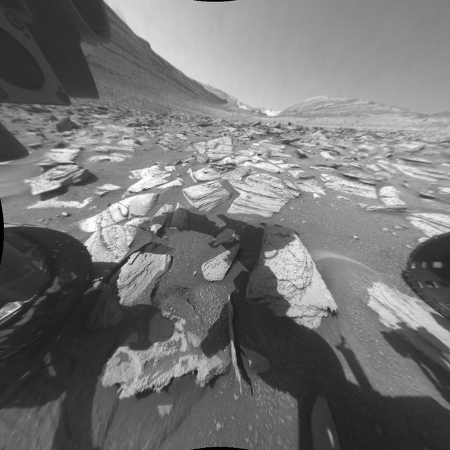
NASA's Curiosity Mars rover recorded two 25-frame videos showing the passage of 12 hours on Nov. 8, 2023, the 4,002nd Martian day, or sol, of the mission. The commands to capture the images that make up these videos were among the last that engineers beamed up to the rover before the start of Mars solar conjunction – a period of several weeks when the Sun is between Earth and Mars. Because the Sun's plasma can interfere with radio communications, NASA's Mars missions stand down from sending commands to their spacecraft during conjunction, bringing the missions to a temporary standstill. (The spacecraft still radio back their health status during this period.) The images were captured with Curiosity's front and rear Hazard-Avoidance Cameras, or Hazcams. Rover drivers use these black-and-white cameras to plan safe drive routes. A long series of images can be put together to create a video so that scientists can look for passing clouds or dust devils, which teach them more about the Martian environment. The perfect time for doing this type of work is when Curiosity is less active for long stretches, as it was during Mars solar conjunction. The lack of robotic arm motion and driving during conjunction allowed the Hazcams to image for 12 hours of a day – from 5:30 a.m. to 5:30 p.m. local Mars time – for the first time. While these Hazcam videos didn't reveal any clouds or dust activity, they did capture the passage of time as the Sun rose and set. The main video shows the front Hazcam's view looking southeast along Gediz Vallis, a valley found on Mount Sharp, the base of which Curiosity has been ascending since 2014. The sky brightens during sunrise in the east (left of image), and the shadow of the rover's stationary 7-foot (2-meter) robotic arm moves across the ground like that of a sundial. The rover's two front wheels are visible on each side of the frame; at upper left is a circular calibration target mounted on the shoulder of the robotic arm. Engineers use the target to test the accuracy of the Alpha Particle X-ray Spectrometer, an instrument that detects chemical elements on the Martian surface. In the middle of the day, the camera's autoexposure algorithm settles on exposure times of around one-third of a second; as evening turns to night, that exposure time grows to more than a minute, causing typical sensor noise known as "hot pixels" that appear as snow across the final image. Video available at https://photojournal.jpl.nasa.gov/catalog/PIA26209

art001e000528 (Nov. 24, 2022)—On flight day 9, NASA’s Orion spacecraft captured imagery of the Moon with its optical navigation camera as it headed toward a distant retrograde orbit around the Moon.

art001e000530 (Nov. 24, 2022)—On flight day 9, NASA’s Orion spacecraft captured imagery of the Moon with its optical navigation camera as it headed toward a distant retrograde orbit around the Moon.
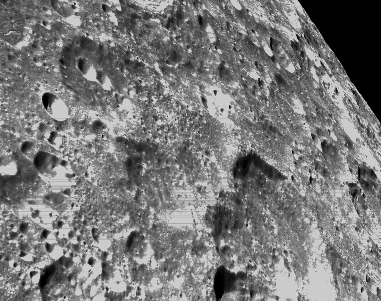
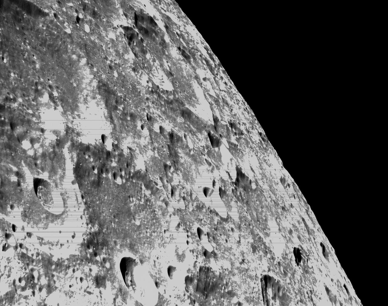
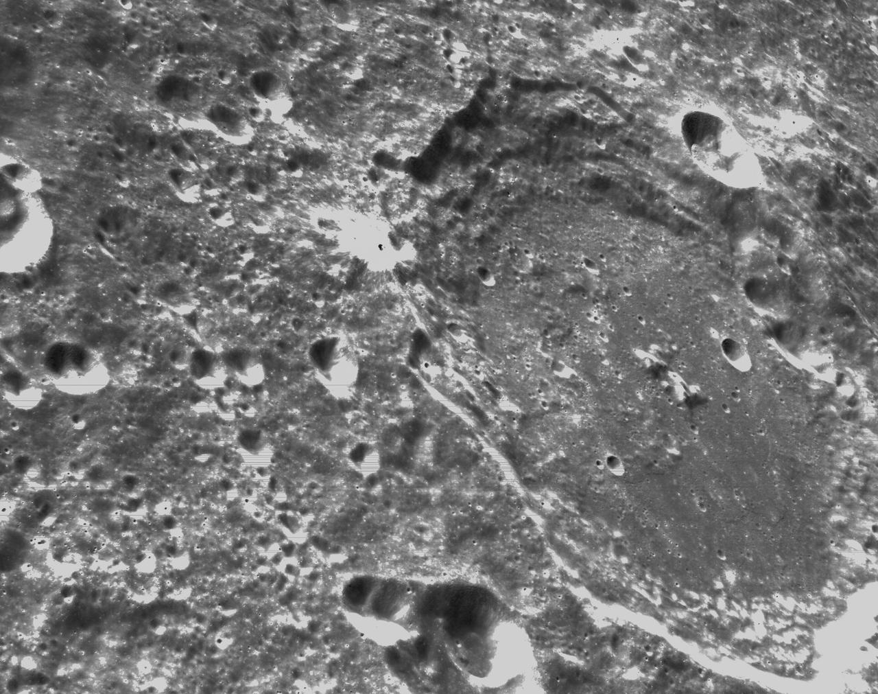
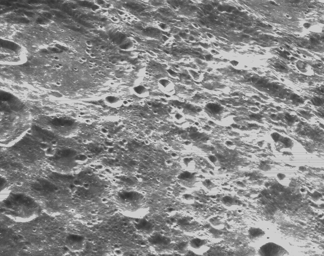
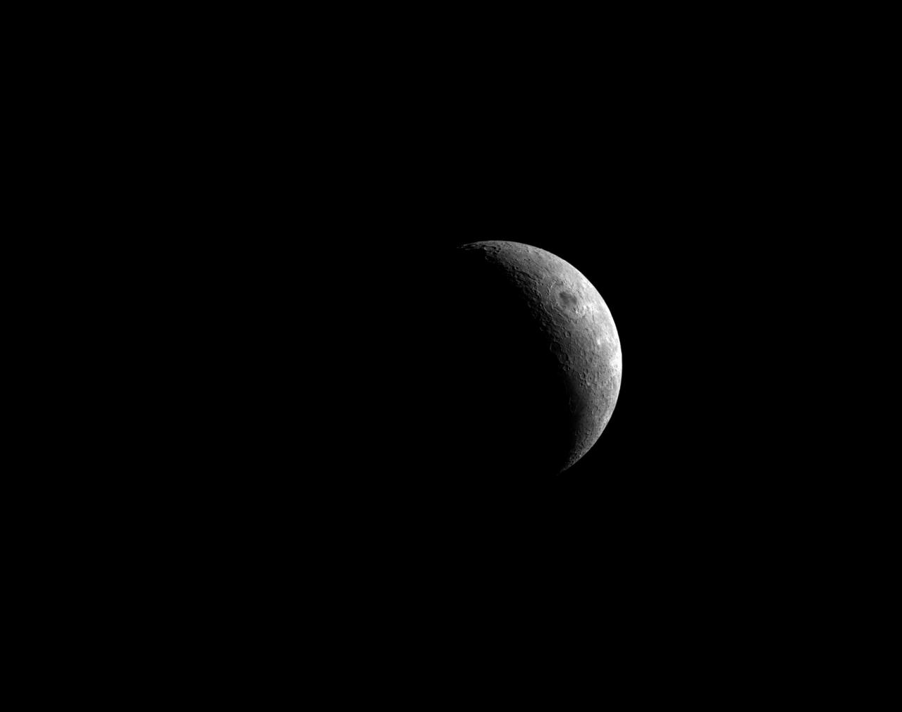
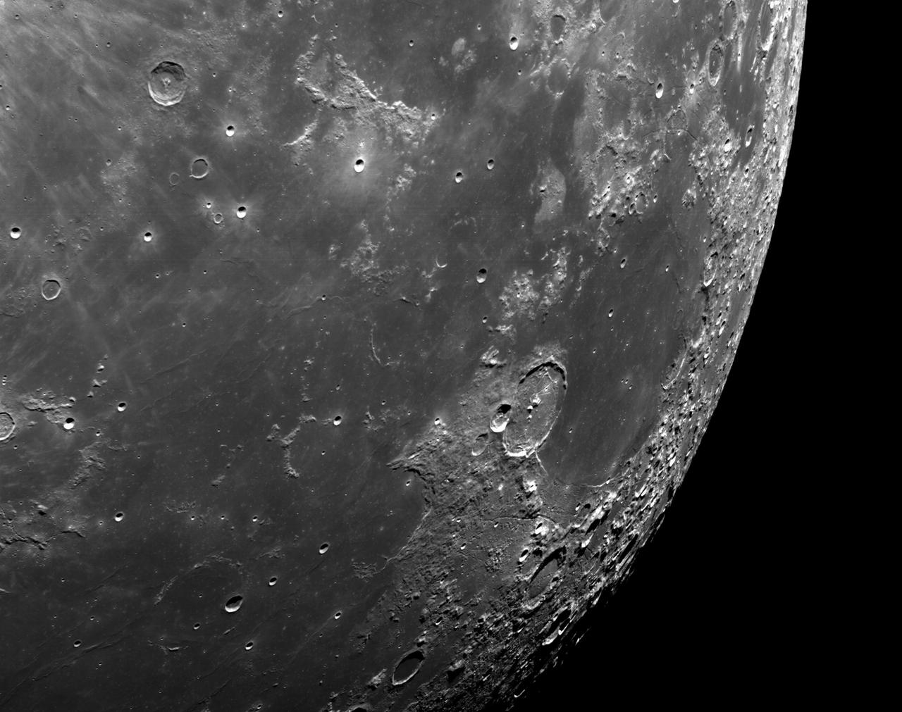
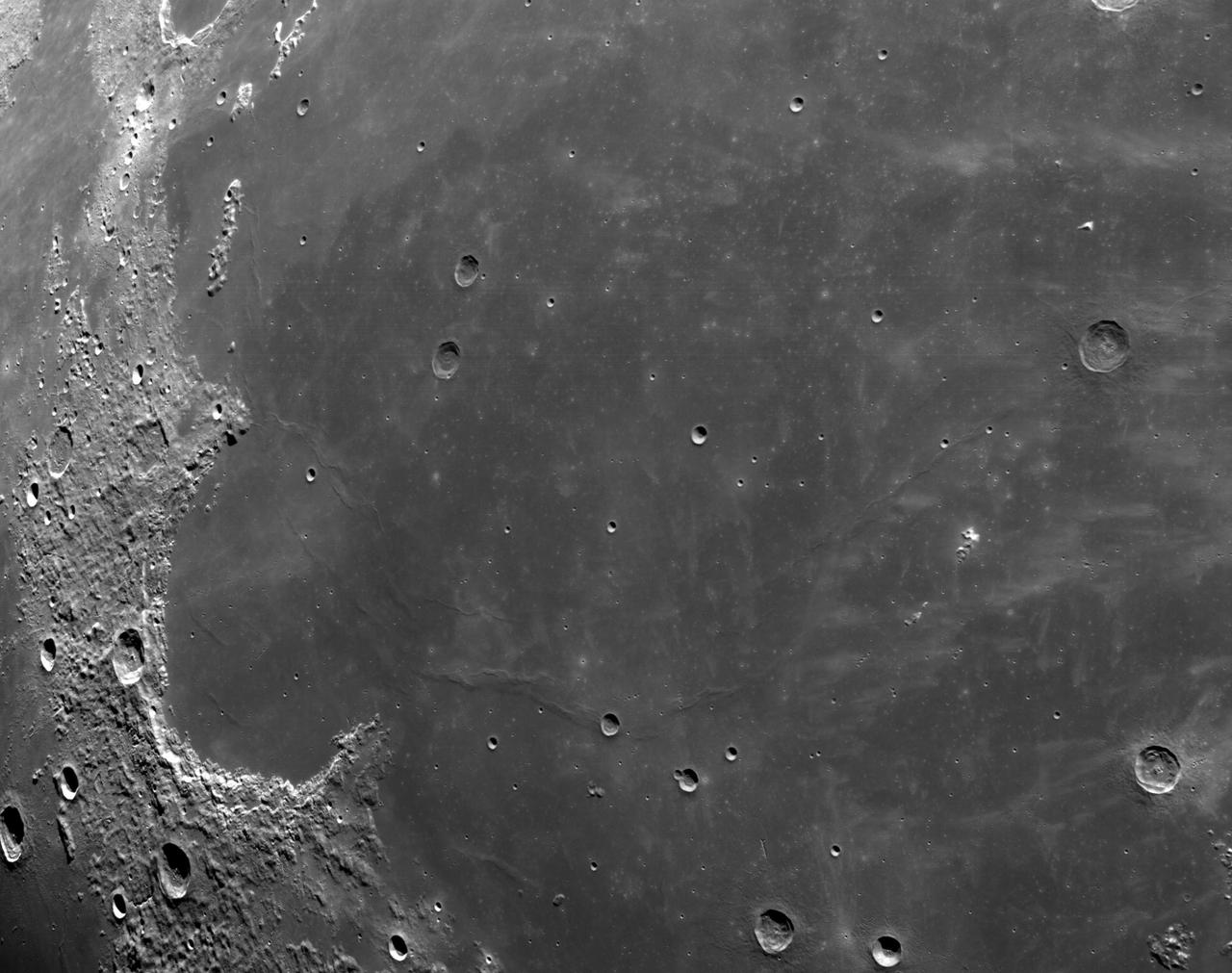
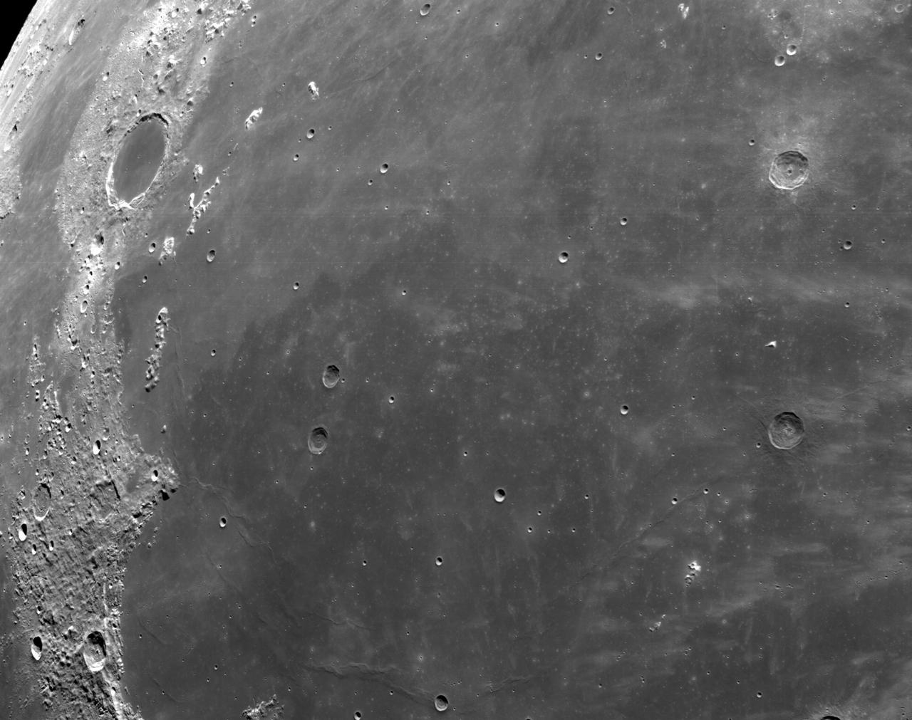
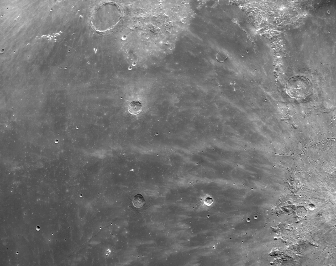
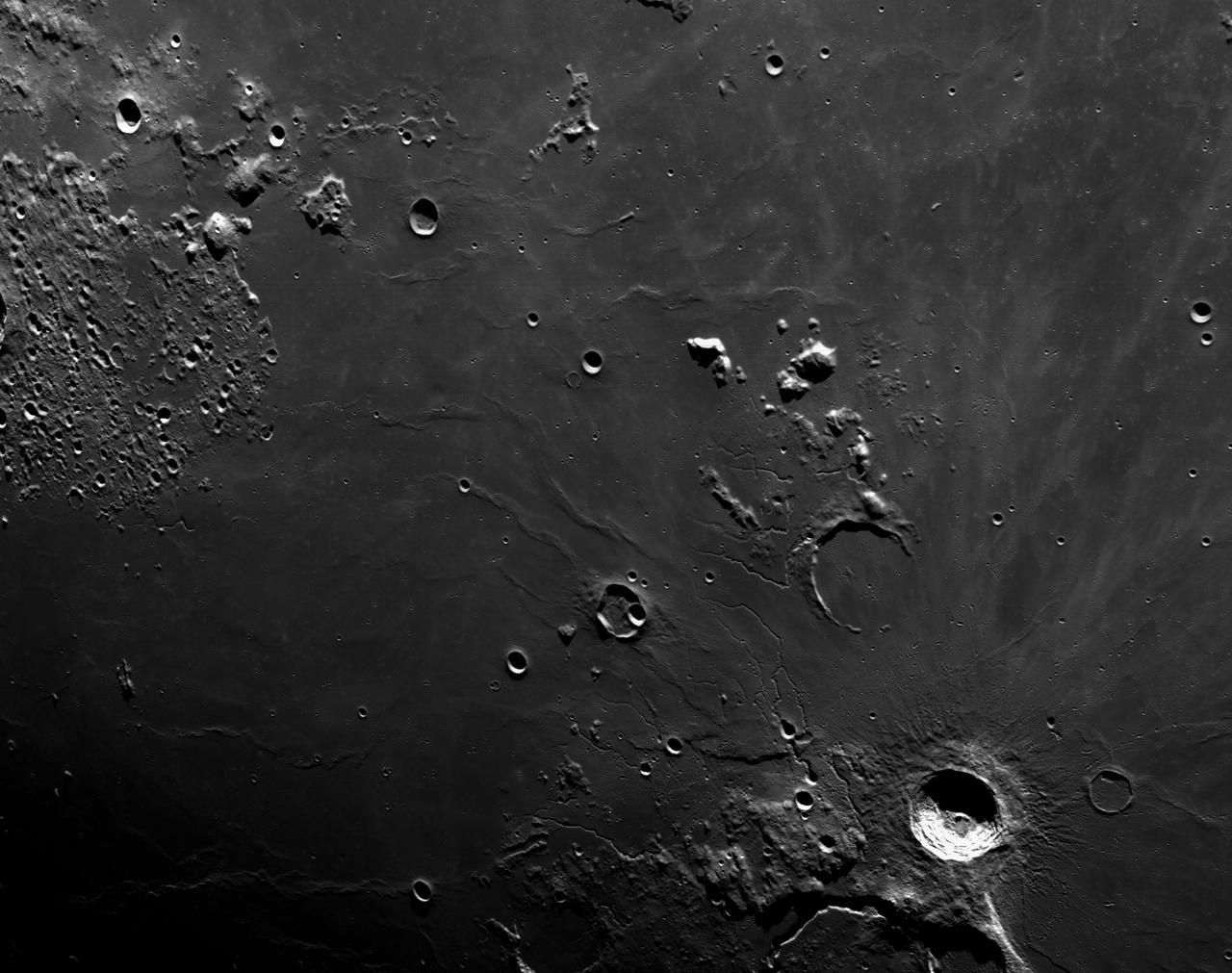
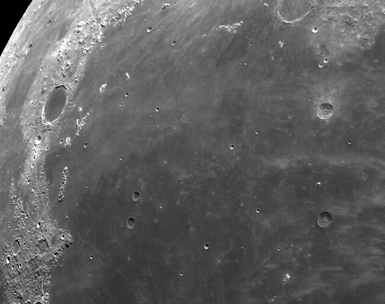
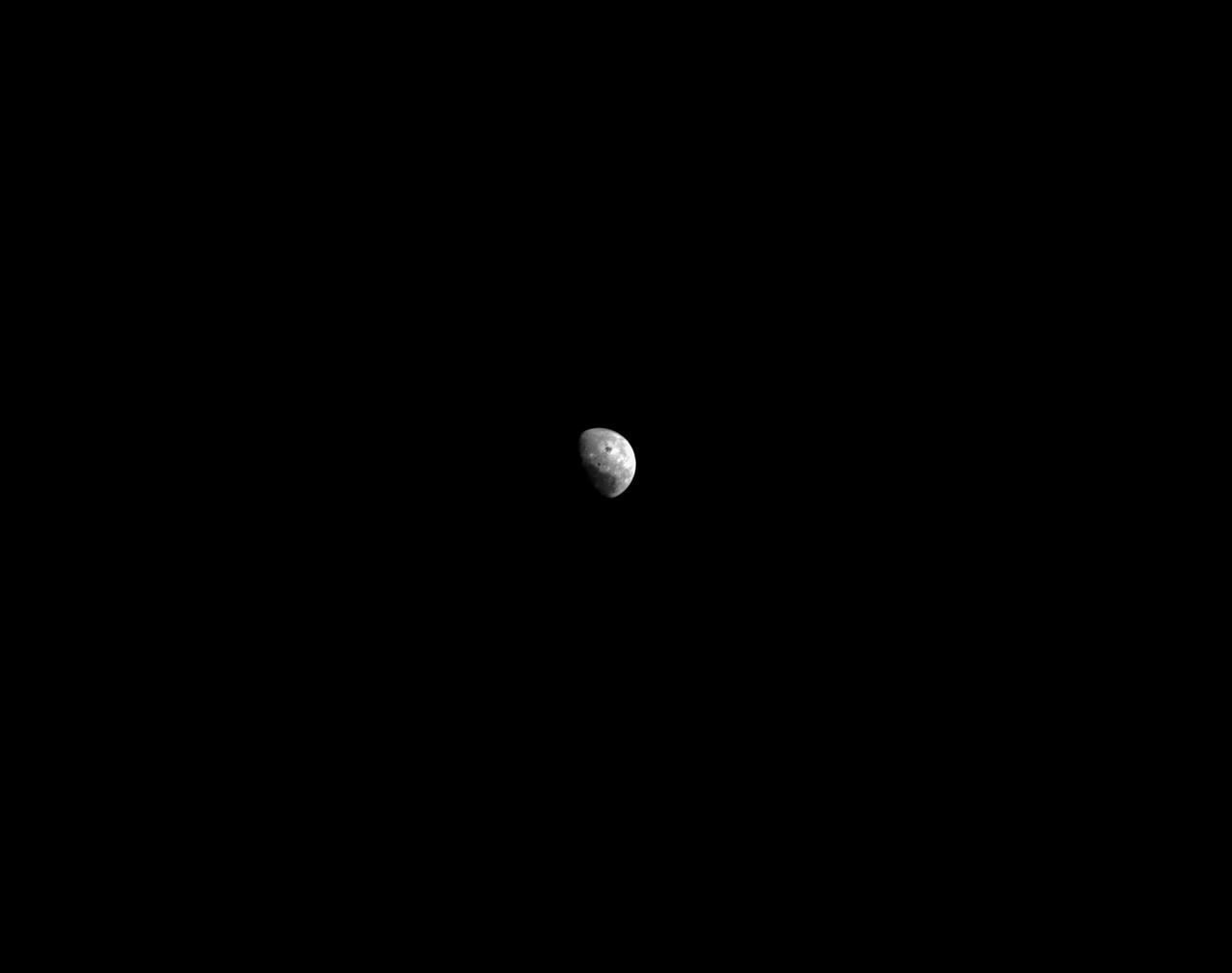
art001e000333 (Nov. 21, 2022) – On the sixth day of the Artemis I mission, Orion’s optical navigation camera captured black-and-white images of craters on the Moon below. Orion uses the optical navigation camera to capture imagery of the Earth and the Moon at different phases and distances, providing an enhanced body of data to certify its effectiveness under different lighting conditions as a way to help orient the spacecraft on future missions with crew.
art001e000344 (Nov. 21, 2022) – On the sixth day of the Artemis I mission, Orion’s optical navigation camera captured black-and-white images of craters on the Moon below. Orion uses the optical navigation camera to capture imagery of the Earth and the Moon at different phases and distances, providing an enhanced body of data to certify its effectiveness under different lighting conditions as a way to help orient the spacecraft on future missions with crew.
art001e000346 (Nov. 21, 2022) – On the sixth day of the Artemis I mission, Orion’s optical navigation camera captured black-and-white images of craters on the Moon below. Orion uses the optical navigation camera to capture imagery of the Earth and the Moon at different phases and distances, providing an enhanced body of data to certify its effectiveness under different lighting conditions as a way to help orient the spacecraft on future missions with crew.
art001e001859 (Dec. 1, 2022) Orion’s optical navigation camera captured this image of the Moon on flight day 16 of the Artemis I mission. Orion uses the optical navigation camera to capture imagery of the Earth and the Moon at different phases and distances, providing an enhanced body of data to certify its effectiveness under different lighting conditions as a way to help orient the spacecraft on future missions with crew.
art001e000340 (Nov. 21, 2022) – On the sixth day of the Artemis I mission, Orion’s optical navigation camera captured black-and-white images of craters on the Moon below. Orion uses the optical navigation camera to capture imagery of the Earth and the Moon at different phases and distances, providing an enhanced body of data to certify its effectiveness under different lighting conditions as a way to help orient the spacecraft on future missions with crew.
art001e000335 (Nov. 21, 2022) – On the sixth day of the Artemis I mission, Orion’s optical navigation camera captured black-and-white images of craters on the Moon below. Orion uses the optical navigation camera to capture imagery of the Earth and the Moon at different phases and distances, providing an enhanced body of data to certify its effectiveness under different lighting conditions as a way to help orient the spacecraft on future missions with crew.
art001e000348 (Nov. 21, 2022) – On the sixth day of the Artemis I mission, Orion’s optical navigation camera captured black-and-white images of craters on the Moon below. Orion uses the optical navigation camera to capture imagery of the Earth and the Moon at different phases and distances, providing an enhanced body of data to certify its effectiveness under different lighting conditions as a way to help orient the spacecraft on future missions with crew.
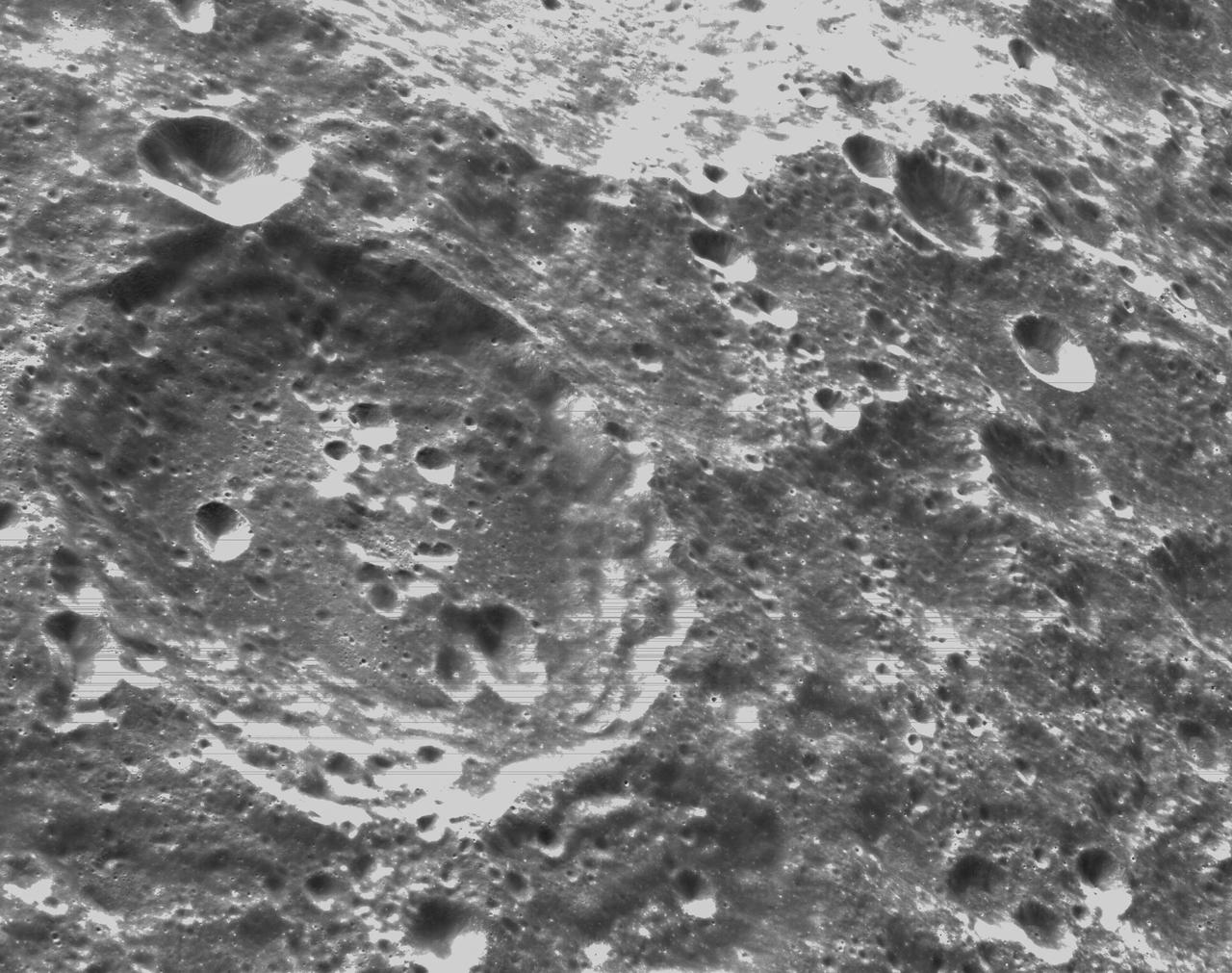
art001e000338 (Nov. 21, 2022) – On the sixth day of the Artemis I mission, Orion’s optical navigation camera captured black-and-white images of craters on the Moon below. Orion uses the optical navigation camera to capture imagery of the Earth and the Moon at different phases and distances, providing an enhanced body of data to certify its effectiveness under different lighting conditions as a way to help orient the spacecraft on future missions with crew.

art001e000345 (Nov. 21, 2022) – On the sixth day of the Artemis I mission, Orion’s optical navigation camera captured black-and-white images of craters on the Moon below. Orion uses the optical navigation camera to capture imagery of the Earth and the Moon at different phases and distances, providing an enhanced body of data to certify its effectiveness under different lighting conditions as a way to help orient the spacecraft on future missions with crew.
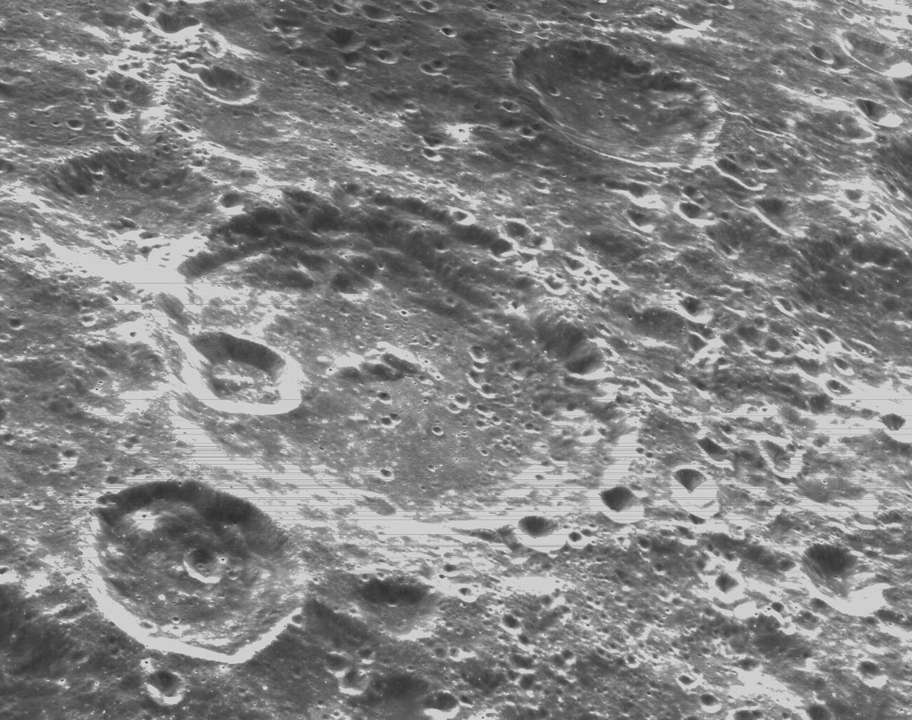
art001e000334 (Nov. 21, 2022) – On the sixth day of the Artemis I mission, Orion’s optical navigation camera captured black-and-white images of craters on the Moon below. Orion uses the optical navigation camera to capture imagery of the Earth and the Moon at different phases and distances, providing an enhanced body of data to certify its effectiveness under different lighting conditions as a way to help orient the spacecraft on future missions with crew.
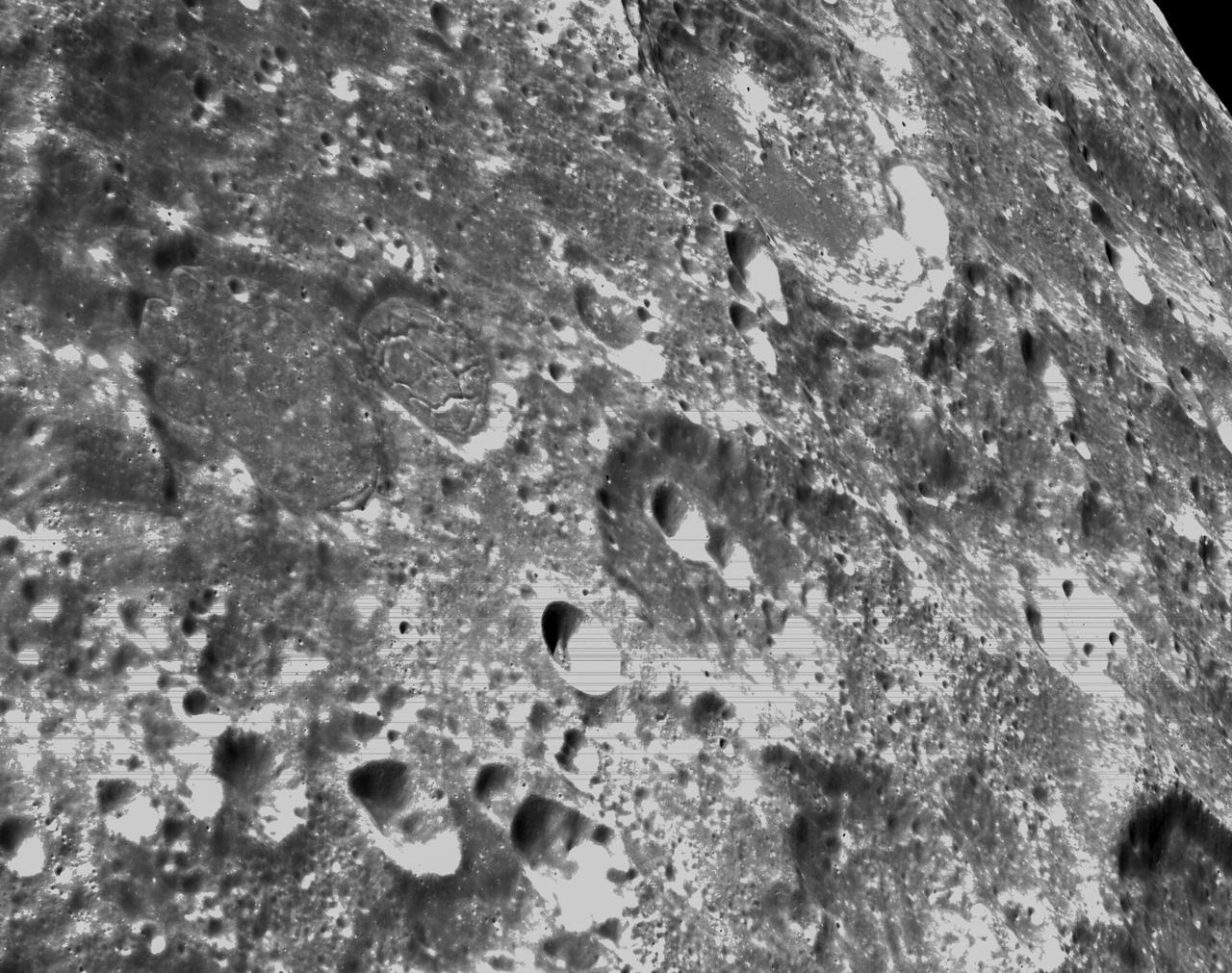
art001e000343 (Nov. 21, 2022) – On the sixth day of the Artemis I mission, Orion’s optical navigation camera captured black-and-white images of craters on the Moon below. Orion uses the optical navigation camera to capture imagery of the Earth and the Moon at different phases and distances, providing an enhanced body of data to certify its effectiveness under different lighting conditions as a way to help orient the spacecraft on future missions with crew.
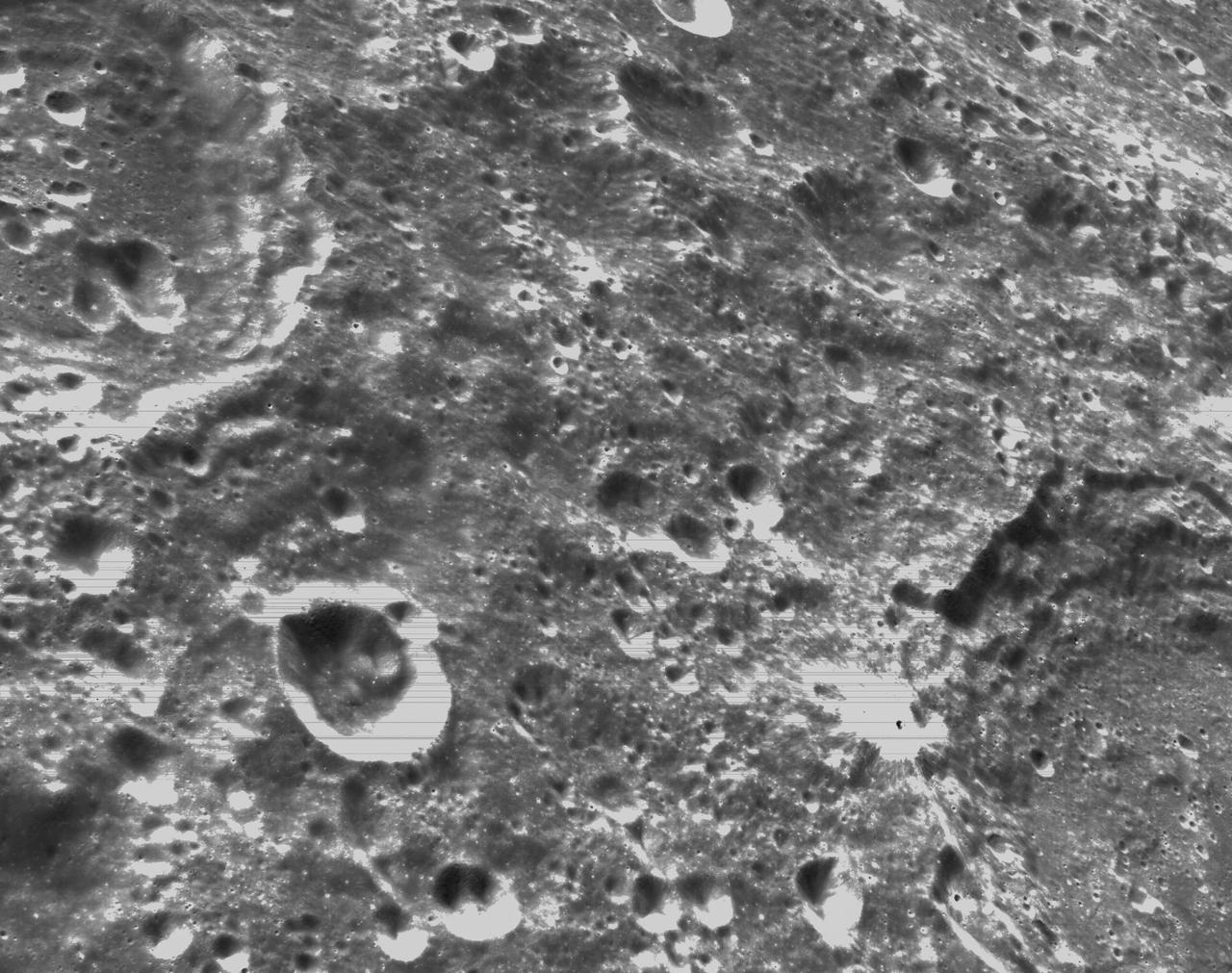
art001e000339 (Nov. 21, 2022) – On the sixth day of the Artemis I mission, Orion’s optical navigation camera captured black-and-white images of craters on the Moon below. Orion uses the optical navigation camera to capture imagery of the Earth and the Moon at different phases and distances, providing an enhanced body of data to certify its effectiveness under different lighting conditions as a way to help orient the spacecraft on future missions with crew.
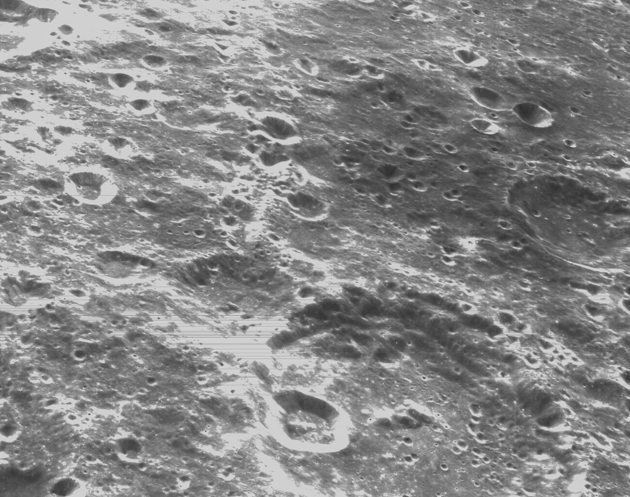
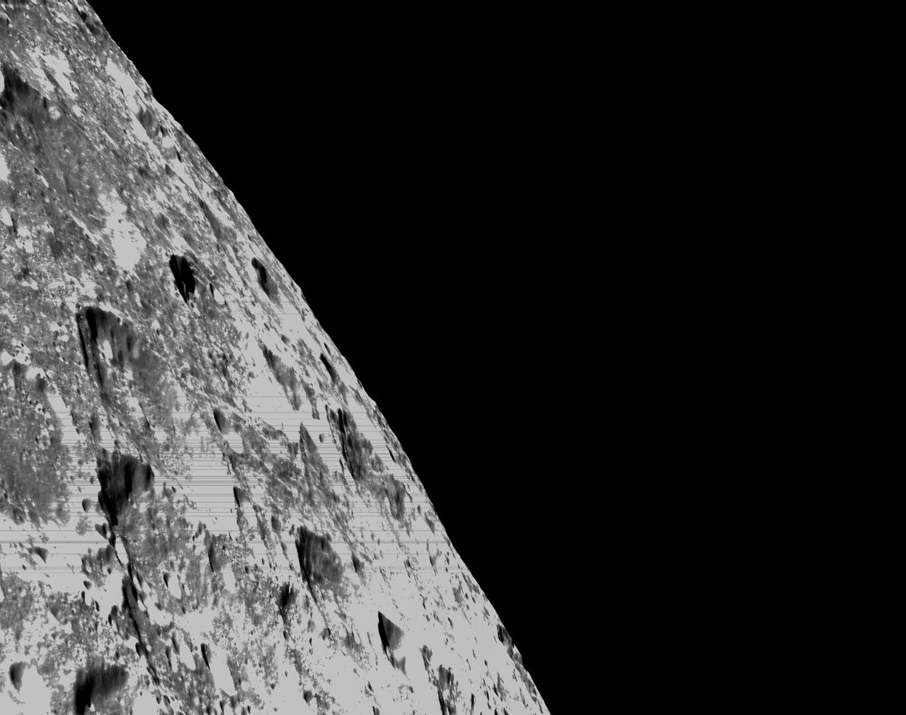
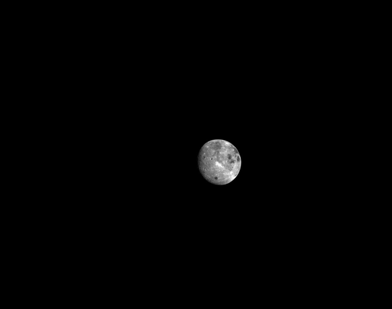
art001e000403 (Nov. 22, 2022) Flight Day 7, Orion’s Optical Navigation camera captures the far side of the Moon, as the spacecraft orbited 81.1 miles above the surface, heading for a Distant Retrograde Orbit. Orion uses the optical navigation camera to capture imagery of the Earth and the Moon at different phases and distances, providing an enhanced body of data to certify its effectiveness under different lighting conditions as a way to help orient the spacecraft on future missions with crew.
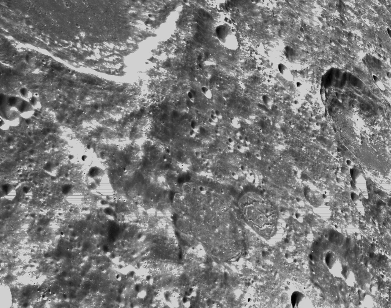
art001e000342 (Nov. 21, 2022) – On the sixth day of the Artemis I mission, Orion’s optical navigation camera captured black-and-white images of craters on the Moon below. Orion uses the optical navigation camera to capture imagery of the Earth and the Moon at different phases and distances, providing an enhanced body of data to certify its effectiveness under different lighting conditions as a way to help orient the spacecraft on future missions with crew.
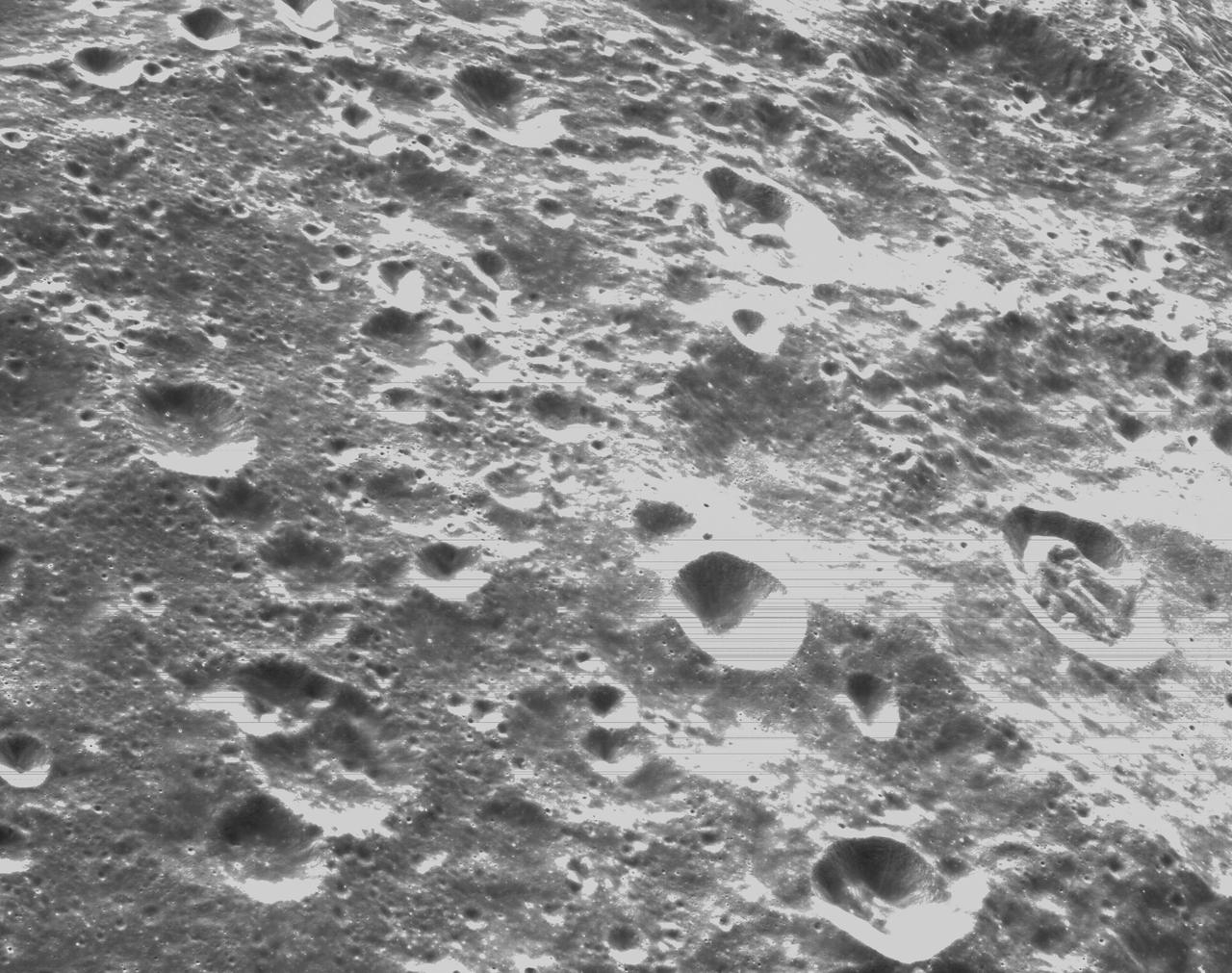
art001e000336 (Nov. 21, 2022) – On the sixth day of the Artemis I mission, Orion’s optical navigation camera captured black-and-white images of craters on the Moon below. Orion uses the optical navigation camera to capture imagery of the Earth and the Moon at different phases and distances, providing an enhanced body of data to certify its effectiveness under different lighting conditions as a way to help orient the spacecraft on future missions with crew.
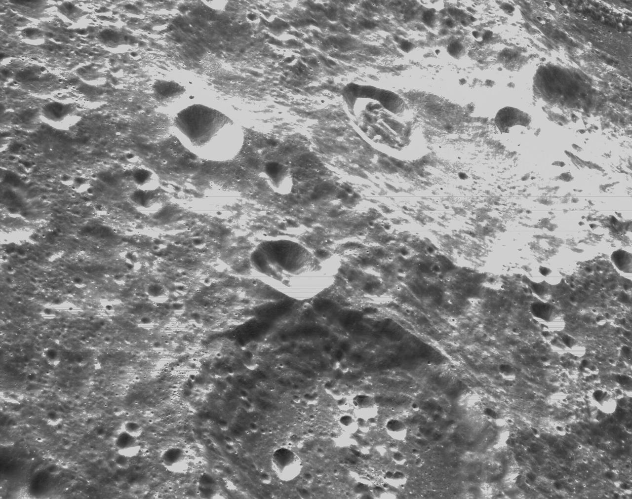
art001e000337 (Nov. 21, 2022) – On the sixth day of the Artemis I mission, Orion’s optical navigation camera captured black-and-white images of craters on the Moon below. Orion uses the optical navigation camera to capture imagery of the Earth and the Moon at different phases and distances, providing an enhanced body of data to certify its effectiveness under different lighting conditions as a way to help orient the spacecraft on future missions with crew.
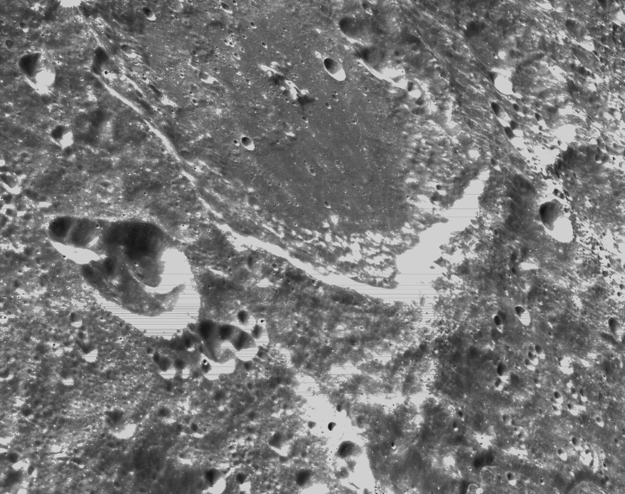
art001e000341 (Nov. 21, 2022) – On the sixth day of the Artemis I mission, Orion’s optical navigation camera captured black-and-white images of craters on the Moon below. Orion uses the optical navigation camera to capture imagery of the Earth and the Moon at different phases and distances, providing an enhanced body of data to certify its effectiveness under different lighting conditions as a way to help orient the spacecraft on future missions with crew.

art001e001873 (Dec. 1, 2022) Orion’s optical navigation camera captured this image of the Moon on flight day 16 of the Artemis I mission. Orion uses the optical navigation camera to capture imagery of the Earth and the Moon at different phases and distances, providing an enhanced body of data to certify its effectiveness under different lighting conditions as a way to help orient the spacecraft on future missions with crew.
art0001e002083 (Dec. 5, 2022) On the 20th day of the Artemis I mission, Orion captured the Earth rising behind the Moon following the return powered flyby. The 3 minute, 27 second, return powered flyby burn, committed the spacecraft to a Dec. 11 splashdown in the Pacific Ocean.
art0001e002092 (Dec. 5, 2022) On the 20th day of the Artemis I mission, Orion captured the Earth rising behind the Moon following the return powered flyby. The 3 minute, 27 second, return powered flyby burn, committed the spacecraft to a Dec. 11 splashdown in the Pacific Ocean.
On flight day six of the Artemis I mission, Orion used its optical navigation camera to snap this black-and-white photo of the Moon. Orion uses the optical navigation camera to capture imagery of the Earth and the Moon at different phases and distances, providing an enhanced body of data to certify its effectiveness under different lighting conditions as a way to help orient the spacecraft on future missions with crew.

An instrument on NASA Terra spacecraft captured a simulated natural color image of the Port-au-Prince, Haiti, area, two days after a devastating earthquake.
NASA's InSight Mars lander captured this image of one of its dust-covered solar panels on April 24, 2022, the 1,211th Martian day, or sol, of the mission. https://photojournal.jpl.nasa.gov/catalog/PIA25286
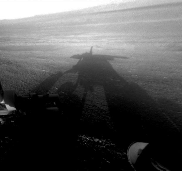
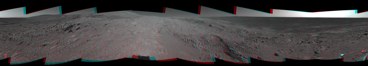
NASA Mars Exploration Rover Opportunity captured this view of its afternoon shadow stretching into Endeavour Crater during the 3,051st Martian day, or sol, of Opportunity work on Mars Aug. 23, 2012.
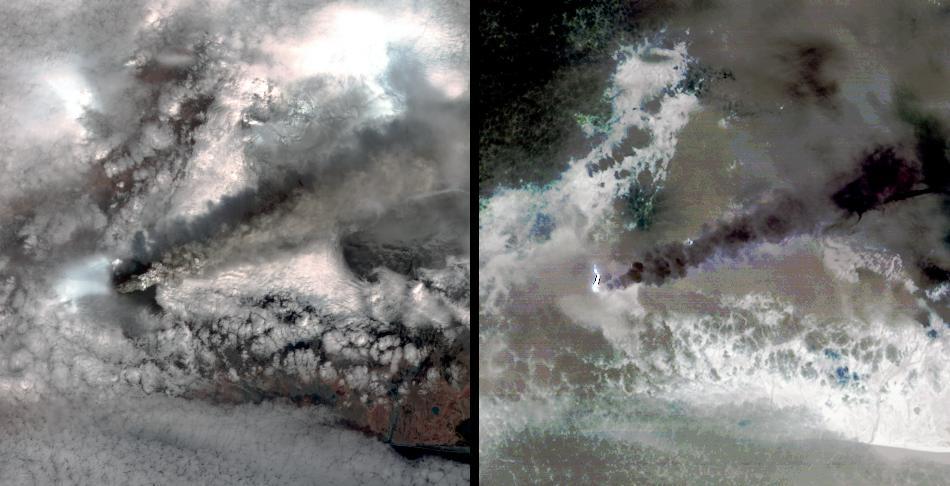
NASA Terra spacecraft captured this pair of images of Iceland Eyjafyallajökull volcano on May 3, 2010. On this day, Ireland closed its airspace for several hours due to presence of ash over the country.

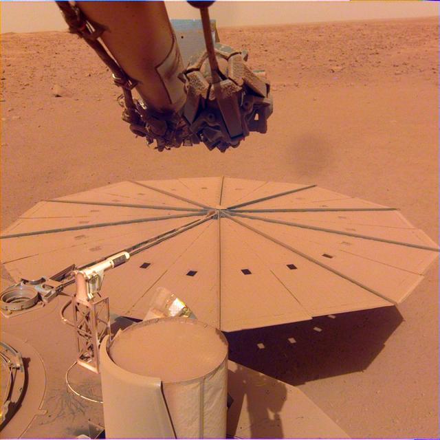
This is one of the last images ever taken by NASA's InSight Mars lander. Captured on Dec. 11, 2022, the 1,436th Martian day, or sol, of the mission, it shows InSight's seismometer on the Red Planet's surface. https://photojournal.jpl.nasa.gov/catalog/PIA25680

The South Pole is receiving sun every day now as spring progresses. The surface texture visible in this image captured by NASA Mars Odyssey was created by the effect of solar warming on the ice.

NASA Opportunity used the navigation camera Navcam on its mast to capture this southward facing scene along the eastern flank of Solander Point during the 3,387 Martian day, or sol, of the rover work on Mars Aug. 3, 2013.

This frame from a movie was captured by a star tracker camera on NASA Jupiter-bound Juno spacecraft. It was taken over several days as Juno approached Earth for a close flyby that would send the spacecraft onward to the giant planet.
Iceland Eyjafjallajökull volcano produced its second major ash plume beginning on May 7, 2010. NASA Terra satellite passed just east of the volcano mid-morning and captured this image the same day.
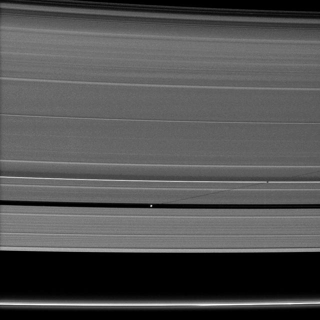
Saturn small moon Pan casts a long shadow across the A ring in this image captured by NASA Cassini spacecraft a few days after the planet August 2009 equinox.
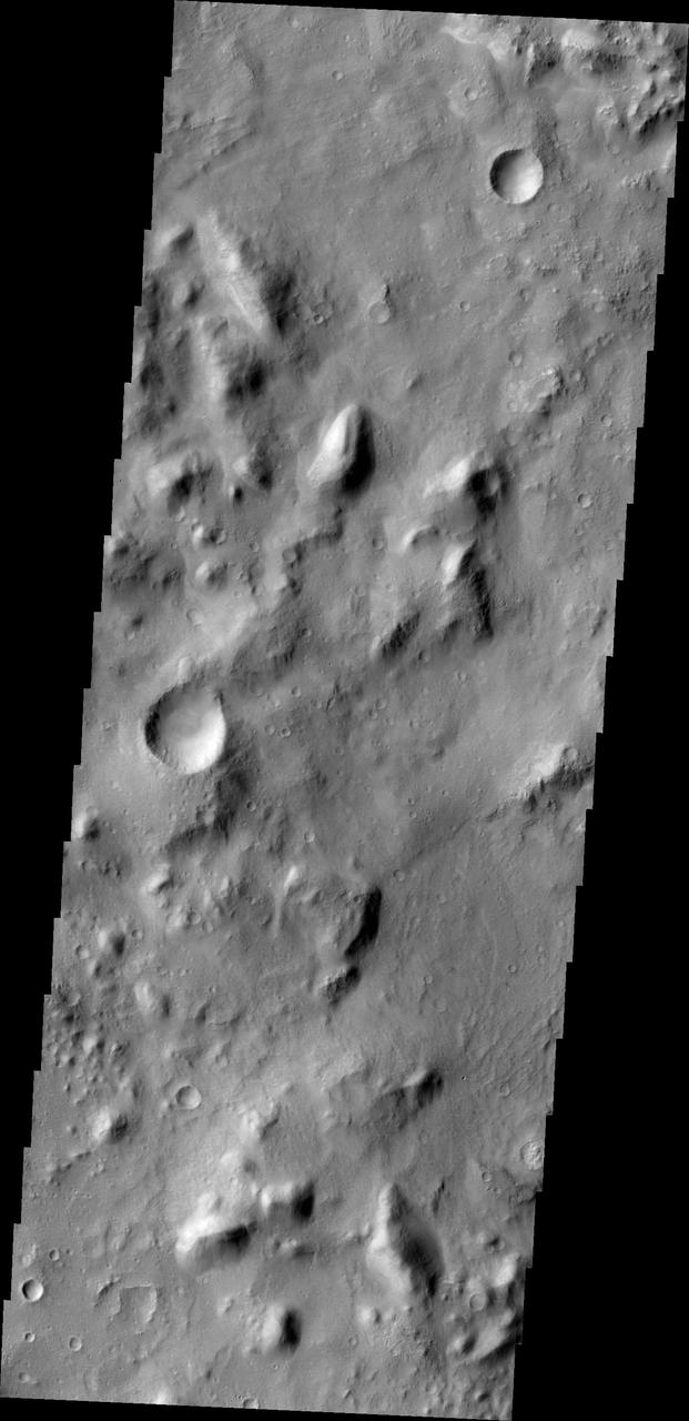
NASA Mars Odyssey spacecraft captured this image on Feb. 19, 2012, 10 years to the day after the camera recorded its first view of Mars. This image covers an area in the Nepenthes Mensae region north of the Martian equator.
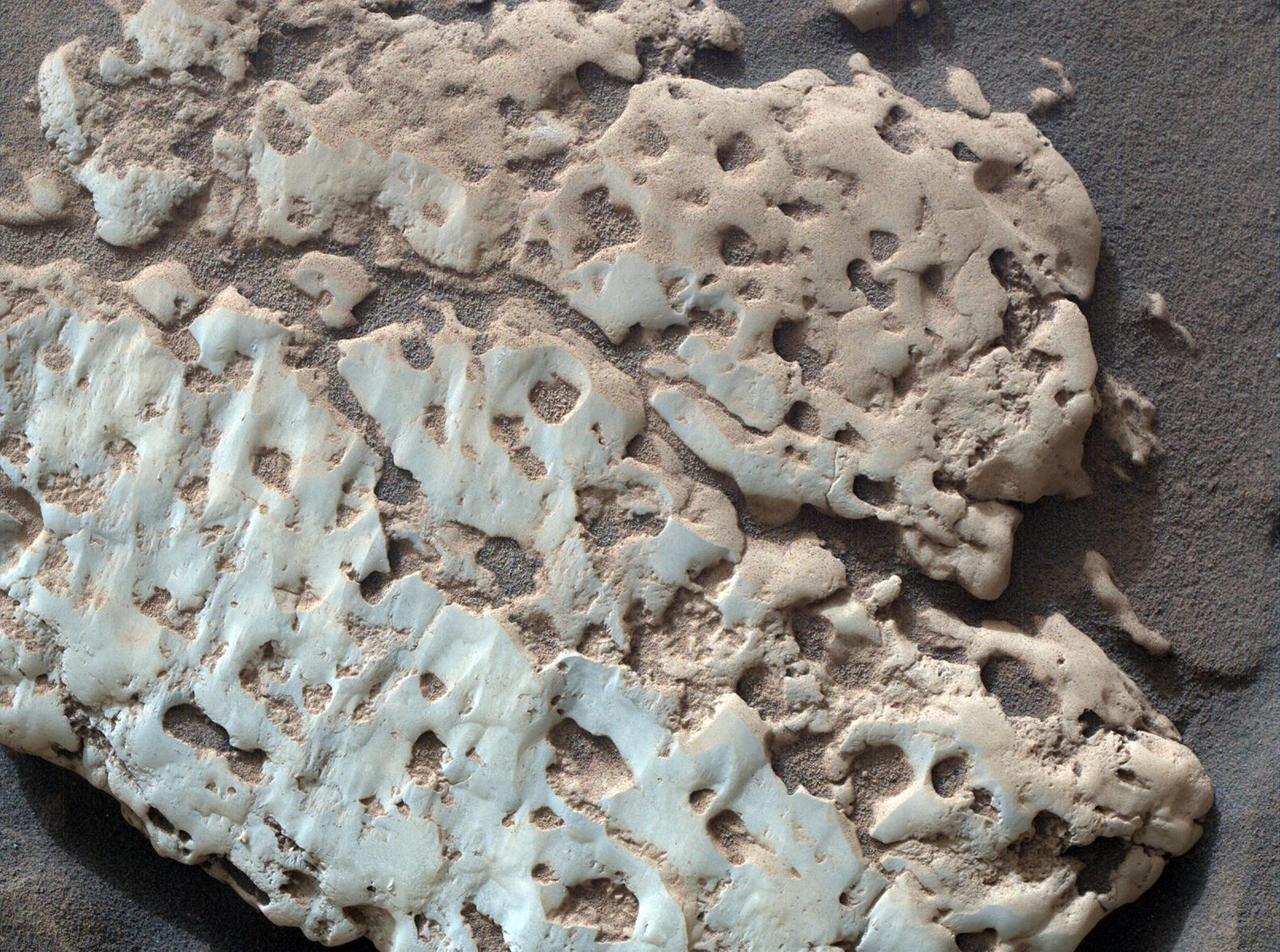
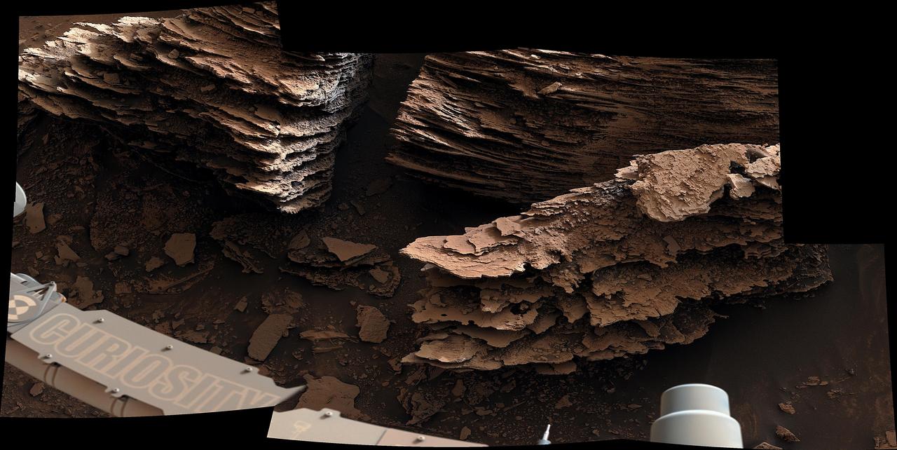
NASA's Curiosity Mars rover captured this close-up image of a rock nicknamed "Snow Lake" on June 8, 2024, the 4,209th Martian day, or sol, of the mission. The image was captured by Curiosity's Mars Hand Lens Imager (MAHLI), a camera on the end of the rover's robotic arm. Nine days before this image was captured, Curiosity crushed a similar-looking rock and revealed crystalline textures inside. Curiosity's Alpha Particle X-Ray Spectrometer (APXS) found that the rock was made of elemental sulfur. An entire field of similar-looking rocks were found in this area; all are expected to have sulfur inside them. https://photojournal.jpl.nasa.gov/catalog/PIA26308
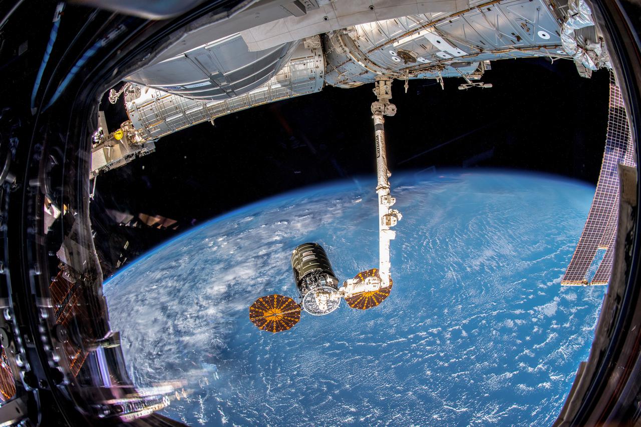
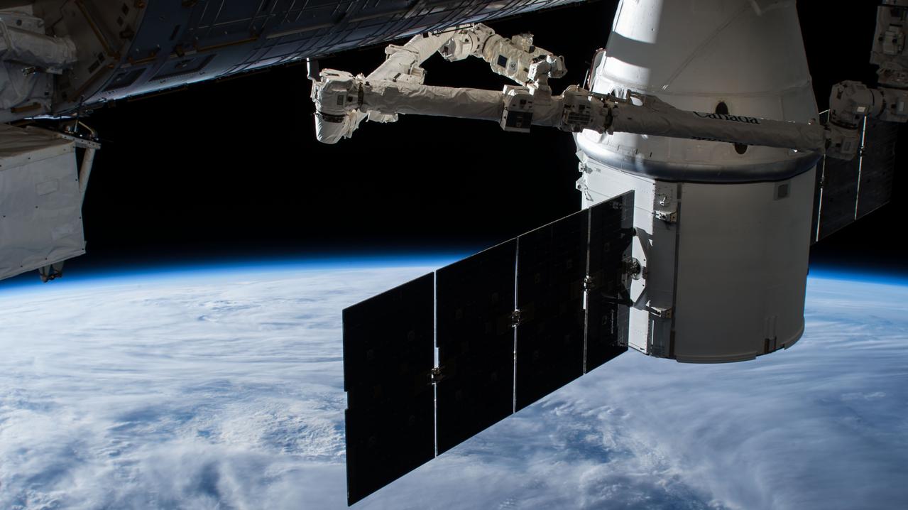
iss057e105337 (Nov. 19, 2018) --- Northrop Grumman's Cygnus space freighter with its prominent cymbal-shaped UltraFlex solar arrays is pictured in the grips of the Canadarm2 robotic arm after it was captured by Expedition 57 Flight Engineer Serena Auñón-Chancellor and ESA (European Space Agency) astronaut Alexander Gerst.

NASA's InSight spacecraft captured this panorama of its landing site on Dec. 9, 2018, the 14th Martian day, or sol, of its mission. The 290-degree perspective surveys the rim of the degraded crater InSight landed in, nicknamed "Homestead Hollow." The panorama is made of 30 individual images that were taken by the spacecraft's Instrument Deployment Camera, located on its robotic arm. https://photojournal.jpl.nasa.gov/catalog/PIA23140
NASA Mars Exploration Rover Spirit looked up at the Columbia Hills from its location on the 265th martian day, or sol, of its mission Sept. 30, 2004 and captured this 3-D view. 3D glasses are necessary to view this image.
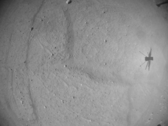
NASA's Ingenuity Mars Helicopter's navigation camera captured the rotorcraft in shadow during its 52nd flight on April 26, 2023. This image was finally received after Perseverance and Ingenuity were out of communication for 63 days. https://photojournal.jpl.nasa.gov/catalog/PIA25918

On May 19th, 2005, NASA Mars Exploration Rover Spirit captured this stunning view as the Sun sank below the rim of Gusev crater on Mars. This Panoramic Camera Pancam mosaic was taken around 6:07 in the evening of the rover 489th martian day.
art001e000666 (Nov. 27, 2022) On flight day 12 of the 25.5-day Artemis I mission, a camera on the tip of one of Orion’s solar arrays captured the Earth as Orion travels in distant retrograde orbit around the Moon.
art001e000667 (Nov. 27, 2022) On flight day 12 of the 25.5-day Artemis I mission, a camera on the tip of one of Orion’s solar arrays captured the Earth as Orion travels in distant retrograde orbit around the Moon.

art001e000669 (Nov. 27, 2022) On flight day 12 of the 25.5-day Artemis I mission, a camera on the tip of one of Orion’s solar arrays captured the Moon as Orion travels in distant retrograde orbit around the Moon.

art001e000670 (Nov. 27, 2022) On flight day 12 of the 25.5-day Artemis I mission, a camera on the tip of one of Orion’s solar arrays captured the Moon as Orion travels in distant retrograde orbit around the Moon.
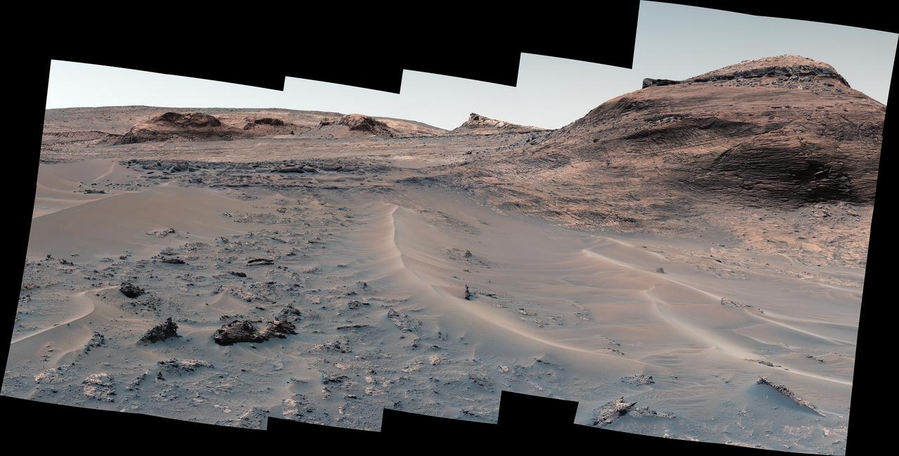
NASA's Curiosity Mars rover used its Mast Camera, or Mastcam, to capture this panorama of a hill nicknamed "Bolívar" and adjacent sand ridges on Aug. 23, 2022, the 3,572nd Martian day, or sol, of the mission. This panorama was stitched together from 23 images once they were sent back to Earth. The color has been adjusted to match the lighting conditions as the human eye would perceive them on Earth. https://photojournal.jpl.nasa.gov/catalog/PIA25414
NASA's Curiosity Mars rover used its Navigation Camera (Navcam) to capture this view on April 11, 2015, during the 952nd Martian day, or sol of the rover's work on Mars. The rover's location was in a valley called "Artist's Drive" on the route up Mount Sharp. The view spans from east, at left, to southwest, at right. Upper Mount Sharp appears on the horizon at left. http://photojournal.jpl.nasa.gov/catalog/PIA19386
NASA's Curiosity Mars rover used its Navigation Camera (Navcam) to capture this view on April 11, 2015, during the 952nd Martian day, or sol of the rover's work on Mars. The image appears three-dimensional when viewed through red-blue glasses with the red lens on the left. The rover's location was in a valley called "Artist's Drive" on the route up Mount Sharp. The view spans from east, at left, to southwest, at right. Upper Mount Sharp appears on the horizon at left. http://photojournal.jpl.nasa.gov/catalog/PIA19387
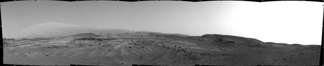
NASA's Curiosity Mars rover used its navigation cameras, or Navcams, to capture this panorama of the narrow "Paraitepuy Pass" on Aug. 11, 2022, the 3,560th Martian day, or sol, of the mission. The pass, with hills in the distance, can be seen on the left side of the scene. The hill in the center of this scene is "Bolívar"; "Deepdale" is on the far left of the scene. The crater floor is visible in the background of the right side of the panorama. https://photojournal.jpl.nasa.gov/catalog/PIA25417

ECOSTRESS captured surface temperature variations in Los Angeles, California between July 22 and August 14 -- a period of extended heat -- at different times of day. The images show how different surfaces within the cityscape warm and cool throughout the day. They have been colored to show the hottest areas in red, warm areas in orange and yellow, and cooler areas in blue. The hottest areas are dark asphalt surfaces that have very little shade during the day and remain warm throughout the night due to their higher heat capacity. They include freeways, airports, oil refineries and parking lots. Clouds and higher-elevation mountainous areas were the coolest. More information is available at https://photojournal.jpl.nasa.gov/catalog/PIA22703
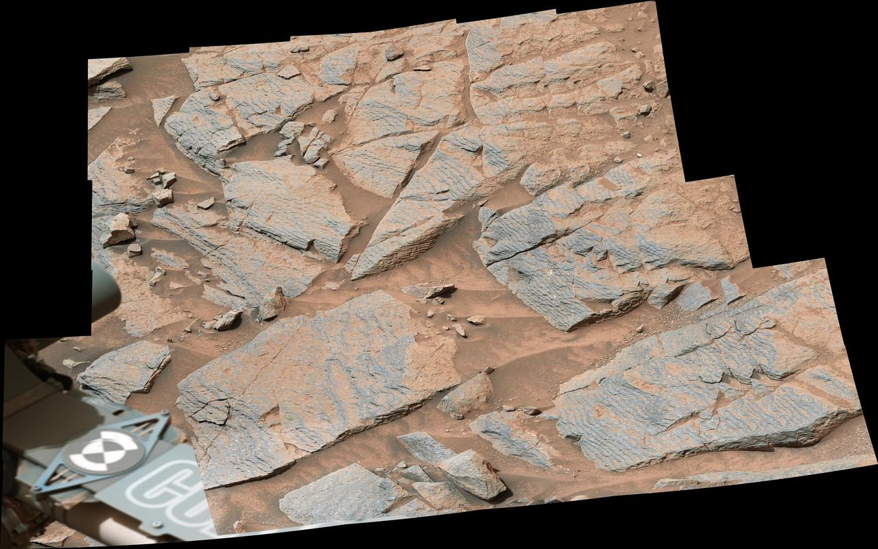
NASA's Curiosity Mars rover captured this view of layered, flaky rocks believed to have formed in an ancient streambed or small pond. The six images that make up this mosaic were captured using Curiosity's Mast Camera, or Mastcam, on June 2, 2022, the 3,492nd Martian day, or sol, of the mission. https://photojournal.jpl.nasa.gov/catalog/PIA25368

This first high-resolution image, taken on the first day of the Artemis I mission, was captured by a camera on the tip of one of Orion’s solar arrays. The spacecraft was 57,000 miles from Earth when the image was captured, and continues to distance itself from planet Earth as it approaches the Moon and distant retrograde orbit.
ISS047e044560 (04/03/2016) --- The very bottom tip of Africa is imaged here as captured by the crew of the International Space Station on April 3rd, 2016. South Africa's capitol Cape Town is located at the bottom left of this beautiful Earth picture captured on a sunny day.
art001e001983 (Dec. 3, 2022) The Moon is captured by Orion’s optical navigation camera on flight day 18 of the 25.5-day Artemis I mission. Orion uses the optical navigation camera to capture imagery of the Earth and the Moon at different phases and distances, providing an enhanced body of data to certify its effectiveness under different lighting conditions as a way to help orient the spacecraft on future missions with crew.
NASA's Mars Exploration Rover Opportunity captured this view from the base of "Burns Cliff" during the rover's 280th martian day (Nov. 6, 2004). This cliff in the inner wall of "Endurance Crater" displays multiple layers of bedrock for the rover to examine with its panoramic camera and miniature thermal emission spectrometer. The rover team has decided that the farthest Opportunity can safely advance along the base of the cliff is close to the squarish white rock near the center of this image. After examining the site for a few days from that position, the the rover will turn around and head out of the crater. The view is a mosaic of frames taken by Opportunity's navigation camera. The rover was on ground with a slope of about 30 degrees when the pictures were taken, and the view is presented here in a way that corrects for that tilt of the camera. http://photojournal.jpl.nasa.gov/catalog/PIA07039
art001e002071 (Dec. 5, 2022) On flight day 20 of the Artemis I mission, Orion captured the Moon on the day of return powered flyby. The burn, which lasted 3 minutes, 27 seconds, committed the spacecraft to a Dec. 11 splashdown.
art001e002070 (Dec. 5, 2022) On flight day 20 of the Artemis I mission, Orion captured the Moon on the day of return powered flyby. The burn, which lasted 3 minutes, 27 seconds, committed the spacecraft to a Dec. 11 splashdown.
art001e001934 (Dec. 2, 2022) A camera mounted on one of Orion’s four solar arrays captured this image of the Moon on flight day 17 of the 25.5-day Artemis I mission from a distance of more than 222,000 miles. Orion has exited the distant lunar orbit and is heading for a Dec. 11 splashdown in the Pacific Ocean.
art001e002069 (Dec. 5, 2022) On flight day 20 of the Artemis I mission, Orion captured the Moon on the day of return powered flyby. The burn, which lasted 3 minutes, 27 seconds, committed the spacecraft to a Dec. 11 splashdown.
art001e002067 (Dec. 5, 2022) On flight day 20 of the Artemis I mission, Orion captured the Moon on the day of return powered flyby. The burn, which lasted 3 minutes, 27 seconds, committed the spacecraft to a Dec. 11 splashdown.
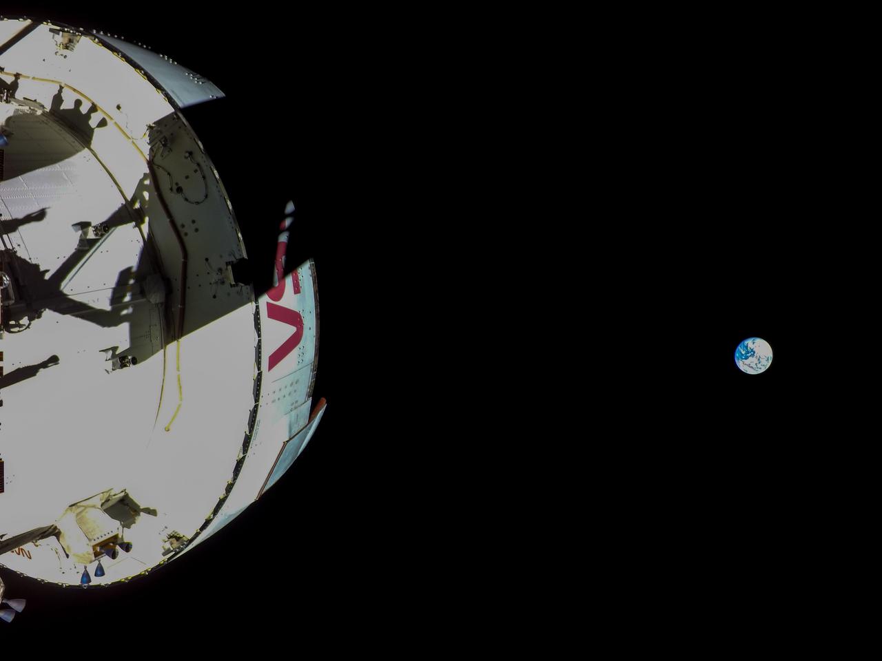
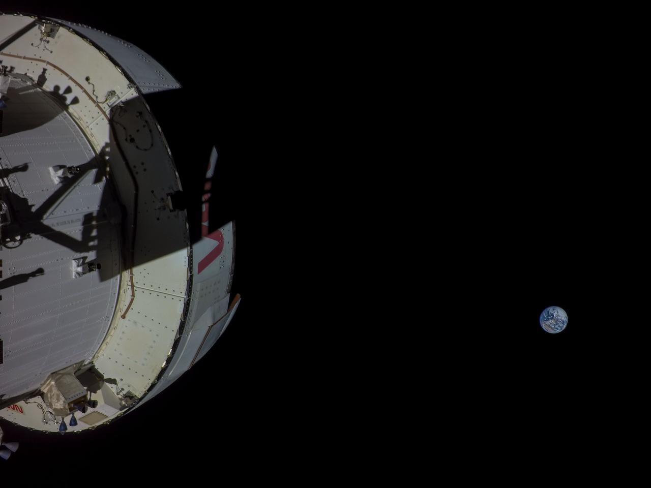
art001e001936 (Dec. 2, 2022) A camera mounted on one of Orion’s four solar arrays captured this image of the Earth on flight day 17 of the 25.5-day Artemis I mission from a distance of more than 222,000 miles. Orion has exited the distant lunar orbit and is heading for a Dec. 11 splashdown in the Pacific Ocean.
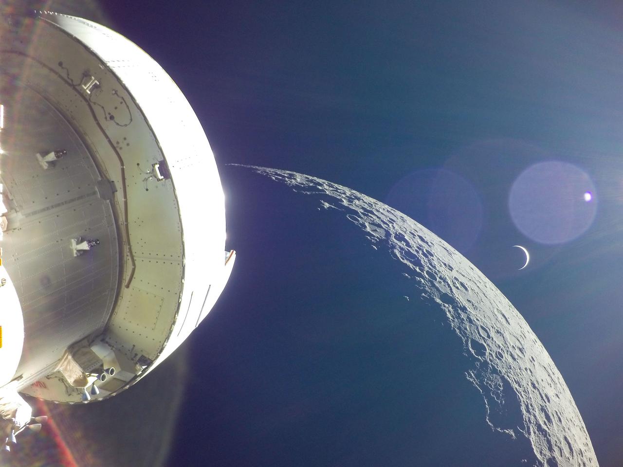
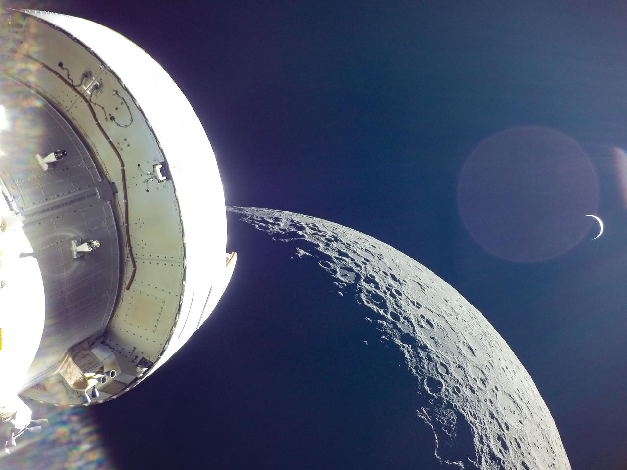
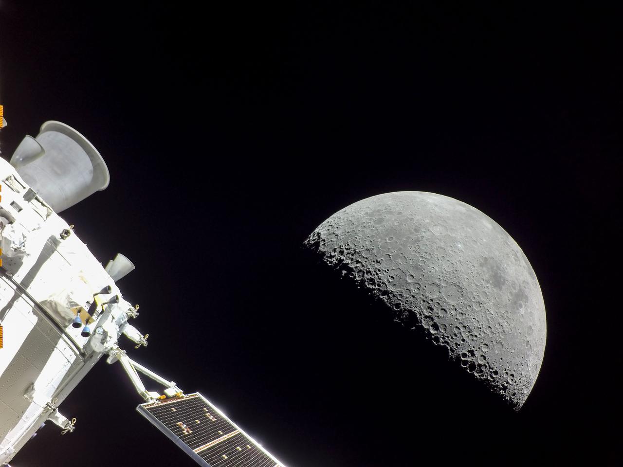
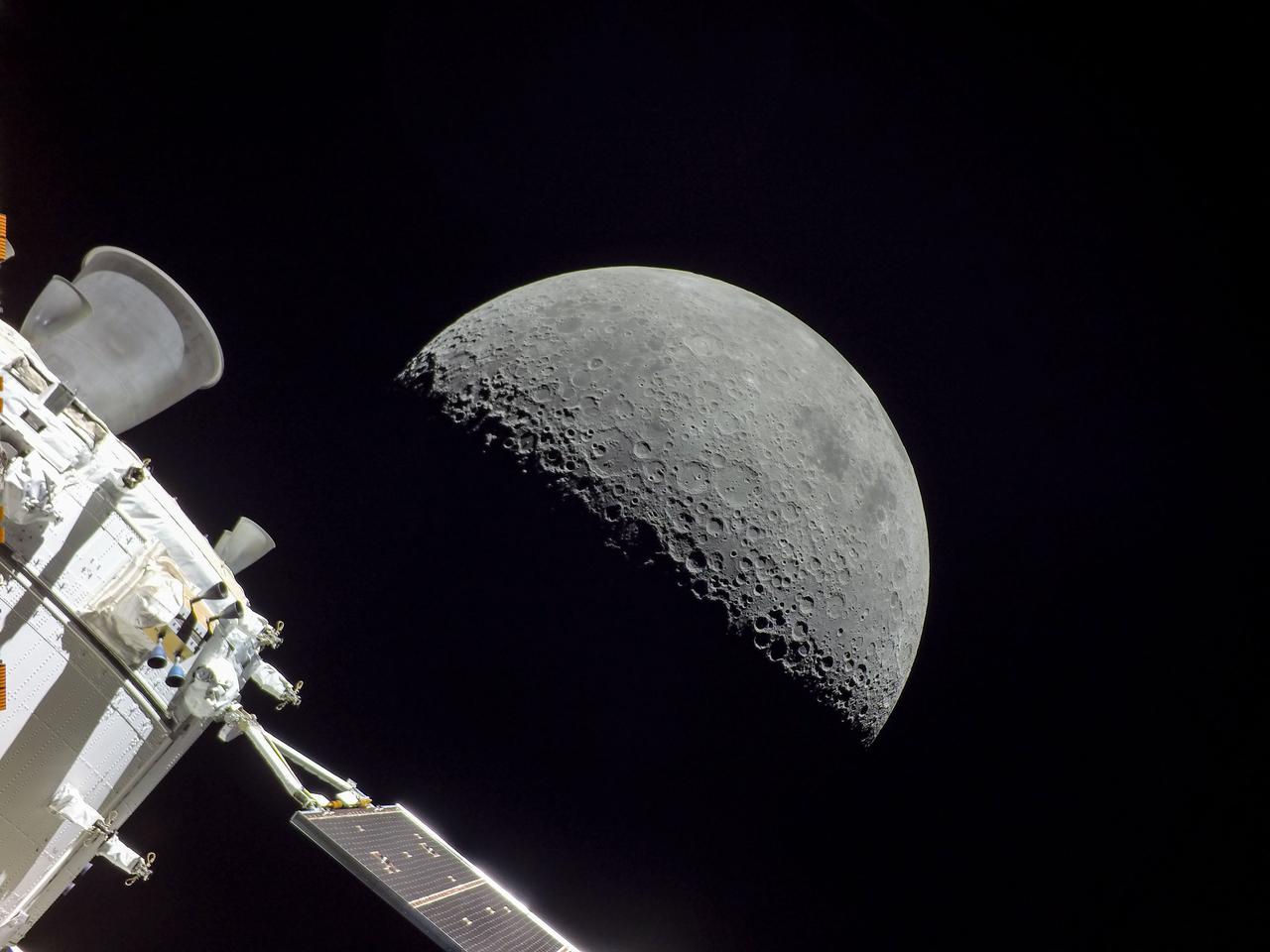
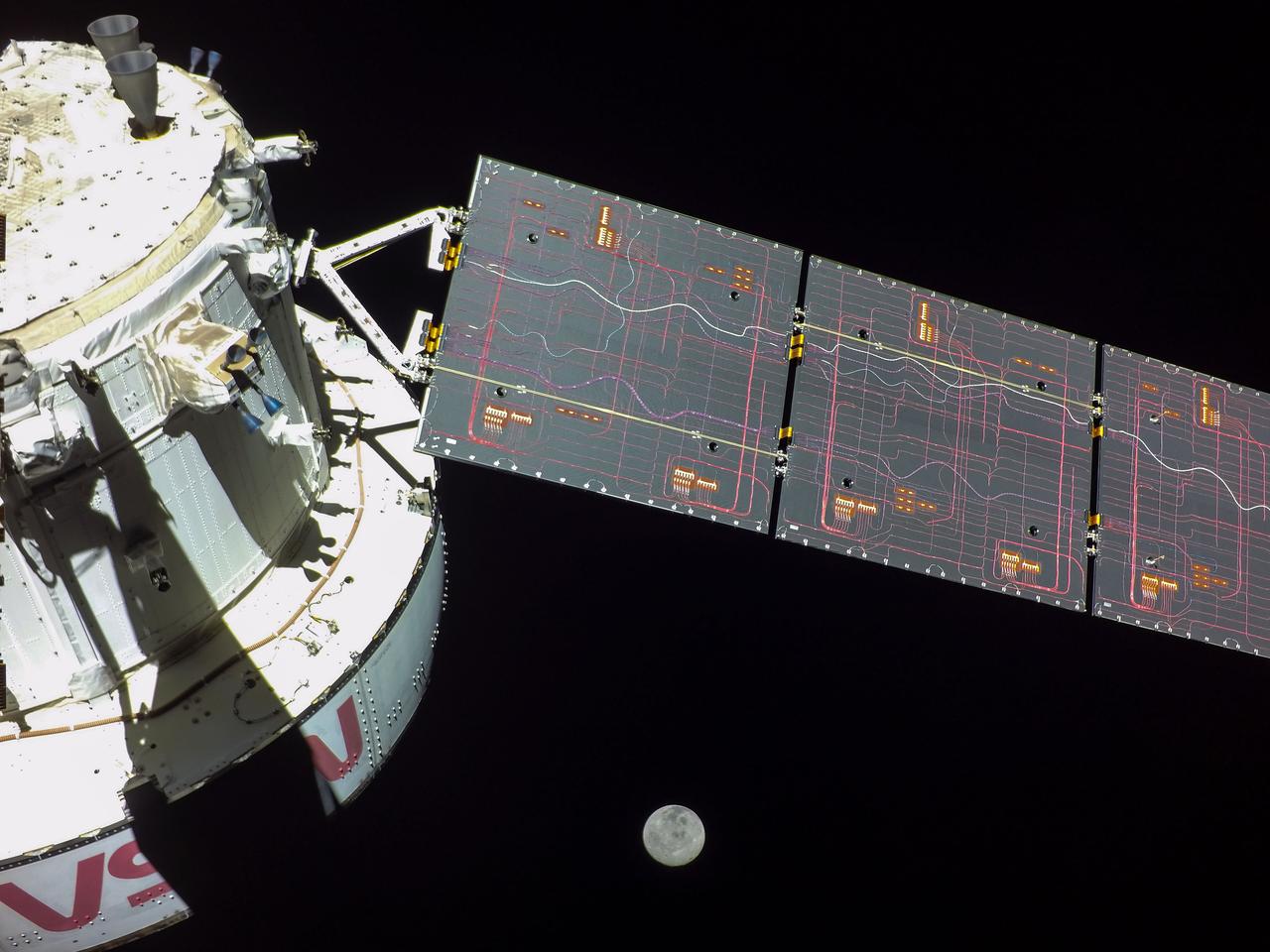
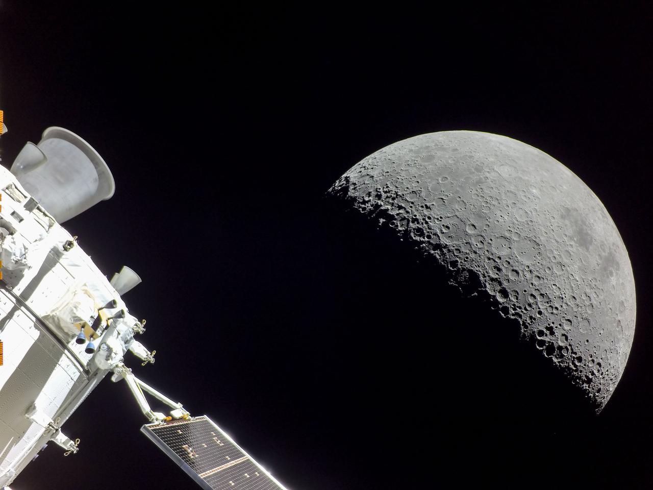
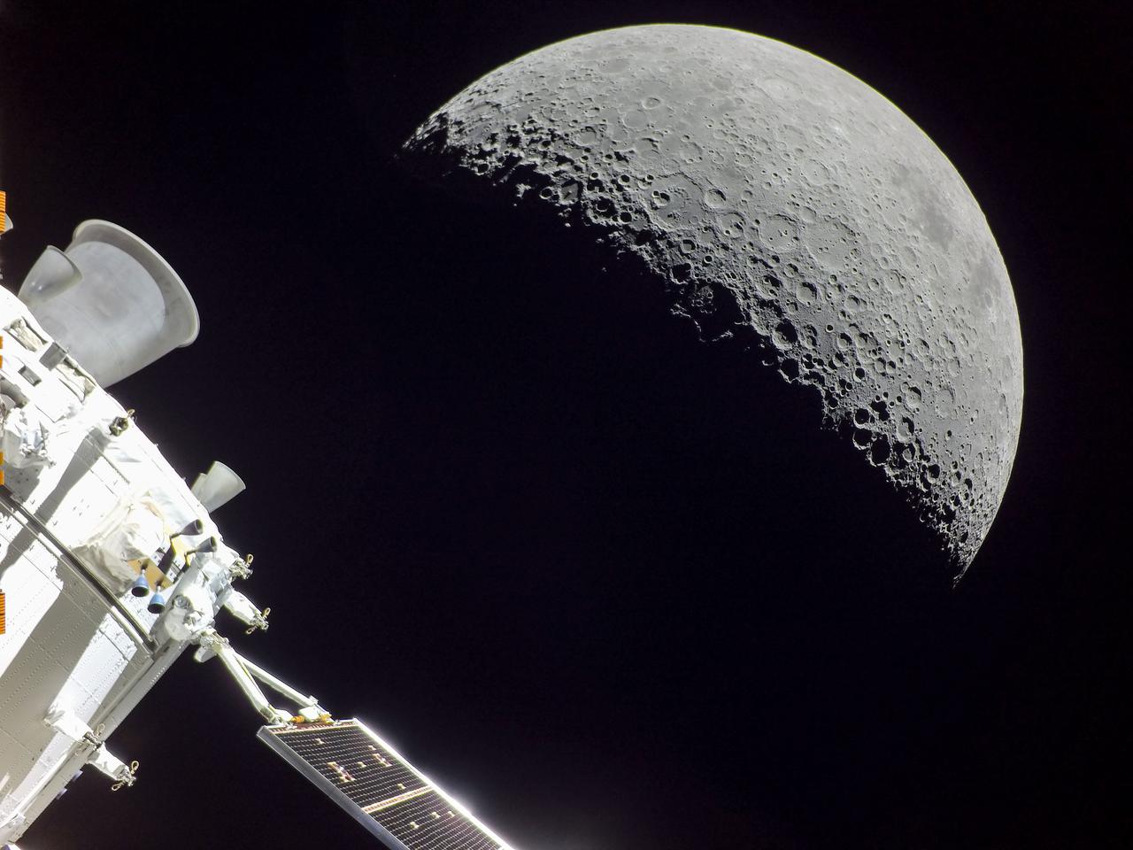
art001e000255 (Nov. 20, 2022) Taken on the fifth day of the Artemis I mission, this photo showing the Orion spacecraft with the Moon beyond was captured by a camera on the tip of one of Orion’s solar arrays. The spacecraft arrived at its closest approach to the moon the following day, Nov. 21, 2022, coming within 80 miles of the lunar surface.
art001e001939 (Dec. 2, 2022) A camera mounted on one of Orion’s four solar arrays captured this image of the Moon on flight day 17 of the 25.5-day Artemis I mission from a distance of more than 222,000 miles. Orion has exited the distant lunar orbit and is heading for a Dec. 11 splashdown in the Pacific Ocean.
art001e000466 (Nov. 23, 2022) – On flight day 8 of the Artemis I mission, Orion’s optical navigation camera snapped this image of the Moon. Orion continues to increase its distance from the Moon, heading toward distant retrograde orbit around the Moon.
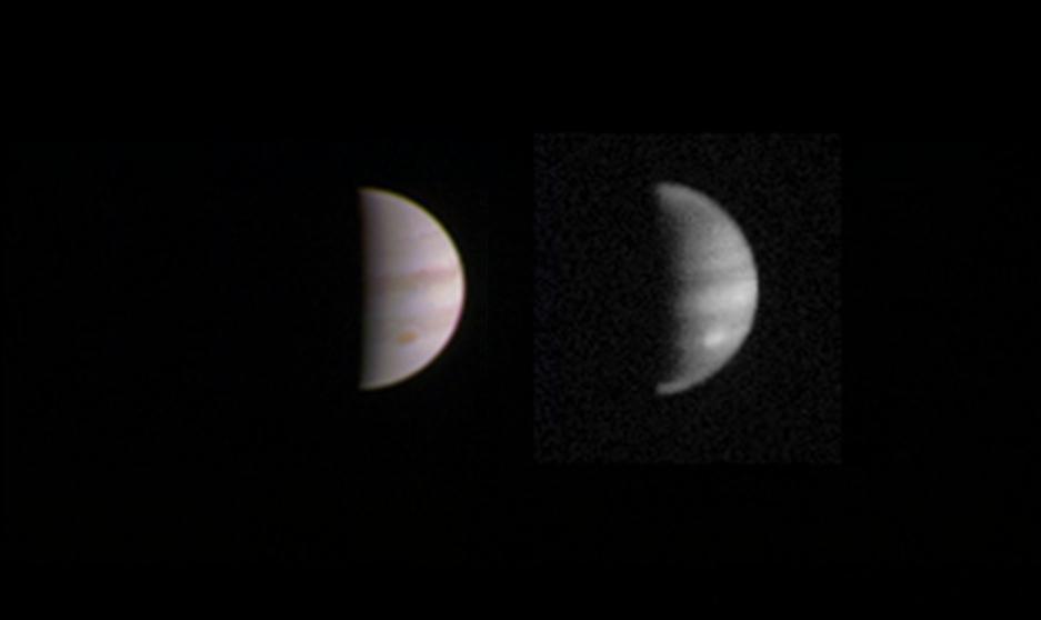
This dual view of Jupiter was taken on August 23, when NASA's Juno spacecraft was 2.8 million miles (4.4 million kilometers) from the gas giant planet on the inbound leg of its initial 53.5-day capture orbit. The image on the left is a color composite taken with Junocam's visible red, green, and blue filters. The image on the right was also taken by JunoCam, but uses the camera's infrared filter, which is sensitive to the abundance of methane in the atmosphere. Bright features like the planet's Great Red Spot are higher in the atmosphere, and so have less of their light absorbed by the methane. http://photojournal.jpl.nasa.gov/catalog/PIA20884
NASA Mars Exploration Rover Spirit used its navigation camera to capture this view of the terrain toward the southeast from the location Spirit reached on the 1,871st Martian day, or sol, of the rover mission on Mars April 8, 2009. The mound on the horizon in the upper left is informally called "Von Braun" and is one of the features that rover team has designated as a possible investigation site in future months. From the location where Spirit was when the image was taken, Von Braun is about 160 meters (525 feet) away. http://photojournal.jpl.nasa.gov/catalog/PIA11996
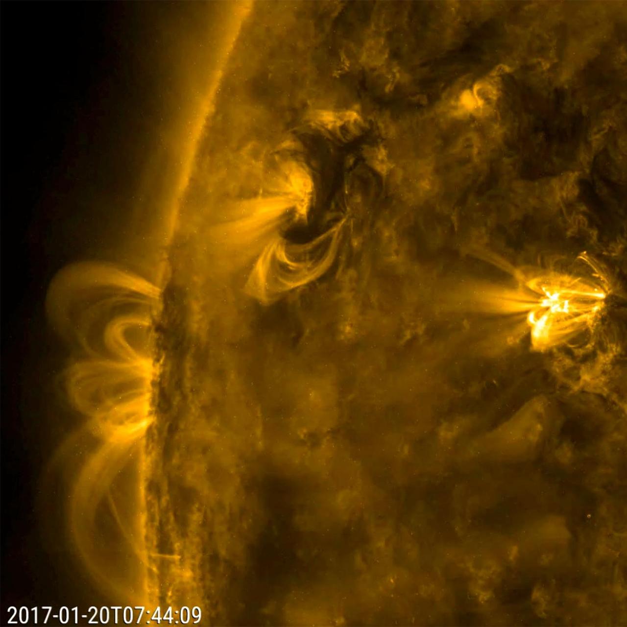
On Jan. 20, 2017, NASA Solar Dynamics Observatory captured a small area of the sun highlighted three active region. Over half a day this active region sent dark swirls of plasma and bright magnetic arches twisting and turning above it. All the activity in the three areas was driven by competing magnetic forces. The dynamic action was observed in a wavelength of extreme ultraviolet light. Movies are available at http://photojournal.jpl.nasa.gov/catalog/PIA11703

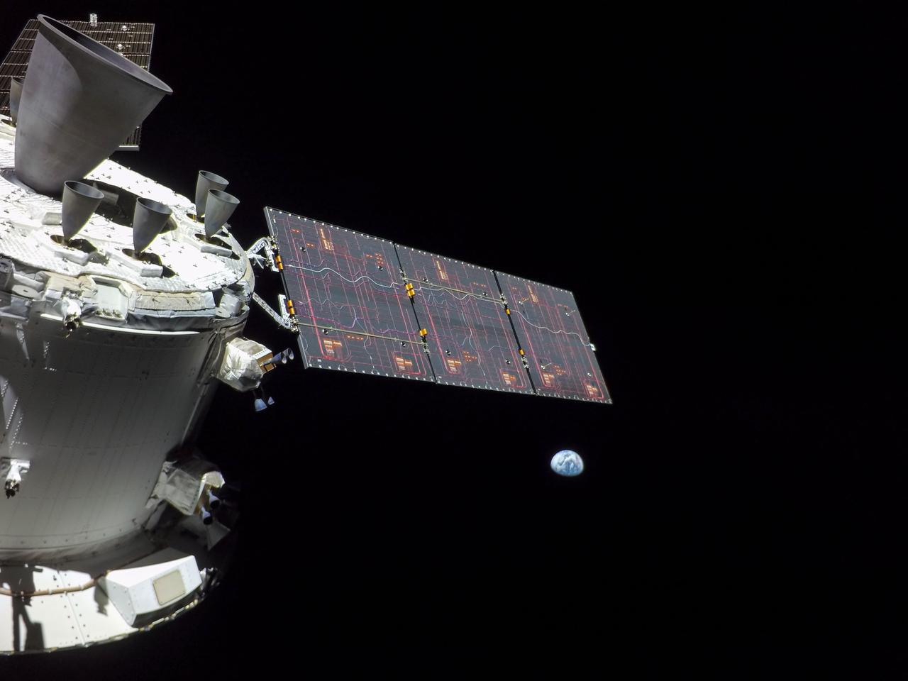
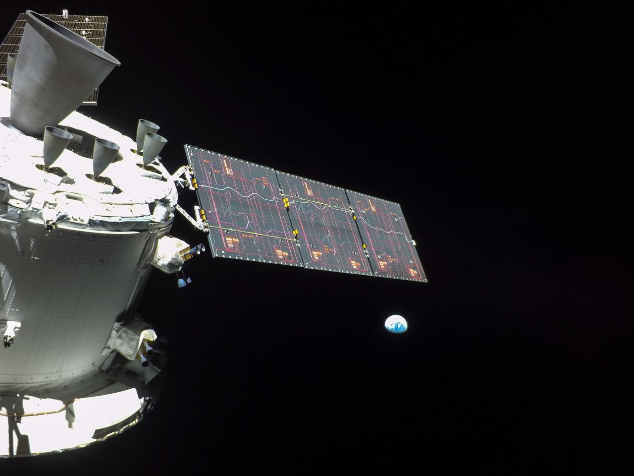
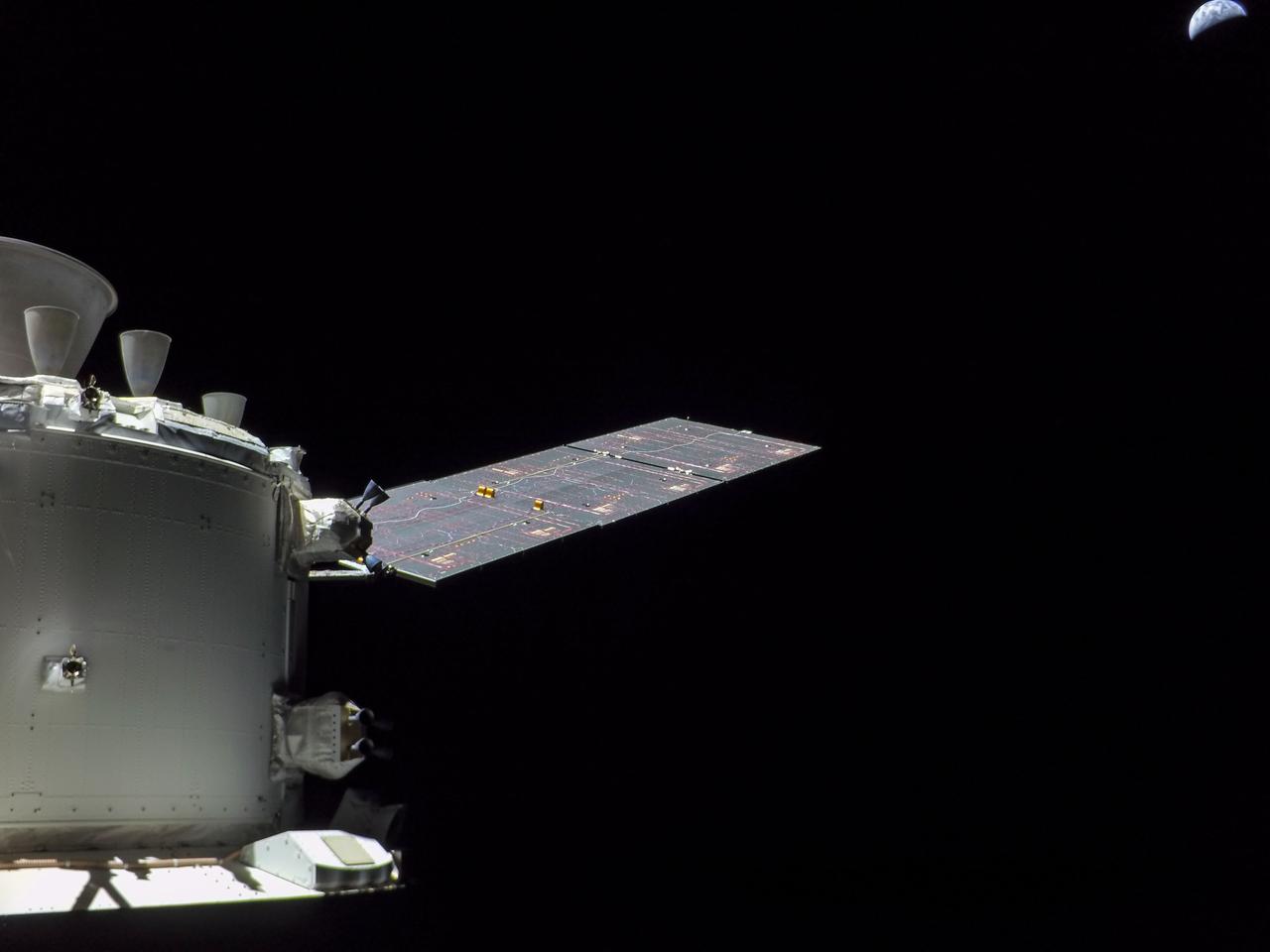
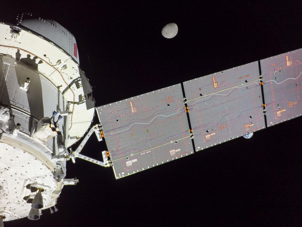
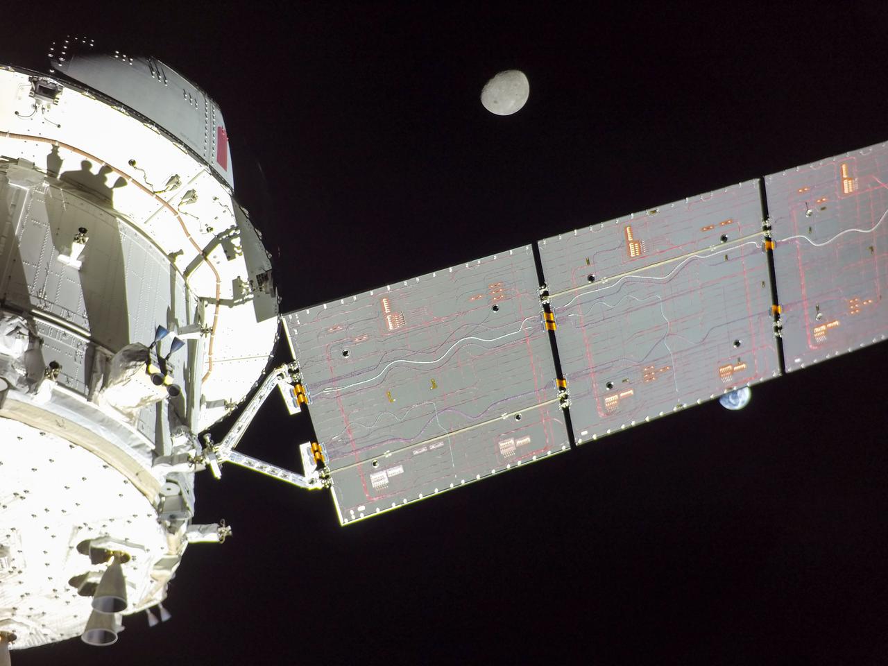
art001e001822 (Nov. 28, 2022) On flight day 13 of the Artemis I mission, Orion captured this view of Earth and the Moon on either sides of one of the spacecraft’s four solar arrays.
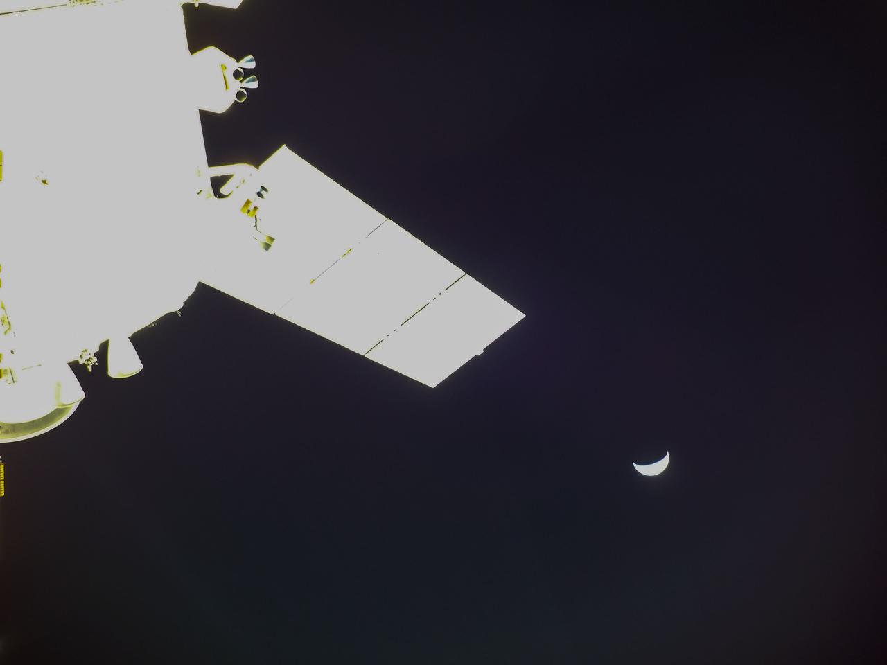
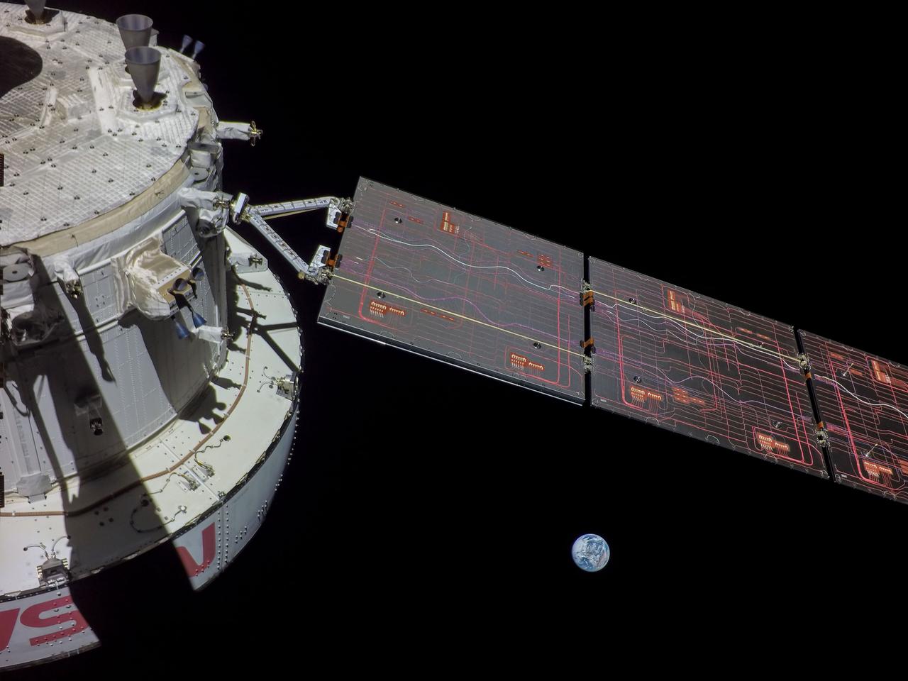
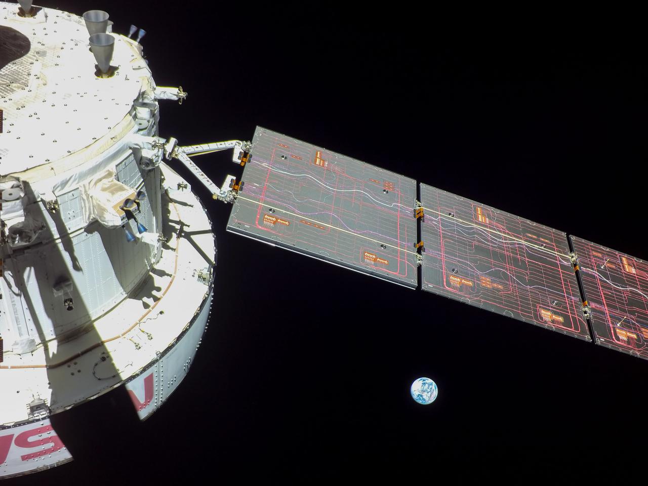
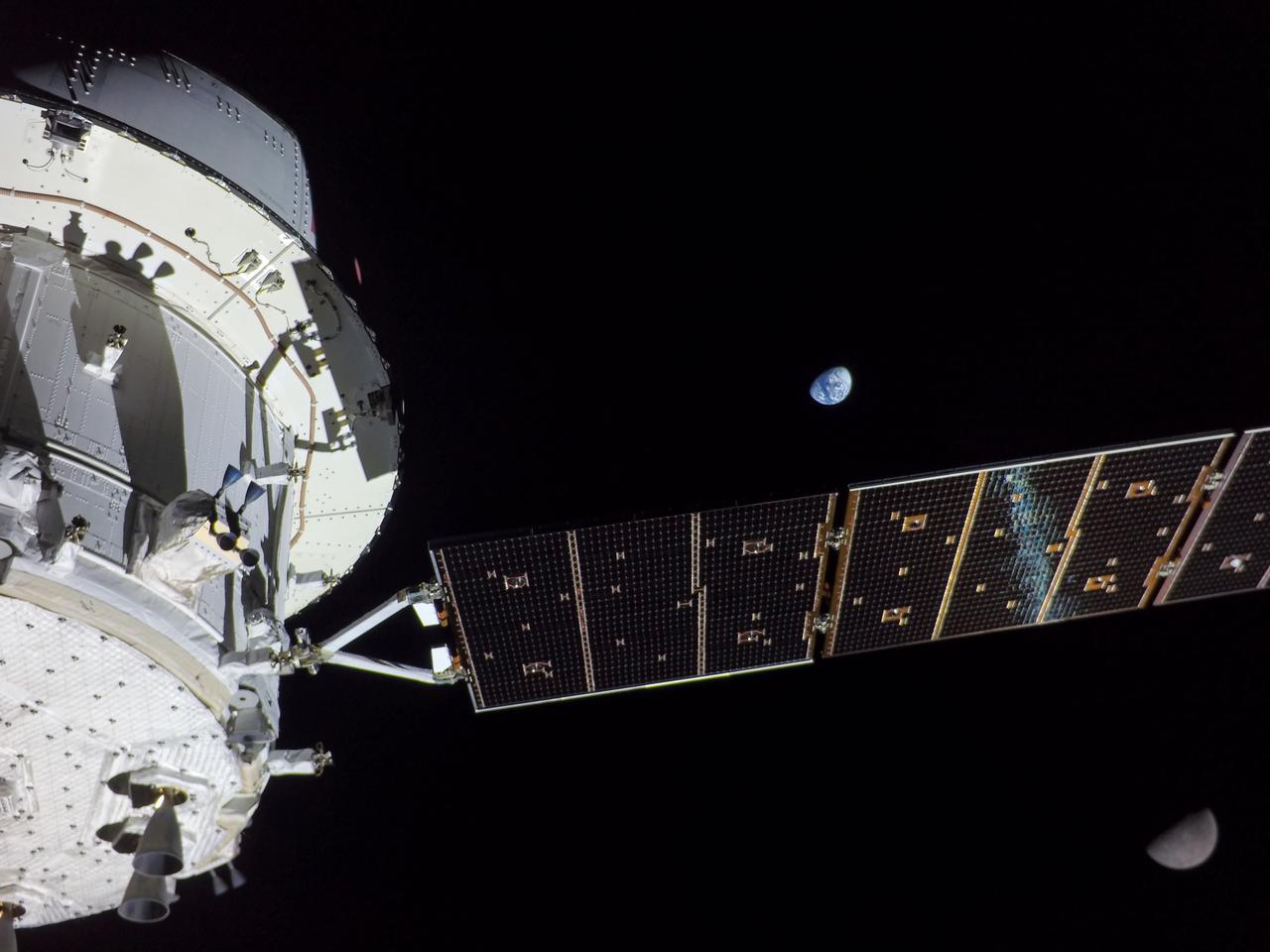
art001e001712 (Nov. 29, 2022) Orion’s solar arrays split the difference between Earth and the Moon on flight day 14 of the Artemis I mission in this image captured by a camera on the tip of one of the spacecraft’s four solar arrays.
art001e000475 (Nov. 24, 2022) – On Flight Day 9, NASA’s Orion spacecraft captured imagery looking back at the Earth from a camera mounted on one of its solar arrays. The spacecraft is enroute to distant retrograde orbit of the Moon.
art001e000476 (Nov. 24, 2022) – On Flight Day 9, NASA’s Orion spacecraft captured imagery looking back at the Earth from a camera mounted on one of its solar arrays. The spacecraft is enroute to distant retrograde orbit of the Moon.
iss056e075963 (July 3, 2018) --- The SpaceX Dragon resupply ship is pictured attached to the International Space Station's Harmony module the day after it was captured by NASA astronaut Ricky Arnold operating the Canadarm2 robotic arm.
art001e001713 (Nov. 29, 2022) Orion’s solar arrays split the difference between Earth and the Moon on flight day 14 of the Artemis I mission in this image captured by a camera on the tip of one of the spacecraft’s four solar arrays.
art001e000472 (Nov. 24, 2022) – On Flight Day 9, NASA’s Orion spacecraft captured imagery looking back at the Earth from a camera mounted on one of its solar arrays. The spacecraft is enroute to distant retrograde orbit of the Moon.
art001e001823 (Nov. 28, 2022) On flight day 13 of the Artemis I mission, Orion captured this view of Earth and the Moon on either sides of one of the spacecraft’s four solar arrays.
art001e000473 (Nov. 24, 2022) – On Flight Day 9, NASA’s Orion spacecraft captured imagery looking back at the Earth from a camera mounted on one of its solar arrays. The spacecraft is enroute to distant retrograde orbit of the Moon.

art001e001714 (Nov. 29, 2022) Orion’s solar arrays split the difference between Earth and the Moon on flight day 14 of the Artemis I mission in this image captured by a camera on the tip of one of the spacecraft’s four solar arrays.

ISS040-E-045605 (7 July 2014) --- The International Space Station, including these two temporarily docked Russian spacecraft, made more than one pass near Typhoon Neoguri on July 7, and Expedition 40 Flight Engineers Reid Wiseman of NASA and Alexander Gerst of the European Space Agency captured its startling dimensions in a day-long series of still photos. In a tweet later in the day, Gerst marveled that even with a fish-eye lens he couldn't capture the whole storm. A 28mm focal length was used for a small sequence of oblique pictures such as this one. The picture was taken at 06:57:53 GMT on July 7, 2014.

ISS040-E-045602 (7 July 2014) --- The International Space Station, including these two temporarily docked Russian spacecraft, made more than one pass near Typhoon Neoguri on July 7, and Expedition 40 Flight Engineers Reid Wiseman of NASA and Alexander Gerst of the European Space Agency captured its startling dimensions in a day-long series of still photos. In a tweet later in the day, Gerst marveled that even with a fish-eye lens he couldn't capture the whole storm. A 28mm focal length was used for a small sequence of oblique pictures such as this one. The picture was taken at 06:57:31 GMT on July 7, 2014.

ISS040-E-045603 (7 July 2014) --- The International Space Station, including these two temporarily docked Russian spacecraft, made more than one pass near Typhoon Neoguri on July 7, and Expedition 40 Flight Engineers Reid Wiseman of NASA and Alexander Gerst of the European Space Agency captured its startling dimensions in a day-long series of still photos. In a tweet later in the day, Gerst marveled that even with a fish-eye lens he couldn't capture the whole storm. A 28mm focal length was used for a small sequence of oblique pictures such as this one. The picture was taken at 06:57:32 GMT on July 7, 2014.
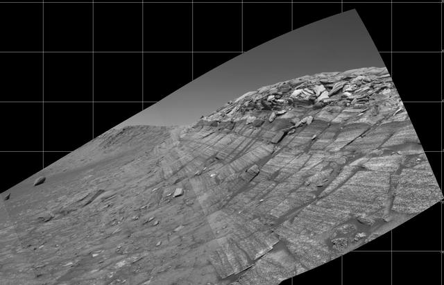
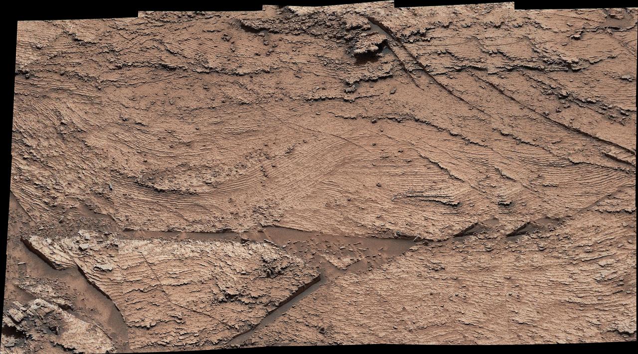
NASA's Curiosity Mars rover captured this image of rhythmic rock layers with a repetitive pattern in their spacing and thickness. The pattern might have been caused by weather or climate cycles occurring while the sediment layers were being deposited, such as dust storms happening at regular intervals in the ancient past. This mosaic is made up of 17 individual images captured in the "Marker Band" area by Curiosity's Mastcam on Nov. 7, 2022, the 3,646th Martian day, or sol, of the mission. The mosaic was captured by Mastcam's 34-millimeter-focal-length camera. https://photojournal.jpl.nasa.gov/catalog/PIA25734
art001e002581 (Dec. 5, 2022): The optical navigation camera mounted on the Orion spacecraft captured these views of the Moon’s surface. On flight day 20 of the Artemis I mission, the spacecraft made its second and final close approach to the Moon before its returned powered flyby burn. Orion uses the optical navigation camera to capture imagery of the Earth and the Moon at different phases and distances, providing an enhanced body of data to certify its effectiveness under different lighting conditions as a way to help orient the spacecraft on future missions with crew.

art001e000537 (Nov. 25, 2022)—On flight day 10, NASA’s Orion spacecraft captured imagery of the Moon while in a distant retrograde orbit. Orion uses the optical navigation camera to capture imagery of the Earth and the Moon at different phases and distances, providing an enhanced body of data to certify its effectiveness under different lighting conditions as a way to help orient the spacecraft on future missions with crew.
art001e002592 (Dec. 5, 2022): The optical navigation camera mounted on the Orion spacecraft captured these views of the Moon’s surface. On flight day 20 of the Artemis I mission, the spacecraft made its second and final close approach to the Moon before its returned powered flyby burn. Orion uses the optical navigation camera to capture imagery of the Earth and the Moon at different phases and distances, providing an enhanced body of data to certify its effectiveness under different lighting conditions as a way to help orient the spacecraft on future missions with crew.
art001e002593 (Dec. 5, 2022): The optical navigation camera mounted on the Orion spacecraft captured these views of the Moon’s surface. On flight day 20 of the Artemis I mission, the spacecraft made its second and final close approach to the Moon before its returned powered flyby burn. Orion uses the optical navigation camera to capture imagery of the Earth and the Moon at different phases and distances, providing an enhanced body of data to certify its effectiveness under different lighting conditions as a way to help orient the spacecraft on future missions with crew.
art001e001924 (Dec. 2, 2022) On flight day 17 of the Artemis I mission, Orion’s optical navigation camera captured this black-and-white image of our Earth as the spacecraft sets its sights on a Dec. 11 splashdown in the Pacific Ocean. Orion uses the optical navigation camera to capture imagery of the Earth and the Moon at different phases and distances, providing an enhanced body of data to certify its effectiveness under different lighting conditions as a way to help orient the spacecraft on future missions with crew.
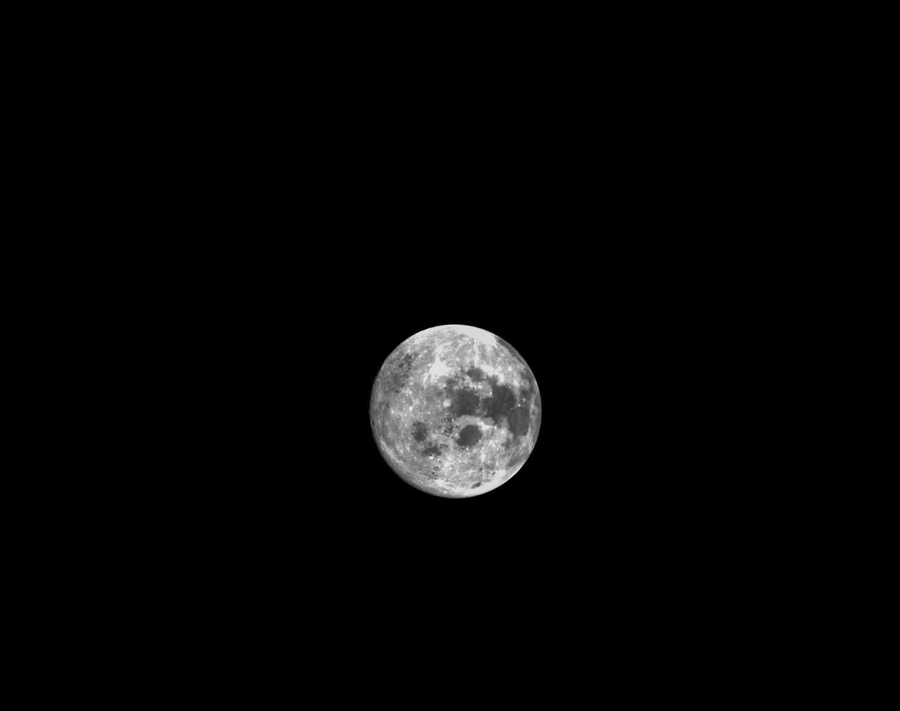
art001e002057 (Dec. 4, 2022) On flight day 19, Orion’s optical navigation camera captured this image of the full Moon as the spacecraft continued its approach toward the return powered flyby burn. Orion uses the optical navigation camera to capture imagery of the Earth and the Moon at different phases and distances, providing an enhanced body of data to certify its effectiveness under different lighting conditions as a way to help orient the spacecraft on future missions with crew.
art001e002594 (Dec. 5, 2022): The optical navigation camera mounted on the Orion spacecraft captured these views of the Moon’s surface. On flight day 20 of the Artemis I mission, the spacecraft made its second and final close approach to the Moon before its returned powered flyby burn. Orion uses the optical navigation camera to capture imagery of the Earth and the Moon at different phases and distances, providing an enhanced body of data to certify its effectiveness under different lighting conditions as a way to help orient the spacecraft on future missions with crew.
art001e002610 (Dec. 5, 2022): The optical navigation camera mounted on the Orion spacecraft captured these views of the Moon’s surface. On flight day 20 of the Artemis I mission, the spacecraft made its second and final close approach to the Moon before its returned powered flyby burn. Orion uses the optical navigation camera to capture imagery of the Earth and the Moon at different phases and distances, providing an enhanced body of data to certify its effectiveness under different lighting conditions as a way to help orient the spacecraft on future missions with crew.
art001e002604 (Dec. 5, 2022): The optical navigation camera mounted on the Orion spacecraft captured these views of the Moon’s surface. On flight day 20 of the Artemis I mission, the spacecraft made its second and final close approach to the Moon before its returned powered flyby burn. Orion uses the optical navigation camera to capture imagery of the Earth and the Moon at different phases and distances, providing an enhanced body of data to certify its effectiveness under different lighting conditions as a way to help orient the spacecraft on future missions with crew.
art001e002599 (Dec. 5, 2022): The optical navigation camera mounted on the Orion spacecraft captured these views of the Moon’s surface. On flight day 20 of the Artemis I mission, the spacecraft made its second and final close approach to the Moon before its returned powered flyby burn. Orion uses the optical navigation camera to capture imagery of the Earth and the Moon at different phases and distances, providing an enhanced body of data to certify its effectiveness under different lighting conditions as a way to help orient the spacecraft on future missions with crew.
NASA's Curiosity Mars rover captured evidence of rock layers that built up as windblown sand accumulated in some areas and was scoured away in others in the ancient past. This panorama, made up of nine individual images that were later stitched together, was captured at a location nicknamed "Las Claritas" using Curiosity's Mast Camera, or Mastcam, on May 19, 2022, the 3,478th Martian day, or sol, of the mission. https://photojournal.jpl.nasa.gov/catalog/PIA25369
art001e002647 (Dec. 5, 2022): The optical navigation camera mounted on the Orion spacecraft captured these views of the Moon’s surface. On flight day 20 of the Artemis I mission, the spacecraft made its second and final close approach to the Moon before its returned powered flyby burn. Orion uses the optical navigation camera to capture imagery of the Earth and the Moon at different phases and distances, providing an enhanced body of data to certify its effectiveness under different lighting conditions as a way to help orient the spacecraft on future missions with crew.
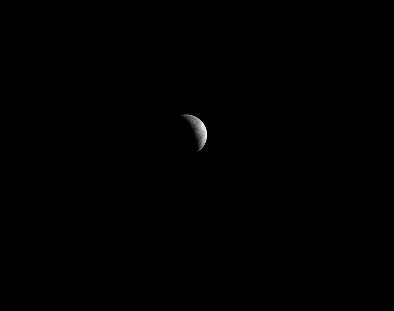
art001e000735 - On flight day 10, NASA’s Orion spacecraft captured imagery of the Moon while in a distant retrograde orbit. Orion uses the optical navigation camera to capture imagery of the Earth and the Moon at different phases and distances, providing an enhanced body of data to certify its effectiveness under different lighting conditions as a way to help orient the spacecraft on future missions with crew.
art001e002602 (Dec. 5, 2022): The optical navigation camera mounted on the Orion spacecraft captured these views of the Moon’s surface. On flight day 20 of the Artemis I mission, the spacecraft made its second and final close approach to the Moon before its returned powered flyby burn. Orion uses the optical navigation camera to capture imagery of the Earth and the Moon at different phases and distances, providing an enhanced body of data to certify its effectiveness under different lighting conditions as a way to help orient the spacecraft on future missions with crew.
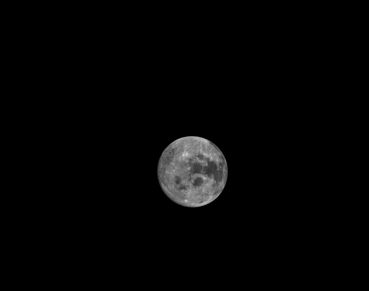
art001e002058 (Dec. 4, 2022) On flight day 19, Orion’s optical navigation camera captured this image of the full Moon as the spacecraft continued its approach toward the return powered flyby burn. Orion uses the optical navigation camera to capture imagery of the Earth and the Moon at different phases and distances, providing an enhanced body of data to certify its effectiveness under different lighting conditions as a way to help orient the spacecraft on future missions with crew.

art001e002596 (Dec. 5, 2022): The optical navigation camera mounted on the Orion spacecraft captured these views of the Moon’s surface. On flight day 20 of the Artemis I mission, the spacecraft made its second and final close approach to the Moon before its returned powered flyby burn. Orion uses the optical navigation camera to capture imagery of the Earth and the Moon at different phases and distances, providing an enhanced body of data to certify its effectiveness under different lighting conditions as a way to help orient the spacecraft on future missions with crew.
art001e001813 (Nov. 30, 2022) On flight day 15, Orion’s optical navigation camera captured this black-and-white image of our Moon. Orion uses the optical navigation camera to capture imagery of the Earth and the Moon at different phases and distances, providing an enhanced body of data to certify its effectiveness under different lighting conditions as a way to help orient the spacecraft on future missions with crew.

art001e000736 - On flight day 10, NASA’s Orion spacecraft captured imagery of the Moon while in a distant retrograde orbit. Orion uses the optical navigation camera to capture imagery of the Earth and the Moon at different phases and distances, providing an enhanced body of data to certify its effectiveness under different lighting conditions as a way to help orient the spacecraft on future missions with crew.
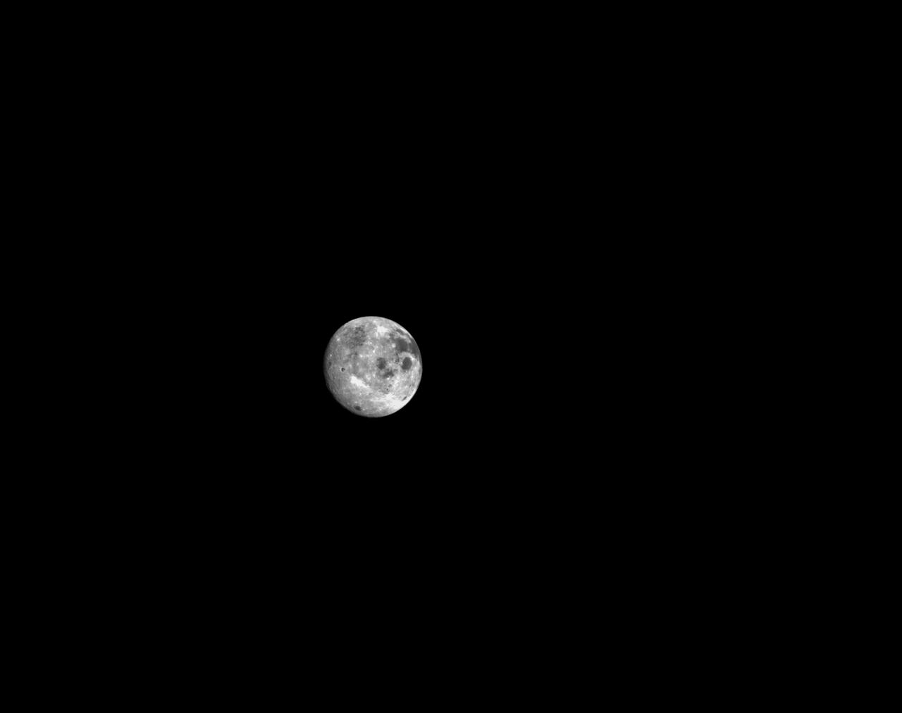
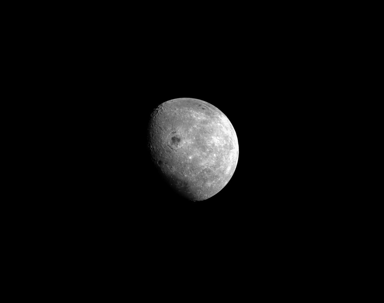
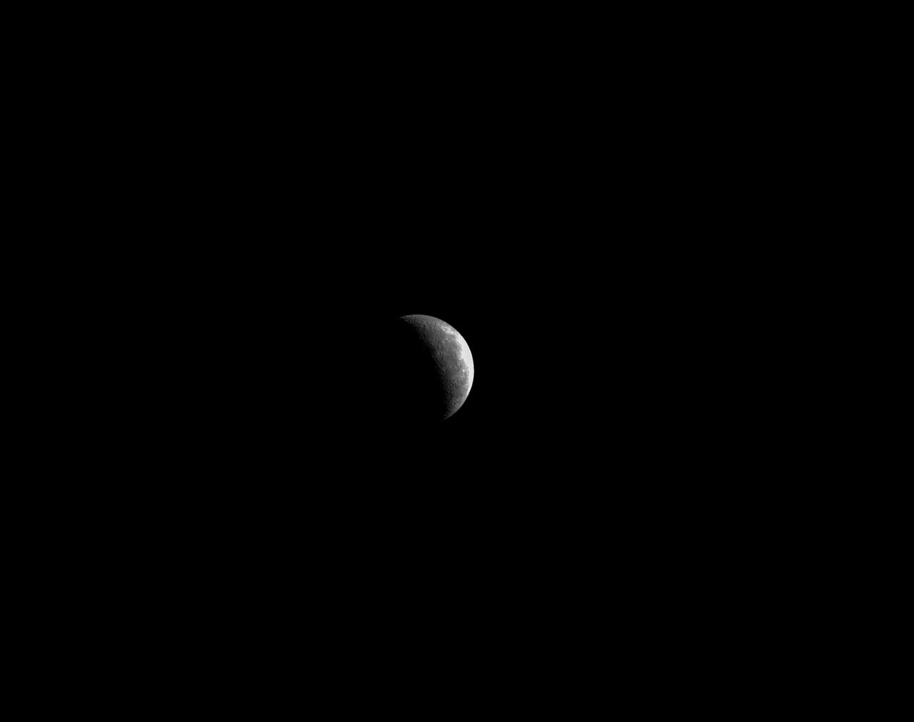
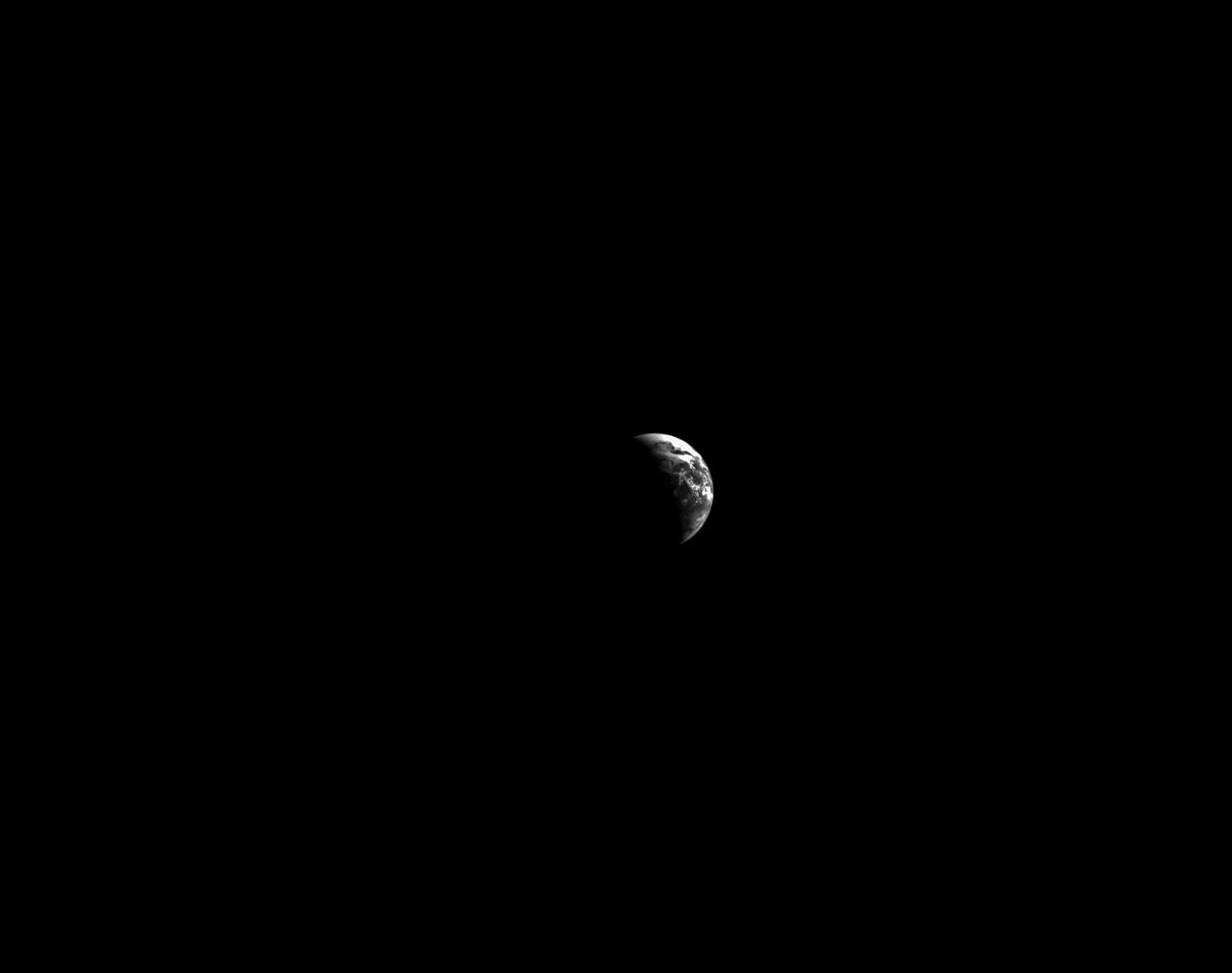
Orion’s black-and-white optical navigation camera captured this view of the Moon on the fourth day of the Artemis I mission. Orion uses the optical navigation camera to capture imagery of the Earth and the Moon at different phases and distances, providing an enhanced body of data to certify its effectiveness as a method for determining its position in space for future missions under differing lighting conditions.