
Dr. Rafat Ansari and James King testing their dynamic light scattering clinical device in NASA's Vision Research Laboratory at NASA Glenn. The objective is to diagnose eye diseases non-invasively long before the clinical symptoms appear and help find non-surgical medical treatments. The device shown was recently used in humans by ophthalmologists and scientists for the study of early onset of cataracts.
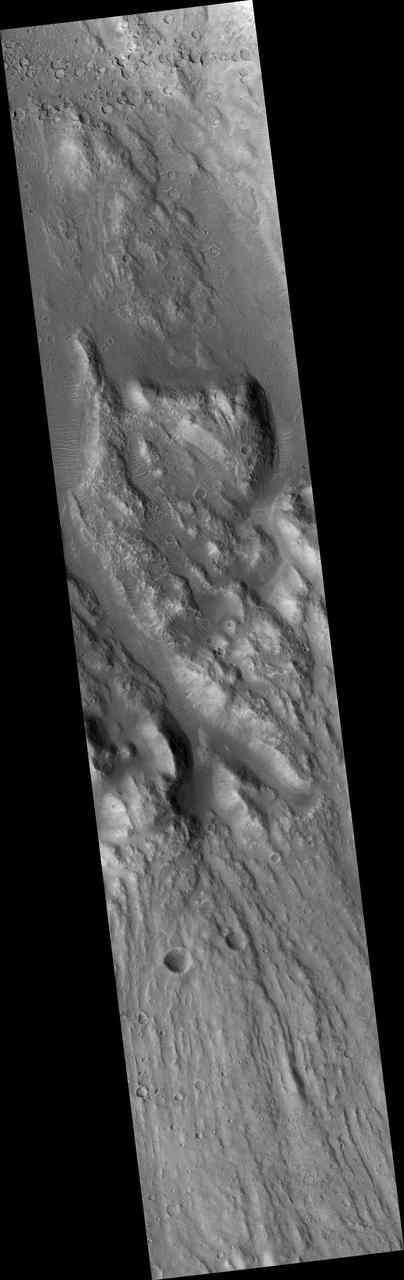
Ares Vallis Cataract
Cataracts are large landforms, and this oblique image from NASA's Mars Reconnaissance Orbiter covers only a small area of the innermost channel. The ridged material on the channel floor may be a lava flow that followed this channel after it was initially carved by giant floods of water.Obviously these are not the kind of cataracts that can develop in the lenses of your eyes, but large erosional scallops that form in river channels, like the Niagara Falls draining the Great Lakes of North America. Obviously these are not the kind of cataracts that can develop in the lenses of your eyes, but large erosional scallops that form in river channels, like the Niagara Falls draining the Great Lakes of North America. https://photojournal.jpl.nasa.gov/catalog/PIA21869
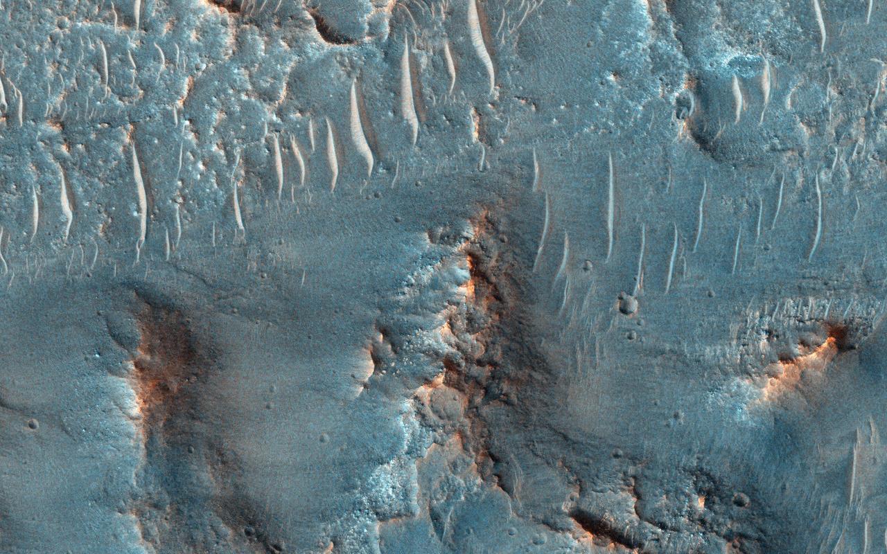
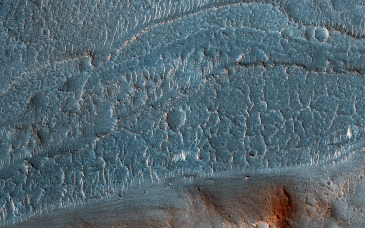
On Earth, cataracts represent regions where a river's gradient increases enough to create so much turbulence, that air gets incorporated into the water body forming a bubbly current sometimes called "whitewater". This image covers a location that may have acted as a cataract in the Kasei valley region. This observation from NASA Mars Reconnaissance Orbiter shows samples of bedrock lithologies which give us a measure of the post-flood erosion and modification history for the floor of Kasei Valles While there is a HiRISE stereo pair adjacent to this location that captures much of this cataract, it also misses some of the head scarp that might be the most useful, scientifically. http://photojournal.jpl.nasa.gov/catalog/PIA19351
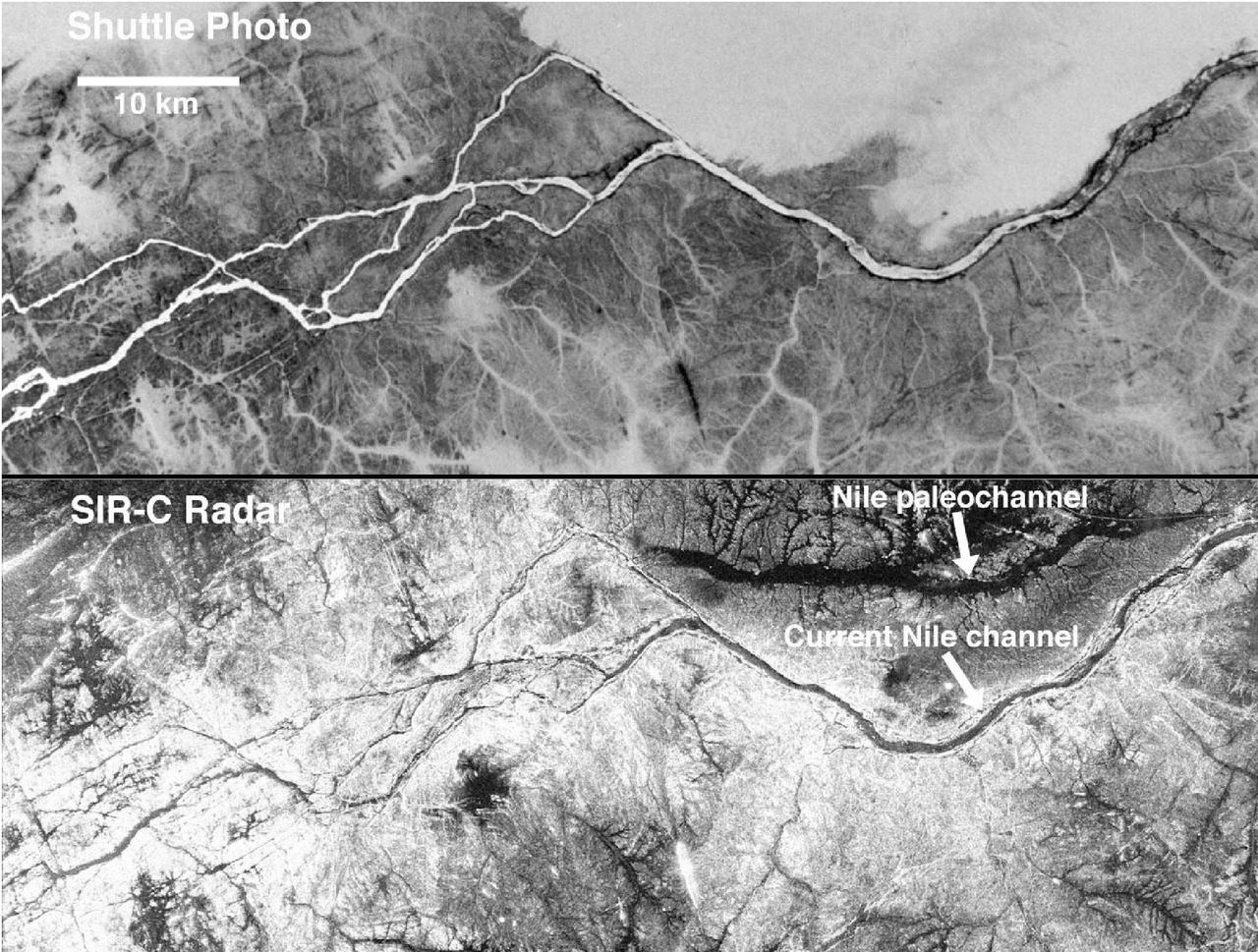
These two gray-scale images from NASA Space Shuttle show part of the Nile River, near the Fourth Cataract in Sudan.
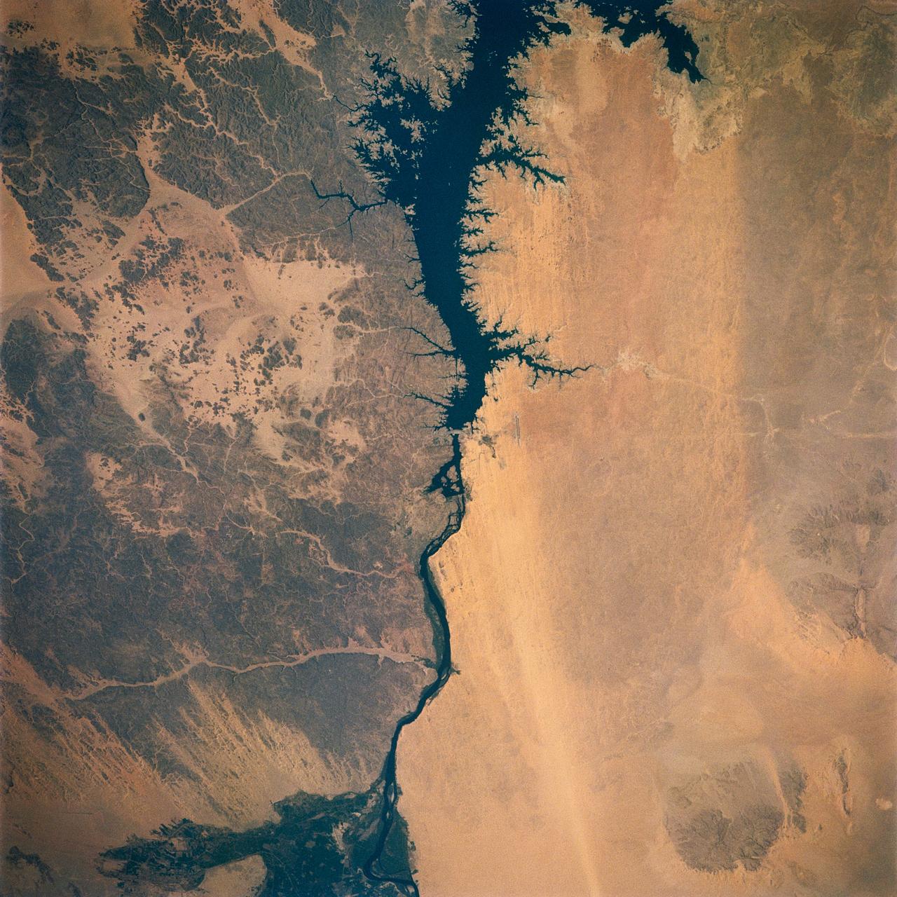
Egypt's High Aswan Dam on the Nile River at the first cataracts, Nile River, (24.0N, 33.0E) was completed in 1971 to provide cheap hydroelectric power and to regulate the historically uneven flow of the Nile River. The contrast between the largely base rock desert east of the Nile versus the sand covered desert west of the river and the ancient irrigated floodplain downstream from the damsite is clearly shown.
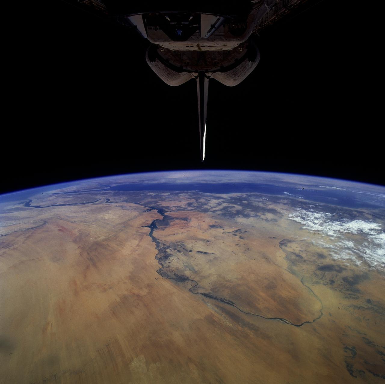
STS079-808-008 (16-26 Sept. 1996) --- In this 70mm frame from the space shuttle Atlantis, the Nile River wanders through the eastern Sahara Desert of Sudan and Egypt. In the foreground is a great bend of the Nile from north to south past the Fourth Cataract at Merowe (an ancient Sudanese dynastic capitol), then north past Dongola and the Third Cararact, to Lake Nasser in Egypt. Prominent sand streaks display a north-south alignment. North of the first great bend a thick dust storm completely obscures the land surface, near Merowe thinner dust creates a hazy look. In the distance the Red Sea stretches from Suez to southern Arabia.
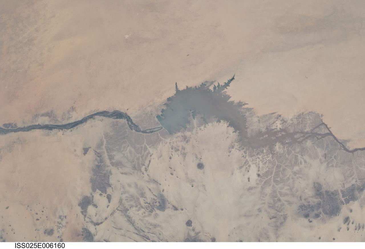
ISS025-E-006160 (5 Oct. 2010) --- Merowe Dam, Nile River and the Republic of the Sudan are featured in this image photographed by an Expedition 25 crew member on the International Space Station. The Merowe Dam is located near the 4th cataract of the Nile River, in the Nubian Desert of the northeastern Republic of the Sudan (also known as Sudan). The dam was built to generate hydroelectric power—electricity intended to further industrial and agricultural development of the country. This photograph illustrates the current extent of the reservoir filling behind the dam; the final spill gate was closed in 2008. The Merowe Dam is located approximately 350 kilometers (215 miles) to the northwest of Sudan’s capital, Khartoum. The nearest settlement downstream of the dam is Karima. Following Sudan’s independence from Egypt and the United Kingdom in 1956, allocation and control of Nile River water was divided between Egypt and Sudan by the Nile Waters Treaty signed in 1959. Today, other countries within the Nile basin—including Ethiopia, Kenya, Rwanda, Tanzania, and Uganda—are seeking more equitable allocation and utilization of the water and recently (2010) signed a new water use pact challenging the 1959 treaty. Beyond the issues of water rights, several local tribes will be displaced by the planned 170 kilometer-long reservoir, and the flooded region contains significant but little-studied archeological sites. The Sudanese government has a resettlement program in place for the tribes. A variety of international institutions have been conducting “salvage” or “rescue” archeological surveys since 1999. Such rescue surveys seek to preserve as much information as possible from sites that will be destroyed or otherwise made inaccessible (in this case by flooding).