
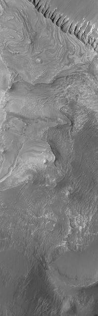
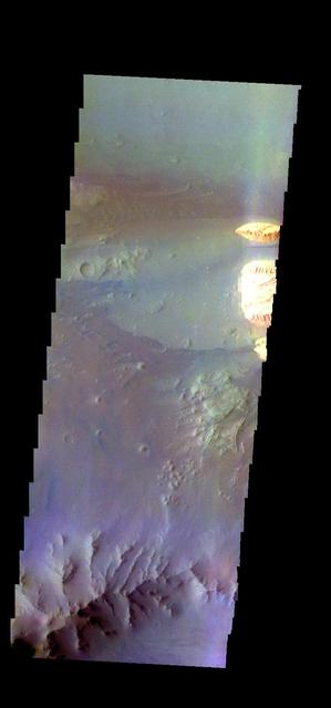
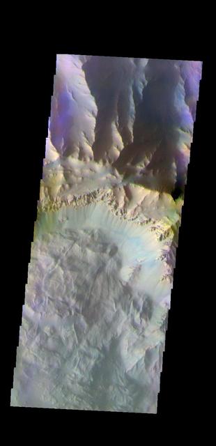
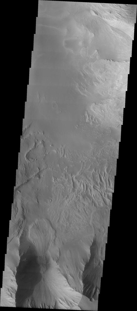
This image shows the part of the southern cliff face of Hebes Chasma a the bottom of the image. At the top of the image is part of the large mesa located in the center of the chasma. Hebes Chasma is an enclosed basin not connected to Valles Marineris. The cliff faces of the chasma itself and the interior mesa appear quite different, which may provided information on how the chasma and the mesa formed. The Odyssey spacecraft has spent over 15 years in orbit around Mars, circling the planet more than 69000 times. It holds the record for longest working spacecraft at Mars. THEMIS, the IR/VIS camera system, has collected data for the entire mission and provides images covering all seasons and lighting conditions. Over the years many features of interest have received repeated imaging, building up a suite of images covering the entire feature. From the deepest chasma to the tallest volcano, individual dunes inside craters and dune fields that encircle the north pole, channels carved by water and lava, and a variety of other feature, THEMIS has imaged them all. For the next several months the image of the day will focus on the Tharsis volcanoes, the various chasmata of Valles Marineris, and the major dunes fields. We hope you enjoy these images! Orbit Number: 10052 Latitude: -1.5441 Longitude: 283.71 Instrument: VIS Captured: 2004-03-21 00:22 https://photojournal.jpl.nasa.gov/catalog/PIA21809

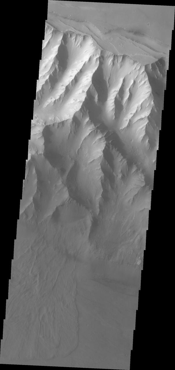
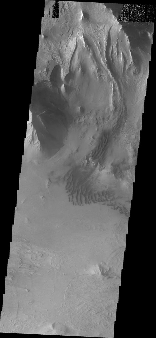
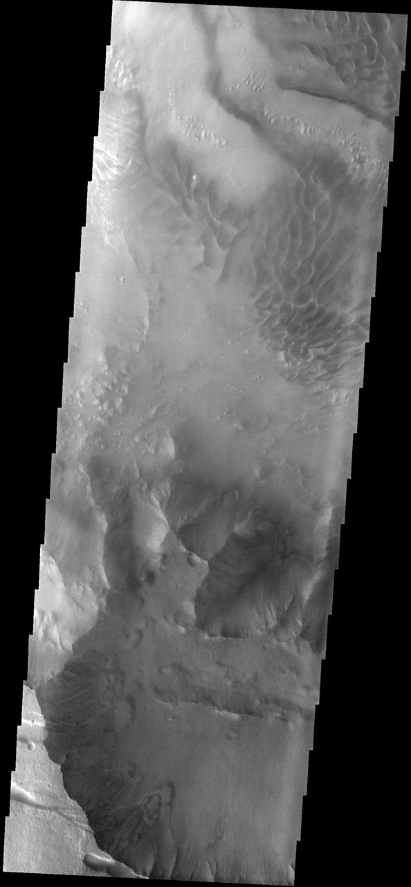
Tithonium Chasma/Ius Chasma
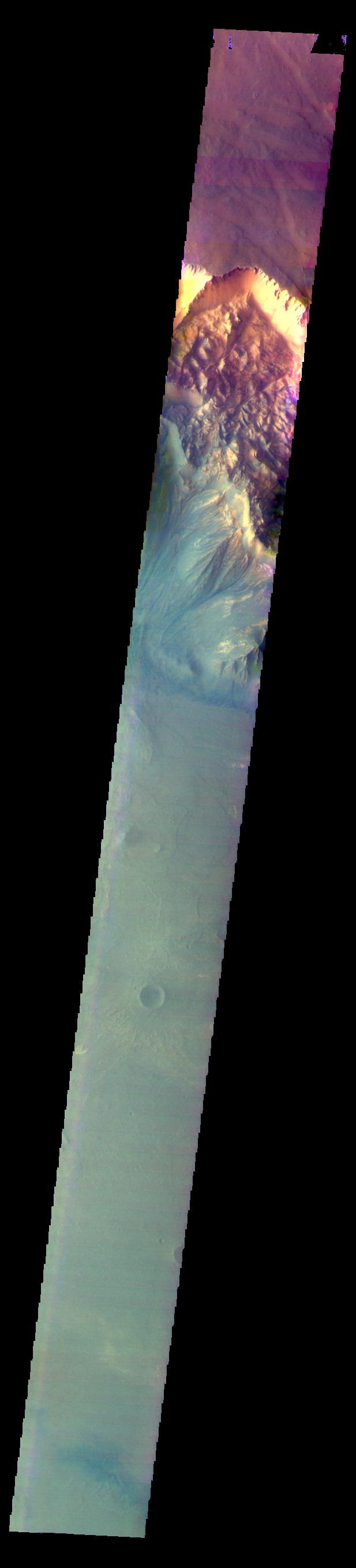
Coprates Chasma is one of the numerous canyons that make up Valles Marineris. The chasma stretches for 960 km (600 miles) from Melas Chasma to the west and Capri Chasma to the east. Landslide deposits, layered materials and sand dunes cover a large portion of the chasma floor. This image is located in central Coprates Chasma. The floor of the chasma is covered by a complex deposit of material. This chaotic surface differs from most of the floor of the canyon and indicate a local process, perhaps a very large landslide or failure of the cliff face. The Odyssey spacecraft has spent over 15 years in orbit around Mars, circling the planet more than 69000 times. It holds the record for longest working spacecraft at Mars. THEMIS, the IR/VIS camera system, has collected data for the entire mission and provides images covering all seasons and lighting conditions. Over the years many features of interest have received repeated imaging, building up a suite of images covering the entire feature. From the deepest chasma to the tallest volcano, individual dunes inside craters and dune fields that encircle the north pole, channels carved by water and lava, and a variety of other feature, THEMIS has imaged them all. For the next several months the image of the day will focus on the Tharsis volcanoes, the various chasmata of Valles Marineris, and the major dunes fields. We hope you enjoy these images! Orbit Number: 27086 Latitude: -13.564 Longitude: 300.618 Instrument: VIS Captured: 2008-01-22 12:04 https://photojournal.jpl.nasa.gov/catalog/PIA21994
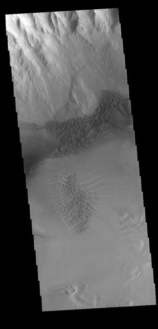
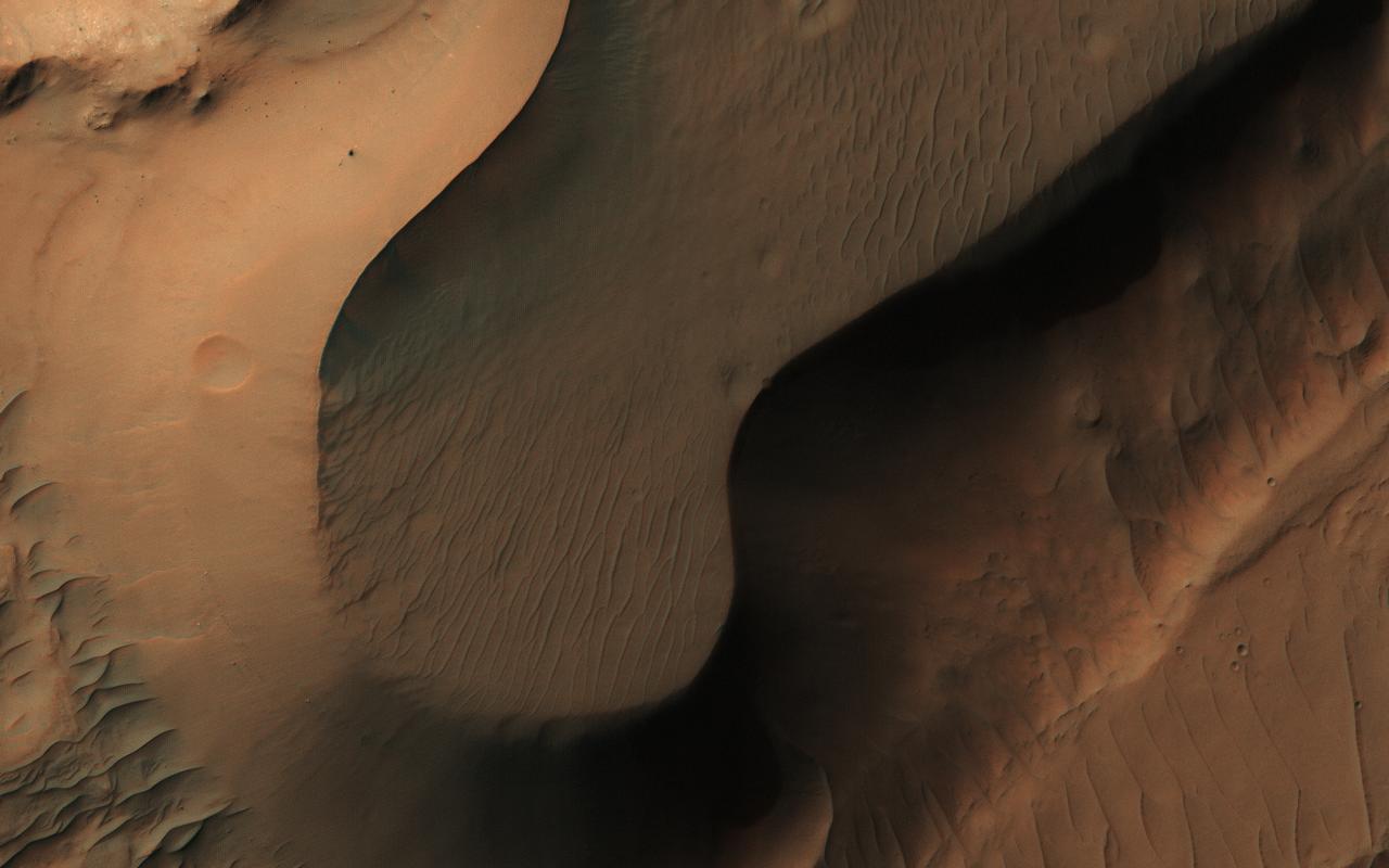
Today's VIS image shows sand dune forms in Juventae Chasma. In this part of Juventae Chasma the entire floor appears to be covered by sand and dunes. Orbit Number: 65083 Latitude: -4.52447 Longitude: 297.293 Instrument: VIS Captured: 2016-08-15 18:39 http://photojournal.jpl.nasa.gov/catalog/PIA21001
This image shows the north central cliff face of Hebes Chasma. The cliff face and downslope movement of material is very different in appearance than the same features of the large mesa in the center of the chasma. Hebes Chasma is an enclosed basin not connected to Valles Marineris. The Odyssey spacecraft has spent over 15 years in orbit around Mars, circling the planet more than 69000 times. It holds the record for longest working spacecraft at Mars. THEMIS, the IR/VIS camera system, has collected data for the entire mission and provides images covering all seasons and lighting conditions. Over the years many features of interest have received repeated imaging, building up a suite of images covering the entire feature. From the deepest chasma to the tallest volcano, individual dunes inside craters and dune fields that encircle the north pole, channels carved by water and lava, and a variety of other feature, THEMIS has imaged them all. For the next several months the image of the day will focus on the Tharsis volcanoes, the various chasmata of Valles Marineris, and the major dunes fields. We hope you enjoy these images! Orbit Number: 26886 Latitude: -0.142089 Longitude: 283.512 Instrument: VIS Captured: 2008-01-06 02:43 https://photojournal.jpl.nasa.gov/catalog/PIA21814

This image shows part of the western side of Hebes Chasma. The large central mesa is on the right side of the image. The smooth region in the lower left side of the image is a region of sand and sand dunes. These features indicate that winds played a part in eroding materials inside the chasma. Hebes Chasma is an enclosed basin not connected to Valles Marineris. The Odyssey spacecraft has spent over 15 years in orbit around Mars, circling the planet more than 69000 times. It holds the record for longest working spacecraft at Mars. THEMIS, the IR/VIS camera system, has collected data for the entire mission and provides images covering all seasons and lighting conditions. Over the years many features of interest have received repeated imaging, building up a suite of images covering the entire feature. From the deepest chasma to the tallest volcano, individual dunes inside craters and dune fields that encircle the north pole, channels carved by water and lava, and a variety of other feature, THEMIS has imaged them all. For the next several months the image of the day will focus on the Tharsis volcanoes, the various chasmata of Valles Marineris, and the major dunes fields. We hope you enjoy these images! Orbit Number: 16841 Latitude: -0.660183 Longitude: 282.319 Instrument: VIS Captured: 2005-09-30 23:26 https://photojournal.jpl.nasa.gov/catalog/PIA21813
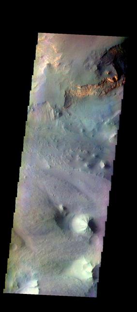
This image shows the eastern portion of Hebes Chasma. The ridge that is casting a shadow at the bottom of the image is likely a large tectonic fault. All of the materials on the floor of the chasma are from the cliff faces. The deposition and erosion of the materials in this image are very different from the those of the large central mesa. Hebes Chasma is an enclosed basin not connected to Valles Marineris. The Odyssey spacecraft has spent over 15 years in orbit around Mars, circling the planet more than 69000 times. It holds the record for longest working spacecraft at Mars. THEMIS, the IR/VIS camera system, has collected data for the entire mission and provides images covering all seasons and lighting conditions. Over the years many features of interest have received repeated imaging, building up a suite of images covering the entire feature. From the deepest chasma to the tallest volcano, individual dunes inside craters and dune fields that encircle the north pole, channels carved by water and lava, and a variety of other feature, THEMIS has imaged them all. For the next several months the image of the day will focus on the Tharsis volcanoes, the various chasmata of Valles Marineris, and the major dunes fields. We hope you enjoy these images! Orbit Number: 27124 Latitude: -1.43316 Longitude: 285.942 Instrument: VIS Captured: 2008-01-25 15:05 https://photojournal.jpl.nasa.gov/catalog/PIA21816
This image from NASA's Mars Reconnaissance Orbiter shows a small portion of the floor of Coprates Chasma, a large trough within the Valles Marineris system of canyons. Although the exact sequence of events that formed Coprates Chasma is unknown, the ripples, mesas, and craters visible throughout the terrain point to a complex history involving multiple mechanisms of erosion and deposition. The main trough of Coprates Chasma ranges from 60 to 100 kilometers in width. https://photojournal.jpl.nasa.gov/catalog/PIA21872
This VIS image shows the southern wall of Juventae Chasma. Orbit Number: 64347 Latitude: -5.0713 Longitude: 298.551 Instrument: VIS Captured: 2016-06-16 03:38 http://photojournal.jpl.nasa.gov/catalog/PIA20807
Today's VIS image shows part of the canyon wall of Melas Chasma. Orbit Number: 65682 Latitude: -9.38343 Longitude: 289.417 Instrument: VIS Captured: 2016-10-04 02:52 http://photojournal.jpl.nasa.gov/catalog/PIA21181

This image shows the northern side of Hebes Chasma. The large central layered mesa is just off the bottom of the image. Meeting in approximately the center of the image are materials eroded from the cliff face and mesa. The appearance of the material differs. Both the floor and central mesa are very complex features in this canyon. Hebes Chasma is an enclosed basin not connected to Valles Marineris. The Odyssey spacecraft has spent over 15 years in orbit around Mars, circling the planet more than 69000 times. It holds the record for longest working spacecraft at Mars. THEMIS, the IR/VIS camera system, has collected data for the entire mission and provides images covering all seasons and lighting conditions. Over the years many features of interest have received repeated imaging, building up a suite of images covering the entire feature. From the deepest chasma to the tallest volcano, individual dunes inside craters and dune fields that encircle the north pole, channels carved by water and lava, and a variety of other feature, THEMIS has imaged them all. For the next several months the image of the day will focus on the Tharsis volcanoes, the various chasmata of Valles Marineris, and the major dunes fields. We hope you enjoy these images! Orbit Number: 51210 Latitude: -0.415426 Longitude: 284.165 Instrument: VIS Captured: 2013-06-30 15:57 https://photojournal.jpl.nasa.gov/catalog/PIA21819

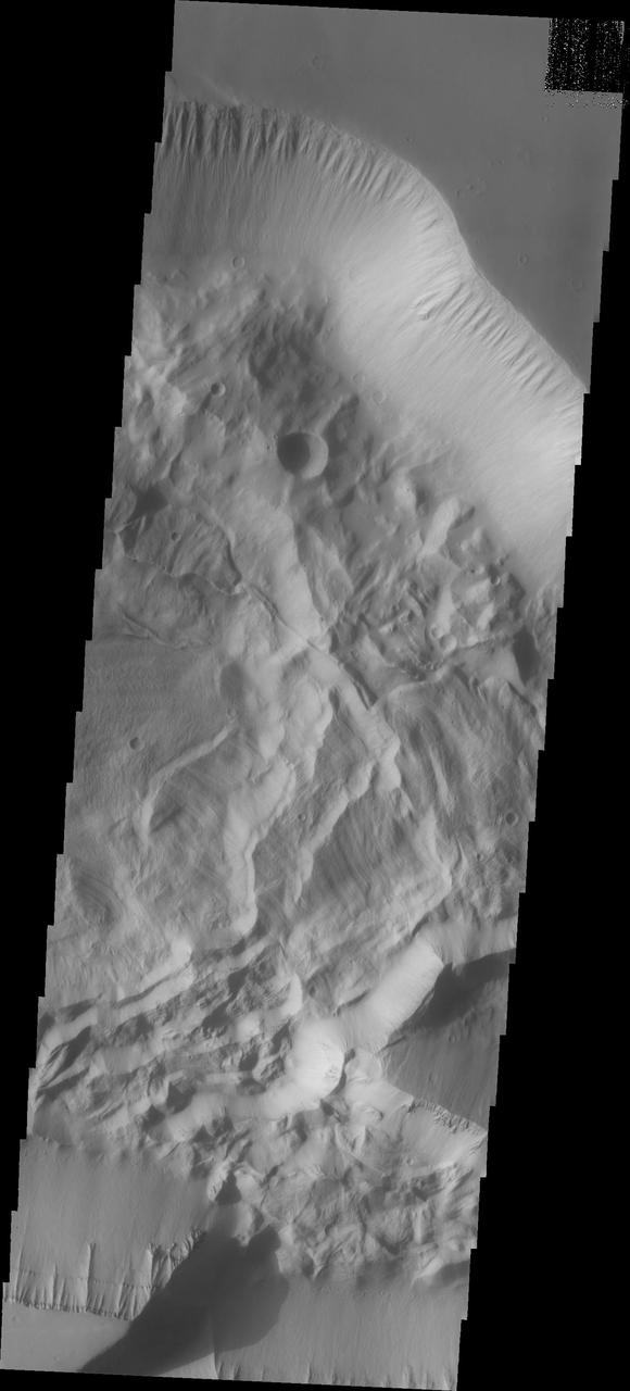
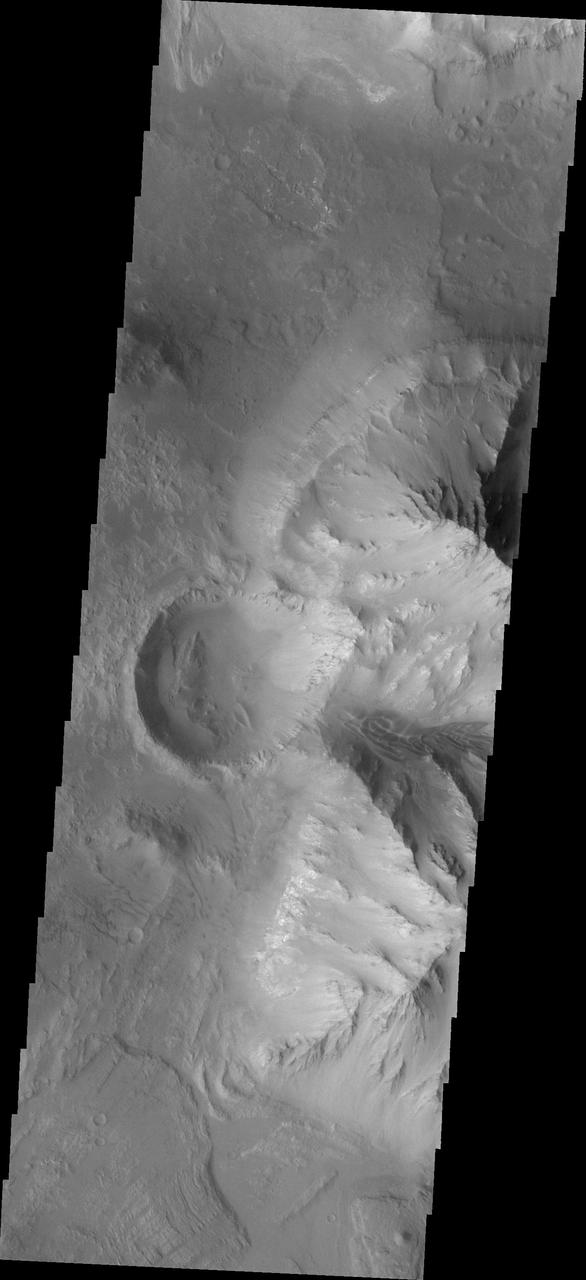
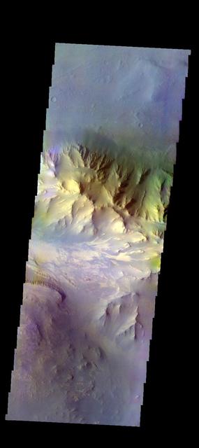
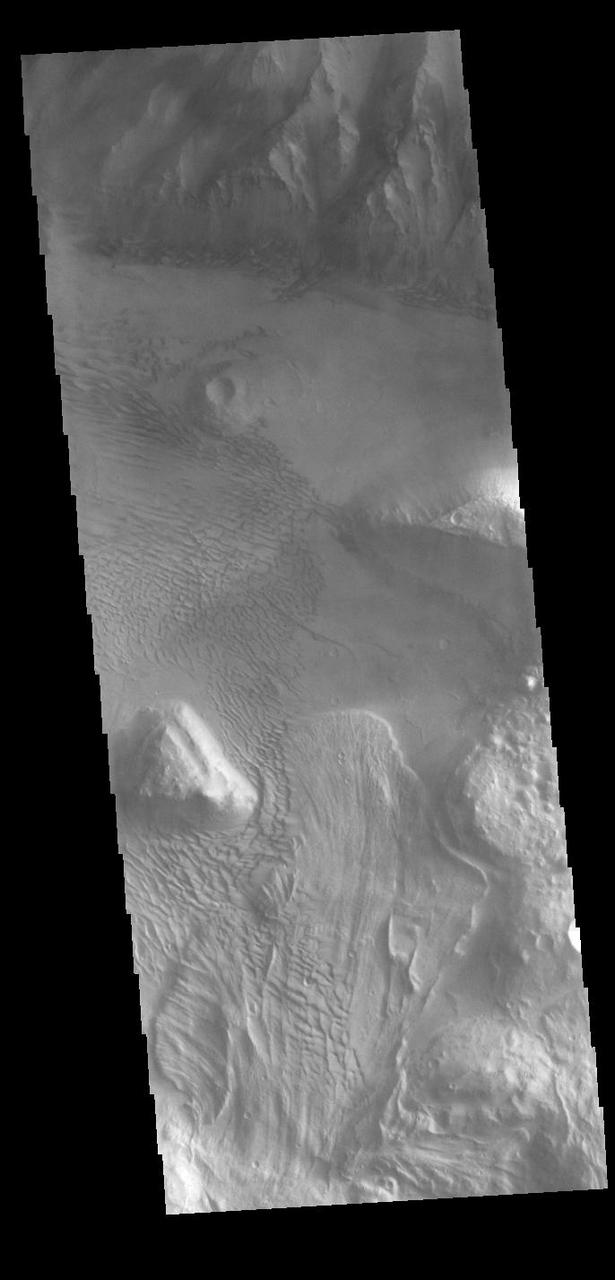
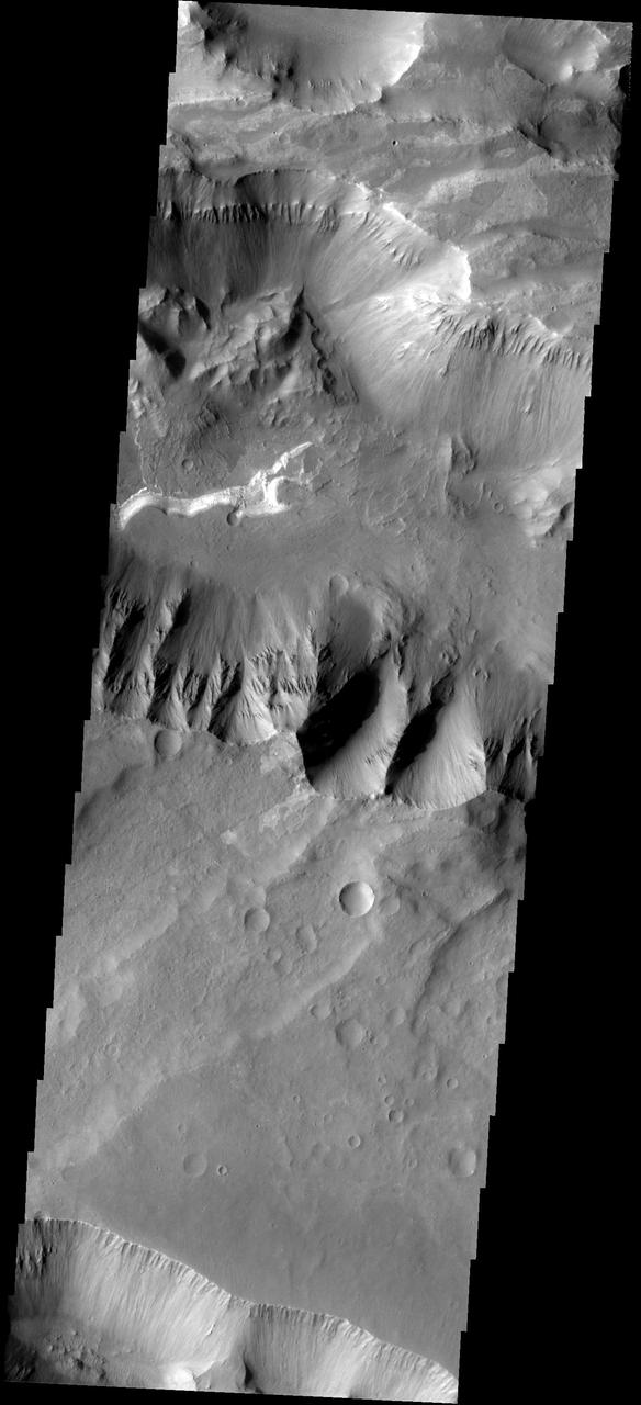
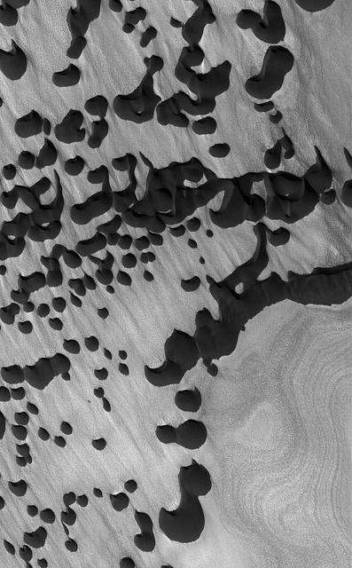
The interior layered mesa in Hebes Chasma is visible at the top of this image. The southern cliff face is at the bottom. A landslide deposit is visible originating from the southern cliff face. Hebes Chasma is an enclosed basin not connected to Valles Marineris. The Odyssey spacecraft has spent over 15 years in orbit around Mars, circling the planet more than 69000 times. It holds the record for longest working spacecraft at Mars. THEMIS, the IR/VIS camera system, has collected data for the entire mission and provides images covering all seasons and lighting conditions. Over the years many features of interest have received repeated imaging, building up a suite of images covering the entire feature. From the deepest chasma to the tallest volcano, individual dunes inside craters and dune fields that encircle the north pole, channels carved by water and lava, and a variety of other feature, THEMIS has imaged them all. For the next several months the image of the day will focus on the Tharsis volcanoes, the various chasmata of Valles Marineris, and the major dunes fields. We hope you enjoy these images! Orbit Number: 46042 Latitude: -1.47735 Longitude: 282.848 Instrument: VIS Captured: 2012-05-01 06:12 https://photojournal.jpl.nasa.gov/catalog/PIA21818
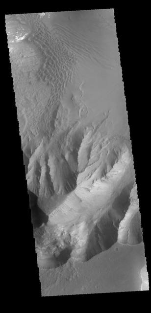
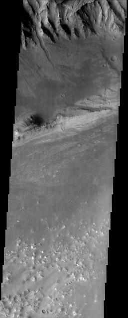
This image shows the part of the southern cliff face of Hebes Chasma at the bottom of the image. The materials seen in the majority of this image are part of the erosion of the central mesa, perhaps created by a massive landslide. Hebes Chasma is an enclosed basin not connected to Valles Marineris. The Odyssey spacecraft has spent over 15 years in orbit around Mars, circling the planet more than 69000 times. It holds the record for longest working spacecraft at Mars. THEMIS, the IR/VIS camera system, has collected data for the entire mission and provides images covering all seasons and lighting conditions. Over the years many features of interest have received repeated imaging, building up a suite of images covering the entire feature. From the deepest chasma to the tallest volcano, individual dunes inside craters and dune fields that encircle the north pole, channels carved by water and lava, and a variety of other feature, THEMIS has imaged them all. For the next several months the image of the day will focus on the Tharsis volcanoes, the various chasmata of Valles Marineris, and the major dunes fields. We hope you enjoy these images! Orbit Number: 10701 Latitude: -1.17496 Longitude: 282.347 Instrument: VIS Captured: 2004-05-13 10:46 https://photojournal.jpl.nasa.gov/catalog/PIA21810
Today's image shows part of the southern margin of Juventae Chasma. Also visible are sand dunes located on the floor of the canyon. Orbit Number: 64372 Latitude: -5.09577 Longitude: 297.061 Instrument: VIS Captured: 2016-06-18 05:03 http://photojournal.jpl.nasa.gov/catalog/PIA20808

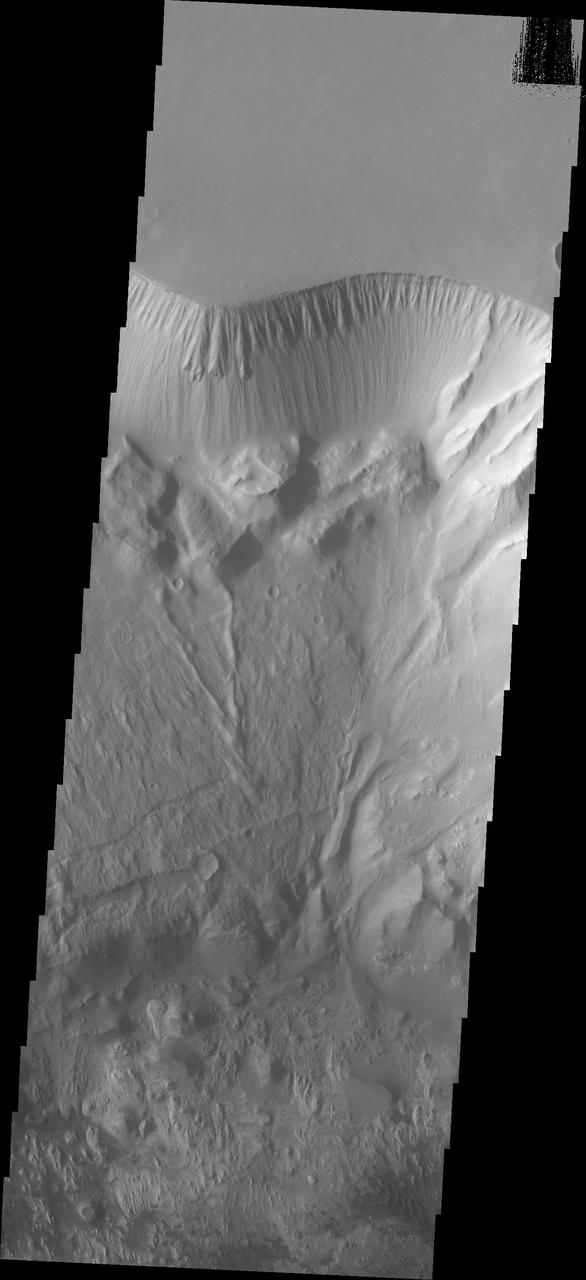
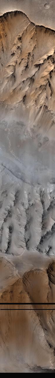
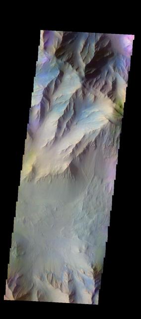
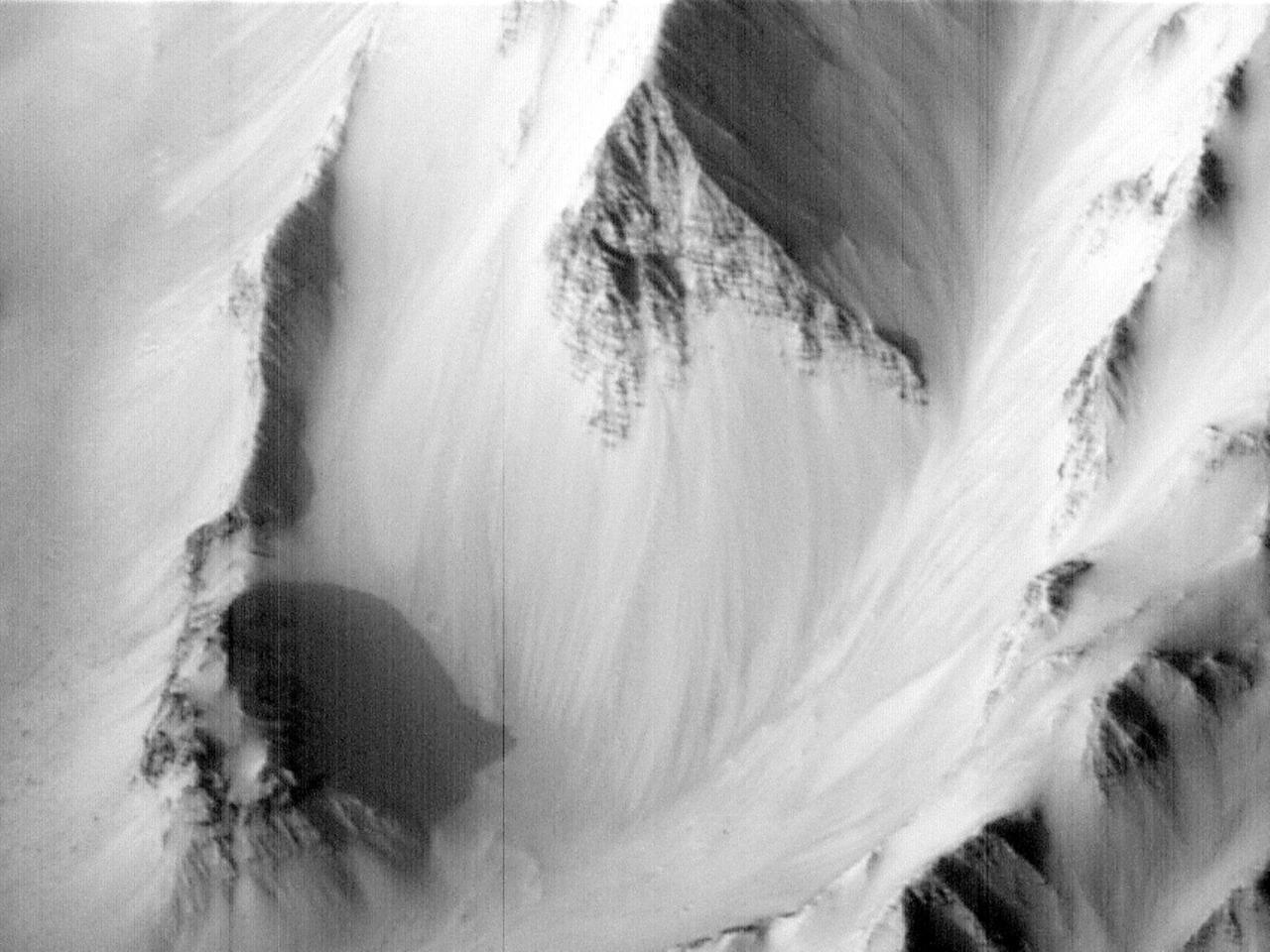
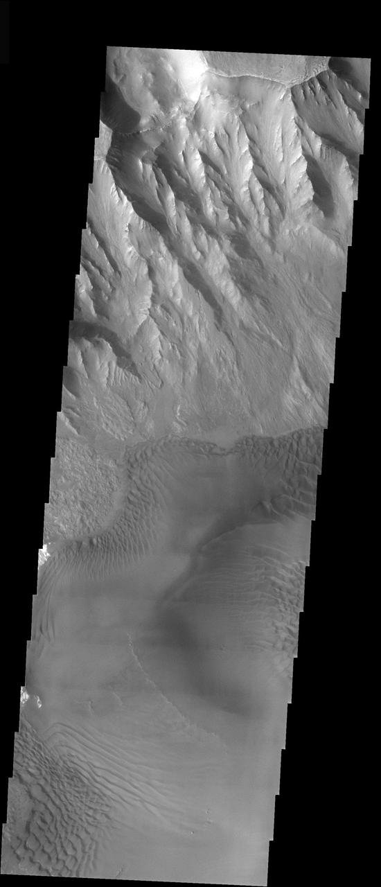
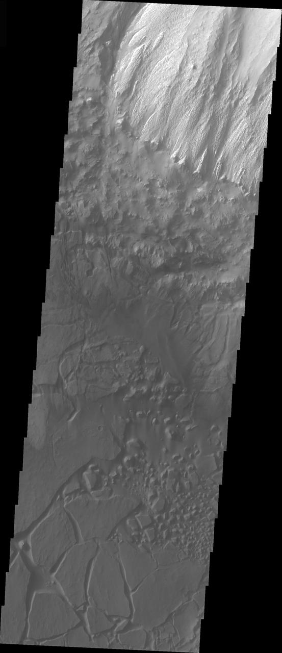
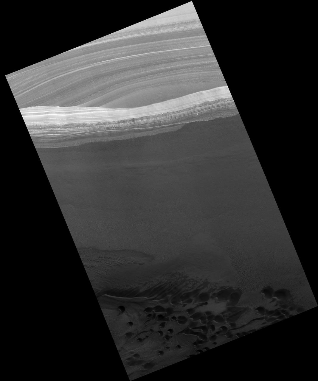
This image shows the part of the northern cliff face of Hebes Chasma at the top of the image. The linear features aligned diagonally across the top of the image are large faults. These faults may have been created at the same time that the chasma formed. The materials seen at the bottom half of this image are part of the erosion of the central mesa. The layered material of the mesa appear to have been eroded by both wind and water action. Hebes Chasma is an enclosed basin not connected to Valles Marineris. The Odyssey spacecraft has spent over 15 years in orbit around Mars, circling the planet more than 69000 times. It holds the record for longest working spacecraft at Mars. THEMIS, the IR/VIS camera system, has collected data for the entire mission and provides images covering all seasons and lighting conditions. Over the years many features of interest have received repeated imaging, building up a suite of images covering the entire feature. From the deepest chasma to the tallest volcano, individual dunes inside craters and dune fields that encircle the north pole, channels carved by water and lava, and a variety of other feature, THEMIS has imaged them all. For the next several months the image of the day will focus on the Tharsis volcanoes, the various chasmata of Valles Marineris, and the major dunes fields. We hope you enjoy these images! Orbit Number: 14369 Latitude: -0.366872 Longitude: 282.949 Instrument: VIS Captured: 2005-03-11 12:44 https://photojournal.jpl.nasa.gov/catalog/PIA21811
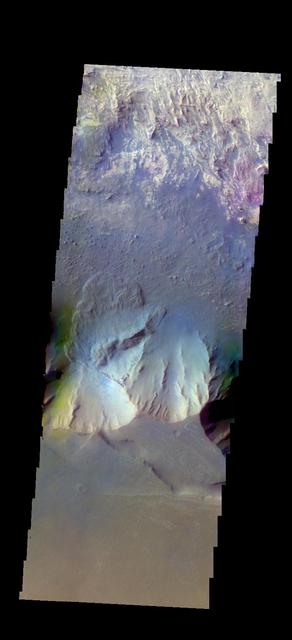
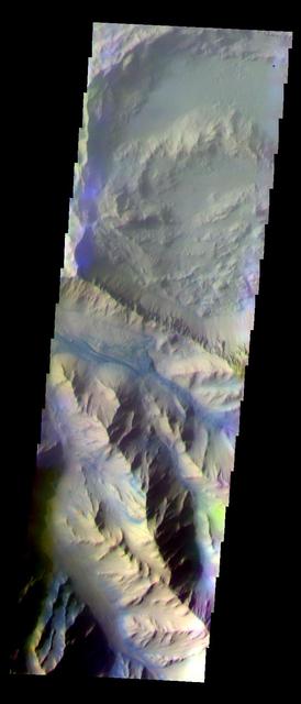
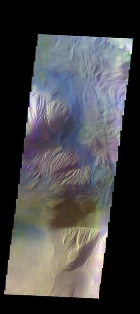
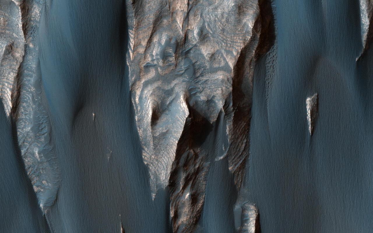
The THEMIS VIS camera contains 5 filters. The data from different filters can be combined in multiple ways to create a false color image. These false color images may reveal subtle variations of the surface not easily identified in a single band image. Today's false color image shows part of Candor Chasma. There is a landslide deposit from the rim of the chasma. Orbit Number: 44856 Latitude: -6.68095 Longitude: 283.729 Instrument: VIS Captured: 2012-01-24 15:20 http://photojournal.jpl.nasa.gov/catalog/PIA21167
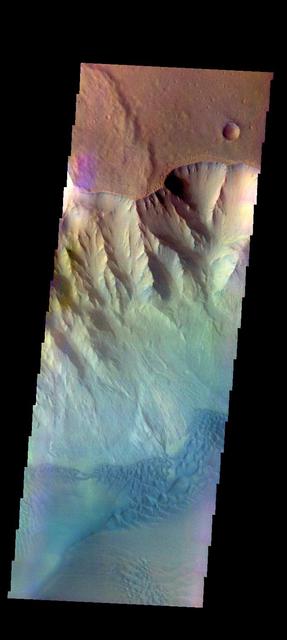
The THEMIS VIS camera contains 5 filters. The data from different filters can be combined in multiple ways to create a false color image. These false color images may reveal subtle variations of the surface not easily identified in a single band image. Today's false color image shows part of Juventae Chasma, including sand dunes on the floor of the chasma. Orbit Number: 48863 Latitude: -4.23406 Longitude: 297.286 Instrument: VIS Captured: 2012-12-19 10:35 http://photojournal.jpl.nasa.gov/catalog/PIA21199
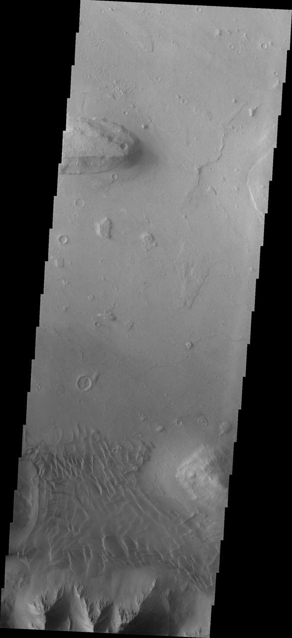
Coprates Chasma is one of the numerous canyons that make up Valles Marineris. The chasma stretches for 960 km (600 miles) from Melas Chasma to the west and Capri Chasma to the east. Landslide deposits, layered materials and sand dunes cover a large portion of the chasma floor. This image is located in eastern Coprates Chasma. The image shows a relatively smooth floor, with a group of sand dune forms located against the wall of the chasma (bottom of image). The Odyssey spacecraft has spent over 15 years in orbit around Mars, circling the planet more than 69000 times. It holds the record for longest working spacecraft at Mars. THEMIS, the IR/VIS camera system, has collected data for the entire mission and provides images covering all seasons and lighting conditions. Over the years many features of interest have received repeated imaging, building up a suite of images covering the entire feature. From the deepest chasma to the tallest volcano, individual dunes inside craters and dune fields that encircle the north pole, channels carved by water and lava, and a variety of other feature, THEMIS has imaged them all. For the next several months the image of the day will focus on the Tharsis volcanoes, the various chasmata of Valles Marineris, and the major dunes fields. We hope you enjoy these images! Orbit Number: 27061 Latitude: -13.9602 Longitude: 301.82 Instrument: VIS Captured: 2008-01-20 10:39 https://photojournal.jpl.nasa.gov/catalog/PIA21993

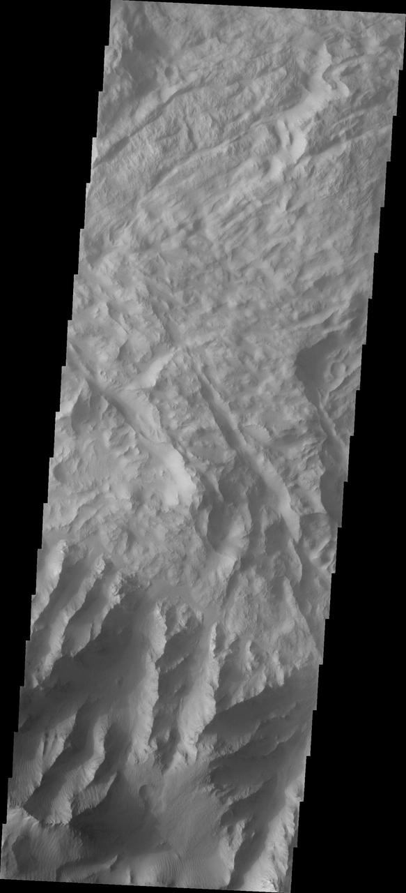
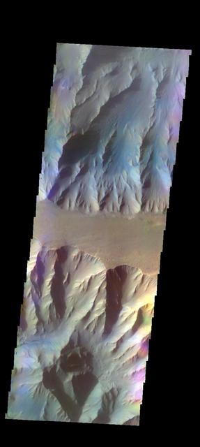
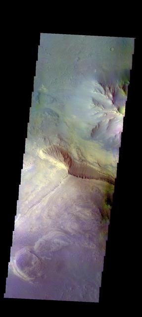
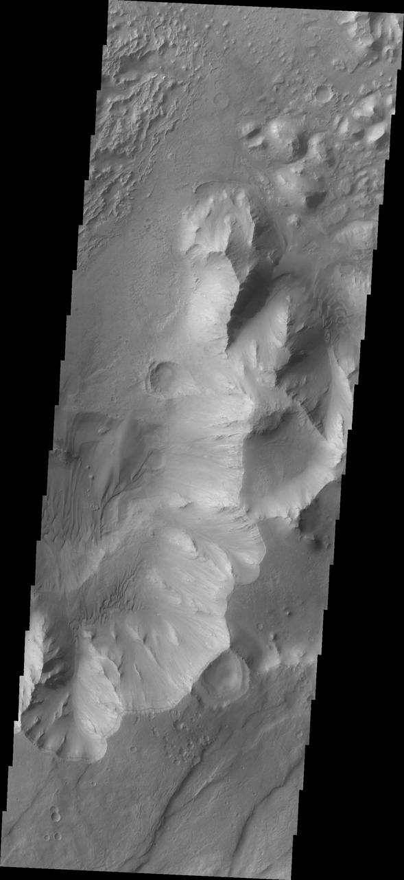
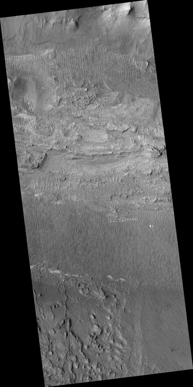
The large mesa in the center of Hebes Chasma dominates this image. The top of the mesa is at the center of the image, with the cliff faces to the top and bottom of the image. The layering of the mesa is most easily identified in the lower part of the image. The long linear depression on the northern face indicate that wind action played a large part in eroding the mesa. Hebes Chasma is an enclosed basin not connected to Valles Marineris. The Odyssey spacecraft has spent over 15 years in orbit around Mars, circling the planet more than 69000 times. It holds the record for longest working spacecraft at Mars. THEMIS, the IR/VIS camera system, has collected data for the entire mission and provides images covering all seasons and lighting conditions. Over the years many features of interest have received repeated imaging, building up a suite of images covering the entire feature. From the deepest chasma to the tallest volcano, individual dunes inside craters and dune fields that encircle the north pole, channels carved by water and lava, and a variety of other feature, THEMIS has imaged them all. For the next several months the image of the day will focus on the Tharsis volcanoes, the various chasmata of Valles Marineris, and the major dunes fields. We hope you enjoy these images! Orbit Number: 15281 Latitude: -1.13682 Longitude: 283.509 Instrument: VIS Captured: 2005-05-25 12:52 https://photojournal.jpl.nasa.gov/catalog/PIA21812
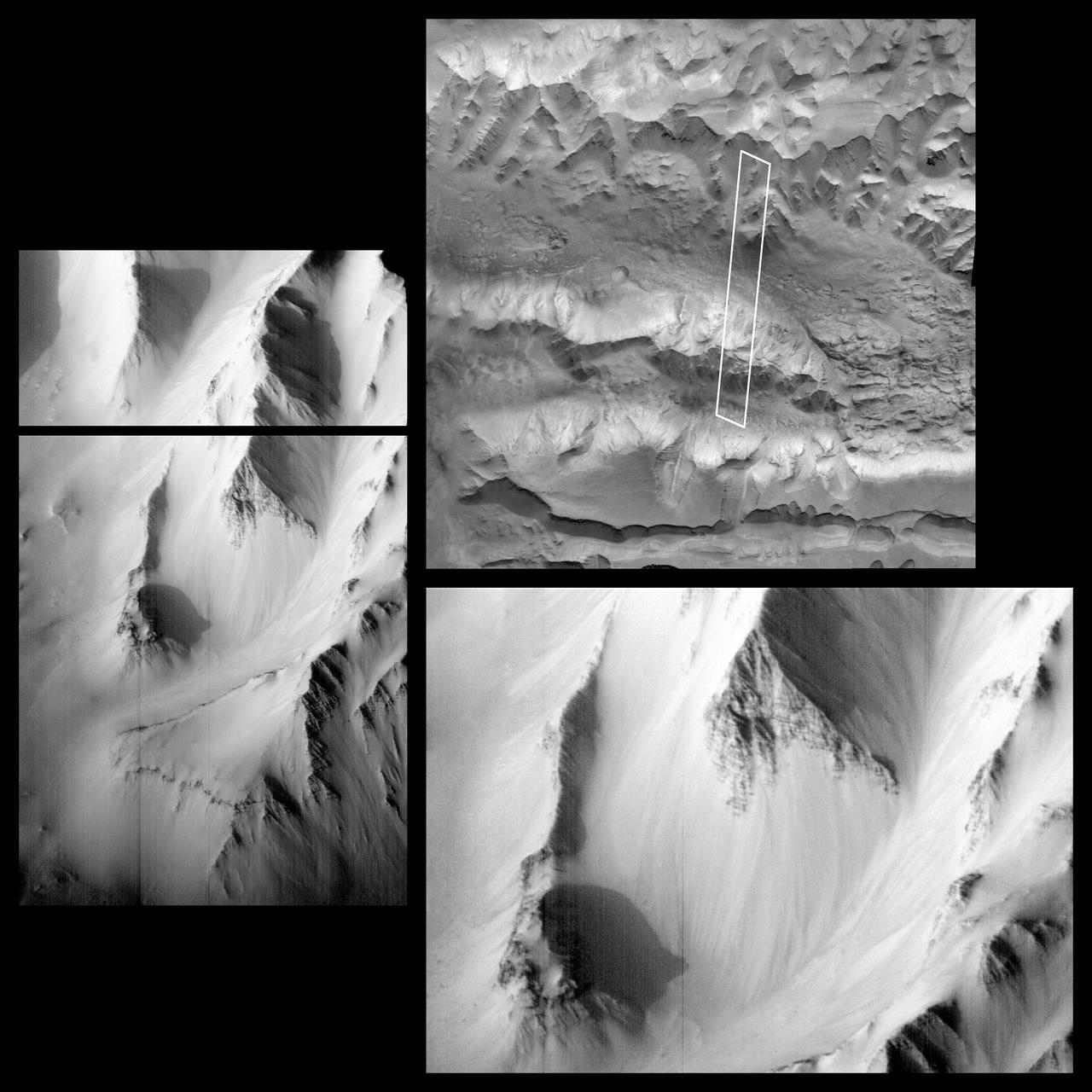
Western Tithonium Chasma/Ius Chasma, Valles Marineris
Coprates Chasma

Candor Chasma

Ganges Chasma

Coprates Chasma
Melas Chasma

Coprates Chasma

Chasma Boreale

Ganges Chasma

Tithonium Chasma

Hebes Chasma

Hebes Chasma
Melas Chasma

Ius Chasma

Hebes Chasma

Ganges Chasma

Candor Chasma

Ophis Chasma

Ganges Chasma

Candor Chasma

Candor Chasma

Ophir Chasma

Candor Chasma

Candor Chasma

Candor Chasma

Candor Chasma
Ius Chasma
Coprates Chasma
Coprates Chasma

Candor Chasma

Candor Chasma

Candor Chasma

Candor Chasma

Candor Chasma

Hebes Chasma

Ophir Chasma
Melas Chasma
Melas Chasma

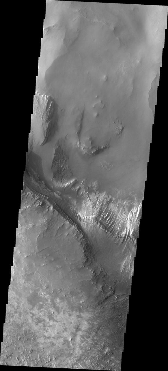
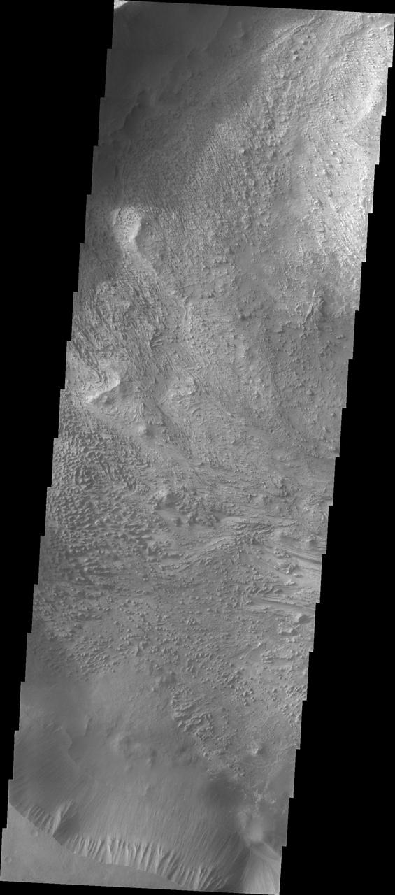
This image shows the side of the large mesa at the top of the image and the southern canyon cliff face at the bottom. Materials on the floor of the chasma originated from both features. Although the cliff faces are eroding differently, both contribute to the rough floor seen in the center of the image. Hebes Chasma is an enclosed basin not connected to Valles Marineris. The Odyssey spacecraft has spent over 15 years in orbit around Mars, circling the planet more than 69000 times. It holds the record for longest working spacecraft at Mars. THEMIS, the IR/VIS camera system, has collected data for the entire mission and provides images covering all seasons and lighting conditions. Over the years many features of interest have received repeated imaging, building up a suite of images covering the entire feature. From the deepest chasma to the tallest volcano, individual dunes inside craters and dune fields that encircle the north pole, channels carved by water and lava, and a variety of other feature, THEMIS has imaged them all. For the next several months the image of the day will focus on the Tharsis volcanoes, the various chasmata of Valles Marineris, and the major dunes fields. We hope you enjoy these images! Orbit Number: 39664 Latitude: -1.49358 Longitude: 283.431 Instrument: VIS Captured: 2010-11-23 04:54 https://photojournal.jpl.nasa.gov/catalog/PIA21817
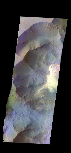
The THEMIS VIS camera contains 5 filters. The data from different filters can be combined in multiple ways to create a false color image. These false color images may reveal subtle variations of the surface not easily identified in a single band image. Today's false color image shows part of Ophir Chasma. Orbit Number: 45867 Latitude: -4.55075 Longitude: 289.252 Instrument: VIS Captured: 2012-04-16 20:31 http://photojournal.jpl.nasa.gov/catalog/PIA21173
The THEMIS camera contains 5 filters. The data from different filters can be combined in multiple ways to create a false color image. These false color images may reveal subtle variations of the surface not easily identified in a single band image. Today's false color image shows part of Juventae Chasma. Orbit Number: 43345 Latitude: -4.63793 Longitude: 296.778 Instrument: VIS Captured: 2011-09-22 06:32 http://photojournal.jpl.nasa.gov/catalog/PIA20987
The THEMIS VIS camera contains 5 filters. The data from different filters can be combined in multiple ways to create a false color image. These false color images may reveal subtle variations of the surface not easily identified in a single band image. Today's false color image shows part of Coprates Chasma. Orbit Number: 59937 Latitude: -12.9223 Longitude: 295.366 Instrument: VIS Captured: 2015-06-18 22:08 https://photojournal.jpl.nasa.gov/catalog/PIA21797
The THEMIS camera contains 5 filters. The data from different filters can be combined in multiple ways to create a false color image. These false color images may reveal subtle variations of the surface not easily identified in a single band image. Today's false color image shows part of Ganges Chasma. Orbit Number: 43282 Latitude: -8.53126 Longitude: 313.149 Instrument: VIS Captured: 2011-09-17 02:06 http://photojournal.jpl.nasa.gov/catalog/PIA20983
The THEMIS VIS camera contains 5 filters. The data from different filters can be combined in multiple ways to create a false color image. These false color images may reveal subtle variations of the surface not easily identified in a single band image. Today's false color image shows part of Coprates Chasma. Orbit Number: 52272 Latitude: -13.5675 Longitude: 297.001 Instrument: VIS Captured: 2013-09-25 23:18 http://photojournal.jpl.nasa.gov/catalog/PIA21515
Context image The THEMIS camera contains 5 filters. The data from different filters can be combined in multiple ways to create a false color image. These false color images may reveal subtle variations of the surface not easily identified in a single band image. Today's false color image shows part of Eos Chasma. Orbit Number: 18300 Latitude: -14.9443 Longitude: 312.7 Instrument: VIS Captured: 2006-01-29 02:31. http://photojournal.jpl.nasa.gov/catalog/PIA20227
The THEMIS VIS camera contains 5 filters. The data from different filters can be combined in multiple ways to create a false color image. These false color images may reveal subtle variations of the surface not easily identified in a single band image. Today's false color image shows part of Coprates Chasma. Orbit Number: 51835 Latitude: -13.3714 Longitude: 294.464 Instrument: VIS Captured: 2013-08-21 00:18 http://photojournal.jpl.nasa.gov/catalog/PIA21313
The THEMIS VIS camera contains 5 filters. The data from different filters can be combined in multiple ways to create a false color image. These false color images may reveal subtle variations of the surface not easily identified in a single band image. Today's false color image shows part of Coprates Chasma. Orbit Number: 59076 Latitude: -12.8501 Longitude: 293.344 Instrument: VIS Captured: 2015-04-09 00:34 https://photojournal.jpl.nasa.gov/catalog/PIA21667
The THEMIS VIS camera contains 5 filters. The data from different filters can be combined in multiple ways to create a false color image. These false color images may reveal subtle variations of the surface not easily identified in a single band image. Today's false color image shows part of Melas Chasma. Orbit Number: 59750 Latitude: -10.5452 Longitude: 290.307 Instrument: VIS Captured: 2015-06-03 12:33 https://photojournal.jpl.nasa.gov/catalog/PIA21705
The THEMIS VIS camera contains 5 filters. The data from different filters can be combined in multiple ways to create a false color image. These false color images may reveal subtle variations of the surface not easily identified in a single band image. Today's false color image shows part of Coprates Chasma. Orbit Number: 51423 Latitude: -12.1253 Longitude: 291.311 Instrument: VIS Captured: 2013-07-18 02:40 http://photojournal.jpl.nasa.gov/catalog/PIA21308
This image captured by NASA 2001 Mars Odyssey spacecraft shows the part of the floor of Melas Chasma. Melas Chasma in the central chasma of Valles Marineris.
The THEMIS camera contains 5 filters. The data from different filters can be combined in multiple ways to create a false color image. This image from NASA 2001 Mars Odyssey spacecraft shows part of the interior of Coprates Chasma. Orbit Number: 50911 Latitude: -12.184 Longitude: 291.09 Instrument: VIS Captured: 2013-06-05 23:33 http://photojournal.jpl.nasa.gov/catalog/PIA21290
![The THEMIS VIS camera contains 5 filters. The data from different filters can be combined in multiple ways to create a false color image. These false color images may reveal subtle variations of the surface not easily identified in a single band image. Today's false color image shows part of Ganges Chasma. Dunes are visible on the floor of the canyon [bottom right corner]. Orbit Number: 52184 Latitude: -7.21971 Longitude: 314.698 Instrument: VIS Captured: 2013-09-18 17:29 http://photojournal.jpl.nasa.gov/catalog/PIA21511](https://images-assets.nasa.gov/image/PIA21511/PIA21511~small.jpg)
The THEMIS VIS camera contains 5 filters. The data from different filters can be combined in multiple ways to create a false color image. These false color images may reveal subtle variations of the surface not easily identified in a single band image. Today's false color image shows part of Ganges Chasma. Dunes are visible on the floor of the canyon [bottom right corner]. Orbit Number: 52184 Latitude: -7.21971 Longitude: 314.698 Instrument: VIS Captured: 2013-09-18 17:29 http://photojournal.jpl.nasa.gov/catalog/PIA21511

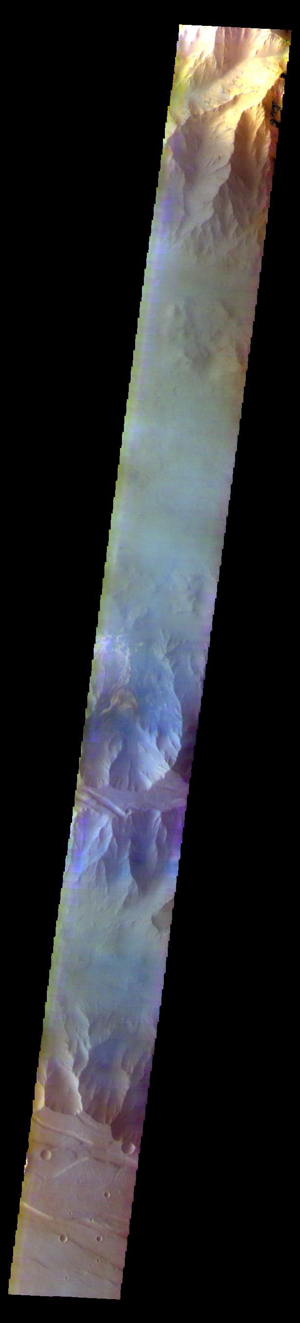
The THEMIS VIS camera contains 5 filters. The data from different filters can be combined in multiple ways to create a false color image. These false color images may reveal subtle variations of the surface not easily identified in a single band image. Today's false color image shows part of Ophir Chasma. The reddish toned feature on the left side of the image is a high standing ridge called Baetis Mensa. Orbit Number: 51573 Latitude: -4.7493 Longitude: 288.194 Instrument: VIS Captured: 2013-07-30 10:52 http://photojournal.jpl.nasa.gov/catalog/PIA21311
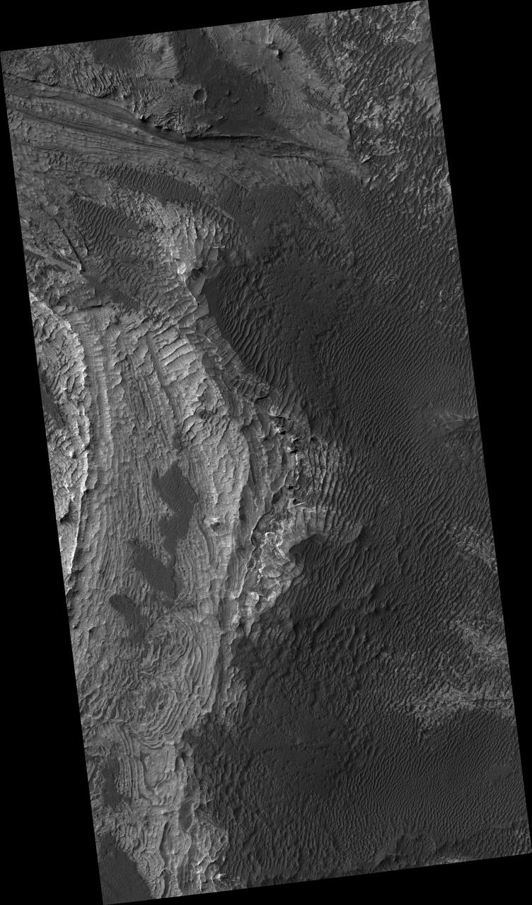
This VIS image is located on the eastern side of Coprates Chasma, near Capri Chasma. The image shows a large lobe shaped landslide deposit at the bottom of the canyon cliff face. Sand dunes are visible both on the landslide deposit and other parts of the canyon floor. Coprates Chasma is one of the numerous canyons that make up Valles Marineris. The chasma stretches for 960 km (600 miles) from Melas Chasma to the west and Capri Chasma to the east. Landslide deposits, layered materials and sand dunes cover a large portion of the chasma floor. Orbit Number: 88225 Latitude: -15.0285 Longitude: 304.496 Instrument: VIS Captured: 2021-11-03 17:56 https://photojournal.jpl.nasa.gov/catalog/PIA25196
Western Tithonium Chasma/Ius Chasma, Valles Marineris - High Resolution Image
Western Tithonium Chasma/Ius Chasma, Valles Marineris - High Resolution Image
This image shows part of Coprates Chasma
This image from NASA 2001 Mars Odyssey shows a portion of Capri Chasma. Dunes are found on the floor of this chasma.
Dark, windblown sand covers intricate sedimentary rock layers in this image captured by NASA's Mars Reconnaissance Orbiter (MRO) from Ganges Chasma, a canyon in the Valles Marineris system. These features are at once familiar and unusual to those familiar with Earth's beaches and deserts. Most sand dunes on Earth are made of silica-rich sand, giving them a light color; these Martian dunes owe their dark color to the iron and magnesium-rich sand found in the region. https://photojournal.jpl.nasa.gov/catalog/PIA21600
Layers in Melas Chasma
Sea of Sand in Juventae Chasma
Outcrop In Juventae Chasma

Inter-Chasma Hills
Old Landslide In Ius Chasma
Dunes in Ganges Chasma

Melas Chasma Floor
Candor Chasma Landslides
Hebes Chasma #1
Eos Chasma Mensa
Melas Chasma in IR Color

Southwest Candor Chasma and Surroundings
Wonders of Eos Chasma
Candor Chasma Chaos
Floor of Ius Chasma

Melas Chasma Floor
Wind Etching in Candor Chasma

Hebes Chasma #2

Ius Chasma by Day and Night
Chasma Boreale Dunes
Chasma Boreale Scarp

Ganges Chasma Sands