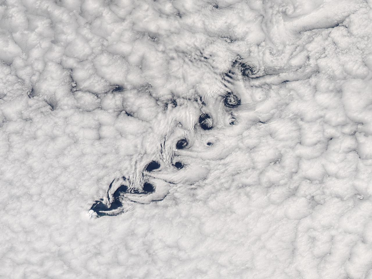
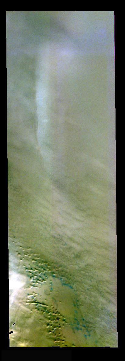
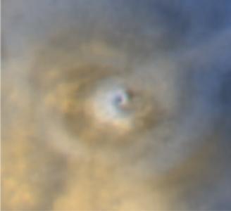
Cloud vortices off Heard Island, south Indian Ocean. The Moderate Resolution Imaging Spectroradiometer (MODIS) aboard NASA’s Aqua satellite captured this true-color image of sea ice off Heard Island on Nov 2, 2015 at 5:02 AM EST (09:20 UTC). Credit: NASA/GSFC/Jeff Schmaltz/MODIS Land Rapid Response Team
Clouds
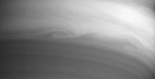
High Cloud, Low Cloud

Artist illustration of the X-59 in flight in blue skies and white clouds.

View of noctilucent clouds over Earth.

NASA Glenn’s Propulsion Systems Lab (PSL) is conducting research to characterize ice crystal clouds that can create a hazard to aircraft engines under certain conditions. The isokinetic probe (in gold) samples particles and another series of probes can measure everything from humidity to air pressure.

Like a ship carving its way through the sea, the South Georgia and South Sandwich Islands parted the clouds. The Moderate Resolution Imaging Spectroradiometer (MODIS) on NASA’s Terra satellite acquired this natural-color image on February 2, 2017. The ripples in the clouds are known as gravity waves. NASA image by Jeff Schmaltz, LANCE/EOSDIS Rapid Response #nasagoddard

March 23, 2010 - Clouds off the Aleutian Islands Interesting cloud patterns were visible over the Aleutian Islands in this image, captured by the MODIS on the Aqua satellite on March 14, 2010. Turbulence, caused by the wind passing over the highest points of the islands, is producing the pronounced eddies that swirl the clouds into a pattern called a vortex "street". In this image, the clouds have also aligned in parallel rows or streets. Cloud streets form when low-level winds move between and over obstacles causing the clouds to line up into rows (much like streets) that match the direction of the winds. At the point where the clouds first form streets, they're very narrow and well-defined. But as they age, they lose their definition, and begin to spread out and rejoin each other into a larger cloud mass. The Aleutians are a chain of islands that extend from Alaska toward the Kamchatka Peninsula in Russia. For more information related to this image go to: <a href="http://modis.gsfc.nasa.gov/gallery/individual.php?db_date=2010-03-23" rel="nofollow">modis.gsfc.nasa.gov/gallery/individual.php?db_date=2010-0...</a> For more information about Goddard Space Flight Center go here: <a href="http://www.nasa.gov/centers/goddard/home/index.html" rel="nofollow">www.nasa.gov/centers/goddard/home/index.html</a>
Cloud Streamers
Cloud Detail
Dance of the Clouds
Shredding a Cloud
Clouds at Dawn
Storm Clouds
Cloud Sketches
Clouds in the Distance

Cloud Interactions
Cloud Phantoms
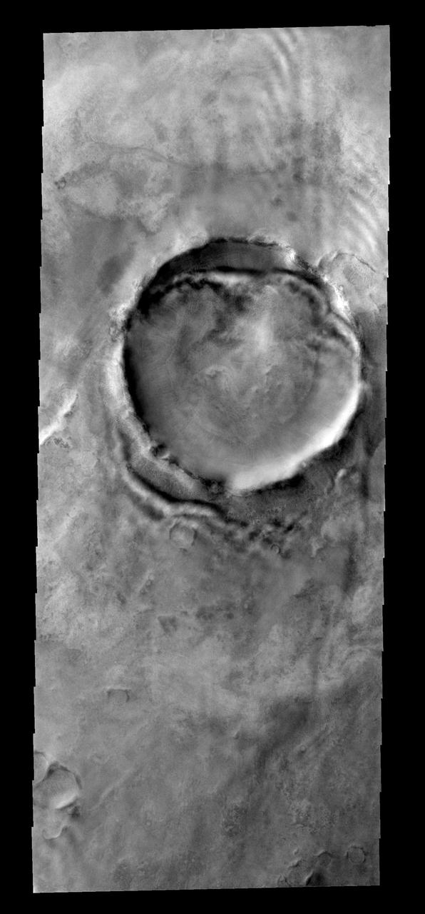
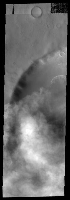
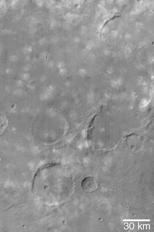
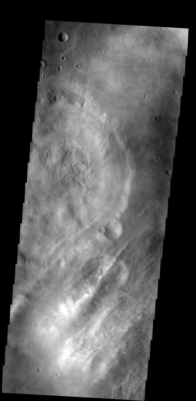
Crater Clouds

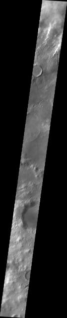
Martian Clouds
Storm and Clouds
Swirls of Clouds
Deep Clouds
Clouds in the Distance
Ripples of Cloud
Clues in the Clouds
Following the Clouds
Watching for Clouds
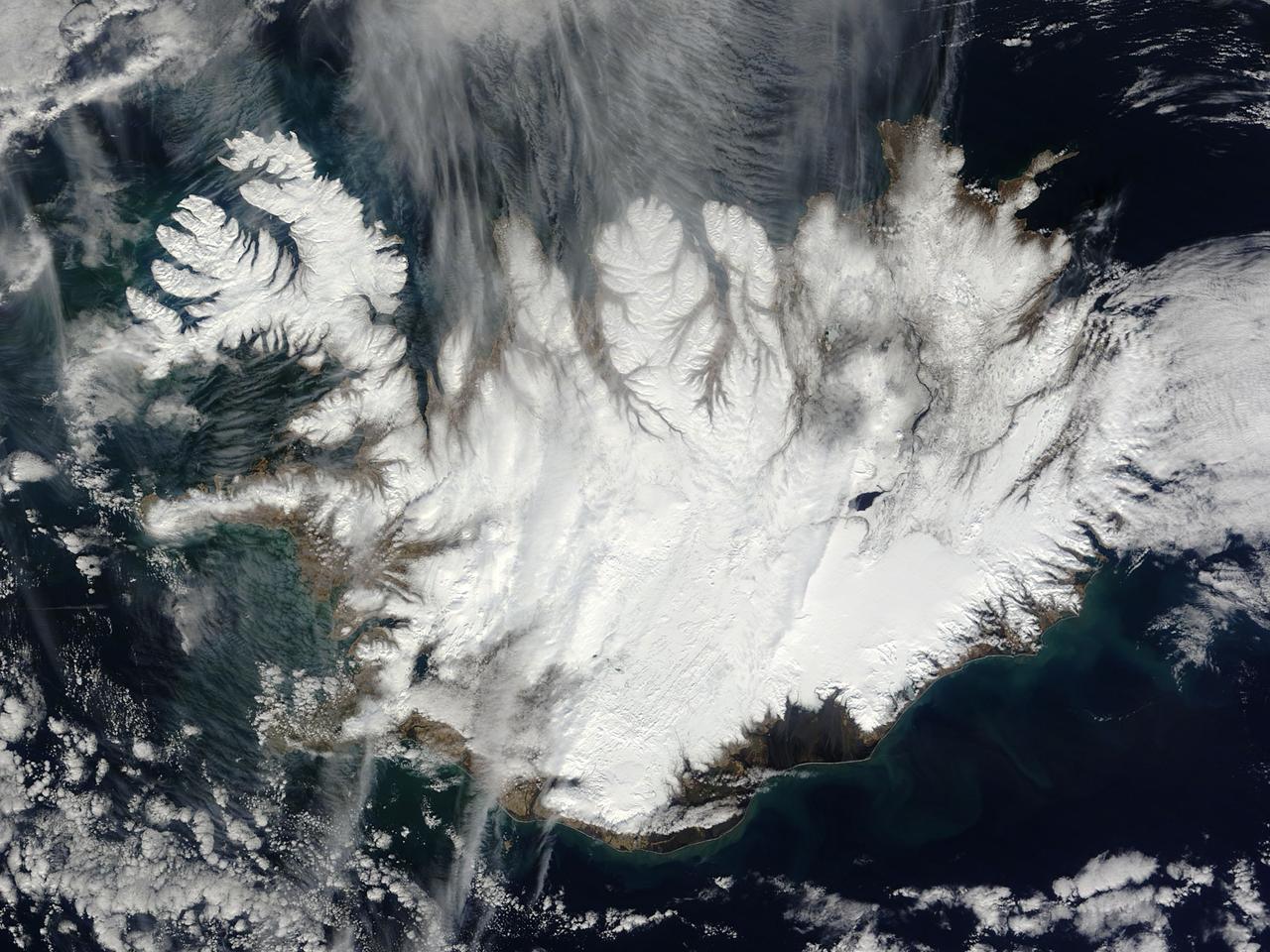
This nearly cloud-free image of Iceland was captured by the MODIS instrument on board the Terra spacecraft on 04/15/2015 at 13:00 UTC.
Clouds are common near the north polar caps throughout the spring and summer. The clouds typically cause a haze over the extensive dune fields. This image from NASA Mars Odyssey shows the edge of the cloud front.

The late winter sun shone brightly on a stunning scene of clouds and ice in the Davis Strait in late February, 2013. The Moderate Resolution Imaging Spectroradiometer aboard NASA’s Aqua satellite captured this true-color image on February 22 at 1625 UTC. The Davis Strait connects the Labrador Sea (part of the Atlantic Ocean) in the south with Baffin Bay to the north, and separates Canada, to the west, from Greenland to the east. Strong, steady winds frequently blow southward from the colder Baffin Bay to the warmer waters of the Labrador Sea. Over ice, the air is dry and no clouds form. However, as the Arctic air moves over the warmer, open water the rising moist air and the temperature differential gives rise to lines of clouds. In this image, the clouds are aligned in a beautiful, parallel pattern. Known as “cloud streets”, this pattern is formed in a low-level wind, with the clouds aligning in the direction of the wind. Credit: NASA/GSFC/Jeff Schmaltz/MODIS Land Rapid Response Team <b><a href="http://www.nasa.gov/audience/formedia/features/MP_Photo_Guidelines.html" rel="nofollow">NASA image use policy.</a></b> <b><a href="http://www.nasa.gov/centers/goddard/home/index.html" rel="nofollow">NASA Goddard Space Flight Center</a></b> enables NASA’s mission through four scientific endeavors: Earth Science, Heliophysics, Solar System Exploration, and Astrophysics. Goddard plays a leading role in NASA’s accomplishments by contributing compelling scientific knowledge to advance the Agency’s mission. <b>Follow us on <a href="http://twitter.com/NASA_GoddardPix" rel="nofollow">Twitter</a></b> <b>Like us on <a href="http://www.facebook.com/pages/Greenbelt-MD/NASA-Goddard/395013845897?ref=tsd" rel="nofollow">Facebook</a></b> <b>Find us on <a href="http://instagram.com/nasagoddard?vm=grid" rel="nofollow">Instagram</a></b>
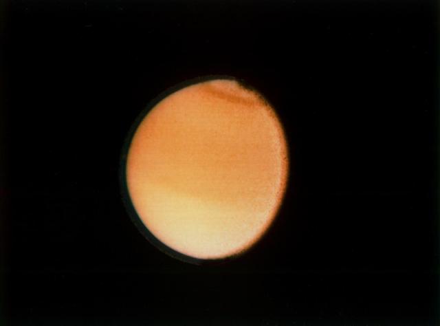
These clouds formed in the south polar region. The faintness of the cloud system likely indicates that these are mainly ice clouds, with relatively little dust content
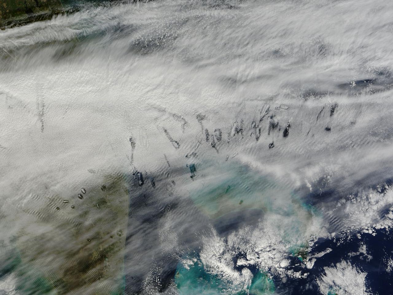
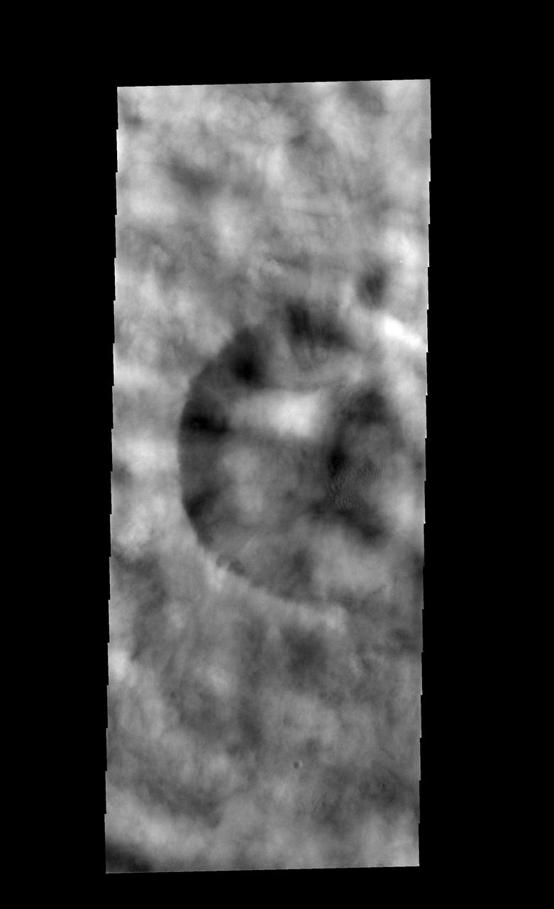
In elementary school, students learn that water freezes at 0 degrees Celsius (32 degrees Fahrenheit). That is true most of the time, but there are exceptions to the rule. For instance, water with very few impurities (such as dust or pollution particles, fungal spores, bacteria) can be chilled to much cooler temperatures and still remain liquid—a process known as supercooling. Supercooling may sound exotic, but it occurs pretty routinely in Earth’s atmosphere. Altocumulus clouds, a common type of mid-altitude cloud, are mostly composed of water droplets supercooled to a temperature of about -15 degrees C. Altocumulus clouds with supercooled tops cover about 8 percent of Earth’s surface at any given time. Supercooled water droplets play a key role in the formation of hole-punch and canal clouds, the distinctive clouds shown in these satellite images. Hole-punch clouds usually appear as circular gaps in decks of altocumulus clouds; canal clouds look similar but the gaps are longer and thinner. This true-color image shows hole-punch and canal clouds off the coast of Florida, as observed on December 12, 2014, by the Moderate Resolution Imaging Spectroradiometer (MODIS) on NASA’s Terra satellite. Both types of cloud form when aircraft fly through cloud decks rich with supercooled water droplets and produce aerodynamic contrails. Air expands and cools as it moves around the wings and past the propeller, a process known as adiabatic cooling. Air temperatures over jet wings often cool by as much as 20 degrees Celsius, pushing supercooled water droplets to the point of freezing. As ice crystals form, they absorb nearby water droplets. Since ice crystals are relatively heavy, they tend to sink. This triggers tiny bursts of snow or rain that leave gaps in the cloud cover. Whether a cloud formation becomes a hole-punch or canal depends on the thickness of the cloud layer, the air temperature, and the degree of horizontal wind shear. Both descending and ascending aircraft—including jets and propeller planes—can trigger hole-punch and canal clouds. The nearest major airports in the images above include Miami International, Fort Lauderdale International, Grand Bahama International, and Palm Beach International. Credit: NASA/GSFC/Jeff Schmaltz/MODIS Land Rapid Response Team <b><a href="http://www.nasa.gov/audience/formedia/features/MP_Photo_Guidelines.html" rel="nofollow">NASA image use policy.</a></b> <b><a href="http://www.nasa.gov/centers/goddard/home/index.html" rel="nofollow">NASA Goddard Space Flight Center</a></b> enables NASA’s mission through four scientific endeavors: Earth Science, Heliophysics, Solar System Exploration, and Astrophysics. Goddard plays a leading role in NASA’s accomplishments by contributing compelling scientific knowledge to advance the Agency’s mission. <b>Follow us on <a href="http://twitter.com/NASAGoddardPix" rel="nofollow">Twitter</a></b> <b>Like us on <a href="http://www.facebook.com/pages/Greenbelt-MD/NASA-Goddard/395013845897?ref=tsd" rel="nofollow">Facebook</a></b> <b>Find us on <a href="http://instagram.com/nasagoddard?vm=grid" rel="nofollow">Instagram</a></b>
Faint clouds can be seen to the northeast of this crater. The bright and dark bands against the NE crater rim interior and exterior are bright clouds and their shadows

Cloud vortices off Heard Island, south Indian Ocean. The Moderate Resolution Imaging Spectroradiometer (MODIS) aboard NASA’s Aqua satellite captured this true-color image of sea ice off Heard Island on Nov 2, 2015 at 5:02 AM EST (09:20 UTC). Credit: NASA/GSFC/Jeff Schmaltz/MODIS Land Rapid Response Team <b><a href="http://www.nasa.gov/audience/formedia/features/MP_Photo_Guidelines.html" rel="nofollow">NASA image use policy.</a></b> <b><a href="http://www.nasa.gov/centers/goddard/home/index.html" rel="nofollow">NASA Goddard Space Flight Center</a></b> enables NASA’s mission through four scientific endeavors: Earth Science, Heliophysics, Solar System Exploration, and Astrophysics. Goddard plays a leading role in NASA’s accomplishments by contributing compelling scientific knowledge to advance the Agency’s mission. <b>Follow us on <a href="http://twitter.com/NASAGoddardPix" rel="nofollow">Twitter</a></b> <b>Like us on <a href="http://www.facebook.com/pages/Greenbelt-MD/NASA-Goddard/395013845897?ref=tsd" rel="nofollow">Facebook</a></b> <b>Find us on <a href="http://instagrid.me/nasagoddard/?vm=grid" rel="nofollow">Instagram</a></b>
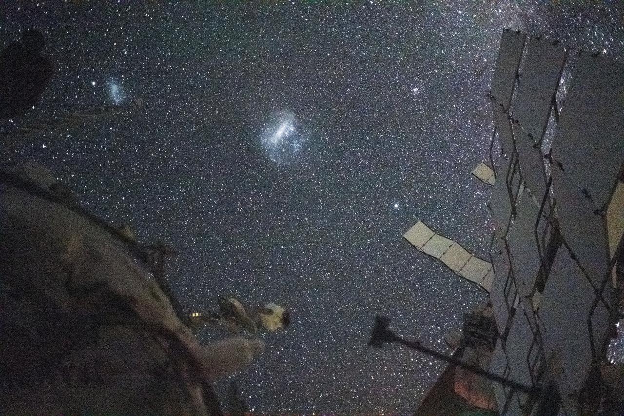
iss071e418742 (Aug. 6, 2024) --- The Large Magellanic Cloud (center) and the Small Magellanic Cloud (upper left), dwarf galaxies in close proximity with the Milky Way galaxy, are pictured from the International Space Station. NASA astronaut and Expedition 71 Flight Engineer Matthew Dominick took this long-duration photograph with a station camera increasing its sensitivity to account for low light conditions.
Clouds over Crater
Clouds Near Icaria Planum
Titan South Polar Clouds
Clouds Roll in for Martian Winter

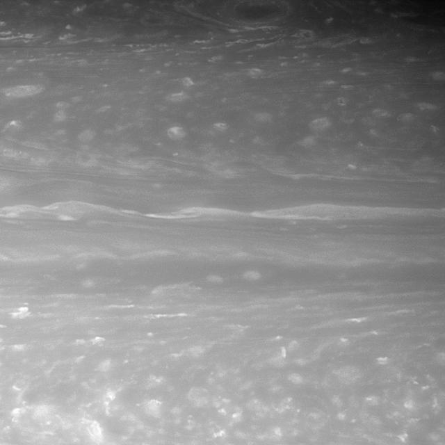
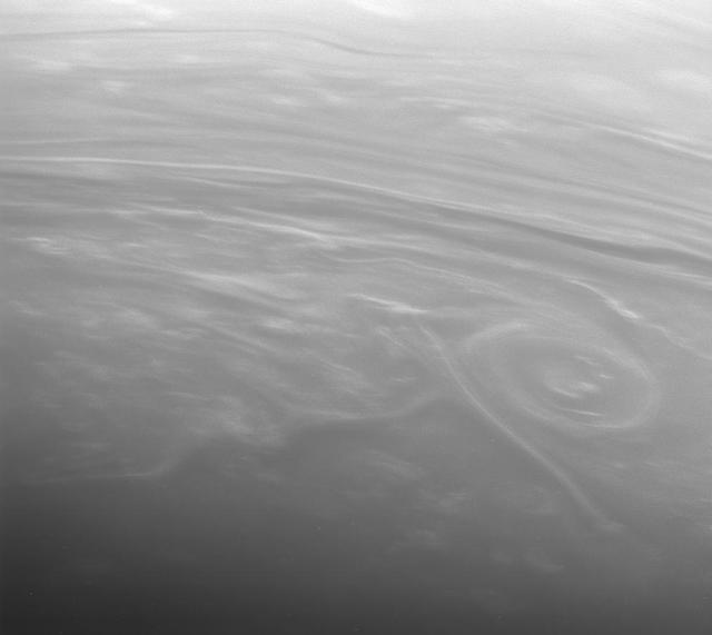
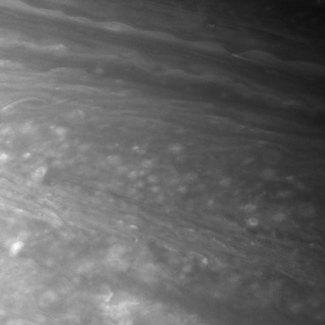
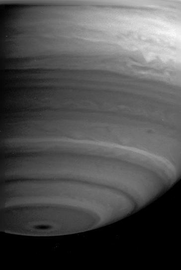
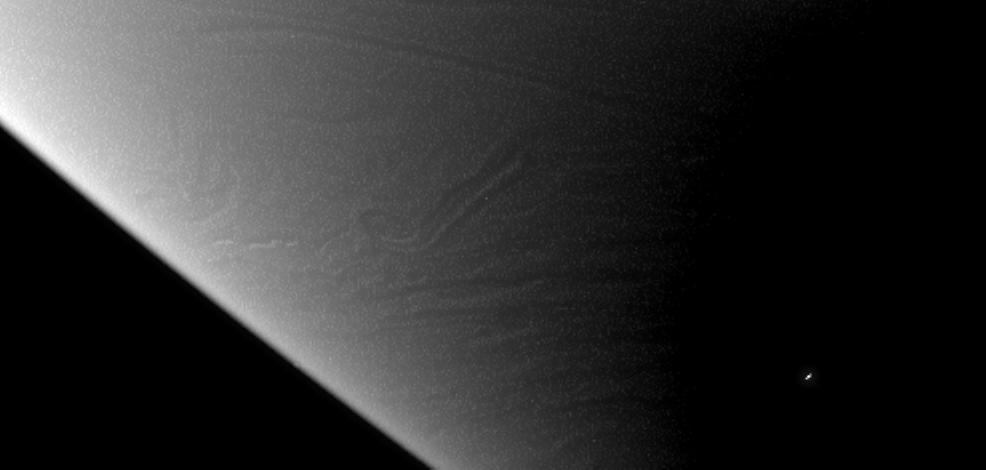
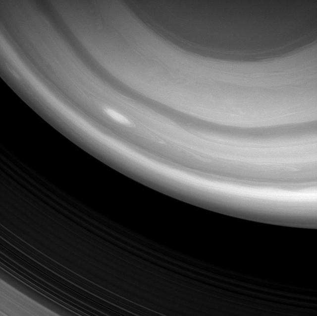
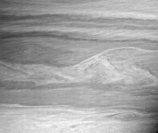
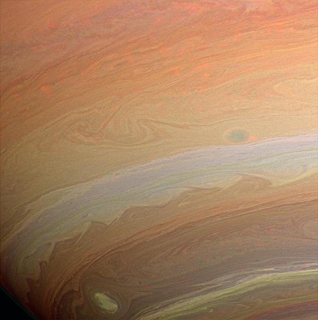
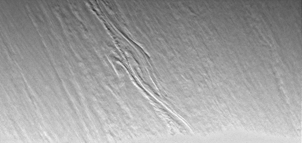
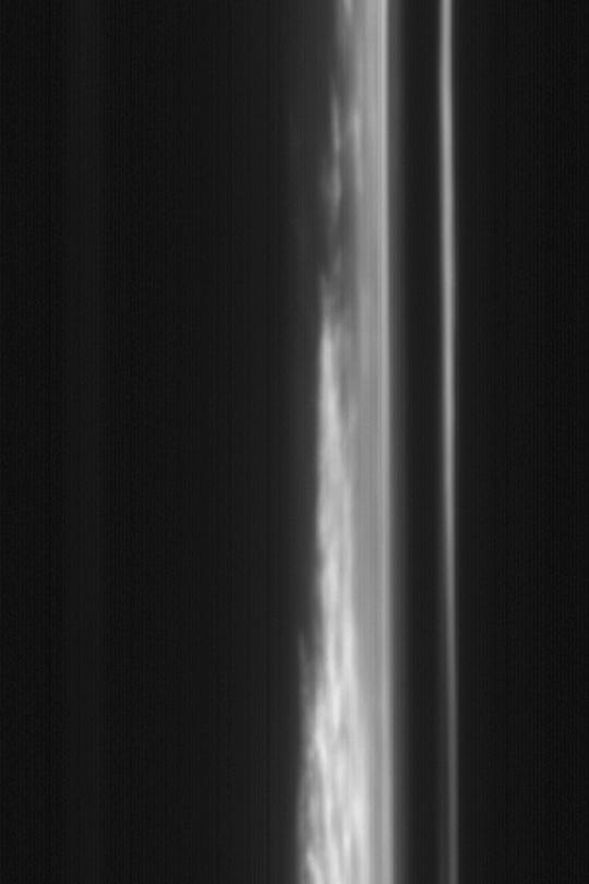
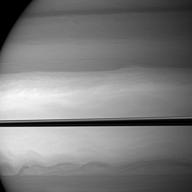
Saturn Ribbonlike Cloud Structure
High Clouds Aloft
Clouds and Dust Storms
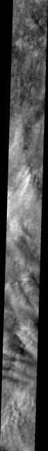
Clouds over Opportunity Site
Dark Storms, Bright Clouds
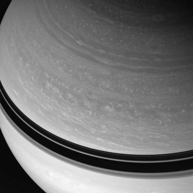
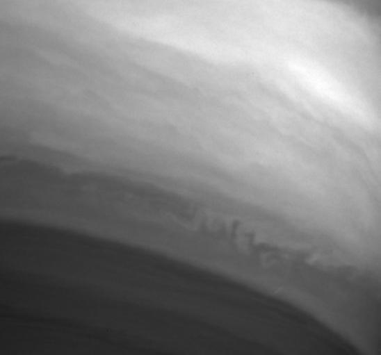
Flowing Cloud Bands
Where Clouds Meet
Winter Clouds Over Mie
Tharsis Limb Cloud
Storms and Feathery Clouds
Clouds Like Sandstone
Ice Clouds in Color IR
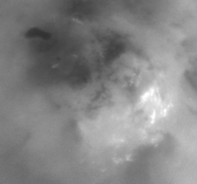
Jovian Lightning and Moonlit Clouds

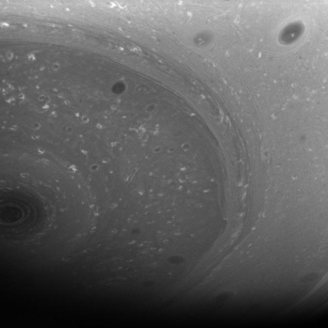
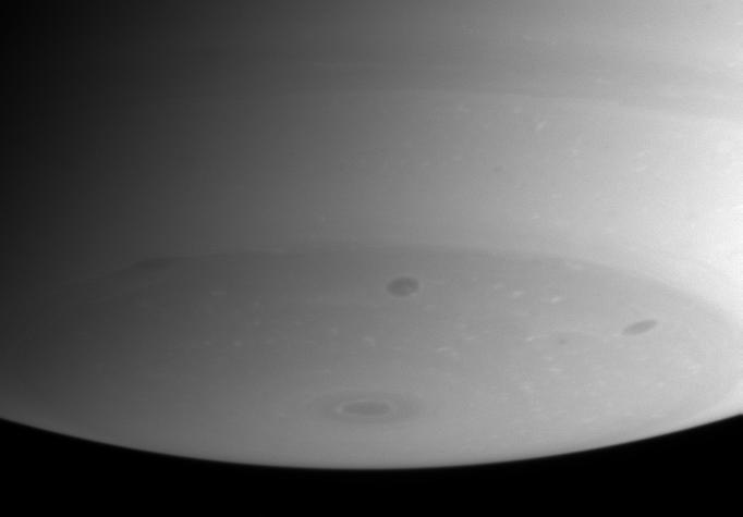
Clouds Over the North Pole
South Polar Clouds
Titan Cloud Systems

More Storm Clouds

Jupiter High-Altitude Clouds
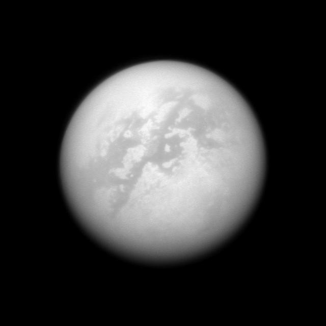
Ethane Clouds Over Titan
Faint Southern Clouds
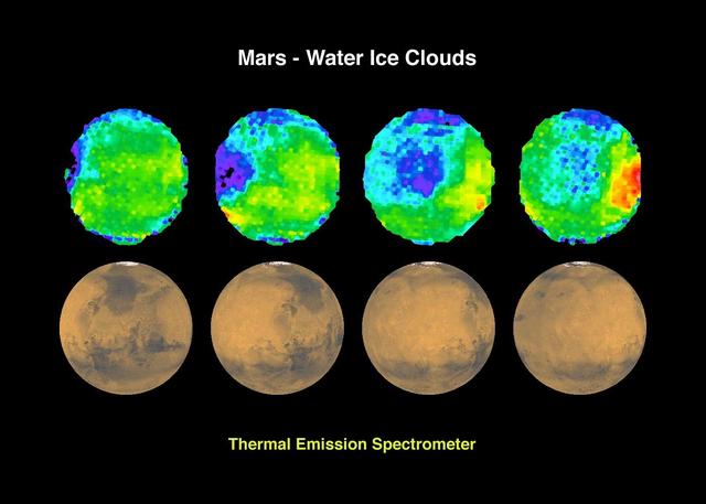
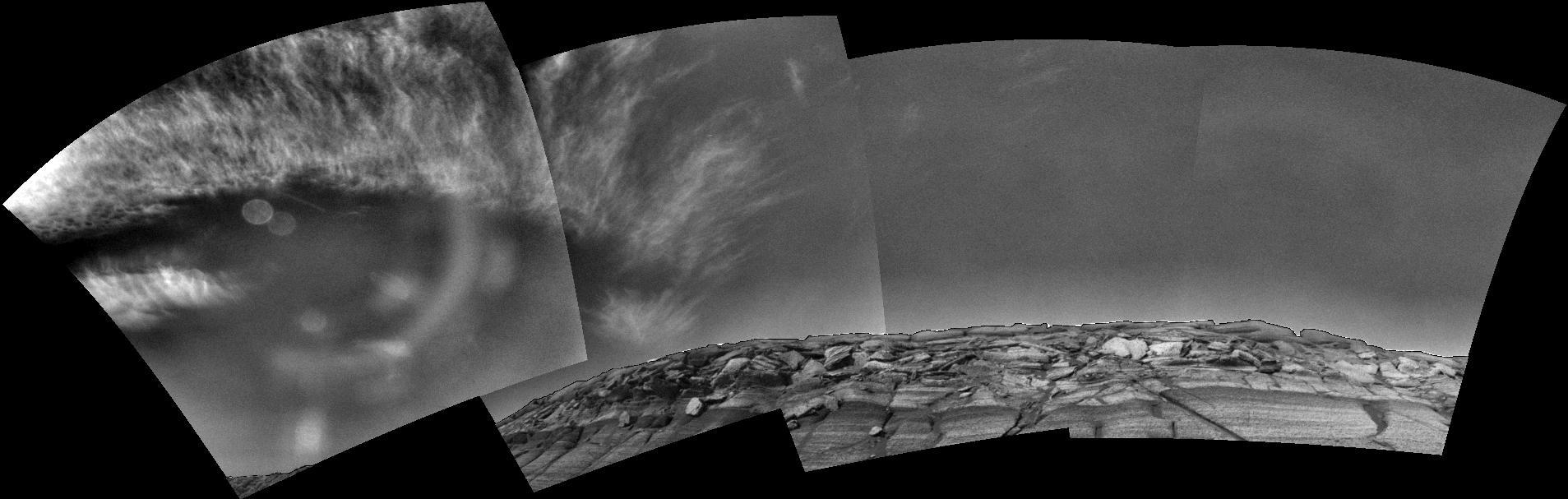
Mars - Water Ice Clouds
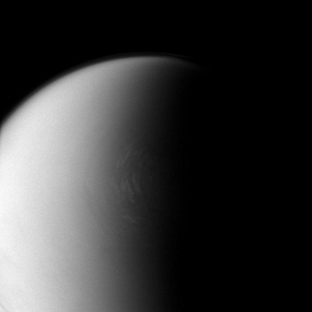
Polar Clouds on Titan
3-D Clouds
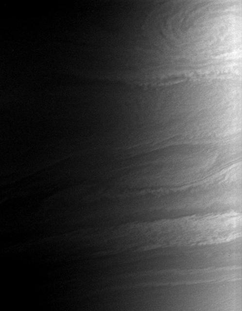
Swirls of Clouds in Infrared
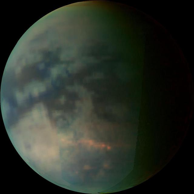
Clouds over Titan

Cloud-Ground Interaction
Clouds Over Morning Limb
Saturn Silhouetted Clouds
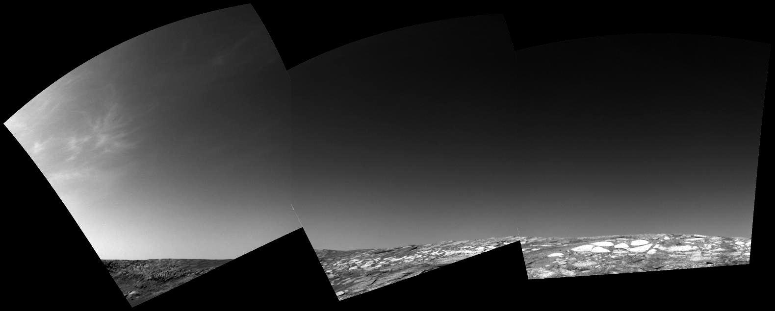
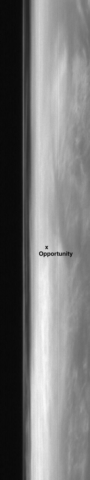
Clouds Over Endurance
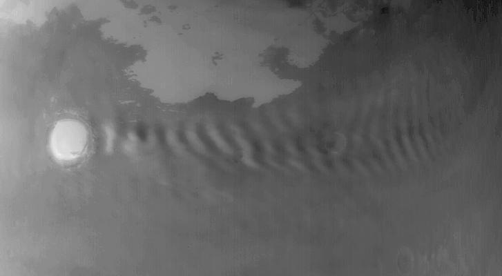
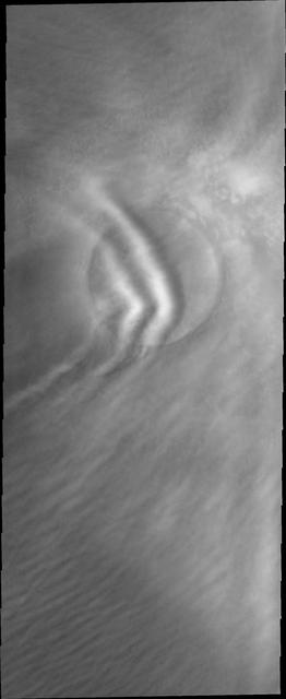
Wave Clouds off Korolev
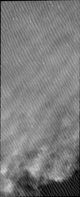
Dunes and Clouds in False Color
Clouds Over Crater Rim
These clouds are located near the edge of the south polar region. The cloud tops are the puffy white features in the bottom half of the image
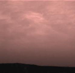
The clouds in this image hide most of the surface. This image was taken during spring in the northern hemisphere of Mars, when cloud cover is common
These streamers of clouds cross over a small crater without deflection
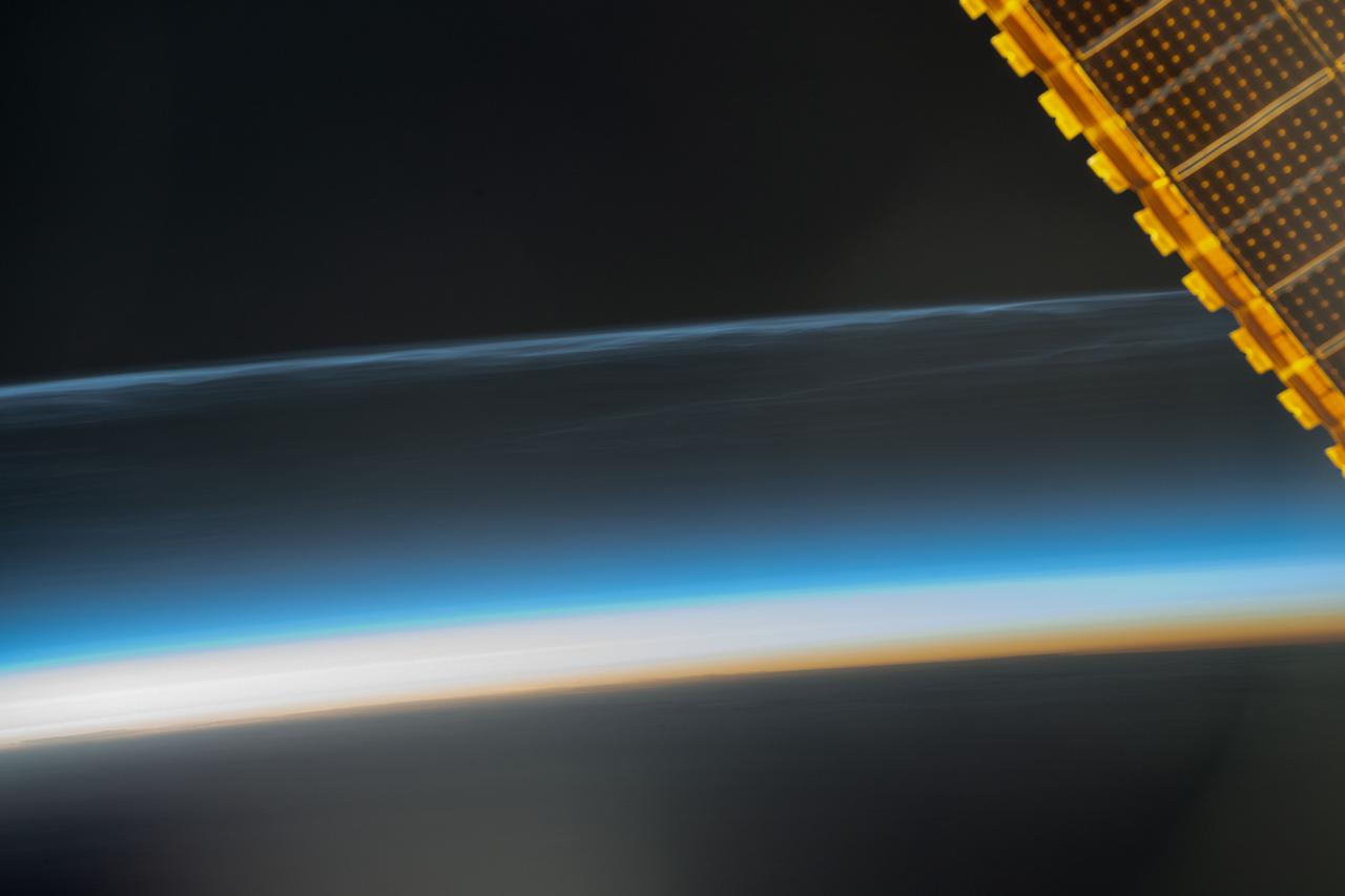
iss071e364425 (July 16, 2024) --- Noctilucent clouds, high-altutude clouds visible during the summer months and illuminated when the sun is below Earth's horizon, are pictured from the International Space Station as it orbited 259 miles above the Pacific Ocean south of Alaska.
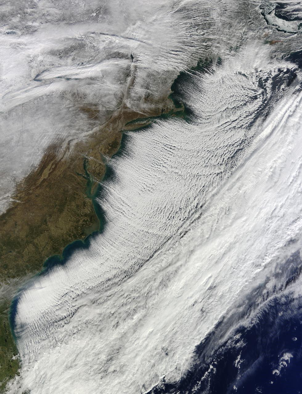
In the midst of a cold snap that sent temperatures 20–40°F (11–22°C) below normal across much of the United States, the Moderate Resolution Imaging Spectroradiometer (MODIS) on the Terra satellite captured this image of cloud streets over the Atlantic Ocean on January 7, 2014. Cloud streets—long parallel bands of cumulus clouds—form when cold air blows over warmer waters and a warmer air layer (or temperature inversion) rests over the top of both. The comparatively warm water gives up heat and moisture to the cold air above, and columns of heated air called thermals naturally rise through the atmosphere. The temperature inversion acts like a lid, so when the rising thermals hit it, they roll over and loop back on themselves, creating parallel cylinders of rotating air. As this happens, the moisture cools and condenses into flat-bottomed, fluffy-topped cumulus clouds that line up parallel to the direction of the prevailing wind. On January 7, the winds were predominantly out of the northwest. Cloud streets can stretch for hundreds of kilometers if the land or water surface underneath is uniform. Sea surface temperature need to be at least 40°F (22°C) warmer than the air for cloud streets to form. More info: <a href="http://earthobservatory.nasa.gov/NaturalHazards/view.php?id=82800" rel="nofollow">earthobservatory.nasa.gov/NaturalHazards/view.php?id=82800</a> NASA Earth Observatory image courtesy Jeff Schmaltz LANCE/EOSDIS MODIS Rapid Response Team, GSFC. Caption by Adam Voiland. Instrument: Terra - MODIS Credit: <b><a href="http://www.earthobservatory.nasa.gov/" rel="nofollow"> NASA Earth Observatory</a></b> <b><a href="http://www.nasa.gov/audience/formedia/features/MP_Photo_Guidelines.html" rel="nofollow">NASA image use policy.</a></b> <b><a href="http://www.nasa.gov/centers/goddard/home/index.html" rel="nofollow">NASA Goddard Space Flight Center</a></b> enables NASA’s mission through four scientific endeavors: Earth Science, Heliophysics, Solar System Exploration, and Astrophysics. Goddard plays a leading role in NASA’s accomplishments by contributing compelling scientific knowledge to advance the Agency’s mission. <b>Follow us on <a href="http://twitter.com/NASA_GoddardPix" rel="nofollow">Twitter</a></b> <b>Like us on <a href="http://www.facebook.com/pages/Greenbelt-MD/NASA-Goddard/395013845897?ref=tsd" rel="nofollow">Facebook</a></b> <b>Find us on <a href="http://instagram.com/nasagoddard?vm=grid" rel="nofollow">Instagram</a></b>
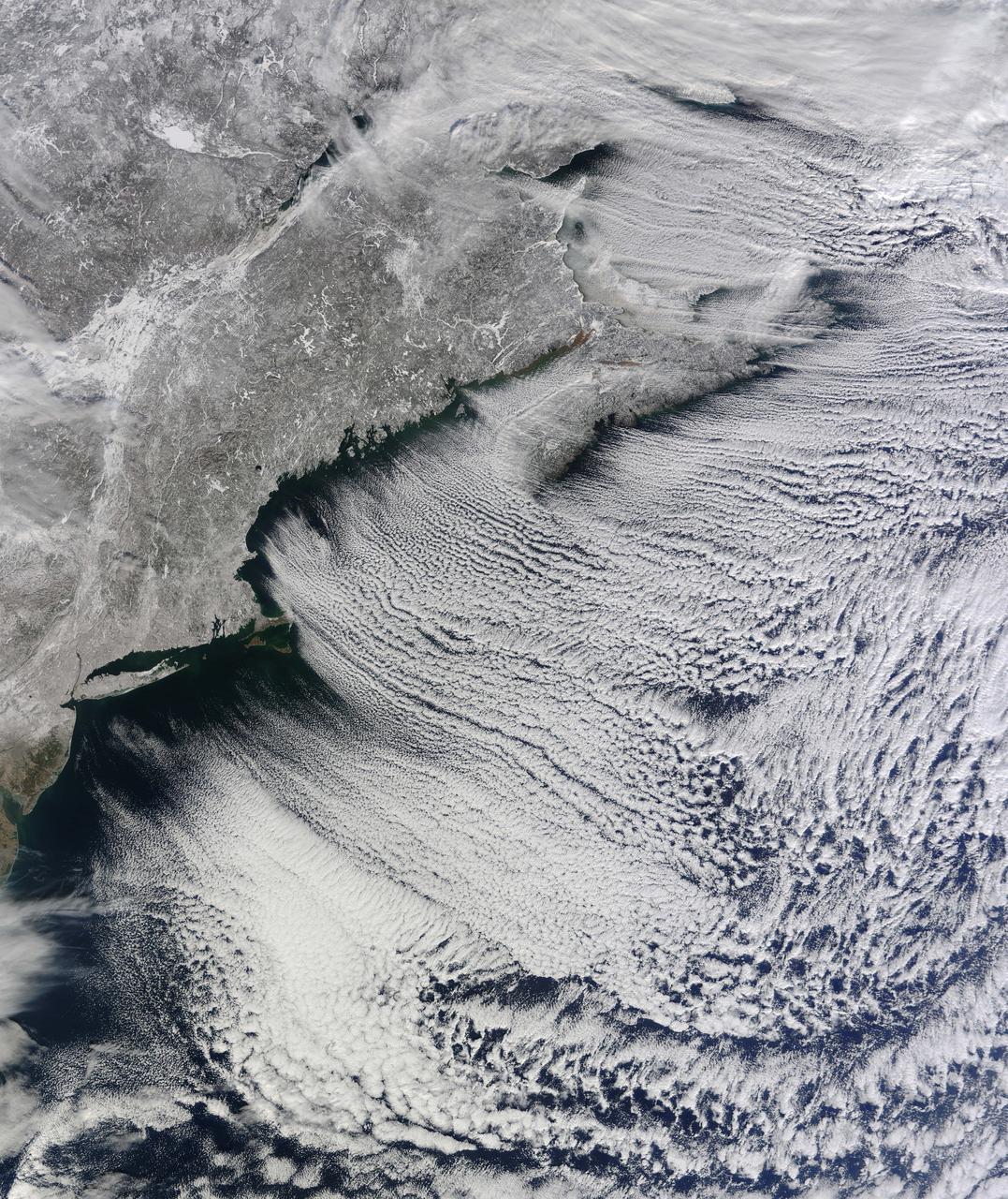
NASA image acquired January 24, 2011 What do you get when you mix below-freezing air temperatures, frigid northwest winds from Canada, and ocean temperatures hovering around 39 to 40 degrees Fahrenheit (4 to 5 degrees Celsius)? Paved highways of clouds across the skies of the North Atlantic. The Moderate Resolution Imaging Spectroradiometer (MODIS) on NASA’s Terra satellite collected this natural-color view of New England, the Canadian Maritimes, and coastal waters at 10:25 a.m. U.S. Eastern Standard Time on January 24, 2011. Lines of clouds stretch from northwest to southeast over the North Atlantic, while the relatively cloudless skies over land afford a peek at the snow that blanketed the Northeast just a few days earlier. Cloud streets form when cold air blows over warmer waters, while a warmer air layer—or temperature inversion—rests over top of both. The comparatively warm water of the ocean gives up heat and moisture to the cold air mass above, and columns of heated air—thermals—naturally rise through the atmosphere. As they hit the temperature inversion like a lid, the air rolls over like the circulation in a pot of boiling water. The water in the warm air cools and condenses into flat-bottomed, fluffy-topped cumulus clouds that line up parallel to the wind. Though they are easy to explain in a broad sense, cloud streets have a lot of mysteries on the micro scale. A NASA-funded researcher from the University of Wisconsin recently observed an unusual pattern in cloud streets over the Great Lakes. Cloud droplets that should have picked up moisture from the atmosphere and grown in size were instead shrinking as they moved over Lake Superior. Read more in an interview at What on Earth? NASA image by Jeff Schmaltz, MODIS Rapid Response Team, Goddard Space Flight Center. Caption by Michael Carlowicz. Instrument: Terra - MODIS Credit: <b><a href="http://www.earthobservatory.nasa.gov/" rel="nofollow"> NASA Earth Observatory</a></b> <b><a href="http://www.nasa.gov/centers/goddard/home/index.html" rel="nofollow">NASA Goddard Space Flight Center</a></b> enables NASA’s mission through four scientific endeavors: Earth Science, Heliophysics, Solar System Exploration, and Astrophysics. Goddard plays a leading role in NASA’s accomplishments by contributing compelling scientific knowledge to advance the Agency’s mission. <b>Follow us on <a href="http://twitter.com/NASA_GoddardPix" rel="nofollow">Twitter</a></b> <b>Join us on <a href="http://www.facebook.com/pages/Greenbelt-MD/NASA-Goddard/395013845897?ref=tsd" rel="nofollow">Facebook</a></b>
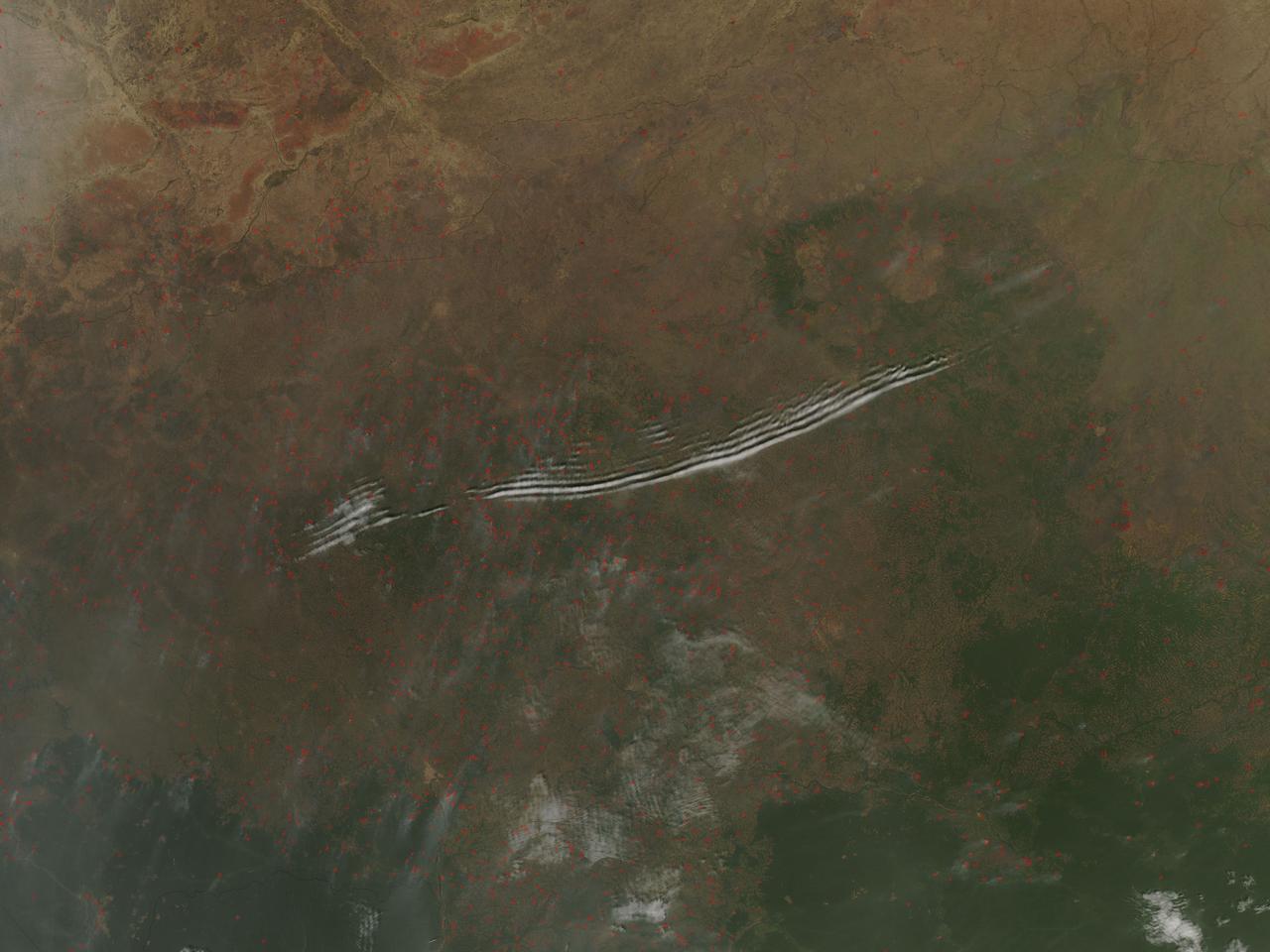
On January 27, 2016, the Moderate Resolution Imaging Spectroradiometer (MODIS) aboard NASA’s Aqua satellite passed over the Central African Republic and captured a true-color image of wave clouds rippling over a fire-speckled landscape. Wave clouds typically form when a mountain, island, or even another mass of air forces an air mass to rise, then fall again, in a wave pattern. The air cools as it rises, and if there is moisture in the air, the water condenses into clouds at the top of the wave. As the air begins to sink, the air warms and the cloud dissipates. The result is a line of clouds marking the crests of the wave separated by clear areas in the troughs of the wave. In addition to the long lines of clouds stretching across the central section of the country, clouds appear to line up in parallel rows near the border of the Democratic Republic of the Congo. In this area, small sets of grayish cloud appear to be lined up with the prevailing wind, judging by the plumes of smoke rising from red hotspots near each set of clouds. Clouds like this, that line in parallel rows parallel with the prevailing wind, are known as “cloud streets”. Each red “hotspot” marks an area where the thermal sensors on the MODIS instrument detected high temperatures. When accompanied by typical smoke, such hotspots are diagnostic for actively burning fires. Given the time of the year, the widespread nature, and the location of the fires, they are almost certainly agricultural fires that have been deliberately set to manage land. Image Credit: Jeff Schmaltz, MODIS Land Rapid Response Team, NASA GSFC <b><a href="http://www.nasa.gov/audience/formedia/features/MP_Photo_Guidelines.html" rel="nofollow">NASA image use policy.</a></b> <b><a href="http://www.nasa.gov/centers/goddard/home/index.html" rel="nofollow">NASA Goddard Space Flight Center</a></b> enables NASA’s mission through four scientific endeavors: Earth Science, Heliophysics, Solar System Exploration, and Astrophysics. Goddard plays a leading role in NASA’s accomplishments by contributing compelling scientific knowledge to advance the Agency’s mission. <b>Follow us on <a href="http://twitter.com/NASAGoddardPix" rel="nofollow">Twitter</a></b> <b>Like us on <a href="http://www.facebook.com/pages/Greenbelt-MD/NASA-Goddard/395013845897?ref=tsd" rel="nofollow">Facebook</a></b> <b>Find us on <a href="http://instagrid.me/nasagoddard/?vm=grid" rel="nofollow">Instagram</a></b>
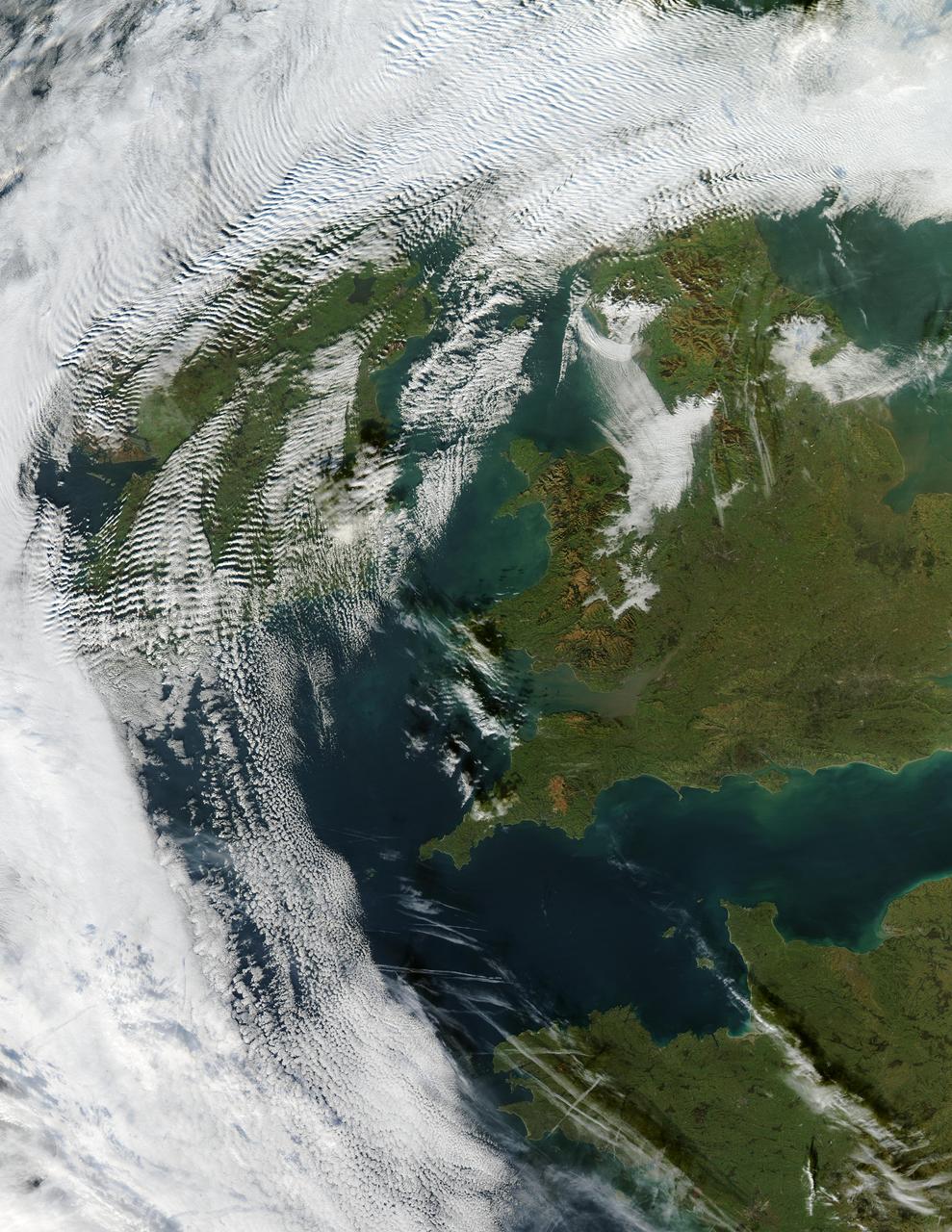
Visualization Date 2003-12-18 Clouds ripple over Ireland and Scotland in a wave pattern, similar to the pattern of waves along a seashore. The similarity is not coincidental — the atmosphere behaves like a fluid, so when it encounters an obstacle, it must move around it. This movement forms a wave, and the wave movement can continue for long distances. In this case, the waves were caused by the air moving over and around the mountains of Scotland and Ireland. As the air crested a wave, it cooled, and clouds formed. Then, as the air sank into the trough, the air warmed, and clouds did not form. This pattern repeated itself, with clouds appearing at the peak of every wave. Other types of clouds are also visible in the scene. Along the northwestern and southwestern edges of this true-color image from December 17, 2003, are normal mid-altitude clouds with fairly uniform appearances. High altitude cirrus-clouds float over these, casting their shadows on the lower clouds. Open- and closed-cell clouds formed off the coast of northwestern France, and thin contrail clouds are visible just east of these. Contrail clouds form around the particles carried in airplane exhaust. Fog is also visible in the valleys east of the Cambrian Mountains, along the border between northern/central Wales and England. This is an Aqua MODIS image. Sensor Aqua/MODIS Credit Jacques Descloitres, MODIS Rapid Response Team, NASA/GSFC For more information go to: <a href="http://visibleearth.nasa.gov/view_rec.php?id=6146" rel="nofollow">visibleearth.nasa.gov/view_rec.php?id=6146</a>
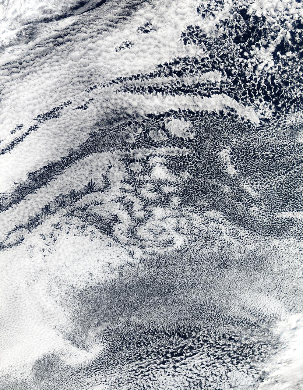
2010/107 - 04/17 at 21 :05 UTC. Open-cell and closed-cell clouds off Peru, Pacific Ocean Resembling a frosted window on a cold winter's day, this lacy pattern of marine clouds was captured off the coast of Peru in the Pacific Ocean by the MODIS on the Aqua satellite on April 19, 2010. The image reveals both open- and closed-cell cumulus cloud patterns. These cells, or parcels of air, often occur in roughly hexagonal arrays in a layer of fluid (the atmosphere often behaves like a fluid) that begins to "boil," or convect, due to heating at the base or cooling at the top of the layer. In "closed" cells warm air is rising in the center, and sinking around the edges, so clouds appear in cell centers, but evaporate around cell edges. This produces cloud formations like those that dominate the lower left. The reverse flow can also occur: air can sink in the center of the cell and rise at the edge. This process is called "open cell" convection, and clouds form at cell edges around open centers, which creates a lacy, hollow-looking pattern like the clouds in the upper right. Closed and open cell convection represent two stable atmospheric configurations — two sides of the convection coin. But what determines which path the "boiling" atmosphere will take? Apparently the process is highly chaotic, and there appears to be no way to predict whether convection will result in open or closed cells. Indeed, the atmosphere may sometimes flip between one mode and another in no predictable pattern. Satellite: Aqua NASA/GSFC/Jeff Schmaltz/MODIS Land Rapid Response Team To learn more about MODIS go to: <a href="http://rapidfire.sci.gsfc.nasa.gov/gallery/?latest" rel="nofollow">rapidfire.sci.gsfc.nasa.gov/gallery/?latest</a> <b><a href="http://www.nasa.gov/centers/goddard/home/index.html" rel="nofollow">NASA Goddard Space Flight Center</a></b> is home to the nation's largest organization of combined scientists, engineers and technologists that build spacecraft, instruments and new technology to study the Earth, the sun, our solar system, and the universe.
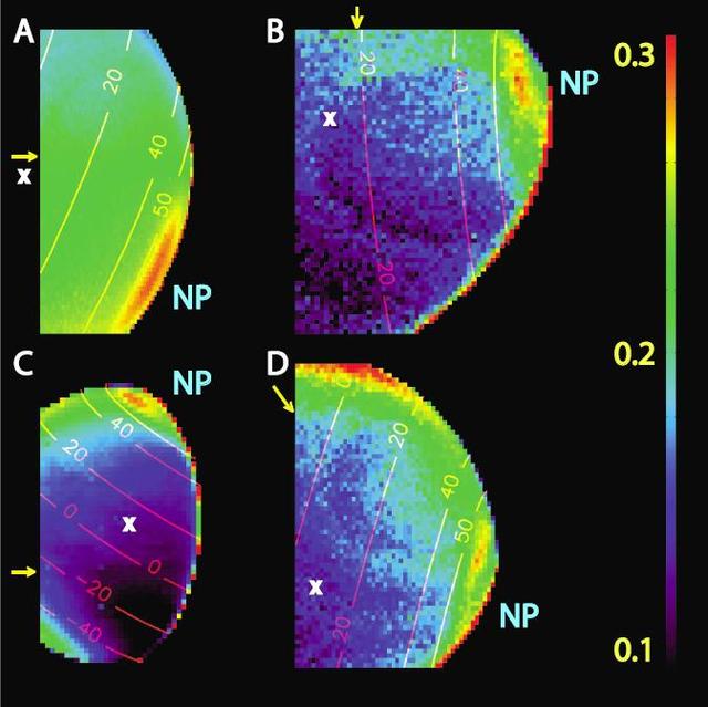
This graphic, constructed from data obtained by NASA Cassini spacecraft, shows the percentage of cloud coverage across the surface of Saturn moon Titan. The color scale from black to yellow signifies no cloud coverage to complete cloud coverage.
Clouds over Endurance on Sol 291
Neutral Gas Cloud Around Titan
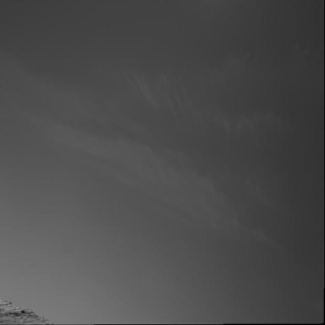
Wispy Blue Clouds Over Mars

Massive Gas Cloud Around Jupiter
Clouds over the Eastern Martian Horizon

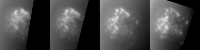
First Image of Clouds over Mars

Cloud Features North of Jupiter Equator
Repeated Clouds over Arsia Mons
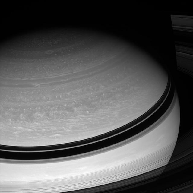
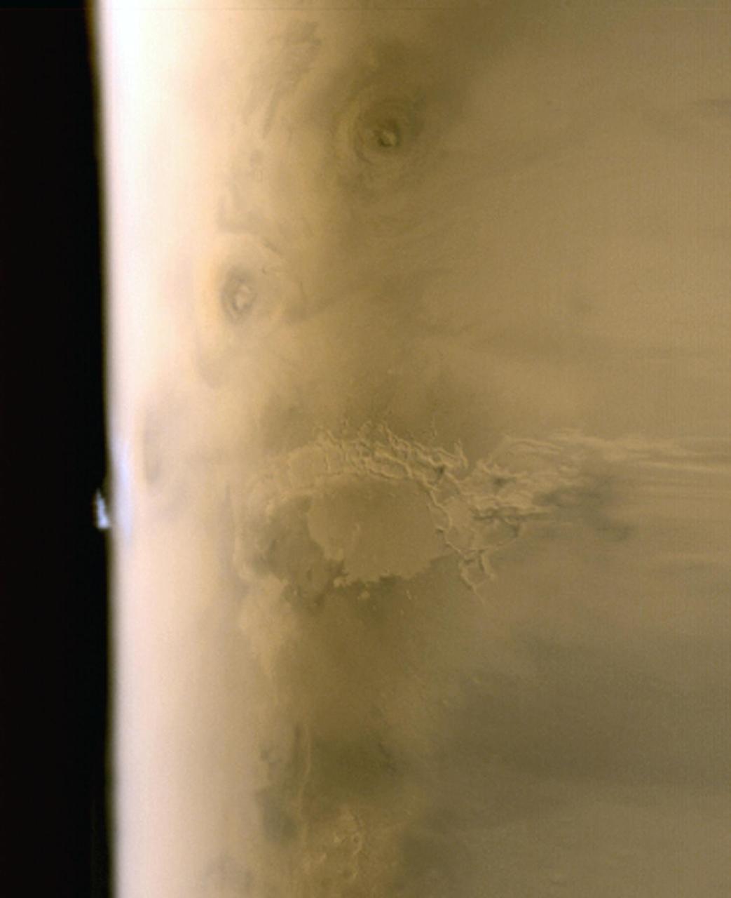
A Gallery of Views of Saturn Deep Clouds
Clouds over Endurance on Sol 290

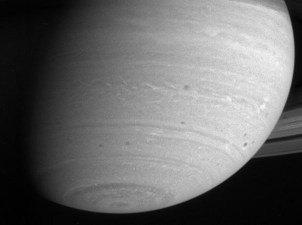
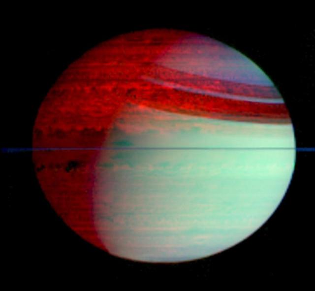
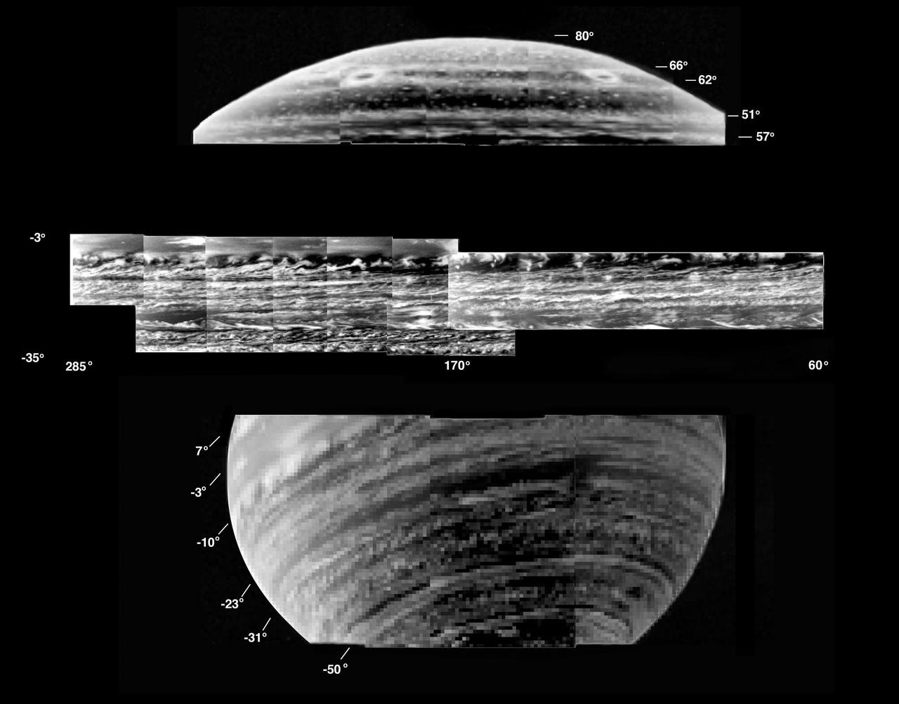
Clouds and Hazes of Jupiter Southern Hemisphere
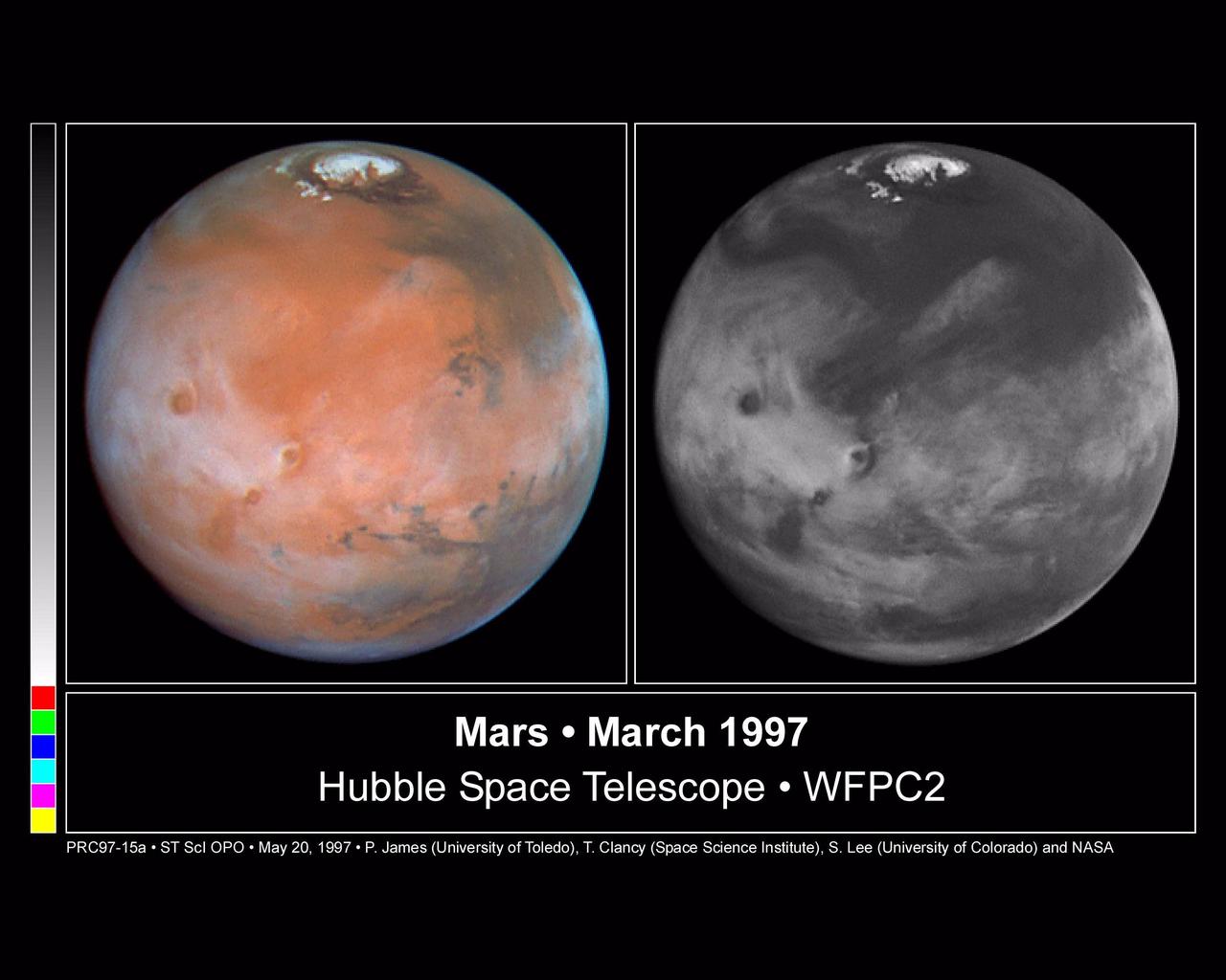
Comparison View of Mars Cloud Cover
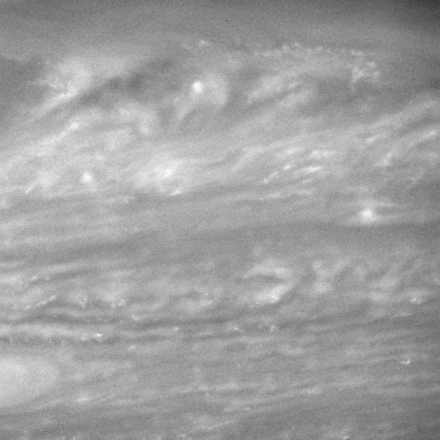
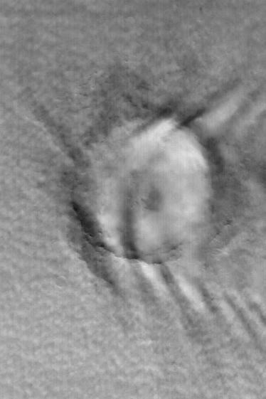
High Above Saturn Cloud Tops

NASA's Aqua satellite captured this image of the clouds over Canada. Entwined within the clouds is the smoke billowing up from the wildfires that are currently burning across a large expanse of the country. The smoke has become entrained within the clouds causing it to twist within the circular motion of the clouds and wind. This image was taken by the Moderate Resolution Imaging Spectroradiometer (MODIS) instrument on the Aqua satellite on May 9, 2016. Image Credit: NASA image courtesy Jeff Schmaltz LANCE/EOSDIS MODIS Rapid Response Team, GSFC <b><a href="http://www.nasa.gov/audience/formedia/features/MP_Photo_Guidelines.html" rel="nofollow">NASA image use policy.</a></b> <b><a href="http://www.nasa.gov/centers/goddard/home/index.html" rel="nofollow">NASA Goddard Space Flight Center</a></b> enables NASA’s mission through four scientific endeavors: Earth Science, Heliophysics, Solar System Exploration, and Astrophysics. Goddard plays a leading role in NASA’s accomplishments by contributing compelling scientific knowledge to advance the Agency’s mission. <b>Follow us on <a href="http://twitter.com/NASAGoddardPix" rel="nofollow">Twitter</a></b> <b>Like us on <a href="http://www.facebook.com/pages/Greenbelt-MD/NASA-Goddard/395013845897?ref=tsd" rel="nofollow">Facebook</a></b> <b>Find us on <a href="http://instagrid.me/nasagoddard/?vm=grid" rel="nofollow">Instagram</a></b>
These clouds occurred near the south polar cap at the end of southern summer
These clouds hide the south polar region. This storm occurred during late summer
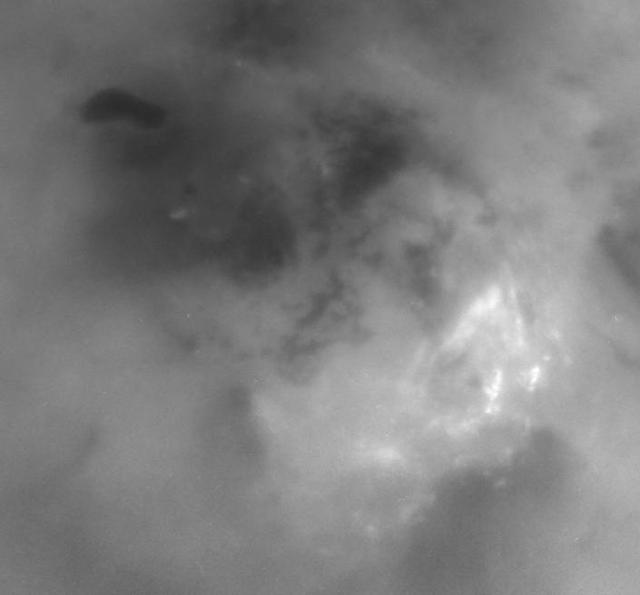
NASA Cassini spacecraft watches as clouds swirl through Saturn equatorial latitudes.
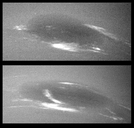
The bright cirrus-like clouds of Neptune change rapidly, often forming and dissipating over periods of several to tens of hours. In this sequence NASA Voyager 2 observed cloud evolution in the region around the Great Dark Spot GDS.