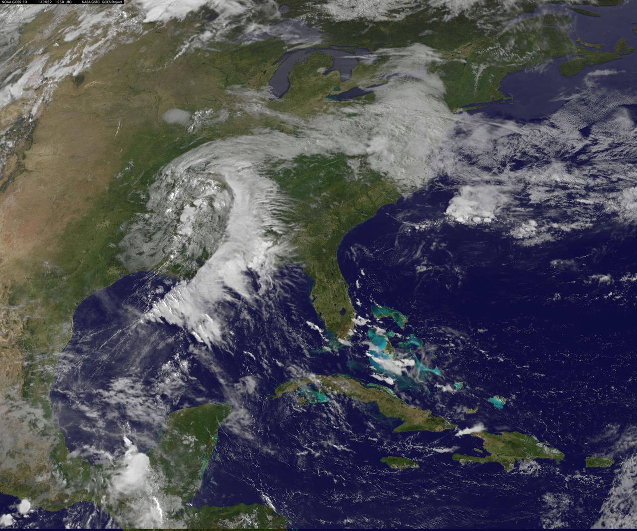
A "backdoor cold front" is bringing April temperatures to the U.S. northeast and Mid-Atlantic today, May 29. The backdoor cold front brings relief to the Mid-Atlantic after temperatures in Washington, D.C. hit 92F on Tuesday, May 27 and 88F on Wednesday, May 28 at Reagan National Airport, according to the National Weather Service (NWS). NWS forecasters expect the high temperature for May 29 to only reach 60F in the District of Columbia. NOAA's GOES-East satellite captured a view of the clouds associated with the backdoor cold front that stretch from southern Illinois to North Carolina. The National Weather Service forecast expects the backdoor cold front to bring showers to the Midwest, Northeast, and Mid-Atlantic today, May 29. According to the National Oceanic and Atmospheric Administration, a backdoor cold front is a cold front moving south or southwest along the Atlantic seaboard and Great Lakes; these are especially common during the spring months. This visible image was taken by NOAA's GOES-East satellite on May 29 at 12:30 UTC (8:30 a.m. EDT). The image was created at NASA/NOAA's GOES Project at NASA's Goddard Space Flight Center in Greenbelt, Maryland. In addition to the backdoor cold front clouds, the GOES-East image shows clouds circling around a low pressure area located in eastern Texas. That low pressure area is expected to bring rain from Texas eastward over the southeastern U.S. According to NOAA's National Weather Service, the slow-moving low pressure area in the Deep South "will bring heavy showers and thunderstorms from Louisiana to Alabama through Thursday. This area is already saturated from previous rainfall, so flash flooding will be possible." Image: NASA/NOAA GOES Project Caption: NASA Goddard/Rob Gutro
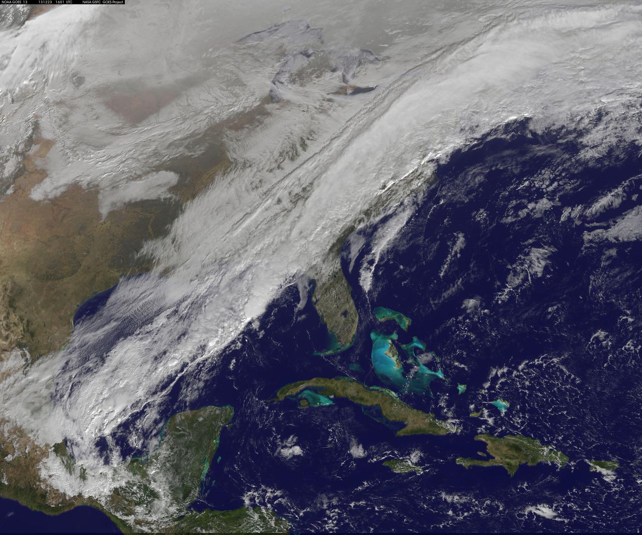
A long, strong, cold front draped over the eastern U.S. is marking a stark change from record-warmth to very cold temperatures. This NOAA GOES-East satellite image from December 23 at 1515 UTC/10:15 a.m. EST shows a powerful cold front covering the U.S. East Coast and stretching into the central and southwestern Gulf of Mexico. According to the National Weather Service, that front is bringing rain and embedded thunderstorms over the Mid-Atlantic and Southeastern U.S. The same system is bringing lingering wintry precipitation to northern New England and upstate New York. Behind the cold front, much colder and dry Canadian air will filter in under high pressure and bring sunshine over the eastern U.S. in time for Christmas. The image was created by the NASA GOES Project at NASA's Goddard Space Flight Center, Greenbelt, Md. Rob Gutro NASA Goddard Space Flight Center <b><a href="http://www.nasa.gov/audience/formedia/features/MP_Photo_Guidelines.html" rel="nofollow">NASA image use policy.</a></b> <b><a href="http://www.nasa.gov/centers/goddard/home/index.html" rel="nofollow">NASA Goddard Space Flight Center</a></b> enables NASA’s mission through four scientific endeavors: Earth Science, Heliophysics, Solar System Exploration, and Astrophysics. Goddard plays a leading role in NASA’s accomplishments by contributing compelling scientific knowledge to advance the Agency’s mission. <b>Follow us on <a href="http://twitter.com/NASA_GoddardPix" rel="nofollow">Twitter</a></b> <b>Like us on <a href="http://www.facebook.com/pages/Greenbelt-MD/NASA-Goddard/395013845897?ref=tsd" rel="nofollow">Facebook</a></b> <b>Find us on <a href="http://instagram.com/nasagoddard?vm=grid" rel="nofollow">Instagram</a></b>