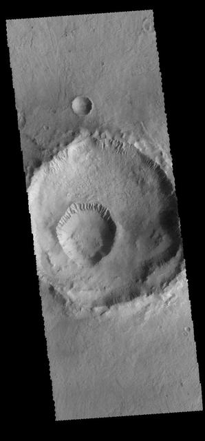
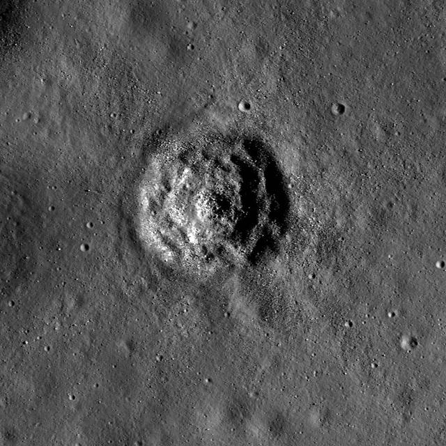
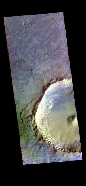
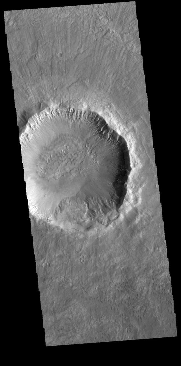
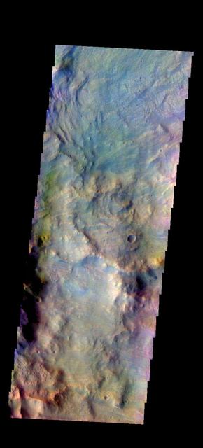
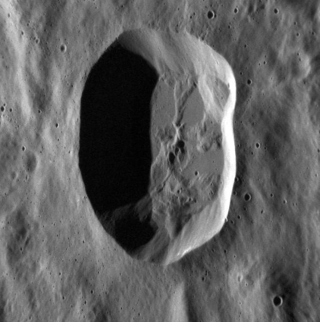
The smaller crater within the larger crater is called Gasa Crater (the larger crater is unnamed). Gullies dissect the inner rims of both craters. Orbit Number: 65538 Latitude: -35.6842 Longitude: 129.44 Instrument: VIS Captured: 2016-09-22 06:02 http://photojournal.jpl.nasa.gov/catalog/PIA21158
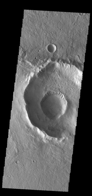
The small crater on the floor of the larger crater is called Gasa Crater. Gullies dissect the rims of both craters, as shown in this image captured by NASA 2001 Mars Odyssey spacecraft. These craters are located in Eridania Planitia. Orbit Number: 67465 Latitude: -35.7075 Longitude: 129.365 Instrument: VIS Captured: 2017-02-27 23:40 https://photojournal.jpl.nasa.gov/catalog/PIA21528
Crater, Crater, Crater!
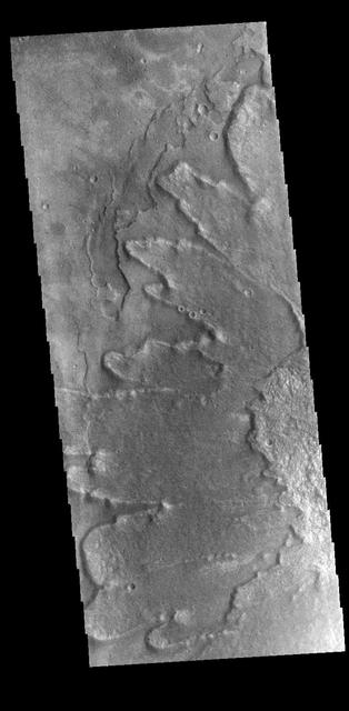
This image captured by NASA 2001 Mars Odyssey spacecraft shows part of the floor of Hale Crater. The mountains in the image are part of the elongated central peak of the crater.It is believed that Hale Crater was formed by an oblique impact, which caused it's more oval form and central peak elongation. Orbit Number: 66105 Latitude: -35.5732 Longitude: 323.646 Instrument: VIS Captured: 2016-11-07 23:04 http://photojournal.jpl.nasa.gov/catalog/PIA21192
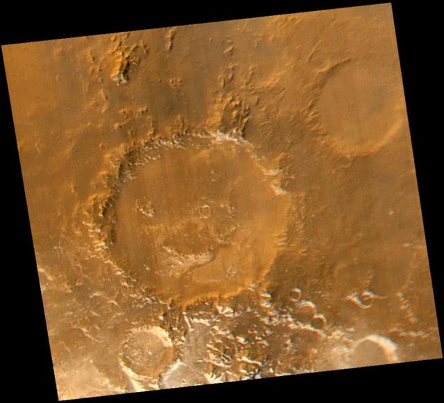
Smile! Spring has sprung in the martian southern hemisphere. With it comes the annual retreat of the winter polar frost cap. This view of "Happy Face Crater"--officially named "Galle Crater"--shows patches of white water ice frost in and around the crater's south-facing slopes. Slopes that face south will retain frost longer than north-facing slopes because they do not receive as much sunlight in early spring. This picture is a composite of images taken by the Mars Global Surveyor Mars Orbiter Camera (MOC) red and blue wide angle cameras. The wide angle cameras were designed to monitor the changing weather, frost, and wind patterns on Mars. Galle Crater is located on the east rim of the Argyre Basin and is about 215 kilometers (134 miles) across. In this picture, illumination is from the upper left and north is up. http://photojournal.jpl.nasa.gov/catalog/PIA02325
This is a mosaic assembled from some of the images taken by the panoramic camera on NASA's Mars Exploration Rover Opportunity during the rover's 590th sol (Sept. 21, 2005). The view is toward the south and includes rock exposures north of "Erebus Crater," with the crater in the background. The rover will investigate the exposed rocks in the foreground and will take additional panoramic-camera images of Erebus Crater, which is about 300 meters (about 984 feet) across. Erebus Crater dwarfs the landing-site crater, "Eagle Crater," which measures about 22 meters (72 feet) in diameter. And, it is nearly twice the diameter of "Endurance Crater," which, at 130 meters (430 feet) wide, has been compared to a stadium. The camera's red filter was used for taking the images in this mosaic. It admits light with a wavelength of 750 nanometers http://photojournal.jpl.nasa.gov/catalog/PIA06341
NASA's Mars Reconnaissance Orbiter (MRO) captured this region of Mars, sprayed with secondary craters from 10-kilometer Zunil Crater to the northwest. Secondary craters form from rocks ejected at high speed from the primary crater, which then impact the ground at sufficiently high speed to make huge numbers of much smaller craters over a large region. In this scene, however, the secondary crater ejecta has an unusual raised-relief appearance like bas-relief sculpture. How did that happen? One idea is that the region was covered with a layer of fine-grained materials like dust or pyroclastics about 1 to 2 meters thick when the Zunil impact occurred (about a million years ago), and the ejecta served to harden or otherwise protect the fine-grained layer from later erosion by the wind. https://photojournal.jpl.nasa.gov/catalog/PIA21591
Today's VIS image shows part of the floor of Gusev Crater. Numerous dark linear markings were created by dust devil action. Gusev Crater is the "home" of the MER Spirit rover. Orbit Number: 65212 Latitude: -14.4728 Longitude: 175.478 Instrument: VIS Captured: 2016-08-26 09:37 http://photojournal.jpl.nasa.gov/catalog/PIA21006
The THEMIS camera contains 5 filters. The data from different filters can be combined in multiple ways to create a false color image. hese false color images may reveal subtle variations of the surface not easily identified in a single band image. This image from NASA 2001 Mars Odyssey spacecraft shows part of Asimov Crater. simov Crater is unique in that the crater floor has been completely filled with material to approximately the crater rim and then a series depressions have occurred near the crater rim. Orbit Number: 58181 Latitude: -46.4874 Longitude: 5.55839 Instrument: VIS Captured: 2015-01-25 08:32 https://photojournal.jpl.nasa.gov/catalog/PIA21543
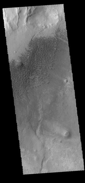
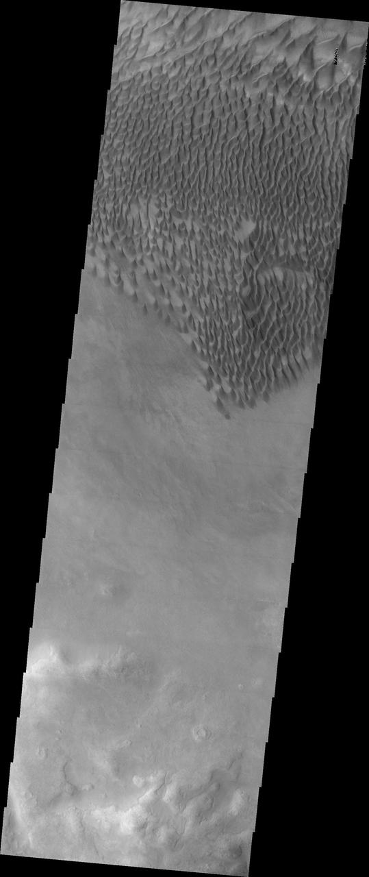
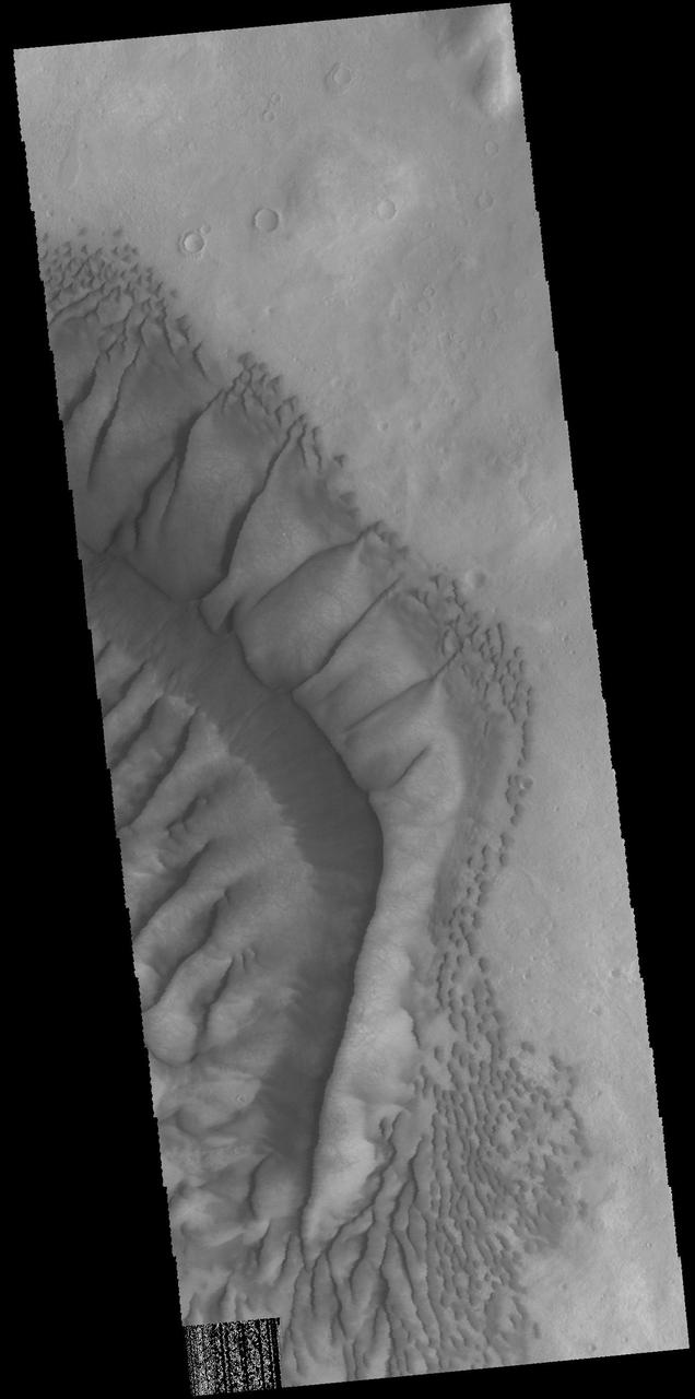
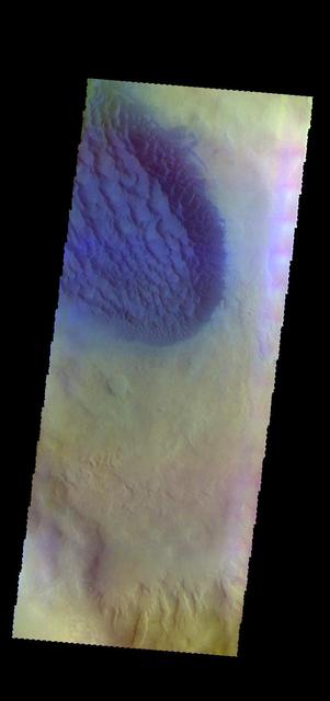
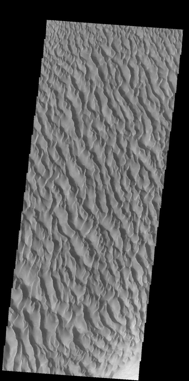
This image captured by NASA 2001 Mars Odyssey spacecraft shows sand dunes on the floor of Sumgin Crater. The crater is located in Noachis Terra north of Argyre Planitia. Orbit Number: 66517 Latitude: -36.4993 Longitude: 311.197 Instrument: VIS Captured: 2016-12-11 21:42 http://photojournal.jpl.nasa.gov/catalog/PIA21299
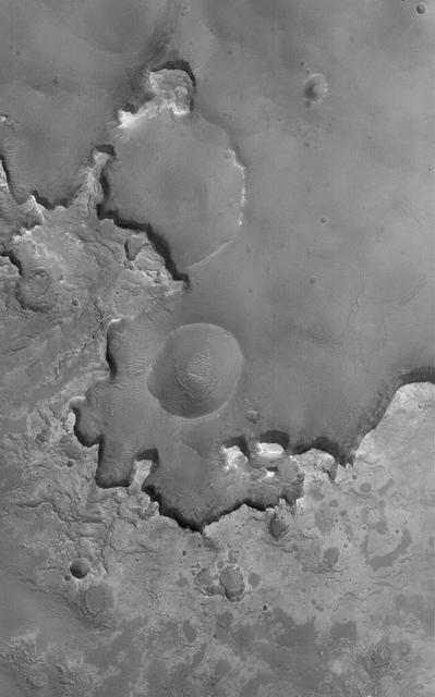
A Volcanic Crater in an Impact Crater
Craters, Craters Everywhere
Terraced Craters in Aitken Crater
Craters within Craters
Craters Filling Craters
Craters within Craters in Meridiani
Exhuming Craters in a Crater
![This image shows a layered deposit in Galle Crater, located in the Southern cratered highlands. The geologic history of Galle Crater is not well constrained, and it contains a variety of features that have been interpreted as fluvial, lacustrine or glacial deposits. The deposit pictured here contains multiple unconformities (sudden or irregular changes from one deposit to another), indicating periods of erosion and non deposition. The map is projected here at a scale of 25 centimeters (9.8 inches) per pixel. [The original image scale is 25.7 centimeters (10.1 inches) per pixel (with 1 x 1 binning); objects on the order of 77 centimeters (30.3 inches) across are resolved.] North is up. https://photojournal.jpl.nasa.gov/catalog/PIA21575](https://images-assets.nasa.gov/image/PIA21575/PIA21575~medium.jpg)
This image shows a layered deposit in Galle Crater, located in the Southern cratered highlands. The geologic history of Galle Crater is not well constrained, and it contains a variety of features that have been interpreted as fluvial, lacustrine or glacial deposits. The deposit pictured here contains multiple unconformities (sudden or irregular changes from one deposit to another), indicating periods of erosion and non deposition. The map is projected here at a scale of 25 centimeters (9.8 inches) per pixel. [The original image scale is 25.7 centimeters (10.1 inches) per pixel (with 1 x 1 binning); objects on the order of 77 centimeters (30.3 inches) across are resolved.] North is up. https://photojournal.jpl.nasa.gov/catalog/PIA21575
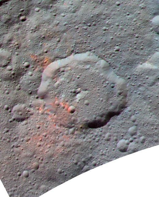
This enhanced color composite image, made with data from the framing camera aboard NASA's Dawn spacecraft, shows the area around Ernutet crater. The bright red portions appear redder with respect to the rest of Ceres. In a 2017 study in the journal Science, researchers from the Dawn science team found that these red areas around Ernutet are associated with evidence of organic material. Images taken using blue (440 nanometers), green (750 nanometers) and infrared (960 nanometers) spectral filters were combined to create the view. Ernutet Crater measures about 32 miles (52 kilometers) in diameter and is located in the northern hemisphere. http://photojournal.jpl.nasa.gov/catalog/PIA21419
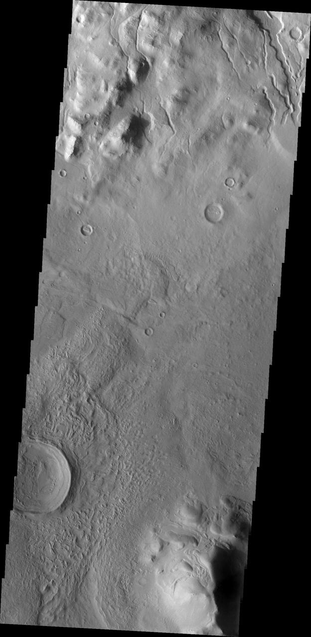
art002e012702 (April 6, 2026) – Poynting crater and Keeler crater are visible side by side in the lower right portion of this image of the Moon’s far side highlands. Poynting, positioned above, is a large impact crater with a well-defined rim and relatively smooth interior, indicative of material that has settled following the initial impact. Just below it, Keeler crater appears slightly smaller, with a sharply outlined rim and a more textured interior shaped by subsequent impacts and ejecta. Both features lie within the densely cratered far side highlands, preserving a record of ancient impacts that have shaped the lunar surface over billions of years.
![The broader scene for this image is the fluidized ejecta from Bakhuysen Crater to the southwest, but there's something very interesting going on here on a much smaller scale. A small impact crater, about 25 meters in diameter, with a gouged-out trench extends to the south. The ejecta (rocky material ejected from the crater) mostly extends to the east and west of the crater. This "butterfly" ejecta is very common for craters formed at low impact angles. Taken together, these observations suggest that the crater-forming impactor came in at a low angle from the north, hit the ground and ejected material to the sides. The top of the impactor may have sheared off ("decapitating" the impactor) and continued downrange, forming the trench. We can't prove that's what happened, but this explanation is consistent with the observations. Regardless of how it formed, it's quite an interesting-looking "dragonfly" crater. The map is projected here at a scale of 50 centimeters (19.69 inches) per pixel. [The original image scale is 55.7 centimeters (21.92 inches) per pixel (with 2 x 2 binning); objects on the order of 167 centimeters (65.7 inches) across are resolved.] North is up. http://photojournal.jpl.nasa.gov/catalog/PIA21454](https://images-assets.nasa.gov/image/PIA21454/PIA21454~medium.jpg)
The broader scene for this image is the fluidized ejecta from Bakhuysen Crater to the southwest, but there's something very interesting going on here on a much smaller scale. A small impact crater, about 25 meters in diameter, with a gouged-out trench extends to the south. The ejecta (rocky material ejected from the crater) mostly extends to the east and west of the crater. This "butterfly" ejecta is very common for craters formed at low impact angles. Taken together, these observations suggest that the crater-forming impactor came in at a low angle from the north, hit the ground and ejected material to the sides. The top of the impactor may have sheared off ("decapitating" the impactor) and continued downrange, forming the trench. We can't prove that's what happened, but this explanation is consistent with the observations. Regardless of how it formed, it's quite an interesting-looking "dragonfly" crater. The map is projected here at a scale of 50 centimeters (19.69 inches) per pixel. [The original image scale is 55.7 centimeters (21.92 inches) per pixel (with 2 x 2 binning); objects on the order of 167 centimeters (65.7 inches) across are resolved.] North is up. http://photojournal.jpl.nasa.gov/catalog/PIA21454

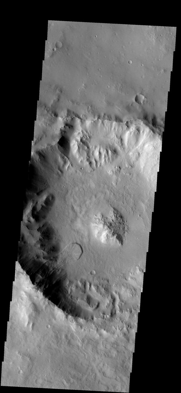
On Earth, geologists can dig holes and pull up core samples to find out what lies beneath the surface. On Mars, geologists cannot dig holes very easily themselves, but a process has been occurring for billions of years that has been digging holes for them: impact cratering. Impact craters form when an asteroid, meteoroid, or comet crashes into a planet's surface, causing an explosion. The energy of the explosion, and the resulting size of the impact crater, depends on the size and density of the impactor, as well as the properties of the surface it hits. In general, the larger and denser the impactor, the larger the crater it will form. The impact crater in this image is a little less than 3 kilometers in diameter. The impact revealed layers when it excavated the Martian surface. Layers can form in a variety of different ways. Multiple lava flows in one area can form stacked sequences, as can deposits from rivers or lakes. Understanding the geology around impact craters and searching for mineralogical data within their layers can help scientists on Earth better understand what the walls of impact craters on Mars expose. http://photojournal.jpl.nasa.gov/catalog/PIA12328
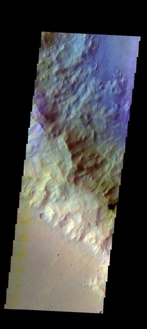
![This white, purple, and pink surface is located on the floor of an impact crater on the southeast rim of the larger Vinogradov Crater in southern Margaritifer Terra. The surface consists of what is left of a series of thin layers that subsequently eroded to create a "bullseye" pattern. The rough, etched appearance of the surface is similar-looking to deposits in other craters in the region and that are often associated with alluvial fans. The apparent ease and manner in which the materials are eroded relative to nearby fans and crater materials suggests they are fine-grained and the dominant agent of erosion is the wind. Although the origin of the deposits remains speculative, their physical character and common association with alluvial fans suggests they may be the result of deposition into a shallow lake or playa enabled by water flowing off the adjacent fan surfaces. The map is projected here at a scale of 25 centimeters (9.8 inches) per pixel. [The original image scale is 26 centimeters (10.2 inches) per pixel (with 1 x 1 binning); objects on the order of 78 centimeters (30.7 inches) across are resolved.] North is up. http://photojournal.jpl.nasa.gov/catalog/PIA21560](https://images-assets.nasa.gov/image/PIA21560/PIA21560~medium.jpg)
This white, purple, and pink surface is located on the floor of an impact crater on the southeast rim of the larger Vinogradov Crater in southern Margaritifer Terra. The surface consists of what is left of a series of thin layers that subsequently eroded to create a "bullseye" pattern. The rough, etched appearance of the surface is similar-looking to deposits in other craters in the region and that are often associated with alluvial fans. The apparent ease and manner in which the materials are eroded relative to nearby fans and crater materials suggests they are fine-grained and the dominant agent of erosion is the wind. Although the origin of the deposits remains speculative, their physical character and common association with alluvial fans suggests they may be the result of deposition into a shallow lake or playa enabled by water flowing off the adjacent fan surfaces. The map is projected here at a scale of 25 centimeters (9.8 inches) per pixel. [The original image scale is 26 centimeters (10.2 inches) per pixel (with 1 x 1 binning); objects on the order of 78 centimeters (30.7 inches) across are resolved.] North is up. http://photojournal.jpl.nasa.gov/catalog/PIA21560
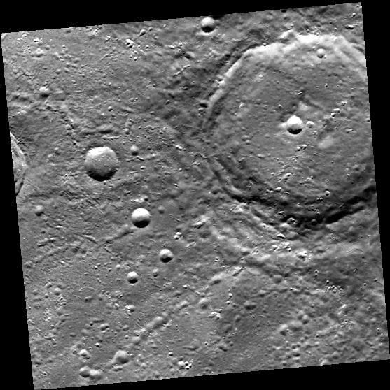
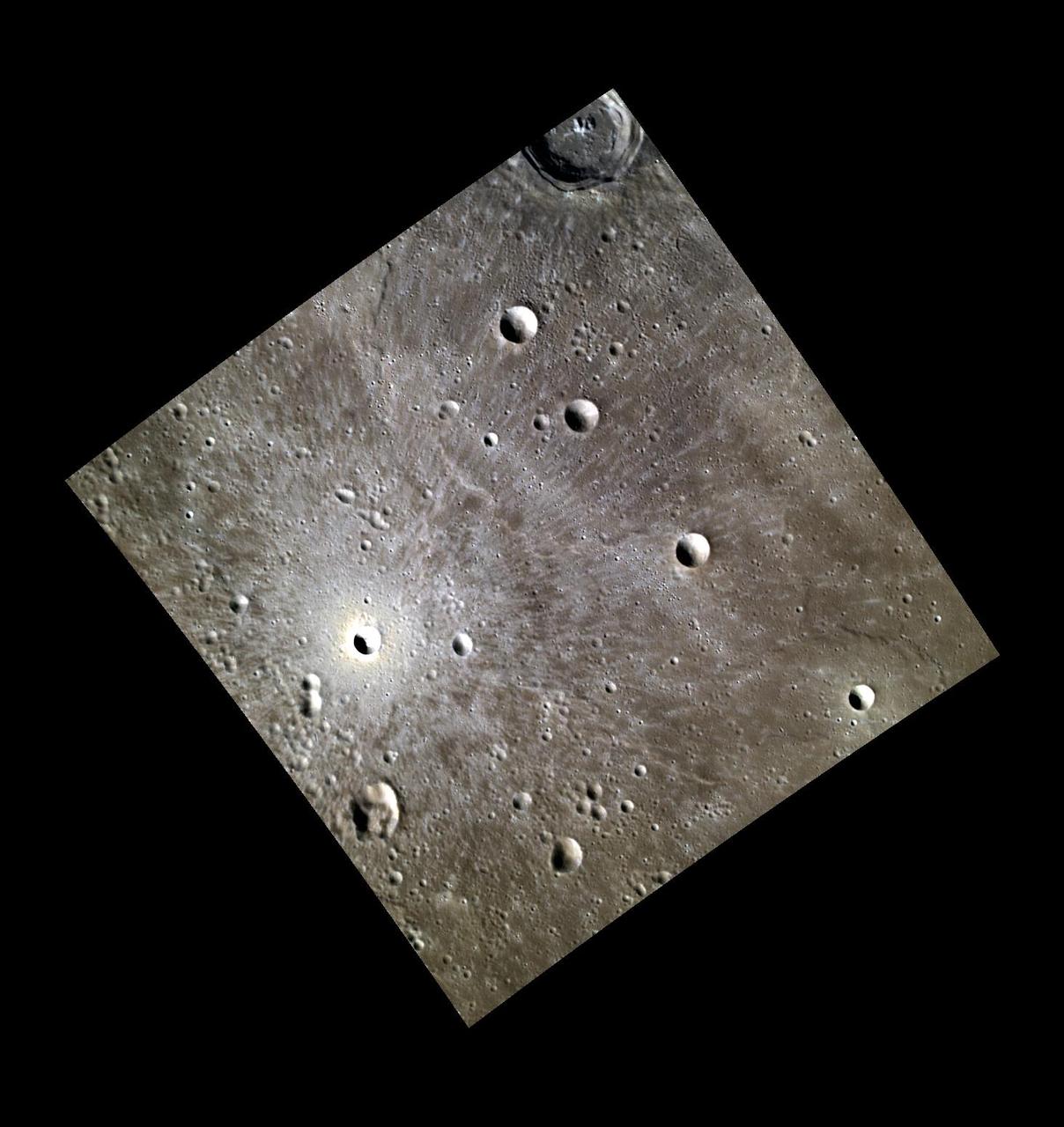
The craters Takel and Cozobi are featured in this image of Ceres from NASA's Dawn spacecraft. Takel is the young crater with bright material on the left of this image, and Cozobi is the sharply defined crater just below center. http://photojournal.jpl.nasa.gov/catalog/PIA21228
The THEMIS camera contains 5 filters. The data from different filters can be combined in multiple ways to create a false color image. These false color images may reveal subtle variations of the surface not easily identified in a single band image. This image from NASA 2001 Mars Odyssey spacecraft shows an unnamed crater located on the floor of Newton Crater. Orbit Number: 57962 Latitude: -42.1218 Longitude: 201.814 Instrument: VIS Captured: 2015-01-07 07:47 https://photojournal.jpl.nasa.gov/catalog/PIA21539
Today's VIS image is of Palikir Crater in Terra Sirenum. The inner rim of the crater is dissected with numerous gullies. In higher resolution images from other imagers these gullies are the location of changing linea, which appear to grow and retreat as seasons change. Orbit Number: 65311 Latitude: -41.6177 Longitude: 202.206 Instrument: VIS Captured: 2016-09-03 13:12 http://photojournal.jpl.nasa.gov/catalog/PIA21152
This image captured by NASA 2001 Mars Odyssey spacecraft shows some of the numerous dark linear streaks on the floor of Gusev Crater. These streaks are formed by wind action. The dark streaks are where dust devils have removed the surface dust, revealing the darker rock beneath. Gusev Crater is the home of the MER Spirit lander. Orbit Number: 65898 Latitude: -14.5 Longitude: 175.545 Instrument: VIS Captured: 2016-10-21 21:54 http://photojournal.jpl.nasa.gov/catalog/PIA21187
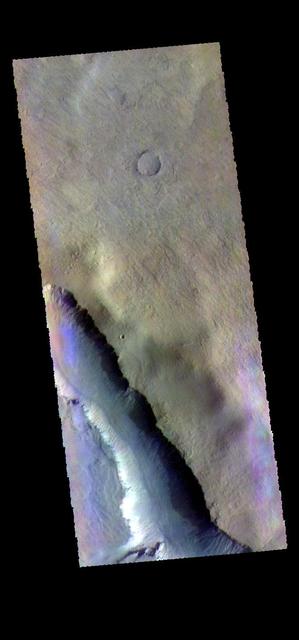
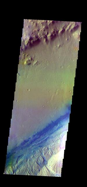
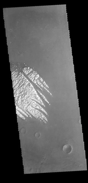
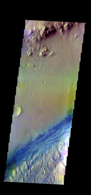
Rather than a central peak, Hale Crater contains a complex ridge of peaks. This image captured by NASA 2001 Mars Odyssey spacecraft shows a portion of the ridge. Orbit Number: 67402 Latitude: -35.7295 Longitude: 323.763 Instrument: VIS Captured: 2017-02-22 19:41 https://photojournal.jpl.nasa.gov/catalog/PIA21656
![Mars is a dynamic planet. HiRISE has witnessed many surface changes over the past ten years, including hundreds of new craters formed by ongoing impacts. Most of these impacts are likely caused by asteroids that have strayed into collision courses with Mars. The planet's much thinner atmosphere compared to Earth makes small asteroids less likely to burn up prior to hitting the Martian surface. This new crater, which formed explosively at the point of impact, has a diameter of roughly 8 meters (about 25 feet), but its surrounding blast zone and ejecta extend over a kilometer (about one mile) beyond the crater itself. The materials exposed nearest the crater have distinctive yellowish and lighter grey appearances, while more distant ejected materials range from dark brown to bright bluish in an enhanced-color view. These varied materials may have originated from different layers penetrated by the impact. This new impact was discovered using the lower-resolution Context Camera (CTX), also on board Mars Reconnaissance Orbiter. An older CTX image of this region from May 2012 shows a uniformly dust-covered surface, while a newer CTX image from September 2016 reveals the crater's dark blast zone. New craters on Mars are easiest to locate in such dust-coated terrains, where they provide opportunistic "road cuts" that allow scientists to see beneath the dust blanket and determine the underlying rock compositions and textures. This particular crater formed about 300 kilometers (roughly 200 miles) east of the Spirit rover's final resting spot in Gusev Crater. The map is projected here at a scale of 25 centimeters (9.8 inches) per pixel. [The original image scale is 26.2 centimeters (10.3 inches) per pixel (with 1 x 1 binning); objects on the order of 79 centimeters (31 inches) across are resolved.] North is up. http://photojournal.jpl.nasa.gov/catalog/PIA21451](https://images-assets.nasa.gov/image/PIA21451/PIA21451~medium.jpg)
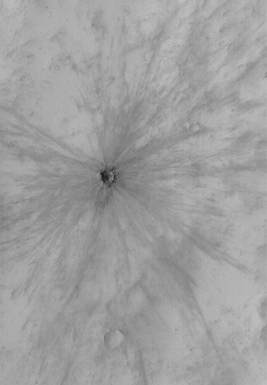
Mars is a dynamic planet. HiRISE has witnessed many surface changes over the past ten years, including hundreds of new craters formed by ongoing impacts. Most of these impacts are likely caused by asteroids that have strayed into collision courses with Mars. The planet's much thinner atmosphere compared to Earth makes small asteroids less likely to burn up prior to hitting the Martian surface. This new crater, which formed explosively at the point of impact, has a diameter of roughly 8 meters (about 25 feet), but its surrounding blast zone and ejecta extend over a kilometer (about one mile) beyond the crater itself. The materials exposed nearest the crater have distinctive yellowish and lighter grey appearances, while more distant ejected materials range from dark brown to bright bluish in an enhanced-color view. These varied materials may have originated from different layers penetrated by the impact. This new impact was discovered using the lower-resolution Context Camera (CTX), also on board Mars Reconnaissance Orbiter. An older CTX image of this region from May 2012 shows a uniformly dust-covered surface, while a newer CTX image from September 2016 reveals the crater's dark blast zone. New craters on Mars are easiest to locate in such dust-coated terrains, where they provide opportunistic "road cuts" that allow scientists to see beneath the dust blanket and determine the underlying rock compositions and textures. This particular crater formed about 300 kilometers (roughly 200 miles) east of the Spirit rover's final resting spot in Gusev Crater. The map is projected here at a scale of 25 centimeters (9.8 inches) per pixel. [The original image scale is 26.2 centimeters (10.3 inches) per pixel (with 1 x 1 binning); objects on the order of 79 centimeters (31 inches) across are resolved.] North is up. http://photojournal.jpl.nasa.gov/catalog/PIA21451
This image shows individual dunes on the floor of Russell Crater. These dunes are in the southern part of the dune field. Russell Crater is located in Noachis Terra. A spectacular dune ridge and other dune forms on the crater floor have caused extensive imaging. The Odyssey spacecraft has spent over 15 years in orbit around Mars, circling the planet more than 69000 times. It holds the record for longest working spacecraft at Mars. THEMIS, the IR/VIS camera system, has collected data for the entire mission and provides images covering all seasons and lighting conditions. Over the years many features of interest have received repeated imaging, building up a suite of images covering the entire feature. From the deepest chasma to the tallest volcano, individual dunes inside craters and dune fields that encircle the north pole, channels carved by water and lava, and a variety of other feature, THEMIS has imaged them all. For the next several months the image of the day will focus on the Tharsis volcanoes, the various chasmata of Valles Marineris, and the major dunes fields. We hope you enjoy these images! https://photojournal.jpl.nasa.gov/catalog/PIA21799

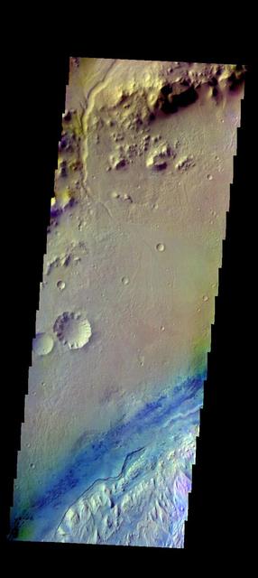
The THEMIS VIS camera contains 5 filters. The data from different filters can be combined in multiple ways to create a false color image. These false color images may reveal subtle variations of the surface not easily identified in a single band image. Today's false color image shows the delta deposit in Eberswalde Crater. Channels from the crater rim hosted material entering the crater. Orbit Number: 44018 Latitude: -23.9442 Longitude: 326.361 Instrument: VIS Captured: 2011-11-16 16:04 http://photojournal.jpl.nasa.gov/catalog/PIA21161
This image shows a portion of the northern hemisphere of Ceres, as seen by NASA's Dawn spacecraft. Cozobi Crater is the sharply defined impact feature at top left. At far right is Victa Crater. Abellio Crater is the sharply defined crater with a central peak just below center. Dawn took this image on Oct. 18 from its second extended-mission science orbit (XMO2), at a distance of about 920 miles (1,480 kilometers) above the surface. The image resolution is about 460 feet (140 meters) per pixel. http://photojournal.jpl.nasa.gov/catalog/PIA21231
Chains: Craters Making More Craters
The THEMIS VIS camera contains 5 filters. The data from different filters can be combined in multiple ways to create a false color image. These false color images may reveal subtle variations of the surface not easily identified in a single band image. Today's false color image shows part of Gale Crater. Gale Crater is the home of the Curiosity Rover. Orbit Number: 46072 Latitude: -4.53679 Longitude: 137.296 Instrument: VIS Captured: 2012-05-03 17:29 http://photojournal.jpl.nasa.gov/catalog/PIA21196
The THEMIS VIS camera contains 5 filters. The data from different filters can be combined in multiple ways to create a false color image. These false color images may reveal subtle variations of the surface not easily identified in a single band image. Today's false color image shows part of Gale Crater. The Curiosity Rover is located in Gale Crater. Orbit Number: 52390 Latitude: -4.49318 Longitude: 137.423 Instrument: VIS Captured: 2013-10-05 16:16 https://photojournal.jpl.nasa.gov/catalog/PIA21530
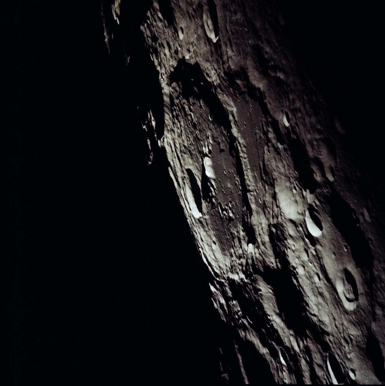
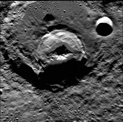
AS13-60-8635 (April 1970) --- An oblique view of the International Astronomical Union Crater No. 302 on the lunar farside as photographed from the Apollo 13 spacecraft during its pass around the moon. This large crater is located at 162 degrees east longitude and 10 degrees south latitude. The smaller crater, I.A.U. No. 301, is in the foreground. I.A.U. No. 302 has ridges in its center and a smaller crater near its inner edge. This view is looking southeast.
This VIS image shows part of the bright material on the floor of Pollack Crater. Erosion by wind action has sculpted the material, forming the linear features that run from bottom right to upper left. The material, while brighter in contrast than the surrounding materials, is not white. Orbit Number: 66427 Latitude: -7.97233 Longitude: 25.1327 Instrument: VIS Captured: 2016-12-04 11:54 http://photojournal.jpl.nasa.gov/catalog/PIA21295
This VIS image shows part of the ejecta around Yuty Crater. The ejecta, with the raised outer margin, is called a rampart. Orbit Number: 65269 Latitude: 22.3058 Longitude: 325.442 Instrument: VIS Captured: 2016-08-31 02:31 http://photojournal.jpl.nasa.gov/catalog/PIA21007

This image captured by NASA 2001 Mars Odyssey spacecraft shows part of the dune field on the floor of Rabe Crater. Orbit Number: 65691 Latitude: -43.6749 Longitude: 34.8006 Instrument: VIS Captured: 2016-10-04 20:29 http://photojournal.jpl.nasa.gov/catalog/PIA21183
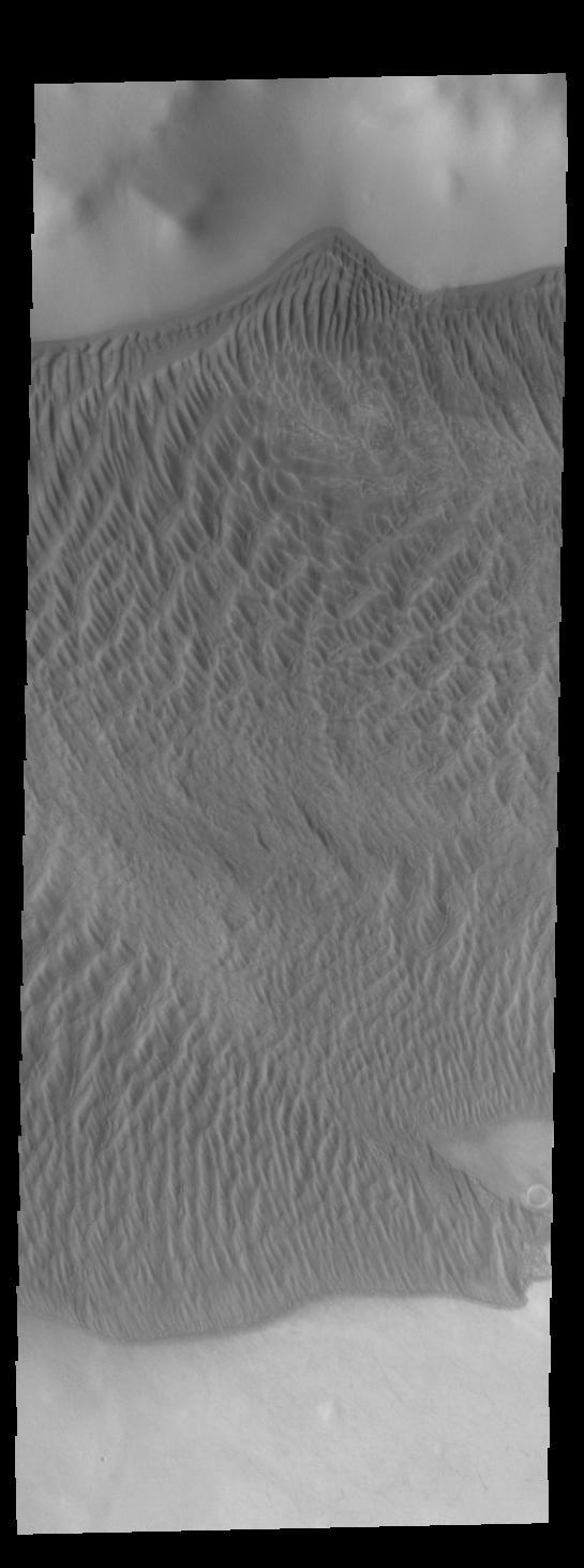
Today's VIS image shows part of the large dune form on the floor of Russell Crater. Orbit Number: 67151 Latitude: -54.3002 Longitude: 13.0603 Instrument: VIS Captured: 2017-02-02 03:15 http://photojournal.jpl.nasa.gov/catalog/PIA21517
This image captured by NASA 2001 Mars Odyssey spacecraft show part of the dune field located on the floor of Rabe Crater. Orbit Number: 67412 Latitude: -43.5303 Longitude: 34.6741 Instrument: VIS Captured: 2017-02-23 15:25 https://photojournal.jpl.nasa.gov/catalog/PIA21658
This image captured by NASA 2001 Mars Odyssey spacecraft shows a field of sand dunes on the floor of Hale Crater. Orbit Number: 66554 Latitude: -35.7883 Longitude: 323.039 Instrument: VIS Captured: 2016-12-14 22:52 http://photojournal.jpl.nasa.gov/catalog/PIA21301
This VIS image shows part of the large sand sheet within Proctor Crater. The surface of the sand sheet hosts dune forms. Orbit Number: 65317 Latitude: -47.7498 Longitude: 30.1831 Instrument: VIS Captured: 2016-09-04 01:02 http://photojournal.jpl.nasa.gov/catalog/PIA21153
The THEMIS VIS camera contains 5 filters. The data from different filters can be combined in multiple ways to create a false color image. These false color images may reveal subtle variations of the surface not easily identified in a single band image. Today's false color image shows part of the floor of Gale Crater. The Curiosity Rover is located in Gale Crater. Orbit Number: 52365 Latitude: -4.54529 Longitude: 137.352 Instrument: VIS Captured: 2013-10-03 14:54 https://photojournal.jpl.nasa.gov/catalog/PIA21529
This scene captured by NASA Dawn spacecraft on Oct. 21, 2016, from Ceres northern hemisphere shows part of the rim of Dantu Crater, at top right. Rao Crater is the largest crater in the bottom left corner of the image. Dawn took this image on Oct. 21, 2016, from its second extended-mission science orbit (XMO2), at a distance of about 920 miles (1,480 kilometers) above the surface. The image resolution is about 460 feet (140 meters) per pixel. http://photojournal.jpl.nasa.gov/catalog/PIA21243
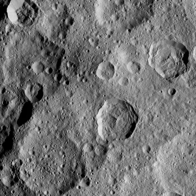
In this densely cratered area of Ceres, NASA's Dawn spacecraft spotted Tupo Crater, with its complex, hummocky interior, at center right. A portion of the rim of Darzamat Crater appears with dark shadows at lower left. Dawn took this image on Oct. 19 from its second extended-mission science orbit (XMO2), at a distance of about 920 miles (1,480 kilometers) above the surface. The image resolution is about 460 feet (140 meters) per pixel. http://photojournal.jpl.nasa.gov/catalog/PIA21233
The THEMIS VIS camera contains 5 filters. The data from different filters can be combined in multiple ways to create a false color image. These false color images may reveal subtle variations of the surface not easily identified in a single band image. Today's false color image shows part of Gale Crater. Basaltic sands are dark blue in this type of false color combination. The Curiosity Rover is located in another portion of Gale Crater, far southwest of this image. Orbit Number: 51803 Latitude: -4.39948 Longitude: 138.116 Instrument: VIS Captured: 2013-08-18 09:04 http://photojournal.jpl.nasa.gov/catalog/PIA21312
The THEMIS VIS camera contains 5 filters. The data from different filters can be combined in multiple ways to create a false color image. These false color images may reveal subtle variations of the surface not easily identified in a single band image. Today's false color image shows part of Danielson Crater. The dark blue feature at the bottom of the image are sand dunes on the floor of the crater. Orbit Number: 48086 Latitude: 8.33987 Longitude: 353.137 Instrument: VIS Captured: 2012-10-16 13:46 http://photojournal.jpl.nasa.gov/catalog/PIA21198
This image captured by NASA's 2001 Mars Odyssey spacecraft shows a portion of the dune sheet and other dune forms on the floor of Proctor Crater. Orbit Number: 67406 Latitude: -47.2898 Longitude: 30.5462 Instrument: VIS Captured: 2017-02-23 03:04 https://photojournal.jpl.nasa.gov/catalog/PIA21657
This VIS image was collected simultaneously with yesterday's IR image. It shows part of the dune field on the floor of Rabe Crater. Orbit Number: 67144 Latitude: -43.5507 Longitude: 34.5952 Instrument: VIS Captured: 2017-02-01 12:57 http://photojournal.jpl.nasa.gov/catalog/PIA21520
This enhanced color composite image from Dawn's visible and infrared mapping spectrometer shows the area around Ernutet Crater on Ceres. The instrument detected the evidence of organic materials in this area, as reported in a 2017 study in the journal Science. In this view, areas that appear pink with respect to the background appear to be rich in organics, and green areas are where organic material appears to be less abundant. Light with a wavelength of 2000 nanometers is shown in blue, 3400 nanometers is shown in green and 1700 nanometers is shown in red. http://photojournal.jpl.nasa.gov/catalog/PIA21420
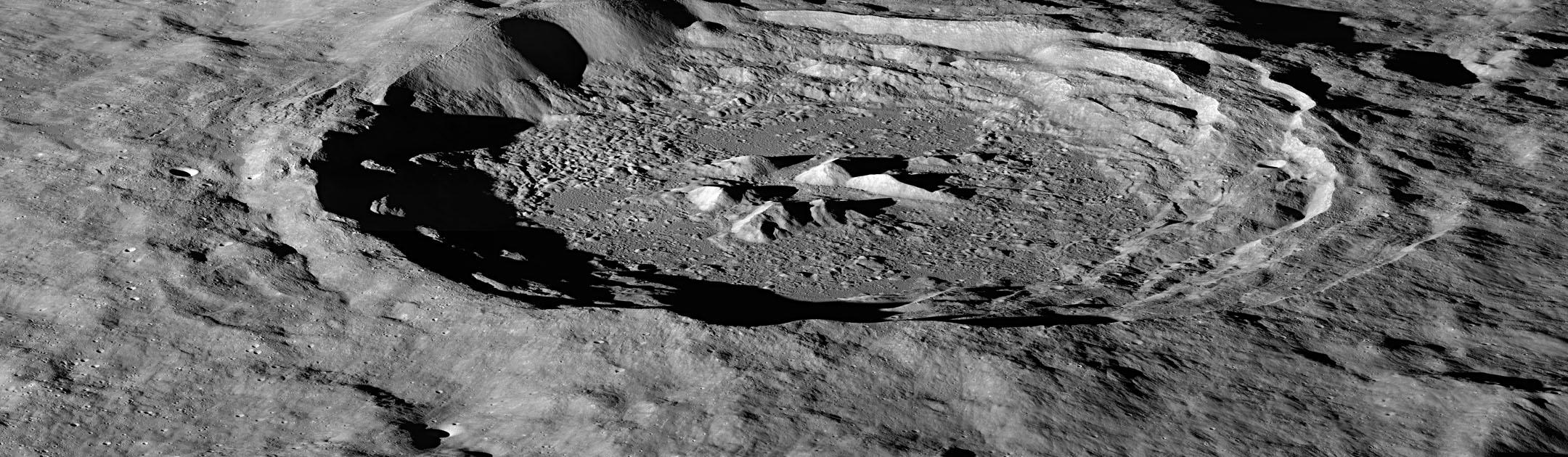
This image was captured by the Lunar Reconnaissance Orbiter Camera's (LROC) Narrow Angle Camera (NAC) aboard NASA's Lunar Reconnaissance Orbiter satellite. The moon's Hayn Crater, located just northeast of Mare Humboldtianum, is an exquisite example of a complex crater. The central peak complex in the image above is dramatically illuminated by the low Sun casting long shadows across the crater floor. The floor of Hayn crater contains spectacular remnants of the impact event: impact melt, slump blocks, and complex debris. In some areas, rocks on the floor have cracked and eroded into fields of boulders. NASA/GSFC/Arizona State University <b><a href="http://www.nasa.gov/audience/formedia/features/MP_Photo_Guidelines.html" rel="nofollow">NASA image use policy.</a></b> <b><a href="http://www.nasa.gov/centers/goddard/home/index.html" rel="nofollow">NASA Goddard Space Flight Center</a></b> enables NASA’s mission through four scientific endeavors: Earth Science, Heliophysics, Solar System Exploration, and Astrophysics. Goddard plays a leading role in NASA’s accomplishments by contributing compelling scientific knowledge to advance the Agency’s mission. <b>Follow us on <a href="http://twitter.com/NASAGoddardPix" rel="nofollow">Twitter</a></b> <b>Like us on <a href="http://www.facebook.com/pages/Greenbelt-MD/NASA-Goddard/395013845897?ref=tsd" rel="nofollow">Facebook</a></b> <b>Find us on <a href="http://instagram.com/nasagoddard?vm=grid" rel="nofollow">Instagram</a></b>
The THEMIS VIS camera contains 5 filters. The data from different filters can be combined in multiple ways to create a false color image. These false color images may reveal subtle variations of the surface not easily identified in a single band image. Today's false color image shows part of the interior mound of material within Gale Crater. The dark blue material is most likely basaltic sand. Gale Crater is the home of Curiosity Rover. Orbit Number: 44524 Latitude: -4.64054 Longitude: 137.663 Instrument: VIS Captured: 2011-12-28 07:29 http://photojournal.jpl.nasa.gov/catalog/PIA21164
The THEMIS VIS camera contains 5 filters. The data from different filters can be combined in multiple ways to create a false color image. These false color images may reveal subtle variations of the surface not easily identified in a single band image. Today's false color image shows part of the southwestern rim of Knobel Crater. Knobel Crater is located in Terra Cimmeria. Orbit Number: 52003 Latitude: -7.25713 Longitude: 132.523 Instrument: VIS Captured: 2013-09-03 20:02 http://photojournal.jpl.nasa.gov/catalog/PIA21314

The THEMIS camera contains 5 filters. The data from different filters can be combined in multiple ways to create a false color image. These false color images may reveal subtle variations of the surface not easily identified in a single band image. This image from NASA 2001 Mars Odyssey spacecraft shows part of the northern rim of Horowitz Crater. Horowitz Crater is located in Terra Cimmeria. Orbit Number: 58894 Latitude: -31.4618 Longitude: 140.816 Instrument: VIS Captured: 2015-03-25 01:00 https://photojournal.jpl.nasa.gov/catalog/PIA21548

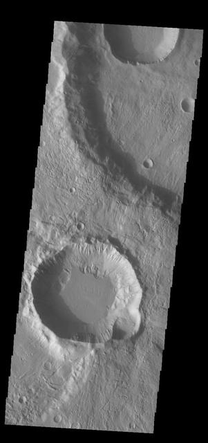
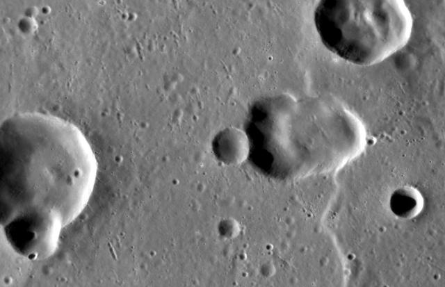
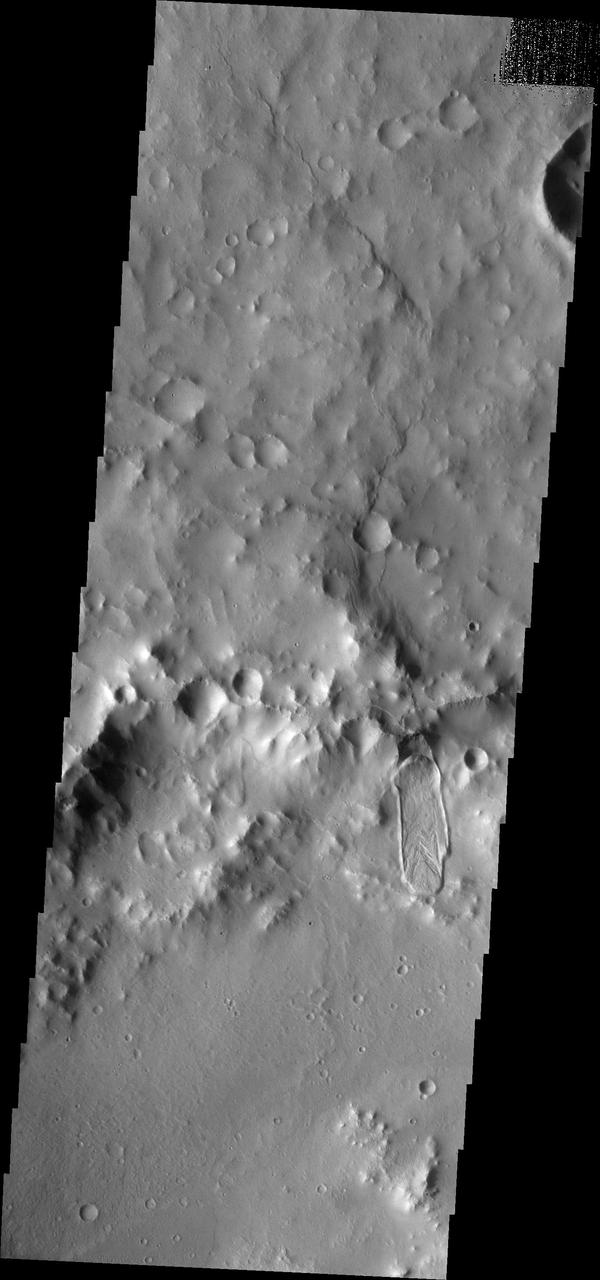
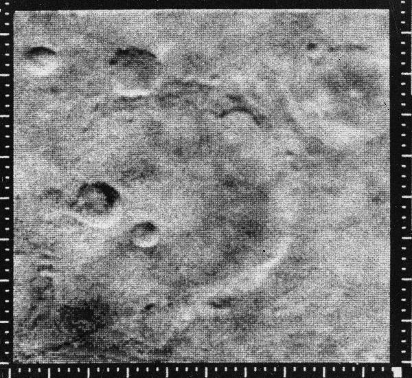
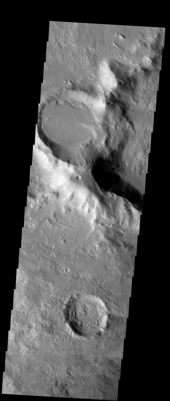
Several craters were formed on the rim of this large crater. The movement of material downhill toward the floor of the large crater has formed interesting patterns on the floors of the smaller craters
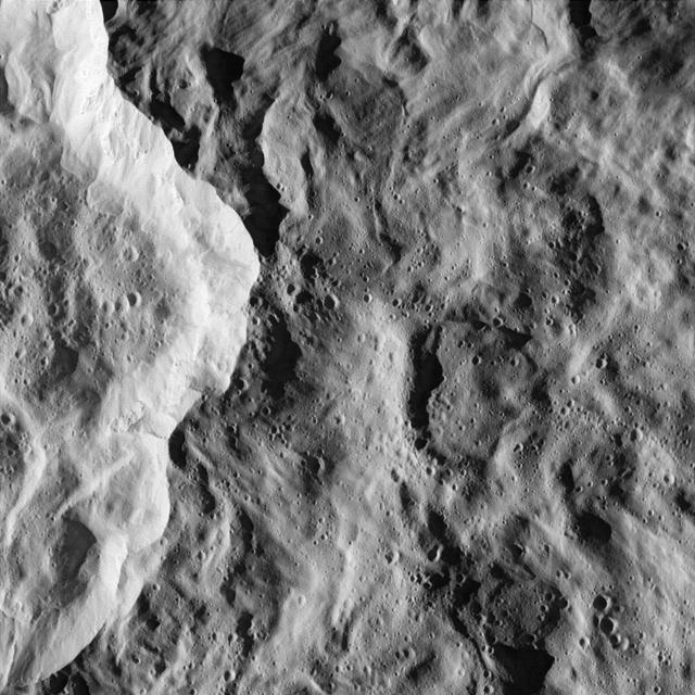
art002e012723 (April 6, 2026) – A close-up view of the Birkhoff crater on the Moon’s far side, captured by the Artemis II crew, shows the surface under low-light conditions. Located within the lunar highlands, Birkhoff is an impact crater shaped by billions of years of collisions. In this underexposed image, reduced brightness reveals subtle variations in texture and topography that are often less visible in brighter views. The lighting emphasizes differences in surface roughness and ejecta patterns, providing a clearer look at the crater’s structure and the surrounding terrain.
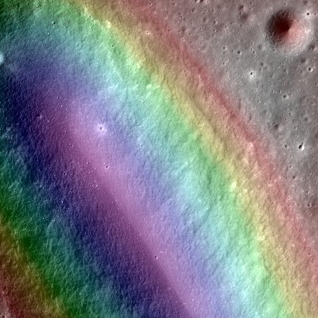
The THEMIS camera contains 5 filters. The data from different filters can be combined in multiple ways to create a false color image. This image from NASA 2001 Mars Odyssey spacecraft shows the outer rim of Beruri Crater. This image is of the ejecta along the eastern rim of the crater. The color variations show the radial nature of the ejecta emplacement. Orbit Number: 51267 Latitude: 5.28807 Longitude: 81.8251 Instrument: VIS Captured: 2013-07-05 08:29 http://photojournal.jpl.nasa.gov/catalog/PIA21305
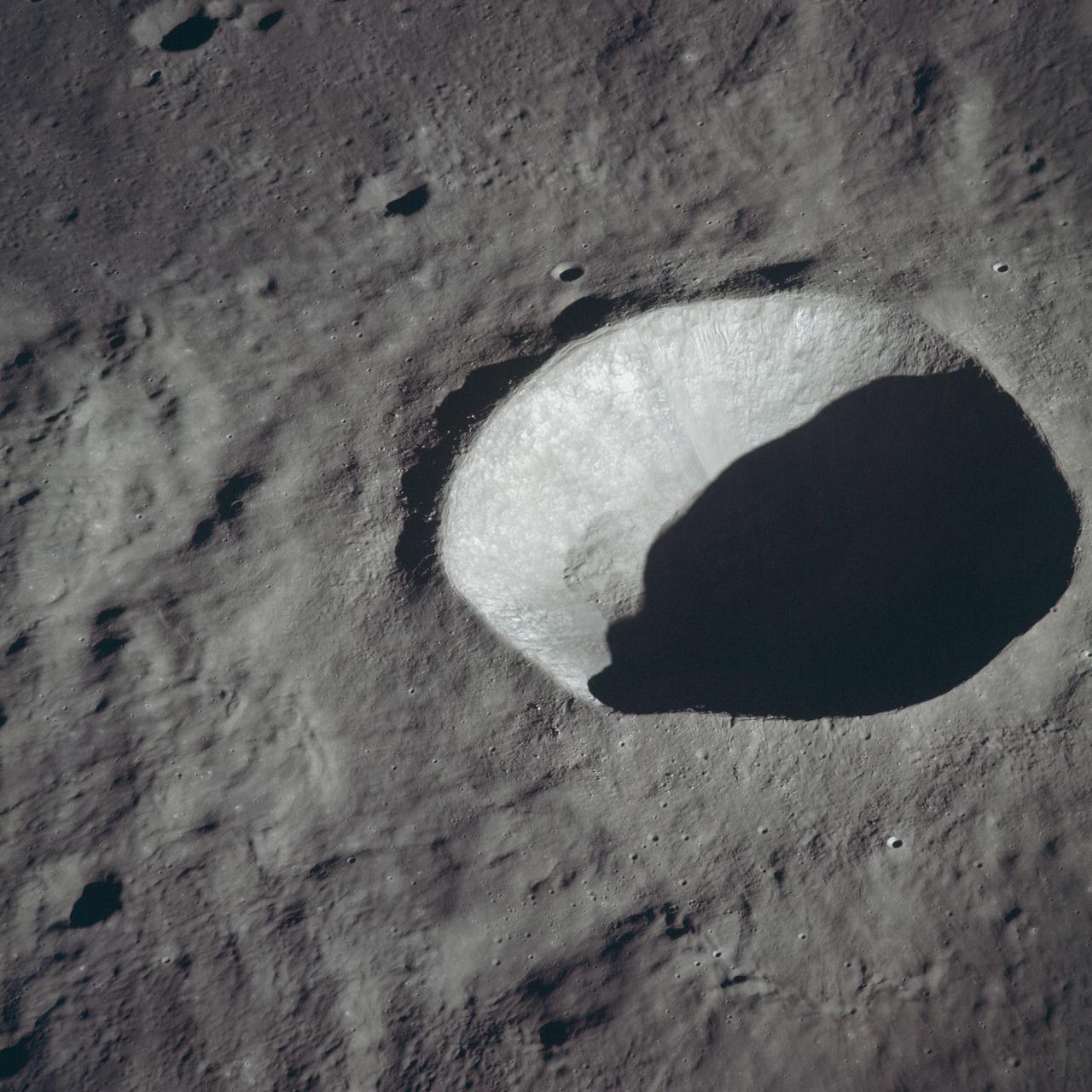
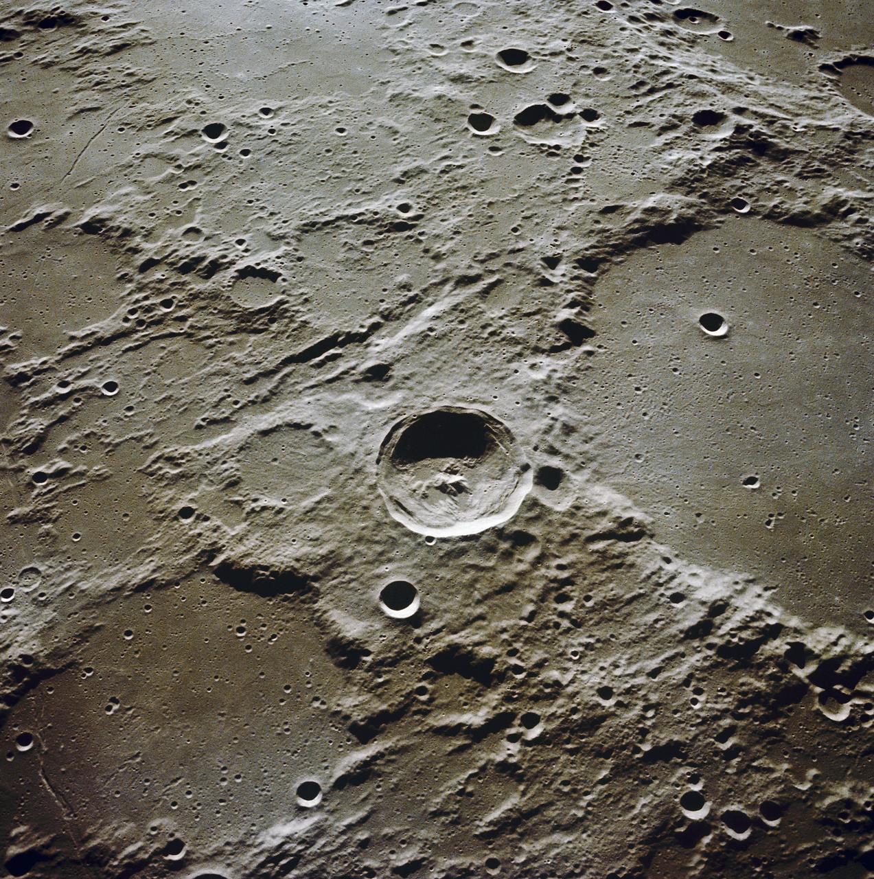
AS10-34-5162 (18-26 May 1969) --- An Apollo 10 view of crater Schmidt which is located at the western edge of the Sea of Tranquility. Schmidt, which has a diameter of 7 statute miles, is also located just south of the crater Ritter and immediately west of the crater Sabine. The coordinates of Schmidt are 18.8 degrees east longitude and 1.2 degrees north latitude. The shadowed area is on the east side of the crater.
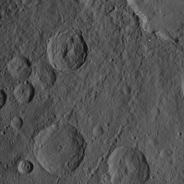
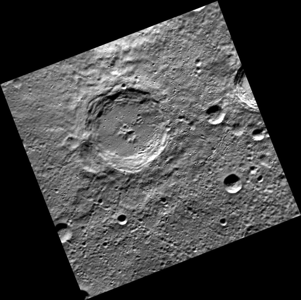
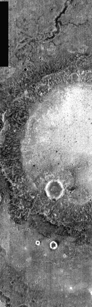
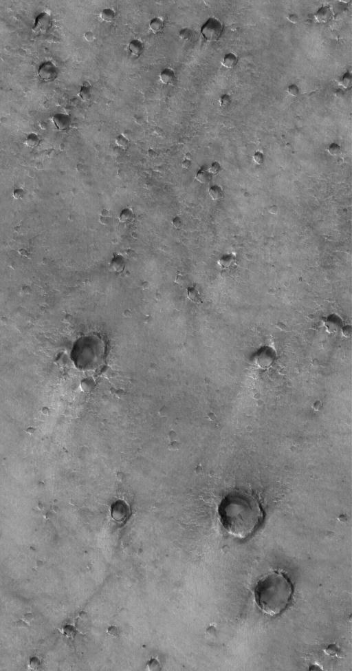
This VIS image contains three craters. There is a quarter of the largest crater in the top half of the image, half of a smaller crater at the very top, and the full crater in the lower half of the image. Investigating the relative ages of each crater indicates the largest crater formed first followed at some point by the smaller craters -- the 1/2 crater at the top occurs on top of the big crater as does the ejecta from the bottom crater. Because the visible ejecta does not reach the smaller crater at the top it is difficult to determine the relative ages of the two smaller craters. Both have similar floor morphology, but different rim morphology. The crater in the bottom of the image has a very complex rim, including both rim gullies (top side) and ridge and spur eroded features (bottom side). These difference may be related to the different materials of the largest crater. One crater impacted into the floor and the other into the ejecta blanket of the largest crater. Near surface morphology as well as deeper materials can modify the pressure wave created by impact. These craters are located in Terra Cimmeria. Orbit Number: 75334 Latitude: -38.7393 Longitude: 157.653 Instrument: VIS Captured: 2018-12-08 06:01 https://photojournal.jpl.nasa.gov/catalog/PIA23074
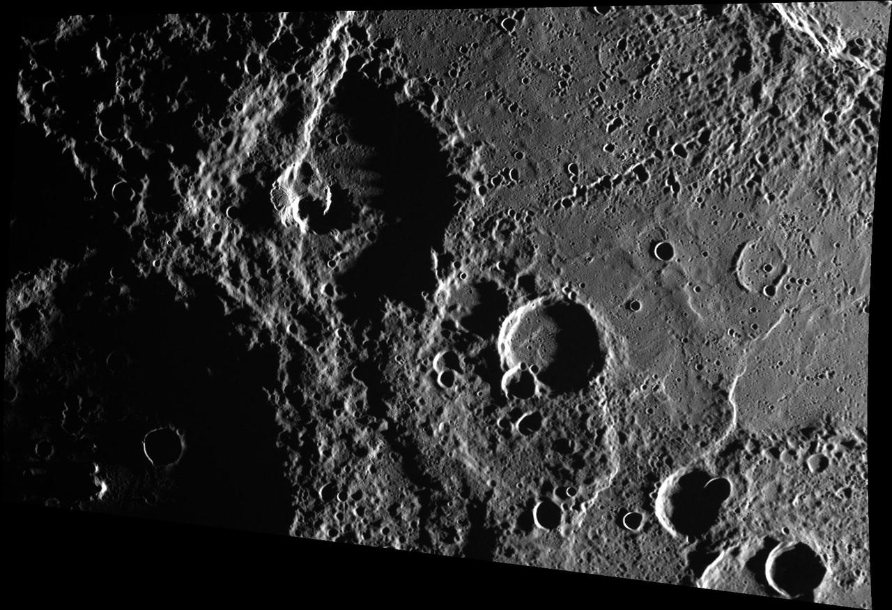
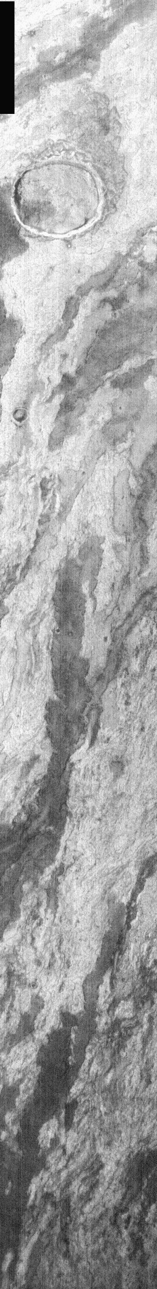
This landslide occurs in an unnamed crater southeast of Millochau Crater
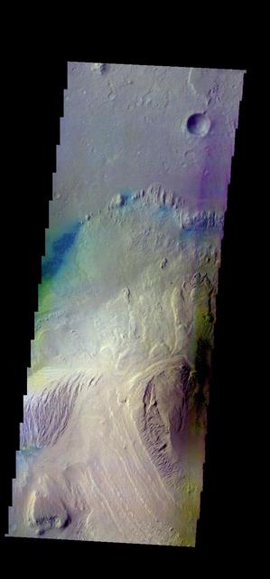
![Holden Crater in southern Margaritifer Terra displays a series of finely layered deposits on its floor. The layered deposits are especially well exposed in the southwestern section of the crater where erosion by water flowing through a breach in the crater rim created spectacular outcrops. In this location, the deposits appear beneath a cap of alluvial fan materials (tan to brown in this image). Within the deposits, individual layers are nearly flat-lying and can be traced for hundreds of meters to kilometers. Information from the CRISM instrument on the Mars Reconnaissance Orbiter suggests that at least some of these beds contain clays. By contrast, the beds in the overlying alluvial fan are less continuous and dip in varying directions, showing less evidence for clays. Collectively, the characteristics of the finely bedded deposits suggest they may have been deposited into a lake on the crater floor, perhaps fed by runoff related to formation of the overlying fans. The map is projected here at a scale of 25 centimeters (9.8 inches) per pixel. [The original image scale is 25.9 centimeters (10.2 inches) per pixel (with 1 x 1 binning); objects on the order of 78 centimeters (30.7 inches) across are resolved.] North is up. http://photojournal.jpl.nasa.gov/catalog/PIA21561](https://images-assets.nasa.gov/image/PIA21561/PIA21561~medium.jpg)
Holden Crater in southern Margaritifer Terra displays a series of finely layered deposits on its floor. The layered deposits are especially well exposed in the southwestern section of the crater where erosion by water flowing through a breach in the crater rim created spectacular outcrops. In this location, the deposits appear beneath a cap of alluvial fan materials (tan to brown in this image). Within the deposits, individual layers are nearly flat-lying and can be traced for hundreds of meters to kilometers. Information from the CRISM instrument on the Mars Reconnaissance Orbiter suggests that at least some of these beds contain clays. By contrast, the beds in the overlying alluvial fan are less continuous and dip in varying directions, showing less evidence for clays. Collectively, the characteristics of the finely bedded deposits suggest they may have been deposited into a lake on the crater floor, perhaps fed by runoff related to formation of the overlying fans. The map is projected here at a scale of 25 centimeters (9.8 inches) per pixel. [The original image scale is 25.9 centimeters (10.2 inches) per pixel (with 1 x 1 binning); objects on the order of 78 centimeters (30.7 inches) across are resolved.] North is up. http://photojournal.jpl.nasa.gov/catalog/PIA21561
The THEMIS camera contains 5 filters. The data from different filters can be combined in multiple ways to create a false color image. These false color images may reveal subtle variations of the surface not easily identified in a single band image. This image from NASA's 2001 Mars Odyssey spacecraft shows part of the floor of Matara Crater, including the sand sheet with surface dune forms. Matara Crater is located in Noachis Terra. Orbit Number: 57999 Latitude: -49.6454 Longitude: 34.7752 Instrument: VIS Captured: 2015-01-10 08:26 https://photojournal.jpl.nasa.gov/catalog/PIA21540

The THEMIS camera contains 5 filters. Data from different filters can be combined in many ways to create a false color image. These false color images may reveal subtle variations of the surface not easily identified in a single band image. This image from NASA 2001 Mars Odyssey spacecraft shows part of the sand sheet with surface dune forms on Proctor Crater. Proctor Crater is located in Noachis Terra. Orbit Number: 58904 Latitude: -47.7155 Longitude: 29.9151 Instrument: VIS Captured: 2015-03-25 21:18 https://photojournal.jpl.nasa.gov/catalog/PIA21549
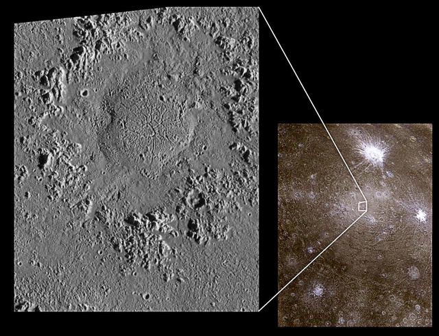
Impact Craters on Icy Callisto: Doh Crater and Asgard
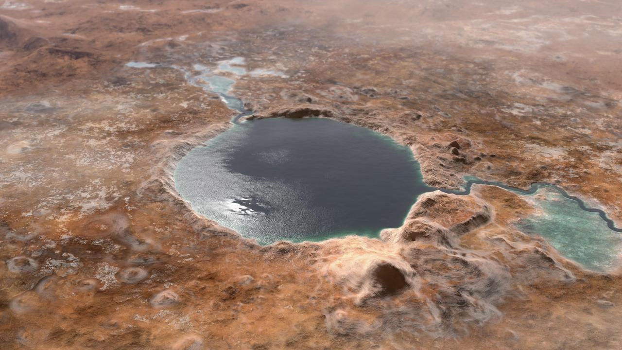
This illustration shows Jezero Crater — the landing site of the Mars 2020 Perseverance rover — as it may have looked billions of years go on Mars, when it was a lake. An inlet and outlet are also visible on either side of the lake. A key objective for Perseverance's mission on Mars is astrobiology, including the search for signs of ancient microbial life. The rover will characterize the planet's geology and past climate, pave the way for human exploration of the Red Planet, and be the first mission to collect and cache Martian rock and regolith (broken rock and dust). Subsequent missions, currently under consideration by NASA in cooperation with the European Space Agency, would send spacecraft to Mars to collect these cached samples from the surface and return them to Earth for in-depth analysis. https://photojournal.jpl.nasa.gov/catalog/PIA24172
AS12-50-7431 (19 Nov 1969) --- This low oblique view, taken from the Apollo 12 spacecraft, is looking toward the southeast and it shows the highland area around the large crater Ptolemaeus (right center). Herschel is the terraced crater with central peaks in center of photo.
The THEMIS VIS camera contains 5 filters. The data from different filters can be combined in multiple ways to create a false color image. These false color images may reveal subtle variations of the surface not easily identified in a single band image. Today's false color image shows part of Gale Crater, the home of Curiosity Rover. Orbit Number: 52340 Latitude: -4.59603 Longitude: 137.402 Instrument: VIS Captured: 2013-10-01 13:32 http://photojournal.jpl.nasa.gov/catalog/PIA21516
The THEMIS camera contains 5 filters. The data from different filters can be combined in multiple ways to create a false color image. This image from NASA 2001 Mars Odyssey spacecraft shows part of Gale Crater. The Curiosity Rover is located off this image to the west. Orbit Number: 46047 Latitude: -4.36053 Longitude: 138.275 Instrument: VIS Captured: 2012-05-01 16:06 http://photojournal.jpl.nasa.gov/catalog/PIA21193
The THEMIS camera contains 5 filters. The data from different filters can be combined in multiple ways to create a false color image. These false color images may reveal subtle variations of the surface not easily identified in a single band image. This image from NASA 2001 Mars Odyssey spacecraft shows more of Asimov Crater. Orbit Number: 58206 Latitude: -47.4085 Longitude: 4.59969 Instrument: VIS Captured: 2015-01-27 09:56 https://photojournal.jpl.nasa.gov/catalog/PIA21544
The THEMIS camera contains 5 filters. The data from different filters can be combined in multiple ways to create a false color image. These false color images may reveal subtle variations of the surface not easily identified in a single band image. Today's false color image shows part of Terby Crater. Orbit Number: 43440 Latitude: -27.3622 Longitude: 73.7577 Instrument: VIS Captured: 2011-09-30 02:20 http://photojournal.jpl.nasa.gov/catalog/PIA20990
This image captured by NASA 2001 Mars Odyssey spacecraft shows the large dune field located on the floor of Proctor Crater in Noachis Terra. Orbit Number: 66982 Latitude: -47.5876 Longitude: 30.3392 Instrument: VIS Captured: 2017-01-19 04:39 http://photojournal.jpl.nasa.gov/catalog/PIA21503
This image captured by NASA 2001 Mars Odyssey spacecraft shows part of the large sand sheet with surface dune forms on the floor of Charlier Crater in Terra Sirenum. Orbit Number: 67288 Latitude: -68.1351 Longitude: 191.161 Instrument: VIS Captured: 2017-02-13 09:50 https://photojournal.jpl.nasa.gov/catalog/PIA21526
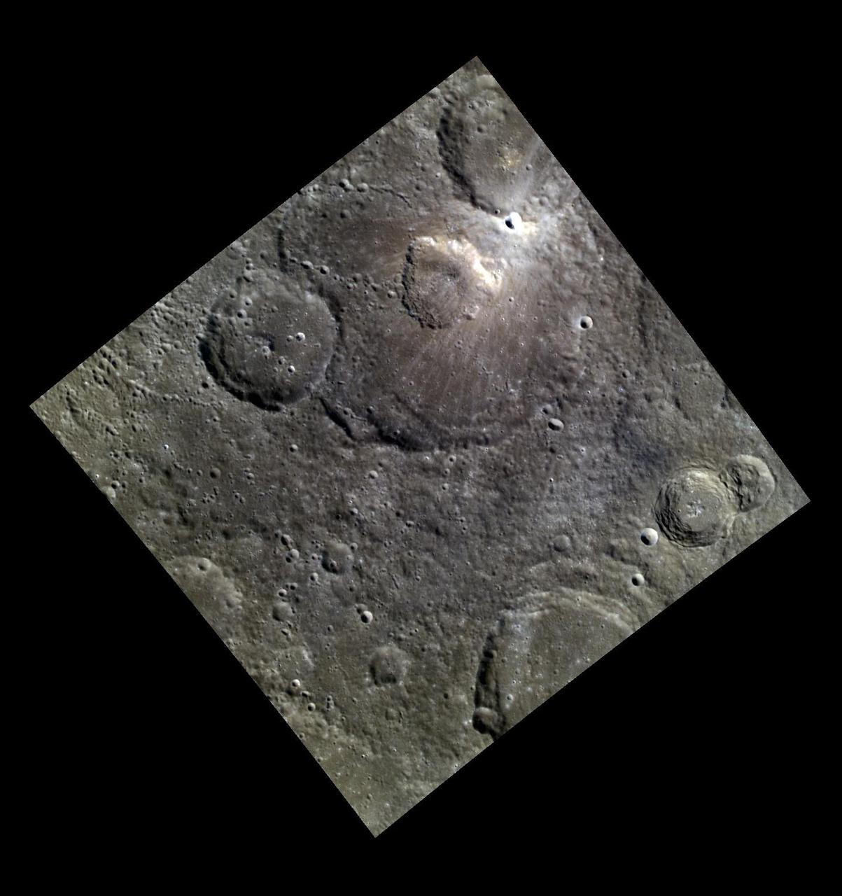
This false color image of Birt E crater shows the topography of the moon and it is thought to be the source region for lava that carved out Rima Birt, a rille in Mare Nubium. This mare is older than 3.4 billion years, and so is this vent! LROC NAC M1144849711L/R with the a color DTM overlaid; North is up. Download high res: <a href="http://lroc.sese.asu.edu/posts/794" rel="nofollow">lroc.sese.asu.edu/posts/794</a> Credit: NASA/GSFC/Arizona State University More info: Birt E crater was not created like most craters on the Moon; there was no meteorite impact. Lava sputtered out of this pyroclastic vent in Mare Nubium over 3.4 billion years ago, dispersing lava onto the surface and leaving the crater we see today. How can we tell it is a volcanic vent and not an impact crater? Impact craters and volcanic vents can be differentiated because vents often have an irregular or elongated shape (as with Birt E). Impact craters are usually circular in shape, created by the shockwave during an impact event. Also, the vee-shape of this crater is likely a product of the formation mechanism. Vee-shaped vents are thought to be formed from a pyroclastic eruption. Gasses fractionating out of the liquid rock create violent events during eruptions. Explosive eruptions created the shape that we see today, but Birt E could have had a complex history with effusive eruptions forming Rima Birt, a rille flowing from Birt E to the SE. Over long enough time scales Birt E will be filled in with ejecta from newly formed craters around Mare Nubium or by mass wasting of the walls into the crater. Let’s enjoy this ancient crater today while we still can! <b><a href="http://www.nasa.gov/audience/formedia/features/MP_Photo_Guidelines.html" rel="nofollow">NASA image use policy.</a></b> <b><a href="http://www.nasa.gov/centers/goddard/home/index.html" rel="nofollow">NASA Goddard Space Flight Center</a></b> enables NASA’s mission through four scientific endeavors: Earth Science, Heliophysics, Solar System Exploration, and Astrophysics. Goddard plays a leading role in NASA’s accomplishments by contributing compelling scientific knowledge to advance the Agency’s mission. <b>Follow us on <a href="http://twitter.com/NASAGoddardPix" rel="nofollow">Twitter</a></b> <b>Like us on <a href="http://www.facebook.com/pages/Greenbelt-MD/NASA-Goddard/395013845897?ref=tsd" rel="nofollow">Facebook</a></b> <b>Find us on <a href="http://instagram.com/nasagoddard?vm=grid" rel="nofollow">Instagram</a></b>
A Christmas Crater
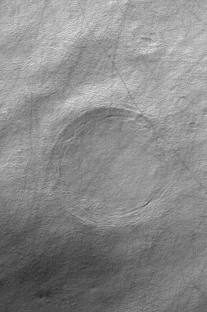
Is this Crater Circular?
Volcanic Crater?

A Crater World
Name This Crater!
Crater Streaks
Fresh Crater
Crater Cliff
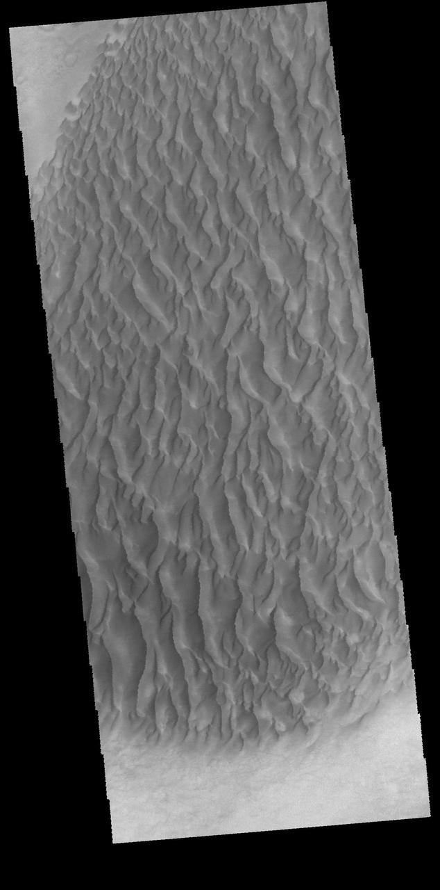
Crater Dunes
Crater with Windstreak

Crater and Canyon
Montevallo Crater
Reshaping the Craters
Filled Crater
Crater Brilliance
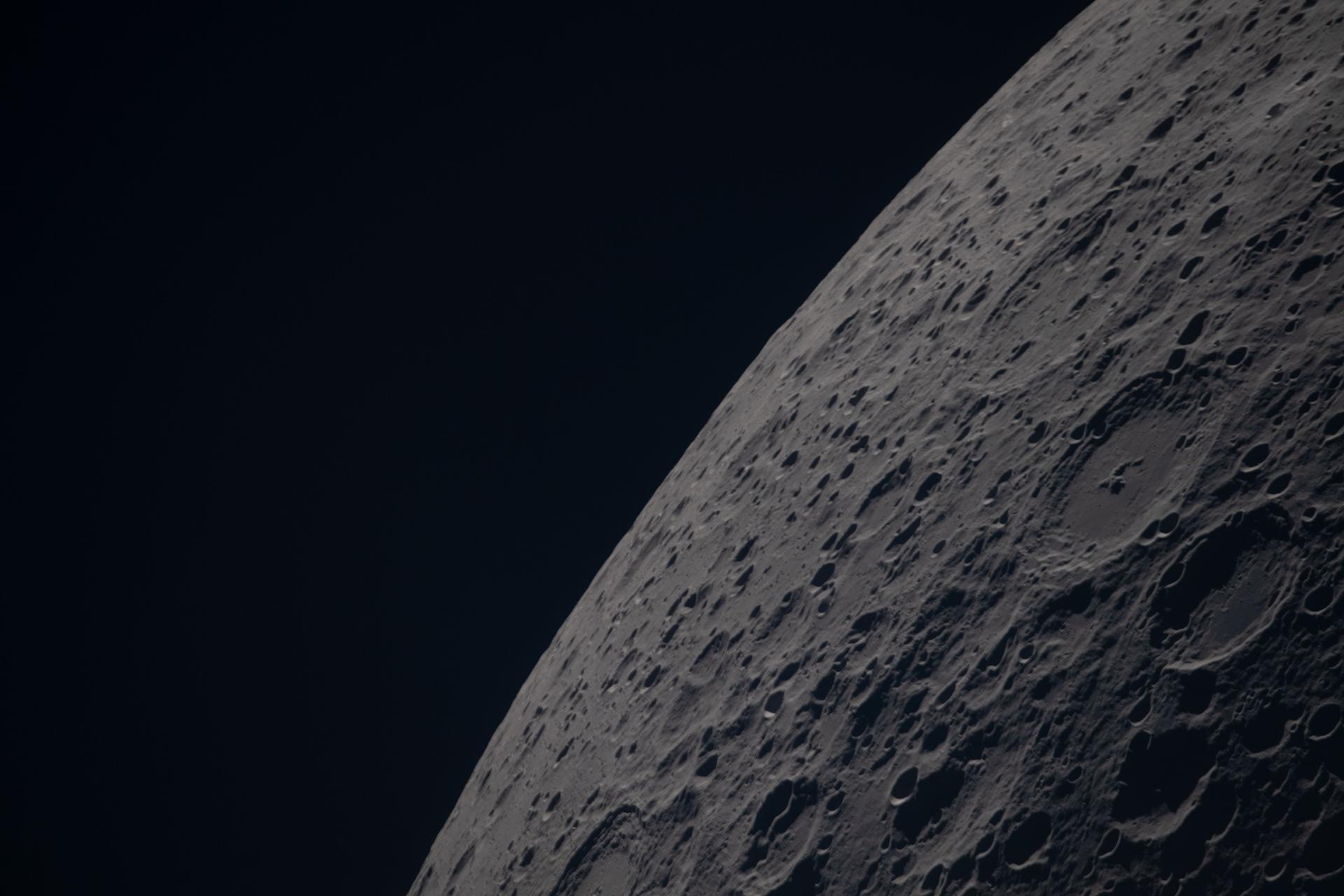
A Cratered Horizon
Arkhangelsky Crater
Mariner Crater
Crater At Night
Craters and Winds
Buried Crater
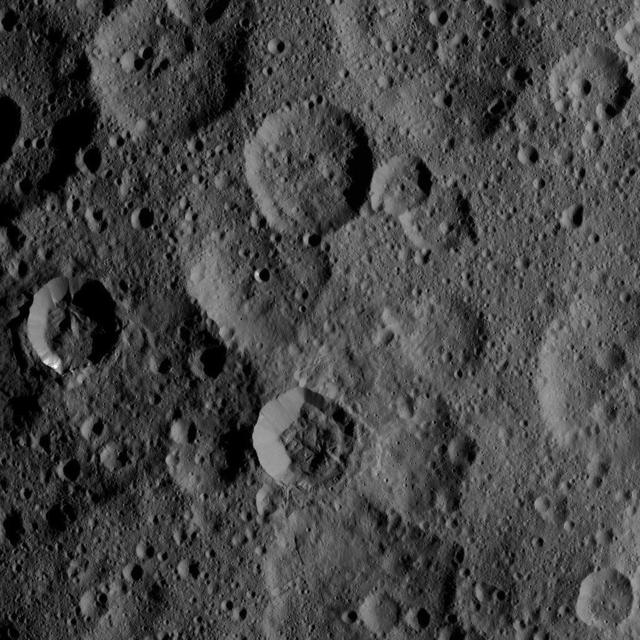
Two Craters
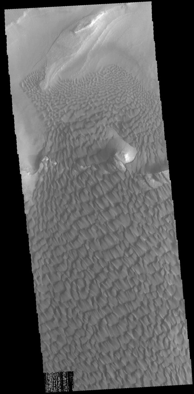
Crater Dunes
Catch that Crater
Cerulli Crater
Meridiani Craters