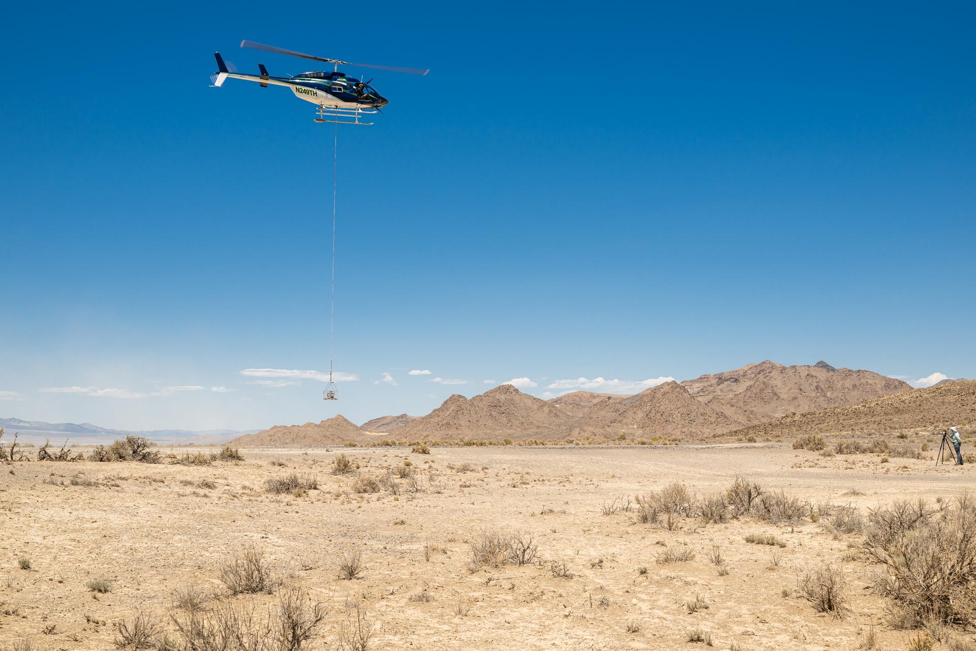
Timberland Helicopter flying the DAVINCI VADIX payload lifts off from Crater Island, Utah, June 23, 2026. NASA/Mike Guinto
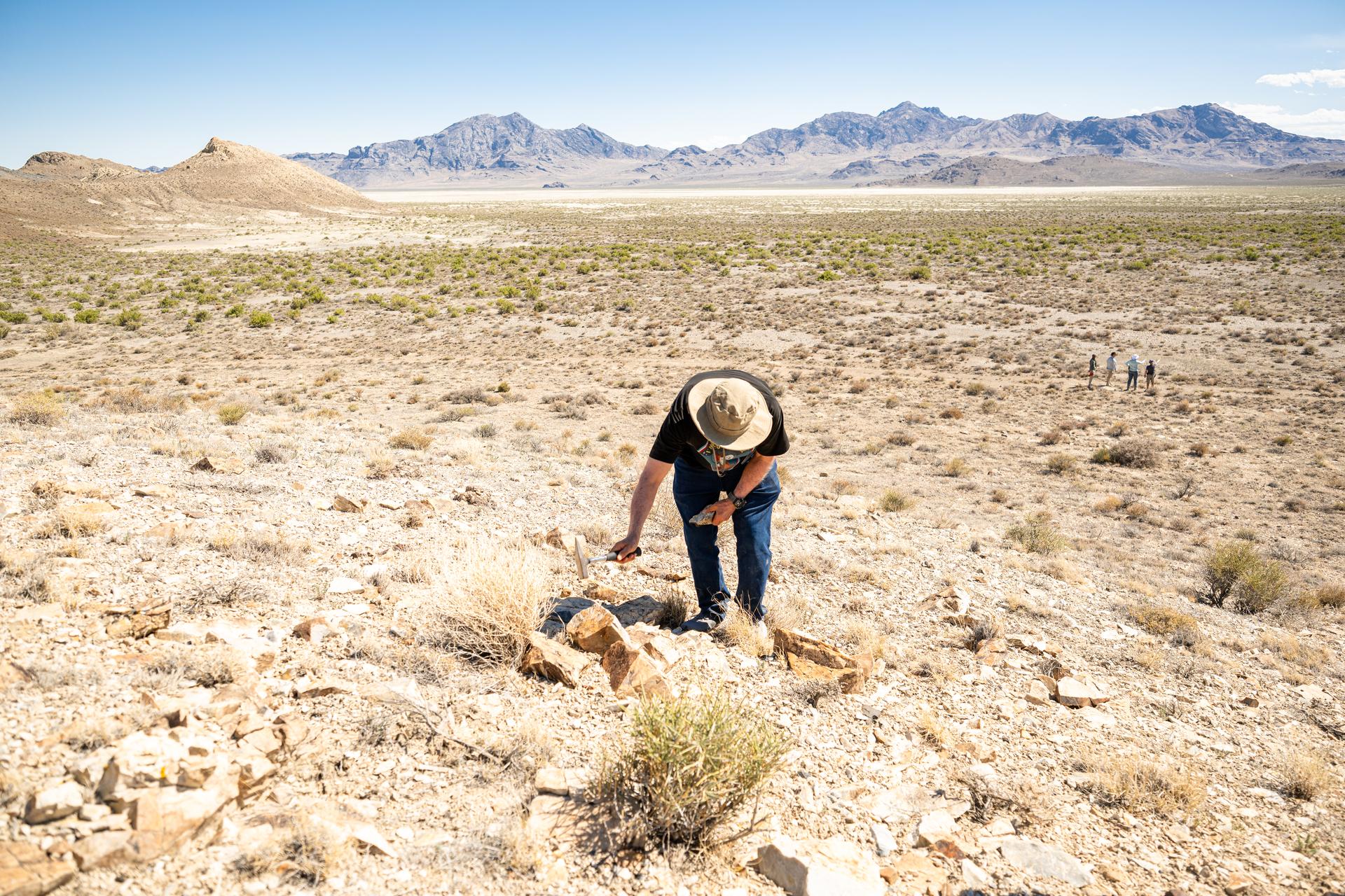
Dr. Jim Garvin, mission principal investigator,collect samples of rocks found at Crater Island, Utah on June 23, 2026. These samples become the "ground truth" for the measurements from the VADIX prototype camera system which flew over the crater island site, taking photos and measurements from the air. NASA/Mike Guinto
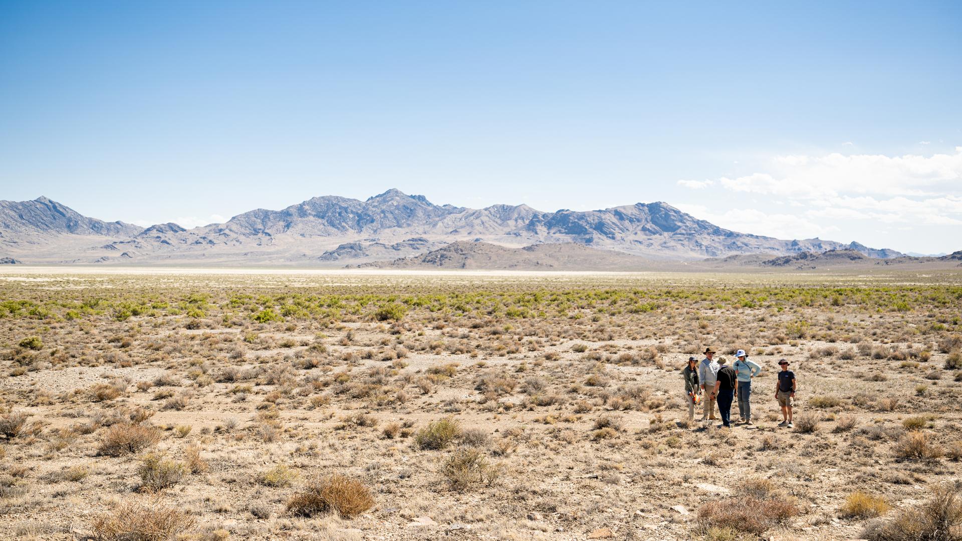
DAVINCI VADIX team members discuss observations at Crater Island, Utah, June 23, 2026. NASA/Mike Guinto
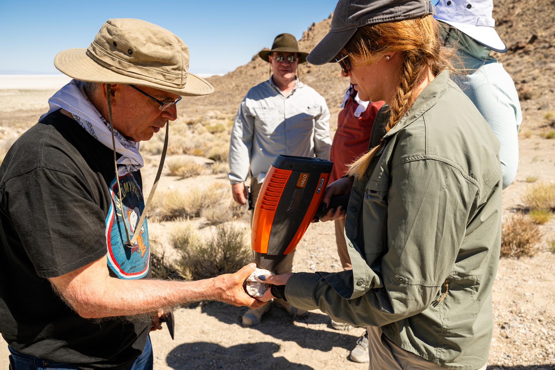
Dr. Jim Garvin, mission principal investigator, left, and Dr. Erika Kohler, acting deputy principal investigator, right, take measurements of rock samples found at Crater Island, Utah on June 23, 2026. These samples become the "ground truth" for the measurements from the VADIX prototype camera system which flew over the crater island site, taking photos and measurements from the air. NASA/Mike Guinto
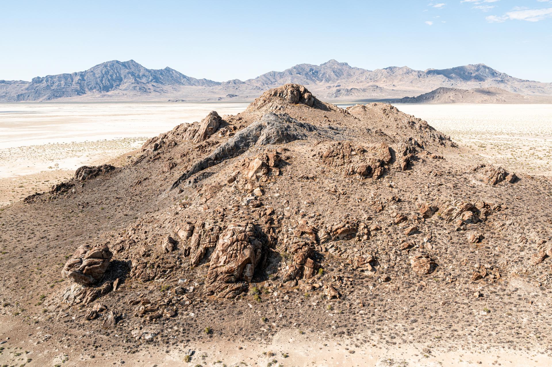
Detailed view of a rock outcrop at Crater Island, Utah on June 23, 2026. This outcropping was one of the points of interest to NASA's DAVINCI VADIX Mission for its distinct geologic properties. NASA/Mike Guinto
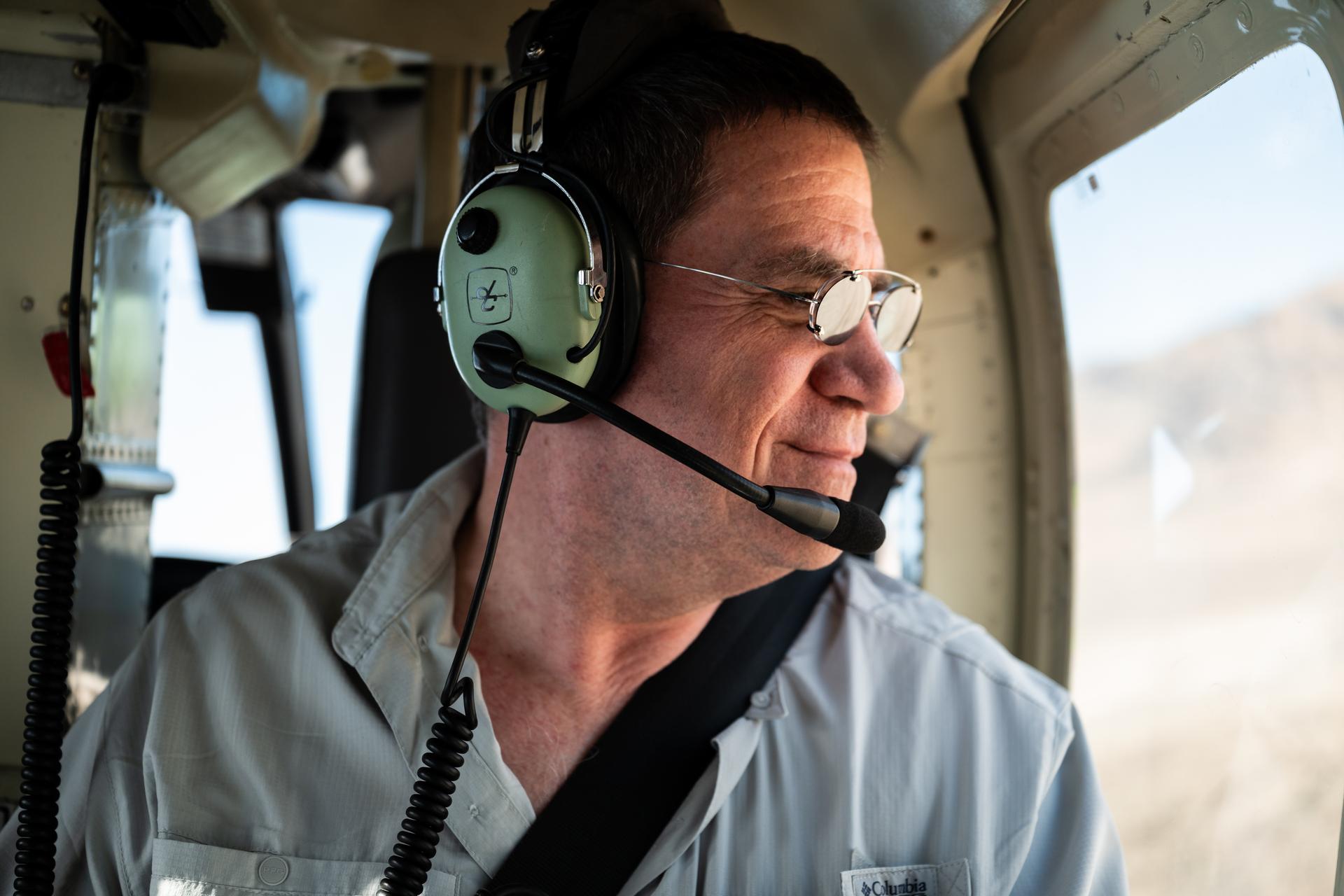
Mike Ravine observes out the helicopter window while in flight over Crater Island, Utah as part of the DAVINCI VADIX experiment, June 23, 2026. NASA/Mike Guinto
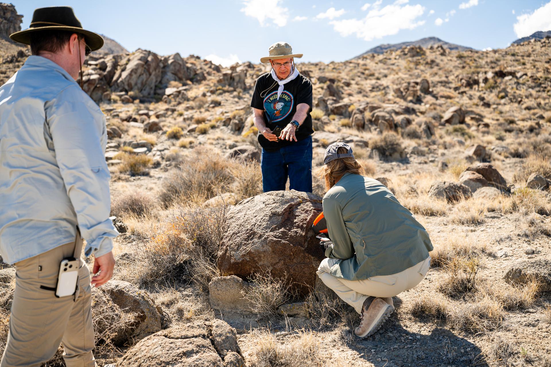
Mike Ravine, left, Jim Garvin, and Erika Kohler, take direct measurements of rocks observed at Crater Island, Utah as part of the DAVINCI VADIX experiment, June 23, 2026. NASA/Mike Guinto
Crater Island
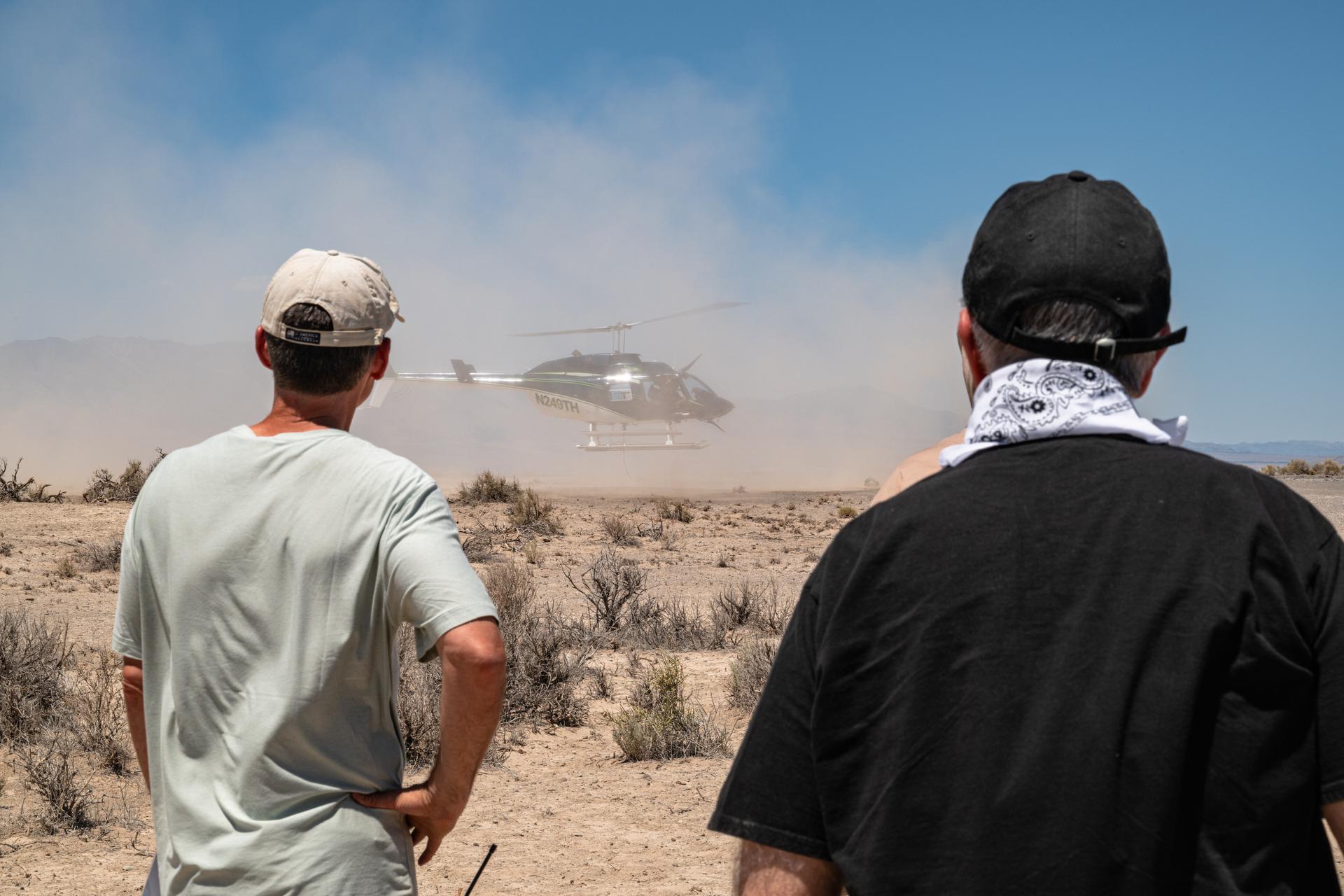
Brent Bos, left, and Jim Garvin, right, watch the helicopter carrying the VADIX payload lift off from Crater Island, Utah, June 23, 2026. VADIX is a test of the camera system that will one day fly aboard NASA’s DAVINCI mission probe to Venus. NASA/Mike Guinto
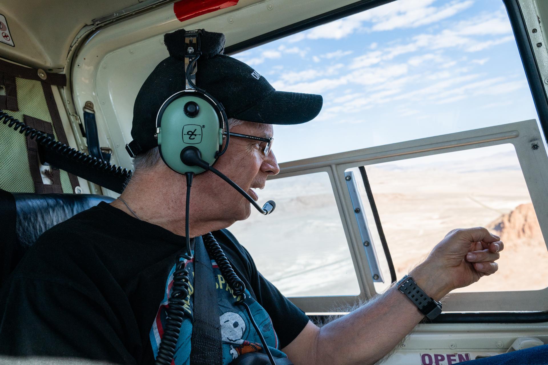
Dr. Jim Garvin makes observations from the window of a helicopter while flying from Wendover Utah to Crater Island, June 23, 2026. The flight was in coordination with the VADIX mission, a preliminary experiment which will demonstrate a prototype camera system that will one day fly on the DAVINCI probe to Venus. NASA/Mike Guinto
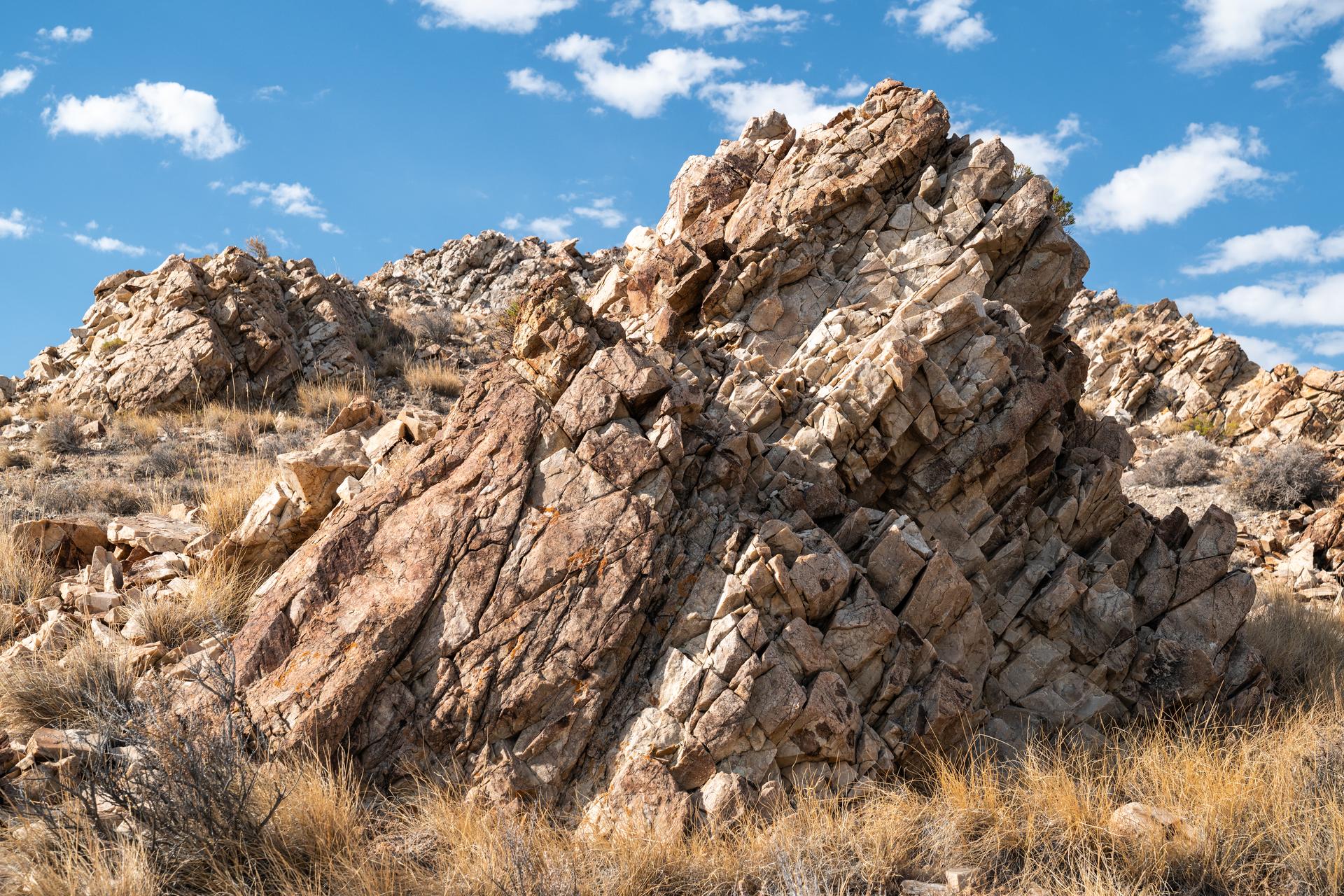
Detailed view of a granite outcrop at Crater Island, Utah on June 23, 2026. This outcropping was one of the points of interest to NASA's DAVINCI VADIX Mission for its distinct geologic properties. NASA/Mike Guinto
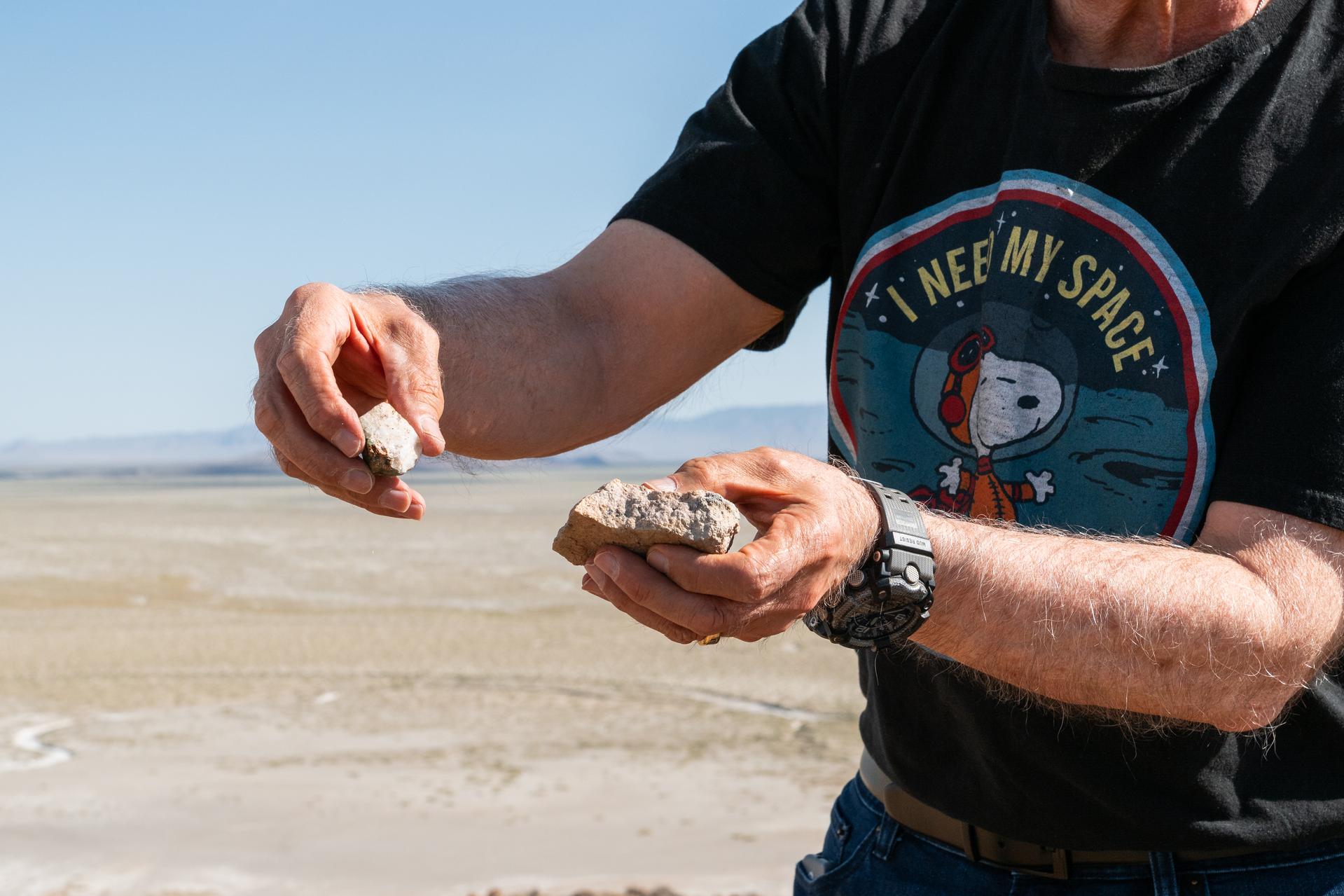
Dr. Jim Garvin presents rock samples found at Crater Island, Utah on June 23, 2026. Dr. Garvin is the principal investigator for NASA's DAVINCI probe which will one day be making discoveries on Venus.
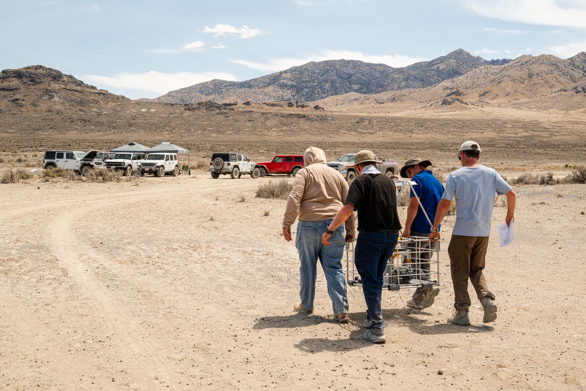
DAVINCI VADIX team carries the VADIX payload from the helicopter back to basecamp so they can retrieve flight data and get the payload back onto the helicopter for the next test flight at Crater Island, Utah, June 24, 2026. NASA/Mike Guinto

Pictured are DAVINCI’s (left to right) Jim Garvin, mission principal investigator; Erika Kohler, acting deputy principal investigator; and Matthew Mullin, space laser engineer, evaluating flight data in real-time to adapt their future tests to the lessons learned from each flight. The researchers are standing in an area of Crater Island, Utah, which was the site of a series of tests (June 23-25, 2026) of the camera system that will one day fly aboard NASA’s DAVINCI mission probe to Venus.
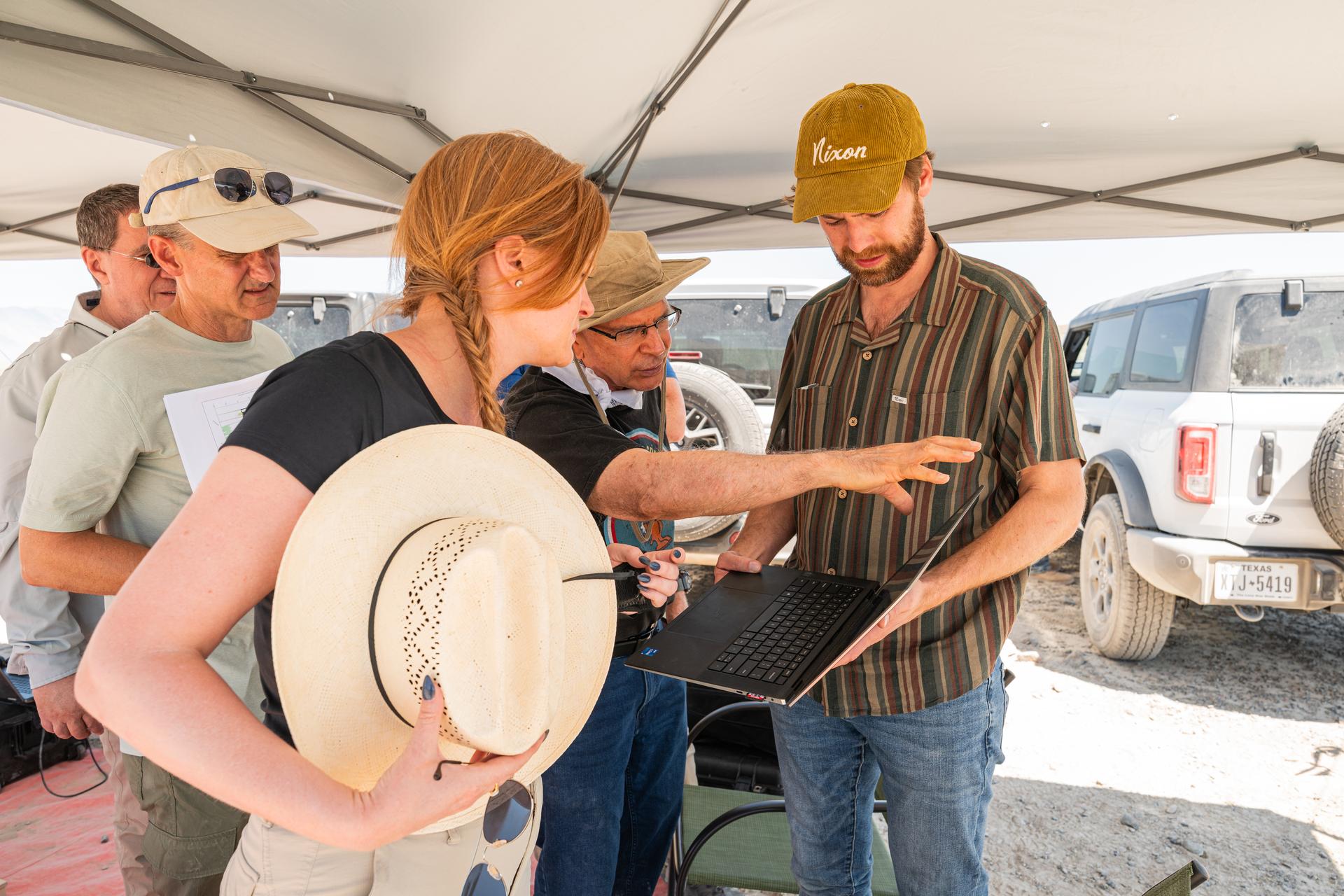
Pictured are DAVINCI’s (left to right) Mike Ravine, Brent Bos, Erika Kohler, Jim Garvin, and Christian Tate, evaluating flight data in real-time to adapt their future tests to the lessons learned from each flight. The researchers are standing in an area of Crater Island, Utah, which was the site of a series of tests (June 23-25, 2026) of the camera system that will one day fly aboard NASA’s DAVINCI mission probe to Venus. NASA/Mike Guinto
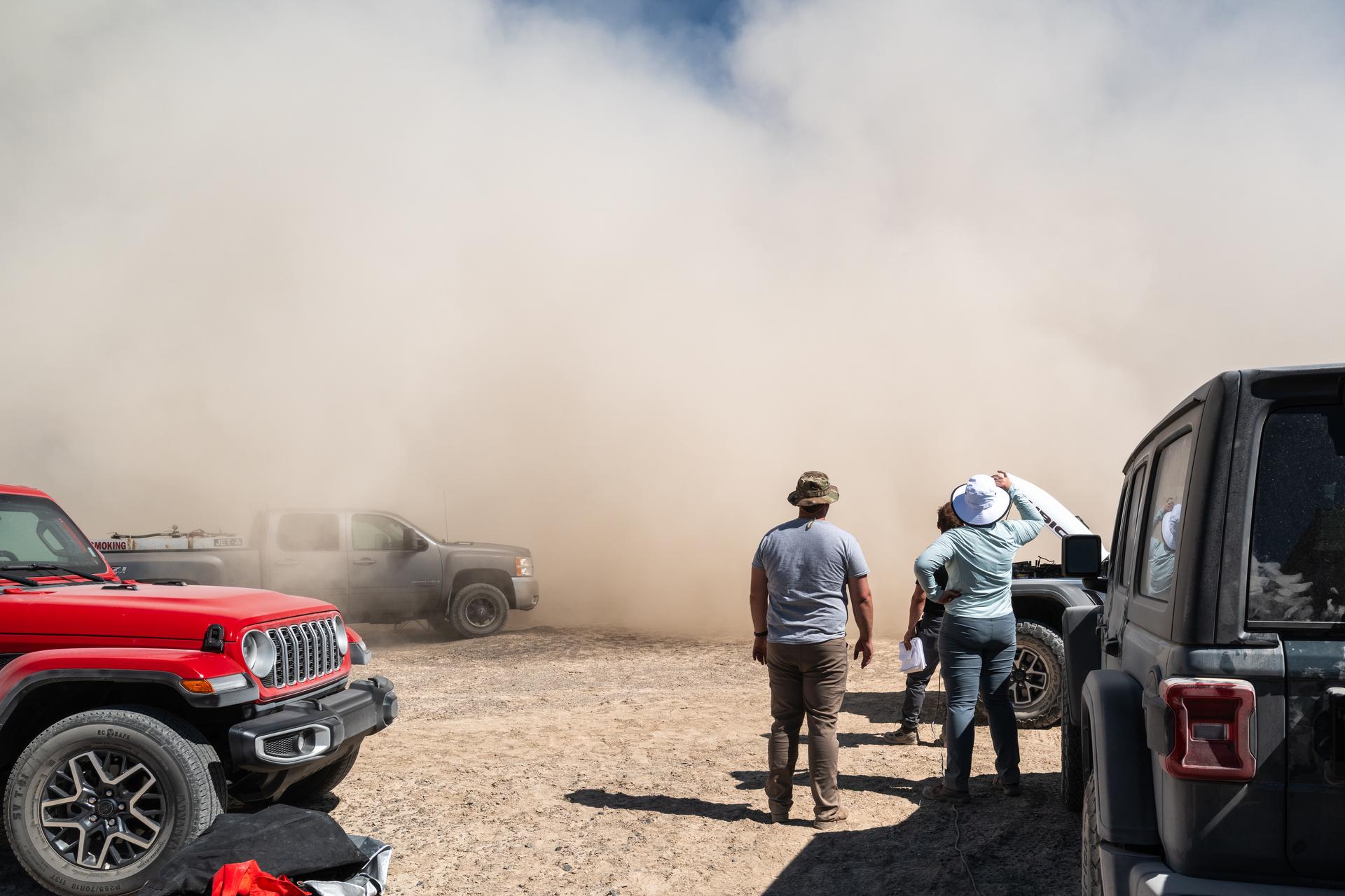
Jason Burt, Lacey Young, and Matt Mullin watch as a helicopter takes off from a test site at Crater Island, June 23, 2026. As the helicopter takes off, it kicks up dust from the ground, reffered to as "roto wash" the dust cloud quickly rises up into a wall of dust before it is blown away by the wind. NASA/Mike Guinto
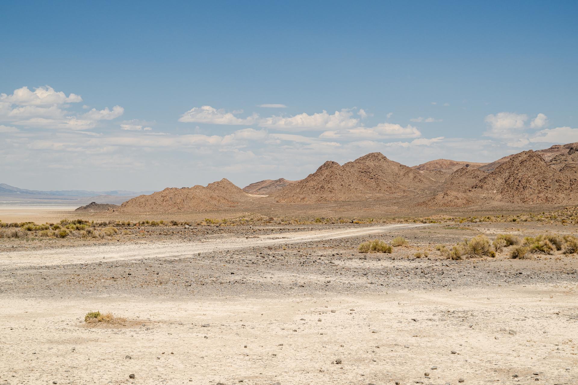
A view of Crater Island from the VADIX Basecamp, Crater Island, Utah June 24, 2026. This area was the site of a series of tests (June 23-25, 2026) of the camera system that will one day fly aboard NASA’s DAVINCI mission to Venus. NASA/Mike Guinto
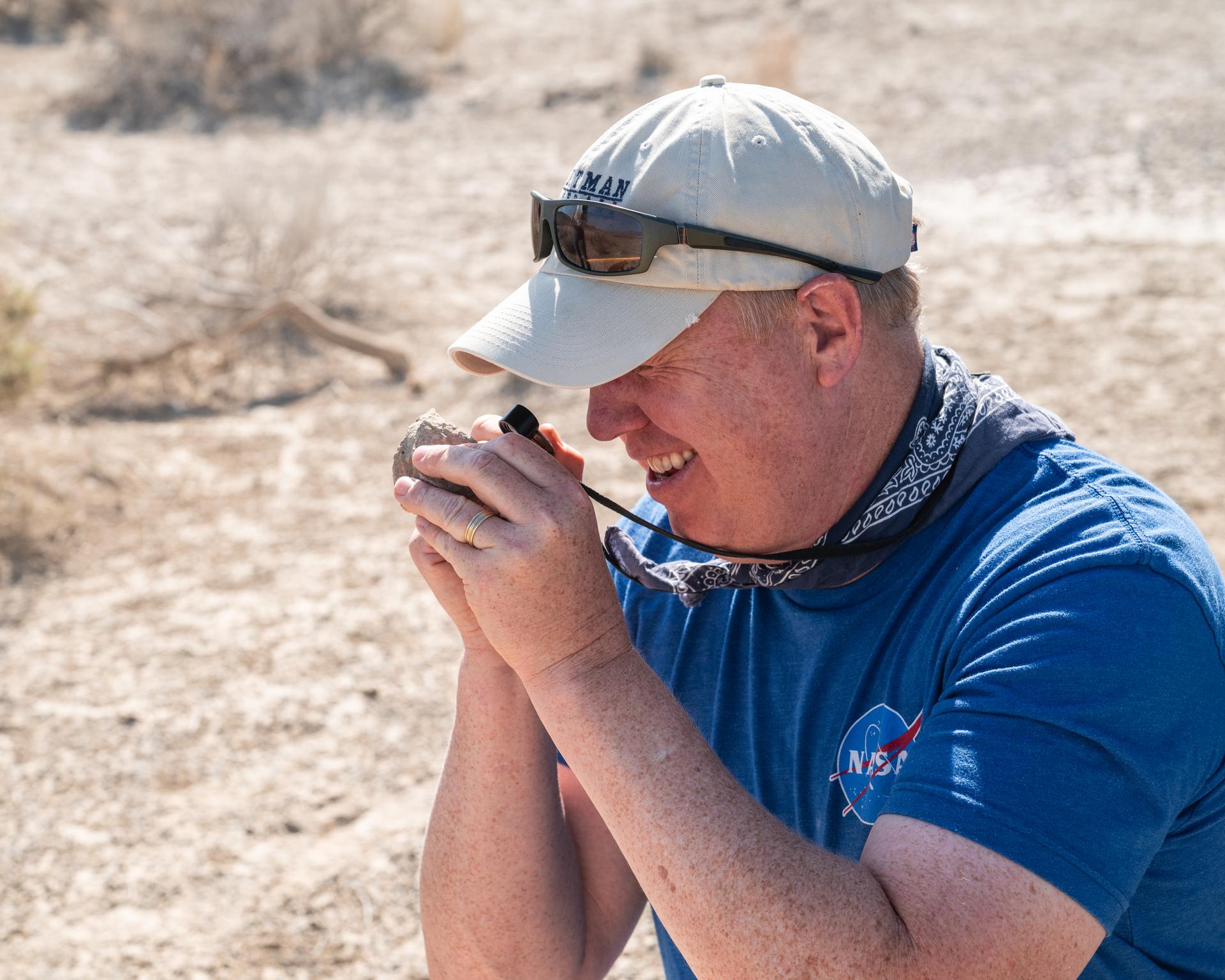
Nick Lang, DAVINCI Science Program Manager at Headquarters NASA, inspects a rock found at Crater Island, Utah during the DAVINCI VADIX experiment, June 23, 2026. NASA/Mike Guinto
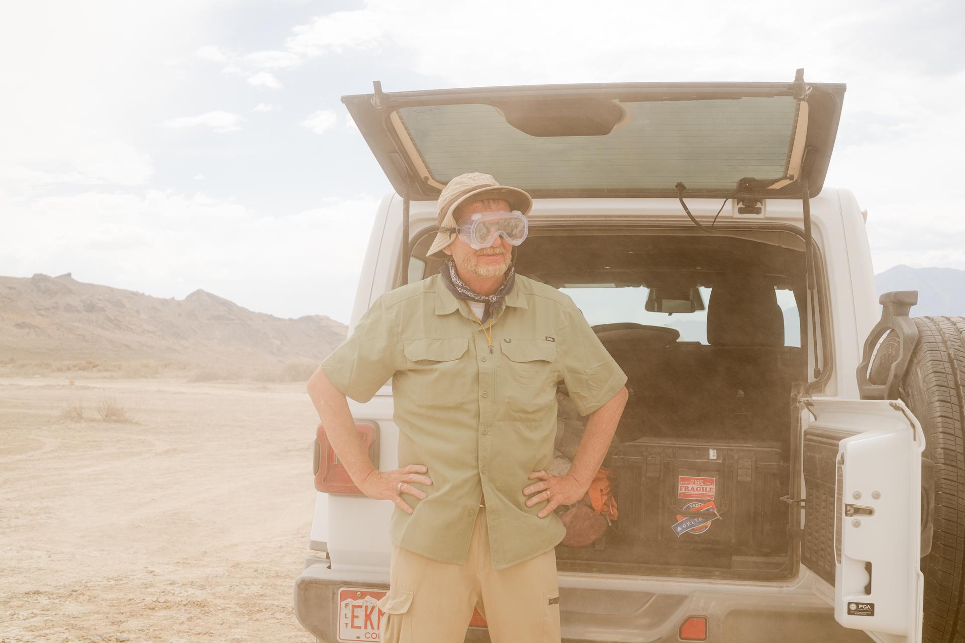
Bob Podgurski wears goggles during a dust event at the DAVINCI VADIX basecamp, Crater Island, Utah, June 24, 2026. This area was the site of a series of tests (June 23-25, 2026) of the camera system that will one day fly aboard NASA’s DAVINCI mission to Venus. NASA/Mike Guinto

DAVINCI's Matthew Mullin, space laser engineer, reviews data in between test flights at Crater Island, Utah June 24, 2026. NASA/Mike Guinto
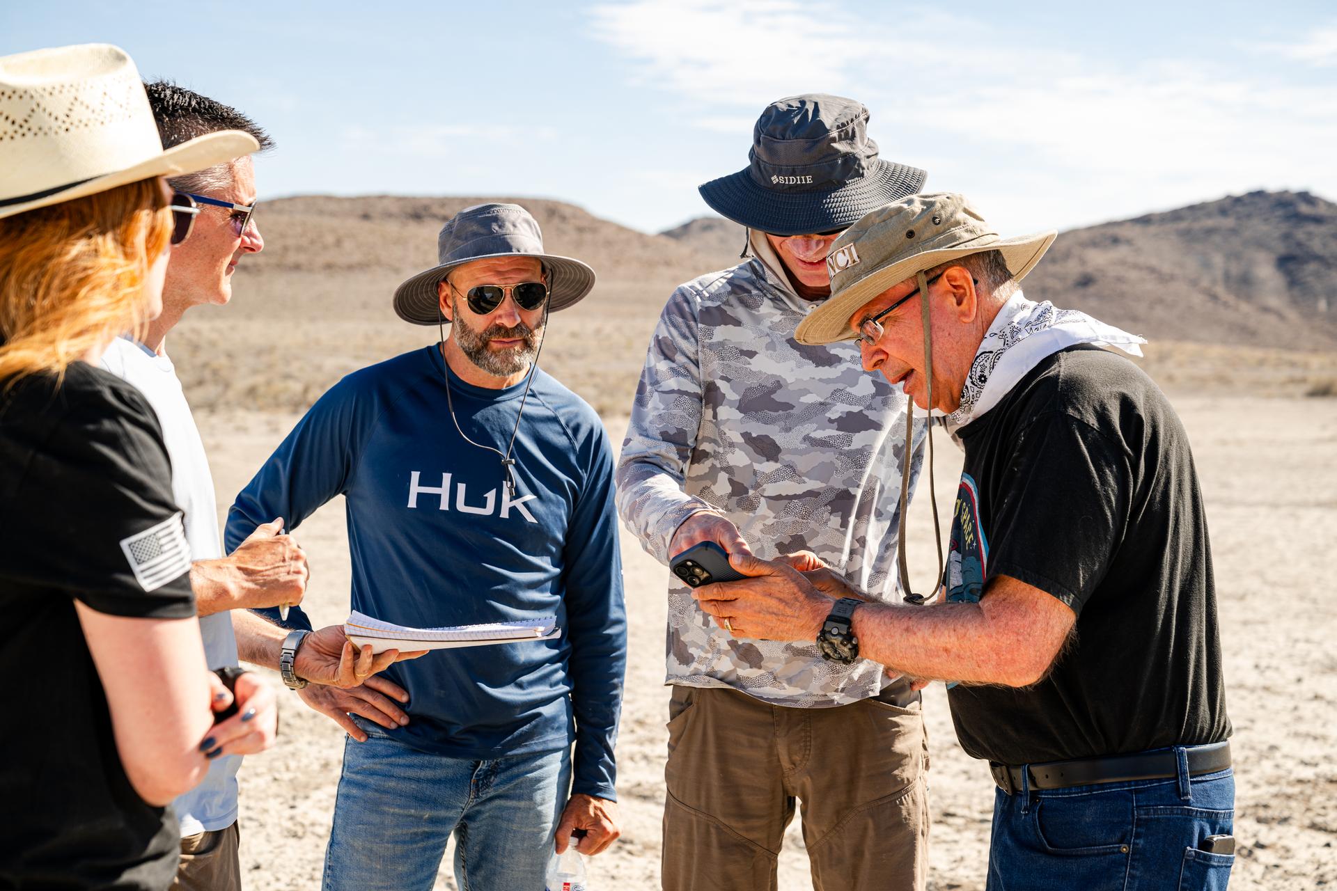
Dr. Jim Garvin, right, discusses flight plans with the pilots in between test flights at Crater Island, Utah, June 24, 2026. NASA/Mike Guinto
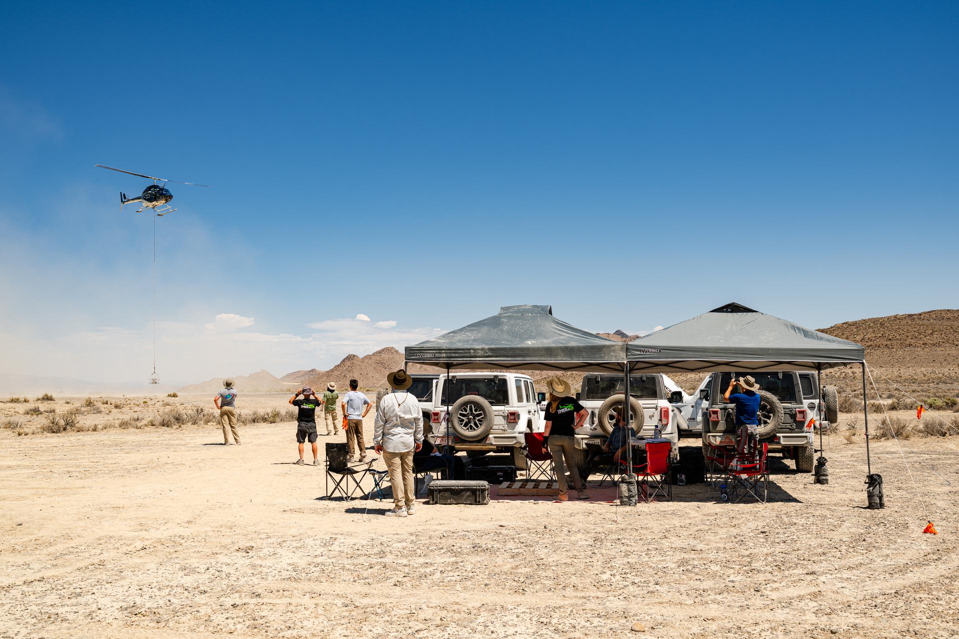
Helicopter carrying the VADIX payload flies past the DAVINCI VADIX base camp in crater island, Utah on June 24, 2026. NASA/Mike Guinto

Dr. Jim Garvin, left, and Mike Ravine review flight data inbetween test flights over Crater Island, Utah as part of the DAVINCI VADIX experiment, June 24, 2026. NASA/Mike Guinto
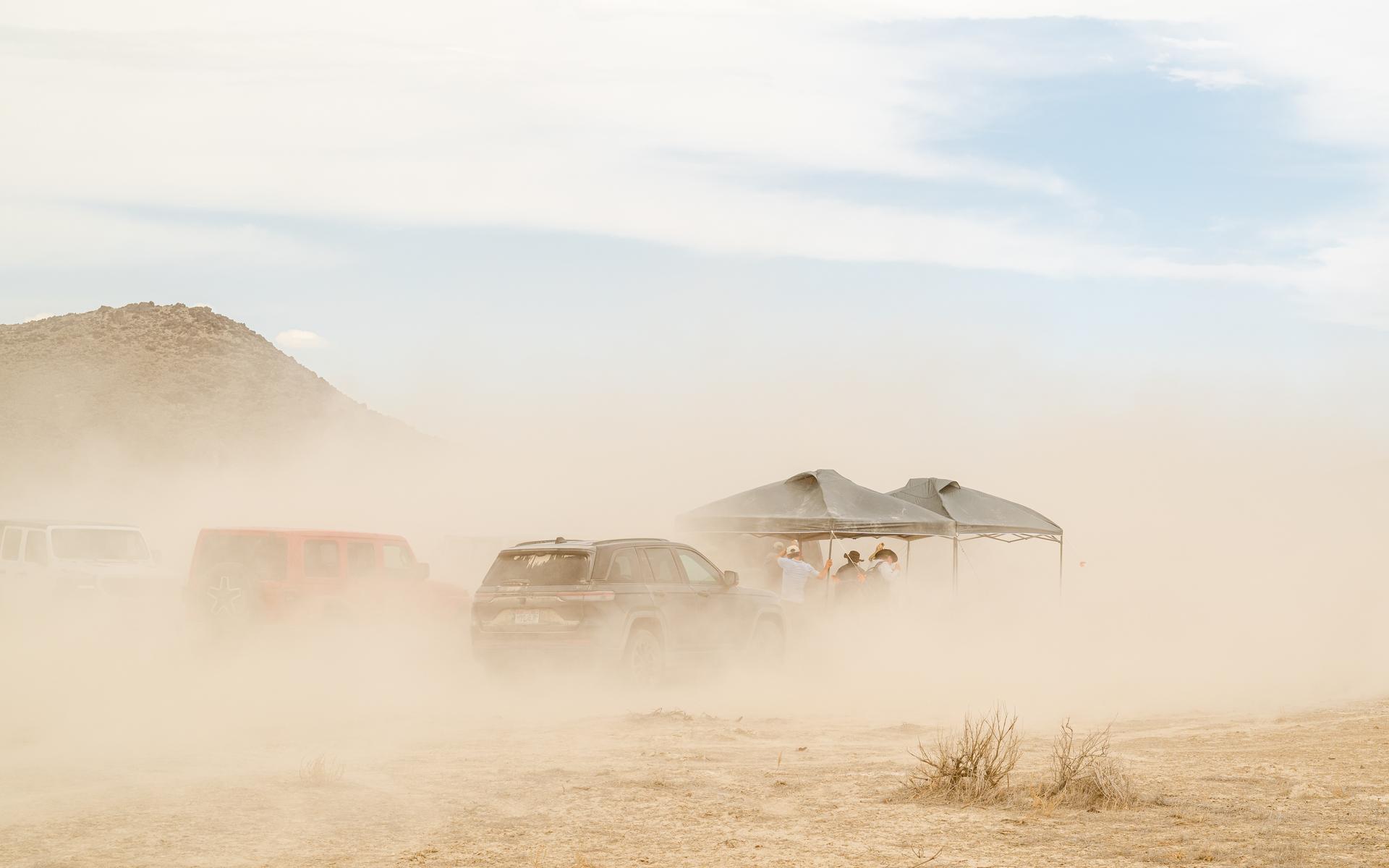
A strong wind kicks up a lot of dirt around the DAVINCI VADIX basecamp at Crater Island, Utah, June 24, 2026. This area was the site of a series of tests (June 23-25, 2026) of the camera system that will one day fly aboard NASA’s DAVINCI mission to Venus. NASA/Mike Guinto
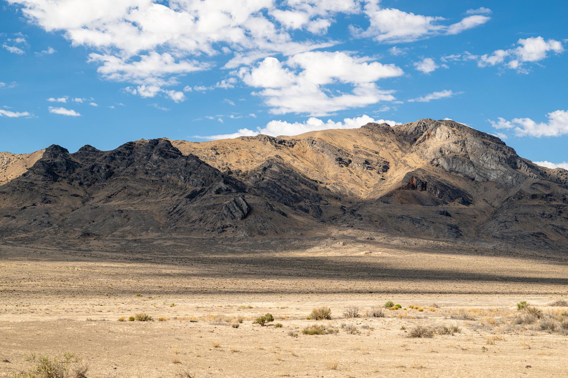
A view from the DAVINCI VADIX Basecamp near Crater Island, Utah, June 25, 2026. This area was the site of a series of tests (June 23-25, 2026) of the camera system that will one day fly aboard NASA’s DAVINCI mission to Venus. NASA/Mike Guinto
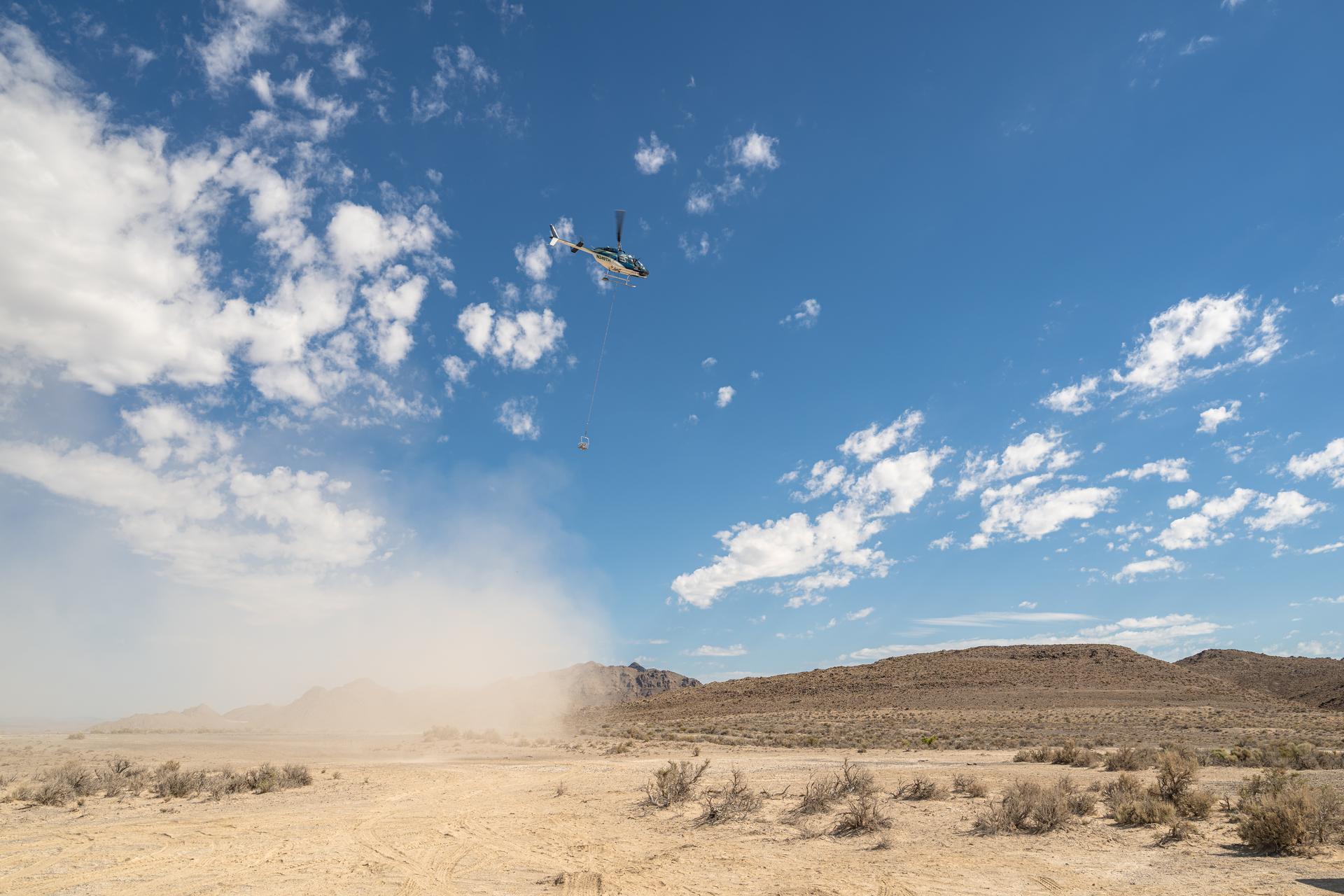
A helicopter flying in U.S. Air Force restricted space over Crater Island, Utah, carrying a basket of nine instruments during a series of tests (June 23-25, 2026) of a prototype of the camera system that will one day fly aboard NASA’s DAVINCI probe to Venus. NASA/Mike Guinto
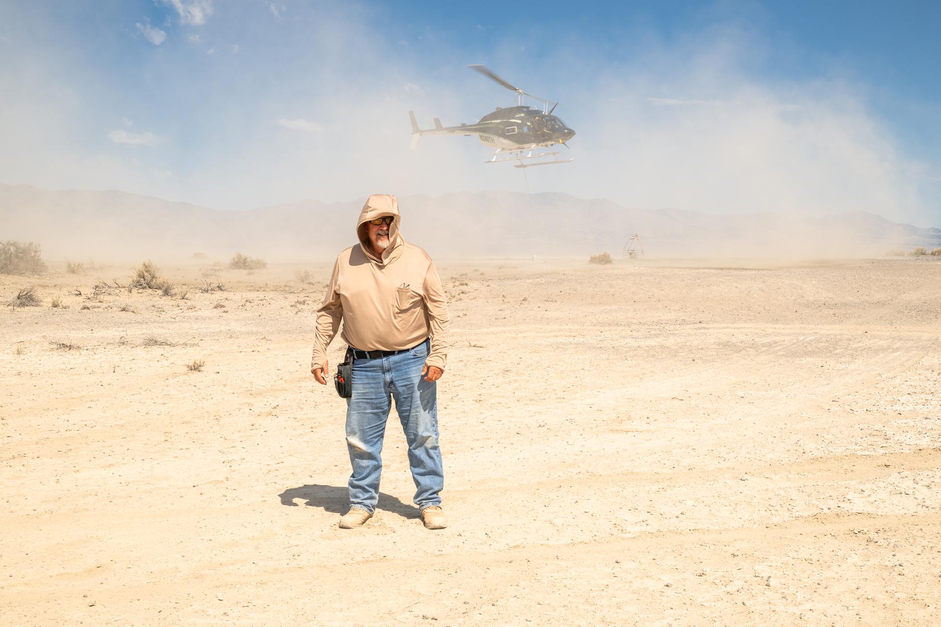
Mike Vitulio, a NASA mechanical integration engineering technician and machinist working on the DAVINCI project poses stands with his back to the helicopter as it takes off to shield himself from the roto-wash at Crater Island, Utah, June 25, 2026. NASA/Mike Guinto
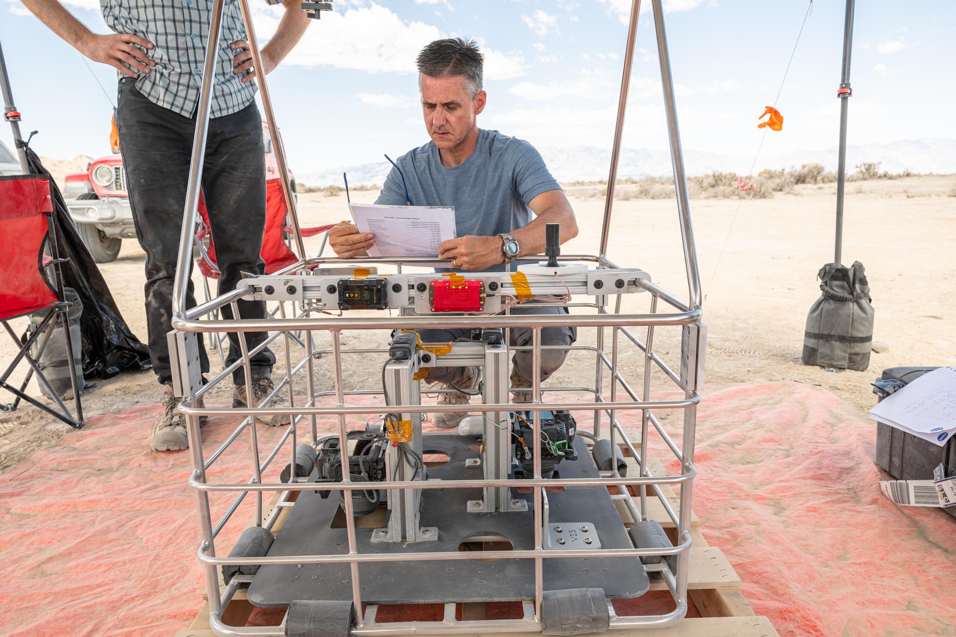
Brent Bos, a research physicist at NASA’s Goddard Space Flight Center in Greenbelt, Maryland, does a pre-flight check of a basket of instruments before one of the 10 high-altitude test flights at Crater Island, Utah. This area was the site of a series of tests (June 23-25, 2026) of the camera system that will one day fly aboard NASA’s DAVINCI mission probe to Venus.
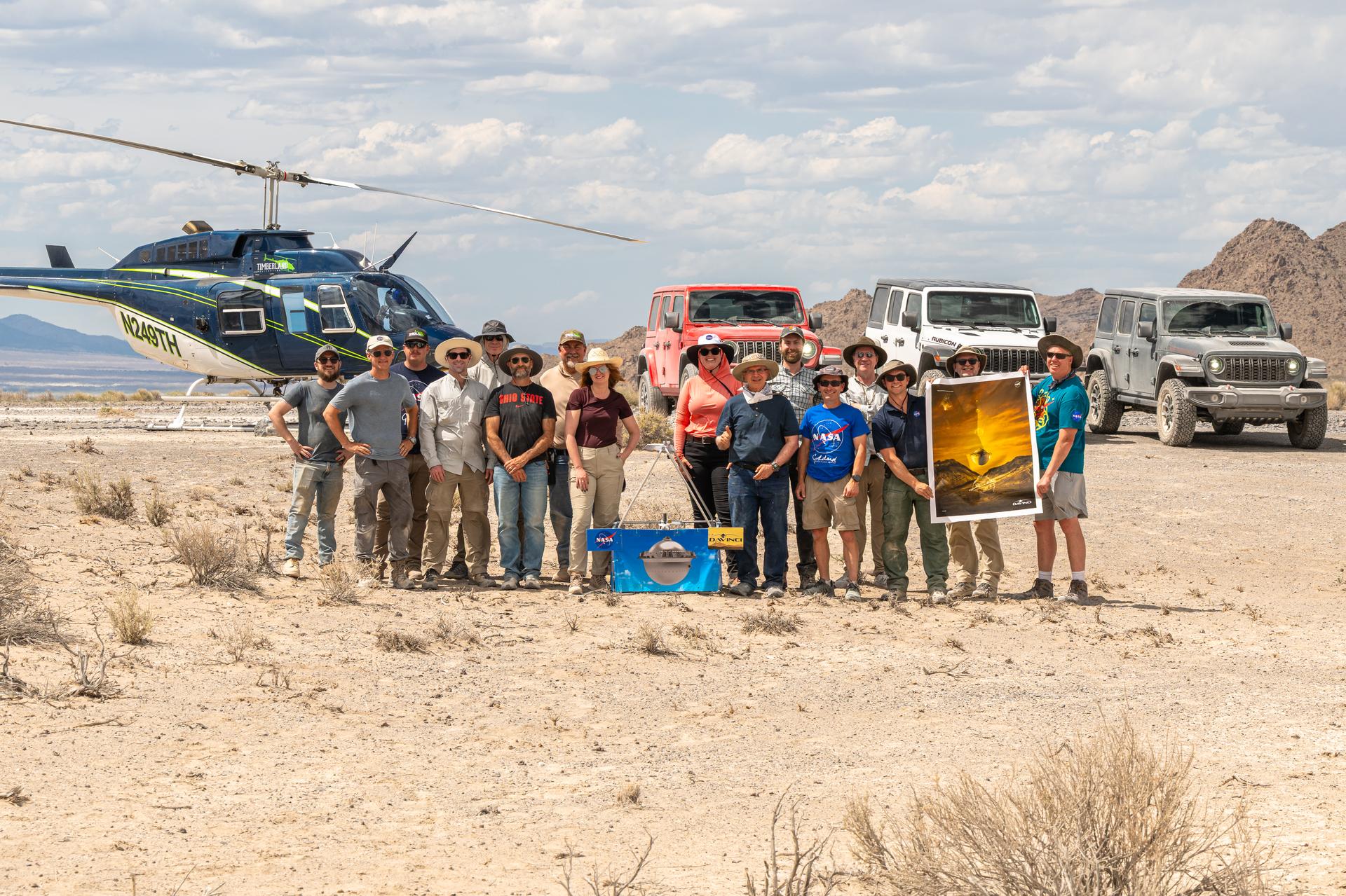
The DAVINCI VADIX team, from left to right, Mike Guinto, Brent Bos, Jason Burt, Dan Gallagher,Joe Turner, Ben Schumacher, Mike Vitulio, Erika Kohler, Lacey Young, Jim Garvin, Christian Tate, Phil Coulter, Mike Ravine, Matt Mullin, Bob Podgurski, Nick Lang; pose for a group photo in front of their vehicles at Crater Island, Utah, June 25, 2026. This area was the site of a series of tests (June 23-25, 2026) of the camera system that will one day fly aboard NASA’s DAVINCI mission to Venus. NASA/Mike Guinto
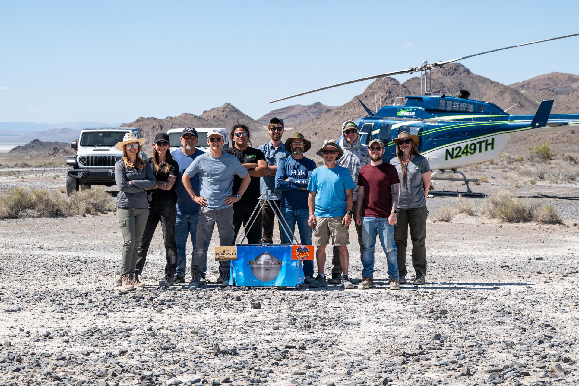
The DAVINCI VADIX dress rehearsal team poses for a group photo at Crater Island, June 4, 2026. From left to right, Erika Kohler, Terra Hardwick, Mike Vitulio, Brent Bos, Will Rivera, Christian Tate, Ben Schumacher, Phil Coulter, Joe Turner, Mike Guinto, Hailey. NASA/MIke Guinto

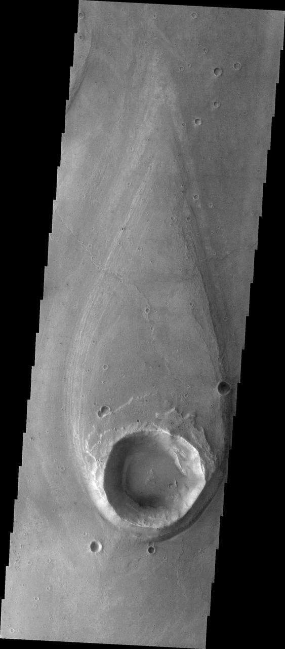
The crater in this image has affected the flow of lava around it, creating a streamlined island

Marte Valles Crater Island
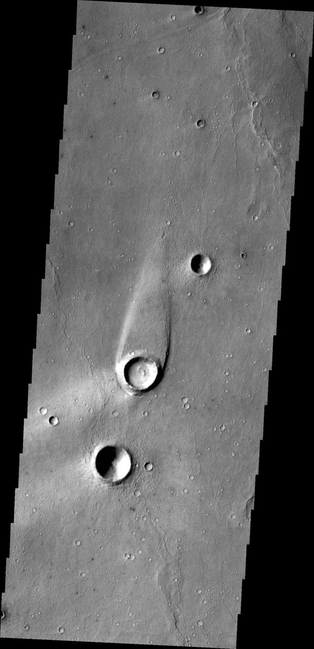
The streamlined island in this image from NASA 2001 Mars Odyssey spacecraft formed within the channel of Maja Valles. The flow of water was deflected by the crater leaving material in the lee of the crater.

This image captured by NASA 2001 Mars Odyssey of Elator Vallis shows where a crater has deflected flow and created a streamlined island.
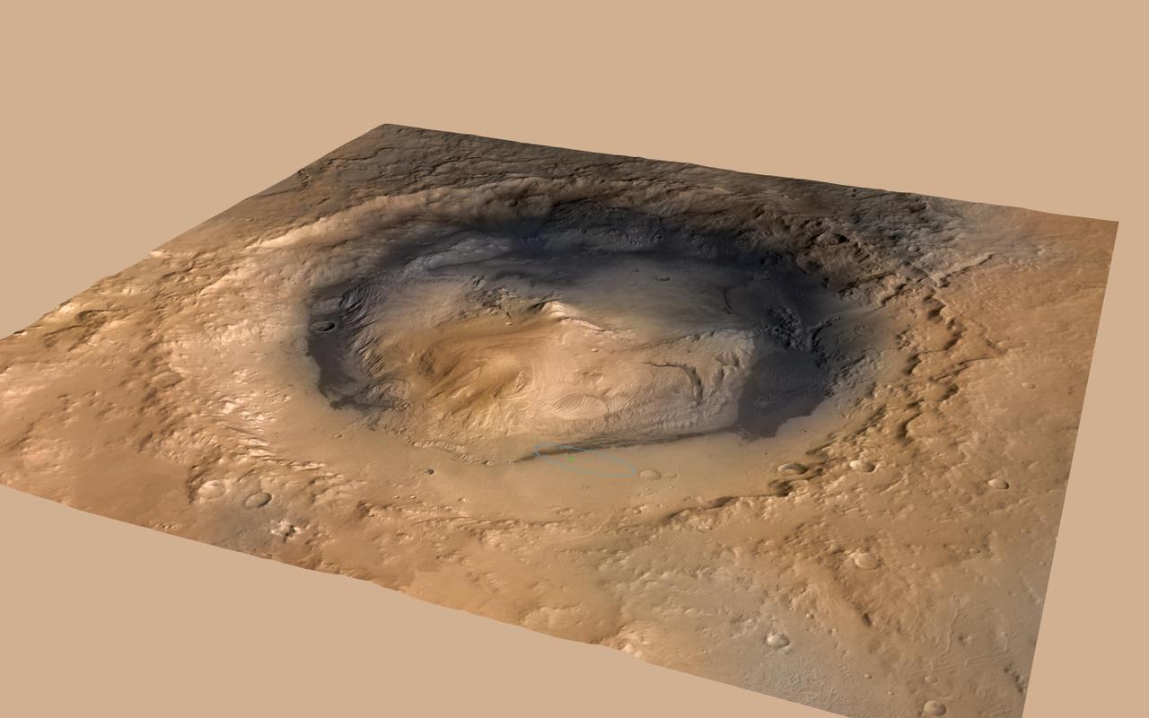
NASA Curiosity rover landed in the Martian crater known as Gale Crater, which is approximately the size of Connecticut and Rhode Island combined. A green dot shows where the rover landed, well within its targeted landing ellipse, outlined in blue.
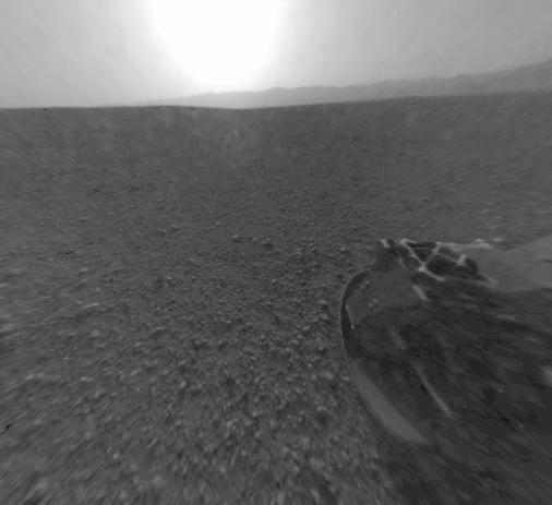
This is a version of one of the first images taken by a rear Hazard-Avoidance camera on NASA Curiosity rover and shows part of the rim of Gale Crater, which is a feature the size of Connecticut and Rhode Island combined.
This is a version of one of the first images taken by a rear Hazard-Avoidance camera on NASA Curiosity rover and shows part of the rim of Gale Crater, which is a feature the size of Connecticut and Rhode Island combined.
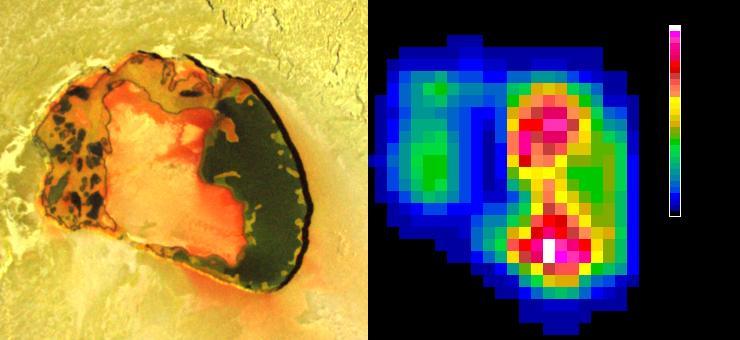
Tupan Caldera, a volcanic crater on Jupiter moon Io, has a relatively cool area, possibly an island, in its center, as indicated by infrared imagery from NASA Galileo spacecraft during an Oct. 16, 2001 flyby.
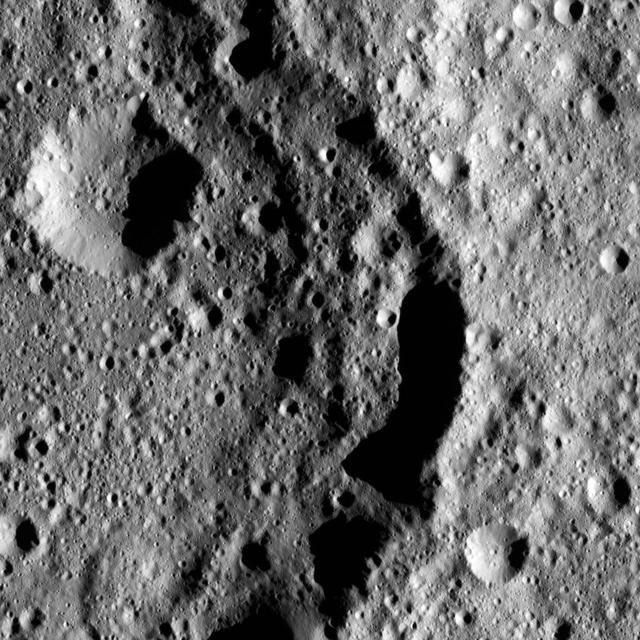
Omonga Crater on Ceres was named for a rice spirit who dwells in the moon, according to legends of the Mori people of the Indonesian island of Sulawesi. NASA Dawnspacecraft spotted Omonga from above the surface.
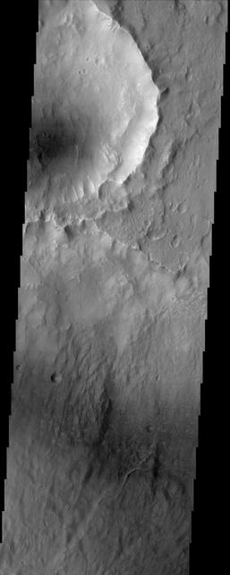
Except for the loss of its ring of ejecta, the crater at the leading edge of this streamlined island in Kasei Vallis, imaged here by NASA Mars Odyssey, shows no hint of the catastrophic floods that passed by it. Kasei Vallis is one of several major outflow channel systems that were active over 3 billion years ago. The intense floods scoured the landscape, eroding craters and producing streamlined islands. But in a close-up view, the evidence for these floods is not apparent. This true of the most similar terrestrial example, the channeled scablands of eastern Washington which also were formed by a catastrophic flood. http://photojournal.jpl.nasa.gov/catalog/PIA04022
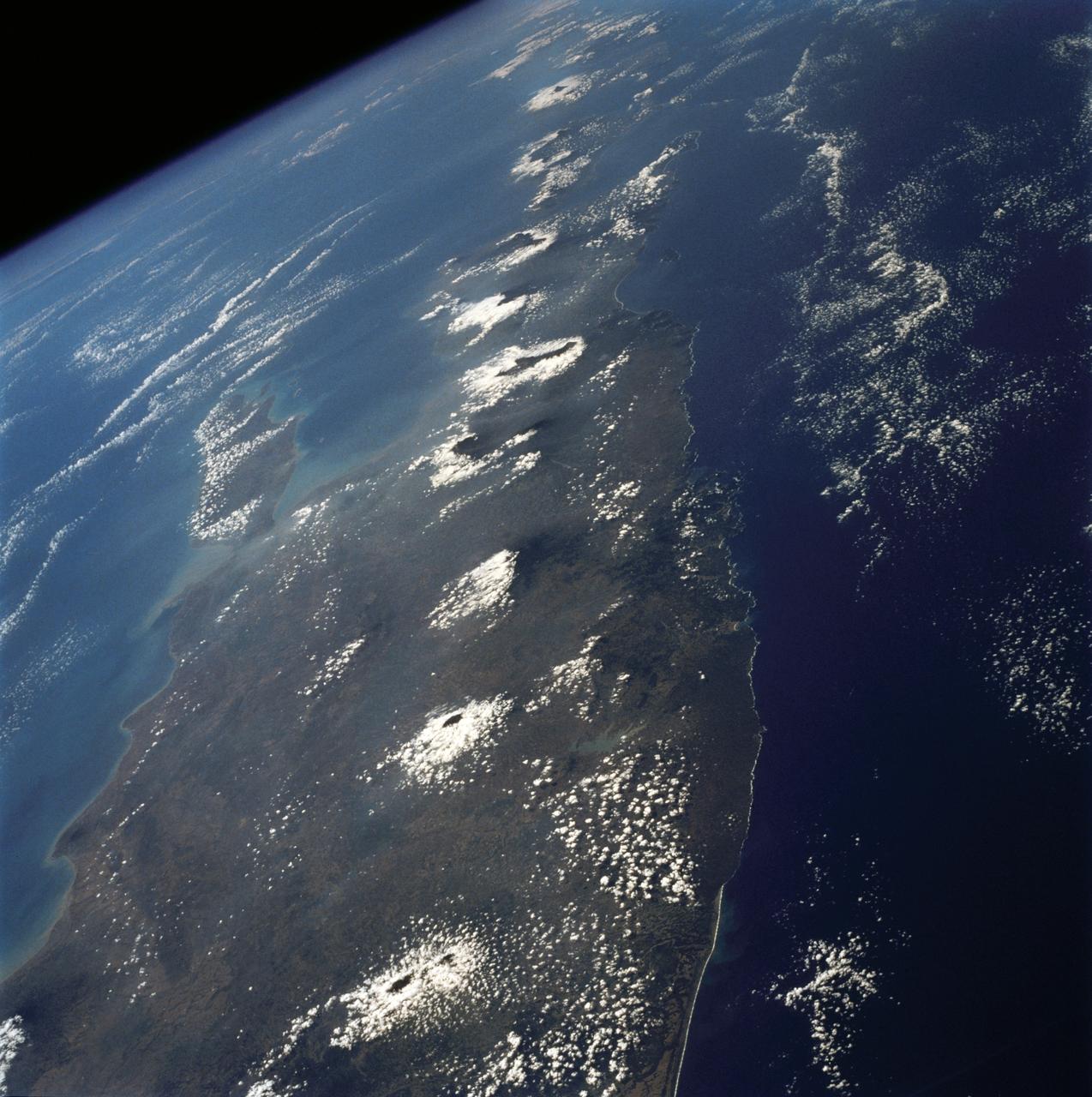
The island of Java (8.0S, 112.0E), perhaps better than any other, illustrates the volcanic origin of Pacific Island groups. Seen in this single view are at least a dozen once active volcano craters. Alignment of the craters even defines the linear fault line of Java as well as the other some 1500 islands of the Indonesian Archipelago. Deep blue water of the Indian Ocean to the south contrasts to the sediment laden waters of the Java Sea to the north.
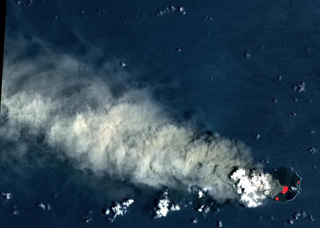
Nishinoshima is a small volcanic island located about 1000 km south of Tokyo, Japan. Eruptive activity began in December 2019, and has continued uninterrupted. ASTER captured this image of an ash and steam plume emanating from the central crater. Thermal infrared data is superposed in red on a visible-infrared color image to highlight the lava in the central crater and lava flows that have flowed down the volcano's flanks. The image was acquired July 28, 2020, covers an area of 15 by 21 km, and is located at 27.3 degrees north, 140.8 degrees east. https://photojournal.jpl.nasa.gov/catalog/PIA24017
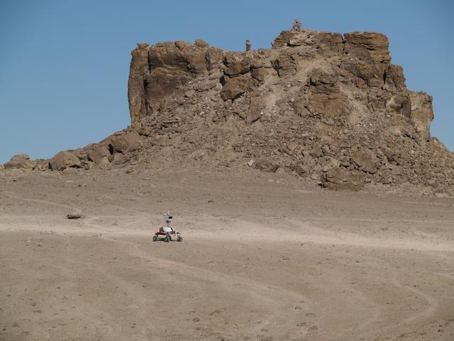
K-10 Red driving near 'The Fortress' formation at Haughton Crater, Devon Island, Canada. photo credit NASA/Lorenzo Fluckiger.

STS073-745-055 (2 November 1995) --- This photograph in color infrared highlights the different vegetation zones on the island of Maui, Hawaii. The dark red tropical forests live on the steep volcanic slopes on the north side of the island, and the fertile lowlands support large sugar cane plantations, which are the red and black checkered pattern. The Wailuku and Kahului area near the center on the north shore of the island was formerly a whaling center. Much of the eastern part of the island is Haleakala National Park, including the spectacular Haleakala Crater (under clouds).
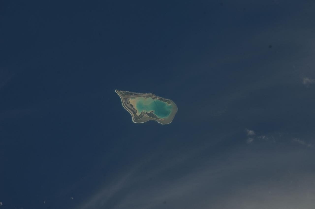
ISS033-E-007873 (27 Sept. 2012) --- Wake Island is featured in this image photographed by an Expedition 33 crew member on the International Space Station. The atoll of Wake Island is located in the central Pacific Ocean approximately 4,000 kilometers to the west-southwest of Hawaii and 2,400 kilometers to the northwest of Guam. In addition to Wake Island, the atoll includes the smaller Peale and Wilkes Island for a total land surface area of 6.5 square kilometers. Like many atolls in the Pacific, the islands and associated reefs formed around a submerged volcano. The lagoon in the center of the islands—characterized by shallow, light blue water in contrast to the surrounding darker, deeper Pacific Ocean waters—marks the approximate location of the summit crater of the volcano.
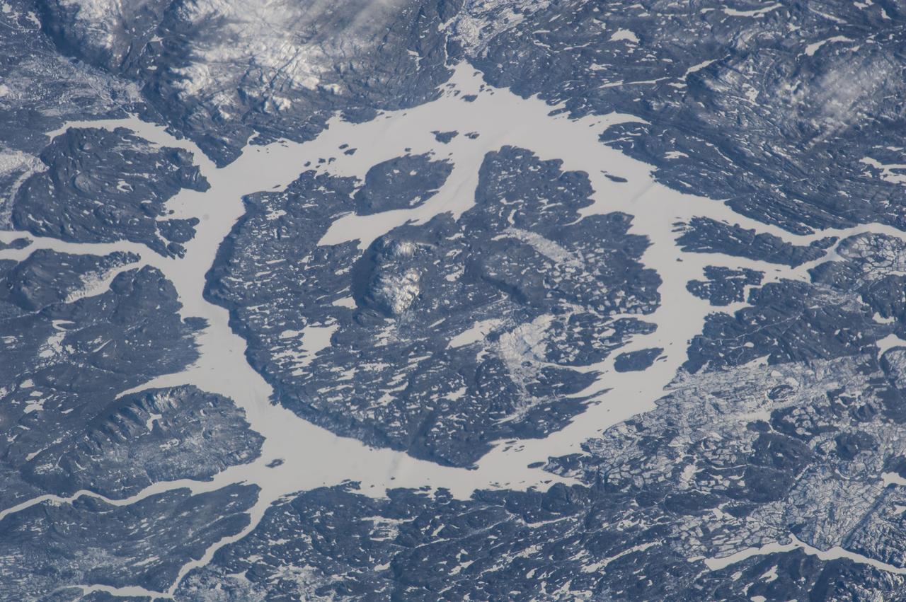
ISS038-E-025350 (2 Jan. 2014) --- One of the Expedition 38 crew members aboard the Earth-orbiting International Space Station recorded this image which features the Manicouagan Crater and reservoir located primarily in Manicouagan Regional County Municipality in the Cote-Nord region of Quebec, Canada. Scientists believe the crater was caused by the impact of a 5 kilometer (3 mile) diameter asteroid about 215.5 million years ago (Triassic Period). The crater is a multiple-ring structure about 100 kilometers (60 miles) across, with its 70 kilometer (40 mile) diameter inner ring as its most prominent feature; it contains a 70 kilometer (40 mile) diameter annular lake, the Manicouagan Reservoir, surrounding an inner island plateau, Rene-Levasseur Island. Because it is so unique and easily recognizable from the sky and space, the crater has been the subject of hundreds of images from astronauts for 45-plus years.
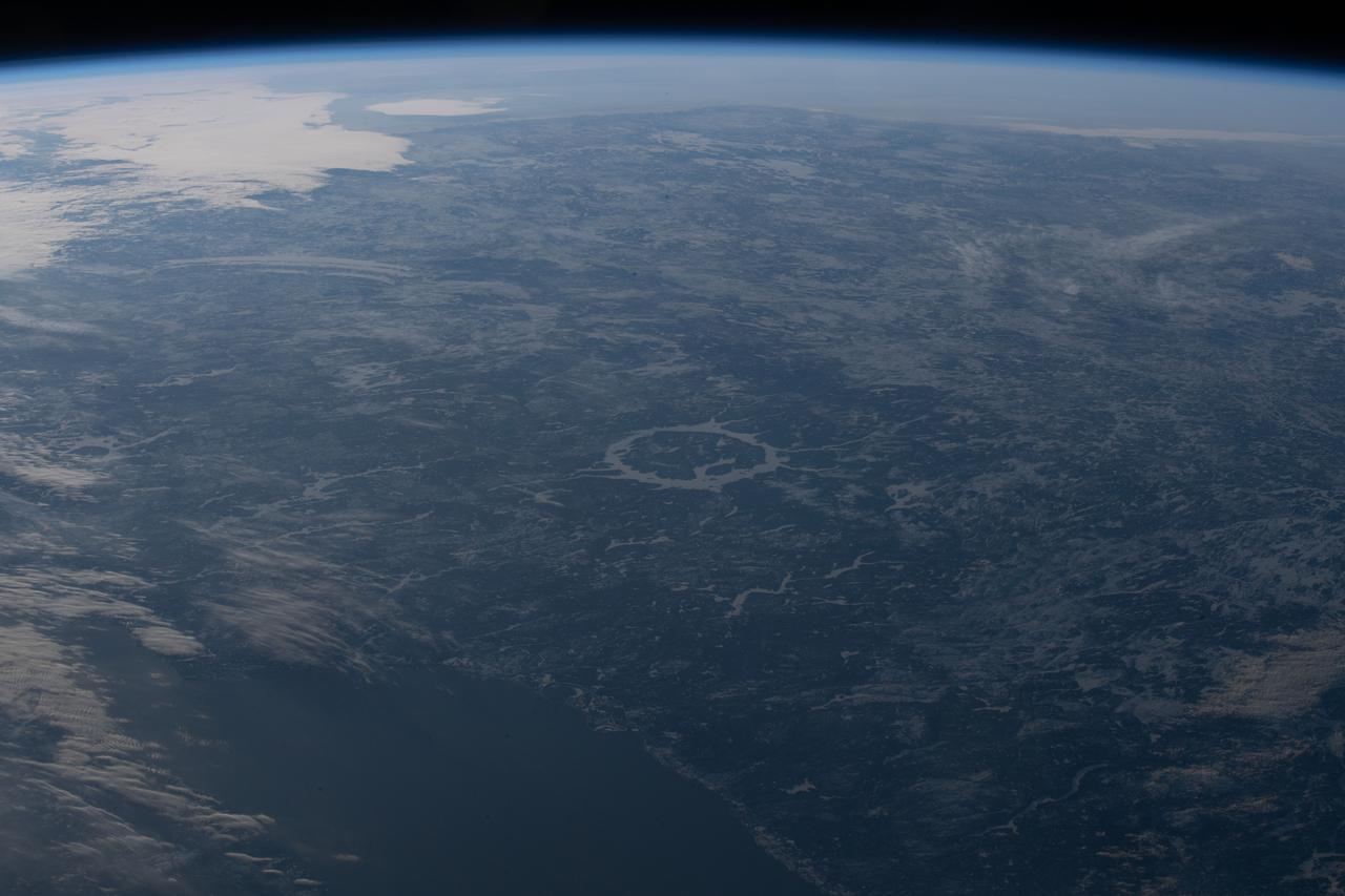
iss067e002988 (April 3, 2022) --- The Manicouagan Crater in Quebec, Canada, figures prominently in the center of this photograph from the International Space Station as it orbited 264 miles above the Atlantic Ocean off the coast of Newfoundland Island.
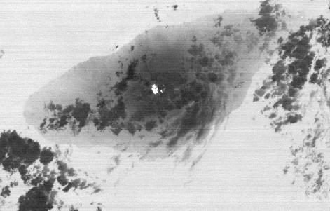
On Sept. 28, 2017, Manaro Voui volcano on Ambae island in Vanuatu began spewing ash in a moderate eruption, prompting authorities to order the evacuation of all 11,000 residents. This nighttime thermal infrared image from the Advanced Spaceborne Thermal Emission and Reflection Radiometer (ASTER), acquired on Oct. 7, shows a hot spot (white) on the volcano's summit crater, but no large eruption. Cold clouds are dark gray, the warmer island is gray, and the ocean, (warmer than the island), is light gray. The image covers an area of 17 by 26 miles (27 by 42.4 kilometers), and is centered at 15.4 degrees south, 167.8 degrees east. https://photojournal.jpl.nasa.gov/catalog/PIA22045
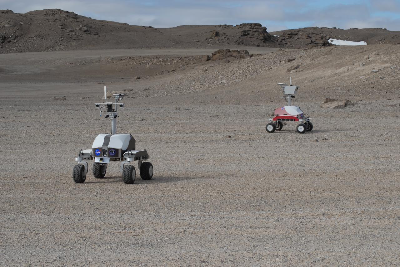
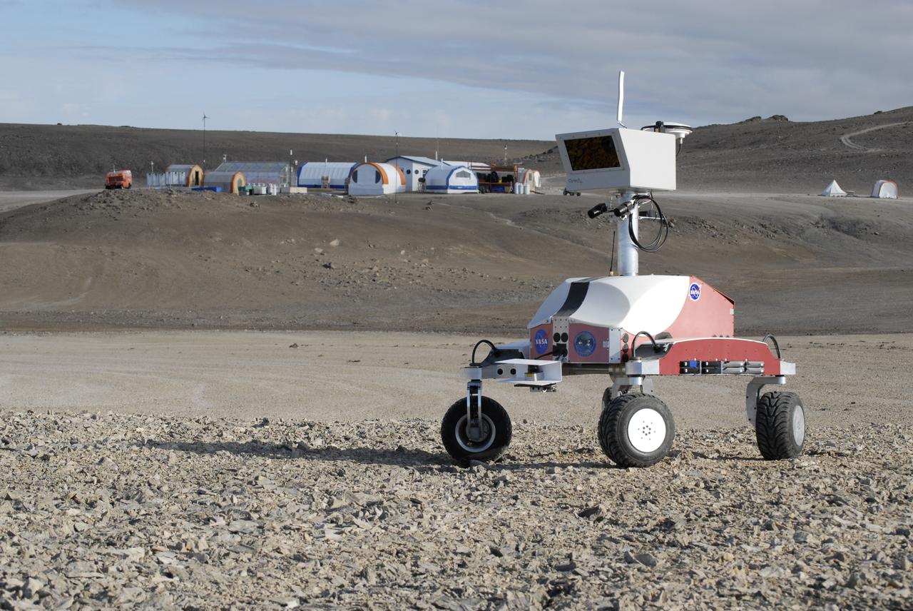
Haughton-Mars Project: - Photo credit to Matt Deans (NASA) K-10 Rover 'Black' and K-10 'RED' conducting systematic site survey at Haughton Creater Devon Island, Nunavut, in the Canadian high arctic. Which lies in the 'frost rubble zone' of the Earth, i.e., in a polar desert environment and is the only crater known to lie in such an environment. Beginning in 1997, the crater and its surroundings are studied as a promising Mars analog by the NASA-led Haughton-Mars Project. (photo reference MCD_0888.JPG)

Haughton-Mars Project: - Photo credit to Matt Deans (NASA) K-10 Rover 'Red' base camp at Haughton Creater Devon Island, Nunavut, in the Canadian high arctic. Which lies in the 'frost rubble zone' of the Earth, i.e., in a polar desert environment and is the only crater known to lie in such an environment. Beginning in 1997, the crater and its surroundings are studied as a promising Mars analog by the NASA-led Haughton-Mars Project. (photo reference MCD_0859.JPG)
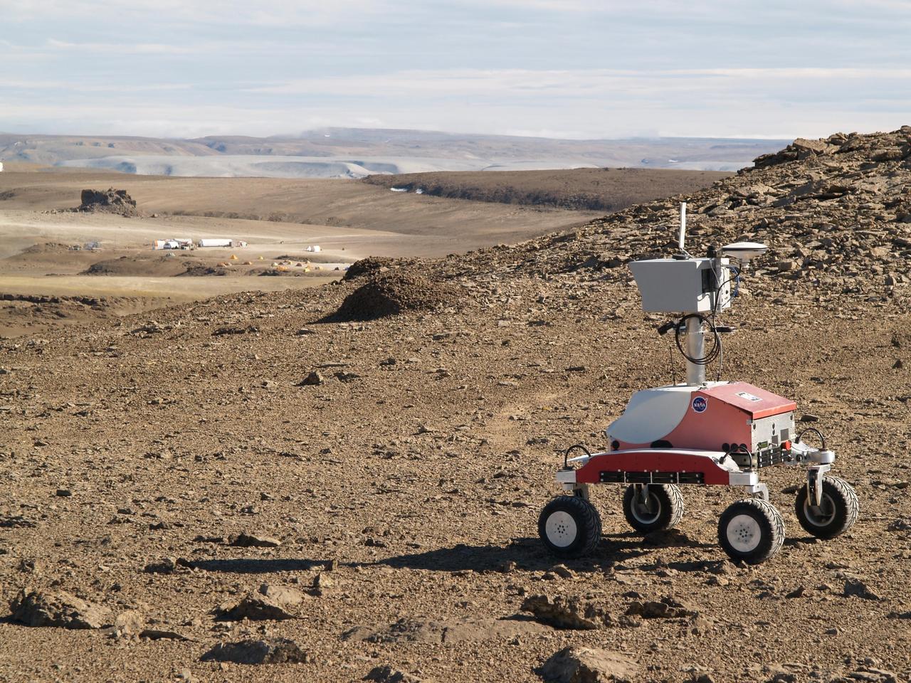
Haughton-Mars Project: - Photo credit to Lorenzo Flueckiger (CMU West) K-10 Rover 'Red' descending Drill Hill toward base campl at Haughton Creator Devon Island, Nunavut, in the Canadian high arctic. Which lies in the 'frost rubble zone' of the Earth, i.e., in a polar desert environment and is the only crater known to lie in such an environment. Beginning in 1997, the crater and its surroundings are studied as a promising Mars analog by the NASA-led Haughton-Mars Project. (photo reference K10-red-hughton-hill.jpg)
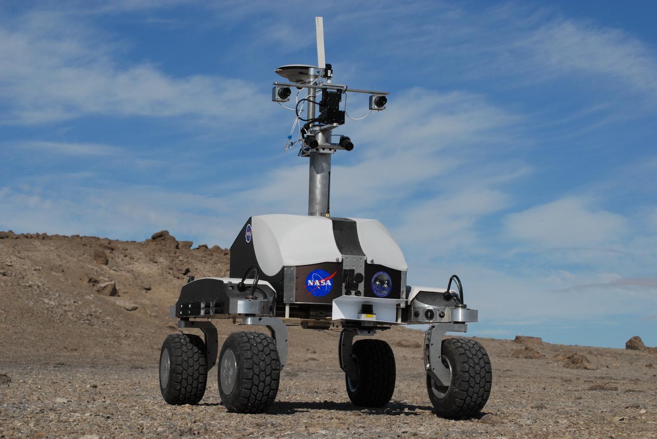
Haughton-Mars Project: - Photo credit to Matt Deans (NASA) K-10 Rover 'Black' operating with ground-penetrating radar at Haughton Creater Devon Island, Nunavut, in the Canadian high arctic. Which lies in the 'frost rubble zone' of the Earth, i.e., in a polar desert environment and is the only crater known to lie in such an environment. Beginning in 1997, the crater and its surroundings are studied as a promising Mars analog by the NASA-led Haughton-Mars Project. (photo reference MCD_0745.JPG
Haughton-Mars Project: - Photo credit to Matt Deans (NASA) K-10 Rover 'Red' base camp at Haughton Creater Devon Island, Nunavut, in the Canadian high arctic. Which lies in the 'frost rubble zone' of the Earth, i.e., in a polar desert environment and is the only crater known to lie in such an environment. Beginning in 1997, the crater and its surroundings are studied as a promising Mars analog by the NASA-led Haughton-Mars Project. (photo reference MCD_0838.JPG)
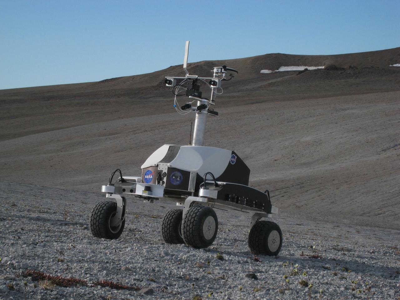
Haughton-Mars Project: - Photo credit to Matt Deans (NASA) K-10 Rover 'Black' driving on 'Drill Hill at Haughton Creater Devon Island, Nunavut, in the Canadian high arctic. Which lies in the 'frost rubble zone' of the Earth, i.e., in a polar desert environment and is the only crater known to lie in such an environment. Beginning in 1997, the crater and its surroundings are studied as a promising Mars analog by the NASA-led Haughton-Mars Project. (photo reference IMG_1278.JPG)
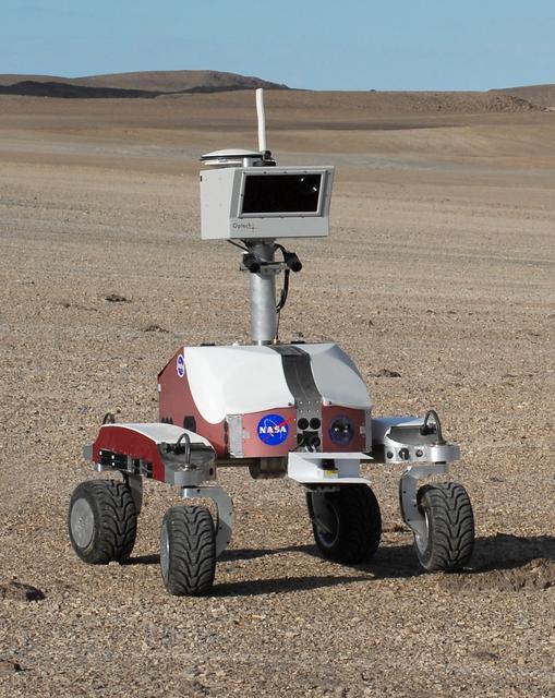
Haughton-Mars Project: - Photo credit to Matt Deans (NASA) K-10 Rover 'Red' base camp at Haughton Creater Devon Island, Nunavut, in the Canadian high arctic. Which lies in the 'frost rubble zone' of the Earth, i.e., in a polar desert environment and is the only crater known to lie in such an environment. Beginning in 1997, the crater and its surroundings are studied as a promising Mars analog by the NASA-led Haughton-Mars Project. (photo reference K10-R-haughton.jpg - crop of ACD07-0170-4 MCD_0859.JPG)
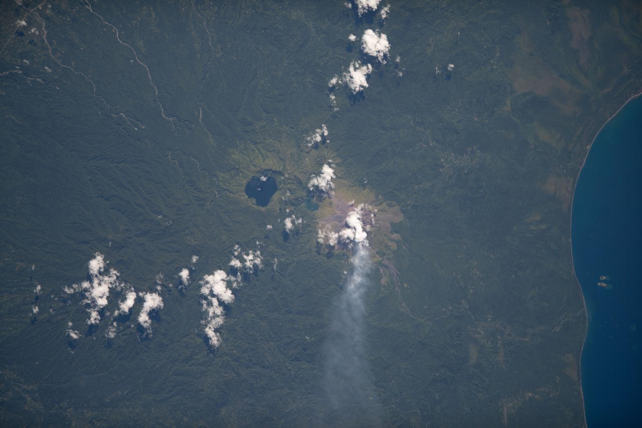
iss068e007429 (Oct. 2, 2022) --- Billy Mitchell Crater Lake and the active volcano Bagana on Papua New Guinea's Bougainville Island are pictured from the International Space Station as it orbited 260 miles above the southwestern Pacific Ocean. Credit: ESA/Samantha Cristoforetti
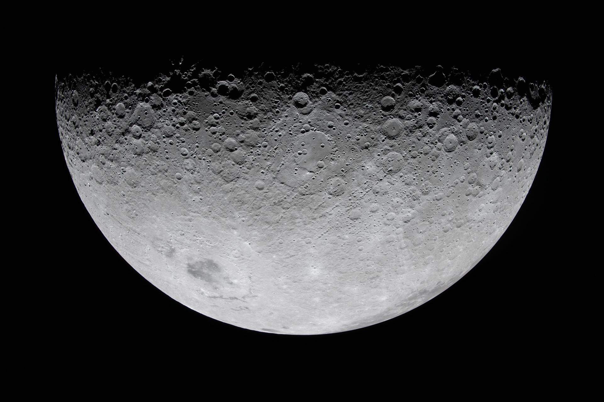
art002e010208 (April 6, 2026) - As the Artemis II crew flew over the terminator, the astronauts described this boundary between day and night as "anything but a straight line." Crater rims along the terminator stand out as "islands" in the night. Giant chains of craters emanating from the 3.7-billion-year-old Orientale basin can be seen scouring the surface, stretching almost to the terminator. This tells a geologic story: these crater chains produced by the Orientale impact event mar the surface of the relatively flat Hertzsprung Basin (center of this image), which means that Hertzsprung Basin must be even older than Orientale!

Kilauea volcano, Hawaii, began erupting on December 20, 2020, when a lava flow within Halema'uma'u crater interacted with a pool of water, triggering a vigorous eruption, emitting steam, ash, and sulfur dioxide gas. Since then, lava continues to enter the crater, and the lava lake appears to be stable. In the image, the lava feeder is bright red within the crater, gas is coming from the lava; the lava lake is a lighter gray donut, with a cooler lava island in the middle. The image was acquired December 28, 2020, covers an area of 29.7 by 37.2 km, and is located at 19.4 degrees north, 155.3 degrees west. https://photojournal.jpl.nasa.gov/catalog/PIA24284
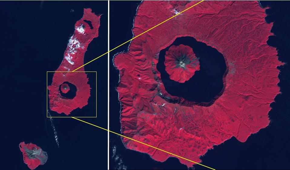
The Kuril Islands are a volcanic archipelago, stretching 1300 km from Hokkaido, Japan to Kamchatka, Russia. They are part of the Pacific Ring of Fire, the result of subduction of the Pacific Plate under the Okhotsk Plate along the Kuril Trench. At the southern end of Onekotan Island is the Tao-Rusyr Caldera stratovolcano, with its 7500 year old caldera lake. The most recent eruption was in 1952. The smaller Kharimkotan Island to the southwest last erupted in 1933. Collapse of this volcano created a horseshoe-shaped crater, and caused a tsunami that killed two people on a near-by island. The image was acquired June 4, 2012; the enlargement covers an area of 17 by 18.5 km, and is located at 49.3 degrees north, 154.7 degrees east. https://photojournal.jpl.nasa.gov/catalog/PIA24020
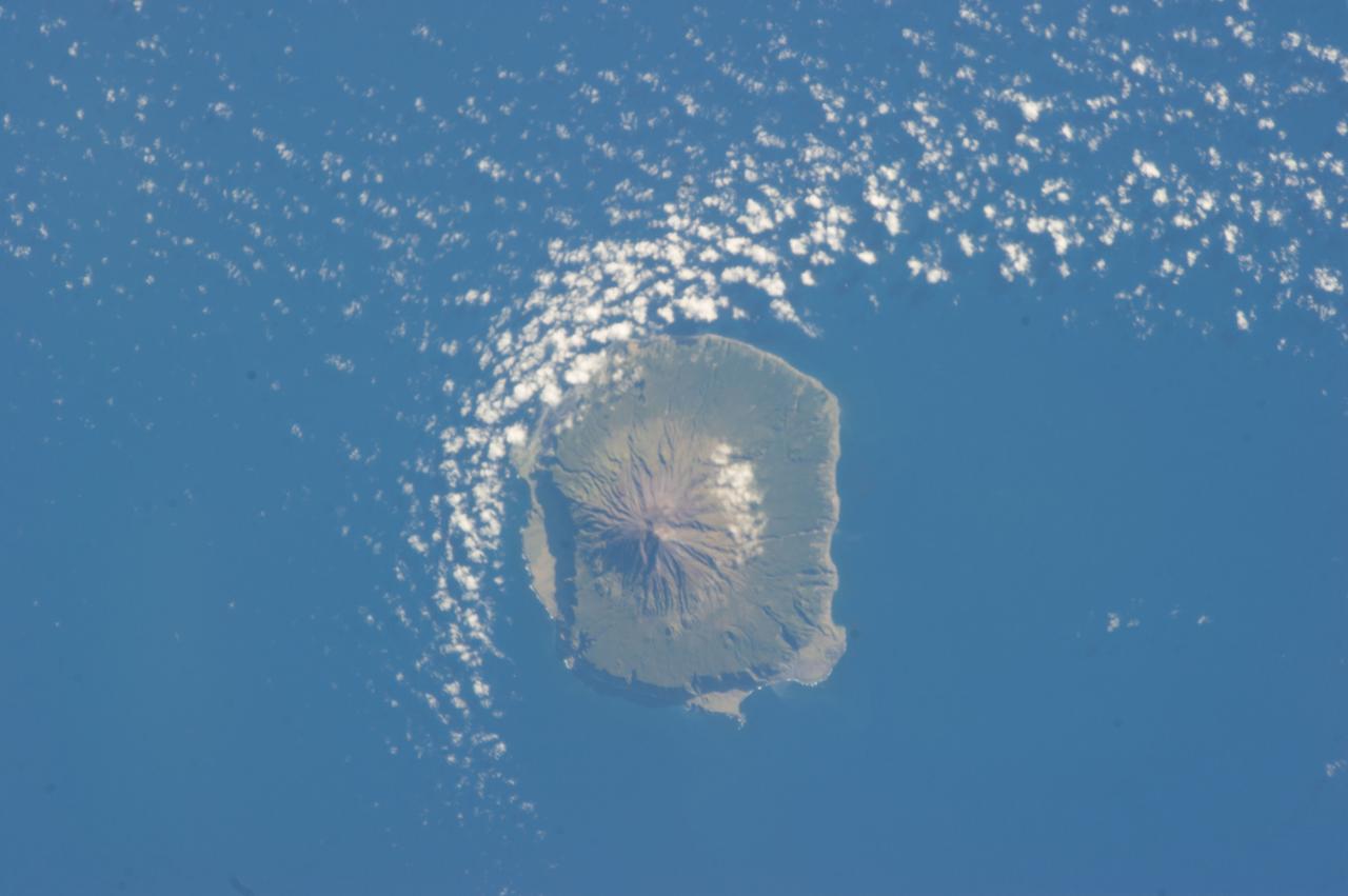
ISS034-E-041528 (6 Feb. 2013) --- Tristan da Cunha is featured in this image photographed by an Expedition 34 crew member on the International Space Station. The island is located in the southern Atlantic Ocean; more than 3,700 kilometers from the northern coastline of Antarctica, approximately 2,800 kilometers to the southern tip of Africa, and more than 3,000 kilometers from the eastern coastline of South America. The island forms part of the British Overseas Territory of Saint Helena, Ascension, and Tristan da Cunha. The shoreline of the 13-kilometer-wide island is marked on most sides by steep cliffs, with lower beach areas on the southern and north-northwestern sides. The island is notable for its bird population, including important breeding grounds for a variety of petrels, albatrosses, penguins and shearwaters. Tristan da Cunha is a shield volcano; a type of volcanic structure usually recognized by a low, broad profile and composed of silica-poor lavas (such as basalt). The upper surface of this low base appears dark green in this photograph. Steeper, brown to tan colored slopes mark the central cone of the volcano at the island?s center. The summit crater, Queen Mary?s Peak, sits at an elevation of 2,060 meters above sea level. While geologic evidence indicates that eruptions have occurred from the central crater, lavas have also erupted from flank vents along the sides of the volcano as well as smaller cinder cones. The last known eruption of Tristan da Cunha took place 1961-1962 and forced evacuation of the only settlement on the island, Edinburgh of the Seven Seas. The settlement is located along the northern coastline of the island (obscured by clouds in this image). This is considered to be the most remote permanent settlement on Earth, with its citizen?s nearest neighbors located 2,173 kilometers to the northeast on the island of St. Helena.
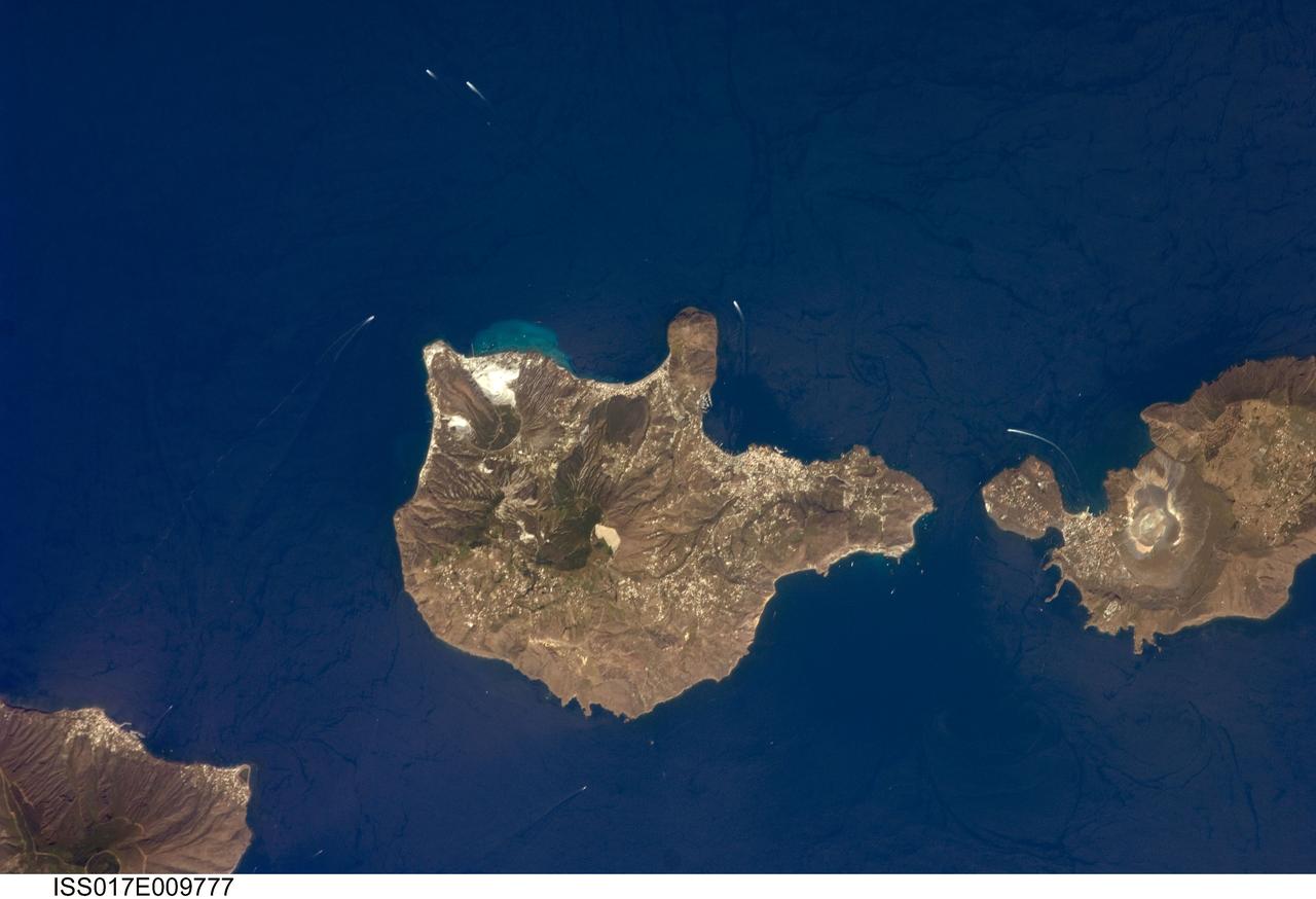
ISS017-E-009777 (24 June 2008) --- Aeolian Islands, Italy are featured in this image photographed by an Expedition 17 crewmember on the International Space Station. The Aeolian Islands formed from a chain of volcanoes in the Tyrrhenian Sea to the north of the island of Sicily. The islands have been studied by geologists and vulcanologists since the 18th century, and were accorded UNESCO World Heritage Site status in 2000 in recognition of their continuing value to study of volcanic processes. Two types of volcanic eruption, Vulcanian and Strombolian, were defined based on study and observation of geologic processes on the islands of Vulcano and Stromboli (not shown). This detailed view features the island of Lipari and the northern portion of the island of Vulcano. Tan, speckled areas on both islands are urban areas and towns. Lipari is the largest of the Aeolian Islands, and is a popular tourist destination due to its rugged volcanic topography and beaches (several boat wakes are visible in the image around the islands). White pumice beaches and caves are located along the northern and northeastern coastlines of Lipari; black sand beaches derived from lava flows can also be found on the island. The most recent eruptive activity on Lipari took place between approximately 580-729. The island of Vulcano (right) is comprised of two calderas -- large craters formed when explosive eruptions empty a magma chamber, followed by collapse of the overlying material into the newly-formed void -- the Caldera della Fossa to the north and the Caldera del Piano to the south. The volcanic cone of La Fossa, located with the Caldera della Fossa, has been the site of much of the historical eruptive activity on the island. The last eruption on Vulcano Island took place during 1898-1900.
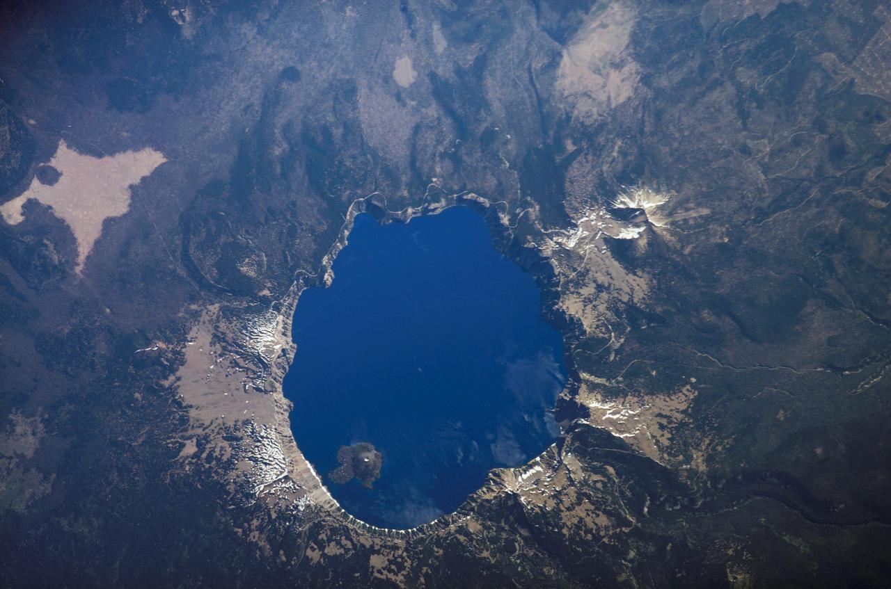
ISS013-E-54243 (19 July 2006) --- Crater Lake, Oregon is featured in this image photographed by an Expedition 13 crewmember on the International Space Station. Crater Lake is formed from the caldera (collapsed magma chamber) of a former volcano known as Mount Mazama. Part of the Cascades volcanic chain, Mount Mazama is situated between the Three Sisters volcanoes to the north and Mount Shasta to the south. While considered a dormant volcano, Crater Lake is part of the United States Geological Survey Cascades Volcano Observatory seismic monitoring network. The dark blue water coloration is typical of the 592 meter (1943 feet) deep Crater Lake; light blue-green areas to the southeast of Wizard Island (along the southern crater rim) most probably correspond to particulates either on or just below the water surface. A light dusting of snow fills the summit cone of Wizard Island. Some of the older lava flows in the area are associated with Mount Scott to the east-southeast of the Lake. Water is lost only by evaporation and seepage, and is only replenished by rainwater and snowmelt from the surrounding crater walls. These processes help maintain minimal sediment input into the lake and exceptional water clarity. The Crater Lake ecosystem is of particular interest to ecologists because of its isolation from the regional landscape, and its overall pristine quality is important to recreational users of Crater Lake National Park (447,240 visitors in 2005). The United States National Park Service maintains programs to monitor changes (both natural and human impacts) to Crater Lake.
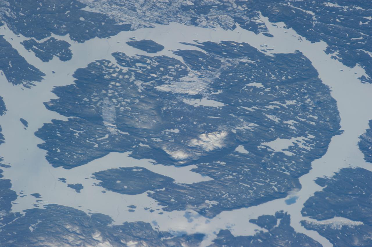
ISS034-E-056100 (21 Feb. 2013) --- One of the most recognizable natural features on Earth, when viewing from space, is the Manicouagan Crater, one of the oldest known impact craters on Earth. Photographed by one of the Expedition 34 crew members onboard the International Space Station, the crater is located primarily in Manicouagan Regional County Municipality in the Côte-Nord region of Québec, Canada, about 300 kilometers (190 miles) north of the city of Baie-Comeau. Manicouagan is one of the oldest large astroblemes still visible on the surface. The crater is a multiple-ring structure about 100 kilometers (60 miles) across, with its 70 kilometer (40 mile) diameter inner ring its most prominent feature; it contains a 70 kilometer (40 mile) diameter annular lake, the Manicouagan Reservoir, surrounding an inner island plateau.
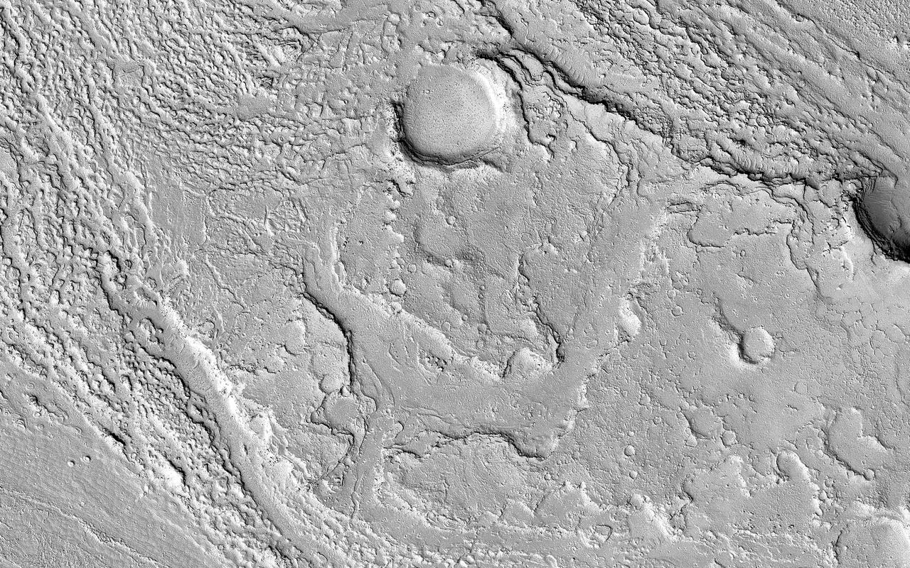
This image in Athabasca Valles shows lava flows originating from Elysium Mons to the northwest. A Context Camera image shows the lava flowed from the northwest to the southeast, diverting around obstacles as it settled. (The flow is outlined in blue with the flow direction shown in yellow, and the approximate location of the HiRISE image is represented by a white rectangle.) The lava appears to have flowed smoothly around obstructions, almost like water, forming streamlined islands. In the southern part of this image, a branch of the flow diverts around a small crater, and eventually rejoins the main part of the flow. Irregular-shaped ring structures appear on the northern end and are related to the volcanic activity that formed the flows. We also see a dense cluster of secondary craters that formed when material ejected from Corinto Crater (to the northwest) impacted the surface at high speed. At full-resolution, this terrain has the distinctive appearance of a field of numerous, small and closely-spaced craters. https://photojournal.jpl.nasa.gov/catalog/PIA23062
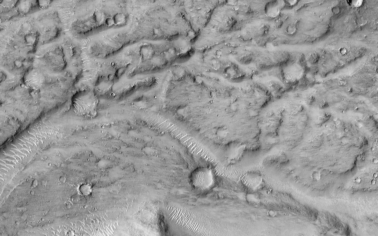
This image shows the northern terminus of an outflow channel located in the volcanic terrains of Amenthes Planum. The channel sources from the Palos impact crater to the south, where water flowed into the crater from Tinto Vallis and eventually formed a paleo lake. As rising lake levels breached through the crater's rim and inundated the plains to the north, the resulting high velocity, large discharge floods plucked out and eroded the volcanic plains scouring out the "Palos Outflow Channel" and the streamlined mesa-islands on its floor. These streamlined forms are the eroded remnants of plains material sculpted by catastrophic floods and are not sediment deposits emplaced by lower magnitude stream flows. Both the fluvial channel floor and the volcanic island surfaces are densely cratered by impacts suggesting that both the surfaces and the flood events are ancient. The morphology (shape) of the channel system and its islands have been preserved through the eons, but water has long been absent from this drainage system. Since then, winds have transported light-toned sediments across this terrain forming extensive dune fields within the channel system, on the floors of impact craters, and in other protected locations in the Palos Outflow Channel region. A closer look shows chevron, or fish-bone shaped, light-toned dunes located near the top of the image where numerous smaller channels have cut through the landscape. These dunes likely started out as Transverse Aeolian Ridges (TAR) that form perpendicular to the prevailing wind direction where the wind-blown sediment supply is scarce. This intriguing morphology likely reflects changes in the prevailing wind environment over time. http://photojournal.jpl.nasa.gov/catalog/PIA21023
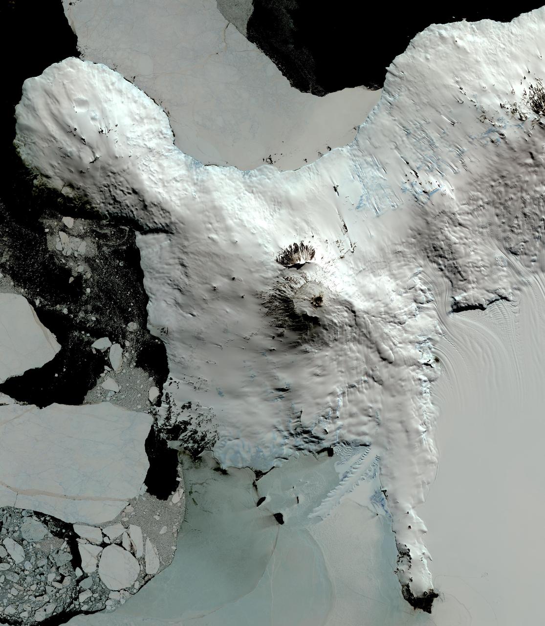
This image from NASA Terra spacecraft shows Mount Erebus, the world southernmost historically active volcano, overlooking the McMurdo research station on Ross Island. The 3794-m-high Erebus is the largest of three major volcanoes forming the crudely triangular Ross Island. An elliptical 500 x 600 m wide, 110-m-deep crater truncates the summit and contains an active lava lake within a 250-m-wide, 100-m-deep inner crater. The glacier-covered volcano was erupting when first sighted by Captain James Ross in 1841. Continuous lava-lake activity with minor explosions, punctuated by occasional larger strombolian explosions that eject bombs onto the crater rim, has been documented since 1972, but has probably been occurring for much of the volcano's recent history. The image was acquired December 31, 2013, covers an area of 63 x 73 km, and is located at 77.5 degrees south, 167.1 degrees east. http://photojournal.jpl.nasa.gov/catalog/PIA20239
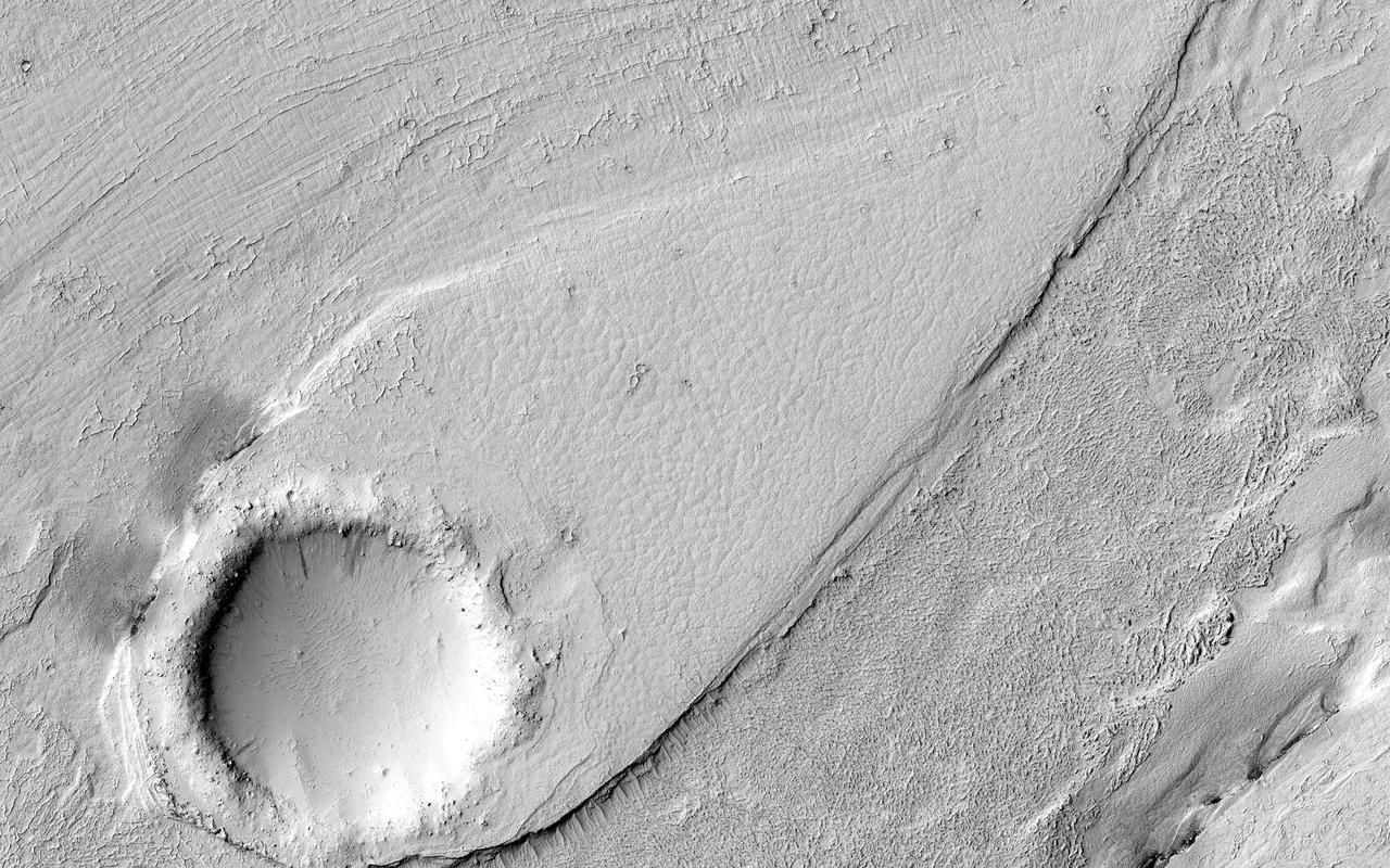
This image shows a portion of Lethe Vallis, an outflow channel that also transported lava. Another investigation of this area (Balme et al., 2011) discovered a repeat pattern of dune-like forms in the channel interpreted as fluvial dunes (or, giant current ripples) which are dunes formed by flowing water. This is one of only a few places on Mars where these pristine-appearing landforms have been identified. The channel formed by catastrophic floods, during which it produced the prominent crater-cored, teardroped-shaped island in the middle. The island has the blunter end pointing upstream and the long tail pointing downstream. Both the island and the fluvial dunes were formed by these extreme floods and their size is an indicator of the enormous discharges required to create them. The margins of the channel also show the terminal front of a pristine lava flow unit that inundated the channel from the south and the dunes show the remnants of another older lava flow. The top of the island displays polygonal patterned ground texture, which is a characteristic of periglacial processes in ice-rich ground. The dark materials from the channel and island walls are probably dark sand being eroded from an underlying horizontal basaltic (lava) layer. The crater at the core of the island has elongated dunes and reticulate dust ridges inside. This single image thus contains features formed by periglacial, volcanic, fluvial, impact, aeolian and mass wasting processes, all in one place. http://photojournal.jpl.nasa.gov/catalog/PIA21039

This is an image of Taal volcano, near Manila on the island of Luzon in the Philippines. The black area in the center is Taal Lake, which nearly fills the 30-kilometer-diameter (18-mile) caldera. The caldera rim consists of deeply eroded hills and cliffs. The large island in Taal Lake, which itself contains a crater lake, is known as Volcano Island. The bright yellow patch on the southwest side of the island marks the site of an explosion crater that formed during a deadly eruption of Taal in 1965. The image was acquired by the Spaceborne Imaging Radar-C/X-band Synthetic Aperture Radar (SIR-C/X-SAR) aboard the space shuttle Endeavour on its 78th orbit on October 5, 1994. The image shows an area approximately 56 kilometers by 112 kilometers (34 miles by 68 miles) that is centered at 14.0 degrees north latitude and 121.0 degrees east longitude. North is toward the upper right of the image. The colors in this image were obtained using the following radar channels: red represents the L-band (horizontally transmitted and received); green represents the L-band (horizontally transmitted and vertically received); blue represents the C-band (horizontally transmitted and vertically received). Since 1572, Taal has erupted at least 34 times. Since early 1991, the volcano has been restless, with swarms of earthquakes, new steaming areas, ground fracturing, and increases in water temperature of the lake. Volcanologists and other local authorities are carefully monitoring Taal to understand if the current activity may foretell an eruption. Taal is one of 15 "Decade Volcanoes" that have been identified by the volcanology community as presenting large potential hazards to population centers. The bright area in the upper right of the image is the densely populated city of Manila, only 50 kilometers (30 miles) north of the central crater. http://photojournal.jpl.nasa.gov/catalog/PIA01768
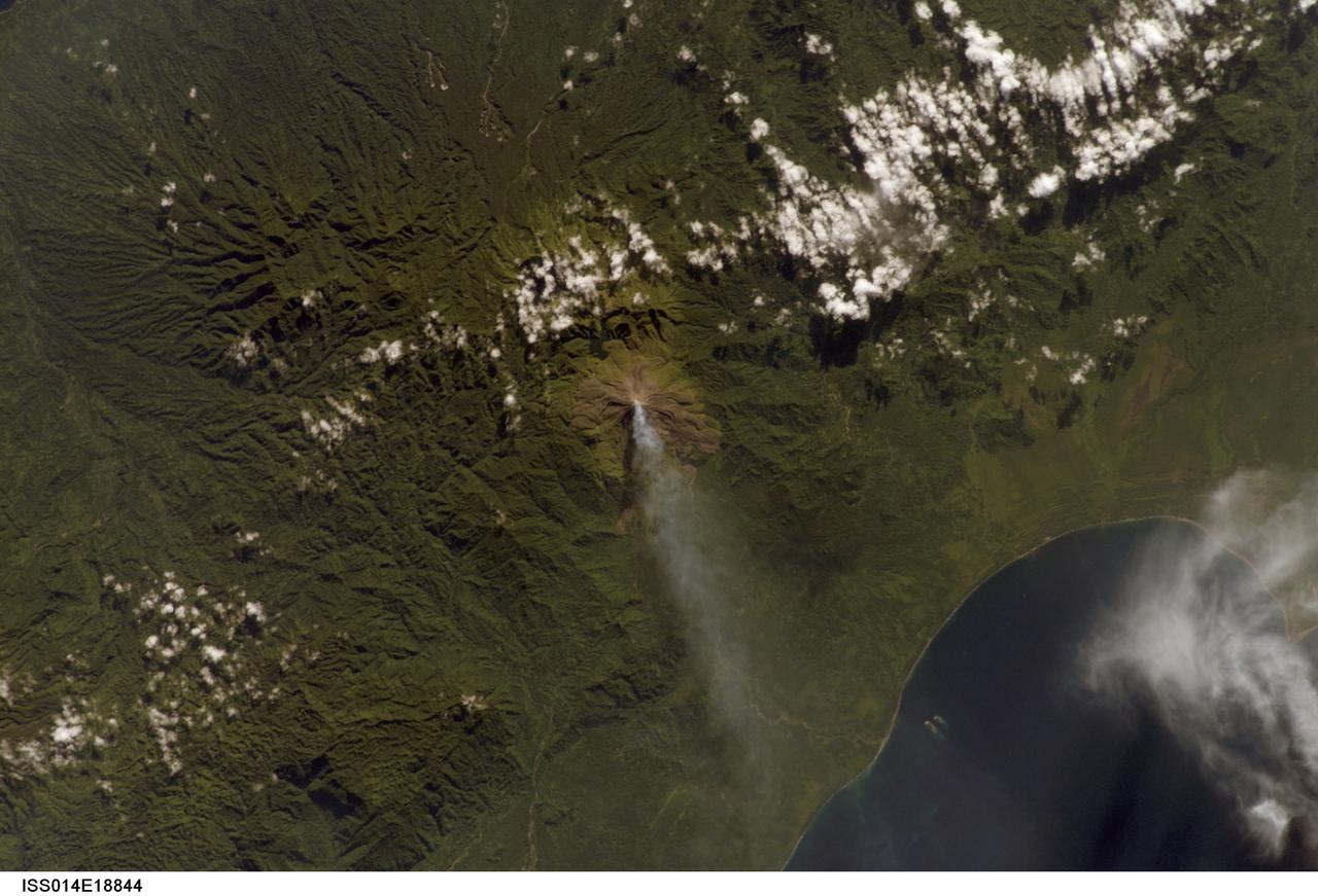
ISS014-E-18844 (2 April 2007) --- A plume at Mt. Bagana, Bougainville Island is featured in this image photographed by an Expedition 14 crewmember on the International Space Station. Bougainville Island, part of the Solomon Islands chain to the east of Papua New Guinea, is typical of many Pacific Rim islands in that volcanism has played a large part in both its geological and recorded history. The island hosts three large volcanoes along its northwest-southeast trending axis: Mt. Balbi, Mt. Bagana, and the Mt. Takuan volcanic complex. Mt. Bagana (near center) is the only volcano on the island that has been historically active. Light green stressed vegetation, and brown lobate lava flows mark the 1,750 meter high lava cone of Mt. Bagana within the verdant landscape of Bougainville Island. The eruptive style of the volcano is typically non-explosive, producing thick lobes of andesitic lava that run down the flanks and maintain a dome in the summit crater. Occasional pyroclastic flows have also been noted. The most recent phase of activity, which began on March 7, has been characterized by vapor plumes with occasional ash-producing emissions. This photograph, acquired almost one month (twenty days) after the last reported activity at Bagana, records a diffuse white vapor plume extending west-southwest from the summit. The Solomon Island region experiences other effects due to the geologic setting: earlier this week, a large but shallow earthquake shook the region and induced a tsunami that hit the western part of the Solomon Island chain.
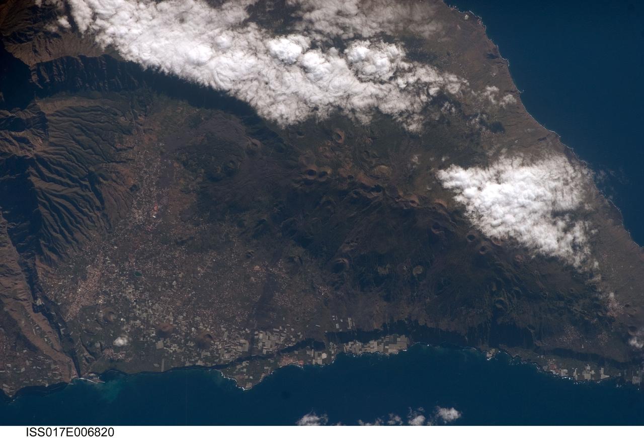
ISS017-E-006820 (13 May 2008) --- Isla de la Palma in the Canary Islands is featured in this image photographed by an Expedition 17 crewmember on the International Space Station. The Canary Islands, a group of volcanic islands, lie just off the west coast of Morocco in the Atlantic Ocean; at the northwest end of the chain of islands is Isla de la Palma. According to scientists, the island started forming as a submarine volcano approximately 3-4 million years ago. Subaerial (above the water surface) volcanic activity and island formation began around 2 million years ago. Most geologists believe the Canary Islands formed over the remnants of an old "hotspot" in the mantle, or mantle plume. The residual hotspot melting produced the magma that resulted in the Canary Island volcanoes. While there is little evidence to support the current existence of a mantle plume, volcanic activity is still taking place -- the most recent lava flows on Isla de Palma were erupted in 1971. In addition to volcanic hazards, the Canary Islands are also subject to occasional dust storms originating in the Sahara Desert. This view highlights volcanic landforms on the southern portion of Isla de Palma. The elongated, 1949-meter high Cumbre Vieja volcanic center is characterized by numerous cinder cones, craters, and gray lava flows that punctuate the green vegetated hillslopes. To the north, the cities of El Paso and Los Llanos de Aridanes nestle against collapsed fragments of the Caldera Taburiente (left), formed by massive slope failure of an older volcanic center to the north. Tourism is a major component of the local economy, but the high mountains and clear air of Isla de la Palma are also attractive to astronomers -- several large observatories (not shown) are located along the northern edge of the Caldera Taburiente.
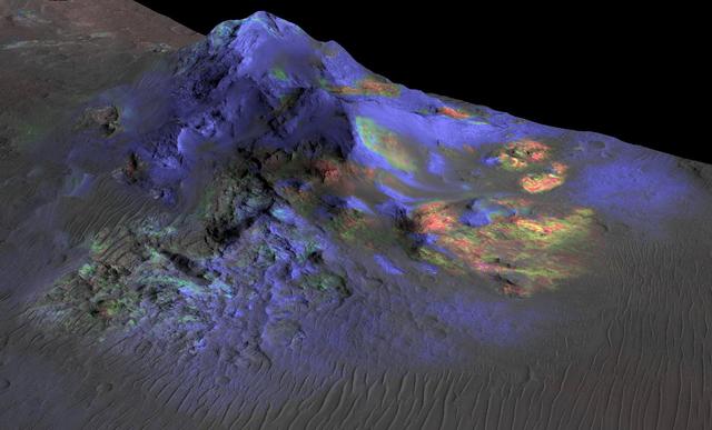
Deposits of impact glass have been preserved in Martian craters, including Alga Crater, shown here. Detection of the impact glass by researchers at Brown University, Providence, Rhode Island, is based on data from the Compact Reconnaissance Imaging Spectrometer for Mars (CRISM) on NASA's Mars Reconnaissance Orbiter. In color coding based on analysis of CRISM spectra, green indicates the presence of glass. (Blues are pyroxene; reds are olivine.) Impact glass forms in the heat of a violent impact that excavates a crater. Impact glass found on Earth can preserve evidence about ancient life. A deposit of impact glass on Mars could be a good place to look for signs of past life on that planet. This view shows Alga Crater's central peak, which is about 3 miles (5 kilometers) wide within the 12-mile (19-kilometer) diameter of this southern-hemisphere crater. The information from CRISM is shown over a terrain model and image, based on observations by the High Resolution Imaging Science Experiment (HiRISE) camera. The vertical dimension is exaggerated by a factor of two. http://photojournal.jpl.nasa.gov/catalog/PIA19673
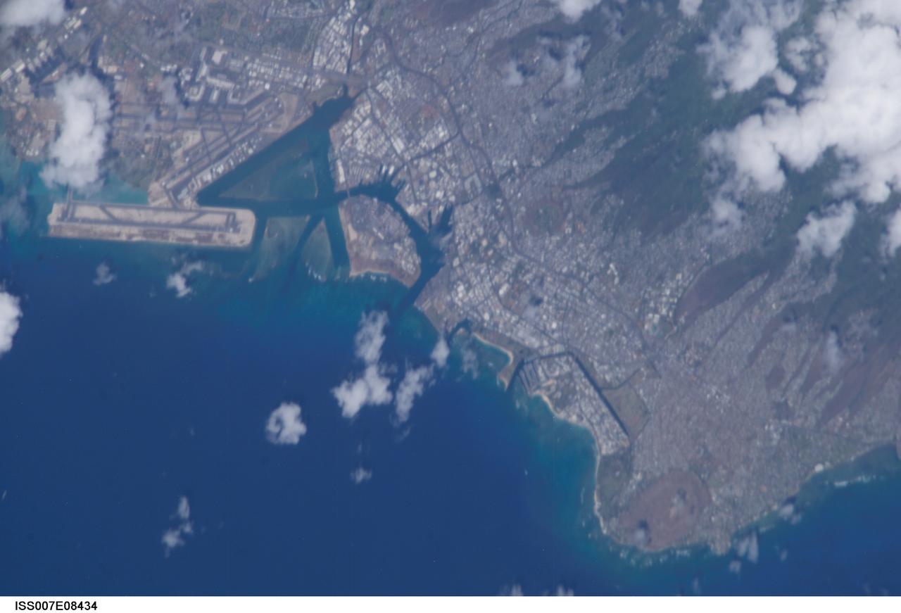
ISS007-E-08434 (27 June 2003) --- This photo featuring a close-up view of Honolulu on the Hawaiian island of Oahu was taken from the International Space Station (ISS) by astronaut Edward T. Lu, Expedition 7 NASA ISS science officer and flight engineer. Diamond Head Crater and Waikiki Beach are visible at lower right.
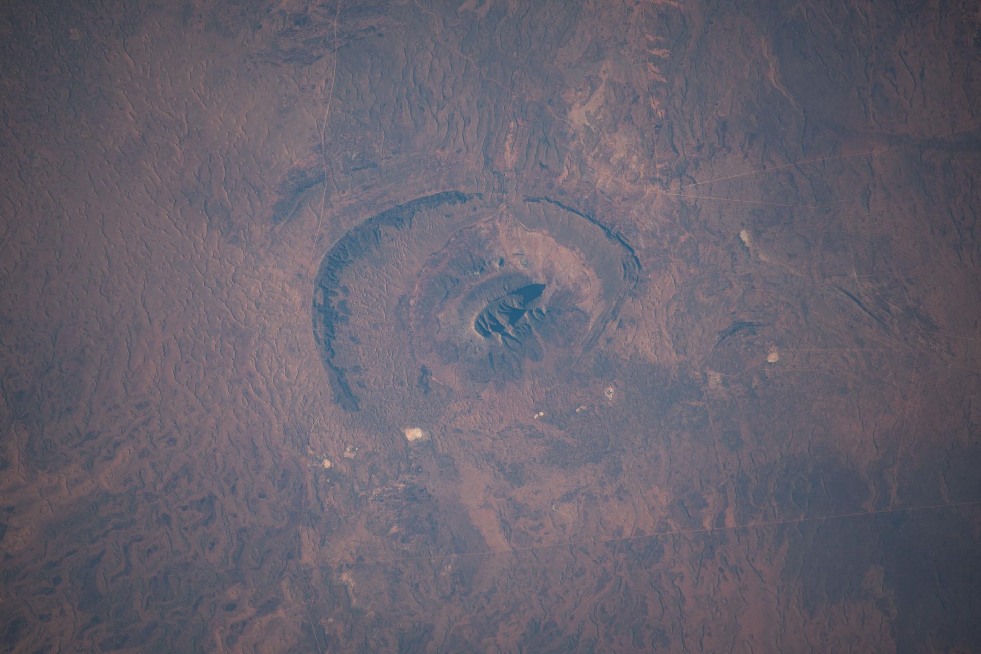
iss074e0046183 (Jan. 4, 2025) --- Mount Conner, in the arid heart of Australia’s Northern Territory—also known as the Red Centre—is a flat-topped mesa and an erosional remnant whose distinct formation took shape approximately 100 million years ago. It resembles an impact crater because it sits on a broad, eroded plain with shallow depressions, while the surrounding terrain was shaped by millions of years of weathering and erosion. The International Space Station was orbiting 262 miles above the island continent when this photograph was taken. Credit: NASA/Chris Williams.
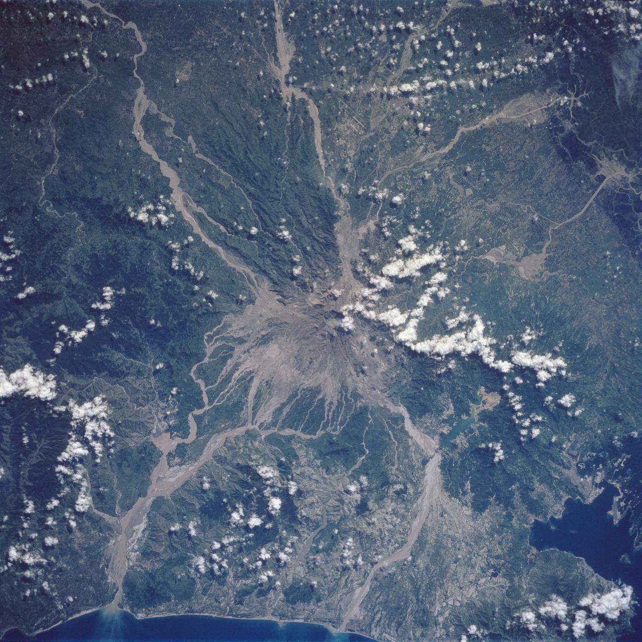
Mt. Pinatubo on the island of Luzon (15.0N, 120.0E) erupted catastrophically in June 1991 after over 600 years of inactivity. In this vertical view, the full extent of the eruption is obvious. Thick layers of ash completely surrounds the crater and the effect of mudflows in this previously heavily forested and agricultural region can be traced as ribbons flowing downhill. Clark AFB, once the crossroads of the SW Pacific can only partially be seen.
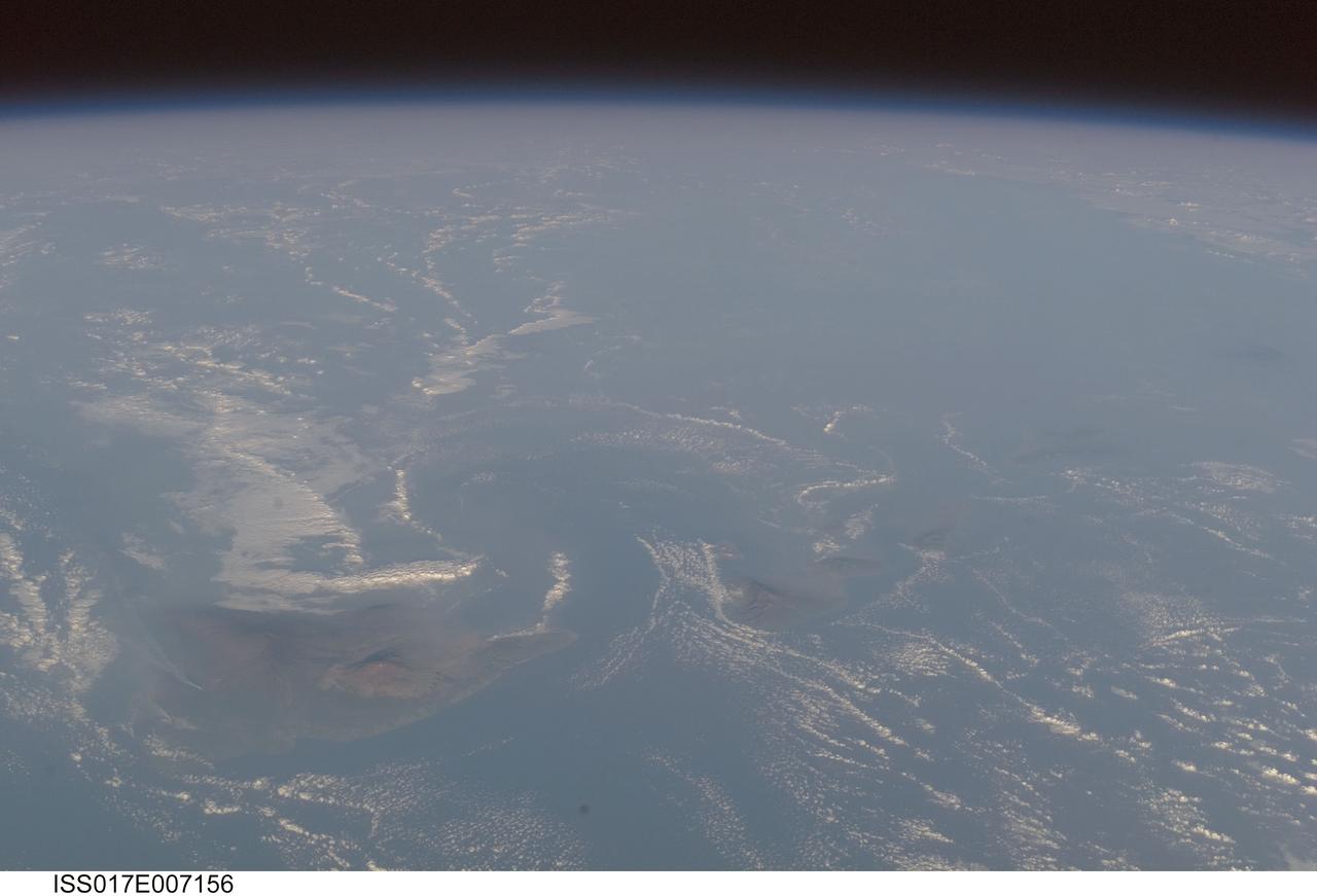
ISS017-E-007156 (17 May 2008) --- Volcanic plumes and volcanic fog in Hawaii are featured in this image photographed by an Expedition 17 crewmember on the International Space Station. For 25 years, Kilauea volcano on Hawaii's Big Island has been erupting continuously. Recent explosive activity that started in March 2008 is producing increased emissions of sulfur dioxide (SO2). These emissions result in a widespread caustic volcanic fog -- known as vog -- that, depending on local winds, drifts as much as 200 miles up the volcanic chain, burning throats and eyes, and inducing asthma attacks as far away as Honolulu, on the island of Oahu. An oblique view of the Hawaiian islands taken from the International Space Station -- viewed looking towards the southwest, rather than "straight down" relative to the station -- on a hazy spring day includes a regional view of three volcanic plumes from Kilauea that contribute to the vog: the plume from Halema'uma'u crater near the summit, a plume from Pu'u O'o vent along the east rift, and a plume from where lava enters the ocean on the coast outside of the park boundaries. At the time this image was taken, doctors throughout the state of Hawaii were reporting an increased caseload of people with respiratory problems. Aside from the vog, this view captures cloud formations indicative of both the large-scale air flow and the local wind patterns around the islands. The parallel lines of clouds aligned roughly northeast to southwest reveal the direction of the region's prevailing trade winds; that flow is disrupted around the islands (between Hawaii and Maui, at right), and further influenced by the local land/sea breeze which at that time had driven the cloud formations offshore and circling the islands. In addition to the Kilauea plumes, the volcanoes of Mauna Loa and Mauna Kea are also visible on the island of Hawaii (center). The uninhabited island of Kaho'olawe is just visible to the southwest of Maui.
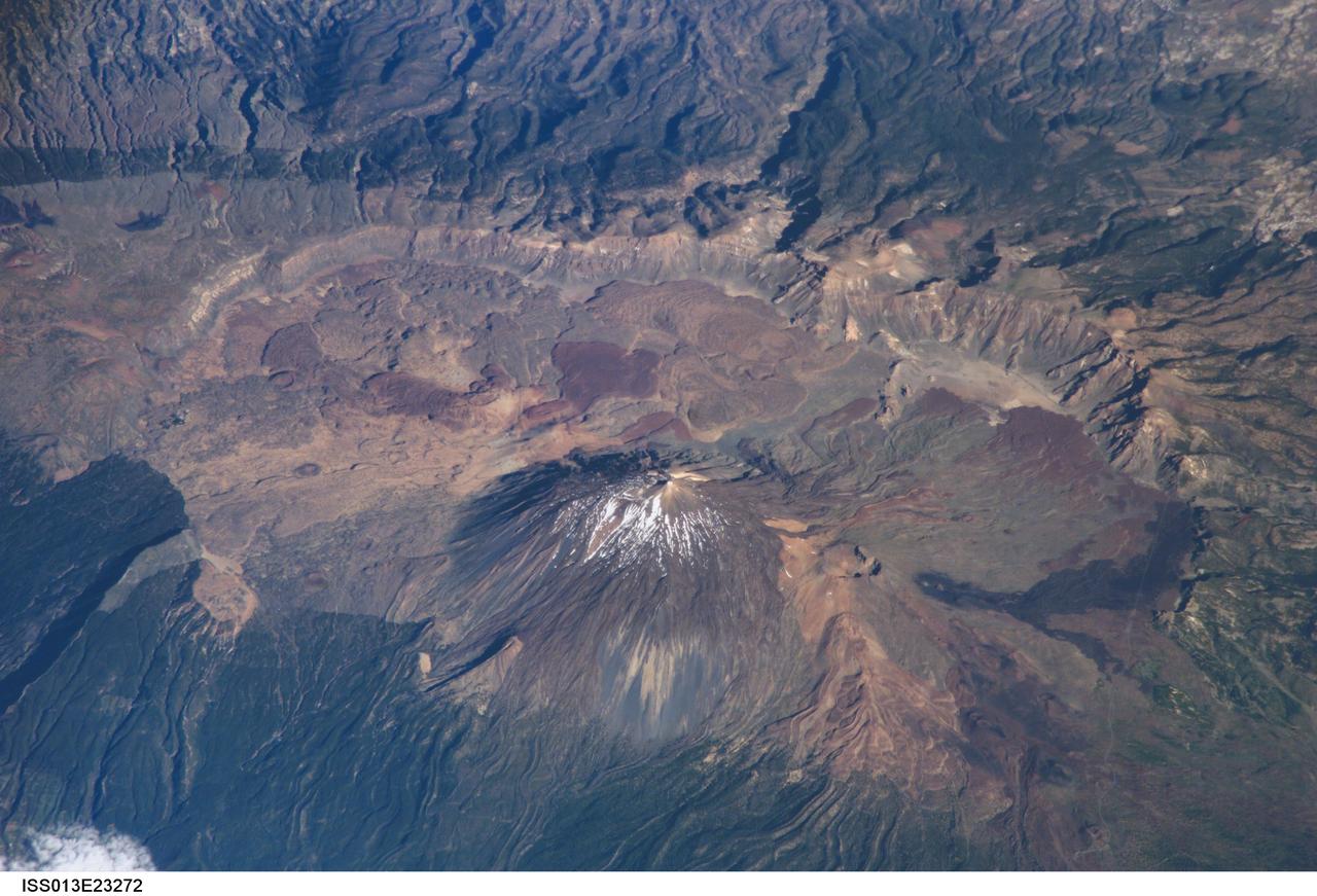
ISS013-E-23272 (8 June 2006) --- Tenerife Island, Spain is featured in this image photographed by an Expedition 13 crewmember on the International Space Station. Tenerife is the largest of the Canary Islands, a Spanish possession located off the northwestern coast of Africa. According to scientists, the islands in the chain could have been produced by eruptions of basaltic shield volcanoes as the African tectonic plate moved over a stationary "hot spot" much like the formation of the Hawaiian Islands. A different hypothesis relates the Canary Islands to magma rise along underwater faults during the uplift of the Atlas Mountains in northern Africa. The island of Tenerife exhibits many excellent volcanic features. The central feature of this image is the elliptical depression of the Las Ca?adas caldera that measures 170 square kilometers in area. A caldera is typically formed when the magma chamber underneath a volcano is completely emptied (usually following a massive eruptive event), and the overlying materials collapse into the newly formed void beneath the surface. A large landslide may have also contributed to (or been the primary cause of) formation of the caldera structure. In this model, part of the original shield volcano forming the bedrock of the island collapsed onto the adjacent sea floor, forming the large depression of the caldera. According to scientists, following formation of the caldera approximately 0.17 million years ago, the composite volcanoes of Mount Teide and Pico Viejo formed. Teide is the highest peak in the Atlantic Ocean with a summit elevation of 3,715 meters. This type of volcano is formed by alternating layers of dense lava flows and more fragmented explosive eruption products, and can build high cones. Many linear flow levees are visible along the flanks of Teide volcano extending from the summit to the base, while a large circular explosion crater marks the summit of Pico Viejo. The floor of the Las Ca?adas caldera is covered with tan, red-brown, and black irregularly-lobed lava flows, the eruptions of which have been observed by settlers and seamen since 1402. The most recent eruption occurred in 1909. The island of Tenerife is actively monitored for further activity.
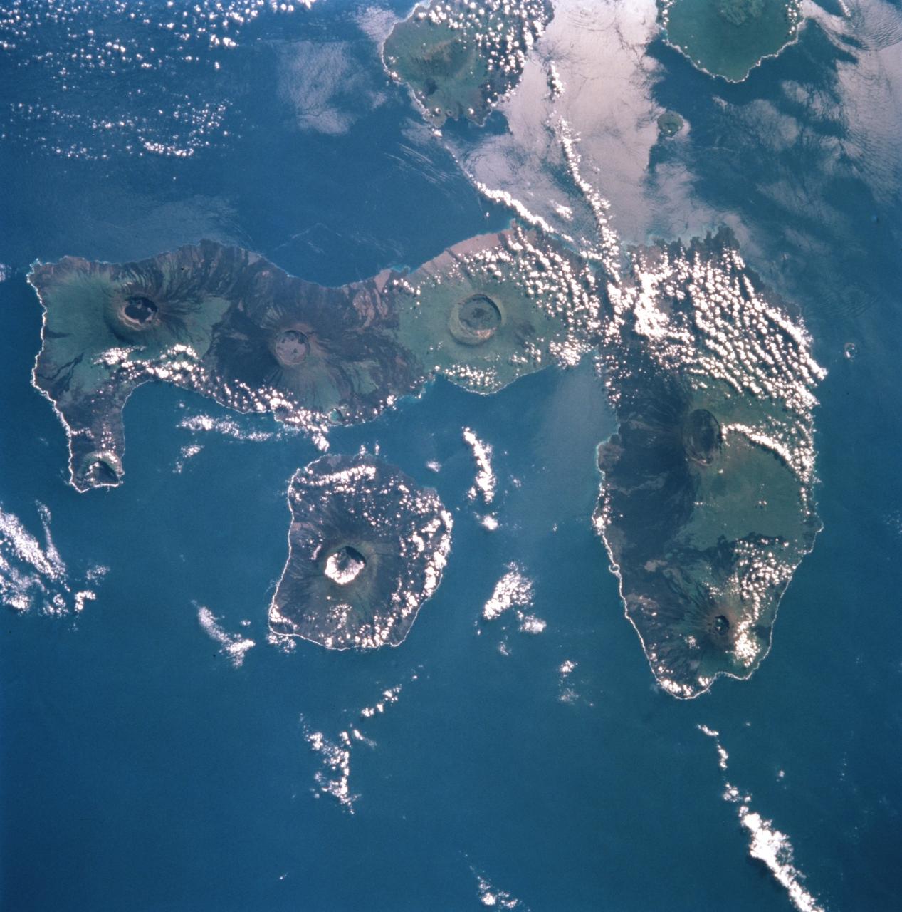
STS099-753-032 (11-22 February 2000) ---This 70mm photograph, photographed from the Space Shuttle Endeavour, centers on the two westernmost Galapagos Islands--seahorse-shaped Isla Isabela and the smaller round Isla Fernandina to its west. All of the 19 islands in the chain are volcanic in origin, and the craters of several of the shield volcanoes are visible as circular features on each of the islands. The two islands shown in this picture contain the most active volcanoes of the Galapagos. Fernandina last erupted in January-February 1995, with red-hot lava pouring into the sea. After 20 years of inactivity, Cerro Azul on Isla Isabela, last erupted in September-October 1998. Cerro Azul is the southwesternmost volcano on Isla Isabela. At 82 miles long, Isla Isabela is the largest of the islands, and comprises half of the land area of the archipelago. The islands are famous for their unique flora and fauna. Charles Darwin's observations of these species in 1835 contributed to the formation of his ideas on natural selection. Some of the most unique species include flightless cormorants, Galapagos penguins, giant land tortoises, and Galapagos finches. The range of Galapagos penguins is restricted to these western islands where upwelling enriches the ocean productivity, and the adaptation of a typically Antarctic bird family to the equator is an ecological marvel. Giant land tortoises are thought to have the oldest lifespans of any animal on Earth, but, scientists say, they have been driven near to extinction. During the most recent eruption of Cerro Azul, one tortoise was killed and many had to be relocated. The 13 species of Galapagos finches on the islands, although varied in form and lifestyle, are the descendants of an ancestor that happened to colonize this isolated archipelago. The human population of the entire archipelago is about 10,000.
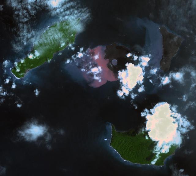
On Dec. 22, 2018, Indonesia's Anak Krakatau volcano erupted and partially collapsed. NASA's Advanced Spaceborne Thermal Emission and Reflection (ASTER) instrument imaged the volcano on Jan. 13 -- several weeks after the eruption. This image shows that the crater area has closed to become a lake and the forest on the island has been destroyed by ash falls. The reddish area in the water southwest of the island is likely due to either iron-rich ash in the water or the interaction of seawater with underwater volcanic eruption products. The image covers an area of 7.5 by 8.4 miles (12.2 by 13.5 kilometers), and is located at 6.1 degrees south, 105.4 degrees east. The tsunami that followed the eruption killed more than 400 people in western Indonesia. https://photojournal.jpl.nasa.gov/catalog/PIA22821
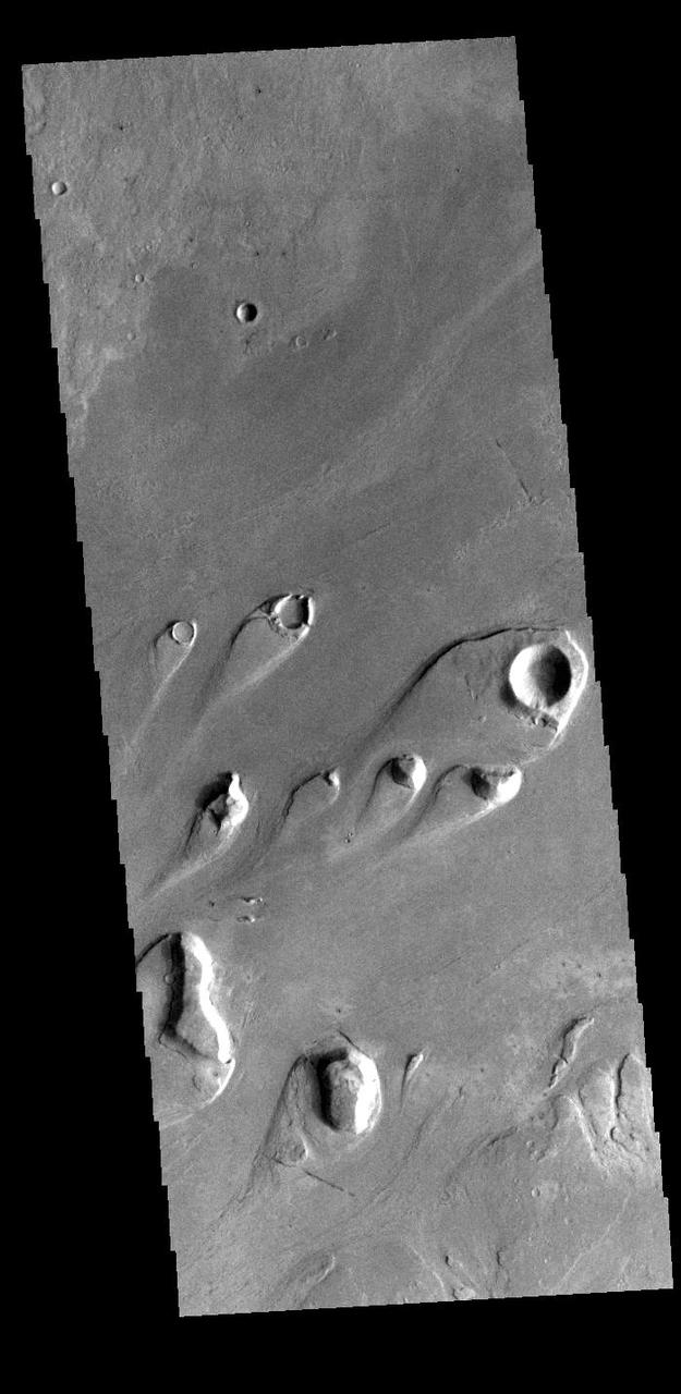
Today's VIS image shows part of Athabasca Valles. Multiple streamlined islands are seen in this image. The teardrop shaped features were formed by liquid flow deflected around features such as craters and hills. The 'tail' of the island points downstream. The source of the fluid was likely an outburst of groundwater, perhaps related to the Elysium volcanic complex located to the northwest of this image. Arising from Cerberus Fossae, the formation mode of this channel is still being debated. While the channel features are similar to water flow, other features are similar to lava flows, and yet other features have an appearance of slabs of material that floated on an underlying fluid. It is thought that Athabasca Valles is the youngest outflow channel system on Mars. Athabasca Valles is just one of the complex channel formations in the Elysium Planitia region. Orbit Number: 89977 Latitude: 9.44823 Longitude: 156.138 Instrument: VIS Captured: 2022-03-28 00:21 https://photojournal.jpl.nasa.gov/catalog/PIA25466
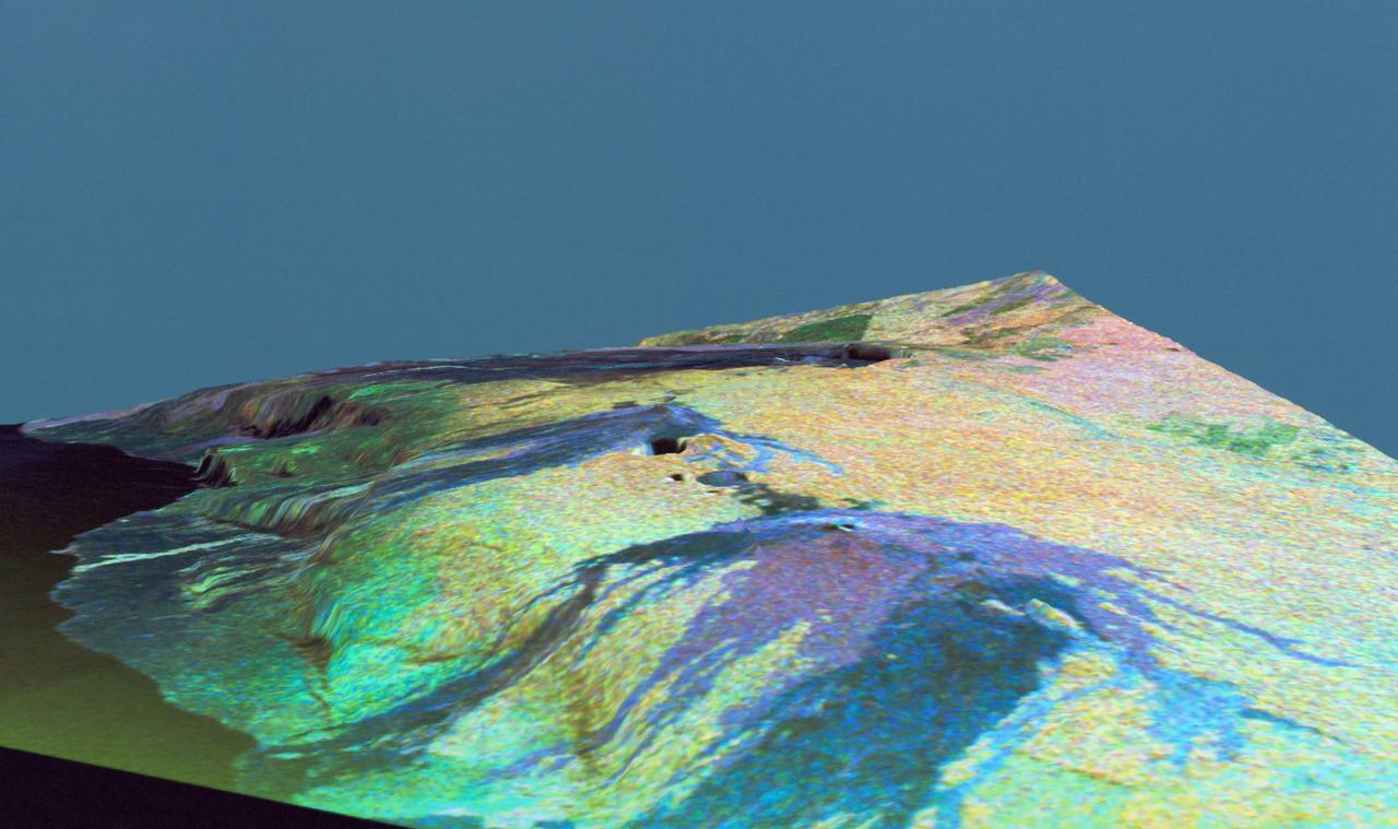
This is a three dimensional perspective view of false-color image of the eastern part of the Big Island of Hawaii. It was produced using all three radar frequencies C-Band and L-Band. This view was constructed by overlaying a SIR-C radar image on a U.S. Geological Survey digital elevation map. The image was acquired on April 12, 1994 during the 52nd orbit of the Shuttle Endeavour by the Spaceborne Imaging Radar-C and X-Band Synthetic Aperture Radar (SIR-C/X-SAR). The area shown is approximately 34 by 57 kilomters with the top of the image pointing toward north-west. The image is centered at about 155.25 degrees west longitude and 19.5 degrees north latitude. Visible in the center of the image in blue are the summit crater (Kilauea Caidera) which contains the smaller Halemaumau Crater, and the line of collapsed craters below them that form the Chain of Craters Road. The rain forest appears bright in the image while green areas correspond to lower vegetation. The lava flows have different colors depending on their types and are easily recognizable due to their shapes. The flows at the top of the image originated from the Muana Loa volcano. The Jet Propulsion Laboratory alternative photo number is P-43932.
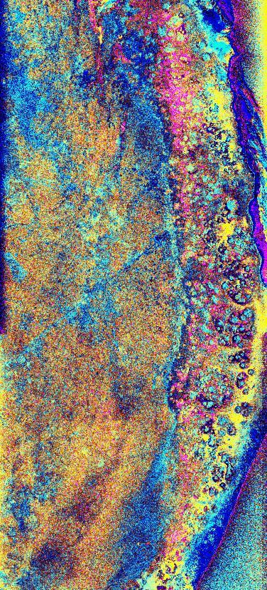
This is a radar image of the southwest portion of the buried Chicxulub impact crater in the Yucatan Peninsula, Mexico. The radar image was acquired on orbit 81 of space shuttle Endeavour on April 14, 1994 by the Spaceborne Imaging Radar C/X-Band Synthetic Aperture Radar (SIR-C/X-SAR). The image is centered at 20 degrees north latitude and 90 degrees west longitude. Scientists believe the crater was formed by an asteroid or comet which slammed into the Earth more than 65 million years ago. It is this impact crater that has been linked to a major biological catastrophe where more than 50 percent of the Earth's species, including the dinosaurs, became extinct. The 180-to 300-kilometer-diameter (110- to 180-mile) crater is buried by 300 to 1,000 meters (1,000 to 3,000 feet) of limestone. The exact size of the crater is currently being debated by scientists. This is a total power radar image with L-band in red, C-band in green, and the difference between C-band L-band in blue. The 10-kilometer-wide (6-mile) band of yellow and pink with blue patches along the top left (northwestern side) of the image is a mangrove swamp. The blue patches are islands of tropical forests created by freshwater springs that emerge through fractures in the limestone bedrock and are most abundant in the vicinity of the buried crater rim. The fracture patterns and wetland hydrology in this region are controlled by the structure of the buried crater. Scientists are using the SIR-C/X-SAR imagery to study wetland ecology and help determine the exact size of the impact crater. http://photojournal.jpl.nasa.gov/catalog/PIA01723
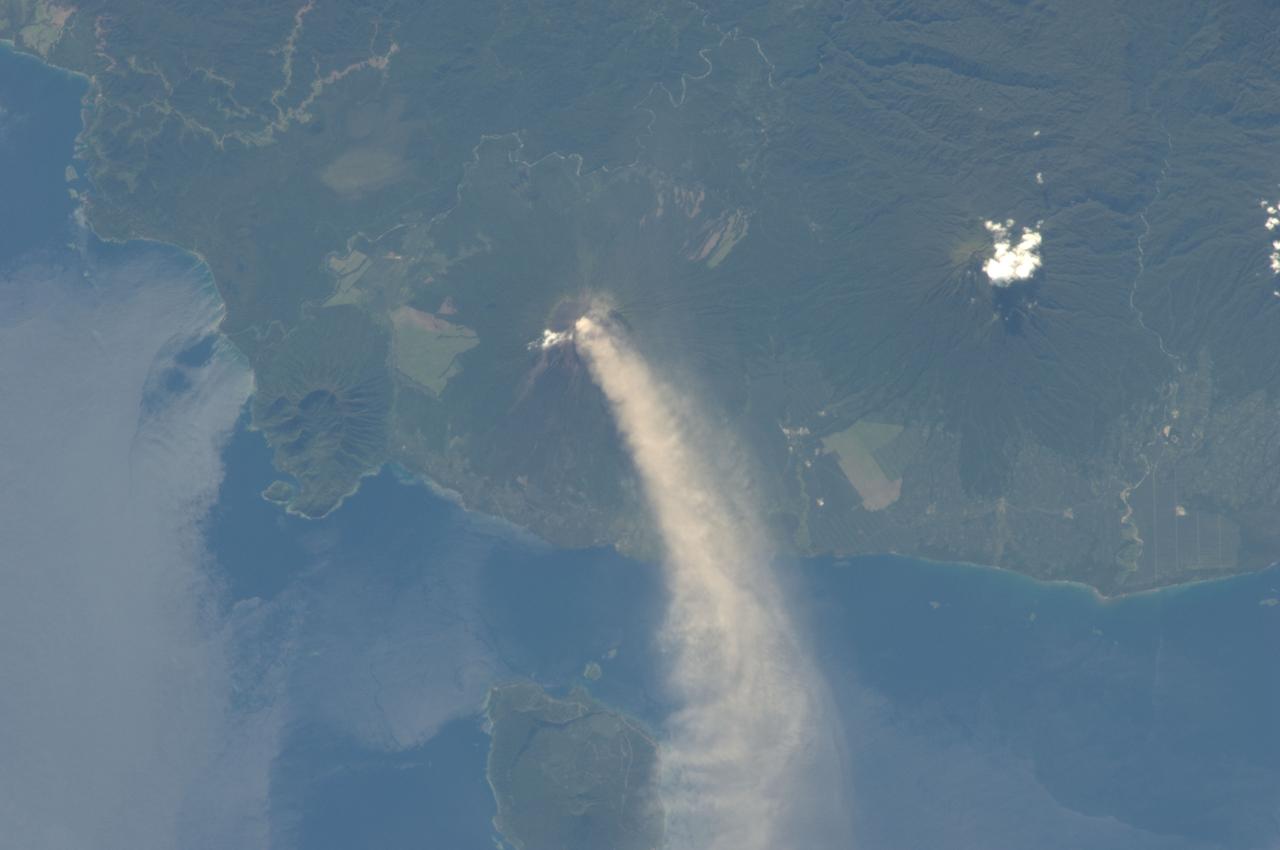
ISS034-E-005496 (30 Nov. 2012) --- An eruption at the Ulawun volcano, New Britain Island, Papua New Guinea is featured in this image photographed by an Expedition 34 crew member on the International Space Station. Numerous volcanoes contribute to the landmass of the island of New Britain, the largest in the Bismarck Archipelago of Papua New Guinea. One of the most active of these volcanoes, Ulawun, is also the highest with a summit elevation of 2,334 meters. This photograph was taken during the most recent phase of volcanic activity at Ulawun. A white steam and ash plume extends from the summit crater of the stratovolcano towards the northwest (center; note the image is oriented such that north is towards the lower left). The plume begins to broaden as it passes the southwestern coast of Lolobau Island approximately 23 kilometers downwind from its source. Ulawun volcano is also known as “the Father”, with the Bamus volcano to the southwest also known as “the South Son”. The summit of Bamus is obscured by white cumulus clouds (not of volcanic origin) in this image. While Ulawun has been active since at least 1700, the most recent eruptive activity at Bamus occurred in the late 19th century. A large region of ocean surface highlighted by sunglint – sunlight reflecting off the water surface, lending it a mirror-like appearance– is visible to the north-northeast of Ulawun (lower left).
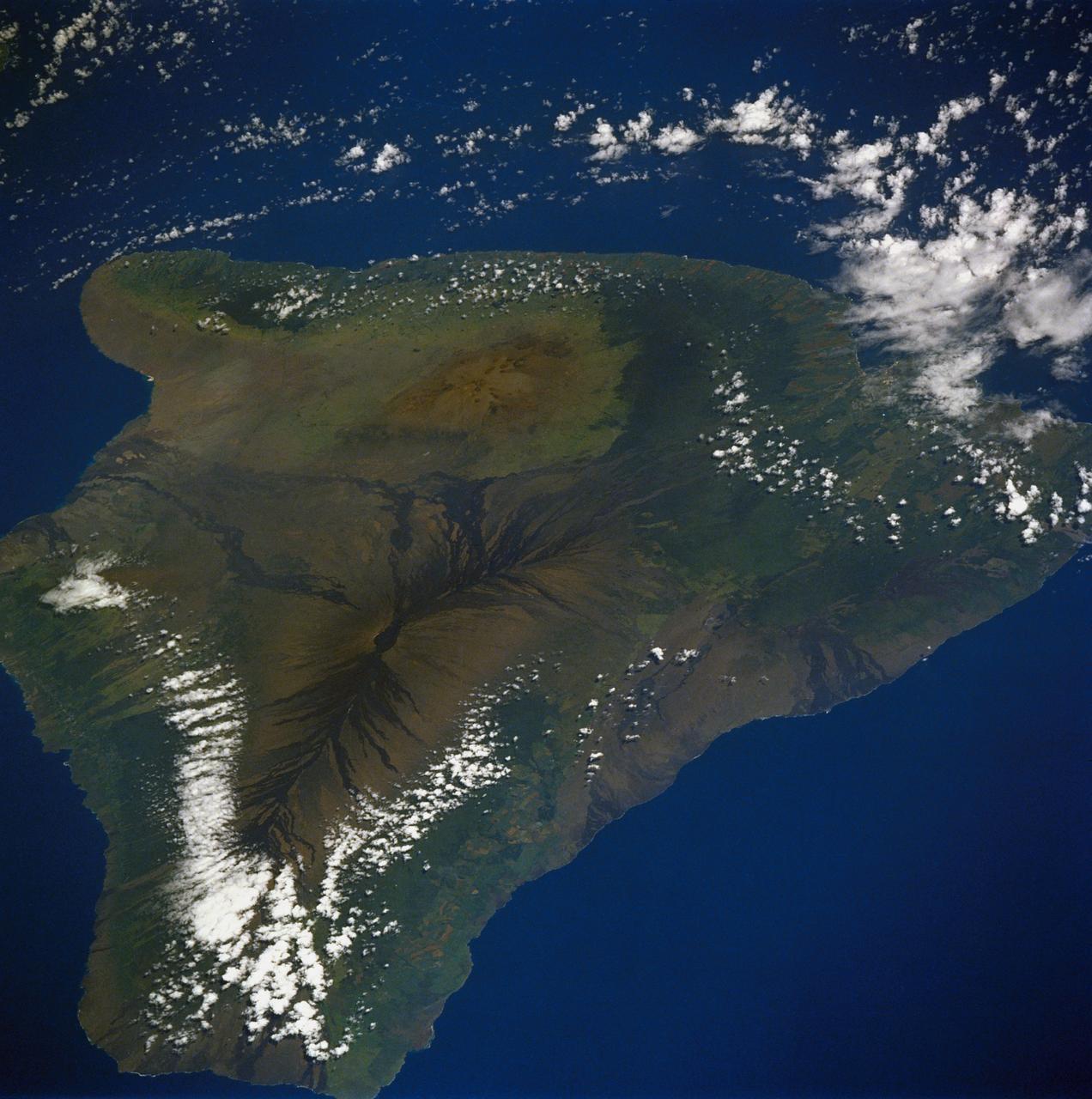
61A-50-057 (1 Nov 1985) --- An oblique view of Hawaii, the largest of the Hawaiian Island Group, as photographed by the crewmembers of Challenger on STS-61A in November of 1985. This unusual early morning view shows nearly the entire island with minimal cloud cover. Normally, these near tropical islands are obscured by heavy cloud cover except for the early morning hours. UPDATE, NOVEMBER 28, 1986 PLEASE NOTE: The Kilauea fissure, on the southeast coast, while not as prominent as ancient, neighboring Mauna Loa and Mauna Kea craters, has been spewing a molten lava flow since July 18, 1986, at a rate of six cubic yards per second. Generally flowing toward the sea, the lava mass had reached the coast by today after destroying several homes and private property along the way. The seven-mile long lava flow covered over 600 feet of coastline and extended into the ocean, creating over 12 acres of new beachfront property.
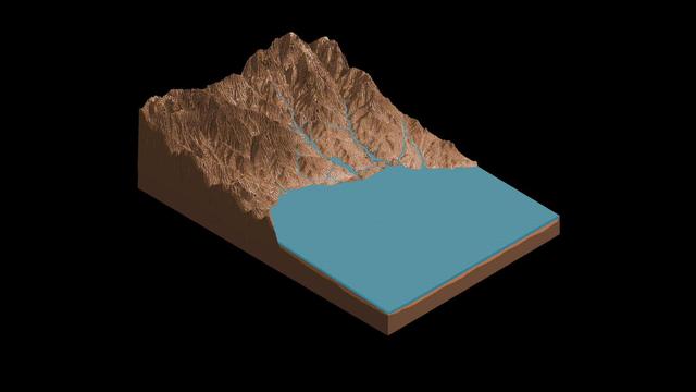
This animation demonstrates how streams may have flowed from Mount Sharp to the floor of Gale Crater, where salty ponds may have been left behind as the region dried out over time. Rocks enriched with mineral salts discovered by NASA's Curiosity at a location on Mount Sharp called "Sutton Island" suggest that water vanished slowly, rather than all at once, possibly returning to the area in a persistent cycle of drying and overflow. This discovery serves as a watermark for when the Martian climate was gradually getting drier. Animation available at https://photojournal.jpl.nasa.gov/catalog/PIA23375
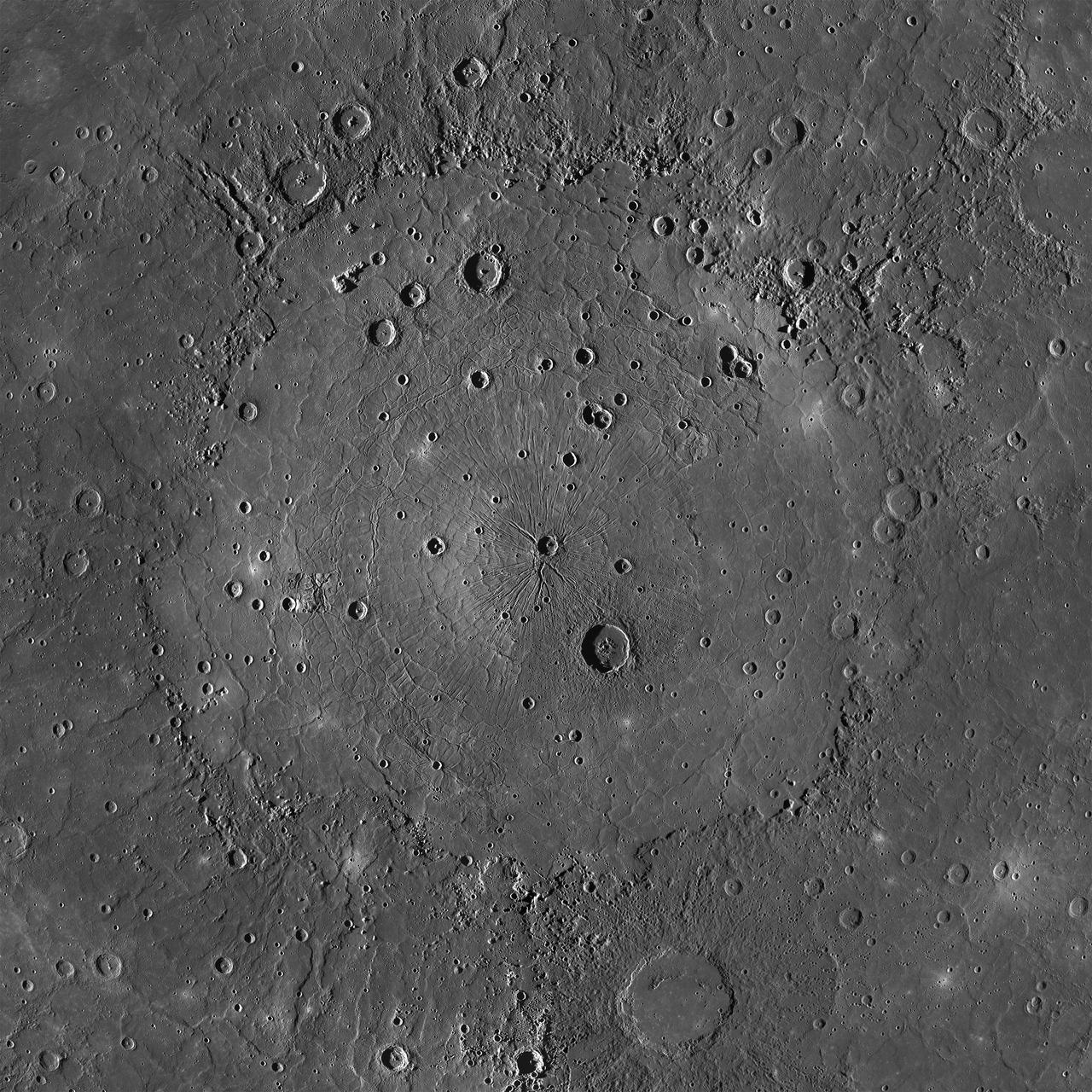
This is an MDIS mosaic of the mighty Caloris basin, Mercury's youngest large impact basin. Caloris has been filled by volcanic plains that are distinctive in color from the surrounding terrain. Subsequent craters have excavated low-reflectance material from beneath these volcanic plains, possibly giving clues to the composition of the basin floor. The basin interior has a complex tectonic history. The interior smooth plains have an area approximately the area of Alaska! Over 640 Rhode Islands would fit inside of this massive basin. http://photojournal.jpl.nasa.gov/catalog/PIA19213
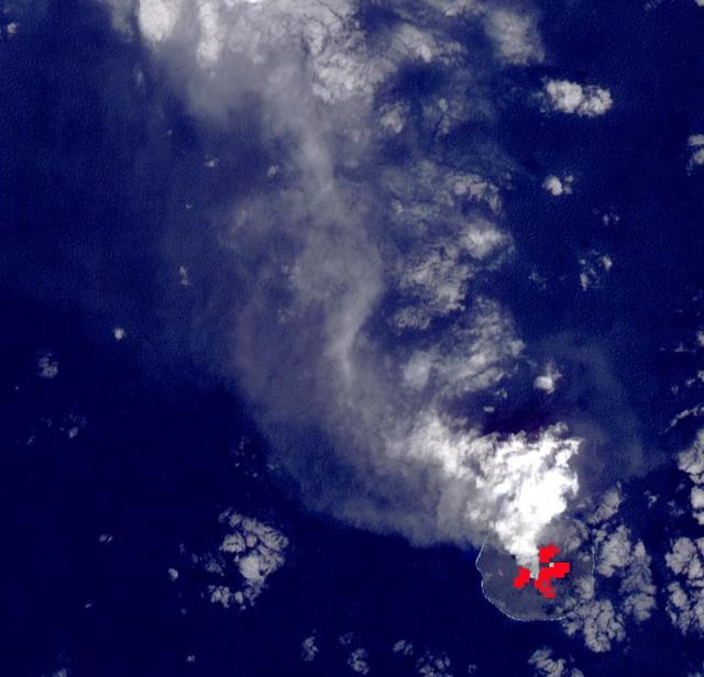
Nishinoshima Volcano is a small volcanic island located about 1000 km south of Tokyo. Recent activity began in December 2019, and has continued. ASTER captured this image of an ash and steam plume emanating from the central crater. Thermal infrared data is superimposed on a visible-infrared color image to highlight the lave flows that have flowed down the volcano's flanks. The image was acquired March 22, 2020, covers an area of 12.6 by 12.3 km, and is located at 27.3 degrees east, 140.8 degrees east. https://photojournal.jpl.nasa.gov/catalog/PIA23846
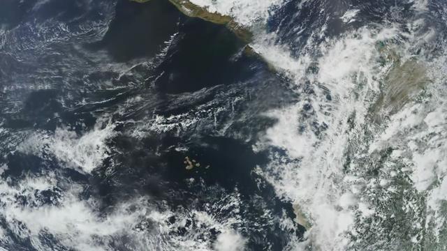
Completed: 07-16-2009 Straddling the equator approximately 1000 kilometers to the west of the South American mainland, the Galapagos Islands lie within the heart of the equatorial current system. Rising from the sea floor, the volcanic islands of the Galapagos are set on top of a large submarine platform. The main portion of the Galapagos platform is relatively flat and less than 1000 meters in depth. The steepest slopes are found along the western and southern flanks of the platform with a gradual slope towards the east. The interactions of the Galapagos and the oceanic currents create vastly different environmental regimes which not only isolates one part of the Archipelago from the other but allows penguins to live along the equator on the western part of the Archipelago and tropical corals around the islands to the north. The islands are relatively new in geologic terms with the youngest islands in the west still exhibiting periodic eruptions from their massive volcanic craters. Please give credit for this item to: NASA/Goddard Space Flight Center, The SeaWiFS Project and GeoEye, Scientific Visualization Studio. NOTE: All SeaWiFS images and data presented on this web site are for research and educational use only. All commercial use of SeaWiFS data must be coordinated with GeoEye (http://www.geoeye.com). To download this video go to: <a href="http://svs.gsfc.nasa.gov/goto?3628" rel="nofollow">svs.gsfc.nasa.gov/goto?3628</a> <b><a href="http://www.nasa.gov/centers/goddard/home/index.html" rel="nofollow">NASA Goddard Space Flight Center</a></b> is home to the nation's largest organization of combined scientists, engineers and technologists that build spacecraft, instruments and new technology to study the Earth, the sun, our solar system, and the universe.
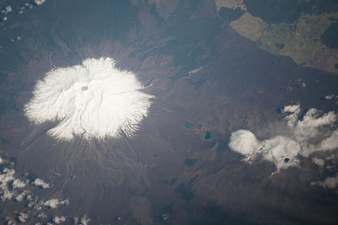
ISS037-E-005089 (30 Sept. 2013) --- Ruapehu volcano and Tongariro volcanic complex in New Zealand are featured in this image photographed by an Expedition 37 crew member on the International Space Station. Mount Ruapehu is one of several volcanic centers on the North Island of New Zealand, but is the largest and historically most active. The 2,797-meter elevation volcano is also the highest mountain on North Island and is covered with snow on its upper slopes. Scientists believe while there are three summit craters that have been active during the last 10,000 years, South Crater is the only historically active one. This vent is currently filled with a lake (Crater Lake), visible at left; eruptions from the vent, mixed with water from the lake can lead to the formation of lahars – destructive gravity flows of mixed fluid and volcanic debris that form a hazard to ski areas on the upper slopes and lower river valleys. The most recent significant eruption of Ruapehu took place in 2007 and formed both an eruption plume and lahars. The volcano is surrounded by a 100-cubic-kilometer ring plain of volcaniclastic debris that appears dark grey in the image, whereas vegetated areas appear light to dark green. Located to the northeast of the Ruapehu volcanic structure, the Tongariro volcanic complex (lower right) is currently in an active eruptive phase – the previous eruptive phase ended in 1897. Explosive eruptions occurred in 2012, which have been followed by steam and gas plumes observed almost daily. According to scientists, the volcanic complex contains multiple cones constructed over the past 275,000 years. The most prominent of these, Mount Ngauruhoe, last erupted in 1975. Like Ruapehu, the upper slopes of both Ngauruhoe and the upper peaks of Tongariro are snow-covered. Scattered cloud cover is also visible near Tongariro at lower right.
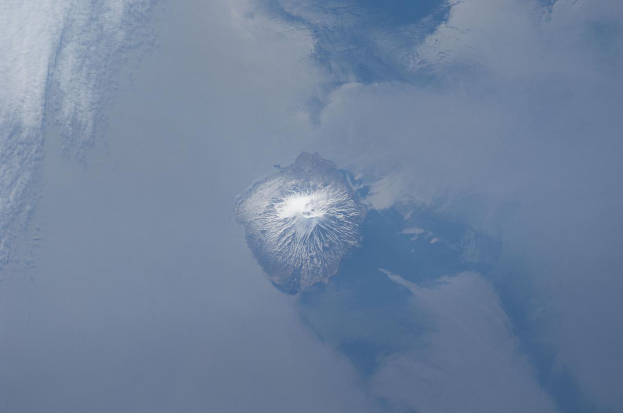
ISS031-E-041959 (18 May 2012) --- Alaid Volcano in the Kuril Islands of the Russian Federation is featured in this image photographed by an Expedition 31 crew member on the International Space Station. The Kurils chain extends from the Kamchatka Peninsula to the islands of Japan, and contains numerous active volcanoes along its length. Alaid is the highest (2,339 meters above sea level) volcano in the Kuril chain, as well as being the northernmost. The textbook conic morphology of this stratovolcano is marred only by the summit crater, which is breached to the south (center) and highlighted by snow cover. The volcano rises 3,000 meters directly from the floor of the Sea of Okhotsk, with the uppermost part of the volcanic edifice exposed as an island. Much of the sea surface surrounding the volcano has a silver-gray appearance. This mirror-like appearance is due to sunglint, where light reflects off the sea surface and is scattered directly towards the observer onboard the space station. Sunglint is largely absent from a zone directly to the west of the volcano, most likely due to surface wind or water current patterns that change the roughness?and light scattering properties?of the water surface in this area. Volcanoes in the Kurils, and similar island arcs in the Pacific ?ring of fire?, are fed by magma generated along the boundary between two tectonic plates, where one plate is being driven beneath the other (a process known as subduction). Alaid Volcano has been historically active with the most recent confirmed explosive activity occurring in 1996.
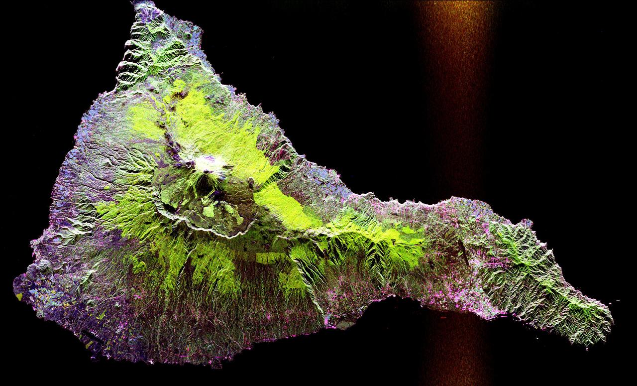
This radar image shows the Teide volcano on the island of Tenerife in the Canary Islands. The Canary Islands, part of Spain, are located in the eastern Atlantic Ocean off the coast of Morocco. Teide has erupted only once in the 20th Century, in 1909, but is considered a potentially threatening volcano due to its proximity to the city of Santa Cruz de Tenerife, shown in this image as the purple and white area on the lower right edge of the island. The summit crater of Teide, clearly visible in the left center of the image, contains lava flows of various ages and roughnesses that appear in shades of green and brown. Different vegetation zones, both natural and agricultural, are detected by the radar as areas of purple, green and yellow on the volcano's flanks. Scientists are using images such as this to understand the evolution of the structure of Teide, especially the formation of the summit caldera and the potential for collapse of the flanks. The volcano is one of 15 identified by scientists as potentially hazardous to local populations, as part of the international The image was acquired by the Spaceborne Imaging Radar-C/X-Band Synthetic Aperture Radar (SIR-C/X-SAR) onboard the space shuttle Endeavour on October 11, 1994. SIR-C/X-SAR, a joint mission of the German, Italian and the United States space agencies, is part of NASA's Mission to Planet Earth. The image is centered at 28.3 degrees North latitude and 16.6 degrees West longitude. North is toward the upper right. The area shown measures 90 kilometers by 54.5 kilometers (55.8 miles by 33.8 miles). The colors in the image are assigned to different frequencies and polarizations of the radar as follows: red is L-band horizontally transmitted, horizontally received; green is L-band horizontally transmitted, vertically received; blue is C-band horizontally transmitted, vertically received. http://photojournal.jpl.nasa.gov/catalog/PIA01779

STS099-749-089 (11-22 February 2000) ---As evidenced by this 70mm frame from the Space Shuttle Endeavour, the Alaska Peninsula and Aleutian Islands form a long arc that intervenes between the Bering Sea and the northern Pacific Ocean. This view is of the snowy south coast of the peninsula, from Chignik Bay and Cape Kumliun (on the triangular peninsula) northeastward to Chiginagak Bay and David Island. Port Heiden is the darker area of little ice on the north coast. Within the rim of the Aniakchak volcanic crater (4,450 feet at highest point) the frozen waters of Surprise Lake are visible. The North American and Pacific tectonic plates are converging in this region at a rate of about 5 centimeters a year. The Pacific plate descends beneath North America, producing a deep trench along the south coast; the Aleutian Trench reaches depths greater than 25,000 ft. In such regions (subduction zones) volcanoes form on the overriding plate -- the North American plate in this instance; Aniakchak is one of the many young volcanoes in this arc.

This image shows a bright, rectangular-looking landform surrounded by a dark floor. How did this feature get here if it looks so different than its surroundings? The feature resembles a plateau. Dark streaks mark steep slopes on its sides while the top appears flat. The slope streaks are not all the same age, as we see a variation in colors from faint to dark. Craters in a variety of sizes and ages pepper the entire rectangle, but the dark, textured floor has very few noticeable craters. The evidence suggests that this rectangular feature is a high-standing "island" of older land surrounded by one or more younger lava flows. This landmass is located in Amazonis Planitia, a smooth plains area potentially formed by large-scale lava floods between the Tharsis and Elysium volcanic regions. As lava flowed into this area, the rectangular plateau was too high to cover completely, leaving a bright spot sticking out of the dark basalt floor for us to find. https://photojournal.jpl.nasa.gov/catalog/PIA22725

ISS033-E-022852 (18 Nov. 2012) --- This view, photographed by an Expedition 33 crew member on the International Space Station, highlights the 24-kilometer wide Aso caldera on the Japanese Island of Kyushu, formed during four explosive eruptions that took place from 300,000 to 90,000 years ago, according to scientists. These major eruptions produced pyroclastic flows and airfall tephra that covered much of Kyushu. As the eruptions emptied the magma chambers beneath the ancient volcanoes, they collapsed ? forming the caldera. Shadows highlight the caldera rim at left, while green vegetation covers slopes between the rim and caldera floor at right. Volcanic activity continued in the caldera following its formation, represented by 17 younger volcanoes including Naka-dake at center. Naka-dake is one of Japan?s most active volcanoes, with ash plumes produced from the summit crater as recently as June 2011. Another prominent crater, Kusasenri, is visible to the west of Naka-dake. This crater is the site of the Aso Volcano Museum as well as pasture for cows and horses. The Aso caldera floor is largely occupied by urban and agricultural land uses that present a gray to white speckled appearance in the image. Fields and cities surround the younger volcanic structures in the caldera center to the north, west, and south. Tan to yellow-brown regions along the crater rim, and along the lower slopes of the younger volcanic highlands in the central caldera, are lacking the dense tree cover indicated by greener areas in the image.
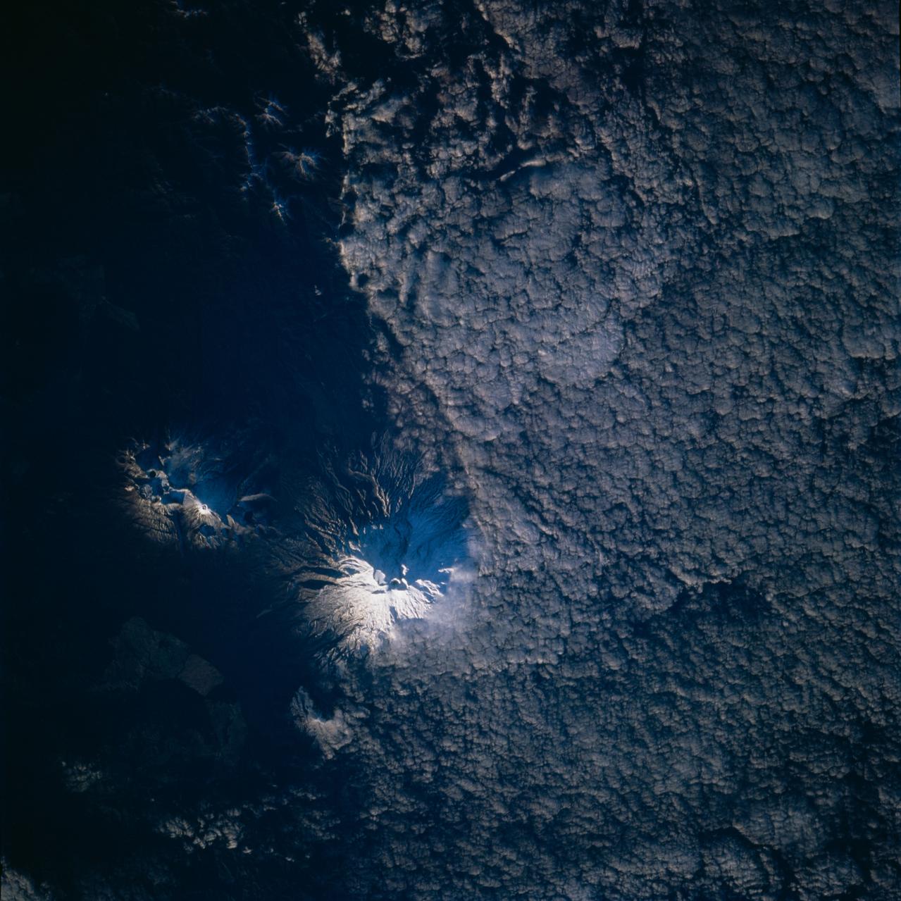
STS077-715-037 (19-29 May 1996) --- According to NASA scientists, Ruapehu, on New Zealand?s North Island, is one of the most active volcanoes in the South Pacific. Prior to the flight, crew members scheduled this site as one of their photographic targets. The volcano endured a significant eruption in late September, 1995. This view is the first image of the crater region since that eruption. Since then, numerous landslides and secondary explosions in the summit area has produced changes. In this view, recent mudflows extend from the summit region and down the mountain flank which is in the shadow. Ruapehu is also one of New Zealand?s high points - the mountain supports a glacier and permanent ice fields, and volcanic activity necessarily involves mixing hot volcanic products with snow and ice. Recent activity has produced destructive lahars (mudslides which are slurries of volcanic material with ice and water) downslope. A hazard warning to skiers is still in effect.
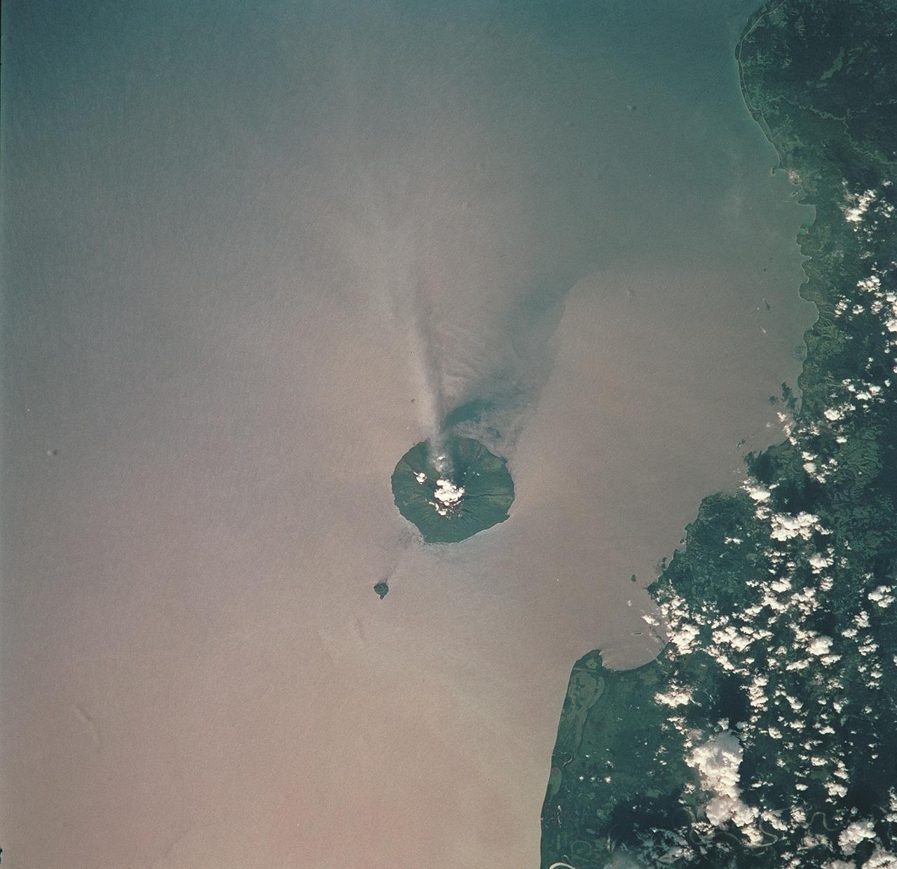
STS093-709-051 (23-27 July 1999) --- The STS-93 astronauts aboard the Space Shuttle Columbia took this picture of the volcanic island of Manam, along the northeast coast of Papua New Guinea. Manam is one in a string of currently active volcanoes called the Bismarck Arc. It is the most active of the group, having begun its present activity in 1994. The plume of steam and ash streaming from its crater extends more than 20 miles into the atmosphere. When the photo was taken, the shuttle was flying over a point located at 12.2 degrees south latitude and 132.0 degrees east longitude. Data back information on the 70mm film lists time and date of the photo as 05:42:31 GMT, July 25, 1999 (orbit 33).
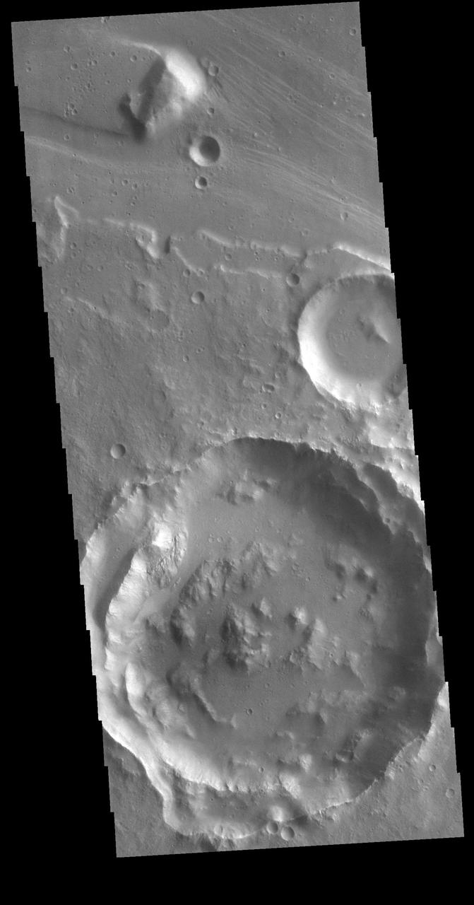
The channel form at the top of this VIS image is part of Tiu Valles. The impact crater has affected the course of the channel, as has the small hill at the top of the image. This type of feature, a hill with a teardrop shaped section, is called a streamline island. The hill interrupts the fluid flow, creating eddies on the downstream side where the flow velocity lessens and it is unable to erode as easily as in the main part of the channel. The teardrop points downstream. Located in Margaritifer Terra, Tiu Valles is part of a large system of channels that arise from Vallis Marineris and flow northward to empty into Chryse Planitia. Orbit Number: 86527 Latitude: 16.6616 Longitude: 325.954 Instrument: VIS Captured: 2021-06-16 22:38 https://photojournal.jpl.nasa.gov/catalog/PIA24998
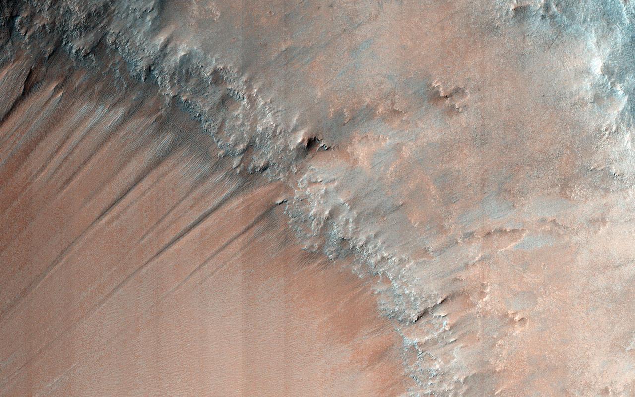
The gullies in this image are within the valley wall of an ancient channel-Nirgal Vallis-a testament to flowing water in Mars' ancient past. However, the formation of gullies are still the subject of much debate with respect to their formation: "wet" vs. "dry" or even "dry" with the aid of some lubricating fluid. Gullies most commonly form in the steep walls of simple craters. Gullies are common even in cold arctic deserts on Earth (e.g., the Haughton impact structure on Devon Island). This suggests that these provocative features can form on a mostly dry Mars that is only sporadically wet. Regardless, these features bear a remarkable resemblance to flowers, including the blossom, petals, stem, and roots. Can you see it too? http://photojournal.jpl.nasa.gov/catalog/PIA19294
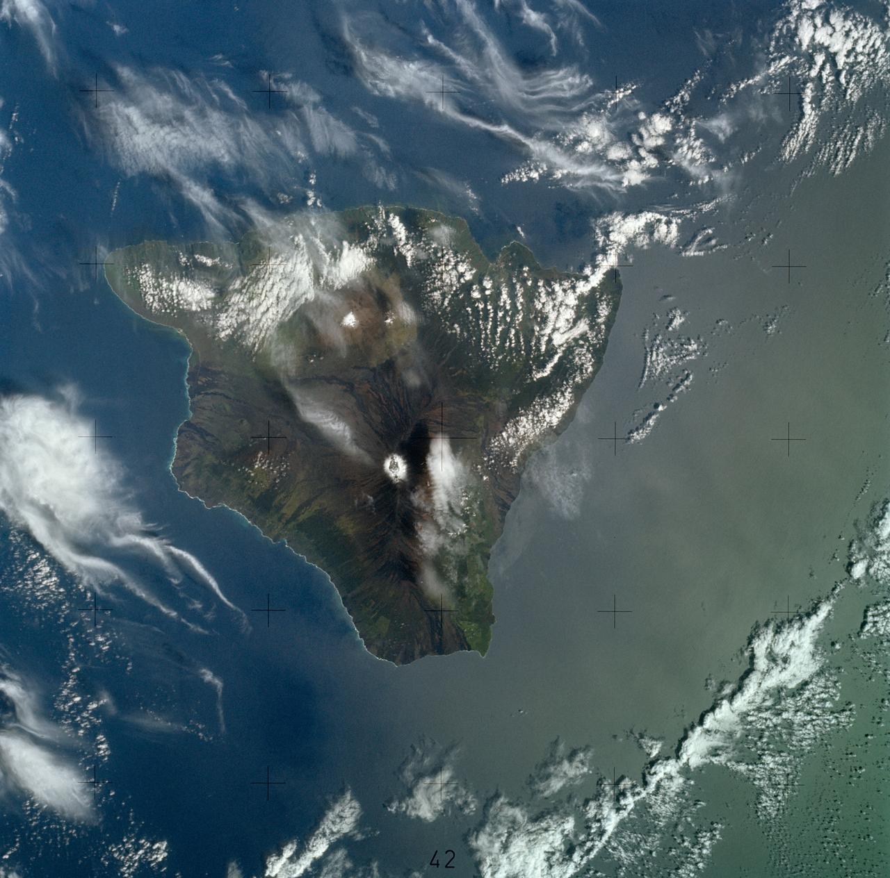
SL4-139-3997 (8 Jan. 1974) --- A vertical view of the Island of Hawaii, State of Hawaii, as photographed from the Skylab space station in Earth orbit by a Skylab 4 crewman. The camera used was a hand-held Hasselblad camera, with SO-368 medium-speed Ektachrome film. This photograph, taken on Jan. 8, 1974, is very useful in studies of volcanic areas. Prominent volcanic features such as the summit caldera on Mauna Loa, the extinct volcano Mauna Kea, the Kilauea caldera, and the pit crater at Halo mau mau within the caldera are easily identified. (Kilauea was undergoing frequent eruption during the mission). Detailed features such as the extent and delineation of historic lava flows on Mauna Loa can be determined and are important parameters in volcanic studies. Photo credit: NASA
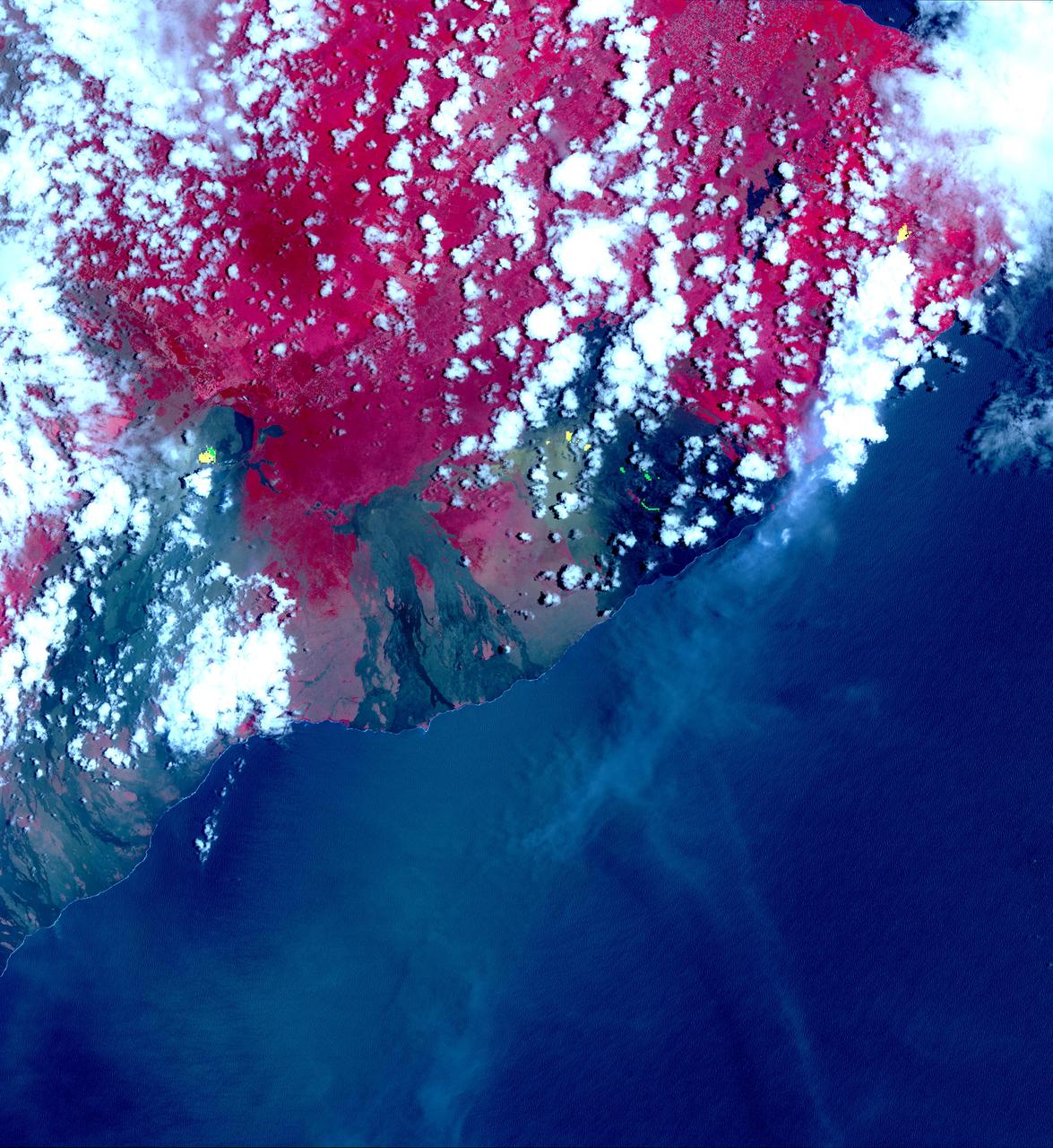
This image from NASA's Advanced Spaceborne Thermal Emission and Reflection Radiometer (ASTER) instrument on NASA's Terra spacecraft show recent eruptions of Kilauea volcano on the island of Hawaii (the Big Island). Following days of increased seismic activity, Kilauea erupted May 3, 2018, and triggered a number of additional fissure eruptions along the East Rift Zone. The eruptions and high level of sulfur dioxide gas (SO2) prompted evacuations in the area, including the Leilani Estates subdivision near the town of Pahoa. The ASTER images, acquired on May 6, 2018, show different aspects of the eruption. A color composite depicts vegetation in red, and old lava flows in black and gray. Superimposed on the image in yellow are hotspots detected on the thermal infrared bands. The easternmost hot spots show the newly formed fissures and the lava flow spilling to the northwest. The middle spots are Pu'u O'o crater, and lava flows descending the slopes to the southeast. The westernmost area is the crater and lava lake on Kilauea's summit. The greenish area southwest of Pu'u O'o is ash deposits from its short eruption on Friday. The inset shows the massive sulfur dioxide plume is shown in yellow and yellow-green, extracted from ASTER's multiple thermal bands. A smaller, but thicker, sulfur dioxide gas plume can be seen coming from Kilauea. The prevailing trade winds blow the plumes to the southwest, out over the ocean. The images cover an area of 57.8 by 63 kilometers, and are located at 19.3 degrees North, 155.1 degrees West. https://photojournal.jpl.nasa.gov/catalog/PIA22450
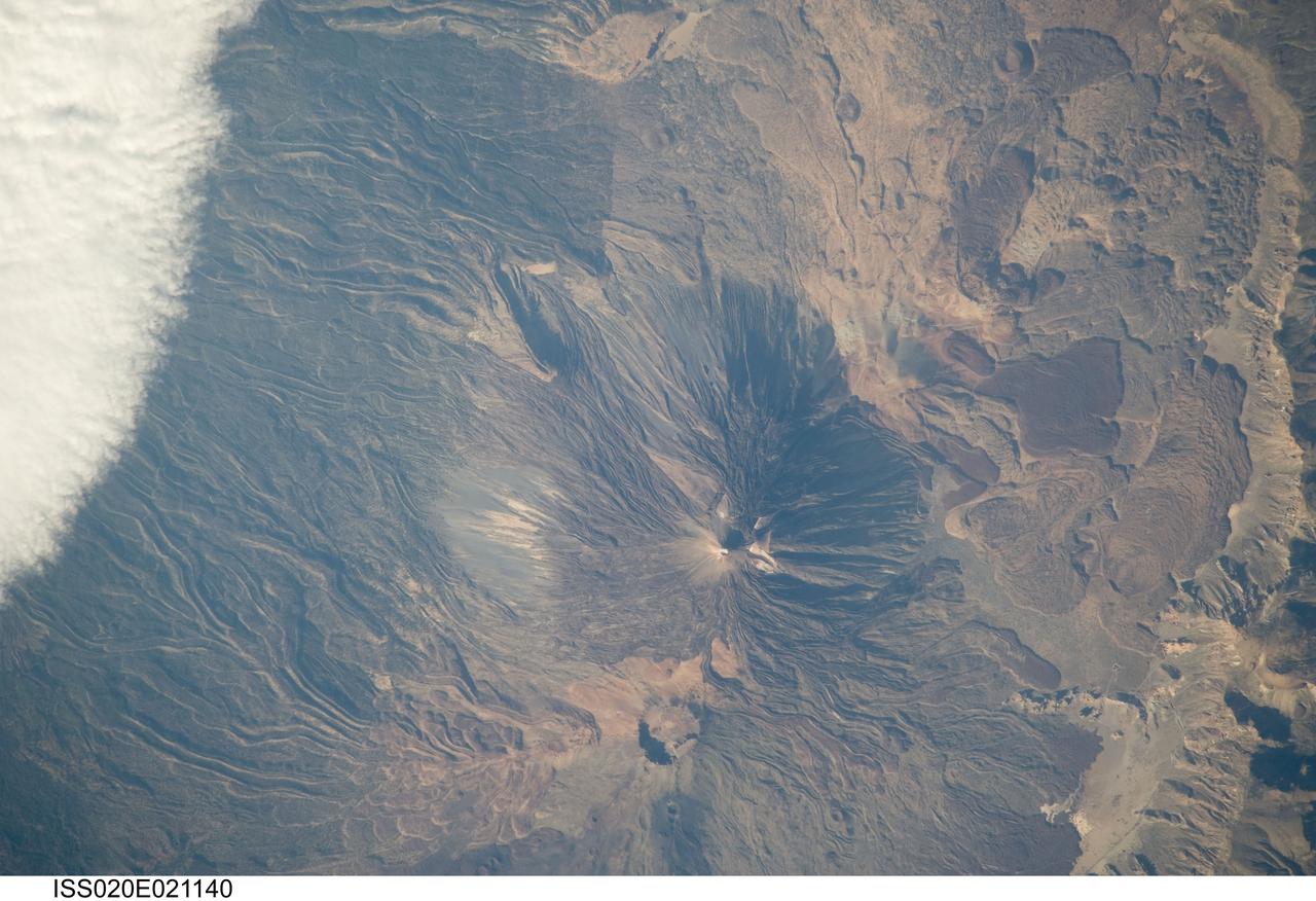
ISS020-E-021140 (15 July 2009) --- Teide Volcano on the Canary Islands of Spain is featured in this image photographed by an Expedition 20 crew member on the International Space Station. This detailed photograph features two stratovolcanoes ? Pico de Teide and Pico Viejo ? located on Tenerife Island, part of the Canary Islands of Spain. Stratovolcanoes are steep-sided; typically conical structures formed by interlayered lavas and fragmented rock material from explosive eruptions. Pico de Teide has a relatively sharp peak, whereas an explosion crater forms the summit of Pico Viejo. The two stratovolcanoes formed within an even larger volcanic structure known as the Las Ca?adas caldera ? a large collapse depression typically formed when a major eruption completely empties the underlying magma chamber of a volcano. The last eruption of Teide occurred in 1909. NASA scientists point out sinuous flow levees marking individual lava flows. The scientists consider the flow levees as perhaps the most striking volcanic features visible in the image. Flow levees are formed when the outer edges of a channelized lava flow cool and harden while the still-molten interior continues to flow downhill ? numerous examples radiate outwards from the peaks of both Pico de Teide and Pico Viejo. Brown to tan overlapping lava flows and domes are visible to the east-southeast of the Teide stratovolcano. Increased seismicity, carbon dioxide emissions, and fumarolic activity within the Las Ca?adas caldera and along the northwestern flanks of the volcano were observed in 2004. Monitoring of the volcano to detect renewal of activity is ongoing.