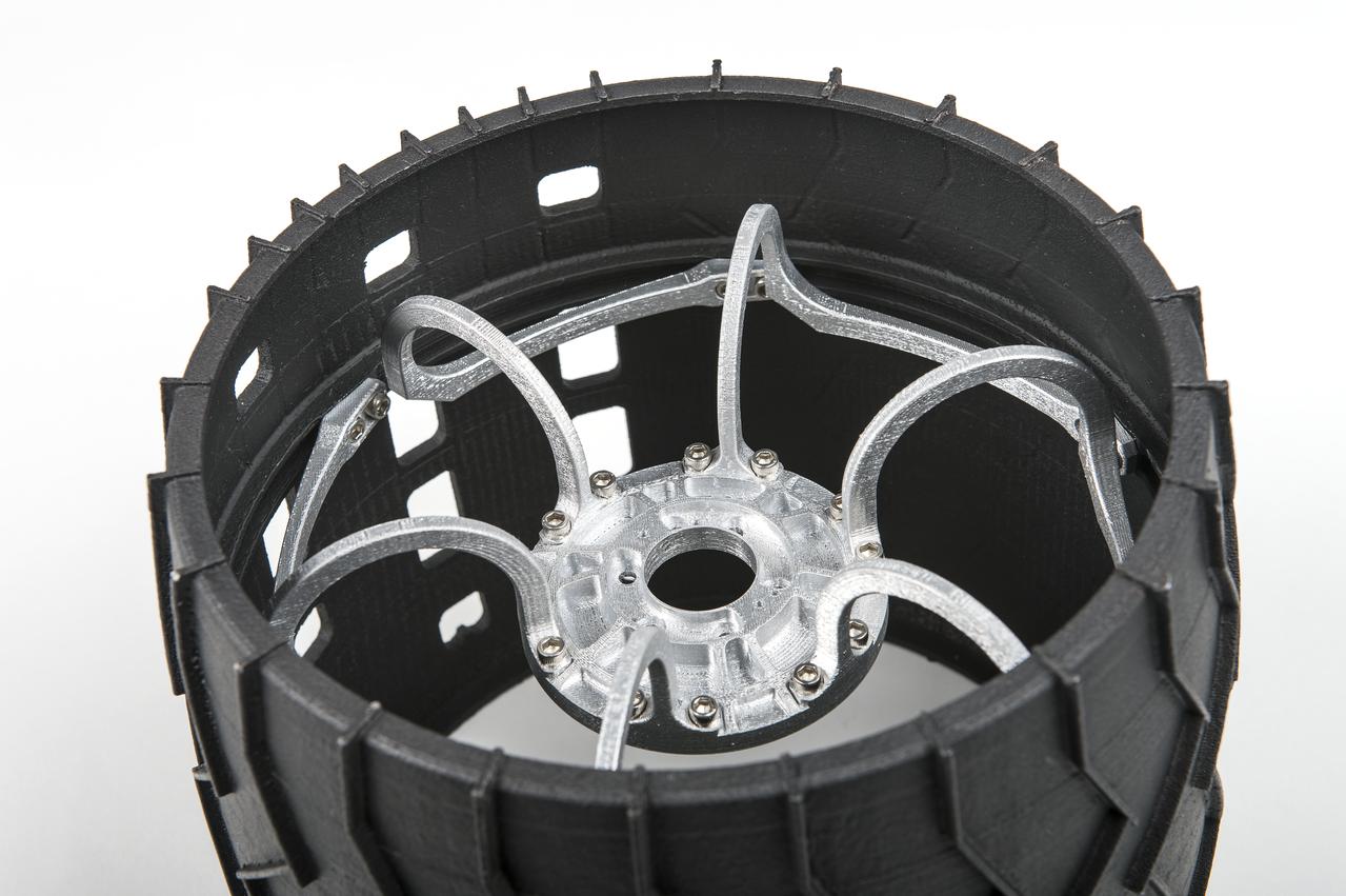
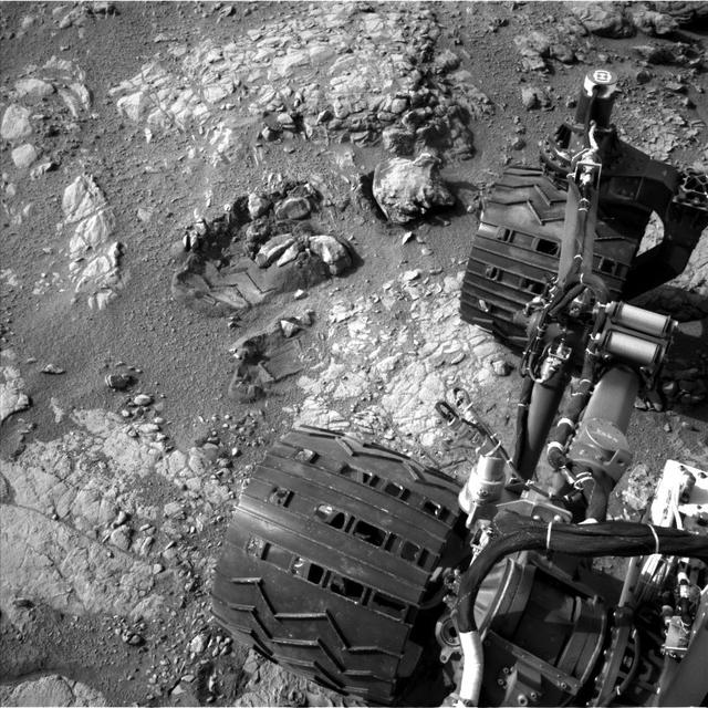
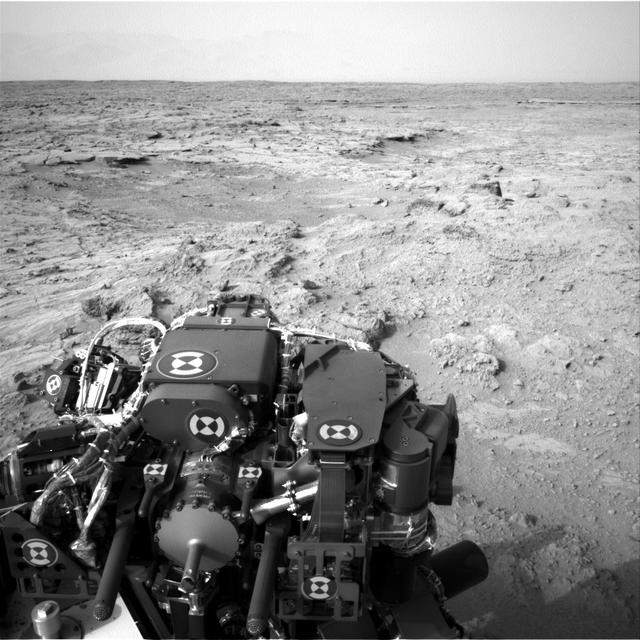
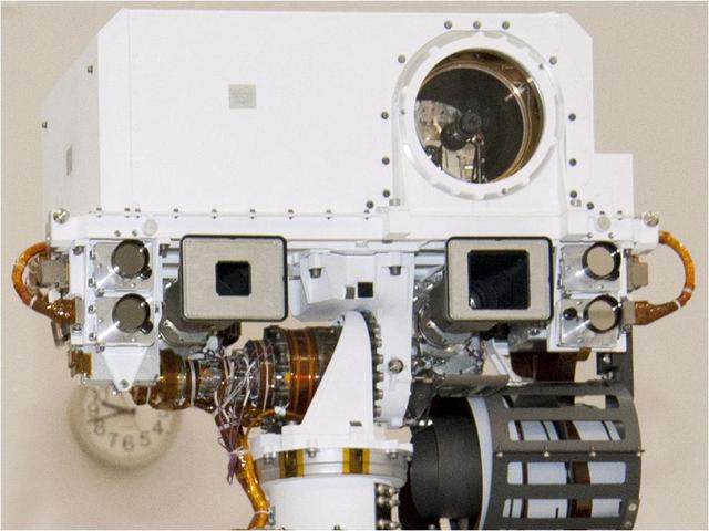
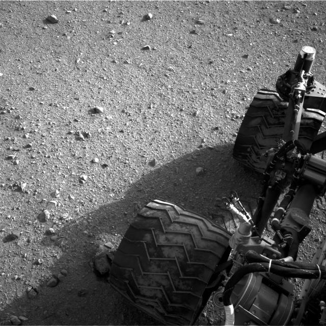
Mars Curiosity Wheel Mock-up
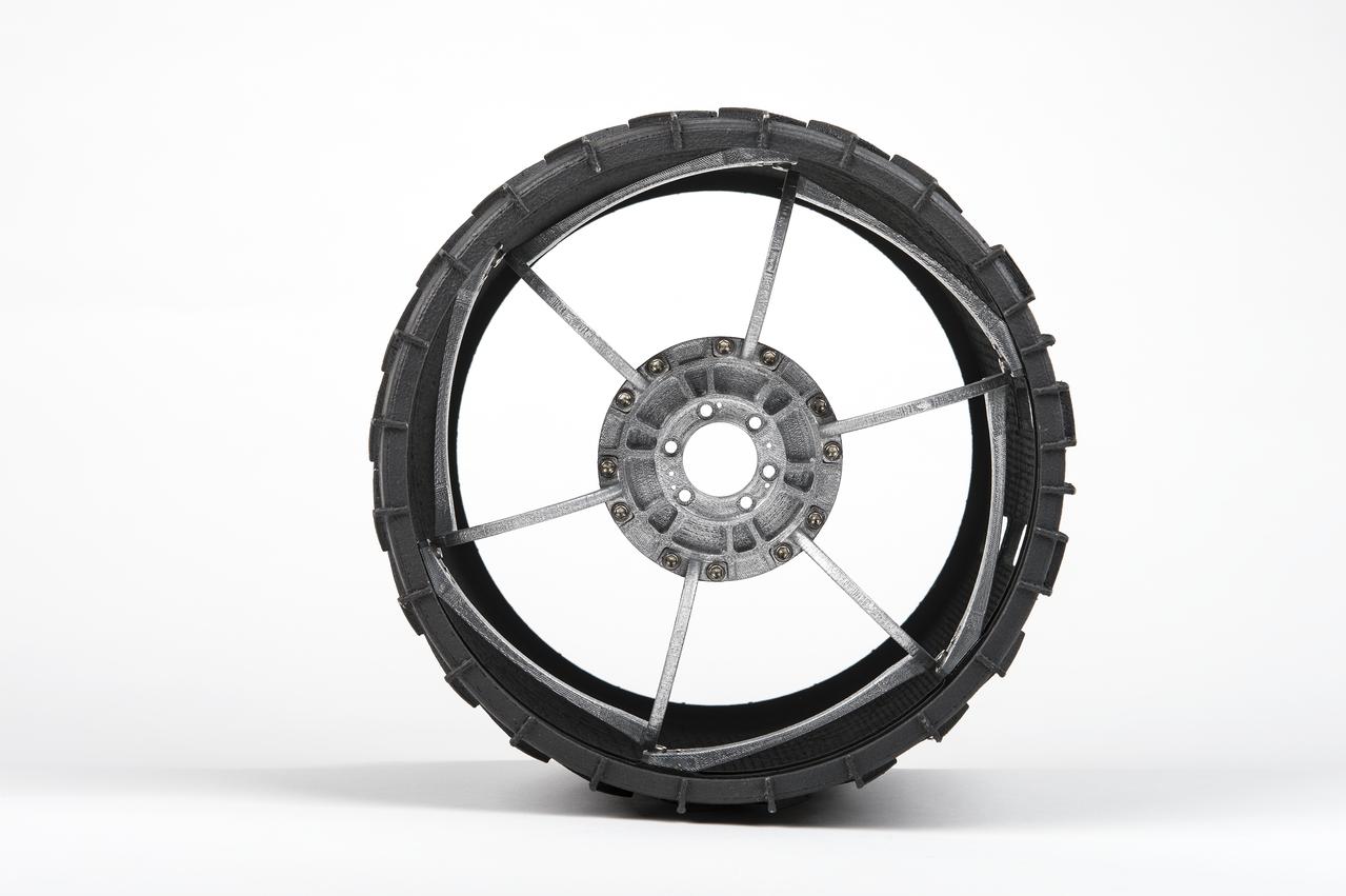
Mars Curiosity Wheel Mock-up
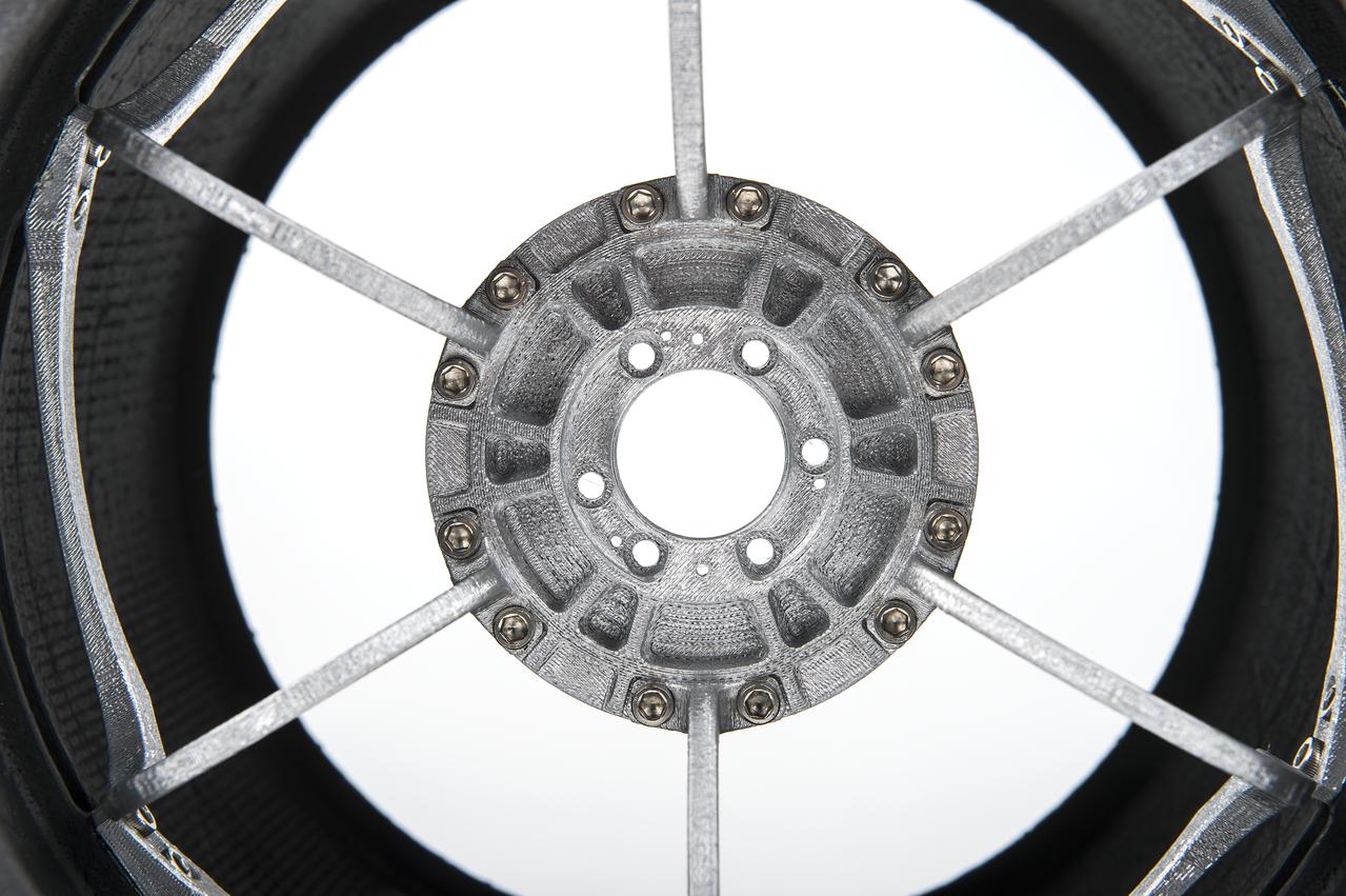
Mars Curiosity Wheel Mock-up
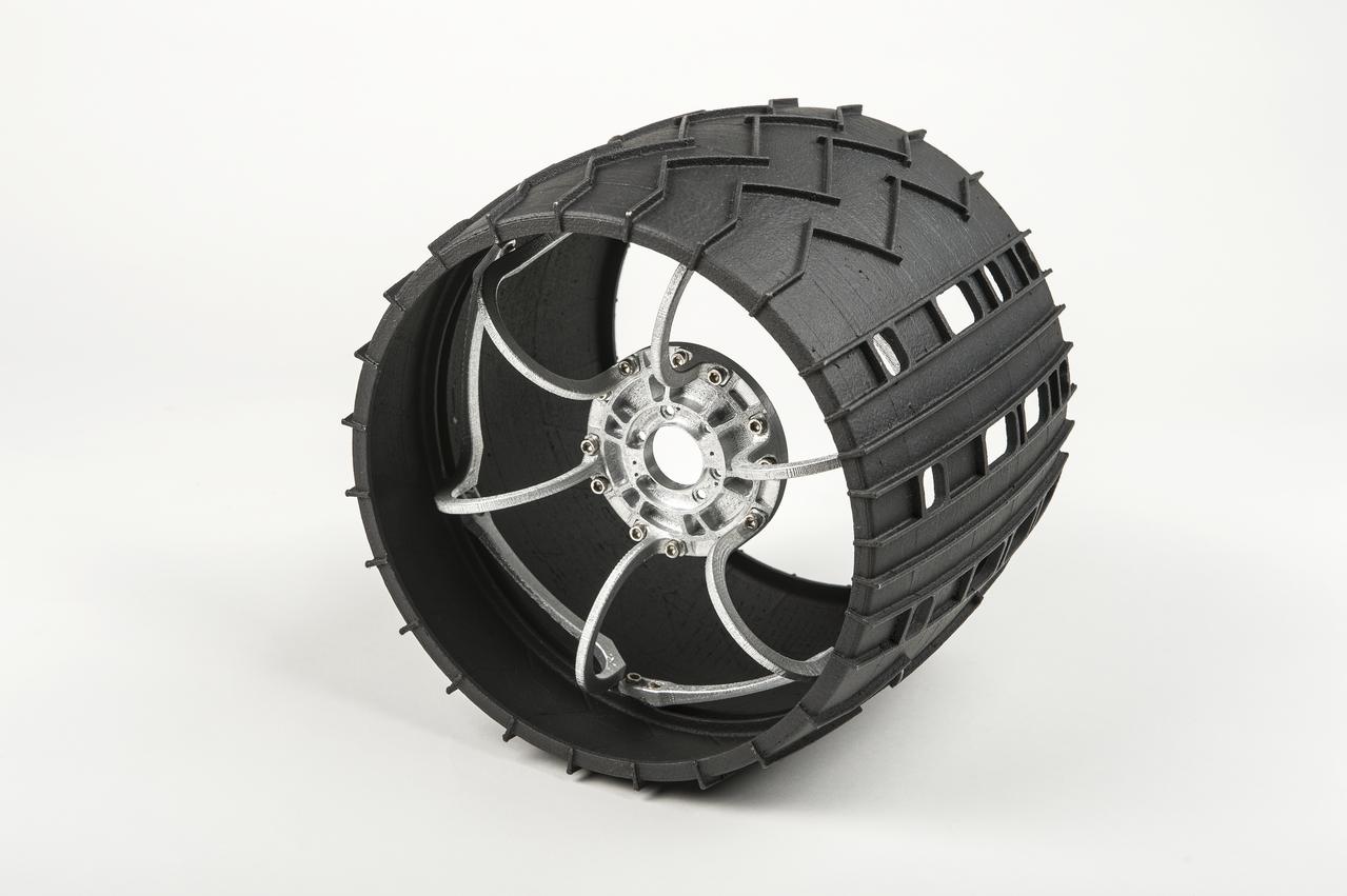
Mars Curiosity Wheel Mock-up
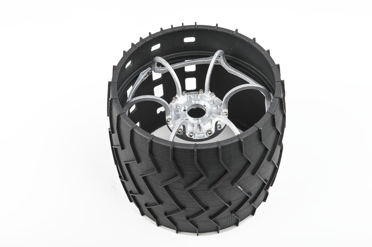
Mars Curiosity Wheel Mock-up
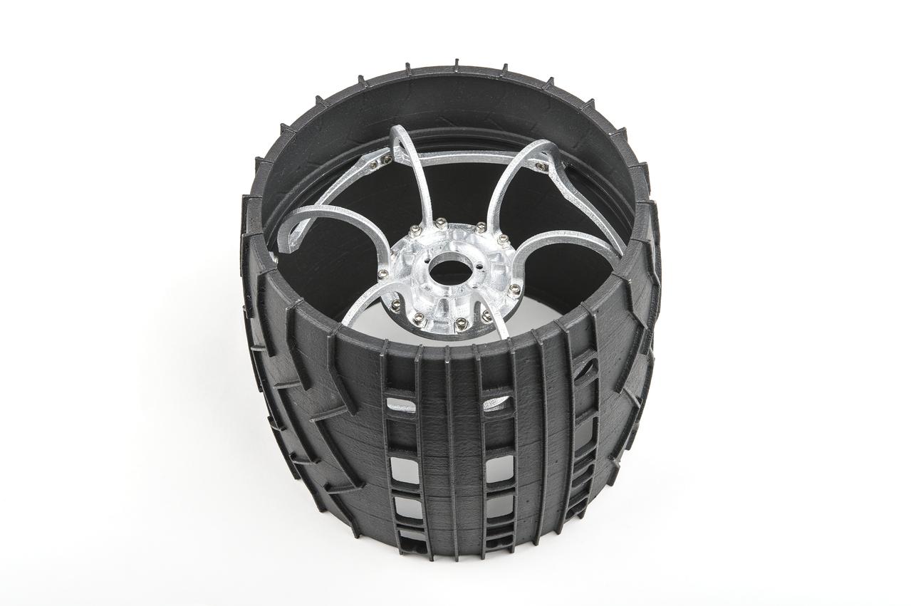
Mars Curiosity Wheel Mock-up
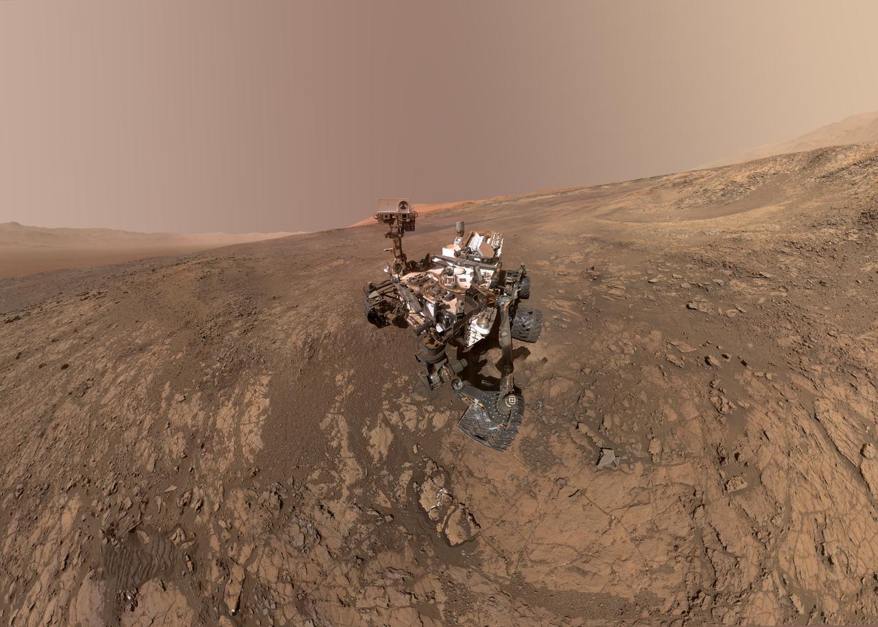
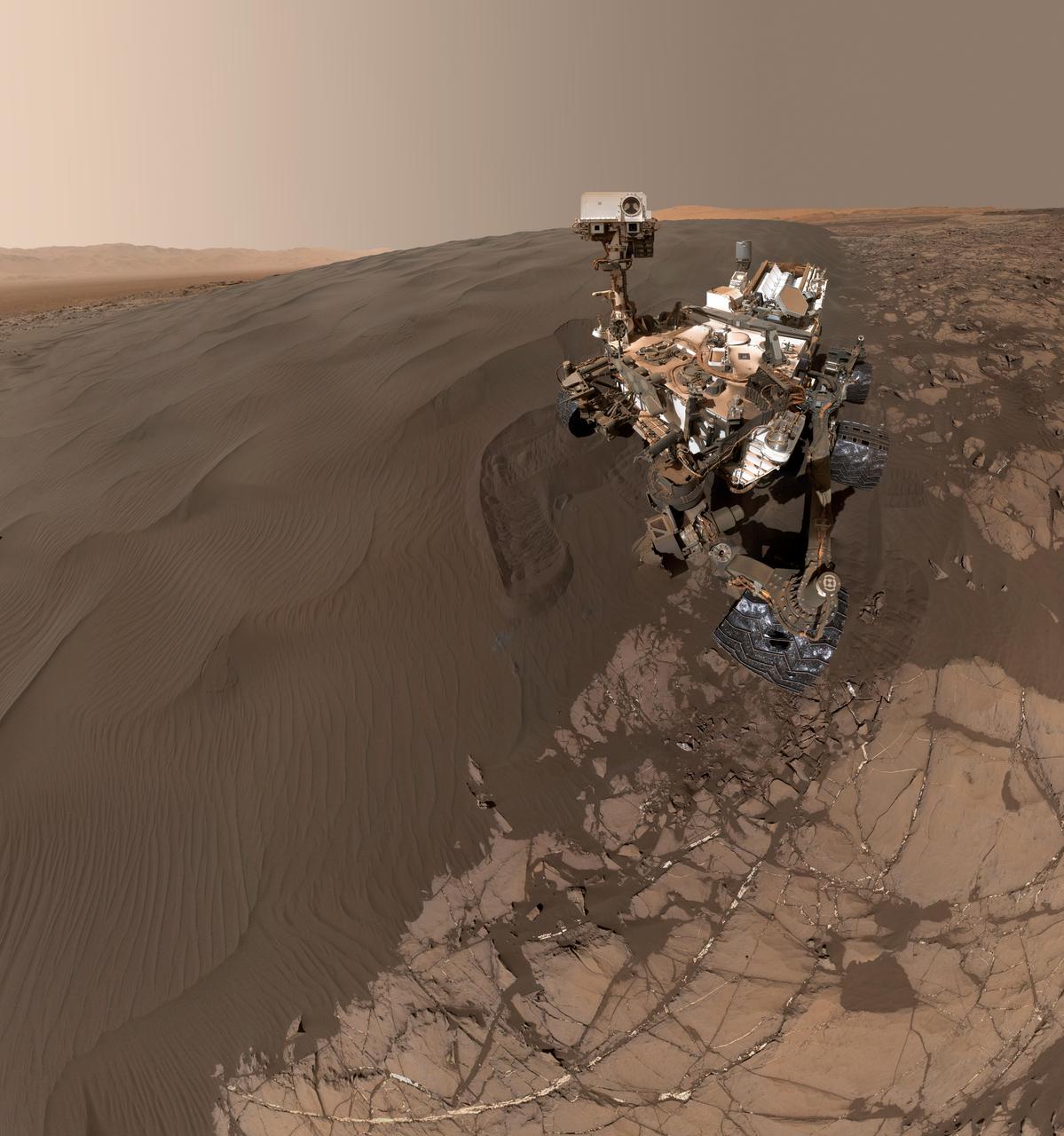
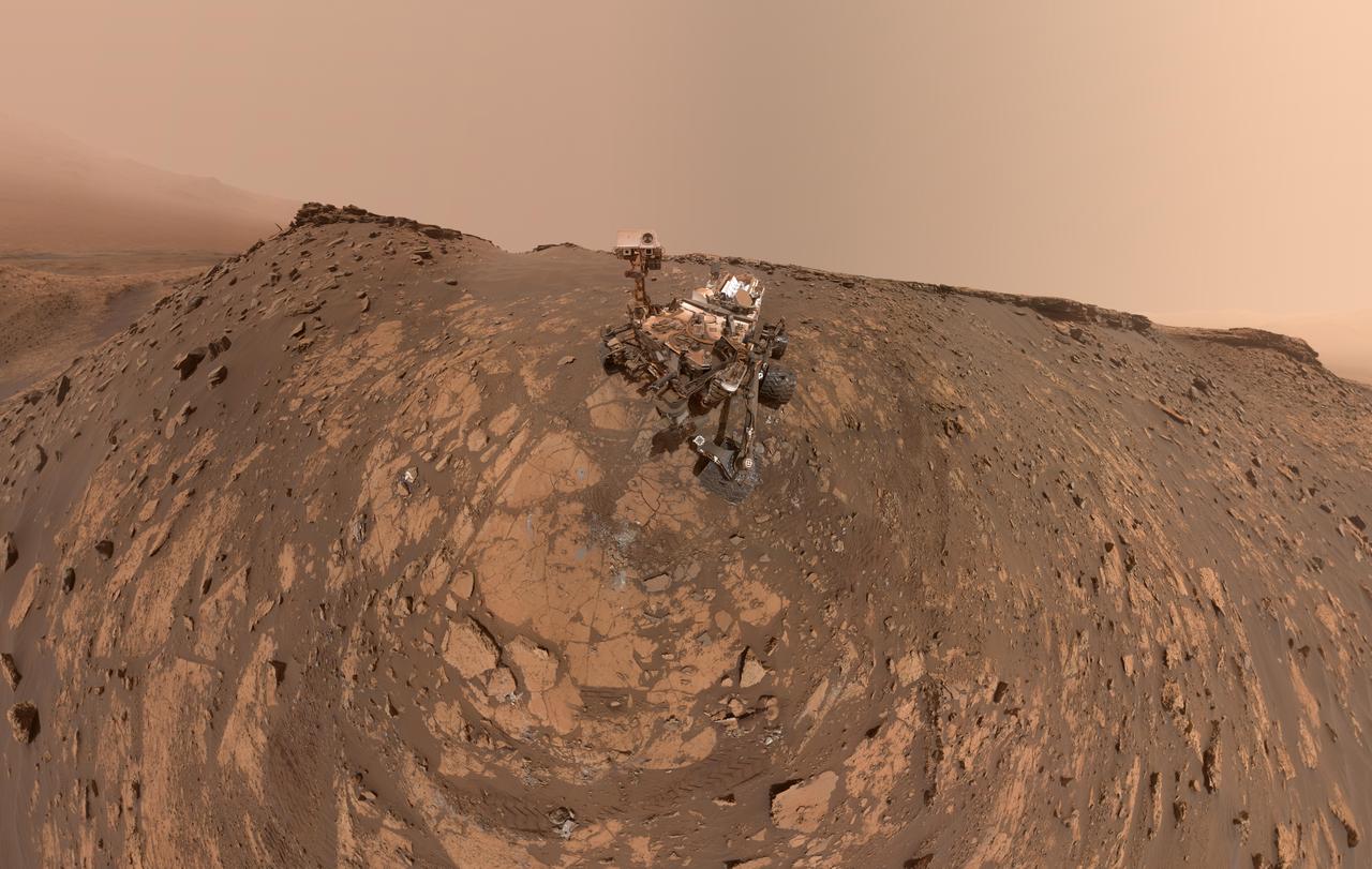
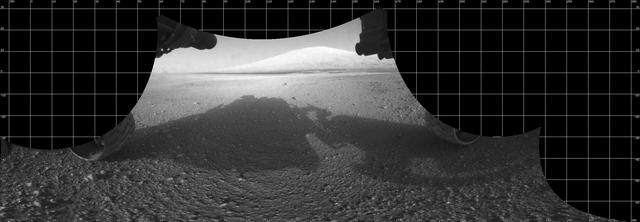
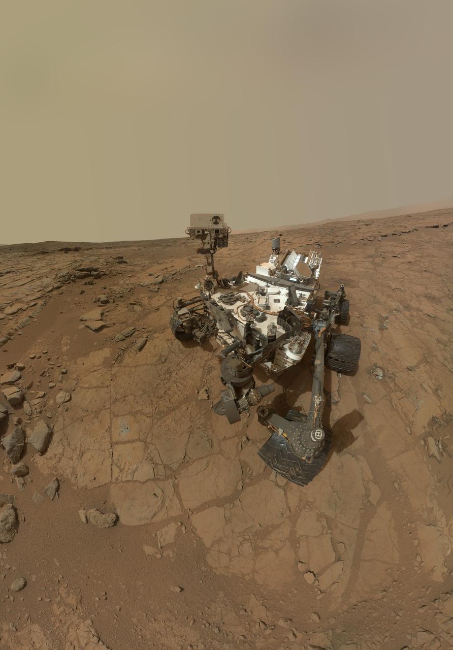
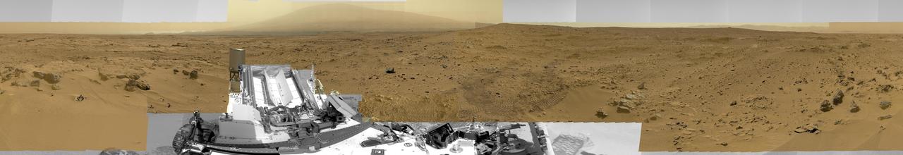
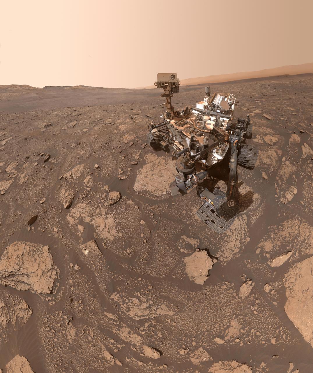
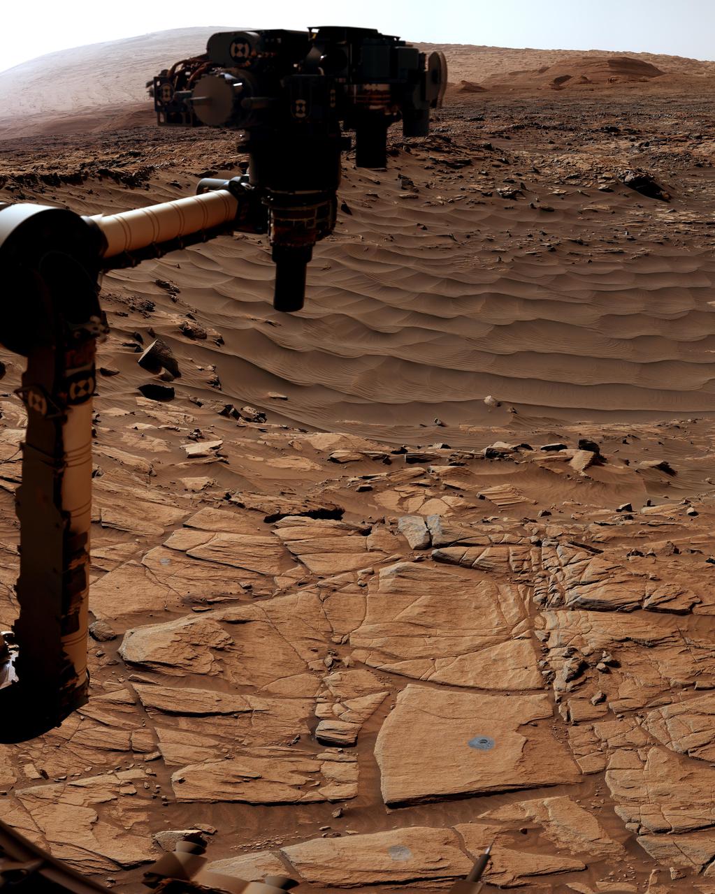
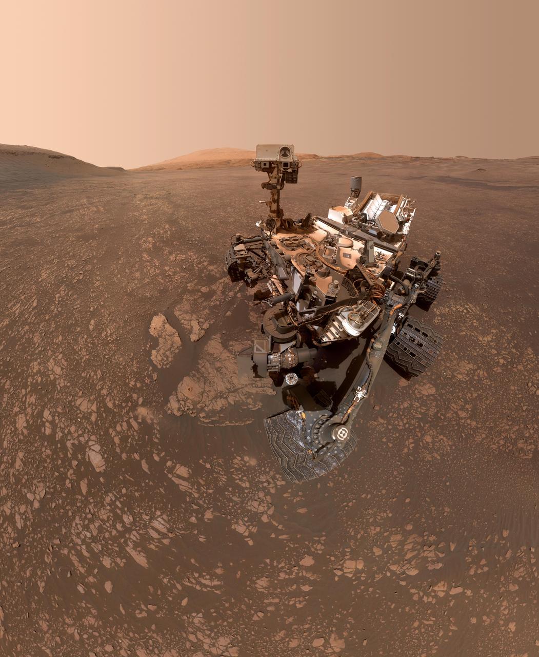
This self-portrait of NASA's Curiosity Mars rover shows the vehicle on Vera Rubin Ridge, which it's been investigating for the past several months. Directly behind the rover is the start of a clay-rich slope scientists are eager to begin exploring. In the coming week, Curiosity will begin to climb this slope. North is on the left and west is on the right, with Gale Crater's rim on the horizon of both edges. Poking up just behind Curiosity's mast is Mount Sharp, photobombing the robot's selfie. Curiosity landed on Mars five years ago with the intention of studying lower Mount Sharp, where it will remain for all of its time on Mars. The mountain's base provides access to layers formed over millions of years. These layers formed in the presence of water -- likely due to a lake or lakes that sat at the bottom of the mountain, which sits inside of Gale Crater. This mosaic was assembled from dozens of images taken by Curiosity's Mars Hands Lens Imager (MAHLI). They were all taken on Jan. 23, 2018, during Sol 1943. The view does not include the rover's arm nor the MAHLI camera itself, except in the miniature scene reflected upside down in the parabolic mirror at the top of the mast. That mirror is part of Curiosity's Chemistry and Camera (ChemCam) instrument. MAHLI appears in the center of the mirror. Wrist motions and turret rotations on the arm allowed MAHLI to acquire the mosaic's component images. The arm was positioned out of the shot in the images, or portions of images, that were used in this mosaic. A full-resolution image is available at https://photojournal.jpl.nasa.gov/catalog/PIA22207

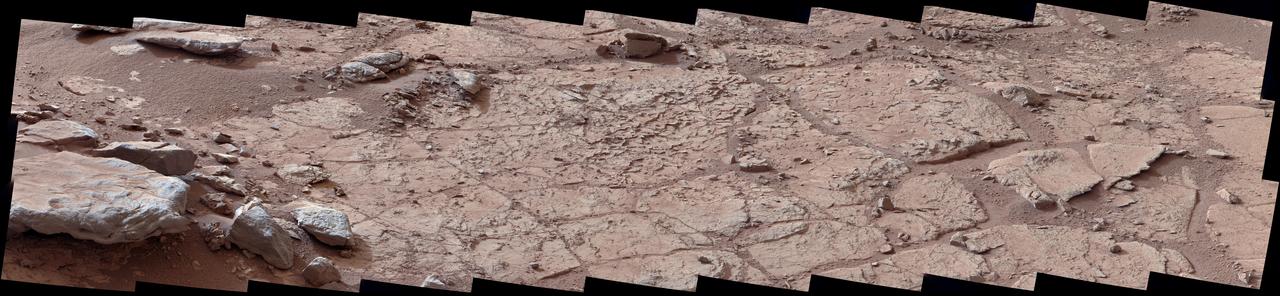
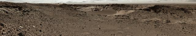
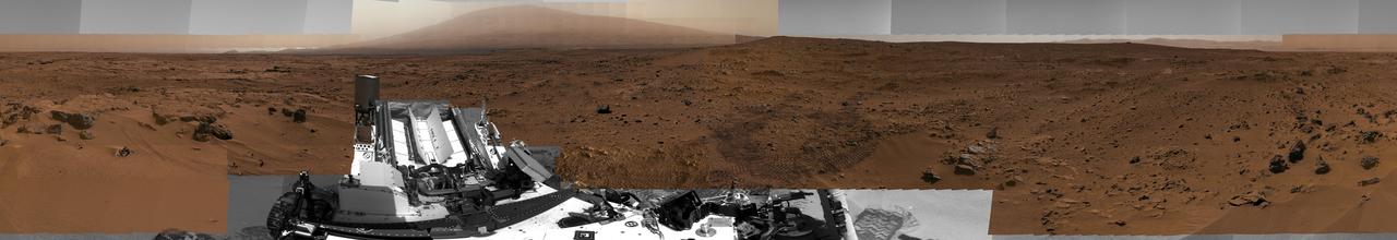
This mosaic taken by NASA's Mars Curiosity rover looks uphill at Mount Sharp, which Curiosity has been climbing. Highlighted in white is an area with clay-bearing rocks that scientists are eager to explore; it could shed additional light on the role of water in creating Mount Sharp. The mosaic was assembled from dozens of images taken by Curiosity's Mast Camera (Mastcam). It was taken on Sol 1931 back in January. Mount Sharp stands in the middle of Gale Crater, which is 96 miles (154 kilometers) in diameter. This mound, which Curiosity has been climbing since 2014, likely formed in the presence of water at various points of time in Mars ancient history. That makes it an ideal place to study how water influenced the habitability of Mars billions of years ago. The scene has been white-balanced so the colors of the rock materials resemble how they would appear under daytime lighting conditions on Earth. https://photojournal.jpl.nasa.gov/catalog/PIA22312

A self-portrait of NASA's Curiosity rover taken on Sol 2082 (June 15, 2018). A Martian dust storm has reduced sunlight and visibility at the rover's location in Gale Crater. Self-portraits are created using images taken by Curiosity's Mars Hands Lens Imager (MAHLI). https://photojournal.jpl.nasa.gov/catalog/PIA22486
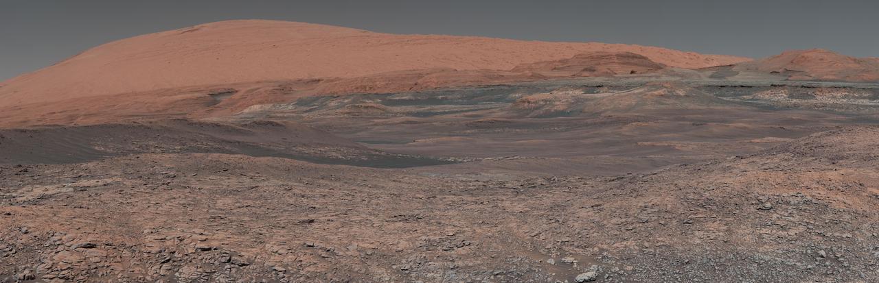
This mosaic taken by NASA's Mars Curiosity rover looks uphill at Mount Sharp, which Curiosity has been climbing. Spanning the center of the image is an area with clay-bearing rocks that scientists are eager to explore; it could shed additional light on the role of water in creating Mount Sharp. The mosaic was assembled from dozens of images taken by Curiosity's Mast Camera (Mastcam). It was taken on Sol 1931 back in January. Mount Sharp stands in the middle of Gale Crater, which is 96 miles (154 kilometers) in diameter. This mound, which Curiosity has been climbing since 2014, likely formed in the presence of water at various points of time in Mars ancient history. That makes it an ideal place to study how water influenced the habitability of Mars billions of years ago. The scene has been white-balanced so the colors of the rock materials resemble how they would appear under daytime lighting conditions on Earth. https://photojournal.jpl.nasa.gov/catalog/PIA22313
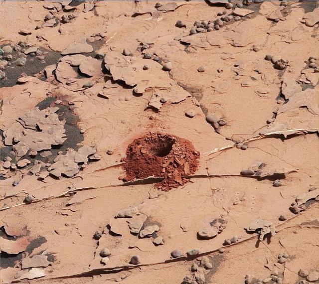
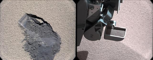
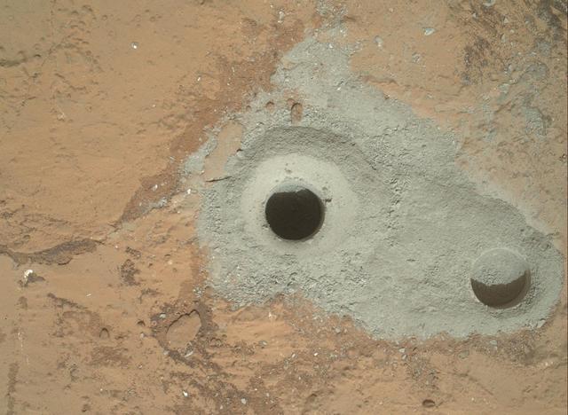
A close-up image of a 2-inch-deep hole produced using a new drilling technique for NASA's Curiosity rover. The hole is about 0.6 inches (1.6 centimeters) in diameter. This image was taken by Curiosity's Mast Camera (Mastcam) on Sol 2057. It has been white balanced and contrast-enhanced. Curiosity drilled this hole in a target called "Duluth" on May 20, 2018. It was the first rock sample captured by the drill since October 2016. A mechanical issue took the drill offline in December 2016. https://photojournal.jpl.nasa.gov/catalog/PIA22326

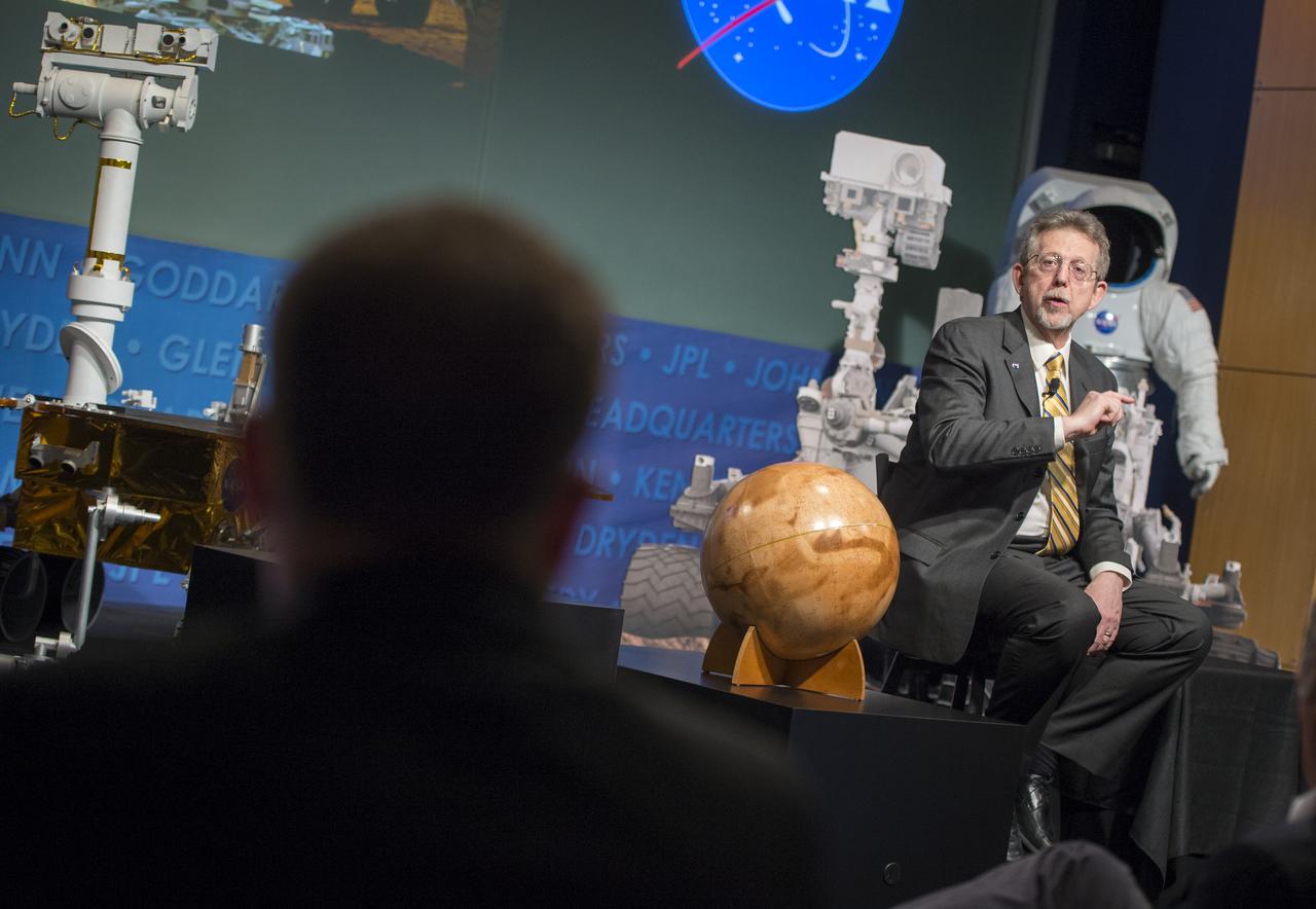
NASA welcomed hundreds of children and accompanying adults to its INFINITY visitor center on Aug. 4, offering Mars-related activities that focused attention on the space agency's Curiosity mission to the Red Planet. Parents and children, such as Myron and Trey (age 3) Cummings, enjoyed exploring Mars using an interactive touch table (top right photo). Midway through the day of activities, visitors in the Science on a Sphere auditorium also enjoyed a presentation on Mars and the Curiosity mission by Dr. Steven Williams, a NASA expert on Mars.
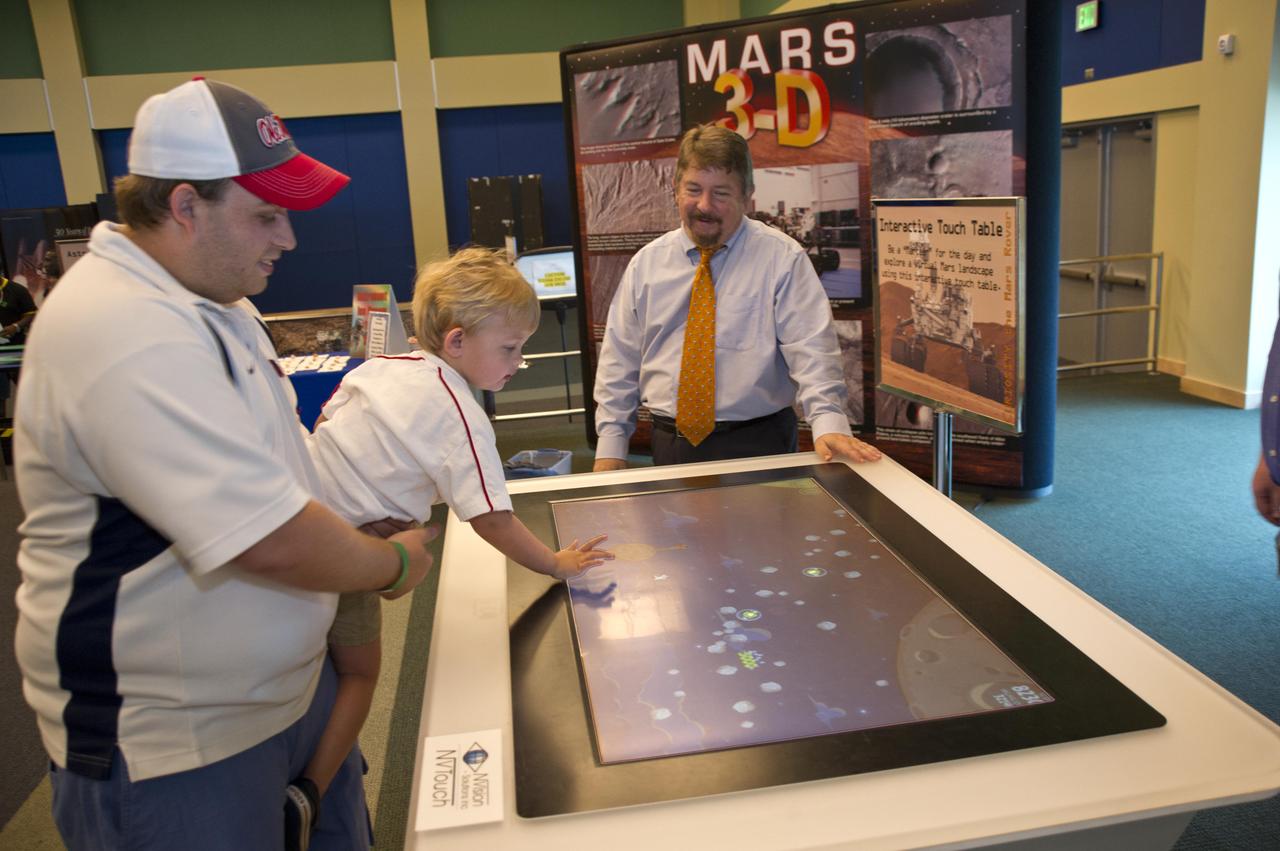
NASA welcomed hundreds of children and accompanying adults to its INFINITY visitor center on Aug. 4, offering Mars-related activities that focused attention on the space agency's Curiosity mission to the Red Planet. Parents and children, such as Myron and Trey (age 3) Cummings, enjoyed exploring Mars using an interactive touch table. Midway through the day of activities, visitors in the Science on a Sphere auditorium also enjoyed a presentation on Mars and the Curiosity mission by Dr. Steven Williams, a NASA expert on Mars.
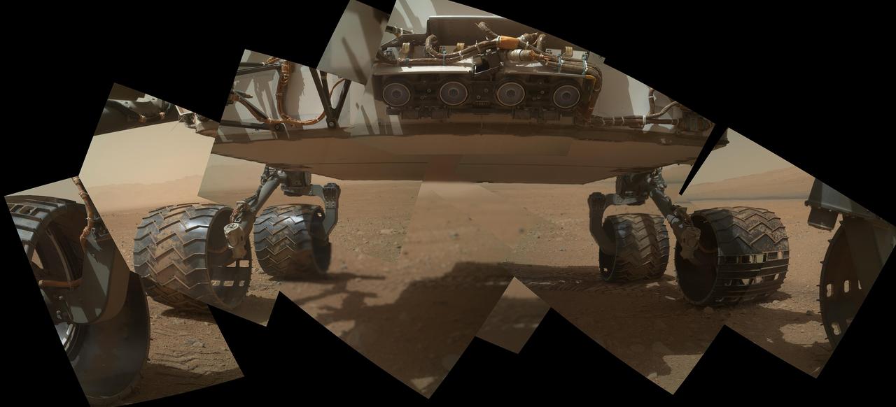
This self-portrait of NASA's Curiosity Mars rover shows the vehicle at "Namib Dune," where the rover's activities included scuffing into the dune with a wheel and scooping samples of sand for laboratory analysis. The scene combines 57 images taken on Jan. 19, 2016, during the 1,228th Martian day, or sol, of Curiosity's work on Mars. The camera used for this is the Mars Hand Lens Imager (MAHLI) at the end of the rover's robotic arm. Namib Dune is part of the dark-sand "Bagnold Dune Field" along the northwestern flank of Mount Sharp. Images taken from orbit have shown that dunes in the Bagnold field move as much as about 3 feet (1 meter) per Earth year. The location of Namib Dune is show on a map of Curiosity's route at http://mars.nasa.gov/msl/multimedia/images/?ImageID=7640. The relationship of Bagnold Dune Field to the lower portion of Mount Sharp is shown in a map at PIA16064. The view does not include the rover's arm. Wrist motions and turret rotations on the arm allowed MAHLI to acquire the mosaic's component images. The arm was positioned out of the shot in the images, or portions of images, that were used in this mosaic. This process was used previously in acquiring and assembling Curiosity self-portraits taken at sample-collection sites, including "Rocknest" (PIA16468), "Windjana" (PIA18390) and "Buckskin" (PIA19807). For scale, the rover's wheels are 20 inches (50 centimeters) in diameter and about 16 inches (40 centimeters) wide. Other Curiosity self-portraits are available at http://photojournal.jpl.nasa.gov/catalog/PIA20316
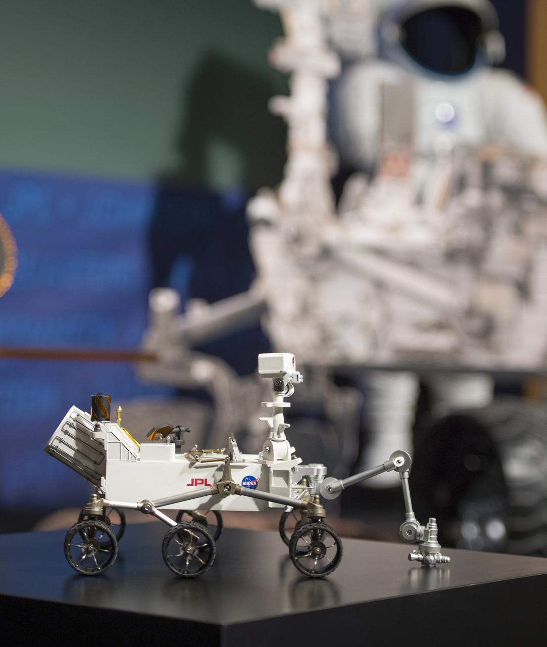
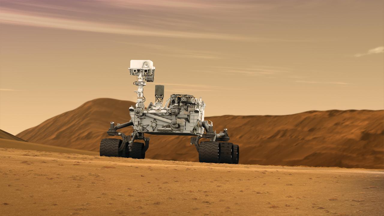
A small-scaled model of NASA's Curiosity rover is seen at a public event observing the first anniversary of the Curiosity rover's landing on Mars, Tuesday, August 6th, 2013 in Washington. The Mars Science Laboratory mission successfully placed the one-ton Curiosity rover on the surface of Mars on Aug. 6, 2012, about 1 mile from the center of its 12-mile-long target area. Within the first eight months of a planned 23-months primary mission, Curiosity met its major science objective of finding evidence of a past environment well-suited to support microbial life. Photo Credit: (NASA/Carla Cioffi)
This detailed panorama from the Mast Camera (Mastcam) on NASA's Curiosity Mars rover shows a view toward two areas on lower Mount Sharp chosen for close-up inspection: "Mount Shields" and "Logan Pass." The scene is a mosaic of images taken with Mastcam's right-eye camera, which has a telephoto lens, on April 16, 2015, during the 957th Martian day, or sol, of Curiosity's work on Mars, before that sol's drive. The view spans from southwest, at left, to west-northwest. The color has been approximately white-balanced to resemble how the scene would appear under daytime lighting conditions on Earth. By 10 sols later, Curiosity had driven about 328 meters (1,076 feet) from the location where it made this observation to an outcrop at the base of "Mount Shields." A 5-meter scale bar has been superimposed near the center of this scene beside the outcrop that the rover then examined in detail. (Five meters is 16.4 feet.) This study location was chosen on the basis of Mount Shields displaying a feature that geologists recognized from images like this as likely to be a site where an ancient valley was incised into bedrock, then refilled with other sediment. After a few sols examining the outcrop at the base of Mount Shields, Curiosity resumed driving toward a study area at Logan Pass, near the 5-meter scale bar in the left half of this scene. That location was selected earlier, on the basis of images from orbit indicating contact there between two different geological units. The rover's route from Mount Shields to Logan Pass runs behind "Jocko Butte" from the viewpoint where this panorama was taken. http://photojournal.jpl.nasa.gov/catalog/PIA19398
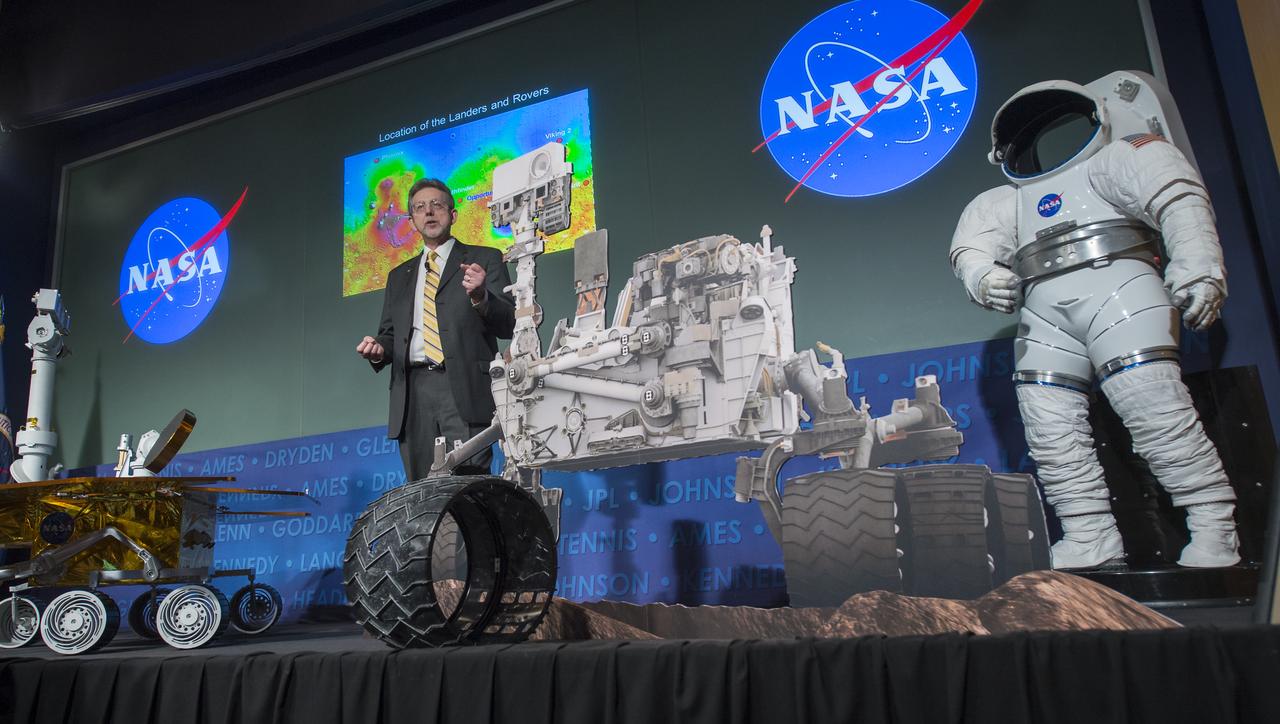
Jim Green, director, Planetary Division, NASA's Science Mission Directorate, speaks at a public event at NASA Headquarters observing the first anniversary of the Curiosity rover's landing on Mars, Tuesday, August 6th, 2013 in Washington. The Mars Science Laboratory mission successfully placed the one-ton Curiosity rover on the surface of Mars on Aug. 6, 2012, about 1 mile from the center of its 12-mile-long target area. Within the first eight months of a planned 23-months primary mission, Curiosity met its major science objective of finding evidence of a past environment well-suited to support microbial life. Photo Credit: (NASA/Carla Cioffi)
NASA Administrator Charles Bolden speaks at a public event at NASA Headquarters observing the first anniversary of the Curiosity rover's landing on Mars, Tuesday, August 6th, 2013 in Washington. The Mars Science Laboratory mission successfully placed the one-ton Curiosity rover on the surface of Mars on Aug. 6, 2012, about 1 mile from the center of its 12-mile-long target area. Within the first eight months of a planned 23-months primary mission, Curiosity met its major science objective of finding evidence of a past environment well-suited to support microbial life. Photo Credit: (NASA/Carla Cioffi)

Jim Green, director, Planetary Division, NASA's Science Mission Directorate, speaks at a public event at NASA Headquarters observing the first anniversary of the Curiosity rover's landing on Mars, Tuesday, August 6th, 2013 in Washington. The Mars Science Laboratory mission successfully placed the one-ton Curiosity rover on the surface of Mars on Aug. 6, 2012, about 1 mile from the center of its 12-mile-long target area. Within the first eight months of a planned 23-months primary mission, Curiosity met its major science objective of finding evidence of a past environment well-suited to support microbial life. Photo Credit: (NASA/Carla Cioffi)
Sam Scimemi, director, NASA's International Space Station Program, speaks at a public event at NASA Headquarters observing the first anniversary of the Curiosity rover's landing on Mars, Tuesday, August 6th, 2013 in Washington. The Mars Science Laboratory mission successfully placed the one-ton Curiosity rover on the surface of Mars on Aug. 6, 2012, about 1 mile from the center of its 12-mile-long target area. Within the first eight months of a planned 23-months primary mission, Curiosity met its major science objective of finding evidence of a past environment well-suited to support microbial life. Photo Credit: (NASA/Carla Cioffi)
Jim Green, director, Planetary Division, NASA's Science Mission Directorate, answers a question at a public event at NASA Headquarters observing the first anniversary of the Curiosity rover's landing on Mars, Tuesday, August 6th, 2013 in Washington. The Mars Science Laboratory mission successfully placed the one-ton Curiosity rover on the surface of Mars on Aug. 6, 2012, about 1 mile from the center of its 12-mile-long target area. Within the first eight months of a planned 23-months primary mission, Curiosity met its major science objective of finding evidence of a past environment well-suited to support microbial life. Photo Credit: (NASA/Carla Cioffi)

Prasun Desai, acting director, Strategic Integration, NASA's Space Technology Mission Directorate, speaks at a public event at NASA Headquarters observing the first anniversary of the Curiosity rover's landing on Mars, Tuesday, August 6th, 2013 in Washington. The Mars Science Laboratory mission successfully placed the one-ton Curiosity rover on the surface of Mars on Aug. 6, 2012, about 1 mile from the center of its 12-mile-long target area. Within the first eight months of a planned 23-months primary mission, Curiosity met its major science objective of finding evidence of a past environment well-suited to support microbial life. Photo Credit: (NASA/Carla Cioffi)

NASA Administrator Charles Bolden speaks at a public event at NASA Headquarters observing the first anniversary of the Curiosity rover's landing on Mars, Tuesday, August 6th, 2013 in Washington. The Mars Science Laboratory mission successfully placed the one-ton Curiosity rover on the surface of Mars on Aug. 6, 2012, about 1 mile from the center of its 12-mile-long target area. Within the first eight months of a planned 23-months primary mission, Curiosity met its major science objective of finding evidence of a past environment well-suited to support microbial life. Photo Credit: (NASA/Carla Cioffi)

NASA Administrator Charles Bolden speaks at a public event at NASA Headquarters observing the first anniversary of the Curiosity rover's landing on Mars, Tuesday, August 6th, 2013 in Washington. The Mars Science Laboratory mission successfully placed the one-ton Curiosity rover on the surface of Mars on Aug. 6, 2012, about 1 mile from the center of its 12-mile-long target area. Within the first eight months of a planned 23-months primary mission, Curiosity met its major science objective of finding evidence of a past environment well-suited to support microbial life. Photo Credit: (NASA/Carla Cioffi)
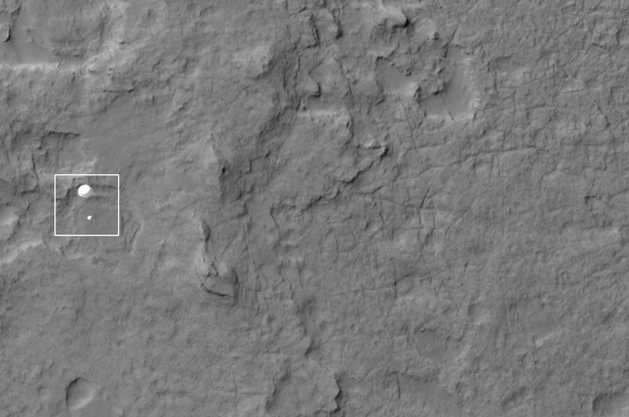
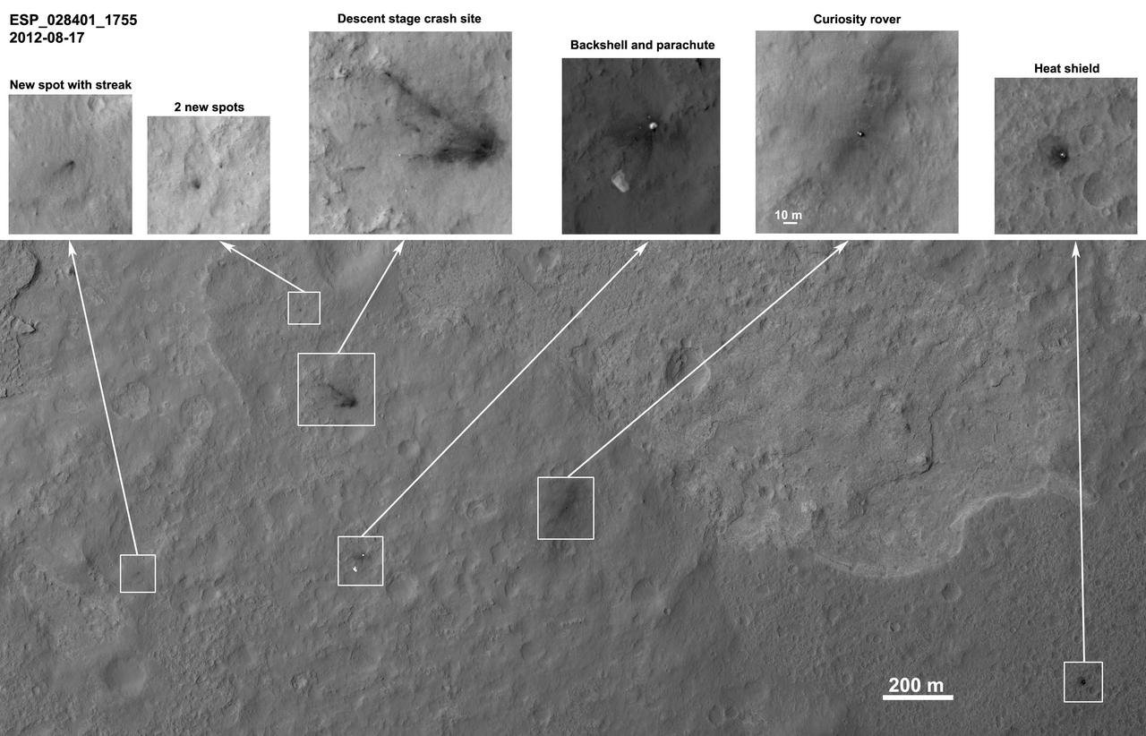
NASA Curiosity rover and its parachute were spotted by NASA Mars Reconnaissance Orbiter as Curiosity descended to the surface on Aug. 5 PDT Aug. 6 EDT. Curiosity and its parachute are in the center of the white box.
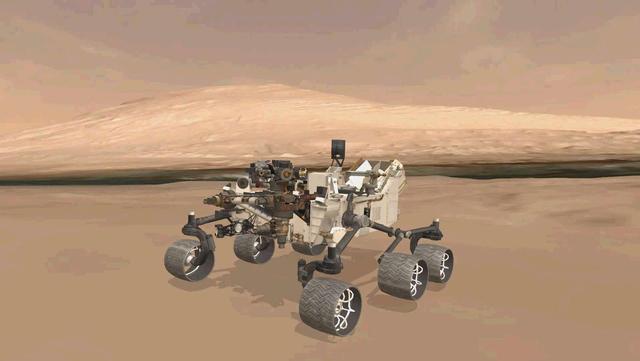
This image shows the approximate true position of NASA Curiosity rover on Mars. A 3-D virtual model of Curiosity is shown inside Gale Crater, near Mount Sharp, Curiosity ultimate destination.
NASA Curiosity rover and its parachute were spotted by NASA Mars Reconnaissance Orbiter as Curiosity descended to the surface on Aug. 5 PDT Aug. 6 EDT. Curiosity and its parachute are in the small white box at center.
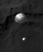
NASA Curiosity rover and its parachute were spotted by NASA Mars Reconnaissance Orbiter as Curiosity descended to the surface. The HiRISE camera captured this image of Curiosity while the orbiter was listening to transmissions from the rover.

Jason Townsend, NASA's Deputy Social Media Manager, asks a question on behalf of a NASA Twitter follower at a public event at NASA Headquarters observing the first anniversary of the Curiosity rover's landing on Mars, Tuesday, August 6th, 2013 in Washington. The Mars Science Laboratory mission successfully placed the one-ton Curiosity rover on the surface of Mars on Aug. 6, 2012, about 1 mile from the center of its 12-mile-long target area. Within the first eight months of a planned 23-months primary mission, Curiosity met its major science objective of finding evidence of a past environment well-suited to support microbial life. Photo Credit: (NASA/Carla Cioffi)

This self-portrait of NASA's Curiosity Mars rover shows the vehicle at a drilled sample site called "Okoruso," on the "Naukluft Plateau" of lower Mount Sharp. The scene combines multiple images taken with the rover's Mars Hand Lens Imager (MAHLI) on May 11, 2016, during the 1,338th Martian day, or sol, of the rover's work on Mars. In front of the rover is the hole, surrounded by grayish drill cuttings, created by using Curiosity's drill to collect sample rock powder at Okoruo, plus a patch of powder dumped onto the ground after delivery of a portion to the rover's internal Chemistry and Mineralogy (CheMin) laboratory instrument. The rover team compared the rock powder from drilling at Okoruso to material from the nearby "Lubango" drilling site, which is visible behind the rover, just to the left of the mast. The Lubango site was selected within a pale zone, or "halo," beside a fracture in the area's sandstone bedrock. Okoruso is in less-altered bedrock farther from any fractures. Note that the Okoruso drill cuttings appear darker than the Lubango drill cuttings. The Lubango sample was found to be enriched in silica and sulfates, relative to Okoruso. To the left of the rover, in this scene, several broken rocks reveal grayish interiors. Here, Curiosity was driven over the rocks in a fracture-associated halo, so that freshly exposed surfaces could be examined with MAHLI, Mast Camera (Mastcam) and Chemistry and Camera (ChemCam) instruments. An upper portion of Mount Sharp is prominent on the horizon. http://photojournal.jpl.nasa.gov/catalog/PIA20602
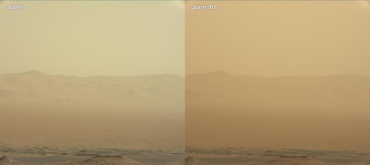
These two views from NASA's Curiosity rover, acquired specifically to measure the amount of dust inside Gale Crater, show that dust has increased over three days from a major Martian dust storm. The left-hand image shows a view of the east-northeast rim of Gale Crater on June 7, 2018 (Sol 2074); the right-hand image shows a view of the same feature on June 10, 2018 (Sol 2077). The images were taken by the rover's Mastcam. https://photojournal.jpl.nasa.gov/catalog/PIA22520
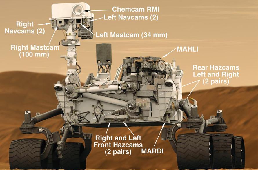
This graphic shows the locations of the cameras on NASA Curiosity rover.
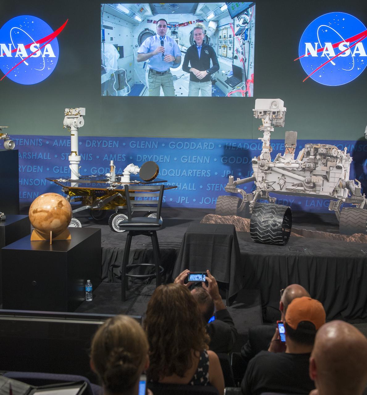
Expedition 35/36 NASA astronaut Chris Cassidy, left on screen, is seen on a live feed from the International Space Station as they participate in a public event at NASA Headquarters observing the first anniversary of the Curiosity rover's landing on Mars, Tuesday, August 6th, 2013 in Washington. Photo Credit: (NASA/Carla Cioffi)

Expedition 35/36 NASA astronaut Karen Nyberg, right on screen, is seen on a live feed from the International Space Station as they participate in a public event at NASA Headquarters observing the first anniversary of the Curiosity rover's landing on Mars, Tuesday, August 6th, 2013 in Washington. Photo Credit: (NASA/Carla Cioffi)
This selfie was taken by NASA's Curiosity Mars rover on Feb. 26, 2020 (the 2,687th Martian day, or sol, of the mission). The crumbling rock layer at the top of the image is the Greenheugh Pediment, which Curiosity climbed soon after taking the image. Directly to the left of Curiosity's foremost wheel is a hole the rover drilled at a rock feature called "Hutton." The selfie includes 86 individual images taken by the Mars Hand Lens Imager (MAHLI) camera on the end of Curiosity's robotic arm. The images were then stitched into a panorama. https://photojournal.jpl.nasa.gov/catalog/PIA23624
This wide view of the John Klein location selected for the first rock drilling by NASA Mars rover Curiosity is a mosaic taken by Curiosity right Mast Camera Mastcam.
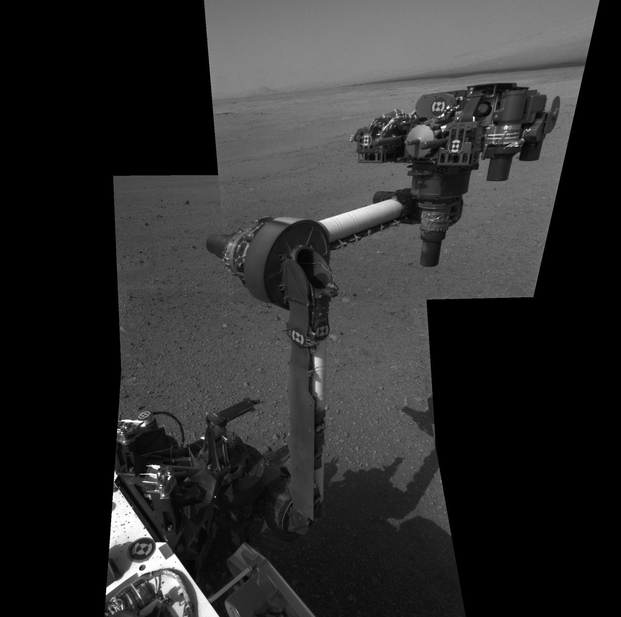
The extended robotic arm of NASA Mars rover Curiosity can be seen in this mosaic of full-resolution images from Curiosity Navigation camera Navcam. Curiosity extended its arm on Aug. 20, 2012.
The drill bit of NASA's Curiosity Mars rover over one of the sample inlets on the rover's deck. The inlets lead to Curiosity's onboard laboratories. This image was taken on Sol 2068 by the rover's Mast Camera (Mastcam). https://photojournal.jpl.nasa.gov/catalog/PIA22327
The feature that appears bright blue at the center of this scene is NASA's Curiosity Mars rover on the northwestern flank of Mount Sharp, viewed by NASA's Mars Reconnaissance Orbiter. Curiosity is approximately 10 feet long and 9 feet wide (3.0 meters by 2.8 meters). The view is a cutout from observation ESP_050897_1750 taken by the High Resolution Imaging Science Experiment (HiRISE) camera on the orbiter on June 5, 2017. HiRISE has been imaging Curiosity about every three months, to monitor the surrounding features for changes such as dune migration or erosion. When the image was taken, Curiosity was partway between its investigation of active sand dunes lower on Mount Sharp, and "Vera Rubin Ridge," a destination uphill where the rover team intends to examine outcrops where hematite has been identified from Mars orbit. The rover's surroundings include tan rocks and patches of dark sand. As in previous HiRISE color images of Curiosity since the rover was at its landing site, the rover appears bluer than it really is. HiRISE color observations are recorded in a red band, a blue-green band and an infrared band, and displayed in red, green and blue. This helps make differences in Mars surface materials apparent, but does not show natural color as seen by the human eye. Lower Mount Sharp was chosen as a destination for the Curiosity mission because the layers of the mountain offer exposures of rocks that record environmental conditions from different times in the early history of the Red Planet. Curiosity has found evidence for ancient wet environments that offered conditions favorable for microbial life, if Mars has ever hosted life. https://photojournal.jpl.nasa.gov/catalog/PIA21710
This color thumbnail image was obtained by NASA Curiosity rover illustrating the first appearance of the left front wheel of the Curiosity rover after deployment of the suspension system as the vehicle was about to touch down on Mars.
The Curiosity engineering team created this cylindrical projection view from images taken by NASA Curiosity rover front hazard avoidance cameras underneath the rover deck on Sol 0. Pictured here are are the pigeon-toed the wheels.
This view of the lower front and underbelly areas of NASA Mars rover Curiosity combines nine images taken by the rover MAHLI camera during the 34th Martian day, or sol, of Curiosity work on Mars.
This color thumbnail image was obtained by NASA Curiosity rover. A dust cloud was generated when the Curiosity rover was being lowered to the surface while the sky crane hovered above.
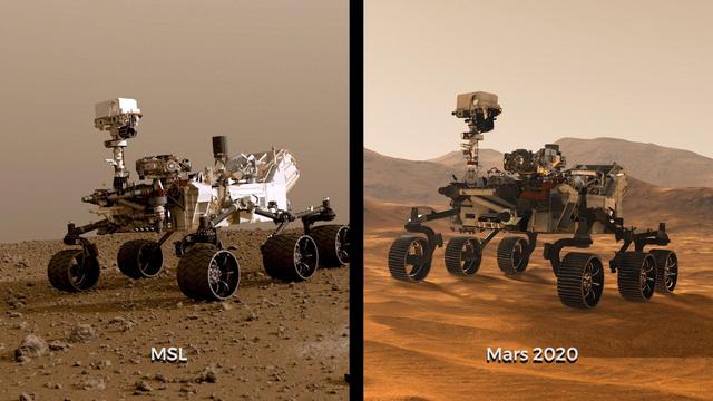
Illustrations of NASA's Curiosity and Mars 2020 rovers. While the newest rover borrows from Curiosity's design, each has its own role in the ongoing exploration of Mars and the search for ancient life. https://photojournal.jpl.nasa.gov/catalog/PIA23517
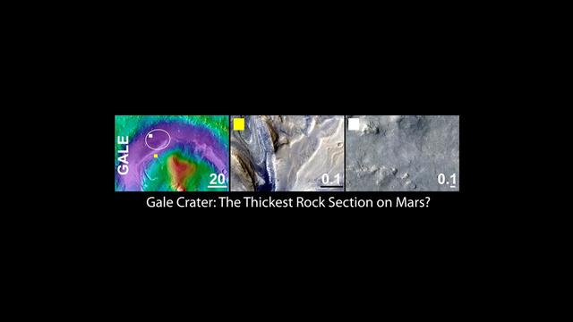
Gale Crater, the Selected Landing Site for Curiosity
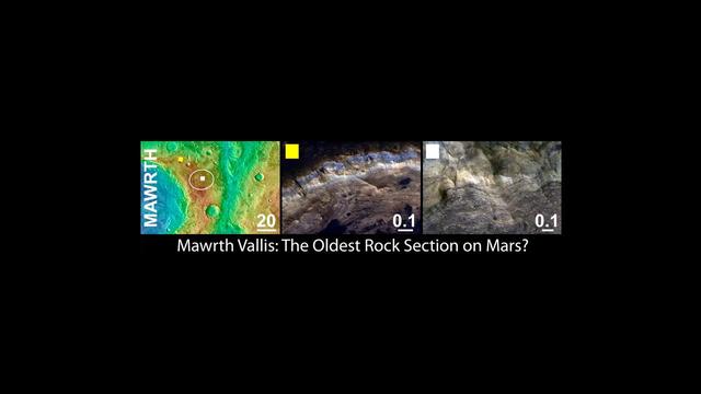
Mawrth Vallis, a Finalist Not Selected as a Landing Site for Curiosity
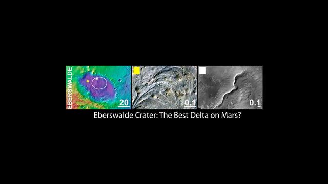
Eberswalde Crater, a Finalist Not Selected as Landing Site for Curiosity
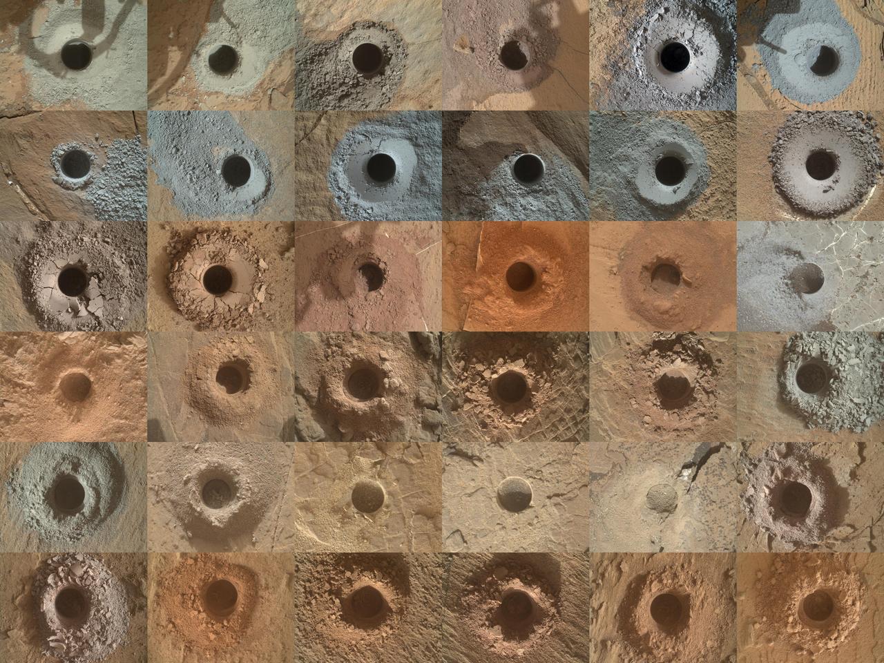
NASA's Curiosity Mars rover has collected 36 powderized rock samples with the drill on the end of its robotic arm. This grid shows all 36 holes to date. The images in the grid were captured by the Mars Hand Lens Imager (MAHLI) on the end of Curiosity's arm. https://photojournal.jpl.nasa.gov/catalog/PIA25416
This color thumbnail image was obtained by NASA Curiosity rover and is representative of the images acquired once the Curiosity rover was resting on the surface of Mars after touchdown.
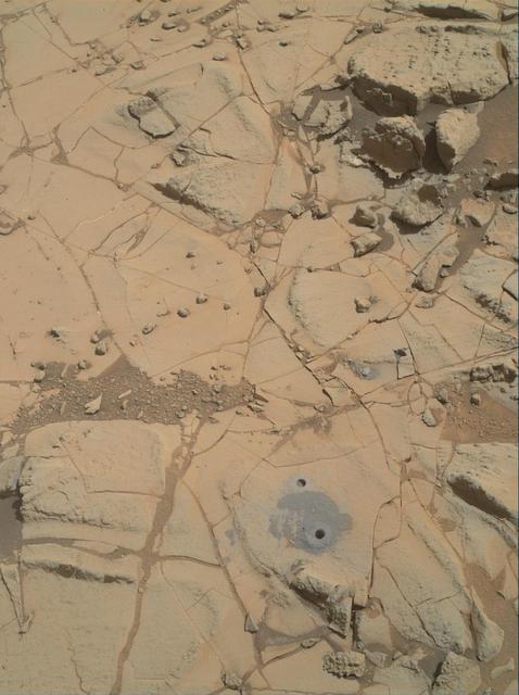
Gray cuttings from Curiosity drilling into a target called Mojave 2 are visible surrounding the sample-collection hole in this image from NASA Curiosity rover.
This view of Curiosity's left-front and left-center wheels and of marks made by wheels on the ground in the "Yellowknife Bay" area comes from one of six cameras used on Mars for the first time more than six months after the rover landed. The left Navigation Camera (Navcam) linked to Curiosity's B-side computer took this image during the 223rd Martian day, or sol, of Curiosity's work on Mars (March 22, 2013). The wheels are 20 inches (50 centimeters) in diameter. Curiosity carries a pair of main computers, redundant to each other, in order to have a backup available if one fails. Each of the computers, A-side and B-side, also has other redundant subsystems linked to just that computer. Curiosity operated on its A-side from before the August 2012 landing until Feb. 28, when engineers commanded a switch to the B-side in response to a memory glitch on the A-side. One set of activities after switching to the B-side computer has been to check the six engineering cameras that are hard-linked to that computer. The rover's science instruments, including five science cameras, can each be operated by either the A-side or B-side computer, whichever is active. However, each of Curiosity's 12 engineering cameras is linked to just one of the computers. The engineering cameras are the Navigation Camera (Navcam), the Front Hazard-Avoidance Camera (Front Hazcam) and Rear Hazard-Avoidance Camera (Rear Hazcam). Each of those three named cameras has four cameras as part of it: two stereo pairs of cameras, with one pair linked to each computer. Only the pairs linked to the active computer can be used, and the A-side computer was active from before landing, in August, until Feb. 28. All six of the B-side engineering cameras have been used during March 2013 and checked out OK. Image Credit: NASA/JPL-Caltech <b><a href="http://www.nasa.gov/audience/formedia/features/MP_Photo_Guidelines.html" rel="nofollow">NASA image use policy.</a></b> <b><a href="http://www.nasa.gov/centers/goddard/home/index.html" rel="nofollow">NASA Goddard Space Flight Center</a></b> enables NASA’s mission through four scientific endeavors: Earth Science, Heliophysics, Solar System Exploration, and Astrophysics. Goddard plays a leading role in NASA’s accomplishments by contributing compelling scientific knowledge to advance the Agency’s mission. <b>Follow us on <a href="http://twitter.com/NASA_GoddardPix" rel="nofollow">Twitter</a></b> <b>Like us on <a href="http://www.facebook.com/pages/Greenbelt-MD/NASA-Goddard/395013845897?ref=tsd" rel="nofollow">Facebook</a></b> <b>Find us on <a href="http://instagram.com/nasagoddard?vm=grid" rel="nofollow">Instagram</a></b>
The drive by NASA Mars rover Curiosity during the mission 43rd Martian day ended with this rock front of the rover. The rover team has assessed it as a suitable target for the first use of Curiosity contact instruments on a rock.
Camera and robotic-arm maneuvers for taking a self-portrait of the NASA Curiosity rover on Mars were checked first, at NASA Jet Propulsion Laboratory in Pasadena, Calif., using the main test rover for the Curiosity.
The Mast Camera Mastcam on NASA Mars rover Curiosity has two rectangular eyes near the top of the rover remote sensing mast. This image shows Curiosity on a tilt table NASA Jet Propulsion Laboratory, Pasadena, California.
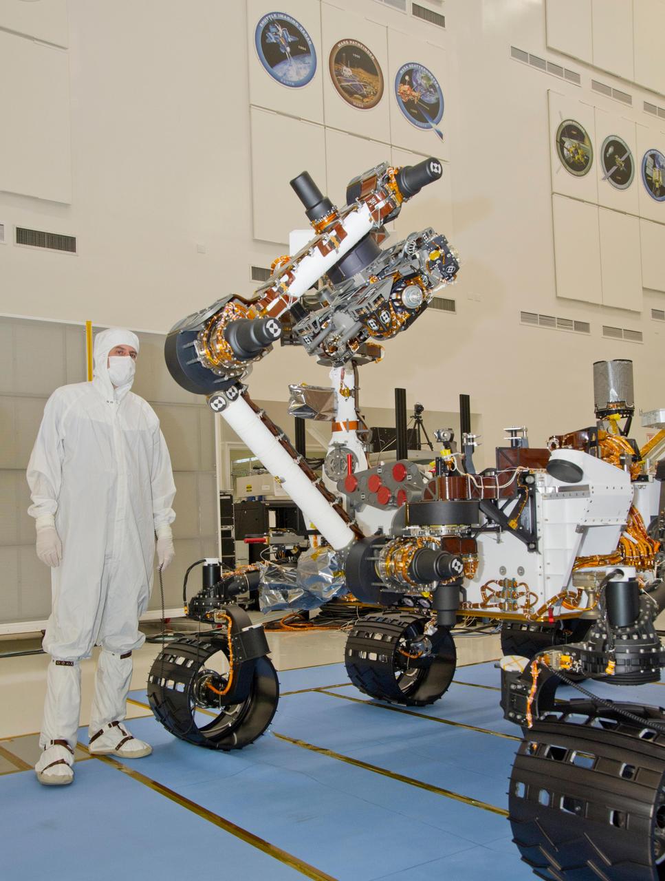
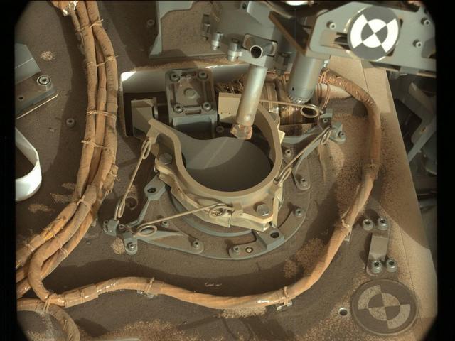
This photograph of the NASA Mars Science Laboratory rover, Curiosity, was taken during testing on June 3, 2011. The turret at the end of Curiosity robotic arm holds five devices.
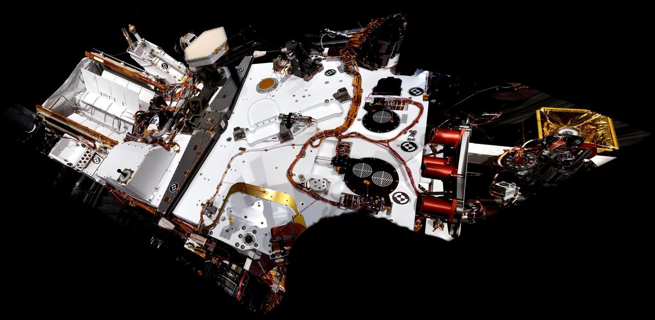
NASA Mars rover Curiosity took the images combined into this mosaic of the rover upper deck. The images were taken in March 2011. At the time, Curiosity was inside a space simulation chamber at NASA Jet Propulsion Laboratory, Pasadena, Calif.
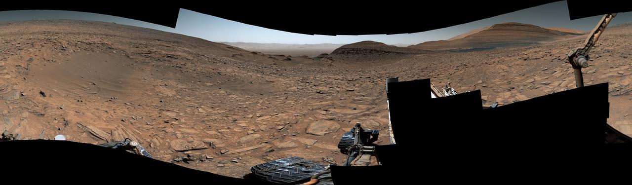
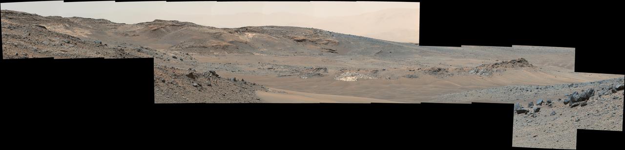
NASA's Curiosity Mars rover captured this 360-degree view showing an impact crater in a location nicknamed "Jau." The scene was captured with the rover's Mastcam on July 25, 2023, the 3,899th Martian day, or sol, of the mission. This was one of dozens of impact craters within a crater cluster Curiosity stopped by after completing one of its most difficult climbs ever. This particular crater is estimated to be about 60 feet (18 meters) wide. Part of Curiosity's robotic arm can be seen at right. In the center of the scene is the path back down a slope toward "Marker Band Valley," which Curiosity passed through on its way to Jau. Beyond that are the floor and northern rim of Gale Crater. This mosaic is made up of 129 images that were stitched together after being sent back to Earth. The color has been adjusted to match lighting conditions as the human eye would see them on Earth. https://photojournal.jpl.nasa.gov/catalog/PIA26014
This pair of images shows a bite mark where NASA Curiosity rover scooped up some Martian soil left, and the scoop carrying soil.
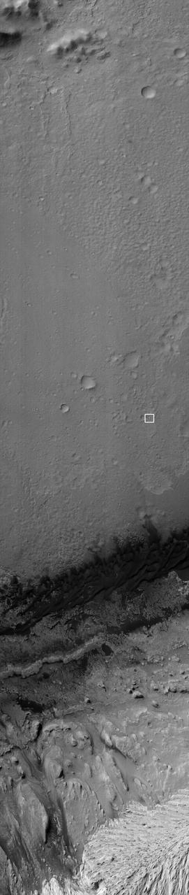
NASA Mars Reconnaissance Orbiter captured this image on 27 June 2014, when Curiosity had just crossed the edge of the 3-sigma landing.
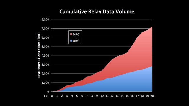
This chart shows increases in the volume of data coming back from NASA Mars Curiosity over recent sols. New capabilities of the Electra relay-radios on MRO and Curiosity have greatly increased the volume of data the rover is sending back from Mars.
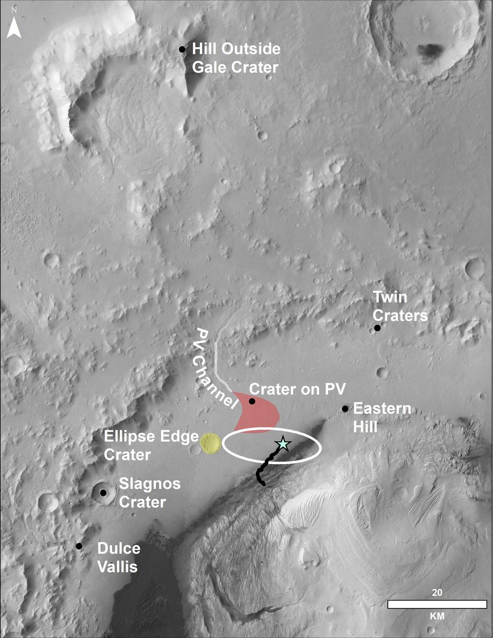
This image of the northwestern portion of Mars' Gale Crater and terrain north of it, from the European Space Agency's Mars Express orbiter, provides a locator map for some features visible in an October 2017 panorama from NASA's Curiosity Mars rover (see PIA22210, Fig. 1). A blue star marks the rover's landing site, on the floor of Gale Crater near the base of Mount Sharp. That layered mountain occupies the middle of the crater. The black line indicates the path of the rover's traverse from its August 2012 landing to about the location on lower Mount Sharp, where the panorama was acquired. North is toward the top. At lower right is a 20-kilometer (12.4-mile) scale bar. The base-map image was taken by the High Resolution Stereo Camera on Mars Express. https://photojournal.jpl.nasa.gov/catalog/PIA22208
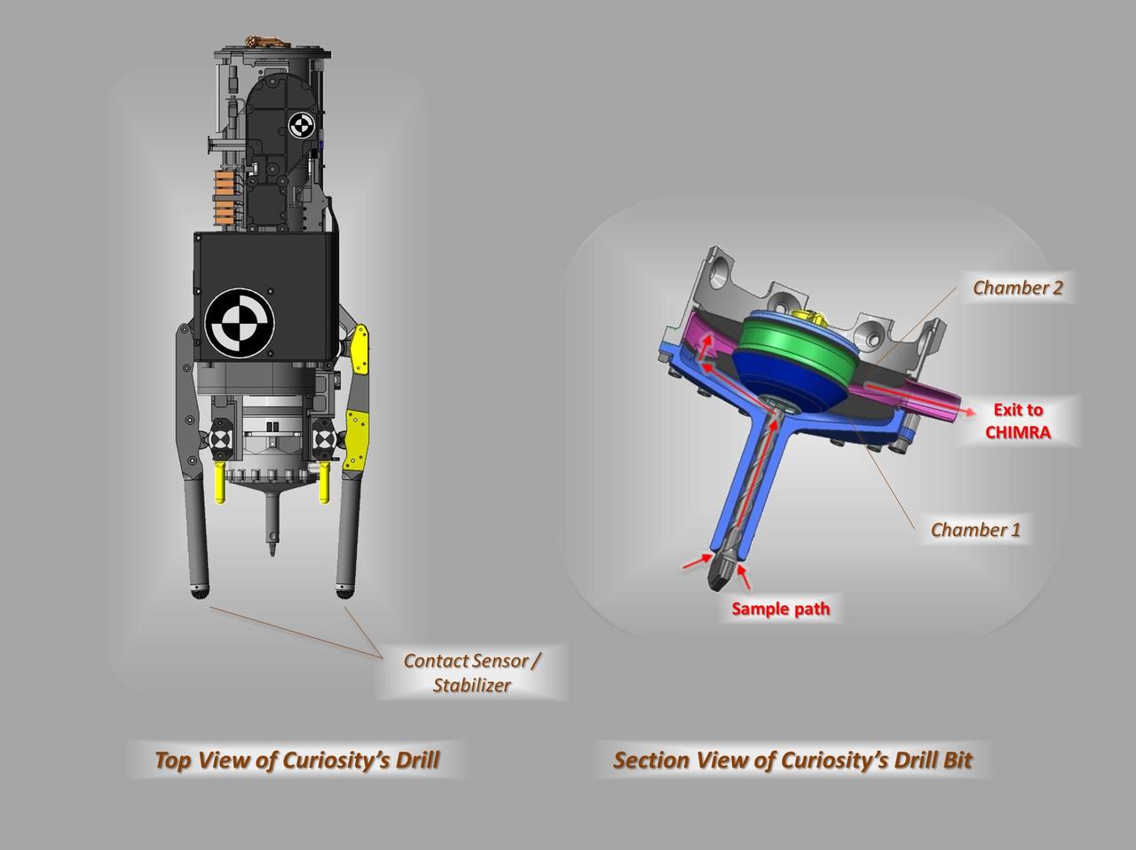
These schematic drawings show a top view and a cutaway view of a section of the drill on NASA Curiosity rover on Mars.
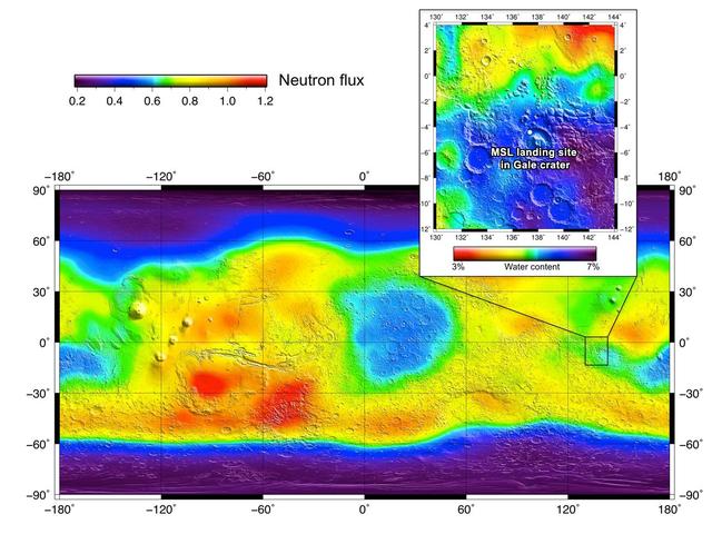
The heritage for investigations with the Dynamic Albedo of Neutrons instrument on NASA Curiosity rover comes from NASA Odyssey orbiter.
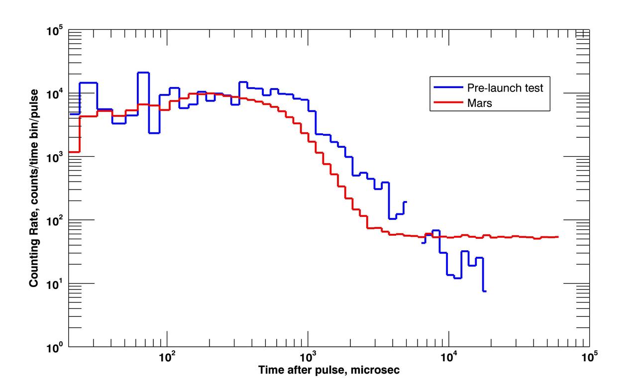
NASA Curiosity rover pinged the ground with neutrons for the first time, a process called active neutron sounding, on August 17, 2012.
This self-portrait of NASA Mars rover Curiosity combines dozens of exposures to show gray-powder and two holes where Curiosity used its drill on the rock target John Klein.
This frame from an animation from NASA Mars rover Curiosity shows the rover drilling into rock target Cumberland. The drilling was performed during the 279th Martian day, or sol, of the Curiosity work on Mars May 19, 2013.
NASA Mars rover Curiosity drove 83 feet eastward during the 102nd Martian day, or sol, of the mission Nov. 18, 2012. At the end of the drive, Curiosity view was toward Yellowknife Bay in the Glenelg area of Gale Crater.
The right Mast Camera Mastcam of NASA Curiosity Mars rover provided this contextual view of the vicinity of the location called John Klein, selected as Curiosity first drilling site.
This artist concept features NASA Mars Science Laboratory Curiosity rover, a mobile robot for investigating Mars past or present ability to sustain microbial life. Curiosity is being tested in preparation for launch in the fall of 2011.
This look back at a dune that NASA Curiosity Mars rover drove across was taken by the rover Mast Camera Mastcam during the 538th Martian day, or sol, of Curiosity work on Mars Feb. 9, 2014.
This artist concept features NASA Mars Science Laboratory Curiosity rover, a mobile robot for investigating Mars past or present ability to sustain microbial life. Curiosity is being tested in preparation for launch in the fall of 2011.
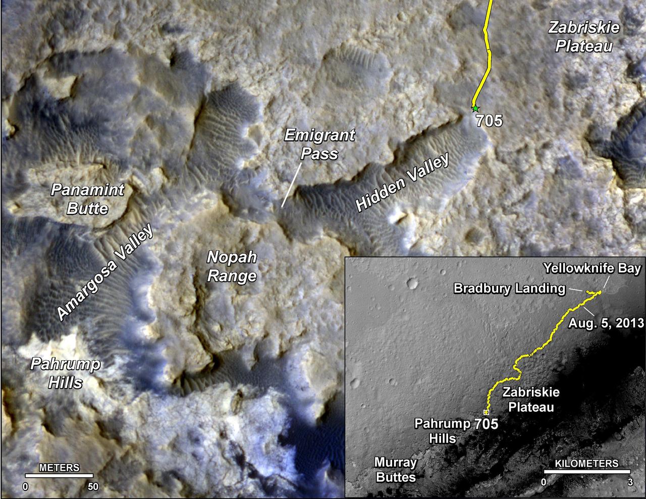
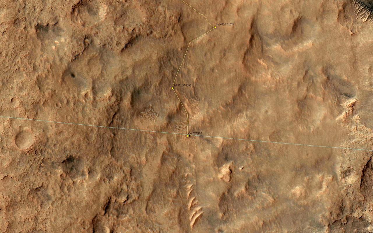
The main map shows landforms near NASA Curiosity Mars rover as the rover second anniversary of landing on Mars nears. The gold traverse line ends at Curiosity position as of July 31, 2014 Sol 705.
Details such as the shadow of the mast on NASA Mars rover Curiosity appear in an image taken Aug. 17, 2012, by the HiRISE camera on NASA Mars Reconnaissance Orbiter, from more directly overhead than previous HiRISE images of Curiosity.
This photograph of the NASA Mars Science Laboratory rover, Curiosity, was taken during testing on June 3, 2011. The turret at the end of Curiosity robotic arm holds five devices. In this view, the drill is at the six oclock position.
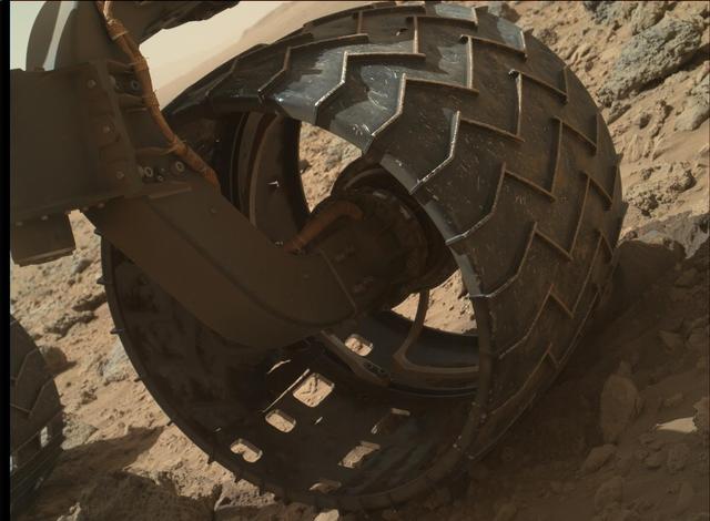
The left-front wheel of NASA Curiosity Mars rover shows dents and holes in this image taken by the MAHLI camera, which is mounted at the end of Curiosity robotic arm.
This image from NASA Curiosity Mars rover shows Curiosity at the Rocknest site where the rover scooped up samples of windblown dust and sand.
This image from NASA Curiosity Mars rover, Curiosity, has been white-balanced to show what the rocks would look like if they were on Earth.
This image from NASA Curiosity Mars rover shows Curiosity at the Rocknest site where the rover scooped up samples of windblown dust and sand.
NASA's Curiosity Mars rover took this selfie at a location nicknamed "Mary Anning" after a 19th century English paleontologist. Curiosity snagged three samples of drilled rock at this site on its way out of the Glen Torridon region, which scientists believe was a site where ancient conditions would have been favorable to supporting life, if it ever was present. Curiosity took the selfie using a camera called the Mars Hand Lens Imager located on the end of its robotic arm (videos explaining how Curiosity's selfies are taken can be found here). A close-up detail from within the selfie shows the three holes that a rock drill, also found on the end of Curiosity's arm, added to the surface. The three drill holes are named "Mary Anning," "Mary Anning 3" and "Groken," the last name coming from a site of geological interest in the Scottish countryside. https://photojournal.jpl.nasa.gov/catalog/PIA24173
This close-up view shows NASA Curiosity rover on the surface of Mars. The image was captured by the NASA Mars Reconnaissance Orbiter about 24 hours after the rover made its grand appearance on Mars.
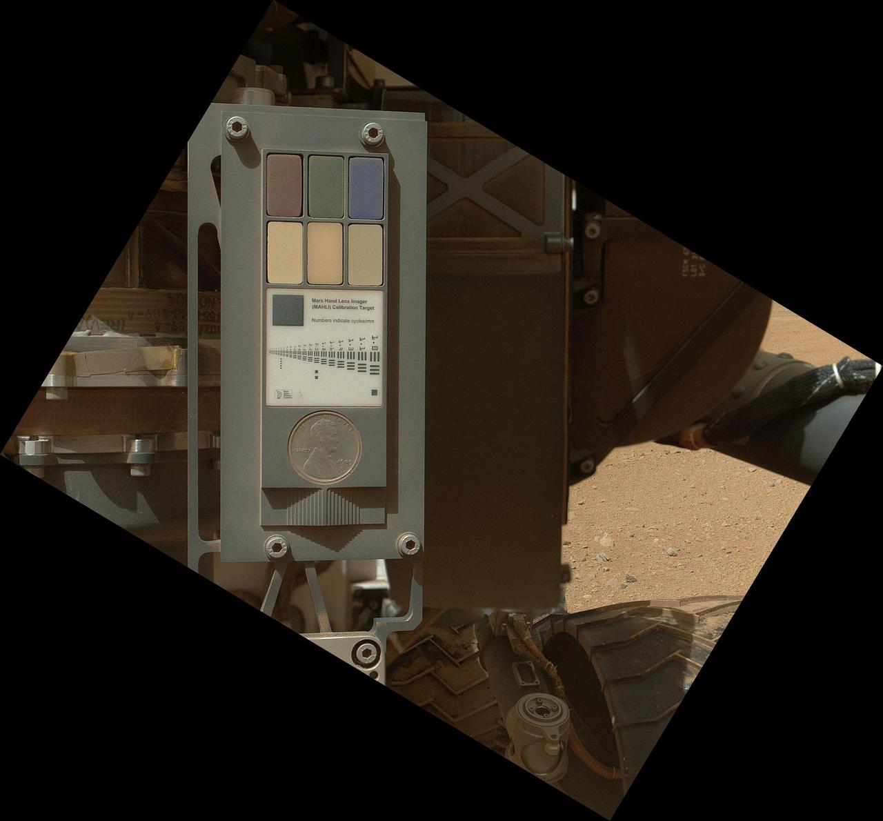
This view of the calibration target for the MAHLI camera aboard NASA Mars rover Curiosity combines two images taken by that camera during Sept. 9, 2012. Part of Curiosity left-front and center wheels and a patch of Martian ground are also visible.
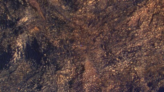
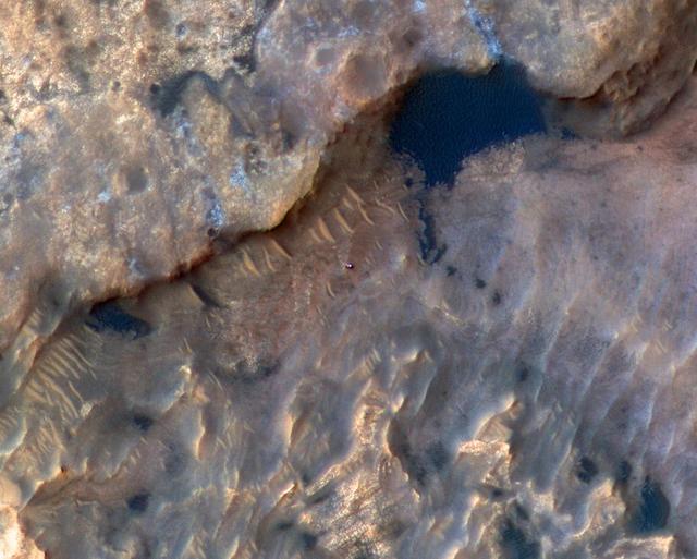
NASA's Curiosity Mars rover appears as a dark speck in this view captured on Feb. 28, 2025, by the High-Resolution Imaging Science Experiment (HiRISE) camera aboard NASA's Mars Reconnaissance Orbiter. At the time this image was taken, Curiosity was driving. It's likely the first time HiRISE has captured the rover while it was in motion. Trailing Curiosity are the rover's tracks, which can linger on the Martian surface for months before being erased by the wind. The tracks are evidence of multiple days of driving as Curiosity made its way to a region full of potential boxwork formations, believed to be the result of ancient groundwater in this region of Mount Sharp, a 3-mile-tall (5-kilometer-tall) mountain Curiosity has been ascending since 2014. When HiRISE takes an image, the majority of the scene is in black-and-white, with a strip of color down the middle. While HiRISE has captured Curiosity in color before, this time the rover happened to fall within the black-and-white part of the image. https://photojournal.jpl.nasa.gov/catalog/PIA26553
NASA's Curiosity Mars rover used its Mast Camera, or Mastcam, to capture this scene around a drill hole named "Edinburgh." The images used to create the scene were taken on March 22 and 23, 2020, which were the 2,711th and 2,712th Martian days, or sols, of the mission. The scene was captured while Curiosity was parked on top of a feature called the "Greenheugh Pediment." Looming above in the background is the top of Mount Sharp, the 3-mile-tall (5-kilometer-tall) mountain that Curiosity has been ascending since 2014. The color balance of the scene was processed to reflect the way it would look to the human eye under daytime lighting on Earth. https://photojournal.jpl.nasa.gov/catalog/PIA25046
This video clip shows a test of a new percussive drilling technique at NASA's Jet Propulsion Laboratory in Pasadena, California. On May 19, NASA's Curiosity rover is scheduled to test percussive drilling on Mars for the first time since December 2016. The video clip was shot on March 28, 2018. It has been sped up by 50 times. Curiosity's drill was designed to pulverize rocks samples into powder, which can then be deposited into two chemistry laboratories carried inside of the rover. Curiosity's science team is eager to the rover using percussive drilling again; it will approach a clay-enriched area later this year that could shed new light on the history of water in Gale Crater. An animation is available at https://photojournal.jpl.nasa.gov/catalog/PIA22324

This image shows fine sand from Mars that was filtered by NASA Curiosity rover as part of its first decontamination exercise.
This is an artist concept of NASA Mars Science Laboratory spacecraft approaching Mars. The Curiosity rover is safely tucked inside the spacecraft aeroshell.
This frame from an animation shows the location of a set of Hazard-Avoidance cameras on the back of NASA Curiosity rover.
This view of the head of the remote sensing mast on the Mars Science Laboratory mission rover, Curiosity, shows seven of the 17 cameras on the rover.
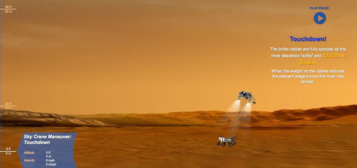
This is a still from an interactive web feature that guides you through the entry, descent and landing of NASA Curiosity rover.
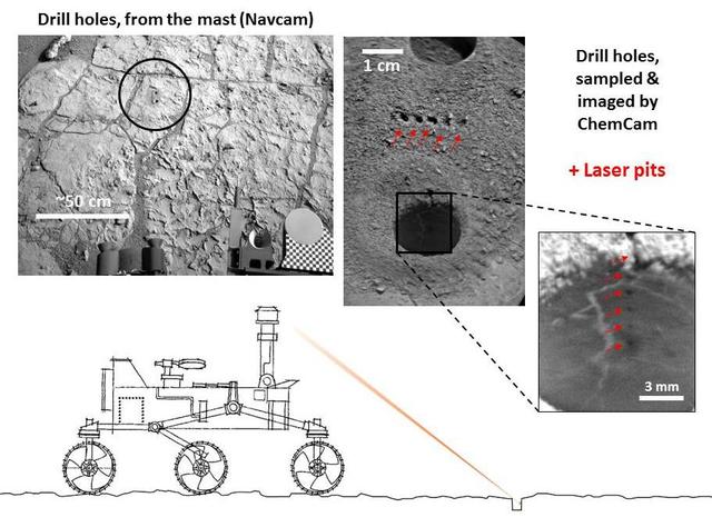
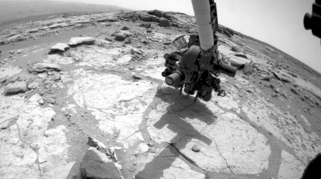
NASA Curiosity Mars rover targeted the laser of the ChemCam instrument with remarkable accuracy for assessing the composition of the wall of a drilled hole and tailings that resulted from the drilling.
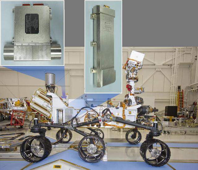
This image of NASA Curiosity rover shows the location of the two components of the Dynamic Albedo of Neutrons instrument. The neutron generator is mounted on the right hip and the detectors are on the opposite hip.
At the center of this image from NASA Curiosity rover is the hole in a rock called John Klein where the rover conducted its first sample drilling on Mars.
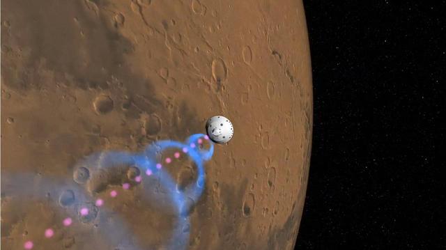
This frame from an artist animation shows how NASA Curiosity rover will communicate with Earth via two of NASA Mars orbiters, Mars Reconnaissance Orbiter and Odyssey.
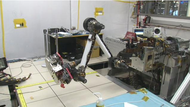
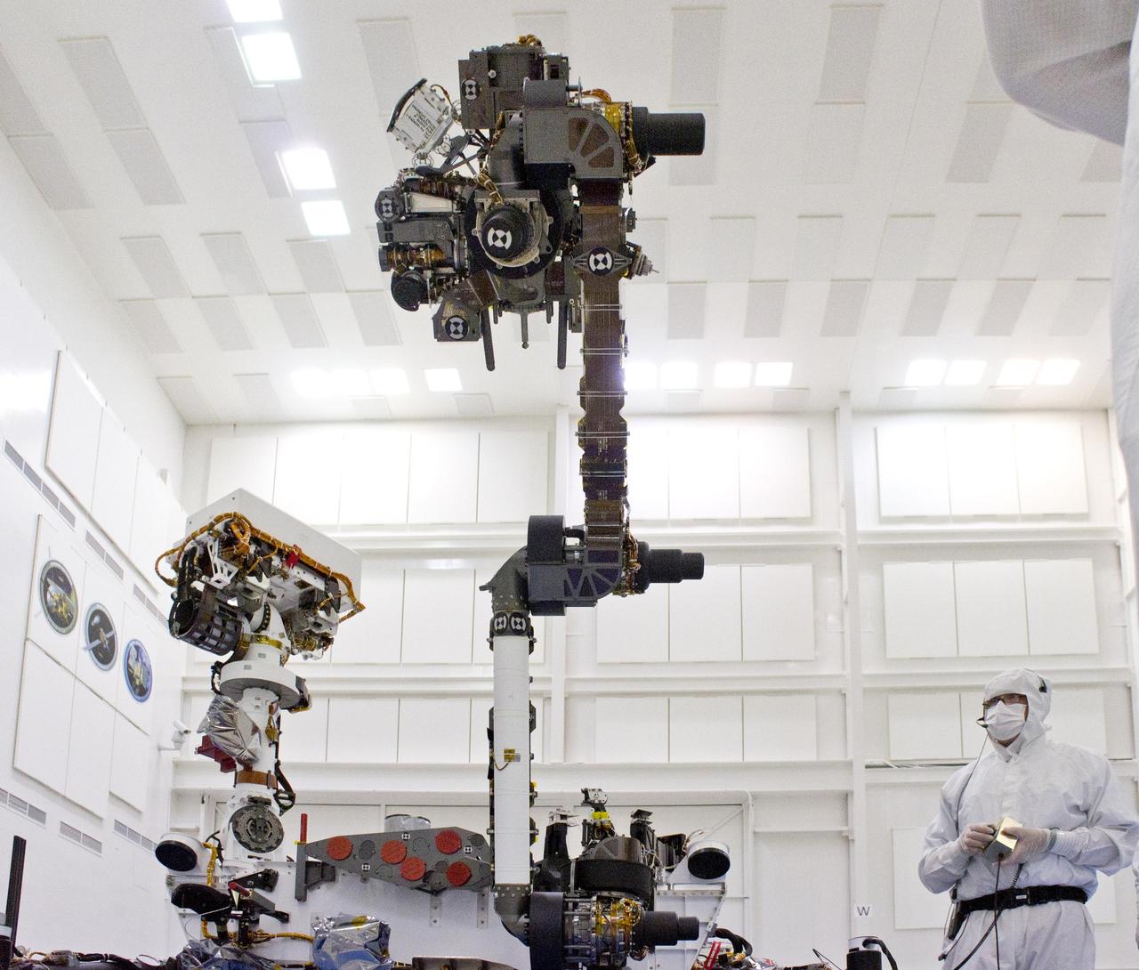
In this image, engineers from NASA Jet Propulsion Laboratory test and flex Curiosity robotic arm and tools. A video can be viewed at the Photojournal.
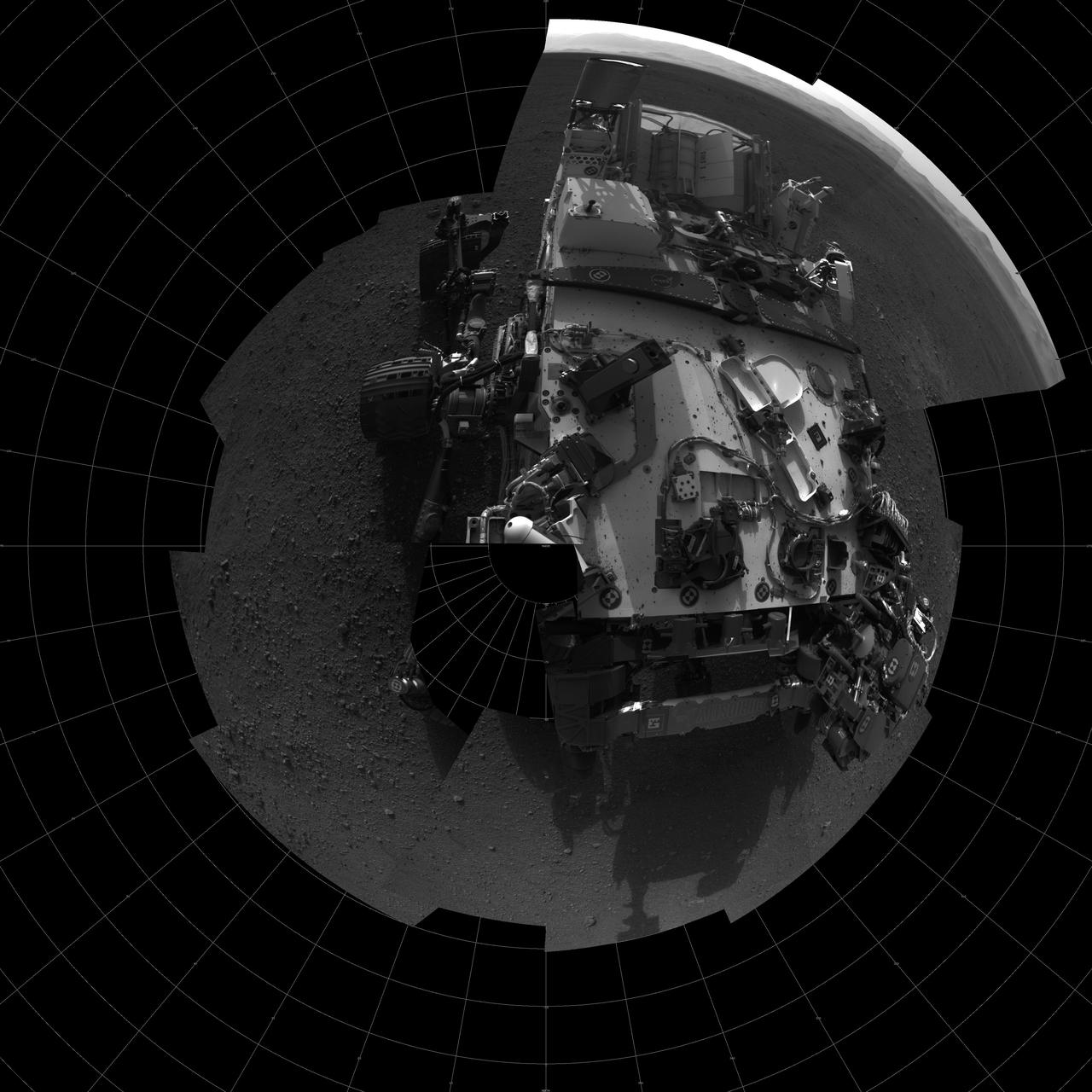
This self-portrait shows the deck of NASA Curiosity rover from the rover Navigation camera. The rim of Gale Crater can be seen at upper right.
NASA's Curiosity Mars rover can be seen in this image taken from space on May 31, 2019, by the High Resolution Imaging Science Experiment (HiRISE) camera aboard the Mars Reconnaissance Orbiter (MRO). In the image, Curiosity appears as a bluish speck. The image shows Curiosity at a location called "Woodland Bay." It's just one of many stops the rover has made in an area referred to as the "clay-bearing unit" on the side of Mount Sharp, a 3-mile-tall (5-kilometer-tall) mountain inside of Gale Crater. Look carefully, and you can make out what it is likely Curiosity's "head," technically known as the remote sensing mast. A bright spot appears in the upper-left corner of the rover. At the time this image was acquired, the rover was facing 65 degrees counterclockwise from north, which would put the mast in about the right location to produce this bright spot. https://photojournal.jpl.nasa.gov/catalog/PIA23341
NASA's Curiosity Mars rover took this selfie on May 12, 2019 (the 2,405th Martian day, or sol, of the mission). To the lower-left of the rover are its two recent drill holes, at targets called "Aberlady" and "Kilmarie." These are Curiosity's 20th and 21st drill sites. The selfie is composed of 57 individual images taken by the rover's Mars Hand Lens Imager (MAHLI), a camera on the end of the rover's robotic arm. The images are stitched together into a panorama, and the robotic arm is digitally removed. https://photojournal.jpl.nasa.gov/catalog/PIA23240
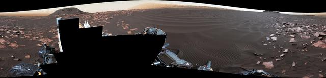
A rippled linear dune of dark Martian sand, "Nathan Bridges Dune," dominates this full-circle panorama from the Mast Camera (Mastcam) of NASA's Curiosity Mars rover. This dune was one research stop of the rover mission's campaign to investigate active Martian dunes. The feature was informally named in 2017 in memory of Nathan Bridges (1966-2017), a planetary scientist who was a leader of the Curiosity team's dune campaign. The scene combines 112 images taken with Mastcam's left-eye camera on Feb. 5, 2017, during the 1,601st Martian day, or sol, of Curiosity's work on Mars. The panorama has been white-balanced so that colors of the rock and sand materials resemble how they would appear under daytime lighting conditions on Earth. The center is toward east-southeast and both ends are toward west-northwest. The dark butte on the horizon in the left half is "Ireson Hill." Upper Mount Sharp is on the horizon in the center. An annotated figure and full resolution TIFF file is available at https://photojournal.jpl.nasa.gov/catalog/PIA21719
NASA Mars rover Curiosity captured this 3-D view of the rock-studded terrain Curiosity has traversed since October 2013, accelerating the pace of wear and tear on the rover wheels.
Soil clinging to the right middle and rear wheels of NASA Mars rover Curiosity can be seen in this image taken by the Curiosity Navigation Camera after the rover third drive on Mars.