Dao Vallis
Dao Vallis
Hazy Conditions in Hellas Dao
A small section of Dao Vallis in shown in this image from NASA 2001 Mars Odyssey spacecraft. Dao Vallis is a major channel that drains into Hellas Planitia.
Looking Out Across Dao, Niger, and Harmakhis Valles
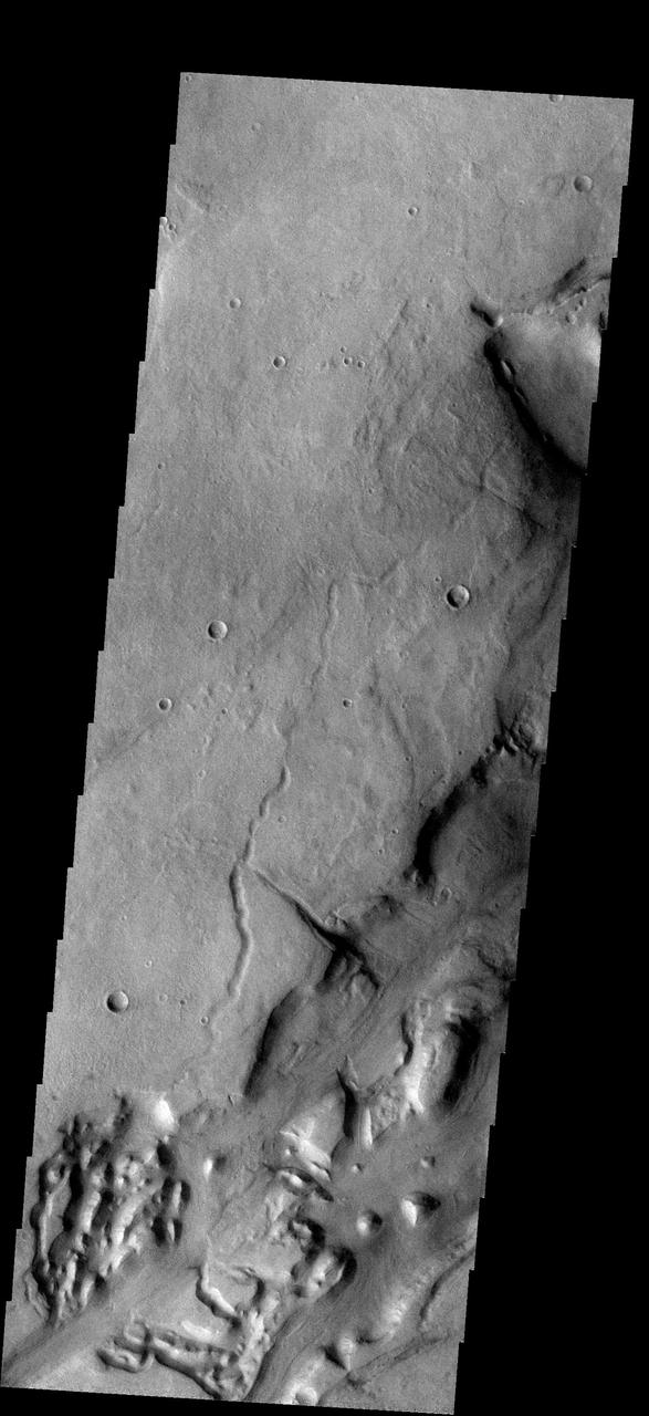
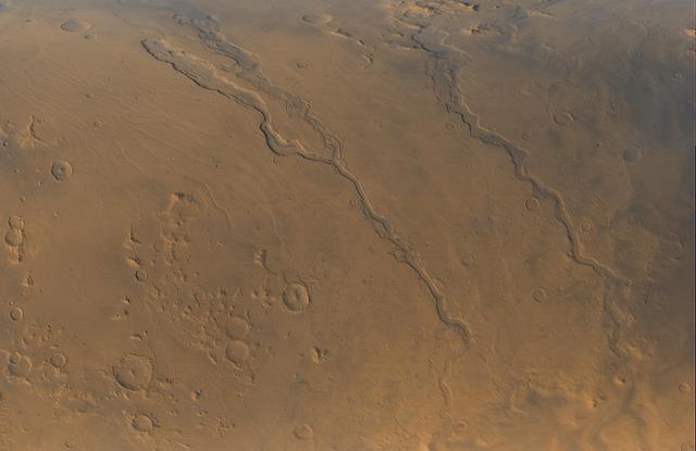
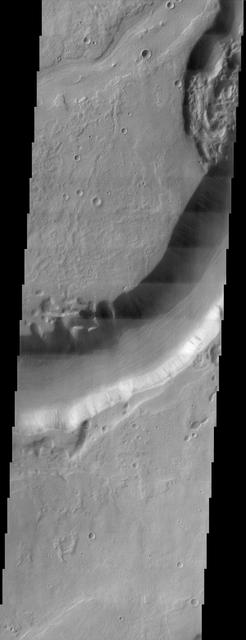
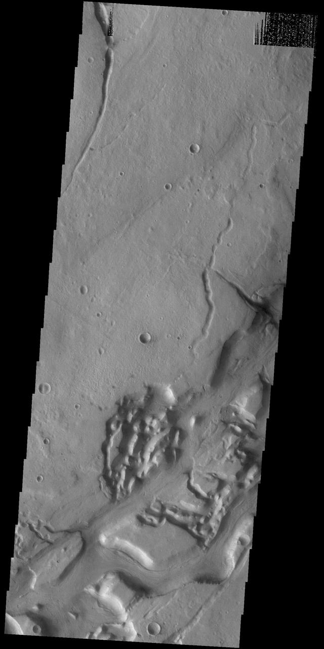
Today's VIS image shows a small portion of both Dao Vallis (top of image) and Niger Vallis (middle of image). Arising from the volcano Hadriacus Mons, Dao Vallis is approximately 1200km (750 miles) long. Niger Vallis is 333 km (207 miles) long. It has been proposed that heating of the region due to volcanic activity melted subsurface ice which was released to the surface to carve the two channels. Niger Vallis merges with Dao Vallis just off the image and then flow southwestward into the Hellas Planitia basin. Orbit Number: 91427 Latitude: -36.3071 Longitude: 90.4526 Instrument: VIS Captured: 2022-07-25 09:32 https://photojournal.jpl.nasa.gov/catalog/PIA25601
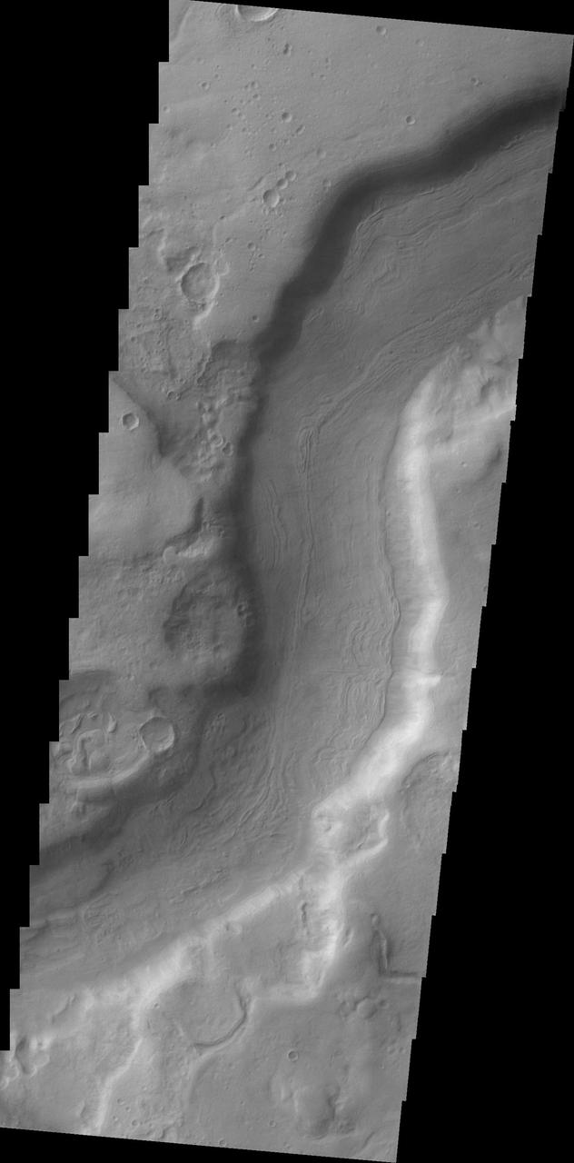
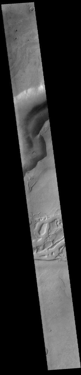
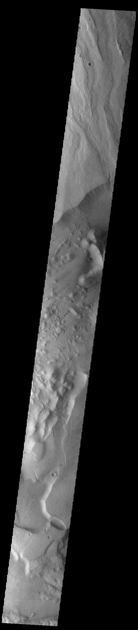
Today's VIS image shows a small portion of Dao Vallis. Located south of Hadriacus Mons (a volcano), this channel is approximately 1200km (750 miles) long. It has been proposed that heating of the region due to volcanic activity melted subsurface ice which was released to the surface to carve the channel. Dao Vallis empties into the Hellas Planitia basin. Orbit Number: 83191 Latitude: -34.7957 Longitude: 91.6287 Instrument: VIS Captured: 2020-09-15 06:07 https://photojournal.jpl.nasa.gov/catalog/PIA24241
Today's VIS image shows a small portion of both Dao Vallis (middle of image) and Niger Vallis (bottom of image). Arising from the volcano Hadriacus Mons (top of image), Dao Vallis is approximately 1200km (750 miles) long. Niger Vallis is 333 km (207 miles) long. It has been proposed that heating of the region due to volcanic activity melted subsurface ice which was released to the surface to carve the two channels. Niger Vallis merges with Dao Vallis south of this image and then flow southwestward into the Hellas Planitia basin. Orbit Number: 93355 Latitude: -33.4749 Longitude: 93.0394 Instrument: VIS Captured: 2022-12-31 02:58 https://photojournal.jpl.nasa.gov/catalog/PIA25852

This daytime IR image captured by NASA 2001 Mars Odyssey spacecraft shows part of the patera summit depression and eroded flank of Hadriacus Mons at the top of the image and a section of Dao Vallis at the bottom of the image.
This NASA Mars Odyssey image shows Dao Vallis, a large outflow channel that starts on the southeast flank of a large volcano called Hadriaca Patera and runs for 1,000 kilometers about 620 miles southwest into the Hellas impact basin. http://photojournal.jpl.nasa.gov/catalog/PIA04009

Headquarters building and spheres at Gas Dynamics. DAO Section. Scanned on 4/23/2018.
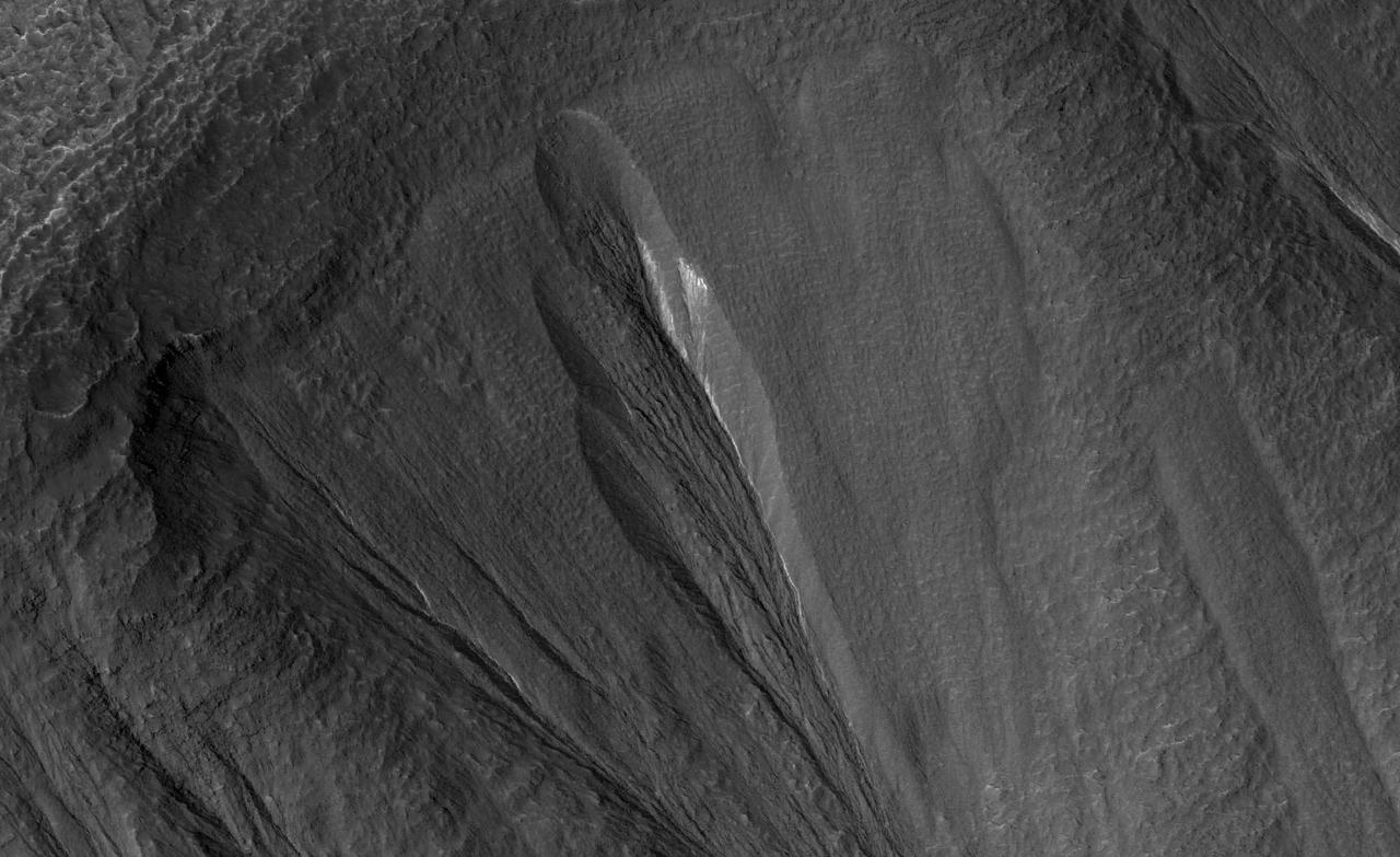
The white material seen within this gully is believed to be dusty water ice in a Martian region called Dao Vallis, captured by NASA's Mars Reconnaissance Orbiter (MRO). Scientists believe dust particles within this ice act similarly to dust that falls on to glaciers on Earth, warming up in sunlight and causing subsurface pockets of meltwater to form. On Earth, the dust that forms these pockets are called cryoconite, and the pockets are called cryoconite holes. These Earth-based pockets of water are often teeming with simple life, including algae, fungi and cyanobacteria. Scientists believe similar shallow pools of water could exist on Mars, and may also be excellent places to search for life on the Red Planet today. This black-and-white image was captured by MRO using its HiRISE (High-Resolution Imaging Science Experiment) camera on May 10, 2009. https://photojournal.jpl.nasa.gov/catalog/PIA26408
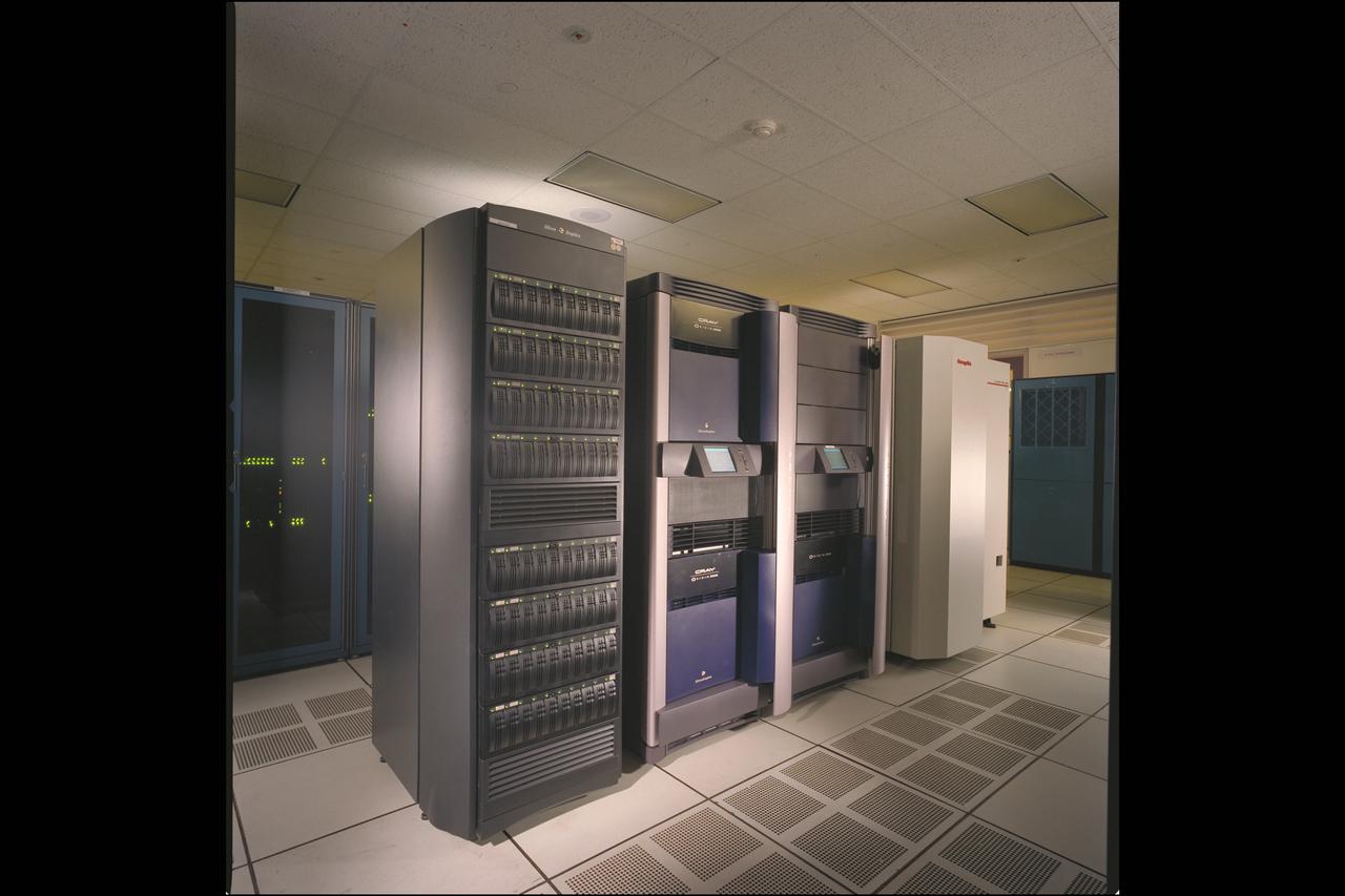
NAS Origin 2000 Computer System - Data Assimilation Office (DAO) storage (Gatun, Raid and Silo)
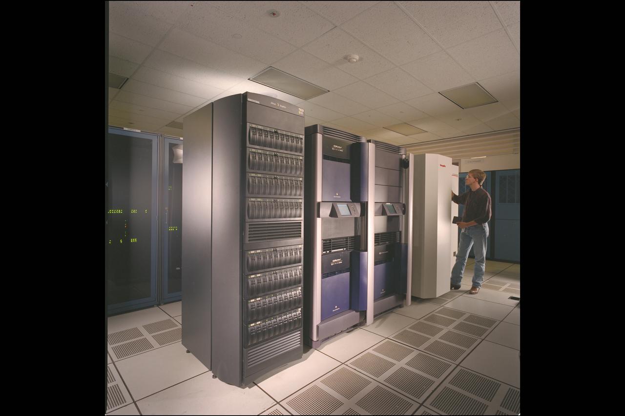
NAS Origin 2000 Computer System - Data Assimilation Office (DAO) storage (Gatun, Raid and Silo) with James Jones
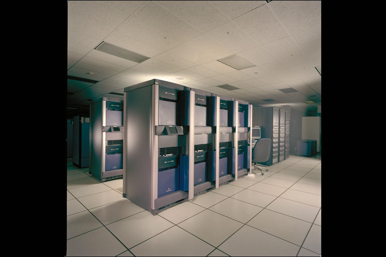
NAS Origin 2000 Computer System - Data Assimilation Office (DAO) cluster (nicknamed Sunrise, Jim PFO, Jim PF1 and Raids)
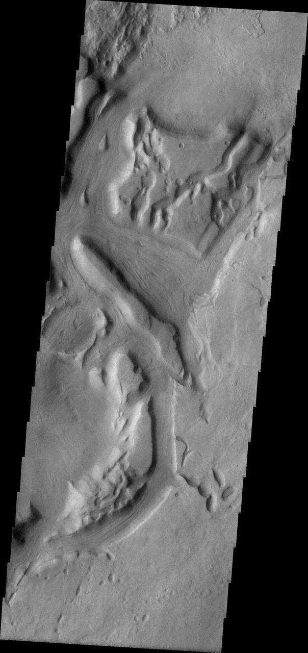
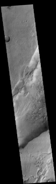
This VIS image shows a portion of Niger Vallis. The channel is 333 km (207 miles) long. Arising from the volcano Hadriacus Mons, Niger Vallis merges with Dao Vallis and flows southwestward into Hellas Planitia. The channel is named for the Niger Rivier in Africa. Orbit Number: 83734 Latitude: -36.231 Longitude: 90.9557 Instrument: VIS Captured: 2020-10-29 22:33 https://photojournal.jpl.nasa.gov/catalog/PIA24279

TechEdSat-11 operators Daphne Dao, left, and Alejandro Salas, in the Ames Multi-Mission Operations Center (MMOC), N240 Annex, Eros control room 162. The team monitors the spacecraft's status during the Exo-Brake “parachute” deployment. The ExoBrake is a drag device that increases the total surface area of the spacecraft to assist with a quicker deorbit. This maneuver is deployed at the end of mission to satisfy NASA's deorbit requirement and prevent space debris. TechEdSat has spent the last several months coordinating with NASA’s Conjunction Assessment Risk Analysis (CARA) team to ensure the spacecraft can safely deploy the ExoBrake without colliding into any other objects.

TechEdSat-11 operators Daphne Dao, left, and Alejandro Salas, in the Ames Multi-Mission Operations Center (MMOC), N240 Annex, Eros control room 162. The team monitors the spacecraft's status during the Exo-Brake “parachute” deployment. The ExoBrake is a drag device that increases the total surface area of the spacecraft to assist with a quicker deorbit. This maneuver is deployed at the end of mission to satisfy NASA's deorbit requirement and prevent space debris. TechEdSat has spent the last several months coordinating with NASA’s Conjunction Assessment Risk Analysis (CARA) team to ensure the spacecraft can safely deploy the ExoBrake without colliding into any other objects.
TechEdSat-11 operators Daphne Dao, left, Alejandro Salas, Kwabena Boateng, and Malachi Mooney-Rivkin, right, in the Ames Multi-Mission Operations Center (MMOC), N240 Annex, Eros control room 162. The team monitors the spacecraft's status during the Exo-Brake “parachute” deployment. The ExoBrake is a drag device that increases the total surface area of the spacecraft to assist with a quicker deorbit. This maneuver is deployed at the end of mission to satisfy NASA's deorbit requirement and prevent space debris. TechEdSat has spent the last several months coordinating with NASA’s Conjunction Assessment Risk Analysis (CARA) team to ensure the spacecraft can safely deploy the ExoBrake without colliding into any other objects.

TechEdSat-11 operators Marcus Murbach, left, Daphne Dao and Alejandro Salas, seated, Kwabena Boateng, and Justin Pane, right, in the Ames Multi-Mission Operations Center (MMOC), N240 Annex, Eros control room 162. The team monitors the spacecraft's status during the Exo-Brake “parachute” deployment. The ExoBrake is a drag device that increases the total surface area of the spacecraft to assist with a quicker deorbit. This maneuver is deployed at the end of mission to satisfy NASA's deorbit requirement and prevent space debris. TechEdSat has spent the last several months coordinating with NASA’s Conjunction Assessment Risk Analysis (CARA) team to ensure the spacecraft can safely deploy the ExoBrake without colliding into any other objects.

TechEdSat-11 operators Heather Smith, left, Justin Pane, Daphne Dao and Alejandro Salas, seated, Kyeong Ja Kim, Luke Idziak, and Kwabena Boateng right, in the Ames Multi-Mission Operations Center (MMOC), N240 Annex, Eros control room 162. The team monitors the spacecraft's status during the Exo-Brake “parachute” deployment. The ExoBrake is a drag device that increases the total surface area of the spacecraft to assist with a quicker deorbit. This maneuver is deployed at the end of mission to satisfy NASA's deorbit requirement and prevent space debris. TechEdSat has spent the last several months coordinating with NASA’s Conjunction Assessment Risk Analysis (CARA) team to ensure the spacecraft can safely deploy the ExoBrake without colliding into any other objects.
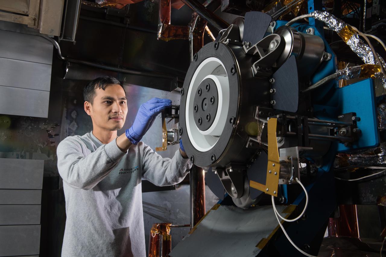
Advanced Electric Propulsion System, AEPS, Engineering Test Unit 2, ETU-2, Thruster Hardware