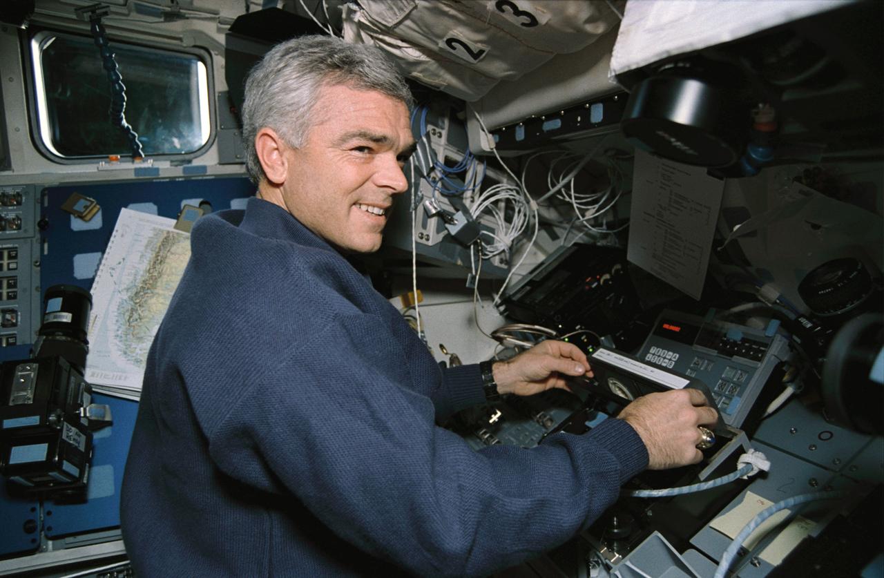
STS059-09-012 (9-20 April 1994) --- On the Space Shuttle Endeavour's aft flight deck, astronaut Michael R. (Rich) Clifford, mission specialist, inserts a tape in the payload high rate recorder. Three of these state-of-the-art recorders captured four times the amount of data that could be radioed to the ground. The 183 tapes, each containing 40 megabytes of data, will be turned into images over the next year, and analyzed over the next decade. Clifford was joined in space by five other NASA astronauts for a week and a half of support to the Space Radar Laboratory (SRL-1)/STS-59 mission.
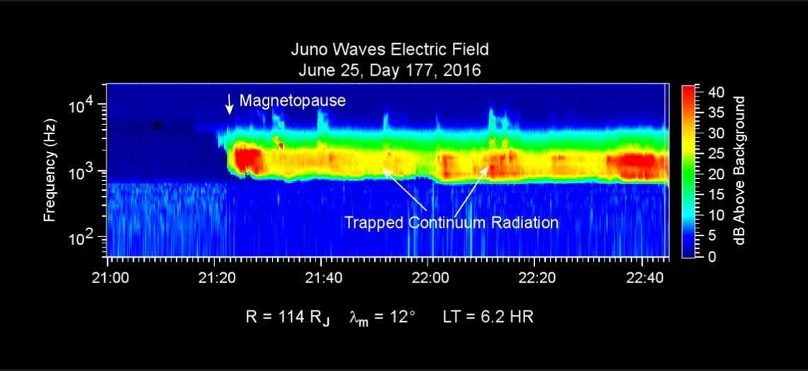
This chart presents data that the Waves investigation on NASA's Juno spacecraft recorded as the spacecraft crossed the bow shock just outside of Jupiter's magnetosphere on June 24, 2016, while approaching Jupiter. Audio accompanies the animation, with volume and pitch correlated to the amplitude and frequency of the recorded waves. The graph is a frequency-time spectrogram with color coding to indicate wave amplitudes as a function of wave frequency (vertical axis, in hertz) and time (horizontal axis, with a total elapsed time of two hours). During the hour before Juno reached the bow shock, the Waves instrument was detecting mainly plasma oscillations just below 10,000 hertz (10 kilohertz). The frequency of these oscillations is related to the local density of electrons; the data yield an estimate of approximately one electron per cubic centimeter (about 16 per cubic inch) in this region just outside Jupiter's bow shock. The broadband burst of noise marked "Bow Shock" is the region of turbulence where the supersonic solar wind is heated and slowed by encountering the Jovian magnetosphere. The shock is analogous to a sonic boom generated in Earth's atmosphere by a supersonic aircraft. The region after the shock is called the magnetosheath. The vertical bar to the right of the chart indicates the color coding of wave amplitude, in decibels (dB) above the background level detected by the Waves instrument. Each step of 10 decibels marks a tenfold increase in wave power. When Juno collected these data, the distance from the spacecraft to Jupiter was about 5.56 million miles (8.95 million kilometers), indicated on the chart as 128 times the radius of Jupiter. Jupiter's magnetic field is tilted about 10 degrees from the planet's axis of rotation. The note of 22 degrees on the chart indicates that at the time these data were recorded, the spacecraft was 22 degrees north of the magnetic-field equator. The "LT" notation is local time on Jupiter at the longitude of the planet directly below the spacecraft, with a value of 6.2 indicating approximately dawn. http://photojournal.jpl.nasa.gov/catalog/PIA20753
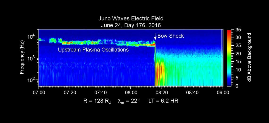
This chart presents data that the Waves investigation on NASA's Juno spacecraft recorded as the spacecraft crossed the bow shock just outside of Jupiter's magnetosphere on June 24, 2016, while approaching Jupiter. Audio accompanies the animation, with volume and pitch correlated to the amplitude and frequency of the recorded waves. The graph is a frequency-time spectrogram with color coding to indicate wave amplitudes as a function of wave frequency (vertical axis, in hertz) and time (horizontal axis, with a total elapsed time of two hours). During the hour before Juno reached the bow shock, the Waves instrument was detecting mainly plasma oscillations just below 10,000 hertz (10 kilohertz). The frequency of these oscillations is related to the local density of electrons; the data yield an estimate of approximately one electron per cubic centimeter (about 16 per cubic inch) in this region just outside Jupiter's bow shock. The broadband burst of noise marked "Bow Shock" is the region of turbulence where the supersonic solar wind is heated and slowed by encountering the Jovian magnetosphere. The shock is analogous to a sonic boom generated in Earth's atmosphere by a supersonic aircraft. The region after the shock is called the magnetosheath. The vertical bar to the right of the chart indicates the color coding of wave amplitude, in decibels (dB) above the background level detected by the Waves instrument. Each step of 10 decibels marks a tenfold increase in wave power. When Juno collected these data, the distance from the spacecraft to Jupiter was about 5.56 million miles (8.95 million kilometers), indicated on the chart as 128 times the radius of Jupiter. Jupiter's magnetic field is tilted about 10 degrees from the planet's axis of rotation. The note of 22 degrees on the chart indicates that at the time these data were recorded, the spacecraft was 22 degrees north of the magnetic-field equator. The "LT" notation is local time on Jupiter at the longitude of the planet directly below the spacecraft, with a value of 6.2 indicating approximately dawn. http://photojournal.jpl.nasa.gov/catalog/PIA20753
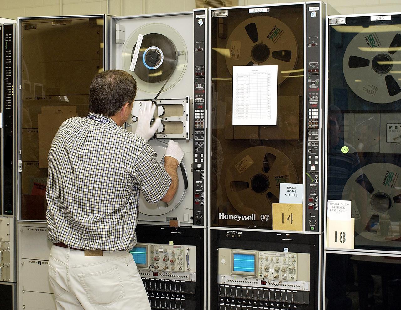
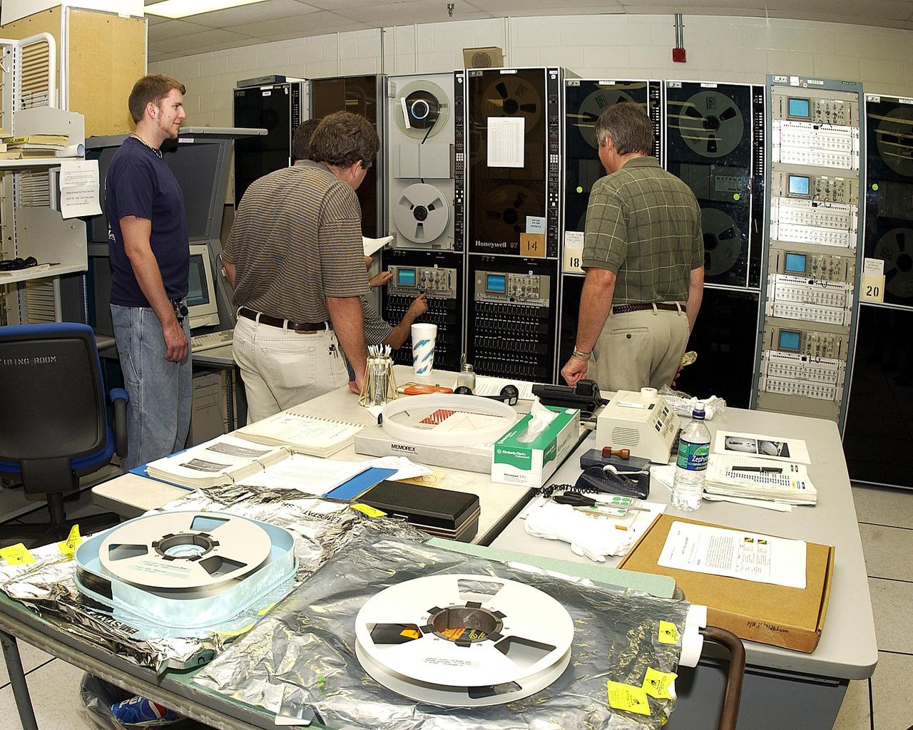
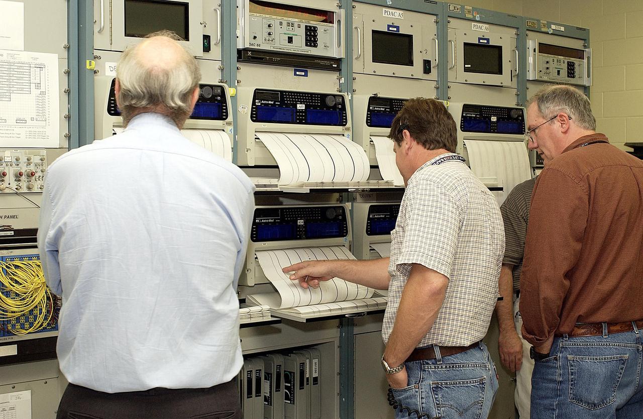
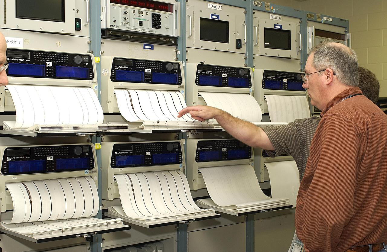
S86-30338 (4 April 1986) --- Carolyn Watson of Lockheed recieves a hard copy print-out of data from the MADS recorder as it is being sent form the termainal in JSC's central data office

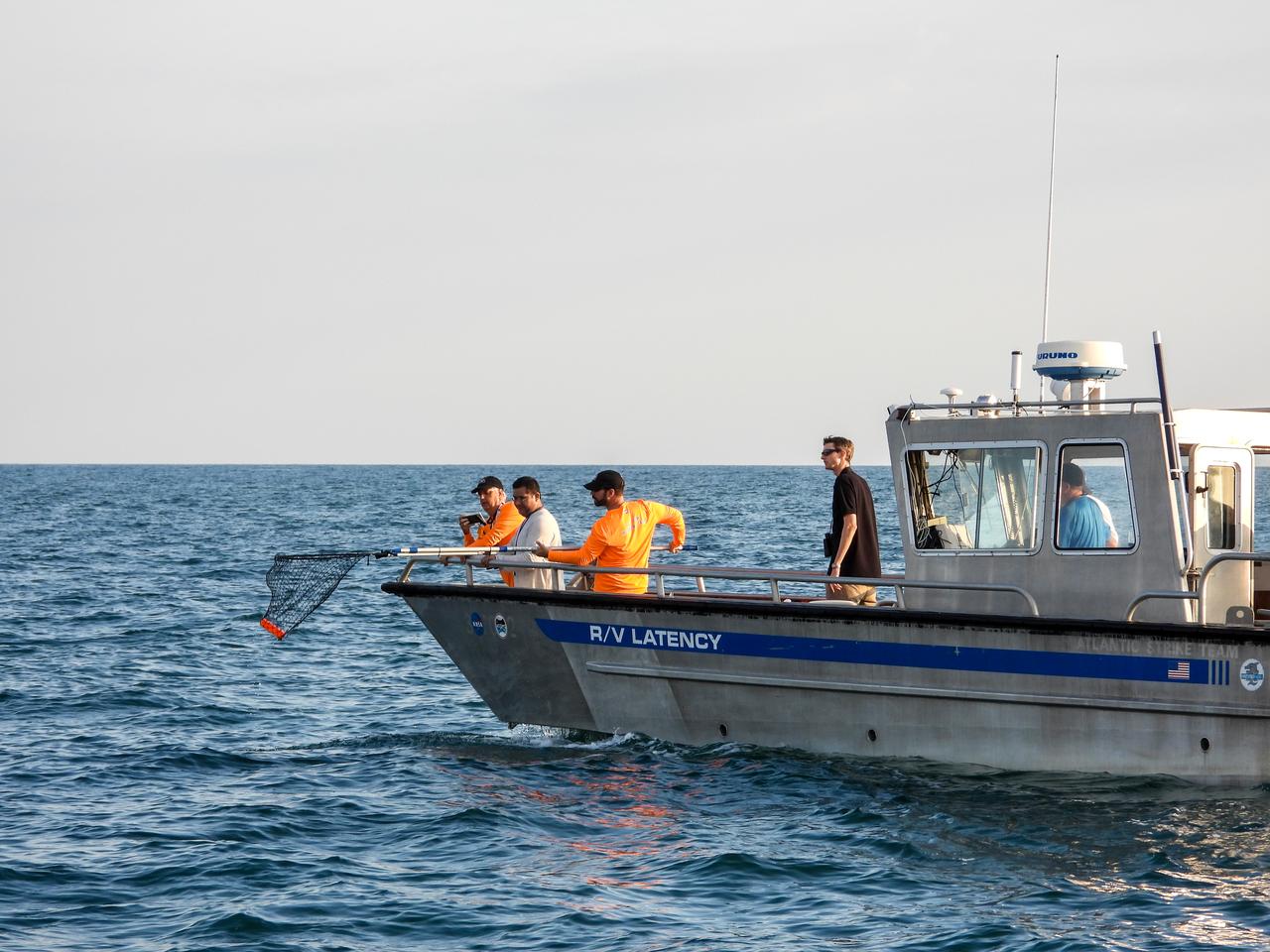
Members of the NASA Ejectable Data Recorder Recovery Team search for the ejectable data recorders in the Atlantic Ocean off the coast of Florida on July 2, 2019, after the Ascent Abort-2 (AA-2) flight test. During AA-2, a fully functional Launch Abort System (LAS) with a test version of Orion attached, launched atop a Northrop Grumman provided booster from Launch Pad 46 at Cape Canaveral Air Force Station on July 2, 2019. Liftoff was at 7 a.m. EDT. During AA-2, the booster sent the LAS and Orion to an altitude of 31,000 feet, traveling at Mach 1.15 (more than 1,000 mph). The LAS’ three motors worked together to pull the crew module away from the booster and prepare it for splashdown in the Atlantic Ocean. The flight test proves that the abort system can pull crew to safety in the unlikely event of an emergency during ascent. Data from the recorders will be analyzed by engineers.
Members of the NASA Ejectable Data Recorder Recovery Team search for the ejectable data recorders in the Atlantic Ocean off the coast of Florida on July 2, 2019, after the Ascent Abort-2 (AA-2) flight test. During AA-2, a fully functional Launch Abort System (LAS) with a test version of Orion attached, launched atop a Northrop Grumman provided booster from Launch Pad 46 at Cape Canaveral Air Force Station on July 2, 2019. Liftoff was at 7 a.m. EDT. During AA-2, the booster sent the LAS and Orion to an altitude of 31,000 feet, traveling at Mach 1.15 (more than 1,000 mph). The LAS’ three motors worked together to pull the crew module away from the booster and prepare it for splashdown in the Atlantic Ocean. The flight test proves that the abort system can pull crew to safety in the unlikely event of an emergency during ascent. Data from the recorders will be analyzed by engineers.
Members of the NASA Ejectable Data Recorder Recovery Team search for the ejectable data recorders in the Atlantic Ocean off the coast of Florida on July 2, 2019, after the Ascent Abort-2 (AA-2) flight test. During AA-2, a fully functional Launch Abort System (LAS) with a test version of Orion attached, launched atop a Northrop Grumman provided booster from Launch Pad 46 at Cape Canaveral Air Force Station on July 2, 2019. Liftoff was at 7 a.m. EDT. During AA-2, the booster sent the LAS and Orion to an altitude of 31,000 feet, traveling at Mach 1.15 (more than 1,000 mph). The LAS’ three motors worked together to pull the crew module away from the booster and prepare it for splashdown in the Atlantic Ocean. The flight test proves that the abort system can pull crew to safety in the unlikely event of an emergency during ascent. Data from the recorders will be analyzed by engineers.

STS003-22-122 (30 March 1982) --- STS-3 Commander Lousma, wearing communications kit assembly (ASSY) mini-headset (HDST), records Plant Growth Unit (PGU) data for the Influence of Weightlessness on Plant Lignification Experiment at forward middeck locker MF14K. The experiment is designed to demonstrate the effect of weightlessness on the quantity and rate of lignin formation in different plant species during early stages of development. Port side bulkhead with window shade and filter kit appears behind Lousma and potable water tank below him. Trash bag also appears in view. Photo credit: NASA
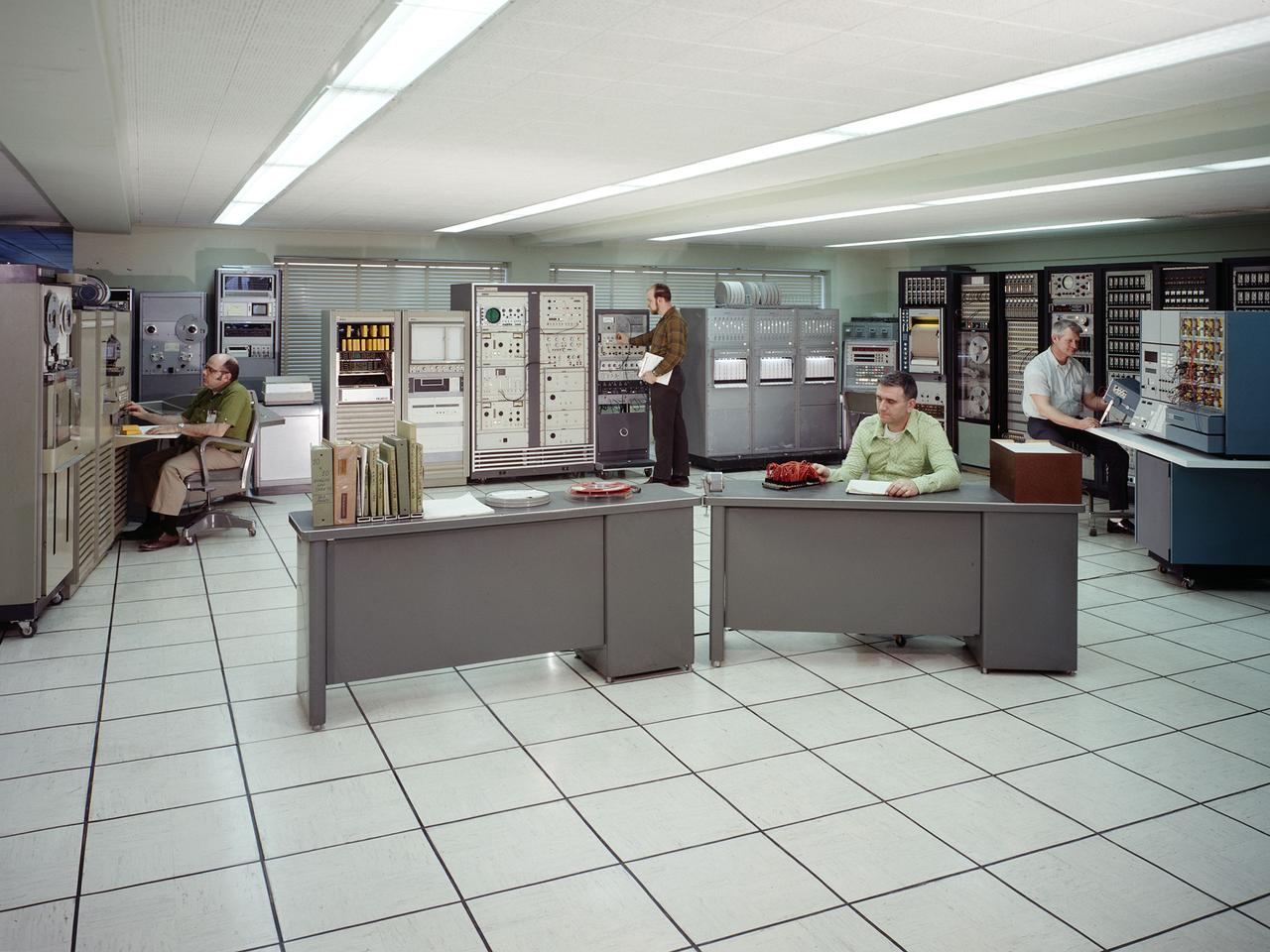
The test data recording equipment located in the office building of the 10-by 10-Foot Supersonic Wind Tunnel at the NASA Lewis Research Center. The data system was the state of the art when the facility began operating in 1955 and was upgraded over time. NASA engineers used solenoid valves to measure pressures from different locations within the test section. Up 48 measurements could be fed into a single transducer. The 10-by 10 data recorders could handle up to 200 data channels at once. The Central Automatic Digital Data Encoder (CADDE) converted this direct current raw data from the test section into digital format on magnetic tape. The digital information was sent to the Lewis Central Computer Facility for additional processing. It could also be displayed in the control room via strip charts or oscillographs. The 16-by 56-foot long ERA 1103 UNIVAC mainframe computer processed most of the digital data. The paper tape with the raw data was fed into the ERA 1103 which performed the needed calculations. The information was then sent back to the control room. There was a lag of several minutes before the computed information was available, but it was exponentially faster than the hand calculations performed by the female computers. The 10- by 10-foot tunnel, which had its official opening in May 1956, was built under the Congressional Unitary Plan Act which coordinated wind tunnel construction at the NACA, Air Force, industry, and universities. The 10- by 10 was the largest of the three NACA tunnels built under the act.

One of the 12 ejectable data recorders from NASA’s Ascent Abort-2 (AA-2) flight test is retrieved from the Atlantic Ocean off the coast of Florida by the NASA Ejectable Data Recorder Recovery Team on July 2, 2019. During AA-2, a fully functional Launch Abort System (LAS) with a test version of Orion attached, launched atop a Northrop Grumman provided booster from Launch Pad 46 at Cape Canaveral Air Force Station on July 2, 2019. Liftoff was at 7 a.m. EDT. During AA-2, the booster sent the LAS and Orion to an altitude of 31,000 feet, traveling at Mach 1.15 (more than 1,000 mph). The LAS’ three motors worked together to pull the crew module away from the booster and prepare it for splashdown in the Atlantic Ocean. The flight test proves that the abort system can pull crew to safety in the unlikely event of an emergency during ascent. Data from the recorders will be analyzed by engineers.
Members of the NASA Ejectable Data Recorder Recovery Team display some of the ejectable data recorders they recovered in the Atlantic Ocean off the coast of Florida on July 2, 2019, after the Ascent Abort-2 (AA-2) flight test. During AA-2, a fully functional Launch Abort System (LAS) with a test version of Orion attached, launched atop a Northrop Grumman provided booster from Launch Pad 46 at Cape Canaveral Air Force Station on July 2, 2019. Liftoff was at 7 a.m. EDT. During AA-2, the booster sent the LAS and Orion to an altitude of 31,000 feet, traveling at Mach 1.15 (more than 1,000 mph). The LAS’ three motors worked together to pull the crew module away from the booster and prepare it for splashdown in the Atlantic Ocean. The flight test proves that the abort system can pull crew to safety in the unlikely event of an emergency during ascent. Data from the recorders will be analyzed by engineers.
One of the 12 ejectable data recorders from NASA’s Ascent Abort-2 (AA-2) flight test is retrieved from the Atlantic Ocean off the coast of Florida by the NASA Ejectable Data Recorder Recovery Team on July 2, 2019. During AA-2, a fully functional Launch Abort System (LAS) with a test version of Orion attached, launched atop a Northrop Grumman provided booster from Launch Pad 46 at Cape Canaveral Air Force Station on July 2, 2019. Liftoff was at 7 a.m. EDT. During AA-2, the booster sent the LAS and Orion to an altitude of 31,000 feet, traveling at Mach 1.15 (more than 1,000 mph). The LAS’ three motors worked together to pull the crew module away from the booster and prepare it for splashdown in the Atlantic Ocean. The flight test proves that the abort system can pull crew to safety in the unlikely event of an emergency during ascent. Data from the recorders will be analyzed by engineers.
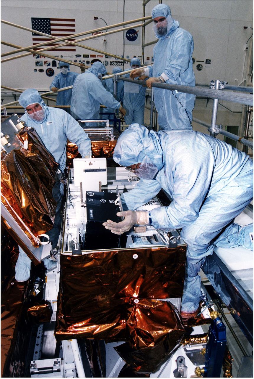
KENNEDY SPACE CENTER, FLA. - Workers in KSC's Vertical Processing Facility install a solid state recorder into a transport assembly in its protective enclosure as part of the prelaunch preparations for STS-82, the second Hubble Space Telescope servicing mission. The digital solid state recorder will replace one of three engineering/science tape recorders on Hubble. The solid state recorder has no moving parts to wear out. It also is more flexible than a reel-to-reel recorder and can store 10 times as much data. Liftoff aboard Discovery is targeted Feb. 11 with a crew of seven.
KENNEDY SPACE CENTER, FLA. - Workers in KSC's Vertical Processing Facility prepare a solid state recorder for installation in a protective enclosure as part of the prelaunch preparations for STS-82, the second Hubble Space Telescope servicing mission. The digital solid state recorder will replace one of three engineering/science tape recorders on Hubble. The solid state recorder has no moving parts to wear out. It also is more flexible than a reel-to-reel recorder and can store 10 times as much data. Liftoff aboard Discovery is targeted Feb. 11 with a crew of seven.

ISS014-E-05129 (3 Oct. 2006) --- Astronaut Michael E. Lopez-Alegria, Expedition 14 commander and NASA space station science officer, uses a computer in the Destiny laboratory of the International Space Station.

Ingenuity Mars chief pilot Håvard Grip records data of the first flight of the Ingenuity Mars Helicopter into the official pilot's logbook for the project — the "Nominal Pilot's Logbook for Planets and Moons." The image was taken at NASA's Jet Propulsion Laboratory in Southern California on April 19, 2021. Pilot logbooks are used by aviators to provide a record of their flights, including current and accumulated flight time, number and locations of takeoffs and landings, as well as unique operating conditions and certifications. https://photojournal.jpl.nasa.gov/catalog/PIA24591
KENNEDY SPACE CENTER, FLA. -- Columbia's Orbiter Experiment Support System (OEX) recorder is put on taping equipment in the KSC Launch Control Center. The recorder tape is being duplicated and will be reviewed at the Johnson Space Center in Houston and other facilities. No actual sensor data on that tape has been reviewed at this time, Search teams near Hemphill, Texas recovered the recorder, which stores sensor information about temperature, aerodynamic pressure, vibrations and other data from dozens of sensor locations on the orbiter, operating only during launch and re-entry. The OEX uses magnetic tape to record data that is not sent to the ground by telemetry.
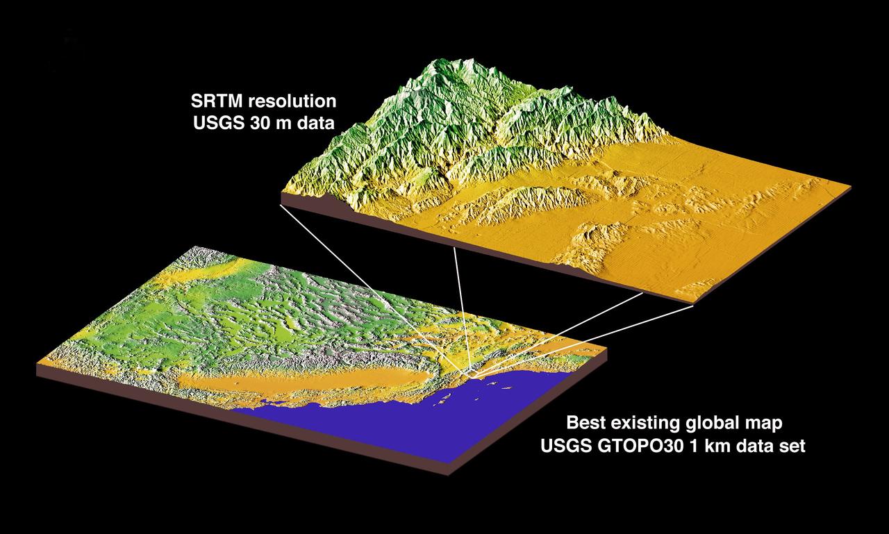
JSC2000E01552 (January 2000) --- This chart compares currently available global map data with the data which will be provided by SRTM during STS-99. The area depicted is the California coast. The SRTM mission will have approximately 1,000 scheduled data takes (every time Endeavour is over land). Data acquisition will be conducted in excess of 80 hours. The recording rate for data will be 180 Mbits/sec for C-band, 90 Mbits/sec for X-band. Total raw radar data will be approximately 9.8 terabytes (15,000 CDs). The mission will utilize some 300 high-density tapes (each tape records 30 min. of C-band, or 60 min. of X-band data).

KENNEDY SPACE CENTER, FLA. - The Orbiter Experiment Support System (OEX) recorder from Columbia is removed from the T-38 jet aircraft that brought it to KSC. Search teams near Hemphill, Texas, recovered the recorder, which stores sensor information about temperature, aerodynamic pressure, vibrations and other data from dozens of sensor locations on the orbiter, operating only during launch and re-entry. The OEX uses magnetic tape to record data that is not sent to the ground by telemetry.
KENNEDY SPACE CENTER, FLA. - The Orbiter Experiment Support System (OEX) recorder from Columbia, in protective covering, sits on the pavement after its arrival at KSC aboard a T-38 jet aircraft. Search teams near Hemphill, Texas, recovered the recorder, which stores sensor information about temperature, aerodynamic pressure, vibrations and other data from dozens of sensor locations on the orbiter, operating only during launch and re-entry. The OEX uses magnetic tape to record data that is not sent to the ground by telemetry.
KENNEDY SPACE CENTER, FLA. -- A T-38 jet aircraft carrying the Orbiter Experiment Support System (OEX) recorder from Columbia arrives at the Shuttle Landing Facility. Search teams near Hemphill, Texas, recovered the recorder, which stores sensor information about temperature, aerodynamic pressure, vibrations and other data from dozens of sensor locations on the orbiter, operating only during launch and re-entry. The OEX uses magnetic tape to record data that is not sent to the ground by telemetry.
KENNEDY SPACE CENTER, FLA. - Workers in the KSC Launch Control Center watch the taping operation involving Columbia's Orbiter Experiment Support System (OEX) recorder. After duplication the tape will be reviewed at the Johnson Space Center in Houston and other facilities. No actual sensor data on that tape has been reviewed at this time. Search teams near Hemphill, Texas recovered the recorder, which stores sensor information about temperature, aerodynamic pressure, vibrations and other data from dozens of sensor locations on the orbiter, operating only during launch and re-entry. The OEX uses magnetic tape to record data that is not sent to the ground by telemetry.
KENNEDY SPACE CENTER, FLA. - Workers in the KSC Launch Control Center look at the printout from Columbia's Orbiter Experiment Support System (OEX) recorder. After duplication the tape will be reviewed at the Johnson Space Center in Houston and other facilities. No actual sensor data on that tape has been reviewed at this time. Search teams near Hemphill, Texas recovered the recorder, which stores sensor information about temperature, aerodynamic pressure, vibrations and other data from dozens of sensor locations on the orbiter, operating only during launch and re-entry. The OEX uses magnetic tape to record data that is not sent to the ground by telemetry.
KENNEDY SPACE CENTER, FLA. - Workers in the KSC Launch Control Center look at the printout from Columbia's Orbiter Experiment Support System (OEX) recorder. After duplication the tape will be reviewed at the Johnson Space Center in Houston and other facilities. No actual sensor data on that tape has been reviewed at this time. Search teams near Hemphill, Texas recovered the recorder, which stores sensor information about temperature, aerodynamic pressure, vibrations and other data from dozens of sensor locations on the orbiter, operating only during launch and re-entry. The OEX uses magnetic tape to record data that is not sent to the ground by telemetry.

The mighty Yukon River and nearby lakes appear in red in this image produced using data recorded on June 18, 2023, by the international Surface Water and Ocean Topography (SWOT) satellite as it passed over Alaska. The satellite measures the height of nearly all the water on Earth's surface, providing one of the most detailed, comprehensive views yet of the planet's ocean and fresh water. The mission is a collaboration between NASA and the French space agency, CNES (Centre National d'Études Spatiales). SWOT will address some of the most pressing climate change questions of our time, offering insights into areas including how a warming world is accelerating Earth's water cycle, leading to more volatile precipitation patterns. SWOT will also help researchers better understand how climate change affects water storage in lakes, rivers, and reservoirs, and how communities can better manage water resources and prepare for floods and other disasters. SWOT passed over the Yukon River and recorded this data during a period called calibration and validation, when the mission confirms the accuracy of its data. Calibration involved ensuring SWOT's software and hardware – including its main scientific instrument, the Ka-band Radar Interferometer (KaRIn) and its antenna – operate as designed. During validation activities, dozens of research teams headed into the field to measure water levels and the slope of rivers, including the Yukon. Mission scientists then compared field measurements to the data taken by the satellite to ensure SWOT's accuracy. In mid-June, the team of freshwater researchers tasked with gathering data on the Yukon drifted down the waterway around midnight – the same time as SWOT passed overhead, collecting its own data on the river. Launched on Dec. 16, 2022, from Vandenberg Space Force Base in central California, SWOT is now in its operations phase, collecting data that will be used for research and other purposes. https://photojournal.jpl.nasa.gov/catalog/PIA25780

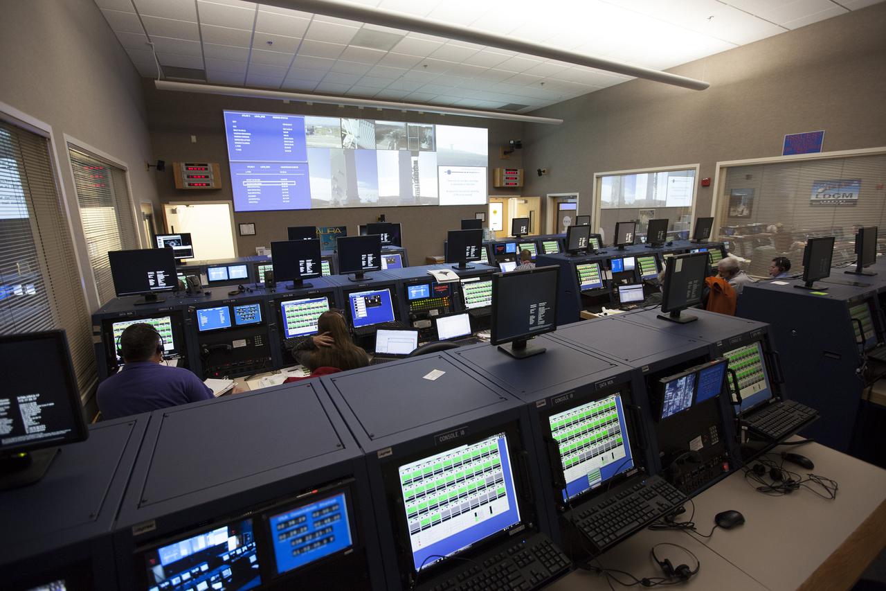
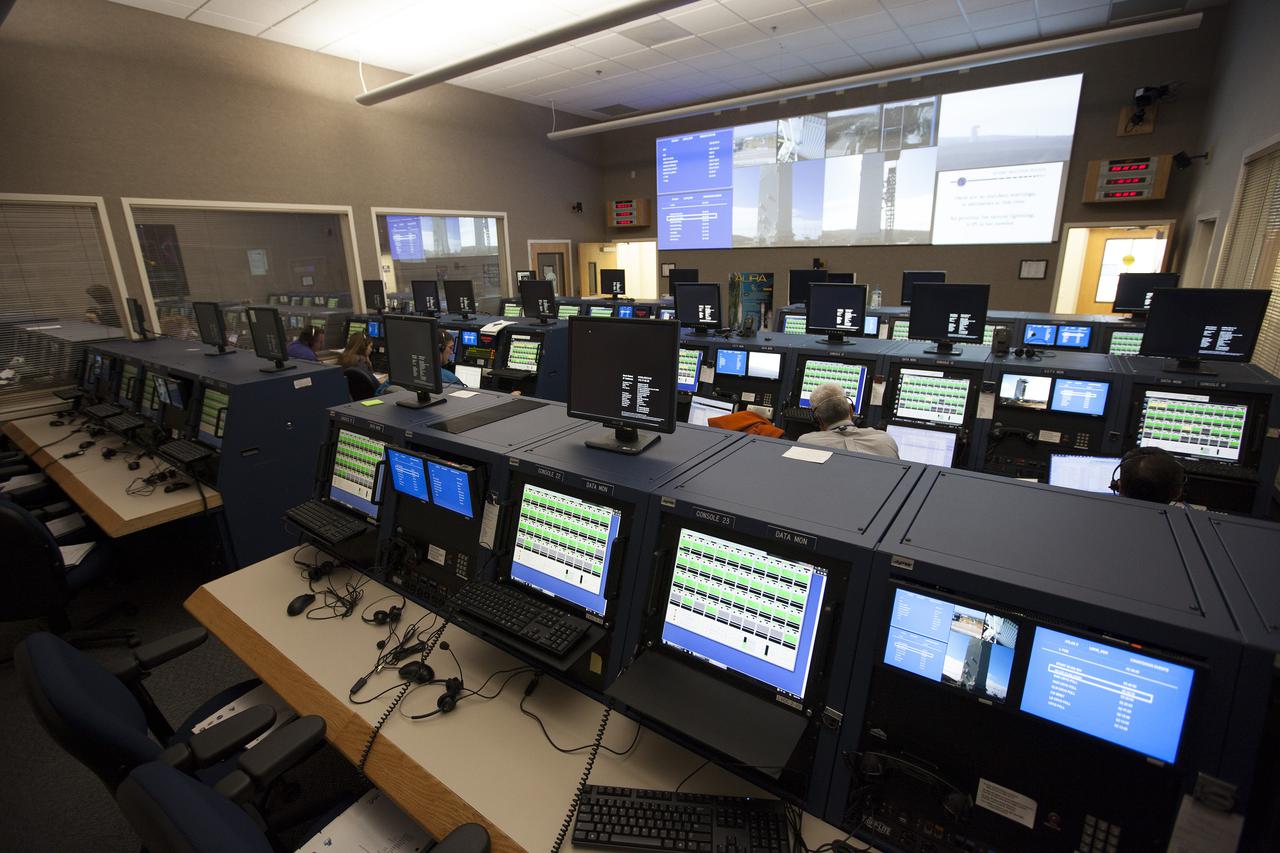
NASA Armstrong’s Mission Control Center, or MCC, is where culmination of all data-gathering occurs. Engineers, flight controllers and researchers monitor flights and missions as they are carried out. Data and video run through the MCC and are recorded, displayed and archived. Data is then processed and prepared for post-flight analysis.

KENNEDY SPACE CENTER, FLA. - The Orbiter Experiment Support System (OEX) recorder from Columbia, in protective covering, rests inside a transport vehicle after its arrival at KSC aboard a T-38 jet aircraft. Search teams near Hemphill, Texas, recovered the recorder, which stores sensor information about temperature, aerodynamic pressure, vibrations and other data from dozens of sensor locations on the orbiter, operating only during launch and re-entry. The OEX uses magnetic tape to record data that is not sent to the ground by telemetry.
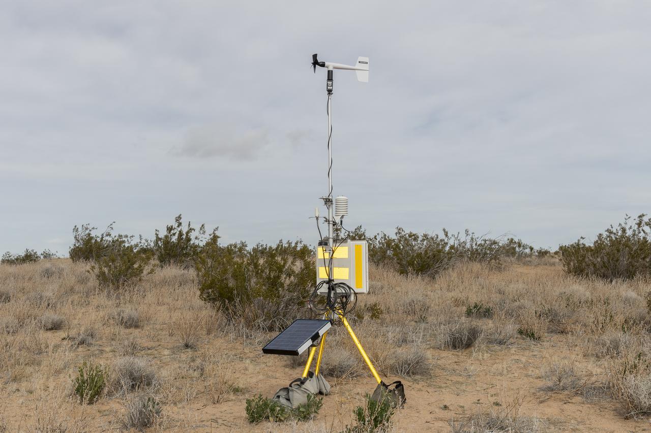
The Quesst mission recently completed testing of operations and equipment to be used in recording the sonic thumps of the X-59. Researchers used three weather towers and a sonic anemometer to collect weather and atmospheric data while recording sonic booms generated by an F-15 and an F-18 from NASA’s Armstrong Flight Research Center.
S86-30340 (4 April 1986) --- Larue Forbes of CSC prepares to put the MADS tape onto one of the central data office’s computers.

S86-30337 (4 April 1986) --- Digital data from the MADS tape is sent from Larue Forbes’ terminal to a hard copy printer in another facility at JSC.

S86-30339 (4 April 1986) --- Stan Williams (left) of Lockheed and Luther D. Palmer of NASA are pictured with the MADS tapes in JSC’s central data office.
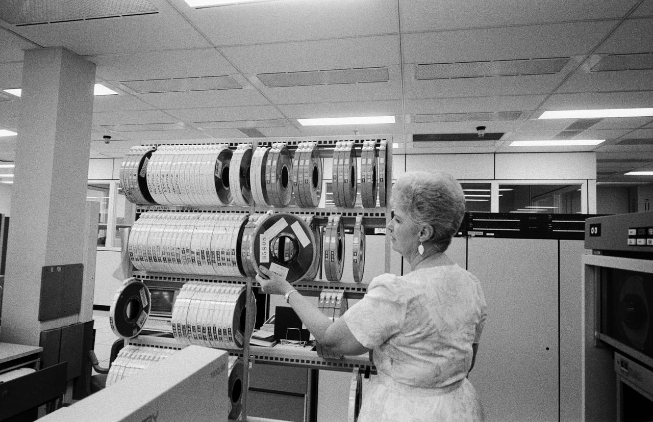
S86-30336 (4 April 1986) --- Larue Forbes of CSC retrieves one of the MADS tapes for inputting into a nearby computer in the central data office.
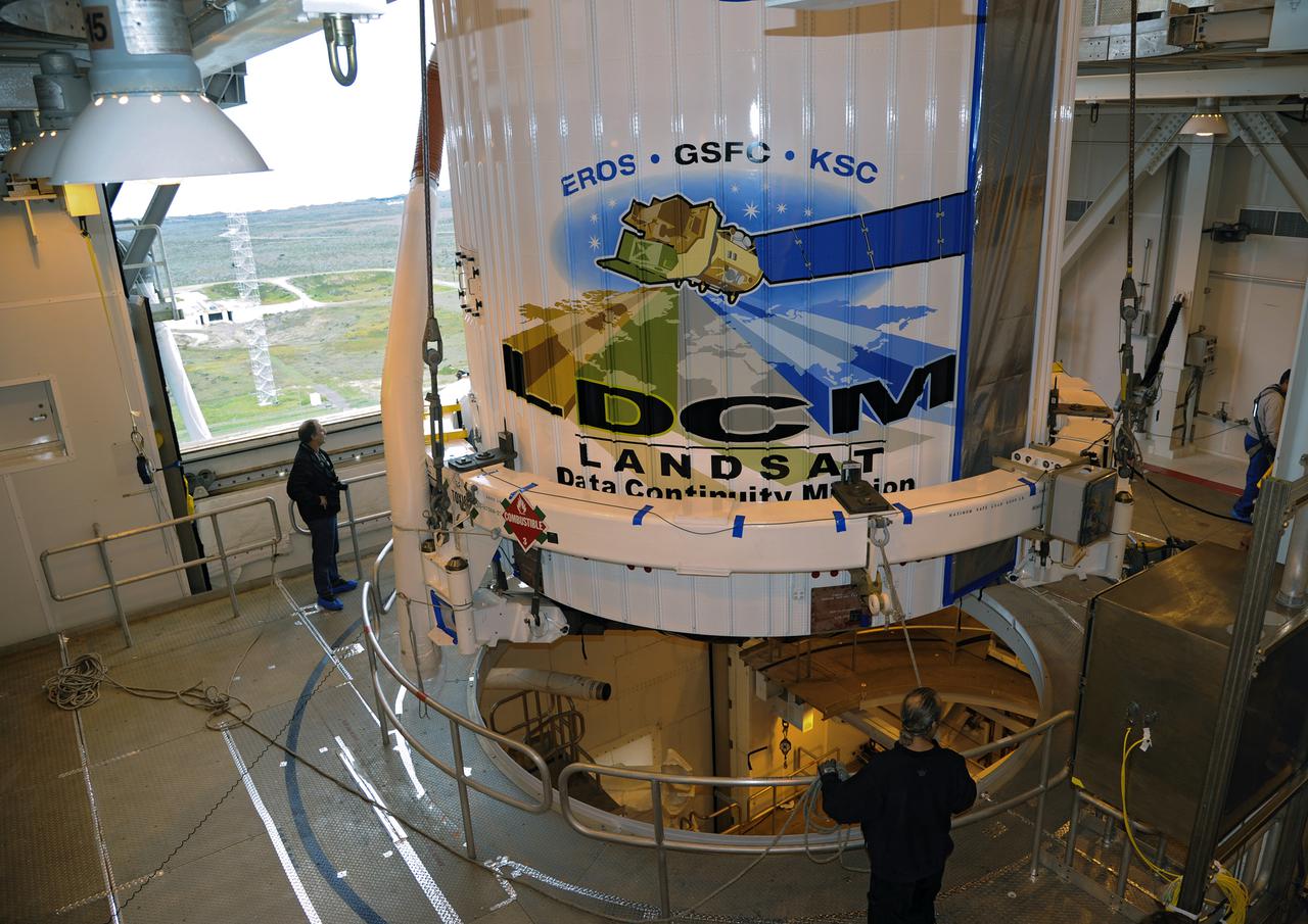
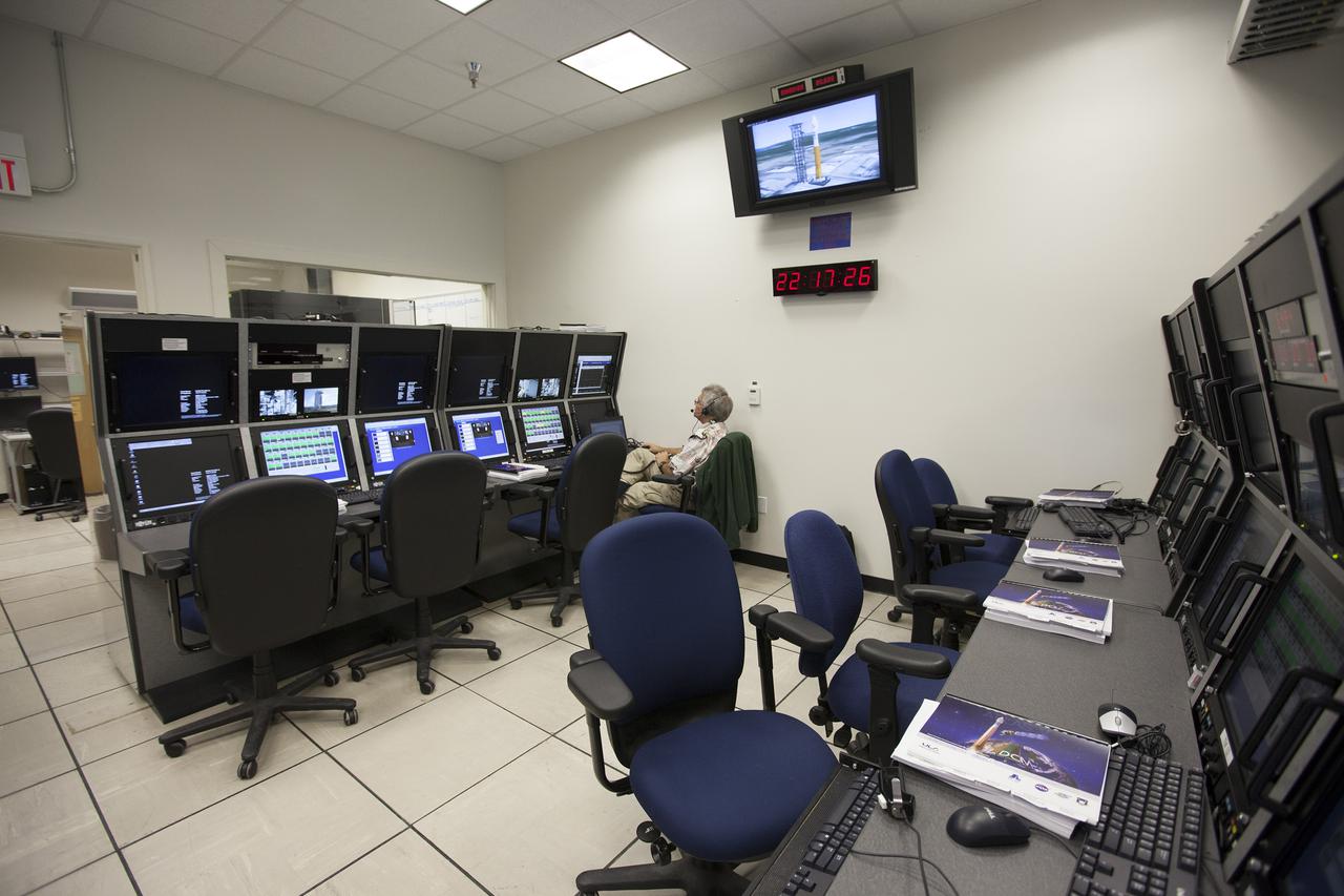
VANDENBERG AFB, Calif. -- From their consoles in the NASA Launch Vehicle Data Center at Vandenberg Air Force Base, engineers monitor the countdown for a United Launch Alliance Atlas V with the Landsat Data Continuity Mission, or LDCM, satellite prior to liftoff. The Landsat Data Continuity Mission, or LDCM, is the future of Landsat satellites. It will continue to obtain valuable data and imagery to be used in agriculture, education, business, science, and government. The Landsat Program provides repetitive acquisition of high resolution multispectral data of the Earth's surface on a global basis. The data from the Landsat spacecraft constitute the longest record of the Earth's continental surfaces as seen from space. It is a record unmatched in quality, detail, coverage, and value. Liftoff is planned for Feb. 11, 2013 aboard a United Launch Alliance Atlas V rocket. For more information, visit: http:__www.nasa.gov_mission_pages_landsat_main_index.html Photo credit: NASA_ Kim Shiflett
VANDENBERG AFB, Calif. -- From their consoles in the NASA Launch Vehicle Data Center at Vandenberg Air Force Base, engineers monitor the countdown for a United Launch Alliance Atlas V with the Landsat Data Continuity Mission, or LDCM, satellite prior to liftoff. The Landsat Data Continuity Mission, or LDCM, is the future of Landsat satellites. It will continue to obtain valuable data and imagery to be used in agriculture, education, business, science, and government. The Landsat Program provides repetitive acquisition of high resolution multispectral data of the Earth's surface on a global basis. The data from the Landsat spacecraft constitute the longest record of the Earth's continental surfaces as seen from space. It is a record unmatched in quality, detail, coverage, and value. Liftoff is planned for Feb. 11, 2013 aboard a United Launch Alliance Atlas V rocket. For more information, visit: http:__www.nasa.gov_mission_pages_landsat_main_index.html Photo credit: NASA_ Kim Shiflett
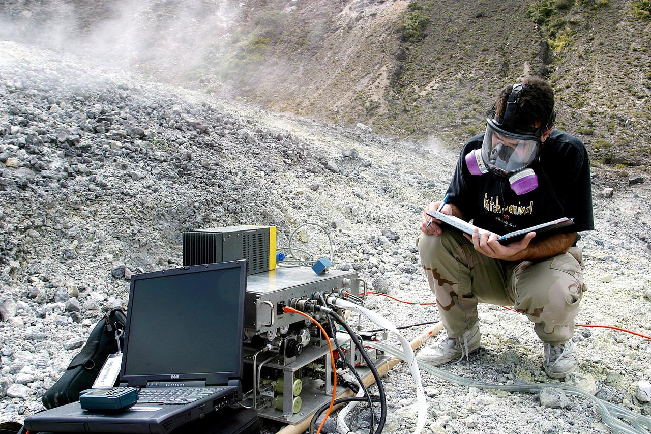
KENNEDY SPACE CENTER, FLA. - Dr. Richard Arkin records data as the hazardous gas detection system AVEMS is used to analyze the toxic gases produced by active vents, called fumaroles, in the Turrialba volcano in Costa Rica. He is using the Aircraft-based Volcanic Emission Mass Spectrometer (AVEMS) that determines the presence and concentration of various chemicals. The AVEMS system has been developed for use in the Space Shuttle program, to detect toxic gas leaks and emissions in the Shuttle’s aft compartment and the crew compartment.
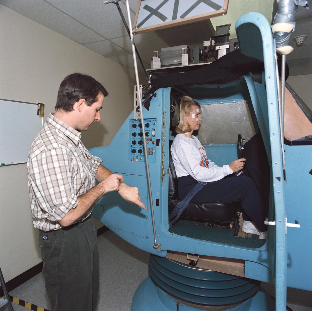
S93-45373 (29 Sept 1993) --- Astronaut Rhea Seddon, STS-58 payload commander, is in a piloting simulator as part of a pre-flight data collection project for neurovestibular functions. The seven Spacelab Life Sciences (SLS-2) crew members devoted a full day to miscellaneous biomedical data collection in preparation for next month's two week mission aboard Columbia.
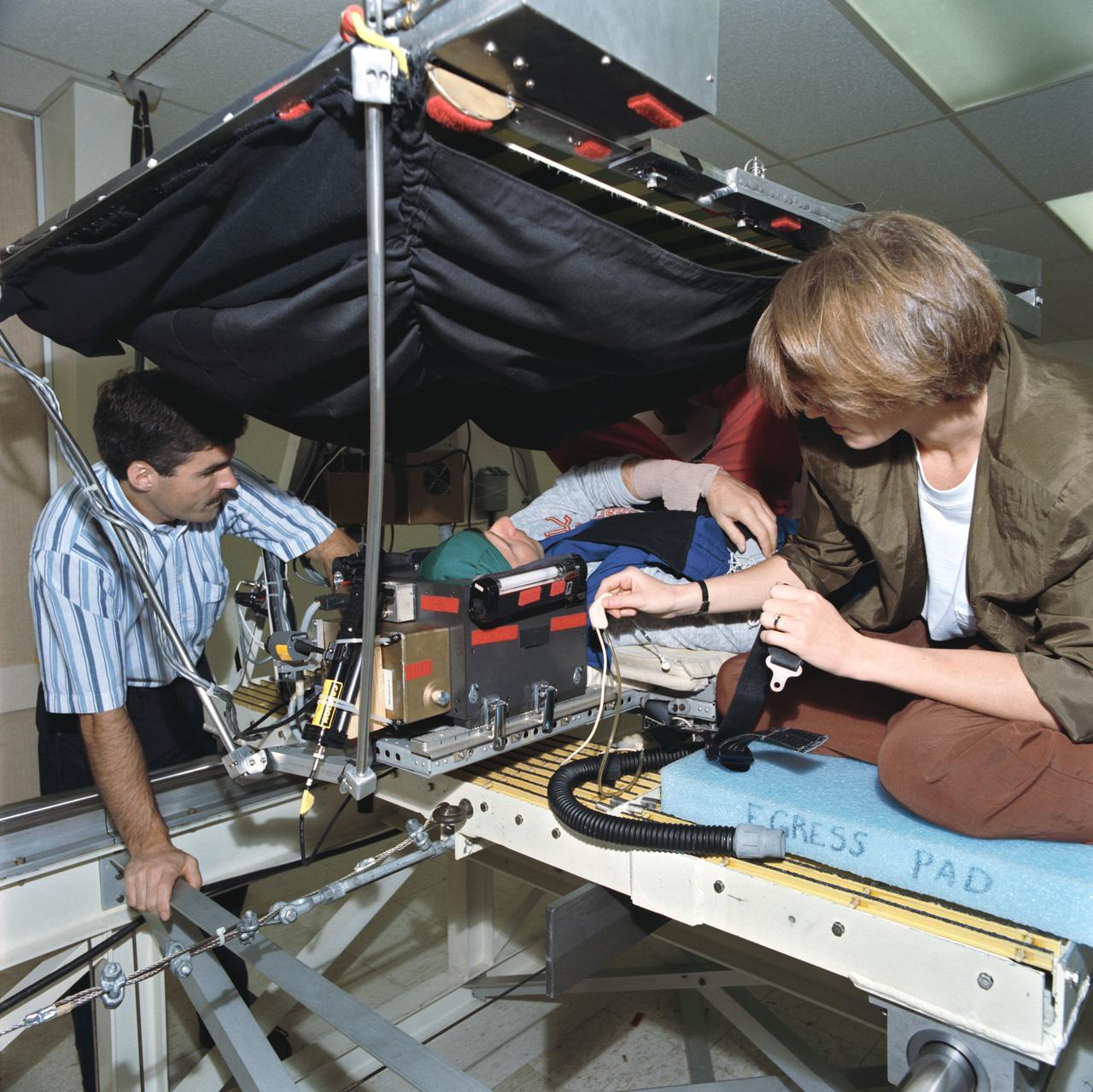
S93-45363 (29 Sept 1993) --- Payload specialist Martin J. Fettman, in an oscillating sled device, participates in a data collection project for neurovestibular functions. The seven Spacelab Life Sciences (SLS-2) crewmembers devoted a full day to miscellaneous biomedical data collection in preparation for next month's two week mission aboard Columbia.
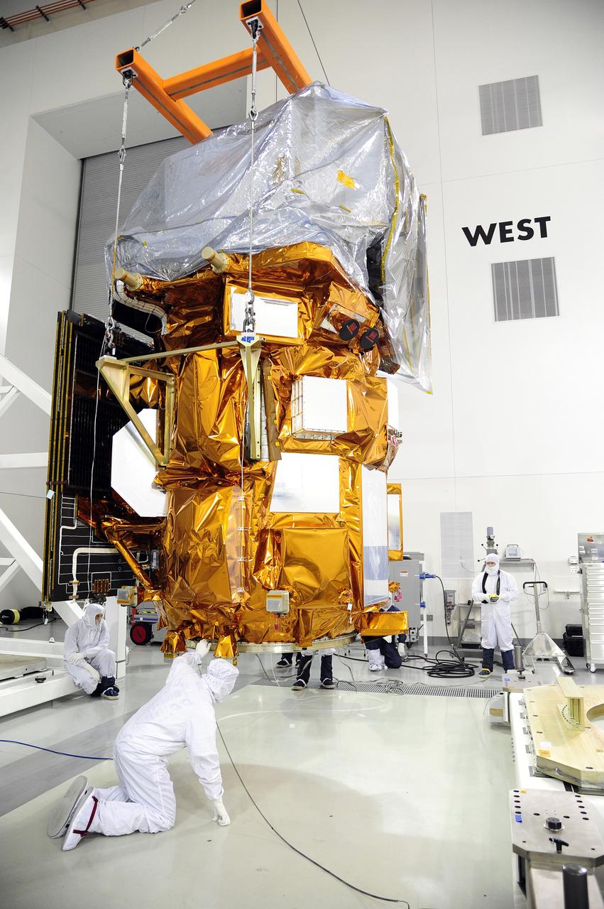
VANDENBERG AFB, Calif. -- A technician ensures no contaminants on the payload fairing or the Landsat Data Continuity Mission, or LDCM, spacecraft about to be mounted atop a United Launch Alliance Atlas V rocket at Space Launch Complex-3E at Vandenberg Air Force Base, Calif. The Landsat Data Continuity Mission LDCM is the future of Landsat satellites. It will continue to obtain valuable data and imagery to be used in agriculture, education, business, science, and government. The Landsat Program provides repetitive acquisition of high resolution multispectral data of the Earth's surface on a global basis. The data from the Landsat spacecraft constitute the longest record of the Earth's continental surfaces as seen from space. It is a record unmatched in quality, detail, coverage, and value. Liftoff is planned for Feb. 11, 2013 aboard a United Launch Alliance Atlas V rocket. For more information, visit: http:__www.nasa.gov_mission_pages_landsat_main_index.html Photo credit: NASA
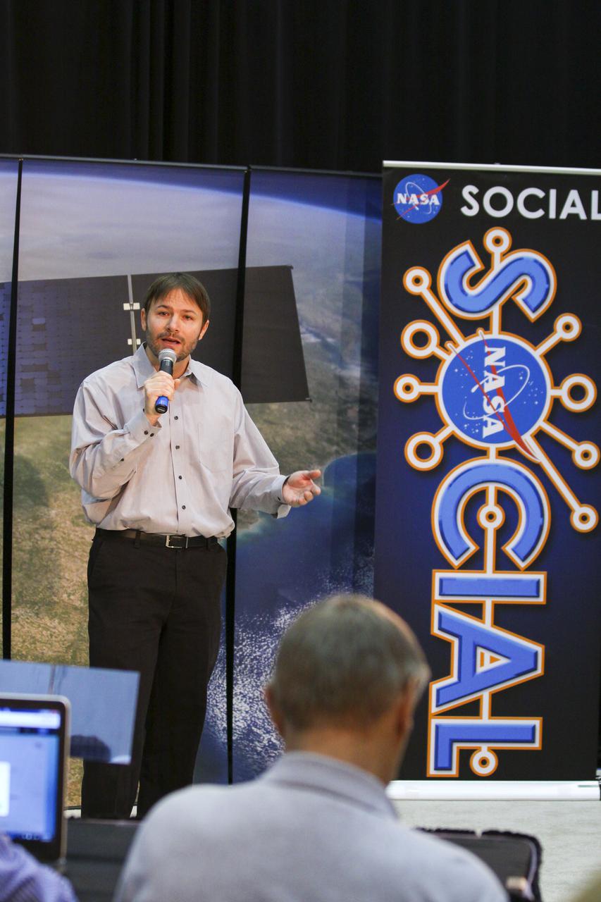
VANDENBERG AFB, Calif. -- At Space Launch Complex 3E at Vandenberg Air Force Base, Anne Castle, assistant secretary for Water and Science, U.S. Department of the Interior, discuss the Landsat Data Continuity Mission, or LDCM, satellite mission with NASA social media followers. The Landsat Data Continuity Mission LDCM is the future of Landsat satellites. It will continue to obtain valuable data and imagery to be used in agriculture, education, business, science, and government. The Landsat Program provides repetitive acquisition of high resolution multispectral data of the Earth's surface on a global basis. The data from the Landsat spacecraft constitute the longest record of the Earth's continental surfaces as seen from space. It is a record unmatched in quality, detail, coverage, and value. Liftoff is planned for Feb. 11, 2013 aboard a United Launch Alliance Atlas V rocket. For more information, visit: http:__www.nasa.gov_mission_pages_landsat_main_index.html Photo credit: NASA_Kim Shiflett
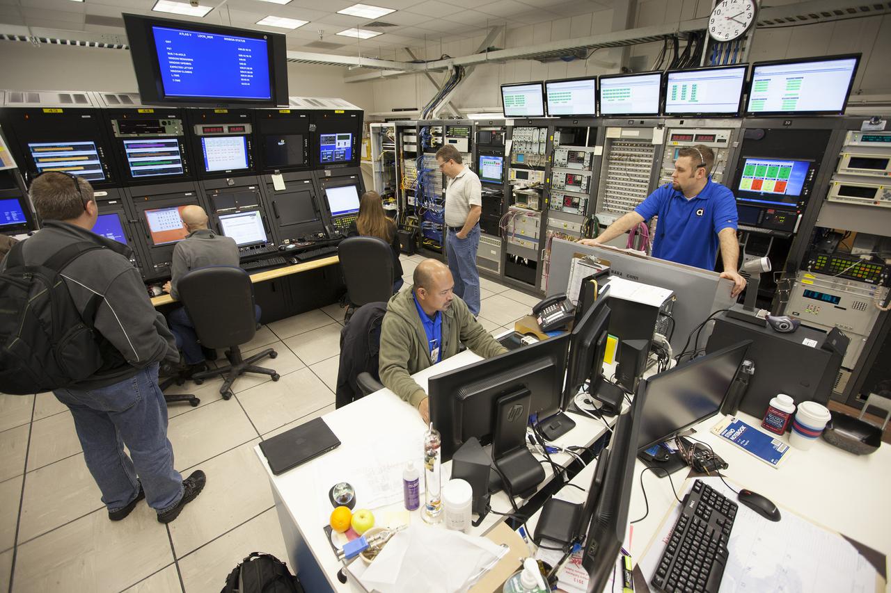
VANDENBERG AFB, Calif. -- From their positions in the telemetry laboratory at Vandenberg Air Force Base, engineers and technicians monitor the countdown for a United Launch Alliance Atlas V with the Landsat Data Continuity Mission, or LDCM, satellite prior to liftoff. The Landsat Data Continuity Mission, or LDCM, is the future of Landsat satellites. It will continue to obtain valuable data and imagery to be used in agriculture, education, business, science, and government. The Landsat Program provides repetitive acquisition of high resolution multispectral data of the Earth's surface on a global basis. The data from the Landsat spacecraft constitute the longest record of the Earth's continental surfaces as seen from space. It is a record unmatched in quality, detail, coverage, and value. Liftoff is planned for Feb. 11, 2013 aboard a United Launch Alliance Atlas V rocket. For more information, visit: http:__www.nasa.gov_mission_pages_landsat_main_index.html Photo credit: NASA_ Kim Shiflett

VANDENBERG AFB, Calif.-- Technicians monitor activity as the transport container delivering NASA's Landsat Data Continuity Mission, or LDCM, satellite is lowered to the floor at the prelaunch processing facility at Vandenberg Air Force Base, Calif. The Landsat Data Continuity Mission LDCM is the future of Landsat satellites. It will continue to obtain valuable data and imagery to be used in agriculture, education, business, science, and government. The Landsat Program provides repetitive acquisition of high resolution multispectral data of the Earth's surface on a global basis. The data from the Landsat spacecraft constitute the longest record of the Earth's continental surfaces as seen from space. It is a record unmatched in quality, detail, coverage, and value. Launch is planned for Feb. 11, 2013. For more information, visit: http://www.nasa.gov/mission_pages/landsat/main/index.html Photo credit: NASA
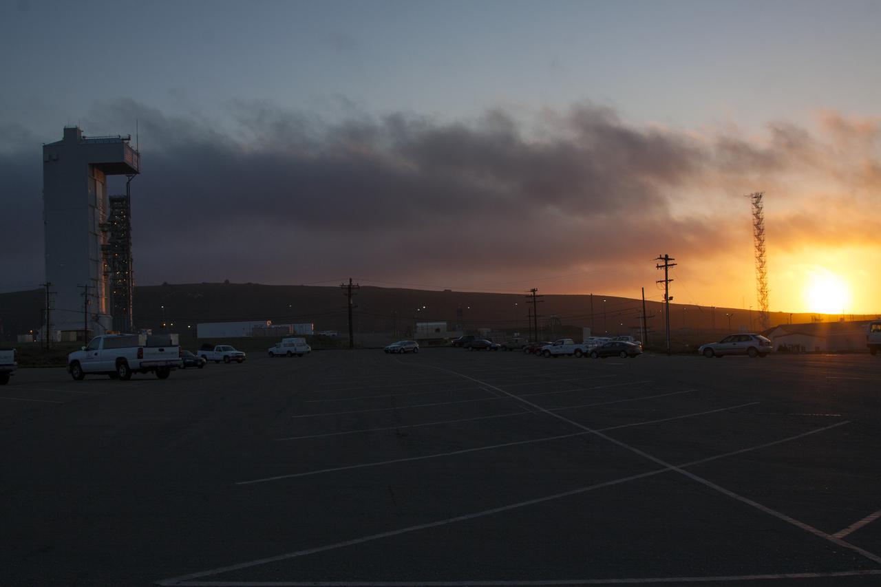
VANDENBERG AFB, Calif. -- The sun sets in the west behind Space Launch Complex 3 at Vandenberg Air Force Base where preparations continue for the launch of the Landsat Data Continuity Mission, or LDCM, satellite atop an Atlas V rocket. The Landsat Data Continuity Mission LDCM is the future of Landsat satellites. It will continue to obtain valuable data and imagery to be used in agriculture, education, business, science, and government. The Landsat Program provides repetitive acquisition of high resolution multispectral data of the Earth's surface on a global basis. The data from the Landsat spacecraft constitute the longest record of the Earth's continental surfaces as seen from space. It is a record unmatched in quality, detail, coverage, and value. Liftoff is planned for Feb. 11, 2013 aboard a United Launch Alliance Atlas V rocket. For more information, visit: http:__www.nasa.gov_mission_pages_landsat_main_index.html Photo credit: NASA_ Ben Smegelsky

VANDENBERG AFB, Calif. -- NASA social media followers at Vandenberg Air Force Base, Calif., listen to speakers describing the agency's Landsat Data Continuity Mission, or LDCM, satellite. The Landsat Data Continuity Mission LDCM is the future of Landsat satellites. It will continue to obtain valuable data and imagery to be used in agriculture, education, business, science, and government. The Landsat Program provides repetitive acquisition of high resolution multispectral data of the Earth's surface on a global basis. The data from the Landsat spacecraft constitute the longest record of the Earth's continental surfaces as seen from space. It is a record unmatched in quality, detail, coverage, and value. Liftoff is planned for Feb. 11, 2013 aboard a United Launch Alliance Atlas V rocket. For more information, visit: http:__www.nasa.gov_mission_pages_landsat_main_index.html Photo credit: NASA_Kim Shiflett
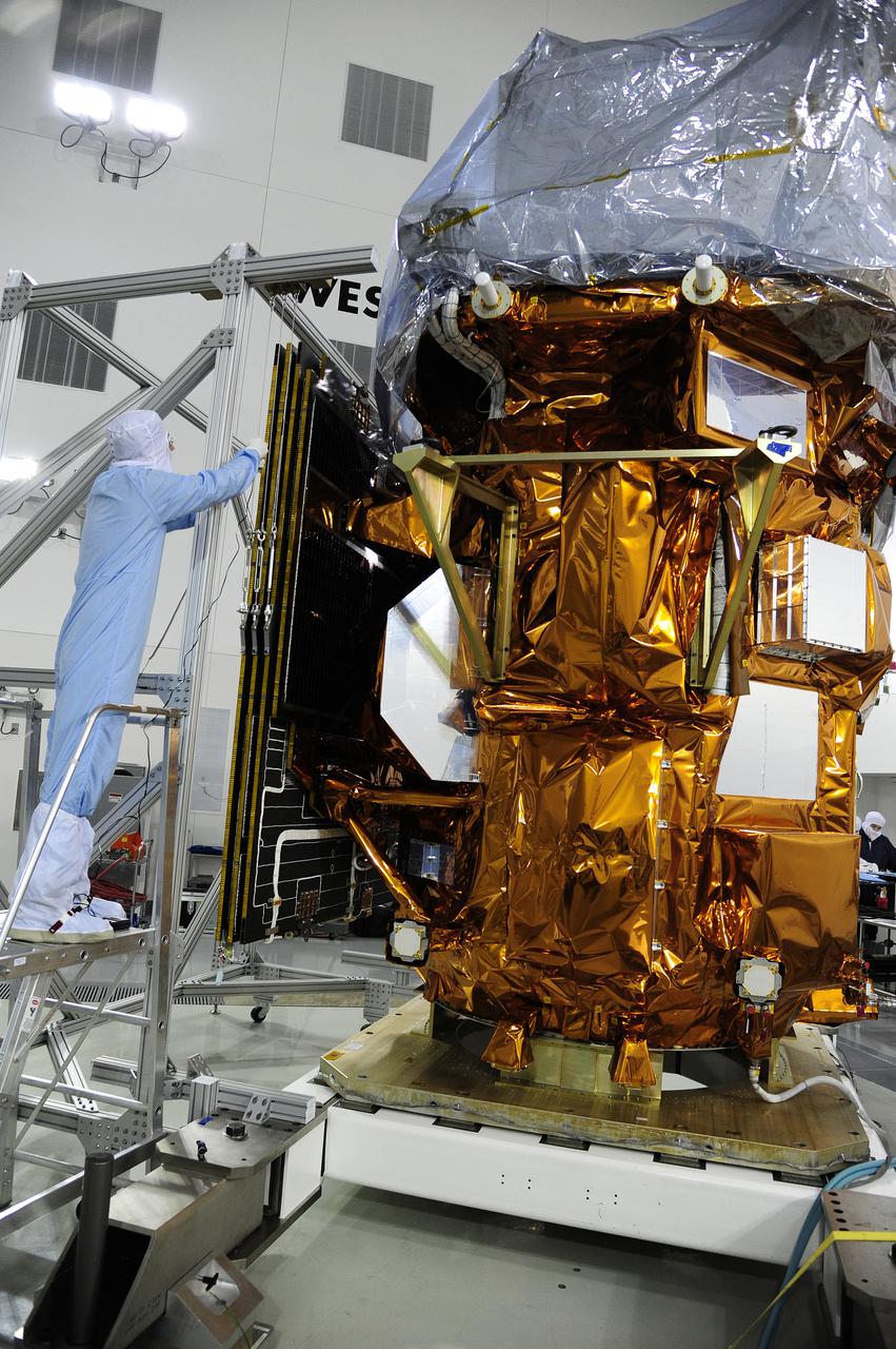
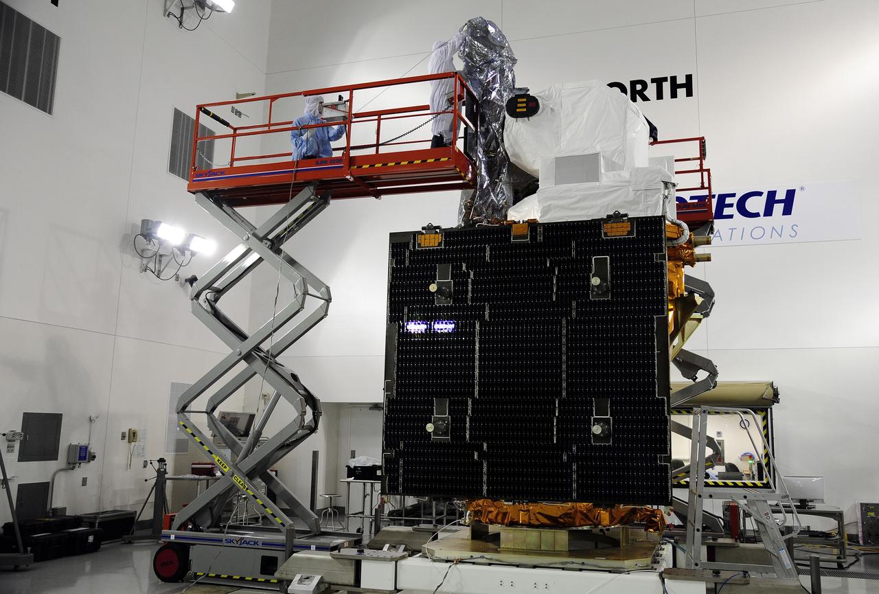
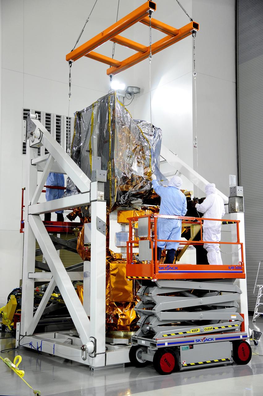
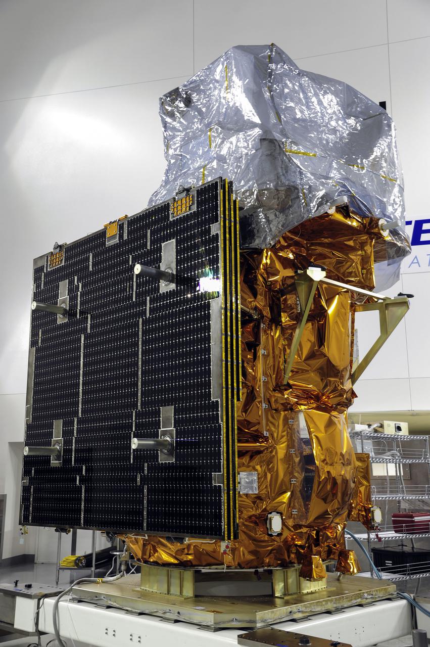
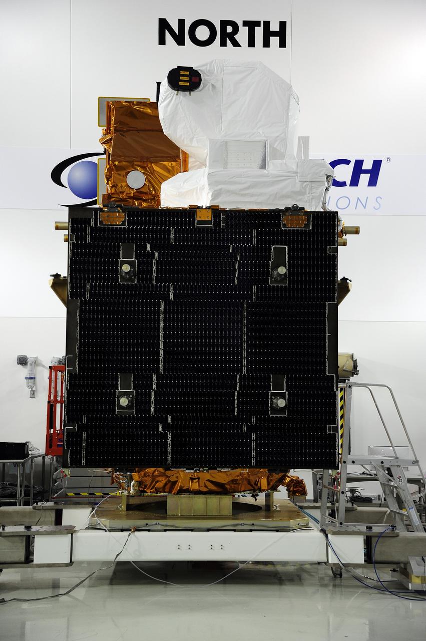
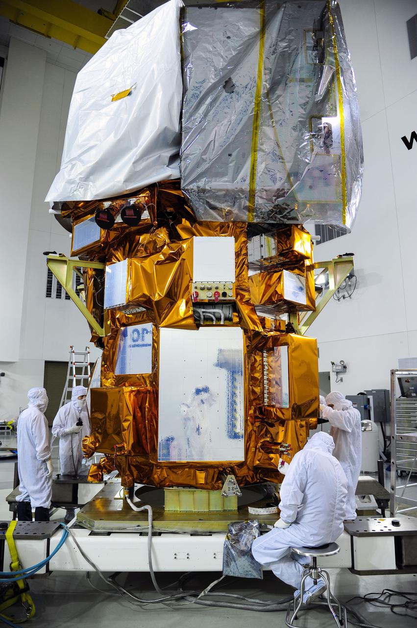
VANDENBERG AFB, Calif. -- In the Astrotech processing facility at Vandenberg Air Force Base, Calif., a technician tests the solar arrays on NASA's Landsat Data Continuity Mission, or LDCM, satellite to ensure they will deploy properly in orbit. The Landsat Data Continuity Mission LDCM is the future of Landsat satellites. It will continue to obtain valuable data and imagery to be used in agriculture, education, business, science, and government. The Landsat Program provides repetitive acquisition of high resolution multispectral data of the Earth's surface on a global basis. The data from the Landsat spacecraft constitute the longest record of the Earth's continental surfaces as seen from space. It is a record unmatched in quality, detail, coverage, and value. Liftoff is planned for Feb. 11, 2013 aboard a United Launch Alliance Atlas V rocket. For more information, visit: http:__www.nasa.gov_mission_pages_landsat_main_index.html Photo credit: NASA
VANDENBERG AFB, Calif. – The interstage booster segment is lifted onto the first stage booster of a United Launch Alliance Atlas V at the launch pad at Space Launch Complex-3E at Vandenberg Air Force Base, Calif. in preparation for the launch of the Landsat Data Continuation Mission. The Landsat Data Continuity Mission LDCM is the future of Landsat satellites. It will continue to obtain valuable data and imagery to be used in agriculture, education, business, science, and government. The Landsat Program provides repetitive acquisition of high resolution multispectral data of the Earth's surface on a global basis. The data from the Landsat spacecraft constitute the longest record of the Earth's continental surfaces as seen from space. It is a record unmatched in quality, detail, coverage, and value. Launch is planned for Feb. 2013. Photo credit: NASA/Roy Allison
VANDENBERG AFB, Calif.-- Technicians begin checkout of NASA's Landsat Data Continuity Mission, or LDCM, satellite at the Astrotech processing facility at Vandenberg Air Force Base, Calif. The Landsat Data Continuity Mission LDCM is the future of Landsat satellites. It will continue to obtain valuable data and imagery to be used in agriculture, education, business, science, and government. The Landsat Program provides repetitive acquisition of high resolution multispectral data of the Earth's surface on a global basis. The data from the Landsat spacecraft constitute the longest record of the Earth's continental surfaces as seen from space. It is a record unmatched in quality, detail, coverage, and value. Launch is planned for Feb. 11, 2013. For more information, visit: http://www.nasa.gov/mission_pages/landsat/main/index.html Photo credit: NASA
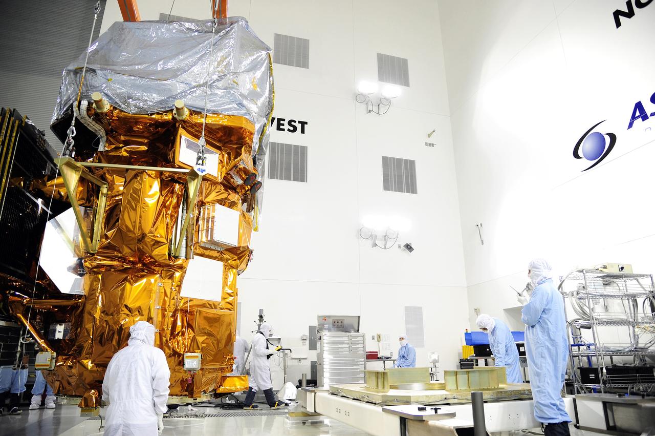
VANDENBERG AFB, Calif. -- Technicians encapsulate the NASA's Landsat Data Continuity Mission, or LDCM, satellite in its payload fairing at the Astrotech processing facility at Vandenberg Air Force Base, Calif. The Landsat Data Continuity Mission LDCM is the future of Landsat satellites. It will continue to obtain valuable data and imagery to be used in agriculture, education, business, science, and government. The Landsat Program provides repetitive acquisition of high resolution multispectral data of the Earth's surface on a global basis. The data from the Landsat spacecraft constitute the longest record of the Earth's continental surfaces as seen from space. It is a record unmatched in quality, detail, coverage, and value. Liftoff is planned for Feb. 11, 2013 aboard a United Launch Alliance Atlas V rocket. For more information, visit: http:__www.nasa.gov_mission_pages_landsat_main_index.html Photo credit: NASA
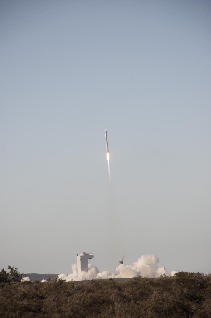
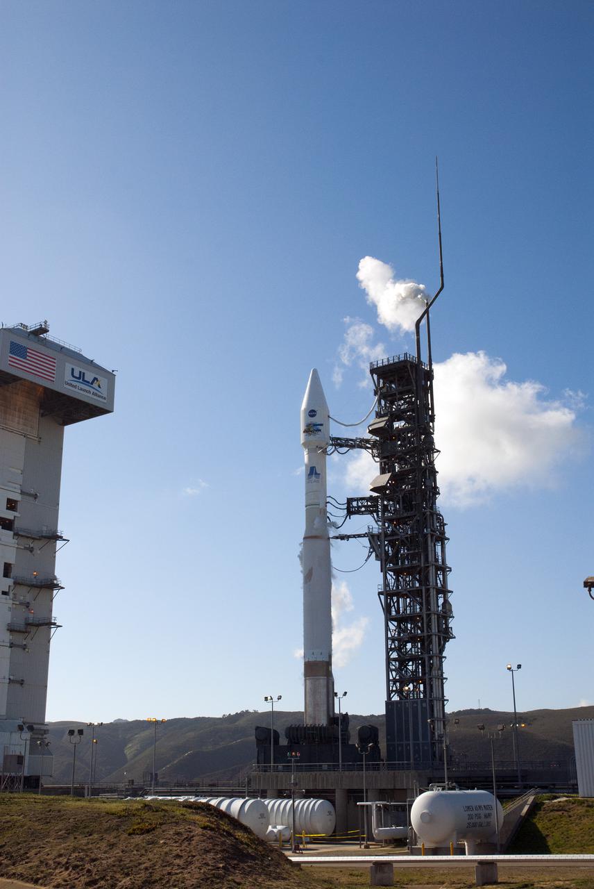
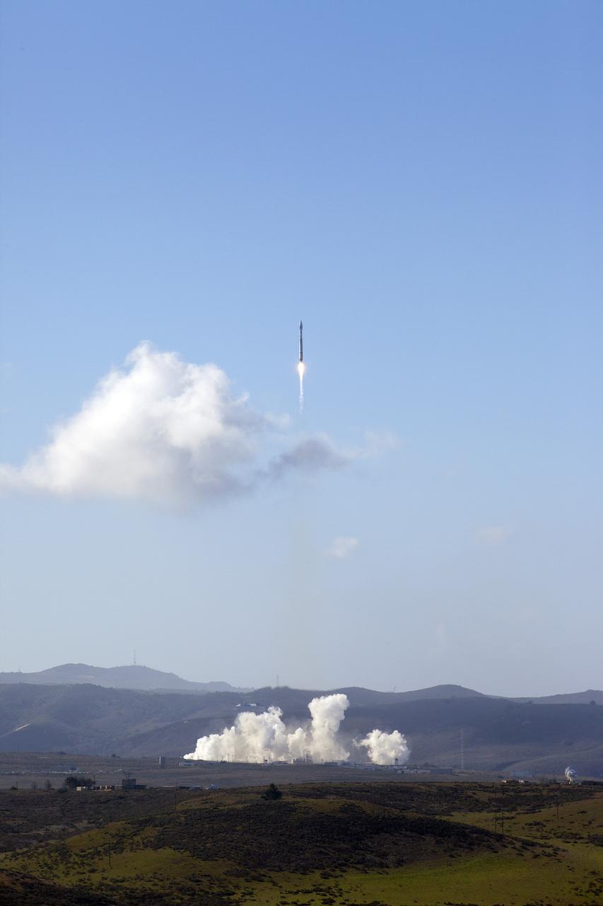
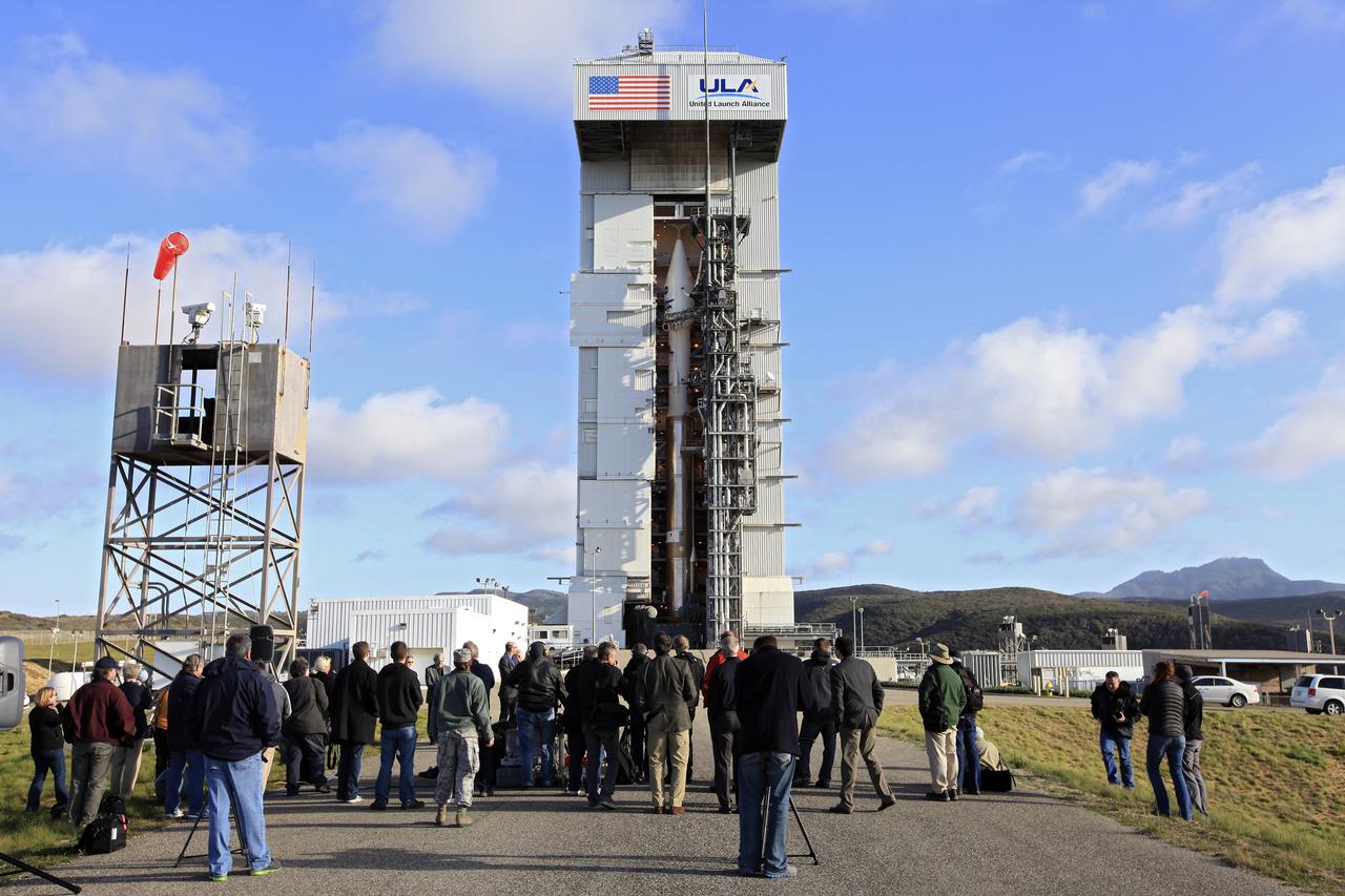
VANDENBERG AFB, Calif. -- The Landsat Data Continuity Mission spacecraft lifts off at 1:02 p.m. EST, 10:02 a.m. PST) atop a United Launch Alliance Atlas V rocket from Space Launch Complex 3 at California's Vandenberg Air Force Base. The Landsat Data Continuity Mission LDCM is the future of Landsat satellites. It will continue to obtain valuable data and imagery to be used in agriculture, education, business, science, and government. The Landsat Program provides repetitive acquisition of high resolution multispectral data of the Earth's surface on a global basis. The data from the Landsat spacecraft constitute the longest record of the Earth's continental surfaces as seen from space. It is a record unmatched in quality, detail, coverage, and value. For more information, visit: http:__www.nasa.gov_mission_pages_landsat_main_index.html Photo credit: NASA_Ben Smegelsky
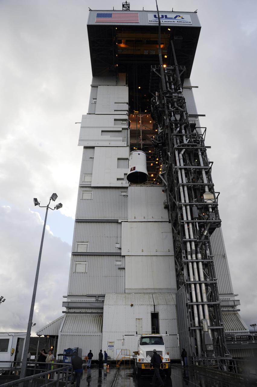
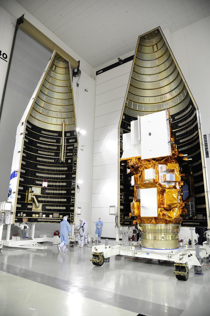
VANDENBERG AFB, Calif. -- The payload fairing containing the Landsat Data Continuity Mission, or LDCM, spacecraft has been lifted to the top of Space Launch Complex-3E at Vandenberg Air Force Base, Calif. where it is about to be mounted atop a United Launch Alliance Atlas V rocket. The Landsat Data Continuity Mission LDCM is the future of Landsat satellites. It will continue to obtain valuable data and imagery to be used in agriculture, education, business, science, and government. The Landsat Program provides repetitive acquisition of high resolution multispectral data of the Earth's surface on a global basis. The data from the Landsat spacecraft constitute the longest record of the Earth's continental surfaces as seen from space. It is a record unmatched in quality, detail, coverage, and value. Liftoff is planned for Feb. 11, 2013 aboard a United Launch Alliance Atlas V rocket. For more information, visit: http:__www.nasa.gov_mission_pages_landsat_main_index.html Photo credit: NASA
VANDENBERG AFB, Calif. -- The Landsat Data Continuity Mission spacecraft is poised for lift off atop a United Launch Alliance Atlas V rocket from Space Launch Complex 3 at California's Vandenberg Air Force Base. The Landsat Data Continuity Mission LDCM is the future of Landsat satellites. It will continue to obtain valuable data and imagery to be used in agriculture, education, business, science, and government. The Landsat Program provides repetitive acquisition of high resolution multispectral data of the Earth's surface on a global basis. The data from the Landsat spacecraft constitute the longest record of the Earth's continental surfaces as seen from space. It is a record unmatched in quality, detail, coverage, and value. For more information, visit: http:__www.nasa.gov_mission_pages_landsat_main_index.html Photo credit: NASA_Ben Smegelsky
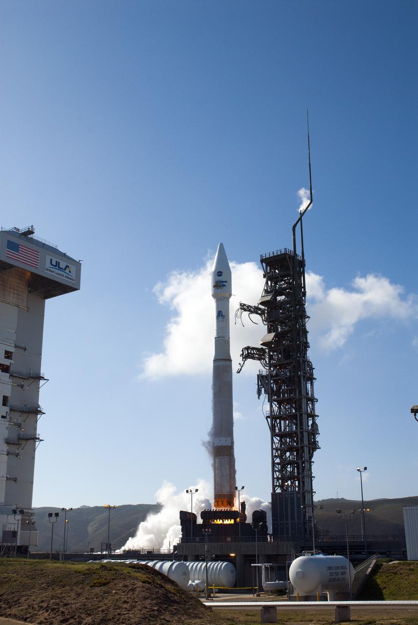
VANDENBERG AFB, Calif. -- The Landsat Data Continuity Mission spacecraft lifts off at 1:02 p.m. EST, 10:02 a.m. PST) atop a United Launch Alliance Atlas V rocket from Space Launch Complex 3 at California's Vandenberg Air Force Base. The Landsat Data Continuity Mission LDCM is the future of Landsat satellites. It will continue to obtain valuable data and imagery to be used in agriculture, education, business, science, and government. The Landsat Program provides repetitive acquisition of high resolution multispectral data of the Earth's surface on a global basis. The data from the Landsat spacecraft constitute the longest record of the Earth's continental surfaces as seen from space. It is a record unmatched in quality, detail, coverage, and value. For more information, visit: http:__www.nasa.gov_mission_pages_landsat_main_index.html Photo credit: NASA_Kim Shiflett
VANDENBERG AFB, Calif. -- The payload fairing containing the Landsat Data Continuity Mission, or LDCM, spacecraft has been lifted to the top of Space Launch Complex-3E at Vandenberg Air Force Base, Calif. where it is about to be mounted atop a United Launch Alliance Atlas V rocket. The Landsat Data Continuity Mission LDCM is the future of Landsat satellites. It will continue to obtain valuable data and imagery to be used in agriculture, education, business, science, and government. The Landsat Program provides repetitive acquisition of high resolution multispectral data of the Earth's surface on a global basis. The data from the Landsat spacecraft constitute the longest record of the Earth's continental surfaces as seen from space. It is a record unmatched in quality, detail, coverage, and value. Liftoff is planned for Feb. 11, 2013 aboard a United Launch Alliance Atlas V rocket. For more information, visit: http:__www.nasa.gov_mission_pages_landsat_main_index.html Photo credit: NASA
VANDENBERG AFB, Calif. -- The payload fairing containing the Landsat Data Continuity Mission, or LDCM, spacecraft is lifted to the top of Space Launch Complex-3E at Vandenberg Air Force Base, Calif. where it will be mounted atop a United Launch Alliance Atlas V rocket. The Landsat Data Continuity Mission LDCM is the future of Landsat satellites. It will continue to obtain valuable data and imagery to be used in agriculture, education, business, science, and government. The Landsat Program provides repetitive acquisition of high resolution multispectral data of the Earth's surface on a global basis. The data from the Landsat spacecraft constitute the longest record of the Earth's continental surfaces as seen from space. It is a record unmatched in quality, detail, coverage, and value. Liftoff is planned for Feb. 11, 2013 aboard a United Launch Alliance Atlas V rocket. For more information, visit: http:__www.nasa.gov_mission_pages_landsat_main_index.html Photo credit: NASA
VANDENBERG AFB, Calif. -- Technicians inspect NASA's Landsat Data Continuity Mission, or LDCM, satellite at the Astrotech processing facility at Vandenberg Air Force Base, Calif. The Landsat Data Continuity Mission LDCM is the future of Landsat satellites. It will continue to obtain valuable data and imagery to be used in agriculture, education, business, science, and government. The Landsat Program provides repetitive acquisition of high resolution multispectral data of the Earth's surface on a global basis. The data from the Landsat spacecraft constitute the longest record of the Earth's continental surfaces as seen from space. It is a record unmatched in quality, detail, coverage, and value. Launch is planned for Feb. 11, 2013. For more information, visit: http://www.nasa.gov/mission_pages/landsat/main/index.html Photo credit: NASA

VANDENBERG AFB, Calif. -- NASA and contractor officials discussed NASA's readiness to launch the Landsat Data Continuity Mission, or LDCM, during a prelaunch news conference at Vandenberg Air Force Base, Calif. Participants included 1st Lt. Jennifer Kelley, launch weather officer for the 30th Operations Support Squadron at Vandenberg. The Landsat Data Continuity Mission LDCM is the future of Landsat satellites. It will continue to obtain valuable data and imagery to be used in agriculture, education, business, science, and government. The Landsat Program provides repetitive acquisition of high resolution multispectral data of the Earth's surface on a global basis. The data from the Landsat spacecraft constitute the longest record of the Earth's continental surfaces as seen from space. It is a record unmatched in quality, detail, coverage, and value. Liftoff is planned for Feb. 11, 2013 aboard a United Launch Alliance Atlas V rocket. For more information, visit: http:__www.nasa.gov_mission_pages_landsat_main_index.html Photo credit: NASA_Kim Shiflett
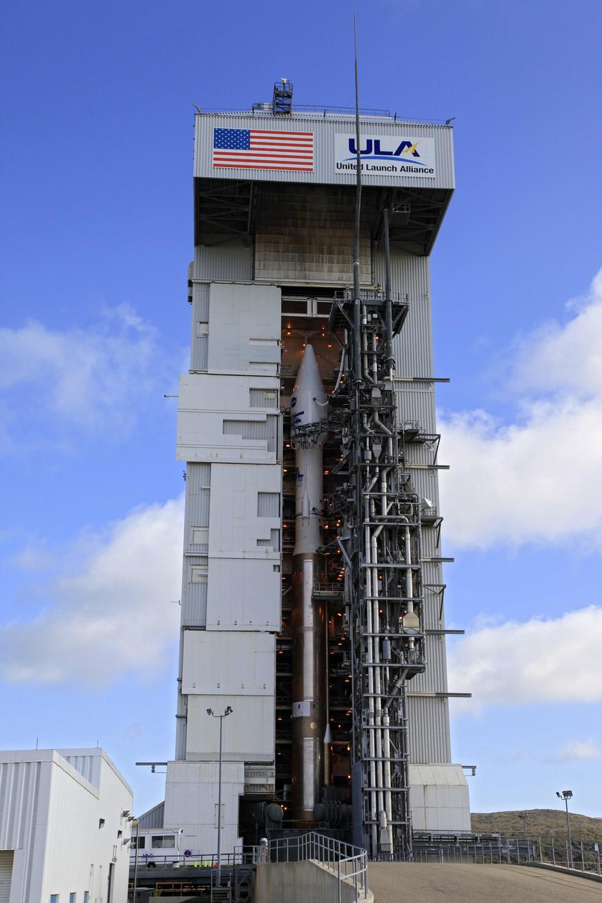
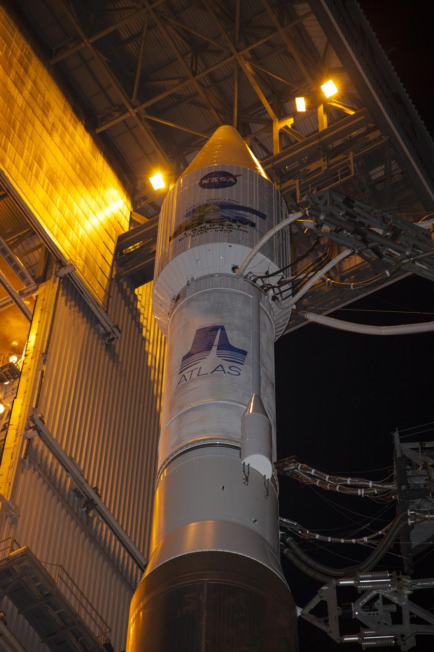
VANDENBERG AFB, Calif. -- At Vandenberg Air Force Base, Calif., NASA's Landsat Data Continuity Mission, or LDCM, satellite is mounted atop a United Launch Alliance Atlas V rocket in the gantry at Space Launch Complex 3E. The Landsat Data Continuity Mission LDCM is the future of Landsat satellites. It will continue to obtain valuable data and imagery to be used in agriculture, education, business, science, and government. The Landsat Program provides repetitive acquisition of high resolution multispectral data of the Earth's surface on a global basis. The data from the Landsat spacecraft constitute the longest record of the Earth's continental surfaces as seen from space. It is a record unmatched in quality, detail, coverage, and value. Liftoff is planned for Feb. 11, 2013 aboard a United Launch Alliance Atlas V rocket. For more information, visit: http://www.nasa.gov/mission_pages/landsat/main/index.html Photo credit: NASA/Kim Shiflett
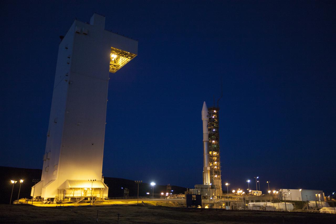
VANDENBERG AFB, Calif. -- At Vandenberg Air Force Base, Calif., the gantry at Space Launch Complex 3E rolls back from NASA's Landsat Data Continuity Mission, or LDCM, satellite mounted atop a United Launch Alliance Atlas V rocket. The Landsat Data Continuity Mission LDCM is the future of Landsat satellites. It will continue to obtain valuable data and imagery to be used in agriculture, education, business, science, and government. The Landsat Program provides repetitive acquisition of high resolution multispectral data of the Earth's surface on a global basis. The data from the Landsat spacecraft constitute the longest record of the Earth's continental surfaces as seen from space. It is a record unmatched in quality, detail, coverage, and value. Liftoff is planned for Feb. 11, 2013 aboard a United Launch Alliance Atlas V rocket. For more information, visit: http:__www.nasa.gov_mission_pages_landsat_main_index.html Photo credit: NASA_Kim Shiflett
VANDENBERG AFB, Calif. -- At the Astrotech processing facility at Vandenberg Air Force Base, Calif., technicians perform close-out inspections on NASA's Landsat Data Continuity Mission, or LDCM, satellite. The Landsat Data Continuity Mission LDCM is the future of Landsat satellites. It will continue to obtain valuable data and imagery to be used in agriculture, education, business, science, and government. The Landsat Program provides repetitive acquisition of high resolution multispectral data of the Earth's surface on a global basis. The data from the Landsat spacecraft constitute the longest record of the Earth's continental surfaces as seen from space. It is a record unmatched in quality, detail, coverage, and value. Liftoff is planned for Feb. 11, 2013 aboard a United Launch Alliance Atlas V rocket. For more information, visit: http:__www.nasa.gov_mission_pages_landsat_main_index.html Photo credit: NASA

VANDENBERG AFB, Calif. -- George Diller of NASA Public Affairs moderated a prelaunch news conference at Vandenberg Air Force Base, Calif. during which NASA and contractor officials discussed NASA's readiness to launch the Landsat Data Continuity Mission, or LDCM. The Landsat Data Continuity Mission LDCM is the future of Landsat satellites. It will continue to obtain valuable data and imagery to be used in agriculture, education, business, science, and government. The Landsat Program provides repetitive acquisition of high resolution multispectral data of the Earth's surface on a global basis. The data from the Landsat spacecraft constitute the longest record of the Earth's continental surfaces as seen from space. It is a record unmatched in quality, detail, coverage, and value. Liftoff is planned for Feb. 11, 2013 aboard a United Launch Alliance Atlas V rocket. For more information, visit: http:__www.nasa.gov_mission_pages_landsat_main_index.html Photo credit: NASA_Kim Shiflett
VANDENBERG AFB, Calif. -- At Space Launch Complex 3E at Vandenberg Air Force Base, Kennedy Space Center Director Bob Cabana discusses the Landsat Data Continuity Mission, or LDCM, satellite mission with NASA social media followers. The Landsat Data Continuity Mission LDCM is the future of Landsat satellites. It will continue to obtain valuable data and imagery to be used in agriculture, education, business, science, and government. The Landsat Program provides repetitive acquisition of high resolution multispectral data of the Earth's surface on a global basis. The data from the Landsat spacecraft constitute the longest record of the Earth's continental surfaces as seen from space. It is a record unmatched in quality, detail, coverage, and value. Liftoff is planned for Feb. 11, 2013 aboard a United Launch Alliance Atlas V rocket. For more information, visit: http:__www.nasa.gov_mission_pages_landsat_main_index.html Photo credit: NASA_Kim Shiflett
VANDENBERG AFB, Calif. – Technicians perform thermal blanket closeouts on the fuel servicing valves on the Landsat Data Continuity Mission, or LDCM, spacecraft in the Astrotech processing facility at Vandenberg Air Force Base in Calif., following fueling operations. The Landsat Data Continuity Mission is the future of Landsat satellites. It will continue to obtain valuable data and imagery to be used in agriculture, education, business, science, and government. The Landsat Program provides repetitive acquisition of high resolution multispectral data of the Earth's surface on a global basis. The data from the Landsat spacecraft constitute the longest record of the Earth's continental surfaces as seen from space. It is a record unmatched in quality, detail, coverage, and value. Launch is planned for Feb. 11, 2013. For more information, visit: http://www.nasa.gov/mission_pages/landsat/main/index.html Photo credit: VAFB
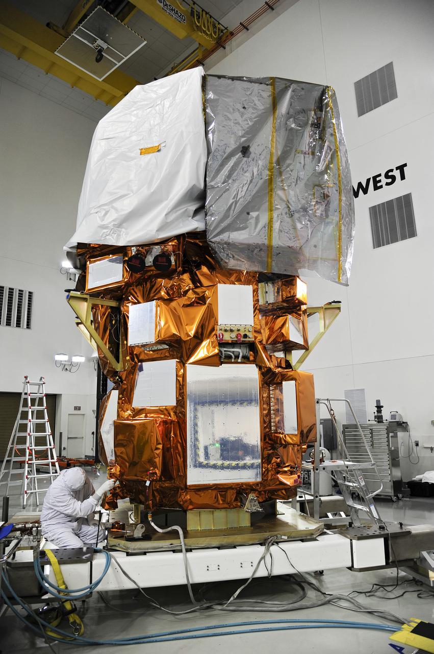
VANDENBERG AFB, Calif. -- At the Astrotech processing facility at Vandenberg Air Force Base, Calif., NASA's Landsat Data Continuity Mission, or LDCM, satellite is undergoing close-outs prior to encapsulation in the payload fairing. The Landsat Data Continuity Mission LDCM is the future of Landsat satellites. It will continue to obtain valuable data and imagery to be used in agriculture, education, business, science, and government. The Landsat Program provides repetitive acquisition of high resolution multispectral data of the Earth's surface on a global basis. The data from the Landsat spacecraft constitute the longest record of the Earth's continental surfaces as seen from space. It is a record unmatched in quality, detail, coverage, and value. Liftoff is planned for Feb. 11, 2013 aboard a United Launch Alliance Atlas V rocket. For more information, visit: http:__www.nasa.gov_mission_pages_landsat_main_index.html Photo credit: NASA
VANDENBERG AFB, Calif. -- From their positions in the telemetry laboratory at Vandenberg Air Force Base, engineers and technicians monitor the countdown for a United Launch Alliance Atlas V with the Landsat Data Continuity Mission, or LDCM, satellite prior to liftoff. The Landsat Data Continuity Mission, or LDCM, is the future of Landsat satellites. It will continue to obtain valuable data and imagery to be used in agriculture, education, business, science, and government. The Landsat Program provides repetitive acquisition of high resolution multispectral data of the Earth's surface on a global basis. The data from the Landsat spacecraft constitute the longest record of the Earth's continental surfaces as seen from space. It is a record unmatched in quality, detail, coverage, and value. Liftoff is planned for Feb. 11, 2013 aboard a United Launch Alliance Atlas V rocket. For more information, visit: http:__www.nasa.gov_mission_pages_landsat_main_index.html Photo credit: NASA_ Kim Shiflett
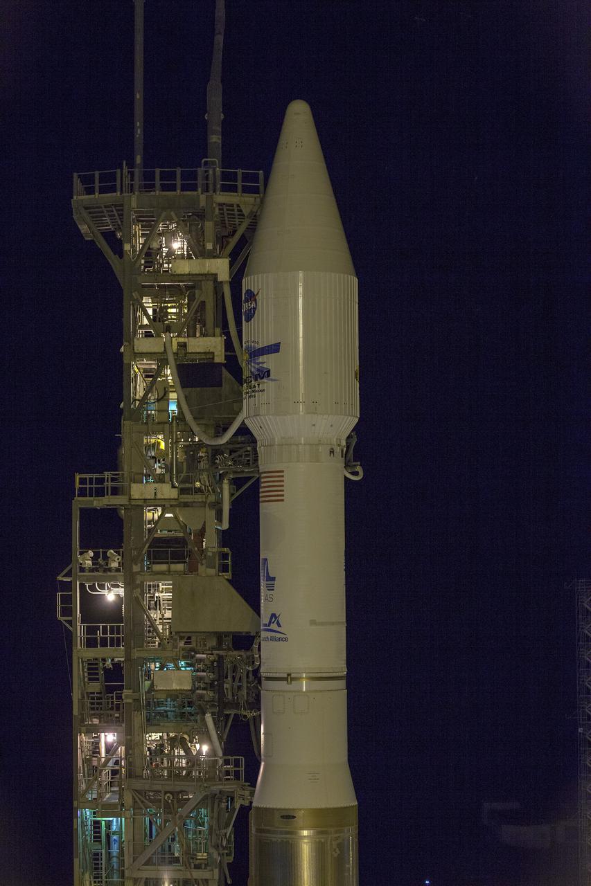
VANDENBERG AFB, Calif. -- At Vandenberg Air Force Base, Calif., NASA's Landsat Data Continuity Mission, or LDCM, satellite is mounted atop a United Launch Alliance Atlas V rocket at Space Launch Complex 3E. The Landsat Data Continuity Mission LDCM is the future of Landsat satellites. It will continue to obtain valuable data and imagery to be used in agriculture, education, business, science, and government. The Landsat Program provides repetitive acquisition of high resolution multispectral data of the Earth's surface on a global basis. The data from the Landsat spacecraft constitute the longest record of the Earth's continental surfaces as seen from space. It is a record unmatched in quality, detail, coverage, and value. Liftoff is planned for Feb. 11, 2013 aboard a United Launch Alliance Atlas V rocket. For more information, visit: http:__www.nasa.gov_mission_pages_landsat_main_index.html Photo credit: NASA_Kim Shiflett

VANDENBERG AFB, Calif. -- NASA and contractor officials discussed NASA's readiness to launch the Landsat Data Continuity Mission, or LDCM, during a prelaunch news conference at Vandenberg Air Force Base, Calif. Participants included LDCM program executive David Jarrett from NASA Headquarters. The Landsat Data Continuity Mission LDCM is the future of Landsat satellites. It will continue to obtain valuable data and imagery to be used in agriculture, education, business, science, and government. The Landsat Program provides repetitive acquisition of high resolution multispectral data of the Earth's surface on a global basis. The data from the Landsat spacecraft constitute the longest record of the Earth's continental surfaces as seen from space. It is a record unmatched in quality, detail, coverage, and value. Liftoff is planned for Feb. 11, 2013 aboard a United Launch Alliance Atlas V rocket. For more information, visit: http:__www.nasa.gov_mission_pages_landsat_main_index.html Photo credit: NASA_Kim Shiflett
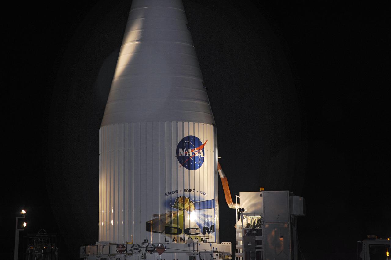
VANDENBERG AFB, Calif. -- The payload fairing containing the Landsat Data Continuity Mission, or LDCM, spacecraft is mounted atop a United Launch Alliance Atlas V rocket at Space Launch Complex-3E at Vandenberg Air Force Base, Calif. The Landsat Data Continuity Mission LDCM is the future of Landsat satellites. It will continue to obtain valuable data and imagery to be used in agriculture, education, business, science, and government. The Landsat Program provides repetitive acquisition of high resolution multispectral data of the Earth's surface on a global basis. The data from the Landsat spacecraft constitute the longest record of the Earth's continental surfaces as seen from space. It is a record unmatched in quality, detail, coverage, and value. Liftoff is planned for Feb. 11, 2013 aboard a United Launch Alliance Atlas V rocket. For more information, visit: http:__www.nasa.gov_mission_pages_landsat_main_index.html Photo credit: NASA
VANDENBERG AFB, Calif. -- John Yembrick, social media manager for NASA, speaks to NASA social media followers at Vandenberg Air Force Base, Calif., prior to the launch of the agency's Landsat Data Continuity Mission, or LDCM, satellite. The Landsat Data Continuity Mission LDCM is the future of Landsat satellites. It will continue to obtain valuable data and imagery to be used in agriculture, education, business, science, and government. The Landsat Program provides repetitive acquisition of high resolution multispectral data of the Earth's surface on a global basis. The data from the Landsat spacecraft constitute the longest record of the Earth's continental surfaces as seen from space. It is a record unmatched in quality, detail, coverage, and value. Liftoff is planned for Feb. 11, 2013 aboard a United Launch Alliance Atlas V rocket. For more information, visit: http:__www.nasa.gov_mission_pages_landsat_main_index.html Photo credit: NASA_Kim Shiflett
VANDENBERG AFB, Calif.-- Technicians unload NASA's Landsat Data Continuity Mission, or LDCM, satellite at the Astrotech processing facility at Vandenberg Air Force Base, Calif. The Landsat Data Continuity Mission LDCM is the future of Landsat satellites. It will continue to obtain valuable data and imagery to be used in agriculture, education, business, science, and government. The Landsat Program provides repetitive acquisition of high resolution multispectral data of the Earth's surface on a global basis. The data from the Landsat spacecraft constitute the longest record of the Earth's continental surfaces as seen from space. It is a record unmatched in quality, detail, coverage, and value. Launch is planned for Feb. 11, 2013. For more information, visit: http://www.nasa.gov/mission_pages/landsat/main/index.html Photo credit: NASA
VANDENBERG AFB, Calif. -- At the Astrotech processing facility at Vandenberg Air Force Base, Calif., technicians perform close-out inspections on NASA's Landsat Data Continuity Mission, or LDCM, satellite. The Landsat Data Continuity Mission LDCM is the future of Landsat satellites. It will continue to obtain valuable data and imagery to be used in agriculture, education, business, science, and government. The Landsat Program provides repetitive acquisition of high resolution multispectral data of the Earth's surface on a global basis. The data from the Landsat spacecraft constitute the longest record of the Earth's continental surfaces as seen from space. It is a record unmatched in quality, detail, coverage, and value. Liftoff is planned for Feb. 11, 2013 aboard a United Launch Alliance Atlas V rocket. For more information, visit: http:__www.nasa.gov_mission_pages_landsat_main_index.html Photo credit: NASA
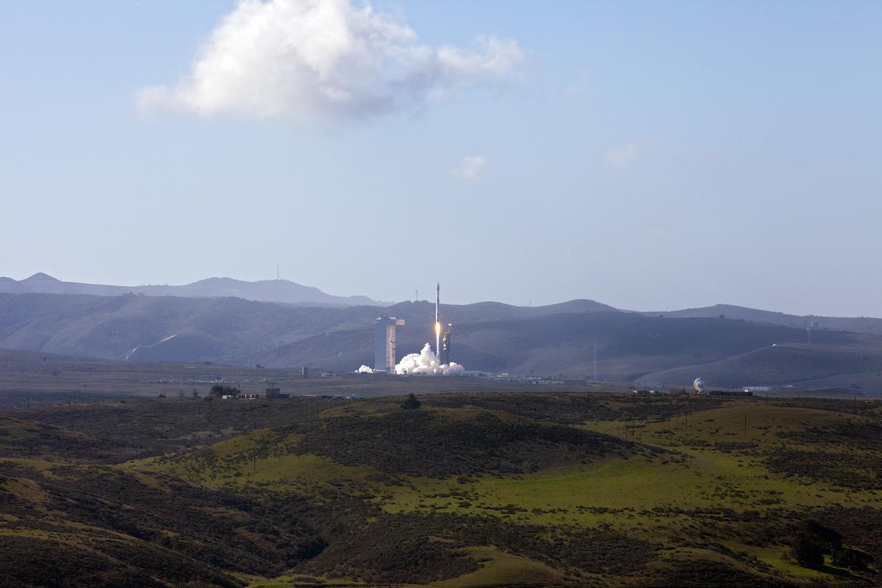
VANDENBERG AFB, Calif. -- The Landsat Data Continuity Mission spacecraft lifted off at 1:02 p.m. EST, 10:02 a.m. PST) atop a United Launch Alliance Atlas V rocket from Space Launch Complex 3 at California's Vandenberg Air Force Base. The Landsat Data Continuity Mission LDCM is the future of Landsat satellites. It will continue to obtain valuable data and imagery to be used in agriculture, education, business, science, and government. The Landsat Program provides repetitive acquisition of high resolution multispectral data of the Earth's surface on a global basis. The data from the Landsat spacecraft constitute the longest record of the Earth's continental surfaces as seen from space. It is a record unmatched in quality, detail, coverage, and value. For more information, visit: http:__www.nasa.gov_mission_pages_landsat_main_index.html Photo credit: NASA_Kim Shiflett
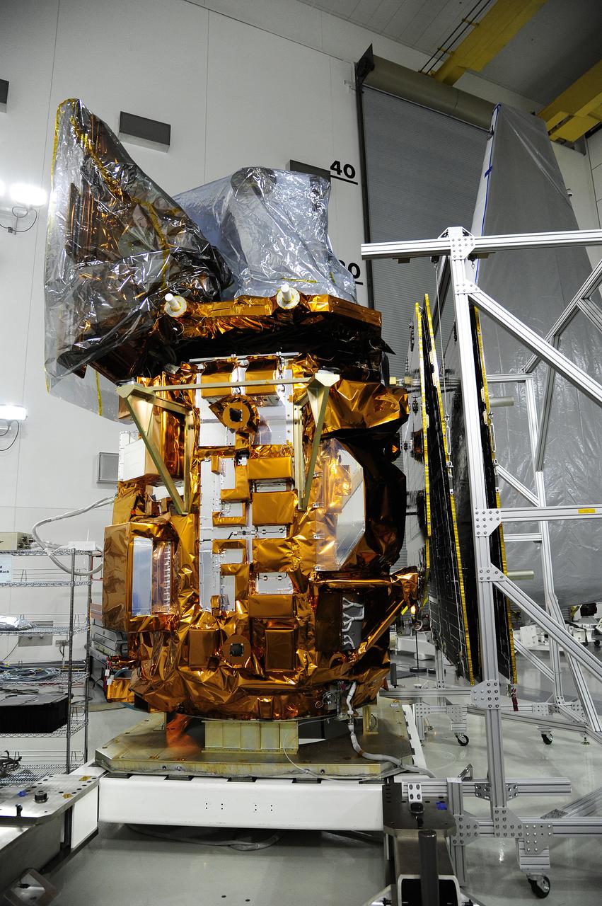
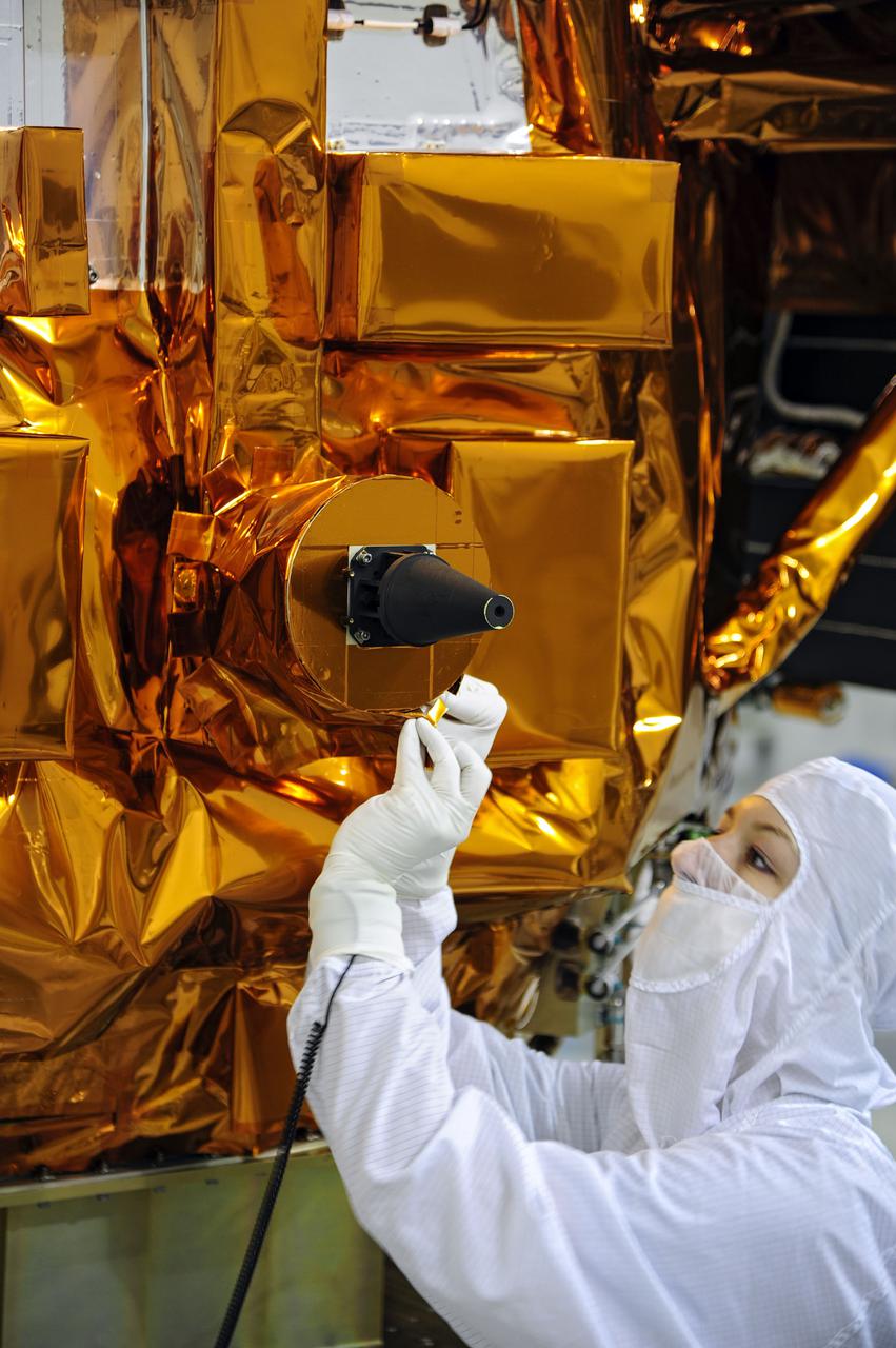
VANDENBERG AFB, Calif. -- In the Astrotech processing facility at Vandenberg Air Force Base, Calif., solar arrays are being tested on NASA's Landsat Data Continuity Mission, or LDCM, satellite. The Landsat Data Continuity Mission LDCM is the future of Landsat satellites. It will continue to obtain valuable data and imagery to be used in agriculture, education, business, science, and government. The Landsat Program provides repetitive acquisition of high resolution multispectral data of the Earth's surface on a global basis. The data from the Landsat spacecraft constitute the longest record of the Earth's continental surfaces as seen from space. It is a record unmatched in quality, detail, coverage, and value. Liftoff is planned for Feb. 11, 2013 aboard a United Launch Alliance Atlas V rocket. For more information, visit: http:__www.nasa.gov_mission_pages_landsat_main_index.html Photo credit: NASA
VANDENBERG AFB, Calif. -- At Vandenberg Air Force Base, Calif., the gantry at Space Launch Complex 3E rolls back from NASA's Landsat Data Continuity Mission, or LDCM, satellite mounted atop a United Launch Alliance Atlas V rocket. The Landsat Data Continuity Mission LDCM is the future of Landsat satellites. It will continue to obtain valuable data and imagery to be used in agriculture, education, business, science, and government. The Landsat Program provides repetitive acquisition of high resolution multispectral data of the Earth's surface on a global basis. The data from the Landsat spacecraft constitute the longest record of the Earth's continental surfaces as seen from space. It is a record unmatched in quality, detail, coverage, and value. Liftoff is planned for Feb. 11, 2013 aboard a United Launch Alliance Atlas V rocket. For more information, visit: http:__www.nasa.gov_mission_pages_landsat_main_index.html Photo credit: NASA_Kim Shiflett
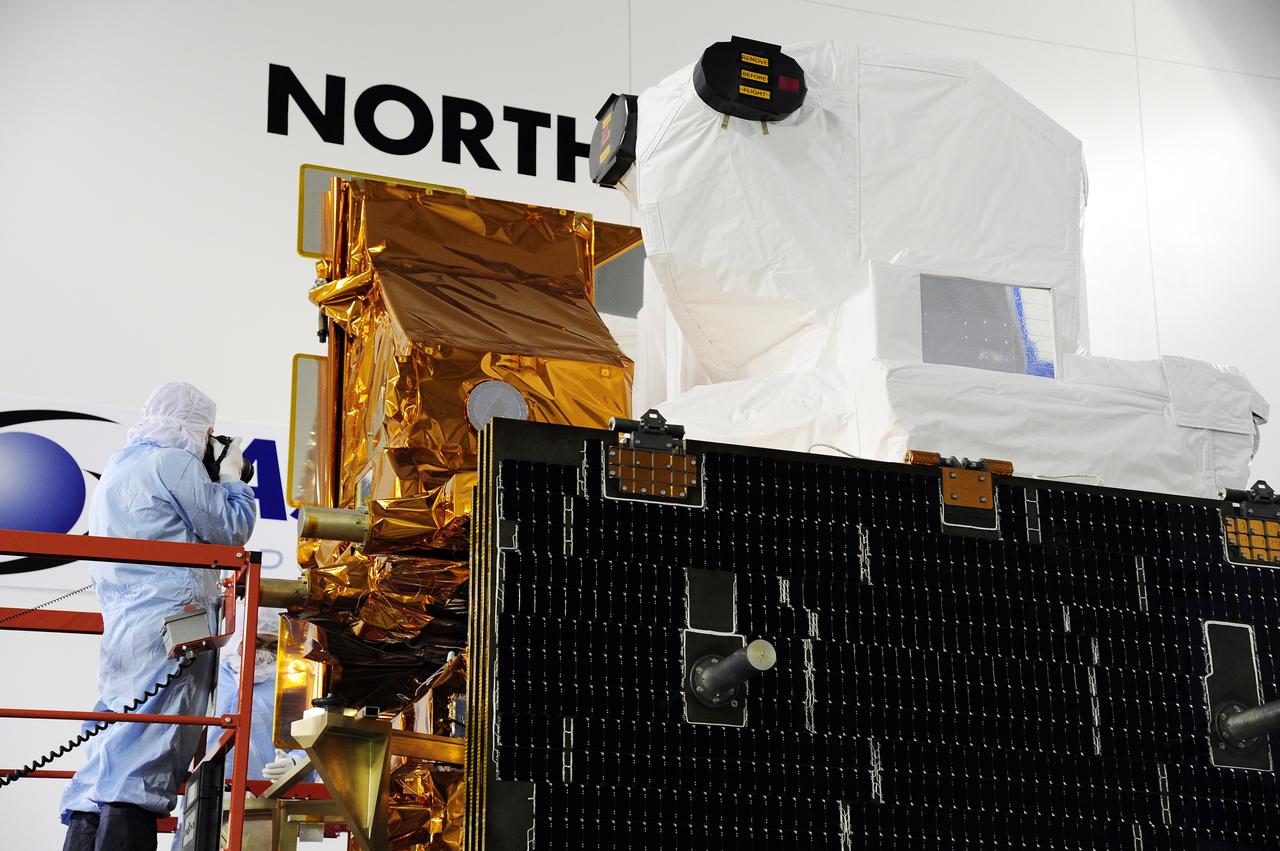
VANDENBERG AFB, Calif. -- A Technician photographs a component on NASA's Landsat Data Continuity Mission, or LDCM, satellite during inspection at the Astrotech processing facility at Vandenberg Air Force Base, Calif. The solar arrays are in the foreground. The Landsat Data Continuity Mission LDCM is the future of Landsat satellites. It will continue to obtain valuable data and imagery to be used in agriculture, education, business, science, and government. The Landsat Program provides repetitive acquisition of high resolution multispectral data of the Earth's surface on a global basis. The data from the Landsat spacecraft constitute the longest record of the Earth's continental surfaces as seen from space. It is a record unmatched in quality, detail, coverage, and value. Launch is planned for Feb. 11, 2013. For more information, visit: http://www.nasa.gov/mission_pages/landsat/main/index.html Photo credit: NASA
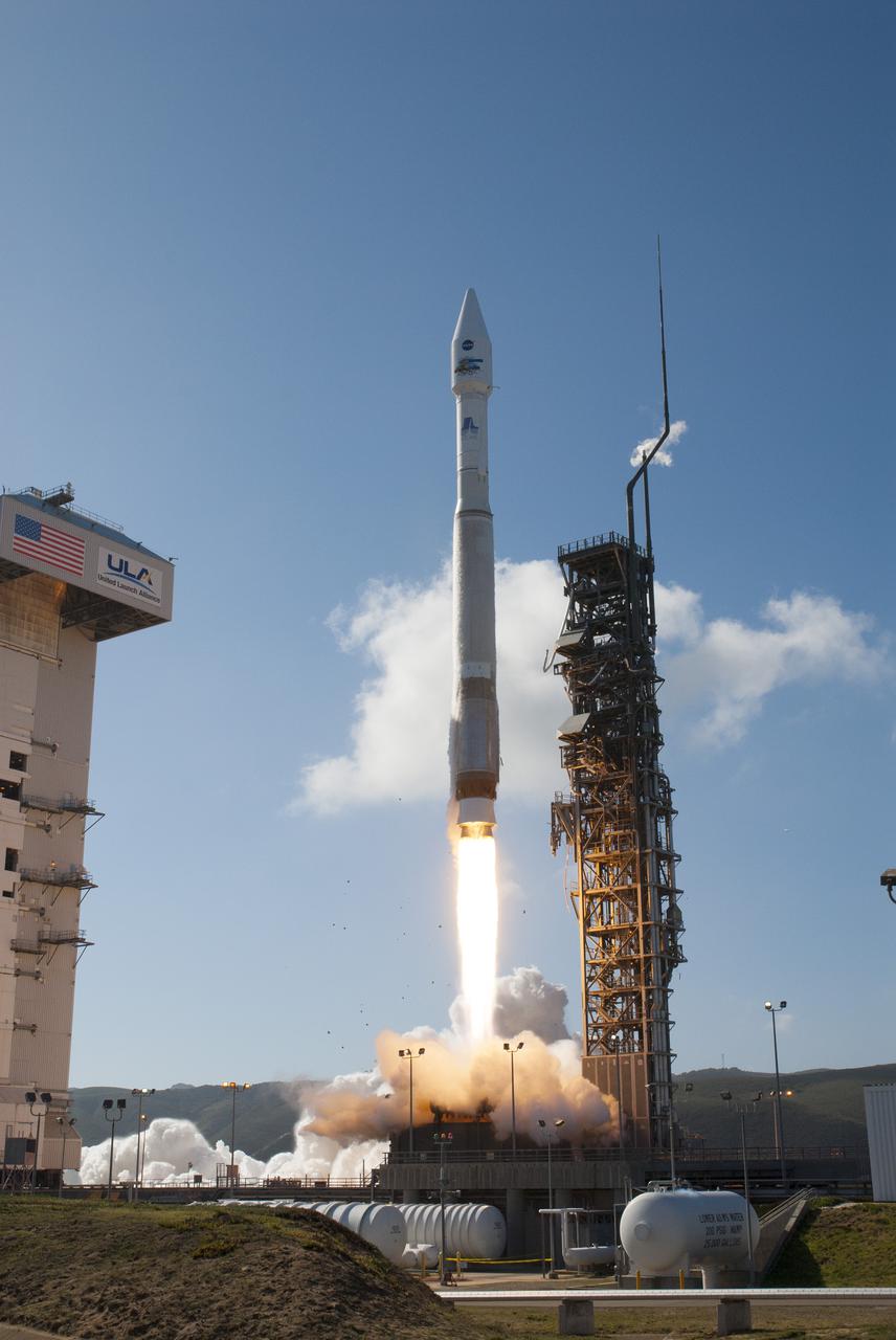
VANDENBERG AFB, Calif. -- The Landsat Data Continuity Mission spacecraft lifts off at 1:02 p.m. EST, 10:02 a.m. PST) atop a United Launch Alliance Atlas V rocket from Space Launch Complex 3 at California's Vandenberg Air Force Base. The Landsat Data Continuity Mission LDCM is the future of Landsat satellites. It will continue to obtain valuable data and imagery to be used in agriculture, education, business, science, and government. The Landsat Program provides repetitive acquisition of high resolution multispectral data of the Earth's surface on a global basis. The data from the Landsat spacecraft constitute the longest record of the Earth's continental surfaces as seen from space. It is a record unmatched in quality, detail, coverage, and value. For more information, visit: http:__www.nasa.gov_mission_pages_landsat_main_index.html Photo credit: NASA_Kim Shiflett
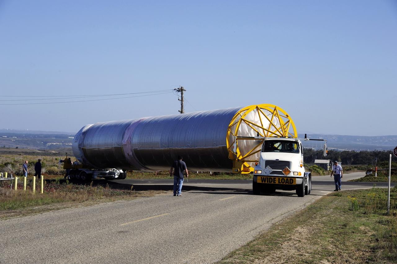
VANDENBERG AFB, Calif.-- NASA's Landsat Data Continuity Mission, or LDCM, satellite arrives by transport truck at Vandenberg Air Force Base, Calif. for prelaunch processing. The Landsat Data Continuity Mission LDCM is the future of Landsat satellites. It will continue to obtain valuable data and imagery to be used in agriculture, education, business, science, and government. The Landsat Program provides repetitive acquisition of high resolution multispectral data of the Earth's surface on a global basis. The data from the Landsat spacecraft constitute the longest record of the Earth's continental surfaces as seen from space. It is a record unmatched in quality, detail, coverage, and value. Launch is planned for Feb. 11, 2013. For more information, visit: http://www.nasa.gov/mission_pages/landsat/main/index.html Photo credit: NASA
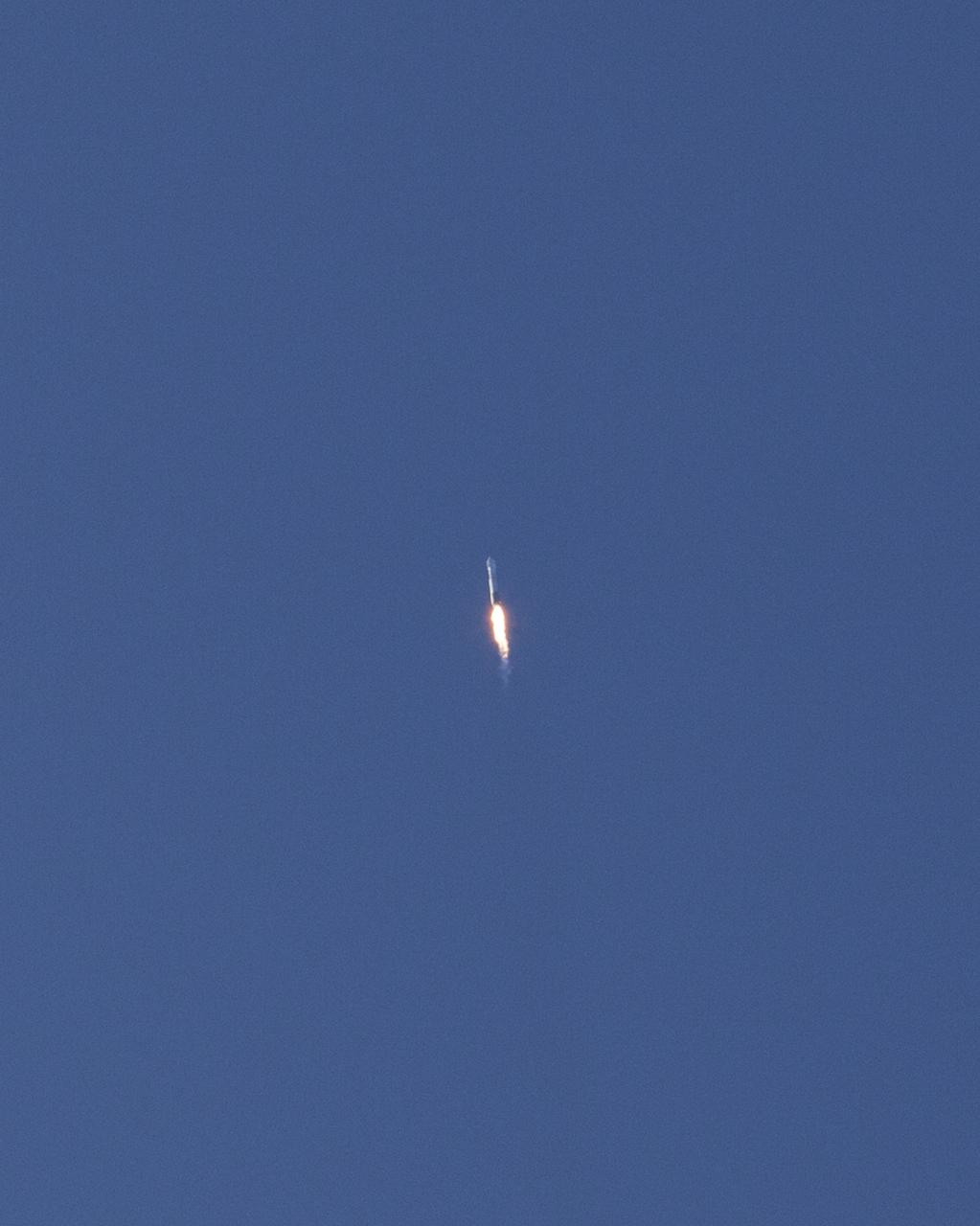
VANDENBERG AFB, Calif. -- The Landsat Data Continuity Mission spacecraft lifted off at 1:02 p.m. EST, 10:02 a.m. PST) atop a United Launch Alliance Atlas V rocket from Space Launch Complex 3 at California's Vandenberg Air Force Base. The Landsat Data Continuity Mission LDCM is the future of Landsat satellites. It will continue to obtain valuable data and imagery to be used in agriculture, education, business, science, and government. The Landsat Program provides repetitive acquisition of high resolution multispectral data of the Earth's surface on a global basis. The data from the Landsat spacecraft constitute the longest record of the Earth's continental surfaces as seen from space. It is a record unmatched in quality, detail, coverage, and value. For more information, visit: http:__www.nasa.gov_mission_pages_landsat_main_index.html Photo credit: NASA_Kim Shiflett
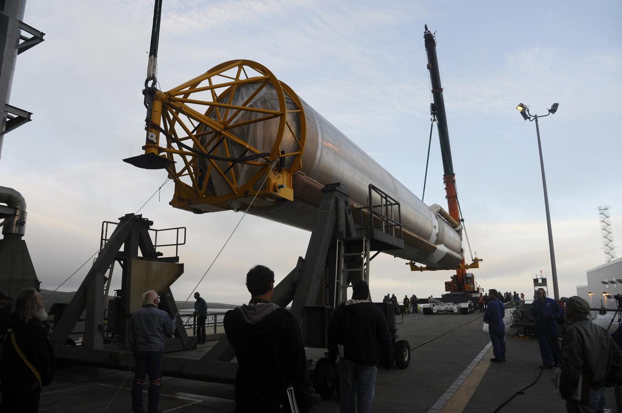
VANDENBERG AFB, Calif. – Cranes raise the first stage booster of a United Launch Alliance Atlas V onto the launch pad at Space Launch Complex-3E at Vandenberg Air Force Base, Calif. in preparation for the launch of the Landsat Data Continuity Mission. The Landsat Data Continuity Mission LDCM is the future of Landsat satellites. It will continue to obtain valuable data and imagery to be used in agriculture, education, business, science, and government. The Landsat Program provides repetitive acquisition of high resolution multispectral data of the Earth's surface on a global basis. The data from the Landsat spacecraft constitute the longest record of the Earth's continental surfaces as seen from space. It is a record unmatched in quality, detail, coverage, and value. Launch is planned for Feb. 2013. Photo credit: NASA/Roy Allison
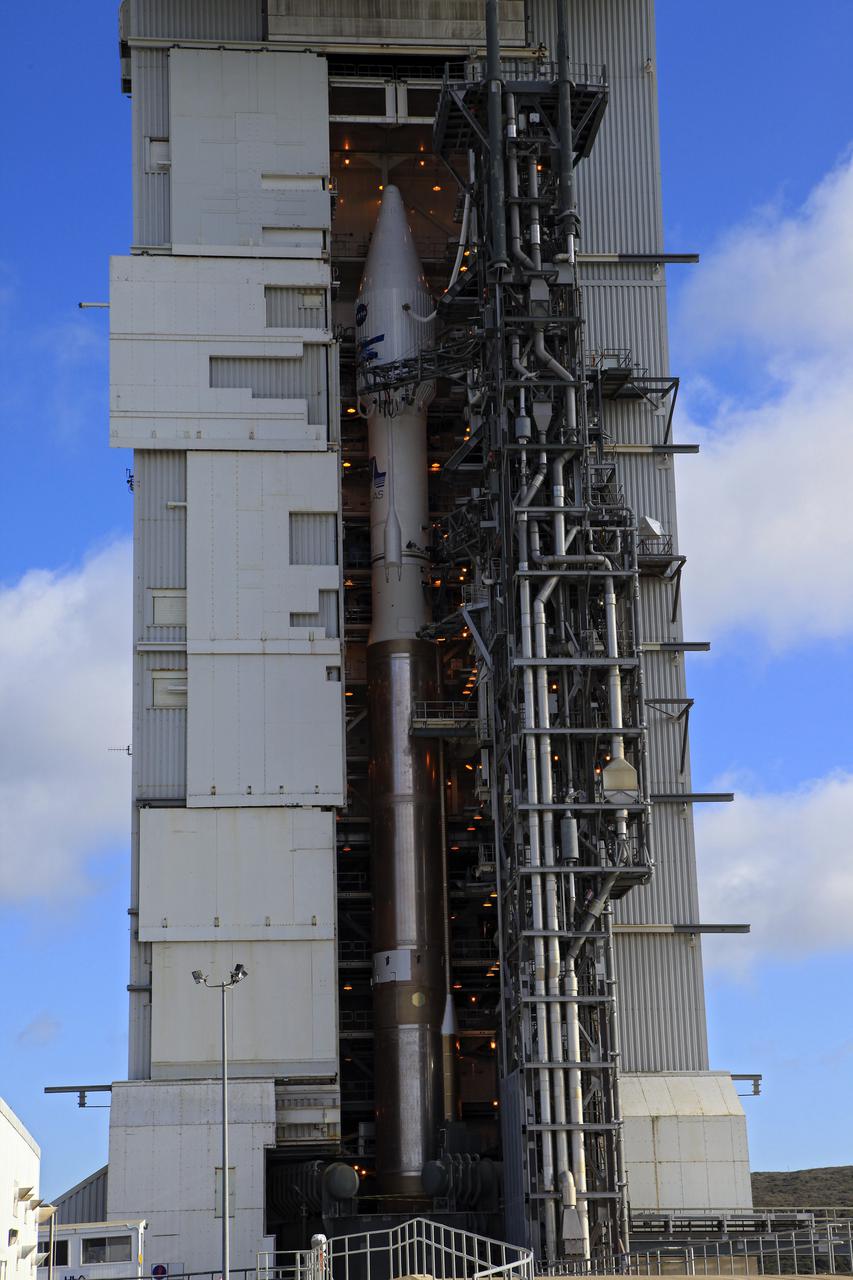
VANDENBERG AFB, Calif. -- At Vandenberg Air Force Base, Calif., NASA's Landsat Data Continuity Mission, or LDCM, satellite is mounted atop a United Launch Alliance Atlas V rocket in the gantry at Space Launch Complex 3E. The Landsat Data Continuity Mission LDCM is the future of Landsat satellites. It will continue to obtain valuable data and imagery to be used in agriculture, education, business, science, and government. The Landsat Program provides repetitive acquisition of high resolution multispectral data of the Earth's surface on a global basis. The data from the Landsat spacecraft constitute the longest record of the Earth's continental surfaces as seen from space. It is a record unmatched in quality, detail, coverage, and value. Liftoff is planned for Feb. 11, 2013 aboard a United Launch Alliance Atlas V rocket. For more information, visit: http:__www.nasa.gov_mission_pages_landsat_main_index.html Photo credit: NASA_Kim Shiflett
VANDENBERG AFB, Calif.-- Technicians use a crane to move NASA's Landsat Data Continuity Mission, or LDCM, satellite at the Astrotech processing facility at Vandenberg Air Force Base, Calif. The Landsat Data Continuity Mission LDCM is the future of Landsat satellites. It will continue to obtain valuable data and imagery to be used in agriculture, education, business, science, and government. The Landsat Program provides repetitive acquisition of high resolution multispectral data of the Earth's surface on a global basis. The data from the Landsat spacecraft constitute the longest record of the Earth's continental surfaces as seen from space. It is a record unmatched in quality, detail, coverage, and value. Launch is planned for Feb. 11, 2013. For more information, visit: http://www.nasa.gov/mission_pages/landsat/main/index.html Photo credit: NASA
VANDENBERG AFB, Calif. -- The Landsat Data Continuity Mission spacecraft is poised for lift off atop a United Launch Alliance Atlas V rocket from Space Launch Complex 3 at California's Vandenberg Air Force Base. The Landsat Data Continuity Mission LDCM is the future of Landsat satellites. It will continue to obtain valuable data and imagery to be used in agriculture, education, business, science, and government. The Landsat Program provides repetitive acquisition of high resolution multispectral data of the Earth's surface on a global basis. The data from the Landsat spacecraft constitute the longest record of the Earth's continental surfaces as seen from space. It is a record unmatched in quality, detail, coverage, and value. For more information, visit: http:__www.nasa.gov_mission_pages_landsat_main_index.html Photo credit: NASA_Kim Shiflett
VANDENBERG AFB, Calif. -- At the Astrotech processing facility at Vandenberg Air Force Base, Calif., NASA's Landsat Data Continuity Mission, or LDCM, satellite is undergoing close-outs prior to encapsulation in the payload fairing. The Landsat Data Continuity Mission LDCM is the future of Landsat satellites. It will continue to obtain valuable data and imagery to be used in agriculture, education, business, science, and government. The Landsat Program provides repetitive acquisition of high resolution multispectral data of the Earth's surface on a global basis. The data from the Landsat spacecraft constitute the longest record of the Earth's continental surfaces as seen from space. It is a record unmatched in quality, detail, coverage, and value. Liftoff is planned for Feb. 11, 2013 aboard a United Launch Alliance Atlas V rocket. For more information, visit: http:__www.nasa.gov_mission_pages_landsat_main_index.html Photo credit: NASA
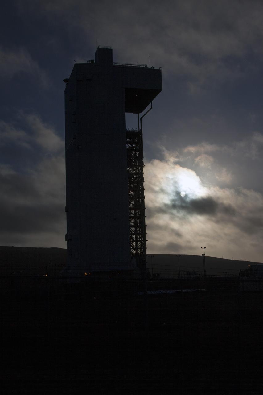
VANDENBERG AFB, Calif. -- The sun sets in the west behind Space Launch Complex 3 at Vandenberg Air Force Base where preparations continue for the launch of the Landsat Data Continuity Mission, or LDCM, satellite atop an Atlas V rocket. The Landsat Data Continuity Mission LDCM is the future of Landsat satellites. It will continue to obtain valuable data and imagery to be used in agriculture, education, business, science, and government. The Landsat Program provides repetitive acquisition of high resolution multispectral data of the Earth's surface on a global basis. The data from the Landsat spacecraft constitute the longest record of the Earth's continental surfaces as seen from space. It is a record unmatched in quality, detail, coverage, and value. Liftoff is planned for Feb. 11, 2013 aboard a United Launch Alliance Atlas V rocket. For more information, visit: http:__www.nasa.gov_mission_pages_landsat_main_index.html Photo credit: NASA_ Ben Smegelsky
VANDENBERG AFB, Calif. -- NASA's Landsat Data Continuity Mission, or LDCM, satellite during post-arrival inspections at the Astrotech processing facility at Vandenberg Air Force Base, Calif. The Landsat Data Continuity Mission LDCM is the future of Landsat satellites. It will continue to obtain valuable data and imagery to be used in agriculture, education, business, science, and government. The Landsat Program provides repetitive acquisition of high resolution multispectral data of the Earth's surface on a global basis. The data from the Landsat spacecraft constitute the longest record of the Earth's continental surfaces as seen from space. It is a record unmatched in quality, detail, coverage, and value. Launch is planned for Feb. 11, 2013. For more information, visit: http://www.nasa.gov/mission_pages/landsat/main/index.html Photo credit: NASA
VANDENBERG AFB, Calif.-- Technicians check out the transport truck used to deliver NASA's Landsat Data Continuity Mission, or LDCM, satellite to Vandenberg Air Force Base, Calif. for prelaunch processing. The Landsat Data Continuity Mission LDCM is the future of Landsat satellites. It will continue to obtain valuable data and imagery to be used in agriculture, education, business, science, and government. The Landsat Program provides repetitive acquisition of high resolution multispectral data of the Earth's surface on a global basis. The data from the Landsat spacecraft constitute the longest record of the Earth's continental surfaces as seen from space. It is a record unmatched in quality, detail, coverage, and value. Launch is planned for Feb. 11, 2013. For more information, visit: http://www.nasa.gov/mission_pages/landsat/main/index.html Photo credit: NASA
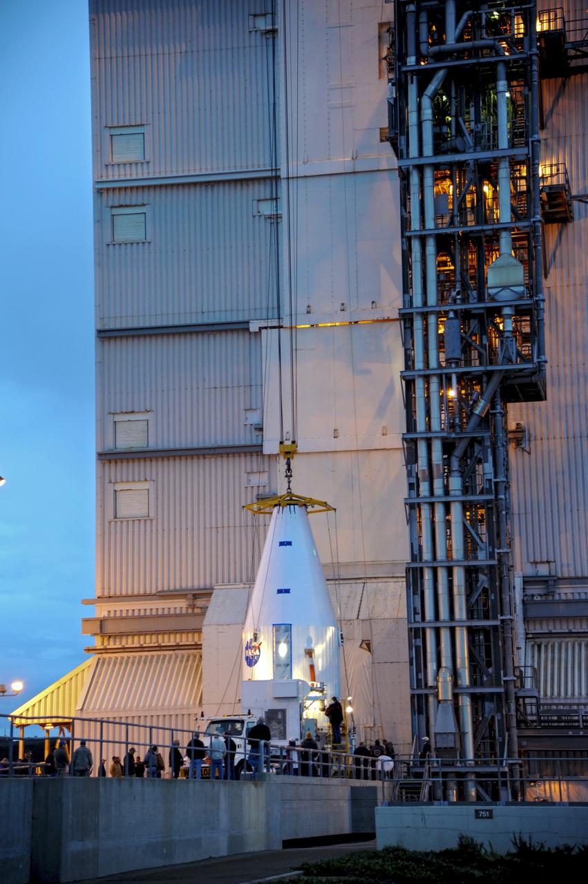
VANDENBERG AFB, Calif. -- The payload fairing containing the Landsat Data Continuity Mission, or LDCM, spacecraft is about to be hoisted atop a United Launch Alliance Atlas V rocket at Space Launch Complex-3E at Vandenberg Air Force Base, Calif. The Landsat Data Continuity Mission LDCM is the future of Landsat satellites. It will continue to obtain valuable data and imagery to be used in agriculture, education, business, science, and government. The Landsat Program provides repetitive acquisition of high resolution multispectral data of the Earth's surface on a global basis. The data from the Landsat spacecraft constitute the longest record of the Earth's continental surfaces as seen from space. It is a record unmatched in quality, detail, coverage, and value. Liftoff is planned for Feb. 11, 2013 aboard a United Launch Alliance Atlas V rocket. For more information, visit: http:__www.nasa.gov_mission_pages_landsat_main_index.html Photo credit: NASA
The Landsat Data Continuity Mission spacecraft is poised for lift off atop a United Launch Alliance Atlas V rocket from Space Launch Complex 3 at California's Vandenberg Air Force Base. The Landsat Data Continuity Mission LDCM is the future of Landsat satellites. It will continue to obtain valuable data and imagery to be used in agriculture, education, business, science, and government. The Landsat Program provides repetitive acquisition of high resolution multispectral data of the Earth's surface on a global basis. The data from the Landsat spacecraft constitute the longest record of the Earth's continental surfaces as seen from space. It is a record unmatched in quality, detail, coverage, and value. For more information, visit: http:__www.nasa.gov_mission_pages_landsat_main_index.html Photo credit: NASA_Kim Shiflett
VANDENBERG AFB, Calif. -- The Landsat Data Continuity Mission spacecraft lifted off at 1:02 p.m. EST, 10:02 a.m. PST) atop a United Launch Alliance Atlas V rocket from Space Launch Complex 3 at California's Vandenberg Air Force Base. The Landsat Data Continuity Mission LDCM is the future of Landsat satellites. It will continue to obtain valuable data and imagery to be used in agriculture, education, business, science, and government. The Landsat Program provides repetitive acquisition of high resolution multispectral data of the Earth's surface on a global basis. The data from the Landsat spacecraft constitute the longest record of the Earth's continental surfaces as seen from space. It is a record unmatched in quality, detail, coverage, and value. For more information, visit: http:__www.nasa.gov_mission_pages_landsat_main_index.html Photo credit: NASA_Kim Shiflett
VANDENBERG AFB, Calif. – A truck moves the first stage booster of a United Launch Alliance Atlas V to Space Launch Complex-3E at Vandenberg Air Force Base, Calif. in preparation for the launch of the Landsat Data Continuity Mission. The Landsat Data Continuity Mission, or LDCM, is the future of Landsat satellites. It will continue to obtain valuable data and imagery to be used in agriculture, education, business, science, and government. The Landsat Program provides repetitive acquisition of high resolution multispectral data of the Earth's surface on a global basis. The data from the Landsat spacecraft constitute the longest record of the Earth's continental surfaces as seen from space. It is a record unmatched in quality, detail, coverage, and value. Launch is planned for Feb. 2013. Photo credit: NASA/Roy Allison
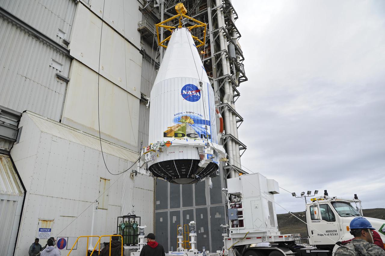
VANDENBERG AFB, Calif. -- The payload fairing containing the Landsat Data Continuity Mission, or LDCM, spacecraft is lifted to the top of Space Launch Complex-3E at Vandenberg Air Force Base, Calif. where it will be mounted atop a United Launch Alliance Atlas V rocket. The Landsat Data Continuity Mission LDCM is the future of Landsat satellites. It will continue to obtain valuable data and imagery to be used in agriculture, education, business, science, and government. The Landsat Program provides repetitive acquisition of high resolution multispectral data of the Earth's surface on a global basis. The data from the Landsat spacecraft constitute the longest record of the Earth's continental surfaces as seen from space. It is a record unmatched in quality, detail, coverage, and value. Liftoff is planned for Feb. 11, 2013 aboard a United Launch Alliance Atlas V rocket. For more information, visit: http:__www.nasa.gov_mission_pages_landsat_main_index.html Photo credit: NASA
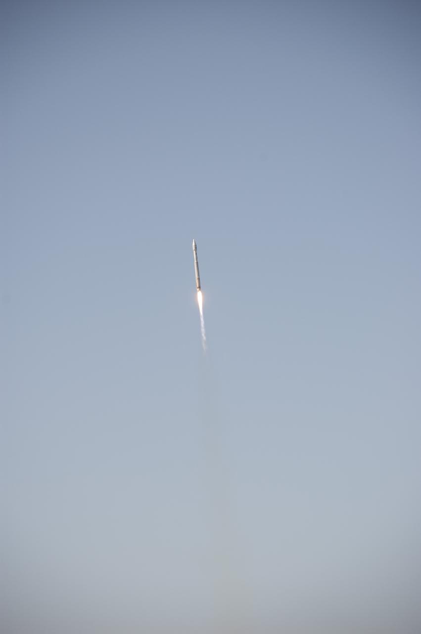
VANDENBERG AFB, Calif. -- The Landsat Data Continuity Mission spacecraft lifts off at 1:02 p.m. EST, 10:02 a.m. PST) atop a United Launch Alliance Atlas V rocket from Space Launch Complex 3 at California's Vandenberg Air Force Base. The Landsat Data Continuity Mission LDCM is the future of Landsat satellites. It will continue to obtain valuable data and imagery to be used in agriculture, education, business, science, and government. The Landsat Program provides repetitive acquisition of high resolution multispectral data of the Earth's surface on a global basis. The data from the Landsat spacecraft constitute the longest record of the Earth's continental surfaces as seen from space. It is a record unmatched in quality, detail, coverage, and value. For more information, visit: http:__www.nasa.gov_mission_pages_landsat_main_index.html Photo credit: NASA_Ben Smegelsky
VANDENBERG AFB, Calif. -- At the Astrotech processing facility at Vandenberg Air Force Base, Calif., technicians perform close-out inspections on NASA's Landsat Data Continuity Mission, or LDCM, satellite. The Landsat Data Continuity Mission LDCM is the future of Landsat satellites. It will continue to obtain valuable data and imagery to be used in agriculture, education, business, science, and government. The Landsat Program provides repetitive acquisition of high resolution multispectral data of the Earth's surface on a global basis. The data from the Landsat spacecraft constitute the longest record of the Earth's continental surfaces as seen from space. It is a record unmatched in quality, detail, coverage, and value. Liftoff is planned for Feb. 11, 2013 aboard a United Launch Alliance Atlas V rocket. For more information, visit: http:__www.nasa.gov_mission_pages_landsat_main_index.html Photo credit: NASA
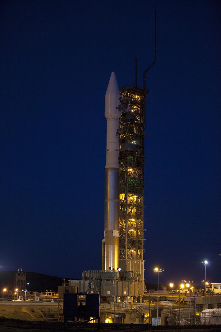
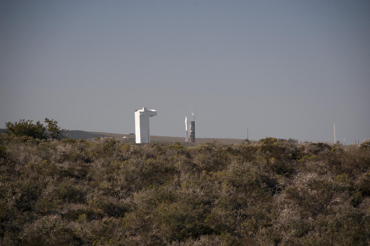
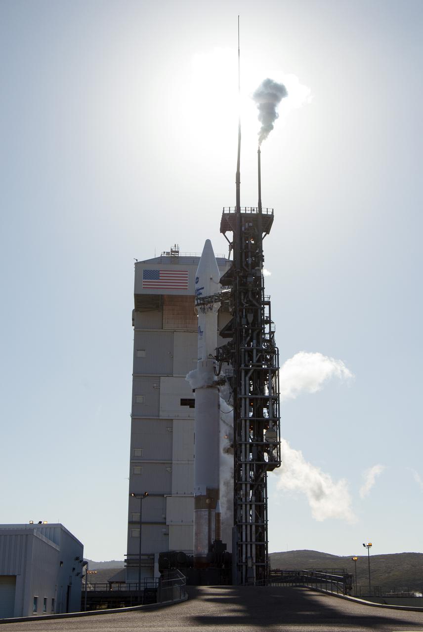
VANDENBERG AFB, Calif. -- At Vandenberg Air Force Base, Calif., NASA's Landsat Data Continuity Mission, or LDCM, satellite is mounted atop a United Launch Alliance Atlas V rocket poised for launch at Space Launch Complex 3E. The Landsat Data Continuity Mission LDCM is the future of Landsat satellites. It will continue to obtain valuable data and imagery to be used in agriculture, education, business, science, and government. The Landsat Program provides repetitive acquisition of high resolution multispectral data of the Earth's surface on a global basis. The data from the Landsat spacecraft constitute the longest record of the Earth's continental surfaces as seen from space. It is a record unmatched in quality, detail, coverage, and value. Liftoff is planned for Feb. 11, 2013 aboard a United Launch Alliance Atlas V rocket. For more information, visit: http:__www.nasa.gov_mission_pages_landsat_main_index.html Photo credit: NASA_Kim Shiflett
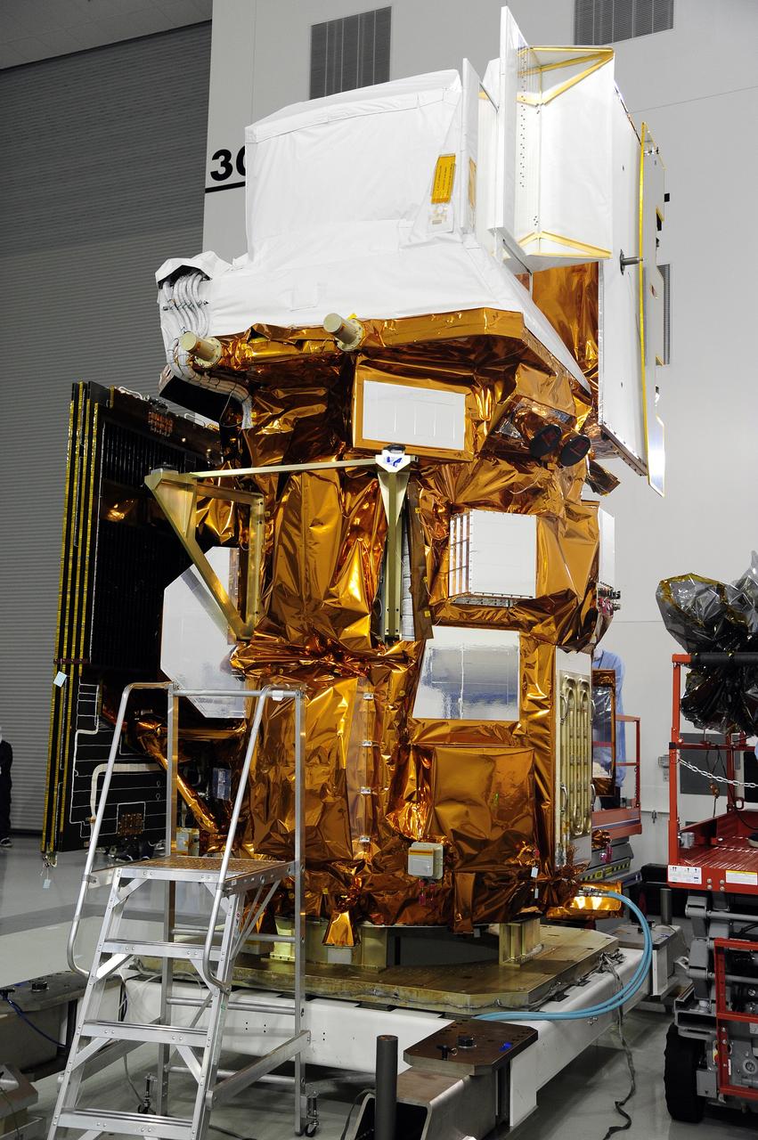
VANDENBERG AFB, Calif. -- NASA's Landsat Data Continuity Mission, or LDCM, satellite during post-arrival inspections at the Astrotech processing facility at Vandenberg Air Force Base, Calif. The Landsat Data Continuity Mission LDCM is the future of Landsat satellites. It will continue to obtain valuable data and imagery to be used in agriculture, education, business, science, and government. The Landsat Program provides repetitive acquisition of high resolution multispectral data of the Earth's surface on a global basis. The data from the Landsat spacecraft constitute the longest record of the Earth's continental surfaces as seen from space. It is a record unmatched in quality, detail, coverage, and value. Launch is planned for Feb. 11, 2013. For more information, visit: http://www.nasa.gov/mission_pages/landsat/main/index.html Photo credit: NASA
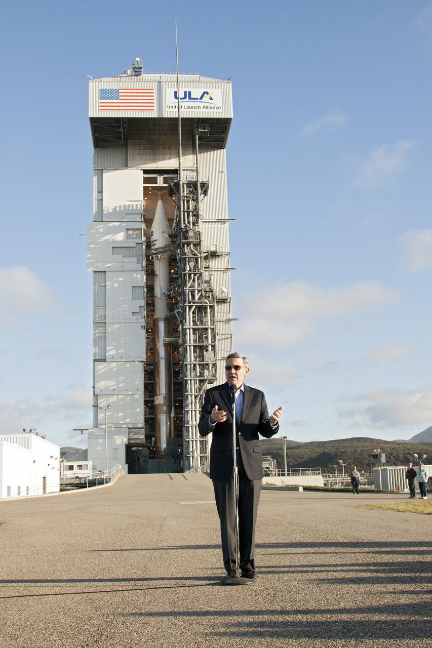
VANDENBERG AFB, Calif. -- At Vandenberg Air Force Base, Calif., NASA social media followers are briefed on the agency's Landsat Data Continuity Mission, or LDCM, satellite mission. In the background, the satellite is mounted atop a United Launch Alliance Atlas V rocket in the gantry at Space Launch Complex 3E. The Landsat Data Continuity Mission LDCM is the future of Landsat satellites. It will continue to obtain valuable data and imagery to be used in agriculture, education, business, science, and government. The Landsat Program provides repetitive acquisition of high resolution multispectral data of the Earth's surface on a global basis. The data from the Landsat spacecraft constitute the longest record of the Earth's continental surfaces as seen from space. It is a record unmatched in quality, detail, coverage, and value. Liftoff is planned for Feb. 11, 2013 aboard a United Launch Alliance Atlas V rocket. For more information, visit: http:__www.nasa.gov_mission_pages_landsat_main_index.html Photo credit: NASA_Kim Shiflett
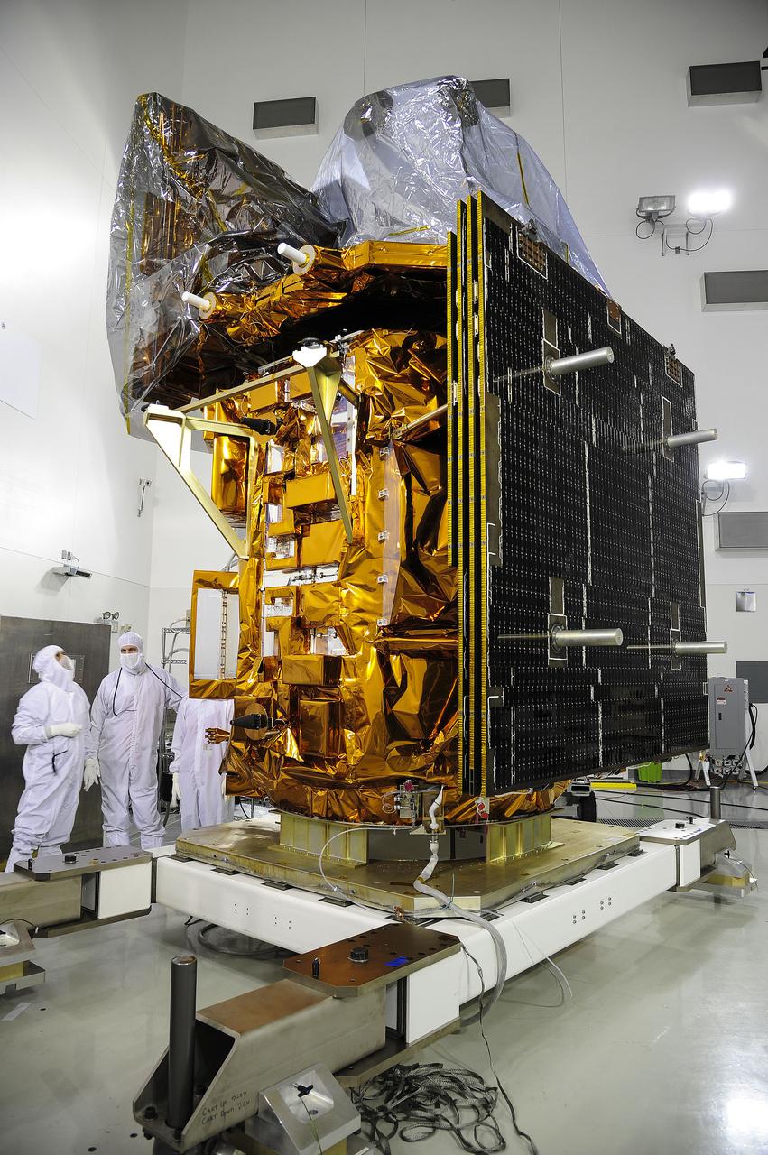
VANDENBERG AFB, Calif. -- At the Astrotech processing facility at Vandenberg Air Force Base, Calif., technicians perform close-outs on NASA's Landsat Data Continuity Mission, or LDCM, satellite. The Landsat Data Continuity Mission LDCM is the future of Landsat satellites. It will continue to obtain valuable data and imagery to be used in agriculture, education, business, science, and government. The Landsat Program provides repetitive acquisition of high resolution multispectral data of the Earth's surface on a global basis. The data from the Landsat spacecraft constitute the longest record of the Earth's continental surfaces as seen from space. It is a record unmatched in quality, detail, coverage, and value. Liftoff is planned for Feb. 11, 2013 aboard a United Launch Alliance Atlas V rocket. For more information, visit: http:__www.nasa.gov_mission_pages_landsat_main_index.html Photo credit: NASA
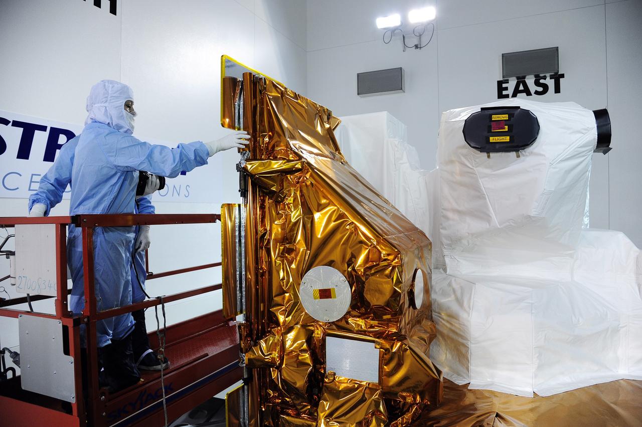
VANDENBERG AFB, Calif. -- Technicians inspect NASA's Landsat Data Continuity Mission, or LDCM, satellite at the Astrotech processing facility at Vandenberg Air Force Base, Calif. The Landsat Data Continuity Mission LDCM is the future of Landsat satellites. It will continue to obtain valuable data and imagery to be used in agriculture, education, business, science, and government. The Landsat Program provides repetitive acquisition of high resolution multispectral data of the Earth's surface on a global basis. The data from the Landsat spacecraft constitute the longest record of the Earth's continental surfaces as seen from space. It is a record unmatched in quality, detail, coverage, and value. Launch is planned for Feb. 11, 2013. For more information, visit: http://www.nasa.gov/mission_pages/landsat/main/index.html Photo credit: NASA
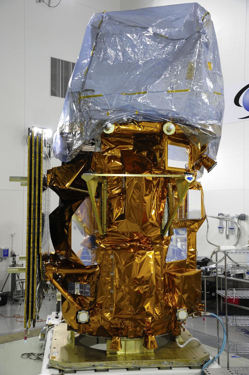
VANDENBERG AFB, Calif. -- At the Astrotech processing facility at Vandenberg Air Force Base, Calif., NASA's Landsat Data Continuity Mission, or LDCM, satellite is undergoing close-outs prior to encapsulation in the payload fairing. The Landsat Data Continuity Mission LDCM is the future of Landsat satellites. It will continue to obtain valuable data and imagery to be used in agriculture, education, business, science, and government. The Landsat Program provides repetitive acquisition of high resolution multispectral data of the Earth's surface on a global basis. The data from the Landsat spacecraft constitute the longest record of the Earth's continental surfaces as seen from space. It is a record unmatched in quality, detail, coverage, and value. Liftoff is planned for Feb. 11, 2013 aboard a United Launch Alliance Atlas V rocket. For more information, visit: http:__www.nasa.gov_mission_pages_landsat_main_index.html Photo credit: NASA
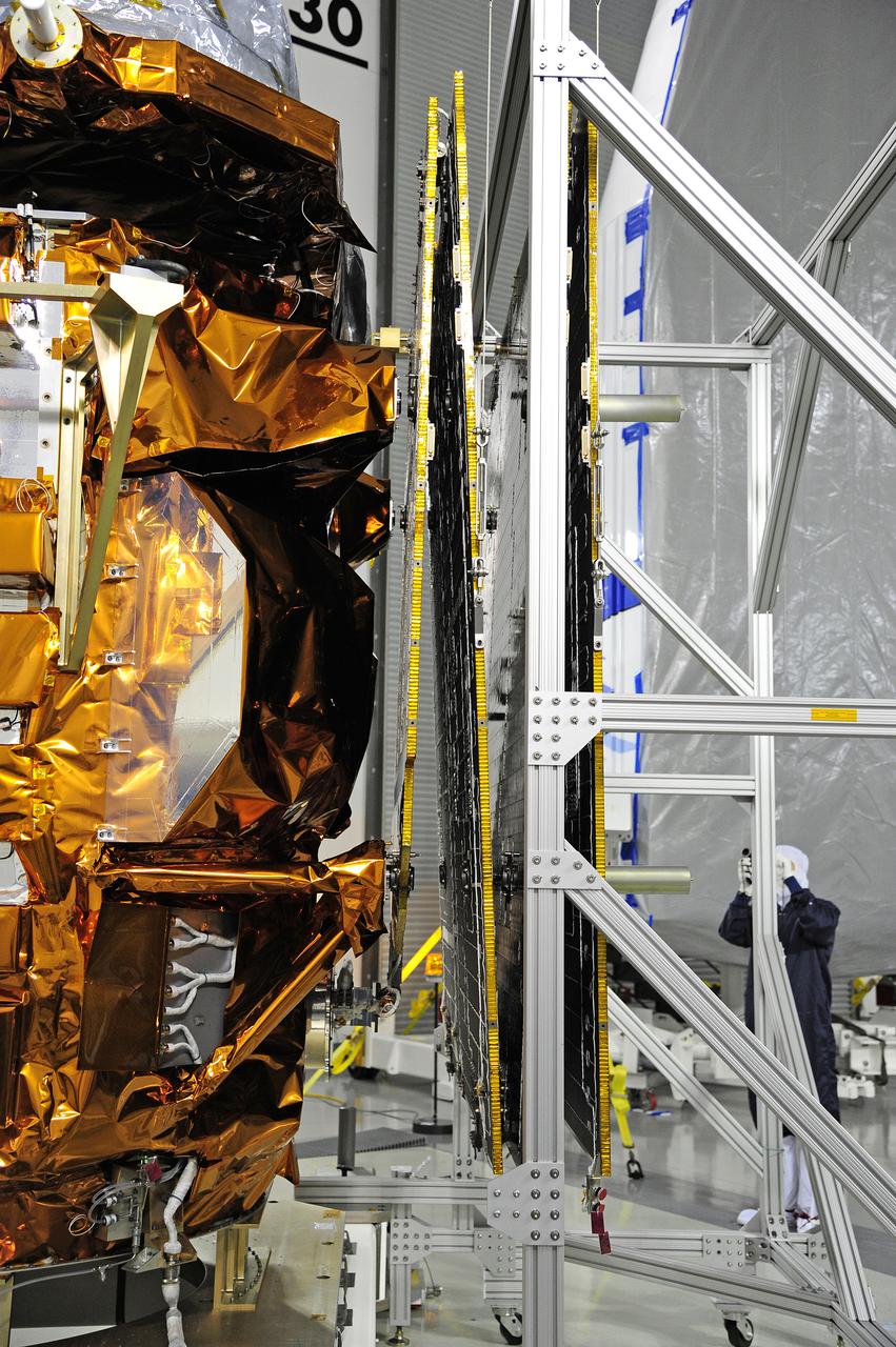
VANDENBERG AFB, Calif. -- In the Astrotech processing facility at Vandenberg Air Force Base, Calif., a technician photographs NASA's Landsat Data Continuity Mission, or LDCM, satellite after the solar arrays were attached and tested. The Landsat Data Continuity Mission LDCM is the future of Landsat satellites. It will continue to obtain valuable data and imagery to be used in agriculture, education, business, science, and government. The Landsat Program provides repetitive acquisition of high resolution multispectral data of the Earth's surface on a global basis. The data from the Landsat spacecraft constitute the longest record of the Earth's continental surfaces as seen from space. It is a record unmatched in quality, detail, coverage, and value. Liftoff is planned for Feb. 11, 2013 aboard a United Launch Alliance Atlas V rocket. For more information, visit: http:__www.nasa.gov_mission_pages_landsat_main_index.html Photo credit: NASA
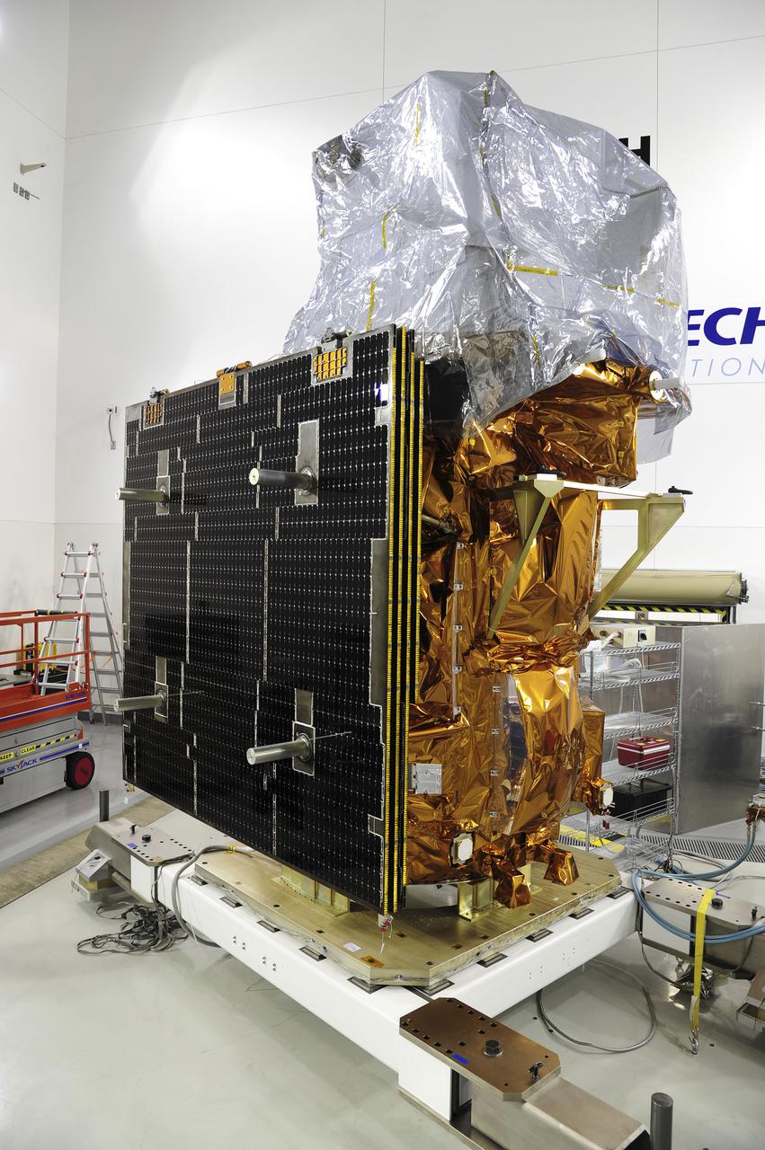
VANDENBERG AFB, Calif. -- At the Astrotech processing facility at Vandenberg Air Force Base, Calif., NASA's Landsat Data Continuity Mission, or LDCM, satellite is undergoing close-outs prior to encapsulation in the payload fairing. The Landsat Data Continuity Mission LDCM is the future of Landsat satellites. It will continue to obtain valuable data and imagery to be used in agriculture, education, business, science, and government. The Landsat Program provides repetitive acquisition of high resolution multispectral data of the Earth's surface on a global basis. The data from the Landsat spacecraft constitute the longest record of the Earth's continental surfaces as seen from space. It is a record unmatched in quality, detail, coverage, and value. Liftoff is planned for Feb. 11, 2013 aboard a United Launch Alliance Atlas V rocket. For more information, visit: http:__www.nasa.gov_mission_pages_landsat_main_index.html Photo credit: NASA
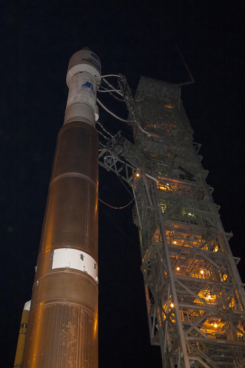
VANDENBERG AFB, Calif. -- At Vandenberg Air Force Base, Calif., NASA's Landsat Data Continuity Mission, or LDCM, satellite is mounted atop a United Launch Alliance Atlas V rocket poised for launch at Space Launch Complex 3E. The Landsat Data Continuity Mission LDCM is the future of Landsat satellites. It will continue to obtain valuable data and imagery to be used in agriculture, education, business, science, and government. The Landsat Program provides repetitive acquisition of high resolution multispectral data of the Earth's surface on a global basis. The data from the Landsat spacecraft constitute the longest record of the Earth's continental surfaces as seen from space. It is a record unmatched in quality, detail, coverage, and value. Liftoff is planned for Feb. 11, 2013 aboard a United Launch Alliance Atlas V rocket. For more information, visit: http:__www.nasa.gov_mission_pages_landsat_main_index.html Photo credit: NASA_Kim Shiflett