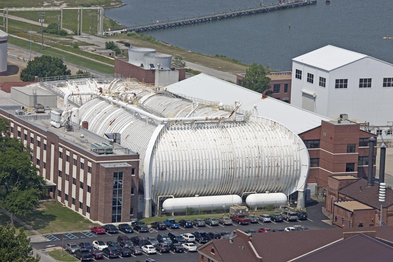
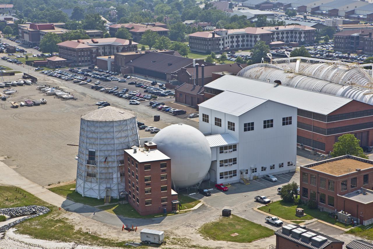
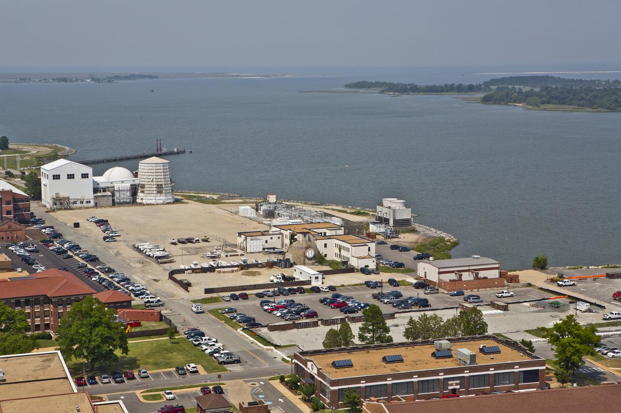
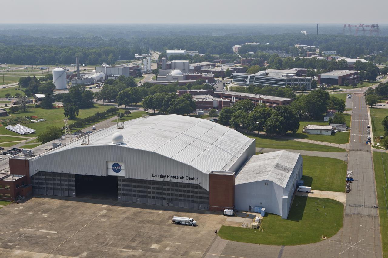
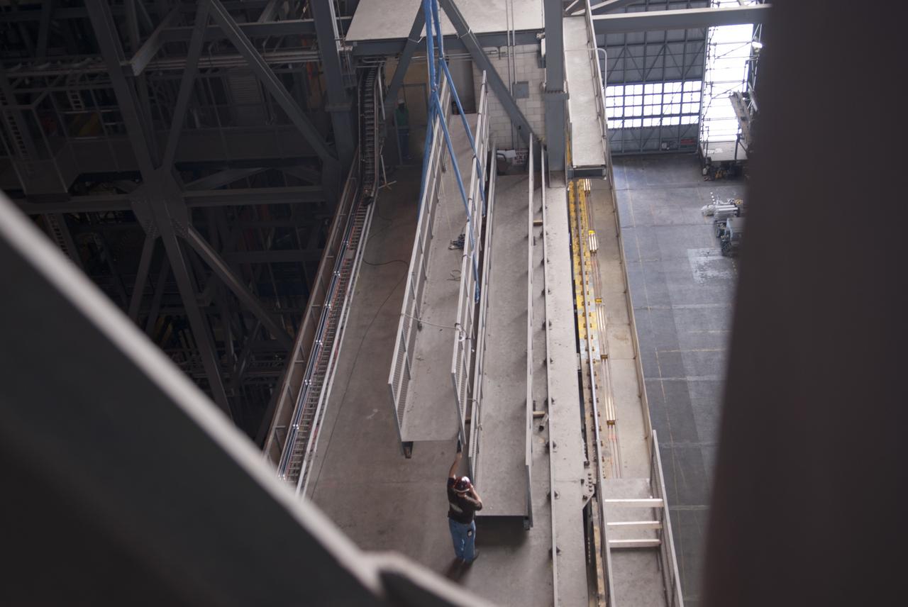
Aerial of NASA Langley East side spin tunnel and wind tunnel
Aerial of NASA Langley East side spin tunnel and wind tunnel
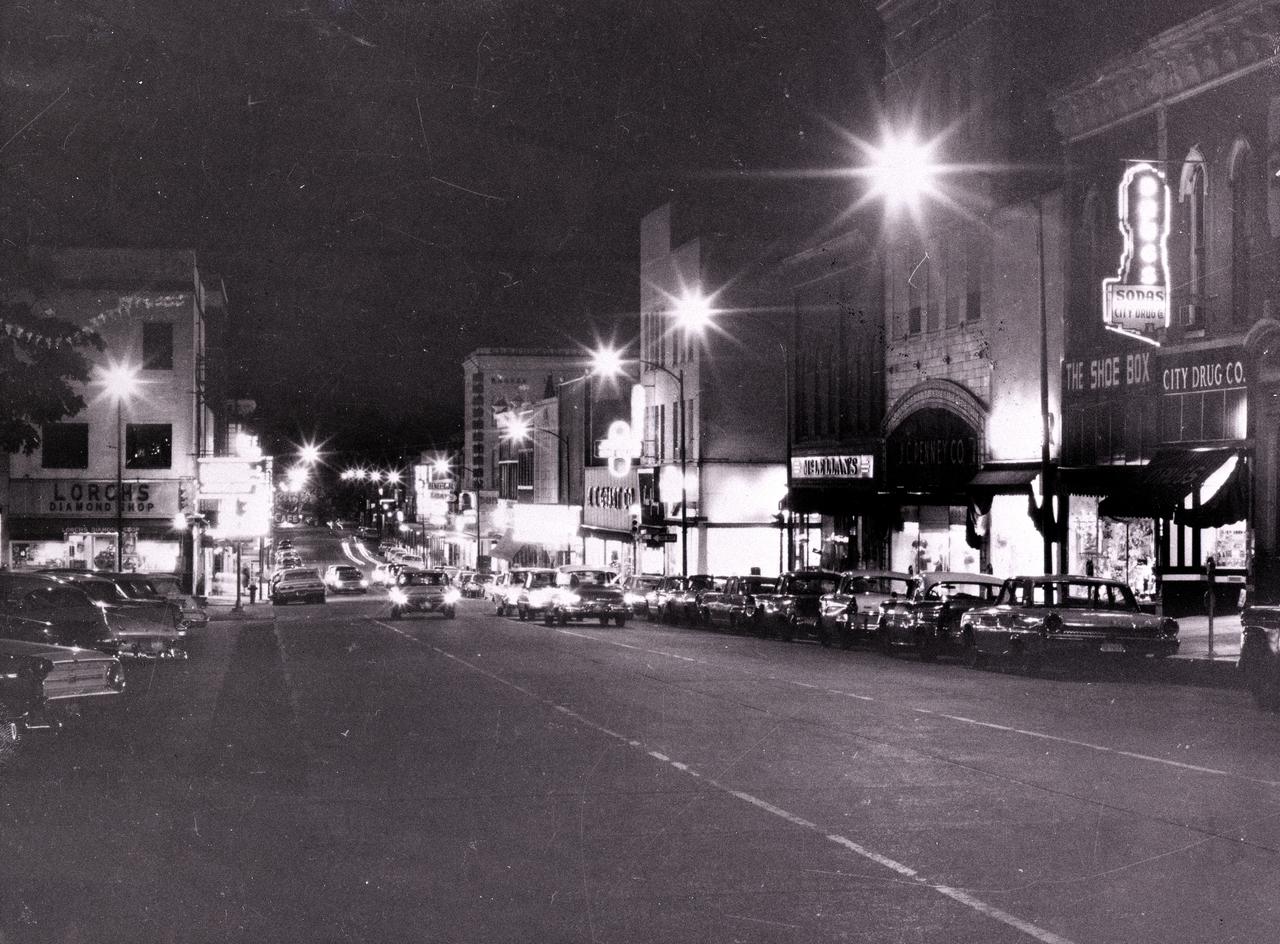
This is a 1956 night shot of the east side of Square in downtown Huntsville, Alabama. Photo Courtesy of Huntsville Public Library
Aerial of NASA Langley East side spin tunnel and wind tunnel
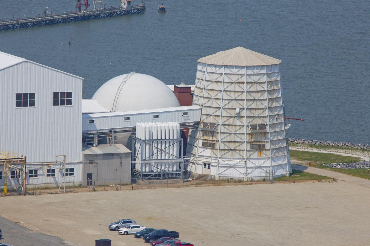
Aerial of NASA Langley East side spin tunnel and wind tunnel
Aerial of NASA Langley East side spin tunnel and wind tunnel
Aerial of NASA Langley East side spin tunnel and wind tunnel
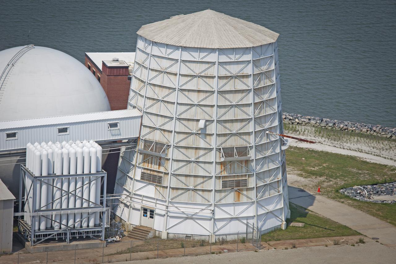
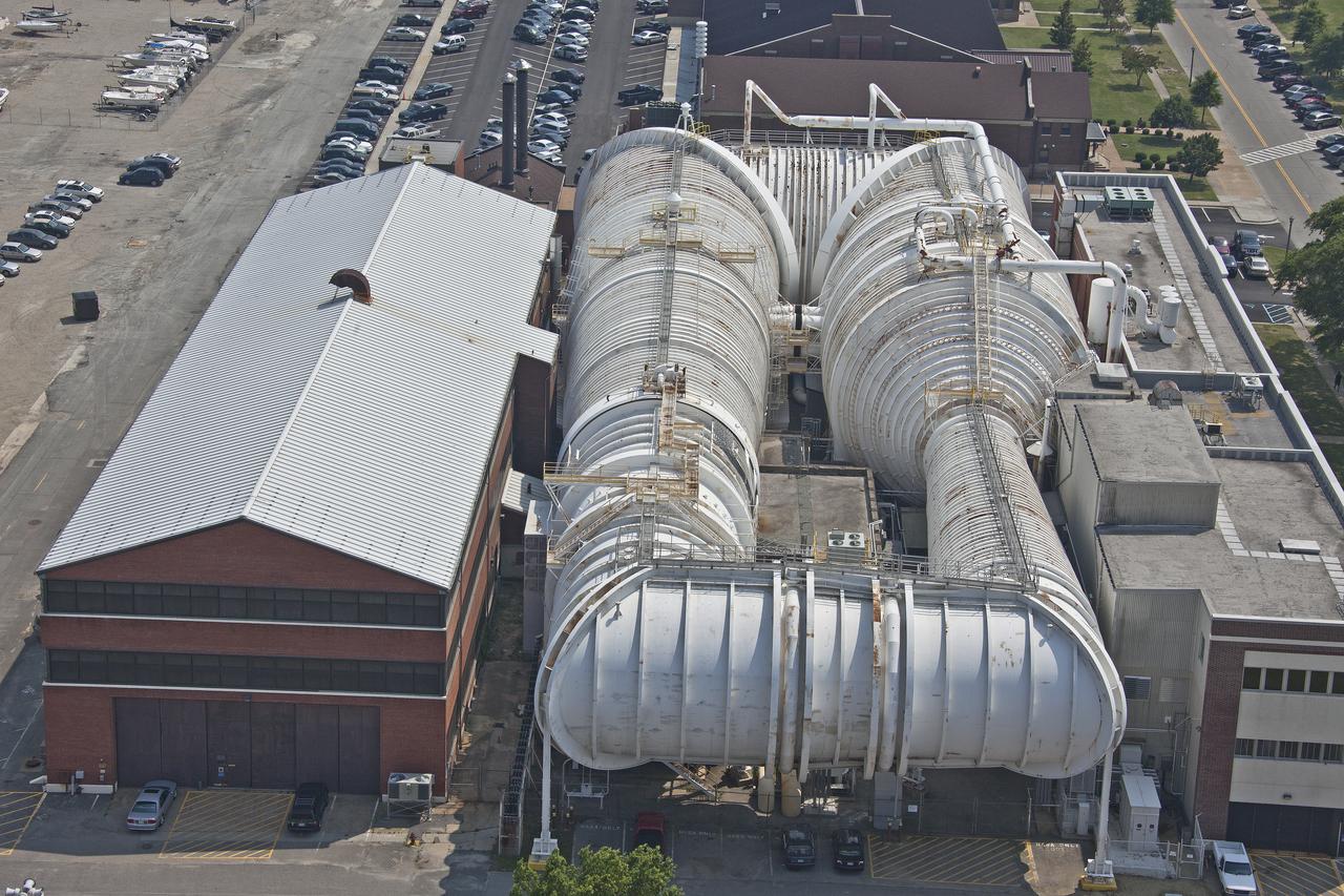
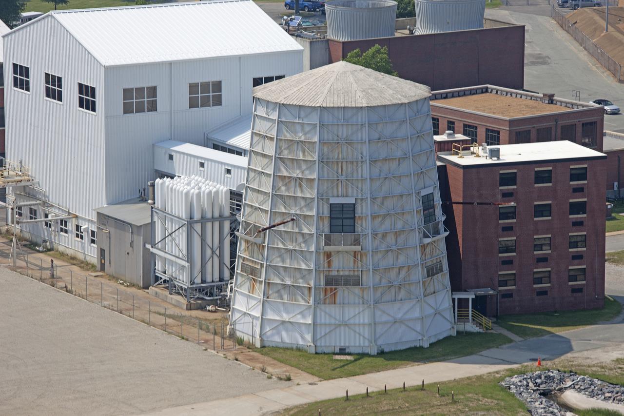
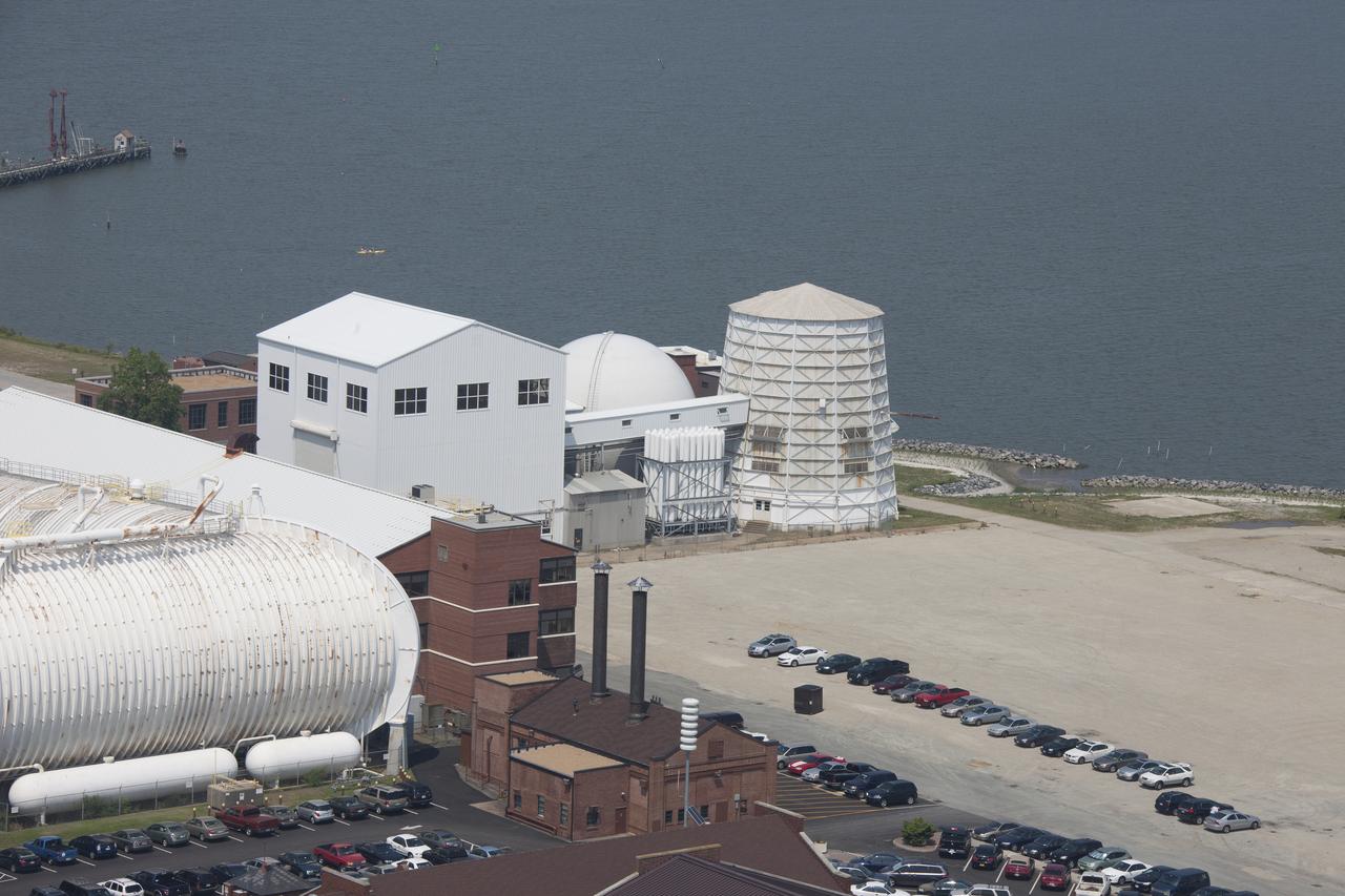
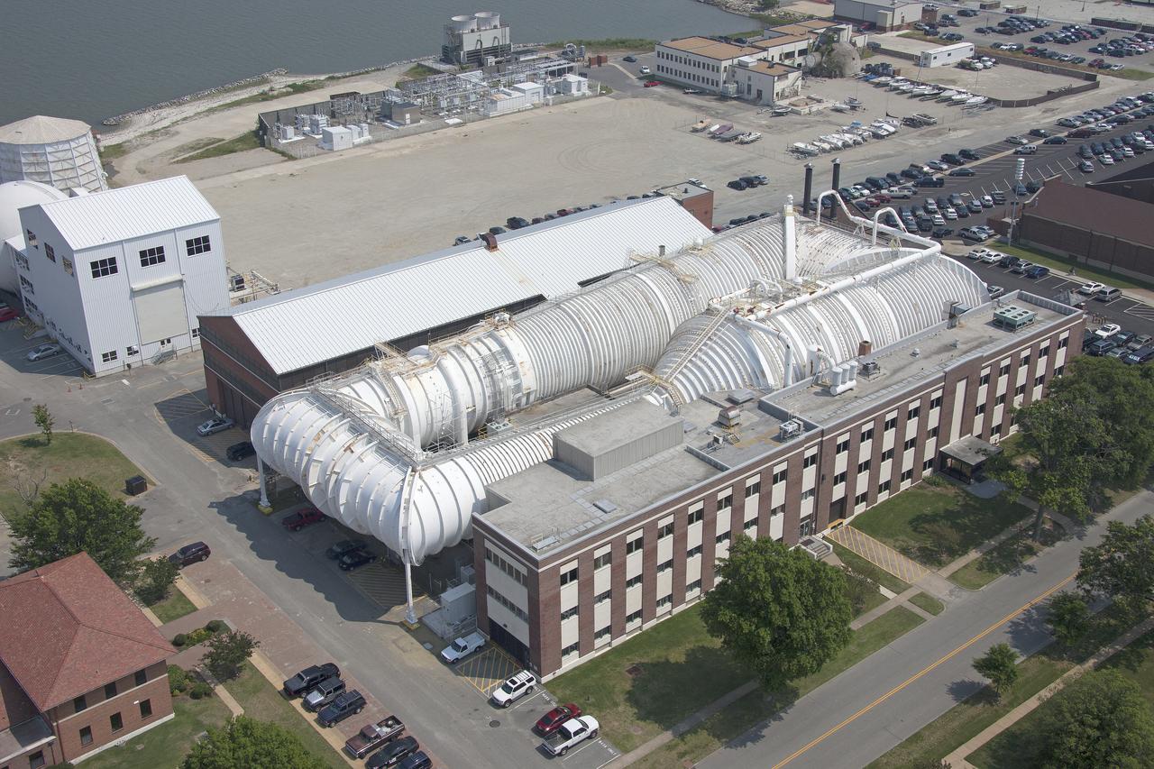
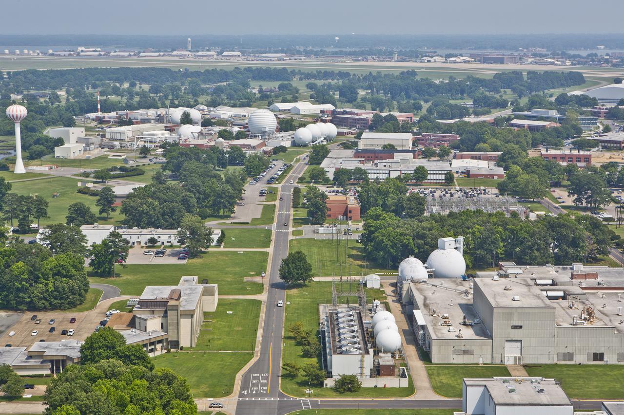
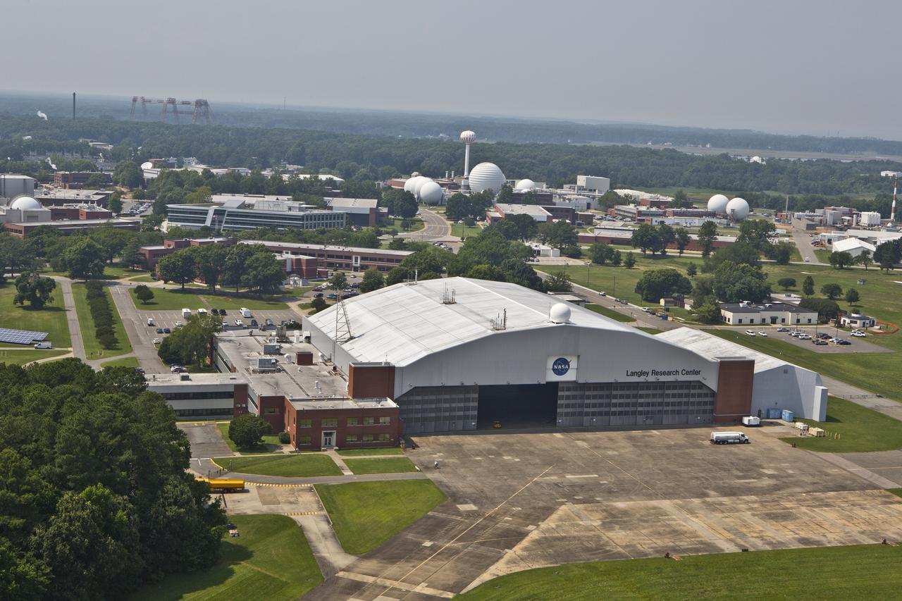
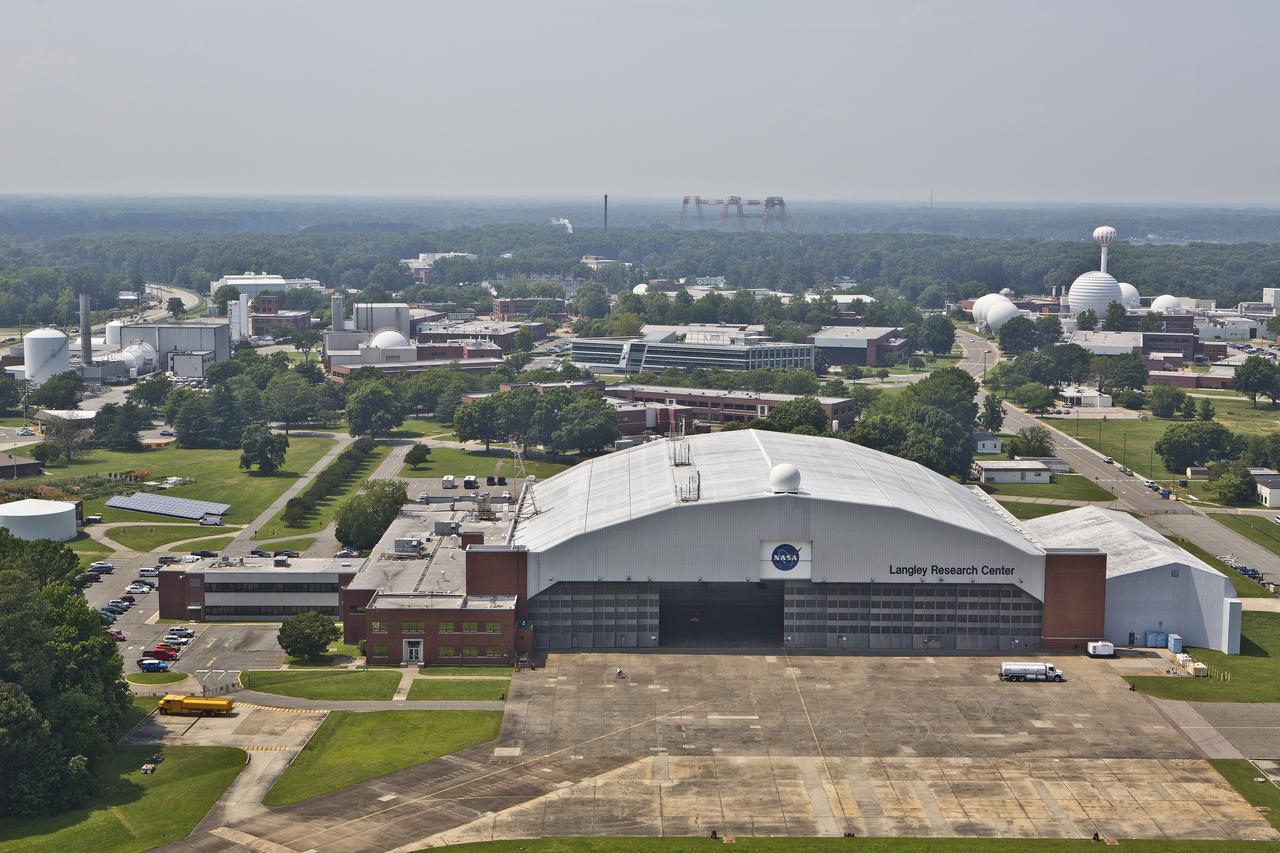
Aerials of NASA Langley Research Center east side with spin tunnel
Aerials of NASA Langley Research Center east side with spin tunnel
Aerial of NASA Langley East side spin tunnel and wind tunnel
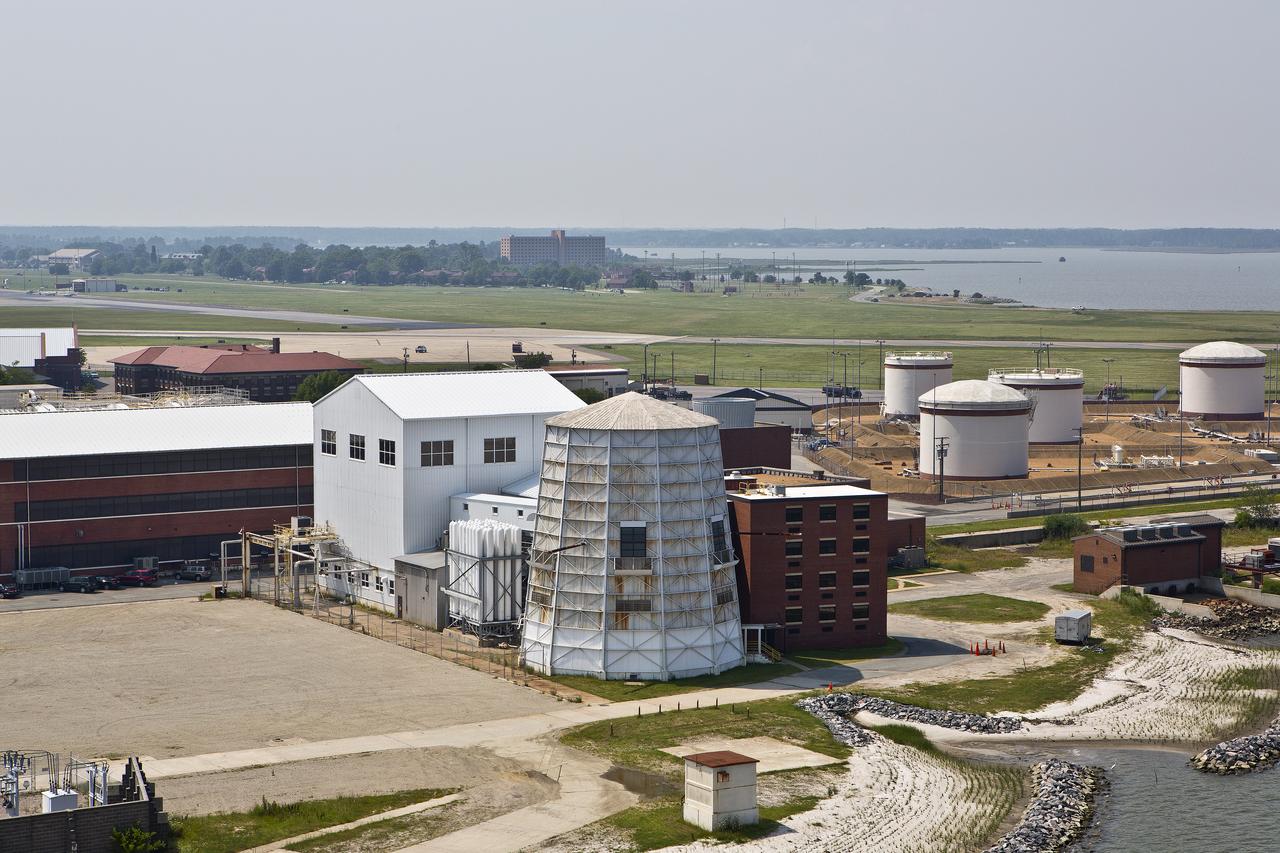
Aerials of NASA Langley Research Center east side with spin tunnel
Aerial of NASA Langley East side spin tunnel and wind tunnel
Aerials of NASA Langley Research Center east side with spin tunnel
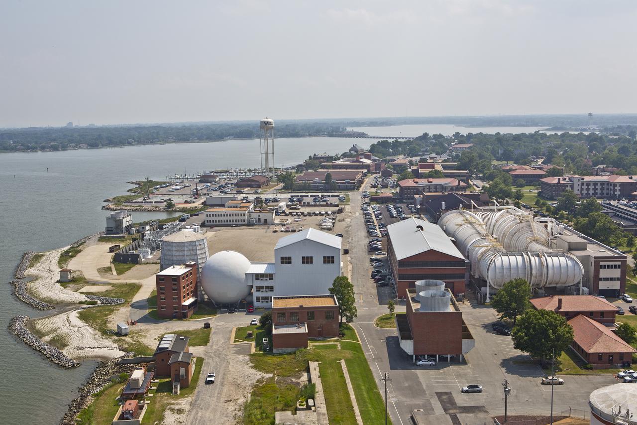
Aerials of NASA Langley Research Center west area
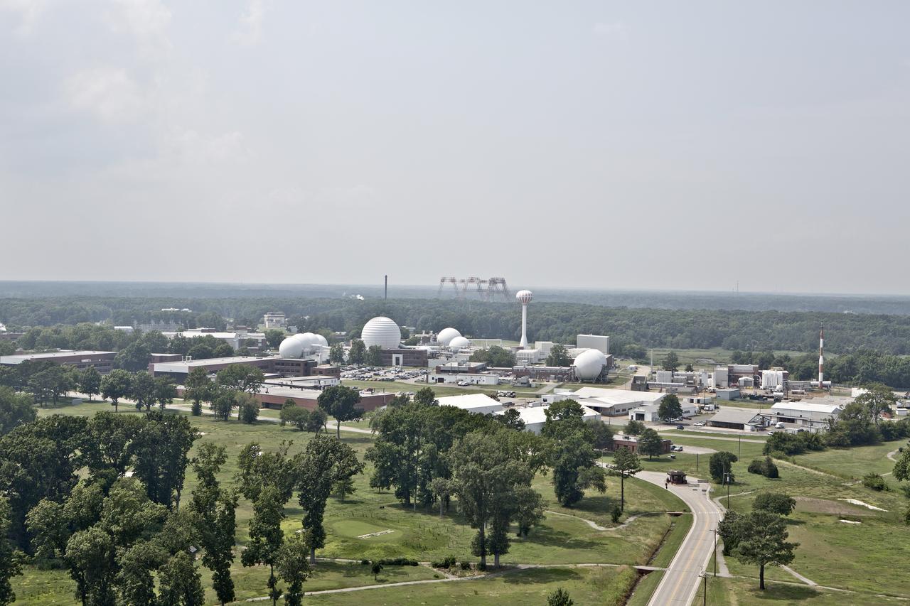
Aerial of west area of Langley Research Center
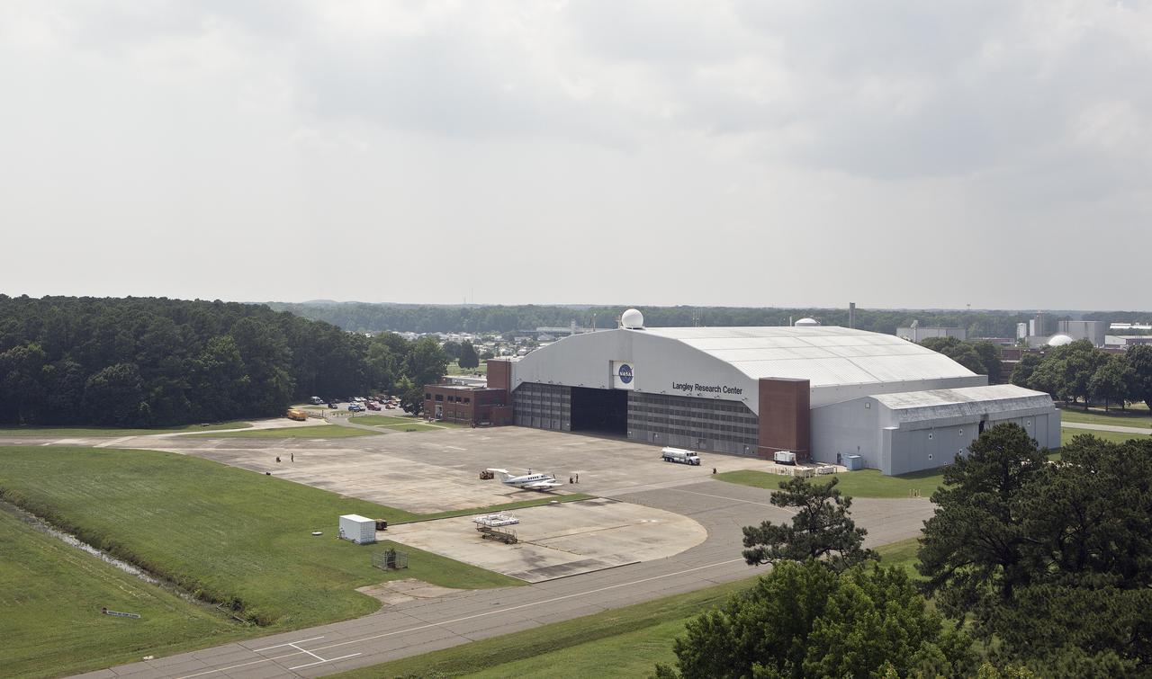
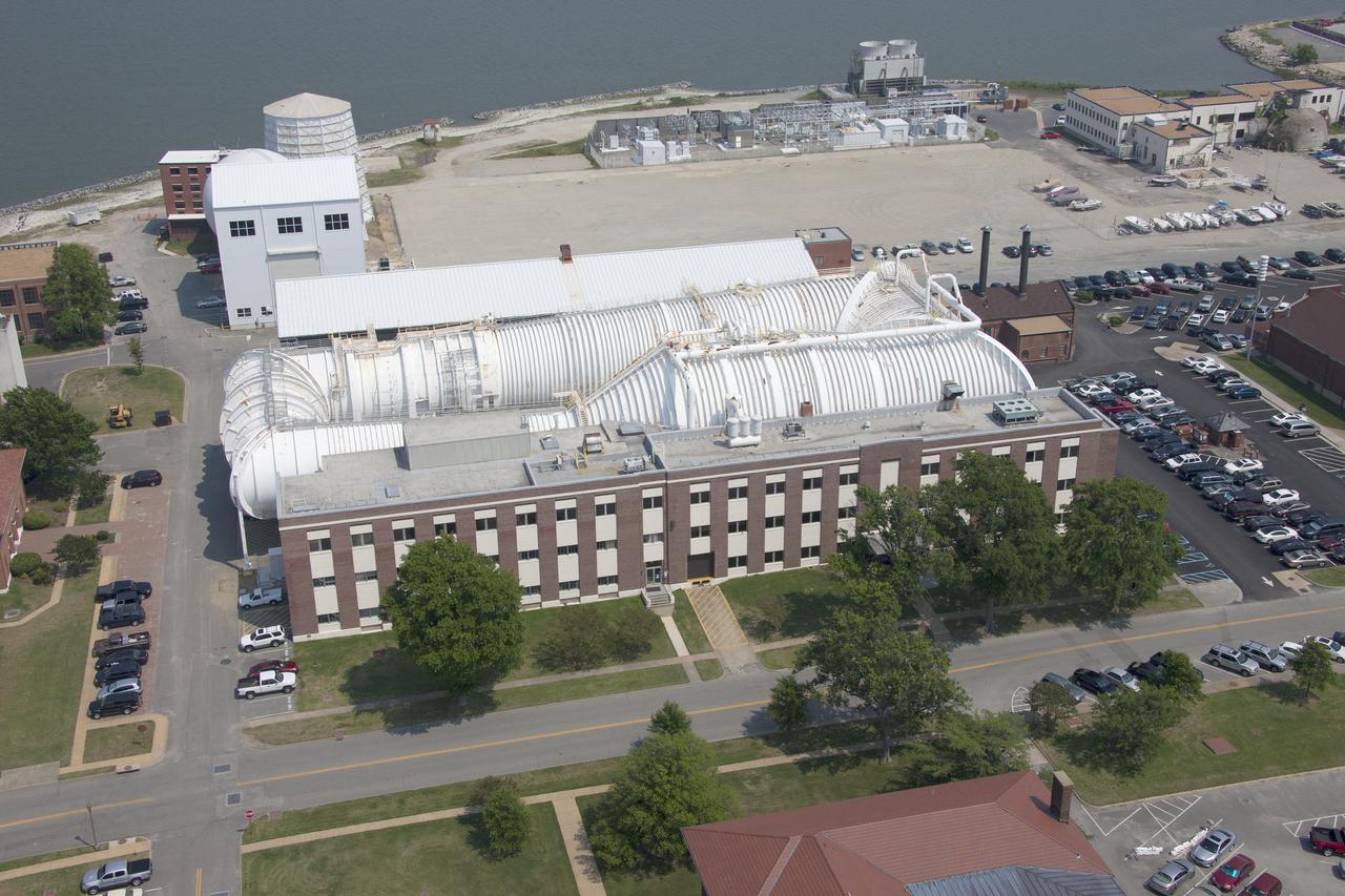
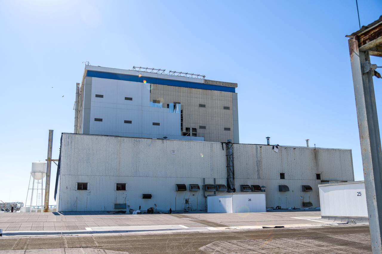
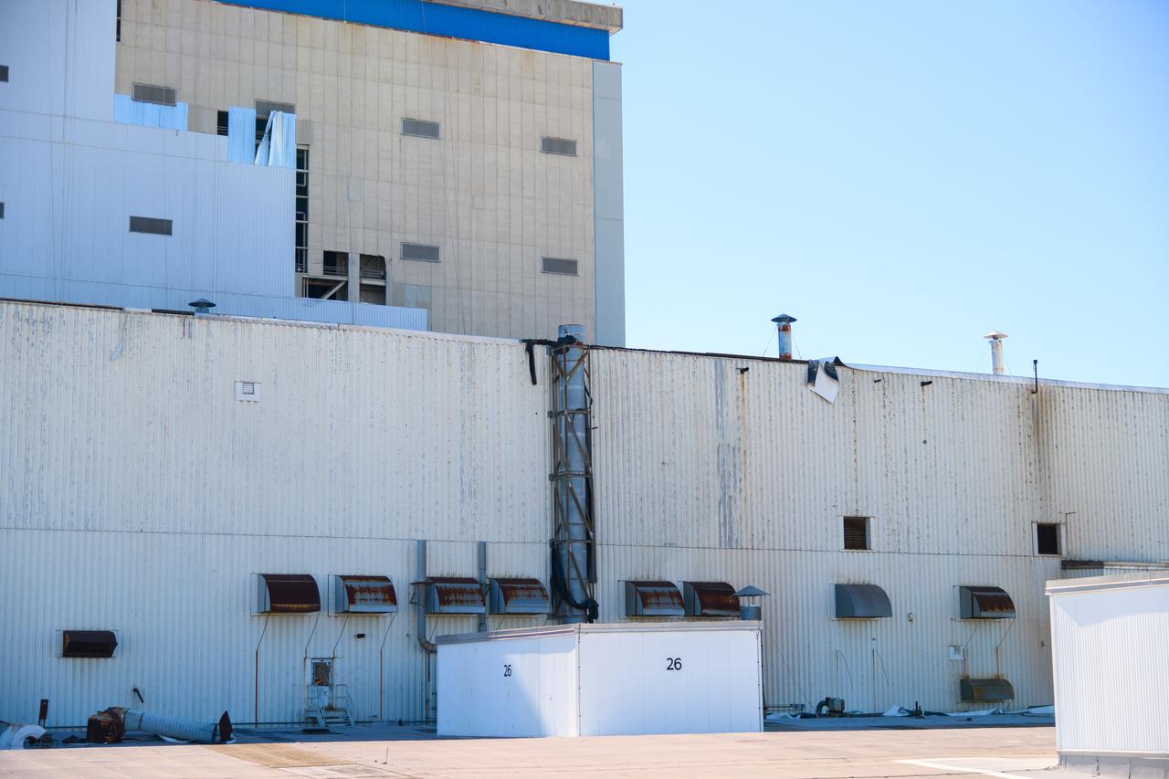
NASA Langley Hangar

Aerial of NASA Langley Research Center Hangar
Aerial of NASA Langley Research Center Hangar
Aerial of NASA Langley Research Center Hangar
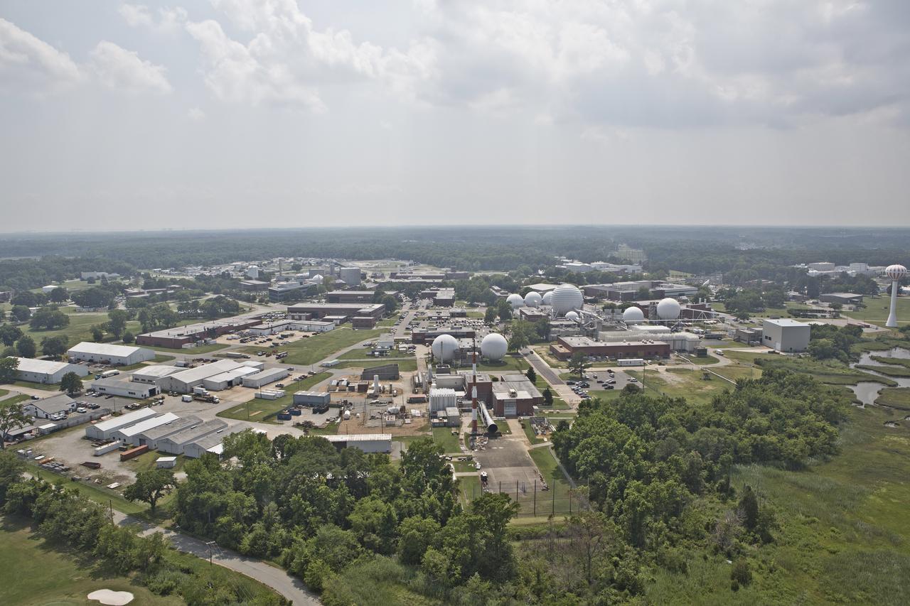
Aerial of west area of Langley Research Center
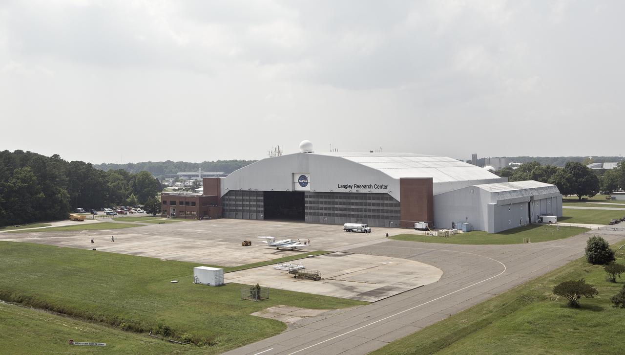
NASA Langley Hangar
Aerial of NASA Langley Research Center Hangar
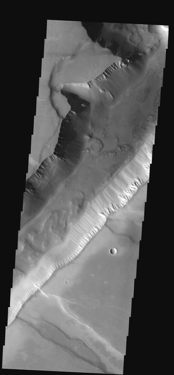
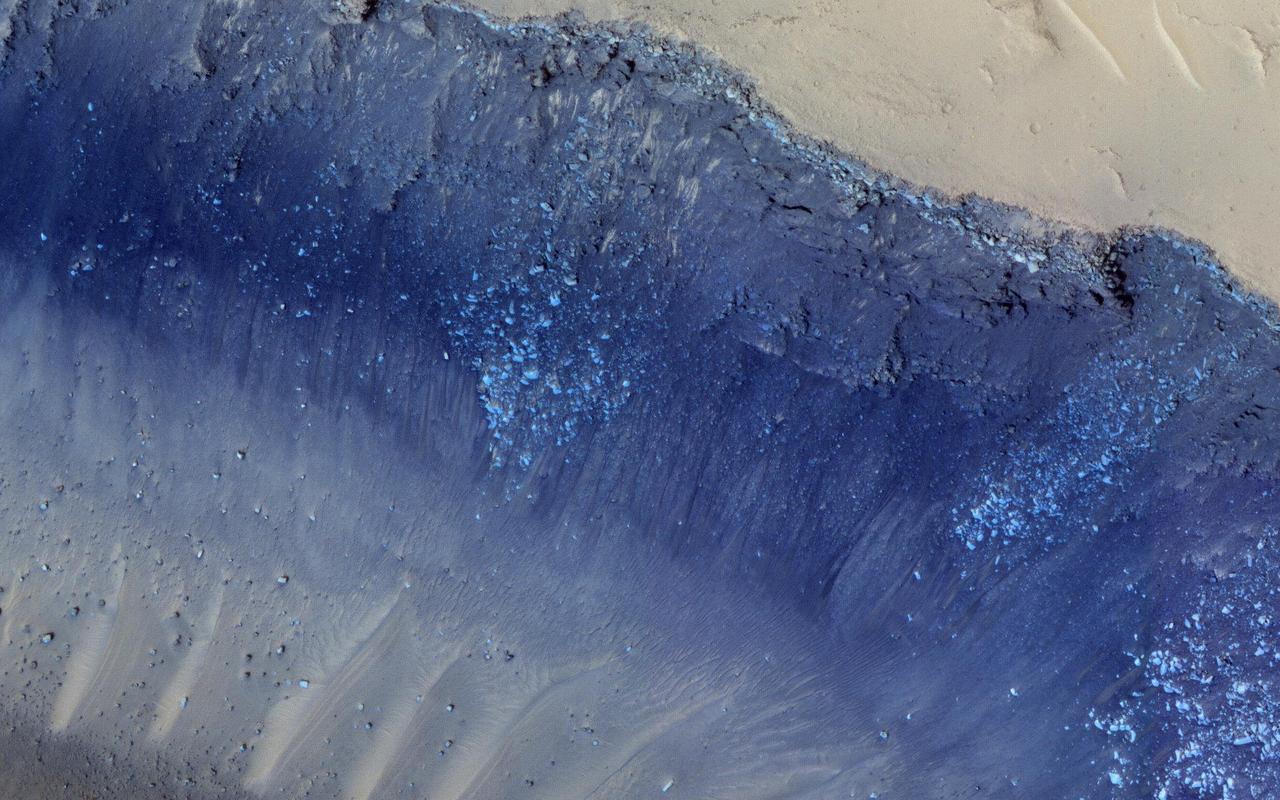
This narrow canyon is part of Coprates Chasma. On the east side of the canyon a landslide is visible. The southern wall of the canyon is marked by bright and dark streaks where dust has slid down the cliff face
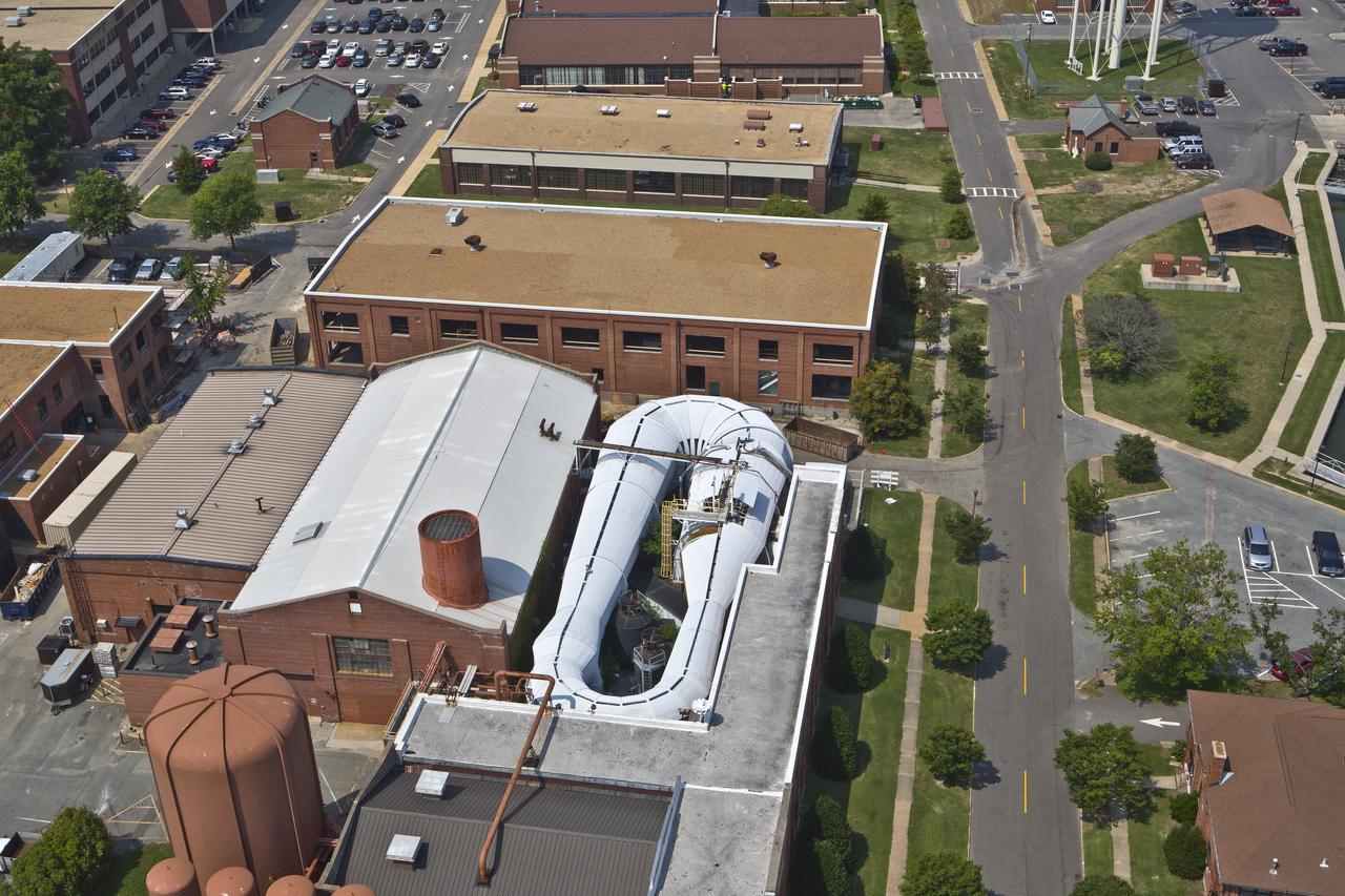
Aerials of NASA Langley Research Center east side with spin tunnel
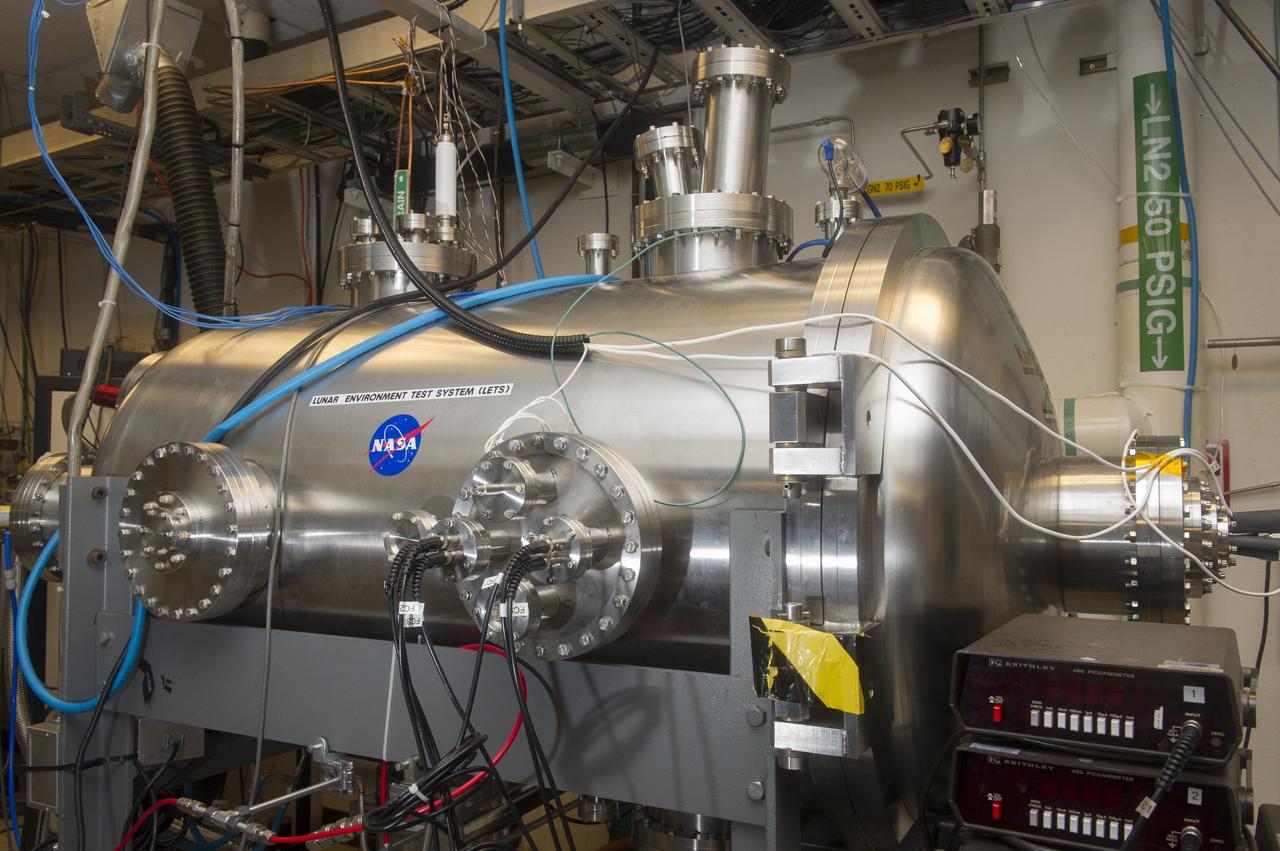
BLDG 4605, LUNAR ENVIRONMENTS TEST SYSTEM VACUUM CHAMBER, EAST SIDE
Hurricane Zeta damage to NASA’s Michoud Assembly Facility – East side of Bldg. 110 the Vertical Assembly Building (VAB).
Hurricane Zeta damage to NASA’s Michoud Assembly Facility – East side of Bldg. 110 the Vertical Assembly Building (VAB).
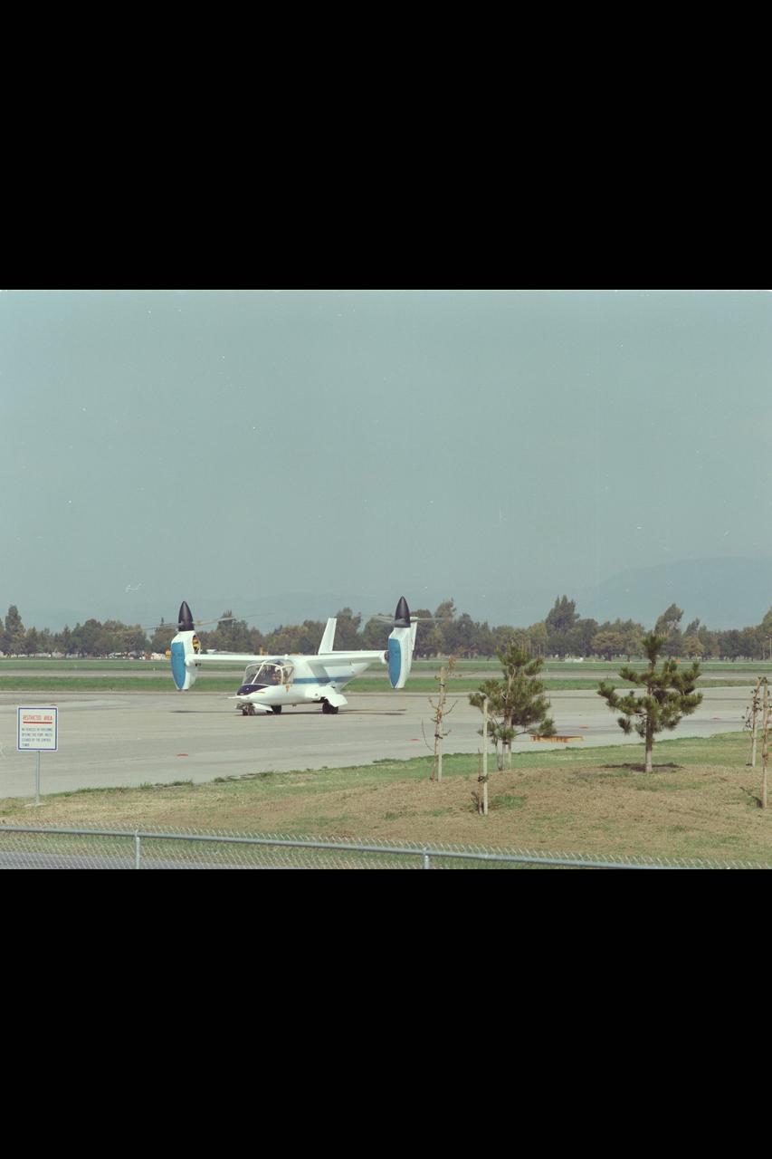
XV-15 (NASA-703) Evaluation Flight @ Ames; Above Title and Helicopter Mode from East Side Runway
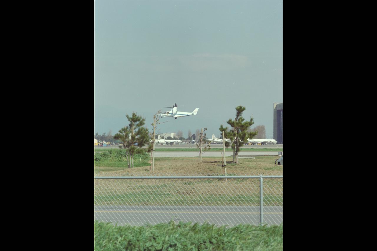
XV-15 (NASA-703) Evaluation Flight @ Ames; Above Title and Helicopter Mode from East Side Runway
Cerberus Fossae is a steep-sided set of troughs cutting volcanic plains to the east of Elysium Mons. Steep slopes on Mars have active landslides (also called "mass wasting"), and here we see evidence for two types of activity. First, the light bluish boulders on the slope appear to originate at a layer of bedrock (also light blue) near the top of the section. Second, the dark thin lines are recurring slope lineae, probably also due to mass wasting, but composed of finer-grained materials. https://photojournal.jpl.nasa.gov/catalog/PIA23182
Today's VIS image shows flank flows on the east side of Olympus Mons. Olympus Mons stands 26 km (16 miles) above the surrounding plains, which is three times taller than Mt. Everest, and is the tallest volcano in the solar system. Olympus Mons is also wider (585 km, 363 miles) than the state of Arizona. Although these are impressive dimensions an astronaut would find walking these slopes easy, as they are typically only 2 to 5 degrees. This image contains numerous lava flows, leveed lava channels, and a series of round depressions thought to be where the roof of a lava tube has collapsed into the underlying void. Orbit Number: 81077 Latitude: 19.9207 Longitude: 231.287 Instrument: VIS Captured: 2020-03-25 04:51 https://photojournal.jpl.nasa.gov/catalog/PIA23928
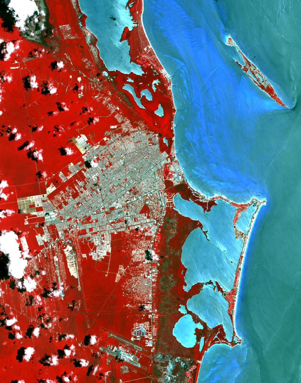
This image from NASA Terra spacecraft shows Cancun, a resort city on the east side of Mexico Yucatan Peninsula. In 1970, the population was 120 people. The city began as a tourism project in 1974. Since then, it has undergone a comprehensive transformation from being a fisherman's island surrounded by virgin forest and undiscovered shores to being one of the two most well-known Mexican resorts, along with Acapulco. In 1990 the city had grown to 167,000 inhabitants, and by 2014 to 723,000 inhabitants. These two images show the area on March 28, 1985, acquired by Landsat; and May 14, 2014, acquired by ASTER. The images cover an area of 25 x 36 km, and are located at 21.1 degrees north, 86.8 degrees west. http://photojournal.jpl.nasa.gov/catalog/PIA20086
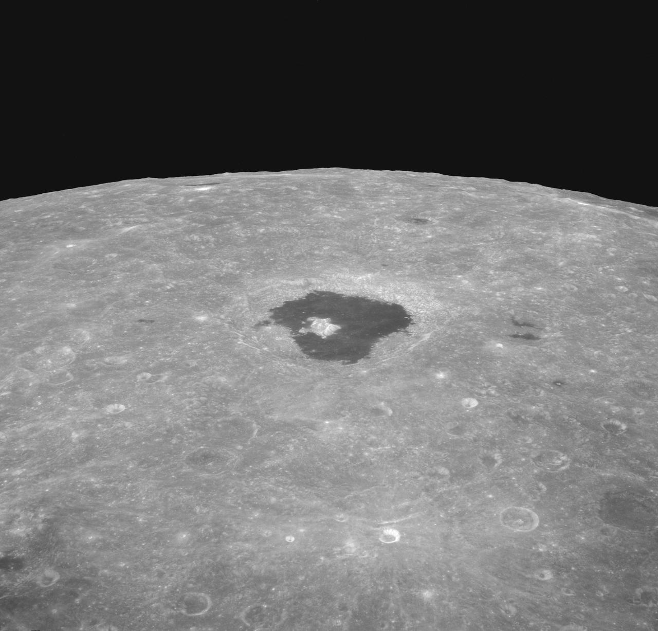
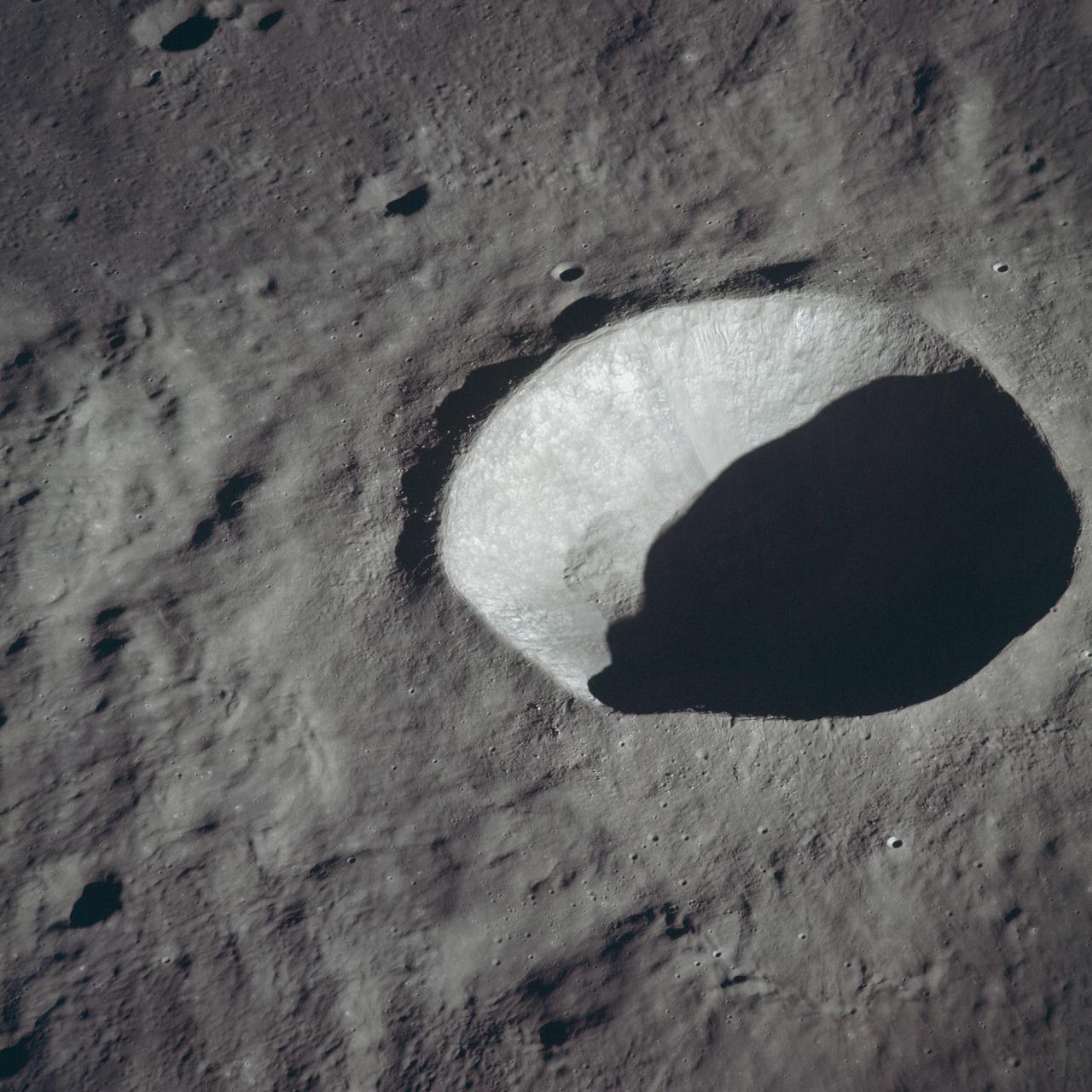
AS08-12-2196 (21-27 Dec. 1968) --- An oblique view from the Apollo 8 spacecraft looking eastward across the lunar surface from about 115 degrees east longitude to the horizon near 180 degrees east longitude. The crater Tsiolkovsky in the center of the picture is 150 kilometers wide and is located at 129 degrees east longitude and 21 degrees south latitude. While in lunar orbit, Apollo 8 moved toward the camera position over the terrain along the left (north) side of this photograph.
On the east side of Building 4826, the future home of the X-59 Quiet SuperSonic Technology aircraft, a conference room, offices, restrooms and a communications room are under construction at NASA's Armstrong Flight Research Center in Edwards, California.
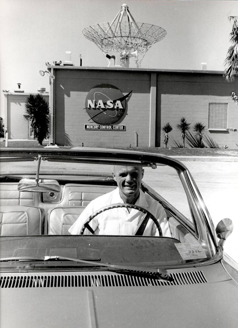
Astronaut John H. Glenn sits in a car in front of the east side of the Mercury Mission Control building. Glenn was the pilot for the Mercury-Atlas 6 mission aboard Friendship 7, which launched Feb. 20, 1962.
This 8,800-square-foot canopy area was demolished during the refurbishment of the east side of Building 4826, the future home of the X-59 Quiet SuperSonic Technology aircraft, at NASA's Armstrong Flight Research Center in Edwards, California.
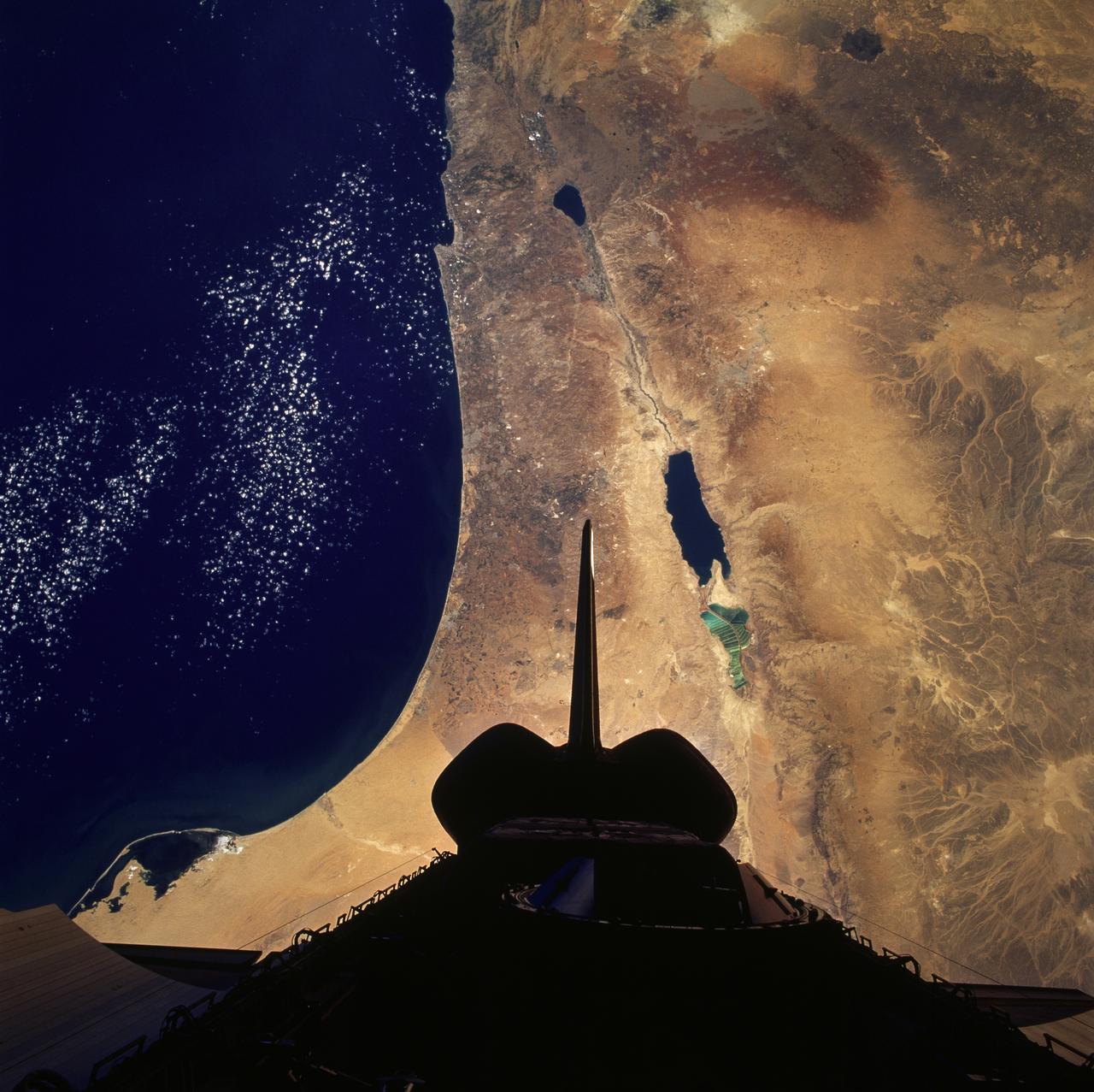
STS079-824-081 (16-26 Sept. 1996) --- In this 70mm frame from the space shuttle Atlantis, the Jordan River Valley can be traced as it separates Lebanon, Palestine and Israel on the west, from Syria and Jordan on the east. The river flows along the Dead Sea rift; the east side of the fault zone (Syria, Jordan, Saudi Arabia) has moved north about 100 kilometers relative to the west side (Lebanon, Israel, Egypt) during the past 24 million years. The Dead Sea and Sea of Galilee are in depressions formed where faults of the zone diverge or step over. The Dead Sea once covered the area of salt evaporation pans (the bright blue water). The lagoon, barrier islands and evaporite deposits (bright white) along the Mediterranean coast of the Sinai Peninsula (lower left of frame) are just east of Port Said.
AS10-34-5162 (18-26 May 1969) --- An Apollo 10 view of crater Schmidt which is located at the western edge of the Sea of Tranquility. Schmidt, which has a diameter of 7 statute miles, is also located just south of the crater Ritter and immediately west of the crater Sabine. The coordinates of Schmidt are 18.8 degrees east longitude and 1.2 degrees north latitude. The shadowed area is on the east side of the crater.

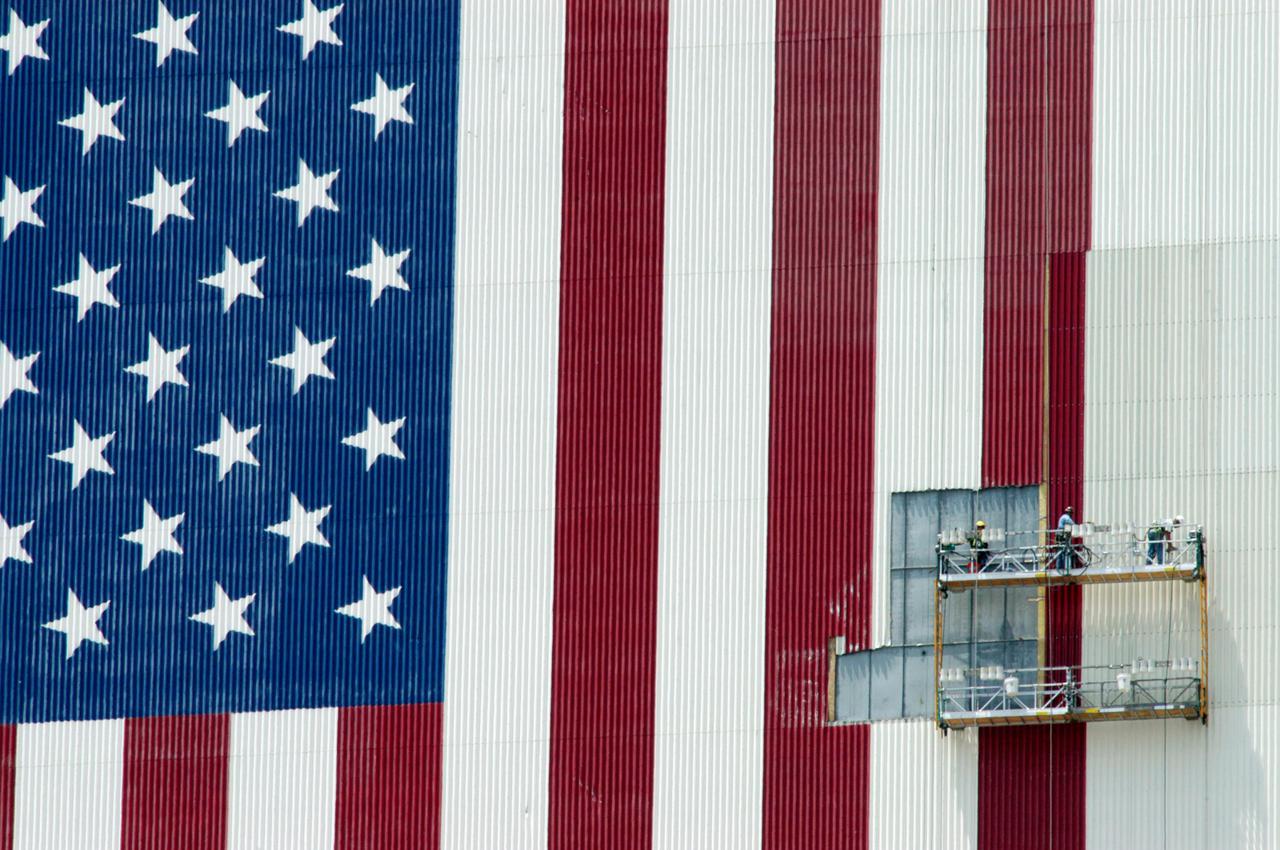
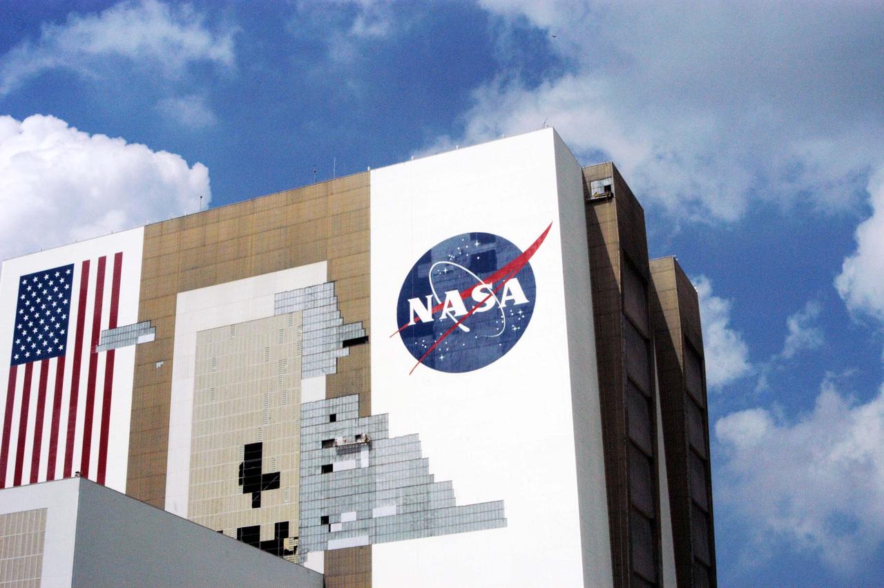
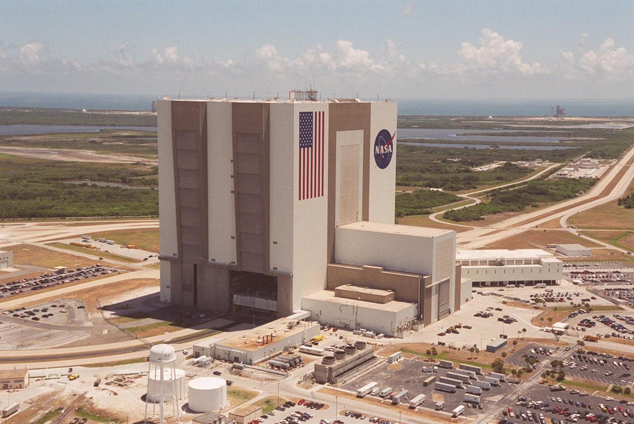
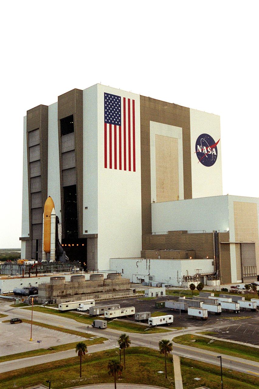
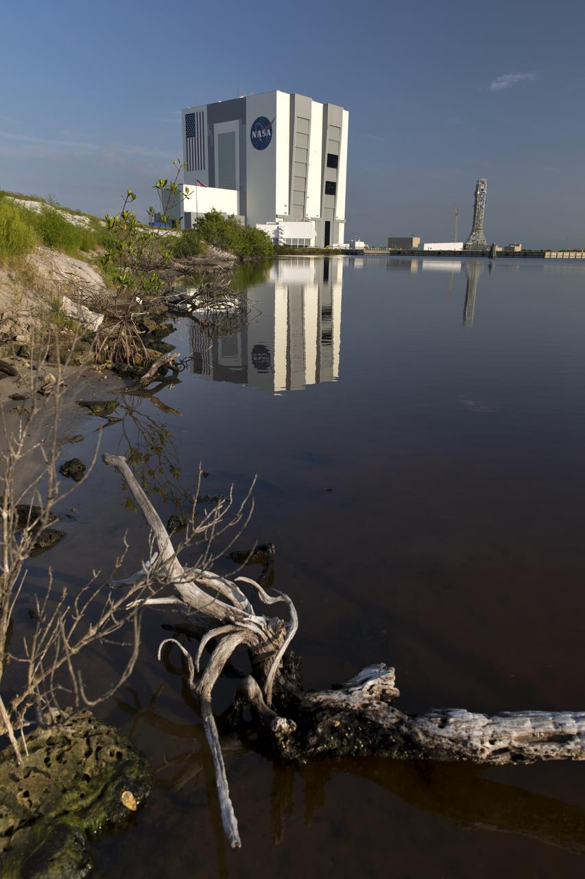
KENNEDY SPACE CENTER, FLA. - The American flag on the side of the Vehicle Assembly Building at NASA’s Kennedy Space Center is newly painted. The flag was damaged in the hurricanes of 2004 that assaulted the east coast of Florida. Winds pulled a number of panels from the side of the 525-foot-high building. The flag is 209 feet by 110 feet. Each star is more than six feet in diameter and each stripe is nine feet wide. The flag sits more than 450 feet above the ground.
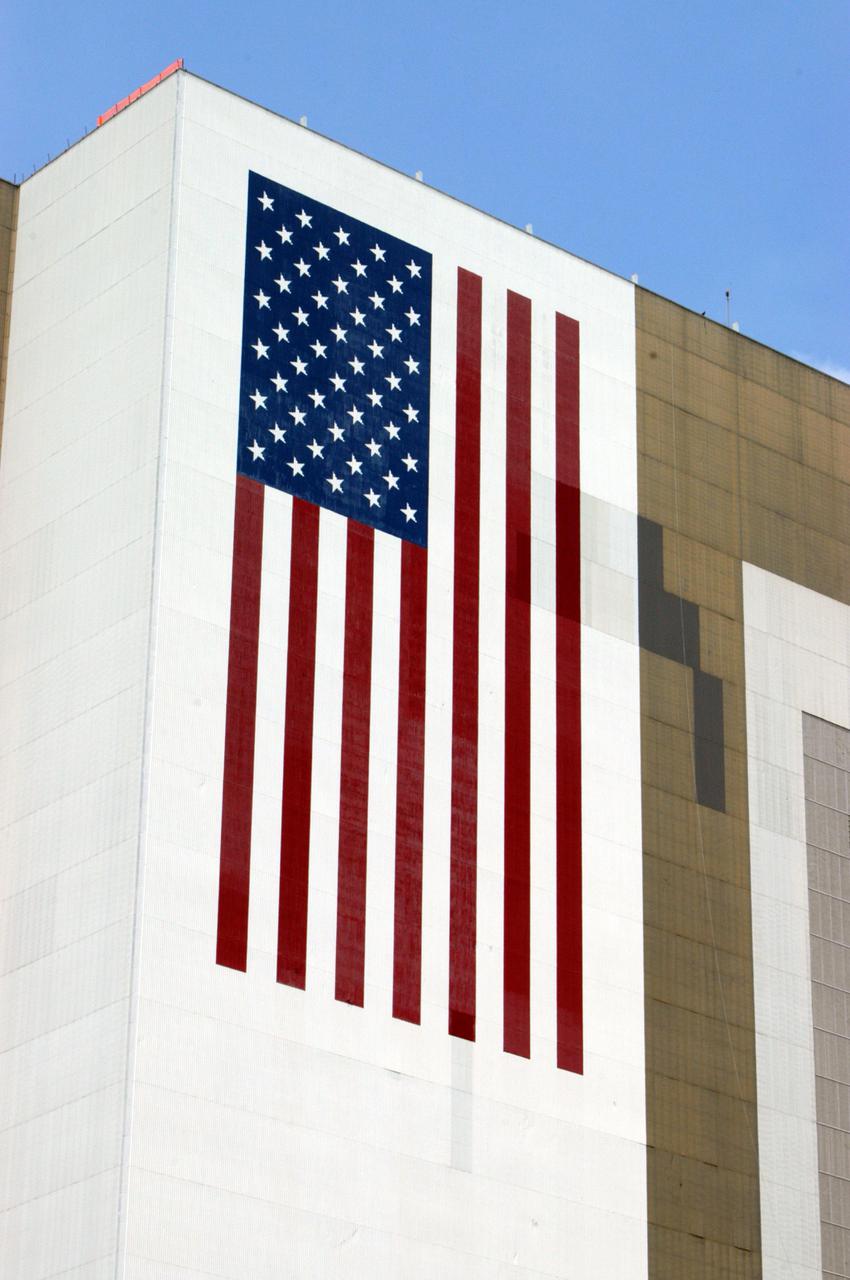
KENNEDY SPACE CENTER, FLA. - The American flag on the side of the Vehicle Assembly Building at NASA’s Kennedy Space Center is newly painted. The flag was damaged in the hurricanes of 2004 that assaulted the east coast of Florida. Winds pulled a number of panels from the side of the 525-foot-high building. The flag is 209 feet by 110 feet. Each star is more than six feet in diameter and each stripe is nine feet wide. The flag sits more than 450 feet above the ground.
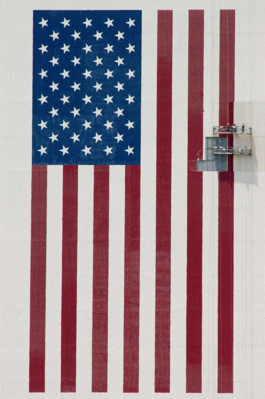
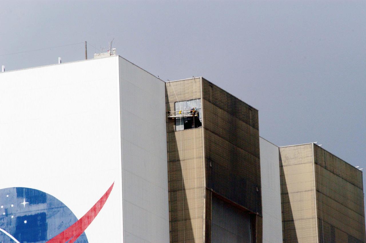
KENNEDY SPACE CENTER, FLA. - About 450 feet above the ground, painters on scaffolding begin preparations to repaint portions of the American flag on the side of the Vehicle Assembly Building at NASA’s Kennedy Space Center. The flag was damaged in the hurricanes of 2004 that assaulted the east coast of Florida. Winds pulled a number of panels from the side of the 525-foot-high building. The flag is 209 feet by 110 feet. Each star is more than six feet in diameter and each stripe is nine feet wide.

ISS027-E-027019 (12 May 2011) --- Parts of two states highly impacted by recent flooding of the Mississippi River, are pictured in this International Space Station image featuring an area east of Blytheville, Ark., off the right side of the image. Center point coordinates are located at 35.8 degrees north latitude and 89.7 degrees west longitude The areas of Ruckers Place, Tenn. and Tomato, Ark. are surrounded by water, while Barfield, Ark. is still dry behind the levee on the right side of the image. North is toward the bottom of the photo.

KENNEDY SPACE CENTER, FLA. - In the Banana Creek at Kennedy Space Center, a school of mullet appear to form an underwater carpet as they swarm in the shallows. The creek flows between the Indian River on the west side of Merritt Island and the Banana River on the east side, passing alongside the Launch Complex 39 Area. Photo credit: NASA/George Shelton
The southwestern border of Brunei with Sarawak, Malaysia is strikingly apparent due to differences in land use practice. On the Malaysian side, a spider web of small roads indicates intensive land use: in this case clearing of the forest for palm oil plantations. On the Brunei side, the virgin forest is preserved, with few if any roads cutting through the forest. The image was acquired September 10, 2012, covers an area of 38 by 38 km, and is located at 4.2 degrees north, 114.4 degrees east. https://photojournal.jpl.nasa.gov/catalog/PIA22034

KENNEDY SPACE CENTER, FLA. - In the Banana Creek at Kennedy Space Center, a school of mullet appear to form an underwater carpet as they swarm in the shallows. The creek flows between the Indian River on the west side of Merritt Island and the Banana River on the east side, passing alongside the Launch Complex 39 Area. Photo credit: NASA/George Shelton
KENNEDY SPACE CENTER, FLA. - About 450 feet above the ground, painters on scaffolding begin preparations to repaint portions of the American flag on the side of the Vehicle Assembly Building at NASA’s Kennedy Space Center. The flag was damaged in the hurricanes of 2004 that assaulted the east coast of Florida. Winds pulled a number of panels from the side of the 525-foot-high building. The flag is 209 feet by 110 feet. Each star is more than six feet in diameter and each stripe is nine feet wide.
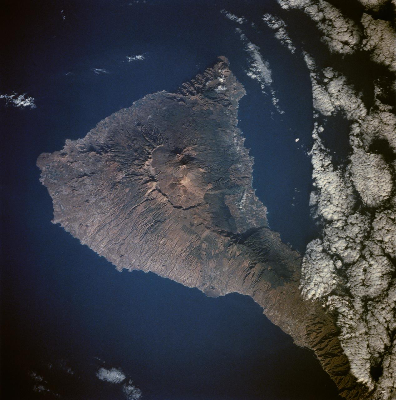
Tenarife Island is one of the most volcanically active of the Canary Island archipelago, Atlantic Ocean, just off the NW coast of Africa, (28.5N, 16.5W). The old central caldera, nearly filled in by successive volcanic activity culminating in two stratocones. From those two peaks, a line of smaller cinder cones extend to the point of the island. Extensive gullies dissect the west side of the island and some forests still remain on the east side.
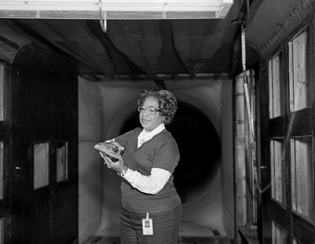
Mary Jackson With Model at NASA Langley. In 1958 Mary Jackson became NASA's first black female engineer. At this time Mrs. Jackson was working in the Theoretical Aerodynamic Branch. The tunnel was located on the East side at Langley Air Force Base.
This image of was obtained by NASA's Dawn spacecraft on May 30, 2018 from an altitude of about 420 miles (675 kilometers). Ejecta from Haulani Crater can be seen on the right side of the image. The center of this picture is located at about 2 degrees south in latitude and 6 degrees east in longitude. https://photojournal.jpl.nasa.gov/catalog/PIA22518
CAPE CANAVERAL, Fla. – Inside the Vehicle Assembly Building, or VAB, at NASA's Kennedy Space Center in Florida, portions of the catwalks on the east and west sides of Level 16 have been removed by crane and are being placed on the east side for storage. The catwalks were removed to allow room for the removal of the 175-ton crane that is situated above the transfer aisle. The crane will be lowered to the floor to perform upgrades to its 45-year-old controls in order to improve reliability, precision and safety. The Ground Systems Development and Operations Program is overseeing upgrades and modifications to the VAB. The crane will be upgraded so that it can support lifting needs for NASA and other exploration vehicles, including the agency's Space Launch System and Orion spacecraft. Photo credit: NASA/Jim Grossmann
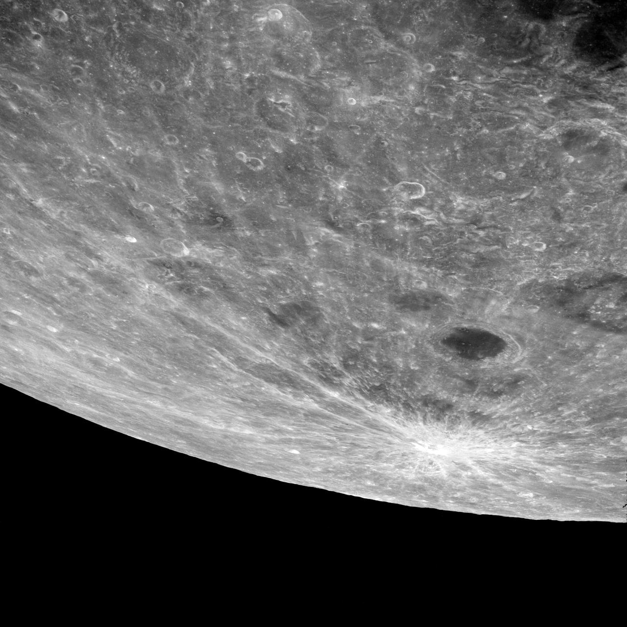
AS08-12-2209 (21-27 Dec. 1968) --- High altitude oblique view of the lunar surface, looking northeastward, as seen from the Apollo 8 spacecraft. The crater Joliot-Curie, about 175 kilometers in diameter and centered near 94 degrees east longitude and 27 degrees north latitude, is near the center of the left side of this photograph. The bright rayed crater near the horizon is probably located near 105 degrees east longitude and 45 degrees north latitude. Long, narrow rays that have been reported in the polar region of Earth facing hemisphere may radiate from this crater.

The Nubian Sandstone Aquifer System is the world's largest fossil water aquifer system. It covers an estimated area of 2.6 million square kilometers, including parts of Sudan, Chad, Libya, and most of Egypt. In the southwestern part of Egypt, the East Oweinat development project uses central pivot irrigation to mine the fossil water for extensive agricultural development. Crops include wheat and potatoes; they are transported via the airport on the eastern side. The image was acquired October 12, 2015, covers an area of 33.3 by 47.2 km, and is located near 22.6 degrees north, 28.5 degrees east. https://photojournal.jpl.nasa.gov/catalog/PIA24616

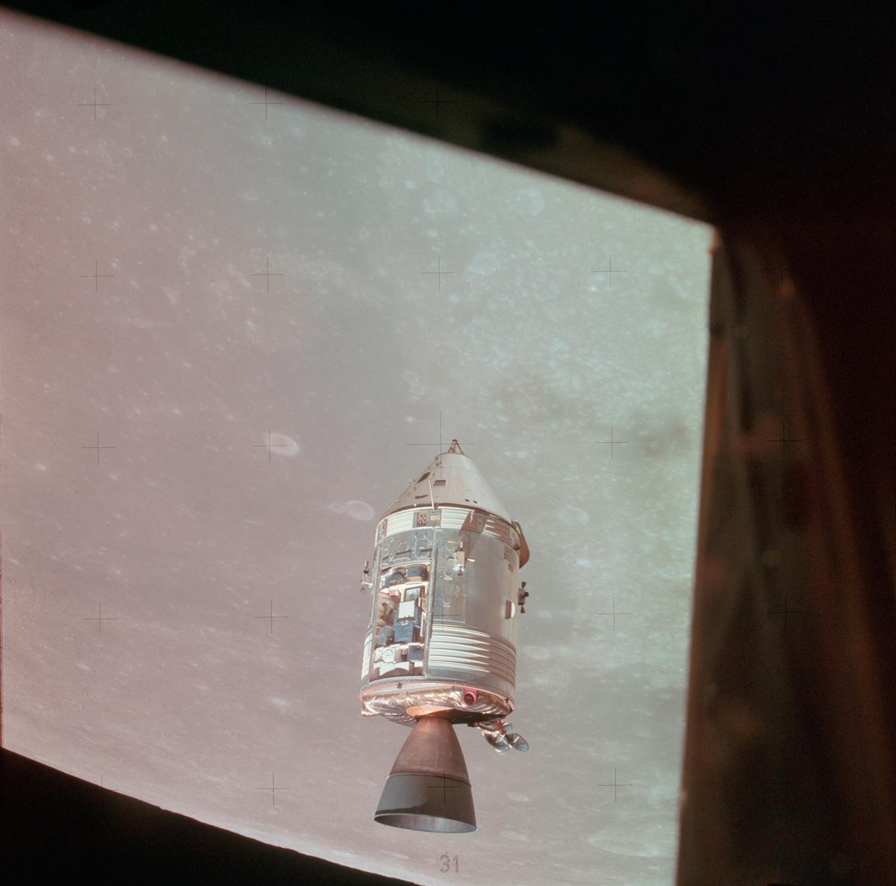
AS10-27-3873 (22 May 1969) --- The Apollo 10 Command and Service Modules (CSM) are photographed from the Lunar Module (LM) after CSM/LM separation in lunar orbit. The CSM was about 175 statute miles east of Smyth's Sea and was above the rough terrain which is typical of the lunar far side. The eastward oblique view of the lunar surface is centered near 105 degrees east longitude and 1 degree north latitude. The horizon is approximately 600 kilometers (374 statute miles) away. Numerous bright craters and the absence of shadows show that the sun was almost directly overhead when this photograph was taken.
KENNEDY SPACE CENTER, FLA. - On a scaffold barely visible along the south wall of the Vehicle Assembly Building near the NASA logo, workers are covering the holes with corrugated steel so the facility can be returned to performing operational activities. The VAB lost 820 panels from the south wall during the storm, and 25 additional panels pulled off the east wall by Hurricane Jeanne. Another scaffold is suspended near the top of the east wall (right side) for repairs. The VAB stands 525 feet tall. Central Florida, including Kennedy Space Center, has been battered by four hurricanes between Aug. 13 and Sept. 26.
The October fires in Northern California were some of the most destructive in the state's history. The burned area on the right side of the image is the ATLAS fire, that burned east of Napa; the fire consumed 51,000 acres and destroyed almost 500 structures. The burned area on the left is part of the Nuns fire that burned between Sonoma and Napa; it consumed 110,000 acres, and destroyed almost 7,000 structures. The images were acquired September 7, 2016 and October 28, 2017, cover an area of 34.5 by 39 kilometers, and are located near 38.3 degrees north, 122.3 degrees east. https://photojournal.jpl.nasa.gov/catalog/PIA22019

iss073e0982169 (Oct. 25, 2025) --- Long Island, New York—the most populous island in the United States—stretches 118 miles from west to east, extending from Brooklyn to Montauk Point. It lies between Long Island Sound to the north and the New York/New Jersey Bight to the south. Toward the upper left, New York City's island borough of Manhattan is visible, with the Hudson River and East River flowing on either side. The city's bright lights contrast with the elongated, darkened area of Central Park. This image was captured at approximately 2:24 a.m. local time from the International Space Station as it orbited 263 miles above the Empire State.
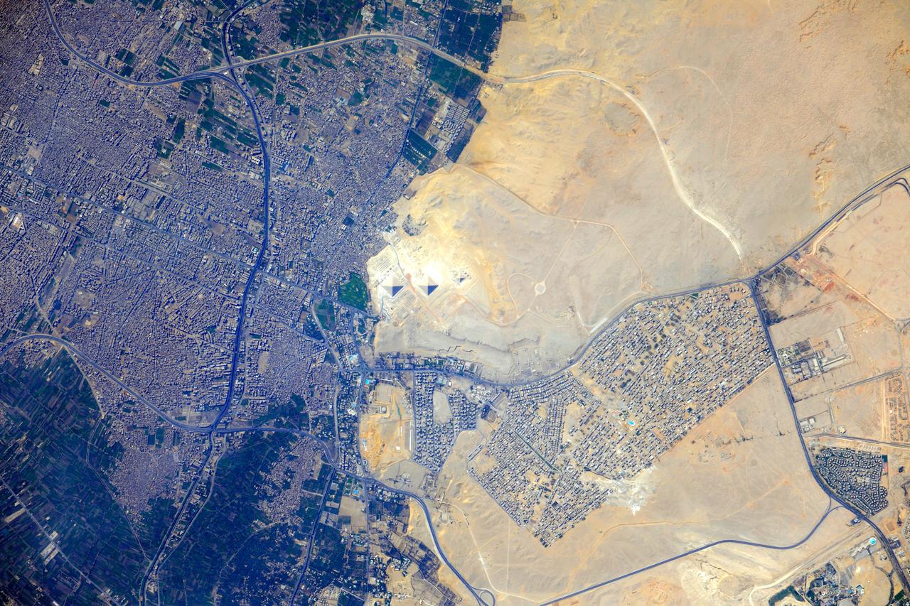
ISS032-E-009123 (26 July 2012) --- Pyramids at Giza, Egypt are featured in this image photographed by an Expedition 32 crew member on the International Space Station. The Great Pyramids at Giza (center) are the last of the Seven Wonders of the Ancient World, and are perhaps the most famous of the ancient monuments in the Nile River Delta region of Egypt. They are also a favorite subject of photography from orbit ? particularly when high resolution imagery can be obtained. The southeast-facing sides of the pyramids of the pharaohs Khufu, Khafre, and Menkaure are all brightly illuminated by the sun, while the northwest facing sides are in shadow. This shadowing also highlights smaller unfinished pyramids to the south of Menkaure?s pyramid, as well as fields of rectangular flat roofed mastabas (tombs) to the east and west of Khufu?s pyramid. While not as grand as the pyramids, mastabas were the burial places of prominent persons during the periods of the ancient pharaohs. To the southeast of Khufu?s pyramid, the head and rear haunches of the Sphinx are also visible (albeit not clearly). It is a short distance between the glories of ancient Egypt and the modern Cairo metropolitan area to the north and east. The green vegetation of a hotel golf course (center left), and the numerous building and streets of El Giza, provide stark contrast to the bare rock and soil of the adjacent desert. Roadways visible in the desert (right) connect the urban regions to the east with further development to the north.
The east side of the Vehicle Assembly Building (VAB) at Kennedy Space Center shows missing panels around the leaves of the upper door, the effect of the high winds from Hurricane Floyd as it passed along the East Coast of Florida, Sept. 14-15. At a weather tower located between Shuttle Launch Pad 39A and Launch Complex 41, the highest winds recorded during the superstorm were 91 mph from the NNW at 4:50 a.m. on Wednesday, Sept. 15. The maximum sustained winds were recorded at 66 mph. The highest amount of rain recorded at KSC was 2.82 inches as the eye of Hurricane Floyd passed 121 miles east of Cape Canaveral at 4 a.m. Wednesday. A preliminary review of conditions at the Kennedy Space Center was positive after the worst of Hurricane Floyd passed. There appeared to be no major damage to NASA assets, including the launch pads, the four Space Shuttle Orbiters, and flight hardware
KENNEDY SPACE CENTER, FLA. -- For the first time in Space Shuttle history, a fully stacked Shuttle - Atlantis - moves into high bay 2, on the west side of the Vehicle Assembly Building (VAB). The VAB and nearby rock-paved crawlerway have recently undergone major modifications to provide Shuttle fliglht hardware more storage space and protection - "Safe Haven" - from hurricanes or tropical storms. Atlantis begain moving out of VAB high bay 1 on the east side at 2:59 a.m. EDT. After the successful "Safe Haven" fit check, Shuttle Atlantis is scheduled to roll out to Launch Pad 39B in preparation for the STS-106 launch on Sept. 8.
A nearly vertical view of Disappointment Reach and surroundings. Ripple-like patterns extending at right angles to the tidal flow can be discerned on shoals. Relict sand dune patterns, crests unvegetated, are evident on the western side of the estuary. Red mud brought down the Mooramel River on the east side of the estuary does extend into the shallow water of the inter-tidal lagoons. Most of the light-colored water along the coast, represents shoals of lime sediment. Patterns of sediment distribution by tides, waves, streams, and wind combine to create a complex and colorful scene.
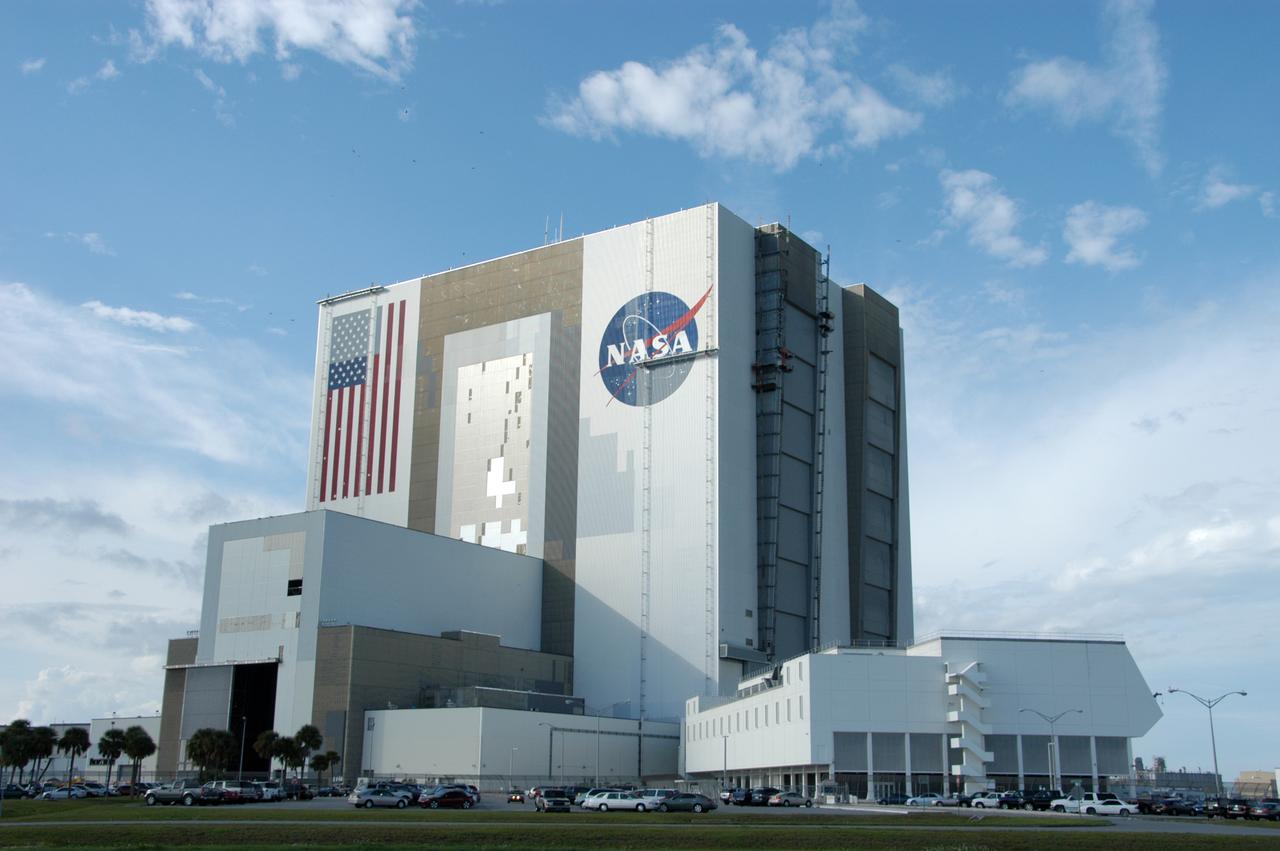
Elevated platforms are seen hanging in front of the NASA Logo on the side of Kennedy Space Center's Vehicle Assembly Building. Also in view on the east side of the building are platforms on the facility's large vertical doors. Workers, suspended on the platforms from the top of the 525-foot-high VAB, use rollers and brushes to do the painting. The flag and logo were last painted in 1998, honoring NASA's 40th anniversary. The flag spans an area 209 feet by 110 feet, or about 23, 437 square feet. Each stripe is 9 feet wide and each star is 6 feet in diameter. The logo, also known as the "meatball," measures 110 feet by 132 feet, or about 12,300 square feet.
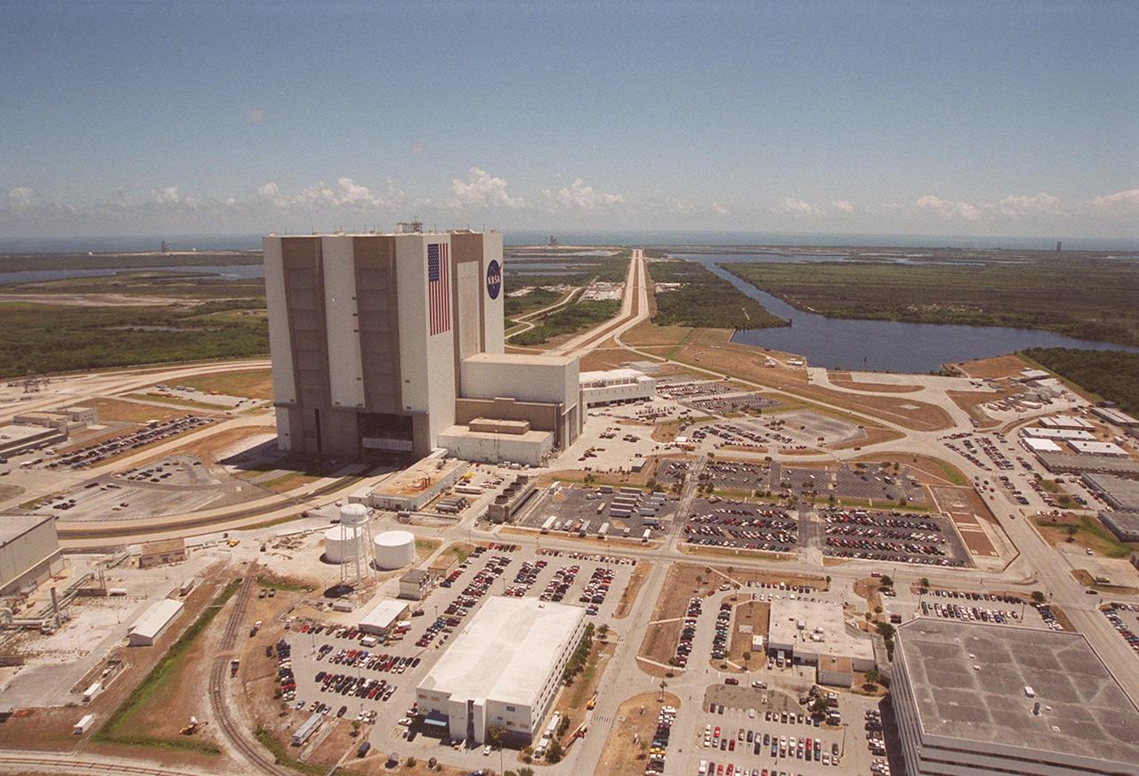
This aerial photo captures many of the facilities involved in Space Shuttle launches. At center is the Vehicle Assembly Building (VAB). The curved road on the near side is the newly restored crawlerway leading into the VAB high bay 2, where a mobile launcher platform/crawler-transporter currently sits. The road restoration and high bay 2 are part of KSC’s Safe Haven project, enabling the storage of orbiters during severe weather. The crawlerway also extends from the east side of the VAB out to the two Space Shuttle launch pads. In the distance is the Atlantic Ocean. To the right of the far crawlerway is the turn basin, into which ships tow the barge for offloading new external tanks from Louisiana
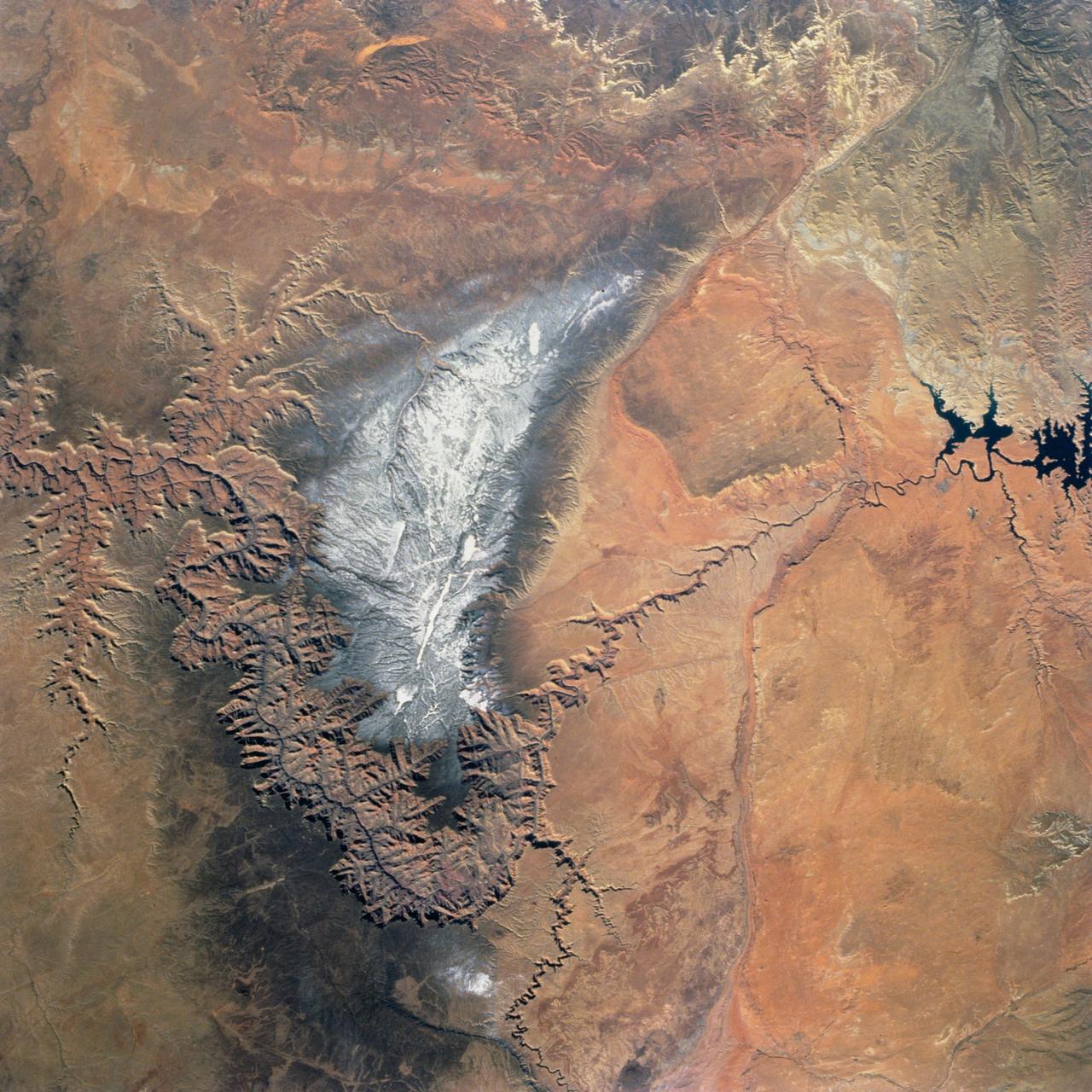
Snow covers the Kaibab Plateau on the northern side of the Colorado River in this November, 1994 view of the Grand Canyon. North is to the bottom of this view. The Colorado River has created a canyon which cuts through billions of years of geologic time. The Grand Canyon is 446 kilometers (277 miles) long, averages 16 kilometers (10 miles) wide, and is approximately 1.6 kilometers (1 mile) deep. The Coconino Plateau is located on the upper left side of the view, or to the south of the Colorado River. The direction of the flow of the Colorado River is from the east to the west. Eventually the river turns south and empties into the Gulf of California. The southern portion of Lake Powell in Utah can be seen at the bottom center of the view.
This aerial photo captures many of the facilities involved in Space Shuttle launches. At center is the Vehicle Assembly Building (VAB). The curved road on the near side is the newly restored crawlerway leading into the VAB high bay 2, where a mobile launcher platform/crawler-transporter currently sits. The road restoration and high bay 2 are part of KSC’s Safe Haven project, enabling the storage of orbiters during severe weather. The crawlerway also extends from the east side of the VAB out to the two Space Shuttle launch pads. In the distance is the Atlantic Ocean

This aerial photo captures many of the facilities involved in Space Shuttle launches. At center is the Vehicle Assembly Building (VAB). The curved road on the near side is the newly restored crawlerway leading into the VAB high bay 2, where a mobile launcher platform/crawler-transporter currently sits. The road restoration and high bay 2 are part of KSC’s Safe Haven project, enabling the storage of orbiters during severe weather. The crawlerway also extends from the east side of the VAB out to the two Space Shuttle launch pads. In the distance is the Atlantic Ocean
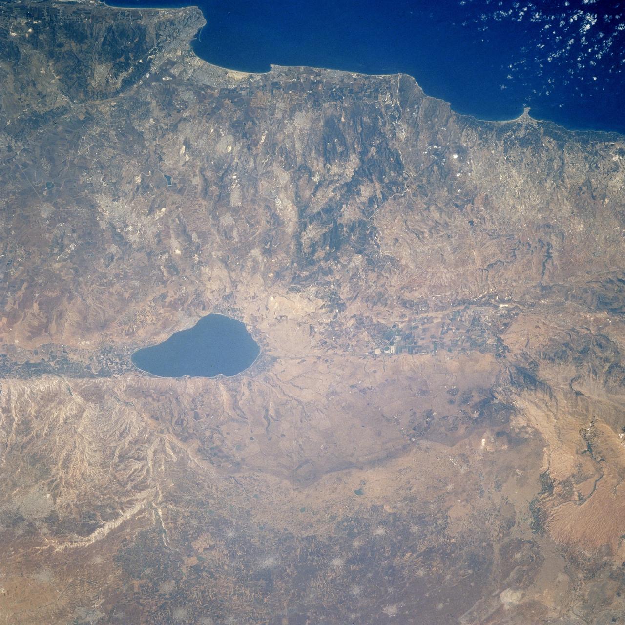
STS106-713-002 (19 September 2000) --- One of the STS-106 crew members on board the Space Shuttle Atlantis, 204 nautical miles above Earth, used a handheld 70mm camera to photograph this image featuring the Sea of Galilee and part of the Mediterranean coast. Also known as Lake Tiberius and other names, the body of water is the only natural fresh-water lake in Israel. It borders on the Golan Heights on its east side. The port of Haifa is visible on the Mediterranean coast. The large agriculture projects on the Israeli side of Galilee are irrigated by the lake and the Jordan River.

KENNEDY SPACE CENTER, FLA. -- For the first time in Space Shuttle history, a fully stacked Shuttle - Atlantis - moves into high bay 2, on the west side of the Vehicle Assembly Building (VAB). The VAB and nearby rock-paved crawlerway have recently undergone major modifications to provide Shuttle fliglht hardware more storage space and protection - "Safe Haven" - from hurricanes or tropical storms. Atlantis begain moving out of VAB high bay 1 on the east side at 2:59 a.m. EDT. After the successful "Safe Haven" fit check, Shuttle Atlantis is scheduled to roll out to Launch Pad 39B in preparation for the STS-106 launch on Sept. 8.

KENNEDY SPACE CENTER, FLA. -- Shuttle Atlantis, with twin solid rocket boosters and external tank atop the Mobile Launcher Platform and crawler-transorter, moves in the predawn hours into high bay 2 in the Vehicle Assembly Building (VAB). For the first time in Space Shuttle history, a fully stacked Shuttle is rolling around the north side of the VAB into high bay 2 on the building's west side. The VAB and nearby rock-paved crawlerway have recently undergone major modifications to provide Shuttle fliglht hardware more storage space and protection - "Safe Haven" - from hurricanes or tropical storms. Atlantis, the twin solid rocket boosters and external tank begain moving out of VAB high bay 1 on the east side at 2:59 a.m. EDT. After the successful "Safe Haven" fit check, Shuttle Atlantis is scheduled to roll out to Launch Pad 39B in preparation for the STS-106 launch on Sept. 8.

KENNEDY SPACE CENTER, FLA. -- A crawler-transporter with mobile launcher platform on top tests the buried portion of the Apollo-era crawlerway leading to the Vehicle Assembly Building (VAB) high bay 2 on the southwest side. The road was restored as part of KSC’s Safe Haven project. High bay 2 provides a third stacking area. The primary goal of the Safe Haven construction project was to strengthen readiness for hurricane season by expanding the VAB’s storage capacity. The new area, in high bay 2, will allow NASA to preassemble stacks and still have room in the VAB to pull a Shuttle back from the pad if severe weather threatens. Potential rollouts of the Space Shuttle to the launch pad from high bay 2 will involve making a turn around the north side of the VAB in contrast to the straight rollouts from high bays 1 and 3, on the east side of the VAB facing the launch pads
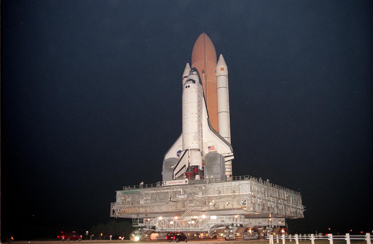
KENNEDY SPACE CENTER, FLA. -- Shuttle Atlantis, with twin solid rocket boosters and external tank atop the Mobile Launcher Platform and crawler-transorter, moves in the predawn hours into high bay 2 in the Vehicle Assembly Building (VAB). For the first time in Space Shuttle history, a fully stacked Shuttle is rolling around the north side of the VAB into high bay 2 on the building's west side. The VAB and nearby rock-paved crawlerway have recently undergone major modifications to provide Shuttle fliglht hardware more storage space and protection - "Safe Haven" - from hurricanes or tropical storms. Atlantis, the twin solid rocket boosters and external tank begain moving out of VAB high bay 1 on the east side at 2:59 a.m. EDT. After the successful "Safe Haven" fit check, Shuttle Atlantis is scheduled to roll out to Launch Pad 39B in preparation for the STS-106 launch on Sept. 8.
KENNEDY SPACE CENTER, FLA. -- For the first time in Space Shuttle history, a fully stacked Shuttle - Atlantis - is rolling into the Vehicle Assembly Building's (VAB) high bay 2 on the building's west side. The VAB and nearby rock-paved crawlerway have recently undergone major modifications to provide Shuttle fliglht hardware more storage space and protection - "Safe Haven" - from hurricanes or tropical storms. Atlantis, the twin solid rocket boosters and external tank begain moving out of VAB high bay 1 on the east side at 2:59 a.m. EDT. The 6-million pound crawler transporter carried the Mobile Launcher Platform and Space Shuttle around the north side of the VAB and into high bay 2. After the successful "Safe Haven" fit check, Shuttle Atlantis is scheduled to roll out to Launch Pad 39B in preparation for the STS-106 launch on Sept. 8.

KENNEDY SPACE CENTER, FLA. -- For the first time in Space Shuttle history, a fully stacked Shuttle - Atlantis - is rolling into the Vehicle Assembly Building's (VAB) high bay 2 on the building's west side. The VAB and nearby rock-paved crawlerway have recently undergone major modifications to provide Shuttle fliglht hardware more storage space and protection - "Safe Haven" - from hurricanes or tropical storms. Atlantis, the twin solid rocket boosters and external tank begain moving out of VAB high bay 1 on the east side at 2:59 a.m. EDT. The 6-million pound crawler transporter carried the Mobile Launcher Platform and Space Shuttle around the north side of the VAB and into high bay 2. After the successful "Safe Haven" fit check, Shuttle Atlantis is scheduled to roll out to Launch Pad 39B in preparation for the STS-106 launch on Sept. 8.
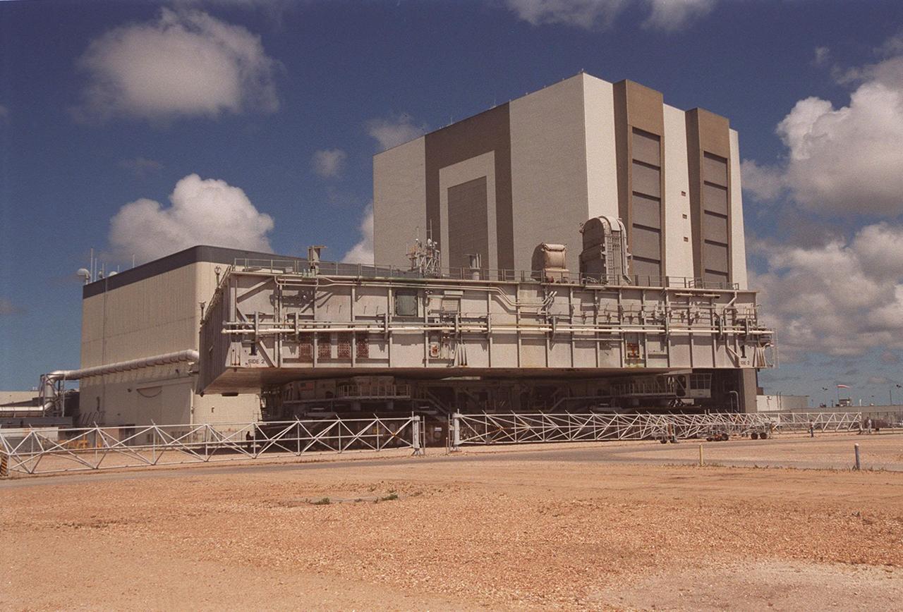
KENNEDY SPACE CENTER, FLA. -- A crawler-transporter with mobile launcher platform on top tests the buried portion of the Apollo-era crawlerway leading to the Vehicle Assembly Building (VAB) high bay 2 on the southwest side. The road was restored as part of KSC’s Safe Haven project. High bay 2 provides a third stacking area. The primary goal of the Safe Haven construction project was to strengthen readiness for hurricane season by expanding the VAB’s storage capacity. The new area, in high bay 2, will allow NASA to preassemble stacks and still have room in the VAB to pull a Shuttle back from the pad if severe weather threatens. Potential rollouts of the Space Shuttle to the launch pad from high bay 2 will involve making a turn around the north side of the VAB in contrast to the straight rollouts from high bays 1 and 3, on the east side of the VAB facing the launch pads
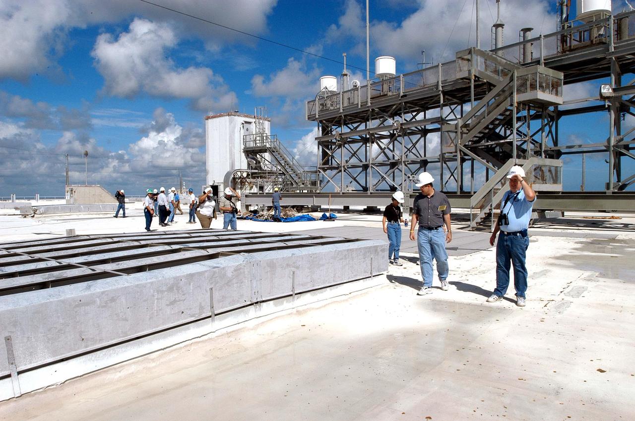
KENNEDY SPACE CENTER, FLA. - Members of a hurricane assessment team from Johnson Space Center and Marshall Space Flight Center tour the roof of the Vehicle Assembly Building (VAB) a week after Hurricane Frances hit the east coast of Central Florida and Kennedy Space Center. The VAB lost 820, 4- x 16-foot panels from the side walls, or more than 52,000 square feet of its surface.
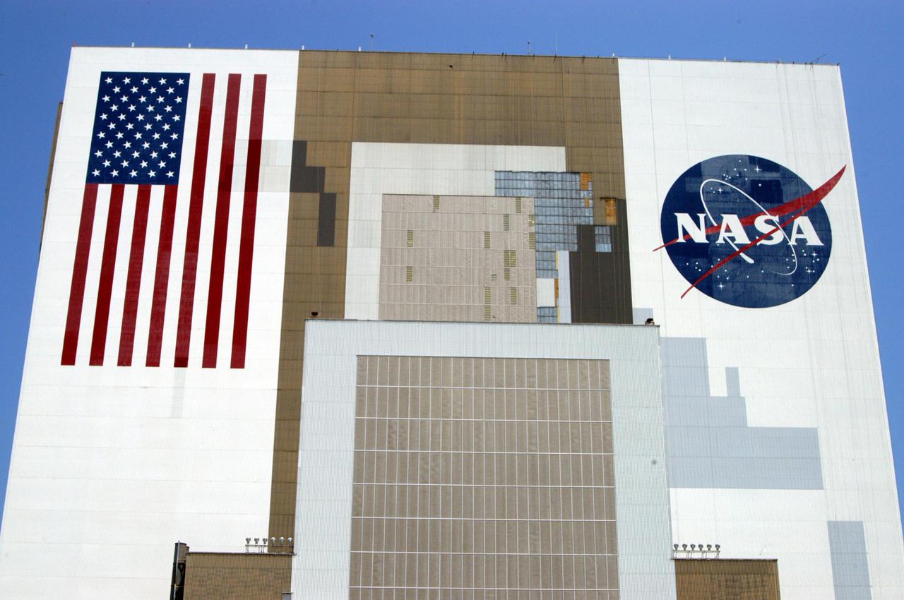
KENNEDY SPACE CENTER, FLA. - The Vehicle Assembly Building at NASA’s Kennedy Space Center is undergoing repairs caused by the hurricanes of 2004 that assaulted the east coast of Florida. Winds pulled a number of panels from the side of the 525-foot-high building. On the left is the American flag that was damaged and now has been repaired and repainted. The flag is 209 feet by 110 feet. Each star is more than six feet in diameter and each stripe is nine feet wide. The flag sits more than 450 feet above the ground.
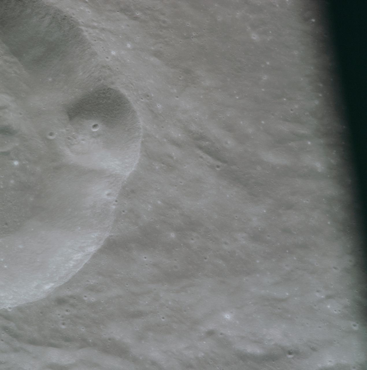
AS08-14-2431 (21-27 Dec. 1968) --- This is a near vertical photograph of the lunar surface taken with a telephoto lens during the Apollo 8 lunar orbit mission. The photographed area is approximately 20 miles on a side, and is located within a large, unmanned 100-statute-miles-in-diameter crater on the farside of the moon. This large crater is located at 10 degrees south latitude and 160 degrees east longitude. The lunar surface probably has less pronounced color than indicated by this print.
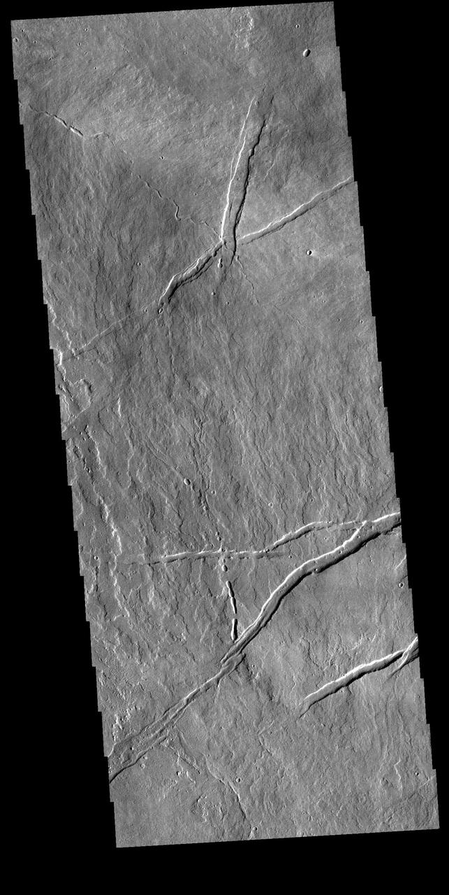
Today's VIS image is located just east of Arsia Mons. Numerous volcanic flows are visible, flowing downhill to the lower right side of the image. Several tectonic graben are present, generally trending perpendicular to the flows. A small channel feature and a discontinuous channel follow the flow trend. These features are likely lava channels and lava tube traces. Orbit Number: 81763 Latitude: -7.28995 Longitude: 244.476 Instrument: VIS Captured: 2020-05-20 16:20 https://photojournal.jpl.nasa.gov/catalog/PIA24012
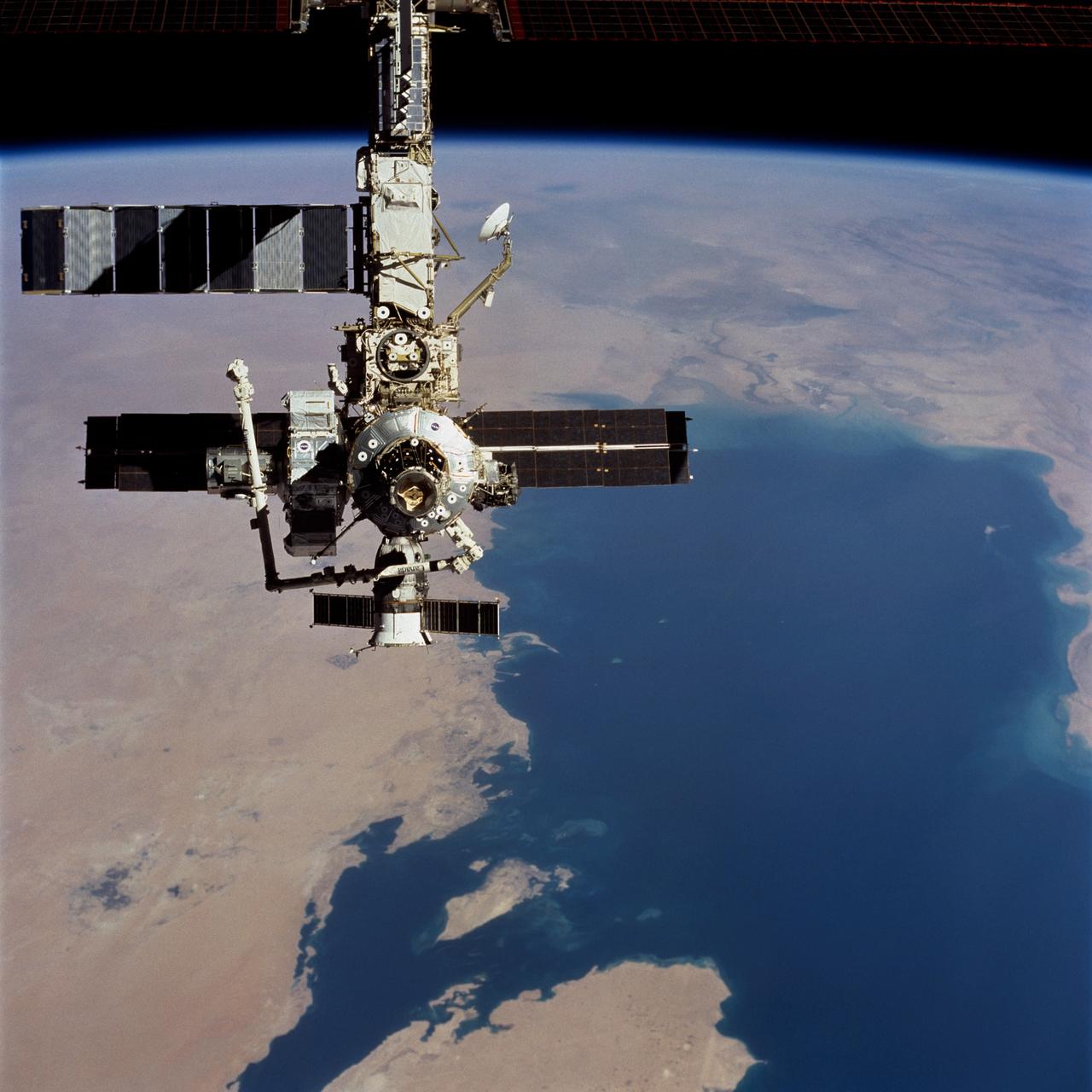
STS104-723-014 (21 July 2001) --- Backdropped over a wide scene of topography in the Middle East, the International Space Station (ISS) passes over the Persian Gulf. The photograph was taken with a 70mm handheld camera during a fly-around inspection by the Space Shuttle Atlantis not long after the two spacecraft separated. Prominent on the starboard side of the outpost is the newly-installed Quest airlock.
One of the most interesting features of Maunder Crater is the large trough seen in this image. The floor of Maunder Crater has been filled by a significant amount of material. At some time after the filling event, the large trough developed. The depression is located on the east side of the crater and parallels the crater rim. How and why the trough came to be is unknown. Orbit Number: 91505 Latitude: -49.2071 Longitude: 2.39522 Instrument: VIS Captured: 2022-07-31 19:36 https://photojournal.jpl.nasa.gov/catalog/PIA25575
KENNEDY SPACE CENTER, FLA. - Viewed from the east side, Launch Pads 39A and 39B tower over the bird-filled waters of the Banana River at NASA Kennedy Space Center. On the far right is seen the 300-gallon water tower. Rising above the fixed service structures are the 80-foot lightning masts that help protect the structures from lightning strikes.
This aerial view captures KSC's Launch Pad 39A, with the rotating service structure closed around Shuttle Atlantis. Just visible in the center is the top of the orange-colored external tank. On the left side towers the white 80-foot fiberglass lightning mast; on the right is the 300,000-gallon water tower used for sound suppression during launch. The launch pad abuts the Atlantic Ocean on the east, seen here in the background
The iconic Vehicle Assembly Building (VAB) casts a reflection in a surrounding waterway at NASA's Kennedy Space Center in Florida. In view are the south and east sides of the building. Ten levels of new work platforms have been installed in VAB High Bay 3. They will surround and provide access for service and processing of NASA's Space Launch System (SLS) rocket and Orion spacecraft. Exploration Ground Systems oversaw the upgrades and installation of the new work platforms to support the launch of the SLS and Orion on Exploration Mission-1 and deep space missions.
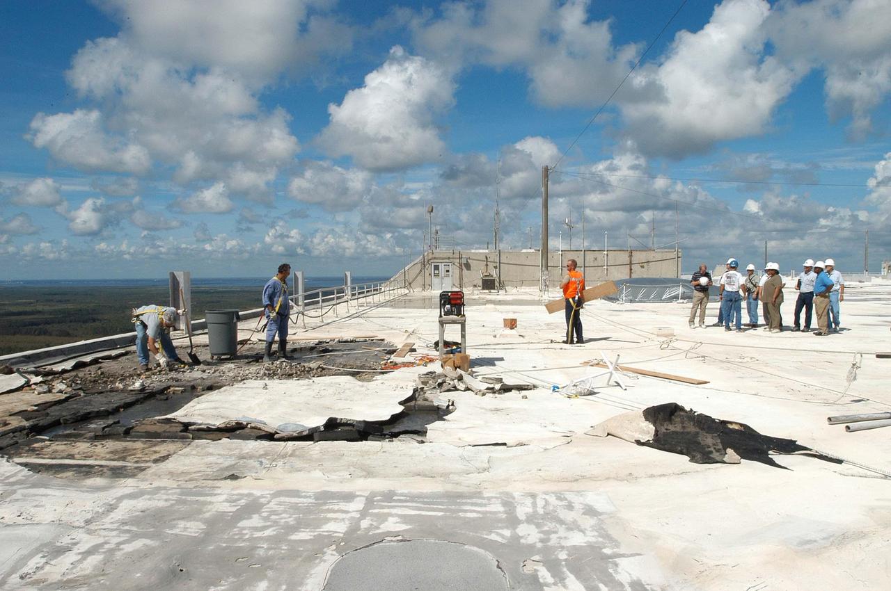
KENNEDY SPACE CENTER, FLA. - Members of a hurricane assessment team from Johnson Space Center and Marshall Space Flight Center look at damage on the roof of the Vehicle Assembly Building (VAB) a week after Hurricane Frances hit the east coast of Central Florida and Kennedy Space Center. The VAB lost 820, 4- x 16-foot panels from the side walls, or more than 52,000 square feet of its surface.
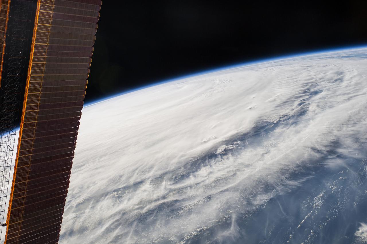
ISS040-E-089379 (7 Aug. 2014) --- One of the Expedition 40 crew members aboard the International Space Station, from an altitude of 221 nautical miles, photographed this image of Typhoon Halong at 08:02:41 GMT on Aug. 7, 2014. The orbital outpost was flying above a point on Earth located at 15.8 degrees north latitude and 142.4 degrees east longitude. One of the solar panels of the orbital outpost is seen on the left side of the scene.
SL2-05-458 (22 June 1973) --- Portions of northwest Washington State (48.0N, 122.5) can be seen in this view as well as portions of British Columbia, Canada. The snow covered Cascade Mountains are on the eastern side of the scene. Vancouver Island is visible in the northeast corner of the photo. The strait of Juan de Fuca separates Vancouver Island from the northwest corner of Washington. Seattle is near the center and the snow covered Olympic Mountains are to the east. Photo credit: NASA
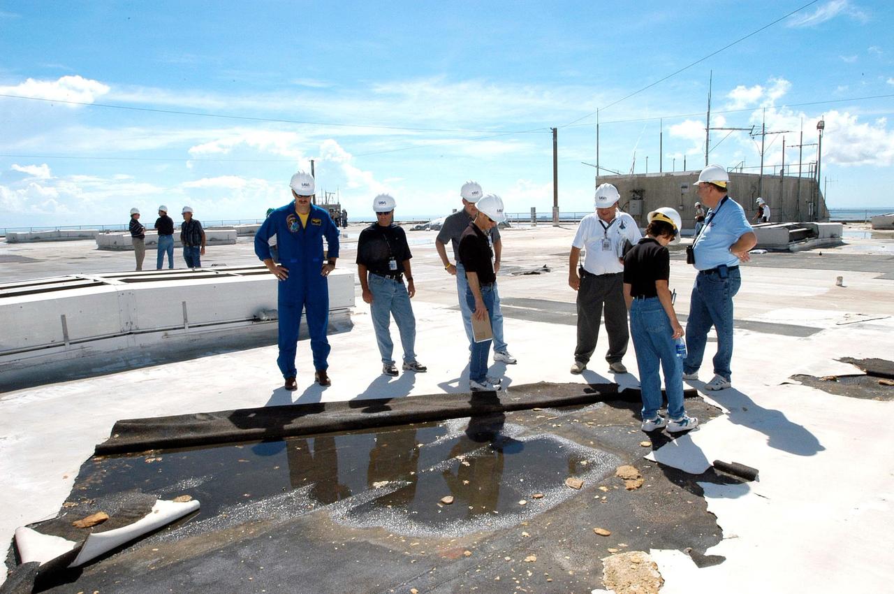
KENNEDY SPACE CENTER, FLA. - Members of a hurricane assessment team from Johnson Space Center and Marshall Space Flight Center look at damage on the roof of the Vehicle Assembly Building (VAB) a week after Hurricane Frances hit the east coast of Central Florida and Kennedy Space Center. The VAB lost 820, 4- x 16-foot panels from the side walls, or more than 52,000 square feet of its surface. One team member is astronaut Scott Altmann, at far left.
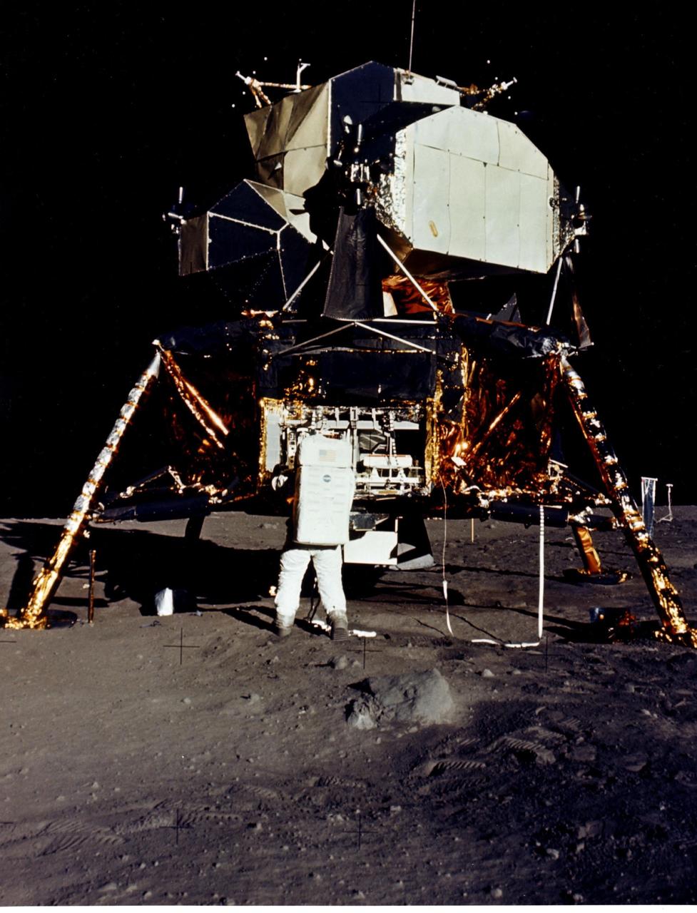
JOHNSON SPACE CENTER, HOUSTON, TEXAS - Man's first landing on the Moon was accomplished at 4:17 p.m. today as Lunar Module "Eagle" touched down gently on the Sea of Tranquility on the east side of the Moon. Astronaut Edwin E. Aldrin Jr., Lunar Module Pilot, removes scientific experiment packages from a stowage area in the Lunar Module's descent stage. Left behind on the lunar surface by Aldrin and Neil A. Armstrong, Apollo 11 commander, were a Passive Seismic Experiments Package and a Laser-Ranging Retro-Reflector.
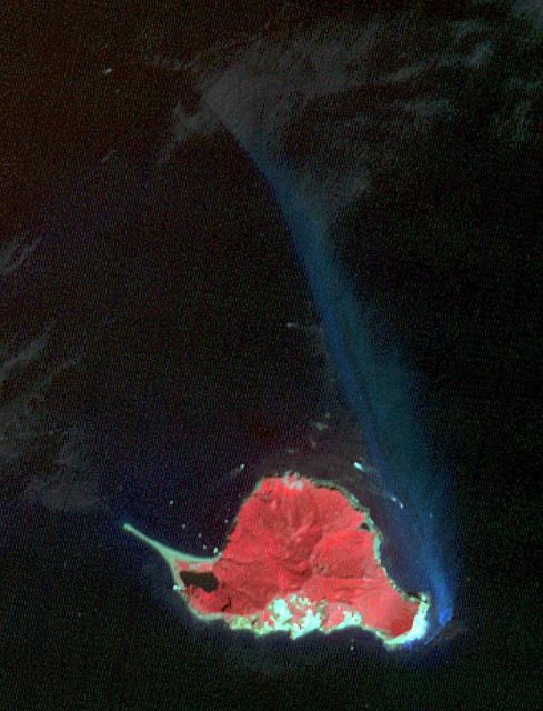
Heard, a remote volcanic island located in the southern Indian Ocean, is an Australian Territory. It consists of two volcanic structures: Big Ben and the smaller Mt. Dixon. The active Mawson Peak is located within a 5-6 km-wide caldera breached to the SW side of Big Ben. Intermittent eruptions have occurred since 1910; the latest in May 2023. The image was acquired March 18, 2025, covers an area of 39.7 by 40.4 km, and is located at 53 degrees south, 73.5 degrees east. https://photojournal.jpl.nasa.gov/catalog/PIA26509
AS08-14-2432 (21-27 Dec. 1968) --- This is a near vertical photograph of the lunar surface taken with a telephoto lens during the Apollo 8 lunar orbit mission. The photographed area is approximately 20 miles on a side and is located within a large, unmanned 100-miles-in-diameter crater on the farside of the moon. This large crater is located at 10 degrees south latitude and 160 degrees east longitude. The lunar surface probably has less pronounced color then indicated by this print.
AS15-88-11968 (2 Aug. 1971) --- A view of the Apollo 15 Command and Service Modules (CSM) in lunar orbit as photographed from the Lunar Module (LM) "Falcon" just after rendezvous. The lunar features below are located on the east side of the Sea of Tranquility. While astronauts David R. Scott, commander; and James B. Irwin, lunar module pilot, descended in the LM to explore the moon, astronaut Alfred M. Worden, command module pilot, remained with the CSM in lunar orbit.
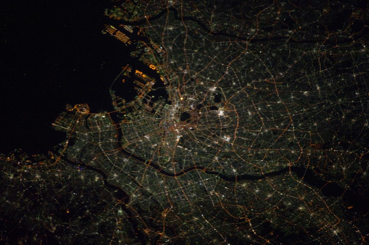
ISS033-E-021464 (14 Nov. 2012) --- This nighttime photograph, taken by one of the Expedition 33 crew members aboard the International Space Station, features city lights of Tokyo, on the north west side of Tokyo Bay. North is toward the lower right-hand corner of the image. Nadir point of the location on Earth was 33.9 degrees north latitude and 139.5 degrees east longitude.
Twelve km off Taiwan's NE coast lies Turtle Island, a forest-covered volcanic island. The bluish patch of water on the island's eastern side (nicknamed the Milky Sea) marks the site of dozens of hydrothermal vents, spewing out hot, acidic water laden with heavy metals and toxic gases. The image was acquired October 4, 2020, covers an area of 10.6 by 13.9 km, and is located at 24.8 degrees north, 122 degrees east. (credit BBC News for this information) https://photojournal.jpl.nasa.gov/catalog/PIA24950
KENNEDY SPACE CENTER, FLA. - On a scaffold suspended near the top of the east side of the Vehicle Assembly Building, workers are covering the holes with corrugated steel so the facility can be returned to performing operational activities. The VAB lost 820 panels from the south wall during Hurricane Frances, and 25 additional panels during Hurricane Jeanne. The VAB stands 525 feet tall. Central Florida, including Kennedy Space Center, was battered by four hurricanes between Aug. 13 and Sept. 26.
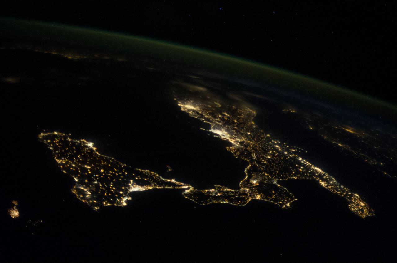
ISS037-E-018864 (23 Oct. 2013) --- This night image of most of Italy and all of Sicily was photographed by one of the Expedition 37 crew members aboard the International Space Station flying approximately 240 miles above Earth on Oct. 23, 2013. The night lights of Rome and Naples are visible near the center of the frame. Many other major cities are also visible by their lights. The Adriatic Sea is on the east (right) side of Italy.
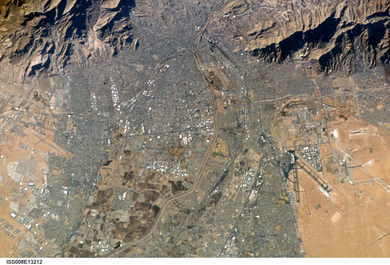
ISS008-E-13212 (26 January 2004) --- This image of the El Paso-Juarez area on the U.S.-Mexico border, photographed by an Expedition 8 crewmember, is the 100,000th photograph of Earth that astronauts have taken from the International Space Station (ISS). The Rio Grande can be seen meandering through the area, forming the boundary between the sister cities of El Paso, Texas and Juarez, Chihuahua. North is to the right in this image, and the setting sun has cast the east side of the Sierra Juarez and Franklin Mountains into shadow.
Today's VIS image shows windstreaks located in Daedalia Planum. These streaks are formed by the wind interaction with positive topographic features (like craters), with the 'tail' located down wind of the crater. The streaks in this image indicate the prevailing wind was from the right to the left side of the image (east to west). Orbit Number: 80341 Latitude: -11.066 Longitude: 228.449 Instrument: VIS Captured: 2020-01-24 14:14 https://photojournal.jpl.nasa.gov/catalog/PIA23820
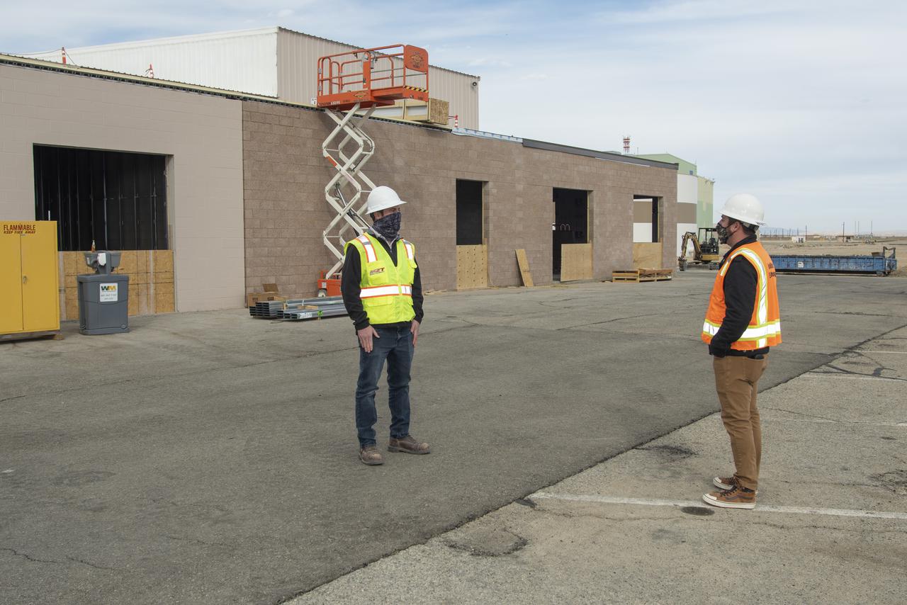
Collin Morris, CJW/MZT project manager and Bryan Watters, NASA civil/structural engineer and project manager, discuss work on the east side of Building 4826. Building 4826 is the future home of the X-59 Quiet SuperSonic Technology aircraft, where a conference room, offices, restrooms and a communications room will be added at NASA's Armstrong Flight Research Center in Edwards, California.
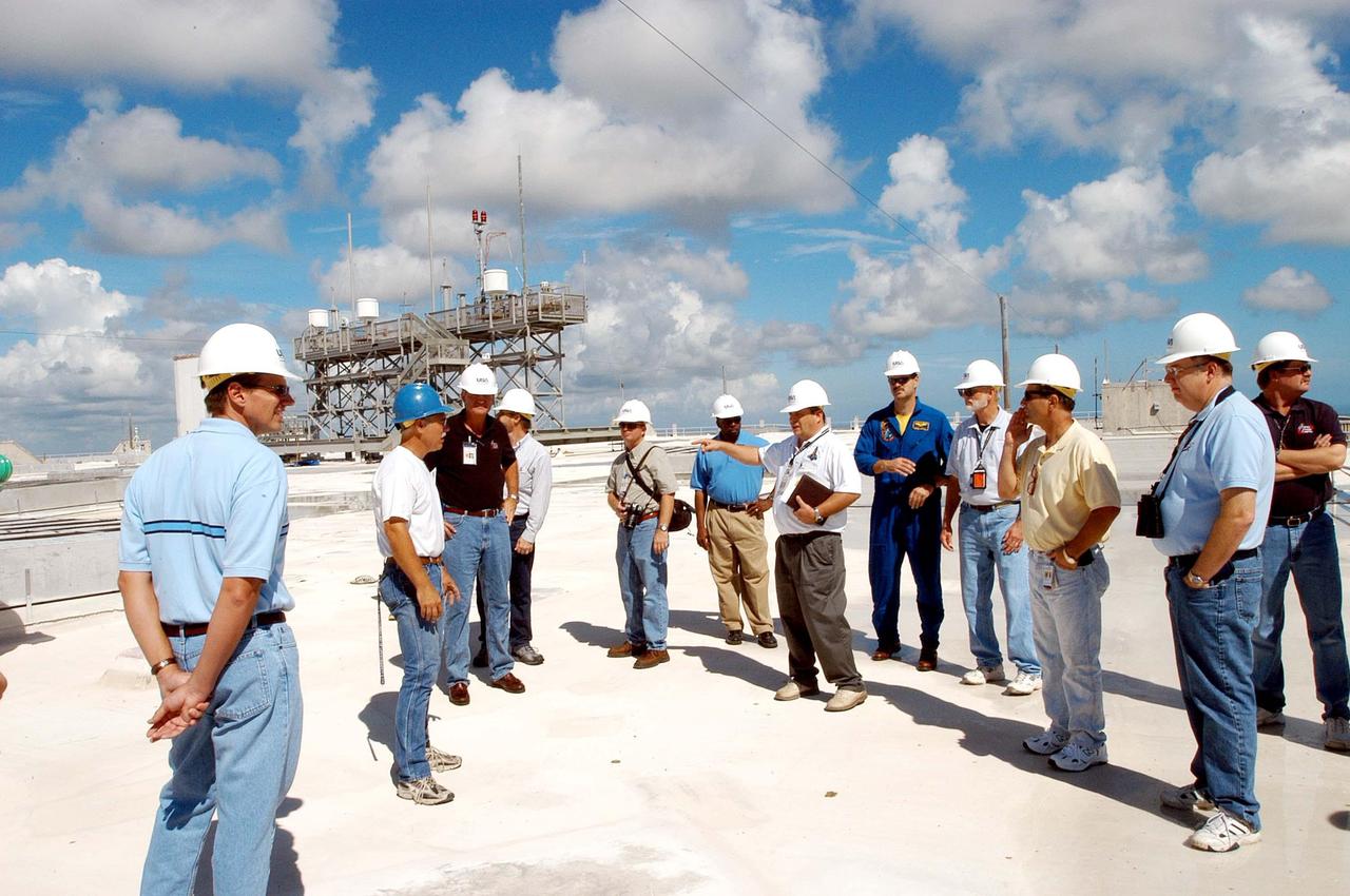
KENNEDY SPACE CENTER, FLA. - Members of a hurricane assessment team from Johnson Space Center and Marshall Space Flight Center tour the roof of the Vehicle Assembly Building (VAB) a week after Hurricane Frances hit the east coast of Central Florida and Kennedy Space Center. The VAB lost 820, 4- x 16-foot panels from the side walls, or more than 52,000 square feet of its surface. One team member is astronaut Scott Altmann, fifth from right.
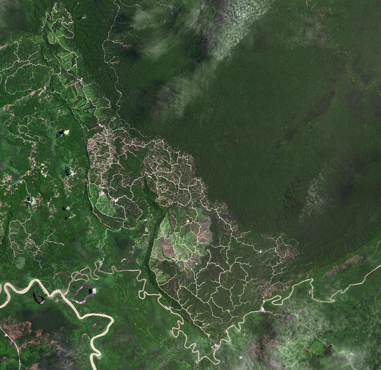
In the northeast Sichuan province of China lies the Sichuan Basin, surrounded by mountains on all sides and drained by the Yangtzee River. The basin is considered the breadbasket of China. On the northeast edge, flat-lying Jurassic to Cretaceous sandstones have been eroded to form an intricately carved landscape of upland fields and lowland streams and valleys. The image was acquired September 11, 2016, covers an area of 36 by 37 kilometers, and is located at 31.9 degrees north, 105.4 degrees east. https://photojournal.jpl.nasa.gov/catalog/PIA23532
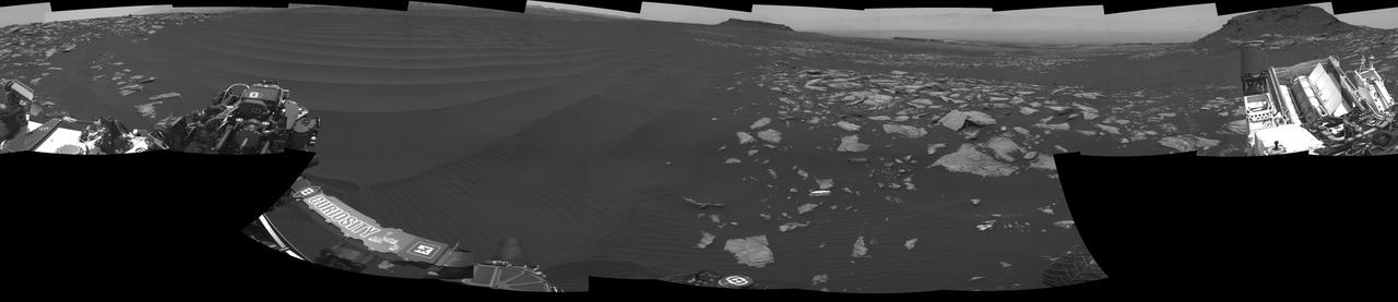
The left side of this 360-degree panorama from NASA's Curiosity Mars rover shows the long rows of ripples on a linear shaped dune in the Bagnold Dune Field on the northwestern flank of Mount Sharp. The view is a mosaic of images taken with Curiosity's Navigation Camera (Navcam) on Feb. 5, 2017, during the 1,601st Martian day, or sol, of the rover's work on Mars. The view is centered toward west-southwest, with east-southeast on either end. A capped mound called "Ireson Hill" is on the right. http://photojournal.jpl.nasa.gov/catalog/PIA21268