
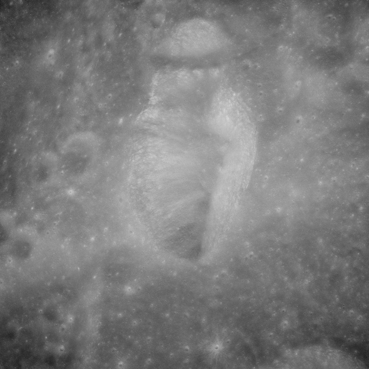
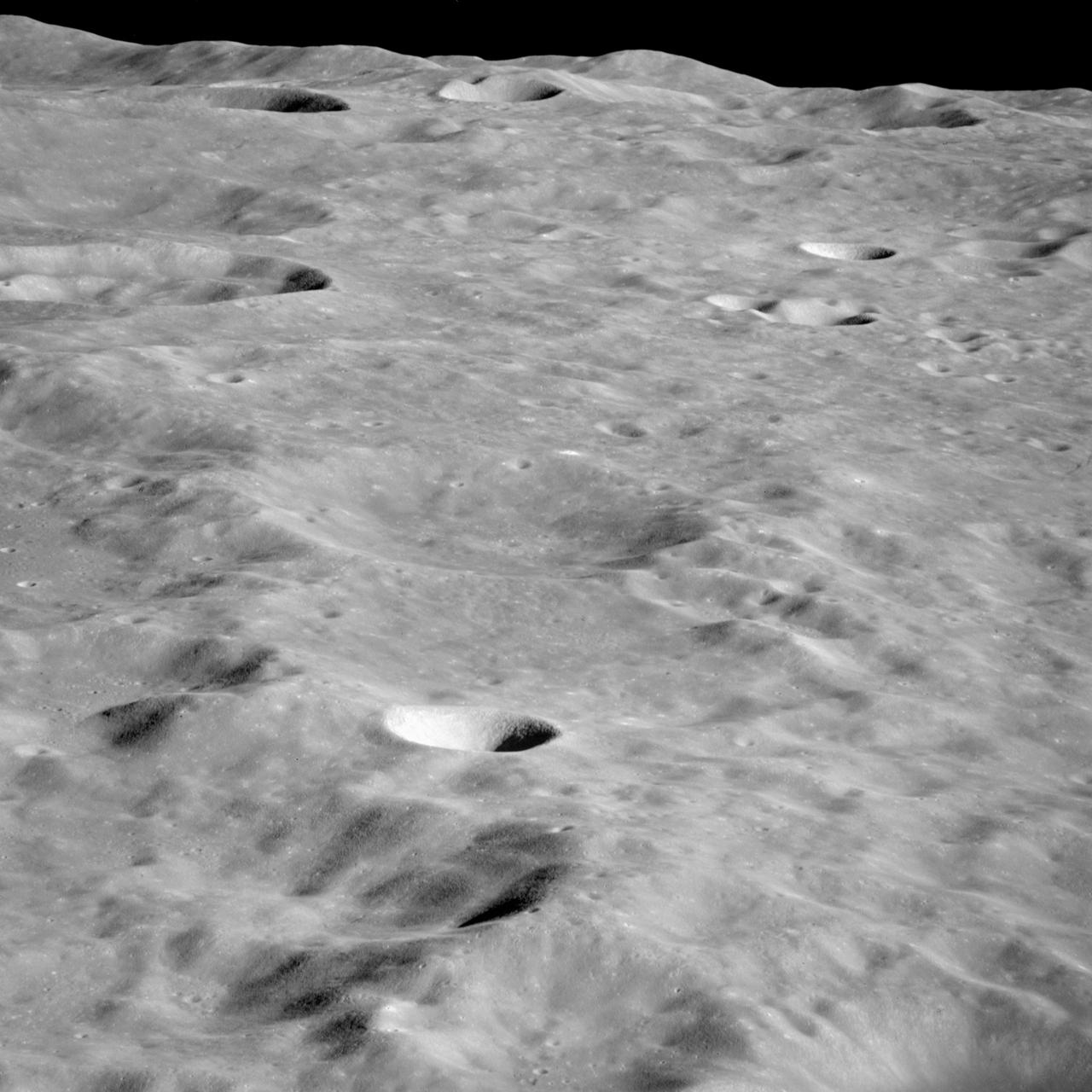
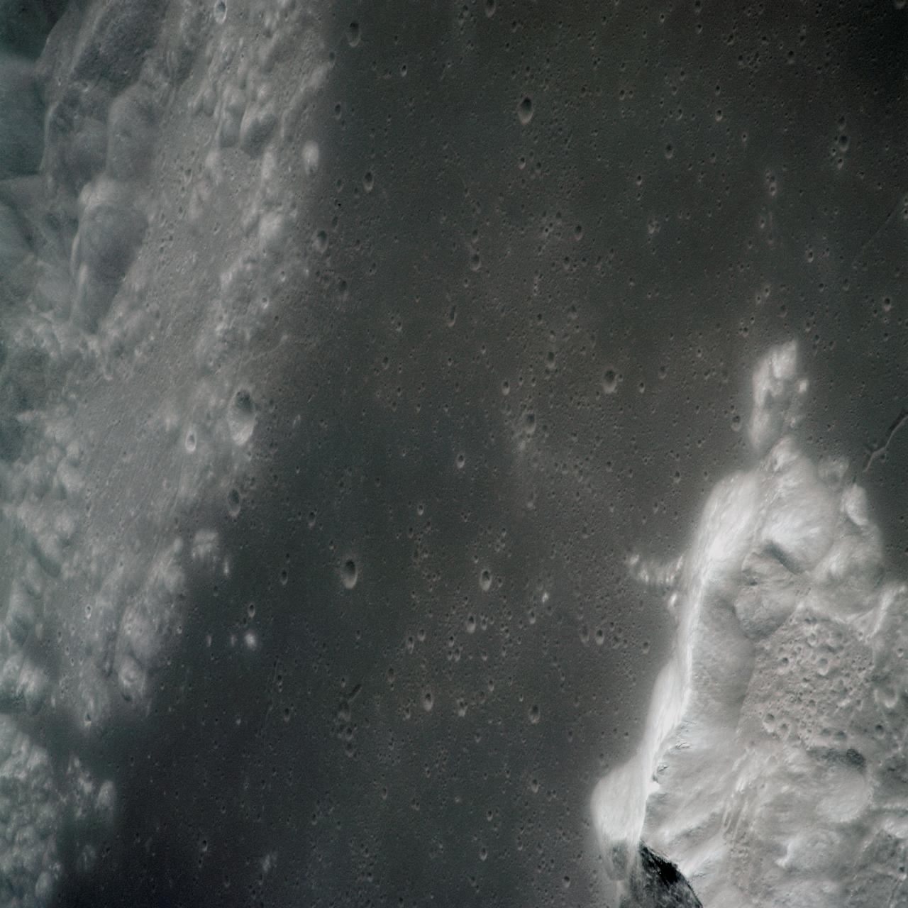
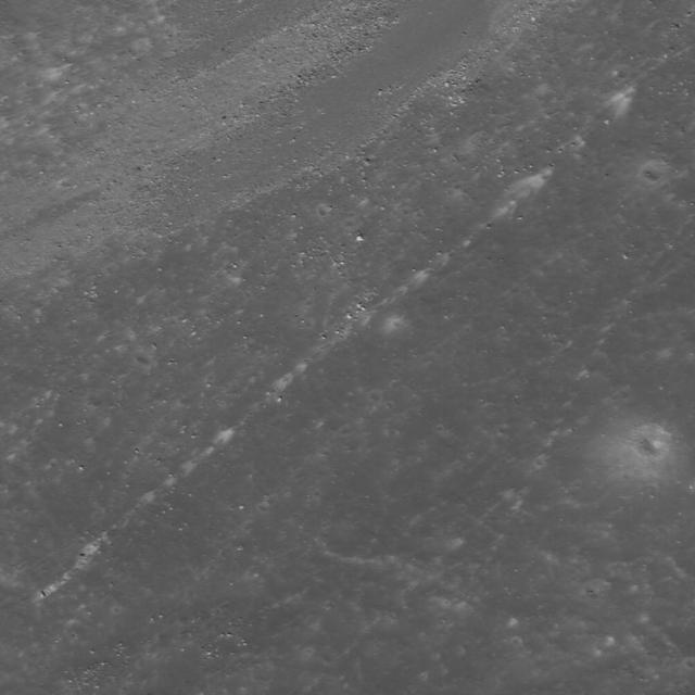
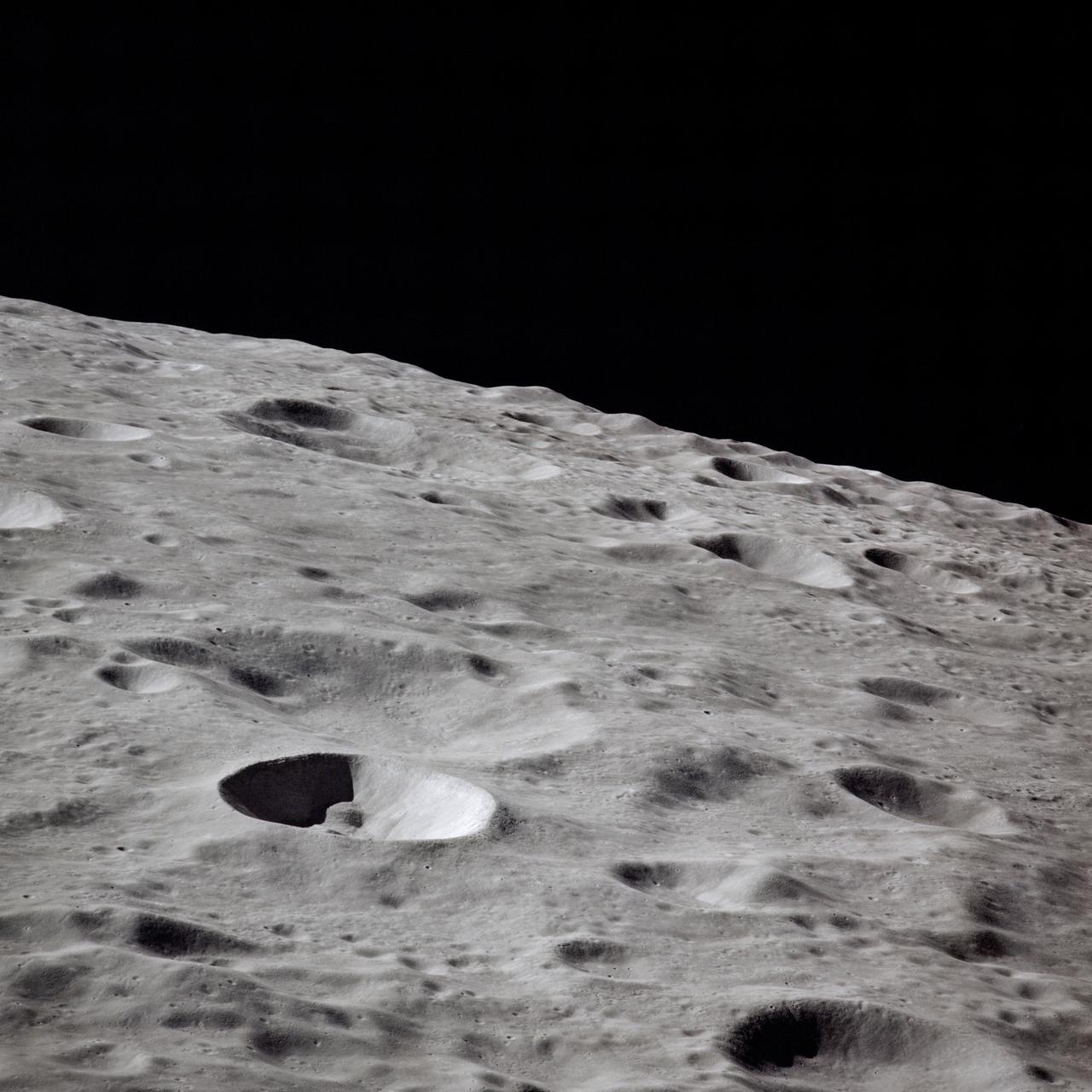
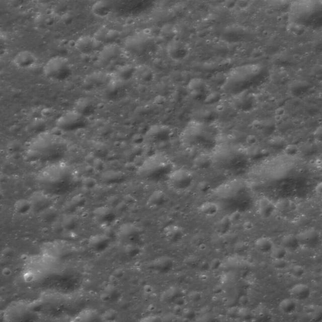
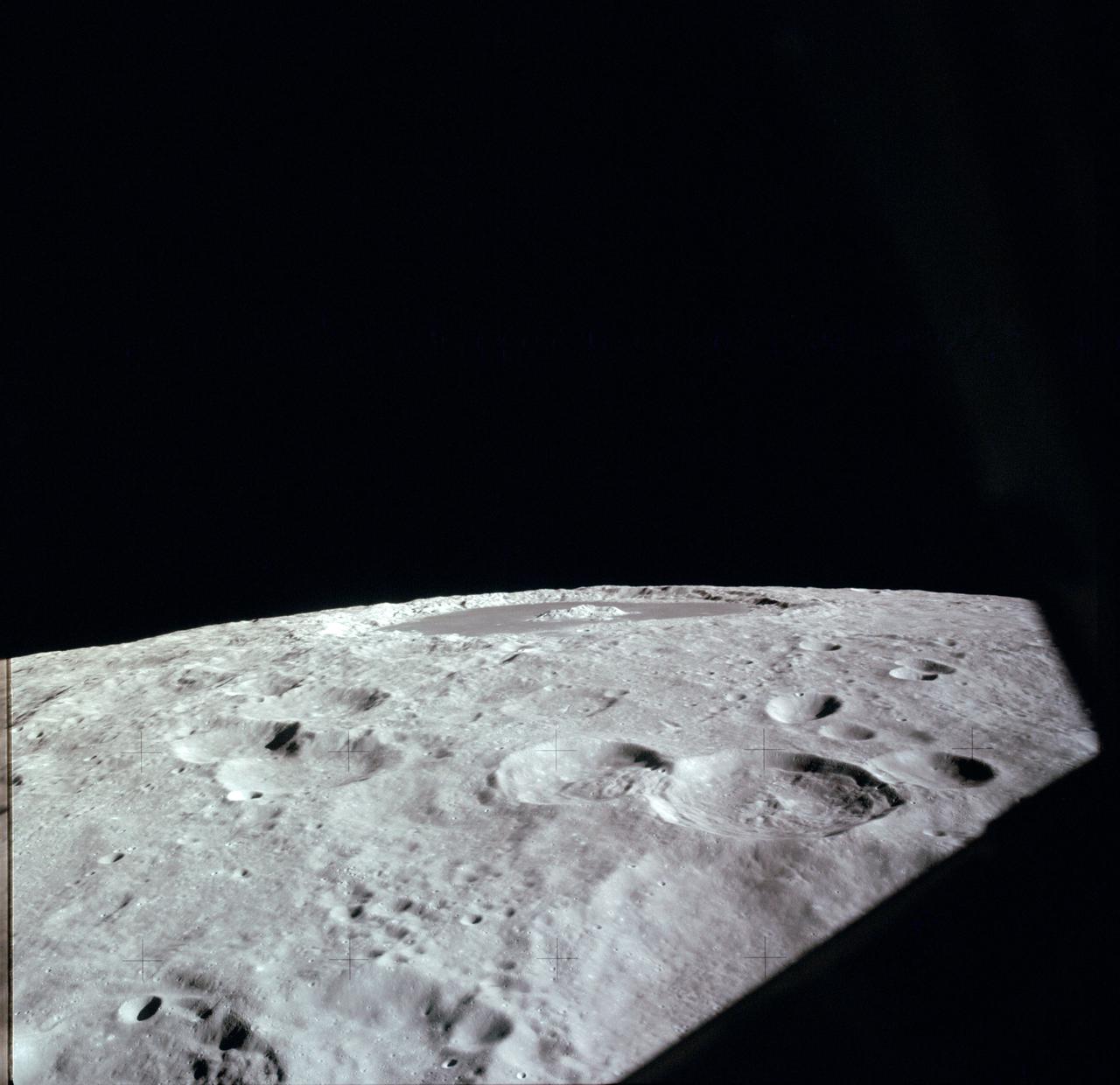
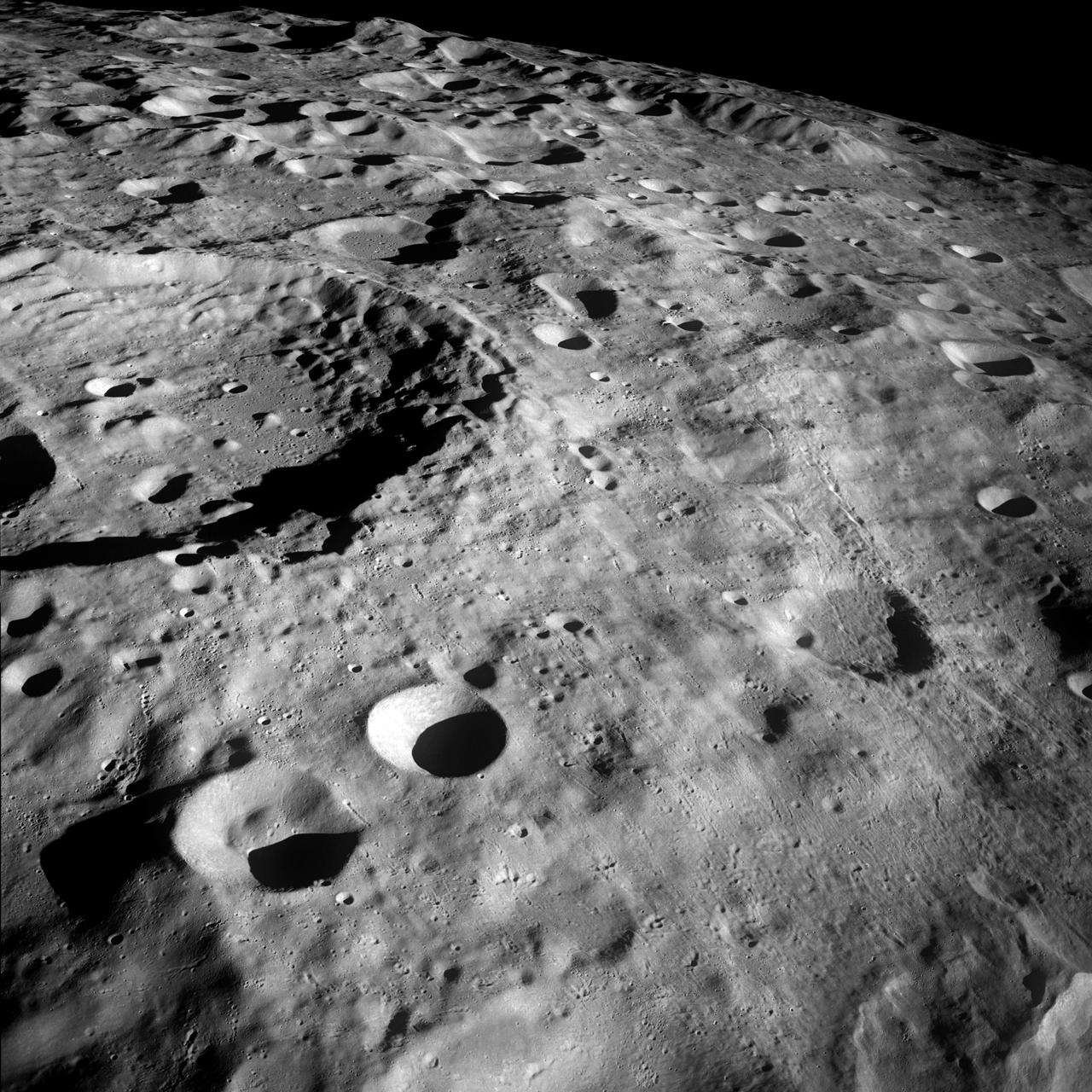
Farside Northern Highlands
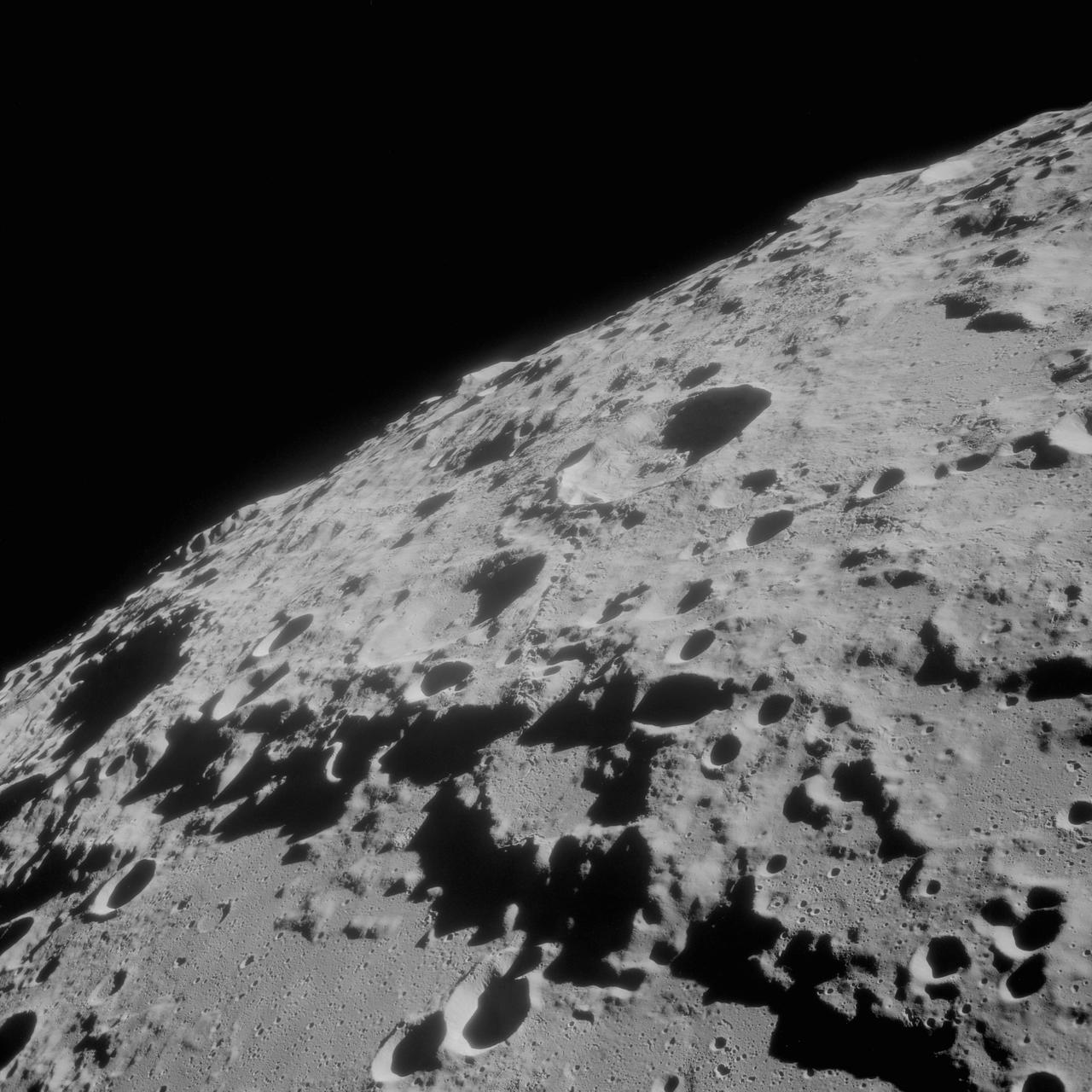
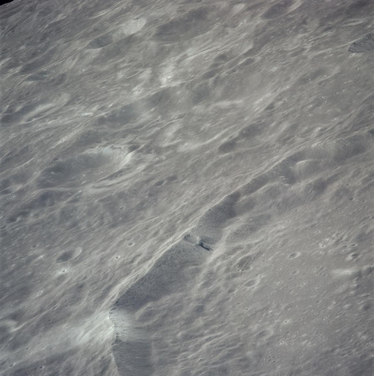
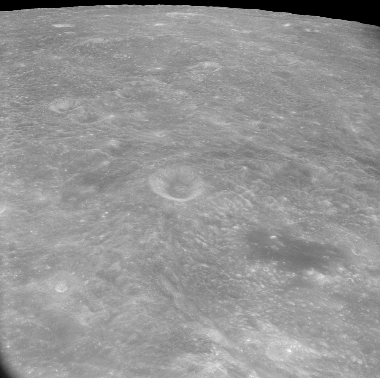
Farside! And All the Way Around
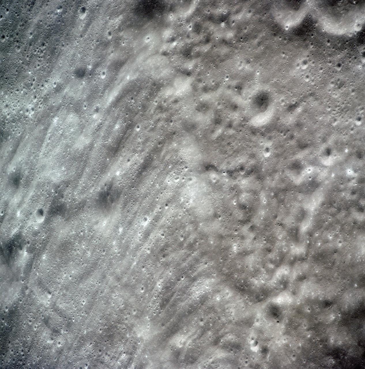
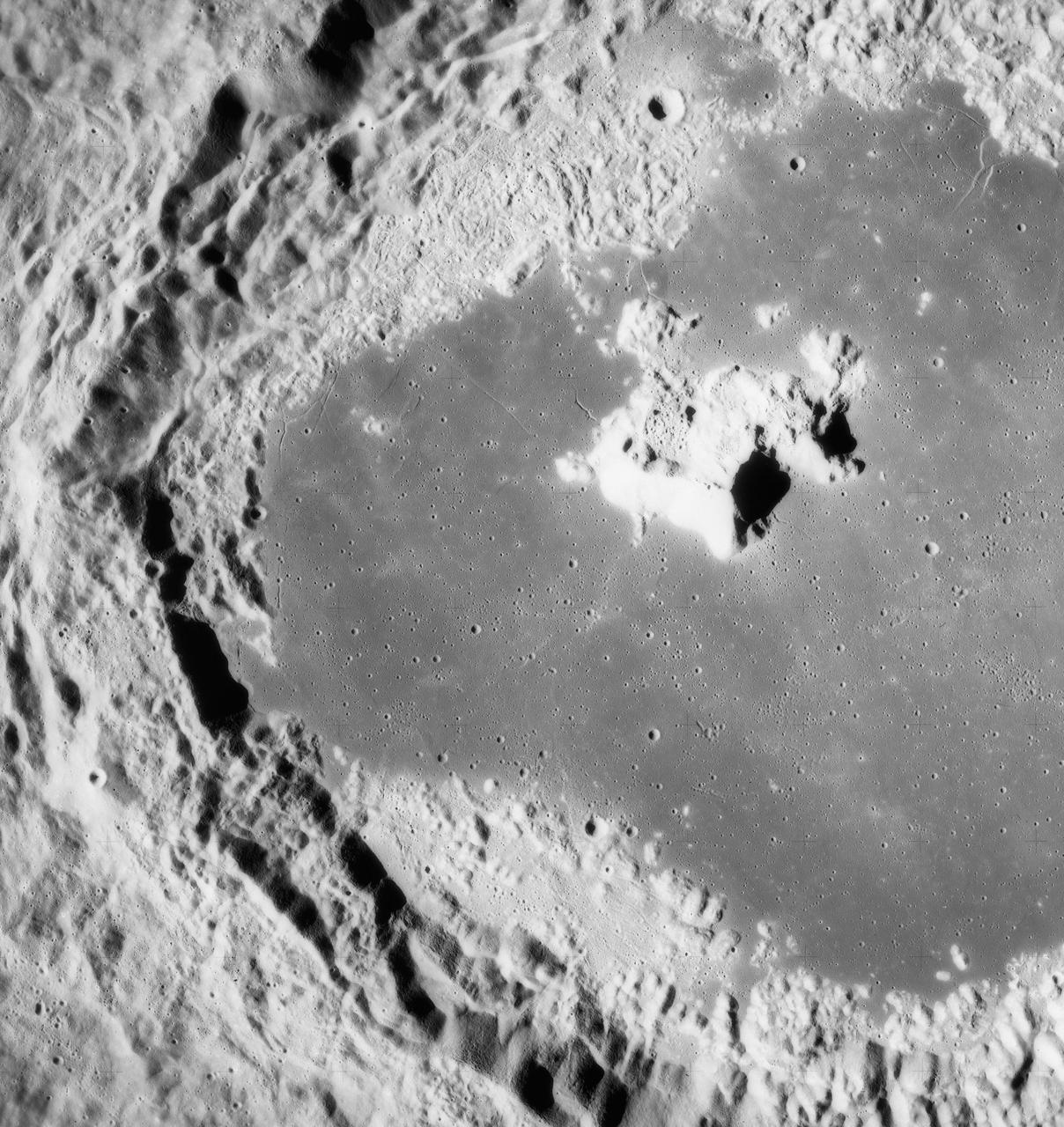
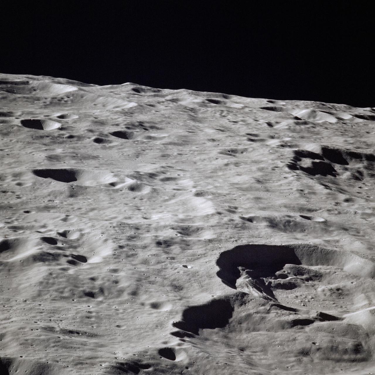
Window to the Farside Mantle
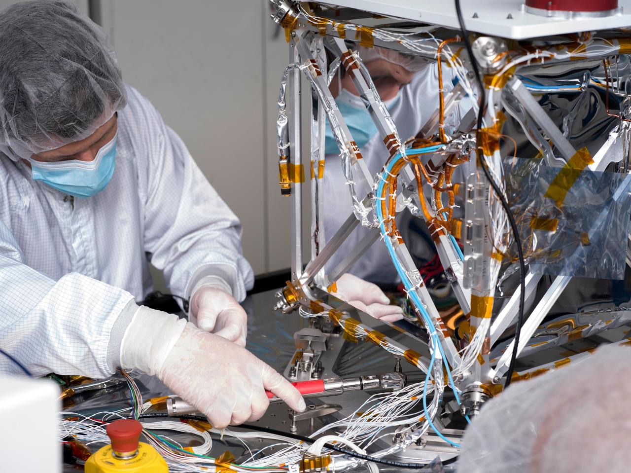
In a clean room at NASA's Jet Propulsion Laboratory in Southern California in March 2024, technician Nik Schwarz prepares the agency's Farside Seismic Suite (FSS) for testing. The cube-shaped payload contains two instruments that will gather NASA's first seismic data from the Moon in nearly 50 years and take the first-ever seismic measurements from the Moon's far side. FSS will operate continuously for at least 4½ months, working through the long, cold lunar nights. The two seismometers are packaged together with a large battery, a computer, and electronics inside a cube structure that's surrounded by several layers of insulation (the shiny, reflective material seen here) and suspended within an outer protective cube, which is in turn covered with a shiny insulating blanket. A technician is here attaching a stiffening brace to the bottom of the FSS outer cube structure. https://photojournal.jpl.nasa.gov/catalog/PIA26341
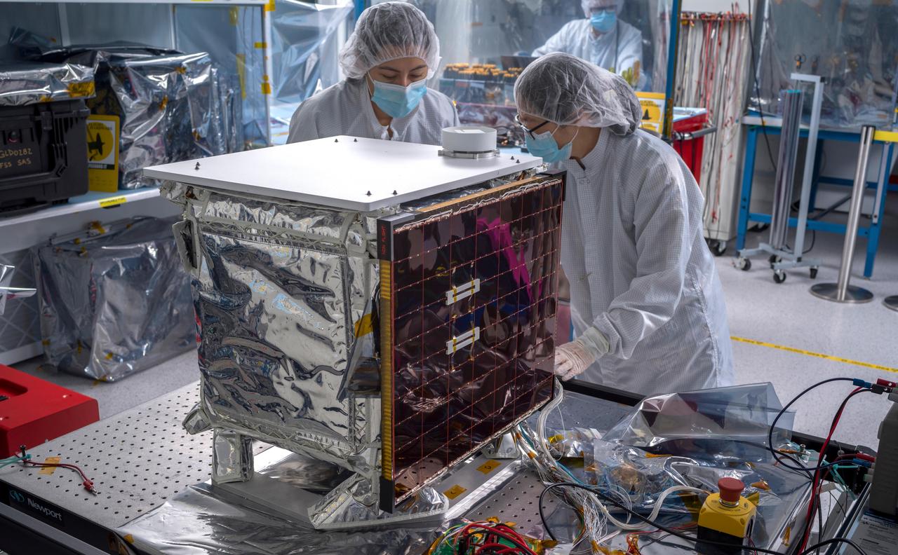
In a clean room at NASA's Jet Propulsion Laboratory in Southern California in March 2024, engineers and technicians work to prepare the agency's Farside Seismic Suite (FSS) for environmental testing to simulate conditions it will encounter in space. Along with being placed in a vacuum chamber and subjected to extreme temperatures, the instrument suite will undergo severe shaking that mimics the rocket's motion during launch. The cube-shaped payload contains two instruments that will gather NASA's first seismic data from the Moon in nearly 50 years and take the first-ever seismic measurements from the Moon's far side. FSS will operate continuously for at least 4½ months, working through the long, cold lunar nights. The two seismometers are packaged together with a large battery, a computer, and electronics inside a cube structure that's surrounded by several layers of insulation and suspended within an outer protective cube, which is in turn covered with a shiny insulating blanket. The suite's single solar panel can be seen at center. On top is a white radiator that will allow the suite to shed heat generated by its electronics during the hot lunar daytime hours. The puck-like object atop the radiator is the suite's antenna, for communicating with two small relay satellites that will orbit the Moon and send data to Earth. Pictured (from left): Joanna Farias, and Bert Turney, and Hsin-Yi Hao. https://photojournal.jpl.nasa.gov/catalog/PIA26299
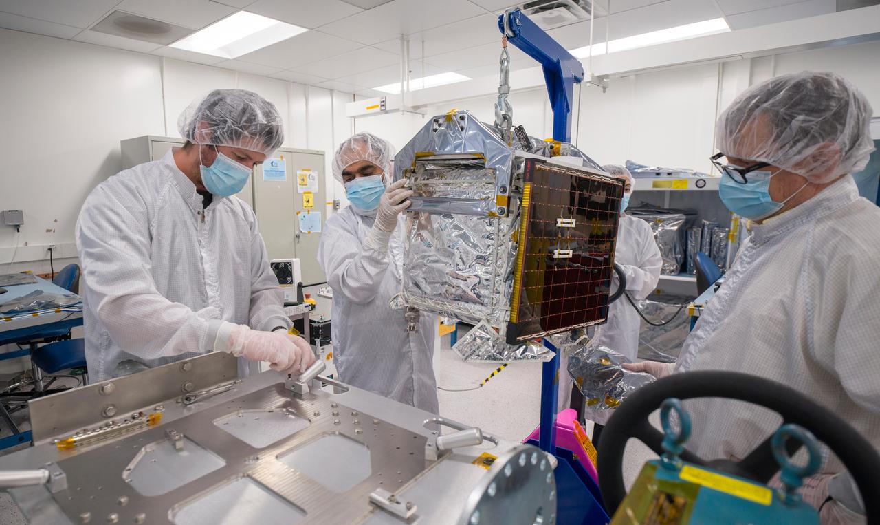
In a clean room at NASA's Jet Propulsion Laboratory in Southern California in March 2024, engineers and technicians prepare the agency's Farside Seismic Suite (FSS) for testing. The cube-shaped payload contains two instruments that will gather NASA's first seismic data from the Moon in nearly 50 years and take the first-ever seismic measurements from the Moon's far side. FSS will operate continuously for at least 4½ months, working through the long, cold lunar nights. Here, engineers move FSS onto a fixture that will allow them to tilt the payload, simulating the pull of lunar gravity in the direction at which one of the instrument's two seismometers is sensitive to motion. (The Moon's gravity is about one-sixth of Earth's.) Called an ambient tilt test, this activity allows engineers to check the seismometers' performance. The two seismometers are packaged together with a large battery, a computer, and electronics inside a cube structure that's surrounded by several layers of insulation and suspended within an outer protective cube, which is in turn covered with a shiny insulating blanket. The suite's single solar panel can be seen right of center. Surrounding the instrument are (from left): Nik Schwarz, Vik Singh, Joanna Farias, and Bert Turney. https://photojournal.jpl.nasa.gov/catalog/PIA26298
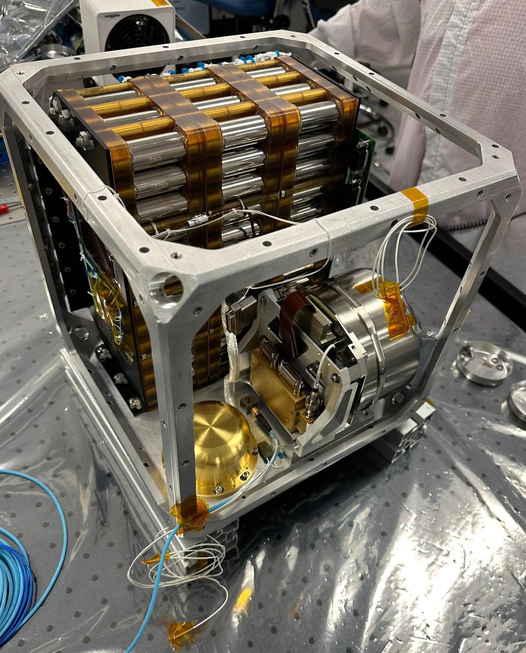
NASA's Farside Seismic Suite (FSS) is assembled in a clean room at the agency's Jet Propulsion Laboratory in Southern California in November 2023. Two sensitive seismometers packaged in the suite's cube-within-a-cube structure will gather NASA's first seismic data from the Moon in nearly 50 years and take the first-ever seismic measurements from the Moon's far side. FSS will operate continuously for at least 4½ months, working through the long, cold lunar nights. Seen here is the inner cube structure, with the suite's large battery at rear. The gold, puck-shaped device at left is the Short Period sensor, or SP, which measures motion in three directions using sensors etched into a trio of square silicon chips, each about 1 inch (25 millimeters) wide. At right, within the silver cylindrical enclosure, is the Very Broadband seismometer, or VBB, the most sensitive seismometer ever built for use in space exploration. It can detect ground motions smaller than the size of a single hydrogen atom, measuring up-and-down movement using a pendulum held in place by a spring. Constructed as a backup instrument (a "flight spare") for NASA's InSight Mars lander by the French space agency, CNES (Centre National d'Études Spatiales), the VBB was slightly modified and packaged in a new enclosure for lunar use. The suite's computer and electronics are packed alongside the battery and seismometers. After being encased in insulation, this inner cube was suspended within a protective outer cube, which was in turn covered with a shiny insulating blanket. https://photojournal.jpl.nasa.gov/catalog/PIA26300
About 50,000 Clementine images were processed to produce the four orthographic views of the Moon. The images show albedo variations (normalized brightness or reflectivity) of the surface at a wavelength of 750 nm (just longward of visible red). The image projection is centered at 0 degree latitude and 180 degrees longitude. Mare Moscoviense (dark albedo feature upper left of image center) and South Pole-Aitken Basin (dark feature at bottom) represent maria regions largely absent on the lunar farside. The Clementine altimeter showed Aitken Basin to consist of a topographic rim about 2500 km in diameter, an inner shelf ranging from 400 to 600 km in width, and an irregular depressed floor about 12 km in depth. http://photojournal.jpl.nasa.gov/catalog/PIA00304
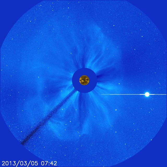
There's no way to tell from this SOHO image whether the halo CME on March 5, 2013, originated from the front or far of the sun. But the STEREO spacecraft were watching the sun from the sides and showed it was from the far side. The bright planet is Venus. Credit: NASA/SOHO CME WEEK: What To See in CME Images Two main types of explosions occur on the sun: solar flares and coronal mass ejections. Unlike the energy and x-rays produced in a solar flare – which can reach Earth at the speed of light in eight minutes – coronal mass ejections are giant, expanding clouds of solar material that take one to three days to reach Earth. Once at Earth, these ejections, also called CMEs, can impact satellites in space or interfere with radio communications. During CME WEEK from Sept. 22 to 26, 2014, we explore different aspects of these giant eruptions that surge out from the star we live with. When a coronal mass ejection blasts off the sun, scientists rely on instruments called coronagraphs to track their progress. Coronagraphs block out the bright light of the sun, so that the much fainter material in the solar atmosphere -- including CMEs -- can be seen in the surrounding space. CMEs appear in these images as expanding shells of material from the sun's atmosphere -- sometimes a core of colder, solar material (called a filament) from near the sun's surface moves in the center. But mapping out such three-dimensional components from a two-dimensional image isn't easy. Watch the slideshow to find out how scientists interpret what they see in CME pictures. The images in the slideshow are from the three sets of coronagraphs NASA currently has in space. One is on the joint European Space Agency and NASA Solar and Heliospheric Observatory, or SOHO. SOHO launched in 1995, and sits between Earth and the sun about a million miles away from Earth. The other two coronagraphs are on the two spacecraft of the NASA Solar Terrestrial Relations Observatory, or STEREO, mission, which launched in 2006. The two STEREO spacecraft are both currently viewing the far side of the sun. Together these instruments help scientists create a three-dimensional model of any CME as its journey unfolds through interplanetary space. Such information can show why a given characteristic of a CME close to the sun might lead to a given effect near Earth, or any other planet in the solar system...<b><a href="http://www.nasa.gov/audience/formedia/features/MP_Photo_Guidelines.html" rel="nofollow">NASA image use policy.</a></b> <b><a href="http://www.nasa.gov/centers/goddard/home/index.html" rel="nofollow">NASA Goddard Space Flight Center</a></b> enables NASA’s mission through four scientific endeavors: Earth Science, Heliophysics, Solar System Exploration, and Astrophysics. Goddard plays a leading role in NASA’s accomplishments by contributing compelling scientific knowledge to advance the Agency’s mission. <b>Follow us on <a href="http://twitter.com/NASAGoddardPix" rel="nofollow">Twitter</a></b> <b>Like us on <a href="http://www.facebook.com/pages/Greenbelt-MD/NASA-Goddard/395013845897?ref=tsd" rel="nofollow">Facebook</a></b> <b>Find us on <a href="http://instagram.com/nasagoddard?vm=grid" rel="nofollow">Instagram</a></b>
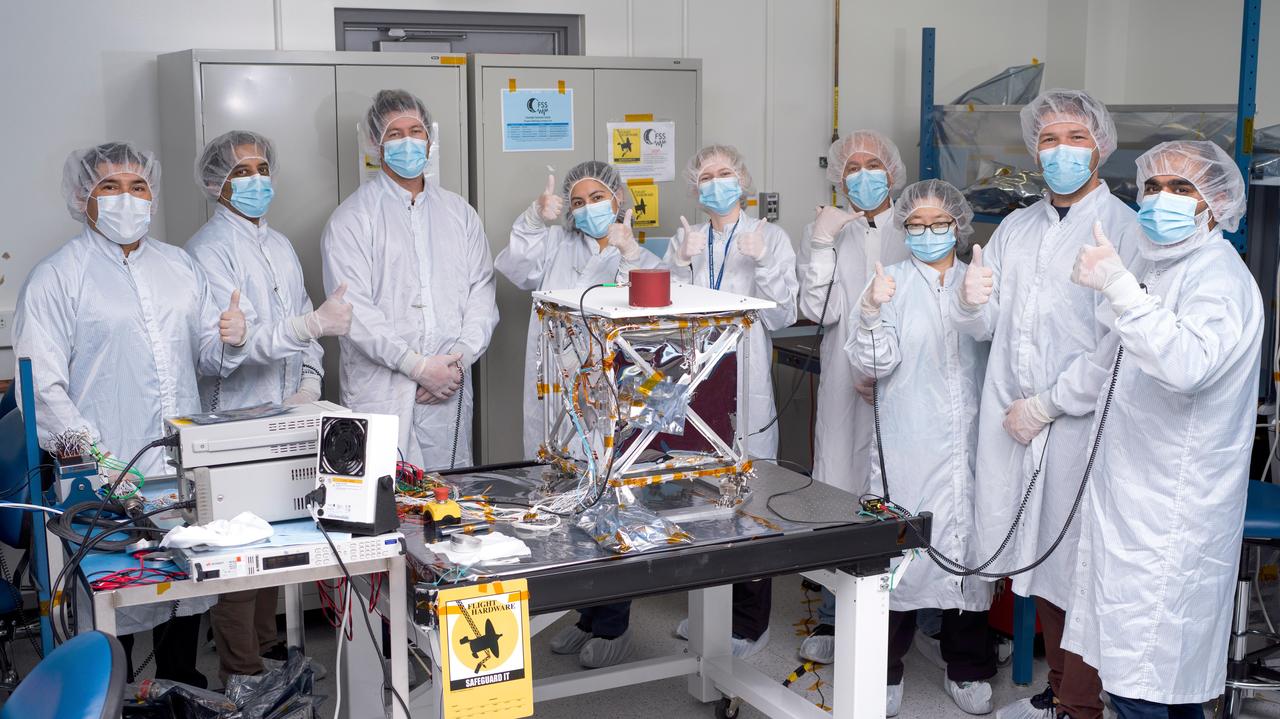
In a clean room at NASA's Jet Propulsion Laboratory in Southern California in March 2024, engineers and technicians pose with the agency's Farside Seismic Suite while the payload is readied for testing. The suite contains two instruments that will gather NASA's first seismic data from the Moon in nearly 50 years and take the first-ever seismic measurements from the Moon's far side. FSS will operate continuously for at least 4½ months, working through the long, cold lunar nights. The two seismometers are packaged together with a large battery, a computer, and electronics inside a cube structure that's surrounded by several layers of insulation (the shiny material at center) and suspended within a protective outer cube, which is, in turn, covered with an insulating blanket. In this photo, the blanket has not yet been attached. Members of the FSS integration team pictured are (from left) Salvador Ramirez, Asad Aboobaker, Nik Schwarz, Joanna Farias, Clara MacFarland, Frank Barone, Hsin-Yi Hao, Nicholas Roy-Steier, and Vik Singh. https://photojournal.jpl.nasa.gov/catalog/PIA26342
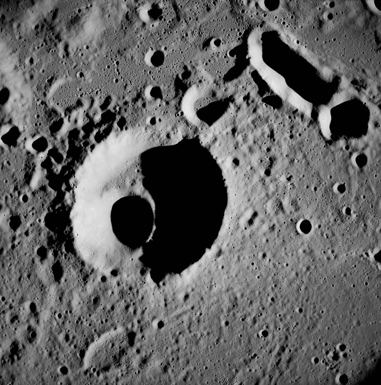
AS08-13-2327 (21-27 Dec. 1968) --- A brightly-rayed crater on the farside of the moon near the sub solar point, where the sun was directly overhead, as seen from the Apollo 8 spacecraft. (HOLD PICTURE WITH THE CRATER SLIGHTLY TO THE UPPER RIGHT). Brightly-rayed craters are numerous on the lunar front side; however, they have not been previously observed in such detail on the farside.
AS11-42-6285 (July 1969) --- An Apollo 11 view of a bright rayed crater on the lunar farside. The crater is unnamed. The center of this photograph is located at 100 degrees southeast longitude and 4 degrees 30 minutes north latitude. This area is just east of Smyth's Sea.
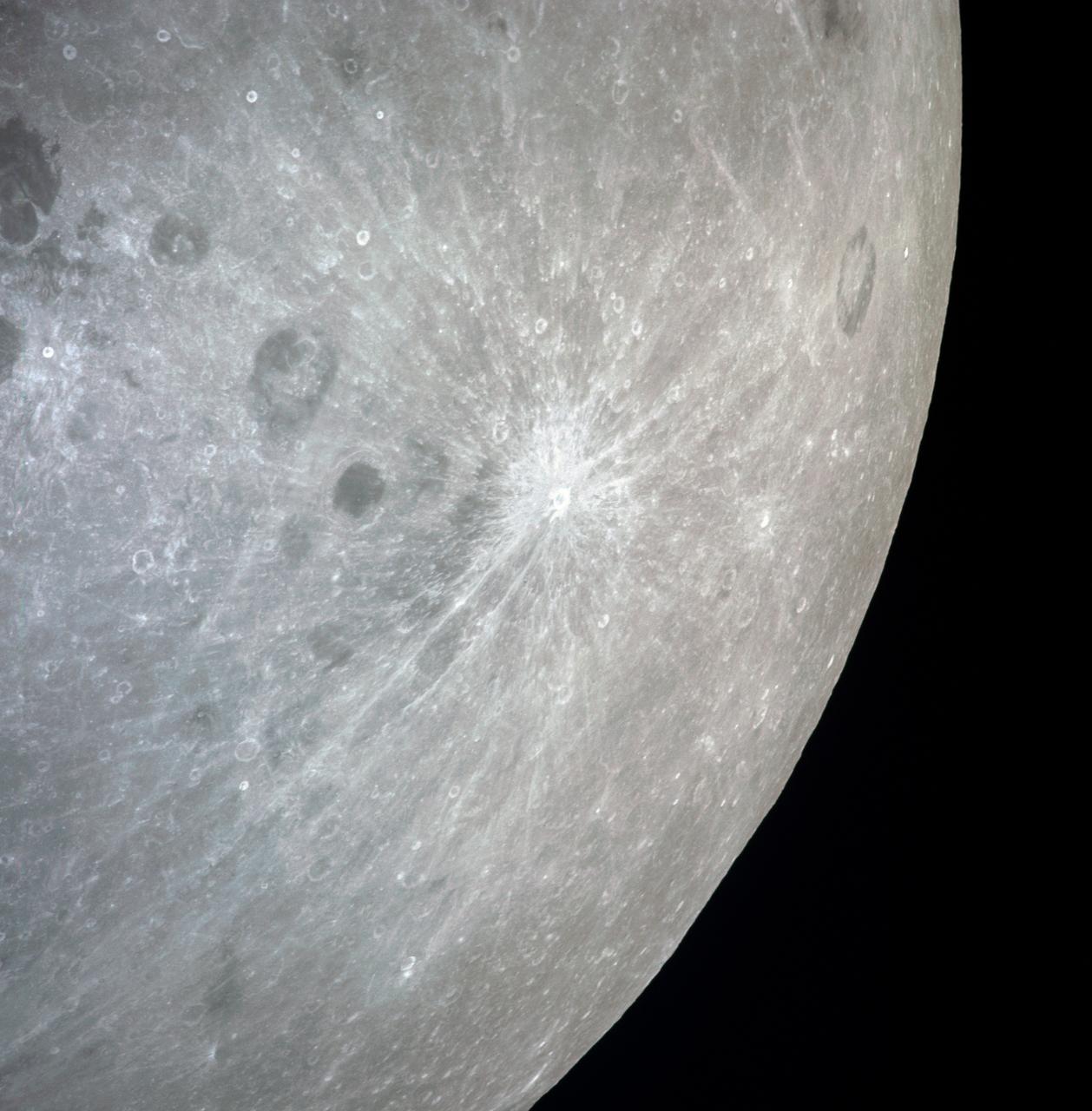
art002e010014 (April 6, 2026) – A bright portion of the Moon is visible in this image. If you look closely, you can see linear, pitted features known as “crater chains” radiating from the Orientale basin, an impact crater with a patch of ancient lava at its center, visible in the bottom center of the image. These crater chains formed about 3.8 billion years ago, when rocks spewed from the collision that formed Orientale landed in lines extending away from the crater. These chains are found near other large craters on the Moon, but we don’t get to see them on Earth because our planet’s crust has been turned over so many times through plate tectonics and largely erased by rain, wind, and ice. In the upper left corner of the Moon disk is a line called the terminator, the boundary between lunar day and night. Here, low-angle sunlight skims the surface, casting dramatic shadows that expose the area’s topography — or the shape of its surface. Glushko crater is the bright spot just to the left of the dark mare, or “sea” of ancient lava flows on the near side of the Moon. It’s identifiable by the bright rays that shoot across the mare, some hundreds of miles away. These rays are made of ejected material after the collision that formed Glushko. Glushko and its rays are brighter than the surrounding area because that younger has experienced less weathering from radiation and impacts. Oceanus Procellarum, the largest lava-filled region on the Moon, spans the horizon. The Aristarchus crater, the bright spot in the sea of lava, creeps toward the right edge of the Moon.

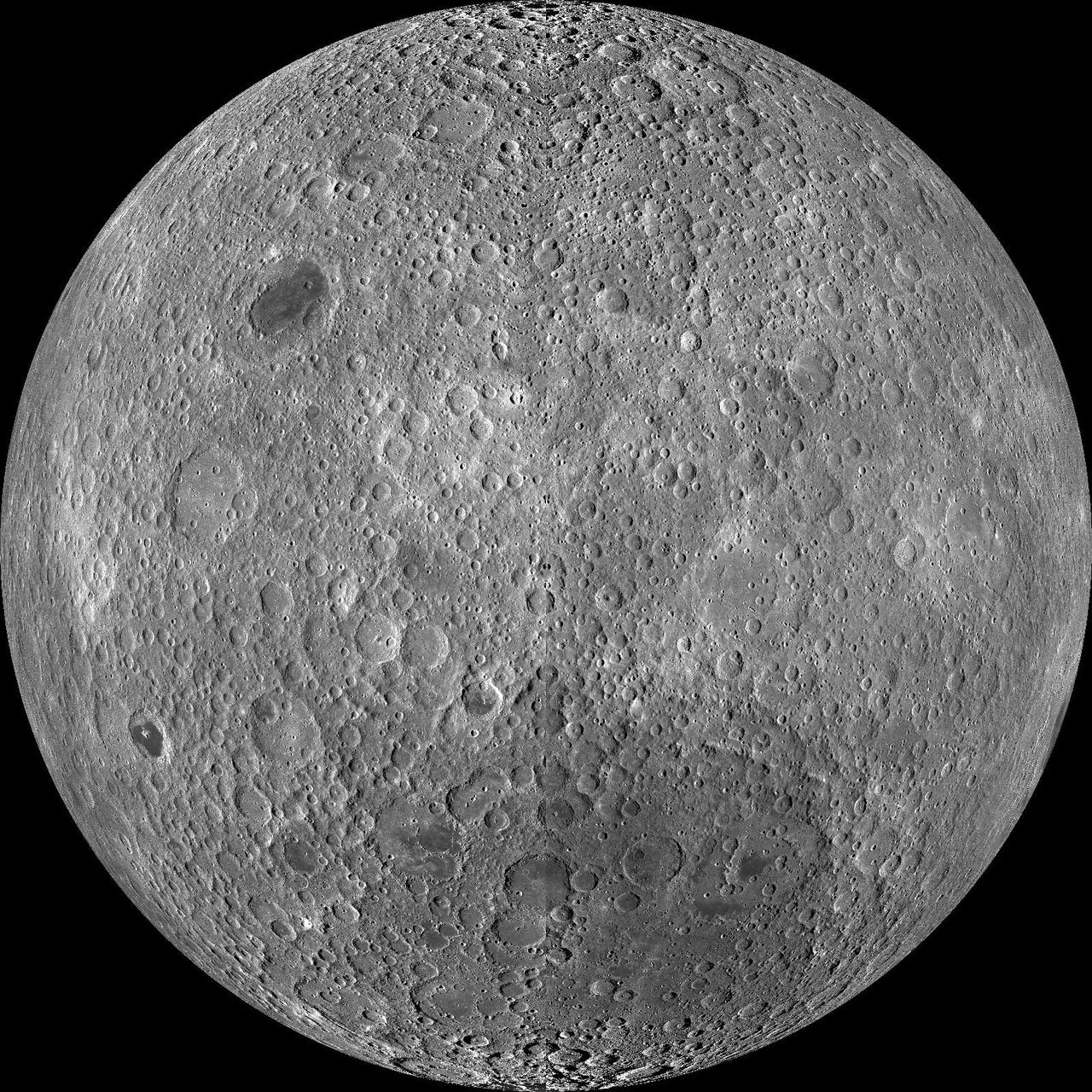
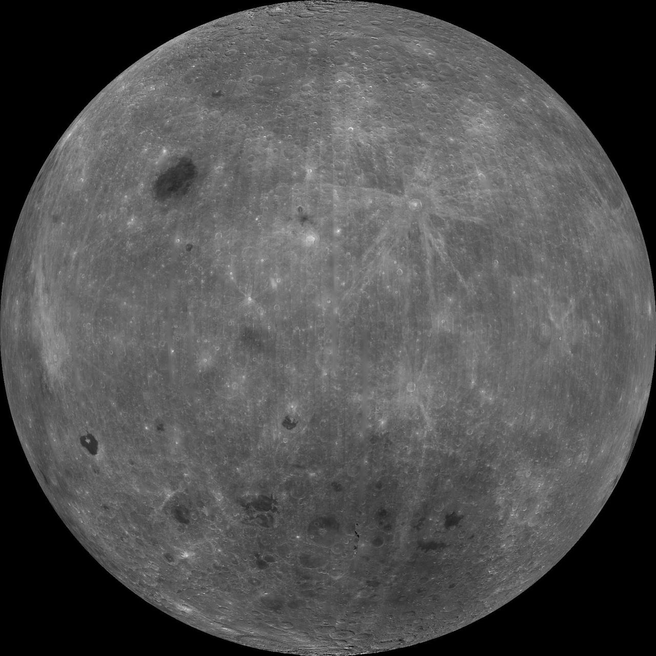
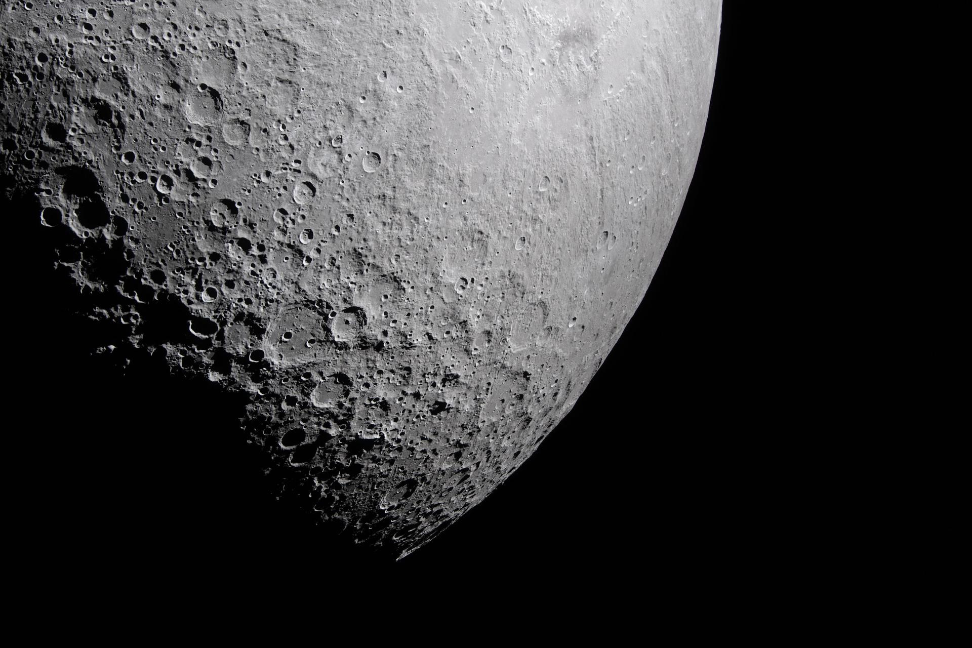
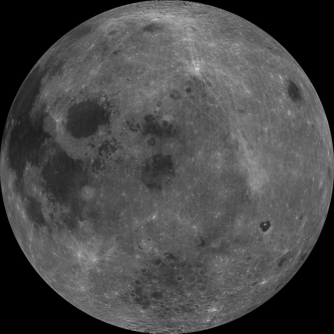
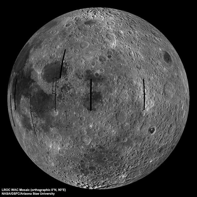
NASA image release March 11, 2011 Caption: The lunar farside as never seen before! LROC WAC orthographic projection centered at 180° longitude, 0° latitude. Credit: NASA/Goddard/Arizona State University. Because the moon is tidally locked (meaning the same side always faces Earth), it was not until 1959 that the farside was first imaged by the Soviet Luna 3 spacecraft (hence the Russian names for prominent farside features, such as Mare Moscoviense). And what a surprise - unlike the widespread maria on the nearside, basaltic volcanism was restricted to a relatively few, smaller regions on the farside, and the battered highlands crust dominated. A different world from what we saw from Earth. Of course, the cause of the farside/nearside asymmetry is an interesting scientific question. Past studies have shown that the crust on the farside is thicker, likely making it more difficult for magmas to erupt on the surface, limiting the amount of farside mare basalts. Why is the farside crust thicker? That is still up for debate, and in fact several presentations at this week's Lunar and Planetary Science Conference attempt to answer this question. The Clementine mission obtained beautiful mosaics with the sun high in the sky (low phase angles), but did not have the opportunity to observe the farside at sun angles favorable for seeing surface topography. This WAC mosaic provides the most complete look at the morphology of the farside to date, and will provide a valuable resource for the scientific community. And it's simply a spectacular sight! The Lunar Reconnaissance Orbiter Camera (LROC) Wide Angle Camera (WAC) is a push-frame camera that captures seven color bands (321, 360, 415, 566, 604, 643, and 689 nm) with a 57-km swath (105-km swath in monochrome mode) from a 50 km orbit. One of the primary objectives of LROC is to provide a global 100 m/pixel monochrome (643 nm) base map with incidence angles between 55°-70° at the equator, lighting that is favorable for morphological interpretations. Each month, the WAC provides nearly complete coverage of the Moon under unique lighting. As an added bonus, the orbit-to-orbit image overlap provides stereo coverage. Reducing all these stereo images into a global topographic map is a big job, and is being led by LROC Team Members from the German Aerospace Center (Deutsches Zentrum für Luft- und Raumfahrt; DLR). Several preliminary WAC topographic products have appeared in LROC featured images over the past year (Orientale basin, Sinus Iridum). For a sneak preview of the WAC global DEM with the WAC global mosaic, view a rotating composite moon (70 MB video from ASU's LROC website). The WAC topographic dataset will be completed and released later this year. The global mosaic released today is comprised of over 15,000 WAC images acquired between November 2009 and February 2011. The non-polar images were map projected onto the GLD100 shape model (WAC derived 100 m/pixel DTM), while polar images were map projected on the LOLA shape model. In addition, the LOLA derived crossover corrected ephemeris, and an improved camera pointing, provide accurate positioning (better than 100 m) of each WAC image. As part of the March 2011 PDS release, the LROC team posted the global map in ten regional tiles. Eight of the tiles are equirectangular projections that encompass 60° latitude by 90° longitude. In addition, two polar stereographic projections are available for each pole from ±60° to the pole. These reduced data records (RDR) products will be available for download on March 15, 2011. As the mission progresses, and our knowledge of the lunar photometric function increases, improved and new mosaics will be released! Work your way around the moon with these six orthographic projections constructed from WAC mosaics. The nearside view linked below is different from that released on 21 February. To read more con't here: <a href="http://www.nasa.gov/mission_pages/LRO/news/lro-farside.html" rel="nofollow">www.nasa.gov/mission_pages/LRO/news/lro-farside.html</a> <b><a href="http://www.nasa.gov/centers/goddard/home/index.html" rel="nofollow">NASA Goddard Space Flight Center</a></b> enables NASA’s mission through four scientific endeavors: Earth Science, Heliophysics, Solar System Exploration, and Astrophysics. Goddard plays a leading role in NASA’s accomplishments by contributing compelling scientific knowledge to advance the Agency’s mission. <b>Follow us on <a href="http://twitter.com/NASA_GoddardPix" rel="nofollow">Twitter</a></b> <b>Join us on <a href="http://www.facebook.com/pages/Greenbelt-MD/NASA-Goddard/395013845897?ref=tsd" rel="nofollow">Facebook</a></b>
AS11-43-6412 (July 1969) --- This is a northeasterly, low-oblique view of an unmanned crater and highland area on the lunar farside, as photographed from Apollo 11. The center of the picture is located at the 167 degrees east longitude and 6 degrees north latitude. This area of the moon lies just east of International Astronomical Union crater No. 220.
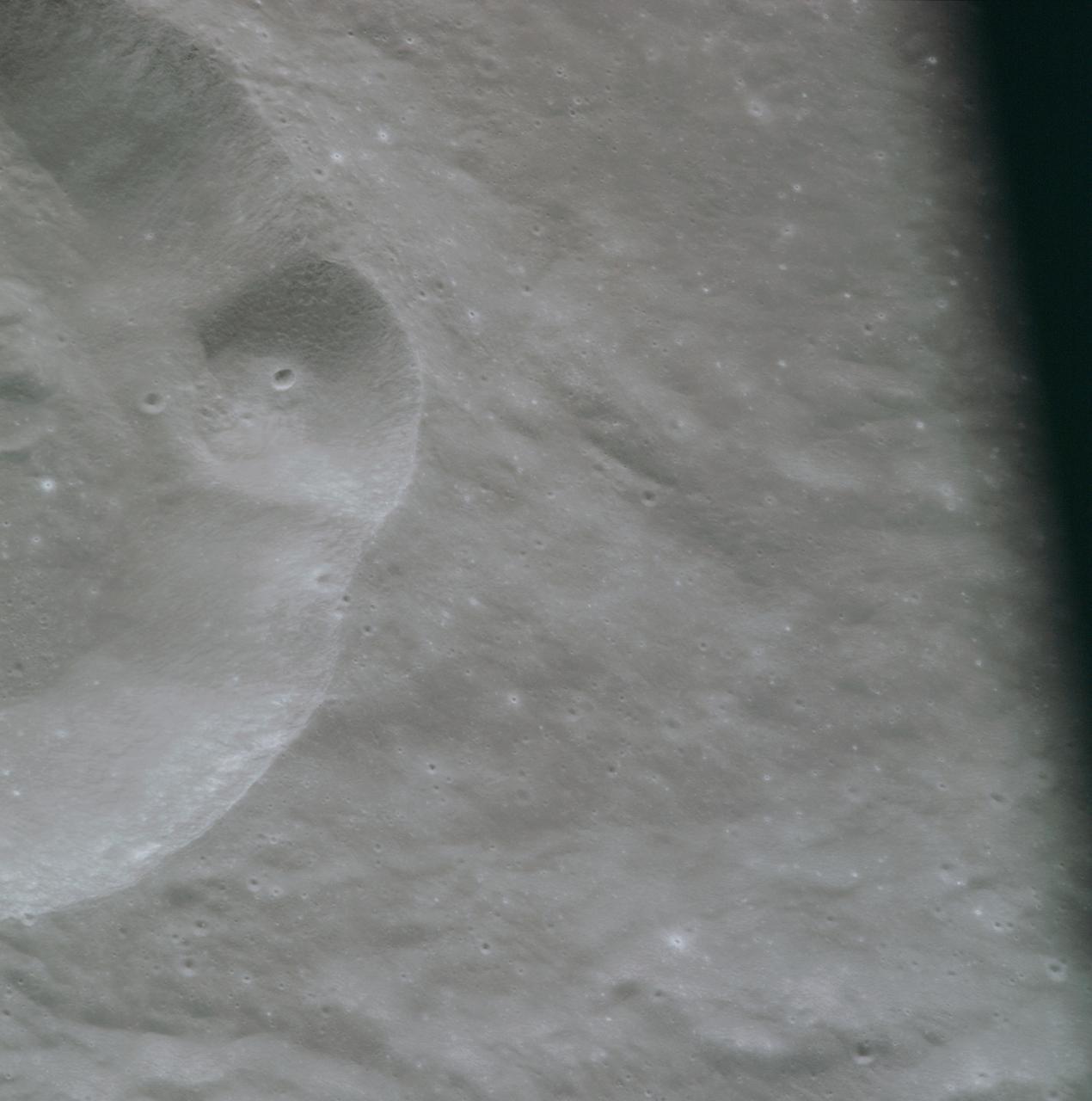
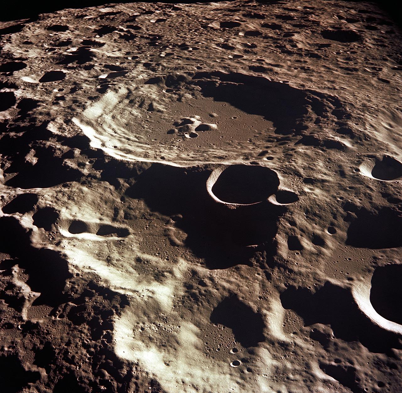
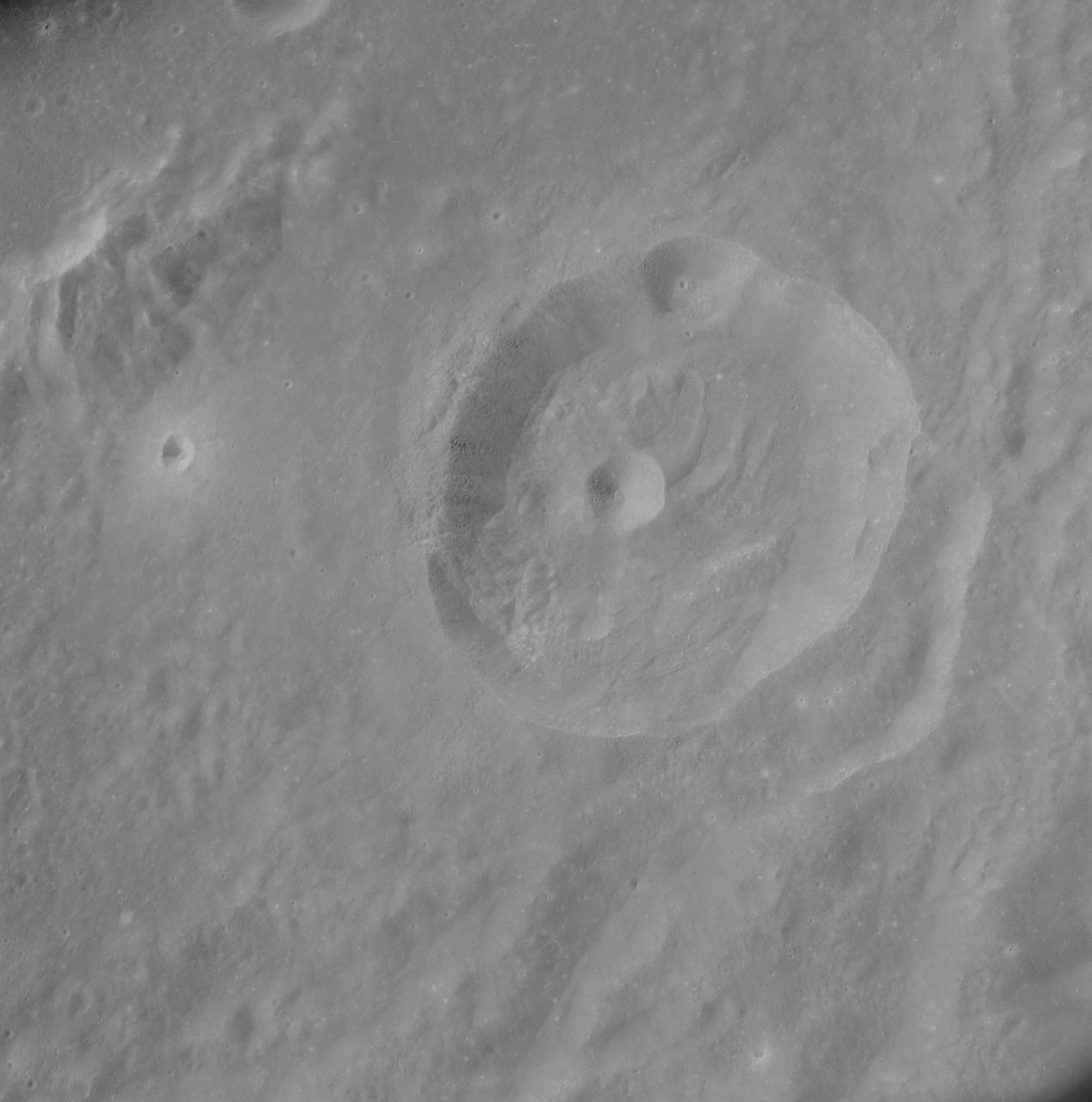
AS14-72-9975 (February 1971) --- A near vertical view of the inner wall of King Crater located on the lunar farside, as photographed from the Apollo 14 spacecraft in lunar orbit. The coordinates of the center of King Crater are 120.7 degrees east longitude and 14.3 degrees north latitude.
AS08-17-2670 (21-27 Dec. 1968) --- Near vertical view of the lunar farside as photographed from the Apollo 8 spacecraft. The center of the picture is located approximately at 162 degrees west longitude and 6 degrees south latitude.
AS13-60-8675 (April 1970) --- This bright-rayed crater on the lunar farside was photographed from the Apollo 13 spacecraft during its pass around the moon. This area is northeast of Mare Marginus. The bright-rayed crater is located at about 105 degrees east longitude and 45 degrees north latitude. The crater Joliot-Curie is located between Mare Marginus and the rayed crater. This view is looking generally toward the northeast.
AS11-43-6439 (July 1969) --- An Apollo 11 oblique view of the lunar farside. The linear group of small craters is located within the large International Astronomical Union crater No. IX, and is centered at 139.5 degrees east longitude and 7 degrees north latitude. The absence of shadows is due to the high sun angle. The crater chain is approximately 34 statute miles in length, and the large crater adjacent to the crater is 10.5 statute miles in diameter.
AS08-14-2431 (21-27 Dec. 1968) --- This is a near vertical photograph of the lunar surface taken with a telephoto lens during the Apollo 8 lunar orbit mission. The photographed area is approximately 20 miles on a side, and is located within a large, unmanned 100-statute-miles-in-diameter crater on the farside of the moon. This large crater is located at 10 degrees south latitude and 160 degrees east longitude. The lunar surface probably has less pronounced color than indicated by this print.
AS08-14-2432 (21-27 Dec. 1968) --- This is a near vertical photograph of the lunar surface taken with a telephoto lens during the Apollo 8 lunar orbit mission. The photographed area is approximately 20 miles on a side and is located within a large, unmanned 100-miles-in-diameter crater on the farside of the moon. This large crater is located at 10 degrees south latitude and 160 degrees east longitude. The lunar surface probably has less pronounced color then indicated by this print.
Apollo 8,Farside of Moon. Image taken on Revolution 4. Camera Tilt Mode: Vertical Stereo. Sun Angle: 13. Original Film Magazine was labeled D. Camera Data: 70mm Hasselblad. Lens: 80mm; F-Stop: F/2.8; Shutter Speed: 1/250 second. Film Type: Kodak SO-3400 Black and White,ASA 40. Flight Date: December 21-27,1968.
AS11-43-6422 (July 1969) --- An Apollo 11 oblique view of the lunar farside. These two odd-shaped craters are located midway between International Astronomical Union craters 218 and 220, and are centered at 155 degrees east longitude and 3 degrees north latitude. The craters total approximately 13.5 statute miles in length and 7.5 statute miles in width at their widest point.
AS11-44-6609 (16-24 July 1969) --- An oblique of the Crater Daedalus on the lunar farside as seen from the Apollo 11 spacecraft in lunar orbit. The view looks southwest. Daedalus (formerly referred to as I.A.U. Crater No. 308) is located at 179 degrees east longitude and 5.5 degrees south latitude. Daedalus has a diameter of about 50 statute miles. This is a typical scene showing the rugged terrain on the farside of the moon. While astronauts Neil A. Armstrong, commander, and Edwin E. Aldrin Jr., lunar module pilot, descended in the Lunar Module (LM) "Eagle" to explore the Sea of Tranquility region of the moon, astronaut Michael Collins, command module pilot, remained with the Command and Service Modules (CSM) "Columbia" in lunar orbit.
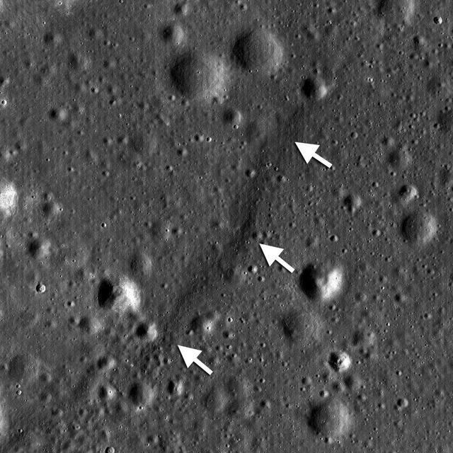
NASA Lunar Reconnaissance Orbiter shows a lobate scarp in the mare basalts of Aitken crater on the lunar farside arrows.
S71-44672 (30 July 1971) --- A near vertical view of the crater Paracelsus (formerly called I.A.U. Crater 365) on the lunar farside, as photographed by the Fairchild metric camera in the Scientific Instrumentation Module (SIM) bay of the Apollo 15 Command and Service Modules (CSM) in lunar orbit. Note mountain peak in center of Paracelsus. The coordinates of the center of Paracelsus are 163 degrees east longitude and 23 degrees south latitude. The second largest crater in the picture is identified as number 364 by the I.A.U. North will be at the top of the picture if held with Paracelsus at top center. The three-inch mapping camera was one of eight lunar orbital science experiments mounted in the SIM bay.
AS8-17-2704 (21-27 Dec. 1968) --- Near vertical view of the lunar farside as photographed from the Apollo 8 spacecraft. This crater, which is about 22 statute miles in diameter, is located at 167 degrees east longitude and 11 degrees south latitude. This crater is located on the eastern edge of a much larger unnamed crater which is about 90 statute miles in diameter.
AS08-14-2446 (21-27 Dec. 1968) --- This is an oblique view of the lunar horizon looking southwest. This photograph, taken during the Apollo 8 lunar orbit mission, covers an area in the foreground to the northwest of the crater Tsiolkovsky on the lunar farside. The area in the foreground is located at about 15 degrees south latitude and 120 degrees east longitude. The lunar surface probably has less pronounced color than indicated by this print.
AS08-14-2400 (21-27 Dec. 1968) --- This near vertical photograph of the lunar surface taken with a telephoto lens during the Apollo 8 lunar orbit mission. The area covered by the photograph is approximately 20 miles on a side, and the photographed area is located at about 3 degrees south latitude and 160 degrees west longitude on the lunar farside. The lunar surface probably had less pronounced color than indicated by this print.
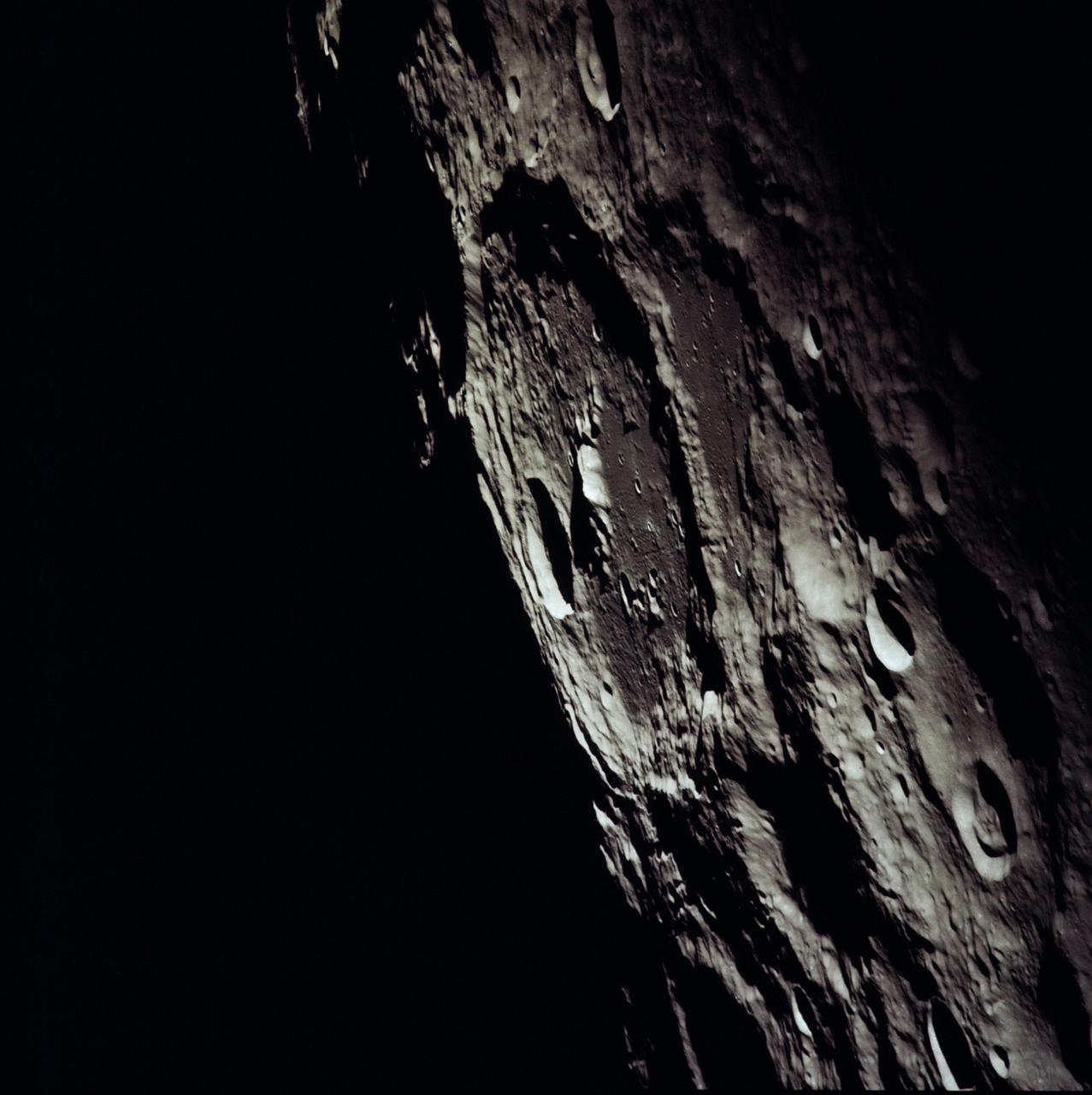
AS13-60-8659 (14 April 1970) --- Excellent view of the lunar farside showing the crater Tsiolkovsky, as photographed by the crew of the Apollo 13 mission during their lunar pass. The view is looking southeast toward the lunar horizon. The approximate coordinates of Tsiolkovsky are 128.5 degrees east longitude and 20.5 degrees south latitude. The Apollo 13 crew members were forced to cancel their scheduled lunar landing because of an apparent explosion of oxygen tank number two in the Service Module (SM).
AS10-34-5173 (18-26 May 1969) --- An Apollo 10 photograph of the lunar farside showing an area in the vicinity of International Astronomical Union (I.A.U.) crater No. 300, taken from the Command and Service Modules. This view is looking south over typical rugged lunar terrain. I.A.U. crater No. 300 is located at 155 degrees east longitude and 10 degrees south latitude.
AS11-42-6248 (July 1969) --- An Apollo 11 oblique view of the lunar farside in the area of International Astronomical Union crater No. 312, which is about 30 statute miles in diameter. The center of the photograph is located at 164 degrees west longitude and 8 degrees south latitude. The sharp shadows indicate that the picture was taken at a low sun angle.
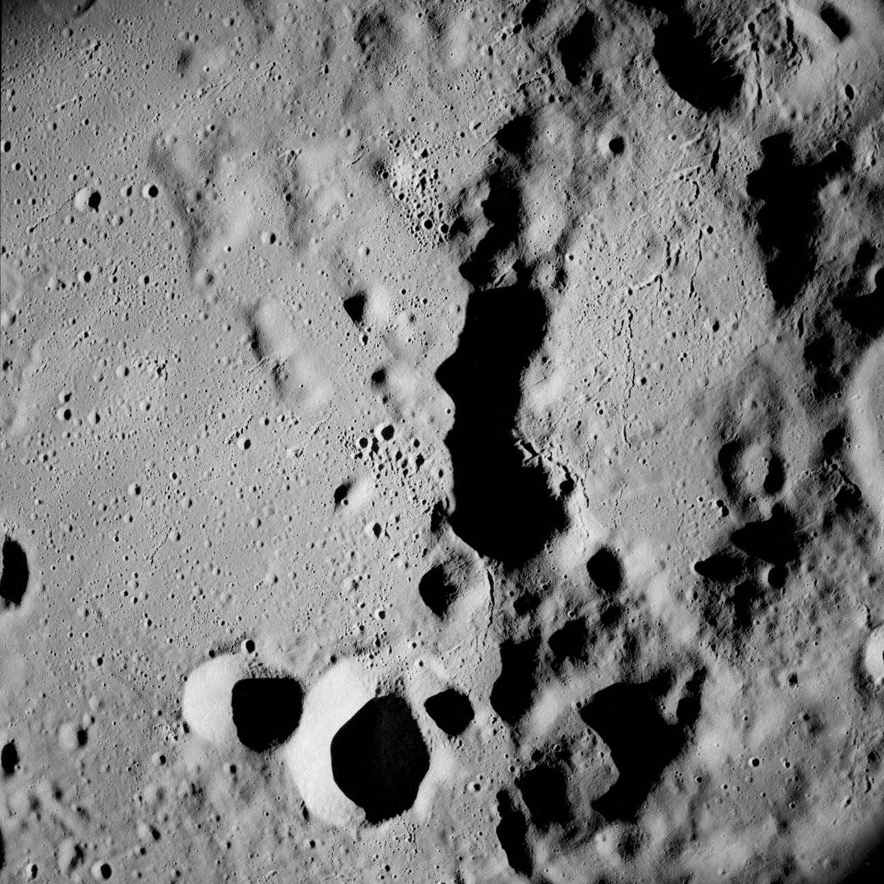
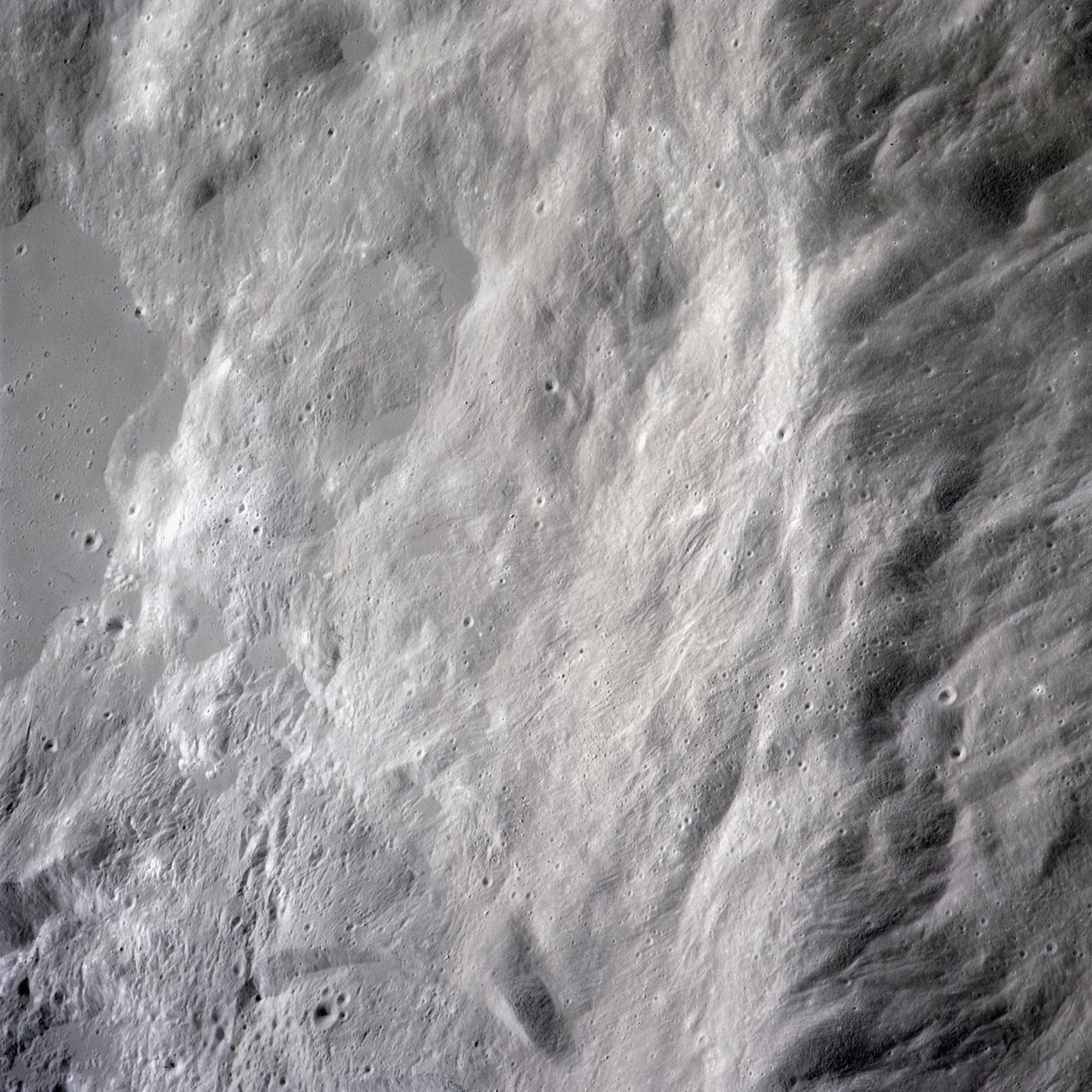
AS15-97-13168 (31 July-2 Aug. 1971) --- A view of the flow structure on the rim and edge of the crater Tsiolkovsky in the highlands of the lunar farside, as photographed from lunar orbit by astronaut Alfred M. Worden in the Apollo 15 Command and Service Module (CSM). Note the scarp at the edge of the flow and elongated grooves on the flow surface. While astronauts David R. Scott and James B. Irwin descended in the Lunar Module (LM) "Falcon" to explore the moon's Hadley-Apennine landing site, Worden remained with the CSM in lunar orbit.
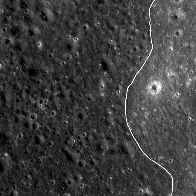
NASA Lunar Reconnaissance Orbiter spied a very subtle mare-highlands boundary in Mare Moscoviense on the lunar farside, near the center of the Constellation Program region of interest.
AS15-97-13160 (31 July-2 Aug. 1971) --- A view of a portion of the crater Tsiolkovsky located in the highlands on the farside of the moon, as photographed from the Apollo 15 Command and Service Modules (CSM) by astronaut Alfred M. Worden, command module pilot. Note the dark, flat crater floor surrounding the very prominent central mountains. The mountains are in the northeastern corner of the photograph. The other upland area comprises part of the southwestern edge of the crater. While astronauts David R. Scott, commander, and James B. Irwin, lunar module pilot, descended in the Lunar Module (LM) "Falcon" to explore the moon, astronaut Worden remained with the CSM in lunar orbit.
S71-44670 (31 July 1971) --- A near vertical view of the crater Tsiolkovsky on the lunar farside, as photographed by the Fairchild metric camera in the Scientific Instrument Module (SIM) bay of the Apollo 15 Command and Service Modules (CSM) in lunar orbit. This view is looking northerly. The coordinates of the crater's central peaks are 128 degrees east longitude and 20 degrees south latitude. The mare area measured from east to west is approximately 145 kilometers (90 statute miles) across. The three-inch mapping camera was one of eight lunar orbital science experiments mounted in the SIM bay.
AS16-121-19407 (April 1972) --- An oblique view of a rim of Guyot Crater on the lunar farside, as photographed from the Apollo 16 spacecraft in lunar orbit. The coordinates of the center of Guyot Crater are 116.5 degrees east longitude and 10.5 degrees north latitude. Note the black coloration which appears to be lava flow down the side of the crater rim. While astronauts John W. Young, commander; and Charles M. Duke Jr., lunar module pilot; descended in the Apollo 16 Lunar Module (LM) "Orion" to explore the Descartes highlands site on the moon, astronaut Thomas K. Mattingly II, command module pilot, remained with the Command and Service Modules (CSM) "Casper" in lunar orbit.
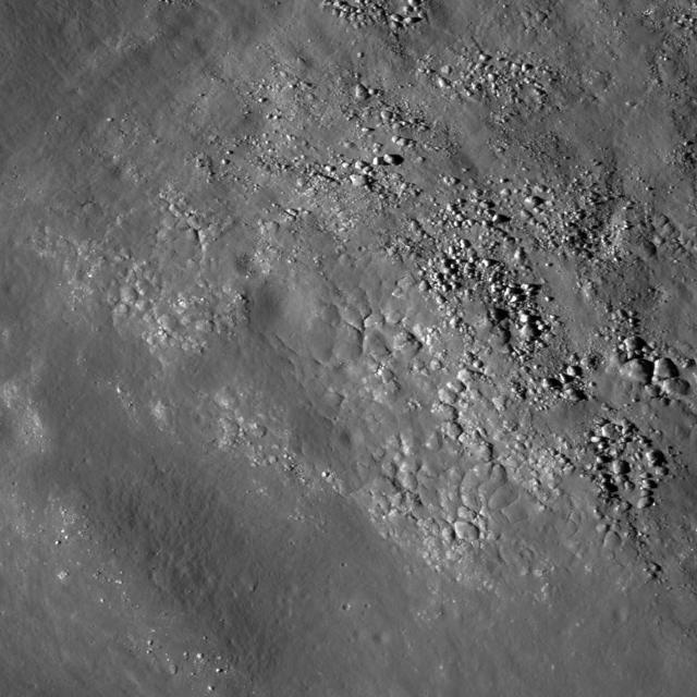
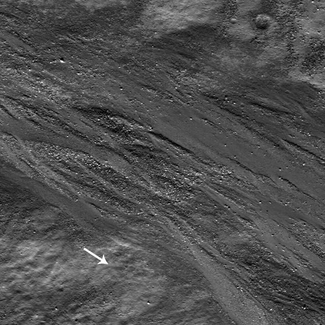
Diverse textures on the floor of Saha E which could be the result of impact melt coating boulders and other deposits on the floor of the crater on the lunar farside in this image taken by NASA Lunar Reconnaissance Orbiter.
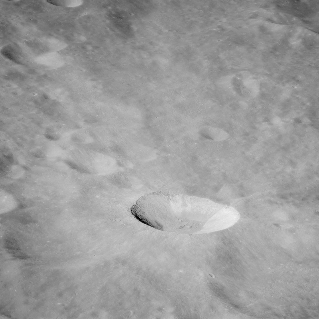
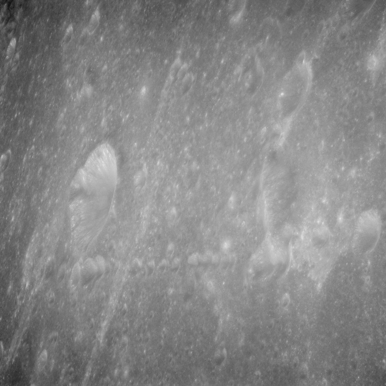
High-albedo marks on the lunar surface left by a boulder bouncing down the northeast wall of farside highlands crater Moore F in this image captured by NASA Lunar Reconnaissance Orbiter.
High-albedo marks on the lunar surface left by a boulder bouncing down the northeast wall of farside highlands crater Moore F in this image captured by NASA Lunar Reconnaissance Orbiter.
AS16-118-18964 (16-27 April 1972) --- This lunar farside oblique view from the Apollo 16 spacecraft in lunar orbit shows the Leonov Crater, just to the left and above the principal point of the photograph. Just beyond the horizon lies the Moscow Sea.
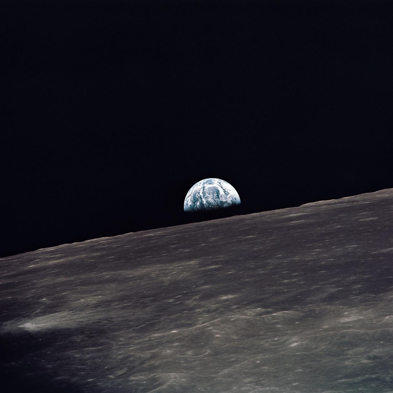
AS10-27-3890 (18-26 May 1969) --- A view of Earth rising above the lunar horizon photographed from the Apollo 10 Lunar Module, looking west in the direction of travel. The Lunar Module at the time the picture was taken was located above the lunar farside highlands at approximately 105 degrees east longitude.

art002e024232 (April 6, 2026) - This photo of the Moon was captured by the Artemis II crew aboard the Orion spacecraft a few hours before the lunar flyby. During the flyby, the crew captured critical science observations as they traveled around the farside of the Moon, traveling farther than any humans ever before.
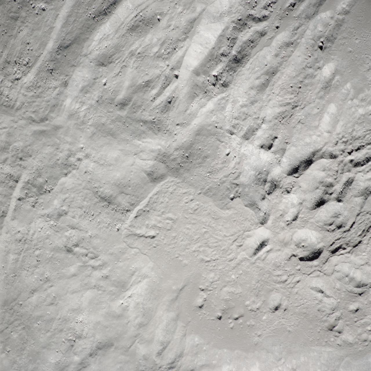
This image from NASA Lunar Reconnaissance Orbiter shows a view of boulders, on the floor of Rutherfurd crater, about to disappear into the shadows of dusk.
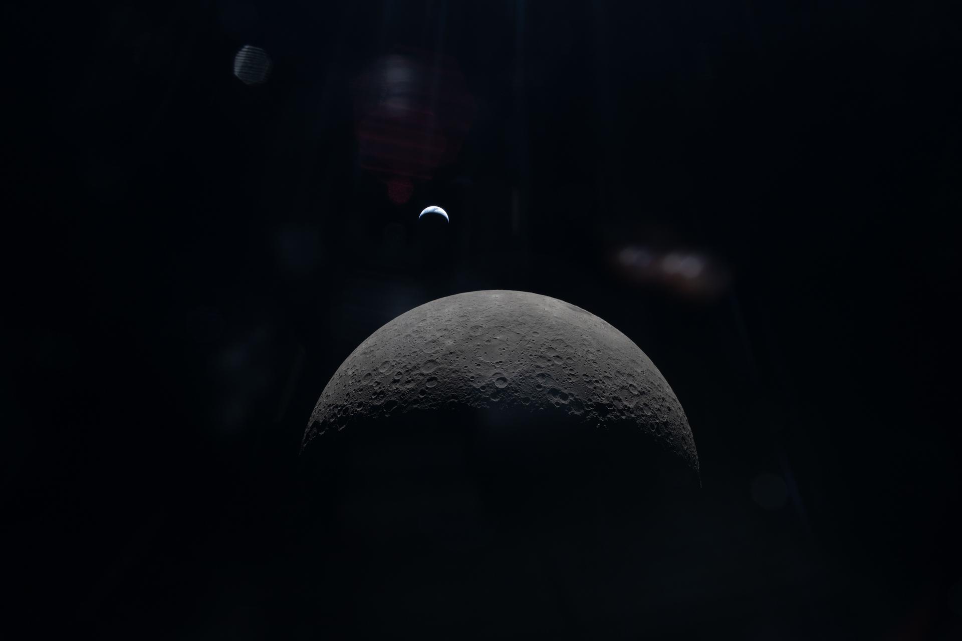
art002e015231 (April 6, 2026) – The Artemis II crew captures a faint view of a crescent Earth above the horizon on the Moon’s far side.
art002e015228 (April 6, 2026) - Seen from behind the Moon during Artemis II, the Moon and Earth align in the same frame, each partially illuminated by the Sun. The Moon’s surface appears in sharp detail in the foreground, while Earth sits much farther away, smaller and softly lit in the background. A faint reflection in the spacecraft window is also visible, subtly overlaying the scene. Though their phases differ, both are shaped by the same sunlight, revealing the geometry of the Sun–Earth–Moon system from deep space. Credit: NASA

About 50,000 Clementine images were processed to produce the four orthographic views of the Moon. The images show albedo variations (normalized brightness or reflectivity) of the surface at a wavelength of 750 nm (just longward of visible red). The image projection is centered at 0 degree latitude and 180 degrees longitude. Mare Moscoviense (dark albedo feature upper left of image center) and South Pole-Aitken Basin (dark feature at bottom) represent maria regions largely absent on the lunar farside. The Clementine altimeter showed Aitken Basin to consist of a topographic rim about 2500 km in diameter, an inner shelf ranging from 400 to 600 km in width, and an irregular depressed floor about 12 km in depth. http://photojournal.jpl.nasa.gov/catalog/PIA00302
AS08-12-2052 (21-27 Dec. 1968) --- This near-vertical photograph from the Apollo 8 spacecraft covers an area of approximately 50 x 50 statute miles within a 250-statute-miles-in-diameter crater on the lunar farside. The center of this large crater is located at about 157 degrees west longitude and 4 degrees south latitude. The large crater in the center of the picture is about 20 statute miles in diameter.
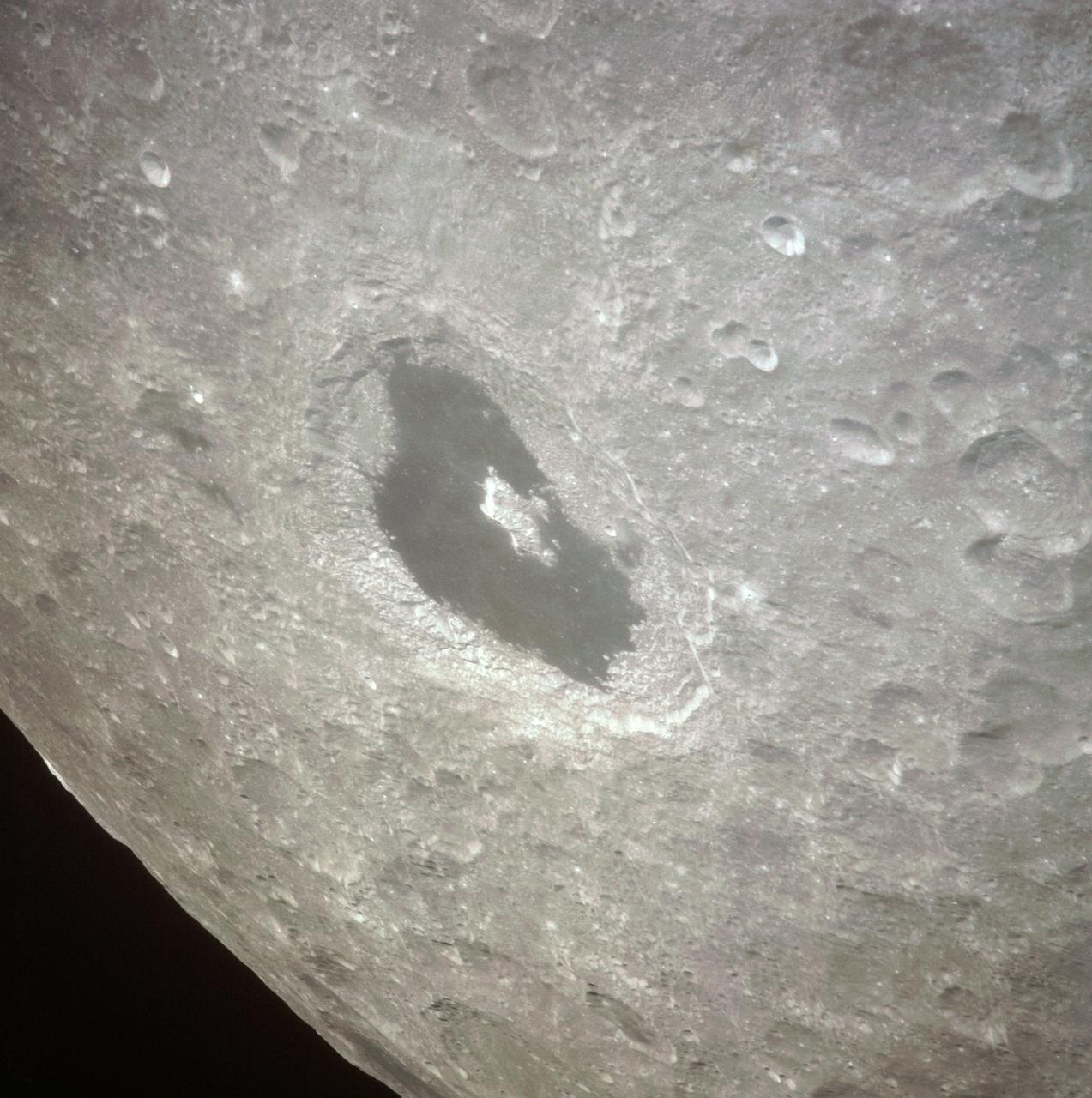
AS12-47-6870 (November 1969) --- An Apollo 12 high-oblique view of the crater Tsiolkovsky (in center of horizon) on the lunar farside, as photographed from lunar orbit. The crew men of the Apollo 12 lunar landing mission were astronauts Charles Conrad Jr., commander; Richard F. Gordon Jr., command module pilot; and Alan L. Bean, lunar module pilot. Tsiolkovsky is centered at 128.5 degrees east longitude and 20.5 degrees south latitude. This view is looking south.
AS8-17-2744 (21-27 Dec. 1968) --- Oblique view of the lunar surface taken from the Apollo 8 spacecraft looking westward showing typical lunar farside terrain. (HOLD PICTURE SO THAT DARK IRREGULAR AREA SURROUNDED BY LIGHT SPOTS IS IN THE LOWER RIGHT QUARTER). The sharp crater near the center of then scene is near 117 degrees east longitude and 5 degrees south latitude; and it is 25 kilometers (15 statute miles) in diameter. That crater is on the rim of a large crater that occupies the lower right quarter of the photograph.
AS16-118-18947 (16-27 April 1972) --- A 250mm view looking north by westward across lunar farside highland terrain, as photographed from the Apollo 16 spacecraft in lunar orbit. The frame is centered at approximately 158 degrees east longitude and 17 degrees north latitude. Van Gent Crater is the lower of two large craters at extreme lower right corner. The top of the two craters is unnamed. The west part of Konstantinov Crater is at extreme right center. Nagaoka Crater is just below the horizon at upper left.
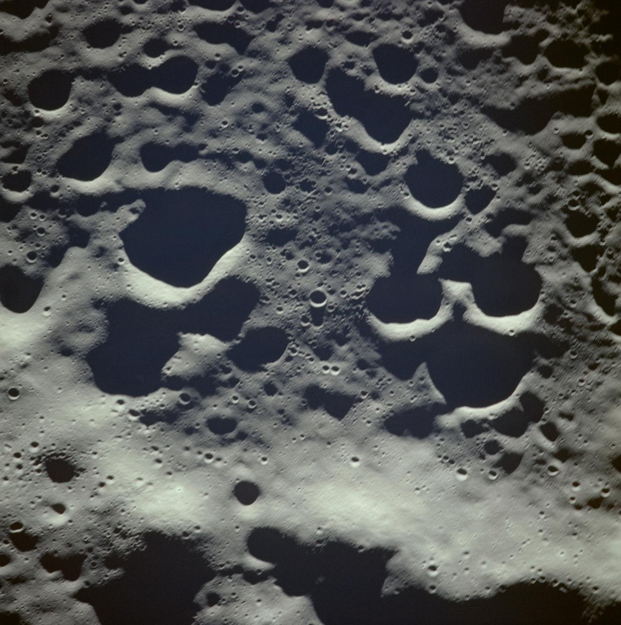
AS8-18-2883 (21-27 Dec. 1968) --- An Apollo 8 photograph of the surface of the moon. HOLD PICTURE WITH SKY AT TOP. The dark-floored crater in the lower right corner is named Lomonosov, and measures approximately 50 statute miles in diameter. The bright-rayed crater was named Giordano Bruno by the Russians. Bruno was a sixteenth-century Italian scientist. Lomonosov is located on the lunar farside at about 102 degrees east longitude and 28 degrees north latitude.

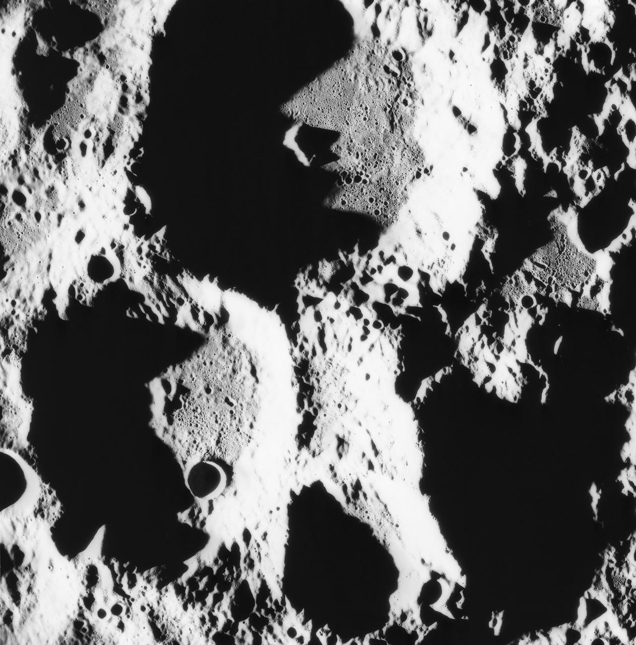
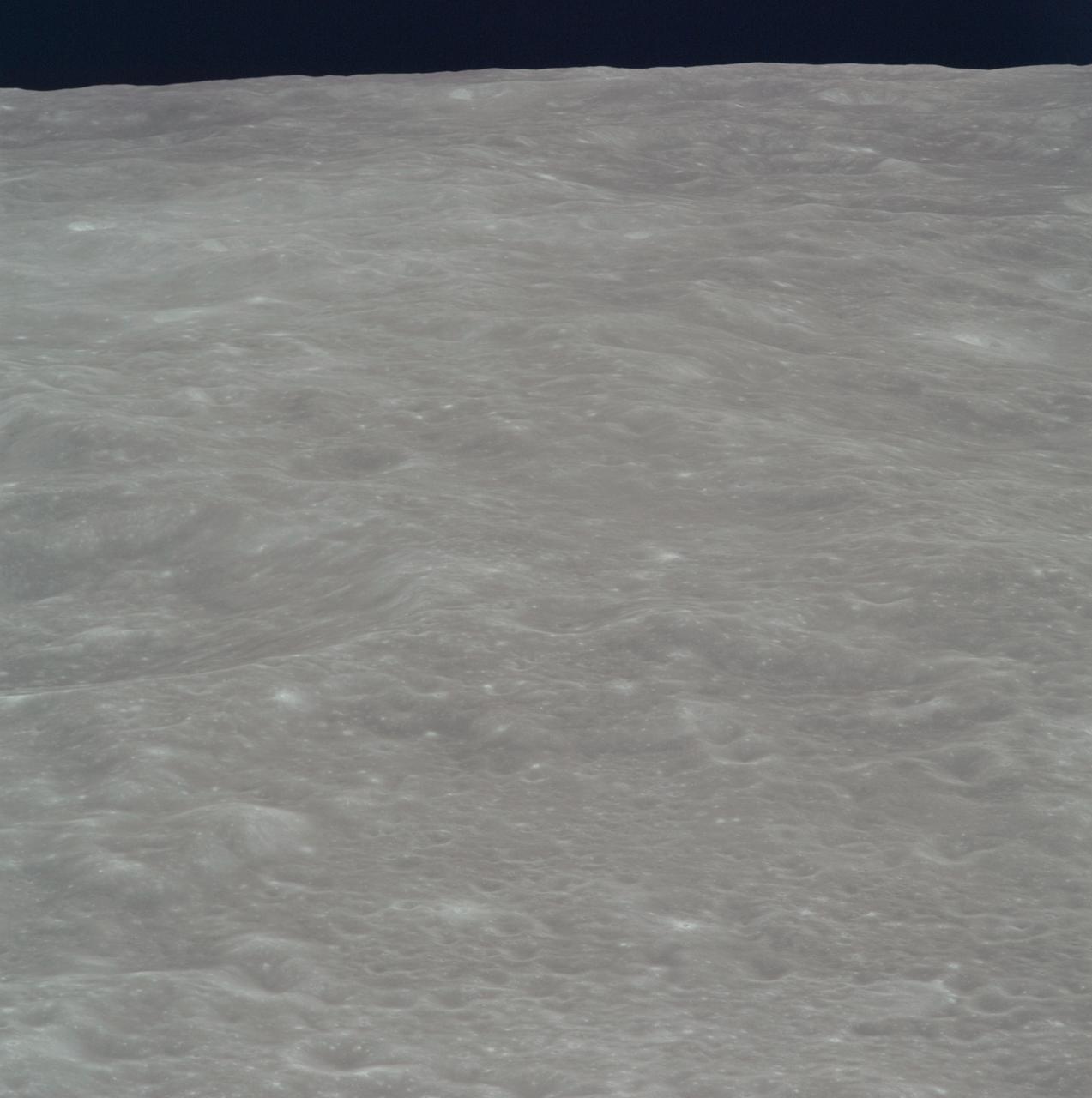
AS08-14-2453 (21-27 Dec. 1968) --- After inserting into lunar orbit, the Apollo 8 astronauts looked down on rugged terrain never before seen by man. This scene is typical of farside terrain illuminated by a sun that is nearly directly overhead. A surface consisting of craters superimposed on older craters extends about 570 kilometers (350 statute miles) to the horizon. Width of view at the horizon is 150 kilometers (94 statute miles).
AS13-60-8635 (April 1970) --- An oblique view of the International Astronomical Union Crater No. 302 on the lunar farside as photographed from the Apollo 13 spacecraft during its pass around the moon. This large crater is located at 162 degrees east longitude and 10 degrees south latitude. The smaller crater, I.A.U. No. 301, is in the foreground. I.A.U. No. 302 has ridges in its center and a smaller crater near its inner edge. This view is looking southeast.
art002e020686 (April 6, 2026) – A portion of the Moon’s farside is seen along the terminator—the boundary between lunar day and night—where low-angle sunlight casts long shadows across the surface. A section of Orientale Basin is visible along the upper right portion of the lunar disk, its structure subtly revealed under grazing illumination. This lighting enhances contrast across the cratered terrain, highlighting variations in surface features and providing insight into the Moon’s geologic history. Credit: NASA
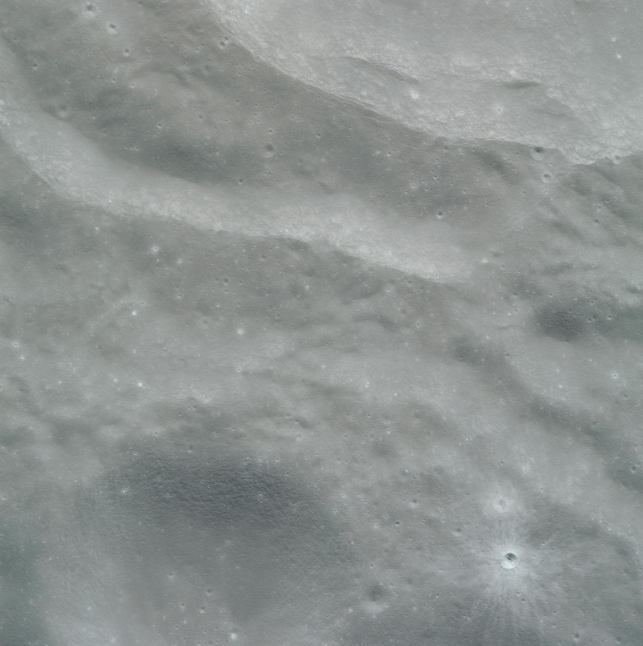
AS16-120-19228 (16-27 April 1972) --- Strongly textured terrain north of the lunar farside King Crater which is centered near 120.5 degrees east longitude and 5.5 degrees north latitude. This near vertical oblique view eastward was photographed from the Apollo 16 spacecraft in lunar orbit with a Hasselblad camera equipped with a 250mm telephoto lens. Several irregular areas characterized by conspicuously smooth surfaces interrupt the rough texture in this view of the eastern quarter of the large, unnamed crater between King and Guyot. Similar "ponds" occur at varied levels in the rim deposits of the nearside craters Copernicus and Tycho. Hold picture with the smooth area at the top.

NASA Administrator Bill Nelson and President of the Centre National d’Etudes Spatiales (CNES) Dr. Philippe Baptiste sign an agreement for the Farside Seismic Suite (FSS), Wednesday, Nov. 30, 2022 at the Mary W. Jackson NASA Headquarters building in Washington. The FSS will return the first lunar seismic data from the far side of the Moon. CNES is contributing one of the seismometers to this payload, which will be delivered via NASA’s Commercial Lunar Payloads Services (CLPS) initiative, based on heritage capabilities from the Mars InSight mission. Photo Credit: (NASA/Keegan Barber)

NASA Administrator Bill Nelson and President of the Centre National d’Etudes Spatiales (CNES) Dr. Philippe Baptiste sign an agreement for the Farside Seismic Suite (FSS), Wednesday, Nov. 30, 2022 at the Mary W. Jackson NASA Headquarters building in Washington. The FSS will return the first lunar seismic data from the far side of the Moon. CNES is contributing one of the seismometers to this payload, which will be delivered via NASA’s Commercial Lunar Payloads Services (CLPS) initiative, based on heritage capabilities from the Mars InSight mission. Photo Credit: (NASA/Keegan Barber)

NASA Administrator Bill Nelson and President of the Centre National d’Etudes Spatiales (CNES) Dr. Philippe Baptiste sign an agreement for the Farside Seismic Suite (FSS), Wednesday, Nov. 30, 2022 at the Mary W. Jackson NASA Headquarters building in Washington. The FSS will return the first lunar seismic data from the far side of the Moon. CNES is contributing one of the seismometers to this payload, which will be delivered via NASA’s Commercial Lunar Payloads Services (CLPS) initiative, based on heritage capabilities from the Mars InSight mission. Photo Credit: (NASA/Keegan Barber)
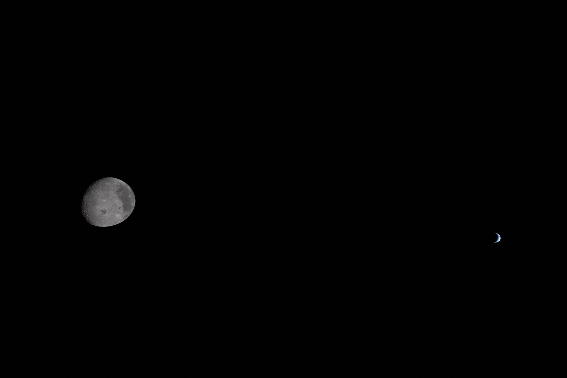
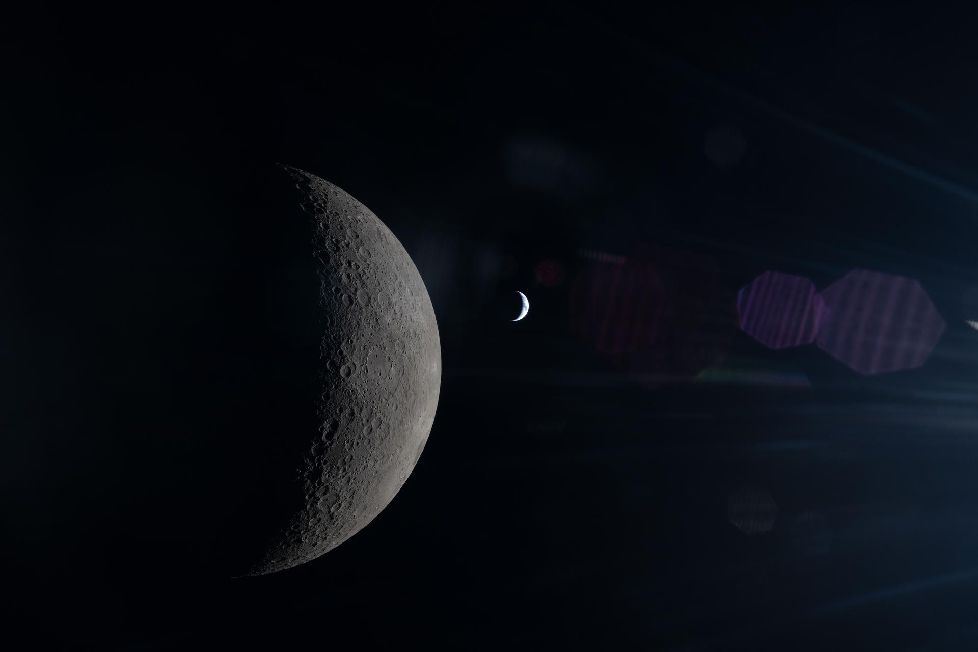
art002e014211 (April 6, 2026) - Seen side-by-side from deep space, the Moon and Earth share the frame—yet Earth appears as a small, delicate crescent against the blackness beyond. At this stage, Orion is approaching the Moon’s farside, placing the image earlier in the flyby, before closest approach during Artemis II. Though both worlds are visible, the scale and distance between them become immediately clear, offering a powerful perspective of how far the crew has traveled from home. Even in its reduced size, Earth’s soft glow stands out, a reminder of the only world we’ve ever known. Credit: NASA
AS08-13-2244 (21-27 Dec. 1968) --- This Apollo 8 view of the lunar surface looks southward at 162 degrees west longitude, showing rugged terrain that is characteristic of the lunar farside hemisphere. Hold picture with black sky at top right. The large crater at the left side of the picture is about 110 kilometers (70 statute miles) in diameter and is centered about 200 kilometers (125 statute miles) south of the spacecraft. The sharp, circular crater in the foreground is about 15 kilometers (9 statute miles) across. Conspicuous surface lineations that extend from the lower right corner of the photograph toward the upper left resemble a radial texture observed near Mare Orientale on Lunar Orbiter IV photographs. The lineations in this area probably are related to another major crater because the observed trend is not radial to Mare Orientale.
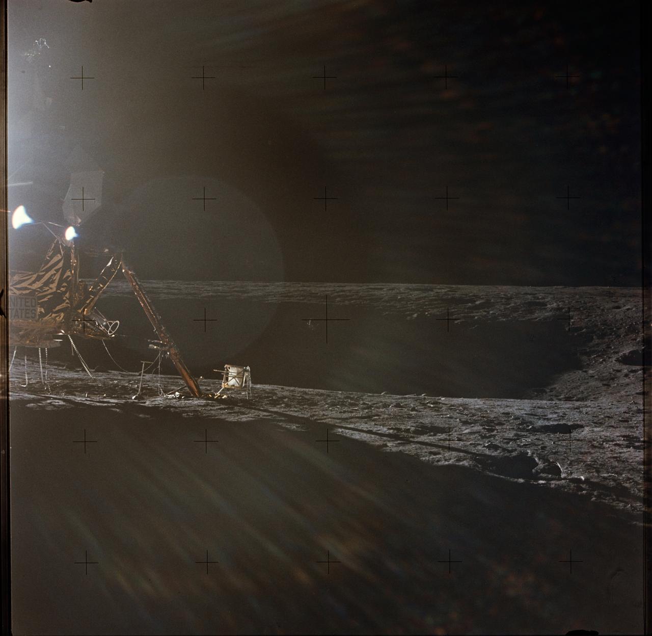
AS12-47-6949 (19-20 Nov. 1969) --- A photograph of the Apollo 12 lunar landing site taken during the extravehicular activity (EVA) of astronauts Charles Conrad Jr., commander; and Alan L. Bean, lunar module pilot. The Apollo 12 Lunar Module (LM) is on the left. Barely visible in the center of the picture, in the shadows on the farside of the crater, is the Surveyor 3 spacecraft. The two spacecraft are about 600 feet apart. Conrad and Bean walked over to Surveyor 3 during their second EVA. The television camera and several other pieces were taken from Surveyor 3 and brought back to Earth for scientific examination. Astronaut Richard F. Gordon Jr., command module pilot, remained with the Command and Service Modules (CSM) in lunar orbit, while astronauts Conrad and Bean descended in the LM to explore the moon. The considerable glare in the picture is caused by the position of the sun. The Apollo tool carrier is the object next to the LM footpad.
About 50,000 Clementine images were processed to produce the four orthographic views of the Moon. The images show albedo variations (normalized brightness or reflectivity) of the surface at a wavelength of 750 nm (just longward of visible red). The image projection is centered at 0 degree latitude and 180 degrees longitude. Mare Moscoviense (dark albedo feature upper left of image center) and South Pole-Aitken Basin (dark feature at bottom) represent maria regions largely absent on the lunar farside. The Clementine altimeter showed Aitken Basin to consist of a topographic rim about 2500 km in diameter, an inner shelf ranging from 400 to 600 km in width, and an irregular depressed floor about 12 km in depth. http://photojournal.jpl.nasa.gov/catalog/PIA00303
About 50,000 Clementine images were processed to produce the four orthographic views of the Moon. The images show albedo variations (normalized brightness or reflectivity) of the surface at a wavelength of 750 nm (just longward of visible red). The image projection is centered at 0 degree latitude and 180 degrees longitude. Mare Moscoviense (dark albedo feature upper left of image center) and South Pole-Aitken Basin (dark feature at bottom) represent maria regions largely absent on the lunar farside. The Clementine altimeter showed Aitken Basin to consist of a topographic rim about 2500 km in diameter, an inner shelf ranging from 400 to 600 km in width, and an irregular depressed floor about 12 km in depth. http://photojournal.jpl.nasa.gov/catalog/PIA00304
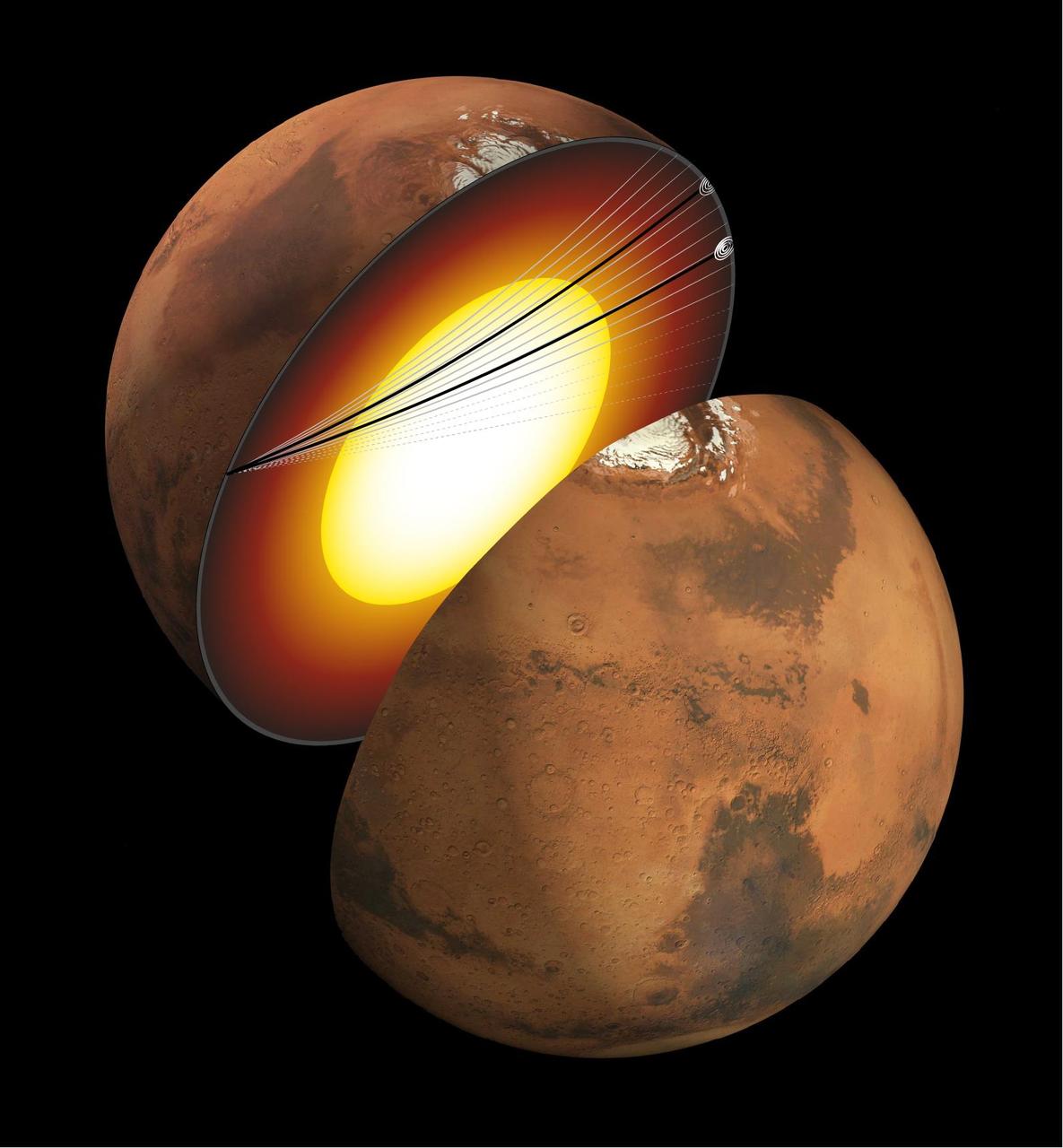
This artist's concept shows a cutaway of Mars along with the paths of seismic waves from two separate quakes in 2021. These seismic waves, detected by NASA's InSight mission, were the first ever identified to enter another planet's core. InSight's seismometer allowed scientists to study these waves and gain an unprecedented look at the Martian core. The quakes were detailed in a paper published April 24, 2023, in the Proceedings of the National Academies of Sciences. Occurring on Aug. 25 and Sept. 18, 2021, the two temblors were the first identified by the InSight team to have originated on the opposite side of the planet from the lander – so-called farside quakes. The distance proved crucial: The farther a quake happens from InSight, the deeper into the planet its seismic waves can travel before being detected. https://photojournal.jpl.nasa.gov/catalog/PIA25827

NASA's Lunar Reconnaissance Orbiter (LRO) recently captured a unique view of Earth from the spacecraft's vantage point in orbit around the moon. "The image is simply stunning," said Noah Petro, Deputy Project Scientist for LRO at NASA's Goddard Space Flight Center in Greenbelt, Maryland. "The image of the Earth evokes the famous 'Blue Marble' image taken by Astronaut Harrison Schmitt during Apollo 17, 43 years ago, which also showed Africa prominently in the picture." In this composite image we see Earth appear to rise over the lunar horizon from the viewpoint of the spacecraft, with the center of the Earth just off the coast of Liberia (at 4.04 degrees North, 12.44 degrees West). The large tan area in the upper right is the Sahara Desert, and just beyond is Saudi Arabia. The Atlantic and Pacific coasts of South America are visible to the left. On the moon, we get a glimpse of the crater Compton, which is located just beyond the eastern limb of the moon, on the lunar farside. LRO was launched on June 18, 2009, and has collected a treasure trove of data with its seven powerful instruments, making an invaluable contribution to our knowledge about the moon. LRO experiences 12 earthrises every day; however the spacecraft is almost always busy imaging the lunar surface so only rarely does an opportunity arise such that its camera instrument can capture a view of Earth. Occasionally LRO points off into space to acquire observations of the extremely thin lunar atmosphere and perform instrument calibration measurements. During these movements sometimes Earth (and other planets) pass through the camera's field of view and dramatic images such as the one shown here are acquired. This image was composed from a series of images taken Oct. 12, when LRO was about 83 miles (134 kilometers) above the moon's farside crater Compton. Capturing an image of the Earth and moon with LRO's Lunar Reconnaissance Orbiter Camera (LROC) instrument is a complicated task. First the spacecraft must be rolled to the side (in this case 67 degrees), then the spacecraft slews with the direction of travel to maximize the width of the lunar horizon in LROC's Narrow Angle Camera image. All this takes place while LRO is traveling faster than 3,580 miles per hour (over 1,600 meters per second) relative to the lunar surface below the spacecraft! The high-resolution Narrow Angle Camera (NAC) on LRO takes black-and-white images, while the lower resolution Wide Angle Camera (WAC) takes color images, so you might wonder how we got a high-resolution picture of the Earth in color. Since the spacecraft, Earth, and moon are all in motion, we had to do some special processing to create an image that represents the view of the Earth and moon at one particular time. The final Earth image contains both WAC and NAC information. WAC provides the color, and the NAC provides high-resolution detail. "From the Earth, the daily moonrise and moonset are always inspiring moments," said Mark Robinson of Arizona State University in Tempe, principal investigator for LROC. "However, lunar astronauts will see something very different: viewed from the lunar surface, the Earth never rises or sets. Since the moon is tidally locked, Earth is always in the same spot above the horizon, varying only a small amount with the slight wobble of the moon. The Earth may not move across the 'sky', but the view is not static. Future astronauts will see the continents rotate in and out of view and the ever-changing pattern of clouds will always catch one's eye, at least on the nearside. The Earth is never visible from the farside; imagine a sky with no Earth or moon - what will farside explorers think with no Earth overhead?" NASA's first Earthrise image was taken with the Lunar Orbiter 1 spacecraft in 1966. Perhaps NASA's most iconic Earthrise photo was taken by the crew of the Apollo 8 mission as the spacecraft entered lunar orbit on Christmas Eve Dec. 24, 1968. That evening, the astronauts -- Commander Frank Borman, Command Module Pilot Jim Lovell, and Lunar Module Pilot William Anders -- held a live broadcast from lunar orbit, in which they showed pictures of the Earth and moon as seen from their spacecraft. Said Lovell, "The vast loneliness is awe-inspiring and it makes you realize just what you have back there on Earth." Credit: NASA/Goddard/Arizona State University <b><a href="http://www.nasa.gov/audience/formedia/features/MP_Photo_Guidelines.html" rel="nofollow">NASA image use policy.</a></b> <b><a href="http://www.nasa.gov/centers/goddard/home/index.html" rel="nofollow">NASA Goddard Space Flight Center</a></b> enables NASA’s mission through four scientific endeavors: Earth Science, Heliophysics, Solar System Exploration, and Astrophysics. Goddard plays a leading role in NASA’s accomplishments by contributing compelling scientific knowledge to advance the Agency’s mission. <b>Follow us on <a href="http://twitter.com/NASAGoddardPix" rel="nofollow">Twitter</a></b> <b>Like us on <a href="http://www.facebook.com/pages/Greenbelt-MD/NASA-Goddard/395013845897?ref=tsd" rel="nofollow">Facebook</a></b> <b>Find us on <a href="http://instagrid.me/nasagoddard/?vm=grid" rel="nofollow">Instagram</a></b>
AS08-14-2505 (21-27 Dec. 1968) --- This photograph of a nearly full moon was taken from the Apollo 8 spacecraft at a point above 70 degrees east longitude. (Hold picture with moon's dark portion at left). Mare Crisium, the circular, dark-colored area near the center, is near the eastern edge of the moon as viewed from Earth. Mare Nectaris is the circular mare near the terminator. The large, irregular maira are Tranquillitatis and Fecunditatis. The terminator at left side of picture crosses Mare Tranquillitatis and highlands to the south. Lunar farside features occupy most of the right half of the picture. The large, dark-colored crater Tsiolkovsky is near the limb at the lower right. Conspicuous bright rays radiate from two large craters, one to the north of Tsiolkovsky, the other near the limb in the upper half of the picture. These rayed craters were not conspicuous in Lunar Orbiter photography due to the low sun elevations when the Lunar Orbiter photography was made. The crater Langrenus is near the center of the picture at the eastern edge of Mare Fecunditatis. The lunar surface probably has less pronounced color that indicated by this print.
AS08-14-2506 (21-27 Dec. 1968) --- This photograph of a nearly full moon was taken from the Apollo 8 spacecraft at a point above 70 degrees east longitude. (Hold picture with moon's dark portion at left). Mare Crisium, the circular, dark-colored area near the center, is near the eastern edge of the moon as viewed from Earth. Mare Nectaris is the circular mare near the terminator. The large, irregular maira are Tranquillitatis and Fecunditatis. The terminator at left side of picture crosses Mare Tranquillitatis and highlands to the south. Lunar farside features occupy most of the right half of the picture. The large, dark-colored crater Tsiolkovsky is near the limb at the lower right. Conspicuous bright rays radiate from two large craters, one to the north of Tsiolkovsky, the other near the limb in the upper half of the picture. These rayed craters were not conspicuous in Lunar Orbiter photography due to the low sun elevations when the Lunar Orbiter photography was made. The crater Langrenus is near the center of the picture at the eastern edge of Mare Fecunditatis. The lunar surface probably has less pronounced color that indicated by this print.
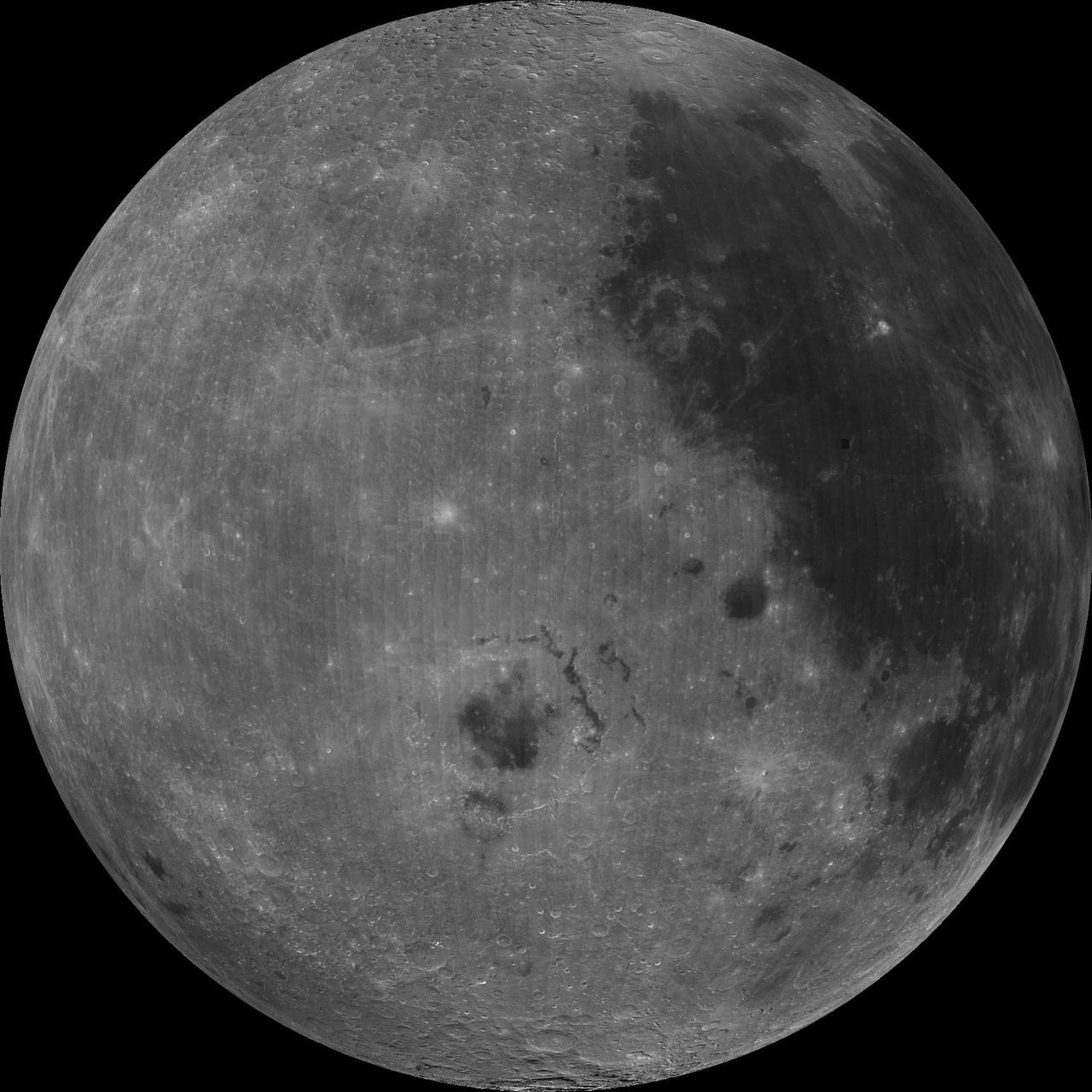
NASA image release September 9, 2010 LROC Wide Angle Camera (WAC) view of the Moon seen from 90° east longitude. Half the nearside is visible to the left, and half the farside to the right. Credit: NASA/GSFC/Arizona State University To read more go to: <a href="http://www.nasa.gov/mission_pages/LRO/multimedia/lroimages/lroc-20100909_mooneast.html" rel="nofollow">www.nasa.gov/mission_pages/LRO/multimedia/lroimages/lroc-...</a> <b><a href="http://www.nasa.gov/centers/goddard/home/index.html" rel="nofollow">NASA Goddard Space Flight Center</a></b> contributes to NASA’s mission through four scientific endeavors: Earth Science, Heliophysics, Solar System Exploration, and Astrophysics. Goddard plays a leading role in NASA’s endeavors by providing compelling scientific knowledge to advance the Agency’s mission. <b>Follow us on <a href="http://twitter.com/NASA_GoddardPix" rel="nofollow">Twitter</a></b> <b>Join us on <a href="http://www.facebook.com/pages/Greenbelt-MD/NASA-Goddard/395013845897?ref=tsd" rel="nofollow">Facebook</a></b>