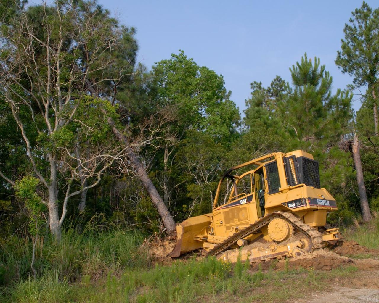
Tree clearing for the site of the new A-3 Test Stand at Stennis Space center began June 13. NASA's first new large rocket engine test stand to be built since the site's inception, A-3 construction begins a historic era for America's largest rocket engine test complex. The 300-foot-tall structure is scheduled for completion in August 2010. A-3 will perform altitude tests on the Constellation's J-2X engine that will power the upper stage of the Ares I crew launch vehicle and earth departure stage of the Ares V cargo launch vehicle. The Constellation Program, NASA's plan for carrying out the nation's Vision for Space Exploration, will return humans to the moon and eventually carry them to Mars and beyond.
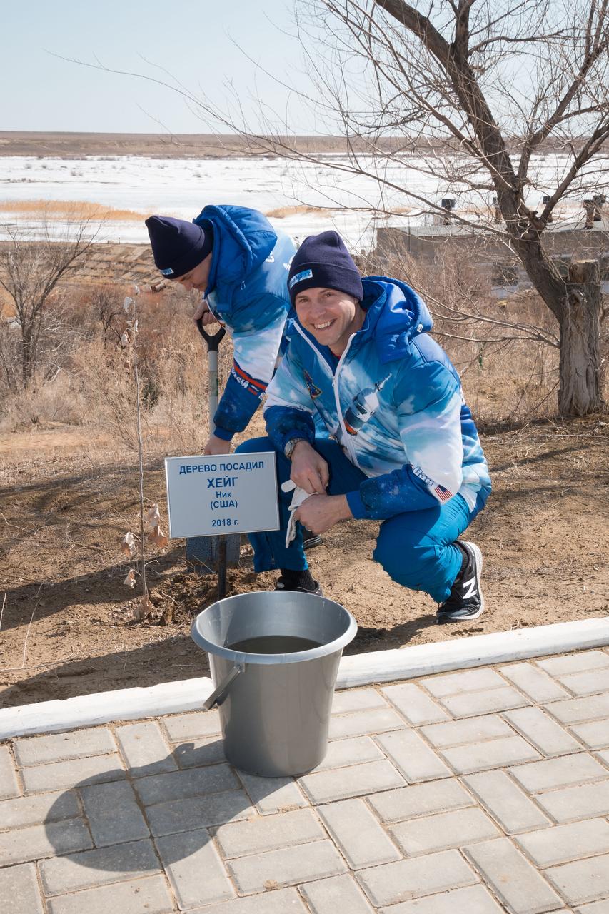
At the Cosmonaut Hotel crew quarters in Baikonur, Kazakhstan, Expedition 59 crewmember Nick Hague of NASA poses for pictures March 7 in front of a tree he originally planted last October before his first flight. Preparing the tree for watering is crewmate Alexey Ovchinin of Roscosmos. They launched together last October 11, but their flight was cut short two minutes after launch by an abort triggered by a first-stage booster rocket separation problem. They are set to launch again March 14, U.S. time, this time with crewmate Christina Koch of NASA on the Soyuz MS-12 spacecraft from the Baikonur Cosmodrome for a six-and-a-half month mission on the International Space Station...NASA/Victor Zelentsov.
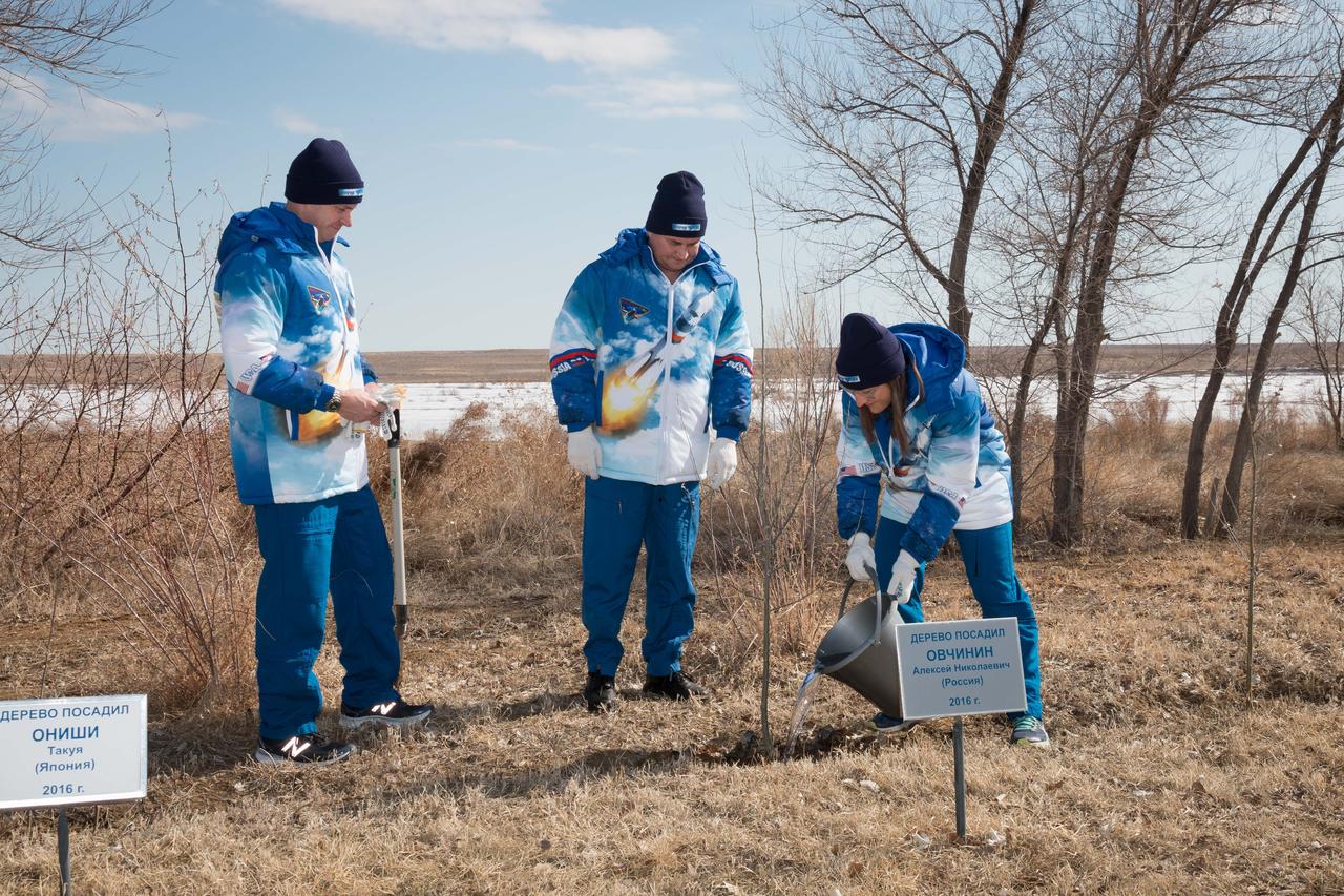
At the Cosmonaut Hotel crew quarters in Baikonur, Kazakhstan, Expedition 59 crewmember Christina Koch of NASA (right) waters a tree March 7 originally planted last October by crewmate Alexey Ovchinin (center). Ovchinin and crewmate Nick Hague of NASA (left) launched together last October 11, but their flight was cut short two minutes after launch by an abort triggered by a first-stage booster rocket separation problem. They are set to launch again March 14, U.S. time, this time with Koch on the Soyuz MS-12 spacecraft from the Baikonur Cosmodrome for a six-and-a-half month mission on the International Space Station...NASA/Victor Zelentsov.
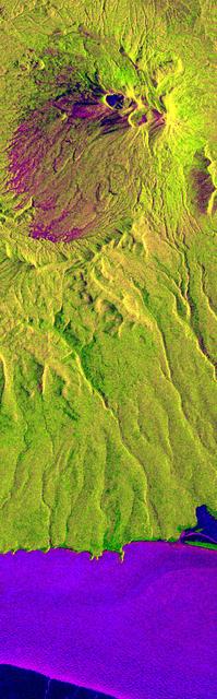
This is an X-band seasonal image of the Maly Semlyachik volcano, which is part of the Karymsky volcano group on Kamchatka peninsula, Russia. The image is centered at 54.2 degrees north latitude and 159.6 degrees east longitude. This image was acquired by the Spaceborne Imaging Radar-C and X-band Synthetic Aperture Radar (SIR-C/X-SAR) aboard the space shuttle Endeavour on April 9, 1994, during the first flight of the radar system, and on September 30, 1994, during the second flight. The image channels have been assigned the following colors: red corresponds to data acquired on April 9; green corresponds to data acquired on September 30; and blue corresponds to the ratio between data from April 9 and September 30, 1994. Kamchatka is twice as large as England, Scotland and Wales combined and is home to approximately 470,000 residents. The region is characterized by a chain of volcanoes stretching 800 kilometers (500 miles) across the countryside. Many of the volcanoes, including the active Maly Semlyachik volcano in this image, have erupted during this century. But the most active period in creating the three characteristic craters of this volcano goes back 20,000, 12,000 and 2,000 years ago. The highest summit of the oldest crater reaches about 1,560 meters (1,650 feet). The radar images reveal the geological structures of craters and lava flows in order to improve scientists' knowledge of these sometimes vigorously active volcanoes. This seasonal composite also highlights the ecological differences that have occurred between April and October 1994. In April the whole area was snow-covered and, at the coast, an ice sheet extended approximately 5 kilometers (3 miles) into the sea. The area shown surrounding the volcano is covered by low vegetation much like scrub. Kamchatka also has extensive forests, which belong to the northern frontier of Taiga, the boreal forest ecosystem. This region plays an important role in the world's carbon cycle. Trees require 60 years to mature in Kamchatka's 120-day growing season. The forest industry is managing these forests and practicing selective cutting to allow younger trees time to grow and reseed. X-SAR images will aid in mapping these deforested areas and in encouraging further recultivation efforts. http://photojournal.jpl.nasa.gov/catalog/PIA01728
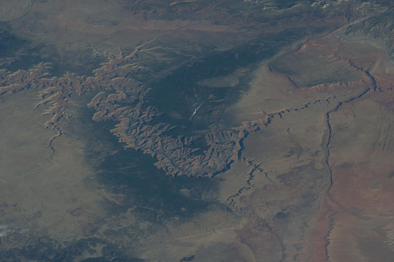
ISS039-E-005258 (25 March 2014) --- Not only do millions of tourists have special attractions to the Grand Canyon, but also through the years astronauts and cosmonauts in space. One of the Expedition 39 crew members aboard the Earth-orbiting International Space Station aimed his camera, equipped with a 180mm lens, at the iconic feature. The steep walls of the Colorado River canyon and its many side canyons make an intricate landscape that contrasts with the dark green, forested plateau to the north and south. The Colorado River has done all the erosional work of carving away cubic kilometers of rock in a geologically short period of time. Visible as a darker line snaking along the bottom of the canyon, the river lies at an altitude of 715 meters (2,345 feet), thousands of meters below the North and South Rims. Temperatures are furnace-like on the river banks in the summer. But Grand Canyon Village, the classic outlook point for visitors, enjoys a milder climate at an altitude of 2,100 meters (6,890 feet). The Grand Canyon has become a geologic icon?a place where, geologists say, one can almost sense the invisible tectonic forces within the Earth. The North and South Rims are part of the Kaibab Plateau, a gentle tectonic swell in the landscape. The uplift of the plateau had two pronounced effects on the landscape that show up in this image. First, in drier parts of the world, forests usually indicate higher places; higher altitudes are cooler and wetter, conditions that allow trees to grow. The other geologic lesson on view is the canyon itself. Geologists now know that a river can cut a canyon only if the Earth surface rises vertically. If such uplift is not rapid, a river can maintain its course by eroding huge quantities of rock and forming a canyon.