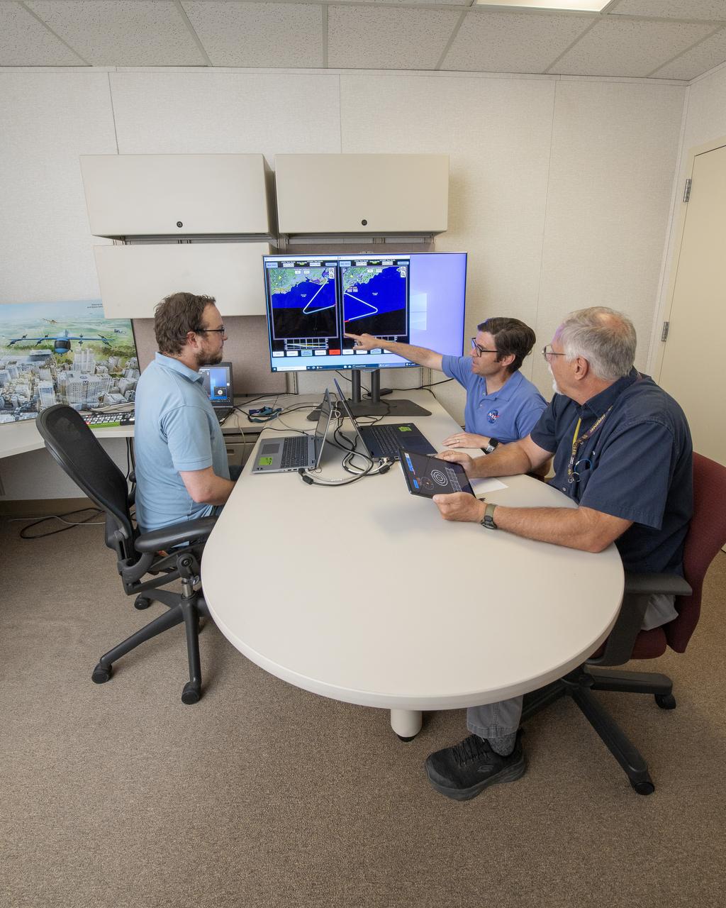
NASA software developer, Ethan Williams, left, pilot Scott Howe, and operations test consultant Jan Scofield run a flight path management software simulation at NASA’s Armstrong Flight Research Center in Edwards, California in May 2023. This simulation research supports the integration of automated systems for the advanced air mobility mission.

Test of Unmanned Aircraft Systems Traffic Management (UTM) technical capability Level 2 (TCL2) at Reno-Stead Airport, Nevada. During the test, five drones simultaneously crossed paths, separated by altitude. Two drones flew beyond visual line-of-sight and three flew within line-of-sight of their operators. Engineer Joey Mercer reviews flight paths using the UAS traffic management research platform UTM coordinator app to verify and validate flight paths.

Test of Unmanned Aircraft Systems Traffic Management (UTM) technical capability Level 2 (TCL2) at Reno-Stead Airport, Nevada. During the test, five drones simultaneously crossed paths, separated by altitude. Two drones flew beyond visual line-of-sight and three flew within line-of-sight of their operators. Engineers Priya Venkatesan and Joey Mercer review flight paths using the UAS traffic management research platform at flight operations mission control at NASA’s UTM TCL2 test.
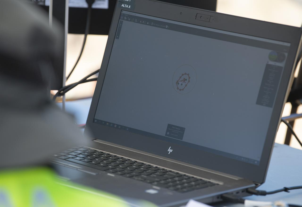
A computer displays the flight path of a FreeFly Systems Alta X drone during a flight as part of STEReO, the Scalable Traffic Management for Emergency Response Operations project, test activities, Tuesday, May 4, 2021 as Cal Fire conducts aerial fire fighting training exercises near Redding, California. STEReO, the Scalable Traffic Management for Emergency Response Operations project, led by NASA’s Ames Research Center, builds on NASA’s expertise in air traffic management, human factors research, and autonomous technology development to apply the agency’s work in Unmanned Aircraft Systems Traffic Management, or UTM, to public safety uses. Photo Credit: (NASA/Joel Kowsky)
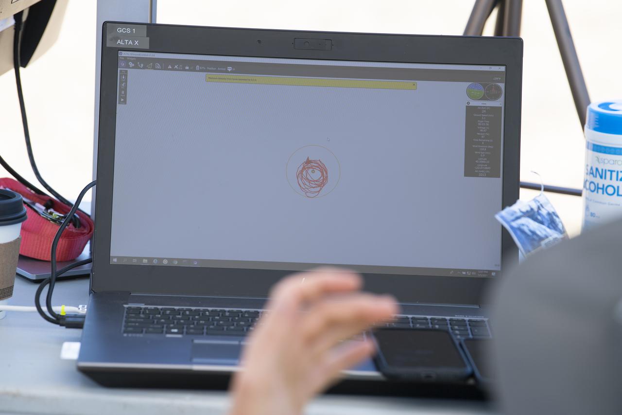
A laptop displays the flight path of a FreeFly Systems Alta X drone during STEReO, the Scalable Traffic Management for Emergency Response Operations project, field testing, Wednesday, May 5, 2021 as Cal Fire conducts aerial fire fighting training exercises near Redding, California. STEReO, the Scalable Traffic Management for Emergency Response Operations project, led by NASA’s Ames Research Center, builds on NASA’s expertise in air traffic management, human factors research, and autonomous technology development to apply the agency’s work in Unmanned Aircraft Systems Traffic Management, or UTM, to public safety uses. Photo Credit: (NASA/Joel Kowsky)
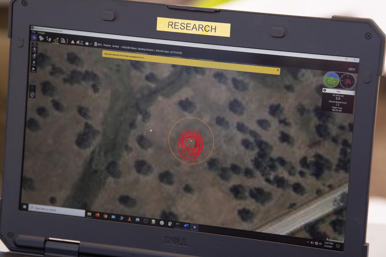
A laptop displays the flight path of a FreeFly Systems Alta X drone during STEReO, the Scalable Traffic Management for Emergency Response Operations project, field testing, Wednesday, May 5, 2021 as Cal Fire conducts aerial fire fighting training exercises near Redding, California. STEReO, the Scalable Traffic Management for Emergency Response Operations project, led by NASA’s Ames Research Center, builds on NASA’s expertise in air traffic management, human factors research, and autonomous technology development to apply the agency’s work in Unmanned Aircraft Systems Traffic Management, or UTM, to public safety uses. Photo Credit: (NASA/Joel Kowsky)

Test of Unmanned Aircraft Systems Traffic Management (UTM) technical capability Level 2 (TCL2) at Reno-Stead Airport, Nevada. During the test, five drones simultaneously crossed paths, separated by altitude. Two drones flew beyond visual line-of-sight and three flew within line-of-sight of their operators. Precision Hawk pilot readies Lancaster Mark 3 UAS for test flight.

Donya Douglas-Bradshaw, Lucy project manager at NASA’s Goddard Space Flight Center, is introduced during a prelaunch news conference for the Lucy mission held inside the TV Auditorium at NASA’s Kennedy Space Center in Florida on Oct. 13, 2021. The mission is scheduled to launch no earlier than 5:34 a.m. EDT Saturday, Oct. 16, on a United Launch Alliance Atlas V 401 rocket from Space Launch Complex 41 at Cape Canaveral Space Force Station. NASA’s Launch Services Program, based at Kennedy, is managing the launch. During its 12-year primary mission, Lucy will explore a record-breaking number of asteroids, flying by one asteroid in the solar system’s main belt and seven Trojan asteroids. Additionally, Lucy’s path will circle back to Earth three times for gravity assists, making it the first spacecraft to return to the vicinity of Earth from the outer solar system.
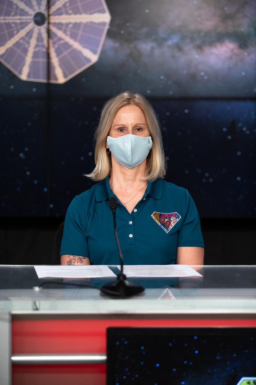
Joan Salute, Planetary Science Division associate director, Flight Programs, NASA HQ, is introduced during an engineering briefing for the Lucy mission held inside the TV Auditorium at NASA’s Kennedy Space Center in Florida on Oct. 14, 2021. The mission is scheduled to launch at 5:34 a.m. EDT Saturday, Oct. 16, on a United Launch Alliance Atlas V 401 rocket from Space Launch Complex 41 at Cape Canaveral Space Force Station. NASA’s Launch Services Program, based at Kennedy, is managing the launch. During its 12-year primary mission, Lucy will explore a record-breaking number of asteroids, flying by one asteroid in the solar system’s main belt and seven Trojan asteroids. Additionally, Lucy’s path will circle back to Earth three times for gravity assists, making it the first spacecraft to return to the vicinity of Earth from the outer solar system.
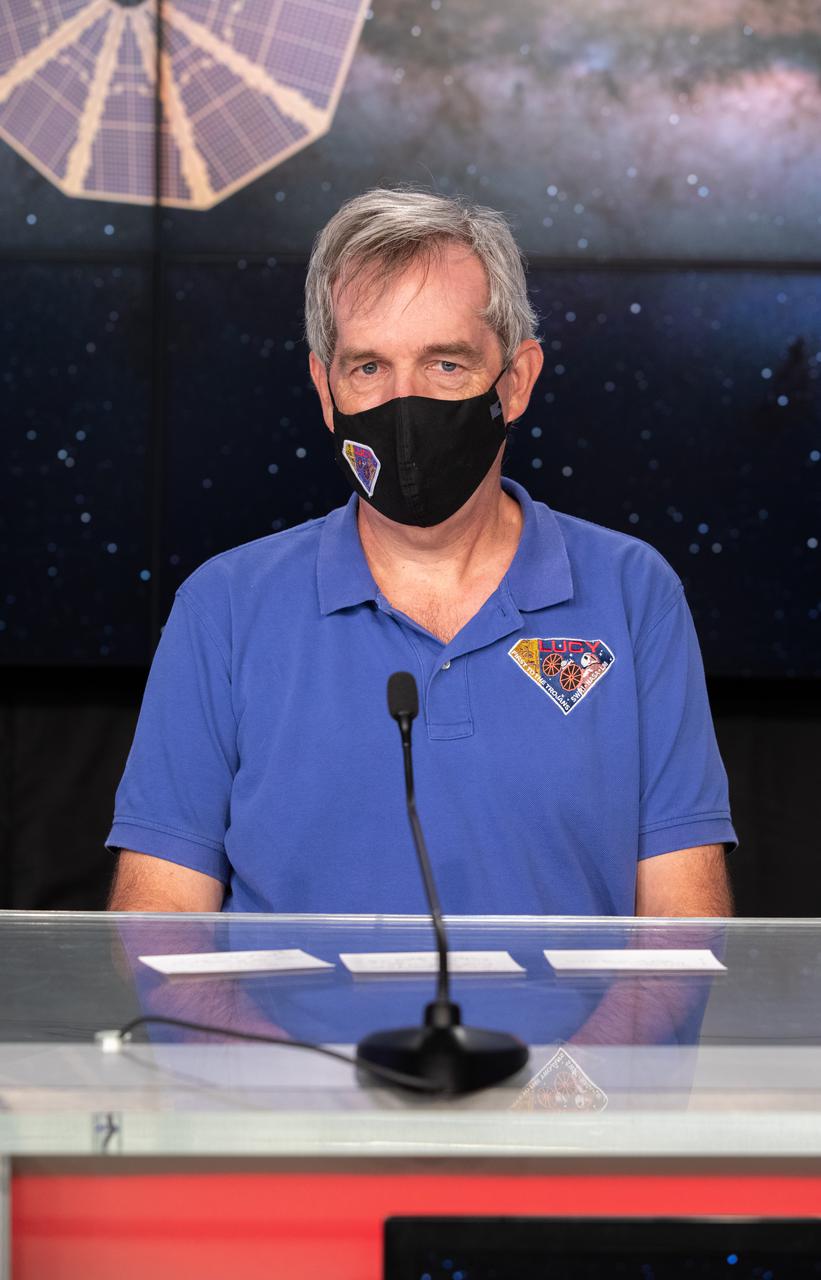
Keith Noll, Lucy Project Scientist at NASA’s Goddard Space Flight Center, is introduced during a science briefing for the Lucy mission held inside the TV Auditorium at NASA’s Kennedy Space Center in Florida on Oct. 14, 2021. The mission is scheduled to launch at 5:34 a.m. EDT Saturday, Oct. 16, on a United Launch Alliance Atlas V 401 rocket from Space Launch Complex 41 at Cape Canaveral Space Force Station. NASA’s Launch Services Program, based at Kennedy, is managing the launch. During its 12-year primary mission, Lucy will explore a record-breaking number of asteroids, flying by one asteroid in the solar system’s main belt and seven Trojan asteroids. Additionally, Lucy’s path will circle back to Earth three times for gravity assists, making it the first spacecraft to return to the vicinity of Earth from the outer solar system.
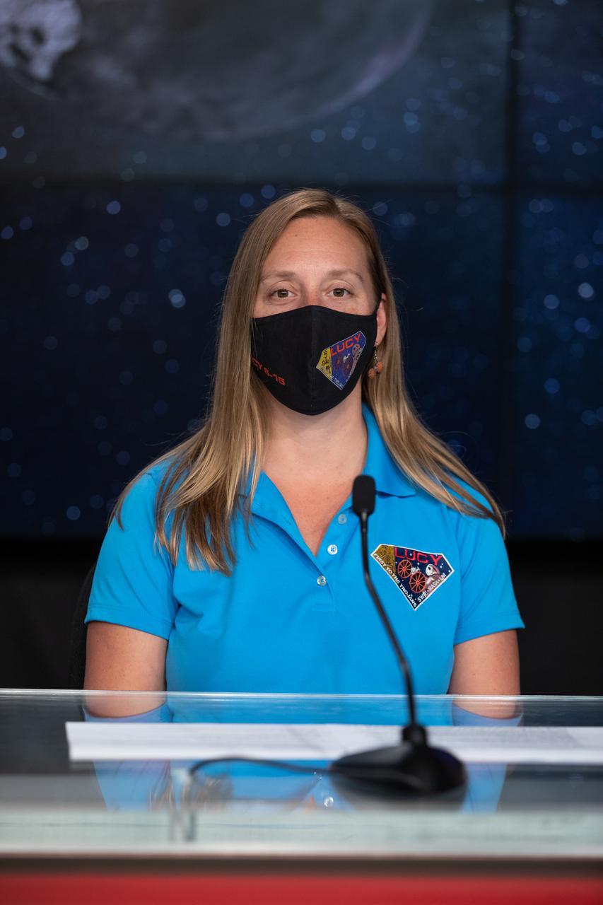
Jessica Lounsbury, Lucy Project Systems engineer at NASA’s Goddard Space Flight Center, is introduced during an engineering briefing for the Lucy mission held inside the TV Auditorium at NASA’s Kennedy Space Center in Florida on Oct. 14, 2021. The mission is scheduled to launch at 5:34 a.m. EDT Saturday, Oct. 16, on a United Launch Alliance Atlas V 401 rocket from Space Launch Complex 41 at Cape Canaveral Space Force Station. NASA’s Launch Services Program, based at Kennedy, is managing the launch. During its 12-year primary mission, Lucy will explore a record-breaking number of asteroids, flying by one asteroid in the solar system’s main belt and seven Trojan asteroids. Additionally, Lucy’s path will circle back to Earth three times for gravity assists, making it the first spacecraft to return to the vicinity of Earth from the outer solar system.

Dennis Reuter, L’Ralph Instrument Principal Investigator at NASA’s Goddard Space Flight Center, is introduced during a science briefing for the Lucy mission held inside the TV Auditorium at NASA’s Kennedy Space Center in Florida on Oct. 14, 2021. The mission is scheduled to launch at 5:34 a.m. EDT Saturday, Oct. 16, on a United Launch Alliance Atlas V 401 rocket from Space Launch Complex 41 at Cape Canaveral Space Force Station. NASA’s Launch Services Program, based at Kennedy, is managing the launch. During its 12-year primary mission, Lucy will explore a record-breaking number of asteroids, flying by one asteroid in the solar system’s main belt and seven Trojan asteroids. Additionally, Lucy’s path will circle back to Earth three times for gravity assists, making it the first spacecraft to return to the vicinity of Earth from the outer solar system.
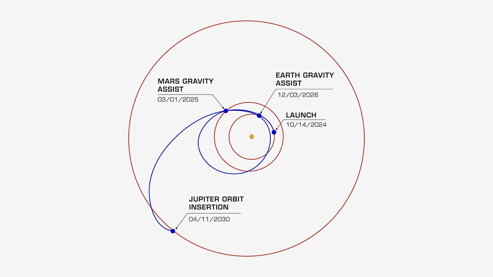
On its journey to the Jupiter system, NASA's Europa Clipper will take a path that swings past Mars, then Earth, using the gravity of each planet as a slingshot to boost the spacecraft's speed. All told, the journey will take about 5½ years, covering a distance of about 1.8 billion miles (2.9 billion kilometers). In this diagram, the orbits of Jupiter, Mars, and Earth are shown as concentric rings. Europa Clipper's launch period begins on Oct. 10, 2024. If the spacecraft launches on a later date, the timing of its Mars and Earth gravity assist maneuvers will shift. For all liftoff dates within the launch period, however, the spacecraft is scheduled to begin orbiting Jupiter on April 11, 2030. Then it will begin its investigation of the gas giant's icy moon Europa. Europa Clipper's three main science objectives are to determine the thickness of the moon's icy shell and its interactions with the ocean below, to investigate its composition, and to characterize its geology. The mission's detailed exploration of Europa will help scientists better understand the astrobiological potential for habitable worlds beyond our planet. Managed by Caltech in Pasadena, California, NASA's Jet Propulsion Laboratory leads the development of the Europa Clipper mission in partnership with APL for NASA's Science Mission Directorate in Washington. APL designed the main spacecraft body in collaboration with JPL and NASA's Goddard Space Flight Center in Greenbelt, Maryland, NASA's Marshall Space Flight Center in Huntsville, Alabama, and Langley Research Center in Hampton, Virginia. The Planetary Missions Program Office at Marshall executes program management of the Europa Clipper mission. NASA's Launch Services Program, based at Kennedy, manages the launch service for the Europa Clipper spacecraft, which will launch on a SpaceX Falcon Heavy rocket from Launch Complex 39A at Kennedy. https://photojournal.jpl.nasa.gov/catalog/PIA26435

An oil slick in the Gulf of Mexico following Hurricane Ida – a high-end Category 4 when it made landfall near Port Fourchon, Louisiana, on Aug. 29, 2021 – appears as a green trail in the inset false-color graphic provided by NASA's Delta-X project, while the surrounding seawater appears orange. The National Oceanic and Atmospheric Administration (NOAA) regularly monitors U.S. coastal waters for potential spills and noticed slicks that appeared just off the coast after the hurricane. They were able to use this information from Delta-X to corroborate other data they had about oil slicks in the area (satellite image in the second inset picture). The blue-green swath crossing from the Gulf of Mexico over the Louisiana coast denotes the flight path of the Delta-X radar instrument on Sept. 1, just before 11:30 a.m. CDT. Charged with studying the Mississippi River Delta, Delta-X was gearing up to collect data on Louisiana's coastal wetlands when Hurricane Ida barreled ashore in late August. The storm damaged buildings and infrastructure alike, resulting in power outages, flooding, and oil slicks in the Gulf of Mexico. Oil tends to smooth out the bumps on the ocean's surface, which results in a distinct radar signal that the Delta-X mission was able to pick out of their data. Delta-X added flight paths to their planned schedule – with the support of NASA's Applied Science Disaster Program – in order to collect information over the gulf in areas of interest to NOAA. Delta-X is studying two wetlands – the Atchafalaya and Terrebonne Basins – by land, boat, and air to quantify water and sediment flow as well as vegetation growth. While the Atchafalaya Basin has been gaining land through sediment accumulation, Terrebonne Basin, which is right next to the Atchafalaya, has been rapidly losing land. The data collected by the project will be applied to models used to forecast which areas of the delta are likely to gain or lose land under various sea level rise, river flow, and watershed management scenarios. The mission uses several instruments to collect its data. Affixed to the bottom of a Gulfstream-III airplane, one of those instruments, the all-weather Uninhabited Aerial Vehicle Synthetic Aperture Radar (UAVSAR), bounces radar signals off of Earth's surface, forming a kind of image of a particular area. Repeated images of the same regions, captured at different times, enable researchers to detect changes in those areas, such as fluctuating water levels beneath the vegetation as the tides move in and out of these wetlands. In addition to radar measurements, teams from Caltech, Louisiana State University, Florida International University, and other collaborating institutions gather water and vegetation samples – among other data – by boat, other airborne sensors, and from instruments on the ground. Funded by NASA's Earth Venture Suborbital (EVS-3) program, Delta-X is managed by the agency's Jet Propulsion Laboratory. Caltech in Pasadena, California, manages JPL for NASA. Fall 2021 was Delta-X's last scheduled field campaign, although the five-year mission will run through the end of 2023. https://photojournal.jpl.nasa.gov/catalog/PIA24540
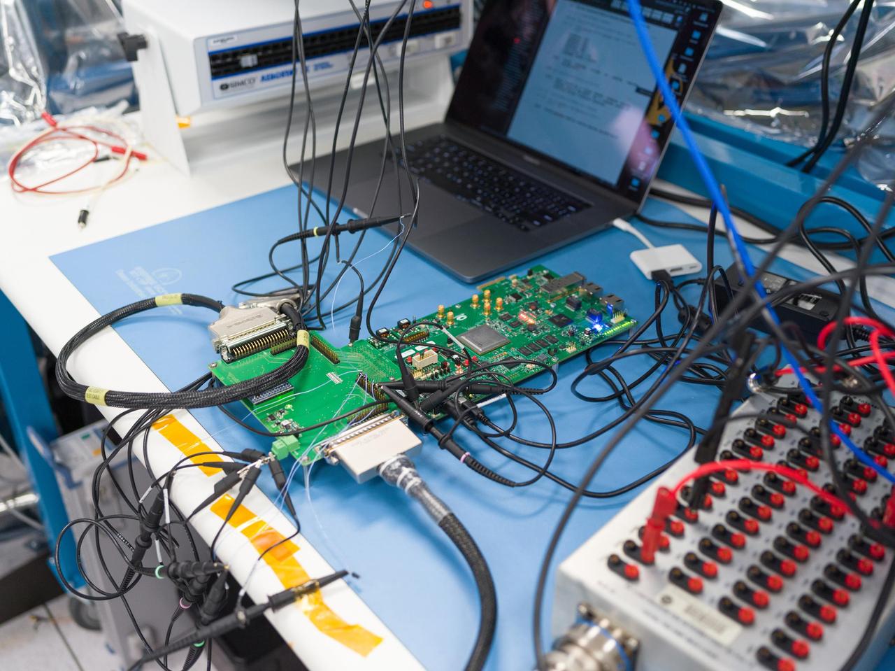
Seen here in March 2023, prototype hardware for the Venus Interferometric Synthetic Aperture Radar (VISAR) underwent interface testing at NASA's Jet Propulsion Laboratory in Southern California. VISAR is being developed at JPL for NASA's Venus Emissivity Radio Science, InSAR, Topography & Spectroscopy (VERITAS) mission that will launch within a decade to explore Earth's twin. These early interface tests are the first in a series to be run by JPL and Thales Alenia Space Italy (TASI), an international partner of the VERITAS mission that is contributing hardware to the instrument. Figure A shows TASI engineers Luca Di Marco Napini and Gabriel Mihu working in a JPL cleanroom on the VISAR prototype hardware. When VERITAS arrives in orbit, it will use VISAR to create detailed 3D global maps of Venus. The spacecraft will also carry a near-infrared spectrometer to figure out what the surface is made of. Together, the instruments will offer clues about the planet's past and present geologic processes, help reveal how the paths of Venus and Earth diverged, and how Venus lost its potential as a habitable world. VERITAS is managed by JPL. VERITAS and NASA's Deep Atmosphere Venus Investigation of Noble gases, Chemistry, and Imaging (DAVINCI) mission were selected in 2021 under NASA's Discovery Program as the agency's next missions to Venus. The Discovery Program is managed by the Planetary Missions Program Office at NASA's Marshall Space Flight Center in Huntsville, Alabama, for the Planetary Science Division of NASA's Science Mission Directorate in Washington. https://photojournal.jpl.nasa.gov/catalog/PIA25832
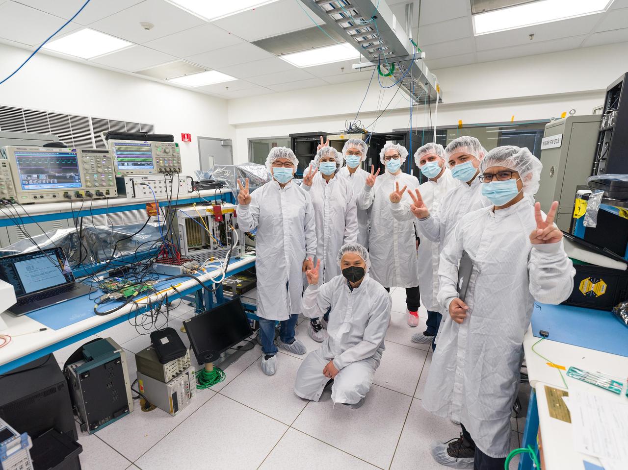
Seen here are members of the international team that participated in recent tests on prototype hardware for the Venus Interferometric Synthetic Aperture Radar (VISAR) at NASA's Jet Propulsion Laboratory in Southern California. VISAR is being developed at JPL for NASA's Venus Emissivity Radio Science, InSAR, Topography & Spectroscopy (VERITAS) mission that will launch within a decade to explore Earth's twin. In March 2023, the hardware underwent early interface tests in a JPL clean room, representing the first in a series to be run by JPL and Thales Alenia Space Italy (TASI), an international partner of the VERITAS mission that is contributing hardware to the instrument. Dressed in gowns to minimize the risk of contamination with sensitive electronics, the JPL VISAR digital team and TASI engineers pose for a photograph next to the laboratory benches where the tests took place. Figure A shows the same personnel without gowns for a team photo. From left to right: Marvin Cruz (JPL), Chester Lim (JPL), Tim Noh (JPL), Hana Haideri (JPL), Luca Di Marco Napini (TASI), Ernie Chuang (JPL), Dragana Perkovic-Martin (JPL), and Gabriel Mihu (TASI). JPL's Michael Burke, Anusha Yarlagadda, Duane Clark, and TASI's Antonio Delfino also participated in the tests but are not pictured. When VERITAS arrives in orbit, it will use VISAR to create detailed 3D global maps of Venus. The spacecraft will also carry a near-infrared spectrometer to figure out what the surface is made of. Together, the instruments will offer clues about the planet's past and present geologic processes, help reveal how the paths of Venus and Earth diverged, and how Venus lost its potential as a habitable world. VERITAS is managed by JPL. VERITAS and NASA's Deep Atmosphere Venus Investigation of Noble gases, Chemistry, and Imaging (DAVINCI) mission were selected in 2021 under NASA's Discovery Program as the agency's next missions to Venus. The Discovery Program is managed by the Planetary Missions Program Office at NASA's Marshall Space Flight Center in Huntsville, Alabama, for the Planetary Science Division of NASA's Science Mission Directorate in Washington. https://photojournal.jpl.nasa.gov/catalog/PIA25833
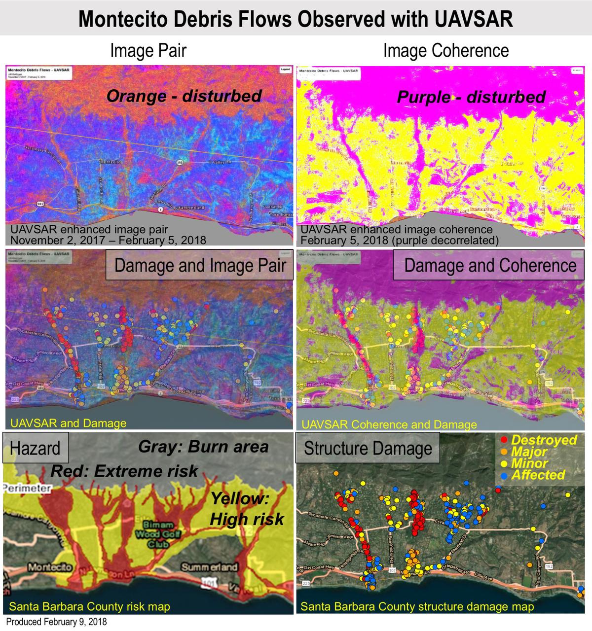
Extreme winter rains in January 2018 following the Thomas Fire in Ventura and Santa Barbara Counties caused severe debris flows, resulting in significant loss of life and considerable property damage in the town on Montecito, just east of Santa Barbara. NASA's Uninhabited Aerial Vehicle Synthetic Aperture Radar (UAVSAR) airborne radar platform detected changes caused by the debris flows between two images acquired on Nov. 2, 2017, and Feb. 5, 2018. An enhanced image pair (top left) shows disturbed areas in orange. In areas of severe surface disruption from the fire scar and debris flows the two image pairs can't be matched and decorrelate (top right). In the middle panels, the radar images are overlaid on the structure damage map produced by the County of Santa Barbara. The fire scars and damage correspond well with the risk map (lower left) and damage map (lower right). With an operational system, products such as these have the potential to augment information available for search and rescue, and for damage assessment for government agencies or the insurance industry. Radar has the advantage of being available in all weather conditions, as it can image through clouds. NASA's Uninhabited Aerial Vehicle Synthetic Aperture Radar (UAVSAR), developed and managed by the Jet Propulsion Laboratory, Pasadena, California, can record changes on the ground beneath the aircraft that occur between multiple flights, which take exactly the same flight path. The instrument is used to monitor how volcanoes, earthquakes, and other natural hazards are changing Earth. The JPL UAVSAR team collected and processed the imagery for Principal Investigator Andrea Donnellan who performed the analysis. She has been conducting ground change research using UAVSAR in this and other regions of California since 2009. https://photojournal.jpl.nasa.gov/catalog/PIA22243

As it sped away from Venus, NASA's Mariner 10 spacecraft captured this seemingly peaceful view of a planet the size of Earth, wrapped in a dense, global cloud layer. But, contrary to its serene appearance, the clouded globe of Venus is a world of intense heat, crushing atmospheric pressure and clouds of corrosive acid. This newly processed image revisits the original data with modern image processing software. A contrast-enhanced version of this view, also provided here, makes features in the planet's thick cloud cover visible in greater detail. The clouds seen here are located about 40 miles (60 kilometers) above the planet's surface, at altitudes where Earth-like atmospheric pressures and temperatures exist. They are comprised of sulfuric acid particles, as opposed to water droplets or ice crystals, as on Earth. These cloud particles are mostly white in appearance; however, patches of red-tinted clouds also can be seen. This is due to the presence of a mysterious material that absorbs light at blue and ultraviolet wavelengths. Many chemicals have been suggested for this mystery component, from sulfur compounds to even biological materials, but a consensus has yet to be reached among researchers. The clouds of Venus whip around the planet at nearly over 200 miles per hour (100 meters per second), circling the globe in about four and a half days. That these hurricane-force winds cover nearly the entire planet is another unexplained mystery, especially given that the solid planet itself rotates at a very slow 4 mph (less than 2 meters per second) — much slower than Earth's rotation rate of about 1,000 mph (450 meters per second). The winds and clouds also blow to the west, not to the east as on the Earth. This is because the planet itself rotates to the west, backward compared to Earth and most of the other planets. As the clouds travel westward, they also typically progress toward the poles; this can be seen in the Mariner 10 view as a curved spiral pattern at mid latitudes. Near the equator, instead of long streaks, areas of more clumpy, discrete clouds can be seen, indicating enhanced upwelling and cloud formation in the equatorial region, spurred on by the enhanced power of sunlight there. This view is a false color composite created by combining images taken using orange and ultraviolet spectral filters on the spacecraft's imaging camera. These were used for the red and blue channels of the color image, respectively, with the green channel synthesized by combining the other two images. Flying past Venus en route to the first-ever flyby of Mercury, Mariner 10 became the first spacecraft to use a gravity assist to change its flight path in order to reach another planet. The images used to create this view were acquired by Mariner 10 on Feb. 7 and 8, 1974, a couple of days after the spacecraft's closest approach to Venus on Feb. 5. Despite their many differences, comparisons between Earth and Venus are valuable for helping to understand their distinct climate histories. Nearly 50 years after this view was obtained, many fundamental questions about Venus remain unanswered. Did Venus have oceans long ago? How has its atmosphere evolved over time, and when did its runaway greenhouse effect begin? How does Venus lose its heat? How volcanically and tectonically active has Venus been over the last billion years? This image was processed from archived Mariner 10 data by JPL engineer Kevin M. Gill. The Mariner 10 mission was managed by NASA's Jet Propulsion Laboratory. https://photojournal.jpl.nasa.gov/catalog/PIA23791