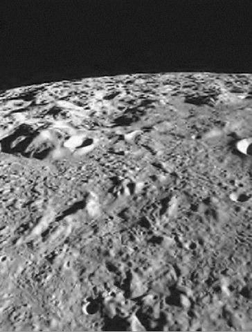
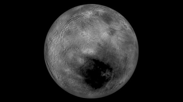
Mare Orientale Flyover
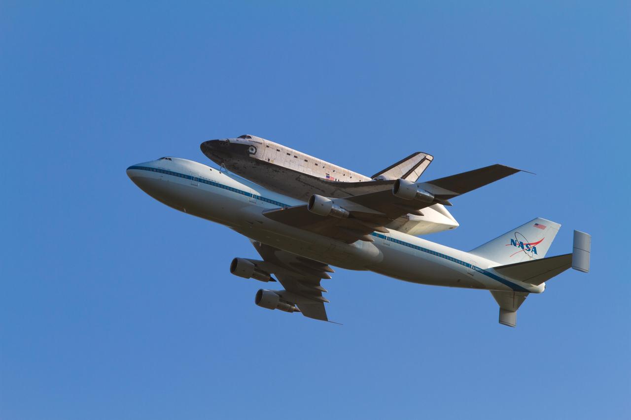
Space shuttle Endeavour embarked on the first leg of its final flight Sept. 19, departing Kennedy Space Center in Florida and making early-morning flyover visits to Stennis Space Center in Mississippi and nearby Michoud Assembly Facility in Louisiana. The shuttle flew atop the 747 Shuttle Carrier Aircraft, headed west, where it will go on display at the California Science Center in Los Angeles. The flight crew coordinated with the Federal Aviation Administration to conduct low-level flyovers at about 1,500 feet above Stennis and Michoud.

Space shuttle Endeavour made an early-morning flyover Stennis space Center on Sept. 19, en route to Los Angeles, where it will be displayed at the California Science Center. Employees viewed the low-level flyover from various locations, including atop the facility test stands. In this photo, employees watch as the shuttle is ferried above the A-1 Test Stand.
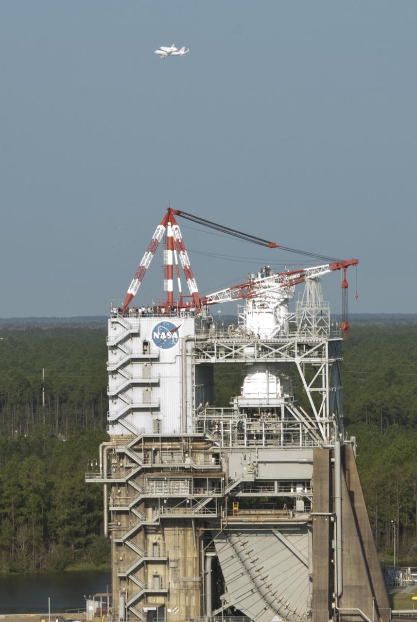
Space shuttle Endeavour made an early-morning flyover Stennis space Center on Sept. 19, en route to Los Angeles, where it will be displayed at the California Science Center. Employees viewed the low-level flyover from various locations, including atop the facility test stands. In this photo, employees watch as the shuttle is ferried above the A-1 Test Stand.

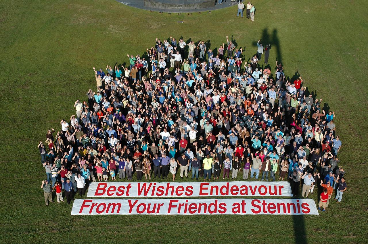
Stennis Space Center employees turned out in force to cheer space shuttle Endeavour as it flew low over the rocket engine test facility early on the morning of Sept. 19. The shuttle is headed to Los Angeles, where it will be on display at the California Science Center. Stennis employees applauded and cheered as the retired shuttle passed low overhead. In addition to those gathered on the lawn in front of the Roy S. Estess Building, many congregated on building rooftops and on facility test stands to view the flyover.
MESSENGER Flyover Movie. This frame from a movie consists of 214 images acquired by NASA MESSENGER Narrow Angle Camera NAC on June 8, 2014.
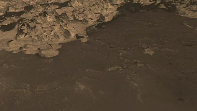
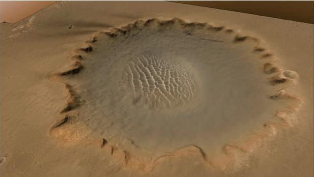
This image from NASA Mars Reconnaissance Orbiter MRO is part of simulated flyover showing rhythmic layers of sedimentary rock inside Becquerel crater on Mars.

Space shuttle Endeavour embarked on the first leg of its final flight Sept. 19, departing Kennedy Space Center in Florida and making early-morning flyover visits to Stennis Space Center in Mississippi and nearby Michoud Assembly Facility in Louisiana. The shuttle flew atop the 747 Shuttle Carrier Aircraft, headed west, where it will go on display at the California Science Center in Los Angeles. The flight crew coordinated with the Federal Aviation Administration to conduct low-level flyovers at about 1,500 feet above Stennis and Michoud.
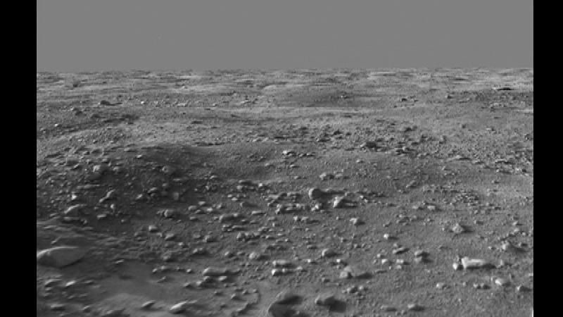
This image from an animated flyover of the workspace of NASA’s Phoenix Mars Lander’s was taken by the Surface Stereo Imager on Sol 14 June 8, 2008, or the 14th Martian day after landing.
This frame from a movie is based on data from NASA Cassini spacecraft and shows a flyover of an area of Saturn moon Titan known as Sotra Facula. Scientists believe Sotra is the best case for an ice volcano, or cryovolcano, region on Titan.
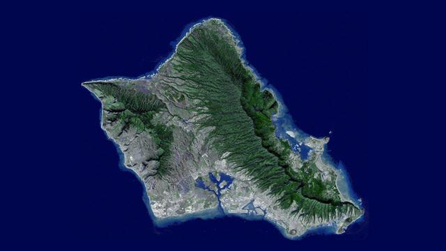
Sometimes called The Gathering Place, Oahu is the third largest of the Hawaiian Islands. This image was captured by NASA Terra spacecraft. A flyover was created by draping ASTER image data acquired January 13, 2010.

This frame from an animation simulates a flyover of a portion of a Martian canyon detailed in a geological map produced by the U.S. Geological Survey and based on observations by the HiRISE camera on NASA Mars Reconnaissance Orbiter.
Stennis Space Center employees turned out in force to cheer space shuttle Endeavour as it flew low over the rocket engine test facility early on the morning of Sept. 19. The shuttle is headed to Los Angeles, where it will be on display at the California Science Center. Stennis employees applauded and cheered as the retired shuttle passed low overhead. In addition to those gathered on the lawn in front of the Roy S. Estess Building, many congregated on building rooftops and on facility test stands to view the flyover.
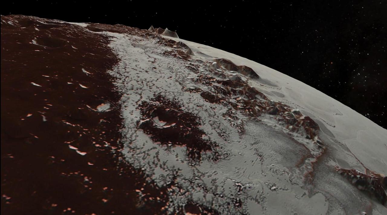
Images downloaded from NASA's New Horizons spacecraft (through Sept. 11, 2015) were stitched together and rendered on a sphere to make a flyover "movie." The animation, made with images from New Horizons' Long Range Reconnaissance Imager (LORRI), begins with a low-altitude look at the informally named Norgay Montes, flies northward over the boundary between informally named Sputnik Planum and Cthulhu Regio, turns, and drifts slowly east. During the animation, the altitude of the observer rises until it is about 10 times higher to show about 80% of the hemisphere New Horizons flew closest to on July 14, 2015. http://photojournal.jpl.nasa.gov/catalog/PIA19951
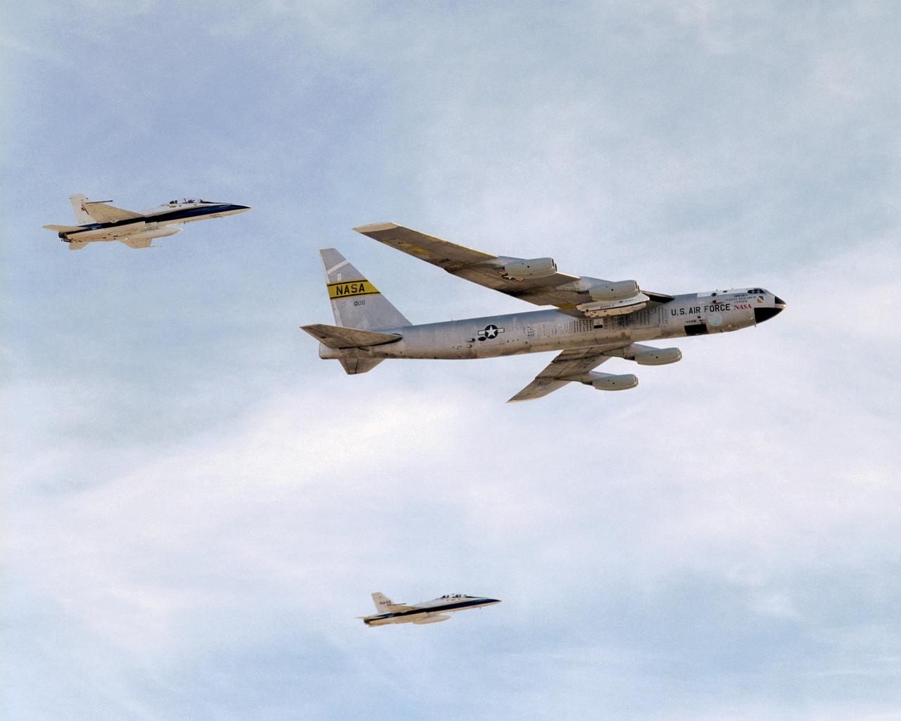
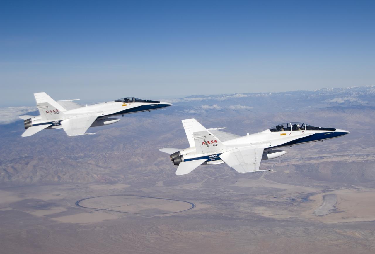
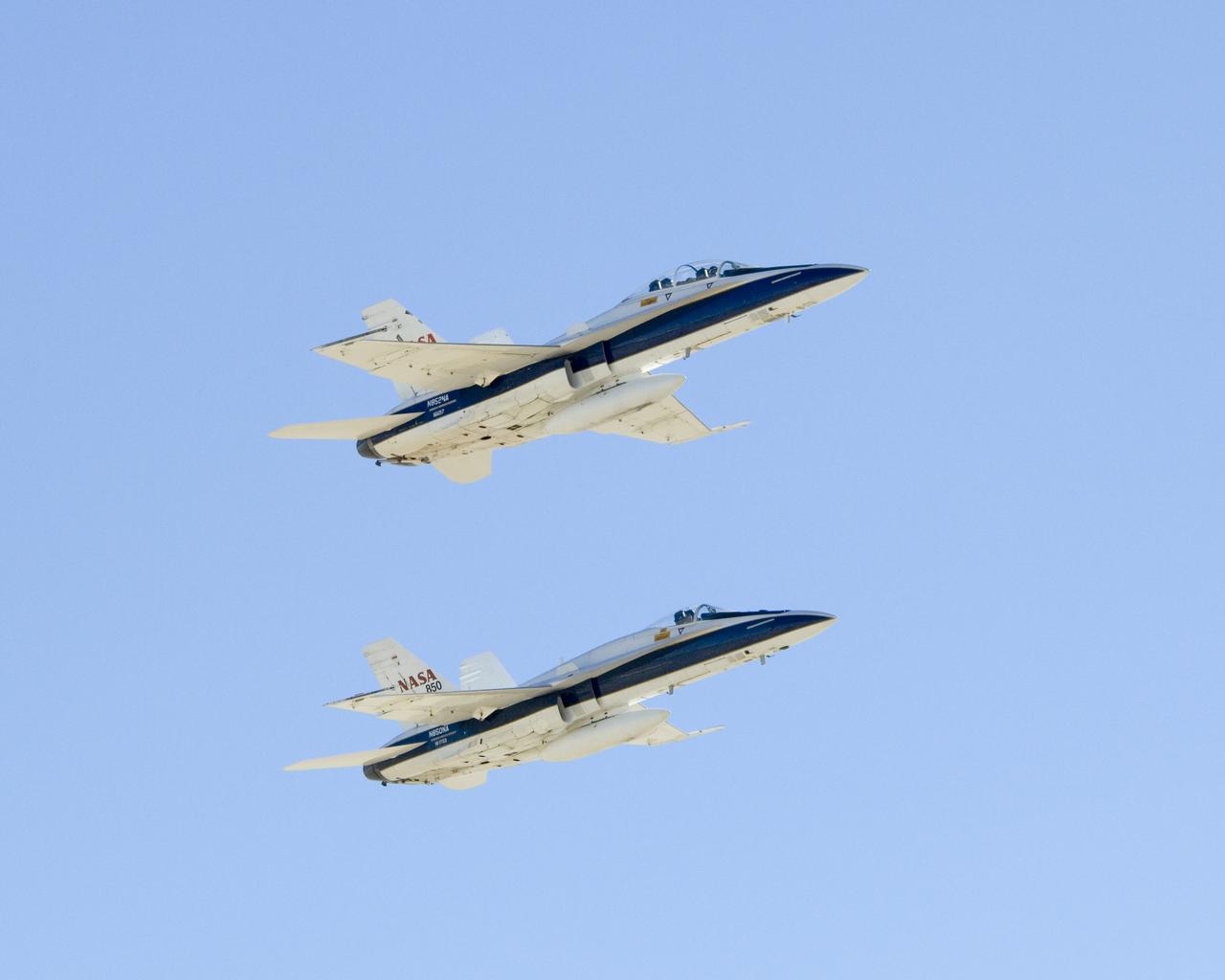
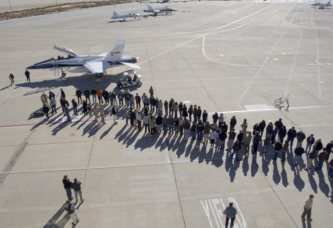
NASA's B-52B mothership, escorted by two F-18s, makes a final flyover after its last research mission that launched the X-43A on its record Mach 9.6 flight.
This animation depicts a flyover of a meteoroid impact crater on Mars that's surrounded by boulder-size chunks of ice. The animation was created using data from the High-Resolution Imaging Science Experiment (HiRISE) camera aboard NASA's Mars Reconnaissance Orbiter. The impact occurred on Dec. 24, 2021. Movie available at https://photojournal.jpl.nasa.gov/catalog/PIA25586
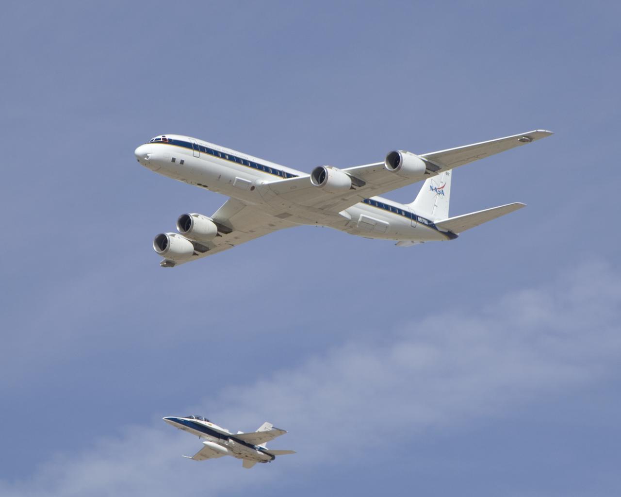
NASA's DC-8 airborne science laboratory is shadowed by a NASA F/A-18 chase plane during a flyover of the Dryden Aircraft Operations Facility in Palmdale, Calif.
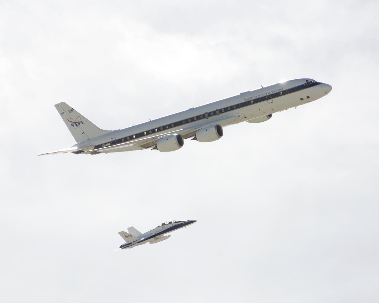
NASA's DC-8 airborne science laboratory is shadowed by a NASA F/A-18 chase plane during a flyover of the Dryden Aircraft Operations Facility in Palmdale, Calif.
A View of MESSENGER Flight Path. This figure highlights the flight path of NASA MESSENGER during its acquisition of images used in its flyover movie.
One of NASA's two ER-2 Earth resources aircraft shows off its lines during a flyover at the Edwards Air Force Base open house Oct. 28-29, 2006.
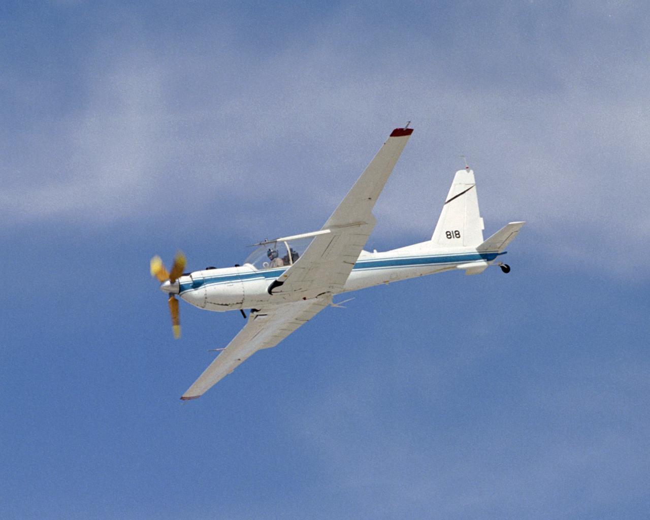
The slow-speed wooden propeller and long wings are evident as NASA's YO-3A acoustics research aircraft performs a low-level flyover at Edwards Air Force Base.

RCAF Snowbirds Flyover VAB Area
Up Close with MESSENGER Flight Path. This image from NASA MESSENGER provides a close-up view, at 50 m/pixel, of the surface MESSENGER imaged for the creation of its flyover video.

This frame from a colorized flyover movie from NASA Cassini mission shows the two largest seas on Saturn moon Titan and nearby lakes. The liquid in Titan lakes and seas is mostly methane and ethane.
This animation shows a hypothetical flyover above Victoria Crater, where NASA Mars Exploration Rover Opportunity is perched on a rim. The rover is expected to begin rolling down into the crater in early July 2007.
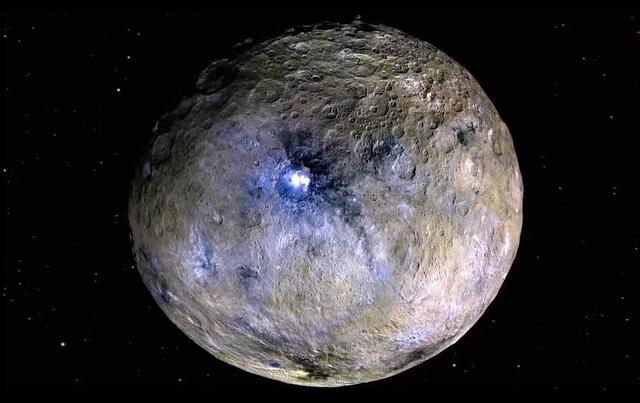
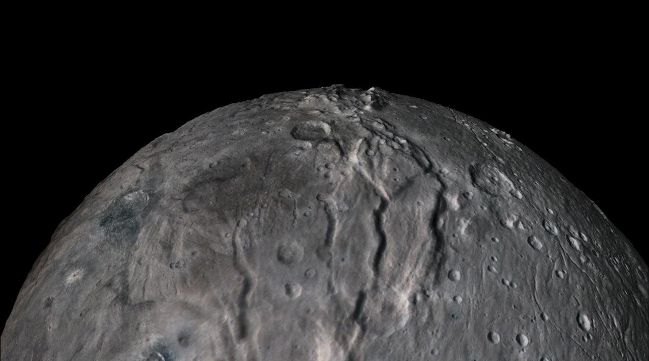
This frame from a video shows a flyover of the intriguing crater named Occator on dwarf planet Ceres. Occator is home to Ceres brightest area. Occator is home to Ceres' brightest area. It may have been produced by upwelling of salt-rich liquids after the impact that formed the crater. The animated flyover includes topographic and enhanced-color views of the crater, highlighting the central dome feature. The central area has been named Cerealia Facula. Occator's secondary group of bright spots is called Vinalia Faculae. A video is available at http://photojournal.jpl.nasa.gov/catalog/PIA21080
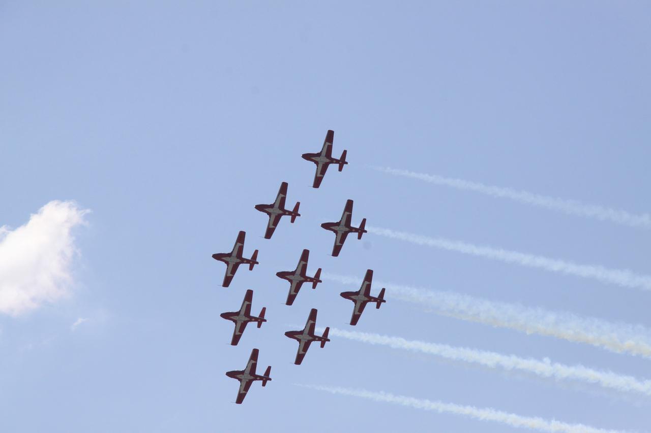
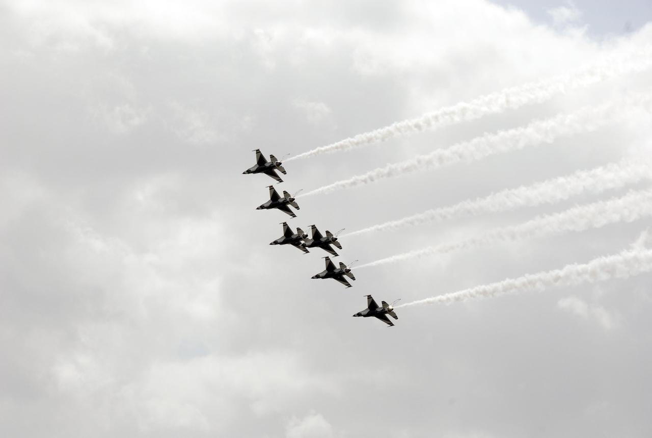
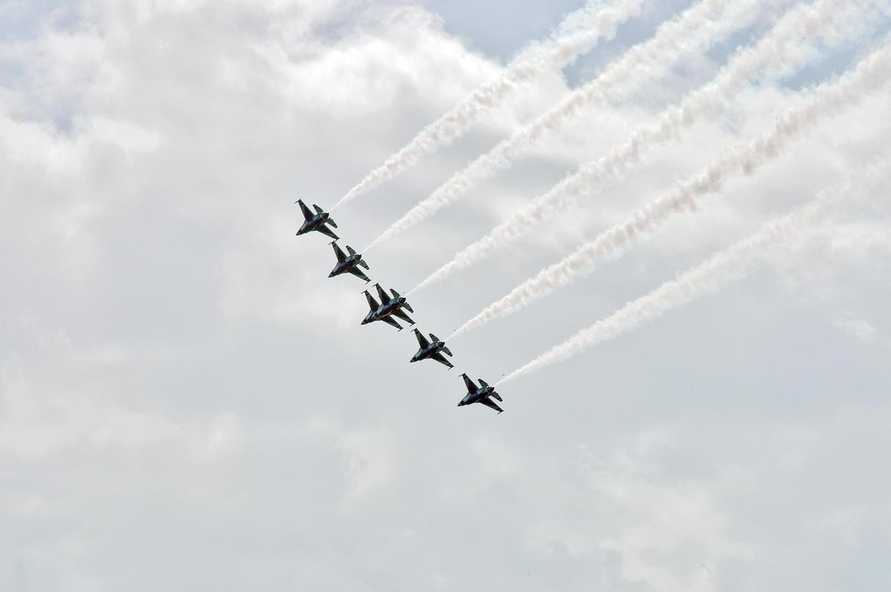
CAPE CANAVERAL, Fla. - The Royal Canadian Air Force Snowbird pilots flew their jets in tight formation over NASA's Kennedy Space Center in Florida. Photo credit: NASA/Jack Pfaller
ER-2 flyover at L.A. County Airshow, March 25, 2017. NASA will be working with the National Oceanic and Atmospheric Administration’s (NOAA) on their newest weather satellite, Geostationary Operational Environmental Satellite-R-series, or GOES-R, that launched into orbit Nov. 19. Now that it has reached its final designated orbit, GOES-R will be known operationally as GOES-16. The ER-2 will help NOAA calibrate sensors and validate data transmitted down from the satellite. The formal ER-2 science flights will take place between March and Mary of 2017 in two phases; during phase one, flights will be operated from the aircraft's normal base of operations at NASA Armstrong Flight Research Center’s Building 703. Phase two flights will be based out of Warner Robbins Air Force Base in Georgia, where thunderstorm conditions can be more easily found and observed.

Shadowed by two F/A-18s, NASA Dryden's venerable NB-52B is saluted by employees as it makes its final flyover after the last X-43A launch in November 2004.
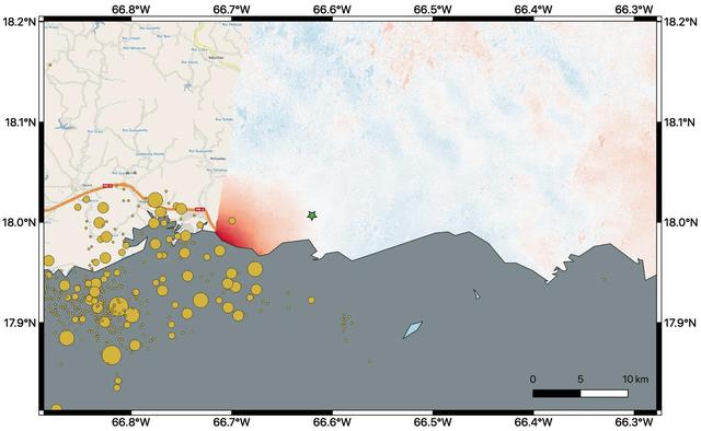
By comparing interferometric synthetic aperture radar (InSAR) data acquired on Jan. 9, 2020, with data acquired on Dec. 28, 2019, from the Copernicus Sentinel-1A satellite, NASA scientists were able to map where, how much and in what direction the ground shifted following a 6.4-magnitude earthquake off the coast of Puerto Rico. Managed by the European Space Agency (ESA), the Copernicus Sentinel-1A satellite was able to see the eastern two-thirds of the island during the Jan. 9 flyover. On the map, red indicates areas where the ground was changed, or displaced, with darker shades corresponding to more significant displacement. The scientists found that the greatest displacement from the flyover area occurred west of the city of Ponce (identified by the green star), not far from the quake's offshore epicenter. They recorded up to 5.5 inches (14 centimeters) of ground change there. The ground appeared to shift downward and slightly to the west. The epicenter of the quake and the cluster of quakes and aftershocks in the region identified by the United States Geological Survey (shown as orange circles) fall just west of the satellite's Jan. 9 track. Because of this, scientists also plan to analyze data from Sentinel-1A's forthcoming Jan. 14 flyover, which will include western Puerto Rico. https://photojournal.jpl.nasa.gov/catalog/PIA23428
This animation, constructed using stereo imaging data from the High Resolution Imaging Science Experiment (HiRISE) camera on NASA's Mars Reconnaissance Orbiter, provides an airborne perspective of the Mars 2020 landing site and its exploration area at Jezero Crater. Mars 2020 is expected to land to the southeast of an ancient river delta, a fan-shaped feature inside the northeast rim of Jezero Crater that provides solid evidence of a river and lake system active in and around the crater billions of years ago. The solid white line on the surface indicates a path the rover could take during its prime mission. Animation available at https://photojournal.jpl.nasa.gov/catalog/PIA22905
Images from NASA New Horizons spacecraft were used to create a flyover video (PIA19965) of Pluto largest moon, Charon. The flight starts with the informally named Mordor dark region near Charon north pole. In the video, the camera then moves south to a vast chasm, descending from 1,100 miles (1,800 kilometers) to just 40 miles (60 kilometers) above the surface to fly through the canyon system. From there it's a turn to the south to view the plains and "moat mountain," informally named Kubrick Mons, a prominent peak surrounded by a topographic depression. http://photojournal.jpl.nasa.gov/catalog/PIA19965
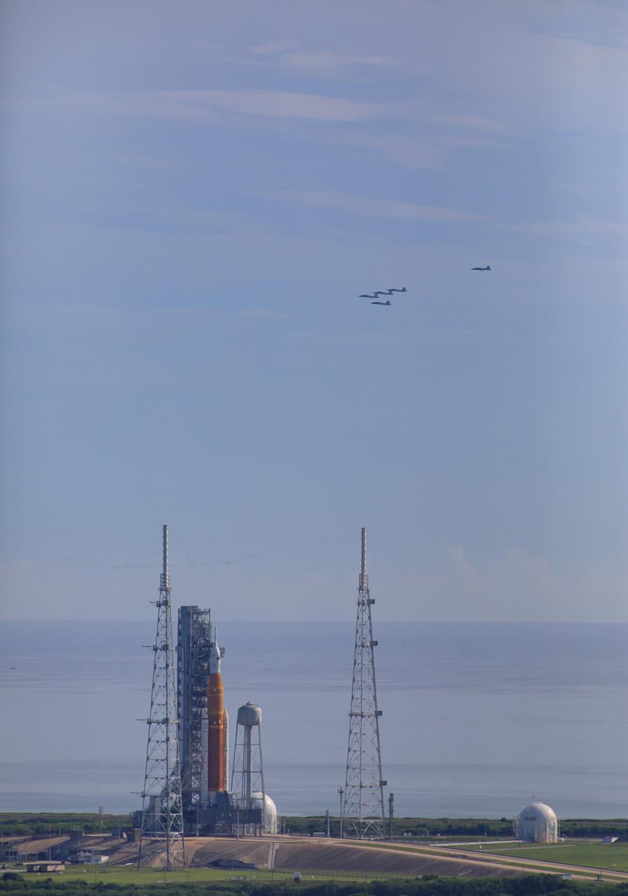
Ahead of NASA’s Artemis I launch, a flight of T-38 supersonic trainer aircraft from the Johnson Space Center Aircraft Operations Division flies in formation over the agency’s Space Launch System and Orion spacecraft on the pad at Launch Complex 39B at Kennedy Space Center in Florida, on Aug. 23, 2022. Pilots and passengers of the five aircraft include NASA Research Pilot Chris Condon and NASA Astronaut Zena Cardman in the lead plane, followed by NASA astronaut candidate Nicole Ayers and NASA astronaut Christina Koch in the second plane, Canadian Space Agency astronaut Jeremy Hansen and NASA astronaut Drew Morgan in the third plane, NASA astronaut Reid Wiseman and NASA astronaut Joe Acaba in the fourth plane, and NASA astronaut candidate Jack Hathaway and Josh Valcarcel, NASA photographer, in the chase plane. Artemis I is scheduled to launch at 8:33 a.m. EDT on Aug. 29, 2022. The first in a series of increasingly complex missions, Artemis I will provide a foundation for human deep space exploration and demonstrate our commitment and capability to extend human presence to the Moon and beyond. The primary goal of Artemis I is to thoroughly test the integrated systems before crewed missions by operating the spacecraft in a deep space environment, testing Orion’s heat shield, and recovering the crew module after reentry, descent, and splashdown.
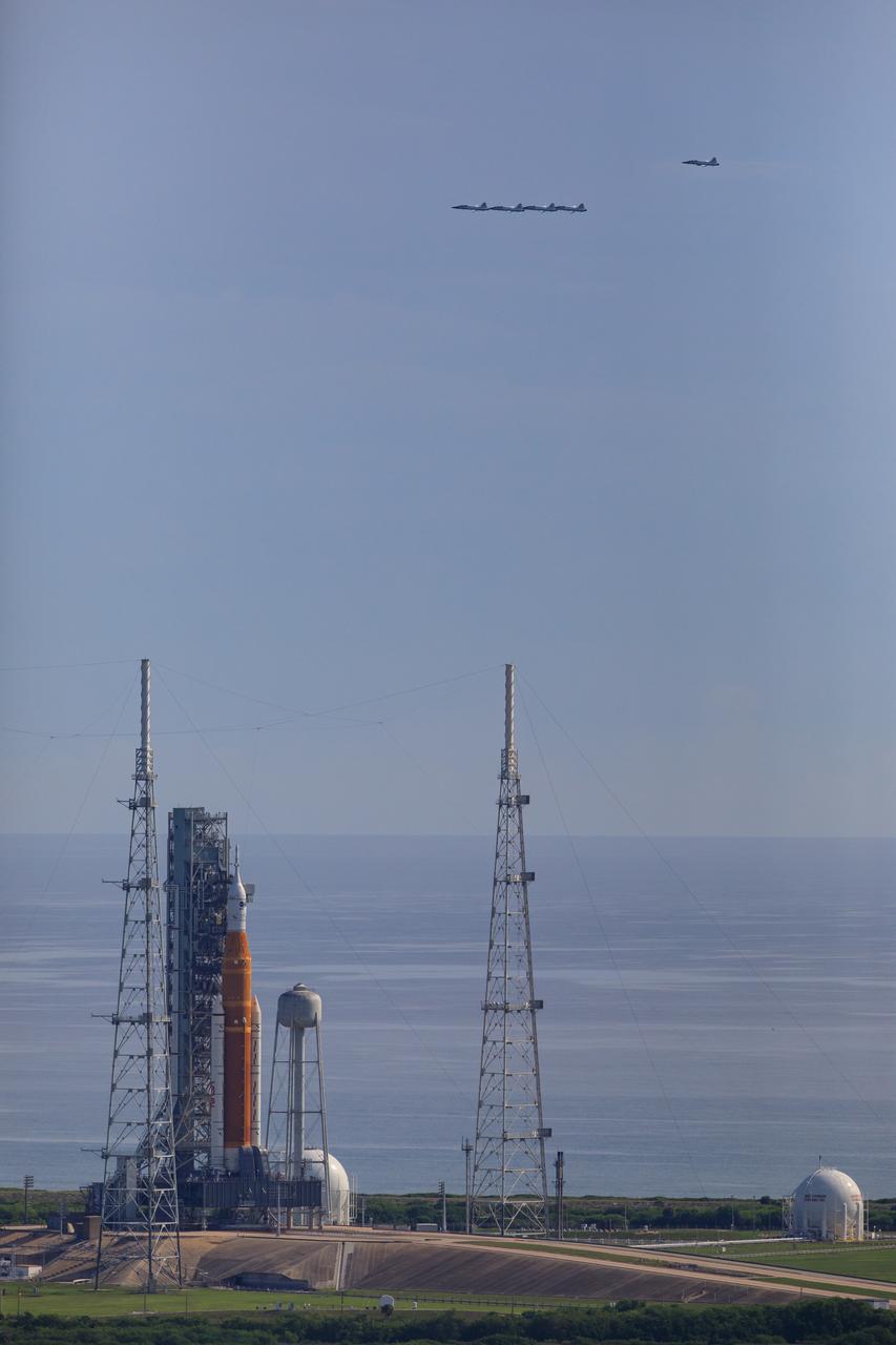
Ahead of NASA’s Artemis I launch, a flight of T-38 supersonic trainer aircraft from the Johnson Space Center Aircraft Operations Division flies in formation over the agency’s Space Launch System and Orion spacecraft on the pad at Launch Complex 39B at Kennedy Space Center in Florida, on Aug. 23, 2022. Pilots and passengers of the five aircraft include NASA Research Pilot Chris Condon and NASA Astronaut Zena Cardman in the lead plane, followed by NASA astronaut candidate Nicole Ayers and NASA astronaut Christina Koch in the second plane, Canadian Space Agency astronaut Jeremy Hansen and NASA astronaut Drew Morgan in the third plane, NASA astronaut Reid Wiseman and NASA astronaut Joe Acaba in the fourth plane, and NASA astronaut candidate Jack Hathaway and Josh Valcarcel, NASA photographer, in the chase plane. Artemis I is scheduled to launch at 8:33 a.m. EDT on Aug. 29, 2022. The first in a series of increasingly complex missions, Artemis I will provide a foundation for human deep space exploration and demonstrate our commitment and capability to extend human presence to the Moon and beyond. The primary goal of Artemis I is to thoroughly test the integrated systems before crewed missions by operating the spacecraft in a deep space environment, testing Orion’s heat shield, and recovering the crew module after reentry, descent, and splashdown.
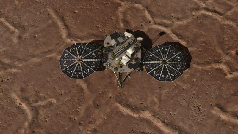
This image shows an overhead view of NASA Phoenix Mars Lander and the work area of the Robotic Arm.
This frame from a video from NASA's Dawn mission shows dwarf planet Ceres in false-color renderings, which highlight differences in surface materials. Images were used to create a movie of Ceres rotating, followed by a flyover view of Occator Crater, home of Ceres' brightest area. A video is available at http://photojournal.jpl.nasa.gov/catalog/PIA20182
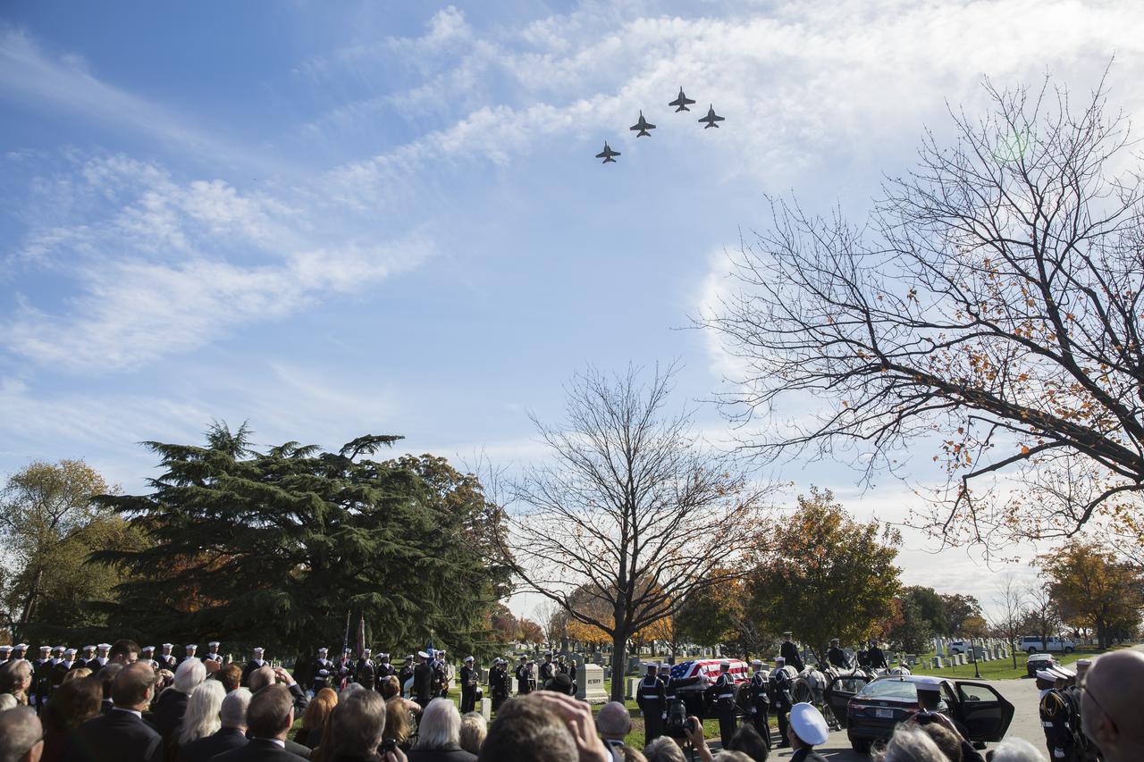
U.S. Navy F/A-18 Super Hornets conduct a flyover during interment services for former astronaut Alan Bean, Thursday, Nov. 8, 2018 at Arlington National Cemetery in Virginia. Selected as an astronaut in 1963, Bean flew in space twice, becoming the fourth human to walk on the Moon on Nov. 19, 1969 and spent 59 days in space as commander of the second Skylab mission in 1973. Photo Credit: (NASA/Joel Kowsky)
In July 2015, NASA's New Horizons spacecraft sent home the first close-up pictures of Pluto and its moons. Using actual New Horizons data and digital elevation models of Pluto and its largest moon, Charon, mission scientists created flyover movies that offer spectacular new perspectives of the many unusual features that were discovered and which have reshaped our views of the Pluto system -- from a vantage point even closer than a ride on New Horizons itself. The dramatic Pluto flyover begins over the highlands to the southwest of the great expanse of nitrogen ice plain informally named Sputnik Planitia. (Note that all feature names in the Pluto system are informal.) The viewer first passes over the western margin of Sputnik, where it borders the dark, cratered terrain of Cthulhu Macula, with the blocky mountain ranges located within the planitia seen on the right. The tour moves north past the rugged and fractured highlands of Voyager Terra and then turns southward over Pioneer Terra, which exhibits deep and wide pits, before concluding over the bladed terrain of Tartarus Dorsa in the far east of the encounter hemisphere. The topographic relief is exaggerated by a factor of 2 to 3 in these movies to emphasize topography; the surface colors have also been enhanced to bring out detail. Digital mapping and rendering were performed by Paul Schenk and John Blackwell of the Lunar and Planetary Institute in Houston. A video can be viewed at https://photojournal.jpl.nasa.gov/catalog/PIA21863
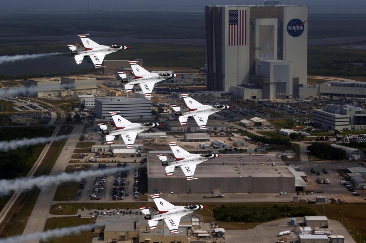
KENNEDY SPACE CENTER, FLA. -- U.S. Air Force Thunderbird F-16 jets fly in formation past the Vehicle Assembly Building in the Industrial Area of Kennedy Space Center. The purpose of the flyover was to photograph the planes at KSC for promotional purposes. The Kennedy Space Center Visitor Complex will host the inaugural World Space Expo from Nov. 3 to 11, featuring an aerial salute by the Thunderbirds on its opening weekend. The Expo will create one of the largest displays of space artifacts, hardware and personalities ever assembled in one location with the objective to inspire, educate and engage the public by highlighting the achievements and benefits of space exploration. Photo credit: U.S. Air Force photograph by TSgt Justin D. Pyle
KENNEDY SPACE CENTER, FLA. -- U.S. Air Force Thunderbird F-16 jets fly in formation above the Industrial Area of Kennedy Space Center. The purpose of the flyover was to photograph the area for promotional purposes. Kennedy Space Center Visitor Complex will host the inaugural World Space Expo from Nov. 3 to 11, featuring an aerial salute by the Thunderbirds on its opening weekend. The Expo will create one of the largest displays of space artifacts, hardware and personalities ever assembled in one location with the objective to inspire, educate and engage the public by highlighting the achievements and benefits of space exploration. Photo credit: NASA/Kim Shiflett
KENNEDY SPACE CENTER, FLA. -- U.S. Air Force Thunderbird F-16 jets fly in formation above the Industrial Area of Kennedy Space Center. The purpose of the flyover was to photograph the area for promotional purposes. Kennedy Space Center Visitor Complex will host the inaugural World Space Expo from Nov. 3 to 11, featuring an aerial salute by the Thunderbirds on its opening weekend. The Expo will create one of the largest displays of space artifacts, hardware and personalities ever assembled in one location with the objective to inspire, educate and engage the public by highlighting the achievements and benefits of space exploration. Photo credit: NASA/Jack Pfaller
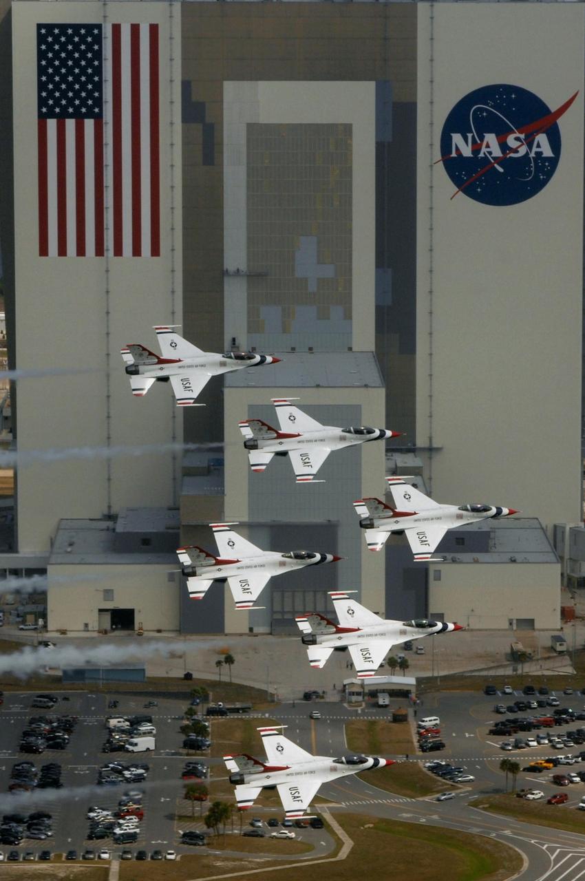
KENNEDY SPACE CENTER, FLA. -- U.S. Air Force Thunderbird F-16 jets fly in formation past the Vehicle Assembly Building in the Industrial Area of Kennedy Space Center. The purpose of the flyover was to photograph the planes at KSC for promotional purposes. The Kennedy Space Center Visitor Complex will host the inaugural World Space Expo from Nov. 3 to 11, featuring an aerial salute by the Thunderbirds on its opening weekend. The Expo will create one of the largest displays of space artifacts, hardware and personalities ever assembled in one location with the objective to inspire, educate and engage the public by highlighting the achievements and benefits of space exploration. Photo credit: U.S. Air Force photograph by TSgt Justin D. Pyle
This animation shows a proposed route for NASA's Curiosity rover, which is climbing lower Mount Sharp on Mars. The annotated version of the map labels different regions that scientists working with the rover would like to explore in coming years. A flyover video explains them in more detail. Data used in creating this map came from several instruments on NASA's Mars Reconnaissance Orbiter (MRO), including the High Resolution Imaging Science Experiment (HiRISE), Compact Reconnaissance Imaging Spectrometer for Mars (CRISM) and the Context Camera (CTX). The High Resolution Stereo Camera (HRSC) instrument on the European Space Agency's Mars Express also contributed data. Animation available at https://photojournal.jpl.nasa.gov/catalog/PIA23179
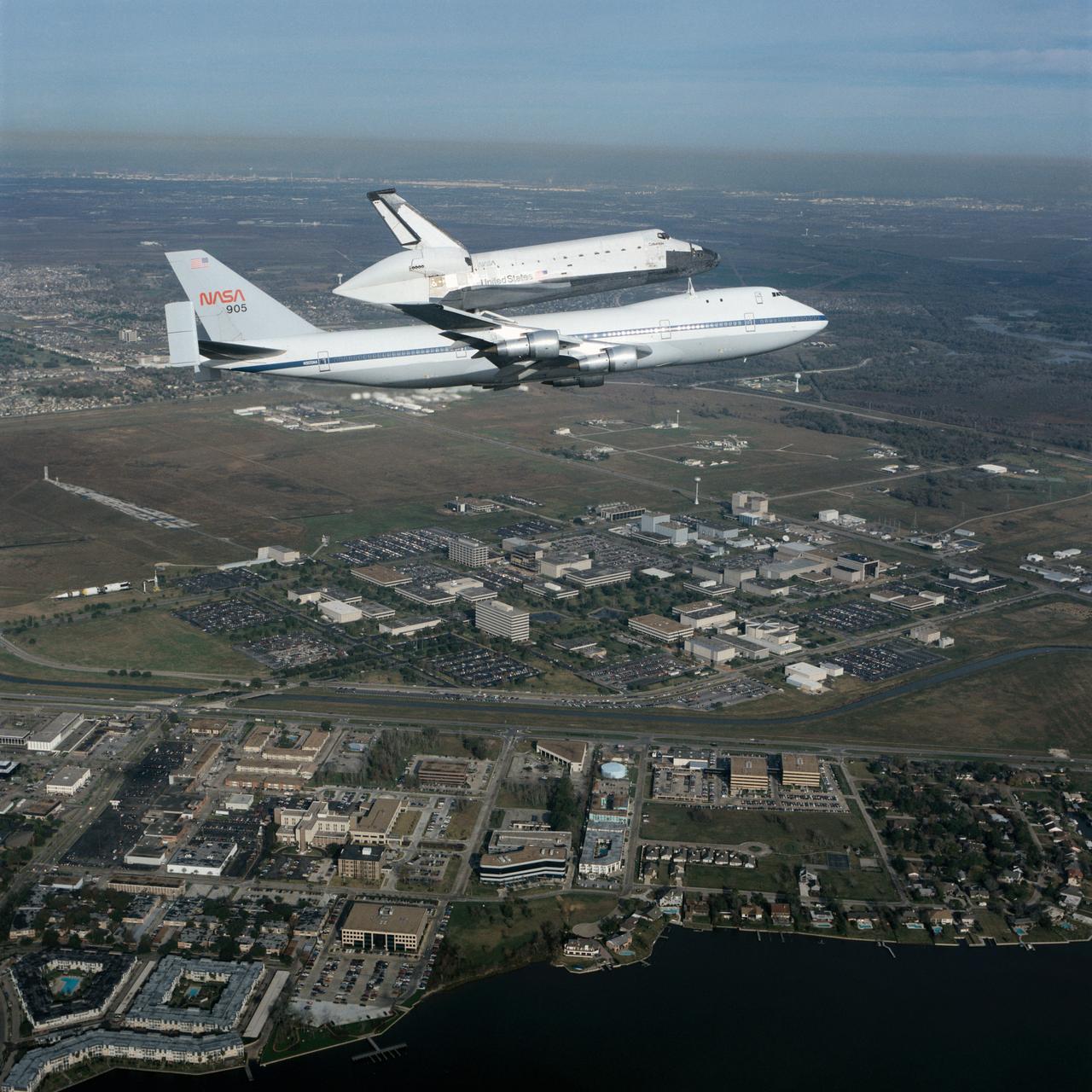
S90-55294 (19 Dec. 1990) --- Johnson Space Center employees and neighbors on the ground didn't get quite this closeup of a view of the Dec. 19 1990 flyover of the Space Shuttle Columbia mounted piggyback atop NASA's Shuttle Carrier Aircraft (SCA--NASA 905). However, hundreds were able to spot it as it passed nearby en route to Florida from California following the successful STS-35 mission. Almost the entire 1625-acre site of the Johnson Space Center is visible in the background, along with a number of businesses and residences in the nearby municipality of Nassau Bay. The air-to-air photograph was taken by Pete Stanley of JSC's Image Services Division who was a passenger in a T-38 jet aircraft.
NASA's two modified F-15B research aircraft joined up for a fly-over of NASA's Dryden Flight Research Center on Edwards AFB, Calif., after a research mission.
In July 2015, NASA's New Horizons spacecraft sent home the first close-up pictures of Pluto and its moons. Using actual New Horizons data and digital elevation models of Pluto and its largest moon, Charon, mission scientists created flyover movies that offer spectacular new perspectives of the many unusual features that were discovered and which have reshaped our views of the Pluto system -- from a vantage point even closer than a ride on New Horizons itself. The flight over Charon begins high over the hemisphere New Horizons saw on its closest approach, then descends over the deep, wide canyon of Serenity Chasma. The view moves north, passing over Dorothy Gale crater and the dark polar hood of Mordor Macula. The flight then turns back south, covering the northern terrain of Oz Terra before ending over the relatively flat equatorial plains of Vulcan Planum and the "moated mountains" of Clarke Montes. (Note that all feature names are informal.) The topographic relief is exaggerated by a factor of 2 to 3 in these movies to emphasize topography; the surface colors have also been enhanced to bring out detail. Digital mapping and rendering were performed by Paul Schenk and John Blackwell of the Lunar and Planetary Institute in Houston. A video is available at https://photojournal.jpl.nasa.gov/catalog/PIA21864
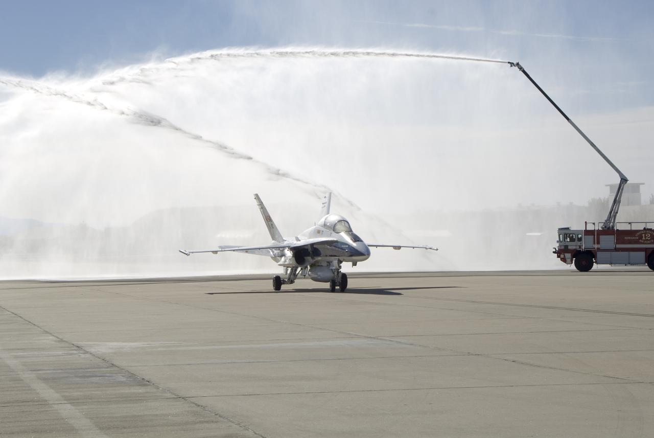
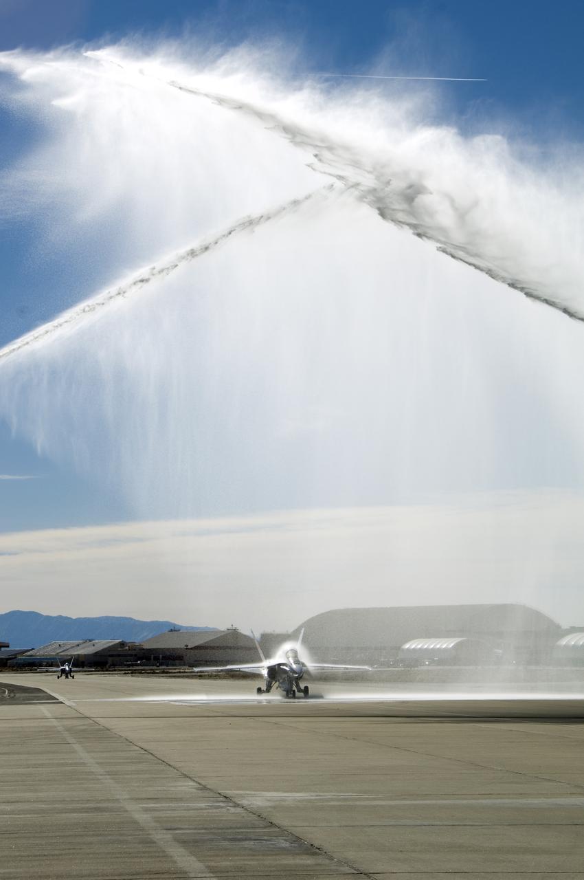
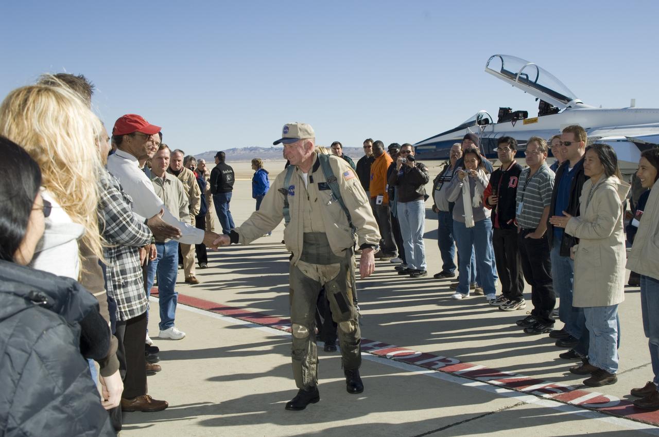
Long-time NASA Dryden research pilot and former astronaut C. Gordon Fullerton capped an almost 50-year flying career, including more than 38 years with NASA, with a final flight in a NASA F/A-18 on Dec. 21, 2007. Fullerton and Dryden research pilot Jim Smolka flew a 90-minute pilot proficiency formation aerobatics flight with another Dryden F/A-18 and a Dryden T-38 before concluding with two low-level formation flyovers of Dryden before landing. Fullerton was honored with a water-cannon spray arch provided by two fire trucks from the Edwards Air Force Base fire department as he taxied the F/A-18 up to the Dryden ramp, and was then greeted by his wife Marie and several hundred Dryden staff after his final flight. Fullerton began his flying career with the U.S. Air Force in 1958 after earning bachelor's and master's degrees in mechanical engineering from the California Institute of Technology. Initially trained as a fighter pilot, he later transitioned to multi-engine bombers and became a bomber operations test pilot after attending the Air Force Aerospace Research Pilot School at Edwards Air Force Base, Calif. He then was assigned to the flight crew for the planned Air Force Manned Orbital Laboratory in 1966. Upon cancellation of that program, the Air Force assigned Fullerton to NASA's astronaut corps in 1969. He served on the support crews for the Apollo 14, 15, 16 and 17 lunar missions, and was later assigned to one of the two flight crews that piloted the space shuttle prototype Enterprise during the Approach and Landing Test program at Dryden. He then logged some 382 hours in space when he flew on two early space shuttle missions, STS-3 on Columbia in 1982 and STS-51F on Challenger in 1985. He joined the flight crew branch at NASA Dryden after leaving the astronaut corps in 1986. During his 21 years at Dryden, Fullerton was project pilot on a number of high-profile research efforts, including the Propulsion Controlled Aircraft, the high-speed landing tests of
Long-time NASA Dryden research pilot and former astronaut C. Gordon Fullerton capped an almost 50-year flying career, including more than 38 years with NASA, with a final flight in a NASA F/A-18 on Dec. 21, 2007. Fullerton and Dryden research pilot Jim Smolka flew a 90-minute pilot proficiency formation aerobatics flight with another Dryden F/A-18 and a Dryden T-38 before concluding with two low-level formation flyovers of Dryden before landing. Fullerton was honored with a water-cannon spray arch provided by two fire trucks from the Edwards Air Force Base fire department as he taxied the F/A-18 up to the Dryden ramp, and was then greeted by his wife Marie and several hundred Dryden staff after his final flight. Fullerton began his flying career with the U.S. Air Force in 1958 after earning bachelor's and master's degrees in mechanical engineering from the California Institute of Technology. Initially trained as a fighter pilot, he later transitioned to multi-engine bombers and became a bomber operations test pilot after attending the Air Force Aerospace Research Pilot School at Edwards Air Force Base, Calif. He then was assigned to the flight crew for the planned Air Force Manned Orbital Laboratory in 1966. Upon cancellation of that program, the Air Force assigned Fullerton to NASA's astronaut corps in 1969. He served on the support crews for the Apollo 14, 15, 16 and 17 lunar missions, and was later assigned to one of the two flight crews that piloted the space shuttle prototype Enterprise during the Approach and Landing Test program at Dryden. He then logged some 382 hours in space when he flew on two early space shuttle missions, STS-3 on Columbia in 1982 and STS-51F on Challenger in 1985. He joined the flight crew branch at NASA Dryden after leaving the astronaut corps in 1986. During his 21 years at Dryden, Fullerton was project pilot on a number of high-profile research efforts, including the Propulsion Controlled Aircraft, the high-speed landing tests of sp
Long-time NASA Dryden research pilot and former astronaut C. Gordon Fullerton capped an almost 50-year flying career, including more than 38 years with NASA, with a final flight in a NASA F/A-18 on Dec. 21, 2007. Fullerton and Dryden research pilot Jim Smolka flew a 90-minute pilot proficiency formation aerobatics flight with another Dryden F/A-18 and a Dryden T-38 before concluding with two low-level formation flyovers of Dryden before landing. Fullerton was honored with a water-cannon spray arch provided by two fire trucks from the Edwards Air Force Base fire department as he taxied the F/A-18 up to the Dryden ramp, and was then greeted by his wife Marie and several hundred Dryden staff after his final flight. Fullerton began his flying career with the U.S. Air Force in 1958 after earning bachelor's and master's degrees in mechanical engineering from the California Institute of Technology. Initially trained as a fighter pilot, he later transitioned to multi-engine bombers and became a bomber operations test pilot after attending the Air Force Aerospace Research Pilot School at Edwards Air Force Base, Calif. He then was assigned to the flight crew for the planned Air Force Manned Orbital Laboratory in 1966. Upon cancellation of that program, the Air Force assigned Fullerton to NASA's astronaut corps in 1969. He served on the support crews for the Apollo 14, 15, 16 and 17 lunar missions, and was later assigned to one of the two flight crews that piloted the space shuttle prototype Enterprise during the Approach and Landing Test program at Dryden. He then logged some 382 hours in space when he flew on two early space shuttle missions, STS-3 on Columbia in 1982 and STS-51F on Challenger in 1985. He joined the flight crew branch at NASA Dryden after leaving the astronaut corps in 1986. During his 21 years at Dryden, Fullerton was project pilot on a number of high-profile research efforts, including the Propulsion Controlled Aircraft, the high-speed landing tests of
Long-time NASA Dryden research pilot and former astronaut C. Gordon Fullerton capped an almost 50-year flying career, including more than 38 years with NASA, with a final flight in a NASA F/A-18 on Dec. 21, 2007. Fullerton and Dryden research pilot Jim Smolka flew a 90-minute pilot proficiency formation aerobatics flight with another Dryden F/A-18 and a Dryden T-38 before concluding with two low-level formation flyovers of Dryden before landing. Fullerton was honored with a water-cannon spray arch provided by two fire trucks from the Edwards Air Force Base fire department as he taxied the F/A-18 up to the Dryden ramp, and was then greeted by his wife Marie and several hundred Dryden staff after his final flight. Fullerton began his flying career with the U.S. Air Force in 1958 after earning bachelor's and master's degrees in mechanical engineering from the California Institute of Technology. Initially trained as a fighter pilot, he later transitioned to multi-engine bombers and became a bomber operations test pilot after attending the Air Force Aerospace Research Pilot School at Edwards Air Force Base, Calif. He then was assigned to the flight crew for the planned Air Force Manned Orbital Laboratory in 1966. Upon cancellation of that program, the Air Force assigned Fullerton to NASA's astronaut corps in 1969. He served on the support crews for the Apollo 14, 15, 16 and 17 lunar missions, and was later assigned to one of the two flight crews that piloted the space shuttle prototype Enterprise during the Approach and Landing Test program at Dryden. He then logged some 382 hours in space when he flew on two early space shuttle missions, STS-3 on Columbia in 1982 and STS-51F on Challenger in 1985. He joined the flight crew branch at NASA Dryden after leaving the astronaut corps in 1986. During his 21 years at Dryden, Fullerton was project pilot on a number of high-profile research efforts, including the Propulsion Controlled Aircraft, the high-speed landing tests of
Long-time NASA Dryden research pilot and former astronaut C. Gordon Fullerton capped an almost 50-year flying career, including more than 38 years with NASA, with a final flight in a NASA F/A-18 on Dec. 21, 2007. Fullerton and Dryden research pilot Jim Smolka flew a 90-minute pilot proficiency formation aerobatics flight with another Dryden F/A-18 and a Dryden T-38 before concluding with two low-level formation flyovers of Dryden before landing. Fullerton was honored with a water-cannon spray arch provided by two fire trucks from the Edwards Air Force Base fire department as he taxied the F/A-18 up to the Dryden ramp, and was then greeted by his wife Marie and several hundred Dryden staff after his final flight. Fullerton began his flying career with the U.S. Air Force in 1958 after earning bachelor's and master's degrees in mechanical engineering from the California Institute of Technology. Initially trained as a fighter pilot, he later transitioned to multi-engine bombers and became a bomber operations test pilot after attending the Air Force Aerospace Research Pilot School at Edwards Air Force Base, Calif. He then was assigned to the flight crew for the planned Air Force Manned Orbital Laboratory in 1966. Upon cancellation of that program, the Air Force assigned Fullerton to NASA's astronaut corps in 1969. He served on the support crews for the Apollo 14, 15, 16 and 17 lunar missions, and was later assigned to one of the two flight crews that piloted the space shuttle prototype Enterprise during the Approach and Landing Test program at Dryden. He then logged some 382 hours in space when he flew on two early space shuttle missions, STS-3 on Columbia in 1982 and STS-51F on Challenger in 1985. He joined the flight crew branch at NASA Dryden after leaving the astronaut corps in 1986. During his 21 years at Dryden, Fullerton was project pilot on a number of high-profile research efforts, including the Propulsion Controlled Aircraft, the high-speed landing tests of
Long-time NASA Dryden research pilot and former astronaut C. Gordon Fullerton capped an almost 50-year flying career, including more than 38 years with NASA, with a final flight in a NASA F/A-18 on Dec. 21, 2007. Fullerton and Dryden research pilot Jim Smolka flew a 90-minute pilot proficiency formation aerobatics flight with another Dryden F/A-18 and a Dryden T-38 before concluding with two low-level formation flyovers of Dryden before landing. Fullerton was honored with a water-cannon spray arch provided by two fire trucks from the Edwards Air Force Base fire department as he taxied the F/A-18 up to the Dryden ramp, and was then greeted by his wife Marie and several hundred Dryden staff after his final flight. Fullerton began his flying career with the U.S. Air Force in 1958 after earning bachelor's and master's degrees in mechanical engineering from the California Institute of Technology. Initially trained as a fighter pilot, he later transitioned to multi-engine bombers and became a bomber operations test pilot after attending the Air Force Aerospace Research Pilot School at Edwards Air Force Base, Calif. He then was assigned to the flight crew for the planned Air Force Manned Orbital Laboratory in 1966. Upon cancellation of that program, the Air Force assigned Fullerton to NASA's astronaut corps in 1969. He served on the support crews for the Apollo 14, 15, 16 and 17 lunar missions, and was later assigned to one of the two flight crews that piloted the space shuttle prototype Enterprise during the Approach and Landing Test program at Dryden. He then logged some 382 hours in space when he flew on two early space shuttle missions, STS-3 on Columbia in 1982 and STS-51F on Challenger in 1985. He joined the flight crew branch at NASA Dryden after leaving the astronaut corps in 1986. During his 21 years at Dryden, Fullerton was project pilot on a number of high-profile research efforts, including the Propulsion Controlled Aircraft, the high-speed landing tests of
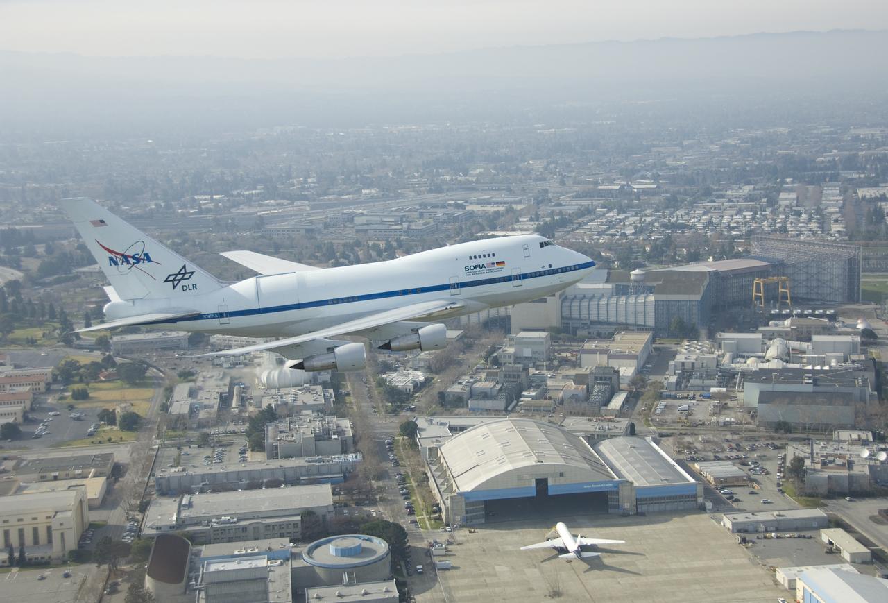
NASA's SOFIA flying observatory makes a low pass over NASA Ames Research Center prior to landing at Moffett Field for a brief visit on Jan. 14, 2008.
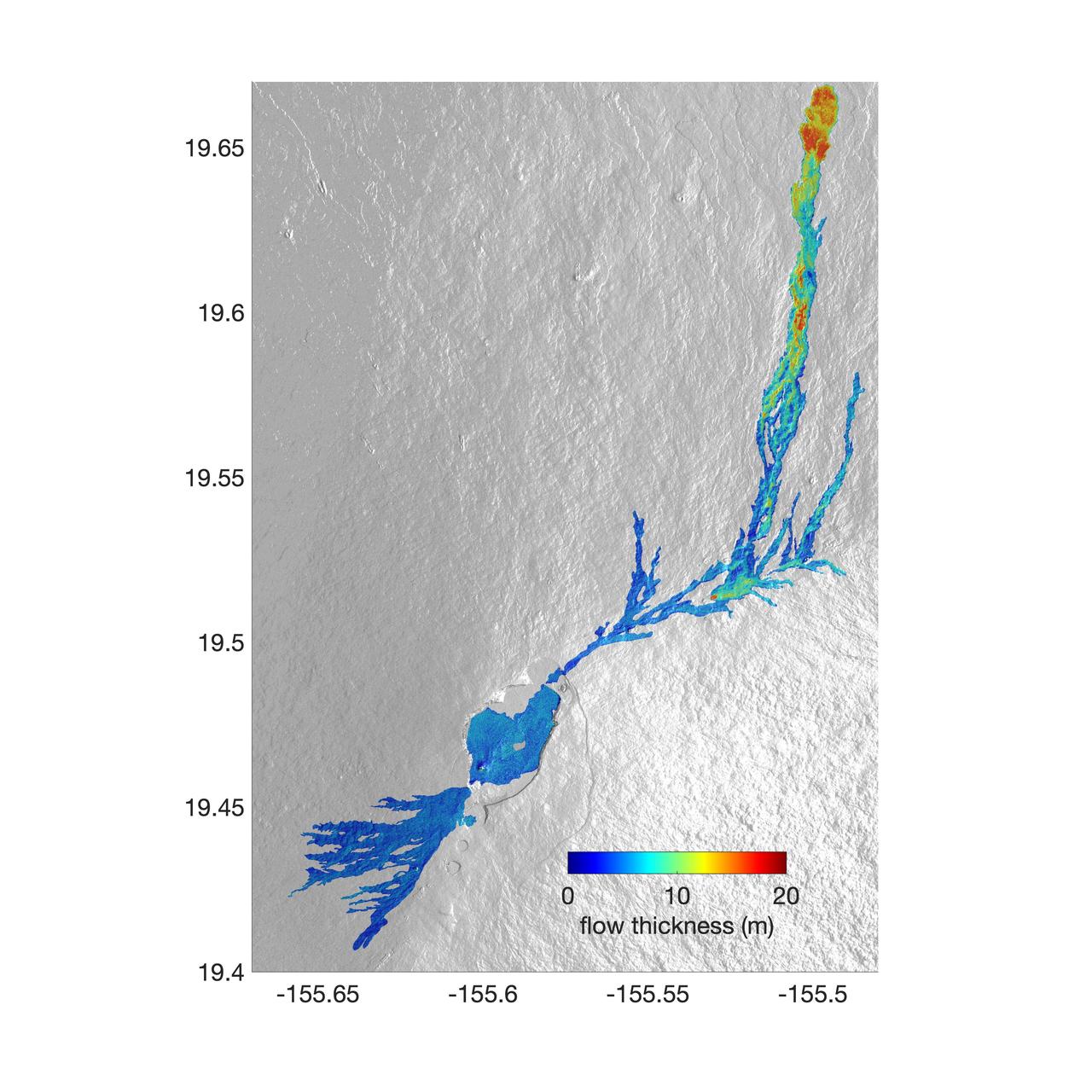
The world's largest active volcano – Hawaii's Mauna Loa – had been quiet for 38 years. But in 2022, the volcano began to stir, showing increased numbers of small earthquakes and subtle swelling of certain land surfaces in September. On November 27, fountains of lava began spurting from the mountain's Northeast Rift Zone and streams of molten rock flowed to the north. Ten days into the eruption, a NASA aircraft conducted its first flight over the erupting volcano. It carried NASA's Uninhabited Aerial Vehicle Synthetic Aperture Radar (UAVSAR) system, which was used to map the volcano's topography in fine detail with a Ka-band instrument called GLISTIN-A. Teams from NASA's Jet Propulsion Laboratory and the United States Geological Survey (USGS) used data from that sensor to map the thickness of those flows during a series of flights on December 7, 8, and 10. The map above shows the thickness of the lava flows during the flight on December 7, the day before USGS scientists noticed a significant decline in the pace of the eruption. A few days later, they declared the eruption had stopped. The map shows the thickness of the lava flows in the summit caldera, where the eruption began, and of lava flows on Mauna Loa's northeastern flank. The color variation from blue to orange indicates increasing lava flow thickness. A maximum thickness of roughly 25 meters (82 feet) is shown, though values exceeding 40 meters (131 feet) were observed in some areas. The thickening at the northern end of the flow is due to lava accumulating away from the vent, along with a flattening of the terrain at the saddle between the Mauna Loa and Mauna Kea volcanoes. By comparing to pre-eruption maps of this area's topography, including GLISTIN-A data collected in 2017, the USGS researchers were able to calculate the size and volume of the lava flow. Over the roughly 14-day eruption, Mauna Loa erupted more than 8.8 billion cubic feet (230 million cubic meters) along a lava flow that extended up to 16.5 miles (19.5 kilometers) from the vent, according to the USGS. The UAVSAR operates from a pod mounted beneath a crewed Gulfstream III jet from NASA's Armstrong Flight Research Center in California. Repeated topographic maps generated with each flight reveal the progression and thickening of lava with time – important information for scientific understanding of volcano processes and for emergency response. For the Mauna Loa science flights, the instrument suite featured an additional state-of-the-art imaging tool: the synthetic aperture radar-fusion optical short-wave infrared (SAR-Fusion Optical/SWIR) camera system. SAR-Fusion collects data over the same ground swath as GLISTIN-A to map land surface changes using optical/SWIR photogrammetry methods. GLISTIN-A was designed to provide all-weather, high-resolution surface topography not available through existing lidar or radar sensors. GLISTIN-A was originally demonstrated as a new radar technique for mapping ice surfaces. Science demonstration flights began in 2013 over alpine glaciers and sea ice in Alaska, and a floodplain in California. Its applications have since expanded to other areas, such as snow accumulation and volcano dynamics. The first time the instrument was deployed for volcano response was in 2018 during the three-month eruption of Kilauea. The success of that operation paved the way for deployment to Mauna Loa. https://photojournal.jpl.nasa.gov/catalog/PIA25526
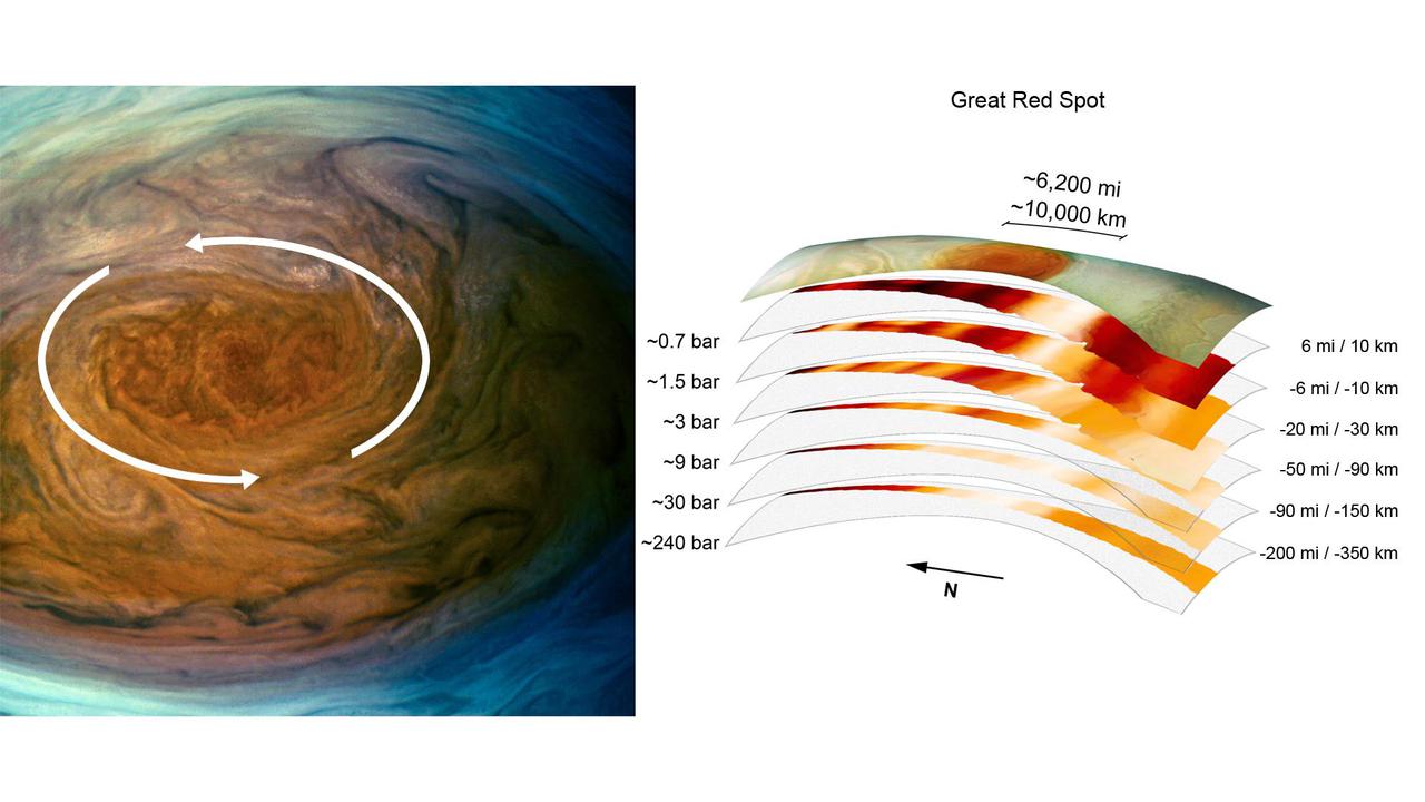
The annotated image on the left from the JunoCam imager aboard NASA's Juno spacecraft depicts the anticyclonic (counterclockwise) rotation of Jupiter's Great Red Spot. The graphic on the right highlights the large-scale structure of the Great Red Spot as seen by the spacecraft's microwave radiometer (MWR) instrument. Data for the image and the microwave radiometer results were collected during a low flyby of Jupiter which took place on July 11, 2017. The radiometer data was acquired from the six channels of MWR. Each MWR channel peers progressively deeper below the visible cloud tops. In fact, the MWR instrument enables Juno to see deeper into Jupiter than any previous spacecraft or Earth-based observations. Unlike Earth, which as a solid surface, Jupiter is a gas giant with no discernable solid surface. So the planetary science community has defined the "base" of Jupiter's atmosphere to be defined as the location where its pressure is equivalent to is 1 bar. The bar is a metric unit of pressure which at 14.5 pounds per square inch is slightly less than the average atmospheric pressure on Earth at sea level. The numbers noted to the left of each layer of MWR data indicates the pressure (in bars) that is present at the location in the atmosphere where the MWR reading occurred. The distance measurements to the right of each layer of MWR data provides the distance – either above or below the 1 bar level – that the corresponding MWR measurement was taken. For context, the top layer in the figure is a visible-light image depicting Jupiter's different levels of clouds, with an average altitude about 6 miles above the 1 bar pressure region. https://photojournal.jpl.nasa.gov/catalog/PIA24819