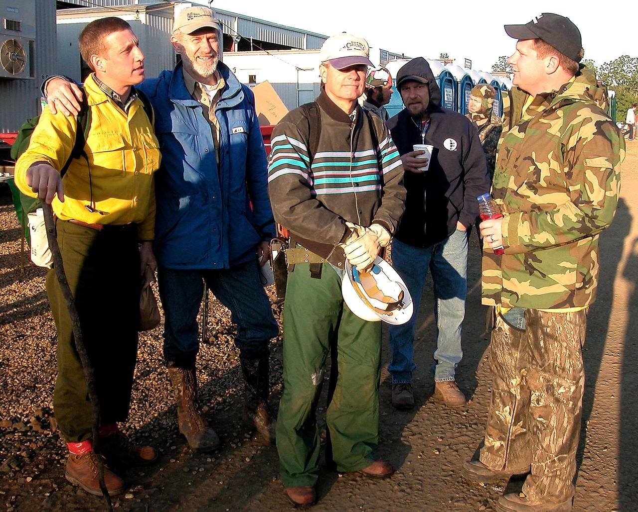
From left, Jon Wallace, deputy fire coordinator, U.S. Fish and Wildlife Service Southeast Region, Atlanta, Georgia; Chris Wilcox, U.S. Fish and Wildlife chief, Fire Management, National Interagency Fire Center, Boise, Idaho; and John Fish, chief, Florida Forest Service, pose for a portrait following a ceremony Nov. 1 on the Merritt Island National Wildlife Refuge in Florida. During the joint ceremony, the Spaceport Integration Team and its partners were presented with the prestigious 2017 Pulaski Award and a new memorial marker was dedicated. The multi-agency team includes representatives from NASA's Kennedy Space Center, Cape Canaveral Air Force Station's 45th Space Wing, the Merritt Island National Wildlife Refuge, as well as the Florida Forest Service and Brevard County Fire Rescue. The memorial marker honors two fallen firefighters, Scott Maness and Beau Sauselein, who died fighting a wildfire on space center property in 1981. Held outdoors, the ceremony was attended by 140 guests.
NASA’s B200 King Air aircraft – based at NASA’s Armstrong Flight Research Center in Edwards, California – ascends to support a prescribed burn in Geneva State Forest, about 100 miles south of Montgomery, Alabama, on March 17, 2025. The effort is part of NASA’s multi-year FireSense project, which aims to test technology that predicts fire and smoke behavior. This data could eventually benefit the U.S. Forest Service as well as local, state, and other federal wildland fire agencies.
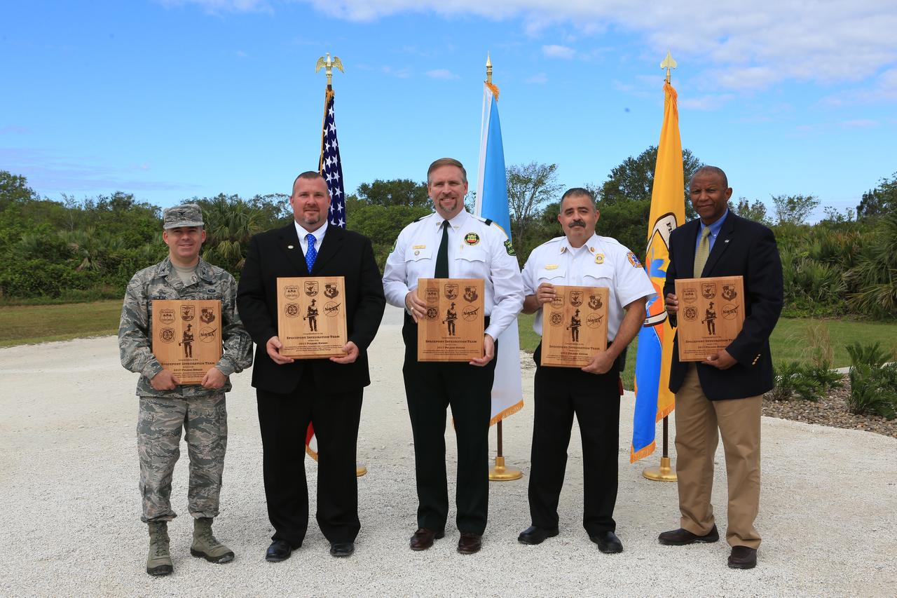
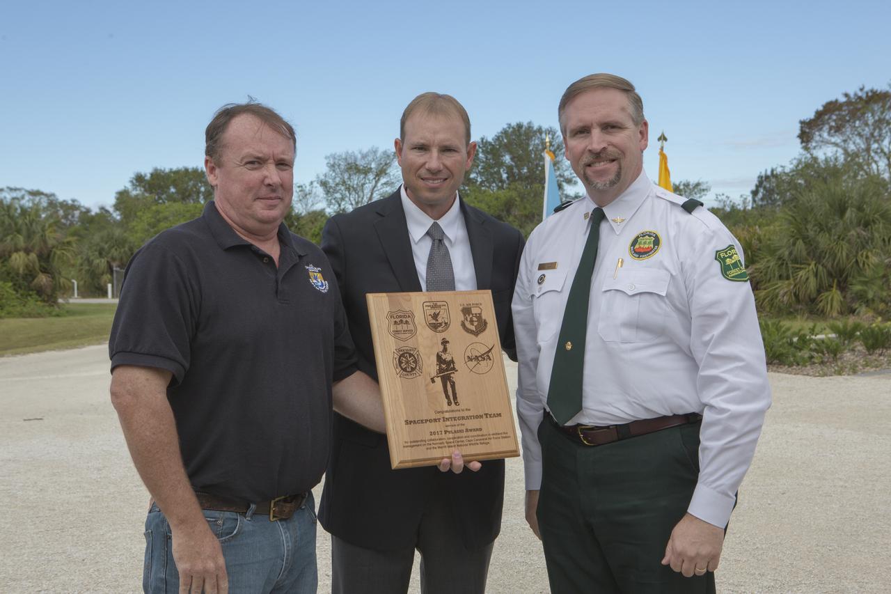
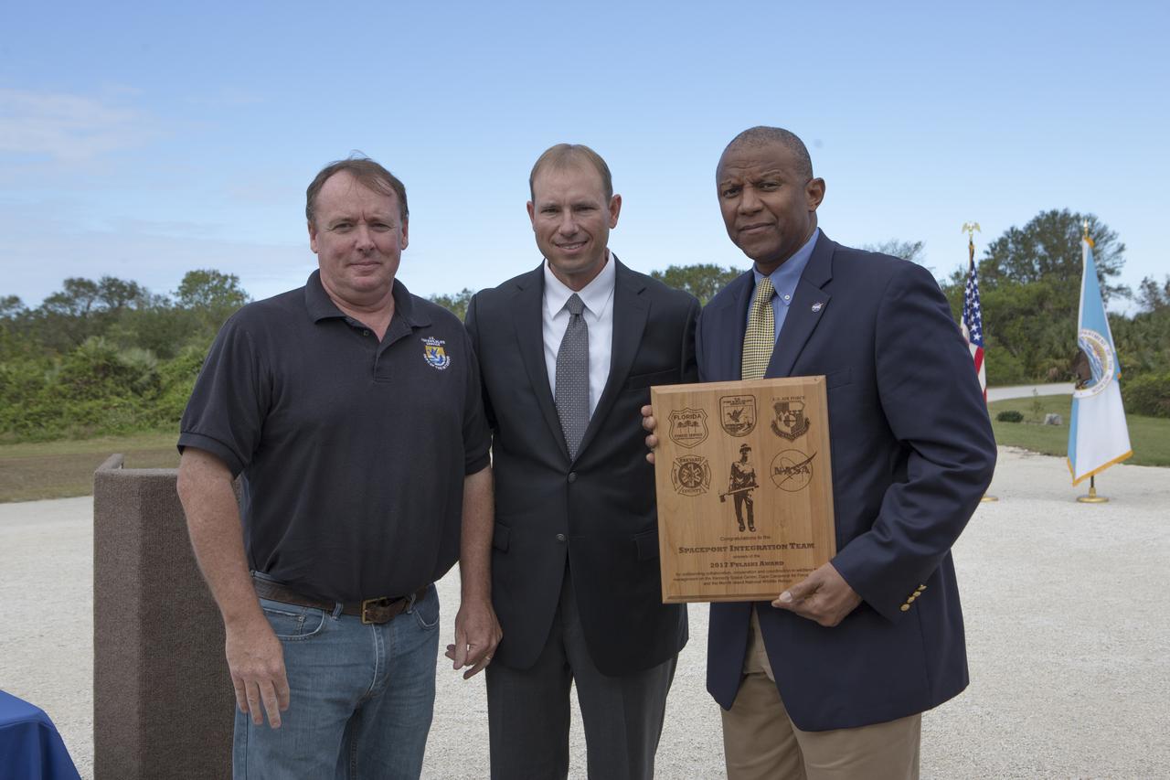
From left, Col. Z. Walter Jackim, vice commander, 45th Space Wing, Cape Canaveral Air Force Station; Michael Good, assistant fire management officer, Merritt Island National Wildlife Refuge; John Fish, chief, Florida Forest Service; Mark Schollmeyer, chief, Brevard County Fire Rescue; and Kelvin Manning, associate director, NASA's Kennedy Space Center, pose for a portrait following a ceremony Nov. 1 on the Merritt Island National Wildlife Refuge in Florida. During the joint ceremony, the Spaceport Integration Team and its partners were presented with the prestigious 2017 Pulaski Award and a new memorial marker was dedicated. The multi-agency team includes representatives from NASA's Kennedy Space Center, Cape Canaveral Air Force Station's 45th Space Wing, the Merritt Island National Wildlife Refuge, as well as the Florida Forest Service and Brevard County Fire Rescue. The memorial marker honors two fallen firefighters, Scott Maness and Beau Sauselein, who died fighting a wildfire on space center property in 1981. Held outdoors, the ceremony was attended by 140 guests.
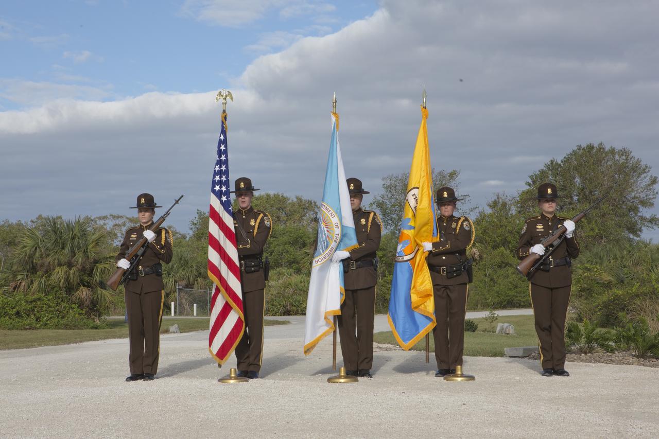
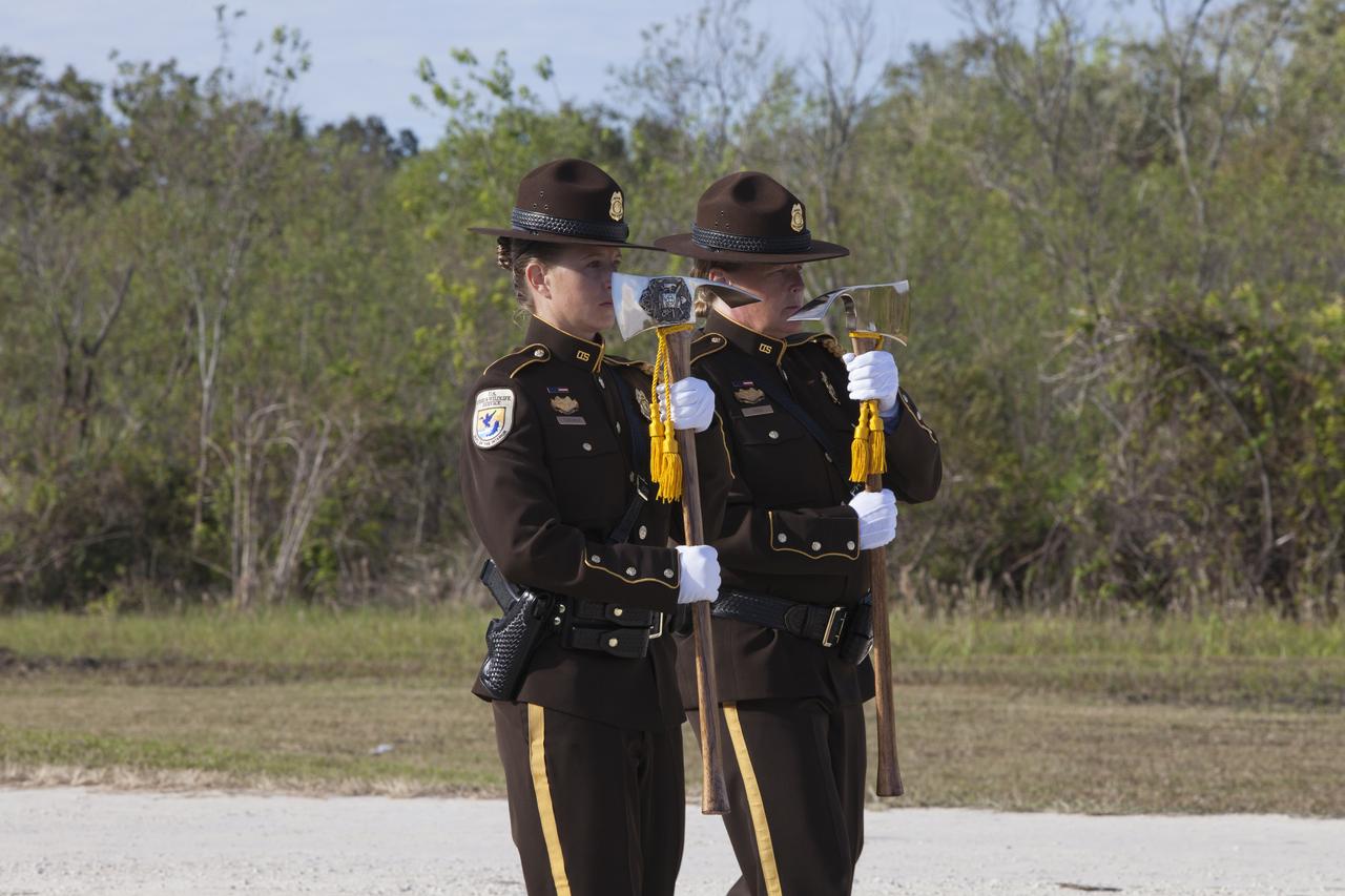
A presentation of colors by the U.S. Fish and Wildlife Service honor guard opened a ceremony Nov. 1 on the Merritt Island National Wildlife Refuge in Florida. During the joint ceremony, the Spaceport Integration Team and its partners were presented with the prestigious 2017 Pulaski Award and the new memorial marker was dedicated. The multi-agency team includes representatives from NASA's Kennedy Space Center, Cape Canaveral Air Force Station's 45th Space Wing, the Merritt Island National Wildlife Refuge, as well as the Florida Forest Service and Brevard County Fire Rescue. The memorial marker honors two fallen firefighters, Scott Maness and Beau Sauselein, who died fighting a wildfire on space center property in 1981. Held outdoors, the ceremony was attended by 140 guests.
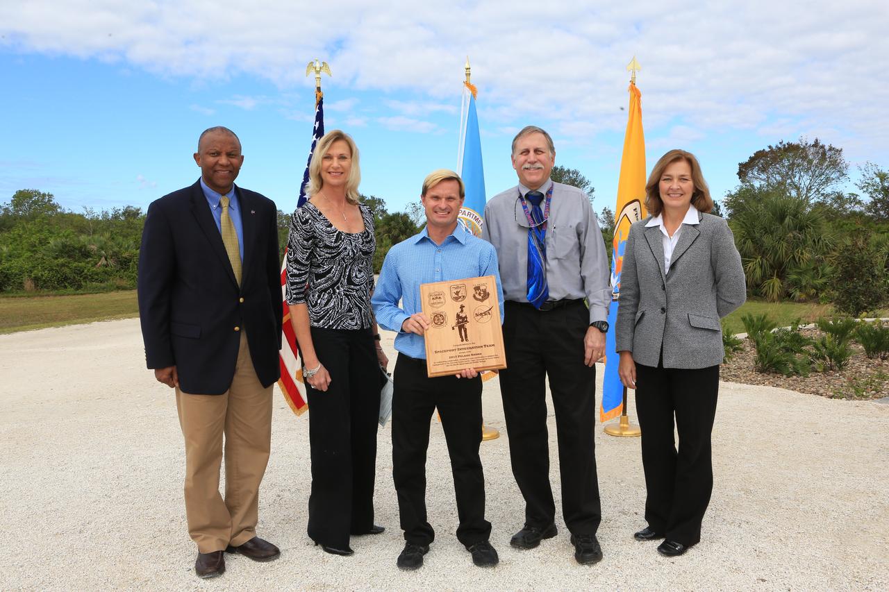
NASA's Kennedy Space Center Associate Director Kelvin Manning, left, and representatives from Kennedy's Spaceport Integration and Services pose for a portrait following a ceremony Nov. 1 on the Merritt Island National Wildlife Refuge in Florida. Next to Manning are, from left, Nancy Bray, director; William Heidtman, Spaceport Integrator; Dan Tweed, deputy director, Technical; and Jean Flowers, chief, Customer Services and Integration Branch. During the joint ceremony, the Spaceport Integration Team and its partners were presented with the prestigious 2017 Pulaski Award and a new memorial marker was dedicated. The multi-agency team includes representatives from NASA's Kennedy Space Center, Cape Canaveral Air Force Station's 45th Space Wing, the Merritt Island National Wildlife Refuge, as well as the Florida Forest Service and Brevard County Fire Rescue. The memorial marker honors two fallen firefighters, Scott Maness and Beau Sauselein, who died fighting a wildfire on space center property in 1981. Held outdoors, the ceremony was attended by 140 guests.
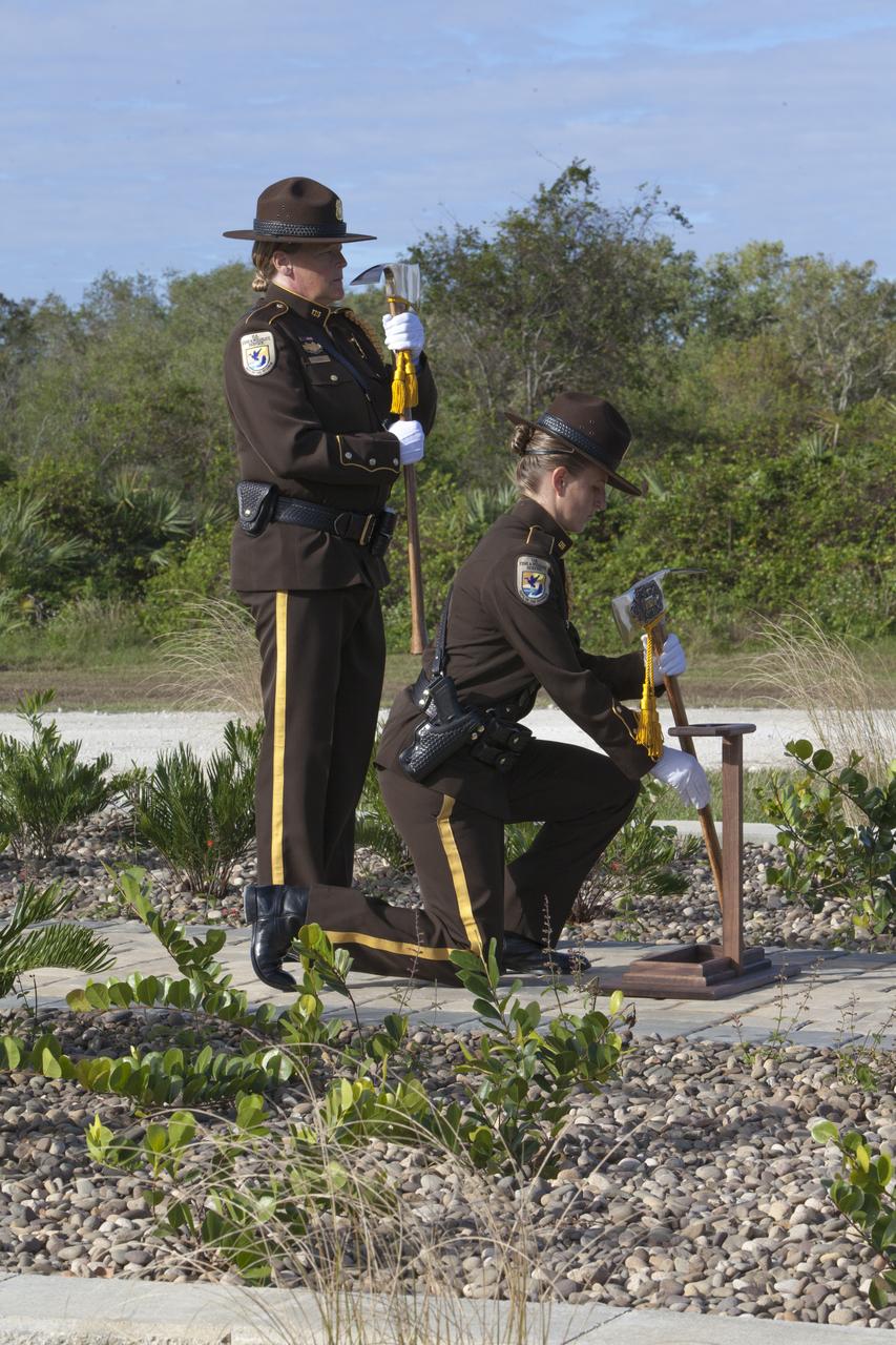
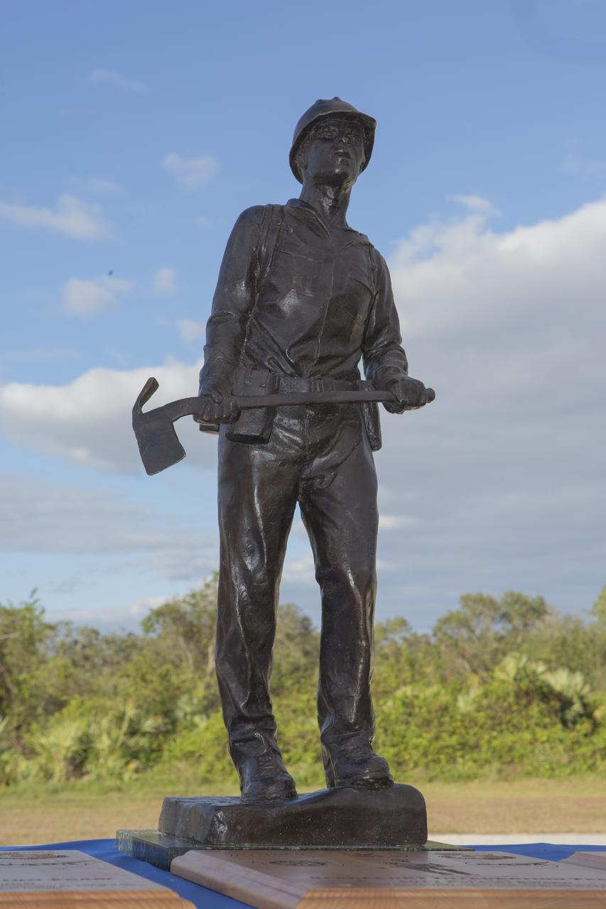
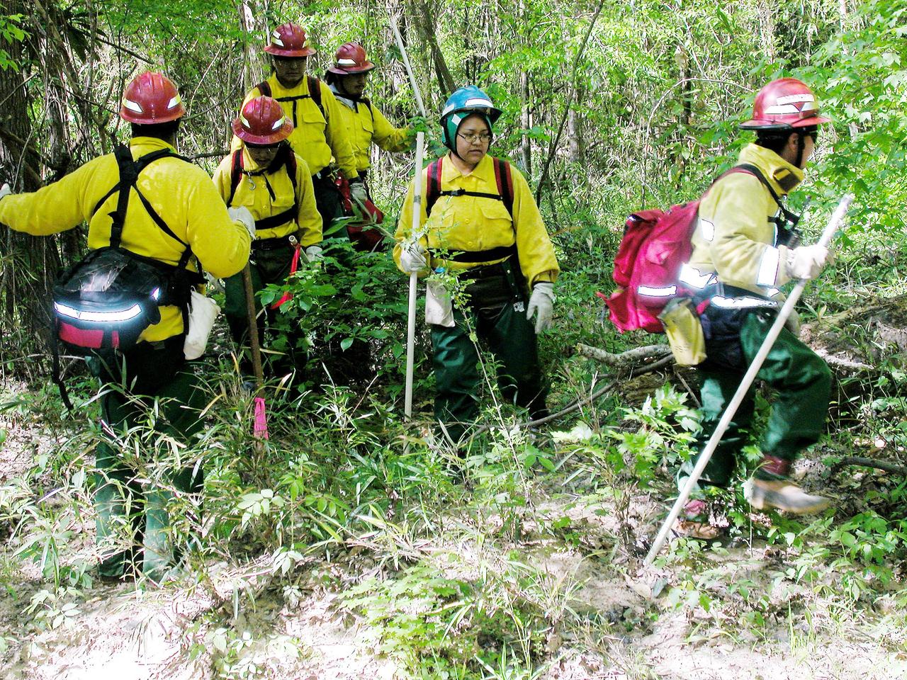
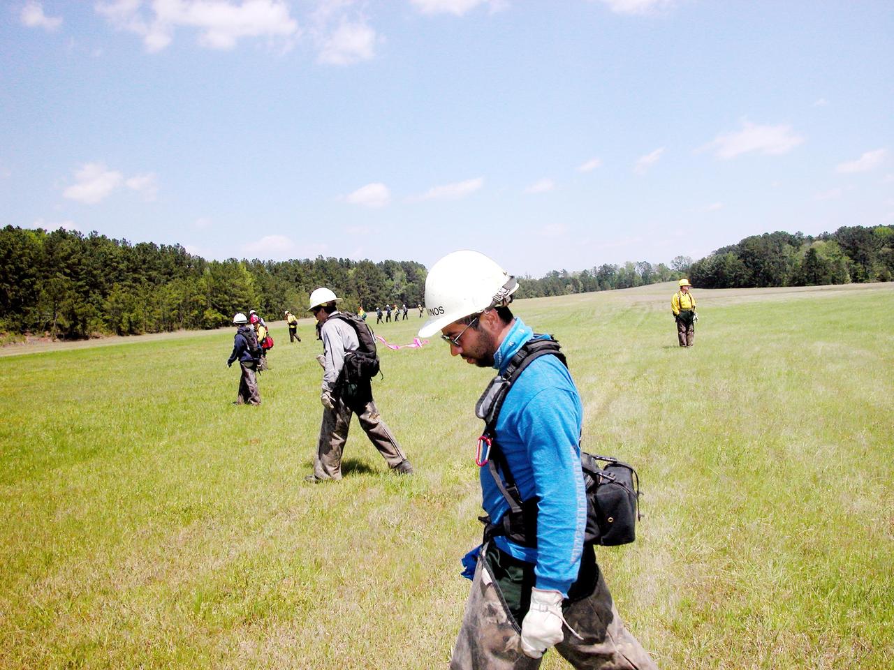
Firefighters place ceremonial Pulaski tools by a new memorial marker Nov. 1 on the Merritt Island National Wildlife Refuge in Florida. During a joint ceremony, the Spaceport Integration Team and its partners were presented with the prestigious 2017 Pulaski Award and the new memorial marker was dedicated. The multi-agency team includes representatives from NASA's Kennedy Space Center, Cape Canaveral Air Force Station's 45th Space Wing, the Merritt Island National Wildlife Refuge, as well as the Florida Forest Service and Brevard County Fire Rescue. The memorial marker honors two fallen firefighters, Scott Maness and Beau Sauselein, who died fighting a wildfire on space center property in 1981. Held outdoors, the ceremony was attended by 140 guests.
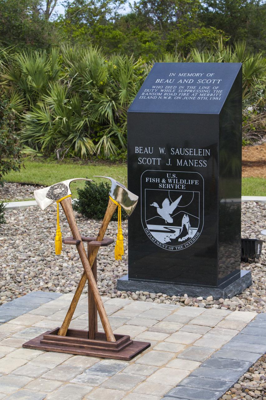
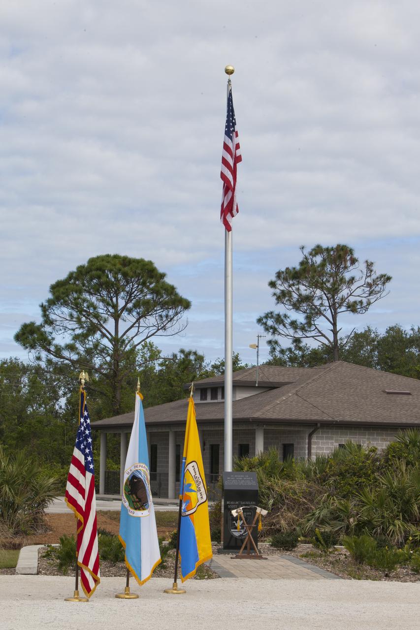
Ceremonial Pulaski tools are positioned in front of a new memorial marker Nov. 1 on the Merritt Island National Wildlife Refuge in Florida. During a joint ceremony, the Spaceport Integration Team and its partners were presented with the prestigious 2017 Pulaski Award and the new memorial marker was dedicated. The multi-agency team includes representatives from NASA's Kennedy Space Center, Cape Canaveral Air Force Station's 45th Space Wing, the Merritt Island National Wildlife Refuge, as well as the Florida Forest Service and Brevard County Fire Rescue. The memorial marker honors two fallen firefighters, Scott Maness and Beau Sauselein, who died fighting a wildfire on space center property in 1981. Held outdoors, the ceremony was attended by 140 guests.
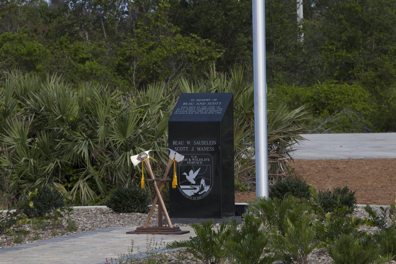
Ceremonial Pulaski tools are positioned in front of a new memorial marker Nov. 1 on the Merritt Island National Wildlife Refuge in Florida. During a joint ceremony, the Spaceport Integration Team and its partners were presented with the prestigious 2017 Pulaski Award and the new memorial marker was dedicated. The multi-agency team includes representatives from NASA's Kennedy Space Center, Cape Canaveral Air Force Station's 45th Space Wing, the Merritt Island National Wildlife Refuge, as well as the Florida Forest Service and Brevard County Fire Rescue. The memorial marker honors two fallen firefighters, Scott Maness and Beau Sauselein, who died fighting a wildfire on space center property in 1981. Held outdoors, the ceremony was attended by 140 guests.
Firefighters prepare to place ceremonial Pulaski tools by a new memorial marker Nov. 1 on the Merritt Island National Wildlife Refuge in Florida. During a joint ceremony, the Spaceport Integration Team and its partners were presented with the prestigious 2017 Pulaski Award and the new memorial marker was dedicated. The multi-agency team includes representatives from NASA's Kennedy Space Center, Cape Canaveral Air Force Station's 45th Space Wing, the Merritt Island National Wildlife Refuge, as well as the Florida Forest Service and Brevard County Fire Rescue. The memorial marker honors two fallen firefighters, Scott Maness and Beau Sauselein, who died fighting a wildfire on space center property in 1981. Held outdoors, the ceremony was attended by 140 guests.
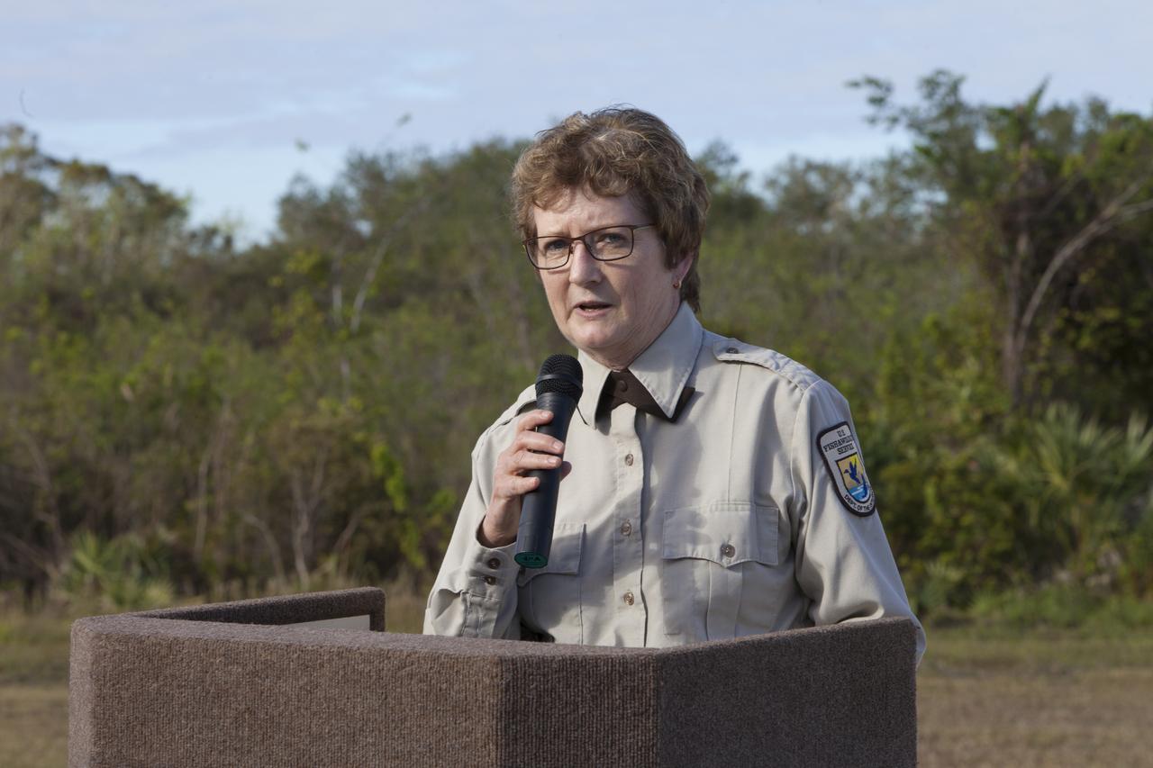
Layne Hamilton, manager of the Merritt Island National Wildlife Refuge, welcomes guests to a ceremony held Nov. 1 on the refuge in Florida. During the joint ceremony, the Spaceport Integration Team and its partners were presented with the prestigious 2017 Pulaski Award and a new memorial marker was dedicated. The multi-agency team includes representatives from NASA's Kennedy Space Center, Cape Canaveral Air Force Station's 45th Space Wing, the Merritt Island National Wildlife Refuge, as well as the Florida Forest Service and Brevard County Fire Rescue. The memorial marker honors two fallen firefighters, Scott Maness and Beau Sauselein, who died fighting a wildfire on space center property in 1981. Held outdoors, the ceremony was attended by 140 guests.
A presentation of colors opened a ceremony Nov. 1 on the Merritt Island National Wildlife Refuge in Florida. During the joint ceremony, the Spaceport Integration Team and its partners were presented with the prestigious 2017 Pulaski Award and a new memorial marker was dedicated. The multi-agency team includes representatives from NASA's Kennedy Space Center, Cape Canaveral Air Force Station's 45th Space Wing, the Merritt Island National Wildlife Refuge, as well as the Florida Forest Service and Brevard County Fire Rescue. The memorial marker honors two fallen firefighters, Scott Maness and Beau Sauselein, who died fighting a wildfire on space center property in 1981. Held outdoors, the ceremony was attended by 140 guests.
The prestigious 2017 Pulaski Award is on display near a new memorial marker on the Merritt Island National Wildlife Refuge in Florida. During a joint ceremony, the Spaceport Integration Team and its partners were presented with the award and a new memorial marker was dedicated. The multi-agency team includes representatives from NASA's Kennedy Space Center, Cape Canaveral Air Force Station's 45th Space Wing, the Merritt Island National Wildlife Refuge, as well as the Florida Forest Service and Brevard County Fire Rescue. The memorial marker honors two fallen firefighters, Scott Maness and Beau Sauselein, who died fighting a wildfire on space center property in 1981. Held outdoors, the ceremony was attended by 140 guests.
From left, Jon Wallace, deputy fire coordinator, U.S. Fish and Wildlife Service Southeast Region, Atlanta, Georgia; Chris Wilcox, U.S. Fish and Wildlife chief, Fire Management, National Interagency Fire Center, Boise, Idaho; and Kelvin Manning, associate director, NASA's Kennedy Space Center, pose for a portrait following a ceremony Nov. 1 on the Merritt Island National Wildlife Refuge in Florida. During the joint ceremony, the Spaceport Integration Team and its partners were presented with the prestigious 2017 Pulaski Award and a new memorial marker was dedicated. The multi-agency team includes representatives from NASA's Kennedy Space Center, Cape Canaveral Air Force Station's 45th Space Wing, the Merritt Island National Wildlife Refuge, as well as the Florida Forest Service and Brevard County Fire Rescue. The memorial marker honors two fallen firefighters, Scott Maness and Beau Sauselein, who died fighting a wildfire on space center property in 1981. Held outdoors, the ceremony was attended by 140 guests.
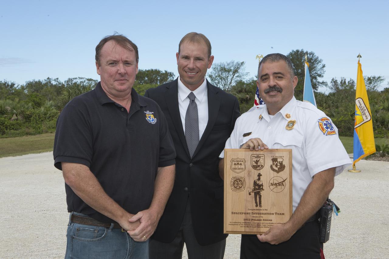
From left, Jon Wallace, deputy fire coordinator, U.S. Fish and Wildlife Service Southeast Region, Atlanta, Georgia; Chris Wilcox, U.S. Fish and Wildlife chief, Fire Management, National Interagency Fire Center, Boise, Idaho; and Mark Schollmeyer, chief, Brevard County Fire Rescue, pose for a portrait following a ceremony Nov. 1 on the Merritt Island National Wildlife Refuge in Florida. During the joint ceremony, the Spaceport Integration Team and its partners were presented with the prestigious 2017 Pulaski Award and a new memorial marker was dedicated. The multi-agency team includes representatives from NASA's Kennedy Space Center, Cape Canaveral Air Force Station's 45th Space Wing, the Merritt Island National Wildlife Refuge, as well as the Florida Forest Service and Brevard County Fire Rescue. The memorial marker honors two fallen firefighters, Scott Maness and Beau Sauselein, who died fighting a wildfire on space center property in 1981. Held outdoors, the ceremony was attended by 140 guests.
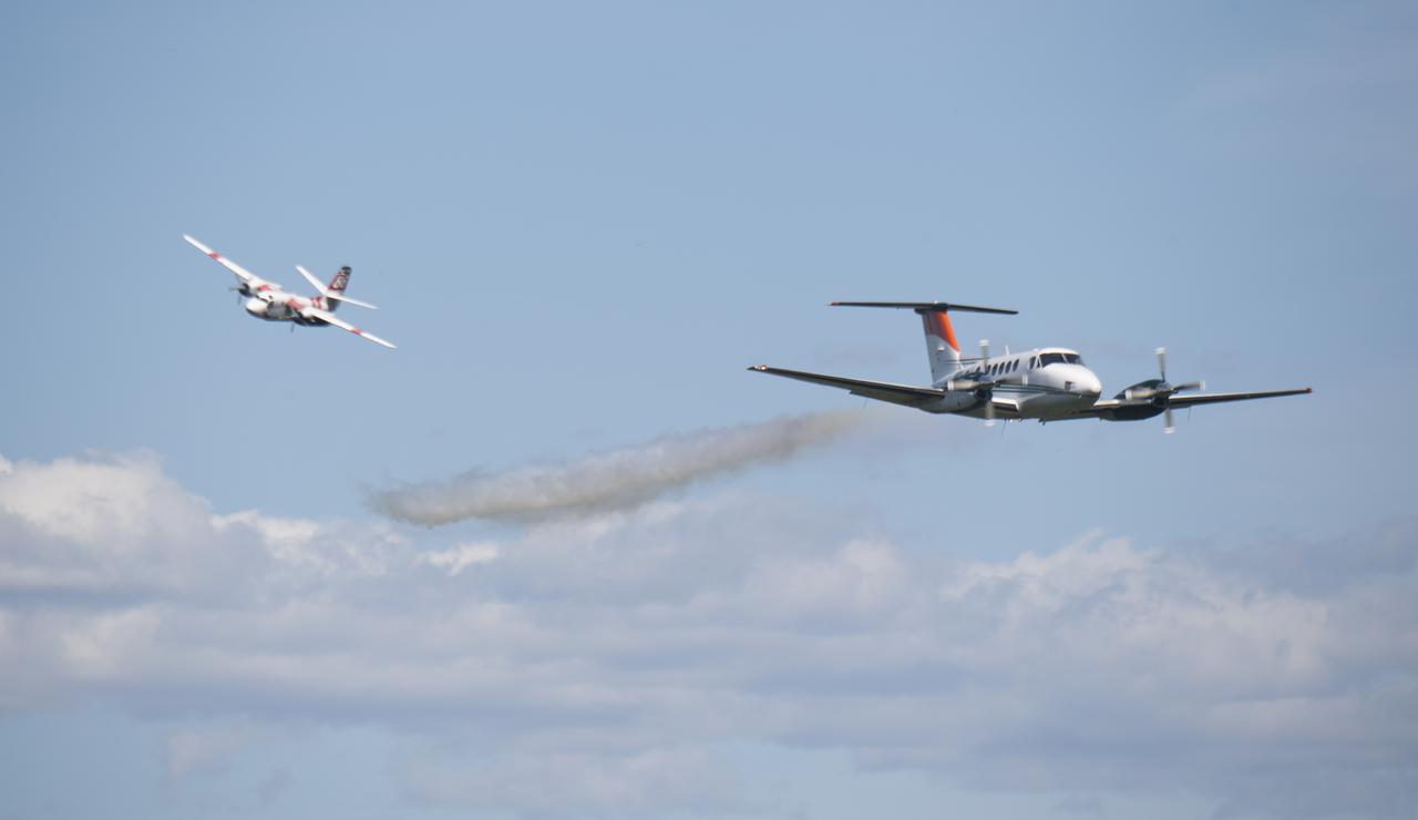
A Cal Fire S2-T airtanker follows a U.S. Forest Service King Air 200 during an aerial attack on a simulated wildfire, Tuesday, May 4, 2021 as Cal Fire conducts aerial fire fighting training exercises near Redding, California. STEReO, the Scalable Traffic Management for Emergency Response Operations project, led by NASA’s Ames Research Center, builds on NASA’s expertise in air traffic management, human factors research, and autonomous technology development to apply the agency’s work in Unmanned Aircraft Systems Traffic Management, or UTM, to public safety uses. Photo Credit: (NASA/Joel Kowsky)

S75-27445 (6 June 1975) --- American ASTP crewmen Vance D. Brand (left), Thomas P. Stafford (second from left) and Donald K. Slayton (right) receive a special box of genetically superior white spruce seeds from Glenn A. Kovar (second from right), USDA Forest Service project coordinator. The seeds, enough to plant an acre of trees, will be presented to the Soviet ASTP crewmen during the U.S.-USSR Apollo-Soyuz Test Project docking-in-Earth-orbit mission in July 1975. The seeds will produce faster-growing trees of exceptional height and shape. The trees will thrive in Moscow-like climate, and were developed by Forest Service?s Institute of Forest Genetics in Rhinelander, Wisconsin. The seed container box was made from recycled fibers and stabilized walnut. These seeds are an outstanding example of the U.S. Forest Service research to help produce new improved forests for the world. The four men are standing in the Building 2 briefing room at NASA's Johnson Space Center.

An ER-2 based at NASA's Armstrong Flight Research Center in California flew a mission over the state's wildfires Aug. 9 to validate instruments and to collect information to help U.S. Forest Service officials plan for recovery.
NASA’s B200 King Air aircraft – based at NASA’s Armstrong Flight Research Center in Edwards, California – ascends to support a prescribed burn in Geneva State Forest, about 100 miles south of Montgomery, Alabama, on March 17, 2025. The effort is part of NASA’s multi-year FireSense project, which aims to test technology that predicts fire and smoke behavior. This data could eventually benefit the U.S. Forest Service as well as local, state, and other federal wildland fire agencies.
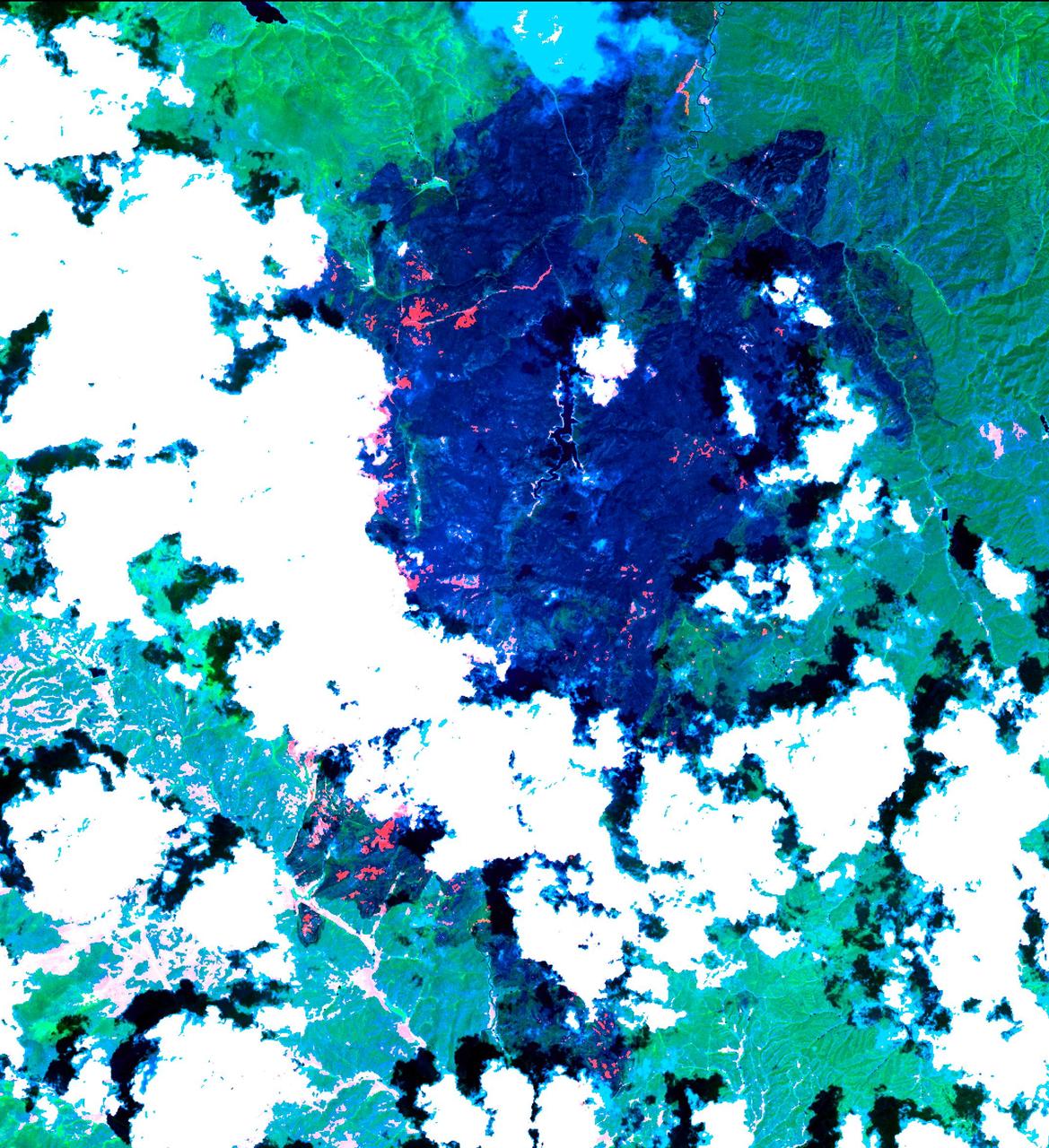
The Hayman forest fire, started on June 8, is continuing to burn in the Pike National Forest, 57 km (35 miles) south-southwest of Denver. According to the U.S. Forest Service, the fire has consumed more than 90,000 acres and has become Colorado's worst fire ever. In this ASTER image, acquired Sunday, June 16, 2002 at 10:30 am MST, the dark blue area is burned vegetation and the green areas are healthy vegetation. Red areas are active fires, and the blue cloud at the top center is smoke. Meteorological clouds are white. The image covers an area of 32.2 x 35.2 km (20.0 x 21.8 miles), and displays ASTER bands 8-3-2 in red, green and blue. http://photojournal.jpl.nasa.gov/catalog/PIA03499
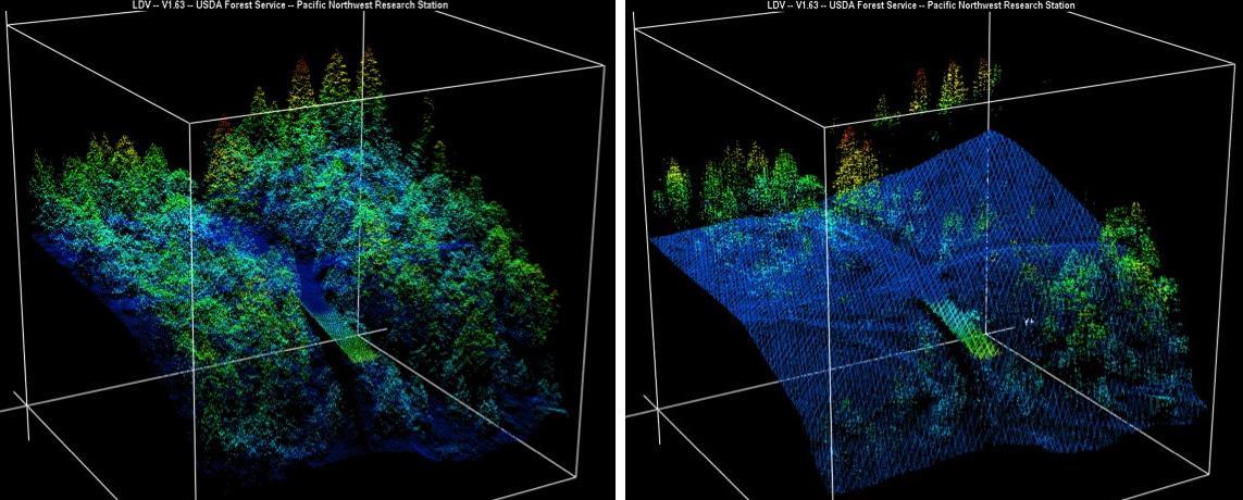
New maps of two recent California megafires that combine unique data sets from the U.S. Forest Service and NASA's Jet Propulsion Laboratory in Pasadena, California, are answering some of the urgent questions that follow a huge wildfire. These before-and-after USFS LIght Detection And Ranging (LIDAR) images from the 2014 King fire region in El Dorado National Forest, California are among new maps. They show a small section of the Rubicon River drainage basin, where fire damage was severe. Blue indicates ground level; lighter colors are higher. A road -- bordered by dense trees in the before image at left -- and part of a bridge are in the center, with the bridge appearing green. http://photojournal.jpl.nasa.gov/catalog/PIA19360
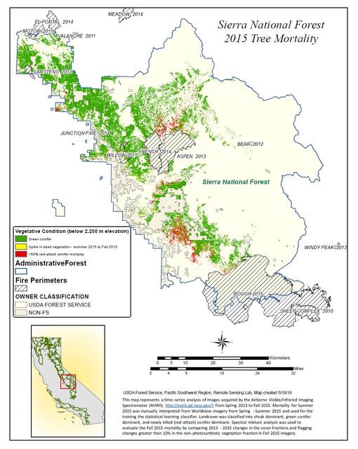
California, reveals the devastating effect of California's ongoing drought on Sierra Nevada conifer forests. The map will be used to help the U.S. Forest Service assess and respond to the impacts of increased tree mortality caused by the drought, particularly where wildlands meet urban areas within the Sierra National Forest. After several years of extreme drought, the highly stressed conifers (trees or bushes that produce cones and are usually green year-round) of the Sierra Nevada are now more susceptible to bark beetles (Dendroctonus spp.). While bark beetles killing trees in the Sierra Nevada is a natural phenomenon, the scale of mortality in the last couple of years is far greater than previously observed. The U.S. Forest Service is using recent airborne spectroscopic measurements from NASA's Airborne Visible/Infrared Imaging Spectrometer (AVIRIS) instrument aboard NASA's ER-2 aircraft, together with new advanced algorithms, to quantify this impact over this large region of rugged terrain. The high-altitude ER-2 aircraft is based at NASA's Armstrong Flight Research Center, Edwards, California. The image was created by scientists at the USFS's Pacific Southwest Region Remote Sensing Lab, McClellan, California, by performing a time series analysis of AVIRIS images. Scientists evaluated baseline tree mortality on public lands in the summer of 2015 using a machine learning algorithm called "random forest." This algorithm classifies the AVIRIS measurements as dominated by either shrubs, healthy trees or newly dead conifer trees. To quantify how much the amount of dead vegetation increased during the fall of 2015, the Forest Service scientists conducted an advanced spectral mixture analysis. This analysis evaluates each spectrum to determine the fraction of green vegetation, dead vegetation and soil. The full spectral range of AVIRIS is important to separate the signatures of soil and dead vegetation. To produce this comprehensive Sierra National Forest tree mortality map, the result from the summer of 2015 was evaluated to look for increases of more than 10 percent in dead vegetation during the fall of 2015. AVIRIS measures spectra of the Earth system to conduct advanced science research. These western U.S. AVIRIS measurements were acquired as part of NASA's Hyperspectral Infrared Imager (HyspIRI) preparatory airborne campaign. HyspIRI was one of the space missions suggested to NASA by the National Academy of Sciences in its 2007 decadal survey for Earth Science. In the future, HyspIRI could provide spectral and thermal measurements of this type globally for ecosystem research and additional science objectives. http://photojournal.jpl.nasa.gov/catalog/PIA20717

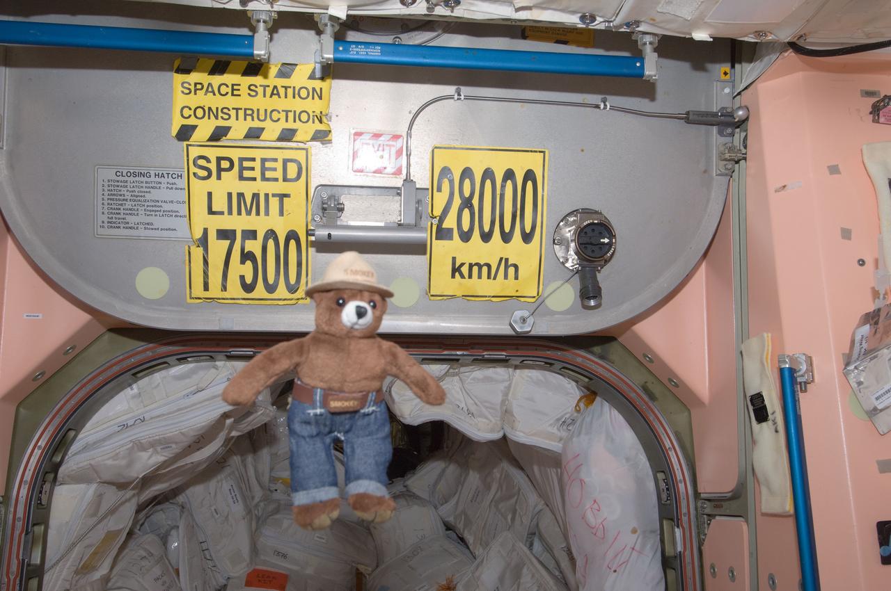
ISS032-E-011678 (3 Aug. 2012) --- Smokey Bear floats freely near a hatchway on the International Space Station. On May 15, 2012, Smokey traveled aboard the Soyuz spacecraft with NASA astronaut Joe Acaba and Russian cosmonauts Gennady Padalka and Sergei Revin to the space station. As a recognized symbol for wildland fire prevention, his presence on the orbiting complex also highlights the many areas of active space station research related to Earth observations, plant growth and combustion and materials sciences, as well as existing spinoff technologies in these areas. NASA, the U.S. Forest Service (USFS) and the Texas Forest Service are teaming up to celebrate Smokey's 68th birthday Aug. 9 at NASA's Johnson Space Center in Houston.
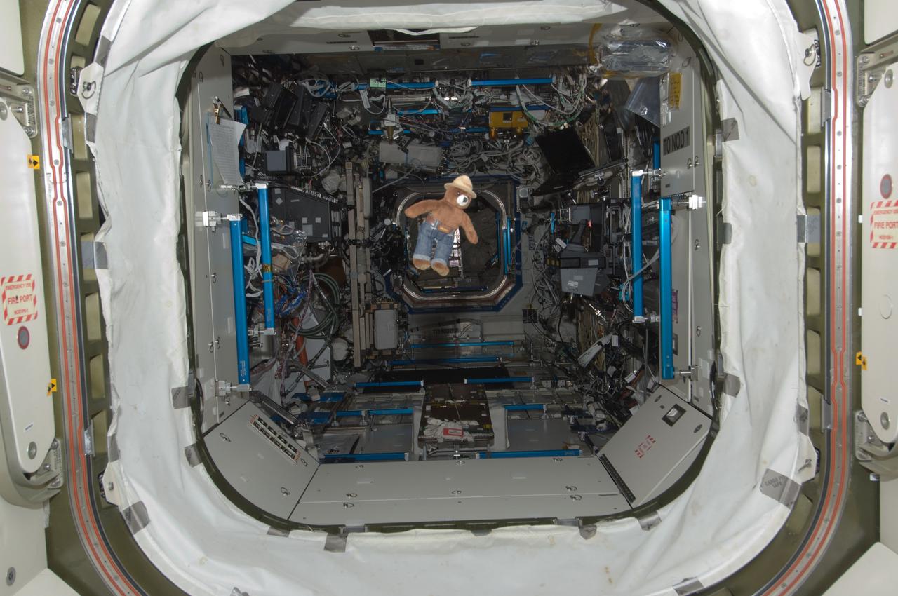
ISS032-E-011664 (3 Aug. 2012) --- Smokey Bear floats freely in the hatchway of the International Space Station’s Destiny laboratory. On May 15, 2012, Smokey traveled aboard the Soyuz spacecraft with NASA astronaut Joe Acaba and Russian cosmonauts Gennady Padalka and Sergei Revin to the space station. As a recognized symbol for wildland fire prevention, his presence on the orbiting complex also highlights the many areas of active space station research related to Earth observations, plant growth and combustion and materials sciences, as well as existing spinoff technologies in these areas. NASA, the U.S. Forest Service (USFS) and the Texas Forest Service are teaming up to celebrate Smokey's 68th birthday Aug. 9 at NASA's Johnson Space Center in Houston.
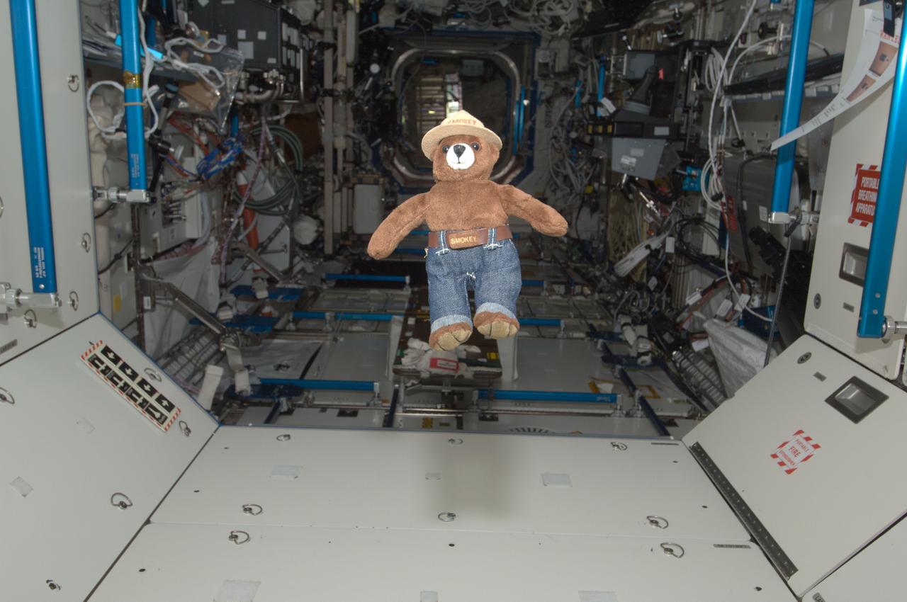
ISS032-E-011662 (3 Aug. 2012) --- Smokey Bear floats freely in the Unity node of the International Space Station. On May 15, 2012, Smokey traveled aboard the Soyuz spacecraft with NASA astronaut Joe Acaba and Russian cosmonauts Gennady Padalka and Sergei Revin to the space station. As a recognized symbol for wildland fire prevention, his presence on the orbiting complex also highlights the many areas of active space station research related to Earth observations, plant growth and combustion and materials sciences, as well as existing spinoff technologies in these areas. NASA, the U.S. Forest Service (USFS) and the Texas Forest Service are teaming up to celebrate Smokey's 68th birthday Aug. 9 at NASA's Johnson Space Center in Houston.
ISS032-E-011666 (3 Aug. 2012) --- Smokey Bear floats freely in the hatchway of the International Space Station’s Destiny laboratory. On May 15, 2012, Smokey traveled aboard the Soyuz spacecraft with NASA astronaut Joe Acaba and Russian cosmonauts Gennady Padalka and Sergei Revin to the space station. As a recognized symbol for wildland fire prevention, his presence on the orbiting complex also highlights the many areas of active space station research related to Earth observations, plant growth and combustion and materials sciences, as well as existing spinoff technologies in these areas. NASA, the U.S. Forest Service (USFS) and the Texas Forest Service are teaming up to celebrate Smokey's 68th birthday Aug. 9 at NASA's Johnson Space Center in Houston.
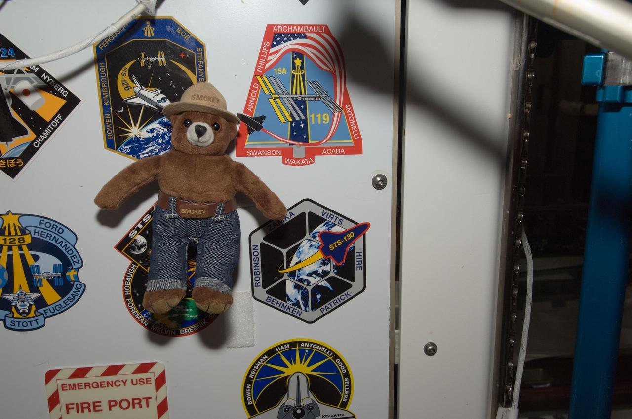
ISS032-E-011654 (3 Aug. 2012) --- Smokey Bear floats freely near crew insignias placed in the Unity node of the International Space Station. On May 15, 2012, Smokey traveled aboard the Soyuz spacecraft with NASA astronaut Joe Acaba and Russian cosmonauts Gennady Padalka and Sergei Revin to the space station. As a recognized symbol for wildland fire prevention, his presence on the orbiting complex also highlights the many areas of active space station research related to Earth observations, plant growth and combustion and materials sciences, as well as existing spinoff technologies in these areas. NASA, the U.S. Forest Service (USFS) and the Texas Forest Service are teaming up to celebrate Smokey's 68th birthday Aug. 9 at NASA's Johnson Space Center in Houston.

Lit by sunlight filtered through the smoke of a distant forest fire, the Space Shuttle Atlantis receives post-flight servicing in the Mate-Demate Device (MDD), following its landing at NASA's Dryden Flight Research Center, Edwards, California. The gantry-like MDD structure is used for servicing the shuttle orbiters in preparation for their ferry flight back to the Kennedy Space Center in Florida, including mounting the shuttle atop NASA's modified Boeing 747 Shuttle Carrier Aircraft.
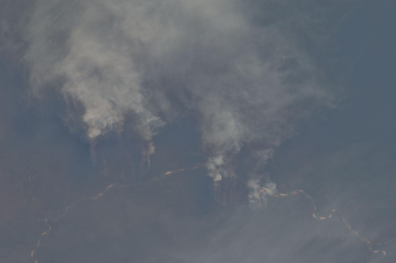
ISS029-E-008032 (17 Sept. 2011) --- Fires along the Rio Xingu, Brazil are featured in this image photographed by an Expedition 29 crew member on the International Space Station. The rain forest of South America, also known as ?Amazonia??the largest such forest on Earth?has been undergoing a continual and accelerated land use conversion process into farmlands (including pasture for livestock) since the early 1960s. This process has typically been achieved by clearing of the forest using fire ? ?slash and burn? ? followed by planting of crops. The generally infertile soils of the region make sustainable farming difficult; this drives more forest conversion into new farmland. The area of clearing can be considerable, and as the deforested regions are easily identifiable and measurable from space the rate of deforestation is likewise easy to track. This detailed photograph illustrates slash-and-burn forest clearing along the Xingu River (Rio) in the northeast of the state of Matto Grasso, Brazil. The perspective of this image allows for a striking visualization of both the horizontal position and extent of the fire lines next to the river, as well as providing a sense of the vertical structure of the smoke plumes due to the viewing angle and shadowing. Light colored areas within the river channel are sand bars, which show that the river is in its annual low-flow/ low water stage. For a sense of scale, the Xingu River channel within the view is approximately 63 kilometers long. Rivers in Amazonia are its natural highways, which may explain why the burning is occurring right next to the Xingu River, one of Amazonia?s largest. In recent years, preservation has gained traction in the region as a result of such considerations as new valuation of the ecosystem services provided by the forest, concerns about the impact of widespread burning on global climate change, and greater sensitivity to the ethnic and biological heritage of Amazonia.
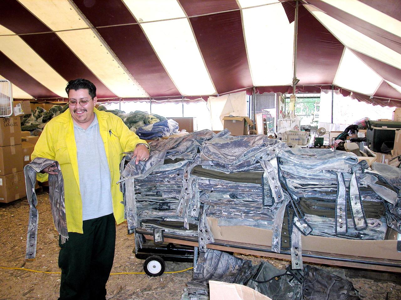
KENNEDY SPACE CENTER, FLA. -- Temporary camp worker Michael Trujillo of North New Mexico displays chaps in the supply tent at the Nacogdoches site. The chaps are used by U.S. Forest Service, Environmental Protection Agency and space program workers searching through dense forests in East Texas. Kennedy Space Center workers are participating in the Columbia Recovery efforts at the Lufkin (Texas) Command Center, four field sites in East Texas, and the Barksdale, La., hangar site. KSC is working with representatives from other NASA Centers and with those from a number of federal, state and local agencies in the recovery effort. KSC provides vehicle technical expertise in the field to identify, collect and return Shuttle hardware to KSC.
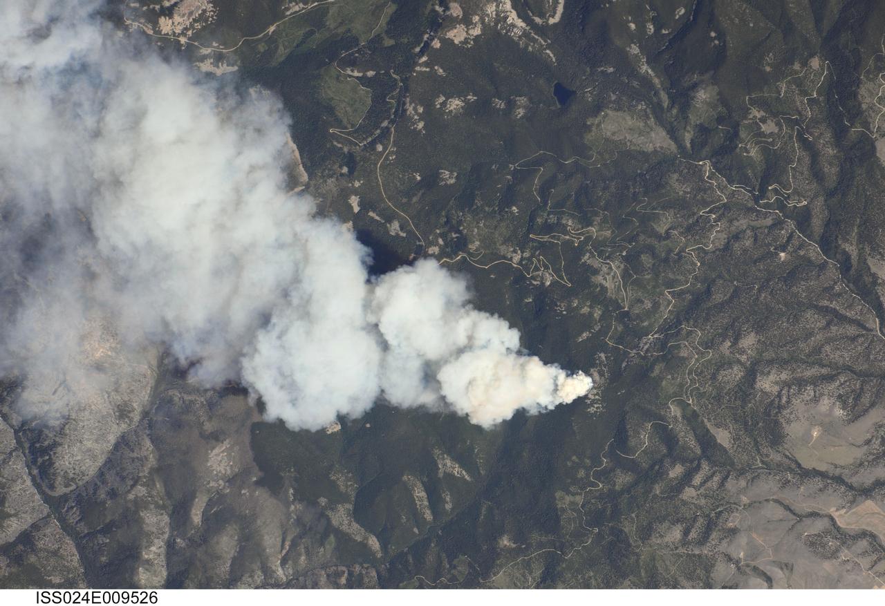
ISS024-E-009526 (25 July 2010) --- Dominic Point Fire in Montana is featured in this image photographed by an Expedition 24 crew member on the International Space Station. Lightning strikes in the forested mountains of the western United States, and human activities, can spark wild fires during the summer dry season. The Dominic Point Fire was first reported near 3:00 p.m. local time on July 25 2010. Approximately one hour later, the space station crew photographed the fire?s large smoke plume ? already extending at least eight kilometers to the east ? from orbit as they passed almost directly overhead. Forest Service fire crews, slurry bombers and helicopters were on the scene by that evening. The fire may have been started by a lightning strike, as there are no trails leading into the fire area located approximately 22 kilometers northeast of Hamilton, MT (according to local reports). As of July 26, 2010 the fire had burned approximately 283?405 hectares of the Bitterroot National Forest in western Montana. The fire is thought to have expanded quickly due to high temperatures, low humidity, and favorable winds with an abundance of deadfall ? dead trees and logs that provide readily combustible fuels ? in the area.
On November 18, 2003, the Advanced Spaceborne Thermal Emission and Reflection Radiometer (ASTER) on NASA's Terra satellite acquired this image of the Old Fire/Grand Prix fire east of Los Angeles. The image is being processed by NASA's Wildfire Response Team and will be sent to the United States Department of Agriculture's Forest Service Remote Sensing Applications Center (RSAC) which provides interpretation services to Burned Area Emergency Response (BAER) teams to assist in mapping the severity of the burned areas. The image combines data from the visible and infrared wavelength regions to highlight the burned areas. http://photojournal.jpl.nasa.gov/catalog/PIA04879

KENNEDY SPACE CENTER, FLA. -- Members of a U.S. Forest Service search team walk a grid during a Columbia Recovery search near the Hemphill site. The group is accompanied by a space program worker able to identify potential hazards of Shuttle parts. Kennedy Space Center workers are participating in the Columbia Recovery efforts at the Lufkin (Texas) Command Center, four field sites in East Texas, and the Barksdale, La., hangar site. KSC is working with representatives from other NASA Centers and with those from a number of federal, state and local agencies in the recovery effort. KSC provides vehicle technical expertise in the field to identify, collect and return Shuttle hardware to KSC.
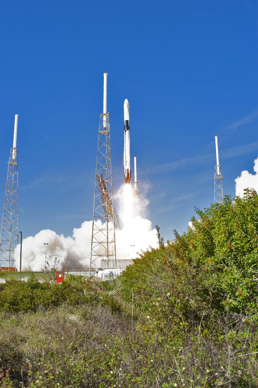
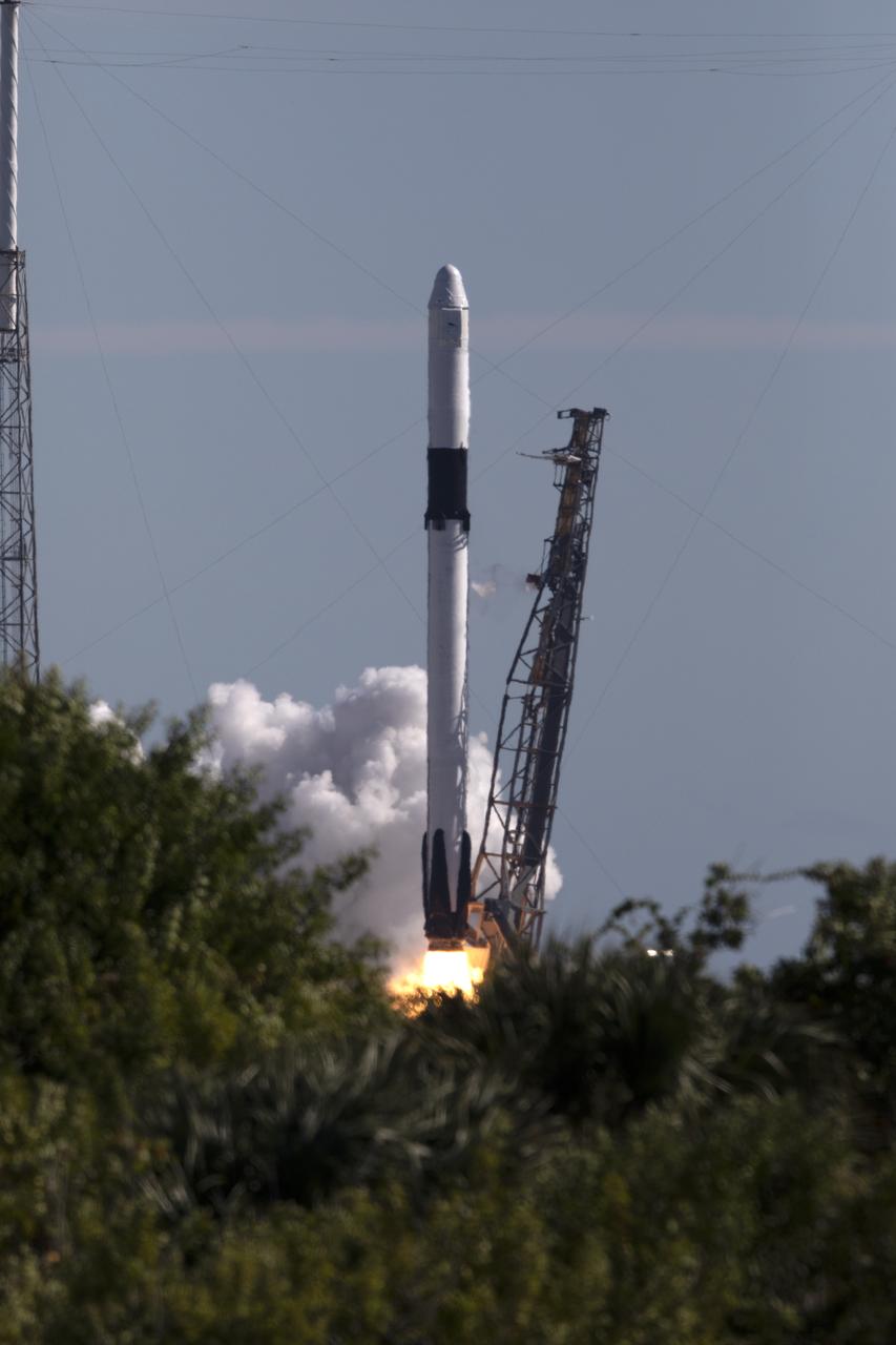
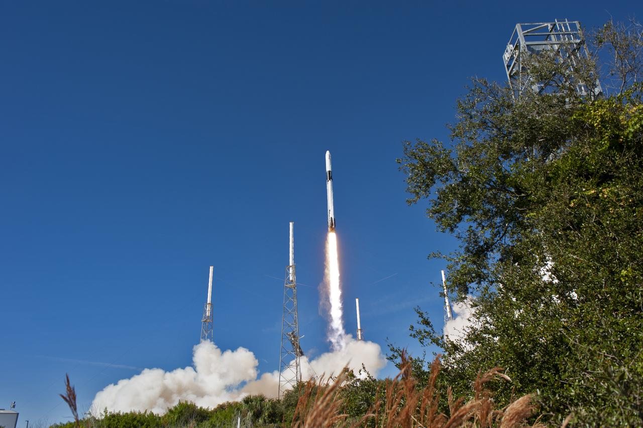
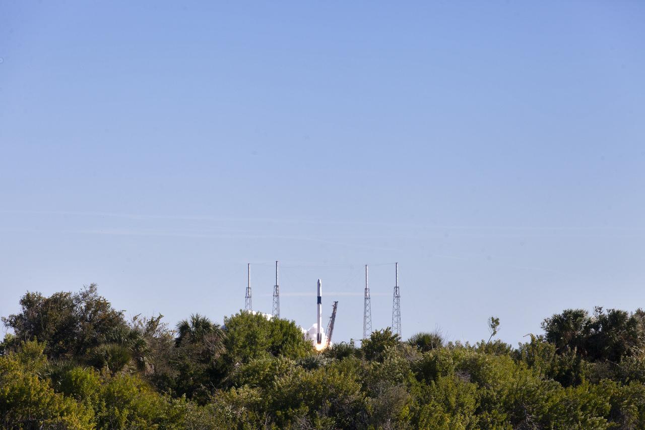
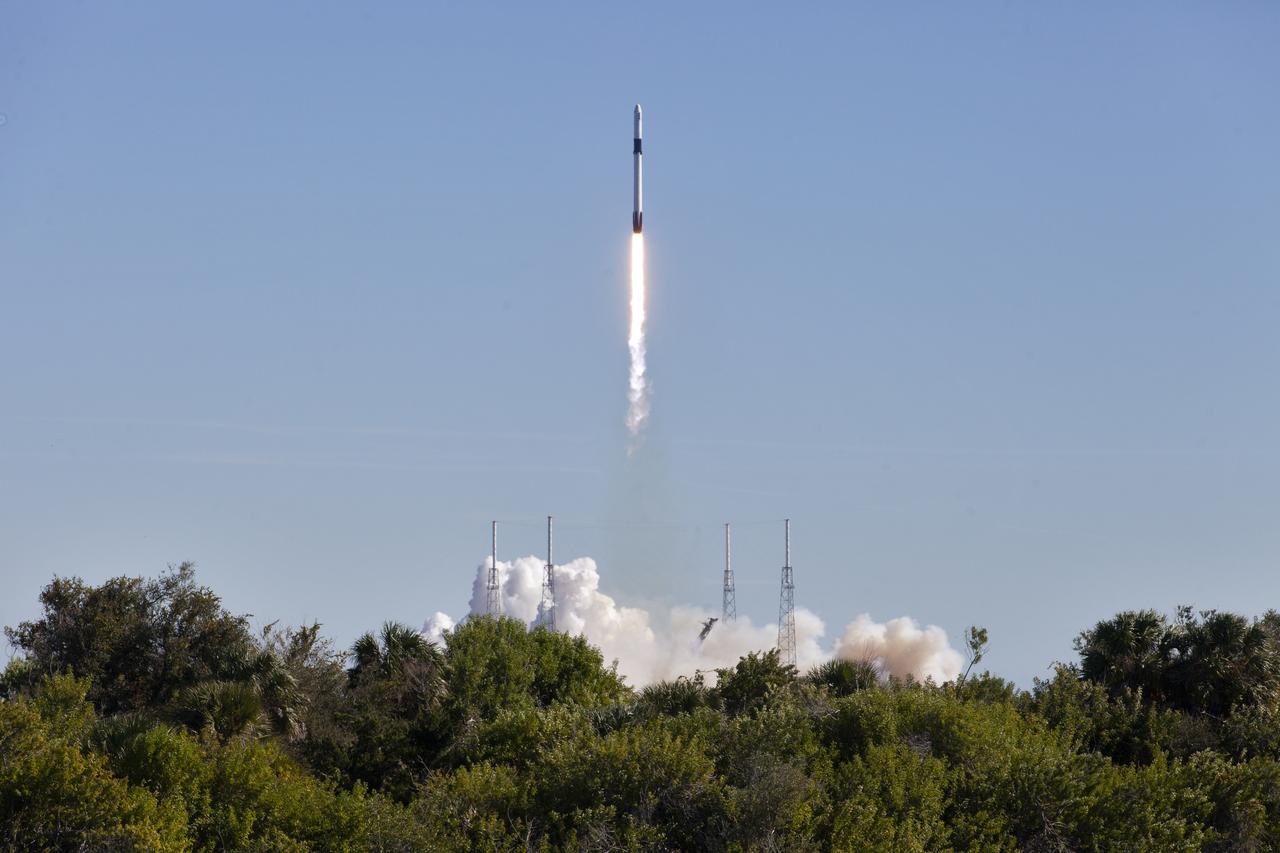
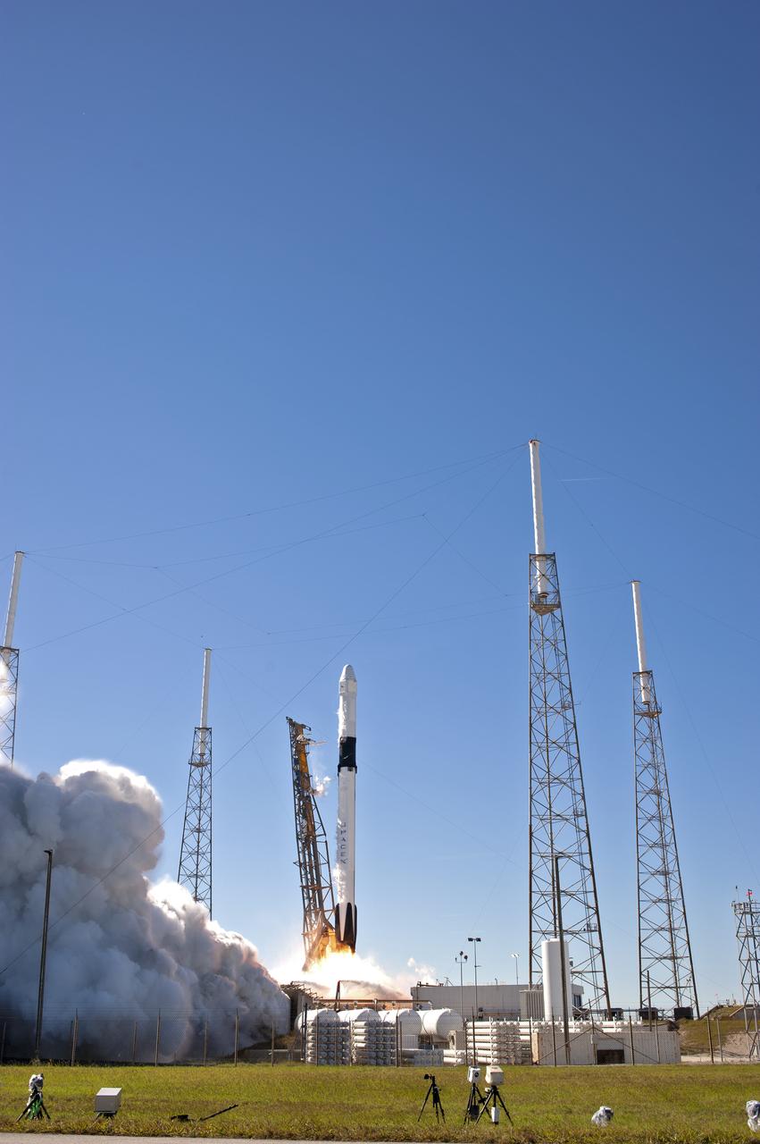
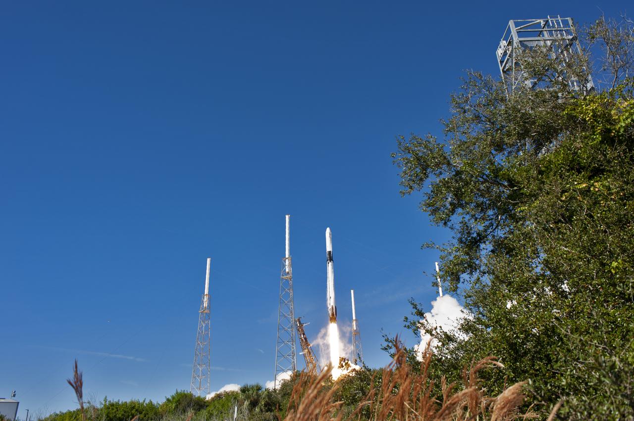
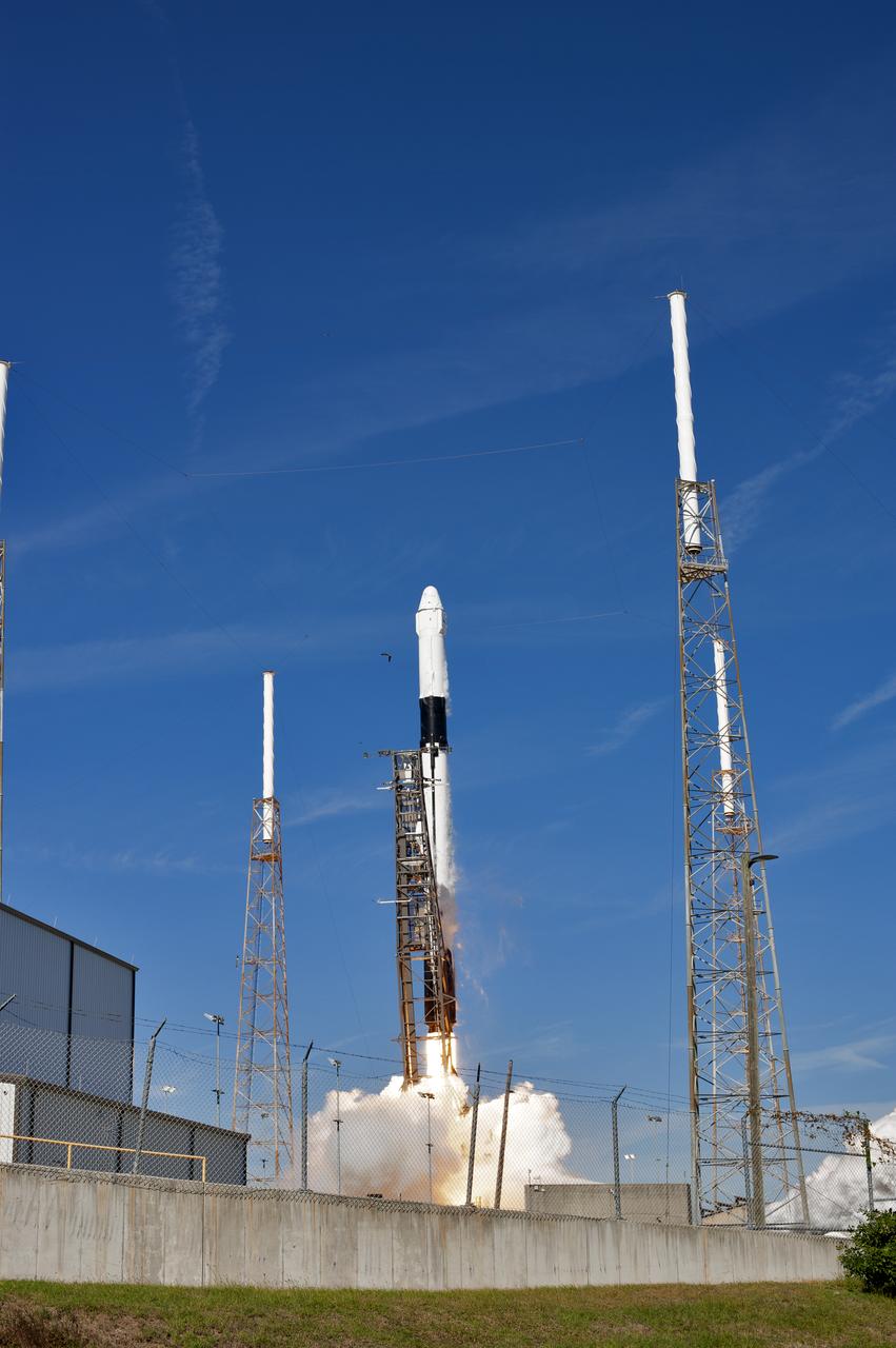
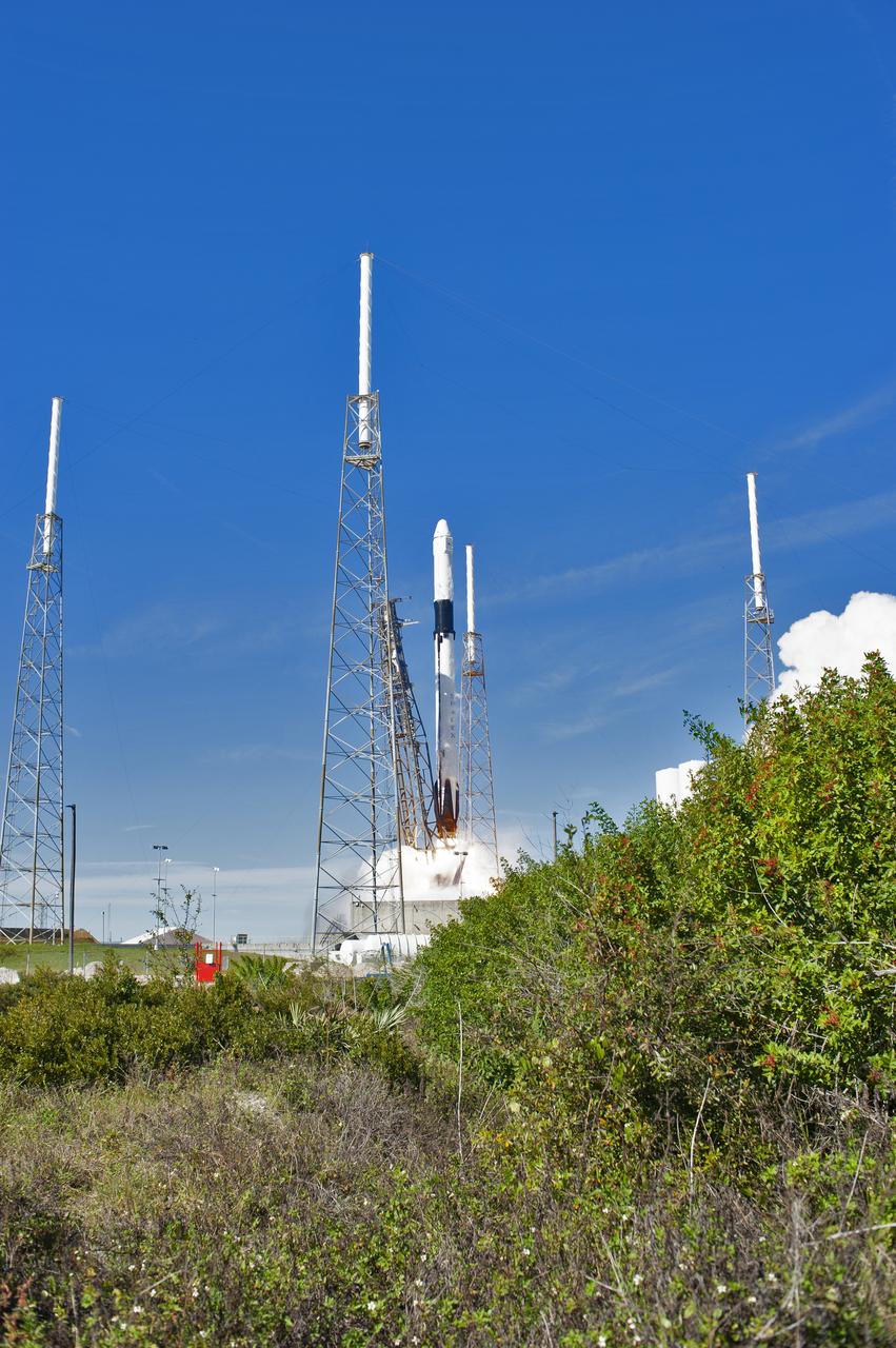
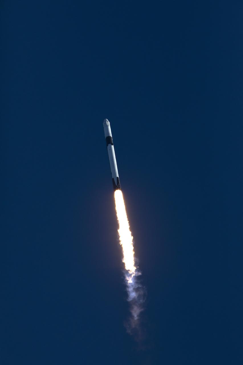
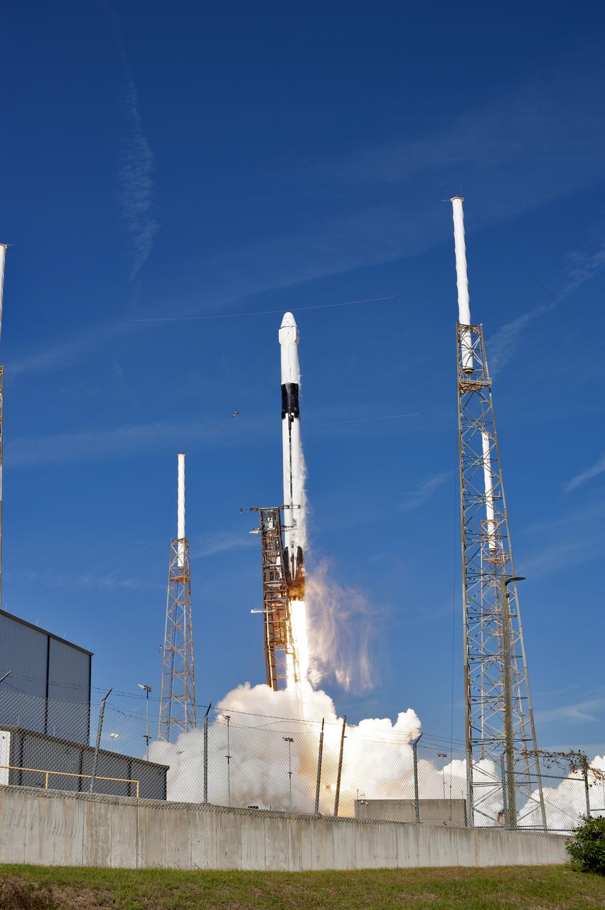
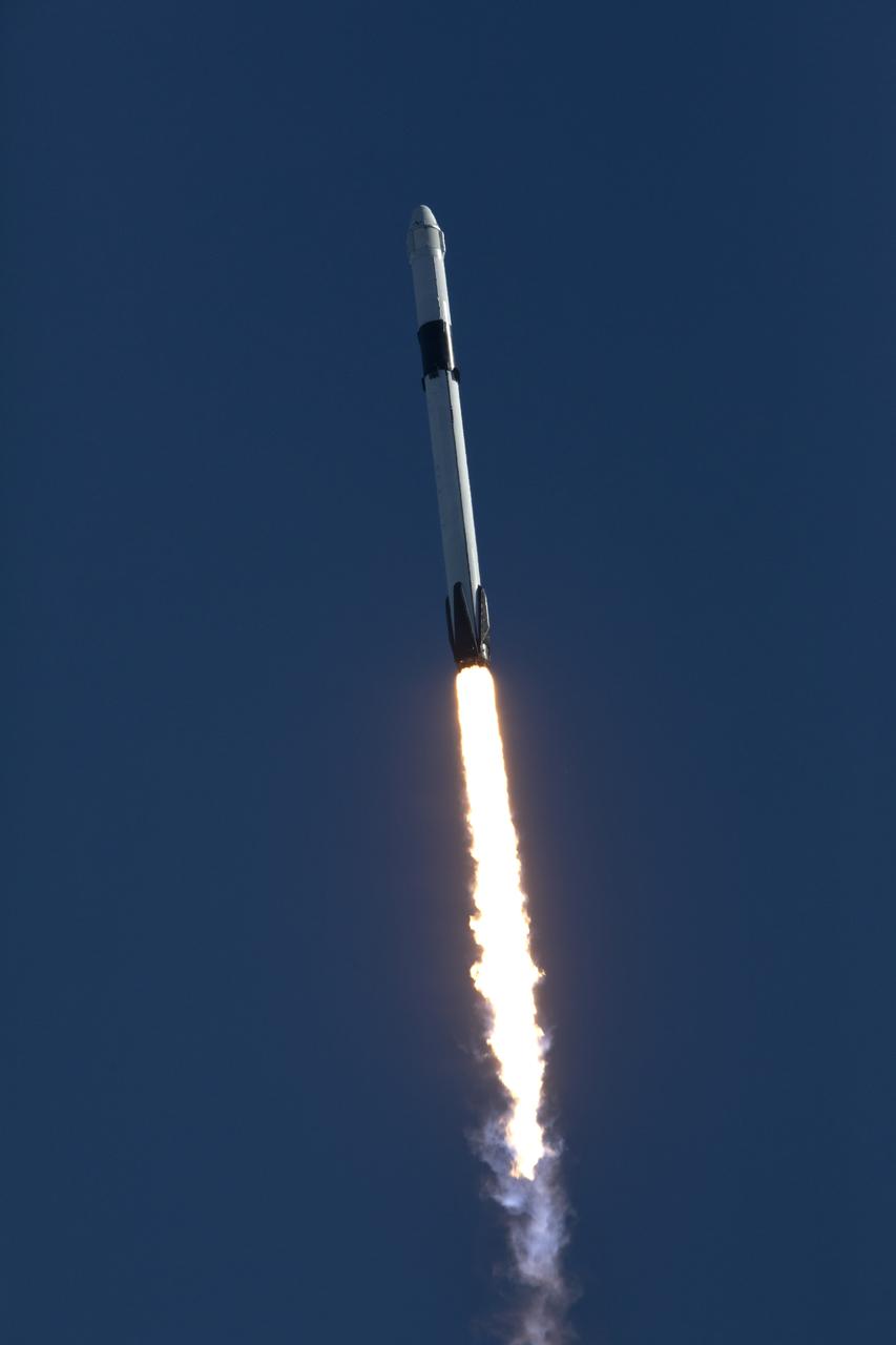
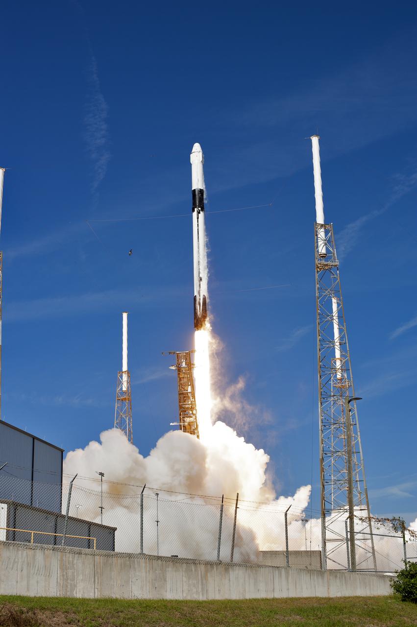
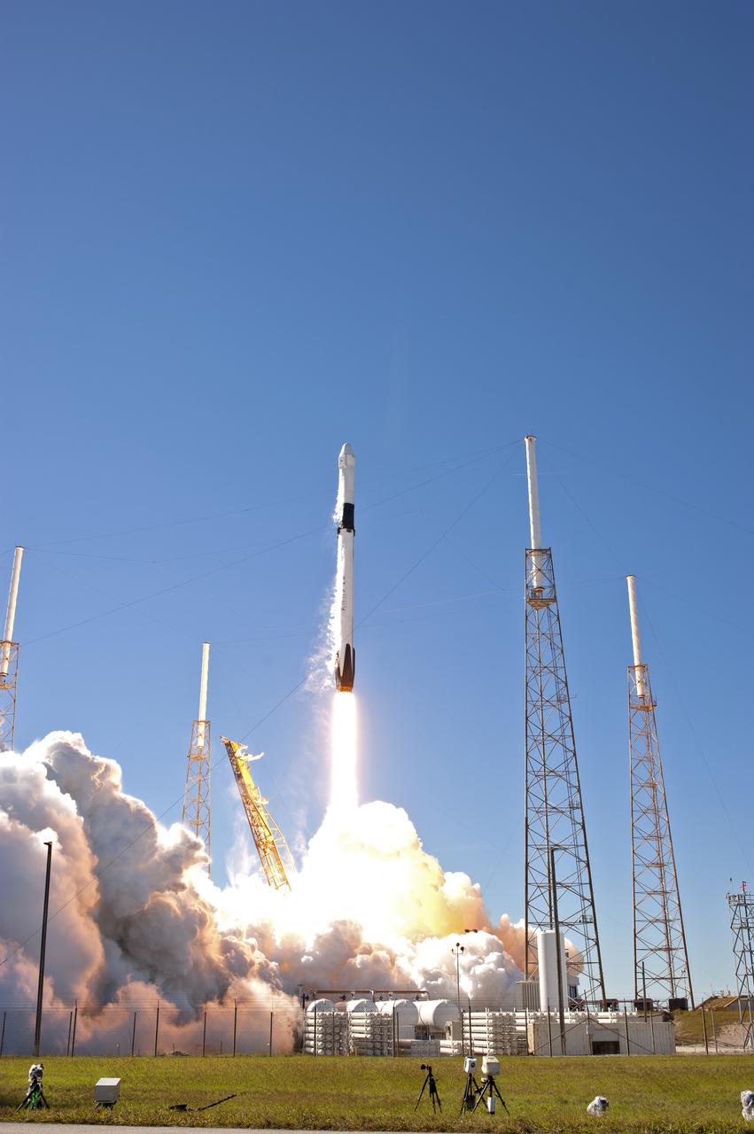
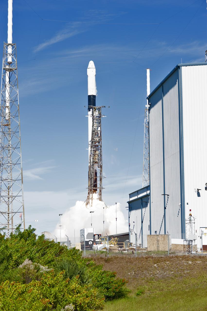
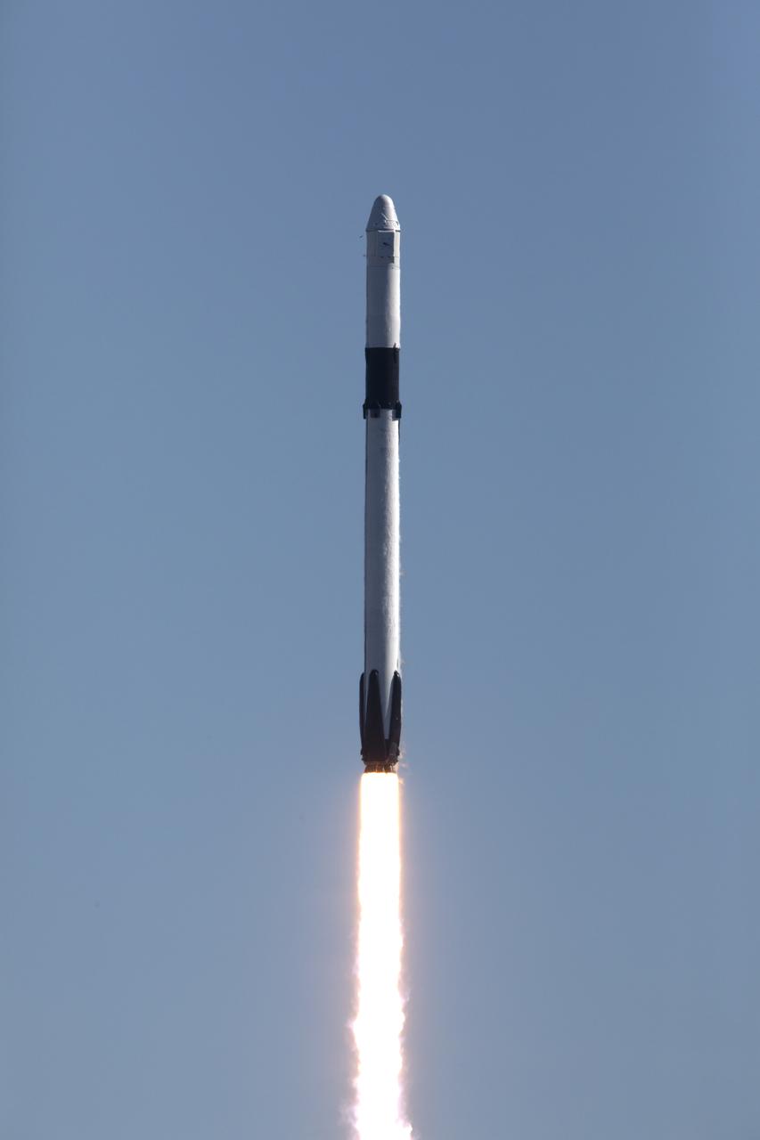
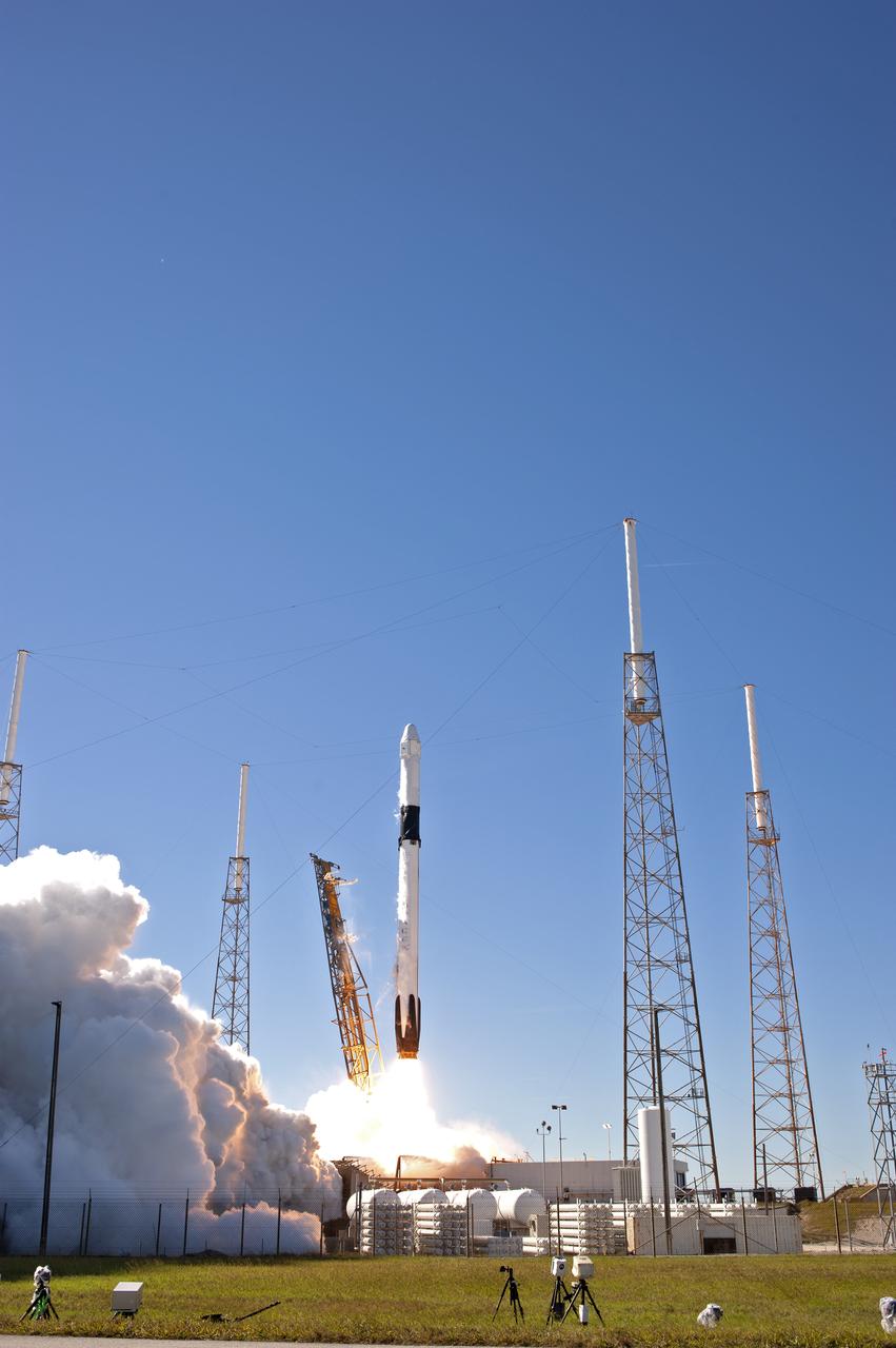
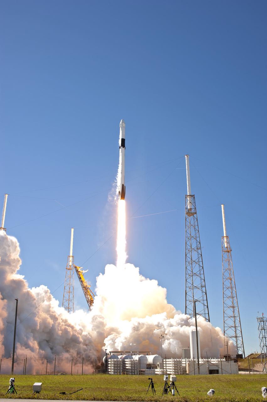
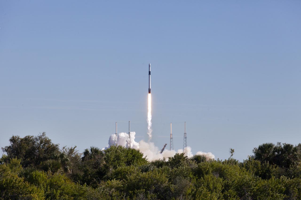
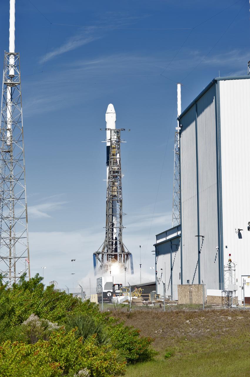
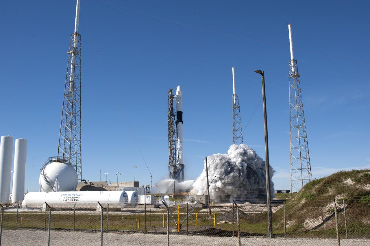
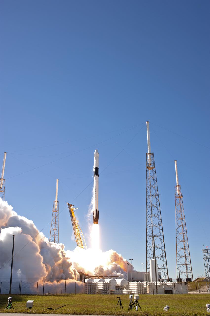
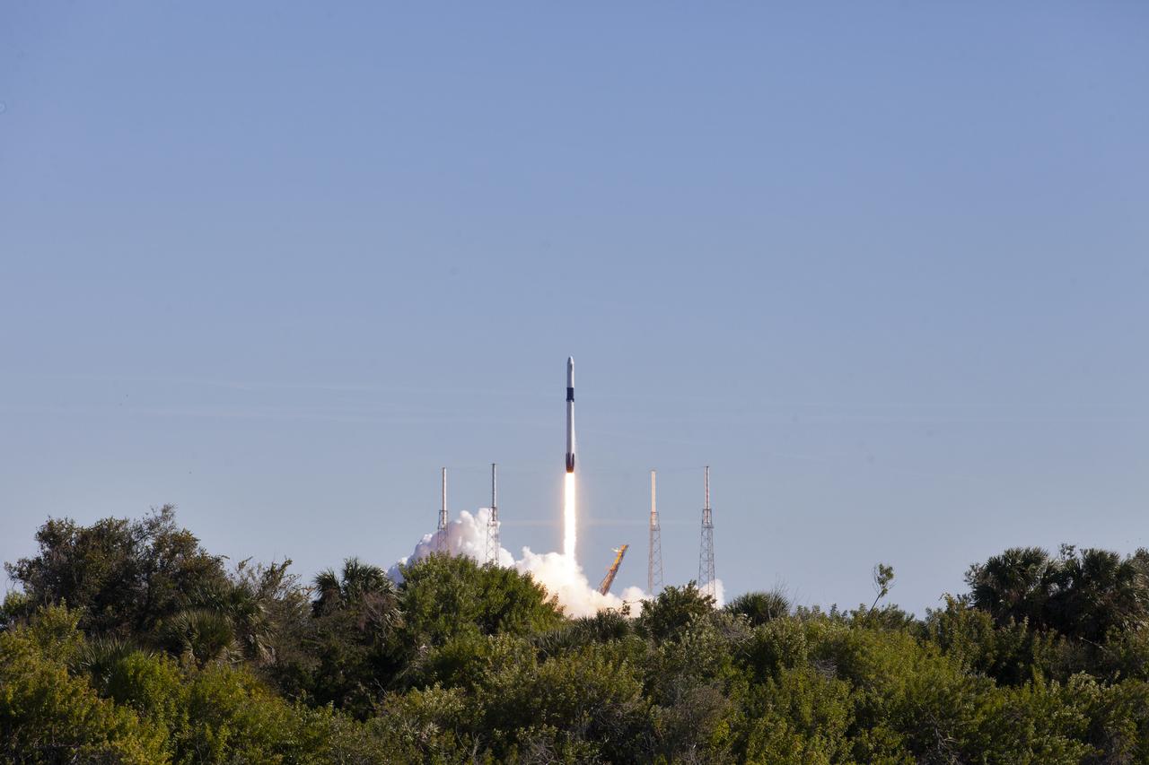
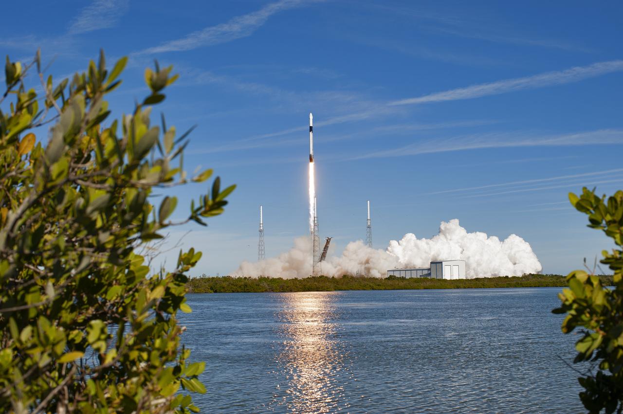
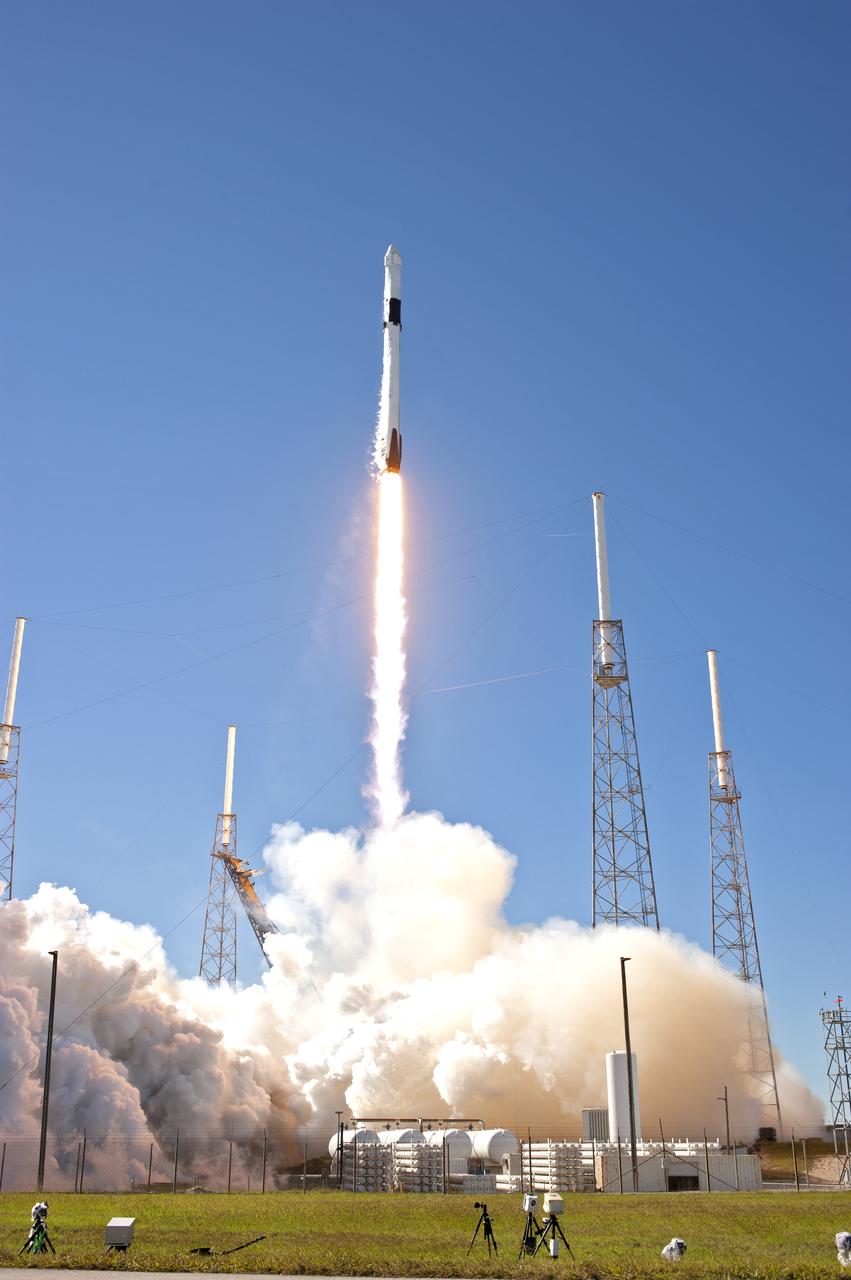
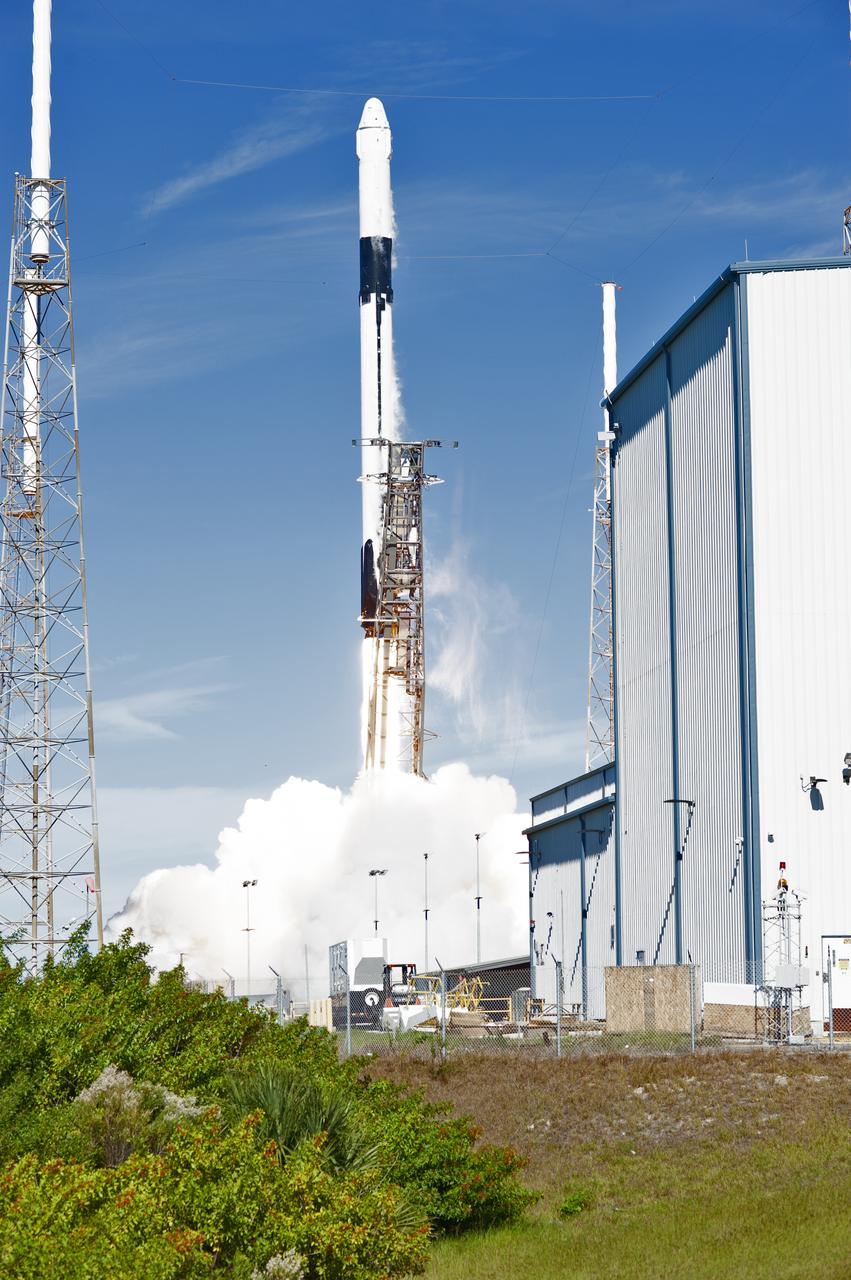
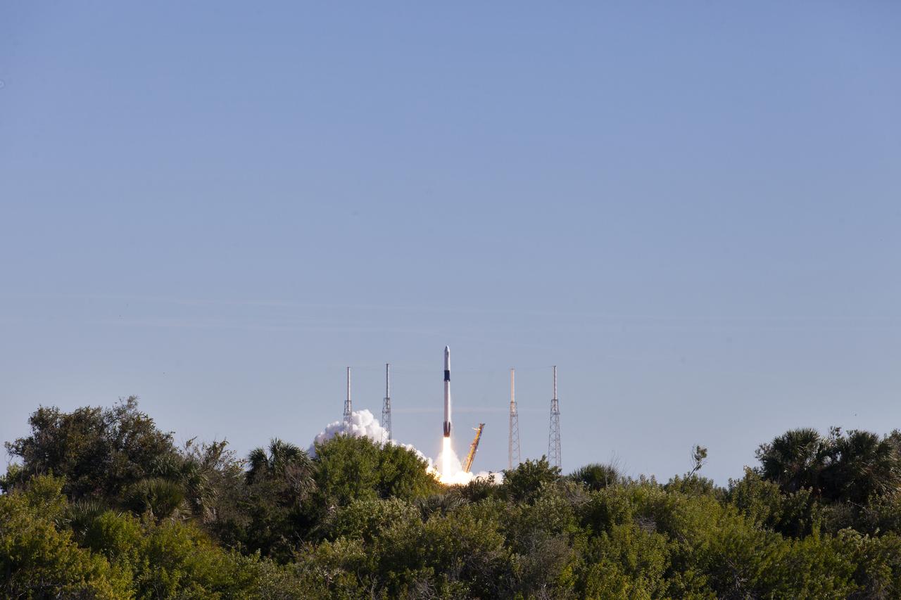
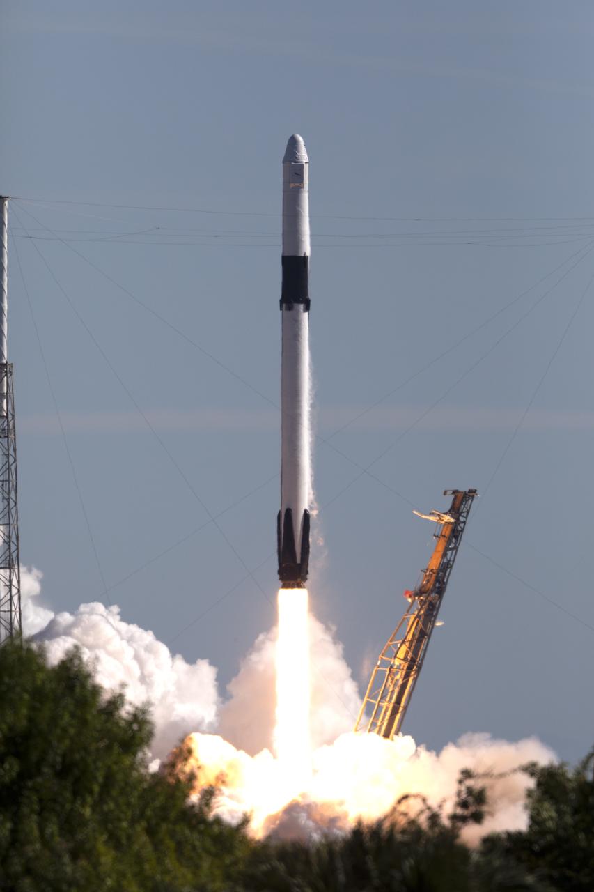
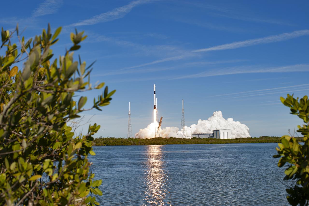
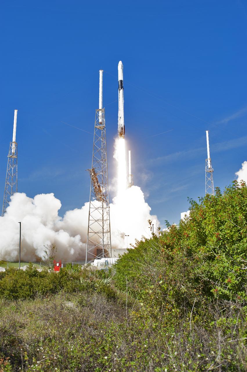
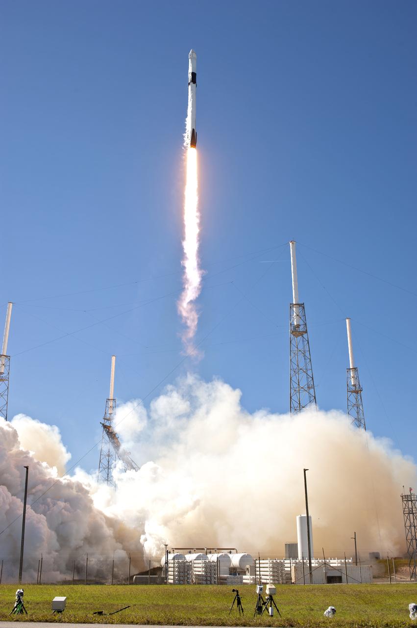
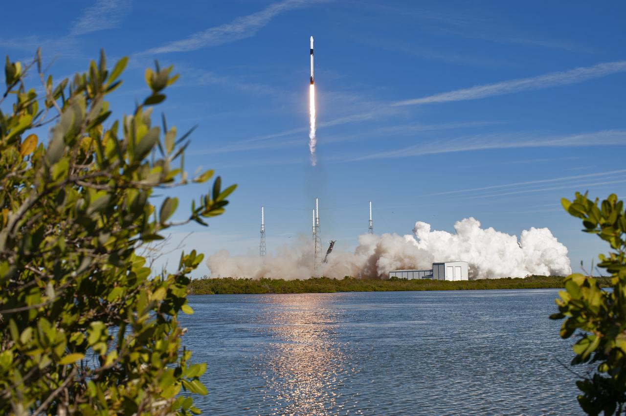
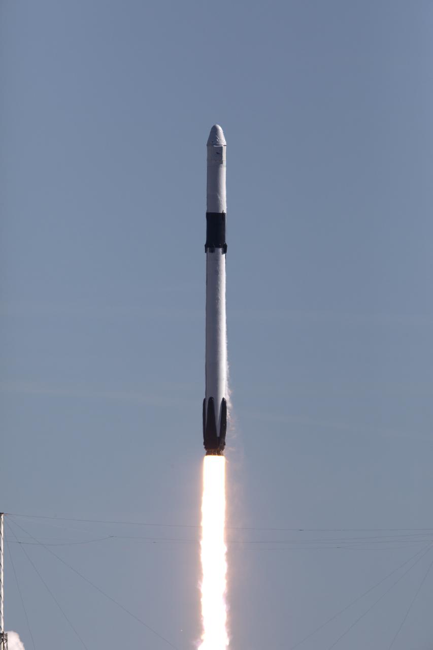
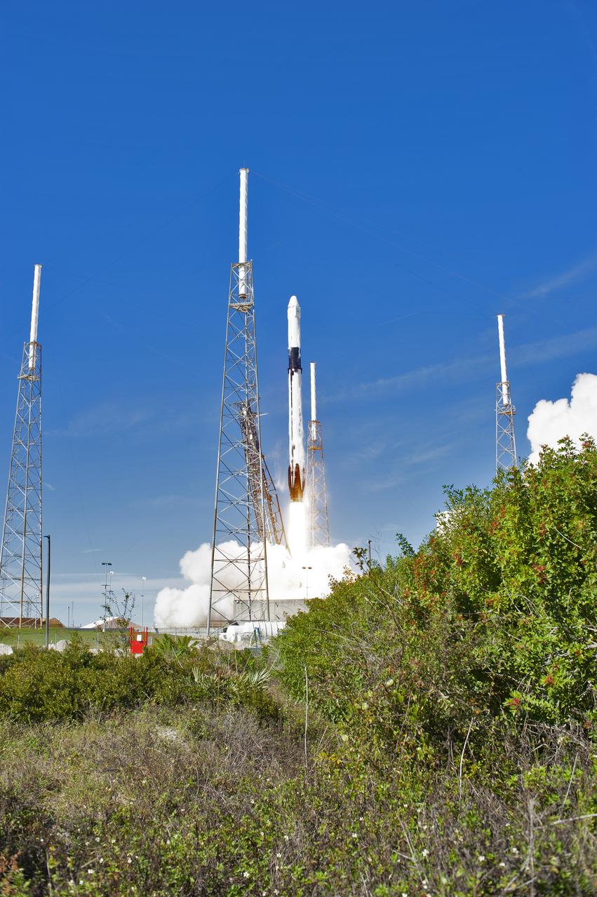
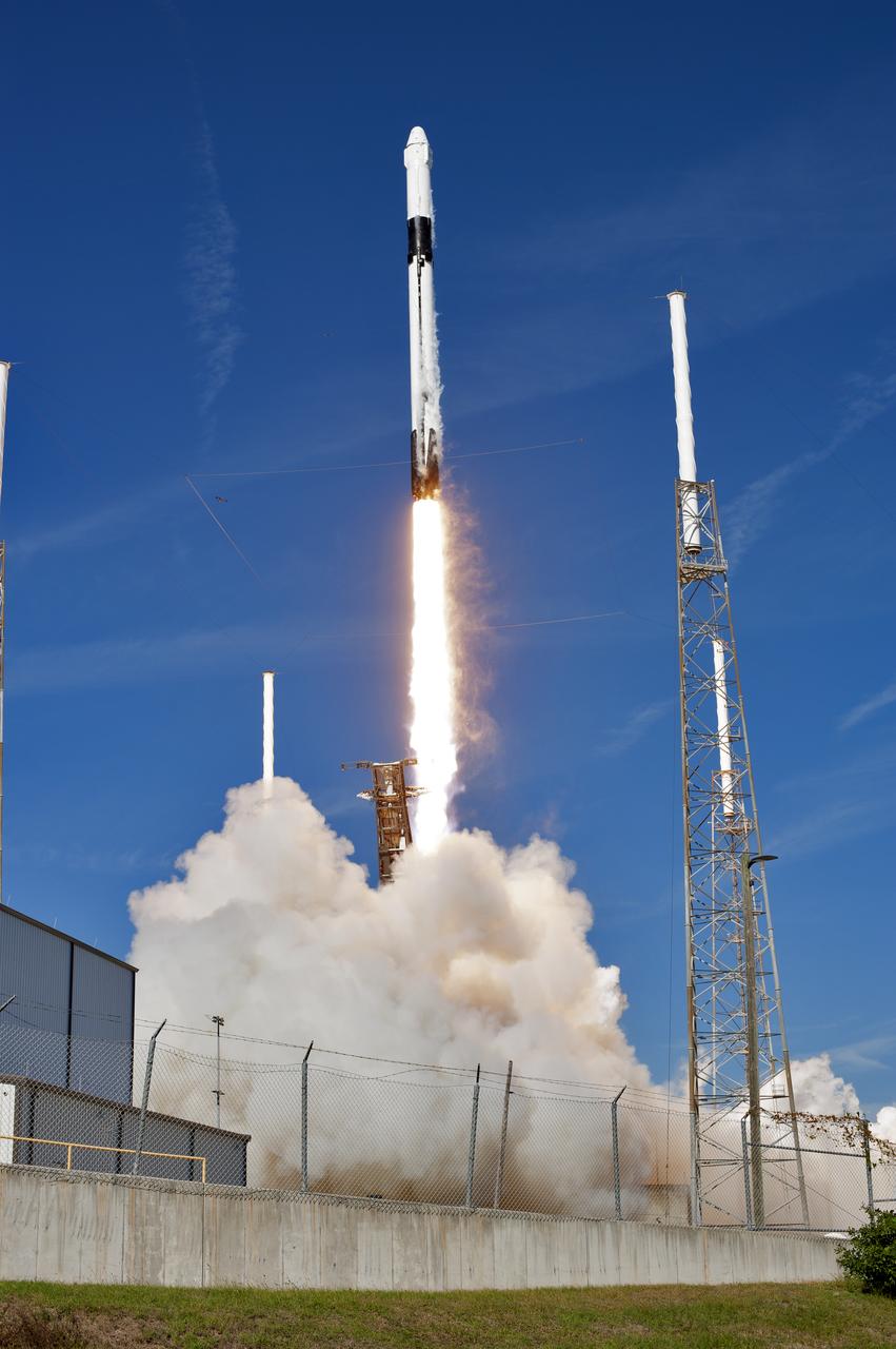
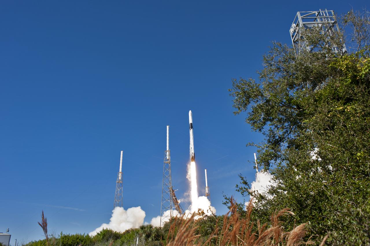
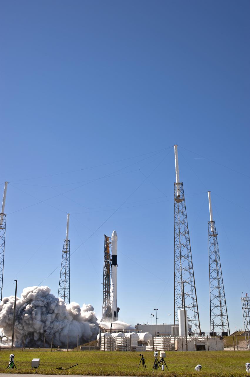
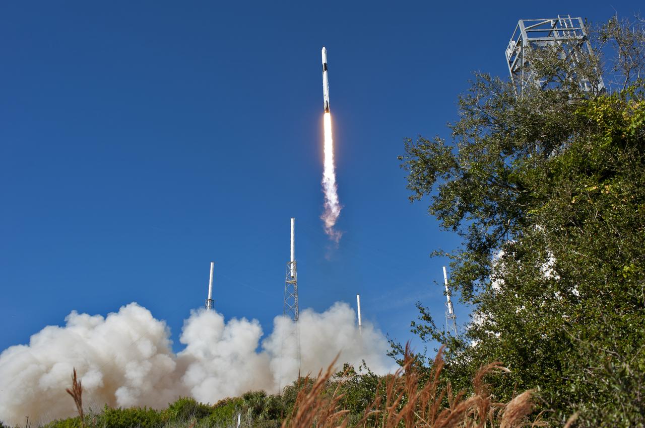
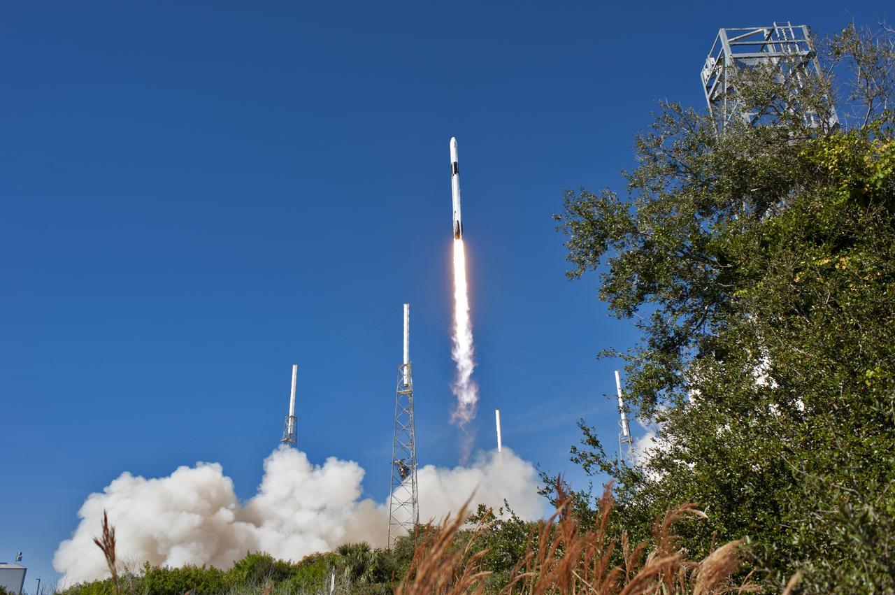
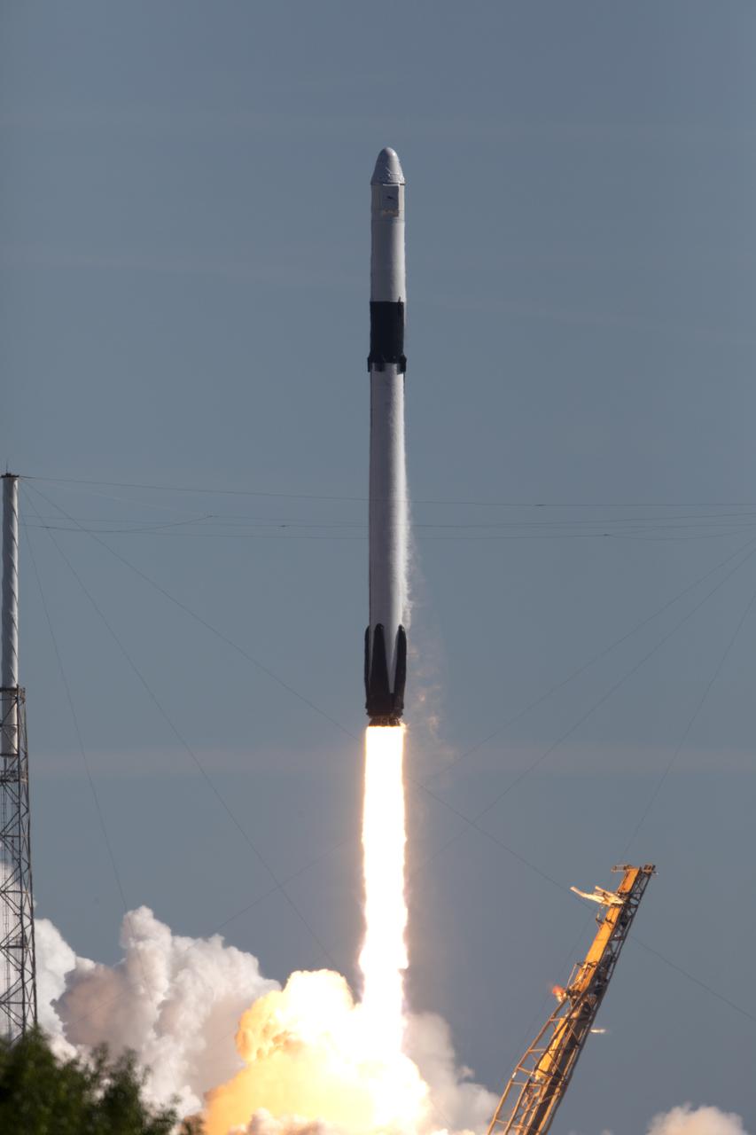
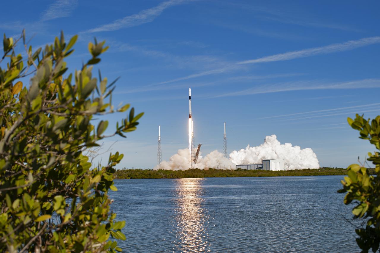
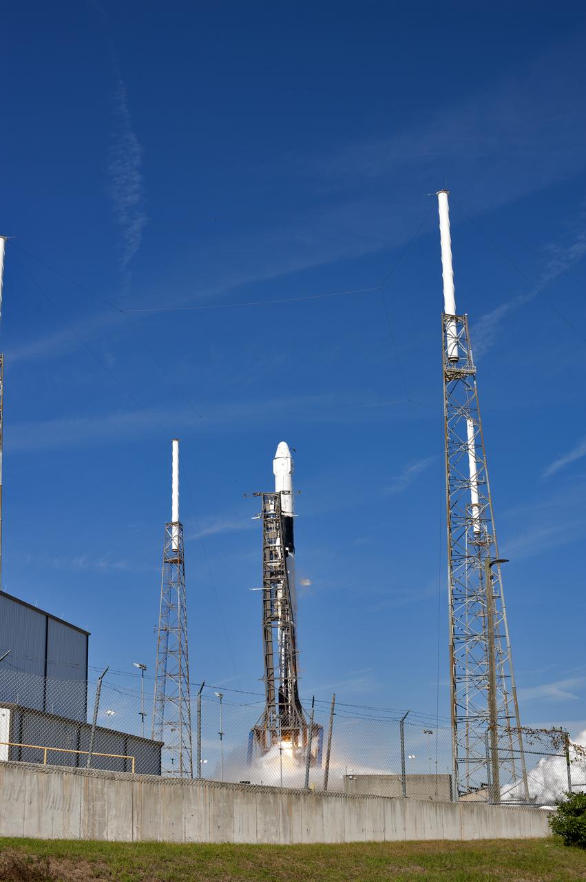
The two-stage Falcon 9 launch vehicle lifts off Space Launch Complex 40 at Cape Canaveral Air Force Station carrying the SpaceX’s Dragon resupply spacecraft to the International Space Station. Liftoff was at 1:16 p.m. EST, Dec. 5, 2018. On its 16th commercial resupply services mission to the space station, Dragon will deliver several science investigations to the space station, including the Global Ecosystem Dynamics Investigation lidar (GEDI). GEDI will provide high-quality laser ranging observations of the Earth’s forests and topography required to advance the understanding of important carbon and water cycling processes, biodiversity and habitat.
The two-stage Falcon 9 launch vehicle lifts off Space Launch Complex 40 at Cape Canaveral Air Force Station carrying the SpaceX’s Dragon resupply spacecraft to the International Space Station. Liftoff was at 1:16 p.m. EST, Dec. 5, 2018. On its 16th commercial resupply services mission to the space station, Dragon will deliver several science investigations to the space station, including the Global Ecosystem Dynamics Investigation lidar (GEDI). GEDI will provide high-quality laser ranging observations of the Earth’s forests and topography required to advance the understanding of important carbon and water cycling processes, biodiversity and habitat.
The two-stage Falcon 9 launch vehicle lifts off Space Launch Complex 40 at Cape Canaveral Air Force Station carrying the SpaceX’s Dragon resupply spacecraft to the International Space Station. Liftoff was at 1:16 p.m. EST, Dec. 5, 2018. On its 16th commercial resupply services mission to the space station, Dragon will deliver several science investigations to the space station, including the Global Ecosystem Dynamics Investigation lidar (GEDI). GEDI will provide high-quality laser ranging observations of the Earth’s forests and topography required to advance the understanding of important carbon and water cycling processes, biodiversity and habitat.

The two-stage Falcon 9 launch vehicle lifts off Space Launch Complex 40 at Cape Canaveral Air Force Station carrying the SpaceX’s Dragon resupply spacecraft to the International Space Station. Liftoff was at 1:16 p.m. EST, Dec. 5, 2018. On its 16th commercial resupply services mission to the space station, Dragon will deliver several science investigations to the space station, including the Global Ecosystem Dynamics Investigation lidar (GEDI). GEDI will provide high-quality laser ranging observations of the Earth’s forests and topography required to advance the understanding of important carbon and water cycling processes, biodiversity and habitat.
The two-stage Falcon 9 launch vehicle lifts off Space Launch Complex 40 at Cape Canaveral Air Force Station carrying the SpaceX’s Dragon resupply spacecraft to the International Space Station. Liftoff was at 1:16 p.m. EST, Dec. 5, 2018. On its 16th commercial resupply services mission to the space station, Dragon will deliver several science investigations to the space station, including the Global Ecosystem Dynamics Investigation lidar (GEDI). GEDI will provide high-quality laser ranging observations of the Earth’s forests and topography required to advance the understanding of important carbon and water cycling processes, biodiversity and habitat.
The two-stage Falcon 9 launch vehicle lifts off Space Launch Complex 40 at Cape Canaveral Air Force Station carrying the SpaceX’s Dragon resupply spacecraft to the International Space Station. Liftoff was at 1:16 p.m. EST, Dec. 5, 2018. On its 16th commercial resupply services mission to the space station, Dragon will deliver several science investigations to the space station, including the Global Ecosystem Dynamics Investigation lidar (GEDI). GEDI will provide high-quality laser ranging observations of the Earth’s forests and topography required to advance the understanding of important carbon and water cycling processes, biodiversity and habitat.
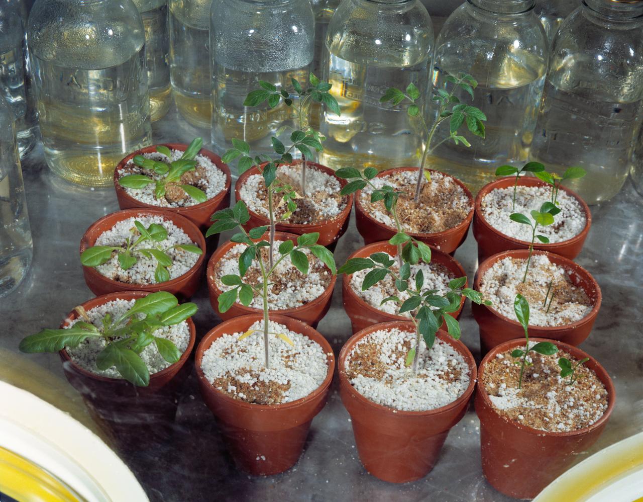
S71-51318 (1 Oct. 1971) --- A close view of germ free plants -- lettuce (left), tomato (right center and left center) and citrus (right). This type of testing is a unique effort at the Manned Spacecraft Center (MSC) to grow germ-free plants. By study of the germ-free plants, NASA and the U.S. Department of Agriculture Forest Service hope to establish clearly the exact mineral needs of the plants alone. Previous nutrition studies have measured the needs of a complex of soil:micro-organisms:plants. Results from studies where the role of microbes is not known or defined are difficult to interpret and do not lead to the accumulation of exacting facts on plant nutrition.

The two-stage Falcon 9 launch vehicle lifts off Space Launch Complex 40 at Cape Canaveral Air Force Station carrying the SpaceX’s Dragon resupply spacecraft to the International Space Station. Liftoff was at 1:16 p.m. EST, Dec. 5, 2018. On its 16th commercial resupply services mission to the space station, Dragon will deliver several science investigations to the space station, including the Global Ecosystem Dynamics Investigation lidar (GEDI). GEDI will provide high-quality laser ranging observations of the Earth’s forests and topography required to advance the understanding of important carbon and water cycling processes, biodiversity and habitat.
The two-stage Falcon 9 launch vehicle lifts off Space Launch Complex 40 at Cape Canaveral Air Force Station carrying the SpaceX’s Dragon resupply spacecraft to the International Space Station. Liftoff was at 1:16 p.m. EST, Dec. 5, 2018. On its 16th commercial resupply services mission to the space station, Dragon will deliver several science investigations to the space station, including the Global Ecosystem Dynamics Investigation lidar (GEDI). GEDI will provide high-quality laser ranging observations of the Earth’s forests and topography required to advance the understanding of important carbon and water cycling processes, biodiversity and habitat.
The two-stage Falcon 9 launch vehicle lifts off Space Launch Complex 40 at Cape Canaveral Air Force Station carrying the SpaceX’s Dragon resupply spacecraft to the International Space Station. Liftoff was at 1:16 p.m. EST, Dec. 5, 2018. On its 16th commercial resupply services mission to the space station, Dragon will deliver several science investigations to the space station, including the Global Ecosystem Dynamics Investigation lidar (GEDI). GEDI will provide high-quality laser ranging observations of the Earth’s forests and topography required to advance the understanding of important carbon and water cycling processes, biodiversity and habitat.
The two-stage Falcon 9 launch vehicle lifts off Space Launch Complex 40 at Cape Canaveral Air Force Station carrying the SpaceX’s Dragon resupply spacecraft to the International Space Station. Liftoff was at 1:16 p.m. EST, Dec. 5, 2018. On its 16th commercial resupply services mission to the space station, Dragon will deliver several science investigations to the space station, including the Global Ecosystem Dynamics Investigation lidar (GEDI). GEDI will provide high-quality laser ranging observations of the Earth’s forests and topography required to advance the understanding of important carbon and water cycling processes, biodiversity and habitat.
The two-stage Falcon 9 launch vehicle lifts off Space Launch Complex 40 at Cape Canaveral Air Force Station carrying the SpaceX’s Dragon resupply spacecraft to the International Space Station. Liftoff was at 1:16 p.m. EST, Dec. 5, 2018. On its 16th commercial resupply services mission to the space station, Dragon will deliver several science investigations to the space station, including the Global Ecosystem Dynamics Investigation lidar (GEDI). GEDI will provide high-quality laser ranging observations of the Earth’s forests and topography required to advance the understanding of important carbon and water cycling processes, biodiversity and habitat.
The two-stage Falcon 9 launch vehicle lifts off Space Launch Complex 40 at Cape Canaveral Air Force Station carrying the SpaceX’s Dragon resupply spacecraft to the International Space Station. Liftoff was at 1:16 p.m. EST, Dec. 5, 2018. On its 16th commercial resupply services mission to the space station, Dragon will deliver several science investigations to the space station, including the Global Ecosystem Dynamics Investigation lidar (GEDI). GEDI will provide high-quality laser ranging observations of the Earth’s forests and topography required to advance the understanding of important carbon and water cycling processes, biodiversity and habitat.
KENNEDY SPACE CENTER, FLA. -- Kennedy Space Center workers chat with Forest Service workers at the Hemphill site in East Texas before heading out to the field for grid searches. KSC workers are participating in the Columbia Recovery efforts at the Lufkin (Texas) Command Center, four field sites in East Texas, and the Barksdale, La., hangar site. KSC is working with representatives from other NASA Centers and with those from a number of federal, state and local agencies in the recovery effort. KSC provides vehicle technical expertise in the field to identify, collect and return Shuttle hardware to KSC.

KENNEDY SPACE CENTER, FLA. -- John Lopez of Bristol, Texas, a crew boss for a camp crew at the Nacogdoches site, looks over tents used by U.S. Forest Service workers in the field searching for parts of Columbia. Kennedy Space Center workers are participating in the Columbia Recovery efforts at the Lufkin (Texas) Command Center, four field sites in East Texas, and the Barksdale, La., hangar site. KSC is working with representatives from other NASA Centers and with those from a number of federal, state and local agencies in the recovery effort. KSC provides vehicle technical expertise in the field to identify, collect and return Shuttle hardware to KSC.
The two-stage Falcon 9 launch vehicle lifts off Space Launch Complex 40 at Cape Canaveral Air Force Station carrying the SpaceX’s Dragon resupply spacecraft to the International Space Station. Liftoff was at 1:16 p.m. EST, Dec. 5, 2018. On its 16th commercial resupply services mission to the space station, Dragon will deliver several science investigations to the space station, including the Global Ecosystem Dynamics Investigation lidar (GEDI). GEDI will provide high-quality laser ranging observations of the Earth’s forests and topography required to advance the understanding of important carbon and water cycling processes, biodiversity and habitat.
The two-stage Falcon 9 launch vehicle lifts off Space Launch Complex 40 at Cape Canaveral Air Force Station carrying the SpaceX’s Dragon resupply spacecraft to the International Space Station. Liftoff was at 1:16 p.m. EST, Dec. 5, 2018. On its 16th commercial resupply services mission to the space station, Dragon will deliver several science investigations to the space station, including the Global Ecosystem Dynamics Investigation lidar (GEDI). GEDI will provide high-quality laser ranging observations of the Earth’s forests and topography required to advance the understanding of important carbon and water cycling processes, biodiversity and habitat.
KENNEDY SPACE CENTER, FLA. -- Kennedy Space Center and Forest Service workers pose in front of a helicopter landed at the Nacogdoches field site. The helicopter is one of those being used to survey for parts of Columbia. KSC workers are participating in the Columbia Recovery efforts at the Lufkin (Texas) Command Center, four field sites in East Texas, and the Barksdale, La., hangar site. KSC is working with representatives from other NASA Centers and with those from a number of federal, state and local agencies in the recovery effort. KSC provides vehicle technical expertise in the field to identify, collect and return Shuttle hardware to KSC.
The two-stage Falcon 9 launch vehicle lifts off Space Launch Complex 40 at Cape Canaveral Air Force Station carrying the SpaceX’s Dragon resupply spacecraft to the International Space Station. Liftoff was at 1:16 p.m. EST, Dec. 5, 2018. On its 16th commercial resupply services mission to the space station, Dragon will deliver several science investigations to the space station, including the Global Ecosystem Dynamics Investigation lidar (GEDI). GEDI will provide high-quality laser ranging observations of the Earth’s forests and topography required to advance the understanding of important carbon and water cycling processes, biodiversity and habitat.
The two-stage Falcon 9 launch vehicle lifts off Space Launch Complex 40 at Cape Canaveral Air Force Station carrying the SpaceX’s Dragon resupply spacecraft to the International Space Station. Liftoff was at 1:16 p.m. EST, Dec. 5, 2018. On its 16th commercial resupply services mission to the space station, Dragon will deliver several science investigations to the space station, including the Global Ecosystem Dynamics Investigation lidar (GEDI). GEDI will provide high-quality laser ranging observations of the Earth’s forests and topography required to advance the understanding of important carbon and water cycling processes, biodiversity and habitat.
The two-stage Falcon 9 launch vehicle lifts off Space Launch Complex 40 at Cape Canaveral Air Force Station carrying the SpaceX’s Dragon resupply spacecraft to the International Space Station. Liftoff was at 1:16 p.m. EST, Dec. 5, 2018. On its 16th commercial resupply services mission to the space station, Dragon will deliver several science investigations to the space station, including the Global Ecosystem Dynamics Investigation lidar (GEDI). GEDI will provide high-quality laser ranging observations of the Earth’s forests and topography required to advance the understanding of important carbon and water cycling processes, biodiversity and habitat.
The two-stage Falcon 9 launch vehicle lifts off Space Launch Complex 40 at Cape Canaveral Air Force Station carrying the SpaceX’s Dragon resupply spacecraft to the International Space Station. Liftoff was at 1:16 p.m. EST, Dec. 5, 2018. On its 16th commercial resupply services mission to the space station, Dragon will deliver several science investigations to the space station, including the Global Ecosystem Dynamics Investigation lidar (GEDI). GEDI will provide high-quality laser ranging observations of the Earth’s forests and topography required to advance the understanding of important carbon and water cycling processes, biodiversity and habitat.
The two-stage Falcon 9 launch vehicle lifts off Space Launch Complex 40 at Cape Canaveral Air Force Station carrying the SpaceX’s Dragon resupply spacecraft to the International Space Station. Liftoff was at 1:16 p.m. EST, Dec. 5, 2018. On its 16th commercial resupply services mission to the space station, Dragon will deliver several science investigations to the space station, including the Global Ecosystem Dynamics Investigation lidar (GEDI). GEDI will provide high-quality laser ranging observations of the Earth’s forests and topography required to advance the understanding of important carbon and water cycling processes, biodiversity and habitat.
The two-stage Falcon 9 launch vehicle lifts off Space Launch Complex 40 at Cape Canaveral Air Force Station carrying the SpaceX’s Dragon resupply spacecraft to the International Space Station. Liftoff was at 1:16 p.m. EST, Dec. 5, 2018. On its 16th commercial resupply services mission to the space station, Dragon will deliver several science investigations to the space station, including the Global Ecosystem Dynamics Investigation lidar (GEDI). GEDI will provide high-quality laser ranging observations of the Earth’s forests and topography required to advance the understanding of important carbon and water cycling processes, biodiversity and habitat.
The two-stage Falcon 9 launch vehicle lifts off Space Launch Complex 40 at Cape Canaveral Air Force Station carrying the SpaceX’s Dragon resupply spacecraft to the International Space Station. Liftoff was at 1:16 p.m. EST, Dec. 5, 2018. On its 16th commercial resupply services mission to the space station, Dragon will deliver several science investigations to the space station, including the Global Ecosystem Dynamics Investigation lidar (GEDI). GEDI will provide high-quality laser ranging observations of the Earth’s forests and topography required to advance the understanding of important carbon and water cycling processes, biodiversity and habitat.
The two-stage Falcon 9 launch vehicle lifts off Space Launch Complex 40 at Cape Canaveral Air Force Station carrying the SpaceX’s Dragon resupply spacecraft to the International Space Station. Liftoff was at 1:16 p.m. EST, Dec. 5, 2018. On its 16th commercial resupply services mission to the space station, Dragon will deliver several science investigations to the space station, including the Global Ecosystem Dynamics Investigation lidar (GEDI). GEDI will provide high-quality laser ranging observations of the Earth’s forests and topography required to advance the understanding of important carbon and water cycling processes, biodiversity and habitat.
The two-stage Falcon 9 launch vehicle lifts off Space Launch Complex 40 at Cape Canaveral Air Force Station carrying the SpaceX’s Dragon resupply spacecraft to the International Space Station. Liftoff was at 1:16 p.m. EST, Dec. 5, 2018. On its 16th commercial resupply services mission to the space station, Dragon will deliver several science investigations to the space station, including the Global Ecosystem Dynamics Investigation lidar (GEDI). GEDI will provide high-quality laser ranging observations of the Earth’s forests and topography required to advance the understanding of important carbon and water cycling processes, biodiversity and habitat.
The two-stage Falcon 9 launch vehicle lifts off Space Launch Complex 40 at Cape Canaveral Air Force Station carrying the SpaceX’s Dragon resupply spacecraft to the International Space Station. Liftoff was at 1:16 p.m. EST, Dec. 5, 2018. On its 16th commercial resupply services mission to the space station, Dragon will deliver several science investigations to the space station, including the Global Ecosystem Dynamics Investigation lidar (GEDI). GEDI will provide high-quality laser ranging observations of the Earth’s forests and topography required to advance the understanding of important carbon and water cycling processes, biodiversity and habitat.
The two-stage Falcon 9 launch vehicle lifts off Space Launch Complex 40 at Cape Canaveral Air Force Station carrying the SpaceX’s Dragon resupply spacecraft to the International Space Station. Liftoff was at 1:16 p.m. EST, Dec. 5, 2018. On its 16th commercial resupply services mission to the space station, Dragon will deliver several science investigations to the space station, including the Global Ecosystem Dynamics Investigation lidar (GEDI). GEDI will provide high-quality laser ranging observations of the Earth’s forests and topography required to advance the understanding of important carbon and water cycling processes, biodiversity and habitat.
The two-stage Falcon 9 launch vehicle lifts off Space Launch Complex 40 at Cape Canaveral Air Force Station carrying the SpaceX’s Dragon resupply spacecraft to the International Space Station. Liftoff was at 1:16 p.m. EST, Dec. 5, 2018. On its 16th commercial resupply services mission to the space station, Dragon will deliver several science investigations to the space station, including the Global Ecosystem Dynamics Investigation lidar (GEDI). GEDI will provide high-quality laser ranging observations of the Earth’s forests and topography required to advance the understanding of important carbon and water cycling processes, biodiversity and habitat.
The two-stage Falcon 9 launch vehicle lifts off Space Launch Complex 40 at Cape Canaveral Air Force Station carrying the SpaceX’s Dragon resupply spacecraft to the International Space Station. Liftoff was at 1:16 p.m. EST, Dec. 5, 2018. On its 16th commercial resupply services mission to the space station, Dragon will deliver several science investigations to the space station, including the Global Ecosystem Dynamics Investigation lidar (GEDI). GEDI will provide high-quality laser ranging observations of the Earth’s forests and topography required to advance the understanding of important carbon and water cycling processes, biodiversity and habitat.
The two-stage Falcon 9 launch vehicle lifts off Space Launch Complex 40 at Cape Canaveral Air Force Station carrying the SpaceX’s Dragon resupply spacecraft to the International Space Station. Liftoff was at 1:16 p.m. EST, Dec. 5, 2018. On its 16th commercial resupply services mission to the space station, Dragon will deliver several science investigations to the space station, including the Global Ecosystem Dynamics Investigation lidar (GEDI). GEDI will provide high-quality laser ranging observations of the Earth’s forests and topography required to advance the understanding of important carbon and water cycling processes, biodiversity and habitat.
The two-stage Falcon 9 launch vehicle lifts off Space Launch Complex 40 at Cape Canaveral Air Force Station carrying the SpaceX’s Dragon resupply spacecraft to the International Space Station. Liftoff was at 1:16 p.m. EST, Dec. 5, 2018. On its 16th commercial resupply services mission to the space station, Dragon will deliver several science investigations to the space station, including the Global Ecosystem Dynamics Investigation lidar (GEDI). GEDI will provide high-quality laser ranging observations of the Earth’s forests and topography required to advance the understanding of important carbon and water cycling processes, biodiversity and habitat.
The two-stage Falcon 9 launch vehicle lifts off Space Launch Complex 40 at Cape Canaveral Air Force Station carrying the SpaceX’s Dragon resupply spacecraft to the International Space Station. Liftoff was at 1:16 p.m. EST, Dec. 5, 2018. On its 16th commercial resupply services mission to the space station, Dragon will deliver several science investigations to the space station, including the Global Ecosystem Dynamics Investigation lidar (GEDI). GEDI will provide high-quality laser ranging observations of the Earth’s forests and topography required to advance the understanding of important carbon and water cycling processes, biodiversity and habitat.
The two-stage Falcon 9 launch vehicle lifts off Space Launch Complex 40 at Cape Canaveral Air Force Station carrying the SpaceX’s Dragon resupply spacecraft to the International Space Station. Liftoff was at 1:16 p.m. EST, Dec. 5, 2018. On its 16th commercial resupply services mission to the space station, Dragon will deliver several science investigations to the space station, including the Global Ecosystem Dynamics Investigation lidar (GEDI). GEDI will provide high-quality laser ranging observations of the Earth’s forests and topography required to advance the understanding of important carbon and water cycling processes, biodiversity and habitat.
The two-stage Falcon 9 launch vehicle lifts off Space Launch Complex 40 at Cape Canaveral Air Force Station carrying the SpaceX’s Dragon resupply spacecraft to the International Space Station. Liftoff was at 1:16 p.m. EST, Dec. 5, 2018. On its 16th commercial resupply services mission to the space station, Dragon will deliver several science investigations to the space station, including the Global Ecosystem Dynamics Investigation lidar (GEDI). GEDI will provide high-quality laser ranging observations of the Earth’s forests and topography required to advance the understanding of important carbon and water cycling processes, biodiversity and habitat.
The two-stage Falcon 9 launch vehicle lifts off Space Launch Complex 40 at Cape Canaveral Air Force Station carrying the SpaceX’s Dragon resupply spacecraft to the International Space Station. Liftoff was at 1:16 p.m. EST, Dec. 5, 2018. On its 16th commercial resupply services mission to the space station, Dragon will deliver several science investigations to the space station, including the Global Ecosystem Dynamics Investigation lidar (GEDI). GEDI will provide high-quality laser ranging observations of the Earth’s forests and topography required to advance the understanding of important carbon and water cycling processes, biodiversity and habitat.
The two-stage Falcon 9 launch vehicle lifts off Space Launch Complex 40 at Cape Canaveral Air Force Station carrying the SpaceX’s Dragon resupply spacecraft to the International Space Station. Liftoff was at 1:16 p.m. EST, Dec. 5, 2018. On its 16th commercial resupply services mission to the space station, Dragon will deliver several science investigations to the space station, including the Global Ecosystem Dynamics Investigation lidar (GEDI). GEDI will provide high-quality laser ranging observations of the Earth’s forests and topography required to advance the understanding of important carbon and water cycling processes, biodiversity and habitat.
The two-stage Falcon 9 launch vehicle lifts off Space Launch Complex 40 at Cape Canaveral Air Force Station carrying the SpaceX’s Dragon resupply spacecraft to the International Space Station. Liftoff was at 1:16 p.m. EST, Dec. 5, 2018. On its 16th commercial resupply services mission to the space station, Dragon will deliver several science investigations to the space station, including the Global Ecosystem Dynamics Investigation lidar (GEDI). GEDI will provide high-quality laser ranging observations of the Earth’s forests and topography required to advance the understanding of important carbon and water cycling processes, biodiversity and habitat.

The two-stage Falcon 9 launch vehicle lifts off Space Launch Complex 40 at Cape Canaveral Air Force Station carrying the SpaceX’s Dragon resupply spacecraft to the International Space Station. Liftoff was at 1:16 p.m. EST, Dec. 5, 2018. On its 16th commercial resupply services mission to the space station, Dragon will deliver several science investigations to the space station, including the Global Ecosystem Dynamics Investigation lidar (GEDI). GEDI will provide high-quality laser ranging observations of the Earth’s forests and topography required to advance the understanding of important carbon and water cycling processes, biodiversity and habitat.
The two-stage Falcon 9 launch vehicle lifts off Space Launch Complex 40 at Cape Canaveral Air Force Station carrying the SpaceX’s Dragon resupply spacecraft to the International Space Station. Liftoff was at 1:16 p.m. EST, Dec. 5, 2018. On its 16th commercial resupply services mission to the space station, Dragon will deliver several science investigations to the space station, including the Global Ecosystem Dynamics Investigation lidar (GEDI). GEDI will provide high-quality laser ranging observations of the Earth’s forests and topography required to advance the understanding of important carbon and water cycling processes, biodiversity and habitat.
The two-stage Falcon 9 launch vehicle lifts off Space Launch Complex 40 at Cape Canaveral Air Force Station carrying the SpaceX’s Dragon resupply spacecraft to the International Space Station. Liftoff was at 1:16 p.m. EST, Dec. 5, 2018. On its 16th commercial resupply services mission to the space station, Dragon will deliver several science investigations to the space station, including the Global Ecosystem Dynamics Investigation lidar (GEDI). GEDI will provide high-quality laser ranging observations of the Earth’s forests and topography required to advance the understanding of important carbon and water cycling processes, biodiversity and habitat.
The two-stage Falcon 9 launch vehicle lifts off Space Launch Complex 40 at Cape Canaveral Air Force Station carrying the SpaceX’s Dragon resupply spacecraft to the International Space Station. Liftoff was at 1:16 p.m. EST, Dec. 5, 2018. On its 16th commercial resupply services mission to the space station, Dragon will deliver several science investigations to the space station, including the Global Ecosystem Dynamics Investigation lidar (GEDI). GEDI will provide high-quality laser ranging observations of the Earth’s forests and topography required to advance the understanding of important carbon and water cycling processes, biodiversity and habitat.
The two-stage Falcon 9 launch vehicle lifts off Space Launch Complex 40 at Cape Canaveral Air Force Station carrying the SpaceX’s Dragon resupply spacecraft to the International Space Station. Liftoff was at 1:16 p.m. EST, Dec. 5, 2018. On its 16th commercial resupply services mission to the space station, Dragon will deliver several science investigations to the space station, including the Global Ecosystem Dynamics Investigation lidar (GEDI). GEDI will provide high-quality laser ranging observations of the Earth’s forests and topography required to advance the understanding of important carbon and water cycling processes, biodiversity and habitat.
The two-stage Falcon 9 launch vehicle lifts off Space Launch Complex 40 at Cape Canaveral Air Force Station carrying the SpaceX’s Dragon resupply spacecraft to the International Space Station. Liftoff was at 1:16 p.m. EST, Dec. 5, 2018. On its 16th commercial resupply services mission to the space station, Dragon will deliver several science investigations to the space station, including the Global Ecosystem Dynamics Investigation lidar (GEDI). GEDI will provide high-quality laser ranging observations of the Earth’s forests and topography required to advance the understanding of important carbon and water cycling processes, biodiversity and habitat.
KENNEDY SPACE CENTER, FLA. -- Members of a U.S. Forest Service search team walk a grid during a Columbia Recovery search near the Hemphill site. The group is accompanied by a space program worker able to identify potential hazards of Shuttle parts. Kennedy Space Center workers are participating in the Columbia Recovery efforts at the Lufkin (Texas) Command Center, four field sites in East Texas, and the Barksdale, La., hangar site. KSC is working with representatives from other NASA Centers and with those from a number of federal, state and local agencies in the recovery effort. KSC provides vehicle technical expertise in the field to identify, collect and return Shuttle hardware to KSC.
The two-stage Falcon 9 launch vehicle lifts off Space Launch Complex 40 at Cape Canaveral Air Force Station carrying the SpaceX’s Dragon resupply spacecraft to the International Space Station. Liftoff was at 1:16 p.m. EST, Dec. 5, 2018. On its 16th commercial resupply services mission to the space station, Dragon will deliver several science investigations to the space station, including the Global Ecosystem Dynamics Investigation lidar (GEDI). GEDI will provide high-quality laser ranging observations of the Earth’s forests and topography required to advance the understanding of important carbon and water cycling processes, biodiversity and habitat.
The two-stage Falcon 9 launch vehicle lifts off Space Launch Complex 40 at Cape Canaveral Air Force Station carrying the SpaceX’s Dragon resupply spacecraft to the International Space Station. Liftoff was at 1:16 p.m. EST, Dec. 5, 2018. On its 16th commercial resupply services mission to the space station, Dragon will deliver several science investigations to the space station, including the Global Ecosystem Dynamics Investigation lidar (GEDI). GEDI will provide high-quality laser ranging observations of the Earth’s forests and topography required to advance the understanding of important carbon and water cycling processes, biodiversity and habitat.
The two-stage Falcon 9 launch vehicle lifts off Space Launch Complex 40 at Cape Canaveral Air Force Station carrying the SpaceX’s Dragon resupply spacecraft to the International Space Station. Liftoff was at 1:16 p.m. EST, Dec. 5, 2018. On its 16th commercial resupply services mission to the space station, Dragon will deliver several science investigations to the space station, including the Global Ecosystem Dynamics Investigation lidar (GEDI). GEDI will provide high-quality laser ranging observations of the Earth’s forests and topography required to advance the understanding of important carbon and water cycling processes, biodiversity and habitat.
KENNEDY SPACE CENTER, FLA. -- Members of a U.S. Forest Service search team walk a grid during a Columbia Recovery search near the Nacogdoches site. The group is accompanied by a space program worker able to identify potential hazards of Shuttle parts. Kennedy Space Center workers are participating in the Columbia Recovery efforts at the Lufkin (Texas) Command Center, four field sites in East Texas, and the Barksdale, La., hangar site. KSC is working with representatives from other NASA Centers and with those from a number of federal, state and local agencies in the recovery effort. KSC provides vehicle technical expertise in the field to identify, collect and return Shuttle hardware to KSC.
The two-stage Falcon 9 launch vehicle lifts off Space Launch Complex 40 at Cape Canaveral Air Force Station carrying the SpaceX’s Dragon resupply spacecraft to the International Space Station. Liftoff was at 1:16 p.m. EST, Dec. 5, 2018. On its 16th commercial resupply services mission to the space station, Dragon will deliver several science investigations to the space station, including the Global Ecosystem Dynamics Investigation lidar (GEDI). GEDI will provide high-quality laser ranging observations of the Earth’s forests and topography required to advance the understanding of important carbon and water cycling processes, biodiversity and habitat.
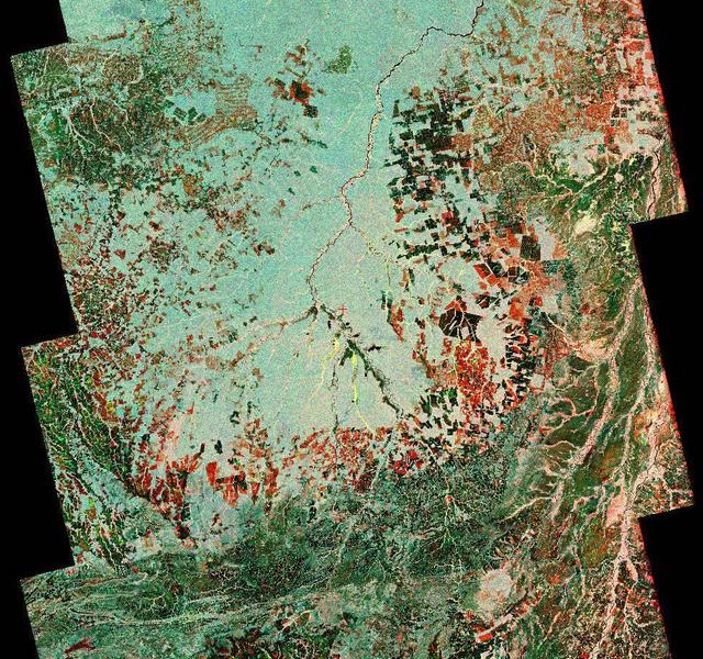
To show the kind of imagery that data from the NISAR (NASA-ISRO Synthetic Aperture Radar) satellite mission will produce, researchers pointed to this composite image of a portion of the so-called "arc of deforestation," a region on the southeast edge of the Amazonian jungle in Brazil where forests are being cleared at a fast pace through human activity. This three-color image shows change to the land cover in the Xingu River basin between 1996 (red) and 2007 (blue/green), using data from the Japanese L-band SAR satellites JERS-1 and ALOS-1, respectively. Black indicates areas converted from rainforest to agricultural land prior to 1996, and red shows the additional areas that had been cleared by 2007. NISAR will offer detailed insights into how the planet's forest ecosystems are changing over time, which will help researchers understand regional and global dynamics of deforestation and study the role of wooded areas in the global carbon cycle. NISAR could also help improve accounting of forest loss and growth, as countries that rely on logging try to shift toward more sustainable practices. NISAR is a joint mission of the U.S. and Indian space agencies. When in orbit, its sophisticated L- and S-band radar systems will scan nearly all of Earth's land and ice surfaces twice every 12 days with exquisite precision. Scheduled to launch in early 2024, NISAR is an equal collaboration between NASA and the Indian Space Research Organisation and marks the first time the two agencies have cooperated on hardware development for an Earth-observing mission. NASA's Jet Propulsion Laboratory, which is managed for the agency by Caltech in Pasadena, leads the U.S. component of the project and is providing the mission's L-band SAR. NASA is also providing the radar reflector antenna, the deployable boom, a high-rate communication subsystem for science data, GPS receivers, a solid-state recorder, and payload data subsystem. ISRO's U R Rao Satellite Centre in Bengaluru, which is leading the ISRO component of the mission, is providing the spacecraft bus, the S-band SAR electronics, the launch vehicle, and associated launch services and satellite mission operations. https://photojournal.jpl.nasa.gov/catalog/PIA26111
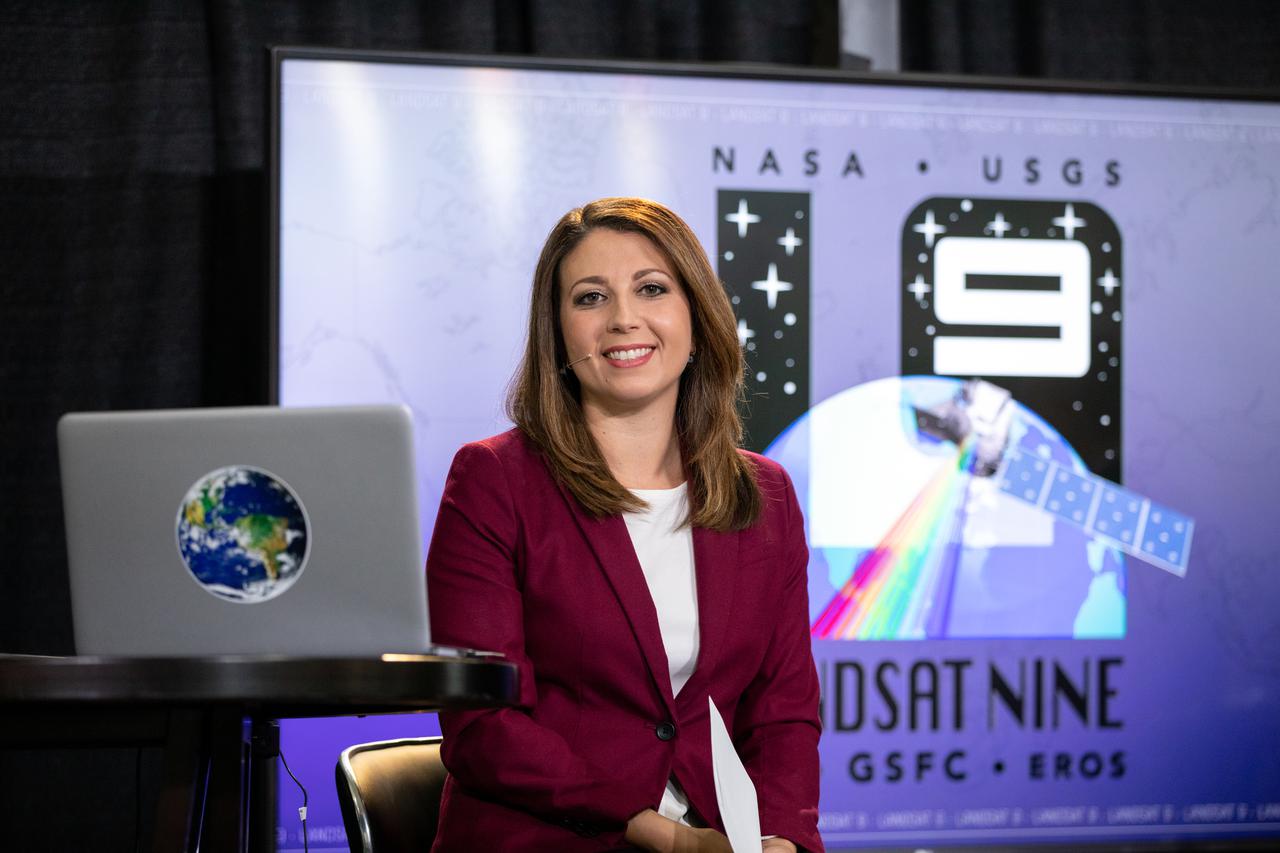
Marie Lewis, NASA Communications, moderates a prelaunch news conference for NASA’s Landsat 9 mission at Vandenberg Space Force Base in California on Saturday, Sept. 25, 2021. Participants include Thomas Zurbuchen, associate administrator, NASA’s Science Mission Directorate; Karen St. Germain, director, NASA’s Earth Science Division; Tanya Trujillo, assistant secretary for water and science, U.S. Department of the Interior; Michael Egan, Landsat program executive, NASA’s Earth Science Division; Tim Dunn, launch director, NASA’s Launch Services Program; Scott Messer, United Launch Alliance program manager, NASA Launch Services Program; and Capt. Addison Nichols, weather officer, Space Launch Delta 30. Landsat 9 is scheduled to launch at 2:12 p.m. EDT (11:12 a.m. PDT) on Monday, Sept. 27, on a United Launch Alliance Atlas V 401 rocket from Space Launch Complex 3 at Vandenberg. The launch is managed by NASA’s Launch Services Program, based at the agency’s Kennedy Space Center in Florida. Landsat 9 will join its sister satellite, Landsat 8, in orbit in collecting images from across the planet every eight days. This calibrated data will continue the Landsat program’s critical role in monitoring the health of Earth and helping people manage essential resources, including crops, irrigation water, and forests.
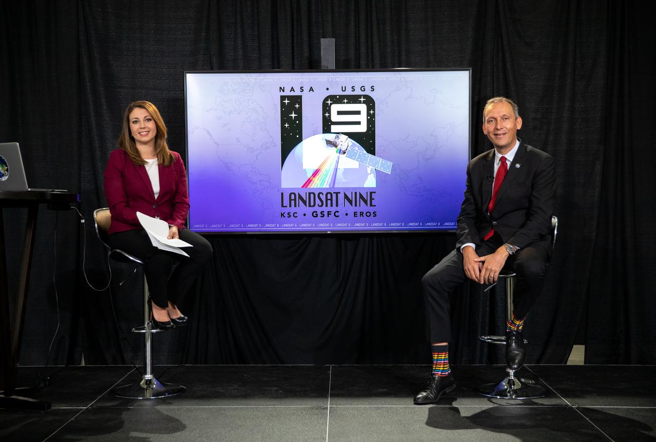
From left, Marie Lewis, NASA Communications; and Thomas Zurbuchen, associate administrator, NASA’s Science Mission Directorate, speak to members of the news media during a prelaunch news conference for NASA’s Landsat 9 mission at Vandenberg Space Force Station in California on Sept. 25, 2021. Landsat 9 is scheduled to launch at 2:12 p.m. EDT (11:12 a.m. PDT) on Monday, Sept. 27, on a United Launch Alliance Atlas V 401 rocket from Space Launch Complex 3 at Vandenberg. The launch is managed by NASA’s Launch Services Program, based at the agency’s Kennedy Space Center in Florida. Landsat 9 will join its sister satellite, Landsat 8, in orbit in collecting images from across the planet every eight days. This calibrated data will continue the Landsat program’s critical role in monitoring the health of Earth and helping people manage essential resources, including crops, irrigation water, and forests.
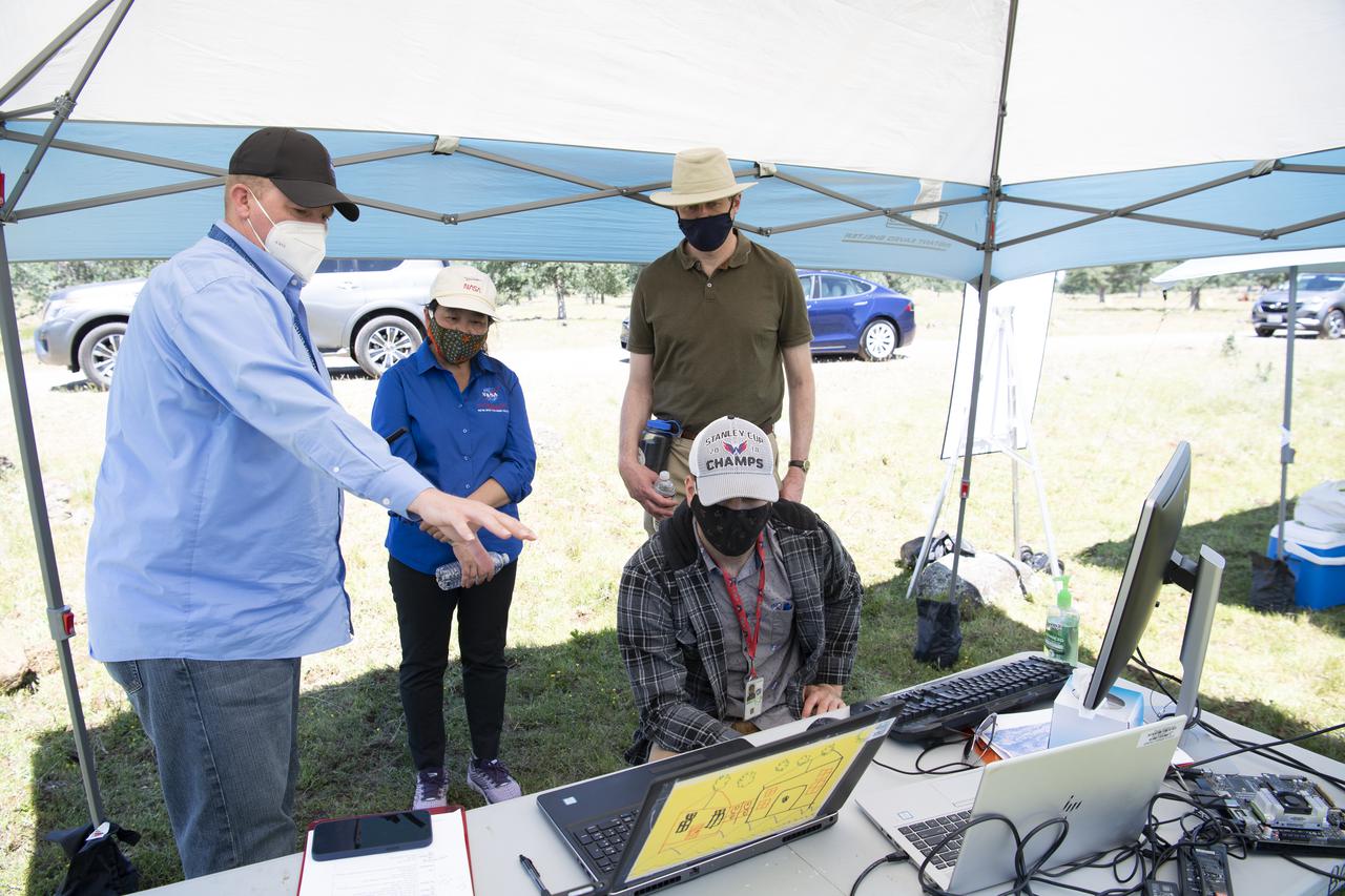
Robert McSwain, co-principle investigator and autonomy researcher for STEReO, the Scalable Traffic Management for Emergency Response Operations project, at NASA's Langley Research Center, left, speaks with Huy Tran, director of aeronautics at NASA's Ames Research Center, center, and Richard Barhydt, station director of the U.S. Forest Service's Pacific Southwest Research Station, right, during STEReO test activities, Tuesday, May 4, 2021 as Cal Fire conducts aerial fire fighting training exercises near Redding, California. STEReO, the Scalable Traffic Management for Emergency Response Operations project, led by NASA’s Ames Research Center, builds on NASA’s expertise in air traffic management, human factors research, and autonomous technology development to apply the agency’s work in Unmanned Aircraft Systems Traffic Management, or UTM, to public safety uses. Photo Credit: (NASA/Joel Kowsky)
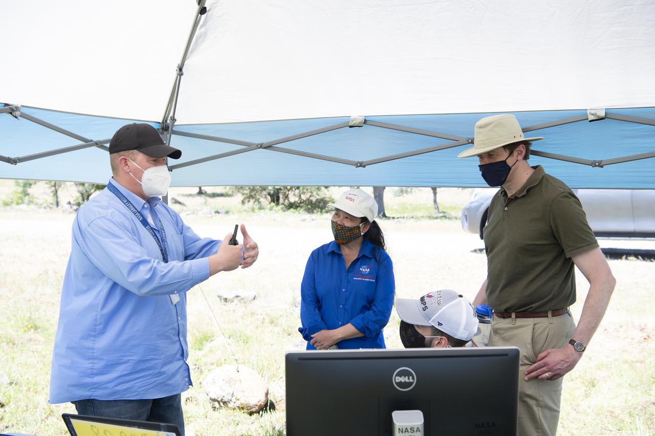
Robert McSwain, co-principle investigator and autonomy researcher for STEReO, the Scalable Traffic Management for Emergency Response Operations project, at NASA's Langley Research Center, left, speaks with Huy Tran, director of aeronautics at NASA's Ames Research Center, center, and Richard Barhydt, station director of the U.S. Forest Service's Pacific Southwest Research Station, right, during STEReO test activities, Tuesday, May 4, 2021 as Cal Fire conducts aerial fire fighting training exercises near Redding, California. STEReO, the Scalable Traffic Management for Emergency Response Operations project, led by NASA’s Ames Research Center, builds on NASA’s expertise in air traffic management, human factors research, and autonomous technology development to apply the agency’s work in Unmanned Aircraft Systems Traffic Management, or UTM, to public safety uses. Photo Credit: (NASA/Joel Kowsky)

Joey Mercer, principle investigator for STEReO, the Scalable Traffic Management for Emergency Response Operations project, at NASA's Ames Research Center speaks with Richard Barhydt, station director of the U.S. Forest Service's Pacific Southwest Research Station and Huy Tran, director of aeronautics at NASA's Ames Research Center, during STEReO test activities, Tuesday, May 4, 2021 as Cal Fire conducts aerial fire fighting training exercises near Redding, California. STEReO, the Scalable Traffic Management for Emergency Response Operations project, led by NASA’s Ames Research Center, builds on NASA’s expertise in air traffic management, human factors research, and autonomous technology development to apply the agency’s work in Unmanned Aircraft Systems Traffic Management, or UTM, to public safety uses. Photo Credit: (NASA/Joel Kowsky)
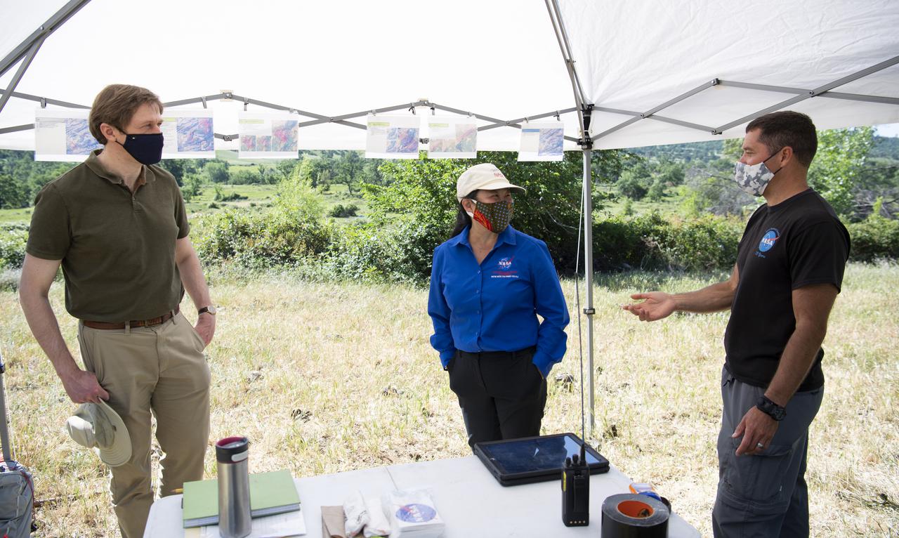
Joey Mercer, principle investigator for STEReO, the Scalable Traffic Management for Emergency Response Operations project, at NASA's Ames Research Center, right, speaks with Richard Barhydt, station director of the U.S. Forest Service's Pacific Southwest Research Station, left, and Huy Tran, director of aeronautics at NASA's Ames Research Center, center, during STEReO test activities, Tuesday, May 4, 2021 as Cal Fire conducts aerial fire fighting training exercises near Redding, California. STEReO, the Scalable Traffic Management for Emergency Response Operations project, led by NASA’s Ames Research Center, builds on NASA’s expertise in air traffic management, human factors research, and autonomous technology development to apply the agency’s work in Unmanned Aircraft Systems Traffic Management, or UTM, to public safety uses. Photo Credit: (NASA/Joel Kowsky)
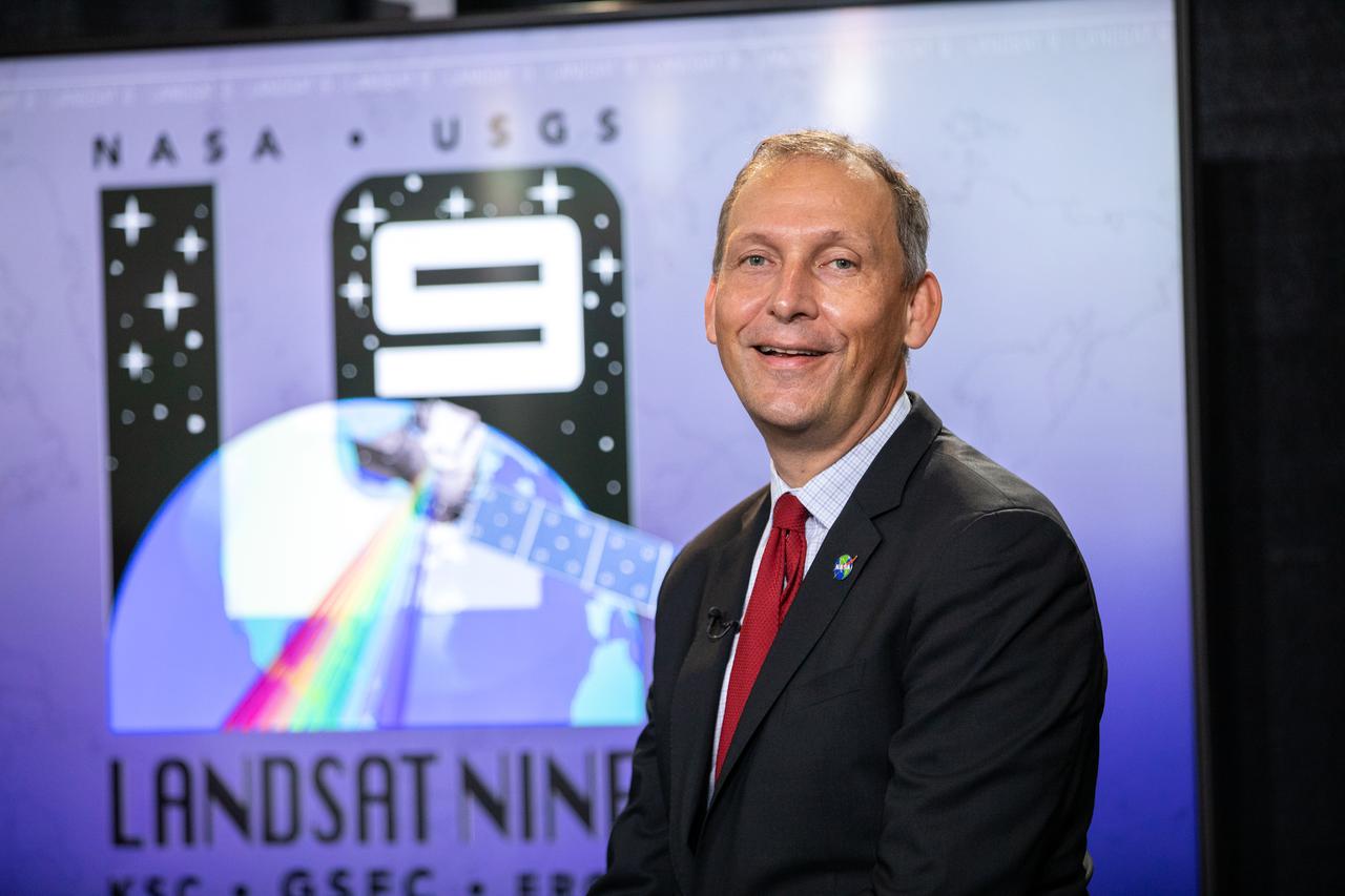
Thomas Zurbuchen, associate administrator, NASA’s Science Mission Directorate, answers questions during a prelaunch news conference for NASA’s Landsat 9 mission at Vandenberg Space Force Station in California on Sept. 25, 2021. Landsat 9 is scheduled to launch at 2:11 p.m. EDT (11:11 a.m. PDT) on Monday, Sept. 27, on a United Launch Alliance Atlas V 401 rocket from Space Launch Complex 3 at Vandenberg. The launch is managed by NASA’s Launch Services Program, based at the agency’s Kennedy Space Center in Florida. Landsat 9 will join its sister satellite, Landsat 8, in orbit in collecting images from across the planet every eight days. This calibrated data will continue the Landsat program’s critical role in monitoring the health of Earth and helping people manage essential resources, including crops, irrigation water, and forests.
Lauren Claudatos, researcher for STEReO, the Scalable Traffic Management for Emergency Response Operations project, at NASA's Ames Research Center, right, speaks with Richard Barhydt, station director of the U.S. Forest Service's Pacific Southwest Research Station, left, and Huy Tran, director of aeronautics at NASA's Ames Research Center, center, during STEReO test activities, Tuesday, May 4, 2021 as Cal Fire conducts aerial fire fighting training exercises near Redding, California. STEReO, the Scalable Traffic Management for Emergency Response Operations project, led by NASA’s Ames Research Center, builds on NASA’s expertise in air traffic management, human factors research, and autonomous technology development to apply the agency’s work in Unmanned Aircraft Systems Traffic Management, or UTM, to public safety uses. Photo Credit: (NASA/Joel Kowsky)
Joey Mercer, principle investigator for STEReO, the Scalable Traffic Management for Emergency Response Operations project, at NASA's Ames Research Center , right, speaks with Richard Barhydt, station director of the U.S. Forest Service's Pacific Southwest Research Station, left, during STEReO test activities, Tuesday, May 4, 2021 as Cal Fire conducts aerial fire fighting training exercises near Redding, California. STEReO, the Scalable Traffic Management for Emergency Response Operations project, led by NASA’s Ames Research Center, builds on NASA’s expertise in air traffic management, human factors research, and autonomous technology development to apply the agency’s work in Unmanned Aircraft Systems Traffic Management, or UTM, to public safety uses. Photo Credit: (NASA/Joel Kowsky)
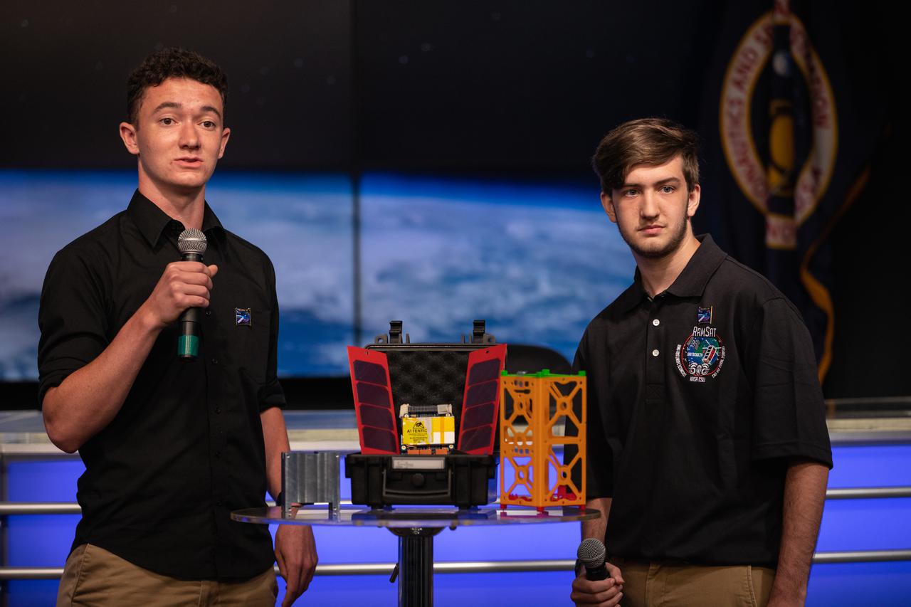
Students Joe Blair, at left, and Jonathon Bonamarte, describe a CubeSat, called RamSat, during a What’s On Board Science Briefing on June 2, 2021, at Kennedy Space Center in Florida for SpaceX’s 22nd Commercial Resupply Services Mission for NASA to the International Space Station. The small research satellite was developed by students and faculty at Robertsville Middle School in Oak Ridge, Tennessee. RamSat will observe forest regrowth in the Gatlinburg, Tennessee area which was devastated by wildfires in 2016. RamSat is the sole payload of the 36th Educational Launch of Nanosatellites (ELaNa) mission and was selected through NASA’s CubeSat Launch Initiative (CSLI). The SpaceX Falcon 9 rocket with the Dragon capsule atop is scheduled to launch at 1:29 p.m. EDT on Thursday, June 3, from the center’s Launch Complex 39A. Dragon will deliver more than 7,300 pounds of cargo and science experiments to the space station.
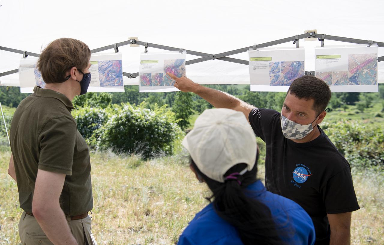
Joey Mercer, principle investigator for STEReO, the Scalable Traffic Management for Emergency Response Operations project, at NASA's Ames Research Center, right, speaks with Richard Barhydt, station director of the U.S. Forest Service's Pacific Southwest Research Station, left, and Huy Tran, director of aeronautics at NASA's Ames Research Center, center, during STEReO test activities, Tuesday, May 4, 2021 as Cal Fire conducts aerial fire fighting training exercises near Redding, California. STEReO, the Scalable Traffic Management for Emergency Response Operations project, led by NASA’s Ames Research Center, builds on NASA’s expertise in air traffic management, human factors research, and autonomous technology development to apply the agency’s work in Unmanned Aircraft Systems Traffic Management, or UTM, to public safety uses. Photo Credit: (NASA/Joel Kowsky)
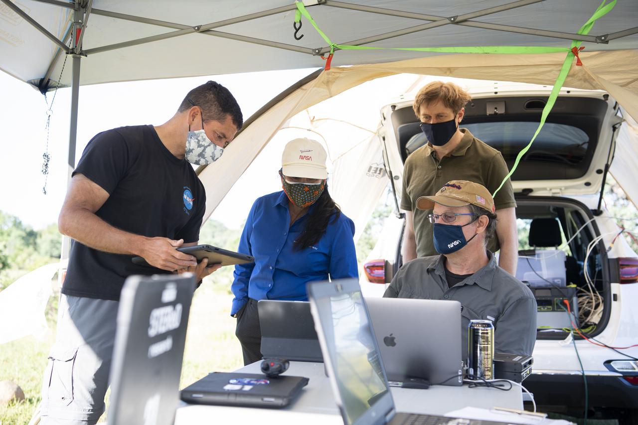
Joey Mercer, principle investigator for STEReO, the Scalable Traffic Management for Emergency Response Operations project, at NASA's Ames Research Center, left, Huy Tran, director of aeronautics at NASA's Ames Research Center, center, and Richard Barhydt, station director of the U.S. Forest Service's Pacific Southwest Research Station, standing right, speak with George Lawton, system architect for STEReO at NASA's Ames Research Center, seated right, during STEReO test activities, Tuesday, May 4, 2021 as Cal Fire conducts aerial fire fighting training exercises near Redding, California. STEReO, the Scalable Traffic Management for Emergency Response Operations project, led by NASA’s Ames Research Center, builds on NASA’s expertise in air traffic management, human factors research, and autonomous technology development to apply the agency’s work in Unmanned Aircraft Systems Traffic Management, or UTM, to public safety uses. Photo Credit: (NASA/Joel Kowsky)
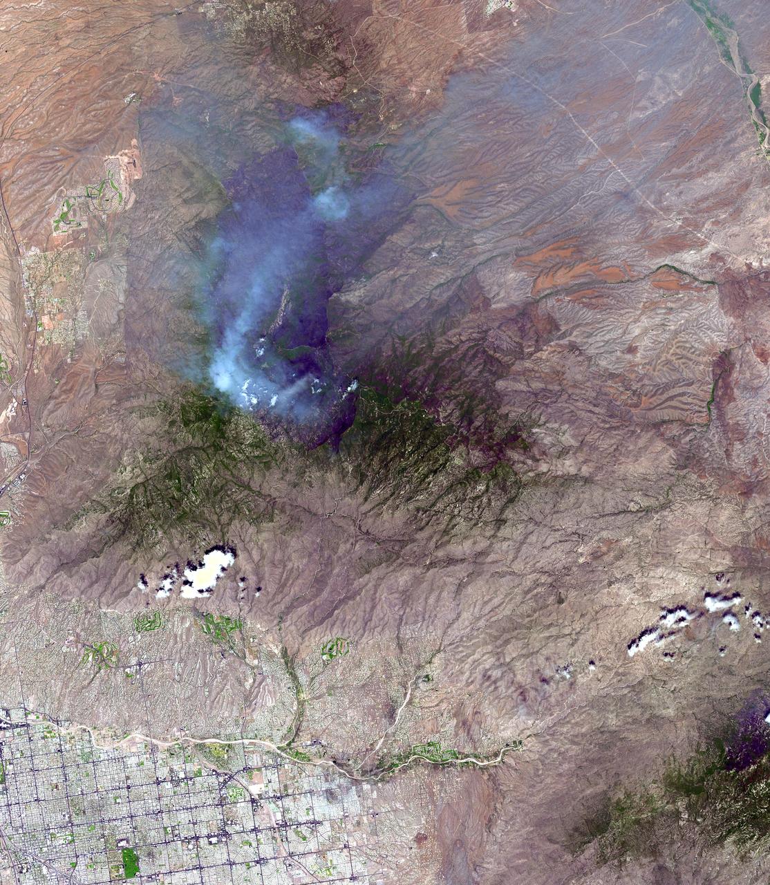
On June 26, NASA's Terra satellite acquired this image of the Aspen fire burning out of control north of Tucson, AZ. As of that date, the fire had consumed more than 27,000 acres and destroyed more than 300 homes, mostly in the resort community of Summerhaven, according to news reports. These data are being used by NASA's Wildfire Response Team and the US Forest Service to assess the intensity of the burn for future remediation efforts. This image was acquired on June 26, 2003 by the Advanced Spaceborne Thermal Emission and Reflection Radiometer (ASTER) on Terra. With its 14 spectral bands from the visible to the thermal infrared wavelength region, and its high spatial resolution of 15 to 90 meters (about 50 to 300 feet), ASTER images Earth to map and monitor the changing surface of our planet. http://photojournal.jpl.nasa.gov/catalog/PIA04602
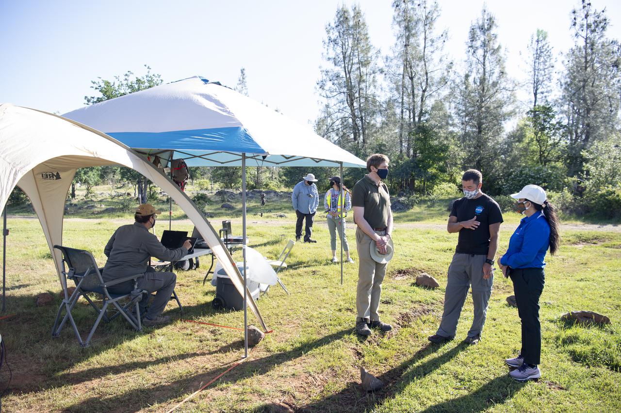
Joey Mercer, principle investigator for STEReO, the Scalable Traffic Management for Emergency Response Operations project, at NASA's Ames Research Center, center, speaks with Richard Barhydt, station director of the U.S. Forest Service's Pacific Southwest Research Station, left, and Huy Tran, director of aeronautics at NASA's Ames Research Center, right, during STEReO test activities, Tuesday, May 4, 2021 as Cal Fire conducts aerial fire fighting training exercises near Redding, California. STEReO, the Scalable Traffic Management for Emergency Response Operations project, led by NASA’s Ames Research Center, builds on NASA’s expertise in air traffic management, human factors research, and autonomous technology development to apply the agency’s work in Unmanned Aircraft Systems Traffic Management, or UTM, to public safety uses. Photo Credit: (NASA/Joel Kowsky)
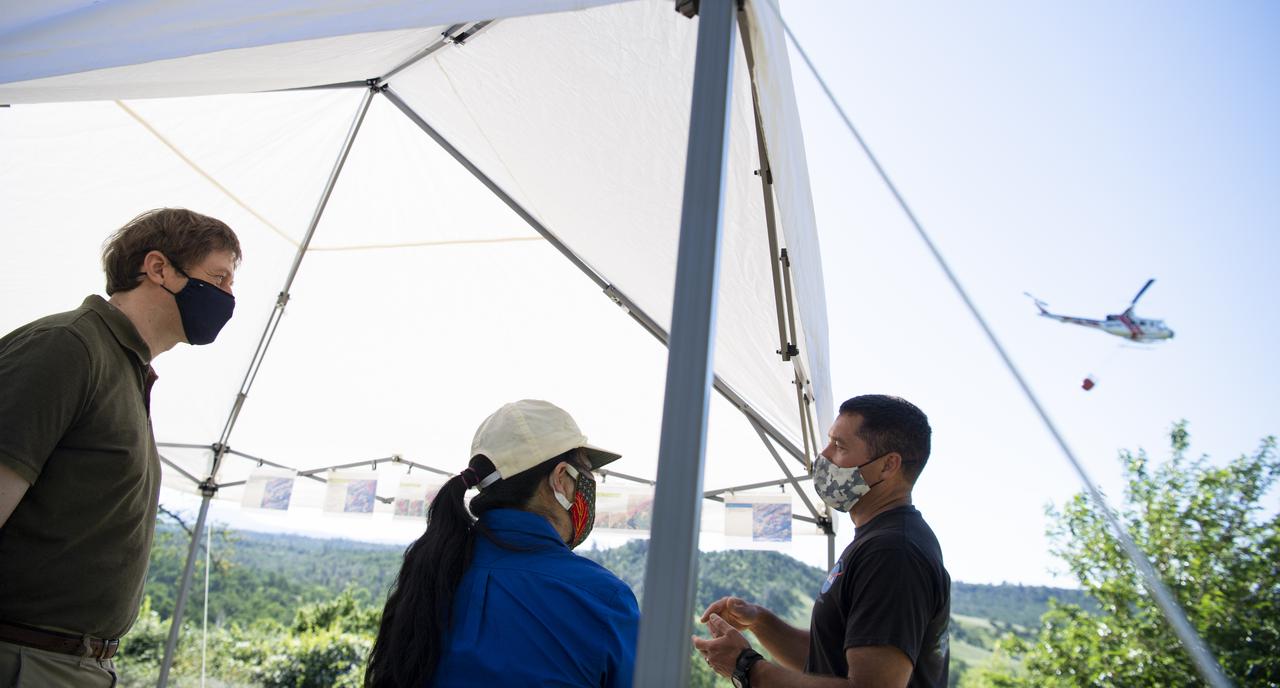
Joey Mercer, principle investigator for STEReO, the Scalable Traffic Management for Emergency Response Operations project, at NASA's Ames Research Center, right, speaks with Richard Barhydt, station director of the U.S. Forest Service's Pacific Southwest Research Station, left, and Huy Tran, director of aeronautics at NASA's Ames Research Center, center, during STEReO test activities, Tuesday, May 4, 2021 as Cal Fire conducts aerial fire fighting training exercises near Redding, California. STEReO, the Scalable Traffic Management for Emergency Response Operations project, led by NASA’s Ames Research Center, builds on NASA’s expertise in air traffic management, human factors research, and autonomous technology development to apply the agency’s work in Unmanned Aircraft Systems Traffic Management, or UTM, to public safety uses. Photo Credit: (NASA/Joel Kowsky)
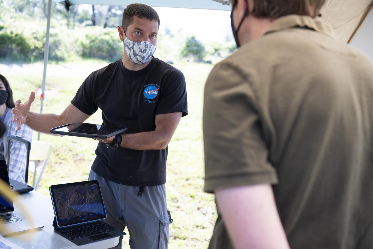
Joey Mercer, principle investigator for STEReO, the Scalable Traffic Management for Emergency Response Operations project, at NASA's Ames Research Center speaks with Richard Barhydt, station director of the U.S. Forest Service's Pacific Southwest Research Station and Huy Tran, director of aeronautics at NASA's Ames Research Center, during STEReO test activities, Tuesday, May 4, 2021 as Cal Fire conducts aerial fire fighting training exercises near Redding, California. STEReO, the Scalable Traffic Management for Emergency Response Operations project, led by NASA’s Ames Research Center, builds on NASA’s expertise in air traffic management, human factors research, and autonomous technology development to apply the agency’s work in Unmanned Aircraft Systems Traffic Management, or UTM, to public safety uses. Photo Credit: (NASA/Joel Kowsky)