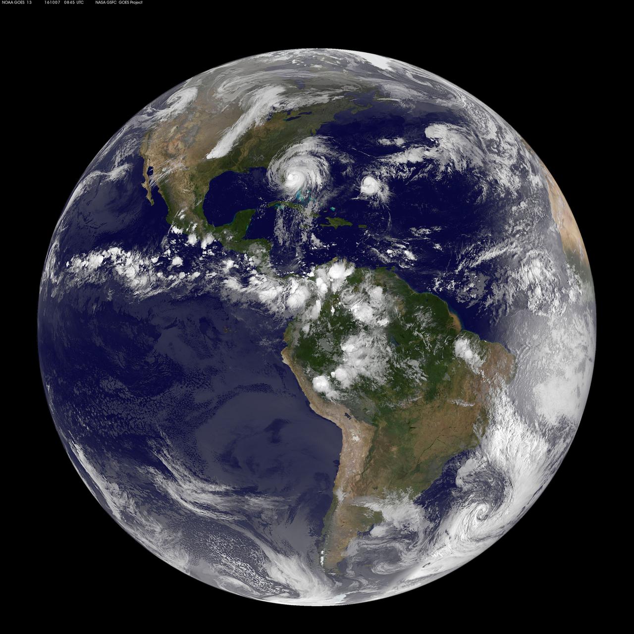
The most recent view of Matthew from space shows this massive storm converging on the Florida coast. This visible image was captured Oct. 7 at 4:45 a.m. EDT from NOAA's GOES-East satellite. Read more about Hurricane Matthew at <a href="http://www.nasa.gov/matthew" rel="nofollow">www.nasa.gov/matthew</a> Credits: NASA/NOAA GOES Project
When NASA’s Terra satellite passed over Russia’s Kamchatka Peninsula at noon local time (00:00 Universal Time) on October 6, 2012, Shilveluch Volcano was quiet. By the time NASA’s Aqua satellite passed over the area two hours later (bottom image), the volcano had erupted and sent a plume of ash over the Kamchatskiy Zaliv. The plume traveled about 90 kilometers (55 miles) toward the south-southeast, where a change in wind direction began pushing the plume toward the east. On October 6, 2012, the Kamchatka Volcanic Emergency Response Team (KVERT) reported that the ash plume from Shiveluch reached an altitude of 3 kilometers (9,800 feet) above sea level, and had traveled some 220 kilometers (140 miles) from the volcano summit. Shiveluch (also spelled Sheveluch) ranks among the biggest and most active volcanoes on the Kamchatka Peninsula. Rising to 3,283 meters (10,771 feet) above sea level, Shiveluch is a stratovolcano composed of alternating layers of hardened lava, compacted ash, and rocks ejected by previous eruptions. The beige-colored expanse of rock on the volcano’s southern slopes (visible in both images) is due to an explosive eruption that occurred in 1964. Part of Shiveluch’s southern flank collapsed, and the light-colored rock is avalanche debris left by that event. High-resolution imagery of Shiveluch shows very little vegetation within that avalanche zone. On October 6, 2012, KVERT cited observations from the Moderate Resolution Imaging Spectroradiometer (MODIS) instruments on Terra and Aqua in detecting the Shiveluch eruption. This was not the first time that MODIS observed a Shiveluch eruption shortly after it started. In 2007, MODIS captured an image within minutes of the eruption’s start, before winds could blow the ash away from the summit. When NASA’s Terra satellite passed over Russia’s Kamchatka Peninsula at noon local time (00:00 Universal Time) on October 6, 2012, Shilveluch Volcano was quiet (top image). By the time NASA’s Aqua satellite passed over the area two hours later (bottom image), the volcano had erupted and sent a plume of ash over the Kamchatskiy Zaliv. The plume traveled about 90 kilometers (55 miles) toward the south-southeast, where a change in wind direction began pushing the plume toward the east. On October 6, 2012, the Kamchatka Volcanic Emergency Response Team (KVERT) reported that the ash plume from Shiveluch reached an altitude of 3 kilometers (9,800 feet) above sea level, and had traveled some 220 kilometers (140 miles) from the volcano summit. Shiveluch (also spelled Sheveluch) ranks among the biggest and most active volcanoes on the Kamchatka Peninsula. Rising to 3,283 meters (10,771 feet) above sea level, Shiveluch is a stratovolcano composed of alternating layers of hardened lava, compacted ash, and rocks ejected by previous eruptions. The beige-colored expanse of rock on the volcano’s southern slopes (visible in both images) is due to an explosive eruption that occurred in 1964. Part of Shiveluch’s southern flank collapsed, and the light-colored rock is avalanche debris left by that event. High-resolution imagery of Shiveluch shows very little vegetation within that avalanche zone. On October 6, 2012, KVERT cited observations from the Moderate Resolution Imaging Spectroradiometer (MODIS) instruments on Terra and Aqua in detecting the Shiveluch eruption. This was not the first time that MODIS observed a Shiveluch eruption shortly after it started. In 2007, MODIS captured an image within minutes of the eruption’s start, before winds could blow the ash away from the summit. Credit: <b><a href="http://www.earthobservatory.nasa.gov/" rel="nofollow"> NASA Earth Observatory</a></b> <b><a href="http://www.nasa.gov/audience/formedia/features/MP_Photo_Guidelines.html" rel="nofollow">NASA image use policy.</a></b> <b><a href="http://www.nasa.gov/centers/goddard/home/index.html" rel="nofollow">NASA Goddard Space Flight Center</a></b> enables NASA’s mission through four scientific endeavors: Earth Science, Heliophysics, Solar System Exploration, and Astrophysics. Goddard plays a leading role in NASA’s accomplishments by contributing compelling scientific knowledge to advance the Agency’s mission. <b>Follow us on <a href="http://twitter.com/NASA_GoddardPix" rel="nofollow">Twitter</a></b> <b>Like us on <a href="http://www.facebook.com/pages/Greenbelt-MD/NASA-Goddard/395013845897?ref=tsd" rel="nofollow">Facebook</a></b> <b>Find us on <a href="http://instagrid.me/nasagoddard/?vm=grid" rel="nofollow">Instagram</a></b>
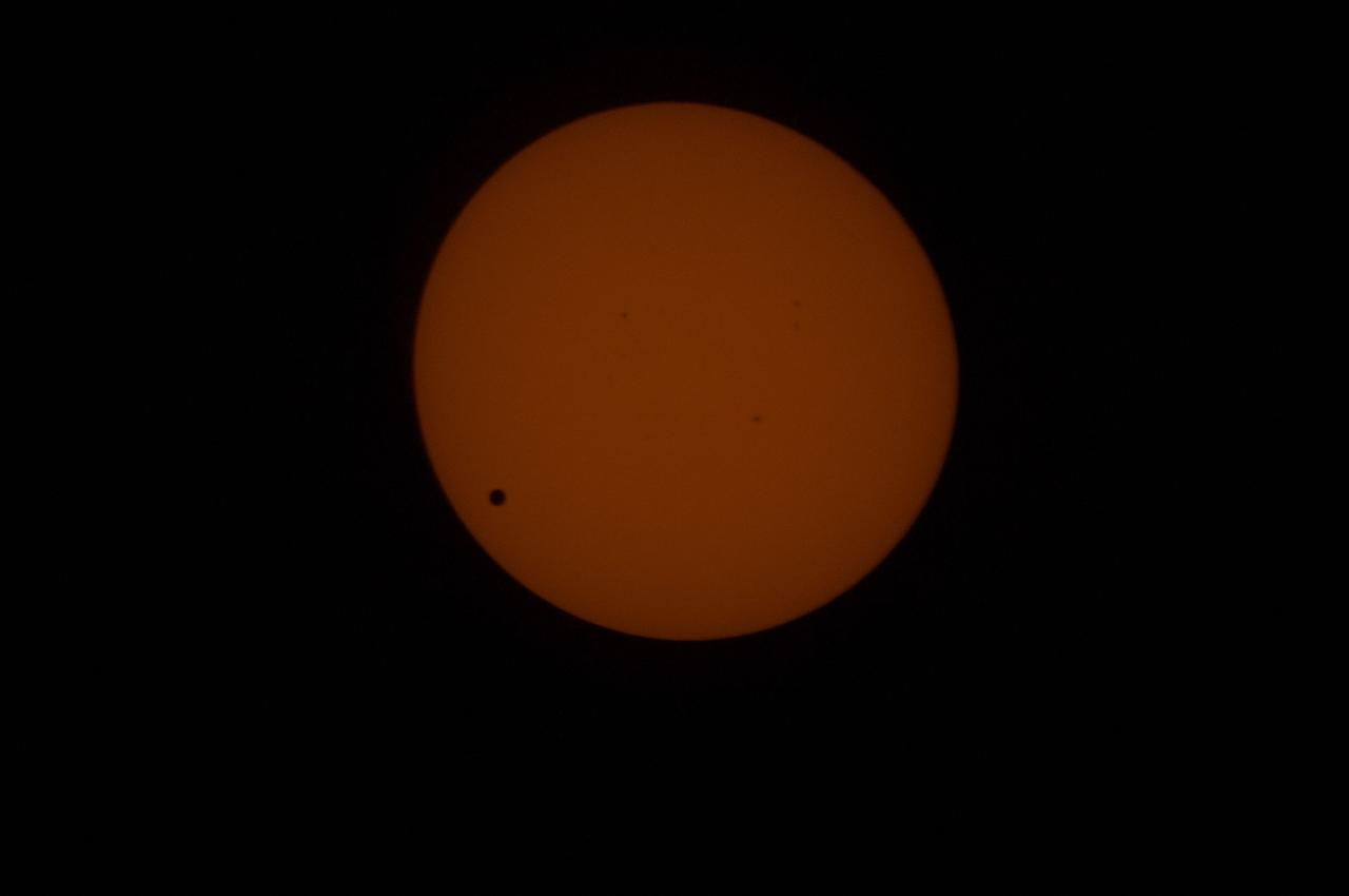
Transit of Venus as seen at 762nm in the CO Module. This image is from NASA Astronaut Don Petttit shot from onboard the International Space Station on June 5, 2012. Petttit, who had the foresight to bring a solar filter for his camera, will be capturing the June 5 Venus Transit from the International Space Station with the images downloading in almost real-time. He will photograph through the European Space Agency-built "cupola", removing the scratch panes to get crisp, clear images. Credit: NASA <b>To read more about the 2012 Venus Transit go to: <a href="http://sunearthday.nasa.gov/transitofvenus" rel="nofollow">sunearthday.nasa.gov/transitofvenus</a> </b> <b>Add your photos of the Transit of Venus to our Flickr Group here: <a href="http://www.flickr.com/groups/venustransit/">www.flickr.com/groups/venustransit/</a> </b> <b><a href="http://www.nasa.gov/audience/formedia/features/MP_Photo_Guidelines.html" rel="nofollow">NASA image use policy.</a></b> <b><a href="http://www.nasa.gov/centers/goddard/home/index.html" rel="nofollow">NASA Goddard Space Flight Center</a></b> enables NASA’s mission through four scientific endeavors: Earth Science, Heliophysics, Solar System Exploration, and Astrophysics. Goddard plays a leading role in NASA’s accomplishments by contributing compelling scientific knowledge to advance the Agency’s mission. <b>Follow us on <a href="http://twitter.com/NASA_GoddardPix" rel="nofollow">Twitter</a></b> <b>Like us on <a href="http://www.facebook.com/pages/Greenbelt-MD/NASA-Goddard/395013845897?ref=tsd" rel="nofollow">Facebook</a></b> <b>Find us on <a href="http://instagrid.me/nasagoddard/?vm=grid" rel="nofollow">Instagram</a></b>
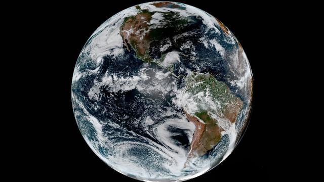
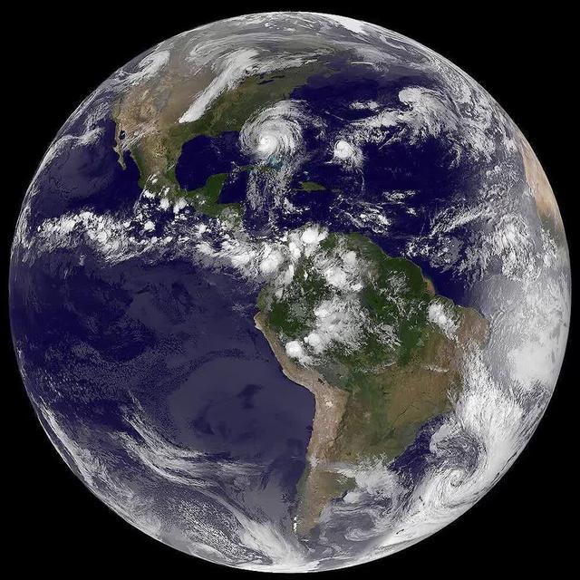
Every day of every year, NASA satellites provide useful data about our home planet, and along the way, some beautiful images as well. This video includes satellite images of Earth in 2014 from NASA and its partners as well as photos and a time lapse video from the International Space Station. We’ve also included a range of data visualizations, model runs, and a conceptual animation that were produced in 2014 (but in some cases might have been utilizing data from earlier years.) Credit: NASA's Goddard Space Flight Center <b><a href="http://www.nasa.gov/audience/formedia/features/MP_Photo_Guidelines.html" rel="nofollow">NASA image use policy.</a></b> <b><a href="http://www.nasa.gov/centers/goddard/home/index.html" rel="nofollow">NASA Goddard Space Flight Center</a></b> enables NASA’s mission through four scientific endeavors: Earth Science, Heliophysics, Solar System Exploration, and Astrophysics. Goddard plays a leading role in NASA’s accomplishments by contributing compelling scientific knowledge to advance the Agency’s mission. <b>Follow us on <a href="http://twitter.com/NASAGoddardPix" rel="nofollow">Twitter</a></b> <b>Like us on <a href="http://www.facebook.com/pages/Greenbelt-MD/NASA-Goddard/395013845897?ref=tsd" rel="nofollow">Facebook</a></b> <b>Find us on <a href="http://instagrid.me/nasagoddard/?vm=grid" rel="nofollow">Instagram</a></b>
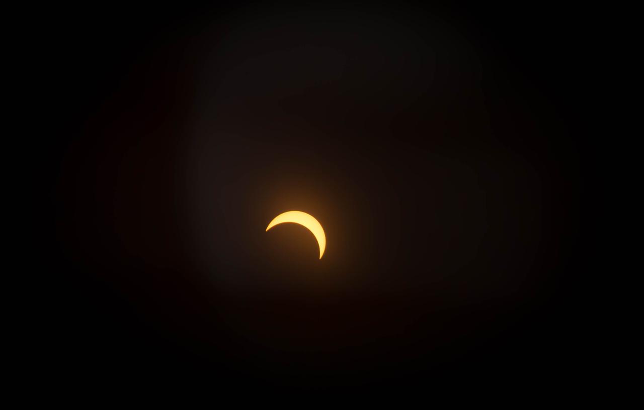
View of the partial solar eclipse from NASA's Goddard Space Flight Center in Greenbelt, Md on Monday, August 21, 2017. A total solar eclipse swept across a narrow portion of the contiguous United States from Lincoln Beach, Oregon to Charleston, South Carolina. A partial solar eclipse was visible across the entire North American continent along with parts of South America, Africa, and Europe. Credit: NASA/Goddard/Rebecca Roth
The shadow of the moon blots out the Pacific Northwest in this GOES-16 geocolor image of the 2017 Solar Eclipse. Credit: CIRA View more eclipse imagery at <a href="http://www.nesdis.noaa.gov/content/multimedia" rel="nofollow">www.nesdis.noaa.gov/content/multimedia</a>
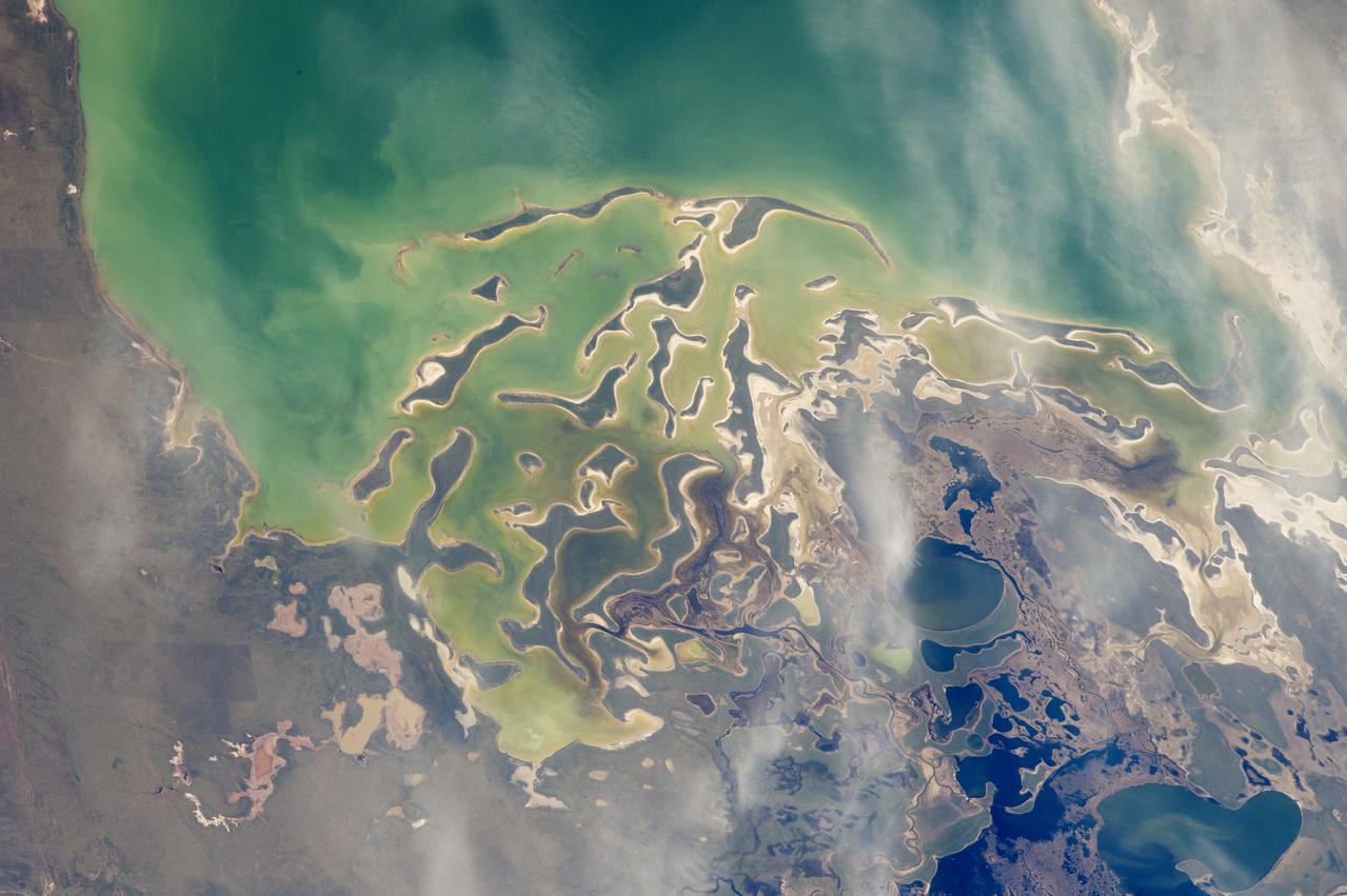
In orbit above the semi-desert grasslands in Kazakhstan, an astronaut aboard the International Space Station spotted one of the few features that stand out. Lake Tengiz is the only large lake (1590 square kilometers, 615 square miles) in northern Kazakhstan. Through white wisps of cloud, the crew member photographed the 50 kilometer-long eastern shore of the lake, with its thin, winding islands and white beaches. The islands and intervening waterways make a rich habitat for birds in this part of Asia. At least 318 species of birds have been identified at the lake; 22 of them are endangered. It is the northernmost habitat of the pink flamingo. The lake system is Kazakhstan’s first UNESCO World Heritage Site, and it has been declared a RAMSAR wetland site of international importance. Part of the richness of area is its complex hydrology. Fresh water enters the system via the Kulanutpes River, so there are small lakes (lower right) full of fresh water. But in this closed basin, the water in the main lake (top) slowly evaporates, becoming salty. Winds stir up bigger waves on the main lake, dispersing sediment and salt and making the water a cloudier and lighter blue-green. (Another astronaut photograph shows the entire lake system, while this story provides more information.) The strange shape of the islands is not easy to interpret. They may be drowned remnants of delta distributaries of the Kulanutpes River. Westerly winds probably have had a smoothing effect on the shorelines, especially in a shallow lake like Tengiz, which is only about 6 meters (20 feet) deep. The lake has an exciting history for people who follow space exploration. In 1976, a Soyuz spacecraft landed in the lake near the north shore (top right). The capsule crashed through the ice and sank during an October snowstorm when temperatures were -22°C (-8°F). Because of low power, the capsule was unheated and the crew was feared lost. It was many hours before the airtight capsule was located and divers could attach flotation tanks to get the capsule to the surface. It was then dragged ashore across the ice by helicopter. The rescue effort took nine hours before the crew was able to safely exit the capsule. Credit: <b><a href="http://www.earthobservatory.nasa.gov/" rel="nofollow"> NASA Earth Observatory</a></b> <b><a href="http://www.nasa.gov/audience/formedia/features/MP_Photo_Guidelines.html" rel="nofollow">NASA image use policy.</a></b> <b><a href="http://www.nasa.gov/centers/goddard/home/index.html" rel="nofollow">NASA Goddard Space Flight Center</a></b> enables NASA’s mission through four scientific endeavors: Earth Science, Heliophysics, Solar System Exploration, and Astrophysics. Goddard plays a leading role in NASA’s accomplishments by contributing compelling scientific knowledge to advance the Agency’s mission. <b>Follow us on <a href="http://twitter.com/NASAGoddardPix" rel="nofollow">Twitter</a></b> <b>Like us on <a href="http://www.facebook.com/pages/Greenbelt-MD/NASA-Goddard/395013845897?ref=tsd" rel="nofollow">Facebook</a></b> <b>Find us on <a href="http://instagrid.me/nasagoddard/?vm=grid" rel="nofollow">Instagram</a></b>
From Beyond
From A to F
From Beyond
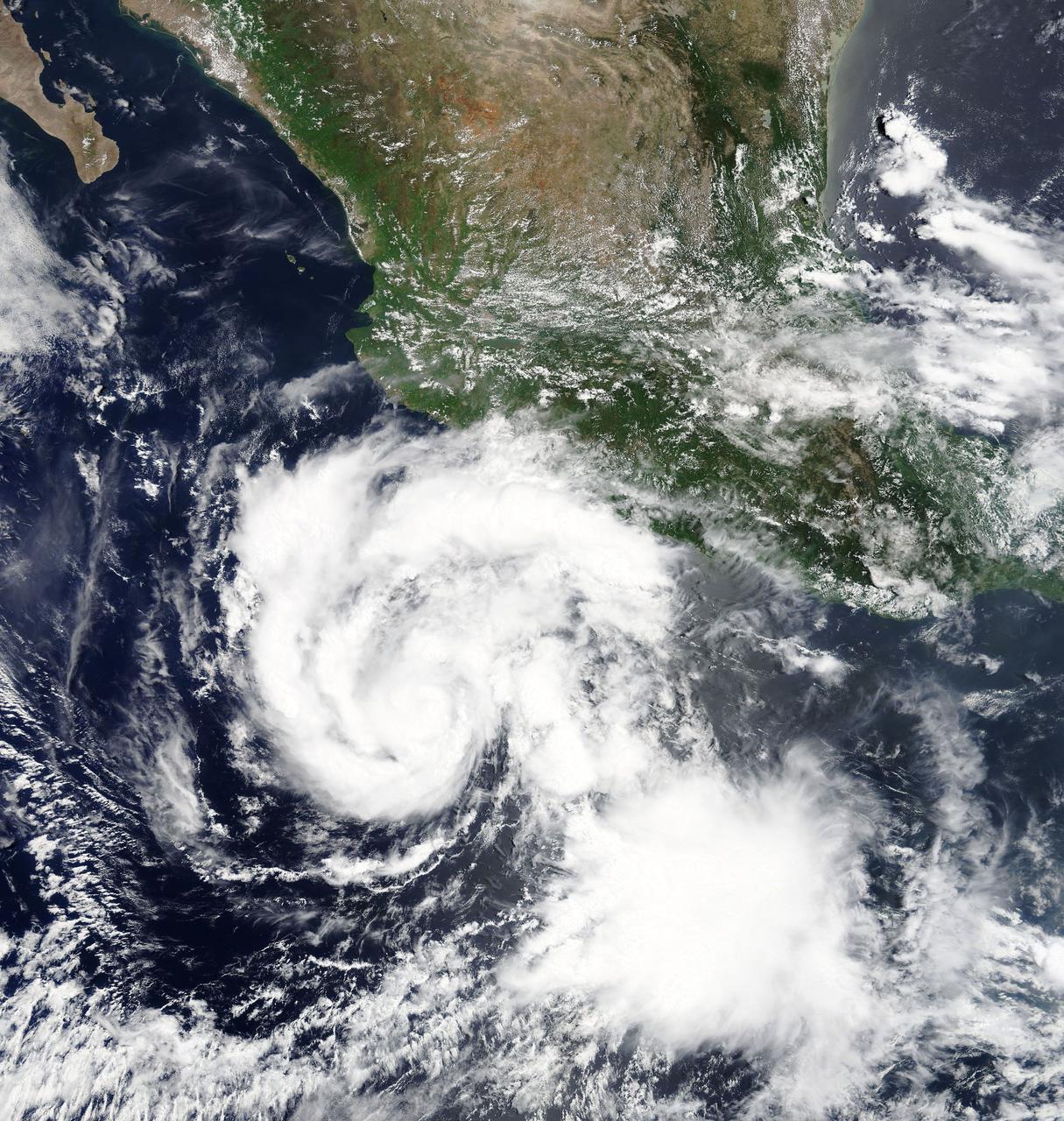
Hilary is a small but strengthening hurricane, with hurricane-force winds extending outward up to 10 miles (20 km) from the center. Tropical-storm-force winds extending outward up to 60 miles (95 km). Hilary began when Tropical Depression 9E formed on July 21. By July 22 at 11 p.m. EDT, the depression strengthened into a tropical storm and was re-named Hilary. At 5 a.m. EDT on Monday, July 24, 2017, Hilary rapidly intensified into a hurricane. NASA's Moderate Resolution Imaging Spectroradiometer, or MODIS, instrument aboard NASA’s Terra satellite captured a true color image of Hurricane Hilary on July 24 at 11 a.m. EDT. The image revealed a better organized tropical cyclone. The National Hurricane Center (NHC) noted "Satellite images indicate that Hilary has a small central core of convection, with both the visible and infrared channels suggesting that an eye is trying to form. Microwave data also show an incomplete eyewall." At 11 a.m. EDT (1500 UTC), the center of Hurricane Hilary was located near 14.1 degrees north latitude and 104.2 degrees west longitude. That's about 340 miles (545 km) south of Manzanillo, Mexico. Hilary is moving toward the west-northwest near 8 mph (13 kph), and the National Hurricane Center said this general motion with some increase in forward speed is expected over the next 48 hours. Maximum sustained winds have increased to near 80 mph (130 kph) with higher gusts. The estimated minimum central pressure is 989 millibars. The National Hurricane Center expects Hilary to become a major hurricane on Tuesday, July 25. For updated forecasts, visit: <a href="http://www.nhc.noaa.gov" rel="nofollow">www.nhc.noaa.gov</a>.
On August 21, 2017, the first total solar eclipse to move across the United States in 99 years occurred. GOES-16 captured the eclipse with the Advanced Baseline Imager (ABI) which had a clear view of the moon’s shadow as it traveled diagonally across the path of totality of the Continental United States from the Pacific Northwest through South Carolina. In this full disk geocolor image from GOES-16 on August 21, 2017, the center of the moon's shadow is now east of the Mississippi River. Credit: CIRA View more eclipse imagery at <a href="http://www.nesdis.noaa.gov/content/multimedia" rel="nofollow">www.nesdis.noaa.gov/content/multimedia</a>

Images acquired December 21, 2010 - September 20, 2011. To view a HD animation of this go to: <a href="http://www.flickr.com/photos/gsfc/6175313242/in/photostream/">www.flickr.com/photos/gsfc/6175313242/in/photostream/</a> To download the high res and learn more go to: <a href="http://earthobservatory.nasa.gov/IOTD/view.php?id=52248" rel="nofollow">earthobservatory.nasa.gov/IOTD/view.php?id=52248</a> One of the most frequently misunderstood concepts in science is the reason for Earth’s seasons. As we experience the September equinox today—anyone try to balance an egg yet?—we thought we’d offer a space-based view of what’s going on. Around 6 a.m. local time each day, the Sun, Earth, and any geosynchronous satellite form a right angle, affording a nadir (straight down) view of the terminator, where the shadows of nightfall meet the sunlight of dusk and dawn. The shape of this line between night and day varies with the seasons, which means different lengths of days and differing amounts of warming sunshine. (The line is actually a curve because the Earth is round, but satellite images only show it in two-dimensions.) The Spinning Enhanced Visible and Infrared Imager (SEVIRI) on EUMETSAT's Meteosat-9 captured these four views of the day-night terminator on December 21, 2010, and March 20, June 21, and September 20, 2011. Each image was taken at 6:12 a.m. local time. On March 20 and September 20, the terminator is a straight north-south line, and the Sun is said to sit directly above the equator. On December 21, the Sun resides directly over the Tropic of Capricorn when viewed from the ground, and sunlight spreads over more of the Southern Hemisphere. On June 21, the Sun sits above the Tropic of Cancer, spreading more sunlight in the north and turning the tables on the south. The bulge of our spherical Earth blocks sunlight from the far hemisphere at the solstices; that same curvature allows the Sun’s rays to spread over more area near the top and bottom of the globe. Of course, it is not the Sun that is moving north or south through the seasons, but a change in the orientation and angles between the Earth and its nearest star. The axis of the Earth is tilted 23.5 degrees relative to the Sun and the ecliptic plane. The axis is tilted away from the Sun at the December solstice and toward the Sun at the June solstice, spreading more and less light on each hemisphere. At the equinoxes, the tilt is at a right angle to the Sun and the light is spread evenly. The equinox and changing of the seasons occurs on September 23, 2011 at 9:05 a.m. Universal Time. (Our September image above is a few days early.) Equinox means "equal night" in Latin, capturing the idea that daytime and nighttime are equal lengths everywhere on the planet. That is true of the Sun's presence above the horizon, though it does not account for twilight, when the Sun's rays extend from beyond the horizon to illuminate our gas-filled atmosphere. NASA images and animation by Robert Simmon, using data ©2010 EUMETSAT. Caption by Mike Carlowicz. Instrument: Meteosat Credit: <b><a href="http://www.earthobservatory.nasa.gov/" rel="nofollow"> NASA Earth Observatory</a></b> <b><a href="http://www.nasa.gov/audience/formedia/features/MP_Photo_Guidelines.html" rel="nofollow">NASA image use policy.</a></b> <b><a href="http://www.nasa.gov/centers/goddard/home/index.html" rel="nofollow">NASA Goddard Space Flight Center</a></b> enables NASA’s mission through four scientific endeavors: Earth Science, Heliophysics, Solar System Exploration, and Astrophysics. Goddard plays a leading role in NASA’s accomplishments by contributing compelling scientific knowledge to advance the Agency’s mission. <b>Follow us on <a href="http://twitter.com/NASAGoddardPix" rel="nofollow">Twitter</a></b> <b>Like us on <a href="http://www.facebook.com/pages/Greenbelt-MD/NASA-Goddard/395013845897?ref=tsd" rel="nofollow">Facebook</a></b> <b>Find us on <a href="http://instagrid.me/nasagoddard/?vm=grid" rel="nofollow">Instagram</a></b>
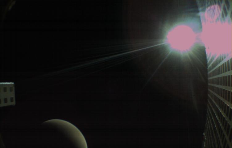
MarCO-B, one of the experimental Mars Cube One (MarCO) CubeSats, took this image of Mars from about 10,900 miles (17,500 kilometers) away just after NASA’s InSight spacecraft landed on Mars on Nov. 26, 2018. MarCO-B flew by Mars with its twin, MarCO-A, to serve as communications relays for InSight as it touched down on the Red Planet around noon PST (3 p.m. EST). This image was taken at 1 p.m. PST (4 p.m. EST). Mars’ south pole is facing the viewer in this image. MarCO-B’s antenna reflector is on the right and antenna feed (white rectangle with gold square) is on the left. The Sun at upper right overexposed part of the image. This image was taken after PIA22833 and shortly before PIA22834. The MarCO and InSight projects are managed for NASA's Science Mission Directorate, Washington, by JPL, a division of Caltech, Pasadena. Credit: NASA/JPL-Caltech
Here are a few of our top images from 2016. To see more great NASA Goddard images be sure to follow us on Instagram at <a href="http://www.instagram.com/nasagoddard" rel="nofollow">www.instagram.com/nasagoddard</a> and also on Twitter at <a href="https://twitter.com/NASAGoddardPix" rel="nofollow">twitter.com/NASAGoddardPix</a>.
Overnight on October 4-5, 2012, a mass of energetic particles from the atmosphere of the Sun were flung out into space, a phenomenon known as a coronal mass ejection. Three days later, the storm from the Sun stirred up the magnetic field around Earth and produced gorgeous displays of northern lights. NASA satellites track such storms from their origin to their crossing of interplanetary space to their arrival in the atmosphere of Earth. Using the “day-night band” (DNB) of the Visible Infrared Imaging Radiometer Suite (VIIRS), the Suomi National Polar-orbiting Partnership (Suomi NPP) satellite acquired this view of the aurora borealis early on the morning of October 8, 2012. The northern lights stretch across Canada’s Quebec and Ontario provinces in the image, and are part of the auroral oval that expanded to middle latitudes because of a geomagnetic storm. The DNB sensor detects dim light signals such as auroras, airglow, gas flares, city lights, and reflected moonlight. In the case of the image above, the sensor detected the visible light emissions as energetic particles rained down from Earth’s magnetosphere and into the gases of the upper atmosphere. The images are similar to those collected by the Operational Linescan System flown on U.S. Defense Meteorological Satellite Program (DMSP) satellites for the past three decades. “When I first saw images like this as a graduate student, I was immediately struck by the fluid dynamic characteristics of the aurora,” said Tom Moore, a space physicist at NASA's Goddard Space Flight Center. “Viewing the aurora in this way makes it immediately clear that space weather is an interaction of fluids from the Sun with those of the Earth's upper atmosphere. The electrodynamics make for important differences between plasmas and ordinary fluids, but familiar behaviors (for example, waves and vortices) are still very apparent. It makes me wonder at the ability of apparently empty space to behave like a fluid.” Auroras typically occur when solar flares and coronal mass ejections—or even an active solar wind stream—disturb and distort the magnetosphere, the cocoon of space protected by Earth’s magnetic field. The collision of solar particles and pressure into our planet’s magnetosphere accelerates particles trapped in the space around Earth (such as in the radiation belts). Those particles are sent crashing down into Earth’s upper atmosphere—at altitudes of 100 to 400 kilometers (60 to 250 miles)—where they excite oxygen and nitrogen molecules and release photons of light. The results are rays, sheets, and curtains of dancing light in the sky. Auroras are a beautiful expression of the connection between Sun and Earth, but not all of the connections are benign. Auroras are connected to geomagnetic storms, which can distort radio communications (particularly high frequencies), disrupt electric power systems on the ground, and give slight but detectable doses of radiation to flight crews and passengers on high-latitude airplane flights and on spacecraft. The advantage of images like those from VIIRS and DMSP is resolution, according to space physicist Patrick Newell of the Johns Hopkins University Applied Physics Laboratory. “You can see very fine detail in the aurora because of the low altitude and the high resolution of the camera,” he said. Most aurora scientists prefer to use images from missions dedicated to aurora studies (such as Polar, IMAGE, and ground-based imagers), which can offer many more images of a storm (rather than one per orbit) and can allow researchers to calculate the energy moving through the atmosphere. There are no science satellites flying right now that provide such a view, though astronauts regularly photograph and film auroras from the International Space Station. NASA Earth Observatory image by Jesse Allen and Robert Simmon, using VIIRS Day-Night Band data from the Suomi National Polar-orbiting Partnership (Suomi NPP) and the University of Wisconsin's Community Satellite Processing Package. Suomi NPP is the result of a partnership between NASA, the National Oceanic and Atmospheric Administration, and the Department of Defense. Caption by Mike Carlowicz. Instrument: Suomi NPP - VIIRS Credit: <b><a href="http://www.earthobservatory.nasa.gov/" rel="nofollow"> NASA Earth Observatory</a></b> <b><a href="http://www.nasa.gov/audience/formedia/features/MP_Photo_Guidelines.html" rel="nofollow">NASA image use policy.</a></b> <b><a href="http://www.nasa.gov/centers/goddard/home/index.html" rel="nofollow">NASA Goddard Space Flight Center</a></b> enables NASA’s mission through four scientific endeavors: Earth Science, Heliophysics, Solar System Exploration, and Astrophysics. Goddard plays a leading role in NASA’s accomplishments by contributing compelling scientific knowledge to advance the Agency’s mission. <b>Follow us on <a href="http://twitter.com/NASA_GoddardPix" rel="nofollow">Twitter</a></b> <b>Like us on <a href="http://www.facebook.com/pages/Greenbelt-MD/NASA-Goddard/395013845897?ref=tsd" rel="nofollow">Facebook</a></b> <b>Find us on <a href="http://instagrid.me/nasagoddard/?vm=grid" rel="nofollow">Instagram</a></b>
MarCO-B, one of the experimental Mars Cube One (MarCO) CubeSats, took this image of Mars from about 10,900 miles (17,500 kilometers) away just after NASA’s InSight spacecraft landed on Mars on Nov. 26, 2018. MarCO-B flew by Mars with its twin, MarCO-A, to serve as communications relays for InSight as it touched down on the Red Planet around noon PST (3 p.m. EST). This image was taken at 1 p.m. PST (4 p.m. EST). A crescent Mars with its south pole in the 4 o’clock position is visible in this picture. MarCO-B’s antenna reflector mirrors a portion of the illuminated part of Mars on the bottom right. The antenna feed (white rectangle with gold squares) is visible on the left. This image was taken about 50 minutes after PIA22833 and 10 seconds after PIA22832. The MarCO and InSight projects are managed for NASA's Science Mission Directorate, Washington, by JPL, a division of Caltech, Pasadena. Credit: NASA/JPL-Caltech
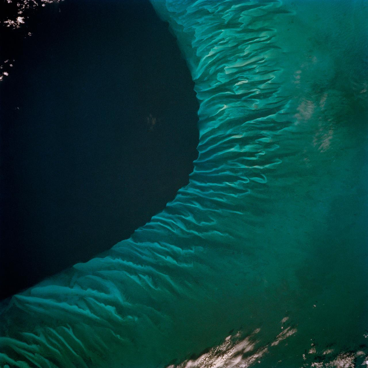
STS062-85-031 (4-18 March 1994) --- The shallow platforms (bright blue) and deep channels (dark blue) of the Bahamas provide a striking visual from space. On a finer scale, delicate patterns are created by the islands, sandbars and tidal channels. This view features a portion of the Tongue of the Ocean, one of the large deep water sounds in the western Bahamas. On the platform along the edge of the Tongue of the Ocean are convoluted sandbars bordering channels which fall into the deeper water. These channels provide an avenue for transport of sediment off the shallow platform (3-10 meters) into the deeper water (1,800 meters).
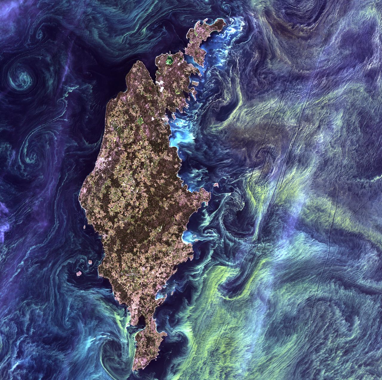
Van Gogh from Space - July 13th, 2005 Description: In the style of Van Gogh's painting "Starry Night," massive congregations of greenish phytoplankton swirl in the dark water around Gotland, a Swedish island in the Baltic Sea. Phytoplankton are microscopic marine plants that form the first link in nearly all ocean food chains. Population explosions, or blooms, of phytoplankton, like the one shown here, occur when deep currents bring nutrients up to sunlit surface waters, fueling the growth and reproduction of these tiny plants. Credit: USGS/NASA/Landsat 7 To learn more about the Landsat satellite go to: <a href="http://landsat.gsfc.nasa.gov/" rel="nofollow">landsat.gsfc.nasa.gov/</a> <b><a href="http://www.nasa.gov/centers/goddard/home/index.html" rel="nofollow">NASA Goddard Space Flight Center</a></b> enables NASA’s mission through four scientific endeavors: Earth Science, Heliophysics, Solar System Exploration, and Astrophysics. Goddard plays a leading role in NASA’s accomplishments by contributing compelling scientific knowledge to advance the Agency’s mission. <b>Follow us on <a href="http://twitter.com/NASA_GoddardPix" rel="nofollow">Twitter</a></b> <b>Join us on <a href="http://www.facebook.com/pages/Greenbelt-MD/NASA-Goddard/395013845897?ref=tsd" rel="nofollow">Facebook</a></b>
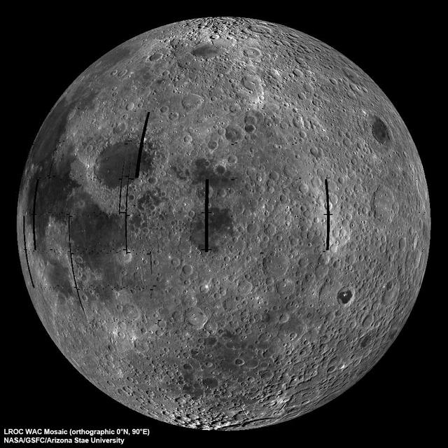
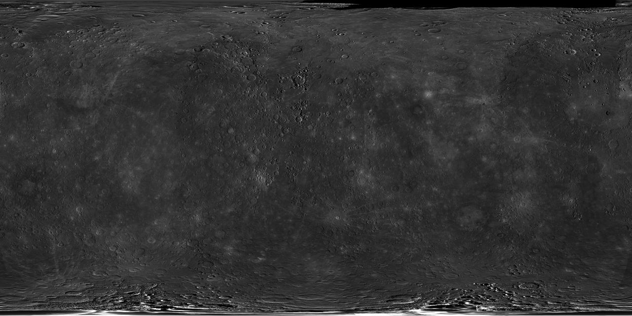
NASA image release September 9, 2010 LROC Wide Angle Camera (WAC) view of the Moon seen from 90° east longitude. Half the nearside is visible to the left, and half the farside to the right. Credit: NASA/GSFC/Arizona State University To read more go to: <a href="http://www.nasa.gov/mission_pages/LRO/multimedia/lroimages/lroc-20100909_mooneast.html" rel="nofollow">www.nasa.gov/mission_pages/LRO/multimedia/lroimages/lroc-...</a> <b><a href="http://www.nasa.gov/centers/goddard/home/index.html" rel="nofollow">NASA Goddard Space Flight Center</a></b> contributes to NASA’s mission through four scientific endeavors: Earth Science, Heliophysics, Solar System Exploration, and Astrophysics. Goddard plays a leading role in NASA’s endeavors by providing compelling scientific knowledge to advance the Agency’s mission. <b>Follow us on <a href="http://twitter.com/NASA_GoddardPix" rel="nofollow">Twitter</a></b> <b>Join us on <a href="http://www.facebook.com/pages/Greenbelt-MD/NASA-Goddard/395013845897?ref=tsd" rel="nofollow">Facebook</a></b>

Red and white vapor clouds filled the skies over the Marshall Islands as part of NASA’s Equatorial Vortex Experiment (EVEX). The red cloud was formed by the release of lithium vapor and the white tracer clouds were formed by the release of trimethyl aluminum (TMA). These clouds allowed scientists on the ground from various locations in the Marshall Islands to observe the neutral winds in the ionosphere. Credit: NASA/Jon Grant --- The Equatorial Vortex Experiment (EVEX) was successfully conducted during the early morning hours (eastern time) May 7 from Roi Namur, Republic of the Marshall Islands. A NASA Terrier-Oriole sounding rocket was launched at 3:39 a.m. EDT and was followed by a launch of Terrier-Improved Malemute sounding rocket 90 seconds later. Preliminary indications are that both rockets released their vapor clouds of lithium or trimethyl aluminum, which were observed from various locations in the area, and all science instruments on the rockets worked as planned. More information on EVEX can be found at <a href="http://www.nasa.gov/mission_pages/sounding-rockets/news/evex.html" rel="nofollow">www.nasa.gov/mission_pages/sounding-rockets/news/evex.html</a> These were the second and third rockets of four planned for launch during this year’s campaign in the Marshall Islands. The first and fourth rockets are supporting the Metal Oxide Space Cloud experiment (MOSC), which is studying radio frequency propagation. <b><a href="http://www.nasa.gov/audience/formedia/features/MP_Photo_Guidelines.html" rel="nofollow">NASA image use policy.</a></b> <b><a href="http://www.nasa.gov/centers/goddard/home/index.html" rel="nofollow">NASA Goddard Space Flight Center</a></b> enables NASA’s mission through four scientific endeavors: Earth Science, Heliophysics, Solar System Exploration, and Astrophysics. Goddard plays a leading role in NASA’s accomplishments by contributing compelling scientific knowledge to advance the Agency’s mission. <b>Follow us on <a href="http://twitter.com/NASA_GoddardPix" rel="nofollow">Twitter</a></b> <b>Like us on <a href="http://www.facebook.com/pages/Greenbelt-MD/NASA-Goddard/395013845897?ref=tsd" rel="nofollow">Facebook</a></b> <b>Find us on <a href="http://instagram.com/nasagoddard?vm=grid" rel="nofollow">Instagram</a></b>
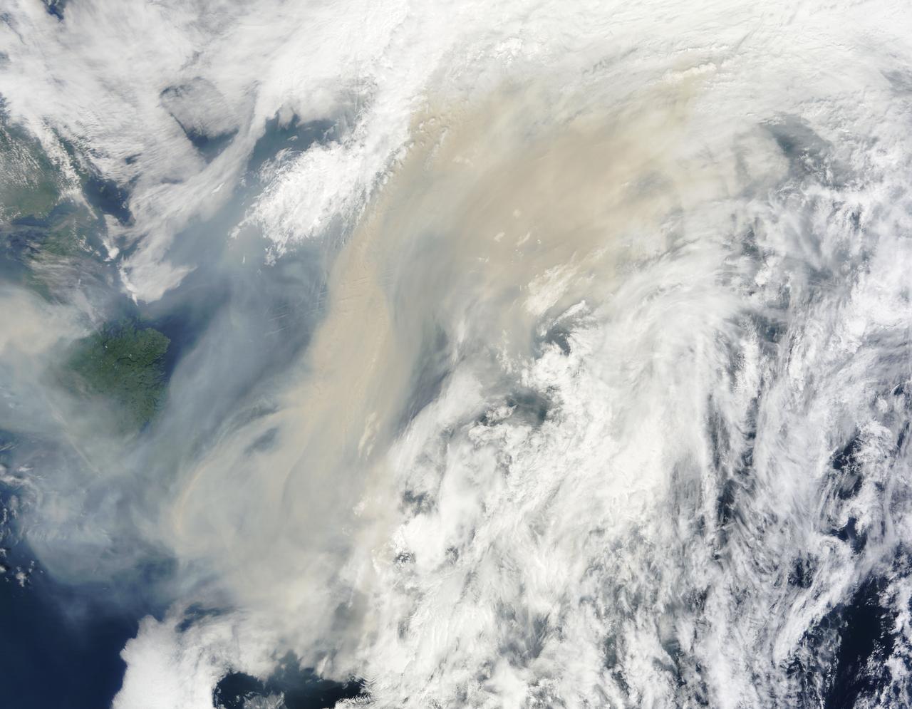
Generally the old saying “where there is smoke, there is fire” rings true, but when thick, hot smoke rises high aloft into the atmosphere it may travel hundreds, sometimes thousands of kilometers away from the source. This was the case on July 6, 2013 when the Moderate Resolution Imaging Spectroradiometer (MODIS) instrument flying on NASA’s Terra satellite captured this true-color image of a thick river of smoke curling across the Atlantic Ocean. In the west of the image, the green land of Canada can be seen, most of which is covered by a thin gray haze. A thick veil of smoke obscures much of southern Canada, and this tan-gray veil blows to the east, then to the northeast. The color of the smoke appears both tan and gray, and is stretched into brush-stroke like curves across the ocean, which disappears from view under the smoke. The smoke filled plume is so high that it even hides the bright white clouds from view as it travels over them. Fires have been burning across Canada since early June, especially in Manitoba and Quebec. Rain in Quebec on July 5 helped diminish the fires in that location, although a severe fire was ignited when a freight train carrying oil derailed in the small, picturesque town of Lac-Megantic. This accident, which occurred on July 6, the same day this image was captured, killed at least 35 people and poured thick smoke into the skies. Credit: NASA/GSFC/Jeff Schmaltz/MODIS Land Rapid Response Team <b><a href="http://www.nasa.gov/audience/formedia/features/MP_Photo_Guidelines.html" rel="nofollow">NASA image use policy.</a></b> <b><a href="http://www.nasa.gov/centers/goddard/home/index.html" rel="nofollow">NASA Goddard Space Flight Center</a></b> enables NASA’s mission through four scientific endeavors: Earth Science, Heliophysics, Solar System Exploration, and Astrophysics. Goddard plays a leading role in NASA’s accomplishments by contributing compelling scientific knowledge to advance the Agency’s mission. <b>Follow us on <a href="http://twitter.com/NASA_GoddardPix" rel="nofollow">Twitter</a></b> <b>Like us on <a href="http://www.facebook.com/pages/Greenbelt-MD/NASA-Goddard/395013845897?ref=tsd" rel="nofollow">Facebook</a></b> <b>Find us on <a href="http://instagram.com/nasagoddard?vm=grid" rel="nofollow">Instagram</a></b>
S77-E-5073 (22 May 1996) --- From its position at 175 statute miles above Earth, the Space Shuttle Endeavour has encountered some colorful and attractive scenes heading into sunsets and sunrises. This particular encounter, captured with an Electronic Still Camera (ESC), occurred on flight day four, during which the six-member crew deployed the Passive Aerodynamically Stabilized Magnetically Damped Satellite (PAMS) - Satellite Test Unit (STU).

STS062-106-094 (4-18 March 1994) --- The Greater Houston metropolitan area, completely clear of clouds, was captured on 70mm film by one of the crew members aboard the Space Shuttle Columbia. The belt system on the north, east and south sides of the city can be traced in the frame, though not completed. The west belt is just out of frame on the left side. Houston Intercontinental Airport is at top center. The NASA Johnson Space Center (JSC) and Nassau Bay can be traced inland from the portion of Galveston Bay in the lower right corner. Not only the dome proper of Harris County Domed Stadium is visible but so are two other structures in the Astrodome complex (left center), Astro Arena and Astrohall.
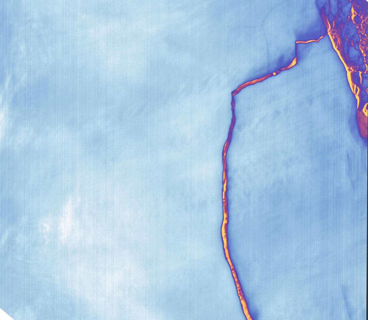
Sometime between July 10 and July 12, an iceberg about the size of Delaware split off from Antarctica’s Larsen C ice shelf. Now that nearly 5,800 square kilometers (2,200 square miles) of ice has broken away, the Larsen C shelf area has shrunk by approximately 10 percent. This false-color image was captured by Landsat’s Thermal Infrared Sensor (TIRS). It shows the relative warmth or coolness of the landscape. Orange indicates where the surface is the warmest, most notably the mélange between the new berg and the ice shelf. Light blues and whites are the coldest areas, including the ice shelf and the iceberg. On July 13, the U.S. National Ice Center issued a press release confirming the new iceberg and officially naming it A-68. Credit: NASA Earth Observatory images by Joshua Stevens, using Landsat data from the U.S. Geological Survey <b><a href="http://www.nasa.gov/audience/formedia/features/MP_Photo_Guidelines.html" rel="nofollow">NASA image use policy.</a></b> <b><a href="http://www.nasa.gov/centers/goddard/home/index.html" rel="nofollow">NASA Goddard Space Flight Center</a></b> enables NASA’s mission through four scientific endeavors: Earth Science, Heliophysics, Solar System Exploration, and Astrophysics. Goddard plays a leading role in NASA’s accomplishments by contributing compelling scientific knowledge to advance the Agency’s mission. <b>Follow us on <a href="http://twitter.com/NASAGoddardPix" rel="nofollow">Twitter</a></b> <b>Like us on <a href="http://www.facebook.com/pages/Greenbelt-MD/NASA-Goddard/395013845897?ref=tsd" rel="nofollow">Facebook</a></b> <b>Find us on <a href="http://instagrid.me/nasagoddard/?vm=grid" rel="nofollow">Instagram</a></b>

Caption: Composite shot of all four rockets for the M-TeX and MIST experiments is made up of 30 second exposures. The rocket salvo began at 4:13 a.m. EST, Jan. 26, 2015, from the Poker Flat Research Range, Alaska. Credit: NASA/Jamie Adkins More info: The Mesosphere-Lower Thermosphere Turbulence Experiment, or M-TeX, and the Mesospheric Inversion-layer Stratified Turbulence, or MIST, experiment were successfully conducted the morning of Jan. 26, 2015, from the Poker Flat Research Range, Alaska. The first M-Tex rocket, a NASA Terrier-Improved Malemute sounding rocket, was launched at 4:13 a.m. EST and was followed one-minute later by the first MIST experiment payload on a NASA Terrier-Improved Orion. The second M-TeX payload was launched at 4:46 a.m. EST and also was followed one minute later by the second MIST payload. Preliminary data show that all four payloads worked as planned and the trimethyl aluminum, or TMA, vapor trails were seen at the various land-based observation sites in Alaska. A fifth rocket carrying the Auroral Spatial Structures Probe remains ready on the launch pad. The launch window for this experiment runs through Jan. 27. <b><a href="http://www.nasa.gov/audience/formedia/features/MP_Photo_Guidelines.html" rel="nofollow">NASA image use policy.</a></b> <b><a href="http://www.nasa.gov/centers/goddard/home/index.html" rel="nofollow">NASA Goddard Space Flight Center</a></b> enables NASA’s mission through four scientific endeavors: Earth Science, Heliophysics, Solar System Exploration, and Astrophysics. Goddard plays a leading role in NASA’s accomplishments by contributing compelling scientific knowledge to advance the Agency’s mission. <b>Follow us on <a href="http://twitter.com/NASAGoddardPix" rel="nofollow">Twitter</a></b> <b>Like us on <a href="http://www.facebook.com/pages/Greenbelt-MD/NASA-Goddard/395013845897?ref=tsd" rel="nofollow">Facebook</a></b> <b>Find us on <a href="http://instagram.com/nasagoddard?vm=grid" rel="nofollow">Instagram</a></b>
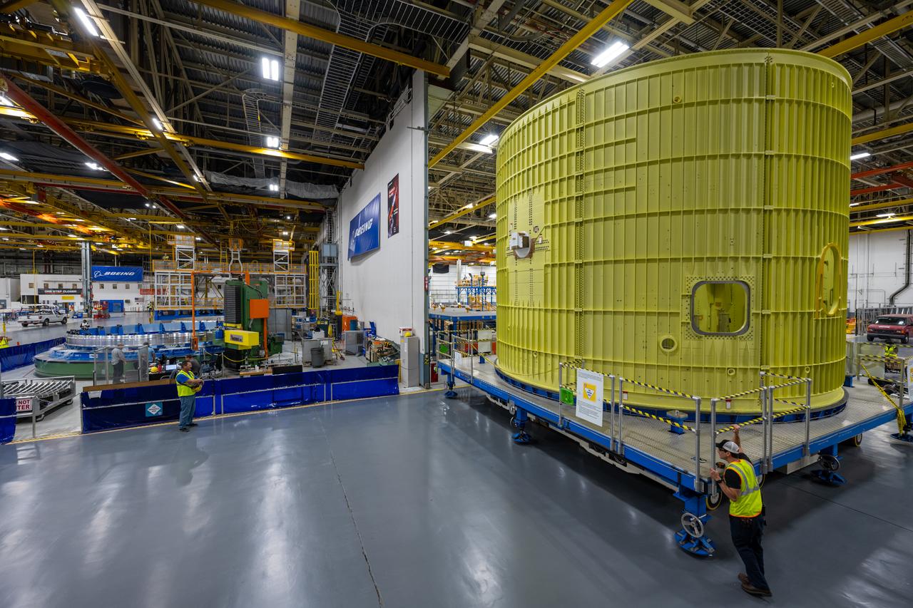
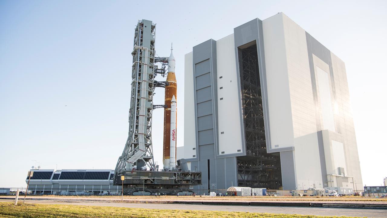
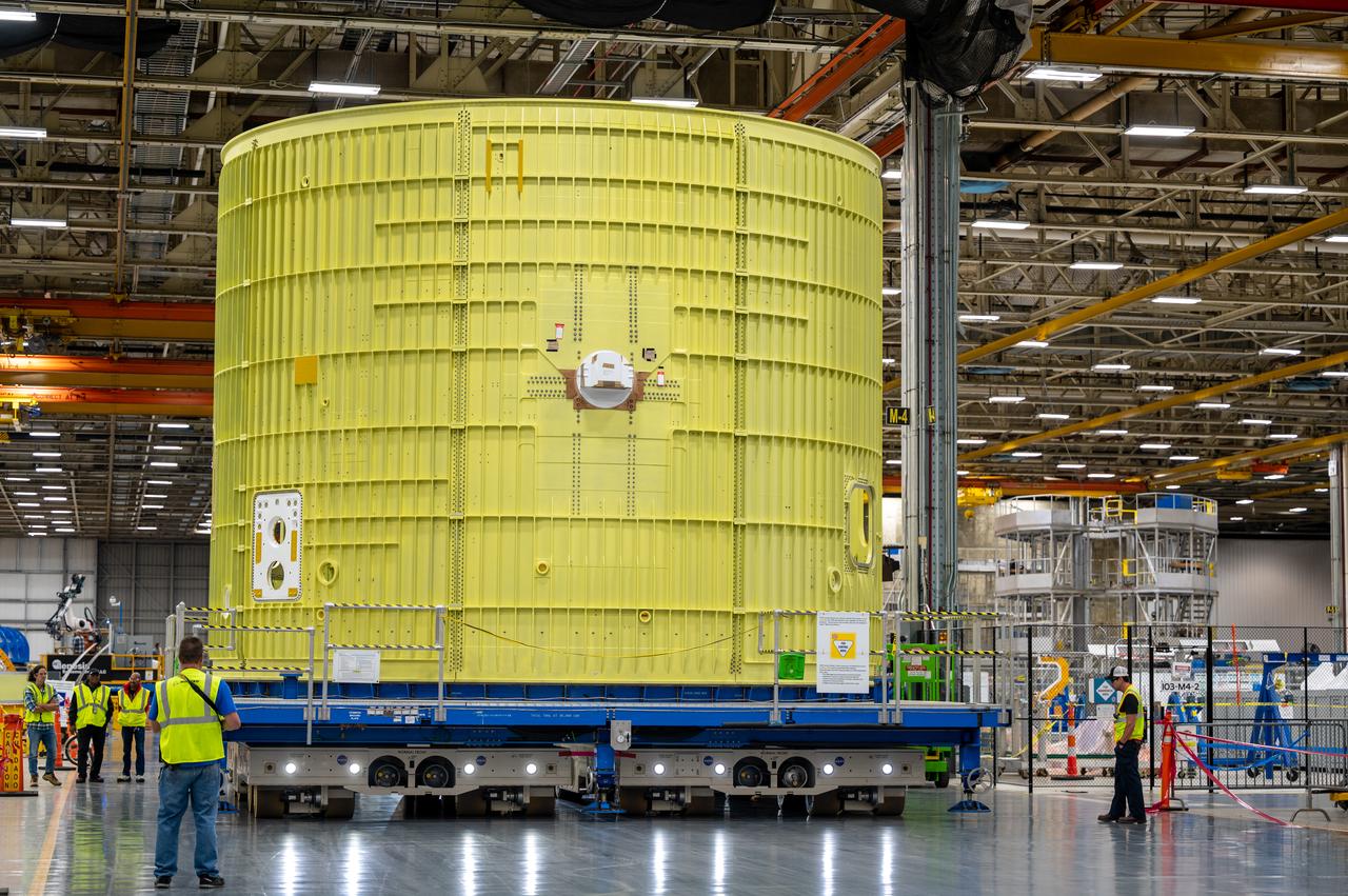
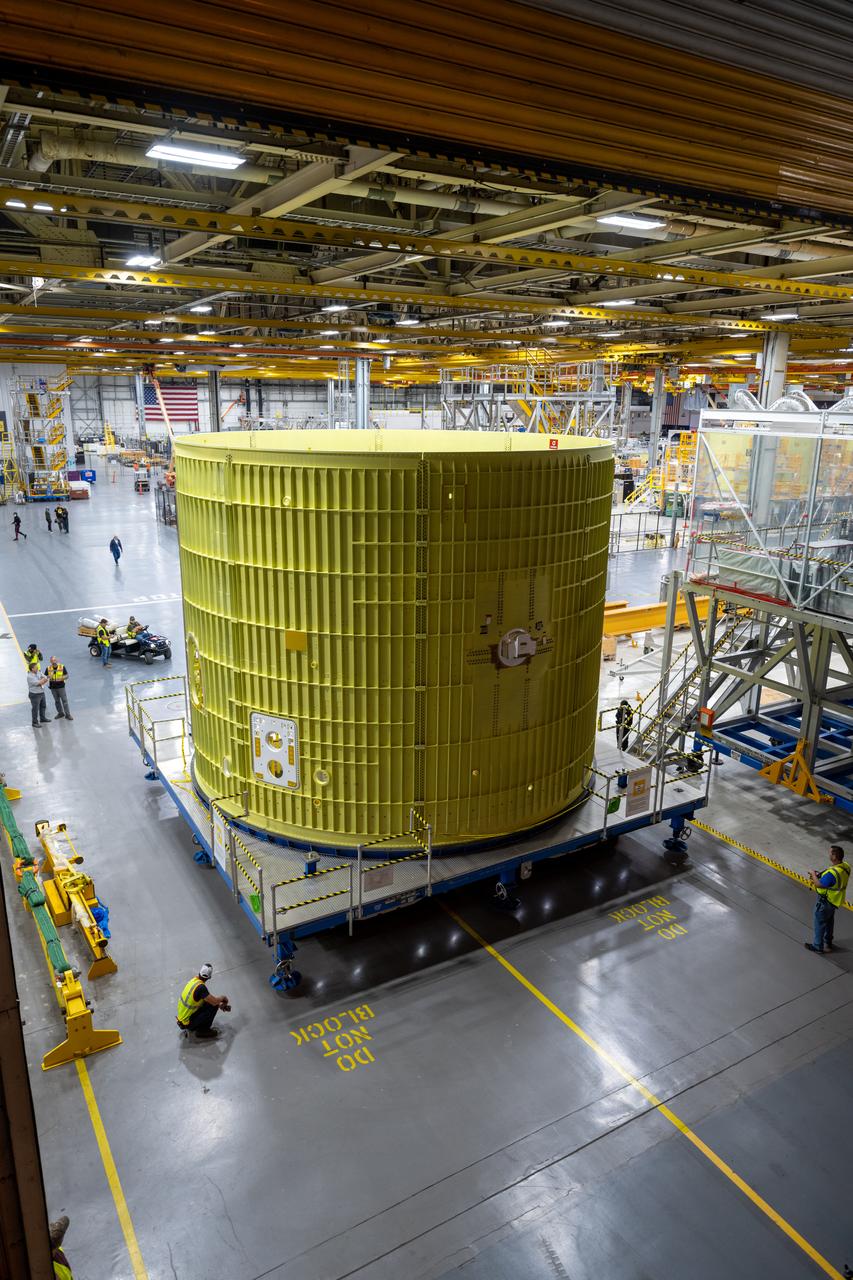
Technicians at NASA’s Michoud Assembly Facility move the intertank of NASA’s Space Launch System rocket for Artemis III to Cell G to await application of the thermal protection system. Thermal protection systems protect space vehicles from aerodynamic heating during entry to planet atmosphere and re-entry to earth atmosphere.

NASA's Aqua satellite captured this image of the clouds over Canada. Entwined within the clouds is the smoke billowing up from the wildfires that are currently burning across a large expanse of the country. The smoke has become entrained within the clouds causing it to twist within the circular motion of the clouds and wind. This image was taken by the Moderate Resolution Imaging Spectroradiometer (MODIS) instrument on the Aqua satellite on May 9, 2016. Image Credit: NASA image courtesy Jeff Schmaltz LANCE/EOSDIS MODIS Rapid Response Team, GSFC <b><a href="http://www.nasa.gov/audience/formedia/features/MP_Photo_Guidelines.html" rel="nofollow">NASA image use policy.</a></b> <b><a href="http://www.nasa.gov/centers/goddard/home/index.html" rel="nofollow">NASA Goddard Space Flight Center</a></b> enables NASA’s mission through four scientific endeavors: Earth Science, Heliophysics, Solar System Exploration, and Astrophysics. Goddard plays a leading role in NASA’s accomplishments by contributing compelling scientific knowledge to advance the Agency’s mission. <b>Follow us on <a href="http://twitter.com/NASAGoddardPix" rel="nofollow">Twitter</a></b> <b>Like us on <a href="http://www.facebook.com/pages/Greenbelt-MD/NASA-Goddard/395013845897?ref=tsd" rel="nofollow">Facebook</a></b> <b>Find us on <a href="http://instagrid.me/nasagoddard/?vm=grid" rel="nofollow">Instagram</a></b>
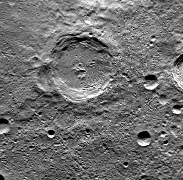
Release Date: December 21, 2011 The crater at the center of this image is named Dickens, after Charles Dickens, the English novelist who lived from 1812 to 1870. Among Dickens' famous works is A Christmas Carol, the story of Bob Cratchit, his family, and horrible boss Mr. Scrooge. Scientists studying Mercury might consider the Mariner 10 mission to be Christmas Past, MESSENGER to be Christmas Present, and the European Bepi-Colombo mission to be Christmas Yet To Come. This image was acquired as part of MDIS's high-resolution surface morphology base map. The surface morphology base map will cover more than 90% of Mercury's surface with an average resolution of 250 meters/pixel (0.16 miles/pixel or 820 feet/pixel). Images acquired for the surface morphology base map typically have off-vertical Sun angles (i.e., high incidence angles) and visible shadows so as to reveal clearly the topographic form of geologic features. The MESSENGER spacecraft is the first ever to orbit the planet Mercury, and the spacecraft's seven scientific instruments and radio science investigation are unraveling the history and evolution of the Solar System's innermost planet. Visit the Why Mercury? section of this website to learn more about the key science questions that the MESSENGER mission is addressing. During the one-year primary mission, MDIS is scheduled to acquire more than 75,000 images in support of MESSENGER's science goals. Credit: NASA/Johns Hopkins University Applied Physics Laboratory/Carnegie Institution of Washington <b><a href="http://www.nasa.gov/audience/formedia/features/MP_Photo_Guidelines.html" rel="nofollow">NASA image use policy.</a></b> <b><a href="http://www.nasa.gov/centers/goddard/home/index.html" rel="nofollow">NASA Goddard Space Flight Center</a></b> enables NASA’s mission through four scientific endeavors: Earth Science, Heliophysics, Solar System Exploration, and Astrophysics. Goddard plays a leading role in NASA’s accomplishments by contributing compelling scientific knowledge to advance the Agency’s mission. <b>Follow us on <a href="http://twitter.com/NASA_GoddardPix" rel="nofollow">Twitter</a></b> <b>Like us on <a href="http://www.facebook.com/pages/Greenbelt-MD/NASA-Goddard/395013845897?ref=tsd" rel="nofollow">Facebook</a></b> <b>Find us on <a href="http://instagrid.me/nasagoddard/?vm=grid" rel="nofollow">Instagram</a></b>
S66-54563 (14 Sept. 1966) --- View of the Gulf Coast area from Atchafalaya Bay to Apalachicola, including the mouth of the Mississippi River, Mobile Bay, New Orleans, Louisiana, and Pensacola, Florida, as seen from the Gemini-11 spacecraft during its 29th revolution of Earth. This photo was taken near sunrise. Photo credit: NASA
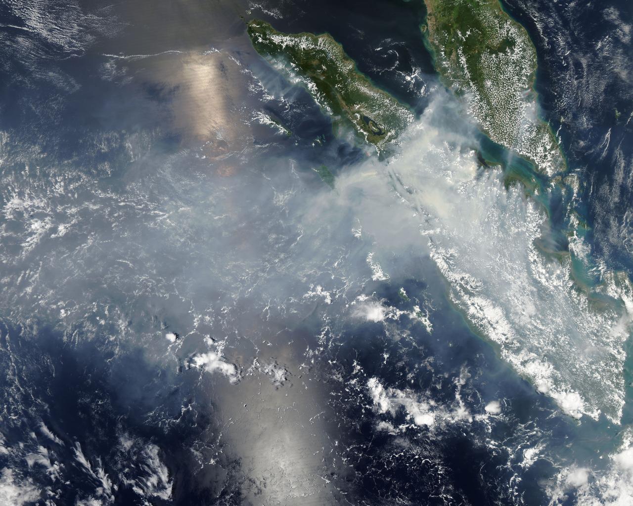
Fires burning in Sumatra continued to pour smoke over the region in mid-March, 2014, bringing air quality to dangerous levels. The Moderate Resolution Imaging Spectroradiometer (MODIS) aboard NASA’s Aqua satellite captured this true-color image of the smoke and haze across the region on March 12. According to the Jakarta Post, on March 12 the Sumatra Environmental Laboratory reported that 10 of 12 spots in Riau had an air quality of index above 300 on the Pollutant Standards Index (PSI), which is considered hazardous. Hazardous air quality had been recorded in some of the locations for 11 consecutive days. The province of Riau is located in the central eastern coast of Sumatra and, in this image, is hidden under thick bands of light gray smoke. Intense fires, reported as deliberately set to clear land, were burning in the Giam Siak Kecil-Bukit Batu biosphere reserve. This reserve contains over 700,000 hectares of sensitive peat forest that sustains a wide range of plant and animal species, including the Sumatra tiger, elephant, tapir and sun bear. With visibility as low as 500 m (1640 ft), 58 flights were cancelled in Pekanbaru, the capital of Riau province, on March 11. Schools were closed across the region, with 43,000 students affected in Payakumbuh, West Sumatra. On March 14, Selangor, Malaysia closed 203 schools, affecting 211,700 pupils, until the air quality improved. On that same day, according to Riau Health Agency, more than 55,000 residents in the province were suffering from haze-related illnesses, including acute respiratory infections, pneumonia and skin and eye irritation. Poor air quality not only affected transportation, human health and the ecosystem, but has had significant economic impacts. On March 17, Reuters reported that the poor air quality had forced Chevron, the country’s biggest oil producer, to close hundreds of its wells. As a result, Indonesia’s crude oil output dropped to 790,000 barrels per day (bpd) – significantly lower than the 870,000 bpd target. Although slash-and-burn techniques, which use fire to clear land, is illegal in Indonesia, the practice is still widespread, with approximately 99% of fires in Sumatra considered to be intentionally set. This year’s early agricultural fires began in February in Riau Province, home to palm-oil and pulpwood plantations. The emergency has prompted strong government response, including a shoot-on-sight order for any suspects involved in land burning activities that resisted arrest. According to the Jakarta Post, police have named as many as 60 suspected-fire starters in Riau. Credit: NASA/GSFC/Jeff Schmaltz/MODIS Land Rapid Response Team <b><a href="http://www.nasa.gov/audience/formedia/features/MP_Photo_Guidelines.html" rel="nofollow">NASA image use policy.</a></b> <b><a href="http://www.nasa.gov/centers/goddard/home/index.html" rel="nofollow">NASA Goddard Space Flight Center</a></b> enables NASA’s mission through four scientific endeavors: Earth Science, Heliophysics, Solar System Exploration, and Astrophysics. Goddard plays a leading role in NASA’s accomplishments by contributing compelling scientific knowledge to advance the Agency’s mission. <b>Follow us on <a href="http://twitter.com/NASAGoddardPix" rel="nofollow">Twitter</a></b> <b>Like us on <a href="http://www.facebook.com/pages/Greenbelt-MD/NASA-Goddard/395013845897?ref=tsd" rel="nofollow">Facebook</a></b> <b>Find us on <a href="http://instagram.com/nasagoddard?vm=grid" rel="nofollow">Instagram</a></b>
Looking up from the South
A Global View from Orbit
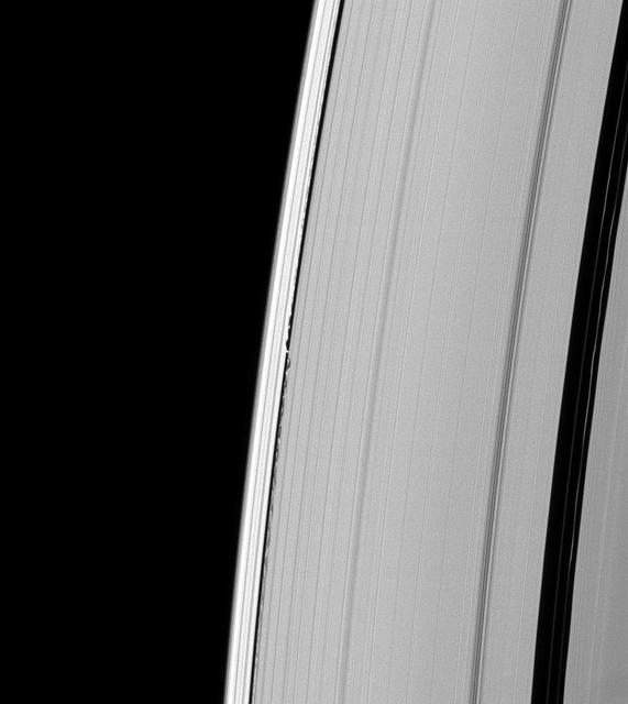
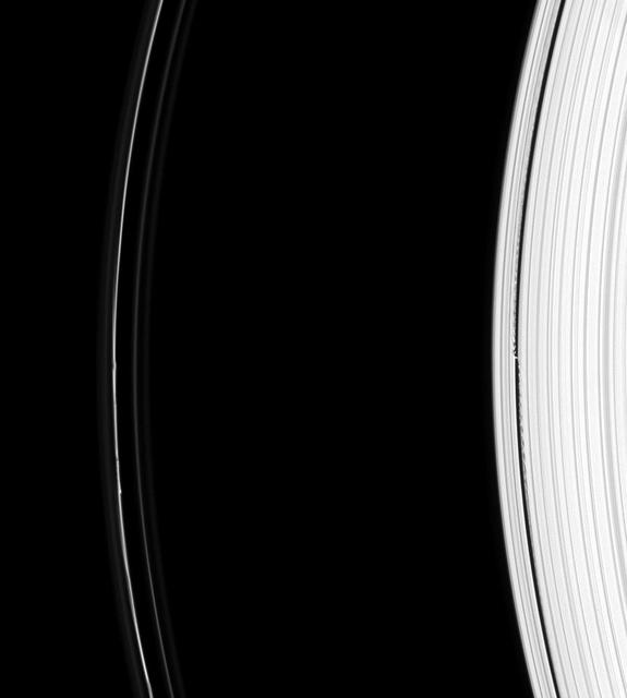
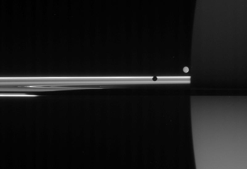
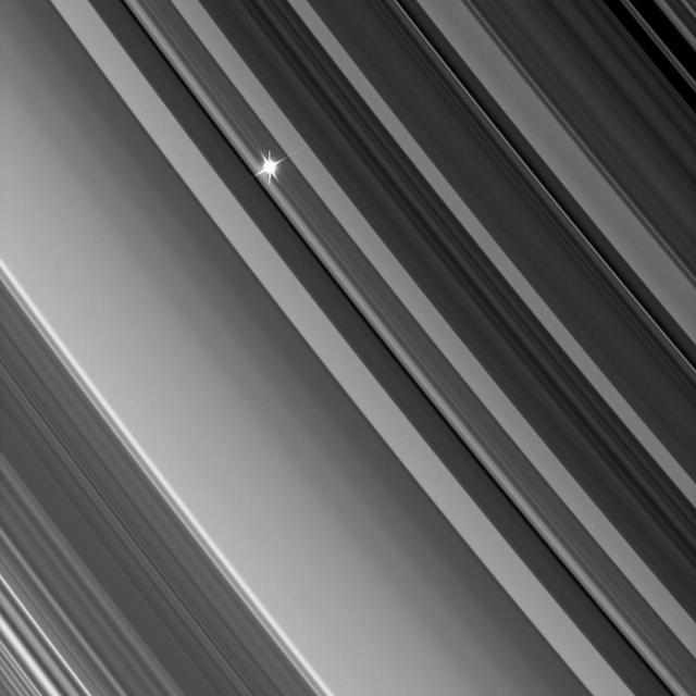
Waves from Daphnis
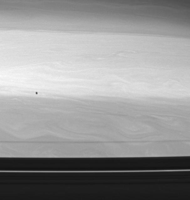
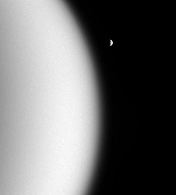
Shade from Epimetheus
Looking Up from the Deep

Speeding Away from Tethys

Moon seen from the East
From Mars, With Love
Iapetus: A View from the Top
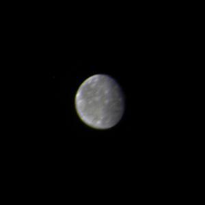
Helene from Afar
Scene from Ius
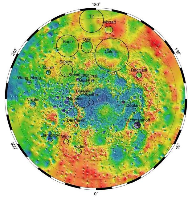
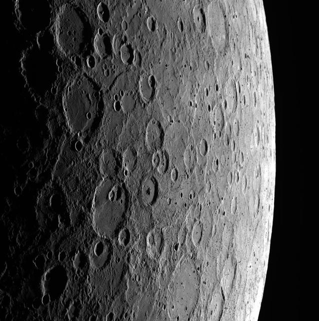
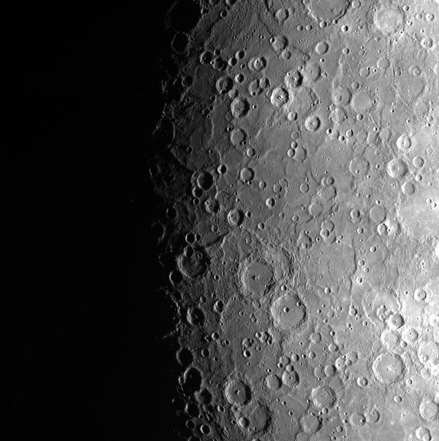
Mercury Topography from MLA
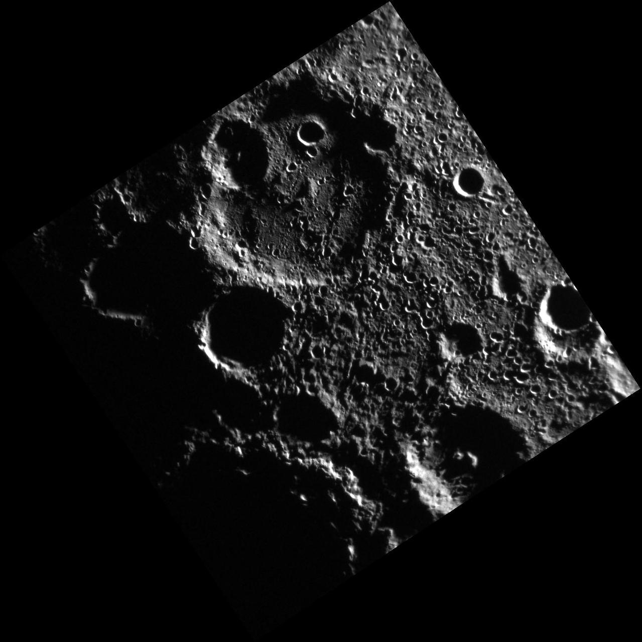
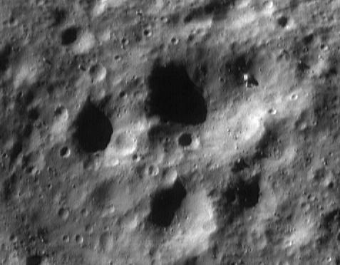
Ejecta from Copernicus
A Look from LEISA
Forces from the Deep

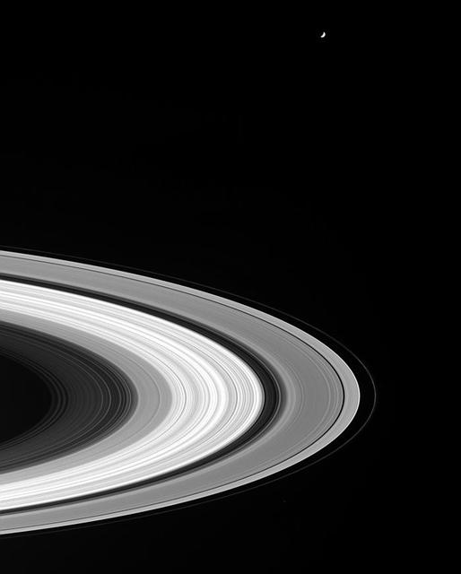
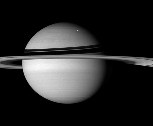
From Rings to Planet
Light from Many Paths
Callisto From 8,023,000 kilometers
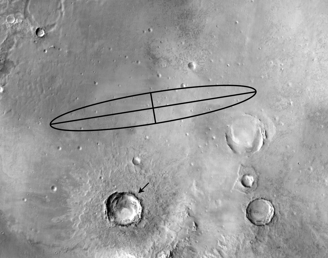
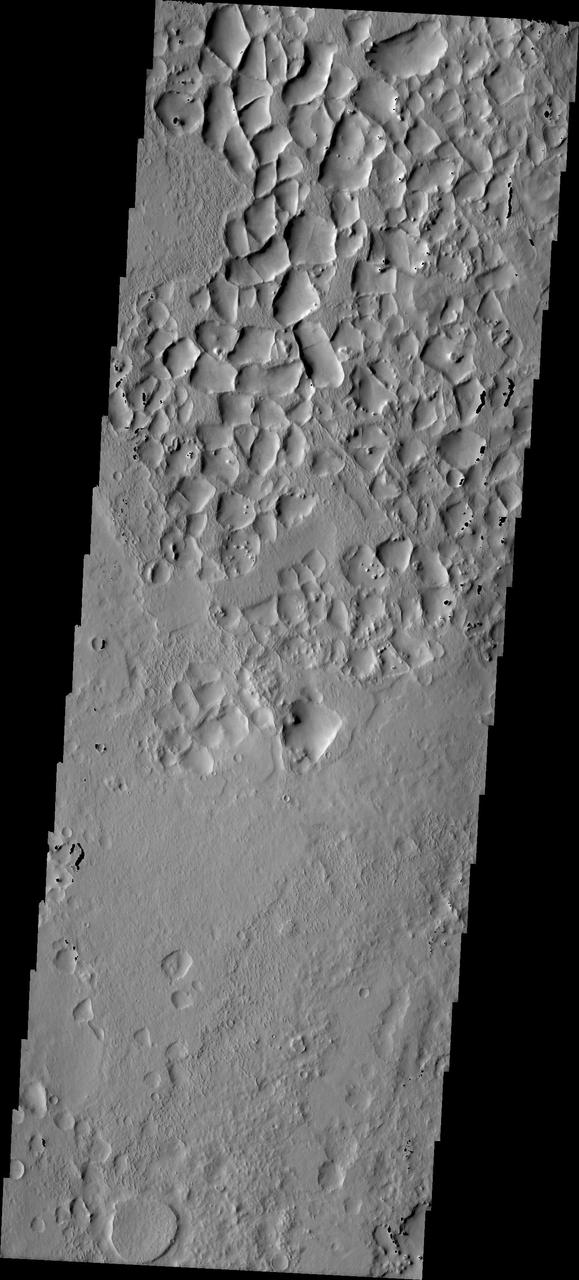
Maadim Vallis From the Top
Up from the Depths
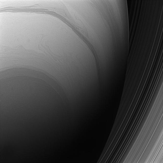
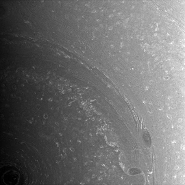
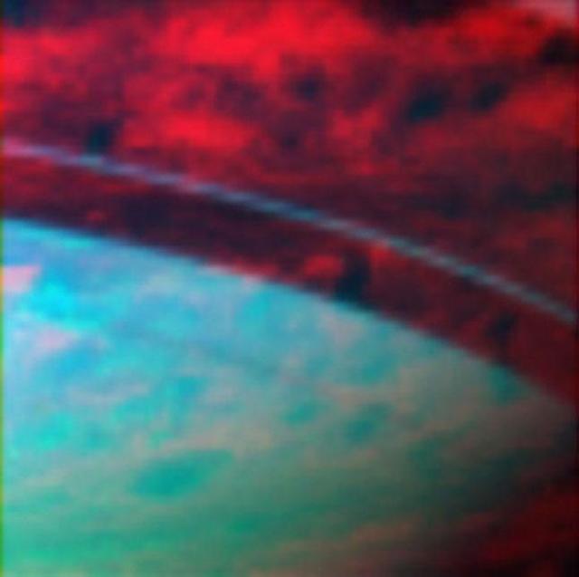
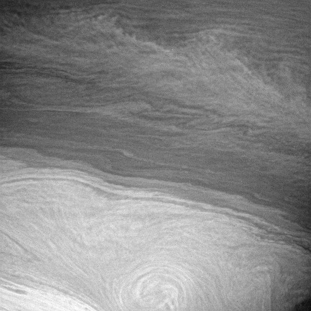
Saturn from Below
Callisto From 7,000,000 kilometers
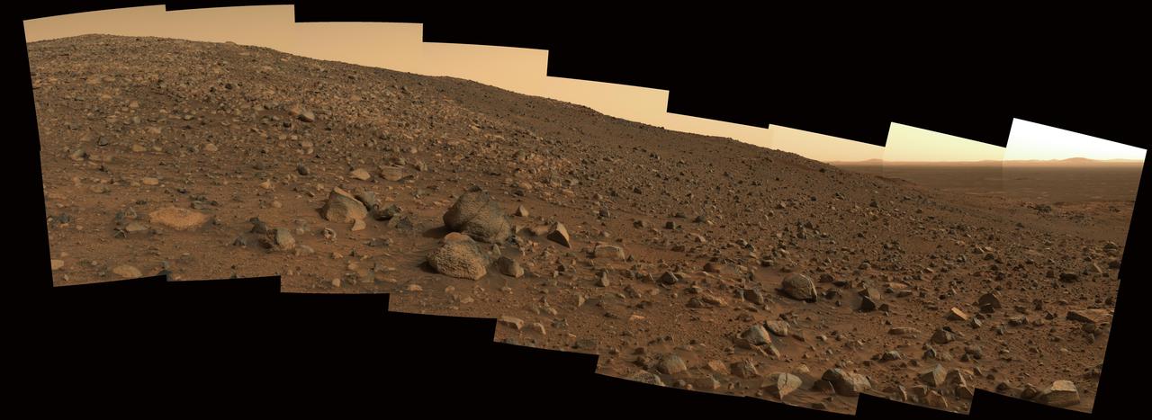
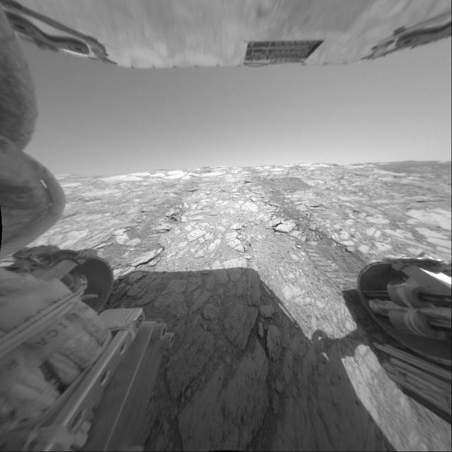
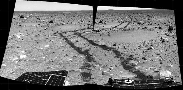
Lessons from Spirit Landing
A View from Afar
From Terminator to Limb

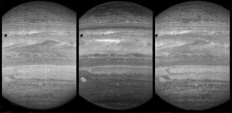
Jupiter from Voyager 2

Polarized Light from Jupiter
Far from Titan
Footprints from Above
Daybreak From Above
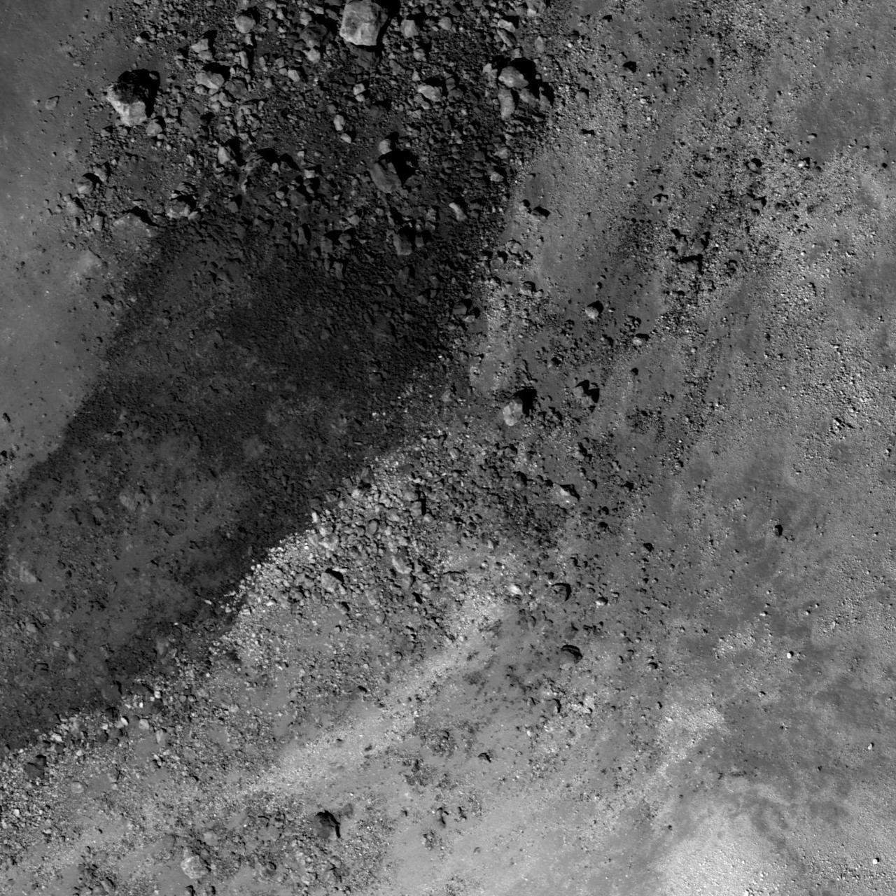
Endurance From the Inside
Rings from Afar
Help from Orion
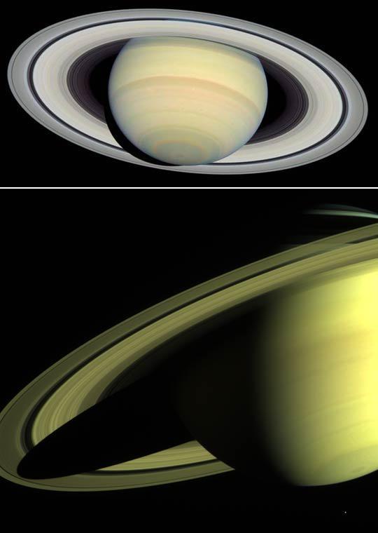
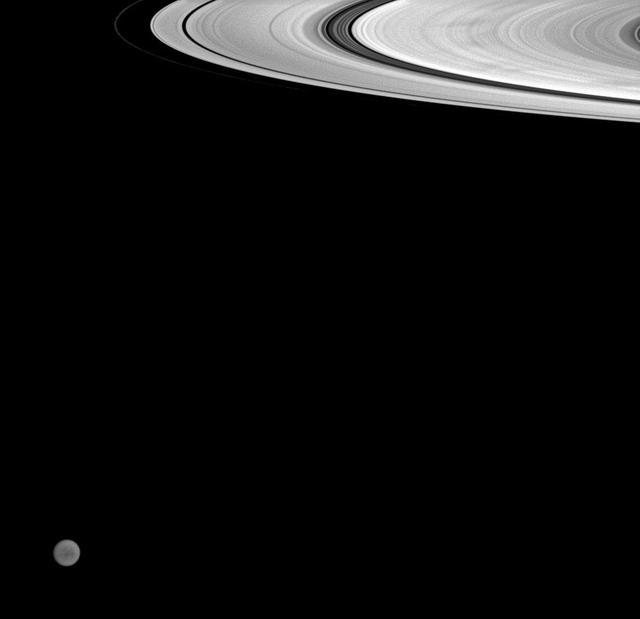
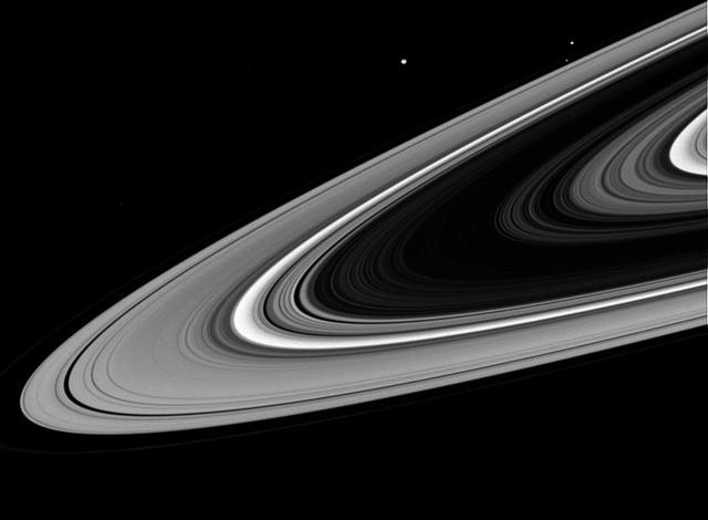
Saturn from Far and Near

Hyperion From Afar
A Long Way From Home
Flung Far from Home
From the Dark Side
From Cloudy to Clear

The Earth from the Moon
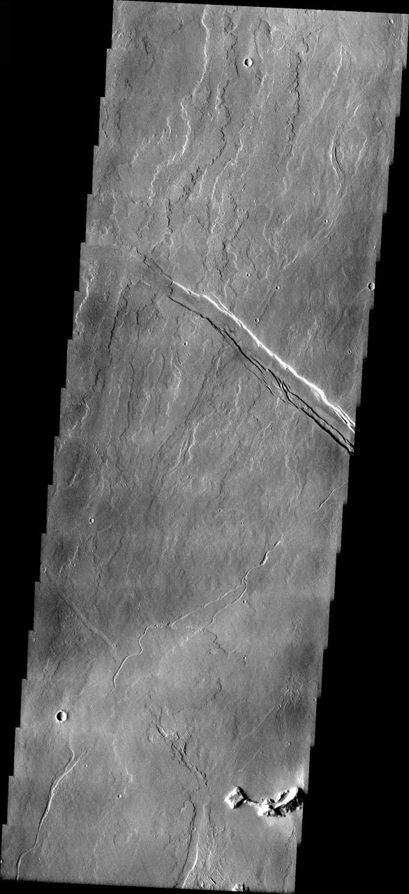
Ridges From Fractures

Earth as Seen from Mars
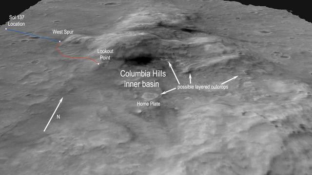
Columbia Hills from Orbit
Flows from Olympus Mons
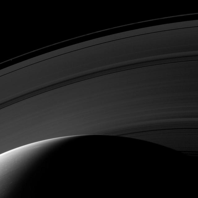
Saturn Light from Within
Impressions from Cassini
The View from Low Orbit

Spiders from Mars?
Light from a Flickering Star
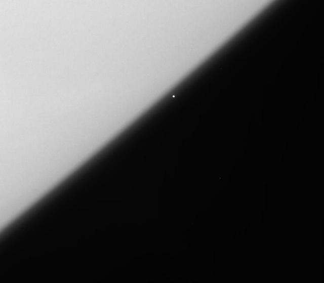
Snapshot from Afar

Phobos from 5,800 Kilometers
The View from Down Under

Streaking Away from Dione

Radiating from Rembrandt
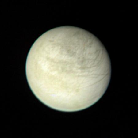
Europa from 2,869,252 Kilometers

Phobos from 6,800 Kilometers

Blazar 3C 279's historic gamma-ray flare can be seen in this image from the Large Area Telescope (LAT) on NASA's Fermi satellite. Gamma rays with energies from 100 million to 100 billion electron volts (eV) are shown; for comparison, visible light has energies between 2 and 3 eV. The image spans 150 degrees, is shown in a stereographic projection, and represents an exposure from June 11 at 00:28 UT to June 17 at 08:17 UT. Credit: NASA/DOE/Fermi LAT Collaboration

NASA image captured December 6, 2010 To view a video of this event go here: <a href="http://www.flickr.com/photos/gsfc/5258354738">www.flickr.com/photos/gsfc/5258354738</a> A very long solar filament that had been snaking around the Sun erupted (Dec. 6, 2010) with a flourish. STEREO (Behind) caught the action in dramatic detail in extreme ultraviolet light of Helium. It had been almost a million km long (about half a solar radius) and a prominent feature on the Sun visible over two weeks earlier before it rotated out of view. Filaments, elongated clouds of cooler gases suspended above the Sun by magnetic forces, are rather unstable and often break away from the Sun. Credit: NASA/GSFC/SOHO <b><a href="http://www.nasa.gov/centers/goddard/home/index.html" rel="nofollow">NASA Goddard Space Flight Center</a></b> enables NASA’s mission through four scientific endeavors: Earth Science, Heliophysics, Solar System Exploration, and Astrophysics. Goddard plays a leading role in NASA’s accomplishments by contributing compelling scientific knowledge to advance the Agency’s mission. <b>Follow us on <a href="http://twitter.com/NASA_GoddardPix" rel="nofollow">Twitter</a></b> <b>Join us on <a href="http://www.facebook.com/pages/Greenbelt-MD/NASA-Goddard/395013845897?ref=tsd" rel="nofollow">Facebook</a></b>
These images of Earth were reconstructed from photos taken by three smartphones in orbit, or "PhoneSats." The trio of PhoneSats launched on April 21, 2013, aboard the Antares rocket from NASA's Wallops Flight Facility and ended a successful mission on April 27. The ultimate goal of the PhoneSat mission was to determine whether a consumer-grade smartphone can be used as the main flight avionics for a satellite in space. During their time in orbit, the three miniature satellites used their smartphone cameras to take pictures of Earth and transmitted these "image-data packets" to multiple ground stations. Every packet held a small piece of the big picture. As the data became available, the PhoneSat Team and multiple amateur radio operators around the world collaborated to piece together photographs from the tiny data packets. Read more: <a href="http://1.usa.gov/ZsWnQG" rel="nofollow">1.usa.gov/ZsWnQG</a> Credit: NASA/Ames <b><a href="http://www.nasa.gov/audience/formedia/features/MP_Photo_Guidelines.html" rel="nofollow">NASA image use policy.</a></b> <b><a href="http://www.nasa.gov/centers/goddard/home/index.html" rel="nofollow">NASA Goddard Space Flight Center</a></b> enables NASA’s mission through four scientific endeavors: Earth Science, Heliophysics, Solar System Exploration, and Astrophysics. Goddard plays a leading role in NASA’s accomplishments by contributing compelling scientific knowledge to advance the Agency’s mission. <b>Follow us on <a href="http://twitter.com/NASA_GoddardPix" rel="nofollow">Twitter</a></b> <b>Like us on <a href="http://www.facebook.com/pages/Greenbelt-MD/NASA-Goddard/395013845897?ref=tsd" rel="nofollow">Facebook</a></b> <b>Find us on <a href="http://instagram.com/nasagoddard?vm=grid" rel="nofollow">Instagram</a></b>
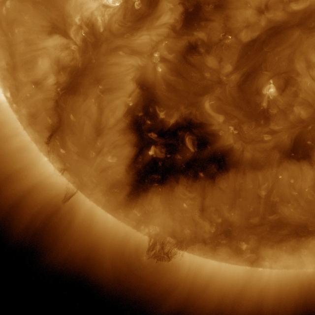
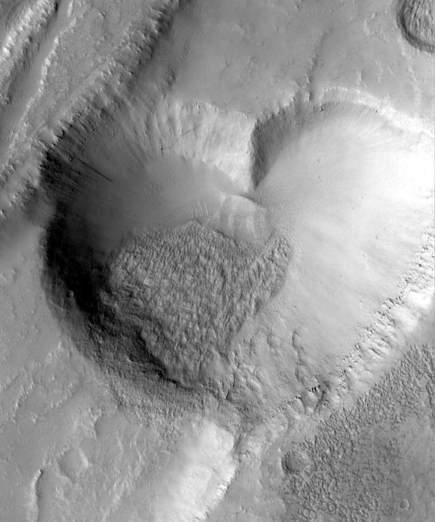
This Solar Dynamics Observatory (SDO) image of the Sun taken on January 20, 2012 in extreme ultraviolet light captures a heart-shaped dark coronal hole. Coronal holes are areas of the Sun's surface that are the source of open magnetic field lines that head way out into space. They are also the source regions of the fast solar wind, which is characterized by a relatively steady speed of approximately 800 km/s (about 1.8 million mph). <b><a href="http://www.nasa.gov/audience/formedia/features/MP_Photo_Guidelines.html" rel="nofollow">NASA image use policy.</a></b> <b><a href="http://www.nasa.gov/centers/goddard/home/index.html" rel="nofollow">NASA Goddard Space Flight Center</a></b> enables NASA’s mission through four scientific endeavors: Earth Science, Heliophysics, Solar System Exploration, and Astrophysics. Goddard plays a leading role in NASA’s accomplishments by contributing compelling scientific knowledge to advance the Agency’s mission. <b>Follow us on <a href="http://twitter.com/NASA_GoddardPix" rel="nofollow">Twitter</a></b> <b>Like us on <a href="http://www.facebook.com/pages/Greenbelt-MD/NASA-Goddard/395013845897?ref=tsd" rel="nofollow">Facebook</a></b> <b>Find us on <a href="http://instagram.com/nasagoddard?vm=grid" rel="nofollow">Instagram</a></b>
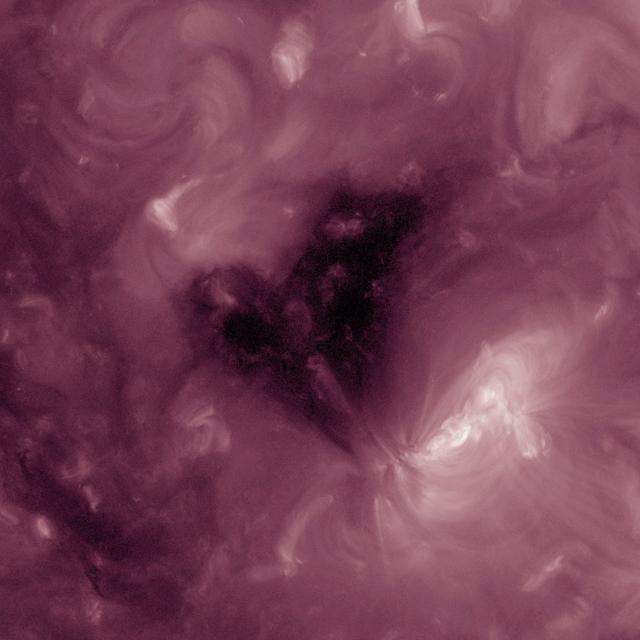
This Solar Dynamics Observatory image of the Sun taken on February 1, 2013 in extreme ultraviolet light captures a heart-shaped dark coronal hole. Coronal holes are areas of the Sun's surface that are the source of open magnetic field lines that head way out into space. They are also the source regions of the fast solar wind, which is characterized by a relatively steady speed of approximately 800 km/s (about 1.8 million mph).

This Solar Dynamics Observatory (SDO) image of the Sun taken on January 20, 2012 in extreme ultraviolet light captures a heart-shaped dark coronal hole. Coronal holes are areas of the Sun's surface that are the source of open magnetic field lines that head way out into space. They are also the source regions of the fast solar wind, which is characterized by a relatively steady speed of approximately 800 km/s (about 1.8 million mph). <b><a href="http://www.nasa.gov/audience/formedia/features/MP_Photo_Guidelines.html" rel="nofollow">NASA image use policy.</a></b> <b><a href="http://www.nasa.gov/centers/goddard/home/index.html" rel="nofollow">NASA Goddard Space Flight Center</a></b> enables NASA’s mission through four scientific endeavors: Earth Science, Heliophysics, Solar System Exploration, and Astrophysics. Goddard plays a leading role in NASA’s accomplishments by contributing compelling scientific knowledge to advance the Agency’s mission. <b>Follow us on <a href="http://twitter.com/NASA_GoddardPix" rel="nofollow">Twitter</a></b> <b>Like us on <a href="http://www.facebook.com/pages/Greenbelt-MD/NASA-Goddard/395013845897?ref=tsd" rel="nofollow">Facebook</a></b> <b>Find us on <a href="http://instagram.com/nasagoddard?vm=grid" rel="nofollow">Instagram</a></b>
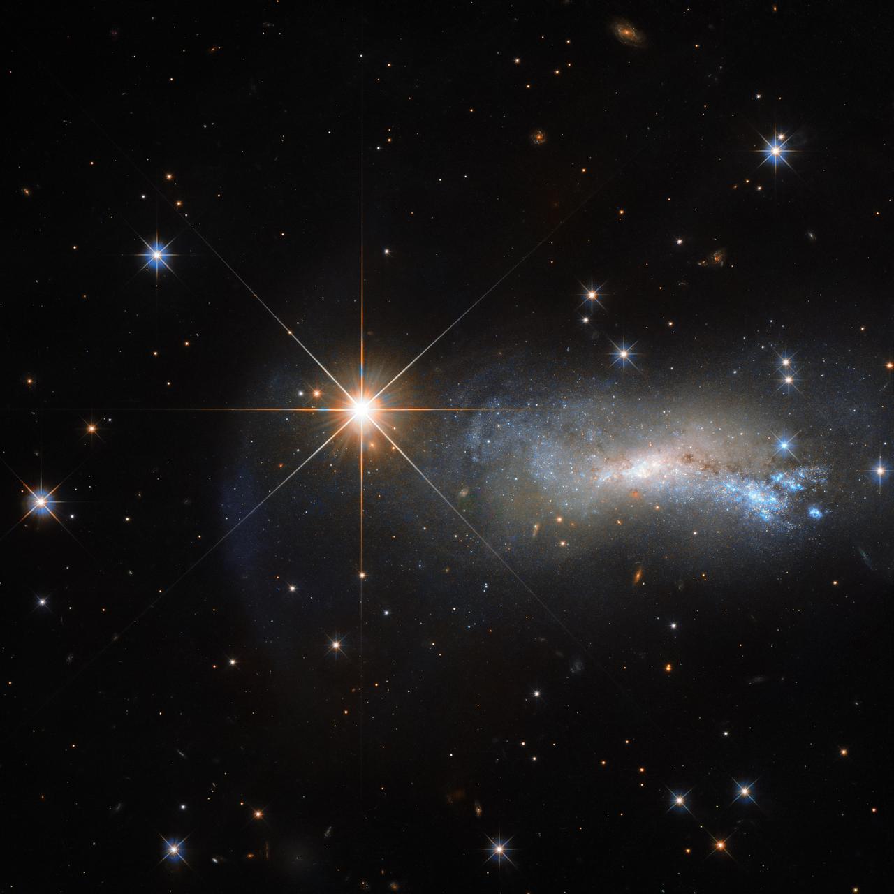
In space, being outshone is an occupational hazard. This NASA/ESA Hubble Space Telescope image captures a galaxy named NGC 7250. Despite being remarkable in its own right — it has bright bursts of star formation and recorded supernova explosions— it blends into the background somewhat thanks to the gloriously bright star hogging the limelight next to it. The bright object seen in this Hubble image is a single and little-studied star named TYC 3203-450-1, located in the constellation of Lacerta (The Lizard). The star is much closer than the much more distant galaxy. Only this way can a normal star outshine an entire galaxy, consisting of billions of stars. Astronomers studying distant objects call these stars “foreground stars” and they are often not very happy about them, as their bright light is contaminating the faint light from the more distant and interesting objects they actually want to study. In this case, TYC 3203-450-1 is million times closer than NGC 7250, which lies more than 45 million light-years away from us. If the star were the same distance from us as NGC 7250, it would hardly be visible in this image. Credit: ESA/Hubble & NASA <b><a href="http://www.nasa.gov/audience/formedia/features/MP_Photo_Guidelines.html" rel="nofollow">NASA image use policy.</a></b> <b><a href="http://www.nasa.gov/centers/goddard/home/index.html" rel="nofollow">NASA Goddard Space Flight Center</a></b> enables NASA’s mission through four scientific endeavors: Earth Science, Heliophysics, Solar System Exploration, and Astrophysics. Goddard plays a leading role in NASA’s accomplishments by contributing compelling scientific knowledge to advance the Agency’s mission. <b>Follow us on <a href="http://twitter.com/NASAGoddardPix" rel="nofollow">Twitter</a></b> <b>Like us on <a href="http://www.facebook.com/pages/Greenbelt-MD/NASA-Goddard/395013845897?ref=tsd" rel="nofollow">Facebook</a></b> <b>Find us on <a href="http://instagrid.me/nasagoddard/?vm=grid" rel="nofollow">Instagram</a></b>
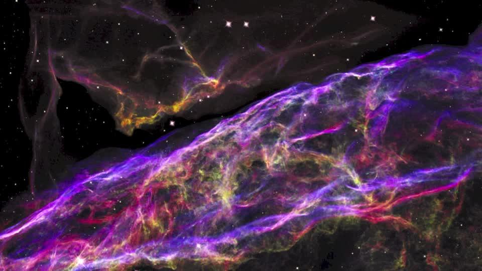
NASA’s Hubble Space Telescope has unveiled in stunning detail a small section of the expanding remains of a massive star that exploded about 8,000 years ago. Called the Veil Nebula, the debris is one of the best-known supernova remnants, deriving its name from its delicate, draped filamentary structures. The entire nebula is 110 light-years across, covering six full moons on the sky as seen from Earth, and resides about 2,100 light-years away in the constellation Cygnus, the Swan. This 3-D visualization flies across a small portion of the Veil Nebula as photographed by the Hubble Space Telescope. Read more: <a href="http://www.nasa.gov/feature/goddard/hubble-zooms-in-on-shrapnel-from-an-exploded-star" rel="nofollow">www.nasa.gov/feature/goddard/hubble-zooms-in-on-shrapnel-...</a> Credit: NASA, ESA, and F. Summers, G. Bacon, Z. Levay, and L. Frattare (Viz 3D Team, STScI) <b><a href="http://www.nasa.gov/audience/formedia/features/MP_Photo_Guidelines.html" rel="nofollow">NASA image use policy.</a></b> <b><a href="http://www.nasa.gov/centers/goddard/home/index.html" rel="nofollow">NASA Goddard Space Flight Center</a></b> enables NASA’s mission through four scientific endeavors: Earth Science, Heliophysics, Solar System Exploration, and Astrophysics. Goddard plays a leading role in NASA’s accomplishments by contributing compelling scientific knowledge to advance the Agency’s mission. <b>Follow us on <a href="http://twitter.com/NASAGoddardPix" rel="nofollow">Twitter</a></b> <b>Like us on <a href="http://www.facebook.com/pages/Greenbelt-MD/NASA-Goddard/395013845897?ref=tsd" rel="nofollow">Facebook</a></b> <b>Find us on <a href="http://instagrid.me/nasagoddard/?vm=grid" rel="nofollow">Instagram</a></b>
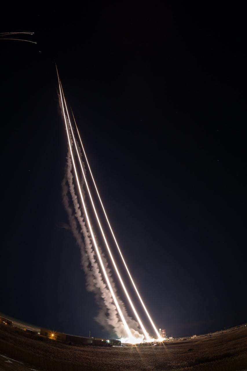
NASA’s Wallops Flight Facility supported the successful launch of three Terrier-Oriole suborbital rockets for the Department of Defense between 2:30 and 2:31 a.m. today, Feb. 24, from NASA’s launch range on the Eastern Shore of Virginia. The next launch from the Wallops Flight Facility is a NASA Terrier-Improved Malemute suborbital sounding rocket between 6 and 9 a.m. on March 27. The rocket will be carrying the Rocksat-X payload carrying university student developed experiments. Credit: NASA/Alison Stancil <b><a href="http://www.nasa.gov/audience/formedia/features/MP_Photo_Guidelines.html" rel="nofollow">NASA image use policy.</a></b> <b><a href="http://www.nasa.gov/centers/goddard/home/index.html" rel="nofollow">NASA Goddard Space Flight Center</a></b> enables NASA’s mission through four scientific endeavors: Earth Science, Heliophysics, Solar System Exploration, and Astrophysics. Goddard plays a leading role in NASA’s accomplishments by contributing compelling scientific knowledge to advance the Agency’s mission. <b>Follow us on <a href="http://twitter.com/NASAGoddardPix" rel="nofollow">Twitter</a></b> <b>Like us on <a href="http://www.facebook.com/pages/Greenbelt-MD/NASA-Goddard/395013845897?ref=tsd" rel="nofollow">Facebook</a></b> <b>Find us on <a href="http://instagram.com/nasagoddard?vm=grid" rel="nofollow">Instagram</a></b>
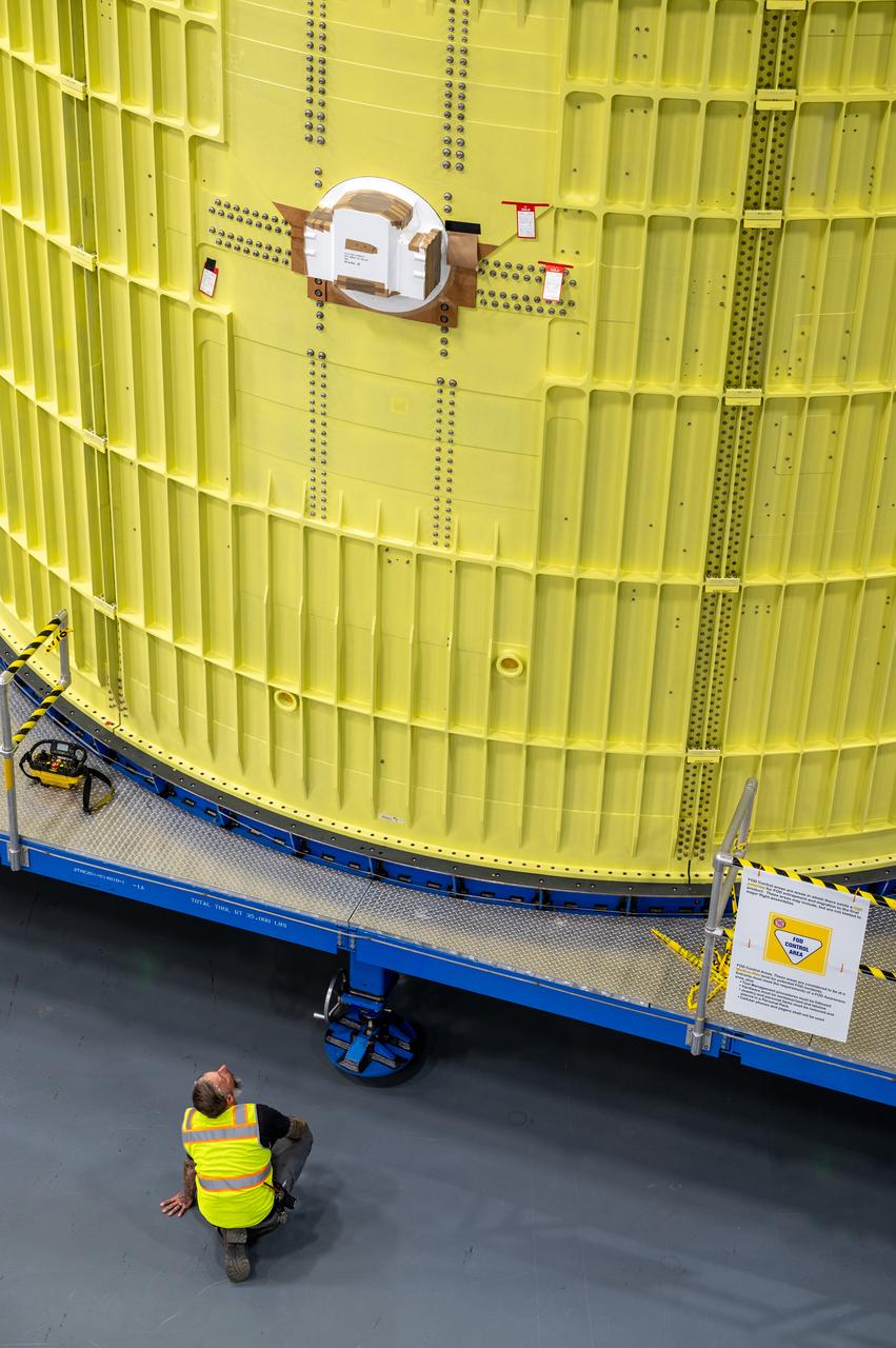
Technicians at NASA’s Michoud Assembly Facility move the intertank of NASA’s Space Launch System rocket for Artemis III to Cell G to await application of the thermal protection system. Thermal protection systems protect space vehicles from aerodynamic heating during entry to planet atmosphere and re-entry to earth atmosphere. The intertank lays between the liquid hydrogen tank and liquid oxygen tank. Together with the engine section and the forward skirt, they comprise the SLS core stage. The liquid hydrogen tank and liquid oxygen tank hold 733,000 gallons of propellant to power the stage’s four RS-25 engines needed for liftoff and Artemis missions to the Moon and future missions to Mars.
Technicians at NASA’s Michoud Assembly Facility move the intertank of NASA’s Space Launch System rocket for Artemis III to Cell G to await application of the thermal protection system. Thermal protection systems protect space vehicles from aerodynamic heating during entry to planet atmosphere and re-entry to earth atmosphere. The intertank lays between the liquid hydrogen tank and liquid oxygen tank. Together with the engine section and the forward skirt, they comprise the SLS core stage. The liquid hydrogen tank and liquid oxygen tank hold 733,000 gallons of propellant to power the stage’s four RS-25 engines needed for liftoff and Artemis missions to the Moon and future missions to Mars.
Technicians at NASA’s Michoud Assembly Facility move the intertank of NASA’s Space Launch System rocket for Artemis III to Cell G to await application of the thermal protection system. Thermal protection systems protect space vehicles from aerodynamic heating during entry to planet atmosphere and re-entry to earth atmosphere. The intertank lays between the liquid hydrogen tank and liquid oxygen tank. Together with the engine section and the forward skirt, they comprise the SLS core stage. The liquid hydrogen tank and liquid oxygen tank hold 733,000 gallons of propellant to power the stage’s four RS-25 engines needed for liftoff and Artemis missions to the Moon and future missions to Mars.