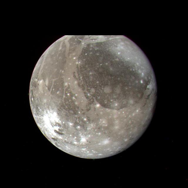
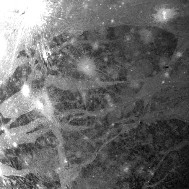
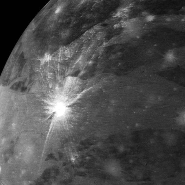
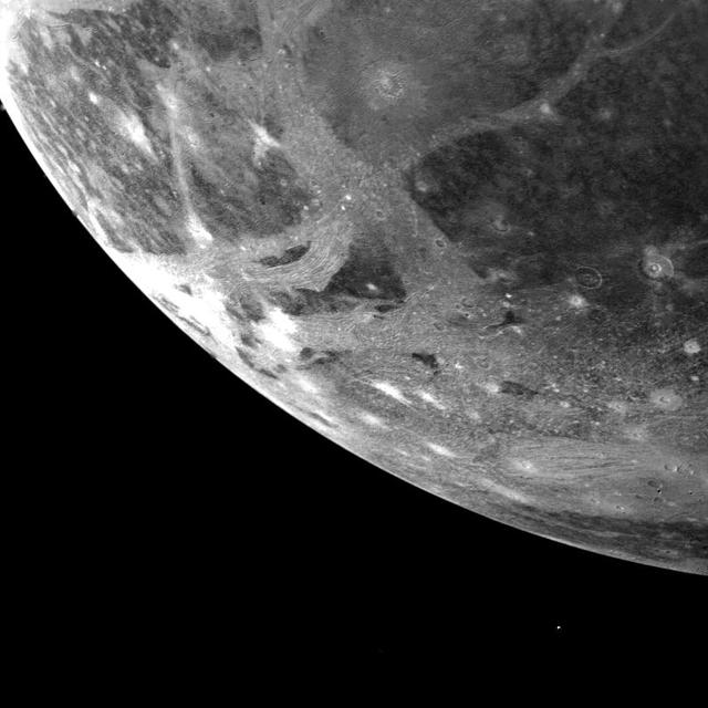
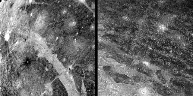
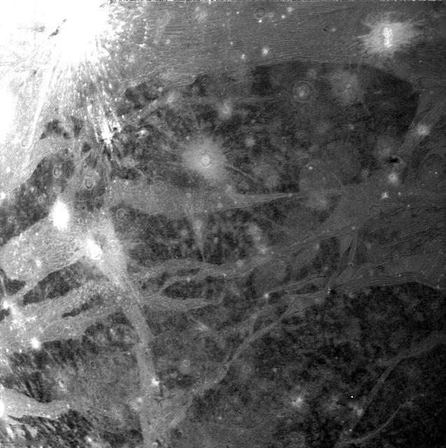
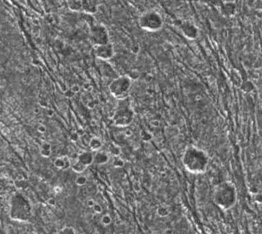
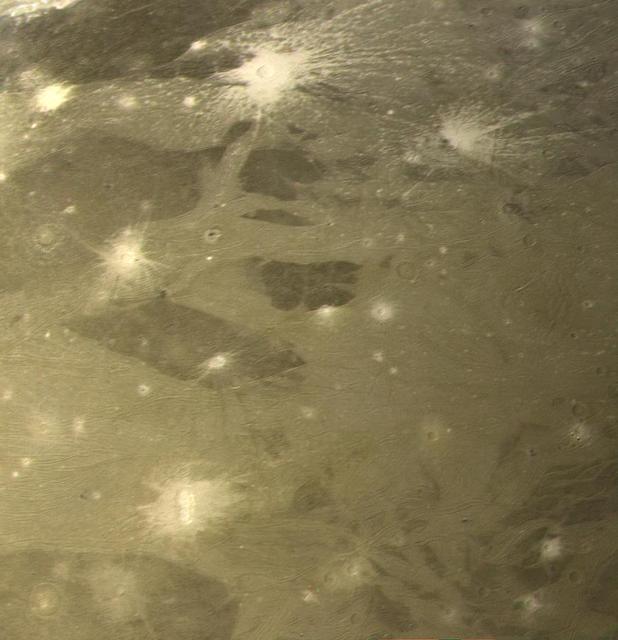
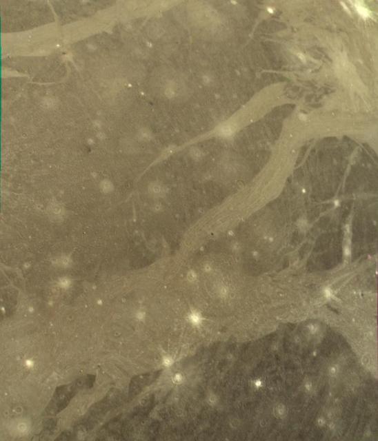
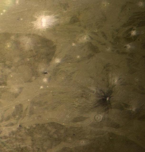
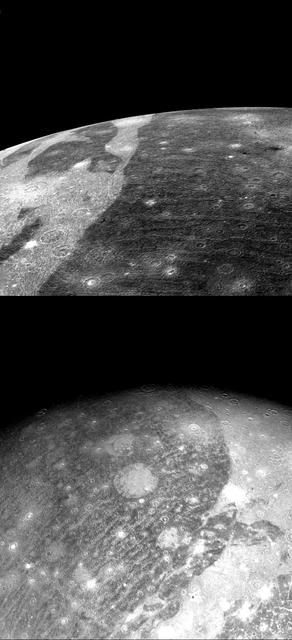
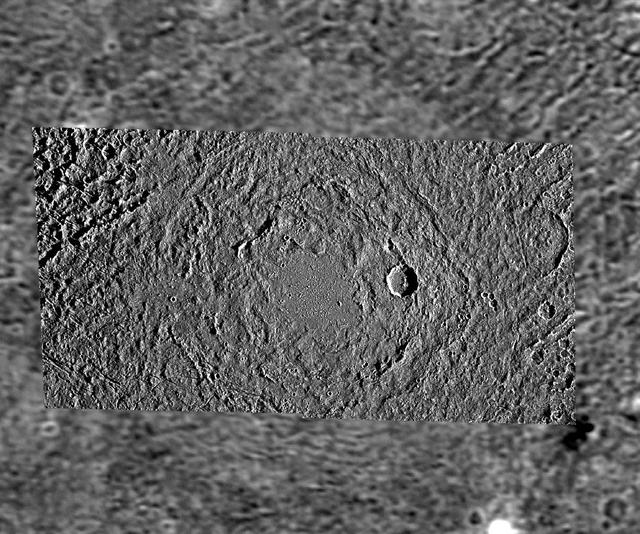
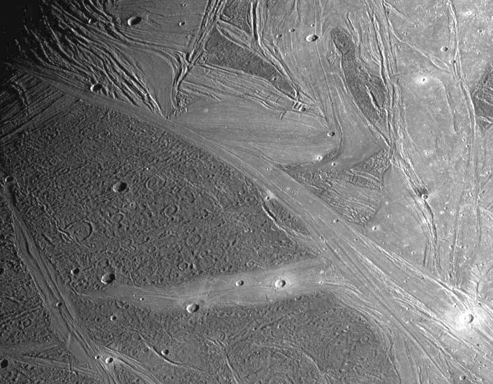
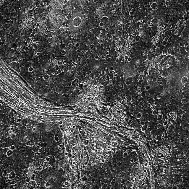
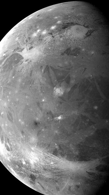
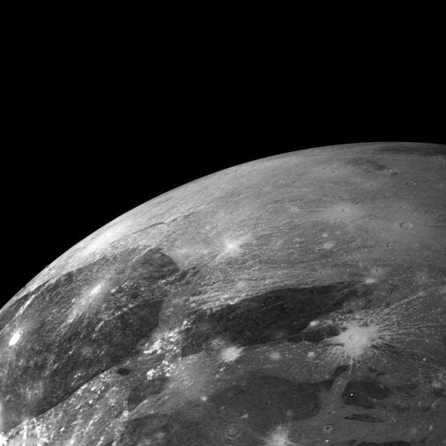
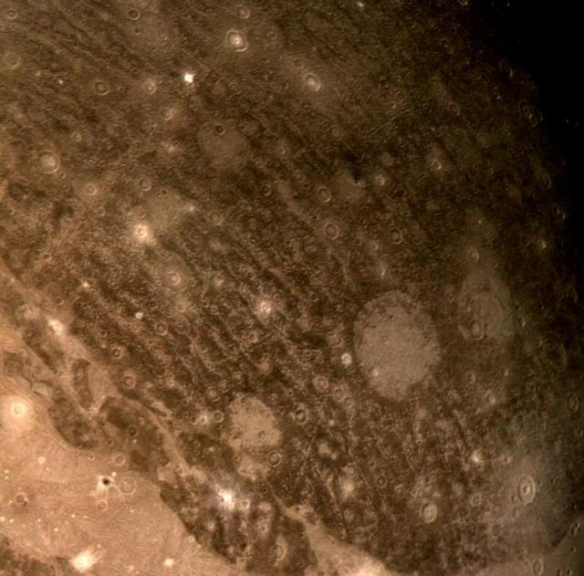
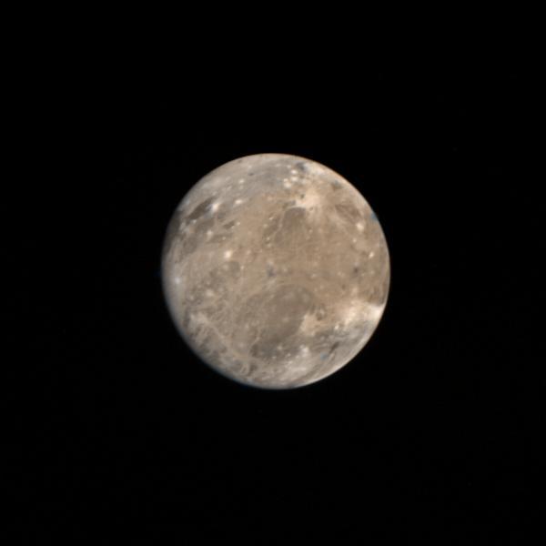
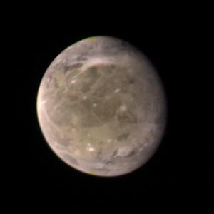
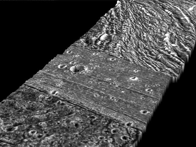
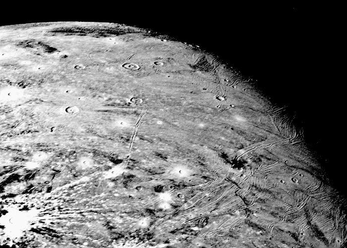
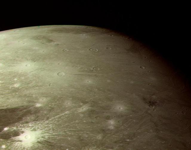
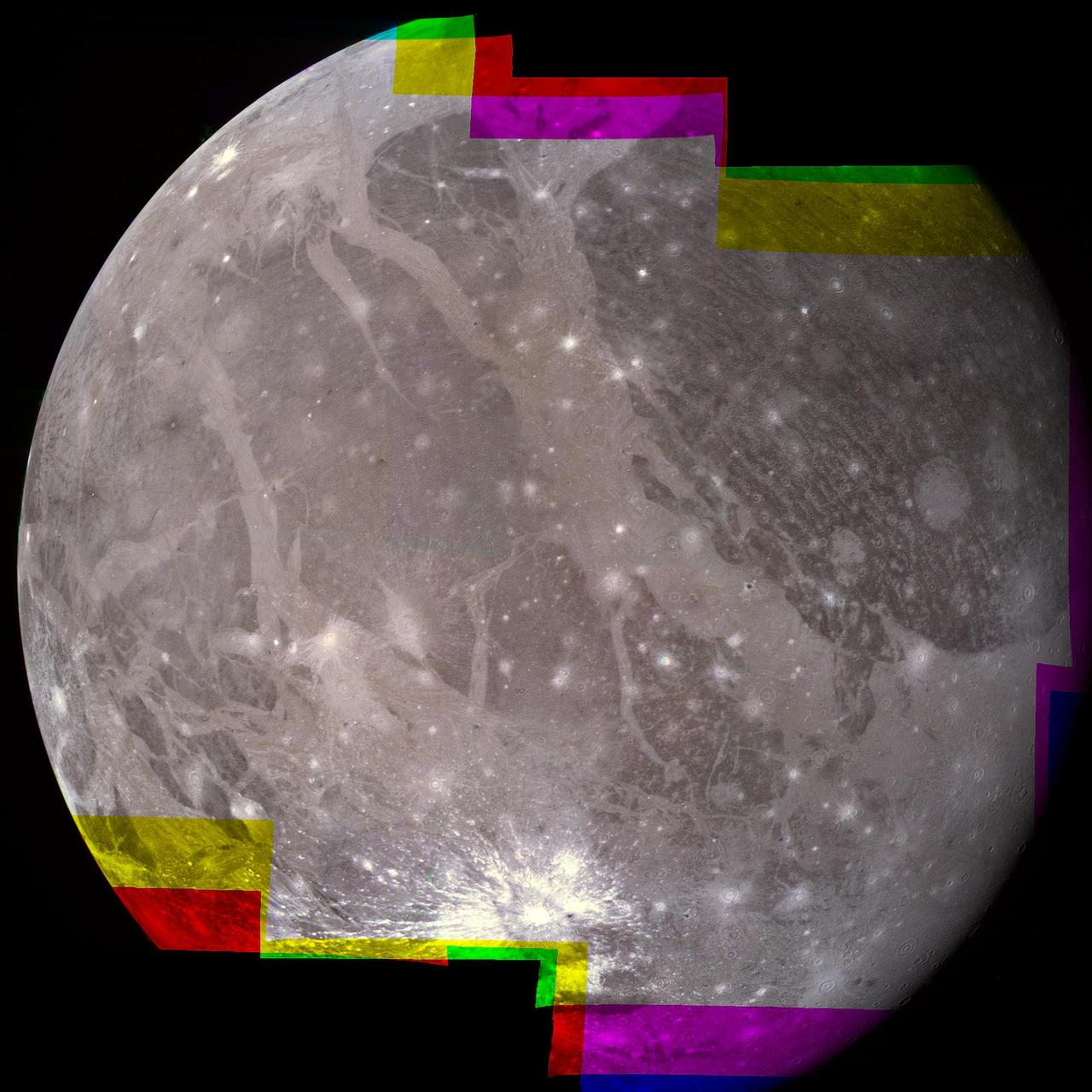
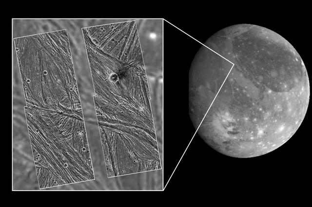
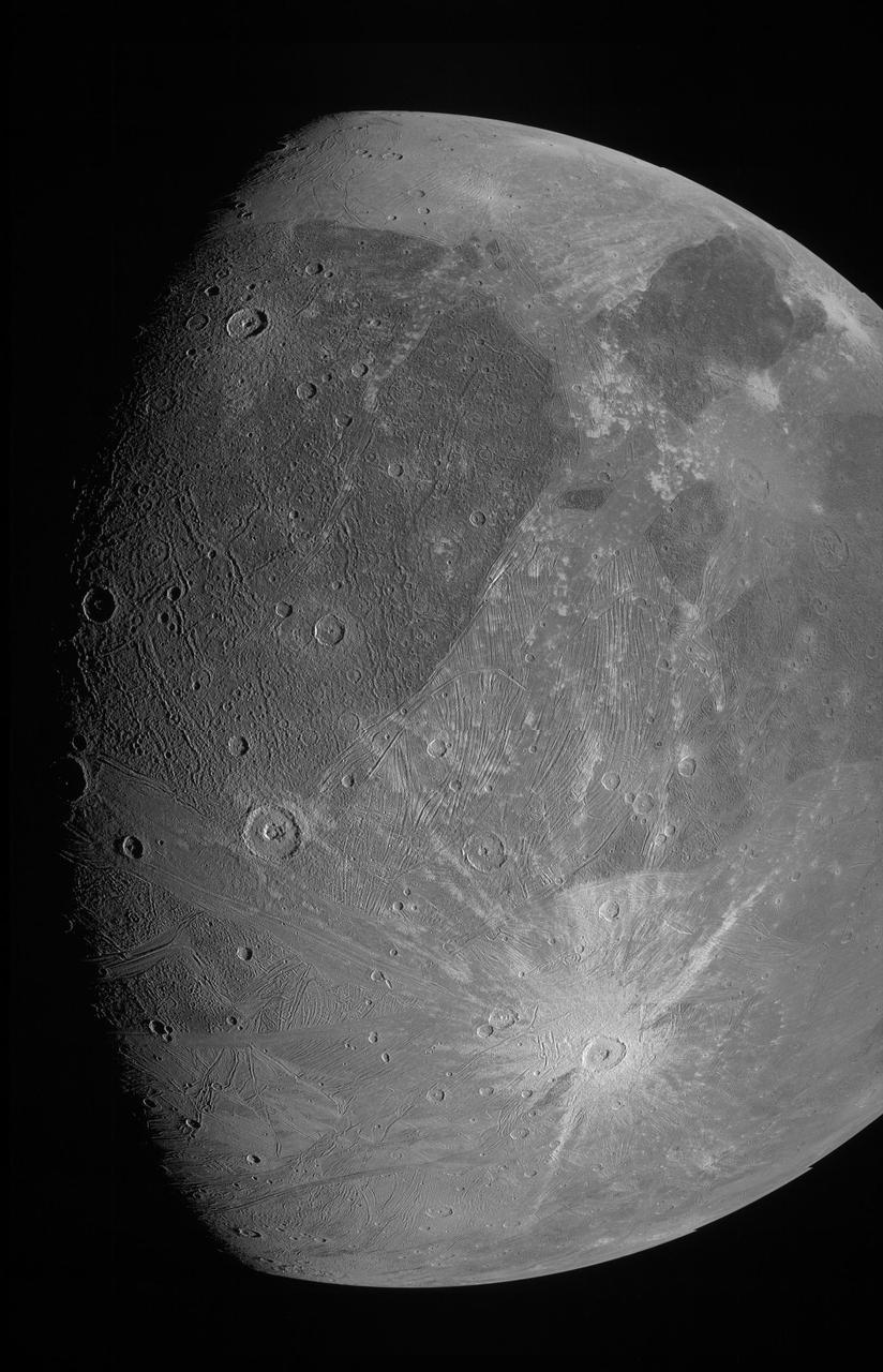
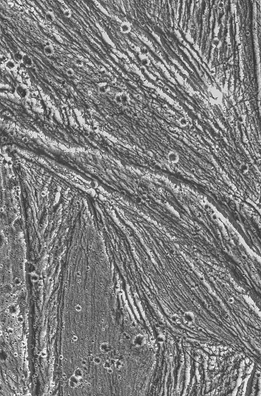
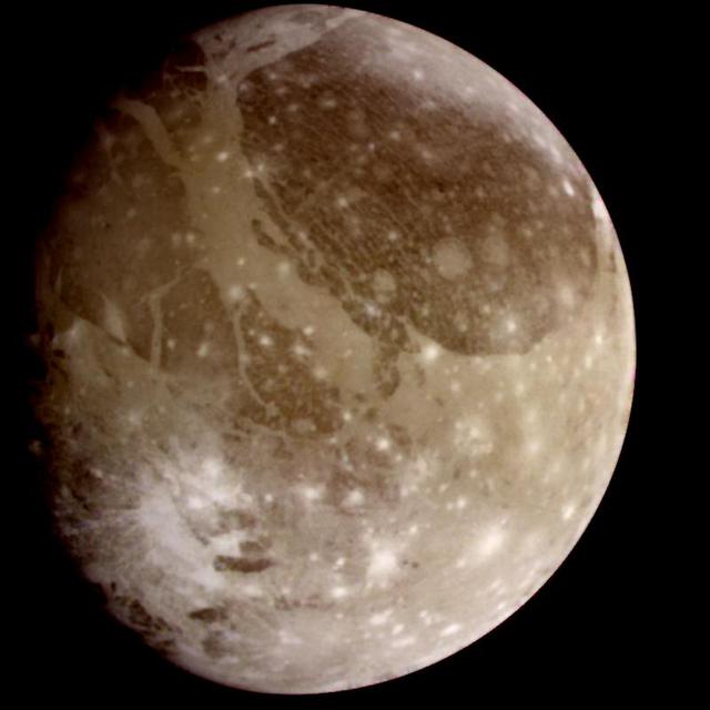
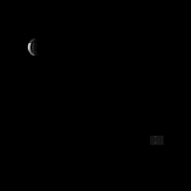
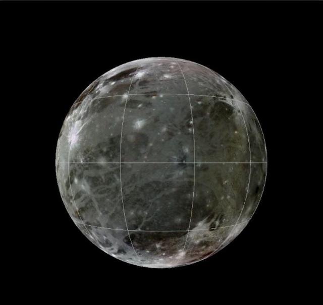
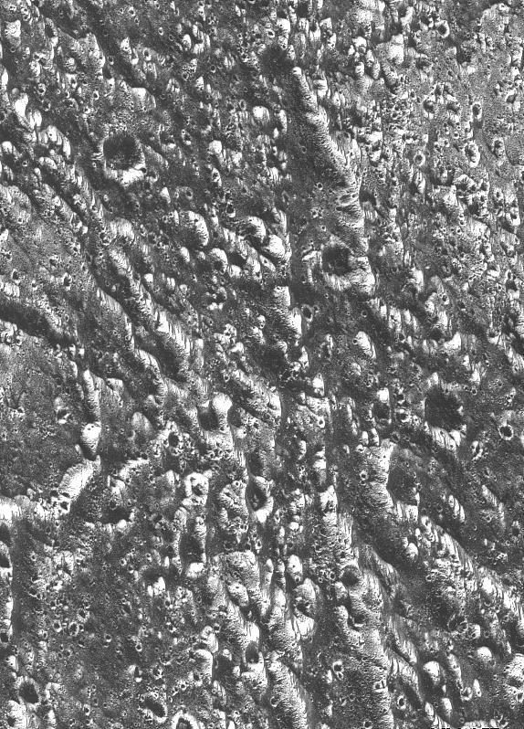
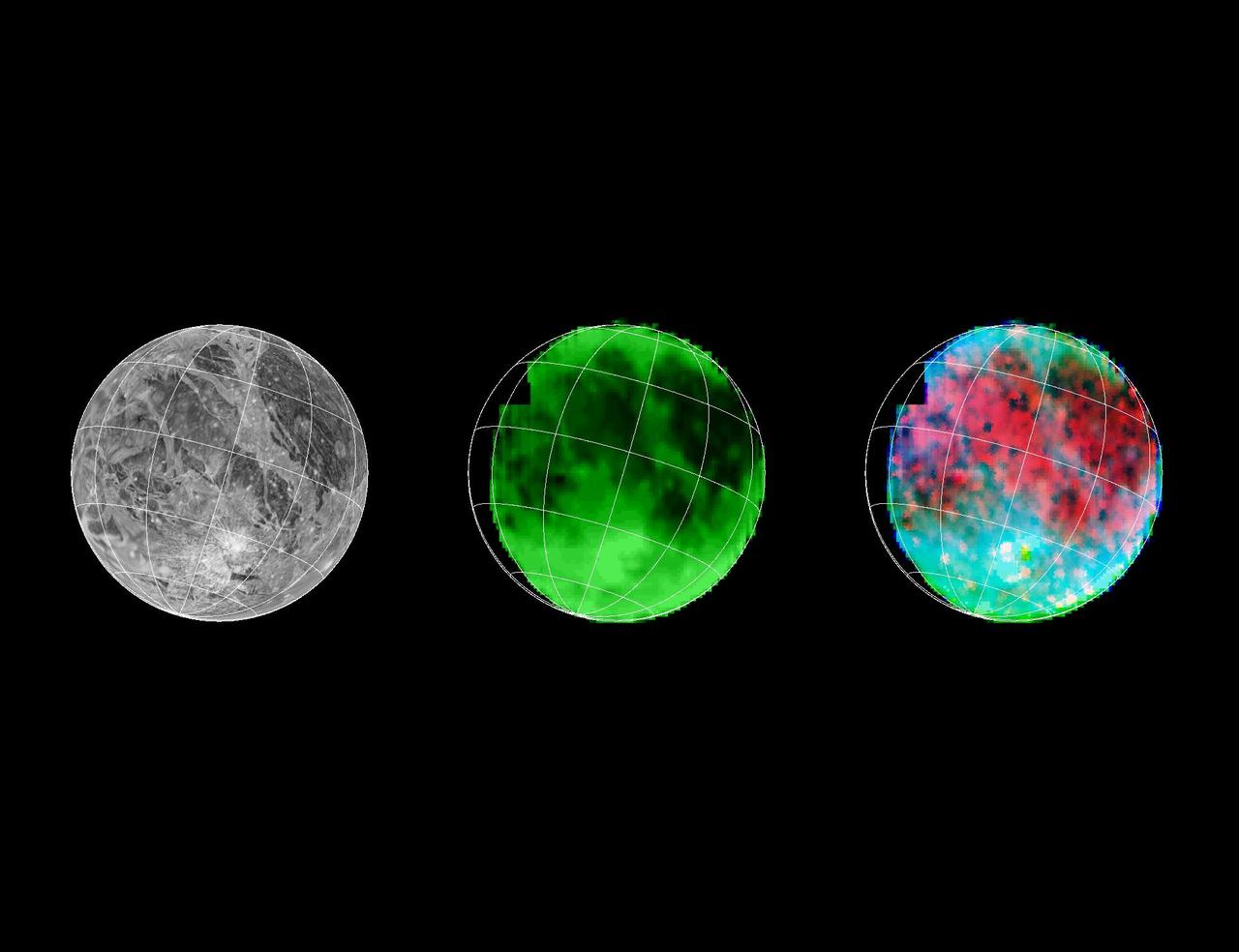
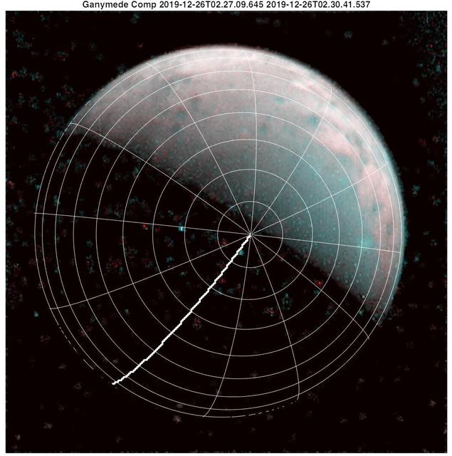
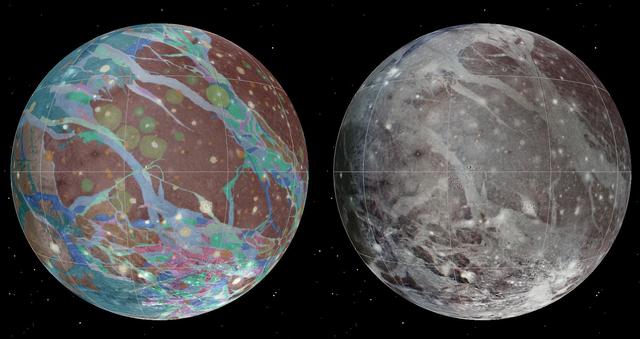
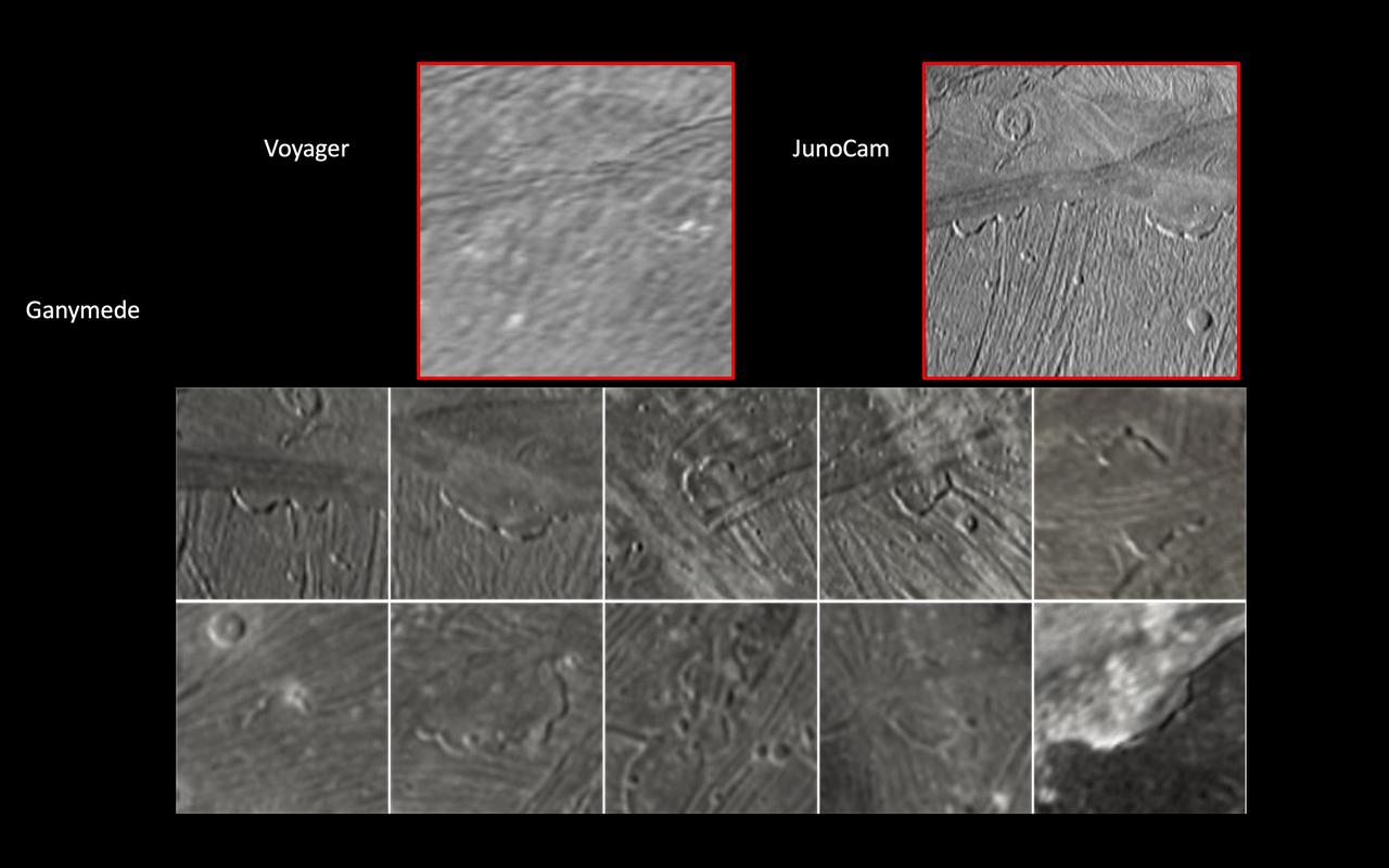
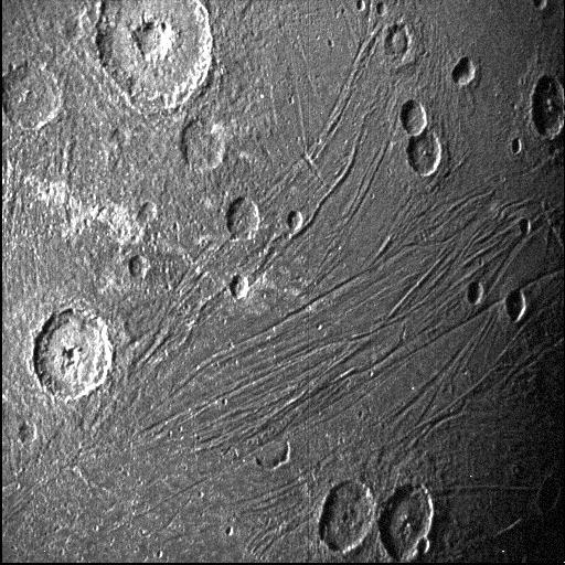
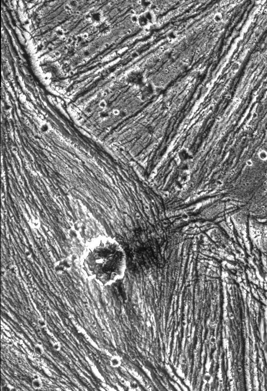
Ganymede
Ganymede
Ganymede
Ganymede
Ganymede
Ganymede
Ganymede
Ganymede
Ganymede
Ganymede
Ganymede
Ganymede
Ganymede Topography
Ganymede Topography
Ganymede Global
Ganymede Global
Ganymede - Surface
Ganymede - Surface
Ganymede Varied Terrain
Secondary Craters on Ganymede
Cratering and Grooved Terrain on Ganymede
Ganymede Varied Terrain
Ganymede Equatorial Region
Grooves and Craters on Ganymede
Region of Ganymede with Mix of Terrains
Ganymede - Close Up Photos
Bright and Dark Slopes on Ganymede
Erech Sulcus, Ganymede
Ganymede Groove Lanes
Buto Facula - A Palimpsest on Ganymede
Nighttime Temperatures on Ganymede
Ganymede Nippur Sulcus
Ganymede Trailing Hemisphere
Regional View of Ganymede
A Polar Crater on Ganymede
Comparison of Ganymede and Europa features
Caldera-like depression on Ganymede
Marius Regio, Ganymede
Fractured Craters on Ganymede
Palimpsest secondary craters on Ganymede
Pre-Dawn Temperatures on Ganymede
Swaths of Grooved Terrain on Ganymede
Geological Mysteries on Ganymede
Completing a Global Map of Ganymede
Sippar Sulcus, Ganymede
Nergal Crater on Ganymede
Complex Tectonism on Ganymede
Fresh Impact Craters on Ganymede
Fractures in Transitional Terrain on Ganymede
Caldera in Sippar Sulcus, Ganymede
Ganymede - high resolution
Khensu Crater on Ganymede
Ganymede Feature Resembling Europa
Ganymede Northern Hemisphere  http://photojournal.jpl.nasa.gov/catalog/PIA00356
Ganymede Northern Hemisphere
Ganymede at 87,000 miles  http://photojournal.jpl.nasa.gov/catalog/PIA00354
Ganymede at 87,000 miles
Ganymede Full Disk  http://photojournal.jpl.nasa.gov/catalog/PIA00353
Ganymede Full Disk
Crater Rays on Ganymede  http://photojournal.jpl.nasa.gov/catalog/PIA00334
Crater Rays on Ganymede
Ganymede at 3.4 million miles  http://photojournal.jpl.nasa.gov/catalog/PIA00352
Ganymede at 3.4 million miles
Ganymede at 2.6 million miles  http://photojournal.jpl.nasa.gov/catalog/PIA00351
Ganymede at 2.6 million miles
Global Map of Ganymede
Ganymede in Visible and Infrared Light
Ice-frosted crater tops on Ganymede
Grooved Terrain in Nippur Sulcus on Ganymede
Pedestal Craters Gula and Achelous on Ganymede
Ganymede Dark Terrain at High Resolution
Perspective view of Arbela Sulcus, Ganymede
A Tumultuous Past for Ganymede Dark Terrain
NIMS Observes Melkart Crater on Ganymede
Dark-floored Impact Craters on Ganymede
Bright-Dark Terrain Boundary, Ganymede
Ridges and Troughs in Sippar Sulcus, Ganymede
NASA's Voyager images are used to create a global view of Ganymede. The cut-out reveals the interior structure of this icy moon. This structure consists of four layers based on measurements of Ganymede's gravity field and theoretical analyses using Ganymede's known mass, size and density. Ganymede's surface is rich in water ice and Voyager and Galileo images show features which are evidence of geological and tectonic disruption of the surface in the past. As with the Earth, these geological features reflect forces and processes deep within Ganymede's interior. Based on geochemical and geophysical models, scientists expected Ganymede's interior to either consist of: a) an undifferentiated mixture of rock and ice or b) a differentiated structure with a large lunar sized "core" of rock and possibly iron overlain by a deep layer of warm soft ice capped by a thin cold rigid ice crust. Galileo's measurement of Ganymede's gravity field during its first and second encounters with the huge moon have basically confirmed the differentiated model and allowed scientists to estimate the size of these layers more accurately. In addition the data strongly suggest that a dense metallic core exists at the center of the rock core. This metallic core suggests a greater degree of heating at sometime in Ganymede's past than had been proposed before and may be the source of Ganymede's magnetic field discovered by Galileo's space physics experiments.  http://photojournal.jpl.nasa.gov/catalog/PIA00519
Ganymede G1 & G2 Encounters - Interior of Ganymede
Bright Halo Impact Crater on Ganymede  http://photojournal.jpl.nasa.gov/catalog/PIA00357
Bright Halo Impact Crater on Ganymede
This picture of Ganymede, Jupiter's largest satellite, was taken by NASA's Voyager 1 on the afternoon of March 5, 1979, from a range of about 250,000 km (150,000 mi.). The center of the picture is at 60 north latitude and 318 longitude, and the distance across the bottom of the photograph is about 1000 km (600 mi.). The smallest features visible in this picture are about 5 km (3 mi.) across. This picture shows impact craters many of which display ray systems probably consisting largely of icy material thrown out by the impacts. Peculiar systems of sinuous ridges and grooves traverse the surface and are best seen near the terminator. These ridges and grooves are probably the result of deformation of the thick ice crust on Ganymede.   http://photojournal.jpl.nasa.gov/catalog/PIA00380
Ganymede At 150,000 Miles
Dome Crater Neith on Jupiter Satellite Ganymede
Stair-step Scarps in Dark Terrain on Ganymede
Bright Ray Craters in Ganymede Northern Hemisphere
Galileo Resolutions: Ganymede and the San Francisco Bay Area
The hemisphere of Ganymede that faces away from the Sun displays a great variety of terrain in this mosaic from NASA Voyager 2.  http://photojournal.jpl.nasa.gov/catalog/PIA00081
Ganymede Mosaic
Calderas on Ganymede?
The north pole of Jupiter's giant moon Ganymede can be seen in this composite image of infrared data from the Jovian Infrared Auroral Mapper (JIRAM) instrument aboard NASA's Juno spacecraft. Five infrared images were taken every 20 minutes, beginning at time of closest approach (far left) on Dec. 26, 2019, when Juno was about 62,000 miles (100,000 kilometers) distant. The infrared imagery provides the first infrared mapping of the massive moon's northern frontier.  As Ganymede has no atmosphere to impede the progress of charged particles from the Sun, the surface at its poles is constantly being bombarded by plasma from Jupiter's gigantic magnetosphere. The bombardment has a dramatic effect on Ganymede's ice. Frozen water molecules detected at both poles have no appreciable order to their arrangement, and the amorphous ice has a different infrared signature than the crystalline ice found at Ganymede's equator.  JIRAM was designed to capture the infrared light emerging from deep inside Jupiter, probing the weather layer down to 30 to 45 miles (50 to 70 kilometers) below Jupiter's cloud tops.  https://photojournal.jpl.nasa.gov/catalog/PIA23988
Five Ganymedes
This infrared view of Ganymede was obtained by the Jovian Infrared Auroral Mapper (JIRAM) instrument aboard NASA's Juno spacecraft during its July 20th, 2021, flyby. JIRAM "sees" in infrared light not visible to the human eye, providing information on Ganymede's icy shell and the composition of the ocean of liquid water beneath. It was designed to capture the infrared light emerging from deep inside Jupiter, probing the weather layer down to 30 to 45 miles (50 to 70 kilometers) below Jupiter's cloud tops.  During the flyby, Juno came within 31,136 miles (50,109 kilometers) of the icy orb. Together with the previous observational geometries provided, this data gives the opportunity for JIRAM to see different regions for the first time, as well as to compare the diversity in composition between the low and high latitudes.  Because Ganymede has no atmosphere to impede the solar wind, or progress of charged particles from the Sun, the surface at its poles is constantly being bombarded by plasma from Jupiter's gigantic magnetosphere. The bombardment has a dramatic effect on Ganymede's ice: Ice is crystallized by heating at the equator and amorphized by particle radiation at the polar regions.  https://photojournal.jpl.nasa.gov/catalog/PIA24791
Ganymede in Infrared
This mosaic of Jupiter’s moon Ganymede consists of more than 100 images acquired with NASA’s Voyager and Galileo spacecrafts, showing irregular lumps beneath the icy surface.
Lumps Within Ganymede
This map shows the temperatures for most of the surface of Ganymede made from data taken by on Jun. 26, 1996 as NASA Galileo approached the sunlit side of the moon.
Temperature Map of Ganymede
Ganymede Galileo Regio High Resolution Mosaic Shown in Context
Ganymede Uruk Sulcus High Resolution Mosaic Shown in Context
Detail of Ganymede Uruk Sulcus Region as Viewed by Galileo and Voyager
This animation illustrates how the magnetic field surrounding Jupiter's moon Ganymede (represented by the blue lines) interacts with and disrupts the magnetic field surrounding Jupiter (represented by the orange lines).  During the June 2021 close approach to Ganymede by NASA's Juno spacecraft, the Magnetic Field (MAG) and Jovian Auroral Distributions Experiment (JADE) instruments aboard the spacecraft recorded data showing evidence of the breaking and reforming of magnetic field connections between Jupiter and Ganymede.  Studying Ganymede's magnetic field can provide scientists with clues about the nature of the salty water reservoir suspected to exist deep under the moon's surface.  Animation available at https://photojournal.jpl.nasa.gov/catalog/PIA25724
NASA's Juno Mission Explores the Magnetic Connection Between Jupiter and Ganymede
Topographic detail is seen in a stereoscopic view of this part of Jupiter moon Ganymede. This image is a computer reconstruction from two images taken by NASA Galileo spacecraft in 1996.
Stereo View of Ganymede Galileo Regio
This image of the Jovian moon Ganymede was obtained by the JunoCam imager aboard NASA's Juno spacecraft during its June 7, 2021, flyby of the icy moon. At the time of closest approach, Juno was within 645 miles (1,038 kilometers) of its surface – closer to Jupiter's largest moon than any other spacecraft has come in more than two decades.  This image is a preliminary product – Ganymede as seen through JunoCam's green filter. Juno is a spin-stabilized spacecraft (with a rotation rate of 2 rpm), and the JunoCam imager has a fixed field of view. To obtain Ganymede images as Juno rotated, the camera acquired a strip at a time as the target passed through its field of view. These image strips were captured separately through the red, green, and blue filters. To generate the final image product, the strips must be stitched together and colors aligned.  At the time this preliminary image was generated, the "spice kernels" (navigation and other ancillary information providing precision observation geometry) necessary to properly map-project the imagery were not available. The red, and blue filtered image strips were also not available. When the final spice kernel data and images from the two filters are incorporated, the images seams (most prevalent on lower right of sphere) will disappear and a complete color image will be generated.  https://photojournal.jpl.nasa.gov/catalog/PIA24681
Juno's Ganymede Close-up
Ridges, grooves, craters and relatively smooth areas in the Uruk Sulcus region of Jupiter moon Ganymede are shown in this high-resolution image captured by NASA Galileo spacecraft during its first flyby of Ganymede on June 27, 1996.  http://photojournal.jpl.nasa.gov/catalog/PIA00276
Ganymede - Ridges, Grooves, Craters and Smooth Areas of Uruk Sulcus Region
Natural color view of Ganymede from NASA Galileo spacecraft during its first encounter with the satellite. The dark areas are the older, more heavily cratered regions and the light areas are younger, tectonically deformed regions.
Ganymede Color Global
This look at the complex surface of Jupiter's moon Ganymede came from NASA's Juno mission during a close pass by the giant moon in June 2021. At closest approach, the spacecraft came within just 650 miles (1,046 kilometers) of Ganymede's surface.  Most of Ganymede's craters have bright rays extending from the impact scar, but about 1 percent of the craters have dark rays. This image taken by JunoCam during the close Ganymede pass shows one of the dark-rayed craters. The crater, named Kittu, is about 9 miles (15 kilometers) across, surrounded by darker material ejected during the impact that formed the crater. Scientists believe that contamination from the impactor produced the dark rays. As time passes, the rays stay dark because they are a bit warmer than the surroundings, so ice is driven off to condense on nearby colder, brighter terrain.  Ganymede is the largest moon in our solar system, larger even than the planet Mercury. It's the only moon known to have its own magnetic field, which causes auroras that circle the moon's poles. Evidence also indicates Ganymede may hide a liquid water ocean beneath its icy surface.  Citizen scientist Thomas Thomopoulos created this enhanced-color image using data from the JunoCam camera. The original image was taken on June 7, 2021.  https://photojournal.jpl.nasa.gov/catalog/PIA25012
A Striking Crater on Jupiter's Moon Ganymede
Ganymede Shadow
Ganymede Shadow
Io and Ganymede
Io and Ganymede
Topographic detail is seen in this stereoscopic view of the Galileo Regio region of Jupiter moon Ganymede. The picture is a computer reconstruction from two images taken by NASA Galileo during 1996.
Stereo View of Ganymede Galileo Region
This view of a part of the Galileo Regio region on Jupiter moon Ganymede shows fine details of the dark terrain that makes up about half of the surface of the planet-sized moon.  http://photojournal.jpl.nasa.gov/catalog/PIA00278
Ganymede - Dark Terrain in Galileo Regio
NASA Galileo spacecraft, now in orbit around Jupiter, returned this optical navigation image June 3, 1996, showing that the spacecraft is accurately targeted for its first flyby of the giant moon Ganymede on June 27.  http://photojournal.jpl.nasa.gov/catalog/PIA00273
Optical Navigation Image of Ganymede
This is a frame from an animation of a rotating globe of Jupiter moon Ganymede, with a geologic map superimposed over a global color mosaic, incorporating the best available imagery from NASA Voyager 1 and 2 spacecraft, and Galileo spacecraft.
Rotating Globe of Ganymede Geology
This annotated map of depicts the areas on the surface of Jupiter's moon Ganymede that were imaged by the Jovian Infrared Auroral Mapper (JIRAM) instrument aboard NASA's Juno spacecraft during two close approaches of the moon.  The region shaded in blue depicts the area JIRAM covered as Juno flew past at a distance of 62,000 miles (100,000 kilometers) on Dec. 26, 2019. The infrared camera took 40 images during the encounter. The region shaded in red illustrates JIRAM coverage during the July 20, 2021, flyby, when Juno came within 31,000 miles (50,000 kilometers) of Ganymede's surface and JIRAM took 14 infrared images.  The different observational geometry of the flybys provided an opportunity to see the north polar region for the first time as well as compare the diversity in composition between Ganymede's low and high latitudes.  JIRAM "sees" in infrared light not visible to the human eye, providing information on Ganymede's icy shell and the composition of the ocean of liquid water beneath. It was designed to capture the infrared light emerging from deep inside Jupiter, probing the weather layer down to 30 to 45 miles (50 to 70 kilometers) below Jupiter's cloud tops.  https://photojournal.jpl.nasa.gov/catalog/PIA24792
Ganymede Coverage by the JIRAM Instrument Aboard Juno
High Latitude Bright and Dark Terrains on Ganymede
Ancient impact craters shown in this image of Jupiter moon Ganymede taken by NASA Galileo spacecraft testify to the great age of the terrain, dating back several billion years.  http://photojournal.jpl.nasa.gov/catalog/PIA00279
Ganymede - Ancient Impact Craters in Galileo Regio
Galileo has eyes that can see more than ours can. By looking at what we call the infrared wavelengths, the NIMS (Near Infrared Mapping Spectrometer) instrument can determine what type and size of material is on the surface of a moon. Here, 3 images of Ganymede are shown.  Left: Voyager's camera. Middle: NIMS, showing water ice on the surface. Dark is less water, bright is more. Right: NIMS, showing the locations of minerals in red, and the size of ice grains in shades of blue.  http://photojournal.jpl.nasa.gov/catalog/PIA00500
NIMS Ganymede Surface Map
The north pole of Ganymede can be seen in center of this annotated image taken by the JIRAM infrared imager aboard NASA's Juno spacecraft on Dec. 26, 2019. Longitudinal lines appear every 30-degrees. The thick line is 0-degrees longitude. At the time the data for this image was captured, Juno was flying in the proximity of the north pole of the Jovian moon.  https://photojournal.jpl.nasa.gov/catalog/PIA23987
Ganymede's North Pole with Gridlines
To present the best information in a single view of Jupiter moon Ganymede, a global image mosaic was assembled, incorporating the best available imagery from NASA Voyager 1 and 2 spacecraft and NASA Galileo spacecraft.
Ganymede Global Geologic Map and Global Image Mosaic
A mosaic of four Galileo high-resolution images of the Uruk Sulcus region of Jupiter moon Ganymede is shown within the context of an image of the region taken by Voyager 2 in 1979.  http://photojournal.jpl.nasa.gov/catalog/PIA00281
Ganymede - Galileo Mosaic Overlayed on Voyager Data in Uruk Sulcus Region
JunoCam, the public engagement camera aboard NASA's Juno spacecraft, captured these views of Jupiter's moon Ganymede during a close pass on June 7, 2021. JunoCam was able to obtain significantly higher quality images compared to those taken by NASA's Voyager spacecraft in 1979 (upper left).  In these images, JunoCam revealed 12 paterae – broad, shallow bowl-shaped features on a planetary body's surface – only two of which are evident in the Voyager data. These features were likely formed by late-stage volcanic processes.  https://photojournal.jpl.nasa.gov/catalog/PIA25721
Juno Zooms in on Jupiter's Moon Ganymede
This image of the dark side of the Jovian moon Ganymede was obtained by the Stellar Reference Unit star camera aboard NASA's Juno spacecraft during its June 7, 2021, flyby of the icy moon.  Usually used to the spacecraft on course, the navigation camera was able to obtain an image of the moon's dark side (the side opposite the Sun) because it was bathed in the dim light scattered off Jupiter; the camera operates exceptionally well in low-light conditions.  https://photojournal.jpl.nasa.gov/catalog/PIA24682
Close-up of Dark Side of Jupiter Moon Ganymede
A mixture of terrains studded with a large impact crater is shown in this view of the Uruk Sulcus region of Jupiter moon Ganymede taken by NASA Galileo spacecraft during its first flyby of the planet-sized moon on June 27, 1996.  http://photojournal.jpl.nasa.gov/catalog/PIA00280
Ganymede - Mixture of Terrains and Large Impact Crater in Uruk Sulcus Region