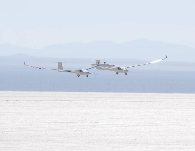
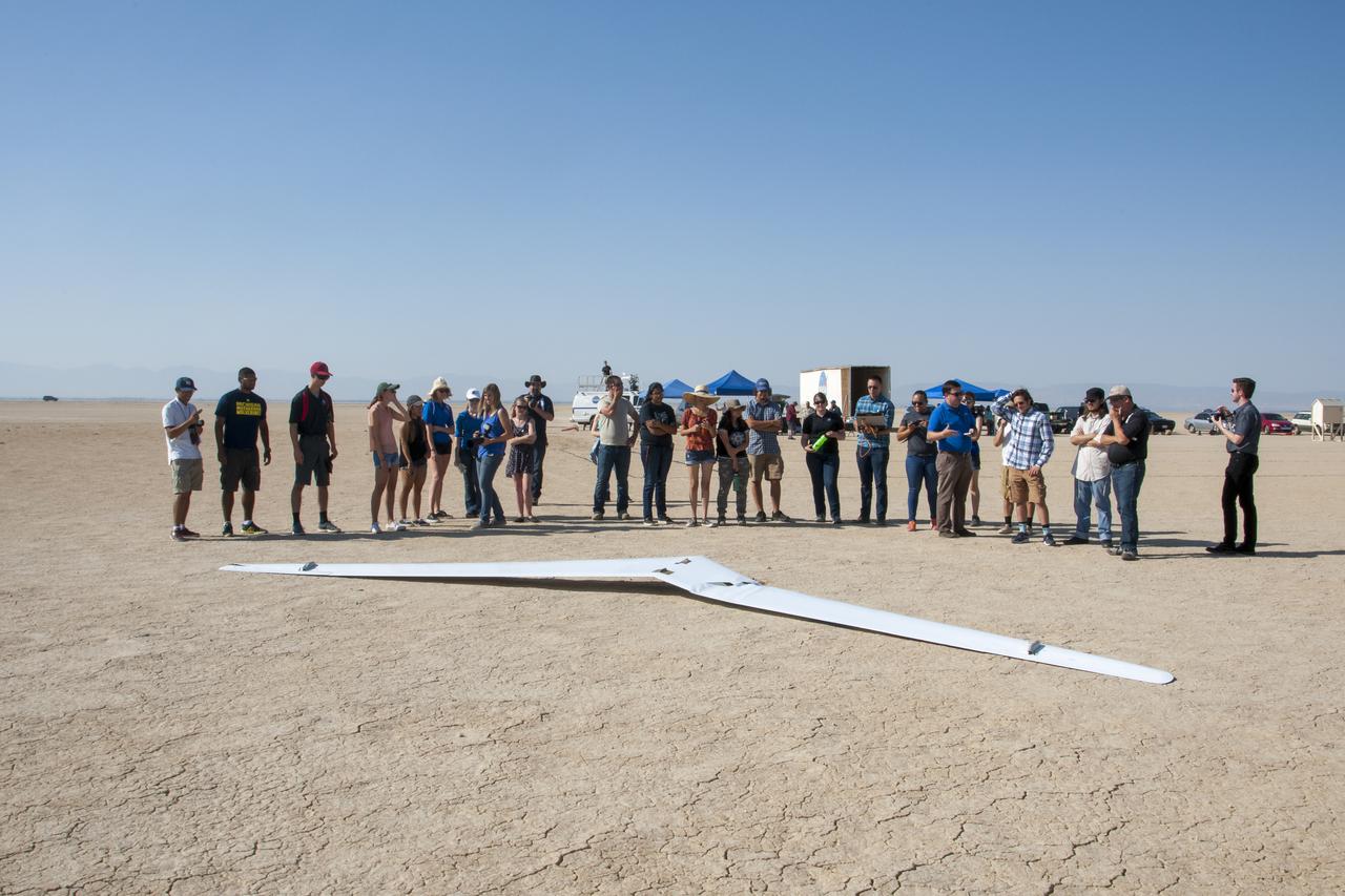
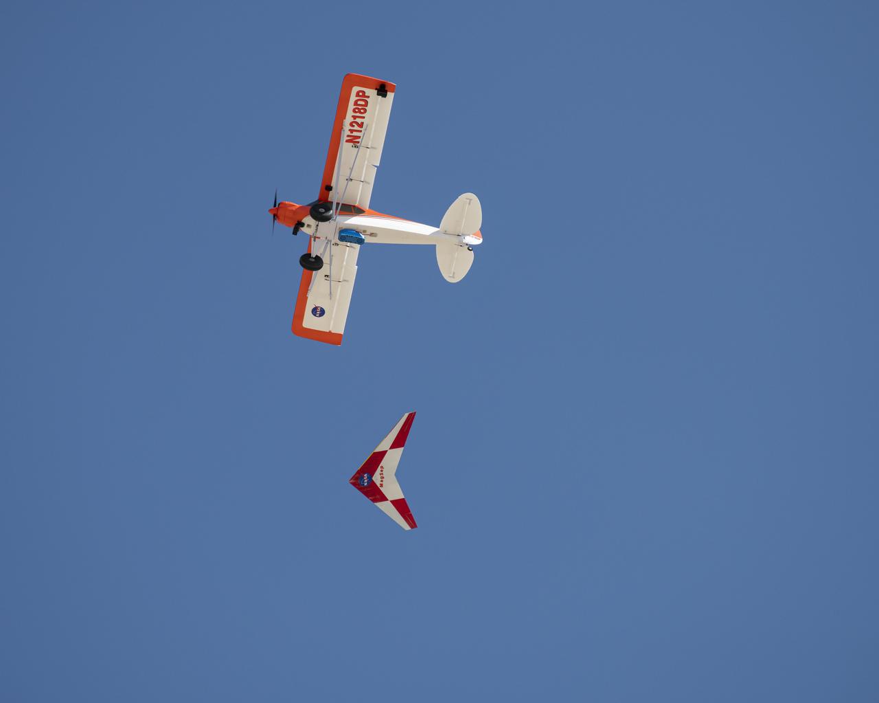
The one-third scale twin-fuselage towed glider glides in for landing on Rogers Dry Lake after its successful first test flight.
Hypersonic Boost Glider in 11 Inch Hypersonic Tunnel L57-1681 In 1957 Langley tested its HYWARDS design in the 11 Inch Hypersonic Tunnel. Photograph published in Engineer in Charge: A History of the Langley Aeronautical Laboratory, 1917-1958 by James R. Hansen. Page 369.
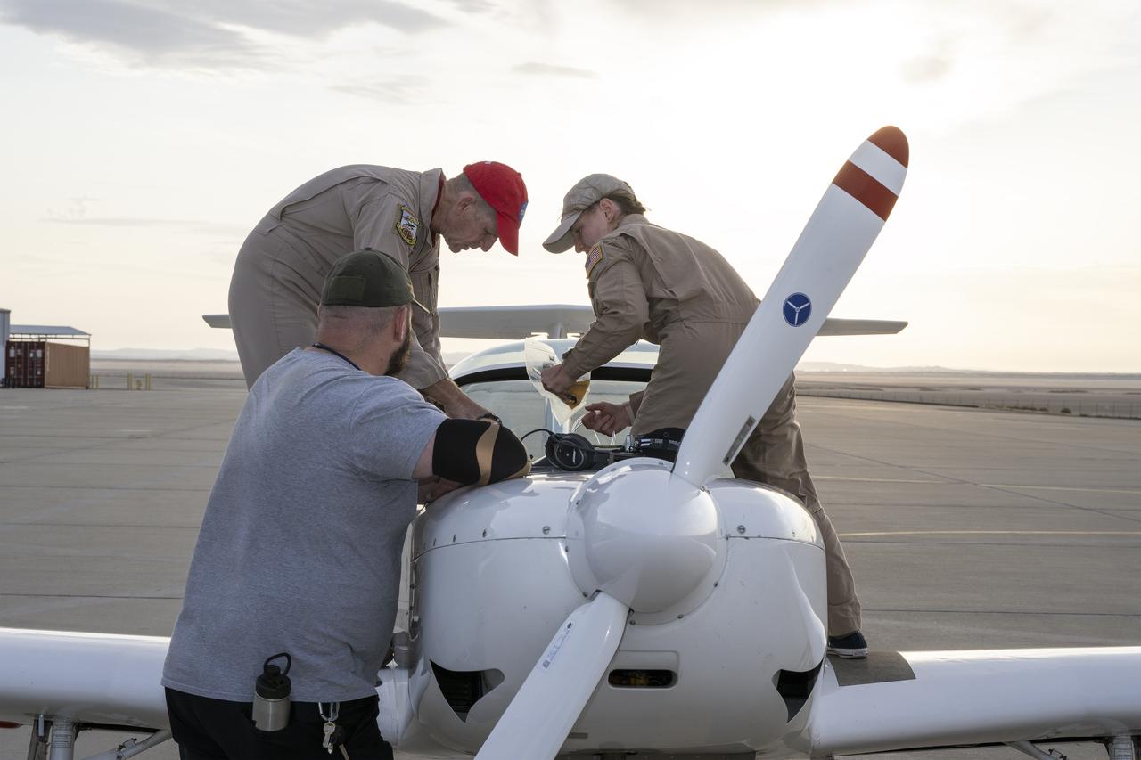
A NASA TG-14 glider aircraft is prepared for flight at NASA’s Armstrong Flight Research Center in Edwards, California, in support of the agency’s Quesst mission. The aircraft is equipped with onboard microphones to capture sonic boom noise generated during rehearsal flights, helping researchers measure the acoustic signature of supersonic aircraft closer to the ground.
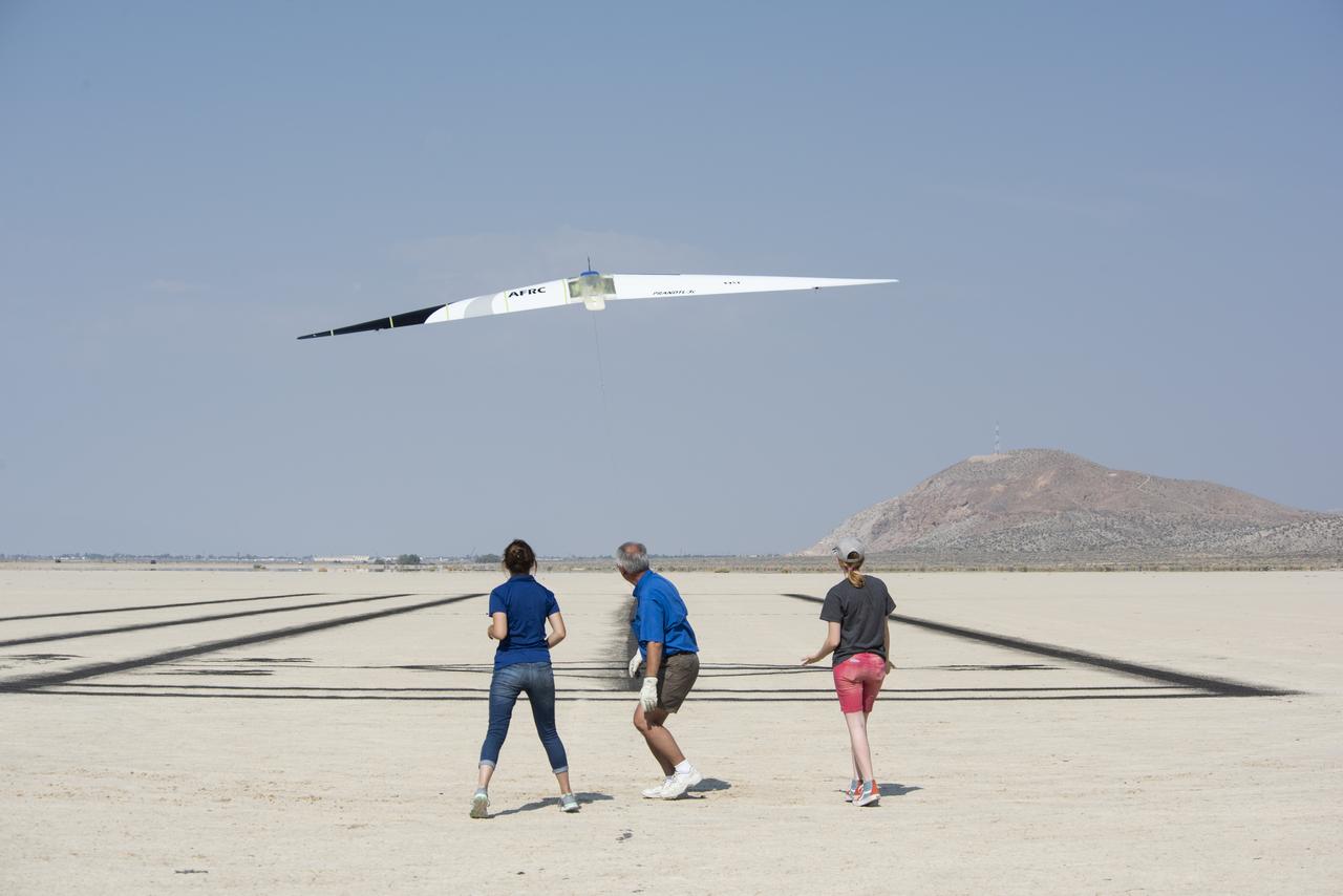
Deborah Jackson, Al Bowers and Abbigail Waddell successfully launch the subscale Prandtl-D 3C glider.
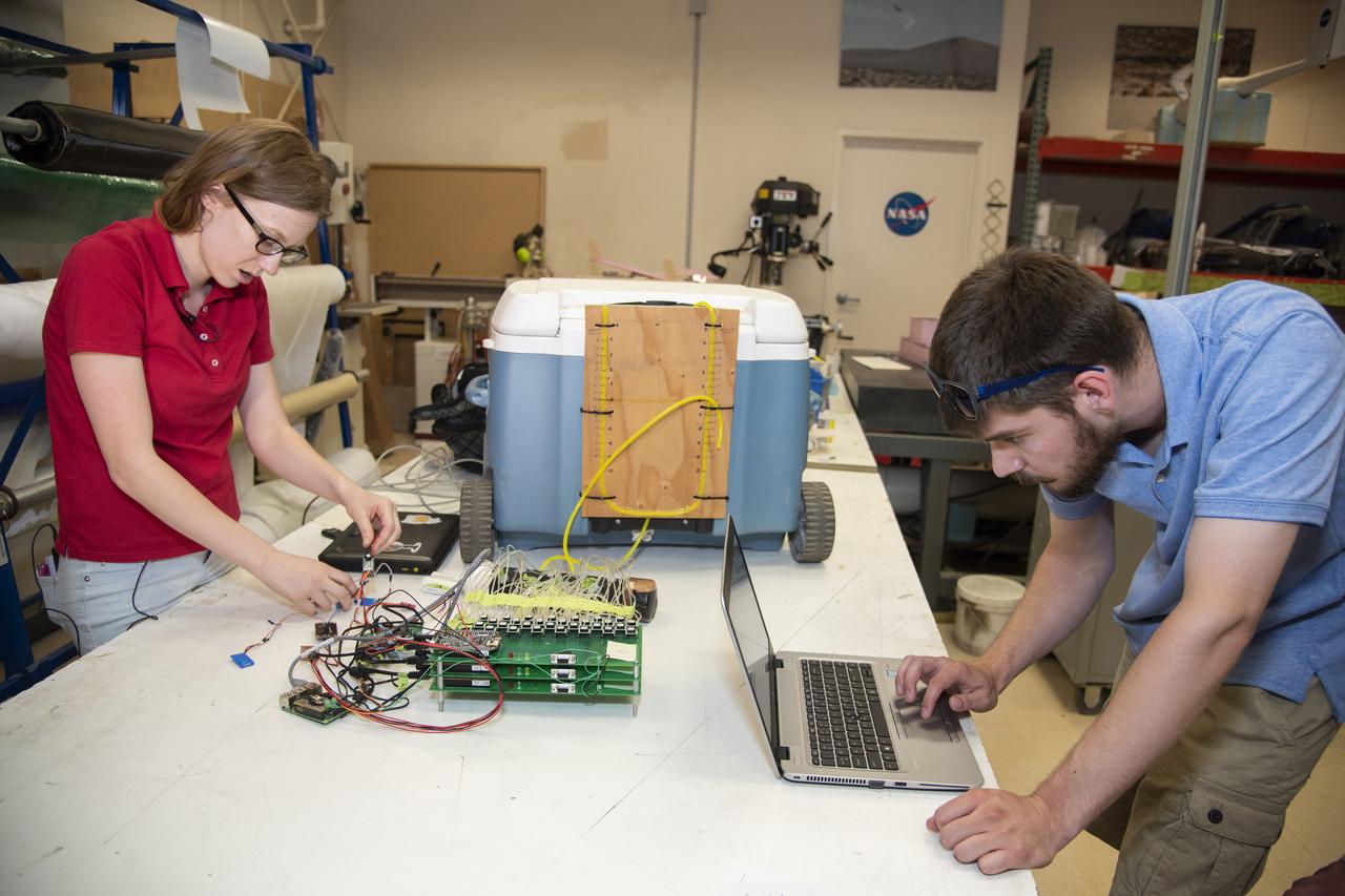
Abbigail Waddell and Nathaniel Boisjolie-Gair test a pressure system they and other students developed for the subscale Prandtl-D 3C glider.
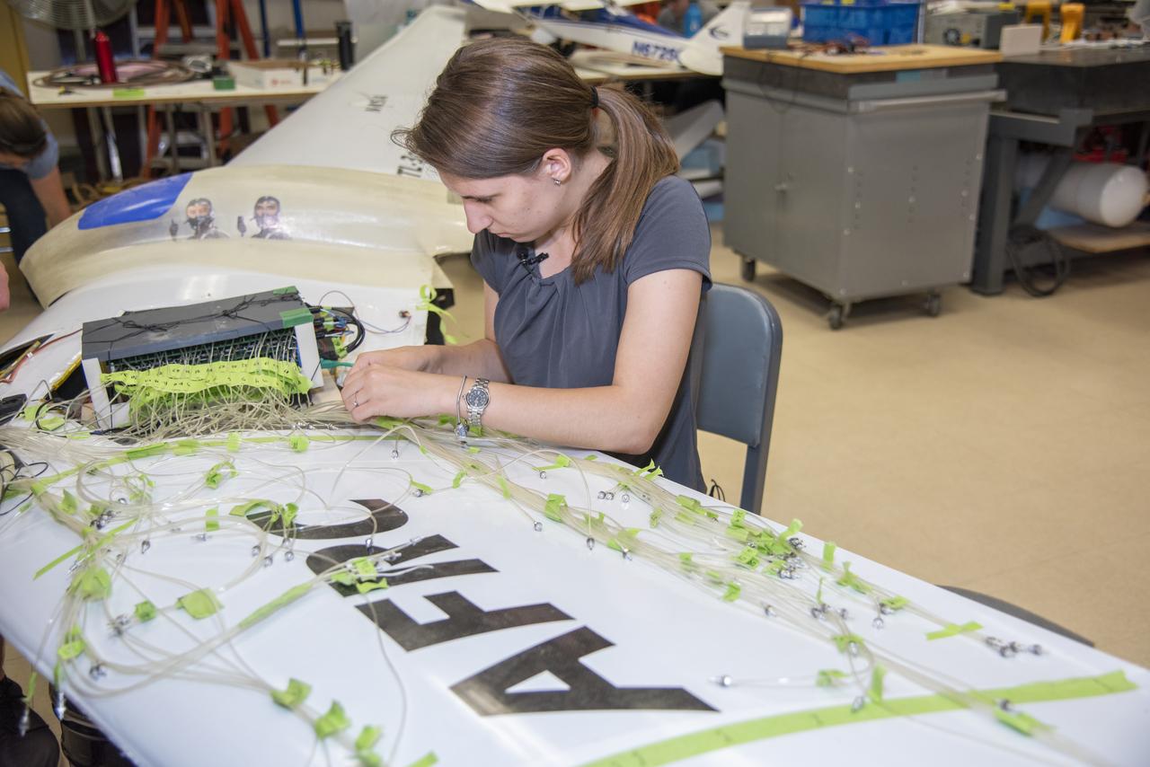
Deborah Jackson integrates a pressure system she and other students developed for the subscale Prandtl-D 3C glider.
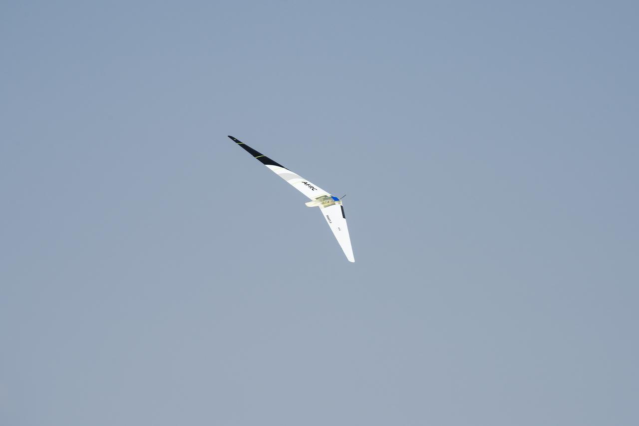
The subscale Prandtl-D 3C glider, carrying a pressure system developed and integrated by students, successfully flies at Edwards Air Force Base in California.
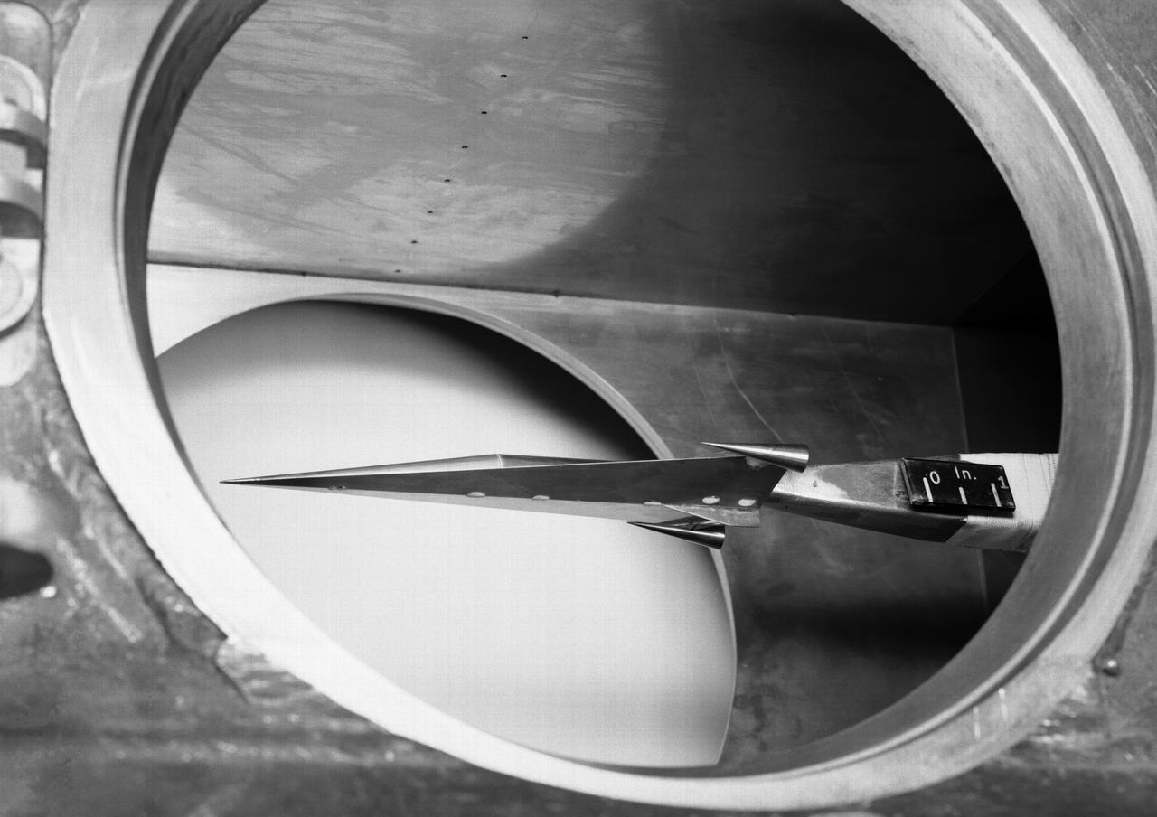
L57-1439 A model based on Langley s concept of a hypersonic glider was test flown on an umbilical cord inside the Full Scale Tunnel in 1957. Photograph published in Engineer in Charge: A History of the Langley Aeronautical Laboratory, 1917-1958 by James R. Hansen. Page 374.
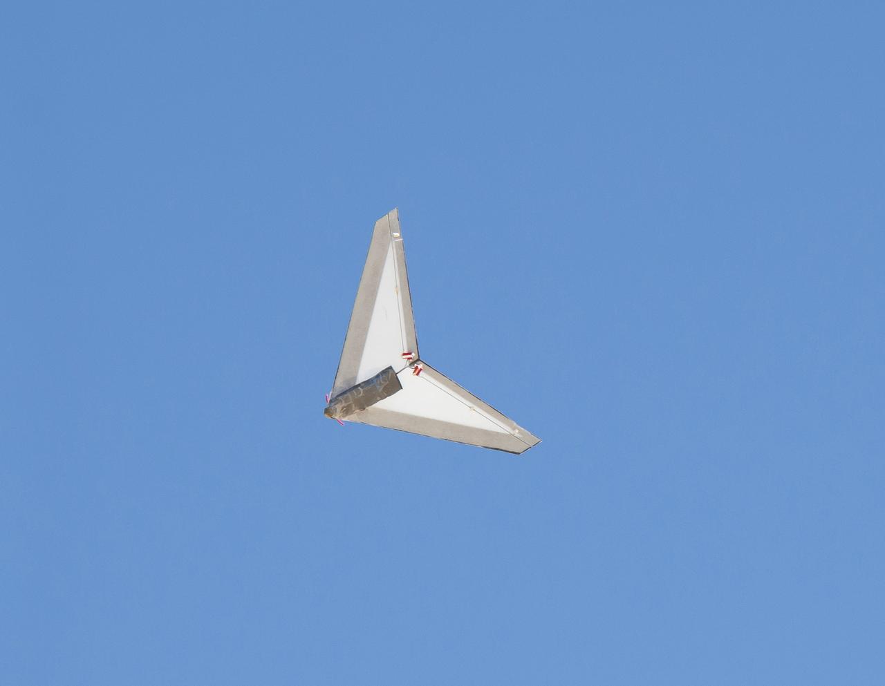
Student interns and NASA personnel cluster in front of PRANDTL-D No. 3 following a crash on Rosamond Dry Lake. The radio-controlled glider was built to validate a new spanload.
Autonomous wave gliders are seen onboard the the Woods Hole Oceanographic Institution research vessel Knorr on Tuesday, Sept. 4, 2012, in Woods Hole, Mass. The autonomous gliders will be deployed in the Atlantic Ocean as part of the Salinity Processes in the Upper Ocean Regional Study (SPURS) which is set to sail on Sept. 6. The NASA-sponsored expedition will sail to the North Atlantic's saltiest spot to get a detailed, 3-D picture of how salt content fluctuates in the ocean's upper layers and how these variations are related to shifts in rainfall patterns around the planet. Photo Credit: (NASA/Bill Ingalls)
Autonomous wave gliders are seen onboard the the Woods Hole Oceanographic Institution research vessel Knorr on Tuesday, Sept. 4, 2012, in Woods Hole, Mass. The autonomous gliders will be deployed in the Atlantic Ocean as part of the Salinity Processes in the Upper Ocean Regional Study (SPURS) which is set to sail on Sept. 6. The NASA-sponsored expedition will sail to the North Atlantic's saltiest spot to get a detailed, 3-D picture of how salt content fluctuates in the ocean's upper layers and how these variations are related to shifts in rainfall patterns around the planet. Photo Credit: (NASA/Bill Ingalls)
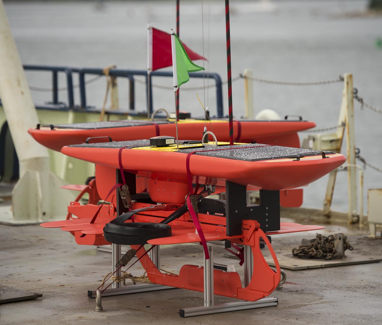
Autonomous wave gliders are seen onboard the the Woods Hole Oceanographic Institution research vessel Knorr on Tuesday, Sept. 4, 2012, in Woods Hole, Mass. The autonomous gliders will be deployed in the Atlantic Ocean as part of the Salinity Processes in the Upper Ocean Regional Study (SPURS) which is set to sail on Sept. 6. The NASA-sponsored expedition will sail to the North Atlantic's saltiest spot to get a detailed, 3-D picture of how salt content fluctuates in the ocean's upper layers and how these variations are related to shifts in rainfall patterns around the planet. Photo Credit: (NASA/Bill Ingalls)

NASA Physical Oceanography Program Scientist Eric Lindstrom inspects an autonomous wave glider onboard the Woods Hole Oceanographic Institution research vessel Knorr on Tuesday, Sept. 4, 2012, in Woods Hole, Mass. The autonomous gliders will be deployed in the Atlantic Ocean as part of the Salinity Processes in the Upper Ocean Regional Study (SPURS) which is set to sail on Sept. 6. The NASA-sponsored expedition will sail to the North Atlantic's saltiest spot to get a detailed, 3-D picture of how salt content fluctuates in the ocean's upper layers and how these variations are related to shifts in rainfall patterns around the planet. Photo Credit: (NASA/Bill Ingalls)

NASA Physical Oceanography Program Scientist Eric Lindstrom inspects an autonomous wave glider onboard the Woods Hole Oceanographic Institution research vessel Knorr on Tuesday, Sept. 4, 2012, in Woods Hole, Mass. The autonomous gliders will be deployed in the Atlantic Ocean as part of the Salinity Processes in the Upper Ocean Regional Study (SPURS) which is set to sail on Sept. 6. The NASA-sponsored expedition will sail to the North Atlantic's saltiest spot to get a detailed, 3-D picture of how salt content fluctuates in the ocean's upper layers and how these variations are related to shifts in rainfall patterns around the planet. Photo Credit: (NASA/Bill Ingalls)
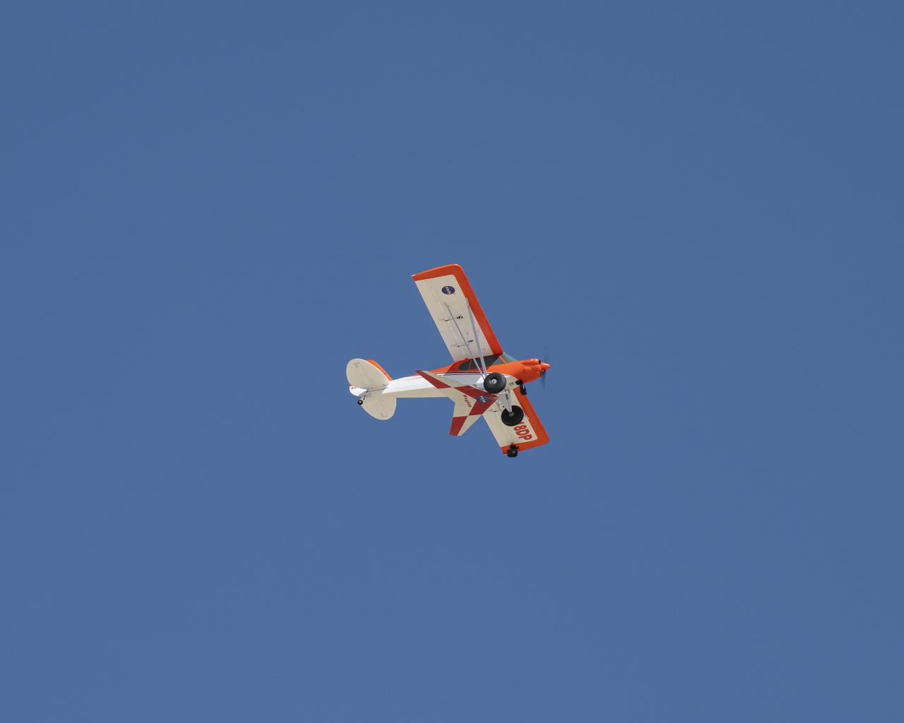
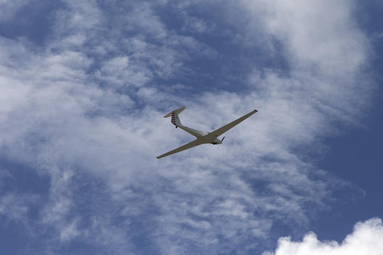
This photo shows NASA's PIK-20E motor-glider sailplane during a research flight from the Ames-Dryden Flight Research Facility (later, the Dryden Flight Research Center), Edwards, California, in 1991.
A United States Air Force Test Pilot School Blanik L-23 glider carrying a microphone and a pressure transducer flies near a BADS (Boom Amplitudes Direction System) sensor following flight at an altitude of 10 thousand feet under the path of the F-5E SSBE aircraft. The SSBE (Shaped Sonic Boom Experiment) was formerly known as the Shaped Sonic Boom Demonstration, or SSBD, and is part of DARPA's Quiet Supersonic Platform (QSP) program. On August 27, 2003, the F-5E SSBD aircraft demonstrated a method to reduce the intensity of sonic booms.
The Preliminary Research Aerodynamic Design to Land on Mars, or Prandtl-M, flies during a test flight. A new proposal based on the aircraft recently won an agencywide technology grant.
Autonomous wave gliders, right, are seen onboard the the Woods Hole Oceanographic Institution research vessel Knorr on Tuesday, Sept. 4, 2012, in Woods Hole, Mass. The autonomous gliders will be deployed in the Atlantic Ocean as part of the Salinity Processes in the Upper Ocean Regional Study (SPURS) which is set to sail on Sept. 6. The NASA-sponsored expedition will sail to the North Atlantic's saltiest spot to get a detailed, 3-D picture of how salt content fluctuates in the ocean's upper layers and how these variations are related to shifts in rainfall patterns around the planet. Photo Credit: (NASA/Bill Ingalls)
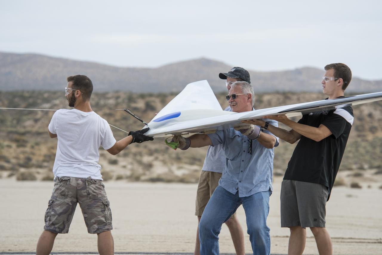
Al Bowers, center, and a group of student interns hook up a bungee cord for a flight of the Prandtl-D 3C subscale glider aircraft.
Justin Hall, left, attaches the Preliminary Research Aerodynamic Design to Land on Mars, or Prandtl-M, glider onto the Carbon-Z Cub, which Justin Link steadies. Hall and Link are part of a team from NASA's Armstrong Flight Research Center in Edwards, California, that uses an experimental magnetic release mechanism to air launch the glider.
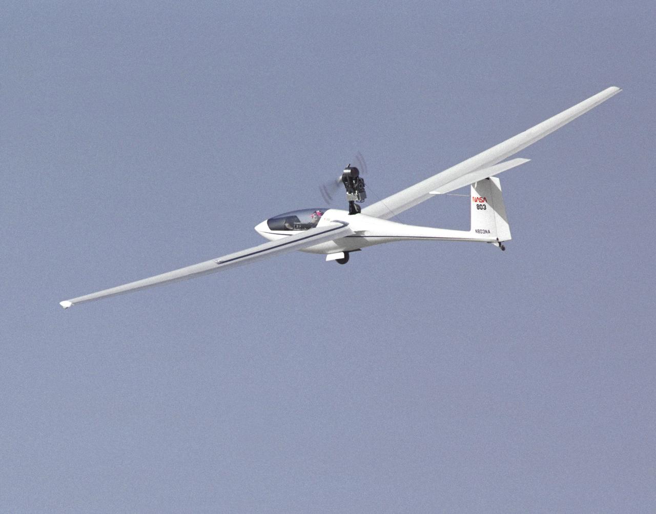
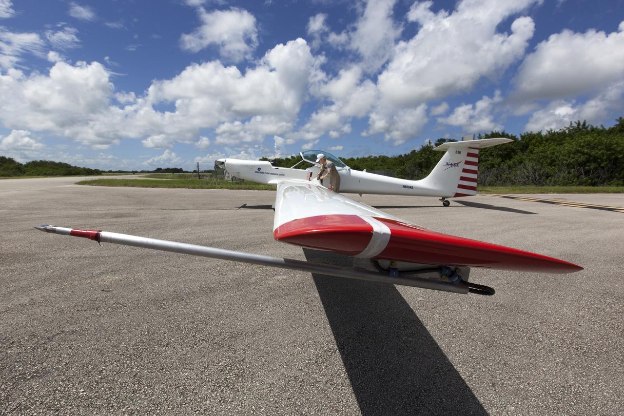
NASA’s SonicBAT team poses in front of the TG-14 motor glider and F/A-18 research aircraft, sitting side-by-side in front of Rogers Dry Lake prior to a SonicBAT flight at Armstrong Flight Research Center on Edwards Air Force Base, California. The TG-14 collected sound signatures of shockwaves created by the F/A-18, to compare with signatures collected on the ground.
The Preliminary Research Aerodynamic Design to Land on Mars, or Prandtl-M, glider flies after a magnetic release mechanism on the Carbon-Z Cub was activated to air launch the aircraft. A team from NASA's Armstrong Flight Research Center in Edwards, California, conducted the successful research flight.
A team from NASA's Armstrong Flight Research Center in Edwards, California, prepares a Carbon-Z Cub to air launch the Preliminary Research Aerodynamic Design to Land on Mars, or Prandtl-M, glider from a magnetic release mechanism on the cub.
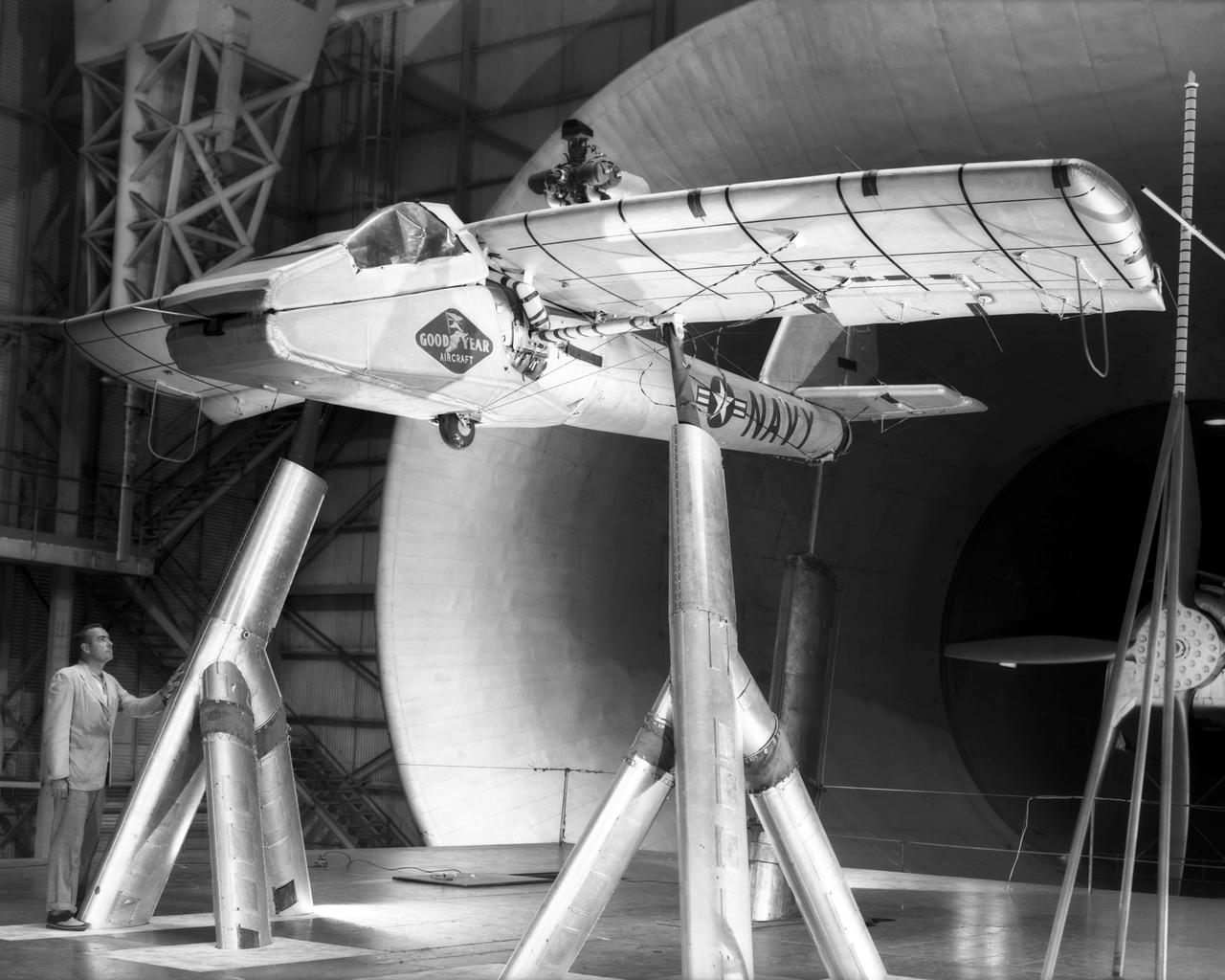
Various views of the Goodyear Inflate-A-Plane mounted in Full Scale Tunnel.
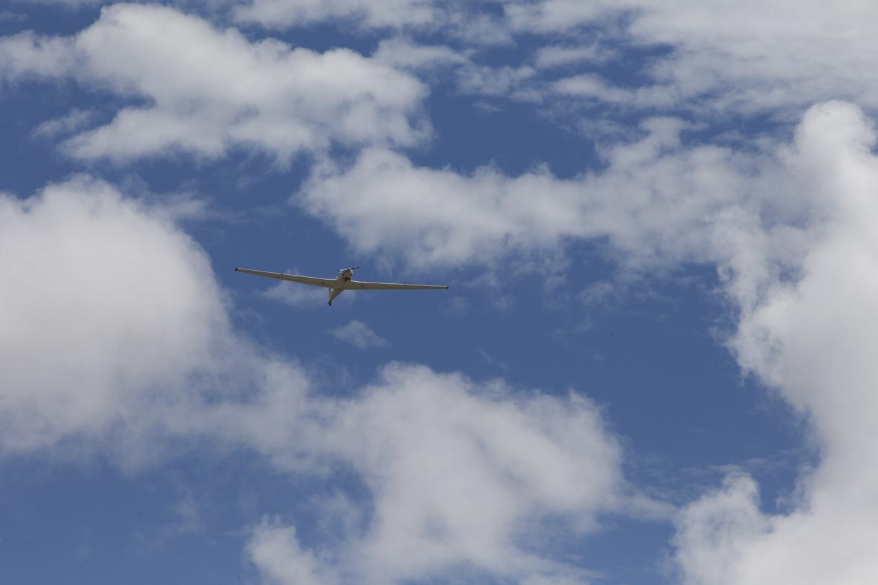
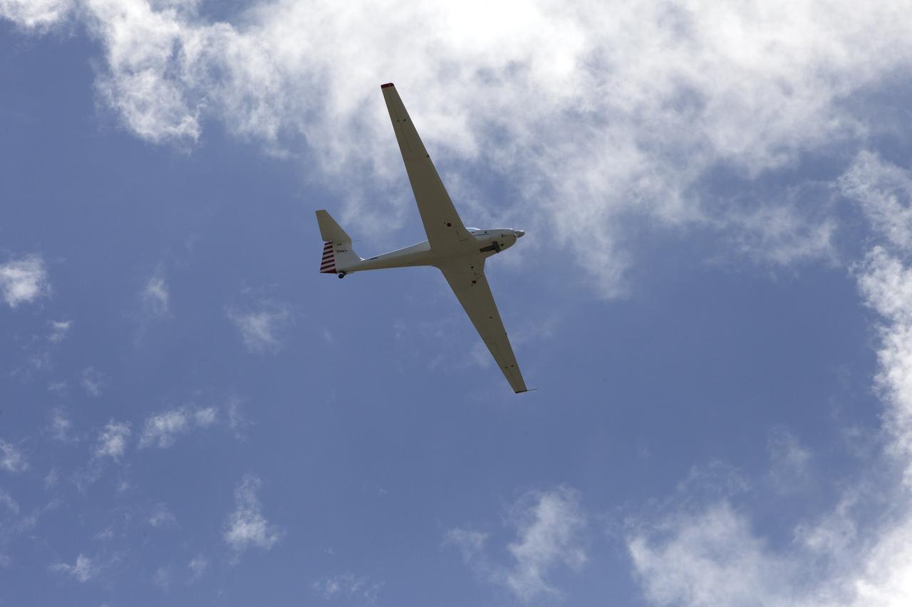
A motorized glider prepares to take off from the Shuttle Landing Facility at NASA's Kennedy Space Center in Florida. Flying with its engine off, the glider will be positioned above the 14,000-foot level to measure sonic booms created by agency F-18 jets to measure the effects of sonic booms. Several flights a day have been taking place the week of Aug. 21, 2017 as part of NASA's Sonic Booms in Atmospheric Turbulence, or SonicBAT II Program. NASA at Kennedy is partnering with the agency's Armstrong Flight Research Center in California, Langley Research Center in Virginia, and Space Florida for a program in which F-18 jets will take off from the Shuttle Landing Facility and fly at supersonic speeds while agency researchers measure the effects of low-altitude turbulence caused by sonic booms.
A motorized glider has taken off from the Shuttle Landing Facility at NASA's Kennedy Space Center in Florida. Flying with its engine off, the glider will be positioned above the 14,000-foot level to measure sonic booms created by agency F-18 jets to measure the effects of sonic booms. Several flights a day have been taking place the week of Aug. 21, 2017 as part of NASA's Sonic Booms in Atmospheric Turbulence, or SonicBAT II Program. NASA at Kennedy is partnering with the agency's Armstrong Flight Research Center in California, Langley Research Center in Virginia, and Space Florida for a program in which F-18 jets will take off from the Shuttle Landing Facility and fly at supersonic speeds while agency researchers measure the effects of low-altitude turbulence caused by sonic booms.
A motorized glider has taken off from the Shuttle Landing Facility at NASA's Kennedy Space Center in Florida. Flying with its engine off, the glider will be positioned above the 14,000-foot level to measure sonic booms created by agency F-18 jets to measure the effects of sonic booms. Several flights a day have been taking place the week of Aug. 21, 2017 as part of NASA's Sonic Booms in Atmospheric Turbulence, or SonicBAT II Program. NASA at Kennedy is partnering with the agency's Armstrong Flight Research Center in California, Langley Research Center in Virginia, and Space Florida for a program in which F-18 jets will take off from the Shuttle Landing Facility and fly at supersonic speeds while agency researchers measure the effects of low-altitude turbulence caused by sonic booms.
A motorized glider has taken off from the Shuttle Landing Facility at NASA's Kennedy Space Center in Florida. Flying with its engine off, the glider will be positioned above the 14,000-foot level to measure sonic booms created by agency F-18 jets to measure the effects of sonic booms. Several flights a day have been taking place the week of Aug. 21, 2017 as part of NASA's Sonic Booms in Atmospheric Turbulence, or SonicBAT II Program. NASA at Kennedy is partnering with the agency's Armstrong Flight Research Center in California, Langley Research Center in Virginia, and Space Florida for a program in which F-18 jets will take off from the Shuttle Landing Facility and fly at supersonic speeds while agency researchers measure the effects of low-altitude turbulence caused by sonic booms.
A motorized glider prepares to take off from the Shuttle Landing Facility at NASA's Kennedy Space Center in Florida. Flying with its engine off, the glider will be positioned above the 14,000-foot level to measure sonic booms created by agency F-18 jets to measure the effects of sonic booms. Several flights a day have been taking place the week of Aug. 21, 2017 as part of NASA's Sonic Booms in Atmospheric Turbulence, or SonicBAT II Program. NASA at Kennedy is partnering with the agency's Armstrong Flight Research Center in California, Langley Research Center in Virginia, and Space Florida for a program in which F-18 jets will take off from the Shuttle Landing Facility and fly at supersonic speeds while agency researchers measure the effects of low-altitude turbulence caused by sonic booms.
A motorized glider prepares to take off from the Shuttle Landing Facility at NASA's Kennedy Space Center in Florida. Flying with its engine off, the glider will be positioned above the 14,000-foot level to measure sonic booms created by agency F-18 jets to measure the effects of sonic booms. Several flights a day have been taking place the week of Aug. 21, 2017 as part of NASA's Sonic Booms in Atmospheric Turbulence, or SonicBAT II Program. NASA at Kennedy is partnering with the agency's Armstrong Flight Research Center in California, Langley Research Center in Virginia, and Space Florida for a program in which F-18 jets will take off from the Shuttle Landing Facility and fly at supersonic speeds while agency researchers measure the effects of low-altitude turbulence caused by sonic booms.
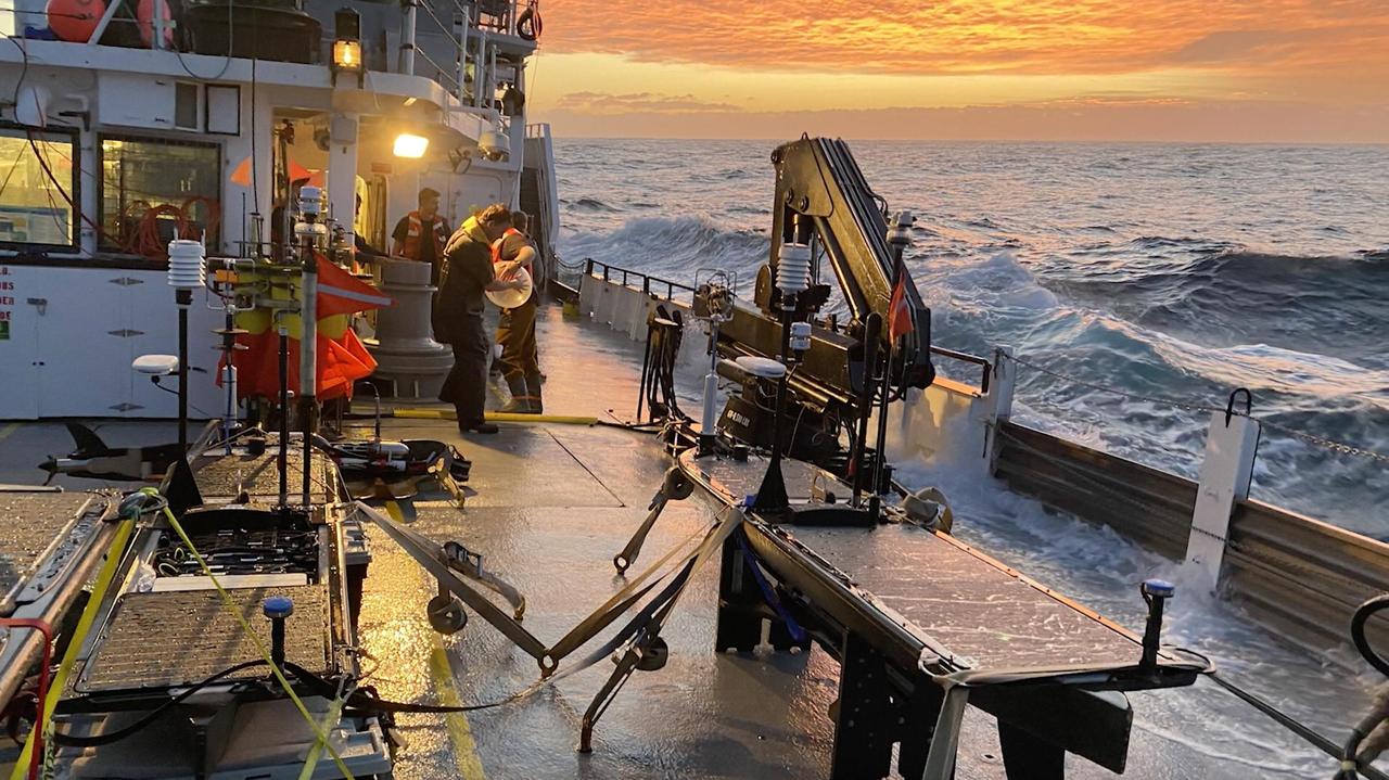
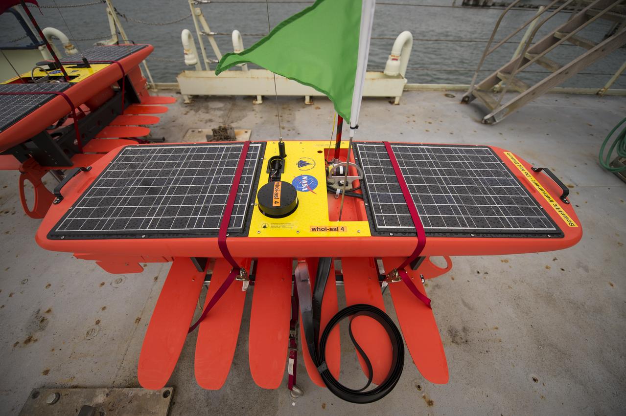
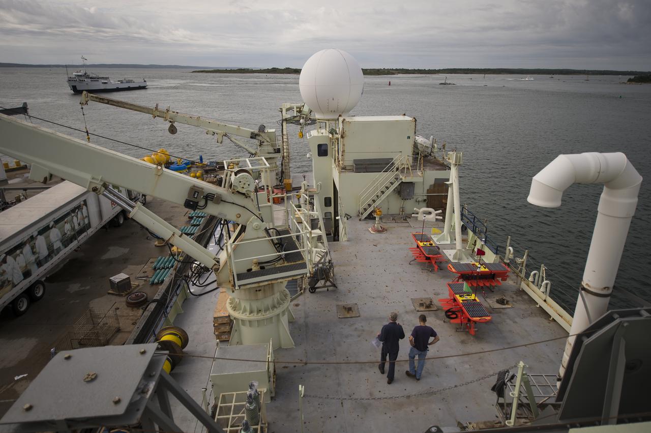
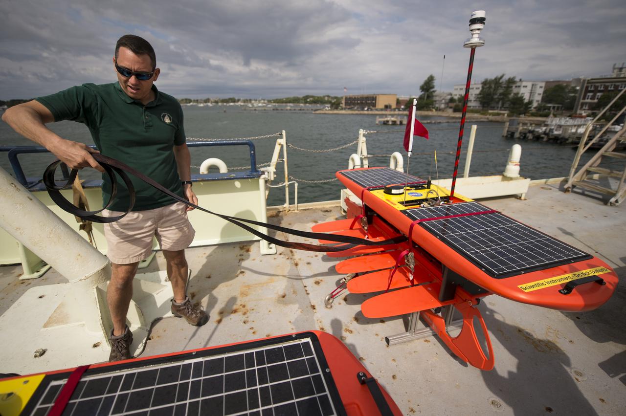
During the pilot campaign for NASA's Sub-Mesoscale Ocean Dynamics Experiment (S-MODE) in 2021, on the transit from Oregon to the experiment site off the coast of San Francisco, large waves (some reaching around 23 feet or 7 meters tall) rolled over the deck of the research vessel Oceanus, damaging several autonomous wave gliders seen here. Scientists from across the country then assembled to repair the instruments in San Francisco harbor. Wave gliders are one type of autonomous marine research platform deployed at sea during S-MODE's field campaigns in the Pacific Ocean. The uncrewed vessels feature a set of fins – on a submersible platform tethered to a surface float – which it uses to propel the craft around the upper ocean. The platforms carry a variety of sensors and instruments. Because they're autonomous, their use reduces the risk posed to human researchers who could be exposed to large storms at sea. S-MODE is a NASA Earth mission to use newly developed in-situ and remote-sensing techniques to look at small-scale ocean whirlpools, eddies, and currents. The observations could help scientists better understand how these dynamics drive the give-and-take of material and energy between the ocean and atmosphere and, ultimately, help shape Earth's climate. More information about S-MODE is at https://espo.nasa.gov/s-mode/content/S-MODE https://photojournal.jpl.nasa.gov/catalog/PIA25522
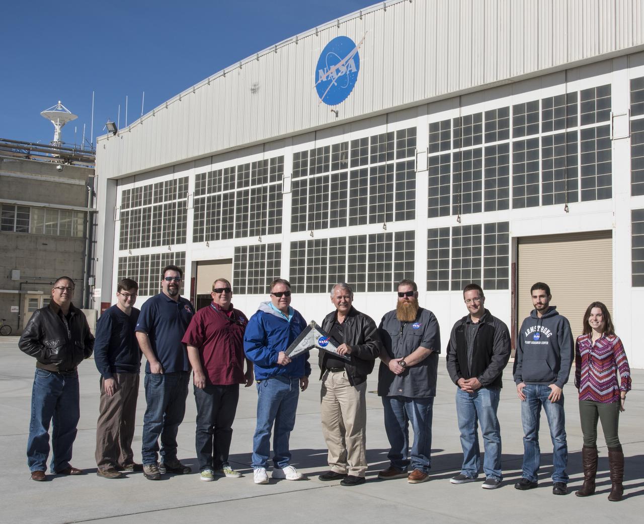
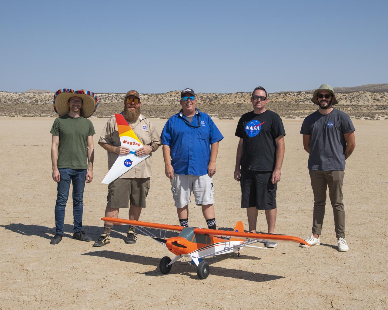
The WHAATRR team from NASA Armstrong includes, from left, Derek Abramson Dave Berger, John Bodylski, Robert “Red” Jensen, Scott Wiley, Al Bowers, Justin Hall, Luke Bard, Hussein Nasr and Samantha Ingersoll.
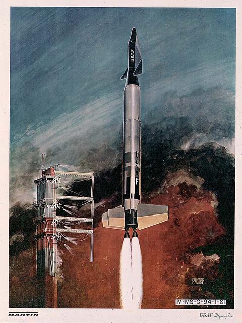
A Dyna-Soar (Dynamic Soaring) vehicle clears the launch tower atop an Air Force Titan II launch vehicle in this 1961 artist's concept. Originally conceived by the U.S. Air Force in 1957 as a marned, rocket-propelled glider in a delta-winged configuration, the Dyna-Soar was considered by Marshall Space Flight Center planners as an upper stage for the Saturn C-2 launch vehicle.
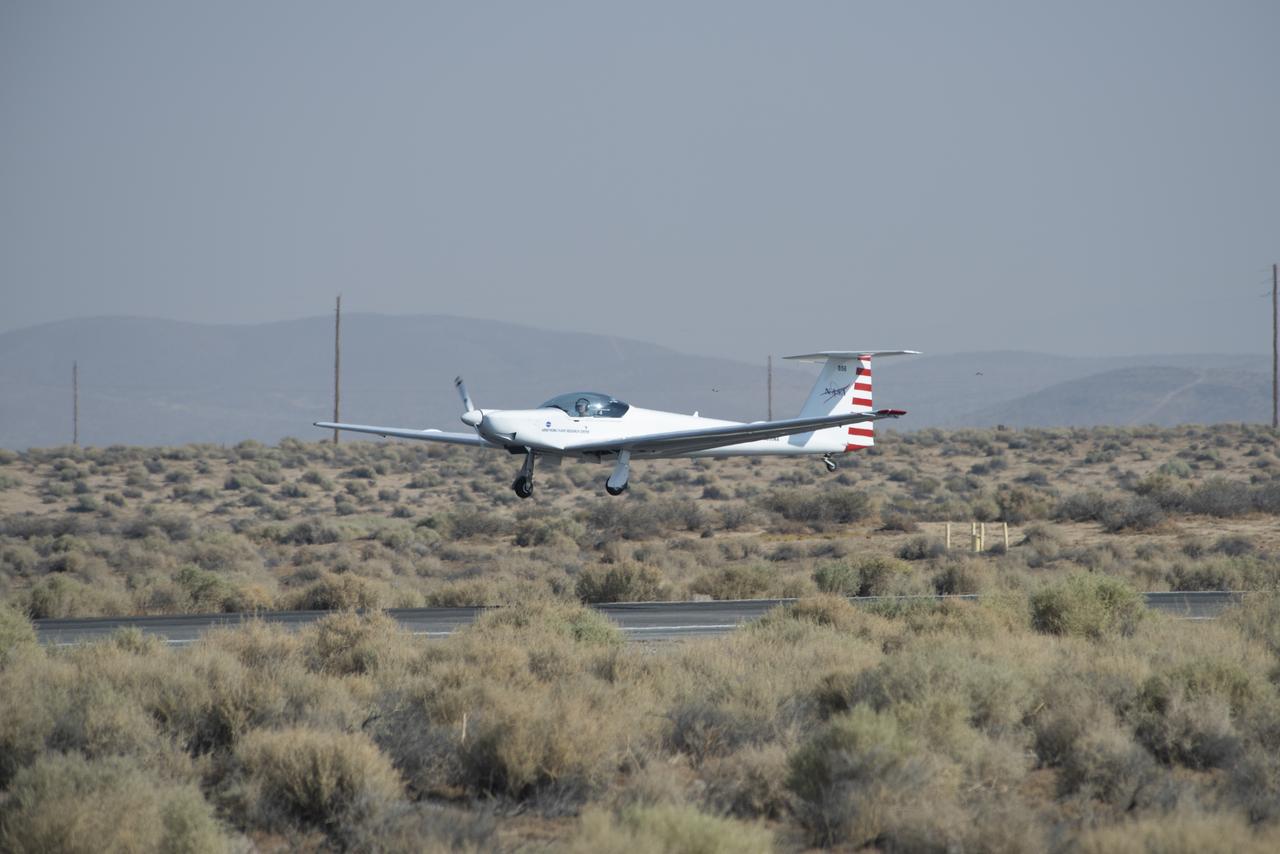
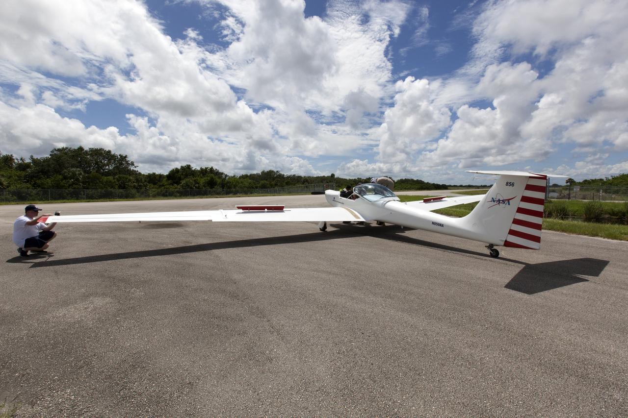
The Advanced Air Mobility National Campaign project conducted connectivity and infrastructure flight tests with a NASA TG-14 glider aircraft at NASA's Armstrong Flight Research Center Sept. 30-Oct. 1, 2020. The flights were preparation for the NC Integrated Dry Run Test in December and allowed pilots to view the routes they will fly during the helicopter test.
A Preliminary Research Aerodynamic Design to Land on Mars, or Prandtl-M, glider was air launched Sept. 7 using a magnetic release mechanism mounted on a Carbon-Z Cub. The team, based at NASA's Armstrong Flight Research Center in Edwards, California, includes, from left, Paul Bean, Justin Hall, Red Jensen, Justin Link, and Nathan Allaire.

Mark Snycerski, senior research associate at NASA's Ames Research Center in California, monitored inbound telemetry data through collection servers during the Advanced Air Mobility National Campaign's connectivity and infrastructure flight tests. The test used a NASA TG-14 glider aircraft based at NASA's Armstrong Flight Research Center in California Sept. 30-Oct. 1, 2020. The exercise was in preparation for the NC Integrated Dry Run Test in December.
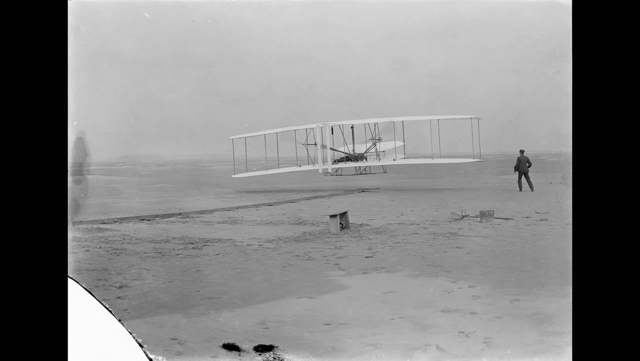
Orville Wright makes the first powered, controlled flight on Earth as his brother Wilbur looks on in this image taken at Kitty Hawk, North Carolina, on Dec. 17, 1903. Orville Wright covered 120 feet in 12 seconds during the first flight. The Wright brothers made four flights that day, each longer than the last. A small amount of the material that covered the wing of the aircraft, Flyer 1, during the first flight was flown to Mars aboard NASA's Ingenuity Mars Helicopter. An insulative tape was used to wrap the small swatch of fabric around a cable located underneath the helicopter's solar panel. Ingenuity is scheduled to attempt the first powered, controlled flight on another planet in April 2021. The Wrights had been using the same type of material – an unbleached muslin called "Pride of the West" – to cover their glider and aircraft wings since 1901. A different piece of the material, along with a small splinter of wood, from the Flyer 1 was flown to the Moon and back aboard Apollo 11. The image was taken by John Daniels, a member of the U.S. Life-Saving Station in Kill Devil Hills, North Carolina. Until the day of the flight, Daniels had never seen a camera. https://photojournal.jpl.nasa.gov/catalog/PIA24434
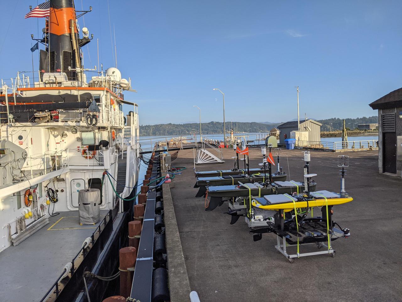
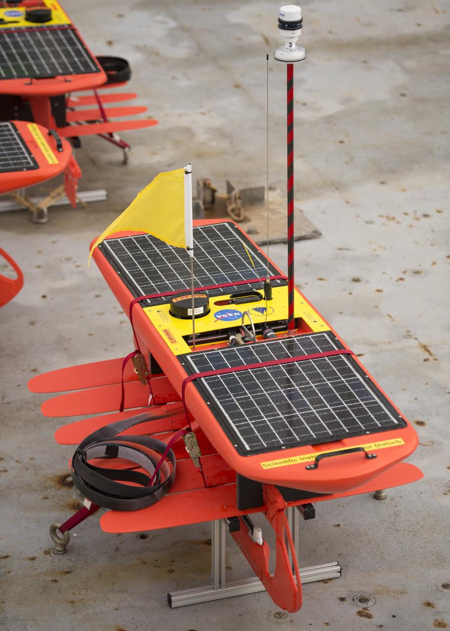
As part of NASA's Sub-Mesoscale Ocean Dynamics Experiment (S-MODE) pilot campaign in 2021, the research vessel Oceanus, owned by the National Science Foundation, set sail to an area 110 nautical miles off the coast of San Francisco, accompanied by a fleet of several types of autonomous marine research vessels. The wave gliders pictured here on the dock carry a variety of sensors and instruments. Because they're autonomous, their use reduces the risk posed to human researchers who could be exposed to large storms at sea. S-MODE is a NASA Earth mission to use newly developed in-situ and remote-sensing techniques to look at small-scale ocean whirlpools, eddies, and currents. The observations could help scientists better understand how these dynamics drive the give-and-take of material and energy between the ocean and atmosphere and, ultimately, help shape Earth's climate. More information about S-MODE is at https://espo.nasa.gov/s-mode/content/S-MODE https://photojournal.jpl.nasa.gov/catalog/PIA25524

Neil Armstrong, donned in his space suit, poses for his official Apollo 11 portrait. Armstrong began his flight career as a naval aviator. He flew 78 combat missions during the Korean War. Armstrong joined the NASA predecessor, NACA (National Advisory Committee for Aeronautics), as a research pilot at the Lewis Laboratory in Cleveland and later transferred to the NACA High Speed Flight Station at Edwards AFB, California. He was a project pilot on many pioneering high speed aircraft, including the 4,000 mph X-15. He has flown over 200 different models of aircraft, including jets, rockets, helicopters, and gliders. In 1962, Armstrong was transferred to astronaut status. He served as command pilot for the Gemini 8 mission, launched March 16, 1966, and performed the first successful docking of two vehicles in space. In 1969, Armstrong was commander of Apollo 11, the first manned lunar landing mission, and gained the distinction of being the first man to land a craft on the Moon and the first man to step on its surface. Armstrong subsequently held the position of Deputy Associate Administrator for Aeronautics, NASA Headquarters Office of Advanced Research and Technology, from 1970 to 1971. He resigned from NASA in 1971.
Woods Hole Oceanographic Institution Scientist Dave Fratantoni works on the EcoMapper AUVs (autonomous underwater vehicles) onboard the Institute's research vessel Knorr, Tuesday, Sept. 4, 2012, in Woods Hole, Mass. The EcoMappers will be deployed in the Atlantic Ocean as part of the Salinity Processes in the Upper Ocean Regional Study (SPURS) which is set to sail on Sept. 6. The NASA-sponsored expedition will sail to the North Atlantic's saltiest spot to get a detailed, 3-D picture of how salt content fluctuates in the ocean's upper layers and how these variations are related to shifts in rainfall patterns around the planet. Photo Credit: (NASA/Bill Ingalls)
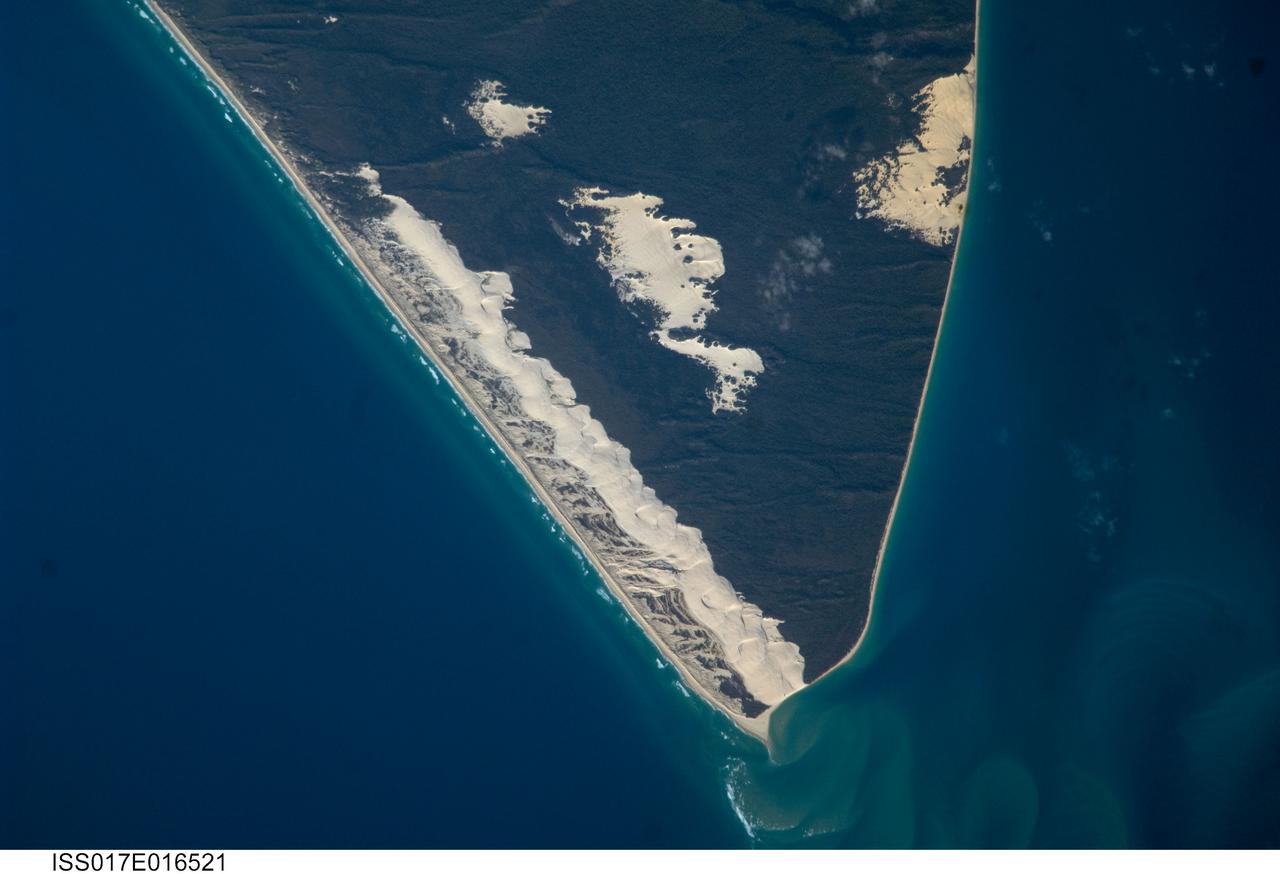
ISS017-E-016521 (15 Sept. 2008) --- Sandy Cape and Fraser Island, Australia are featured in this image photographed by an Expedition 17 crewmember on the International Space Station. Fraser Island, the world's largest sand island, includes Great Sandy National Park and is located along the coastline of Queensland, Australia. The island was designated a World Heritage site in 1992, in part due to its outstanding preservation of geological processes related to sand dune formation. According to scientists, the island's dune fields preserve a record of sand deposition and movement related to sea level rise and fall extending back over 700,000 years. In addition to sand dunes, the island also preserves an interesting range of vegetation -- including vine rainforest, stands of eucalypt trees, and mangroves -- and diverse fauna including crabs, parrots, sugar gliders and flying foxes. This view highlights the northernmost portion of the island, known as Sandy Cape. Active white sand dunes contrast with dark green vegetation that anchors older dune sets. Irregular patches of sand dunes surrounded by vegetation are known as sand blows (or blowouts), formed when the vegetation cover is disturbed -- by wind, fire, or human activities. The exposed underlying sand can then move and form new dunes, sometimes at rates of up to one meter per year. Coastal sand dune fields -- such as the one located along the eastern side of Sandy Cape (center) -- will remain active until anchored by vegetation, or until no more sand is available to form new dunes.
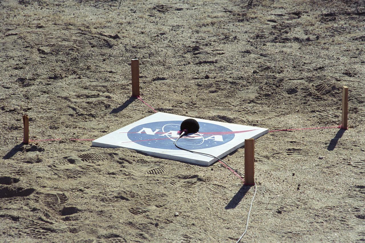
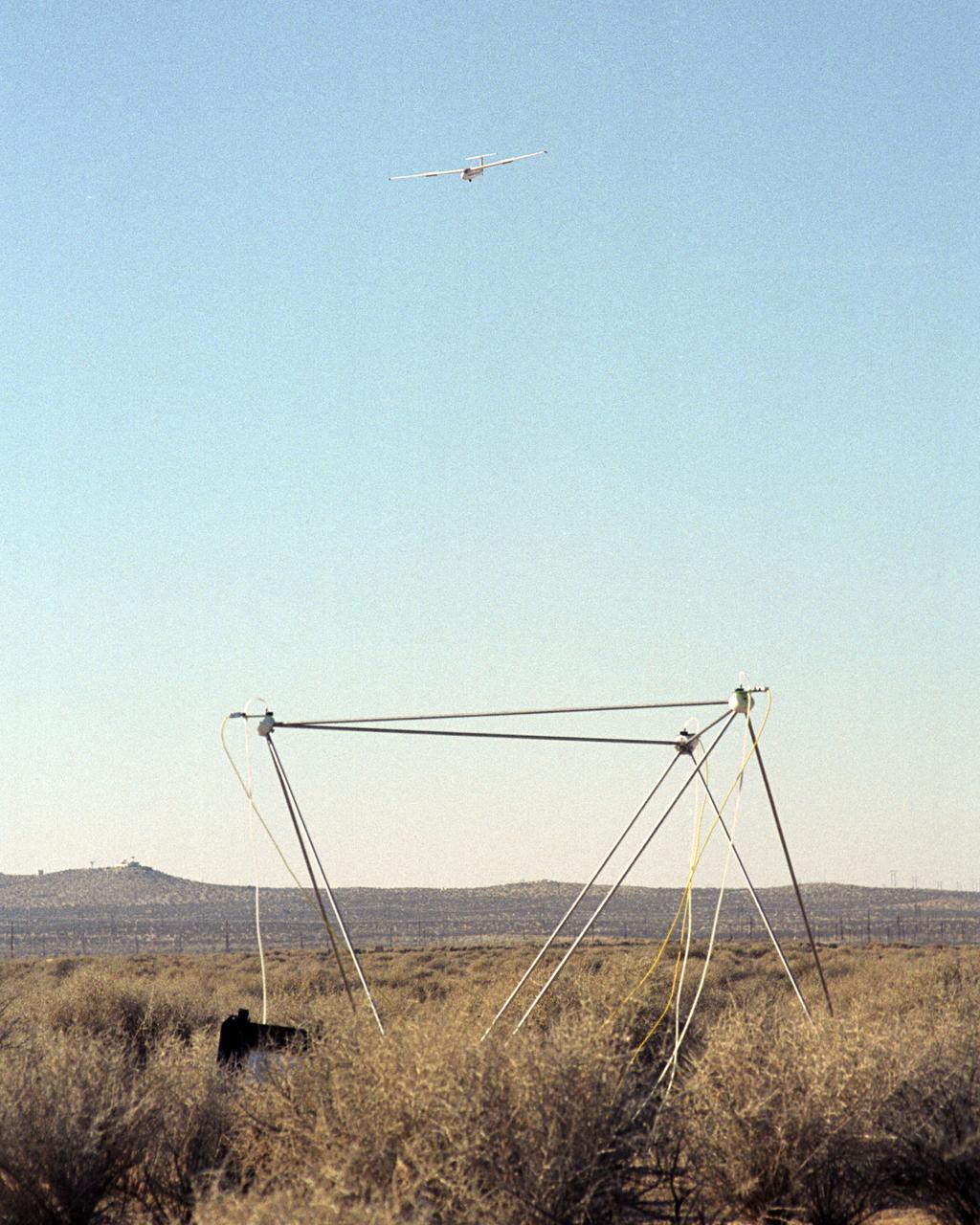
One of many microphones arrayed under the path of the F-5E SSBE (Shaped Sonic Boom Experiment) aircraft to record sonic booms. The SSBE (Shaped Sonic Boom Experiment) was formerly known as the Shaped Sonic Boom Demonstration, or SSBD, and is part of DARPA's Quiet Supersonic Platform (QSP) program. On August 27, 2003, the F-5E SSBD aircraft demonstrated a method to reduce the intensity of sonic booms.
Dale Reed with a model of the M2-F1 in front of the actual lifting body. Reed used the model to show the potential of the lifting bodies. He first flew it into tall grass to test stability and trim, then hand-launched it from buildings for longer flights. Finally, he towed the lifting-body model aloft using a powered model airplane known as the "Mothership." A timer released the model and it glided to a landing. Dale's wife Donna used a 9 mm. camera to film the flights of the model. Its stability as it glided--despite its lack of wings--convinced Milt Thompson and some Flight Research Center engineers including the center director, Paul Bikle, that a piloted lifting body was possible.