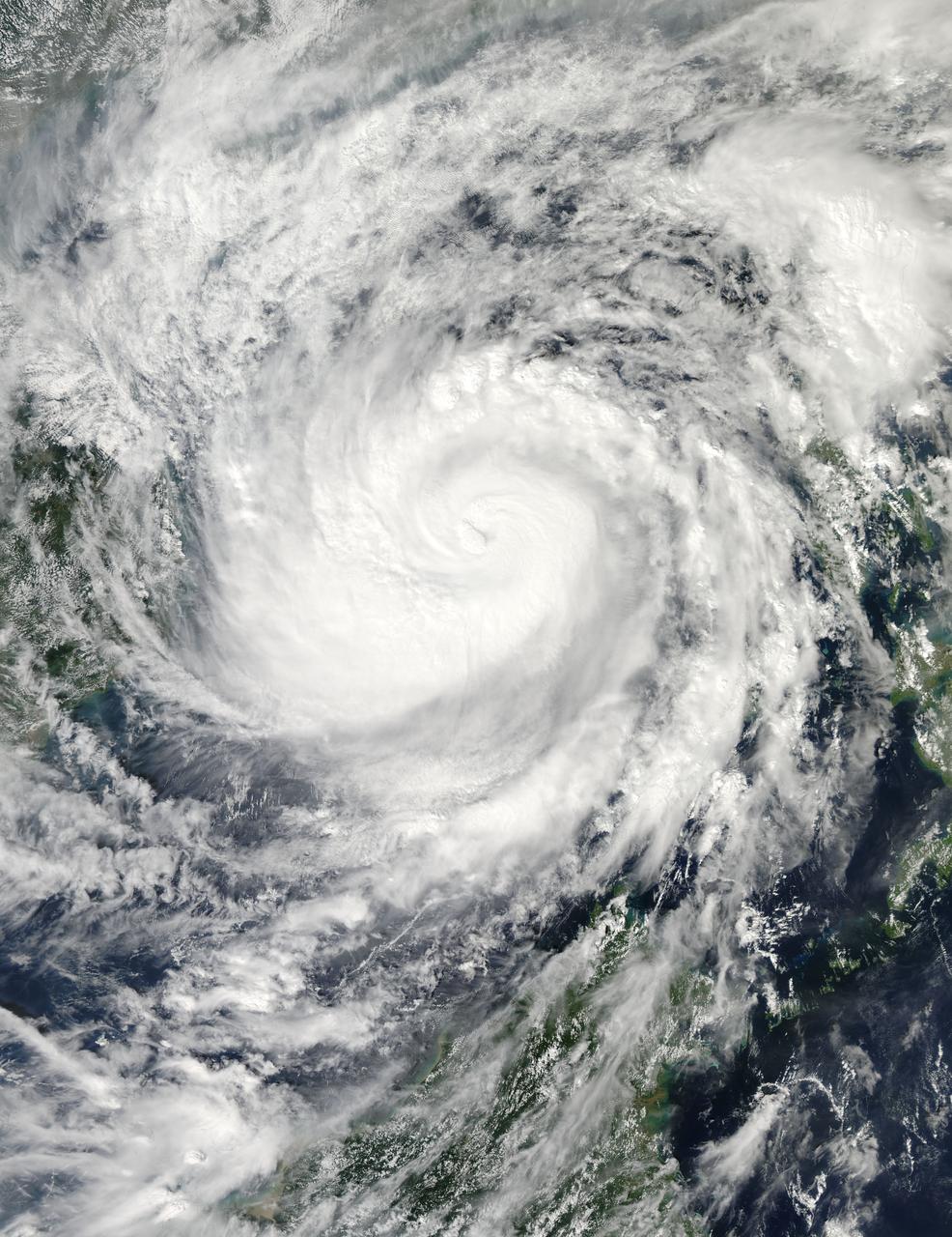
On Nov. 9 at 05:55 UTC/12:55 a.m. EDT, Typhoon Haiyan was in the middle of the South China Sea, headed toward Vietnam. Credit: NASA Goddard MODIS Rapid Response Team <b><a href="http://www.nasa.gov/audience/formedia/features/MP_Photo_Guidelines.html" rel="nofollow">NASA image use policy.</a></b> <b><a href="http://www.nasa.gov/centers/goddard/home/index.html" rel="nofollow">NASA Goddard Space Flight Center</a></b> enables NASA’s mission through four scientific endeavors: Earth Science, Heliophysics, Solar System Exploration, and Astrophysics. Goddard plays a leading role in NASA’s accomplishments by contributing compelling scientific knowledge to advance the Agency’s mission. <b>Follow us on <a href="http://twitter.com/NASA_GoddardPix" rel="nofollow">Twitter</a></b> <b>Like us on <a href="http://www.facebook.com/pages/Greenbelt-MD/NASA-Goddard/395013845897?ref=tsd" rel="nofollow">Facebook</a></b> <b>Find us on <a href="http://instagrid.me/nasagoddard/?vm=grid" rel="nofollow">Instagram</a></b>
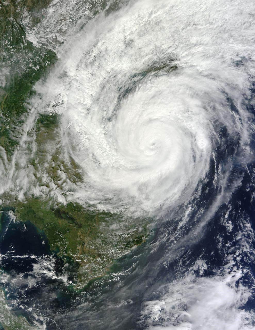
On Nov. 11 at 05:45 UTC, the MODIS instrument aboard NASA's Aqua satellite captured this image of Tropical Storm Haiyan over mainland China. Credit: NASA Goddard MODIS Rapid Response Team <b><a href="http://www.nasa.gov/audience/formedia/features/MP_Photo_Guidelines.html" rel="nofollow">NASA image use policy.</a></b> <b><a href="http://www.nasa.gov/centers/goddard/home/index.html" rel="nofollow">NASA Goddard Space Flight Center</a></b> enables NASA’s mission through four scientific endeavors: Earth Science, Heliophysics, Solar System Exploration, and Astrophysics. Goddard plays a leading role in NASA’s accomplishments by contributing compelling scientific knowledge to advance the Agency’s mission. <b>Follow us on <a href="http://twitter.com/NASA_GoddardPix" rel="nofollow">Twitter</a></b> <b>Like us on <a href="http://www.facebook.com/pages/Greenbelt-MD/NASA-Goddard/395013845897?ref=tsd" rel="nofollow">Facebook</a></b> <b>Find us on <a href="http://instagrid.me/nasagoddard/?vm=grid" rel="nofollow">Instagram</a></b>
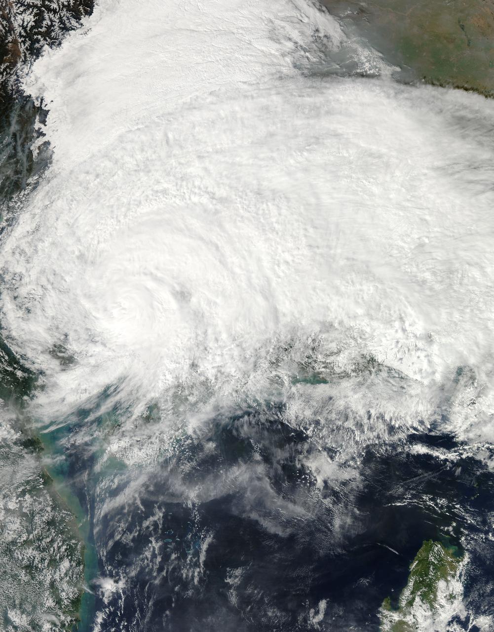
On Nov. 10 at 03:30 UTC/Nov. 9 at 10:30 p.m. EDT, the MODIS instrument aboard NASA's Terra satellite showed the center of Typhoon Haiyan just south of Hainan Island, China in the South China Sea. Credit: NASA Goddard MODIS Rapid Response Team <b><a href="http://www.nasa.gov/audience/formedia/features/MP_Photo_Guidelines.html" rel="nofollow">NASA image use policy.</a></b> <b><a href="http://www.nasa.gov/centers/goddard/home/index.html" rel="nofollow">NASA Goddard Space Flight Center</a></b> enables NASA’s mission through four scientific endeavors: Earth Science, Heliophysics, Solar System Exploration, and Astrophysics. Goddard plays a leading role in NASA’s accomplishments by contributing compelling scientific knowledge to advance the Agency’s mission. <b>Follow us on <a href="http://twitter.com/NASA_GoddardPix" rel="nofollow">Twitter</a></b> <b>Like us on <a href="http://www.facebook.com/pages/Greenbelt-MD/NASA-Goddard/395013845897?ref=tsd" rel="nofollow">Facebook</a></b> <b>Find us on <a href="http://instagrid.me/nasagoddard/?vm=grid" rel="nofollow">Instagram</a></b>

Satellite images obtained from NASA Atmospheric Infrared Sounder AIRS instrument aboard NASA Aqua spacecraft provide a glimpse into one of the most powerful storms ever recorded on Earth, Typhoon Haiyan.

This image, is of Super Typhoon Haiyan, one of the most powerful storms ever recorded on Earth, which struck the Philippines Nov. 8, 2013.

On Nov. 8, 2013, NASA Terra spacecraft acquired this image of Super Typhoon Haiyan as it tore across the central Philippines, leaving a trail of destruction in its path. Among the worst-hit areas is eastern Leyte island and the city of Tacloban.
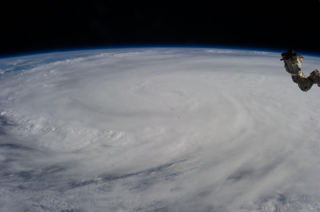
ISS037-E-028930 (9 Nov. 2013) --- When one of the Expedition 37 crew members aboard the International Space Station took this photograph on Nov. 9, 2013, Typhoon Haiyan had already made landfall and was rapidly weakening over the west-central Philippines, with winds estimated at 110 miles per hour and estimated position near 15.0 degrees north latitude and 112.3 degrees east longitude.