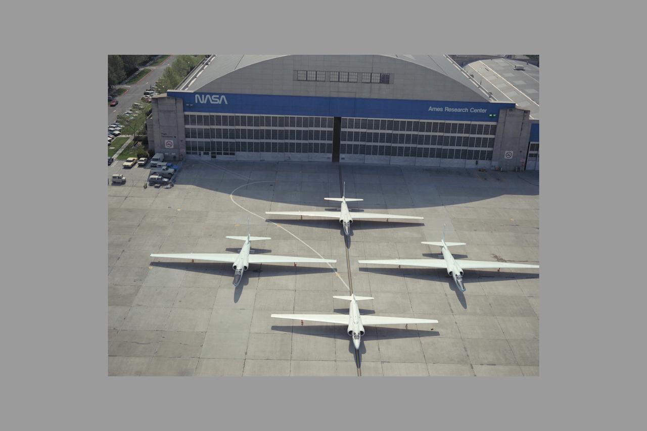
High Altitude MTPE Aircraft on flight line in front of N-211 hangar - three ER-2 and retiring U-2
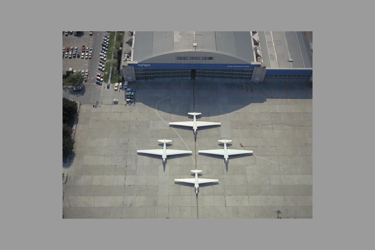
High Altitude MTPE Aircraft on flight line in front of N-211 hangar - three ER-2 and retiring U-2
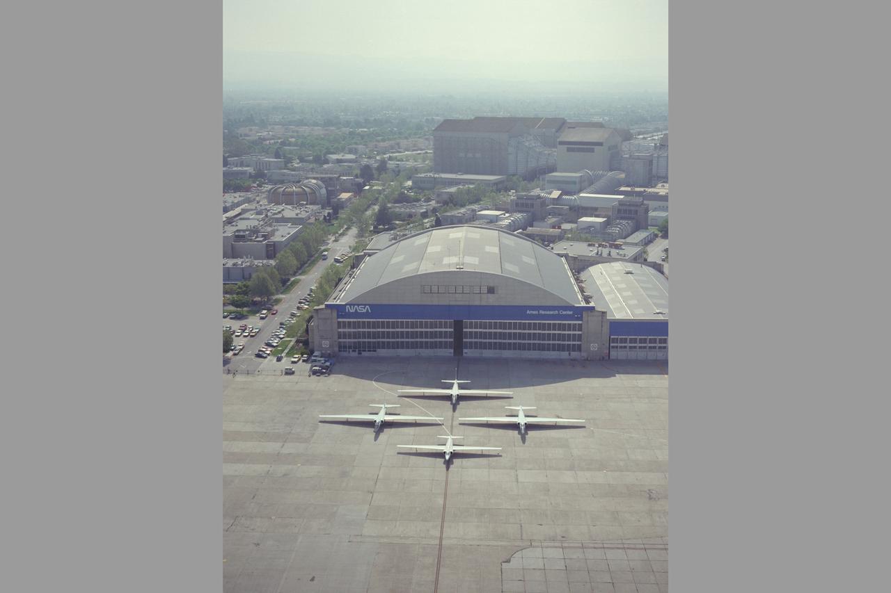
High Altitude MTPE Aircraft on flight line in front of N-211 hangar - three ER-2 and retiring U-2
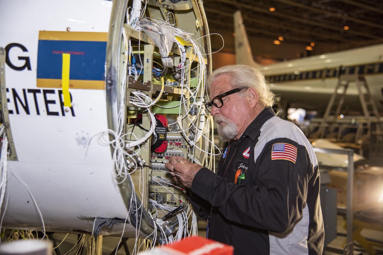
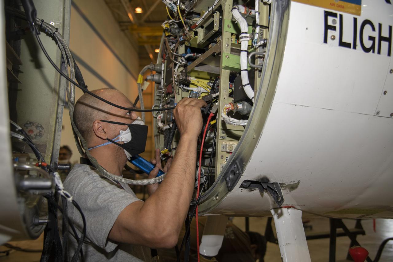
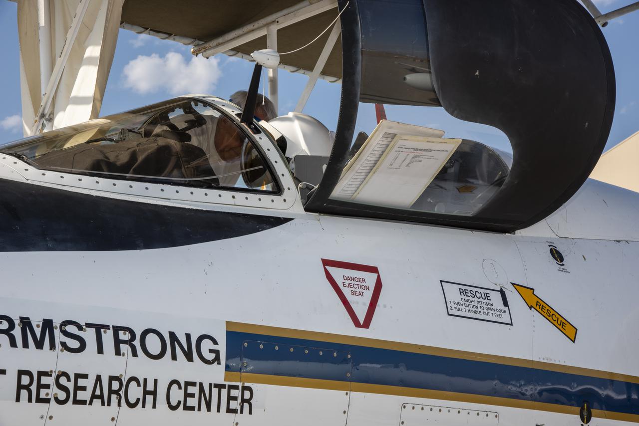
Technician Johnny Bryant works on rewiring the high-altitude aircraft's fixed nose and cockpit.
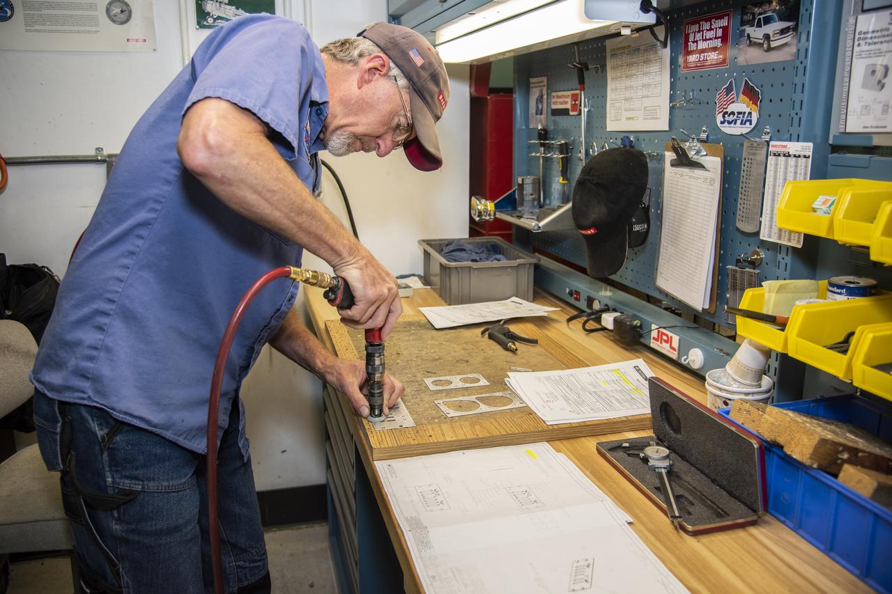
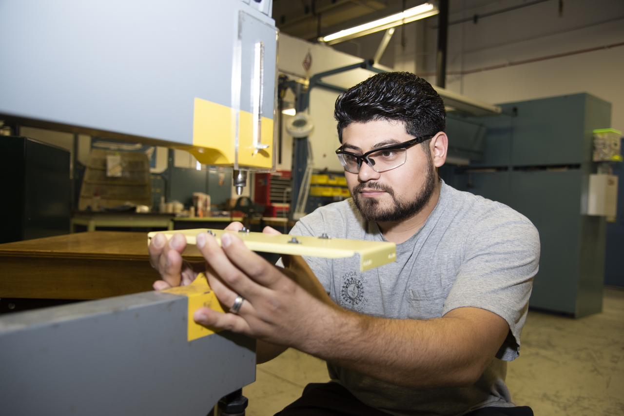
Andrew Shaw works on a component for the high-altitude ER-2 aircraft's instrument panel.
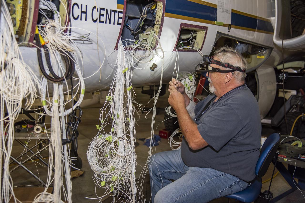
Technician David Johnson works on rewiring the high-altitude ER-2 aircraft's fixed nose and cockpit.Â

ER-2 tail number 706, was one of two Airborne Science ER-2s used as science platforms by Dryden. The aircraft were platforms for a variety of high-altitude science missions flown over various parts of the world. They were also used for earth science and atmospheric sensor research and development, satellite calibration and data validation.

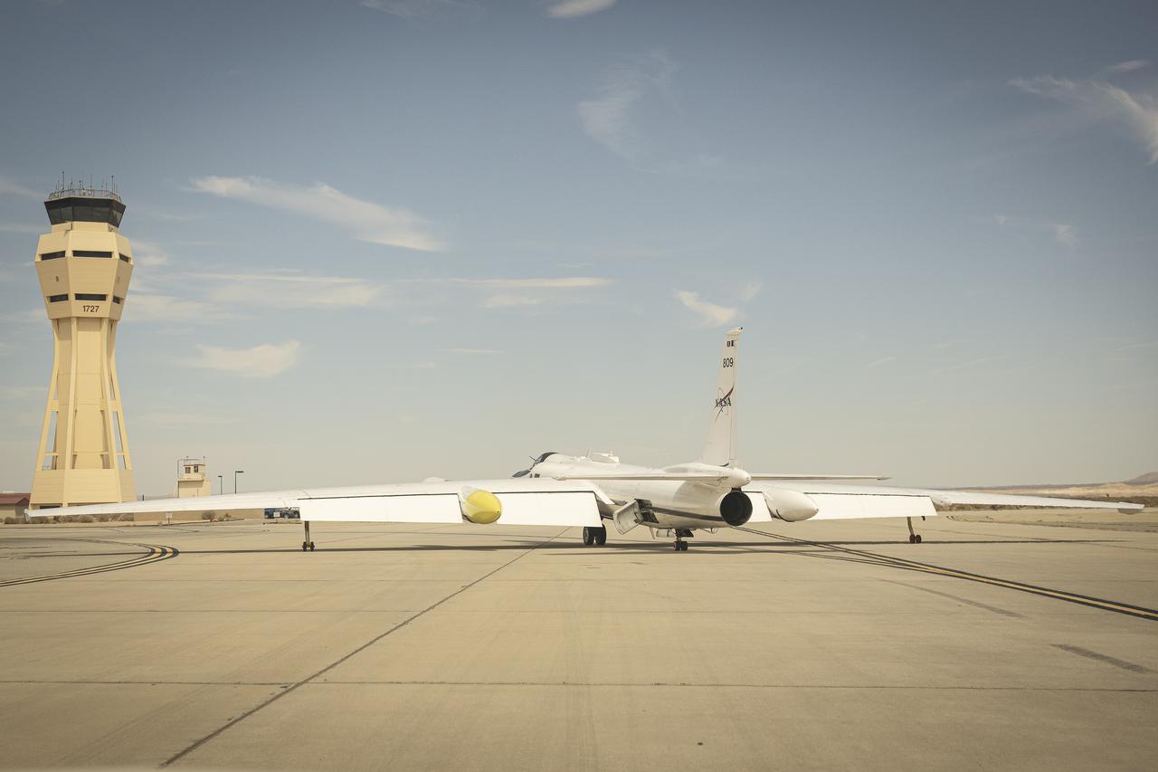
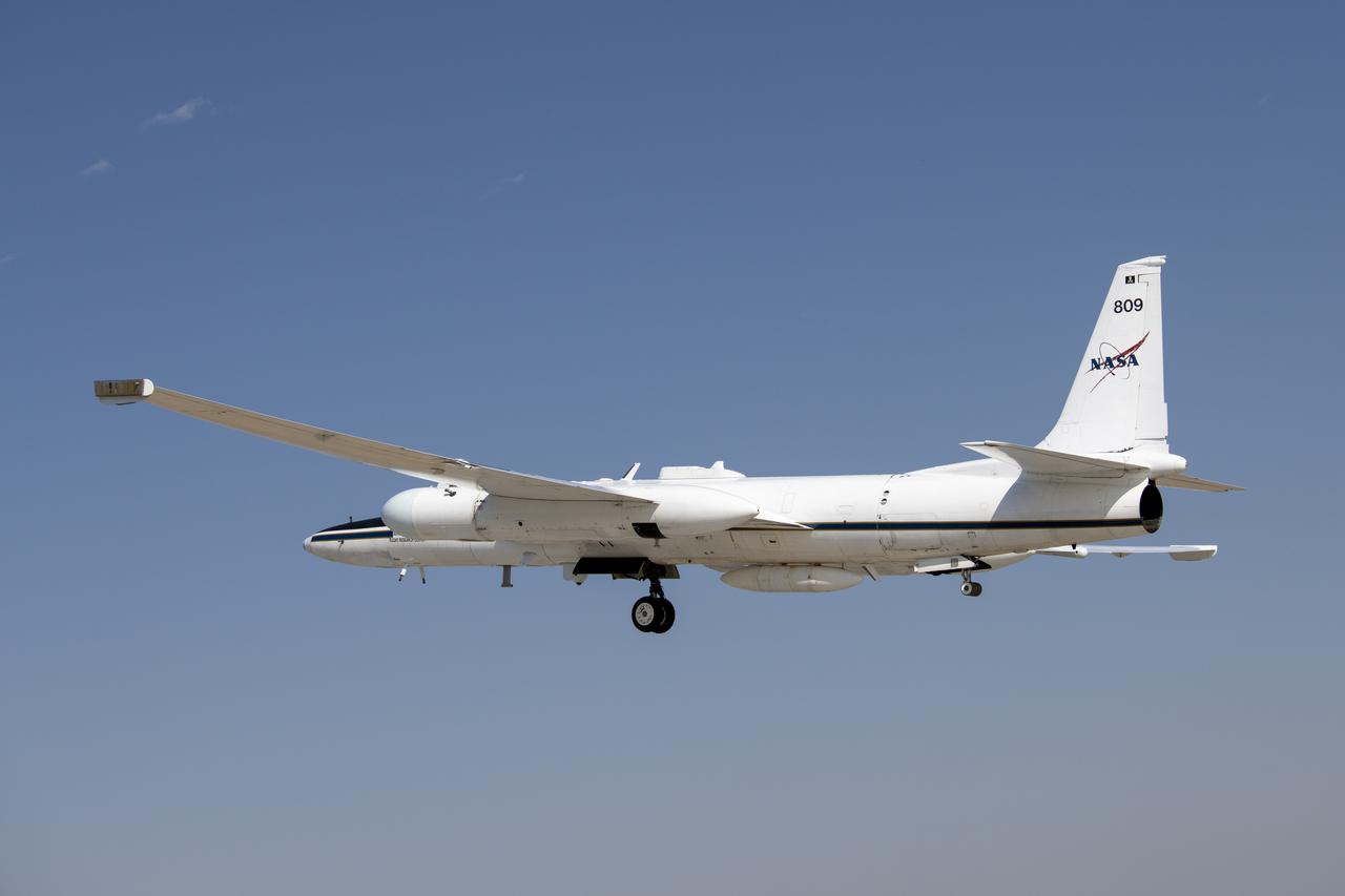
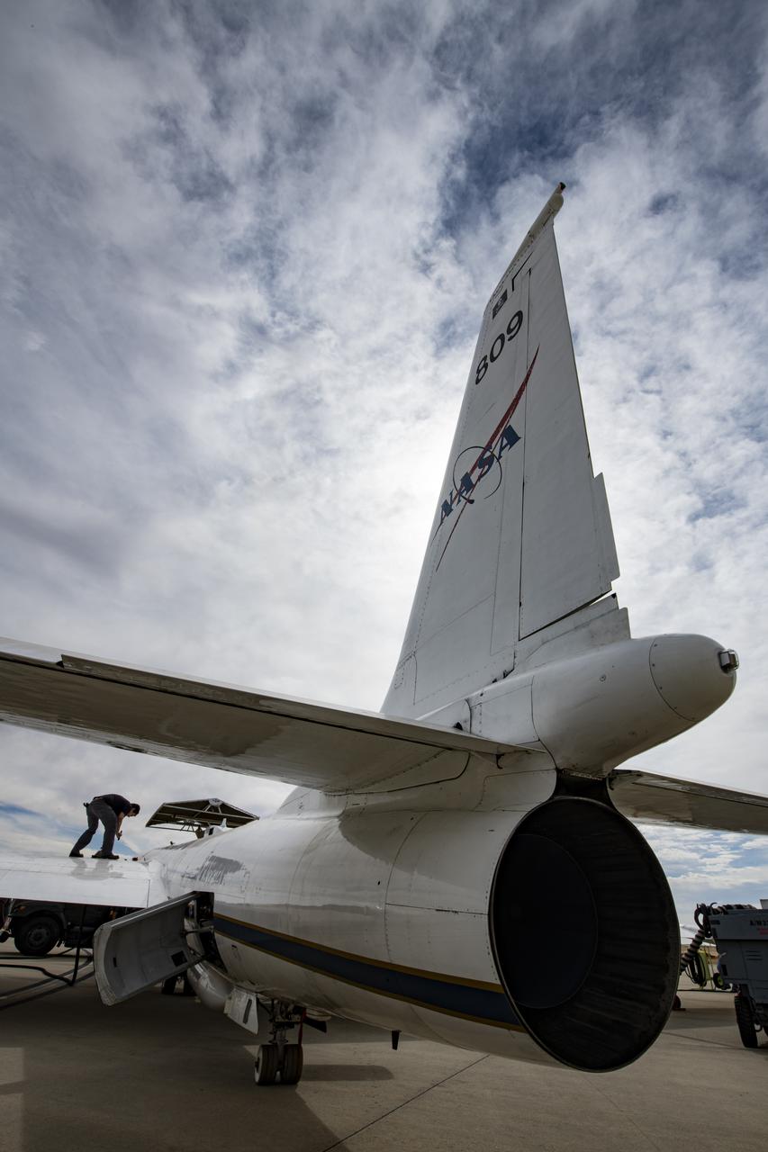
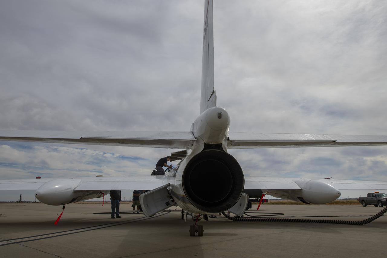
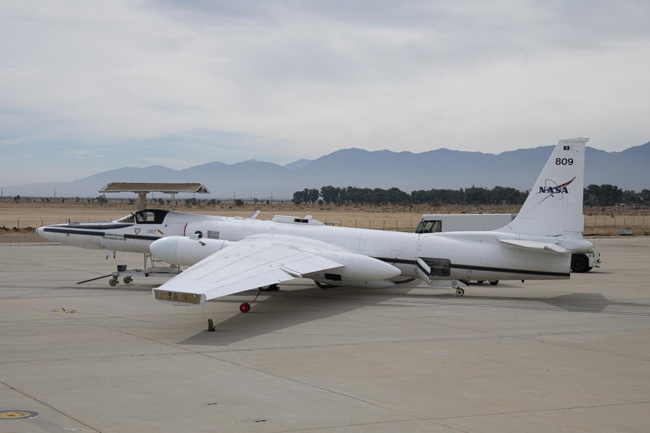
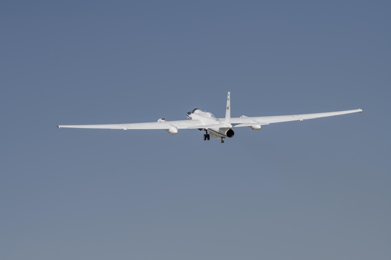
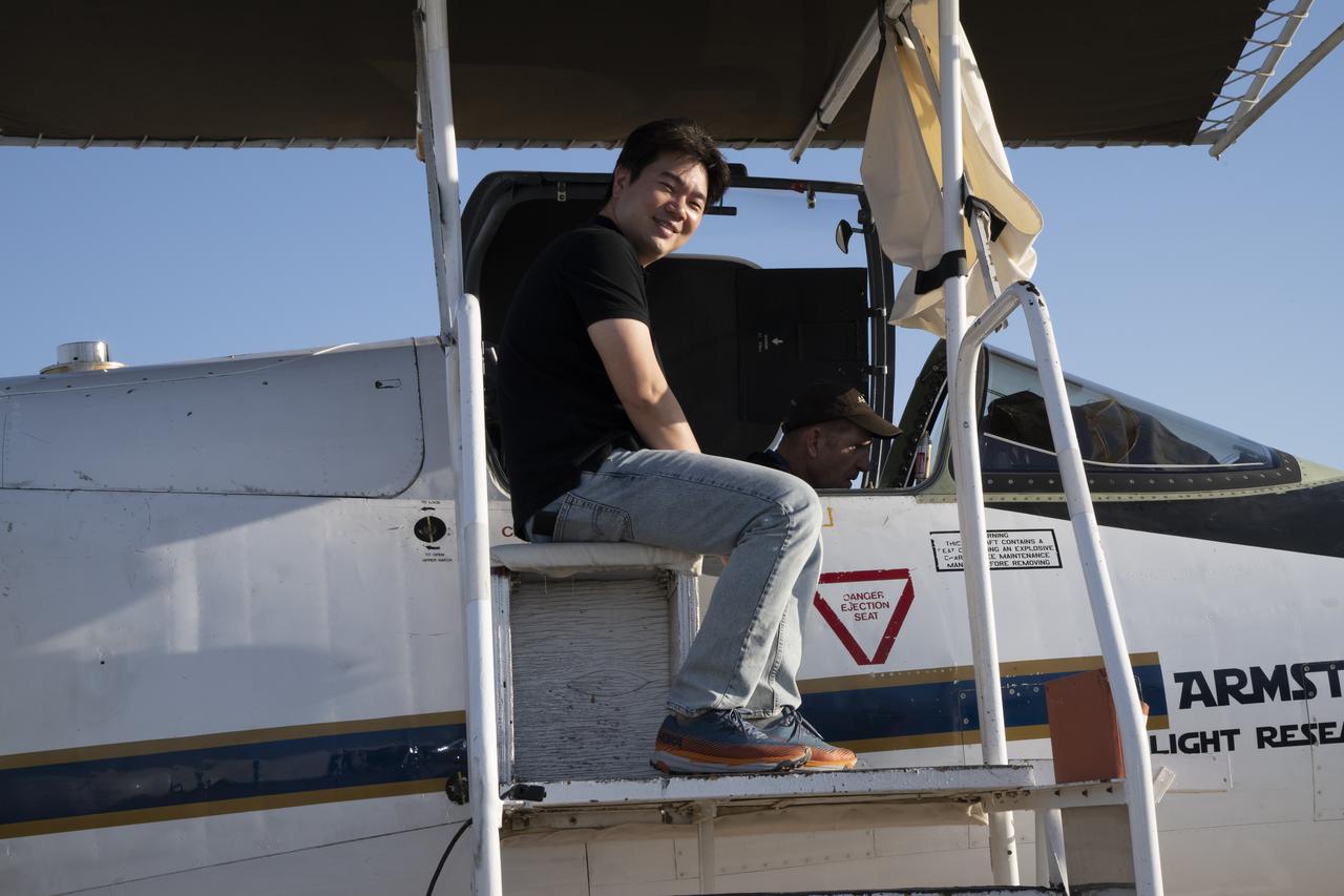
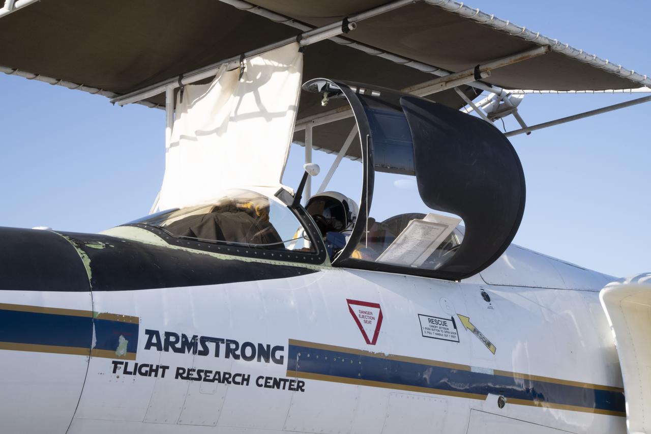
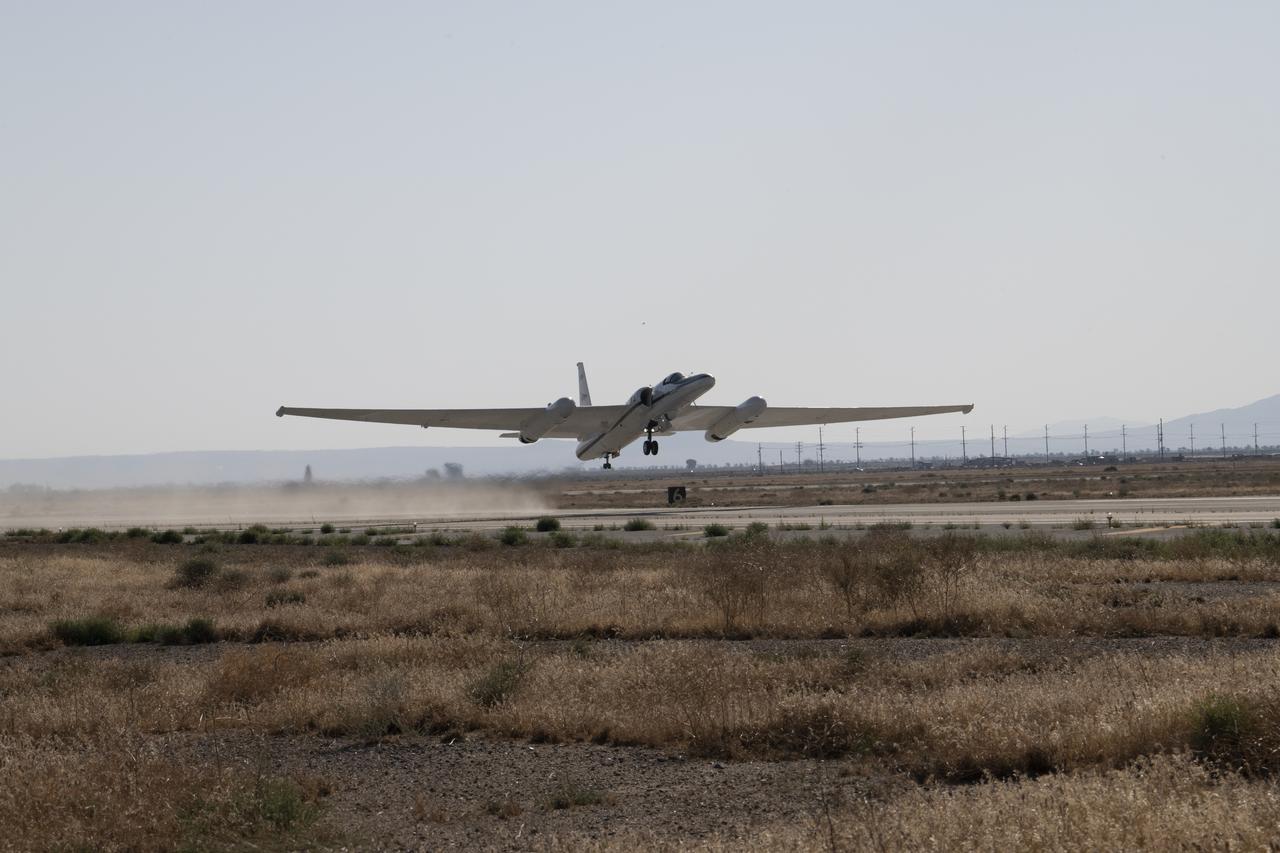
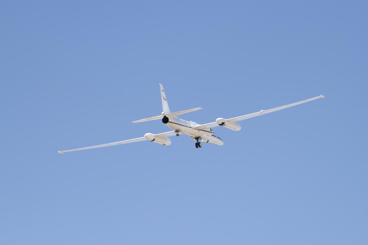
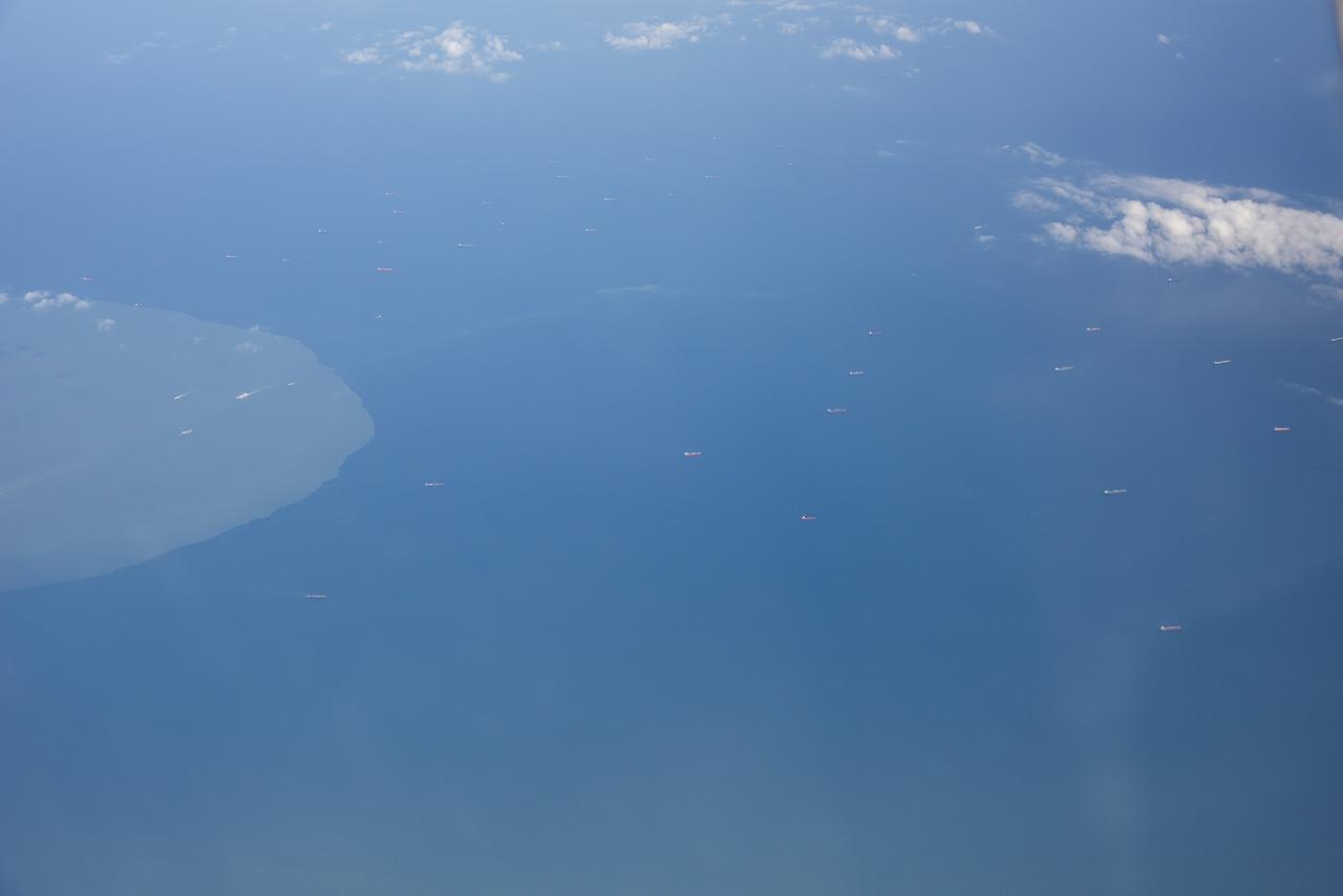
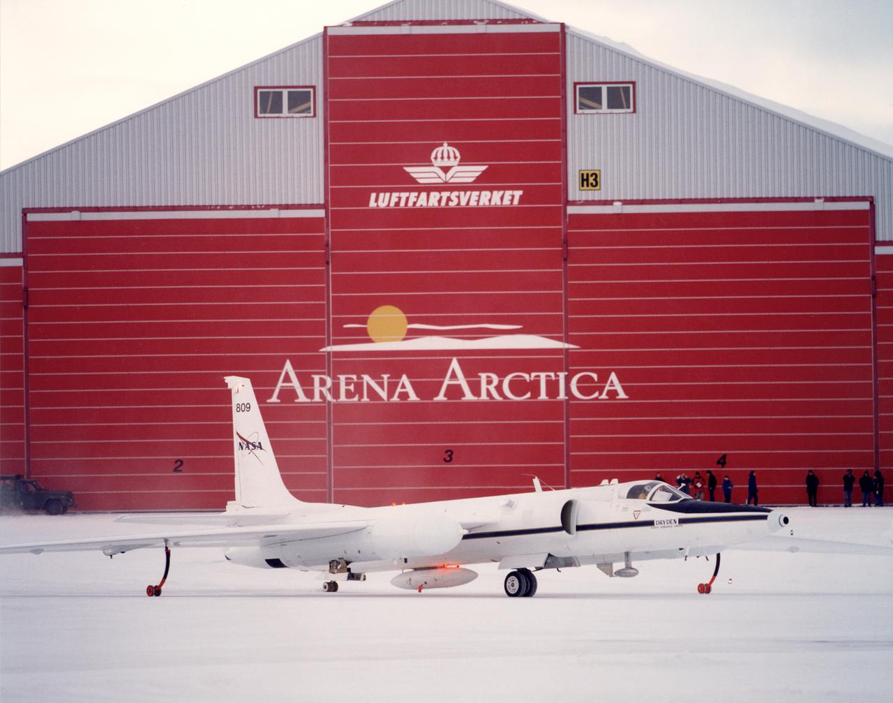
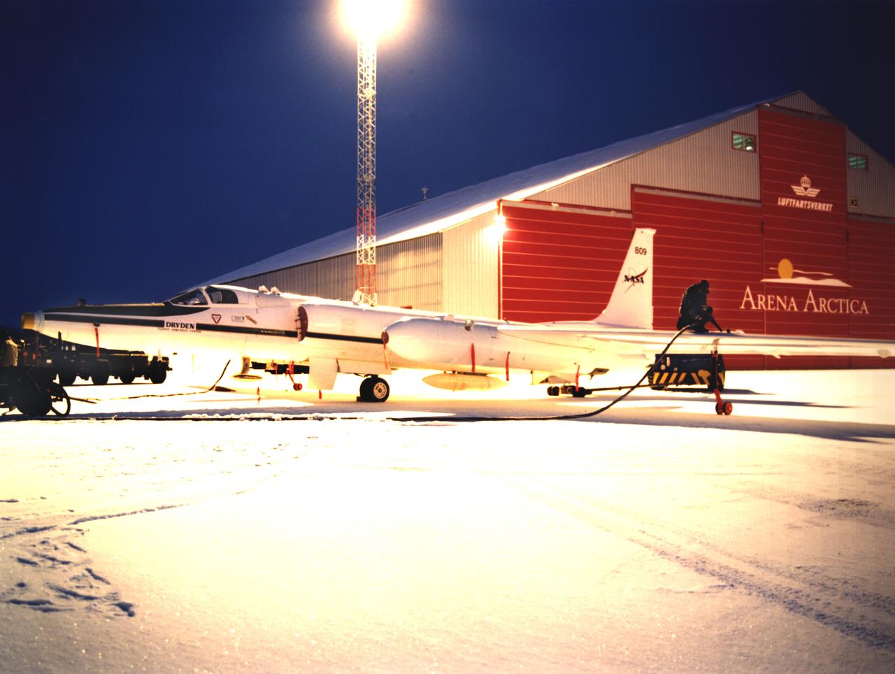
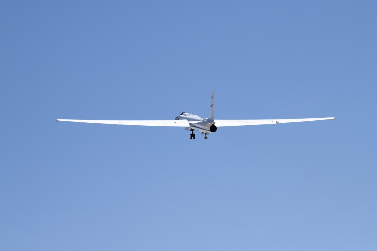
ER-2 tail number 809, is one of two Airborne Science ER-2s used as science platforms by Dryden. The aircraft are platforms for a variety of high-altitude science missions flown over various parts of the world. They are also used for earth science and atmospheric sensor research and development, satellite calibration and data validation. The ER-2s are capable of carrying a maximum payload of 2,600 pounds of experiments in a nose bay, the main equipment bay behind the cockpit, two wing-mounted superpods and small underbody and trailing edges. Most ER-2 missions last about six hours with ranges of about 2,200 nautical miles. The aircraft typically fly at altitudes above 65,000 feet. On November 19, 1998, the ER-2 set a world record for medium weight aircraft reaching an altitude of 68,700 feet. The aircraft is 63 feet long, with a wingspan of 104 feet. The top of the vertical tail is 16 feet above ground when the aircraft is on the bicycle-type landing gear. Cruising speeds are 410 knots, or 467 miles per hour, at altitude. A single General Electric F118 turbofan engine rated at 17,000 pounds thrust powers the ER-2.

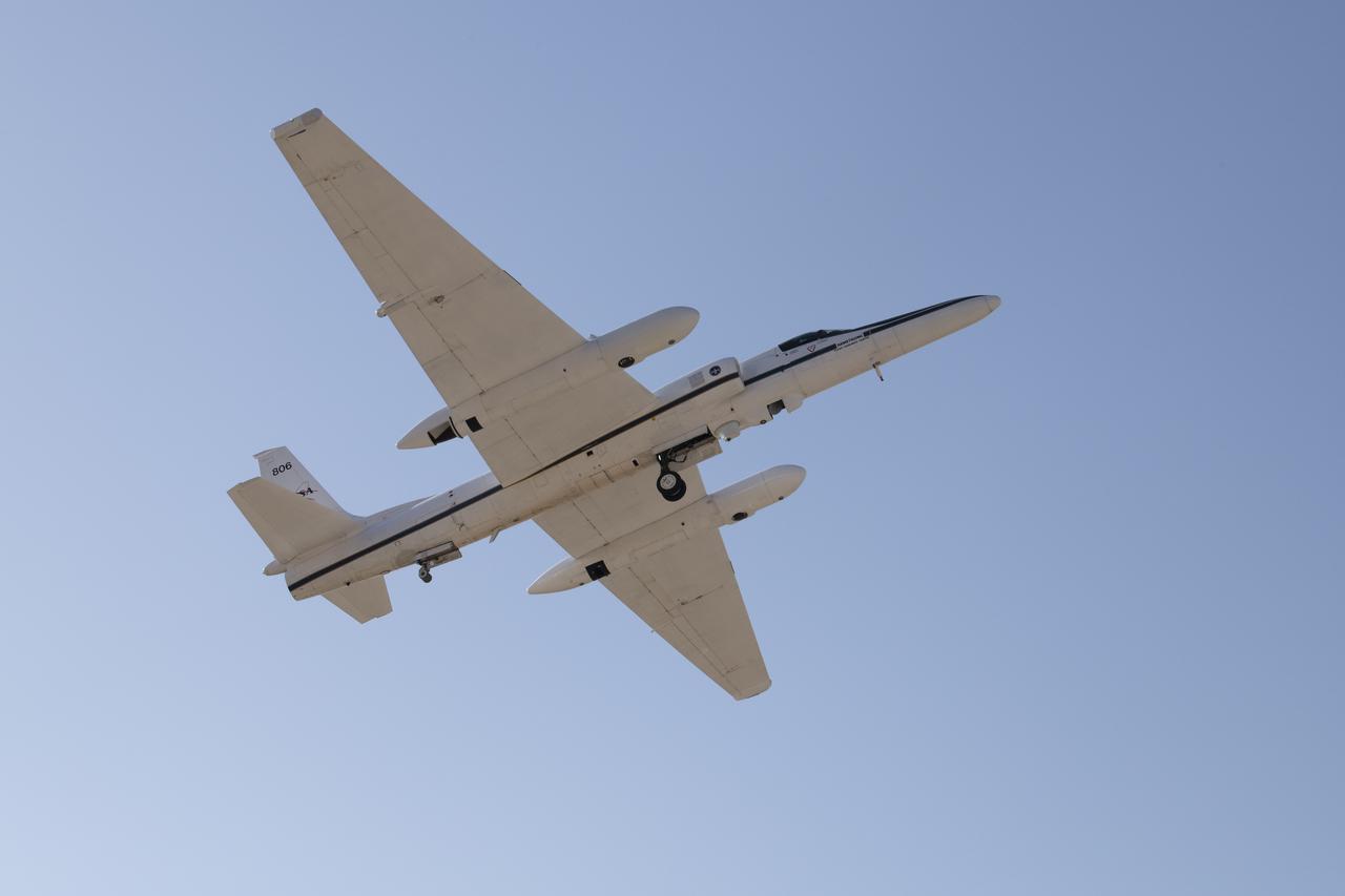
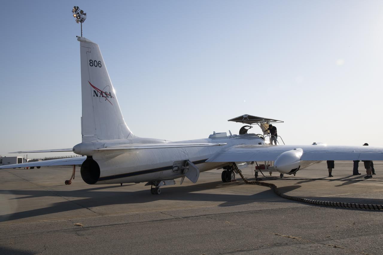
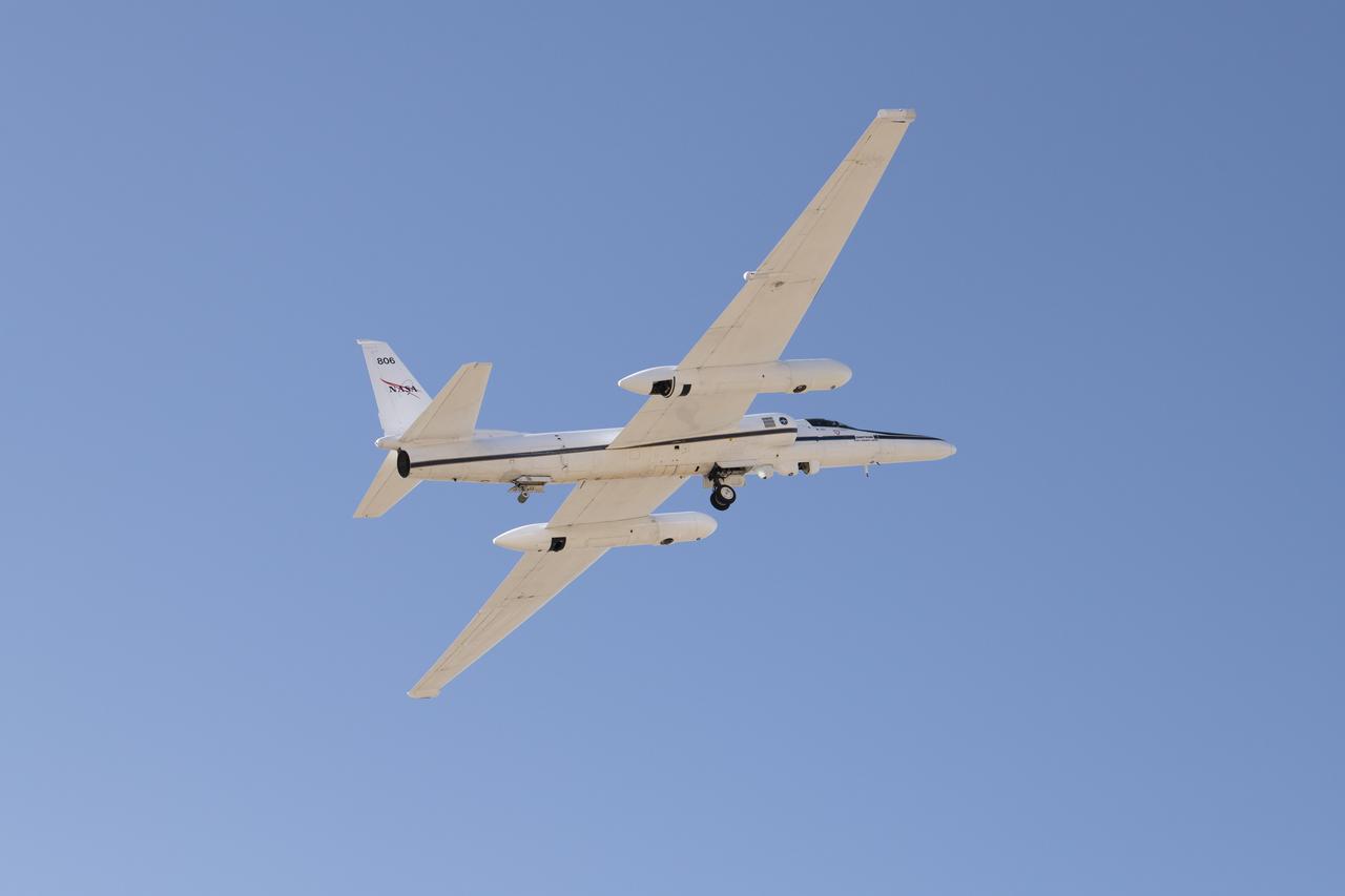
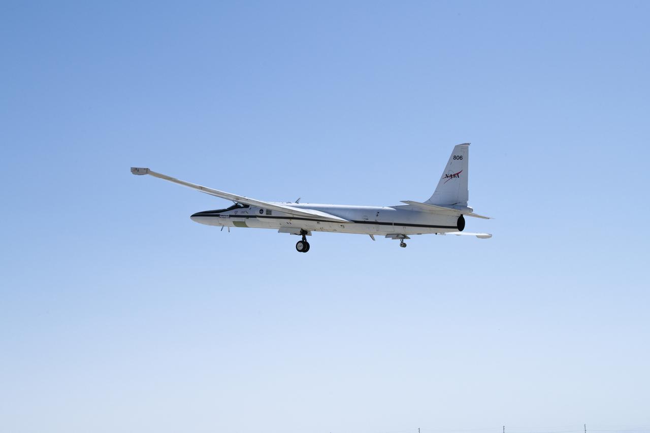
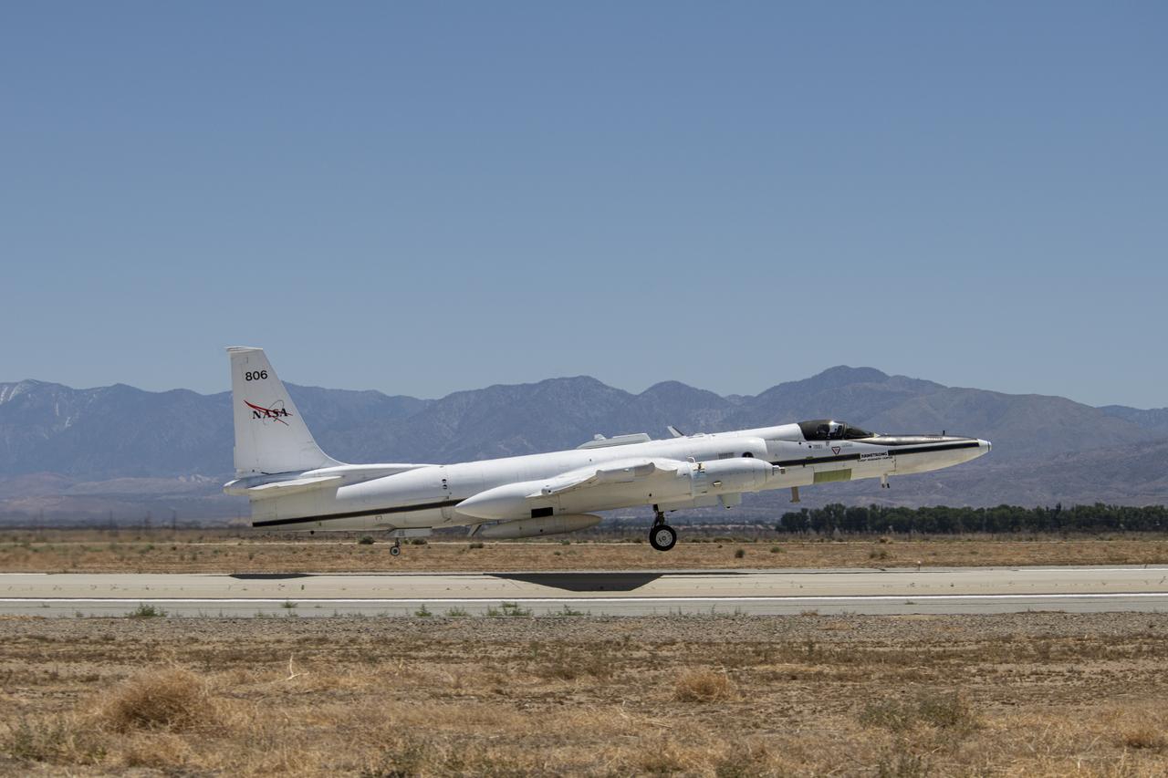
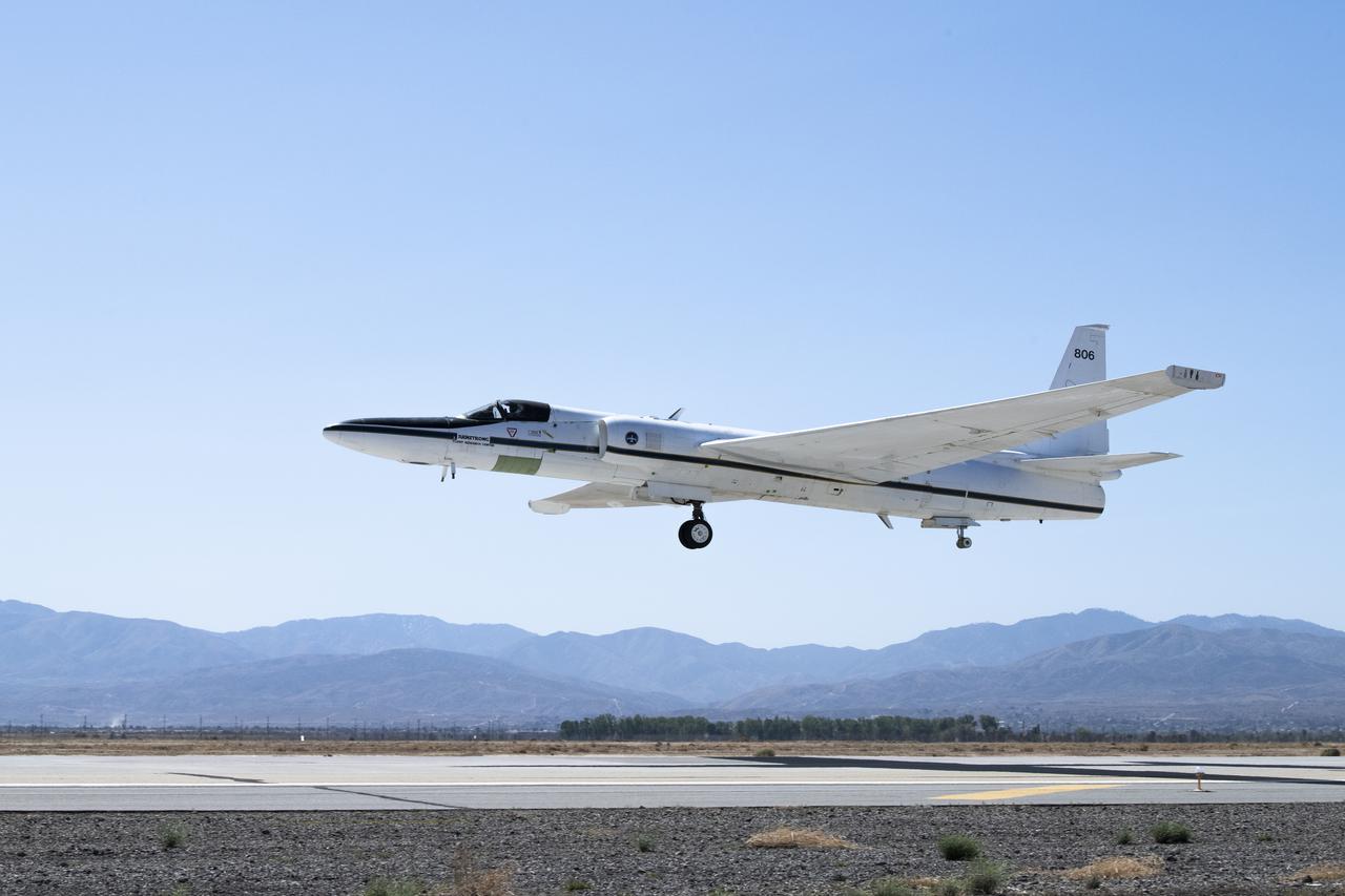
ER-2 tail number 806, is one of two Airborne Science ER-2s used as science platforms by Dryden. The aircraft are platforms for a variety of high-altitude science missions flown over various parts of the world. They are also used for earth science and atmospheric sensor research and development, satellite calibration and data validation. The ER-2s are capable of carrying a maximum payload of 2,600 pounds of experiments in a nose bay, the main equipment bay behind the cockpit, two wing-mounted superpods and small underbody and trailing edges. Most ER-2 missions last about six hours with ranges of about 2,200 nautical miles. The aircraft typically fly at altitudes above 65,000 feet. On November 19, 1998, the ER-2 set a world record for medium weight aircraft reaching an altitude of 68,700 feet. The aircraft is 63 feet long, with a wingspan of 104 feet. The top of the vertical tail is 16 feet above ground when the aircraft is on the bicycle-type landing gear. Cruising speeds are 410 knots, or 467 miles per hour, at altitude. A single General Electric F-118 turbofan engine rated at 17,000 pounds thrust powers the ER-2.

ER-2 tail number 806, is one of two Airborne Science ER-2s used as science platforms by Dryden. The aircraft are platforms for a variety of high-altitude science missions flown over various parts of the world. They are also used for earth science and atmospheric sensor research and development, satellite calibration and data validation. The ER-2s are capable of carrying a maximum payload of 2,600 pounds of experiments in a nose bay, the main equipment bay behind the cockpit, two wing-mounted superpods and small underbody and trailing edges. Most ER-2 missions last about six hours with ranges of about 2,200 nautical miles. The aircraft typically fly at altitudes above 65,000 feet. On November 19, 1998, the ER-2 set a world record for medium weight aircraft reaching an altitude of 68,700 feet. The aircraft is 63 feet long, with a wingspan of 104 feet. The top of the vertical tail is 16 feet above ground when the aircraft is on the bicycle-type landing gear. Cruising speeds are 410 knots, or 467 miles per hour, at altitude. A single General Electric F-118 turbofan engine rated at 17,000 pounds thrust powers the ER-2.
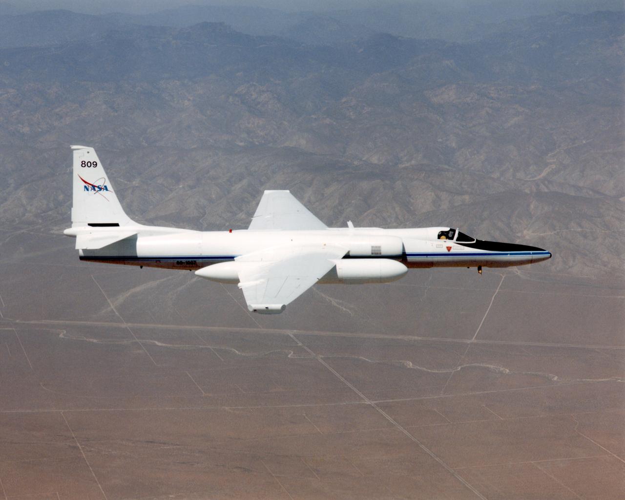
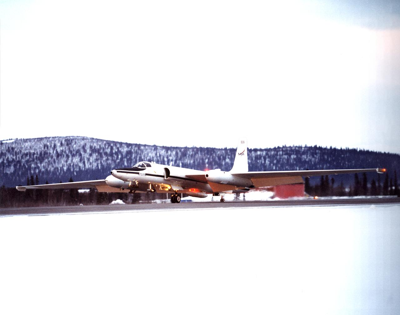
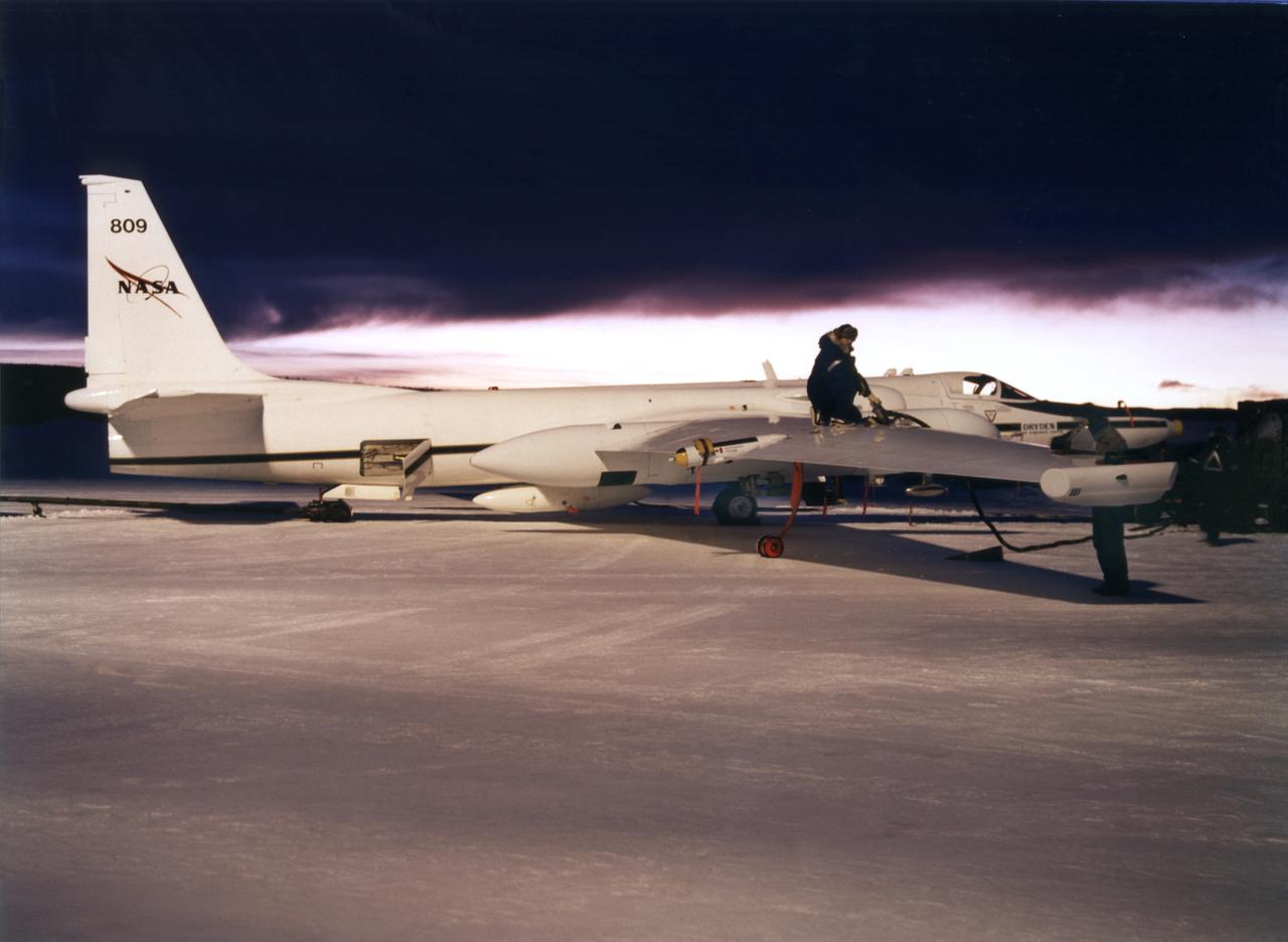
ER-2C tail number 809, was one of two Airborne Science ER-2Cs used as science platforms by Dryden. The aircraft were platforms for a variety of high-altitude science missions flown over various parts of the world. They were also used for earth science and atmospheric sensor research and development, satellite calibration and data validation. The ER-2Cs were capable of carrying a maximum payload of 2,600 pounds of experiments in a nose bay, the main equipment bay behind the cockpit, two wing-mounted superpods and small underbody and trailing edges. Most ER-2C missions lasted about six hours with ranges of about 2,200 nautical miles. The aircraft typically flew at altitudes above 65,000 feet. On November 19, 1998, the ER-2C set a world record for medium weight aircraft reaching an altitude of 68,700 feet. The aircraft was 63 feet long, with a wingspan of 104 feet. The top of the vertical tail was 16 feet above ground when the aircraft was on the bicycle-type landing gear. Cruising speeds were 410 knots, or 467 miles per hour, at altitude. A single General Electric F-118 turbofan engine rated at 17,000 pounds thrust powers the ER-2C.

ER-2 tail number 806, is one of two Airborne Science ER-2s used as science platforms by Dryden. The aircraft are platforms for a variety of high-altitude science missions flown over various parts of the world. They are also used for earth science and atmospheric sensor research and development, satellite calibration and data validation. The ER-2s are capable of carrying a maximum payload of 2,600 pounds of experiments in a nose bay, the main equipment bay behind the cockpit, two wing-mounted superpods and small underbody and trailing edges. Most ER-2 missions last about six hours with ranges of about 2,200 nautical miles. The aircraft typically fly at altitudes above 65,000 feet. On November 19, 1998, the ER-2 set a world record for medium weight aircraft reaching an altitude of 68,700 feet. The aircraft is 63 feet long, with a wingspan of 104 feet. The top of the vertical tail is 16 feet above ground when the aircraft is on the bicycle-type landing gear. Cruising speeds are 410 knots, or 467 miles per hour, at altitude. A single General Electric F-118 turbofan engine rated at 17,000 pounds thrust powers the ER-2.
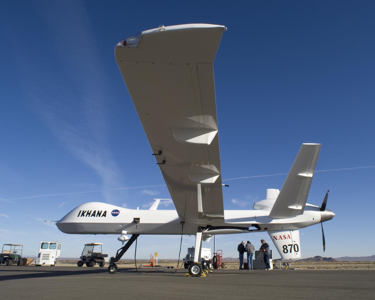
Bearing NASA tail number 870, NASA's Ikhana unmanned aircraft is a civil version of the Predator B designed for high-altitude, long-endurance science flights.

ER-2 tail number 706, was one of two Airborne Science ER-2s used as science platforms by Dryden. The aircraft were platforms for a variety of high-altitude science missions flown over various parts of the world. They were also used for earth science and atmospheric sensor research and development, satellite calibration and data validation.
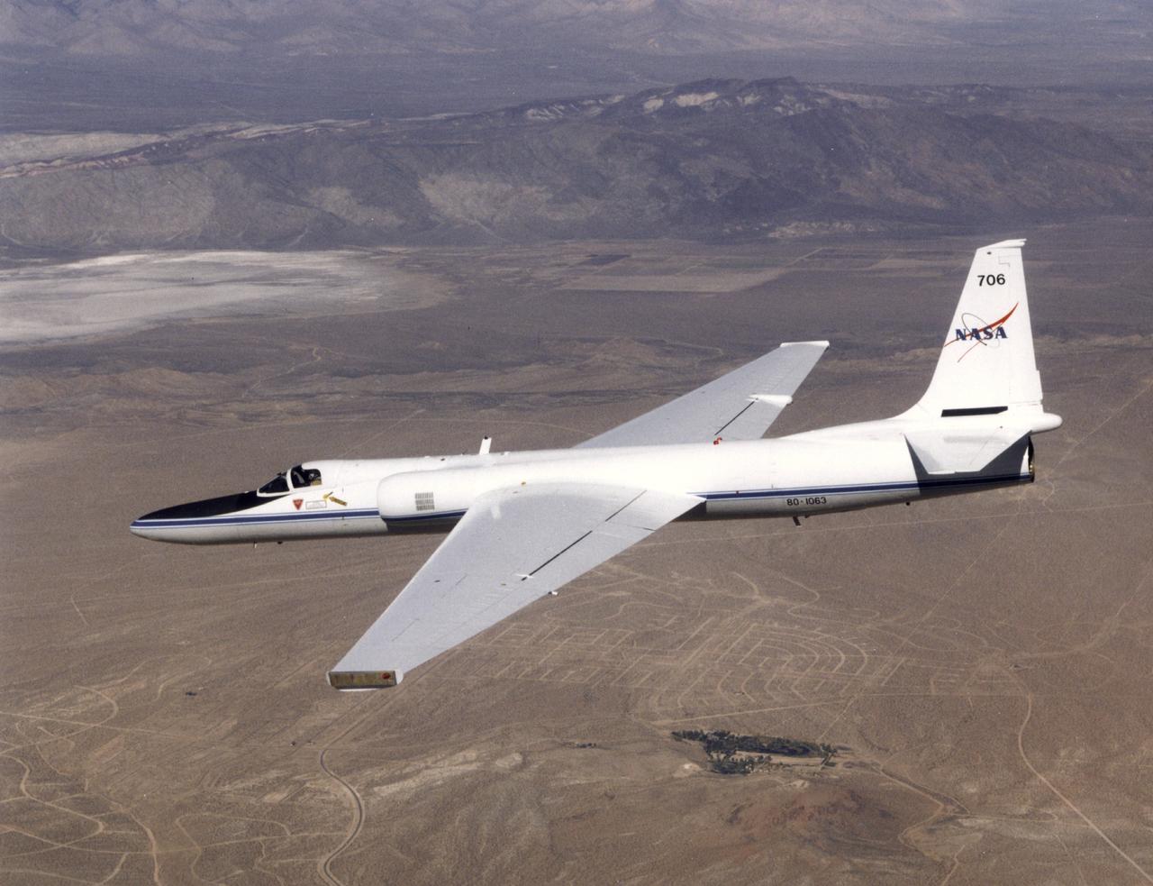
ER-2 tail number 706, was one of two Airborne Science ER-2s used as science platforms by Dryden. The aircraft were platforms for a variety of high-altitude science missions flown over various parts of the world. They were also used for earth science and atmospheric sensor research and development, satellite calibration and data validation.
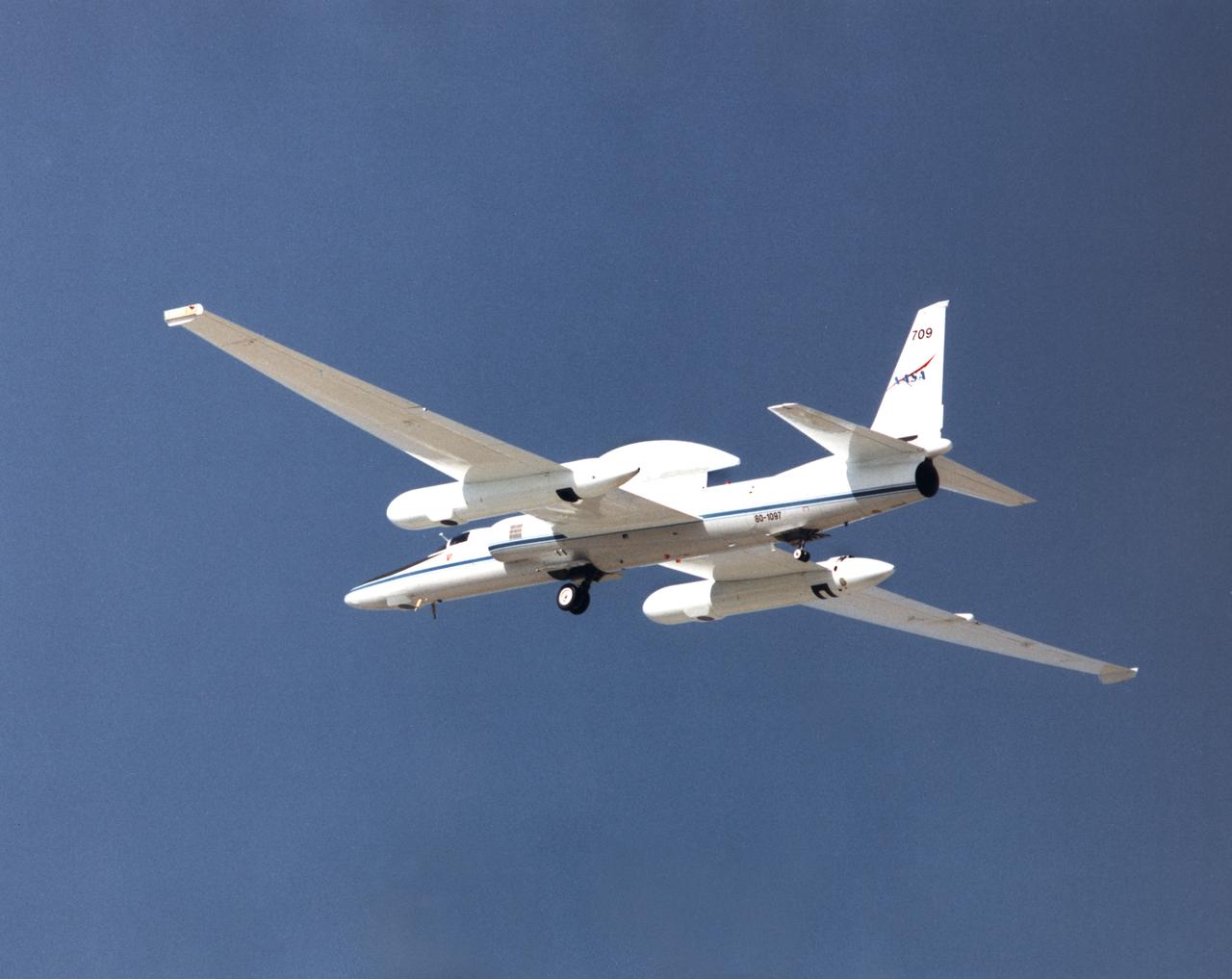
ER-2 tail number 709, was one of two Airborne Science ER-2s used as science platforms by Dryden. The aircraft were platforms for a variety of high-altitude science missions flown over various parts of the world. They were also used for earth science and atmospheric sensor research and development, satellite calibration and data validation.
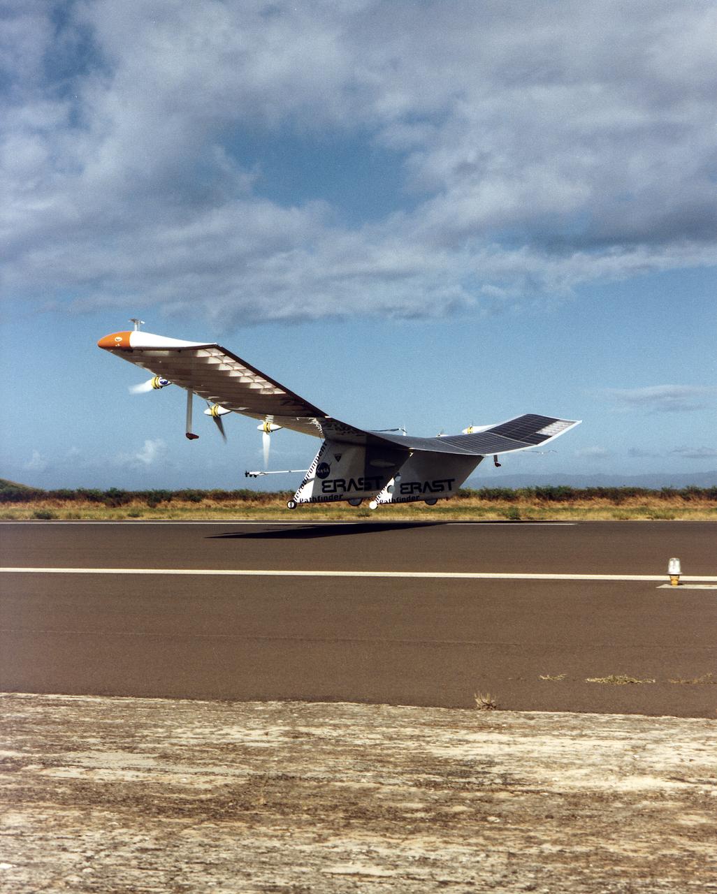
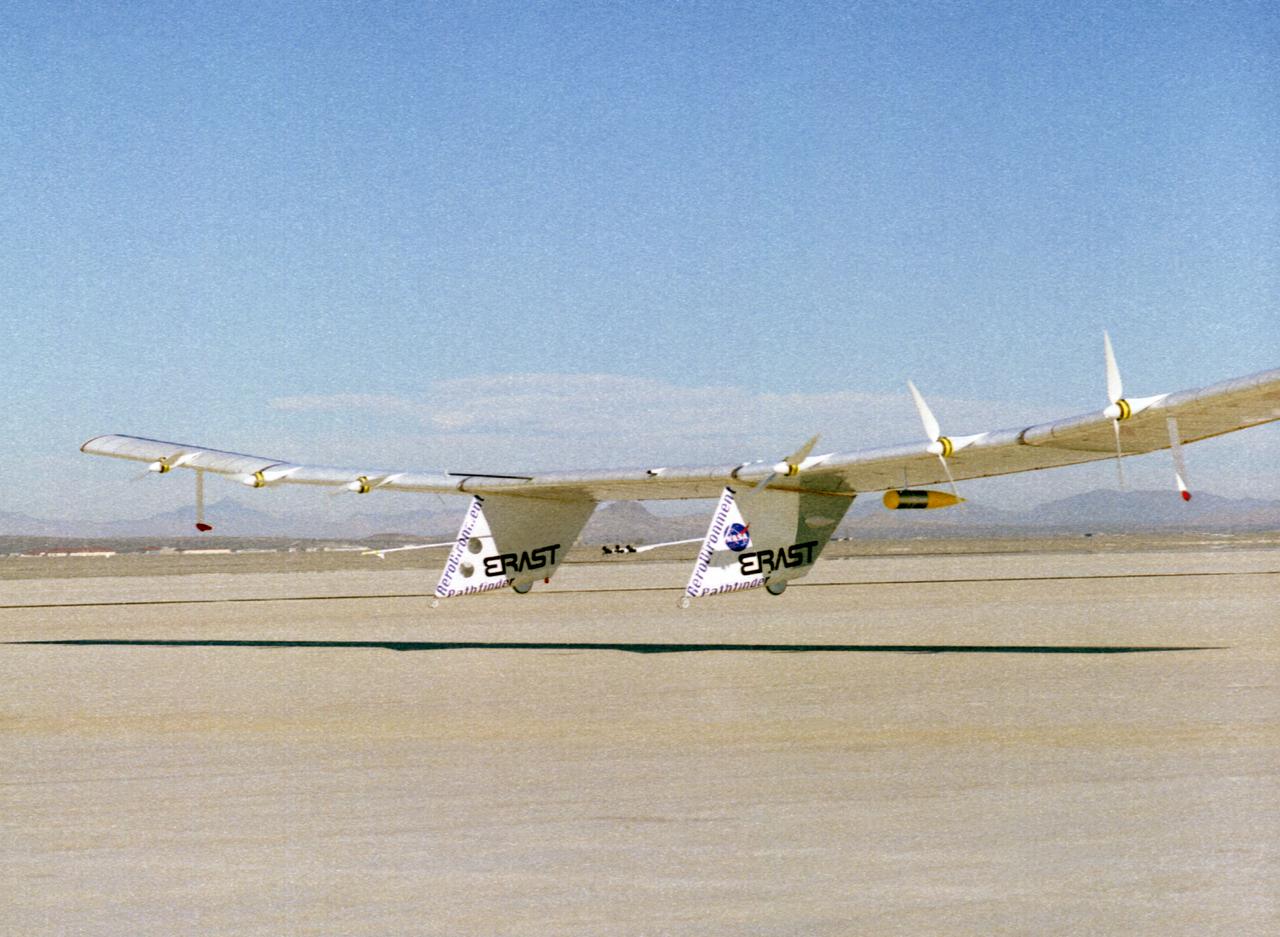
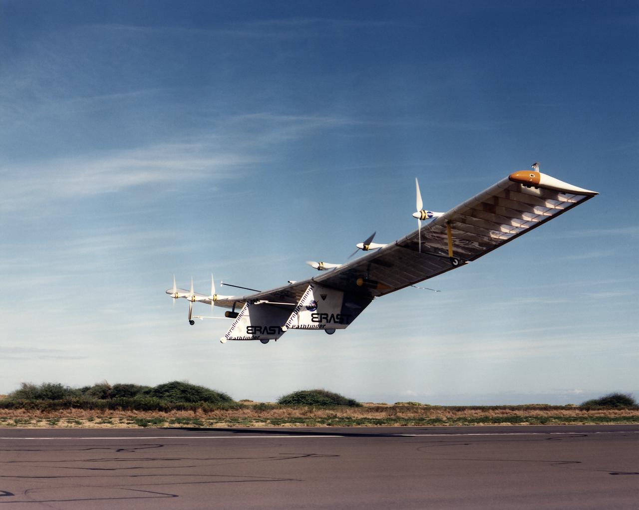
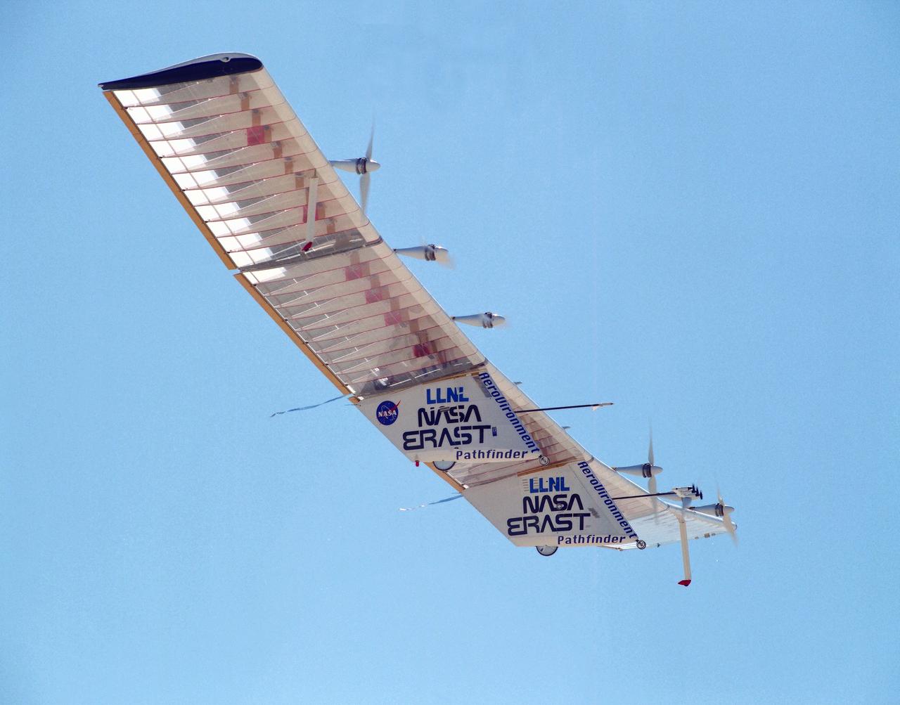
The Pathfinder aircraft has set a new unofficial world record for high-altitude flight of over 71,500 feet for solar-powered aircraft at the U.S. Navy's Pacific Missile Range Facility, Kauai, Hawaii. Pathfinder was designed and manufactured by AeroVironment, Inc, of Simi Valley, California, and was operated by the firm under a jointly sponsored research agreement with NASA's Dryden Flight Research Center, Edwards, California. Pathfinder's record-breaking flight occurred July 7, 1997. The aircraft took off at 11:34 a.m. PDT, passed its previous record altitude of 67,350 feet at about 5:45 p.m. and then reached its new record altitude at 7 p.m. The mission ended with a perfect nighttime landing at 2:05 a.m. PDT July 8. The new record is the highest altitude ever attained by a propellor-driven aircraft. Before Pathfinder, the altitude record for propellor-driven aircraft was 67,028 feet, set by the experimental Boeing Condor remotely piloted aircraft.
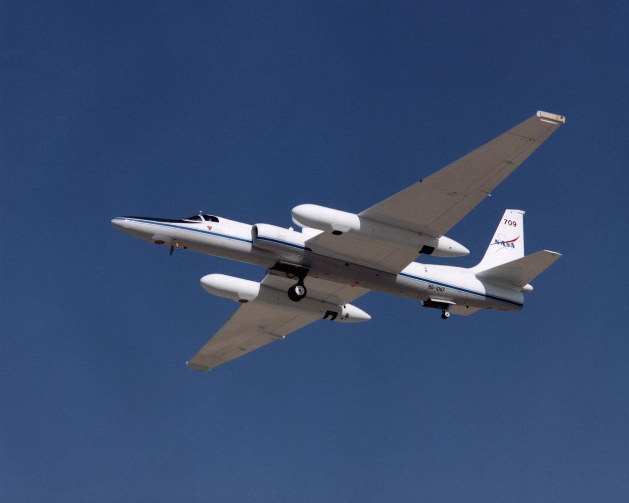
ER-2 tail number 709, was one of two Airborne Science ER-2s used as science platforms by Dryden. The aircraft were platforms for a variety of high-altitude science missions flown over various parts of the world. They were also used for earth science and atmospheric sensor research and development, satellite calibration and data validation.
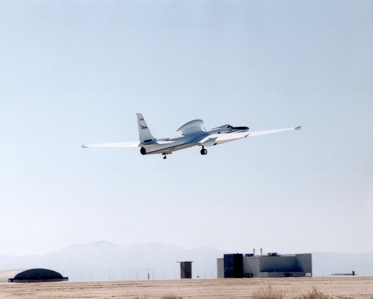
ER-2 tail number 709, was one of two Airborne Science ER-2s used as science platforms by Dryden. The aircraft were platforms for a variety of high-altitude science missions flown over various parts of the world. They were also used for earth science and atmospheric sensor research and development, satellite calibration and data validation.
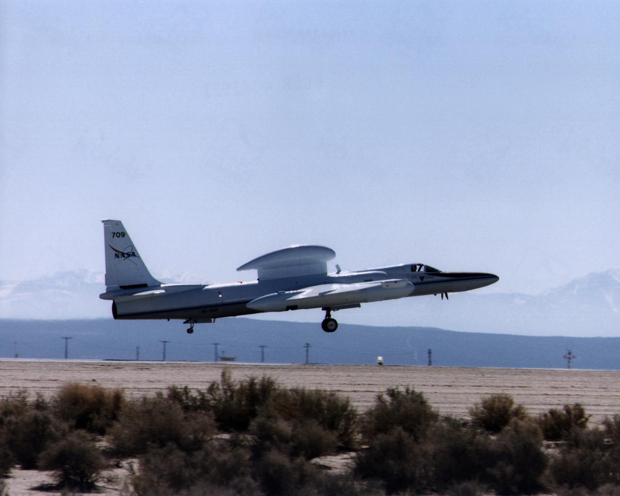
ER-2 tail number 709, was one of two Airborne Science ER-2s used as science platforms by Dryden. The aircraft were platforms for a variety of high-altitude science missions flown over various parts of the world. They were also used for earth science and atmospheric sensor research and development, satellite calibration and data validation.
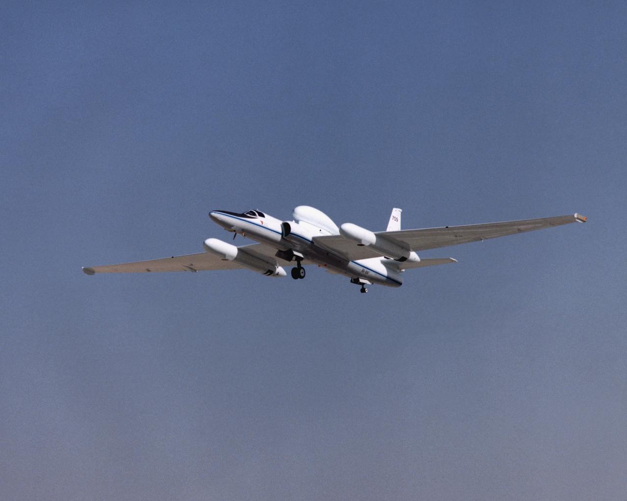
ER-2 tail number 709, was one of two Airborne Science ER-2s used as science platforms by Dryden. The aircraft were platforms for a variety of high-altitude science missions flown over various parts of the world. They were also used for earth science and atmospheric sensor research and development, satellite calibration and data validation.

An ER-2 high-altitude Earth science aircraft banks away during a flight over the southern Sierra Nevada. NASA’s Armstrong Flight Research Center operates two of the Lockheed-built aircraft on a wide variety of environmental science, atmospheric sampling, and satellite data verification missions.
NASA’s ER-2 high-altitude aircraft prepares for a night flight with the Airborne Lunar Spectral Irradiance (air-LUSI) instrument on Monday, Feb. 2, 2026. The instrument measures Moonlight to improve accuracy of space-based sensors that forecast the weather, monitor agriculture, and study Earth’s ecosystem.

The Proteus high-altitude aircraft at Sunset
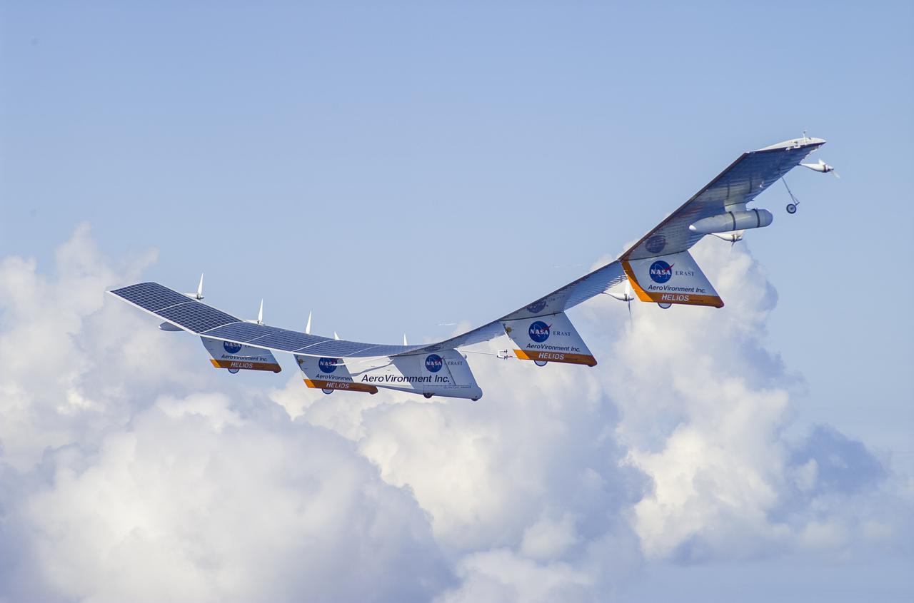
The AeroVironment Helios high-altitude, solar-powered aircraft flies in Kauai, Hawaii. Helios reached 96,300 feet altitude, the record for sustained, level flight for a winged aircraft.
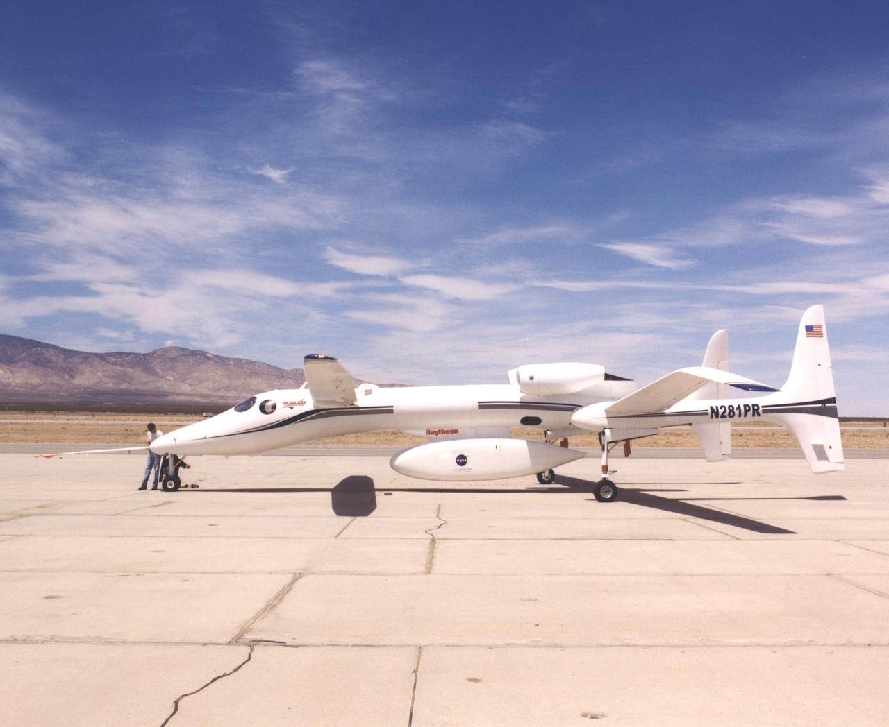
The Proteus high-altitude aircraft on the ramp at the Mojave Airport in Mojave, California.
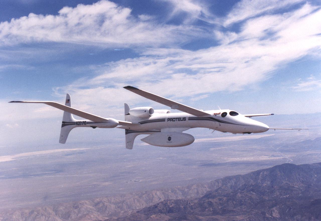
The uniquely shaped Proteus high-altitude aircraft soars over California’s Mojave Desert during a July 1999 flight.
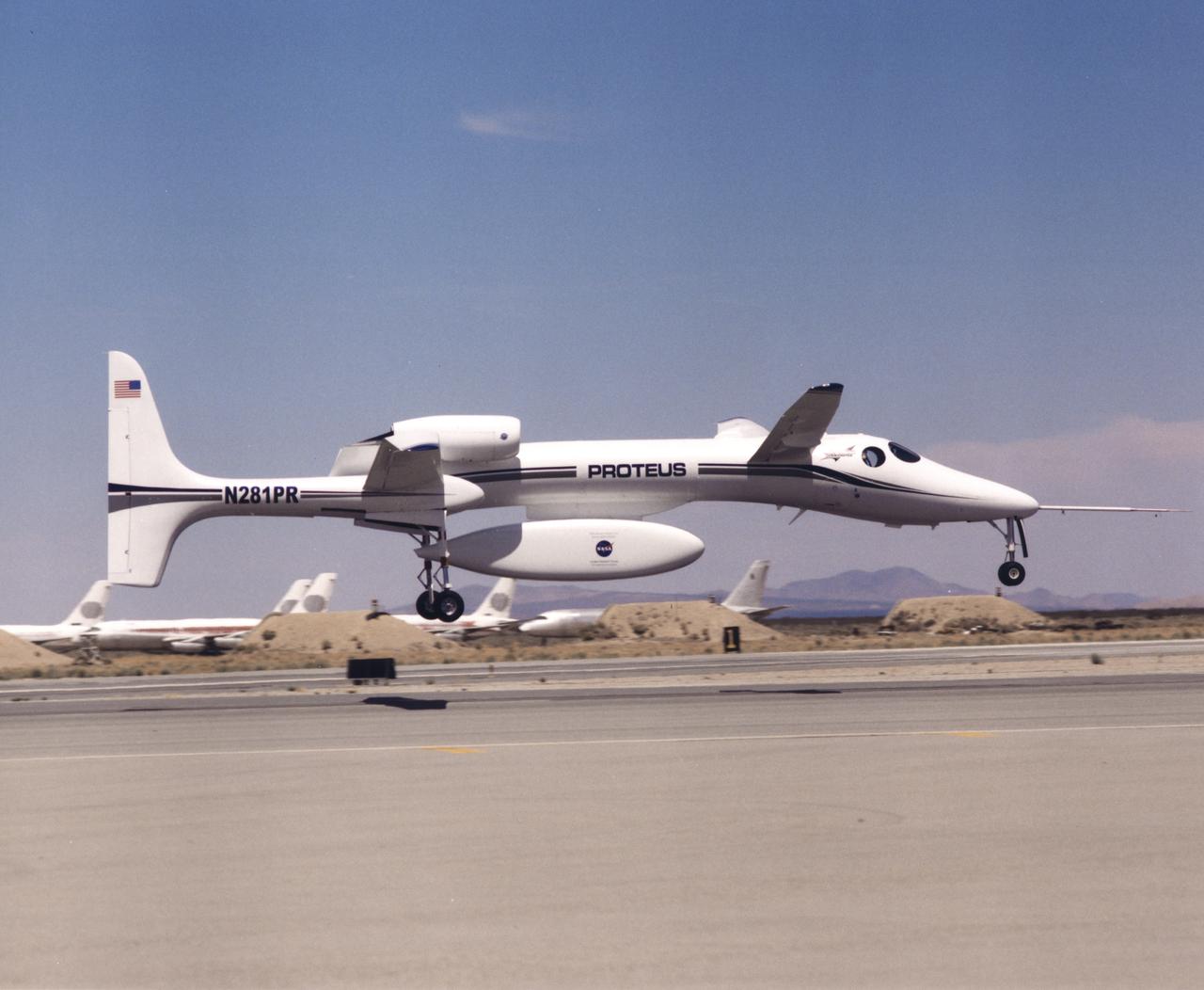
The uniquely-shaped Proteus high-altitude research aircraft lifts off from the runway at the Mojave Airport in Mojave, California.
A frontal view of the Proteus high-altitude aircraft on the ramp at the Mojave Airport in Mojave, California in July 1999.
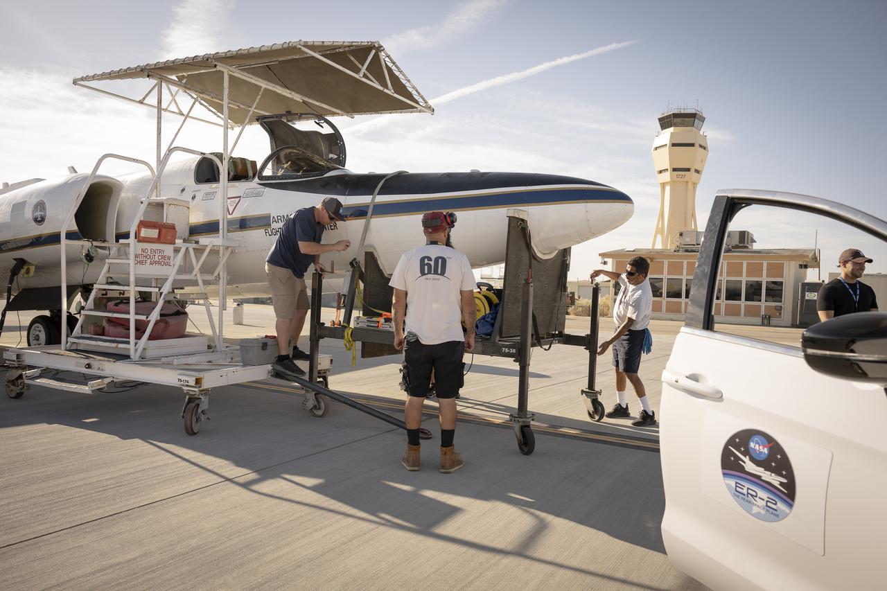
Ground crew members make final preparations on NASA Armstrong Flight Research Center’s ER-2 aircraft at Edwards, California, on Thursday, Aug. 21, 2025, ahead of a high-altitude mission for the Geological Earth Mapping Experiment (GEMx). The pilot will soon board the aircraft, which can fly at altitudes up to 70,000 feet.
Ground crew members make final preparations on NASA Armstrong Flight Research Center’s ER-2 aircraft at Edwards, California, on Thursday, Aug. 21, 2025, ahead of a high-altitude mission for the Geological Earth Mapping Experiment (GEMx). The pilot will soon board the aircraft, which can fly at altitudes up to 70,000 feet.

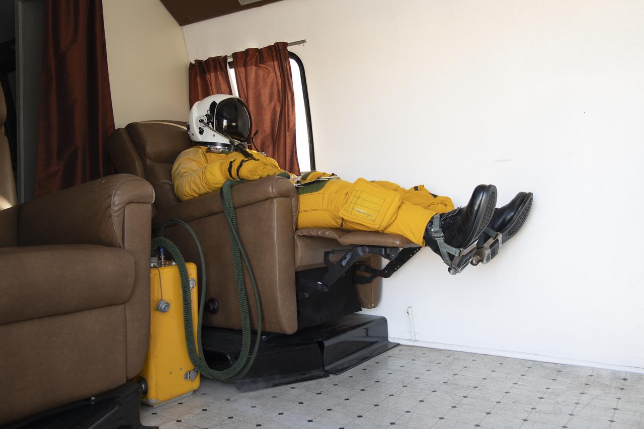
NASA astronaut Jonny Kim wearing a high-altitude pressure suit worn in the WB-57 aircraft, which is capable of flying at altitudes over 60,000 feet. Photographer: Norah Moran – Johnson Space Center
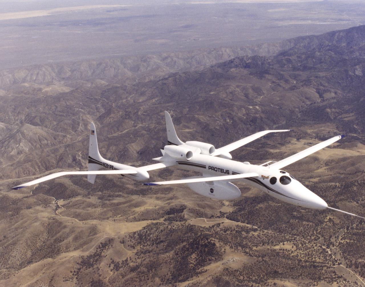
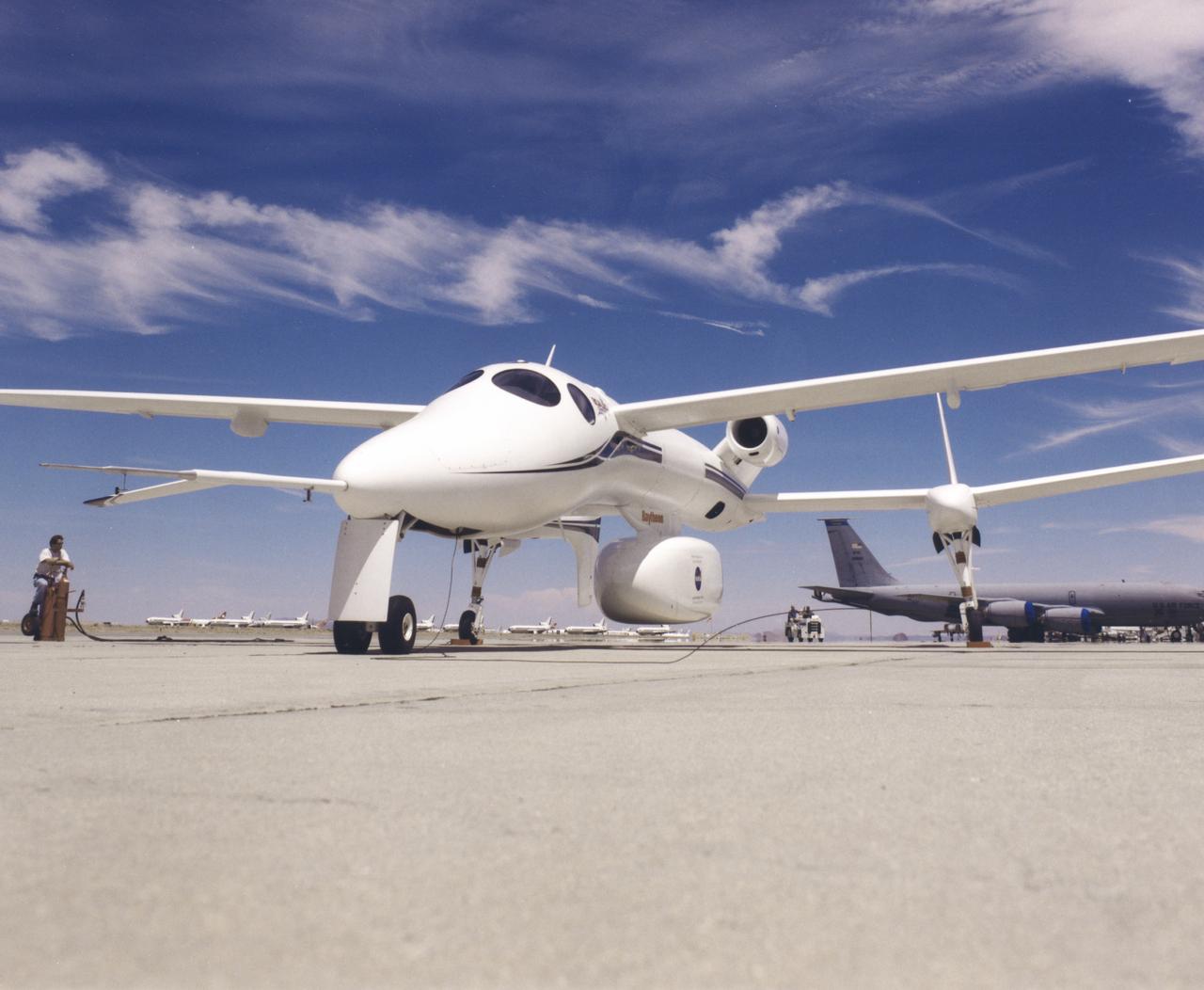
The unusual design of the Proteus high-altitude aircraft, incorporating a gull-wing shape for its main wing and a long, slender forward canard, is clearly visible in this view of the aircraft in flight over the Mojave Desert in California.
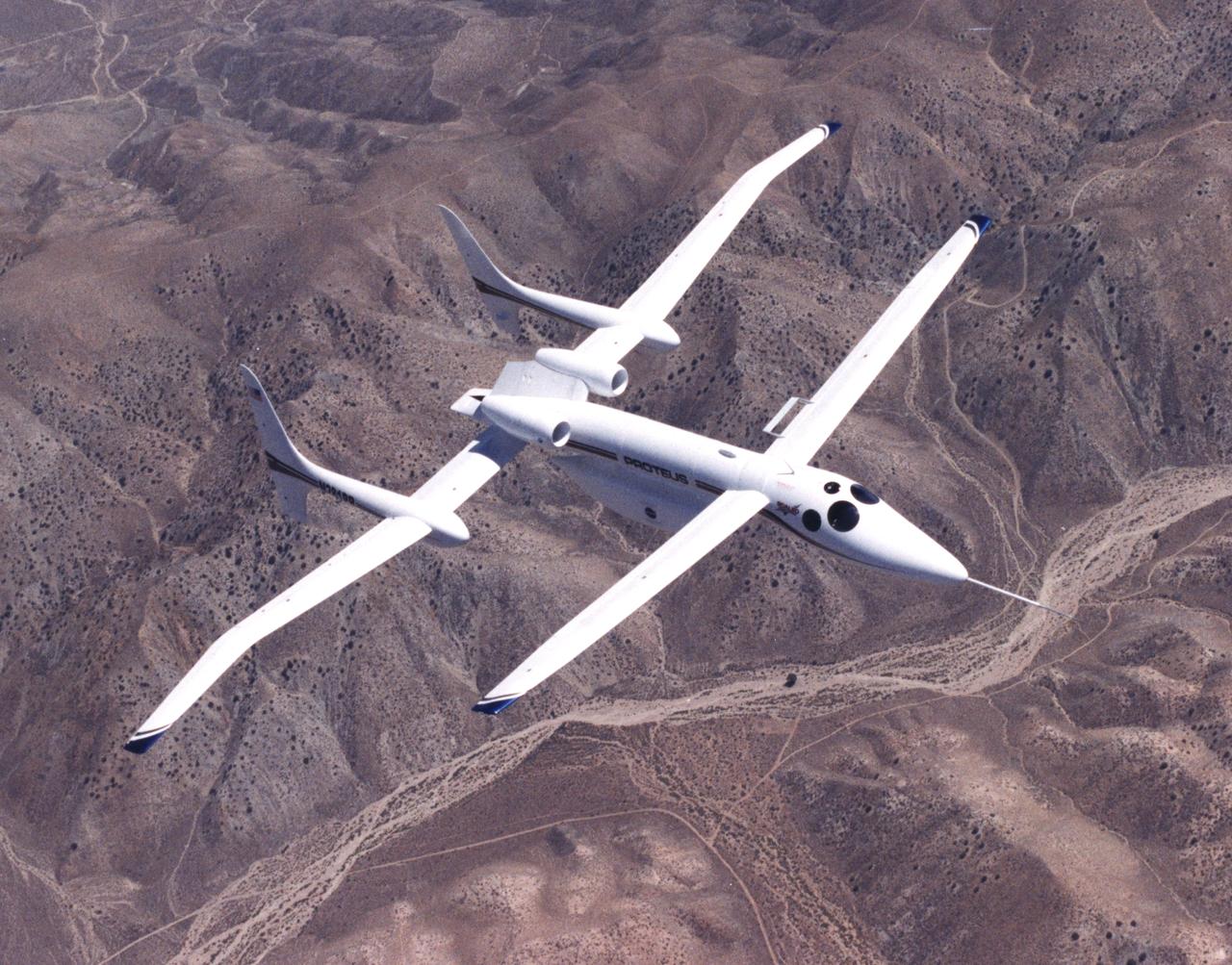
The unusual design of the Proteus high-altitude aircraft, incorporating a gull-wing shape for its main wing and a long, slender forward canard, is clearly visible in this view of the aircraft in flight over the Mojave Desert in California.
The bulbous nose of one of NASA's two Global Hawk unmanned high-altitude aircraft houses communications and sensor payloads on Earth science missions.
Eric Nisbet works on a part for the ER-2 instrument panel.
Hector Rosas works on fabricating a part for the ER-2 instrumentation panel.
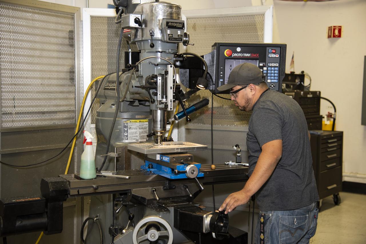
Herman Escobar works on a part for the ER-2 instrument panel.
NASA Armstrong Flight Research Center’s ER-2 aircraft taxis at Edwards, California, on Thursday, Aug. 21, 2025, ahead of a high-altitude mission supporting the Geological Earth Mapping Experiment (GEMx), which requires flights of up to eight hours at approximately 65,000 feet altitude.
NASA's Armstrong Flight Research Center operates ER-2 #809 high-altitude aircraft for Dynamics and Chemistry of the Summer Stratosphere (DCOTSS) science flights on June 17, 2021.
NASA’s Armstrong Flight Research Center ER-2 #809 high-altitude aircraft taking off for Dynamics and Chemistry of the Summer Stratosphere (DCOTSS) science flights in Palmdale, CA on June 17, 2021.
NASA's Armstrong Flight Research Center ER-2 #809 high-altitude aircraft prepped for Dynamics and Chemistry of the Summer Stratosphere (DCOTSS) science flights in Palmdale, CA.
NASA's Armstrong Flight Research Center ER-2 #809 high-altitude aircraft prepped for Dynamics and Chemistry of the Summer Stratosphere (DCOTSS) science flights in Palmdale, CA.
NASA's Armstrong Flight Research Center ER-2 #809 high-altitude aircraft prepared for Dynamics and Chemistry of the Summer Stratosphere (DCOTSS) science flights in Palmdale, CA on June 17, 2021
NASA’s Armstrong Flight Research Center ER-2 #809 high-altitude aircraft maintained by avionics technician Gregory Bantalin for Dynamics and Chemistry of the Summer Stratosphere (DCOTSS) science flights.
NASA's Armstrong Flight Research Center ER-2 #809 high-altitude aircraft prepared for Dynamics and Chemistry of the Summer Stratosphere (DCOTSS) science flights in Palmdale, CA on June 17, 2021.
NASA's Armstrong Flight Research Center ER-2 #809 high-altitude aircraft prepped for Dynamics and Chemistry of the Summer Stratosphere (DCOTSS) science flights in Palmdale, CA.
One of NASA's two Global Hawk unmanned high-altitude aircraft shows off its blue-and-white livery in front of its hangar at NASA's Dryden Flight Research Center.
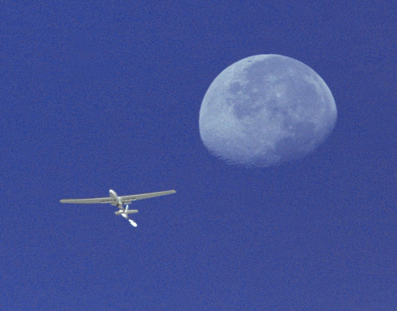
The Perseus A, a remotely-piloted, high-altitude research aircraft, is seen here framed against the moon and sky during a research mission at the Dryden Flight Research Center, Edwards, California in August 1994.
NASA’s Armstrong Flight Research Center operates ER-2 #809 high-altitude aircraft for Dynamics and Chemistry of the Summer Stratosphere (DCOTSS) science flights on June 17, 2021.
NASA’s Armstrong Flight Research Center ER-2 #809 high-altitude aircraft prepped for Dynamics and Chemistry of the Summer Stratosphere (DCOTSS) science flights in Palmdale, CA.
One of NASA's two Global Hawk high-altitude unmanned science aircraft displays its contours outside its hangar at NASA's Dryden Flight Research Center.
NASA Armstrong’s ER-2 aircraft deploys for its ALOFT mission. The ER-2 will fly at high altitudes above the Floridian coastline to collect data about the energetic characteristics and behavior of lightning and thunderclouds. A NASA pilot will operate the aircraft while scientists from the University of Bergen, Norway will interpret the data from the ground.
NASA Armstrong’s ER-2 aircraft deploys for its ALOFT mission. The ER-2 will fly at high altitudes above the Floridian coastline to collect data about the energetic characteristics and behavior of lightning and thunderclouds. A NASA pilot will operate the aircraft while scientists from the University of Bergen, Norway will interpret the data from the ground.
NASA Armstrong’s ER-2 aircraft deploys for its ALOFT mission. The ER-2 will fly at high altitudes above the Floridian coastline to collect data about the energetic characteristics and behavior of lightning and thunderclouds. A NASA pilot will operate the aircraft while scientists from the University of Bergen, Norway will interpret the data from the ground.
NASA Armstrong’s ER-2 aircraft deploys for its ALOFT mission. The ER-2 will fly at high altitudes above the Floridian coastline to collect data about the energetic characteristics and behavior of lightning and thunderclouds. A NASA pilot will operate the aircraft while scientists from the University of Bergen, Norway will interpret the data from the ground.
NASA Armstrong’s ER-2 aircraft deploys for its ALOFT mission. The ER-2 will fly at high altitudes above the Floridian coastline to collect data about the energetic characteristics and behavior of lightning and thunderclouds. A NASA pilot will operate the aircraft while scientists from the University of Bergen, Norway will interpret the data from the ground.
NASA Armstrong’s ER-2 aircraft deploys for its ALOFT mission. The ER-2 will fly at high altitudes above the Floridian coastline to collect data about the energetic characteristics and behavior of lightning and thunderclouds. A NASA pilot will operate the aircraft while scientists from the University of Bergen, Norway will interpret the data from the ground.
NASA Armstrong’s ER-2 aircraft deploys for its ALOFT mission. The ER-2 will fly at high altitudes above the Floridian coastline to collect data about the energetic characteristics and behavior of lightning and thunderclouds. A NASA pilot will operate the aircraft while scientists from the University of Bergen, Norway will interpret the data from the ground.
NASA Armstrong’s ER-2 aircraft deploys for its ALOFT mission. The ER-2 will fly at high altitudes above the Floridian coastline to collect data about the energetic characteristics and behavior of lightning and thunderclouds. A NASA pilot will operate the aircraft while scientists from the University of Bergen, Norway will interpret the data from the ground.
NASA Armstrong’s ER-2 aircraft deploys for its ALOFT mission. The ER-2 will fly at high altitudes above the Floridian coastline to collect data about the energetic characteristics and behavior of lightning and thunderclouds. A NASA pilot will operate the aircraft while scientists from the University of Bergen, Norway will interpret the data from the ground.

The Gulf of Mexico as seen from NASA photographer Carla Thomas at high altitude in the F/A-18 research aircraft during a flight in support of the Quiet Supersonic Flights 2018 series, or QSF18. The high altitude is necessary as part of the quiet supersonic dive maneuver, climbing to around 50,000 feet, followed by a supersonic, inverted dive. This creates sonic boom shockwaves in a way that they are quieter in a specific area.
The Gulf of Mexico as seen from NASA photographer Carla Thomas at high altitude in the F/A-18 research aircraft during a flight in support of the Quiet Supersonic Flights 2018 series, or QSF18. The high altitude is necessary as part of the quiet supersonic dive maneuver, climbing to around 50,000 feet, followed by a supersonic, inverted dive. This creates sonic boom shockwaves in a way that they are quieter in a specific area.
The Gulf of Mexico as seen from NASA photographer Carla Thomas at high altitude in the F/A-18 research aircraft during a flight in support of the Quiet Supersonic Flights 2018 series, or QSF18. The high altitude is necessary as part of the quiet supersonic dive maneuver, climbing to around 50,000 feet, followed by a supersonic, inverted dive. This creates sonic boom shockwaves in a way that they are quieter in a specific area.
The Gulf of Mexico as seen from NASA photographer Carla Thomas at high altitude in the F/A-18 research aircraft during a flight in support of the Quiet Supersonic Flights 2018 series, or QSF18. The high altitude is necessary as part of the quiet supersonic dive maneuver, climbing to around 50,000 feet, followed by a supersonic, inverted dive. This creates sonic boom shockwaves in a way that they are quieter in a specific area.
The Gulf of Mexico as seen from NASA photographer Carla Thomas at high altitude in the F/A-18 research aircraft during a flight in support of the Quiet Supersonic Flights 2018 series, or QSF18. The high altitude is necessary as part of the quiet supersonic dive maneuver, climbing to around 50,000 feet, followed by a supersonic, inverted dive. This creates sonic boom shockwaves in a way that they are quieter in a specific area.
The Gulf of Mexico as seen from NASA photographer Carla Thomas at high altitude in the F/A-18 research aircraft during a flight in support of the Quiet Supersonic Flights 2018 series, or QSF18. The high altitude is necessary as part of the quiet supersonic dive maneuver, climbing to around 50,000 feet, followed by a supersonic, inverted dive. This creates sonic boom shockwaves in a way that they are quieter in a specific area.
The Gulf of Mexico as seen from NASA photographer Carla Thomas at high altitude in the F/A-18 research aircraft during a flight in support of the Quiet Supersonic Flights 2018 series, or QSF18. The high altitude is necessary as part of the quiet supersonic dive maneuver, climbing to around 50,000 feet, followed by a supersonic, inverted dive. This creates sonic boom shockwaves in a way that they are quieter in a specific area.
The Gulf of Mexico as seen from NASA photographer Carla Thomas at high altitude in the F/A-18 research aircraft during a flight in support of the Quiet Supersonic Flights 2018 series, or QSF18. The high altitude is necessary as part of the quiet supersonic dive maneuver, climbing to around 50,000 feet, followed by a supersonic, inverted dive. This creates sonic boom shockwaves in a way that they are quieter in a specific area.
The Gulf of Mexico as seen from NASA photographer Carla Thomas at high altitude in the F/A-18 research aircraft during a flight in support of the Quiet Supersonic Flights 2018 series, or QSF18. The high altitude is necessary as part of the quiet supersonic dive maneuver, climbing to around 50,000 feet, followed by a supersonic, inverted dive. This creates sonic boom shockwaves in a way that they are quieter in a specific area.
The Gulf of Mexico as seen from NASA photographer Carla Thomas at high altitude in the F/A-18 research aircraft during a flight in support of the Quiet Supersonic Flights 2018 series, or QSF18. The high altitude is necessary as part of the quiet supersonic dive maneuver, climbing to around 50,000 feet, followed by a supersonic, inverted dive. This creates sonic boom shockwaves in a way that they are quieter in a specific area.
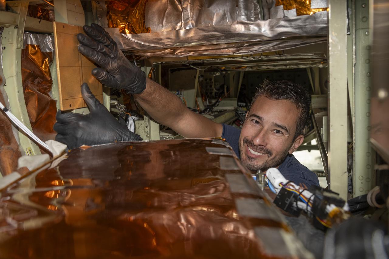
A team of experts prepares the ER-2 aircraft at Armstrong Flight Research Center in Edwards, California for the GSFC Lidar Observation and Validation Experiment (GLOVE) in February 2025. Aircraft mechanic Darick Alvarez-Alonzo installs a satellite-simulating instrument which will fly at high altitudes on the ER-2 to validate satellite-borne data. As a collaboration between engineers, scientists, and aircraft professionals, GLOVE aims to improve satellite data products for Earth Science applications.
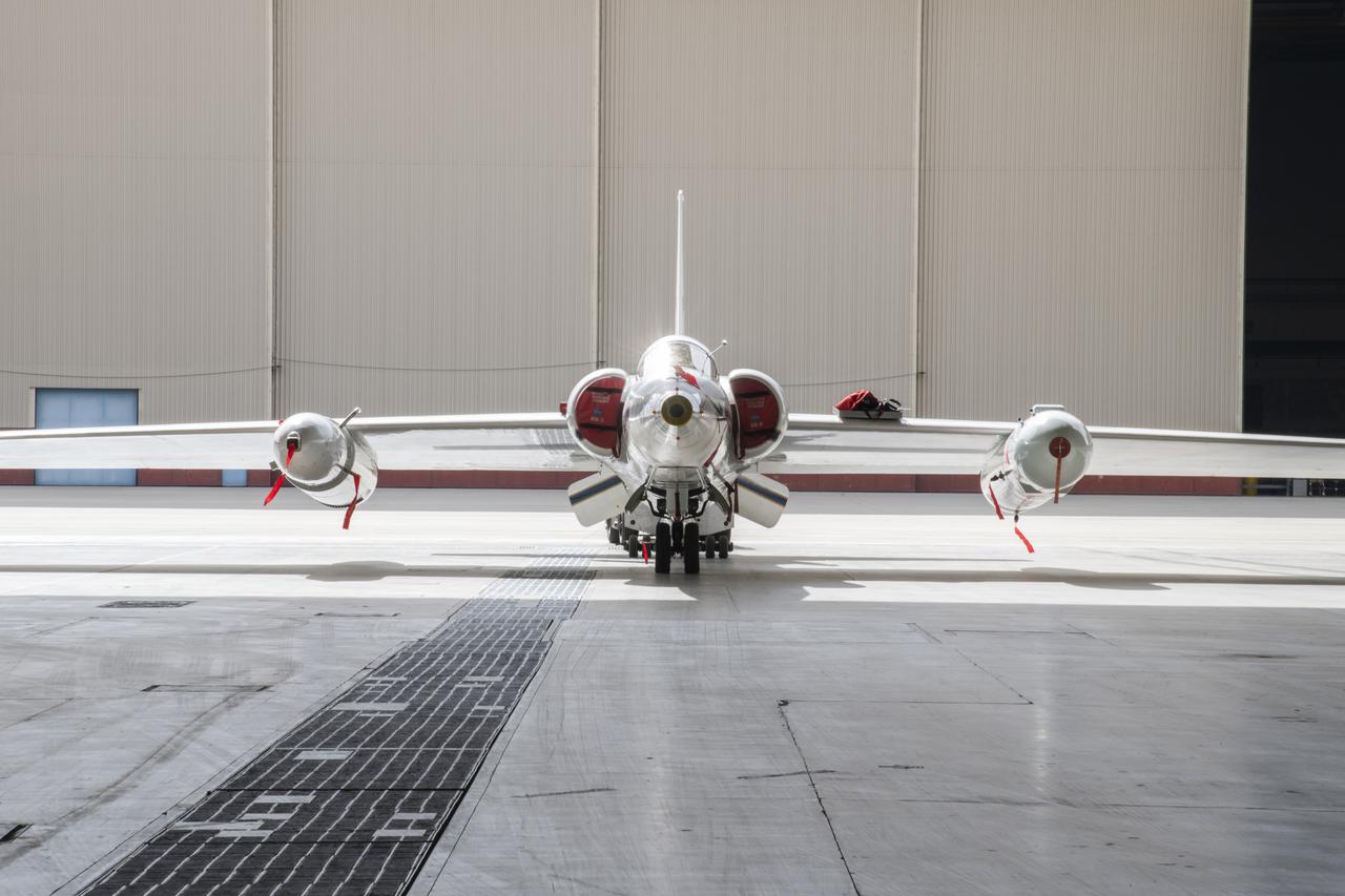
ER-2s bearing tail numbers 806 and 809 are used as airborne science platforms by NASA's Dryden Flight Research Center. The aircraft are platforms for a variety of high-altitude science missions flown over various parts of the world. They are also used for earth science and atmospheric sensor research and development, satellite calibration and data validation. The ER-2s are capable of carrying a maximum payload of 2,600 pounds of experiments in a nose bay, the main equipment bay behind the cockpit, two wing-mounted superpods and small underbody and trailing edges. Most ER-2 missions last about six hours with ranges of about 2,200 nautical miles. The aircraft typically fly at altitudes above 65,000 feet. On November 19, 1998, an ER-2 set a world record for medium weight aircraft reaching an altitude of 68,700 feet. The aircraft is 63 feet long, with a wingspan of 104 feet. The top of the vertical tail is 16 feet above ground when the aircraft is on the bicycle-type landing gear. Cruising speeds are 410 knots, or 467 miles per hour, at altitude. A single General Electric F-118 turbofan engine rated at 17,000 pounds thrust powers the ER-2.

ER-2s bearing tail numbers 806 and 809 are used as airborne science platforms by NASA's Dryden Flight Research Center. The aircraft are platforms for a variety of high-altitude science missions flown over various parts of the world. They are also used for earth science and atmospheric sensor research and development, satellite calibration and data validation. The ER-2s are capable of carrying a maximum payload of 2,600 pounds of experiments in a nose bay, the main equipment bay behind the cockpit, two wing-mounted superpods and small underbody and trailing edges. Most ER-2 missions last about six hours with ranges of about 2,200 nautical miles. The aircraft typically fly at altitudes above 65,000 feet. On November 19, 1998, an ER-2 set a world record for medium weight aircraft reaching an altitude of 68,700 feet. The aircraft is 63 feet long, with a wingspan of 104 feet. The top of the vertical tail is 16 feet above ground when the aircraft is on the bicycle-type landing gear. Cruising speeds are 410 knots, or 467 miles per hour, at altitude. A single General Electric F-118 turbofan engine rated at 17,000 pounds thrust powers the ER-2.
ER-2s bearing tail numbers 806 and 809 are used as airborne science platforms by NASA's Dryden Flight Research Center. The aircraft are platforms for a variety of high-altitude science missions flown over various parts of the world. They are also used for earth science and atmospheric sensor research and development, satellite calibration and data validation. The ER-2s are capable of carrying a maximum payload of 2,600 pounds of experiments in a nose bay, the main equipment bay behind the cockpit, two wing-mounted superpods and small underbody and trailing edges. Most ER-2 missions last about six hours with ranges of about 2,200 nautical miles. The aircraft typically fly at altitudes above 65,000 feet. On November 19, 1998, an ER-2 set a world record for medium weight aircraft reaching an altitude of 68,700 feet. The aircraft is 63 feet long, with a wingspan of 104 feet. The top of the vertical tail is 16 feet above ground when the aircraft is on the bicycle-type landing gear. Cruising speeds are 410 knots, or 467 miles per hour, at altitude. A single General Electric F-118 turbofan engine rated at 17,000 pounds thrust powers the ER-2.
ER-2s bearing tail numbers 806 and 809 are used as airborne science platforms by NASA's Dryden Flight Research Center. The aircraft are platforms for a variety of high-altitude science missions flown over various parts of the world. They are also used for earth science and atmospheric sensor research and development, satellite calibration and data validation. The ER-2s are capable of carrying a maximum payload of 2,600 pounds of experiments in a nose bay, the main equipment bay behind the cockpit, two wing-mounted superpods and small underbody and trailing edges. Most ER-2 missions last about six hours with ranges of about 2,200 nautical miles. The aircraft typically fly at altitudes above 65,000 feet. On November 19, 1998, an ER-2 set a world record for medium weight aircraft reaching an altitude of 68,700 feet. The aircraft is 63 feet long, with a wingspan of 104 feet. The top of the vertical tail is 16 feet above ground when the aircraft is on the bicycle-type landing gear. Cruising speeds are 410 knots, or 467 miles per hour, at altitude. A single General Electric F-118 turbofan engine rated at 17,000 pounds thrust powers the ER-2.
ER-2s bearing tail numbers 806 and 809 are used as airborne science platforms by NASA's Dryden Flight Research Center. The aircraft are platforms for a variety of high-altitude science missions flown over various parts of the world. They are also used for earth science and atmospheric sensor research and development, satellite calibration and data validation. The ER-2s are capable of carrying a maximum payload of 2,600 pounds of experiments in a nose bay, the main equipment bay behind the cockpit, two wing-mounted superpods and small underbody and trailing edges. Most ER-2 missions last about six hours with ranges of about 2,200 nautical miles. The aircraft typically fly at altitudes above 65,000 feet. On November 19, 1998, an ER-2 set a world record for medium weight aircraft reaching an altitude of 68,700 feet. The aircraft is 63 feet long, with a wingspan of 104 feet. The top of the vertical tail is 16 feet above ground when the aircraft is on the bicycle-type landing gear. Cruising speeds are 410 knots, or 467 miles per hour, at altitude. A single General Electric F-118 turbofan engine rated at 17,000 pounds thrust powers the ER-2.

The flight operations crew for NASA’s QSF18 flight series debriefs following a flight with the F/A-18 research aircraft. The flight included a quiet supersonic dive maneuver at high altitudes off the coast to produce a sonic boom out over the ocean, with the intention of producing quieter “thumps” on land.
The flight operations crew for NASA's QSF18 flight series debriefs following a flight with the F/A-18 research aircraft. The flight included a quiet supersonic dive maneuver at high altitudes off the coast to produce a sonic boom out over the ocean, with the intention of producing quieter "thumps" on land.
NASA’s ER-2 No. 806 returns to flying high-altitude on April 7, 2022, after three years of heavy maintenance. NASA Armstrong operates two ER-2 aircraft to collect information about Earth resources, celestial observations, atmospheric chemistry and dynamics, and oceanic processes.
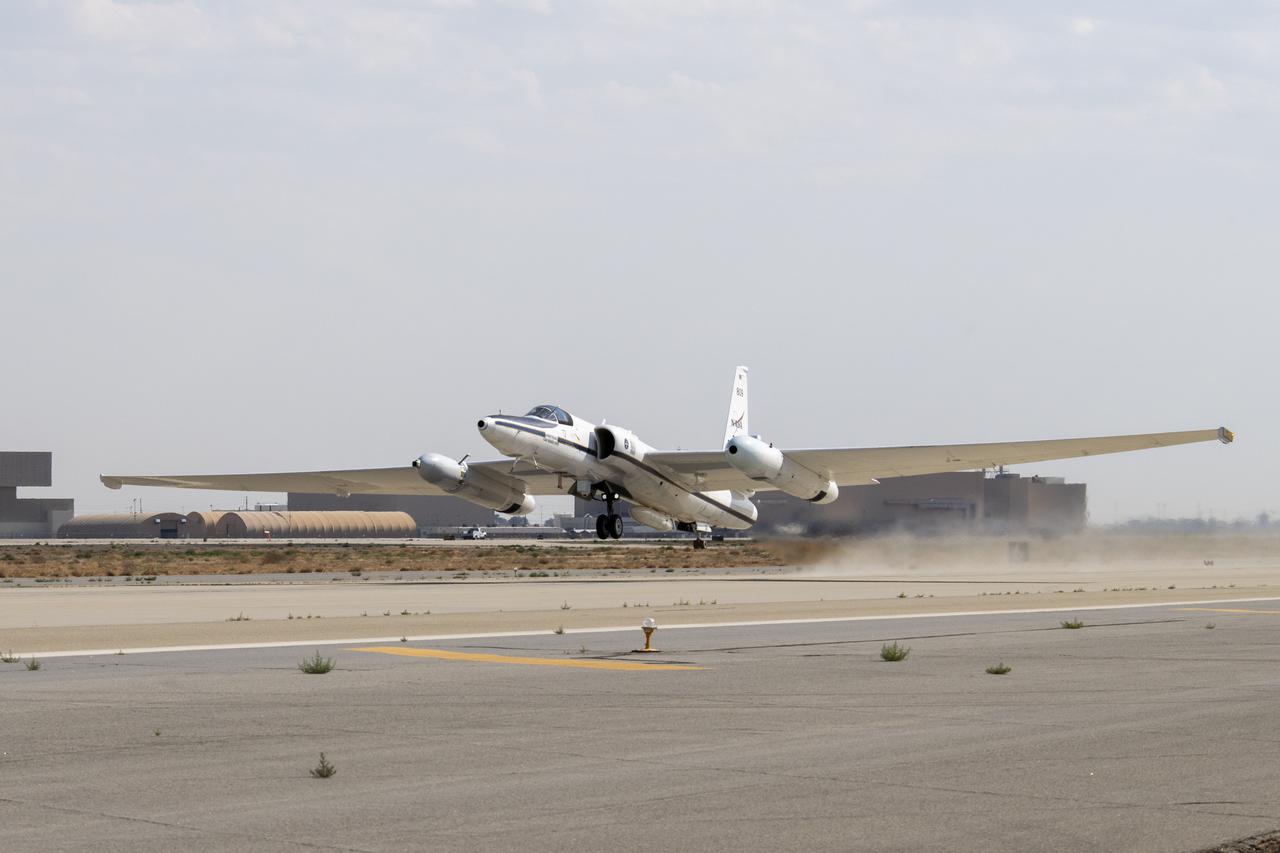
NASA's ER-2 high altitude aircraft takes off from Armstrong Flight Research Center Building 703 in Palmdale, California to perform a check flight for the the Dynamics and Chemistry of the Summer Stratosphere, or DCOTSS, 2022 campaign on May 13, 2022.
The flight operations crew for NASA’s QSF18 flight series debriefs following a flight with the F/A-18 research aircraft. The flight included a quiet supersonic dive maneuver at high altitudes off the coast to produce a sonic boom out over the ocean, with the intention of producing quieter “thumps” on land.
The flight operations crew for NASA’s QSF18 flight series debriefs following a flight with the F/A-18 research aircraft. The flight included a quiet supersonic dive maneuver at high altitudes off the coast to produce a sonic boom out over the ocean, with the intention of producing quieter “thumps” on land.
NASA's ER-2 No. 806 returns to flying high-altitude on April 7, 2022, after three years of heavy maintenance. NASA Armstrong operates two ER-2 aircraft to collect information about Earth resources, celestial observations, atmospheric chemistry and dynamics, and oceanic processes.
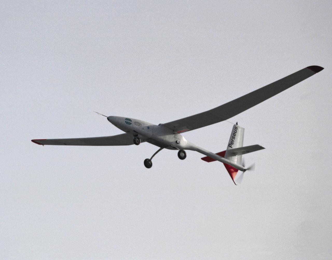
The Perseus proof-of-concept vehicle in flight at the Dryden Flight Research Center, Edwards, California in 1991. Perseus is one of several remotely-piloted aircraft designed for high-altitude, long-endurance scientific sampling missions being evaluated under the ERAST program.

The flight operations crew for NASA’s QSF18 flight series debriefs following a flight with the F/A-18 research aircraft. The flight included a quiet supersonic dive maneuver at high altitudes off the coast to produce a sonic boom out over the ocean, with the intention of producing quieter “thumps” on land.

The flight operations crew for NASA's QSF18 flight series debriefs following a flight with the F/A-18 research aircraft. The flight included a quiet supersonic dive maneuver at high altitudes off the coast to produce a sonic boom out over the ocean, with the intention of producing quieter "thumps" on land.
The flight operations crew for NASA’s QSF18 flight series debriefs following a flight with the F/A-18 research aircraft. The flight included a quiet supersonic dive maneuver at high altitudes off the coast to produce a sonic boom out over the ocean, with the intention of producing quieter “thumps” on land.
The flight operations crew for NASA’s QSF18 flight series debriefs following a flight with the F/A-18 research aircraft. The flight included a quiet supersonic dive maneuver at high altitudes off the coast to produce a sonic boom out over the ocean, with the intention of producing quieter “thumps” on land.
NASA’s ER-2 No. 806 returns to flying high-altitude on April 7, 2022, after three years of heavy maintenance. NASA Armstrong operates two ER-2 aircraft to collect information about Earth resources, celestial observations, atmospheric chemistry and dynamics, and oceanic processes.
The flight operations crew for NASA’s QSF18 flight series debriefs following a flight with the F/A-18 research aircraft. The flight included a quiet supersonic dive maneuver at high altitudes off the coast to produce a sonic boom out over the ocean, with the intention of producing quieter “thumps” on land.
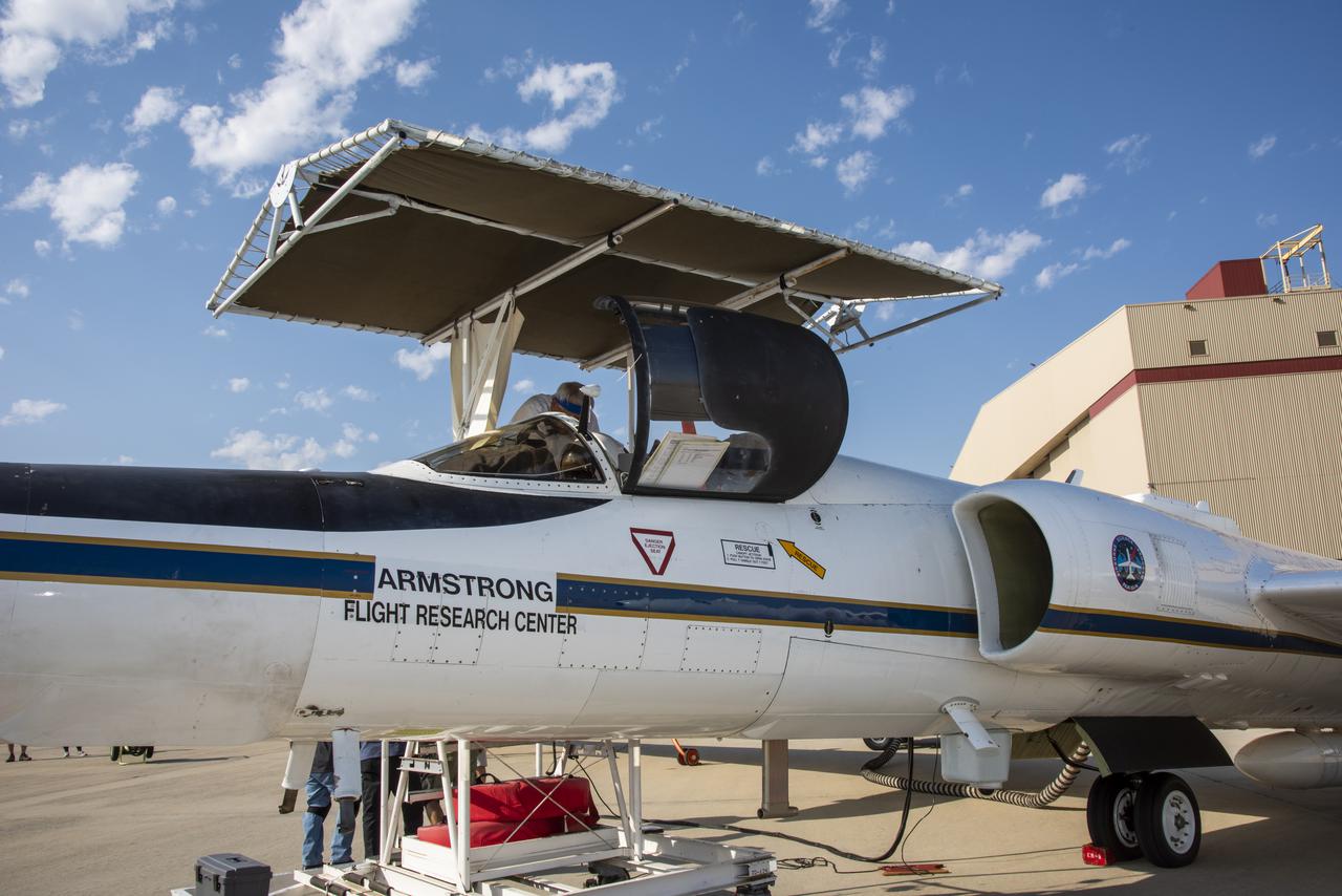
A National Aeronautics and Space Administration (NASA) Lockheed U-2 aircraft on display at the 1973 Inspection of the Lewis Research Center in Cleveland, Ohio. Lockheed developed the U-2 as a high-altitude reconnaissance aircraft in the early 1950s before satellites were available. The U-2 could cruise over enemy territory at 70,000 feet and remain impervious to ground fire, interceptor aircraft, and even radar. An advanced camera system was designed specifically for the aircraft. The pilot is required to use a pressure suit similar to those worn by astronauts. NASA’s Ames Research Center received two U-2 aircraft in April 1971 to conduct high-altitude research. They were used to study and monitor various Earth resources, celestial bodies, atmospheric chemistry, and oceanic processes. NASA replaced its U-2s with ER-2 aircraft in 1981 and 1989. The ER-2s were designed to carry up to 2600 pounds of scientific equipment. The ER-2 program was transferred to Dryden Flight Research Center in 1997. Since the inaugural flight for this program on August 31, 1971, NASA’s U-2 and ER-2 aircraft have flown more than 4500 data missions and test flights for NASA, other federal agencies, states, universities, and the private sector.
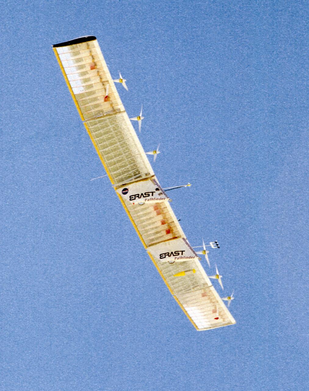
The Pathfinder solar-powered research aircraft settles in for landing on the bed of Rogers Dry Lake at the Dryden Flight Research Center, Edwards, California, after a successful test flight Nov. 19, 1996. The ultra-light craft flew a racetrack pattern at low altitudes over the flight test area for two hours while project engineers checked out various systems and sensors on the uninhabited aircraft. The Pathfinder was controlled by two pilots, one in a mobile control unit which followed the craft, the other in a stationary control station. Pathfinder, developed by AeroVironment, Inc., is one of several designs being evaluated under NASA's Environmental Research Aircraft and Sensor Technology (ERAST) program.
Pathfinder, NASA's solar-powered, remotely-piloted aircraft is shown while it was conducting a series of science flights to highlight the aircraft's science capabilities while collecting imagery of forest and coastal zone ecosystems on Kauai, Hawaii. The flights also tested two new scientific instruments, a high-spectral-resolution Digital Array Scanned Interferometer (DASI) and a high-spatial-resolution Airborne Real-Time Imaging System (ARTIS). The remote sensor payloads were designed by NASA's Ames Research Center, Moffett Field, California, to support NASA's Mission to Planet Earth science programs.
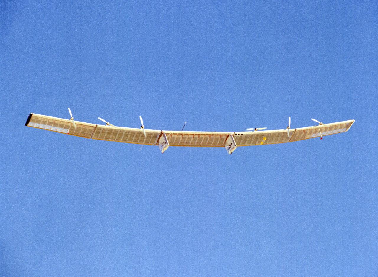
The Pathfinder research aircraft's wing structure is clearly defined as it soars under a clear blue sky during a test flight from Dryden Flight Research Center, Edwards, California, in November of 1996.
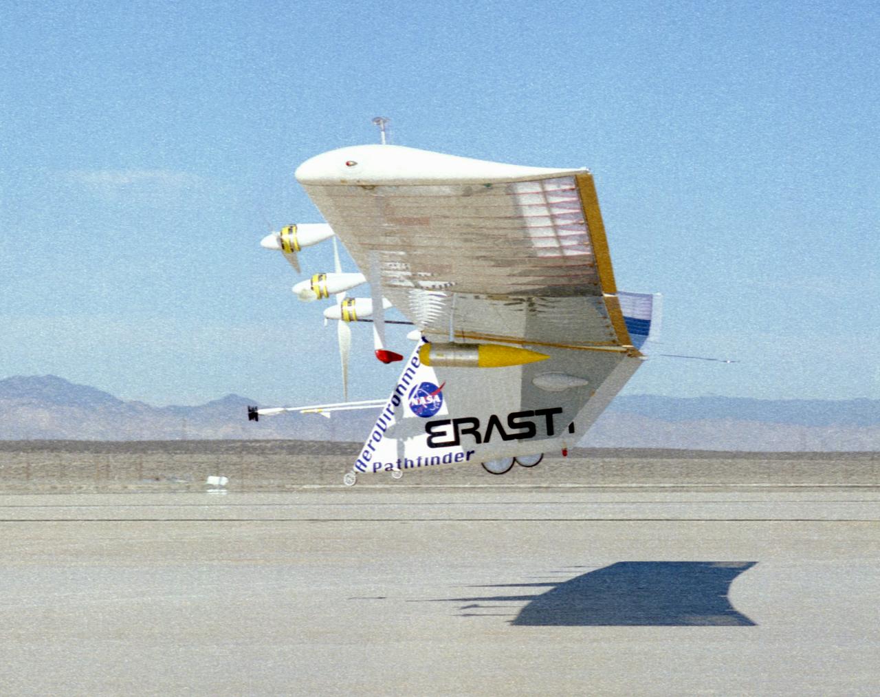
The Pathfinder solar-powered research aircraft heads for landing on the bed of Rogers Dry Lake at the Dryden Flight Research Center, Edwards, California, after a successful test flight Nov. 19, 1996.
The Pathfinder solar-powered research aircraft is silhouetted against a clear blue sky as it soars aloft during a checkout flight from the Dryden Flight Research Center, Edwards, California, November, 1996.
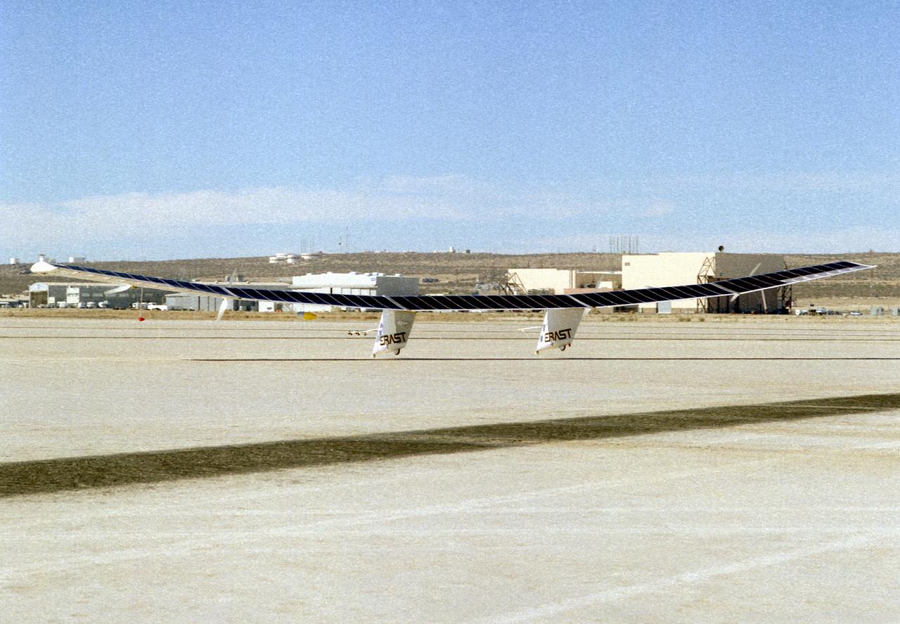
The Pathfinder research aircraft's solar cell arrays are prominently displayed as it touches down on the bed of Rogers Dry Lake at the Dryden Flight Research Center, Edwards, California, following a test flight. The solar arrays covered more than 75 percent of Pathfinder's upper wing surface, and provided electricity to power its six electric motors, flight controls, communications links and a host of scientific sensors.
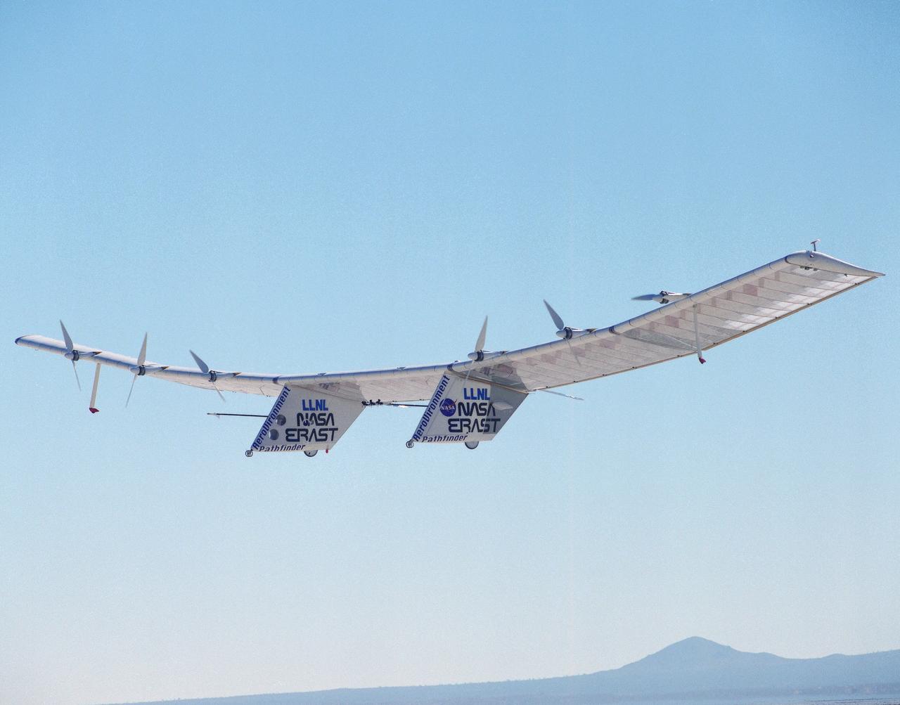
The Pathfinder solar-powered remotely piloted aircraft climbs to a record-setting altitude of 50,567 feet during a flight Sept. 11, 1995, at NASA's Dryden Flight Research Center, Edwards, California. The flight was part of the NASA ERAST (Environmental Research Aircraft and Sensor Technology) program. The Pathfinder was designed and built by AeroVironment Inc., Monrovia, California. Solar arrays cover nearly all of the upper wing surface and produce electricity to power the aircraft's six motors.
The Pathfinder research aircraft's wing structure was clearly defined as it soared under a clear blue sky during a test flight July 27, 1995, from Dryden Flight Research Center, Edwards, California. The center section and outer wing panels of the aircraft had ribs constructed of thin plastic foam, while the ribs in the inner wing panels are fabricated from lightweight composite material. Developed by AeroVironment, Inc., the Pathfinder was one of several unmanned aircraft being evaluated under NASA's Environmental Research Aircraft and Sensor Technology (ERAST) program.