
ER-2 tail number 706, was one of two Airborne Science ER-2s used as science platforms by Dryden. The aircraft were platforms for a variety of high-altitude science missions flown over various parts of the world. They were also used for earth science and atmospheric sensor research and development, satellite calibration and data validation.
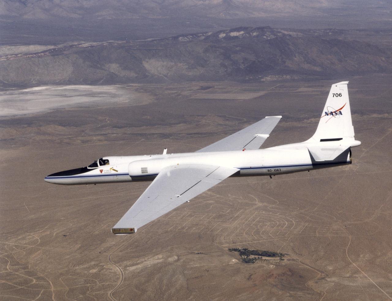
ER-2 tail number 706, was one of two Airborne Science ER-2s used as science platforms by Dryden. The aircraft were platforms for a variety of high-altitude science missions flown over various parts of the world. They were also used for earth science and atmospheric sensor research and development, satellite calibration and data validation.

ER-2 tail number 706, was one of two Airborne Science ER-2s used as science platforms by Dryden. The aircraft were platforms for a variety of high-altitude science missions flown over various parts of the world. They were also used for earth science and atmospheric sensor research and development, satellite calibration and data validation.
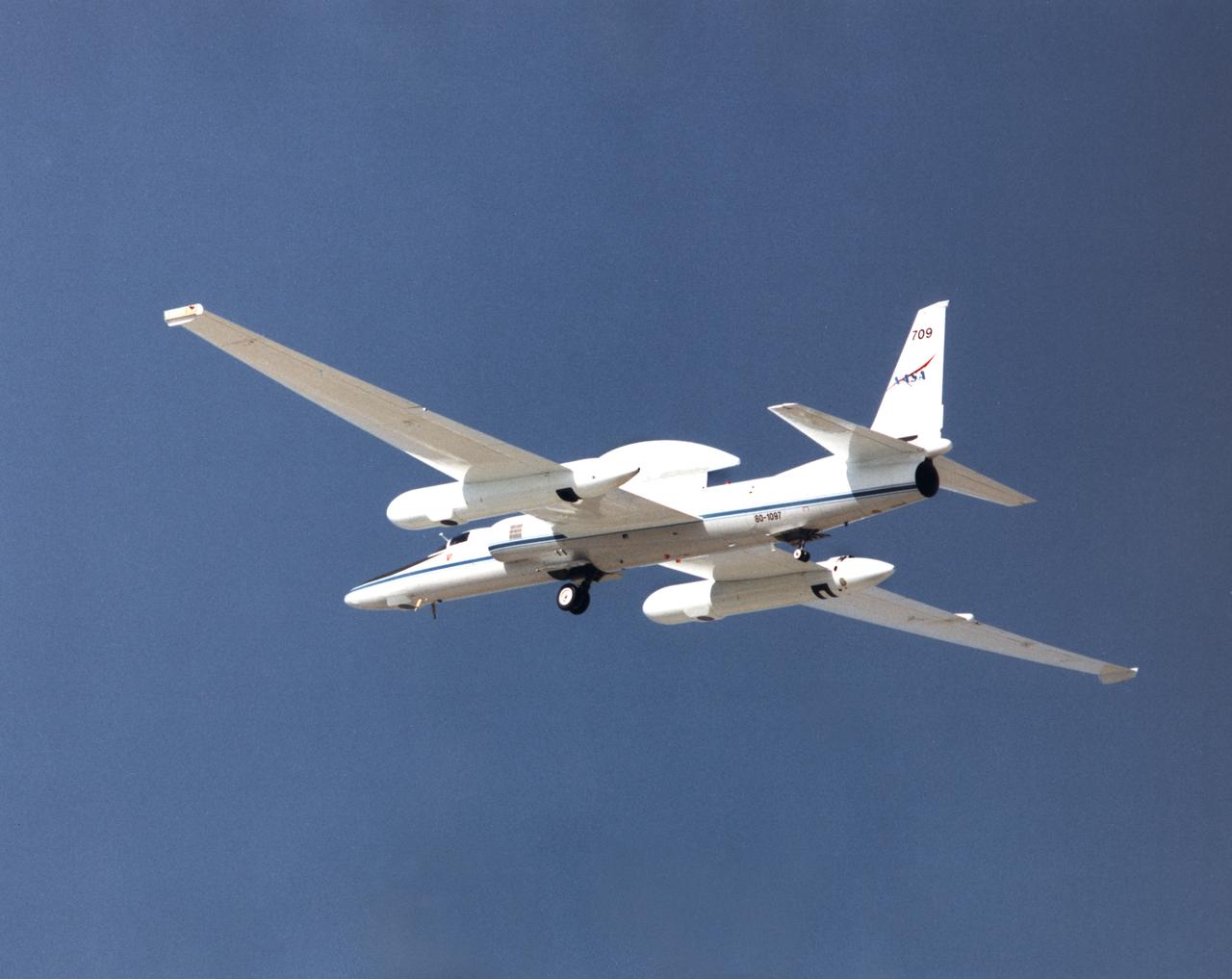
ER-2 tail number 709, was one of two Airborne Science ER-2s used as science platforms by Dryden. The aircraft were platforms for a variety of high-altitude science missions flown over various parts of the world. They were also used for earth science and atmospheric sensor research and development, satellite calibration and data validation.

ER-2 tail number 809, is one of two Airborne Science ER-2s used as science platforms by Dryden. The aircraft are platforms for a variety of high-altitude science missions flown over various parts of the world. They are also used for earth science and atmospheric sensor research and development, satellite calibration and data validation. The ER-2s are capable of carrying a maximum payload of 2,600 pounds of experiments in a nose bay, the main equipment bay behind the cockpit, two wing-mounted superpods and small underbody and trailing edges. Most ER-2 missions last about six hours with ranges of about 2,200 nautical miles. The aircraft typically fly at altitudes above 65,000 feet. On November 19, 1998, the ER-2 set a world record for medium weight aircraft reaching an altitude of 68,700 feet. The aircraft is 63 feet long, with a wingspan of 104 feet. The top of the vertical tail is 16 feet above ground when the aircraft is on the bicycle-type landing gear. Cruising speeds are 410 knots, or 467 miles per hour, at altitude. A single General Electric F118 turbofan engine rated at 17,000 pounds thrust powers the ER-2.

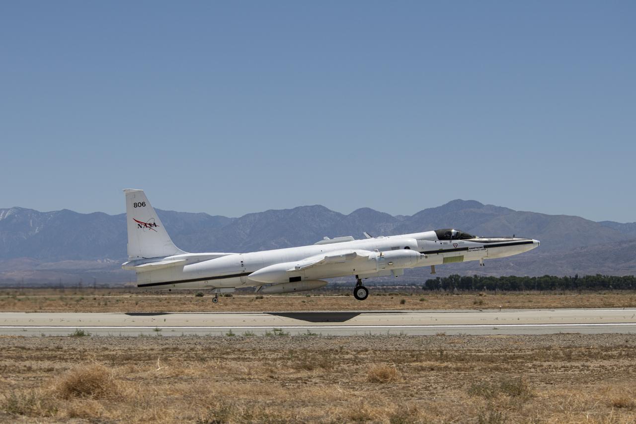
ER-2 tail number 806, is one of two Airborne Science ER-2s used as science platforms by Dryden. The aircraft are platforms for a variety of high-altitude science missions flown over various parts of the world. They are also used for earth science and atmospheric sensor research and development, satellite calibration and data validation. The ER-2s are capable of carrying a maximum payload of 2,600 pounds of experiments in a nose bay, the main equipment bay behind the cockpit, two wing-mounted superpods and small underbody and trailing edges. Most ER-2 missions last about six hours with ranges of about 2,200 nautical miles. The aircraft typically fly at altitudes above 65,000 feet. On November 19, 1998, the ER-2 set a world record for medium weight aircraft reaching an altitude of 68,700 feet. The aircraft is 63 feet long, with a wingspan of 104 feet. The top of the vertical tail is 16 feet above ground when the aircraft is on the bicycle-type landing gear. Cruising speeds are 410 knots, or 467 miles per hour, at altitude. A single General Electric F-118 turbofan engine rated at 17,000 pounds thrust powers the ER-2.

ER-2 tail number 806, is one of two Airborne Science ER-2s used as science platforms by Dryden. The aircraft are platforms for a variety of high-altitude science missions flown over various parts of the world. They are also used for earth science and atmospheric sensor research and development, satellite calibration and data validation. The ER-2s are capable of carrying a maximum payload of 2,600 pounds of experiments in a nose bay, the main equipment bay behind the cockpit, two wing-mounted superpods and small underbody and trailing edges. Most ER-2 missions last about six hours with ranges of about 2,200 nautical miles. The aircraft typically fly at altitudes above 65,000 feet. On November 19, 1998, the ER-2 set a world record for medium weight aircraft reaching an altitude of 68,700 feet. The aircraft is 63 feet long, with a wingspan of 104 feet. The top of the vertical tail is 16 feet above ground when the aircraft is on the bicycle-type landing gear. Cruising speeds are 410 knots, or 467 miles per hour, at altitude. A single General Electric F-118 turbofan engine rated at 17,000 pounds thrust powers the ER-2.
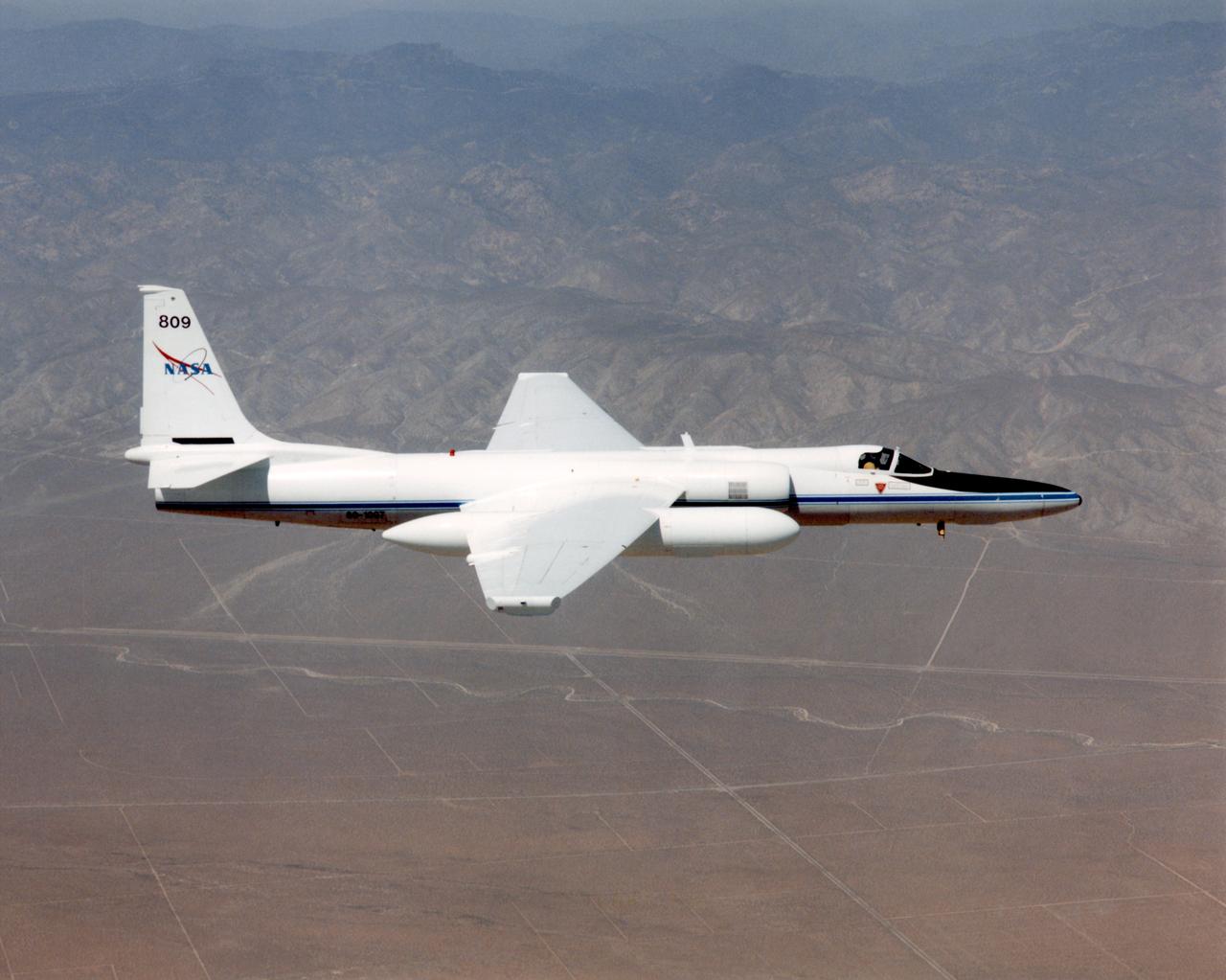
ER-2C tail number 809, was one of two Airborne Science ER-2Cs used as science platforms by Dryden. The aircraft were platforms for a variety of high-altitude science missions flown over various parts of the world. They were also used for earth science and atmospheric sensor research and development, satellite calibration and data validation. The ER-2Cs were capable of carrying a maximum payload of 2,600 pounds of experiments in a nose bay, the main equipment bay behind the cockpit, two wing-mounted superpods and small underbody and trailing edges. Most ER-2C missions lasted about six hours with ranges of about 2,200 nautical miles. The aircraft typically flew at altitudes above 65,000 feet. On November 19, 1998, the ER-2C set a world record for medium weight aircraft reaching an altitude of 68,700 feet. The aircraft was 63 feet long, with a wingspan of 104 feet. The top of the vertical tail was 16 feet above ground when the aircraft was on the bicycle-type landing gear. Cruising speeds were 410 knots, or 467 miles per hour, at altitude. A single General Electric F-118 turbofan engine rated at 17,000 pounds thrust powers the ER-2C.

ER-2 tail number 806, is one of two Airborne Science ER-2s used as science platforms by Dryden. The aircraft are platforms for a variety of high-altitude science missions flown over various parts of the world. They are also used for earth science and atmospheric sensor research and development, satellite calibration and data validation. The ER-2s are capable of carrying a maximum payload of 2,600 pounds of experiments in a nose bay, the main equipment bay behind the cockpit, two wing-mounted superpods and small underbody and trailing edges. Most ER-2 missions last about six hours with ranges of about 2,200 nautical miles. The aircraft typically fly at altitudes above 65,000 feet. On November 19, 1998, the ER-2 set a world record for medium weight aircraft reaching an altitude of 68,700 feet. The aircraft is 63 feet long, with a wingspan of 104 feet. The top of the vertical tail is 16 feet above ground when the aircraft is on the bicycle-type landing gear. Cruising speeds are 410 knots, or 467 miles per hour, at altitude. A single General Electric F-118 turbofan engine rated at 17,000 pounds thrust powers the ER-2.

The High Altitude Lidar Observatory (HALO) instrument head, which houses the lidar instrument, is installed onto the DC-8 airborne science laboratory at NASA Armstrong Flight Research Center in Edwards, California. The gold and blue casing holds the laser, optics, detectors, and electronics, which are at the heart of the lidar.
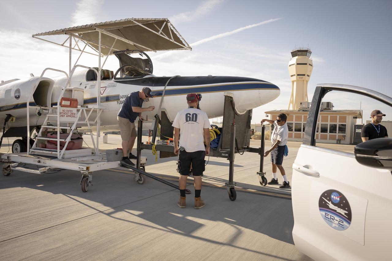
Ground crew members make final preparations on NASA Armstrong Flight Research Center’s ER-2 aircraft at Edwards, California, on Thursday, Aug. 21, 2025, ahead of a high-altitude mission for the Geological Earth Mapping Experiment (GEMx). The pilot will soon board the aircraft, which can fly at altitudes up to 70,000 feet.
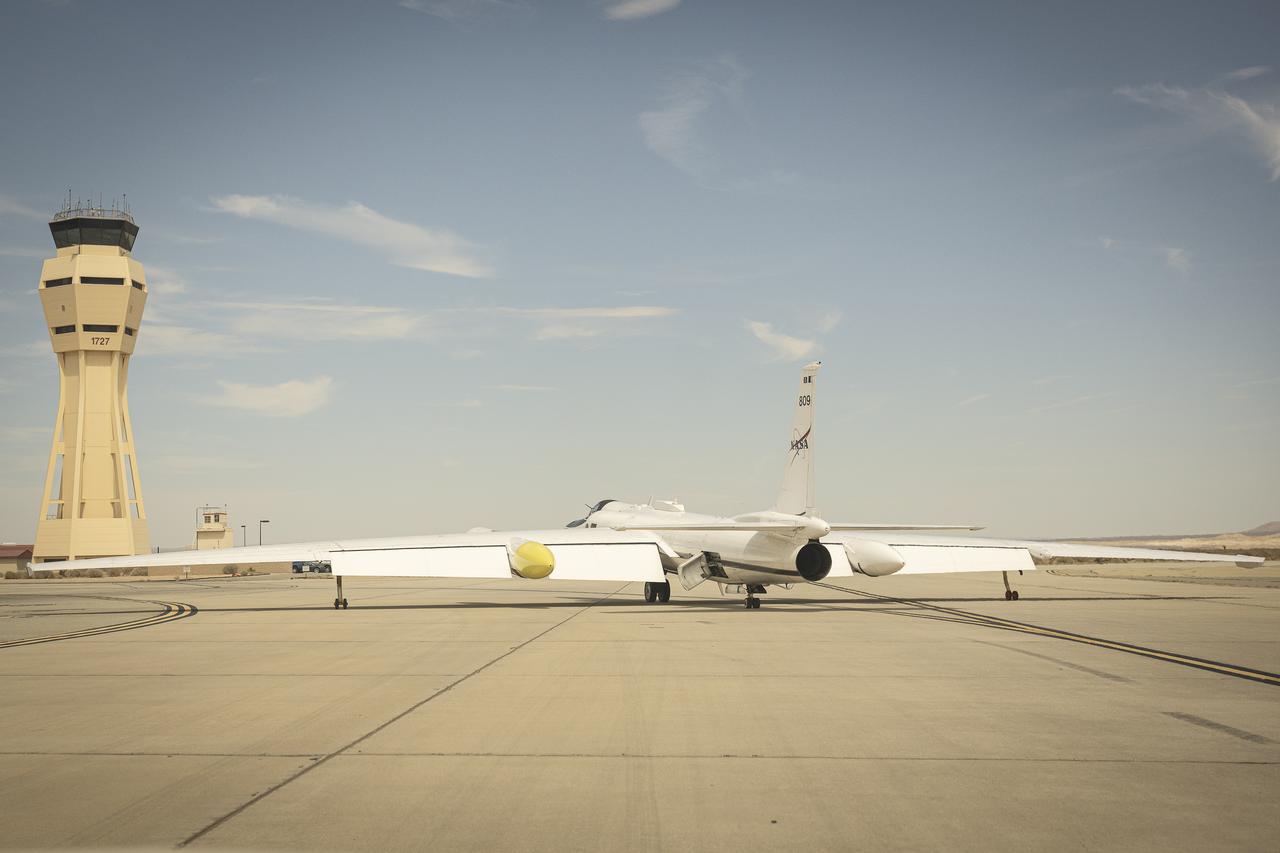
NASA Armstrong Flight Research Center’s ER-2 aircraft taxis at Edwards, California, on Thursday, Aug. 21, 2025, ahead of a high-altitude mission supporting the Geological Earth Mapping Experiment (GEMx), which requires flights of up to eight hours at approximately 65,000 feet altitude.
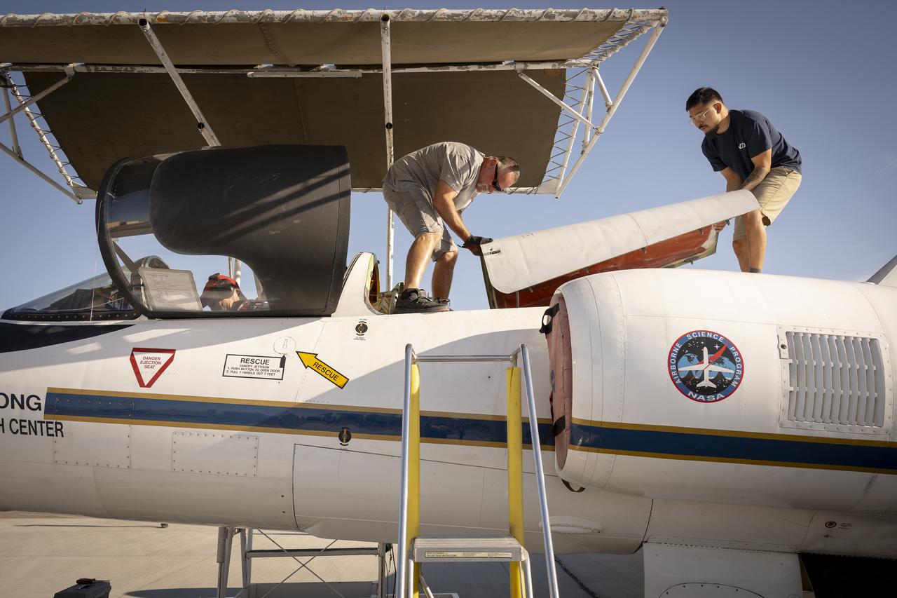
Ground crew members make final preparations on NASA Armstrong Flight Research Center’s ER-2 aircraft at Edwards, California, on Thursday, Aug. 21, 2025, ahead of a high-altitude mission for the Geological Earth Mapping Experiment (GEMx). The pilot will soon board the aircraft, which can fly at altitudes up to 70,000 feet.
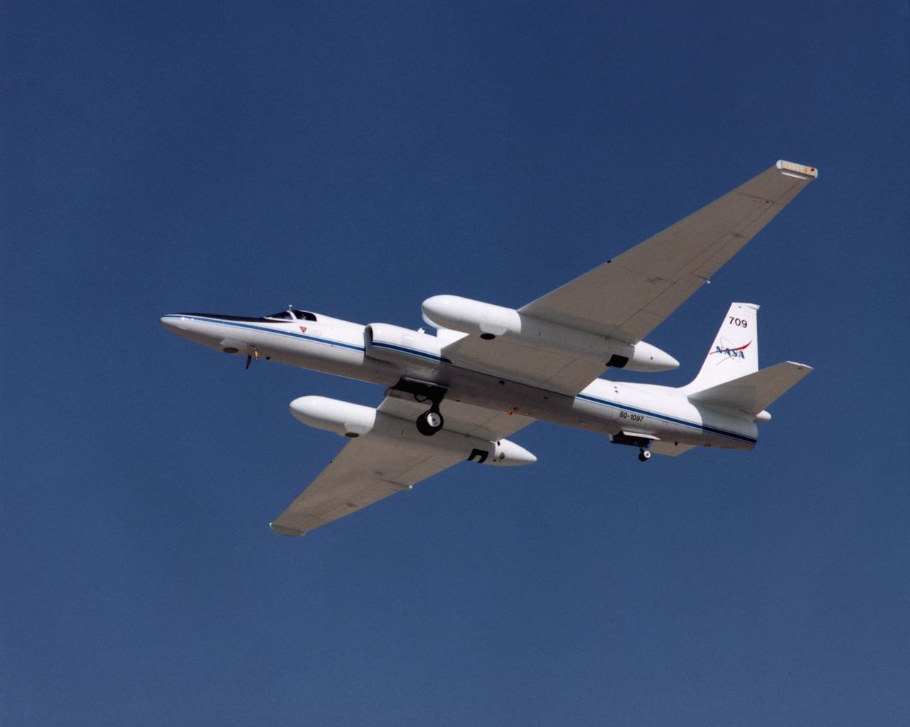
ER-2 tail number 709, was one of two Airborne Science ER-2s used as science platforms by Dryden. The aircraft were platforms for a variety of high-altitude science missions flown over various parts of the world. They were also used for earth science and atmospheric sensor research and development, satellite calibration and data validation.
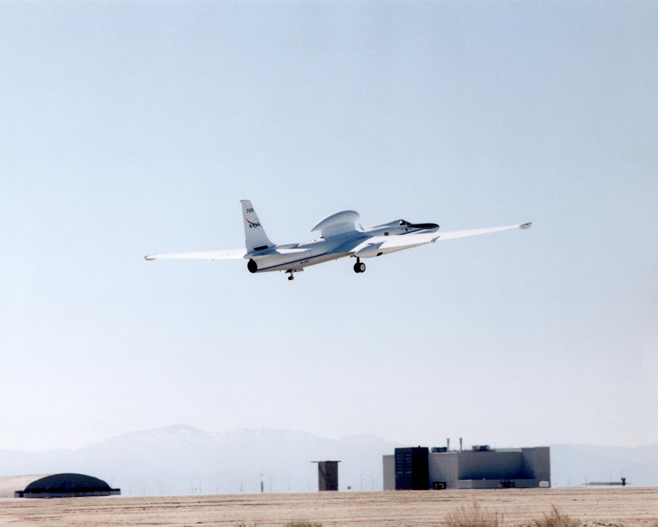
ER-2 tail number 709, was one of two Airborne Science ER-2s used as science platforms by Dryden. The aircraft were platforms for a variety of high-altitude science missions flown over various parts of the world. They were also used for earth science and atmospheric sensor research and development, satellite calibration and data validation.
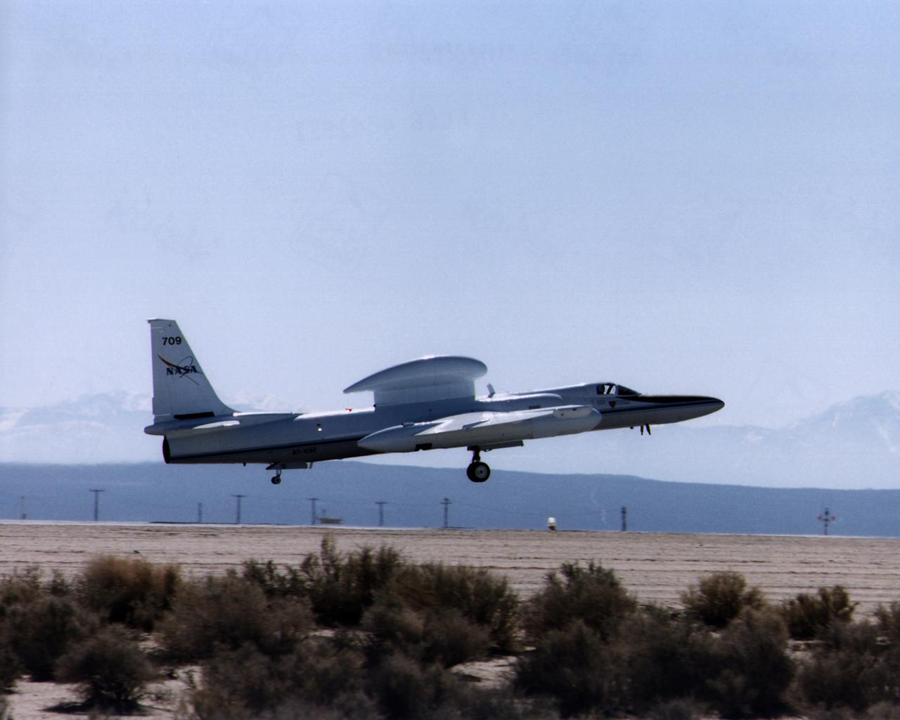
ER-2 tail number 709, was one of two Airborne Science ER-2s used as science platforms by Dryden. The aircraft were platforms for a variety of high-altitude science missions flown over various parts of the world. They were also used for earth science and atmospheric sensor research and development, satellite calibration and data validation.
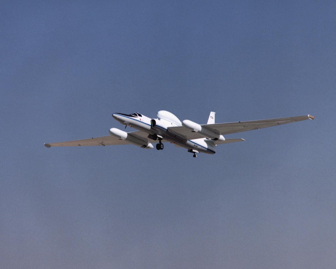
ER-2 tail number 709, was one of two Airborne Science ER-2s used as science platforms by Dryden. The aircraft were platforms for a variety of high-altitude science missions flown over various parts of the world. They were also used for earth science and atmospheric sensor research and development, satellite calibration and data validation.
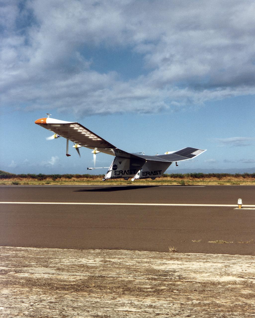
The Pathfinder aircraft has set a new unofficial world record for high-altitude flight of over 71,500 feet for solar-powered aircraft at the U.S. Navy's Pacific Missile Range Facility, Kauai, Hawaii. Pathfinder was designed and manufactured by AeroVironment, Inc, of Simi Valley, California, and was operated by the firm under a jointly sponsored research agreement with NASA's Dryden Flight Research Center, Edwards, California. Pathfinder's record-breaking flight occurred July 7, 1997. The aircraft took off at 11:34 a.m. PDT, passed its previous record altitude of 67,350 feet at about 5:45 p.m. and then reached its new record altitude at 7 p.m. The mission ended with a perfect nighttime landing at 2:05 a.m. PDT July 8. The new record is the highest altitude ever attained by a propellor-driven aircraft. Before Pathfinder, the altitude record for propellor-driven aircraft was 67,028 feet, set by the experimental Boeing Condor remotely piloted aircraft.

A NASA ER-2 high-altitude aircraft takes off from NASA’s Armstrong Flight Research Center in Edwards California on Tuesday, March 31, 2026, to support the Geological Earth Mapping Experiment (GEMx) airborne science mission.

A NASA ER-2 high-altitude aircraft takes off from NASA’s Armstrong Flight Research Center in Edwards California on Tuesday, March 31, 2026, to support the Geological Earth Mapping Experiment (GEMx) airborne science mission.
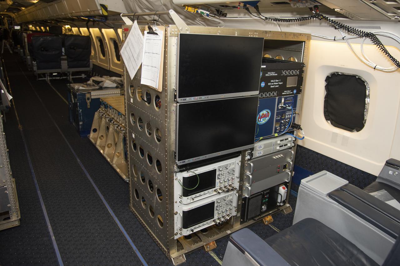
The High Altitude Lidar Observatory (HALO) system electronics and diagnostic tools are integrated onto the DC-8 airborne science laboratory at NASA Armstrong Flight Research Center in Edwards, California. The lidar system control electronics are on the right hand side of the rack. The large monitors on the left are used to display real-time images of water vapor and aerosol profiles, which are used by the science team to guide in-flight decisions and navigation. The compact HALO instrument head can be seen directly behind the electronics rack.

Mechanic Francisco Rodriguez and crew chief Darin Whittington installed the Airborne Visible/Infrared Imaging Spectrometer (AVIRIS) instrument into a NASA ER-2 high-altitude aircraft at NASA’s Armstrong Flight Research Center in Edwards, California, on Wednesday, March 11, 2026. The installation helped enabled the Geological Earth Mapping Experiment (GEMx) airborne science

Crew chief Darin Whittington and mechanic Edwin Flores watch as mechanic Francisco Rodriguez works on a mounting bolt to secure the Airborne Visible/Infrared Imaging Spectrometer (AVIRIS) instrument into a NASA ER-2 high-altitude aircraft at NASA’s Armstrong Flight Research Center in Edwards, California, on Wednesday, March 11, 2026. The installation helped enabled the Geological Earth Mapping Experiment (GEMx) airborne science mission, which began on March 31, 2026.
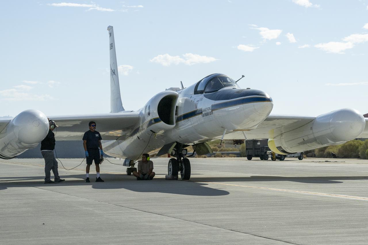
Crew members prepare NASA Armstrong Flight Research Center’s ER-2 aircraft for flight at Edwards, California, on Tuesday, Sept. 23, 2025, in support of the Geological Earth Mapping Experiment (GEMx). The high-altitude science aircraft operates between 20,000 and 70,000 feet. For this mission, pilots flew at approximately 65,000 feet, requiring them to wear specially designed pressure suits.
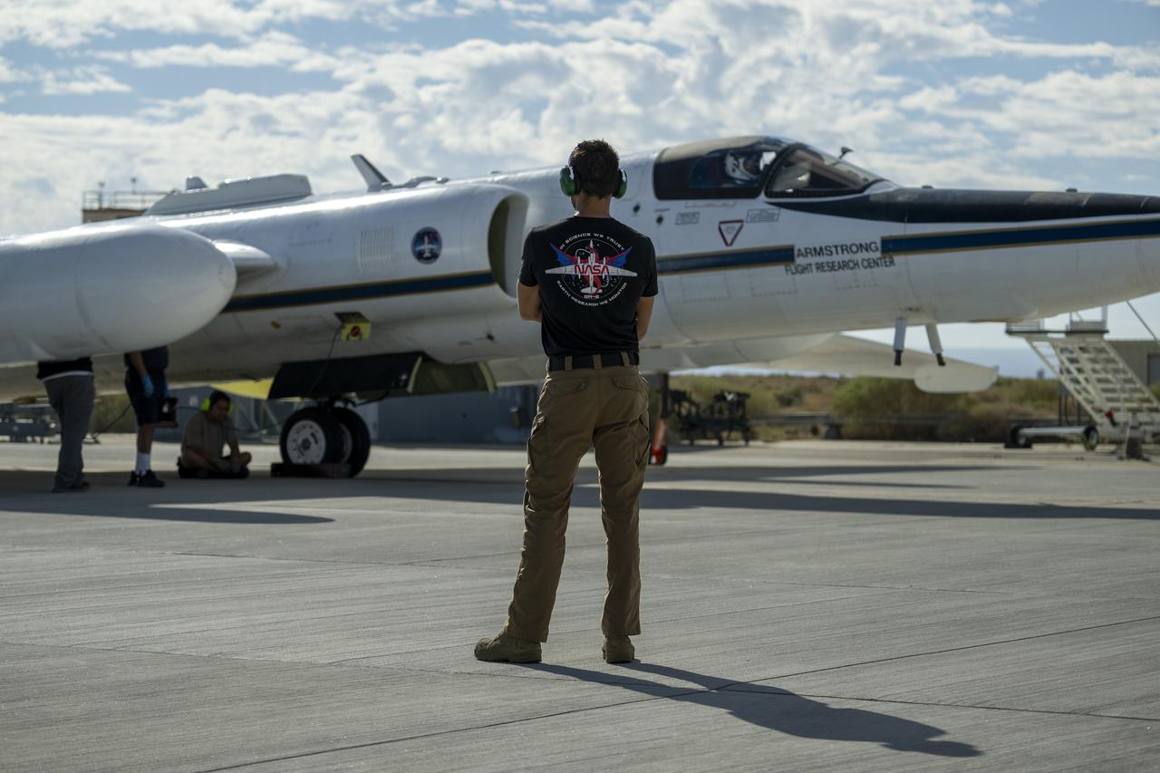
Crew members prepare NASA Armstrong Flight Research Center’s ER-2 aircraft for flight at Edwards, California, on Tuesday, Sept. 23, 2025, in support of the Geological Earth Mapping Experiment (GEMx). The high-altitude science aircraft operates between 20,000 and 70,000 feet. For this mission, pilots flew at approximately 65,000 feet, requiring them to wear specially designed pressure suits.
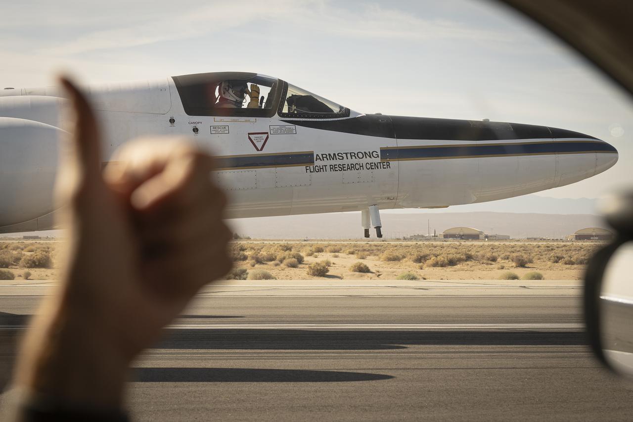
From the window of the ER-2 chase car, a crew member gives a thumbs up to the pilot as NASA Armstrong Flight Research Center’s ER-2 aircraft taxis at Edwards, California, on Thursday, Aug. 21, 2025. The gesture signals a final check before takeoff for the high-altitude mission supporting the Geological Earth Mapping Experiment (GEMx).
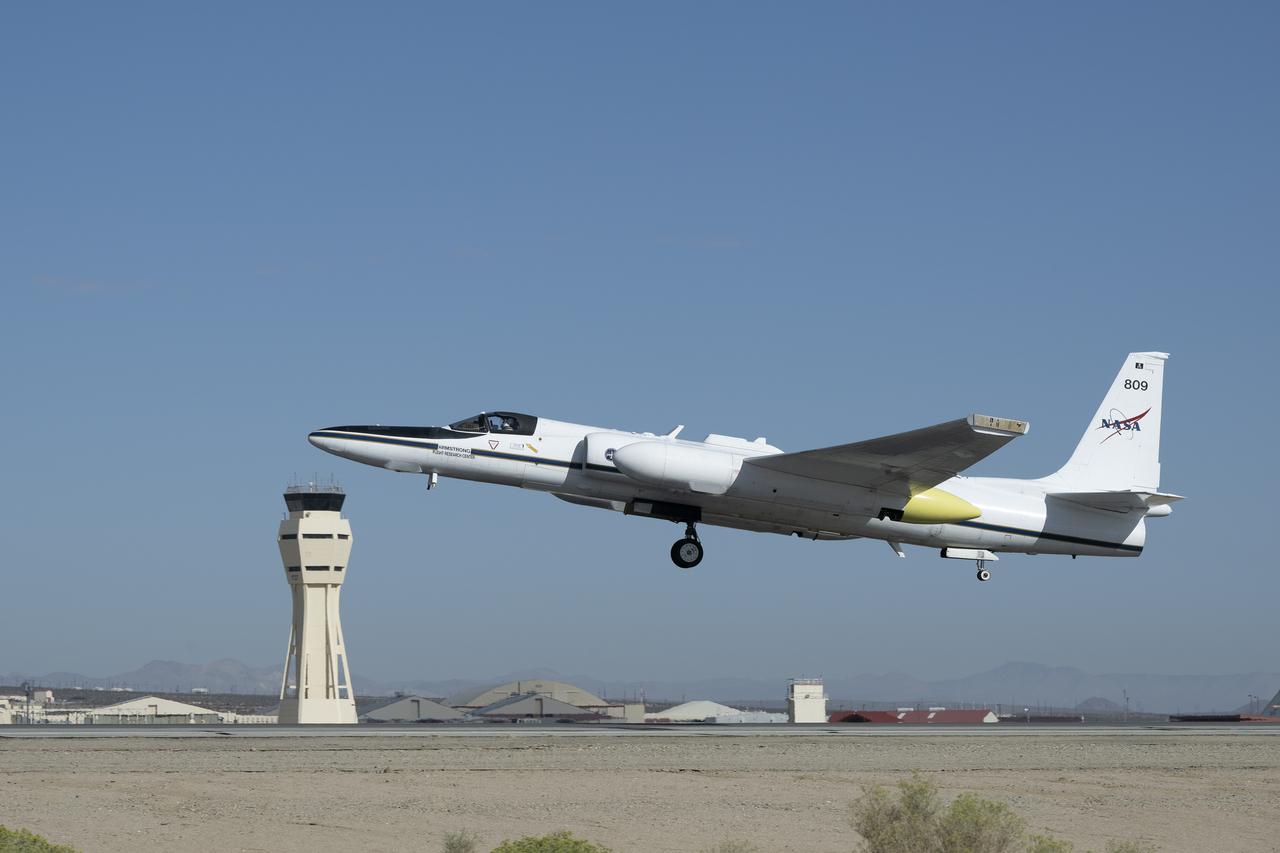
NASA Armstrong Flight Research Center’s ER-2 aircraft lifts off from Edwards, California, on Tuesday, Sept. 23, 2025, in support of the Geological Earth Mapping Experiment (GEMx). The high-altitude science aircraft operates between 20,000 and 70,000 feet. For this mission, pilots flew at approximately 65,000 feet, requiring them to wear specially designed pressure suits.

Suited up and ready, ER-2 pilot Kirt Stallings waits inside the transport vehicle at Edwards, California, on Thursday, Aug. 21, 2025, moments before boarding NASA’s Armstrong Flight Research Center’s ER-2 aircraft for a high-altitude mission supporting the Geological Earth Mapping Experiment (GEMx). Through the vehicle window, the aircraft can be seen being readied for flight.
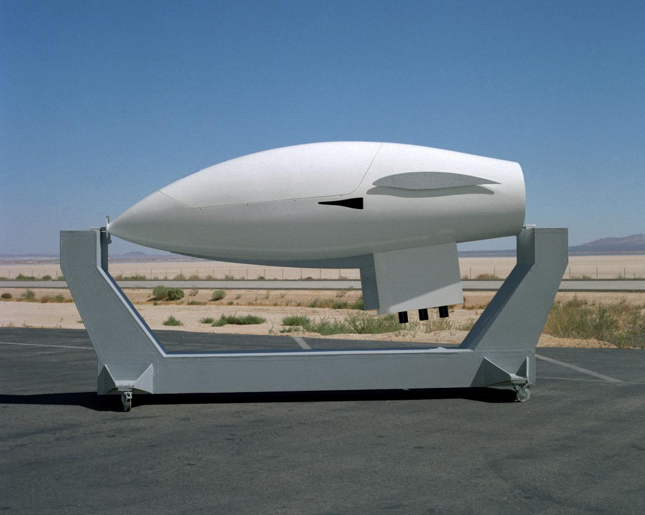
Apex high-altitude research sailplane mock-up
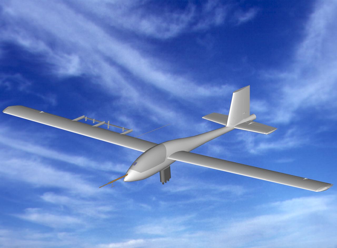
Computer generated image of Apex high-altitude research sailplane in flight
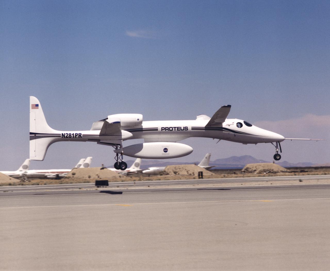
The uniquely-shaped Proteus high-altitude research aircraft lifts off from the runway at the Mojave Airport in Mojave, California.
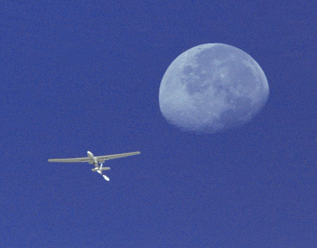
The Perseus A, a remotely-piloted, high-altitude research aircraft, is seen here framed against the moon and sky during a research mission at the Dryden Flight Research Center, Edwards, California in August 1994.
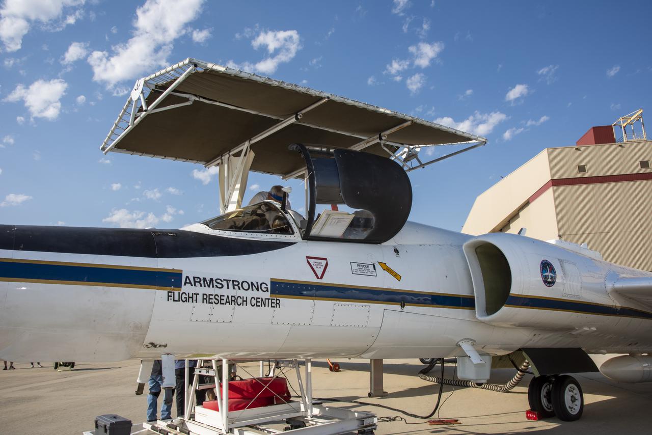
NASA's Armstrong Flight Research Center ER-2 #809 high-altitude aircraft prepared for Dynamics and Chemistry of the Summer Stratosphere (DCOTSS) science flights in Palmdale, CA on June 17, 2021
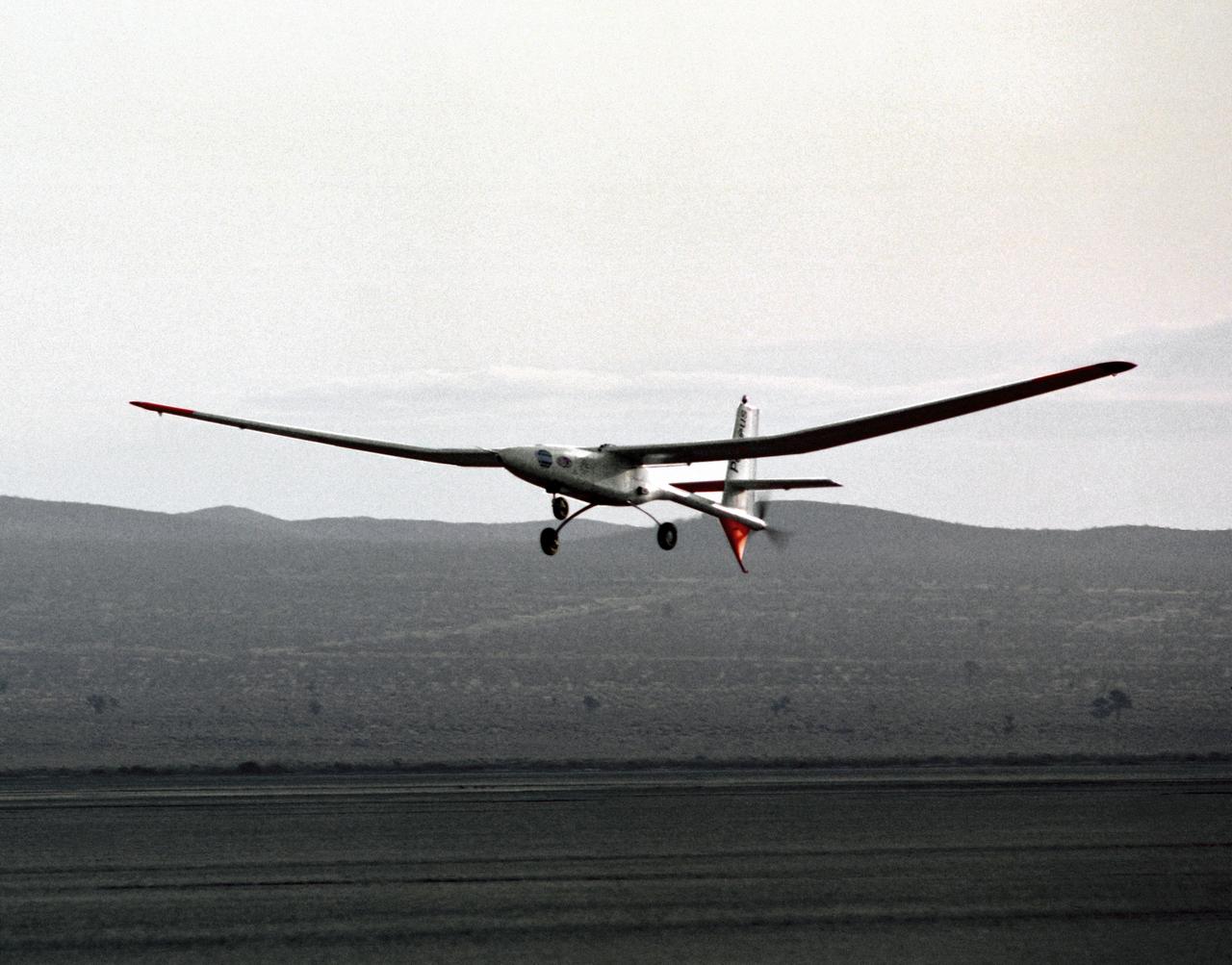
The Perseus proof-of-concept vehicle flies over Rogers Dry Lake at the Dryden Flight Research Center, Edwards, California, to test basic design concepts for the remotely-piloted, high-altitude vehicle.
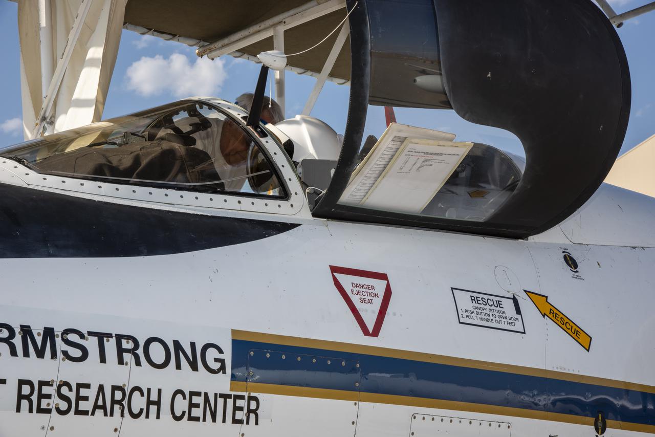
NASA's Armstrong Flight Research Center ER-2 #809 high-altitude aircraft prepared for Dynamics and Chemistry of the Summer Stratosphere (DCOTSS) science flights in Palmdale, CA on June 17, 2021.
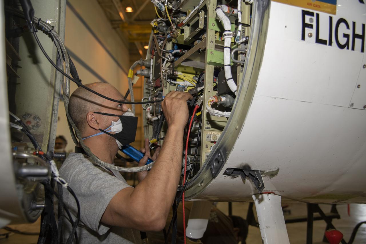
NASA’s Armstrong Flight Research Center ER-2 #809 high-altitude aircraft maintained by avionics technician Gregory Bantalin for Dynamics and Chemistry of the Summer Stratosphere (DCOTSS) science flights.
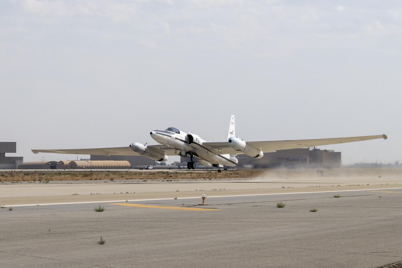
NASA’s Armstrong Flight Research Center ER-2 #809 high-altitude aircraft taking off for Dynamics and Chemistry of the Summer Stratosphere (DCOTSS) science flights in Palmdale, CA on June 17, 2021.
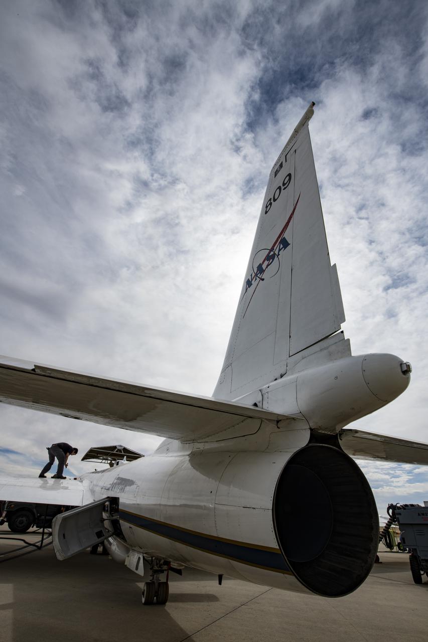
NASA's Armstrong Flight Research Center ER-2 #809 high-altitude aircraft prepped for Dynamics and Chemistry of the Summer Stratosphere (DCOTSS) science flights in Palmdale, CA.
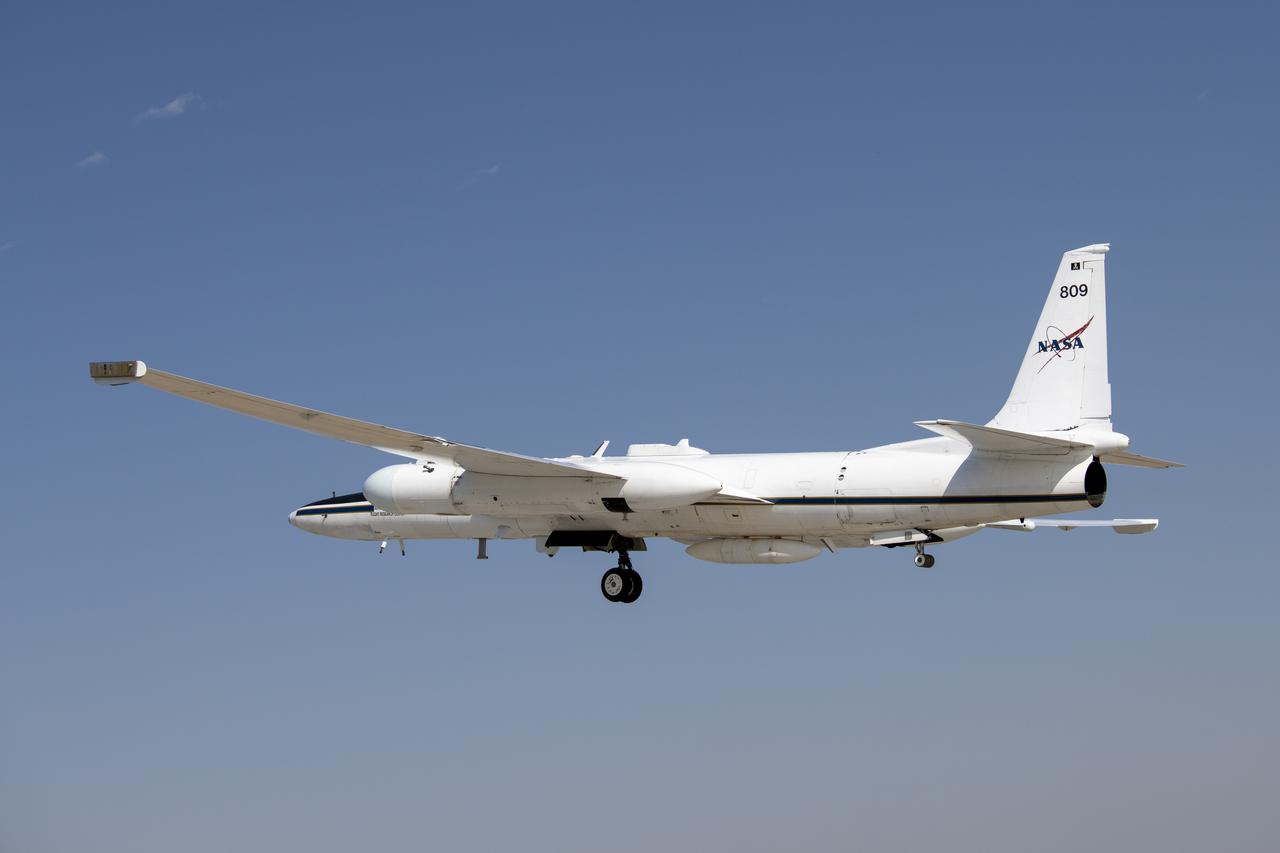
NASA's Armstrong Flight Research Center operates ER-2 #809 high-altitude aircraft for Dynamics and Chemistry of the Summer Stratosphere (DCOTSS) science flights on June 17, 2021.
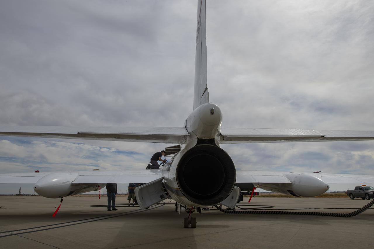
NASA's Armstrong Flight Research Center ER-2 #809 high-altitude aircraft prepped for Dynamics and Chemistry of the Summer Stratosphere (DCOTSS) science flights in Palmdale, CA.
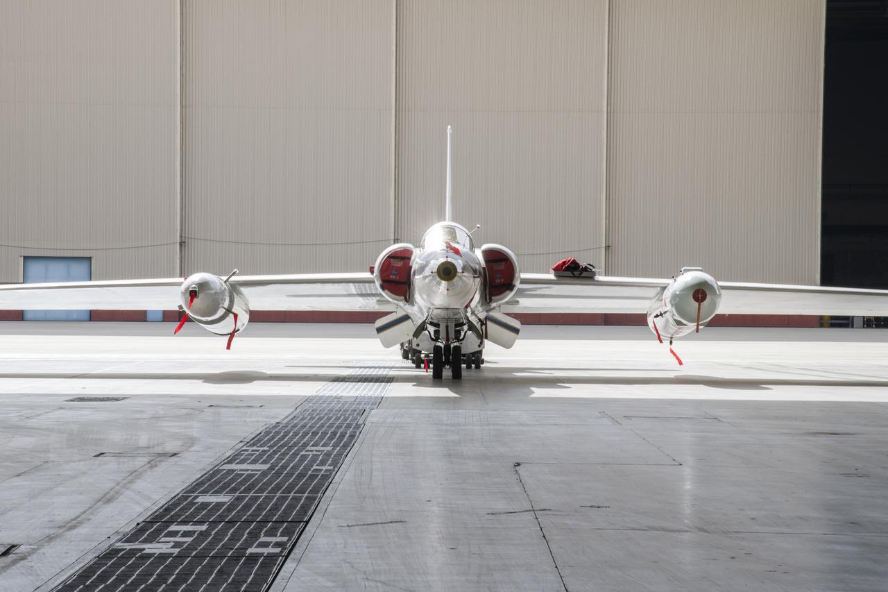
NASA’s Armstrong Flight Research Center ER-2 #809 high-altitude aircraft prepped for Dynamics and Chemistry of the Summer Stratosphere (DCOTSS) science flights in Palmdale, CA.
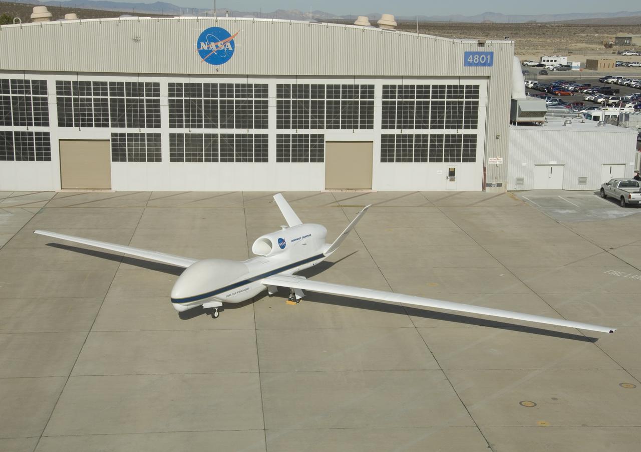
One of NASA's two Global Hawk high-altitude unmanned science aircraft displays its contours outside its hangar at NASA's Dryden Flight Research Center.
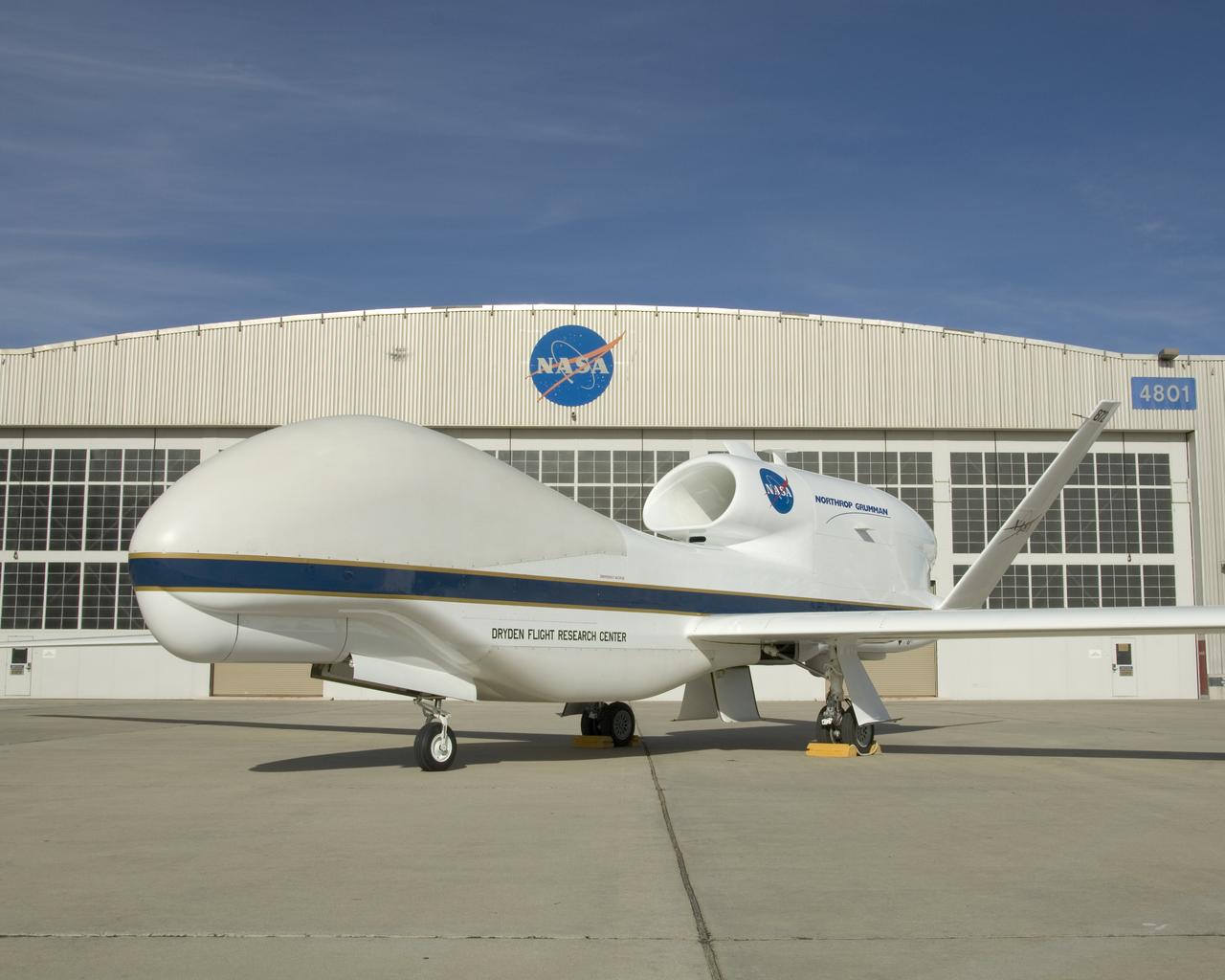
One of NASA's two Global Hawk unmanned high-altitude aircraft shows off its blue-and-white livery in front of its hangar at NASA's Dryden Flight Research Center.
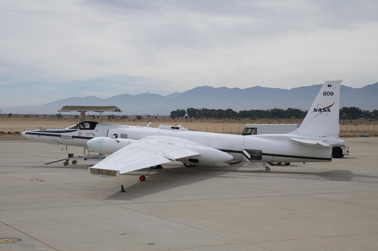
NASA's Armstrong Flight Research Center ER-2 #809 high-altitude aircraft prepped for Dynamics and Chemistry of the Summer Stratosphere (DCOTSS) science flights in Palmdale, CA.
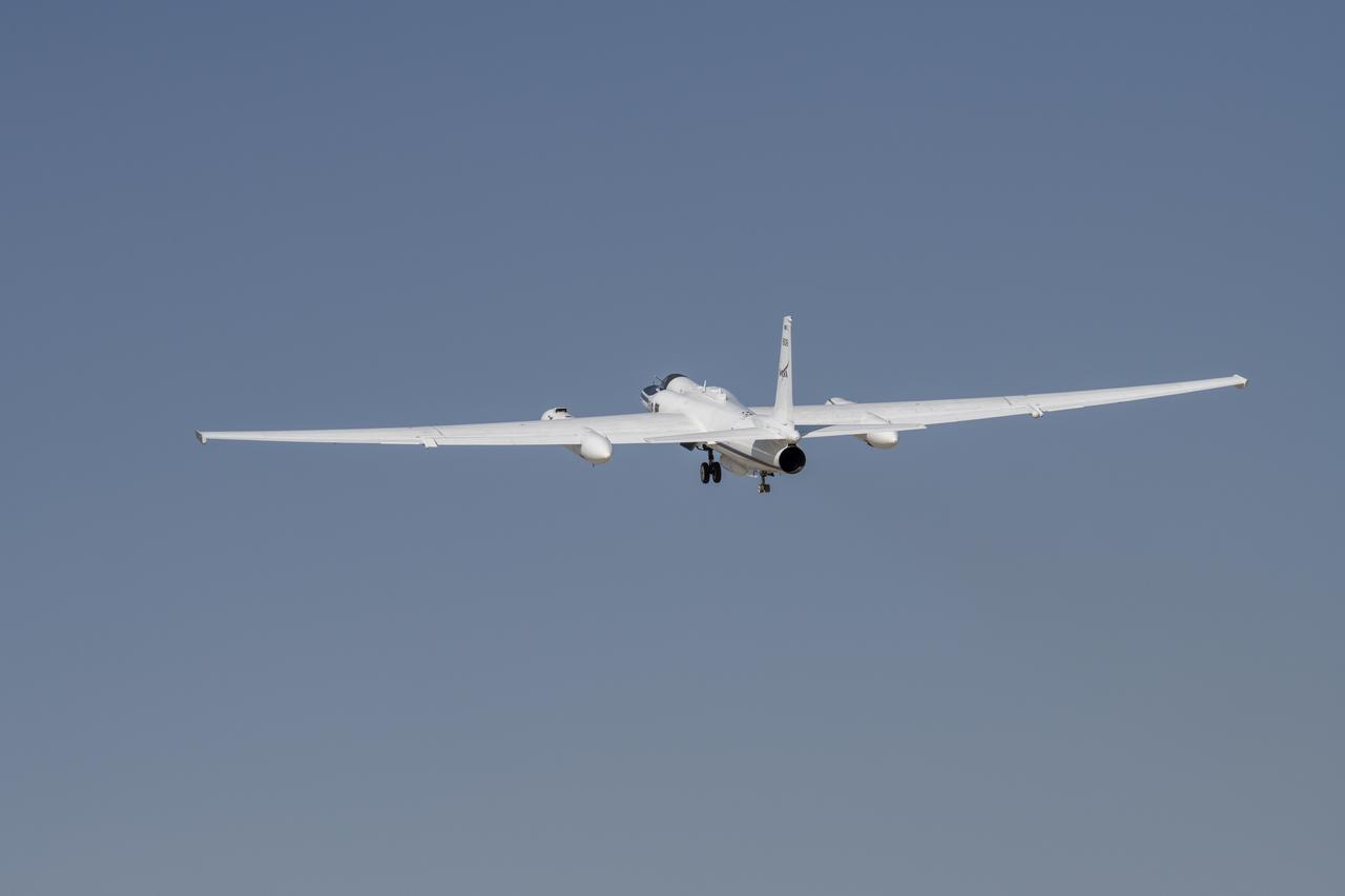
NASA’s Armstrong Flight Research Center operates ER-2 #809 high-altitude aircraft for Dynamics and Chemistry of the Summer Stratosphere (DCOTSS) science flights on June 17, 2021.
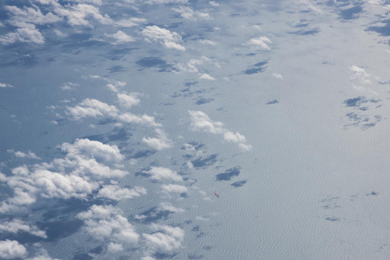
The Gulf of Mexico as seen from NASA photographer Carla Thomas at high altitude in the F/A-18 research aircraft during a flight in support of the Quiet Supersonic Flights 2018 series, or QSF18. The high altitude is necessary as part of the quiet supersonic dive maneuver, climbing to around 50,000 feet, followed by a supersonic, inverted dive. This creates sonic boom shockwaves in a way that they are quieter in a specific area.
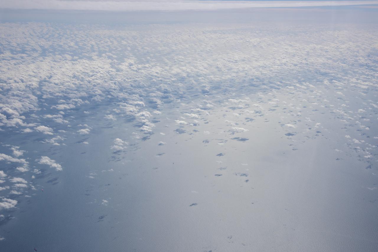
The Gulf of Mexico as seen from NASA photographer Carla Thomas at high altitude in the F/A-18 research aircraft during a flight in support of the Quiet Supersonic Flights 2018 series, or QSF18. The high altitude is necessary as part of the quiet supersonic dive maneuver, climbing to around 50,000 feet, followed by a supersonic, inverted dive. This creates sonic boom shockwaves in a way that they are quieter in a specific area.
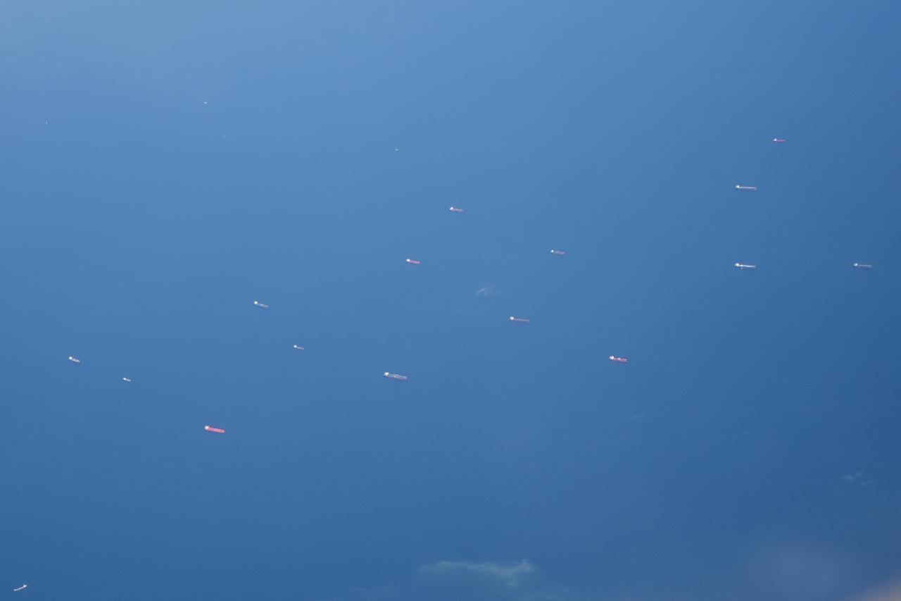
The Gulf of Mexico as seen from NASA photographer Carla Thomas at high altitude in the F/A-18 research aircraft during a flight in support of the Quiet Supersonic Flights 2018 series, or QSF18. The high altitude is necessary as part of the quiet supersonic dive maneuver, climbing to around 50,000 feet, followed by a supersonic, inverted dive. This creates sonic boom shockwaves in a way that they are quieter in a specific area.
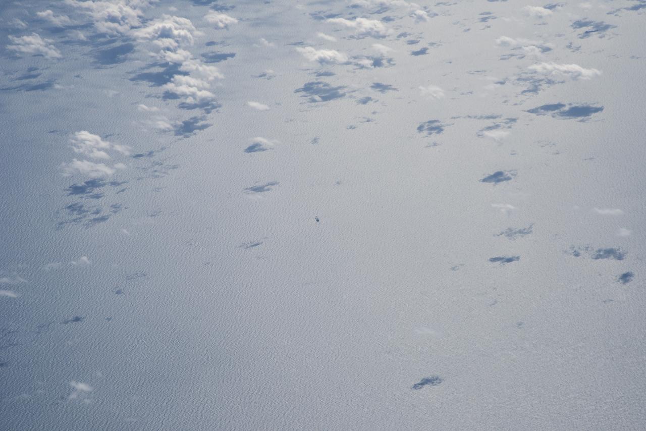
The Gulf of Mexico as seen from NASA photographer Carla Thomas at high altitude in the F/A-18 research aircraft during a flight in support of the Quiet Supersonic Flights 2018 series, or QSF18. The high altitude is necessary as part of the quiet supersonic dive maneuver, climbing to around 50,000 feet, followed by a supersonic, inverted dive. This creates sonic boom shockwaves in a way that they are quieter in a specific area.
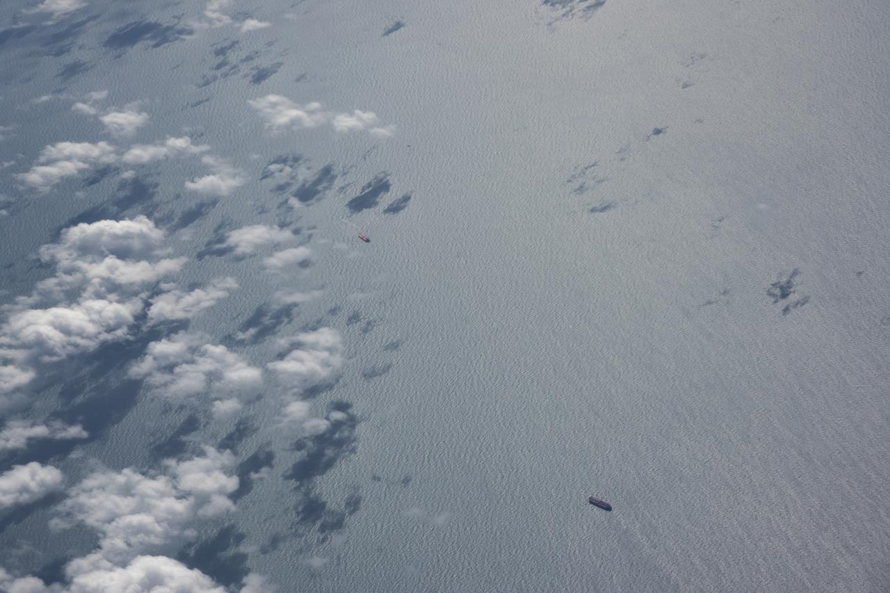
The Gulf of Mexico as seen from NASA photographer Carla Thomas at high altitude in the F/A-18 research aircraft during a flight in support of the Quiet Supersonic Flights 2018 series, or QSF18. The high altitude is necessary as part of the quiet supersonic dive maneuver, climbing to around 50,000 feet, followed by a supersonic, inverted dive. This creates sonic boom shockwaves in a way that they are quieter in a specific area.
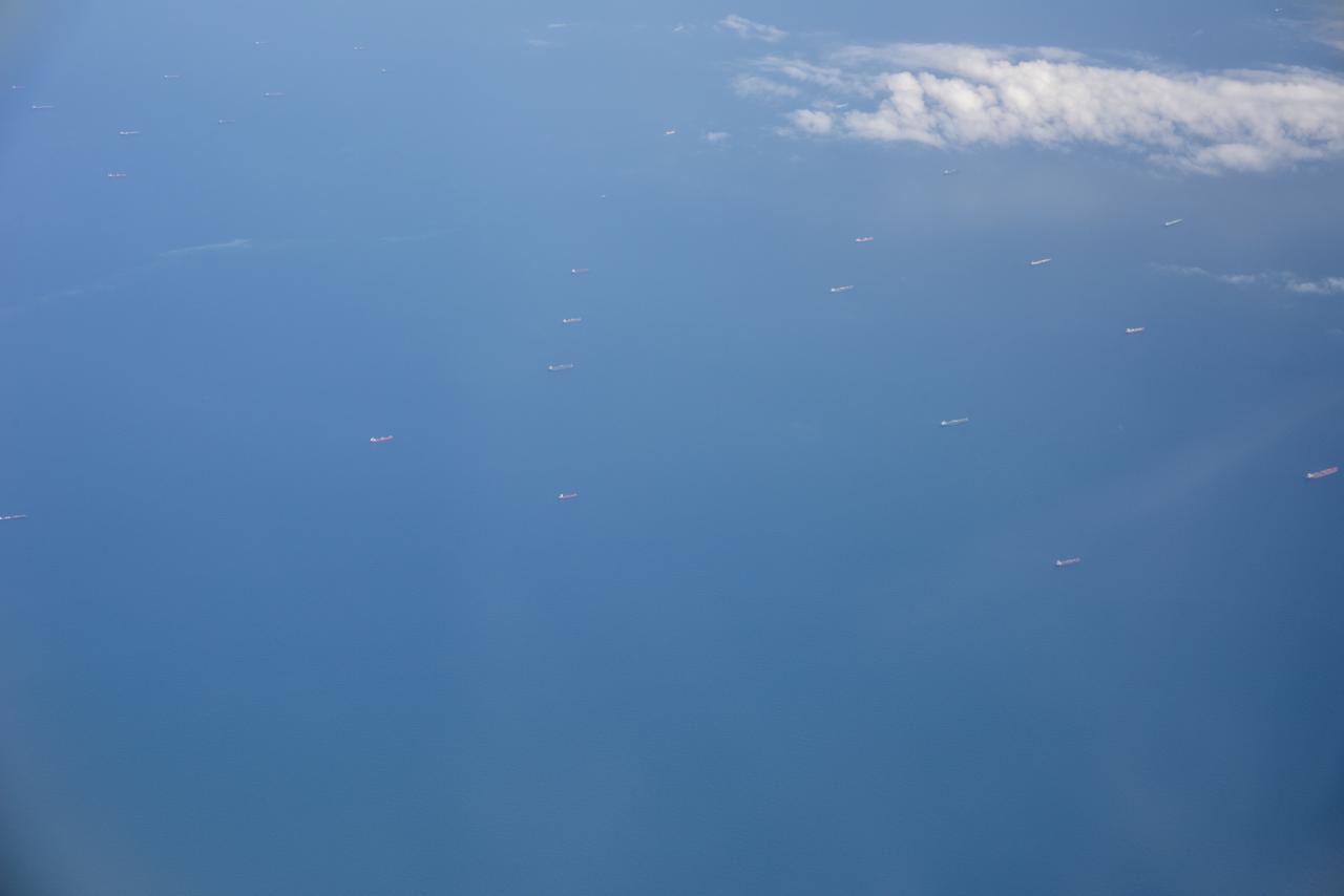
The Gulf of Mexico as seen from NASA photographer Carla Thomas at high altitude in the F/A-18 research aircraft during a flight in support of the Quiet Supersonic Flights 2018 series, or QSF18. The high altitude is necessary as part of the quiet supersonic dive maneuver, climbing to around 50,000 feet, followed by a supersonic, inverted dive. This creates sonic boom shockwaves in a way that they are quieter in a specific area.
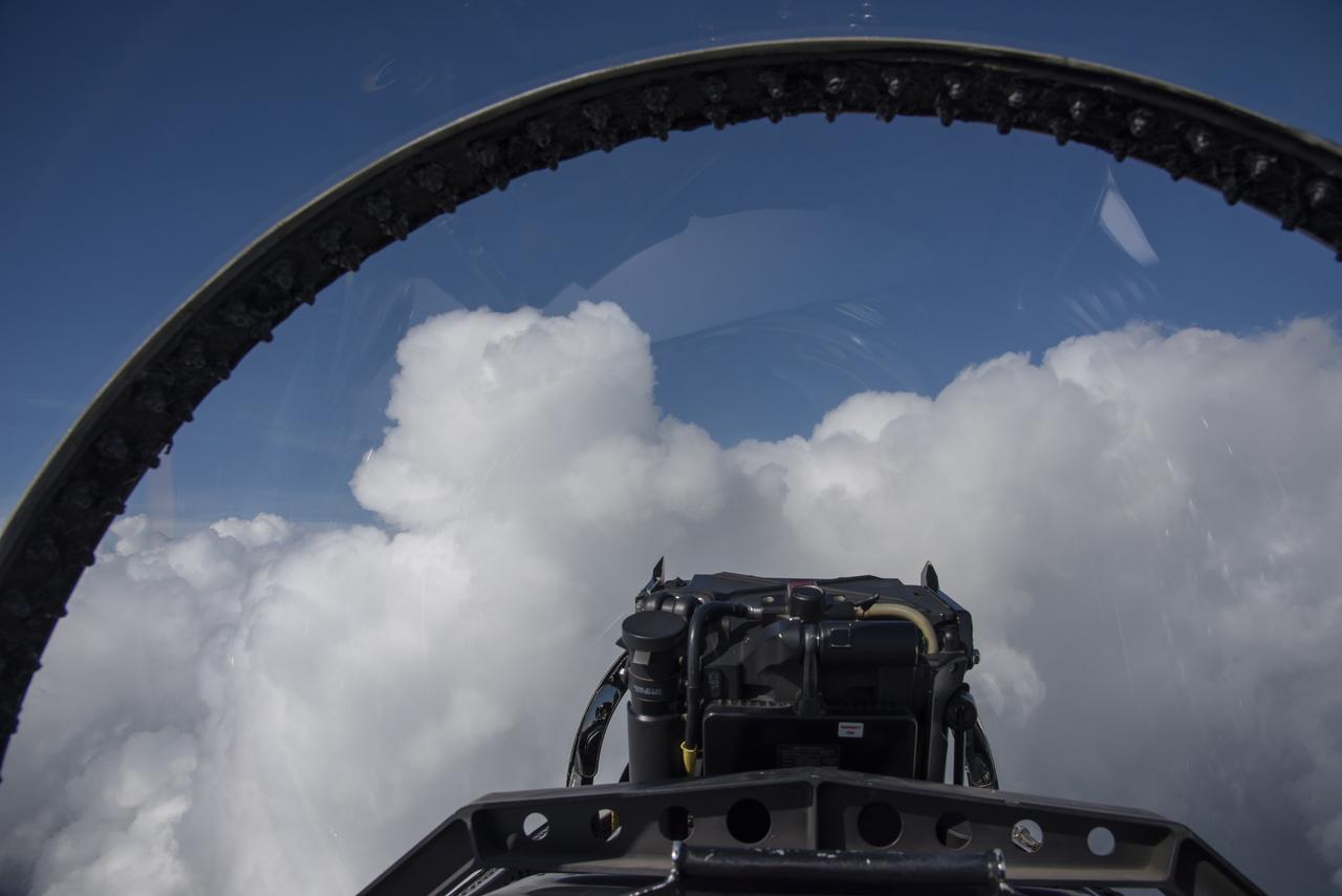
The Gulf of Mexico as seen from NASA photographer Carla Thomas at high altitude in the F/A-18 research aircraft during a flight in support of the Quiet Supersonic Flights 2018 series, or QSF18. The high altitude is necessary as part of the quiet supersonic dive maneuver, climbing to around 50,000 feet, followed by a supersonic, inverted dive. This creates sonic boom shockwaves in a way that they are quieter in a specific area.
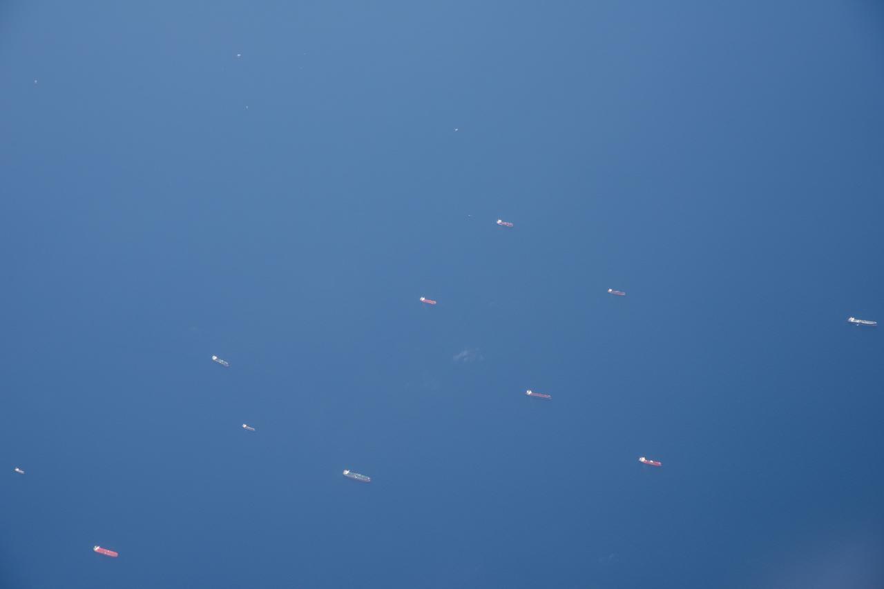
The Gulf of Mexico as seen from NASA photographer Carla Thomas at high altitude in the F/A-18 research aircraft during a flight in support of the Quiet Supersonic Flights 2018 series, or QSF18. The high altitude is necessary as part of the quiet supersonic dive maneuver, climbing to around 50,000 feet, followed by a supersonic, inverted dive. This creates sonic boom shockwaves in a way that they are quieter in a specific area.
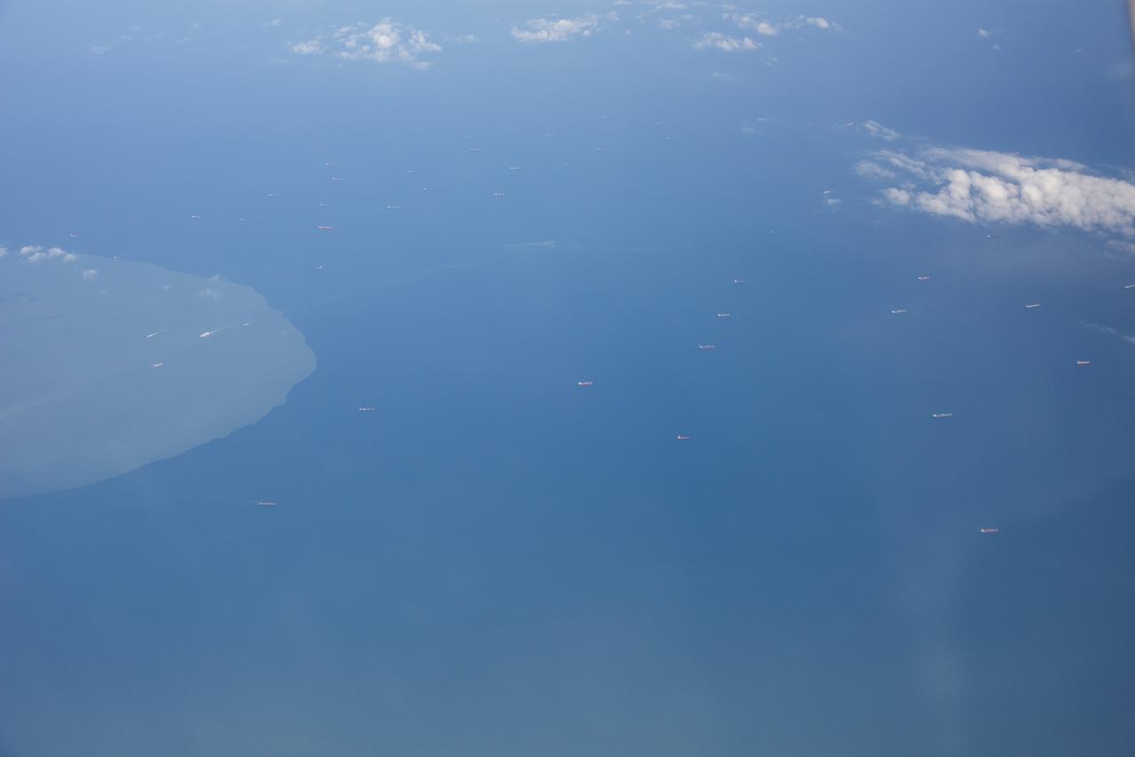
The Gulf of Mexico as seen from NASA photographer Carla Thomas at high altitude in the F/A-18 research aircraft during a flight in support of the Quiet Supersonic Flights 2018 series, or QSF18. The high altitude is necessary as part of the quiet supersonic dive maneuver, climbing to around 50,000 feet, followed by a supersonic, inverted dive. This creates sonic boom shockwaves in a way that they are quieter in a specific area.
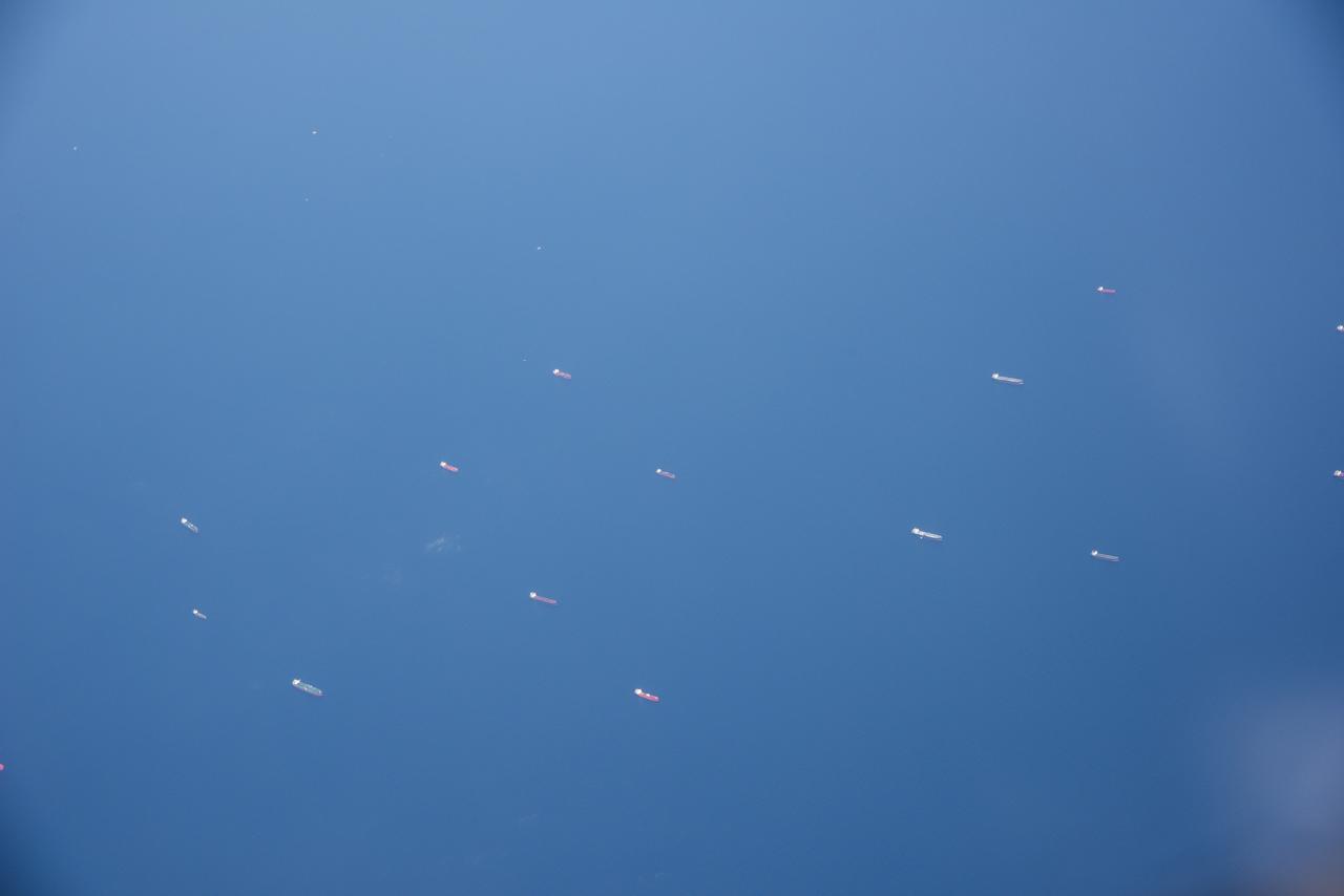
The Gulf of Mexico as seen from NASA photographer Carla Thomas at high altitude in the F/A-18 research aircraft during a flight in support of the Quiet Supersonic Flights 2018 series, or QSF18. The high altitude is necessary as part of the quiet supersonic dive maneuver, climbing to around 50,000 feet, followed by a supersonic, inverted dive. This creates sonic boom shockwaves in a way that they are quieter in a specific area.
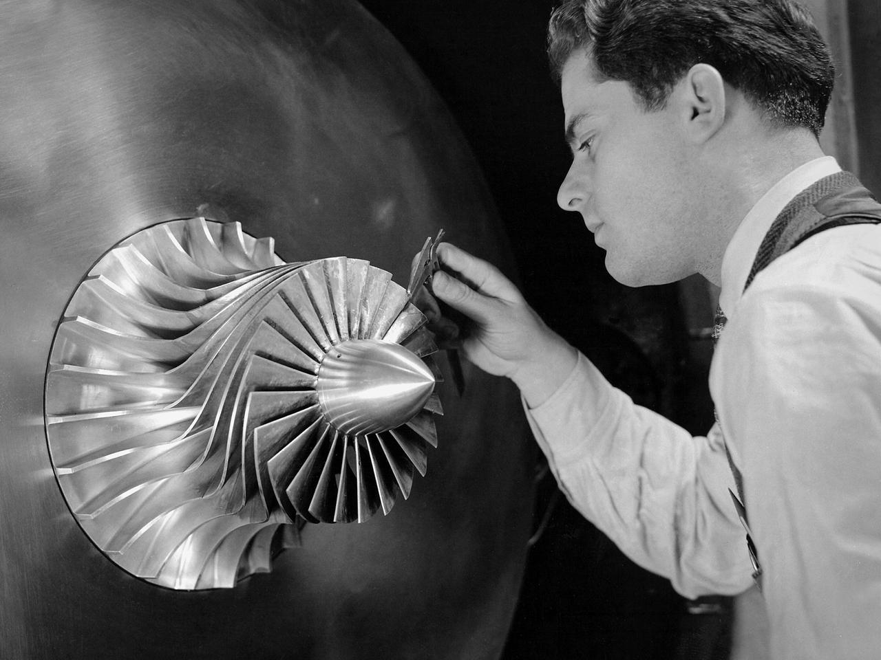
A researcher in the Supercharger Research Division at the National Advisory Committee for Aeronautics (NACA) Aircraft Engine Research Laboratory measures the blade thickness on a supercharger. Superchargers were developed at General Electric used to supply additional air to reciprocating engines. The extra air resulted in increased the engine’s performance, particularly at higher altitudes. The Aircraft Engine Research Laboratory had an entire division dedicated to superchargers during World War II. General Electric developed the supercharger in response to a 1917 request from the NACA to develop a device to enhance high-altitude flying. The supercharger pushed larger volumes of air into the engine manifold. The extra oxygen allowed the engine to operate at its optimal sea-level rating even when at high altitudes. Thus, the aircraft could maintain its climb rate, maneuverability and speed as it rose higher into the sky. NACA work on the supercharger ceased after World War II due to the arrival of the turbojet engine. The Supercharger Research Division was disbanded in October 1945 and reconstituted as the Compressor and Turbine Division.
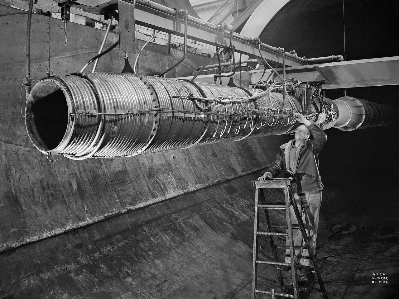
A 20-inch diameter ramjet installed in the Altitude Wind Tunnel at the National Advisory Committee for Aeronautics (NACA) Lewis Flight Propulsion Laboratory. The Altitude Wind Tunnel was used in the 1940s to study early ramjet configurations. Ramjets provide a very simple source of propulsion. They are basically a tube which takes in high-velocity air, ignites it, and then expels the expanded airflow at a significantly higher velocity for thrust. Ramjets are extremely efficient and powerful but can only operate at high speeds. Therefore a turbojet or rocket was needed to launch the vehicle. This NACA-designed 20-inch diameter ramjet was installed in the Altitude Wind Tunnel in May 1945. The ramjet was mounted under a section of wing in the 20-foot diameter test section with conditioned airflow ducted directly to the engine. The mechanic in this photograph was installing instrumentation devices that led to the control room. NACA researchers investigated the ramjet’s overall performance at simulated altitudes up to 47,000 feet. Thrust measurements from these runs were studied in conjunction with drag data obtained during small-scale studies in the laboratory’s small supersonic tunnels. An afterburner was attached to the ramjet during the portions of the test program. The researchers found that an increase in altitude caused a reduction in the engine’s horsepower. They also determined the optimal configurations for the flameholders, which provided the engine’s ignition source.

The flight operations crew for NASA’s QSF18 flight series debriefs following a flight with the F/A-18 research aircraft. The flight included a quiet supersonic dive maneuver at high altitudes off the coast to produce a sonic boom out over the ocean, with the intention of producing quieter “thumps” on land.
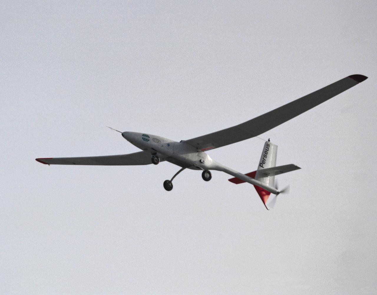
The Perseus proof-of-concept vehicle in flight at the Dryden Flight Research Center, Edwards, California in 1991. Perseus is one of several remotely-piloted aircraft designed for high-altitude, long-endurance scientific sampling missions being evaluated under the ERAST program.
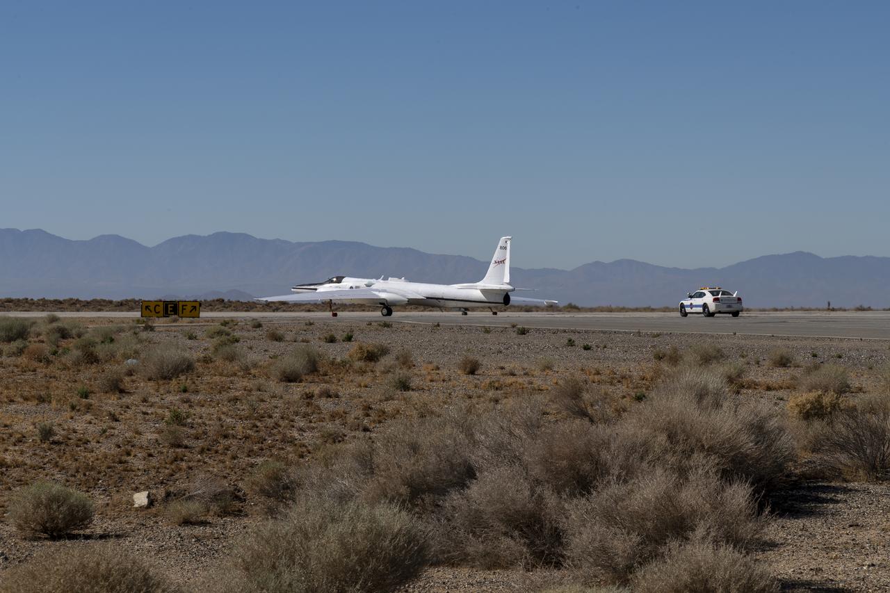
The ER-2 conducted over 80 flight hours in service of the Plankton, Aerosol, Cloud, ocean Ecosystem Postlaunch Airborne eXperiment (PACE-PAX) mission. The ER-2 is uniquely qualified to conduct the high-altitude scientific flights that this project required, and is based at NASA’s Armstrong Flight Research Center in Edwards, California.
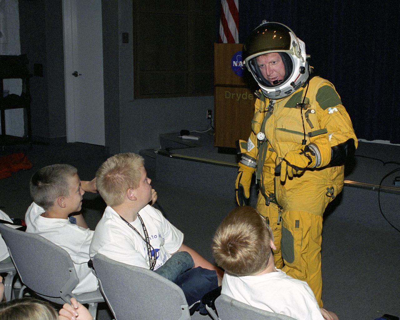
NASA Dryden historian Christian Gelzer explains functions of the high-altitude pressure suit he is wearing to (left to right) Brandon Blankenship and Garrett Clay of Lancaster and Eddie Patterson of Tehachapi during Take Your Children to Work Day activities at NASA Dryden Flight Research Center June 22.
NASA's ER-2 high altitude aircraft takes off from Armstrong Flight Research Center Building 703 in Palmdale, California to perform a check flight for the the Dynamics and Chemistry of the Summer Stratosphere, or DCOTSS, 2022 campaign on May 13, 2022.
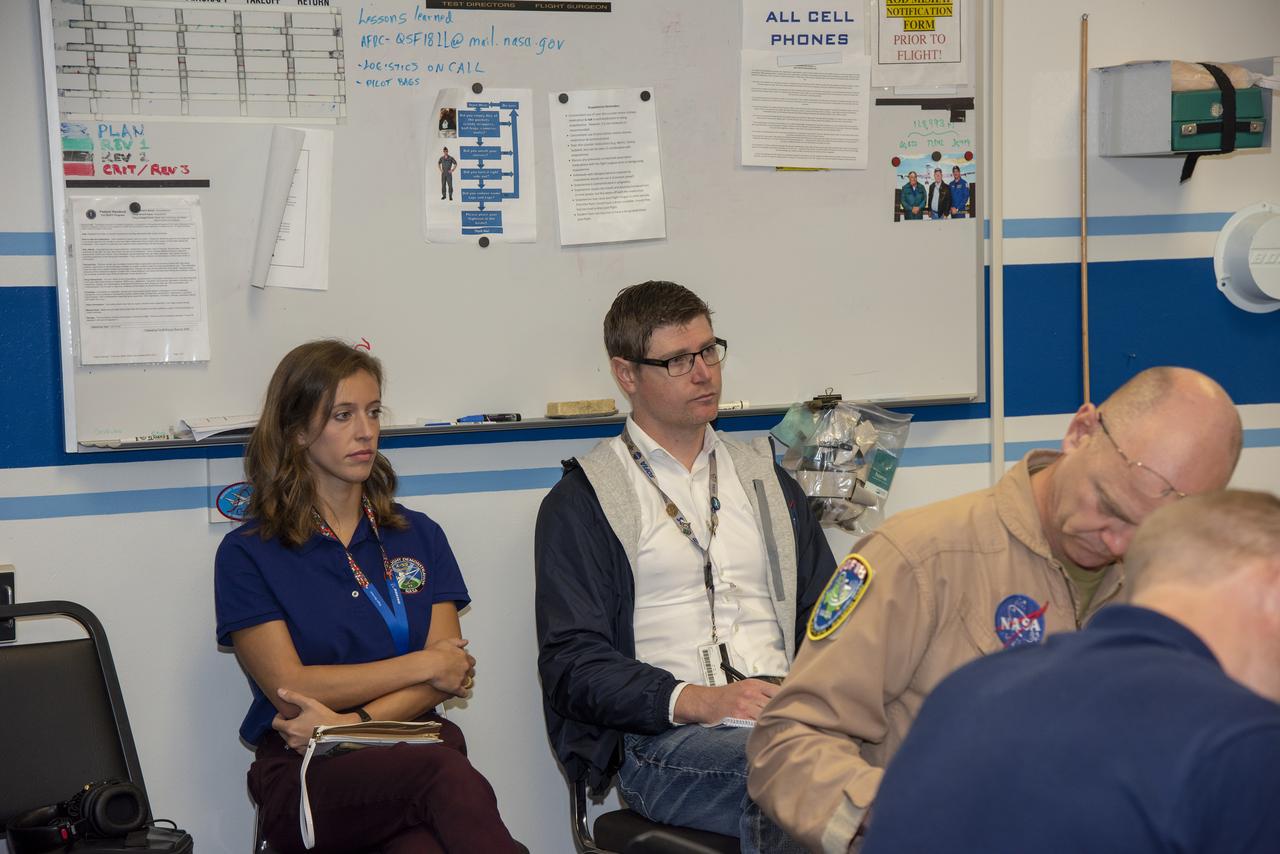
The flight operations crew for NASA’s QSF18 flight series debriefs following a flight with the F/A-18 research aircraft. The flight included a quiet supersonic dive maneuver at high altitudes off the coast to produce a sonic boom out over the ocean, with the intention of producing quieter “thumps” on land.
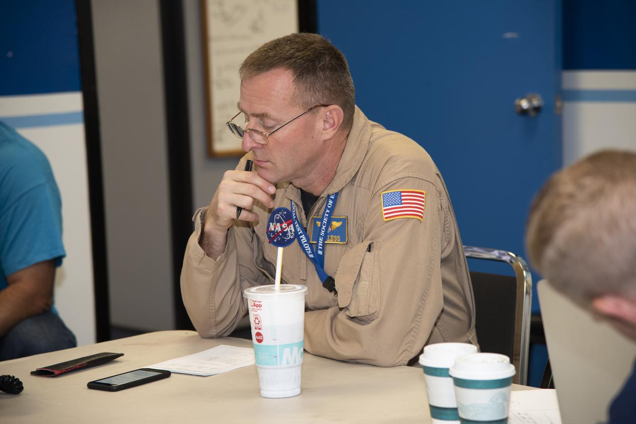
The flight operations crew for NASA’s QSF18 flight series debriefs following a flight with the F/A-18 research aircraft. The flight included a quiet supersonic dive maneuver at high altitudes off the coast to produce a sonic boom out over the ocean, with the intention of producing quieter “thumps” on land.
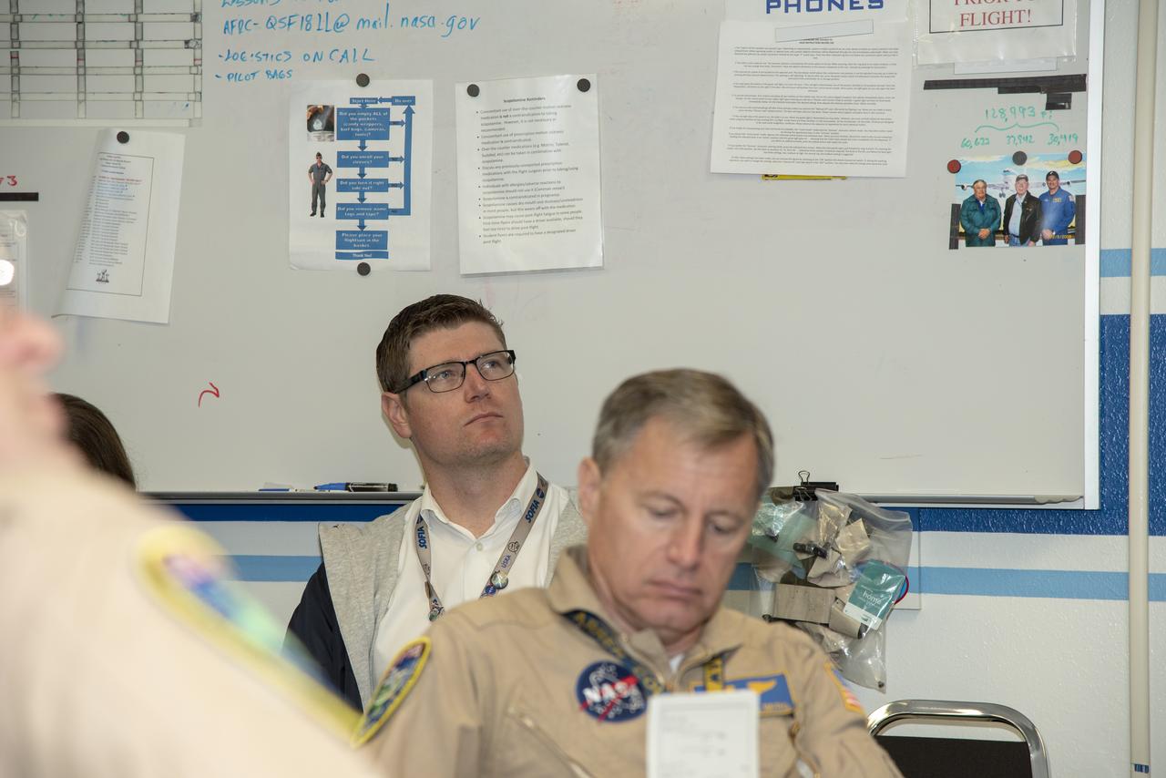
The flight operations crew for NASA's QSF18 flight series debriefs following a flight with the F/A-18 research aircraft. The flight included a quiet supersonic dive maneuver at high altitudes off the coast to produce a sonic boom out over the ocean, with the intention of producing quieter "thumps" on land.
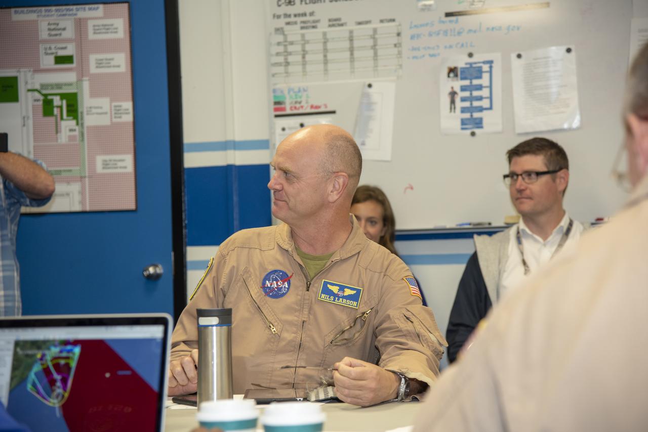
The flight operations crew for NASA’s QSF18 flight series debriefs following a flight with the F/A-18 research aircraft. The flight included a quiet supersonic dive maneuver at high altitudes off the coast to produce a sonic boom out over the ocean, with the intention of producing quieter “thumps” on land.
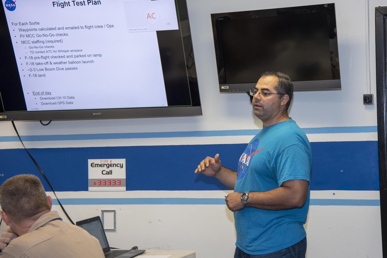
The flight operations crew for NASA’s QSF18 flight series debriefs following a flight with the F/A-18 research aircraft. The flight included a quiet supersonic dive maneuver at high altitudes off the coast to produce a sonic boom out over the ocean, with the intention of producing quieter “thumps” on land.

An ER-2 high-altitude Earth science aircraft banks away during a flight over the southern Sierra Nevada. NASA’s Armstrong Flight Research Center operates two of the Lockheed-built aircraft on a wide variety of environmental science, atmospheric sampling, and satellite data verification missions.
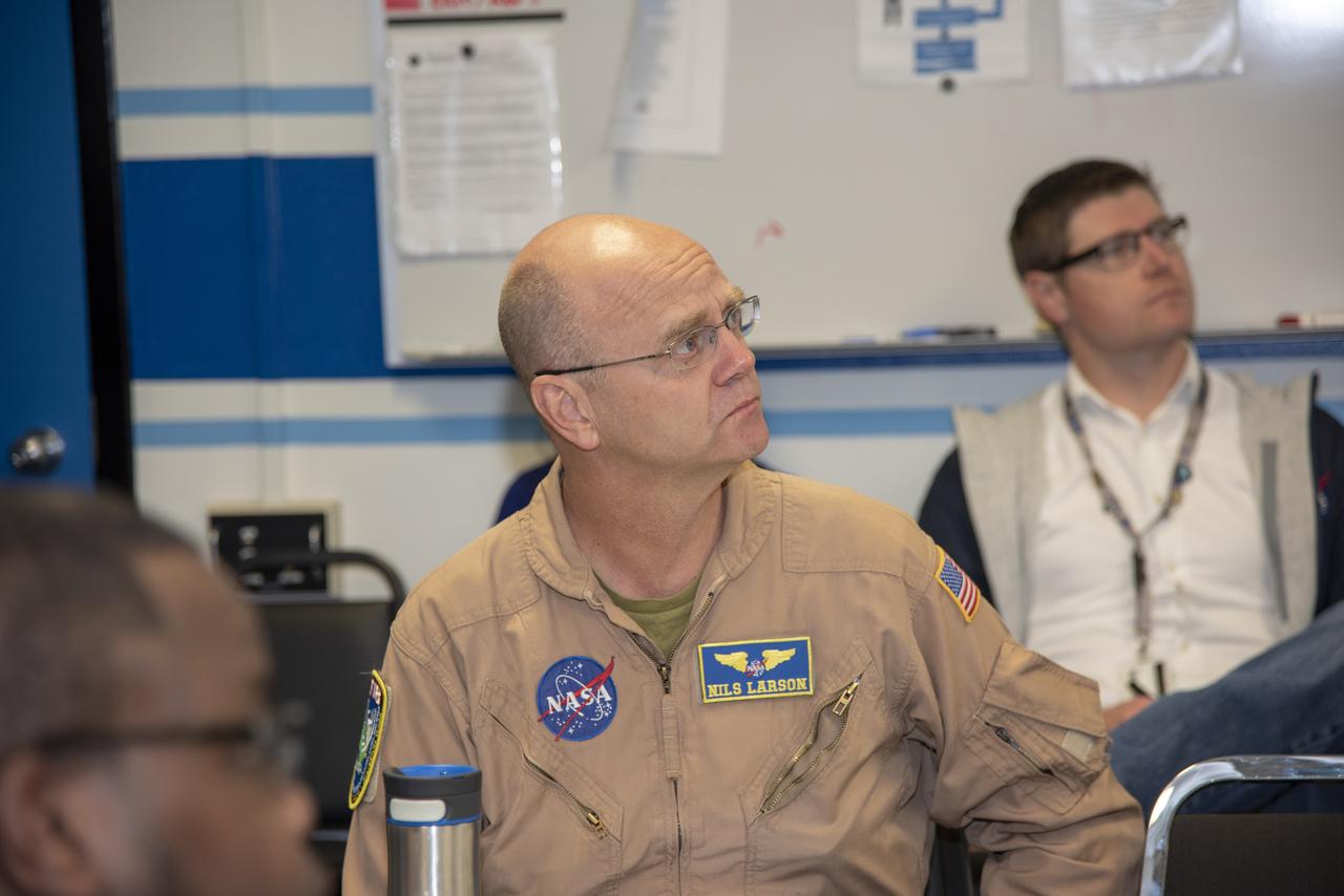
The flight operations crew for NASA’s QSF18 flight series debriefs following a flight with the F/A-18 research aircraft. The flight included a quiet supersonic dive maneuver at high altitudes off the coast to produce a sonic boom out over the ocean, with the intention of producing quieter “thumps” on land.

The flight operations crew for NASA's QSF18 flight series debriefs following a flight with the F/A-18 research aircraft. The flight included a quiet supersonic dive maneuver at high altitudes off the coast to produce a sonic boom out over the ocean, with the intention of producing quieter "thumps" on land.
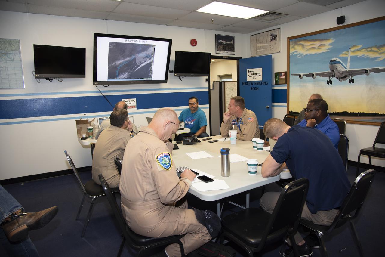
The flight operations crew for NASA’s QSF18 flight series debriefs following a flight with the F/A-18 research aircraft. The flight included a quiet supersonic dive maneuver at high altitudes off the coast to produce a sonic boom out over the ocean, with the intention of producing quieter “thumps” on land.
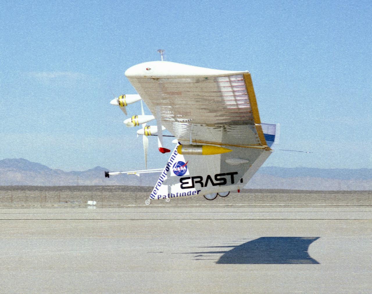
The Pathfinder solar-powered research aircraft heads for landing on the bed of Rogers Dry Lake at the Dryden Flight Research Center, Edwards, California, after a successful test flight Nov. 19, 1996.
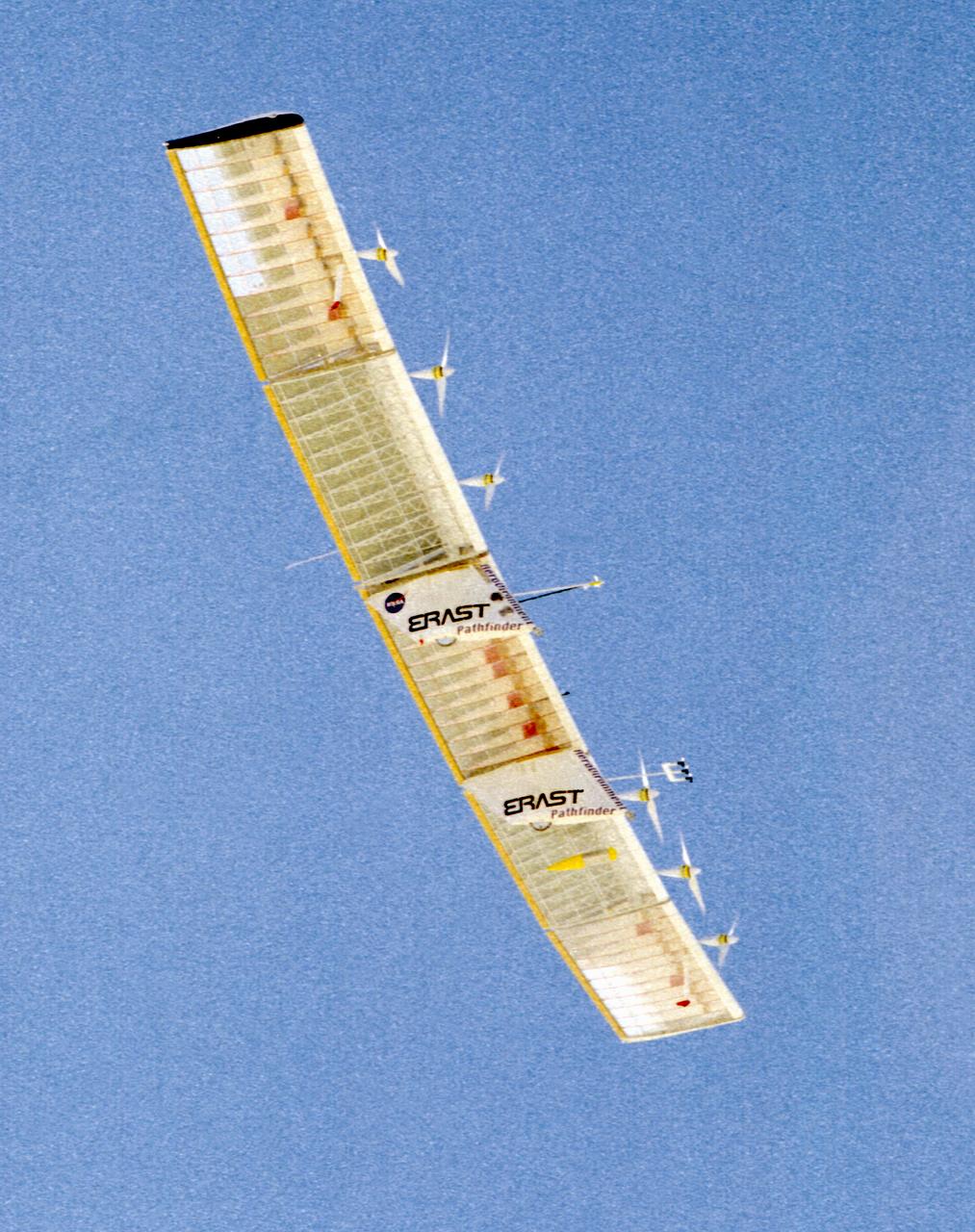
The Pathfinder research aircraft's wing structure is clearly defined as it soars under a clear blue sky during a test flight from Dryden Flight Research Center, Edwards, California, in November of 1996.
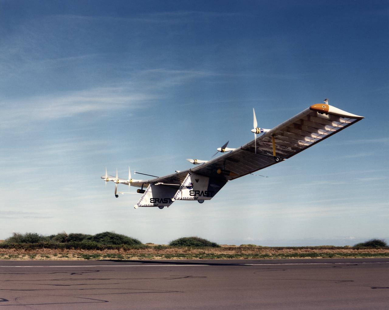
Pathfinder, NASA's solar-powered, remotely-piloted aircraft is shown while it was conducting a series of science flights to highlight the aircraft's science capabilities while collecting imagery of forest and coastal zone ecosystems on Kauai, Hawaii. The flights also tested two new scientific instruments, a high-spectral-resolution Digital Array Scanned Interferometer (DASI) and a high-spatial-resolution Airborne Real-Time Imaging System (ARTIS). The remote sensor payloads were designed by NASA's Ames Research Center, Moffett Field, California, to support NASA's Mission to Planet Earth science programs.
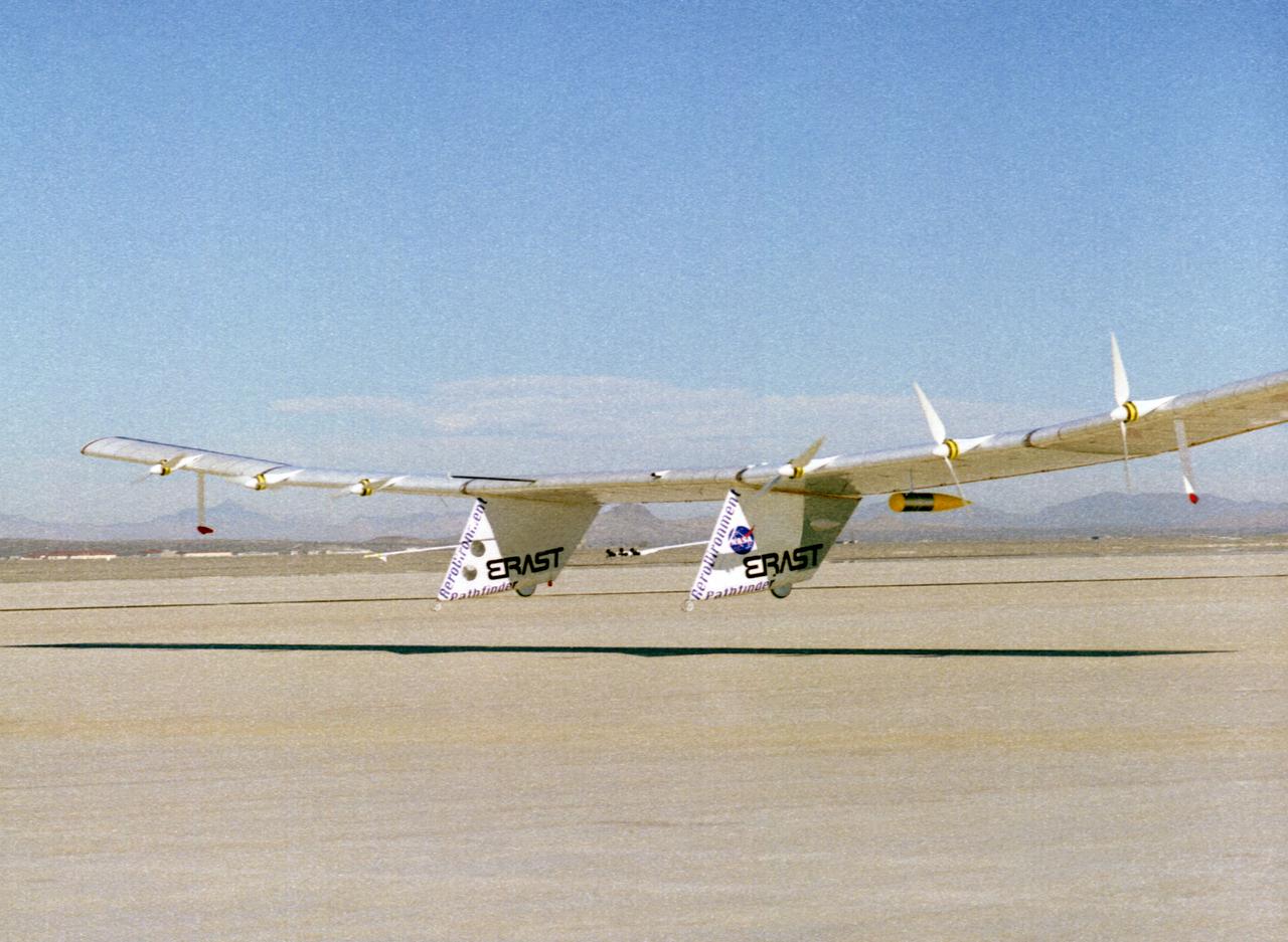
The Pathfinder solar-powered research aircraft settles in for landing on the bed of Rogers Dry Lake at the Dryden Flight Research Center, Edwards, California, after a successful test flight Nov. 19, 1996. The ultra-light craft flew a racetrack pattern at low altitudes over the flight test area for two hours while project engineers checked out various systems and sensors on the uninhabited aircraft. The Pathfinder was controlled by two pilots, one in a mobile control unit which followed the craft, the other in a stationary control station. Pathfinder, developed by AeroVironment, Inc., is one of several designs being evaluated under NASA's Environmental Research Aircraft and Sensor Technology (ERAST) program.
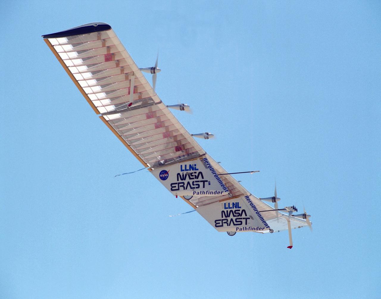
The Pathfinder research aircraft's wing structure was clearly defined as it soared under a clear blue sky during a test flight July 27, 1995, from Dryden Flight Research Center, Edwards, California. The center section and outer wing panels of the aircraft had ribs constructed of thin plastic foam, while the ribs in the inner wing panels are fabricated from lightweight composite material. Developed by AeroVironment, Inc., the Pathfinder was one of several unmanned aircraft being evaluated under NASA's Environmental Research Aircraft and Sensor Technology (ERAST) program.
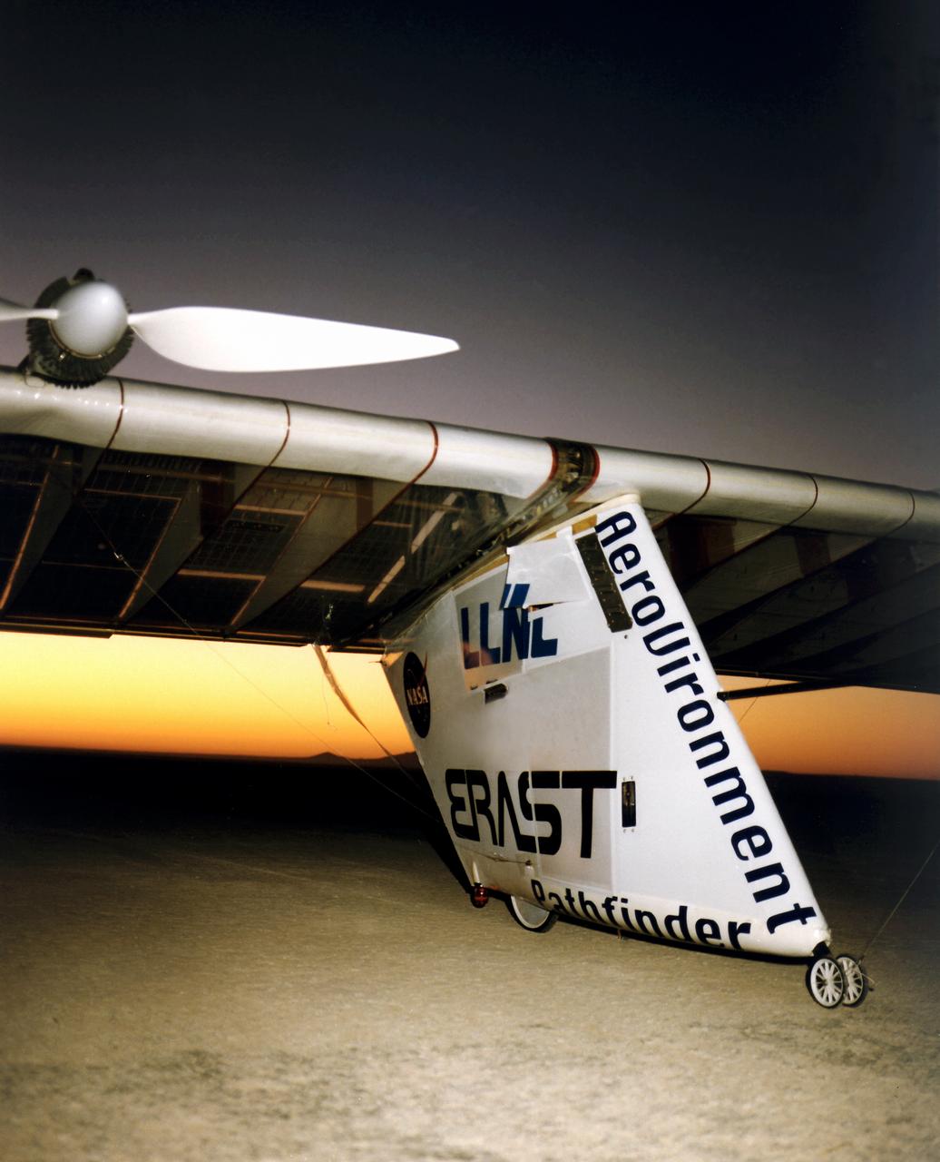
The Pathfinder solar-powered aircraft sits on Rogers Dry Lake at NASA's Dryden Flight Research Center, Edwards, California, before a research flight.
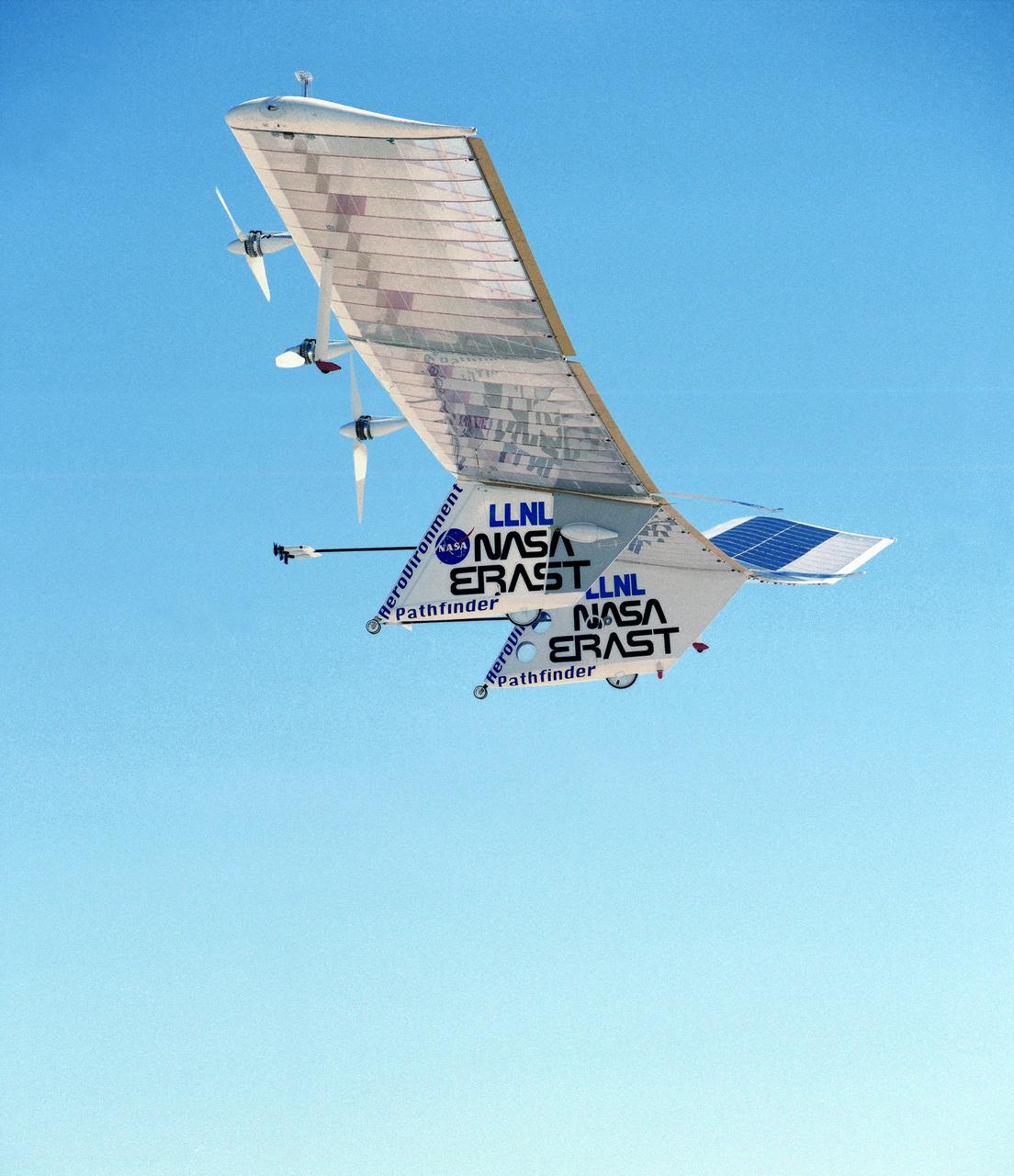
The Pathfinder solar-powered remotely piloted aircraft climbs to a record-setting altitude of 50,567 feet during a flight Sept. 11, 1995, at NASA's Dryden Flight Research Center, Edwards, California.
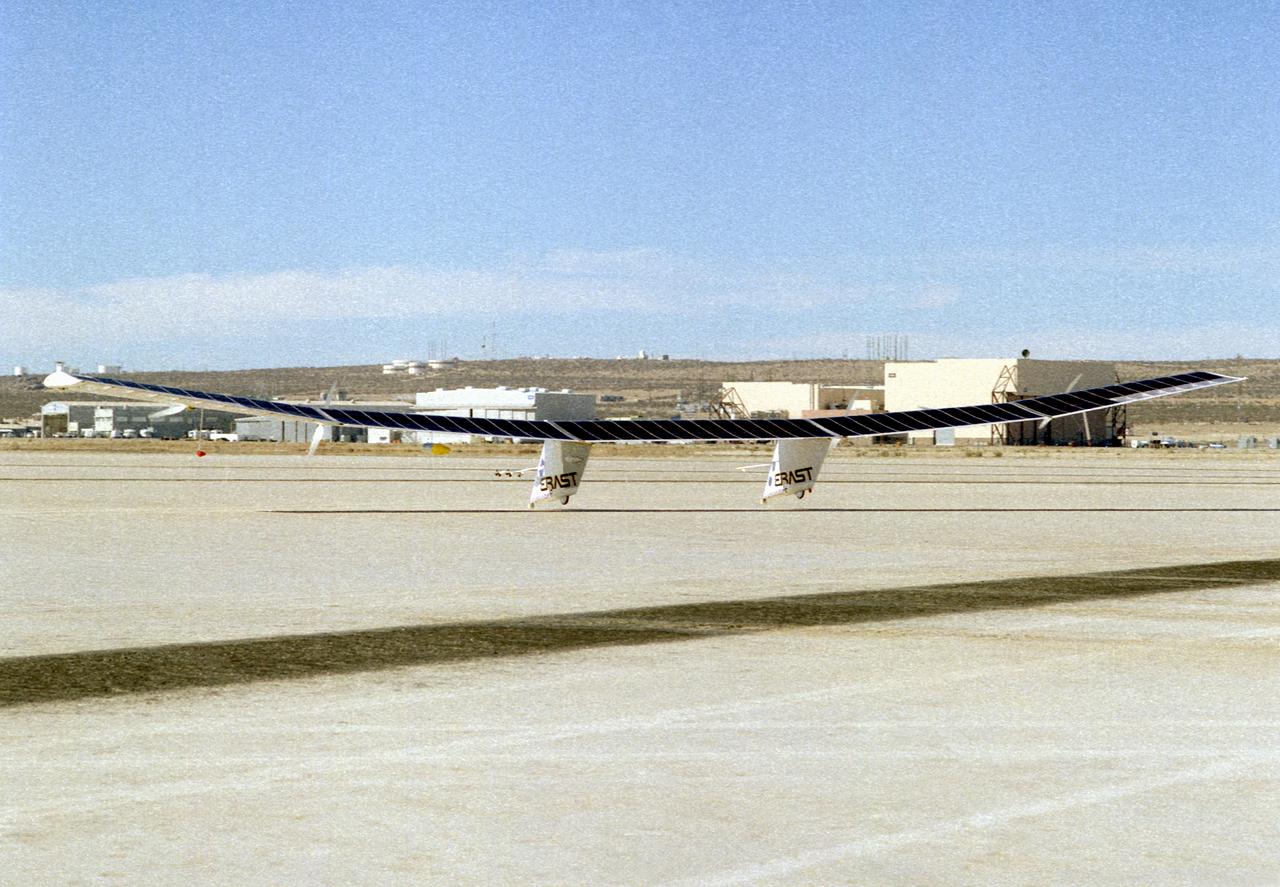
The Pathfinder research aircraft's solar cell arrays are prominently displayed as it touches down on the bed of Rogers Dry Lake at the Dryden Flight Research Center, Edwards, California, following a test flight. The solar arrays covered more than 75 percent of Pathfinder's upper wing surface, and provided electricity to power its six electric motors, flight controls, communications links and a host of scientific sensors.
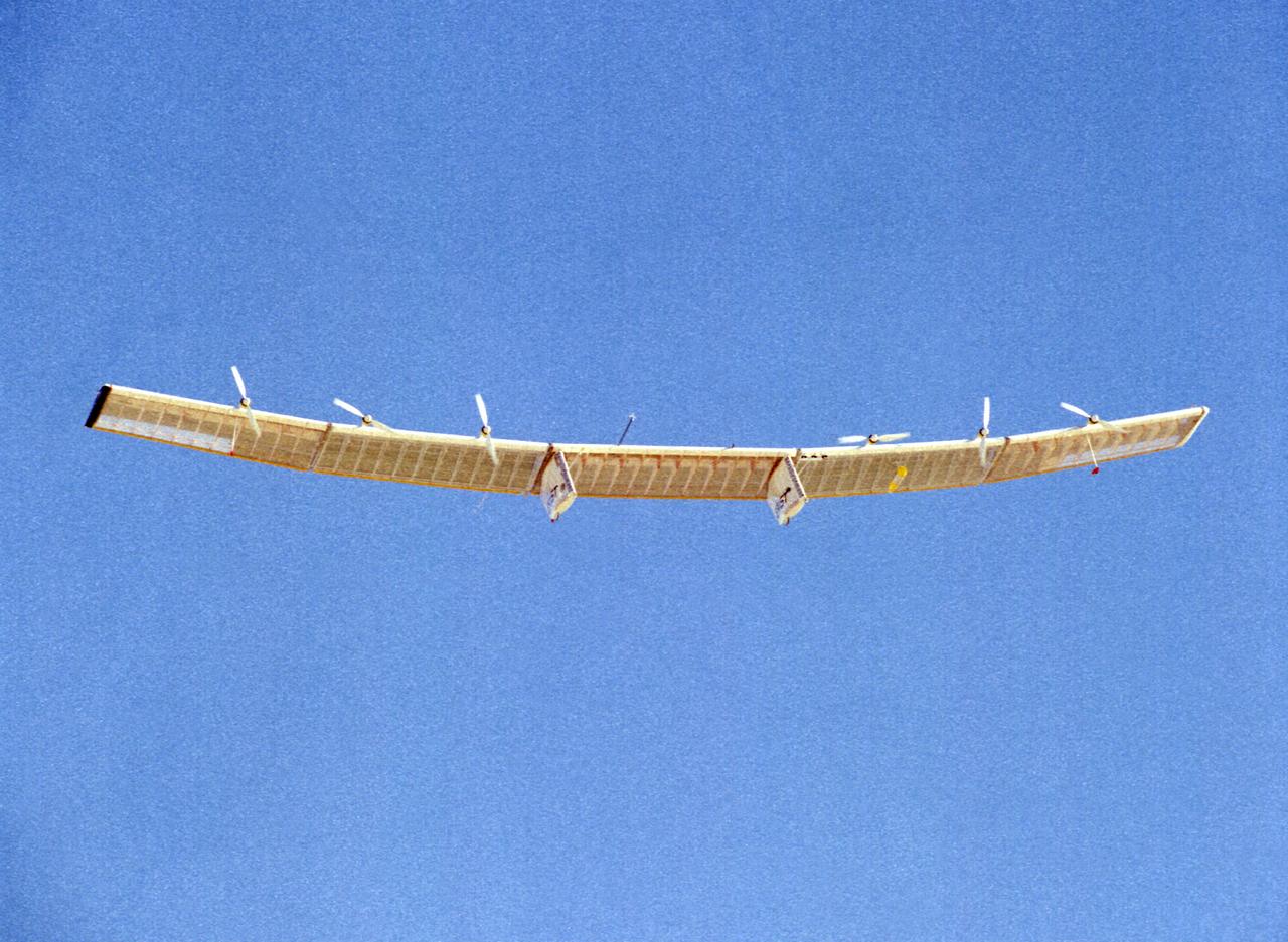
The Pathfinder solar-powered research aircraft is silhouetted against a clear blue sky as it soars aloft during a checkout flight from the Dryden Flight Research Center, Edwards, California, November, 1996.
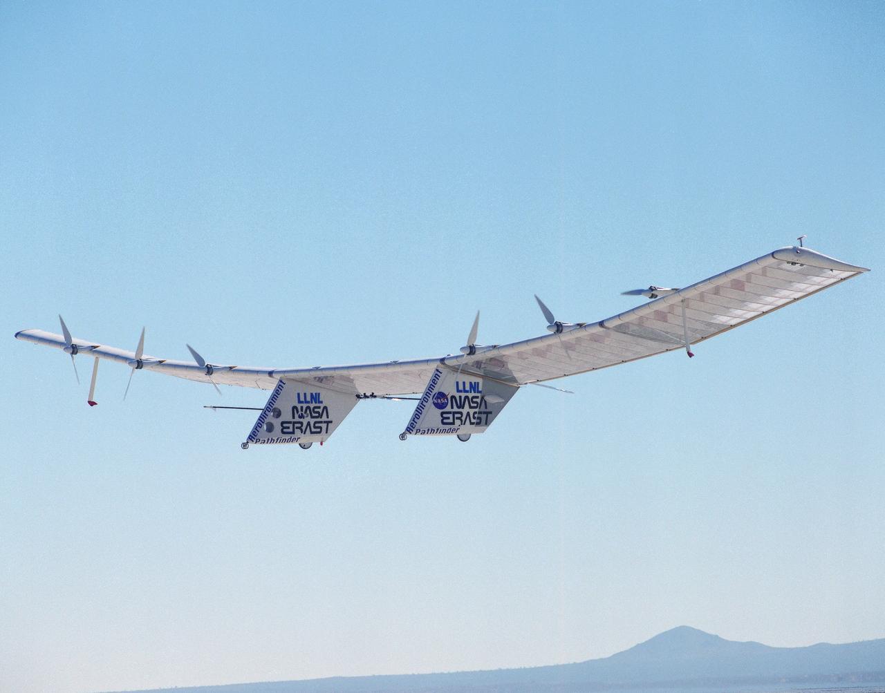
The Pathfinder solar-powered remotely piloted aircraft climbs to a record-setting altitude of 50,567 feet during a flight Sept. 11, 1995, at NASA's Dryden Flight Research Center, Edwards, California. The flight was part of the NASA ERAST (Environmental Research Aircraft and Sensor Technology) program. The Pathfinder was designed and built by AeroVironment Inc., Monrovia, California. Solar arrays cover nearly all of the upper wing surface and produce electricity to power the aircraft's six motors.
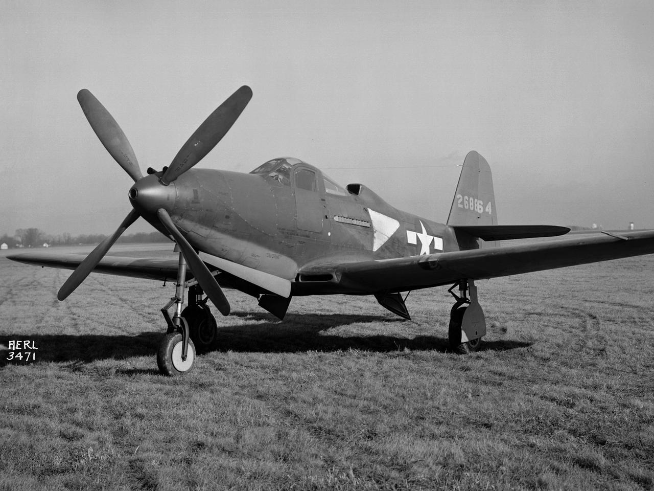
The Army Air Forces lent the National Advisory Committee for Aeronautics (NACA) Aircraft Engine Research Laboratory a Bell P–63A King Cobra in October 1943 to complement the lab's extensive efforts to improve the Allison V–1710 engine. The V–1710-powered P–63A was a single-seat fighter that could reach speeds of 410 miles per hour and an altitude of 43,000 feet. The fighter, first produced in 1942, was an improvement on Bell’s P–39, but persistent performance problems at high altitudes prevented its acceptance by the Air Corps. Instead many of the P–63s were transferred to the Soviet Union. Almost every test facility at the NACA’s engine lab was used to study the Allison V–1710 engine and its supercharger during World War II. Researchers were able to improve the efficiency, capacity and pressure ratio of the supercharger. They found that improved cooling significantly reduced engine knock in the fuel. Once the researchers were satisfied with their improvements, the new supercharger and cooling components were installed on the P–63A. The Flight Research Division first established the aircraft’s normal flight performance parameters such as speed at various altitudes, rate of climb, and peak altitude. Ensuing flights established the performance parameters of the new configuration in order to determine the improved performance. The program increased V–1710’s horsepower from 1650 to 2250.
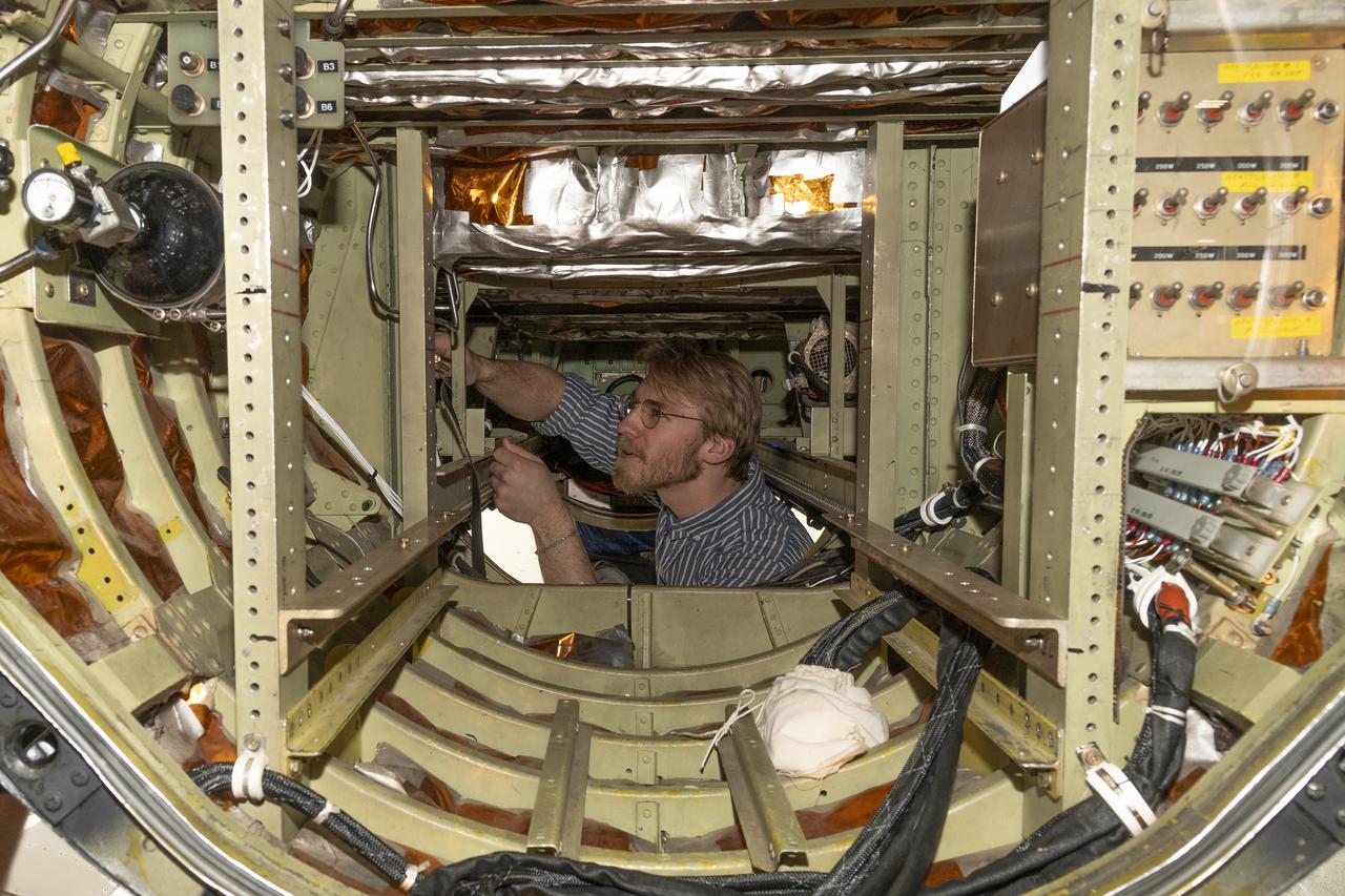
A team of experts prepares the ER-2 aircraft at Armstrong Flight Research Center in Edwards, California for the GSFC Lidar Observation and Validation Experiment (GLOVE) in February 2025. Researcher Jackson Begolka from the University of Iowa examines the instrument connectors in the ER-2 onboard the ER-2, which flies at high altitudes to validate satellite-borne data. As a collaboration between engineers, scientists, and aircraft professionals, GLOVE aims to improve satellite data products for Earth Science applications.
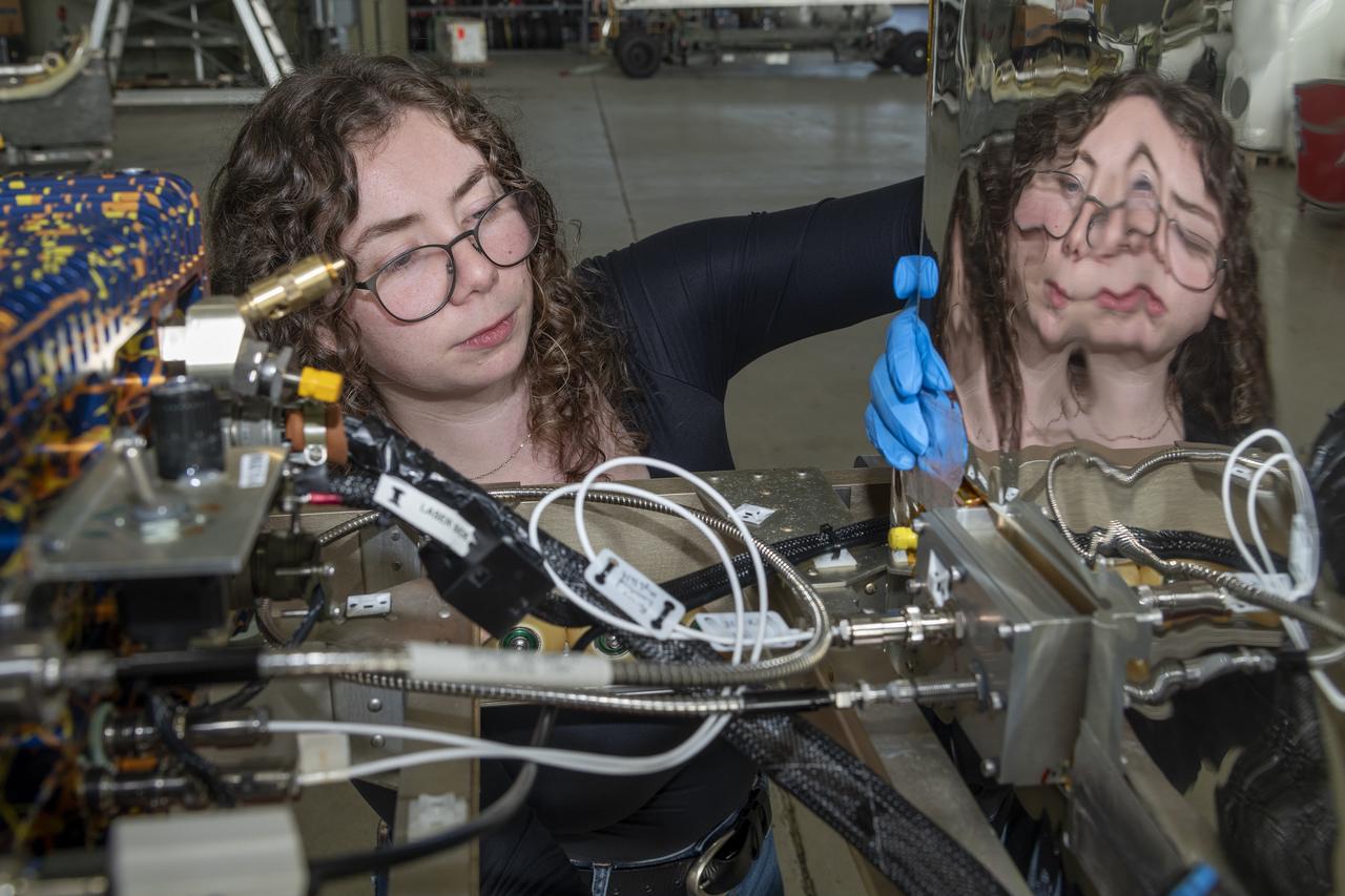
A team of experts prepares the ER-2 aircraft at Armstrong Flight Research Center in Edwards, California for the GSFC Lidar Observation and Validation Experiment (GLOVE) in February 2025. Researcher Jennifer Moore checks the cabling on the Roscoe instrument which flew at high altitudes on the ER-2. As a collaboration between engineers, scientists, and aircraft professionals, GLOVE aims to improve satellite data products for Earth Science applications.
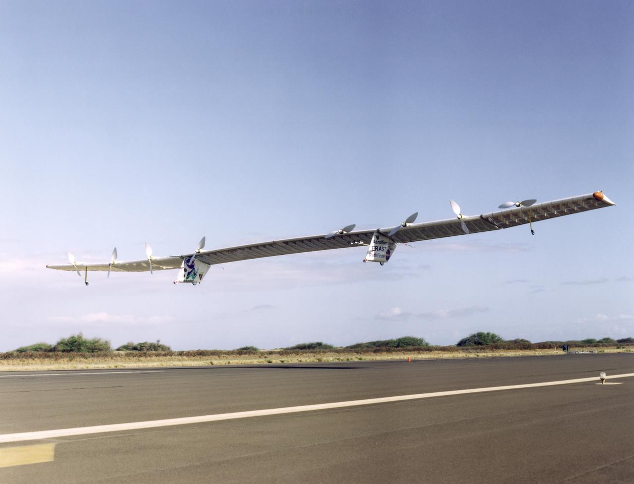
Pathfinder-Plus on a flight over Hawaii in 1998.

Pathfinder-Plus on a flight over the Hawaiian island of N'ihau in 1998.
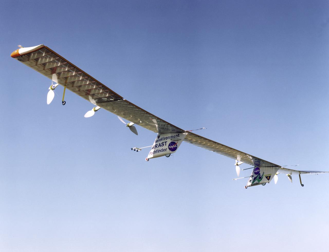
Pathfinder-Plus on a flight over Hawaii in 1998.
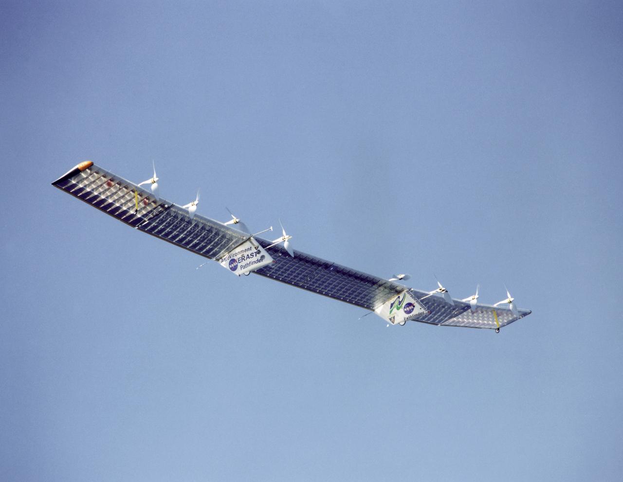
Pathfinder-Plus on flight over Hawaii.
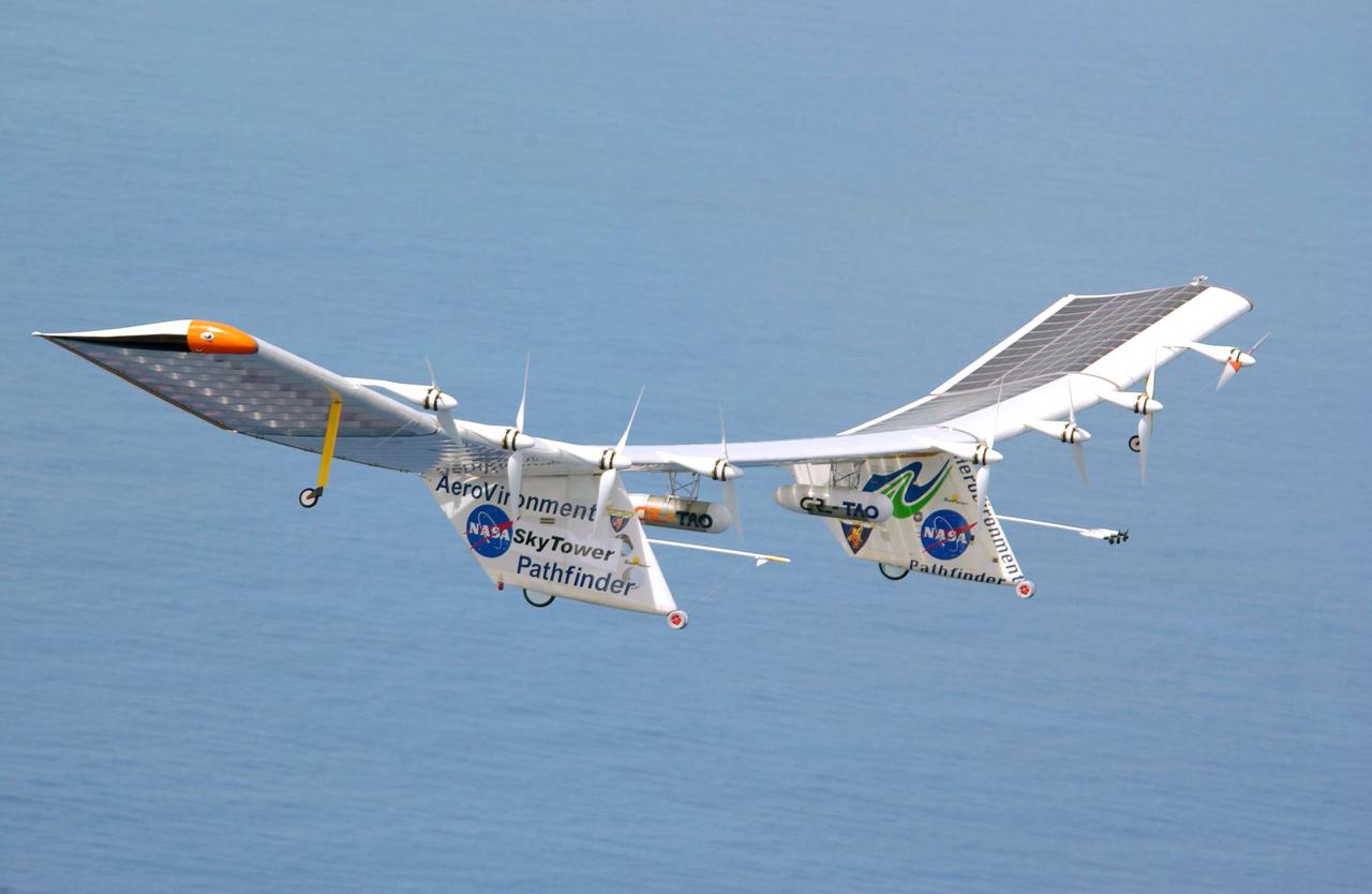
Pathfinder-Plus flight in Hawaii June 2002
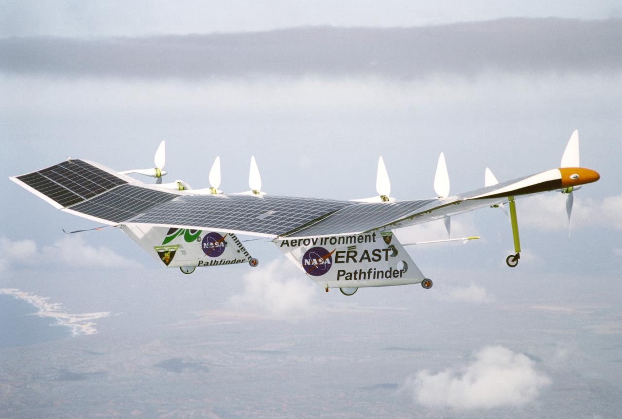
Pathfinder-Plus on a flight over the Hawaiian island of N'ihau in 1998.

Pathfinder-Plus on a flight in 1998 over Hawaiian waters.
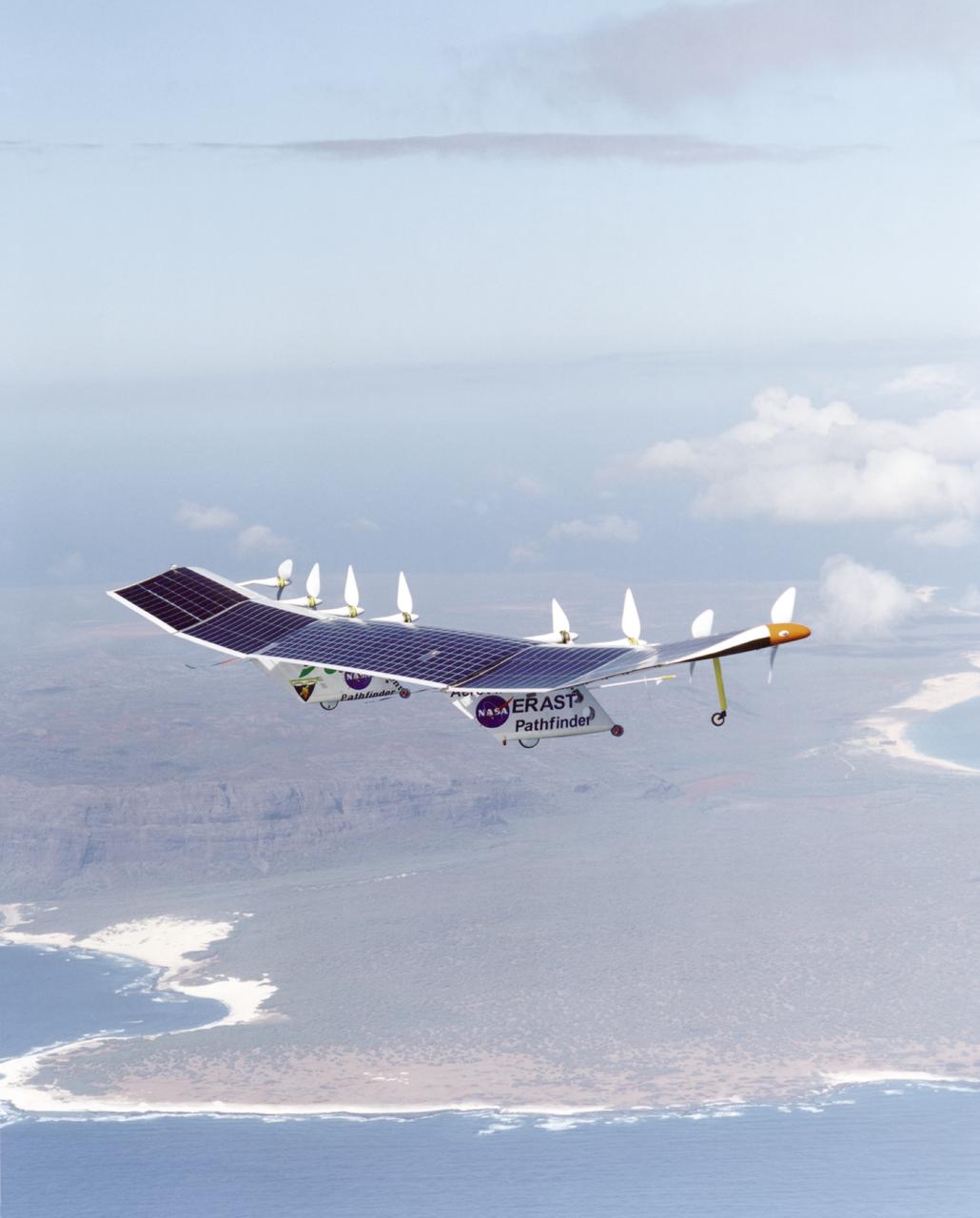
Pathfinder-Plus on a flight over the Hawaiian island of N'ihau in 1998.
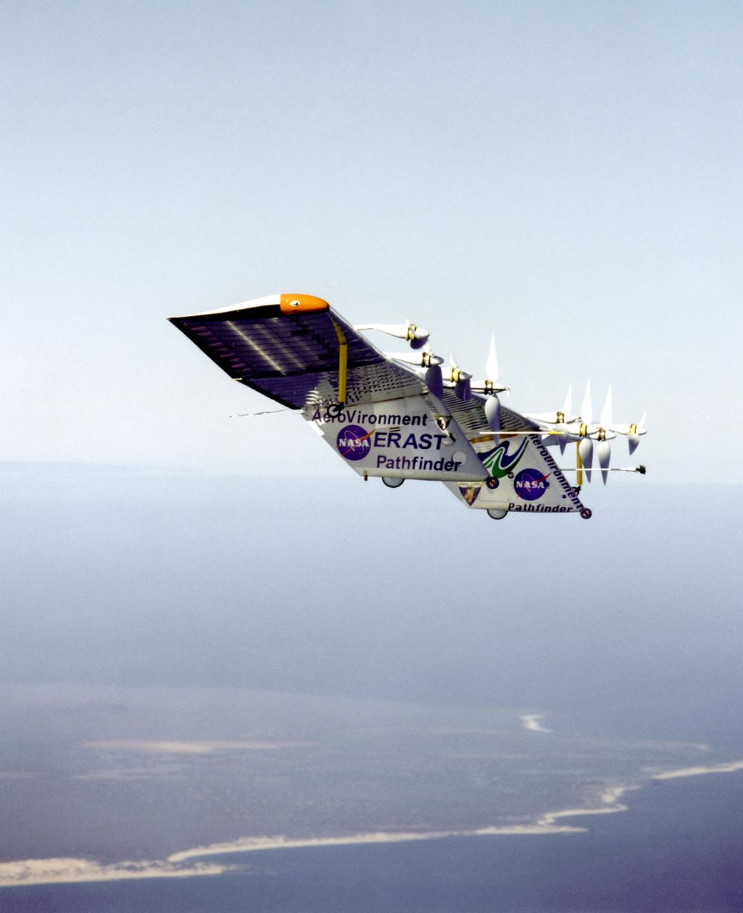
Pathfinder-Plus flying over the Hawaiian Islands in 1998 with Ni'ihau Island in the background.
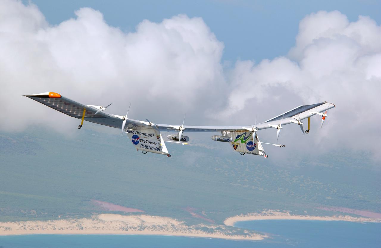
Pathfinder-Plus flight in Hawaii June 2002
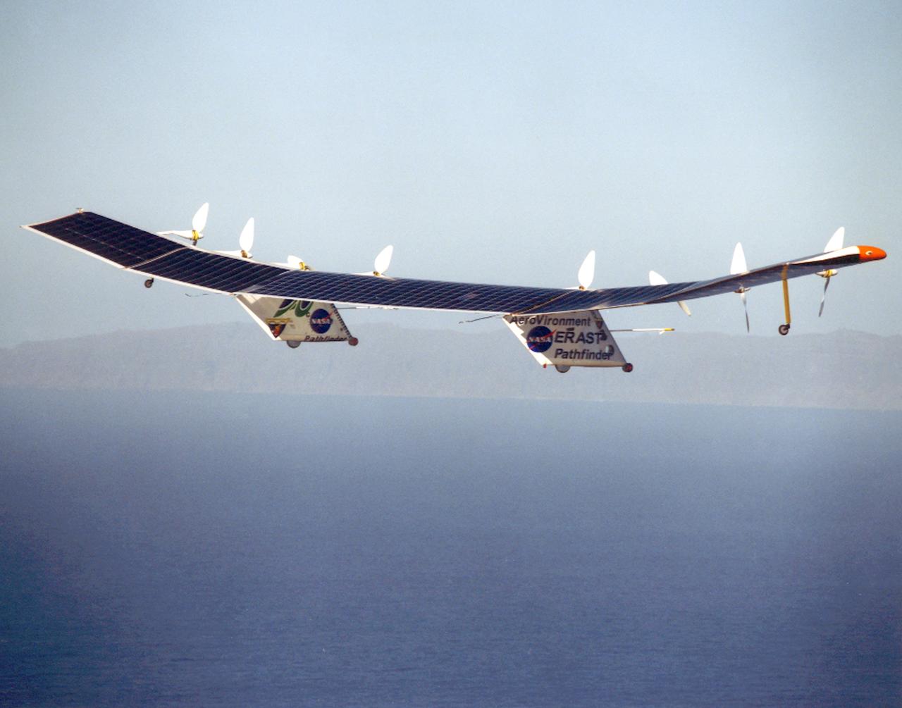
Pathfinder-Plus on flight over Hawaiian Islands in 1998.
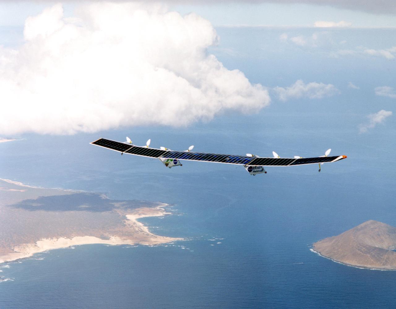
Pathfinder-Plus on flight over Hawaiian Islands, with N'ihau and Lehua in the background.
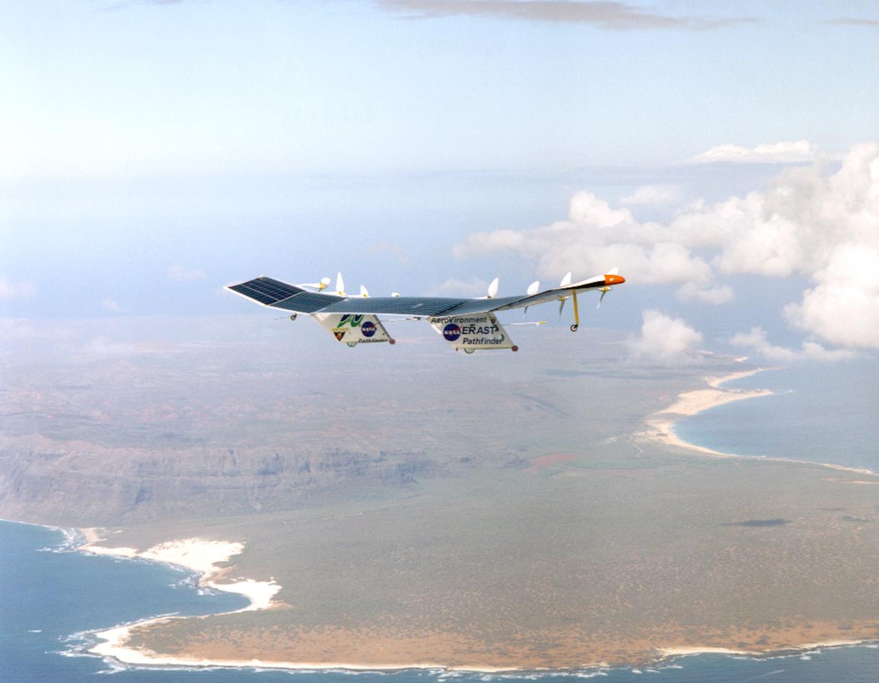
Pathfinder-Plus on a flight with the Hawaiian island of N'ihau in the background.
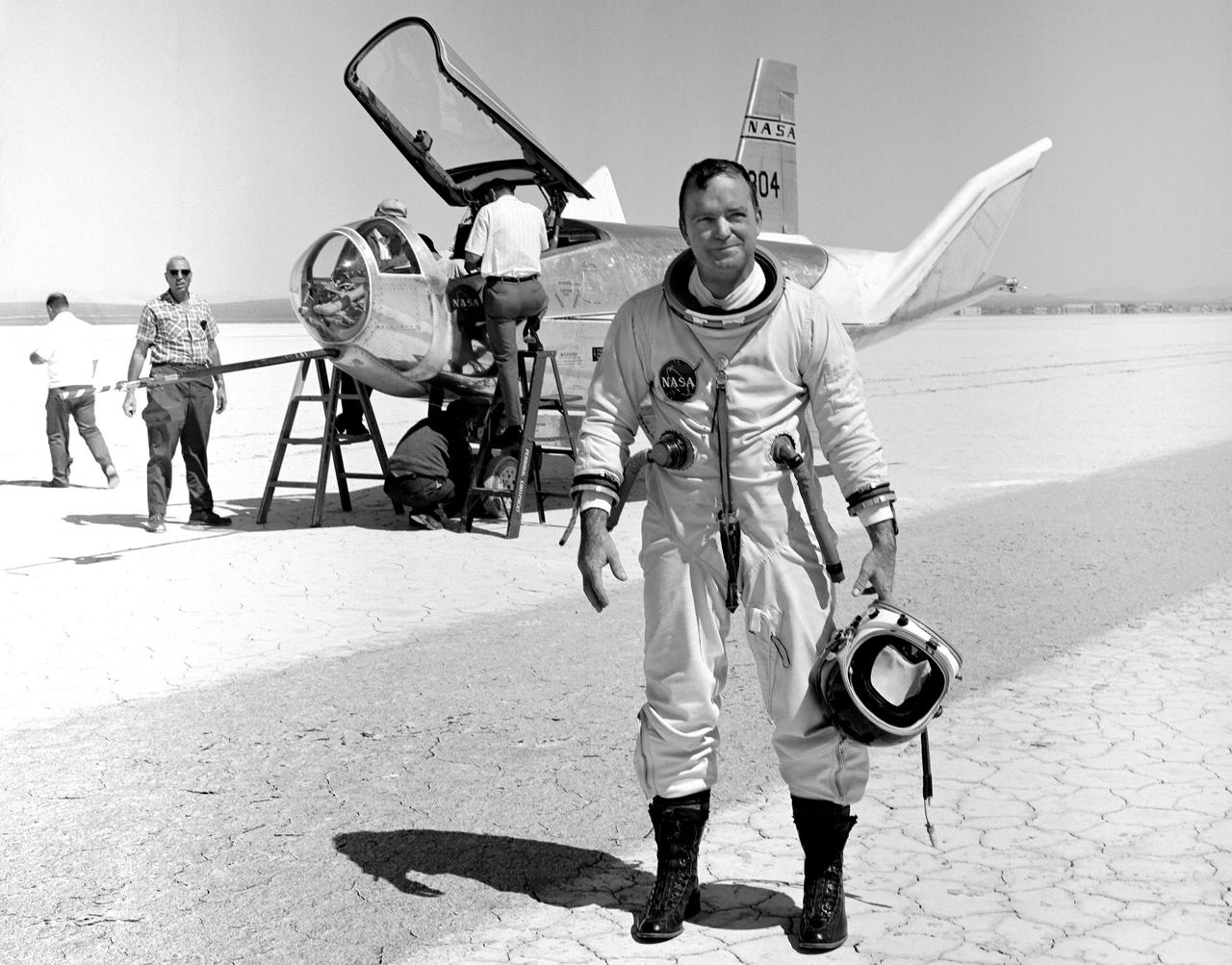
NASA research pilot Bill Dana stands in front of the HL-10 Lifting Body following his first glide flight on April 25, 1969. Dana later retired as Chief Engineer at NASA's Dryden Flight Research Center, (called the NASA Flight Research Center in 1969). Prior to his lifting body assignment, Dana flew the X-15 research airplane. He flew the rocket-powered aircraft 16 times, reaching a top speed of 3,897 miles per hour and a peak altitude of 310,000 feet (almost 59 miles high).
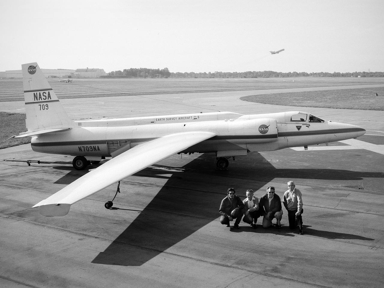
A National Aeronautics and Space Administration (NASA) Lockheed U-2 aircraft on display at the 1973 Inspection of the Lewis Research Center in Cleveland, Ohio. Lockheed developed the U-2 as a high-altitude reconnaissance aircraft in the early 1950s before satellites were available. The U-2 could cruise over enemy territory at 70,000 feet and remain impervious to ground fire, interceptor aircraft, and even radar. An advanced camera system was designed specifically for the aircraft. The pilot is required to use a pressure suit similar to those worn by astronauts. NASA’s Ames Research Center received two U-2 aircraft in April 1971 to conduct high-altitude research. They were used to study and monitor various Earth resources, celestial bodies, atmospheric chemistry, and oceanic processes. NASA replaced its U-2s with ER-2 aircraft in 1981 and 1989. The ER-2s were designed to carry up to 2600 pounds of scientific equipment. The ER-2 program was transferred to Dryden Flight Research Center in 1997. Since the inaugural flight for this program on August 31, 1971, NASA’s U-2 and ER-2 aircraft have flown more than 4500 data missions and test flights for NASA, other federal agencies, states, universities, and the private sector.
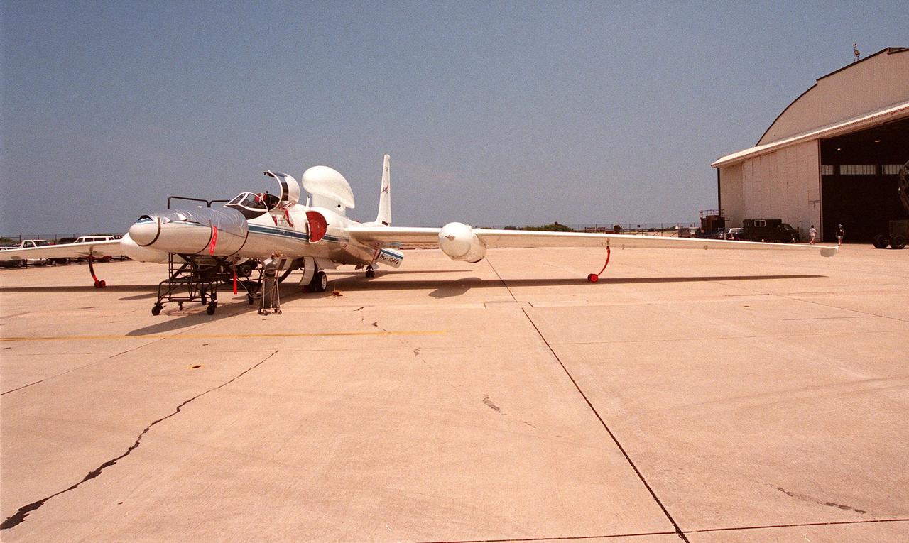
This high-altitude research plane, a specially equipped Dryden Flight Research Center ER-2 (a modified U-2), is readied at Patrick Air Force Base for flight into a hurricane in the Atlantic. The plane is part of the NASA-led Atmospheric Dynamics and Remote Sensing program that includes other government weather researchers and the university community in a study of Atlantic hurricanes and tropical storms. The ER-2, soaring above 65,000 feet, will measure the structure of hurricanes and the surrounding atmosphere that steers the storms’ movement. The hurricane study, which lasts through September 1998, is part of NASA’s Earth Science enterprise to better understand the total Earth system and the effects of natural and human-induced changes on the global environment