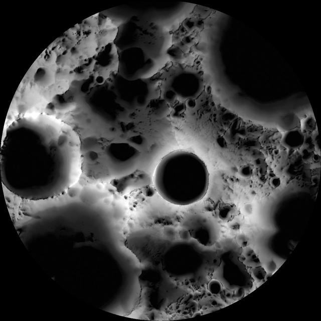
South Pole Illumination Map
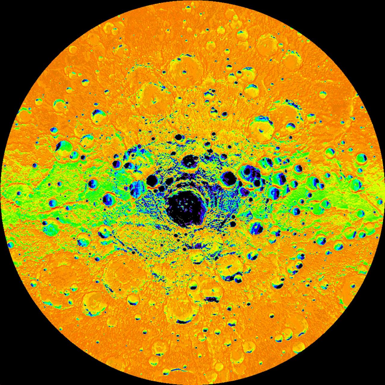
Illumination Map of Mercury South Pole
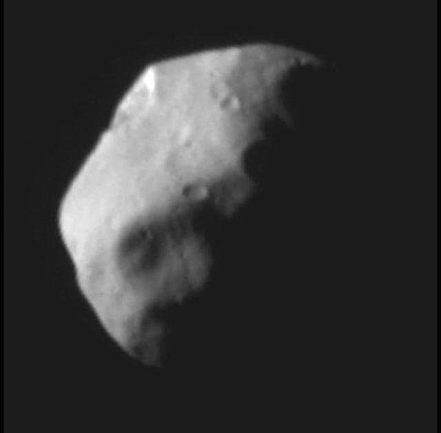
Dactyl Dark Side Illuminated by Idashine http://photojournal.jpl.nasa.gov/catalog/PIA00298
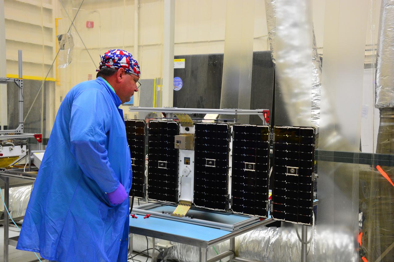
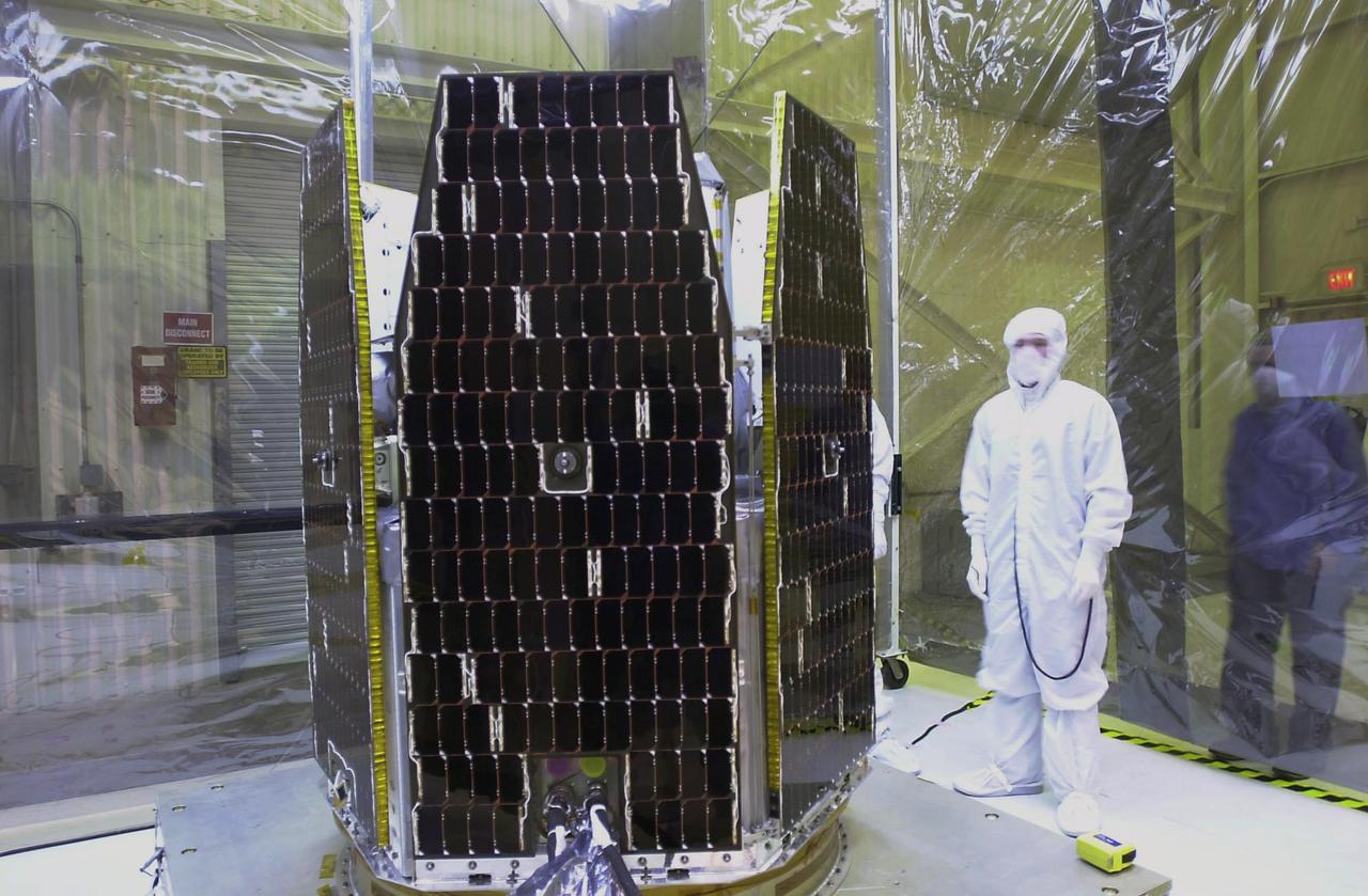
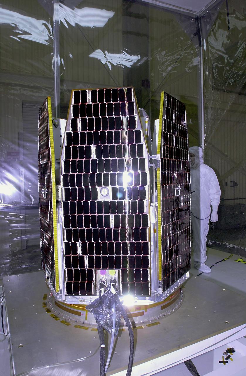
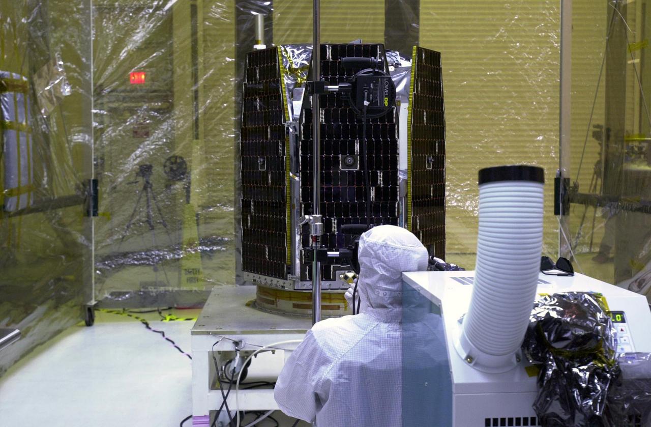
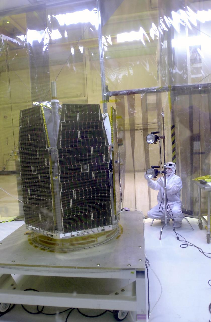
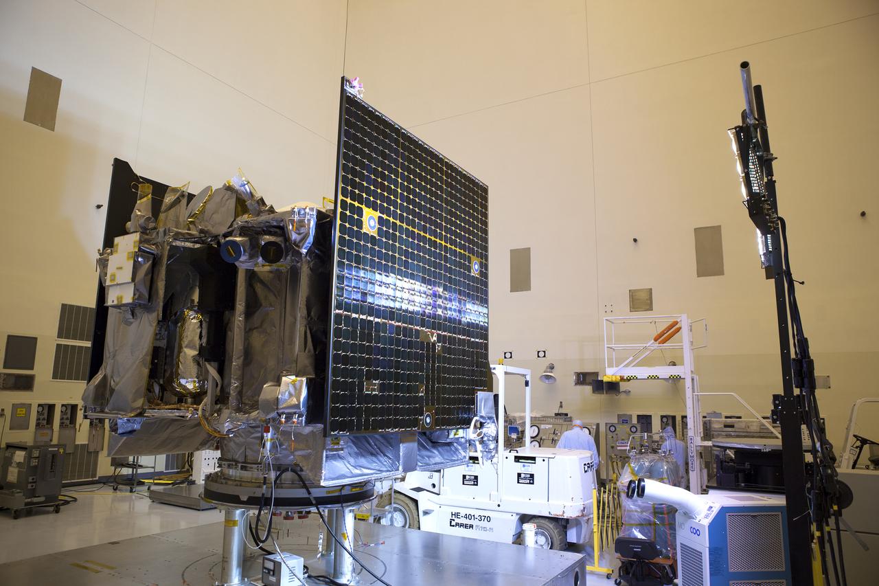
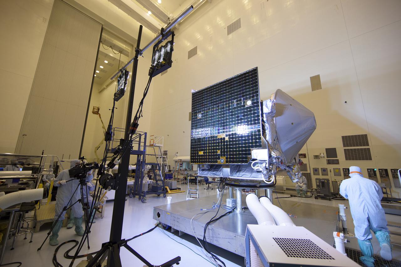
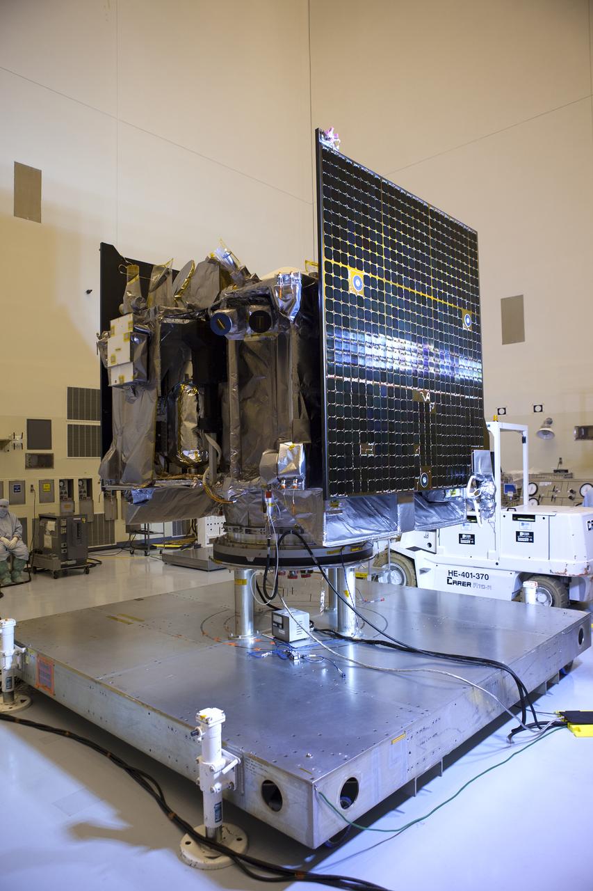
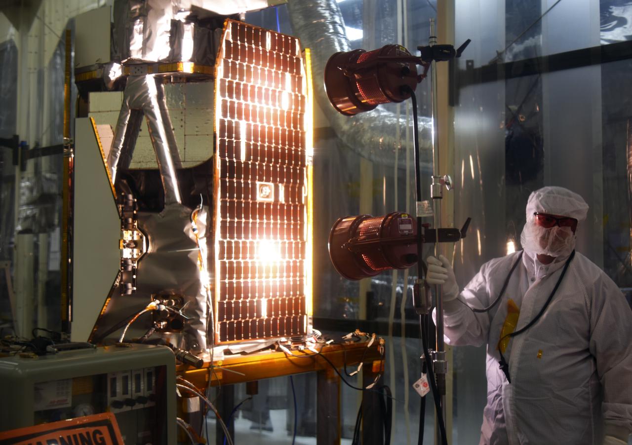
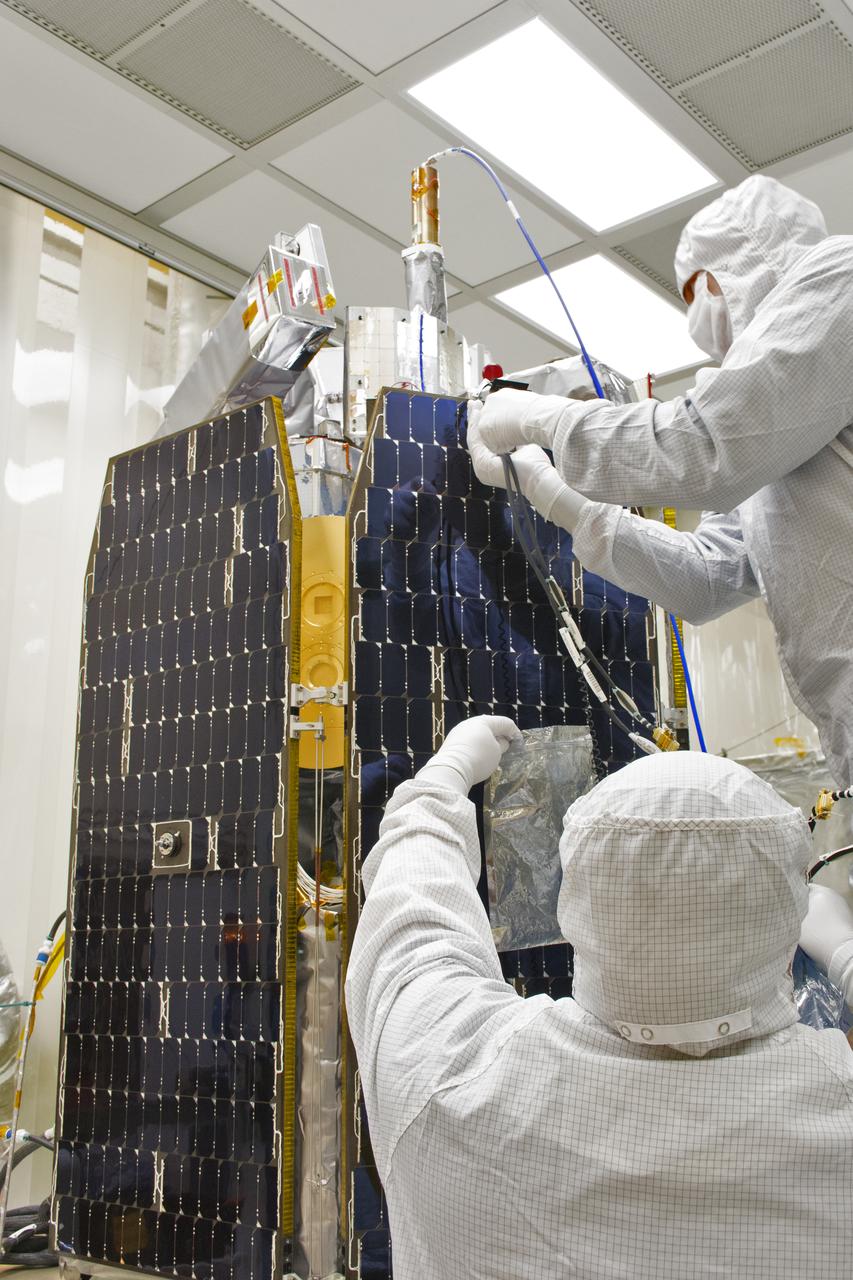
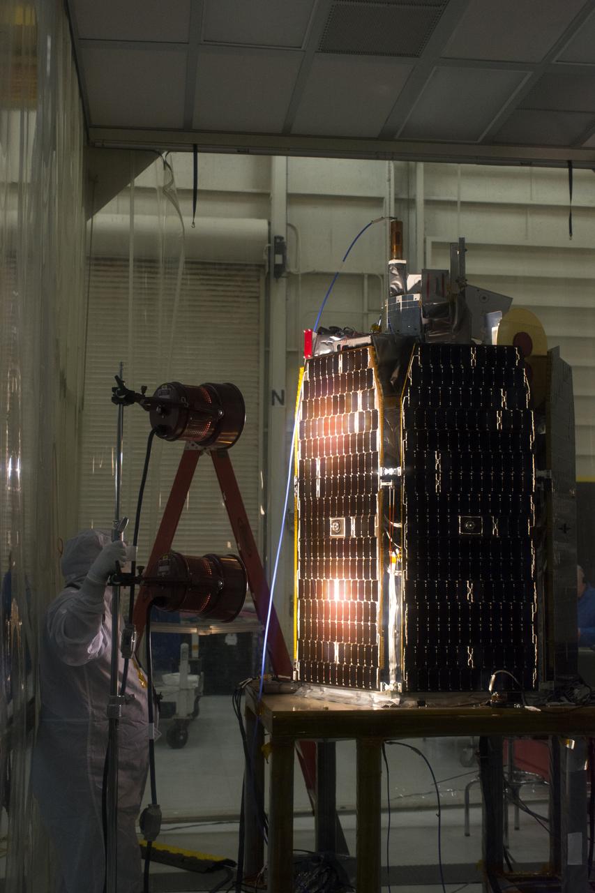
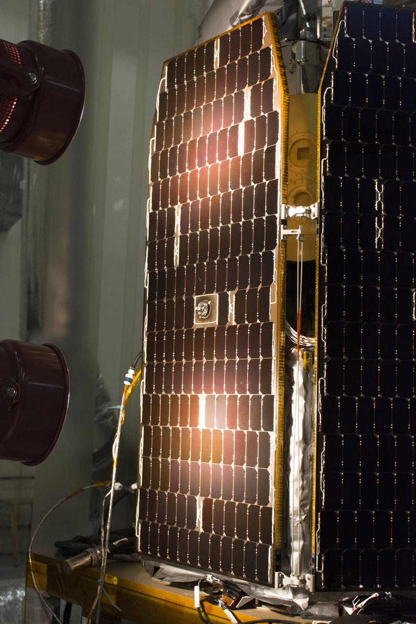
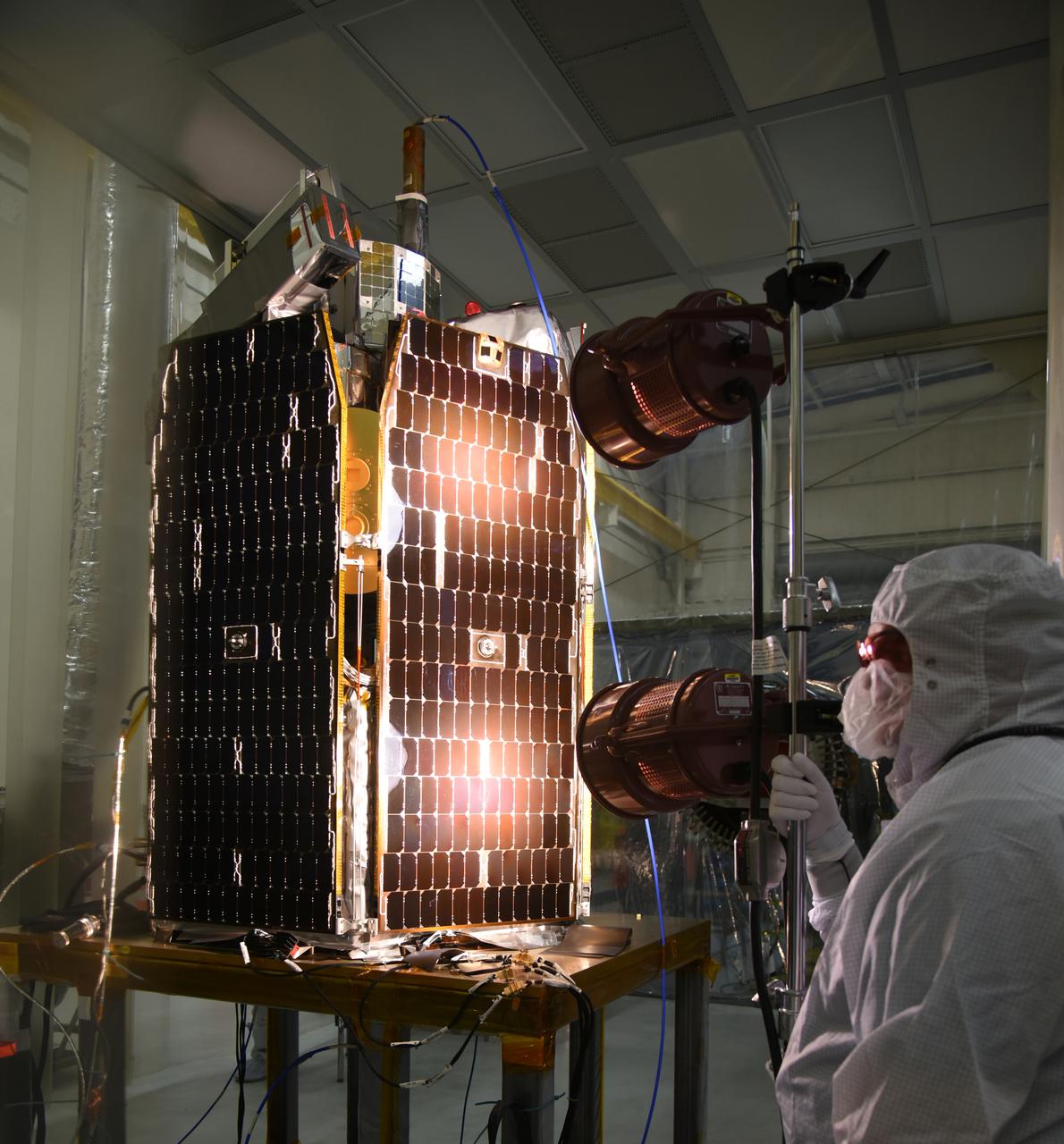
Inside Building 1555 at Vandenberg Air Force Base in California, solar panels for one of eight NASA's Cyclone Global Navigation Satellite System (CYGNSS) spacecraft has been deployed for illumination testing. Processing activities will prepare the spacecraft for launch aboard an Orbital ATK Pegasus XL rocket. When preparations are completed at Vandenberg, the rocket will be transported to NASA's Kennedy Space Center in Florida attached to the Orbital ATK L-1011 carrier aircraft within its payload fairing. CYGNSS will launch on the Pegasus XL rocket from the Skid Strip at Cape Canaveral Air Force Station. CYGNSS will make frequent and accurate measurements of ocean surface winds throughout the life cycle of tropical storms and hurricanes. The data that CYGNSS provides will enable scientists to probe key air-sea interaction processes that take place near the core of storms, which are rapidly changing and play a critical role in the beginning and intensification of hurricanes.
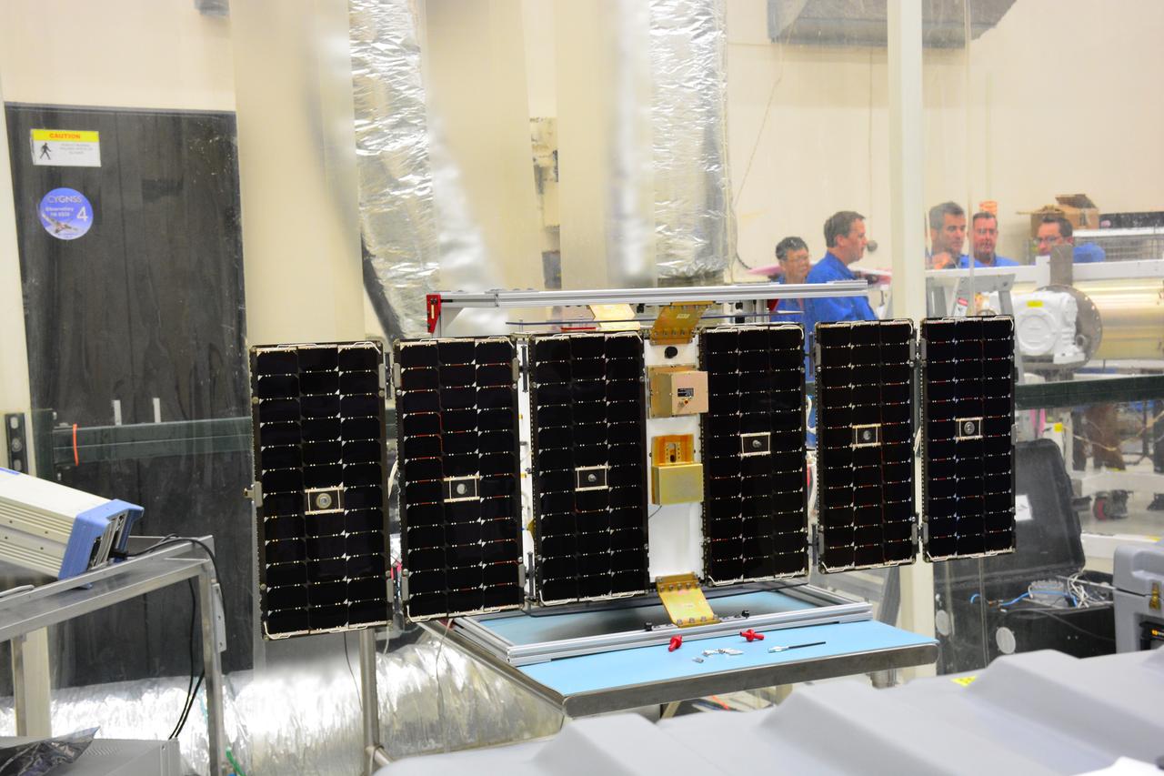
Inside Building 1555 at Vandenberg Air Force Base in California, solar panels for one of eight NASA's Cyclone Global Navigation Satellite System (CYGNSS) spacecraft has been deployed for illumination testing. Processing activities will prepare the spacecraft for launch aboard an Orbital ATK Pegasus XL rocket. When preparations are completed at Vandenberg, the rocket will be transported to NASA's Kennedy Space Center in Florida attached to the Orbital ATK L-1011 carrier aircraft within its payload fairing. CYGNSS will launch on the Pegasus XL rocket from the Skid Strip at Cape Canaveral Air Force Station. CYGNSS will make frequent and accurate measurements of ocean surface winds throughout the life cycle of tropical storms and hurricanes. The data that CYGNSS provides will enable scientists to probe key air-sea interaction processes that take place near the core of storms, which are rapidly changing and play a critical role in the beginning and intensification of hurricanes.

NASA image acquired October 13, 2012 The Nile River Valley and Delta comprise less than 5 percent of Egypt’s land area, but provide a home to roughly 97 percent of the country’s population. Nothing makes the location of human population clearer than the lights illuminating the valley and delta at night. On October 13, 2012, the Visible Infrared Imaging Radiometer Suite (VIIRS) on the Suomi NPP satellite captured this nighttime view of the Nile River Valley and Delta. This image is from the VIIRS “day-night band,” which detects light in a range of wavelengths from green to near-infrared and uses filtering techniques to observe signals such as gas flares, auroras, wildfires, city lights, and reflected moonlight. The city lights resemble a giant calla lily, just one with a kink in its stem near the city of Luxor. Some of the brightest lights occur around Cairo, but lights are abundant along the length of the river. Bright city lights also occur along the Suez Canal and around Tel Aviv. Away from the lights, however, land and water appear uniformly black. This image was acquired near the time of the new Moon, and little moonlight was available to brighten land and water surfaces. NASA Earth Observatory image by Jesse Allen and Robert Simmon, using VIIRS Day-Night Band data from the Suomi National Polar-orbiting Partnership. Suomi NPP is the result of a partnership between NASA, the National Oceanic and Atmospheric Administration, and the Department of Defense. Caption by Michon Scott. Instrument: Suomi NPP - VIIRS Credit: <b><a href="http://www.earthobservatory.nasa.gov/" rel="nofollow"> NASA Earth Observatory</a></b> <b>Click here to view all of the <a href="http://earthobservatory.nasa.gov/Features/NightLights/" rel="nofollow"> Earth at Night 2012 images </a></b> <b>Click here to <a href="http://earthobservatory.nasa.gov/NaturalHazards/view.php?id=79807" rel="nofollow"> read more </a> about this image </b> <b><a href="http://www.nasa.gov/audience/formedia/features/MP_Photo_Guidelines.html" rel="nofollow">NASA image use policy.</a></b> <b><a href="http://www.nasa.gov/centers/goddard/home/index.html" rel="nofollow">NASA Goddard Space Flight Center</a></b> enables NASA’s mission through four scientific endeavors: Earth Science, Heliophysics, Solar System Exploration, and Astrophysics. Goddard plays a leading role in NASA’s accomplishments by contributing compelling scientific knowledge to advance the Agency’s mission. <b>Follow us on <a href="http://twitter.com/NASA_GoddardPix" rel="nofollow">Twitter</a></b> <b>Like us on <a href="http://www.facebook.com/pages/Greenbelt-MD/NASA-Goddard/395013845897?ref=tsd" rel="nofollow">Facebook</a></b> <b>Find us on <a href="http://instagram.com/nasagoddard?vm=grid" rel="nofollow">Instagram</a></b>

NASA image acquired October 13, 2012 The Nile River Valley and Delta comprise less than 5 percent of Egypt’s land area, but provide a home to roughly 97 percent of the country’s population. Nothing makes the location of human population clearer than the lights illuminating the valley and delta at night. On October 13, 2012, the Visible Infrared Imaging Radiometer Suite (VIIRS) on the Suomi NPP satellite captured this nighttime view of the Nile River Valley and Delta. This image is from the VIIRS “day-night band,” which detects light in a range of wavelengths from green to near-infrared and uses filtering techniques to observe signals such as gas flares, auroras, wildfires, city lights, and reflected moonlight. The city lights resemble a giant calla lily, just one with a kink in its stem near the city of Luxor. Some of the brightest lights occur around Cairo, but lights are abundant along the length of the river. Bright city lights also occur along the Suez Canal and around Tel Aviv. Away from the lights, however, land and water appear uniformly black. This image was acquired near the time of the new Moon, and little moonlight was available to brighten land and water surfaces. NASA Earth Observatory image by Jesse Allen and Robert Simmon, using VIIRS Day-Night Band data from the Suomi National Polar-orbiting Partnership. Suomi NPP is the result of a partnership between NASA, the National Oceanic and Atmospheric Administration, and the Department of Defense. Caption by Michon Scott. Instrument: Suomi NPP - VIIRS Credit: <b><a href="http://www.earthobservatory.nasa.gov/" rel="nofollow"> NASA Earth Observatory</a></b> <b>Click here to view all of the <a href="http://earthobservatory.nasa.gov/Features/NightLights/" rel="nofollow"> Earth at Night 2012 images </a></b> <b>Click here to <a href="http://earthobservatory.nasa.gov/NaturalHazards/view.php?id=79807" rel="nofollow"> read more </a> about this image </b> <b><a href="http://www.nasa.gov/audience/formedia/features/MP_Photo_Guidelines.html" rel="nofollow">NASA image use policy.</a></b> <b><a href="http://www.nasa.gov/centers/goddard/home/index.html" rel="nofollow">NASA Goddard Space Flight Center</a></b> enables NASA’s mission through four scientific endeavors: Earth Science, Heliophysics, Solar System Exploration, and Astrophysics. Goddard plays a leading role in NASA’s accomplishments by contributing compelling scientific knowledge to advance the Agency’s mission. <b>Follow us on <a href="http://twitter.com/NASA_GoddardPix" rel="nofollow">Twitter</a></b> <b>Like us on <a href="http://www.facebook.com/pages/Greenbelt-MD/NASA-Goddard/395013845897?ref=tsd" rel="nofollow">Facebook</a></b> <b>Find us on <a href="http://instagram.com/nasagoddard?vm=grid" rel="nofollow">Instagram</a></b>
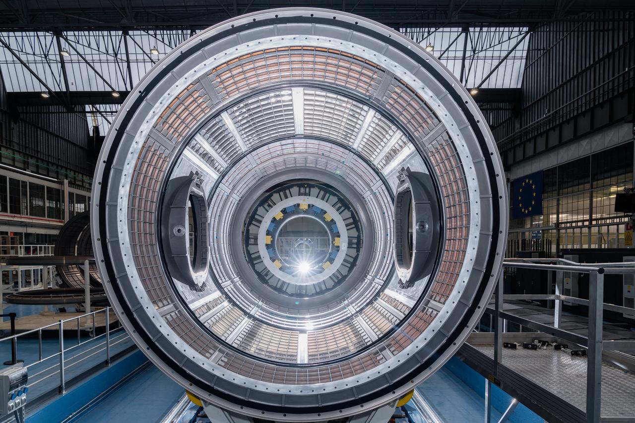
The primary structure of the Gateway space station's HALO (Habitation and Logistics Outpost) module is one step closer to launch following welding completion in Turin, Italy. HALO is one of four Gateway modules where astronauts will live, conduct science, and prepare for lunar surface missions. NASA is partnering with Northrop Grumman and their subcontractor Thales Alenia Space to develop HALO.
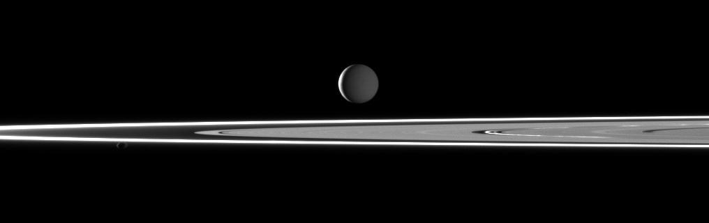
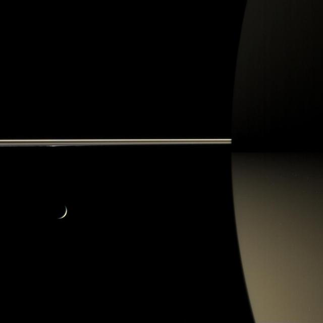
In this image taken by NASA Cassini spacecraft two light sources illuminate Saturn highly reflective moon Enceladus featuring bright rings and the small moon Pandora in the foreground.
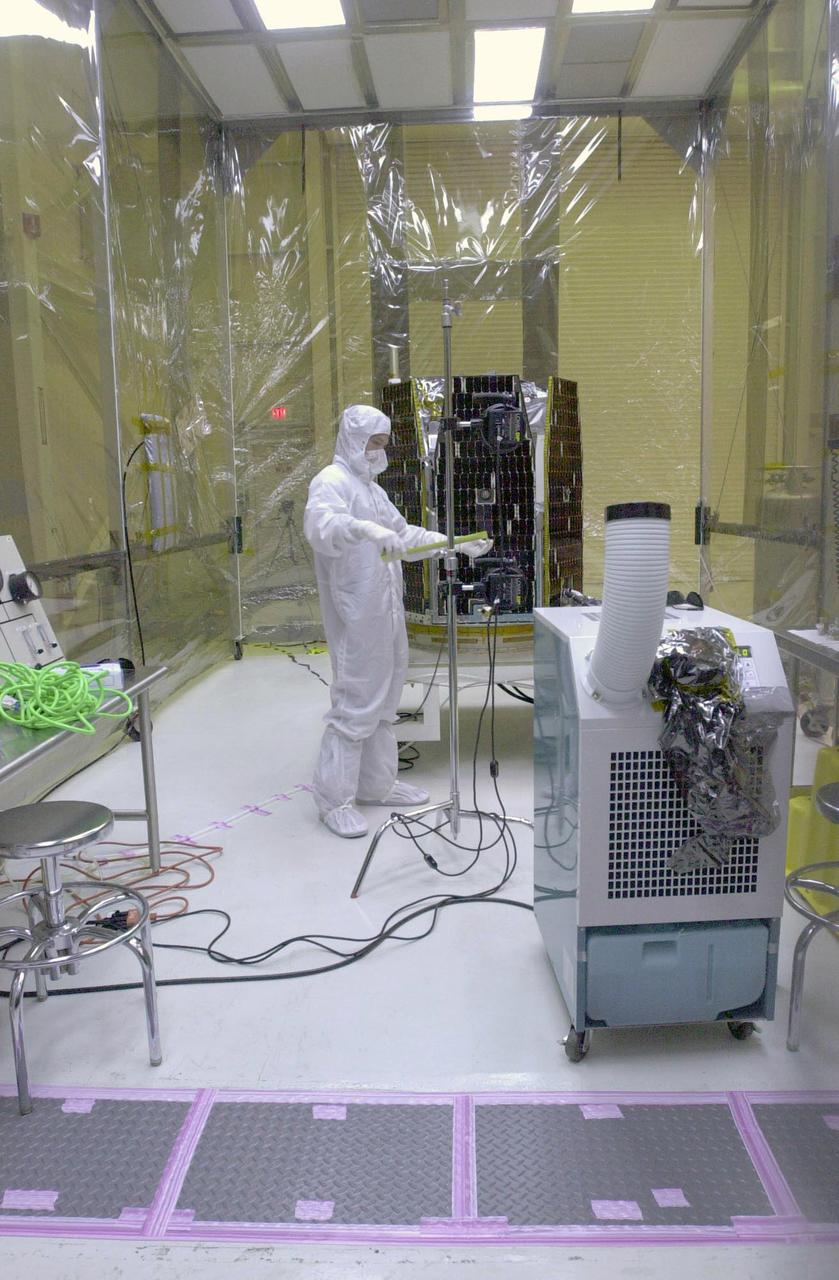
In a clean-room environment containing the AIM spacecraft (background) at North Vandenberg Air Force Base, a technician studies results of illumination testing on the spacecraft's solar array panels. The AIM spacecraft will fly three instruments designed to study those clouds located at the edge of space, 50 miles above the Earth's surface in the coldest part of the planet's atmosphere. The mission's primary goal is to explain why these clouds form and what has caused them to become brighter and more numerous and appear at lower latitudes in recent years. AIM's results will provide the basis for the study of long-term variability in the mesospheric climate and its relationship to global climate change. AIM is scheduled to be mated to the Pegasus XL during the second week of April, after which final inspections will be conducted. Launch is scheduled for April 25.
In a clean-room environment at North Vandenberg Air Force Base, a technician begins the illumination testing of the AIM spacecraft at left. The AIM spacecraft will fly three instruments designed to study those clouds located at the edge of space, 50 miles above the Earth's surface in the coldest part of the planet's atmosphere. The mission's primary goal is to explain why these clouds form and what has caused them to become brighter and more numerous and appear at lower latitudes in recent years. AIM's results will provide the basis for the study of long-term variability in the mesospheric climate and its relationship to global climate change. AIM is scheduled to be mated to the Pegasus XL during the second week of April, after which final inspections will be conducted. Launch is scheduled for April 25.
In a clean-room environment at North Vandenberg Air Force Base, lights are reflected on the solar array panels of the AIM spacecraft during illumination testing. The AIM spacecraft will fly three instruments designed to study those clouds located at the edge of space, 50 miles above the Earth's surface in the coldest part of the planet's atmosphere. The mission's primary goal is to explain why these clouds form and what has caused them to become brighter and more numerous and appear at lower latitudes in recent years. AIM's results will provide the basis for the study of long-term variability in the mesospheric climate and its relationship to global climate change. AIM is scheduled to be mated to the Pegasus XL during the second week of April, after which final inspections will be conducted. Launch is scheduled for April 25.
In a clean-room environment at North Vandenberg Air Force Base, a technician monitors the AIM spacecraft after illumination testing on the spacecraft's solar array panels. The AIM spacecraft will fly three instruments designed to study those clouds located at the edge of space, 50 miles above the Earth's surface in the coldest part of the planet's atmosphere. The mission's primary goal is to explain why these clouds form and what has caused them to become brighter and more numerous and appear at lower latitudes in recent years. AIM's results will provide the basis for the study of long-term variability in the mesospheric climate and its relationship to global climate change. AIM is scheduled to be mated to the Pegasus XL during the second week of April, after which final inspections will be conducted. Launch is scheduled for April 25.
In a clean-room environment at North Vandenberg Air Force Base, a technician prepares the lights for illumination testing of the AIM spacecraft at left. The AIM spacecraft will fly three instruments designed to study those clouds located at the edge of space, 50 miles above the Earth's surface in the coldest part of the planet's atmosphere. The mission's primary goal is to explain why these clouds form and what has caused them to become brighter and more numerous and appear at lower latitudes in recent years. AIM's results will provide the basis for the study of long-term variability in the mesospheric climate and its relationship to global climate change. AIM is scheduled to be mated to the Pegasus XL during the second week of April, after which final inspections will be conducted. Launch is scheduled for April 25.
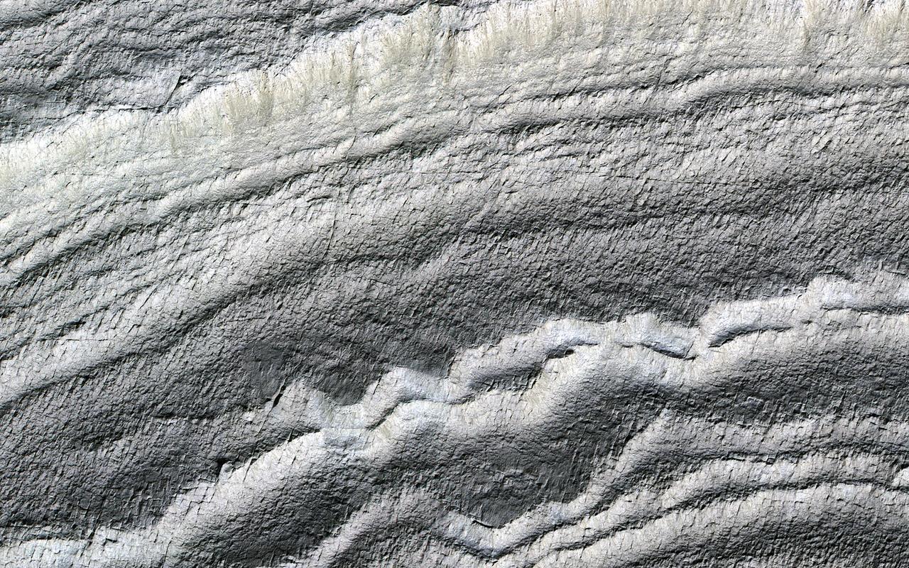
The south polar layered deposits are icy layers that have been deposited over millions of years, preserving a climate history of Mars. In this image the layers are well illuminated to accentuate the topography. A prior image of this location was acquired with the layered slope facing away from the sun, placing the layers in shadow. (The top of the cutout image is at a higher elevation.) https://photojournal.jpl.nasa.gov/catalog/PIA23098

iss071e045749 (April 26, 2024) -- An illuminated waning gibbous moon contrasts the deep black of space as the International Space Station soared 270 miles over the Southern Ocean.
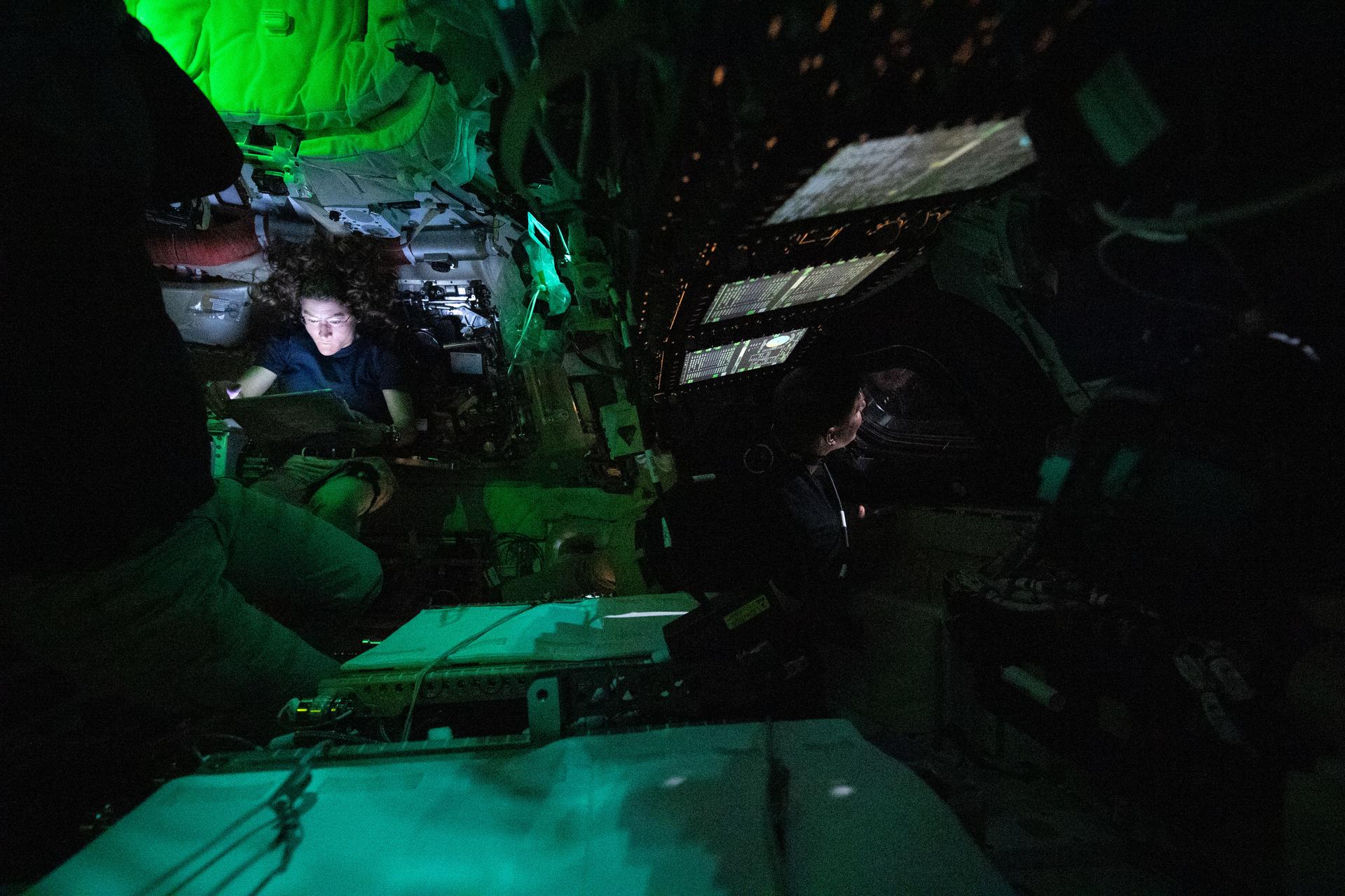
art002e004440 (April 3, 2026) - NASA astronaut Christina Koch is illuminated by a screen inside the darkened Orion spacecraft on the third day of the agency's Artemis II mission. To the right of the image's center, CSA (Canadian Space Agency) astronaut Jeremy Hansen is seen in profile peering out of one of Orion's windows. Lights are turned off to avoid glare on the windows.
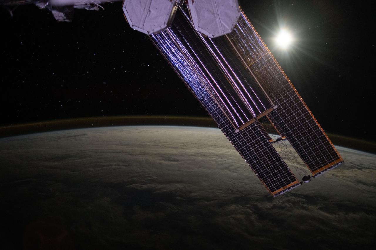
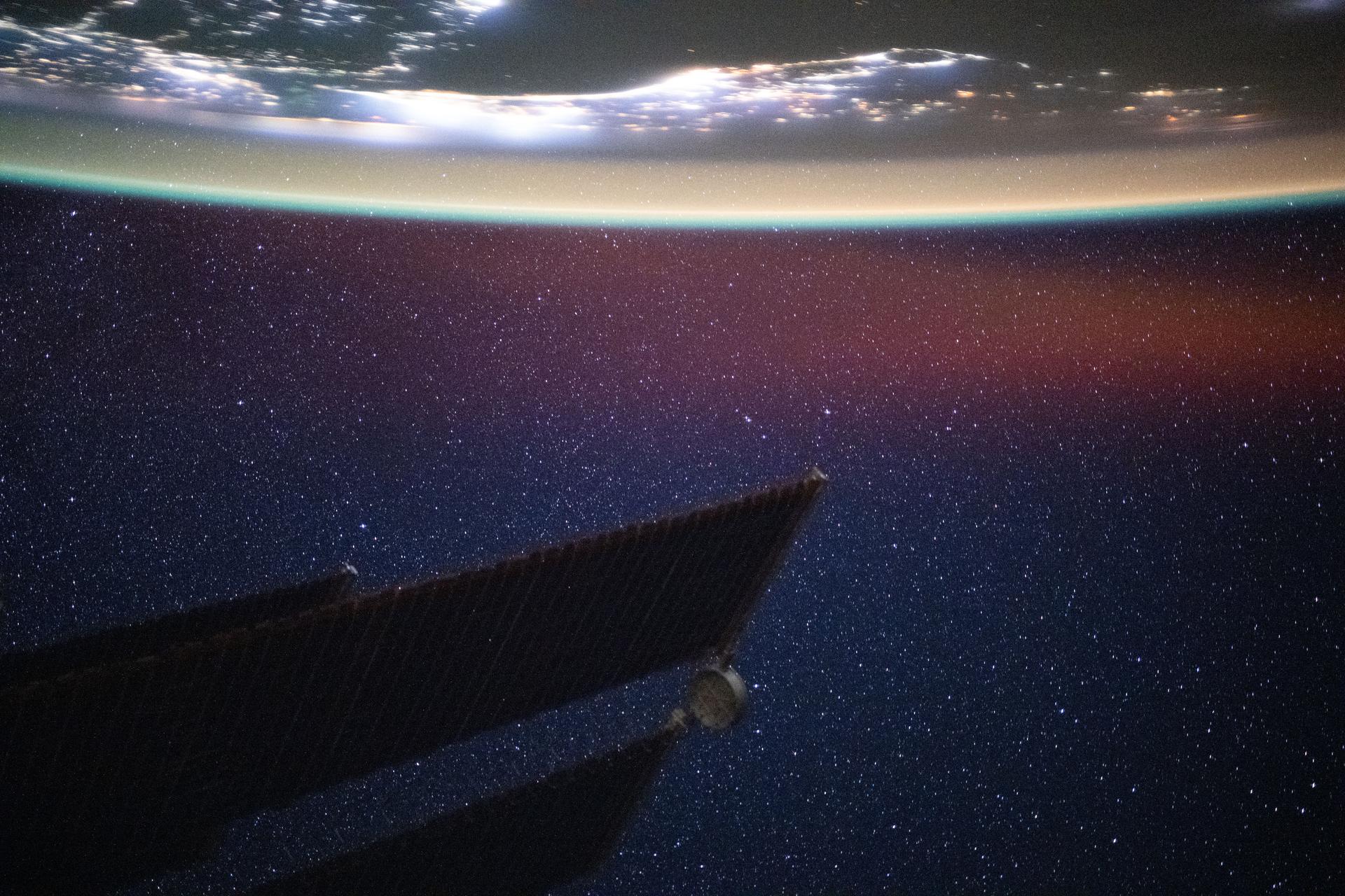
iss071e457356 (July 18, 2024) --- The Moon illuminates a cloud-covered Pacific Ocean as stars glitter in the background above the Earth's airglow. The International Space Station's solar arrays dominate the foreground as the orbital outpost soared 268 miles above.
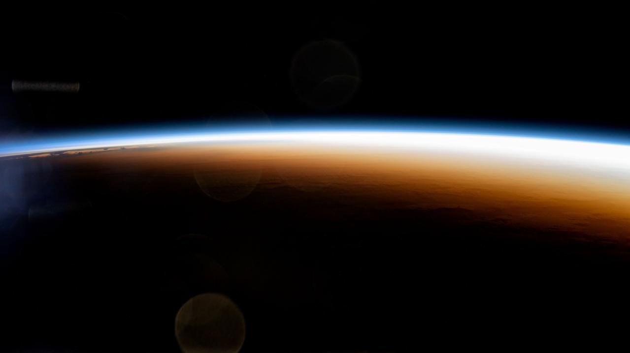
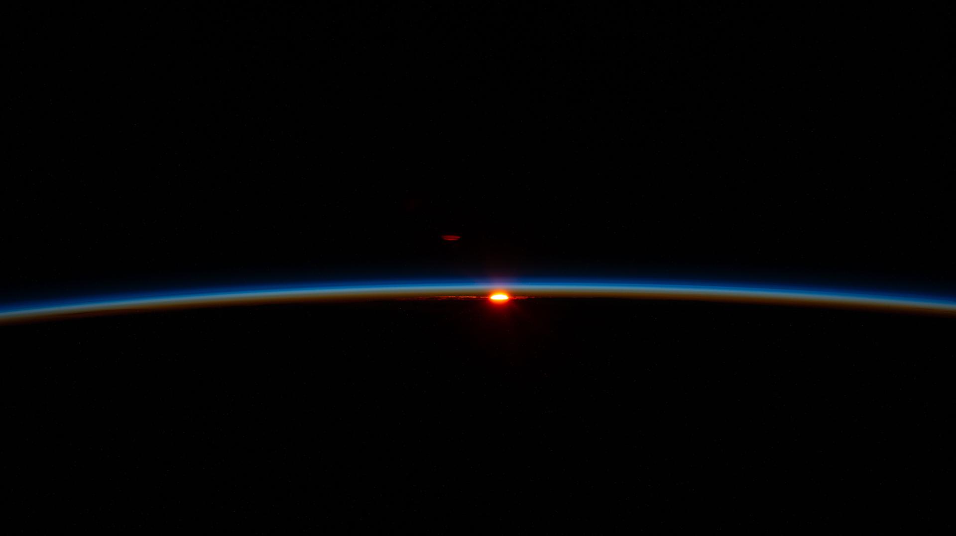
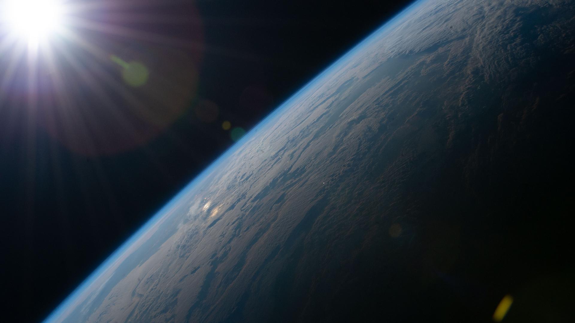
iss071e439624 (Aug. 6, 2024) --- An orbital sunrise colorfully illuminates the Earth's atmosphere and highlights the boundary between night and day, also known as the terminator, in this photograph from the International Space Station as it orbited 267 miles above the Pacific Ocean north of Auckland, New Zealand.
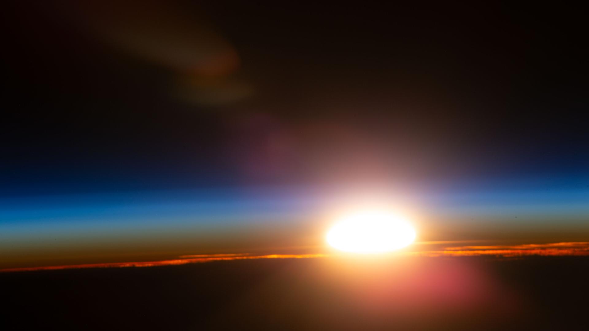
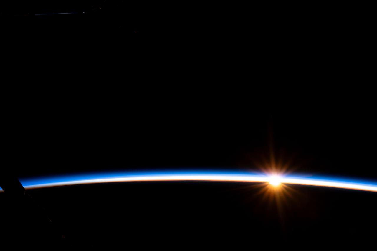
iss073e0988954 (Oct. 30, 2025) --- An orbital sunrise illuminates Earth's atmosphere and cloud tops in this photograph captured from the International Space Station as it orbited 264 miles above the Czech Republic in Eastern Europe.
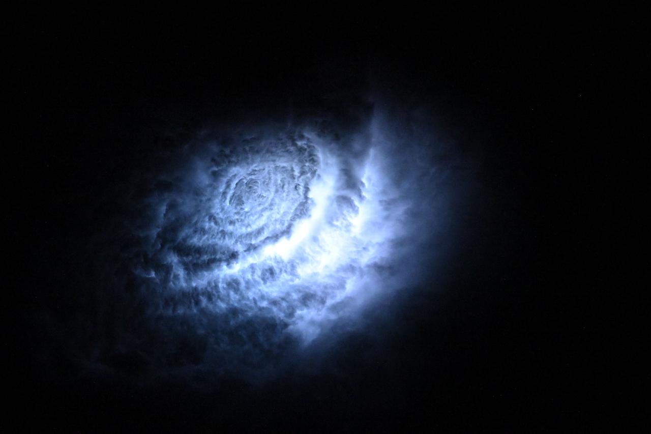
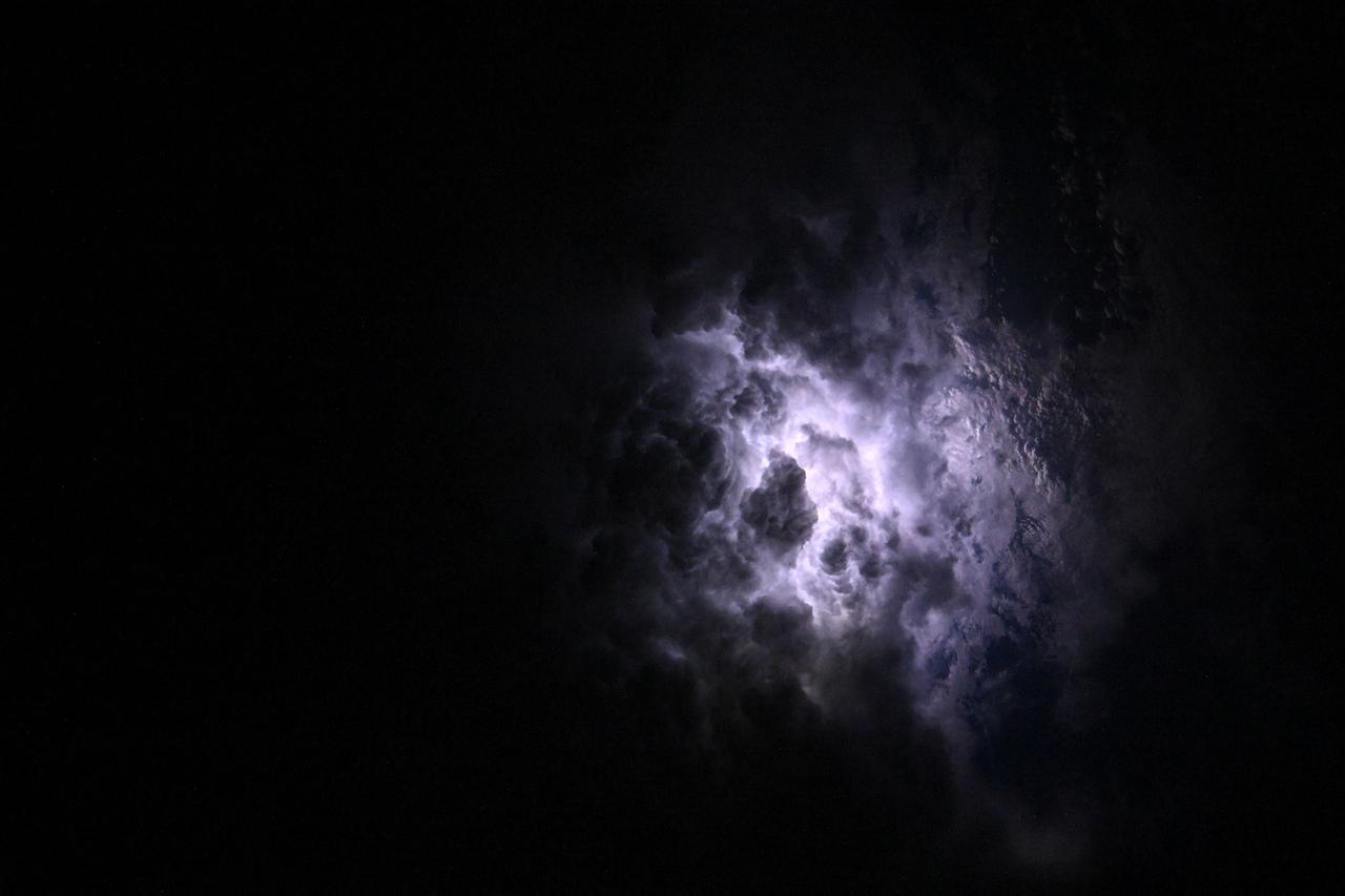
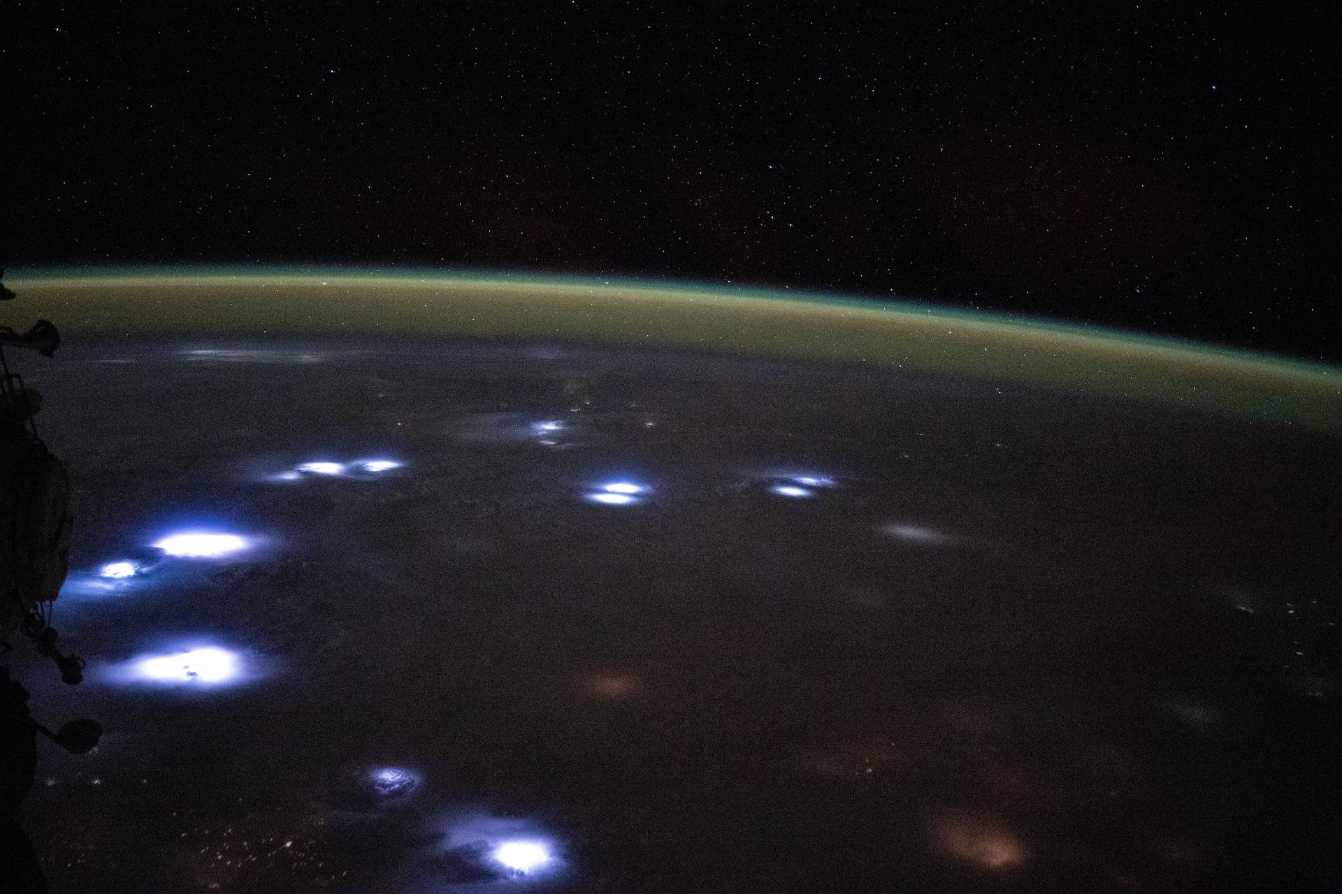
iss073e0111251 (May 18, 2025) --- Lightining illuminates the cloud tops during a storm underneath Earth's atmospheric glow in this photograph from the International Space Station as it orbited 259 miles above the Atlantic Ocean east of the Bahamas.
iss071e364425 (July 16, 2024) --- Noctilucent clouds, high-altutude clouds visible during the summer months and illuminated when the sun is below Earth's horizon, are pictured from the International Space Station as it orbited 259 miles above the Pacific Ocean south of Alaska.
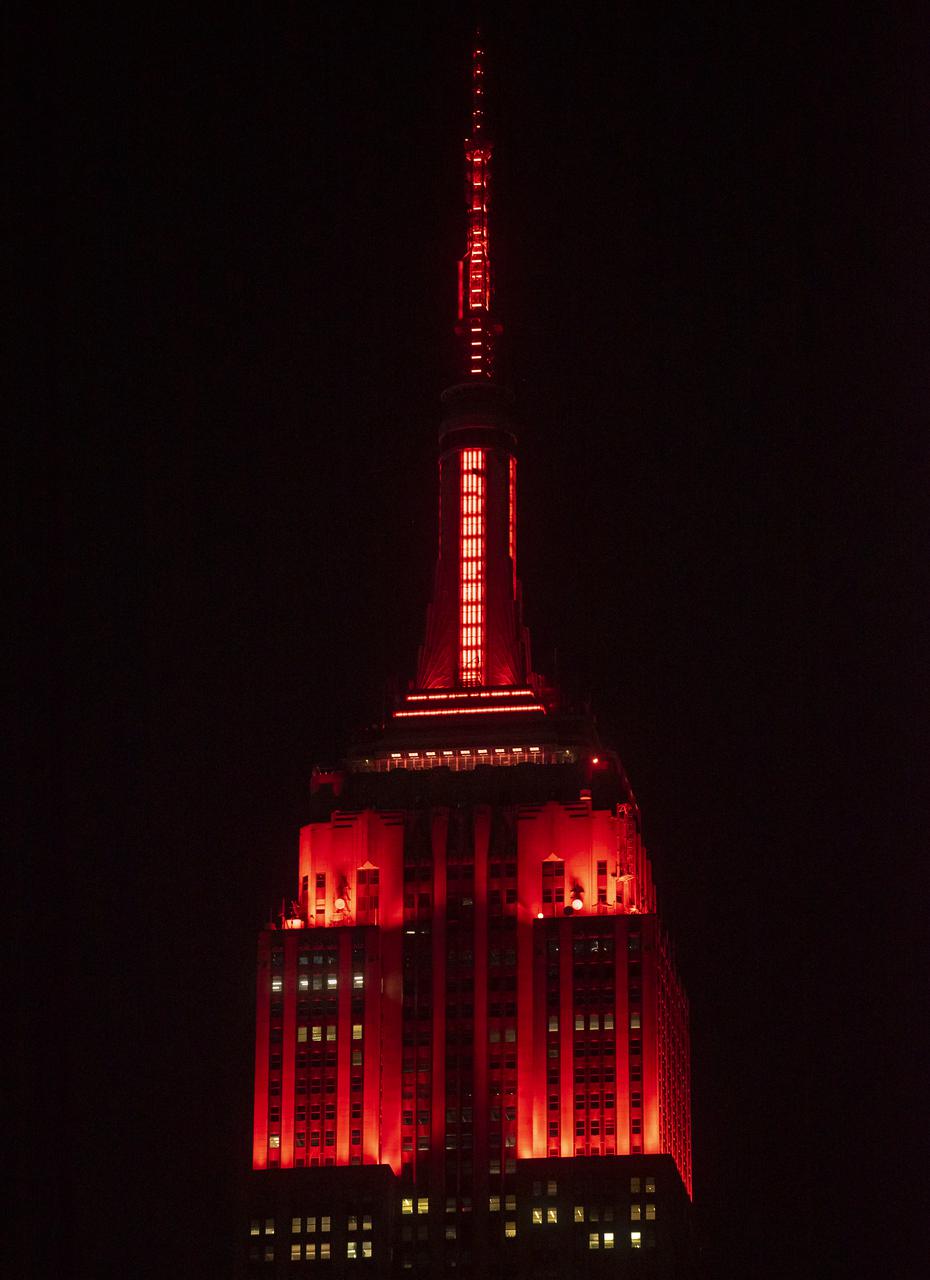
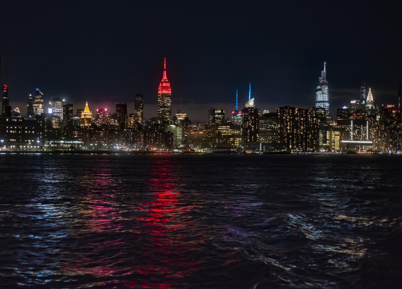
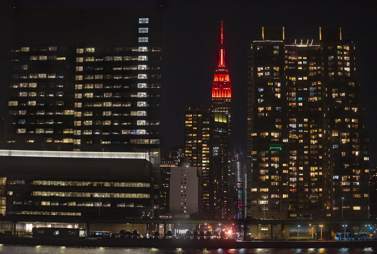
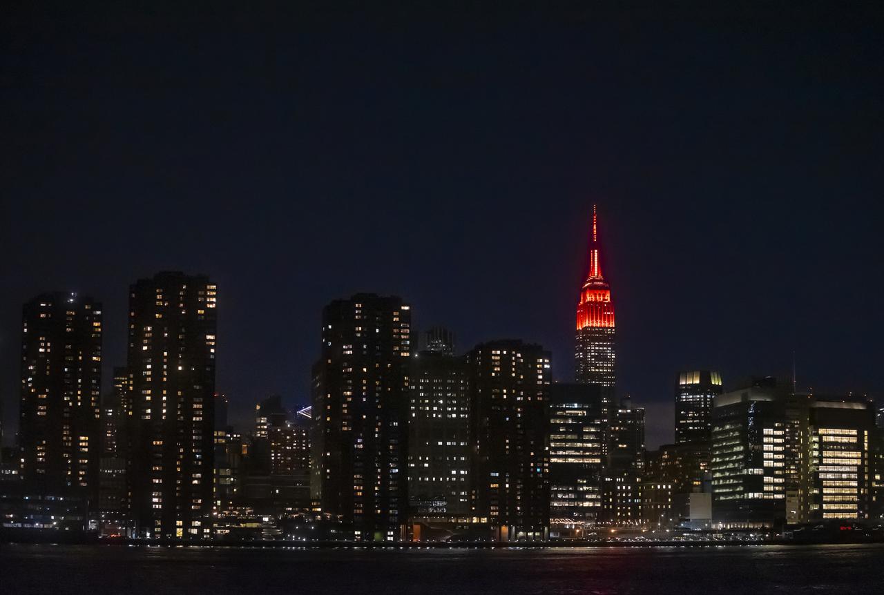
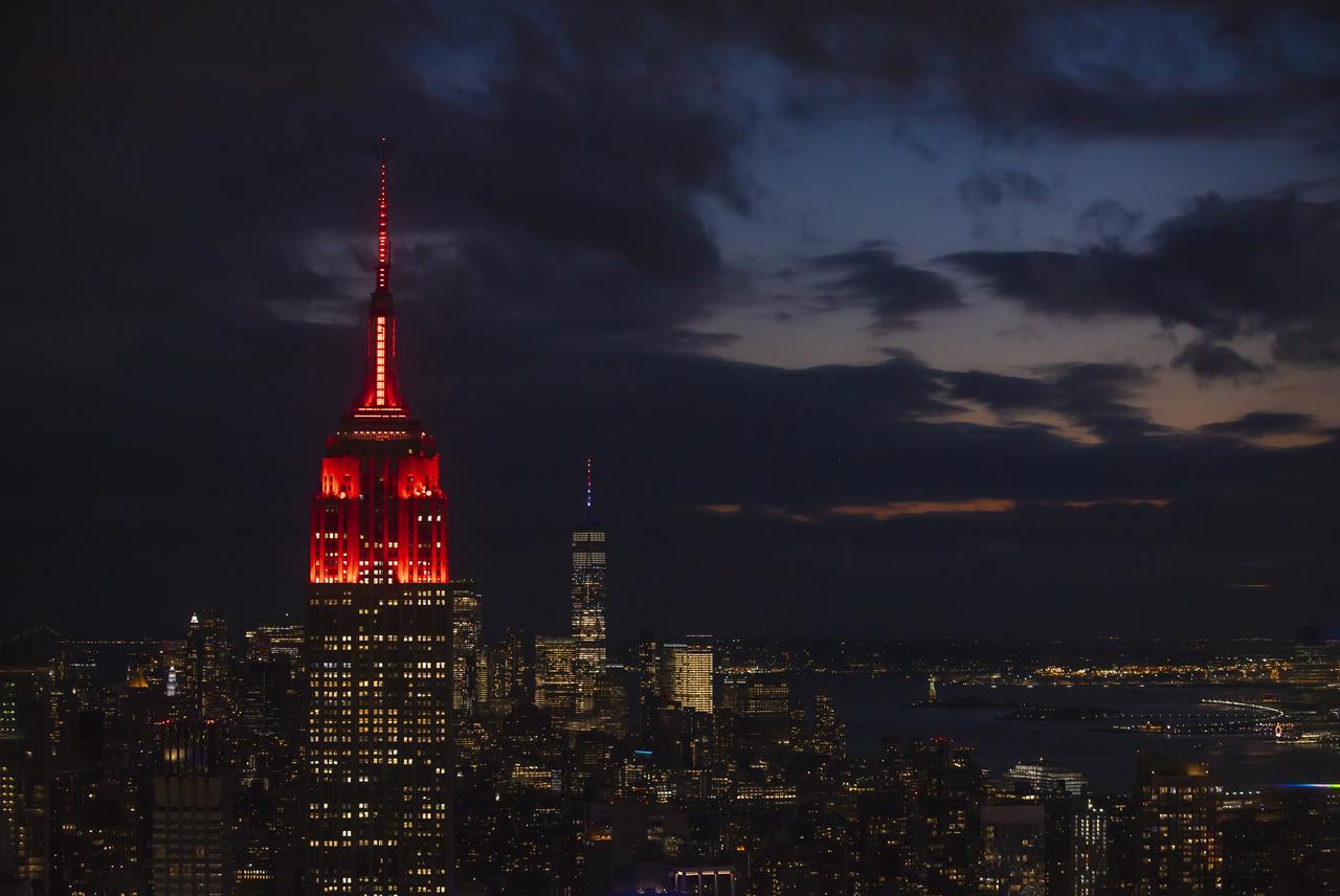
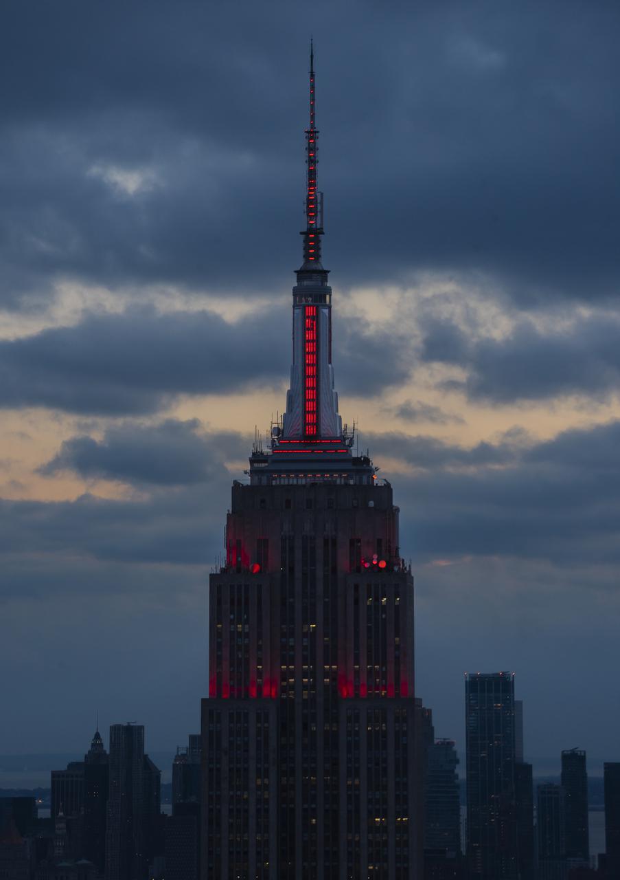
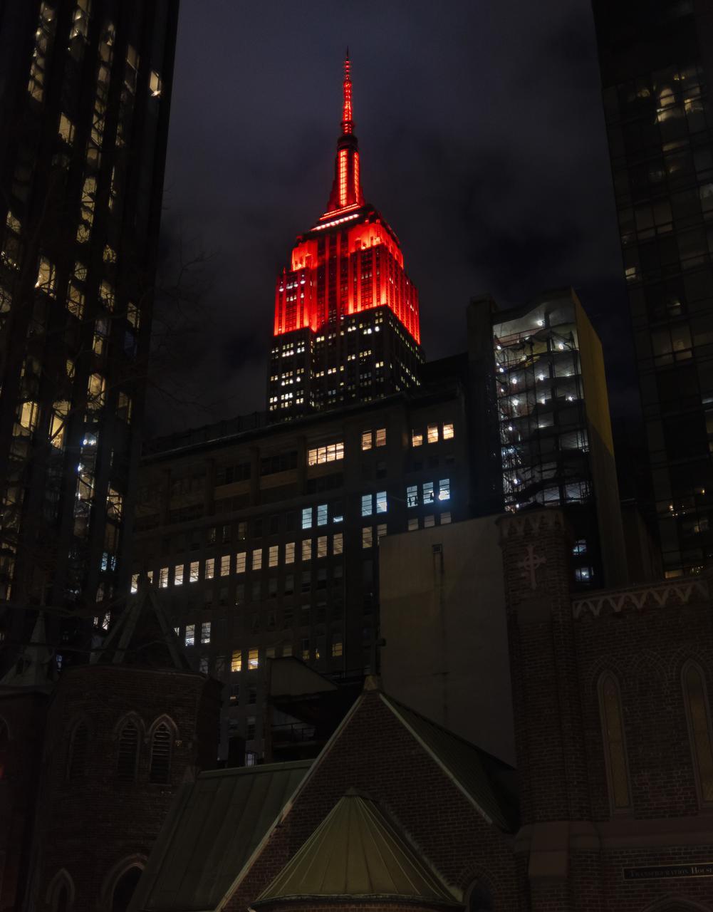
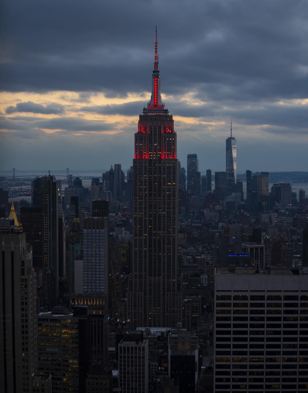
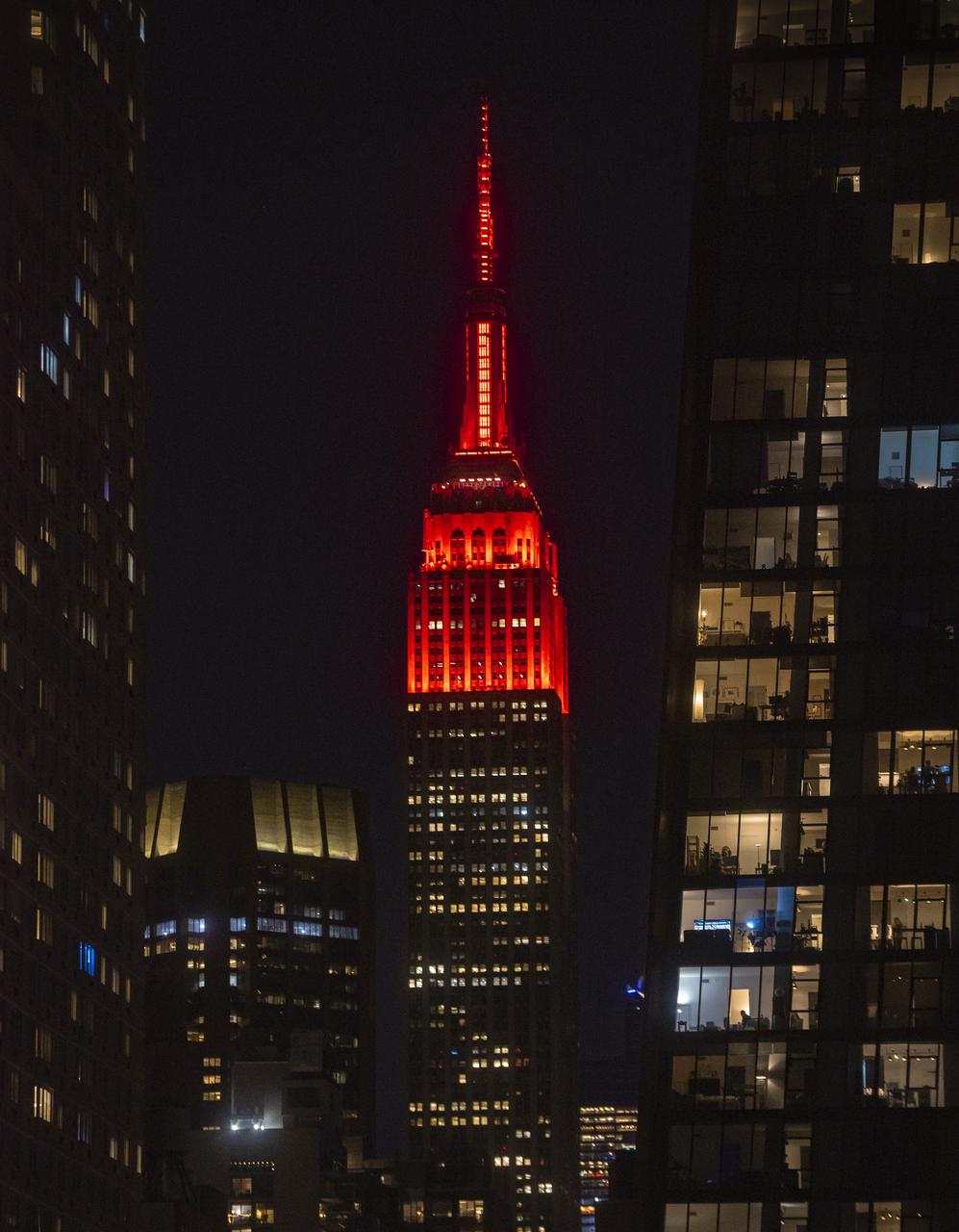
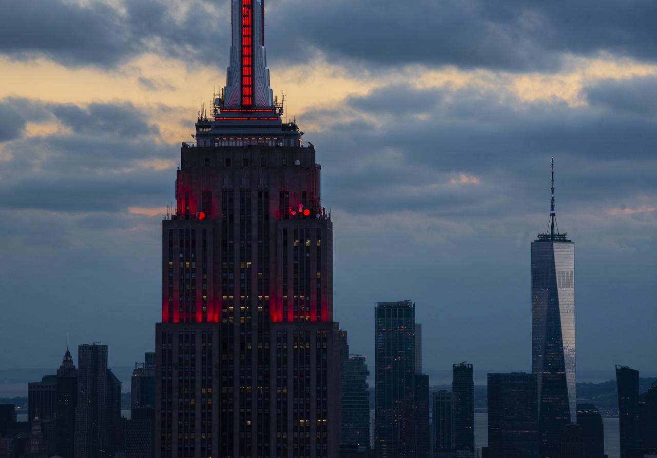
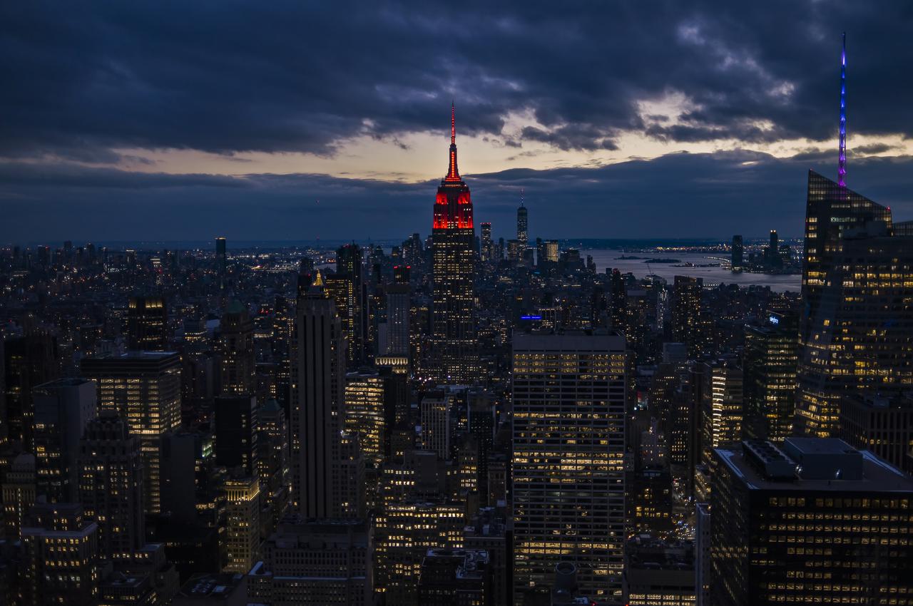
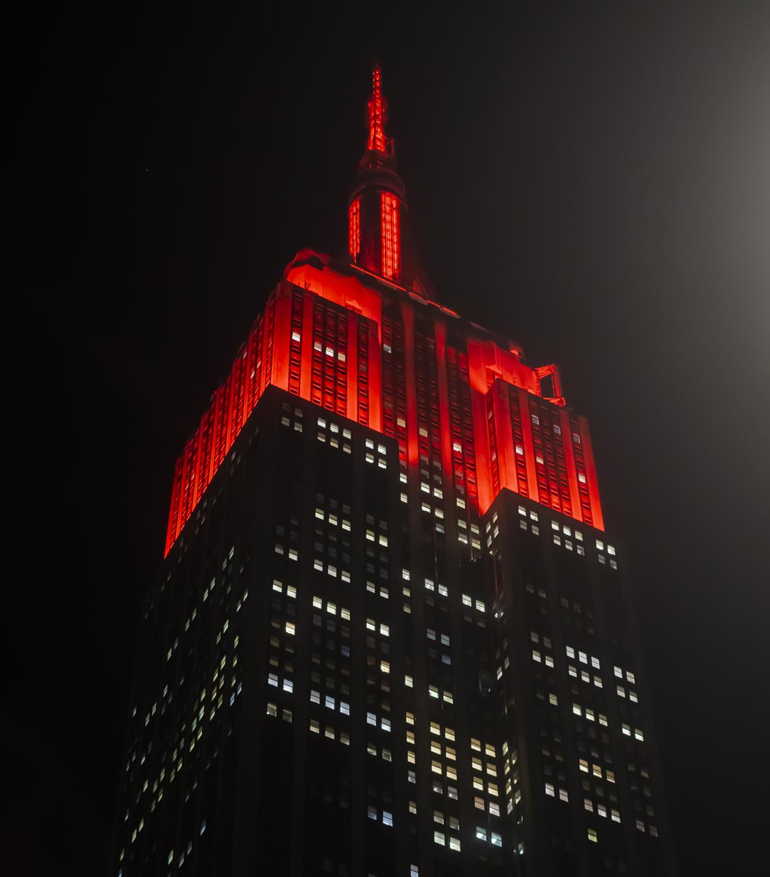
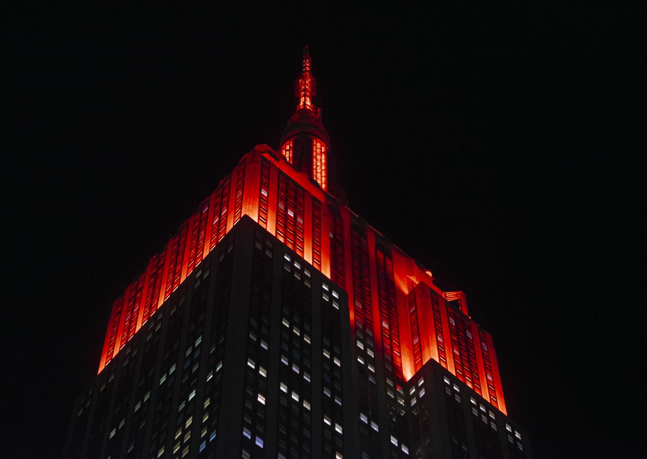
The Empire State Building is illuminated in red to celebrate this Thursday's scheduled landing on Mars of NASA's Perseverance rover, Tuesday, Feb. 16, 2021 in New York City. A key objective for Perseverance’s mission on Mars is astrobiology, including the search for signs of ancient microbial life. The rover will characterize the planet’s geology and past climate, pave the way for human exploration of the Red Planet, and be the first mission to collect and cache Martian rock and regolith. Photo Credit: (NASA/Emma Howells)
The Empire State Building is illuminated in red to celebrate this Thursday's scheduled landing on Mars of NASA's Perseverance rover, Tuesday, Feb. 16, 2021 in New York City. A key objective for Perseverance’s mission on Mars is astrobiology, including the search for signs of ancient microbial life. The rover will characterize the planet’s geology and past climate, pave the way for human exploration of the Red Planet, and be the first mission to collect and cache Martian rock and regolith. Photo Credit: (NASA/Emma Howells)
The Empire State Building is illuminated in red to celebrate this Thursday's scheduled landing on Mars of NASA's Perseverance rover, Tuesday, Feb. 16, 2021 in New York City. A key objective for Perseverance’s mission on Mars is astrobiology, including the search for signs of ancient microbial life. The rover will characterize the planet’s geology and past climate, pave the way for human exploration of the Red Planet, and be the first mission to collect and cache Martian rock and regolith. Photo Credit: (NASA/Emma Howells)

The Empire State Building is illuminated in red to celebrate this Thursday's scheduled landing on Mars of NASA's Perseverance rover, Tuesday, Feb. 16, 2021 in New York City. A key objective for Perseverance’s mission on Mars is astrobiology, including the search for signs of ancient microbial life. The rover will characterize the planet’s geology and past climate, pave the way for human exploration of the Red Planet, and be the first mission to collect and cache Martian rock and regolith. Photo Credit: (NASA/Emma Howells)
The Empire State Building is illuminated in red to celebrate this Thursday's scheduled landing on Mars of NASA's Perseverance rover, Tuesday, Feb. 16, 2021 in New York City. A key objective for Perseverance’s mission on Mars is astrobiology, including the search for signs of ancient microbial life. The rover will characterize the planet’s geology and past climate, pave the way for human exploration of the Red Planet, and be the first mission to collect and cache Martian rock and regolith. Photo Credit: (NASA/Emma Howells)

The Empire State Building is illuminated in red to celebrate this Thursday's scheduled landing on Mars of NASA's Perseverance rover, Tuesday, Feb. 16, 2021 in New York City. A key objective for Perseverance’s mission on Mars is astrobiology, including the search for signs of ancient microbial life. The rover will characterize the planet’s geology and past climate, pave the way for human exploration of the Red Planet, and be the first mission to collect and cache Martian rock and regolith. Photo Credit: (NASA/Emma Howells)

The Empire State Building is illuminated in red to celebrate this Thursday's scheduled landing on Mars of NASA's Perseverance rover, Tuesday, Feb. 16, 2021 in New York City. A key objective for Perseverance’s mission on Mars is astrobiology, including the search for signs of ancient microbial life. The rover will characterize the planet’s geology and past climate, pave the way for human exploration of the Red Planet, and be the first mission to collect and cache Martian rock and regolith. Photo Credit: (NASA/Emma Howells)

The Empire State Building is illuminated in red to celebrate this Thursday's scheduled landing on Mars of NASA's Perseverance rover, Tuesday, Feb. 16, 2021 in New York City. A key objective for Perseverance’s mission on Mars is astrobiology, including the search for signs of ancient microbial life. The rover will characterize the planet’s geology and past climate, pave the way for human exploration of the Red Planet, and be the first mission to collect and cache Martian rock and regolith. Photo Credit: (NASA/Emma Howells)
The Empire State Building is illuminated in red to celebrate this Thursday's scheduled landing on Mars of NASA's Perseverance rover, Tuesday, Feb. 16, 2021 in New York City. A key objective for Perseverance’s mission on Mars is astrobiology, including the search for signs of ancient microbial life. The rover will characterize the planet’s geology and past climate, pave the way for human exploration of the Red Planet, and be the first mission to collect and cache Martian rock and regolith. Photo Credit: (NASA/Emma Howells)
The Empire State Building is illuminated in red to celebrate this Thursday's scheduled landing on Mars of NASA's Perseverance rover, Tuesday, Feb. 16, 2021 in New York City. A key objective for Perseverance’s mission on Mars is astrobiology, including the search for signs of ancient microbial life. The rover will characterize the planet’s geology and past climate, pave the way for human exploration of the Red Planet, and be the first mission to collect and cache Martian rock and regolith. Photo Credit: (NASA/Emma Howells)
The Empire State Building is illuminated in red to celebrate this Thursday's scheduled landing on Mars of NASA's Perseverance rover, Tuesday, Feb. 16, 2021 in New York City. A key objective for Perseverance’s mission on Mars is astrobiology, including the search for signs of ancient microbial life. The rover will characterize the planet’s geology and past climate, pave the way for human exploration of the Red Planet, and be the first mission to collect and cache Martian rock and regolith. Photo Credit: (NASA/Emma Howells)
The Empire State Building is illuminated in red to celebrate this Thursday's scheduled landing on Mars of NASA's Perseverance rover, Tuesday, Feb. 16, 2021 in New York City. A key objective for Perseverance’s mission on Mars is astrobiology, including the search for signs of ancient microbial life. The rover will characterize the planet’s geology and past climate, pave the way for human exploration of the Red Planet, and be the first mission to collect and cache Martian rock and regolith. Photo Credit: (NASA/Emma Howells)
The Empire State Building is illuminated in red to celebrate this Thursday's scheduled landing on Mars of NASA's Perseverance rover, Tuesday, Feb. 16, 2021 in New York City. A key objective for Perseverance’s mission on Mars is astrobiology, including the search for signs of ancient microbial life. The rover will characterize the planet’s geology and past climate, pave the way for human exploration of the Red Planet, and be the first mission to collect and cache Martian rock and regolith. Photo Credit: (NASA/Emma Howells)
The Empire State Building is illuminated in red to celebrate this Thursday's scheduled landing on Mars of NASA's Perseverance rover, Tuesday, Feb. 16, 2021 in New York City. A key objective for Perseverance’s mission on Mars is astrobiology, including the search for signs of ancient microbial life. The rover will characterize the planet’s geology and past climate, pave the way for human exploration of the Red Planet, and be the first mission to collect and cache Martian rock and regolith. Photo Credit: (NASA/Emma Howells)
The Empire State Building is illuminated in red to celebrate this Thursday's scheduled landing on Mars of NASA's Perseverance rover, Tuesday, Feb. 16, 2021 in New York City. A key objective for Perseverance’s mission on Mars is astrobiology, including the search for signs of ancient microbial life. The rover will characterize the planet’s geology and past climate, pave the way for human exploration of the Red Planet, and be the first mission to collect and cache Martian rock and regolith. Photo Credit: (NASA/Emma Howells)

The Empire State Building is illuminated in red to celebrate this Thursday's scheduled landing on Mars of NASA's Perseverance rover, Tuesday, Feb. 16, 2021 in New York City. A key objective for Perseverance’s mission on Mars is astrobiology, including the search for signs of ancient microbial life. The rover will characterize the planet’s geology and past climate, pave the way for human exploration of the Red Planet, and be the first mission to collect and cache Martian rock and regolith. Photo Credit: (NASA/Emma Howells)
The Empire State Building is illuminated in red to celebrate this Thursday's scheduled landing on Mars of NASA's Perseverance rover, Tuesday, Feb. 16, 2021 in New York City. A key objective for Perseverance’s mission on Mars is astrobiology, including the search for signs of ancient microbial life. The rover will characterize the planet’s geology and past climate, pave the way for human exploration of the Red Planet, and be the first mission to collect and cache Martian rock and regolith. Photo Credit: (NASA/Emma Howells)

The Empire State Building is illuminated in red to celebrate this Thursday's scheduled landing on Mars of NASA's Perseverance rover, Tuesday, Feb. 16, 2021 in New York City. A key objective for Perseverance’s mission on Mars is astrobiology, including the search for signs of ancient microbial life. The rover will characterize the planet’s geology and past climate, pave the way for human exploration of the Red Planet, and be the first mission to collect and cache Martian rock and regolith. Photo Credit: (NASA/Emma Howells)
The Empire State Building is illuminated in red to celebrate this Thursday's scheduled landing on Mars of NASA's Perseverance rover, Tuesday, Feb. 16, 2021 in New York City. A key objective for Perseverance’s mission on Mars is astrobiology, including the search for signs of ancient microbial life. The rover will characterize the planet’s geology and past climate, pave the way for human exploration of the Red Planet, and be the first mission to collect and cache Martian rock and regolith. Photo Credit: (NASA/Emma Howells)

iss073e0222649 (May 26, 2025) --- Jakarta, Indonesia, with a metropolitan population of about 32.6 million including its suburbs, and fishing boats illuminated on the Java Sea are pictured at approximately 11:47 p.m. local time from the International Space Station as it orbited 261 miles above the Indian Ocean.
iss073e0332020 (June 20, 2025) --- Lightning illuminates the cloud tops of Tropical Storm Erick as it stormed across the Pacific coast of central Mexico at approximately 3:42 a.m. local time as the International Space Station orbited 258 miles above.
iss072e030246 (Oct. 7, 2024) --- The first rays of an orbital sunrise illuminate Earth's atmosphere in this photograph from the International Space Station as it orbited 269 miles above the Pacific Ocean near Chile's Patagonia coast on the South American continent.
iss073e0204297 (May 25, 2025) --- Lightning illuminates the clouds (left), city lights line the coast of Vietnam, and lights on fishing boats dot the South China Sea in this photograph from the International Space Station as it orbited 259 miles above Southeast Asia.
iss073e0330134 (June 20, 2025) --- Lightning illuminates the cloud tops of Tropical Storm Erick as it stormed across the Pacific coast of central Mexico at approximately 3:38 a.m. local time as the International Space Station orbited 258 miles above.
iss074e0089802 (Jan. 16, 2026) --- The first rays of an orbital sunrise illuminate Earth’s atmosphere in this photograph taken from the International Space Station as it orbited 268 miles above French Polynesia in the Pacific Ocean at approximately 2:52 a.m. local time.

STS084-357-008 (15-24 May 1997) --- Photographed through the aft flight deck windows of the Earth-orbiting Space Shuttle Atlantis, this 35mm frame captures a firing of the Orbital Maneuvering System (OMS) engines to perform a necessary maneuver. The vertical stabilizer, flanked by the two OMS pods, is illuminated in the scene.

iss073e0204578 (May 25, 2025) --- Lightning illuminates the clouds (top left) above Southeast Asia in this photograph from the International Space Station as it orbited 259 miles over the South China Sea and off the coast of the Malaysian state of Sarawak on the island of Borneo.
iss073e0566536 (July 28, 2025) --- Lightning strikes illuminate the stormy cloud tops above the Democratic Republic of the Congo in this photograph, taken at approximately 9:58 p.m. local time from the International Space Station as it orbited 259 miles above Earth.
iss073e0330560 (June 20, 2025) --- Lightning illuminates the cloud tops of Tropical Storm Erick as it stormed across the Pacific coast of central Mexico at approximately 3:39 a.m. local time as the International Space Station orbited 258 miles above.
This recently received panchromatic image of Pluto's small satellite Nix taken by the Multispectral Visible Imaging Camera (MVIC) aboard New Horizons is one of the best images of Pluto's third-largest moon generated by the NASA mission. Taken on July 14, 2015, at a range of about 14,000 miles (23,000 kilometers) from Nix, the illuminated surface is about 12 miles (19 kilometers) by 29 miles (47 kilometers). The unique perspective of this image provides new details about Nix's geologic history and impact record. http://photojournal.jpl.nasa.gov/catalog/PIA20287
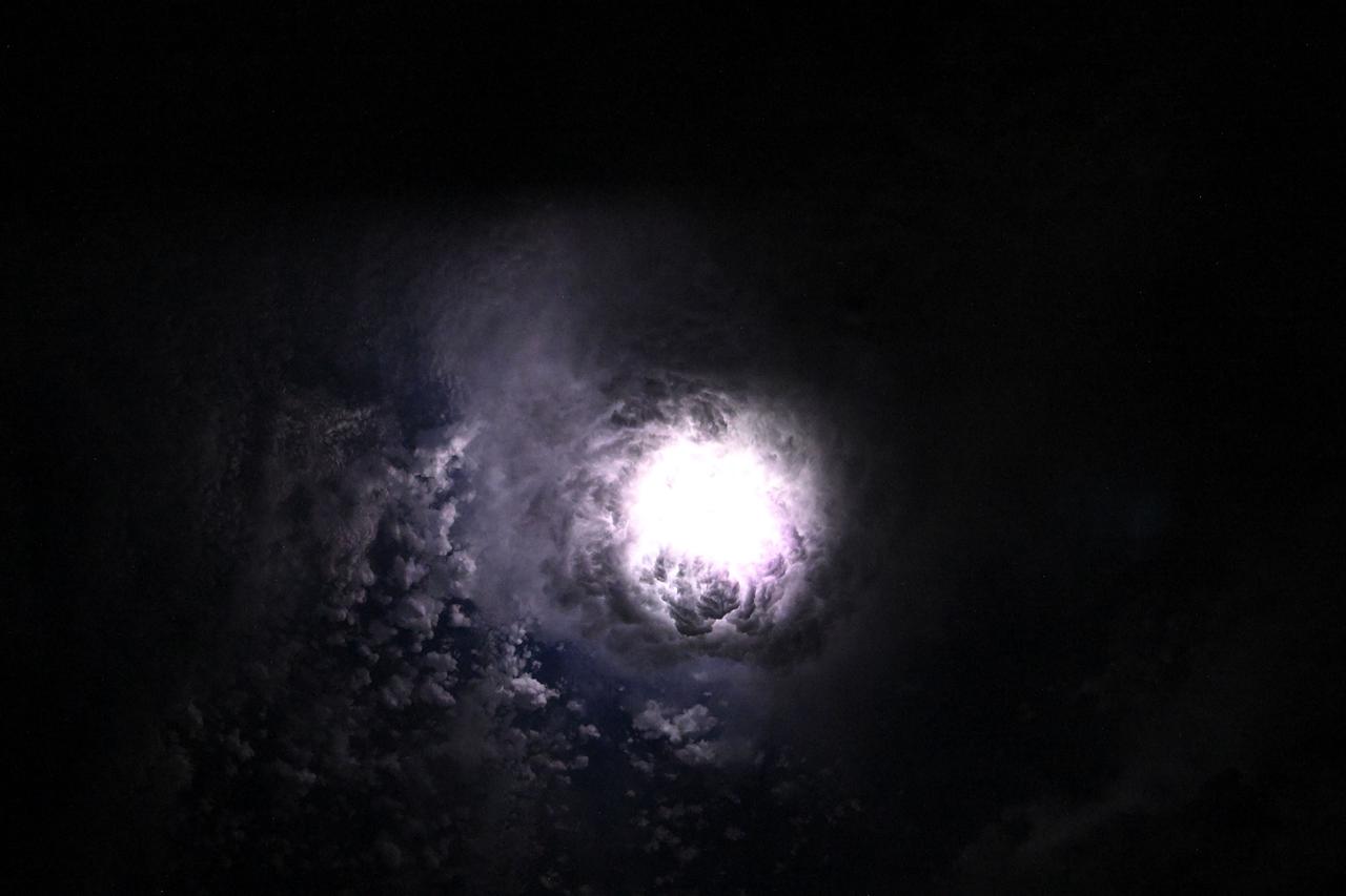
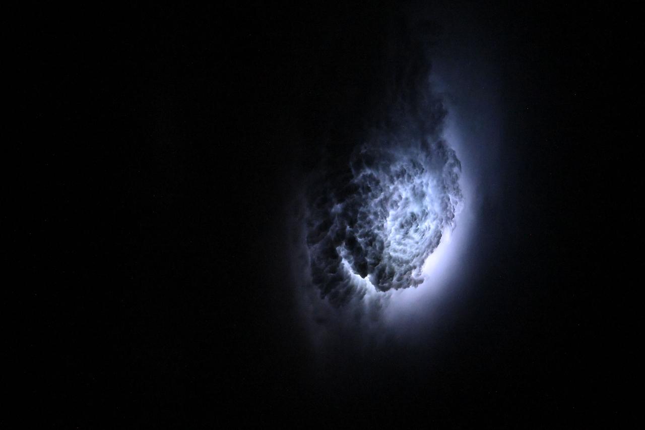
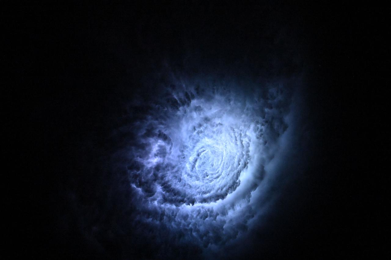
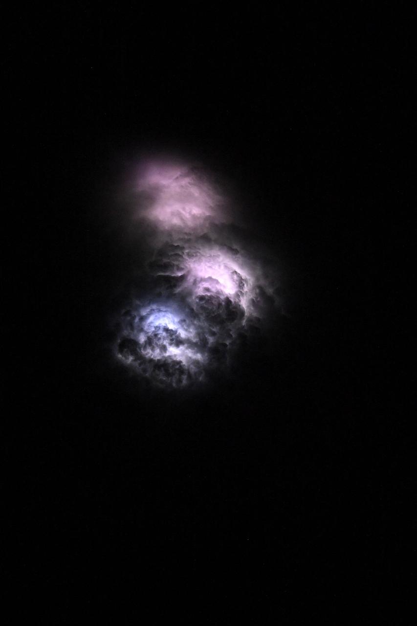
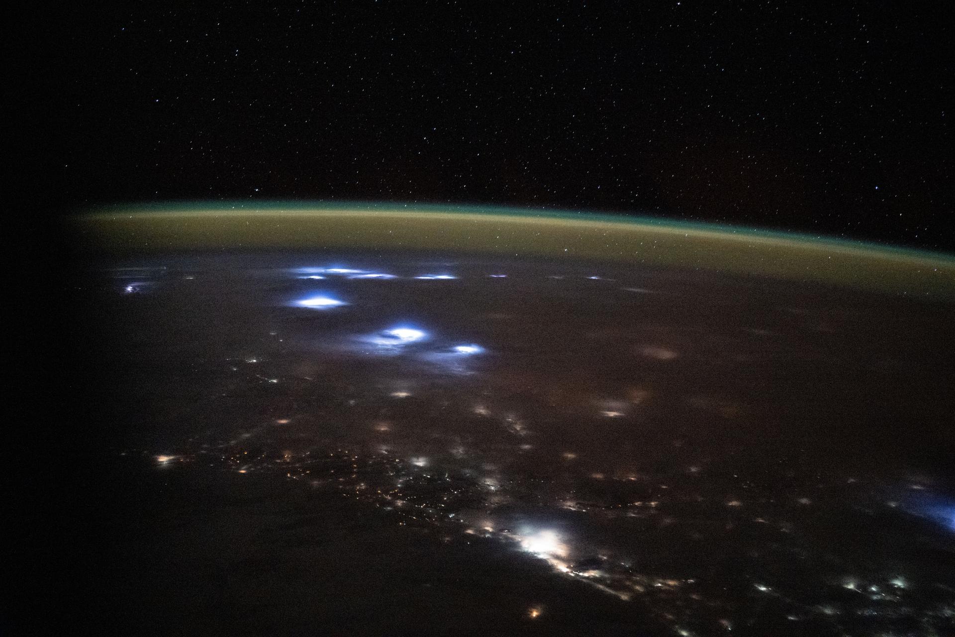
iss073e0080280 (May 15, 2025) --- This nebula-like formation is actually lightning illuminating the clouds during a storm off the coast of North Carolina in this photograph from the International Space Station as it orbited 260 miles above the Atlantic Ocean.
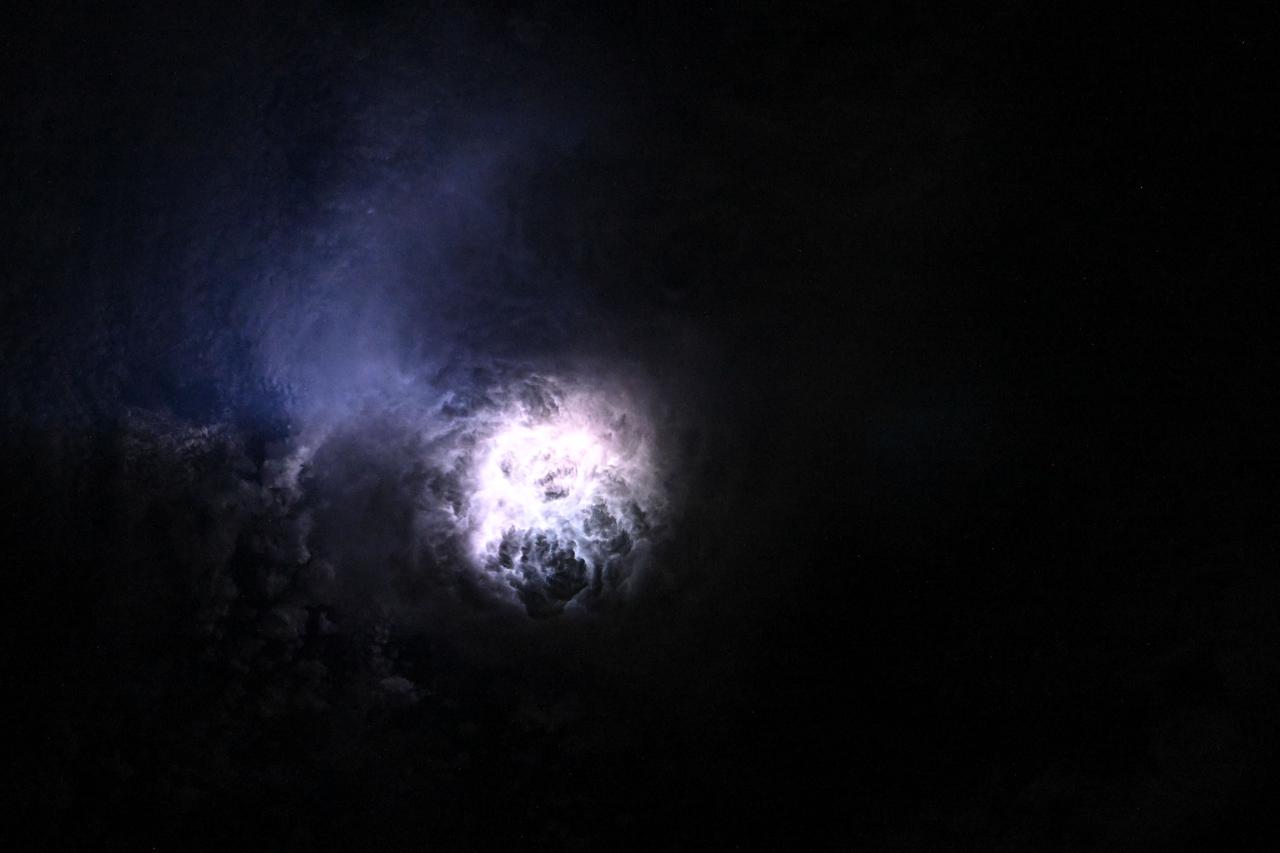
iss073e0080625 (May 15, 2025) --- This nebula-like formation is actually lightning illuminating the clouds during a storm off the coast of North Carolina in this photograph from the International Space Station as it orbited 260 miles above the Atlantic Ocean.
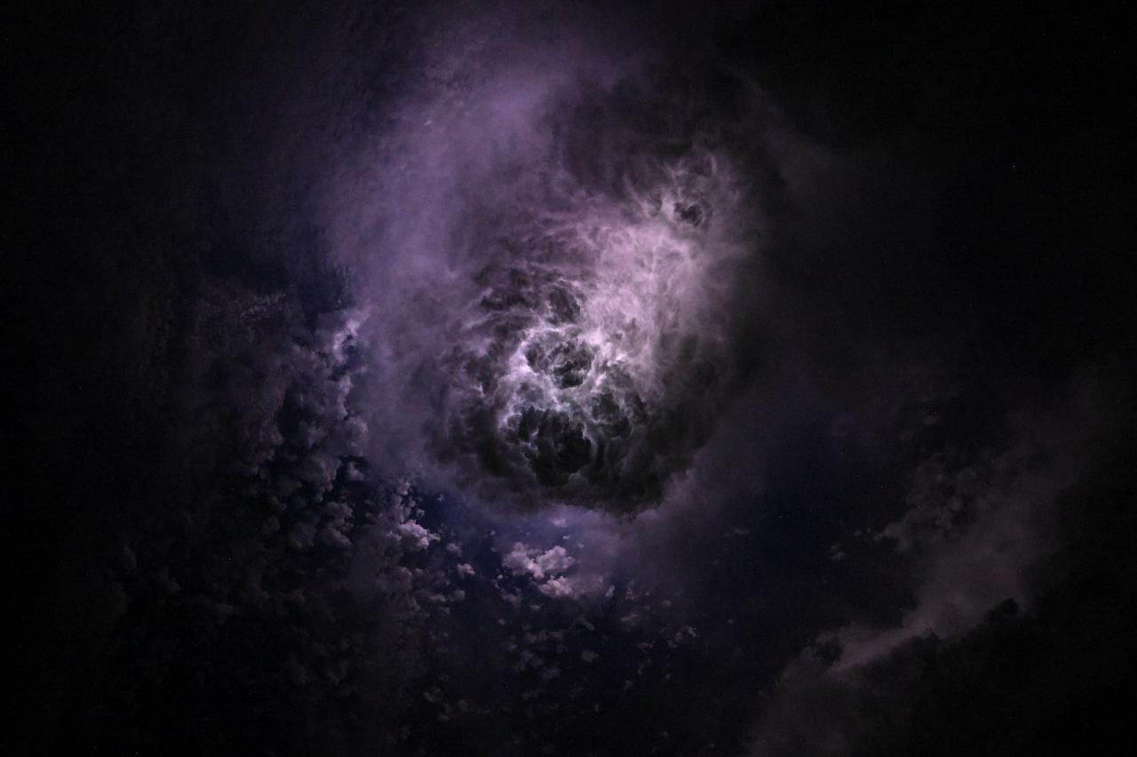
iss073e0080327 (May 15, 2025) --- This nebula-like formation is actually lightning illuminating the clouds during a storm off the coast of North Carolina in this photograph from the International Space Station as it orbited 260 miles above the Atlantic Ocean.
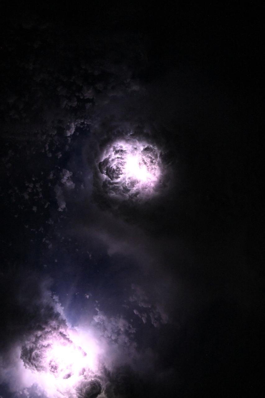
iss073e0081060 (May 15, 2025) --- This nebula-like formation is actually lightning illuminating the clouds during a storm off the coast of North Carolina in this photograph from the International Space Station as it orbited 260 miles above the Atlantic Ocean.
Inside the Payload Hazardous Servicing Facility at NASA's Kennedy Space Center in Florida, illumination testing is underway on the power-producing solar arrays for the agency’s Origins, Spectral Interpretation, Resource Identification, Security-Regolith Explorer, or OSIRIS-REx spacecraft. Targeted for liftoff Sept. 8, 2016, OSIRIS-Rex will be the first U.S. mission to sample an asteroid, retrieve at least two ounces of surface material and return it to Earth for study. The asteroid, Bennu, may hold clues to the origin of the solar system and the source of water and organic molecules found on Earth.

iss073e0203588 (May 19, 2025) --- Lightning (upper left) illuminates the clouds and an atmospheric glow blankets Earth's horizon in this photograph from the International Space Station as it orbited 264 miles above the Atlantic Ocean off the coast of southern Brazil. At bottom, is the SpaceX Dragon crew spacecraft docked to the orbital outpost's forward port on the Harmony module.
Inside the Payload Hazardous Servicing Facility at NASA's Kennedy Space Center in Florida, illumination testing is underway on the power -producing solar arrays for the agency’s Origins, Spectral Interpretation, Resource Identification, Security-Regolith Explorer, or OSIRIS-REx spacecraft. Targeted for liftoff Sept. 8, 2016, OSIRIS-Rex will be the first U.S. mission to sample an asteroid, retrieve at least two ounces of surface material and return it to Earth for study. The asteroid, Bennu, may hold clues to the origin of the solar system and the source of water and organic molecules found on Earth.
Inside the Payload Hazardous Servicing Facility at NASA's Kennedy Space Center in Florida, illumination testing is underway on the power-producing solar arrays for the agency’s Origins, Spectral Interpretation, Resource Identification, Security-Regolith Explorer, or OSIRIS-REx spacecraft. Targeted for liftoff Sept. 8, 2016, OSIRIS-Rex will be the first U.S. mission to sample an asteroid, retrieve at least two ounces of surface material and return it to Earth for study. The asteroid, Bennu, may hold clues to the origin of the solar system and the source of water and organic molecules found on Earth.
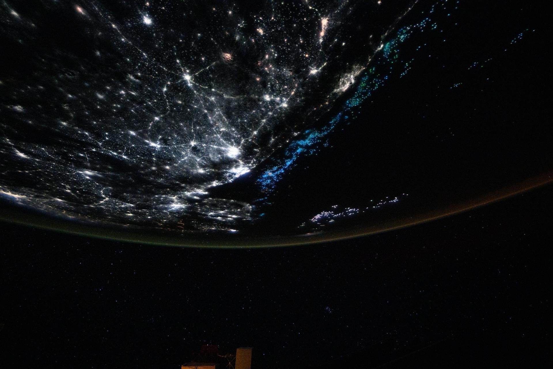
iss073e0854494 (Sept. 21, 2025) --- The coastlines of Colombia and Venezuela (left), illuminated by city lights, are separated from the island nations of the Dominican Republic and Puerto Rico (far right) by the dark expanse of the Caribbean Sea. The International Space Station was orbiting approximately 260 miles above Earth when this photograph was taken at around 1:06 a.m. local time.
iss073e0380959 (June 18, 2025) --- Lightning illuminates the cloud tops of Category 1 Hurricane Erick as it stormed across the Pacific Ocean south of the Mexican state of Chiapas at approximately 3:42 a.m. local time as the International Space Station orbited 258 miles above.
iss074e0343241 (Feb. 22, 2026) --- Fishing boats illuminate the Arabian Sea along India’s west coast with blue-green lights designed to attract squid, shrimp, sardines, and mackerel. Near the center of the photograph is India's Mumbai Metropolitan Region, home to over 26 million people and the heart of Bollywood. Credit: NASA/Chris Williams
iss073e0982823 (Oct. 26, 2025) --- The Moon glares into a camera aboard the International Space Station as it orbited 259 miles above the Atlantic Ocean off the coast of Africa at approximately 10:49 p.m. local time. A bright airglow blankets Earth's horizon as the Milky Way illuminates the night sky.
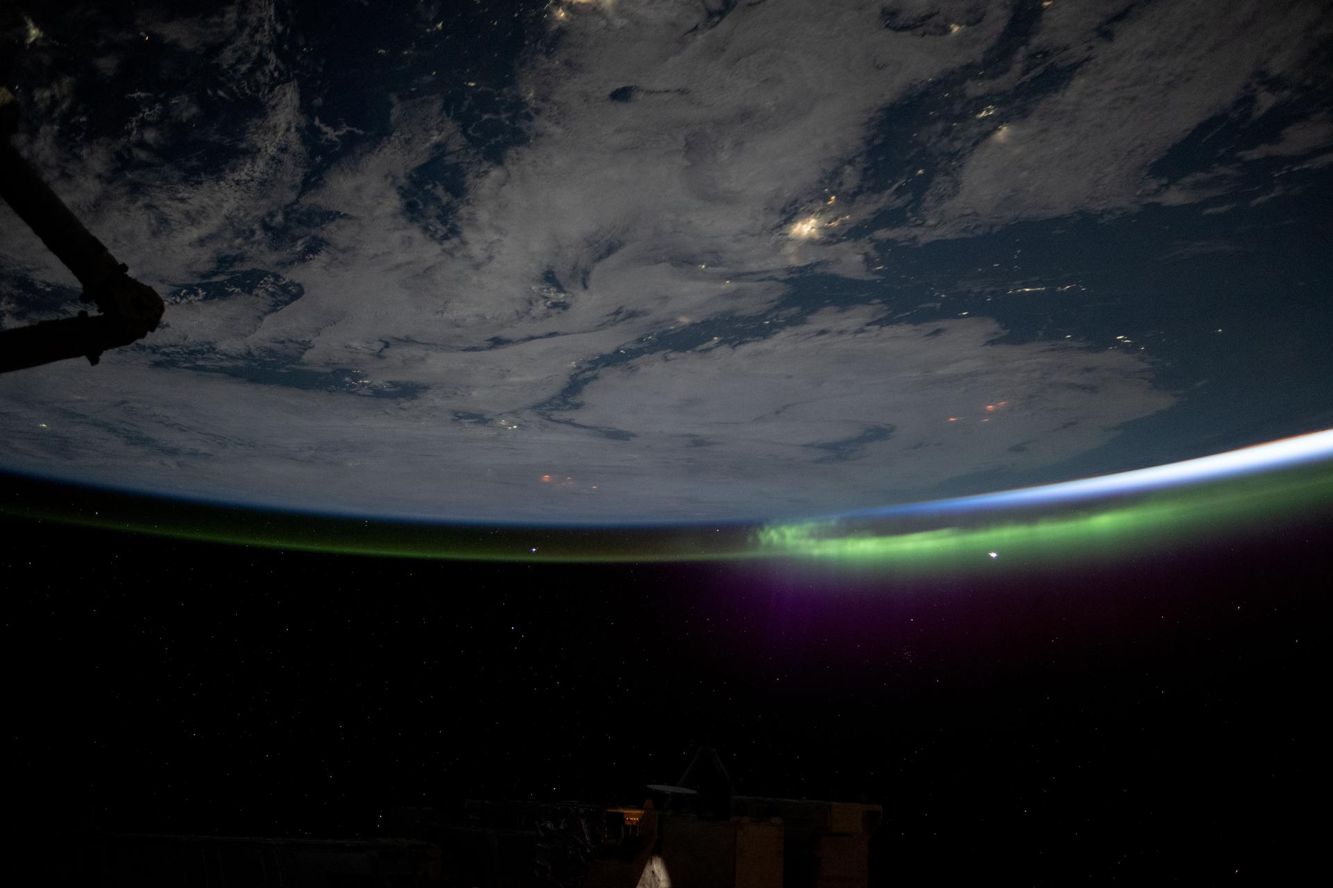
iss073e0761799 (Sept. 6, 2025) --- A wispy aurora caps Earth's horizon as an orbital sunrise begins illuminating the atmosphere in this photograph taken at approximately 2:19 a.m. local time from the International Space Station as it orbited 264 miles above the Mongolia-China border region.

February 17, 2021, The Terminal Tower is illuminated in red to commemorate the Landing of NASA’s Perseverance Rover on the surface of Mars, February 18, 2021. Terminal Tower is a 52-story, (771 ft), landmark skyscraper located on Public Square in downtown Cleveland, Ohio. Cleveland is also the home of the NASA Glenn Research Center.

February 17, 2021, The Terminal Tower is illuminated in red to commemorate the Landing of NASA’s Perseverance Rover on the surface of Mars, February 18, 2021. Terminal Tower is a 52-story, (771 ft), landmark skyscraper located on Public Square in downtown Cleveland, Ohio. Cleveland is also the home of the NASA Glenn Research Center.
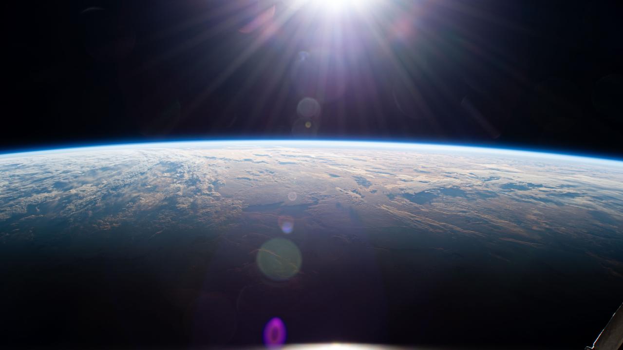
iss072e838362 (March 26, 2025) --- Sunrise above Earth's horizon begins illuminating a cloudy Indian Ocean and reveals the terminator, the dividing line between night and day, in this photograph from the International Space Station as it orbited 271 miles above.

February 17, 2021, The Terminal Tower is illuminated in red to commemorate the Landing of NASA’s Perseverance Rover on the surface of Mars, February 18, 2021. Terminal Tower is a 52-story, (771 ft), landmark skyscraper located on Public Square in downtown Cleveland, Ohio. Cleveland is also the home of the NASA Glenn Research Center.

February 17, 2021, The Terminal Tower is illuminated in red to commemorate the Landing of NASA’s Perseverance Rover on the surface of Mars, February 18, 2021. Terminal Tower is a 52-story, (771 ft), landmark skyscraper located on Public Square in downtown Cleveland, Ohio. Cleveland is also the home of the NASA Glenn Research Center.

February 17, 2021, The Terminal Tower is illuminated in red to commemorate the Landing of NASA’s Perseverance Rover on the surface of Mars, February 18, 2021. Terminal Tower is a 52-story, (771 ft), landmark skyscraper located on Public Square in downtown Cleveland, Ohio. Cleveland is also the home of the NASA Glenn Research Center.
iss074e0494675 (April 21, 2026) --- The Sun begins illuminating Earth’s surface just after an orbital sunrise in this photograph taken at approximately 6:17 a.m. local time from the International Space Station as it orbited 264 miles above southern France. Credit: NASA

iss073e0982783 (Oct. 26, 2025) --- A red-yellow airglow blankets Earth as the last rays of an orbital sunset illuminate the atmosphere in this photograph from the International Space Station as it orbited 262 miles above the South Atlantic Ocean.
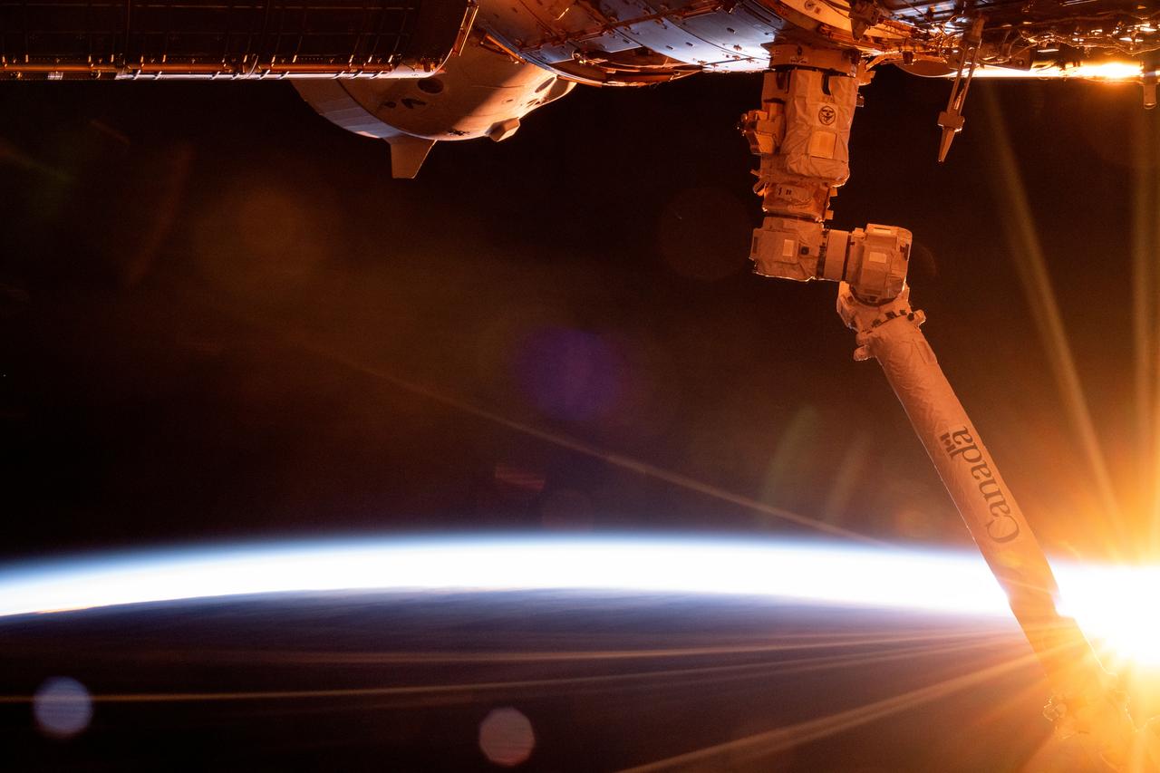
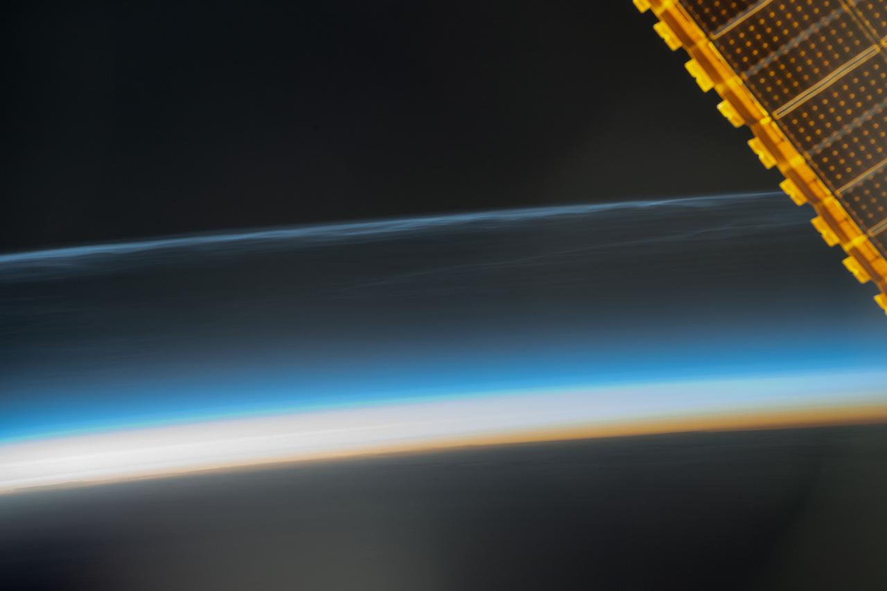
iss072e010164 (Oct. 1, 2024) --- The first rays of an orbital sunrise breakthrough illuminating Earth's atmosphere in this photograph from the International Space Station as it orbited 272 miles above the South Pacifc Ocean off the southern coast of New Zealand. In the foreground, at right, is the Canadarm2 robotic arm and partially obscured at top, is the SpaceX Dragon Freedom spacecract docked to the Harmony module's forward port.
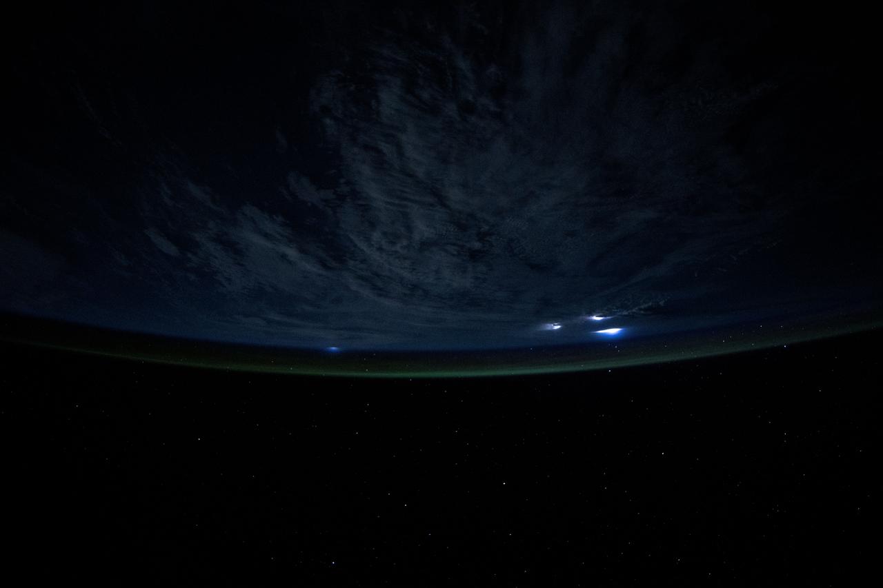
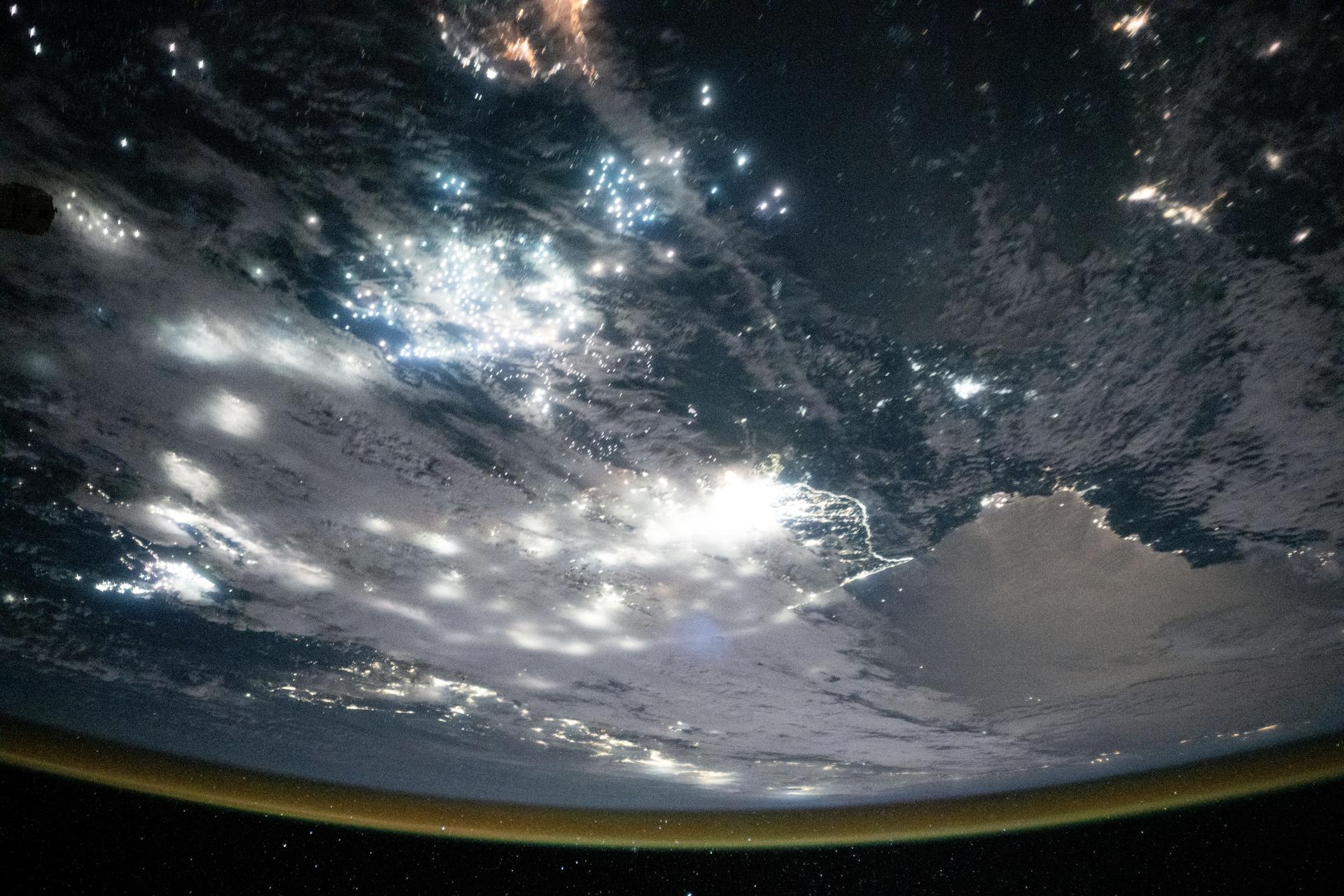
iss073e0817052 (Sept. 27, 2025) --- Warm, diffuse city lights and bright lightning storms illuminate the cloudy nighttime landscape of western Africa in this image captured from the International Space Station. A soft yellow-green atmospheric glow, created by atoms and molecules releasing energy absorbed from solar radiation earlier in the day, blankets Earth’s horizon. The orbital outpost was soaring 260 miles above the Atlantic Ocean at approximately 11:05 p.m. local time when this photograph was taken.
iss073e0816985 (Sept. 27, 2025) --- Bright lightning storms illuminate the cloudy landscape of western Africa in this image captured from the International Space Station. A soft yellow-green atmospheric glow, created by atoms and molecules releasing energy absorbed from solar radiation earlier in the day, blankets Earth’s horizon. The orbital outpost was soaring 260 miles above the Atlantic coast of Ghana at approximately 11:04 p.m. local time when this photograph was taken.
iss073e0982720 (Oct. 25, 2025) --- The Persian Gulf region—from Oman to the United Arab Emirates, with Iran's southwest coast visible across the geographically important waterway—is illuminated beneath a bright yellow-green airglow. This long-exposure photograph, taken at approximately 11:40 p.m. local time from the International Space Station as it orbited 259 miles above northwestern India, also captures the starry expanse of the night sky.

iss074e0044675 (Dec. 25, 2025) --- Fishing boats illuminate the Arabian Sea along India’s west coast with green lights designed to attract squid, shrimp, sardines, and mackerel in this nighttime photograph from the International Space Station, orbiting 259 miles above Earth. At lower right, the city lights of Hyderabad—renowned for its historic diamond and pearl trade—stretch westward toward the Mumbai Metropolitan Region, home to over 26 million people and the heart of Bollywood.
iss073e0824280 (Sept. 14, 2025) --- The well-lit border (center) between South Korea and the less-illuminated North Korea is framed by the moonlit Sea of Japan (bottom) and the Yellow Sea (top), which is dotted with the bright lights of fishing boats. These lights are used to attract nocturnal fish, including anchovies, mackerel, and squid. The International Space Station was orbiting 262 miles above the Bohai Sea at approximately 12:43 a.m. local time when this photograph was taken.
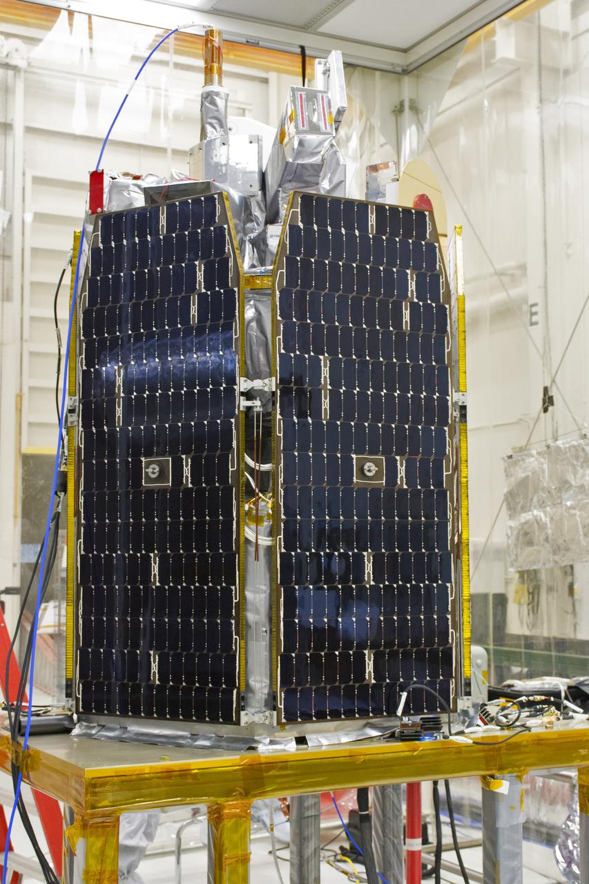
NASA's Ionospheric Connection Explorer (ICON) is prepared for a solar array illumination test in a clean room inside Building 1555 at Vandenberg Air Force Base in California on May 4, 2018. The test checks for any imperfections and confirms that the solar arrays are functioning properly. The explorer will launch on June 15, 2018, from Kwajalein Atoll in the Marshall Islands (June 14 in the continental United States) on Orbital ATK's Pegasus XL rocket, which is attached to the company's L-1011 Stargazer aircraft. ICON will study the frontier of space - the dynamic zone high in Earth's atmosphere where terrestrial weather from below meets space weather above. The explorer will help determine the physics of Earth's space environment and pave the way for mitigating its effects on our technology, communications systems and society.
A solar array illumination test is performed on NASA's Ionospheric Connection Explorer (ICON) in a clean room on May 4, 2018, inside Building 1555 at Vandenberg Air Force Base in California. The test checks for any imperfections and confirms that the solar arrays are functioning properly. The explorer will launch on June 15, 2018, from Kwajalein Atoll in the Marshall Islands (June 14 in the continental United States) on Orbital ATK's Pegasus XL rocket, which is attached to the company's L-1011 Stargazer aircraft. ICON will study the frontier of space - the dynamic zone high in Earth's atmosphere where terrestrial weather from below meets space weather above. The explorer will help determine the physics of Earth's space environment and pave the way for mitigating its effects on our technology, communications systems and society.
Technicians prepare NASA's Ionospheric Connection Explorer (ICON) for a solar array illumination test in a clean room inside Building 1555 at Vandenberg Air Force Base in California on May 4, 2018. The test checks for any imperfections and confirms that the solar arrays are functioning properly. The explorer will launch on June 15, 2018, from Kwajalein Atoll in the Marshall Islands (June 14 in the continental United States) on Orbital ATK's Pegasus XL rocket, which is attached to the company's L-1011 Stargazer aircraft. ICON will study the frontier of space - the dynamic zone high in Earth's atmosphere where terrestrial weather from below meets space weather above. The explorer will help determine the physics of Earth's space environment and pave the way for mitigating its effects on our technology, communications systems and society.
A solar array illumination test is performed on NASA's Ionospheric Connection Explorer (ICON) in a clean room inside Building 1555 at Vandenberg Air Force Base in California on May 4, 2018. The test checks for any imperfections and confirms that the solar arrays are functioning properly. The explorer will launch on June 15, 2018, from Kwajalein Atoll in the Marshall Islands (June 14 in the continental United States) on Orbital ATK's Pegasus XL rocket, which is attached to the company's L-1011 Stargazer aircraft. ICON will study the frontier of space - the dynamic zone high in Earth's atmosphere where terrestrial weather from below meets space weather above. The explorer will help determine the physics of Earth's space environment and pave the way for mitigating its effects on our technology, communications systems and society.
A solar array illumination test is performed on NASA's Ionospheric Connection Explorer (ICON) in a clean room inside Building 1555 at Vandenberg Air Force Base in California on May 4, 2018. The test checks for any imperfections and confirms that the solar arrays are functioning properly. The explorer will launch on June 15, 2018, from Kwajalein Atoll in the Marshall Islands (June 14 in the continental United States) on Orbital ATK's Pegasus XL rocket, which is attached to the company's L-1011 Stargazer aircraft. ICON will study the frontier of space - the dynamic zone high in Earth's atmosphere where terrestrial weather from below meets space weather above. The explorer will help determine the physics of Earth's space environment and pave the way for mitigating its effects on our technology, communications systems and society.
A solar array illumination test is performed on NASA's Ionospheric Connection Explorer (ICON) in a clean room on May 4, 2018, inside Building 1555 at Vandenberg Air Force Base in California. The test checks for any imperfections and confirms that the solar arrays are functioning properly. The explorer will launch on June 15, 2018, from Kwajalein Atoll in the Marshall Islands (June 14 in the continental United States) on Orbital ATK's Pegasus XL rocket, which is attached to the company's L-1011 Stargazer aircraft. ICON will study the frontier of space - the dynamic zone high in Earth's atmosphere where terrestrial weather from below meets space weather above. The explorer will help determine the physics of Earth's space environment and pave the way for mitigating its effects on our technology, communications systems and society.
This rare color view of Saturn night side shows how the rings dimly illuminate the southern hemisphere, giving it a dull golden glow. Part of the northern dark side is just visible at top -- the illumination it receives being far less than the south
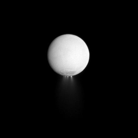
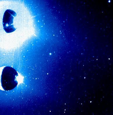
At least four distinct plumes of water ice spew out from the south polar region of Saturn moon Enceladus in this dramatically illuminated image. Light reflected off Saturn is illuminating the surface of the moon while the sun backlights the plumes.
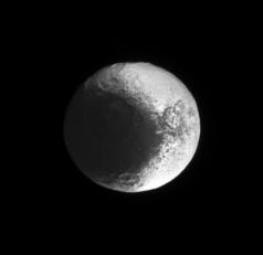
The Cassini spacecraft continues to image terrain on Iapetus that is progressively eastward of the terrain it has previously seen illuminated by sunlight
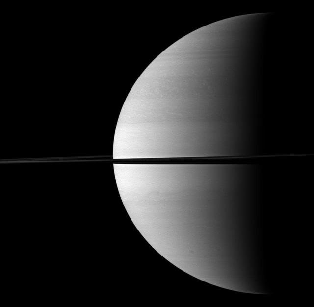
Roughly a quarter of majestic Saturn is illuminated in this view captured while NASA Cassini spacecraft was orbiting near the planet equatorial plane.

This animation depicts the illumination of the topography near Prokofiev crater, showing the small proportion of sunlight that reaches Prokofiev floor and rim.
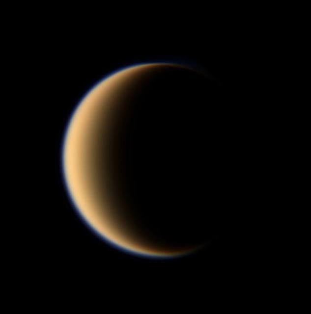
Titan hazy orange globe hangs before the Cassini spacecraft, partly illuminated -- a world with many mysteries yet to be uncovered.
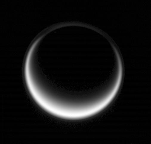
Sunlight scatters through Titan atmosphere, illuminating high hazes and bathing the entire moon in a soft glow

The Cassini spacecraft looks past the illuminated side of Saturn rings to the brilliant moon Enceladus.
Titan polar vortex stands illuminated where all else is in shadow in this image from NASA Cassini spacecraft.
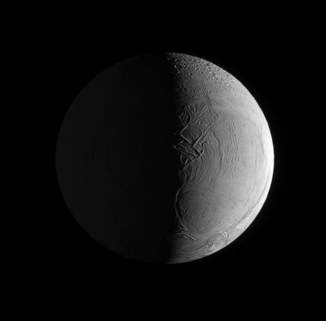
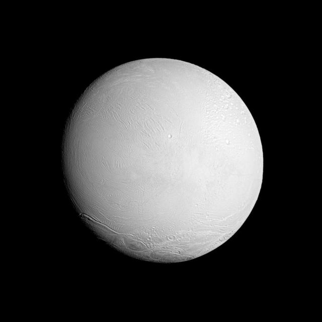
Two sources of light illuminate the textured surface of the moon Enceladus in this image taken by NASA Cassini spacecraft narrow angle camera.
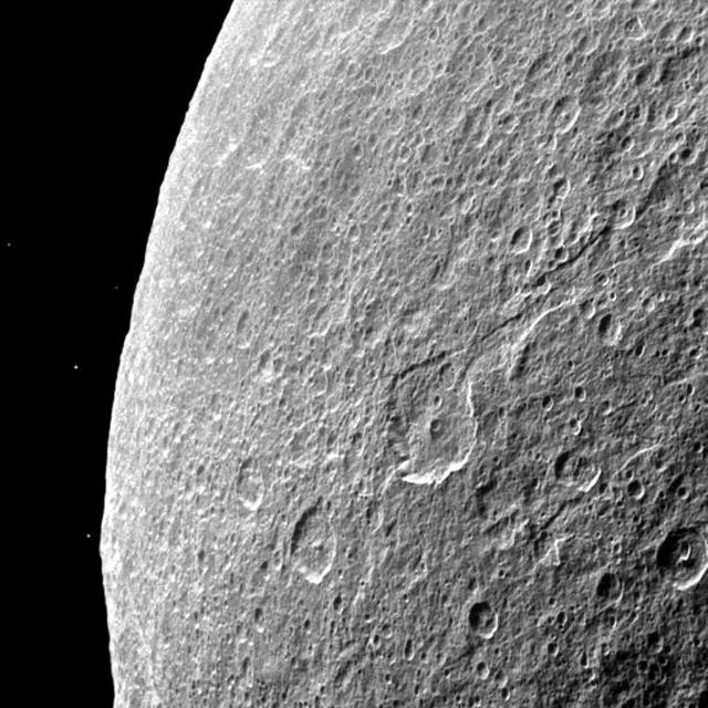
Southern terrain on Saturn moon Rhea is dimly illuminated by Saturnshine in this view of the dark side of the moon captured by NASA Cassini spacecraft.
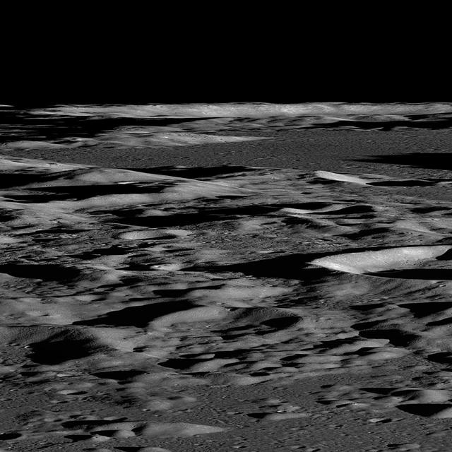
Several sequences were acquired by NASA Lunar Reconnaissance Orbiter looking across the illuminated limb to quantify scattered light.
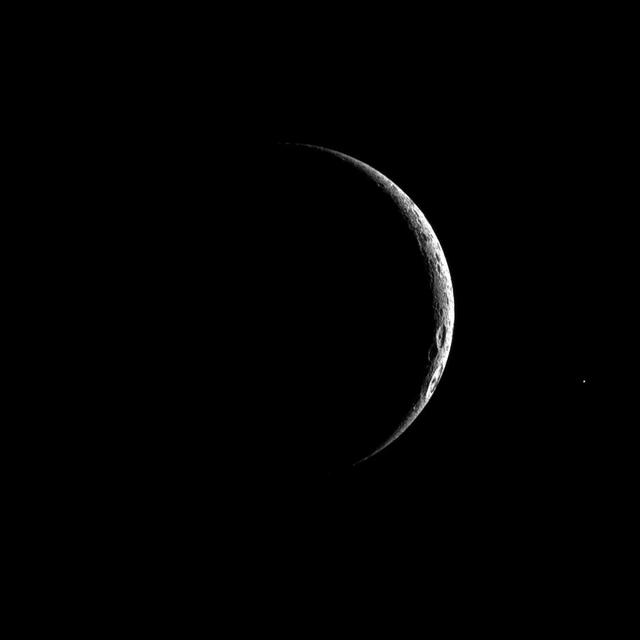
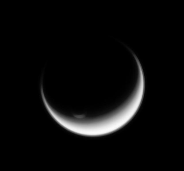
A thin crescent of cratered terrain is illuminated on Saturn third largest moon, Dione in this image captured by NASA Cassini spacecraft.
NASA Cassini spacecraft looks at a brightly illuminated Enceladus and examines the surface of the leading hemisphere of this Saturnian moon.
This image from NASA Galileo spacecraft is of Prometheus sunlit plume and Io illuminated crescent.