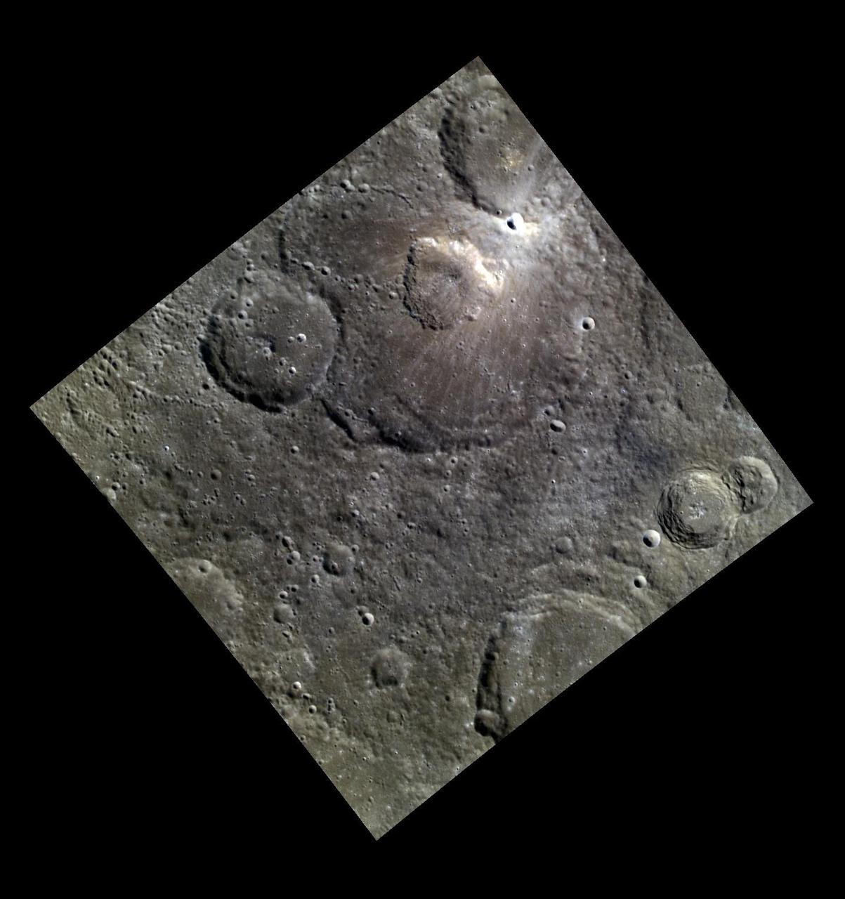
A Volcanic Crater in an Impact Crater

Impact Craters
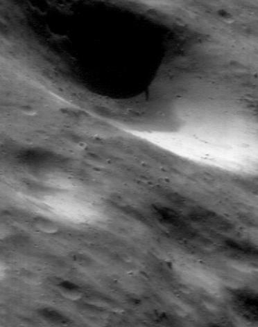
The Impact of Cratering
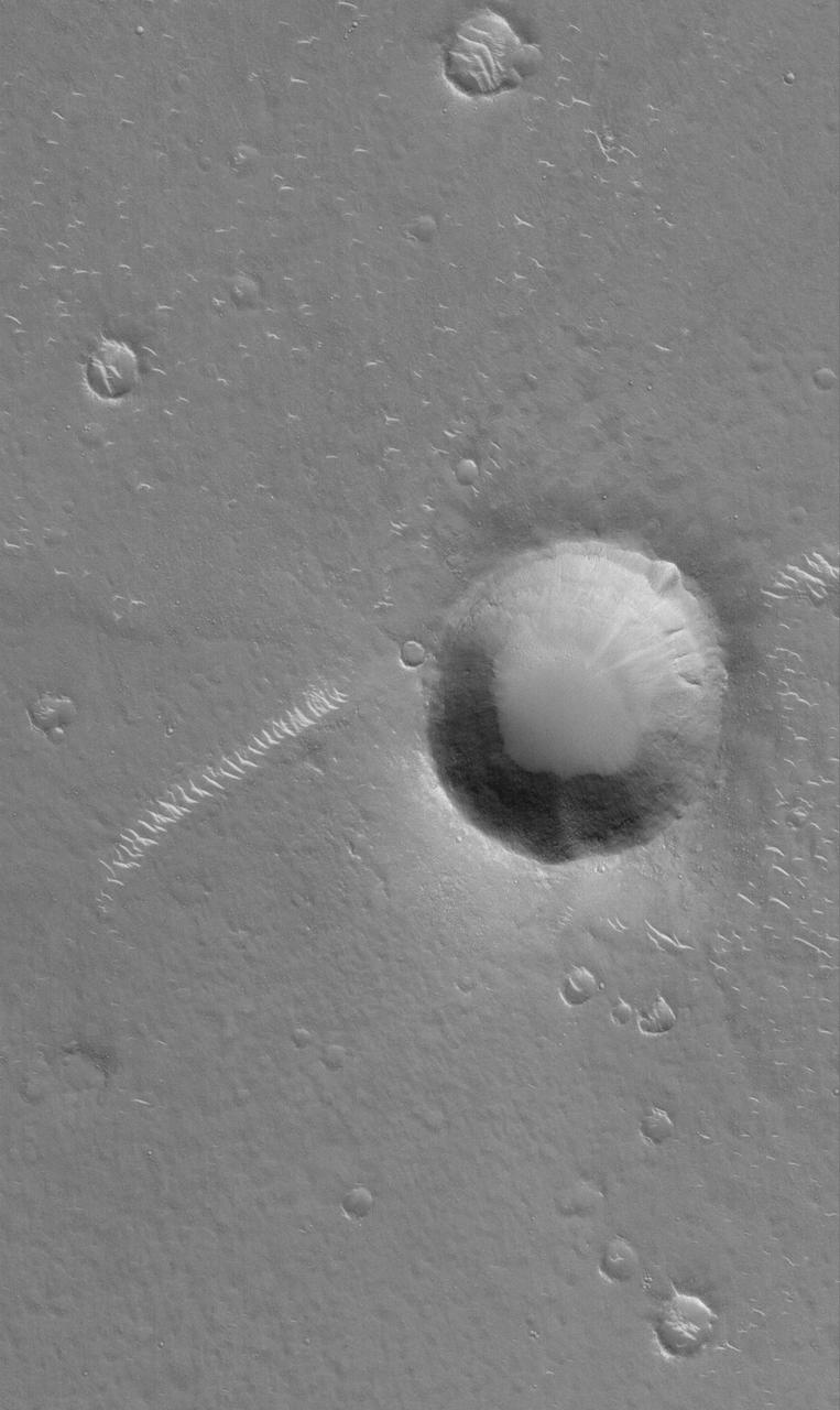
Impact Crater
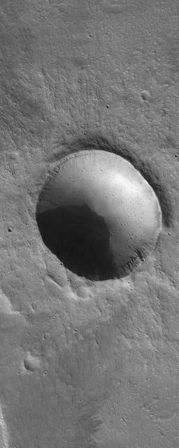
Impact Crater
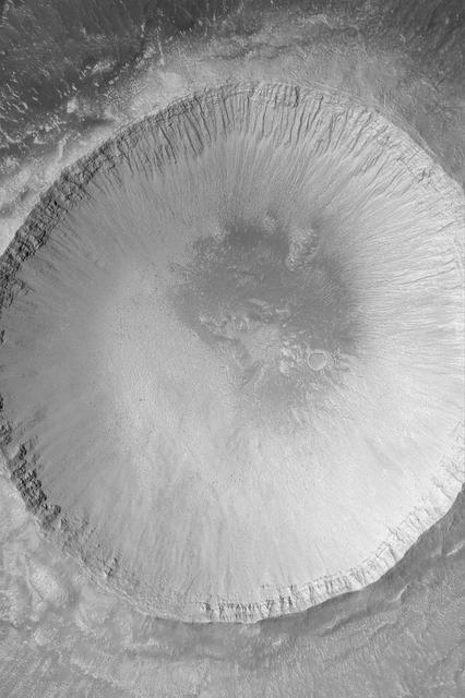
Impact Crater
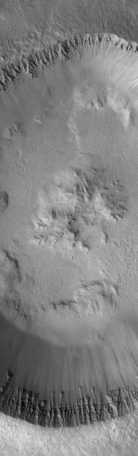
Impact Crater
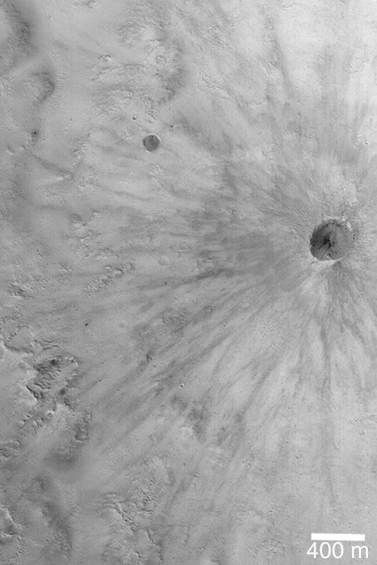
Fresh, Rayed Impact Crater
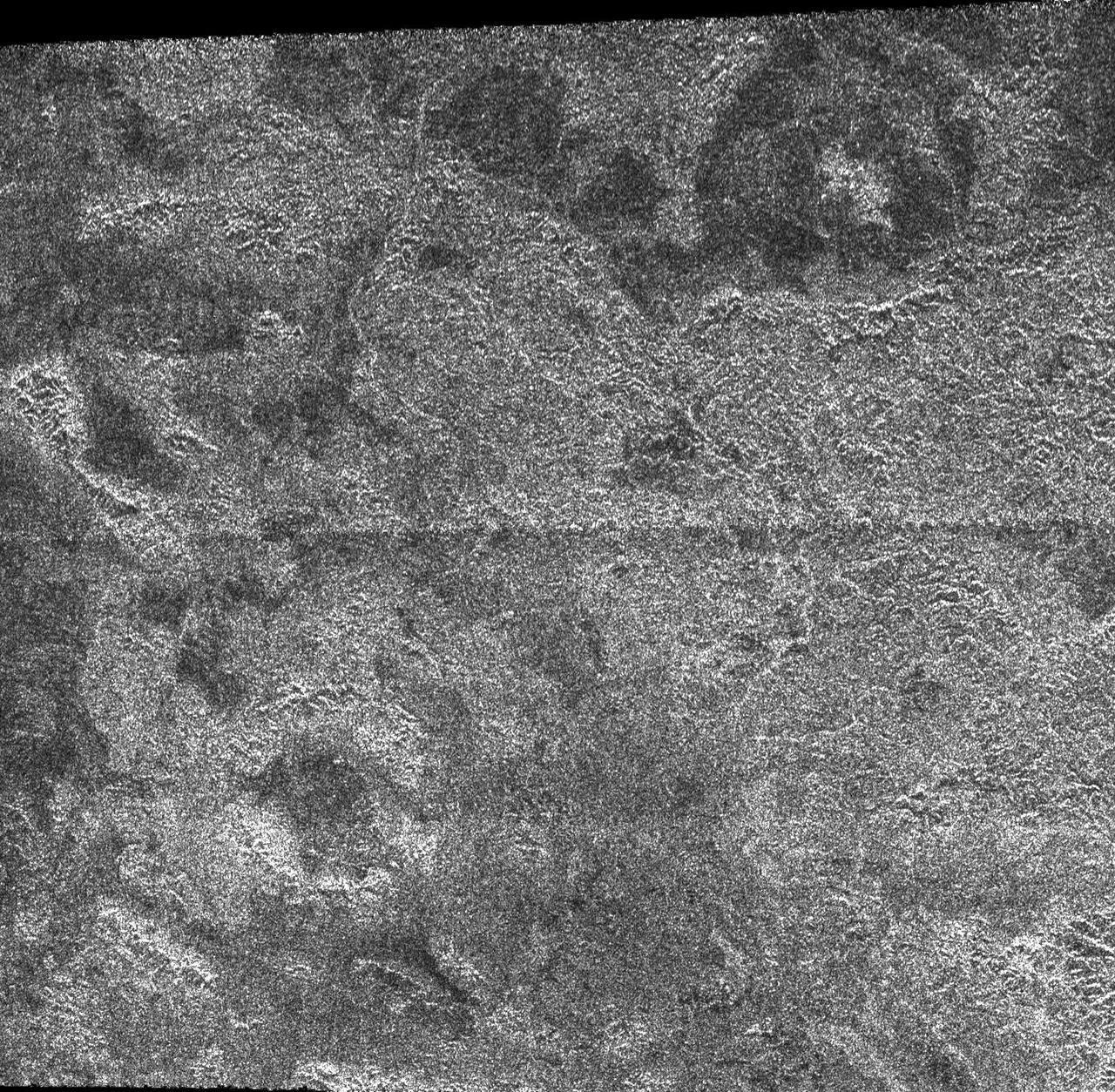
Impact Craters on Xanadu
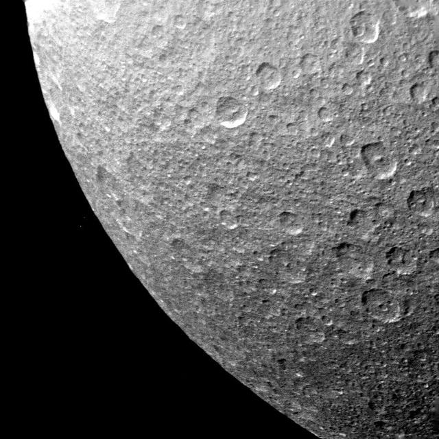
Rhea - Multiple Impact Craters

Impact Melt at Necho Crater
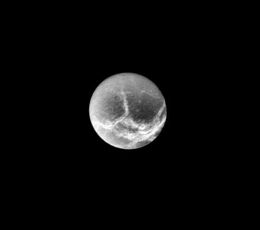
Dione - Circular Impact Craters
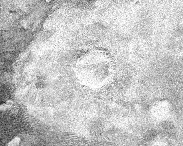
Impact Crater with Ejecta Blanket
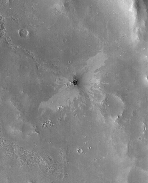
Small Impact Crater
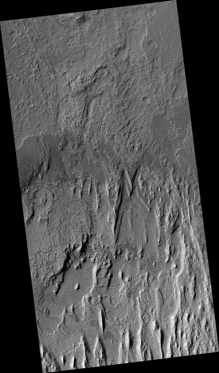
Eroding Layers in an Impact Crater
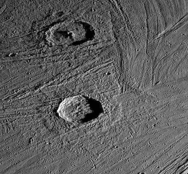
Fresh Impact Craters on Ganymede
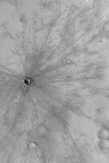
Fresh Impact Crater
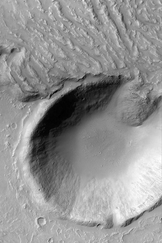
Lava Flow and Impact Crater
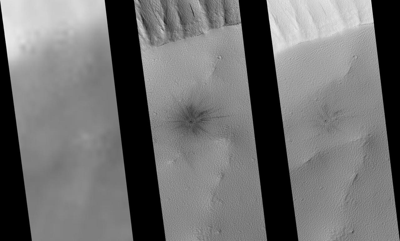
Recently-Formed Impact Crater
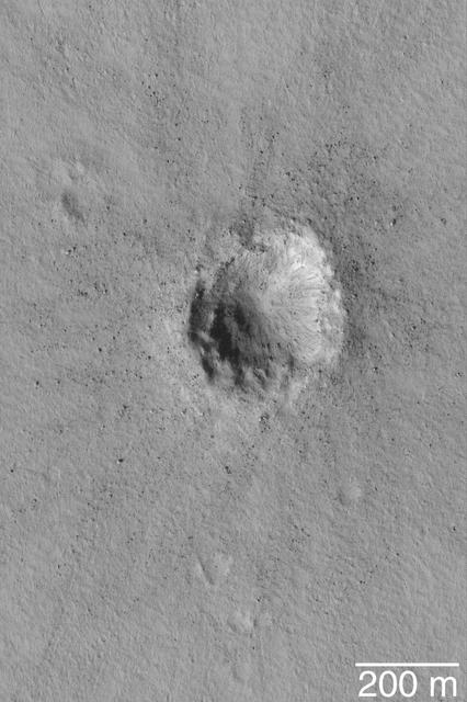
Small Impact Crater
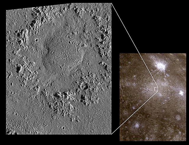
Impact Craters on Icy Callisto: Doh Crater and Asgard
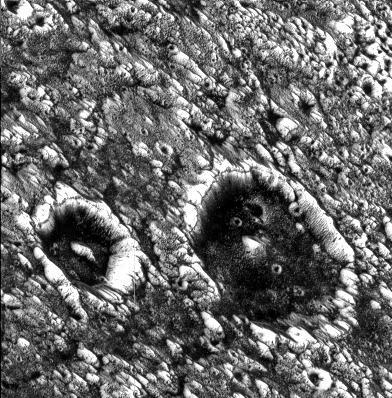
Dark-floored Impact Craters on Ganymede
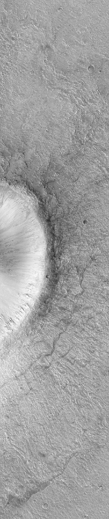
Detail of an Impact Crater, Acidalia Planitia
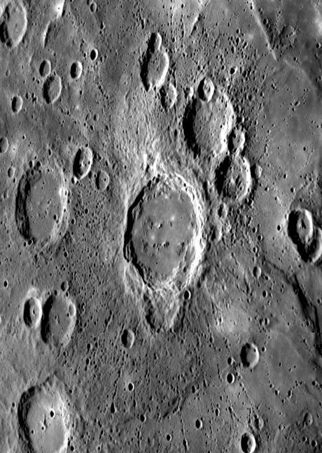
Crater Ejecta and Chains of Secondary Impacts
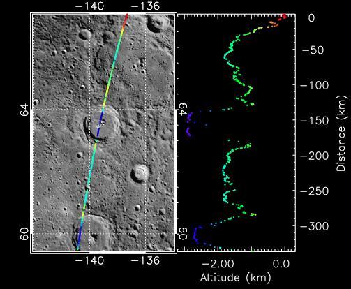
Taking the Measure of Impact Craters on Mercury
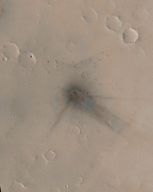
Before-and-After Look at Impact Craters
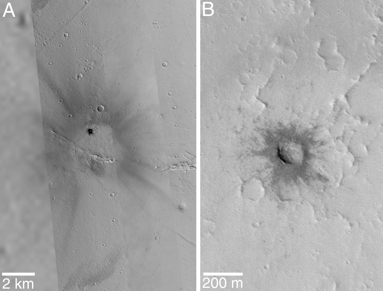
Fresh Impact Crater and Rays in Tharsis
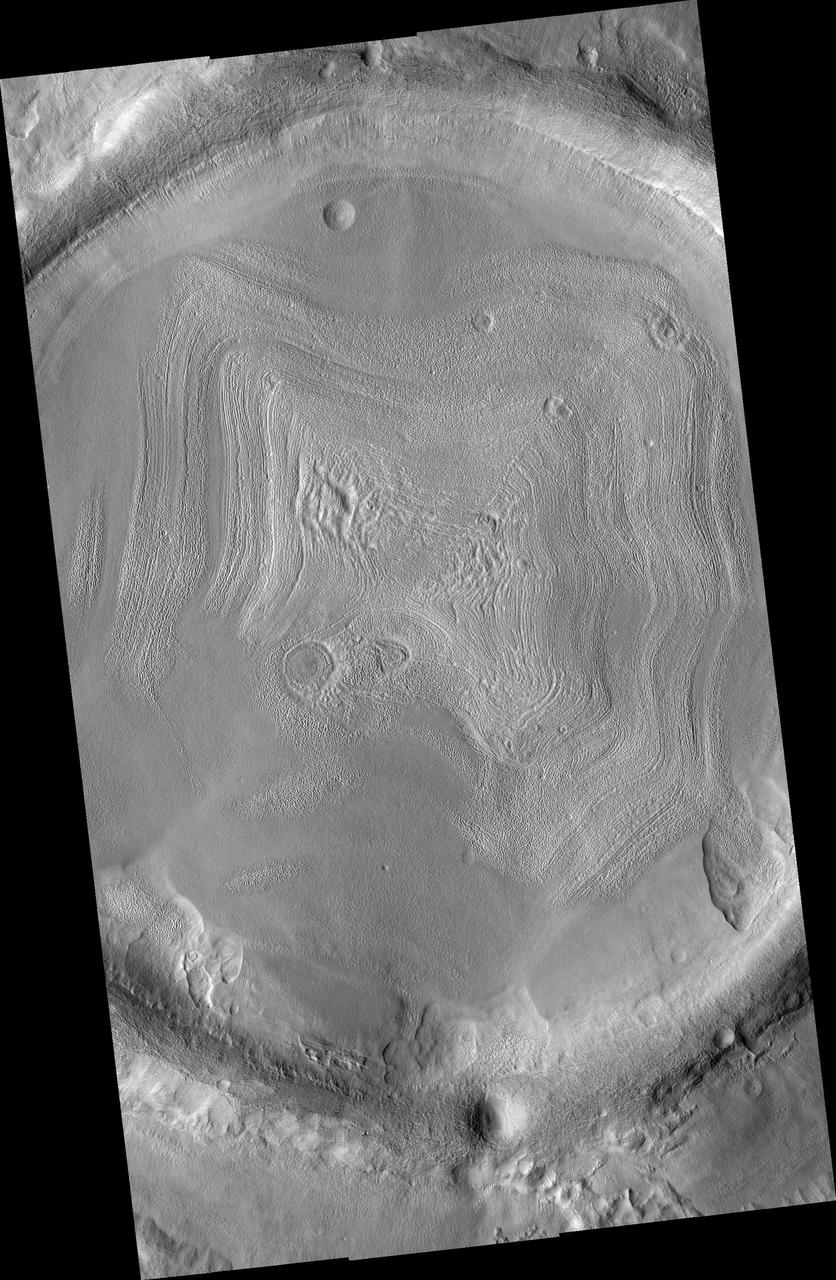
Impact Crater Filled With Layered Deposits
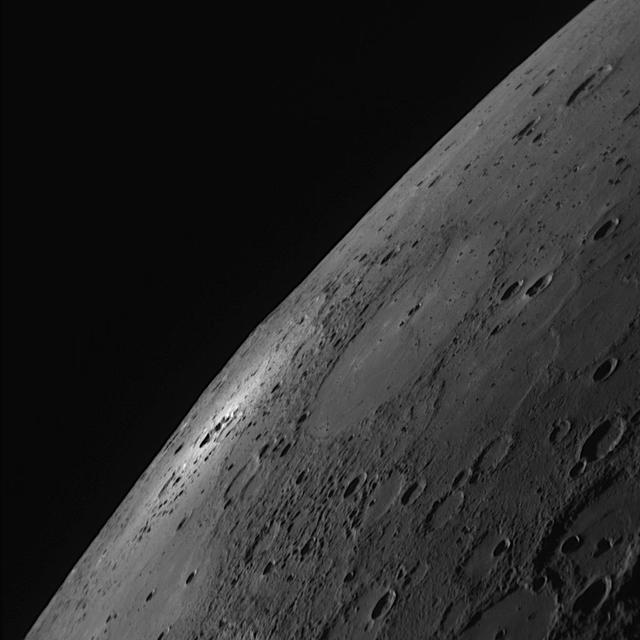
A Small Crater Makes a Bright Impact
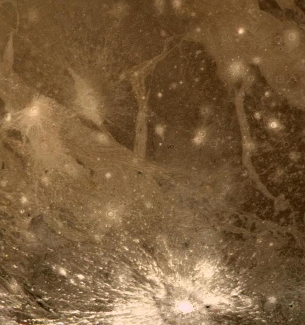
Bright Halo Impact Crater on Ganymede http://photojournal.jpl.nasa.gov/catalog/PIA00357
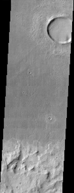
This scene from NASA Mars Odyssey spacecraft shows several interesting geologic features associated with impact craters on Mars.
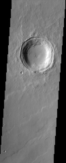
The relatively flat floor and terrace walls of this impact crater imaged by NASA Mars Odyssey spacecraft suggest the crater was partly infilled with sediment and subsequently eroded to its present day form.
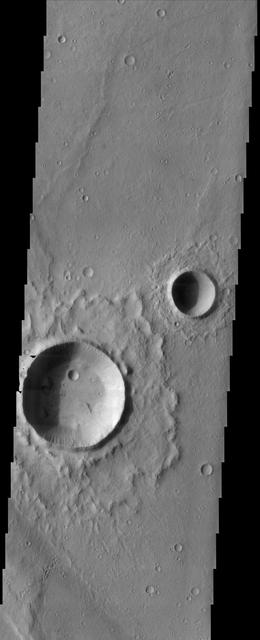
The fluidized impact crater ejecta and flat crater floors observed in this image from NASA Mars Odyssey spacecraft suggest near-surface volatiles once played an important role in modifying the Martian surface.

Ancient Paleo-Dunes Battered by Impact Craters
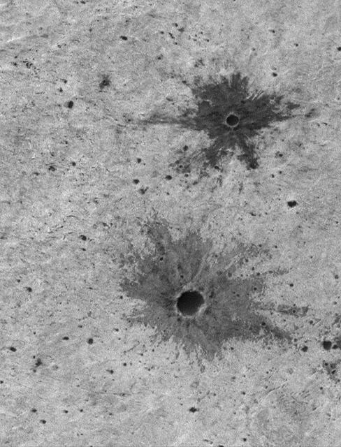
Small Impact Craters with Dark Ejecta Deposits

Ten Newly Named Impact Craters on Mercury
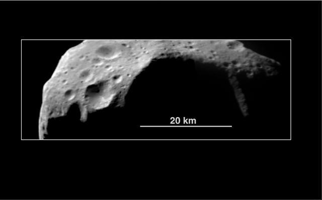
Abundance of Very Large Impact Craters on Mathilde
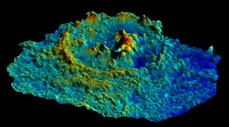
Pwyll Impact Crater: Perspective View of Topographic Model

Ancient Paleo-Dunes Battered by Impact Craters
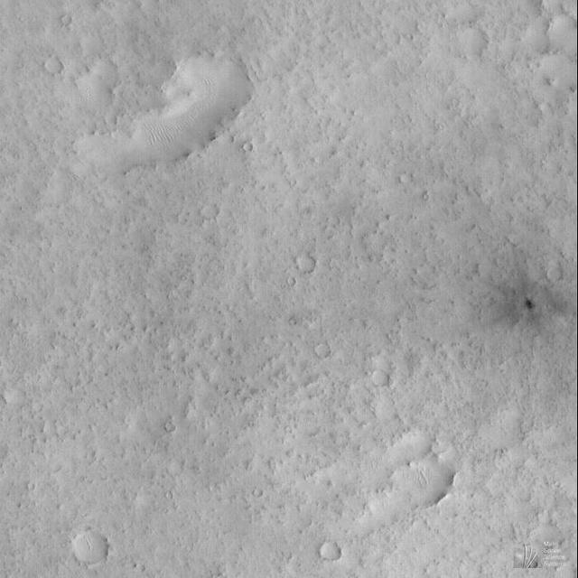
Small, Fresh Impact Crater With Dark Ejecta
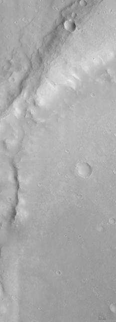
Eroded Crater Adjacent to Huygens Impact Basin

On Earth, geologists can dig holes and pull up core samples to find out what lies beneath the surface. On Mars, geologists cannot dig holes very easily themselves, but a process has been occurring for billions of years that has been digging holes for them: impact cratering. Impact craters form when an asteroid, meteoroid, or comet crashes into a planet's surface, causing an explosion. The energy of the explosion, and the resulting size of the impact crater, depends on the size and density of the impactor, as well as the properties of the surface it hits. In general, the larger and denser the impactor, the larger the crater it will form. The impact crater in this image is a little less than 3 kilometers in diameter. The impact revealed layers when it excavated the Martian surface. Layers can form in a variety of different ways. Multiple lava flows in one area can form stacked sequences, as can deposits from rivers or lakes. Understanding the geology around impact craters and searching for mineralogical data within their layers can help scientists on Earth better understand what the walls of impact craters on Mars expose. http://photojournal.jpl.nasa.gov/catalog/PIA12328
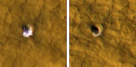
NASA Mars Reconnaissance Orbiter reveals underground ice exposed by impact cratering. The impact that dug the crater excavated water ice from beneath the surface.
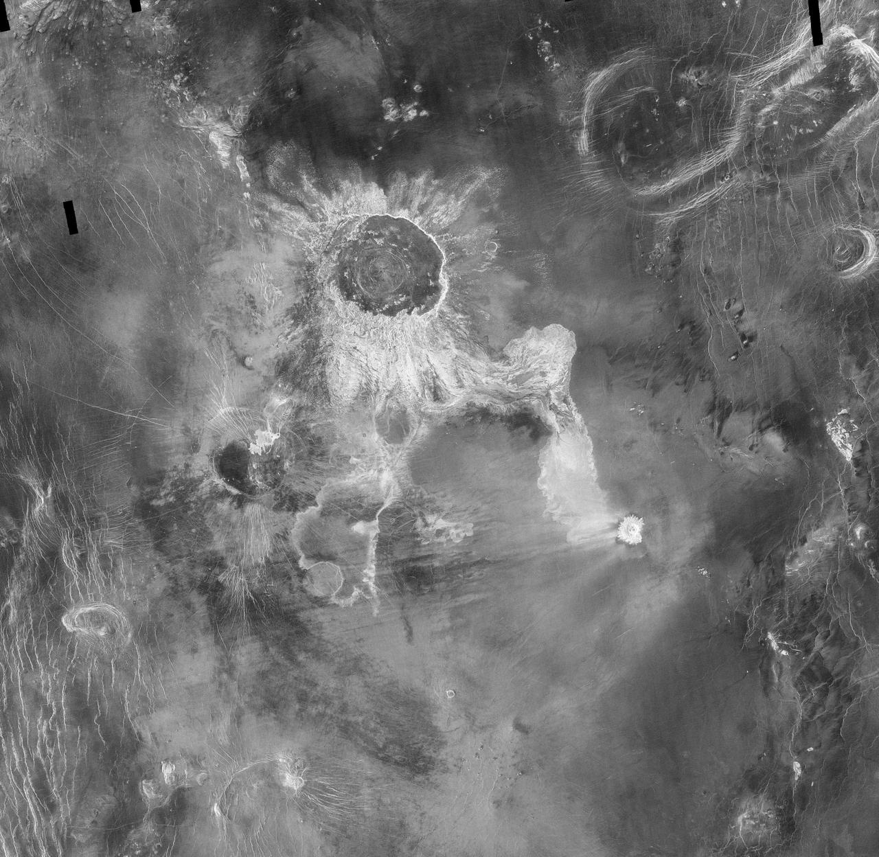
Crater Isabella is seen in this radar image from NASA Magellan spacecraft. The second largest impact crater on Venus, the crater is named in honor of the 15th Century queen of Spain, Isabella of Castile.

This image from NASA Dawn spacecraft of asteroid Vesta shows hows a large impact crater whose rim is rather smoothed and degraded. There are many smaller, younger craters surrounding and inside of this crater and these have sharper, fresher rims.

Dark streaks emanating from within impact crater walls show evidence for mass movement of materials in this image from NASA Mars Odyssey spacecraft.
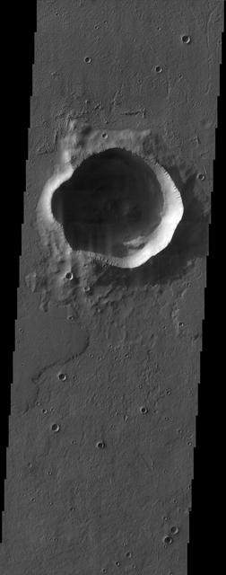
The irregularly shaped rim of the bowl-shaped impact crater in this NASA Mars Odyssey image is most likely due to erosion and the subsequent infilling of sediment.

This image from NASA Dawn spacecraft shows two overlapping impact craters on asteroid Vesta. The rims of the craters are both reasonably fresh but the larger crater must be older because the smaller crater cuts across the larger crater rim.
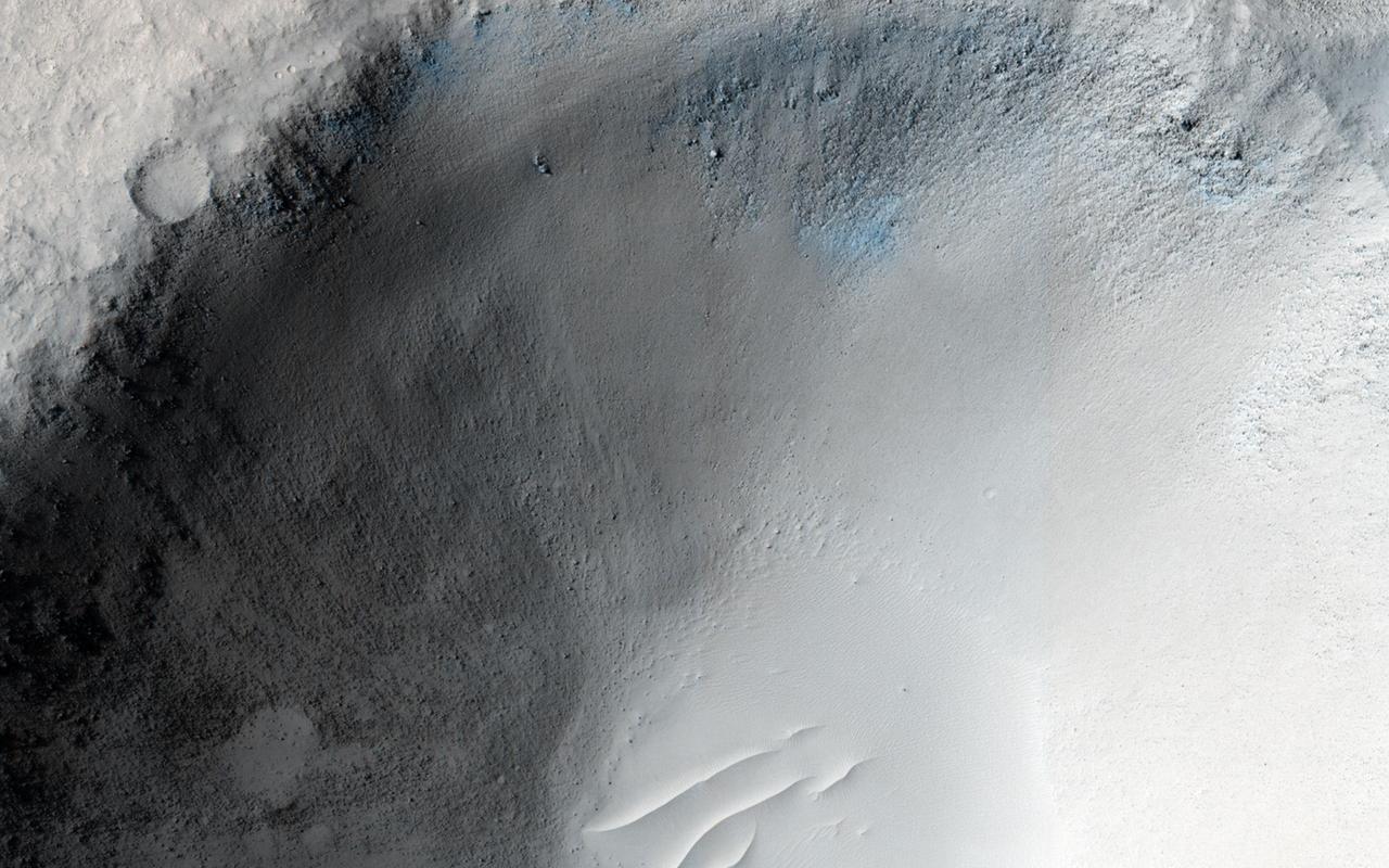
An impact crater in Isidis Planitia observed for a fifth time by NASA Mars Reconnaissance Orbiter.
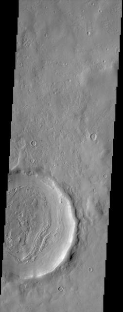
The layering of material observed at the bottom of this impact crater imaged by NASA Mars Odyssey spacecraft suggests multiple depositional and erosional episodes in a changing environment. http://photojournal.jpl.nasa.gov/catalog/PIA04021

This false-color image reveals the scar of a past major impact of a comet or small asteroid on Europa surface. A city-sized impact crater was viewed by NASA Galileo spacecraft.
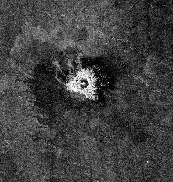
This full-resolution image from NASA Magellan spacecraft shows Jeanne crater, a 19.5 kilometer (12 mile) diameter impact crater. Jeanne crater is located at 40.0 degrees north latitude and 331.4 degrees longitude. The distinctive triangular shape of the ejecta indicates that the impacting body probably hit obliquely, traveling from southwest to northeast. The crater is surrounded by dark material of two types. The dark area on the southwest side of the crater is covered by smooth (radar-dark) lava flows which have a strongly digitate contact with surrounding brighter flows. The very dark area on the northeast side of the crater is probably covered by smooth material such as fine-grained sediment. This dark halo is asymmetric, mimicking the asymmetric shape of the ejecta blanket. The dark halo may have been caused by an atmospheric shock or pressure wave produced by the incoming body. Jeanne crater also displays several outflow lobes on the northwest side. These flow-like features may have formed by fine-grained ejecta transported by a hot, turbulent flow created by the arrival of the impacting object. Alternatively, they may have formed by flow of impact melt. http://photojournal.jpl.nasa.gov/catalog/PIA00472
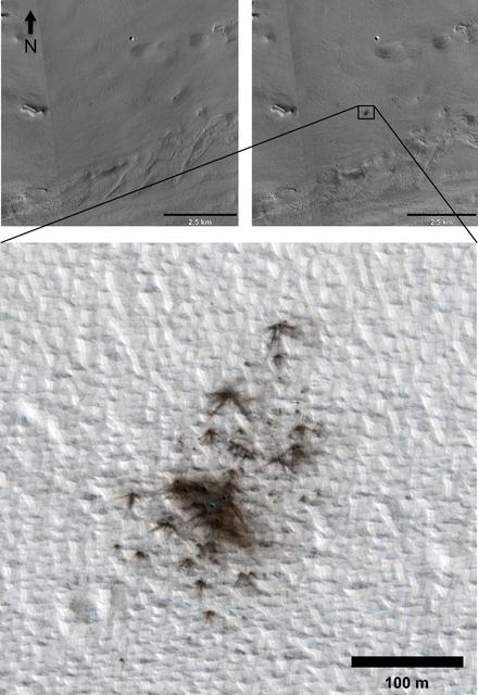
This set of images from cameras on NASA Mars Reconnaissance Orbiter documents the appearance of a new cluster of impact craters on Mars. The orbiter has imaged at least 248 fresh craters, or crater clusters, on Mars.
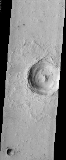
This image taken by NASA Mars Odyssey spacecraft shows a classic example of a Martian impact crater with a central peak. Central peaks are common in large, fresh craters on both Mars and the Moon.
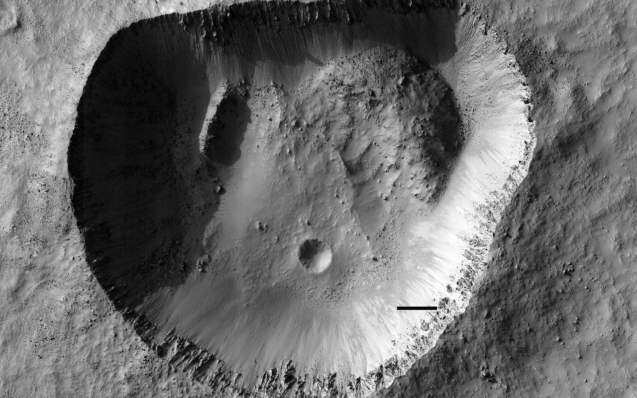
This odd-shaped hole in Noachis Terra is clearly an impact crater. It has the characteristic raised rim that distinguishes it from pits that have simply collapsed. In contrast to most impact craters though, it isn't round. What could have caused this odd shape? Sometimes craters can be elongated when the impact occurs at a very grazing angle, but that's not the case here as the rough ejecta blanket around the crater is mostly symmetric. Large blocks of material in the northeast and northwest corners look like they have slid into the crater. These collapses have extended the crater in those directions giving it an oblong appearance. https://photojournal.jpl.nasa.gov/catalog/PIA25307

NASA's Mars Reconnaissance Orbiter (MRO) keeps finding new impact sites on Mars. This one occurred within the dense secondary crater field of Corinto Crater, to the north-northeast. The new crater and its ejecta have distinctive color patterns. Once the colors have faded in a few decades, this new crater will still be distinctive compared to the secondaries by having a deeper cavity compared to its diameter. https://photojournal.jpl.nasa.gov/catalog/PIA22462
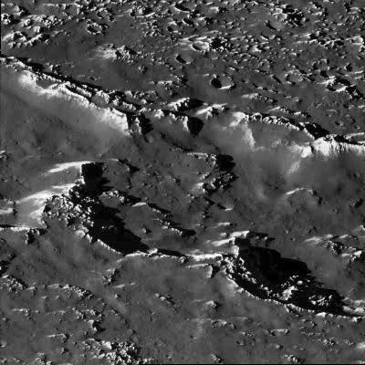
A portion of a chain of impact craters on Jupiter's moon Callisto is seen in this image taken by the Galileo spacecraft on November 4, 1996. This crater chain on Callisto is believed to result from the impact of a split object, similar to the fragments of Comet Shoemaker-Levy 9 which smashed into Jupiter's atmosphere in July of 1994. This high-resolution view, taken by Galileo's solid state imaging television camera during its third orbit around Jupiter, is of Callisto's northern hemisphere at 35 degrees north, 46 degrees west, and covers an area of about eight miles (13 kilometers) across. The smallest visible crater is about 140 yards (130 meters) across. The image was taken at a range of 974 miles (1,567 kilometers). On a global scale, Callisto is heavily cratered, indicating the great age of its surface. At the scale of this image, it was anticipated that the surface would be heavily cratered as well; however, there is a surprising lack of small craters, suggesting that one or more processes have obliterated these and other small-scale features. For example, downslope movement of ice-rich debris could bury small craters. The bright slopes visible in this picture represent places where downslope movement has taken place, exposing fresh ice surfaces. http://photojournal.jpl.nasa.gov/catalog/PIA00514
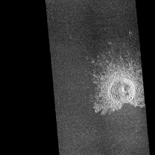
This image mosaic from NASA Magellan spacecraft is of an impact crater located in Guinevere Planitia on Venus. http://photojournal.jpl.nasa.gov/catalog/PIA00238
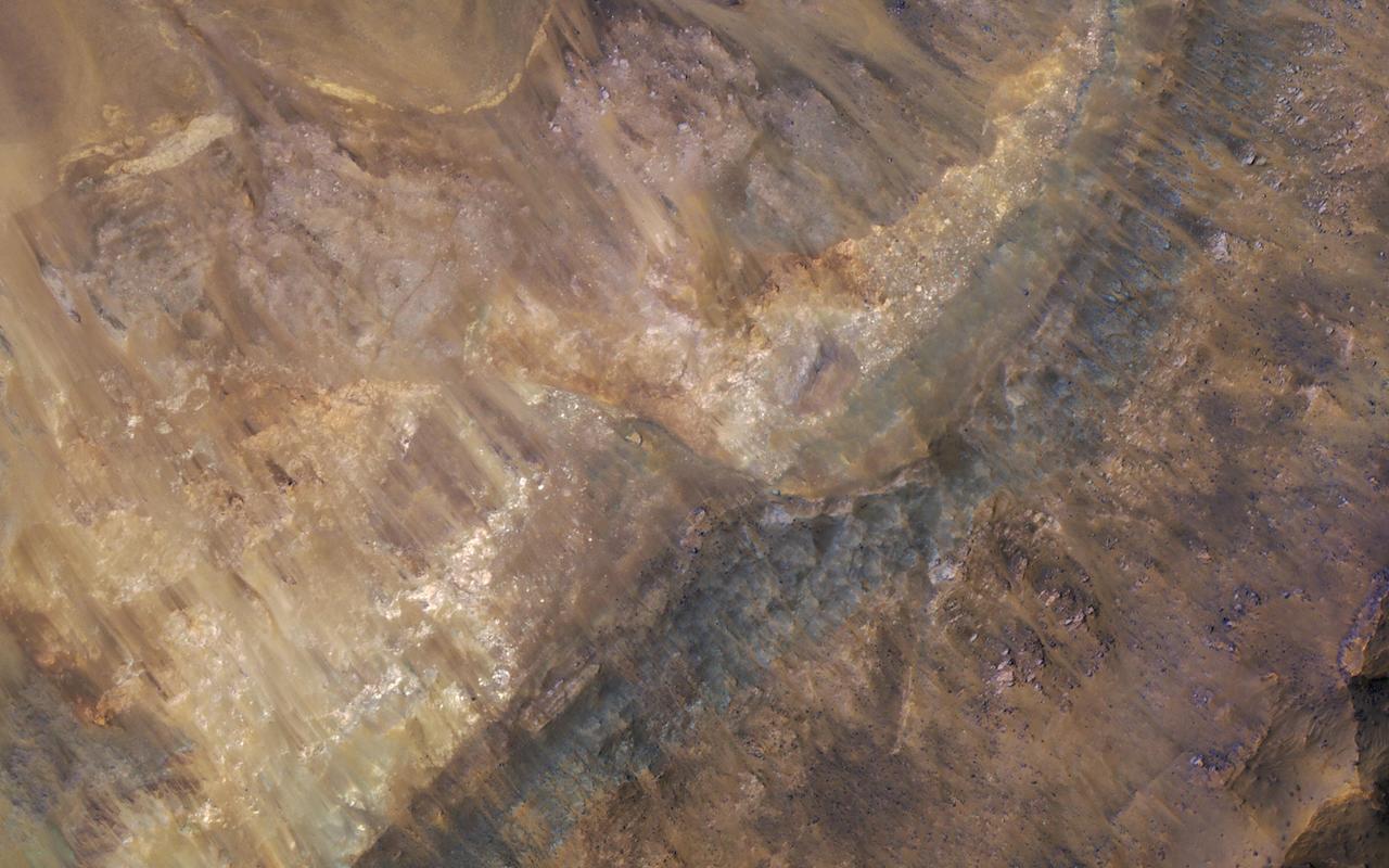
Geologists love roadcuts because they reveal the bedrock stratigraphy (layering). Until we have highways on Mars, we can get the same information from fresh impact craters as shown in this image from NASA's Mars Reconnaissance Orbiter. This image reveals these layers filling a larger crater, perhaps a combination of lava, impact ejecta, and sediments. https://photojournal.jpl.nasa.gov/catalog/PIA21631
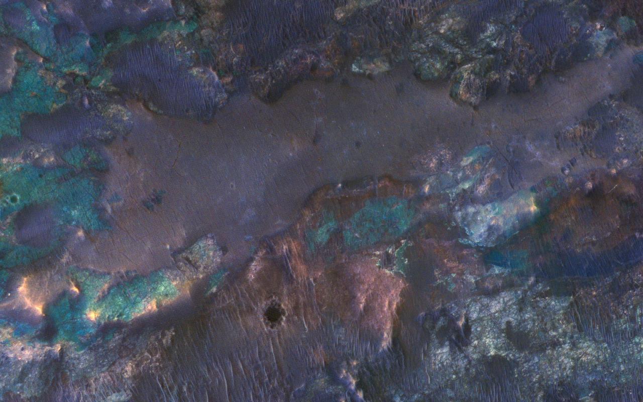
The collision that created Hargraves Crater impacted into diverse bedrock lithologies of ancient Mars; the impact ejecta is a rich mix of rock types with different colors and textures, as seen by NASA Mars Reconnaissance Orbiter. The crater is named after Robert Hargraves who discovered and studied meteorite impacts on the Earth. https://photojournal.jpl.nasa.gov/catalog/PIA21609
![Mars is a dynamic planet. HiRISE has witnessed many surface changes over the past ten years, including hundreds of new craters formed by ongoing impacts. Most of these impacts are likely caused by asteroids that have strayed into collision courses with Mars. The planet's much thinner atmosphere compared to Earth makes small asteroids less likely to burn up prior to hitting the Martian surface. This new crater, which formed explosively at the point of impact, has a diameter of roughly 8 meters (about 25 feet), but its surrounding blast zone and ejecta extend over a kilometer (about one mile) beyond the crater itself. The materials exposed nearest the crater have distinctive yellowish and lighter grey appearances, while more distant ejected materials range from dark brown to bright bluish in an enhanced-color view. These varied materials may have originated from different layers penetrated by the impact. This new impact was discovered using the lower-resolution Context Camera (CTX), also on board Mars Reconnaissance Orbiter. An older CTX image of this region from May 2012 shows a uniformly dust-covered surface, while a newer CTX image from September 2016 reveals the crater's dark blast zone. New craters on Mars are easiest to locate in such dust-coated terrains, where they provide opportunistic "road cuts" that allow scientists to see beneath the dust blanket and determine the underlying rock compositions and textures. This particular crater formed about 300 kilometers (roughly 200 miles) east of the Spirit rover's final resting spot in Gusev Crater. The map is projected here at a scale of 25 centimeters (9.8 inches) per pixel. [The original image scale is 26.2 centimeters (10.3 inches) per pixel (with 1 x 1 binning); objects on the order of 79 centimeters (31 inches) across are resolved.] North is up. http://photojournal.jpl.nasa.gov/catalog/PIA21451](https://images-assets.nasa.gov/image/PIA21451/PIA21451~medium.jpg)
Mars is a dynamic planet. HiRISE has witnessed many surface changes over the past ten years, including hundreds of new craters formed by ongoing impacts. Most of these impacts are likely caused by asteroids that have strayed into collision courses with Mars. The planet's much thinner atmosphere compared to Earth makes small asteroids less likely to burn up prior to hitting the Martian surface. This new crater, which formed explosively at the point of impact, has a diameter of roughly 8 meters (about 25 feet), but its surrounding blast zone and ejecta extend over a kilometer (about one mile) beyond the crater itself. The materials exposed nearest the crater have distinctive yellowish and lighter grey appearances, while more distant ejected materials range from dark brown to bright bluish in an enhanced-color view. These varied materials may have originated from different layers penetrated by the impact. This new impact was discovered using the lower-resolution Context Camera (CTX), also on board Mars Reconnaissance Orbiter. An older CTX image of this region from May 2012 shows a uniformly dust-covered surface, while a newer CTX image from September 2016 reveals the crater's dark blast zone. New craters on Mars are easiest to locate in such dust-coated terrains, where they provide opportunistic "road cuts" that allow scientists to see beneath the dust blanket and determine the underlying rock compositions and textures. This particular crater formed about 300 kilometers (roughly 200 miles) east of the Spirit rover's final resting spot in Gusev Crater. The map is projected here at a scale of 25 centimeters (9.8 inches) per pixel. [The original image scale is 26.2 centimeters (10.3 inches) per pixel (with 1 x 1 binning); objects on the order of 79 centimeters (31 inches) across are resolved.] North is up. http://photojournal.jpl.nasa.gov/catalog/PIA21451

Three large meteorite impact craters are seen in this image obtained by NASA Magellan spacecraft of the Lavinia region of Venus. http://photojournal.jpl.nasa.gov/catalog/PIA00214

A dramatic, fresh impact crater dominates this image taken by the HiRISE camera onboard NASA Mars Reconnaissance Orbiter on Nov. 19, 2013. The crater is surrounded by a large, rayed blast zone.
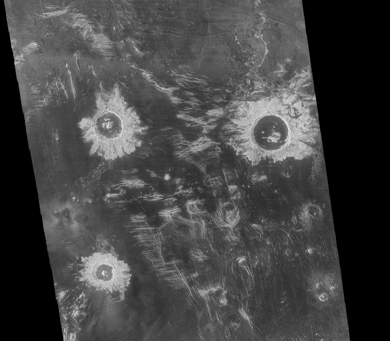
This mosaic from NASA Magellan data is in the Lavinia region of Venus. Three large impact craters can be seen located in a region of fractured plains. http://photojournal.jpl.nasa.gov/catalog/PIA00086
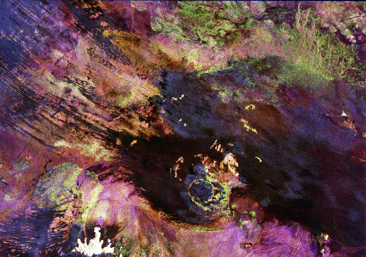
This space radar image shows the Roter Kamm impact crater in southwest Namibia. The crater rim is seen in the lower center of the image as a radar-bright, circular feature. Geologists believe the crater was formed by a meteorite that collided with Earth approximately 5 million years ago. The data were acquired by the Spaceborne Imaging Radar-C/X-Band Synthetic Aperture Radar (SIR-C/X-SAR) instrument onboard space shuttle Endeavour on April 14, 1994. The area is located at 27.8 degrees south latitude and 16.2 degrees east longitude in southern Africa. The colors in this image were obtained using the following radar channels: red represents the L-band (horizontally transmitted and received); green represents the L-band (horizontally transmitted and vertically received); and blue represents the C-band (horizontally transmitted and vertically received). The area shown is approximately 25.5 kilometers (15.8 miles) by 36.4 kilometers (22.5 miles), with north toward the lower right. The bright white irregular feature in the lower left corner is a small hill of exposed rock outcrop. Roter Kamm is a moderate sized impact crater, 2.5 kilometers (1.5 miles) in diameter rim to rim, and is 130 meters (400 feet) deep. However, its original floor is covered by sand deposits at least 100 meters (300 feet) thick. In a conventional aerial photograph, the brightly colored surfaces immediately surrounding the crater cannot be seen because they are covered by sand. The faint blue surfaces adjacent to the rim may indicate the presence of a layer of rocks ejected from the crater during the impact. The darkest areas are thick windblown sand deposits which form dunes and sand sheets. The sand surface is smooth relative to the surrounding granite and limestone rock outcrops and appears dark in radar image. The green tones are related primarily to larger vegetation growing on sand soil, and the reddish tones are associated with thinly mantled limestone outcrops. Studies of impact craters on the surface of the Earth help geologists understand the role of the impact process in the Earth's evolution, including effects on the atmosphere and on biological evolution. http://photojournal.jpl.nasa.gov/catalog/PIA00503
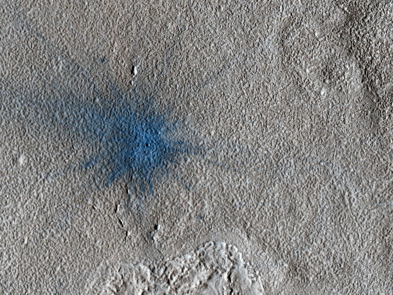
This image from NASA Mars Reconnaissance Orbiter shows an approximately 7-meter diameter fresh crater and dark ejecta blanket. These small impact craters continue to form on Mars, and are most easily recognized in areas covered by bright dust.
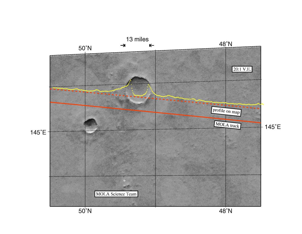
MGS Mars Orbiter Laser Altimeter Topographic Profile of Impact Crater

New Impact Crater Formed Between April 2001 and December 2003
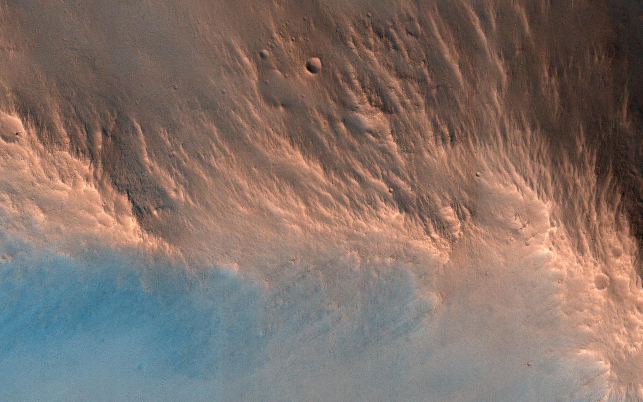
found across the Martian surface. Each impact crater on Mars possesses a unique origin and composition, which makes the HiRISE team very interested in sampling as many of them as possible! Like the impact of a droplet into fluid, once an impact has occurred on the surface of Mars, an ejecta curtain forms immediately after, contributing to the raised rim visible at the top of the crater's walls. After the formation of the initial crater, if it is large enough, then a central peak appears as the surface rebounds. These central peaks can expose rocks that were previously deeply buried beneath the Martian surface. The blue and red colors in this enhanced-contrast image reflect the effects of post-impact sedimentation and weathering over time. http://photojournal.jpl.nasa.gov/catalog/PIA08395
![This image was acquired to take a closer look at a circular feature that might be an impact structure on the South Polar layered deposits. Measuring the sizes and frequency of impact craters provides a constraint on the age of the landscape. However, craters in icy terrain are modified by processes that flatten and change them in such a manner that it is hard to say for sure if it had an impact origin. The map is projected here at a scale of 50 centimeters (19.7 inches) per pixel. [The original image scale is 49.8 centimeters (19.6 inches) per pixel (with 2 x 2 binning); objects on the order of 150 centimeters (59 inches) across are resolved.] North is up. https://photojournal.jpl.nasa.gov/catalog/PIA21576](https://images-assets.nasa.gov/image/PIA21576/PIA21576~medium.jpg)
This image was acquired to take a closer look at a circular feature that might be an impact structure on the South Polar layered deposits. Measuring the sizes and frequency of impact craters provides a constraint on the age of the landscape. However, craters in icy terrain are modified by processes that flatten and change them in such a manner that it is hard to say for sure if it had an impact origin. The map is projected here at a scale of 50 centimeters (19.7 inches) per pixel. [The original image scale is 49.8 centimeters (19.6 inches) per pixel (with 2 x 2 binning); objects on the order of 150 centimeters (59 inches) across are resolved.] North is up. https://photojournal.jpl.nasa.gov/catalog/PIA21576
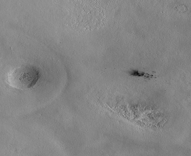
The Context Camera aboard NASA Mars Reconnaissance Orbiter discovers new dark spots on Mars that, upon closer examination, turn out to be brand new impact craters.

This image from NASA Mars Reconnaissance Orbiter spacecraft shows a roughly 3-kilometer impact crater, formed on the sloping walls of Tithonium Chasma, part of the large Valles Marineris canyon system.
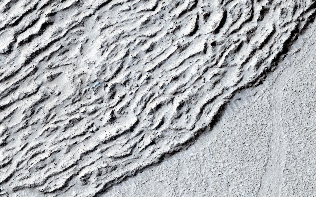
This image shows lava crumpled against the upstream side of an impact crater as seen by NASA Mars Reconnaissance Orbiter.
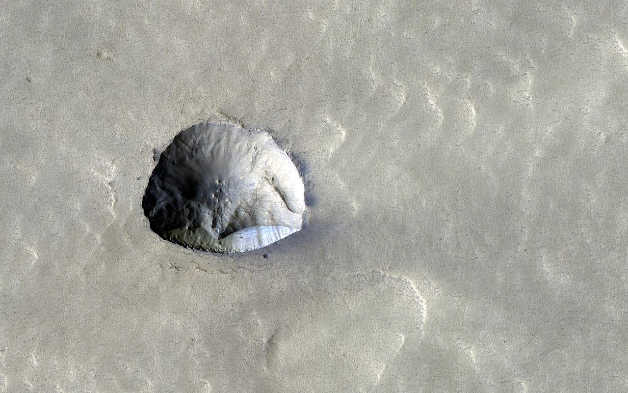
We've come to understand in recent years that about a third of Mars has ice just below the surface. Many impact craters in the mid-latitudes are filled with smooth material that is probably ice covered with a little dirt. Part of one of these filled craters appears in this HiRISE image and has an interesting feature about 250 meters (800 feet) across, near the image center. What looks like might have been a small impact crater now has a straight edge with a steep cliff on its southern side. This north-facing cliff appears to expose icy material that's similar to other pole-facing scarps showing buried ice elsewhere on the planet. These cliffs give us a cut-away view of the buried ice in that location and can help answer questions about what the Martian climate was like when this ice formed. https://photojournal.jpl.nasa.gov/catalog/PIA25083

This image from NASA Dawn spacecraft shows a large number of craters, formed by collisions into the surface of asteroid Vesta. The relatively large circular depressions in this image are older, heavily degraded impact craters.
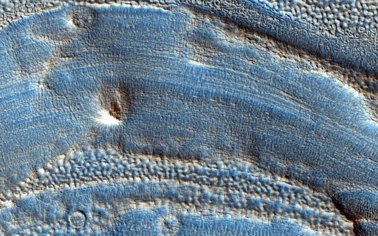
This image captured by NASA Mars Reconnaissance Orbiter spans from wall to wall across the center area of an impact crater. From what we see, a lot has happened to modify the appearance of the crater since it was formed.
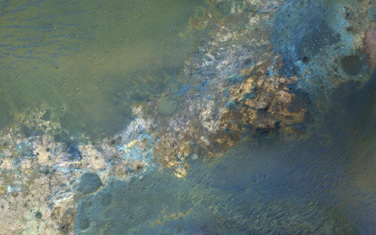
Large impact craters rebound from the initial shock, raising deep bedrock to the surface in the central uplift of the crater. Often this bedrock has greater compositional diversity than the surface layers, because they are from greater depths, older, jumbled, and altered, and very diverse. http://photojournal.jpl.nasa.gov/catalog/PIA20814
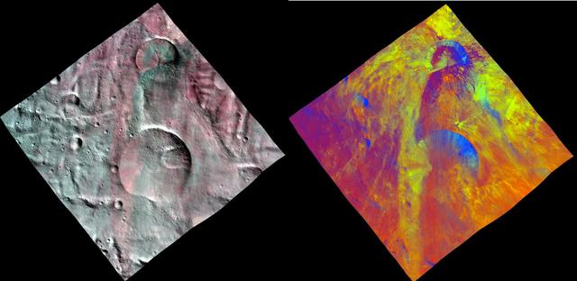
This image combines two separate views of the giant asteroid Vesta obtained by NASA Dawn spacecraft. The fresh impact craters in this view are located in the south polar region, which has been partly covered by landslides from the adjacent crater.

This image from NASA's Mars Reconnaissance Orbiter (MRO) shows two new craters, both with the same distinctive pattern of relatively blue (less red) ejecta surrounded by a dark blast zone (where dust has been removed or disturbed), and with arcing patterns extending northwest and northeast. This pattern indicates an oblique impact angle with the bolide coming from the north. MRO has discovered over 700 new impact sites on Mars. Often, a bolide breaks apart in the atmosphere and makes a tight cluster of new craters. https://photojournal.jpl.nasa.gov/catalog/PIA22453

This image covers two overlapping impact craters, one approximately 4 kilometers in diameter and a second that is about 3 kilometers wide. The smaller crater has a sharply defined rim that interrupts the rim of the larger one, indicating that the smaller crater formed more recently. Rocks of several different colors are exposed in this crater's walls; they are undergoing erosion into finer-grained debris that travels downwards and accumulates in small fans on the crater floor. The rocks exposed on the eastern crater wall appear bluer in enhanced color than the redder rocks of the southern wall. These craters are in the Terra Cimmeria region of Mars' Southern Highlands, where they provide windows into the diverse compositions of the ancient bedrock. https://photojournal.jpl.nasa.gov/catalog/PIA25503

Impact craters are common on all solar system bodies. They offer many clues to scientists regarding the geologic history of a planetary surface, particularly regarding its age, evolution with time, and composition. For instance, this image covers an impact crater on the southeastern flank of Ascraeus Mons, a notable volcano in the Tharsis Plateau. Based on the original science rationale for acquiring this image, by gaining more information about its depth and consequently the stability of the crater wall, we can learn more about the nature of the volcano's flank materials. Also, by carefully studying the materials exposed in the crater walls, we can gain more information about the subsurface. https://photojournal.jpl.nasa.gov/catalog/PIA24919
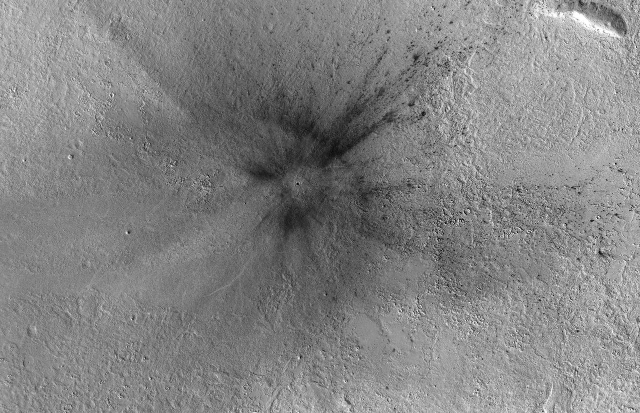
This meteoroid impact crater on Mars was discovered using the black-and-white Context Camera aboard NASA's Mars Reconnaissance Orbiter (MRO). The Context Camera took this image showing the impact, which occurred Dec. 24, 2021, in a region called Amazonis Planitia. Relying on data from the Mars Color Imager camera, also aboard MRO, along with seismic data from NASA's InSight lander, scientists were able to determine when this particular crater formed. Looking closely at the crater's rim, white specks could be detected that suggested the presence of water ice (which was later confirmed by MRO's High-Resolution Imaging Science Experiment, or HiRISE, camera). Debris thrown during the impact can be seen reaching as far as 23 miles (37 kilometers) away. The disturbance seen in the surface suggests the meteoroid was traveling towards the northeast when it hit the ground, throwing the longest streaks of debris in that direction. https://photojournal.jpl.nasa.gov/catalog/PIA25584
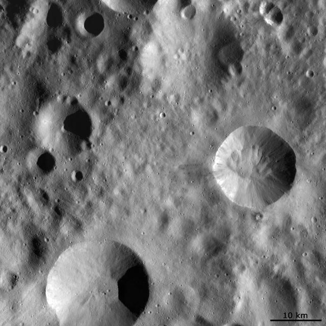
This image from NASA Dawn spacecraft shows four large impact craters close to one another on Vesta surface. Interestingly, each of these four has a distinct preservation state.

This image acquired by NASA Lunar Reconnaissance Orbiter shows a crater center of image formed by impact of the Apollo 14 Saturn IVB booster.
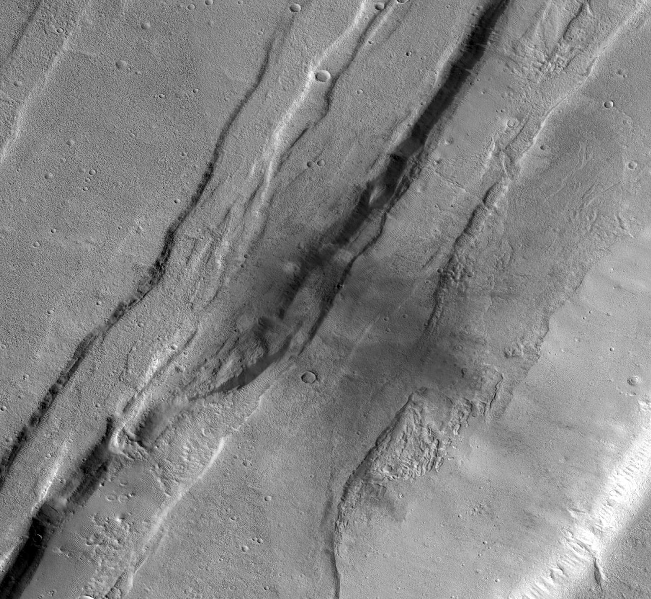
This meteoroid impact crater on Mars was captured using the black-and-white Context Camera aboard NASA's Mars Reconnaissance Orbiter (MRO). The Context Camera took this image showing the impact, which occurred Sept. 18, 2021, in a region called Tempe Terra. The meteoroid struck the side of a graben – a depression created by faults. The impact crater left behind is roughly 427 feet (130 meters) across. https://photojournal.jpl.nasa.gov/catalog/PIA25587
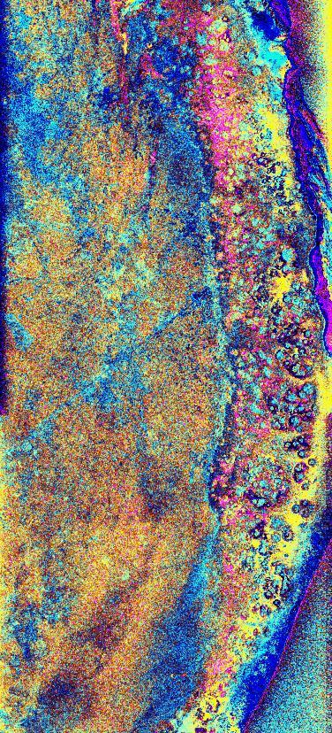
This is a radar image of the southwest portion of the buried Chicxulub impact crater in the Yucatan Peninsula, Mexico. The radar image was acquired on orbit 81 of space shuttle Endeavour on April 14, 1994 by the Spaceborne Imaging Radar C/X-Band Synthetic Aperture Radar (SIR-C/X-SAR). The image is centered at 20 degrees north latitude and 90 degrees west longitude. Scientists believe the crater was formed by an asteroid or comet which slammed into the Earth more than 65 million years ago. It is this impact crater that has been linked to a major biological catastrophe where more than 50 percent of the Earth's species, including the dinosaurs, became extinct. The 180-to 300-kilometer-diameter (110- to 180-mile) crater is buried by 300 to 1,000 meters (1,000 to 3,000 feet) of limestone. The exact size of the crater is currently being debated by scientists. This is a total power radar image with L-band in red, C-band in green, and the difference between C-band L-band in blue. The 10-kilometer-wide (6-mile) band of yellow and pink with blue patches along the top left (northwestern side) of the image is a mangrove swamp. The blue patches are islands of tropical forests created by freshwater springs that emerge through fractures in the limestone bedrock and are most abundant in the vicinity of the buried crater rim. The fracture patterns and wetland hydrology in this region are controlled by the structure of the buried crater. Scientists are using the SIR-C/X-SAR imagery to study wetland ecology and help determine the exact size of the impact crater. http://photojournal.jpl.nasa.gov/catalog/PIA01723
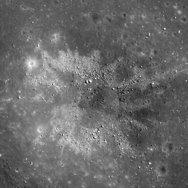
Materials excavated during formation of this ~450 m diameter impact crater have an unusual two-toned character, likely a reflection of heterogeneity in the target materials. This crater occurs in Balmer Basin. This image was taken by NASA Lunar Reconnai
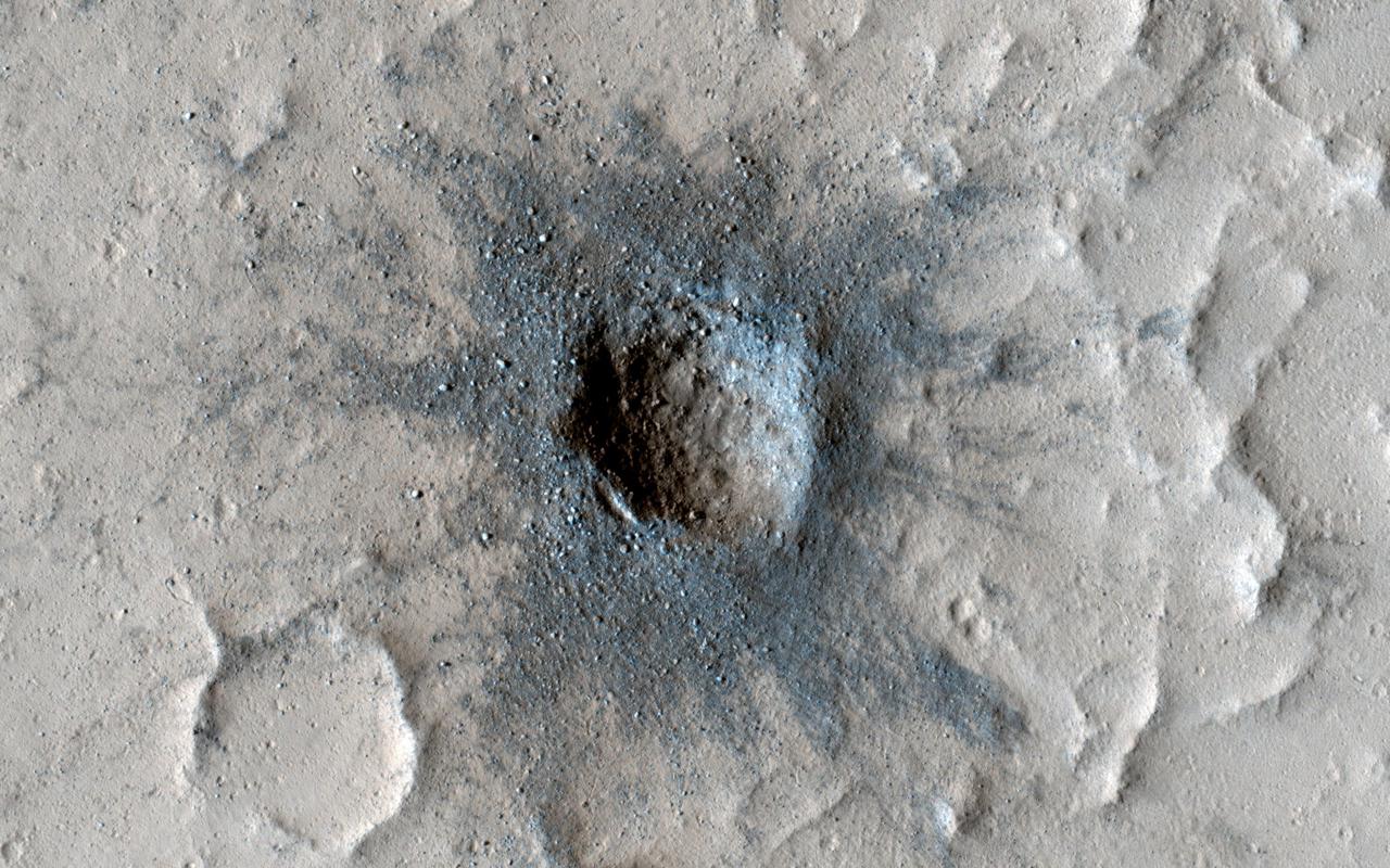
New impact craters on Mars are often darker than their surroundings and have lots of boulders in their interior. The crater in this image has all those attributes and looks like it may have occurred very recently; however, it's been seen in images dating back 50 years to the Mariner 9 mission. HiRISE has imaged this crater a few times (most recently in January 2022) to check for changes. We expect that over time the dark coloring will fade and many of the boulders will be buried by sand and dust. Learning how fast this process happens helps us understand changes on the Martian surface today. So far however, this crater has been rather persistent and shows little change from our first image in 2007. https://photojournal.jpl.nasa.gov/catalog/PIA25310
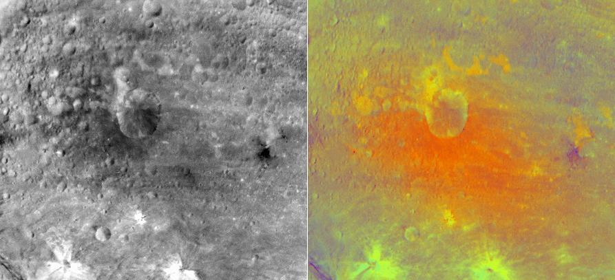
NASA Dawn spacecraft obtained this false-color image right of an impact crater in asteroid Vesta equatorial region with its framing camera on July 25, 2011. The view on the left is from the camera clear filter.
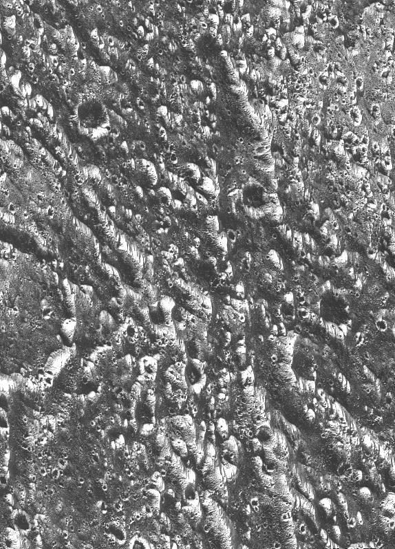
Ancient impact craters shown in this image of Jupiter moon Ganymede taken by NASA Galileo spacecraft testify to the great age of the terrain, dating back several billion years. http://photojournal.jpl.nasa.gov/catalog/PIA00279
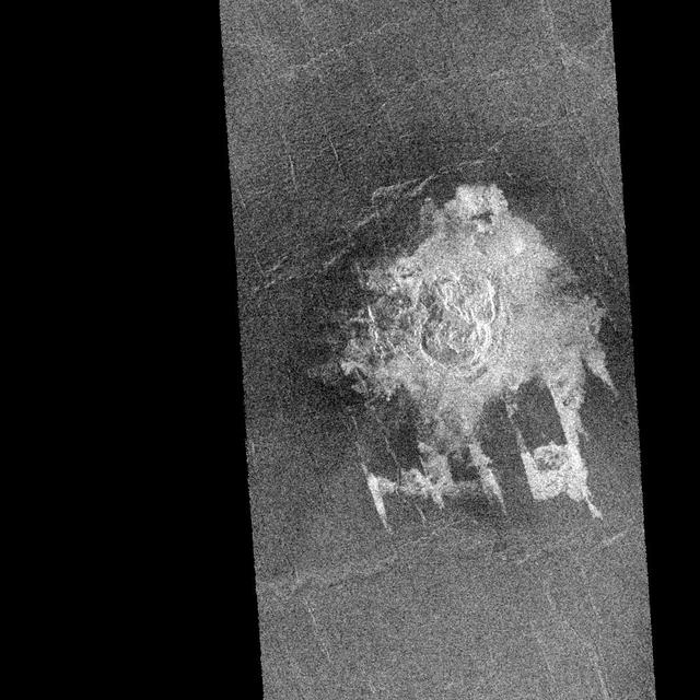
NASA' sMagellan imaged this multiple-floored, irregular impact crater at latitude 16.4 degrees north, longitude 352.1 degrees east, during orbits 481 and 482 on 27 September 1990. This crater, about 9.2 kilometers in maximum diameter, was formed on what appears to be a slightly fractured, radar-dark (smooth) plain. The abundant, low viscosity flows associated with this cratering event have, however, filled local, fault-controlled troughs (called graben). These shallow graben are well portrayed on this Magellan image but would be unrecognizable but for their coincidental infilling by the radar-bright crater flows. This fortuitous enhancement by the crater flows of fault structures that are below the resolution of the Magellan synthetic aperture radar is providing the Magellan Science Team with valuable geologic information. The flow deposits from the craters are thought to consist primarily of shock melted rock and fragmented debris resulting from the nearly simultaneous impacts of two projectile fragments into the hot (800 degrees Fahrenheit) surface rocks of Venus. The presence of the various floors of this irregular crater is interpreted to be the result of crushing, fragmentation, and eventual aerodynamic dispersion of a single entry projectile during passage through the dense Venusian atmosphere. http://photojournal.jpl.nasa.gov/catalog/PIA00462
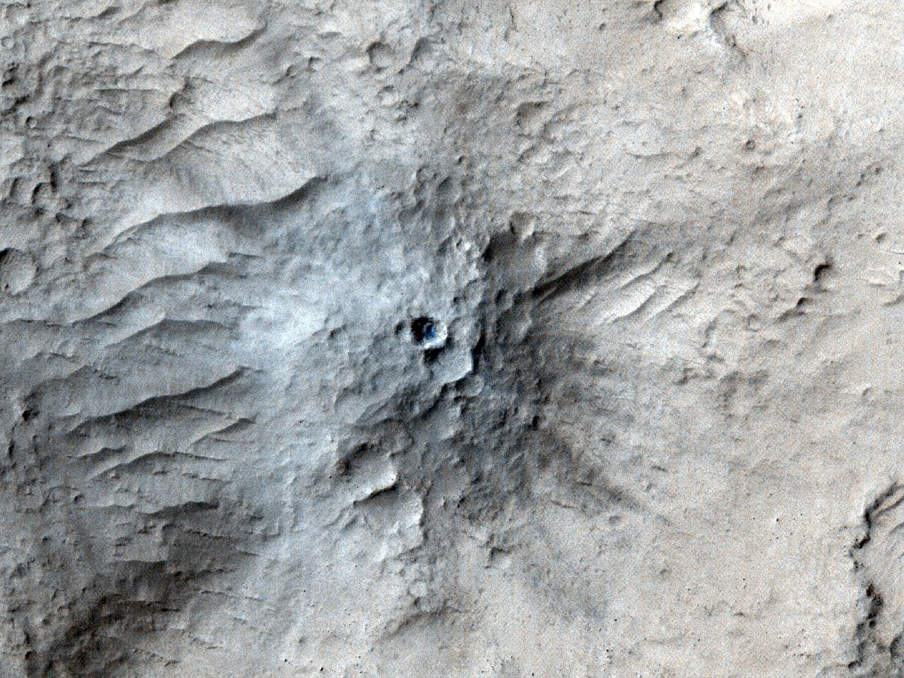
NASA's Mars Reconnaissance Orbiter used its High-Resolution Imaging Science Experiment (HiRISE) camera to capture this impact crater in Cerberus Fossae, a seismically active region of the Red Planet, on March 4, 2021. Scientists matched the crater's appearance on the surface with a quake detected by NASA's InSight lander, which was about 1,000 miles (1,640 kilometers) away. The crater is estimated to be about 71 feet (21.5 meters) in diameter. Most of the impacts detected by InSight, which was retired in 2022 after operating for more than four years, were thought to send their seismic signals through the Martian crust. But scientists concluded the energy from this impact traveled through the planet's mantle, much deeper than expected, after studying the location of the impact crater and seismic signals linked to it. Because of this finding, models of the composition and structure of the inner planet will have to be reassessed. This impact crater, along with others covered in a pair of papers published in Geophysical Research Letters in February 2025, was found with help from a machine learning algorithm developed at NASA's Jet Propulsion Laboratory in Southern California. The algorithm searched through tens of thousands of images captured by MRO's Context Camera in a matter of days, detecting 123 potential craters that may have occurred at the same time InSight was recording data. Traditional methods, in which human scientists carefully peer over images pixel by pixel, would have taken years of work to find these matches. Human scientists still had to narrow down the pool of candidate craters to 49 that matched InSight's quake data. After discovering this impact, scientists commanding MRO to take more detailed imagery with HiRISE. https://photojournal.jpl.nasa.gov/catalog/PIA26518
![This image from NASA Mars Reconnaissance Orbiter shows a new impact site originally detected by the Context Camera onboard MRO. The crater is on a dusty slope, which also has several dark slope streaks due to dust avalanches. A previous impact at another place on Mars triggered a major dust avalanche, but this one did not. This tells us that the dust here is more stable (stronger and/or on a lower slope). The map is projected here at a scale of 25 centimeters (9.8 inches) per pixel. [The original image scale is 27.1 centimeters (9.8 inches) per pixel (with 1 x 1 binning); objects on the order of 81 centimeters (30 inches) across are resolved.] North is up. http://photojournal.jpl.nasa.gov/catalog/PIA21459](https://images-assets.nasa.gov/image/PIA21459/PIA21459~medium.jpg)
This image from NASA Mars Reconnaissance Orbiter shows a new impact site originally detected by the Context Camera onboard MRO. The crater is on a dusty slope, which also has several dark slope streaks due to dust avalanches. A previous impact at another place on Mars triggered a major dust avalanche, but this one did not. This tells us that the dust here is more stable (stronger and/or on a lower slope). The map is projected here at a scale of 25 centimeters (9.8 inches) per pixel. [The original image scale is 27.1 centimeters (9.8 inches) per pixel (with 1 x 1 binning); objects on the order of 81 centimeters (30 inches) across are resolved.] North is up. http://photojournal.jpl.nasa.gov/catalog/PIA21459
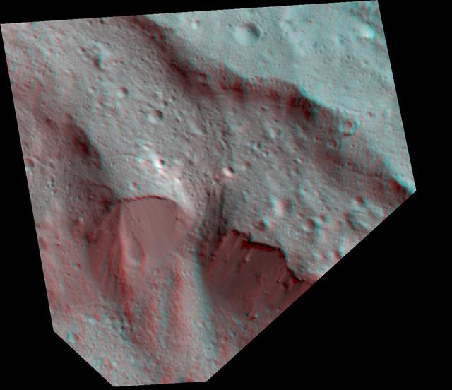
The Dawn spacecraft captured these stereo images of Occator crater on the dwarf planet Ceres in 2018. Framing camera images were used to construct this anaglyph view (which requires red-blue stereo glasses for viewing) of part of the northeastern rim of the crater. This area is approximately 4 miles (7 kilometers) wide and features a thin mantling layer of impact melt draped over faulted terrace blocks. Impact melt flowed through a gap in the blocks in the center of the frame. The spatial resolution of the stereo images is about 11 feet (3.5 meters) per pixel. Occator Crater, named after the Roman god of the agricultural practice of harrowing, is about 57 miles (92 kilometers) in diameter. The conclusion of Dawn's mission operations was Oct. 31, 2018, when the spacecraft depleted its hydrazine used for attitude control. This image was produced by Dr. Paul Schenk at the Lunar and Planetary Institute in Houston. https://photojournal.jpl.nasa.gov/catalog/PIA24064

This April 6, 2014, image from NASA Mars Reconnaissance Orbiter was taken as a follow-up to discovery of a possible 2012 impact scar in images from the orbiter Mars Color Imager. It reveals two craters within the darkened area center of rectangle.
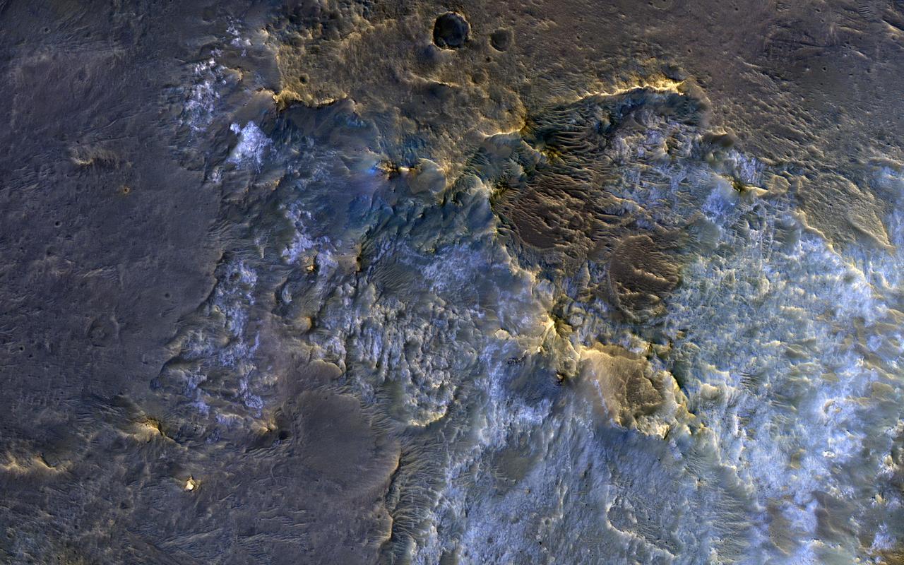
In this complex crater (about 44-kilometers in diameter), we see bedrock in several locations from different depths in the crust. The central uplift exposes large fragments of green-toned bedrock that possibly originated from several kilometers beneath the surface. To the south of the crater, we see more of this bedrock along with material that was excavated and thrown out after the impact. In craters of this size, the rim is unstable and collapses inwards forming terraces, which occasionally exposes more bedrock that would have originated from close to the surface than the rocks exposed within the uplift itself. Central uplifts have better exposures of bedrock, but in this example the terraces steal the show, displaying beautiful green- and light-toned bedrock at multiple locations. https://photojournal.jpl.nasa.gov/catalog/PIA23057
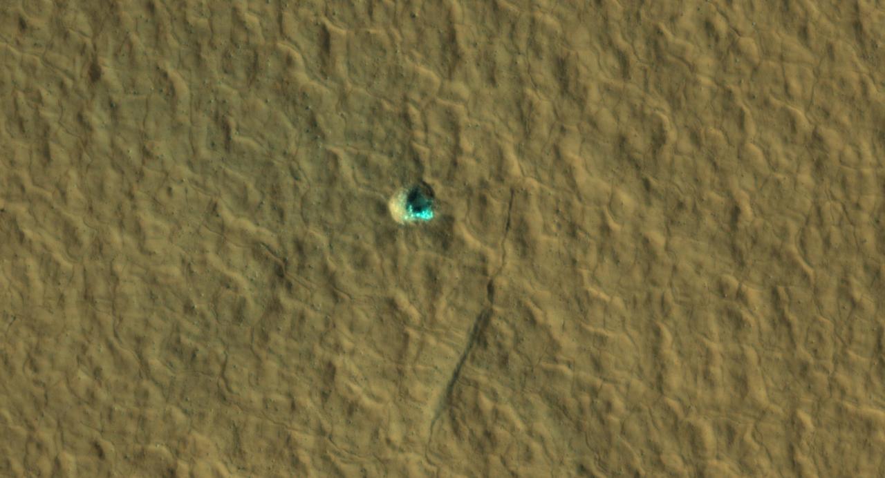
The ice-exposing impact crater at the center of this image is an example of what scientists look for when mapping places where future astronauts should land on Mars. NASA's Mars Reconnaissance Orbiter captured this view using its High-Resolution Imaging Science Experiment (HiRISE) camera on July 17, 2016. The color in this image has been enhanced for effect; water ice would not actually look this blue on Mars. The crater is estimated to be about 59 feet wide (18 meters wide). Surrounding the impact is a rough kind of surface known as "polygon terrain," which on Earth is known to form when subsurface ice expands and contracts repeatedly over time. Seeing this terrain surrounding an ice-exposing crater suggests much more ice could be found there. This impact is one of many included in a NASA-funded mapping project called Subsurface Water Ice Mapping, or SWIM. Mars has both water ice and carbon dioxide ice (dry ice); water ice would be a critical resource for the first astronauts to step foot on Mars, who can use it for drinking, rocket fuel, and other purposes. The more water ice these astronauts land next to, the less they need to bring with them. Because the Martian atmosphere is so thin – less than 1% the pressure experienced at sea level on Earth – liquid water is unstable on the Red Planet and will vaporize unless it's frozen. But water ice on the planet's surface is only stable at high latitudes that are far too cold for astronauts and robots to survive. So SWIM attempts to locate water ice preserved within the subsurface in the mid-latitudes, where landing would be feasible. Such regions are far enough toward the poles for water ice to be plentiful, but close enough to the equator to avoid the coldest temperatures seen on Mars. https://photojournal.jpl.nasa.gov/catalog/PIA26044
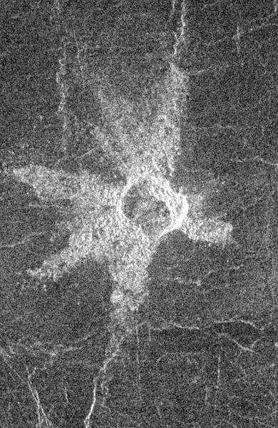
This image from NASA Magellan spacecraft shows the central Eistla Region of the equatorial highlands of Venus. It is centered at 15 degrees north latitude and 5 degrees east longitude. The image is 76.8 kilometers (48 miles) wide. The crater is slightly irregular in platform and approximately 6 kilometers (4 miles) in diameter. The walls appear terraced. Five or six lobes of radar-bright ejecta radiate up to 13.2 kilometers (8 miles) from the crater rim. These lobes are up to 3.5 kilometers (2 miles) in width and form a "starfish" pattern against the underlying radar-dark plains. The asymmetric pattern of the ejecta suggests the angle of impact was oblique. The alignment of two of the ejecta lobes along fractures in the underlying plains is apparently coincidental. http://photojournal.jpl.nasa.gov/catalog/PIA00466

Boulder-size blocks of water ice can be seen around the rim of this giant meteoroid impact crater on Mars, as viewed by the High-Resolution Imaging Science Experiment (HiRISE camera) aboard NASA's Mars Reconnaissance Orbiter. The crater was formed on Dec. 24, 2021, when a meteoroid struck the ground in a region of Mars called Amazonis Planitia. The impact churned up a layer of water ice buried under the ground here – the closest to the Martian equator buried water ice has ever been found. NASA scientists are interested in finding deposits of water ice as close to the Martian equator as possible, where it's warmer and safer to land. This ice would be a critical resource for astronauts as drinking water, for agriculture, and for rocket propellant. https://photojournal.jpl.nasa.gov/catalog/PIA25583

At an Angle. This image NASA MESSENGER features an elongated impact crater north of Rembrandt impact basin. This crater was most likely formed by a oblique impact which created the crater distinct elongated shape and central peak.