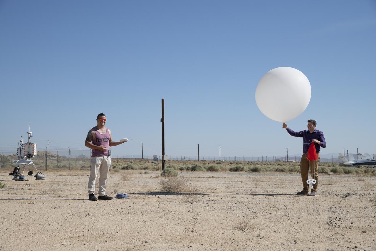
Rocky Garcia and Wesley James prepare a weather balloon to collect wind data for the Advanced Exploration of Reliable Operation at Low Altitudes: Meteorology, Simulation and Technology campaign. The weather study was at NASA’s Armstrong Flight Research Center in Edwards, California. The focus was to study wind from the ground to 2,000 feet to provide data to assist future drones to safely land on rooftop hubs called vertiports and to potentially improve weather prediction.
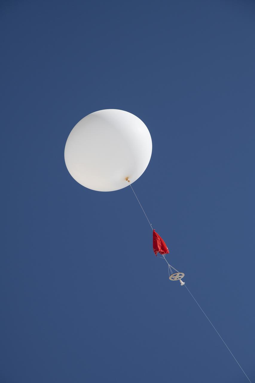
A weather balloon is launched to collect wind data for the Advanced Exploration of Reliable Operation at Low Altitudes: Meteorology, Simulation and Technology campaign. The weather study was at NASA’s Armstrong Flight Research Center in Edwards, California. The focus was to study wind from the ground to 2,000 feet to provide data to assist future drones to safely land on rooftop hubs called vertiports and to potentially improve weather prediction.
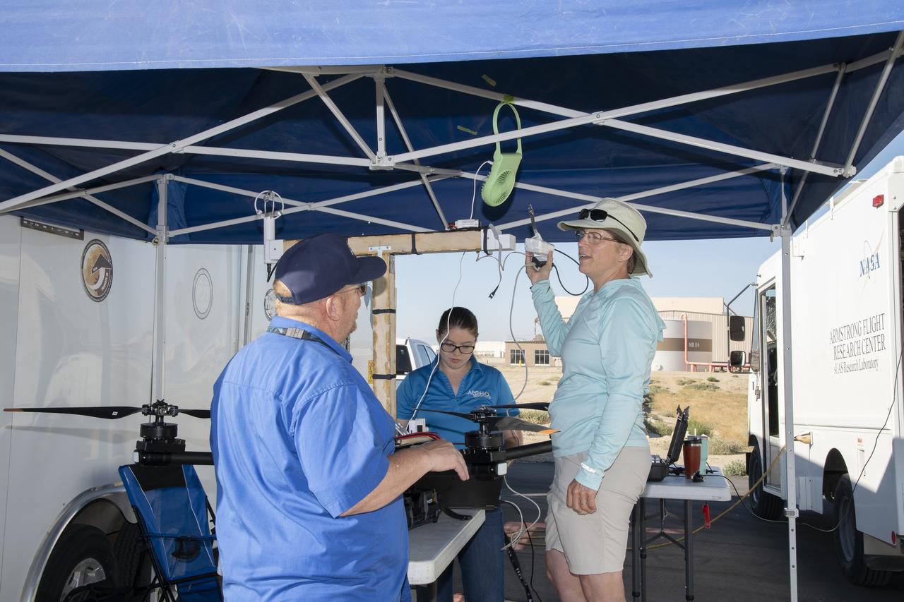
Jennifer Fowler talks to Red Jensen prior to a flight for the Advanced Exploration of Reliable Operation at Low Altitudes: Meteorology, Simulation and Technology campaign. Tyler Willhite completes some equipment checks for the research in the background. The weather study was at NASA’s Armstrong Flight Research Center in Edwards, California. The focus was to study wind from the ground to 2,000 feet to provide data to assist future drones to safely land on rooftop hubs called vertiports and to potentially improve weather prediction.
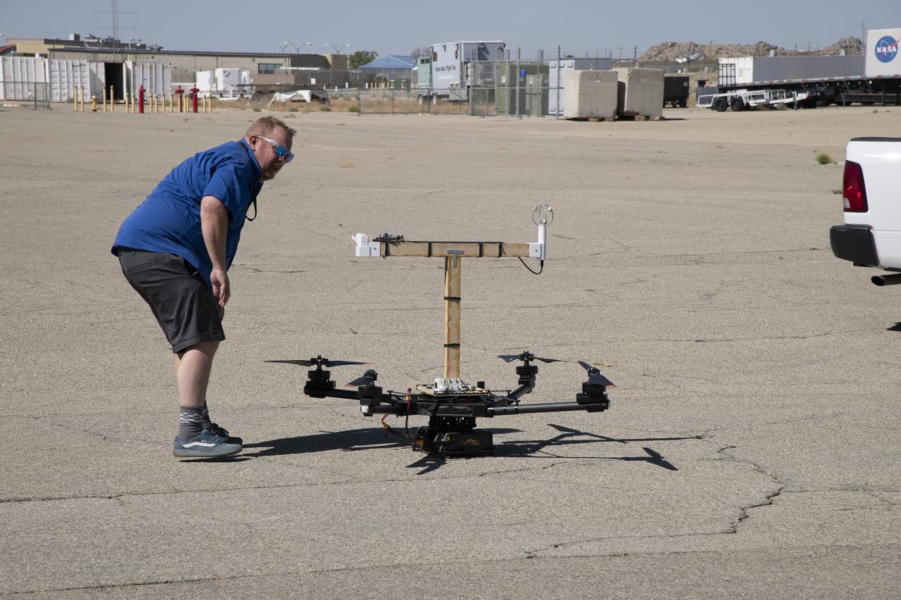
Red Jensen looks over the Alta-X aircraft before a flight for the Advanced Exploration of Reliable Operation at Low Altitudes: Meteorology, Simulation and Technology campaign. The weather study was at NASA’s Armstrong Flight Research Center in Edwards, California. The focus was to study wind from the ground to 2,000 feet to provide data to assist future drones to safely land on rooftop hubs called vertiports and to potentially improve weather prediction.
Tegan French and Rocky Garcia are at a weather balloon system’s ground station monitoring temperature, humidity, pressure, and winds transmitted from an instrument package on the balloon as it ascends. The balloon is part of the different methods to collect wind and weather data for the Advanced Exploration of Reliable Operation at Low Altitudes: Meteorology, Simulation and Technology campaign. The weather study was at NASA’s Armstrong Flight Research Center in Edwards, California. The focus was to study wind from the ground to 2,000 feet to provide data to assist future drones to safely land on rooftop hubs called vertiports and to potentially improve weather prediction.

The Alta-X aircraft flies by the former space shuttle hangar at NASA’s Armstrong Flight Research Center in Edwards, California, as part of the Advanced Exploration of Reliable Operation at Low Altitudes: Meteorology, Simulation and Technology campaign. The campaign was at NASA Armstrong to study wind from the ground to 2,000 feet to provide data to assist future drones to safely land on rooftop hubs called vertiports and to potentially improve weather prediction.
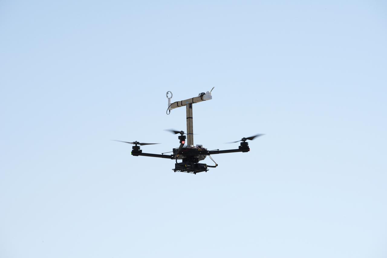
The Alta-X aircraft flies at NASA’s Armstrong Flight Research Center in Edwards, California, as part of the Advanced Exploration of Reliable Operation at Low Altitudes: Meteorology, Simulation and Technology campaign. The campaign was at NASA Armstrong to study wind from the ground to 2,000 feet to provide data to assist future drones to safely land on rooftop hubs called vertiports and to potentially improve weather prediction.
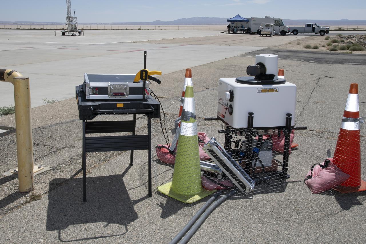
This is one of two lidar units positioned on either end of Building 4833 at NASA’s Armstrong Flight Research Center in Edwards, California, that formed the cutting-edge ‘virtual tower concept.’ The units use lasers to measure airflow from the ground level to 2,000 feet to provide data to assist future drones to safely land on rooftop hubs called vertiports, and to potentially improve weather prediction. It was part of the multi-faceted Advanced Exploration of Reliable Operation at Low Altitudes: Meteorology, Simulation and Technology campaign.
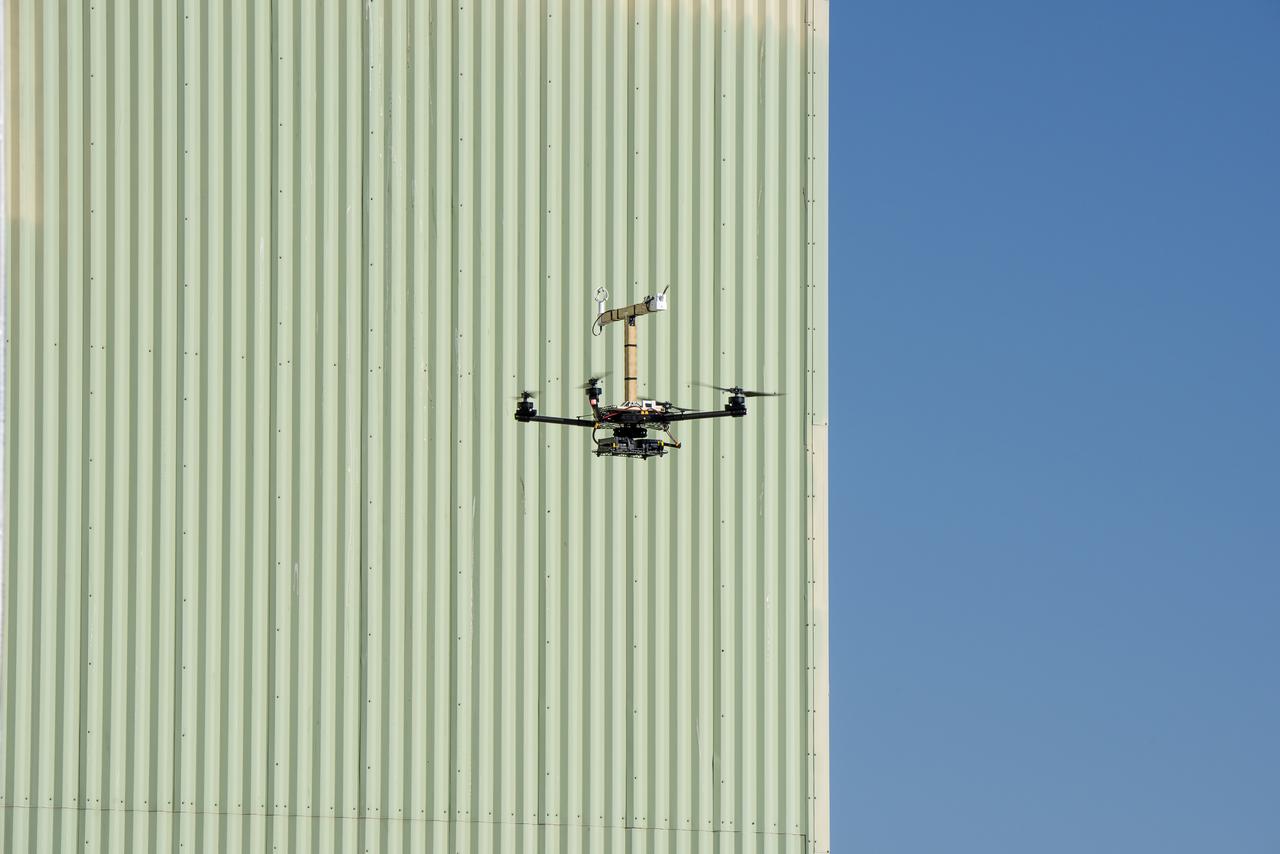
The Alta-X aircraft flies by the former space shuttle hangar at NASA’s Armstrong Flight Research Center in Edwards, California, as part of the Advanced Exploration of Reliable Operation at Low Altitudes: Meteorology, Simulation and Technology campaign. The campaign was at NASA Armstrong Flight to study wind from the ground to 2,000 feet to provide data to assist future drones to safely land on rooftop hubs called vertiports and to potentially improve weather prediction.
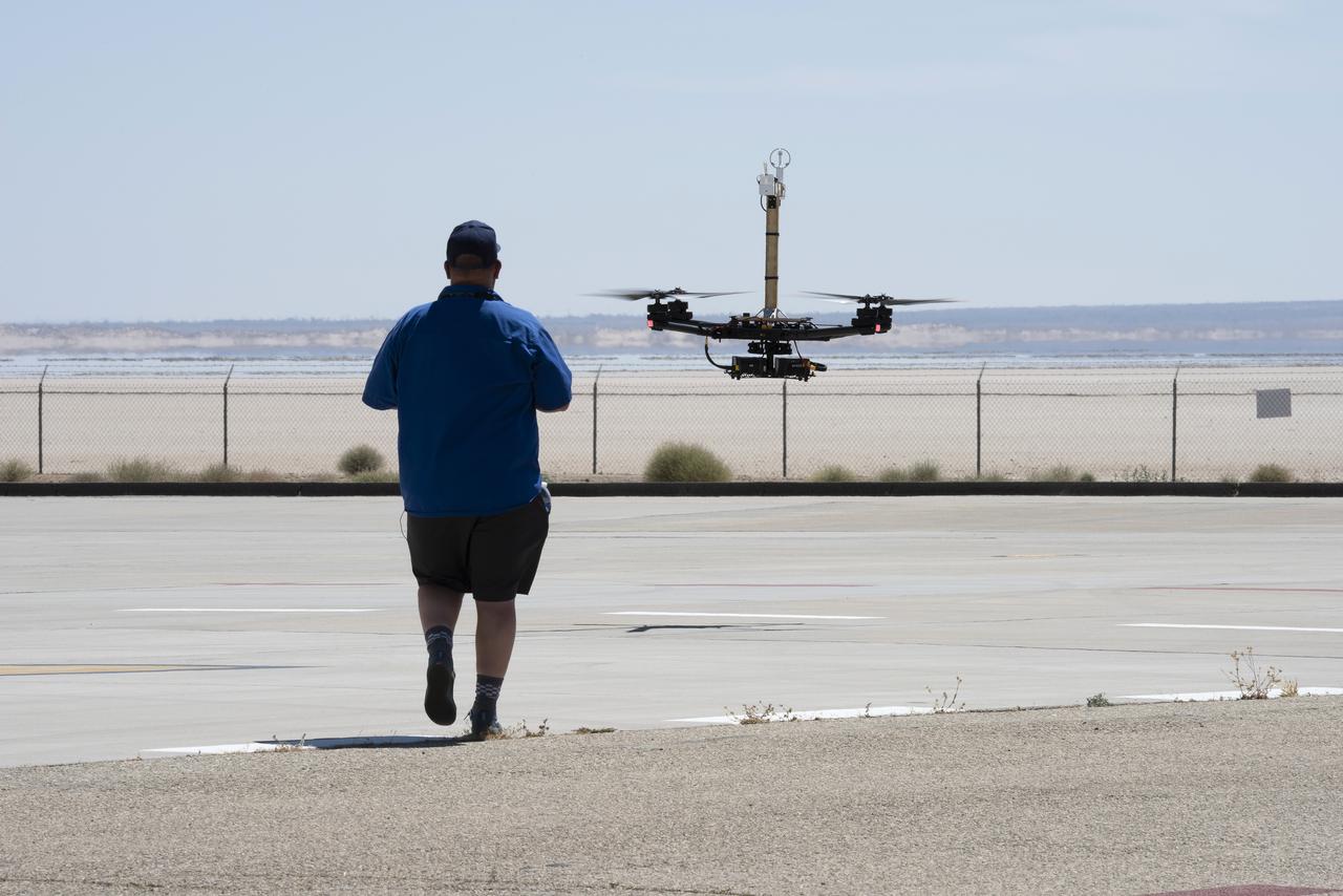
Red Jensen lands the Alta-X aircraft at NASA’s Armstrong Flight Research Center in Edwards, California, as part of the Advanced Exploration of Reliable Operation at Low Altitudes: Meteorology, Simulation and Technology campaign. The campaign was at NASA Armstrong to study wind from the ground to 2,000 feet to provide data to assist future drones to safely land on rooftop hubs called vertiports and to potentially improve weather prediction.
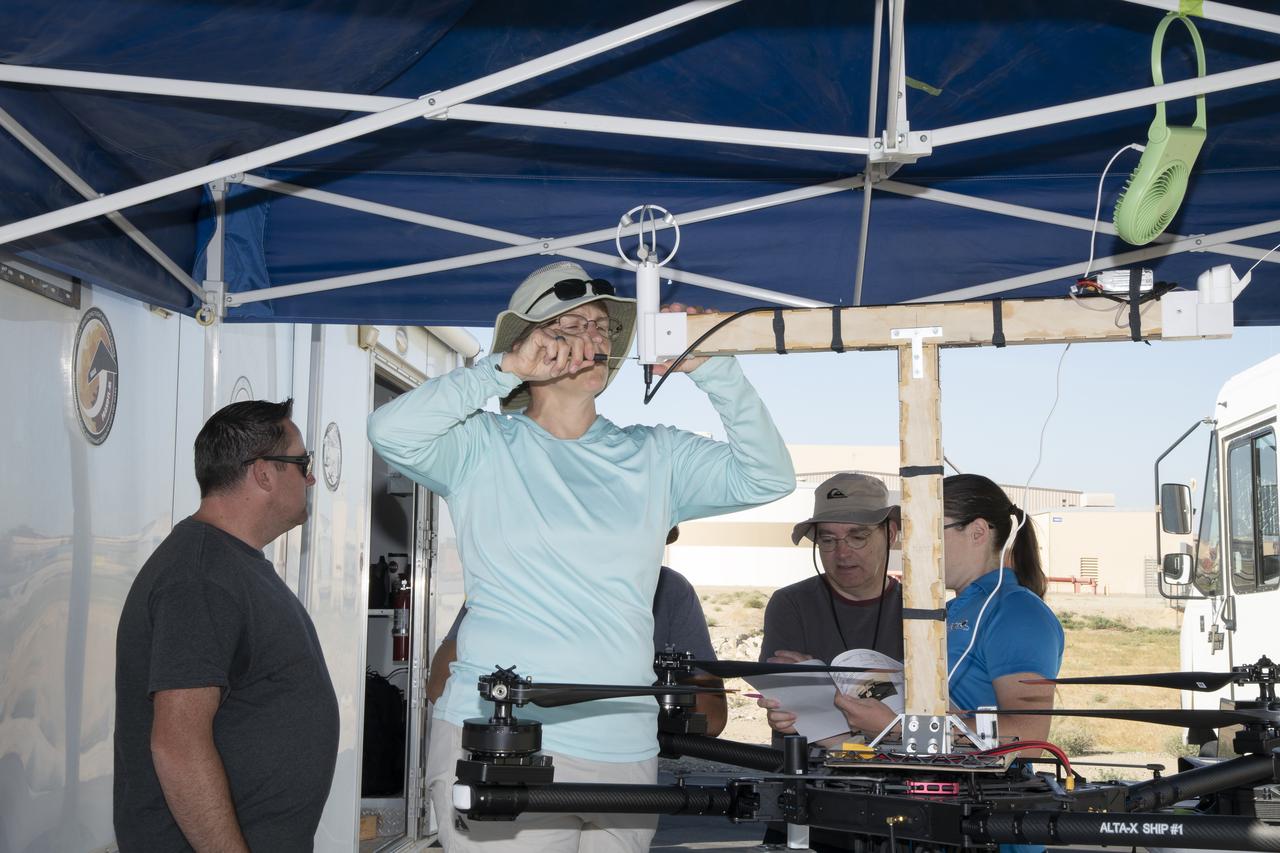
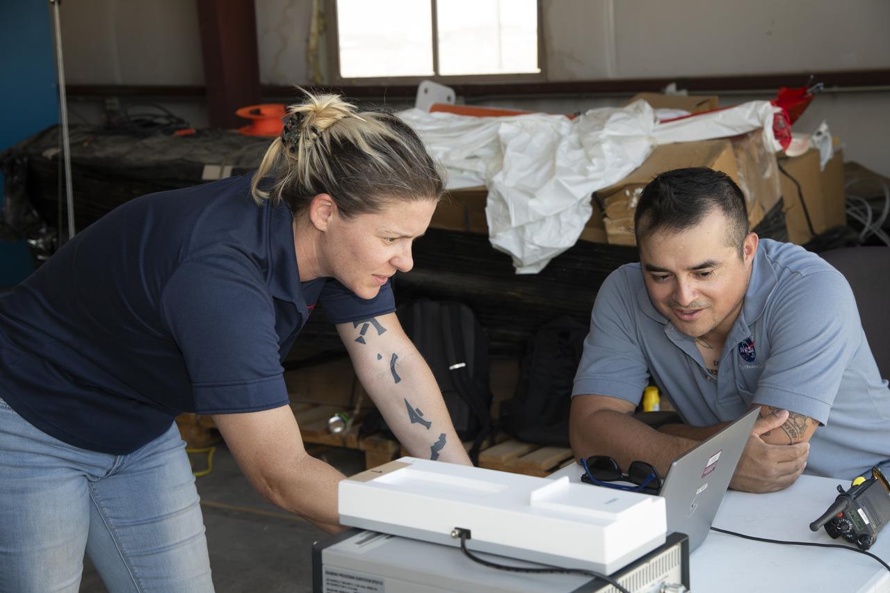
Jennifer Fowler works on securing sensors onto the test fixture on the Alta-X aircraft. Justin Link, Grady Koch, and Tyler Willhite are in the background. The Advanced Exploration of Reliable Operation at Low Altitudes: Meteorology, Simulation and Technology campaign was at NASA’s Armstrong Flight Research Center in Edwards, California. The focus was to study wind from the ground to 2,000 feet to provide data to assist future drones to safely land on rooftop hubs called vertiports and to potentially improve weather prediction.
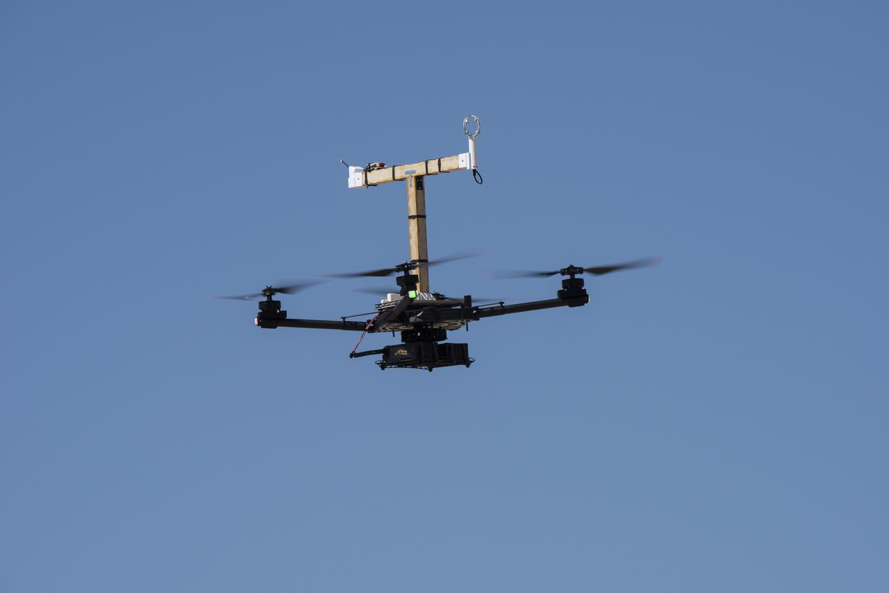
The Alta-X aircraft flies at NASA’s Armstrong Flight Research Center in Edwards, California, as part of the Advanced Exploration of Reliable Operation at Low Altitudes: Meteorology, Simulation and Technology campaign. The campaign was at NASA Armstrong to study wind from the ground to 2,000 feet to provide data to assist future drones to safely land on rooftop hubs called vertiports and to potentially improve weather prediction.
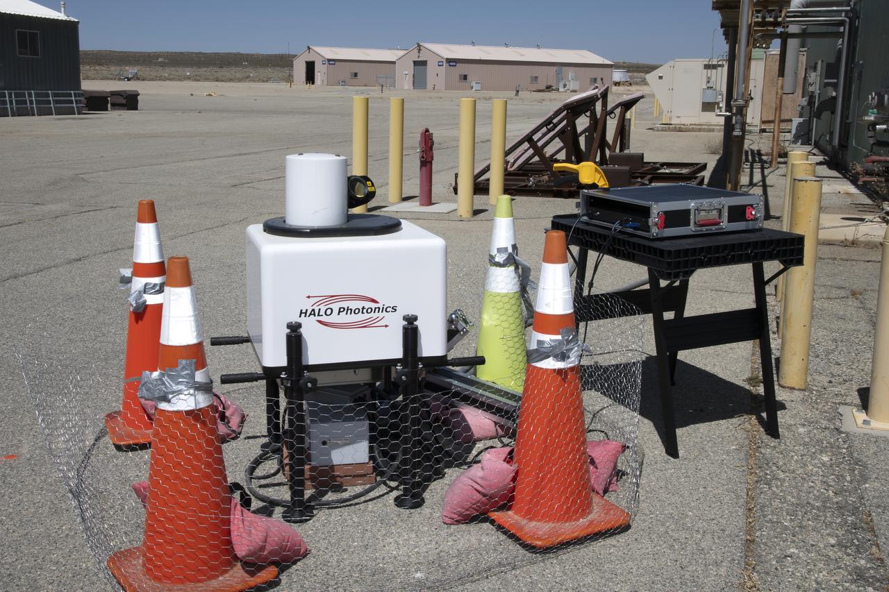
This is one of two lidar units positioned on either end of Building 4833 at NASA’s Armstrong Flight Research Center in Edwards, California, that formed the cutting-edge ‘virtual tower concept.’ The units use lasers to measure airflow from the ground level to 2,000 feet to provide data to assist future drones to safely land on rooftop hubs called vertiports, and to potentially improve weather prediction. It was part of the multi-faceted Advanced Exploration of Reliable Operation at Low Altitudes: Meteorology, Simulation and Technology campaign.
The Alta-X aircraft flies at NASA’s Armstrong Flight Research Center in Edwards, California, as part of the Advanced Exploration of Reliable Operation at Low Altitudes: Meteorology, Simulation and Technology campaign. The campaign was at NASA Armstrong to study wind from the ground to 2,000 feet to provide data to assist future drones to safely land on rooftop hubs called vertiports and to potentially improve weather prediction.
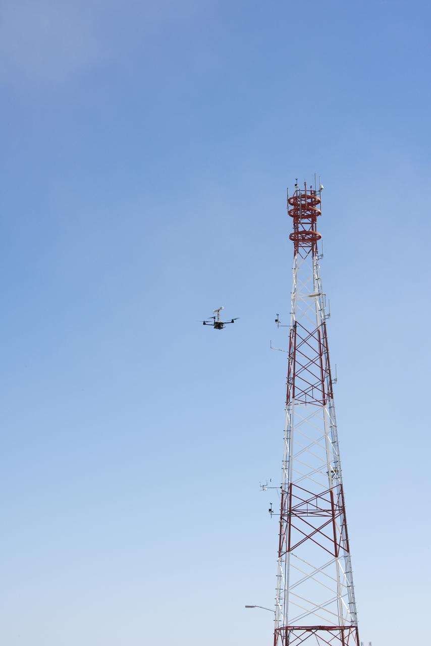
The Alta-X aircraft flies by a 140-foot instrumented tower at NASA’s Armstrong Flight Research Center in Edwards, California, as part of the Advanced Exploration of Reliable Operation at Low Altitudes: Meteorology, Simulation and Technology campaign. The campaign was at NASA Armstrong to study wind from the ground to 2,000 feet to provide data to assist future drones to safely land on rooftop hubs called vertiports and to potentially improve weather prediction.

Justin Link, left, Red Jensen and Derek Abramson prepare for an Alta-X aircraft flight as part of the Advanced Exploration of Reliable Operation at Low Altitudes: Meteorology, Simulation and Technology campaign. In the background are Grady Koch and Jennifer Fowler. The campaign was at NASA Armstrong to study wind from the ground to 2,000 feet to provide data to assist future drones to safely land on rooftop hubs called vertiports and to potentially improve weather prediction.
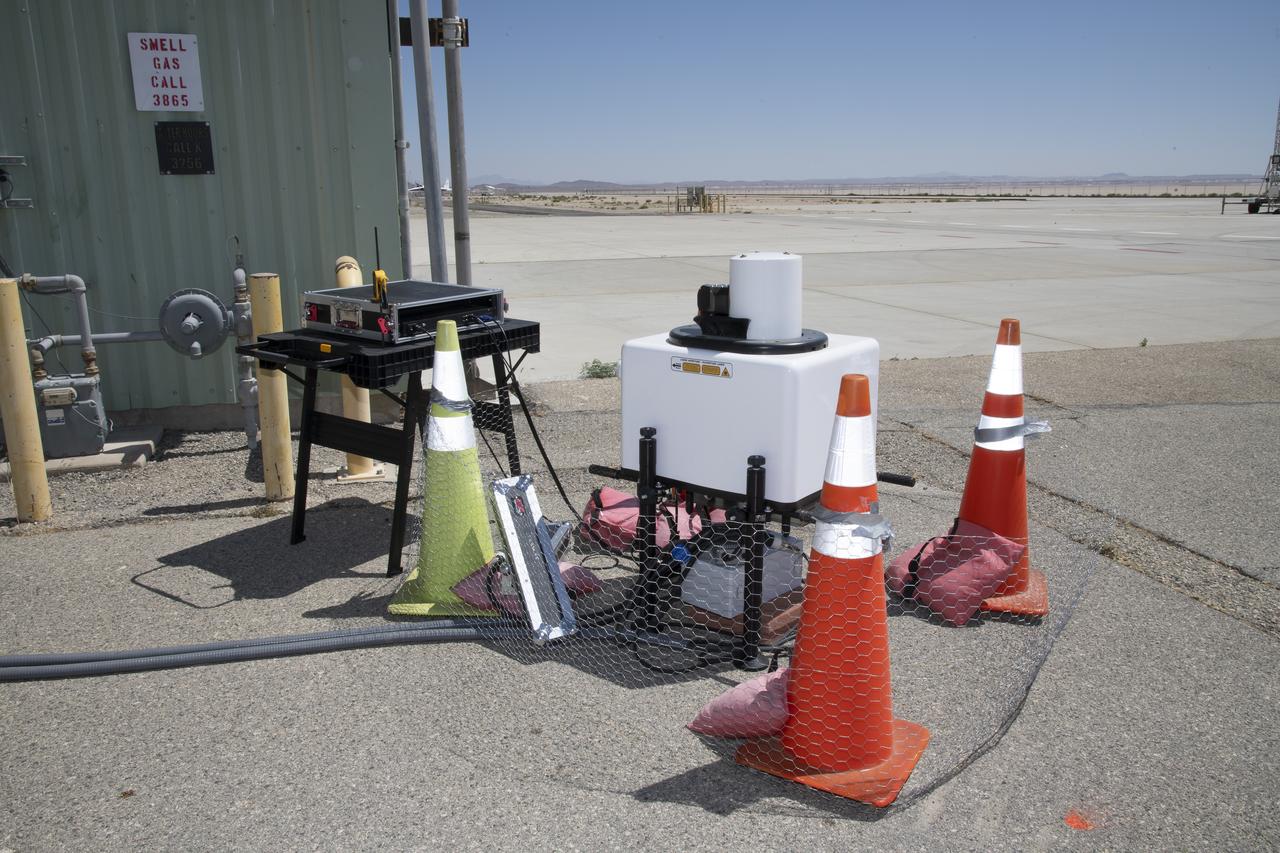
This is one of two lidar units positioned on either end of Building 4833 at NASA’s Armstrong Flight Research Center in Edwards, California, that formed the cutting-edge ‘virtual tower concept.’ The units use lasers to measure airflow from the ground level to 2,000 feet to provide data to assist future drones to safely land on rooftop hubs called vertiports, and to potentially improve weather prediction. It was part of the multi-faceted Advanced Exploration of Reliable Operation at Low Altitudes: Meteorology, Simulation and Technology campaign.
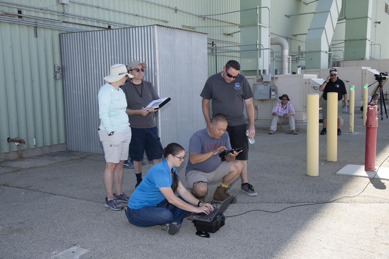
Tyler Willhite, sitting, and Derek Abramson and Justin Link, prepare for an Alta-X aircraft flight. Behind them are Jennifer Fowler, from left and Grady Kock. The Alta-X flight was part of the Advanced Exploration of Reliable Operation at Low Altitudes: Meteorology, Simulation and Technology campaign. The campaign was at NASA Armstrong to study wind from the ground to 2,000 feet to provide data to assist future drones to safely land on rooftop hubs called vertiports and to potentially improve weather prediction.
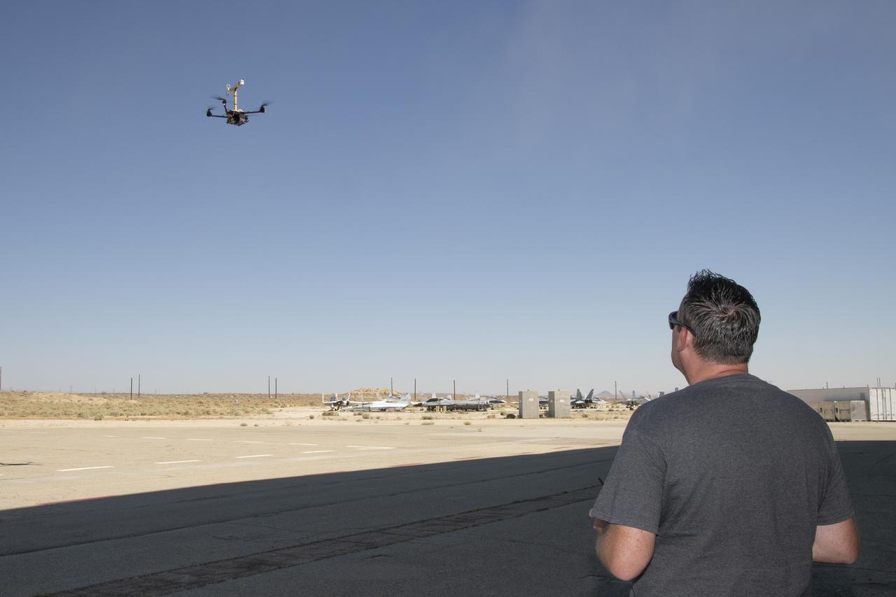
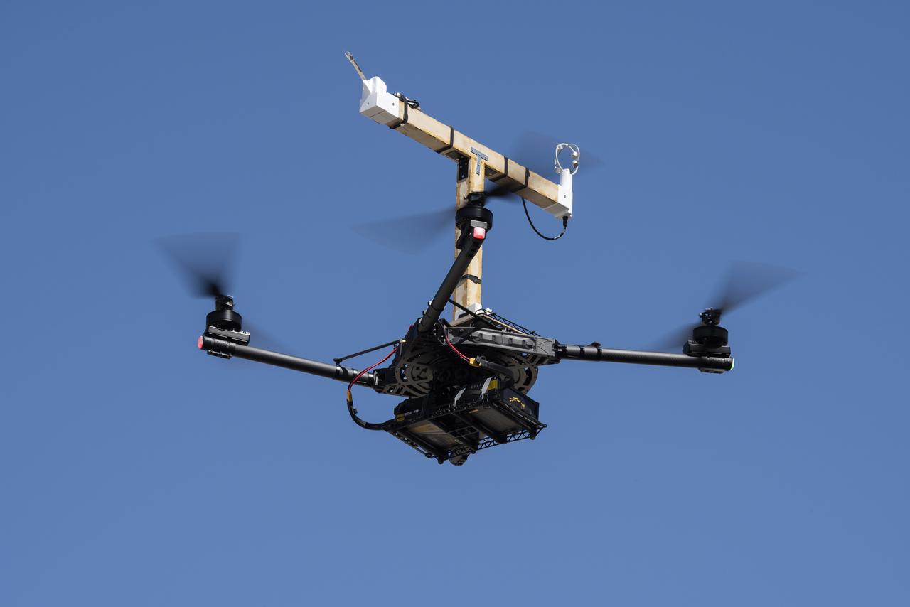
Justin Link positions the Alta-X aircraft for a hover to capture data as part of the Advanced Exploration of Reliable Operation at Low Altitudes: Meteorology, Simulation and Technology campaign. The campaign was at NASA Armstrong to study wind from the ground to 2,000 feet to provide data to assist future drones to safely land on rooftop hubs called vertiports and to potentially improve weather prediction.

This is one of two lidar units positioned on either end of Building 4833 at NASA’s Armstrong Flight Research Center in Edwards, California, that formed the cutting-edge ‘virtual tower concept.’ The units use lasers to measure airflow from the ground level to 2,000 feet to provide data to assist future drones to safely land on rooftop hubs called vertiports, and to potentially improve weather prediction. It was part of the multi-faceted Advanced Exploration of Reliable Operation at Low Altitudes: Meteorology, Simulation and Technology campaign.

National Weather Service Director Louis Uccellini and deputy director Mary Erickson hear from Short-term Prediction Research and Transition (SPoRT) team members during a visit Sept. 11 to the National Space Science and Technology Center. Managed by NASA’s Marshall Space Flight Center, SPoRT is a project to transition unique Earth observations and research capabilities to the operational weather community to improve short-term forecasts on a regional scale.

National Weather Service Director Louis Uccellini and deputy director Mary Erickson hear from Short-term Prediction Research and Transition (SPoRT) team members during a visit Sept. 11 to the National Space Science and Technology Center. Managed by NASA’s Marshall Space Flight Center, SPoRT is a project to transition unique Earth observations and research capabilities to the operational weather community to improve short-term forecasts on a regional scale.

National Weather Service Director Louis Uccellini and deputy director Mary Erickson hear from Short-term Prediction Research and Transition (SPoRT) team members during a visit Sept. 11 to the National Space Science and Technology Center. Managed by NASA’s Marshall Space Flight Center, SPoRT is a project to transition unique Earth observations and research capabilities to the operational weather community to improve short-term forecasts on a regional scale.
Plasma fluctuations in the upper atmosphere can distort radio signals as they pass into space, damaging radio communication with satellites. The ISX (Ionospheric Scintillation Explorer) mission will study these effects by measuring and comparing digital TV signals produced on the ground. Developed as a collaboration between SRI International and PolySat at Cal Poly, San Luis Obispo, the ISX mission will attempt to improve our understanding of these plasma irregularities and help model space weather predictions in the future.
Plasma fluctuations in the upper atmosphere can distort radio signals as they pass into space, damaging radio communication with satellites. The ISX (Ionospheric Scintillation Explorer) mission will study these effects by measuring and comparing digital TV signals produced on the ground. Developed as a collaboration between SRI International and PolySat at Cal Poly, San Luis Obispo, the ISX mission will attempt to improve our understanding of these plasma irregularities and help model space weather predictions in the future.
Plasma fluctuations in the upper atmosphere can distort radio signals as they pass into space, damaging radio communication with satellites. The ISX (Ionospheric Scintillation Explorer) mission will study these effects by measuring and comparing digital TV signals produced on the ground. Developed as a collaboration between SRI International and PolySat at Cal Poly, San Luis Obispo, the ISX mission will attempt to improve our understanding of these plasma irregularities and help model space weather predictions in the future.
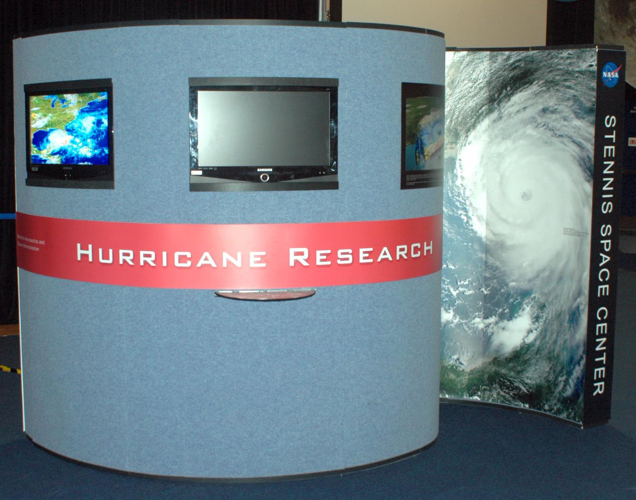
A new exhibit in StenniSphere depicting NASA's role in hurricane prediction and research and SSC's role in helping the region recover from Hurricane Katrina. The cyclone-shaped exhibit focuses on the effects of the Aug. 29, 2005 storm and outlines how NASA is working to improve weather forecasting. Through photos, 3-D models and digital animations, the exhibit tells the story of what happened inside the storm and how NASA's scientific research can increase the accuracy of hurricane tracking and modeling.
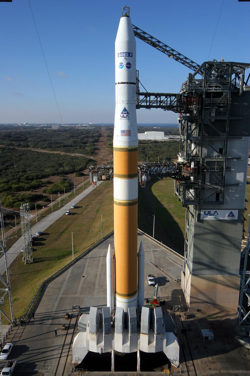
Cape Canaveral AFS, Fla. - A United Launch Alliance Delta IV rocket sits poised on its launch pad with the NASA/NOAA Geostationary Operational Environmental Satellite P (GOES P) at Space Launch Complex-37. GOES P will provide NOAA and NASA scientists with data to support weather, solar and space operations, and will enable future science improvements in weather prediction and remote sensing. Additionally, GOES-P will provide data on global climate changes and capability for search and rescue. Photo credit: Carleton Bailie, The Boeing Company
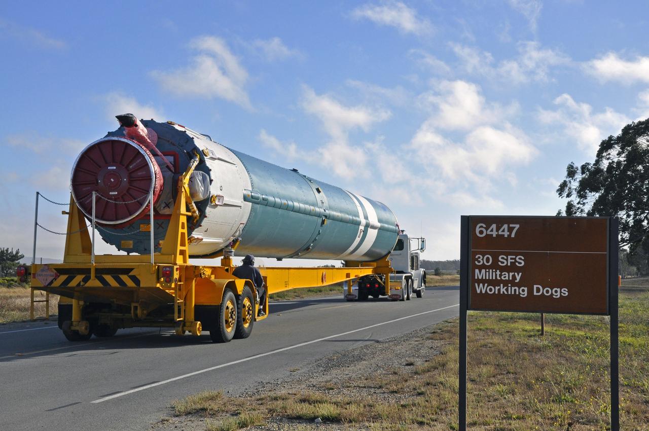
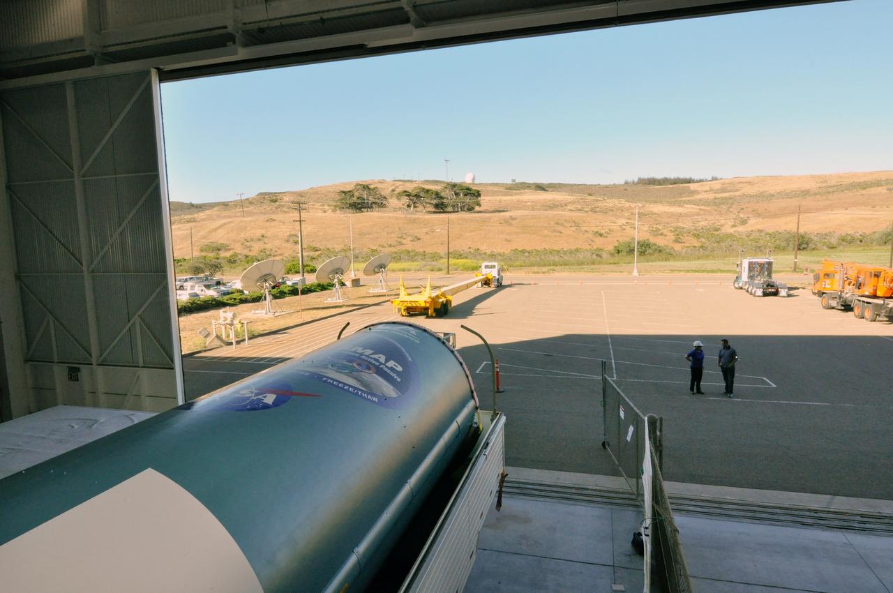
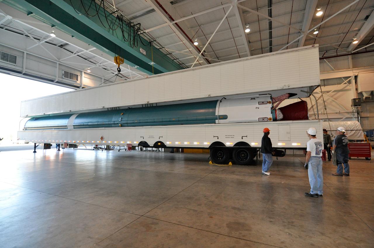
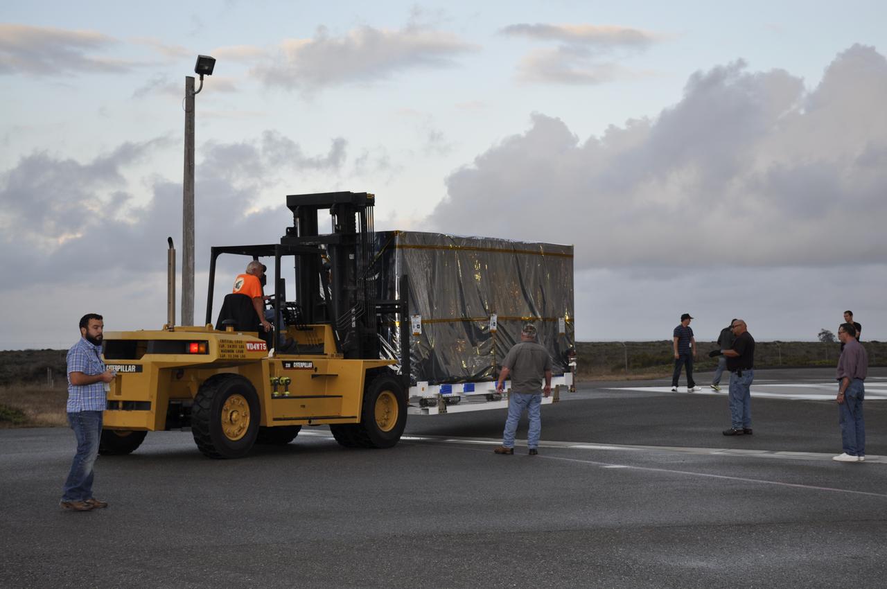
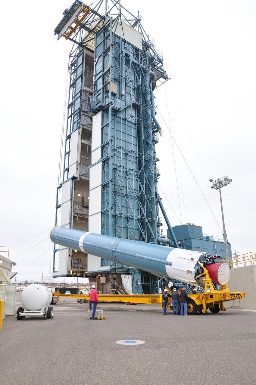
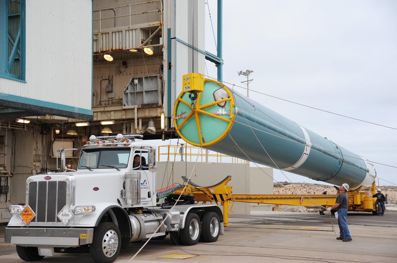
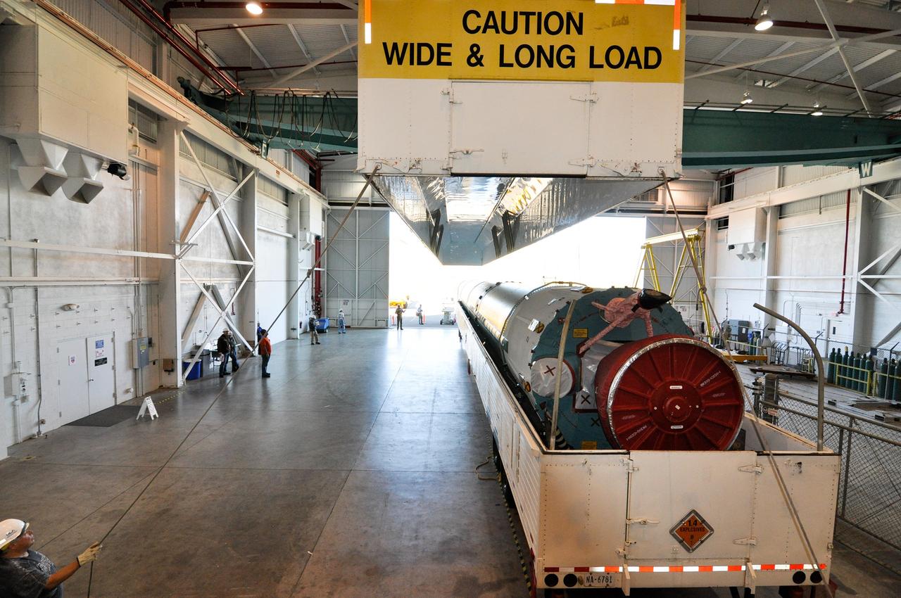
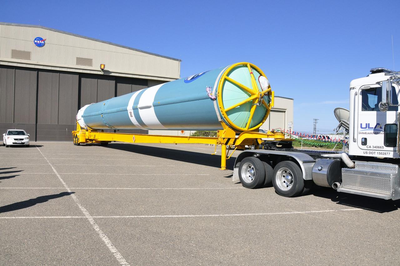
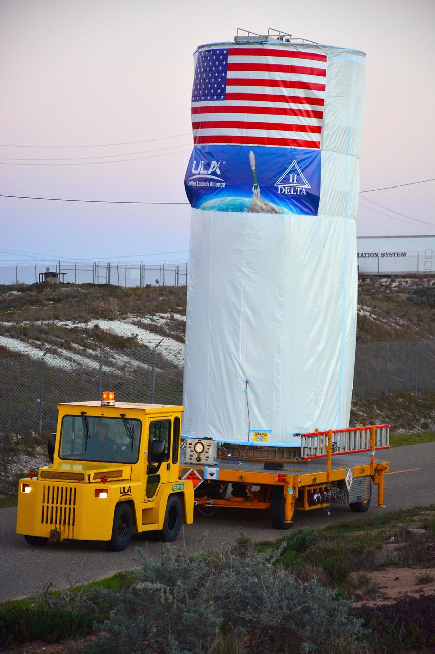
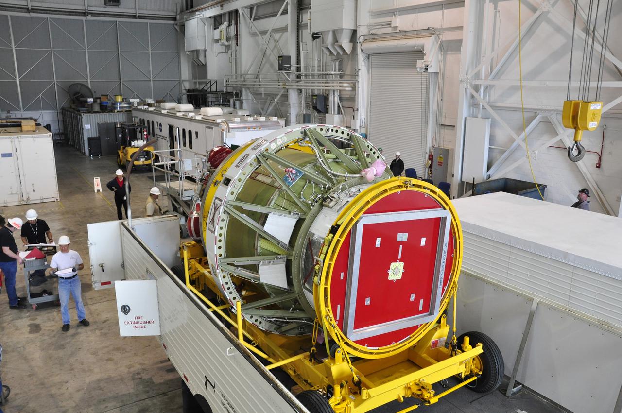
VANDENBERG AIR FORCE BASE, Calif. – Technicians prepare to offload the first stage of a United Launch Alliance Delta II rocket following its arrival at NASA hangar 836 on Vandenberg Air Force Base in California. The launch vehicle will be used to deliver NASA's Soil Moisture Active Passive mission, or SMAP, into orbit. SMAP will provide global measurements of soil moisture and its freeze/thaw state. These measurements will be used to enhance understanding of processes that link the water, energy and carbon cycles, and to extend the capabilities of weather and climate prediction models. SMAP data also will be used to quantify net carbon flux in boreal landscapes and to develop improved flood prediction and drought monitoring capabilities. Launch is scheduled for November 2014. To learn more about SMAP, visit http://smap.jpl.nasa.gov Photo credit: NASA/Randy Beaudoin
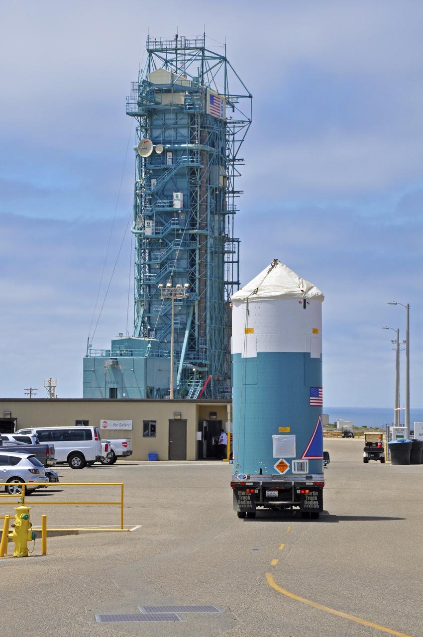
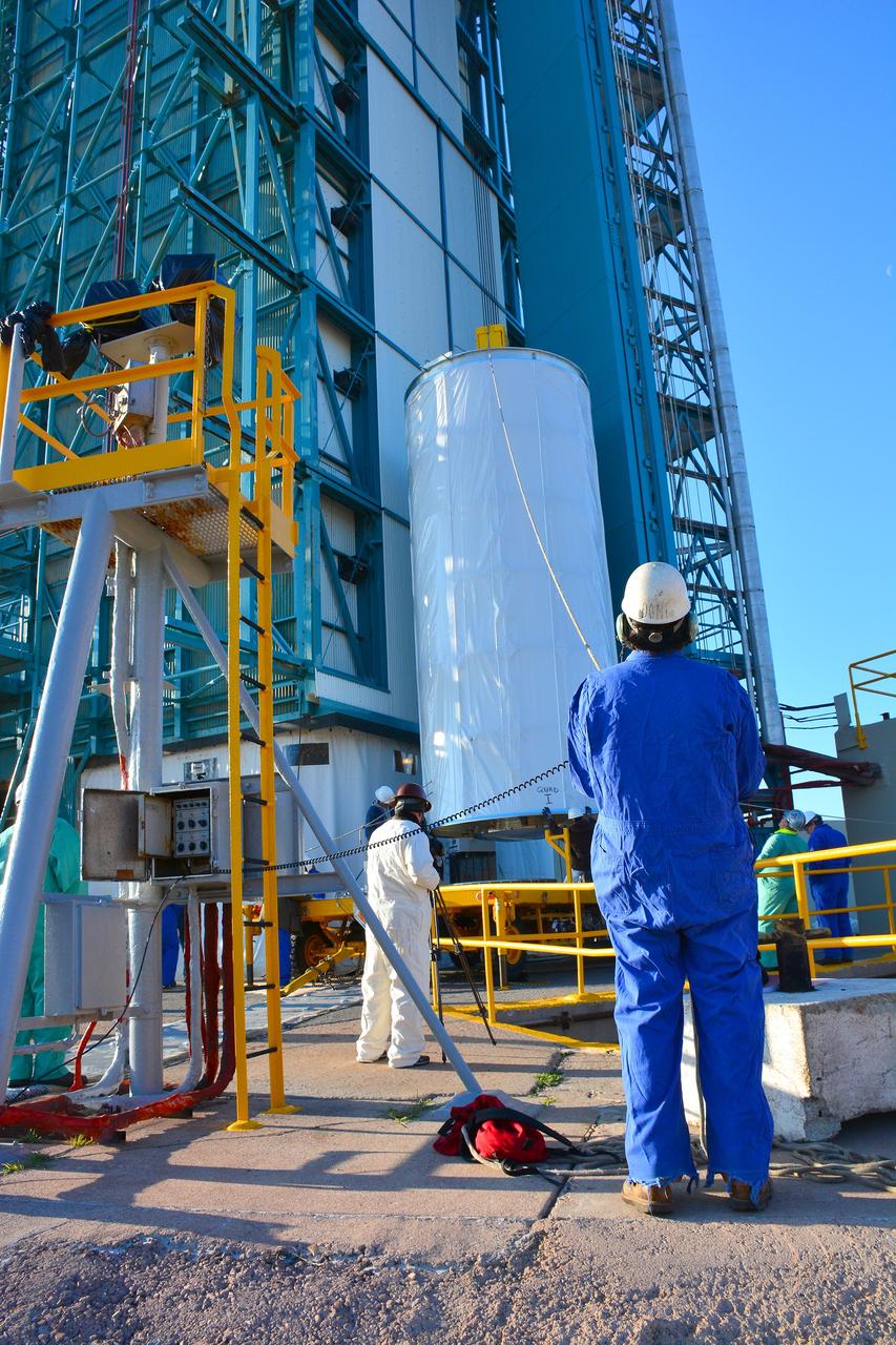
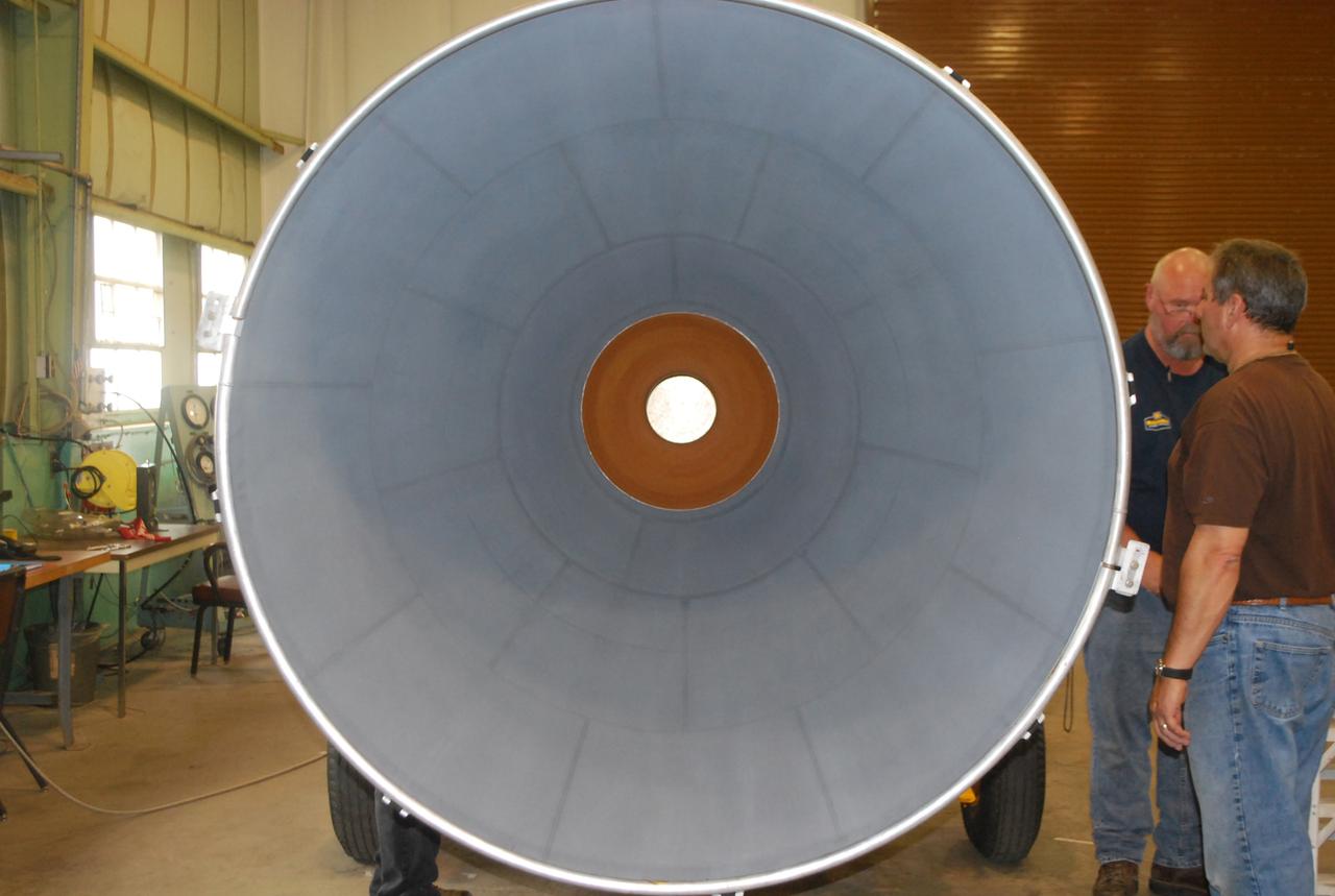
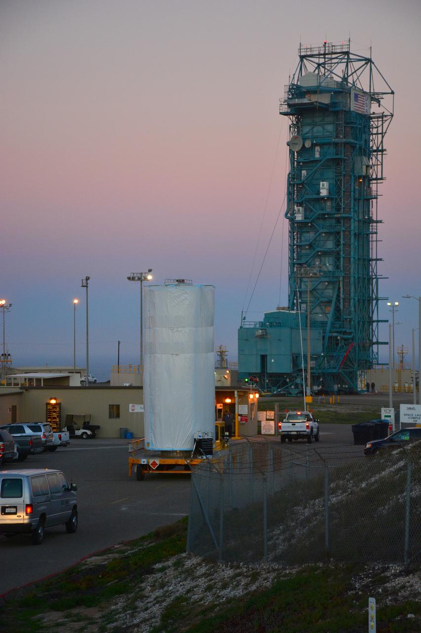
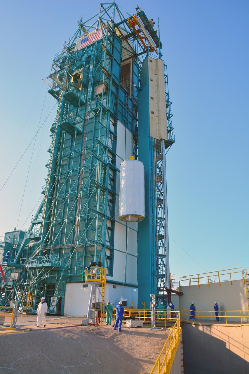
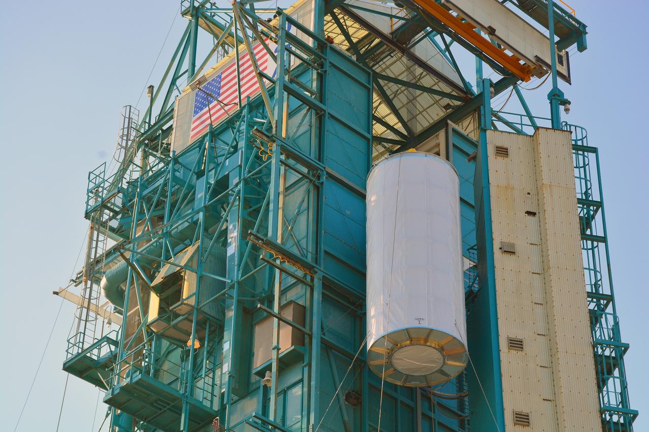
VANDENBERG AIR FORCE BASE, Calif. – The half sections of the 10-foot-diameter fairing for NASA's Soil Moisture Active Passive mission, or SMAP, are delivered to the mobile service tower at Space Launch Complex 2 on Vandenberg Air Force Base in California. The fairing will protect the SMAP spacecraft from the heat and aerodynamic pressure generated during its ascent to orbit aboard a United Launch Alliance Delta II rocket. SMAP will provide global measurements of soil moisture and its freeze/thaw state. These measurements will be used to enhance understanding of processes that link the water, energy and carbon cycles, and to extend the capabilities of weather and climate prediction models. SMAP data will also be used to quantify net carbon flux in boreal landscapes and to develop improved flood prediction and drought monitoring capabilities. Launch is scheduled for no earlier than November 2014. To learn more about SMAP, visit http://smap.jpl.nasa.gov. Photo credit: NASA/Randy Beaudoin
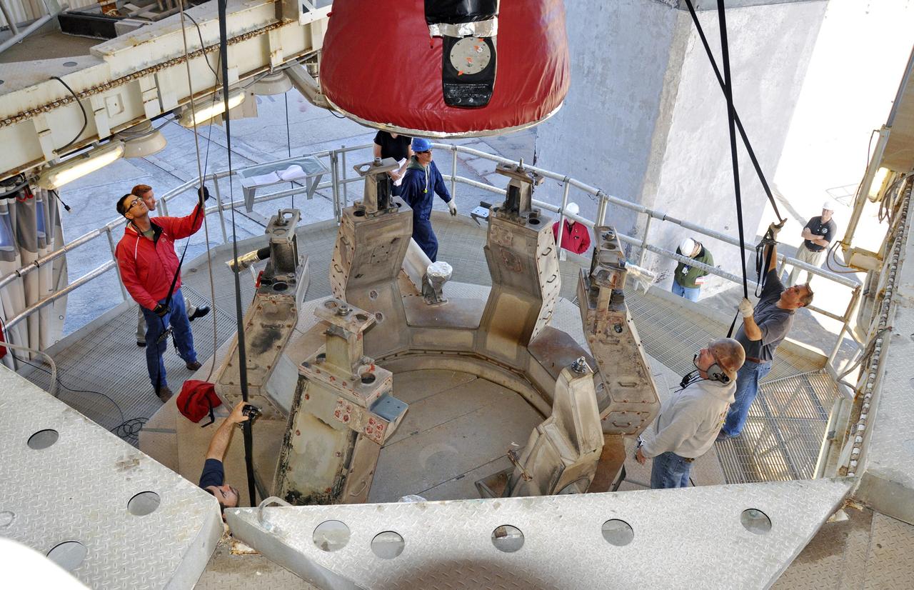
VANDENBERG AIR FORCE BASE, Calif. – The Delta II interstage adapter, or ISA, for NASA's Soil Moisture Active Passive mission, or SMAP, approaches the mobile service tower at Space Launch Complex 2 on Vandenberg Air Force Base in California. A United Launch Alliance Delta II rocket will loft SMAP into orbit. The ISA connects the Delta II first and second stages and encloses the second stage engine and thrust section. The spacecraft will provide global measurements of soil moisture and its freeze/thaw state. These measurements will be used to enhance understanding of processes that link the water, energy and carbon cycles, and to extend the capabilities of weather and climate prediction models. The data returned also will be used to quantify net carbon flux in boreal landscapes and to develop improved flood prediction and drought monitoring capabilities. Launch is scheduled for November 2014. To learn more about SMAP, visit http://smap.jpl.nasa.gov. Photo credit: NASA/Randy Beaudoin
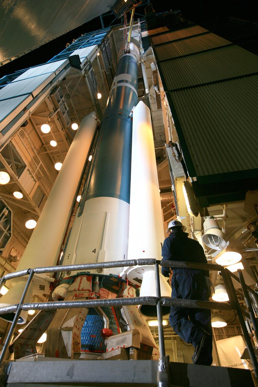
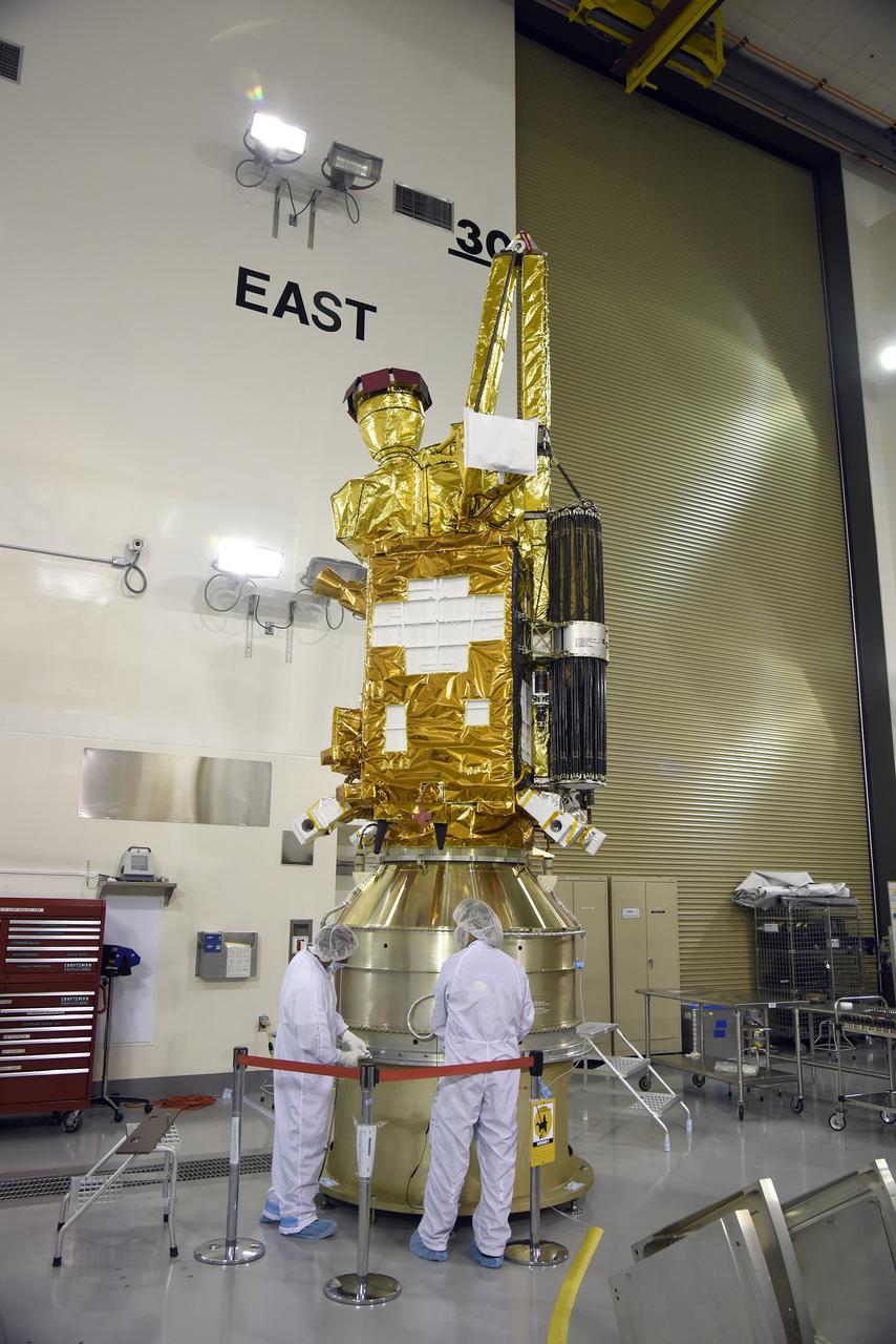
Inside the Astrotech payload processing facility on Vandenberg Air Force Base in California, engineers and technicians begin processing of NASA's Soil Moisture Active Passive, or SMAP, spacecraft. SMAP will launch on a Delta II 7320 configuration vehicle featuring a United Launch Alliance first stage booster powered by an Aerojet Rocketdyne RS-27A main engine and three Alliant Techsystems, or ATK, strap-on solid rocket motors. Once on station in Earth orbit, SMAP will provide global measurements of soil moisture and its freeze/thaw state. These measurements will be used to enhance understanding of processes that link the water, energy and carbon cycles, and to extend the capabilities of weather and climate prediction models. SMAP data also will be used to quantify net carbon flux in boreal landscapes and to develop improved flood prediction and drought monitoring capabilities. Launch from Space Launch Complex 2 is targeted for Jan. 29, 2015.
Inside the Astrotech payload processing facility on Vandenberg Air Force Base in California, engineers and technicians rotate NASA's Soil Moisture Active Passive, or SMAP, spacecraft to begin processing. SMAP will launch on a Delta II 7320 configuration vehicle featuring a United Launch Alliance first stage booster powered by an Aerojet Rocketdyne RS-27A main engine and three Alliant Techsystems, or ATK, strap-on solid rocket motors. Once on station in Earth orbit, SMAP will provide global measurements of soil moisture and its freeze/thaw state. These measurements will be used to enhance understanding of processes that link the water, energy and carbon cycles, and to extend the capabilities of weather and climate prediction models. SMAP data also will be used to quantify net carbon flux in boreal landscapes and to develop improved flood prediction and drought monitoring capabilities. Launch from Space Launch Complex 2 is targeted for Jan. 29, 2015.
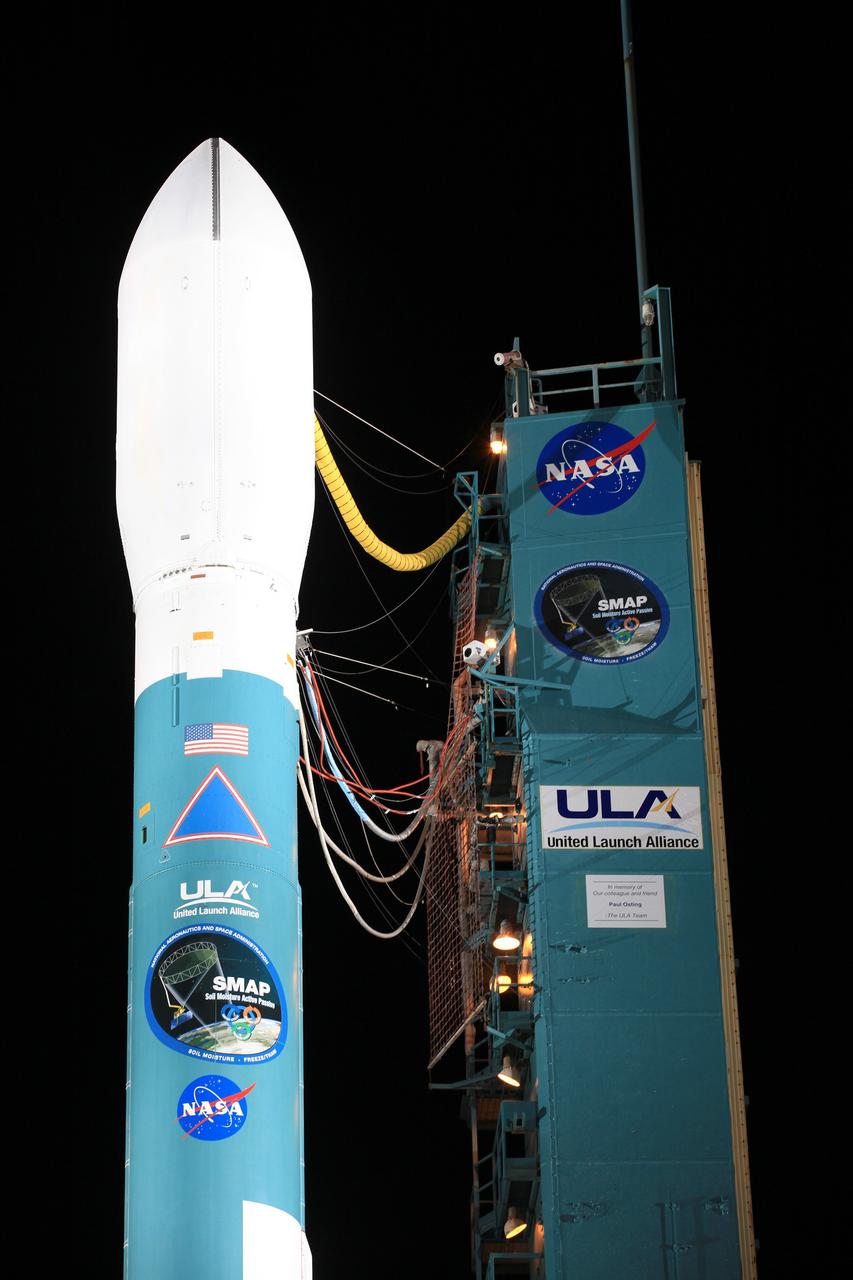
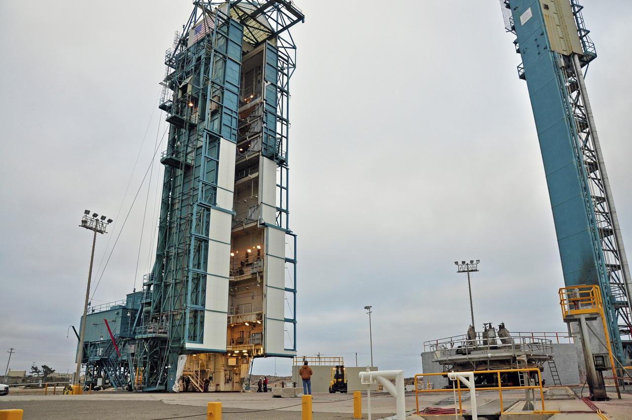
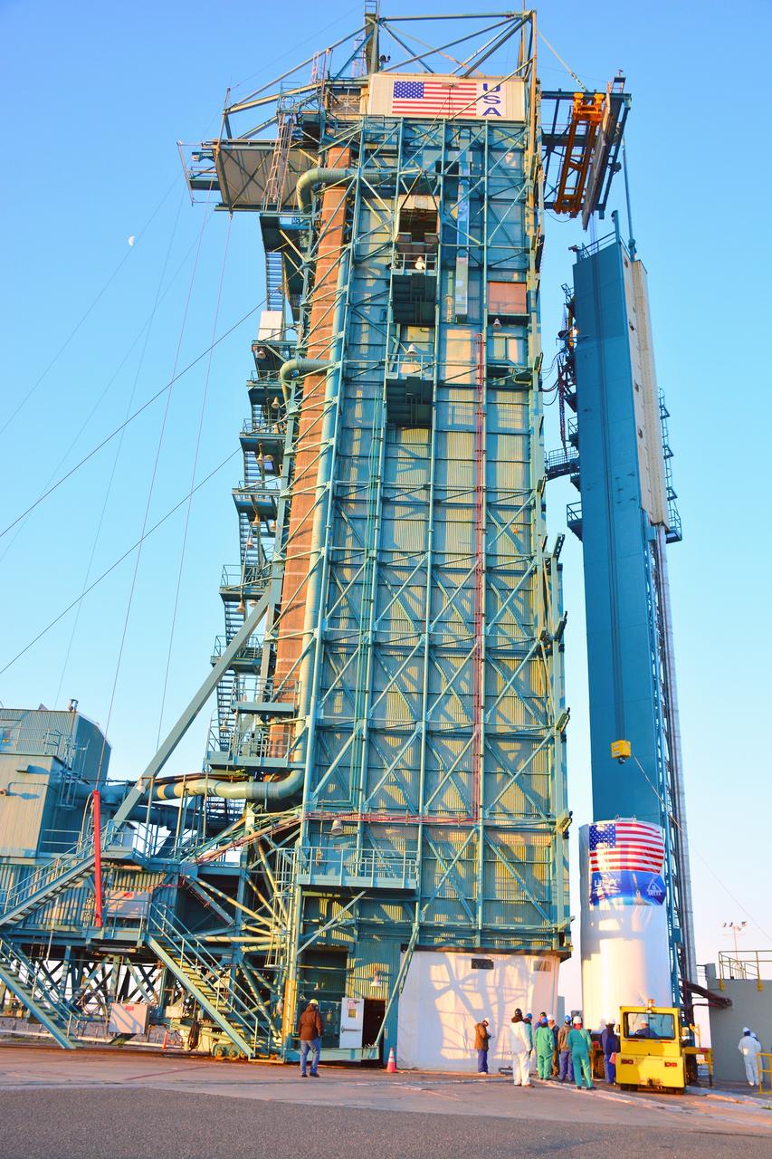
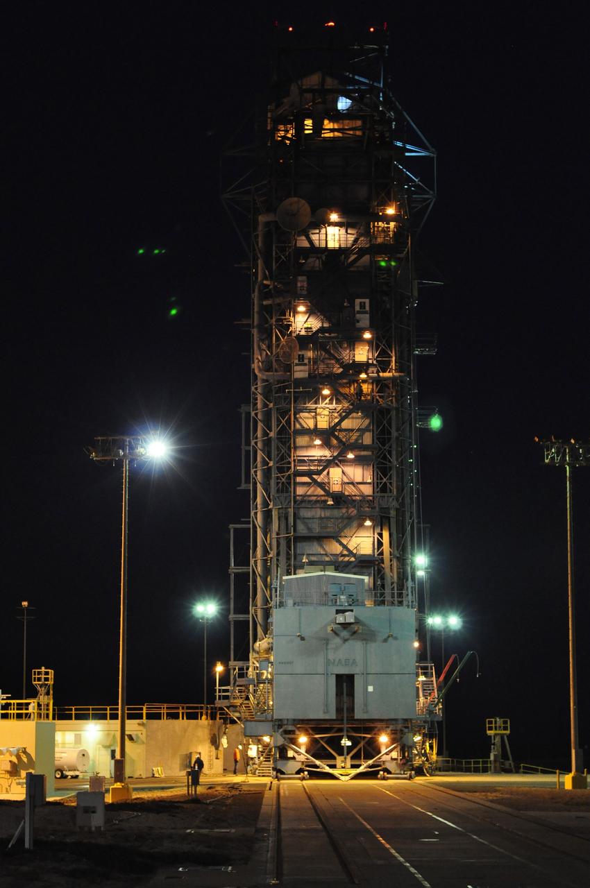
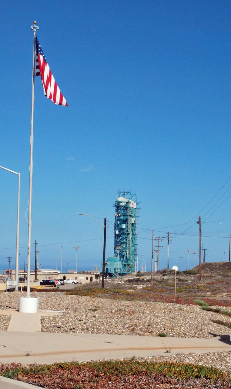
VANDENBERG AIR FORCE BASE, Calif. – The launch gantry is rolled back to reveal the United Launch Alliance Delta II rocket with the Soil Moisture Active Passive, or SMAP, satellite aboard, at the Space Launch Complex 2 at Vandenberg Air Force Base, California. SMAP is a remote sensing mission designed to measure and map the Earth's soil moisture distribution and freeze/thaw stat with unprecedented accuracy, resolution and coverage. SMAP will provide global measurements of soil moisture and its freeze/thaw state. These measurements will be used to enhance understanding of processes that link the water, energy and carbon cycles, and to extend the capabilities of weather and climate prediction models. SMAP data also will be used to quantify net carbon flux in boreal landscapes and to develop improved flood prediction and drought monitoring capabilities. Launch is scheduled for Jan. 29, 2015. To learn more about SMAP, visit http://smap.jpl.nasa.gov Photo credit: NASA/Kim Shiflett
VANDENBERG AIR FORCE BASE, Calif. – The launch gantry is rolled back to reveal the United Launch Alliance Delta II rocket with the Soil Moisture Active Passive, or SMAP, satellite aboard, at the Space Launch Complex 2 at Vandenberg Air Force Base, California. SMAP is a remote sensing mission designed to measure and map the Earth's soil moisture distribution and freeze/thaw stat with unprecedented accuracy, resolution and coverage. SMAP will provide global measurements of soil moisture and its freeze/thaw state. These measurements will be used to enhance understanding of processes that link the water, energy and carbon cycles, and to extend the capabilities of weather and climate prediction models. SMAP data also will be used to quantify net carbon flux in boreal landscapes and to develop improved flood prediction and drought monitoring capabilities. Launch is scheduled for Jan. 29, 2015. To learn more about SMAP, visit http://smap.jpl.nasa.gov Photo credit: NASA/Kim Shiflett
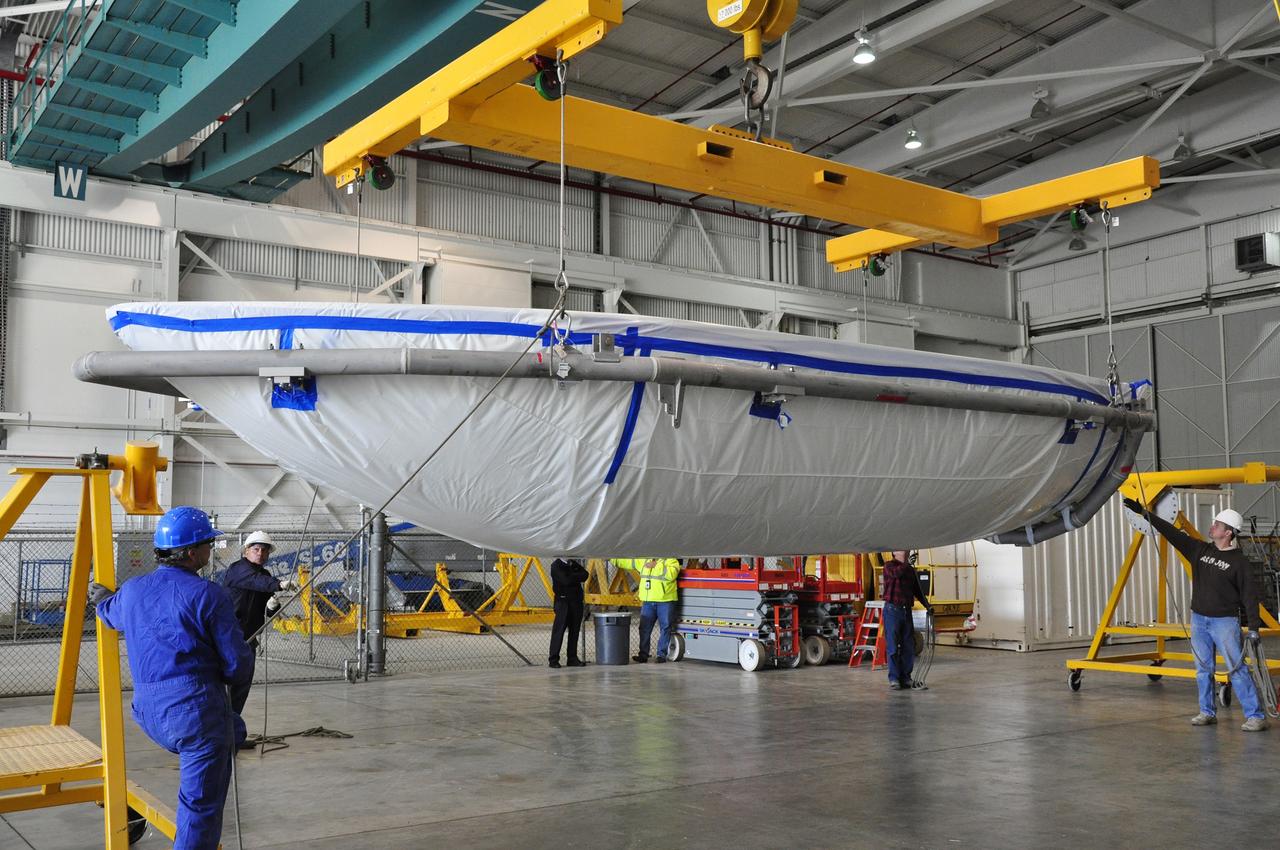
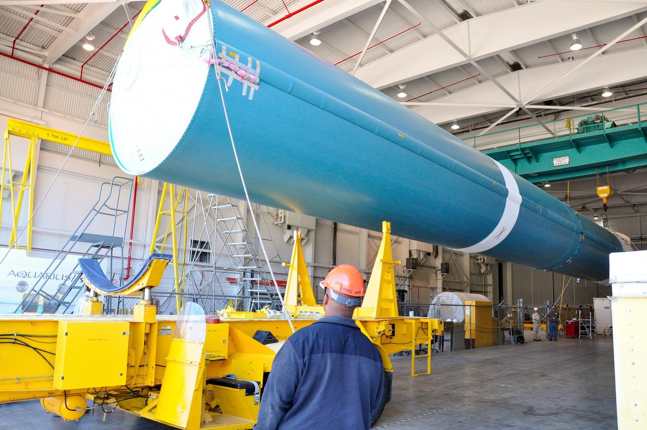
VANDENBERG AIR FORCE BASE, Calif. – Workers move a section of the fairing for NASA's Soil Moisture Active Passive mission, or SMAP, across the floor of the Building 836 high bay on Vandenberg Air Force Base in California. The fairing will protect the SMAP spacecraft from the heat and aerodynamic pressure generated during its ascent to orbit aboard a United Launch Alliance Delta II rocket from Space Launch Complex 2. SMAP will provide global measurements of soil moisture and its freeze/thaw state. These measurements will be used to enhance understanding of processes that link the water, energy and carbon cycles, and to extend the capabilities of weather and climate prediction models. SMAP data will also be used to quantify net carbon flux in boreal landscapes and to develop improved flood prediction and drought monitoring capabilities. Launch is scheduled for November 2014. To learn more about SMAP, visit http://smap.jpl.nasa.gov. Photo credit: NASA/Randy Beaudoin
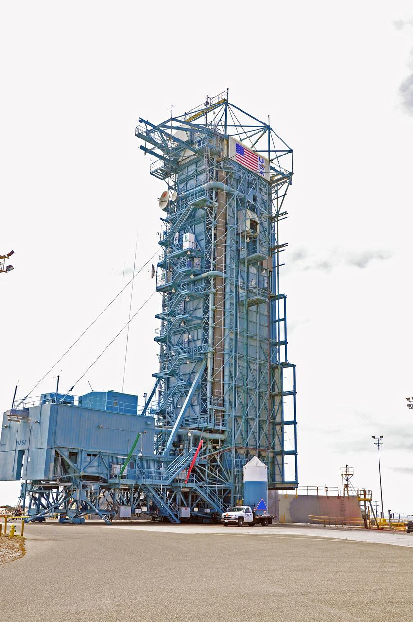
VANDENBERG AIR FORCE BASE, Calif. – The mobile service tower at Space Launch Complex 2 on Vandenberg Air Force Base in California is rolled back in preparation for the arrival of the first stage of the United Launch Alliance Delta II rocket for NASA's Soil Moisture Active Passive mission, or SMAP. SMAP will provide global measurements of soil moisture and its freeze/thaw state. These measurements will be used to enhance understanding of processes that link the water, energy and carbon cycles, and to extend the capabilities of weather and climate prediction models. SMAP data also will be used to quantify net carbon flux in boreal landscapes and to develop improved flood prediction and drought monitoring capabilities. Launch is scheduled for November 2014. To learn more about SMAP, visit http://smap.jpl.nasa.gov. Photo credit: NASA/Randy Beaudoin
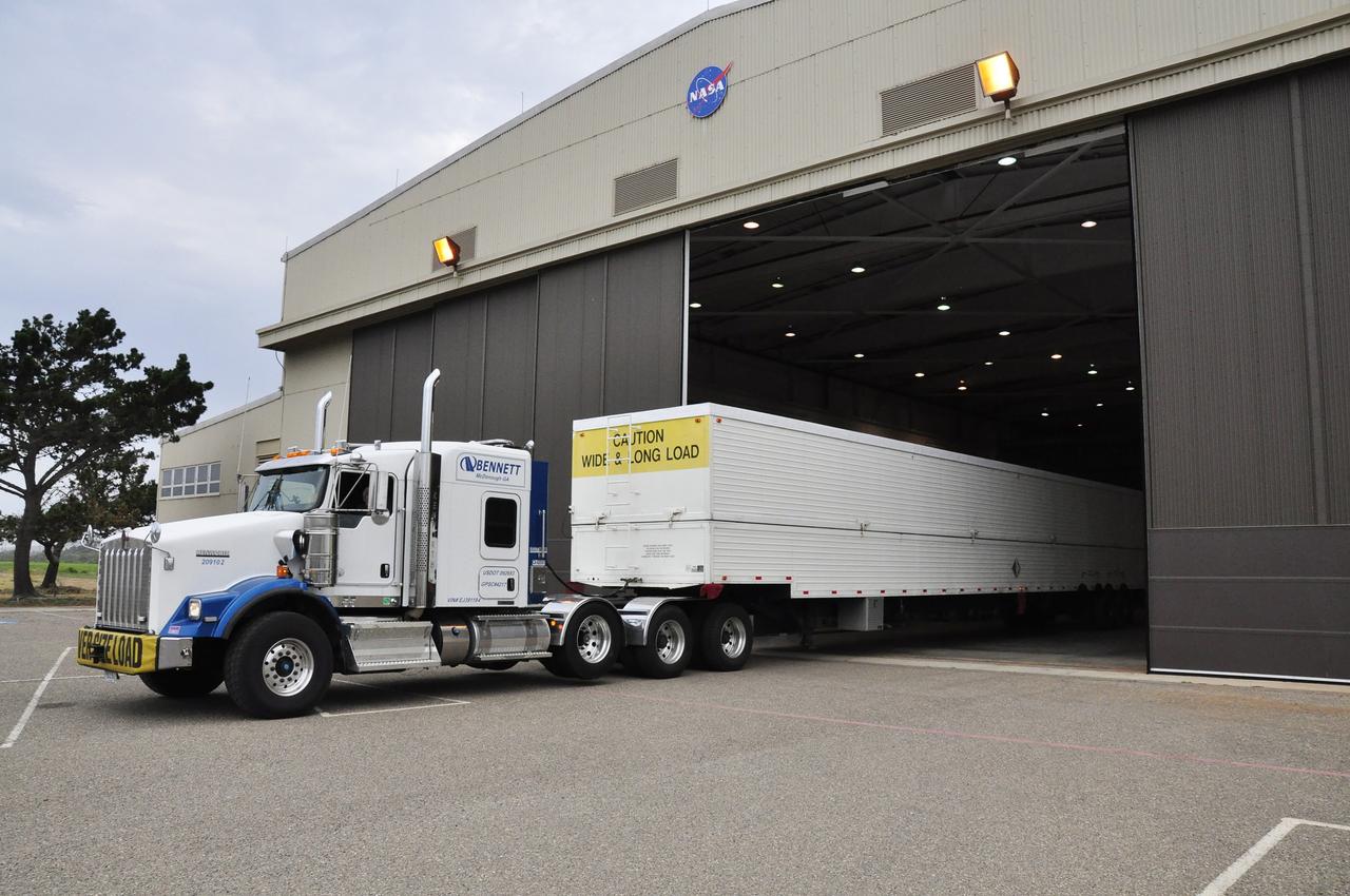
VANDENBERG AIR FORCE BASE, Calif. – The U.S. Air Force 30th Security Forces Squadron is responsible for the safety of the first stage of the United Launch Alliance Delta II rocket for NASA's Soil Moisture Active Passive mission, or SMAP, on its move from the Building 836 hangar to the Horizontal Processing Facility at Space Launch Complex 2 on Vandenberg Air Force Base in California. SMAP will provide global measurements of soil moisture and its freeze/thaw state. These measurements will be used to enhance understanding of processes that link the water, energy and carbon cycles, and to extend the capabilities of weather and climate prediction models. SMAP data also will be used to quantify net carbon flux in boreal landscapes and to develop improved flood prediction and drought monitoring capabilities. Launch is scheduled for November 2014. To learn more about SMAP, visit http://smap.jpl.nasa.gov. Photo credit: NASA/Randy Beaudoin
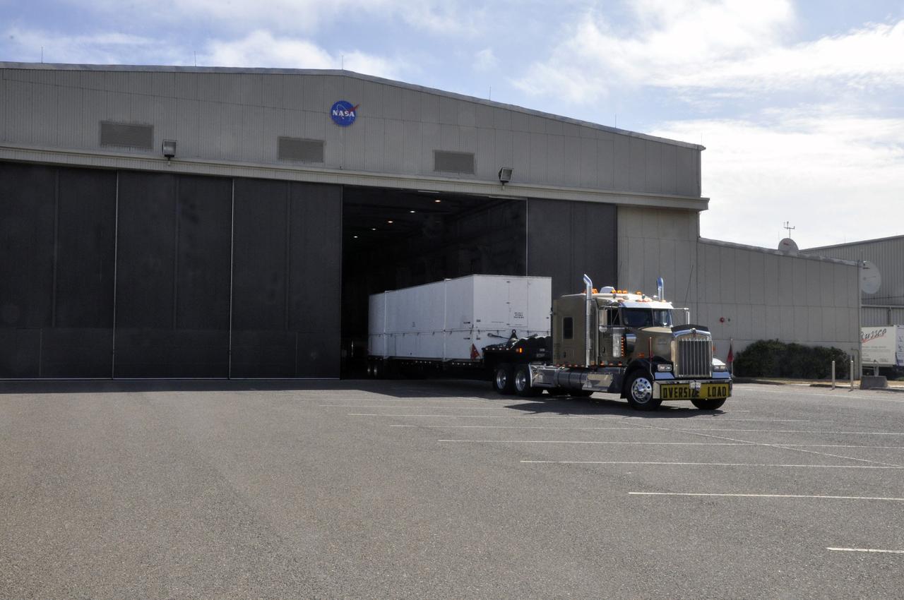
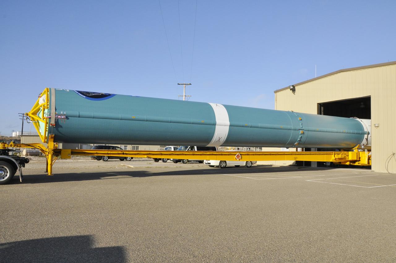
VANDENBERG AIR FORCE BASE, Calif. – The first stage of a United Launch Alliance Delta II rocket arrives at NASA hangar 836 on Vandenberg Air Force Base in California. The Delta II rocket will be used to deliver NASA's Soil Moisture Active Passive mission, or SMAP, into orbit. SMAP will provide global measurements of soil moisture and its freeze/thaw state. These measurements will be used to enhance understanding of processes that link the water, energy and carbon cycles, and to extend the capabilities of weather and climate prediction models. SMAP data also will be used to quantify net carbon flux in boreal landscapes and to develop improved flood prediction and drought monitoring capabilities. Launch is scheduled for November 2014. To learn more about SMAP, visit http://smap.jpl.nasa.gov Photo credit: NASA/Randy Beaudoin
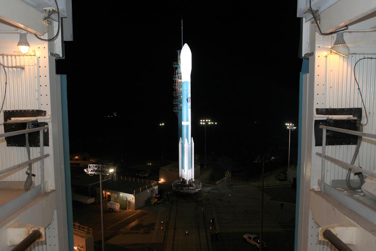
VANDENBERG AIR FORCE BASE, Calif. – The launch gantry is rolled back to reveal the United Launch Alliance Delta II rocket with the Soil Moisture Active Passive, or SMAP, satellite aboard, at the Space Launch Complex 2 at Vandenberg Air Force Base, California. SMAP is a remote sensing mission designed to measure and map the Earth's soil moisture distribution and freeze/thaw stat with unprecedented accuracy, resolution and coverage. SMAP will provide global measurements of soil moisture and its freeze/thaw state. These measurements will be used to enhance understanding of processes that link the water, energy and carbon cycles, and to extend the capabilities of weather and climate prediction models. SMAP data also will be used to quantify net carbon flux in boreal landscapes and to develop improved flood prediction and drought monitoring capabilities. Launch is scheduled for Jan. 29, 2015. To learn more about SMAP, visit http://smap.jpl.nasa.gov Photo credit: NASA/Kim Shiflett
VANDENBERG AIR FORCE BASE, Calif. – Workers steady the first stage of the United Launch Alliance Delta II rocket for NASA's Soil Moisture Active Passive mission, or SMAP, after it is lifted into a vertical position alongside the mobile service tower at Space Launch Complex 2 on Vandenberg Air Force Base in California. SMAP will provide global measurements of soil moisture and its freeze/thaw state. These measurements will be used to enhance understanding of processes that link the water, energy and carbon cycles, and to extend the capabilities of weather and climate prediction models. SMAP data also will be used to quantify net carbon flux in boreal landscapes and to develop improved flood prediction and drought monitoring capabilities. Launch is scheduled for November 2014. To learn more about SMAP, visit http://smap.jpl.nasa.gov. Photo credit: NASA/Tony Vauccin, USAF
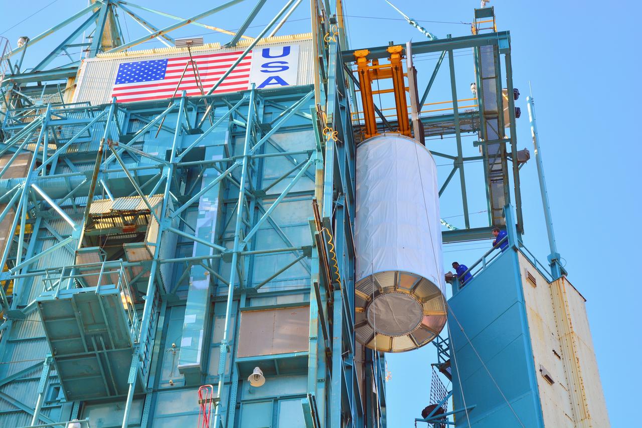
VANDENBERG AIR FORCE BASE, Calif. – The Delta II interstage adapter, or ISA, for NASA's Soil Moisture Active Passive mission, or SMAP, is ready to be lifted into the mobile service tower at Space Launch Complex 2 on Vandenberg Air Force Base in California. A United Launch Alliance Delta II rocket will loft SMAP into orbit. The ISA connects the Delta II first and second stages and encloses the second stage engine and thrust section. The spacecraft will provide global measurements of soil moisture and its freeze/thaw state. These measurements will be used to enhance understanding of processes that link the water, energy and carbon cycles, and to extend the capabilities of weather and climate prediction models. The data returned also will be used to quantify net carbon flux in boreal landscapes and to develop improved flood prediction and drought monitoring capabilities. Launch is scheduled for November 2014. To learn more about SMAP, visit http://smap.jpl.nasa.gov. Photo credit: NASA/Randy Beaudoin
VANDENBERG AIR FORCE BASE, Calif. – At Vandenberg Air Force Base in California, NASA's Soil Moisture Active Passive mission, or SMAP, satellite is mated to its Delta II rocket at Space Launch Complex 2. SMAP will provide global measurements of soil moisture and its freeze/thaw state. These measurements will be used to enhance understanding of processes that link the water, energy and carbon cycles, and to extend the capabilities of weather and climate prediction models. SMAP data also will be used to quantify net carbon flux in boreal landscapes and to develop improved flood prediction and drought monitoring capabilities. Launch is scheduled for Jan. 29, 2015. To learn more about SMAP, visit http://smap.jpl.nasa.gov Photo credit: NASA/Randy Beaudoin
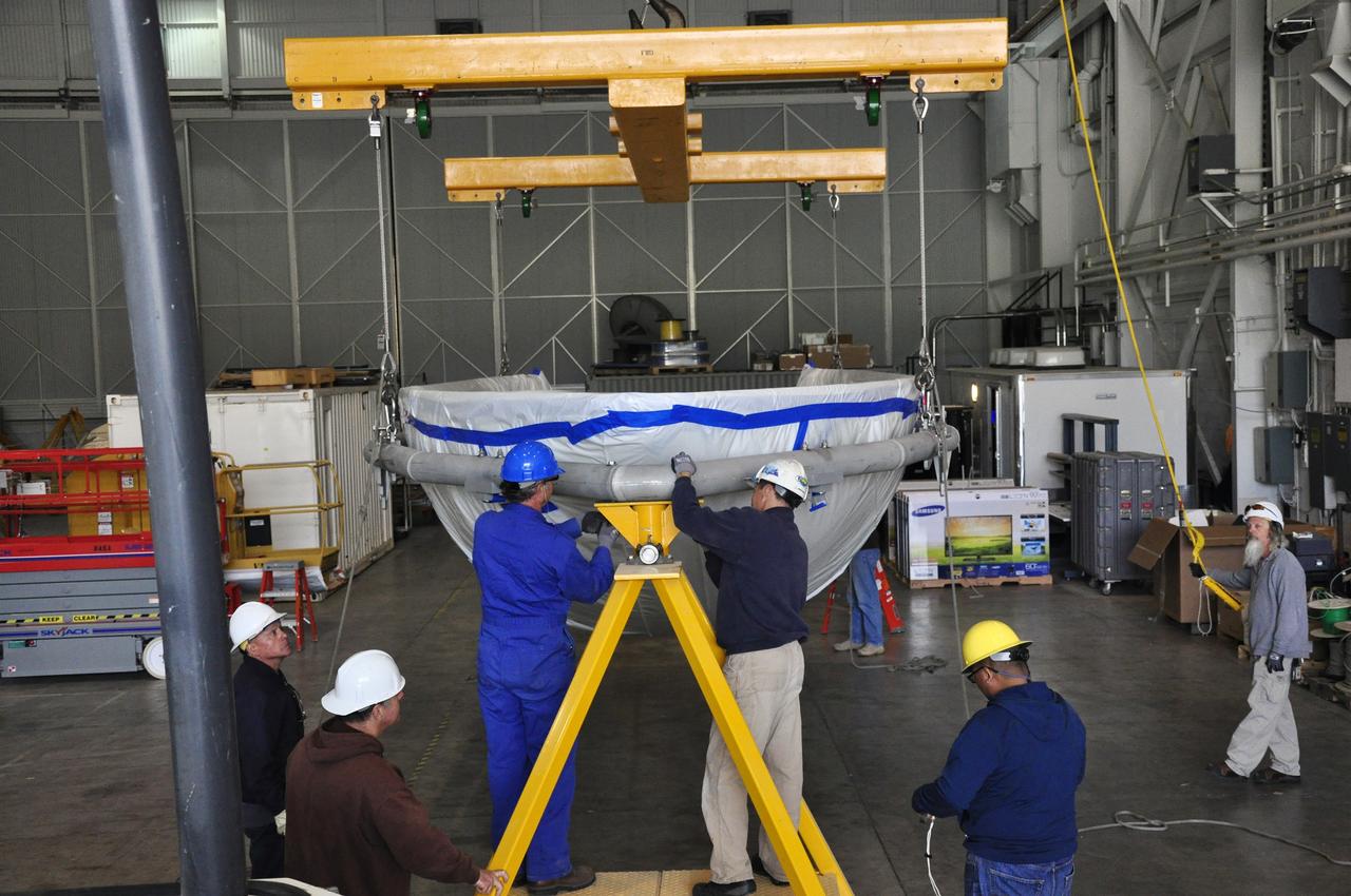
VANDENBERG AIR FORCE BASE, Calif. – Workers prepare to rotate a section of the fairing for NASA's Soil Moisture Active Passive mission, or SMAP, in a lifting device in the Building 836 high bay on Vandenberg Air Force Base in California. The fairing will protect the SMAP spacecraft from the heat and aerodynamic pressure generated during its ascent to orbit aboard a United Launch Alliance Delta II rocket from Space Launch Complex 2. SMAP will provide global measurements of soil moisture and its freeze/thaw state. These measurements will be used to enhance understanding of processes that link the water, energy and carbon cycles, and to extend the capabilities of weather and climate prediction models. SMAP data will also be used to quantify net carbon flux in boreal landscapes and to develop improved flood prediction and drought monitoring capabilities. Launch is scheduled for November 2014. To learn more about SMAP, visit http://smap.jpl.nasa.gov. Photo credit: NASA/Randy Beaudoin
VANDENBERG AIR FORCE BASE, Calif. – The launch gantry is rolled back to reveal the United Launch Alliance Delta II rocket with the Soil Moisture Active Passive, or SMAP, satellite aboard, at the Space Launch Complex 2 at Vandenberg Air Force Base, California. SMAP is a remote sensing mission designed to measure and map the Earth's soil moisture distribution and freeze/thaw stat with unprecedented accuracy, resolution and coverage. SMAP will provide global measurements of soil moisture and its freeze/thaw state. These measurements will be used to enhance understanding of processes that link the water, energy and carbon cycles, and to extend the capabilities of weather and climate prediction models. SMAP data also will be used to quantify net carbon flux in boreal landscapes and to develop improved flood prediction and drought monitoring capabilities. Launch is scheduled for Jan. 29, 2015. To learn more about SMAP, visit http://smap.jpl.nasa.gov Photo credit: NASA/Kim Shiflett

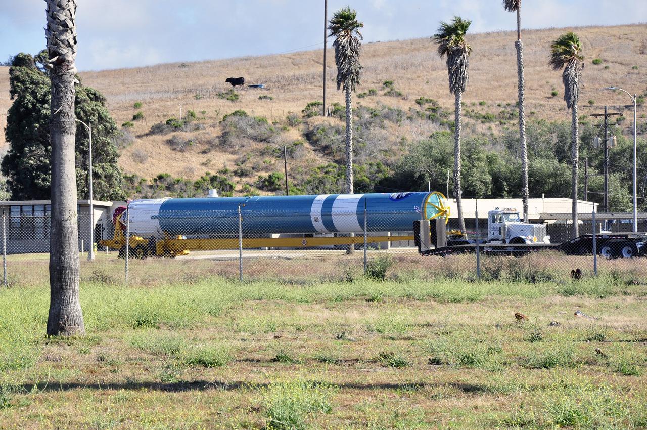
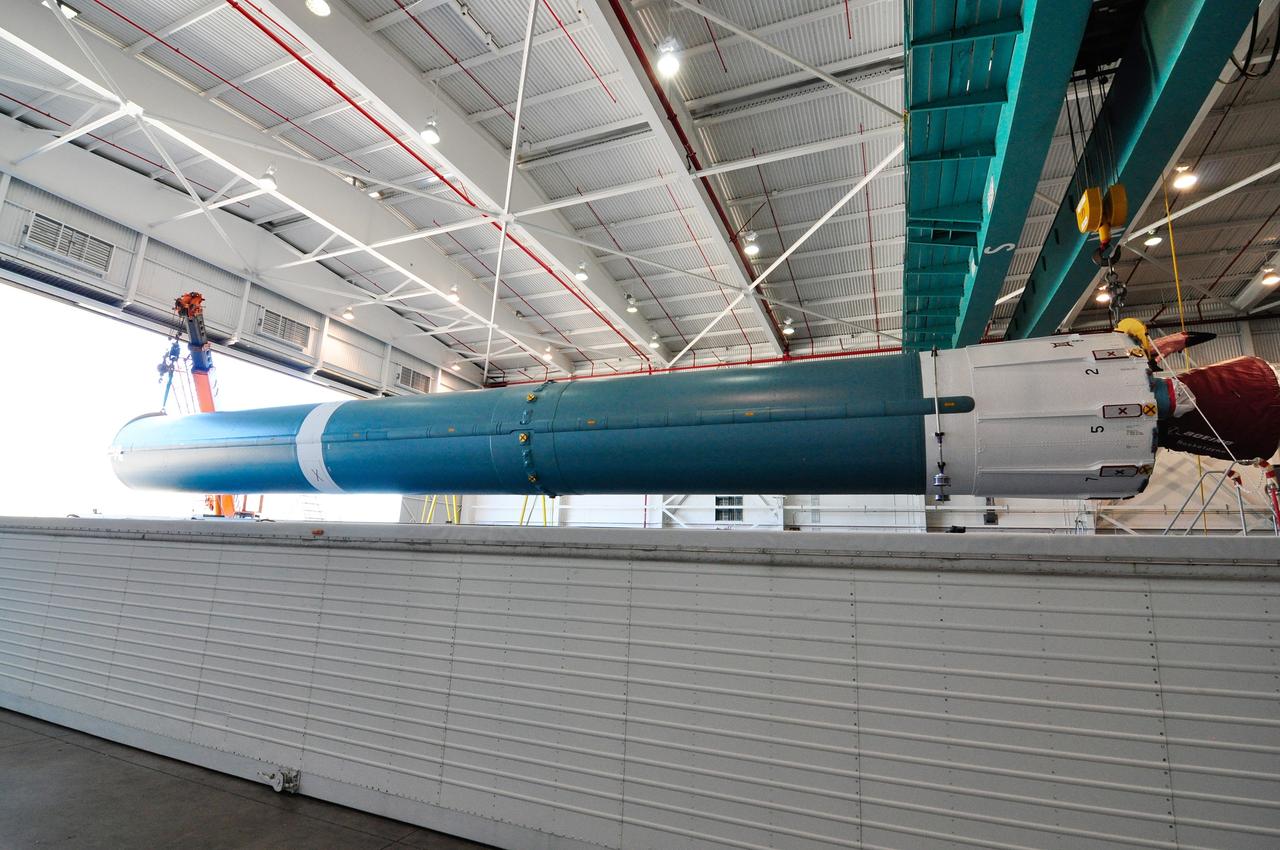
VANDENBERG AIR FORCE BASE, Calif. – The second stage, or upper stage, of a United Launch Alliance Delta II rocket arrives at Space Launch Complex 2 on Vandenberg Air Force Base in California where it will undergo preparations for launch in the Horizontal Processing Facility. The Delta II rocket will be used to deliver NASA's Soil Moisture Active Passive mission, or SMAP, into orbit. SMAP will provide global measurements of soil moisture and its freeze/thaw state. These measurements will be used to enhance understanding of processes that link the water, energy and carbon cycles, and to extend the capabilities of weather and climate prediction models. SMAP data also will be used to quantify net carbon flux in boreal landscapes and to develop improved flood prediction and drought monitoring capabilities. Launch is scheduled for November 2014. To learn more about SMAP, visit http://smap.jpl.nasa.gov. Photo credit: NASA/Randy Beaudoin
VANDENBERG AIR FORCE BASE, Calif. – At Vandenberg Air Force Base in California, NASA's Soil Moisture Active Passive mission, or SMAP, satellite is lifted at Space Launch Complex 2 for mating to its Delta II rocket. SMAP will provide global measurements of soil moisture and its freeze/thaw state. These measurements will be used to enhance understanding of processes that link the water, energy and carbon cycles, and to extend the capabilities of weather and climate prediction models. SMAP data also will be used to quantify net carbon flux in boreal landscapes and to develop improved flood prediction and drought monitoring capabilities. Launch is scheduled for Jan. 29, 2015. To learn more about SMAP, visit http://smap.jpl.nasa.gov Photo credit: NASA/Randy Beaudoin
VANDENBERG AIR FORCE BASE, Calif. – The first stage of the United Launch Alliance Delta II rocket for NASA's Soil Moisture Active Passive mission, or SMAP, passes the mobile service tower at Space Launch Complex 2 on its way to the Horizontal Processing Facility on Vandenberg Air Force Base in California. SMAP will provide global measurements of soil moisture and its freeze/thaw state. These measurements will be used to enhance understanding of processes that link the water, energy and carbon cycles, and to extend the capabilities of weather and climate prediction models. SMAP data also will be used to quantify net carbon flux in boreal landscapes and to develop improved flood prediction and drought monitoring capabilities. Launch is scheduled for November 2014. To learn more about SMAP, visit http://smap.jpl.nasa.gov. Photo credit: NASA/Randy Beaudoin
VANDENBERG AIR FORCE BASE, Calif. – The first stage of a United Launch Alliance Delta II rocket arrives at NASA hangar 836 on Vandenberg Air Force Base in California. The Delta II rocket will be used to deliver NASA's Soil Moisture Active Passive mission, or SMAP, into orbit. SMAP will provide global measurements of soil moisture and its freeze/thaw state. These measurements will be used to enhance understanding of processes that link the water, energy and carbon cycles, and to extend the capabilities of weather and climate prediction models. SMAP data also will be used to quantify net carbon flux in boreal landscapes and to develop improved flood prediction and drought monitoring capabilities. Launch is scheduled for November 2014. To learn more about SMAP, visit http://smap.jpl.nasa.gov Photo credit: NASA/Randy Beaudoin
VANDENBERG AIR FORCE BASE, Calif. – At Vandenberg Air Force Base in California, NASA's Soil Moisture Active Passive mission, or SMAP, satellite is prepared for lifting at Space Launch Complex 2 for mating to its Delta II rocket. SMAP will provide global measurements of soil moisture and its freeze/thaw state. These measurements will be used to enhance understanding of processes that link the water, energy and carbon cycles, and to extend the capabilities of weather and climate prediction models. SMAP data also will be used to quantify net carbon flux in boreal landscapes and to develop improved flood prediction and drought monitoring capabilities. Launch is scheduled for Jan. 29, 2015. To learn more about SMAP, visit http://smap.jpl.nasa.gov Photo credit: NASA/Randy Beaudoin

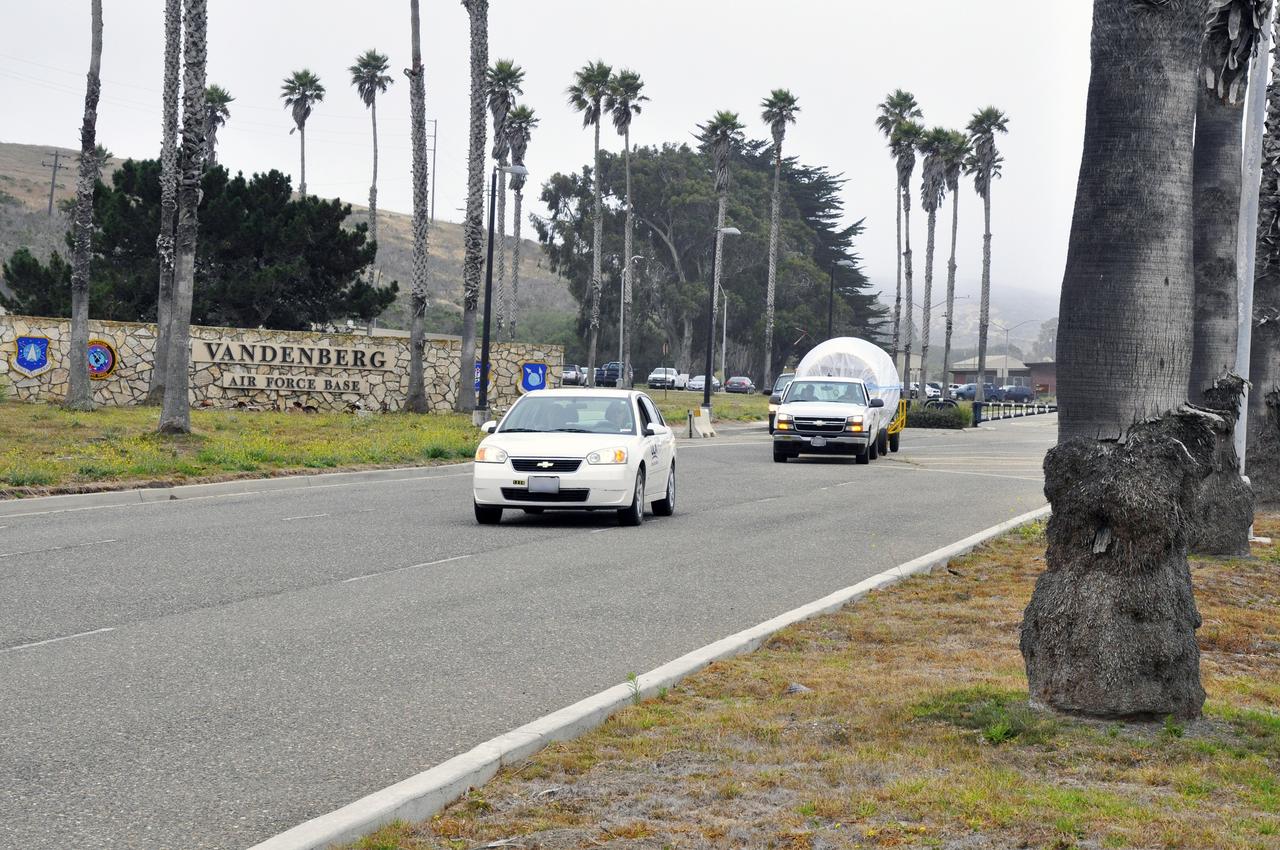
VANDENBERG AIR FORCE BASE, Calif. – The first stage of the United Launch Alliance Delta II rocket for NASA's Soil Moisture Active Passive mission, or SMAP, crosses a railroad bridge on its move from the Building 836 hangar to the Horizontal Processing Facility at Space Launch Complex 2 on Vandenberg Air Force Base in California. SMAP will provide global measurements of soil moisture and its freeze/thaw state. These measurements will be used to enhance understanding of processes that link the water, energy and carbon cycles, and to extend the capabilities of weather and climate prediction models. SMAP data also will be used to quantify net carbon flux in boreal landscapes and to develop improved flood prediction and drought monitoring capabilities. Launch is scheduled for November 2014. To learn more about SMAP, visit http://smap.jpl.nasa.gov. Photo credit: NASA/U.S. Air Force 30th Space Wing
VANDENBERG AIR FORCE BASE, Calif. – Workers guide the first stage of the United Launch Alliance Delta II rocket for NASA's Soil Moisture Active Passive mission, or SMAP, onto the launcher adjacent to the fixed umbilical tower at Space Launch Complex 2 on Vandenberg Air Force Base in California. SMAP will provide global measurements of soil moisture and its freeze/thaw state. These measurements will be used to enhance understanding of processes that link the water, energy and carbon cycles, and to extend the capabilities of weather and climate prediction models. SMAP data also will be used to quantify net carbon flux in boreal landscapes and to develop improved flood prediction and drought monitoring capabilities. Launch is scheduled for November 2014. To learn more about SMAP, visit http://smap.jpl.nasa.gov. Photo credit: NASA/Randy Beaudoin
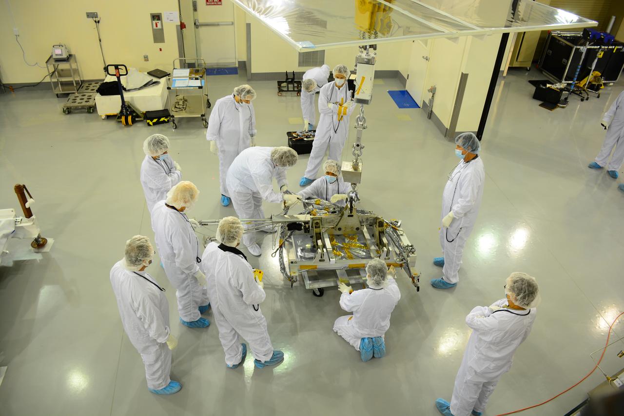
Workers push the pallet supporting the transportation container protecting NASA's Soil Moisture Active Passive, or SMAP, spacecraft into the Astrotech payload processing facility on Vandenberg Air Force Base in California. SMAP will launch on a Delta II 7320 configuration vehicle featuring a United Launch Alliance first stage booster powered by an Aerojet Rocketdyne RS-27A main engine and three Alliant Techsystems, or ATK, strap-on solid rocket motors. Once on station in Earth orbit, SMAP will provide global measurements of soil moisture and its freeze/thaw state. These measurements will be used to enhance understanding of processes that link the water, energy and carbon cycles, and to extend the capabilities of weather and climate prediction models. SMAP data also will be used to quantify net carbon flux in boreal landscapes and to develop improved flood prediction and drought monitoring capabilities. Launch from Space Launch Complex 2 is targeted for Jan. 29, 2015.
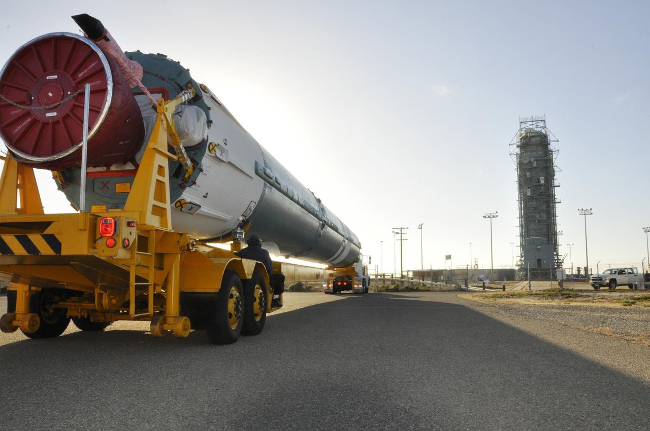
VANDENBERG AIR FORCE BASE, Calif. – The first stage of the United Launch Alliance Delta II rocket for NASA's Soil Moisture Active Passive mission, or SMAP, makes its way along the roadways on Vandenberg Air Force Base in California from the Building 836 hangar to the Horizontal Processing Facility at Space Launch Complex 2. SMAP will provide global measurements of soil moisture and its freeze/thaw state. These measurements will be used to enhance understanding of processes that link the water, energy and carbon cycles, and to extend the capabilities of weather and climate prediction models. SMAP data also will be used to quantify net carbon flux in boreal landscapes and to develop improved flood prediction and drought monitoring capabilities. Launch is scheduled for November 2014. To learn more about SMAP, visit http://smap.jpl.nasa.gov. Photo credit: NASA/Randy Beaudoin
VANDENBERG AIR FORCE BASE, Calif. – Technicians assist in offloading the first stage of a United Launch Alliance Delta II rocket following its arrival at NASA hangar 836 on Vandenberg Air Force Base in California. The launch vehicle will be used to deliver NASA's Soil Moisture Active Passive mission, or SMAP, into orbit. SMAP will provide global measurements of soil moisture and its freeze/thaw state. These measurements will be used to enhance understanding of processes that link the water, energy and carbon cycles, and to extend the capabilities of weather and climate prediction models. SMAP data also will be used to quantify net carbon flux in boreal landscapes and to develop improved flood prediction and drought monitoring capabilities. Launch is scheduled for November 2014. To learn more about SMAP, visit http://smap.jpl.nasa.gov Photo credit: NASA/Randy Beaudoin
VANDENBERG AIR FORCE BASE, Calif. – At Vandenberg Air Force Base in California, NASA's Soil Moisture Active Passive mission, or SMAP, satellite is lifted at Space Launch Complex 2 for mating to its Delta II rocket. SMAP will provide global measurements of soil moisture and its freeze/thaw state. These measurements will be used to enhance understanding of processes that link the water, energy and carbon cycles, and to extend the capabilities of weather and climate prediction models. SMAP data also will be used to quantify net carbon flux in boreal landscapes and to develop improved flood prediction and drought monitoring capabilities. Launch is scheduled for Jan. 29, 2015. To learn more about SMAP, visit http://smap.jpl.nasa.gov Photo credit: NASA/Randy Beaudoin
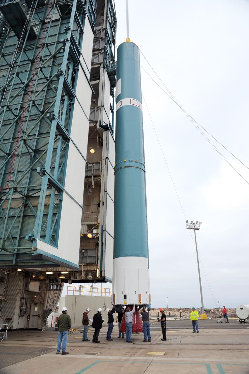
VANDENBERG AIR FORCE BASE, Calif. – The first stage of the United Launch Alliance Delta II rocket for NASA's Soil Moisture Active Passive mission, or SMAP, is elevated off its transporter into a vertical position for its move into the mobile service tower at Space Launch Complex 2 on Vandenberg Air Force Base in California. SMAP will provide global measurements of soil moisture and its freeze/thaw state. These measurements will be used to enhance understanding of processes that link the water, energy and carbon cycles, and to extend the capabilities of weather and climate prediction models. SMAP data also will be used to quantify net carbon flux in boreal landscapes and to develop improved flood prediction and drought monitoring capabilities. Launch is scheduled for November 2014. To learn more about SMAP, visit http://smap.jpl.nasa.gov. Photo credit: NASA/Randy Beaudoin
VANDENBERG AIR FORCE BASE, Calif. – The launch gantry is rolled back to reveal the United Launch Alliance Delta II rocket with the Soil Moisture Active Passive, or SMAP, satellite aboard, at Space Launch Complex 2 on Vandenberg Air Force Base in California. SMAP is a remote sensing mission designed to measure and map the Earth's soil moisture distribution and freeze/thaw stat with unprecedented accuracy, resolution and coverage. SMAP will provide global measurements of soil moisture and its freeze/thaw state. These measurements will be used to enhance understanding of processes that link the water, energy and carbon cycles, and to extend the capabilities of weather and climate prediction models. SMAP data also will be used to quantify net carbon flux in boreal landscapes and to develop improved flood prediction and drought monitoring capabilities. Launch is scheduled for Jan. 29, 2015. To learn more about SMAP, visit http://www.nasa.gov/smap. Photo credit: NASA/Randy Beaudoin
Inside the Astrotech payload processing facility on Vandenberg Air Force Base in California, engineers and technicians use a crane to move NASA's Soil Moisture Active Passive, or SMAP, spacecraft. SMAP will launch on a Delta II 7320 configuration vehicle featuring a United Launch Alliance first stage booster powered by an Aerojet Rocketdyne RS-27A main engine and three Alliant Techsystems, or ATK, strap-on solid rocket motors. Once on station in Earth orbit, SMAP will provide global measurements of soil moisture and its freeze/thaw state. These measurements will be used to enhance understanding of processes that link the water, energy and carbon cycles, and to extend the capabilities of weather and climate prediction models. SMAP data also will be used to quantify net carbon flux in boreal landscapes and to develop improved flood prediction and drought monitoring capabilities. Launch from Space Launch Complex 2 is targeted for Jan. 29, 2015.

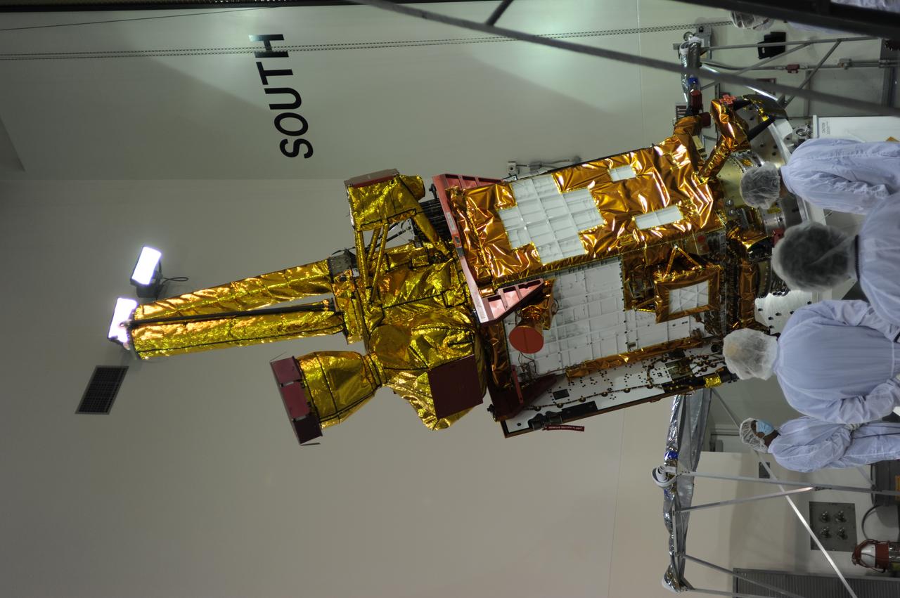
Inside the Astrotech payload processing facility on Vandenberg Air Force Base in California, engineers and technicians inspect NASA's Soil Moisture Active Passive, or SMAP, spacecraft. SMAP will launch on a Delta II 7320 configuration vehicle featuring a United Launch Alliance first stage booster powered by an Aerojet Rocketdyne RS-27A main engine and three Alliant Techsystems, or ATK, strap-on solid rocket motors. Once on station in Earth orbit, SMAP will provide global measurements of soil moisture and its freeze/thaw state. These measurements will be used to enhance understanding of processes that link the water, energy and carbon cycles, and to extend the capabilities of weather and climate prediction models. SMAP data also will be used to quantify net carbon flux in boreal landscapes and to develop improved flood prediction and drought monitoring capabilities. Launch from Space Launch Complex 2 is targeted for Jan. 29, 2015.
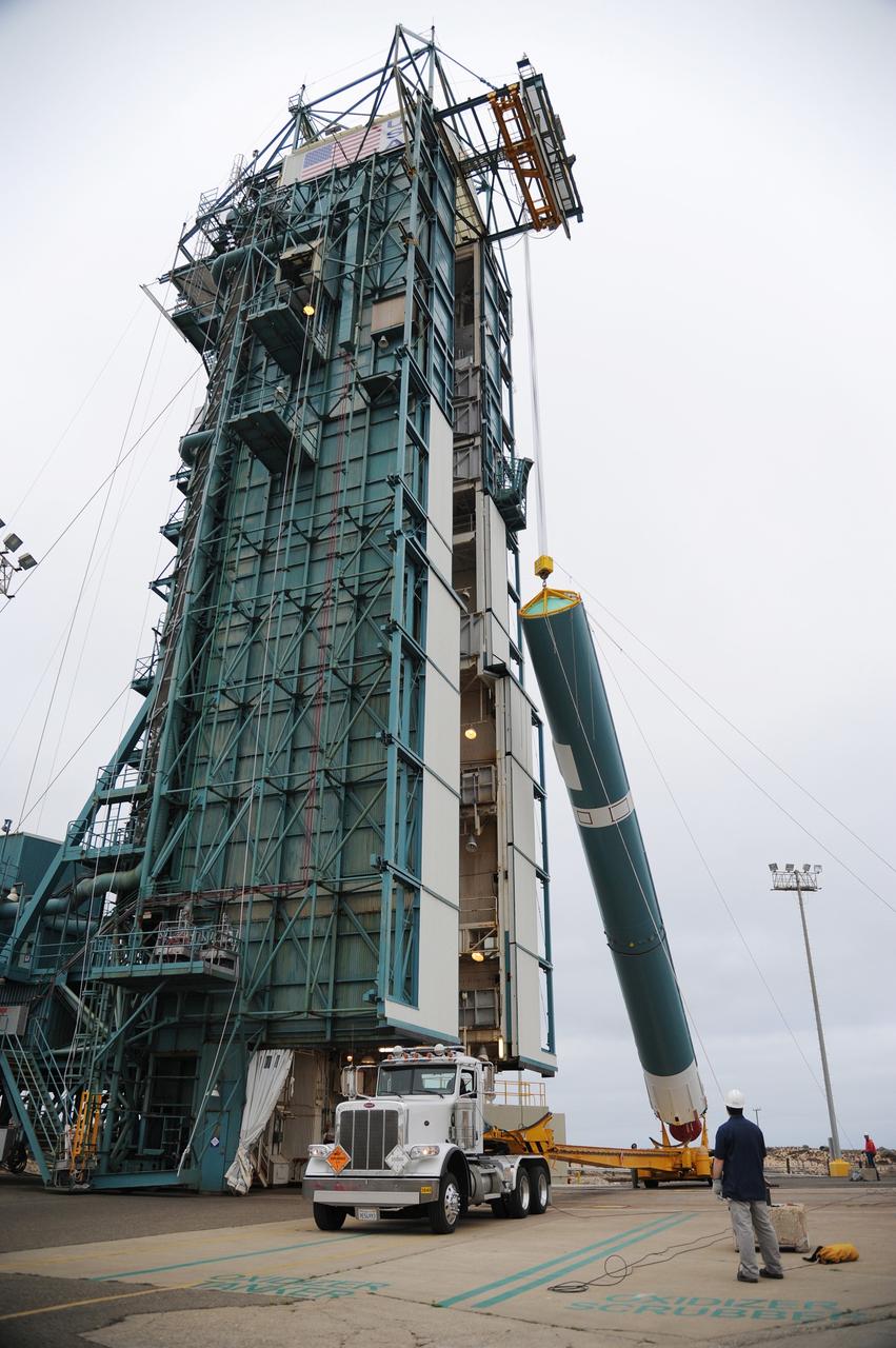
VANDENBERG AIR FORCE BASE, Calif. – A crane hoists the first stage of the United Launch Alliance Delta II rocket for NASA's Soil Moisture Active Passive mission, or SMAP, into a vertical position alongside the mobile service tower at Space Launch Complex 2 on Vandenberg Air Force Base in California. SMAP will provide global measurements of soil moisture and its freeze/thaw state. These measurements will be used to enhance understanding of processes that link the water, energy and carbon cycles, and to extend the capabilities of weather and climate prediction models. SMAP data also will be used to quantify net carbon flux in boreal landscapes and to develop improved flood prediction and drought monitoring capabilities. Launch is scheduled for November 2014. To learn more about SMAP, visit http://smap.jpl.nasa.gov. Photo credit: NASA/Tony Vauccin, USAF
VANDENBERG AIR FORCE BASE, Calif. – The first stage of the United Launch Alliance Delta II rocket for NASA's Soil Moisture Active Passive mission, or SMAP, is raised off its transporter into a vertical position for its transfer into the mobile service tower at Space Launch Complex 2 on Vandenberg Air Force Base in California. SMAP will provide global measurements of soil moisture and its freeze/thaw state. These measurements will be used to enhance understanding of processes that link the water, energy and carbon cycles, and to extend the capabilities of weather and climate prediction models. SMAP data also will be used to quantify net carbon flux in boreal landscapes and to develop improved flood prediction and drought monitoring capabilities. Launch is scheduled for November 2014. To learn more about SMAP, visit http://smap.jpl.nasa.gov. Photo credit: NASA/Tony Vauccin, USAF
VANDENBERG AIR FORCE BASE, Calif. – Under the watchful eye of technicians, crane is used to offload the first stage of a United Launch Alliance Delta II rocket following its arrival at NASA hangar 836 on Vandenberg Air Force Base in California. The launch vehicle will be used to deliver NASA's Soil Moisture Active Passive mission, or SMAP, into orbit. SMAP will provide global measurements of soil moisture and its freeze/thaw state. These measurements will be used to enhance understanding of processes that link the water, energy and carbon cycles, and to extend the capabilities of weather and climate prediction models. SMAP data also will be used to quantify net carbon flux in boreal landscapes and to develop improved flood prediction and drought monitoring capabilities. Launch is scheduled for November 2014. To learn more about SMAP, visit http://smap.jpl.nasa.gov Photo credit: NASA/Randy Beaudoin
VANDENBERG AIR FORCE BASE, Calif. – Workers oversee the rollback of the mobile service tower at Space Launch Complex 2 on Vandenberg Air Force Base in California in preparation for the arrival of the first stage of the United Launch Alliance Delta II rocket for NASA's Soil Moisture Active Passive mission, or SMAP. SMAP will provide global measurements of soil moisture and its freeze/thaw state. These measurements will be used to enhance understanding of processes that link the water, energy and carbon cycles, and to extend the capabilities of weather and climate prediction models. SMAP data also will be used to quantify net carbon flux in boreal landscapes and to develop improved flood prediction and drought monitoring capabilities. Launch is scheduled for November 2014. To learn more about SMAP, visit http://smap.jpl.nasa.gov. Photo credit: NASA/Randy Beaudoin
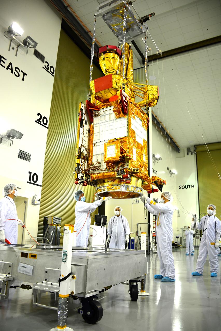
Inside the Astrotech payload processing facility on Vandenberg Air Force Base in California, engineers and technicians wearing protective garb, monitor operations as a crane lifts a component of NASA's Soil Moisture Active Passive, or SMAP, spacecraft. SMAP will launch on a Delta II 7320 configuration vehicle featuring a United Launch Alliance first stage booster powered by an Aerojet Rocketdyne RS-27A main engine and three Alliant Techsystems, or ATK, strap-on solid rocket motors. Once on station in Earth orbit, SMAP will provide global measurements of soil moisture and its freeze/thaw state. These measurements will be used to enhance understanding of processes that link the water, energy and carbon cycles, and to extend the capabilities of weather and climate prediction models. SMAP data also will be used to quantify net carbon flux in boreal landscapes and to develop improved flood prediction and drought monitoring capabilities. Launch from Space Launch Complex 2 is targeted for Jan. 29, 2015.
VANDENBERG AIR FORCE BASE, Calif. – At Vandenberg Air Force Base in California, NASA's Soil Moisture Active Passive mission, or SMAP, satellite is mated to its Delta II rocket at Space Launch Complex 2. SMAP will provide global measurements of soil moisture and its freeze/thaw state. These measurements will be used to enhance understanding of processes that link the water, energy and carbon cycles, and to extend the capabilities of weather and climate prediction models. SMAP data also will be used to quantify net carbon flux in boreal landscapes and to develop improved flood prediction and drought monitoring capabilities. Launch is scheduled for Jan. 29, 2015. To learn more about SMAP, visit http://smap.jpl.nasa.gov Photo credit: NASA/Randy Beaudoin
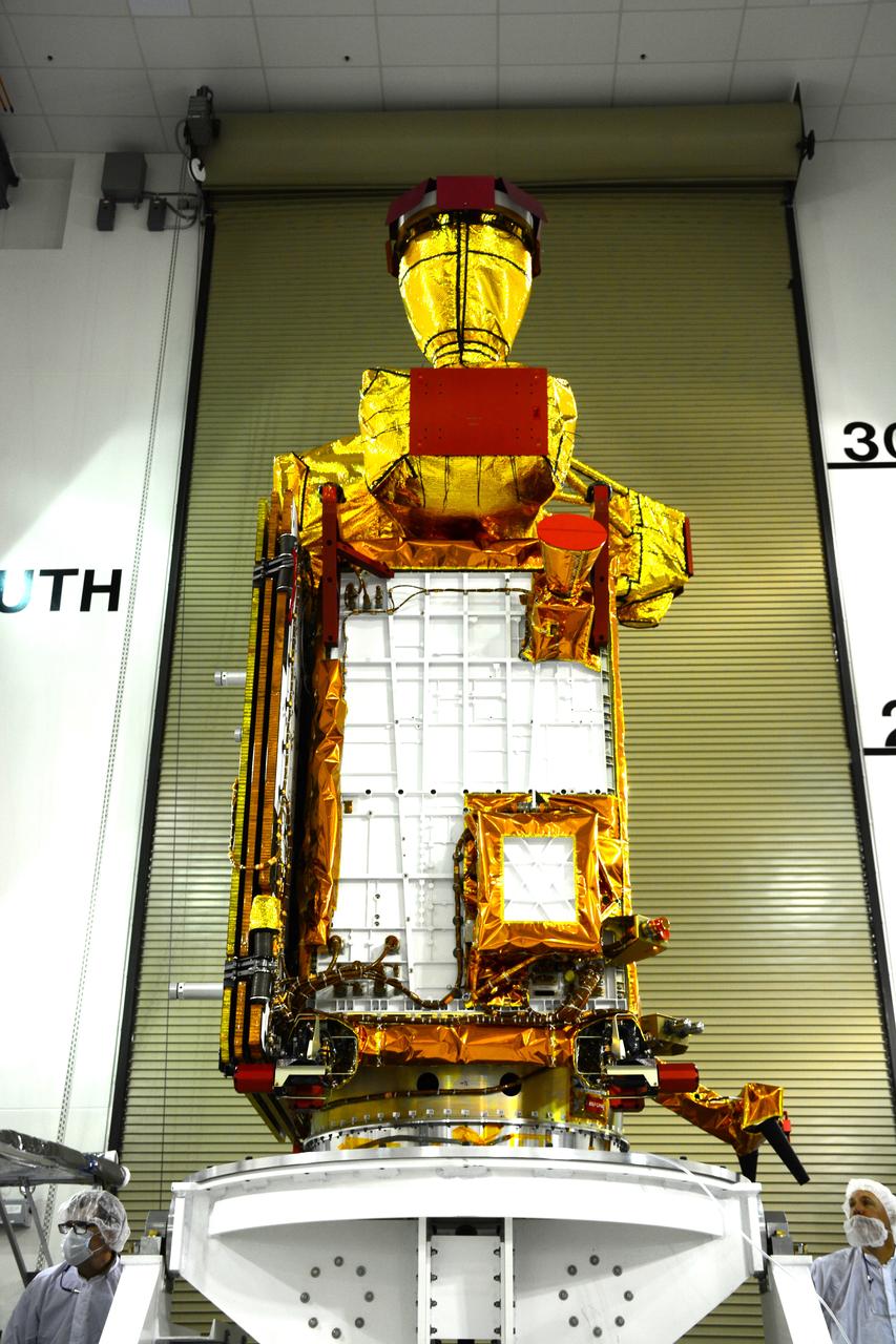
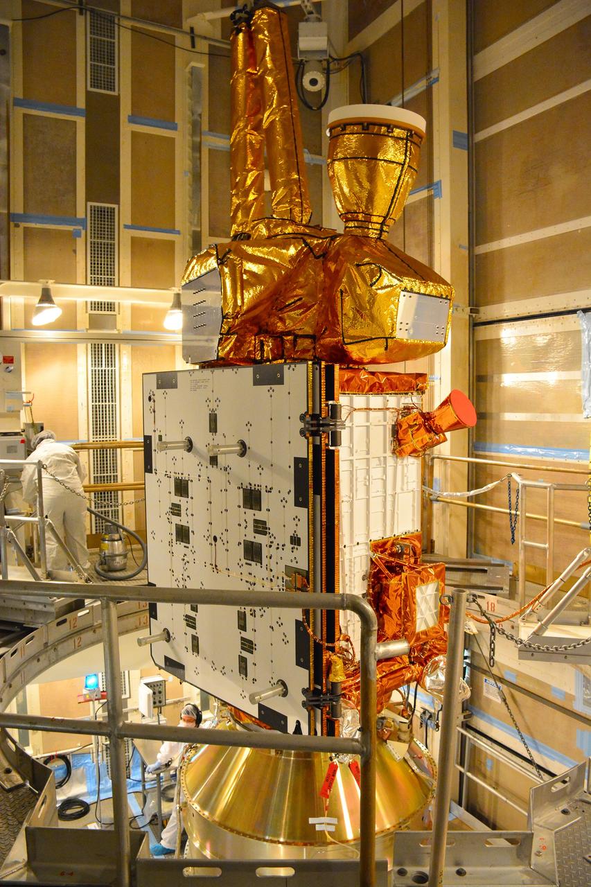
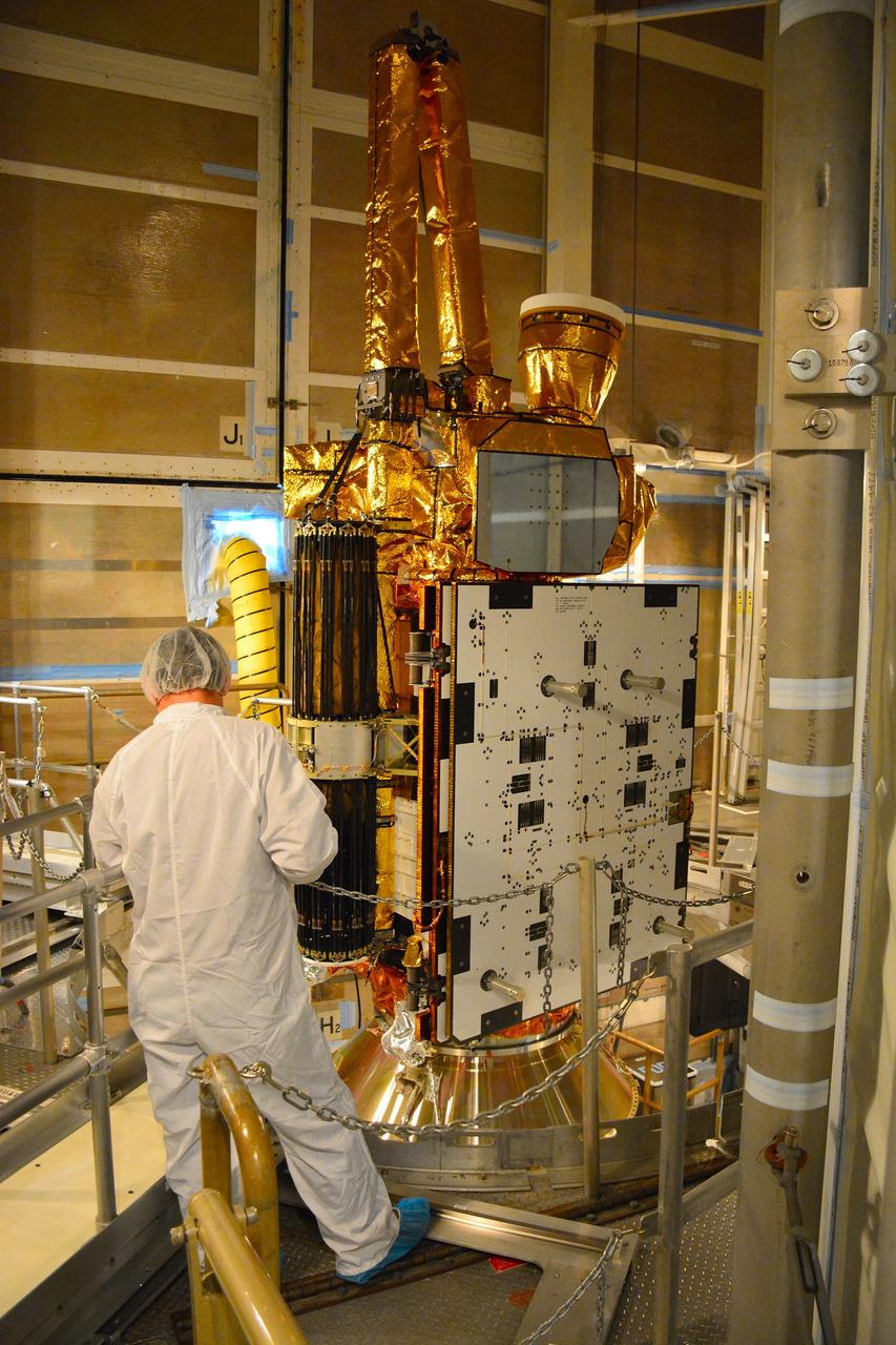
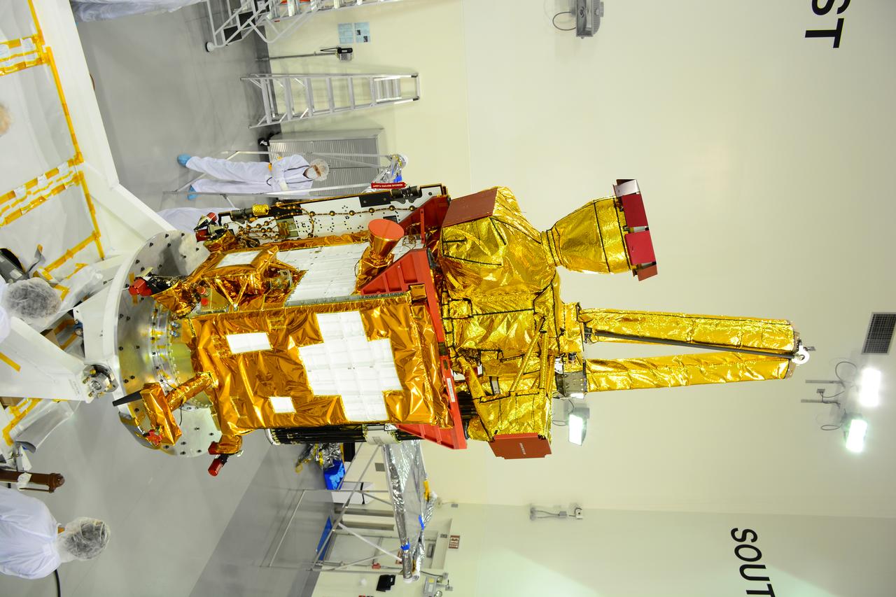
VANDENBERG AIR FORCE BASE, Calif. – Inside the Astrotech payload processing facility at Vandenberg Air Force Base in California, engineers and technicians inspect NASA's Soil Moisture Active Passive mission, or SMAP, satellite. SMAP will provide global measurements of soil moisture and its freeze/thaw state. These measurements will be used to enhance understanding of processes that link the water, energy and carbon cycles, and to extend the capabilities of weather and climate prediction models. SMAP data also will be used to quantify net carbon flux in boreal landscapes and to develop improved flood prediction and drought monitoring capabilities. Launch is scheduled for Jan. 29, 2015. To learn more about SMAP, visit http://smap.jpl.nasa.gov Photo credit: Jeremy Moore, USAF Photo Squadron
VANDENBERG AIR FORCE BASE, Calif. – At Vandenberg Air Force Base in California, NASA's Soil Moisture Active Passive mission, or SMAP, satellite is prepared for lifting at Space Launch Complex 2 for mating to its Delta II rocket. SMAP will provide global measurements of soil moisture and its freeze/thaw state. These measurements will be used to enhance understanding of processes that link the water, energy and carbon cycles, and to extend the capabilities of weather and climate prediction models. SMAP data also will be used to quantify net carbon flux in boreal landscapes and to develop improved flood prediction and drought monitoring capabilities. Launch is scheduled for Jan. 29, 2015. To learn more about SMAP, visit http://smap.jpl.nasa.gov Photo credit: NASA/Randy Beaudoin

Inside the Astrotech payload processing facility on Vandenberg Air Force Base in California, engineers and technicians use a crane to move a component of NASA's Soil Moisture Active Passive, or SMAP, spacecraft for a lift by a crane. SMAP will launch on a Delta II 7320 configuration vehicle featuring a United Launch Alliance first stage booster powered by an Aerojet Rocketdyne RS-27A main engine and three Alliant Techsystems, or ATK, strap-on solid rocket motors. Once on station in Earth orbit, SMAP will provide global measurements of soil moisture and its freeze/thaw state. These measurements will be used to enhance understanding of processes that link the water, energy and carbon cycles, and to extend the capabilities of weather and climate prediction models. SMAP data also will be used to quantify net carbon flux in boreal landscapes and to develop improved flood prediction and drought monitoring capabilities. Launch from Space Launch Complex 2 is targeted for Jan. 29, 2015.
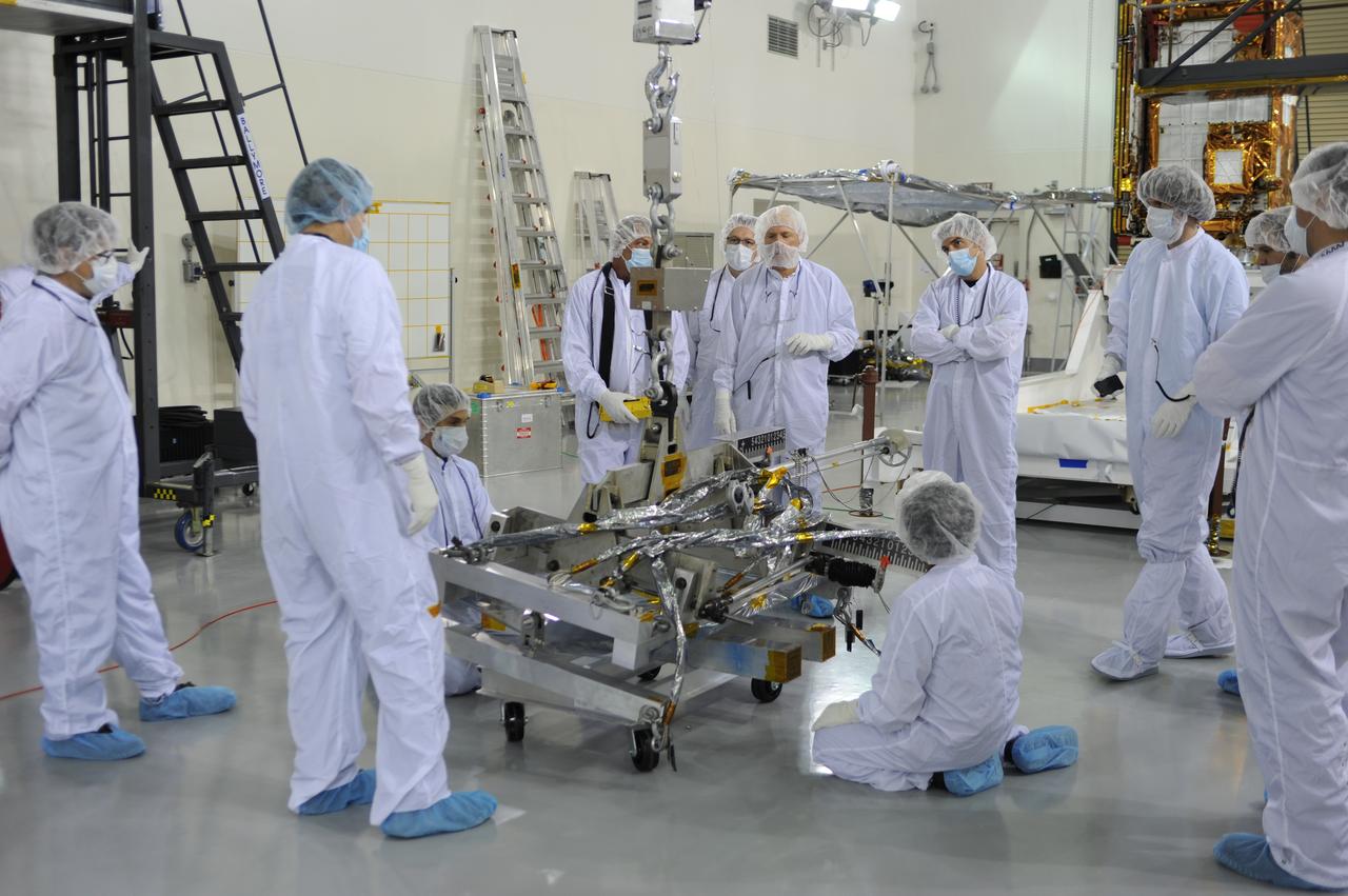
Inside the Astrotech payload processing facility on Vandenberg Air Force Base in California, engineers and technicians prepare a component of NASA's Soil Moisture Active Passive, or SMAP, spacecraft for a lift by a crane. SMAP will launch on a Delta II 7320 configuration vehicle featuring a United Launch Alliance first stage booster powered by an Aerojet Rocketdyne RS-27A main engine and three Alliant Techsystems, or ATK, strap-on solid rocket motors. Once on station in Earth orbit, SMAP will provide global measurements of soil moisture and its freeze/thaw state. These measurements will be used to enhance understanding of processes that link the water, energy and carbon cycles, and to extend the capabilities of weather and climate prediction models. SMAP data also will be used to quantify net carbon flux in boreal landscapes and to develop improved flood prediction and drought monitoring capabilities. Launch from Space Launch Complex 2 is targeted for Jan. 29, 2015.
VANDENBERG AIR FORCE BASE, Calif. – The first stage of a United Launch Alliance Delta II rocket arrives at NASA hangar 836 on Vandenberg Air Force Base in California. The Delta II rocket will be used to deliver NASA's Soil Moisture Active Passive mission, or SMAP, into orbit. SMAP will provide global measurements of soil moisture and its freeze/thaw state. These measurements will be used to enhance understanding of processes that link the water, energy and carbon cycles, and to extend the capabilities of weather and climate prediction models. SMAP data also will be used to quantify net carbon flux in boreal landscapes and to develop improved flood prediction and drought monitoring capabilities. Launch is scheduled for November 2014. To learn more about SMAP, visit http://smap.jpl.nasa.gov Photo credit: NASA/Randy Beaudoin
VANDENBERG AIR FORCE BASE, Calif. – The second stage, or upper stage, of a United Launch Alliance Delta II rocket arrives at the Building 836 hangar on south Vandenberg Air Force Base in California. The Delta II rocket will be used to deliver NASA's Soil Moisture Active Passive mission, or SMAP, into orbit from Vandenberg's Space Launch Complex 2. SMAP will provide global measurements of soil moisture and its freeze/thaw state. These measurements will be used to enhance understanding of processes that link the water, energy and carbon cycles, and to extend the capabilities of weather and climate prediction models. SMAP data also will be used to quantify net carbon flux in boreal landscapes and to develop improved flood prediction and drought monitoring capabilities. Launch is scheduled for November 2014. To learn more about SMAP, visit http://smap.jpl.nasa.gov. Photo credit: NASA/Randy Beaudoin
VANDENBERG AIR FORCE BASE, Calif. – The second stage, or upper stage, of a United Launch Alliance Delta II rocket is on its way from Building 836 on south Vandenberg Air Force Base in California to the Horizontal Processing Facility at Space Launch Complex 2. The Delta II rocket will be used to deliver NASA's Soil Moisture Active Passive mission, or SMAP, into orbit. SMAP will provide global measurements of soil moisture and its freeze/thaw state. These measurements will be used to enhance understanding of processes that link the water, energy and carbon cycles, and to extend the capabilities of weather and climate prediction models. SMAP data also will be used to quantify net carbon flux in boreal landscapes and to develop improved flood prediction and drought monitoring capabilities. Launch is scheduled for November 2014. To learn more about SMAP, visit http://smap.jpl.nasa.gov. Photo credit: NASA/Randy Beaudoin
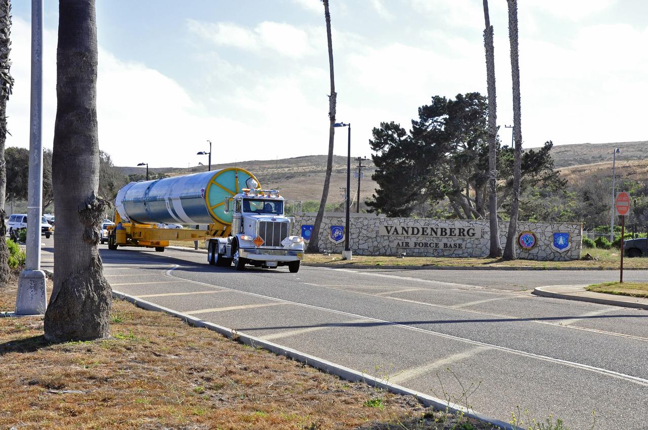
VANDENBERG AIR FORCE BASE, Calif. –The interstage adapter, or ISA, for NASA's Soil Moisture Active Passive mission, or SMAP, arrives at the Building 836 hangar on south Vandenberg Air Force Base in California. A United Launch Alliance Delta II rocket will loft SMAP into orbit from Vandenberg's Space Launch Complex 2. The ISA connects the Delta II first and second stages and encloses the second stage engine and thrust section. The spacecraft will provide global measurements of soil moisture and its freeze/thaw state. These measurements will be used to enhance understanding of processes that link the water, energy and carbon cycles, and to extend the capabilities of weather and climate prediction models. The data returned also will be used to quantify net carbon flux in boreal landscapes and to develop improved flood prediction and drought monitoring capabilities. Launch is scheduled for November 2014. To learn more about SMAP, visit http://smap.jpl.nasa.gov. Photo credit: NASA/Randy Beaudoin
VANDENBERG AIR FORCE BASE, Calif. – The first stage of the United Launch Alliance Delta II rocket for NASA's Soil Moisture Active Passive mission, or SMAP, begins its journey from the Building 836 hangar to the Horizontal Processing Facility at Space Launch Complex 2 on Vandenberg Air Force Base in California. SMAP will provide global measurements of soil moisture and its freeze/thaw state. These measurements will be used to enhance understanding of processes that link the water, energy and carbon cycles, and to extend the capabilities of weather and climate prediction models. SMAP data also will be used to quantify net carbon flux in boreal landscapes and to develop improved flood prediction and drought monitoring capabilities. Launch is scheduled for November 2014. To learn more about SMAP, visit http://smap.jpl.nasa.gov. Photo credit: NASA/Randy Beaudoin

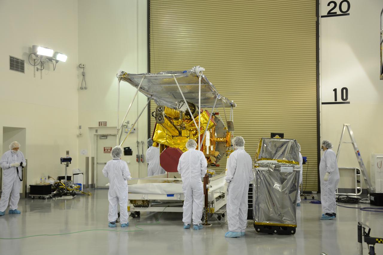
NASA's Soil Moisture Active Passive, or SMAP, spacecraft is delivered by truck to the Astrotech payload processing facility on Vandenberg Air Force Base in California. SMAP will launch on a Delta II 7320 configuration vehicle featuring a United Launch Alliance first stage booster powered by an Aerojet Rocketdyne RS-27A main engine and three Alliant Techsystems, or ATK, strap-on solid rocket motors. Once on station in Earth orbit, SMAP will provide global measurements of soil moisture and its freeze/thaw state. These measurements will be used to enhance understanding of processes that link the water, energy and carbon cycles, and to extend the capabilities of weather and climate prediction models. SMAP data also will be used to quantify net carbon flux in boreal landscapes and to develop improved flood prediction and drought monitoring capabilities. Launch from Space Launch Complex 2 is targeted for Jan. 29, 2015.
VANDENBERG AIR FORCE BASE, Calif. – Inside the Astrotech payload processing facility at Vandenberg Air Force Base in California, engineers and technicians inspect NASA's Soil Moisture Active Passive mission, or SMAP, satellite. SMAP will provide global measurements of soil moisture and its freeze/thaw state. These measurements will be used to enhance understanding of processes that link the water, energy and carbon cycles, and to extend the capabilities of weather and climate prediction models. SMAP data also will be used to quantify net carbon flux in boreal landscapes and to develop improved flood prediction and drought monitoring capabilities. Launch is scheduled for Jan. 29, 2015. To learn more about SMAP, visit http://smap.jpl.nasa.gov Photo credit: Jeremy Moore, USAF Photo Squadron
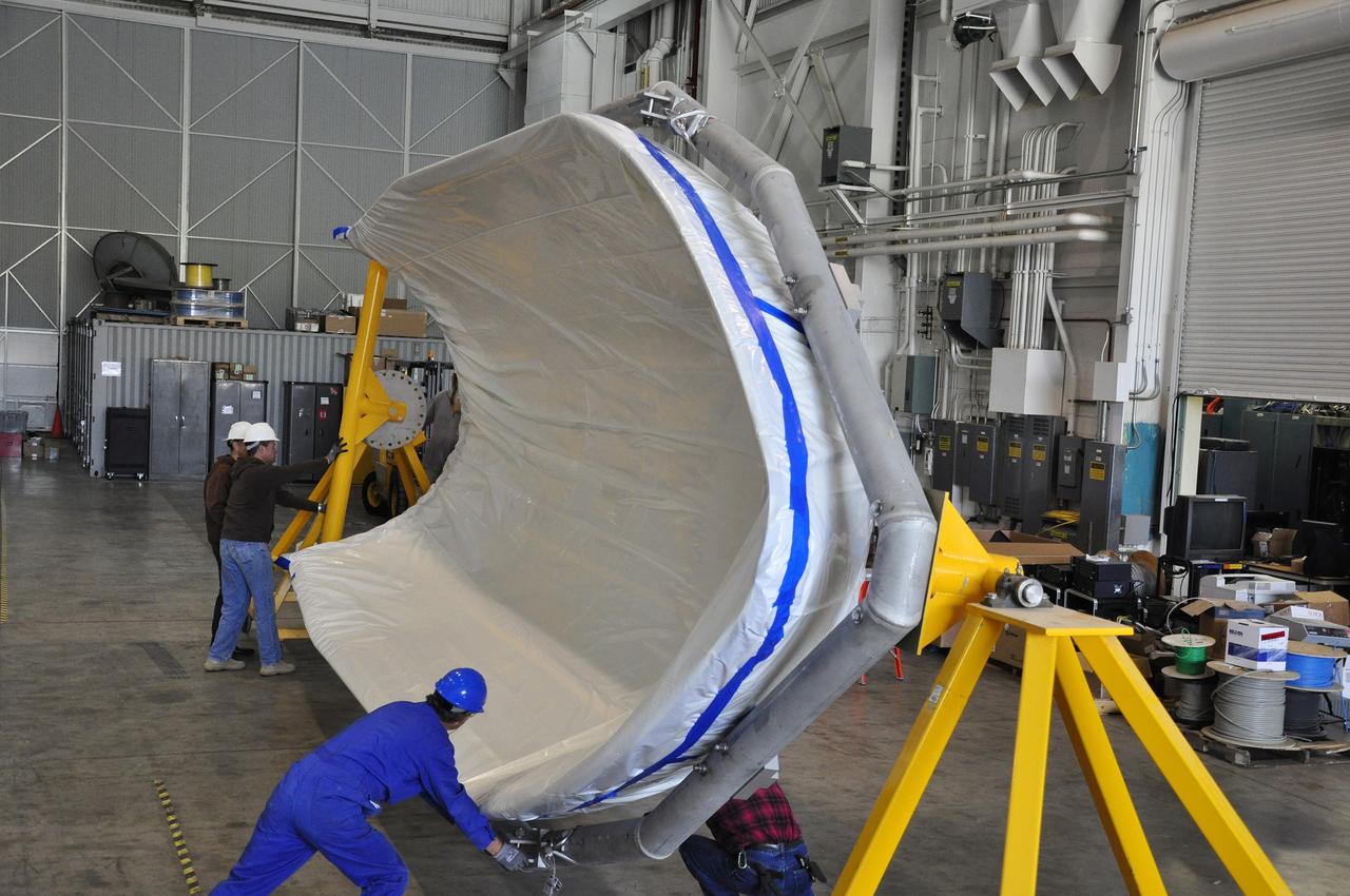
VANDENBERG AIR FORCE BASE, Calif. – Workers rotate a section of the fairing for NASA's Soil Moisture Active Passive mission, or SMAP, in a lifting device in the Building 836 high bay on Vandenberg Air Force Base in California. The fairing will protect the SMAP spacecraft from the heat and aerodynamic pressure generated during its ascent to orbit aboard a United Launch Alliance Delta II rocket from Space Launch Complex 2. SMAP will provide global measurements of soil moisture and its freeze/thaw state. These measurements will be used to enhance understanding of processes that link the water, energy and carbon cycles, and to extend the capabilities of weather and climate prediction models. SMAP data will also be used to quantify net carbon flux in boreal landscapes and to develop improved flood prediction and drought monitoring capabilities. Launch is scheduled for November 2014. To learn more about SMAP, visit http://smap.jpl.nasa.gov. Photo credit: NASA/Randy Beaudoin
VANDENBERG AIR FORCE BASE, Calif. – Preparations are underway at Space Launch Complex 2 on Vandenberg Air Force Base in California for the arrival of the first stage of the United Launch Alliance Delta II rocket for NASA's Soil Moisture Active Passive mission, or SMAP. SMAP will provide global measurements of soil moisture and its freeze/thaw state. These measurements will be used to enhance understanding of processes that link the water, energy and carbon cycles, and to extend the capabilities of weather and climate prediction models. SMAP data also will be used to quantify net carbon flux in boreal landscapes and to develop improved flood prediction and drought monitoring capabilities. Launch is scheduled for November 2014. To learn more about SMAP, visit http://smap.jpl.nasa.gov. Photo credit: NASA/Randy Beaudoin
Inside the Astrotech payload processing facility on Vandenberg Air Force Base in California, engineers and technicians remove a protective covering from NASA's Soil Moisture Active Passive, or SMAP, spacecraft. SMAP will launch on a Delta II 7320 configuration vehicle featuring a United Launch Alliance first stage booster powered by an Aerojet Rocketdyne RS-27A main engine and three Alliant Techsystems, or ATK, strap-on solid rocket motors. Once on station in Earth orbit, SMAP will provide global measurements of soil moisture and its freeze/thaw state. These measurements will be used to enhance understanding of processes that link the water, energy and carbon cycles, and to extend the capabilities of weather and climate prediction models. SMAP data also will be used to quantify net carbon flux in boreal landscapes and to develop improved flood prediction and drought monitoring capabilities. Launch from Space Launch Complex 2 is targeted for Jan. 29, 2015.
VANDENBERG AIR FORCE BASE, Calif. – The nozzle has been installed on the second stage of the United Launch Alliance Delta II rocket in the Horizontal Processing Facility at Space Launch Complex 2 on Vandenberg Air Force Base in California. The Delta II will be used to loft NASA's Soil Moisture Active Passive mission, or SMAP, into orbit. The spacecraft will provide global measurements of soil moisture and its freeze/thaw state. These measurements will be used to enhance understanding of processes that link the water, energy and carbon cycles, and to extend the capabilities of weather and climate prediction models. The data returned also will be used to quantify net carbon flux in boreal landscapes and to develop improved flood prediction and drought monitoring capabilities. Launch is scheduled for November 2014. To learn more about SMAP, visit http://smap.jpl.nasa.gov. Photo credit: NASA/Randy Beaudoin
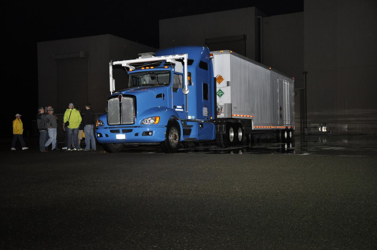
The truck transporting NASA's Soil Moisture Active Passive, or SMAP, spacecraft arrives at the Astrotech payload processing facility on Vandenberg Air Force Base in California. SMAP will launch on a Delta II 7320 configuration vehicle featuring a United Launch Alliance first stage booster powered by an Aerojet Rocketdyne RS-27A main engine and three Alliant Techsystems, or ATK, strap-on solid rocket motors. Once on station in Earth orbit, SMAP will provide global measurements of soil moisture and its freeze/thaw state. These measurements will be used to enhance understanding of processes that link the water, energy and carbon cycles, and to extend the capabilities of weather and climate prediction models. SMAP data also will be used to quantify net carbon flux in boreal landscapes and to develop improved flood prediction and drought monitoring capabilities. Launch from Space Launch Complex 2 is targeted for Jan. 29, 2015.
VANDENBERG AIR FORCE BASE, Calif. – Preparations are underway at Space Launch Complex 2 on Vandenberg Air Force Base in California for the arrival of the rocket components slated to launch NASA's Soil Moisture Active Passive mission, or SMAP, in November 2014. A United Launch Alliance Delta II rocket will be used to deliver SMAP into orbit. SMAP will provide global measurements of soil moisture and its freeze/thaw state. These measurements will be used to enhance understanding of processes that link the water, energy and carbon cycles, and to extend the capabilities of weather and climate prediction models. SMAP data also will be used to quantify net carbon flux in boreal landscapes and to develop improved flood prediction and drought monitoring capabilities. To learn more about SMAP, visit http://smap.jpl.nasa.gov. Photo credit: NASA/Randy Beaudoin
Inside the Astrotech payload processing facility on Vandenberg Air Force Base in California, engineers and technicians prepare a component of NASA's Soil Moisture Active Passive, or SMAP, spacecraft for a lift by a crane. SMAP will launch on a Delta II 7320 configuration vehicle featuring a United Launch Alliance first stage booster powered by an Aerojet Rocketdyne RS-27A main engine and three Alliant Techsystems, or ATK, strap-on solid rocket motors. Once on station in Earth orbit, SMAP will provide global measurements of soil moisture and its freeze/thaw state. These measurements will be used to enhance understanding of processes that link the water, energy and carbon cycles, and to extend the capabilities of weather and climate prediction models. SMAP data also will be used to quantify net carbon flux in boreal landscapes and to develop improved flood prediction and drought monitoring capabilities. Launch from Space Launch Complex 2 is targeted for Jan. 29, 2015.
VANDENBERG AIR FORCE BASE, Calif. – At Vandenberg Air Force Base in California, NASA's Soil Moisture Active Passive mission, or SMAP, satellite is transported to Space Launch Complex 2 where it will be mated to a Delta II rocket. SMAP will provide global measurements of soil moisture and its freeze/thaw state. These measurements will be used to enhance understanding of processes that link the water, energy and carbon cycles, and to extend the capabilities of weather and climate prediction models. SMAP data also will be used to quantify net carbon flux in boreal landscapes and to develop improved flood prediction and drought monitoring capabilities. Launch is scheduled for Jan. 29, 2015. To learn more about SMAP, visit http://smap.jpl.nasa.gov Photo credit: NASA/Randy Beaudoin
VANDENBERG AIR FORCE BASE, Calif. – The first stage of the United Launch Alliance Delta II rocket for NASA's Soil Moisture Active Passive mission, or SMAP, is transported from the Building 836 hangar to the Horizontal Processing Facility at Space Launch Complex 2 on Vandenberg Air Force Base in California. SMAP will provide global measurements of soil moisture and its freeze/thaw state. These measurements will be used to enhance understanding of processes that link the water, energy and carbon cycles, and to extend the capabilities of weather and climate prediction models. SMAP data also will be used to quantify net carbon flux in boreal landscapes and to develop improved flood prediction and drought monitoring capabilities. Launch is scheduled for November 2014. To learn more about SMAP, visit http://smap.jpl.nasa.gov. Photo credit: NASA/Randy Beaudoin
VANDENBERG AIR FORCE BASE, Calif. – The second stage, or upper stage, of a United Launch Alliance Delta II rocket begins its journey from Building 836 on south Vandenberg Air Force Base in California to the Horizontal Processing Facility at Space Launch Complex 2. The Delta II rocket will be used to deliver NASA's Soil Moisture Active Passive mission, or SMAP, into orbit. SMAP will provide global measurements of soil moisture and its freeze/thaw state. These measurements will be used to enhance understanding of processes that link the water, energy and carbon cycles, and to extend the capabilities of weather and climate prediction models. SMAP data also will be used to quantify net carbon flux in boreal landscapes and to develop improved flood prediction and drought monitoring capabilities. Launch is scheduled for November 2014. To learn more about SMAP, visit http://smap.jpl.nasa.gov. Photo credit: NASA/Randy Beaudoin
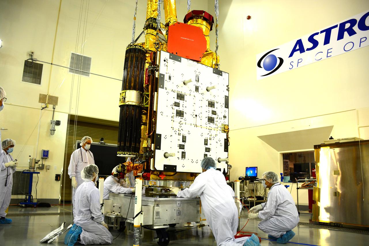
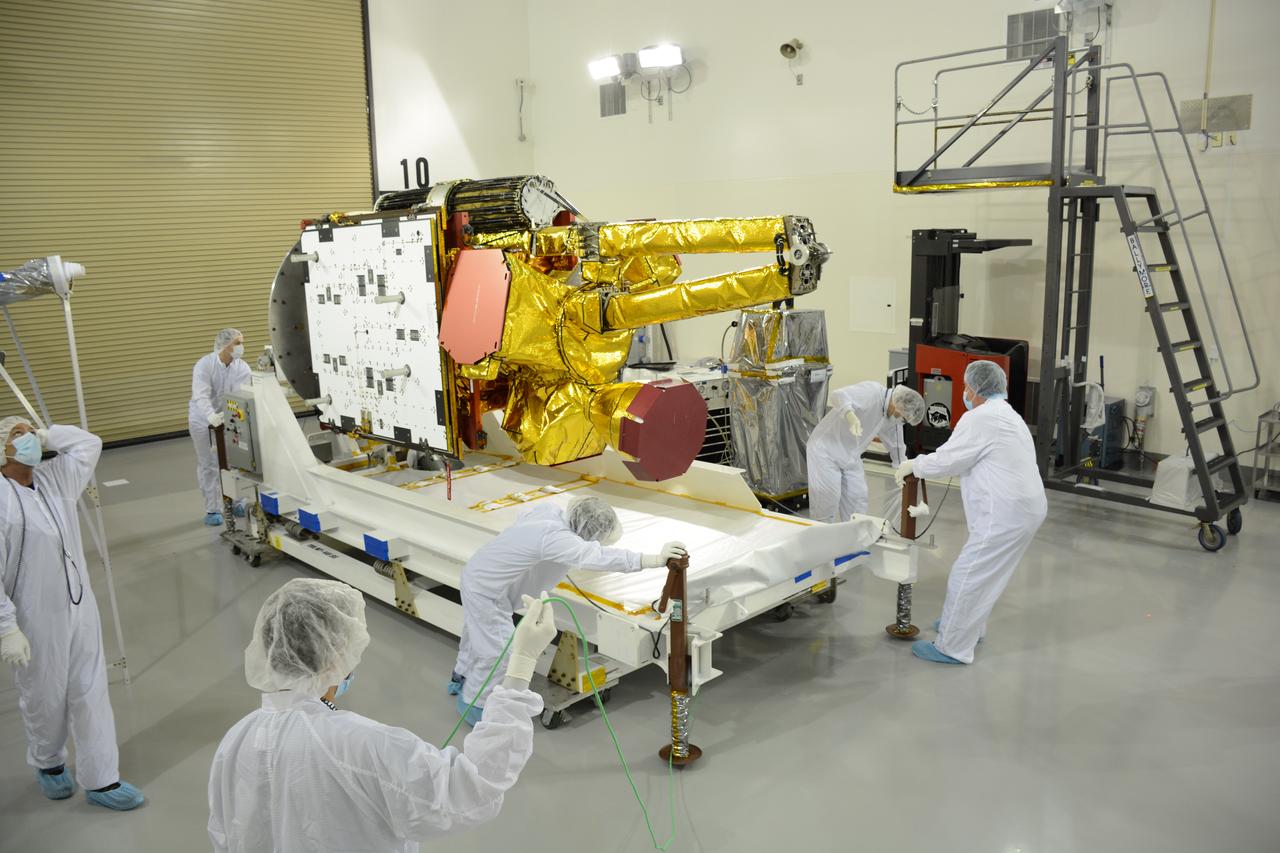
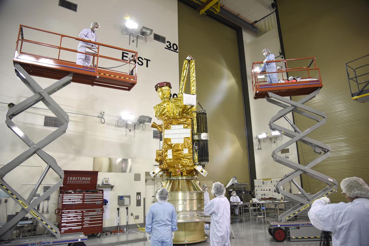
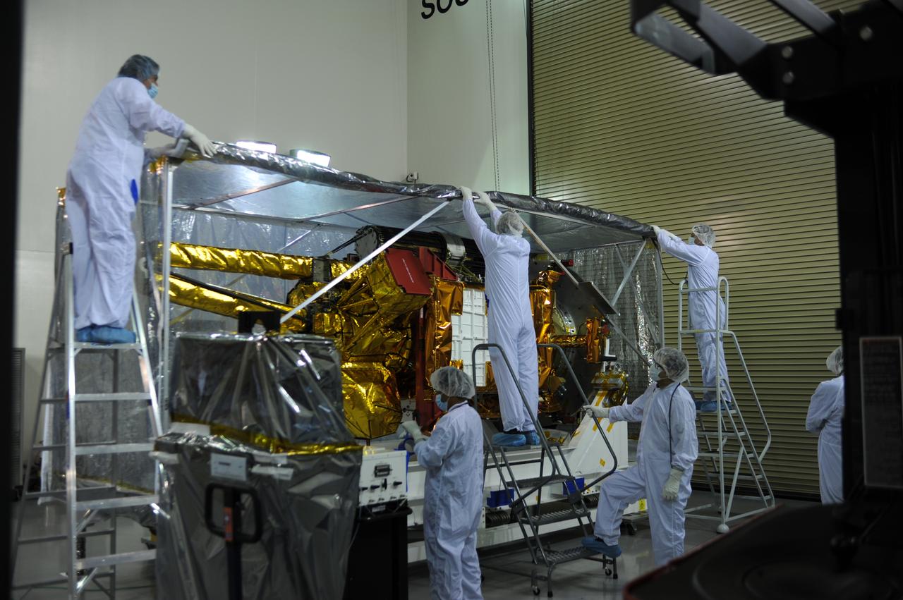
Inside the Astrotech payload processing facility on Vandenberg Air Force Base in California, engineers and technicians mount NASA's Soil Moisture Active Passive, or SMAP, spacecraft on a work platform. SMAP will launch on a Delta II 7320 configuration vehicle featuring a United Launch Alliance first stage booster powered by an Aerojet Rocketdyne RS-27A main engine and three Alliant Techsystems, or ATK, strap-on solid rocket motors. Once on station in Earth orbit, SMAP will provide global measurements of soil moisture and its freeze/thaw state. These measurements will be used to enhance understanding of processes that link the water, energy and carbon cycles, and to extend the capabilities of weather and climate prediction models. SMAP data also will be used to quantify net carbon flux in boreal landscapes and to develop improved flood prediction and drought monitoring capabilities. Launch from Space Launch Complex 2 is targeted for Jan. 29, 2015.
Inside the Astrotech payload processing facility on Vandenberg Air Force Base in California, engineers and technicians rotate NASA's Soil Moisture Active Passive, or SMAP, spacecraft to begin processing. SMAP will launch on a Delta II 7320 configuration vehicle featuring a United Launch Alliance first stage booster powered by an Aerojet Rocketdyne RS-27A main engine and three Alliant Techsystems, or ATK, strap-on solid rocket motors. Once on station in Earth orbit, SMAP will provide global measurements of soil moisture and its freeze/thaw state. These measurements will be used to enhance understanding of processes that link the water, energy and carbon cycles, and to extend the capabilities of weather and climate prediction models. SMAP data also will be used to quantify net carbon flux in boreal landscapes and to develop improved flood prediction and drought monitoring capabilities. Launch from Space Launch Complex 2 is targeted for Jan. 29, 2015.
VANDENBERG AIR FORCE BASE, Calif. – At Vandenberg Air Force Base in California, NASA's Soil Moisture Active Passive mission, or SMAP, satellite is lifted at Space Launch Complex 2 for mating to its Delta II rocket. SMAP will provide global measurements of soil moisture and its freeze/thaw state. These measurements will be used to enhance understanding of processes that link the water, energy and carbon cycles, and to extend the capabilities of weather and climate prediction models. SMAP data also will be used to quantify net carbon flux in boreal landscapes and to develop improved flood prediction and drought monitoring capabilities. Launch is scheduled for Jan. 29, 2015. To learn more about SMAP, visit http://smap.jpl.nasa.gov Photo credit: NASA/Randy Beaudoin
VANDENBERG AIR FORCE BASE, Calif. – The launch gantry is rolled back to reveal the United Launch Alliance Delta II rocket with the Soil Moisture Active Passive, or SMAP, satellite aboard, at Space Launch Complex 2 on Vandenberg Air Force Base in California. SMAP is a remote sensing mission designed to measure and map the Earth's soil moisture distribution and freeze/thaw stat with unprecedented accuracy, resolution and coverage. SMAP will provide global measurements of soil moisture and its freeze/thaw state. These measurements will be used to enhance understanding of processes that link the water, energy and carbon cycles, and to extend the capabilities of weather and climate prediction models. SMAP data also will be used to quantify net carbon flux in boreal landscapes and to develop improved flood prediction and drought monitoring capabilities. Launch is scheduled for Jan. 29, 2015. To learn more about SMAP, visit http://www.nasa.gov/smap. Photo credit: NASA/Randy Beaudoin
VANDENBERG AIR FORCE BASE, Calif. – At Vandenberg Air Force Base in California, NASA's Soil Moisture Active Passive mission, or SMAP, satellite is transported to Space Launch Complex 2 where it will be mated to a Delta II rocket. SMAP will provide global measurements of soil moisture and its freeze/thaw state. These measurements will be used to enhance understanding of processes that link the water, energy and carbon cycles, and to extend the capabilities of weather and climate prediction models. SMAP data also will be used to quantify net carbon flux in boreal landscapes and to develop improved flood prediction and drought monitoring capabilities. Launch is scheduled for Jan. 29, 2015. To learn more about SMAP, visit http://smap.jpl.nasa.gov Photo credit: NASA/Randy Beaudoin
VANDENBERG AIR FORCE BASE, Calif. – A crane is used to offload the first stage of a United Launch Alliance Delta II rocket following its arrival at NASA hangar 836 on Vandenberg Air Force Base in California. The launch vehicle will be used to deliver NASA's Soil Moisture Active Passive mission, or SMAP, into orbit. SMAP will provide global measurements of soil moisture and its freeze/thaw state. These measurements will be used to enhance understanding of processes that link the water, energy and carbon cycles, and to extend the capabilities of weather and climate prediction models. SMAP data also will be used to quantify net carbon flux in boreal landscapes and to develop improved flood prediction and drought monitoring capabilities. Launch is scheduled for November 2014. To learn more about SMAP, visit http://smap.jpl.nasa.gov Photo credit: NASA/Randy Beaudoin
Inside the Astrotech payload processing facility on Vandenberg Air Force Base in California, engineers and technicians rotate NASA's Soil Moisture Active Passive, or SMAP, spacecraft to begin processing. SMAP will launch on a Delta II 7320 configuration vehicle featuring a United Launch Alliance first stage booster powered by an Aerojet Rocketdyne RS-27A main engine and three Alliant Techsystems, or ATK, strap-on solid rocket motors. Once on station in Earth orbit, SMAP will provide global measurements of soil moisture and its freeze/thaw state. These measurements will be used to enhance understanding of processes that link the water, energy and carbon cycles, and to extend the capabilities of weather and climate prediction models. SMAP data also will be used to quantify net carbon flux in boreal landscapes and to develop improved flood prediction and drought monitoring capabilities. Launch from Space Launch Complex 2 is targeted for Jan. 29, 2015.
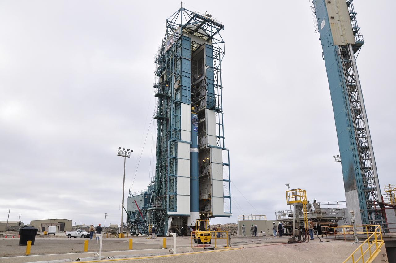
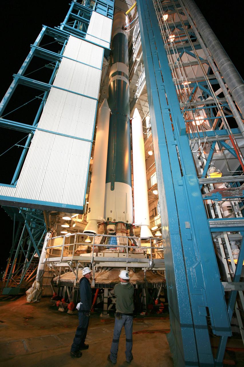
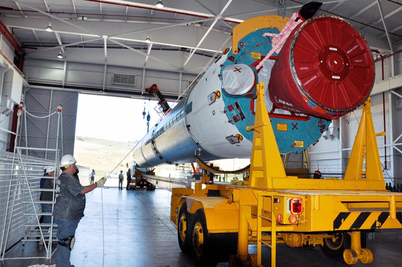
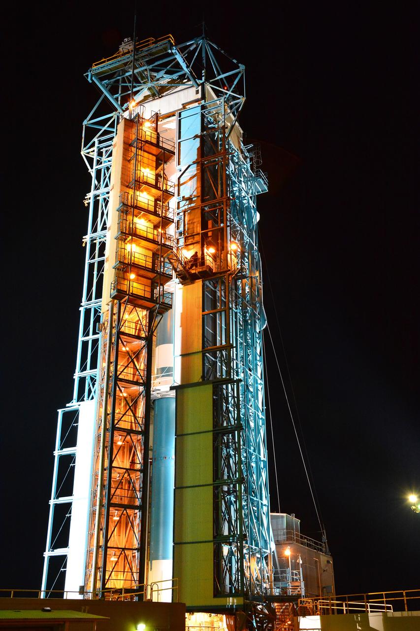
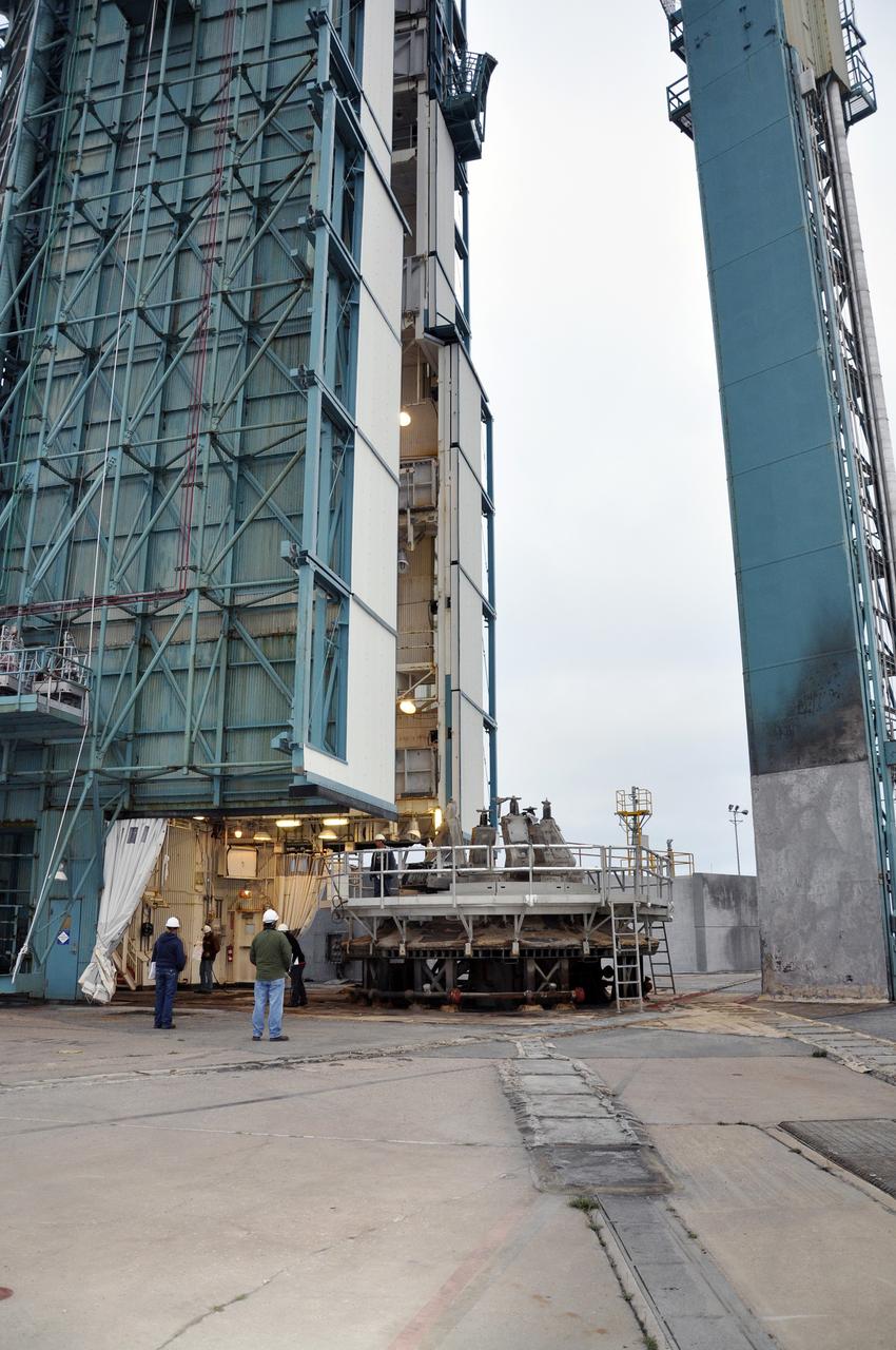
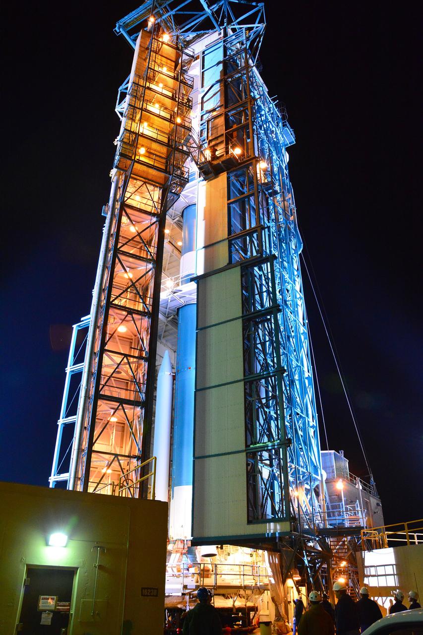
VANDENBERG AIR FORCE BASE, Calif. – The first stage of the United Launch Alliance Delta II rocket for NASA's Soil Moisture Active Passive mission, or SMAP, is positioned in the mobile service tower at Space Launch Complex 2 on Vandenberg Air Force Base in California in preparation for mating with the rocket's second stage. SMAP will provide global measurements of soil moisture and its freeze/thaw state. These measurements will be used to enhance understanding of processes that link the water, energy and carbon cycles, and to extend the capabilities of weather and climate prediction models. SMAP data also will be used to quantify net carbon flux in boreal landscapes and to develop improved flood prediction and drought monitoring capabilities. Launch is scheduled for November 2014. To learn more about SMAP, visit http://smap.jpl.nasa.gov. Photo credit: NASA/Randy Beaudoin
Inside the Astrotech payload processing facility on Vandenberg Air Force Base in California, engineers and technicians remove a protective covering from NASA's Soil Moisture Active Passive, or SMAP, spacecraft. SMAP will launch on a Delta II 7320 configuration vehicle featuring a United Launch Alliance first stage booster powered by an Aerojet Rocketdyne RS-27A main engine and three Alliant Techsystems, or ATK, strap-on solid rocket motors. Once on station in Earth orbit, SMAP will provide global measurements of soil moisture and its freeze/thaw state. These measurements will be used to enhance understanding of processes that link the water, energy and carbon cycles, and to extend the capabilities of weather and climate prediction models. SMAP data also will be used to quantify net carbon flux in boreal landscapes and to develop improved flood prediction and drought monitoring capabilities. Launch from Space Launch Complex 2 is targeted for Jan. 29, 2015.
VANDENBERG AIR FORCE BASE, Calif. – Preparations are underway to lift the second stage, or upper stage, of a United Launch Alliance Delta II rocket from its transportation trailer in the Building 836 hangar on south Vandenberg Air Force Base in California. The Delta II rocket will be used to deliver NASA's Soil Moisture Active Passive mission, or SMAP, into orbit from Vandenberg's Space Launch Complex 2. SMAP will provide global measurements of soil moisture and its freeze/thaw state. These measurements will be used to enhance understanding of processes that link the water, energy and carbon cycles, and to extend the capabilities of weather and climate prediction models. SMAP data also will be used to quantify net carbon flux in boreal landscapes and to develop improved flood prediction and drought monitoring capabilities. Launch is scheduled for November 2014. To learn more about SMAP, visit http://smap.jpl.nasa.gov. Photo credit: NASA/Randy Beaudoin
VANDENBERG AIR FORCE BASE, Calif. – At Vandenberg Air Force Base in California, NASA's Soil Moisture Active Passive mission, or SMAP, satellite is lifted at Space Launch Complex 2 for mating to its Delta II rocket. SMAP will provide global measurements of soil moisture and its freeze/thaw state. These measurements will be used to enhance understanding of processes that link the water, energy and carbon cycles, and to extend the capabilities of weather and climate prediction models. SMAP data also will be used to quantify net carbon flux in boreal landscapes and to develop improved flood prediction and drought monitoring capabilities. Launch is scheduled for Jan. 29, 2015. To learn more about SMAP, visit http://smap.jpl.nasa.gov Photo credit: NASA/Randy Beaudoin
VANDENBERG AIR FORCE BASE, Calif. – The first stage of the United Launch Alliance Delta II rocket for NASA's Soil Moisture Active Passive mission, or SMAP, arrives at the Horizontal Processing Facility at Space Launch Complex 2 on Vandenberg Air Force Base in California. SMAP will provide global measurements of soil moisture and its freeze/thaw state. These measurements will be used to enhance understanding of processes that link the water, energy and carbon cycles, and to extend the capabilities of weather and climate prediction models. SMAP data also will be used to quantify net carbon flux in boreal landscapes and to develop improved flood prediction and drought monitoring capabilities. Launch is scheduled for November 2014. To learn more about SMAP, visit http://smap.jpl.nasa.gov. Photo credit: NASA/Randy Beaudoin
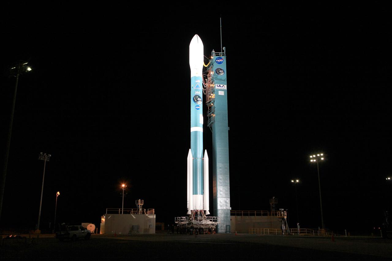
VANDENBERG AIR FORCE BASE, Calif. – The launch gantry is rolled back to reveal the United Launch Alliance Delta II rocket with the Soil Moisture Active Passive, or SMAP, satellite aboard, at the Space Launch Complex 2 at Vandenberg Air Force Base, California. SMAP is a remote sensing mission designed to measure and map the Earth's soil moisture distribution and freeze/thaw stat with unprecedented accuracy, resolution and coverage. SMAP will provide global measurements of soil moisture and its freeze/thaw state. These measurements will be used to enhance understanding of processes that link the water, energy and carbon cycles, and to extend the capabilities of weather and climate prediction models. SMAP data also will be used to quantify net carbon flux in boreal landscapes and to develop improved flood prediction and drought monitoring capabilities. Launch is scheduled for Jan. 29, 2015. To learn more about SMAP, visit http://smap.jpl.nasa.gov Photo credit: NASA/Kim Shiflett