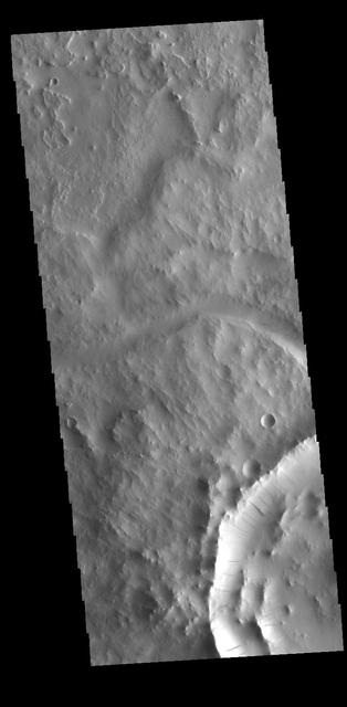
Indus Vallis
This VIS image shows a small section of Indus Vallis. Indus Vallis is located in northern Terra Sabaea. Orbit Number: 77727 Latitude: 18.7218 Longitude: 40.0134 Instrument: VIS Captured: 2019-06-23 08:30 https://photojournal.jpl.nasa.gov/catalog/PIA23389

This VIS image shows a section of Indus Vallis. Indus Vallis is located in Terra Sabaea. Orbit Number: 72450 Latitude: 18.8141 Longitude: 38.999 Instrument: VIS Captured: 2018-04-14 17:31 https://photojournal.jpl.nasa.gov/catalog/PIA22607
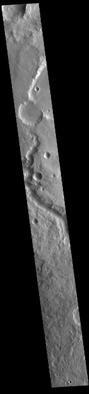
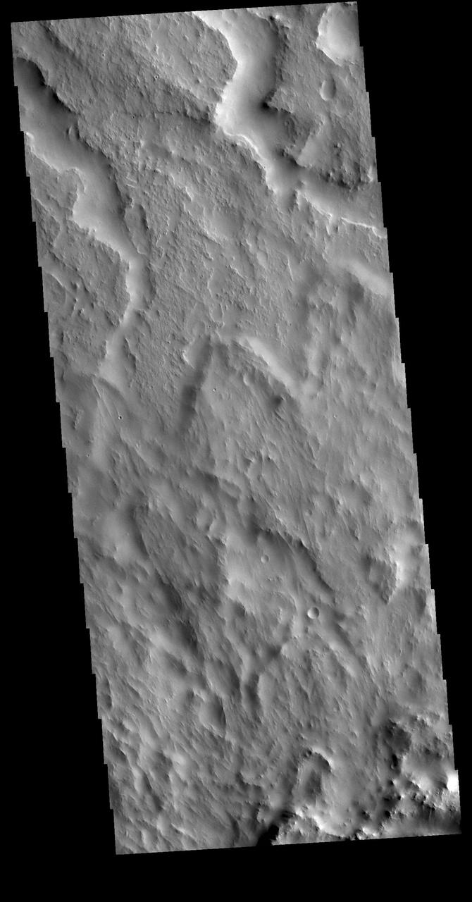
This VIS image shows a section of Indus Vallis. Indus Vallis is 300 km (186 miles) long and is located in Terra Sabaea. Orbit Number: 85651 Latitude: 19.8382 Longitude: 36.9696 Instrument: VIS Captured: 2021-04-05 19:35 https://photojournal.jpl.nasa.gov/catalog/PIA24860
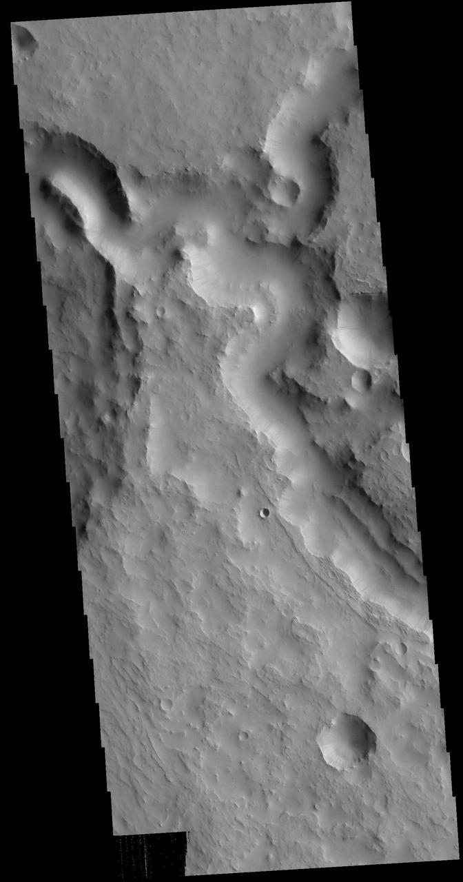
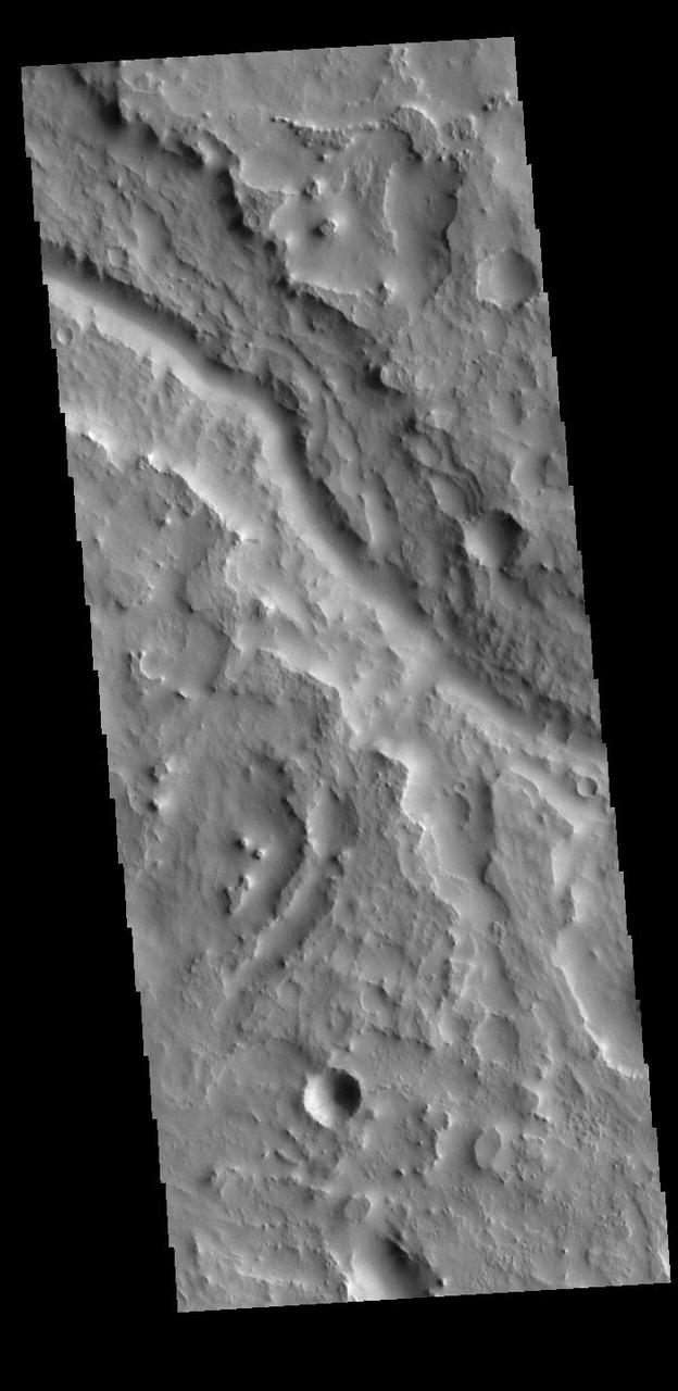
This VIS image shows part of Indus Vallis. Indus Vallis is 300km long (186 miles) and is located in Terra Sabaea. Orbit Number: 78900 Latitude: 19.8775 Longitude: 36.769 Instrument: VIS Captured: 2019-09-27 22:44 https://photojournal.jpl.nasa.gov/catalog/PIA23510
This image captured by NASA 2001 Mars Odyssey spacecraft shows a portion of Indus Vallis.
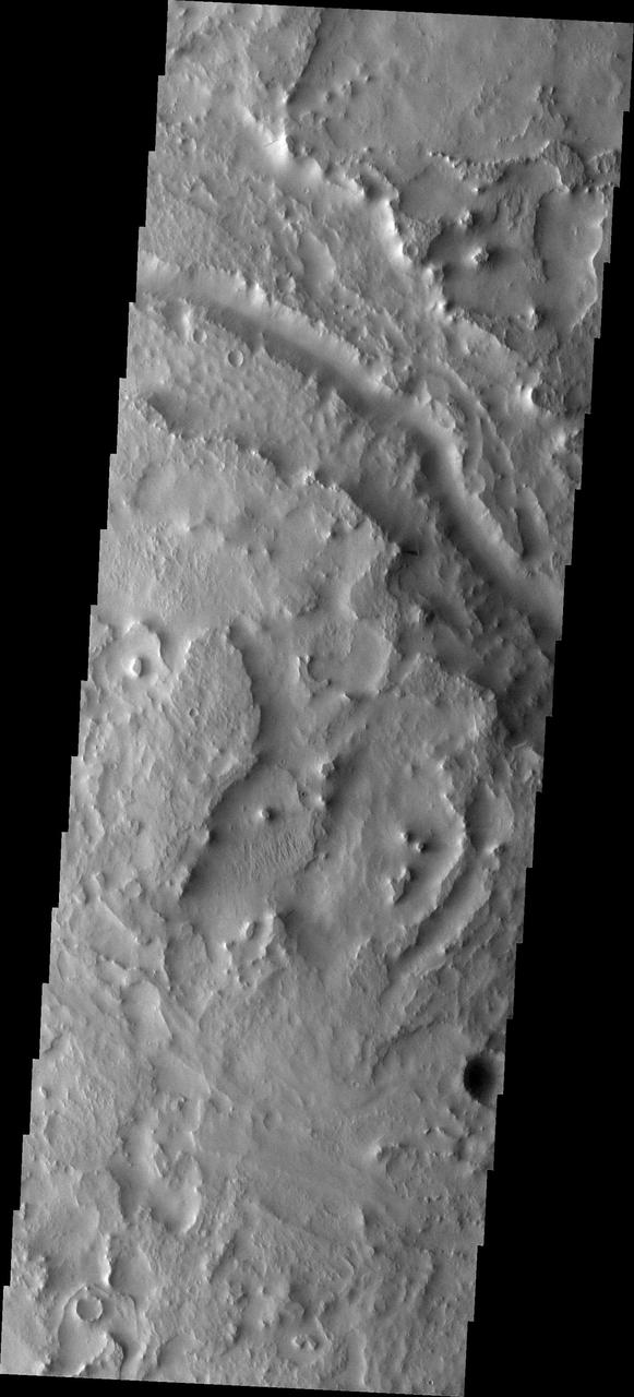
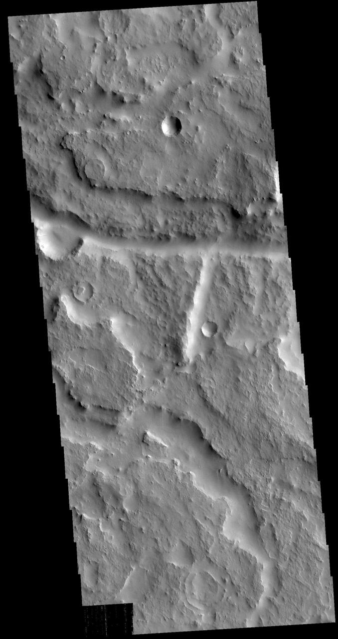
The two channels visible at the top of this image are tributaries of Indus Vallis. Ejecta from an unnamed crater south of this image fills the bottom half of the VIS image. Indus Vallis is located in Terra Sabaea. Orbit Number: 78850 Latitude: 18.178 Longitude: 39.5506 Instrument: VIS Captured: 2019-09-23 19:54 https://photojournal.jpl.nasa.gov/catalog/PIA23508
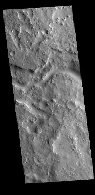
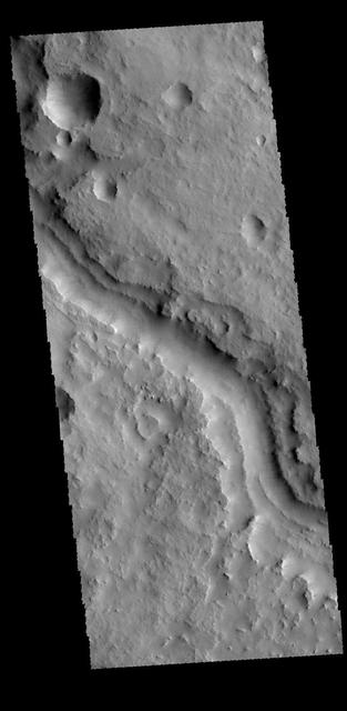
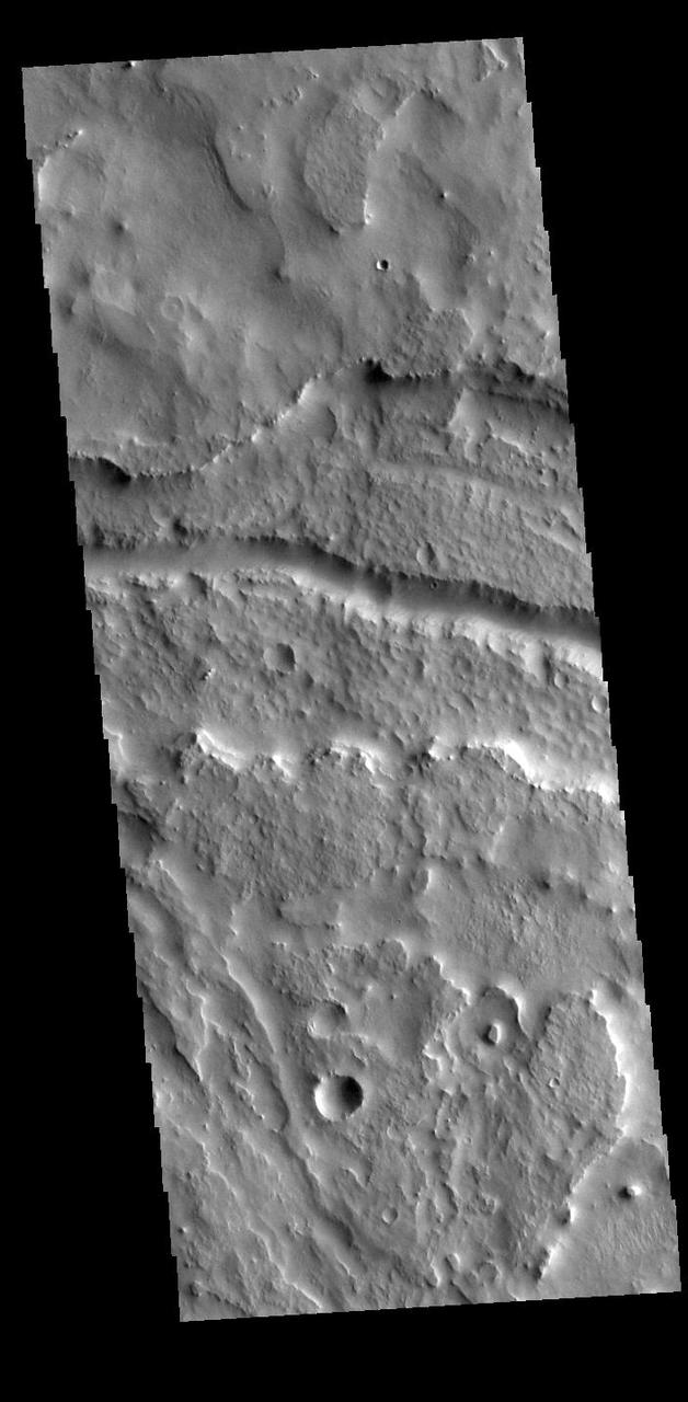
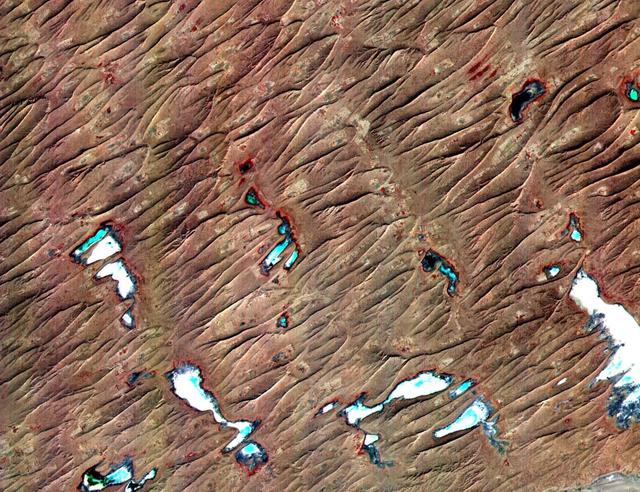
Today's VIS image shows part of Indus Vallis, located in northern Terra Sabaea. The valley system is over 300 km (186 miles) long. Orbit Number: 79137 Latitude: 18.6453 Longitude: 39.3279 Instrument: VIS Captured: 2019-10-17 11:06 https://photojournal.jpl.nasa.gov/catalog/PIA23573
Today's VIS image shows part of Indus Vallis, located in northern Terra Sabaea. The channel system is over 300 km (186 miles) long. Orbit Number: 86799 Latitude: 18.9615 Longitude: 38.7759 Instrument: VIS Captured: 2021-07-09 08:09 https://photojournal.jpl.nasa.gov/catalog/PIA24997
Today's VIS image shows part of Indus Vallis, located in northern Terra Sabaea. The channel system is over 300 km (186 miles) long. Orbit Number: 94960 Latitude: 19.1891 Longitude: 38.424 Instrument: VIS Captured: 2023-05-12 07:31 https://photojournal.jpl.nasa.gov/catalog/PIA26220
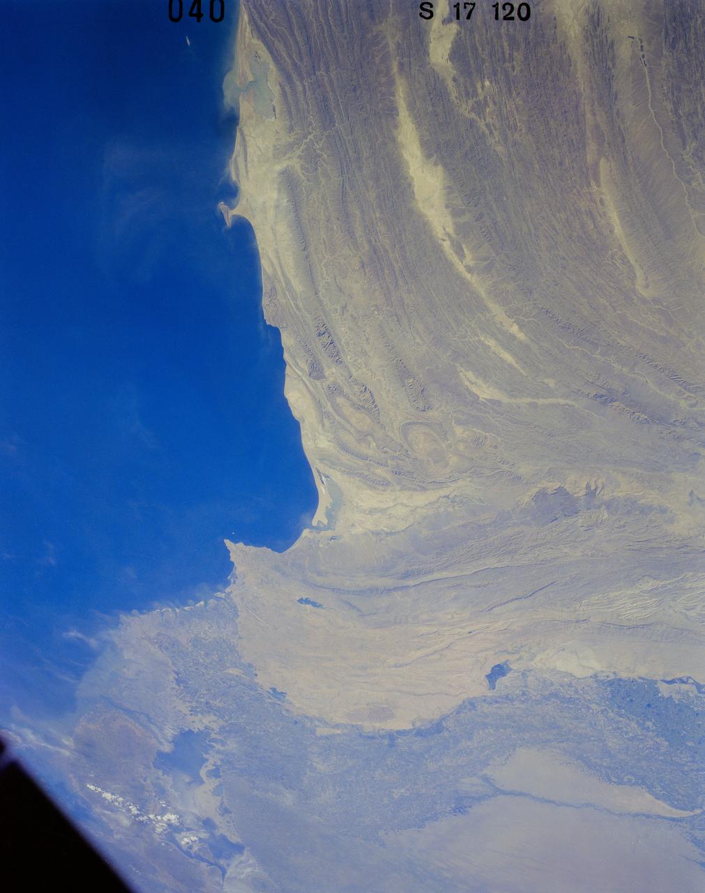
41G-120-040 (5-13 Oct. 1984) --- Pakistan, featuring the city of Karachi, the Makran mountain range, the mouth of the Indus River and the North Arabian Sea were photographed with a medium format camera aboard the space shuttle Challenger during the 41-G mission. Photo credit: NASA
S63-06455 (15-16 May 1963) --- Indus River above Hyderabad, photographed from the Mercury-Atlas 9 (MA-9) capsule by astronaut L. Gordon Cooper Jr., during his 22-orbit MA-9 spaceflight. Photo credit: NASA
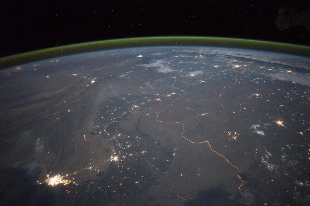
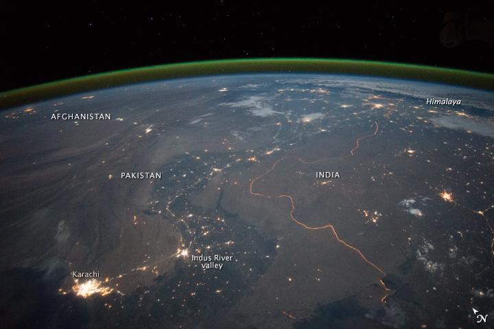
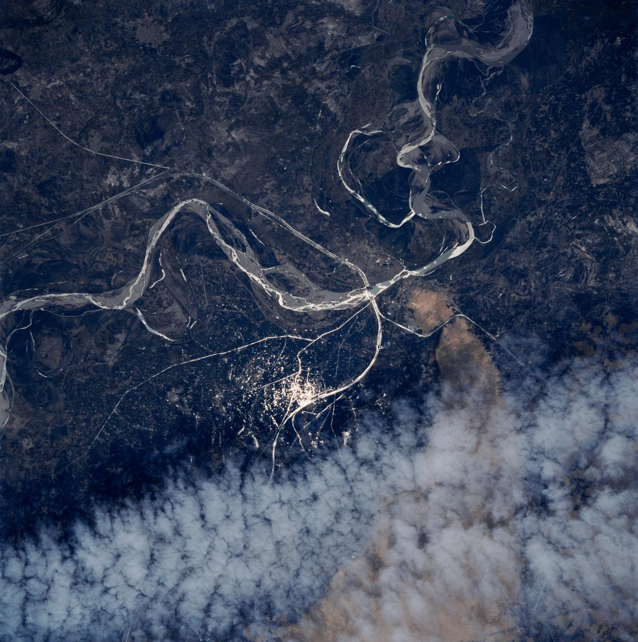
An astronaut aboard the International Space Station took this nighttime panorama while looking north across Pakistan’s Indus River valley. The port city of Karachi is the bright cluster of lights facing the Arabian Sea, which appears completely black. City lights and the dark color of dense agriculture closely track with the great curves of the Indus valley. For scale, the distance from Karachi to the foothills of the Himalaya Mountains is 1,160 kilometers (720 miles). This photograph shows one of the few places on Earth where an international boundary can be seen at night. The winding border between Pakistan and India is lit by security lights that have a distinct orange tone. Astronaut photograph ISS045-E-27869 was acquired on September 23, 2015, with a Nikon D4 digital camera using a 28 millimeter lens, and is provided by the ISS Crew Earth Observations Facility and the Earth Science and Remote Sensing Unit, Johnson Space Center. via NASA Earth Observatory Read more: <a href="http://earthobservatory.nasa.gov/IOTD/view.php?id=86725&eocn=home&eoci=iotd_title" rel="nofollow">earthobservatory.nasa.gov/IOTD/view.php?id=86725&eocn...</a>
An astronaut aboard the International Space Station took this nighttime panorama while looking north across Pakistan’s Indus River valley. The port city of Karachi is the bright cluster of lights facing the Arabian Sea, which appears completely black. City lights and the dark color of dense agriculture closely track with the great curves of the Indus valley. For scale, the distance from Karachi to the foothills of the Himalaya Mountains is 1,160 kilometers (720 miles). This photograph shows one of the few places on Earth where an international boundary can be seen at night. The winding border between Pakistan and India is lit by security lights that have a distinct orange tone. Astronaut photograph ISS045-E-27869 was acquired on September 23, 2015, with a Nikon D4 digital camera using a 28 millimeter lens, and is provided by the ISS Crew Earth Observations Facility and the Earth Science and Remote Sensing Unit, Johnson Space Center. via NASA Earth Observatory Read more: <a href="http://earthobservatory.nasa.gov/IOTD/view.php?id=86725&eocn=home&eoci=iotd_title" rel="nofollow">earthobservatory.nasa.gov/IOTD/view.php?id=86725&eocn...</a>
On Sept. 3, 2010, NASA Terra spacecraft captured this image strip over the Indus River, Pakistan, where severe flooding caused a major humanitarian crisis.
On Sept. 3, 2010, when NASA Terra spacecraft captured this image strip over the Indus River in Pakistan, severe flooding was still causing a major humanitarian crisis in Pakistan. The city of Hyderabad is near the middle of the image.
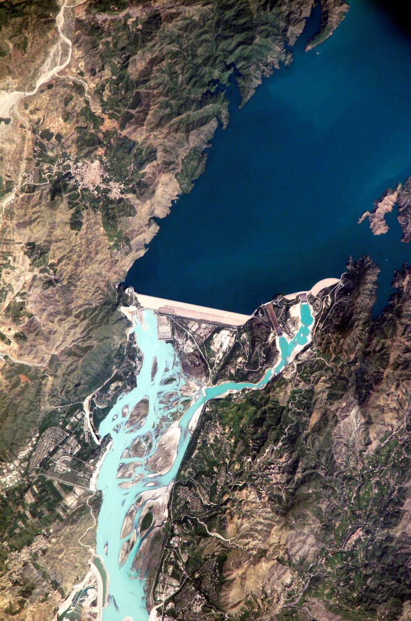
ISS005-E-12804 (6 September 2002) --- Tarbela Dam, Pakistan is featured in this image photographed by an Expedition 5 crewmember on the International Space Station (ISS). The Indus River basin extends from the Himalaya mountain ranges forming the northeastern boundary of Pakistan, to the alluvial plains of Sindh near the Arabian Sea coastline. Tarbela Dam is part of the Indus Basin Project that resulted from a water treaty signed in 1960 between India and Pakistan. This treaty guaranteed Pakistan water supplies independent of upstream control by India. Designed primarily for water storage rather than power generation, the dam was completed in 1977. Turquoise waters of the Indus River (to the south of the dam) reflect the high proportion of silt and clay suspended in waters released by the spillways (chutes on either of side of the main dam). With a volume of 142,000,000 cubic meters, the Tarbela Dam is the largest earth and rockfill dam in the world and stands 147 meters above the Indus riverbed. Its reservoir occupies an area of 37 square kilometers. While the dam has fulfilled its purpose in storing water for agricultural use in Pakistan, there have been environmental consequences to the Indus river delta, according to NASA scientists who are studying the Space Station photography. Reduction of seasonal flooding and reduced water flows to the delta have resulted in decrease of mangrove stands and abundance of some fish species.
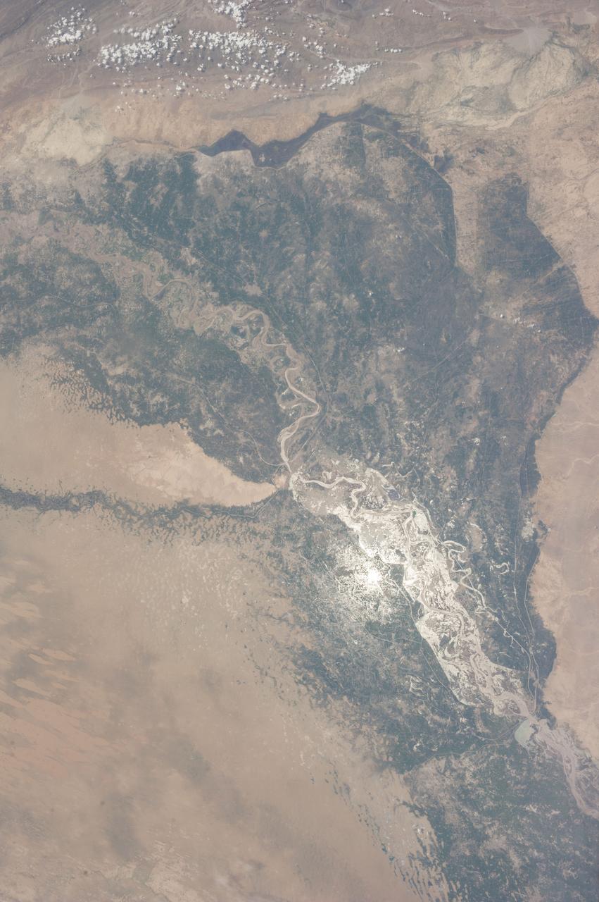
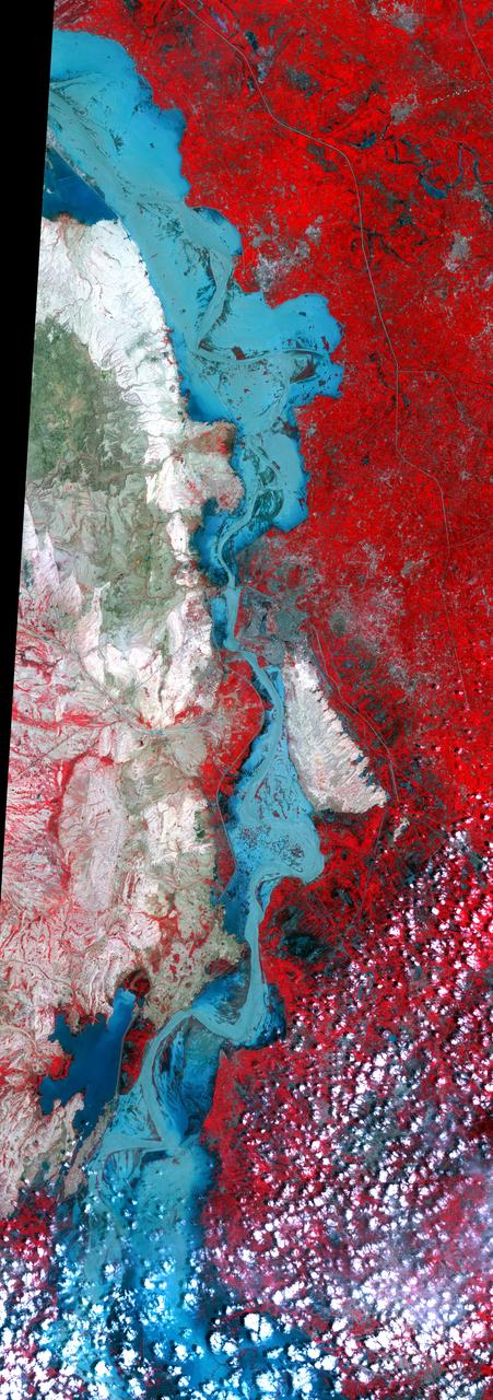
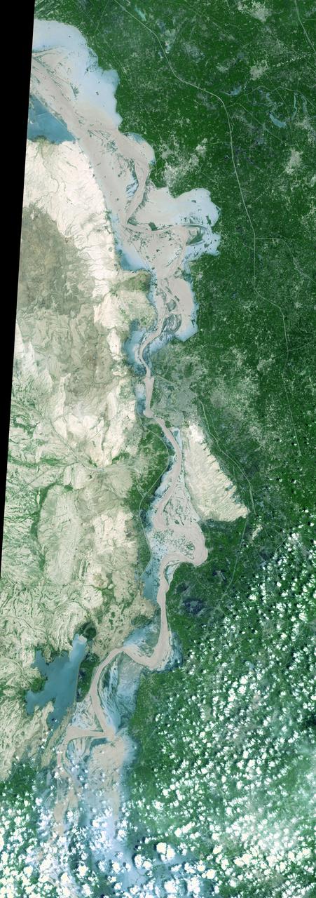
ISS036-E-036730 (14 Aug. 2013) --- One of the Expedition 36 crew members aboard the International Space Station photographed this image of the Indus Valley in Pakistan with its huge August floods brilliantly visible in sunglint.
STS083-747-052 (4-8 April 1997) --- Sunglint on the Indus River, Sukkar, and Rohri, Pakistan. Sukkar city (27.42 north 68.52 east), Sindh province, southeastern Pakistan lies on the west bank of the Indus River, connected with Rohri on the opposite bank by a cantilever bridge. Midstream between the two cities is the strategic island fortress of Bukkur. The old town contains many historic tombs and mosques, including the Mir Ma'sum Shah Minaret (c. AD 1607). An industrial and trade center, it has biscuit, cigarette, oil, lime, and cement factories, and cotton, silk, thread, and flour mills; boat building is also significant. The surrounding region is a vast alluvial plain broken only occasionally by low limestone hills. A portion of the Thar Desert is reaching from the south to Rohri. The Sukkur Barrage, highlighted by the sunglint, was completed in 1932. Nearly 1 mile (1.6 kilometers) long it crosses the Indus River 3 miles (4.8 kilometers) below Sukkur Gorge and feeds irrigation canals. The canals originating from it serve a cultivable area of about five million acres of land producing both food and cash crops, such as wheat, cotton, rice, oilseed, and fruit cultivation.
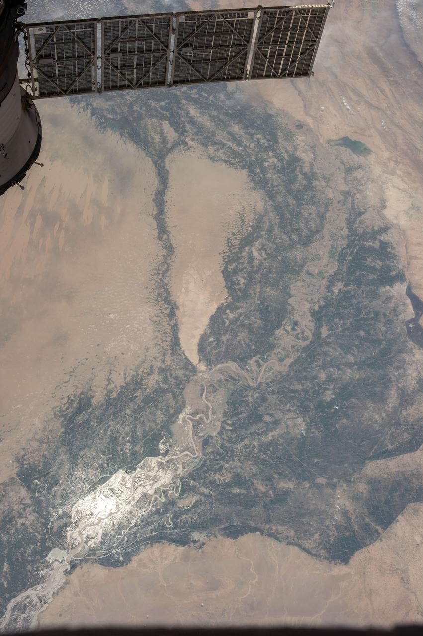
ISS036-E-036732 (14 Aug. 2013) --- One of the Expedition 36 crew members aboard the International Space Station photographed this image of the Indus Valley in Pakistan with its huge August floods brilliantly visible in sunglint. A solar array panel belonging to a docked Russian vehicle is at upper left foreground.
This VIS image shows several dark slope streaks on the inner rim of an unnamed crater in Terra Sabaea. These features are thought to be formed by downslope movement of material the removes some of the surface dust, revealing the darker rock beneath. The channel to the north of the crater is Indus Vallis. Orbit Number: 68696 Latitude: 18.7889 Longitude: 40.4151 Instrument: VIS Captured: 2017-06-09 10:50 https://photojournal.jpl.nasa.gov/catalog/PIA21792

41G-120-009 (5-13 Oct 1984) --- A large format camera's frame from the STS41-G/space shuttle Challenger mission provides a southwestern view of the Greater Himalayas bordering the Karakoram Range, whose great peaks are near the lower left edge of the frame. India is in the upper left; Pakistan, at lower right; and China is in the lower left foreground. The valley of the Indus River is in the right bottom corner. Photo credit: NASA
This ASTER sub-scene covers an area of 12 x 15 km in NW India in the Thar Desert. The sand dunes of the Thar Desert constantly shift and take on new shapes. Located in northwestern India and eastern Pakistan, the desert is bounded on the south by a salt marsh known as the Rann of Kutch, and on the west by the Indus River plain. About 800 kilometers long and about 490 kilometers wide, the desert's terrain is mainly rolling sandhills with scattered growths of shrub and rock outcroppings. Only about 12 to 25 centimeters of rain fall on the desert each year, and temperatures rise as high as 52 degrees Celsius. Much of the population is pastoral, raising sheep for their wool. The image is located at 24.4 degrees north latitude and 69.3 degrees east longitude. http://photojournal.jpl.nasa.gov/catalog/PIA11094