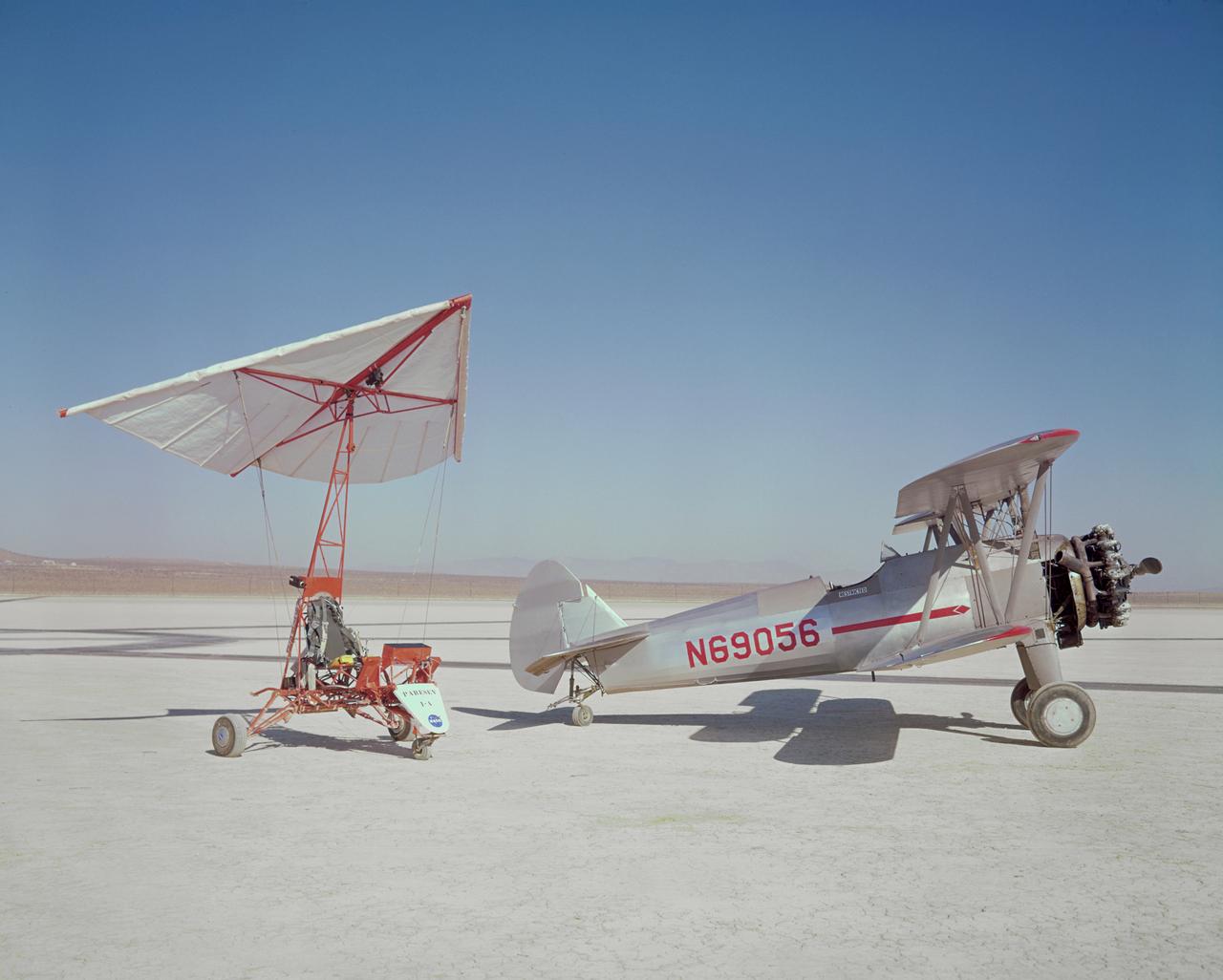
Paresev 1A and Stearman tow plane on lakebed.
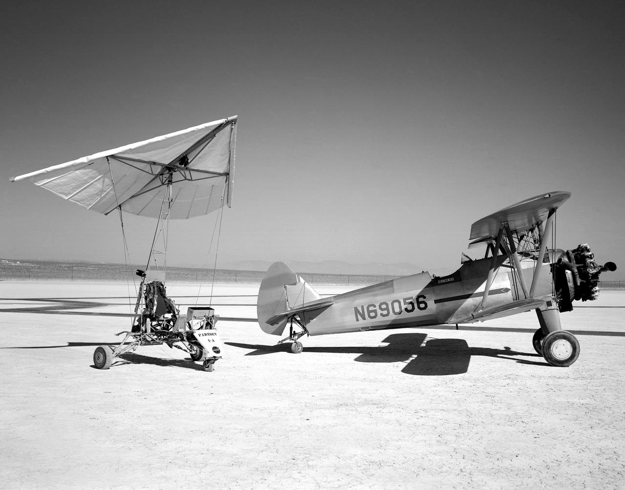
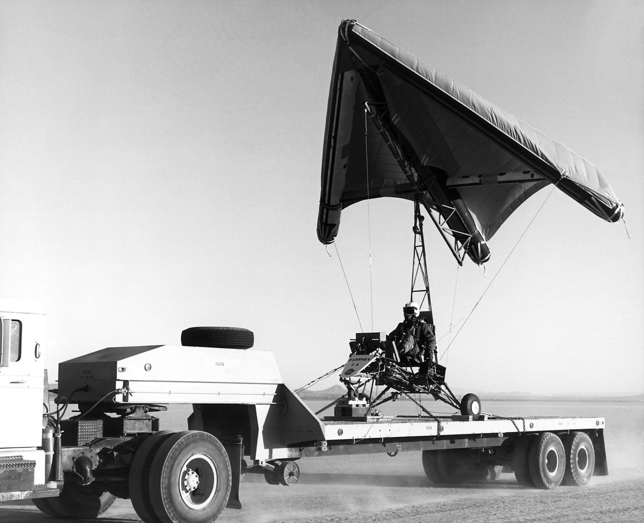
The Paresev 1-A (Paraglider Research Vehicle) and the tow airplane, 450-hp Stearman sport Biplane, sitting on Rogers dry lakebed, Edwards, California. The control system in the Paresev 1-A had a more conventional control stick position and was cable-operated; the main landing gear used shocks and bungees with the 100-square-foot wing membrane being made of 6-ounce unsealed Dacron.
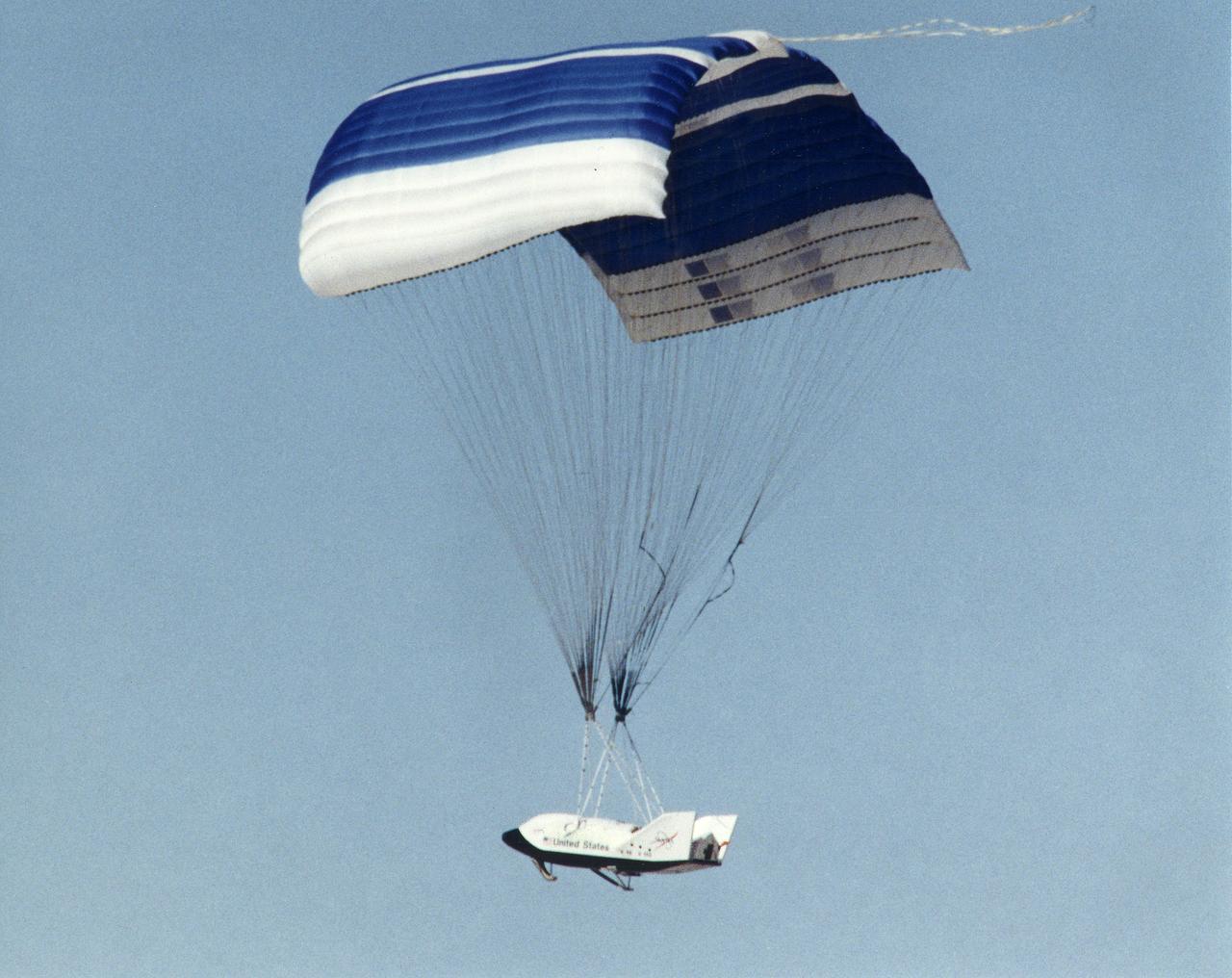
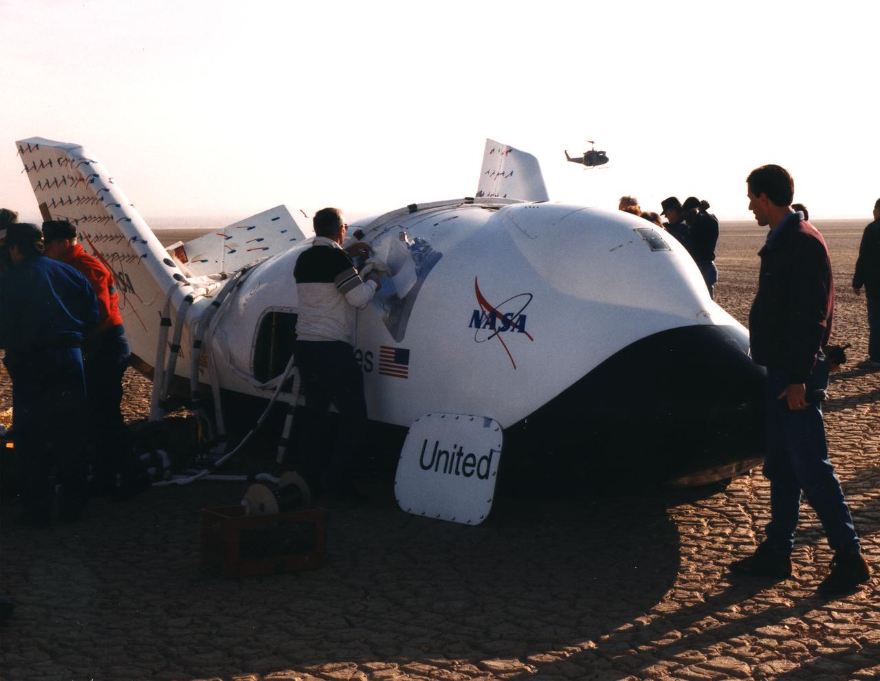
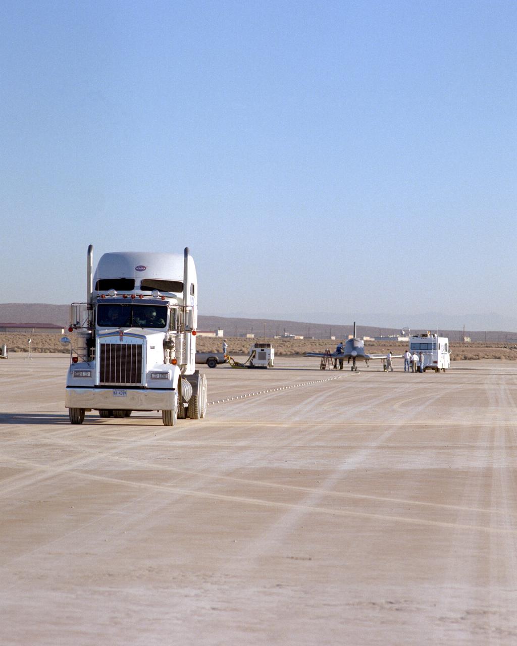
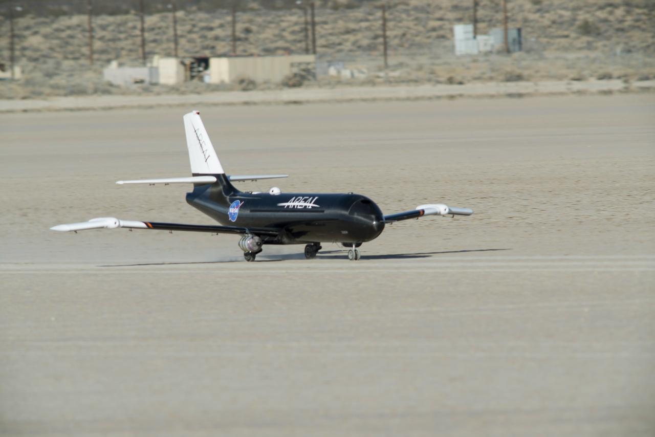
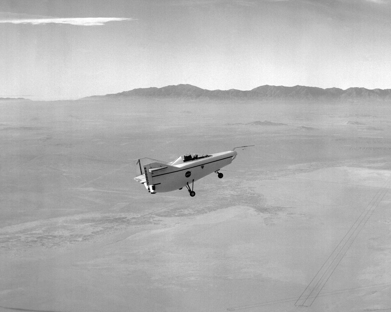
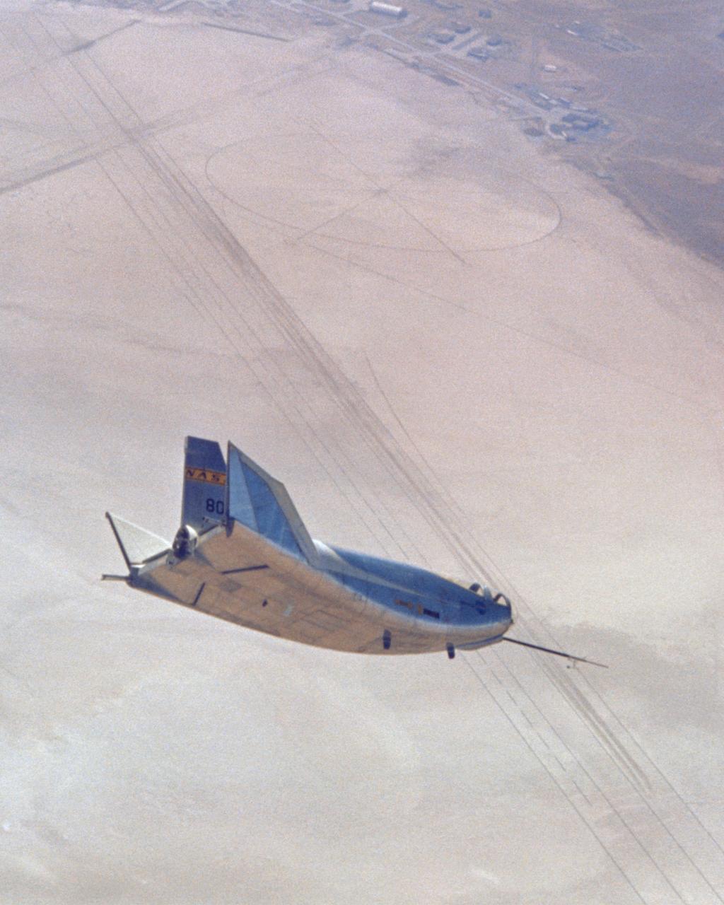
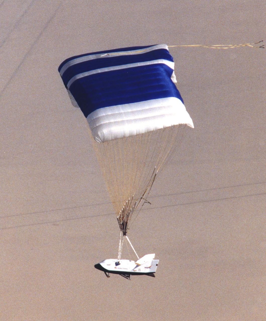
This photograph shows NASA's 3/8th-scale remotely piloted research vehicle landing on Rogers Dry Lakebed at Edwards Air Force Base, California, in 1975.
The M2-F3 Lifting Body is seen here on the lakebed next to the NASA Flight Research Center (FRC--later Dryden Flight Research Center), Edwards, California. The May 1967 crash of the M2-F2 had torn off the left fin and landing gear. It had also damaged the external skin and internal structure. Flight Research Center engineers worked with Ames Research Center and the Air Force in redesigning the vehicle with a center fin to provide greater stability. Then Northrop Corporation cooperated with the FRC in rebuilding the vehicle. The entire process took three years.
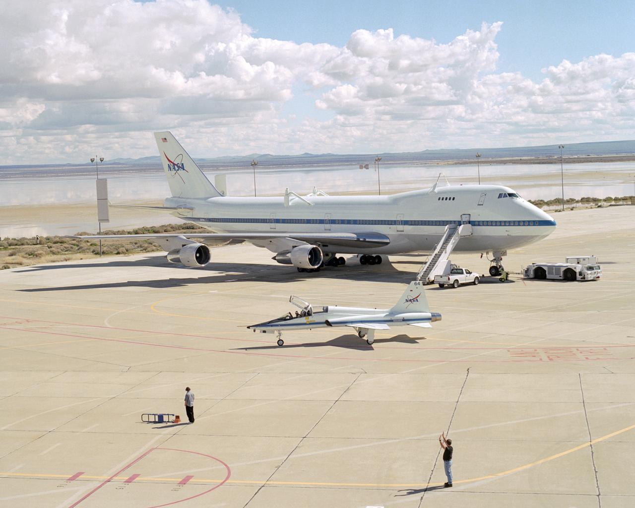
Puffy white clouds and a flooded lakebed form a backdrop as a T-38 support aircraft taxies across the ramp in front of NASA's Boeing 747 Shuttle Carrier Aircraft.
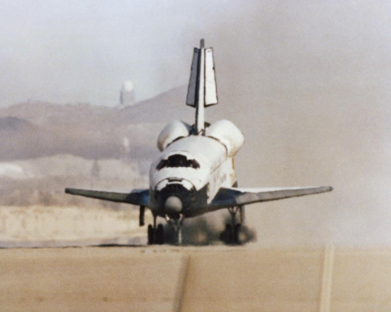
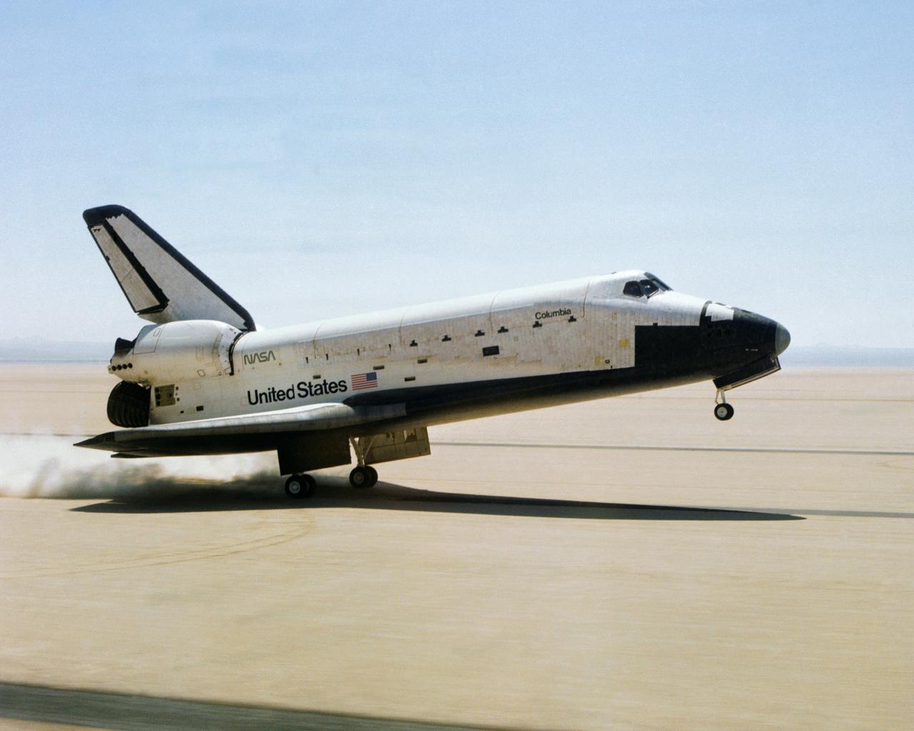
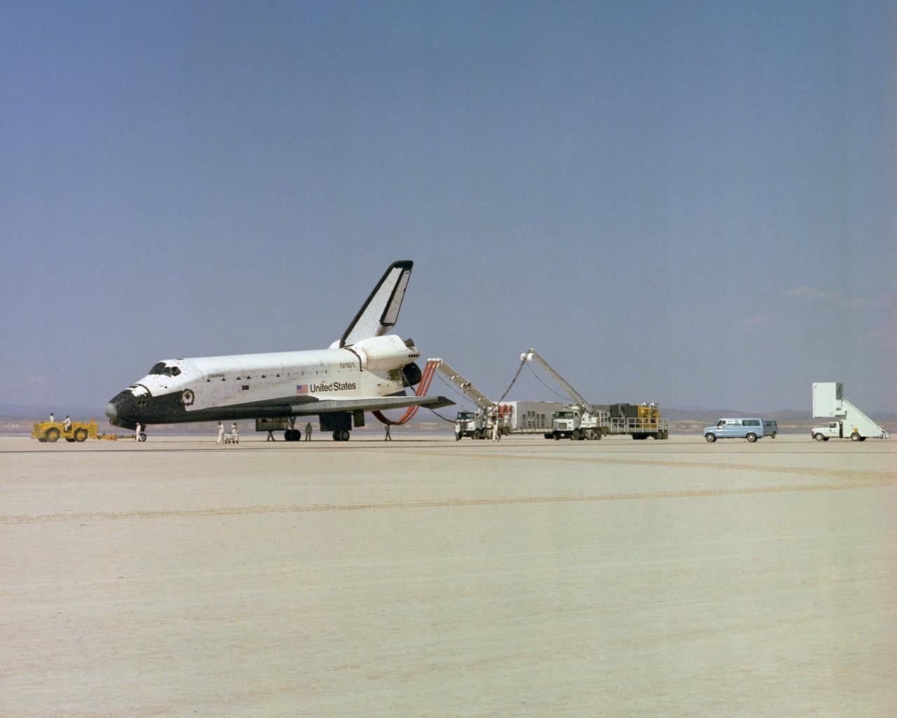
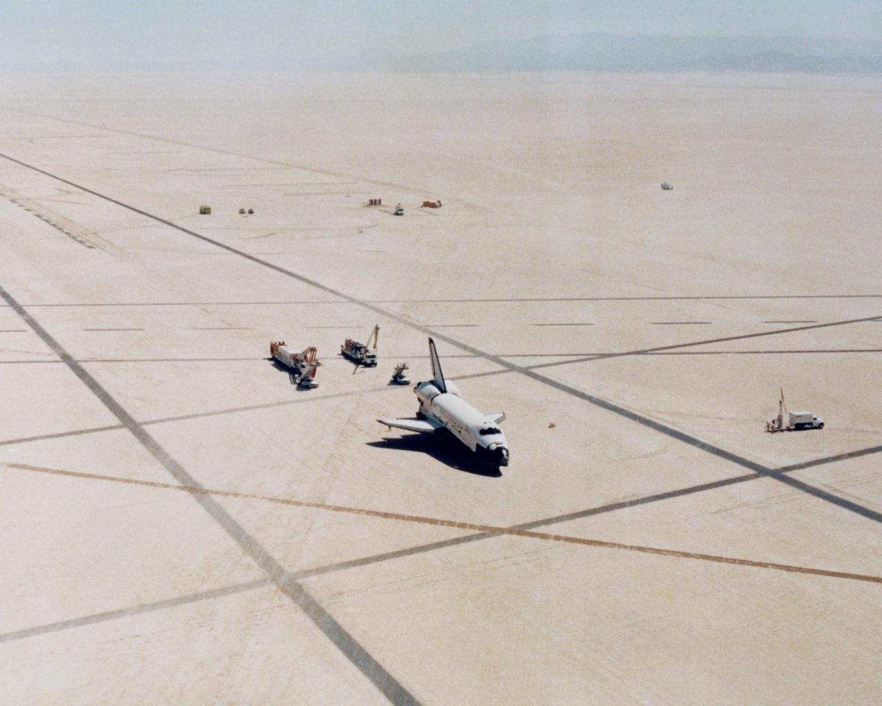
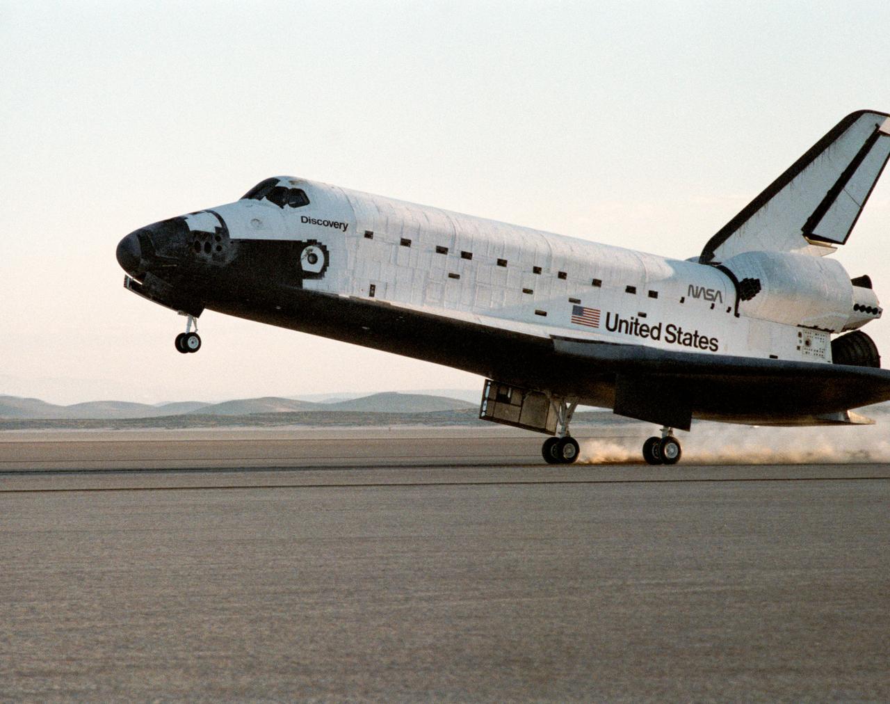
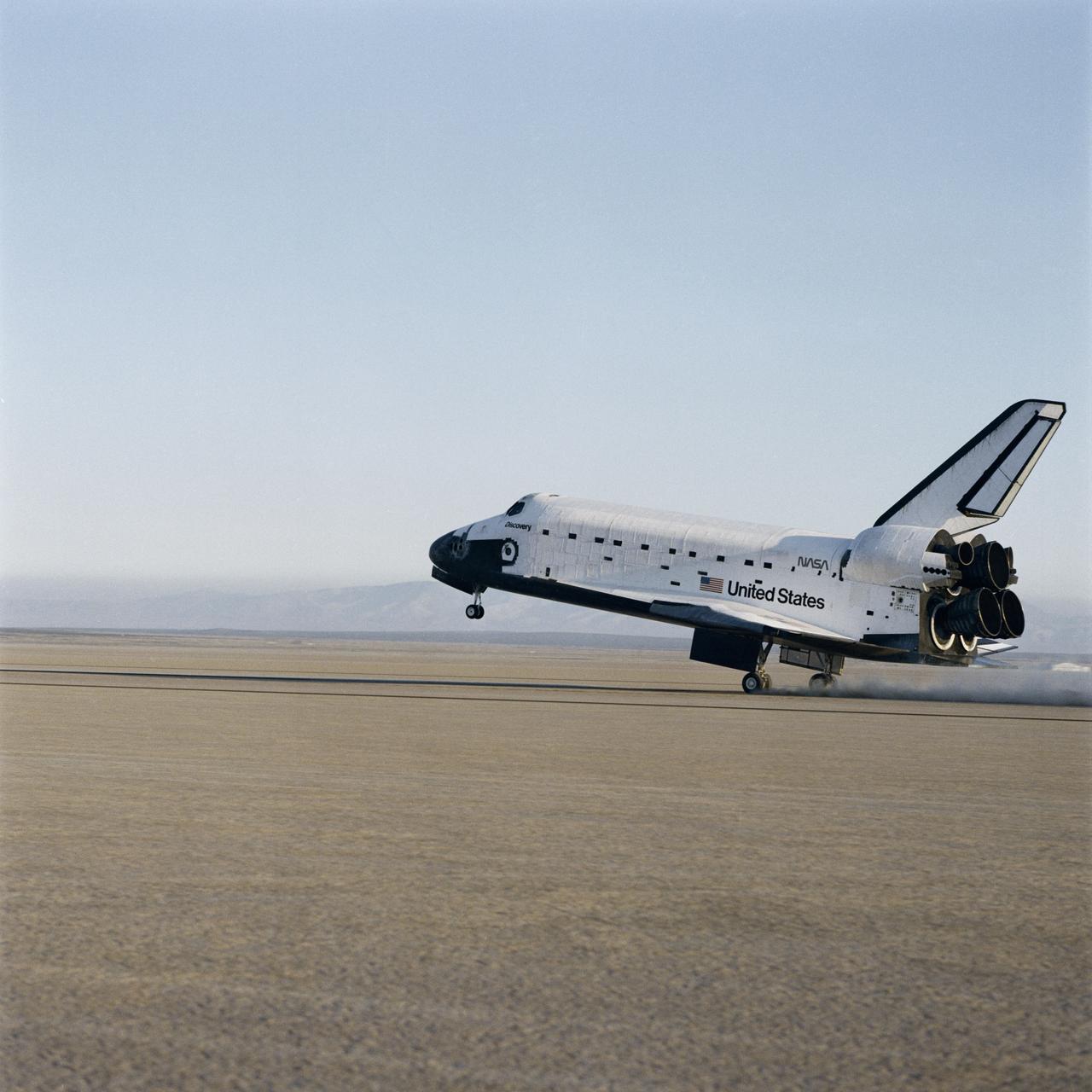
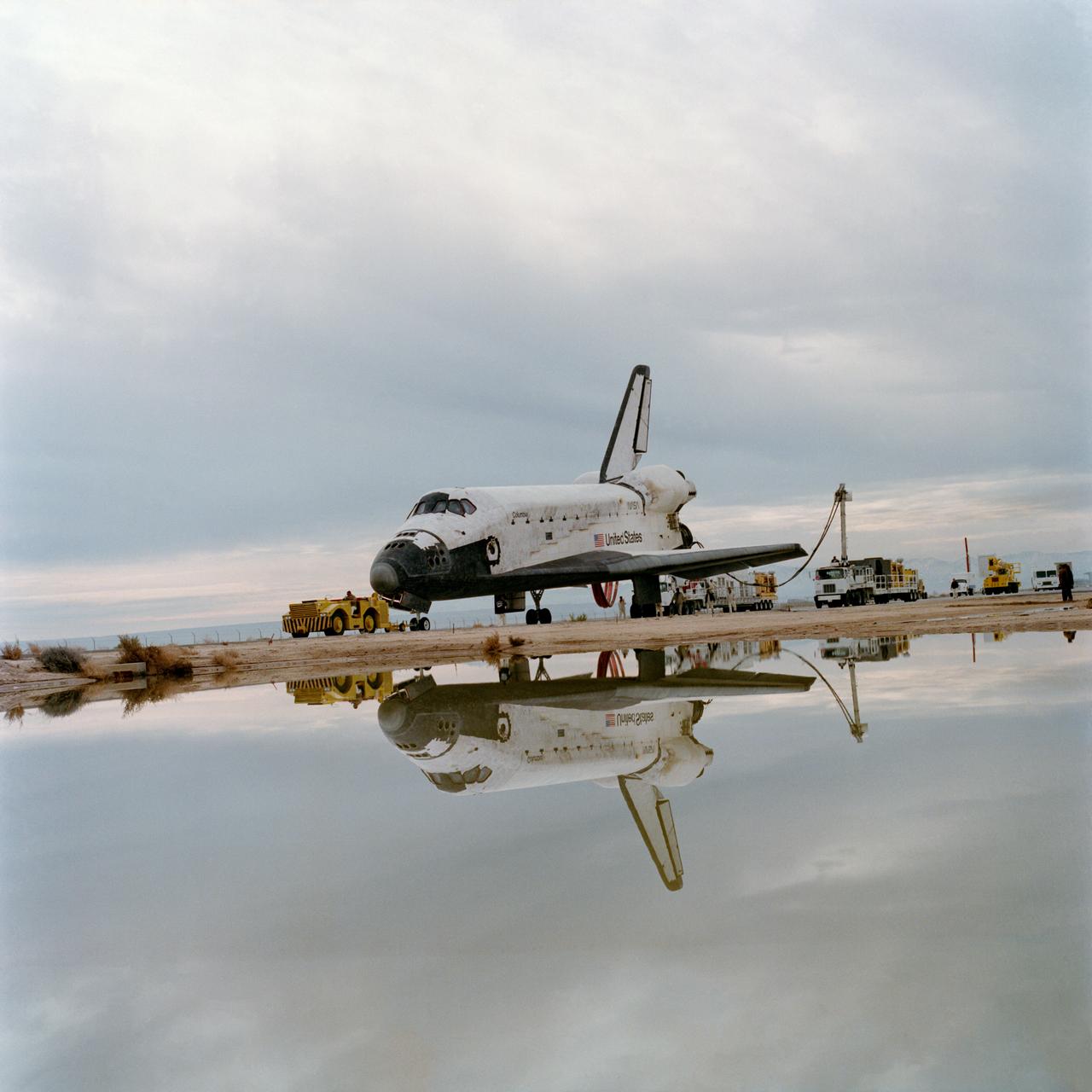
The Space Shuttle Columbia touches down on lakebed runway 23 at Edwards Air Force Base, Calif., to conclude the first orbital shuttle mission.
The M2-F3 Lifting Body is seen here on the lakebed at the NASA Flight Research Center (FRC--later the Dryden Flight Research Center), Edwards, California. After a three-year-long redesign and rebuilding effort, the M2-F3 was ready to fly. The May 1967 crash of the M2-F2 had damaged both the external skin and the internal structure of the lifting body. At first, it seemed that the vehicle had been irreparably damaged, but the original manufacturer, Northrop, did the repair work and returned the redesigned M2-F3 with a center fin for stability to the FRC.
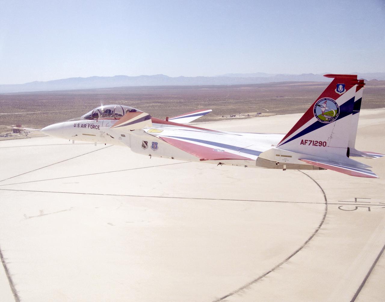
F-15B ACTIVE in flight over lakebed
The M2-F3 Lifting Body is seen here on the lakebed next to the NASA Flight Research Center (later the Dryden Flight Research Center), Edwards, California. Redesigned and rebuilt from the M2-F2, the M2-F3 featured as its most visible change a center fin for greater stability. While the M2-F3 was still demanding to fly, the center fin eliminated the high risk of pilot induced oscillation (PIO) that was characteristic of the M2-F2.
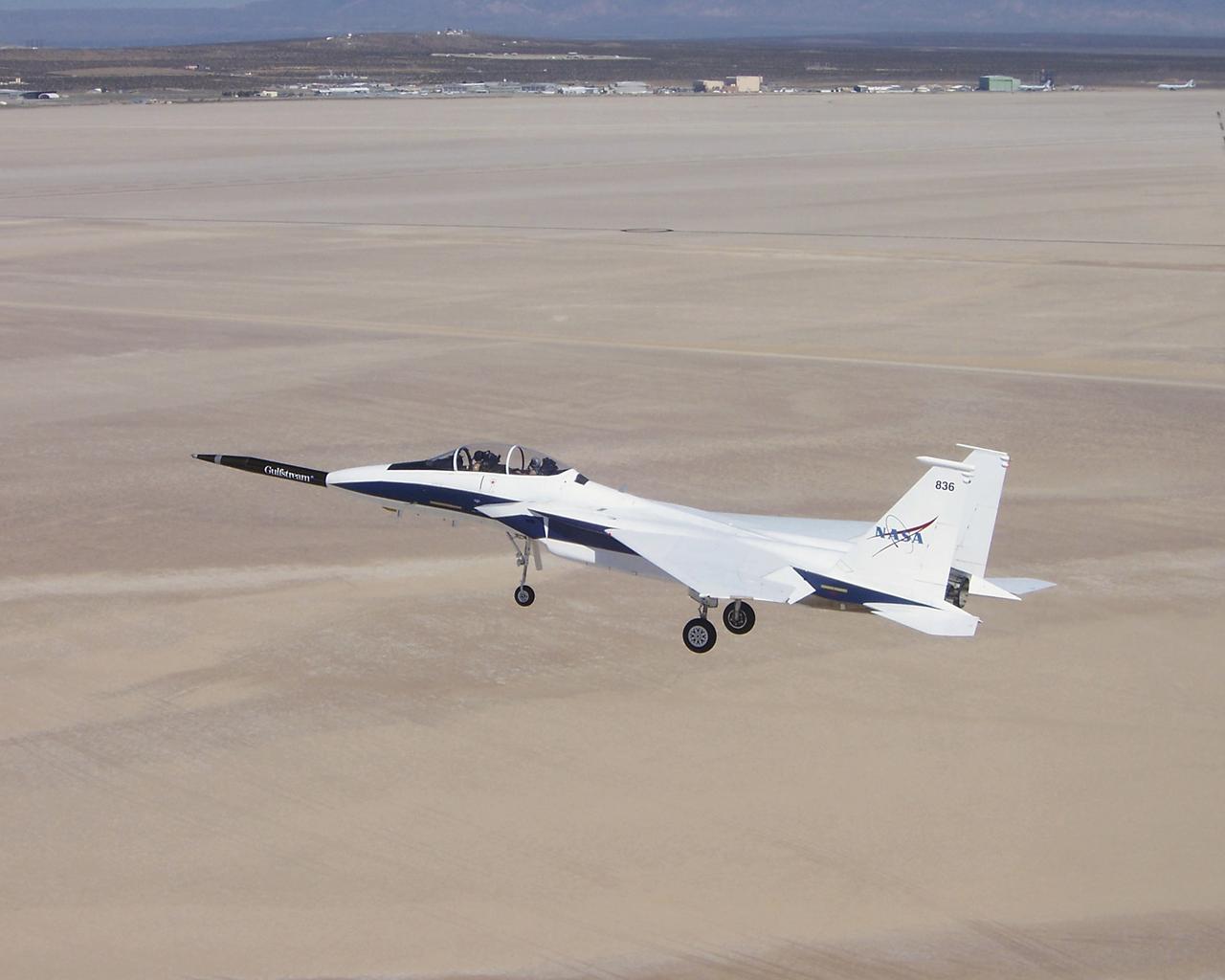
Approaching the runway after the first evaluation flight of the Quiet Spike project, NASA's F-15B testbed aircraft cruises over Roger's Dry Lakebed near the Dryden Flight Research Center. The Quiet Spike was developed by Gulfstream Aerospace as a means of controlling and reducing the sonic boom caused by an aircraft 'breaking' the sound barrier.
The Space Shuttle Columbia touches down on lakebed runway 23 at Edwards Air Force Base, Calif., to conclude the first orbital shuttle mission. (JSC photo # S81-30734)
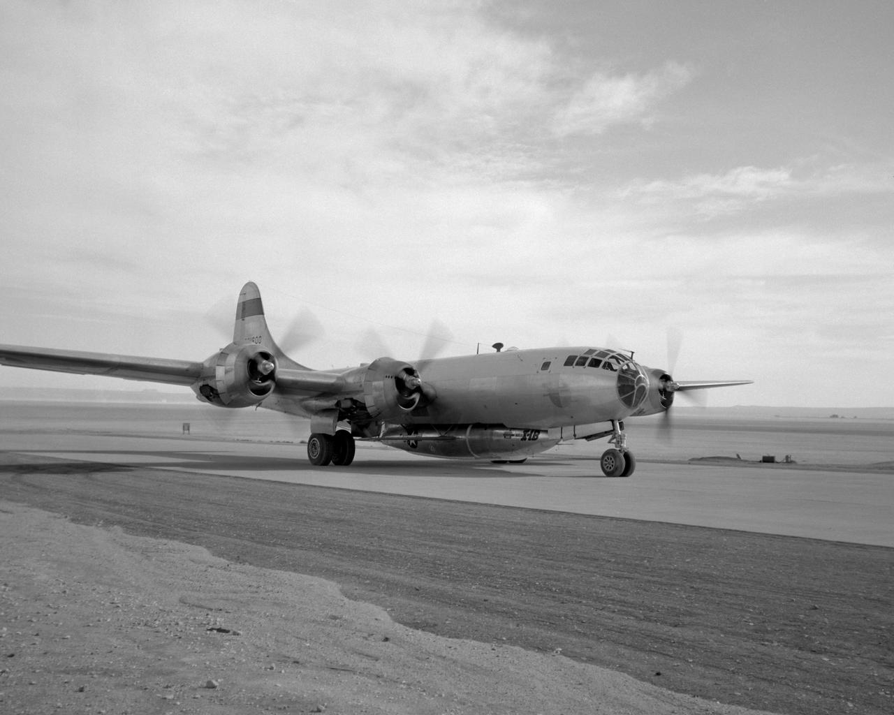
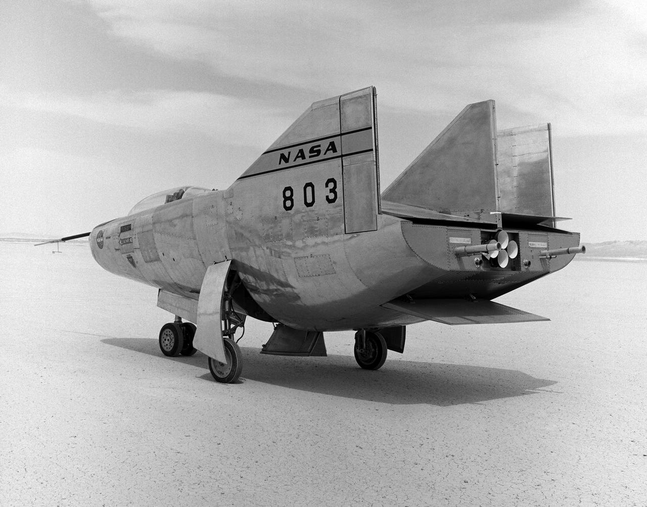
B-29 #800 with X-1B attached taxis in off of the lakebed.
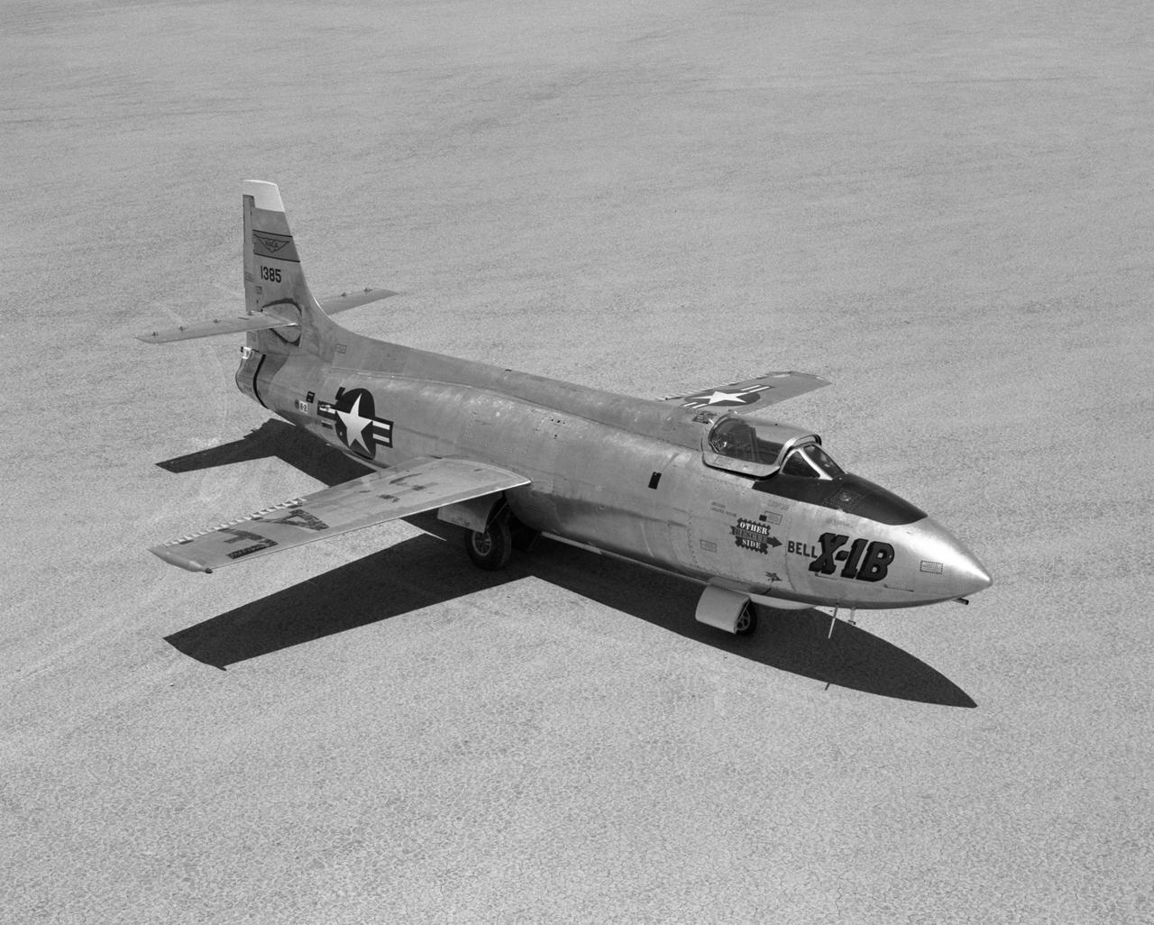
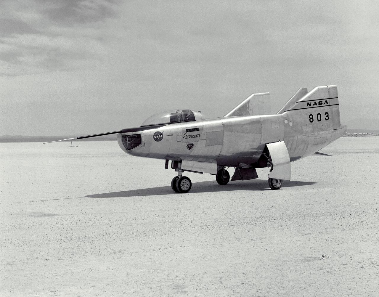
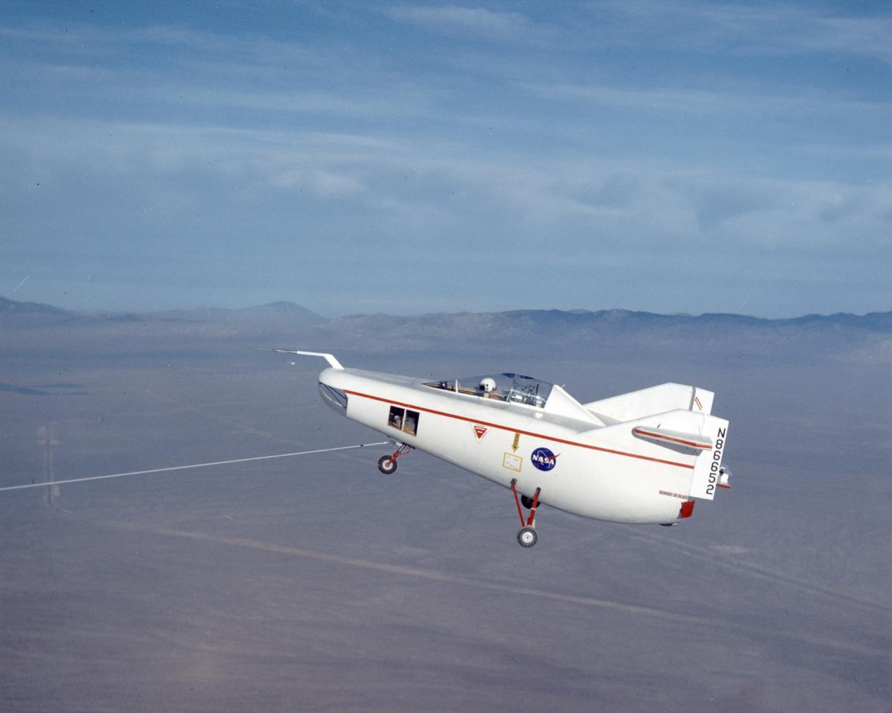
Bell X-1B fitted with a reaction control system on the lakebed
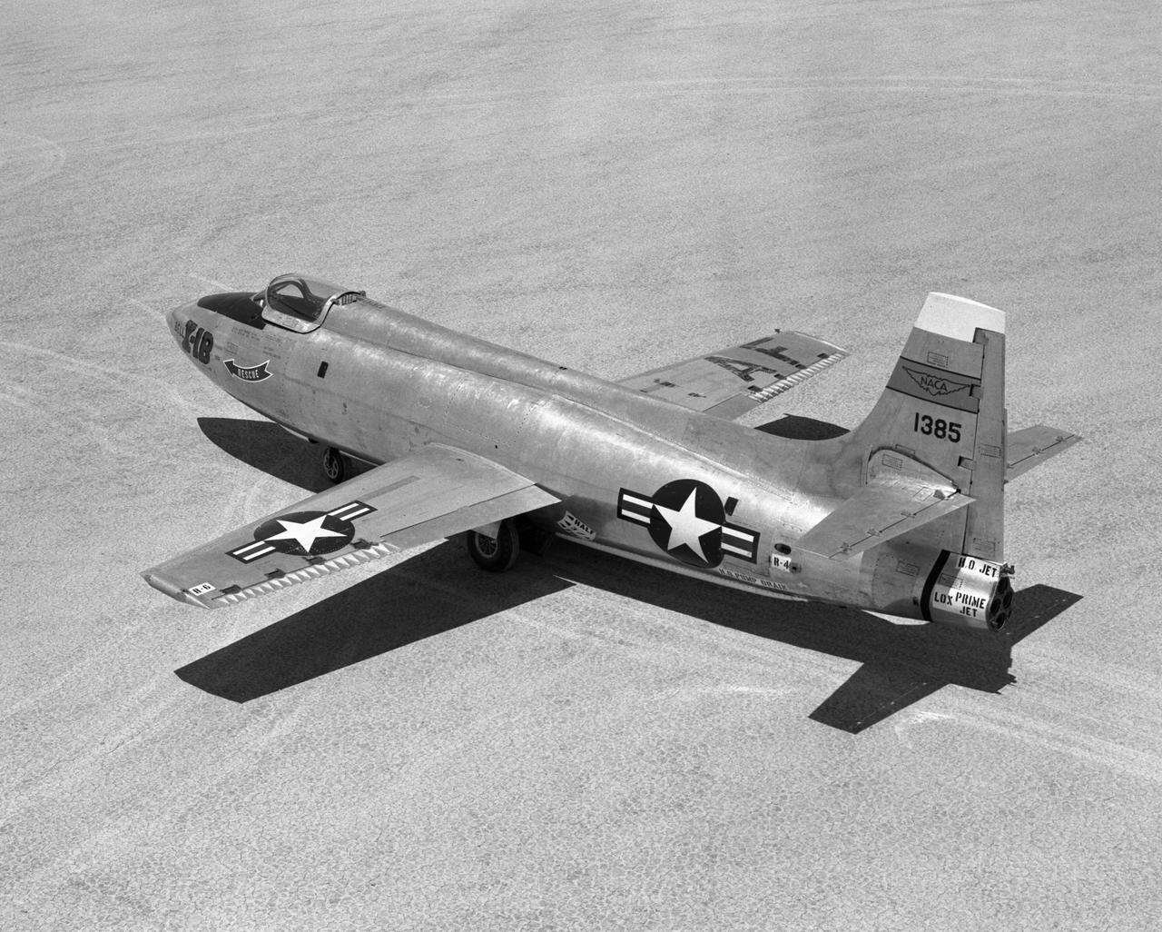
Bell X-1B fitted with a reaction control system on the lakebed.
The Navmar Applied Sciences Corporation’s TigerShark sits on the lakebed at Edwards Air Force Base after completing a flight for the Unmanned Aircraft Systems integration in the National Airspace Systems, Flight Test Series Six (FT6) project. FT6 took place at NASA’s Armstrong Flight Research Center in California and focused on low size weight and power sensors for Detect and Avoid (DAA) operations in controlled airspace to inform the FAA through the RTCA Special Committee DAA Working Group on the phase 2 minimum operational performance standards for DAA and air-to-air radar.
The Navmar Applied Sciences Corporation’s TigerShark sits on the lakebed at Edwards Air Force Base after completing a flight for the Unmanned Aircraft Systems integration in the National Airspace Systems, Flight Test Series Six (FT6) project. FT6 took place at NASA’s Armstrong Flight Research Center in California and focused on low size weight and power sensors for Detect and Avoid (DAA) operations in controlled airspace to inform the FAA through the RTCA Special Committee DAA Working Group on the phase 2 minimum operational performance standards for DAA and air-to-air radar.
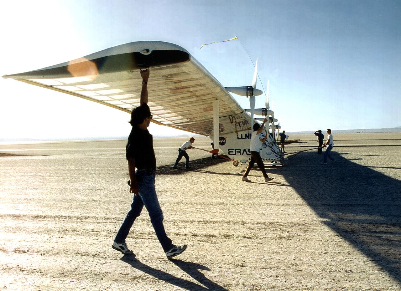
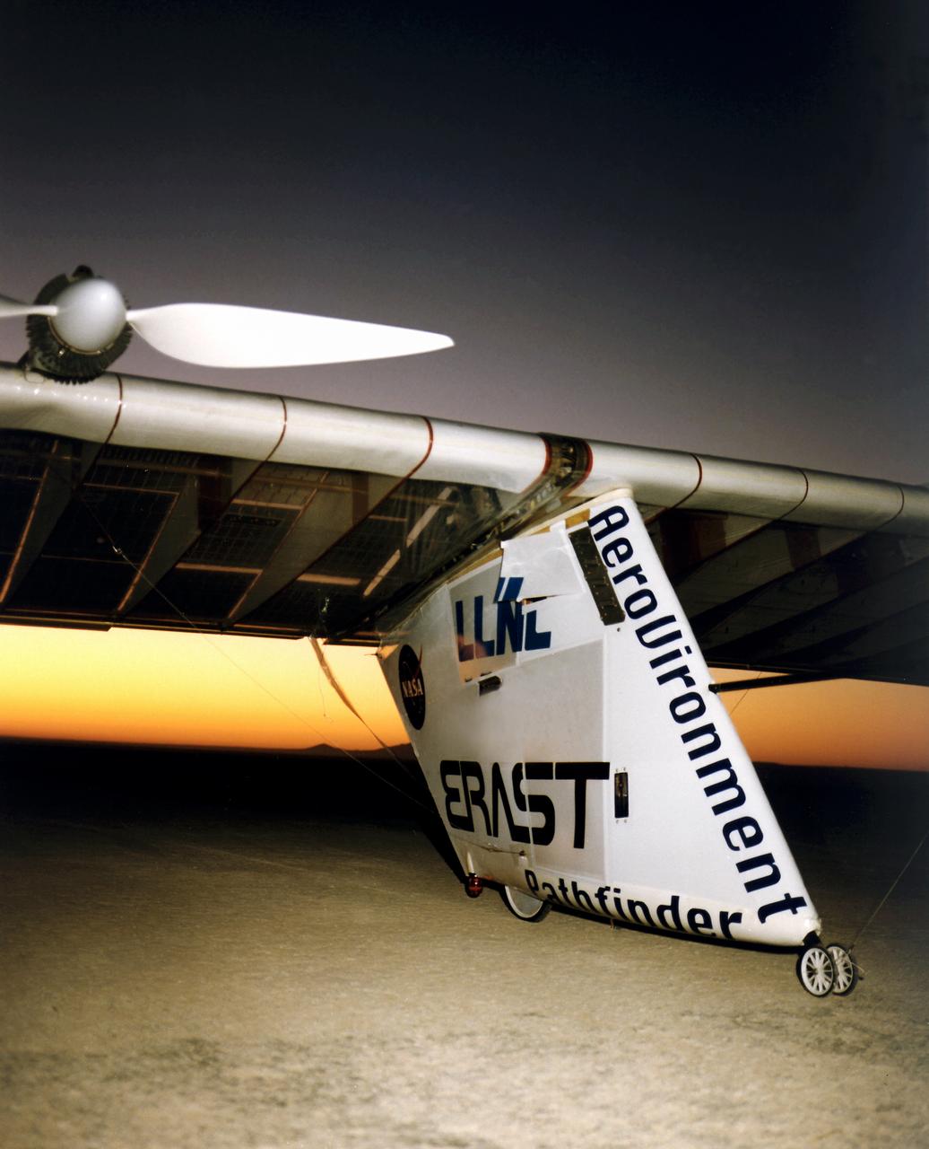
The Pathfinder research aircraft's wing structure is clearly defined in this photo as personnel from AeroVironment rolled it out onto the lakebed at NASA's Dryden Flight Research Center, Edwards, California, for another test flight.
NASA Flight Research Pilot Milt Thompson, shown here on the lakebed with the M2-F1 lifting body, was an early backer of R. Dale Reed's lifting-body proposal. He urged Flight Research Center director Paul Bikle to approve the M2-F1's construction. Thompson also made the first glide flights in both the M2-F1 and its successor, the heavyweight M2-F2.
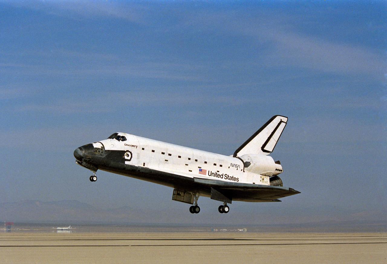
The Space Shuttle Columbia on Rogers Dry lakebed at Edwards AFB after landing to complete its first orbital mission on April 14, 1981. Technicians towed the Shuttle back to the NASA Dryden Flight Research Center for post-flight processing and preparation for a return ferry flight atop a modified 747 to Kennedy Space Center in Florida.
The Space Shuttle Columbia on Rogers Dry lakebed at Edwards AFB after landing to complete its first orbital mission on April 14, 1981. Technicians towed the Shuttle back to the NASA Dryden Flight Research Center for post-flight processing and preparation for a return ferry flight atop a modified 747 to Kennedy Space Center in Florida. (JSC photo # S81-31163)
The Space Shuttle Columbia on Rogers Dry lakebed at Edwards AFB after landing to complete its first orbital mission on April 14, 1981. Technicians towed the Shuttle back to the NASA Dryden Flight Research Center for post-flight processing and preparation for a return ferry flight atop a modified 747 to Kennedy Space Center in Florida. (JSC photo # S81-30749)
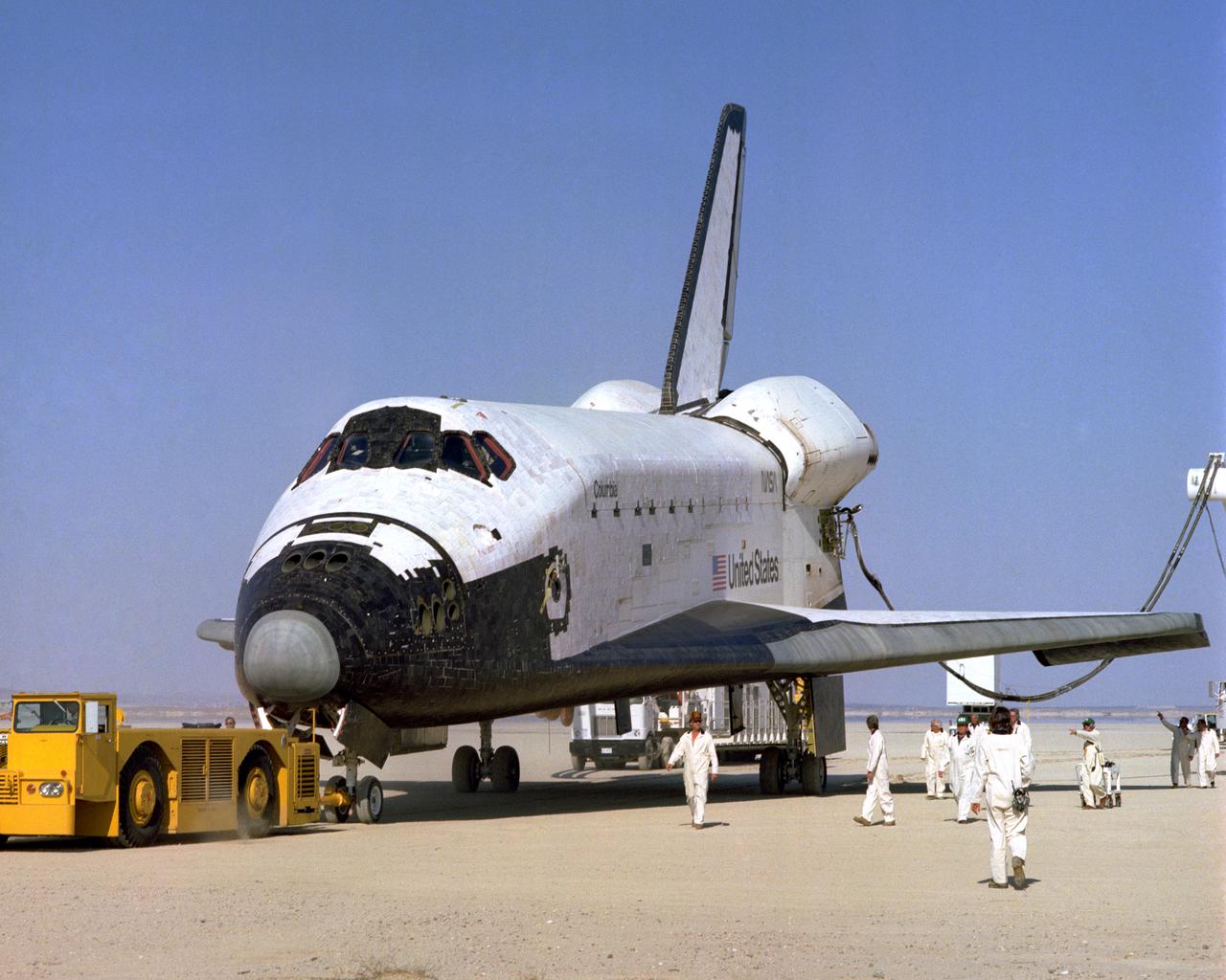
The Space Shuttle Columbia on Rogers Dry lakebed at Edwards AFB after landing to complete its first orbital mission on April 14, 1981. Technicians towed the Shuttle back to the NASA Dryden Flight Research Center for post-flight processing and preparation for a return ferry flight atop a modified 747 to Kennedy Space Center in Florida.
The Space Shuttle Columbia on Rogers Dry lakebed at Edwards AFB after landing to complete its first orbital mission on April 14, 1981. Technicians towed the Shuttle back to the NASA Dryden Flight Research Center for post-flight processing and preparation for a return ferry flight atop a modified 747 to Kennedy Space Center in Florida.
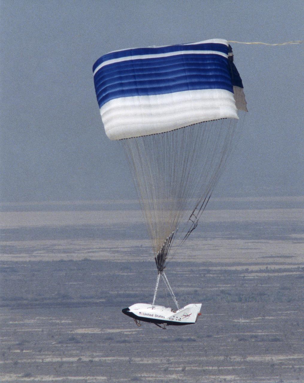
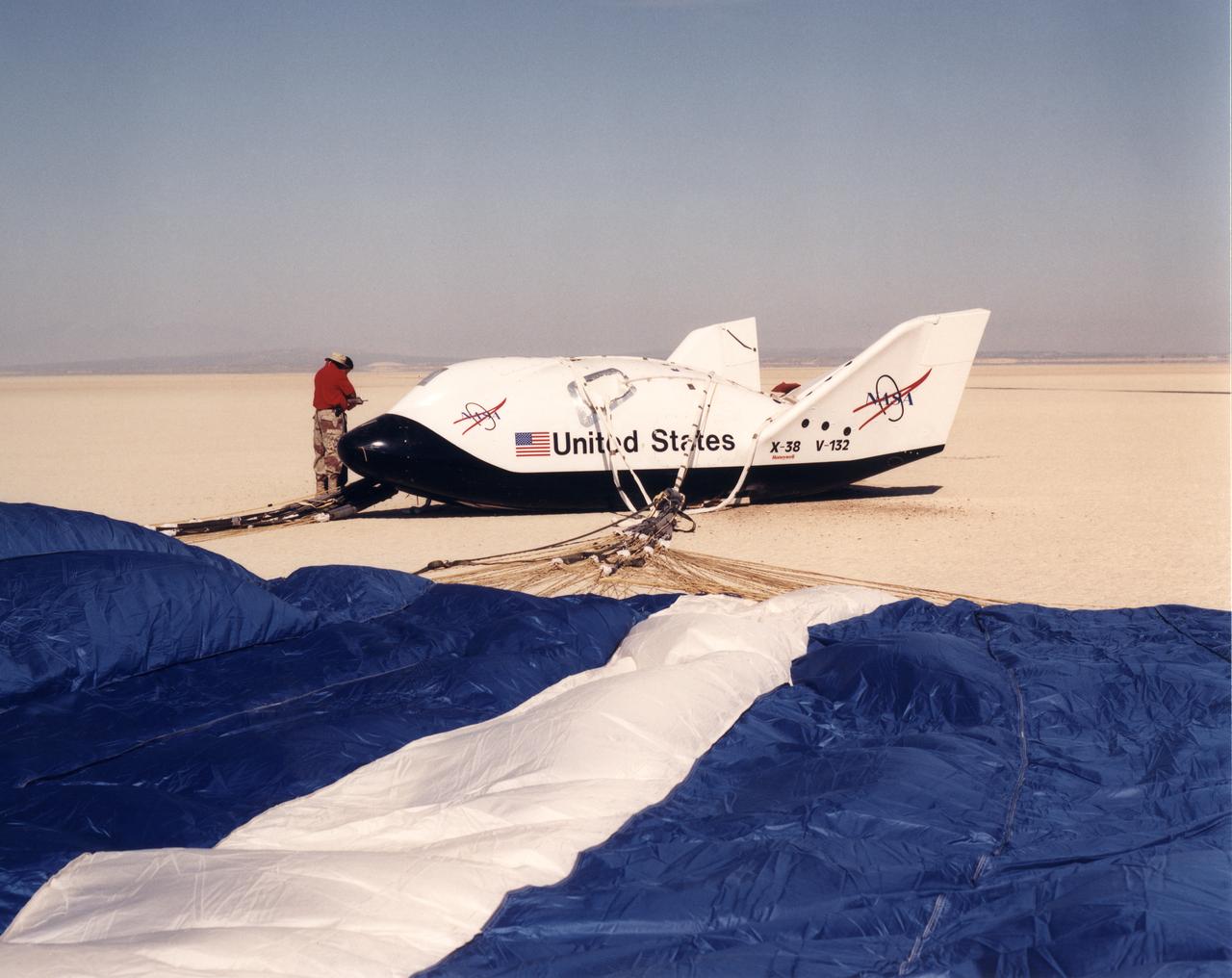
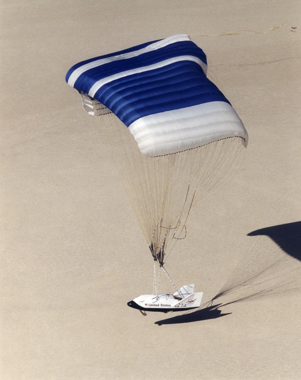
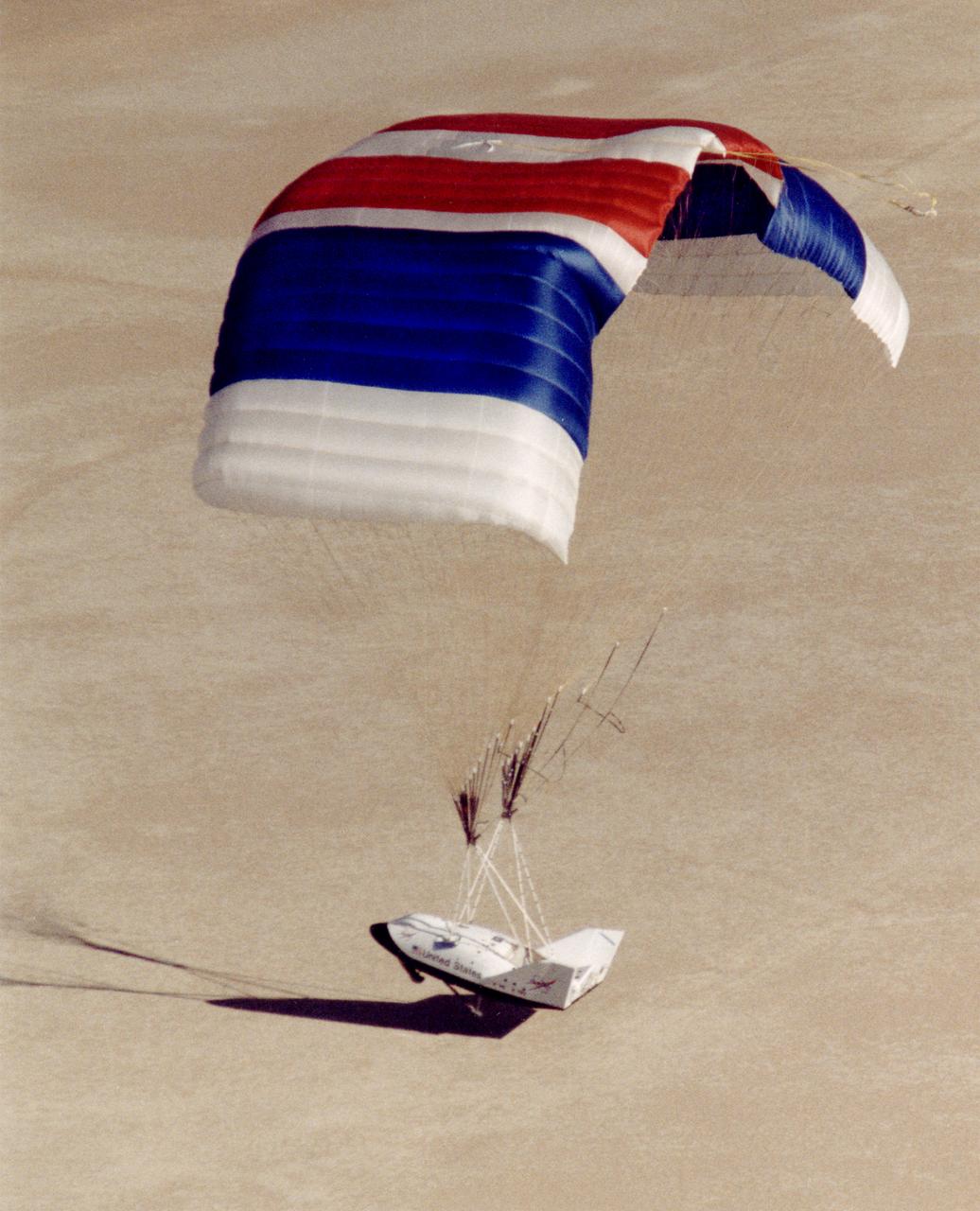
The X-38 technology demonstrator descends under its steerable parafoil toward a lakebed landing in a March 2000 test flight.
The X-38 technology demonstrator descends under its steerable parafoil toward a lakebed landing in a March 2000 test flight.

This side-rear view of the X-24A Lifting Body on the lakebed by the NASA Flight Research Center shows its control surfaces used for subsonic flight.
NASA's X-38, a prototype of a Crew Return Vehicle (CRV) resting on the lakebed near the Dryden Flight Research Center after the completion of its second free flight. The X-38 was launched from NASA Dryden's B-52 Mothership on Saturday, February 6, 1999, from an altitude of approximately 23,000 feet.
The HL-10 Lifting Body is seen here in flight over Rogers Dry lakebed. Like the other lifting bodies, the HL-10 made a steep descent toward the lakebed, followed by a high-speed landing. This was due to the vehicle's low lift-over-drag ratio. The first 11 flights of the HL-10 were unpowered, flown to check the vehicle's handling and stability before rocket-powered flights began using the XLR-11 rocket engine.
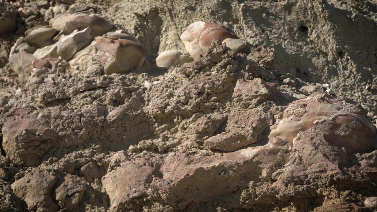
Made from fossilized microbes and sediment, these rounded rocks are stromatolites that were found in a dry lakebed during the field exercise. Scientists hope to find something similar in the dry lakebed Perseverance will be exploring on Mars. https://photojournal.jpl.nasa.gov/catalog/PIA23779
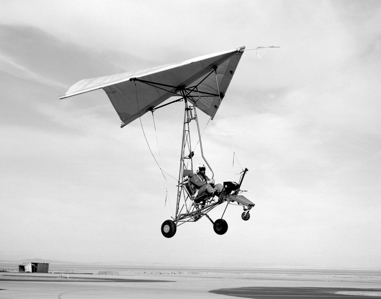
Pilot and Paresev 1 preparing for a landing on the Rogers dry lakebed in 1962 at Edwards Air Force Base, California. The flight program began with ground tow tests. Several tows were made before liftoff was attempted to check the control rigging and to familiarize the pilot with the vehicle’s ground stability. As the pilot’s confidence and experience increased, tow speeds were also increased until liftoff was attained. Liftoff was at about 40 knots indicated airspeed (kias).
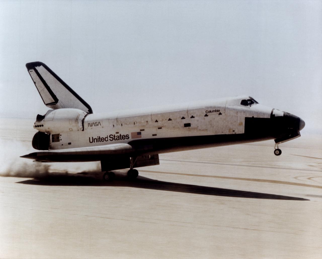
TOUCHDOWN! -- The Space Shuttle Columbia touches down on lakebed runway 23 at Edwards Air Force Base, Calif., to conclude the first orbital shuttle mission, April 14, 1981.
The X-38's blue and white parafoil spreads out in front of the research vehicle as it sits on a lakebed near the Dryden Flight Research Center after a March 2000 test flight.
The X-38, a research vehicle built to help develop technology for an emergency Crew Return Vehicle from the International Space Station, is seen just before touchdown on a lakebed near the Dryden Flight Research Center, Edwards California, at the end of a March 2000 test flight.
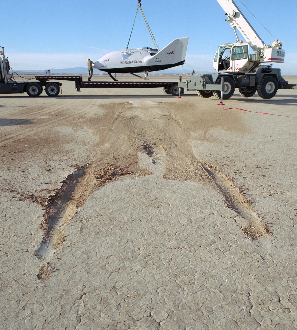
The NASA X-38 is picked up from its dry lakebed landing site following its successful eighth free flight test mission December 13, 2001. Skid marks in the ground show the X-38's landing path.
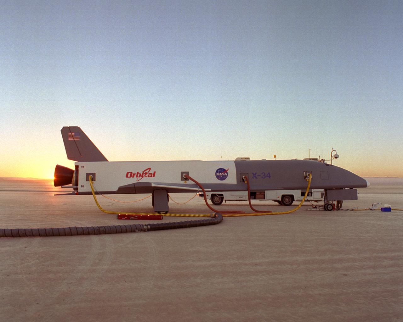
Following initial captive flight tests last year at NASA's Dryden Flight Research Center, Edwards Air Force Base, California, the X-34 technology demonstrator began a new series of tests last week in which it is being towed behind a semi-truck and released to coast on the Edwards dry lakebed. On July 20, 2000, it was towed and released twice at speeds of five and 10 miles per hour. On July 24, 2000, it was towed and released twice at 10 and 30 miles per hour. Twelve tests are planned during which the X-34 will be towed for distances up to 10,000 feet and released at speeds up to 80 miles per hour. The test series is expected to last at least six weeks.
Altus I aircraft on lakebed
D-558-2 Aircraft on lakebed
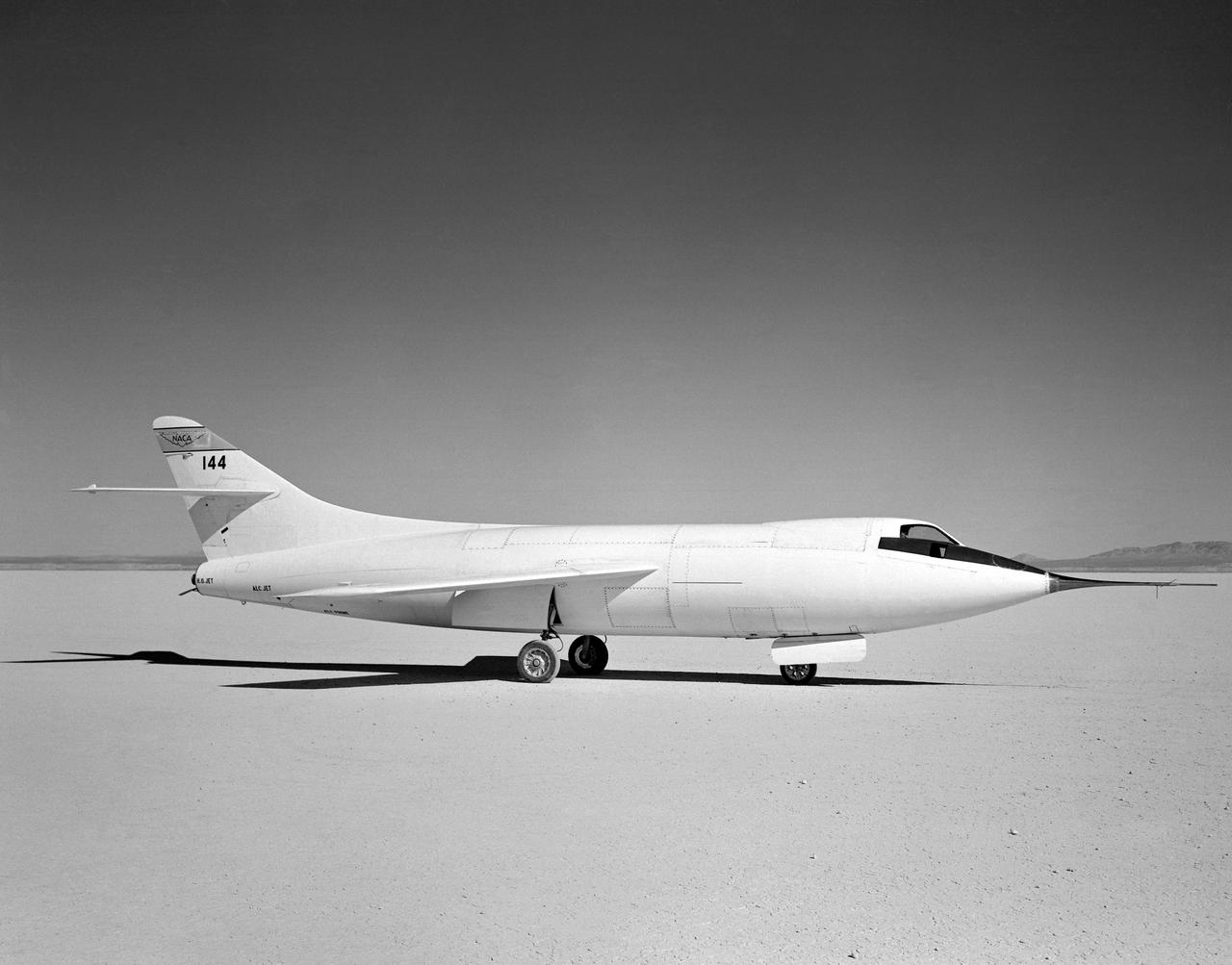
D-558-2 Aircraft on lakebed
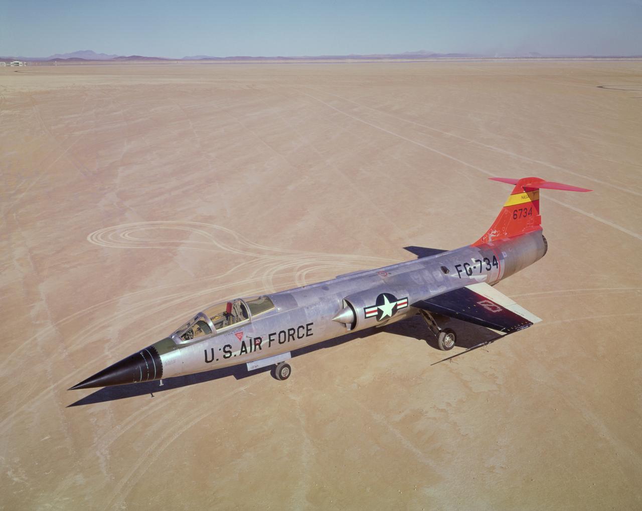
F-104A #734 on lakebed. 11/16/60
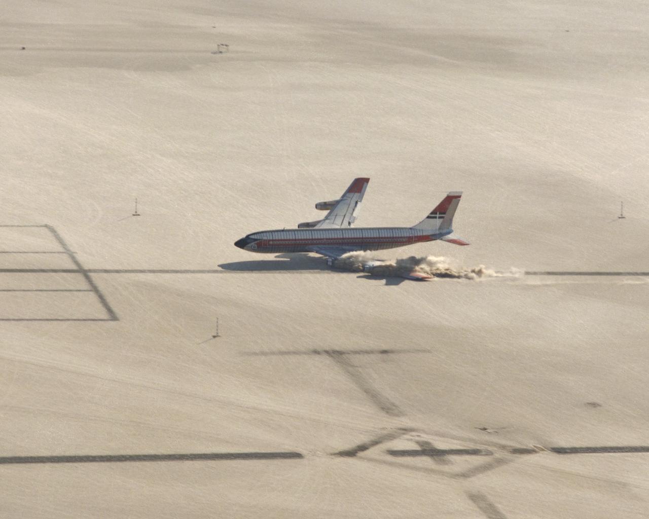
CID (Controlled Imact Demonstrator) Aircraft lakebed skid.
Following initial captive flight tests last year at NASA's Dryden Flight Research Center, Edwards Air Force Base, California, the X-34 technology demonstrator began a new series of tests last week in which it is being towed behind a semi-truck and released to coast on the Edwards dry lakebed. On July 20, 2000, it was towed and released twice at speeds of five and 10 miles per hour. On July 24, 2000, it was towed and released twice at 10 and 30 miles per hour. Twelve tests are planned during which the X-34 will be towed for distances up to 10,000 feet and released at speeds up to 80 miles per hour. The test series is expected to last at least six weeks.
Following initial captive flight tests last year at NASA's Dryden Flight Research Center, Edwards Air Force Base, California, the X-34 technology demonstrator began a new series of tests last week in which it is being towed behind a semi-truck and released to coast on the Edwards dry lakebed. On July 20, 2000, it was towed and released twice at speeds of five and 10 miles per hour. On July 24, 2000, it was towed and released twice at 10 and 30 miles per hour. Twelve tests are planned during which the X-34 will be towed for distances up to 10,000 feet and released at speeds up to 80 miles per hour. The test series is expected to last at least six weeks.
Altus I aircraft landing on Edwards lakebed runway 23
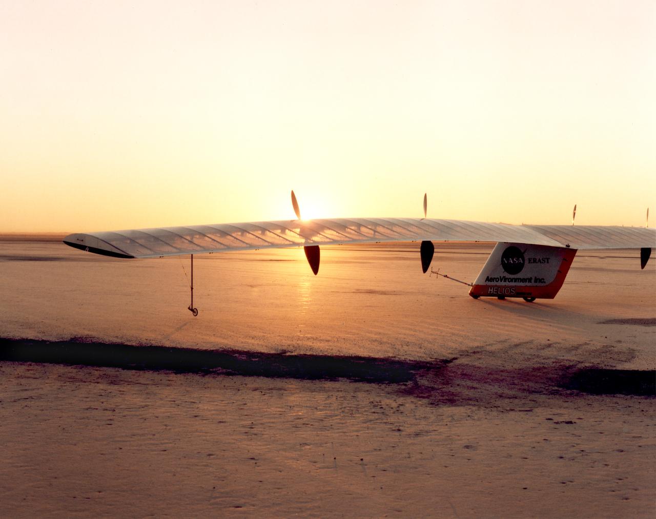
Helios Prototype on lakebed prior to first battery-powered flight

B-29 #800 with X-1B attached taxi's in off of the lakebed.
Altus I aircraft taking off from lakebed runway
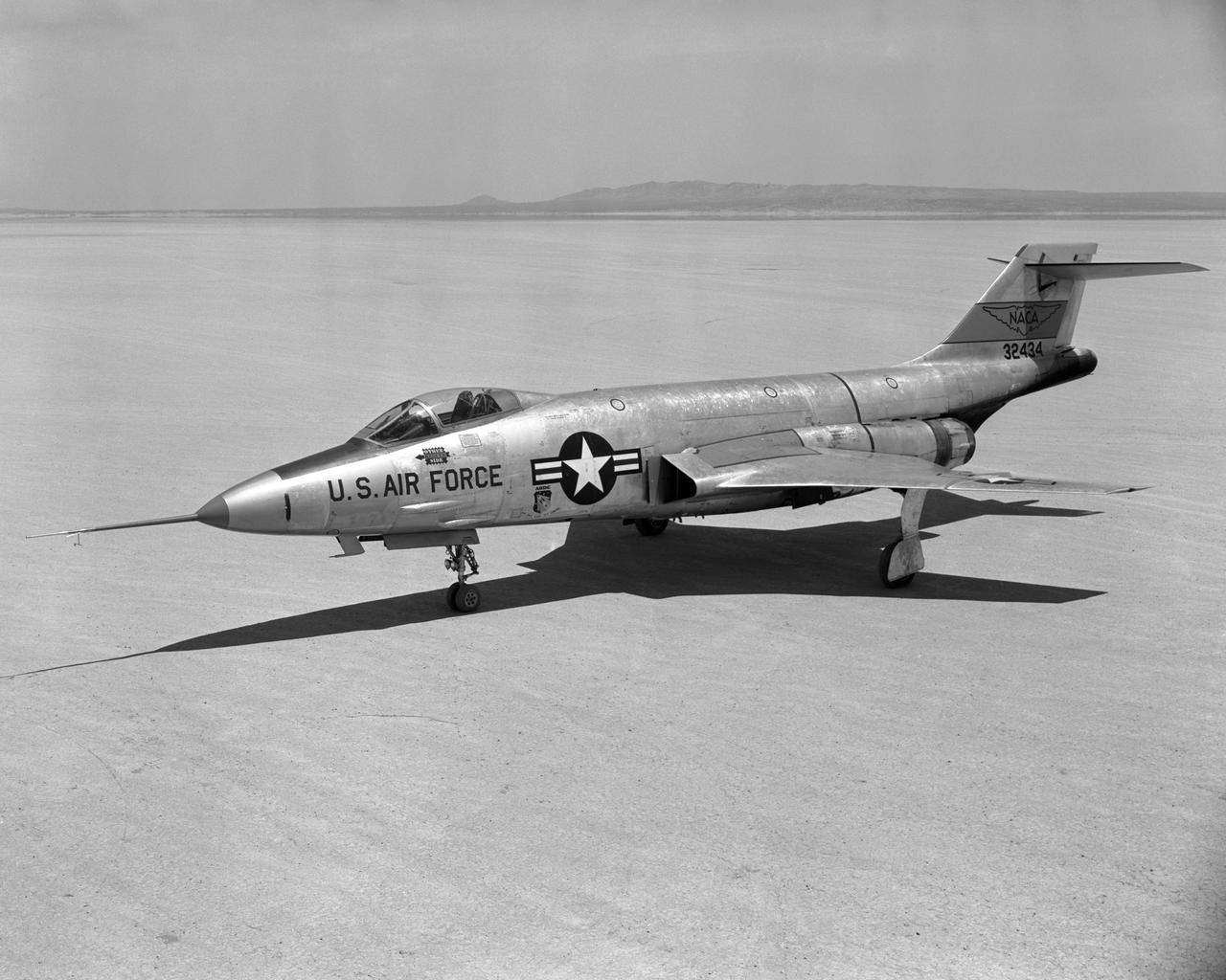
F-101A Front quarter view on Edwards Lakebed Aug. 10, 1956
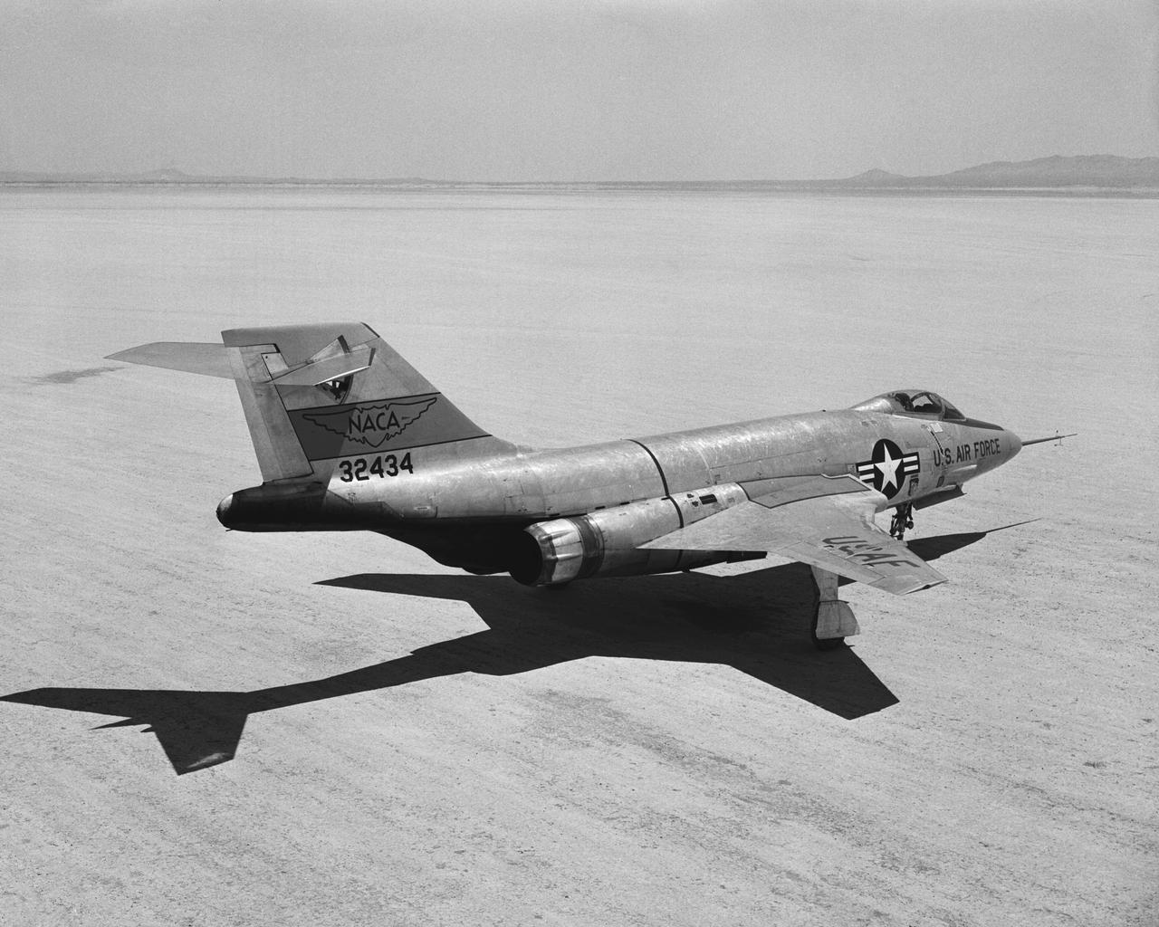
F-101A Rear quarter view on Edwards Lakebed. Aug. 10, 1956
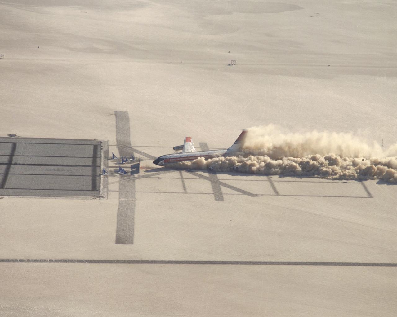
CID (Controlled Imact Demonstrator) Aircraft prior to wing cutter impact during lakebed skid.
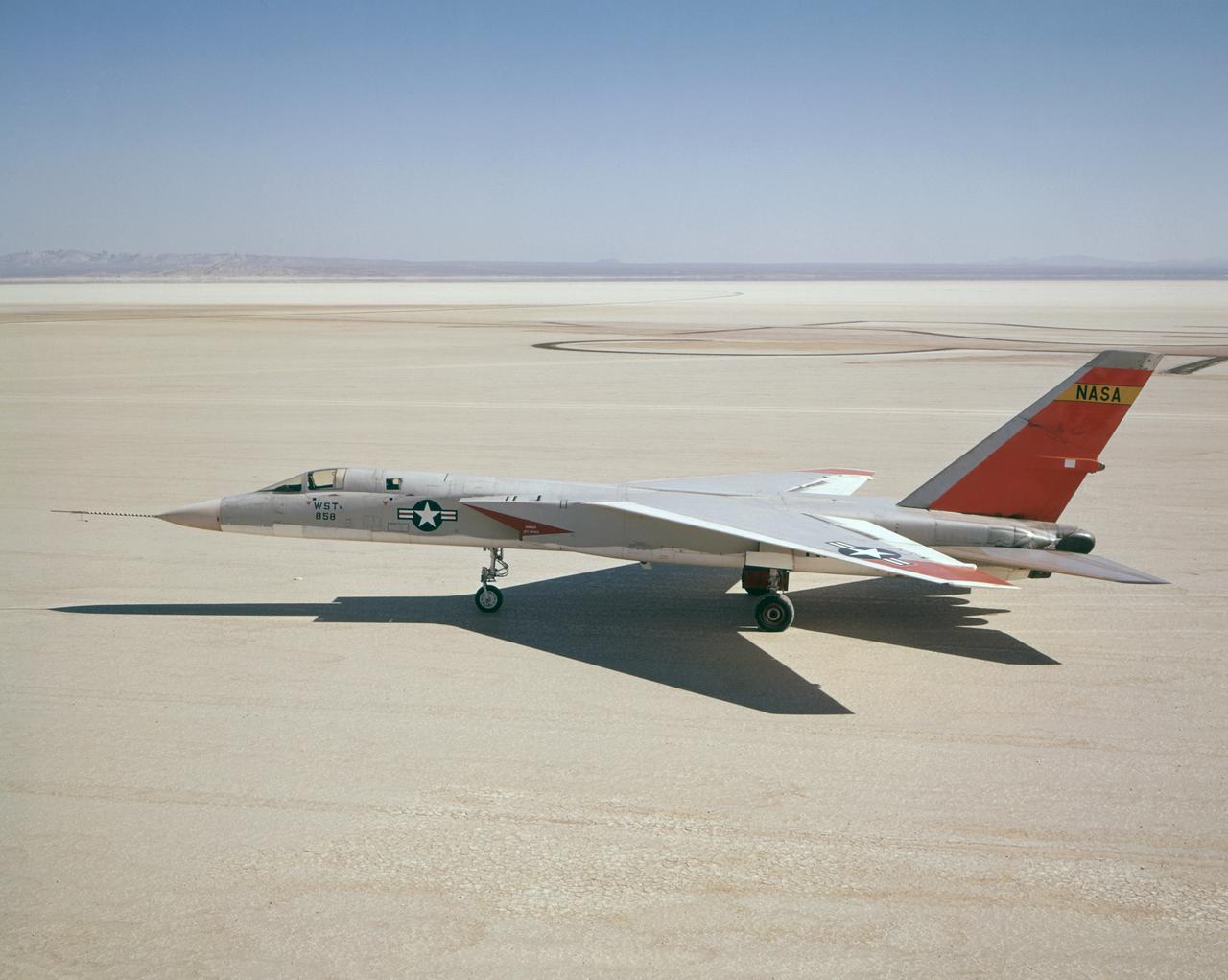
A North American Aviation A-5A Vigilante (Navy serial number 147858/NASA tail number 858) arrived from the Naval Air Test Center, Patuxent River, MD, on December 19, 1962, at the NASA Flight Research Center (now, Dryden Flight Research Center, Edwards, CA). The Center flew the A-5A in a year-long series of flights in support of the U.S. supersonic transport program. The Center flew the aircraft to determine the let-down and approach conditions of a supersonic transport flying into a dense air traffic network. With the completion of the research flights, the Center sent the A-5A back to the Navy on December 20, 1963.
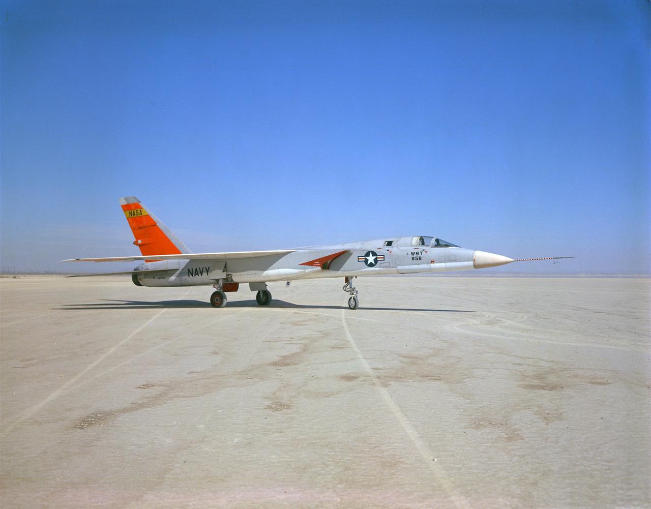
A North American Aviation A-5A Vigilante (Navy serial number 147858/NASA tail number 858) arrived from the Naval Air Test Center, Patuxent River, MD, on December 19, 1962, at the NASA Flight Research Center (now, Dryden Flight Research Center, Edwards, CA). The Center flew the A-5A in a year-long series of flights in support of the U.S. supersonic transport program. The Center flew the aircraft to determine the let-down and approach conditions of a supersonic transport flying into a dense air traffic network. With the completion of the research flights, the Center sent the A-5A back to the Navy on December 20, 1963.
The M2-F1 following a hard landing on Rogers Dry Lake in 1963. It hit the lakebed so hard the rolling gear completely separated.
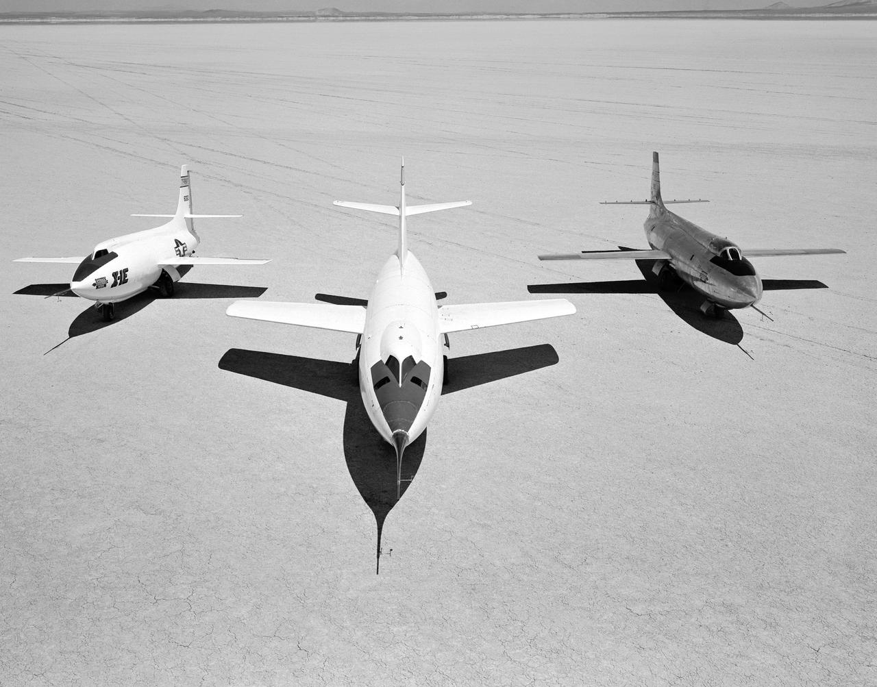
Early NACA research aircraft on the lakebed at the High Speed Research Station in 1955: Left to right: X-1E, D-558-II, X-1B
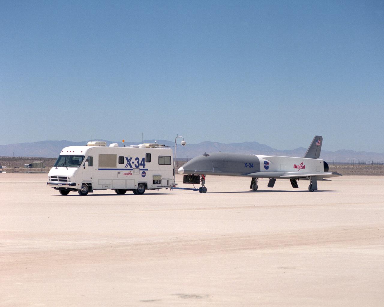
Following initial captive flight tests last year at NASA's Dryden Flight Research Center, Edwards Air Force Base, California, the X-34 technology demonstrator began a new series of tests last week in which it is being towed behind a semi-truck and released to coast on the Edwards dry lakebed. On July 20, 2000, it was towed and released twice at speeds of five and 10 miles per hour. On July 24, 2000, it was towed and released twice at 10 and 30 miles per hour. Twelve tests are planned during which the X-34 will be towed for distances up to 10,000 feet and released at speeds up to 80 miles per hour. The test series is expected to last at least six weeks.
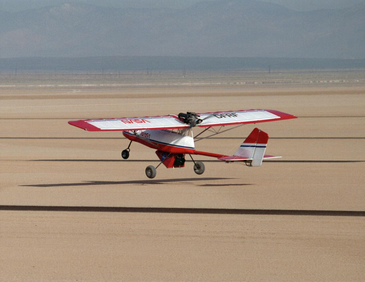
PTERA takes off from the Rogers Dry Lakebed on a flight to test the ability of an innovative, lightweight material, called shape memory alloy, to fold the outer portion of an aircraft’s wings in flight.
Documentary views of Space Shuttle Columbia on Lakebed Runway during De-Servicing, Crew Egress and departure from Orbiter at the end of STS-2 Mission. EAFB, CA Also available in 70 CN
Documentary aerial and ground views of the Columbia sitting on the Lakebed Runway with the deservicing trucks following the STS-1 Mission, 04/14/1981. EAFB, CA Also available in 70 CN
The X-38, a research vehicle built to help develop technology for an emergency Crew Return Vehicle (CRV), flares for its lakebed landing at the end of a March 1999 test flight at the Dryden Flight Research Center, Edwards, California.
Following the first M2-F1 airtow flight on 16 August 1963, the Flight Research Center used the vehicle for both research flights and to check out new lifting-body pilots. These included Bruce Peterson, Don Mallick, Fred Haise, and Bill Dana from NASA. Air Force pilots who flew the M2-F1 included Chuck Yeager, Jerry Gentry, Joe Engle, Jim Wood, and Don Sorlie, although Wood, Haise, and Engle only flew on car tows. In the three years between the first and last flights of the M2-F1, it made about 400 car tows and 77 air tows.
After initial ground-tow flights of the M2-F1 using the Pontiac as a tow vehicle, the way was clear to make air tows behind a C-47. The first air tow took place on 16 August 1963. Pilot Milt Thompson found that the M2-F1 flew well, with good control. This first flight lasted less than two minutes from tow-line release to touchdown. The descent rate was 4,000 feet per minute.
Bruce A. Peterson standing beside the M2-F2 lifting body on Rogers Dry Lake. Peterson became the NASA project pilot for the lifting body program after Milt Thompson retired from flying in late 1966. Peterson had flown the M2-F1, and made the first glide flight of the HL-10 heavy-weight lifting body in December 1966. On May 10, 1967, Peterson made his fourth glide flight in the M2-F2. This was also the M2-F2's 16th glide flight, scheduled to be the last one before the powered flights began. However, as pilot Bruce Peterson neared the lakebed, the M2-F2 suffered a pilot induced oscillation (PIO). The vehicle rolled from side to side in flight as he tried to bring it under control. Peterson recovered, but then observed a rescue helicopter that seemed to pose a collision threat. Distracted, Peterson drifted in a cross-wind to an unmarked area of the lakebed where it was very difficult to judge the height over the lakebed because of a lack of the guidance the markers provided on the lakebed runway. Peterson fired the landing rockets to provide additional lift, but he hit the lakebed before the landing gear was fully down and locked. The M2-F2 rolled over six times, coming to rest upside down. Pulled from the vehicle by Jay King and Joseph Huxman, Peterson was rushed to the base hospital, transferred to March Air Force Base and then the UCLA Hospital. He recovered but lost vision in his right eye due to a staph infection.
![Holden Crater was once filled by at least two different lakes. The sediments deposited in those lakes are relatively light-toned where exposed, as seen in this observation from NASA's Mars Reconnaissance Orbiter. Each layer represents a different point in time and perhaps a changing environment for Martian life, if it existed. The elongated ridges with sharp crests are sand dunes. The map is projected here at a scale of 25 centimeters (9.8 inches) per pixel. [The original image scale is 25.9 centimeters (10.2 inches) per pixel (with 1 x 1 binning); objects on the order of 78 centimeters (30.7 inches) across are resolved.] North is up. https://photojournal.jpl.nasa.gov/catalog/PIA21587](https://images-assets.nasa.gov/image/PIA21587/PIA21587~medium.jpg)
Holden Crater was once filled by at least two different lakes. The sediments deposited in those lakes are relatively light-toned where exposed, as seen in this observation from NASA's Mars Reconnaissance Orbiter. Each layer represents a different point in time and perhaps a changing environment for Martian life, if it existed. The elongated ridges with sharp crests are sand dunes. The map is projected here at a scale of 25 centimeters (9.8 inches) per pixel. [The original image scale is 25.9 centimeters (10.2 inches) per pixel (with 1 x 1 binning); objects on the order of 78 centimeters (30.7 inches) across are resolved.] North is up. https://photojournal.jpl.nasa.gov/catalog/PIA21587
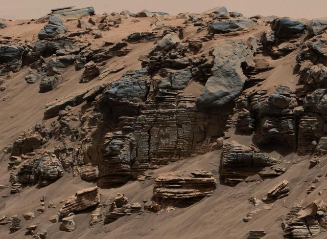
This evenly layered rock photographed by the Mast Camera Mastcam on NASA Curiosity Mars Rover on Aug. 7, 2014, shows a pattern typical of a lake-floor sedimentary deposit not far from where flowing water entered a lake.
This photo shows the HL-10 in flight, turning to line up with lakebed runway 18. The pilot for this flight, the 29th of the HL-10 series, was Bill Dana. The HL-10 reached a peak altitude of 64,590 feet and a top speed of Mach 1.59 on this particular flight.
51G-S-225 (24 June 1985) --- Discovery, with its seven-member 51-G crew aboard, touches down on a dry lakebed at Edwards Air Force Base in California. Landing was noted at 6:11:53 a.m. (PDT), June 24, 1985.
STS-26 Discovery, Orbiter Vehicle (OV) 103, with nose landing gear (NLG) and main landing gear (MLG) deployed glides above dry lakebed runway 17 at Edwards Air Force Base (EAFB), California. This profile view shows OV-103's port side just before MLG touchdown.
51G-S-224 (24 June 1985) --- Discovery, with its seven-member 51-G crew aboard, touches down on a dry lakebed at Edwards Air Force Base in California. Landing was noted at 6:11:53 a.m. (PDT), June 24, 1985.
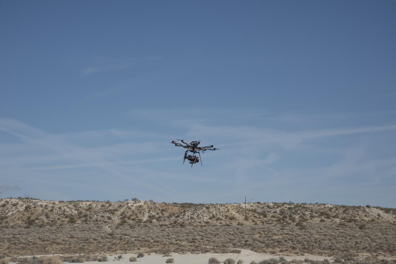
The Alta 8 remotely piloted aircraft flies above Rosamond North Lakebed at NASA's Armstrong Flight Research Center in Edwards, California. The Resilient Autonomy project used these flights to collect data with the Nav Module hardware and software developed by NASA's Jet Propulsion Laboratory in Pasadena, California.
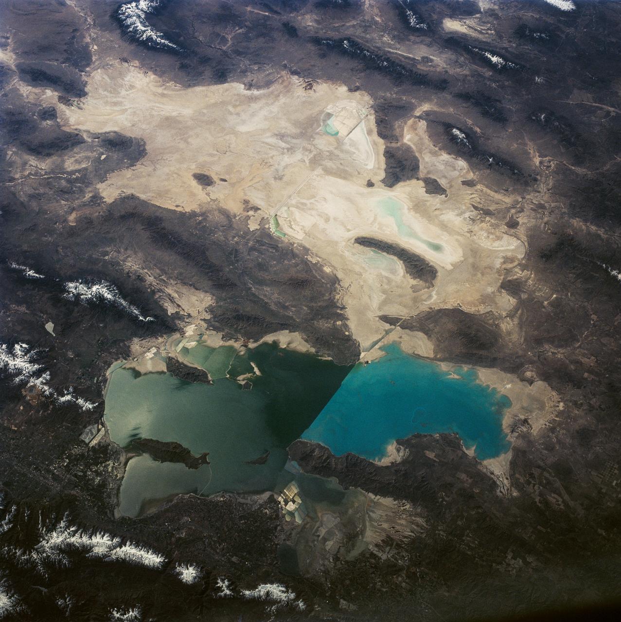
iss073e0886770 (Oct. 1, 2025) --- Laguna Salada is a dry lakebed in the Baja California portion of the Sonoran Desert, located near the geologically active San Andreas Fault system. The International Space Station was orbiting 261 miles above Earth when this image was taken.
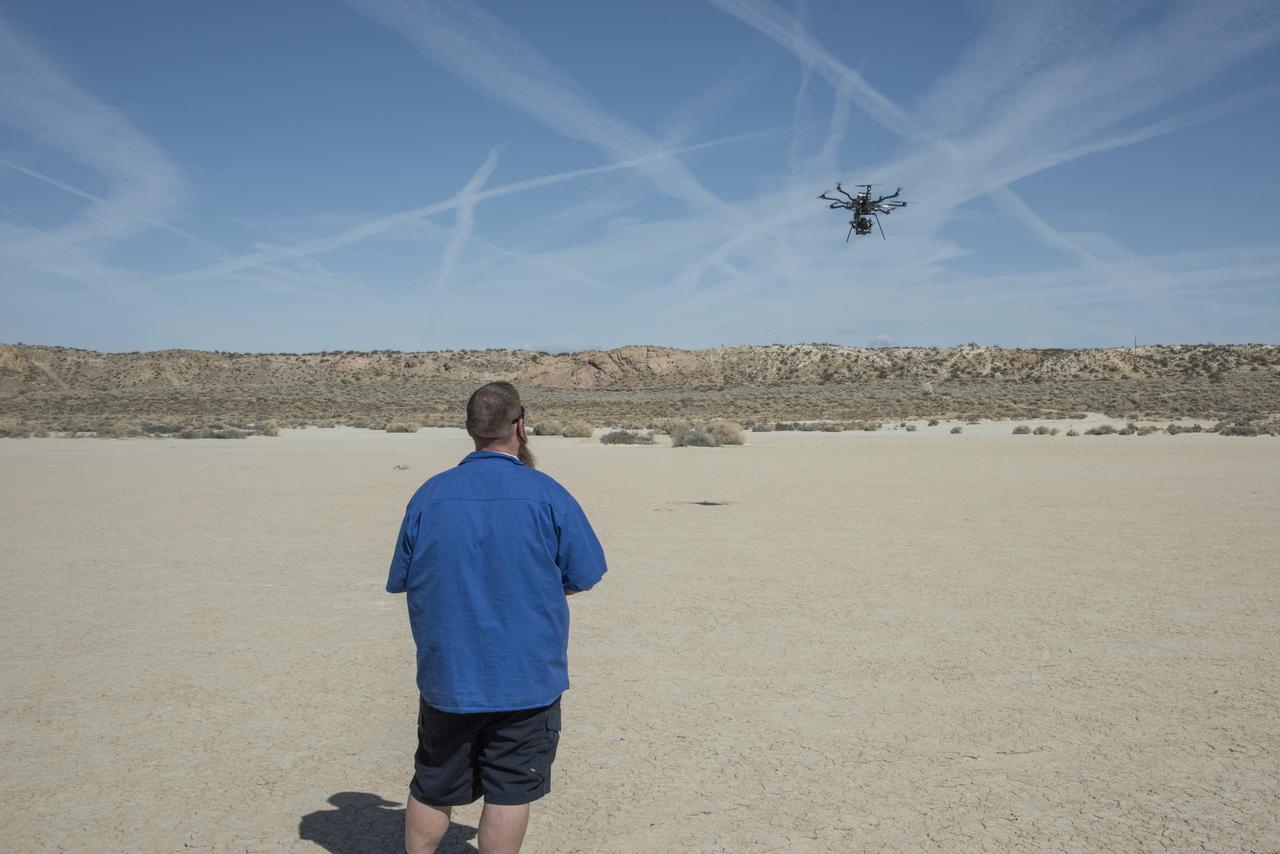
Justin Hall flies the Alta 8 remotely piloted aircraft in March 2021 at Rosamond North Lakebed at NASA’s Armstrong Flight Research Center in Edwards, California. The Resilient Autonomy project used these flights to collect data with the Nav Module hardware and software developed by NASA’s Jet Propulsion Laboratory in Pasadena, California.
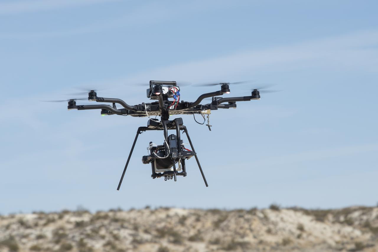
The Alta 8 remotely piloted aircraft hovers above Rosamond North Lakebed in March 2021 at NASA's Armstrong Flight Research Center in Edwards, California. The Resilient Autonomy project used these flights to collect data with the Nav Module hardware and software developed by NASA's Jet Propulsion Laboratory in Pasadena, California.
John Manke is shown here on the lakebed next to the HL-10, one of four different lifting-body vehicles he flew, including the X-24B, which he flew 16 times. His final total was 42 lifting-body flights.
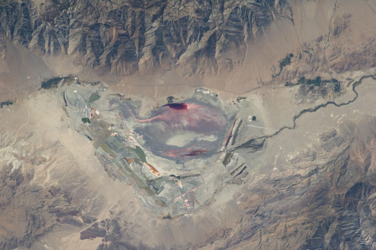
ISS028-E-035137 (30 Aug. 2011) --- Owens Lake in California is featured in this image photographed by an Expedition 28 crew member on the International Space Station. This photograph highlights the mostly dry bed of Owens Lake, located in the Owens River Valley between the Inyo Mountains and the Sierra Nevada. Shallow groundwater, springs, and seeps support minor wetlands and a central brine pool. Two bright red areas along the margins of the brine pool indicate the presence of halophilic, or salt-loving organisms known as Achaeans. Grey and white materials within the lake bed are exposed lakebed sediments and salt crusts. The towns of Olancha and Lone Pine are delineated by the presence of green vegetation indicating a more constant availability of water. According to scientists, the present-day Owens Lake was part of a much larger lake and river system that existed during the Pleistocene Epoch (approximately 3 million to approximately 12,000 years ago) along the current northeastern border of California with Nevada. Meltwater from alpine glaciers in the Sierra Nevada filled the regional valleys of the Basin and Range to form several glacial lakes that were ancestral to the now-dry lakebeds (or playas) of Owens, Searles Lake, and China Lake. While Searles and China Lakes dried out due to regional changes to a hotter and drier climate over thousands of years, Owens Lake became desiccated largely due to the diversion of Owens River water in the early 20th century to serve the needs of the City of Los Angeles, CA located 266 kilometers to the south. Following complete desiccation of the lakebed in 1926, significant amounts of windblown dust were produced ? indeed, the term ?Keeler fog? was coined by residents of the now largely abandoned town on the eastern side of Owens Lake due to the dust. In addition to adverse health effects on local residents, dust from Owens Lake has been linked to visibility reduction in nearby national parks, forests, and wilderness areas. Recently, efforts to control dust evolution from the lakebed have been undertaken by the City of Los Angeles.
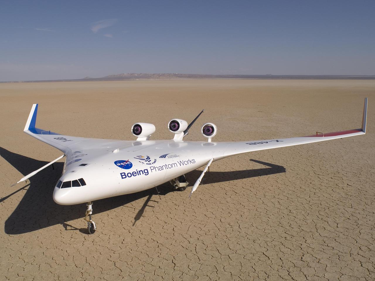
Boeing's sub-scale X-48B Blended Wing Body technology demonstrator showed off its unique lines on the vast expanse of Rogers Dry Lake adjacent to NASA Dryden.
An image taken at the Hidden Valley site, en-route to Mount Sharp, by NASA Curiosity rover. A variety of mudstone strata in the area indicate a lakebed deposit, with river- and stream-related deposits nearby. Decoding the history of how these sedimentary rocks were formed, and during what period of time, was a key component in the confirming of the role of water and sedimentation in the formation of the floor of Gale Crater and Mount Sharp. This image was taken by the Mast Camera (Mastcam) on Curiosity on the 703rd Martian day, or sol, of the mission. Malin Space Science Systems, San Diego, built and operates Curiosity's Mastcam. NASA's Jet Propulsion Laboratory, a division of the California Institute of Technology, Pasadena, built the rover and manages the project for NASA's Science Mission Directorate, Washington. http://photojournal.jpl.nasa.gov/catalog/PIA19840
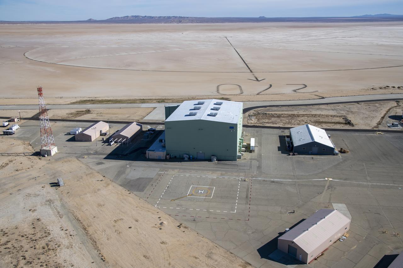
An aerial image taken by one of NASA's photographers during recent helicopter flights shows a view of the windward helipad and surrounding areas and structures that the Advanced Air Mobility National Campaign used during flight research at NASA's Armstrong Flight Research Center in Edwards, California. Part of the compass rose on the Edwards Air Force Base dry lakebed can also be seen.
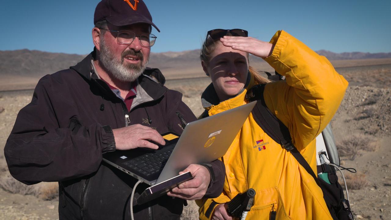
Michael Tuite and Rachel Kronyak of NASA's Jet Propulsion Laboratory in a dry lakebed in the Nevada desert. During the February 2020 exercise, they served as part of a field team that stood in as Mars a rover, receiving commands to seek out images and other data for review by scientists who will work with NASA's Perseverance Mars rover. https://photojournal.jpl.nasa.gov/catalog/PIA23892

S85-41802 (7 Sept 1985) --- Wheels of the Space Shuttle Atlantis touch down on the dry lakebed at Edwards Air Force Base to mark successful completion of the STS 51-J mission. Crewmembers onboard for the flight were Astronauts Karol J. Bobko, Ronald J. Grabe, David C. Hilmers, and Robert L. Stewart; and USAF Maj. William A. Pailes.
51F-46-100 (29 July-6 Aug 1985) --- The remarkable 51-F mission would end at Edwards Air Force Base, lakebed runway 23 at the center of the photograph. The San Andres Fault gashes across the lower left corner of the photo as does the Garlock fault at the upper left corner. The California Aqueduct can be traced from left center to lower right corner.
The oval shaped basin of the sedimentary rocks of the Hammersley Range, northern Western Australia (23.0S, 119.0E) dominates the center of this near nadir view. The Fortescue River is the remarkably straight, fault controlled feature bordering the Hammersley on the north. Sand dunes are the main surface features in the northeast and southwest. Many dry lakebeds can be seen to the east as light grey colored patches along the watercourses.
This is a view of the Great Salt Lake and nearby Bonneville Salt Flats, UT, (41.0N, 112.5W). A railroad causeway divides the lake with a stark straight line changing the water level and chemistry of the lake as a result. Fresh water runoff enters from the south adding to the depth and reducing the salinity. The north half receives little frsh water and is more saline and shallow. The Bonnieville Salt Flats is the lakebed of a onetime larger lake.
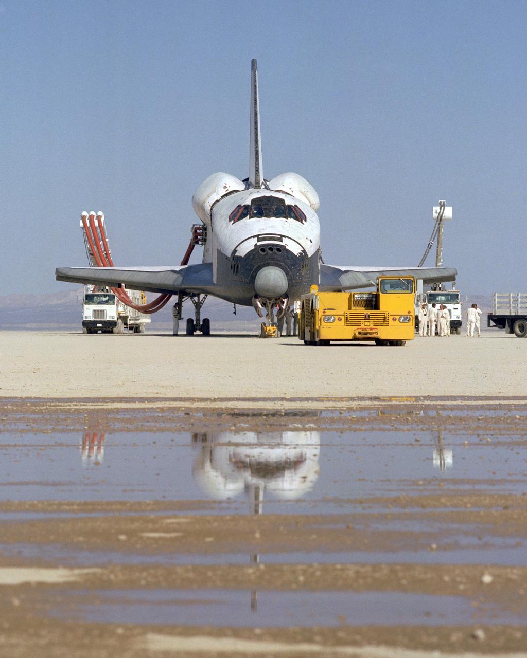
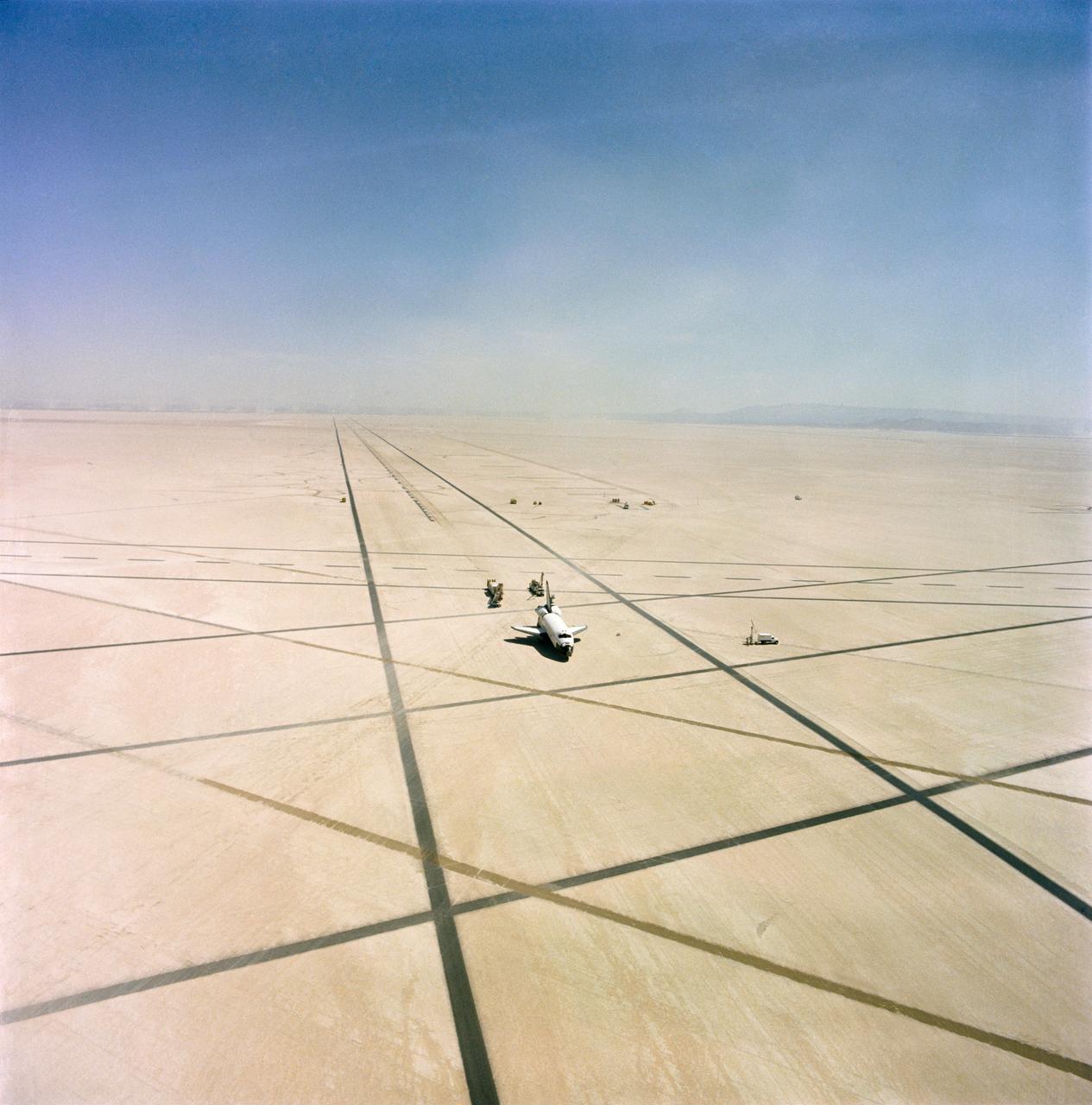
S82-39888 (16 Nov. 1982) --- Post-landing processing of the space shuttle Columbia is seen in double in this rare scene at the Dryden Flight Research Facility (DFRF) in southern California. Uncommon rainwater has given a mirror effect to the normally dry lakebed. Columbia, with its first four-member crew aboard, touched down earlier today to complete a successful five-day, two-hour mission. The runway used was Number 22 at Edwards Air Force Base. Photo credit: NASA
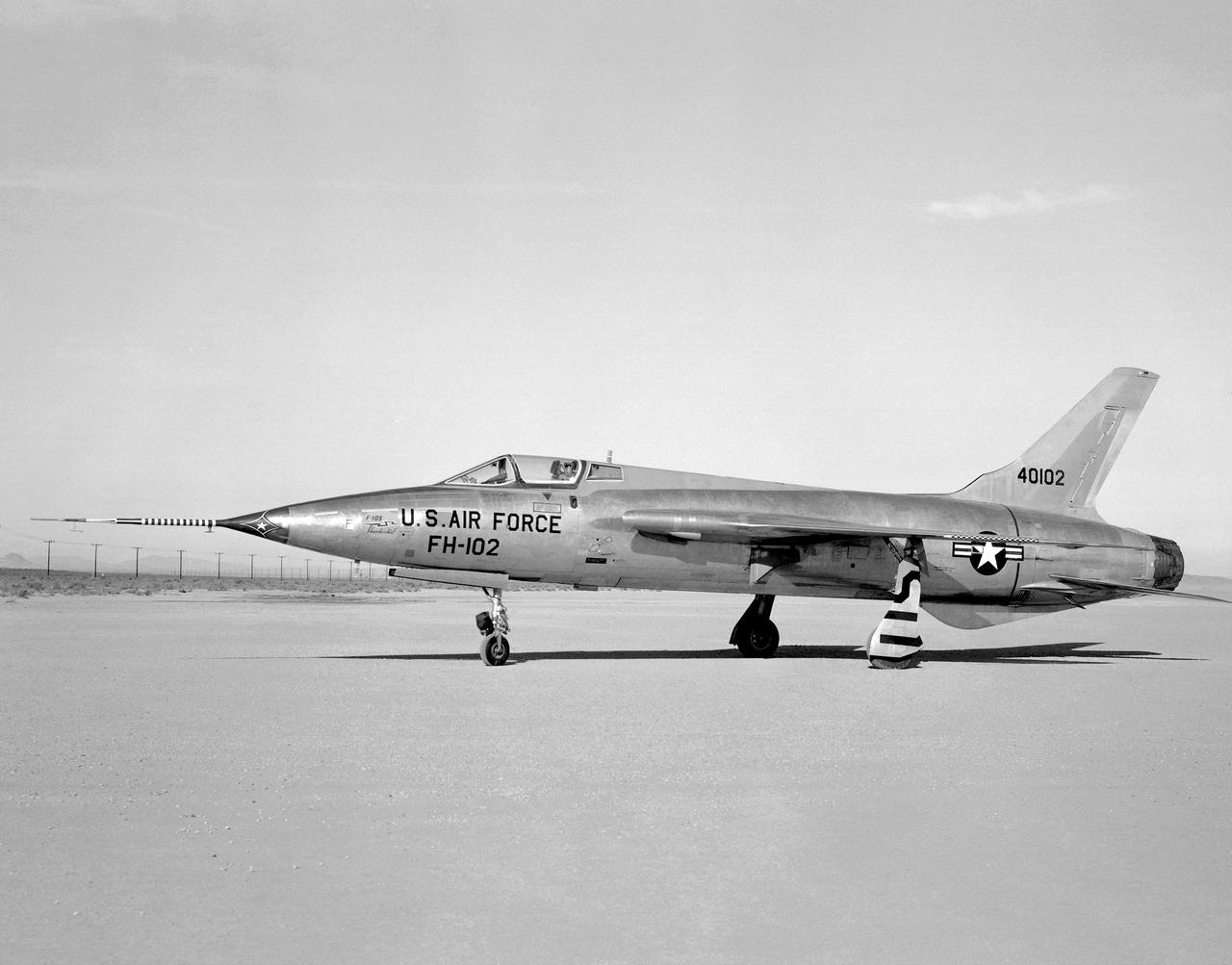
Side view of a F-105B (serial #54-0102) photographed on Rogers Dry Lakebed at Edwards Air Force Base, California in 1959. The black stripes across the left wheel-panel complete the lettering on the bottom of the wing when wheels are retracted. Two of the F-105B characteristics are fuselage length of 61 feet 1.33 inches and a wing area of 385.0 square feet.
A Rans S-12 remotely piloted "mothership" takes off from a lakebed runway carrying a Spacewedge research model during 1992 flight tests. The Spacewedge was lauched in flight from the Rans S-12 aircraft and then glided back to a landing under a steerable parafoil. Technology tested in the Spacewedge program was used in developing the X-38 research vehicle.
NASA's X-38, a research vehicle developed as part of an effort to build an emergency Crew Return Vehicle (CRV) for the International Space Station, descends toward a desert lakebed under its steerable parafoil on its second free flight. The X-38 was launched from NASA Dryden's B-52 Mothership on Saturday, February 6, 1999, from an altitude of approximately 23,000 feet.
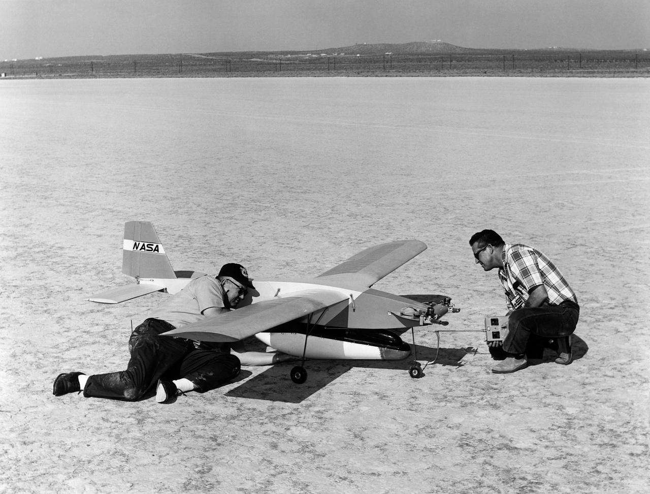
A photo of model airplane builders James B. Newman and Robert L. McDonald preparing for a flight with models of the M2-F2 and a “Mothership”. In 1968 a test flight was made on the Rosamond dry lakebed, Rosamond, California. The original idea of lifting bodies was conceived about 1957 by Dr. Alfred J. Eggers, Jr., then the assistant director for Research and Development Analysis and Planning at the National Advisory Committee for Aeronautics' Ames Aeronautical Laboratory, Moffett Field, California. Nose cone studies led to the design known as the M-2, a modified half-cone, rounded on the bottom and flat on top, with a blunt, rounded nose and twin tail fins. To gather flight data on this configuration, models were found to be an effective method. A special twin-engined, 14-foot model “mothership” was used for carrying the M2-F2 model to altitude and a launch, much as was being done with the B-52 for the full-scale lifting bodies. Jim (on the left) will fly the “mothership” and Bob will take control of the M2-F2 at launch and fly it to a landing on the lakebed.
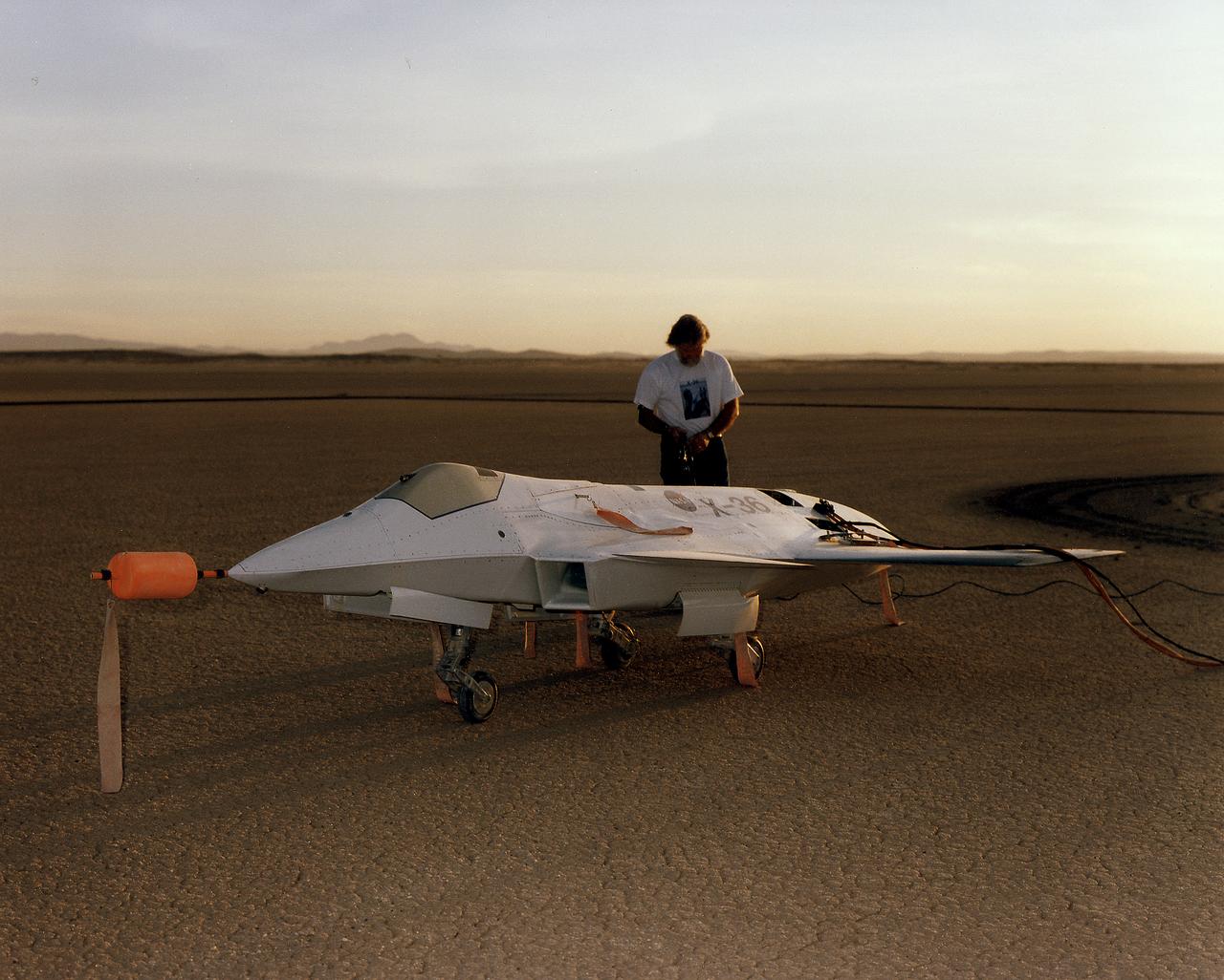
Lit by the rays of the morning sunrise on Rogers Dry Lake, adjacent to NASA's Dryden Flight Research Center, Edwards, California, a technician prepares the remotely-piloted X-36 Tailless Fighter Agility Research Aircraft for its first flight on May 17, 1997.
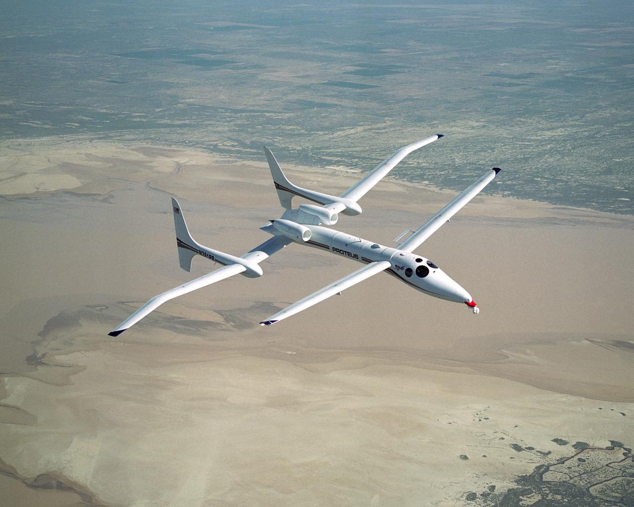
Scaled Composites' unique tandem-wing Proteus was the testbed for a series of UAV collision-avoidance flight demonstrations. An Amphitech 35GHz radar unit installed below Proteus' nose was the primary sensor for the Detect, See and Avoid tests.
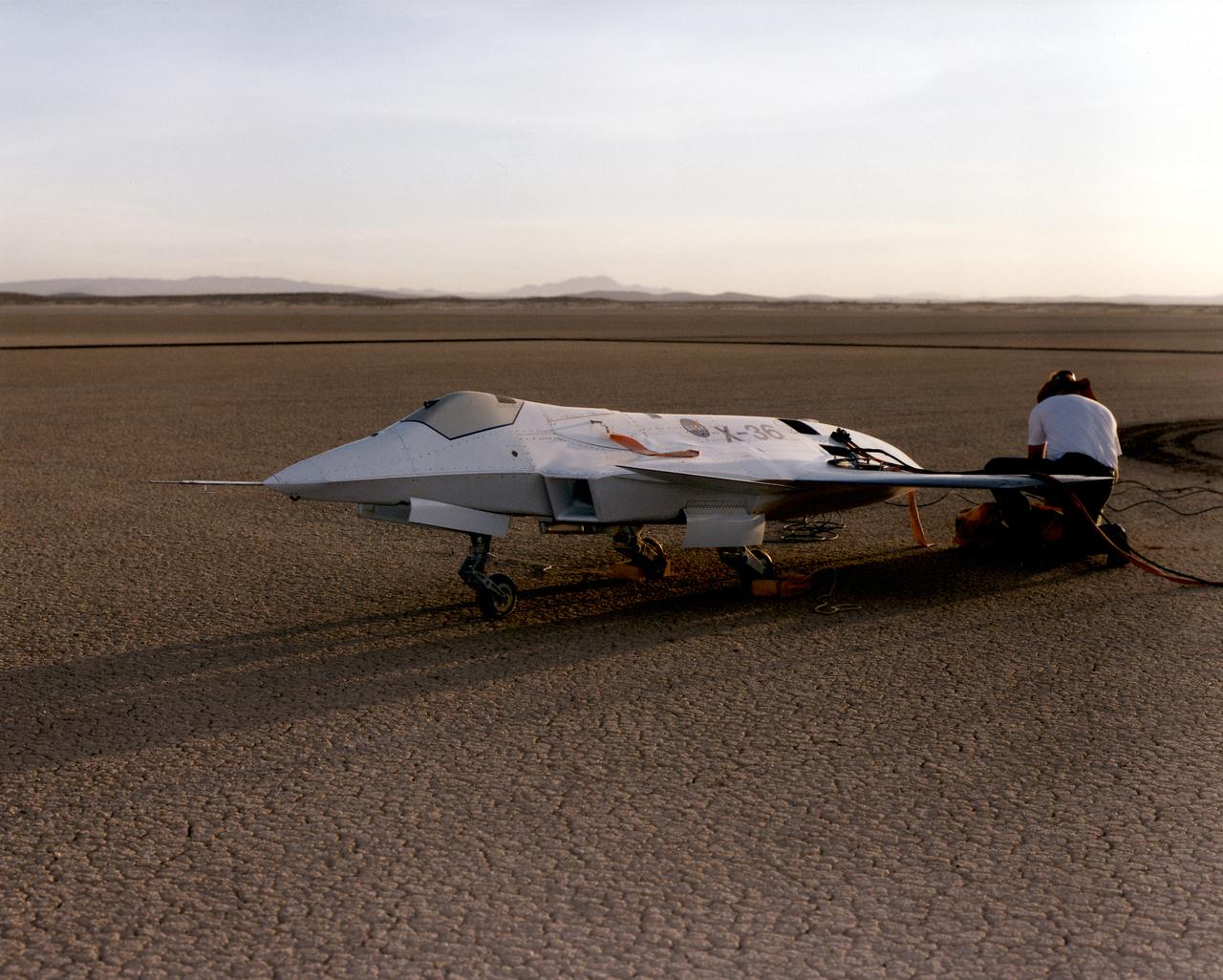
Lit by the rays of the morning sunrise on Rogers Dry Lake, adjacent to NASA's Dryden Flight Research Center, Edwards, California, technicians prepare the remotely-piloted X-36 Tailless Fighter Agility Research Aircraft for its first flight in May 1997.
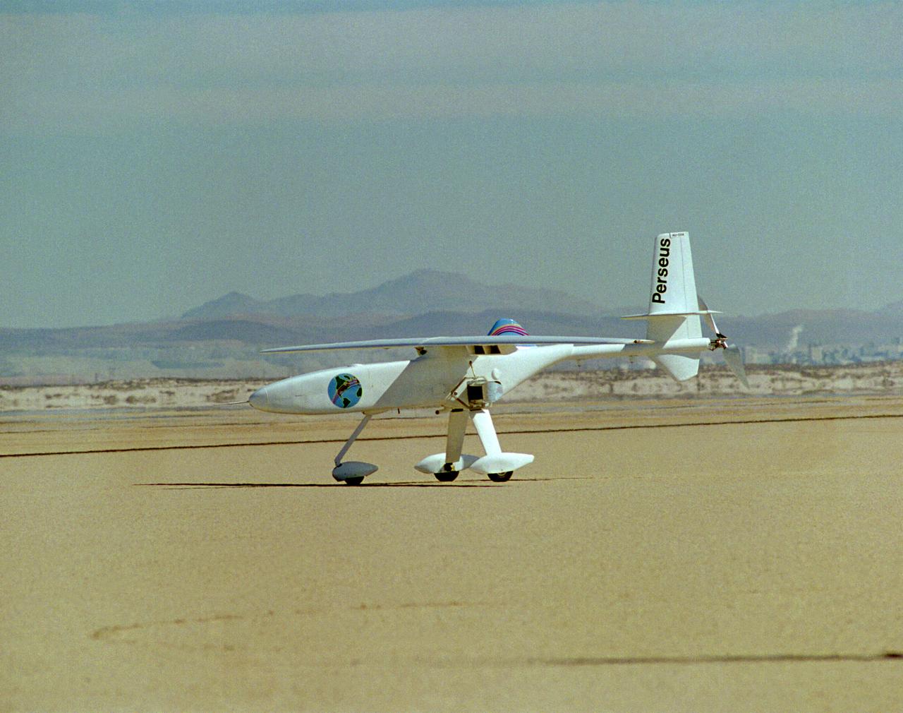
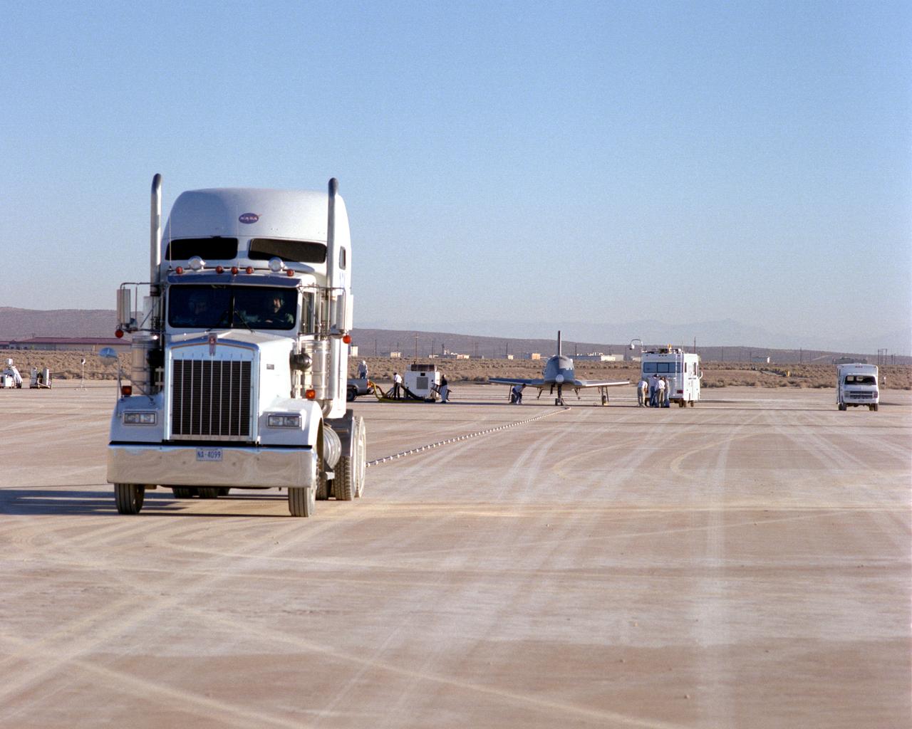
One of NASA's unmanned, remotely controlled aircraft, the Perseus B, is seen here before its first flight at the Dryden Flight Research Center, Edwards, California.
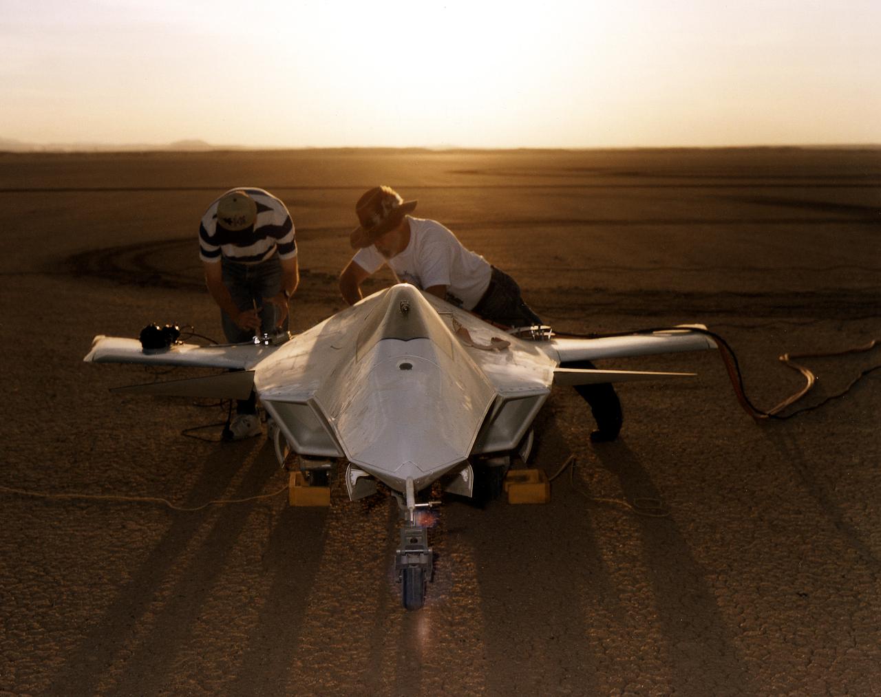
As the sun creeps above the horizon of Rogers Dry Lake at NASA's Dryden Flight Research Center, Edwards, California, technicians make final preparations for the first flight of the X-36 Tailless Fighter Agility Research Aircraft.
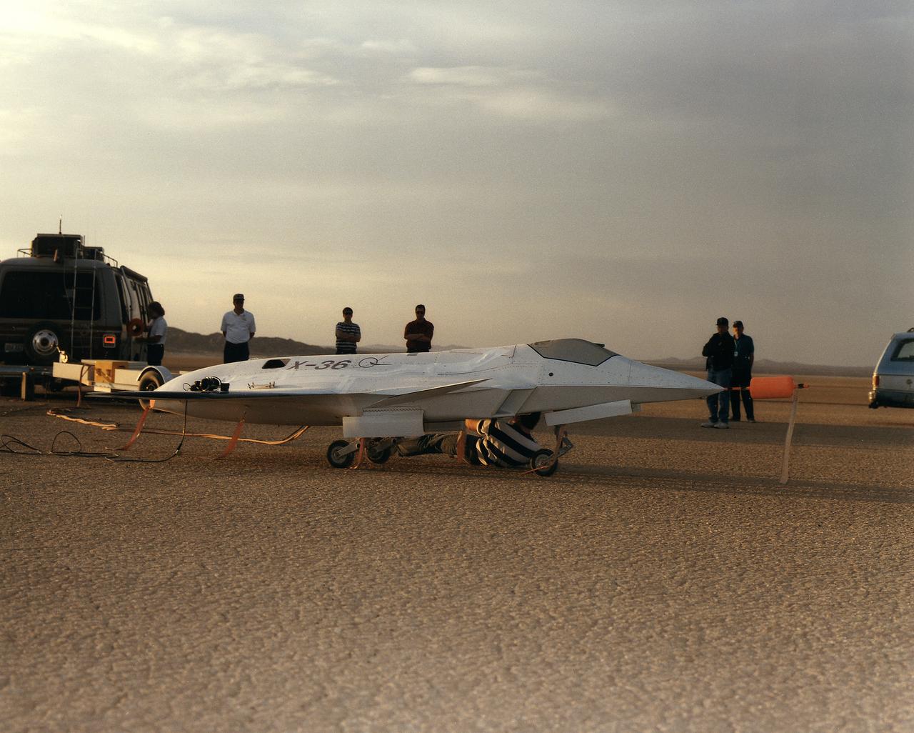
Lit by the rays of the morning sunrise on Rogers Dry Lake, adjacent to NASA's Dryden Flight Research Center, Edwards, California, technicians prepares the remotely-piloted X-36 Tailless Fighter Agility Research Aircraft for its first flight on May 17, 1997.
The Pathfinder solar-powered aircraft sits on Rogers Dry Lake at NASA's Dryden Flight Research Center, Edwards, California, before a research flight.
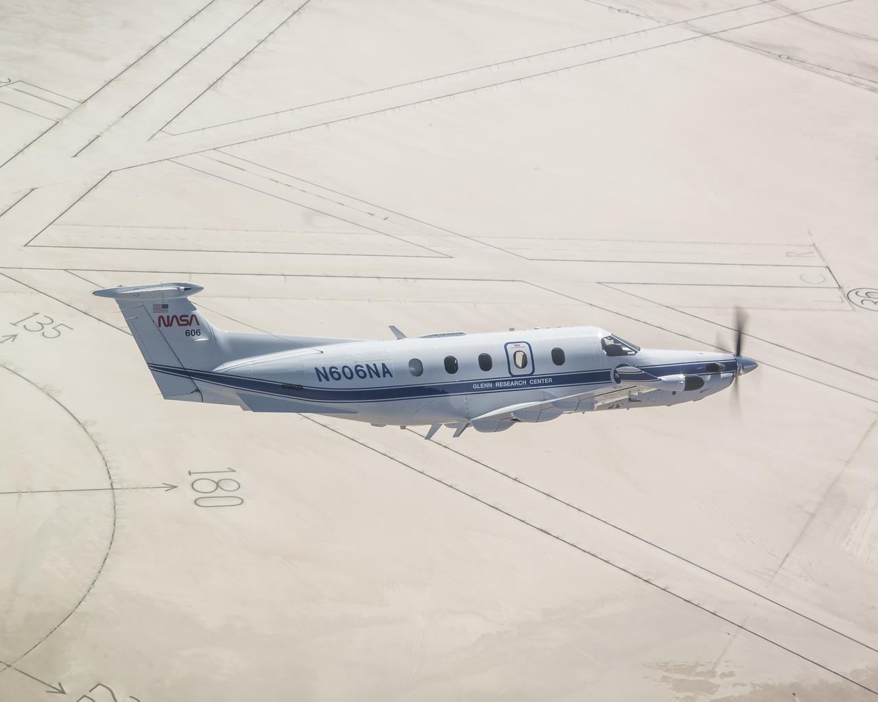
Based out of NASA’s Glenn Research Center in Cleveland, the Pilatus PC-12 is flying over the compass rose in the Roger’s Dry Lakebed at NASA’s Armstrong Flight Research Center, in Edwards, California. The compass rose is more than 4,000 feet in diameter and aligned to magnetic north, to test navigation equipment on aircraft. The Pilatus PC-12 tests communications technology for the emerging Advanced Air Mobility ecosystem. Pilots and crew from both centers perform familiarization flights to prepare for Automatic Dependent Surveillance Broadcast (ADS-B) systems tests between the aircraft and ping-Stations on the ground at Armstrong Flight Research Center. These flights are the first cross-center activity with the Pilatus-PC-12 at Armstrong Flight Research Center.
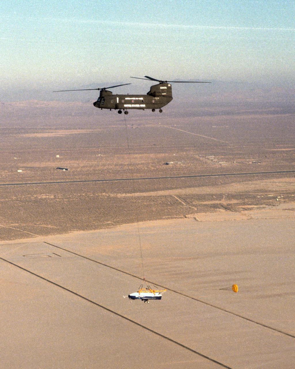
The X-40 sub-scale technology demonstrator and its U.S. Army CH-47 Chinook helicopter mothership fly over a dry lakebed runway during a captive-carry test flight from NASA's Dryden Flight Research Center, Edwards, California. The X-40 is attached to a sling which is suspended from the CH-47 by a 110-foot-long cable during the tests, while a small parachute trails behind to provide stability. The captive carry flights are designed to verify the X-40's navigation and control systems, rigging angles for its sling, and stability and control of the helicopter while carrying the X-40 on a tether. Following a series of captive-carry flights, the X-40 made free flights from a launch altitude of about 15,000 feet above ground, gliding to a fully autonomous landing. The X-40 is an unpowered 82 percent scale version of the X-37, a Boeing-developed spaceplane designed to demonstrate various advanced technologies for development of future lower-cost access to space vehicles.

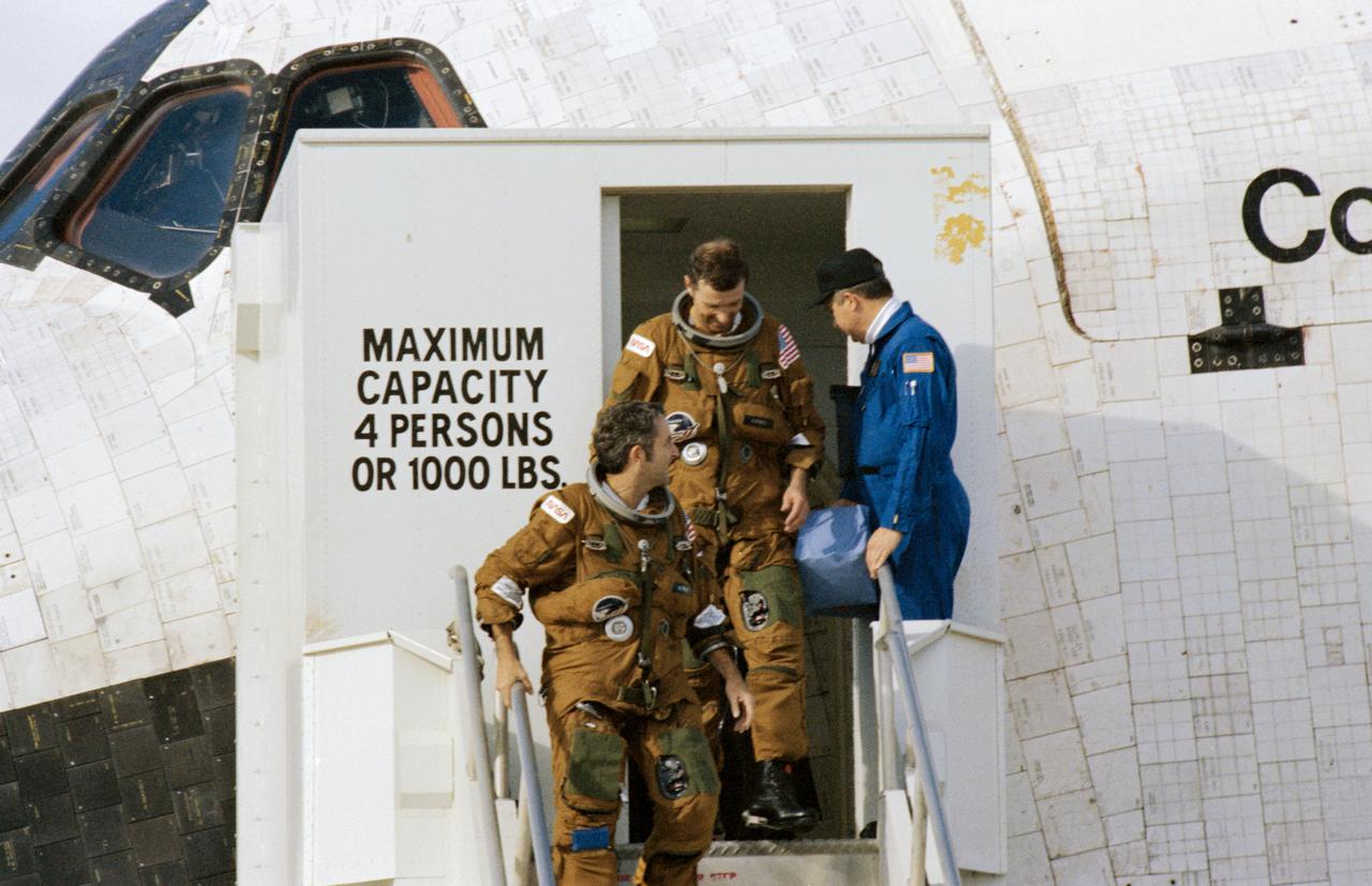
STS030-S-132 (8 May 1989) --- Crewmembers who spent just over four full days in space aboard Space Shuttle Atlantis egress their temporary home for a welcome meeting with terra firma. Pictured, from bottom of steps to top, are astronauts David M. Walker, Ronald J. Grabe, Norman E. Thagard, Mary L. Cleave and Mark C. Lee. Minutes earlier, the spacecraft?s landing gear came to a stop at 12:44:33 P.M. (PDT), 8 May 1989. It landed on runway 22, a concrete facility, like a number of other NASA flights. Still others have landed on unpaved dry lakebed stripes.
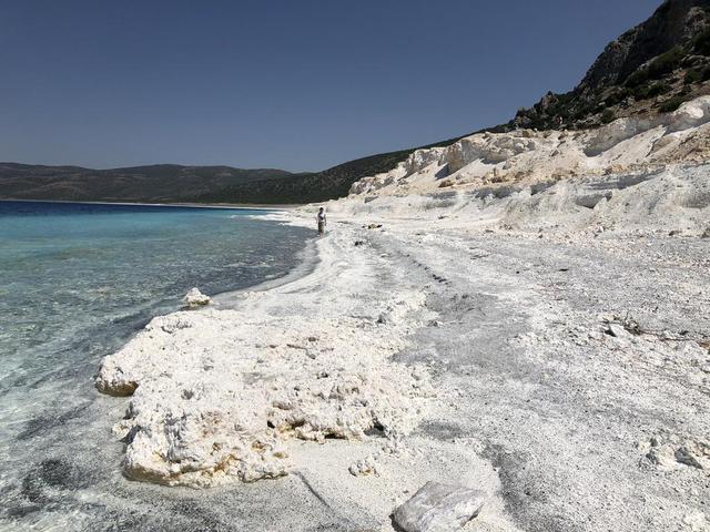
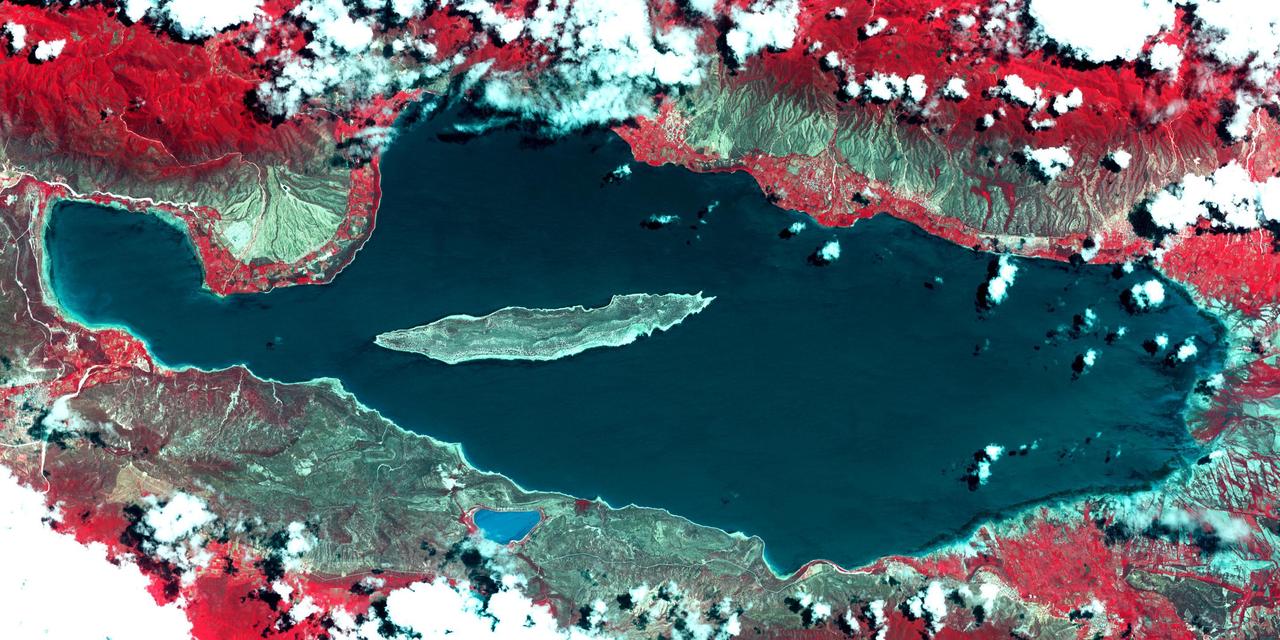
The eastern shore of Lake Salda in Turkey is a good analog for what an ancient lake may have looked like at Jezero Carter on Mars. The white sands and rocks are carbonate minerals that precipitated in the lake. The terraces on the right are old shorelines from when the lake levels were higher, where dried-out sediments have now cemented. These types of deposits might be present along the former shorelines at Jezero. What's more, these deposits might contain signs of microbes, if they ever existed on the Red Planet. NASA's Mars 2020 Perseverance mission will search for signs of ancient life in an dried-up lakebed on the surface of Mars. https://photojournal.jpl.nasa.gov/catalog/PIA24375
Lake Enriquillo is a hypersaline lake in the Dominican Republic. In 2004, the lake covered an area of 164 square kilometers; by 2011, it had doubled in size and grown to 350 km2, inundating farmland and homes. Various reasons for the flooding include increases in rainfall; increase of sediments going into the lake, raising the lakebed; and milder temperatures, reducing surface evaporation. The lake is home to the largest population of American crocodiles in the Caribbean. The images were acquired October 26, 2003 and June 10, 2017, cover an area of 22.7 by 45.4 km, and are located at 18.5 degrees north, 71.6 degrees west. An image of Lake Enriquillo taken in 2003 is available at https://photojournal.jpl.nasa.gov/catalog/PIA21815
Aboard a truck and ready for a test flight is the Paresev 1-C on the ramp at the NASA Flight Research Center, Edwards, California. The half-scale version of the inflatable Gemini parawing was pre-flighted by being carried across the Rosamond dry lakebed on the back of a truck before a tow behind a International Harvester Carry-All. The inflatable center spar ran fore and aft and measured 191 inches, two other inflatable spars formed the leading edges. The three compartments were filled with nitrogen under pressure to make them rigid. The Paresev 1-C was very unstable in flight with this configuration.
STS030-S-123 (8 May 1989) --- The Space Shuttle Atlantis glides toward a landing on the Mojave Desert after spending just over four full days in space. Aboard were astronauts David. M. Walker, Ronald J. Grabe, Norman E. Thagard, Mary L. Cleave and Mark C. Lee. Moments later, the spacecraft?s landing gear came to a stop at 12:44:33 P.M. (PDT), 8 May 1989. It landed on runway 22, a concrete facility, like a number of other NASA flights. Still others have landed on unpaved dry lakebed strips.