
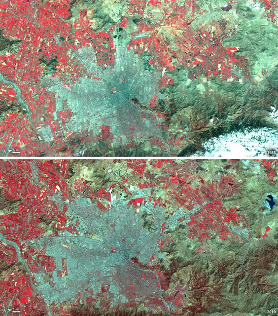
Istanbul has been a bustling trade city for thousands of years. In this 1975 image, taken by Landsat, the city centers on the Golden Horn the estuary that flows into the Bosporus Straight at the center of the scene. Shown in false color, vegetation is red, urban areas are gray, and water appears black. A bridge built in 1973 to connect the Asian and European sides of Istanbul is barely visible. By 2011, Istanbul's population had exploded from 2 to 13 million people, and the city has gone through a dramatic expansion. This Landsat 5 image shows densely packed urban areas stretching along the Sea of Marmara and up the Bosporus Straight where a second bridge built in 1988 now crosses the water. ---- NASA and the U.S. Department of the Interior through the U.S. Geological Survey (USGS) jointly manage Landsat, and the USGS preserves a 40-year archive of Landsat images that is freely available over the Internet. The next Landsat satellite, now known as the Landsat Data Continuity Mission (LDCM) and later to be called Landsat 8, is scheduled for launch in 2013. In honor of Landsat’s 40th anniversary in July 2012, the USGS released the LandsatLook viewer – a quick, simple way to go forward and backward in time, pulling images of anywhere in the world out of the Landsat archive. <b><a href="http://www.nasa.gov/audience/formedia/features/MP_Photo_Guidelines.html" rel="nofollow">NASA image use policy.</a></b> <b><a href="http://www.nasa.gov/centers/goddard/home/index.html" rel="nofollow">NASA Goddard Space Flight Center</a></b> enables NASA’s mission through four scientific endeavors: Earth Science, Heliophysics, Solar System Exploration, and Astrophysics. Goddard plays a leading role in NASA’s accomplishments by contributing compelling scientific knowledge to advance the Agency’s mission. <b>Follow us on <a href="http://twitter.com/NASA_GoddardPix" rel="nofollow">Twitter</a></b> <b>Like us on <a href="http://www.facebook.com/pages/Greenbelt-MD/NASA-Goddard/395013845897?ref=tsd" rel="nofollow">Facebook</a></b> <b>Find us on <a href="http://instagrid.me/nasagoddard/?vm=grid" rel="nofollow">Instagram</a></b>
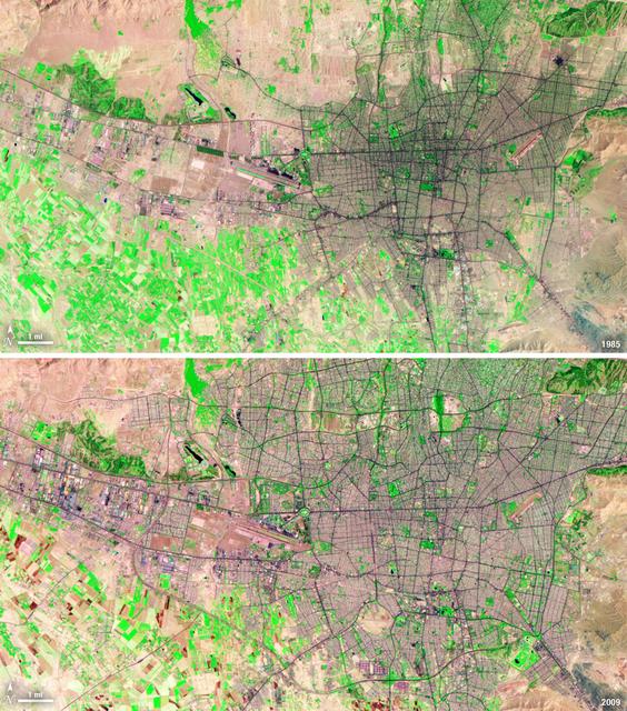
Santiago, Chile, ranks among the world's fastest growing cities. Chile is South America's fifth largest economy with strong export and tourism markets. More than a third of Chile's population lives in Santiago as of 2009. Taken on January 9, 1985, and January 30, 2010, this pair of images from the Landsat 5 satellite illustrates the city's steady growth. The images were made with infrared and visible light (Landsat bands 4, 3, and 2) so that plant-covered land is red. Bare or sparsely vegetated land is tan, and the city is dark silver. In the fifteen years that elapsed between 1985 and 2010, the city expanded away from the Andes Mountains along spoke-like lines, which are major roads. ---- NASA and the U.S. Department of the Interior through the U.S. Geological Survey (USGS) jointly manage Landsat, and the USGS preserves a 40-year archive of Landsat images that is freely available over the Internet. The next Landsat satellite, now known as the Landsat Data Continuity Mission (LDCM) and later to be called Landsat 8, is scheduled for launch in 2013. In honor of Landsat’s 40th anniversary in July 2012, the USGS released the LandsatLook viewer – a quick, simple way to go forward and backward in time, pulling images of anywhere in the world out of the Landsat archive. <b><a href="http://www.nasa.gov/audience/formedia/features/MP_Photo_Guidelines.html" rel="nofollow">NASA image use policy.</a></b> <b><a href="http://www.nasa.gov/centers/goddard/home/index.html" rel="nofollow">NASA Goddard Space Flight Center</a></b> enables NASA’s mission through four scientific endeavors: Earth Science, Heliophysics, Solar System Exploration, and Astrophysics. Goddard plays a leading role in NASA’s accomplishments by contributing compelling scientific knowledge to advance the Agency’s mission. <b>Follow us on <a href="http://twitter.com/NASA_GoddardPix" rel="nofollow">Twitter</a></b> <b>Like us on <a href="http://www.facebook.com/pages/Greenbelt-MD/NASA-Goddard/395013845897?ref=tsd" rel="nofollow">Facebook</a></b> <b>Find us on <a href="http://instagrid.me/nasagoddard/?vm=grid" rel="nofollow">Instagram</a></b>

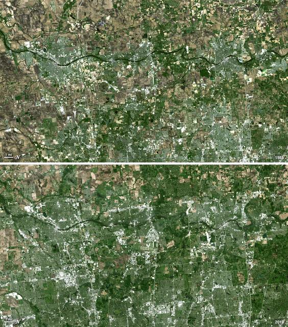
Over the last 25 years, Chandler, Arizona has traded its grid of fields for a grid of streets. Founded in 1912 on cotton, grains, alfalfa, and ostrich farms, brown and green irrigated fields still dominate the region southeast of Phoenix in this 1985 natural color image taken by Landsat 5. By 2011, the blue gray city streets in this Landsat 5 image have taken over. Chandler's economy has shifted from agriculture to manufacturing and electronics, and its population boomed from 30,000 people in 1980 to 236,000 in 2010. ---- Survey (USGS) jointly manage Landsat, and the USGS preserves a 40-year archive of Landsat images that is freely available over the Internet. The next Landsat satellite, now known as the Landsat Data Continuity Mission (LDCM) and later to be called Landsat 8, is scheduled for launch in 2013. In honor of Landsat’s 40th anniversary in July 2012, the USGS released the LandsatLook viewer – a quick, simple way to go forward and backward in time, pulling images of anywhere in the world out of the Landsat archive. <b><a href="http://www.nasa.gov/audience/formedia/features/MP_Photo_Guidelines.html" rel="nofollow">NASA image use policy.</a></b> <b><a href="http://www.nasa.gov/centers/goddard/home/index.html" rel="nofollow">NASA Goddard Space Flight Center</a></b> enables NASA’s mission through four scientific endeavors: Earth Science, Heliophysics, Solar System Exploration, and Astrophysics. Goddard plays a leading role in NASA’s accomplishments by contributing compelling scientific knowledge to advance the Agency’s mission. <b>Follow us on <a href="http://twitter.com/NASA_GoddardPix" rel="nofollow">Twitter</a></b> <b>Like us on <a href="http://www.facebook.com/pages/Greenbelt-MD/NASA-Goddard/395013845897?ref=tsd" rel="nofollow">Facebook</a></b> <b>Find us on <a href="http://instagrid.me/nasagoddard/?vm=grid" rel="nofollow">Instagram</a></b>
Between 1985 and 2009, the population of Tehran, Iran, grew from six million to just over seven million. The city's growth was spurred largely by migration from other parts of the country. In addition to being the hub of government and associated public sector jobs, Tehran houses more than half of Iran's industry. Landsat 5 acquired these false-color images of Tehran on August 2, 1985, and July 19, 2009. The city is a web of dark purple lines, vegetation is green and bare ground is pink and tan. The images were created using both infrared and visible light (band combination 7, 4, and 2) to distinguish urban areas from the surrounding desert. ---- NASA and the U.S. Department of the Interior through the U.S. Geological Survey (USGS) jointly manage Landsat, and the USGS preserves a 40-year archive of Landsat images that is freely available over the Internet. The next Landsat satellite, now known as the Landsat Data Continuity Mission (LDCM) and later to be called Landsat 8, is scheduled for launch in 2013. In honor of Landsat’s 40th anniversary in July 2012, the USGS released the LandsatLook viewer – a quick, simple way to go forward and backward in time, pulling images of anywhere in the world out of the Landsat archive. <b><a href="http://www.nasa.gov/audience/formedia/features/MP_Photo_Guidelines.html" rel="nofollow">NASA image use policy.</a></b> <b><a href="http://www.nasa.gov/centers/goddard/home/index.html" rel="nofollow">NASA Goddard Space Flight Center</a></b> enables NASA’s mission through four scientific endeavors: Earth Science, Heliophysics, Solar System Exploration, and Astrophysics. Goddard plays a leading role in NASA’s accomplishments by contributing compelling scientific knowledge to advance the Agency’s mission. <b>Follow us on <a href="http://twitter.com/NASA_GoddardPix" rel="nofollow">Twitter</a></b> <b>Like us on <a href="http://www.facebook.com/pages/Greenbelt-MD/NASA-Goddard/395013845897?ref=tsd" rel="nofollow">Facebook</a></b> <b>Find us on <a href="http://instagrid.me/nasagoddard/?vm=grid" rel="nofollow">Instagram</a></b>
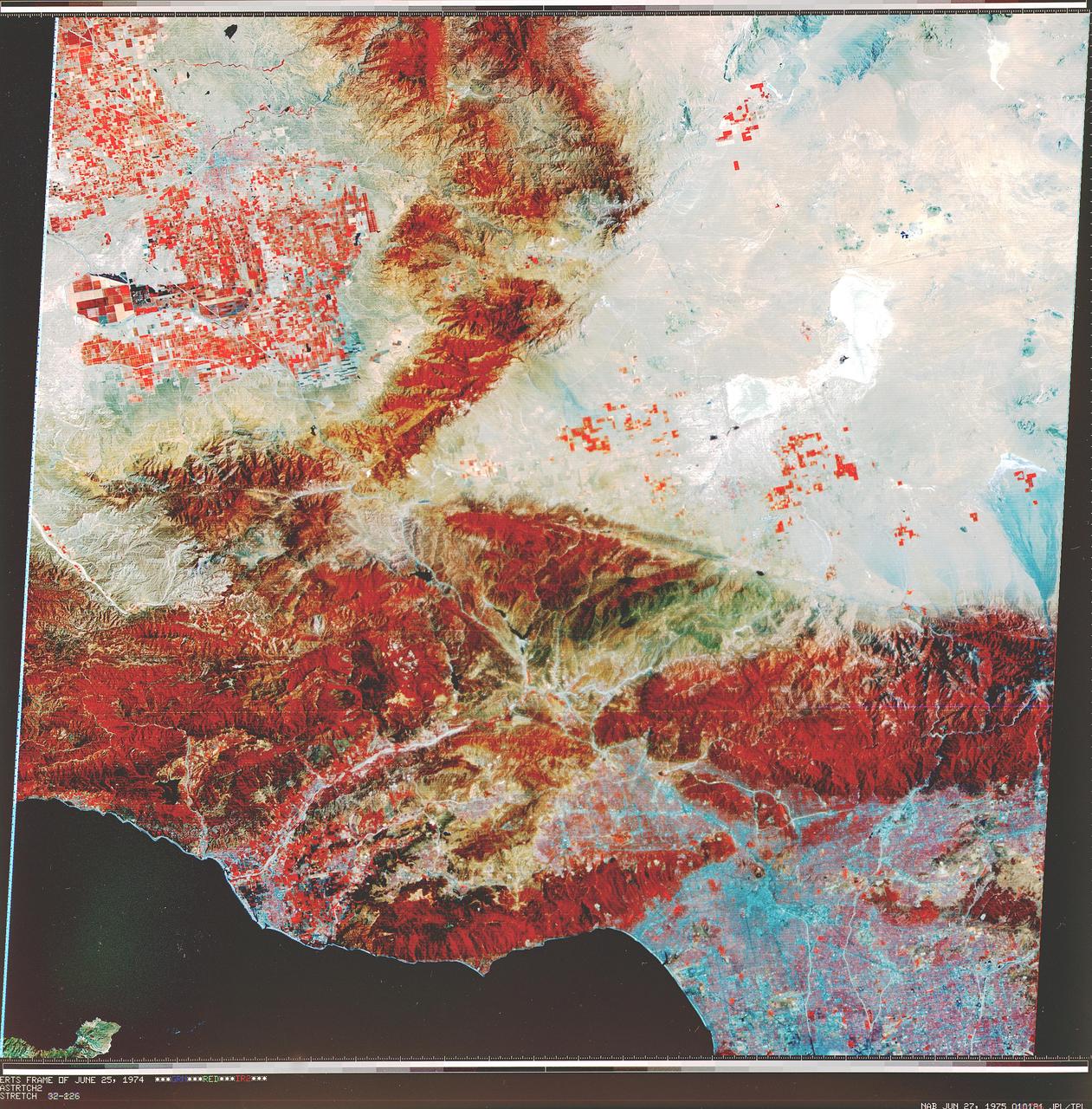
NASA Landsat 1 originally named the Earth Resources Technology Satellite, or ERTS was the first of what was to become a series of satellites designed to map and monitor the Earth land surfaces.
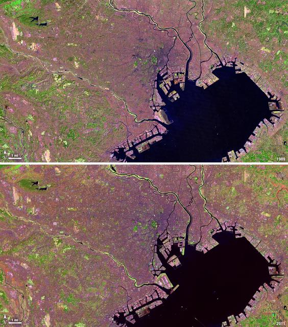
Tokyo is the world’s largest metropolitan region, home to nearly 37 million people. During the past two decades, Tokyo’s population has grown by more than 7 million. The city’s growth has continued despite Japan’s overall stagnating population, mainly due to a continued trend of centralization—citizens moving out of the country and into the city. Landsat 4 collected this first false-color image of Tokyo on Feb. 2, 1989. The upper half of Tokyo Bay is the large water body visible in a dark blue. In the middle of the image, central Tokyo appears a deep purple just north of the bay. Twenty-two years later, Landsat 5, captured this second image of Tokyo on April 5, 2011. The urban reaches of metropolitan Tokyo have grown in both distance and density, as seen where the green color of vegetation has turned to pink and purple shades of urbanization. A major expansion of Tokyo’s Haneda Airport, can be seen south of the city, on land built out into the bay. The constant circular spot of green in the dense city-center, visible on both images, is the Tokyo Imperial Palace and its gardens. (Landsat 5 TM Bands 7,4,2) ---- NASA and the U.S. Department of the Interior through the U.S. Geological Survey (USGS) jointly manage Landsat, and the USGS preserves a 40-year archive of Landsat images that is freely available over the Internet. The next Landsat satellite, now known as the Landsat Data Continuity Mission (LDCM) and later to be called Landsat 8, is scheduled for launch in 2013. In honor of Landsat’s 40th anniversary in July 2012, the USGS released the LandsatLook viewer – a quick, simple way to go forward and backward in time, pulling images of anywhere in the world out of the Landsat archive. <b><a href="http://www.nasa.gov/audience/formedia/features/MP_Photo_Guidelines.html" rel="nofollow">NASA image use policy.</a></b> <b><a href="http://www.nasa.gov/centers/goddard/home/index.html" rel="nofollow">NASA Goddard Space Flight Center</a></b> enables NASA’s mission through four scientific endeavors: Earth Science, Heliophysics, Solar System Exploration, and Astrophysics. Goddard plays a leading role in NASA’s accomplishments by contributing compelling scientific knowledge to advance the Agency’s mission. <b>Follow us on <a href="http://twitter.com/NASA_GoddardPix" rel="nofollow">Twitter</a></b> <b>Like us on <a href="http://www.facebook.com/pages/Greenbelt-MD/NASA-Goddard/395013845897?ref=tsd" rel="nofollow">Facebook</a></b> <b>Find us on <a href="http://instagrid.me/nasagoddard/?vm=grid" rel="nofollow">Instagram</a></b>
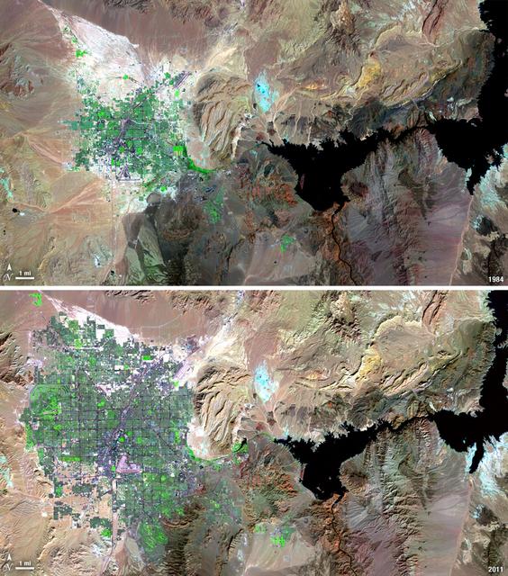
Over the years of the Landsat program, the desert city of Las Vegas has gone through a massive growth spurt. The outward expansion of the city over the last quarter of a century is shown here with two false-color Landsat 5 images (August 3, 1984, and November 2, 2011). The dark purple grid of city streets and the green of irrigated vegetation grow out in every direction into the surrounding desert. These images were created using reflected light from the shortwave infrared, near-infrared, and green portions of the electromagnetic spectrum (Landsat 5 TM bands 7,4,2). ---- NASA and the U.S. Department of the Interior through the U.S. Geological Survey (USGS) jointly manage Landsat, and the USGS preserves a 40-year archive of Landsat images that is freely available over the Internet. The next Landsat satellite, now known as the Landsat Data Continuity Mission (LDCM) and later to be called Landsat 8, is scheduled for launch in 2013. In honor of Landsat’s 40th anniversary in July 2012, the USGS released the LandsatLook viewer – a quick, simple way to go forward and backward in time, pulling images of anywhere in the world out of the Landsat archive. <b><a href="http://www.nasa.gov/audience/formedia/features/MP_Photo_Guidelines.html" rel="nofollow">NASA image use policy.</a></b> <b><a href="http://www.nasa.gov/centers/goddard/home/index.html" rel="nofollow">NASA Goddard Space Flight Center</a></b> enables NASA’s mission through four scientific endeavors: Earth Science, Heliophysics, Solar System Exploration, and Astrophysics. Goddard plays a leading role in NASA’s accomplishments by contributing compelling scientific knowledge to advance the Agency’s mission. <b>Follow us on <a href="http://twitter.com/NASA_GoddardPix" rel="nofollow">Twitter</a></b> <b>Like us on <a href="http://www.facebook.com/pages/Greenbelt-MD/NASA-Goddard/395013845897?ref=tsd" rel="nofollow">Facebook</a></b> <b>Find us on <a href="http://instagrid.me/nasagoddard/?vm=grid" rel="nofollow">Instagram</a></b>
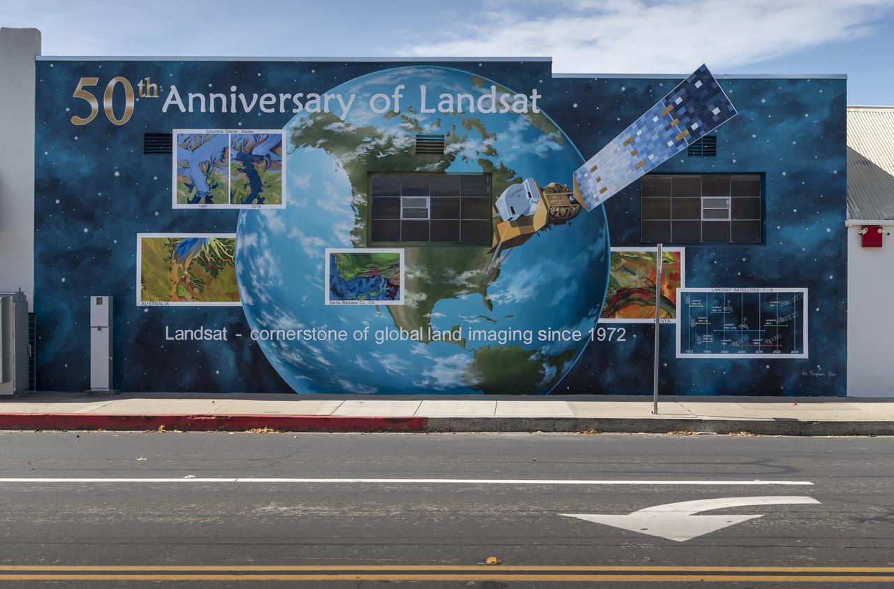
A mural celebrating the 50 years of the Landsat mission is seen, Tuesday, Sept. 28, 2021, in Lompoc, California. On Monday, Sept. 27, 2021, the Landsat 9 satellite, a joint NASA/U.S. Geological Survey mission that will continue the legacy of monitoring Earth’s land and coastal regions, launched from Vandenberg Space Force Base, California. Photo Credit: (NASA/Bill Ingalls)
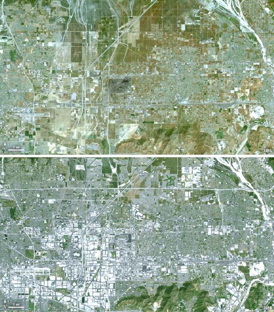
Thirty-five miles due east of downtown Los Angeles lies the city of Ontario, California. In 1881 two Canadian brothers established the town, naming it after their native city. By 1891 Ontario, Calif., was incorporated as a city. The farming-based economy (olives, citrus, dairy) of the city helped it grow to 20,000 by the 1960s. Subsequently, warehousing and freight trafficking took over as the major industry and the city’s population was over 160,000 by 2010. The L.A./Ontario International Airport is now America’s 15th busiest cargo airport. In these natural color Landsat 5 images, the massive growth of the city between 1985 and 2010 can be seen. The airport, found in the southwest portion of the images, added a number of runways and large warehousing structures now dominate the once rural areas surrounding the airport. In these images vegetation is green and brown and urban structures are bright white and gray. (Note there is a large dry riverbed in the northeast corner that is also bright white, but its nonlinear appearance sets it apart visually). ---- NASA and the U.S. Department of the Interior through the U.S. Geological Survey (USGS) jointly manage Landsat, and the USGS preserves a 40-year archive of Landsat images that is freely available over the Internet. The next Landsat satellite, now known as the Landsat Data Continuity Mission (LDCM) and later to be called Landsat 8, is scheduled for launch in 2013. In honor of Landsat’s 40th anniversary in July 2012, the USGS released the LandsatLook viewer – a quick, simple way to go forward and backward in time, pulling images of anywhere in the world out of the Landsat archive. <b><a href="http://www.nasa.gov/audience/formedia/features/MP_Photo_Guidelines.html" rel="nofollow">NASA image use policy.</a></b> <b><a href="http://www.nasa.gov/centers/goddard/home/index.html" rel="nofollow">NASA Goddard Space Flight Center</a></b> enables NASA’s mission through four scientific endeavors: Earth Science, Heliophysics, Solar System Exploration, and Astrophysics. Goddard plays a leading role in NASA’s accomplishments by contributing compelling scientific knowledge to advance the Agency’s mission. <b>Follow us on <a href="http://twitter.com/NASA_GoddardPix" rel="nofollow">Twitter</a></b> <b>Like us on <a href="http://www.facebook.com/pages/Greenbelt-MD/NASA-Goddard/395013845897?ref=tsd" rel="nofollow">Facebook</a></b> <b>Find us on <a href="http://instagrid.me/nasagoddard/?vm=grid" rel="nofollow">Instagram</a></b>
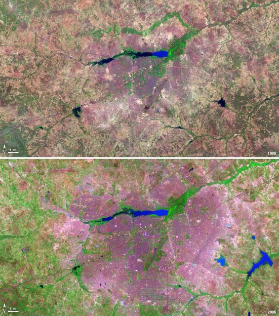
The landlocked western African nation of Burkina Faso experienced a 200 percent increase in urban population between 1975 and 2000. As a result, the area of the capital city Ouagadougou grew 14-fold during this period. These Landsat images show the city expanding outward from its center in the two decades between 1986 and 2006. On Nov. 18, 1986, the Landsat 5 satellite acquired this image of the capital. This false-color image shows vegetation in shades of green and gray, water in various shades of blue, and urban areas in pink and purple. The runway of the city’s airport can be seen as a long straight line that extends from southwest to northeast south of the large lake, Bois de Boulogne. Two decades later, on Oct. 16, 2006 Landsat 7 acquired this image of Ouagadougou. Growth radiated from the city center in all directions. The green strip of vegetation north of Bois de Boulogne has been paved over and a massive new development including a large thoroughfare and traffic circle can be seen south of the airport. ---- NASA and the U.S. Department of the Interior through the U.S. Geological Survey (USGS) jointly manage Landsat, and the USGS preserves a 40-year archive of Landsat images that is freely available over the Internet. The next Landsat satellite, now known as the Landsat Data Continuity Mission (LDCM) and later to be called Landsat 8, is scheduled for launch in 2013. In honor of Landsat’s 40th anniversary in July 2012, the USGS released the LandsatLook viewer – a quick, simple way to go forward and backward in time, pulling images of anywhere in the world out of the Landsat archive. <b><a href="http://www.nasa.gov/audience/formedia/features/MP_Photo_Guidelines.html" rel="nofollow">NASA image use policy.</a></b> <b><a href="http://www.nasa.gov/centers/goddard/home/index.html" rel="nofollow">NASA Goddard Space Flight Center</a></b> enables NASA’s mission through four scientific endeavors: Earth Science, Heliophysics, Solar System Exploration, and Astrophysics. Goddard plays a leading role in NASA’s accomplishments by contributing compelling scientific knowledge to advance the Agency’s mission. <b>Follow us on <a href="http://twitter.com/NASA_GoddardPix" rel="nofollow">Twitter</a></b> <b>Like us on <a href="http://www.facebook.com/pages/Greenbelt-MD/NASA-Goddard/395013845897?ref=tsd" rel="nofollow">Facebook</a></b> <b>Find us on <a href="http://instagrid.me/nasagoddard/?vm=grid" rel="nofollow">Instagram</a></b>
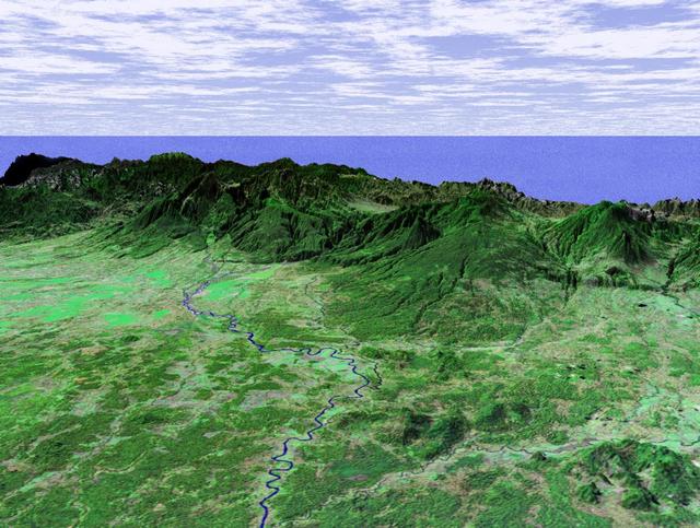
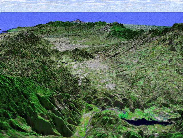
This perspective view taken in February 2000 from NASA Landsat and SRTM shows the Caribbean coastal plain of Costa Rica, with the Cordillera Central rising in the background.
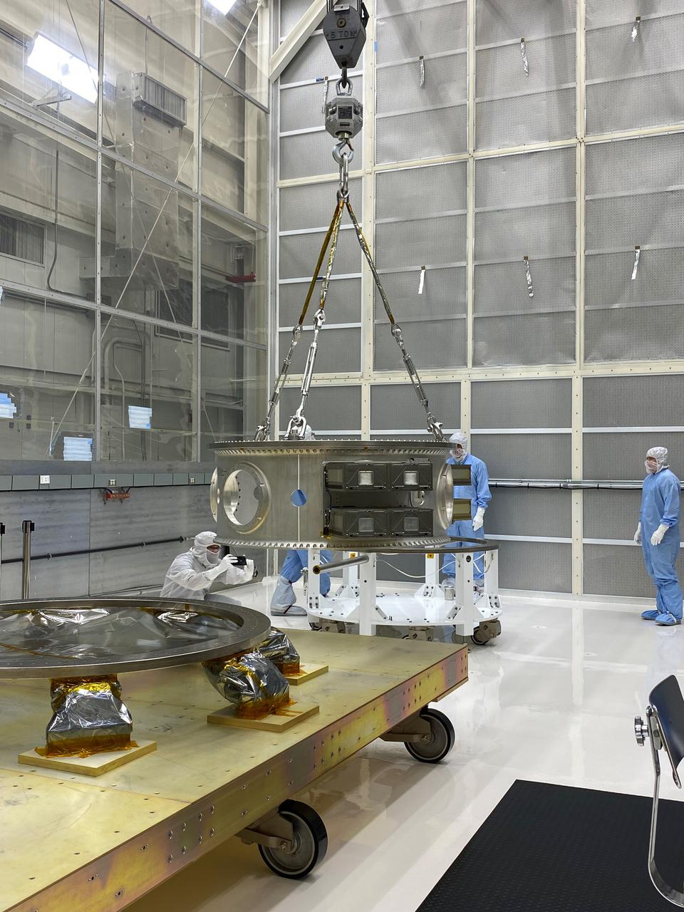
Aleksandra Bogunovic (left) and Veronica Otero (right) look on while Pete Steigner (in the middle) adds a flow tube that will make sure that nitrogen gas flows through the instrument while it's being shipped. The gas will keep contaminating particles from infiltrating the instrument. The Thermal Infrared Sensor (TIRS) will fly on the next Landsat satellite, the Landsat Data Continuity Mission (LDCM). TIRS was built on an accelerated schedule at NASA's Goddard Space Flight Center, Greenbelt, Md. and will now be integrated into the LDCM spacecraft at Orbital Science Corp. in Gilbert, Ariz. The Landsat Program is a series of Earth observing satellite missions jointly managed by NASA and the U.S. Geological Survey. Landsat satellites have been consistently gathering data about our planet since 1972. They continue to improve and expand this unparalleled record of Earth's changing landscapes for the benefit of all. For more information on Landsat, visit: <a href="http://www.nasa.gov/landsat" rel="nofollow">www.nasa.gov/landsat</a> Credit: NASA/GSFC/Rebecca Roth <b><a href="http://www.nasa.gov/audience/formedia/features/MP_Photo_Guidelines.html" rel="nofollow">NASA image use policy.</a></b> <b><a href="http://www.nasa.gov/centers/goddard/home/index.html" rel="nofollow">NASA Goddard Space Flight Center</a></b> enables NASA’s mission through four scientific endeavors: Earth Science, Heliophysics, Solar System Exploration, and Astrophysics. Goddard plays a leading role in NASA’s accomplishments by contributing compelling scientific knowledge to advance the Agency’s mission. <b>Follow us on <a href="http://twitter.com/NASA_GoddardPix" rel="nofollow">Twitter</a></b> <b>Like us on <a href="http://www.facebook.com/pages/Greenbelt-MD/NASA-Goddard/395013845897?ref=tsd" rel="nofollow">Facebook</a></b> <b>Find us on <a href="http://instagrid.me/nasagoddard/?vm=grid" rel="nofollow">Instagram</a></b>
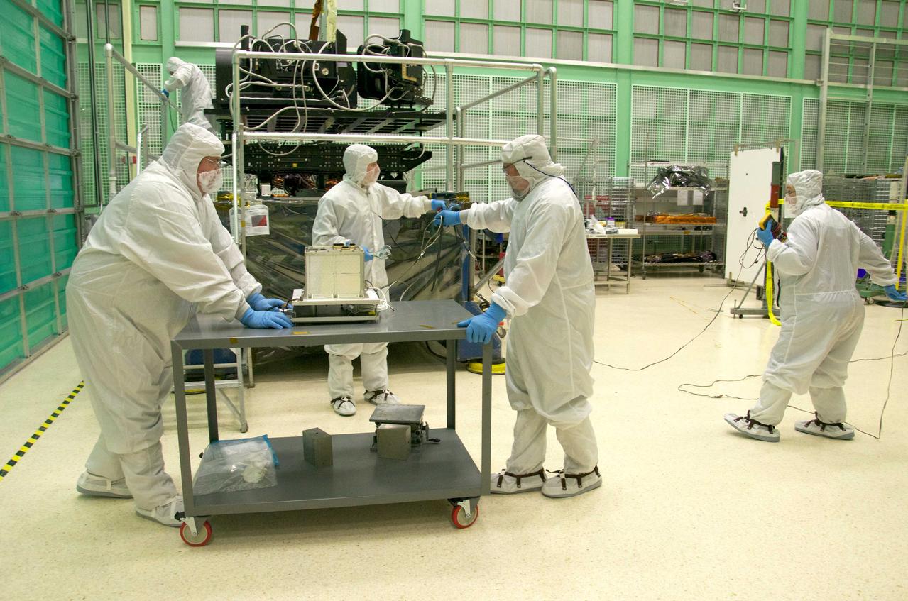
Pete Steigner, and Mike Golob (middle and right) assist an Chris Kolos in carefully moving a TIRS component across the clean room at Goddard. On the far right Robin Knight holds the component's 'grounding strap.' It's used to make sure that any static electricity that could possibly build up while the component is being moved doesn't affect the damage the sensitive electronics. The Thermal Infrared Sensor (TIRS) will fly on the next Landsat satellite, the Landsat Data Continuity Mission (LDCM). TIRS was built on an accelerated schedule at NASA's Goddard Space Flight Center, Greenbelt, Md. and will now be integrated into the LDCM spacecraft at Orbital Science Corp. in Gilbert, Ariz. The Landsat Program is a series of Earth observing satellite missions jointly managed by NASA and the U.S. Geological Survey. Landsat satellites have been consistently gathering data about our planet since 1972. They continue to improve and expand this unparalleled record of Earth's changing landscapes for the benefit of all. For more information on Landsat, visit: <a href="http://www.nasa.gov/landsat" rel="nofollow">www.nasa.gov/landsat</a> Credit: NASA/GSFC/Rebecca Roth <b><a href="http://www.nasa.gov/audience/formedia/features/MP_Photo_Guidelines.html" rel="nofollow">NASA image use policy.</a></b> <b><a href="http://www.nasa.gov/centers/goddard/home/index.html" rel="nofollow">NASA Goddard Space Flight Center</a></b> enables NASA’s mission through four scientific endeavors: Earth Science, Heliophysics, Solar System Exploration, and Astrophysics. Goddard plays a leading role in NASA’s accomplishments by contributing compelling scientific knowledge to advance the Agency’s mission. <b>Follow us on <a href="http://twitter.com/NASA_GoddardPix" rel="nofollow">Twitter</a></b> <b>Like us on <a href="http://www.facebook.com/pages/Greenbelt-MD/NASA-Goddard/395013845897?ref=tsd" rel="nofollow">Facebook</a></b> <b>Find us on <a href="http://instagrid.me/nasagoddard/?vm=grid" rel="nofollow">Instagram</a></b>
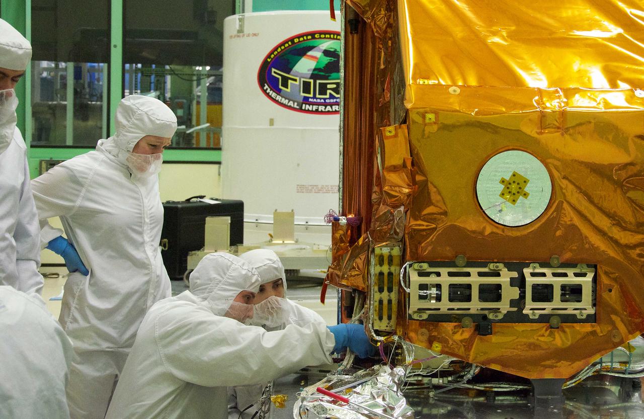
The Thermal Infrared Sensor (TIRS) will fly on the next Landsat satellite, the Landsat Data Continuity Mission (LDCM). The right side of the instrument is what's called the 'nadir side,' that's the side that points toward Earth when the instrument is in space. The black circle visible on the right side is where the optics for the instrument are located. In that area are the lens and the detectors. The white area is a radiator that radiates heat to keep the telescope and the detector cool. The black hole on the white area on the left is what the satellite operators point to deep space when they calibrate the instrument to the cold temperatures of space. TIRS was built on an accelerated schedule at NASA's Goddard Space Flight Center, Greenbelt, Md. and will now be integrated into the LDCM spacecraft at Orbital Science Corp. in Gilbert, Ariz. The Landsat Program is a series of Earth observing satellite missions jointly managed by NASA and the U.S. Geological Survey. Landsat satellites have been consistently gathering data about our planet since 1972. They continue to improve and expand this unparalleled record of Earth's changing landscapes for the benefit of all. For more information on Landsat, visit: <a href="http://www.nasa.gov/landsat" rel="nofollow">www.nasa.gov/landsat</a> Credit: NASA/GSFC/Rebecca Roth <b><a href="http://www.nasa.gov/audience/formedia/features/MP_Photo_Guidelines.html" rel="nofollow">NASA image use policy.</a></b> <b><a href="http://www.nasa.gov/centers/goddard/home/index.html" rel="nofollow">NASA Goddard Space Flight Center</a></b> enables NASA’s mission through four scientific endeavors: Earth Science, Heliophysics, Solar System Exploration, and Astrophysics. Goddard plays a leading role in NASA’s accomplishments by contributing compelling scientific knowledge to advance the Agency’s mission. <b>Follow us on <a href="http://twitter.com/NASA_GoddardPix" rel="nofollow">Twitter</a></b> <b>Like us on <a href="http://www.facebook.com/pages/Greenbelt-MD/NASA-Goddard/395013845897?ref=tsd" rel="nofollow">Facebook</a></b> <b>Find us on <a href="http://instagrid.me/nasagoddard/?vm=grid" rel="nofollow">Instagram</a></b>
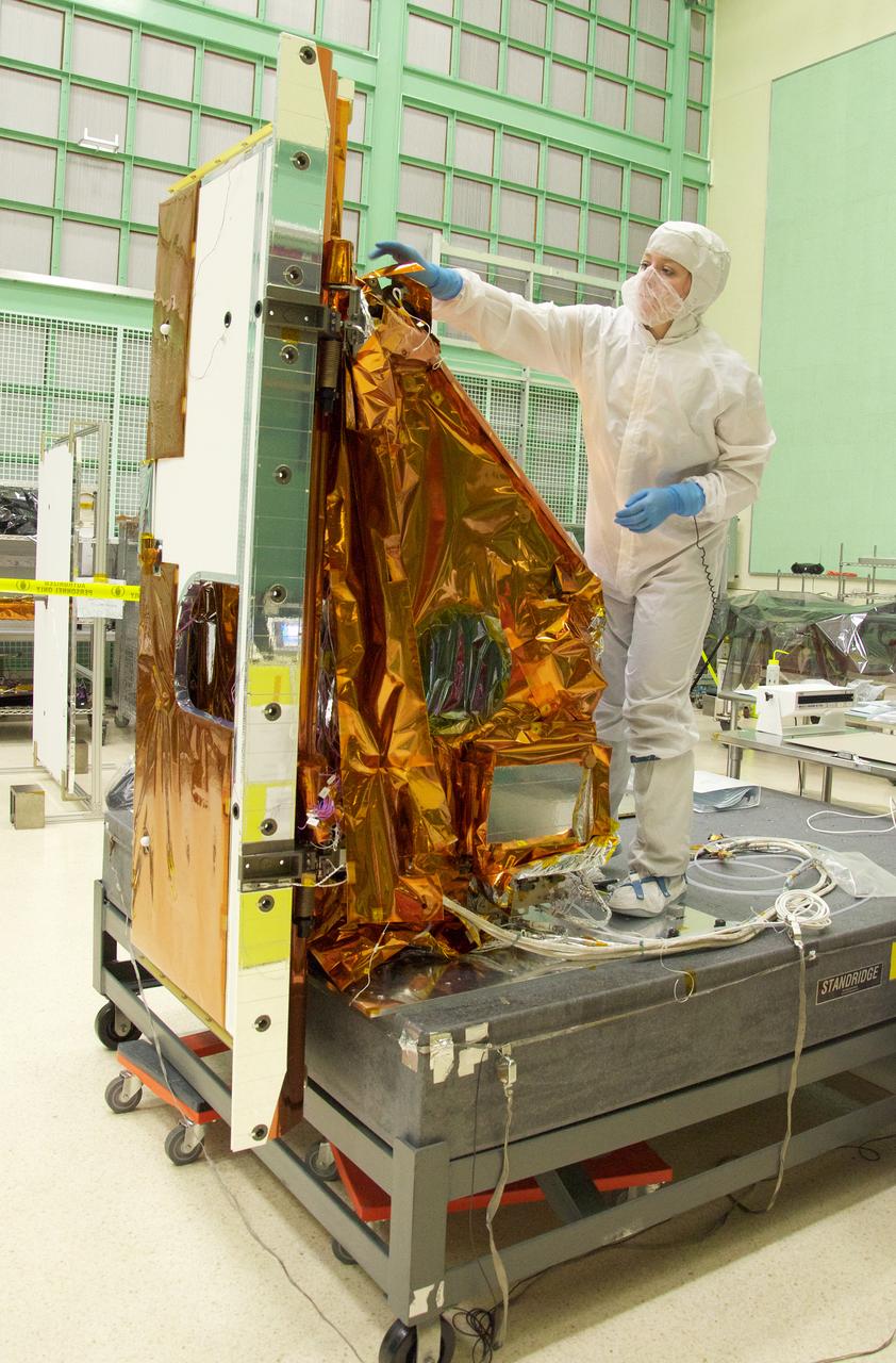
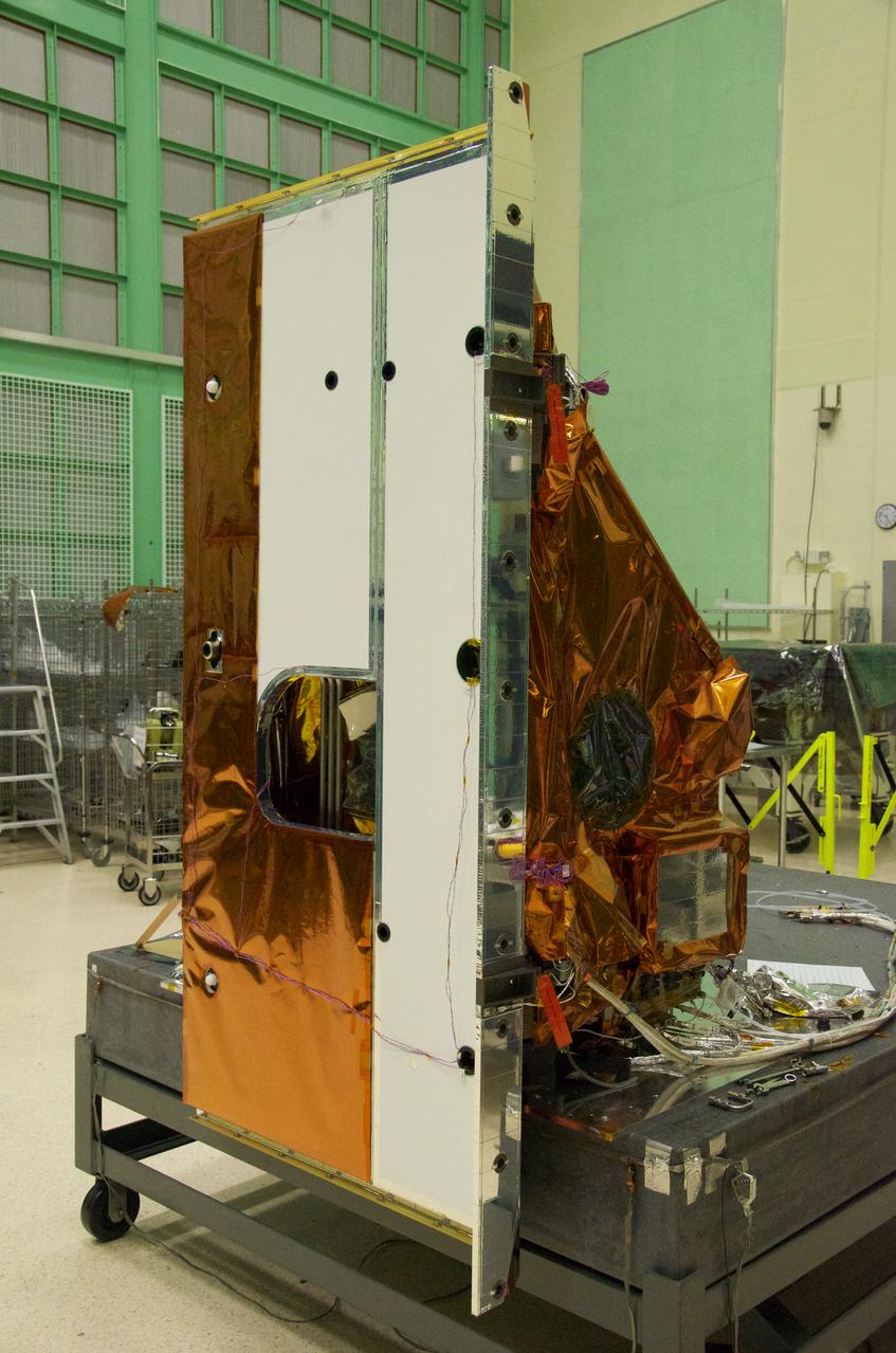
Aleksandra Bogunovic reaches across the instrument to affix the corners of a Multi-Layer Insulation blanket to the TIRS instrument. The Thermal Infrared Sensor (TIRS) will fly on the next Landsat satellite, the Landsat Data Continuity Mission (LDCM). TIRS was built on an accelerated schedule at NASA's Goddard Space Flight Center, Greenbelt, Md. and will now be integrated into the LDCM spacecraft at Orbital Science Corp. in Gilbert, Ariz. The Landsat Program is a series of Earth observing satellite missions jointly managed by NASA and the U.S. Geological Survey. Landsat satellites have been consistently gathering data about our planet since 1972. They continue to improve and expand this unparalleled record of Earth's changing landscapes for the benefit of all. For more information on Landsat, visit: <a href="http://www.nasa.gov/landsat" rel="nofollow">www.nasa.gov/landsat</a> Credit: NASA/GSFC/Rebecca Roth <b><a href="http://www.nasa.gov/audience/formedia/features/MP_Photo_Guidelines.html" rel="nofollow">NASA image use policy.</a></b> <b><a href="http://www.nasa.gov/centers/goddard/home/index.html" rel="nofollow">NASA Goddard Space Flight Center</a></b> enables NASA’s mission through four scientific endeavors: Earth Science, Heliophysics, Solar System Exploration, and Astrophysics. Goddard plays a leading role in NASA’s accomplishments by contributing compelling scientific knowledge to advance the Agency’s mission. <b>Follow us on <a href="http://twitter.com/NASA_GoddardPix" rel="nofollow">Twitter</a></b> <b>Like us on <a href="http://www.facebook.com/pages/Greenbelt-MD/NASA-Goddard/395013845897?ref=tsd" rel="nofollow">Facebook</a></b> <b>Find us on <a href="http://instagrid.me/nasagoddard/?vm=grid" rel="nofollow">Instagram</a></b>
This perspective view taken in February 2000 from NASA Landsat and SRTM shows the capital city of San Jose, Costa Rica, the gray area in the center of the image.
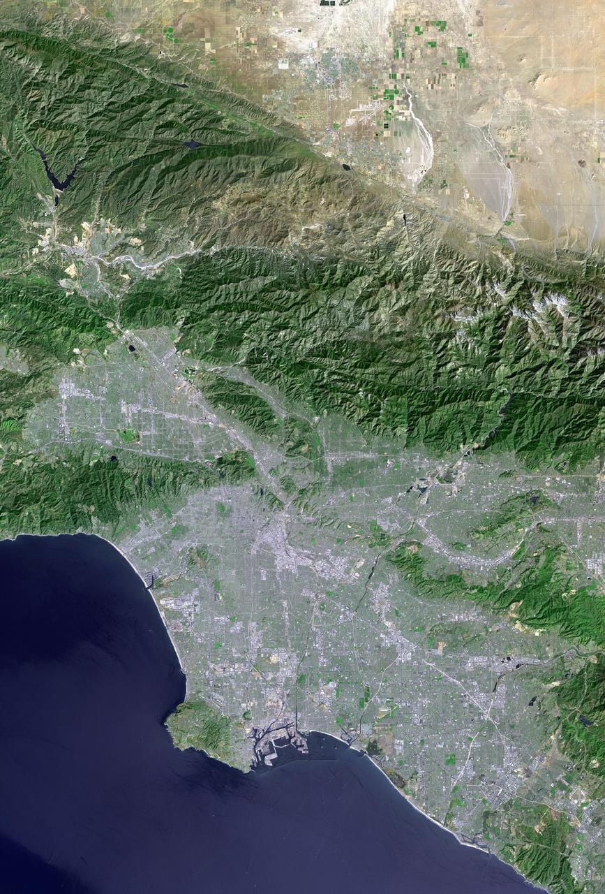
Los Angeles and vicinity seen from space, as viewed by NASA Landsat 7 satellite from an altitude of 437 miles on May 4, 2001.

Tylar Greene, NASA Communications, moderates a mission and science briefing for NASA’s Landsat 9 mission at Vandenberg Space Force Base in California on Sept. 24, 2021. Virtual participants (not shown) are Jeff Masek, Landsat 9 project scientist at NASA’s Goddard Space Flight Center; Chris Crawford, Landsat 9 project scientist at USGS; Inbal Becker-Reshef, director of NASA’s Harvest food security and agriculture program; Del Jenstrom, Landsat 9 project manager at Goddard; Brian Sauer, Landsat 9 project manager at USGS; Sabrina Chapman, manager, system engineering, Northrop Grumman Space Systems; and Sarah Lipscy, OLI-2 senior engineer, Ball Aerospace & Technologies. Landsat 9 is scheduled to launch at 2:11 p.m. EDT (11:11 a.m. PDT) on Monday, Sept. 27, on a United Launch Alliance Atlas V 401 rocket from Space Launch Complex 3 at Vandenberg. The launch is managed by NASA’s Launch Services Program, based at the agency’s Kennedy Space Center in Florida. Landsat 9 will join its sister satellite, Landsat 8, in orbit in collecting images from across the planet every eight days. This calibrated data will continue the Landsat program’s critical role in monitoring the health of Earth and helping people manage essential resources, including crops, irrigation water, and forests.

Tylar Greene, NASA Communications, moderates a mission and science briefing for NASA’s Landsat 9 mission at Vandenberg Space Force Base in California on Sept. 24, 2021. Virtual participants (not shown) are Jeff Masek, Landsat 9 project scientist at NASA’s Goddard Space Flight Center; Chris Crawford, Landsat 9 project scientist at USGS; Inbal Becker-Reshef, director of NASA’s Harvest food security and agriculture program; Del Jenstrom, Landsat 9 project manager at Goddard; Brian Sauer, Landsat 9 project manager at USGS; Sabrina Chapman, manager, system engineering, Northrop Grumman Space Systems; and Sarah Lipscy, OLI-2 senior engineer, Ball Aerospace & Technologies. Landsat 9 is scheduled to launch at 2:11 p.m. EDT (11:11 a.m. PDT) on Monday, Sept. 27, on a United Launch Alliance Atlas V 401 rocket from Space Launch Complex 3 at Vandenberg. The launch is managed by NASA’s Launch Services Program, based at the agency’s Kennedy Space Center in Florida. Landsat 9 will join its sister satellite, Landsat 8, in orbit in collecting images from across the planet every eight days. This calibrated data will continue the Landsat program’s critical role in monitoring the health of Earth and helping people manage essential resources, including crops, irrigation water, and forests.
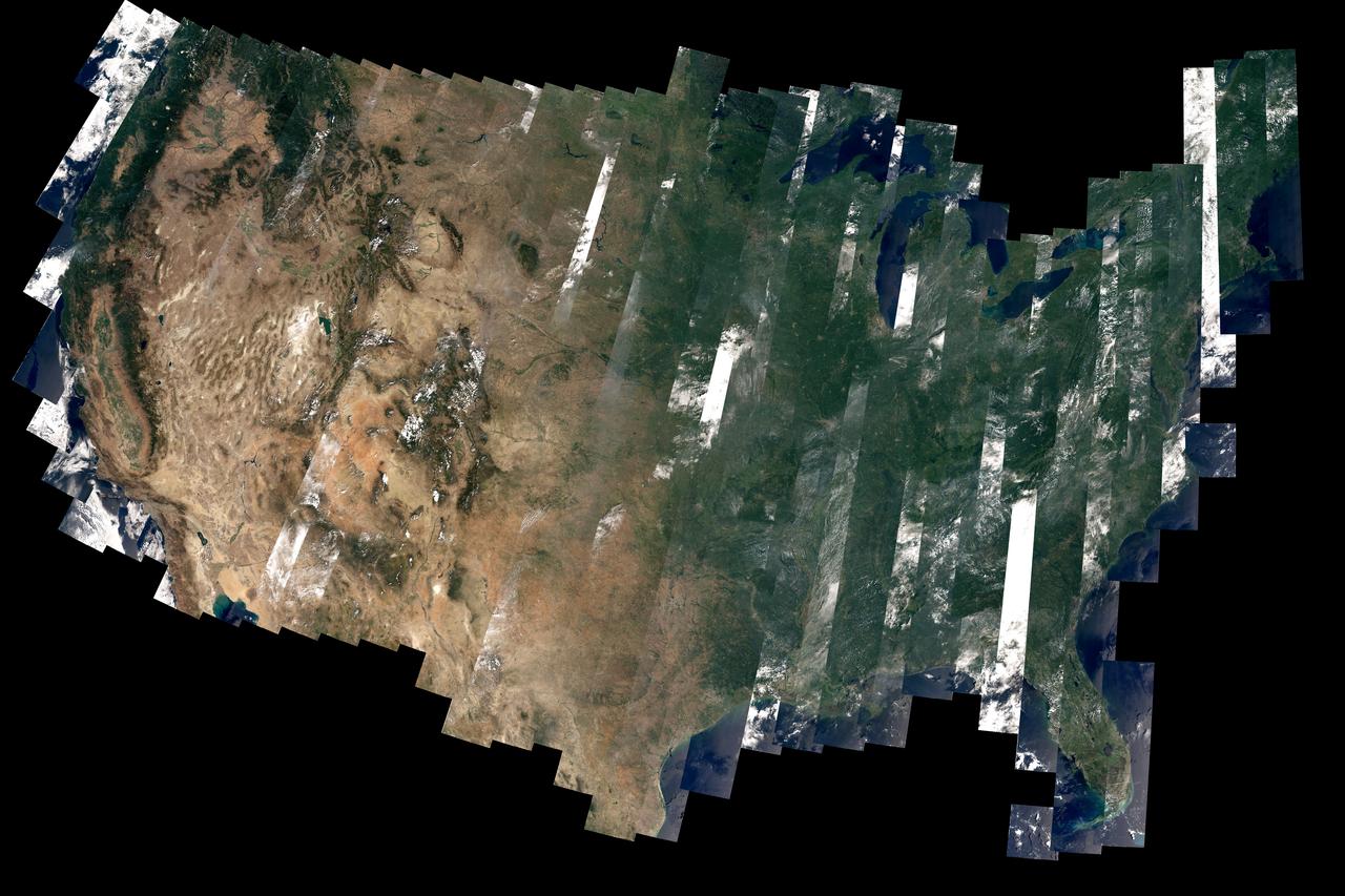
On February 11, 2013, the Landsat 8 satellite rocketed into a sunny California morning onboard a powerful Atlas V and began its life in orbit. In the year since launch, scientists have been working to understand the information the satellite has been sending back. Some have been calibrating the data—checking it against ground observations and matching it to the rest of the 42-year-long Landsat record. At the same time, the broader science community has been learning to use the new data. The map above—one of the first views of the United States from Landsat 8—is an example of how scientists are testing Landsat 8 data. David Roy, a co-leader of the USGS-NASA Landsat science team and researcher at South Dakota State University, made the map with observations taken during August 2013 by the satellite’s Operational Land Imager. Read more: <a href="http://earthobservatory.nasa.gov/IOTD/view.php?id=83099" rel="nofollow">earthobservatory.nasa.gov/IOTD/view.php?id=83099</a> Image courtesy David Roy, USGS-NASA WELD product. Caption by Holli Riebeek. Instrument: Landsat 8 - OLI Credit: <b><a href="http://www.earthobservatory.nasa.gov/" rel="nofollow"> NASA Earth Observatory</a></b> <b><a href="http://www.nasa.gov/audience/formedia/features/MP_Photo_Guidelines.html" rel="nofollow">NASA image use policy.</a></b> <b><a href="http://www.nasa.gov/centers/goddard/home/index.html" rel="nofollow">NASA Goddard Space Flight Center</a></b> enables NASA’s mission through four scientific endeavors: Earth Science, Heliophysics, Solar System Exploration, and Astrophysics. Goddard plays a leading role in NASA’s accomplishments by contributing compelling scientific knowledge to advance the Agency’s mission. <b>Follow us on <a href="http://twitter.com/NASAGoddardPix" rel="nofollow">Twitter</a></b> <b>Like us on <a href="http://www.facebook.com/pages/Greenbelt-MD/NASA-Goddard/395013845897?ref=tsd" rel="nofollow">Facebook</a></b> <b>Find us on <a href="http://instagram.com/nasagoddard?vm=grid" rel="nofollow">Instagram</a></b>
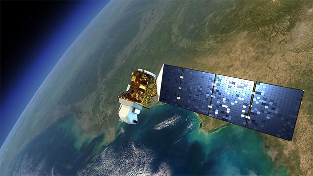
An artist's rendition of the next Landsat satellite, the Landsat Data Continuity Mission (LDCM) that will launch in Feb. 2013. Credit: NASA The Landsat program is the longest continuous global record of Earth observations from space – ever. Since its first satellite went up in the summer of 1972, Landsat has been looking at our planet. The view of Earth that this 40-year satellite program has recorded allows scientists to see, in ways they never imagined, how the Earth's surface has transformed, over time. In the 1970s Landsat captured the first views from space of the Amazonian rainforest and continued to track the area year after year after year, giving the world an unprecedented view of systemic and rapid deforestation. This view from space let us see an activity that was taking place in an exceptionally remote part of our world. These now iconic-images of tropical deforestation spurred the global environmental community to rally in an unprecedented way, and resulted in worldwide attention and action. To read more go to: <a href="http://www.nasa.gov/mission_pages/landsat/news/landsat-history.html" rel="nofollow">www.nasa.gov/mission_pages/landsat/news/landsat-history.html</a> <b><a href="http://www.nasa.gov/audience/formedia/features/MP_Photo_Guidelines.html" rel="nofollow">NASA image use policy.</a></b> <b><a href="http://www.nasa.gov/centers/goddard/home/index.html" rel="nofollow">NASA Goddard Space Flight Center</a></b> enables NASA’s mission through four scientific endeavors: Earth Science, Heliophysics, Solar System Exploration, and Astrophysics. Goddard plays a leading role in NASA’s accomplishments by contributing compelling scientific knowledge to advance the Agency’s mission. <b>Follow us on <a href="http://twitter.com/NASA_GoddardPix" rel="nofollow">Twitter</a></b> <b>Like us on <a href="http://www.facebook.com/pages/Greenbelt-MD/NASA-Goddard/395013845897?ref=tsd" rel="nofollow">Facebook</a></b> <b>Find us on <a href="http://instagrid.me/nasagoddard/?vm=grid" rel="nofollow">Instagram</a></b>

In 1979, China established two special economic zones around the Pearl River Delta, north of Hong Kong. This image, taken by Landsat 3 on October 19, 1973, shows that the region was rural when the zone was established. Plant-covered land, which is red in this false-color image, dominates the scene. Square grids are agriculture. By January 10, 2003, when Landsat 7 took this image, the Pearl River Delta was a densely populated urban corridor with several large cities. The urban areas are gray in this image. The region is a major manufacturing center with an economy the size of Taiwan’s. As of 2010, the Pearl River Economic Zone had a population of 36 million people. ---- NASA and the U.S. Department of the Interior through the U.S. Geological Survey (USGS) jointly manage Landsat, and the USGS preserves a 40-year archive of Landsat images that is freely available over the Internet. The next Landsat satellite, now known as the Landsat Data Continuity Mission (LDCM) and later to be called Landsat 8, is scheduled for launch in 2013. In honor of Landsat’s 40th anniversary in July 2012, the USGS released the LandsatLook viewer – a quick, simple way to go forward and backward in time, pulling images of anywhere in the world out of the Landsat archive. <b><a href="http://www.nasa.gov/audience/formedia/features/MP_Photo_Guidelines.html" rel="nofollow">NASA image use policy.</a></b> <b><a href="http://www.nasa.gov/centers/goddard/home/index.html" rel="nofollow">NASA Goddard Space Flight Center</a></b> enables NASA’s mission through four scientific endeavors: Earth Science, Heliophysics, Solar System Exploration, and Astrophysics. Goddard plays a leading role in NASA’s accomplishments by contributing compelling scientific knowledge to advance the Agency’s mission. <b>Follow us on <a href="http://twitter.com/NASA_GoddardPix" rel="nofollow">Twitter</a></b> <b>Like us on <a href="http://www.facebook.com/pages/Greenbelt-MD/NASA-Goddard/395013845897?ref=tsd" rel="nofollow">Facebook</a></b> <b>Find us on <a href="http://instagrid.me/nasagoddard/?vm=grid" rel="nofollow">Instagram</a></b>
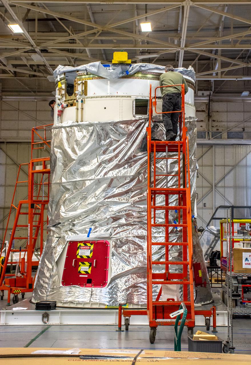
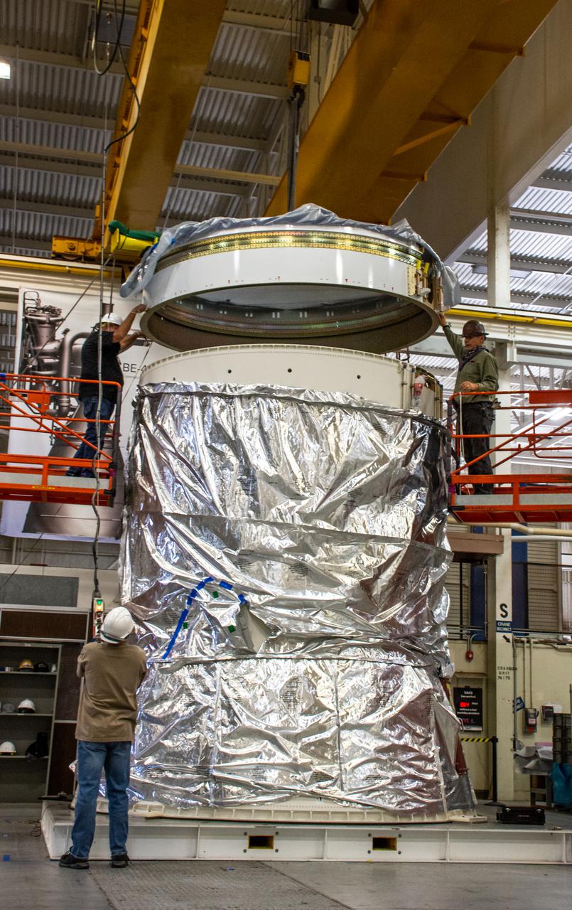
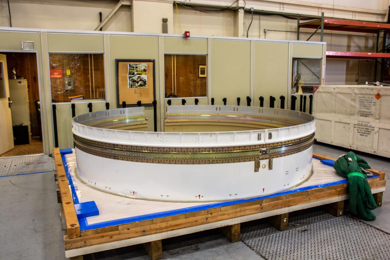
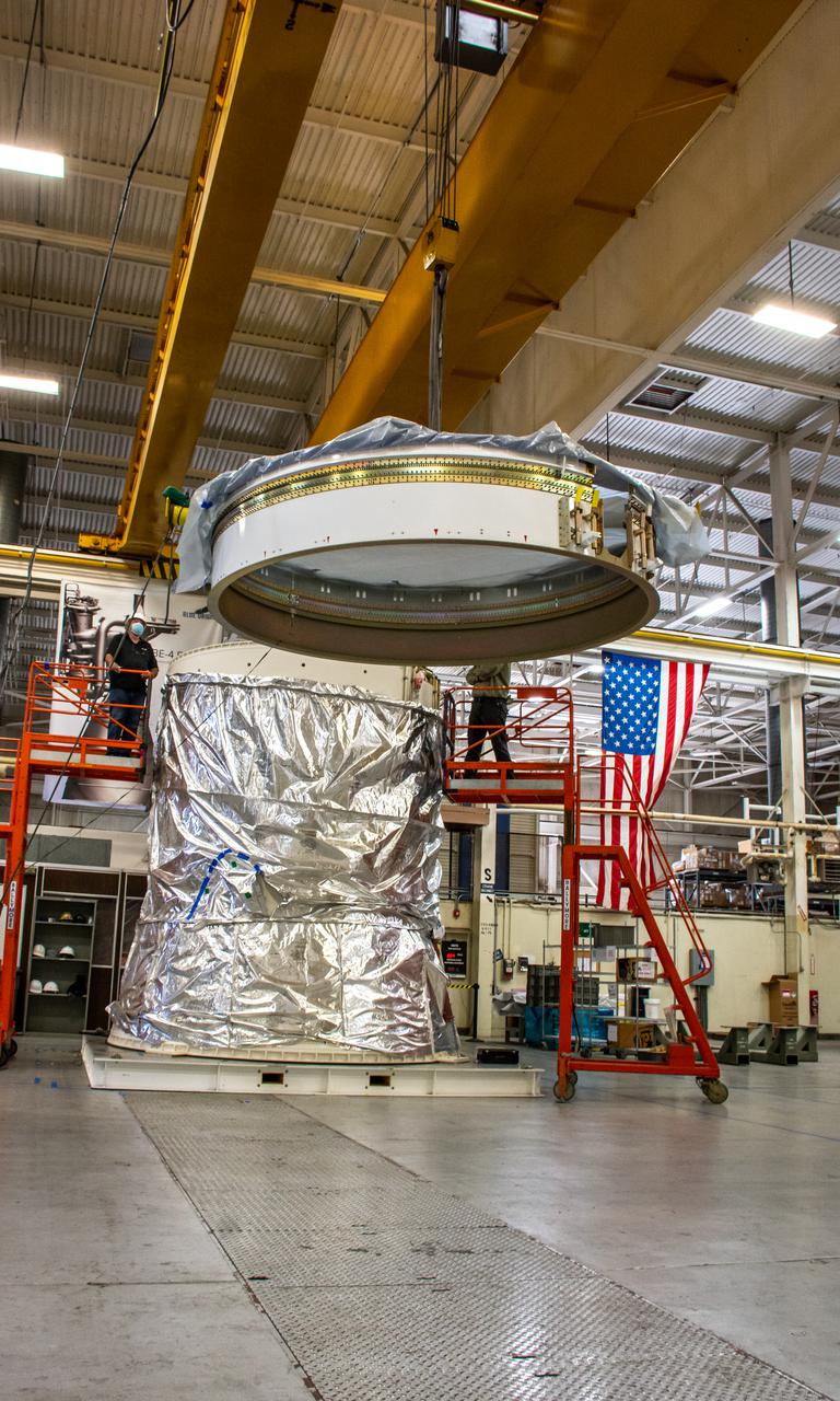
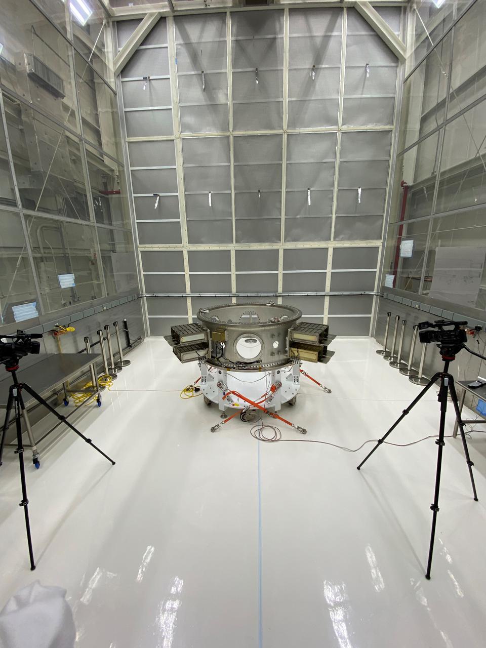
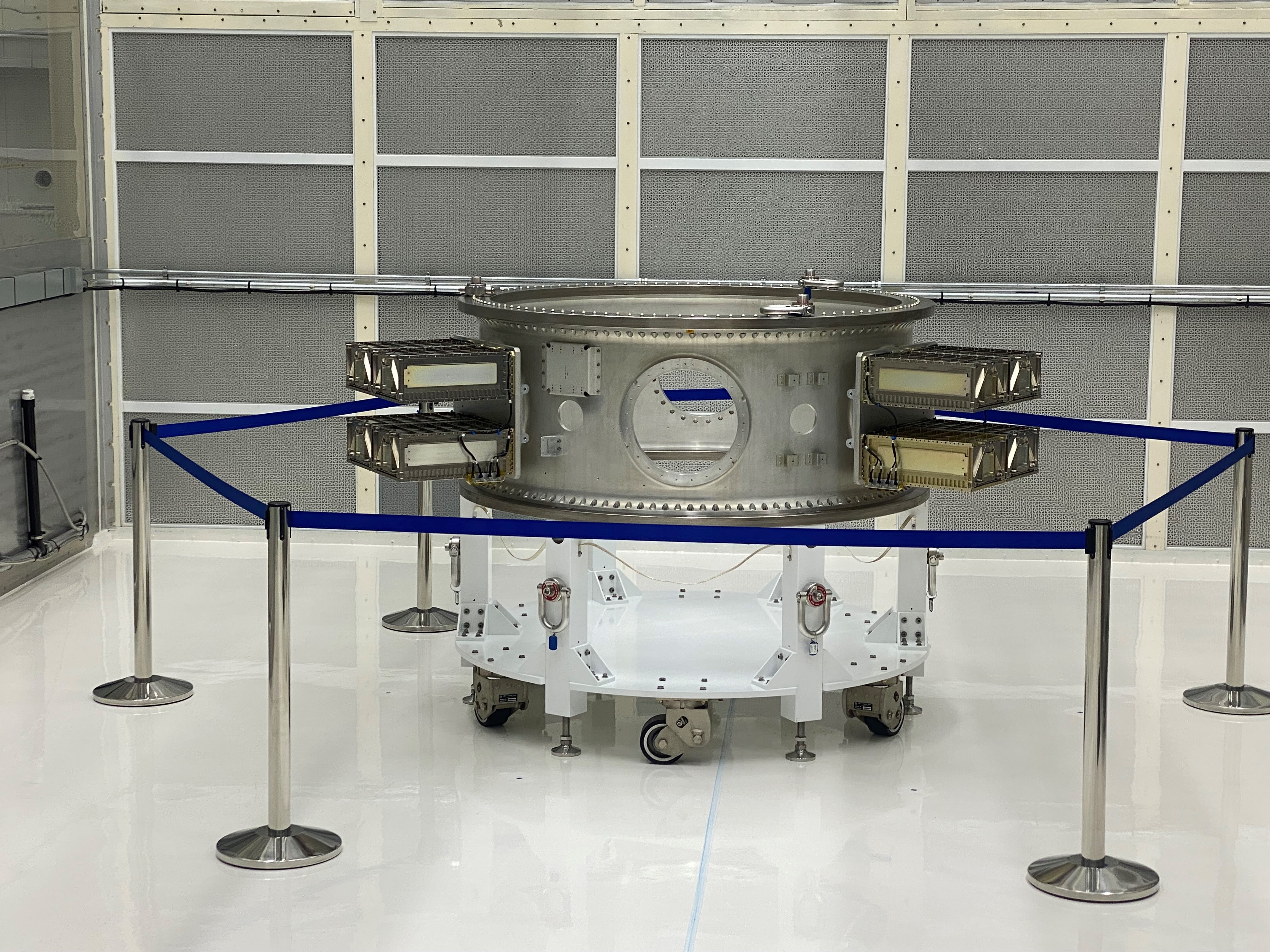
The Evolved Expendable Launch Vehicle Secondary Payload Adapter for NASA’s Landsat 9 mission arrives at Vandenberg Space Force Base in California, on June 14, 2021. The Landsat 9 mission will launch atop a United Launch Alliance Atlas V from Vandenberg in September 2021. The launch is being managed by NASA’s Launch Services Program based at Kennedy Space Center. The Landsat 9 satellite will continue the nearly 50-year legacy of previous Landsat missions. It will monitor key natural and economic resources from orbit. Landsat 9 is managed by the agency’s Goddard Space Flight Center in Greenbelt, Maryland. The satellite will carry two instruments: the Operational Land Imager 2, which collects images of Earth’s landscapes in visible, near infrared and shortwave infrared light, and the Thermal Infrared Sensor 2, which measures the temperature of land surfaces. Like its predecessors, Landsat 9 is a joint mission between NASA and the U.S. Geological Survey.
The Evolved Expendable Launch Vehicle Secondary Payload Adapter for NASA’s Landsat 9 mission arrives at Vandenberg Space Force Base in California, on June 14, 2021. The Landsat 9 mission will launch atop a United Launch Alliance Atlas V from Vandenberg in September 2021. The launch is being managed by NASA’s Launch Services Program based at Kennedy Space Center. The Landsat 9 satellite will continue the nearly 50-year legacy of previous Landsat missions. It will monitor key natural and economic resources from orbit. Landsat 9 is managed by the agency’s Goddard Space Flight Center in Greenbelt, Maryland. The satellite will carry two instruments: the Operational Land Imager 2, which collects images of Earth’s landscapes in visible, near infrared and shortwave infrared light, and the Thermal Infrared Sensor 2, which measures the temperature of land surfaces. Like its predecessors, Landsat 9 is a joint mission between NASA and the U.S. Geological Survey.
The Evolved Expendable Launch Vehicle Secondary Payload Adapter for NASA’s Landsat 9 mission arrives at Vandenberg Space Force Base in California, on June 14, 2021. The Landsat 9 mission will launch atop a United Launch Alliance Atlas V from Vandenberg in September 2021. The launch is being managed by NASA’s Launch Services Program based at Kennedy Space Center. The Landsat 9 satellite will continue the nearly 50-year legacy of previous Landsat missions. It will monitor key natural and economic resources from orbit. Landsat 9 is managed by the agency’s Goddard Space Flight Center in Greenbelt, Maryland. The satellite will carry two instruments: the Operational Land Imager 2, which collects images of Earth’s landscapes in visible, near infrared and shortwave infrared light, and the Thermal Infrared Sensor 2, which measures the temperature of land surfaces. Like its predecessors, Landsat 9 is a joint mission between NASA and the U.S. Geological Survey.
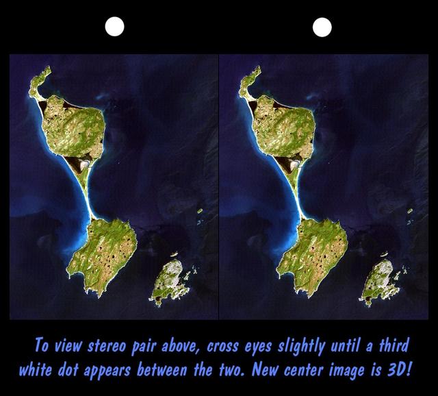
This stereoscopic satellite image showing Miquelon and Saint Pierre Islands, located south of Newfoundland, Canada, was generated by draping NASA Landsat satellite image over a preliminary Shuttle Radar Topography Mission SRTM elevation model.
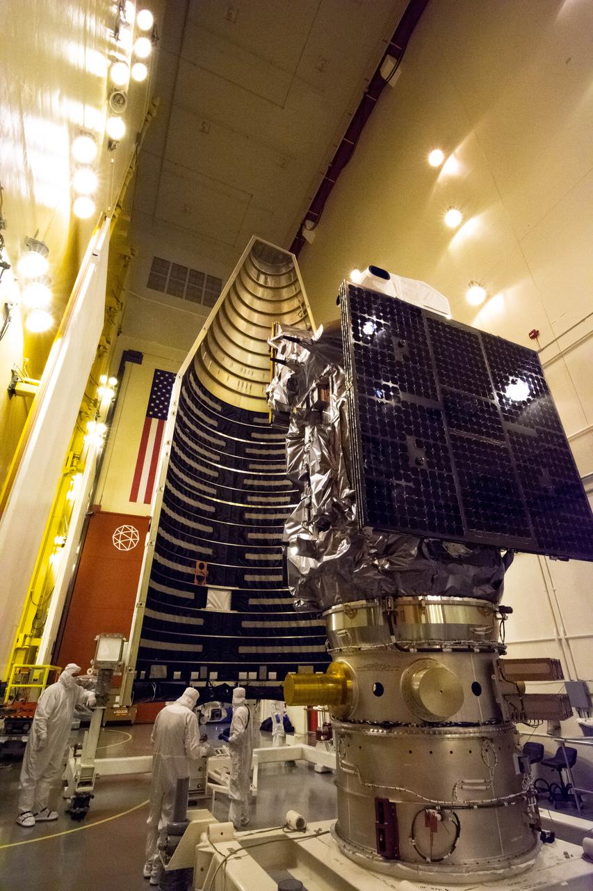
Inside the Integrated Processing Facility at Vandenberg Space Force Base in California, technicians prepare the Landsat 9 spacecraft for encapsulation on Aug. 16, 2021. The two halves of the United Launch Alliance (ULA) payload fairing will surround and encase Landsat 9 to protect it during launch atop the ULA Atlas V rocket. Landsat 9 will launch on the Atlas V rocket from Space Launch Complex 3 at Vandenberg in September 2021. The launch is being managed by NASA’s Launch Services Program based at Kennedy Space Center, America’s multi-user spaceport. The Landsat 9 satellite will continue the nearly 50-year legacy of previous Landsat missions. It will monitor key natural and economic resources from orbit. Landsat 9 is managed by the agency’s Goddard Space Flight Center in Greenbelt, Maryland. The satellite will carry two instruments: the Operational Land Imager 2, which collects images of Earth’s landscapes in visible, near infrared and shortwave infrared light, and the Thermal Infrared Sensor 2, which measures the temperature of land surfaces. Like its predecessors, Landsat 9 is a joint mission between NASA and the U.S. Geological Survey.
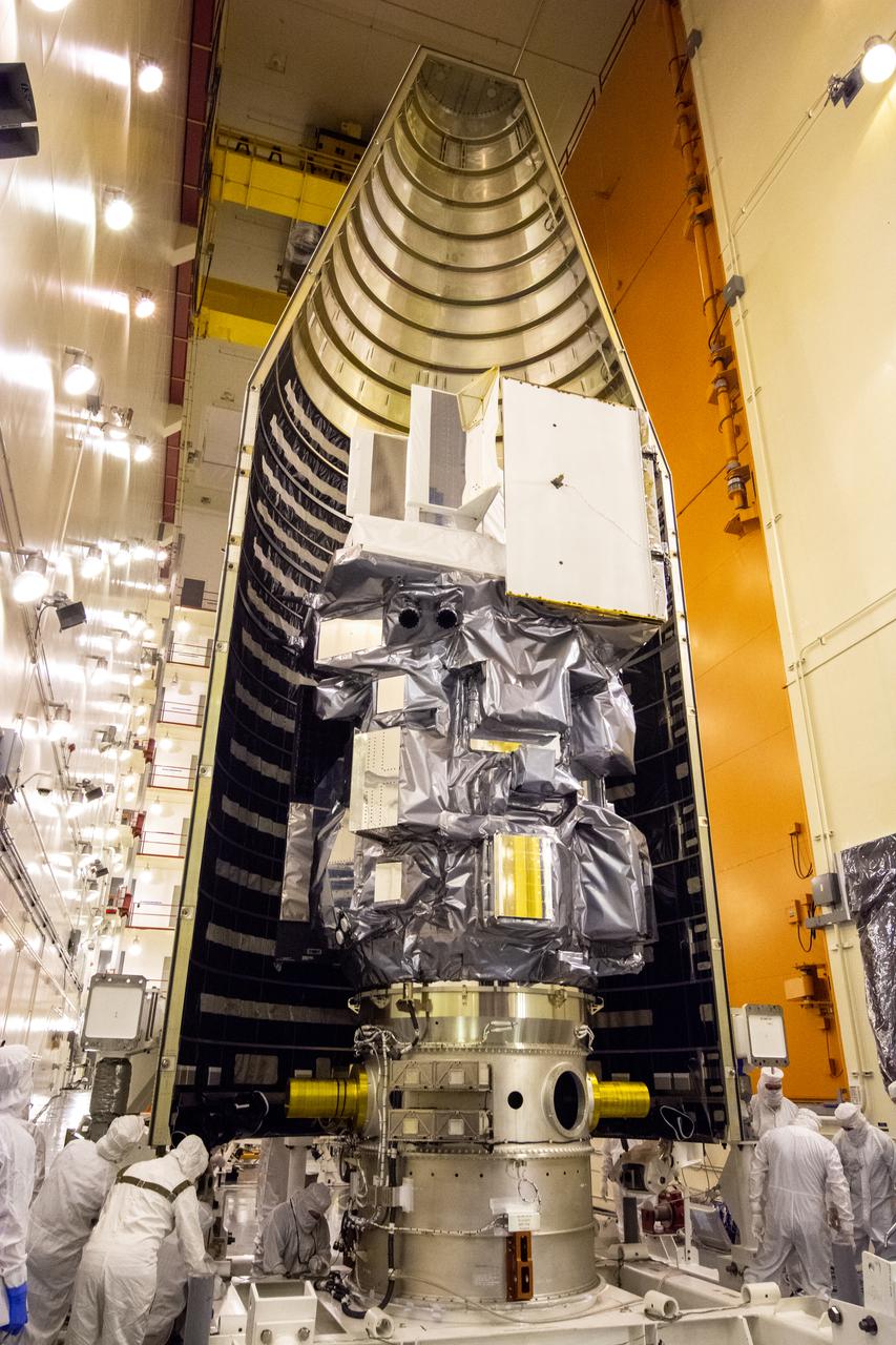
Inside the Integrated Processing Facility at Vandenberg Space Force Base in California, the Landsat 9 spacecraft is moved into position for encapsulation on Aug. 16, 2021. The two halves of the United Launch Alliance (ULA) payload fairing will surround and encase Landsat 9 to protect it during launch atop the ULA Atlas V rocket. Landsat 9 will launch on the Atlas V rocket from Space Launch Complex 3 at Vandenberg in September 2021. The launch is being managed by NASA’s Launch Services Program based at Kennedy Space Center, America’s mult-iuser spaceport. The Landsat 9 satellite will continue the nearly 50-year legacy of previous Landsat missions. It will monitor key natural and economic resources from orbit. Landsat 9 is managed by the agency’s Goddard Space Flight Center in Greenbelt, Maryland. The satellite will carry two instruments: the Operational Land Imager 2, which collects images of Earth’s landscapes in visible, near infrared and shortwave infrared light, and the Thermal Infrared Sensor 2, which measures the temperature of land surfaces. Like its predecessors, Landsat 9 is a joint mission between NASA and the U.S. Geological Survey.
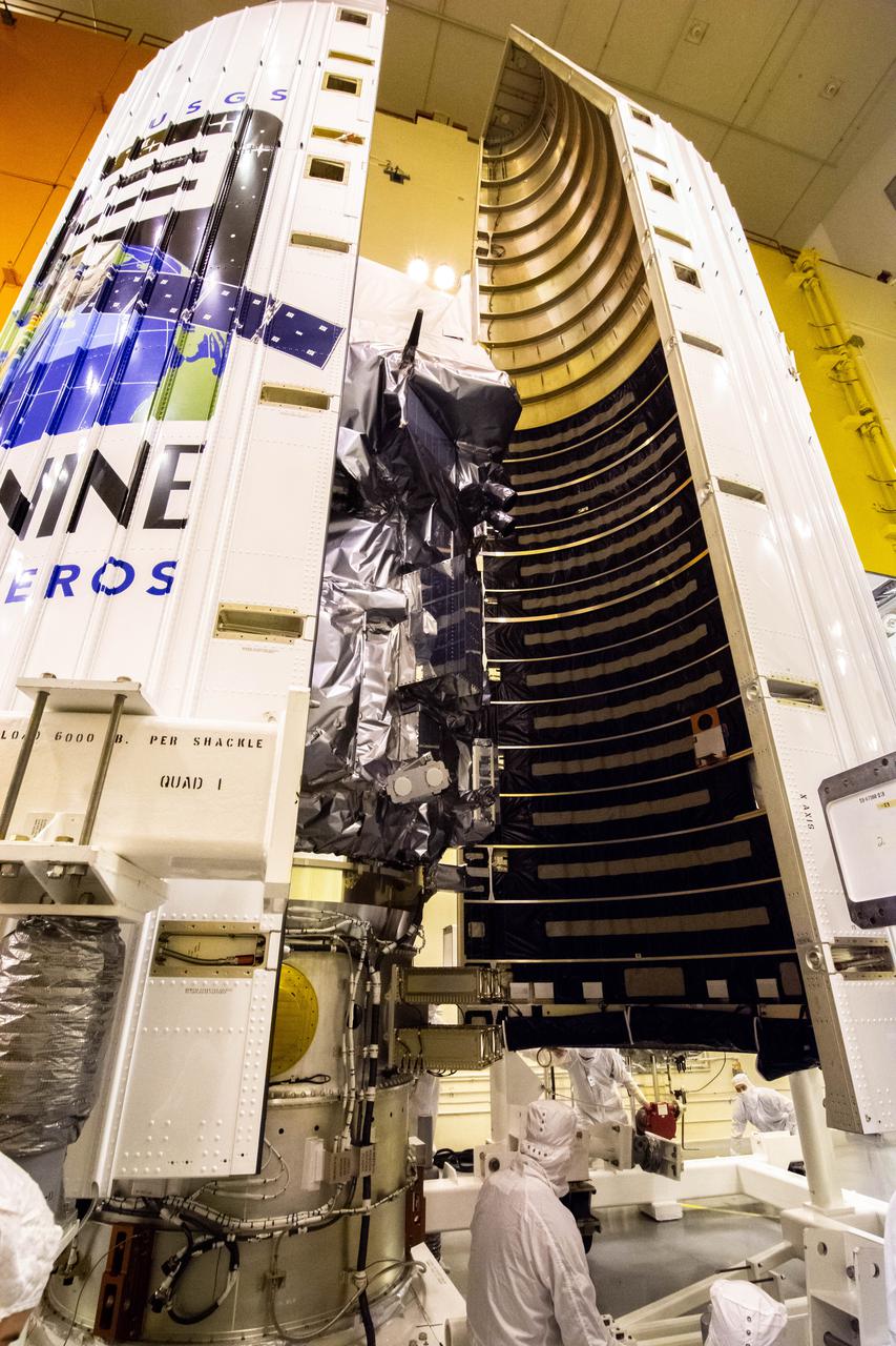
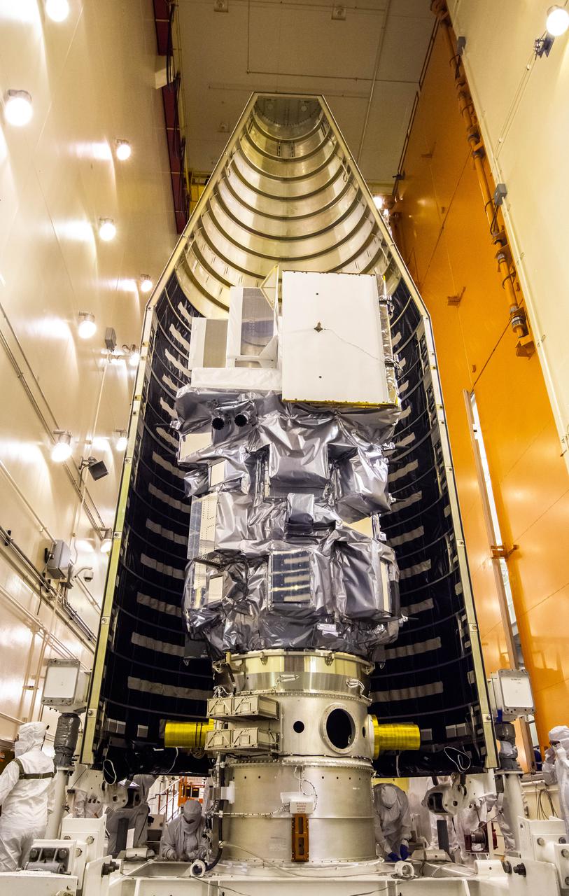
Inside the Integrated Processing Facility at Vandenberg Space Force Base in California, both halves of the United Launch Alliance (ULA) payload fairing are slowly moved around the Landsat 9 spacecraft on Aug. 16, 2021. The payload fairing will be secured around Landsat 9 to protect it during launch atop the ULA Atlas V rocket. Landsat 9 will launch on the Atlas V rocket from Space Launch Complex 3 at Vandenberg in September 2021. The launch is being managed by NASA’s Launch Services Program based at Kennedy Space Center, America’s multi-user spaceport. The Landsat 9 satellite will continue the nearly 50-year legacy of previous Landsat missions. It will monitor key natural and economic resources from orbit. Landsat 9 is managed by the agency’s Goddard Space Flight Center in Greenbelt, Maryland. The satellite will carry two instruments: the Operational Land Imager 2, which collects images of Earth’s landscapes in visible, near infrared and shortwave infrared light, and the Thermal Infrared Sensor 2, which measures the temperature of land surfaces. Like its predecessors, Landsat 9 is a joint mission between NASA and the U.S. Geological Survey.

Inside the Integrated Processing Facility at Vandenberg Space Force Base in California, the Landsat 9 spacecraft is moved into position for encapsulation on Aug. 16, 2021. The two halves of the United Launch Alliance (ULA) payload fairing will surround and encase Landsat 9 to protect it during launch atop the ULA Atlas V rocket. Landsat 9 will launch on the Atlas V rocket from Space Launch Complex 3 at Vandenberg in September 2021. The launch is being managed by NASA’s Launch Services Program based at Kennedy Space Center, America’s multi-user spaceport. The Landsat 9 satellite will continue the nearly 50-year legacy of previous Landsat missions. It will monitor key natural and economic resources from orbit. Landsat 9 is managed by the agency’s Goddard Space Flight Center in Greenbelt, Maryland. The satellite will carry two instruments: the Operational Land Imager 2, which collects images of Earth’s landscapes in visible, near infrared and shortwave infrared light, and the Thermal Infrared Sensor 2, which measures the temperature of land surfaces. Like its predecessors, Landsat 9 is a joint mission between NASA and the U.S. Geological Survey.

Inside the Integrated Processing Facility at Vandenberg Space Force Base in California, the Landsat 9 spacecraft is moved into position for encapsulation on Aug. 16, 2021. The two halves of the United Launch Alliance (ULA) payload fairing will surround and encase Landsat 9 to protect it during launch atop the ULA Atlas V rocket. Landsat 9 will launch on the Atlas V rocket from Space Launch Complex 3 at Vandenberg in September 2021. The launch is being managed by NASA’s Launch Services Program based at Kennedy Space Center, America’s multi-user spaceport. The Landsat 9 satellite will continue the nearly 50-year legacy of previous Landsat missions. It will monitor key natural and economic resources from orbit. Landsat 9 is managed by the agency’s Goddard Space Flight Center in Greenbelt, Maryland. The satellite will carry two instruments: the Operational Land Imager 2, which collects images of Earth’s landscapes in visible, near infrared and shortwave infrared light, and the Thermal Infrared Sensor 2, which measures the temperature of land surfaces. Like its predecessors, Landsat 9 is a joint mission between NASA and the U.S. Geological Survey.
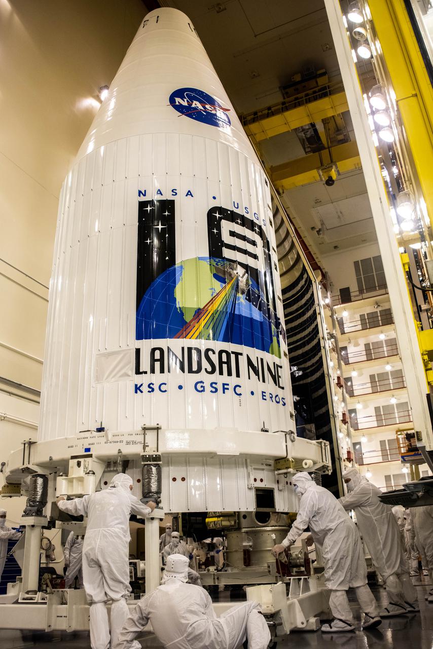
Inside the Integrated Processing Facility at Vandenberg Space Force Base in California, both United Launch Alliance (ULA) payload fairings are secured around the Landsat 9 spacecraft on Aug. 16, 2021. The fairings will encase and protect Landsat 9 during launch atop the ULA Atlas V rocket. Landsat 9 will launch on the Atlas V rocket from Space Launch Complex 3 at Vandenberg in September 2021. The launch is being managed by NASA’s Launch Services Program based at Kennedy Space Center, America’s multi-user spaceport. The Landsat 9 satellite will continue the nearly 50-year legacy of previous Landsat missions. It will monitor key natural and economic resources from orbit. Landsat 9 is managed by the agency’s Goddard Space Flight Center in Greenbelt, Maryland. The satellite will carry two instruments: the Operational Land Imager 2, which collects images of Earth’s landscapes in visible, near infrared and shortwave infrared light, and the Thermal Infrared Sensor 2, which measures the temperature of land surfaces. Like its predecessors, Landsat 9 is a joint mission between NASA and the U.S. Geological Survey.
Inside the Integrated Processing Facility at Vandenberg Space Force Base in California, both United Launch Alliance (ULA) payload fairings are secured around the Landsat 9 spacecraft on Aug. 16, 2021. The fairings will encase and protect Landsat 9 during launch atop the ULA Atlas V rocket. Landsat 9 will launch on the Atlas V rocket from Space Launch Complex 3 at Vandenberg in September 2021. The launch is being managed by NASA’s Launch Services Program based at Kennedy Space Center, America’s multi-user spaceport. The Landsat 9 satellite will continue the nearly 50-year legacy of previous Landsat missions. It will monitor key natural and economic resources from orbit. Landsat 9 is managed by the agency’s Goddard Space Flight Center in Greenbelt, Maryland. The satellite will carry two instruments: the Operational Land Imager 2, which collects images of Earth’s landscapes in visible, near infrared and shortwave infrared light, and the Thermal Infrared Sensor 2, which measures the temperature of land surfaces. Like its predecessors, Landsat 9 is a joint mission between NASA and the U.S. Geological Survey.
Inside the Integrated Processing Facility at Vandenberg Space Force Base in California, the Landsat 9 spacecraft is moved into position for encapsulation on Aug. 16, 2021. The two halves of the United Launch Alliance (ULA) payload fairing will surround and encase Landsat 9 to protect it during launch atop the ULA Atlas V rocket. Landsat 9 will launch on the Atlas V rocket from Space Launch Complex 3 at Vandenberg in September 2021. The launch is being managed by NASA’s Launch Services Program based at Kennedy Space Center, America’s multi-user spaceport. The Landsat 9 satellite will continue the nearly 50-year legacy of previous Landsat missions. It will monitor key natural and economic resources from orbit. Landsat 9 is managed by the agency’s Goddard Space Flight Center in Greenbelt, Maryland. The satellite will carry two instruments: the Operational Land Imager 2, which collects images of Earth’s landscapes in visible, near infrared and shortwave infrared light, and the Thermal Infrared Sensor 2, which measures the temperature of land surfaces. Like its predecessors, Landsat 9 is a joint mission between NASA and the U.S. Geological Survey.
Inside the Integrated Processing Facility at Vandenberg Space Force Base in California, both halves of the United Launch Alliance (ULA) payload fairing are slowly moved around the Landsat 9 spacecraft on Aug. 16, 2021. The payload fairing will be secured around Landsat 9 to protect it during launch atop the ULA Atlas V rocket. Landsat 9 will launch on the Atlas V rocket from Space Launch Complex 3 at Vandenberg in September 2021. The launch is being managed by NASA’s Launch Services Program based at Kennedy Space Center, America’s multi-user spaceport. The Landsat 9 satellite will continue the nearly 50-year legacy of previous Landsat missions. It will monitor key natural and economic resources from orbit. Landsat 9 is managed by the agency’s Goddard Space Flight Center in Greenbelt, Maryland. The satellite will carry two instruments: the Operational Land Imager 2, which collects images of Earth’s landscapes in visible, near infrared and shortwave infrared light, and the Thermal Infrared Sensor 2, which measures the temperature of land surfaces. Like its predecessors, Landsat 9 is a joint mission between NASA and the U.S. Geological Survey.
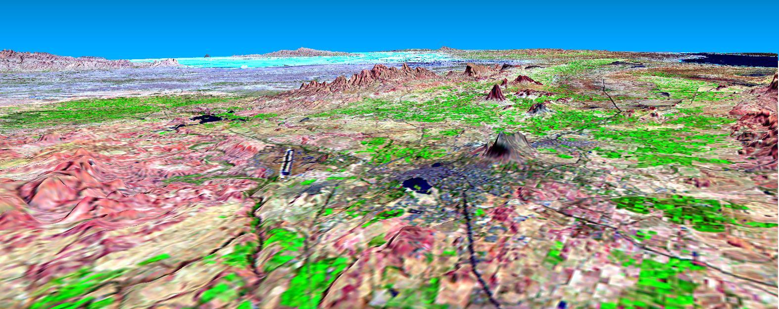
This perspective view shows the city of Bhuj, India, in the foreground gray area after an earthquake in western India on January 26, 2001. This image was generated from NASA Landsat satellite and data from Shuttle Radar Topography Mission SRTM.

Jeff Masek, Landsat 9 project scientist at NASA’s Goddard Space Flight Center, participates in the launch broadcast for the Landsat 9 mission on Sept. 27, 2021, at Vandenberg Space Force Base in California. NASA’s Landsat 9 satellite launched on a United Launch Alliance Atlas V 401 rocket from Vandenberg's Space Launch Complex 3 at 2:12 p.m. EDT (11:12 a.m. PDT). The launch is managed by NASA’s Launch Services Program, based at the agency’s Kennedy Space Center in Florida. Landsat 9 will join its sister satellite, Landsat 8, in orbit in collecting images from across the planet every eight days. This calibrated data will continue the Landsat program’s critical role in monitoring the health of Earth and helping people manage essential resources, including crops, irrigation water, and forests. NASA Goddard manages the Landsat 9 mission. Goddard teams also built and tested one of the two instruments on Landsat 9, the Thermal Infrared Sensor 2 (TIRS-2) instrument. TIRS-2 will use thermal imaging to make measurements that can be used to estimate soil moisture and detect the health of plants.

Dr. Kate Frickas, cofounder of "Ladies of Landsat", participates in the launch broadcast for the Landsat 9 mission on Sept. 27, 2021, at Vandenberg Space Force Base in California. NASA’s Landsat 9 satellite launched on a United Launch Alliance Atlas V 401 rocket from Vandenberg's Space Launch Complex 3 at 2:12 p.m. EDT (11:12 a.m. PDT). The launch is managed by NASA’s Launch Services Program, based at the agency’s Kennedy Space Center in Florida. Landsat 9 will join its sister satellite, Landsat 8, in orbit in collecting images from across the planet every eight days. This calibrated data will continue the Landsat program’s critical role in monitoring the health of Earth and helping people manage essential resources, including crops, irrigation water, and forests. NASA Goddard manages the Landsat 9 mission. Goddard teams also built and tested one of the two instruments on Landsat 9, the Thermal Infrared Sensor 2 (TIRS-2) instrument. TIRS-2 will use thermal imaging to make measurements that can be used to estimate soil moisture and detect the health of plants.
Marc Evan Jackson, actor, "Landsat Steve" in Kong: Skull Island, participates in the launch broadcast for the Landsat 9 mission on Sept. 27, 2021, at Vandenberg Space Force Base in California. NASA’s Landsat 9 satellite launched on a United Launch Alliance Atlas V 401 rocket from Vandenberg's Space Launch Complex 3 at 2:12 p.m. EDT (11:12 a.m. PDT). The launch is managed by NASA’s Launch Services Program, based at the agency’s Kennedy Space Center in Florida. Landsat 9 will join its sister satellite, Landsat 8, in orbit in collecting images from across the planet every eight days. This calibrated data will continue the Landsat program’s critical role in monitoring the health of Earth and helping people manage essential resources, including crops, irrigation water, and forests. NASA Goddard manages the Landsat 9 mission. Goddard teams also built and tested one of the two instruments on Landsat 9, the Thermal Infrared Sensor 2 (TIRS-2) instrument. TIRS-2 will use thermal imaging to make measurements that can be used to estimate soil moisture and detect the health of plants.
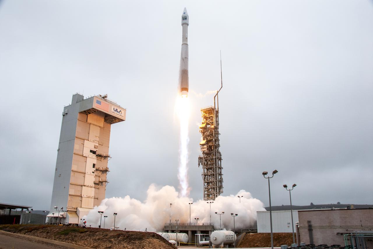
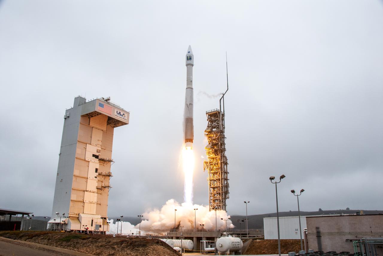
NASA’s Landsat 9 satellite launches on a United Launch Alliance Atlas V 401 rocket from Space Launch Complex 3 at Vandenberg Space Force Station in California on Sept. 27, 2021. Launch time was 2:11 p.m. EDT (11:11 a.m. PDT). The launch is managed by NASA’s Launch Services Program, based at the agency’s Kennedy Space Center in Florida. Landsat 9 will join its sister satellite, Landsat 8, in orbit in collecting images from across the planet every eight days. This calibrated data will continue the Landsat program’s critical role in monitoring the health of Earth and helping people manage essential resources, including crops, irrigation water, and forests. NASA Goddard manages the Landsat 9 mission. Goddard teams also built and tested one of the two instruments on Landsat 9, the Thermal Infrared Sensor 2 (TIRS-2) instrument. TIRS-2 will use thermal imaging to make measurements that can be used to estimate soil moisture and detect the health of plants.
NASA’s Landsat 9 satellite launches on a United Launch Alliance Atlas V 401 rocket from Space Launch Complex 3 at Vandenberg Space Force Station in California on Sept. 27, 2021. Launch time was 2:11 p.m. EDT (11:11 a.m. PDT). The launch is managed by NASA’s Launch Services Program, based at the agency’s Kennedy Space Center in Florida. Landsat 9 will join its sister satellite, Landsat 8, in orbit in collecting images from across the planet every eight days. This calibrated data will continue the Landsat program’s critical role in monitoring the health of Earth and helping people manage essential resources, including crops, irrigation water, and forests. NASA Goddard manages the Landsat 9 mission. Goddard teams also built and tested one of the two instruments on Landsat 9, the Thermal Infrared Sensor 2 (TIRS-2) instrument. TIRS-2 will use thermal imaging to make measurements that can be used to estimate soil moisture and detect the health of plants.
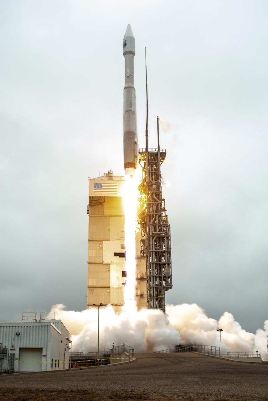
NASA’s Landsat 9 satellite launches on a United Launch Alliance Atlas V 401 rocket from Space Launch Complex 3 at Vandenberg Space Force Station in California on Sept. 27, 2021. Launch time was 2:11 p.m. EDT (11:11 a.m. PDT). The launch is managed by NASA’s Launch Services Program, based at the agency’s Kennedy Space Center in Florida. Landsat 9 will join its sister satellite, Landsat 8, in orbit in collecting images from across the planet every eight days. This calibrated data will continue the Landsat program’s critical role in monitoring the health of Earth and helping people manage essential resources, including crops, irrigation water, and forests. NASA Goddard manages the Landsat 9 mission. Goddard teams also built and tested one of the two instruments on Landsat 9, the Thermal Infrared Sensor 2 (TIRS-2) instrument. TIRS-2 will use thermal imaging to make measurements that can be used to estimate soil moisture and detect the health of plants.
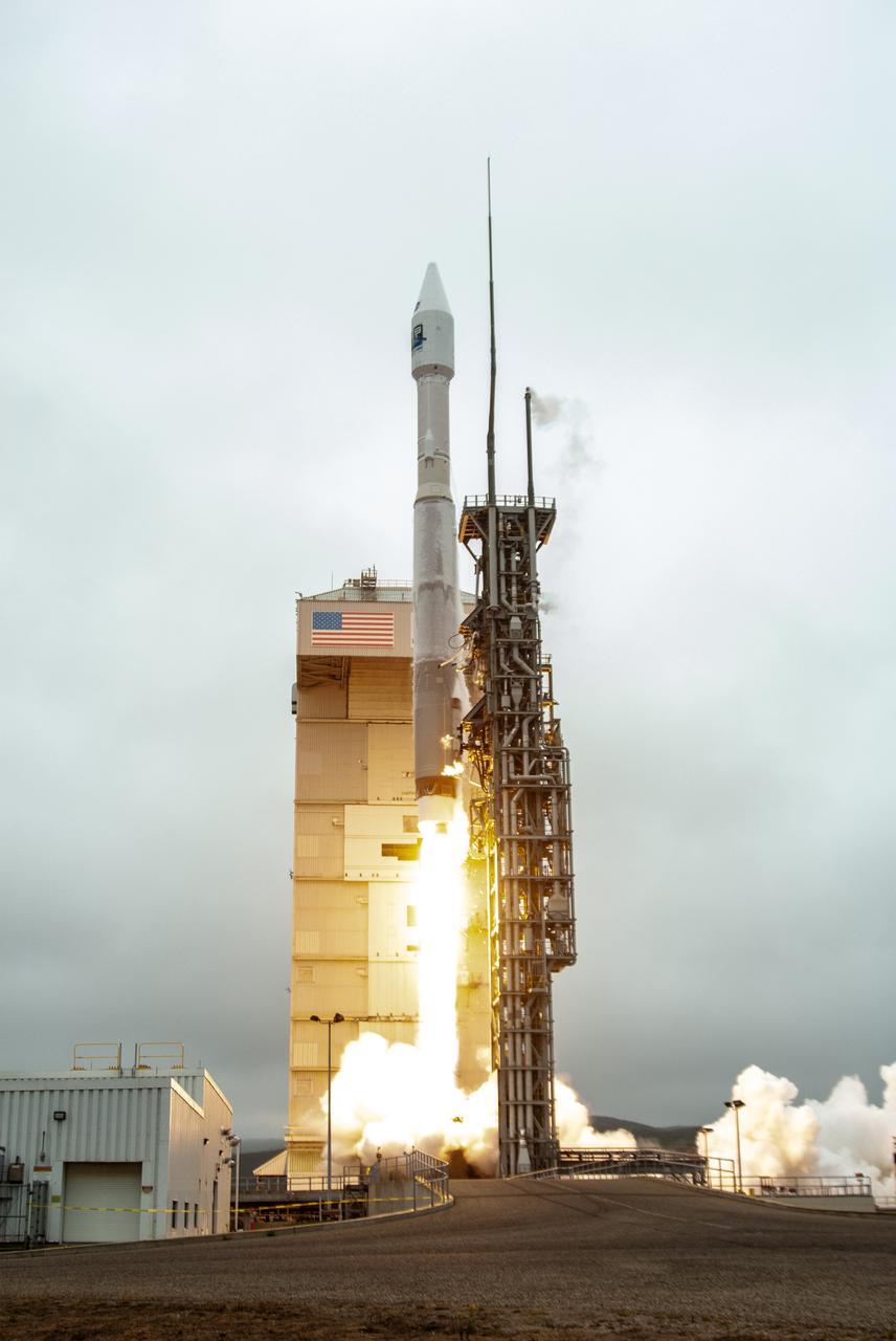
NASA’s Landsat 9 satellite launches on a United Launch Alliance Atlas V 401 rocket from Space Launch Complex 3 at Vandenberg Space Force Station in California on Sept. 27, 2021. Launch time was 2:11 p.m. EDT (11:11 a.m. PDT). The launch is managed by NASA’s Launch Services Program, based at the agency’s Kennedy Space Center in Florida. Landsat 9 will join its sister satellite, Landsat 8, in orbit in collecting images from across the planet every eight days. This calibrated data will continue the Landsat program’s critical role in monitoring the health of Earth and helping people manage essential resources, including crops, irrigation water, and forests. NASA Goddard manages the Landsat 9 mission. Goddard teams also built and tested one of the two instruments on Landsat 9, the Thermal Infrared Sensor 2 (TIRS-2) instrument. TIRS-2 will use thermal imaging to make measurements that can be used to estimate soil moisture and detect the health of plants.
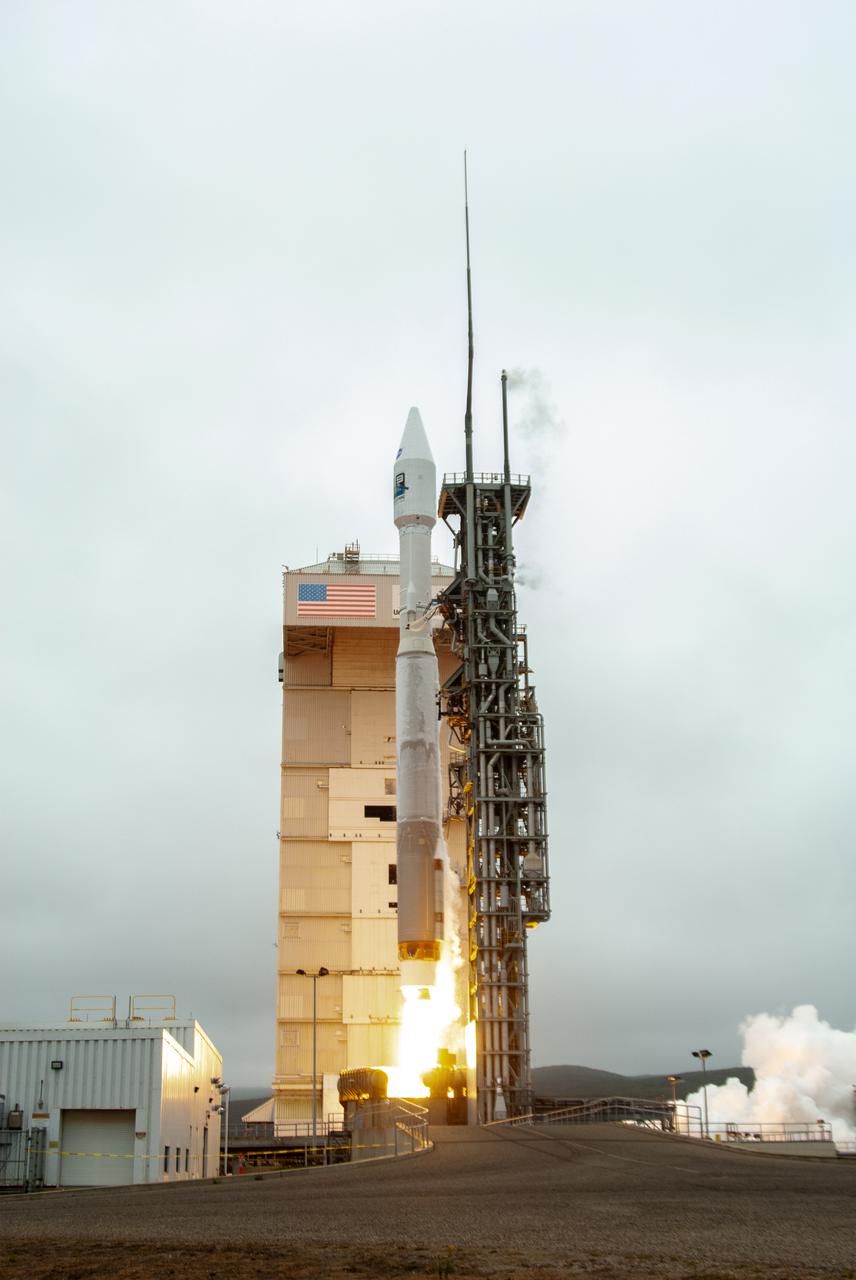
NASA’s Landsat 9 satellite launches on a United Launch Alliance Atlas V 401 rocket from Space Launch Complex 3 at Vandenberg Space Force Station in California on Sept. 27, 2021. Launch time was 2:11 p.m. EDT (11:11 a.m. PDT). The launch is managed by NASA’s Launch Services Program, based at the agency’s Kennedy Space Center in Florida. Landsat 9 will join its sister satellite, Landsat 8, in orbit in collecting images from across the planet every eight days. This calibrated data will continue the Landsat program’s critical role in monitoring the health of Earth and helping people manage essential resources, including crops, irrigation water, and forests. NASA Goddard manages the Landsat 9 mission. Goddard teams also built and tested one of the two instruments on Landsat 9, the Thermal Infrared Sensor 2 (TIRS-2) instrument. TIRS-2 will use thermal imaging to make measurements that can be used to estimate soil moisture and detect the health of plants.
NASA’s Landsat 9 satellite launches on a United Launch Alliance Atlas V 401 rocket from Space Launch Complex 3 at Vandenberg Space Force Station in California on Sept. 27, 2021. Launch time was 2:11 p.m. EDT (11:11 a.m. PDT). The launch is managed by NASA’s Launch Services Program, based at the agency’s Kennedy Space Center in Florida. Landsat 9 will join its sister satellite, Landsat 8, in orbit in collecting images from across the planet every eight days. This calibrated data will continue the Landsat program’s critical role in monitoring the health of Earth and helping people manage essential resources, including crops, irrigation water, and forests. NASA Goddard manages the Landsat 9 mission. Goddard teams also built and tested one of the two instruments on Landsat 9, the Thermal Infrared Sensor 2 (TIRS-2) instrument. TIRS-2 will use thermal imaging to make measurements that can be used to estimate soil moisture and detect the health of plants.
Forty miles west of downtown Chicago, the Fox River meanders its way through what has become the westernmost reaches of metropolitan Chicago, where the sprawling metropolis meets the hinterlands. While Chicago itself has seen a seven percent population decline during the last decade, the population of its metropolitan region, "Chicagoland," has steadily increased. These two natural-color Landsat 5 images acquired a quarter-century apart (on May 2, 1985, and May 23, 2010), stand witness to the soaring growth of this region. Aurora, Illinois’ second largest city, is the silvery-green region to the left hugging the Fox River, just south of the I-88 (North is to the right in this image); Carpentersville is found on the rightmost side, north of the I-90. From 1985 to 2010 a development explosion can been seen as the browns of pasture lands give way to silvery-green suburban areas and large white-colored business districts spring up along and east of the river. A major expansion of Dupage Airport appears in the middle of the 2010 image, and the circular-shaped region north of the I-88 and east of the Fox River, visible on both images, is the Department of Energy’s Fermilab. ---- NASA and the U.S. Department of the Interior through the U.S. Geological Survey (USGS) jointly manage Landsat, and the USGS preserves a 40-year archive of Landsat images that is freely available over the Internet. The next Landsat satellite, now known as the Landsat Data Continuity Mission (LDCM) and later to be called Landsat 8, is scheduled for launch in 2013. In honor of Landsat’s 40th anniversary in July 2012, the USGS released the LandsatLook viewer – a quick, simple way to go forward and backward in time, pulling images of anywhere in the world out of the Landsat archive. <b><a href="http://www.nasa.gov/audience/formedia/features/MP_Photo_Guidelines.html" rel="nofollow">NASA image use policy.</a></b> <b><a href="http://www.nasa.gov/centers/goddard/home/index.html" rel="nofollow">NASA Goddard Space Flight Center</a></b> enables NASA’s mission through four scientific endeavors: Earth Science, Heliophysics, Solar System Exploration, and Astrophysics. Goddard plays a leading role in NASA’s accomplishments by contributing compelling scientific knowledge to advance the Agency’s mission. <b>Follow us on <a href="http://twitter.com/NASA_GoddardPix" rel="nofollow">Twitter</a></b> <b>Like us on <a href="http://www.facebook.com/pages/Greenbelt-MD/NASA-Goddard/395013845897?ref=tsd" rel="nofollow">Facebook</a></b> <b>Find us on <a href="http://instagrid.me/nasagoddard/?vm=grid" rel="nofollow">Instagram</a></b>
Inside Building 7525, a processing facility at Vandenberg Space Force Base in California, a worker secures the aft stub adapter onto the interstage adapter for the United Launch Alliance Atlas V rocket on Nov. 4, 2020. The Atlas V will launch NASA’s Landsat 9 satellite from Vandenberg in September 2021. The launch is being managed by NASA’s Launch Services Program based at Kennedy Space Center. Landsat 9 will continue the nearly 50-year legacy of previous Landsat missions. It will monitor key natural and economic resources from orbit. Landsat 9 is managed by the agency’s Goddard Space Flight Center in Greenbelt, Maryland. It will carry two instruments: the Operational Land Imager 2, which collects images of Earth’s landscapes in visible, near infrared and shortwave infrared light, and the Thermal Infrared Sensor 2, which measures the temperature of land surfaces. Like its predecessors, Landsat 9 is a joint mission between NASA and the U.S. Geological Survey.
Inside Building 7525, a processing facility at Vandenberg Space Force Base in California, workers assist as the aft stub adapter is lowered onto the interstage adapter for the United Launch Alliance Atlas V rocket on Nov. 4, 2020. The Atlas V will launch NASA’s Landsat 9 satellite from Vandenberg in September 2021. The launch is being managed by NASA’s Launch Services Program based at Kennedy Space Center. Landsat 9 will continue the nearly 50-year legacy of previous Landsat missions. It will monitor key natural and economic resources from orbit. Landsat 9 is managed by the agency’s Goddard Space Flight Center in Greenbelt, Maryland. It will carry two instruments: the Operational Land Imager 2, which collects images of Earth’s landscapes in visible, near infrared and shortwave infrared light, and the Thermal Infrared Sensor 2, which measures the temperature of land surfaces. Like its predecessors, Landsat 9 is a joint mission between NASA and the U.S. Geological Survey.
Inside Building 7525, a processing facility at Vandenberg Space Force Base in California, the aft stub adapter is being prepared for mating to the interstage adapter for the United Launch Alliance Atlas V rocket on Nov. 4, 2020. The Atlas V will launch NASA’s Landsat 9 satellite from Vandenberg in September 2021. The launch is being managed by NASA’s Launch Services Program based at Kennedy Space Center. Landsat 9 will continue the nearly 50-year legacy of previous Landsat missions. It will monitor key natural and economic resources from orbit. Landsat 9 is managed by the agency’s Goddard Space Flight Center in Greenbelt, Maryland. It will carry two instruments: the Operational Land Imager 2, which collects images of Earth’s landscapes in visible, near-infrared and shortwave infrared light, and the Thermal Infrared Sensor 2, which measures the temperature of land surfaces. Like its predecessors, Landsat 9 is a joint mission between NASA and the U.S. Geological Survey.
Inside Building 7525, a processing facility at Vandenberg Space Force Base in California, the aft stub adapter is lifted for mating to the interstage adapter for the United Launch Alliance Atlas V rocket on Nov. 4, 2020. The Atlas V will launch NASA’s Landsat 9 satellite from Vandenberg in September 2021. The launch is being managed by NASA’s Launch Services Program based at Kennedy Space Center. Landsat 9 will continue the nearly 50-year legacy of previous Landsat missions. It will monitor key natural and economic resources from orbit. Landsat 9 is managed by the agency’s Goddard Space Flight Center in Greenbelt, Maryland. It will carry two instruments: the Operational Land Imager 2, which collects images of Earth’s landscapes in visible, near infrared and shortwave infrared light, and the Thermal Infrared Sensor 2, which measures the temperature of land surfaces. Like its predecessors, Landsat 9 is a joint mission between NASA and the U.S. Geological Survey.
The Evolved Expendable Launch Vehicle Secondary Payload Adapter for NASA’s Landsat 9 mission is moved into a processing facility at Vandenberg Space Force Base in California, on June 14, 2021. The Landsat 9 mission will launch atop a United Launch Alliance Atlas V from Vandenberg in September 2021. The launch is being managed by NASA’s Launch Services Program based at Kennedy Space Center. The Landsat 9 satellite will continue the nearly 50-year legacy of previous Landsat missions. It will monitor key natural and economic resources from orbit. Landsat 9 is managed by the agency’s Goddard Space Flight Center in Greenbelt, Maryland. The satellite will carry two instruments: the Operational Land Imager 2, which collects images of Earth’s landscapes in visible, near infrared and shortwave infrared light, and the Thermal Infrared Sensor 2, which measures the temperature of land surfaces. Like its predecessors, Landsat 9 is a joint mission between NASA and the U.S. Geological Survey.
Technicians perform a blacklight inspection of the secondary payload adapter for NASA’s Landsat 9 mission at Vandenberg Space Force Base in California, on Aug. 4, 2021, before it is transported to the Integrated Processing Facility. Several secondary payloads, called CubeSats, will launch with Landsat 9 atop a United Launch Alliance Atlas V rocket from Vandenberg in September 2021. The launch is being managed by NASA’s Launch Services Program based at Kennedy Space Center, America’s multi-user spaceport. The Landsat 9 satellite will continue the nearly 50-year legacy of previous Landsat missions. It will monitor key natural and economic resources from orbit. Landsat 9 is managed by the agency’s Goddard Space Flight Center in Greenbelt, Maryland. The satellite will carry two instruments: the Operational Land Imager 2, which collects images of Earth’s landscapes in visible, near infrared and shortwave infrared light, and the Thermal Infrared Sensor 2, which measures the temperature of land surfaces. Like its predecessors, Landsat 9 is a joint mission between NASA and the U.S. Geological Survey.
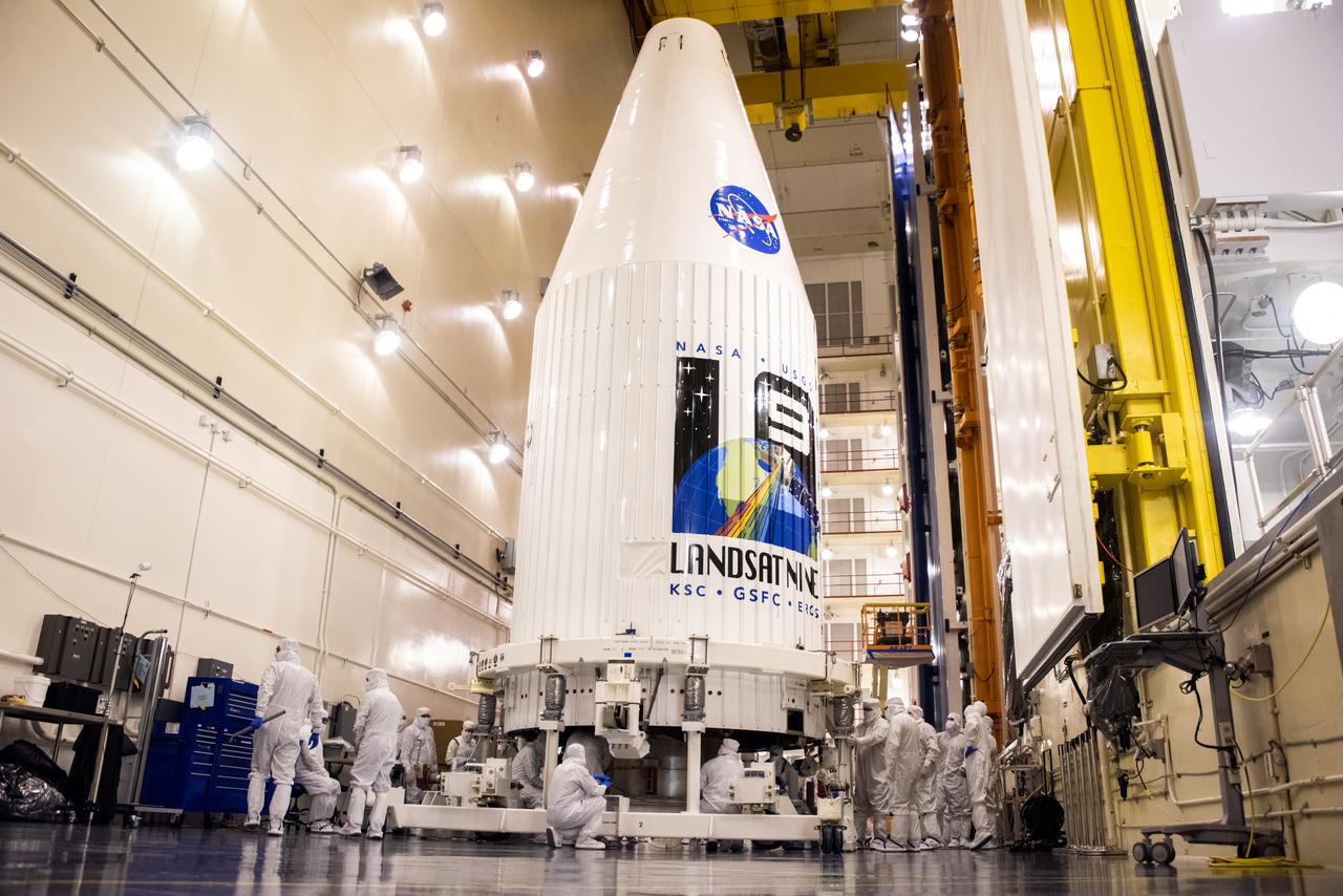
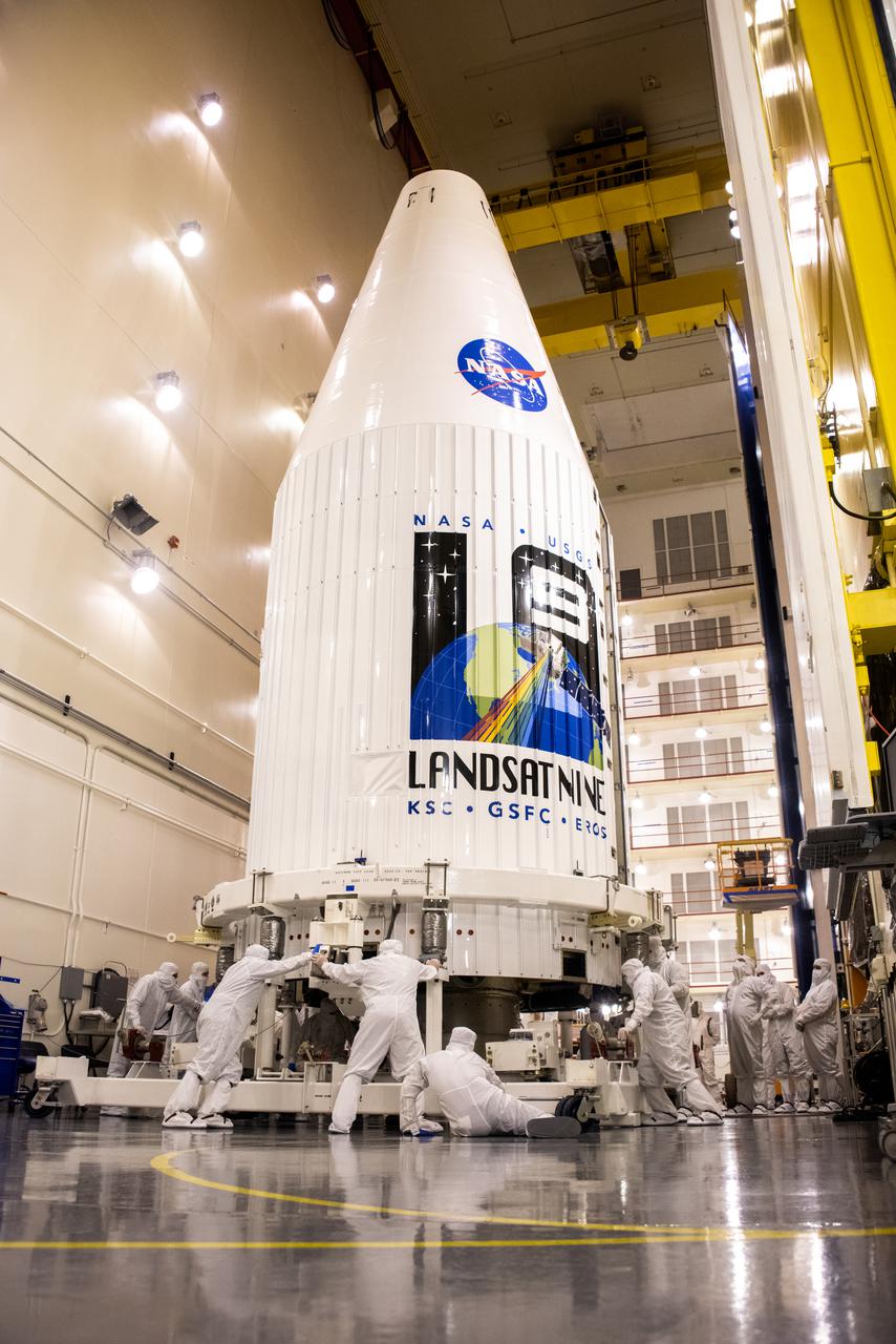
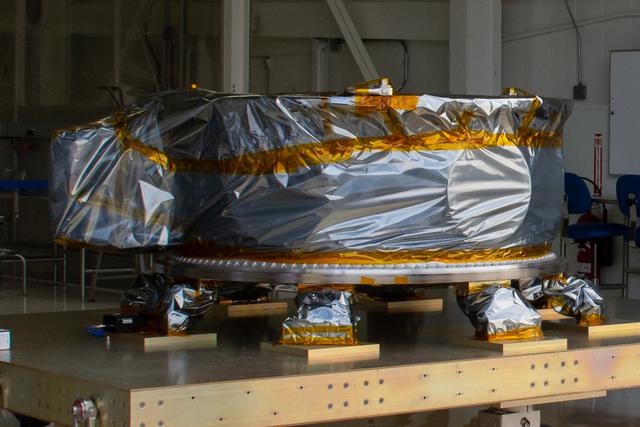
Encapsulated within the United Launch Alliance (ULA) payload fairing, the Landsat 9 spacecraft undergoes final preparations before launch inside the Integrated Processing Facility at Vandenberg Space Force Base in California on Aug. 25, 2021. Landsat 9 will launch on a ULA Atlas V rocket from Space Launch Complex 3 at Vandenberg in September 2021. The launch is being managed by NASA’s Launch Services Program based at Kennedy Space Center, America’s multi-user spaceport. The Landsat 9 satellite will continue the nearly 50-year legacy of previous Landsat missions and monitor key natural and economic resources from orbit. Landsat 9 is managed by the agency’s Goddard Space Flight Center in Greenbelt, Maryland. The satellite will carry two instruments: the Operational Land Imager 2, which collects images of Earth’s landscapes in visible, near infrared and shortwave infrared light, and the Thermal Infrared Sensor 2, which measures the temperature of land surfaces. Like its predecessors, Landsat 9 is a joint mission between NASA and the U.S. Geological Survey.
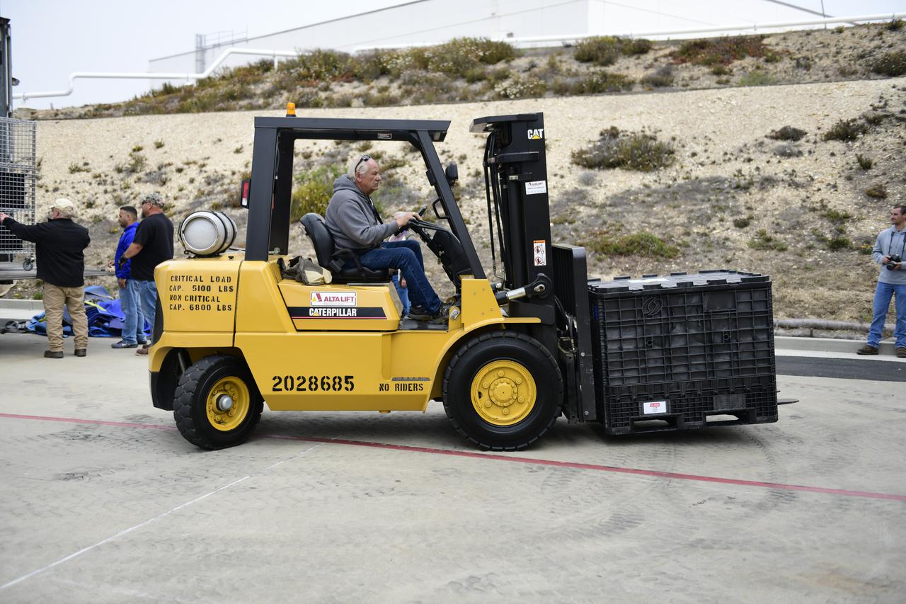
A forklift is used to move containers of electrical ground support equipment for NASA’s Landsat 9 mission to the Integrated Processing Facility at Vandenberg Space Force Base in California, on June 29, 2021. The Landsat 9 mission will launch atop a United Launch Alliance Atlas V rocket from Vandenberg in September 2021. The launch is being managed by NASA’s Launch Services Program based at Kennedy Space Center. The Landsat 9 satellite will continue the nearly 50-year legacy of previous Landsat missions. It will monitor key natural and economic resources from orbit. Landsat 9 is managed by the agency’s Goddard Space Flight Center in Greenbelt, Maryland. The satellite will carry two instruments: the Operational Land Imager 2, which collects images of Earth’s landscapes in visible, near infrared and shortwave infrared light, and the Thermal Infrared Sensor 2, which measures the temperature of land surfaces. Like its predecessors, Landsat 9 is a joint mission between NASA and the U.S. Geological Survey.
Encapsulated within the United Launch Alliance (ULA) payload fairing, the Landsat 9 spacecraft undergoes final preparations before launch inside the Integrated Processing Facility at Vandenberg Space Force Base in California on Aug. 25, 2021. Landsat 9 will launch on a ULA Atlas V rocket from Space Launch Complex 3 at Vandenberg in September 2021. The launch is being managed by NASA’s Launch Services Program based at Kennedy Space Center, America’s multi-user spaceport. The Landsat 9 satellite will continue the nearly 50-year legacy of previous Landsat missions and monitor key natural and economic resources from orbit. Landsat 9 is managed by the agency’s Goddard Space Flight Center in Greenbelt, Maryland. The satellite will carry two instruments: the Operational Land Imager 2, which collects images of Earth’s landscapes in visible, near infrared and shortwave infrared light, and the Thermal Infrared Sensor 2, which measures the temperature of land surfaces. Like its predecessors, Landsat 9 is a joint mission between NASA and the U.S. Geological Survey.
Containers of electrical ground support equipment for NASA’s Landsat 9 mission are moved inside the Integrated Processing Facility at Vandenberg Space Force Base in California, on June 29, 2021. The Landsat 9 mission will launch atop a United Launch Alliance Atlas V rocket from Vandenberg in September 2021. The launch is being managed by NASA’s Launch Services Program based at Kennedy Space Center. The Landsat 9 satellite will continue the nearly 50-year legacy of previous Landsat missions. It will monitor key natural and economic resources from orbit. Landsat 9 is managed by the agency’s Goddard Space Flight Center in Greenbelt, Maryland. The satellite will carry two instruments: the Operational Land Imager 2, which collects images of Earth’s landscapes in visible, near infrared and shortwave infrared light, and the Thermal Infrared Sensor 2, which measures the temperature of land surfaces. Like its predecessors, Landsat 9 is a joint mission between NASA and the U.S. Geological Survey.
United Launch Alliance (ULA) technicians move containers of electrical ground support equipment for NASA’s Landsat 9 mission inside the Integrated Processing Facility at Vandenberg Space Force Base in California, on June 29, 2021. The Landsat 9 mission will launch atop a ULA Atlas V rocket from Vandenberg in September 2021. The launch is being managed by NASA’s Launch Services Program based at Kennedy Space Center. The Landsat 9 satellite will continue the nearly 50-year legacy of previous Landsat missions. It will monitor key natural and economic resources from orbit. Landsat 9 is managed by the agency’s Goddard Space Flight Center in Greenbelt, Maryland. The satellite will carry two instruments: the Operational Land Imager 2, which collects images of Earth’s landscapes in visible, near infrared and shortwave infrared light, and the Thermal Infrared Sensor 2, which measures the temperature of land surfaces. Like its predecessors, Landsat 9 is a joint mission between NASA and the U.S. Geological Survey.
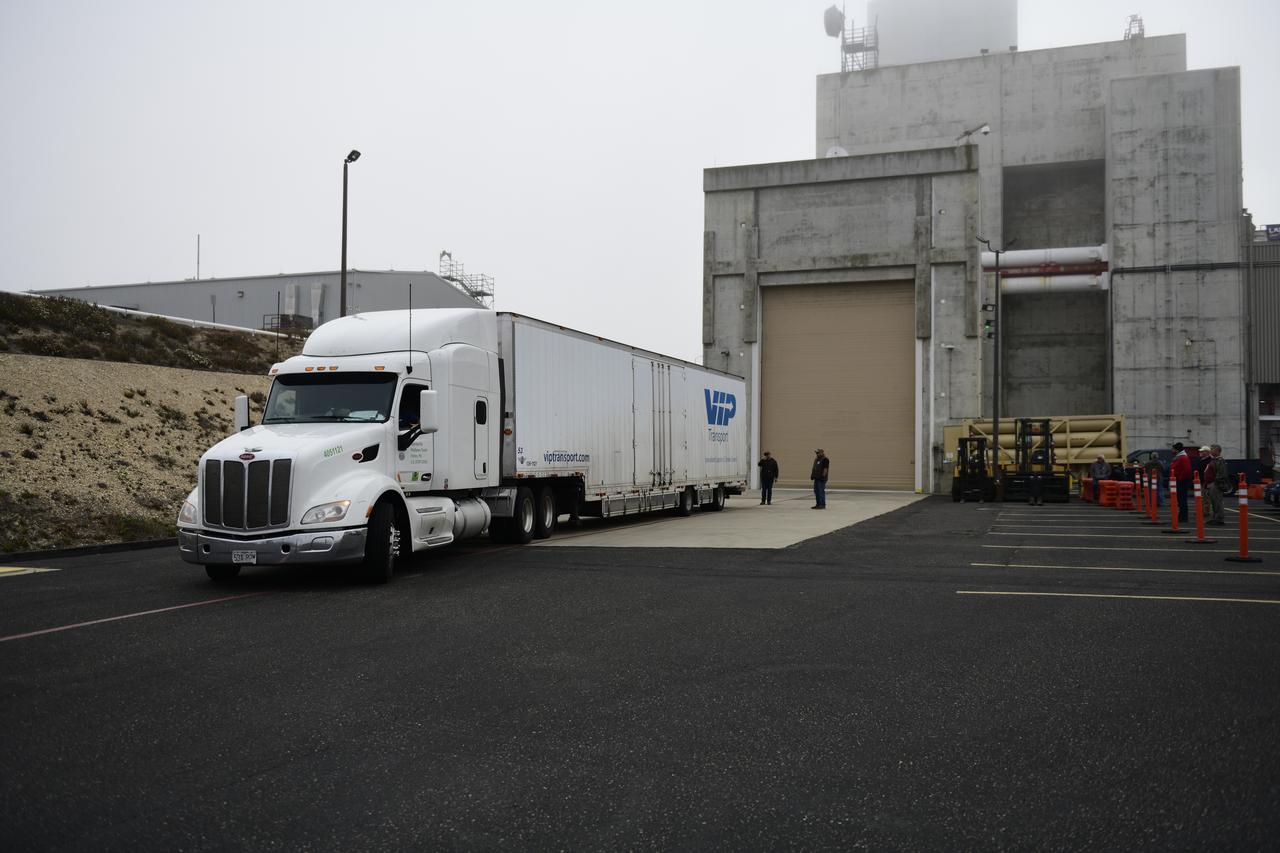
A truck carrying electrical ground support equipment for NASA’s Landsat 9 mission arrives at the Integrated Processing Facility at Vandenberg Space Force Base in California, on June 29, 2021. The Landsat 9 mission will launch atop a United Launch Alliance Atlas V rocket from Vandenberg in September 2021. The launch is being managed by NASA’s Launch Services Program based at Kennedy Space Center. The Landsat 9 satellite will continue the nearly 50-year legacy of previous Landsat missions. It will monitor key natural and economic resources from orbit. Landsat 9 is managed by the agency’s Goddard Space Flight Center in Greenbelt, Maryland. The satellite will carry two instruments: the Operational Land Imager 2, which collects images of Earth’s landscapes in visible, near infrared and shortwave infrared light, and the Thermal Infrared Sensor 2, which measures the temperature of land surfaces. Like its predecessors, Landsat 9 is a joint mission between NASA and the U.S. Geological Survey.
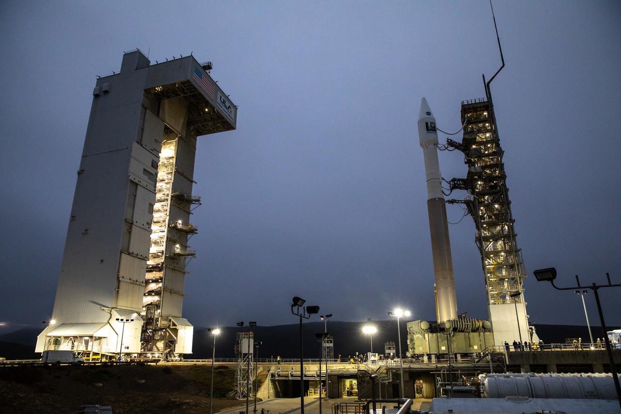
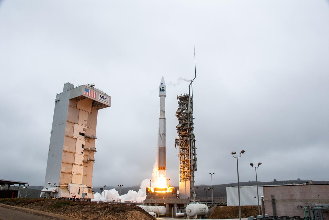
The United Launch Alliance Atlas V 401 rocket with NASA’s Landsat 9 satellite arrives at the launch pad at Space Launch Complex 3 (SLC-3) at Vandenberg Space Force Base in California, on Sept. 27, 2021, after rolling out from the Vertical Integration Facility. Landsat 9 is scheduled to launch at 2:12 p.m. EDT (11:12 a.m. PDT) today, Sept. 27, atop the Atlas V from SLC-3. The launch is managed by NASA’s Launch Services Program based at Kennedy Space Center. The Landsat 9 satellite will continue the nearly 50-year legacy of previous Landsat missions. It will join its sister satellite, Landsat 8, in orbit to monitor key natural and economic resources from orbit. Landsat 9 is managed by the agency’s Goddard Space Flight Center in Greenbelt, Maryland. The satellite will carry two instruments: the Operational Land Imager 2, which collects images of Earth’s landscapes in visible, near infrared and shortwave infrared light, and the Thermal Infrared Sensor 2, which measures the temperature of land surfaces. Like its predecessors, Landsat 9 is a joint mission between NASA and the U.S. Geological Survey.
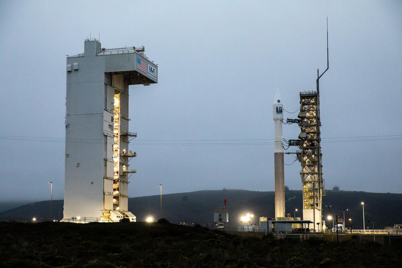
The United Launch Alliance Atlas V 401 rocket with NASA’s Landsat 9 satellite is secured on the launch pad at Space Launch Complex 3 (SLC-3) at Vandenberg Space Force Base in California, on Sept. 27, 2021, after making the trek from the Vertical Integration Facility. Landsat 9 is scheduled to launch at 2:12 p.m. EDT (11:12 a.m. PDT) today, Sept. 27, atop the Atlas V from SLC-3. The launch is managed by NASA’s Launch Services Program based at Kennedy Space Center. The Landsat 9 satellite will continue the nearly 50-year legacy of previous Landsat missions. It will join its sister satellite, Landsat 8, in orbit to monitor key natural and economic resources from orbit. Landsat 9 is managed by the agency’s Goddard Space Flight Center in Greenbelt, Maryland. The satellite will carry two instruments: the Operational Land Imager 2, which collects images of Earth’s landscapes in visible, near infrared and shortwave infrared light, and the Thermal Infrared Sensor 2, which measures the temperature of land surfaces. Like its predecessors, Landsat 9 is a joint mission between NASA and the U.S. Geological Survey.
Technicians process mechanical and electrical support equipment for NASA’s Landsat 9 observatory inside the Integrated Processing Facility at Vandenberg Space Force Base in California, on June 16, 2021. The equipment includes a secondary payload adapter and flight system for a group of microsat payloads, called CubeSats, that will launch with Landsat 9 as secondary payloads. Landsat 9 will launch on a United Launch Alliance Atlas V rocket from Space Launch Complex 3 at Vandenberg in September 2021. The launch is being managed by NASA’s Launch Services Program based at Kennedy Space Center, America’s multiuser spaceport. The Landsat 9 satellite will continue the nearly 50-year legacy of previous Landsat missions. It will monitor key natural and economic resources from orbit. Landsat 9 is managed by the agency’s Goddard Space Flight Center in Greenbelt, Maryland. The satellite will carry two instruments: the Operational Land Imager 2, which collects images of Earth’s landscapes in visible, near infrared and shortwave infrared light, and the Thermal Infrared Sensor 2, which measures the temperature of land surfaces. Like its predecessors, Landsat 9 is a joint mission between NASA and the U.S. Geological Survey.
Mechanical and electrical support equipment for NASA’s Landsat 9 observatory are being processed inside the Integrated Processing Facility at Vandenberg Space Force Base in California, on June 24, 2021. The equipment includes a secondary payload adapter and flight system for a group of microsat payloads, called CubeSats, that will launch with Landsat 9 as secondary payloads. Landsat 9 will launch on a United Launch Alliance Atlas V rocket from Space Launch Complex 3 at Vandenberg in September 2021. The launch is being managed by NASA’s Launch Services Program based at Kennedy Space Center, America’s multiuser spaceport. The Landsat 9 satellite will continue the nearly 50-year legacy of previous Landsat missions. It will monitor key natural and economic resources from orbit. Landsat 9 is managed by the agency’s Goddard Space Flight Center in Greenbelt, Maryland. The satellite will carry two instruments: the Operational Land Imager 2, which collects images of Earth’s landscapes in visible, near infrared and shortwave infrared light, and the Thermal Infrared Sensor 2, which measures the temperature of land surfaces. Like its predecessors, Landsat 9 is a joint mission between NASA and the U.S. Geological Survey.
Mechanical and electrical support equipment for NASA’s Landsat 9 observatory are inside the Integrated Processing Facility at Vandenberg Space Force Base in California, on June 16, 2021. The equipment includes a secondary payload adapter and flight system for a group of microsat payloads, called CubeSats, that will launch with Landsat 9 as secondary payloads. Landsat 9 will launch on a United Launch Alliance Atlas V rocket from Space Launch Complex 3 at Vandenberg in September 2021. The launch is being managed by NASA’s Launch Services Program based at Kennedy Space Center, America’s multiuser spaceport. The Landsat 9 satellite will continue the nearly 50-year legacy of previous Landsat missions. It will monitor key natural and economic resources from orbit. Landsat 9 is managed by the agency’s Goddard Space Flight Center in Greenbelt, Maryland. The satellite will carry two instruments: the Operational Land Imager 2, which collects images of Earth’s landscapes in visible, near infrared and shortwave infrared light, and the Thermal Infrared Sensor 2, which measures the temperature of land surfaces. Like its predecessors, Landsat 9 is a joint mission between NASA and the U.S. Geological Survey.
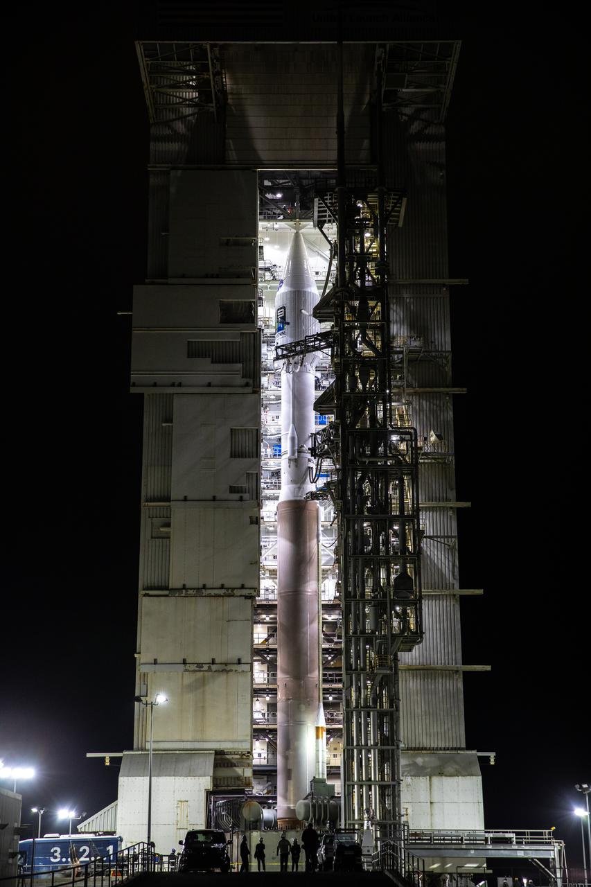
The United Launch Alliance Atlas V 401 rocket with NASA’s Landsat 9 satellite begins rollout from the Vertical Integration Facility to the launch pad at Space Launch Complex 3 (SLC-3) at Vandenberg Space Force Base in California, on Sept. 27, 2021. Landsat 9 is scheduled to launch at 2:12 p.m. EDT (11:12 a.m. PDT) today, Sept. 27, atop the Atlas V from SLC-3. The launch is managed by NASA’s Launch Services Program based at Kennedy Space Center. The Landsat 9 satellite will continue the nearly 50-year legacy of previous Landsat missions. It will join its sister satellite, Landsat 8, in orbit to monitor key natural and economic resources from orbit. Landsat 9 is managed by the agency’s Goddard Space Flight Center in Greenbelt, Maryland. The satellite will carry two instruments: the Operational Land Imager 2, which collects images of Earth’s landscapes in visible, near infrared and shortwave infrared light, and the Thermal Infrared Sensor 2, which measures the temperature of land surfaces. Like its predecessors, Landsat 9 is a joint mission between NASA and the U.S. Geological Survey.
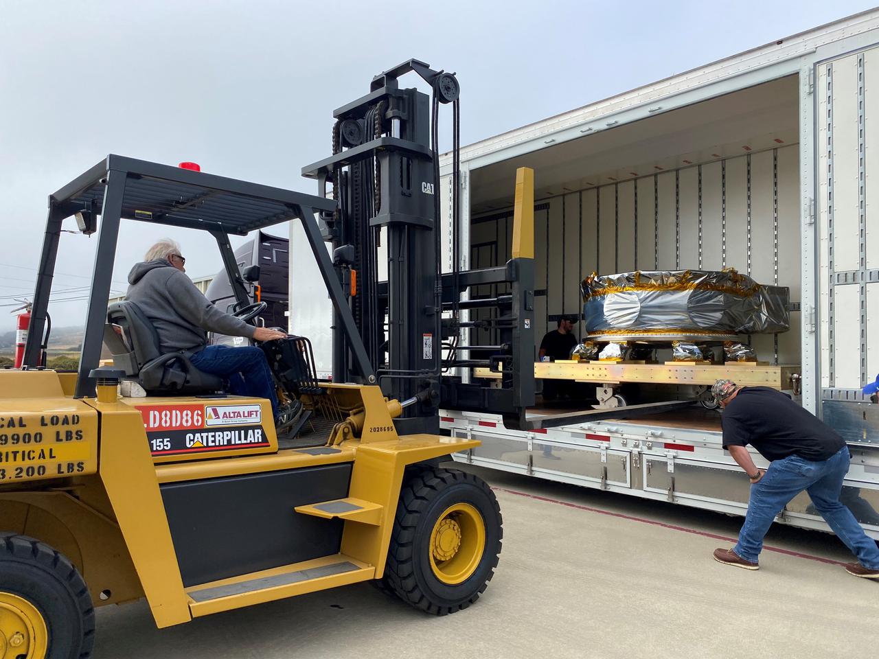
Mechanical and electrical support equipment for NASA’s Landsat 9 observatory arrive at the Integrated Processing Facility at Vandenberg Space Force Base in California, on June 14, 2021. The equipment includes a secondary payload adapter and flight system for a group of microsat payloads, called CubeSats, that will launch with Landsat 9 as secondary payloads. Landsat 9 will launch on a United Launch Alliance Atlas V rocket from Space Launch Complex 3 at Vandenberg in September 2021. The launch is being managed by NASA’s Launch Services Program based at Kennedy Space Center, America’s multiuser spaceport. The Landsat 9 satellite will continue the nearly 50-year legacy of previous Landsat missions. It will monitor key natural and economic resources from orbit. Landsat 9 is managed by the agency’s Goddard Space Flight Center in Greenbelt, Maryland. The satellite will carry two instruments: the Operational Land Imager 2, which collects images of Earth’s landscapes in visible, near infrared and shortwave infrared light, and the Thermal Infrared Sensor 2, which measures the temperature of land surfaces. Like its predecessors, Landsat 9 is a joint mission between NASA and the U.S. Geological Survey.
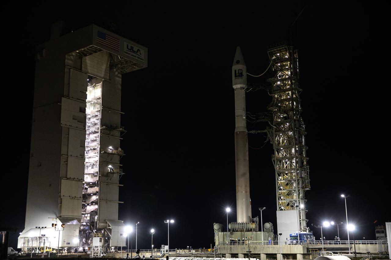
The United Launch Alliance Atlas V 401 rocket with NASA’s Landsat 9 satellite rolls out from the Vertical Integration Facility to the launch pad at Space Launch Complex 3 (SLC-3) at Vandenberg Space Force Base in California, on Sept. 27, 2021. Landsat 9 is scheduled to launch at 2:12 p.m. EDT (11:12 a.m. PDT) today, Sept. 27, atop the Atlas V from SLC-3. The launch is managed by NASA’s Launch Services Program based at Kennedy Space Center. The Landsat 9 satellite will continue the nearly 50-year legacy of previous Landsat missions. It will join its sister satellite, Landsat 8, in orbit to monitor key natural and economic resources from orbit. Landsat 9 is managed by the agency’s Goddard Space Flight Center in Greenbelt, Maryland. The satellite will carry two instruments: the Operational Land Imager 2, which collects images of Earth’s landscapes in visible, near infrared and shortwave infrared light, and the Thermal Infrared Sensor 2, which measures the temperature of land surfaces. Like its predecessors, Landsat 9 is a joint mission between NASA and the U.S. Geological Survey.
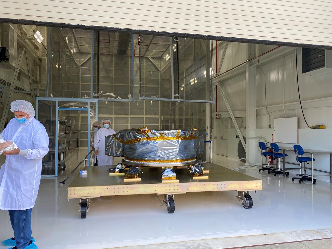
Mechanical and electrical support equipment for NASA’s Landsat 9 observatory arrive inside the Integrated Processing Facility at Vandenberg Space Force Base in California, on June 14, 2021. The equipment includes a secondary payload adapter and flight system for a group of microsat payloads, called CubeSats, that will launch with Landsat 9 as secondary payloads. Landsat 9 will launch on a United Launch Alliance Atlas V rocket from Space Launch Complex 3 at Vandenberg in September 2021. The launch is being managed by NASA’s Launch Services Program based at Kennedy Space Center, America’s multiuser spaceport. The Landsat 9 satellite will continue the nearly 50-year legacy of previous Landsat missions. It will monitor key natural and economic resources from orbit. Landsat 9 is managed by the agency’s Goddard Space Flight Center in Greenbelt, Maryland. The satellite will carry two instruments: the Operational Land Imager 2, which collects images of Earth’s landscapes in visible, near infrared and shortwave infrared light, and the Thermal Infrared Sensor 2, which measures the temperature of land surfaces. Like its predecessors, Landsat 9 is a joint mission between NASA and the U.S. Geological Survey.

Dr. Thomas Zurbuchen, associate administrator, NASA’s Science Mission Directorate, participates in the launch broadcast for the Landsat 9 mission on Sept. 27, 2021, at Vandenberg Space Force Base in California. NASA’s Landsat 9 satellite launched on a United Launch Alliance Atlas V 401 rocket from Vandenberg's Space Launch Complex 3 at 2:12 p.m. EDT (11:12 a.m. PDT). The launch is managed by NASA’s Launch Services Program, based at the agency’s Kennedy Space Center in Florida. Landsat 9 will join its sister satellite, Landsat 8, in orbit in collecting images from across the planet every eight days. This calibrated data will continue the Landsat program’s critical role in monitoring the health of Earth and helping people manage essential resources, including crops, irrigation water, and forests. NASA Goddard manages the Landsat 9 mission. Goddard teams also built and tested one of the two instruments on Landsat 9, the Thermal Infrared Sensor 2 (TIRS-2) instrument. TIRS-2 will use thermal imaging to make measurements that can be used to estimate soil moisture and detect the health of plants.
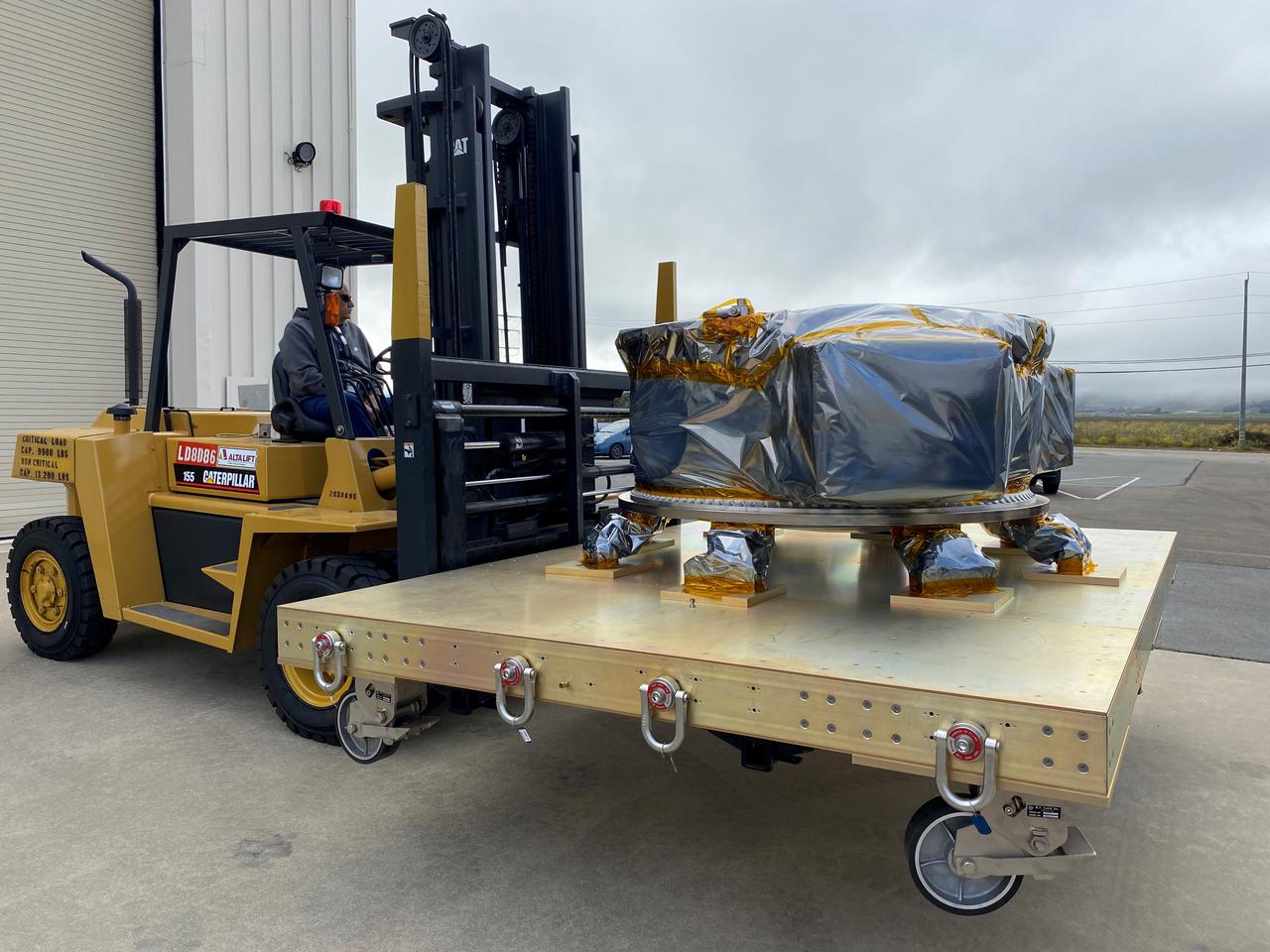
Mechanical and electrical support equipment for NASA’s Landsat 9 observatory arrive at the Integrated Processing Facility at Vandenberg Space Force Base in California, on June 14, 2021. The equipment includes a secondary payload adapter and flight system for a group of microsat payloads, called CubeSats, that will launch with Landsat 9 as secondary payloads. Landsat 9 will launch on a United Launch Alliance Atlas V rocket from Space Launch Complex 3 at Vandenberg in September 2021. The launch is being managed by NASA’s Launch Services Program based at Kennedy Space Center, America’s multiuser spaceport. The Landsat 9 satellite will continue the nearly 50-year legacy of previous Landsat missions. It will monitor key natural and economic resources from orbit. Landsat 9 is managed by the agency’s Goddard Space Flight Center in Greenbelt, Maryland. The satellite will carry two instruments: the Operational Land Imager 2, which collects images of Earth’s landscapes in visible, near infrared and shortwave infrared light, and the Thermal Infrared Sensor 2, which measures the temperature of land surfaces. Like its predecessors, Landsat 9 is a joint mission between NASA and the U.S. Geological Survey.

Dr. Pete Doucette, acting director, USGS Earth Resources, participates in the launch broadcast for the Landsat 9 mission on Sept. 27, 2021, at Vandenberg Space Force Base in California. NASA’s Landsat 9 satellite launched on a United Launch Alliance Atlas V 401 rocket from Vandenberg's Space Launch Complex 3 at 2:12 p.m. EDT (11:12 a.m. PDT). The launch is managed by NASA’s Launch Services Program, based at the agency’s Kennedy Space Center in Florida. Landsat 9 will join its sister satellite, Landsat 8, in orbit in collecting images from across the planet every eight days. This calibrated data will continue the Landsat program’s critical role in monitoring the health of Earth and helping people manage essential resources, including crops, irrigation water, and forests. NASA Goddard manages the Landsat 9 mission. Goddard teams also built and tested one of the two instruments on Landsat 9, the Thermal Infrared Sensor 2 (TIRS-2) instrument. TIRS-2 will use thermal imaging to make measurements that can be used to estimate soil moisture and detect the health of plants.
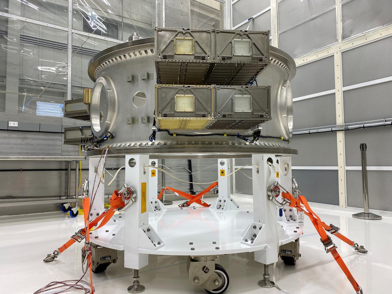
Mechanical and electrical support equipment for NASA’s Landsat 9 observatory are being processed inside the Integrated Processing Facility at Vandenberg Space Force Base in California, on June 24, 2021. The equipment includes a secondary payload adapter and flight system for a group of microsat payloads, called CubeSats, that will launch with Landsat 9 as secondary payloads. Landsat 9 will launch on a United Launch Alliance Atlas V rocket from Space Launch Complex 3 at Vandenberg in September 2021. The launch is being managed by NASA’s Launch Services Program based at Kennedy Space Center, America’s multiuser spaceport. The Landsat 9 satellite will continue the nearly 50-year legacy of previous Landsat missions. It will monitor key natural and economic resources from orbit. Landsat 9 is managed by the agency’s Goddard Space Flight Center in Greenbelt, Maryland. The satellite will carry two instruments: the Operational Land Imager 2, which collects images of Earth’s landscapes in visible, near infrared and shortwave infrared light, and the Thermal Infrared Sensor 2, which measures the temperature of land surfaces. Like its predecessors, Landsat 9 is a joint mission between NASA and the U.S. Geological Survey.
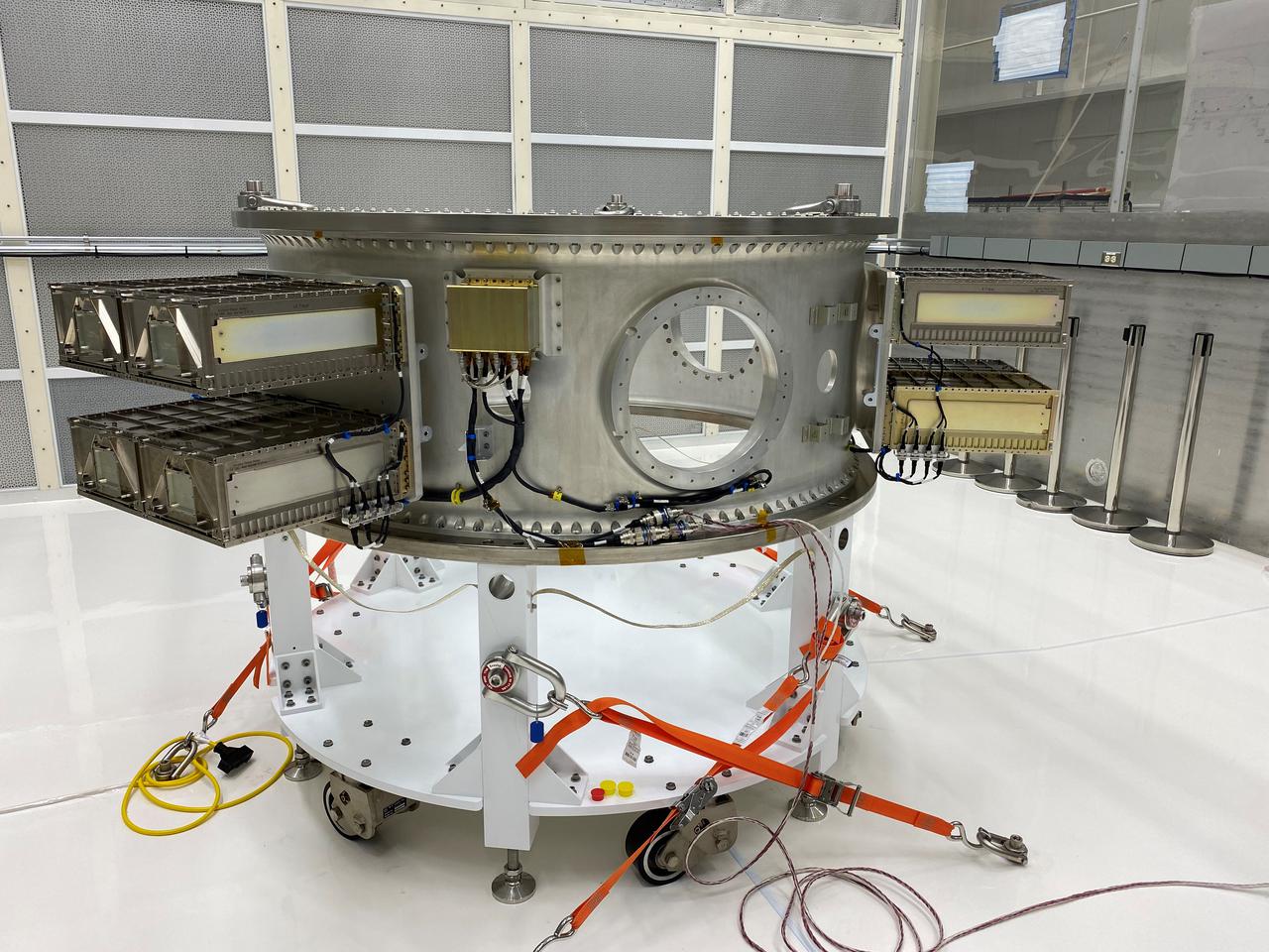
Mechanical and electrical support equipment for NASA’s Landsat 9 observatory are being processed inside the Integrated Processing Facility at Vandenberg Space Force Base in California, on June 24, 2021. The equipment includes a secondary payload adapter and flight system for a group of microsat payloads, called CubeSats, that will launch with Landsat 9 as secondary payloads. Landsat 9 will launch on a United Launch Alliance Atlas V rocket from Space Launch Complex 3 at Vandenberg in September 2021. The launch is being managed by NASA’s Launch Services Program based at Kennedy Space Center, America’s multiuser spaceport. The Landsat 9 satellite will continue the nearly 50-year legacy of previous Landsat missions. It will monitor key natural and economic resources from orbit. Landsat 9 is managed by the agency’s Goddard Space Flight Center in Greenbelt, Maryland. The satellite will carry two instruments: the Operational Land Imager 2, which collects images of Earth’s landscapes in visible, near infrared and shortwave infrared light, and the Thermal Infrared Sensor 2, which measures the temperature of land surfaces. Like its predecessors, Landsat 9 is a joint mission between NASA and the U.S. Geological Survey.
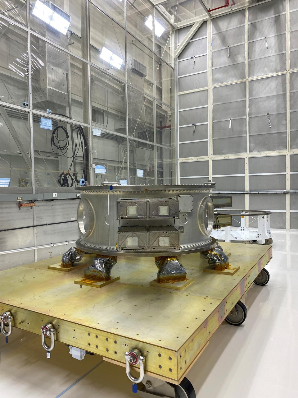
Mechanical and electrical support equipment for NASA’s Landsat 9 observatory arrive inside the Integrated Processing Facility at Vandenberg Space Force Base in California, on June 16, 2021. The equipment includes a secondary payload adapter and flight system for a group of microsat payloads, called CubeSats, that will launch with Landsat 9 as secondary payloads. Landsat 9 will launch on a United Launch Alliance Atlas V rocket from Space Launch Complex 3 at Vandenberg in September 2021. The launch is being managed by NASA’s Launch Services Program based at Kennedy Space Center, America’s multiuser spaceport. The Landsat 9 satellite will continue the nearly 50-year legacy of previous Landsat missions. It will monitor key natural and economic resources from orbit. Landsat 9 is managed by the agency’s Goddard Space Flight Center in Greenbelt, Maryland. The satellite will carry two instruments: the Operational Land Imager 2, which collects images of Earth’s landscapes in visible, near infrared and shortwave infrared light, and the Thermal Infrared Sensor 2, which measures the temperature of land surfaces. Like its predecessors, Landsat 9 is a joint mission between NASA and the U.S. Geological Survey.
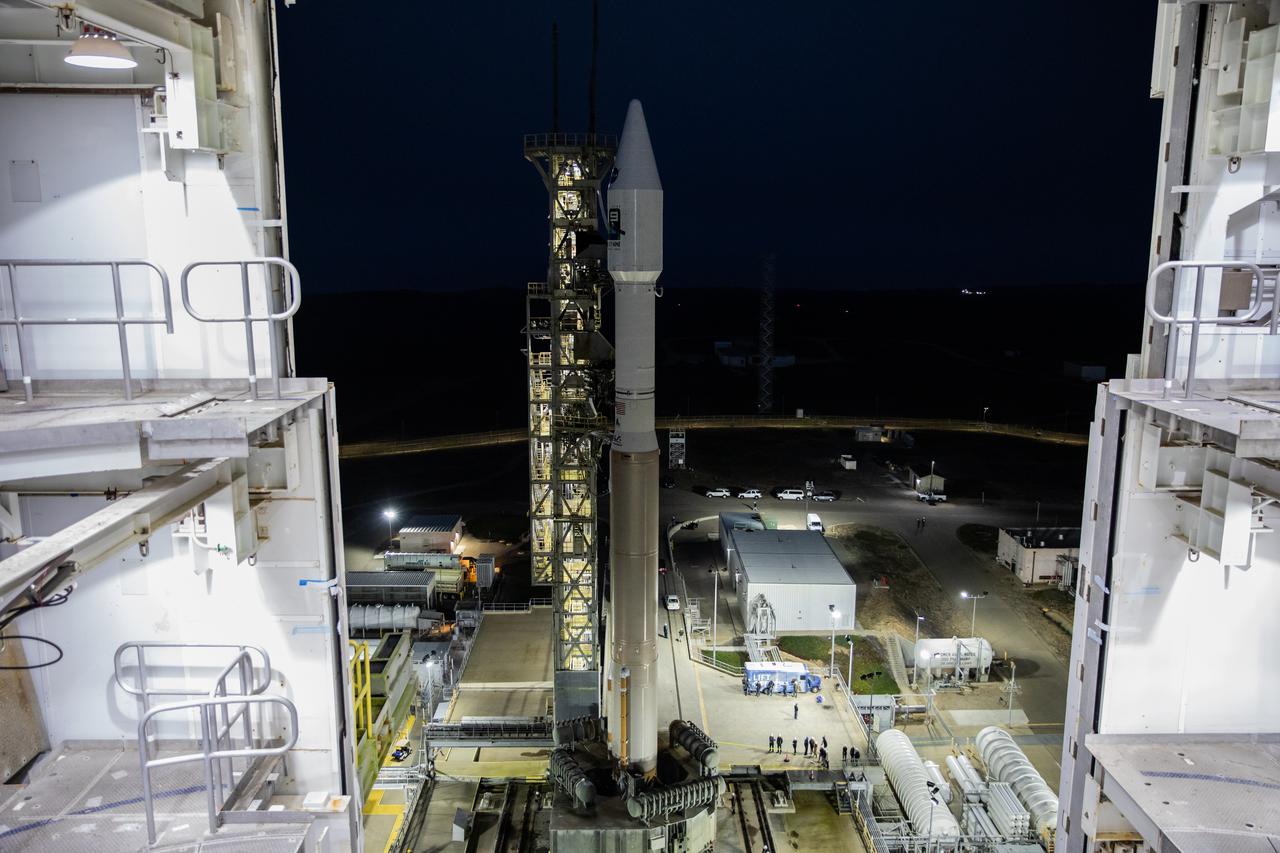
The United Launch Alliance Atlas V 401 rocket with NASA’s Landsat 9 satellite rolls out from the Vertical Integration Facility on its way to the launch pad at Space Launch Complex 3 (SLC-3) at Vandenberg Space Force Base in California, on Sept. 27, 2021. Landsat 9 is scheduled to launch at 2:12 p.m. EDT (11:12 a.m. PDT) today, Sept. 27, atop the Atlas V from SLC-3. The launch is managed by NASA’s Launch Services Program based at Kennedy Space Center. The Landsat 9 satellite will continue the nearly 50-year legacy of previous Landsat missions. It will join its sister satellite, Landsat 8, in orbit to monitor key natural and economic resources from orbit. Landsat 9 is managed by the agency’s Goddard Space Flight Center in Greenbelt, Maryland. The satellite will carry two instruments: the Operational Land Imager 2, which collects images of Earth’s landscapes in visible, near infrared and shortwave infrared light, and the Thermal Infrared Sensor 2, which measures the temperature of land surfaces. Like its predecessors, Landsat 9 is a joint mission between NASA and the U.S. Geological Survey.

Marie Lewis, NASA Communications, moderates the launch broadcast for the Landsat 9 mission on Sept. 27, 2021, at Vandenberg Space Force Base in California. NASA’s Landsat 9 satellite launched on a United Launch Alliance Atlas V 401 rocket from Vandenberg's Space Launch Complex 3 at 2:12 p.m. EDT (11:12 a.m. PDT). The launch is managed by NASA’s Launch Services Program, based at the agency’s Kennedy Space Center in Florida. Landsat 9 will join its sister satellite, Landsat 8, in orbit in collecting images from across the planet every eight days. This calibrated data will continue the Landsat program’s critical role in monitoring the health of Earth and helping people manage essential resources, including crops, irrigation water, and forests. NASA Goddard manages the Landsat 9 mission. Goddard teams also built and tested one of the two instruments on Landsat 9, the Thermal Infrared Sensor 2 (TIRS-2) instrument. TIRS-2 will use thermal imaging to make measurements that can be used to estimate soil moisture and detect the health of plants.
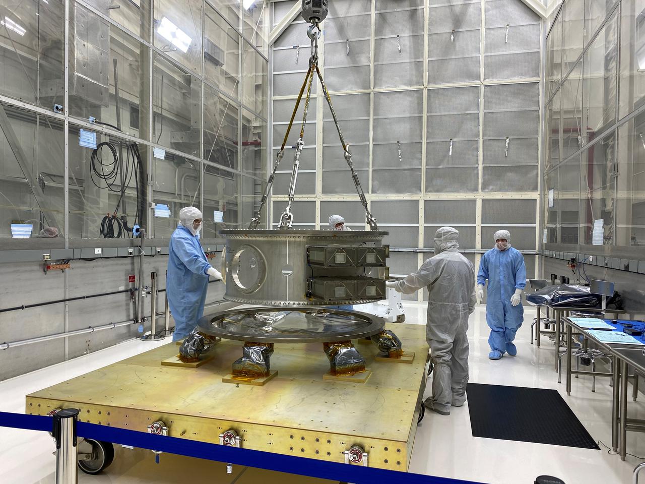
Technicians process mechanical and electrical support equipment for NASA’s Landsat 9 observatory inside the Integrated Processing Facility at Vandenberg Space Force Base in California, on June 16, 2021. The equipment includes a secondary payload adapter and flight system for a group of microsat payloads, called CubeSats, that will launch with Landsat 9 as secondary payloads. Landsat 9 will launch on a United Launch Alliance Atlas V rocket from Space Launch Complex 3 at Vandenberg in September 2021. The launch is being managed by NASA’s Launch Services Program based at Kennedy Space Center, America’s multiuser spaceport. The Landsat 9 satellite will continue the nearly 50-year legacy of previous Landsat missions. It will monitor key natural and economic resources from orbit. Landsat 9 is managed by the agency’s Goddard Space Flight Center in Greenbelt, Maryland. The satellite will carry two instruments: the Operational Land Imager 2, which collects images of Earth’s landscapes in visible, near infrared and shortwave infrared light, and the Thermal Infrared Sensor 2, which measures the temperature of land surfaces. Like its predecessors, Landsat 9 is a joint mission between NASA and the U.S. Geological Survey.

Frank DeMauro, vice president, Northrop Grumman Tactical Space Systems, participates in the launch broadcast for the Landsat 9 mission on Sept. 27, 2021, at Vandenberg Space Force Base in California. NASA’s Landsat 9 satellite launched on a United Launch Alliance Atlas V 401 rocket from Vandenberg's Space Launch Complex 3 at 2:12 p.m. EDT (11:12 a.m. PDT). The launch is managed by NASA’s Launch Services Program, based at the agency’s Kennedy Space Center in Florida. Landsat 9 will join its sister satellite, Landsat 8, in orbit in collecting images from across the planet every eight days. This calibrated data will continue the Landsat program’s critical role in monitoring the health of Earth and helping people manage essential resources, including crops, irrigation water, and forests. NASA Goddard manages the Landsat 9 mission. Goddard teams also built and tested one of the two instruments on Landsat 9, the Thermal Infrared Sensor 2 (TIRS-2) instrument. TIRS-2 will use thermal imaging to make measurements that can be used to estimate soil moisture and detect the health of plants.
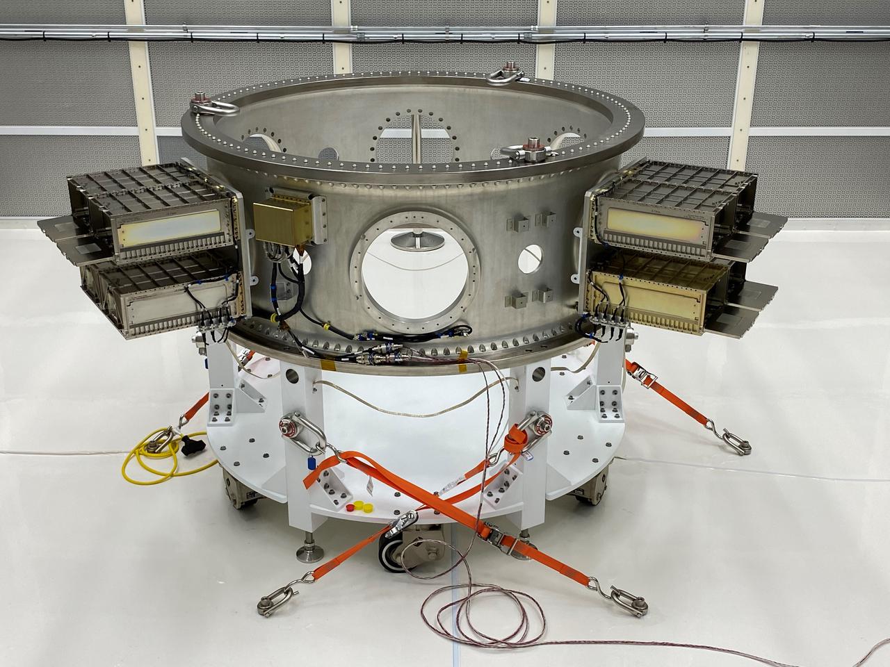
Mechanical and electrical support equipment for NASA’s Landsat 9 observatory are being processed inside the Integrated Processing Facility at Vandenberg Space Force Base in California, on June 24, 2021. The equipment includes a secondary payload adapter and flight system for a group of microsat payloads, called CubeSats, that will launch with Landsat 9 as secondary payloads. Landsat 9 will launch on a United Launch Alliance Atlas V rocket from Space Launch Complex 3 at Vandenberg in September 2021. The launch is being managed by NASA’s Launch Services Program based at Kennedy Space Center, America’s multiuser spaceport. The Landsat 9 satellite will continue the nearly 50-year legacy of previous Landsat missions. It will monitor key natural and economic resources from orbit. Landsat 9 is managed by the agency’s Goddard Space Flight Center in Greenbelt, Maryland. The satellite will carry two instruments: the Operational Land Imager 2, which collects images of Earth’s landscapes in visible, near infrared and shortwave infrared light, and the Thermal Infrared Sensor 2, which measures the temperature of land surfaces. Like its predecessors, Landsat 9 is a joint mission between NASA and the U.S. Geological Survey.
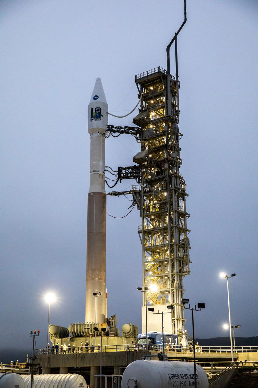
The United Launch Alliance Atlas V 401 rocket with NASA’s Landsat 9 satellite is secured on the launch pad at Space Launch Complex 3 (SLC-3) at Vandenberg Space Force Base in California, on Sept. 27, 2021, after making the trek from the Vertical Integration Facility. Landsat 9 is scheduled to launch at 2:12 p.m. EDT (11:12 a.m. PDT) today, Sept. 27, atop the Atlas V from SLC-3. The launch is managed by NASA’s Launch Services Program based at Kennedy Space Center. The Landsat 9 satellite will continue the nearly 50-year legacy of previous Landsat missions. It will join its sister satellite, Landsat 8, in orbit to monitor key natural and economic resources from orbit. Landsat 9 is managed by the agency’s Goddard Space Flight Center in Greenbelt, Maryland. The satellite will carry two instruments: the Operational Land Imager 2, which collects images of Earth’s landscapes in visible, near infrared and shortwave infrared light, and the Thermal Infrared Sensor 2, which measures the temperature of land surfaces. Like its predecessors, Landsat 9 is a joint mission between NASA and the U.S. Geological Survey.

Omar Baez, NASA senior launch director, participates in the launch broadcast for the Landsat 9 mission on Sept. 27, 2021, at Vandenberg Space Force Base in California. NASA’s Landsat 9 satellite launched on a United Launch Alliance Atlas V 401 rocket from Vandenberg's Space Launch Complex 3 at 2:12 p.m. EDT (11:12 a.m. PDT). The launch is managed by NASA’s Launch Services Program, based at the agency’s Kennedy Space Center in Florida. Landsat 9 will join its sister satellite, Landsat 8, in orbit in collecting images from across the planet every eight days. This calibrated data will continue the Landsat program’s critical role in monitoring the health of Earth and helping people manage essential resources, including crops, irrigation water, and forests. NASA Goddard manages the Landsat 9 mission. Goddard teams also built and tested one of the two instruments on Landsat 9, the Thermal Infrared Sensor 2 (TIRS-2) instrument. TIRS-2 will use thermal imaging to make measurements that can be used to estimate soil moisture and detect the health of plants.
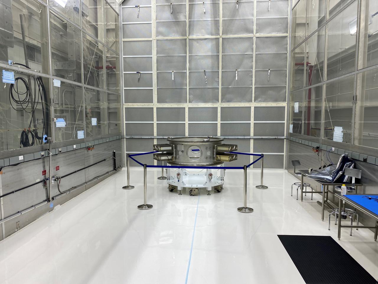
Mechanical and electrical support equipment for NASA’s Landsat 9 observatory are inside the Integrated Processing Facility at Vandenberg Space Force Base in California, on June 16, 2021. The equipment includes a secondary payload adapter and flight system for a group of microsat payloads, called CubeSats, that will launch with Landsat 9 as secondary payloads. Landsat 9 will launch on a United Launch Alliance Atlas V rocket from Space Launch Complex 3 at Vandenberg in September 2021. The launch is being managed by NASA’s Launch Services Program based at Kennedy Space Center, America’s multiuser spaceport. The Landsat 9 satellite will continue the nearly 50-year legacy of previous Landsat missions. It will monitor key natural and economic resources from orbit. Landsat 9 is managed by the agency’s Goddard Space Flight Center in Greenbelt, Maryland. The satellite will carry two instruments: the Operational Land Imager 2, which collects images of Earth’s landscapes in visible, near infrared and shortwave infrared light, and the Thermal Infrared Sensor 2, which measures the temperature of land surfaces. Like its predecessors, Landsat 9 is a joint mission between NASA and the U.S. Geological Survey.

From left, Marie Lewis, NASA Communications; and Thomas Zurbuchen, associate administrator, NASA’s Science Mission Directorate, speak to members of the news media during a prelaunch news conference for NASA’s Landsat 9 mission at Vandenberg Space Force Station in California on Sept. 25, 2021. Landsat 9 is scheduled to launch at 2:12 p.m. EDT (11:12 a.m. PDT) on Monday, Sept. 27, on a United Launch Alliance Atlas V 401 rocket from Space Launch Complex 3 at Vandenberg. The launch is managed by NASA’s Launch Services Program, based at the agency’s Kennedy Space Center in Florida. Landsat 9 will join its sister satellite, Landsat 8, in orbit in collecting images from across the planet every eight days. This calibrated data will continue the Landsat program’s critical role in monitoring the health of Earth and helping people manage essential resources, including crops, irrigation water, and forests.

Thomas Zurbuchen, associate administrator, NASA’s Science Mission Directorate, answers questions during a prelaunch news conference for NASA’s Landsat 9 mission at Vandenberg Space Force Station in California on Sept. 25, 2021. Landsat 9 is scheduled to launch at 2:11 p.m. EDT (11:11 a.m. PDT) on Monday, Sept. 27, on a United Launch Alliance Atlas V 401 rocket from Space Launch Complex 3 at Vandenberg. The launch is managed by NASA’s Launch Services Program, based at the agency’s Kennedy Space Center in Florida. Landsat 9 will join its sister satellite, Landsat 8, in orbit in collecting images from across the planet every eight days. This calibrated data will continue the Landsat program’s critical role in monitoring the health of Earth and helping people manage essential resources, including crops, irrigation water, and forests.
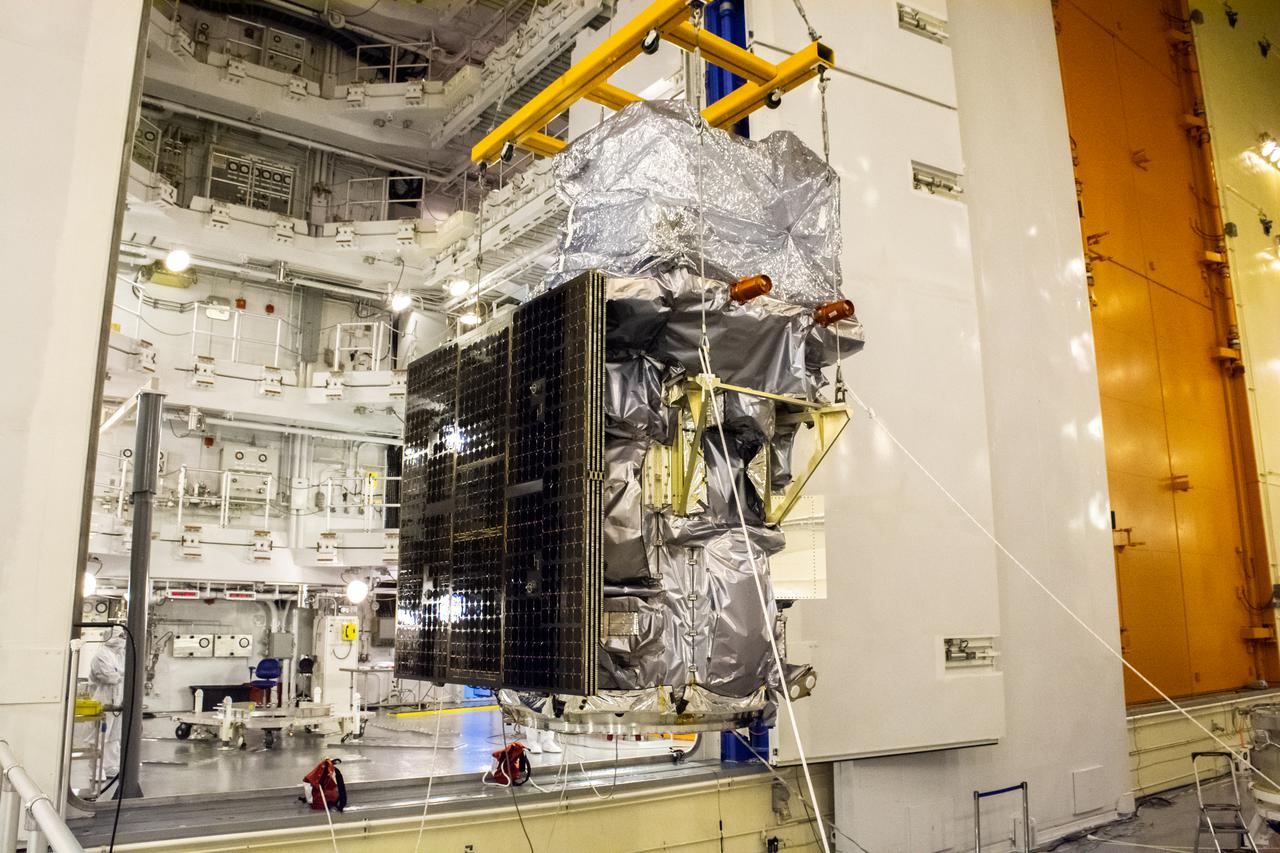
Technicians move the Landsat 9 spacecraft over to the evolved expendable vehicle secondary payload adapter (ESPA) for mating operations inside the Vertical Integration Facility at Vandenberg Space Force Base in California on Aug. 11, 2021. The ESPA connects Landsat 9 and the payload adapter (PMA) – the PMA then will attach to the second stage of a United Launch Alliance Atlas V rocket. Landsat 9 will launch on the Atlas V from Space Launch Complex 3 at Vandenberg in September 2021. The launch is being managed by NASA’s Launch Services Program based at Kennedy Space Center, America’s multi-user spaceport. The Landsat 9 satellite will continue the nearly 50-year legacy of previous Landsat missions. It will monitor key natural and economic resources from orbit. Landsat 9 is managed by the agency’s Goddard Space Flight Center in Greenbelt, Maryland. The satellite will carry two instruments: the Operational Land Imager 2, which collects images of Earth’s landscapes in visible, near infrared and shortwave infrared light, and the Thermal Infrared Sensor 2, which measures the temperature of land surfaces. Like its predecessors, Landsat 9 is a joint mission between NASA and the U.S. Geological Survey.
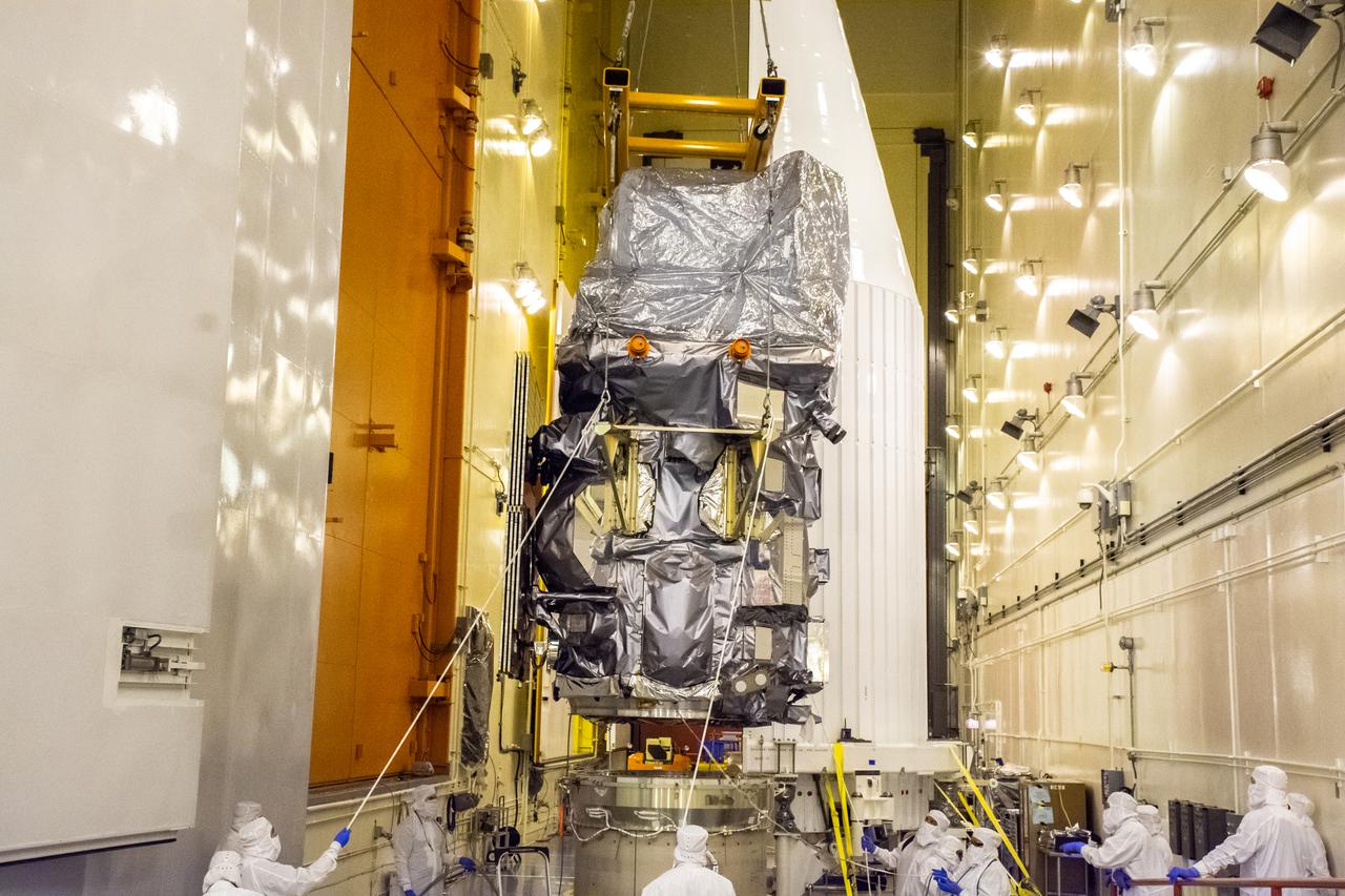
Technicians begin to attach the Landsat 9 spacecraft to the evolved expendable vehicle secondary payload adapter (ESPA) inside the Vertical Integration Facility at Vandenberg Space Force Base in California on Aug. 11, 2021. The ESPA connects Landsat 9 and the payload adapter (PMA) – the PMA then will attach to the second stage of a United Launch Alliance Atlas V rocket. Landsat 9 will launch on the Atlas V from Space Launch Complex 3 at Vandenberg in September 2021. The launch is being managed by NASA’s Launch Services Program based at Kennedy Space Center, America’s multi-user spaceport. The Landsat 9 satellite will continue the nearly 50-year legacy of previous Landsat missions. It will monitor key natural and economic resources from orbit. Landsat 9 is managed by the agency’s Goddard Space Flight Center in Greenbelt, Maryland. The satellite will carry two instruments: the Operational Land Imager 2, which collects images of Earth’s landscapes in visible, near infrared and shortwave infrared light, and the Thermal Infrared Sensor 2, which measures the temperature of land surfaces. Like its predecessors, Landsat 9 is a joint mission between NASA and the U.S. Geological Survey.
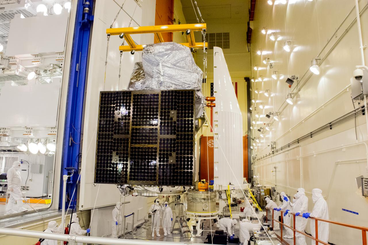
Technicians move the Landsat 9 spacecraft over to the evolved expendable vehicle secondary payload adapter (ESPA) for mating operations inside the Vertical Integration Facility at Vandenberg Space Force Base in California on Aug. 11, 2021. The ESPA connects Landsat 9 and the payload adapter (PMA) – the PMA then will attach to the second stage of a United Launch Alliance Atlas V rocket. Landsat 9 will launch on the Atlas V from Space Launch Complex 3 at Vandenberg in September 2021. The launch is being managed by NASA’s Launch Services Program based at Kennedy Space Center, America’s multi-user spaceport. The Landsat 9 satellite will continue the nearly 50-year legacy of previous Landsat missions. It will monitor key natural and economic resources from orbit. Landsat 9 is managed by the agency’s Goddard Space Flight Center in Greenbelt, Maryland. The satellite will carry two instruments: the Operational Land Imager 2, which collects images of Earth’s landscapes in visible, near infrared and shortwave infrared light, and the Thermal Infrared Sensor 2, which measures the temperature of land surfaces. Like its predecessors, Landsat 9 is a joint mission between NASA and the U.S. Geological Survey.
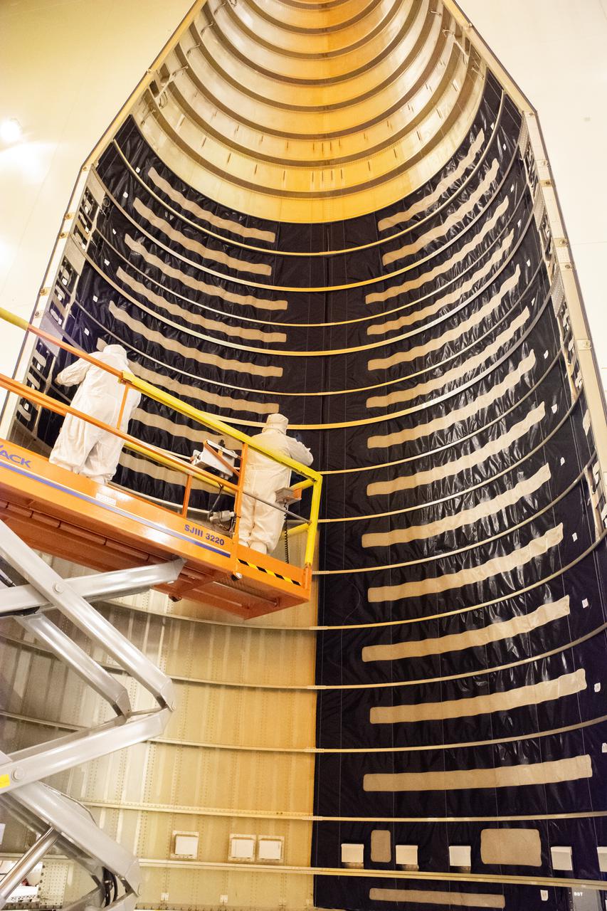
Inside the Integrated Processing Facility at Vandenberg Space Force Base in California, technicians with United Launch Alliance (ULA) remove the protective blankets from one payload fairing half for the Landsat 9 spacecraft on Aug. 2, 2021. The two halves of the ULA payload fairing will be secured around Landsat 9 to protect it during launch atop the ULA Atlas V rocket. Landsat 9 will launch on the Atlas V rocket from Space Launch Complex 3 at Vandenberg in September 2021. The launch is being managed by NASA’s Launch Services Program based at Kennedy Space Center, America’s multi-user spaceport. The Landsat 9 satellite will continue the nearly 50-year legacy of previous Landsat missions. It will monitor key natural and economic resources from orbit. Landsat 9 is managed by the agency’s Goddard Space Flight Center in Greenbelt, Maryland. The satellite will carry two instruments: the Operational Land Imager 2, which collects images of Earth’s landscapes in visible, near infrared and shortwave infrared light, and the Thermal Infrared Sensor 2, which measures the temperature of land surfaces. Like its predecessors, Landsat 9 is a joint mission between NASA and the U.S. Geological Survey.
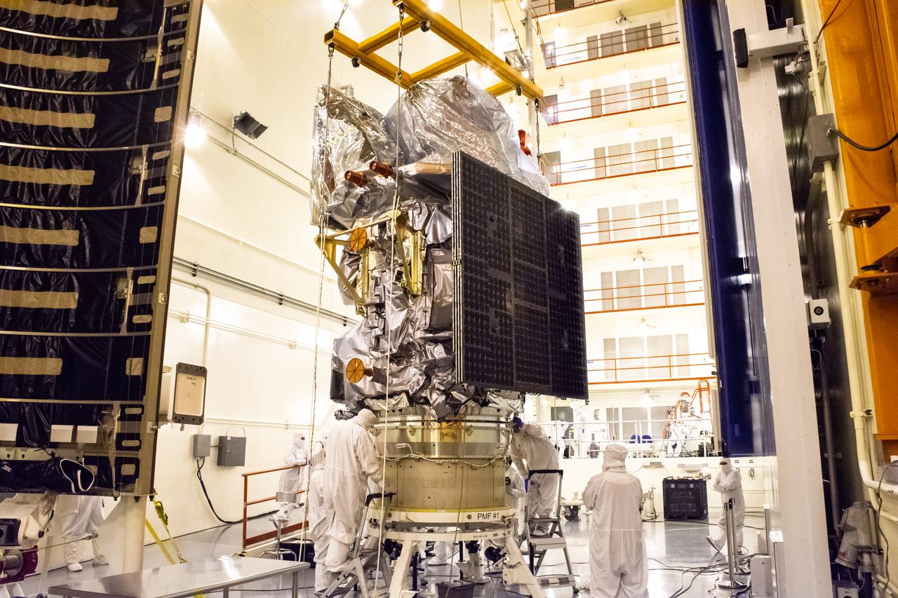
Technicians attach the Landsat 9 spacecraft to the evolved expendable vehicle secondary payload adapter (ESPA) inside the Vertical Integration Facility at Vandenberg Space Force Base in California on Aug. 11, 2021. The ESPA connects Landsat 9 and the payload adapter (PMA) – the PMA then will attach to the second stage of a United Launch Alliance Atlas V rocket. Landsat 9 will launch on the Atlas V from Space Launch Complex 3 at Vandenberg in September 2021. The launch is being managed by NASA’s Launch Services Program based at Kennedy Space Center, America’s multi-user spaceport. The Landsat 9 satellite will continue the nearly 50-year legacy of previous Landsat missions. It will monitor key natural and economic resources from orbit. Landsat 9 is managed by the agency’s Goddard Space Flight Center in Greenbelt, Maryland. The satellite will carry two instruments: the Operational Land Imager 2, which collects images of Earth’s landscapes in visible, near infrared and shortwave infrared light, and the Thermal Infrared Sensor 2, which measures the temperature of land surfaces. Like its predecessors, Landsat 9 is a joint mission between NASA and the U.S. Geological Survey.
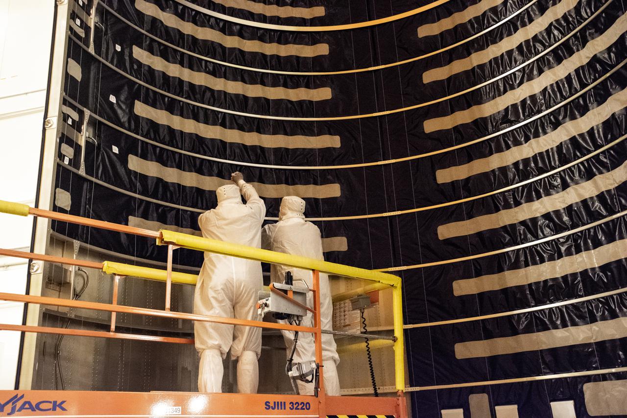
Inside the Integrated Processing Facility at Vandenberg Space Force Base in California, technicians with United Launch Alliance (ULA) remove the protective blankets from one payload fairing half for the Landsat 9 spacecraft on Aug. 2, 2021. The two halves of the ULA payload fairing will be secured around Landsat 9 to protect it during launch atop the ULA Atlas V rocket. Landsat 9 will launch on the Atlas V rocket from Space Launch Complex 3 at Vandenberg in September 2021. The launch is being managed by NASA’s Launch Services Program based at Kennedy Space Center, America’s multi-user spaceport. The Landsat 9 satellite will continue the nearly 50-year legacy of previous Landsat missions. It will monitor key natural and economic resources from orbit. Landsat 9 is managed by the agency’s Goddard Space Flight Center in Greenbelt, Maryland. The satellite will carry two instruments: the Operational Land Imager 2, which collects images of Earth’s landscapes in visible, near infrared and shortwave infrared light, and the Thermal Infrared Sensor 2, which measures the temperature of land surfaces. Like its predecessors, Landsat 9 is a joint mission between NASA and the U.S. Geological Survey.
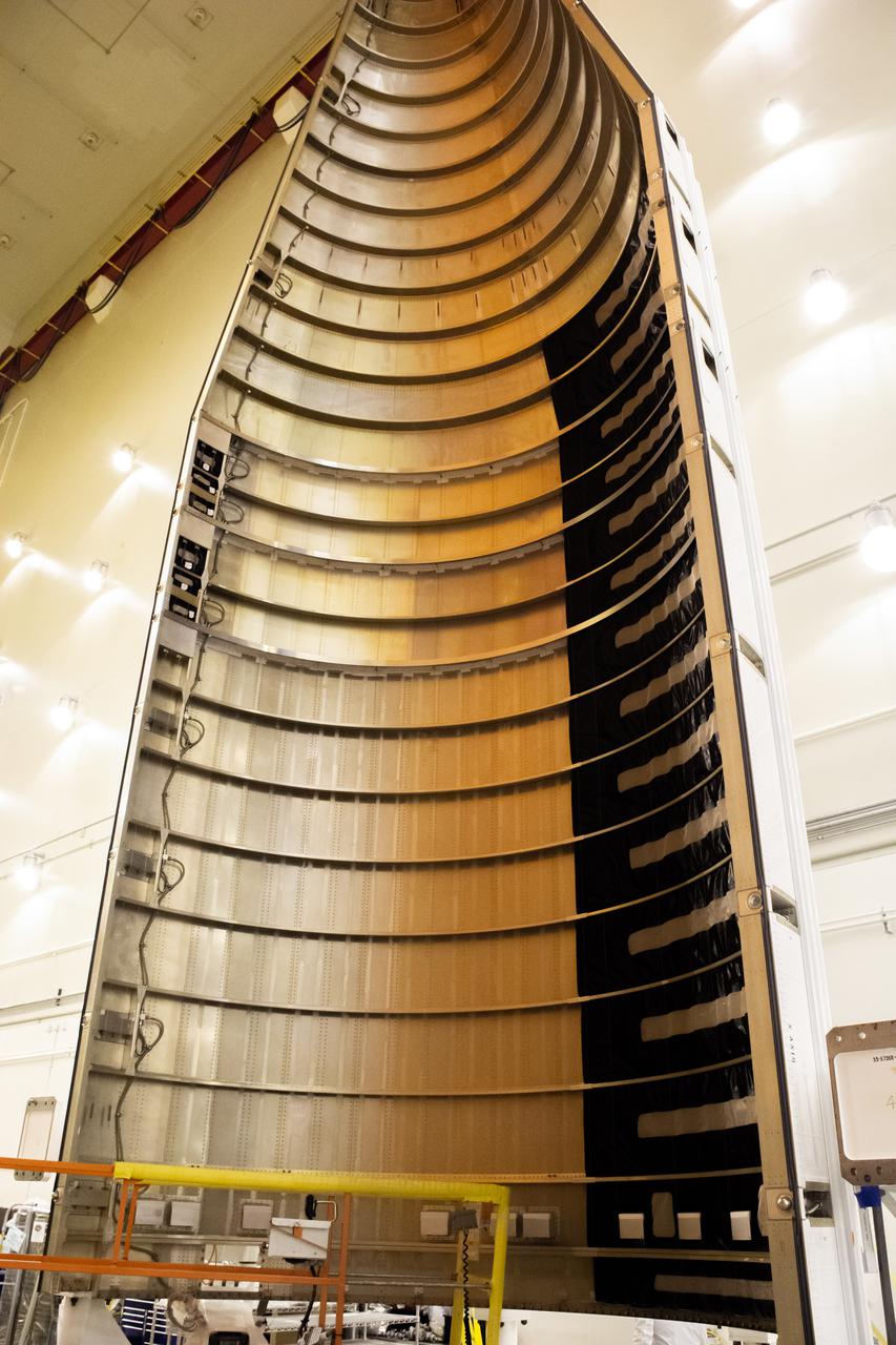
Inside the Integrated Processing Facility at Vandenberg Space Force Base in California, protective blanks are removed from the United Launch Alliance (ULA) payload fairings for the Landsat 9 spacecraft on Aug. 2, 2021. The two halves of the ULA payload fairing will be secured around Landsat 9 to protect it during launch atop the ULA Atlas V rocket. Landsat 9 will launch on the Atlas V rocket from Space Launch Complex 3 at Vandenberg in September 2021. The launch is being managed by NASA’s Launch Services Program based at Kennedy Space Center, America’s multi-user spaceport. The Landsat 9 satellite will continue the nearly 50-year legacy of previous Landsat missions. It will monitor key natural and economic resources from orbit. Landsat 9 is managed by the agency’s Goddard Space Flight Center in Greenbelt, Maryland. The satellite will carry two instruments: the Operational Land Imager 2, which collects images of Earth’s landscapes in visible, near infrared and shortwave infrared light, and the Thermal Infrared Sensor 2, which measures the temperature of land surfaces. Like its predecessors, Landsat 9 is a joint mission between NASA and the U.S. Geological Survey.
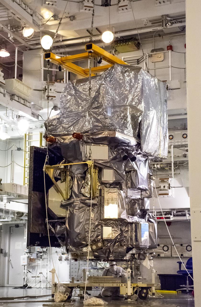
Technicians begin to move the Landsat 9 spacecraft for mating operations inside the Vertical Integration Facility at Vandenberg Space Force Base in California on Aug. 11, 2021. The spacecraft will attach to the evolved expendable vehicle secondary payload adapter (ESPA), which connects Landsat 9 and the payload adapter (PMA). The PMA will then attach to the second stage of a United Launch Alliance Atlas V rocket. Landsat 9 will launch on the Atlas V from Space Launch Complex 3 at Vandenberg in September 2021. The launch is being managed by NASA’s Launch Services Program based at Kennedy Space Center, America’s multi-user spaceport. The Landsat 9 satellite will continue the nearly 50-year legacy of previous Landsat missions. It will monitor key natural and economic resources from orbit. Landsat 9 is managed by the agency’s Goddard Space Flight Center in Greenbelt, Maryland. The satellite will carry two instruments: the Operational Land Imager 2, which collects images of Earth’s landscapes in visible, near infrared and shortwave infrared light, and the Thermal Infrared Sensor 2, which measures the temperature of land surfaces. Like its predecessors, Landsat 9 is a joint mission between NASA and the U.S. Geological Survey.
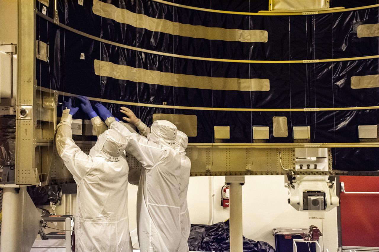
Inside the Integrated Processing Facility at Vandenberg Space Force Base in California, technicians with United Launch Alliance (ULA) remove the protective blankets from one payload fairing half for the Landsat 9 spacecraft on Aug. 2, 2021. The two halves of the ULA payload fairing will be secured around Landsat 9 to protect it during launch atop the ULA Atlas V rocket. Landsat 9 will launch on the Atlas V rocket from Space Launch Complex 3 at Vandenberg in September 2021. The launch is being managed by NASA’s Launch Services Program based at Kennedy Space Center, America’s multi-user spaceport. The Landsat 9 satellite will continue the nearly 50-year legacy of previous Landsat missions. It will monitor key natural and economic resources from orbit. Landsat 9 is managed by the agency’s Goddard Space Flight Center in Greenbelt, Maryland. The satellite will carry two instruments: the Operational Land Imager 2, which collects images of Earth’s landscapes in visible, near infrared and shortwave infrared light, and the Thermal Infrared Sensor 2, which measures the temperature of land surfaces. Like its predecessors, Landsat 9 is a joint mission between NASA and the U.S. Geological Survey.
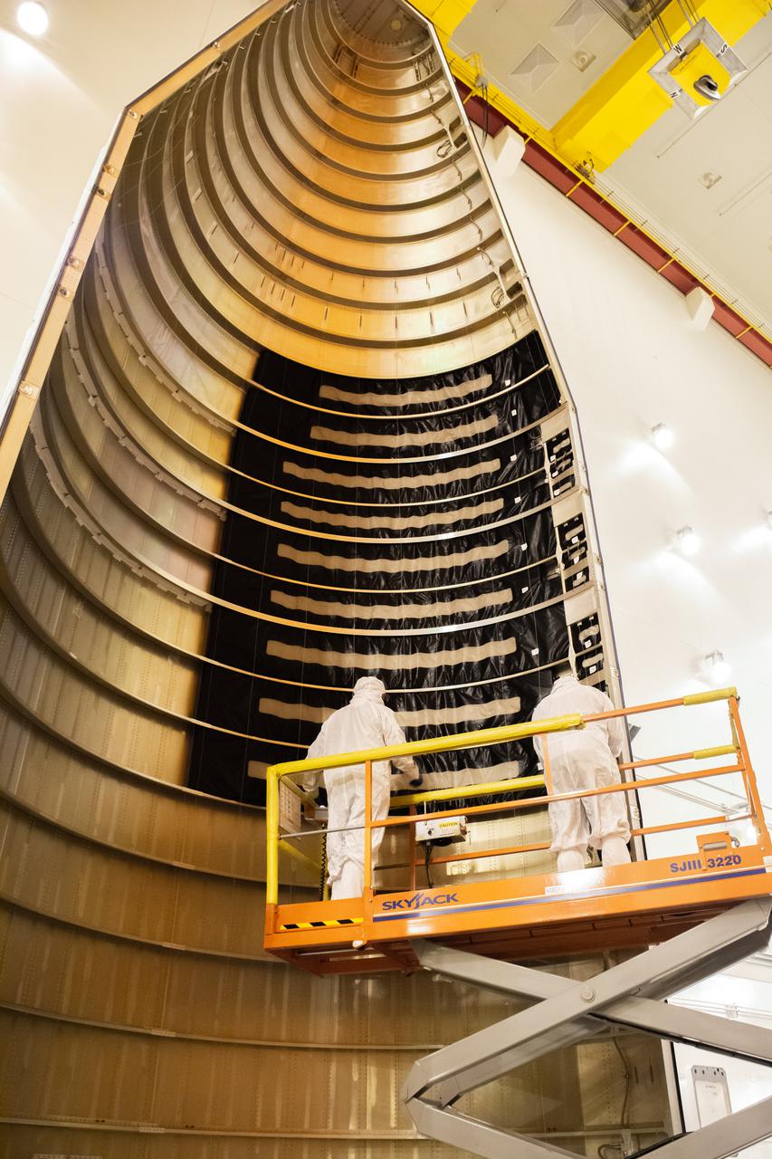
Inside the Integrated Processing Facility at Vandenberg Space Force Base in California, technicians with United Launch Alliance (ULA) remove the protective blankets from one payload fairing half for the Landsat 9 spacecraft on Aug. 2, 2021. The two halves of the ULA payload fairing will be secured around Landsat 9 to protect it during launch atop the ULA Atlas V rocket. Landsat 9 will launch on the Atlas V rocket from Space Launch Complex 3 at Vandenberg in September 2021. The launch is being managed by NASA’s Launch Services Program based at Kennedy Space Center, America’s multi-user spaceport. The Landsat 9 satellite will continue the nearly 50-year legacy of previous Landsat missions. It will monitor key natural and economic resources from orbit. Landsat 9 is managed by the agency’s Goddard Space Flight Center in Greenbelt, Maryland. The satellite will carry two instruments: the Operational Land Imager 2, which collects images of Earth’s landscapes in visible, near infrared and shortwave infrared light, and the Thermal Infrared Sensor 2, which measures the temperature of land surfaces. Like its predecessors, Landsat 9 is a joint mission between NASA and the U.S. Geological Survey.

Marie Lewis, NASA Communications, moderates a prelaunch news conference for NASA’s Landsat 9 mission at Vandenberg Space Force Base in California on Saturday, Sept. 25, 2021. Participants include Thomas Zurbuchen, associate administrator, NASA’s Science Mission Directorate; Karen St. Germain, director, NASA’s Earth Science Division; Tanya Trujillo, assistant secretary for water and science, U.S. Department of the Interior; Michael Egan, Landsat program executive, NASA’s Earth Science Division; Tim Dunn, launch director, NASA’s Launch Services Program; Scott Messer, United Launch Alliance program manager, NASA Launch Services Program; and Capt. Addison Nichols, weather officer, Space Launch Delta 30. Landsat 9 is scheduled to launch at 2:12 p.m. EDT (11:12 a.m. PDT) on Monday, Sept. 27, on a United Launch Alliance Atlas V 401 rocket from Space Launch Complex 3 at Vandenberg. The launch is managed by NASA’s Launch Services Program, based at the agency’s Kennedy Space Center in Florida. Landsat 9 will join its sister satellite, Landsat 8, in orbit in collecting images from across the planet every eight days. This calibrated data will continue the Landsat program’s critical role in monitoring the health of Earth and helping people manage essential resources, including crops, irrigation water, and forests.
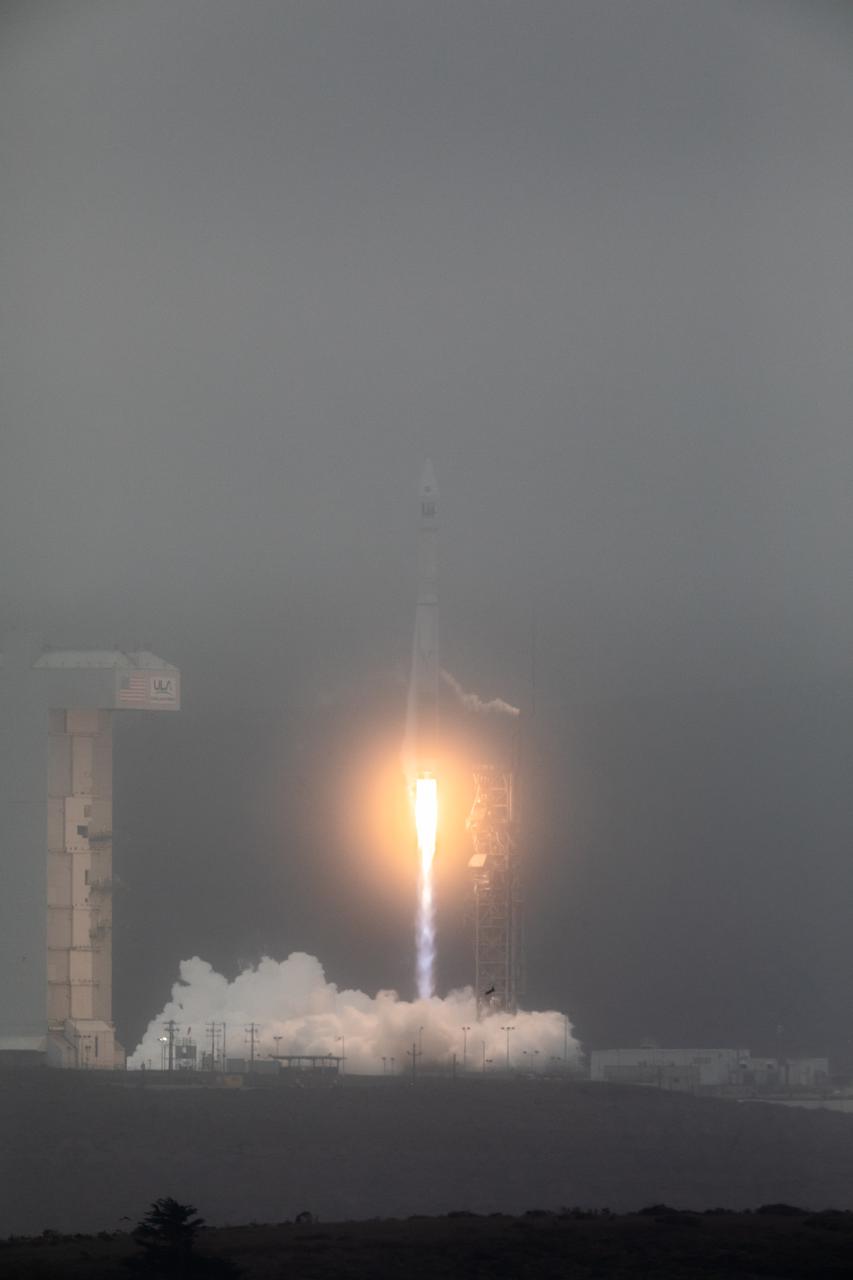
NASA’s Landsat 9 satellite launches on a United Launch Alliance Atlas V 401 rocket from Space Launch Complex 3 at Vandenberg Space Force Station in California on Sept. 27, 2021. Launch time was 2:12 p.m. EDT (11:12 a.m. PDT). The launch is managed by NASA’s Launch Services Program, based at the agency’s Kennedy Space Center in Florida. Landsat 9 will join its sister satellite, Landsat 8, in orbit in collecting images from across the planet every eight days. This calibrated data will continue the Landsat program’s critical role in monitoring the health of Earth and helping people manage essential resources, including crops, irrigation water, and forests. NASA Goddard manages the Landsat 9 mission. Goddard teams also built and tested one of the two instruments on Landsat 9, the Thermal Infrared Sensor 2 (TIRS-2) instrument. TIRS-2 will use thermal imaging to make measurements that can be used to estimate soil moisture and detect the health of plants.
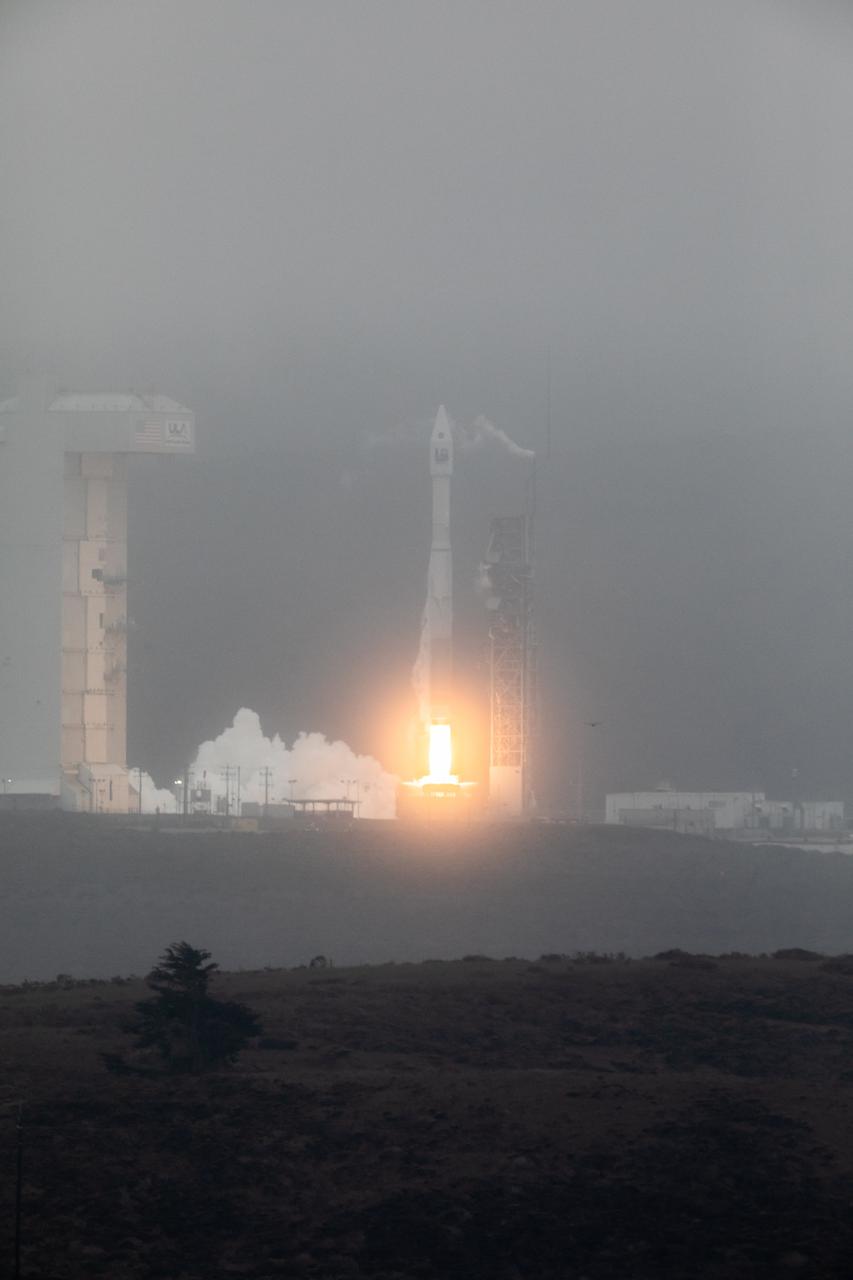
NASA’s Landsat 9 satellite launches on a United Launch Alliance Atlas V 401 rocket from Space Launch Complex 3 at Vandenberg Space Force Station in California on Sept. 27, 2021. Launch time was 2:12 p.m. EDT (11:12 a.m. PDT). The launch is managed by NASA’s Launch Services Program, based at the agency’s Kennedy Space Center in Florida. Landsat 9 will join its sister satellite, Landsat 8, in orbit in collecting images from across the planet every eight days. This calibrated data will continue the Landsat program’s critical role in monitoring the health of Earth and helping people manage essential resources, including crops, irrigation water, and forests. NASA Goddard manages the Landsat 9 mission. Goddard teams also built and tested one of the two instruments on Landsat 9, the Thermal Infrared Sensor 2 (TIRS-2) instrument. TIRS-2 will use thermal imaging to make measurements that can be used to estimate soil moisture and detect the health of plants.
Rectangular fields of the agriculturally rich Santa Clara River Valley are visible in this perspective view generated by using data from the Shuttle Radar Topography Mission and an enhanced Landsat image.
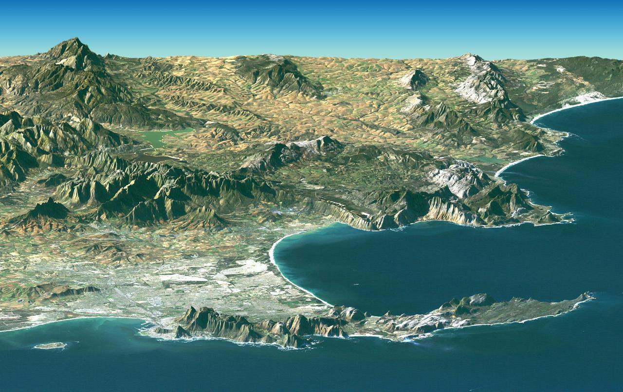
Cape Town and the Cape of Good Hope, South Africa, appear in the foreground of this perspective view generated from a Landsat satellite image and elevation data from NASA Space Shuttle Endeavour.
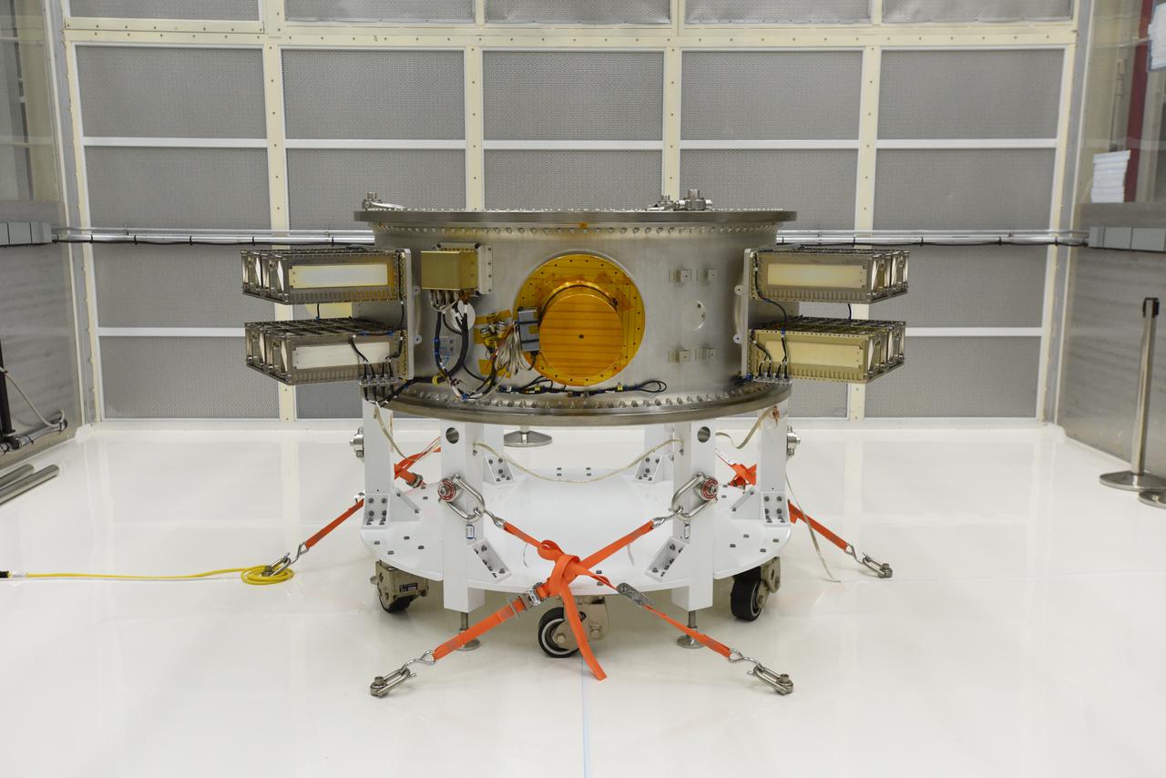
The secondary payload adapter for NASA’s Landsat 9 mission is staged for further testing at Vandenberg Space Force Base in California, on Aug. 3, 2021, before it is transported to the Integrated Processing Facility. Several secondary payloads, called CubeSats, will launch with Landsat 9 atop a United Launch Alliance Atlas V rocket from Vandenberg in September 2021. The launch is being managed by NASA’s Launch Services Program based at Kennedy Space Center, America’s multi-user spaceport. The Landsat 9 satellite will continue the nearly 50-year legacy of previous Landsat missions. It will monitor key natural and economic resources from orbit. Landsat 9 is managed by the agency’s Goddard Space Flight Center in Greenbelt, Maryland. The satellite will carry two instruments: the Operational Land Imager 2, which collects images of Earth’s landscapes in visible, near infrared and shortwave infrared light, and the Thermal Infrared Sensor 2, which measures the temperature of land surfaces. Like its predecessors, Landsat 9 is a joint mission between NASA and the U.S. Geological Survey.
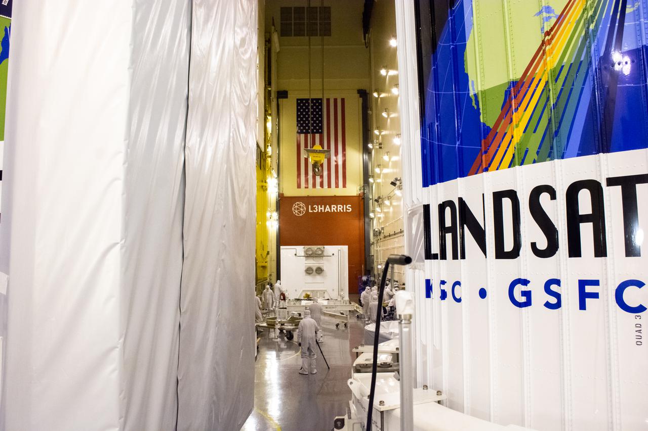
Technicians remove the satellite for the Landsat 9 mission from its shipping container following its arrival at Vandenberg Space Force Base in California on July 7, 2021. The Landsat 9 mission will launch atop a United Launch Alliance Atlas V rocket from Vandenberg in September 2021. The launch is being managed by NASA’s Launch Services Program based at Kennedy Space Center in Florida, America’s multi-user spaceport. The Landsat 9 satellite will continue the nearly 50-year legacy of previous Landsat missions. It will monitor key natural and economic resources from orbit. Landsat 9 is managed by the agency’s Goddard Space Flight Center in Greenbelt, Maryland. The satellite will carry two instruments: the Operational Land Imager 2, which collects images of Earth’s landscapes in visible, near infrared and shortwave infrared light, and the Thermal Infrared Sensor 2, which measures the temperature of land surfaces. Like its predecessors, Landsat 9 is a joint mission between NASA and the U.S. Geological Survey.