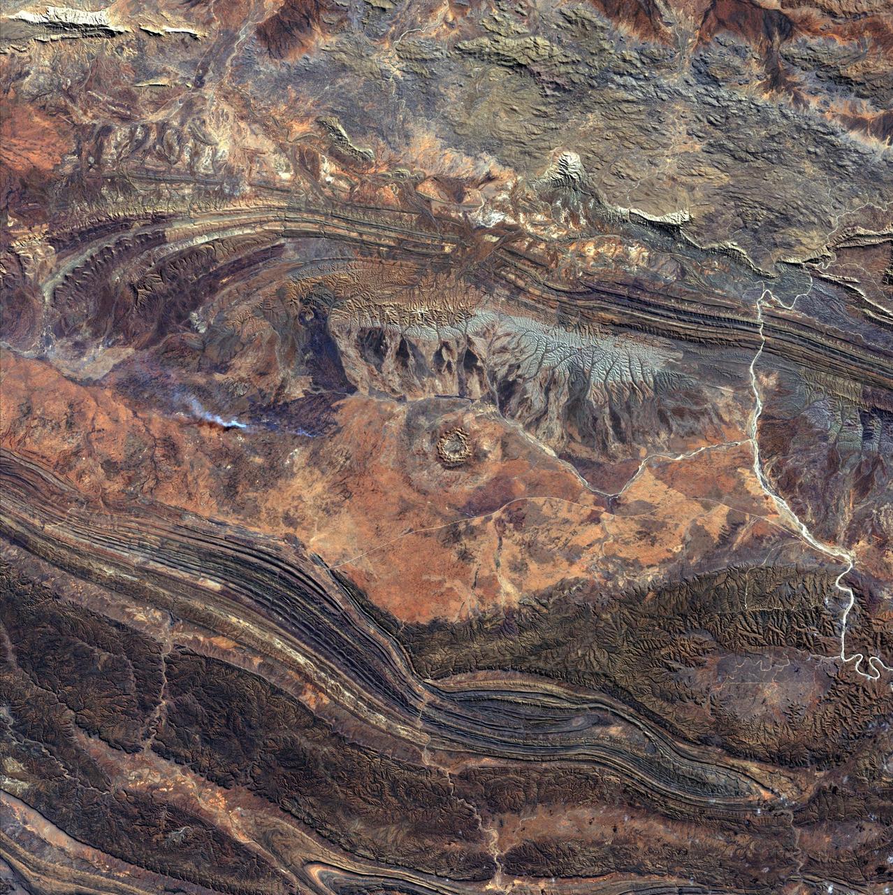
August 14th, 2002: Description: 142 million years ago, an asteroid or comet slammed into what is now the Missionary Plains in Australia’s Northern Territory, forming a crater 24 kilometers in diameter and 5 kilometers deep. Today, like a bull’s eye, the circular ring of hills that defines Gosses Bluff stands as a stark reminder of the event. Source: Landsat 7 To learn more about the Landsat satellite go to: <a href="http://landsat.gsfc.nasa.gov/" rel="nofollow">landsat.gsfc.nasa.gov/</a>

Image taken 1/11/2001: The so-called Richat Structure is a geological formation in the Maur Adrar Desert in the African country of Mauritania. Although it resembles an impact crater, the Richat Structure formed when a volcanic dome hardened and gradually eroded, exposing the onion-like layers of rock. The Richat Structure can be found on Landsat 7 WRS Path 203 Row 45, center: 21.68, -11.94. To learn more about the Landsat satellite go to: <a href="http://landsat.gsfc.nasa.gov/" rel="nofollow">landsat.gsfc.nasa.gov/</a> Credit: NASA/GSFC/Landsat 7/USGS
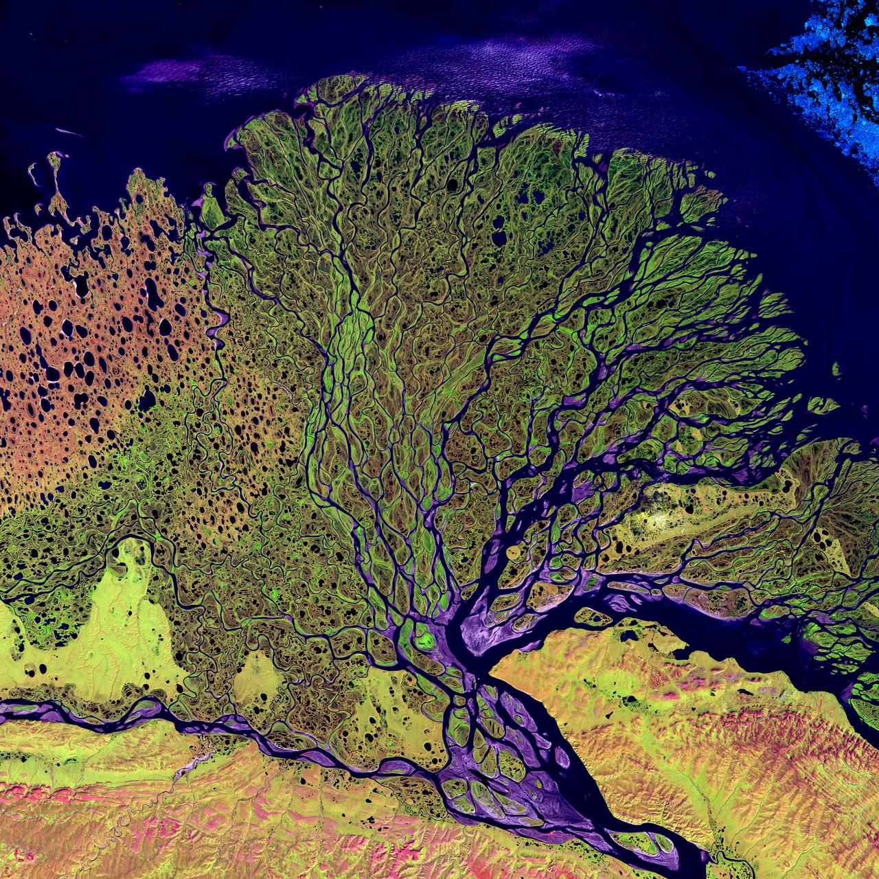
Image taken 7/27/2000: The Lena River, some 2,800 miles (4,400 km) long, is one of the largest rivers in the world. The Lena Delta Reserve is the most extensive protected wilderness area in Russia. It is an important refuge and breeding grounds for many species of Siberian wildlife. The Lena Delta can be found on Landsat 7 WRS Path 131 Row 8/9, center: 72.21, 126.15. To learn more about the Landsat satellite go to: <a href="http://landsat.gsfc.nasa.gov/" rel="nofollow">landsat.gsfc.nasa.gov/</a>
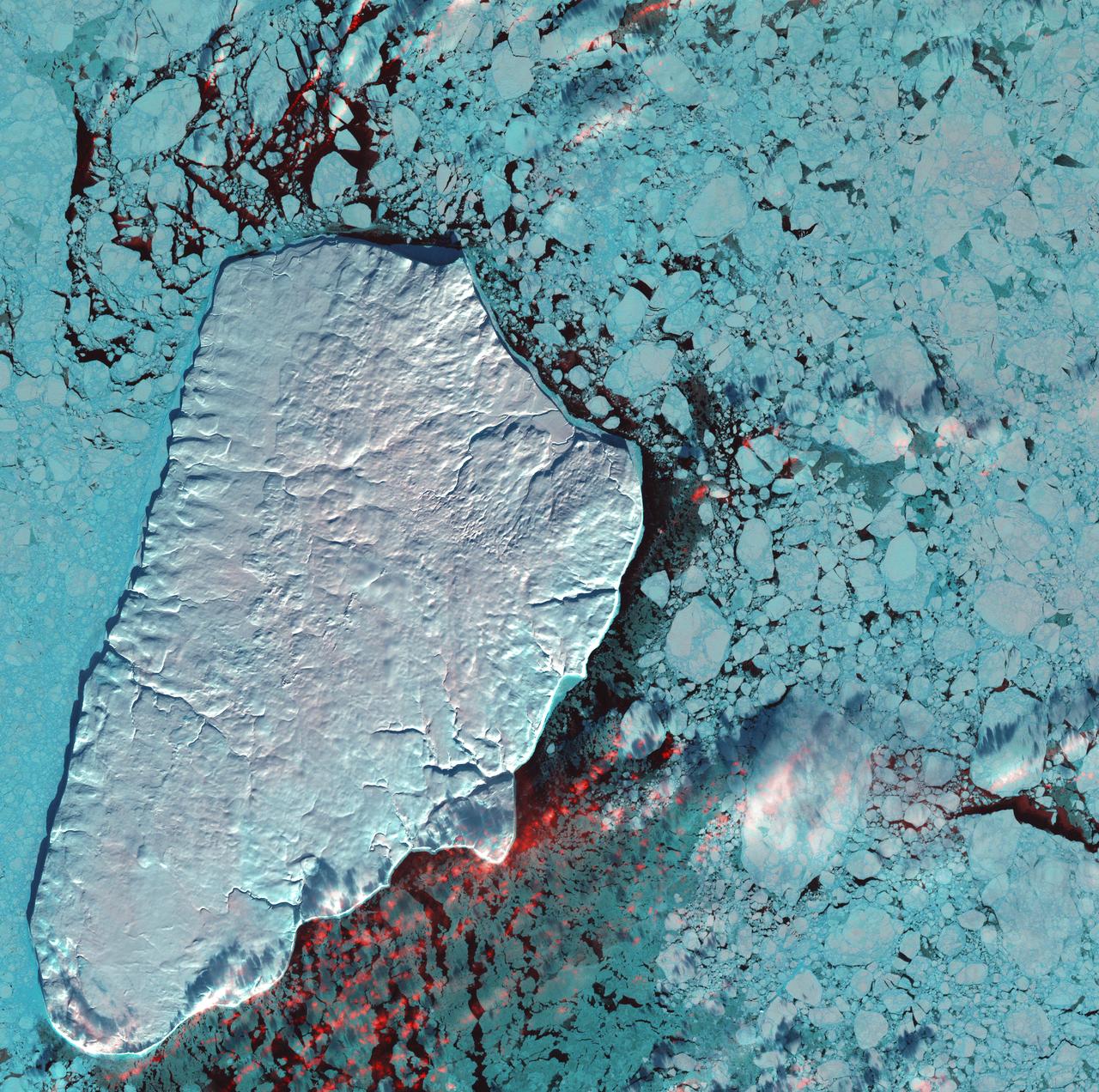
January 1st, 2001: Description: Akpatok Island lies in Ungava Bay in northern Quebec, Canada. Accessible only by air, Akpatok Island rises out of the water as sheer cliffs that soar 500 to 800 feet (150 to 243m) above the sea surface. The island is an important sanctuary for cliff-nesting seabirds. Numerous ice floes around the island attract walrus and whales, making Akpatok a traditional hunting ground for native Inuit people. Source: Landsat 7 To learn more about the Landsat satellite go to: <a href="http://landsat.gsfc.nasa.gov/" rel="nofollow">landsat.gsfc.nasa.gov/</a>
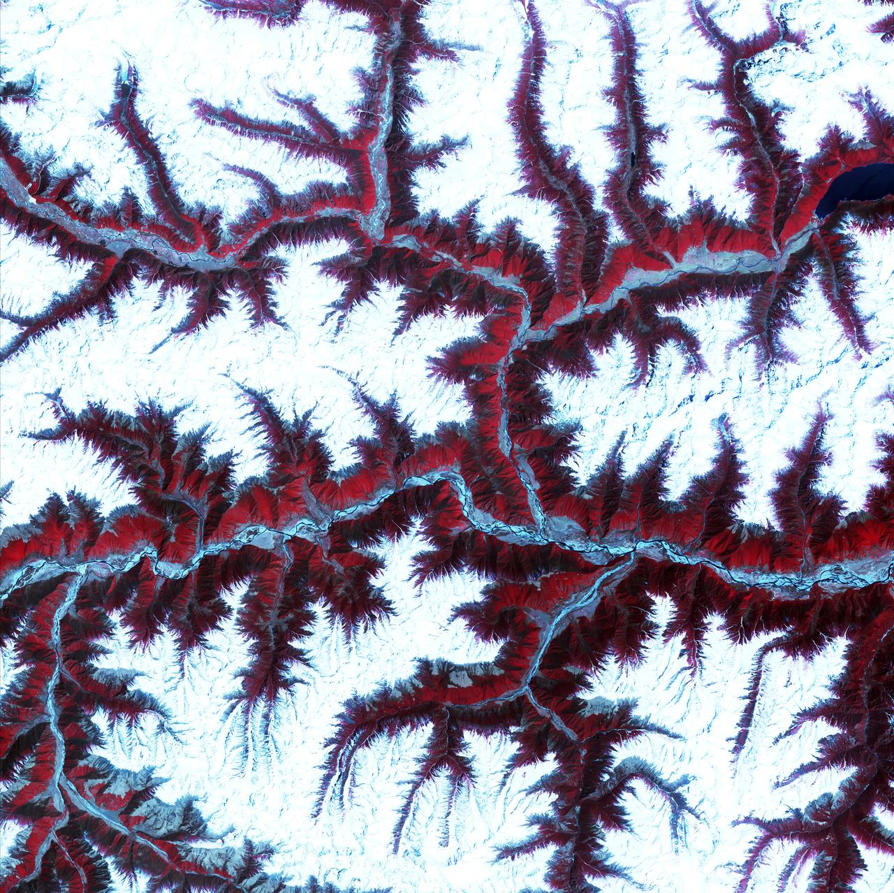
April 12th, 2001: Description: Soaring, snow-capped peaks and ridges of the eastern Himalaya Mountains create an irregular white-on-red patchwork between major rivers in southwestern China. The Himalayas are made up of three parallel mountain ranges that together extend more than 2,900 kilometers. Source: ASTER To learn more about the Landsat satellite go to: <a href="http://landsat.gsfc.nasa.gov/" rel="nofollow">landsat.gsfc.nasa.gov/</a>

This Landsat 7 image of Guinea-Bissau, a small country in West Africa, shows the complex patterns of the country's shallow coastal waters, where silt carried by the Geba and other rivers washes out into the Atlantic Ocean. This is a false-color composite image made using infrared, red and blue wavelengths to bring out details in the silt was taken using Landsat 7's Enhanced Thematic Mapper plus (ETM+) sensor on Jan. 12, 2000. Image Credit: NASA/USGS EROS Data Center To learn more about the Landsat satellite go to: <a href="http://landsat.gsfc.nasa.gov/" rel="nofollow">landsat.gsfc.nasa.gov/</a>
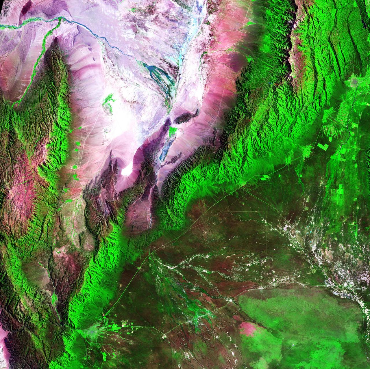
Acquisition Date: February 28, 1985 The Sierra de Velasco Mountains dominate this image in northern Argentina. The Catamarca province is in the northern part of the image, and the La Rioja province is to the south. The streams are fed by runoff from the snow in the Andes Mountains to the north. These intermittent streams can dry up rapidly. The larger urban area near the bottom of the image is La Rioja, the capital of the province of La Rioja. Credit: NASA/GSFC/Landsat/USGS To learn more about Landsat and to see the orginal high res file go to: <a href="http://landsat.usgs.gov/gallery_view.php?category=greenflag&thesort=mainTitle" rel="nofollow">landsat.usgs.gov/gallery_view.php?category=greenflag&...</a>
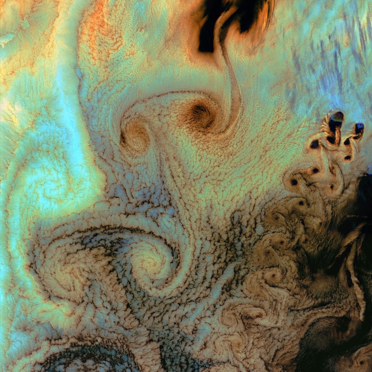
July 4th, 2002: Description: As air flows over and around objects in its path, spiraling eddies, known as Von Karman vortices, may form. The vortices in this image were created when prevailing winds sweeping east across the northern Pacific Ocean encountered Alaska’s Aleutian Islands. Source: Landsat 7 To learn more about the Landsat satellite go to: <a href="http://landsat.gsfc.nasa.gov/" rel="nofollow">landsat.gsfc.nasa.gov/</a>
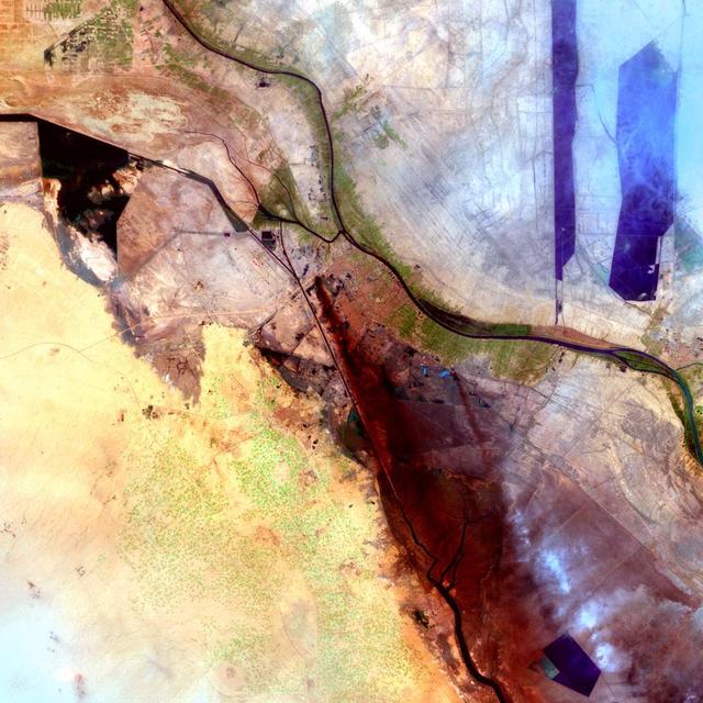
Al Basrah, Iraq Sensor: L7 ETM+ Acquisition Date: April 4, 2003 Path/Row: 166/39 Lat/Long: 30.486/47.811 Smoke drifts south in this image of Al Basrah, located in southeastern Iraq. The green circles from the center to the left of the image represent irrigated crops.
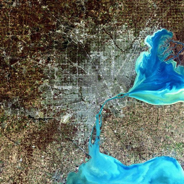
Detroit, Michigan, USA Sensor: L7 ETM+ Acquisition Date: December 11, 2001 Path/Row: 20/30 Lat/Long: 42.330/-83.046 Detroit, Michigan, is commonly referred to as Motor City because of the many automobile manufacturing plants located in the city. It is the largest city in Michigan, with a population approaching one million. Credit: NASA/Goddard/Landsat <b><a href="http://www.nasa.gov/audience/formedia/features/MP_Photo_Guidelines.html" rel="nofollow">NASA image use policy.</a></b> <b><a href="http://www.nasa.gov/centers/goddard/home/index.html" rel="nofollow">NASA Goddard Space Flight Center</a></b> enables NASA’s mission through four scientific endeavors: Earth Science, Heliophysics, Solar System Exploration, and Astrophysics. Goddard plays a leading role in NASA’s accomplishments by contributing compelling scientific knowledge to advance the Agency’s mission. <b>Follow us on <a href="http://twitter.com/NASA_GoddardPix" rel="nofollow">Twitter</a></b> <b>Like us on <a href="http://www.facebook.com/pages/Greenbelt-MD/NASA-Goddard/395013845897?ref=tsd" rel="nofollow">Facebook</a></b> <b>Find us on <a href="http://instagram.com/nasagoddard?vm=grid" rel="nofollow">Instagram</a></b>

Image taken 12/2/2000: The Lambert Glacier in Antarctica, is the world's largest glacier. The focal point of this image is an icefall that feeds into the Lambert glacier from the vast ice sheet covering the polar plateau. Ice flows like water, albeit much more slowly. Cracks can be seen in this icefall as it bends and twists on its slow-motion descent 1300 feet (400 meters) to the glacier below. This Icefall can be found on Landsat 7 WRS Path 42 Row 133/134/135, center: -70.92, 69.15. To learn more about the Landsat satellite go to: <a href="http://landsat.gsfc.nasa.gov/" rel="nofollow">landsat.gsfc.nasa.gov/</a>
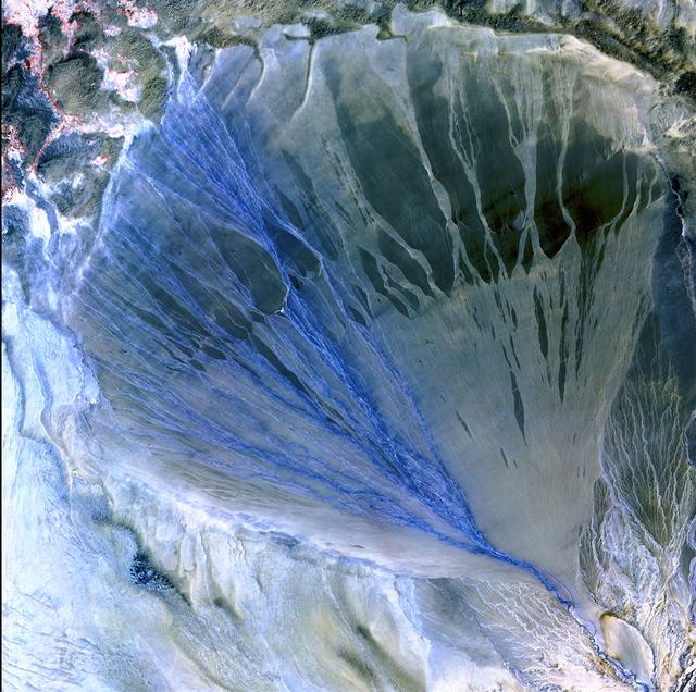
Image taken 5/2/2002 by ASTER: A vast alluvial fan blossoms across the desolate landscape between the Kunlun and Altun mountain ranges that form the southern border of the Taklimakan Desert in China's XinJiang Province. This image can be found on ASTER Path 143 Row 34, center: 37.43 N, 84.30 E. To learn more about the Landsat satellite go to: <a href="http://landsat.gsfc.nasa.gov/" rel="nofollow">landsat.gsfc.nasa.gov/</a>
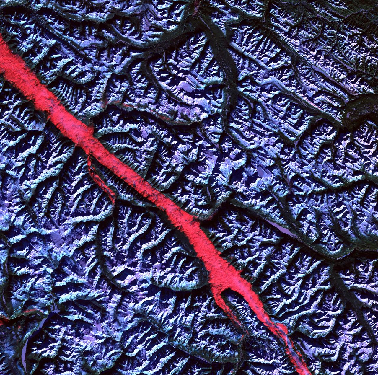
Acquisition Date: February 2004 The high reflectance of clouds compared to the surrounding land, coupled with the low sun elevation when this image was acquired, causes low clouds to appear red as they fill a portion of the Rocky Mountain Trench. Running parallel with the peaks of the Canadian Rockies and ranging from 2 to 10 miles (3 to 16 kilometers) wide and about 900 miles (1,448 kilometers) long, the Trench aligns with the Fraser River and makes its way past Mount Robson, the highest peak in the Canadian Rockies at 12,972 feet (3,954 meters). Mount Robson is near the center of this image. Credit: NASA/GSFC/Landsat/USGS To learn more about Landsat and to see the orginal high res file go to: <a href="http://landsat.usgs.gov/gallery_view.php?category=greenflag&thesort=mainTitle" rel="nofollow">landsat.usgs.gov/gallery_view.php?category=greenflag&...</a>
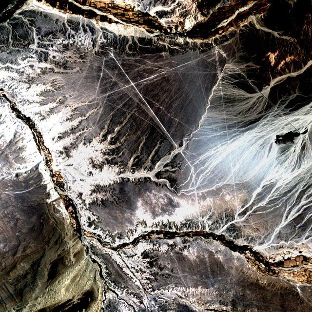
Acquisition Date: November 10, 2002 In the desert of southwest Peru, between the Andes Mountains and the Peruvian coast, lies a plateau with huge geometric patterns and spirals, animal figures including a monkey, a spider, and an 'owl man,' and thousands of perfectly straight lines. The last of these was drawn about a thousand years ago. Known as the Nazca lines, the drawings have mystified scientists since they were first discovered in the 1920s. Pictured here is all that can be seen of these lines by Landsat 7's 15 meter pan band, which has been used to sharpen the 30 meter Bands 3, 2, and 1. Credit: NASA/GSFC/Landsat/USGS To learn more about Landsat and to see the orginal high res file go to: <a href="http://landsat.usgs.gov/gallery_view.php?category=greenflag&thesort=mainTitle" rel="nofollow">landsat.usgs.gov/gallery_view.php?category=greenflag&...</a>