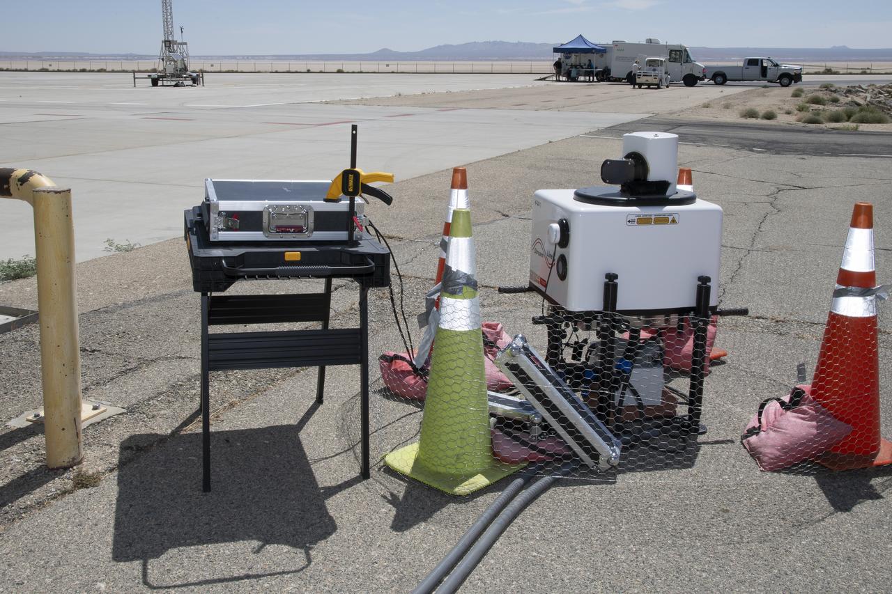
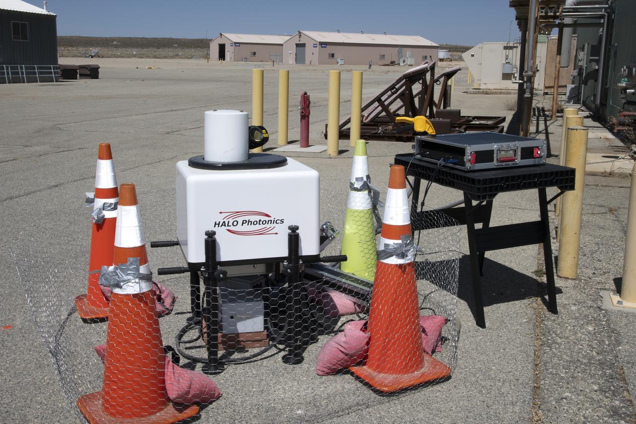
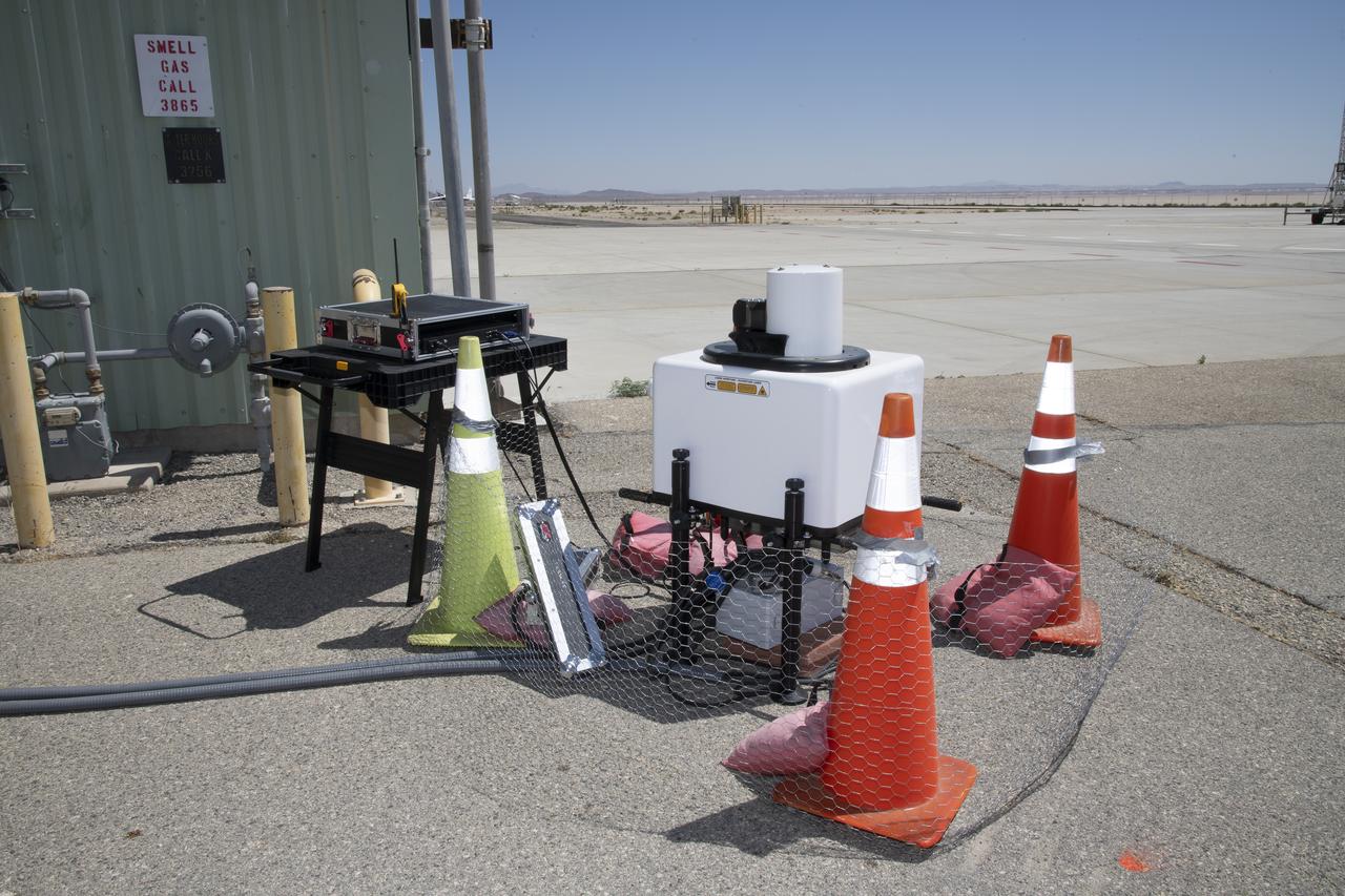
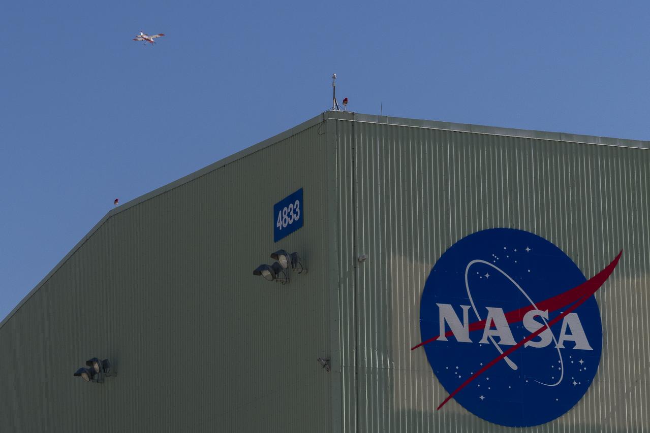
This is one of two lidar units positioned on either end of Building 4833 at NASA’s Armstrong Flight Research Center in Edwards, California, that formed the cutting-edge ‘virtual tower concept.’ The units use lasers to measure airflow from the ground level to 2,000 feet to provide data to assist future drones to safely land on rooftop hubs called vertiports, and to potentially improve weather prediction. It was part of the multi-faceted Advanced Exploration of Reliable Operation at Low Altitudes: Meteorology, Simulation and Technology campaign.
This is one of two lidar units positioned on either end of Building 4833 at NASA’s Armstrong Flight Research Center in Edwards, California, that formed the cutting-edge ‘virtual tower concept.’ The units use lasers to measure airflow from the ground level to 2,000 feet to provide data to assist future drones to safely land on rooftop hubs called vertiports, and to potentially improve weather prediction. It was part of the multi-faceted Advanced Exploration of Reliable Operation at Low Altitudes: Meteorology, Simulation and Technology campaign.
This is one of two lidar units positioned on either end of Building 4833 at NASA’s Armstrong Flight Research Center in Edwards, California, that formed the cutting-edge ‘virtual tower concept.’ The units use lasers to measure airflow from the ground level to 2,000 feet to provide data to assist future drones to safely land on rooftop hubs called vertiports, and to potentially improve weather prediction. It was part of the multi-faceted Advanced Exploration of Reliable Operation at Low Altitudes: Meteorology, Simulation and Technology campaign.

This is one of two lidar units positioned on either end of Building 4833 at NASA’s Armstrong Flight Research Center in Edwards, California, that formed the cutting-edge ‘virtual tower concept.’ The units use lasers to measure airflow from the ground level to 2,000 feet to provide data to assist future drones to safely land on rooftop hubs called vertiports, and to potentially improve weather prediction. It was part of the multi-faceted Advanced Exploration of Reliable Operation at Low Altitudes: Meteorology, Simulation and Technology campaign.
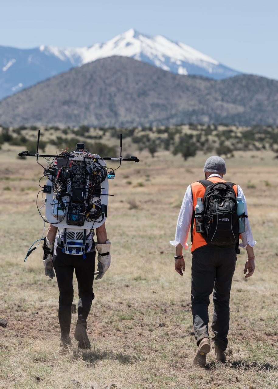
NASA astronaut Kate Rubins walks through the lunar-like landscape wearing the Joint AR (Joint Augmented Reality Visual Informatics System) display during an advanced technology run in the San Francisco Volcanic Field in Northern Arizona on May 19, 2024. The suit display features include navigation, photo capture, graphical format of consumables, procedure viewing, mission control updates, and other augmented reality cues and graphics. The team successfully tested navigation displays using data from four different data streams: GPS (Global Positioning System)/IMU (Inertial Measurement Unit), camera/IMU, LiDAR (Light Detection and Ranging), and static maps. Technology like this may be used for future Artemis missions to augment mission control communication and help guide crew back to the lunar lander. Credit: NASA/Josh Valcarcel
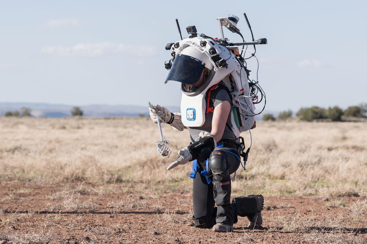
NASA astronaut Kate Rubins uses tongs to pick up a geologic sample while wearing the Joint AR (Joint Augmented Reality Visual Informatics System) display during an advanced technology run in the San Francisco Volcanic Field in Northern Arizona on May 21, 2024. The suit display features include navigation, photo capture, graphical format of consumables, procedure viewing, mission control updates, and other augmented reality cues and graphics. The team successfully tested navigation displays using data from four different data streams: GPS (Global Positioning System)/IMU (Inertial Measurement Unit), camera/IMU, LiDAR (Light Detection and Ranging), and static maps. Technology like this may be used for future Artemis missions to augment mission control communication and help guide crew back to the lunar lander. Credit: NASA/Josh Valcarcel
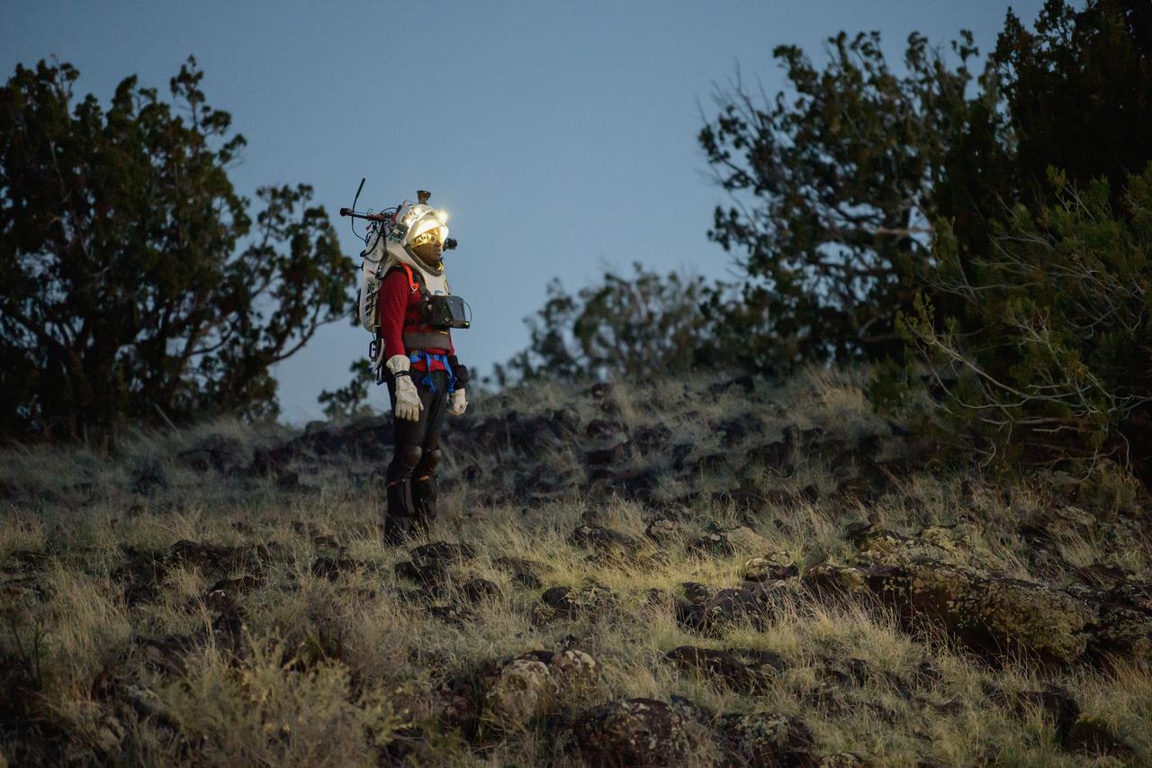
NASA astronaut Andre Douglas views the lunar-like landscape at dusk while wearing the Joint AR (Joint Augmented Reality Visual Informatics System) display during an advanced technology run in the San Francisco Volcanic Field in Northern Arizona on May 21, 2024. The suit display features include navigation, photo capture, graphical format of consumables, procedure viewing, mission control updates, and other augmented reality cues and graphics. The team successfully tested navigation displays using data from four different data streams: GPS (Global Positioning System)/IMU (Inertial Measurement Unit), camera/IMU, LiDAR (Light Detection and Ranging), and static maps. Technology like this may be used for future Artemis missions to augment mission control communication and help guide crew back to the lunar lander. Credit: NASA/Josh Valcarcel
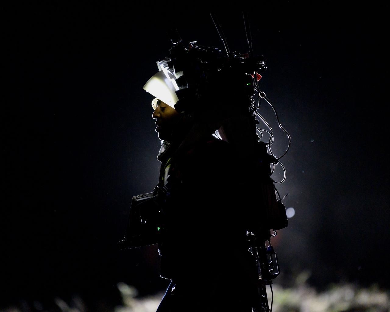
NASA astronaut Andre Douglas wears the Joint AR (Joint Augmented Reality Visual Informatics System) display during a nighttime advanced technology run in the San Francisco Volcanic Field in Northern Arizona on May 21, 2024. The suit display features include navigation, photo capture, graphical format of consumables, procedure viewing, mission control updates, and other augmented reality cues and graphics. The team successfully tested navigation displays using data from four different data streams: GPS (Global Positioning System)/IMU (Inertial Measurement Unit), camera/IMU, LiDAR (Light Detection and Ranging), and static maps. Technology like this may be used for future Artemis missions to augment mission control communication and help guide crew back to the lunar lander. Credit: NASA/Josh Valcarcel
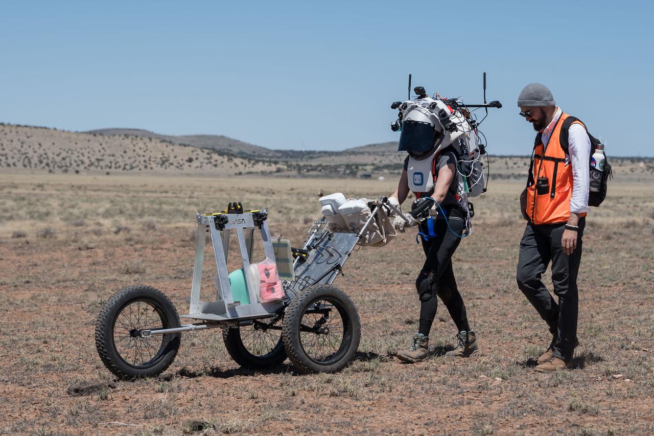
NASA astronaut Kate Rubins pushes a cart through the lunar-like landscape while wearing the Joint AR (Joint Augmented Reality Visual Informatics System) display during an advanced technology run in the San Francisco Volcanic Field in Northern Arizona on May 19, 2024. The suit display features include navigation, photo capture, graphical format of consumables, procedure viewing, mission control updates, and other augmented reality cues and graphics. The team successfully tested navigation displays using data from four different data streams: GPS (Global Positioning System)/IMU (Inertial Measurement Unit), camera/IMU, LiDAR (Light Detection and Ranging), and static maps. Technology like this may be used for future Artemis missions to augment mission control communication and help guide crew back to the lunar lander. Credit: NASA/Josh Valcarcel
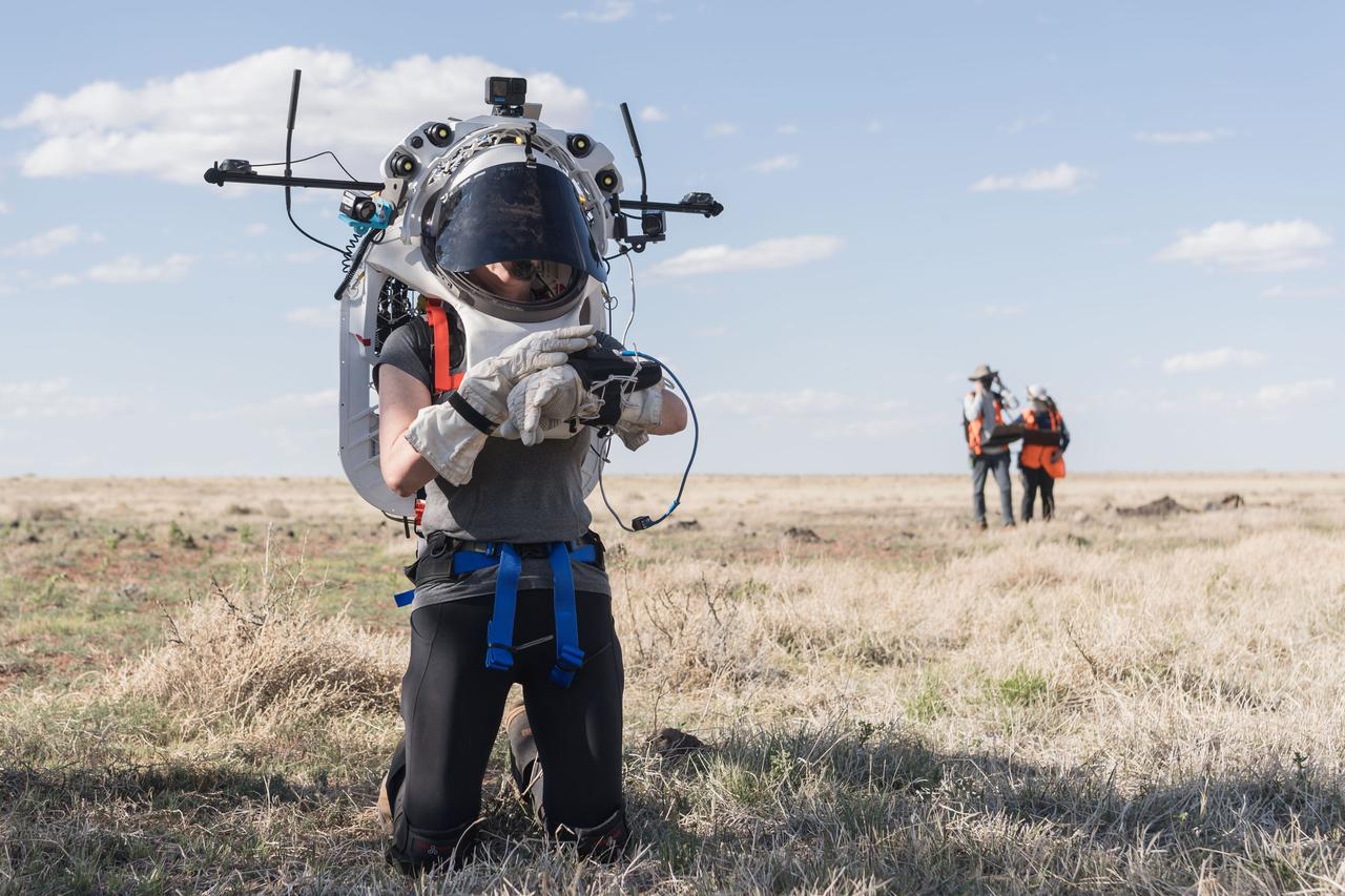
NASA astronaut Kate Rubins uses the hand controller on her wrist to display information while wearing the Joint AR (Joint Augmented Reality Visual Informatics System) display during an advanced technology run in the San Francisco Volcanic Field in Northern Arizona on May 21, 2024. The suit display features include navigation, photo capture, graphical format of consumables, procedure viewing, mission control updates, and other augmented reality cues and graphics. The team successfully tested navigation displays using data from four different data streams: GPS (Global Positioning System)/IMU (Inertial Measurement Unit), camera/IMU, LiDAR (Light Detection and Ranging), and static maps. Technology like this may be used for future Artemis missions to augment mission control communication and help guide crew back to the lunar lander. Credit: NASA/Josh Valcarcel
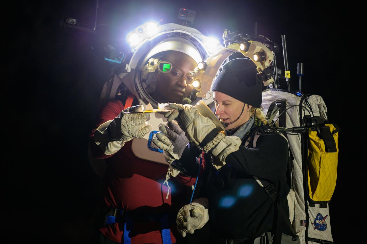
NASA astronauts Andre Douglas and Kate Rubins during a nighttime advanced technology run in the San Francisco Volcanic Field in Northern Arizona on May 21, 2024. Douglas is wearing the Joint AR (Joint Augmented Reality Visual Informatics System) display. The suit display features include navigation, photo capture, graphical format of consumables, procedure viewing, mission control updates, and other augmented reality cues and graphics. The team successfully tested navigation displays using data from four different data streams: GPS (Global Positioning System)/IMU (Inertial Measurement Unit), camera/IMU, LiDAR (Light Detection and Ranging), and static maps. Technology like this may be used for future Artemis missions to augment mission control communication and help guide crew back to the lunar lander. Credit: NASA/Josh Valcarcel
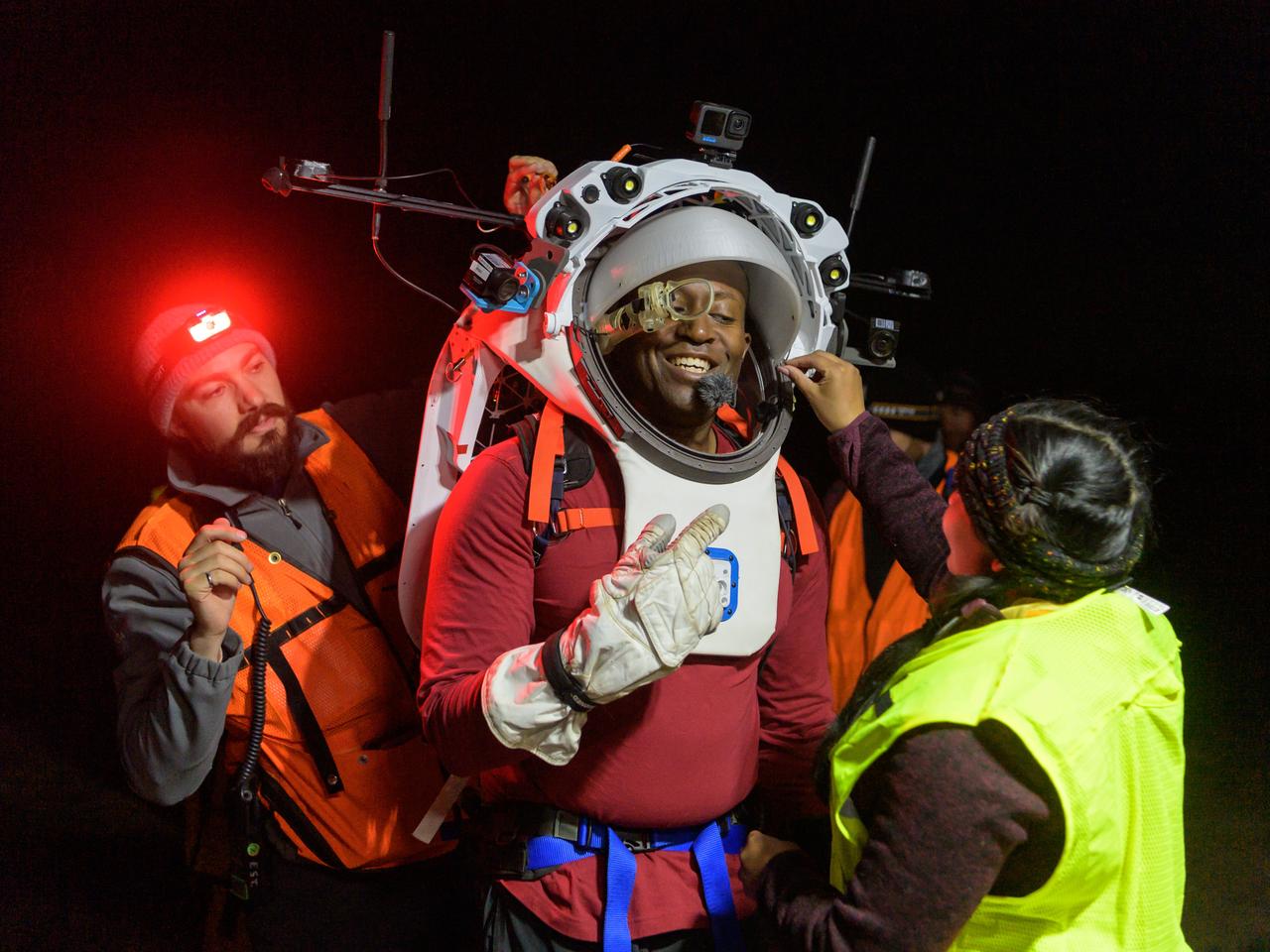
Engineers help NASA astronaut Andre Douglas adjust the Joint AR (Joint Augmented Reality Visual Informatics System) display he’s wearing during a nighttime advanced technology run in the San Francisco Volcanic Field in Northern Arizona on May 21, 2024. The suit display features include navigation, photo capture, graphical format of consumables, procedure viewing, mission control updates, and other augmented reality cues and graphics. The team successfully tested navigation displays using data from four different data streams: GPS (Global Positioning System)/IMU (Inertial Measurement Unit), camera/IMU, LiDAR (Light Detection and Ranging), and static maps. Technology like this may be used for future Artemis missions to augment mission control communication and help guide crew back to the lunar lander. Credit: NASA/Josh Valcarcel
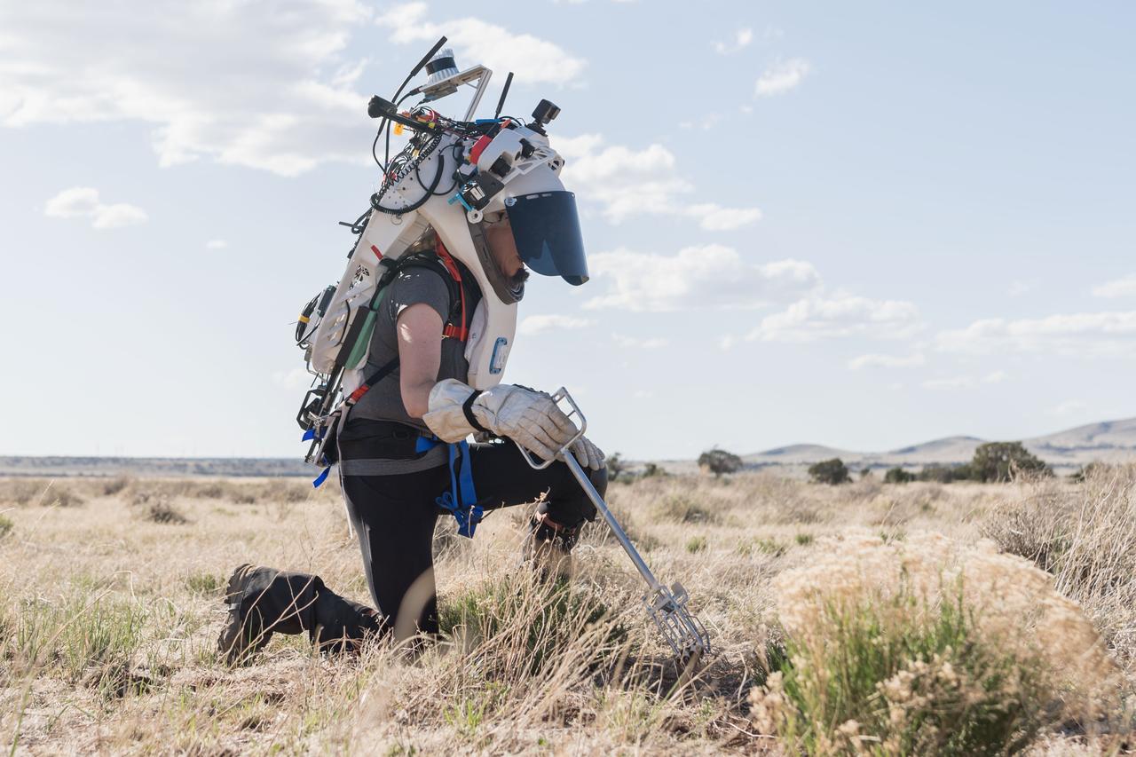
NASA astronaut Kate Rubins uses tongs to collect geologic samples while wearing the Joint AR (Joint Augmented Reality Visual Informatics System) display during an advanced technology run in the San Francisco Volcanic Field in Northern Arizona on May 21, 2024. The suit display features include navigation, photo capture, graphical format of consumables, procedure viewing, mission control updates, and other augmented reality cues and graphics. The team successfully tested navigation displays using data from four different data streams: GPS (Global Positioning System)/IMU (Inertial Measurement Unit), camera/IMU, LiDAR (Light Detection and Ranging), and static maps. Technology like this may be used for future Artemis missions to augment mission control communication and help guide crew back to the lunar lander. Credit: NASA/Josh Valcarcel
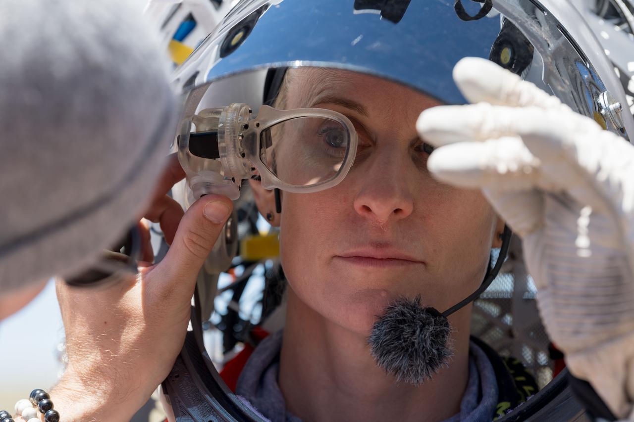
An engineer helps NASA astronaut Kate Rubins adjust the lens on the Joint AR (Joint Augmented Reality Visual Informatics System) display she’s wearing during an advanced technology run in the San Francisco Volcanic Field in Northern Arizona on May 19, 2024. The suit display features include navigation, photo capture, graphical format of consumables, procedure viewing, mission control updates, and other augmented reality cues and graphics. The team successfully tested navigation displays using data from four different data streams: GPS (Global Positioning System)/IMU (Inertial Measurement Unit), camera/IMU, LiDAR (Light Detection and Ranging), and static maps. Technology like this may be used for future Artemis missions to augment mission control communication and help guide crew back to the lunar lander. Credit: NASA/Josh Valcarcel
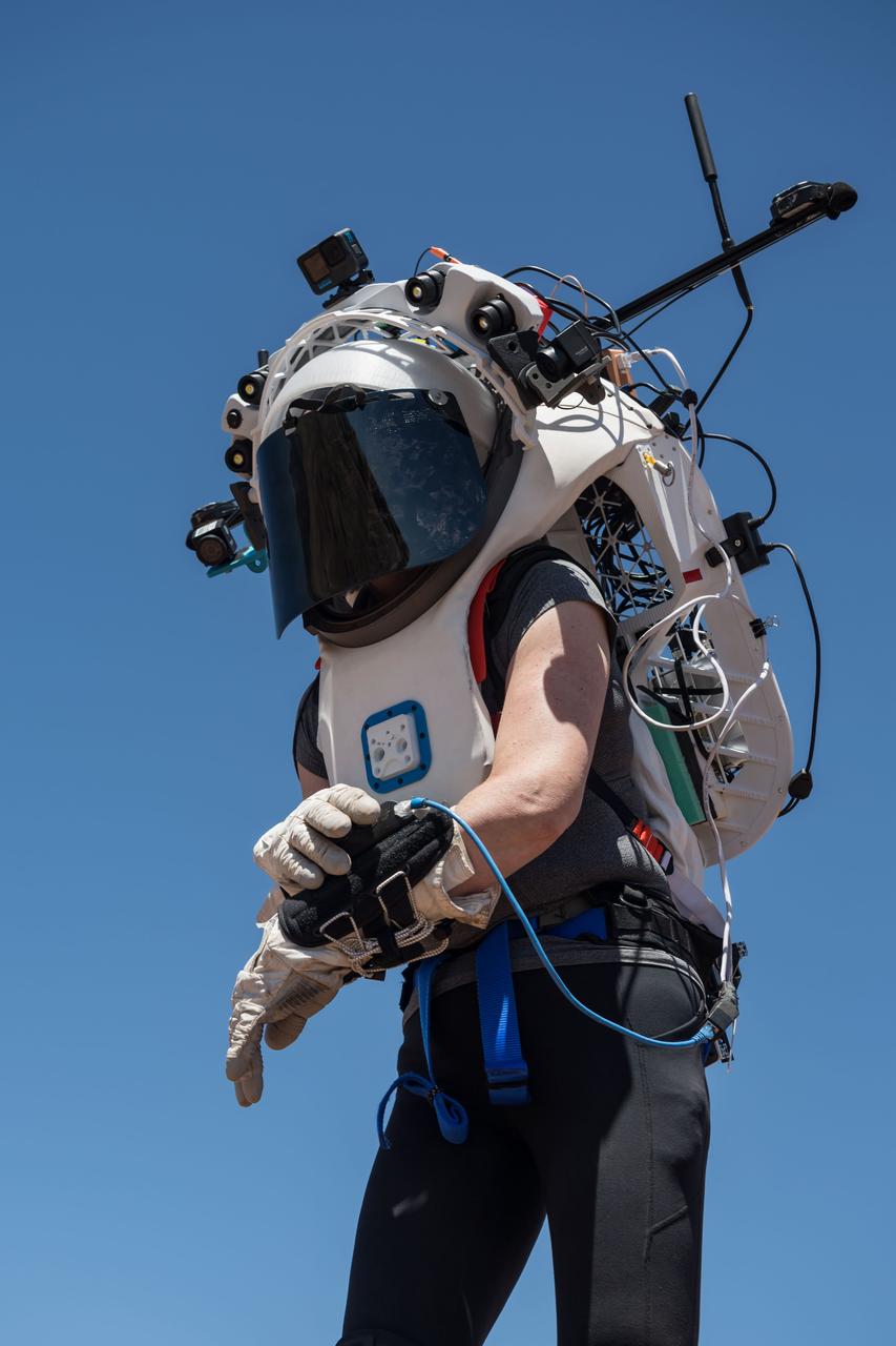
NASA astronaut Kate Rubins uses the hand controller on her wrist to display information while wearing the Joint AR (Joint Augmented Reality Visual Informatics System) display during an advanced technology run in the San Francisco Volcanic Field in Northern Arizona on May 19, 2024. The suit display features include navigation, photo capture, graphical format of consumables, procedure viewing, mission control updates, and other augmented reality cues and graphics. The team successfully tested navigation displays using data from four different data streams: GPS (Global Positioning System)/IMU (Inertial Measurement Unit), camera/IMU, LiDAR (Light Detection and Ranging), and static maps. Technology like this may be used for future Artemis missions to augment mission control communication and help guide crew back to the lunar lander. Credit: NASA/Josh Valcarcel
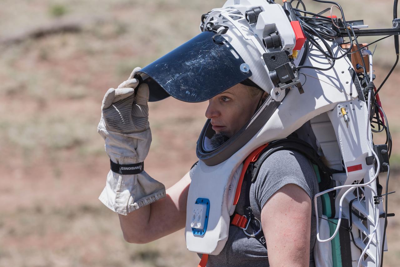
NASA astronaut Kate Rubins opens the sun visor on the Joint AR (Joint Augmented Reality Visual Informatics System) display she’s wearing during an advanced technology run in the San Francisco Volcanic Field in Northern Arizona on May 19, 2024. The suit display features include navigation, photo capture, graphical format of consumables, procedure viewing, mission control updates, and other augmented reality cues and graphics. The team successfully tested navigation displays using data from four different data streams: GPS (Global Positioning System)/IMU (Inertial Measurement Unit), camera/IMU, LiDAR (Light Detection and Ranging), and static maps. Technology like this may be used for future Artemis missions to augment mission control communication and help guide crew back to the lunar lander. Credit: NASA/Josh Valcarcel
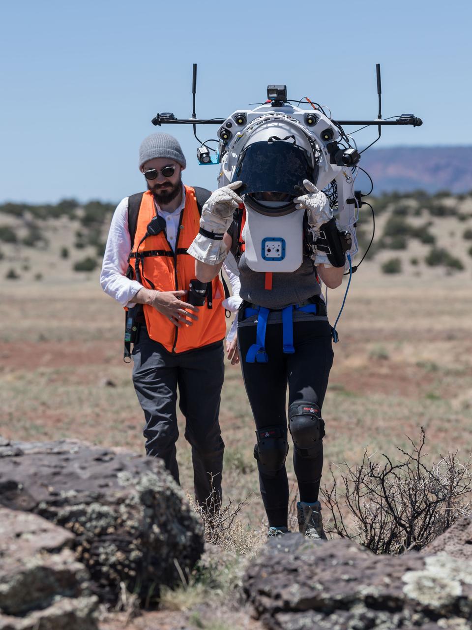
NASA astronaut Kate Rubins walks through the lunar-like landscape wearing the Joint AR (Joint Augmented Reality Visual Informatics System) display during an advanced technology run in the San Francisco Volcanic Field in Northern Arizona on May 19, 2024. The suit display features include navigation, photo capture, graphical format of consumables, procedure viewing, mission control updates, and other augmented reality cues and graphics. The team successfully tested navigation displays using data from four different data streams: GPS (Global Positioning System)/IMU (Inertial Measurement Unit), camera/IMU, LiDAR (Light Detection and Ranging), and static maps. Technology like this may be used for future Artemis missions to augment mission control communication and help guide crew back to the lunar lander. Credit: NASA/Josh Valcarcel

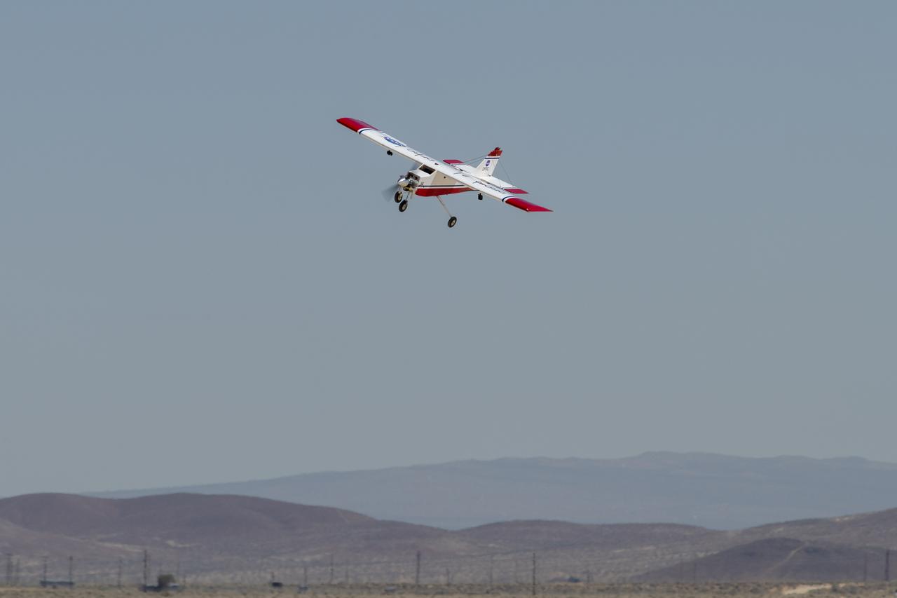
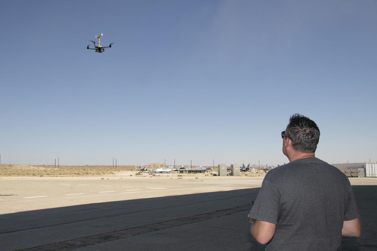
The Alta-X aircraft flies by the former space shuttle hangar at NASA’s Armstrong Flight Research Center in Edwards, California, as part of the Advanced Exploration of Reliable Operation at Low Altitudes: Meteorology, Simulation and Technology campaign. The campaign was at NASA Armstrong to study wind from the ground to 2,000 feet to provide data to assist future drones to safely land on rooftop hubs called vertiports and to potentially improve weather prediction.
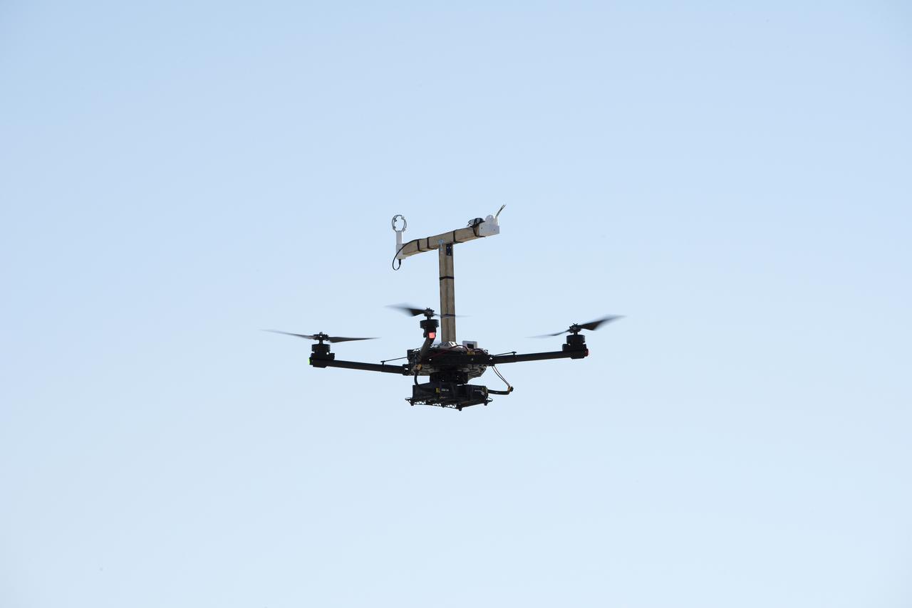
The Alta-X aircraft flies at NASA’s Armstrong Flight Research Center in Edwards, California, as part of the Advanced Exploration of Reliable Operation at Low Altitudes: Meteorology, Simulation and Technology campaign. The campaign was at NASA Armstrong to study wind from the ground to 2,000 feet to provide data to assist future drones to safely land on rooftop hubs called vertiports and to potentially improve weather prediction.
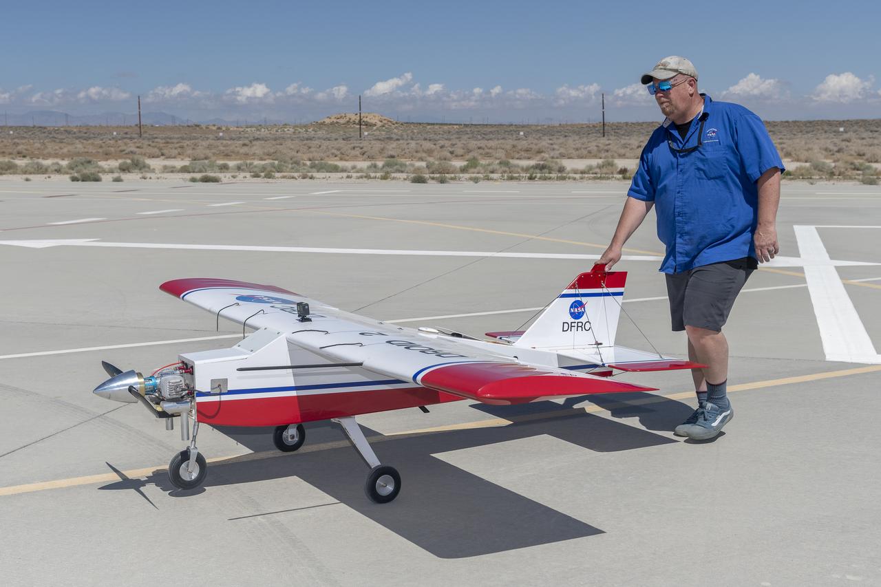
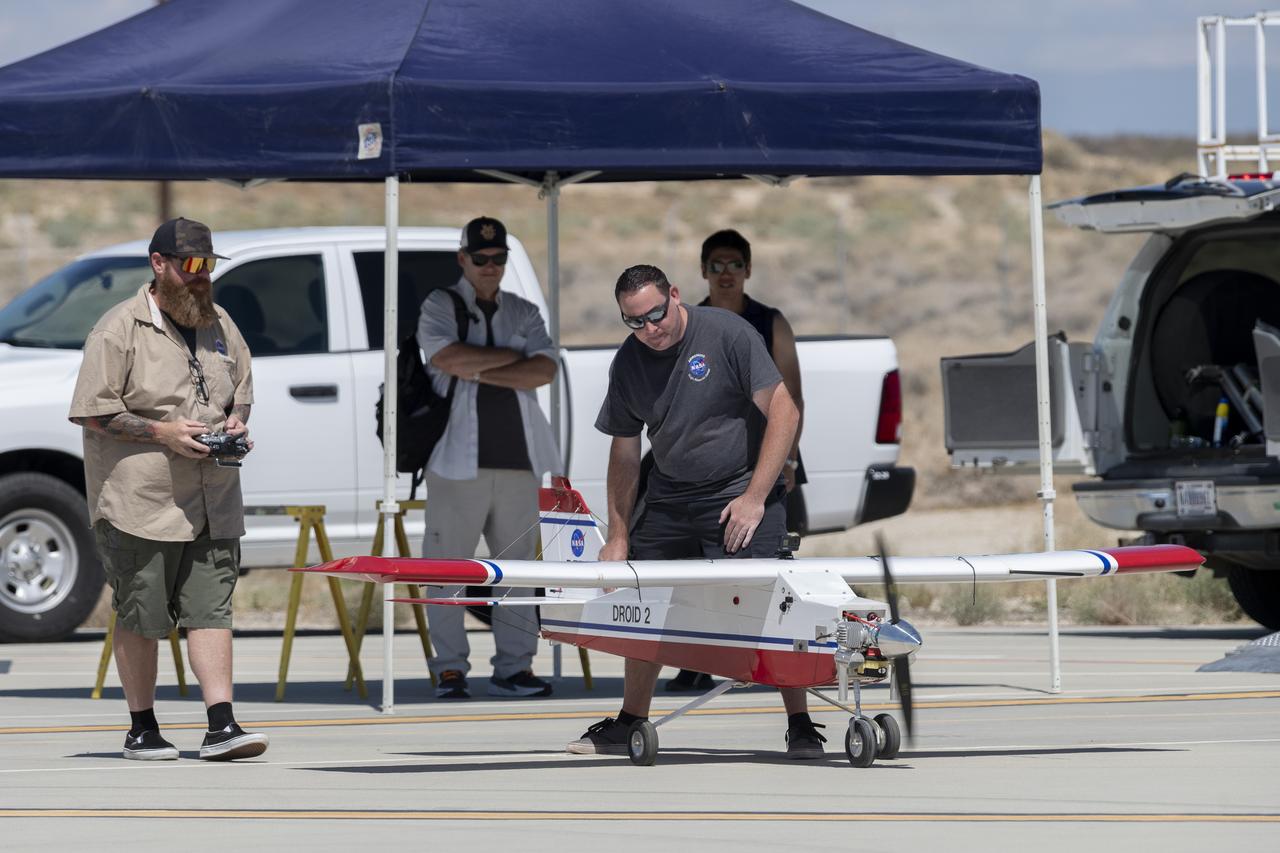
Robert "Red" Jensen positions the DROID 2 (Dryden Remotely Operated Integrated Drone) aircraft before a flight for the Advanced Exploration of Reliable Operation at Low Altitudes: Meteorology, Simulation, and Technology campaign. The weather study was at NASA's Armstrong Flight Research Center in Edwards, California. The focus was to study wind to provide data for safe takeoff and landing of future air taxis.
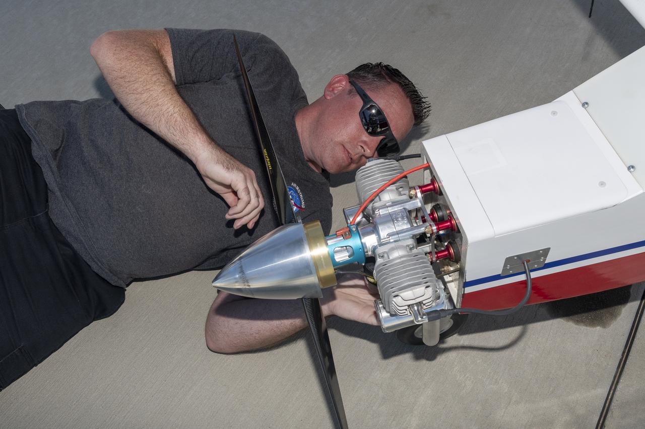
Justin Link prepares the DROID 2 (Dryden Remotely Operated Integrated Drone 2) aircraft before a flight for the Advanced Exploration of Reliable Operation at Low Altitudes: Meteorology, Simulation, and Technology campaign. The weather study was at NASA's Armstrong Flight Research Center in Edwards, California. The focus was to study wind to provide data for safe takeoff and landing of future air taxis.
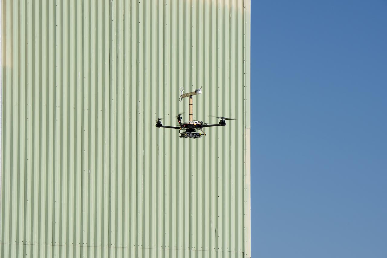
The Alta-X aircraft flies by the former space shuttle hangar at NASA’s Armstrong Flight Research Center in Edwards, California, as part of the Advanced Exploration of Reliable Operation at Low Altitudes: Meteorology, Simulation and Technology campaign. The campaign was at NASA Armstrong Flight to study wind from the ground to 2,000 feet to provide data to assist future drones to safely land on rooftop hubs called vertiports and to potentially improve weather prediction.
The DROID 2 (Dryden Remotely Operated Integrated Drone 2) aircraft flies by the former space shuttle hangar at NASA's Armstrong Flight Research Center in Edwards, California, as part of the Advanced Exploration of Reliable Operation at Low Altitudes: Meteorology, Simulation, and Technology campaign. The focus was to study wind to provide data for safe takeoff and landing of future air taxis.
Tegan French and Rocky Garcia are at a weather balloon system’s ground station monitoring temperature, humidity, pressure, and winds transmitted from an instrument package on the balloon as it ascends. The balloon is part of the different methods to collect wind and weather data for the Advanced Exploration of Reliable Operation at Low Altitudes: Meteorology, Simulation and Technology campaign. The weather study was at NASA’s Armstrong Flight Research Center in Edwards, California. The focus was to study wind from the ground to 2,000 feet to provide data to assist future drones to safely land on rooftop hubs called vertiports and to potentially improve weather prediction.
Red Jensen lands the Alta-X aircraft at NASA’s Armstrong Flight Research Center in Edwards, California, as part of the Advanced Exploration of Reliable Operation at Low Altitudes: Meteorology, Simulation and Technology campaign. The campaign was at NASA Armstrong to study wind from the ground to 2,000 feet to provide data to assist future drones to safely land on rooftop hubs called vertiports and to potentially improve weather prediction.
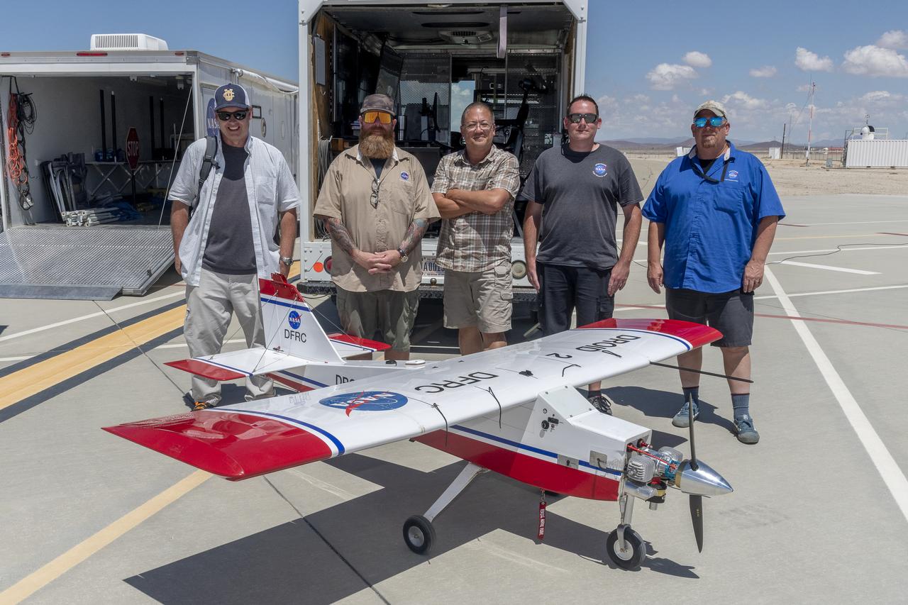
John Melton, Justin Hall, Derek Abramson, Justin Link, and Robert "Red" Jensen were key on mission day for the Advanced Exploration of Reliable Operation at Low Altitudes: Meteorology, Simulation, and Technology campaign. The DROID 2 (Dryden Remotely Operated Integrated Drone 2) aircraft supported the campaign at NASA's Armstrong Flight Research Center in Edwards, California. The focus was to study wind to provide data for safe takeoff and landing of future air taxis.
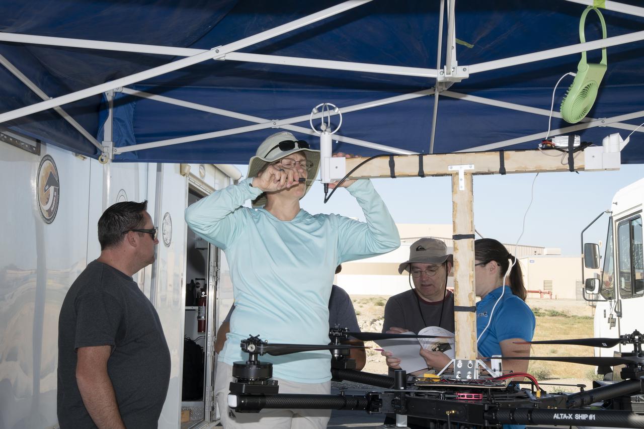
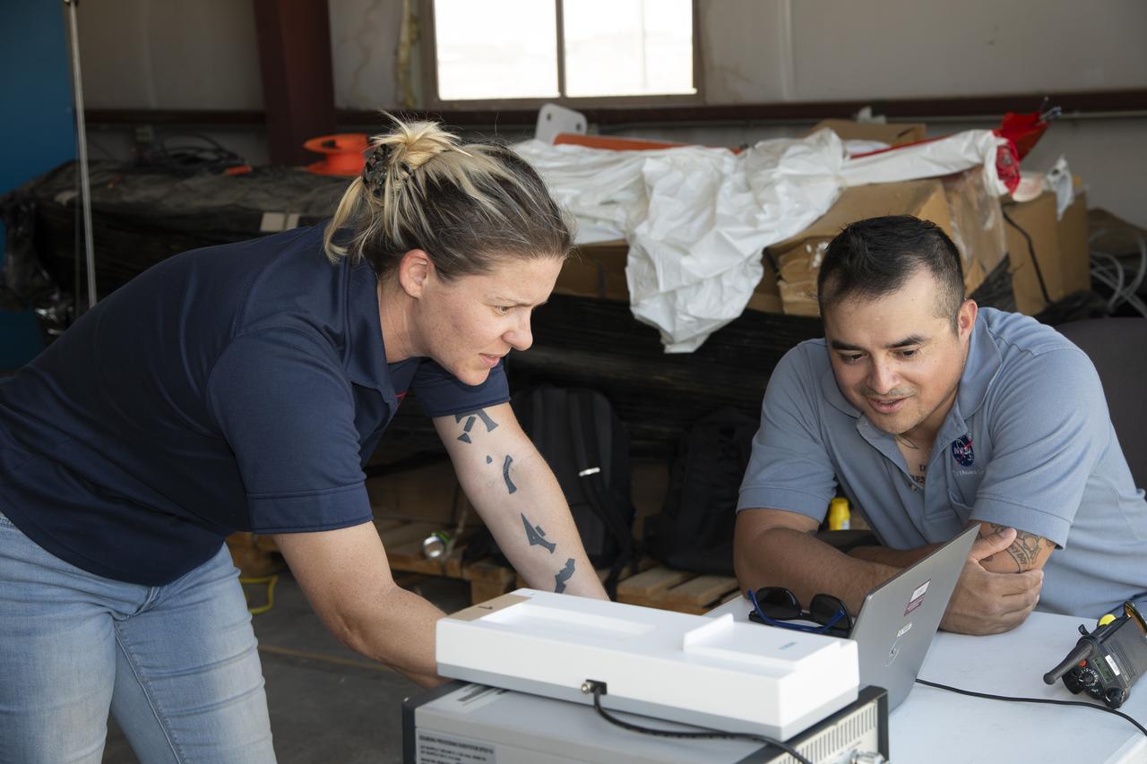
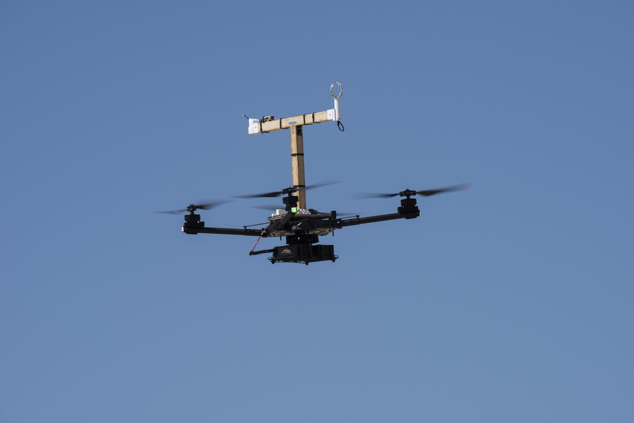
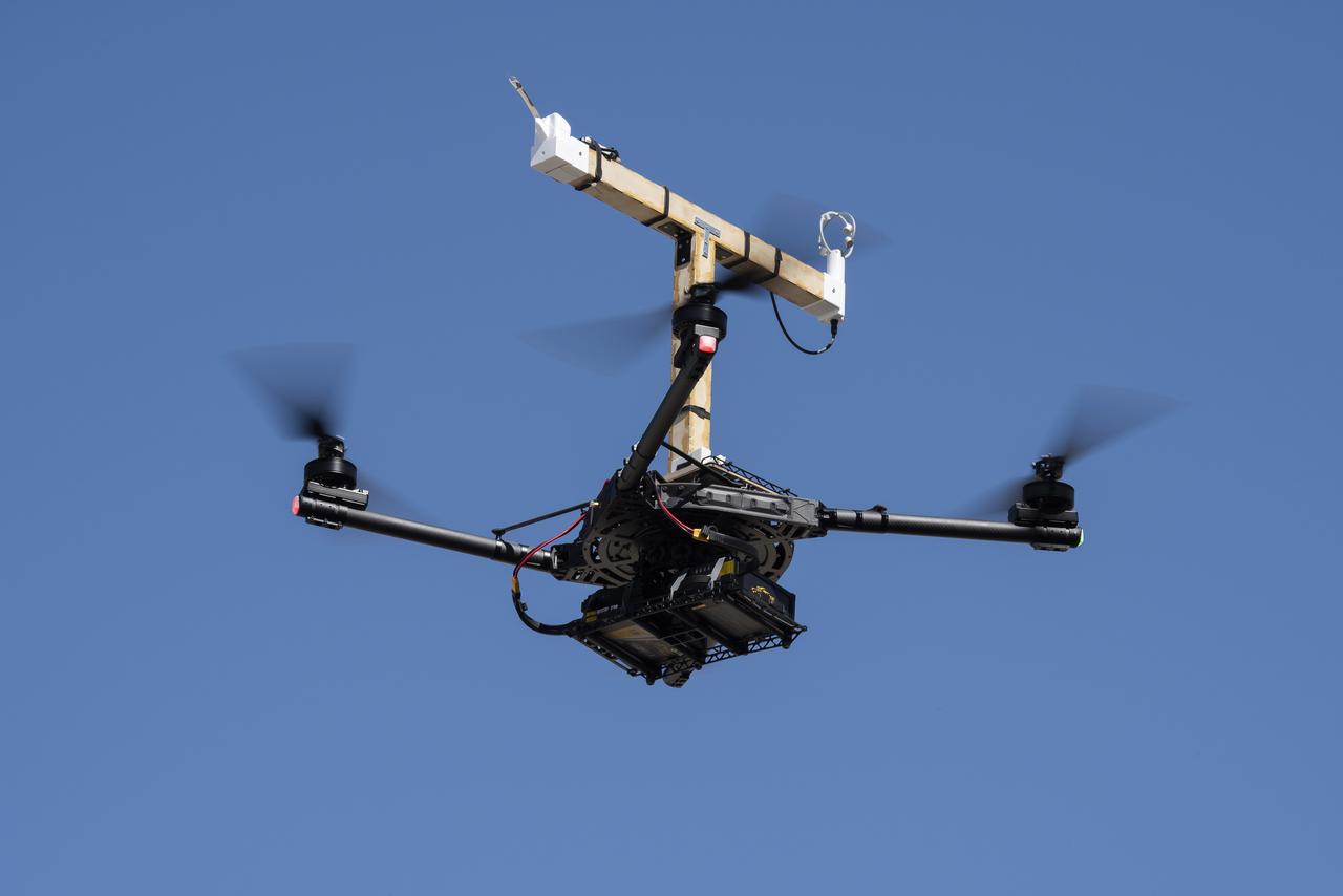
Jennifer Fowler works on securing sensors onto the test fixture on the Alta-X aircraft. Justin Link, Grady Koch, and Tyler Willhite are in the background. The Advanced Exploration of Reliable Operation at Low Altitudes: Meteorology, Simulation and Technology campaign was at NASA’s Armstrong Flight Research Center in Edwards, California. The focus was to study wind from the ground to 2,000 feet to provide data to assist future drones to safely land on rooftop hubs called vertiports and to potentially improve weather prediction.
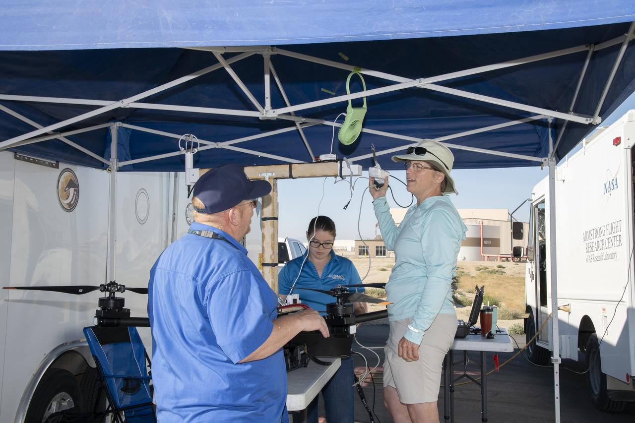
Jennifer Fowler talks to Red Jensen prior to a flight for the Advanced Exploration of Reliable Operation at Low Altitudes: Meteorology, Simulation and Technology campaign. Tyler Willhite completes some equipment checks for the research in the background. The weather study was at NASA’s Armstrong Flight Research Center in Edwards, California. The focus was to study wind from the ground to 2,000 feet to provide data to assist future drones to safely land on rooftop hubs called vertiports and to potentially improve weather prediction.
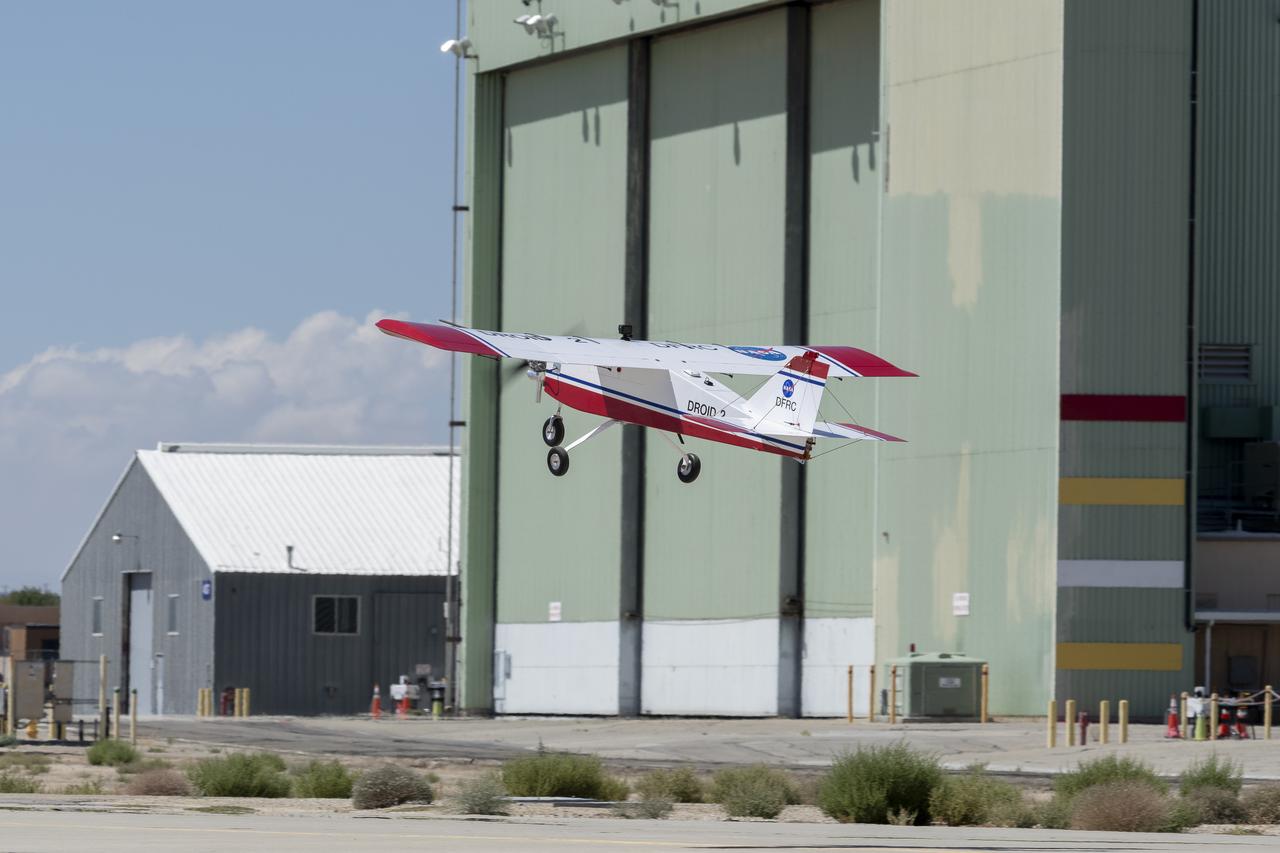
The DROID 2 (Dryden Remotely Operated Integrated Drone 2) aircraft flies by the former space shuttle hangar at NASA's Armstrong Flight Research Center in Edwards, California, as part of the Advanced Exploration of Reliable Operation at Low Altitudes: Meteorology, Simulation, and Technology campaign. The focus was to study wind to provide data for safe takeoff and landing of future air taxis.
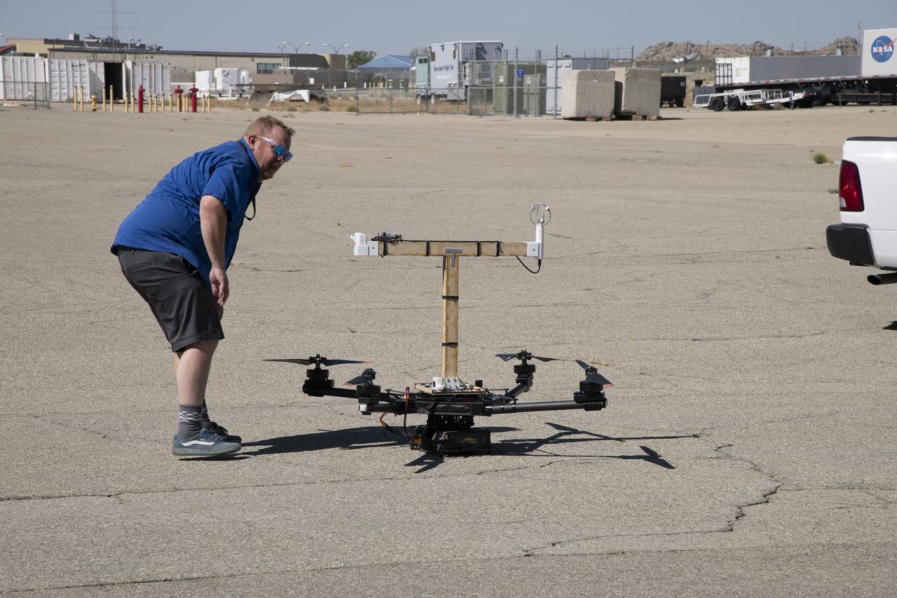
Red Jensen looks over the Alta-X aircraft before a flight for the Advanced Exploration of Reliable Operation at Low Altitudes: Meteorology, Simulation and Technology campaign. The weather study was at NASA’s Armstrong Flight Research Center in Edwards, California. The focus was to study wind from the ground to 2,000 feet to provide data to assist future drones to safely land on rooftop hubs called vertiports and to potentially improve weather prediction.
The Alta-X aircraft flies at NASA’s Armstrong Flight Research Center in Edwards, California, as part of the Advanced Exploration of Reliable Operation at Low Altitudes: Meteorology, Simulation and Technology campaign. The campaign was at NASA Armstrong to study wind from the ground to 2,000 feet to provide data to assist future drones to safely land on rooftop hubs called vertiports and to potentially improve weather prediction.
The Alta-X aircraft flies at NASA’s Armstrong Flight Research Center in Edwards, California, as part of the Advanced Exploration of Reliable Operation at Low Altitudes: Meteorology, Simulation and Technology campaign. The campaign was at NASA Armstrong to study wind from the ground to 2,000 feet to provide data to assist future drones to safely land on rooftop hubs called vertiports and to potentially improve weather prediction.
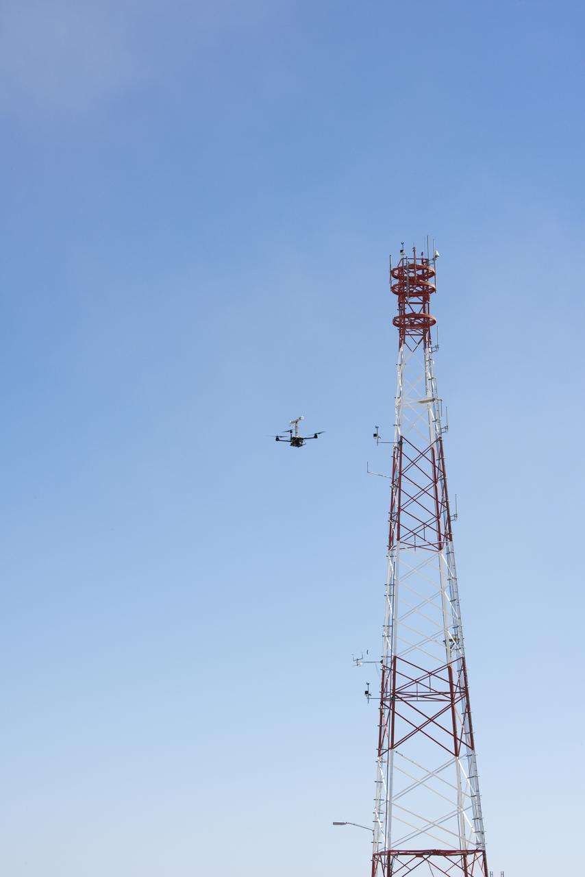
The Alta-X aircraft flies by a 140-foot instrumented tower at NASA’s Armstrong Flight Research Center in Edwards, California, as part of the Advanced Exploration of Reliable Operation at Low Altitudes: Meteorology, Simulation and Technology campaign. The campaign was at NASA Armstrong to study wind from the ground to 2,000 feet to provide data to assist future drones to safely land on rooftop hubs called vertiports and to potentially improve weather prediction.
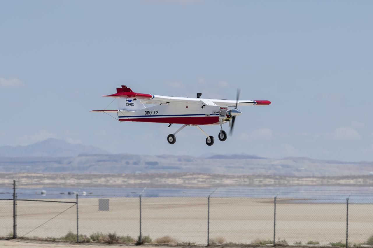
The DROID 2 (Dryden Remotely Operated Integrated Drone 2) prepares to land at NASA's Armstrong Flight Research Center in Edwards, California, as part of the Advanced Exploration of Reliable Operation at Low Altitudes: Meteorology, Simulation, and Technology campaign. The focus was to study wind to provide data for safe takeoff and landing of future air taxis.

The DROID 2 (Dryden Remotely Operated Integrated Drone 2) flies by a 140-foot instrumented tower at NASA's Armstrong Flight Research Center in Edwards, California, as part of the Advanced Exploration of Reliable Operation at Low Altitudes: Meteorology, Simulation, and Technology campaign. The focus was to study wind to provide data for safe takeoff and landing of future air taxis.

Justin Link, left, Red Jensen and Derek Abramson prepare for an Alta-X aircraft flight as part of the Advanced Exploration of Reliable Operation at Low Altitudes: Meteorology, Simulation and Technology campaign. In the background are Grady Koch and Jennifer Fowler. The campaign was at NASA Armstrong to study wind from the ground to 2,000 feet to provide data to assist future drones to safely land on rooftop hubs called vertiports and to potentially improve weather prediction.
Justin Hall, left, prepares to pilot the DROID 2 (Dryden Remotely Operated Integrated Drone 2) aircraft, as John Melton watches and Justin Link makes a final adjustment. The flight was part of the Advanced Exploration of Reliable Operation at Low Altitudes: Meteorology, Simulation, and Technology campaign. The weather study was at NASA's Armstrong Flight Research Center in Edwards, California. The focus was to study wind to provide data for safe takeoff and landing of future air taxis.
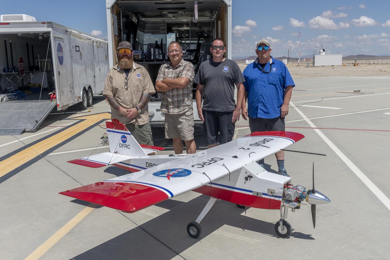
Justin Hall, Derek Abramson, Justin Link, and Robert "Red" Jensen were key to a successful mission for the DROID 2 (Dryden Remotely Operated Integrated Drone 2) aircraft at NASA's Armstrong Flight Research Center in Edwards, California. The aircraft flew as part of the Advanced Exploration of Reliable Operation at Low Altitudes: Meteorology, Simulation, and Technology campaign. The focus was to study wind to provide data for safe takeoff and landing of future air taxis.
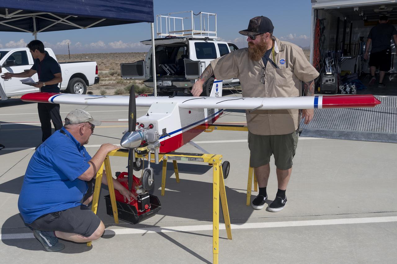
Robert "Red" Jensen and Justin Hall prepare the DROID 2 (Dryden Remotely Operated Integrated Drone 2) aircraft for the Advanced Exploration of Reliable Operation at Low Altitudes: Meteorology, Simulation, and Technology campaign flights. The weather study was at NASA's Armstrong Flight Research Center in Edwards, California. The focus was to study wind to provide data for safe takeoff and landing of future air taxis.
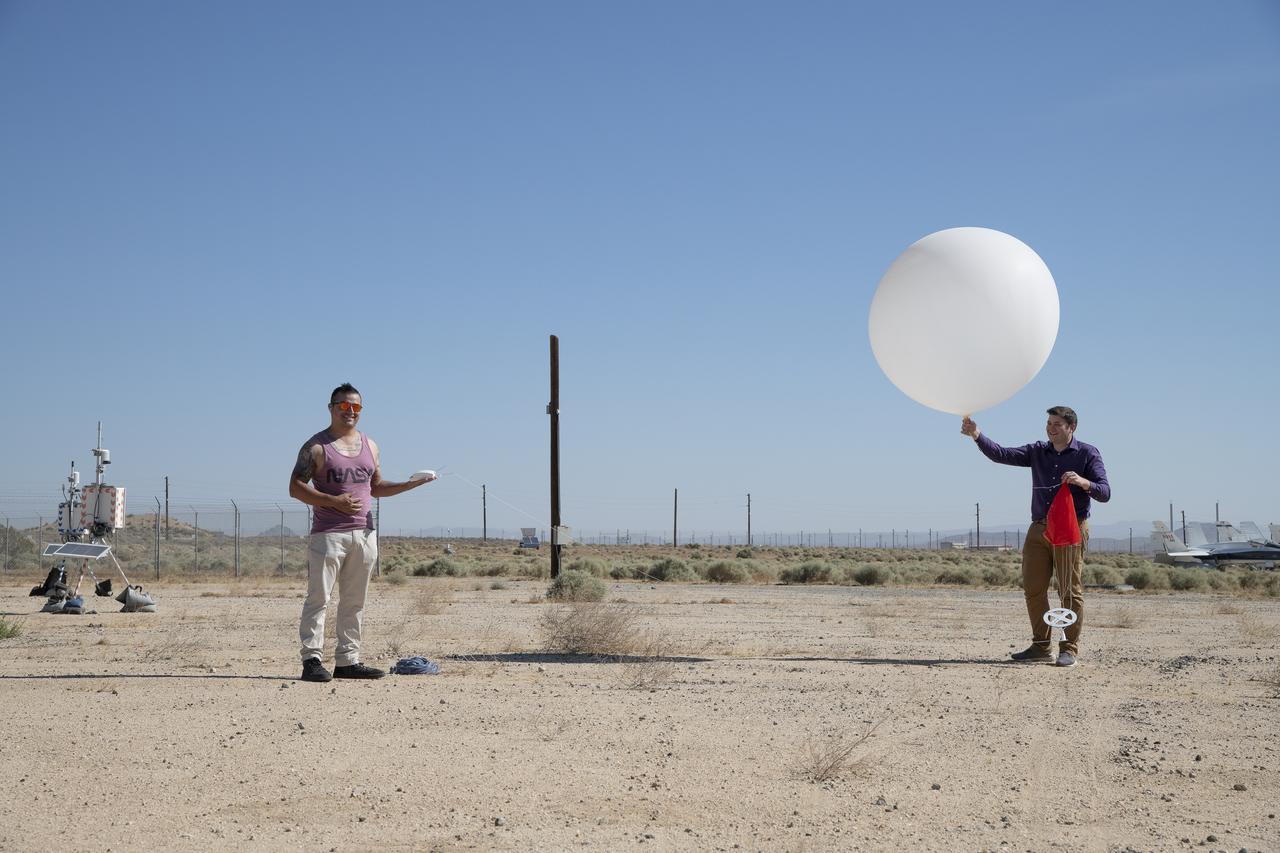
Rocky Garcia and Wesley James prepare a weather balloon to collect wind data for the Advanced Exploration of Reliable Operation at Low Altitudes: Meteorology, Simulation and Technology campaign. The weather study was at NASA’s Armstrong Flight Research Center in Edwards, California. The focus was to study wind from the ground to 2,000 feet to provide data to assist future drones to safely land on rooftop hubs called vertiports and to potentially improve weather prediction.
The DROID 2 (Dryden Remotely Operated Integrated Drone 2) flies at NASA's Armstrong Flight Research Center in Edwards, California, as part of the Advanced Exploration of Reliable Operation at Low Altitudes: Meteorology, Simulation, and Technology campaign. The focus was to study wind to provide data for safe takeoff and landing of future air taxis.
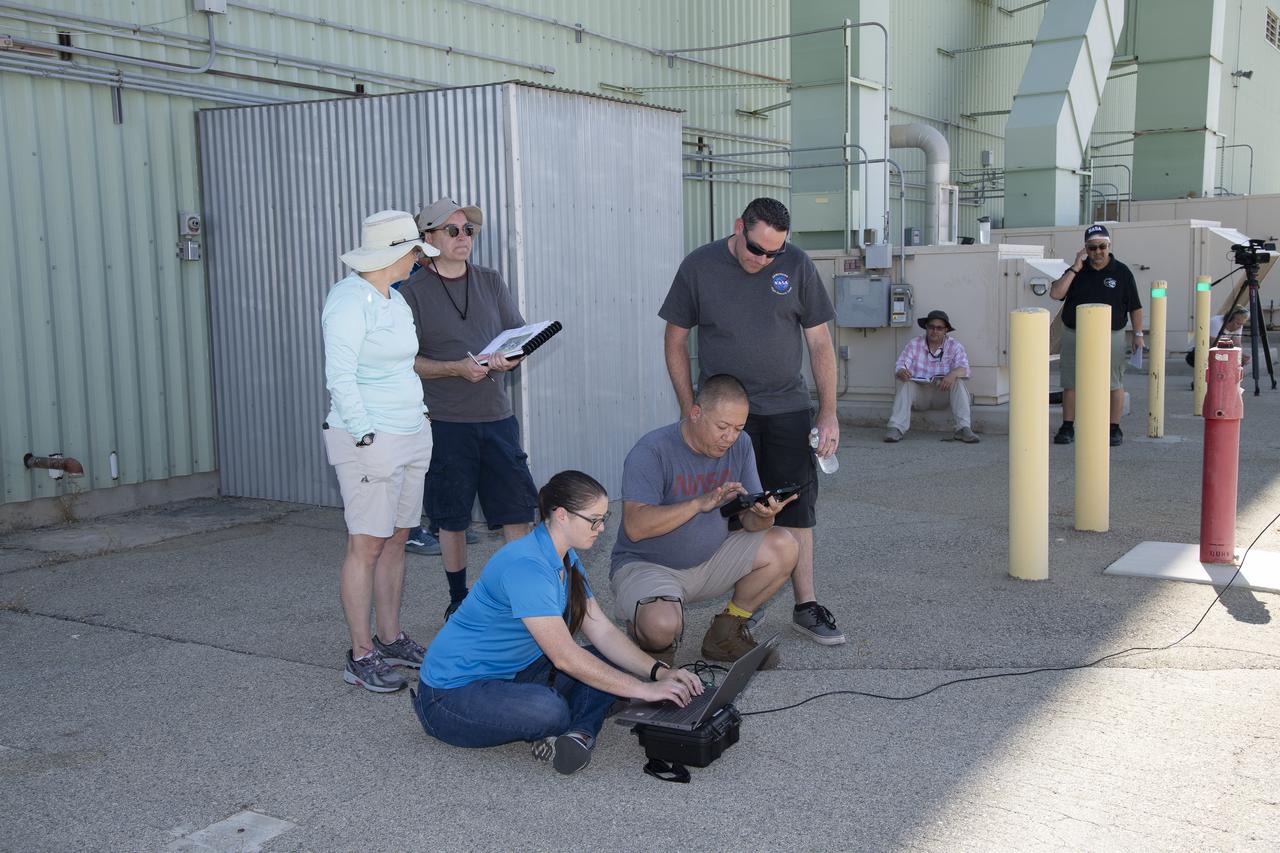
Tyler Willhite, sitting, and Derek Abramson and Justin Link, prepare for an Alta-X aircraft flight. Behind them are Jennifer Fowler, from left and Grady Kock. The Alta-X flight was part of the Advanced Exploration of Reliable Operation at Low Altitudes: Meteorology, Simulation and Technology campaign. The campaign was at NASA Armstrong to study wind from the ground to 2,000 feet to provide data to assist future drones to safely land on rooftop hubs called vertiports and to potentially improve weather prediction.
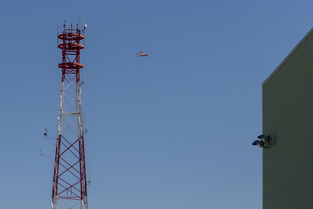
The DROID 2 (Dryden Remotely Operated Integrated Drone 2) flies by a 140-foot instrumented tower and the former space shuttle hangar at NASA's Armstrong Flight Research Center in Edwards, California, as part of the Advanced Exploration of Reliable Operation at Low Altitudes: Meteorology, Simulation, and Technology campaign. The focus was to study wind to provide data for safe takeoff and landing of future air taxis.
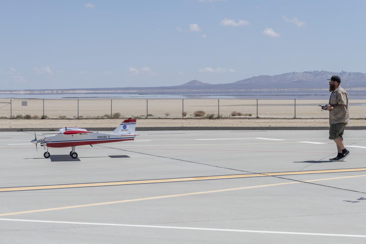
Justin Hall lands the DROID 2 (Dryden Remotely Operated Integrated Drone 2) aircraft at NASA's Armstrong Flight Research Center in Edwards, California, as part of the Advanced Exploration of Reliable Operation at Low Altitudes: Meteorology, Simulation, and Technology campaign. The focus was to study wind to provide data for safe takeoff and landing of future air taxis.
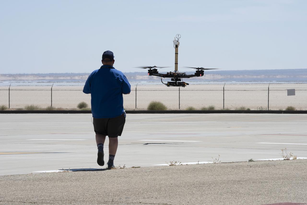
Justin Link positions the Alta-X aircraft for a hover to capture data as part of the Advanced Exploration of Reliable Operation at Low Altitudes: Meteorology, Simulation and Technology campaign. The campaign was at NASA Armstrong to study wind from the ground to 2,000 feet to provide data to assist future drones to safely land on rooftop hubs called vertiports and to potentially improve weather prediction.

Robert "Red" Jensen lands the DROID 2 (Dryden Remotely Operated Integrated Drone 2) aircraft at NASA's Armstrong Flight Research Center in Edwards, California, as part of the Advanced Exploration of Reliable Operation at Low Altitudes: Meteorology, Simulation, and Technology campaign. The focus was to study wind to provide data for safe takeoff and landing of future air taxis.
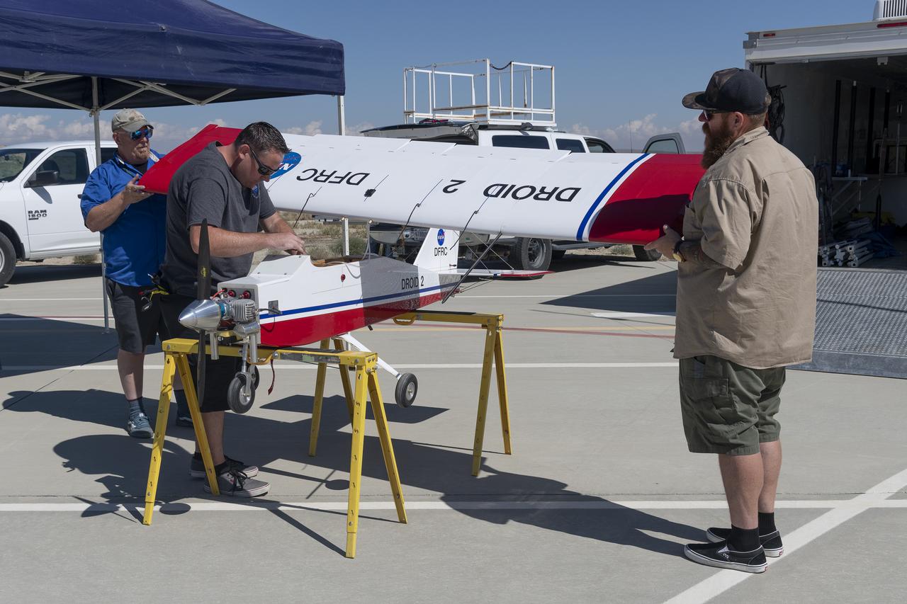
Robert "Red" Jensen, Justin Link, and Justin Hall prepare the DROID 2 (Dryden Remotely Operated Integrated Drone 2) for the Advanced Exploration of Reliable Operation at Low Altitudes: Meteorology, Simulation, and Technology campaign flights. The weather study was at NASA's Armstrong Flight Research Center in Edwards, California. The focus was to study wind to provide data for safe takeoff and landing of future air taxis.
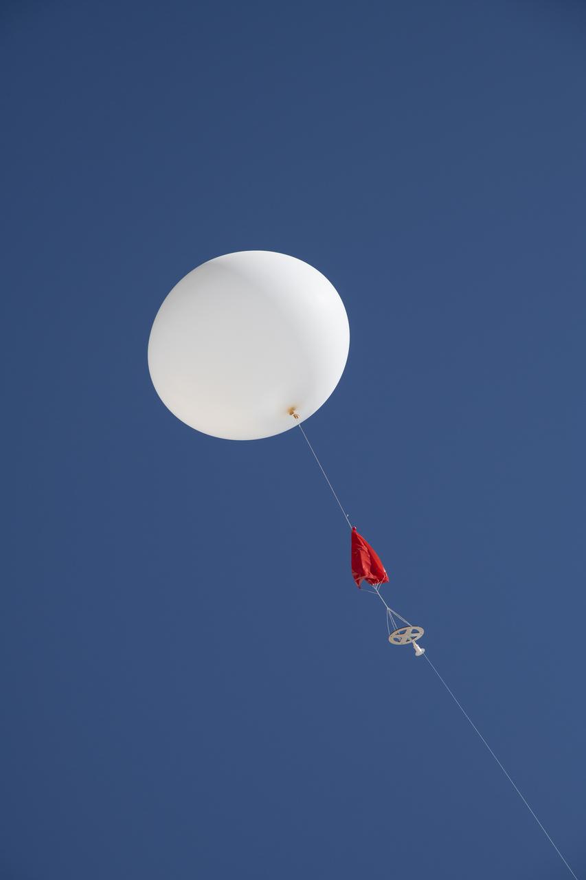
A weather balloon is launched to collect wind data for the Advanced Exploration of Reliable Operation at Low Altitudes: Meteorology, Simulation and Technology campaign. The weather study was at NASA’s Armstrong Flight Research Center in Edwards, California. The focus was to study wind from the ground to 2,000 feet to provide data to assist future drones to safely land on rooftop hubs called vertiports and to potentially improve weather prediction.
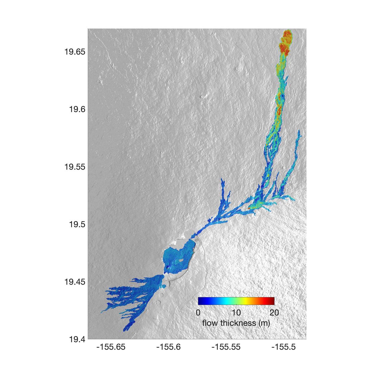
The world's largest active volcano – Hawaii's Mauna Loa – had been quiet for 38 years. But in 2022, the volcano began to stir, showing increased numbers of small earthquakes and subtle swelling of certain land surfaces in September. On November 27, fountains of lava began spurting from the mountain's Northeast Rift Zone and streams of molten rock flowed to the north. Ten days into the eruption, a NASA aircraft conducted its first flight over the erupting volcano. It carried NASA's Uninhabited Aerial Vehicle Synthetic Aperture Radar (UAVSAR) system, which was used to map the volcano's topography in fine detail with a Ka-band instrument called GLISTIN-A. Teams from NASA's Jet Propulsion Laboratory and the United States Geological Survey (USGS) used data from that sensor to map the thickness of those flows during a series of flights on December 7, 8, and 10. The map above shows the thickness of the lava flows during the flight on December 7, the day before USGS scientists noticed a significant decline in the pace of the eruption. A few days later, they declared the eruption had stopped. The map shows the thickness of the lava flows in the summit caldera, where the eruption began, and of lava flows on Mauna Loa's northeastern flank. The color variation from blue to orange indicates increasing lava flow thickness. A maximum thickness of roughly 25 meters (82 feet) is shown, though values exceeding 40 meters (131 feet) were observed in some areas. The thickening at the northern end of the flow is due to lava accumulating away from the vent, along with a flattening of the terrain at the saddle between the Mauna Loa and Mauna Kea volcanoes. By comparing to pre-eruption maps of this area's topography, including GLISTIN-A data collected in 2017, the USGS researchers were able to calculate the size and volume of the lava flow. Over the roughly 14-day eruption, Mauna Loa erupted more than 8.8 billion cubic feet (230 million cubic meters) along a lava flow that extended up to 16.5 miles (19.5 kilometers) from the vent, according to the USGS. The UAVSAR operates from a pod mounted beneath a crewed Gulfstream III jet from NASA's Armstrong Flight Research Center in California. Repeated topographic maps generated with each flight reveal the progression and thickening of lava with time – important information for scientific understanding of volcano processes and for emergency response. For the Mauna Loa science flights, the instrument suite featured an additional state-of-the-art imaging tool: the synthetic aperture radar-fusion optical short-wave infrared (SAR-Fusion Optical/SWIR) camera system. SAR-Fusion collects data over the same ground swath as GLISTIN-A to map land surface changes using optical/SWIR photogrammetry methods. GLISTIN-A was designed to provide all-weather, high-resolution surface topography not available through existing lidar or radar sensors. GLISTIN-A was originally demonstrated as a new radar technique for mapping ice surfaces. Science demonstration flights began in 2013 over alpine glaciers and sea ice in Alaska, and a floodplain in California. Its applications have since expanded to other areas, such as snow accumulation and volcano dynamics. The first time the instrument was deployed for volcano response was in 2018 during the three-month eruption of Kilauea. The success of that operation paved the way for deployment to Mauna Loa. https://photojournal.jpl.nasa.gov/catalog/PIA25526