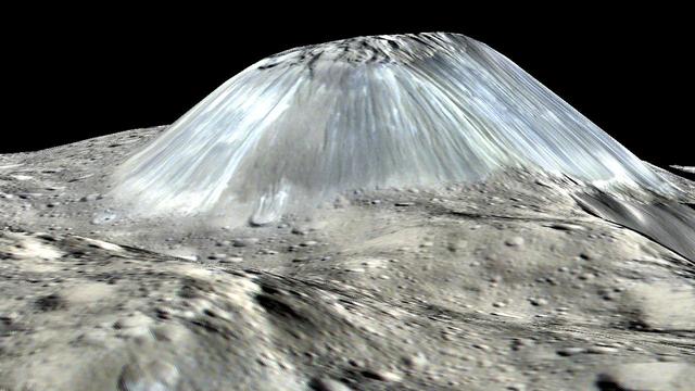
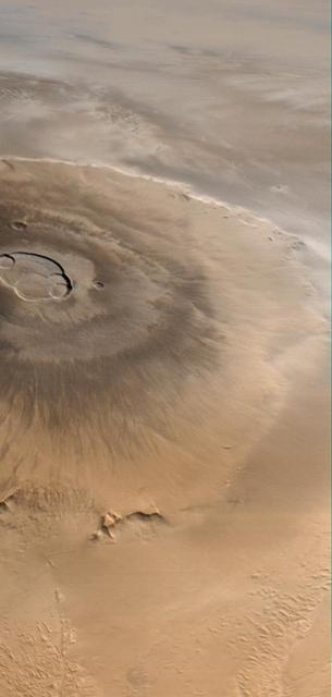
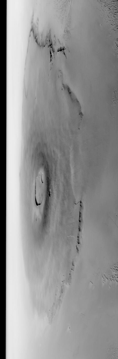
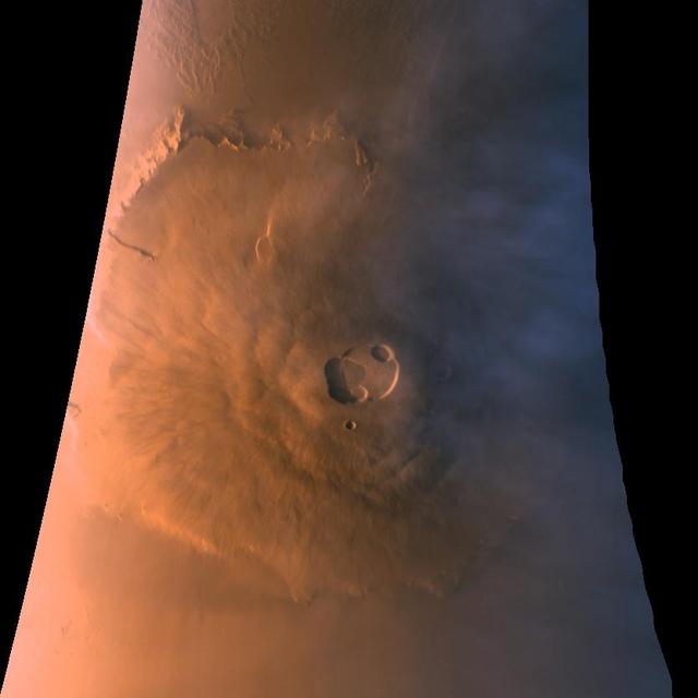
Ceres' lonely mountain, Ahuna Mons, is seen in this simulated perspective view. The elevation has been exaggerated by a factor of two. The view was made using enhanced-color images from NASA's Dawn mission. Images taken using blue (440 nanometers), green (750 nanometers) and infrared (960 nanometers) spectral filters were combined to create the view. The spacecraft's framing camera took the images from Dawn's low-altitude mapping orbit, from an altitude of 240 miles (385 kilometers) in August 2016. The resolution of the component images is 120 feet (35 meters) per pixel. http://photojournal.jpl.nasa.gov/catalog/PIA20915
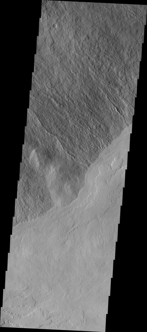
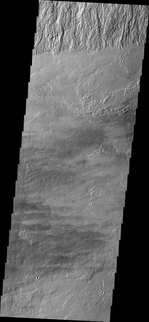
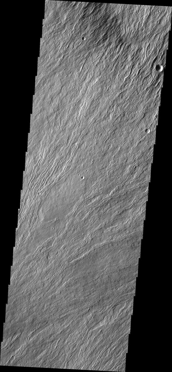
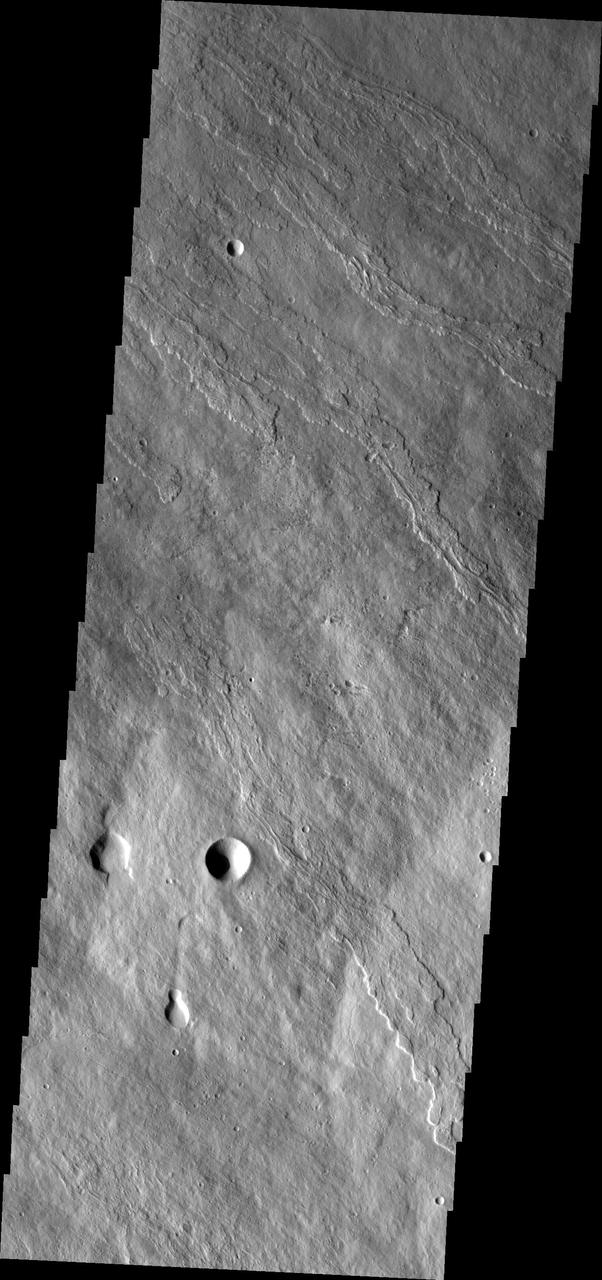
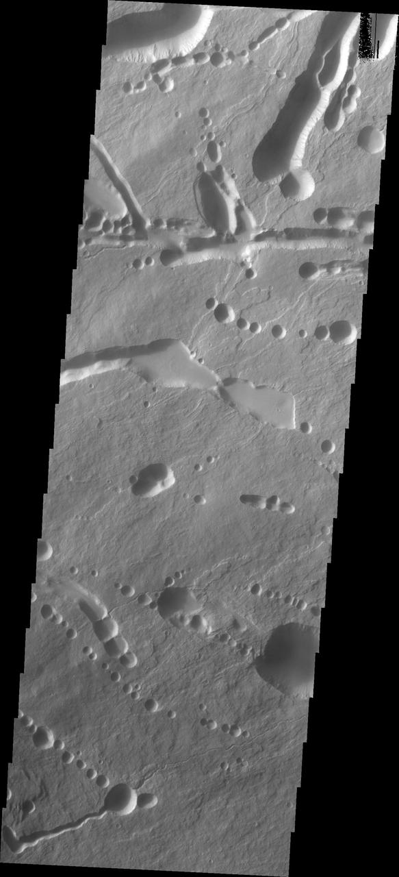
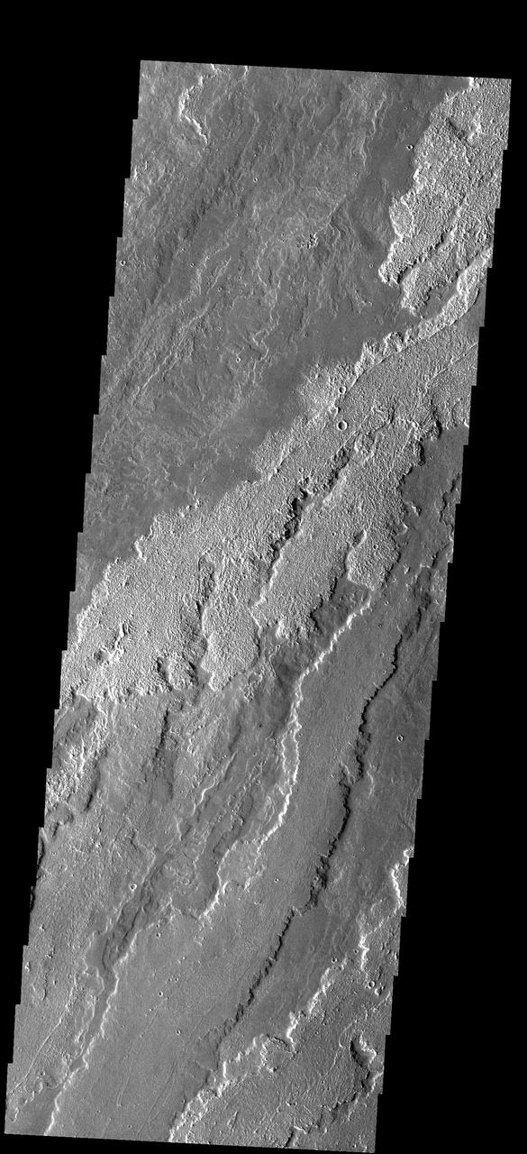
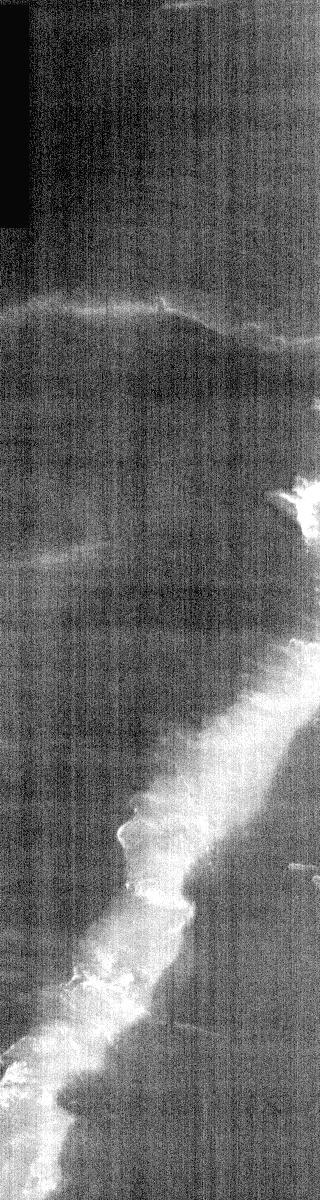
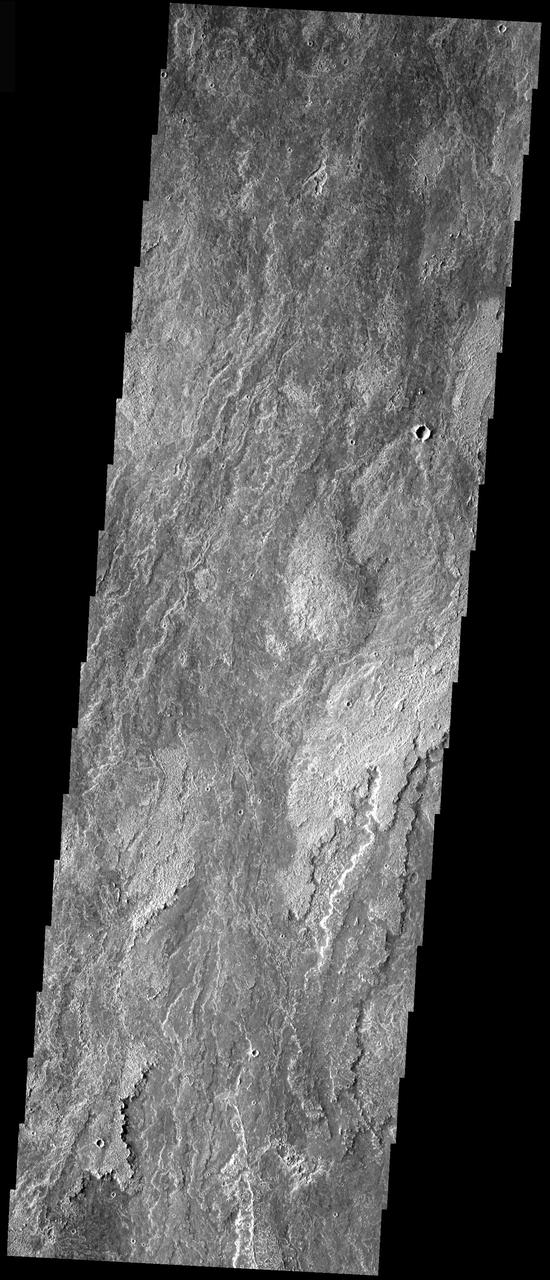
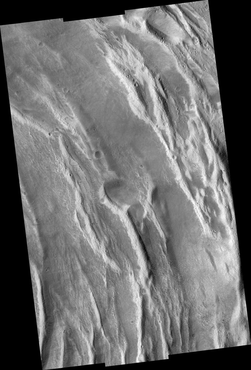
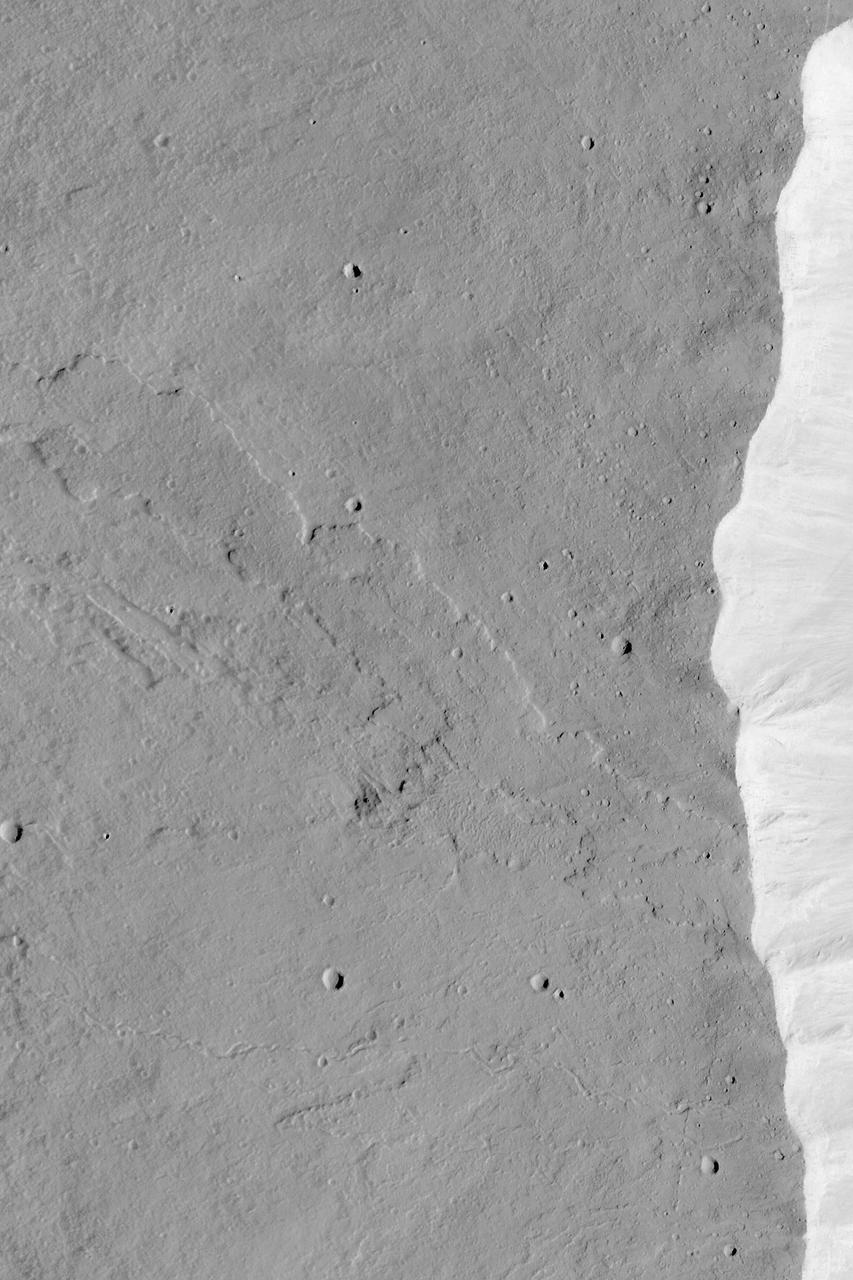
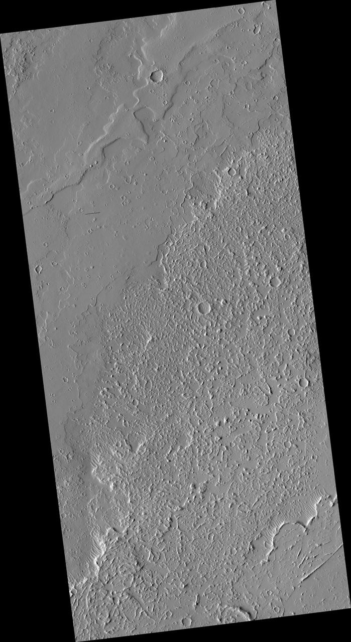
This image shows part of the southeastern flank of Ascraeus Mons. The narrow flows of the volcano dominate the top of the image, while younger volcanic plains cover the bottom of the image. The relative age designation is based on the fact that the brighter plains flows lap up against and cover the flank flows of Ascraeus Mons. The Odyssey spacecraft has spent over 15 years in orbit around Mars, circling the planet more than 69000 times. It holds the record for longest working spacecraft at Mars. THEMIS, the IR/VIS camera system, has collected data for the entire mission and provides images covering all seasons and lighting conditions. Over the years many features of interest have received repeated imaging, building up a suite of images covering the entire feature. From the deepest chasma to the tallest volcano, individual dunes inside craters and dune fields that encircle the north pole, channels carved by water and lava, and a variety of other feature, THEMIS has imaged them all. For the next several months the image of the day will focus on the Tharsis volcanoes, the various chasmata of Valles Marineris, and the major dunes fields. We hope you enjoy these images! Orbit Number: 10339 Latitude: 9.01699 Longitude: 257.294 Instrument: VIS Captured: 2004-04-13 17:23 https://photojournal.jpl.nasa.gov/catalog/PIA21820
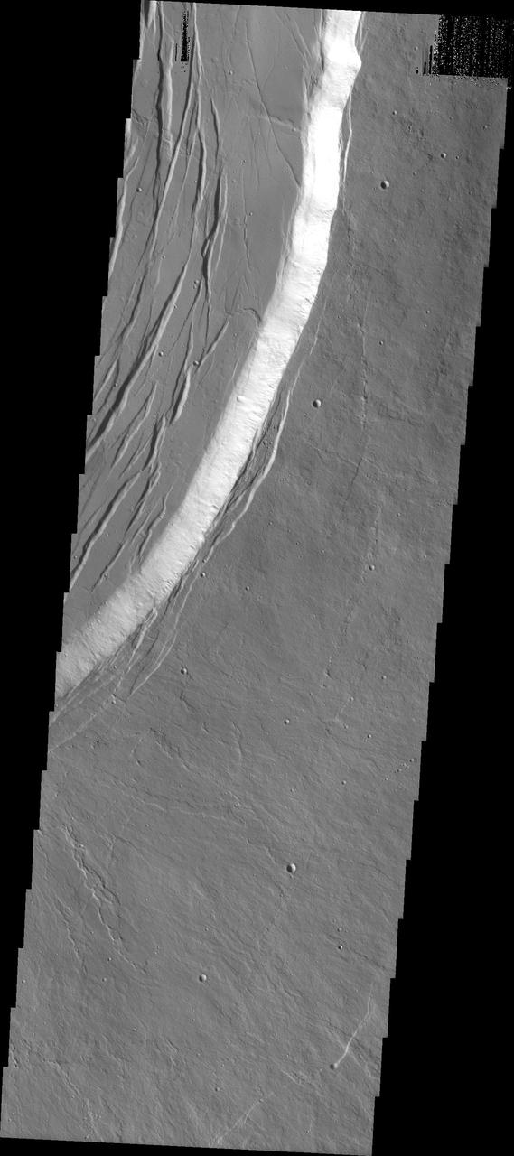
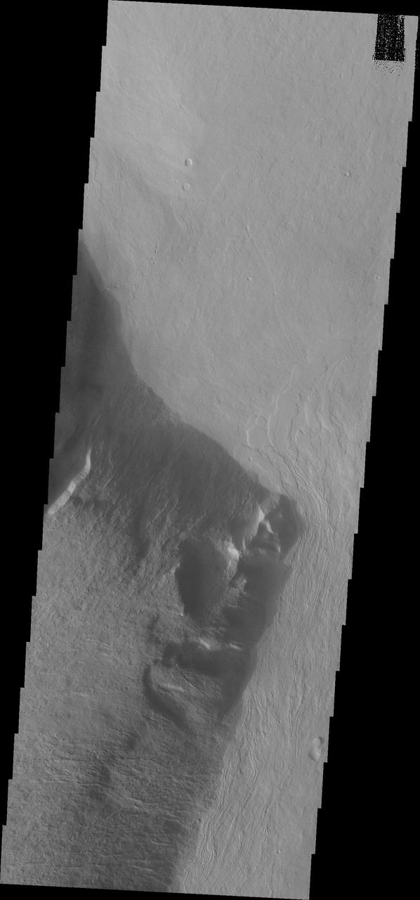
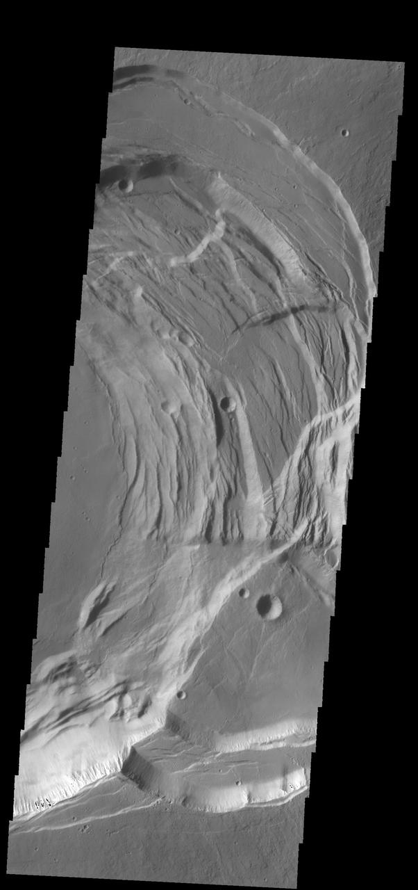
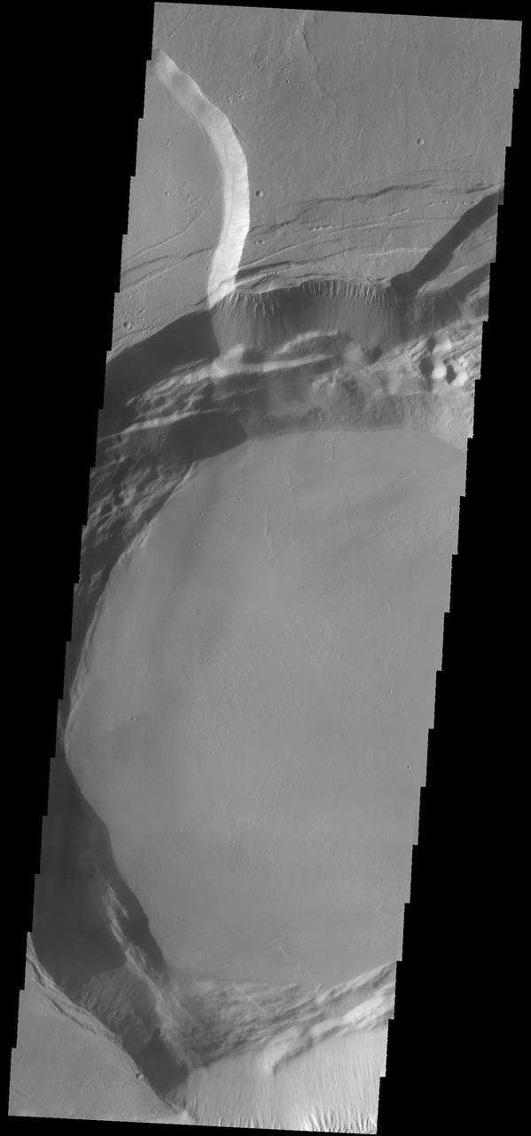
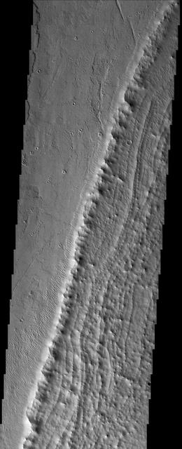
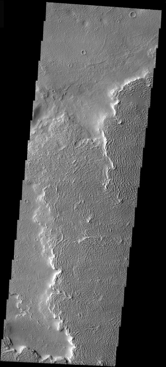
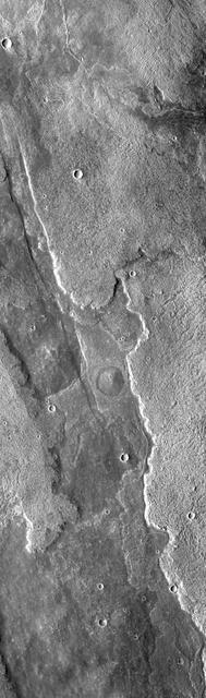
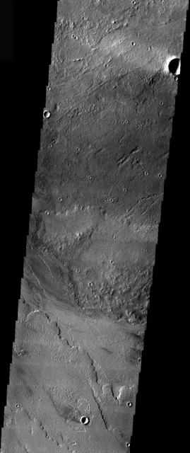
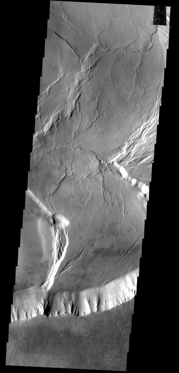
This image shows part of the southern flank of Ascraeus Mons. The feature at the bottom of the image is a collapse feature. These features can be caused by several processes. The ceiling of lava tubes can collapse into the open space left after the last flow. Tectonic activity can occur, and blocks of material can drop down between faults. The tectonic features are called graben. All three of the Tharsis volcanoes (Ascraeus, Pavonis and Arsia mons) are aligned along a northeast/southwest trend. The largest region of collapse features on each of the three volcanoes are located along this trend. The Odyssey spacecraft has spent over 15 years in orbit around Mars, circling the planet more than 69000 times. It holds the record for longest working spacecraft at Mars. THEMIS, the IR/VIS camera system, has collected data for the entire mission and provides images covering all seasons and lighting conditions. Over the years many features of interest have received repeated imaging, building up a suite of images covering the entire feature. From the deepest chasma to the tallest volcano, individual dunes inside craters and dune fields that encircle the north pole, channels carved by water and lava, and a variety of other feature, THEMIS has imaged them all. For the next several months the image of the day will focus on the Tharsis volcanoes, the various chasmata of Valles Marineris, and the major dunes fields. We hope you enjoy these images! Orbit Number: 18376 Latitude: 9.77446 Longitude: 254.826 Instrument: VIS Captured: 2006-02-04 10:32 https://photojournal.jpl.nasa.gov/catalog/PIA21824
Olympus Mons
Olympus Mons
Olympus Mons
Ascraeus Mons
Olympus Mons

Pavonis Mons
Olympus Mons
Arsia Mons
Pavonis Mons
Elysium Mons
Ascraeus Mons
Ascraeus Mons
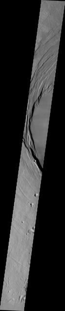
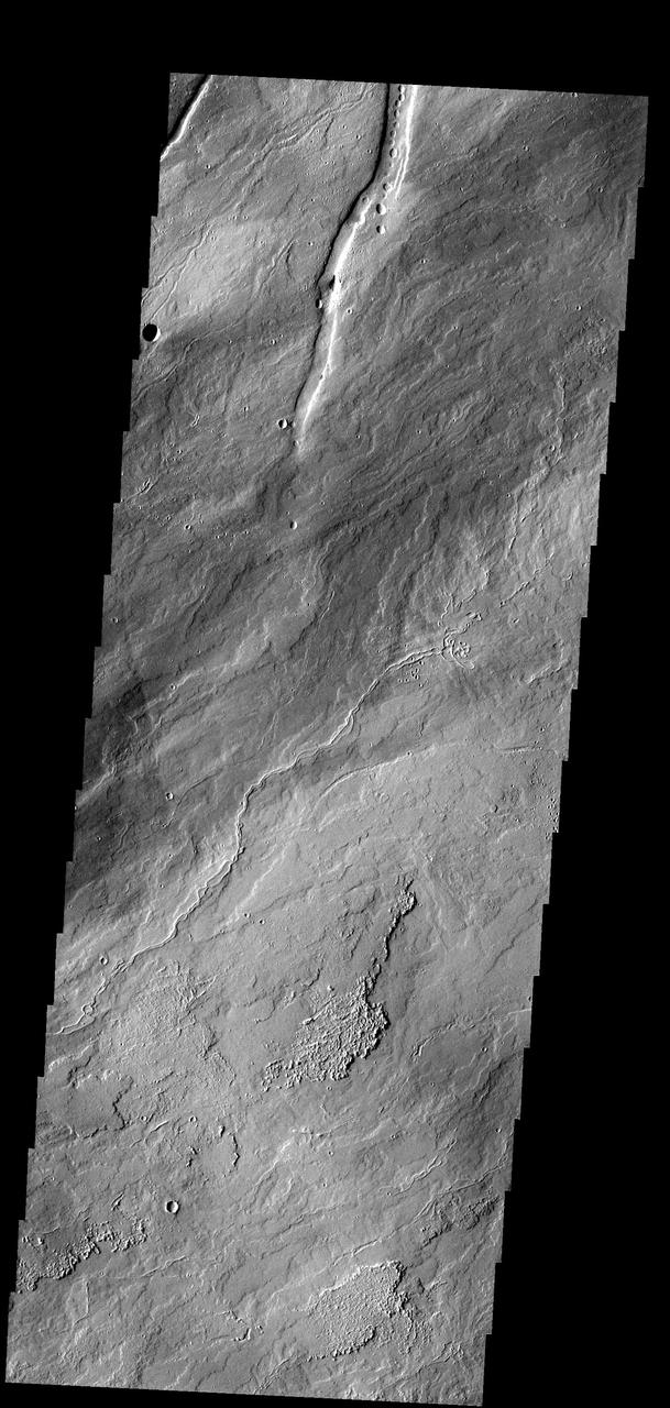
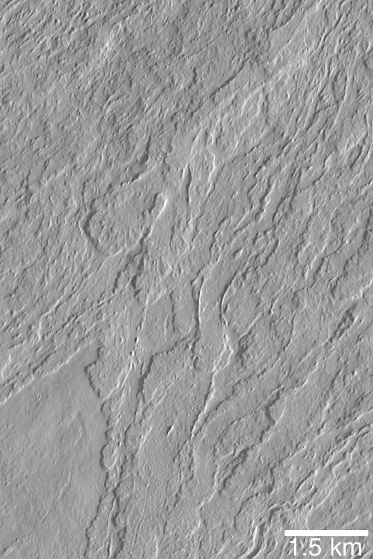
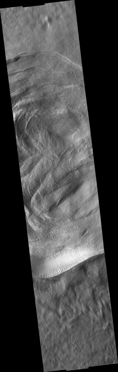
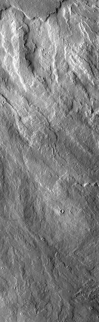
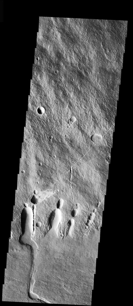
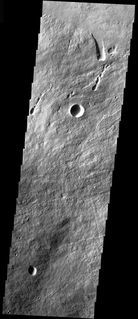
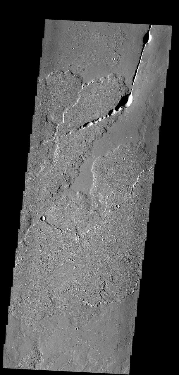
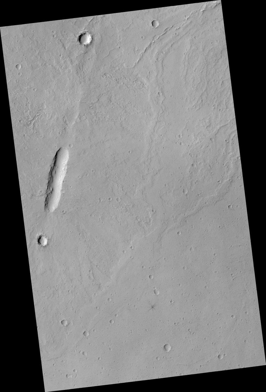
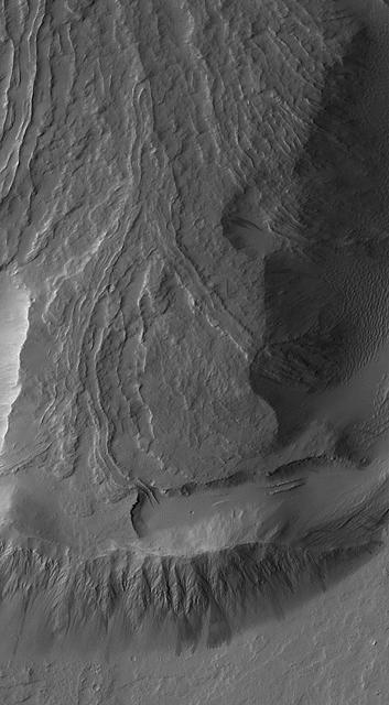
This image of the flank of Ascraeus Mons shows several individual flows where the sides are higher than the center. These are called leveed flows, as the outer margin acts as a levee containing the flow as it continues downslope. Levees grow as the flow margins start to cool. The hotter liquid lava continues as long as the source flows. The Odyssey spacecraft has spent over 15 years in orbit around Mars, circling the planet more than 69000 times. It holds the record for longest working spacecraft at Mars. THEMIS, the IR/VIS camera system, has collected data for the entire mission and provides images covering all seasons and lighting conditions. Over the years many features of interest have received repeated imaging, building up a suite of images covering the entire feature. From the deepest chasma to the tallest volcano, individual dunes inside craters and dune fields that encircle the north pole, channels carved by water and lava, and a variety of other feature, THEMIS has imaged them all. For the next several months the image of the day will focus on the Tharsis volcanoes, the various chasmata of Valles Marineris, and the major dunes fields. We hope you enjoy these images! Orbit Number: 18039 Latitude: 10.3245 Longitude: 256.26 Instrument: VIS Captured: 2006-01-07 16:37 https://photojournal.jpl.nasa.gov/catalog/PIA21823
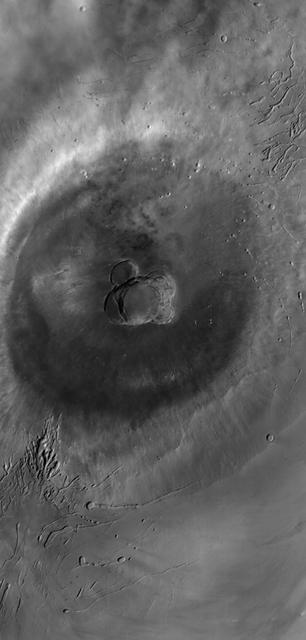
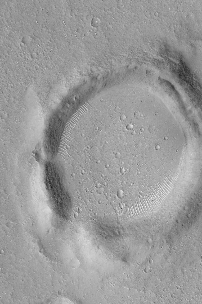
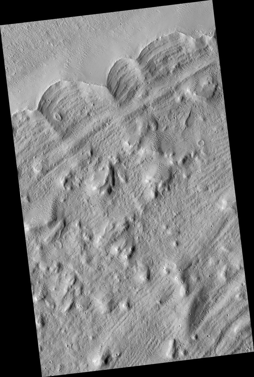
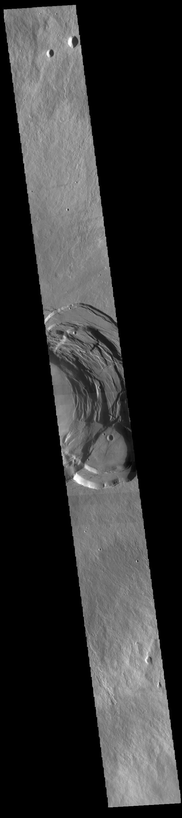
This image shows the eastern part of the complex caldera at the summit of the volcano. Calderas are found at the tops of volcanoes and are the source region for magma that rises from an underground lava source to erupt at the surface. Volcanoes are formed by repeated flows from the central caldera. The final eruptions can pool within the summit caldera, leaving a flat surface as they cool. Calderas are also a location of collapse, creating rings of tectonic faults that form the caldera rim. This image is dominated by the ring of faults that defines the outer margin of the caldera. Ascraeus Mons has several caldera features at its summit. The Odyssey spacecraft has spent over 15 years in orbit around Mars, circling the planet more than 69000 times. It holds the record for longest working spacecraft at Mars. THEMIS, the IR/VIS camera system, has collected data for the entire mission and provides images covering all seasons and lighting conditions. Over the years many features of interest have received repeated imaging, building up a suite of images covering the entire feature. From the deepest chasma to the tallest volcano, individual dunes inside craters and dune fields that encircle the north pole, channels carved by water and lava, and a variety of other feature, THEMIS has imaged them all. For the next several months the image of the day will focus on the Tharsis volcanoes, the various chasmata of Valles Marineris, and the major dunes fields. We hope you enjoy these images! Orbit Number: 53334 Latitude: 11.2134 Longitude: 255.911 Instrument: VIS Captured: 2013-12-22 10:29 https://photojournal.jpl.nasa.gov/catalog/PIA21829
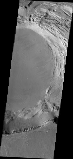
This image shows part of the complex caldera at the summit of the volcano. Calderas are found at the tops of volcanoes and are the source region for magma that rises from an underground lava source to erupt at the surface. Volcanoes are formed by repeated flows from the central caldera. The final eruptions can pool within the summit caldera, leaving a flat surface as they cool. Calderas are also a location of collapse, creating rings of tectonic faults that form the caldera rim. Ascraeus Mons has several caldera features at its summit. The Odyssey spacecraft has spent over 15 years in orbit around Mars, circling the planet more than 69000 times. It holds the record for longest working spacecraft at Mars. THEMIS, the IR/VIS camera system, has collected data for the entire mission and provides images covering all seasons and lighting conditions. Over the years many features of interest have received repeated imaging, building up a suite of images covering the entire feature. From the deepest chasma to the tallest volcano, individual dunes inside craters and dune fields that encircle the north pole, channels carved by water and lava, and a variety of other feature, THEMIS has imaged them all. For the next several months the image of the day will focus on the Tharsis volcanoes, the various chasmata of Valles Marineris, and the major dunes fields. We hope you enjoy these images! Orbit Number: 17440 Latitude: 11.128 Longitude: 255.731 Instrument: VIS Captured: 2005-11-19 08:59 https://photojournal.jpl.nasa.gov/catalog/PIA21822
This image shows part of the complex caldera at the summit of the volcano. Calderas are found at the tops of volcanoes and are the source region for magma that rises from an underground lava source to erupt at the surface. Volcanoes are formed by repeated flows from the central caldera. The final eruptions can pool within the summit caldera, leaving a flat surface as they cool. This image shows part of two of the summit calderas, each with a floor at different elevations. Calderas are also a location of collapse, creating rings of tectonic faults that form the caldera rim. Ascraeus Mons has several caldera features at its summit. The Odyssey spacecraft has spent over 15 years in orbit around Mars, circling the planet more than 69000 times. It holds the record for longest working spacecraft at Mars. THEMIS, the IR/VIS camera system, has collected data for the entire mission and provides images covering all seasons and lighting conditions. Over the years many features of interest have received repeated imaging, building up a suite of images covering the entire feature. From the deepest chasma to the tallest volcano, individual dunes inside craters and dune fields that encircle the north pole, channels carved by water and lava, and a variety of other feature, THEMIS has imaged them all. For the next several months the image of the day will focus on the Tharsis volcanoes, the various chasmata of Valles Marineris, and the major dunes fields. We hope you enjoy these images! Orbit Number: 63076 Latitude: 11.3749 Longitude: 255.364 Instrument: VIS Captured: 2016-03-03 11:14 https://photojournal.jpl.nasa.gov/catalog/PIA21830
This image shows part of the complex caldera at the summit of the volcano. Calderas are found at the tops of volcanoes and are the source region for magma that rises from an underground lava source to erupt at the surface. Volcanoes are formed by repeated flows from the central caldera. The final eruptions can pool within the summit caldera, leaving a flat surface as they cool. Calderas are also a location of collapse, creating rings of tectonic faults that form the caldera rim. Ascraeus Mons has several caldera features at its summit. The Odyssey spacecraft has spent over 15 years in orbit around Mars, circling the planet more than 69000 times. It holds the record for longest working spacecraft at Mars. THEMIS, the IR/VIS camera system, has collected data for the entire mission and provides images covering all seasons and lighting conditions. Over the years many features of interest have received repeated imaging, building up a suite of images covering the entire feature. From the deepest chasma to the tallest volcano, individual dunes inside craters and dune fields that encircle the north pole, channels carved by water and lava, and a variety of other feature, THEMIS has imaged them all. For the next several months the image of the day will focus on the Tharsis volcanoes, the various chasmata of Valles Marineris, and the major dunes fields. We hope you enjoy these images! Orbit Number: 52847 Latitude: 11.2724 Longitude: 255.564 Instrument: VIS Captured: 2013-11-12 08:41 https://photojournal.jpl.nasa.gov/catalog/PIA21828
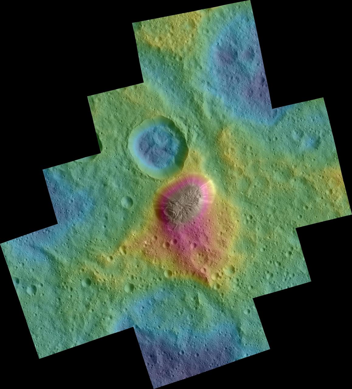
These color topographic views show variations in surface height around Ahuna Mons, a mysterious mountain on Ceres. The views are colorized versions of PIA20348 and PIA20349. They represent an update to the view in PIA19976, which showed the mountain using data from an earlier, higher orbit. Both views were made using images taken by NASA's Dawn spacecraft during its low-altitude mapping orbit, at a distance of about 240 miles (385 kilometers) from the surface. The resolution of the component images is about 120 feet (35 meters) per pixel. Elevations span a range of about 5.5 miles (9 kilometers) from the lowest places in the region to the highest terrains. Blue represents the lowest elevation, and brown is the highest. The streaks running down the side of the mountain, which appear white in the grayscale view, are especially bright parts of the surface (the brightness does not relate to elevation). The elevations are from a shape model generated using images taken at varying sun and viewing angles during Dawn's lower-resolution, high-altitude mapping orbit (HAMO) phase. The side perspective view was generated by draping the image mosaics over the shape model. http://photojournal.jpl.nasa.gov/catalog/PIA20399
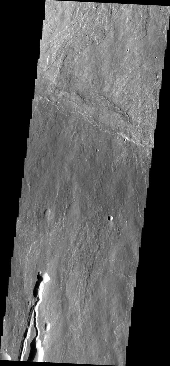
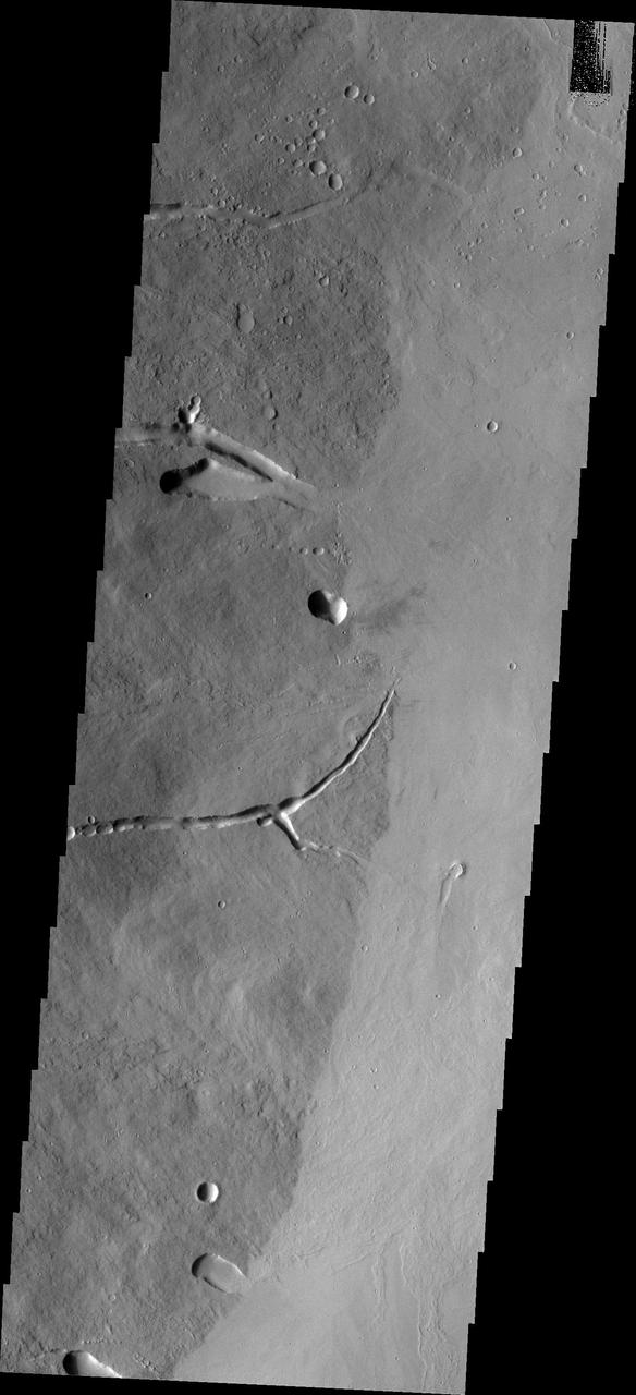
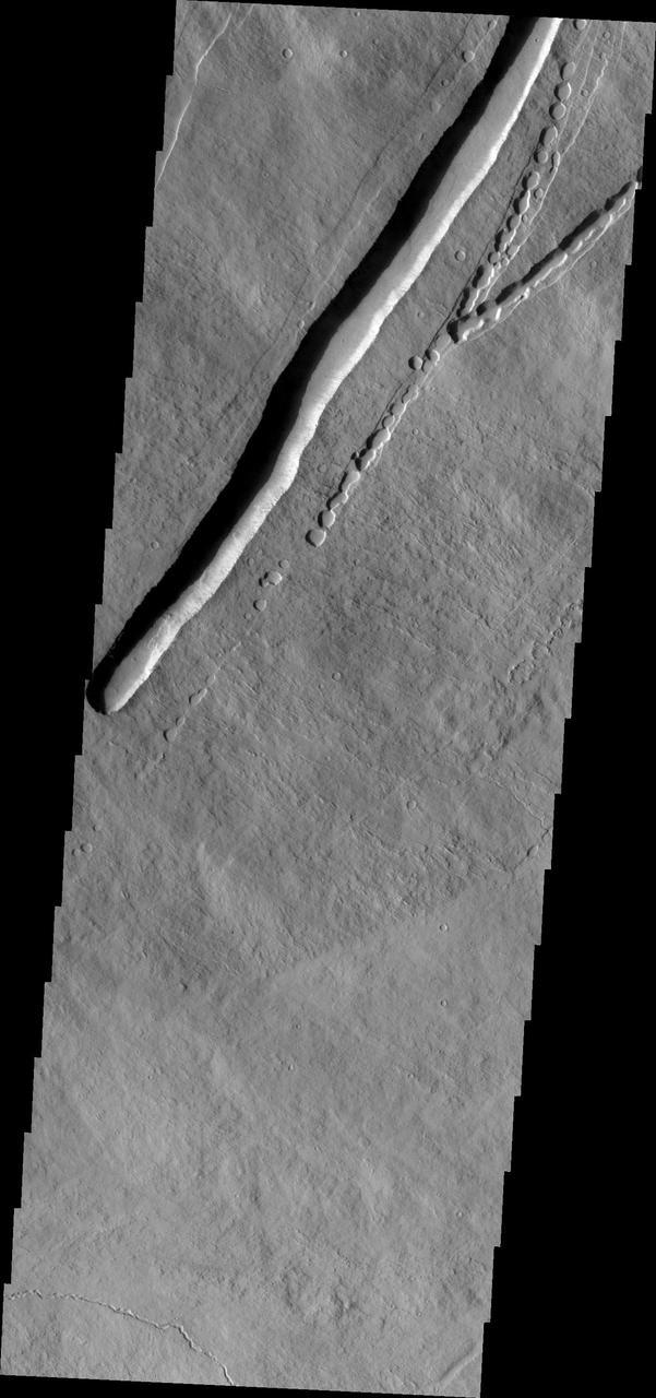
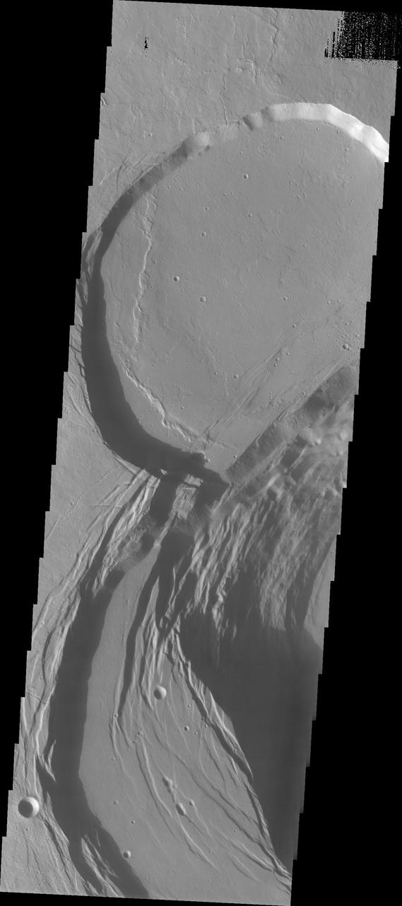
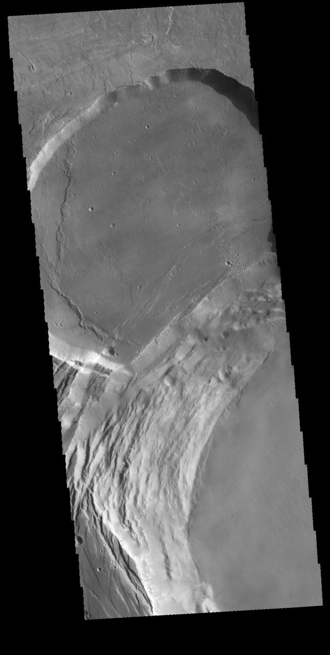
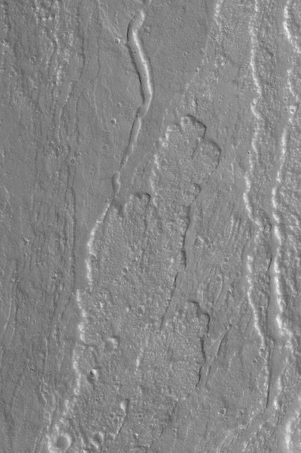
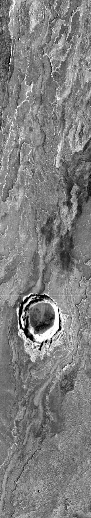
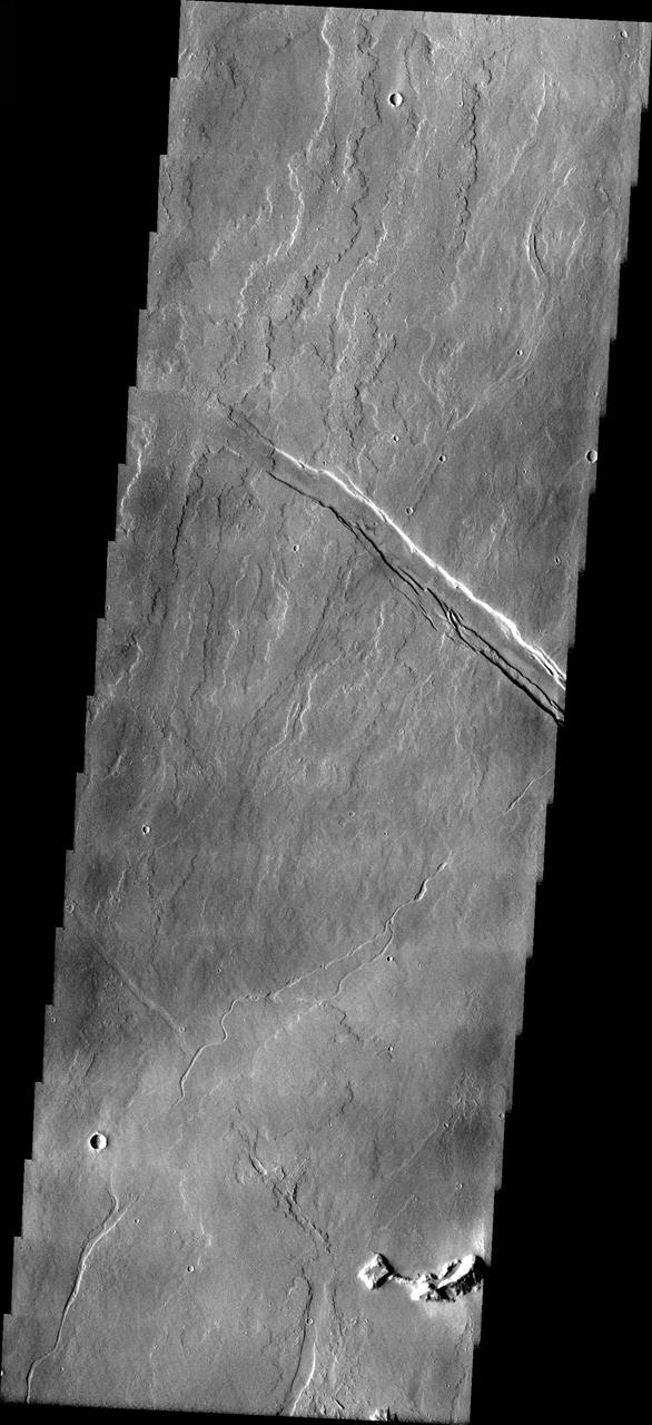
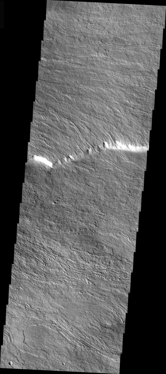
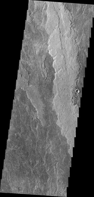
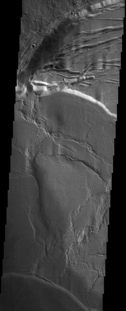
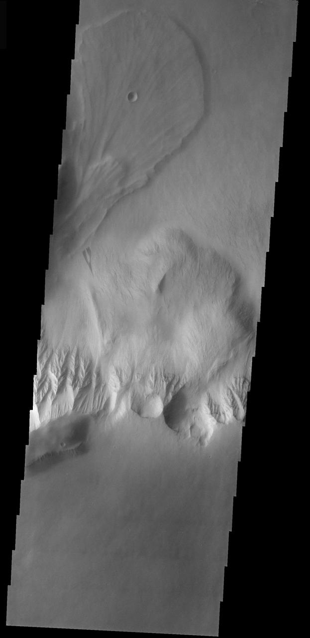
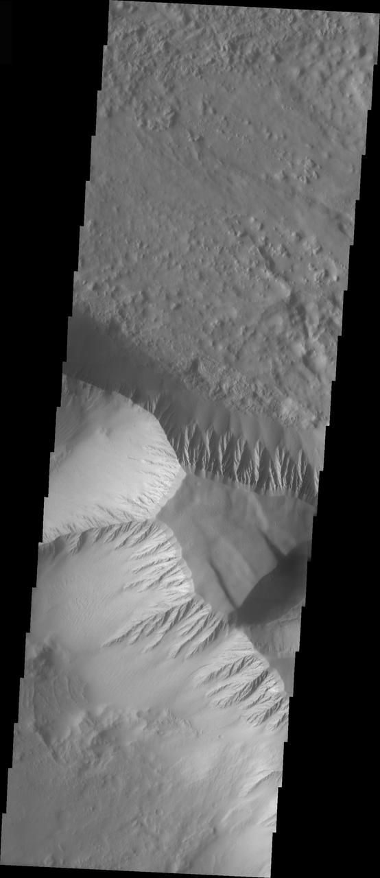
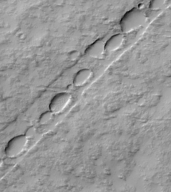
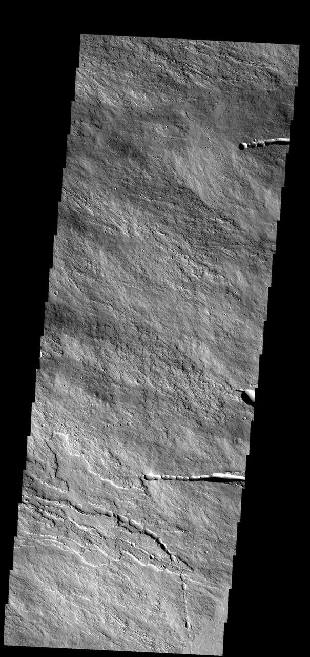
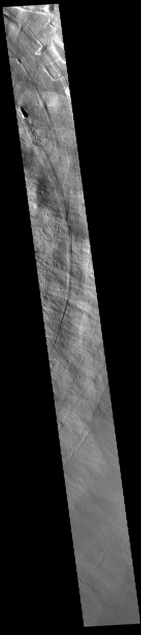
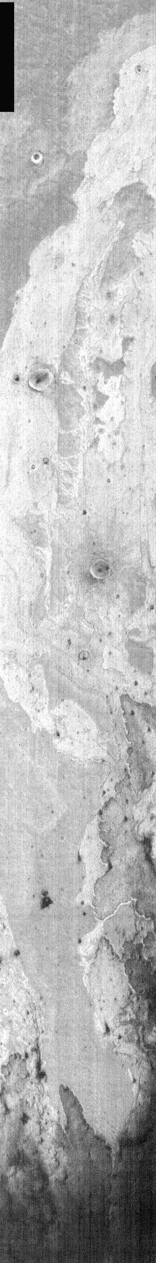
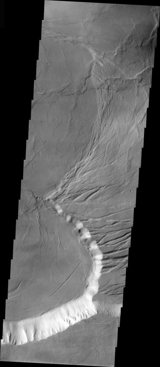
This image shows part of the northeastern flank of Ascraeus Mons, along the trend that joins the three large Tharsis volcanoes. The image has a myriad of collapse features from circular to linear outlines. The majority of the collapse features don't interact with the surface lava flows, indicating that the collapse features were formed after the main emplacement of lava flows from the summit and near summit vents. The Odyssey spacecraft has spent over 15 years in orbit around Mars, circling the planet more than 69000 times. It holds the record for longest working spacecraft at Mars. THEMIS, the IR/VIS camera system, has collected data for the entire mission and provides images covering all seasons and lighting conditions. Over the years many features of interest have received repeated imaging, building up a suite of images covering the entire feature. From the deepest chasma to the tallest volcano, individual dunes inside craters and dune fields that encircle the north pole, channels carved by water and lava, and a variety of other feature, THEMIS has imaged them all. For the next several months the image of the day will focus on the Tharsis volcanoes, the various chasmata of Valles Marineris, and the major dunes fields. We hope you enjoy these images! Orbit Number: 19886 Latitude: 12.7788 Longitude: 257.162 Instrument: VIS Captured: 2006-06-08 18:15 https://photojournal.jpl.nasa.gov/catalog/PIA21827
These lava flows are part of Ascraeus Mons
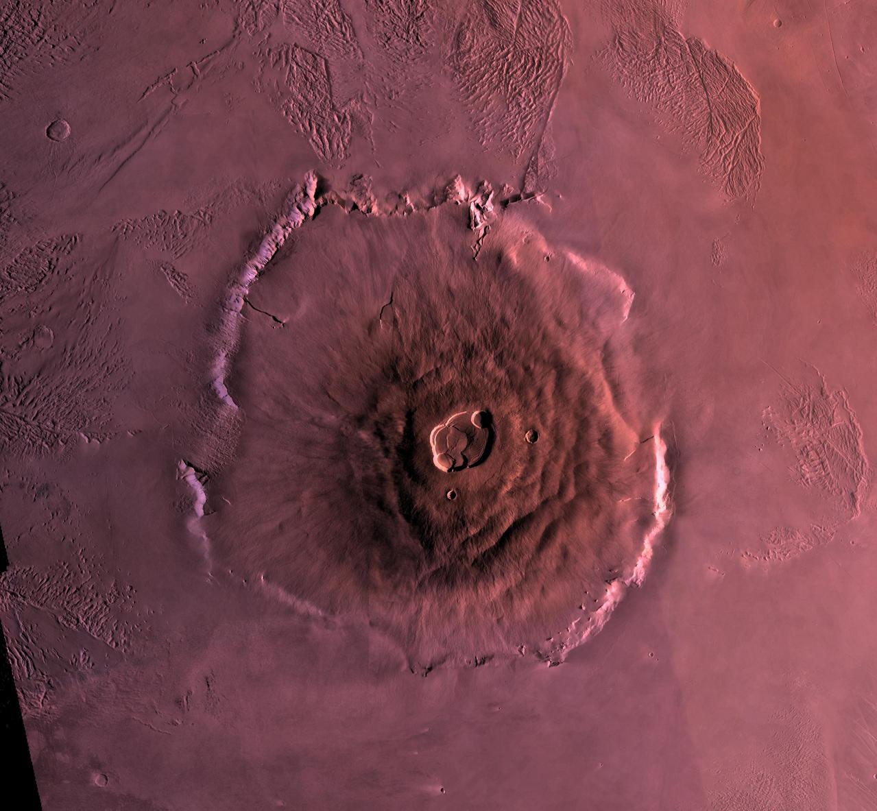
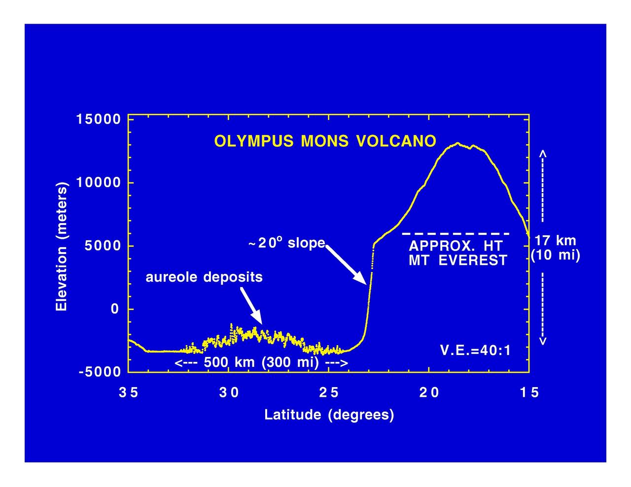
Shown here is a digital mosaic of Olympus Mons, the largest known volcano in the Solar System. It is 27 kilometers high, over 600 kilometers at the base, and is surrounded by a well-defined scarp that is up to 6 km high. Lava flows drape over the scarp in places. Much of the plains surrounding the volcano are covered by the ridged and grooved 'aureole' of Olympus Mons. The origin of the aureole is controversial, but may be related to gravity sliding off of the flanks of an ancestral volcano. The summit caldera (central depression) is almost 3 km deep and 25 km across. It probably formed from recurrent collapse following drainage of magma resulting from flank eruptions. http://photojournal.jpl.nasa.gov/catalog/PIA00300
Olympus Mons Volcano
Work of Wind on Pavonis Mons
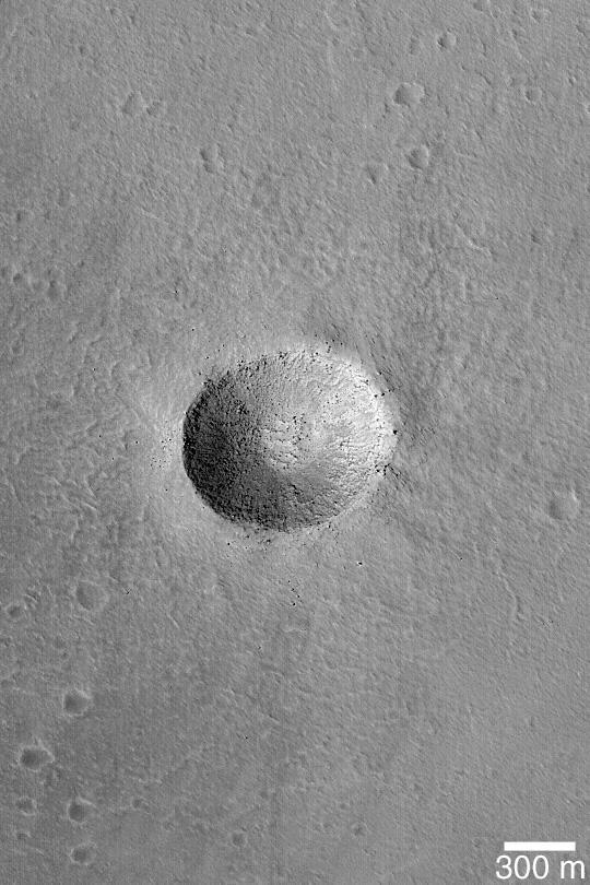
Impact on Arsia Mons
Arsia Mons Flows

Arsia Mons Mosaic
Pavonis Mons Aureole
Olympus Mons at Night
Arsia Mons by Visible Light
Arsia Mons Southern Flank
Arsia Mons Flows
Olympus Mons Lava Flows
Olympus Mons Lava Flows
Elysium Mons Wind Streak
Elysium Mons Volcanic Region
Arsia Mons Flows
Crater Karzok on Olympus Mons
Ascraeus Mons Pits
Arsia Mons Lava Flows
Olympus Mons, 1998 Color
Oblique Olympus Mons

Ascraeus Mons Collapse Pits
Ascraeus Mons Caldera Wall
MSIP: Elysium Mons Crater
Top of Olympus Mons
Flows from Olympus Mons
Southeast Olympus Mons
Volcano Near Pavonis Mons
Olympus Mons In Visible Light
Arsia Mons Overlapping Flows
Arsia Mons Lava Flows

Arsia Mons Caldera Rim
Mantled Surface of Ascraeus Mons
Tohil Mons, Io
Arsia Mons Flows

Shamshu Mons and Patera, Io
Olympus Mons Windstreaks
Rugged Olympus Mons
The Summit of Olympus Mons

Olympus Mons Lava Flows
Photomosiac of Olympus Mons

Arsia Mons Flows in Infrared
Flows on Olympus Mons
Arsia Mons Western Flows
Collapse Features on Arsia Mons
Olympus Mons in Day
Olympus Mons Landslide

Elysium Mons Volcano
Channel on Ascraeus Mons
Olympus Mons Mensa
Arsia Mons Caldera
Blocks in the Olympus Mons
Edge of the Olympus Mons
Arsia Mons Caldera
Pavonis Mons Features
Arsia Mons Surface Flow
Arsia Mons Lava
Arsia Mons Flank
Olympus Mons in Color
Chain of Pits on Pavonis Mons
This image shows a portion of the summit caldera of Olympus Mons

These lava flows occur on the flank of Olympus Mons
This image shows a small portion of the flank of Ascraeus Mons
These lava flows and collapse features are part of Ascraeus Mons
This image shows part of the flank and margin of Ascraeus Mons
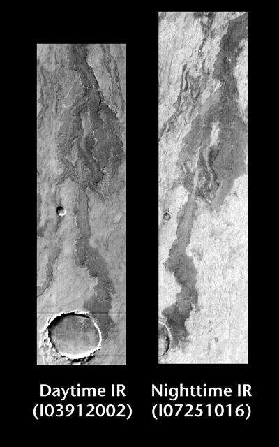
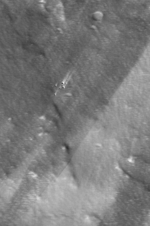
Released 22 June 2004 This pair of images shows part of Arsia Mons. Day/Night Infrared Pairs The image pairs presented focus on a single surface feature as seen in both the daytime and nighttime by the infrared THEMIS camera. The nighttime image (right) has been rotated 180 degrees to place north at the top. Infrared image interpretation Daytime: Infrared images taken during the daytime exhibit both the morphological and thermophysical properties of the surface of Mars. Morphologic details are visible due to the effect of sun-facing slopes receiving more energy than antisun-facing slopes. This creates a warm (bright) slope and cool (dark) slope appearance that mimics the light and shadows of a visible wavelength image. Thermophysical properties are seen in that dust heats up more quickly than rocks. Thus dusty areas are bright and rocky areas are dark. Nighttime: Infrared images taken during the nighttime exhibit only the thermophysical properties of the surface of Mars. The effect of sun-facing versus non-sun-facing energy dissipates quickly at night. Thermophysical effects dominate as different surfaces cool at different rates through the nighttime hours. Rocks cool slowly, and are therefore relatively bright at night (remember that rocks are dark during the day). Dust and other fine grained materials cool very quickly and are dark in nighttime infrared images. Image information: IR instrument. Latitude -19.6, Longitude 241.9 East (118.1 West). 100 meter/pixel resolution. http://photojournal.jpl.nasa.gov/catalog/PIA06399
This VIS image shows a cross section of Pavonis Mons. Pavonis Mons is the central volcano of the three large Tharsis volcanoes. In order from north to south the volcanoes are Ascreaus Mons, Pavonis Mons and Arsia Mons. All three volcanoes form a line located along a tectonic bulge caused by extensional forces in the region. Along this trend there are increased tectonic features and additional lava flows that arose from the flanks of the volcanoes rather than just the summit. Like the other large volcanoes in the region, Pavonis Mons is a shield volcano. Shield volcanoes are formed by lava flows originating near or at the summit, building up layers upon layers of lava. In shield volcanoes summit calderas are typically formed where the surface collapses into the void formed by an emptied magma chamber. Pavonis Mons is the smallest of the three volcanoes with a summit of only 14km (8.7 miles) and a width of 375 km (233 miles). Like most shield volcanoes the surface has a low profile. In the case of Pavonis Mons the average slope is only 4 degrees. Pavonis means peacock in Latin, making its name peacock mountain. Orbit Number: 94828 Latitude: 0.739028 Longitude: 248.934 Instrument: VIS Captured: 2023-05-01 10:34 https://photojournal.jpl.nasa.gov/catalog/PIA26180
Today's VIS image shows the summit of Ascraeus Mons. Ascraeus Mons is the northernmost of the three aligned Tharsis volcanoes. Orbit Number: 80602 Latitude: 11.189 Longitude: 255.887 Instrument: VIS Captured: 2020-02-15 02:07 https://photojournal.jpl.nasa.gov/catalog/PIA23841
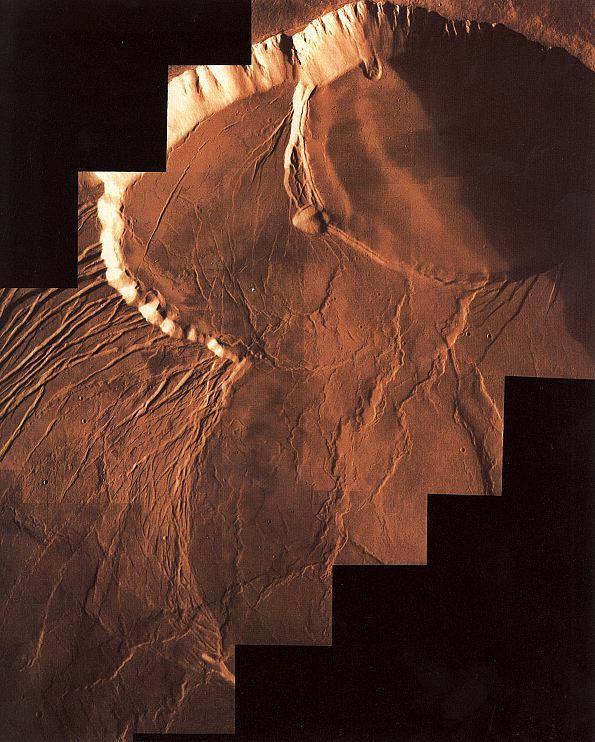
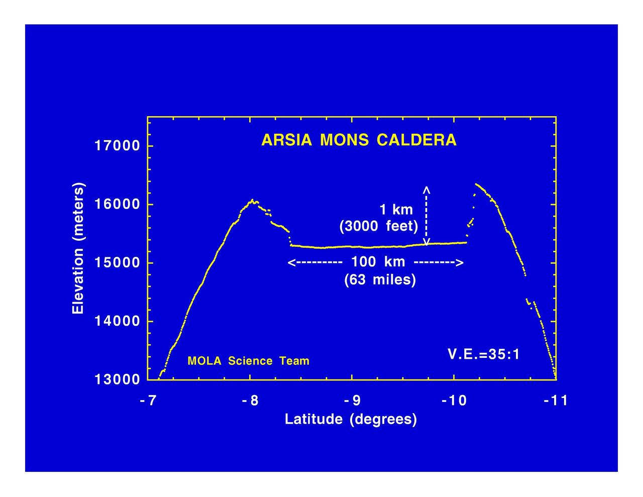
The three large aligned Tharsis volcanoes are Arsia Mons, Pavonis Mons and Ascreaus Mons (from south to north). There are collapse features on all three volcanoes, on the southwestern and northeastern flanks. This alignment may indicate a large fracture/vent system was responsible for the eruptions that formed all three volcanoes. This VIS image shows cross section from the summit caldera to the plains near the southern flank of Arsia Mons. Arsia Mons is 270 miles (450km) in diameter, almost 12 miles (20km) high, and the summit caldera is 72 miles (120km) wide. For comparison, the largest volcano on Earth is Mauna Loa. From its base on the sea floor, Mauna Loa measures only 6.3 (10km) miles high and 75 miles (120km) in diameter. A large volcanic crater known as a caldera is located at the summit of all of the Tharsis volcanoes. These calderas are produced by massive volcanic explosions and collapse. The Arsia Mons summit caldera is larger than many volcanoes on Earth. Orbit Number: 91821 Latitude: -11.0315 Longitude: 240.053 Instrument: VIS Captured: 2022-08-26 20:16 https://photojournal.jpl.nasa.gov/catalog/PIA25649
Bright Ridge near Mons Hansteen
Arsia Mons Lava Flows at Night
Dusty Lava Flows on Ascreaus Mons
Vent at the Summit of Arsia Mons Volcano
Lava Flows near Pavonis Mons
Dust-Mantled Olympus Mons Flows
Arcuate Fractures in Olympus Mons Caldera
Lava Flows On Ascraeus Mons Volcano