
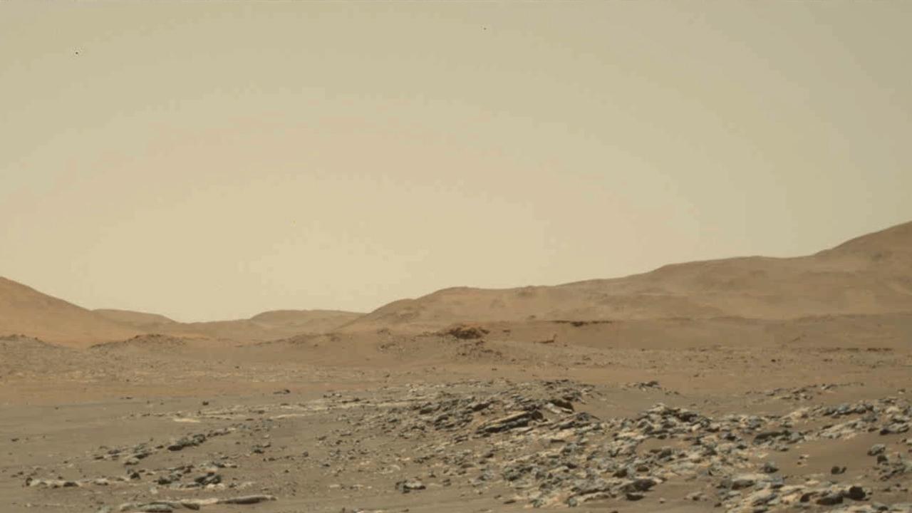
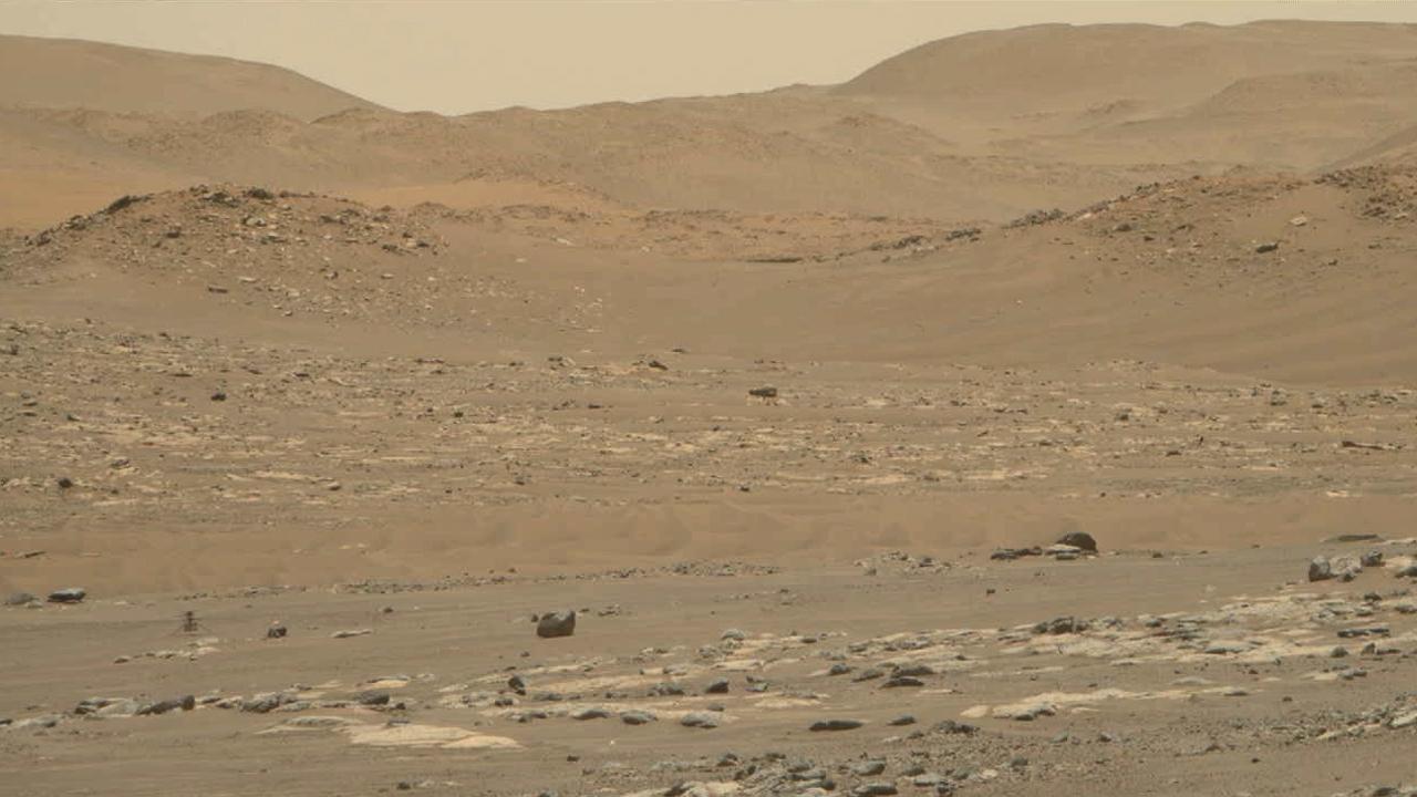
The sun descends to the Martian horizon and sets in this image from the panoramic camera Pancam on NASA Mars Exploration Rover Opportunity. A movie is available at the Photojournal.
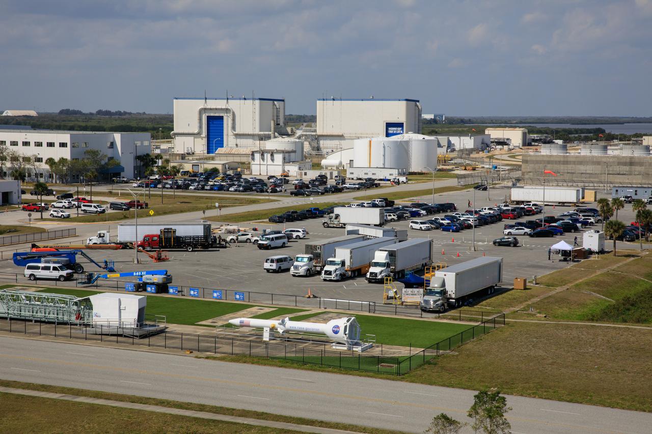
A major motion picture is being filmed in February 2023 at NASA’s Kennedy Space Center in Florida. Filming is in progress in the lower parking lot of the News Center.
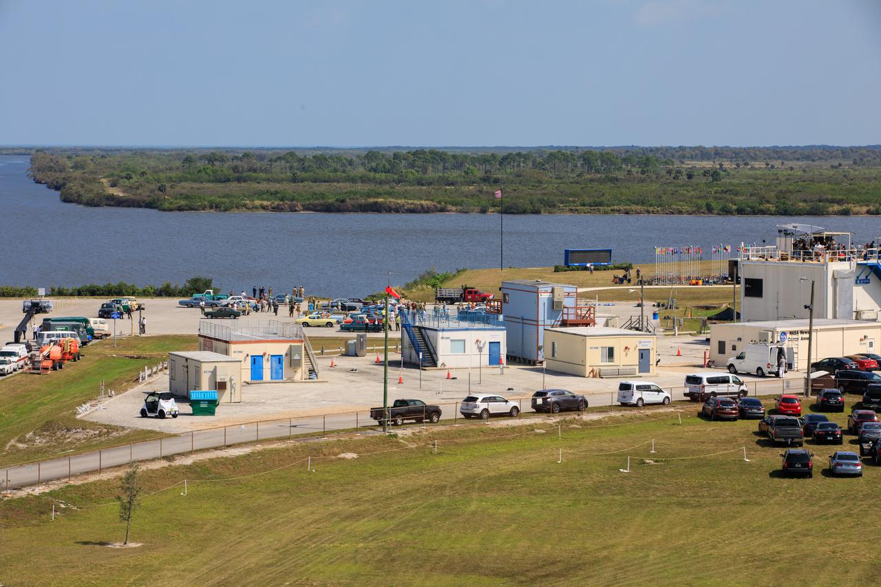
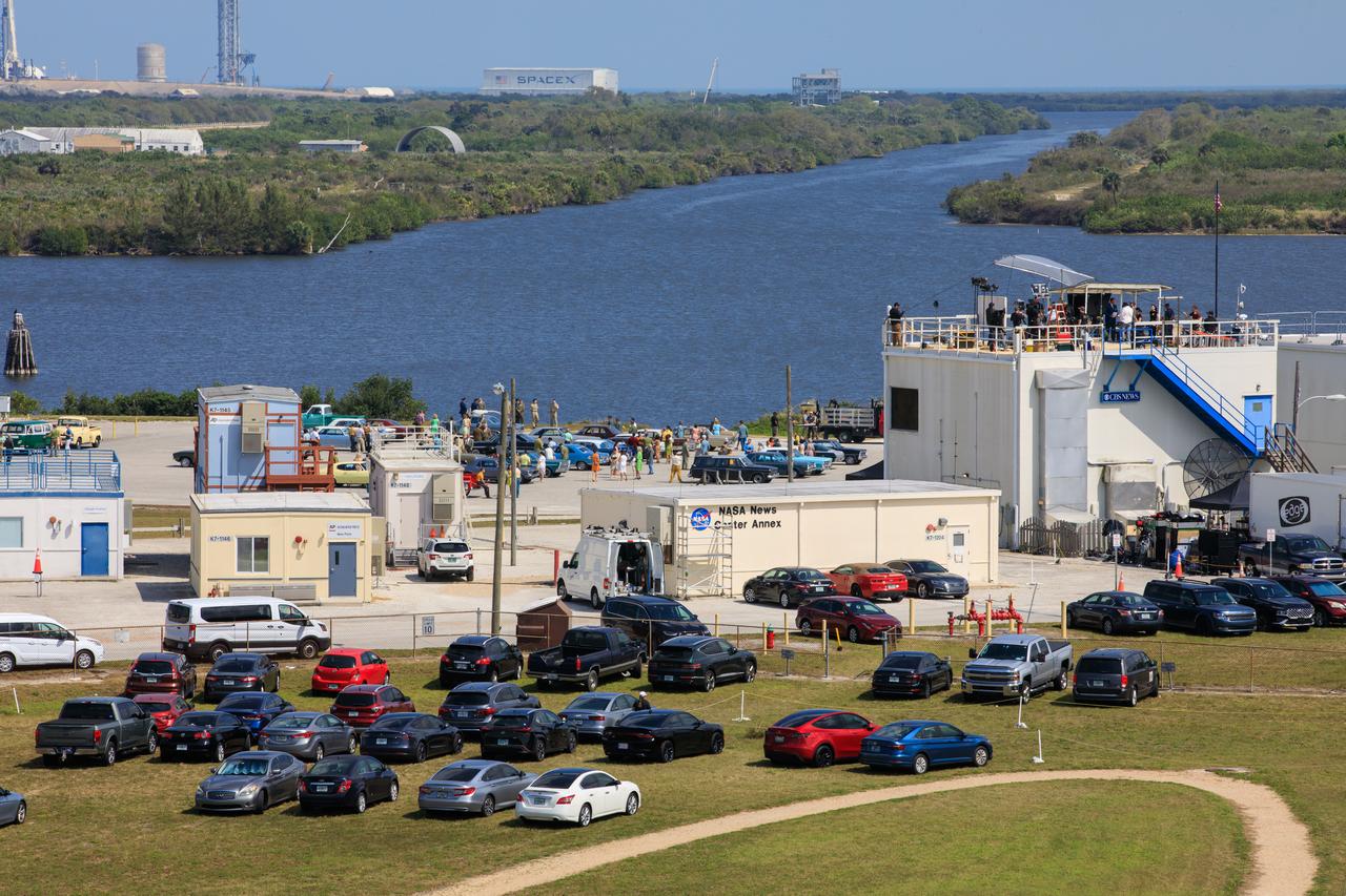
A major motion picture is being filmed in February 2023 at NASA’s Kennedy Space Center in Florida. In view is Base Camp #1 in the Launch Complex 39 area that includes support buildings for the film project.
A major motion picture is being filmed in February 2023 at NASA’s Kennedy Space Center in Florida. In view is Base Camp #1 in the Launch Complex 39 area that includes support buildings for the film project.
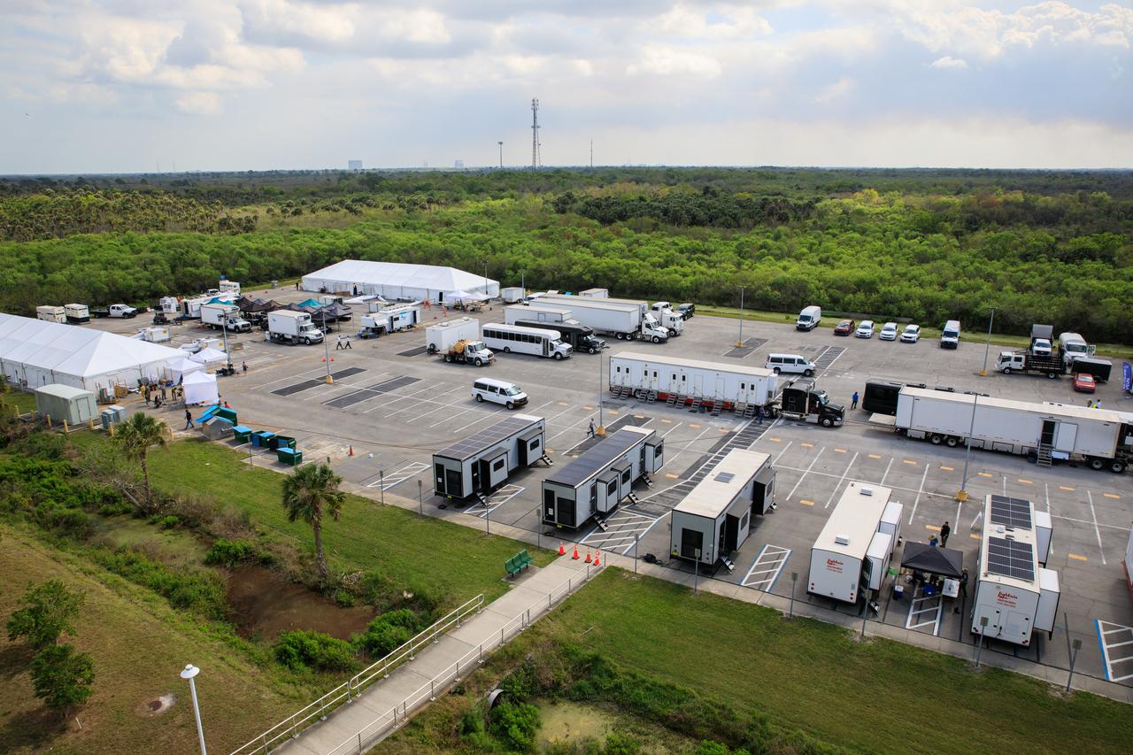
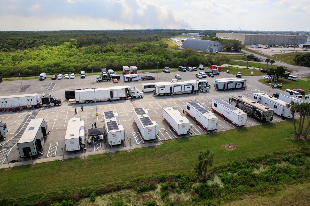
A major motion picture is being filmed in February 2023 at NASA’s Kennedy Space Center in Florida. In view are some of the support vehicles in use for the film project in the Launch Complex 39 area.
A major motion picture is being filmed in February 2023 at NASA’s Kennedy Space Center in Florida. Filming is in progress in the lower parking lot of the News Center.

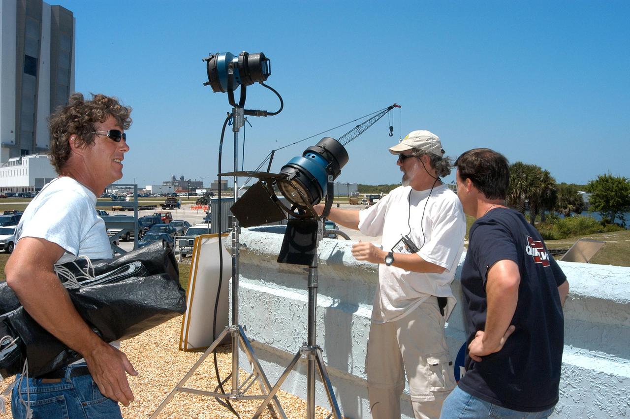
KENNEDY SPACE CENTER, FLA. -- A film crew from India sets up equipment at the viewing stands near the NASA News Center. The crew spent several days at KSC filming at various sites for the movie “Swades,” a story about India’s brain-drain. The writer and director is Ashutosh Gowariker and lead actors are Shahrukh Khan and Gayatri Joshi. Sunita Gowariker is executive producer.

KENNEDY SPACE CENTER, FLA. -- A film crew from India sets up equipment inside the television studio at the NASA News Center. The crew spent several days at KSC filming at various sites for the movie “Swades,” a story about India’s brain-drain. At center is Mahesh Aney, director of photography. The writer and director is Ashutosh Gowariker (seen to the right of Aney). The lead actors are Shahrukh Khan and Gayatri Joshi. Sunita Gowariker is executive producer.

KENNEDY SPACE CENTER, FLA. -- KSC videographer Dave Stanley, at right, films the crew from India who are setting up their equipment. The crew spent several days at KSC filming at various sites for the movie “Swades,” a story about India’s brain-drain. The writer and director is Ashutosh Gowariker (seen to the right of center). The lead actors are Shahrukh Khan and Gayatri Joshi. Sunita Gowariker is executive producer.
KENNEDY SPACE CENTER, FLA. -- A film crew from India sets up equipment at the viewing stands near the NASA News Center. The crew spent several days at KSC filming at various sites for the movie “Swades,” a story about India’s brain-drain. The writer and director is Ashutosh Gowariker and lead actors are Shahrukh Khan and Gayatri Joshi. Sunita Gowariker is executive producer.
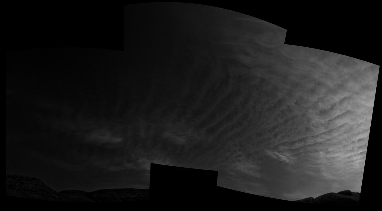
Using the navigation cameras on its mast, NASA's Curiosity Mars rover took these images of clouds just after sunset on March 31, 2021, the 3,075th so, or Martian day, of the mission. These noctilucent, or twilight clouds, are made of water ice; ice crystals reflect the setting sun, allowing the detail in each cloud to be seen more easily. Movie available at https://photojournal.jpl.nasa.gov/catalog/PIA24645

KENNEDY SPACE CENTER, FLA. -- Mahesh Aney, who is director of photography on a film crew from India, sets up a camera at the stands near the NASA News Center. The crew spent several days at KSC filming at various sites for the movie “Swades,” a story about India’s brain-drain. The writer and director is Ashutosh Gowariker. The lead actors are Shahrukh Khan and Gayatri Joshi. Sunita Gowariker is executive producer.

KENNEDY SPACE CENTER, FLA. -- A film crew from India sets up equipment at the viewing stands near the NASA News Center. The crew spent several days at KSC filming at various sites for the movie “Swades,” a story about India’s brain-drain. The writer and director is Ashutosh Gowariker, standing at left. The lead actors are Shahrukh Khan and Gayatri Joshi. Sunita Gowariker is executive producer.

KENNEDY SPACE CENTER, FLA. -- A film crew from India sets up equipment at the viewing stands near the NASA News Center. Behind the camera at right is Director of Photography Mahesh Aney. The crew spent several days at KSC filming at various sites for the movie “Swades,” a story about India’s brain-drain. The writer and director is Ashutosh Gowariker. The lead actors are Shahrukh Khan and Gayatri Joshi. Sunita Gowariker is executive producer.
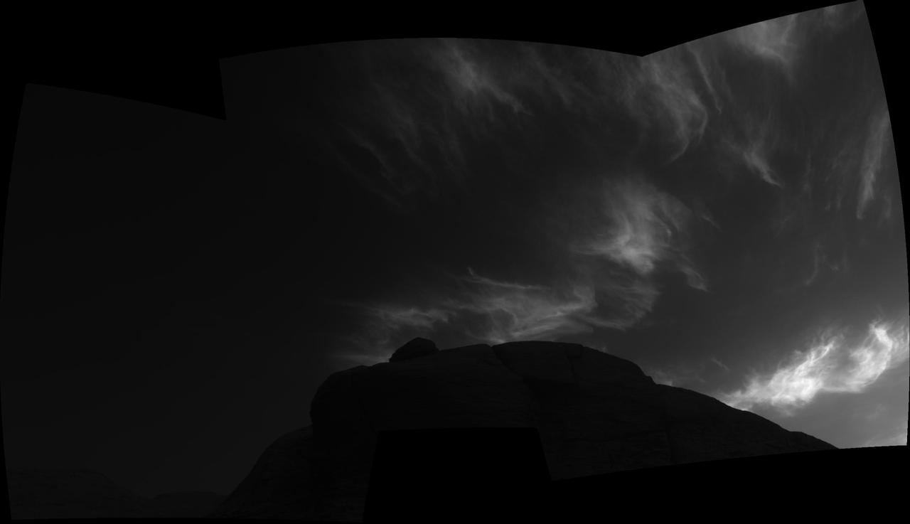
Using the navigation cameras on its mast, NASA's Curiosity Mars rover took these images of clouds just after sunset on March 28, 2021, the 3,072nd so, or Martian day, of the mission. These noctilucent, or twilight clouds, are made of water ice; ice crystals reflect the setting sun, allowing the detail in each cloud to be seen more easily. Movie available at https://photojournal.jpl.nasa.gov/catalog/PIA24646
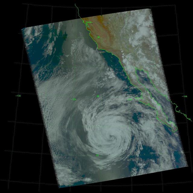
Tropical Storm Blas as observed by the Atmospheric Infrared Sounder AIRS onboard NASA Aqua in the year 2004. The major contribution to radiation (infrared light) that AIRS channels sense comes from different levels in the atmosphere, depending upon the channel wavelength. To create the movie, a set of AIRS channels were selected which probe the atmosphere at progressively deeper levels. If there were no clouds, the color in each frame would be nearly uniform until the Earth's surface is encountered. The tropospheric air temperature warms at a rate of 6 K (about 11 F) for each kilometer of descent toward the surface. Thus the colors would gradually change from cold to warm as the movie progresses. Clouds block the infrared radiation. Thus wherever there are clouds we can penetrate no deeper in infrared. The color remains fixed as the movie progresses, for that area of the image is "stuck" to the cloud top temperature. The coldest temperatures around 220 K (about -65 F) come from altitudes of about 10 miles. http://photojournal.jpl.nasa.gov/catalog/PIA00436

NASA's Cassini spacecraft watched clouds of methane moving across the far northern regions of Saturn's largest moon, Titan, on Oct. 29 and 30, 2016. Several sets of clouds develop, move over the surface and fade during the course of this movie sequence, which spans 11 hours, with one frame taken every 20 minutes. Most prominent are long cloud streaks that lie between 49 and 55 degrees north latitude. While the general region of cloud activity is persistent over the course of the observation, individual streaks appear to develop then fade. These clouds are measured to move at a speed of about 14 to 22 miles per hour (7 to 10 meters per second). There are also some small clouds over the region of small lakes farther north, including a bright cloud between Neagh Lacus and Punga Mare, which fade over the course of the movie. This small grouping of clouds is moving at a speed of about 0.7 to 1.4 miles per hour (1 to 2 meters per second). Time-lapse movies like this allow scientists to observe the dynamics of clouds as they develop, move over the surface and fade. A time-lapse movie can also help to distinguish between noise in images (for example from cosmic rays hitting the detector) and faint clouds or fog. In 2016, Cassini has intermittently observed clouds across the northern mid-latitudes of Titan, as well as within the north polar region -- an area known to contain numerous methane/ethane lakes and seas see PIA19657 and PIA17655. However, most of this year's observations designed for cloud monitoring have been short snapshots taken days, or weeks, apart. This observation provides Cassini's best opportunity in 2016 to study short-term cloud dynamics. Models of Titan's climate have predicted more cloud activity during early northern summer than what Cassini has observed so far, suggesting that the current understanding of the giant moon's changing seasons is incomplete. The mission will continue monitoring Titan's weather around the 2017 summer solstice in Titan's northern hemisphere. The movie was acquired using the Cassini narrow-angle camera using infrared filters to make the surface and tropospheric methane clouds visible. A movie is available at http://photojournal.jpl.nasa.gov/catalog/PIA21051

Over the past week, the single, largest feature on the sun was a long coronal hole that stretched out across more than half the diameter of the sun (Mar. 13-15, 2018). Coronal holes appear dark in certain wavelengths of extreme ultraviolet light like the one you see here. They are areas of open magnetic fields from which solar wind rushes out into space. This area likely generated the beautiful aurora that were reportedly observed on March 14th in regions near Earth's poles. With the Earth set in the image to show scale, you get a good sense of just how extensive this hole is. Movies are available at https://photojournal.jpl.nasa.gov/catalog/PIA22345
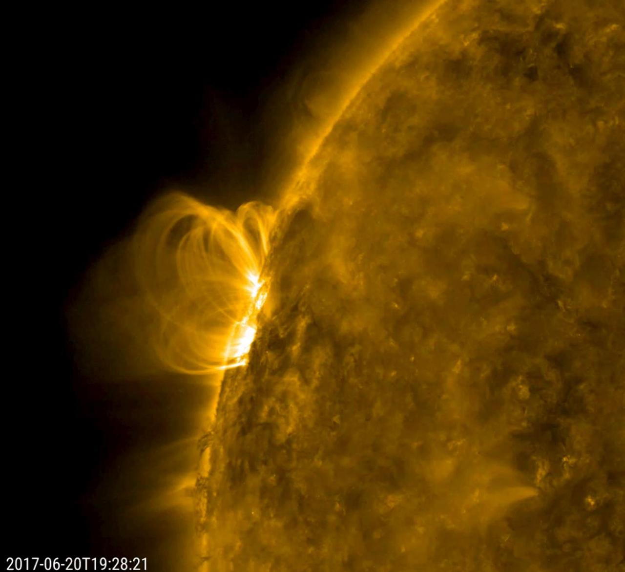
A smallish solar filament looks like it collapsed into the sun and set off a minor eruption that hurled plasma into space (June 20, 2017). Then, the disrupted magnetic field immediately began to reorganize itself, hence the bright series of spirals coiling up over that area. The magnetic field lines are made visible in extreme ultraviolet light as charged particles spin along them. Also of interest are the darker, cooler strands of plasma being pulled and twisted at the edge of the sun just below the active region. The activity here is in a 21-hour period. Movies are available at https://photojournal.jpl.nasa.gov/catalog/PIA21764
The Mast Camera, or Mastcam, on NASA's Curiosity Mars rover captured this set of images before and after it drilled a rock nicknamed "Aberlady," on Saturday, April 6, 2019 (the 2,370th Martian day, or sol, of the mission). The rock and others nearby appear to have moved when the drill was retracted. This was the first time Curiosity has drilled in the long-awaited "clay-bearing unit." The scene is presented with a color adjustment that approximates white balancing to resemble how the rocks and sand would appear under daytime lighting conditions on Earth. Movie available at https://photojournal.jpl.nasa.gov/catalog/PIA23138
This video clip was obtained by the Ingenuity Mars Helicopter's black-and-white navigation camera during its 14th flight, on Oct. 24, 2021. During the flight, the rotorcraft reached a peak altitude of 16 feet (5 meters) with a small sideways translation of 7 feet (2 meters) to avoid a nearby sand ripple, before setting down again. Flight 14 was only 23 seconds in length. As a result, enough onboard memory was available to obtain black-and-white navigation camera imagery at the high-rate of 7.4 frames a second. Movie available at https://photojournal.jpl.nasa.gov/catalog/PIA24976
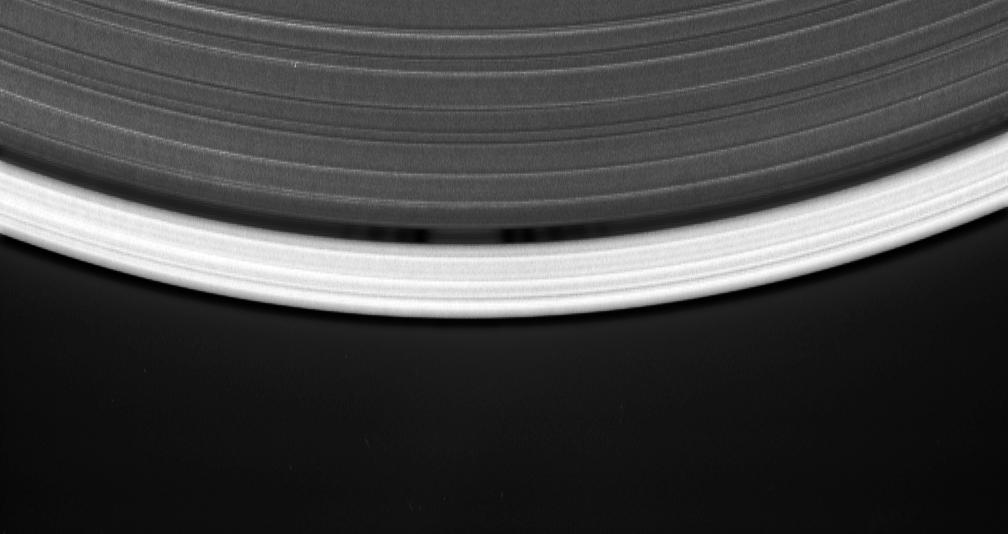
Cassini's celestial sleuthing has paid off with this time-lapse series of images which confirmed earlier suspicions that a small moon was orbiting within the narrow Keeler gap of Saturn's rings. The movie sequence, which consists of 12 images taken over 16 minutes while Cassini gazed down upon the sunlit side of the A ring, shows a tiny moon orbiting in the center of the Keeler gap, churning up waves in the gap edges as it goes. The pattern of waves travels with the moon in its orbit. The Keeler gap is located about 250 kilometers (155 miles) inside the outer edge of the A ring, which is also the outer edge of the bright main rings. The new object is about 7 kilometers across (4 miles) and reflects about 50 percent of the sunlight that falls upon it -- a brightness that is typical of particles in the nearby rings. The new body has been provisionally named S/2005 S1. Imaging scientists predicted the moon's presence and its orbital distance from Saturn after July 2004, when they saw a set of peculiar spiky and wispy features in the Keeler gap's outer edge. The similarities of the Keeler gap features to those noted in Saturn's F ring and the Encke gap led the scientists to conclude that a small body, a few kilometers across, was lurking in the center of the Keeler gap, awaiting discovery. Also included here is a view of the same scene created by combining six individual, unmagnified frames used in the movie sequence. This digital composite view improves the overall resolution of the scene compared to that available in any of the single images. The images in this movie sequence were obtained with the Cassini spacecraft narrow-angle camera on May 1, 2005, at a distance of approximately 1.1 million kilometers (708,000 miles) from Saturn. Resolution in the original image was 8 kilometers (5 miles) per pixel. The images in the movie sequence have been magnified in (the vertical direction only) by a factor of two to aid visibility of features caused within the gap by the moonlet. An animation is available at http://photojournal.jpl.nasa.gov/catalog/PIA06238

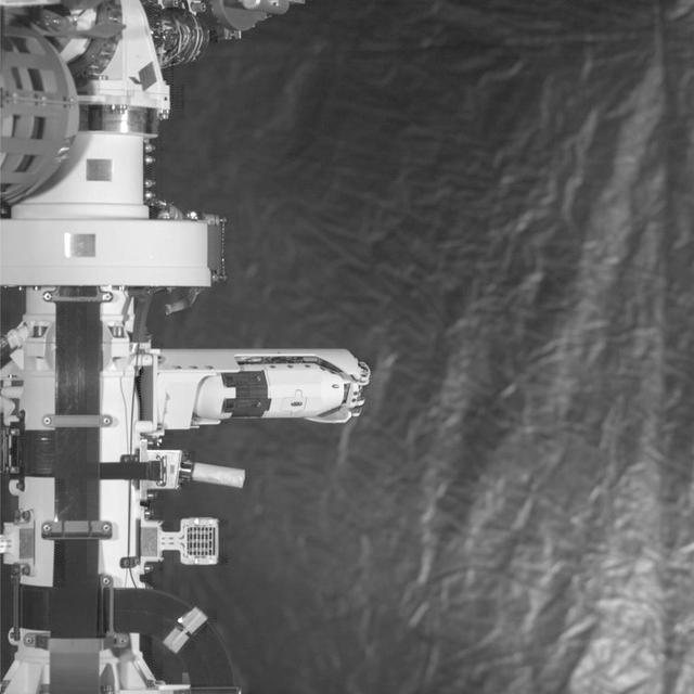
This set of images shows parts of the robotic arm on NASA's Perseverance rover flexing and turning during its first checkout after landing on Mars. These images were taken by Perseverance's Navigation Cameras on March 3, 2021. A key objective for Perseverance's mission on Mars is astrobiology, including the search for signs of ancient microbial life. The rover will characterize the planet's geology and past climate, pave the way for human exploration of the Red Planet, and be the first mission to collect and cache Martian rock and regolith (broken rock and dust). Subsequent NASA missions, in cooperation with ESA (European Space Agency), would send spacecraft to Mars to collect these sealed samples from the surface and return them to Earth for in-depth analysis. The Mars 2020 Perseverance mission is part of NASA's Moon to Mars exploration approach, which includes Artemis missions to the Moon that will help prepare for human exploration of the Red Planet. Movie available at https://photojournal.jpl.nasa.gov/catalog/PIA24338
This animation illustrates NASA's InSight lander touching down on Mars, causing a rock to roll 3 feet (1 meter) as the lander touched down on Mars on Nov. 26, 2018. A little bigger than a golf ball, the rock was later nicknamed "Rolling Stones Rock" by the InSight team in honor of The Rolling Stones. A series of 10 or so divots marked the rock's course after being set in motion by the landing. It's the farthest NASA has seen a rock roll after landing a spacecraft on another planet. Though fitting, "Rolling Stones Rock" is not an official designation by the International Astronomical Union, which is responsible to approving the names given to geographical and geological features on other planets. The rock was imaged by the Instrument Deployment Camera (IDC) on InSight's robotic arm, which is not visible here. Movie available at https://photojournal.jpl.nasa.gov/catalog/PIA23345

NASA's Perseverance rover wiggles one of its wheels in this set of images obtained by the rover's left Navigation Camera on March 4, 2021. A key objective for Perseverance's mission on Mars is astrobiology, including the search for signs of ancient microbial life. The rover will characterize the planet's geology and past climate, pave the way for human exploration of the Red Planet, and be the first mission to collect and cache Martian rock and regolith (broken rock and dust). Subsequent NASA missions, in cooperation with ESA (European Space Agency), would send spacecraft to Mars to collect these sealed samples from the surface and return them to Earth for in-depth analysis. The Mars 2020 Perseverance mission is part of NASA's Moon to Mars exploration approach, which includes Artemis missions to the Moon that will help prepare for human exploration of the Red Planet. Movie available at https://photojournal.jpl.nasa.gov/catalog/PIA24340

This set of images shows part of the deployment of the Mars Environmental Dynamics Analyzer (MEDA) wind sensors on NASA's Perseverance Mars rover. MEDA is a set of weather sensors, with the wind sensor components on the rover's remote sensing mast. These images were taken by Perseverance's Navigation Cameras on Feb. 28, 2021. A key objective for Perseverance's mission on Mars is astrobiology, including the search for signs of ancient microbial life. The rover will characterize the planet's geology and past climate, pave the way for human exploration of the Red Planet, and be the first mission to collect and cache Martian rock and regolith (broken rock and dust). Subsequent NASA missions, in cooperation with ESA (European Space Agency), would send spacecraft to Mars to collect these sealed samples from the surface and return them to Earth for in-depth analysis. The Mars 2020 Perseverance mission is part of NASA's Moon to Mars exploration approach, which includes Artemis missions to the Moon that will help prepare for human exploration of the Red Planet. Movie available at https://photojournal.jpl.nasa.gov/catalog/PIA24339
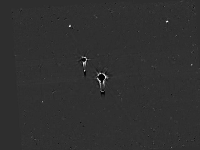
This single frame from a four-frame movie shows New Horizons' final deep search for hazardous material around Pluto, obtained on July 1, 2015. These data allow a highly sensitive search for any new moons. The images were taken with the spacecraft's Long Range Reconnaissance Imager (LORRI) over a 100-minute period, and were the final observations in the series of dedicated searches for hazards in the Pluto system which began on May 11. The images show all five known satellites of Pluto moving in their orbits around the dwarf planet, but analysis of these data has so far not revealed the existence of any additional moons. This means that any undiscovered Plutonian moons further than a few thousand miles from Pluto must be smaller than about 1 mile (1.6 kilometers) in diameter, if their surfaces have similar brightness to Pluto's big moon Charon. For comparison, Pluto's faintest known moon, Styx, which is conspicuous in the lower left quadrant of these images, is about 4 miles (7 kilometers) across, assuming the same surface brightness. The absence of additional moons, and also the absence of detectable rings in the hazard search data, imply that the spacecraft is very unlikely to be damaged by collisions with rings, or dust particles ejected from moons, during its high-speed passage through the Pluto system. The four movie frames were taken at 16:28, 16:38, 17:52, and 18:04 UTC on July 1, from a range of 9.4 million miles (15.2 million kilometers). Each frame is a mosaic of four sets of overlapping images, with a total exposure time of 120 seconds. The images have been heavily processed to remove the glare of Pluto and Charon, and the dense background of stars, though blemishes remain at the locations of many of the brighter stars. The "tails" extending to the right or downward from Pluto and Charon are camera artifacts caused by the extreme overexposure of both objects. Pluto and its five moons Charon, Styx, Nix, Kerberos and Hydra are identified by their initials, and their orbits around the center of gravity of the system (which is located just outside Pluto itself) are also shown. http://photojournal.jpl.nasa.gov/catalog/PIA19701
Cassini gazed toward high southern latitudes near Saturn's south pole to observe ghostly curtains of dancing light -- Saturn's southern auroras, or southern lights. These natural light displays at the planet's poles are created by charged particles raining down into the upper atmosphere, making gases there glow. The dark area at the top of this scene is Saturn's night side. The auroras rotate from left to right, curving around the planet as Saturn rotates over about 70 minutes, compressed here into a movie sequence of about five seconds. Background stars are seen sliding behind the planet. Cassini was moving around Saturn during the observation, keeping its gaze fixed on a particular spot on the planet, which causes a shift in the distant background over the course of the observation. Some of the stars seem to make a slight turn to the right just before disappearing. This effect is due to refraction -- the starlight gets bent as it passes through the atmosphere, which acts as a lens. Random bright specks and streaks appearing from frame to frame are due to charged particles and cosmic rays hitting the camera detector. The aim of this observation was to observe seasonal changes in the brightness of Saturn's auroras, and to compare with the simultaneous observations made by Cassini's infrared and ultraviolet imaging spectrometers. The original images in this movie sequence have a size of 256x256 pixels; both the original size and a version enlarged to 500x500 pixels are available here. The small image size is the result of a setting on the camera that allows for shorter exposure times than full-size (1024x1024 pixel) images. This enabled Cassini to take more frames in a short time and still capture enough photons from the auroras for them to be visible. The images were taken in visible light using the Cassini spacecraft narrow-angle camera on July 20, 2017, at a distance of about 620,000 miles (1 million kilometers) from Saturn. The views look toward 74 degrees south latitude on Saturn. Image scale is about 0.9 mile (1.4 kilometers) per pixel on Saturn. An animation is available at https://photojournal.jpl.nasa.gov/catalog/PIA21623
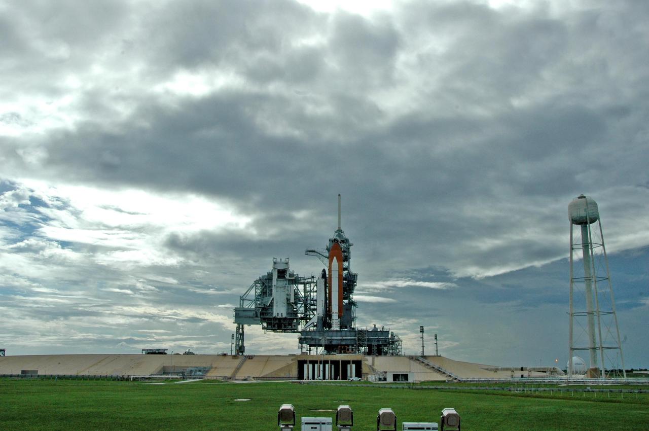
KENNEDY SPACE CENTER, FLA. - Launch Pad 39B looks like a movie screen in this photo of Space Shuttle Atlantis after rollback of the rotating service structure. The RSS provides protected access to the orbiter for changeout and servicing of payloads at the pad and then is rolled away before liftoff. At right is the 300,000-gallon water tank that releases a deluge of water across the mobile launcher platform during liftoff to aid sound suppression. Atlantis is scheduled to launch Sept. 6 at 12:29 p.m. EDT on mission STS-115. During the mission, Atlantis' astronauts will deliver and install the 17.5-ton, bus-sized P3/P4 integrated truss segment on the station. The girder-like truss includes a set of giant solar arrays, batteries and associated electronics and will provide one-fourth of the total power-generation capability for the completed station. This mission is the 116th space shuttle flight, the 27th flight for orbiter Atlantis, and the 19th U.S. flight to the International Space Station. STS-115 is scheduled to last 11 days with a planned KSC landing at about 8:03 a.m. EDT on Sept. 17. Photo credit: NASA/Ken Thornsley
One of two wind sensors springs out of the mast on NASA's Perseverance Mars rover. These sensors are part of the Mars Environmental Dynamics Analyzer (MEDA), the rover's set of weather instrumentation. MEDA was provided to NASA by the Centro de Astrobiología (CAB) at the Instituto Nacional de Técnica Aeroespacial in Madrid, Spain. A key objective for Perseverance's mission on Mars is astrobiology, including the search for signs of ancient microbial life. The rover will characterize the planet's geology and past climate, pave the way for human exploration of the Red Planet, and be the first mission to collect and cache Martian rock and regolith (broken rock and dust). Subsequent missions, currently under consideration by NASA in cooperation with ESA (the European Space Agency), would send spacecraft to Mars to collect these cached samples from the surface and return them to Earth for in-depth analysis. The Mars 2020 mission is part of a larger program that includes missions to the Moon as a way to prepare for human exploration of the Red Planet. Charged with returning astronauts to the Moon by 2024, NASA will establish a sustained human presence on and around the Moon by 2028 through NASA's Artemis lunar exploration plans. Movie available at https://photojournal.jpl.nasa.gov/catalog/PIA24175
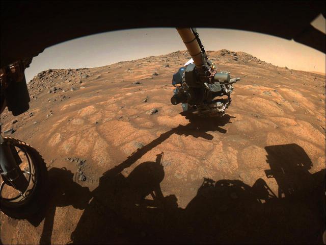
The robotic arm on NASA's Perseverance rover reached out to examine rocks in an area on Mars nicknamed the "Cratered Floor Fractured Rough" area in this image captured on July 10, 2021 (the 138th sol, or Martian day, of its mission). The image was taken by one of the rover's hazard cameras. An additional set of images from July 10-12 have been compiled into a GIF. Scientists are particularly interested in the flat rocks that appear light in color (nicknamed "paver rocks"). This image was processed to enhance contrast. A key objective for Perseverance's mission on Mars is astrobiology, including the search for signs of ancient microbial life. The rover will characterize the planet's geology and past climate, pave the way for human exploration of the Red Planet, and be the first mission to collect and cache Martian rock and regolith (broken rock and dust). Subsequent NASA missions, in cooperation with ESA (European Space Agency), would send spacecraft to Mars to collect these sealed samples from the surface and return them to Earth for in-depth analysis. The Mars 2020 Perseverance mission is part of NASA's Moon to Mars exploration approach, which includes Artemis missions to the Moon that will help prepare for human exploration of the Red Planet. Movie available at https://photojournal.jpl.nasa.gov/catalog/PIA24748
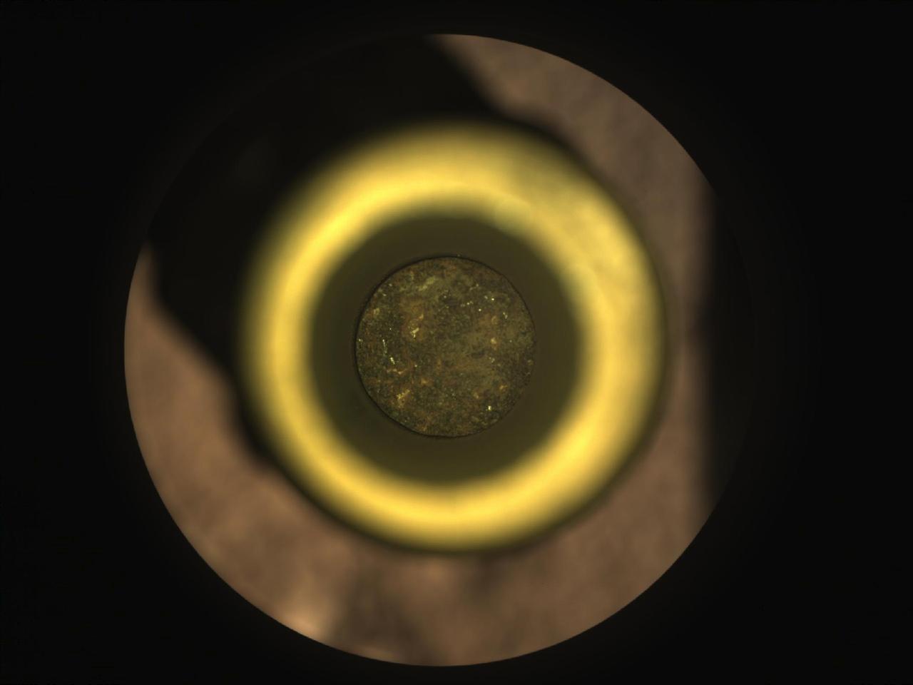
The first cored sample of Mars rock is visible (at center) inside a titanium sample collection tube in this from the Sampling and Caching System Camera (known as CacheCam) of NASA's Perseverance rover. The image was taken on Sept. 6, 2021 (the 194th sol, or Martian day, of the mission), prior to the system attaching and sealing a metal cap onto the tube. The image was taken so the cored-rock sample would be in focus. The seemingly dark ring surrounding the sample is a portion of the sample tube's inner wall. The bright gold-colored ring surrounding the tube and sample is the "bearing race," an asymmetrical flange that assists in shearing off a sample once the coring drill has bored into a rock. The outermost, mottled-brown disc in this image is a portion of the sample handling arm inside the rover's adaptive caching assembly. An additional set of images shows the tube and its cored sample during CacheCam imaging inspection. A key objective for Perseverance's mission on Mars is astrobiology, including the search for signs of ancient microbial life. The rover will characterize the planet's geology and past climate, pave the way for human exploration of the Red Planet, and be the first mission to collect and cache Martian rock and regolith (broken rock and dust). Subsequent NASA missions, in cooperation with ESA (European Space Agency), would send spacecraft to Mars to collect these sealed samples from the surface and return them to Earth for in-depth analysis. The Mars 2020 Perseverance mission is part of NASA's Moon to Mars exploration approach, which includes Artemis missions to the Moon that will help prepare for human exploration of the Red Planet. Movie available at https://photojournal.jpl.nasa.gov/catalog/PIA24806
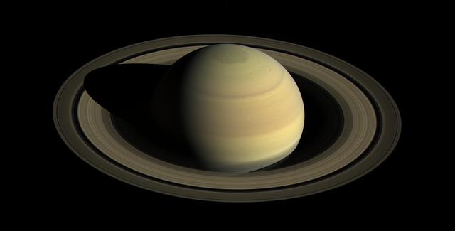
Since NASA's Cassini spacecraft arrived at Saturn in mid-2004, the planet's appearance has changed greatly. The shifting angle of sunlight as the seasons march forward has illuminated the giant hexagon-shaped jet stream around the north polar region, and the subtle bluish hues seen earlier in the mission have continued to fade. Earlier views obtained in 2004 and 2009 (see PIA06077 and PIA11667) demonstrate how drastically the illumination has changed. This view shows Saturn's northern hemisphere in 2016, as that part of the planet nears its northern hemisphere summer solstice in May 2017. Saturn's year is nearly 30 Earth years long, and during its long time there, Cassini has observed winter and spring in the north, and summer and fall in the south. The spacecraft will complete its mission just after northern summer solstice, having observed long-term changes in the planet's winds, temperatures, clouds and chemistry. Cassini scanned across the planet and its rings on April 25, 2016, capturing three sets of red, green and blue images to cover this entire scene showing the planet and the main rings. The images were obtained using Cassini's wide-angle camera at a distance of approximately 1.9 million miles (3 million kilometers) from Saturn and at an elevation of about 30 degrees above the ring plane. The view looks toward the sunlit side of the rings from a sun-Saturn-spacecraft angle, or phase angle, of 55 degrees. Image scale on Saturn is about 111 miles (178 kilometers) per pixel. The exposures used to make this mosaic were obtained just prior to the beginning of a 44-hour movie sequence. http://photojournal.jpl.nasa.gov/catalog/PIA21046
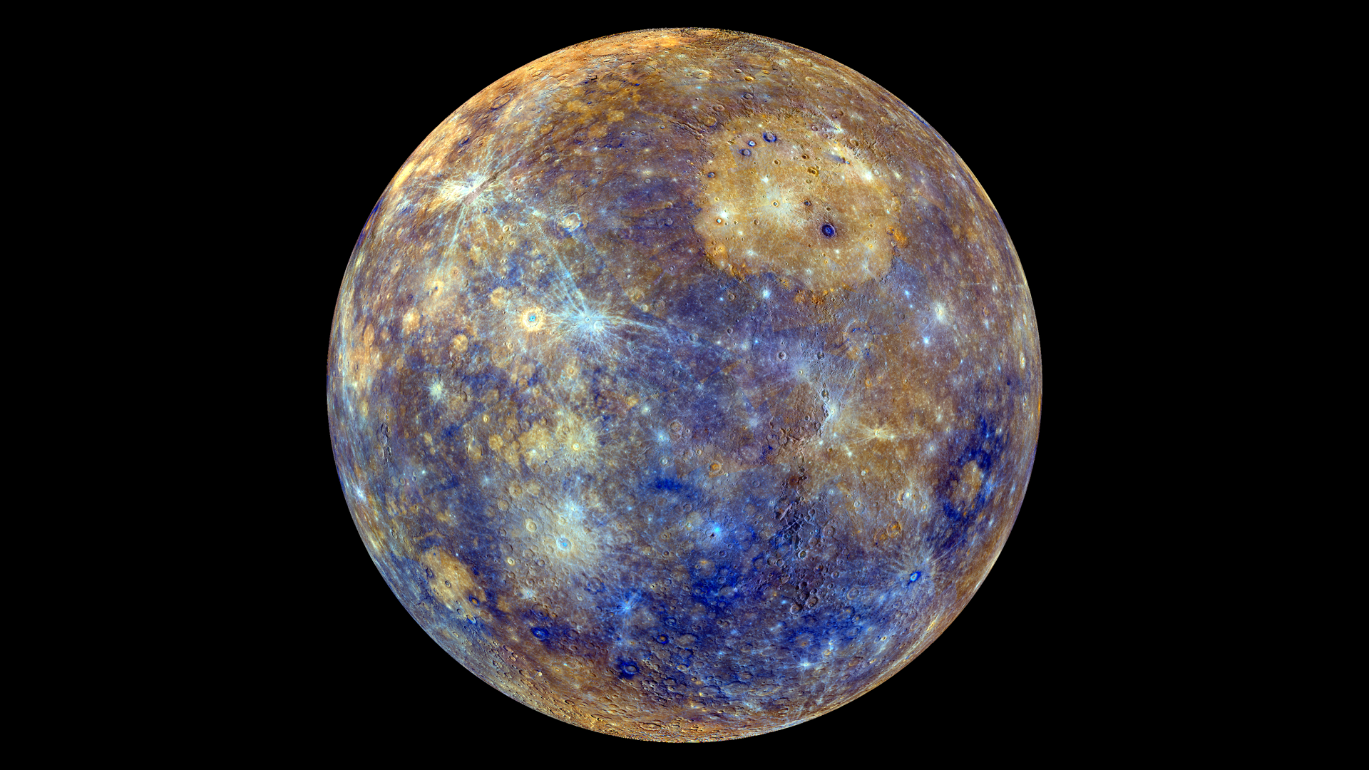
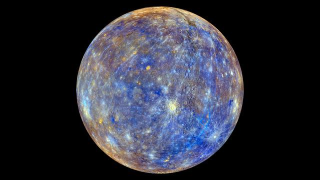
This colorful view of Mercury was produced by using images from the color base map imaging campaign during MESSENGER's primary mission. These colors are not what Mercury would look like to the human eye, but rather the colors enhance the chemical, mineralogical, and physical differences between the rocks that make up Mercury's surface. <b>To watch a movie of this colorful view of Mercury as a spinning globe go here: <a href="http://www.flickr.com/photos/gsfc/8497927473">www.flickr.com/photos/gsfc/8497927473</a></b> Young crater rays, extending radially from fresh impact craters, appear light blue or white. Medium- and dark-blue areas are a geologic unit of Mercury's crust known as the "low-reflectance material", thought to be rich in a dark, opaque mineral. Tan areas are plains formed by eruption of highly fluid lavas. The giant Caloris basin is the large circular tan feature located just to the upper right of center of the image. The MESSENGER spacecraft is the first ever to orbit the planet Mercury, and the spacecraft's seven scientific instruments and radio science investigation are unraveling the history and evolution of the Solar System's innermost planet. Visit the Why Mercury? section of this website to learn more about the key science questions that the MESSENGER mission is addressing. During the one-year primary mission, MESSENGER acquired 88,746 images and extensive other data sets. MESSENGER is now in a yearlong extended mission, during which plans call for the acquisition of more than 80,000 additional images to support MESSENGER's science goals. Credit: NASA/Johns Hopkins University Applied Physics Laboratory/Carnegie Institution of Washington <b><a href="http://www.nasa.gov/audience/formedia/features/MP_Photo_Guidelines.html" rel="nofollow">NASA image use policy.</a></b> <b><a href="http://www.nasa.gov/centers/goddard/home/index.html" rel="nofollow">NASA Goddard Space Flight Center</a></b> enables NASA’s mission through four scientific endeavors: Earth Science, Heliophysics, Solar System Exploration, and Astrophysics. Goddard plays a leading role in NASA’s accomplishments by contributing compelling scientific knowledge to advance the Agency’s mission. <b>Follow us on <a href="http://twitter.com/NASA_GoddardPix" rel="nofollow">Twitter</a></b> <b>Like us on <a href="http://www.facebook.com/pages/Greenbelt-MD/NASA-Goddard/395013845897?ref=tsd" rel="nofollow">Facebook</a></b> <b>Find us on <a href="http://instagram.com/nasagoddard?vm=grid" rel="nofollow">Instagram</a></b>
Video footage from NASA's Perseverance Mars rover provides a big-picture perspective of the 13th flight of NASA's Ingenuity Mars Helicopter. The 160.5-second reconnaissance sortie involved flying into challenging terrain and taking images of a specific rocky outcrop from multiple angles. Captured from a distance of about 980 feet (300 meters) by the rover's two-camera Mastcam-Z, Ingenuity is barely discernable near the lower left of frame at the beginning of the video. An annotated version of this video highlighting the location of Ingenuity can be found here. At 0:04 seconds into the video Ingenuity takes off and climbs to an altitude of to 26 feet (8 meters) before beginning its sideways translation to the right. At the video's 0:59 second point, Ingenuity leaves the camera's field of view on the right. Soon after (1:02), the helicopter returns into the field of view (the majority of frames that did not capture helicopter after it exited the camera's field of view were purposely not downlinked from Mars by the team) and lands at a location near its takeoff point. To obtain the footage, the "left eye" of the Mastcam-Z instrument is set for a wide-angle shot (26 mm focal length). The video is shot at 6 frames per second. Another view (PIA24979) is taken at the same time by Mastcam-Z's other ("right eye") imager and provides a closer perspective of the helicopter as it took off and landed. The Mastcam-Z investigation is led and operated by Arizona State University in Tempe, working in collaboration with Malin Space Science Systems in San Diego, California, on the design, fabrication, testing, and operation of the cameras, and in collaboration with the Neils Bohr Institute of the University of Copenhagen on the design, fabrication, and testing of the calibration targets. A key objective for Perseverance's mission on Mars is astrobiology, including the search for signs of ancient microbial life. The rover will characterize the planet's geology and past climate, pave the way for human exploration of the Red Planet, and be the first mission to collect and cache Martian rock and regolith (broken rock and dust). Subsequent NASA missions, in cooperation with ESA (European Space Agency), would send spacecraft to Mars to collect these sealed samples from the surface and return them to Earth for in-depth analysis. The Mars 2020 Perseverance mission is part of NASA's Moon to Mars exploration approach, which includes Artemis missions to the Moon that will help prepare for human exploration of the Red Planet. Movie available at https://photojournal.jpl.nasa.gov/catalog/PIA24978
Video footage from the Mastcam-Z instrument aboard NASA's Perseverance Mars rover captured this closeup view of the takeoff and landing of the 13th flight of the Ingenuity Mars Helicopter on Sept. 4, 2021. The 160.5-second reconnaissance sortie involved flying into challenging terrain and taking images of a specific outcrop from multiple angles. The closeup video of takeoff and landing was acquired as part of a science observation intended to measure the dust plumes generated by the helicopter. At the beginning of the video, Ingenuity is near the lower left of frame, at a distance of about 980 feet (300 meters) from the rover. It climbs to an altitude of to 26 feet (8 meters) before beginning its sideways translation. The helicopter leaves the camera's field of view on the right. Soon after, the helicopter returns into the field of view (the majority of frames that did not capture helicopter after it exited the camera's field of view were purposely not downlinked from Mars by the team) and lands at a location near its takeoff point. To obtain the footage, the two-camera Mastcam-Z's "right eye" was at its maximum zoom setting (110mm focal length). The video is shot at 6 frames per second. Another view (PIA24978) was taken at the same time by Mastcam-Z's "left eye" imager and provides a wider perspective of the same flight. The Mastcam-Z investigation is led and operated by Arizona State University in Tempe, working in collaboration with Malin Space Science Systems in San Diego, California, on the design, fabrication, testing, and operation of the cameras, and in collaboration with the Neils Bohr Institute of the University of Copenhagen on the design, fabrication, and testing of the calibration targets. A key objective for Perseverance's mission on Mars is astrobiology, including the search for signs of ancient microbial life. The rover will characterize the planet's geology and past climate, pave the way for human exploration of the Red Planet, and be the first mission to collect and cache Martian rock and regolith (broken rock and dust). Subsequent NASA missions, in cooperation with ESA (European Space Agency), would send spacecraft to Mars to collect these sealed samples from the surface and return them to Earth for in-depth analysis. The Mars 2020 Perseverance mission is part of NASA's Moon to Mars exploration approach, which includes Artemis missions to the Moon that will help prepare for human exploration of the Red Planet. Movie available at https://photojournal.jpl.nasa.gov/catalog/PIA24979
This colorful view of Mercury was produced by using images from the color base map imaging campaign during MESSENGER's primary mission. These colors are not what Mercury would look like to the human eye, but rather the colors enhance the chemical, mineralogical, and physical differences between the rocks that make up Mercury's surface. Young crater rays, extending radially from fresh impact craters, appear light blue or white. Medium- and dark-blue areas are a geologic unit of Mercury's crust known as the "low-reflectance material", thought to be rich in a dark, opaque mineral. Tan areas are plains formed by eruption of highly fluid lavas. The crater in the upper right whose rays stretch across the planet is Hokusai. <b>To watch a movie of this colorful view of Mercury as a spinning globe go here: <a href="http://www.flickr.com/photos/gsfc/8497927473">www.flickr.com/photos/gsfc/8497927473</a></b> Young crater rays, extending radially from fresh impact craters, appear light blue or white. Medium- and dark-blue areas are a geologic unit of Mercury's crust known as the "low-reflectance material", thought to be rich in a dark, opaque mineral. Tan areas are plains formed by eruption of highly fluid lavas. The giant Caloris basin is the large circular tan feature located just to the upper right of center of the image. The MESSENGER spacecraft is the first ever to orbit the planet Mercury, and the spacecraft's seven scientific instruments and radio science investigation are unraveling the history and evolution of the Solar System's innermost planet. Visit the Why Mercury? section of this website to learn more about the key science questions that the MESSENGER mission is addressing. During the one-year primary mission, MESSENGER acquired 88,746 images and extensive other data sets. MESSENGER is now in a yearlong extended mission, during which plans call for the acquisition of more than 80,000 additional images to support MESSENGER's science goals. Credit: NASA/Johns Hopkins University Applied Physics Laboratory/Carnegie Institution of Washington <b><a href="http://www.nasa.gov/audience/formedia/features/MP_Photo_Guidelines.html" rel="nofollow">NASA image use policy.</a></b> <b><a href="http://www.nasa.gov/centers/goddard/home/index.html" rel="nofollow">NASA Goddard Space Flight Center</a></b> enables NASA’s mission through four scientific endeavors: Earth Science, Heliophysics, Solar System Exploration, and Astrophysics. Goddard plays a leading role in NASA’s accomplishments by contributing compelling scientific knowledge to advance the Agency’s mission. <b>Follow us on <a href="http://twitter.com/NASAGoddardPix" rel="nofollow">Twitter</a></b> <b>Like us on <a href="http://www.facebook.com/pages/Greenbelt-MD/NASA-Goddard/395013845897?ref=tsd" rel="nofollow">Facebook</a></b> <b>Find us on <a href="http://instagram.com/nasagoddard?vm=grid" rel="nofollow">Instagram</a></b>

NASA image acquired July 27, 2001 In southwestern Jordan lies an unusual landscape. Mountains of granite and sandstone rise next to valleys filled with red sand. Some of the mountains reach a height of about 1,700 meters (5,600 feet) above sea level, and many have near-vertical slopes. So alien is this landscape, it’s nicknamed “Valley of the Moon,” and it has served as the film set for a movie about Mars. Yet nomadic people have lived here for thousands of years. Declared a protected area in 1998, this unearthly landscape is Wadi Rum. The Advanced Land Imager (ALI) on NASA’s Earth Observing-1 (EO-1) satellite captured this natural-color image on July 27, 2001. The scene includes part of Wadi Rum and an adjacent area to the east. East of the protected area, fields with center-pivot irrigation make circles of green and brown (image upper right). As the earth tones throughout the image attest, the area is naturally arid, receiving little annual precipitation and supporting only sparse vegetation. Between rocky peaks, the sandy valleys range in color from beige to brick. Ancient granite rocks dating from the Precambrian underlie younger rocks, and some of these basement rocks have eroded into rugged, steep-sloped mountains. The granite mountains have risen thanks partly to crisscrossing fault lines under the park. Overlying the granite are sandstones from the Cambrian and Ordovician Periods, as well as loose sands. Lawrence of Arabia, who fought in the Arab Revolt of 1917–1918, made frequent references to Wadi Rum in his book The Seven Pillars of Wisdom. Likewise, a prominent feature of the protected area is named after the book. Several popular sites in Wadi Rum bear Lawrence of Arabia’s name, but whether he actually visited those sites is uncertain. To download the full high res go to: <a href="http://earthobservatory.nasa.gov/IOTD/view.php?id=49945" rel="nofollow">earthobservatory.nasa.gov/IOTD/view.php?id=49945</a> NASA Earth Observatory image created by Jesse Allen and Robert Simmon, using EO-1 ALI data provided courtesy of the NASA EO-1 team and the United States Geological Survey. Caption by Michon Scott. Instrument: EO-1 - ALI Credit: <b><a href="http://www.earthobservatory.nasa.gov/" rel="nofollow"> NASA Earth Observatory</a></b> <b><a href="http://www.nasa.gov/centers/goddard/home/index.html" rel="nofollow">NASA Goddard Space Flight Center</a></b> enables NASA’s mission through four scientific endeavors: Earth Science, Heliophysics, Solar System Exploration, and Astrophysics. Goddard plays a leading role in NASA’s accomplishments by contributing compelling scientific knowledge to advance the Agency’s mission. <b>Follow us on <a href="http://twitter.com/NASA_GoddardPix" rel="nofollow">Twitter</a></b> <b>Join us on <a href="http://www.facebook.com/pages/Greenbelt-MD/NASA-Goddard/395013845897?ref=tsd" rel="nofollow">Facebook</a></b>