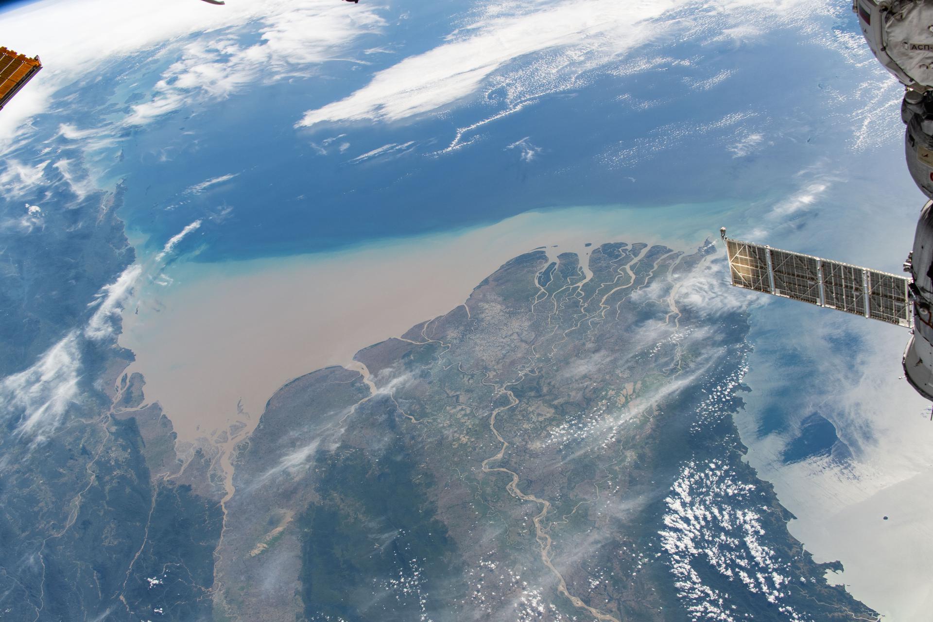
iss073e1197819 (Nov. 22, 2025) --- Myanmar’s (Burma) Irrawaddy Delta—an important agricultural region in Southeast Asia filled with mangrove forests, rice paddies, and swampy lowlands—empties into the Andaman Sea and is pictured from the International Space Station as it orbited 262 miles above.
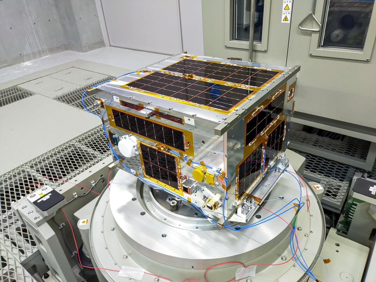
jsc2020e049614 (8/7/2020) --- A preflight view of the MMSAT-1 flight unit. MMSAT-1 is Myanmar’s first 50 kg-class MicroSat, that deploys during the JEM Small Satellite Orbital Deployer-M2 (J-SSOD-M2) micro-satellite deployment mission. The satellite mission aims to help provide information to implement more efficient and systematic agricultural practices in Myanmar and monitor natural disasters through the provision of satellite imagery. Photo courtesy of: TohokuHokkaido University

iss060e006636 (July 11, 2019) --- Earth's atmospheric glow is back-dropped by a starry Milky Way as the International Space Station orbited 258 miles above Myanmar during an orbital nighttime pass. The Progress 72 resupply ship and the Pirs docking compartment with its lit airlock window silhouette the background.
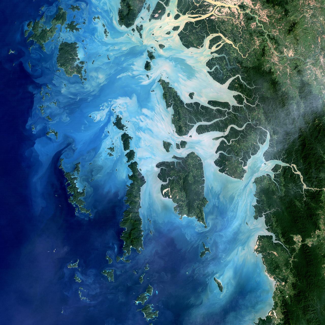
NASA image acquired December 14, 2004 In the southernmost reaches of Burma (Myanmar), along the border with Thailand, lies the Mergui Archipelago. The archipelago in the Andaman Sea is made up of more than 800 islands surrounded by extensive coral reefs. This natural color image acquired by Landsat 5 on Dec. 14, 2004, shows the middle portion of the archipelago, including Auckland and Whale Bays. Swirling patterns are visible in the near-shore waters as sediments carried by rivers slowly settle out and are deposited on the seafloor. The heavy sediment loads make the river appear nearly white. As those sediments settle out, the seawater appears deeper shades of blue. The tropical rainforests of the region appear deep green. Captain Thomas Forrest of the East India Company first described the region to Europeans after a 1782 expedition in search of potential sugar-growing lands. At that time, the islands were mainly inhabited by a nomadic fishing culture. These people, known as the Moken, still call the archipelago home and mostly live a hunter-gatherer lifestyle. As of 2006, 2,000 Moken were known to inhabit the Burmese portion of Mergui. The small population of the archipelago has helped preserve its high diversity of plants and animals. In 1997, Burma opened the region to foreign tourism and in the years since it has become a major diving destination. A valued species of pearl oyster (Pinctada maxima) are found in nearby waters. Today, overfishing is emerging as a regional problem. Landsat image created by Michael Taylor, Landsat Project Science Office. Caption by Laura Rocchio. Instrument: Landsat 5 - TM To read more go to: <a href="http://1.usa.gov/TDmjsk" rel="nofollow">1.usa.gov/TDmjsk</a> Credit: <b><a href="http://www.earthobservatory.nasa.gov/" rel="nofollow"> NASA Earth Observatory</a></b> <b><a href="http://www.nasa.gov/audience/formedia/features/MP_Photo_Guidelines.html" rel="nofollow">NASA image use policy.</a></b> <b><a href="http://www.nasa.gov/centers/goddard/home/index.html" rel="nofollow">NASA Goddard Space Flight Center</a></b> enables NASA’s mission through four scientific endeavors: Earth Science, Heliophysics, Solar System Exploration, and Astrophysics. Goddard plays a leading role in NASA’s accomplishments by contributing compelling scientific knowledge to advance the Agency’s mission. <b>Follow us on <a href="http://twitter.com/NASA_GoddardPix" rel="nofollow">Twitter</a></b> <b>Like us on <a href="http://www.facebook.com/pages/Greenbelt-MD/NASA-Goddard/395013845897?ref=tsd" rel="nofollow">Facebook</a></b> <b>Find us on <a href="http://instagram.com/nasagoddard?vm=grid" rel="nofollow">Instagram</a></b>