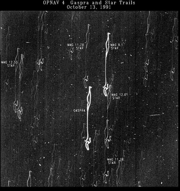
This time-exposure picture of the asteroid Gaspra and background stars is one of four optical navigation images made by NASA Galileo imaging system to improve knowledge of Gaspra location for the spacecraft flyby. http://photojournal.jpl.nasa.gov/catalog/PIA00229
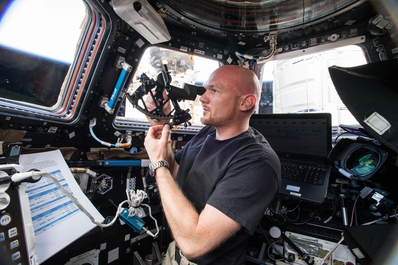
iss056e049856 (June 28, 2018) --- Astronaut Alexander Gerst of ESA (European Space Agency) calibrates and operates the Sextant Navigation device which is testing emergency navigation methods such as stability and star sighting in microgravity for future Orion exploration missions.
NASA Galileo spacecraft, now in orbit around Jupiter, returned this optical navigation image June 3, 1996, showing that the spacecraft is accurately targeted for its first flyby of the giant moon Ganymede on June 27. http://photojournal.jpl.nasa.gov/catalog/PIA00273
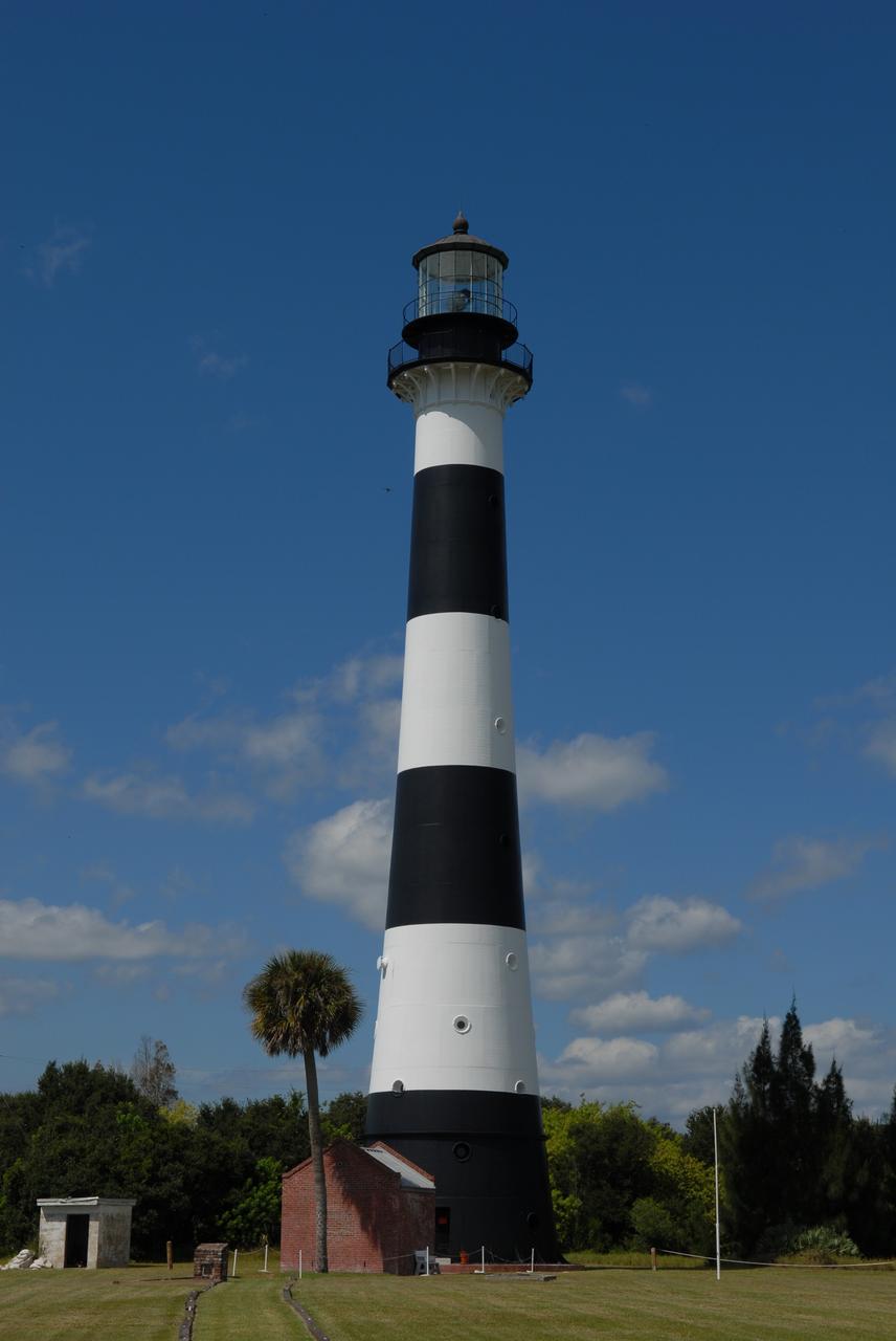
CAPE CANAVERAL, Fla. – The Cape Canaveral Lighthouse stands in the midst of space-age structures, a monolith born in another era of exploration. Located near Launch Complex 36 on Cape Canaveral Air Force Station, the Coast Guard transferred ownership in 2000 of the lighthouse structure and its grounds to the U.S. Air Force, which is now responsible for maintaining it. A restoration of the lighthouse was completed by the Air Force in 2007. The Coast Guard continues to maintain the beacon as an active navigational aid. For the history of the lighthouse, visit http://www.nasa.gov/centers/kennedy/about/history/lighthouse.html. For current information, visit http://www.CanaveralLight.org. Photo credit: NASA/Jim Grossmann
NASA's Dawn spacecraft took this picture on its way to a new orbit, at an altitude of about 30,000 miles (48,300 kilometers), as part of a series of images intended to help the navigation of the spacecraft relative to Ceres. The image was taken on March 28, 2017. Several familiar features can be identified: At the top, we see Occator Crater and its faculae (bright deposits identified as a mixture of sodium carbonate and other salts). Below center is the crater Urvara, and to the right of it, the larger crater Yalode (the third and second largest craters on Ceres, respectively). Large-scale faults called Samhain Catenae stretch from the Occator region toward the Yalode-Urvara region. The spacecraft will settle into a new orbit that will allow it to observe Ceres in opposition at the end of April 2017, when Dawn is directly between the sun and the Occator bright spots, at an altitude of about 12,400 miles (20,000 kilometers). The Dawn Journal has more details about the science expected from these observations. https://photojournal.jpl.nasa.gov/catalog/PIA21401
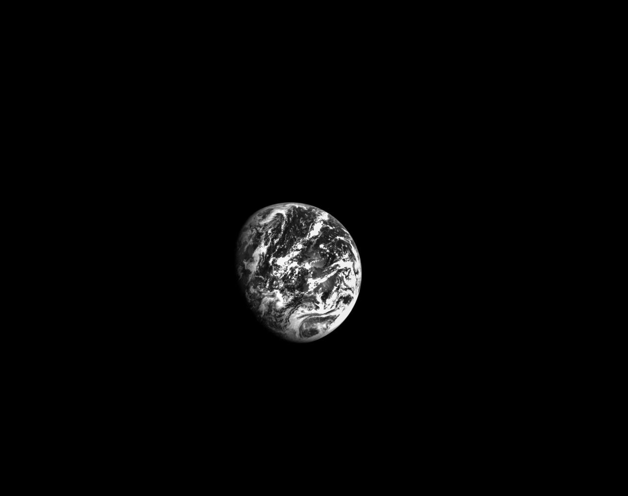
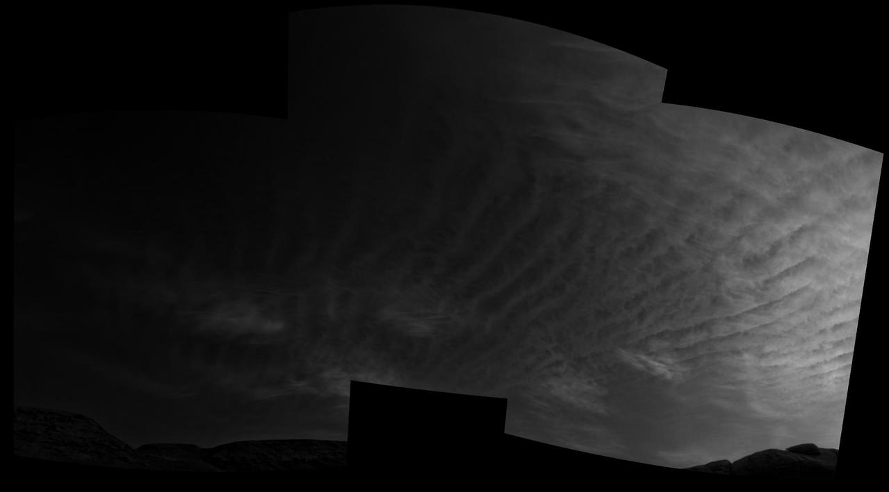
On the second day of the 25.5-day Artemis I mission, Orion used its optical navigation camera to snap black and white photos of planet Earth. Orion uses the optical navigation camera to capture imagery of the Earth and the Moon at different phases and distances, providing an enhanced body of data to certify its effectiveness as a method for determining its position in space for future missions under differing lighting conditions.
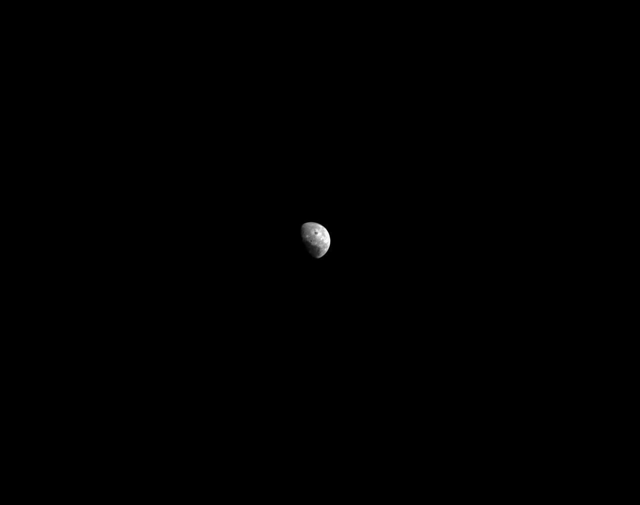
Orion’s black-and-white optical navigation camera captured this view of the Moon on the fourth day of the Artemis I mission. Orion uses the optical navigation camera to capture imagery of the Earth and the Moon at different phases and distances, providing an enhanced body of data to certify its effectiveness as a method for determining its position in space for future missions under differing lighting conditions.
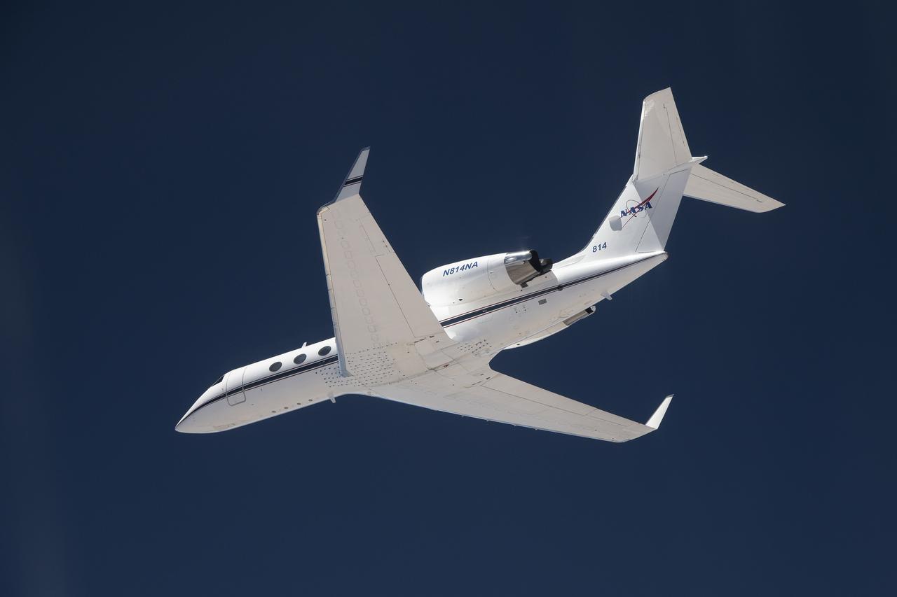
The G-IV aircraft flies overhead in the Mojave Desert near NASA’s Armstrong Flight Research Center in Edwards, California. Baseline flights like this one occurred in June 2024, and future flights in service of science research will benefit from the installment of the Soxnav navigational system, developed in collaboration with NASA’s Jet Propulsion Laboratory in Southern California and the Bay Area Environmental Research Institute in California’s Silicon Valley. This navigational system provides precise, economical aircraft guidance for a variety of aircraft types moving at high speeds.
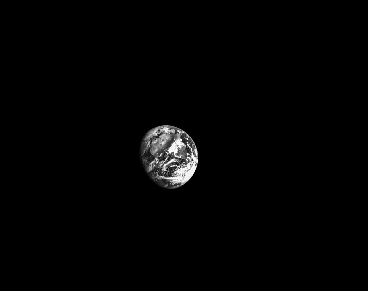
On the second day of the 25.5-day Artemis I mission, Orion used its optical navigation camera to snap black and white photos of planet Earth. Orion uses the optical navigation camera to capture imagery of the Earth and the Moon at different phases and distances, providing an enhanced body of data to certify its effectiveness as a method for determining its position in space for future missions under differing lighting conditions.
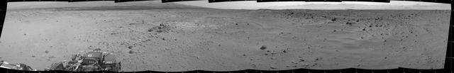
This mosaic of images from the Navigation Camera Navcam on NASA Mars rover Curiosity shows the scene from the rover position on the 376th Martian day, or sol, of the mission Aug. 27, 2013.
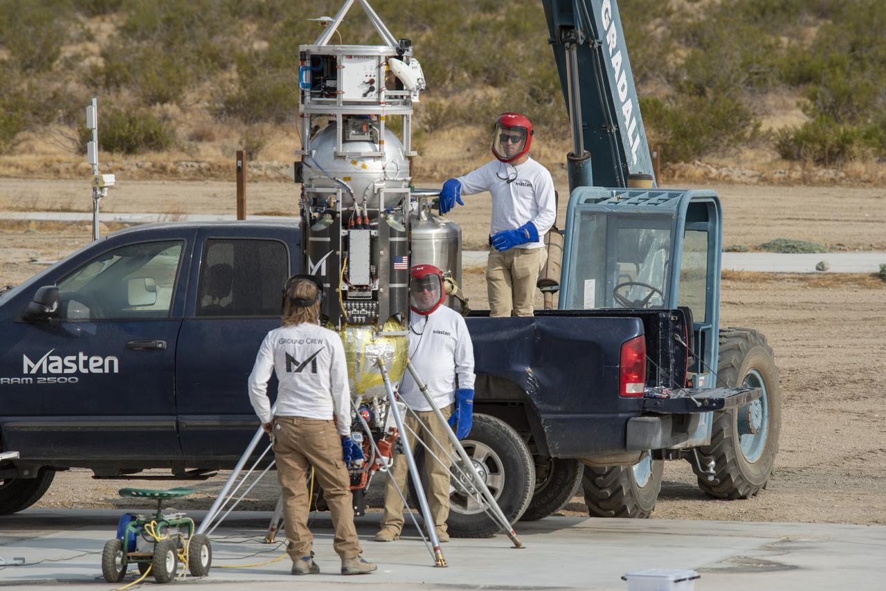
Masten Space Systems employees prepare its rocket to flight test NASA -licensed Psionic navigation doppler lidar technology that enables precision landing on celestial bodies where GPS for navigation only available on Earth is not an option.

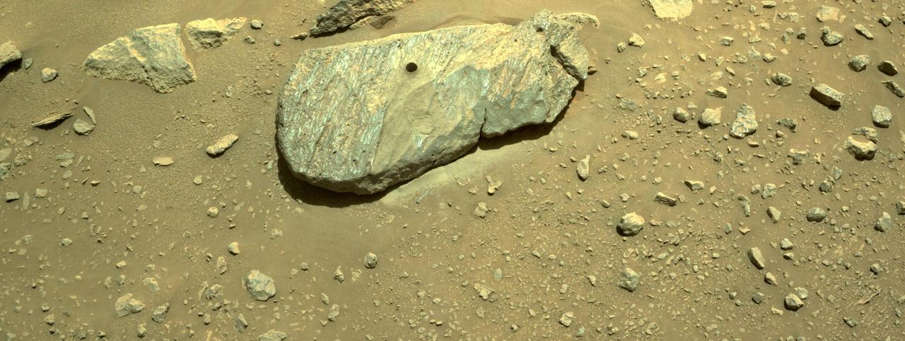
NASA's Mars Perseverance rover acquired this image using its onboard left Navigation Camera (Navcam). The camera is located high on the rover's mast and aids in driving. This image was acquired on March 7, 2021 (Sol 16) at the local mean solar time of 15:04:10. https://photojournal.jpl.nasa.gov/catalog/PIA23729
NASA photographer James Ross monitors the Airborne Location Integrating Geospatial Navigation System (ALIGNS) from the backseat of an F-15 near NASA’s Armstrong Flight Research Center in Edwards, California. The ALIGNS provides real-time positioning guidance between aircraft for shock wave probing and schlieren imagery capture.
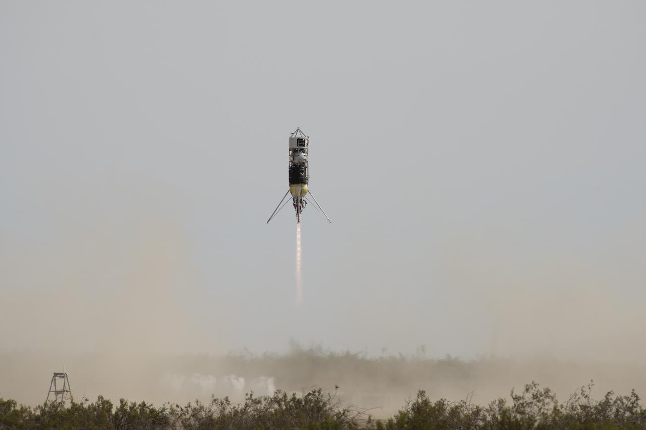
Masten Space Systems vertical takeoff vertical landing rocket launched September 10, 2020 to flight test NASA-licensed Psionic navigation doppler lidar technology that enables precision landing on celestial bodies where GPS for navigation only available on Earth is not an option.
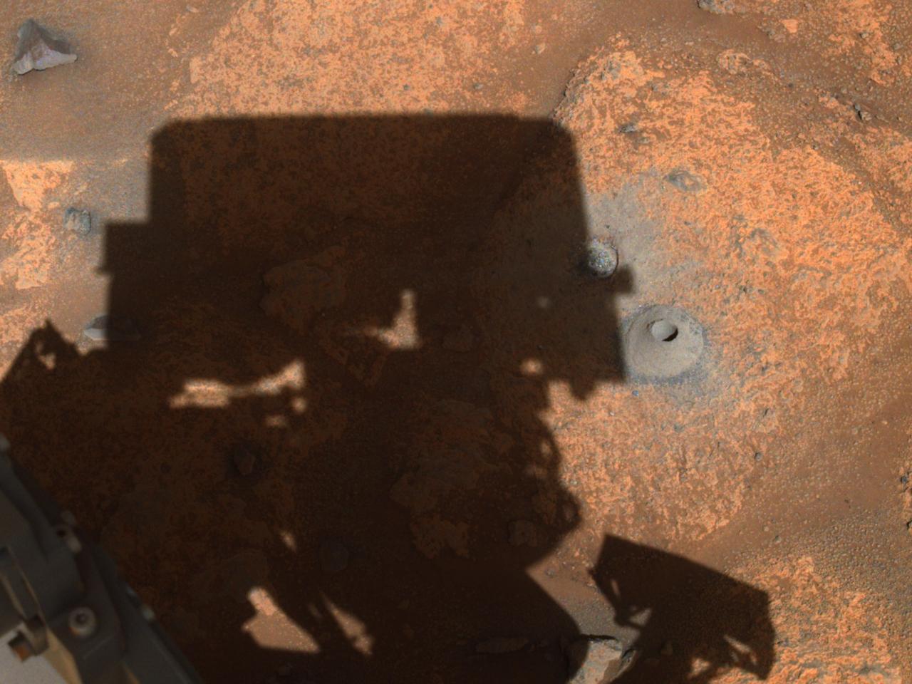
This image of the hole drilled by NASA's Perseverance rover during its first sample-collection attempt was imaged by one of the rover's navigation cameras. The photo was taken on August 6, 2021, in the "Crater Floor Fractured Rough" geologic unit in Mars' Jezero Crater. A key objective for Perseverance's mission on Mars is astrobiology, including the search for signs of ancient microbial life. The rover will characterize the planet's geology and past climate, pave the way for human exploration of the Red Planet, and be the first mission to collect and cache Martian rock and regolith (broken rock and dust). Subsequent NASA missions, in cooperation with ESA (European Space Agency), would send spacecraft to Mars to collect these sealed samples from the surface and return them to Earth for in-depth analysis. The Mars 2020 Perseverance mission is part of NASA's Moon to Mars exploration approach, which includes Artemis missions to the Moon that will help prepare for human exploration of the Red Planet. https://photojournal.jpl.nasa.gov/catalog/PIA24798
A small piece of foreign object debris (FOD) is seen in footage from the navigation camera of NASA's Ingenuity Mars Helicopter during its 33rd flight on Mars on Sept 24, 2022. The FOD is seen attached to one of the rotorcraft's landing legs, then drifting away. Movie available at https://photojournal.jpl.nasa.gov/catalog/PIA25331
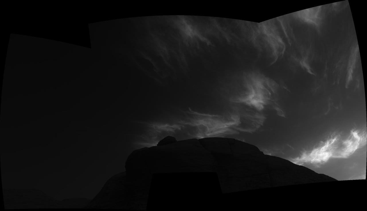
Using the navigation cameras on its mast, NASA's Curiosity Mars rover took these images of clouds just after sunset on March 28, 2021, the 3,072nd so, or Martian day, of the mission. These noctilucent, or twilight clouds, are made of water ice; ice crystals reflect the setting sun, allowing the detail in each cloud to be seen more easily. Movie available at https://photojournal.jpl.nasa.gov/catalog/PIA24646
Using the navigation cameras on its mast, NASA's Curiosity Mars rover took these images of clouds just after sunset on March 31, 2021, the 3,075th so, or Martian day, of the mission. These noctilucent, or twilight clouds, are made of water ice; ice crystals reflect the setting sun, allowing the detail in each cloud to be seen more easily. Movie available at https://photojournal.jpl.nasa.gov/catalog/PIA24645
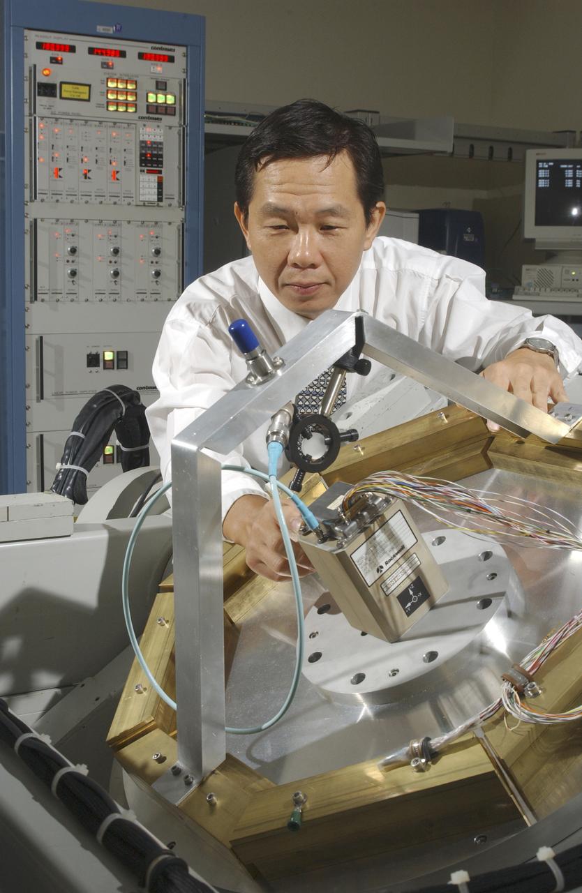
An array of components in a laboratory at NASA's Marshall Space Flight Center (MSFC) is being tested by the Flight Mechanics Office to develop an integrated navigation system for the second generation reusable launch vehicle. The laboratory is testing Global Positioning System (GPS) components, a satellite-based location and navigation system, and Inertial Navigation System (INS) components, sensors on a vehicle that determine angular velocity and linear acceleration at various points. The GPS and INS components work together to provide a space vehicle with guidance and navigation, like the push of the OnStar button in your car assists you with directions to a specific address. The integration will enable the vehicle operating system to track where the vehicle is in space and define its trajectory. The use of INS components for navigation is not new to space technology. The Space Shuttle currently uses them. However, the Space Launch Initiative is expanding the technology to integrate GPS and INS components to allow the vehicle to better define its position and more accurately determine vehicle acceleration and velocity. This advanced technology will lower operational costs and enhance the safety of reusable launch vehicles by providing a more comprehensive navigation system with greater capabilities. In this photograph, Dr. Jason Chuang of MSFC inspects an INS component in the laboratory.
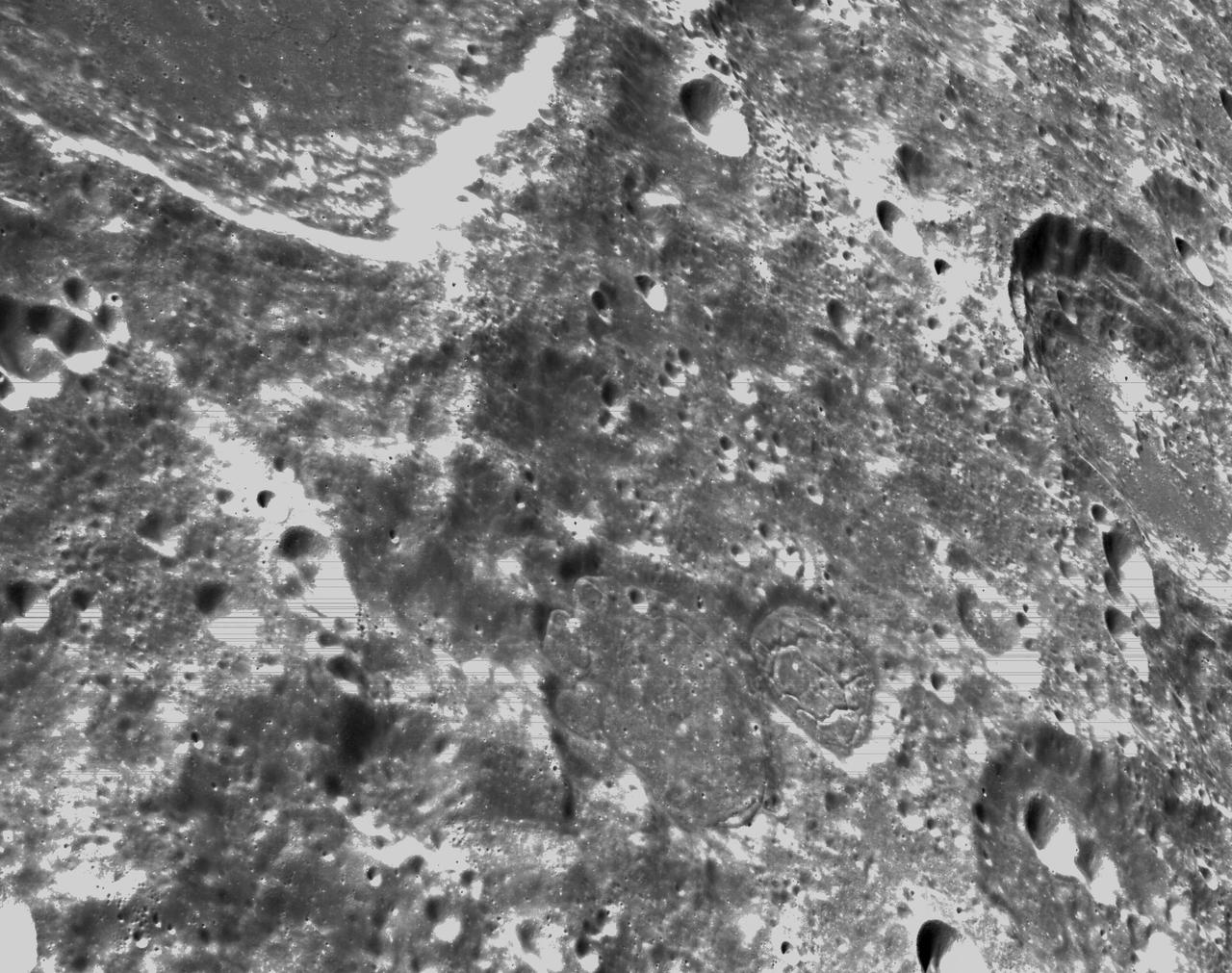
art001e000342 (Nov. 21, 2022) – On the sixth day of the Artemis I mission, Orion’s optical navigation camera captured black-and-white images of craters on the Moon below. Orion uses the optical navigation camera to capture imagery of the Earth and the Moon at different phases and distances, providing an enhanced body of data to certify its effectiveness under different lighting conditions as a way to help orient the spacecraft on future missions with crew.
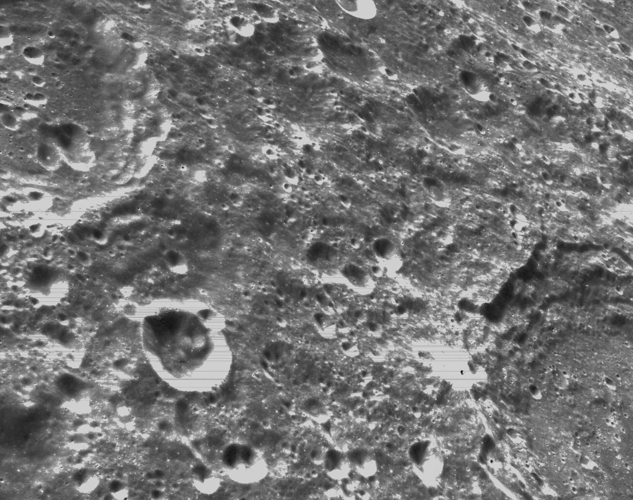
art001e000339 (Nov. 21, 2022) – On the sixth day of the Artemis I mission, Orion’s optical navigation camera captured black-and-white images of craters on the Moon below. Orion uses the optical navigation camera to capture imagery of the Earth and the Moon at different phases and distances, providing an enhanced body of data to certify its effectiveness under different lighting conditions as a way to help orient the spacecraft on future missions with crew.
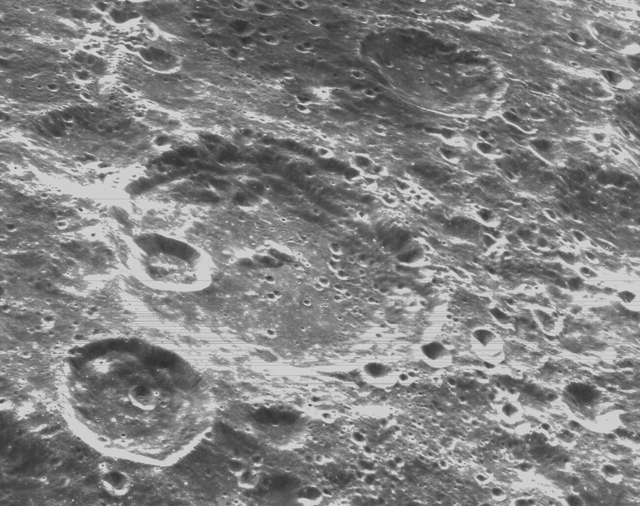
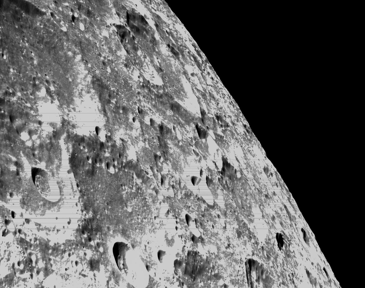
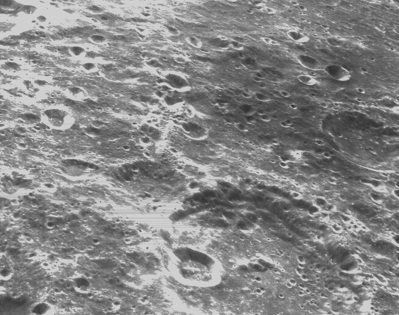
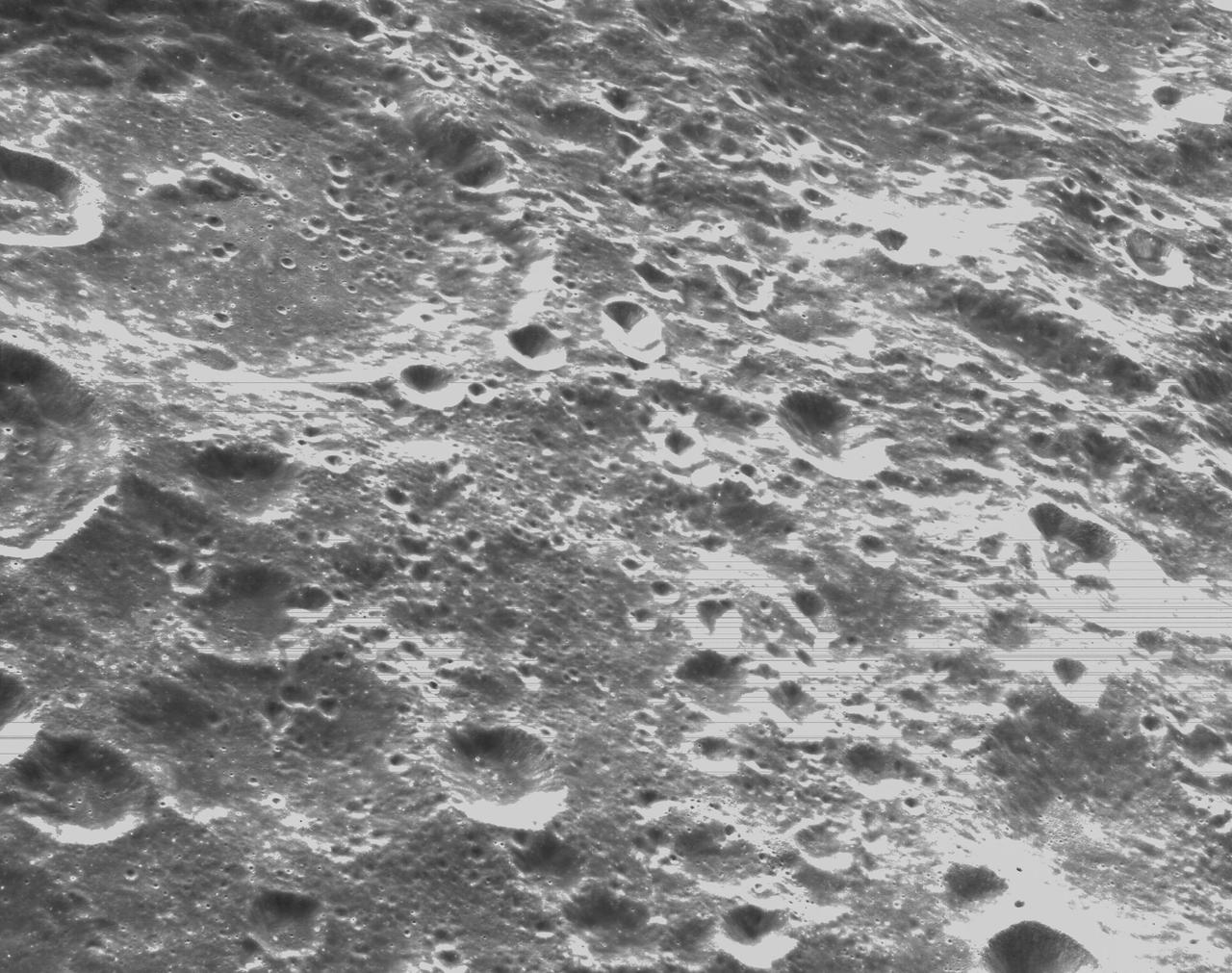
art001e000334 (Nov. 21, 2022) – On the sixth day of the Artemis I mission, Orion’s optical navigation camera captured black-and-white images of craters on the Moon below. Orion uses the optical navigation camera to capture imagery of the Earth and the Moon at different phases and distances, providing an enhanced body of data to certify its effectiveness under different lighting conditions as a way to help orient the spacecraft on future missions with crew.
art001e000348 (Nov. 21, 2022) – On the sixth day of the Artemis I mission, Orion’s optical navigation camera captured black-and-white images of craters on the Moon below. Orion uses the optical navigation camera to capture imagery of the Earth and the Moon at different phases and distances, providing an enhanced body of data to certify its effectiveness under different lighting conditions as a way to help orient the spacecraft on future missions with crew.

art001e000345 (Nov. 21, 2022) – On the sixth day of the Artemis I mission, Orion’s optical navigation camera captured black-and-white images of craters on the Moon below. Orion uses the optical navigation camera to capture imagery of the Earth and the Moon at different phases and distances, providing an enhanced body of data to certify its effectiveness under different lighting conditions as a way to help orient the spacecraft on future missions with crew.
art001e000340 (Nov. 21, 2022) – On the sixth day of the Artemis I mission, Orion’s optical navigation camera captured black-and-white images of craters on the Moon below. Orion uses the optical navigation camera to capture imagery of the Earth and the Moon at different phases and distances, providing an enhanced body of data to certify its effectiveness under different lighting conditions as a way to help orient the spacecraft on future missions with crew.
art001e000346 (Nov. 21, 2022) – On the sixth day of the Artemis I mission, Orion’s optical navigation camera captured black-and-white images of craters on the Moon below. Orion uses the optical navigation camera to capture imagery of the Earth and the Moon at different phases and distances, providing an enhanced body of data to certify its effectiveness under different lighting conditions as a way to help orient the spacecraft on future missions with crew.
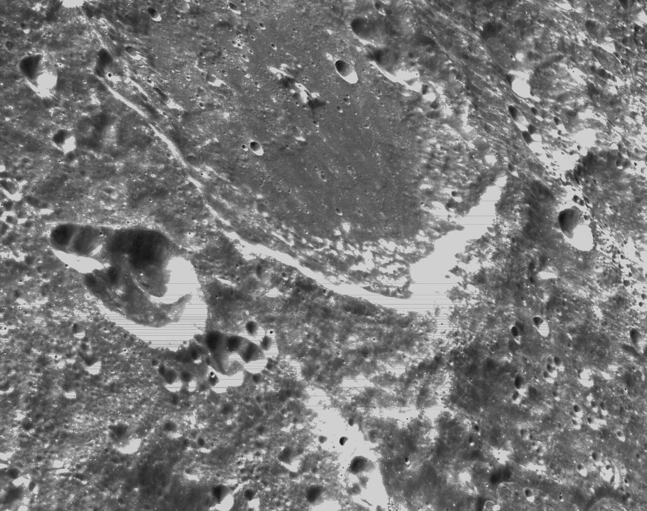
art001e000341 (Nov. 21, 2022) – On the sixth day of the Artemis I mission, Orion’s optical navigation camera captured black-and-white images of craters on the Moon below. Orion uses the optical navigation camera to capture imagery of the Earth and the Moon at different phases and distances, providing an enhanced body of data to certify its effectiveness under different lighting conditions as a way to help orient the spacecraft on future missions with crew.
art001e000343 (Nov. 21, 2022) – On the sixth day of the Artemis I mission, Orion’s optical navigation camera captured black-and-white images of craters on the Moon below. Orion uses the optical navigation camera to capture imagery of the Earth and the Moon at different phases and distances, providing an enhanced body of data to certify its effectiveness under different lighting conditions as a way to help orient the spacecraft on future missions with crew.
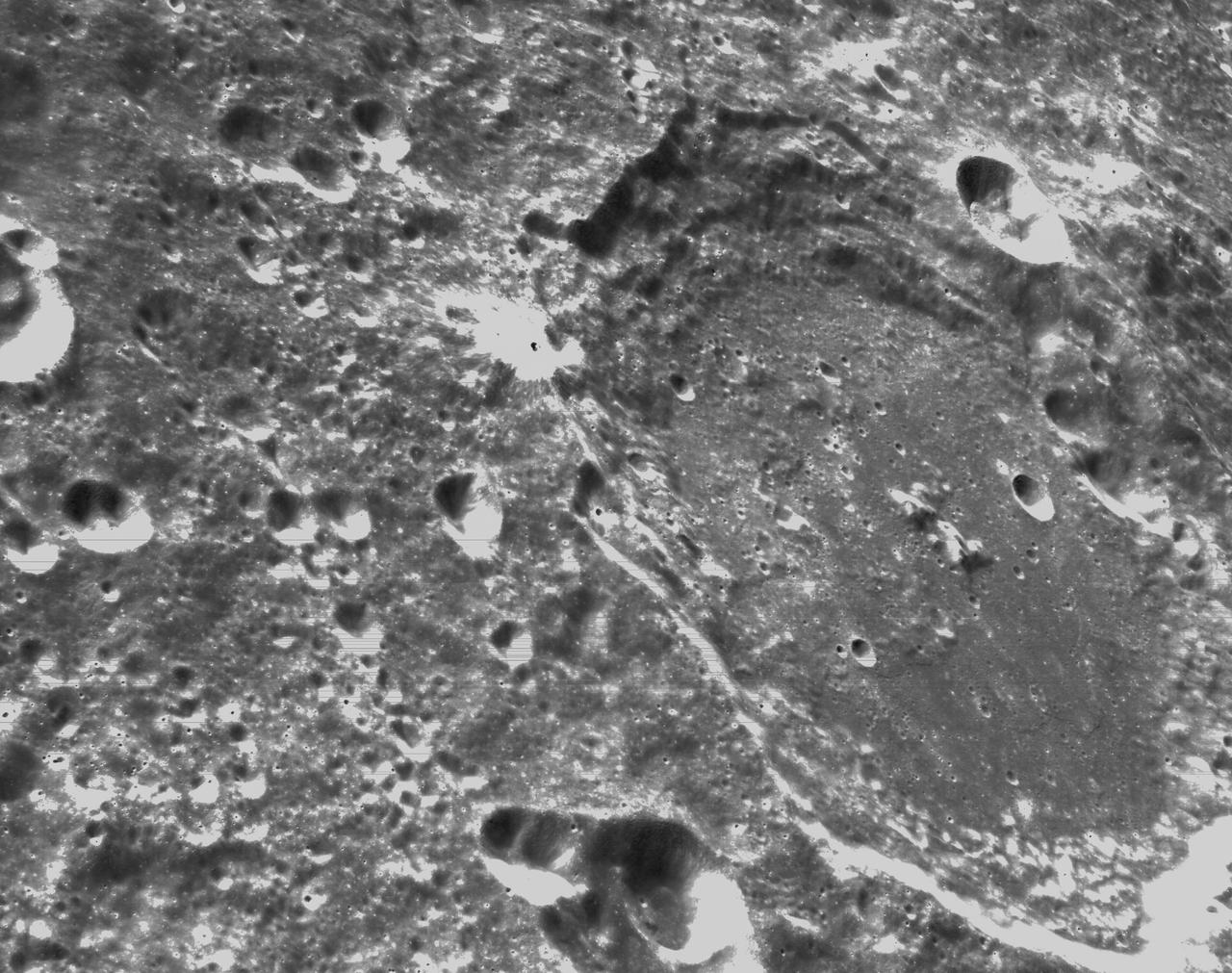
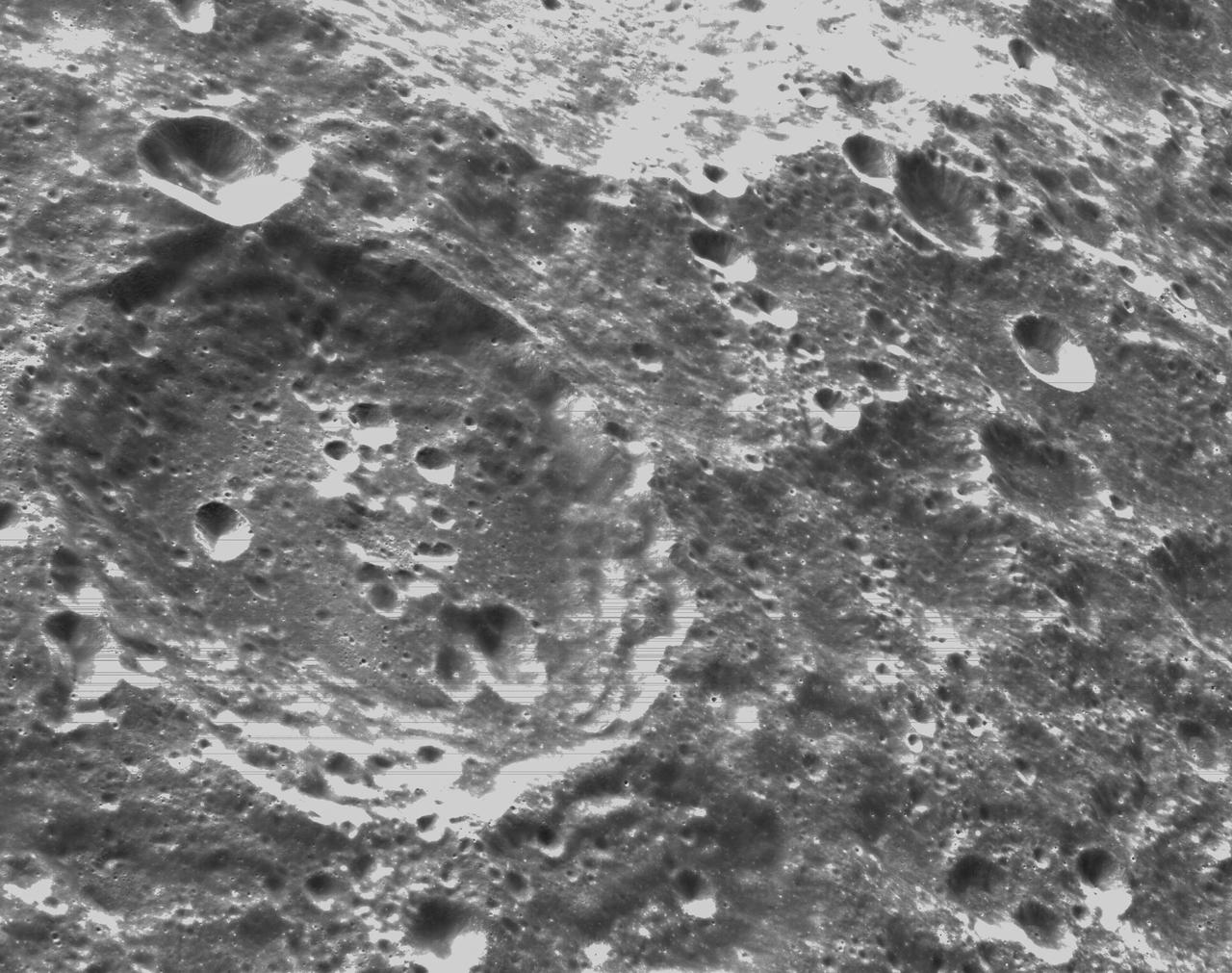
art001e001859 (Dec. 1, 2022) Orion’s optical navigation camera captured this image of the Moon on flight day 16 of the Artemis I mission. Orion uses the optical navigation camera to capture imagery of the Earth and the Moon at different phases and distances, providing an enhanced body of data to certify its effectiveness under different lighting conditions as a way to help orient the spacecraft on future missions with crew.
art001e000338 (Nov. 21, 2022) – On the sixth day of the Artemis I mission, Orion’s optical navigation camera captured black-and-white images of craters on the Moon below. Orion uses the optical navigation camera to capture imagery of the Earth and the Moon at different phases and distances, providing an enhanced body of data to certify its effectiveness under different lighting conditions as a way to help orient the spacecraft on future missions with crew.
art001e000333 (Nov. 21, 2022) – On the sixth day of the Artemis I mission, Orion’s optical navigation camera captured black-and-white images of craters on the Moon below. Orion uses the optical navigation camera to capture imagery of the Earth and the Moon at different phases and distances, providing an enhanced body of data to certify its effectiveness under different lighting conditions as a way to help orient the spacecraft on future missions with crew.
art001e000344 (Nov. 21, 2022) – On the sixth day of the Artemis I mission, Orion’s optical navigation camera captured black-and-white images of craters on the Moon below. Orion uses the optical navigation camera to capture imagery of the Earth and the Moon at different phases and distances, providing an enhanced body of data to certify its effectiveness under different lighting conditions as a way to help orient the spacecraft on future missions with crew.
art001e000335 (Nov. 21, 2022) – On the sixth day of the Artemis I mission, Orion’s optical navigation camera captured black-and-white images of craters on the Moon below. Orion uses the optical navigation camera to capture imagery of the Earth and the Moon at different phases and distances, providing an enhanced body of data to certify its effectiveness under different lighting conditions as a way to help orient the spacecraft on future missions with crew.
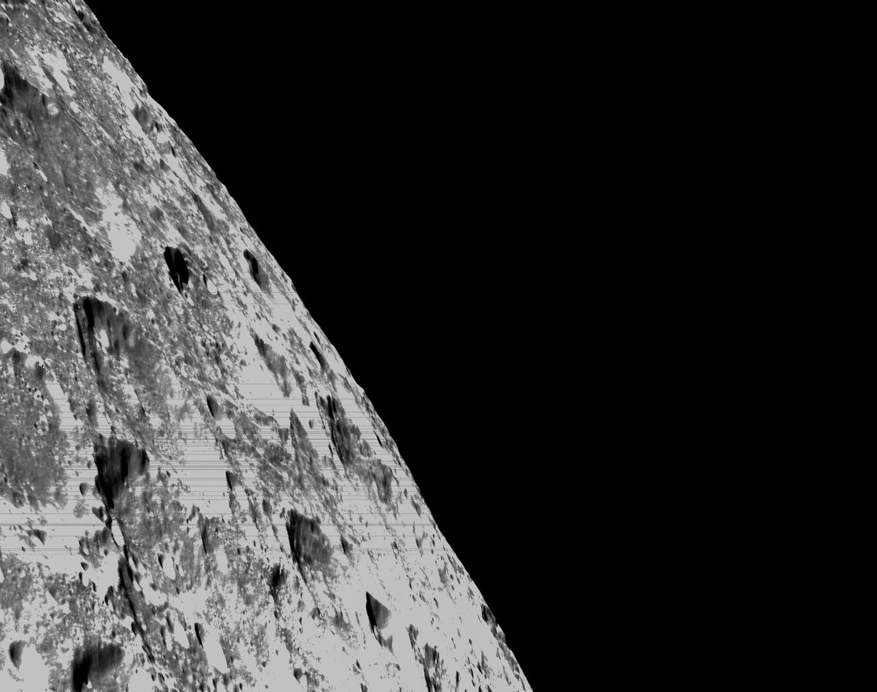
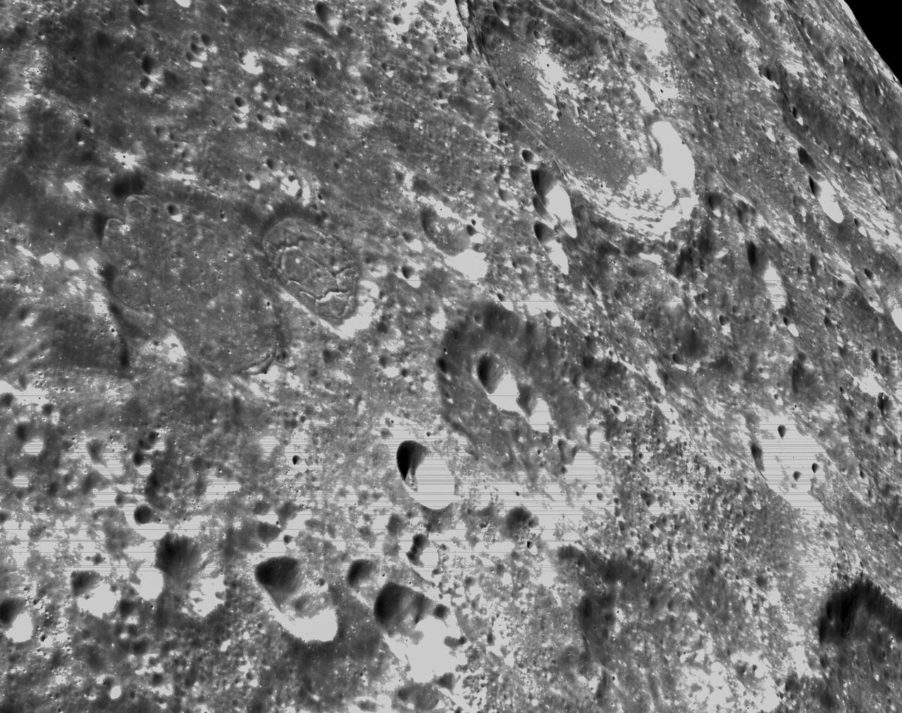
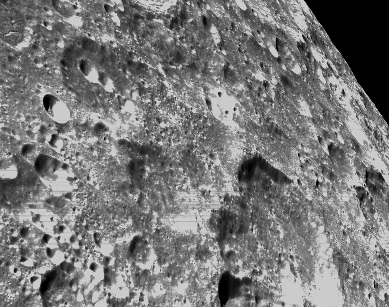
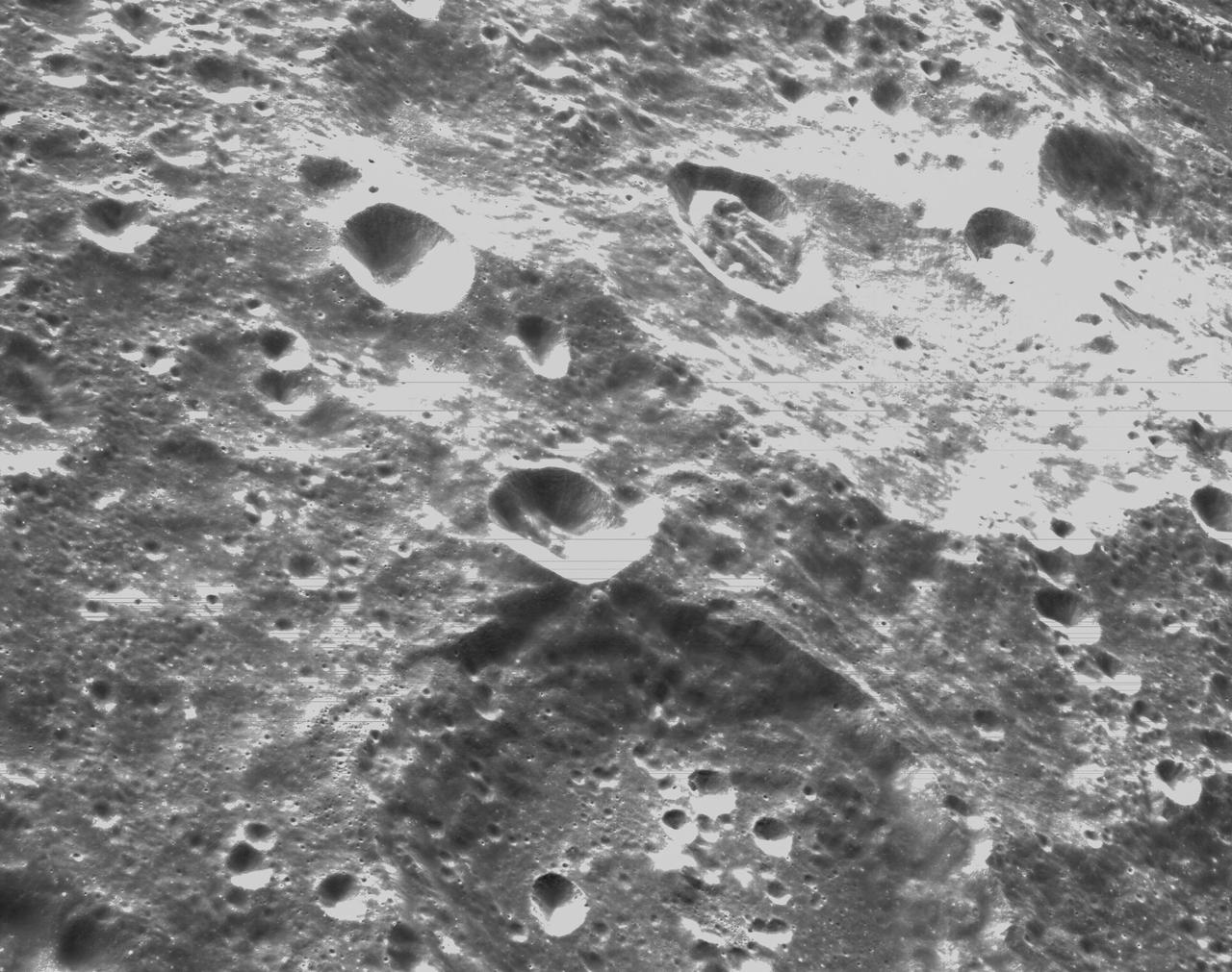
art001e000403 (Nov. 22, 2022) Flight Day 7, Orion’s Optical Navigation camera captures the far side of the Moon, as the spacecraft orbited 81.1 miles above the surface, heading for a Distant Retrograde Orbit. Orion uses the optical navigation camera to capture imagery of the Earth and the Moon at different phases and distances, providing an enhanced body of data to certify its effectiveness under different lighting conditions as a way to help orient the spacecraft on future missions with crew.
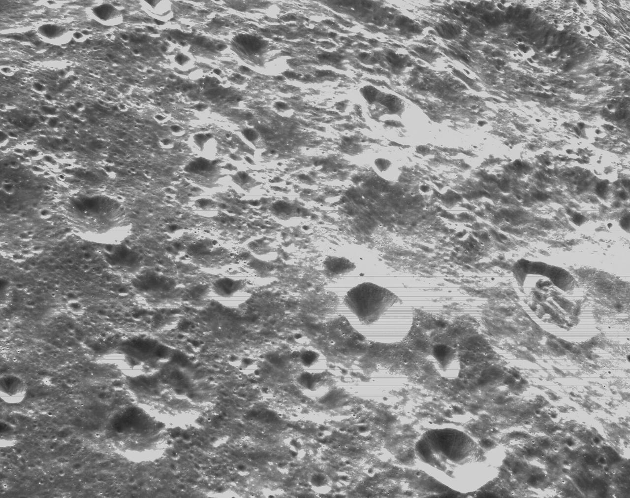
art001e000336 (Nov. 21, 2022) – On the sixth day of the Artemis I mission, Orion’s optical navigation camera captured black-and-white images of craters on the Moon below. Orion uses the optical navigation camera to capture imagery of the Earth and the Moon at different phases and distances, providing an enhanced body of data to certify its effectiveness under different lighting conditions as a way to help orient the spacecraft on future missions with crew.
art001e000337 (Nov. 21, 2022) – On the sixth day of the Artemis I mission, Orion’s optical navigation camera captured black-and-white images of craters on the Moon below. Orion uses the optical navigation camera to capture imagery of the Earth and the Moon at different phases and distances, providing an enhanced body of data to certify its effectiveness under different lighting conditions as a way to help orient the spacecraft on future missions with crew.
art001e001873 (Dec. 1, 2022) Orion’s optical navigation camera captured this image of the Moon on flight day 16 of the Artemis I mission. Orion uses the optical navigation camera to capture imagery of the Earth and the Moon at different phases and distances, providing an enhanced body of data to certify its effectiveness under different lighting conditions as a way to help orient the spacecraft on future missions with crew.
This composite of two images shows the hole drilled by NASA's Perseverance rover during its second sample-collection attempt. The images, which were obtained by one of the rover's navigation cameras on Sept. 1, 2021 (the 190th sol, or Martian day, of the mission), were taken in the "Crater Floor Fractured Rough" geologic unit in Mars' Jezero Crater. The team nicknamed the rock "Rochette" for reference and the spot on the rock where the sample was cored "Montdenier." A key objective for Perseverance's mission on Mars is astrobiology, including the search for signs of ancient microbial life. The rover will characterize the planet's geology and past climate, pave the way for human exploration of the Red Planet, and be the first mission to collect and cache Martian rock and regolith (broken rock and dust). Subsequent NASA missions, in cooperation with ESA (European Space Agency), would send spacecraft to Mars to collect these sealed samples from the surface and return them to Earth for in-depth analysis. The Mars 2020 Perseverance mission is part of NASA's Moon to Mars exploration approach, which includes Artemis missions to the Moon that will help prepare for human exploration of the Red Planet. https://photojournal.jpl.nasa.gov/catalog/PIA24805
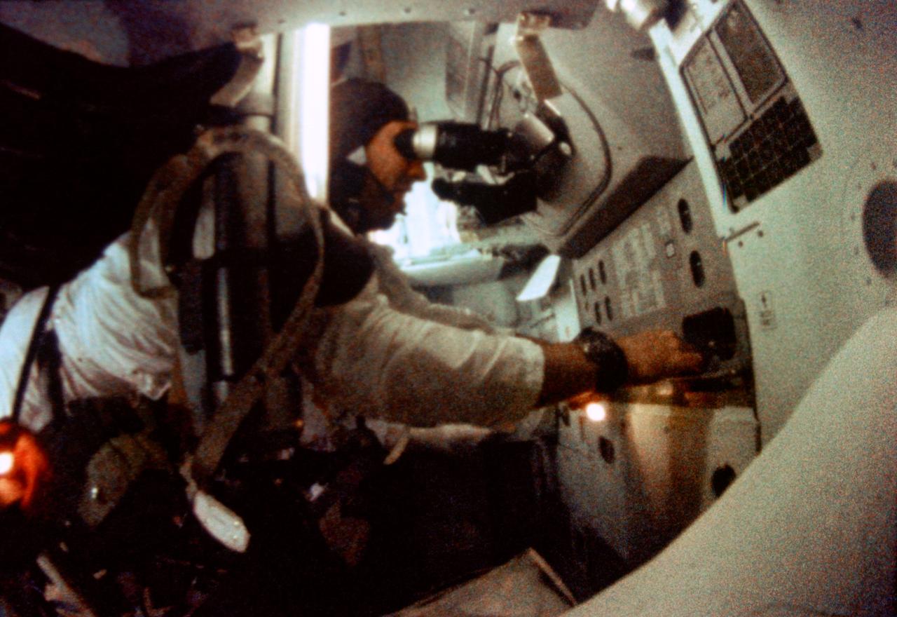
S69-35097 (21-27 Dec. 1968) --- Astronaut James A. Lovell Jr., Apollo 8 command module pilot, is seen at the Apollo 8 Spacecraft Command Module's Guidance and Navigation station during the Apollo 8 lunar orbit mission. This picture was taken from 16mm motion picture film.
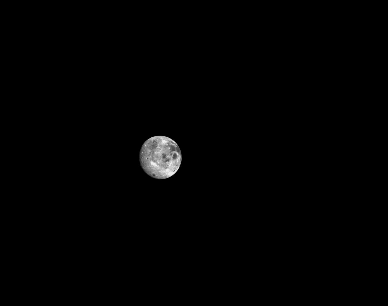
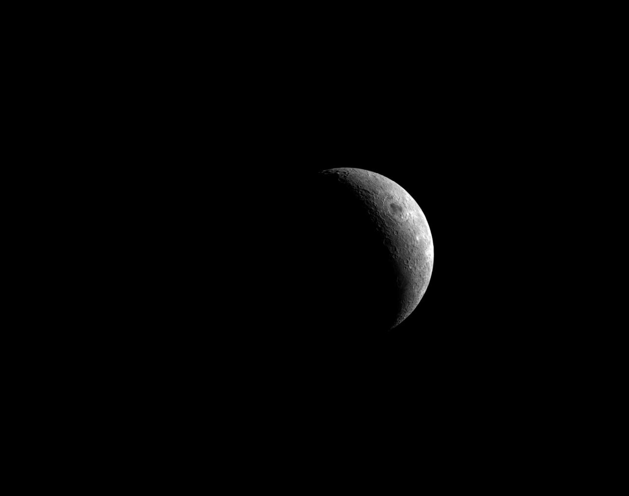
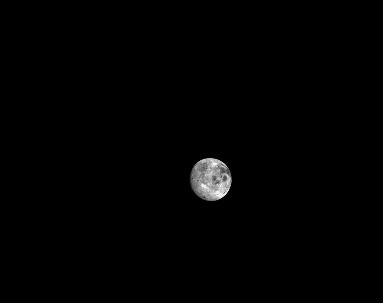
art001e000466 (Nov. 23, 2022) – On flight day 8 of the Artemis I mission, Orion’s optical navigation camera snapped this image of the Moon. Orion continues to increase its distance from the Moon, heading toward distant retrograde orbit around the Moon.
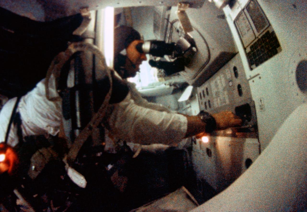
S69-35099 (21-27 Dec. 1968) --- Astronaut James A. Lovell Jr., Apollo 8 command module pilot, is seen at the Apollo 8 Spacecraft Command Module's Guidance and Navigation station during the Apollo 8 lunar orbit mission. This picture was taken from 16mm motion picture film.
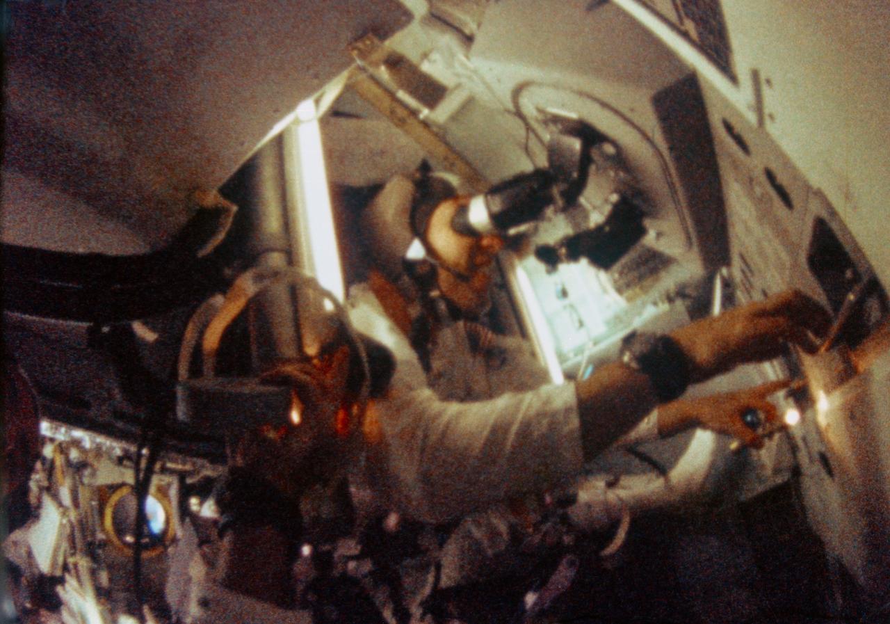
S69-35098 (21-27 Dec. 1968) --- Astronaut James A. Lovell Jr., Apollo 8 command module pilot, is seen at the Apollo 8 Spacecraft Command Module's Guidance and Navigation station during the Apollo 8 lunar orbit mission. This picture was taken from 16mm motion picture film.
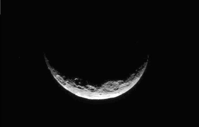
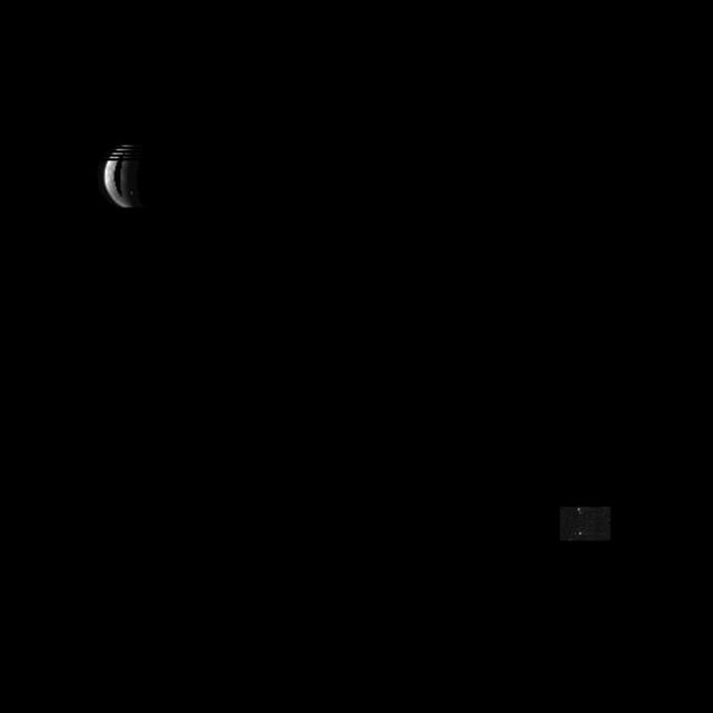
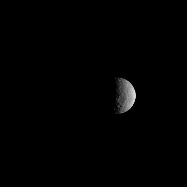
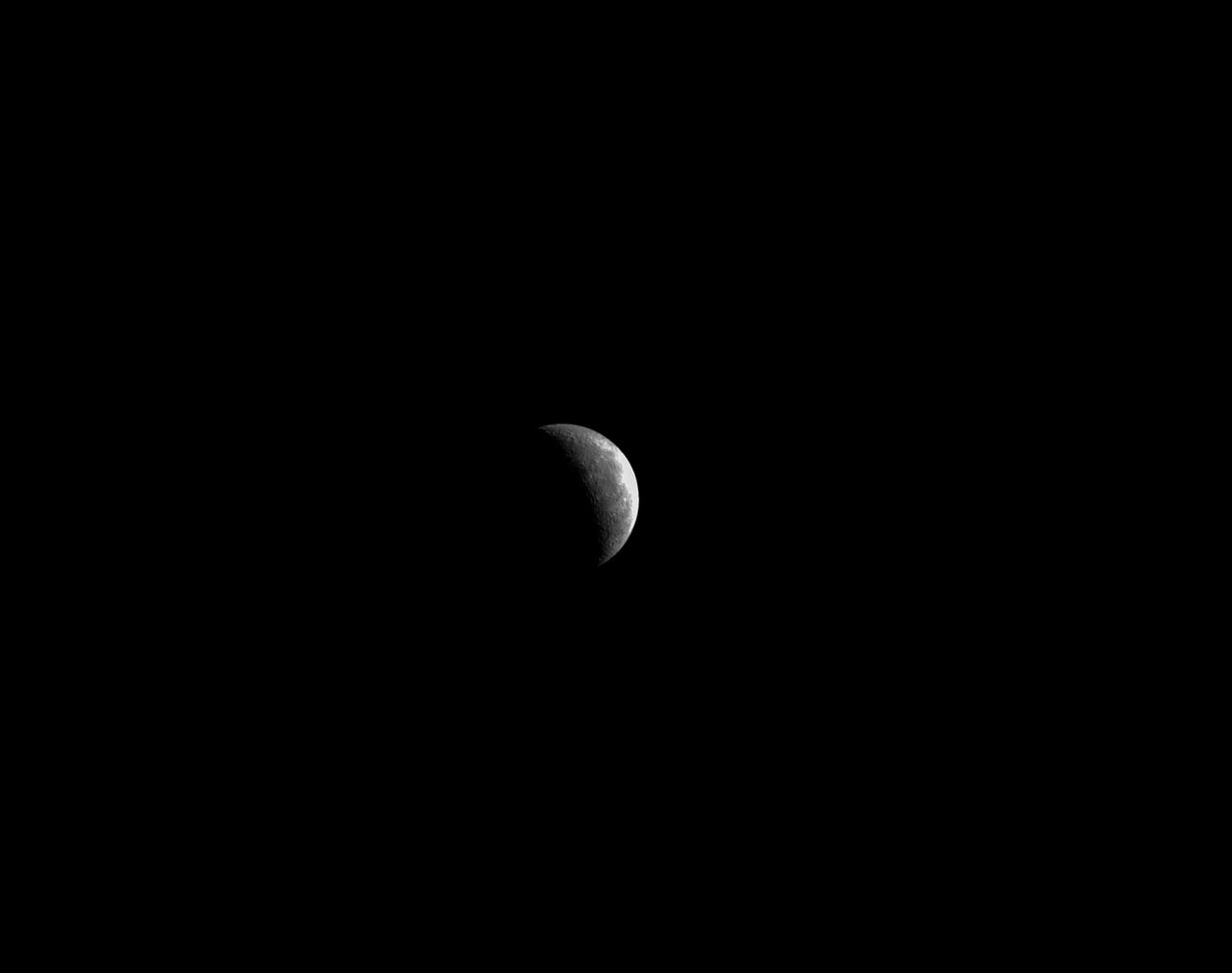
NASA's Dawn spacecraft took this image of Ceres' south polar region on May 17, 2017, from an altitude of about 26,400 miles (42,500 kilometers). The image scale is about 2.5 miles (4 kilometers) per pixel. Dawn took this image to help navigators refine their measurements of the spacecraft's position in orbit. Ceres appears as a crescent as Dawn is on the night side of the dwarf planet. Zadeni Crater, which is 80 miles (128 kilometers) wide, is recognizable on the bottom left side of the crescent. The large crater seen on the right side is Urvara Crater, which is 101 miles (163 kilometers) wide. Large fractures scarring Ceres' surface can also be distinguished here. Dawn captured a similar scene (Figure 1) at higher resolution, although with a slightly different geometry, on April 26, 2015, from its RC3 orbit at an altitude of about 8,450 miles (13,600 kilometers) and an image scale of about 0.81 miles (1.3 kilometers) per pixel. The geology of Ceres' polar regions is very rough in comparison to that generally found at lower latitudes. This is because colder temperatures near the poles allow craters to hold their original shapes over longer periods of time. Features found on Ceres are named after gods and goddesses of agriculture, as well as harvest festivals, from around the world. Zadeni is named for the ancient Georgian god of bountiful harvest, while Urvara is an Indian and Iranian deity of plants and fields. https://photojournal.jpl.nasa.gov/catalog/PIA21407
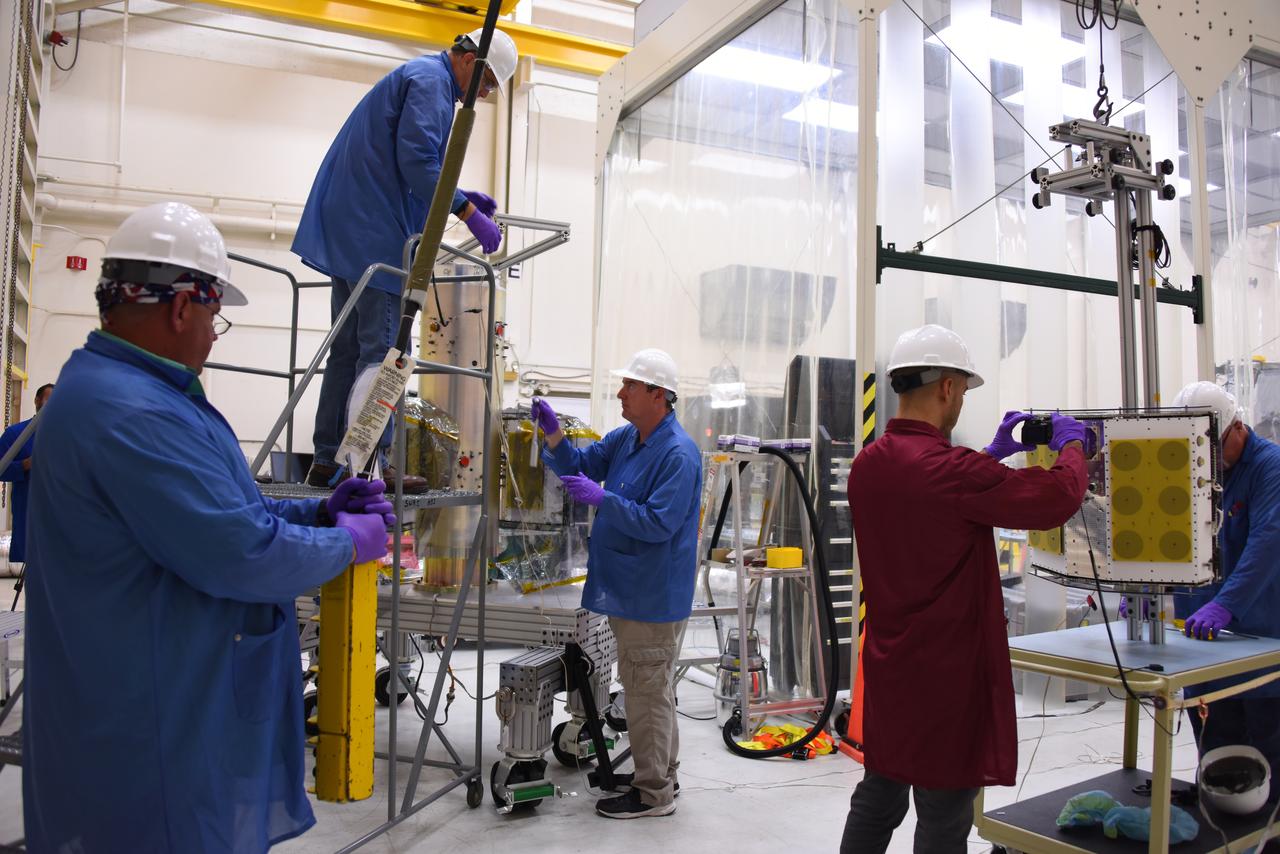
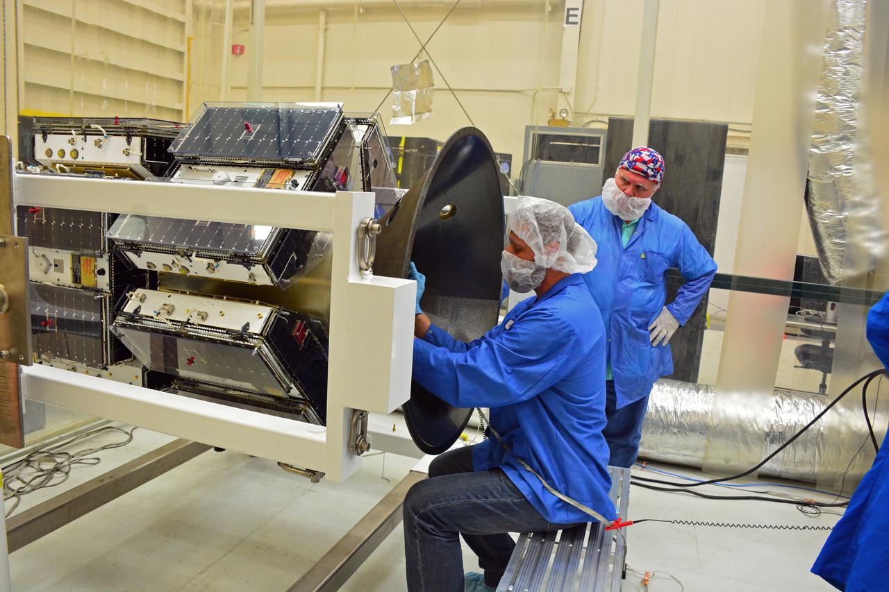
Technicians with Orbital ATK remove the first half of the Pegasus payload fairing for NASA’s Cyclone Global Navigation Satellite System (CYGNSS) from its shipping container and prepare it for the move to nearby Building 1555 at Vandenberg Air Force Base in California. CYGNSS is being prepared at Vandenberg, and then will be transported to NASA’s Kennedy Space Center in Florida aboard the Orbital ATK Pegasus XL rocket which will be attached to the Orbital ATK L-1011 carrier aircraft. CYGNSS will launch on the Pegasus XL rocket from the Skid Strip at Cape Canaveral Air Force Station. CYGNSS will make frequent and accurate measurements of ocean surface winds throughout the life cycle of tropical storms and hurricanes. The data that CYGNSS provides will enable scientists to probe key air-sea interaction processes that take place near the core of storms, which are rapidly changing and play a critical role in the beginning and intensification of hurricanes.
Technicians with Orbital ATK check assemble the micro satellites deployment module for NASA’s Cyclone Global Navigation Satellite System (CYGNSS) in Building 1555 at Vandenberg Air Force Base in California. CYGNSS is being prepared at Vandenberg, and then will be transported to NASA’s Kennedy Space Center in Florida aboard the Orbital ATK Pegasus XL rocket which will be attached to the Orbital ATK L-1011 carrier aircraft. CYGNSS will launch on the Pegasus XL rocket from the Skid Strip at Cape Canaveral Air Force Station. CYGNSS will make frequent and accurate measurements of ocean surface winds throughout the life cycle of tropical storms and hurricanes. The data that CYGNSS provides will enable scientists to probe key air-sea interaction processes that take place near the core of storms, which are rapidly changing and play a critical role in the beginning and intensification of hurricanes.
Technicians with Orbital ATK continue to install micro satellites on the deployment module for NASA’s Cyclone Global Navigation Satellite System (CYGNSS) in Building 1555 at Vandenberg Air Force Base in California. CYGNSS is being prepared at Vandenberg, and then will be transported to NASA’s Kennedy Space Center in Florida aboard the Orbital ATK Pegasus XL rocket which will be attached to the Orbital ATK L-1011 carrier aircraft. CYGNSS will launch on the Pegasus XL rocket from the Skid Strip at Cape Canaveral Air Force Station. CYGNSS will make frequent and accurate measurements of ocean surface winds throughout the life cycle of tropical storms and hurricanes. The data that CYGNSS provides will enable scientists to probe key air-sea interaction processes that take place near the core of storms, which are rapidly changing and play a critical role in the beginning and intensification of hurricanes.
Technicians with Orbital ATK prepare the micro satellites for installation on the deployment module for NASA’s Cyclone Global Navigation Satellite System (CYGNSS) in Building 1555 at Vandenberg Air Force Base in California. CYGNSS is being prepared at Vandenberg, and then will be transported to NASA’s Kennedy Space Center in Florida aboard the Orbital ATK Pegasus XL rocket which will be attached to the Orbital ATK L-1011 carrier aircraft. CYGNSS will launch on the Pegasus XL rocket from the Skid Strip at Cape Canaveral Air Force Station. CYGNSS will make frequent and accurate measurements of ocean surface winds throughout the life cycle of tropical storms and hurricanes. The data that CYGNSS provides will enable scientists to probe key air-sea interaction processes that take place near the core of storms, which are rapidly changing and play a critical role in the beginning and intensification of hurricanes.
A technician with Orbital ATK prepares the deployment module for NASA’s Cyclone Global Navigation Satellite System (CYGNSS) for micro satellites installation in Building 1555 at Vandenberg Air Force Base in California. CYGNSS is being prepared at Vandenberg, and then will be transported to NASA’s Kennedy Space Center in Florida aboard the Orbital ATK Pegasus XL rocket which will be attached to the Orbital ATK L-1011 carrier aircraft. CYGNSS will launch on the Pegasus XL rocket from the Skid Strip at Cape Canaveral Air Force Station. CYGNSS will make frequent and accurate measurements of ocean surface winds throughout the life cycle of tropical storms and hurricanes. The data that CYGNSS provides will enable scientists to probe key air-sea interaction processes that take place near the core of storms, which are rapidly changing and play a critical role in the beginning and intensification of hurricanes.
A technician with Orbital ATK prepares a set of micro satellites for installation on the deployment module for NASA’s Cyclone Global Navigation Satellite System (CYGNSS) in Building 1555 at Vandenberg Air Force Base in California. CYGNSS is being prepared at Vandenberg, and then will be transported to NASA’s Kennedy Space Center in Florida aboard the Orbital ATK Pegasus XL rocket which will be attached to the Orbital ATK L-1011 carrier aircraft. CYGNSS will launch on the Pegasus XL rocket from the Skid Strip at Cape Canaveral Air Force Station. CYGNSS will make frequent and accurate measurements of ocean surface winds throughout the life cycle of tropical storms and hurricanes. The data that CYGNSS provides will enable scientists to probe key air-sea interaction processes that take place near the core of storms, which are rapidly changing and play a critical role in the beginning and intensification of hurricanes.
A technician with Orbital ATK prepares to install another micro satellite on the deployment module for NASA’s Cyclone Global Navigation Satellite System (CYGNSS) in Building 1555 at Vandenberg Air Force Base in California. CYGNSS is being prepared at Vandenberg, and then will be transported to NASA’s Kennedy Space Center in Florida aboard the Orbital ATK Pegasus XL rocket which will be attached to the Orbital ATK L-1011 carrier aircraft. CYGNSS will launch on the Pegasus XL rocket from the Skid Strip at Cape Canaveral Air Force Station. CYGNSS will make frequent and accurate measurements of ocean surface winds throughout the life cycle of tropical storms and hurricanes. The data that CYGNSS provides will enable scientists to probe key air-sea interaction processes that take place near the core of storms, which are rapidly changing and play a critical role in the beginning and intensification of hurricanes.
Technicians with Orbital ATK check out the micro satellites deployment module for NASA’s Cyclone Global Navigation Satellite System (CYGNSS) in Building 1555 at Vandenberg Air Force Base in California. CYGNSS is being prepared at Vandenberg, and then will be transported to NASA’s Kennedy Space Center in Florida aboard the Orbital ATK Pegasus XL rocket which will be attached to the Orbital ATK L-1011 carrier aircraft. CYGNSS will launch on the Pegasus XL rocket from the Skid Strip at Cape Canaveral Air Force Station. CYGNSS will make frequent and accurate measurements of ocean surface winds throughout the life cycle of tropical storms and hurricanes. The data that CYGNSS provides will enable scientists to probe key air-sea interaction processes that take place near the core of storms, which are rapidly changing and play a critical role in the beginning and intensification of hurricanes.
A technician with Orbital ATK checks the installation of the micro satellites on the deployment module for NASA’s Cyclone Global Navigation Satellite System (CYGNSS) in Building 1555 at Vandenberg Air Force Base in California. CYGNSS is being prepared at Vandenberg, and then will be transported to NASA’s Kennedy Space Center in Florida aboard the Orbital ATK Pegasus XL rocket which will be attached to the Orbital ATK L-1011 carrier aircraft. CYGNSS will launch on the Pegasus XL rocket from the Skid Strip at Cape Canaveral Air Force Station. CYGNSS will make frequent and accurate measurements of ocean surface winds throughout the life cycle of tropical storms and hurricanes. The data that CYGNSS provides will enable scientists to probe key air-sea interaction processes that take place near the core of storms, which are rapidly changing and play a critical role in the beginning and intensification of hurricanes.
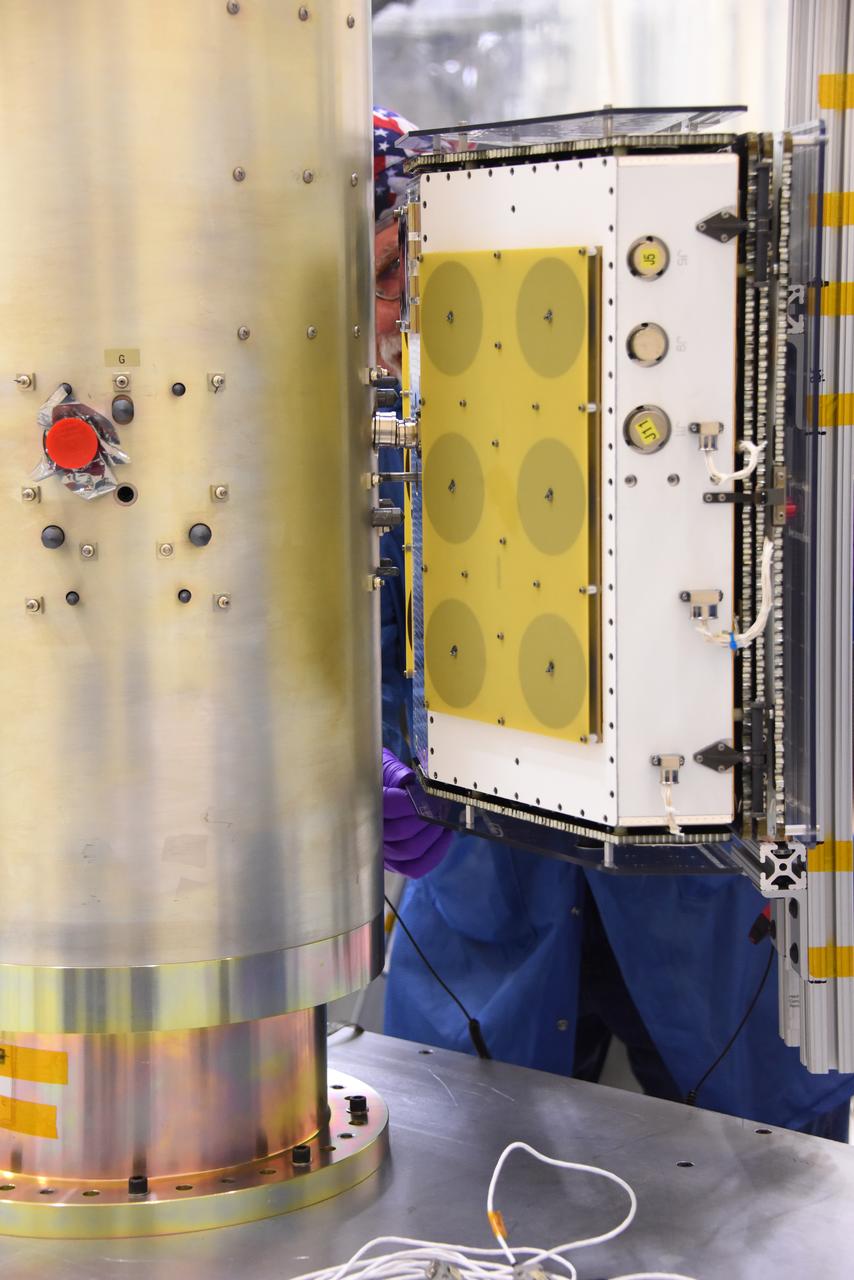
Technicians with Orbital ATK install the first set of micro satellites on the deployment module for NASA’s Cyclone Global Navigation Satellite System (CYGNSS) in Building 1555 at Vandenberg Air Force Base in California. CYGNSS is being prepared at Vandenberg, and then will be transported to NASA’s Kennedy Space Center in Florida aboard the Orbital ATK Pegasus XL rocket which will be attached to the Orbital ATK L-1011 carrier aircraft. CYGNSS will launch on the Pegasus XL rocket from the Skid Strip at Cape Canaveral Air Force Station. CYGNSS will make frequent and accurate measurements of ocean surface winds throughout the life cycle of tropical storms and hurricanes. The data that CYGNSS provides will enable scientists to probe key air-sea interaction processes that take place near the core of storms, which are rapidly changing and play a critical role in the beginning and intensification of hurricanes.
Technicians with Orbital ATK prepare the micro satellites for installation on the deployment module for NASA’s Cyclone Global Navigation Satellite System (CYGNSS) in Building 1555 at Vandenberg Air Force Base in California. CYGNSS is being prepared at Vandenberg, and then will be transported to NASA’s Kennedy Space Center in Florida aboard the Orbital ATK Pegasus XL rocket which will be attached to the Orbital ATK L-1011 carrier aircraft. CYGNSS will launch on the Pegasus XL rocket from the Skid Strip at Cape Canaveral Air Force Station. CYGNSS will make frequent and accurate measurements of ocean surface winds throughout the life cycle of tropical storms and hurricanes. The data that CYGNSS provides will enable scientists to probe key air-sea interaction processes that take place near the core of storms, which are rapidly changing and play a critical role in the beginning and intensification of hurricanes.
Technicians with Orbital ATK prepare to install micro satellites on the deployment module for NASA’s Cyclone Global Navigation Satellite System (CYGNSS) in Building 1555 at Vandenberg Air Force Base in California. CYGNSS is being prepared at Vandenberg, and then will be transported to NASA’s Kennedy Space Center in Florida aboard the Orbital ATK Pegasus XL rocket which will be attached to the Orbital ATK L-1011 carrier aircraft. CYGNSS will launch on the Pegasus XL rocket from the Skid Strip at Cape Canaveral Air Force Station. CYGNSS will make frequent and accurate measurements of ocean surface winds throughout the life cycle of tropical storms and hurricanes. The data that CYGNSS provides will enable scientists to probe key air-sea interaction processes that take place near the core of storms, which are rapidly changing and play a critical role in the beginning and intensification of hurricanes.
Technicians with Orbital ATK continue to install the micro satellites on the deployment module for NASA’s Cyclone Global Navigation Satellite System (CYGNSS) in Building 1555 at Vandenberg Air Force Base in California. CYGNSS is being prepared at Vandenberg, and then will be transported to NASA’s Kennedy Space Center in Florida aboard the Orbital ATK Pegasus XL rocket which will be attached to the Orbital ATK L-1011 carrier aircraft. CYGNSS will launch on the Pegasus XL rocket from the Skid Strip at Cape Canaveral Air Force Station. CYGNSS will make frequent and accurate measurements of ocean surface winds throughout the life cycle of tropical storms and hurricanes. The data that CYGNSS provides will enable scientists to probe key air-sea interaction processes that take place near the core of storms, which are rapidly changing and play a critical role in the beginning and intensification of hurricanes.
Technicians with Orbital ATK prepare to install the micro satellites on the deployment module for NASA’s Cyclone Global Navigation Satellite System (CYGNSS) in Building 1555 at Vandenberg Air Force Base in California. CYGNSS is being prepared at Vandenberg, and then will be transported to NASA’s Kennedy Space Center in Florida aboard the Orbital ATK Pegasus XL rocket which will be attached to the Orbital ATK L-1011 carrier aircraft. CYGNSS will launch on the Pegasus XL rocket from the Skid Strip at Cape Canaveral Air Force Station. CYGNSS will make frequent and accurate measurements of ocean surface winds throughout the life cycle of tropical storms and hurricanes. The data that CYGNSS provides will enable scientists to probe key air-sea interaction processes that take place near the core of storms, which are rapidly changing and play a critical role in the beginning and intensification of hurricanes.
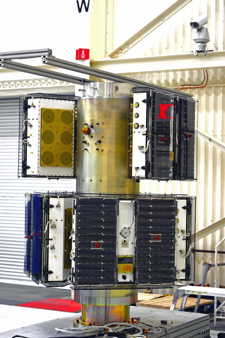
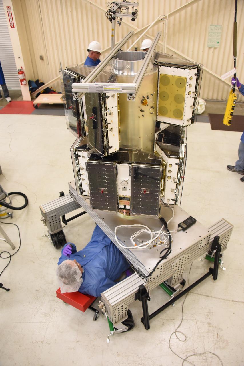
All of the micro satellites have been fully installed on the deployment module by Orbital ATK for NASA’s Cyclone Global Navigation Satellite System (CYGNSS) in Building 1555 at Vandenberg Air Force Base in California. CYGNSS is being prepared at Vandenberg, and then will be transported to NASA’s Kennedy Space Center in Florida aboard the Orbital ATK Pegasus XL rocket which will be attached to the Orbital ATK L-1011 carrier aircraft. CYGNSS will launch on the Pegasus XL rocket from the Skid Strip at Cape Canaveral Air Force Station. CYGNSS will make frequent and accurate measurements of ocean surface winds throughout the life cycle of tropical storms and hurricanes. The data that CYGNSS provides will enable scientists to probe key air-sea interaction processes that take place near the core of storms, which are rapidly changing and play a critical role in the beginning and intensification of hurricanes.
Technicians with Orbital ATK check out the micro satellites deployment module for NASA’s Cyclone Global Navigation Satellite System (CYGNSS) in Building 1555 at Vandenberg Air Force Base in California. CYGNSS is being prepared at Vandenberg, and then will be transported to NASA’s Kennedy Space Center in Florida aboard the Orbital ATK Pegasus XL rocket which will be attached to the Orbital ATK L-1011 carrier aircraft. CYGNSS will launch on the Pegasus XL rocket from the Skid Strip at Cape Canaveral Air Force Station. CYGNSS will make frequent and accurate measurements of ocean surface winds throughout the life cycle of tropical storms and hurricanes. The data that CYGNSS provides will enable scientists to probe key air-sea interaction processes that take place near the core of storms, which are rapidly changing and play a critical role in the beginning and intensification of hurricanes.
Technicians with Orbital ATK continue to install micro satellites on the deployment module for NASA’s Cyclone Global Navigation Satellite System (CYGNSS) in Building 1555 at Vandenberg Air Force Base in California. CYGNSS is being prepared at Vandenberg, and then will be transported to NASA’s Kennedy Space Center in Florida aboard the Orbital ATK Pegasus XL rocket which will be attached to the Orbital ATK L-1011 carrier aircraft. CYGNSS will launch on the Pegasus XL rocket from the Skid Strip at Cape Canaveral Air Force Station. CYGNSS will make frequent and accurate measurements of ocean surface winds throughout the life cycle of tropical storms and hurricanes. The data that CYGNSS provides will enable scientists to probe key air-sea interaction processes that take place near the core of storms, which are rapidly changing and play a critical role in the beginning and intensification of hurricanes.
A technician with Orbital ATK assembles the micro satellites deployment module for NASA’s Cyclone Global Navigation Satellite System (CYGNSS) in Building 1555 at Vandenberg Air Force Base in California. CYGNSS is being prepared at Vandenberg, and then will be transported to NASA’s Kennedy Space Center in Florida aboard the Orbital ATK Pegasus XL rocket which will be attached to the Orbital ATK L-1011 carrier aircraft. CYGNSS will launch on the Pegasus XL rocket from the Skid Strip at Cape Canaveral Air Force Station. CYGNSS will make frequent and accurate measurements of ocean surface winds throughout the life cycle of tropical storms and hurricanes. The data that CYGNSS provides will enable scientists to probe key air-sea interaction processes that take place near the core of storms, which are rapidly changing and play a critical role in the beginning and intensification of hurricanes.
Technicians with Orbital ATK continue to install micro satellites on the deployment module for NASA’s Cyclone Global Navigation Satellite System (CYGNSS) in Building 1555 at Vandenberg Air Force Base in California. CYGNSS is being prepared at Vandenberg, and then will be transported to NASA’s Kennedy Space Center in Florida aboard the Orbital ATK Pegasus XL rocket which will be attached to the Orbital ATK L-1011 carrier aircraft. CYGNSS will launch on the Pegasus XL rocket from the Skid Strip at Cape Canaveral Air Force Station. CYGNSS will make frequent and accurate measurements of ocean surface winds throughout the life cycle of tropical storms and hurricanes. The data that CYGNSS provides will enable scientists to probe key air-sea interaction processes that take place near the core of storms, which are rapidly changing and play a critical role in the beginning and intensification of hurricanes.
Technicians with Orbital ATK prepare a set of micro satellites for installation on the deployment module for NASA’s Cyclone Global Navigation Satellite System (CYGNSS) in Building 1555 at Vandenberg Air Force Base in California. CYGNSS is being prepared at Vandenberg, and then will be transported to NASA’s Kennedy Space Center in Florida aboard the Orbital ATK Pegasus XL rocket which will be attached to the Orbital ATK L-1011 carrier aircraft. CYGNSS will launch on the Pegasus XL rocket from the Skid Strip at Cape Canaveral Air Force Station. CYGNSS will make frequent and accurate measurements of ocean surface winds throughout the life cycle of tropical storms and hurricanes. The data that CYGNSS provides will enable scientists to probe key air-sea interaction processes that take place near the core of storms, which are rapidly changing and play a critical role in the beginning and intensification of hurricanes.
Technicians with Orbital ATK continue to install micro satellites on the deployment module for NASA’s Cyclone Global Navigation Satellite System (CYGNSS) in Building 1555 at Vandenberg Air Force Base in California. CYGNSS is being prepared at Vandenberg, and then will be transported to NASA’s Kennedy Space Center in Florida aboard the Orbital ATK Pegasus XL rocket which will be attached to the Orbital ATK L-1011 carrier aircraft. CYGNSS will launch on the Pegasus XL rocket from the Skid Strip at Cape Canaveral Air Force Station. CYGNSS will make frequent and accurate measurements of ocean surface winds throughout the life cycle of tropical storms and hurricanes. The data that CYGNSS provides will enable scientists to probe key air-sea interaction processes that take place near the core of storms, which are rapidly changing and play a critical role in the beginning and intensification of hurricanes.
A technician with Orbital ATK prepares the deployment module for NASA’s Cyclone Global Navigation Satellite System (CYGNSS) for micro satellites installation in Building 1555 at Vandenberg Air Force Base in California. CYGNSS is being prepared at Vandenberg, and then will be transported to NASA’s Kennedy Space Center in Florida aboard the Orbital ATK Pegasus XL rocket which will be attached to the Orbital ATK L-1011 carrier aircraft. CYGNSS will launch on the Pegasus XL rocket from the Skid Strip at Cape Canaveral Air Force Station. CYGNSS will make frequent and accurate measurements of ocean surface winds throughout the life cycle of tropical storms and hurricanes. The data that CYGNSS provides will enable scientists to probe key air-sea interaction processes that take place near the core of storms, which are rapidly changing and play a critical role in the beginning and intensification of hurricanes.
Technicians with Orbital ATK move the first half of the Pegasus payload fairing for NASA’s Cyclone Global Navigation Satellite System (CYGNSS) from into Building 1555 at Vandenberg Air Force Base in California. CYGNSS is being prepared at Vandenberg, and then will be transported to NASA’s Kennedy Space Center in Florida aboard the Orbital ATK Pegasus XL rocket which will be attached to the Orbital ATK L-1011 carrier aircraft. CYGNSS will launch on the Pegasus XL rocket from the Skid Strip at Cape Canaveral Air Force Station. CYGNSS will make frequent and accurate measurements of ocean surface winds throughout the life cycle of tropical storms and hurricanes. The data that CYGNSS provides will enable scientists to probe key air-sea interaction processes that take place near the core of storms, which are rapidly changing and play a critical role in the beginning and intensification of hurricanes.
All of the micro satellites have been fully installed on the deployment module by Orbital ATK for NASA’s Cyclone Global Navigation Satellite System (CYGNSS) in Building 1555 at Vandenberg Air Force Base in California. CYGNSS is being prepared at Vandenberg, and then will be transported to NASA’s Kennedy Space Center in Florida aboard the Orbital ATK Pegasus XL rocket which will be attached to the Orbital ATK L-1011 carrier aircraft. CYGNSS will launch on the Pegasus XL rocket from the Skid Strip at Cape Canaveral Air Force Station. CYGNSS will make frequent and accurate measurements of ocean surface winds throughout the life cycle of tropical storms and hurricanes. The data that CYGNSS provides will enable scientists to probe key air-sea interaction processes that take place near the core of storms, which are rapidly changing and play a critical role in the beginning and intensification of hurricanes.
Technicians with Orbital ATK prepare to install the micro satellites on the deployment module for NASA’s Cyclone Global Navigation Satellite System (CYGNSS) in Building 1555 at Vandenberg Air Force Base in California. CYGNSS is being prepared at Vandenberg, and then will be transported to NASA’s Kennedy Space Center in Florida aboard the Orbital ATK Pegasus XL rocket which will be attached to the Orbital ATK L-1011 carrier aircraft. CYGNSS will launch on the Pegasus XL rocket from the Skid Strip at Cape Canaveral Air Force Station. CYGNSS will make frequent and accurate measurements of ocean surface winds throughout the life cycle of tropical storms and hurricanes. The data that CYGNSS provides will enable scientists to probe key air-sea interaction processes that take place near the core of storms, which are rapidly changing and play a critical role in the beginning and intensification of hurricanes.
A technician with Orbital ATK checks out the micro satellites deployment module for NASA’s Cyclone Global Navigation Satellite System (CYGNSS) in Building 1555 at Vandenberg Air Force Base in California. CYGNSS is being prepared at Vandenberg, and then will be transported to NASA’s Kennedy Space Center in Florida aboard the Orbital ATK Pegasus XL rocket which will be attached to the Orbital ATK L-1011 carrier aircraft. CYGNSS will launch on the Pegasus XL rocket from the Skid Strip at Cape Canaveral Air Force Station. CYGNSS will make frequent and accurate measurements of ocean surface winds throughout the life cycle of tropical storms and hurricanes. The data that CYGNSS provides will enable scientists to probe key air-sea interaction processes that take place near the core of storms, which are rapidly changing and play a critical role in the beginning and intensification of hurricanes.
Technicians with Orbital ATK remove the first half of the Pegasus payload fairing for NASA’s Cyclone Global Navigation Satellite System (CYGNSS) from its shipping container near Building 1555 at Vandenberg Air Force Base in California. CYGNSS is being prepared at Vandenberg, and then will be transported to NASA’s Kennedy Space Center in Florida aboard the Orbital ATK Pegasus XL rocket which will be attached to the Orbital ATK L-1011 carrier aircraft. CYGNSS will launch on the Pegasus XL rocket from the Skid Strip at Cape Canaveral Air Force Station. CYGNSS will make frequent and accurate measurements of ocean surface winds throughout the life cycle of tropical storms and hurricanes. The data that CYGNSS provides will enable scientists to probe key air-sea interaction processes that take place near the core of storms, which are rapidly changing and play a critical role in the beginning and intensification of hurricanes.
Technicians with Orbital ATK install the first two sets of micro satellites on the deployment module for NASA’s Cyclone Global Navigation Satellite System (CYGNSS) in Building 1555 at Vandenberg Air Force Base in California. CYGNSS is being prepared at Vandenberg, and then will be transported to NASA’s Kennedy Space Center in Florida aboard the Orbital ATK Pegasus XL rocket which will be attached to the Orbital ATK L-1011 carrier aircraft. CYGNSS will launch on the Pegasus XL rocket from the Skid Strip at Cape Canaveral Air Force Station. CYGNSS will make frequent and accurate measurements of ocean surface winds throughout the life cycle of tropical storms and hurricanes. The data that CYGNSS provides will enable scientists to probe key air-sea interaction processes that take place near the core of storms, which are rapidly changing and play a critical role in the beginning and intensification of hurricanes.
Technicians with Orbital ATK remove the first half of the Pegasus payload fairing for NASA’s Cyclone Global Navigation Satellite System (CYGNSS) from its shipping container near Building 1555 at Vandenberg Air Force Base in California. CYGNSS is being prepared at Vandenberg, and then will be transported to NASA’s Kennedy Space Center in Florida aboard the Orbital ATK Pegasus XL rocket which will be attached to the Orbital ATK L-1011 carrier aircraft. CYGNSS will launch on the Pegasus XL rocket from the Skid Strip at Cape Canaveral Air Force Station. CYGNSS will make frequent and accurate measurements of ocean surface winds throughout the life cycle of tropical storms and hurricanes. The data that CYGNSS provides will enable scientists to probe key air-sea interaction processes that take place near the core of storms, which are rapidly changing and play a critical role in the beginning and intensification of hurricanes.
Technicians with Orbital ATK continue to install micro satellites on the deployment module for NASA’s Cyclone Global Navigation Satellite System (CYGNSS) in Building 1555 at Vandenberg Air Force Base in California. CYGNSS is being prepared at Vandenberg, and then will be transported to NASA’s Kennedy Space Center in Florida aboard the Orbital ATK Pegasus XL rocket which will be attached to the Orbital ATK L-1011 carrier aircraft. CYGNSS will launch on the Pegasus XL rocket from the Skid Strip at Cape Canaveral Air Force Station. CYGNSS will make frequent and accurate measurements of ocean surface winds throughout the life cycle of tropical storms and hurricanes. The data that CYGNSS provides will enable scientists to probe key air-sea interaction processes that take place near the core of storms, which are rapidly changing and play a critical role in the beginning and intensification of hurricanes.
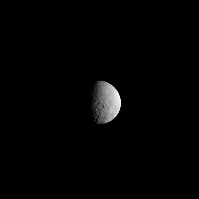
NASA's Dawn spacecraft took this picture as it reached its new orbit to observe Ceres in opposition, when Dawn is directly between the sun and the Occator Crater bright spots. Entering the very tight opposition geometry (explained here) is a major feat that requires extra checks for increased delivery accuracy. Hence, this picture was part of a series of images intended to help the navigation of the spacecraft relative to Ceres. This vantage point highlights the southern hemisphere of Ceres. Abundant polygonal craters can be seen, starting with Kerwan, Ceres' largest crater at 174 miles (280 kilometers) in diameter, in the upper right of Ceres' circular disc. Kerwan's rims appear subdued and its floor is relatively relaxed. The crater found almost in the "bullseye" of the crater is called Insitor (16 miles or 26 kilometers in diameter). The Inamahari and Homshuk craters featured here can be found at the top of the disc. Another large polygonal crater called Chaminuka (76 miles, 122 kilometers in diameter) is found toward the center. This map can be used to locate these and more features. The name "Kerwan" refers to the Hopi spirit of sprouting maize and "Chaminuka" to the Shona (Zimbabwe) spirit who provides rains in times of droughts. "Insitor" is named for the Roman agricultural deity in charge of the sowing. This picture was taken on April 17, 2017, from an altitude of about 28,000 miles (45,000 kilometers). https://photojournal.jpl.nasa.gov/catalog/PIA21403
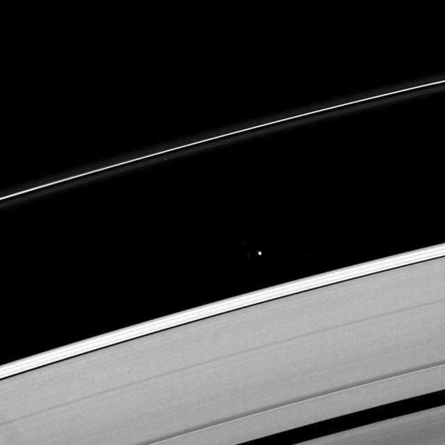
Saturn moon Atlas plies the Roche Division between the A ring and the thin F ring.
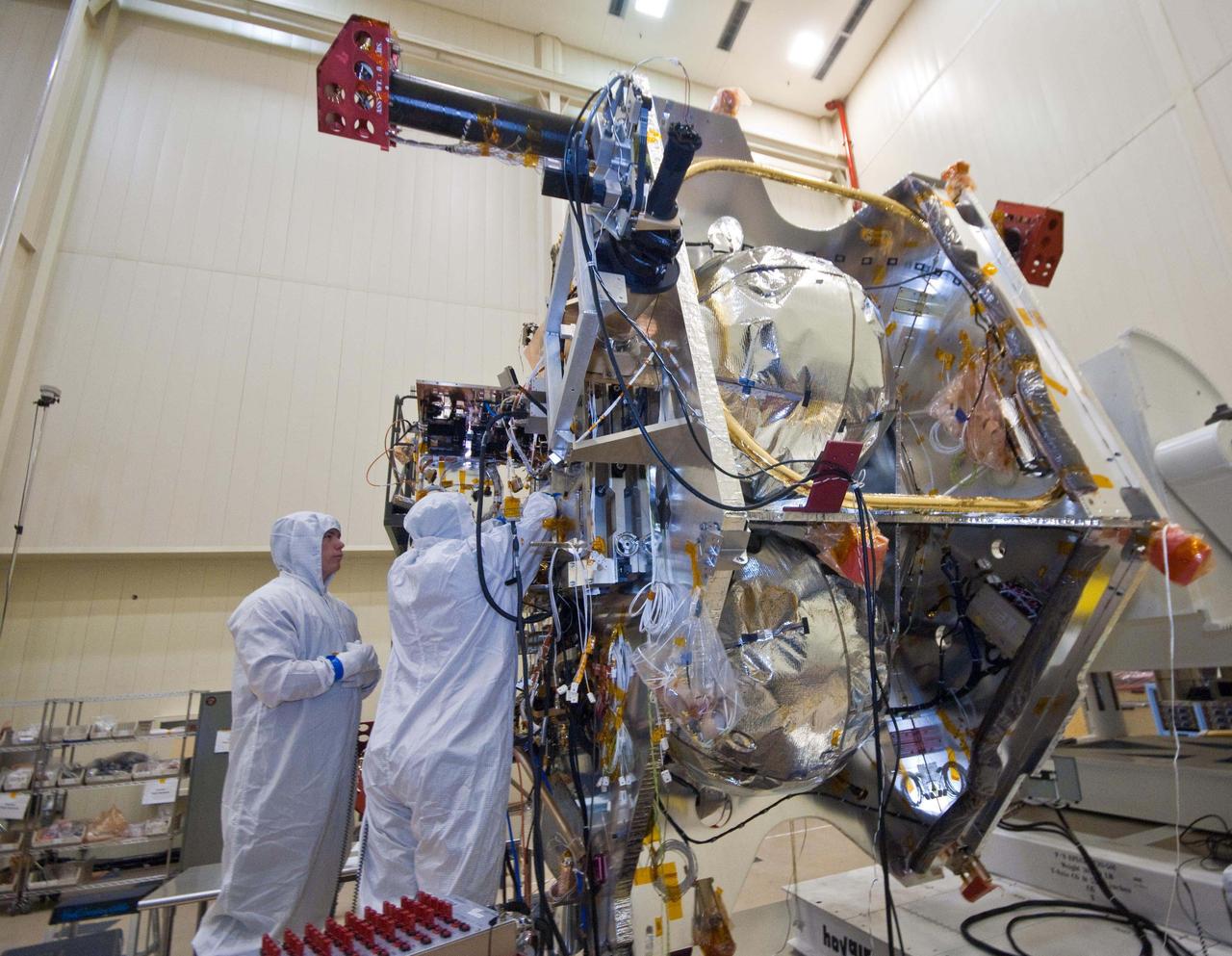
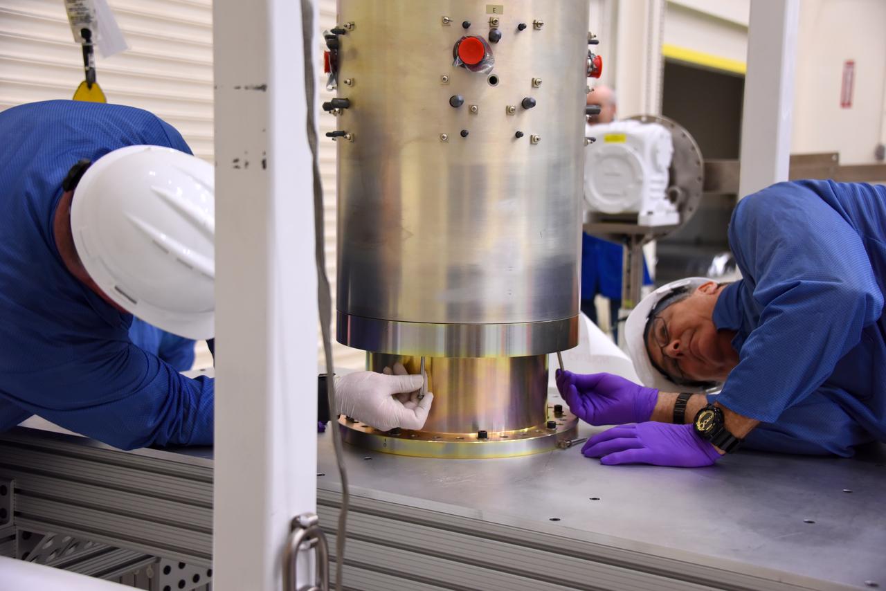
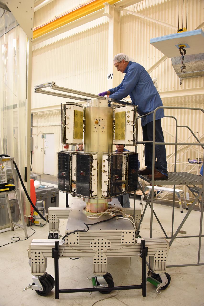
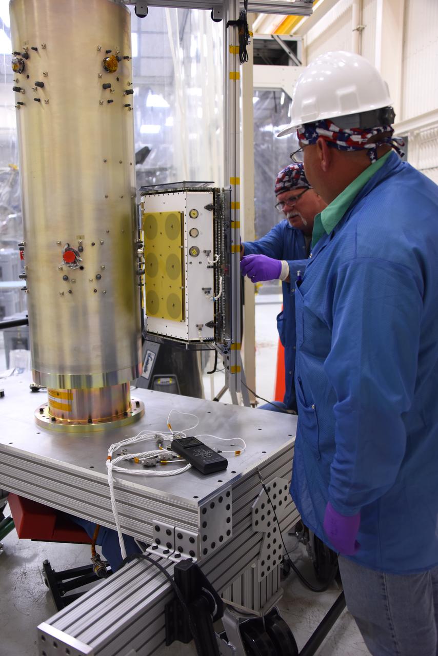
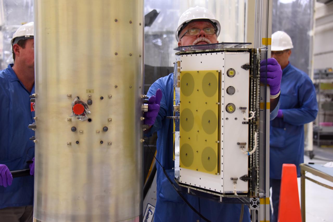
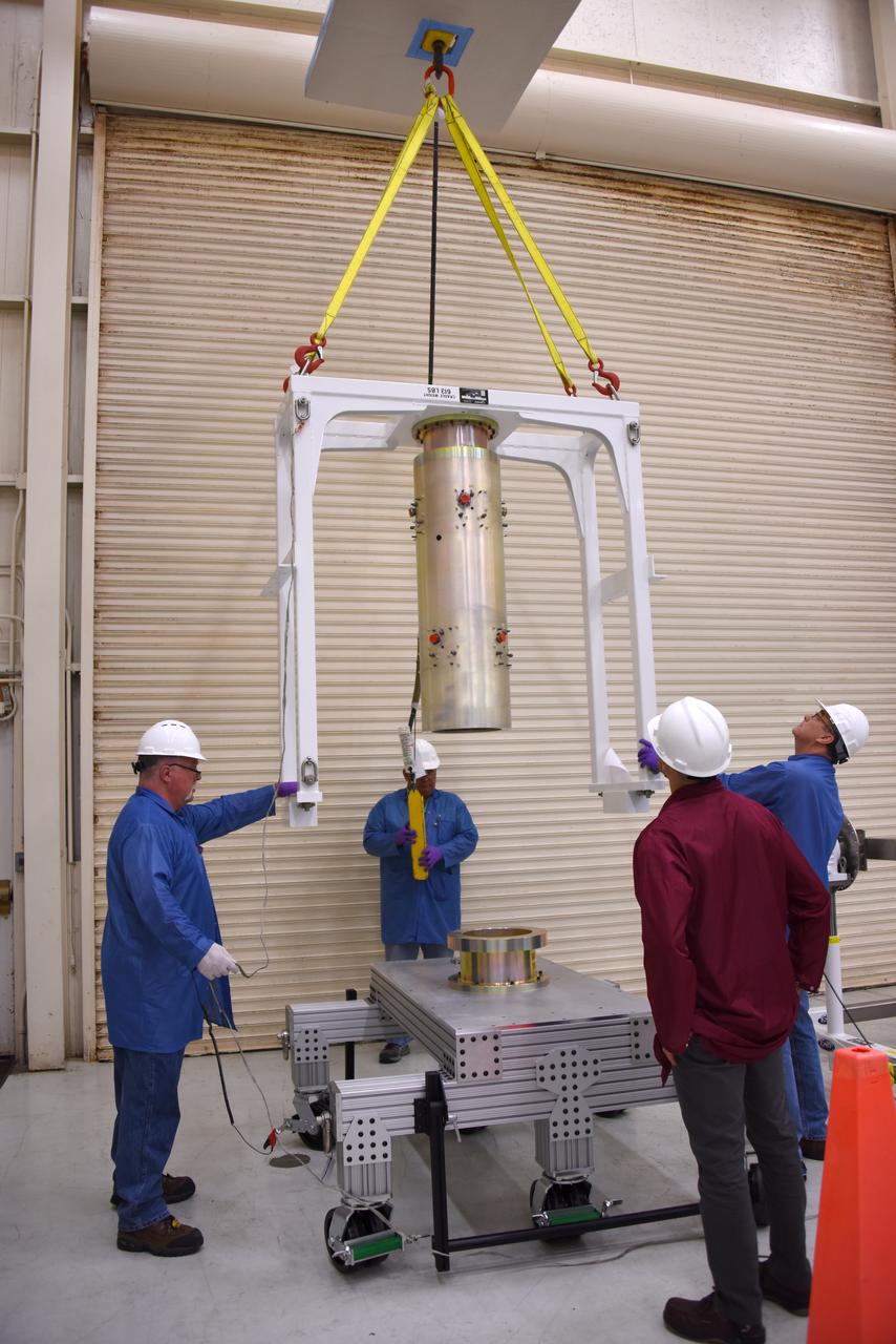
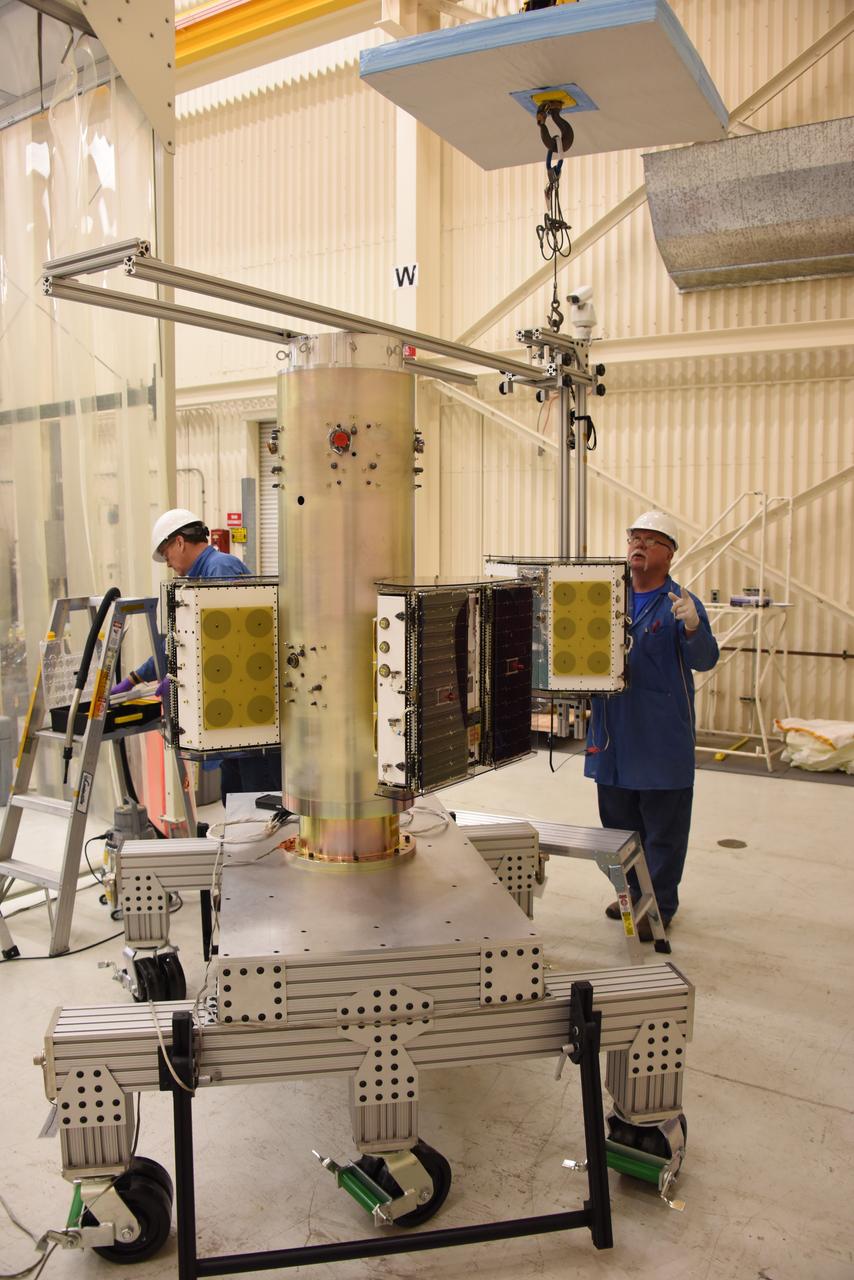
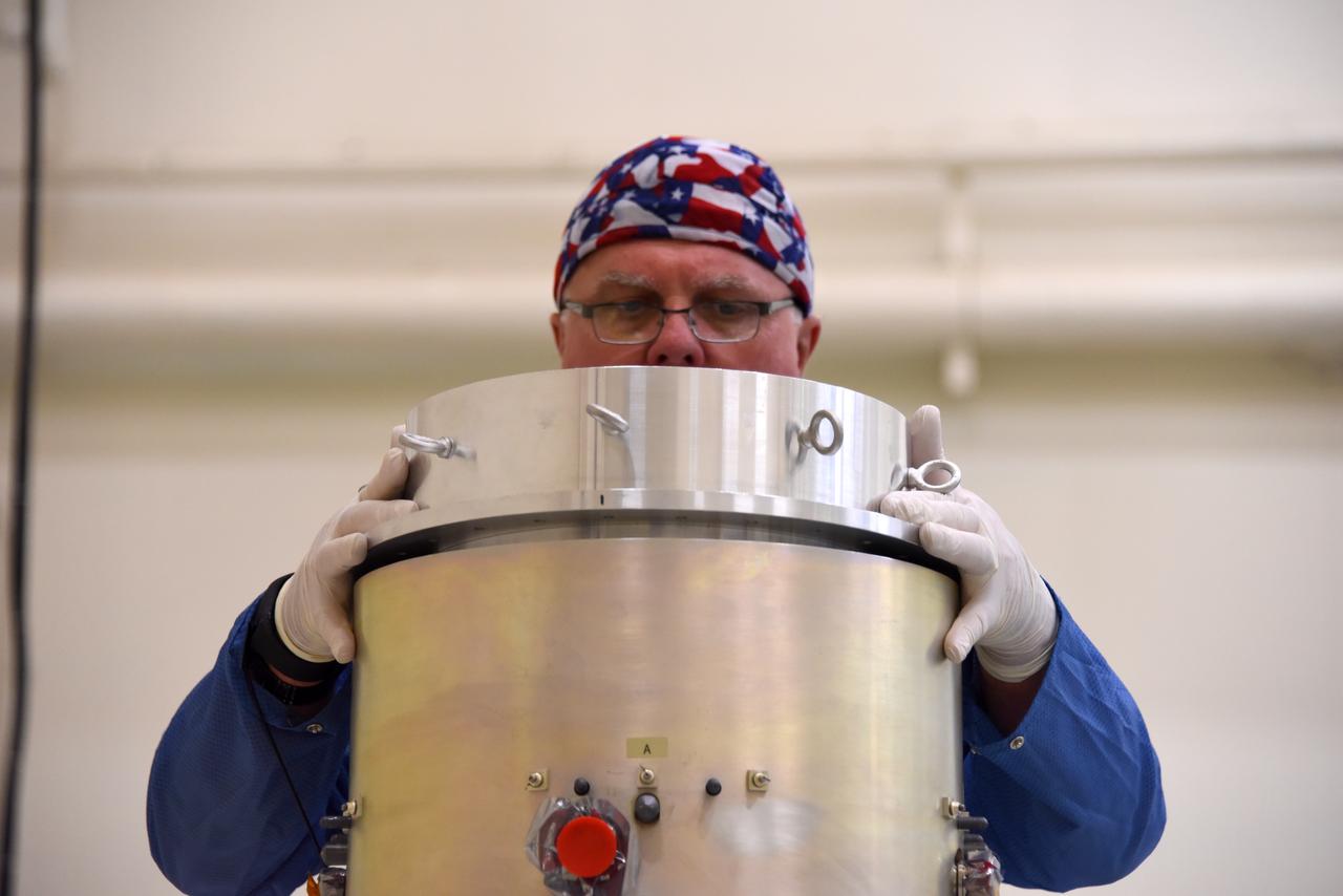
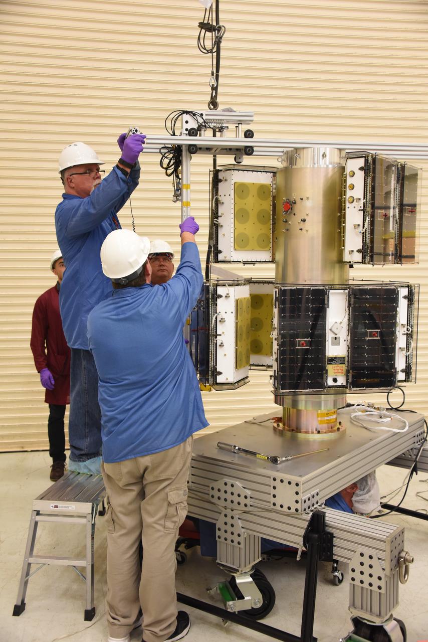
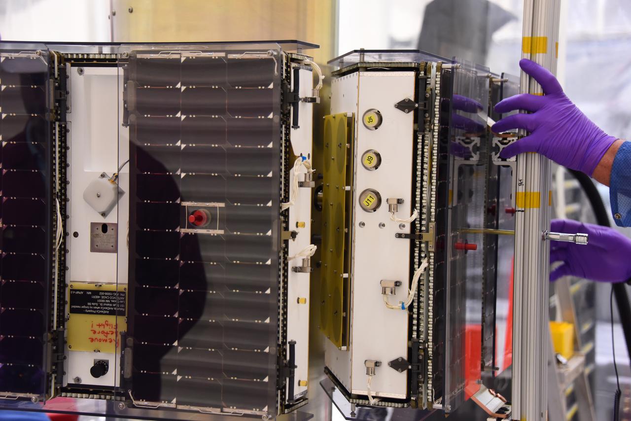
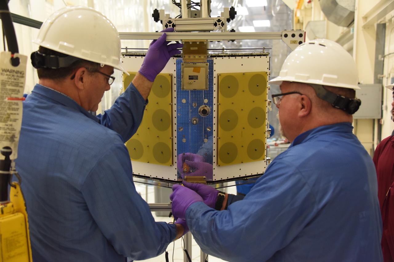
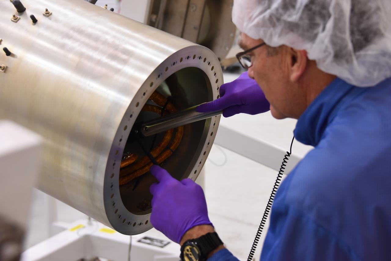
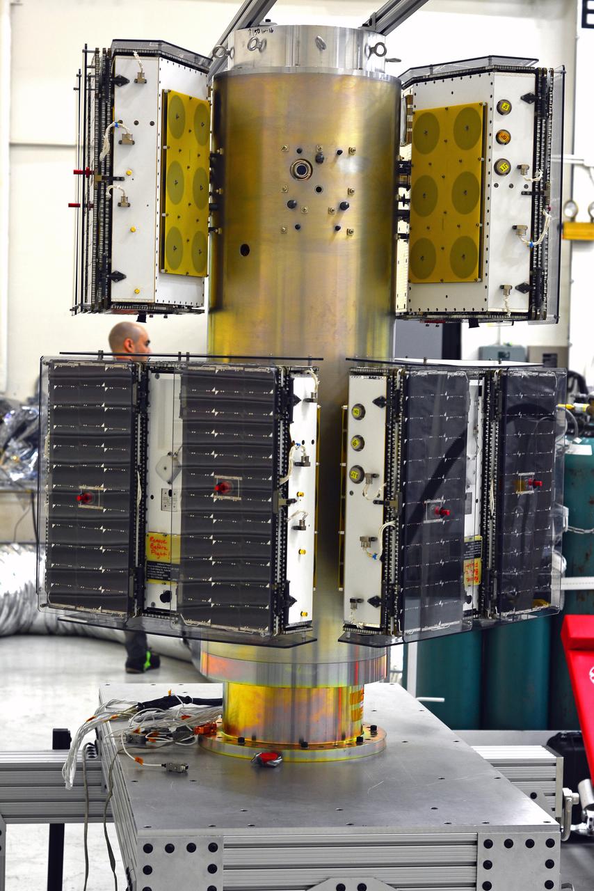
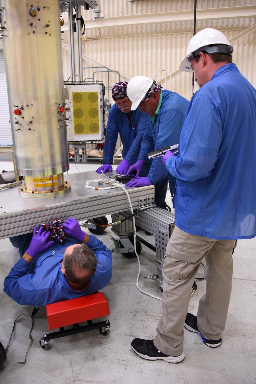
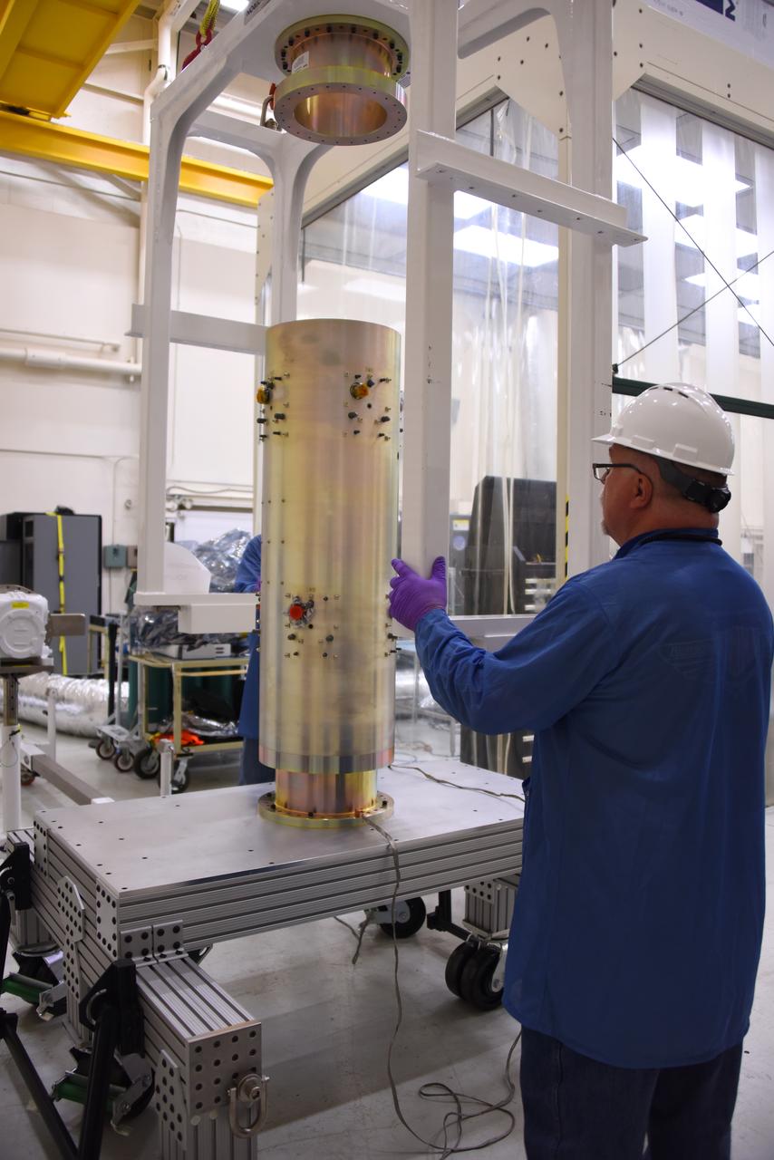
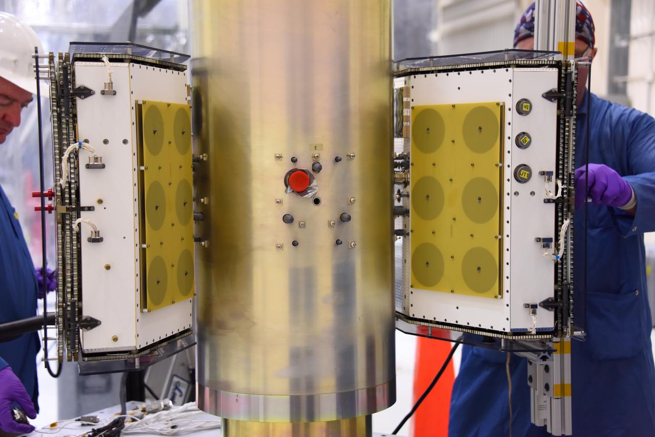
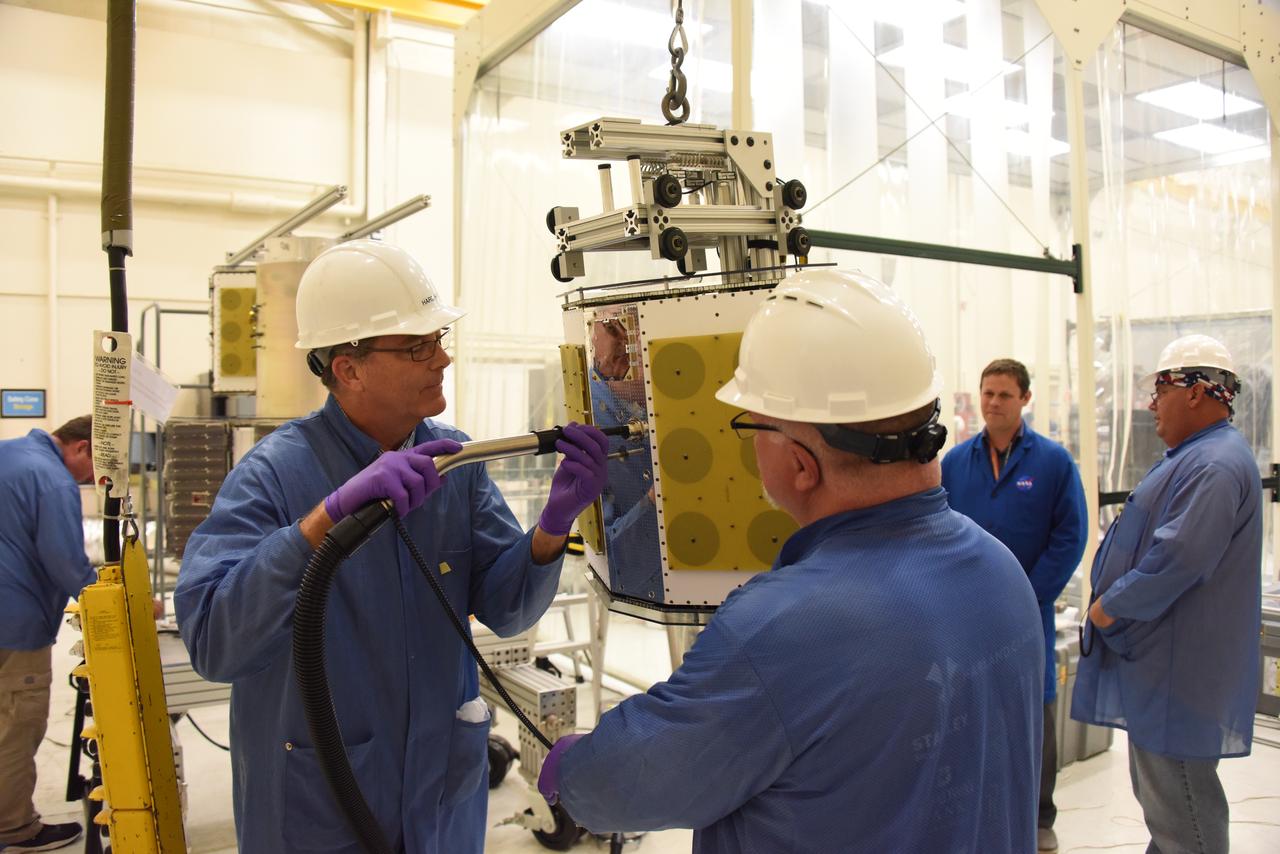
Technicians install components that will aid with guidance, navigation and control of NASA Juno spacecraft.
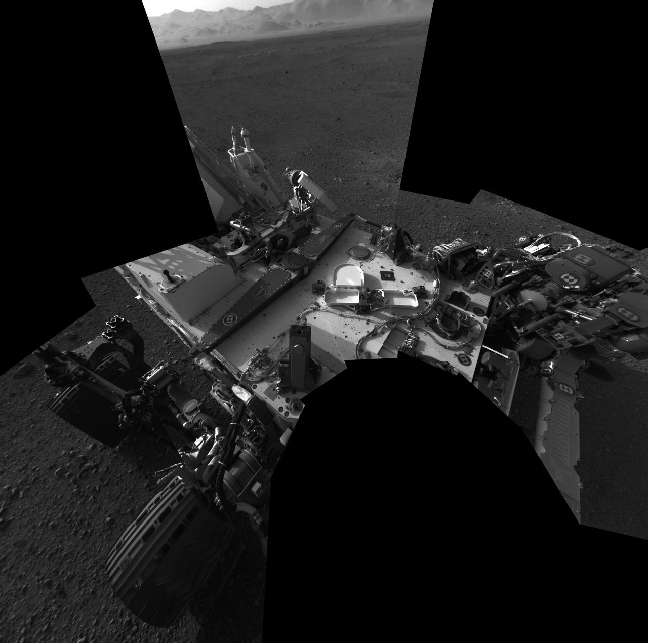
This full-resolution self-portrait shows the deck of NASA Curiosity rover from the rover Navigation cameras. This full-resolution self-portrait shows the deck of NASA Curiosity rover from the rover Navigation cameras.
Technicians with Orbital ATK install the payload adapter to the deployment module that contains the micro satellites for NASA’s Cyclone Global Navigation Satellite System (CYGNSS) in Building 1555 at Vandenberg Air Force Base in California. CYGNSS is being prepared at Vandenberg, and then will be transported to NASA’s Kennedy Space Center in Florida aboard the Orbital ATK Pegasus XL rocket which will be attached to the Orbital ATK L-1011 carrier aircraft. CYGNSS will launch on the Pegasus XL rocket from the Skid Strip at Cape Canaveral Air Force Station. CYGNSS will make frequent and accurate measurements of ocean surface winds throughout the life cycle of tropical storms and hurricanes. The data that CYGNSS provides will enable scientists to probe key air-sea interaction processes that take place near the core of storms, which are rapidly changing and play a critical role in the beginning and intensification of hurricanes.
Technicians with Orbital ATK prepare to install the payload adapter to the deployment module that contains the micro satellites for NASA’s Cyclone Global Navigation Satellite System (CYGNSS) in Building 1555 at Vandenberg Air Force Base in California. CYGNSS is being prepared at Vandenberg, and then will be transported to NASA’s Kennedy Space Center in Florida aboard the Orbital ATK Pegasus XL rocket which will be attached to the Orbital ATK L-1011 carrier aircraft. CYGNSS will launch on the Pegasus XL rocket from the Skid Strip at Cape Canaveral Air Force Station. CYGNSS will make frequent and accurate measurements of ocean surface winds throughout the life cycle of tropical storms and hurricanes. The data that CYGNSS provides will enable scientists to probe key air-sea interaction processes that take place near the core of storms, which are rapidly changing and play a critical role in the beginning and intensification of hurricanes.

NASA Deputy Administrator Pam Melroy gives opening remarks at the 25th meeting of the Space-Based Positioning, Navigation, and Timing National Advisory Board, Thursday, Dec. 9, 2021, at the Sheraton Pentagon City Hotel in Arlington, Va. Photo Credit: (NASA/Aubrey Gemignani)

NASA Deputy Administrator Pam Melroy gives opening remarks at the 25th meeting of the Space-Based Positioning, Navigation, and Timing National Advisory Board, Thursday, Dec. 9, 2021, at the Sheraton Pentagon City Hotel in Arlington, Va. Photo Credit: (NASA/Aubrey Gemignani)

NASA Deputy Administrator Pam Melroy gives opening remarks at the 25th meeting of the Space-Based Positioning, Navigation, and Timing National Advisory Board, Thursday, Dec. 9, 2021, at the Sheraton Pentagon City Hotel in Arlington, Va. Photo Credit: (NASA/Aubrey Gemignani)

NASA Deputy Administrator Pam Melroy gives opening remarks at the 25th meeting of the Space-Based Positioning, Navigation, and Timing National Advisory Board, Thursday, Dec. 9, 2021, at the Sheraton Pentagon City Hotel in Arlington, Va. Photo Credit: (NASA/Aubrey Gemignani)

NASA Deputy Administrator Pam Melroy gives opening remarks at the 25th meeting of the Space-Based Positioning, Navigation, and Timing National Advisory Board, Thursday, Dec. 9, 2021, at the Sheraton Pentagon City Hotel in Arlington, Va. Photo Credit: (NASA/Aubrey Gemignani)

NASA Deputy Administrator Pam Melroy gives opening remarks at the 25th meeting of the Space-Based Positioning, Navigation, and Timing National Advisory Board, Thursday, Dec. 9, 2021, at the Sheraton Pentagon City Hotel in Arlington, Va. Photo Credit: (NASA/Aubrey Gemignani)
NASA astronaut Kate Rubins walks through the lunar-like landscape wearing the Joint AR (Joint Augmented Reality Visual Informatics System) display during an advanced technology run in the San Francisco Volcanic Field in Northern Arizona on May 19, 2024. The suit display features include navigation, photo capture, graphical format of consumables, procedure viewing, mission control updates, and other augmented reality cues and graphics. The team successfully tested navigation displays using data from four different data streams: GPS (Global Positioning System)/IMU (Inertial Measurement Unit), camera/IMU, LiDAR (Light Detection and Ranging), and static maps. Technology like this may be used for future Artemis missions to augment mission control communication and help guide crew back to the lunar lander. Credit: NASA/Josh Valcarcel
NASA astronaut Kate Rubins uses tongs to pick up a geologic sample while wearing the Joint AR (Joint Augmented Reality Visual Informatics System) display during an advanced technology run in the San Francisco Volcanic Field in Northern Arizona on May 21, 2024. The suit display features include navigation, photo capture, graphical format of consumables, procedure viewing, mission control updates, and other augmented reality cues and graphics. The team successfully tested navigation displays using data from four different data streams: GPS (Global Positioning System)/IMU (Inertial Measurement Unit), camera/IMU, LiDAR (Light Detection and Ranging), and static maps. Technology like this may be used for future Artemis missions to augment mission control communication and help guide crew back to the lunar lander. Credit: NASA/Josh Valcarcel
NASA astronaut Andre Douglas views the lunar-like landscape at dusk while wearing the Joint AR (Joint Augmented Reality Visual Informatics System) display during an advanced technology run in the San Francisco Volcanic Field in Northern Arizona on May 21, 2024. The suit display features include navigation, photo capture, graphical format of consumables, procedure viewing, mission control updates, and other augmented reality cues and graphics. The team successfully tested navigation displays using data from four different data streams: GPS (Global Positioning System)/IMU (Inertial Measurement Unit), camera/IMU, LiDAR (Light Detection and Ranging), and static maps. Technology like this may be used for future Artemis missions to augment mission control communication and help guide crew back to the lunar lander. Credit: NASA/Josh Valcarcel
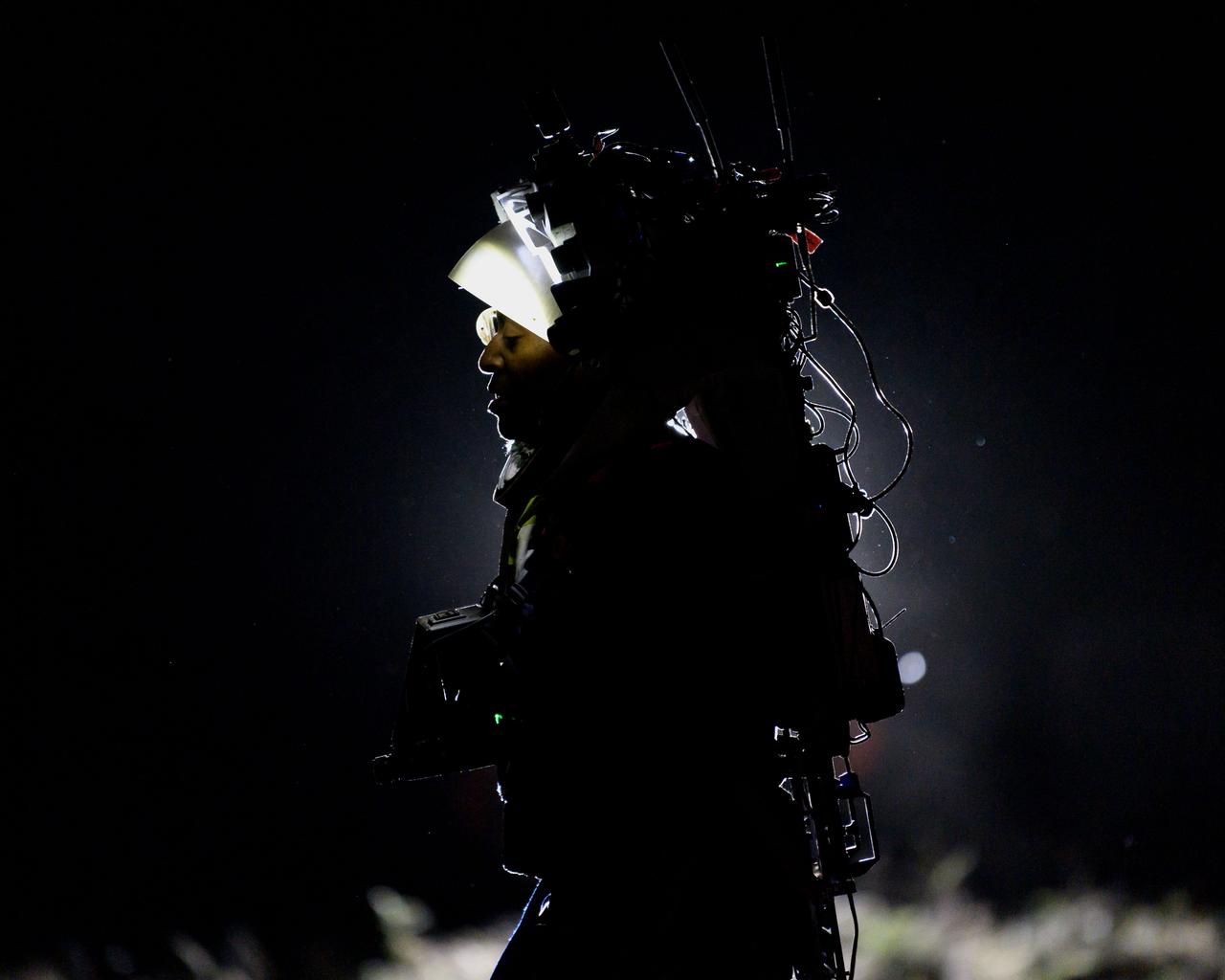
NASA astronaut Andre Douglas wears the Joint AR (Joint Augmented Reality Visual Informatics System) display during a nighttime advanced technology run in the San Francisco Volcanic Field in Northern Arizona on May 21, 2024. The suit display features include navigation, photo capture, graphical format of consumables, procedure viewing, mission control updates, and other augmented reality cues and graphics. The team successfully tested navigation displays using data from four different data streams: GPS (Global Positioning System)/IMU (Inertial Measurement Unit), camera/IMU, LiDAR (Light Detection and Ranging), and static maps. Technology like this may be used for future Artemis missions to augment mission control communication and help guide crew back to the lunar lander. Credit: NASA/Josh Valcarcel
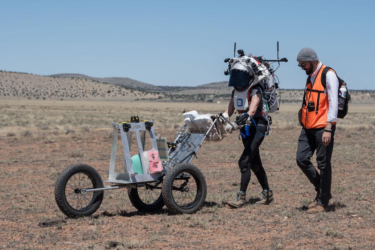
NASA astronaut Kate Rubins pushes a cart through the lunar-like landscape while wearing the Joint AR (Joint Augmented Reality Visual Informatics System) display during an advanced technology run in the San Francisco Volcanic Field in Northern Arizona on May 19, 2024. The suit display features include navigation, photo capture, graphical format of consumables, procedure viewing, mission control updates, and other augmented reality cues and graphics. The team successfully tested navigation displays using data from four different data streams: GPS (Global Positioning System)/IMU (Inertial Measurement Unit), camera/IMU, LiDAR (Light Detection and Ranging), and static maps. Technology like this may be used for future Artemis missions to augment mission control communication and help guide crew back to the lunar lander. Credit: NASA/Josh Valcarcel
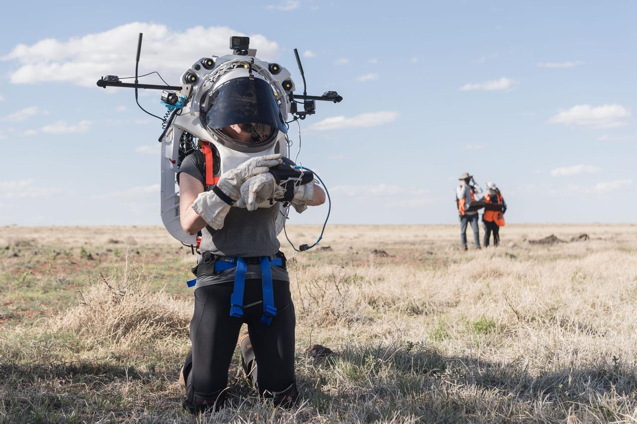
NASA astronaut Kate Rubins uses the hand controller on her wrist to display information while wearing the Joint AR (Joint Augmented Reality Visual Informatics System) display during an advanced technology run in the San Francisco Volcanic Field in Northern Arizona on May 21, 2024. The suit display features include navigation, photo capture, graphical format of consumables, procedure viewing, mission control updates, and other augmented reality cues and graphics. The team successfully tested navigation displays using data from four different data streams: GPS (Global Positioning System)/IMU (Inertial Measurement Unit), camera/IMU, LiDAR (Light Detection and Ranging), and static maps. Technology like this may be used for future Artemis missions to augment mission control communication and help guide crew back to the lunar lander. Credit: NASA/Josh Valcarcel
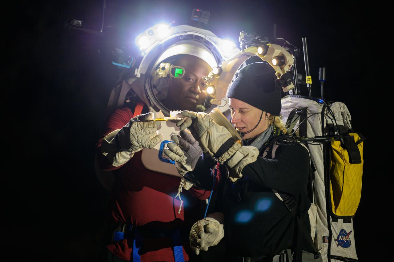
NASA astronauts Andre Douglas and Kate Rubins during a nighttime advanced technology run in the San Francisco Volcanic Field in Northern Arizona on May 21, 2024. Douglas is wearing the Joint AR (Joint Augmented Reality Visual Informatics System) display. The suit display features include navigation, photo capture, graphical format of consumables, procedure viewing, mission control updates, and other augmented reality cues and graphics. The team successfully tested navigation displays using data from four different data streams: GPS (Global Positioning System)/IMU (Inertial Measurement Unit), camera/IMU, LiDAR (Light Detection and Ranging), and static maps. Technology like this may be used for future Artemis missions to augment mission control communication and help guide crew back to the lunar lander. Credit: NASA/Josh Valcarcel
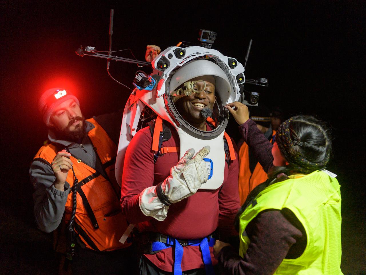
Engineers help NASA astronaut Andre Douglas adjust the Joint AR (Joint Augmented Reality Visual Informatics System) display he’s wearing during a nighttime advanced technology run in the San Francisco Volcanic Field in Northern Arizona on May 21, 2024. The suit display features include navigation, photo capture, graphical format of consumables, procedure viewing, mission control updates, and other augmented reality cues and graphics. The team successfully tested navigation displays using data from four different data streams: GPS (Global Positioning System)/IMU (Inertial Measurement Unit), camera/IMU, LiDAR (Light Detection and Ranging), and static maps. Technology like this may be used for future Artemis missions to augment mission control communication and help guide crew back to the lunar lander. Credit: NASA/Josh Valcarcel
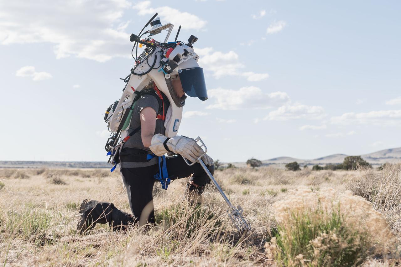
NASA astronaut Kate Rubins uses tongs to collect geologic samples while wearing the Joint AR (Joint Augmented Reality Visual Informatics System) display during an advanced technology run in the San Francisco Volcanic Field in Northern Arizona on May 21, 2024. The suit display features include navigation, photo capture, graphical format of consumables, procedure viewing, mission control updates, and other augmented reality cues and graphics. The team successfully tested navigation displays using data from four different data streams: GPS (Global Positioning System)/IMU (Inertial Measurement Unit), camera/IMU, LiDAR (Light Detection and Ranging), and static maps. Technology like this may be used for future Artemis missions to augment mission control communication and help guide crew back to the lunar lander. Credit: NASA/Josh Valcarcel
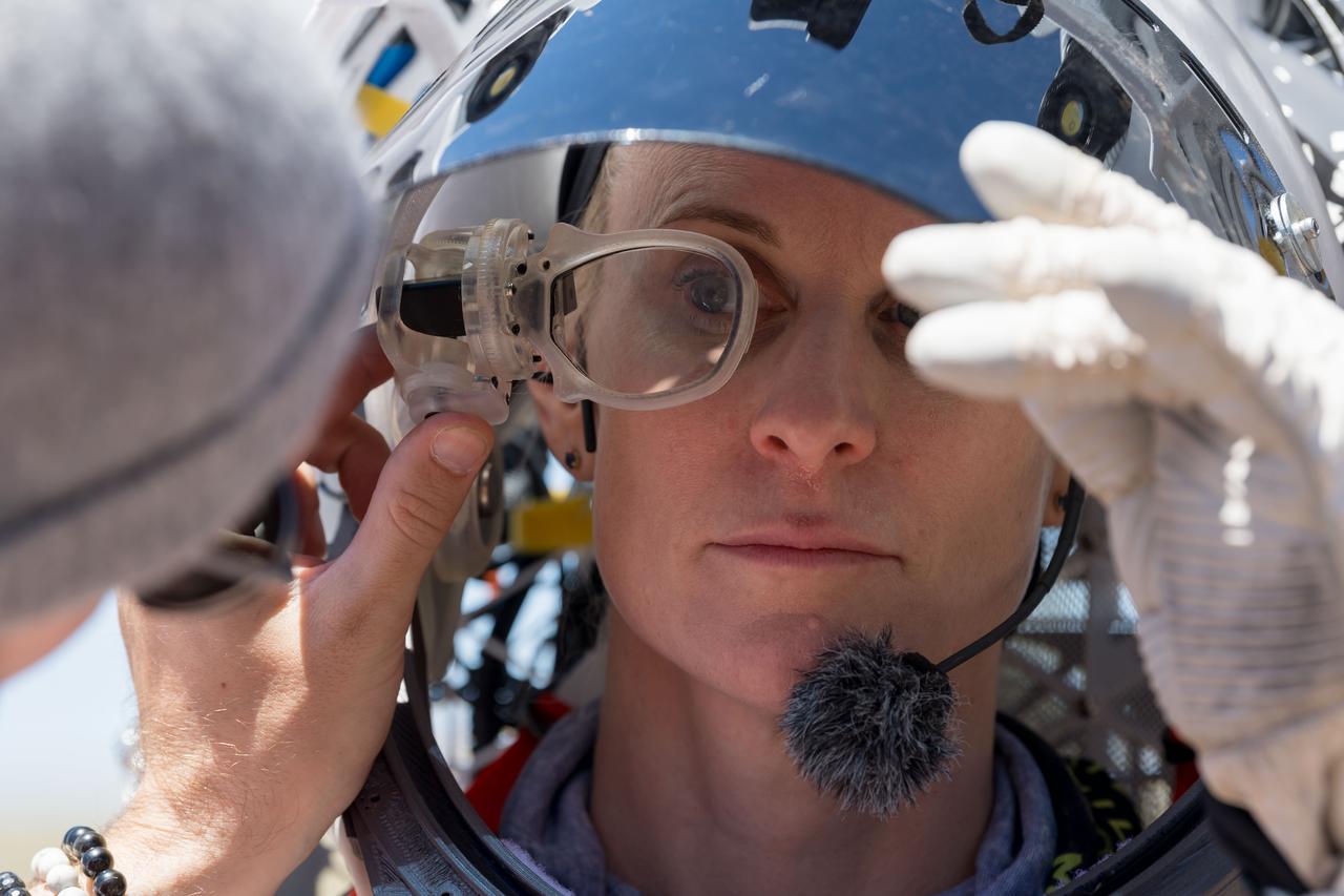
An engineer helps NASA astronaut Kate Rubins adjust the lens on the Joint AR (Joint Augmented Reality Visual Informatics System) display she’s wearing during an advanced technology run in the San Francisco Volcanic Field in Northern Arizona on May 19, 2024. The suit display features include navigation, photo capture, graphical format of consumables, procedure viewing, mission control updates, and other augmented reality cues and graphics. The team successfully tested navigation displays using data from four different data streams: GPS (Global Positioning System)/IMU (Inertial Measurement Unit), camera/IMU, LiDAR (Light Detection and Ranging), and static maps. Technology like this may be used for future Artemis missions to augment mission control communication and help guide crew back to the lunar lander. Credit: NASA/Josh Valcarcel
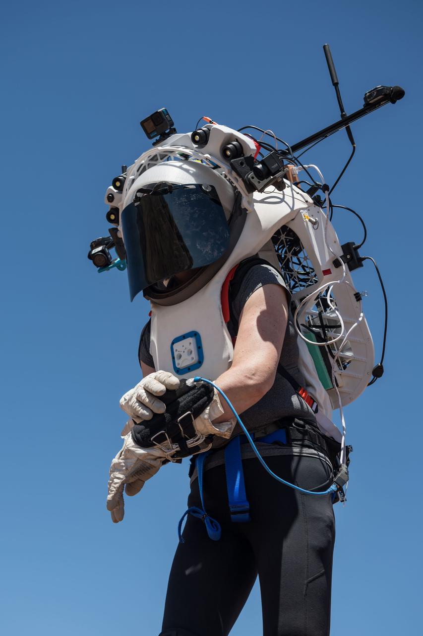
NASA astronaut Kate Rubins uses the hand controller on her wrist to display information while wearing the Joint AR (Joint Augmented Reality Visual Informatics System) display during an advanced technology run in the San Francisco Volcanic Field in Northern Arizona on May 19, 2024. The suit display features include navigation, photo capture, graphical format of consumables, procedure viewing, mission control updates, and other augmented reality cues and graphics. The team successfully tested navigation displays using data from four different data streams: GPS (Global Positioning System)/IMU (Inertial Measurement Unit), camera/IMU, LiDAR (Light Detection and Ranging), and static maps. Technology like this may be used for future Artemis missions to augment mission control communication and help guide crew back to the lunar lander. Credit: NASA/Josh Valcarcel
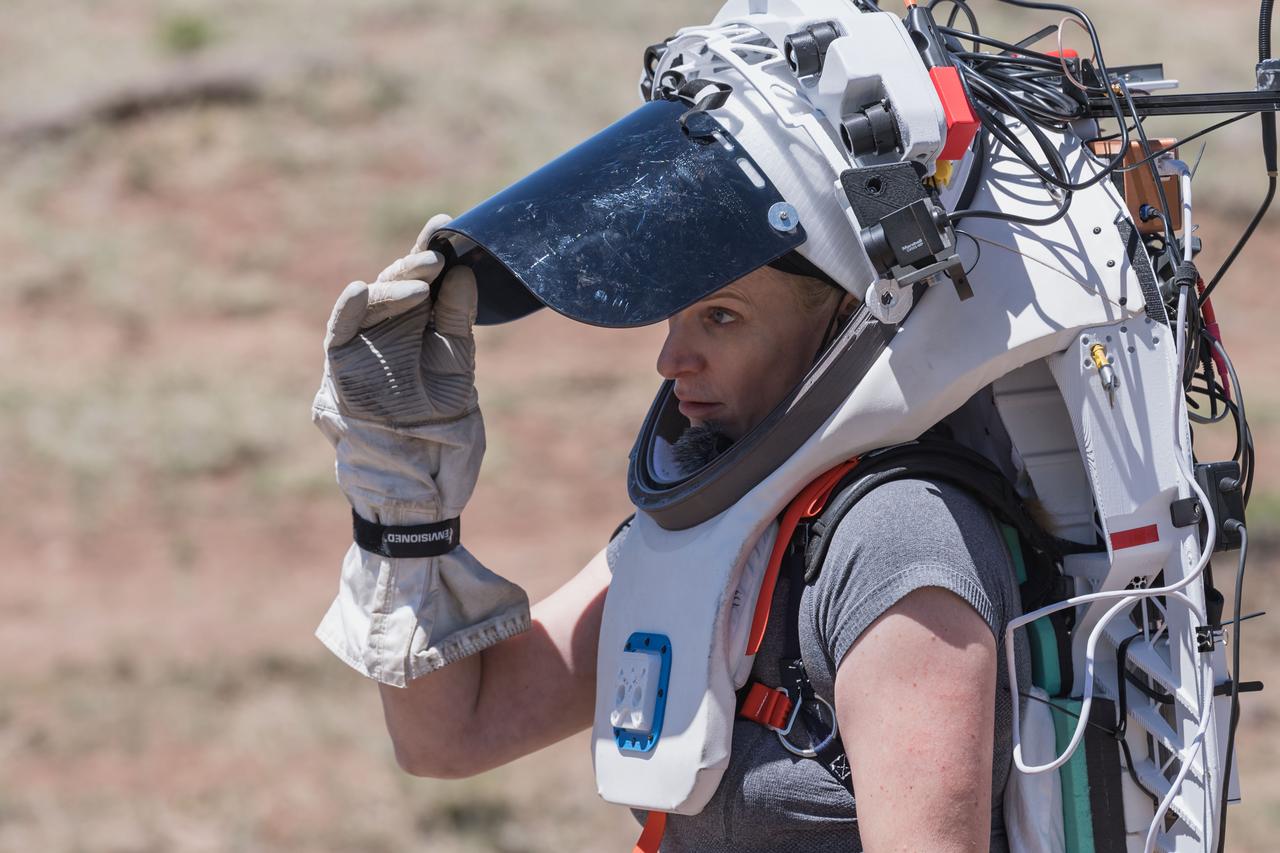
NASA astronaut Kate Rubins opens the sun visor on the Joint AR (Joint Augmented Reality Visual Informatics System) display she’s wearing during an advanced technology run in the San Francisco Volcanic Field in Northern Arizona on May 19, 2024. The suit display features include navigation, photo capture, graphical format of consumables, procedure viewing, mission control updates, and other augmented reality cues and graphics. The team successfully tested navigation displays using data from four different data streams: GPS (Global Positioning System)/IMU (Inertial Measurement Unit), camera/IMU, LiDAR (Light Detection and Ranging), and static maps. Technology like this may be used for future Artemis missions to augment mission control communication and help guide crew back to the lunar lander. Credit: NASA/Josh Valcarcel
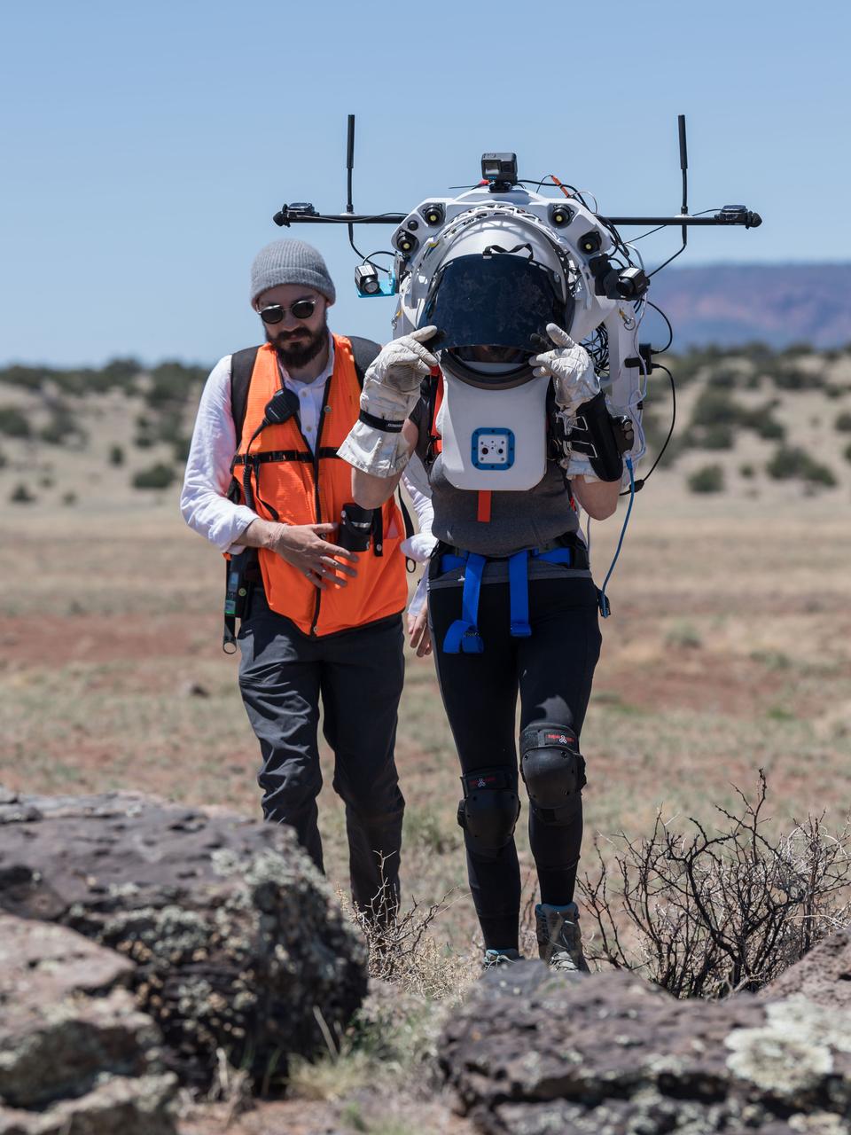
NASA astronaut Kate Rubins walks through the lunar-like landscape wearing the Joint AR (Joint Augmented Reality Visual Informatics System) display during an advanced technology run in the San Francisco Volcanic Field in Northern Arizona on May 19, 2024. The suit display features include navigation, photo capture, graphical format of consumables, procedure viewing, mission control updates, and other augmented reality cues and graphics. The team successfully tested navigation displays using data from four different data streams: GPS (Global Positioning System)/IMU (Inertial Measurement Unit), camera/IMU, LiDAR (Light Detection and Ranging), and static maps. Technology like this may be used for future Artemis missions to augment mission control communication and help guide crew back to the lunar lander. Credit: NASA/Josh Valcarcel
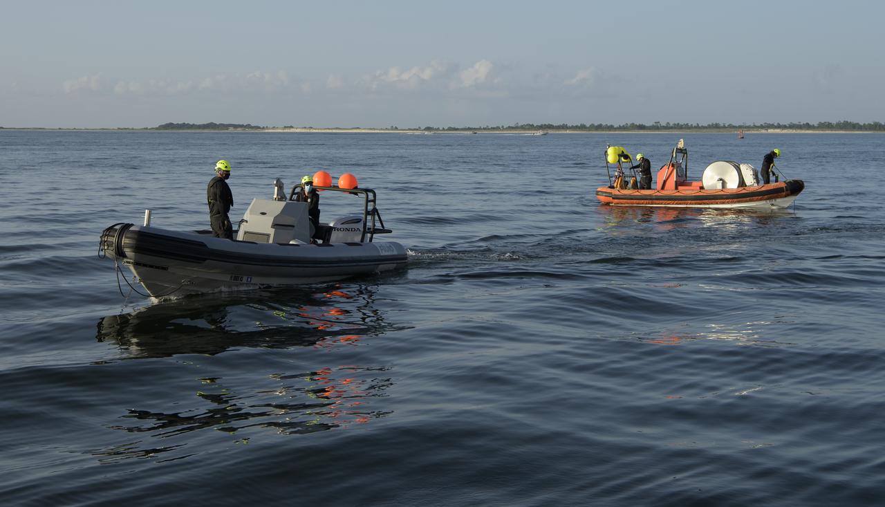
SpaceX support teams are deployed on fast boats from the SpaceX GO Navigator recovery ship ahead of the landing of the SpaceX Crew Dragon Endeavour spacecraft with NASA astronauts Robert Behnken and Douglas Hurley onboard, Sunday, Aug. 2, 2020 in the Gulf of Mexico off the cost of Pensacola, Florida. The Demo-2 test flight for NASA's Commercial Crew Program is the first to deliver astronauts to the International Space Station and return them to Earth onboard a commercially built and operated spacecraft. Behnken and Hurley are returning after spending 64 days in space. Photo Credit: (NASA/Bill Ingalls)

SpaceX support teams are deployed on fast boats from the SpaceX GO Navigator recovery ship ahead of the landing of the SpaceX Crew Dragon Endeavour spacecraft with NASA astronauts Robert Behnken and Douglas Hurley onboard, Sunday, Aug. 2, 2020 in the Gulf of Mexico off the cost of Pensacola, Florida. The Demo-2 test flight for NASA's Commercial Crew Program is the first to deliver astronauts to the International Space Station and return them to Earth onboard a commercially built and operated spacecraft. Behnken and Hurley are returning after spending 64 days in space. Photo Credit: (NASA/Bill Ingalls)