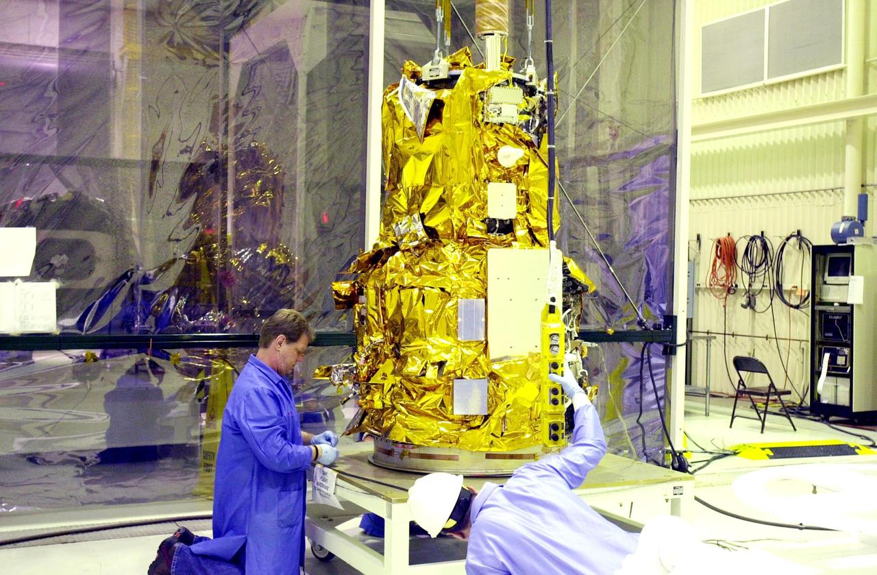
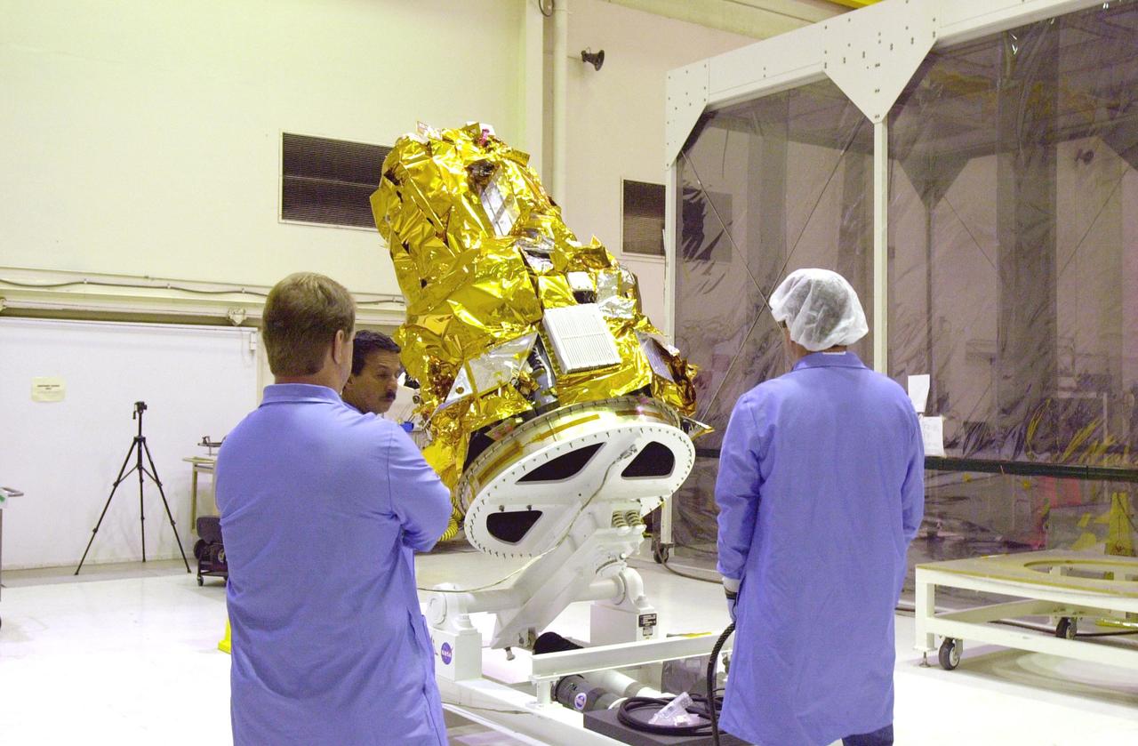
Technicians with Orbital ATK check assemble the micro satellites deployment module for NASA’s Cyclone Global Navigation Satellite System (CYGNSS) in Building 1555 at Vandenberg Air Force Base in California. CYGNSS is being prepared at Vandenberg, and then will be transported to NASA’s Kennedy Space Center in Florida aboard the Orbital ATK Pegasus XL rocket which will be attached to the Orbital ATK L-1011 carrier aircraft. CYGNSS will launch on the Pegasus XL rocket from the Skid Strip at Cape Canaveral Air Force Station. CYGNSS will make frequent and accurate measurements of ocean surface winds throughout the life cycle of tropical storms and hurricanes. The data that CYGNSS provides will enable scientists to probe key air-sea interaction processes that take place near the core of storms, which are rapidly changing and play a critical role in the beginning and intensification of hurricanes.
Technicians with Orbital ATK continue to install micro satellites on the deployment module for NASA’s Cyclone Global Navigation Satellite System (CYGNSS) in Building 1555 at Vandenberg Air Force Base in California. CYGNSS is being prepared at Vandenberg, and then will be transported to NASA’s Kennedy Space Center in Florida aboard the Orbital ATK Pegasus XL rocket which will be attached to the Orbital ATK L-1011 carrier aircraft. CYGNSS will launch on the Pegasus XL rocket from the Skid Strip at Cape Canaveral Air Force Station. CYGNSS will make frequent and accurate measurements of ocean surface winds throughout the life cycle of tropical storms and hurricanes. The data that CYGNSS provides will enable scientists to probe key air-sea interaction processes that take place near the core of storms, which are rapidly changing and play a critical role in the beginning and intensification of hurricanes.
Technicians with Orbital ATK prepare the micro satellites for installation on the deployment module for NASA’s Cyclone Global Navigation Satellite System (CYGNSS) in Building 1555 at Vandenberg Air Force Base in California. CYGNSS is being prepared at Vandenberg, and then will be transported to NASA’s Kennedy Space Center in Florida aboard the Orbital ATK Pegasus XL rocket which will be attached to the Orbital ATK L-1011 carrier aircraft. CYGNSS will launch on the Pegasus XL rocket from the Skid Strip at Cape Canaveral Air Force Station. CYGNSS will make frequent and accurate measurements of ocean surface winds throughout the life cycle of tropical storms and hurricanes. The data that CYGNSS provides will enable scientists to probe key air-sea interaction processes that take place near the core of storms, which are rapidly changing and play a critical role in the beginning and intensification of hurricanes.
A technician with Orbital ATK prepares the deployment module for NASA’s Cyclone Global Navigation Satellite System (CYGNSS) for micro satellites installation in Building 1555 at Vandenberg Air Force Base in California. CYGNSS is being prepared at Vandenberg, and then will be transported to NASA’s Kennedy Space Center in Florida aboard the Orbital ATK Pegasus XL rocket which will be attached to the Orbital ATK L-1011 carrier aircraft. CYGNSS will launch on the Pegasus XL rocket from the Skid Strip at Cape Canaveral Air Force Station. CYGNSS will make frequent and accurate measurements of ocean surface winds throughout the life cycle of tropical storms and hurricanes. The data that CYGNSS provides will enable scientists to probe key air-sea interaction processes that take place near the core of storms, which are rapidly changing and play a critical role in the beginning and intensification of hurricanes.
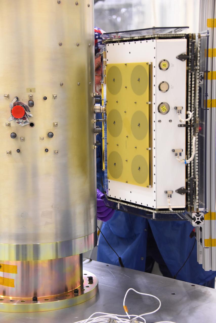
A technician with Orbital ATK prepares a set of micro satellites for installation on the deployment module for NASA’s Cyclone Global Navigation Satellite System (CYGNSS) in Building 1555 at Vandenberg Air Force Base in California. CYGNSS is being prepared at Vandenberg, and then will be transported to NASA’s Kennedy Space Center in Florida aboard the Orbital ATK Pegasus XL rocket which will be attached to the Orbital ATK L-1011 carrier aircraft. CYGNSS will launch on the Pegasus XL rocket from the Skid Strip at Cape Canaveral Air Force Station. CYGNSS will make frequent and accurate measurements of ocean surface winds throughout the life cycle of tropical storms and hurricanes. The data that CYGNSS provides will enable scientists to probe key air-sea interaction processes that take place near the core of storms, which are rapidly changing and play a critical role in the beginning and intensification of hurricanes.
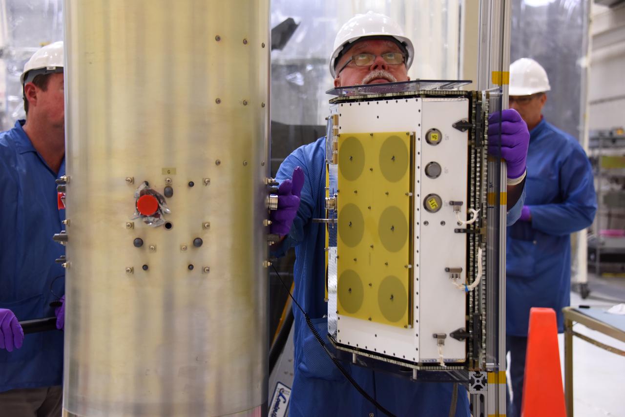
A technician with Orbital ATK prepares to install another micro satellite on the deployment module for NASA’s Cyclone Global Navigation Satellite System (CYGNSS) in Building 1555 at Vandenberg Air Force Base in California. CYGNSS is being prepared at Vandenberg, and then will be transported to NASA’s Kennedy Space Center in Florida aboard the Orbital ATK Pegasus XL rocket which will be attached to the Orbital ATK L-1011 carrier aircraft. CYGNSS will launch on the Pegasus XL rocket from the Skid Strip at Cape Canaveral Air Force Station. CYGNSS will make frequent and accurate measurements of ocean surface winds throughout the life cycle of tropical storms and hurricanes. The data that CYGNSS provides will enable scientists to probe key air-sea interaction processes that take place near the core of storms, which are rapidly changing and play a critical role in the beginning and intensification of hurricanes.
Technicians with Orbital ATK check out the micro satellites deployment module for NASA’s Cyclone Global Navigation Satellite System (CYGNSS) in Building 1555 at Vandenberg Air Force Base in California. CYGNSS is being prepared at Vandenberg, and then will be transported to NASA’s Kennedy Space Center in Florida aboard the Orbital ATK Pegasus XL rocket which will be attached to the Orbital ATK L-1011 carrier aircraft. CYGNSS will launch on the Pegasus XL rocket from the Skid Strip at Cape Canaveral Air Force Station. CYGNSS will make frequent and accurate measurements of ocean surface winds throughout the life cycle of tropical storms and hurricanes. The data that CYGNSS provides will enable scientists to probe key air-sea interaction processes that take place near the core of storms, which are rapidly changing and play a critical role in the beginning and intensification of hurricanes.
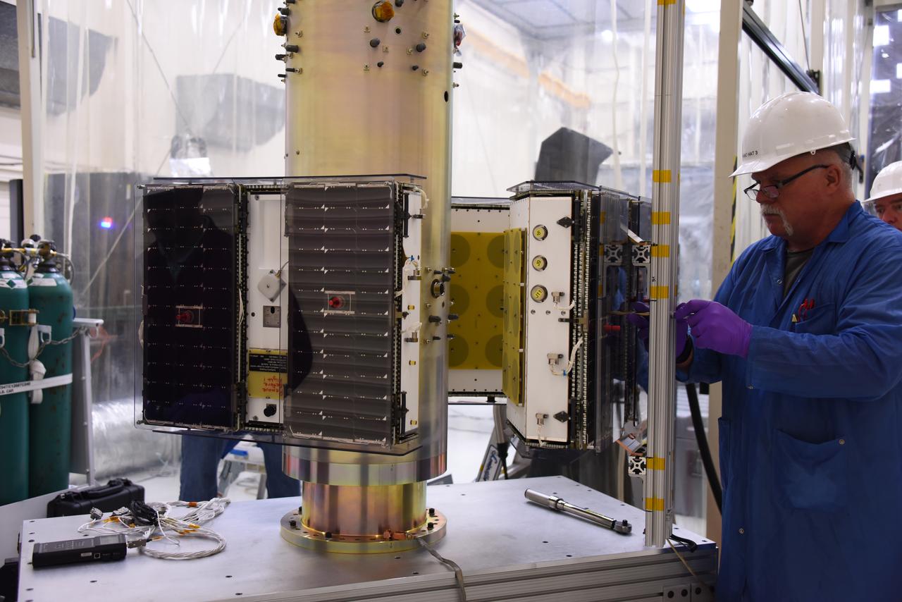
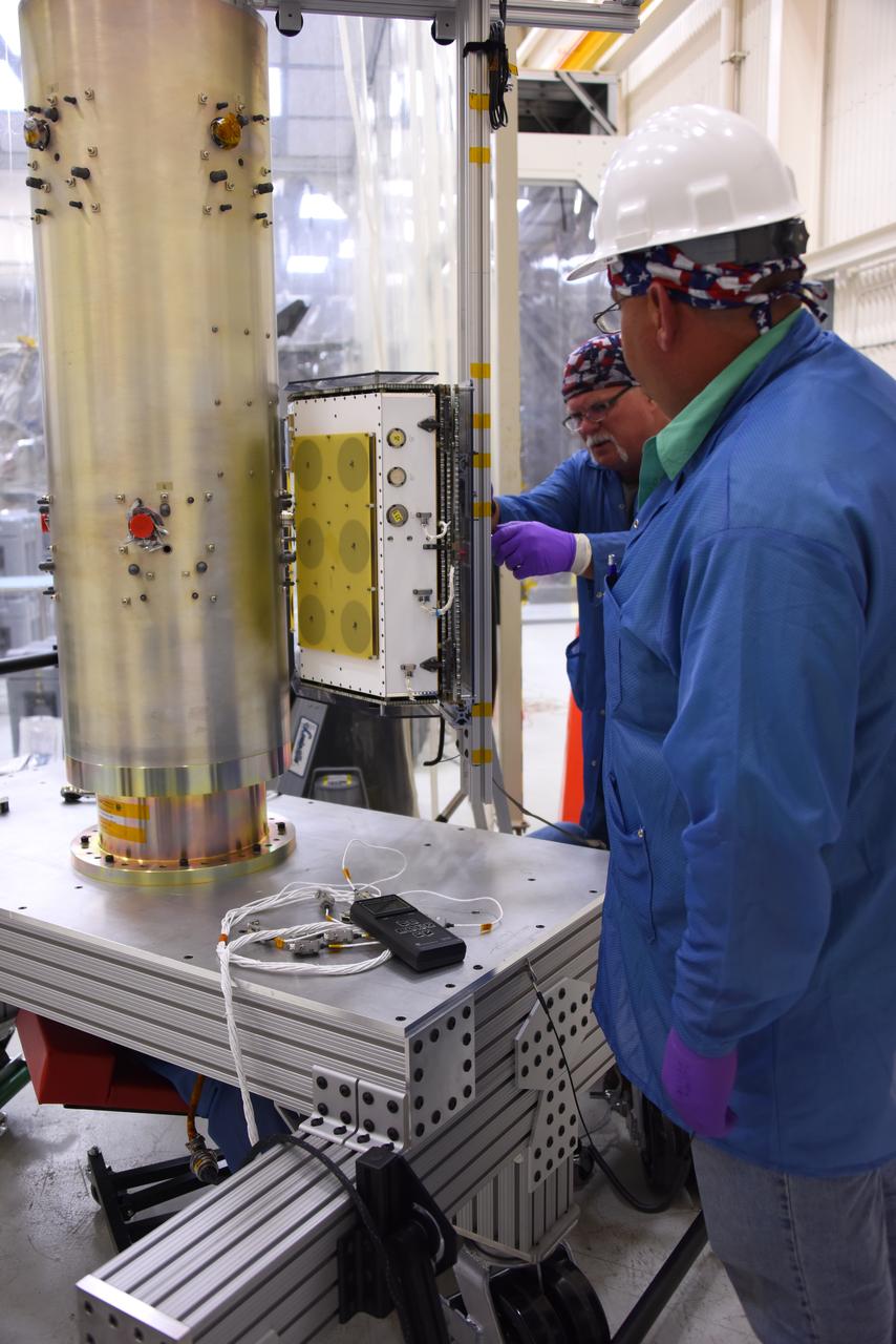
A technician with Orbital ATK checks the installation of the micro satellites on the deployment module for NASA’s Cyclone Global Navigation Satellite System (CYGNSS) in Building 1555 at Vandenberg Air Force Base in California. CYGNSS is being prepared at Vandenberg, and then will be transported to NASA’s Kennedy Space Center in Florida aboard the Orbital ATK Pegasus XL rocket which will be attached to the Orbital ATK L-1011 carrier aircraft. CYGNSS will launch on the Pegasus XL rocket from the Skid Strip at Cape Canaveral Air Force Station. CYGNSS will make frequent and accurate measurements of ocean surface winds throughout the life cycle of tropical storms and hurricanes. The data that CYGNSS provides will enable scientists to probe key air-sea interaction processes that take place near the core of storms, which are rapidly changing and play a critical role in the beginning and intensification of hurricanes.
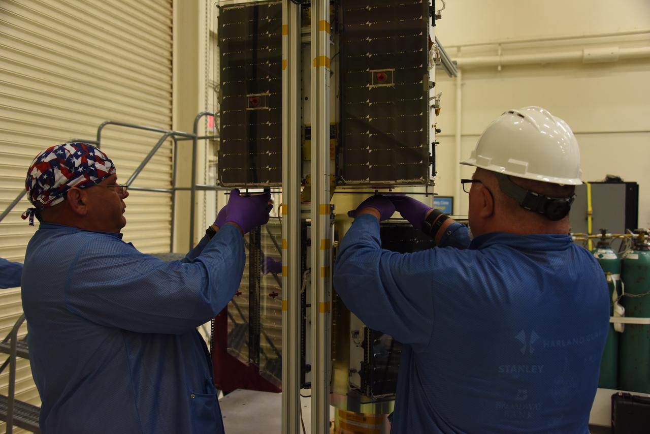
Technicians with Orbital ATK install the first set of micro satellites on the deployment module for NASA’s Cyclone Global Navigation Satellite System (CYGNSS) in Building 1555 at Vandenberg Air Force Base in California. CYGNSS is being prepared at Vandenberg, and then will be transported to NASA’s Kennedy Space Center in Florida aboard the Orbital ATK Pegasus XL rocket which will be attached to the Orbital ATK L-1011 carrier aircraft. CYGNSS will launch on the Pegasus XL rocket from the Skid Strip at Cape Canaveral Air Force Station. CYGNSS will make frequent and accurate measurements of ocean surface winds throughout the life cycle of tropical storms and hurricanes. The data that CYGNSS provides will enable scientists to probe key air-sea interaction processes that take place near the core of storms, which are rapidly changing and play a critical role in the beginning and intensification of hurricanes.
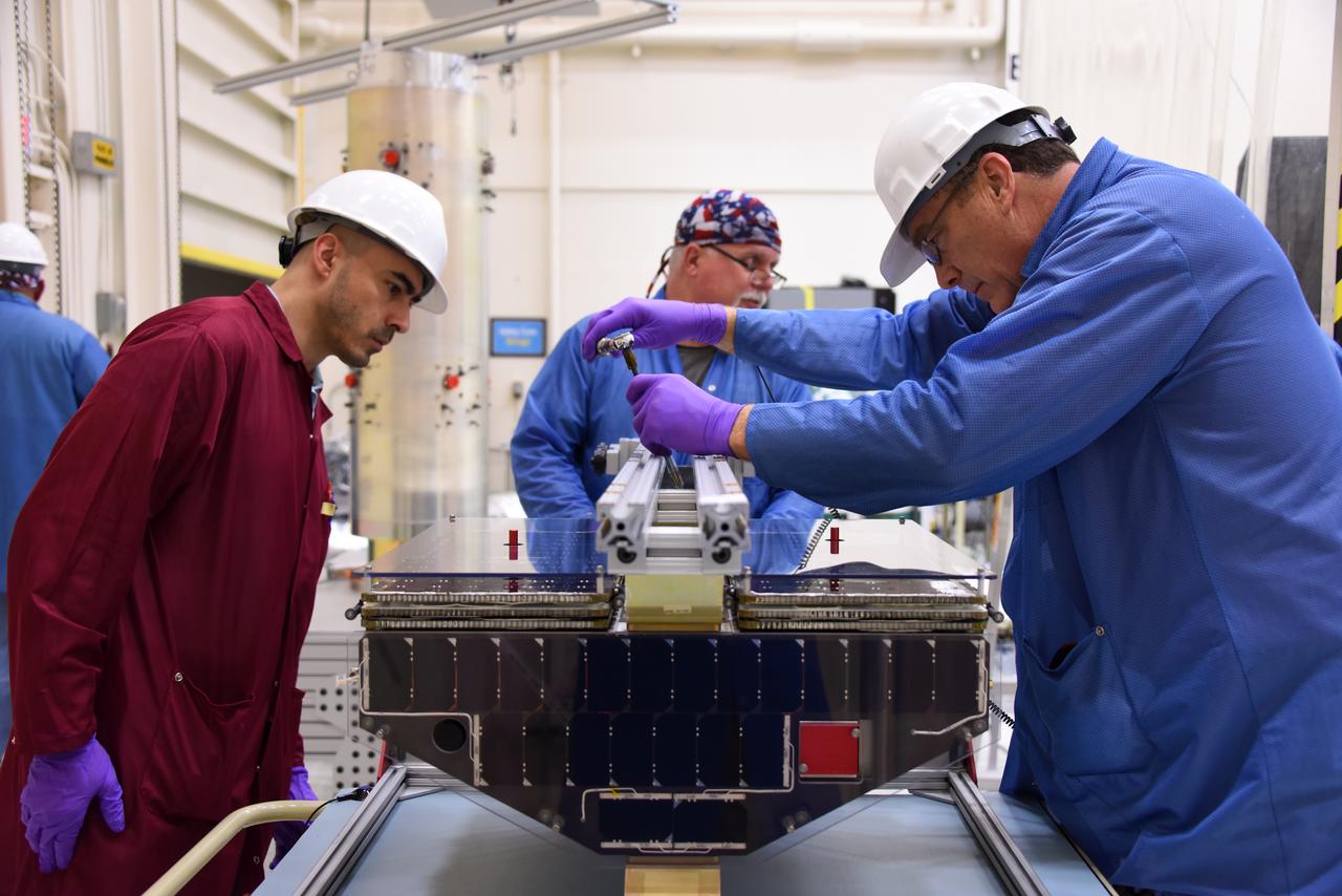
Technicians with Orbital ATK prepare the micro satellites for installation on the deployment module for NASA’s Cyclone Global Navigation Satellite System (CYGNSS) in Building 1555 at Vandenberg Air Force Base in California. CYGNSS is being prepared at Vandenberg, and then will be transported to NASA’s Kennedy Space Center in Florida aboard the Orbital ATK Pegasus XL rocket which will be attached to the Orbital ATK L-1011 carrier aircraft. CYGNSS will launch on the Pegasus XL rocket from the Skid Strip at Cape Canaveral Air Force Station. CYGNSS will make frequent and accurate measurements of ocean surface winds throughout the life cycle of tropical storms and hurricanes. The data that CYGNSS provides will enable scientists to probe key air-sea interaction processes that take place near the core of storms, which are rapidly changing and play a critical role in the beginning and intensification of hurricanes.
Technicians with Orbital ATK prepare to install micro satellites on the deployment module for NASA’s Cyclone Global Navigation Satellite System (CYGNSS) in Building 1555 at Vandenberg Air Force Base in California. CYGNSS is being prepared at Vandenberg, and then will be transported to NASA’s Kennedy Space Center in Florida aboard the Orbital ATK Pegasus XL rocket which will be attached to the Orbital ATK L-1011 carrier aircraft. CYGNSS will launch on the Pegasus XL rocket from the Skid Strip at Cape Canaveral Air Force Station. CYGNSS will make frequent and accurate measurements of ocean surface winds throughout the life cycle of tropical storms and hurricanes. The data that CYGNSS provides will enable scientists to probe key air-sea interaction processes that take place near the core of storms, which are rapidly changing and play a critical role in the beginning and intensification of hurricanes.
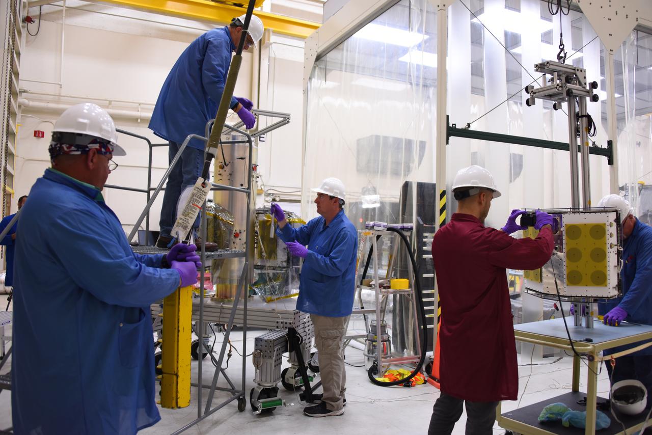
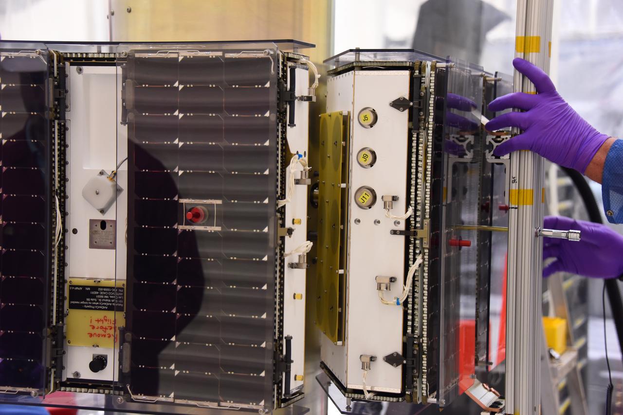
Technicians with Orbital ATK continue to install the micro satellites on the deployment module for NASA’s Cyclone Global Navigation Satellite System (CYGNSS) in Building 1555 at Vandenberg Air Force Base in California. CYGNSS is being prepared at Vandenberg, and then will be transported to NASA’s Kennedy Space Center in Florida aboard the Orbital ATK Pegasus XL rocket which will be attached to the Orbital ATK L-1011 carrier aircraft. CYGNSS will launch on the Pegasus XL rocket from the Skid Strip at Cape Canaveral Air Force Station. CYGNSS will make frequent and accurate measurements of ocean surface winds throughout the life cycle of tropical storms and hurricanes. The data that CYGNSS provides will enable scientists to probe key air-sea interaction processes that take place near the core of storms, which are rapidly changing and play a critical role in the beginning and intensification of hurricanes.
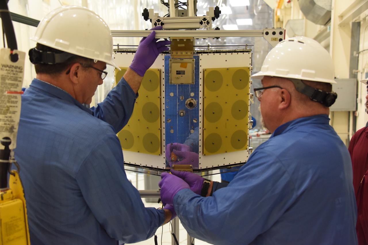
Technicians with Orbital ATK prepare to install the micro satellites on the deployment module for NASA’s Cyclone Global Navigation Satellite System (CYGNSS) in Building 1555 at Vandenberg Air Force Base in California. CYGNSS is being prepared at Vandenberg, and then will be transported to NASA’s Kennedy Space Center in Florida aboard the Orbital ATK Pegasus XL rocket which will be attached to the Orbital ATK L-1011 carrier aircraft. CYGNSS will launch on the Pegasus XL rocket from the Skid Strip at Cape Canaveral Air Force Station. CYGNSS will make frequent and accurate measurements of ocean surface winds throughout the life cycle of tropical storms and hurricanes. The data that CYGNSS provides will enable scientists to probe key air-sea interaction processes that take place near the core of storms, which are rapidly changing and play a critical role in the beginning and intensification of hurricanes.
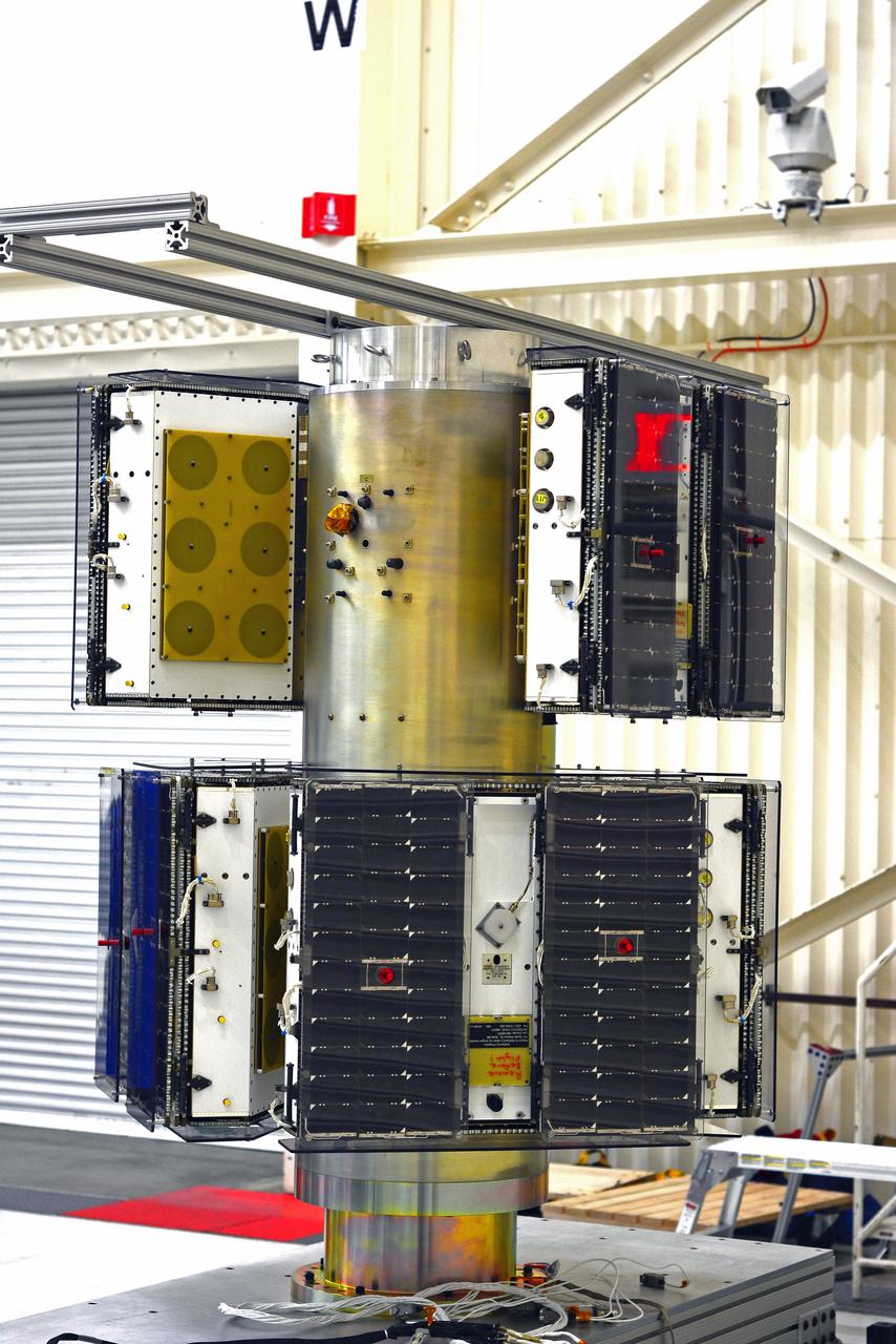
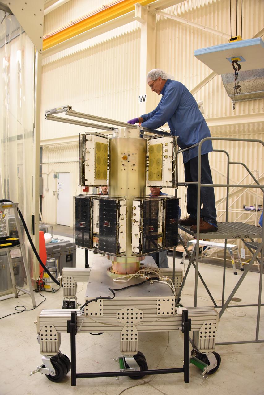
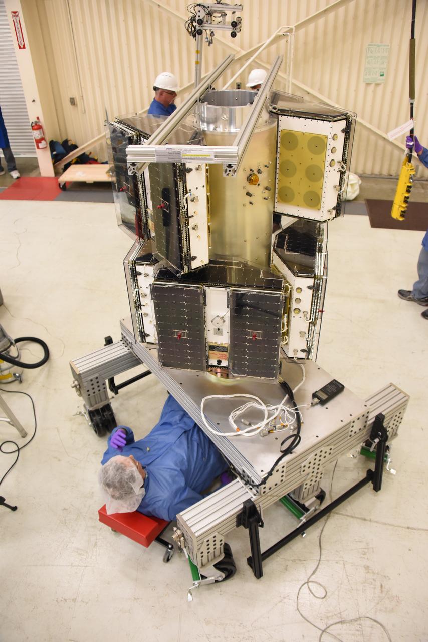
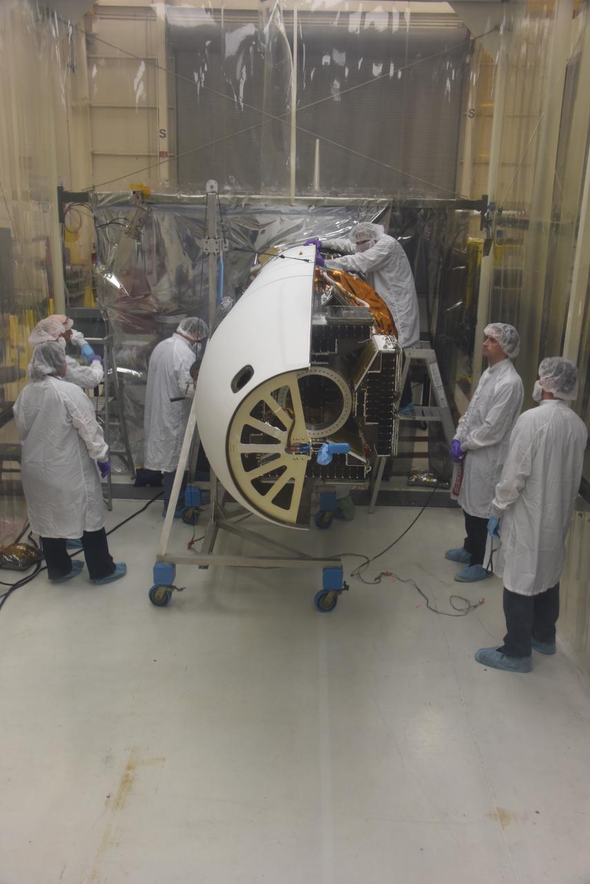
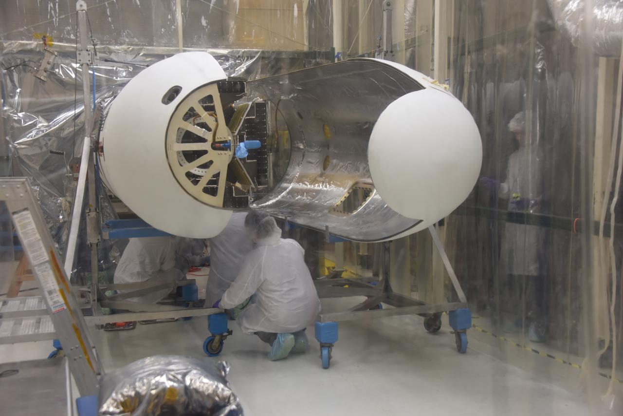
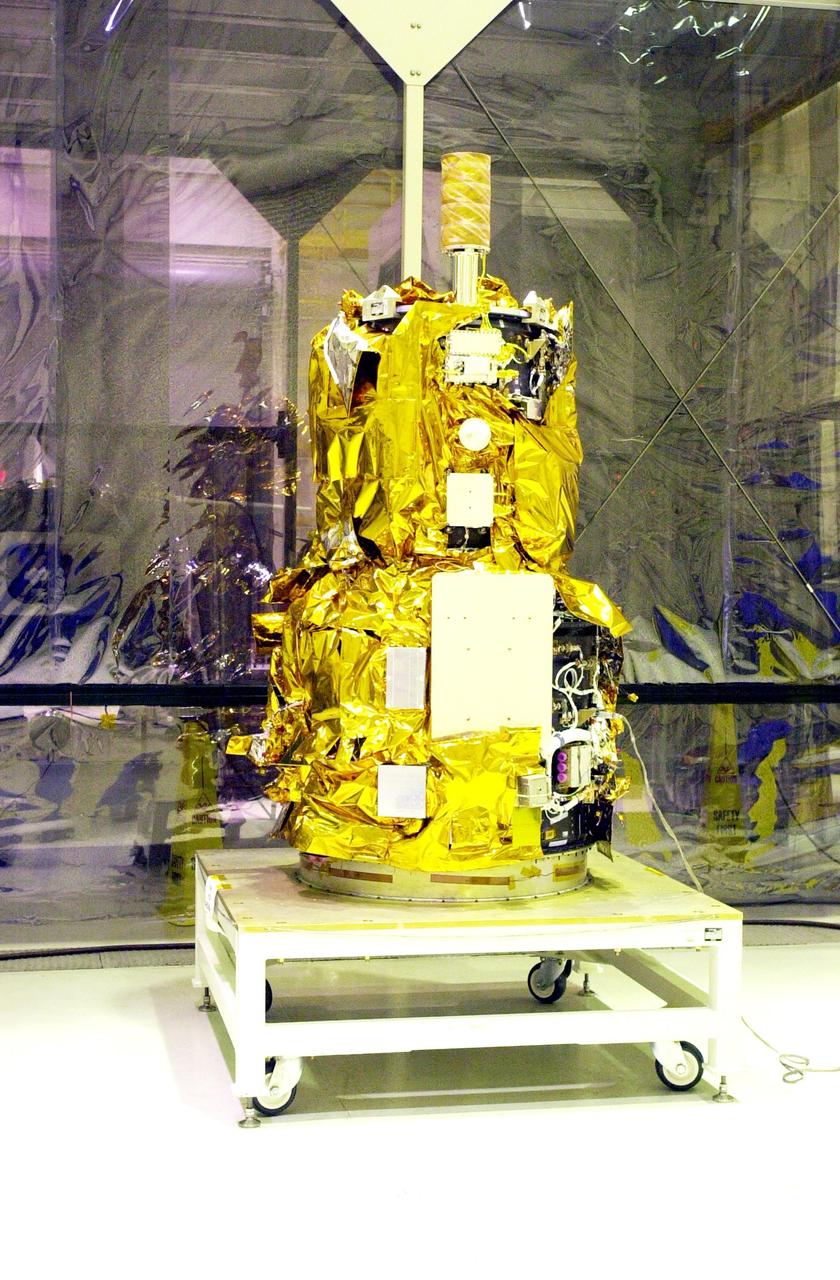
All of the micro satellites have been fully installed on the deployment module by Orbital ATK for NASA’s Cyclone Global Navigation Satellite System (CYGNSS) in Building 1555 at Vandenberg Air Force Base in California. CYGNSS is being prepared at Vandenberg, and then will be transported to NASA’s Kennedy Space Center in Florida aboard the Orbital ATK Pegasus XL rocket which will be attached to the Orbital ATK L-1011 carrier aircraft. CYGNSS will launch on the Pegasus XL rocket from the Skid Strip at Cape Canaveral Air Force Station. CYGNSS will make frequent and accurate measurements of ocean surface winds throughout the life cycle of tropical storms and hurricanes. The data that CYGNSS provides will enable scientists to probe key air-sea interaction processes that take place near the core of storms, which are rapidly changing and play a critical role in the beginning and intensification of hurricanes.
Technicians with Orbital ATK check out the micro satellites deployment module for NASA’s Cyclone Global Navigation Satellite System (CYGNSS) in Building 1555 at Vandenberg Air Force Base in California. CYGNSS is being prepared at Vandenberg, and then will be transported to NASA’s Kennedy Space Center in Florida aboard the Orbital ATK Pegasus XL rocket which will be attached to the Orbital ATK L-1011 carrier aircraft. CYGNSS will launch on the Pegasus XL rocket from the Skid Strip at Cape Canaveral Air Force Station. CYGNSS will make frequent and accurate measurements of ocean surface winds throughout the life cycle of tropical storms and hurricanes. The data that CYGNSS provides will enable scientists to probe key air-sea interaction processes that take place near the core of storms, which are rapidly changing and play a critical role in the beginning and intensification of hurricanes.
Technicians with Orbital ATK continue to install micro satellites on the deployment module for NASA’s Cyclone Global Navigation Satellite System (CYGNSS) in Building 1555 at Vandenberg Air Force Base in California. CYGNSS is being prepared at Vandenberg, and then will be transported to NASA’s Kennedy Space Center in Florida aboard the Orbital ATK Pegasus XL rocket which will be attached to the Orbital ATK L-1011 carrier aircraft. CYGNSS will launch on the Pegasus XL rocket from the Skid Strip at Cape Canaveral Air Force Station. CYGNSS will make frequent and accurate measurements of ocean surface winds throughout the life cycle of tropical storms and hurricanes. The data that CYGNSS provides will enable scientists to probe key air-sea interaction processes that take place near the core of storms, which are rapidly changing and play a critical role in the beginning and intensification of hurricanes.
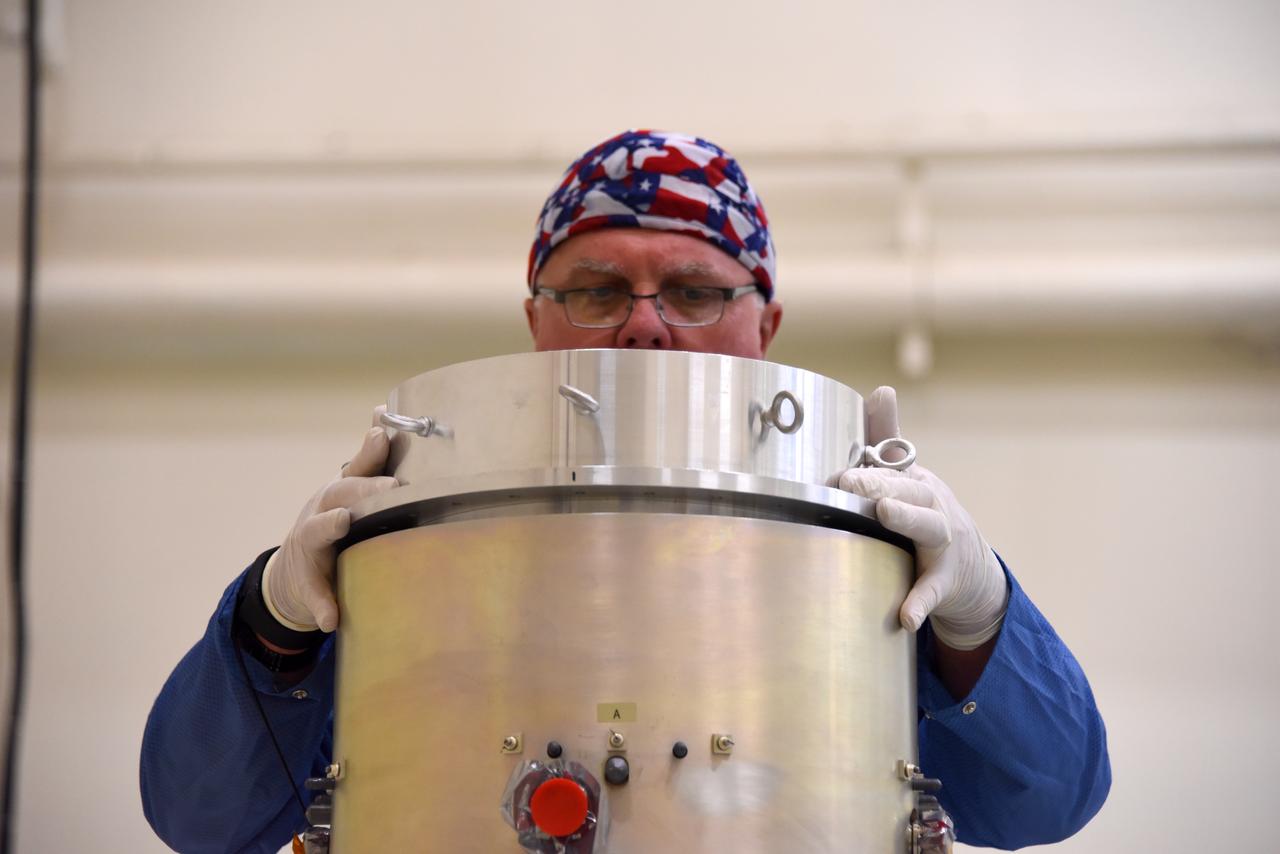
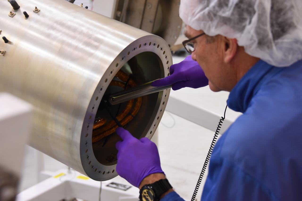
A technician with Orbital ATK assembles the micro satellites deployment module for NASA’s Cyclone Global Navigation Satellite System (CYGNSS) in Building 1555 at Vandenberg Air Force Base in California. CYGNSS is being prepared at Vandenberg, and then will be transported to NASA’s Kennedy Space Center in Florida aboard the Orbital ATK Pegasus XL rocket which will be attached to the Orbital ATK L-1011 carrier aircraft. CYGNSS will launch on the Pegasus XL rocket from the Skid Strip at Cape Canaveral Air Force Station. CYGNSS will make frequent and accurate measurements of ocean surface winds throughout the life cycle of tropical storms and hurricanes. The data that CYGNSS provides will enable scientists to probe key air-sea interaction processes that take place near the core of storms, which are rapidly changing and play a critical role in the beginning and intensification of hurricanes.
Technicians with Orbital ATK continue to install micro satellites on the deployment module for NASA’s Cyclone Global Navigation Satellite System (CYGNSS) in Building 1555 at Vandenberg Air Force Base in California. CYGNSS is being prepared at Vandenberg, and then will be transported to NASA’s Kennedy Space Center in Florida aboard the Orbital ATK Pegasus XL rocket which will be attached to the Orbital ATK L-1011 carrier aircraft. CYGNSS will launch on the Pegasus XL rocket from the Skid Strip at Cape Canaveral Air Force Station. CYGNSS will make frequent and accurate measurements of ocean surface winds throughout the life cycle of tropical storms and hurricanes. The data that CYGNSS provides will enable scientists to probe key air-sea interaction processes that take place near the core of storms, which are rapidly changing and play a critical role in the beginning and intensification of hurricanes.
Technicians with Orbital ATK prepare a set of micro satellites for installation on the deployment module for NASA’s Cyclone Global Navigation Satellite System (CYGNSS) in Building 1555 at Vandenberg Air Force Base in California. CYGNSS is being prepared at Vandenberg, and then will be transported to NASA’s Kennedy Space Center in Florida aboard the Orbital ATK Pegasus XL rocket which will be attached to the Orbital ATK L-1011 carrier aircraft. CYGNSS will launch on the Pegasus XL rocket from the Skid Strip at Cape Canaveral Air Force Station. CYGNSS will make frequent and accurate measurements of ocean surface winds throughout the life cycle of tropical storms and hurricanes. The data that CYGNSS provides will enable scientists to probe key air-sea interaction processes that take place near the core of storms, which are rapidly changing and play a critical role in the beginning and intensification of hurricanes.
Technicians with Orbital ATK continue to install micro satellites on the deployment module for NASA’s Cyclone Global Navigation Satellite System (CYGNSS) in Building 1555 at Vandenberg Air Force Base in California. CYGNSS is being prepared at Vandenberg, and then will be transported to NASA’s Kennedy Space Center in Florida aboard the Orbital ATK Pegasus XL rocket which will be attached to the Orbital ATK L-1011 carrier aircraft. CYGNSS will launch on the Pegasus XL rocket from the Skid Strip at Cape Canaveral Air Force Station. CYGNSS will make frequent and accurate measurements of ocean surface winds throughout the life cycle of tropical storms and hurricanes. The data that CYGNSS provides will enable scientists to probe key air-sea interaction processes that take place near the core of storms, which are rapidly changing and play a critical role in the beginning and intensification of hurricanes.
A technician with Orbital ATK prepares the deployment module for NASA’s Cyclone Global Navigation Satellite System (CYGNSS) for micro satellites installation in Building 1555 at Vandenberg Air Force Base in California. CYGNSS is being prepared at Vandenberg, and then will be transported to NASA’s Kennedy Space Center in Florida aboard the Orbital ATK Pegasus XL rocket which will be attached to the Orbital ATK L-1011 carrier aircraft. CYGNSS will launch on the Pegasus XL rocket from the Skid Strip at Cape Canaveral Air Force Station. CYGNSS will make frequent and accurate measurements of ocean surface winds throughout the life cycle of tropical storms and hurricanes. The data that CYGNSS provides will enable scientists to probe key air-sea interaction processes that take place near the core of storms, which are rapidly changing and play a critical role in the beginning and intensification of hurricanes.
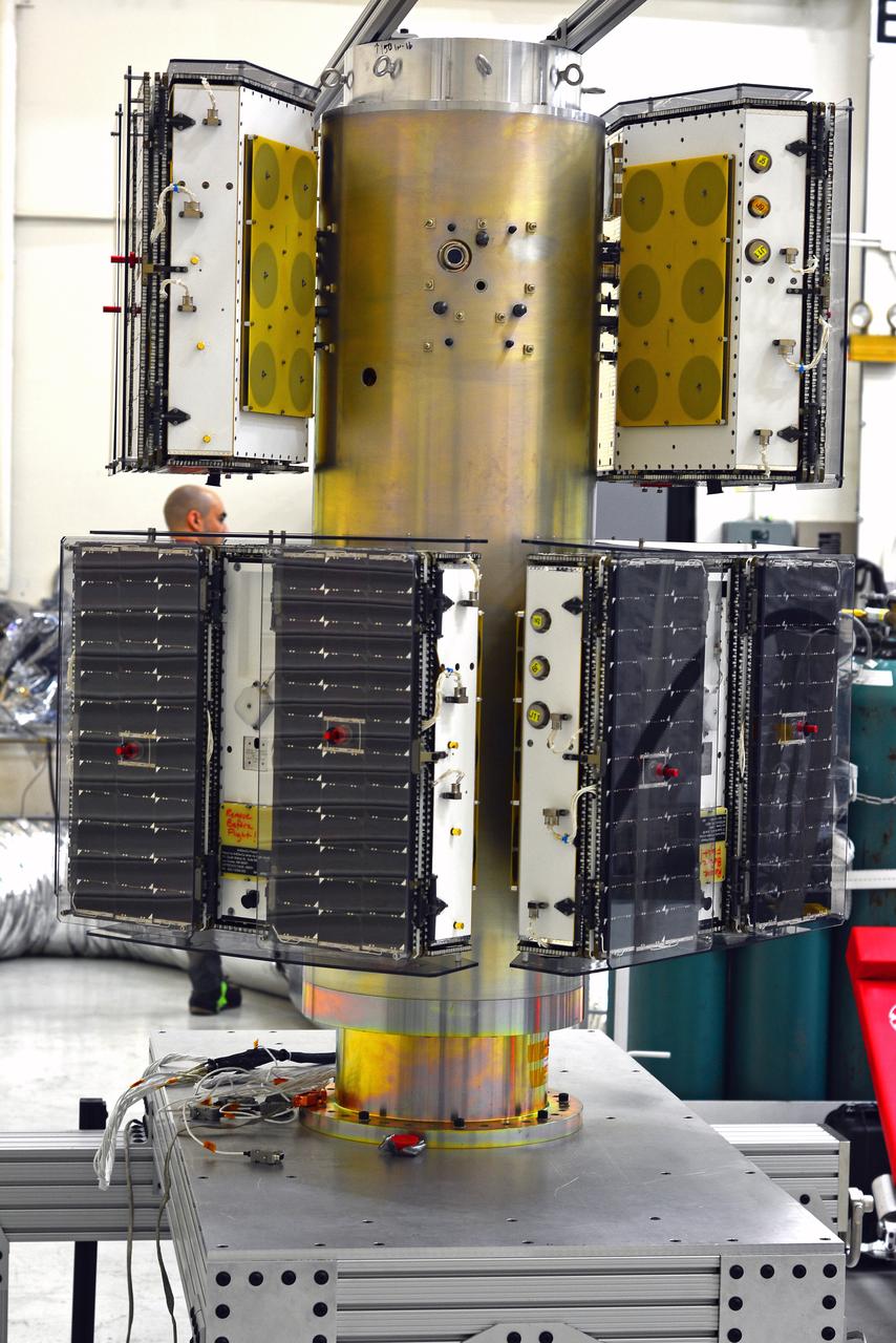
All of the micro satellites have been fully installed on the deployment module by Orbital ATK for NASA’s Cyclone Global Navigation Satellite System (CYGNSS) in Building 1555 at Vandenberg Air Force Base in California. CYGNSS is being prepared at Vandenberg, and then will be transported to NASA’s Kennedy Space Center in Florida aboard the Orbital ATK Pegasus XL rocket which will be attached to the Orbital ATK L-1011 carrier aircraft. CYGNSS will launch on the Pegasus XL rocket from the Skid Strip at Cape Canaveral Air Force Station. CYGNSS will make frequent and accurate measurements of ocean surface winds throughout the life cycle of tropical storms and hurricanes. The data that CYGNSS provides will enable scientists to probe key air-sea interaction processes that take place near the core of storms, which are rapidly changing and play a critical role in the beginning and intensification of hurricanes.
Technicians with Orbital ATK prepare to install the micro satellites on the deployment module for NASA’s Cyclone Global Navigation Satellite System (CYGNSS) in Building 1555 at Vandenberg Air Force Base in California. CYGNSS is being prepared at Vandenberg, and then will be transported to NASA’s Kennedy Space Center in Florida aboard the Orbital ATK Pegasus XL rocket which will be attached to the Orbital ATK L-1011 carrier aircraft. CYGNSS will launch on the Pegasus XL rocket from the Skid Strip at Cape Canaveral Air Force Station. CYGNSS will make frequent and accurate measurements of ocean surface winds throughout the life cycle of tropical storms and hurricanes. The data that CYGNSS provides will enable scientists to probe key air-sea interaction processes that take place near the core of storms, which are rapidly changing and play a critical role in the beginning and intensification of hurricanes.
A technician with Orbital ATK checks out the micro satellites deployment module for NASA’s Cyclone Global Navigation Satellite System (CYGNSS) in Building 1555 at Vandenberg Air Force Base in California. CYGNSS is being prepared at Vandenberg, and then will be transported to NASA’s Kennedy Space Center in Florida aboard the Orbital ATK Pegasus XL rocket which will be attached to the Orbital ATK L-1011 carrier aircraft. CYGNSS will launch on the Pegasus XL rocket from the Skid Strip at Cape Canaveral Air Force Station. CYGNSS will make frequent and accurate measurements of ocean surface winds throughout the life cycle of tropical storms and hurricanes. The data that CYGNSS provides will enable scientists to probe key air-sea interaction processes that take place near the core of storms, which are rapidly changing and play a critical role in the beginning and intensification of hurricanes.
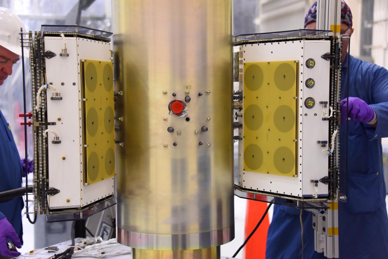
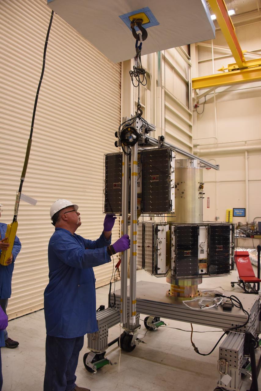
Technicians with Orbital ATK install the first two sets of micro satellites on the deployment module for NASA’s Cyclone Global Navigation Satellite System (CYGNSS) in Building 1555 at Vandenberg Air Force Base in California. CYGNSS is being prepared at Vandenberg, and then will be transported to NASA’s Kennedy Space Center in Florida aboard the Orbital ATK Pegasus XL rocket which will be attached to the Orbital ATK L-1011 carrier aircraft. CYGNSS will launch on the Pegasus XL rocket from the Skid Strip at Cape Canaveral Air Force Station. CYGNSS will make frequent and accurate measurements of ocean surface winds throughout the life cycle of tropical storms and hurricanes. The data that CYGNSS provides will enable scientists to probe key air-sea interaction processes that take place near the core of storms, which are rapidly changing and play a critical role in the beginning and intensification of hurricanes.
Technicians with Orbital ATK continue to install micro satellites on the deployment module for NASA’s Cyclone Global Navigation Satellite System (CYGNSS) in Building 1555 at Vandenberg Air Force Base in California. CYGNSS is being prepared at Vandenberg, and then will be transported to NASA’s Kennedy Space Center in Florida aboard the Orbital ATK Pegasus XL rocket which will be attached to the Orbital ATK L-1011 carrier aircraft. CYGNSS will launch on the Pegasus XL rocket from the Skid Strip at Cape Canaveral Air Force Station. CYGNSS will make frequent and accurate measurements of ocean surface winds throughout the life cycle of tropical storms and hurricanes. The data that CYGNSS provides will enable scientists to probe key air-sea interaction processes that take place near the core of storms, which are rapidly changing and play a critical role in the beginning and intensification of hurricanes.
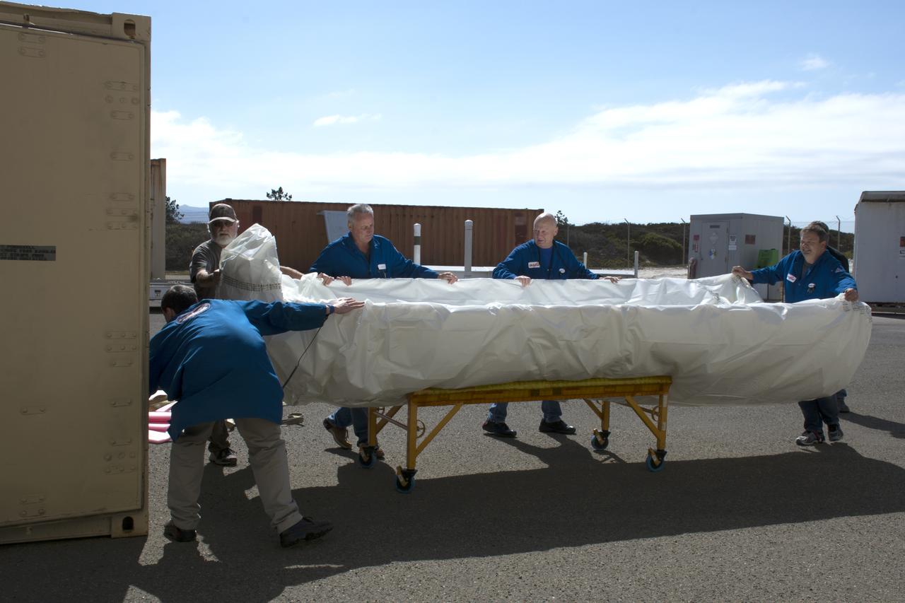
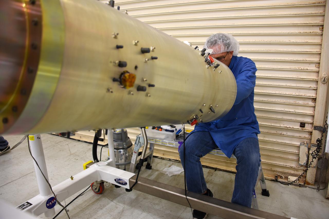
Technicians with Orbital ATK remove the first half of the Pegasus payload fairing for NASA’s Cyclone Global Navigation Satellite System (CYGNSS) from its shipping container and prepare it for the move to nearby Building 1555 at Vandenberg Air Force Base in California. CYGNSS is being prepared at Vandenberg, and then will be transported to NASA’s Kennedy Space Center in Florida aboard the Orbital ATK Pegasus XL rocket which will be attached to the Orbital ATK L-1011 carrier aircraft. CYGNSS will launch on the Pegasus XL rocket from the Skid Strip at Cape Canaveral Air Force Station. CYGNSS will make frequent and accurate measurements of ocean surface winds throughout the life cycle of tropical storms and hurricanes. The data that CYGNSS provides will enable scientists to probe key air-sea interaction processes that take place near the core of storms, which are rapidly changing and play a critical role in the beginning and intensification of hurricanes.
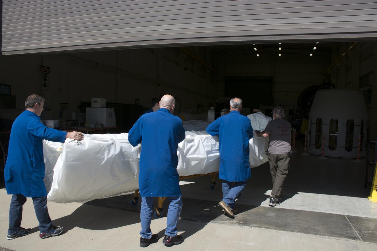
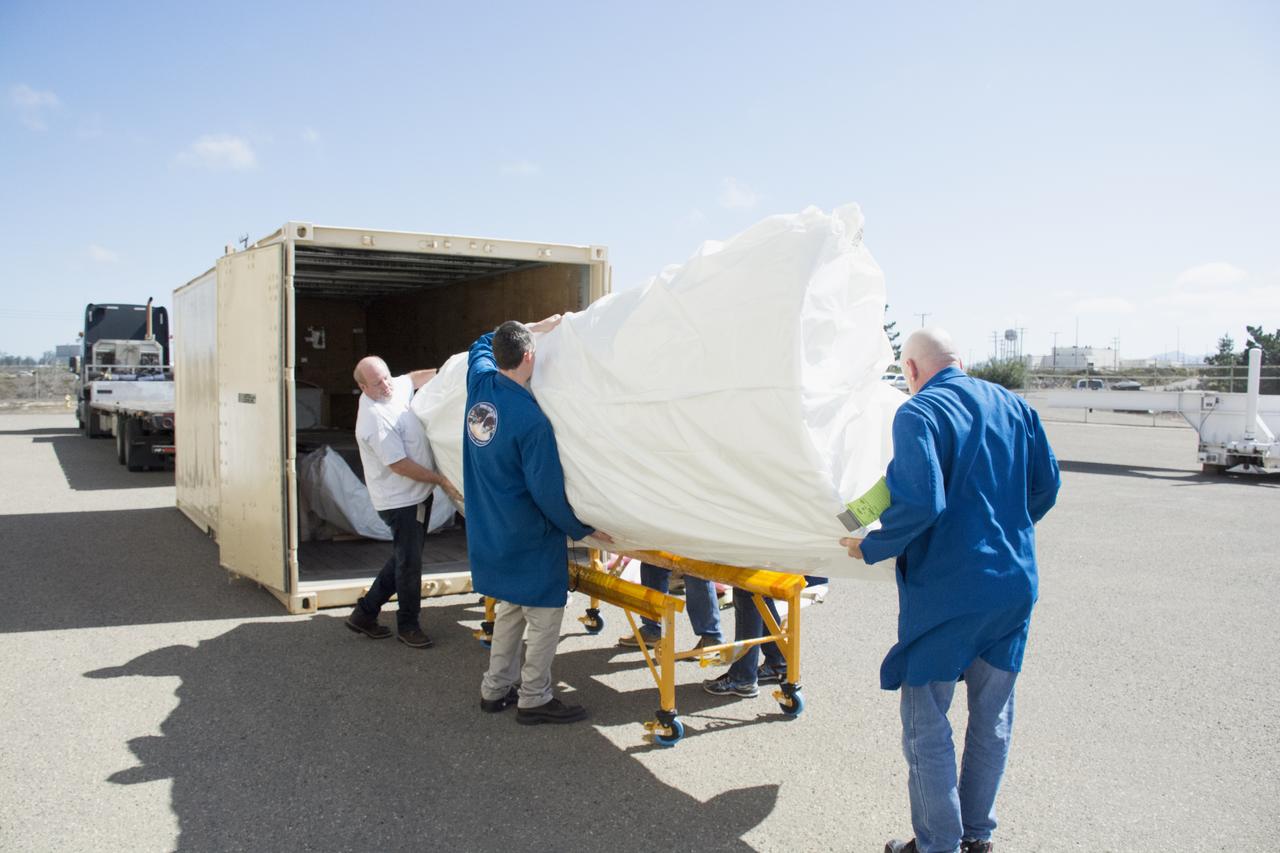
Technicians with Orbital ATK move the first half of the Pegasus payload fairing for NASA’s Cyclone Global Navigation Satellite System (CYGNSS) from into Building 1555 at Vandenberg Air Force Base in California. CYGNSS is being prepared at Vandenberg, and then will be transported to NASA’s Kennedy Space Center in Florida aboard the Orbital ATK Pegasus XL rocket which will be attached to the Orbital ATK L-1011 carrier aircraft. CYGNSS will launch on the Pegasus XL rocket from the Skid Strip at Cape Canaveral Air Force Station. CYGNSS will make frequent and accurate measurements of ocean surface winds throughout the life cycle of tropical storms and hurricanes. The data that CYGNSS provides will enable scientists to probe key air-sea interaction processes that take place near the core of storms, which are rapidly changing and play a critical role in the beginning and intensification of hurricanes.
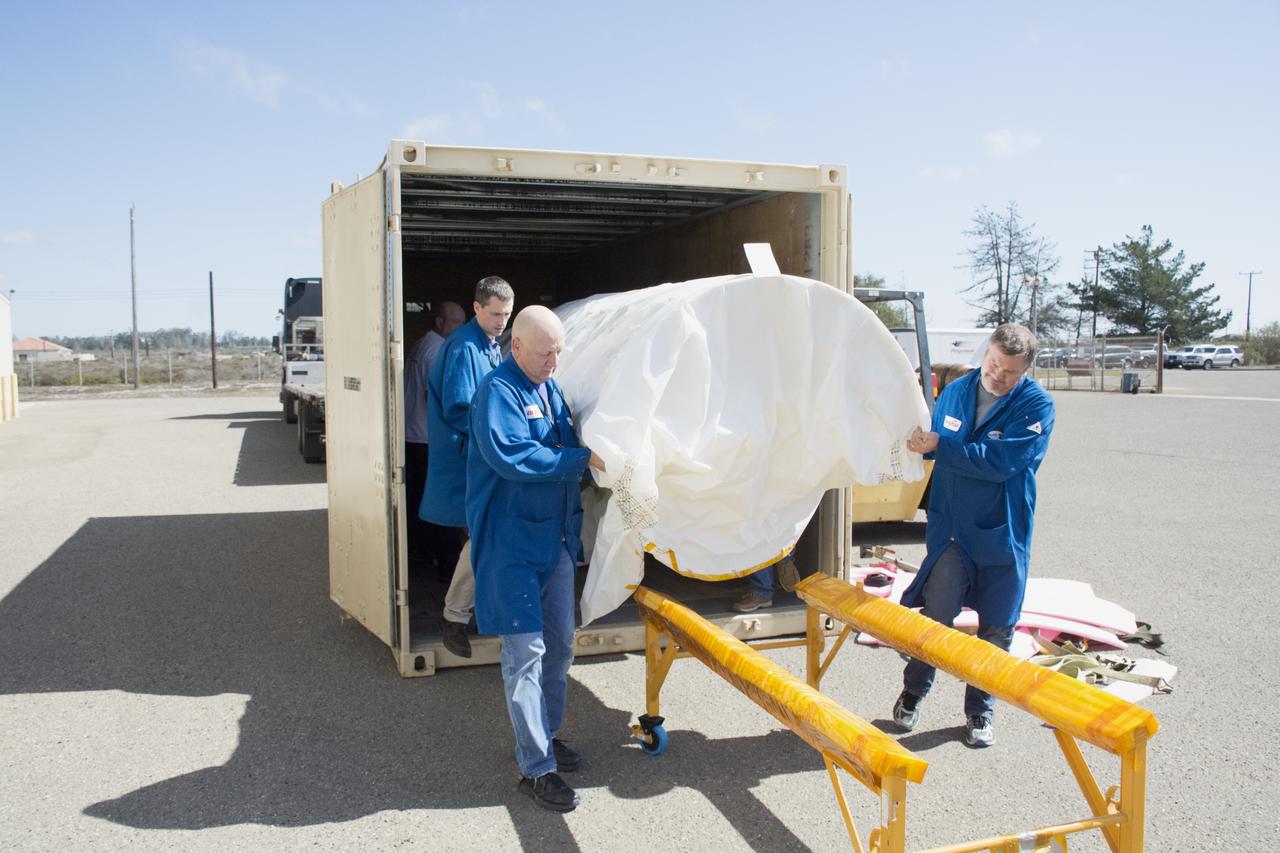
Technicians with Orbital ATK remove the first half of the Pegasus payload fairing for NASA’s Cyclone Global Navigation Satellite System (CYGNSS) from its shipping container near Building 1555 at Vandenberg Air Force Base in California. CYGNSS is being prepared at Vandenberg, and then will be transported to NASA’s Kennedy Space Center in Florida aboard the Orbital ATK Pegasus XL rocket which will be attached to the Orbital ATK L-1011 carrier aircraft. CYGNSS will launch on the Pegasus XL rocket from the Skid Strip at Cape Canaveral Air Force Station. CYGNSS will make frequent and accurate measurements of ocean surface winds throughout the life cycle of tropical storms and hurricanes. The data that CYGNSS provides will enable scientists to probe key air-sea interaction processes that take place near the core of storms, which are rapidly changing and play a critical role in the beginning and intensification of hurricanes.
Technicians with Orbital ATK remove the first half of the Pegasus payload fairing for NASA’s Cyclone Global Navigation Satellite System (CYGNSS) from its shipping container near Building 1555 at Vandenberg Air Force Base in California. CYGNSS is being prepared at Vandenberg, and then will be transported to NASA’s Kennedy Space Center in Florida aboard the Orbital ATK Pegasus XL rocket which will be attached to the Orbital ATK L-1011 carrier aircraft. CYGNSS will launch on the Pegasus XL rocket from the Skid Strip at Cape Canaveral Air Force Station. CYGNSS will make frequent and accurate measurements of ocean surface winds throughout the life cycle of tropical storms and hurricanes. The data that CYGNSS provides will enable scientists to probe key air-sea interaction processes that take place near the core of storms, which are rapidly changing and play a critical role in the beginning and intensification of hurricanes.
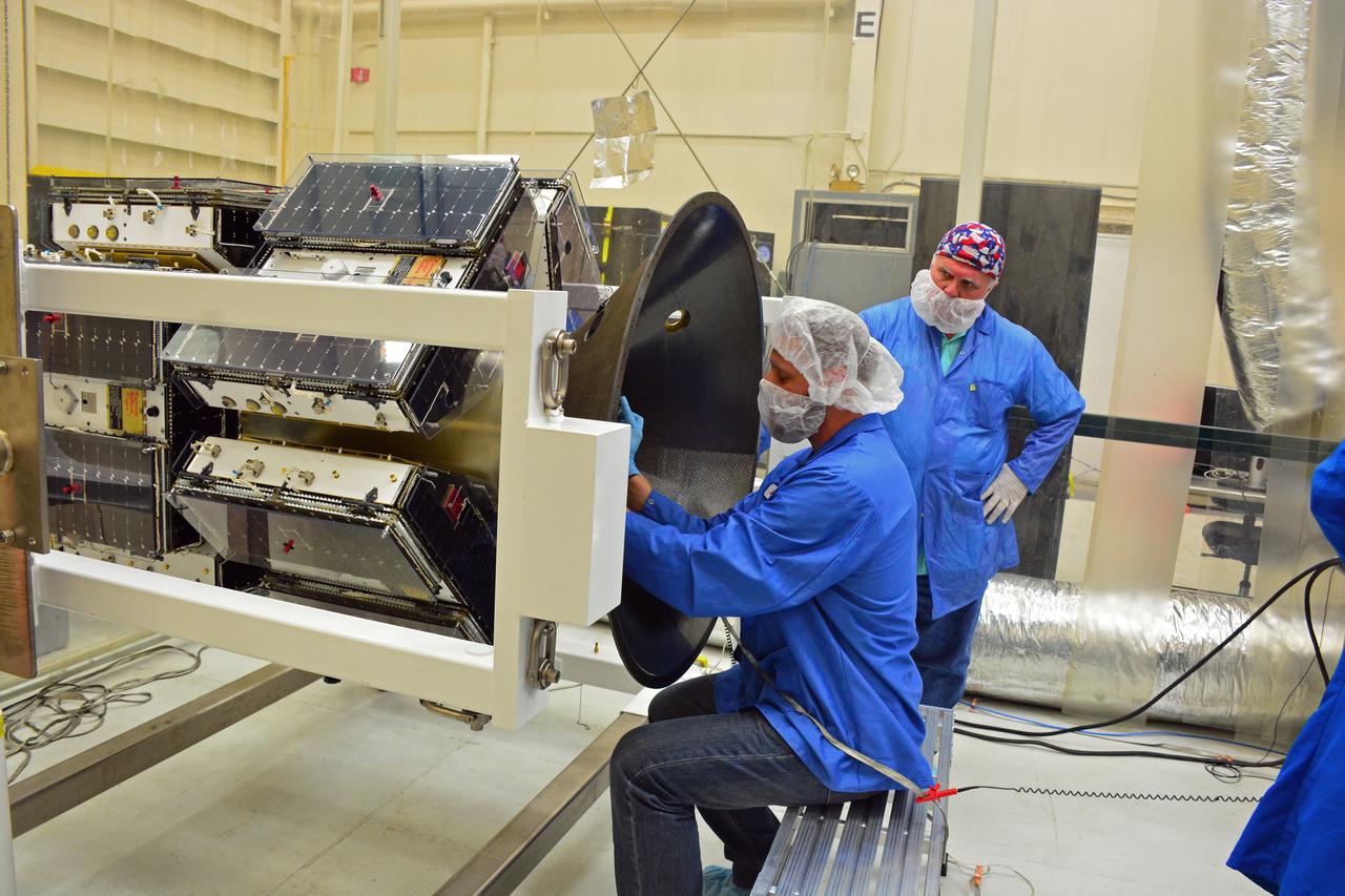
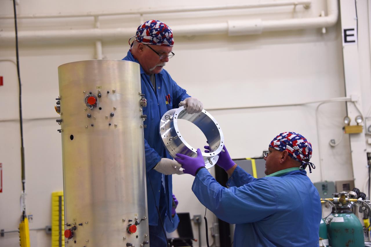
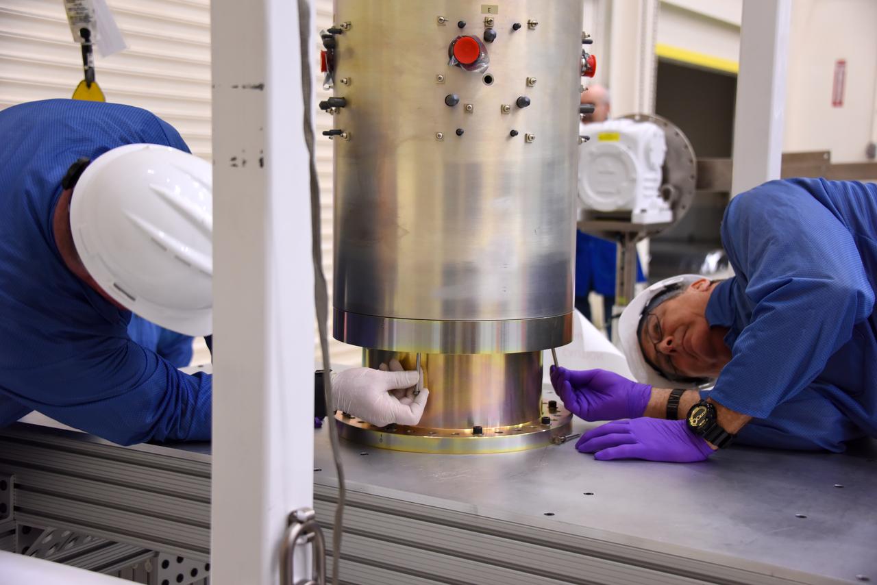
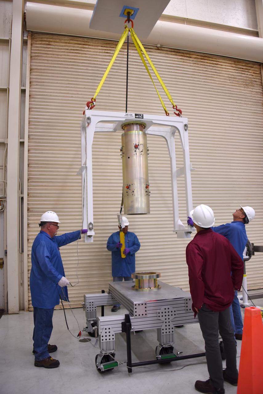
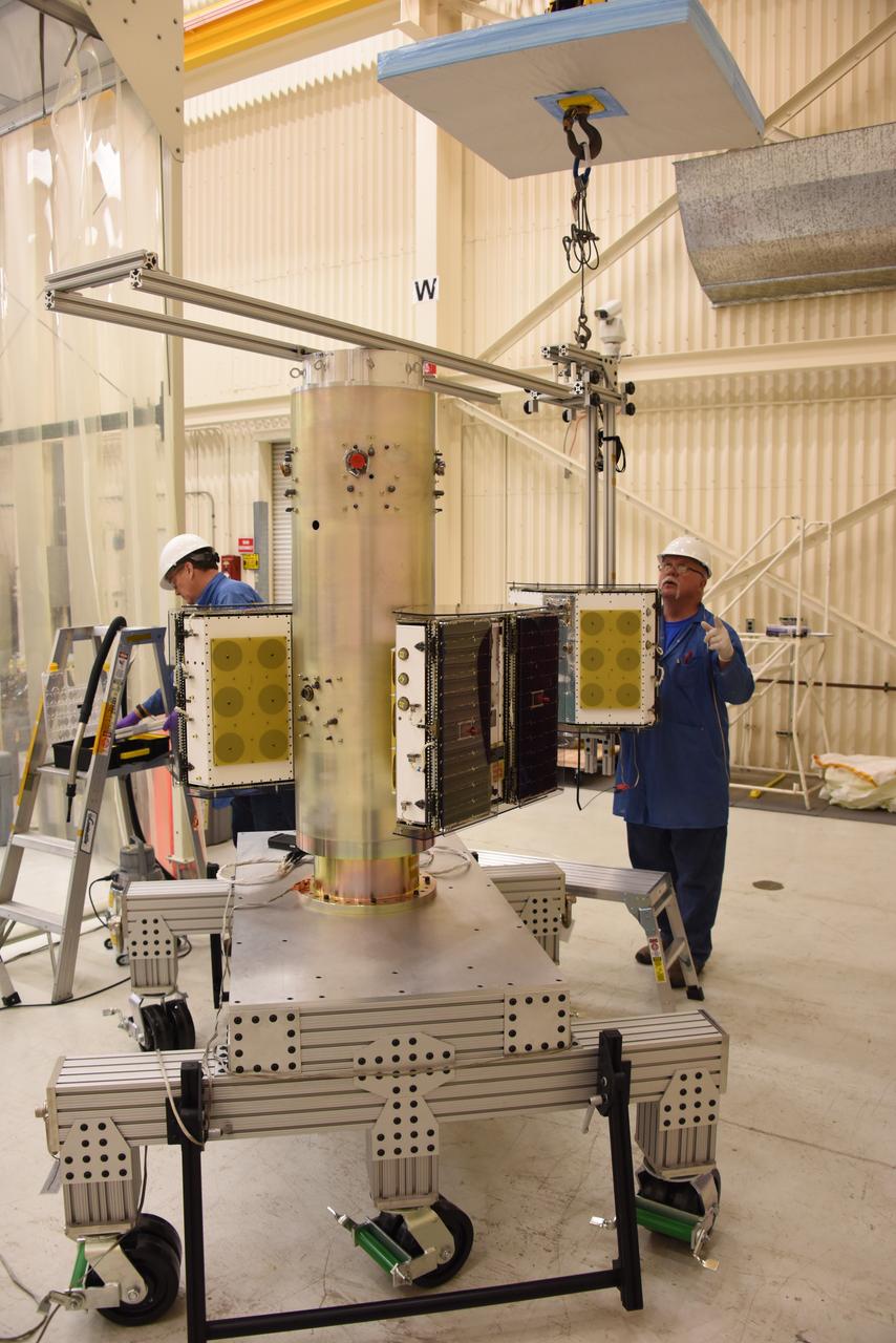
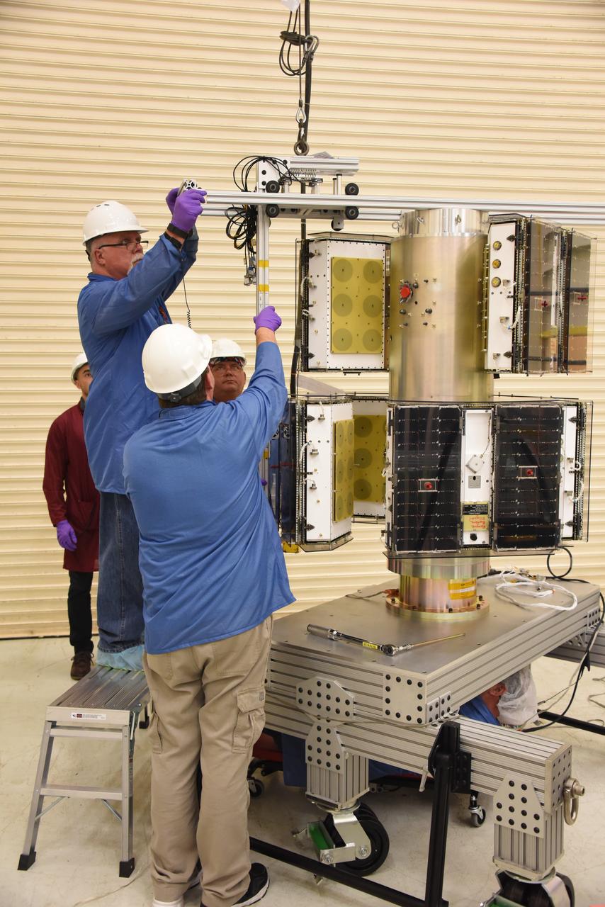
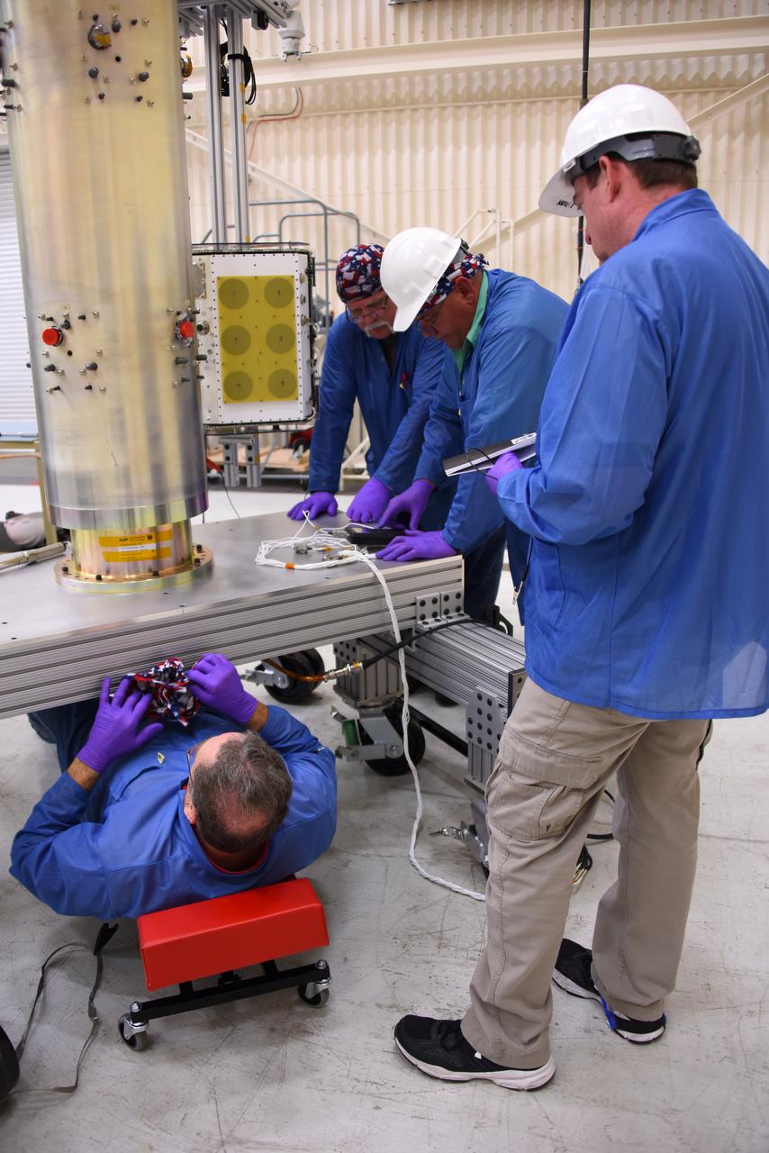
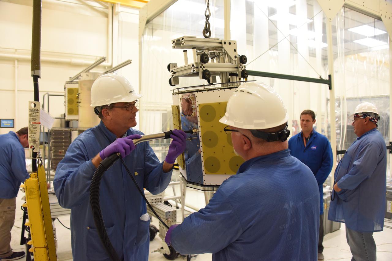
Technicians with Orbital ATK install the payload adapter to the deployment module that contains the micro satellites for NASA’s Cyclone Global Navigation Satellite System (CYGNSS) in Building 1555 at Vandenberg Air Force Base in California. CYGNSS is being prepared at Vandenberg, and then will be transported to NASA’s Kennedy Space Center in Florida aboard the Orbital ATK Pegasus XL rocket which will be attached to the Orbital ATK L-1011 carrier aircraft. CYGNSS will launch on the Pegasus XL rocket from the Skid Strip at Cape Canaveral Air Force Station. CYGNSS will make frequent and accurate measurements of ocean surface winds throughout the life cycle of tropical storms and hurricanes. The data that CYGNSS provides will enable scientists to probe key air-sea interaction processes that take place near the core of storms, which are rapidly changing and play a critical role in the beginning and intensification of hurricanes.
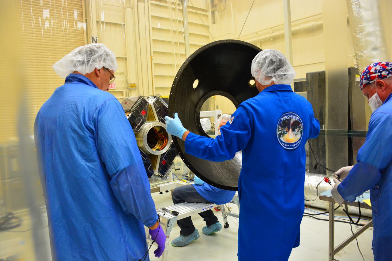
Technicians with Orbital ATK prepare to install the payload adapter to the deployment module that contains the micro satellites for NASA’s Cyclone Global Navigation Satellite System (CYGNSS) in Building 1555 at Vandenberg Air Force Base in California. CYGNSS is being prepared at Vandenberg, and then will be transported to NASA’s Kennedy Space Center in Florida aboard the Orbital ATK Pegasus XL rocket which will be attached to the Orbital ATK L-1011 carrier aircraft. CYGNSS will launch on the Pegasus XL rocket from the Skid Strip at Cape Canaveral Air Force Station. CYGNSS will make frequent and accurate measurements of ocean surface winds throughout the life cycle of tropical storms and hurricanes. The data that CYGNSS provides will enable scientists to probe key air-sea interaction processes that take place near the core of storms, which are rapidly changing and play a critical role in the beginning and intensification of hurricanes.
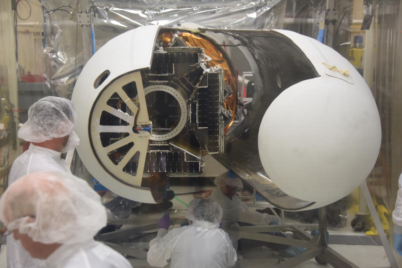
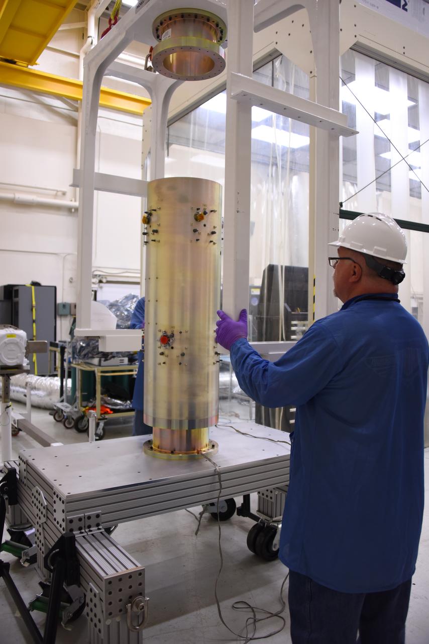
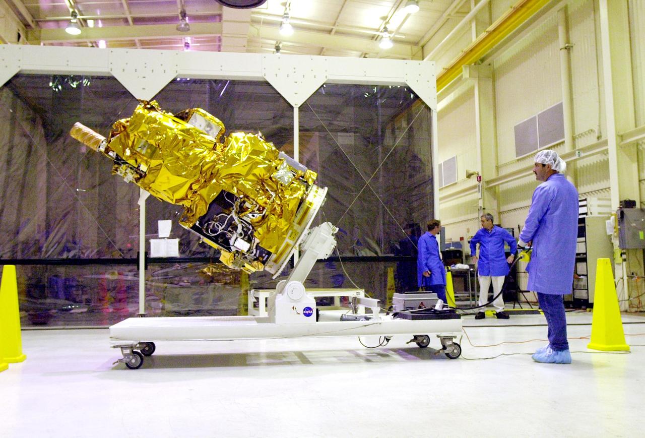
Technicians with Orbital ATK have installed the first half of the Pegasus XL fairing around NASA’s Cyclone Global Navigation Satellite System (CYGNSS) in Building 1555 at Vandenberg Air Force Base in California. The second half of the fairing is being installed. CYGNSS is being prepared at Vandenberg, and then will be transported to NASA’s Kennedy Space Center in Florida aboard the Orbital ATK Pegasus XL rocket which will be attached to the Orbital ATK L-1011 carrier aircraft. CYGNSS will launch on the Pegasus XL rocket from the Skid Strip at Cape Canaveral Air Force Station. CYGNSS will make frequent and accurate measurements of ocean surface winds throughout the life cycle of tropical storms and hurricanes. The data that CYGNSS provides will enable scientists to probe key air-sea interaction processes that take place near the core of storms, which are rapidly changing and play a critical role in the beginning and intensification of hurricanes.
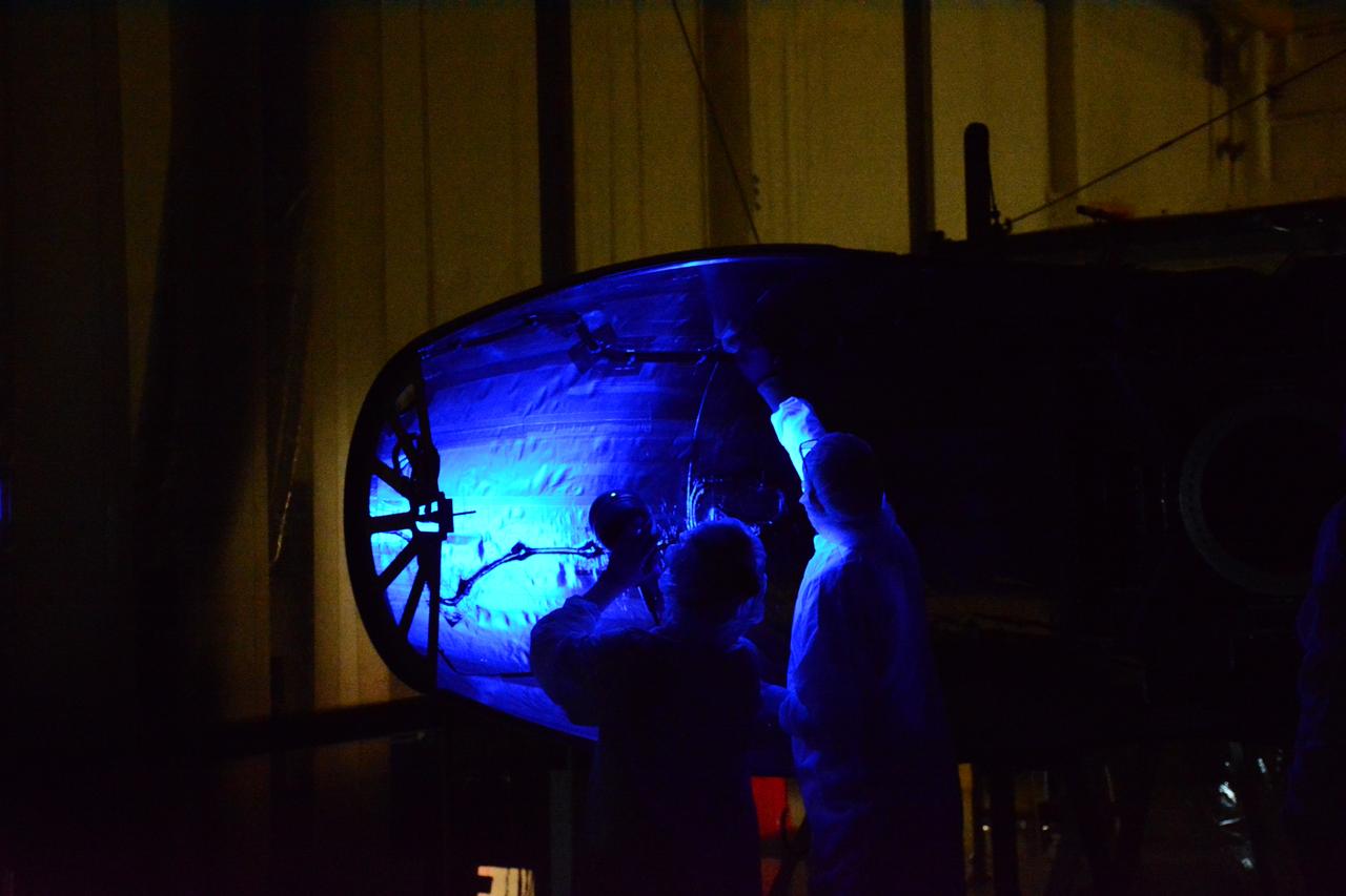
Technicians with Orbital ATK perform a black light test on the Pegasus XL fairing inside Building 1555 at Vandenberg Air Force Base in California. NASA’s Cyclone Global Navigation Satellite System (CYGNSS) is being prepared at Vandenberg, and then will be transported to NASA’s Kennedy Space Center in Florida aboard the Orbital ATK Pegasus XL rocket which will be attached to the Orbital ATK L-1011 Stargazer aircraft. CYGNSS will launch on the Pegasus XL rocket from the Skid Strip at Cape Canaveral Air Force Station. CYGNSS will make frequent and accurate measurements of ocean surface winds throughout the life cycle of tropical storms and hurricanes. The data that CYGNSS provides will enable scientists to probe key air-sea interaction processes that take place near the core of storms, which are rapidly changing and play a critical role in the beginning and intensification of hurricanes.
Technicians with Orbital ATK install the first half of the Pegasus XL fairing around NASA’s Cyclone Global Navigation Satellite System (CYGNSS) in Building 1555 at Vandenberg Air Force Base in California. CYGNSS is being prepared at Vandenberg, and then will be transported to NASA’s Kennedy Space Center in Florida aboard the Orbital ATK Pegasus XL rocket which will be attached to the Orbital ATK L-1011 carrier aircraft. CYGNSS will launch on the Pegasus XL rocket from the Skid Strip at Cape Canaveral Air Force Station. CYGNSS will make frequent and accurate measurements of ocean surface winds throughout the life cycle of tropical storms and hurricanes. The data that CYGNSS provides will enable scientists to probe key air-sea interaction processes that take place near the core of storms, which are rapidly changing and play a critical role in the beginning and intensification of hurricanes.
Technicians with Orbital ATK have installed the first half of the Pegasus XL fairing around NASA’s Cyclone Global Navigation Satellite System (CYGNSS) in Building 1555 at Vandenberg Air Force Base in California. Work is underway to install the second half of the fairing. CYGNSS is being prepared at Vandenberg, and then will be transported to NASA’s Kennedy Space Center in Florida aboard the Orbital ATK Pegasus XL rocket which will be attached to the Orbital ATK L-1011 carrier aircraft. CYGNSS will launch on the Pegasus XL rocket from the Skid Strip at Cape Canaveral Air Force Station. CYGNSS will make frequent and accurate measurements of ocean surface winds throughout the life cycle of tropical storms and hurricanes. The data that CYGNSS provides will enable scientists to probe key air-sea interaction processes that take place near the core of storms, which are rapidly changing and play a critical role in the beginning and intensification of hurricanes.

Small Expendable Deployer System (SEDS) is a tethered date collecting satellite and is intended to demonstrate a versatile and economical way of delivering smaller payloads to higher orbits or downward toward Earth's atmosphere. 19th Navstar Global Positioning System Satellite mission joined with previously launched satellites used for navigational purposes and geodite studies. These satellites are used commercially as well as by the military.
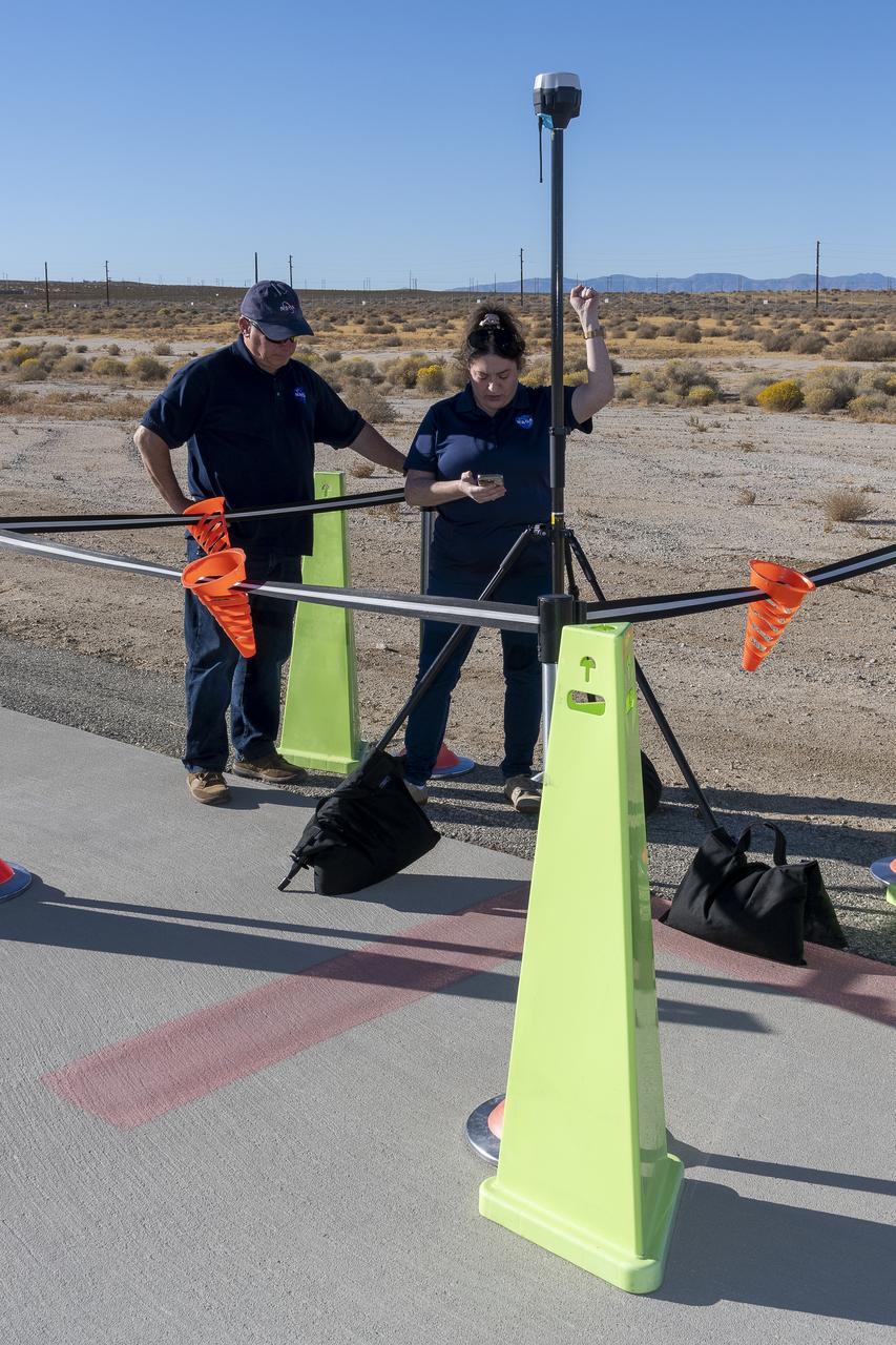
NASA Pathways intern Saré Culbertson, right, works with NASA operations engineer Jack Hayes at NASA’s Armstrong Flight Research Center in Edwards, California, on Nov. 7, 2024. They are verifying GPS and global navigation satellite system coordinates using Emlid Reach RS2+ receiver equipment, which supports surveying, mapping, and navigation in preparation for future air taxi test flight research.
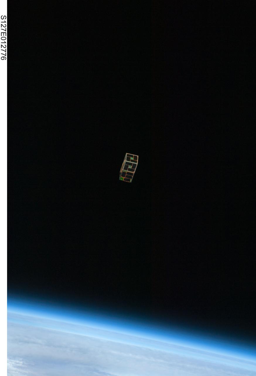
S127-E-012776 (30 July 2009) --- Backdropped by Earth?s horizon and the blackness of space, a Dual RF Astrodynamic GPS Orbital Navigator Satellite (DRAGONSat) is photographed after its release from Space Shuttle Endeavour?s payload bay by STS-127 crew members. DRAGONSat will look at independent rendezvous of spacecraft in orbit using Global Positioning Satellite data. The two satellites were designed and built by students at the University of Texas, Austin, and Texas A&M University, College Station.
iss054e026583 (Jan. 31, 2018) --- NASA astronaut Joe Acaba during a Synchronized Position Hold, Engage, Reorient, Experimental Satellites (SPHERES) Smoothing-Based Relative Navigation (SmoothNav) experiment test run. SPHERES is a self-contained, free-flying satellite to test autonomous capabilities and docking maneuvers within the International Space Station (ISS). SmoothNav software uses a unique computational method to estimate position and velocity in multi-satellite formations.
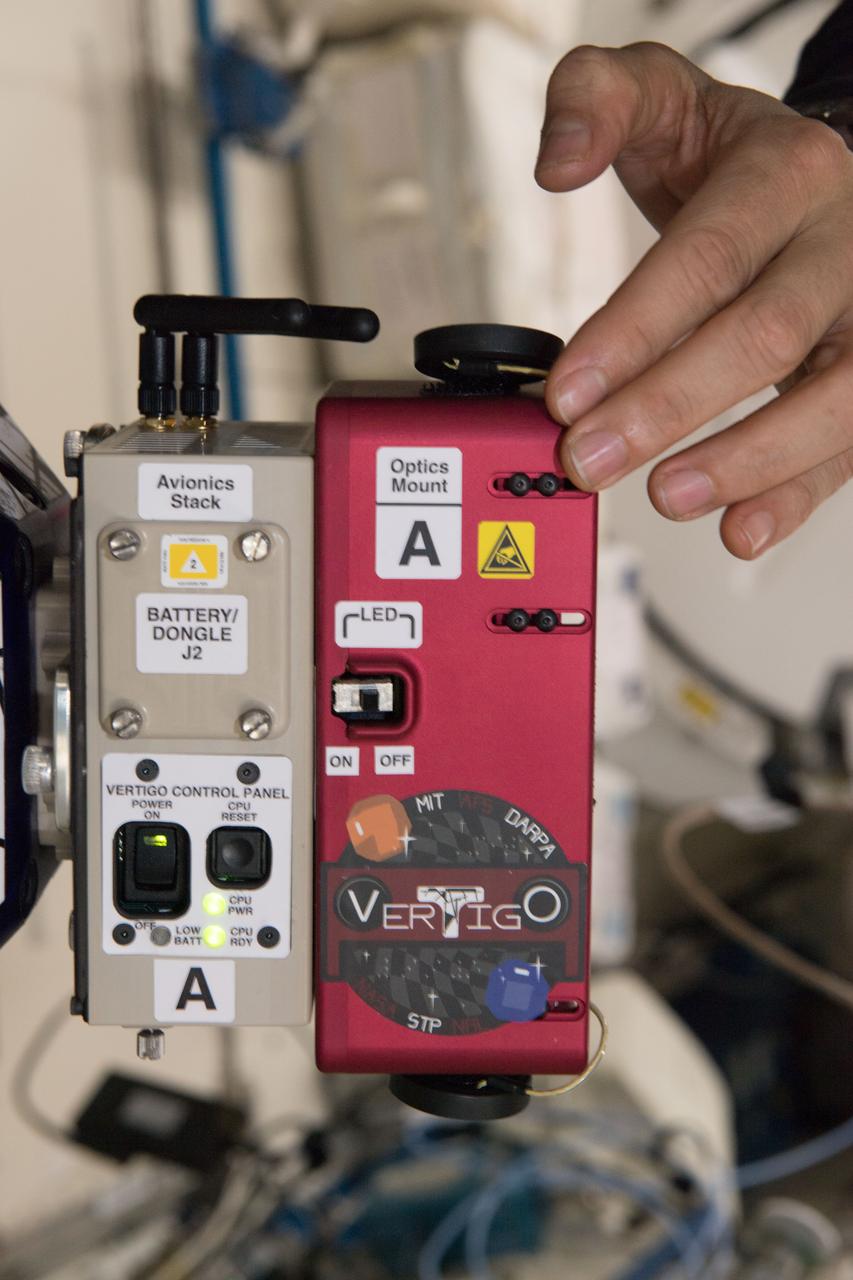
iss054e026580 (Jan. 31, 2018) --- Vertigo hardware used on Synchronized Position Hold, Engage, Reorient, Experimental Satellites (SPHERES) during a test run of Smoothing-Based Relative Navigation (SmoothNav). SPHERES is a self-contained, free-flying satellite to test autonomous capabilities and docking maneuvers within the International Space Station (ISS). SmoothNav software uses a unique computational method to estimate position and velocity in multi-satellite formations.
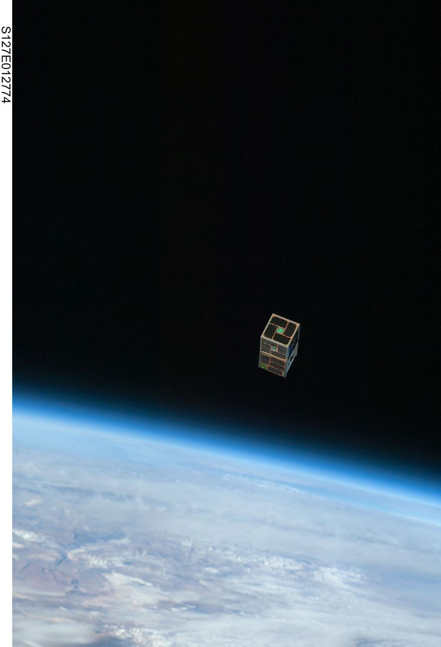
S127-E-012774 (30 July 2009) --- Backdropped by Earth?s horizon and the blackness of space, a Dual RF Astrodynamic GPS Orbital Navigator Satellite (DRAGONSat) is photographed after its release from Space Shuttle Endeavour?s payload bay by STS-127 crew members. DRAGONSat will look at independent rendezvous of spacecraft in orbit using Global Positioning Satellite data. The two satellites were designed and built by students at the University of Texas, Austin, and Texas A&M University, College Station.
iss054e026578 (Jan. 31, 2018) --- Vertigo hardware used on Synchronized Position Hold, Engage, Reorient, Experimental Satellites (SPHERES) during a test run of Smoothing-Based Relative Navigation (SmoothNav). SPHERES is a self-contained, free-flying satellite to test autonomous capabilities and docking maneuvers within the International Space Station (ISS). SmoothNav software uses a unique computational method to estimate position and velocity in multi-satellite formations.
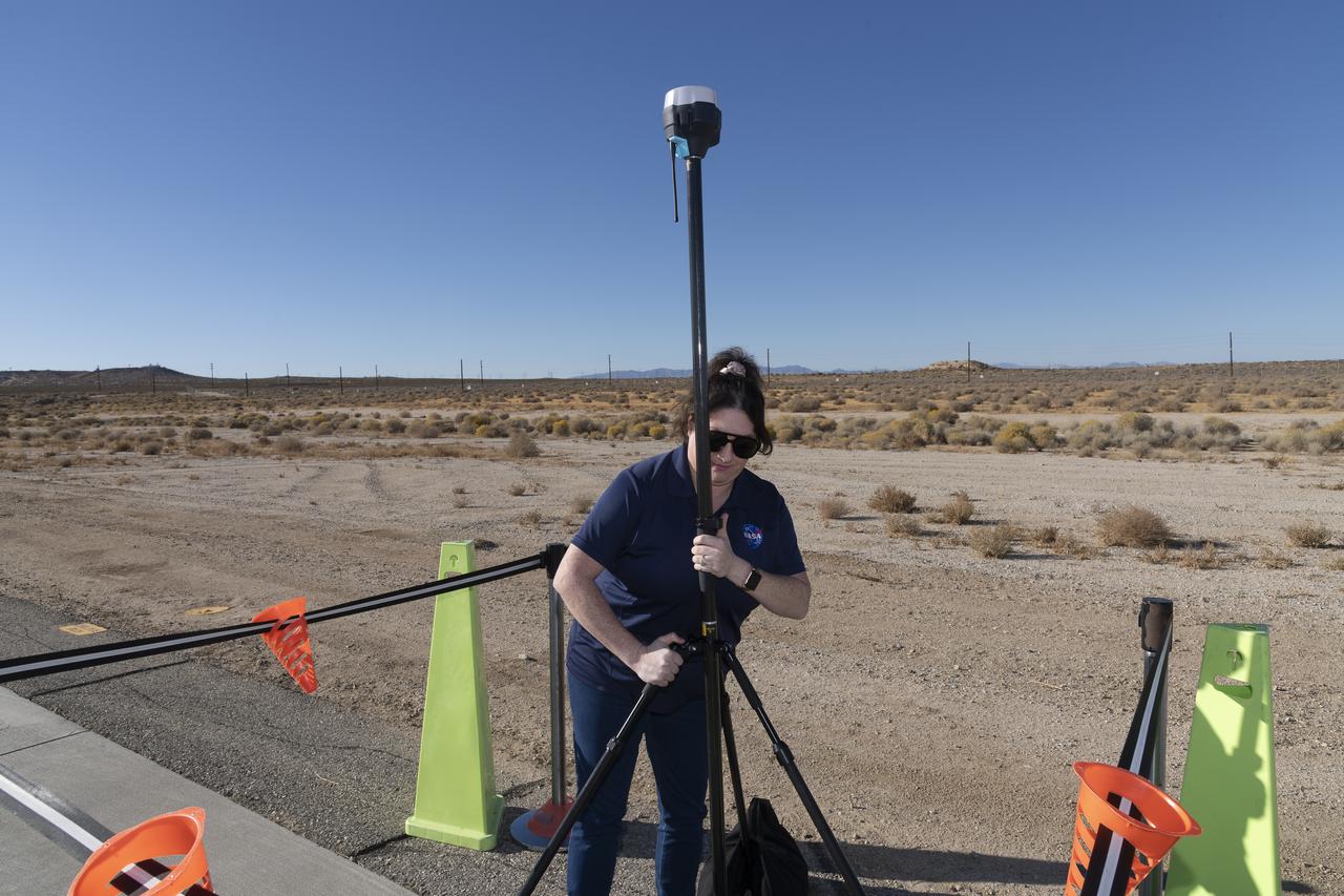
Saré Culbertson, NASA Pathways intern at NASA’s Armstrong Flight Research Center in Edwards, California, adjusts the Emlid Reach RS2+ receiver equipment that connects with GPS and global navigation satellite systems on Nov. 7, 2024, in preparation for future air taxi test flight research.
Communications, Navigation, and Network Reconfigurable Test-bed (CoNNeCT) Flight Hardware Compatibility Test Sets - Glenn Research Center and Networks Integration Management Office (NIMO) Testing for the Tracking and Data Relay Satellite System (TDRSS) - Goddard Space Flight Center Testing
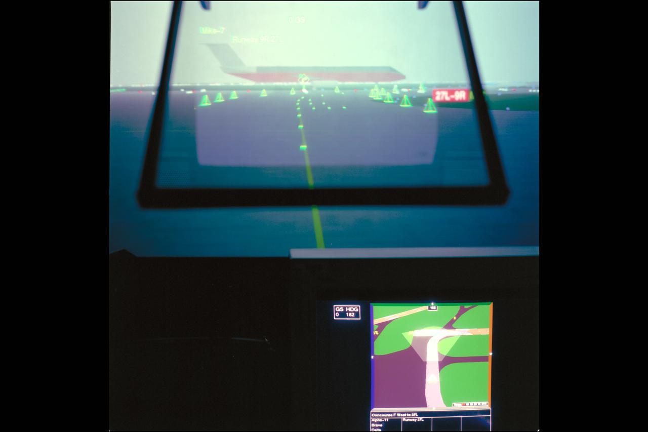
LVLASO (Low Visability Landing and Surface Operations) Project. Taxiway Navigation and Situtation Awareness (TNAS) system will help pilots taxi safely, particularly in low visibility weather conditions using a combination of cockpit displays and the GPS satellite positioning system. HUD SIMULATION DISPLAYS (FOG IN HEADS-UP DISPLAY).
Communications, Navigation, and Network Reconfigurable Test-bed (CoNNeCT) Flight Hardware Compatibility Test Sets - Glenn Research Center and Networks Integration Management Office (NIMO) Testing for the Tracking and Data Relay Satellite System (TDRSS) - Goddard Space Flight Center Testing
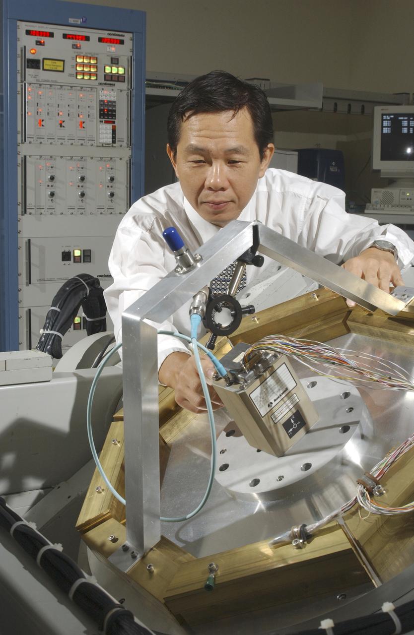
An array of components in a laboratory at NASA's Marshall Space Flight Center (MSFC) is being tested by the Flight Mechanics Office to develop an integrated navigation system for the second generation reusable launch vehicle. The laboratory is testing Global Positioning System (GPS) components, a satellite-based location and navigation system, and Inertial Navigation System (INS) components, sensors on a vehicle that determine angular velocity and linear acceleration at various points. The GPS and INS components work together to provide a space vehicle with guidance and navigation, like the push of the OnStar button in your car assists you with directions to a specific address. The integration will enable the vehicle operating system to track where the vehicle is in space and define its trajectory. The use of INS components for navigation is not new to space technology. The Space Shuttle currently uses them. However, the Space Launch Initiative is expanding the technology to integrate GPS and INS components to allow the vehicle to better define its position and more accurately determine vehicle acceleration and velocity. This advanced technology will lower operational costs and enhance the safety of reusable launch vehicles by providing a more comprehensive navigation system with greater capabilities. In this photograph, Dr. Jason Chuang of MSFC inspects an INS component in the laboratory.
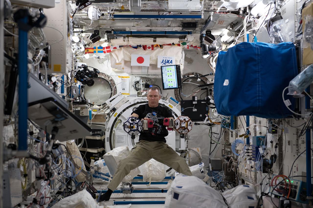
iss055e008318 (April 2, 2018) --- Expedition 55 Flight Engineer Drew Feustel works inside the Japanese Kibo laboratory module with tiny internal satellites known as SPHERES, or Synchronized Position Hold, Engage, Reorient, Experimental Satellites. Feustel was operating the SPHERES for the Smoothing-Based Relative Navigation (SmoothNav) experiment which is developing an algorithm to obtain the most probable estimate of the relative positions and velocities between all spacecraft using all available sensor information, including past measurements.
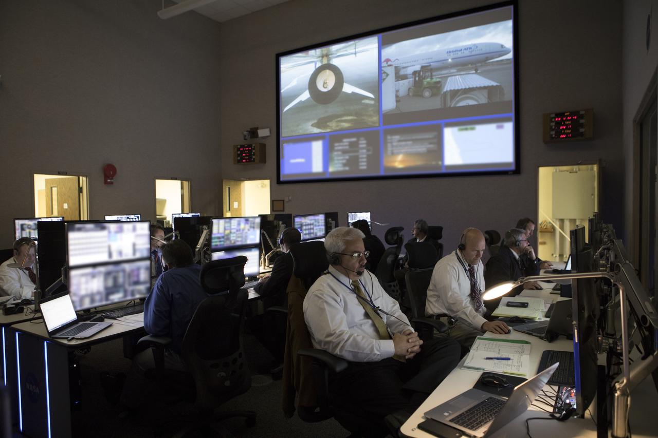
In the Mission Director's Center at Cape Canaveral Air Force Station, members of the launch team monitor the progress of preparations to launch eight Cyclone Global Navigation Satellite System, or CYGNSS, spacecraft. The CYGNSS satellites will make frequent and accurate measurements of ocean surface winds throughout the life cycle of tropical storms and hurricanes. The data that CYGNSS provides will enable scientists to probe key air-sea interaction processes that take place near the core of storms, which are rapidly changing and play a crucial role in the beginning and intensification of hurricanes.

jsc2024e016247 (11/27/2023) --- Nanoracks employees Brendan Swanik (background) and Maximillian Brummel (foreground) integrate the Killick-1 satellite into the launch tube. Nanoracks-Killick-1 is a CubeSat that measures sea ice parameters using Global Navigation Satellite System (GNSS) reflectometry or reflected signals. This monitoring system could contribute to a better understanding of important ocean phenomena and improved weather and climate models. Image courtesy of C-CORE and Memorial University.
In the Mission Director's Center at Cape Canaveral Air Force Station, members of the launch team monitor the progress of preparations to launch eight Cyclone Global Navigation Satellite System, or CYGNSS, spacecraft. The CYGNSS satellites will make frequent and accurate measurements of ocean surface winds throughout the life cycle of tropical storms and hurricanes. The data that CYGNSS provides will enable scientists to probe key air-sea interaction processes that take place near the core of storms, which are rapidly changing and play a crucial role in the beginning and intensification of hurricanes.
In the Mission Director's Center at Cape Canaveral Air Force Station, members of the launch team monitor the progress of preparations to launch eight Cyclone Global Navigation Satellite System, or CYGNSS, spacecraft. The CYGNSS satellites will make frequent and accurate measurements of ocean surface winds throughout the life cycle of tropical storms and hurricanes. The data that CYGNSS provides will enable scientists to probe key air-sea interaction processes that take place near the core of storms, which are rapidly changing and play a crucial role in the beginning and intensification of hurricanes.
A SpaceX Falcon Heavy rocket carrying 24 satellites as part of the Department of Defense's Space Test Program-2 (STP-2) mission is seen illuminated by lights at Launch Complex 39A, Monday, June 24, 2019 at NASA's Kennedy Space Center in Florida. Four NASA technology and science payloads which will study non-toxic spacecraft fuel, deep space navigation, "bubbles" in the electrically-charged layers of Earth's upper atmosphere, and radiation protection for satellites are among the two dozen satellites that will be launched. The three hour launch window opens at 11:30pm EDT on June 24. Photo Credit: (NASA/Joel Kowsky)
A SpaceX Falcon Heavy rocket carrying 24 satellites as part of the Department of Defense's Space Test Program-2 (STP-2) mission launches from Launch Complex 39A, Tuesday, June 25, 2019 at NASA's Kennedy Space Center in Florida. Four NASA technology and science payloads which will study non-toxic spacecraft fuel, deep space navigation, "bubbles" in the electrically-charged layers of Earth's upper atmosphere, and radiation protection for satellites are among the two dozen satellites that will be put into orbit. Photo Credit: (NASA/Joel Kowsky)
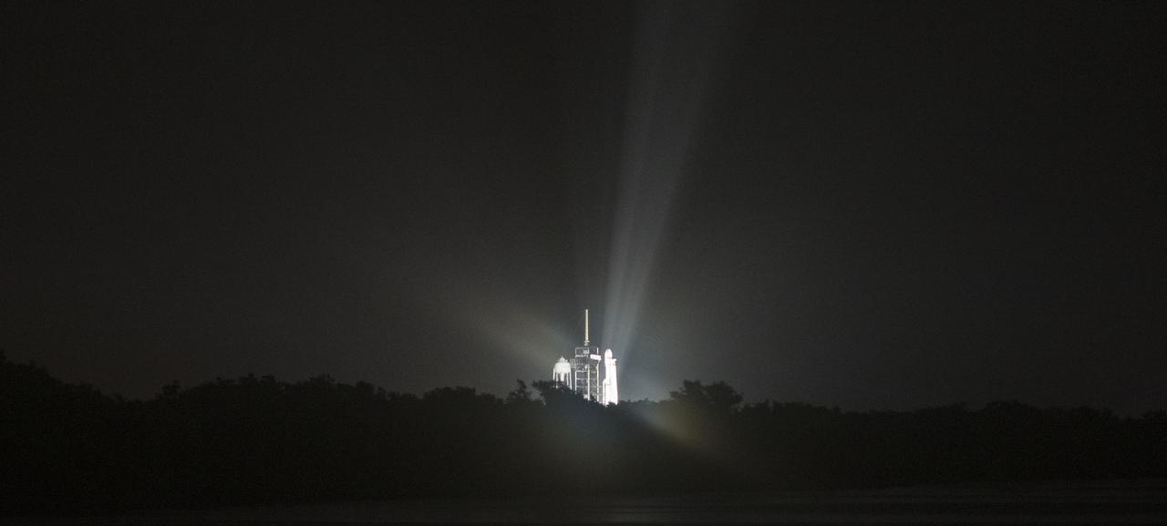
The two side boosters of the SpaceX Falcon Heavy rocket carrying 24 satellites as part of the Department of Defense's Space Test Program-2 (STP-2) mission are seen as they begin their landing burns to return to Landing Zone 1, Tuesday, June 25, 2019 at NASA's Kennedy Space Center in Florida. Four NASA technology and science payloads which will study non-toxic spacecraft fuel, deep space navigation, "bubbles" in the electrically-charged layers of Earth's upper atmosphere, and radiation protection for satellites are among the two dozen satellites that will be put into orbit. Photo Credit: (NASA/Joel Kowsky)
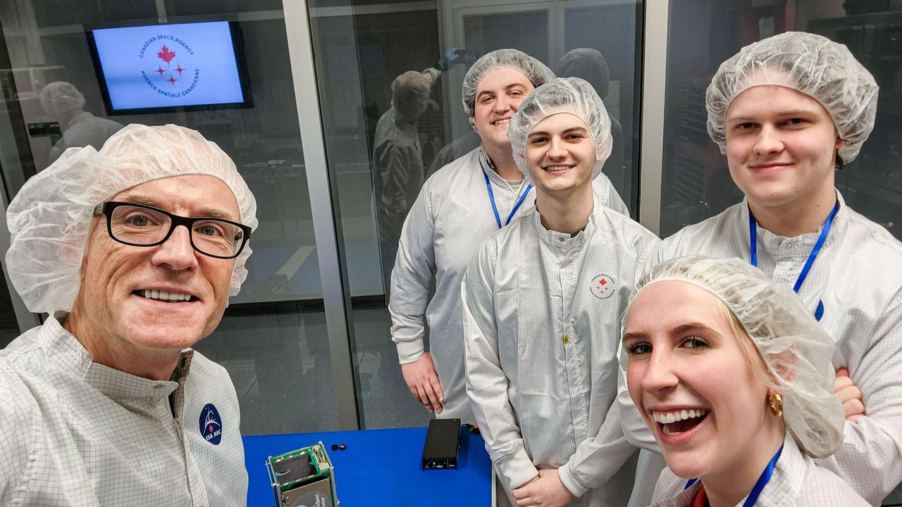
jsc2024e016246 (11/27/2023) --- Selfie of Killick-1 Satellite Integration Team in the Canadian Space Agency Clean Room with the Killick-1 satellite (foreground). From left to right – Desmond Power (Co-Principal Investigator), Matthew Fewer (Computer Engineering Student), Cameron King (Computer Engineering Student), Victoria Vaters (Mechanical Engineering Student), Daniel Dolomount (computer Engineering Student). Nanoracks-Killick-1 is a CubeSat that measures sea ice parameters using Global Navigation Satellite System (GNSS) reflectometry or reflected signals. Image courtesy of C-CORE and Memorial University.
A SpaceX Falcon Heavy rocket carrying 24 satellites as part of the Department of Defense's Space Test Program-2 (STP-2) mission is seen illuminated by lights at Launch Complex 39A, Tuesday, June 25, 2019 at NASA's Kennedy Space Center in Florida. Four NASA technology and science payloads which will study non-toxic spacecraft fuel, deep space navigation, "bubbles" in the electrically-charged layers of Earth's upper atmosphere, and radiation protection for satellites are among the two dozen satellites that will be put into orbit. Photo Credit: (NASA/Joel Kowsky)
A SpaceX Falcon Heavy rocket carrying 24 satellites as part of the Department of Defense's Space Test Program-2 (STP-2) mission launches from Launch Complex 39A, Tuesday, June 25, 2019 at NASA's Kennedy Space Center in Florida. Four NASA technology and science payloads which will study non-toxic spacecraft fuel, deep space navigation, "bubbles" in the electrically-charged layers of Earth's upper atmosphere, and radiation protection for satellites are among the two dozen satellites that will be put into orbit. Photo Credit: (NASA/Joel Kowsky)

A SpaceX Falcon Heavy rocket carrying 24 satellites as part of the Department of Defense's Space Test Program-2 (STP-2) mission is seen at Launch Complex 39A, Monday, June 24, 2019 at NASA's Kennedy Space Center in Florida. Four NASA technology and science payloads which will study non-toxic spacecraft fuel, deep space navigation, "bubbles" in the electrically-charged layers of Earth's upper atmosphere, and radiation protection for satellites are among the two dozen satellites that will be launched. The three hour launch window opens at 11:30pm EDT on June 24. Photo Credit: (NASA/Joel Kowsky)
A SpaceX Falcon Heavy rocket carrying 24 satellites as part of the Department of Defense's Space Test Program-2 (STP-2) mission is seen illuminated by lights at Launch Complex 39A, Monday, June 24, 2019 at NASA's Kennedy Space Center in Florida. Four NASA technology and science payloads which will study non-toxic spacecraft fuel, deep space navigation, "bubbles" in the electrically-charged layers of Earth's upper atmosphere, and radiation protection for satellites are among the two dozen satellites that will be launched. The three hour launch window opens at 11:30pm EDT on June 24. Photo Credit: (NASA/Joel Kowsky)
A SpaceX Falcon Heavy rocket carrying 24 satellites as part of the Department of Defense's Space Test Program-2 (STP-2) mission launches from Launch Complex 39A, Tuesday, June 25, 2019 at NASA's Kennedy Space Center in Florida. Four NASA technology and science payloads which will study non-toxic spacecraft fuel, deep space navigation, "bubbles" in the electrically-charged layers of Earth's upper atmosphere, and radiation protection for satellites are among the two dozen satellites that will be put into orbit. Photo Credit: (NASA/Joel Kowsky)
A SpaceX Falcon Heavy rocket carrying 24 satellites as part of the Department of Defense's Space Test Program-2 (STP-2) mission launches from Launch Complex 39A, Tuesday, June 25, 2019 at NASA's Kennedy Space Center in Florida. Four NASA technology and science payloads which will study non-toxic spacecraft fuel, deep space navigation, "bubbles" in the electrically-charged layers of Earth's upper atmosphere, and radiation protection for satellites are among the two dozen satellites that will be put into orbit. Photo Credit: (NASA/Joel Kowsky)

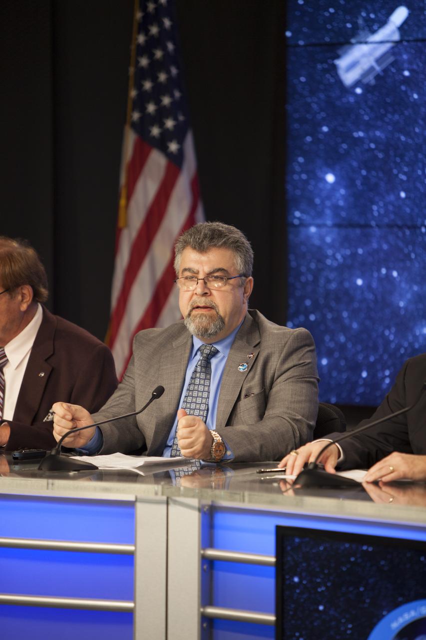
In the Kennedy Space Center’s Press Site auditorium, NASA and industry leaders speak to members of the media during a prelaunch news conference for the agency’s Cyclone Global Navigation Satellite System, or CYGNSS, spacecraft. The model depicts the deployment module from which the eight micro-satellites will be deployed. In the background is Tim Dunn, NASA launch director at Kennedy. The CYGNSS satellites will make frequent and accurate measurements of ocean surface winds throughout the life cycle of tropical storms and hurricanes. The data will help scientists probe key air-sea interaction processes that take place near the core of storms, which are rapidly changing and play a crucial role in the beginning and intensification of hurricanes.
A SpaceX Falcon Heavy rocket carrying 24 satellites as part of the Department of Defense's Space Test Program-2 (STP-2) mission launches from Launch Complex 39A, Tuesday, June 25, 2019 at NASA's Kennedy Space Center in Florida. Four NASA technology and science payloads which will study non-toxic spacecraft fuel, deep space navigation, "bubbles" in the electrically-charged layers of Earth's upper atmosphere, and radiation protection for satellites are among the two dozen satellites that will be put into orbit. Photo Credit: (NASA/Joel Kowsky)
A SpaceX Falcon Heavy rocket carrying 24 satellites as part of the Department of Defense's Space Test Program-2 (STP-2) mission launches from Launch Complex 39A, Tuesday, June 25, 2019 at NASA's Kennedy Space Center in Florida. Four NASA technology and science payloads which will study non-toxic spacecraft fuel, deep space navigation, "bubbles" in the electrically-charged layers of Earth's upper atmosphere, and radiation protection for satellites are among the two dozen satellites that will be put into orbit. Photo Credit: (NASA/Joel Kowsky)
The two side boosters of the SpaceX Falcon Heavy rocket carrying 24 satellites as part of the Department of Defense's Space Test Program-2 (STP-2) mission are seen as they conduct a boost back burn to return to Landing Zone 1, Tuesday, June 25, 2019 at NASA's Kennedy Space Center in Florida. Four NASA technology and science payloads which will study non-toxic spacecraft fuel, deep space navigation, "bubbles" in the electrically-charged layers of Earth's upper atmosphere, and radiation protection for satellites are among the two dozen satellites that will be put into orbit. Photo Credit: (NASA/Joel Kowsky)
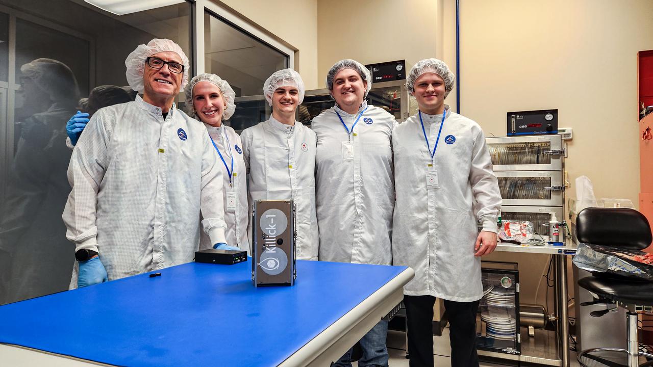
jsc2024e016245 (11/27/2023) --- The Nanoracks-Killick-1 Satellite Integration Team in the Canadian Space Agency (CSA) clean room with the Killick-1 satellite (foreground). From left to right – Desmond Power (Co-Principal Investigator), Victoria Vaters (Mechanical Engineering Student), Cameron King (Computer Engineering Student), Matthew Fewer (Computer Engineering Student), Daniel Dolomount (computer Engineering Student). Nanoracks-Killick-1 is a CubeSat that measures sea ice parameters using Global Navigation Satellite System (GNSS) reflectometry or reflected signals. Image courtesy of C-CORE and Memorial University.
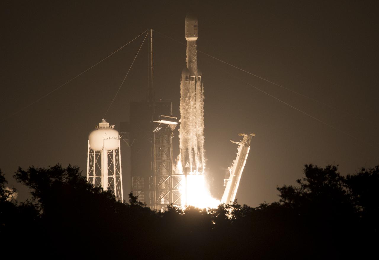
A SpaceX Falcon Heavy rocket carrying 24 satellites as part of the Department of Defense's Space Test Program-2 (STP-2) mission launches from Launch Complex 39A, Tuesday, June 25, 2019 at NASA's Kennedy Space Center in Florida. Four NASA technology and science payloads which will study non-toxic spacecraft fuel, deep space navigation, "bubbles" in the electrically-charged layers of Earth's upper atmosphere, and radiation protection for satellites are among the two dozen satellites that will be put into orbit. Photo Credit: (NASA/Joel Kowsky)
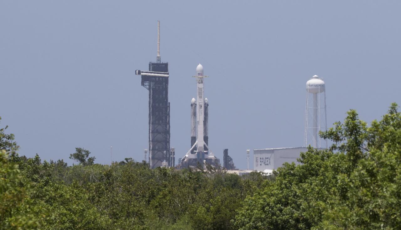
A SpaceX Falcon Heavy rocket carrying 24 satellites as part of the Department of Defense's Space Test Program-2 (STP-2) mission is seen at Launch Complex 39A, Monday, June 24, 2019 at NASA's Kennedy Space Center in Florida. Four NASA technology and science payloads which will study non-toxic spacecraft fuel, deep space navigation, "bubbles" in the electrically-charged layers of Earth's upper atmosphere, and radiation protection for satellites are among the two dozen satellites that will be launched. The three hour launch window opens at 11:30pm EDT on June 24. Photo Credit: (NASA/Joel Kowsky)
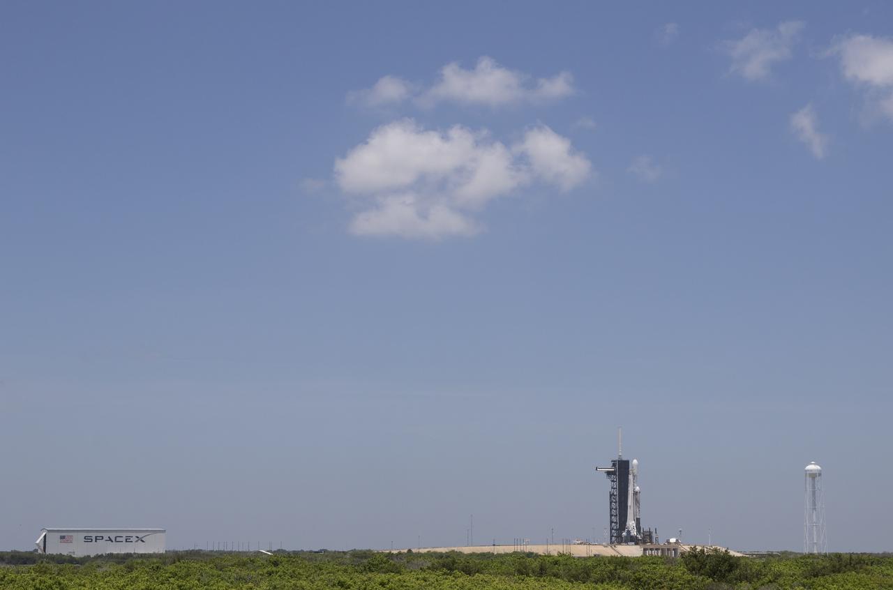
A SpaceX Falcon Heavy rocket carrying 24 satellites as part of the Department of Defense's Space Test Program-2 (STP-2) mission is seen at Launch Complex 39A, Monday, June 24, 2019 at NASA's Kennedy Space Center in Florida. Four NASA technology and science payloads which will study non-toxic spacecraft fuel, deep space navigation, "bubbles" in the electrically-charged layers of Earth's upper atmosphere, and radiation protection for satellites are among the two dozen satellites that will be launched. The three hour launch window opens at 11:30pm EDT on June 24. Photo Credit: (NASA/Joel Kowsky)
A SpaceX Falcon Heavy rocket carrying 24 satellites as part of the Department of Defense's Space Test Program-2 (STP-2) mission is seen illuminated by lights at Launch Complex 39A, Monday, June 24, 2019 at NASA's Kennedy Space Center in Florida. Four NASA technology and science payloads which will study non-toxic spacecraft fuel, deep space navigation, "bubbles" in the electrically-charged layers of Earth's upper atmosphere, and radiation protection for satellites are among the two dozen satellites that will be launched. The three hour launch window opens at 11:30pm EDT on June 24. Photo Credit: (NASA/Joel Kowsky)
CAPE CANAVERAL, Fla. – During a news conference at NASA's Kennedy Space Center in Florida, agency and contractor officials discussed preparations for the launch of NASA's Tracking and Data Relay Satellite, or TDRS-L, spacecraft. Participants included Badri Younes, deputy associate administrator, Space Communications and Navigation SCaN NASA Human Exploration and Operations Mission Directorate at NASA Headquarters in Washington D.C. The TDRS-L spacecraft is the second of three new satellites designed to ensure vital operational continuity for NASA by expanding the lifespan of the Tracking and Data Relay Satellite System TDRSS fleet, which consists of eight satellites in geosynchronous orbit. The spacecraft provide tracking, telemetry, command and high bandwidth data return services for numerous science and human exploration missions orbiting Earth. These include NASA's Hubble Space Telescope and the International Space Station. TDRS-L has a high-performance solar panel designed for more spacecraft power to meet the growing S-band communications requirements. TDRSS is one of NASA Space Communication and Navigation’s SCaN three networks providing space communications to NASA’s missions. For more information more about TDRS-L, visit: http://www.nasa.gov/tdrs To learn more about SCaN, visit: www.nasa.gov/scan Photo credit: NASA/Frankie Martin
KENNEDY SPACE CENTER, FLA. - At Vandenberg Air Force Base in California, the Demonstration of Autonomous Rendezvous Technology (DART) spacecraft is placed on a work stand for processing activities. The spacecraft was developed for NASA by Orbital Sciences Corporation in Dulles, Va., to prove technologies for locating and maneuvering near an orbiting satellite. DART will be launched on a Pegasus launch vehicle. At about 40,000 feet over the Pacific Ocean, the Pegasus will be released from Orbital’s Stargazer L-1011 aircraft, fire its rocket motors and boost DART into a polar orbit approximately 472 miles by 479 miles. Once in orbit, DART will rendezvous with a target satellite, the Multiple Paths, Beyond-Line-of-Site Communications satellite, also built by Orbital Sciences. DART will then perform several close proximity operations, such as moving toward and away from the satellite using navigation data provided by onboard sensors. DART is scheduled for launch no earlier than Oct. 18.
KENNEDY SPACE CENTER, FLA. - At Vandenberg Air Force Base in California, the Demonstration of Autonomous Rendezvous Technology (DART) spacecraft is raised to a vertical position. It will be lifted onto a test stand for launch processing activities. The spacecraft was developed for NASA by Orbital Sciences Corporation in Dulles, Va., to prove technologies for locating and maneuvering near an orbiting satellite. DART will be launched on a Pegasus launch vehicle. At about 40,000 feet over the Pacific Ocean, the Pegasus will be released from Orbital’s Stargazer L-1011 aircraft, fire its rocket motors and boost DART into a polar orbit approximately 472 miles by 479 miles. Once in orbit, DART will rendezvous with a target satellite, the Multiple Paths, Beyond-Line-of-Site Communications satellite, also built by Orbital Sciences. DART will then perform several close proximity operations, such as moving toward and away from the satellite using navigation data provided by onboard sensors. DART is scheduled for launch no earlier than Oct. 18.
KENNEDY SPACE CENTER, FLA. - At Vandenberg Air Force Base in California, the Demonstration of Autonomous Rendezvous Technology (DART) spacecraft is on a work stand waiting for processing activities. The spacecraft was developed for NASA by Orbital Sciences Corporation in Dulles, Va., to prove technologies for locating and maneuvering near an orbiting satellite. DART will be launched on a Pegasus launch vehicle. At about 40,000 feet over the Pacific Ocean, the Pegasus will be released from Orbital’s Stargazer L-1011 aircraft, fire its rocket motors and boost DART into a polar orbit approximately 472 miles by 479 miles. Once in orbit, DART will rendezvous with a target satellite, the Multiple Paths, Beyond-Line-of-Site Communications satellite, also built by Orbital Sciences. DART will then perform several close proximity operations, such as moving toward and away from the satellite using navigation data provided by onboard sensors. DART is scheduled for launch no earlier than Oct. 18.
KENNEDY SPACE CENTER, FLA. - At Vandenberg Air Force Base in California, the Demonstration of Autonomous Rendezvous Technology (DART) spacecraft is raised to a vertical position. It will be lifted onto a test stand for launch processing activities. The spacecraft was developed for NASA by Orbital Sciences Corporation in Dulles, Va., to prove technologies for locating and maneuvering near an orbiting satellite. DART will be launched on a Pegasus launch vehicle. At about 40,000 feet over the Pacific Ocean, the Pegasus will be released from Orbital’s Stargazer L-1011 aircraft, fire its rocket motors and boost DART into a polar orbit approximately 472 miles by 479 miles. Once in orbit, DART will rendezvous with a target satellite, the Multiple Paths, Beyond-Line-of-Site Communications satellite, also built by Orbital Sciences. DART will then perform several close proximity operations, such as moving toward and away from the satellite using navigation data provided by onboard sensors. DART is scheduled for launch no earlier than Oct. 18.
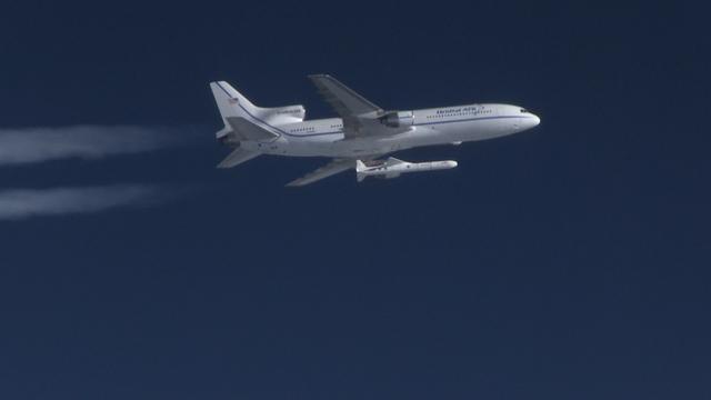
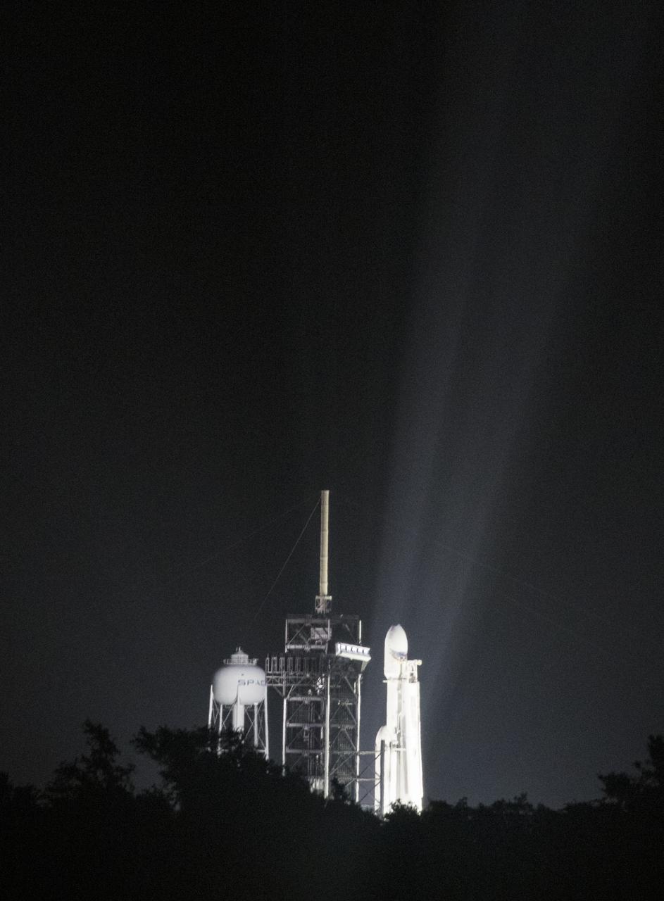
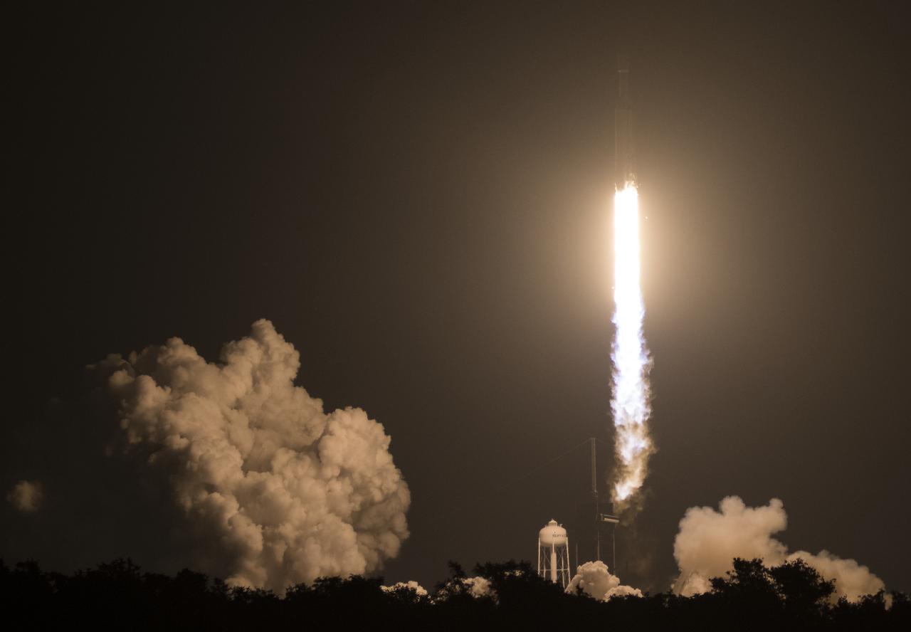
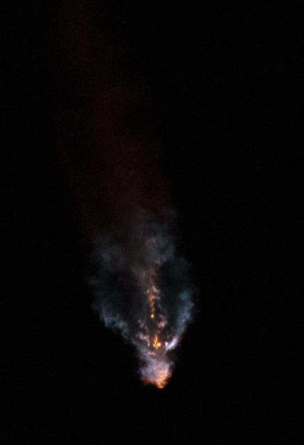
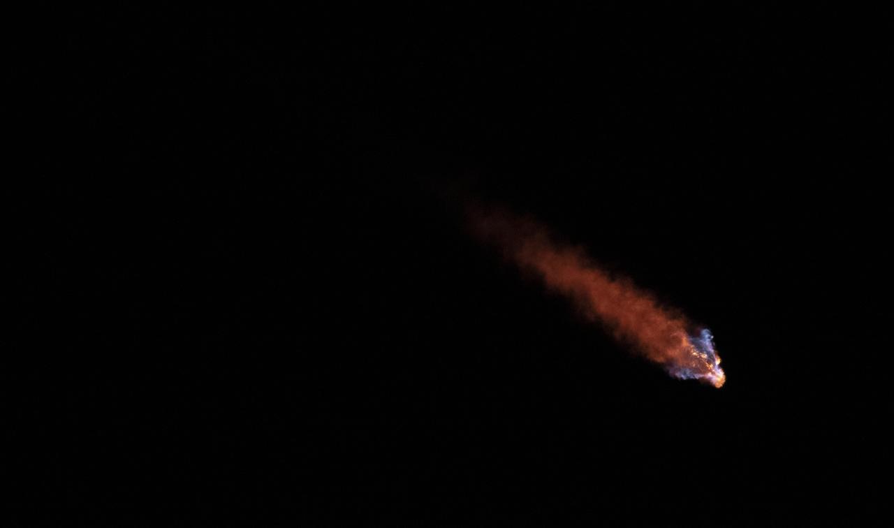
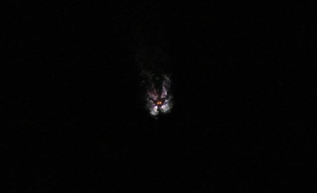
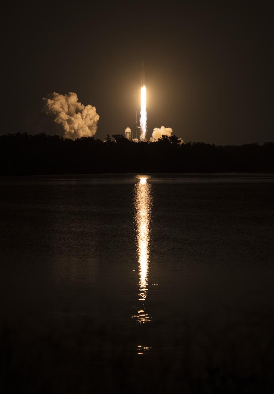
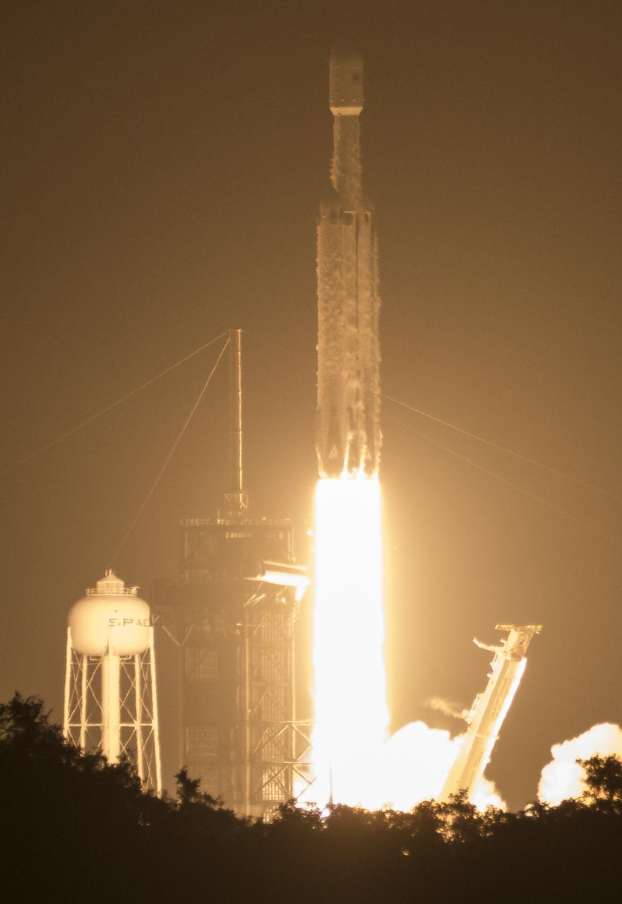
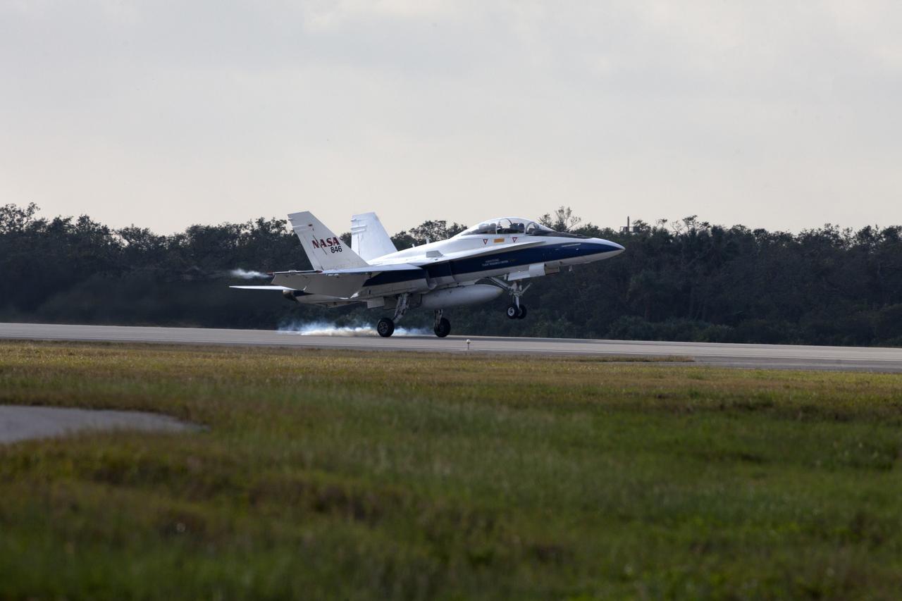
The Orbital ATK Pegasus XL rocket carrying NASA's Cyclone Global Navigation Satellite System, or CYGNSS, spacecraft is released and the first stage ignites at 8:37 a.m. EST. The rocket was released from the Orbital ATK L-1011 Stargazer aircraft flying over the Atlantic Ocean offshore from Daytona Beach, Florida following takeoff from the Skid Strip at Cape Canaveral Air Force Station. This image was taken from a NASA F-18 chase plane provided by Armstrong Flight Research Center in California. The CYGNSS satellites will make frequent and accurate measurements of ocean surface winds throughout the life cycle of tropical storms and hurricanes.
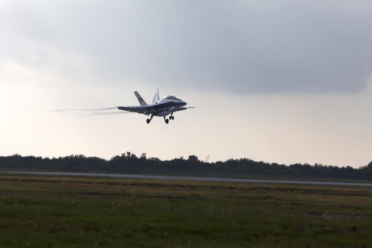
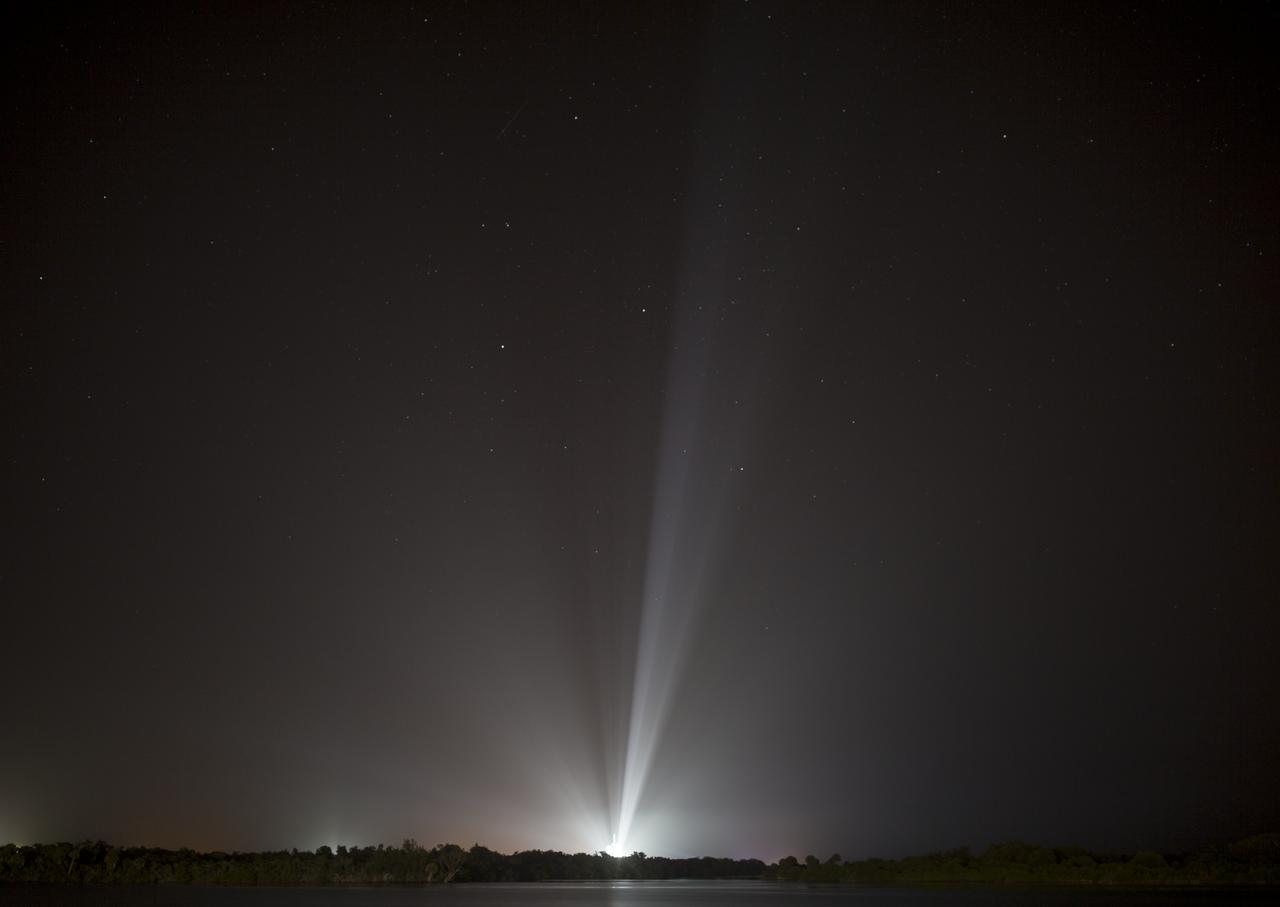
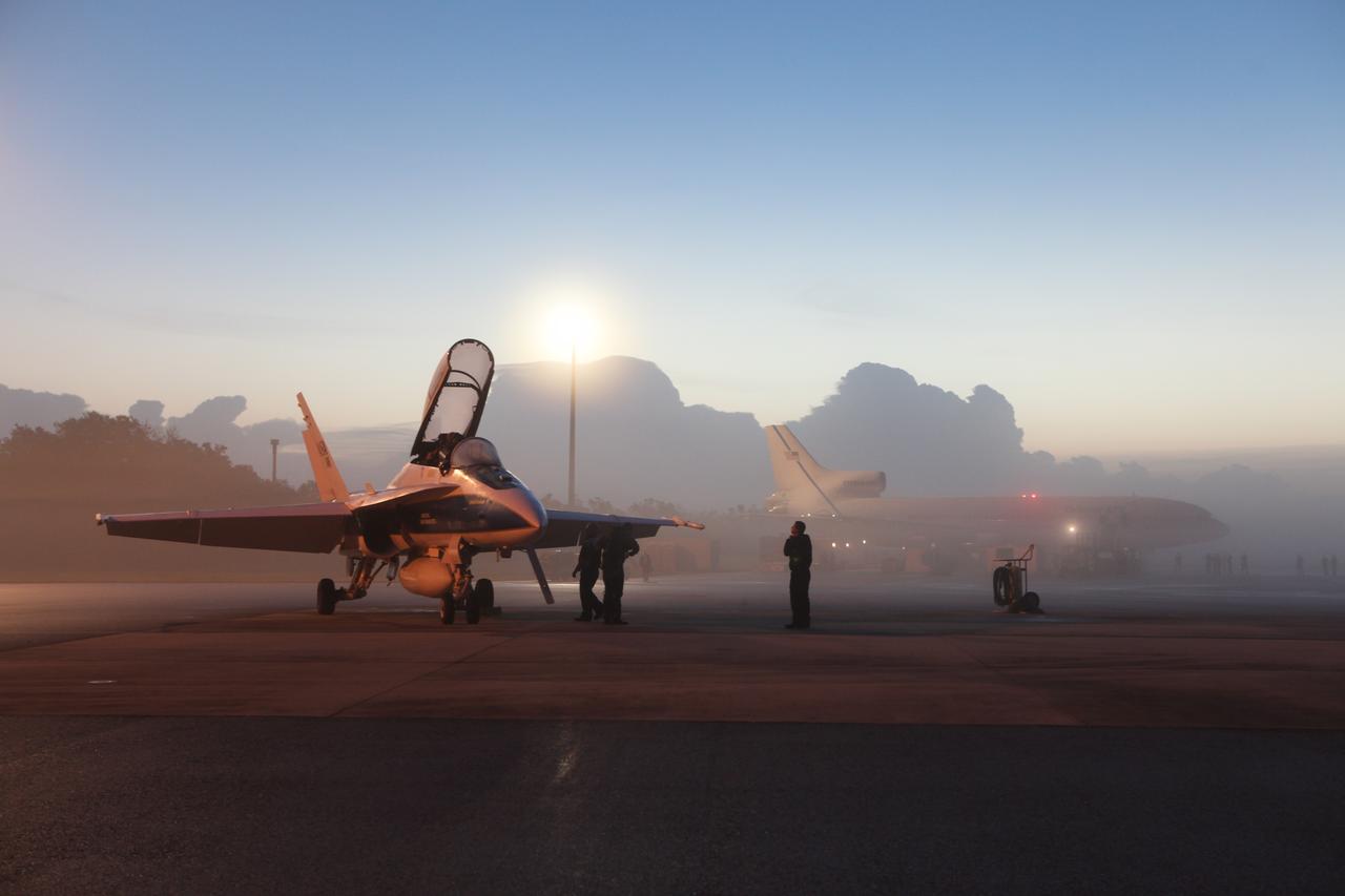
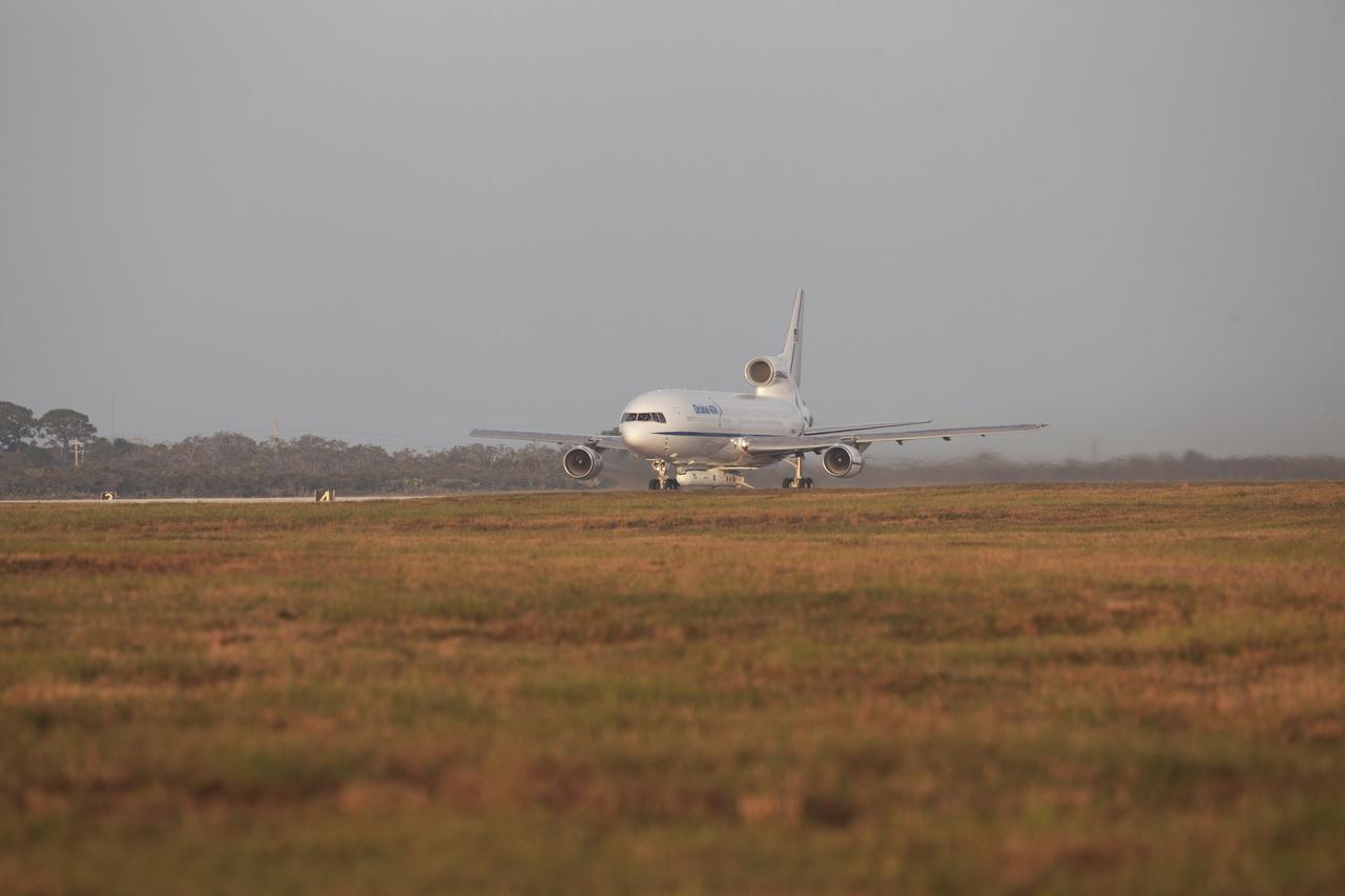
A pathfinder aircraft descends for touchdown at the Skid Strip at Cape Canaveral Air Force Station in Florida. The airplane provided photographic and video imagery of the Orbital ATK L-1011 Stargazer aircraft carrying a Pegasus XL Rocket with eight NASA Cyclone Global Navigation Satellite System, or CYGNSS, spacecraft. With the aircraft flying off shore, the Pegasus rocket was released at 8:37 a.m. EST. Five seconds later, the solid propellant engine ignited and boosted the eight hurricane observatories to orbit. The eight CYGNSS satellites will make frequent and accurate measurements of ocean surface winds throughout the life cycle of tropical storms and hurricanes.
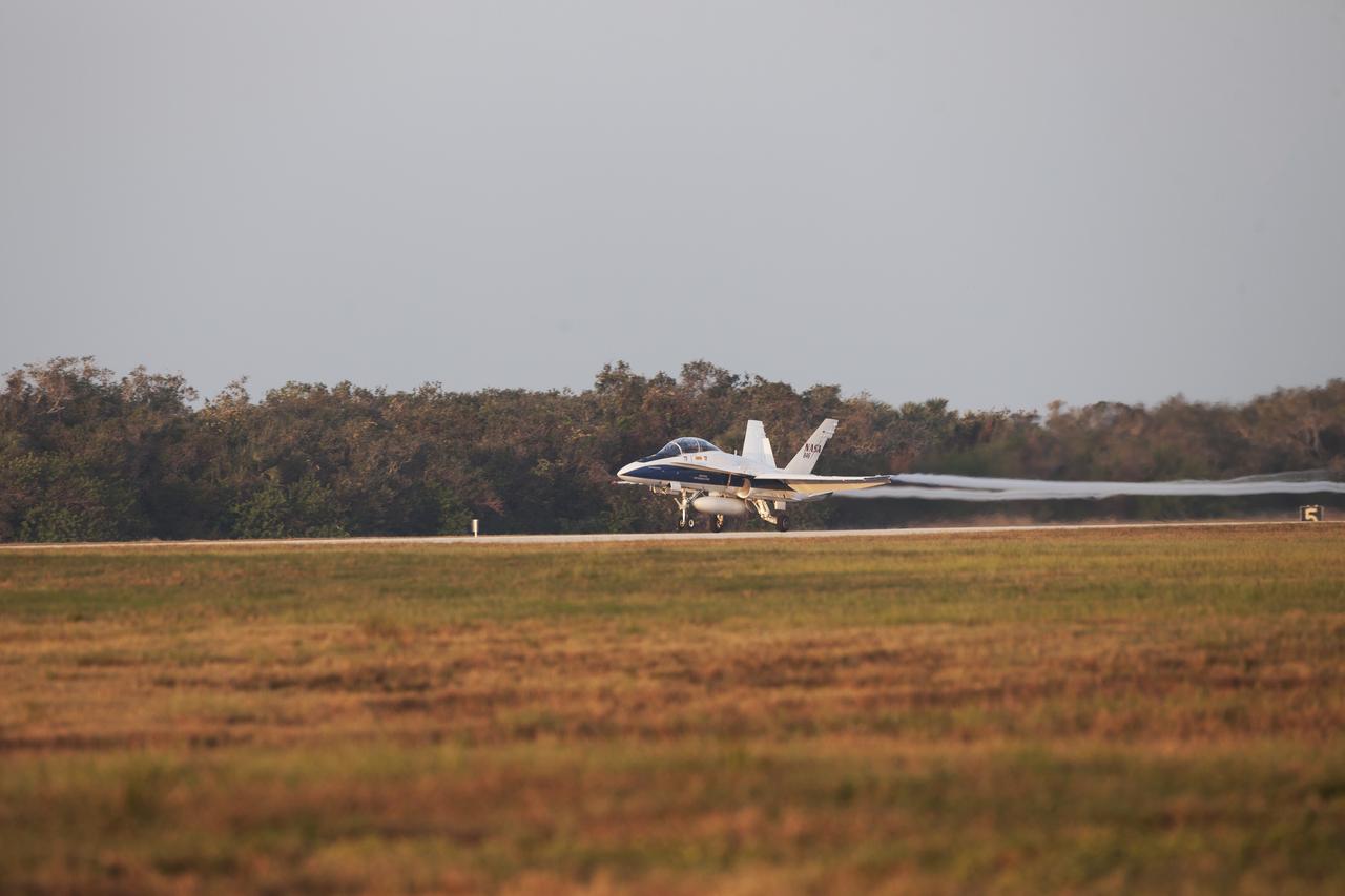
A pathfinder aircraft begins its takeoff from the Skid Strip at Cape Canaveral Air Force Station in Florida. The airplane will provide photographic and video imagery of the Orbital ATK L-1011 Stargazer aircraft carrying a Pegasus XL Rocket with eight NASA Cyclone Global Navigation Satellite System, or CYGNSS, spacecraft. With the aircraft flying off shore, the Pegasus rocket will be released. Five seconds later, the solid propellant engine will ignite and boost the eight hurricane observatories to orbit. The eight CYGNSS satellites will make frequent and accurate measurements of ocean surface winds throughout the life cycle of tropical storms and hurricanes.
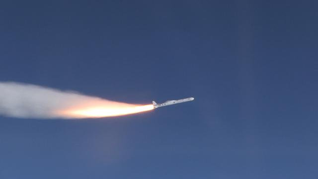
The Orbital ATK Pegasus XL rocket carrying NASA's Cyclone Global Navigation Satellite System, or CYGNSS, spacecraft is released and the first stage ignites at 8:37 a.m. EST. The rocket was released from the Orbital ATK L-1011 Stargazer aircraft flying over the Atlantic Ocean offshore from Daytona Beach, Florida following takeoff from the Skid Strip at Cape Canaveral Air Force Station. This image was taken from a NASA F-18 chase plane provided by Armstrong Flight Research Center in California. The CYGNSS satellites will make frequent and accurate measurements of ocean surface winds throughout the life cycle of tropical storms and hurricanes.
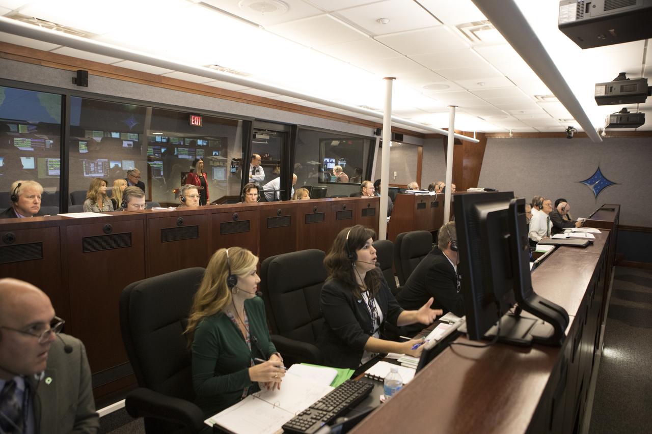
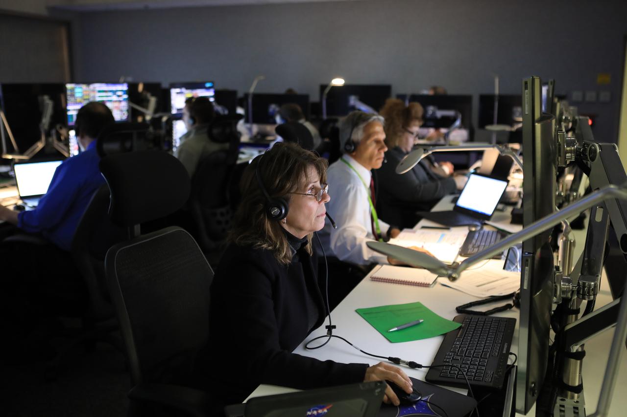
In the Mission Director's Center at Cape Canaveral Air Force Station, Dana Allender, NASA Launch Operations manager, left, and Aly Mendoza-Hill, NASA Mission manager, monitor the progress of preparations to launch eight Cyclone Global Navigation Satellite System, or CYGNSS, spacecraft. The CYGNSS satellites will make frequent and accurate measurements of ocean surface winds throughout the life cycle of tropical storms and hurricanes. The data that CYGNSS provides will enable scientists to probe key air-sea interaction processes that take place near the core of storms, which are rapidly changing and play a crucial role in the beginning and intensification of hurricanes.
In the Kennedy Space Center's Press Site auditorium, Badri Younes, deputy associate administrator for Space Communications and Navigation at NASA Headquarters in Washington, speaks to members of the media at a prelaunch news conference for NASA's Tracking and Data Relay Satellite, TDRS-M. It is the latest spacecraft destined for the agency's constellation of communications satellites that allows nearly continuous contact with orbiting spacecraft ranging from the International Space Station and Hubble Space Telescope to the array of scientific observatories. Liftoff atop a United Launch Alliance Atlas V rocket is scheduled to take place from Space Launch Complex 41 at Cape Canaveral Air Force Station at 8:03 a.m. EDT Aug. 18.
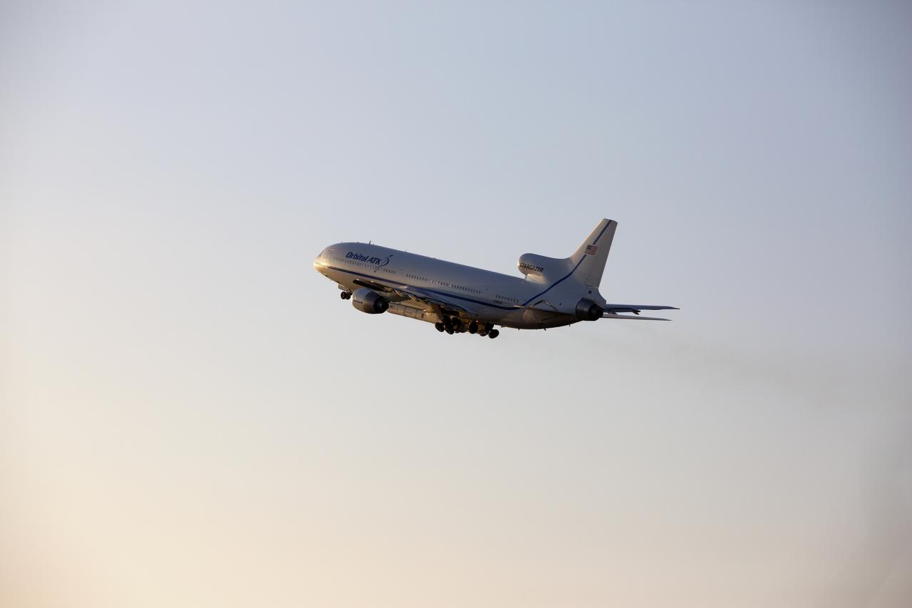
An Orbital ATK L-1011 Stargazer aircraft carrying a Pegasus XL Rocket with eight NASA Cyclone Global Navigation Satellite System, or CYGNSS, soars high after takeoff from the Skid Strip at Cape Canaveral Air Force Station, Florida. With the aircraft flying off shore, the Pegasus rocket will be released. Five seconds later, the solid propellant engine will ignite and boost the eight hurricane observatories to orbit. The eight CYGNSS satellites will make frequent and accurate measurements of ocean surface winds throughout the life cycle of tropical storms and hurricanes. Release of the Pegasus XL rocket is scheduled for 8:40 a.m. EST.
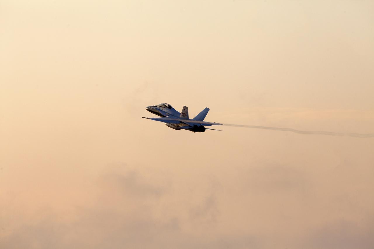
A pathfinder aircraft soars high after takeoff from the Skid Strip at Cape Canaveral Air Force Station in Florida. The airplane will provide photographic and video imagery of the Orbital ATK L-1011 Stargazer aircraft carrying a Pegasus XL Rocket with eight NASA Cyclone Global Navigation Satellite System, or CYGNSS, spacecraft. With the aircraft flying off shore, the Pegasus rocket will be released. Five seconds later, the solid propellant engine will ignite and boost the eight hurricane observatories to orbit. The eight CYGNSS satellites will make frequent and accurate measurements of ocean surface winds throughout the life cycle of tropical storms and hurricanes.
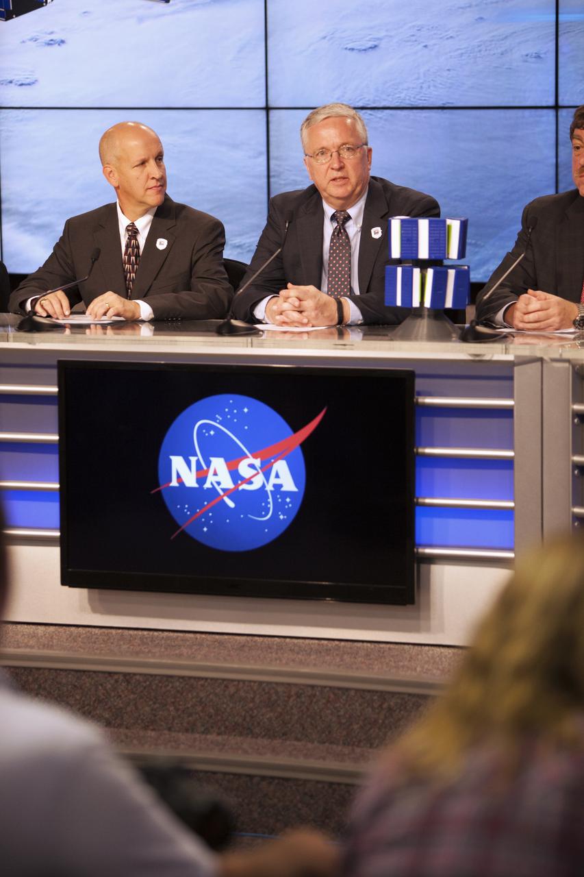
In the Kennedy Space Center’s Press Site auditorium, NASA and industry leaders speak to members of the media during a prelaunch news conference for the agency’s Cyclone Global Navigation Satellite System, or CYGNSS, spacecraft. From left are: Tim Dunn, NASA launch director at Kennedy; and Bryan Baldwin, Pegasus launch vehicle program manager for Orbital ATK, Dulles, Virginia. The eight CYGNSS satellites will make frequent and accurate measurements of ocean surface winds throughout the life cycle of tropical storms and hurricanes. The data will help scientists probe key air-sea interaction processes that take place near the core of storms, which are rapidly changing and play a crucial role in the beginning and intensification of hurricanes.
An Orbital ATK L-1011 Stargazer aircraft carrying a Pegasus XL Rocket with eight NASA Cyclone Global Navigation Satellite System, or CYGNSS, spacecraft is being readied for takeoff from the Skid Strip at Cape Canaveral Air Force Station, Florida. With the aircraft flying off shore, the Pegasus rocket will be released. Five seconds later, the solid propellant engine will ignite and boost the eight hurricane observatories to orbit. The eight CYGNSS satellites will make frequent and accurate measurements of ocean surface winds throughout the life cycle of tropical storms and hurricanes.
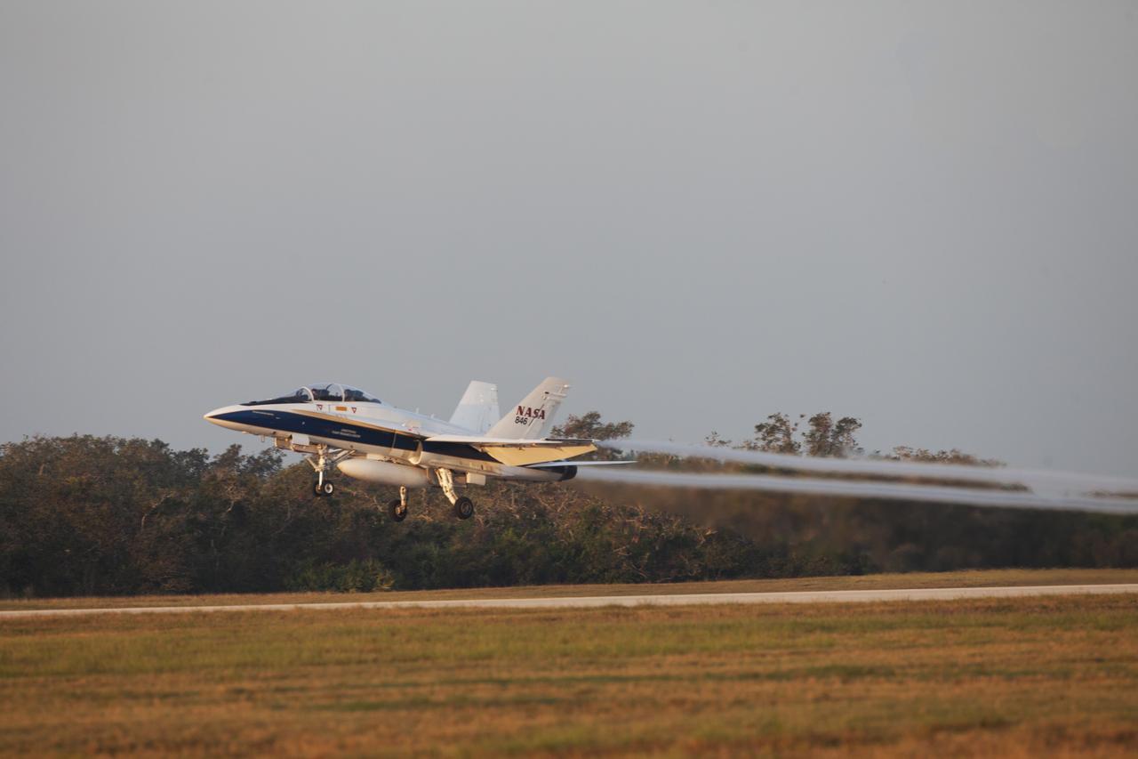
A pathfinder aircraft takes off from the Skid Strip at Cape Canaveral Air Force Station in Florida. The airplane will provide photographic and video imagery of the Orbital ATK L-1011 Stargazer aircraft carrying a Pegasus XL Rocket with eight NASA Cyclone Global Navigation Satellite System, or CYGNSS, spacecraft. With the aircraft flying off shore, the Pegasus rocket will be released. Five seconds later, the solid propellant engine will ignite and boost the eight hurricane observatories to orbit. The eight CYGNSS satellites will make frequent and accurate measurements of ocean surface winds throughout the life cycle of tropical storms and hurricanes.
A pathfinder aircraft prepares for takeoff from the Skid Strip at Cape Canaveral Air Force Station in Florida. The airplane will provide photographic and video imagery of the Orbital ATK L-1011 Stargazer aircraft carrying a Pegasus XL Rocket with eight NASA Cyclone Global Navigation Satellite System, or CYGNSS, spacecraft. With the aircraft flying off shore, the Pegasus rocket will be released. Five seconds later, the solid propellant engine will ignite and boost the eight hurricane observatories to orbit. The eight CYGNSS satellites will make frequent and accurate measurements of ocean surface winds throughout the life cycle of tropical storms and hurricanes.
A pathfinder aircraft touches down at the Skid Strip at Cape Canaveral Air Force Station in Florida. The airplane provided photographic and video imagery of the Orbital ATK L-1011 Stargazer aircraft carrying a Pegasus XL Rocket with eight NASA Cyclone Global Navigation Satellite System, or CYGNSS, spacecraft. With the aircraft flying off shore, the Pegasus rocket was released at 8:37 a.m. EST. Five seconds later, the solid propellant engine ignited and boosted the eight hurricane observatories to orbit. The eight CYGNSS satellites will make frequent and accurate measurements of ocean surface winds throughout the life cycle of tropical storms and hurricanes.
An Orbital ATK L-1011 Stargazer aircraft carrying a Pegasus XL Rocket with eight NASA Cyclone Global Navigation Satellite System, or CYGNSS, soars high after takeoff from the Skid Strip at Cape Canaveral Air Force Station, Florida. With the aircraft flying off shore, the Pegasus rocket will be released. Five seconds later, the solid propellant engine will ignite and boost the eight hurricane observatories to orbit. The eight CYGNSS satellites will make frequent and accurate measurements of ocean surface winds throughout the life cycle of tropical storms and hurricanes. Release of the Pegasus XL rocket is scheduled for 8:40 a.m. EST.
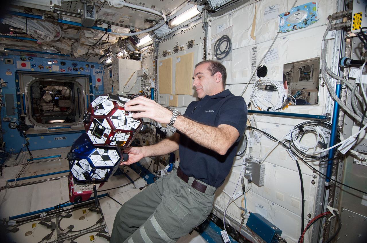
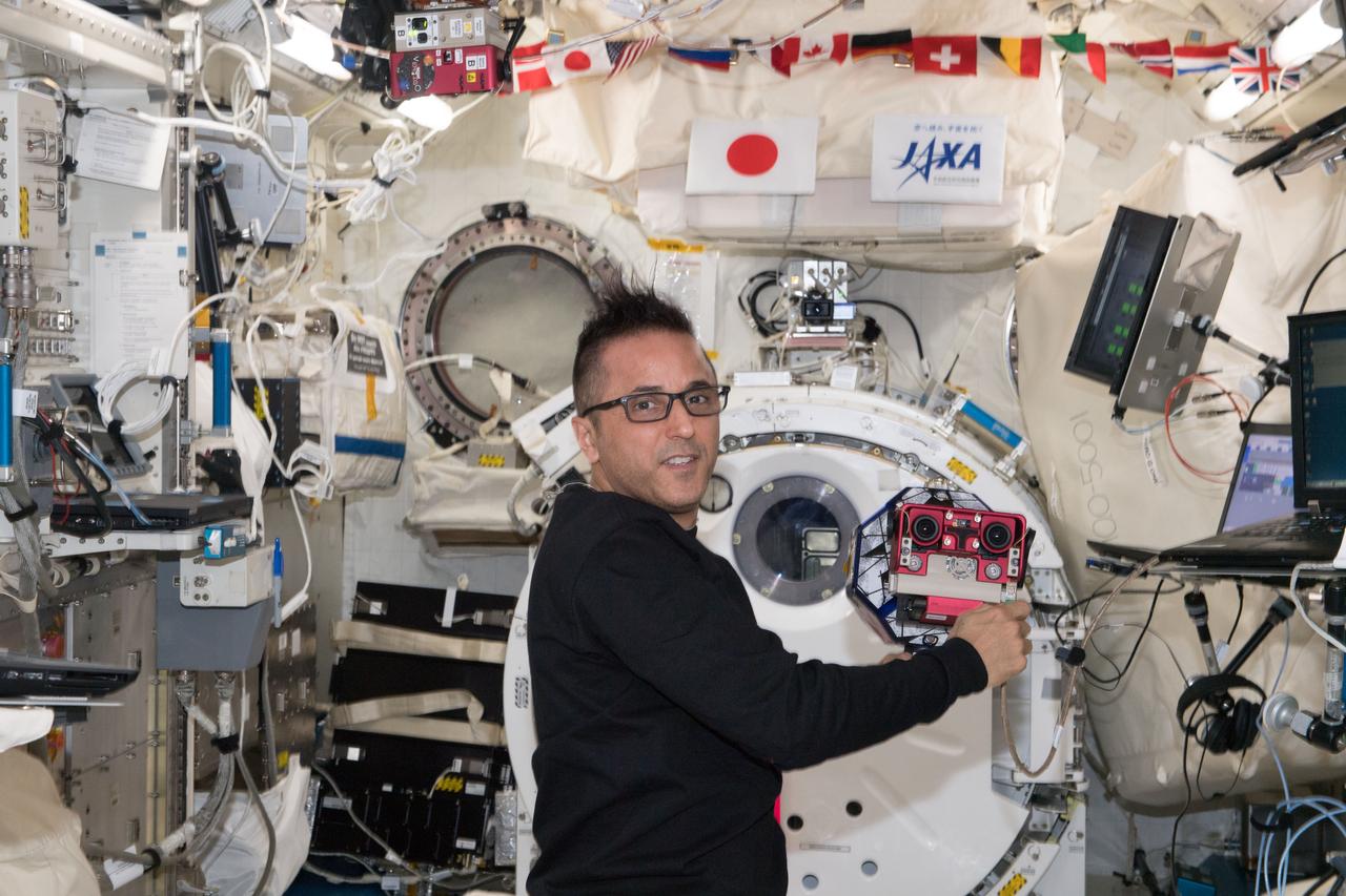
ISS038-E-035432 (23 Jan. 2014) --- NASA astronaut Rick Mastracchio, Expedition 38 flight engineer, works with a pair of basketball-sized, free-flying satellites known Synchronized Position Hold, Engage, Reorient, Experimental Satellites, or SPHERES, in the Kibo laboratory of the International Space Station. For this experiment session, the crew members equipped one of the two SPHERES with a pair of stereoscopic goggles dubbed the Visual Estimation and Relative Tracking for Inspection of Generic Objects, or VERTIGO. As the second SPHERES tumbled and spun, the VERTIGO-equipped robot attempted to map it and perform relative navigation around it.
An Orbital ATK L-1011 Stargazer aircraft carrying a Pegasus XL Rocket with eight NASA Cyclone Global Navigation Satellite System, or CYGNSS, spacecraft is ready for takeoff from the Skid Strip at Cape Canaveral Air Force Station, Florida. With the aircraft flying off shore, the Pegasus rocket will be released. Five seconds later, the solid propellant engine will ignite and boost the eight hurricane observatories to orbit. The eight CYGNSS satellites will make frequent and accurate measurements of ocean surface winds throughout the life cycle of tropical storms and hurricanes.
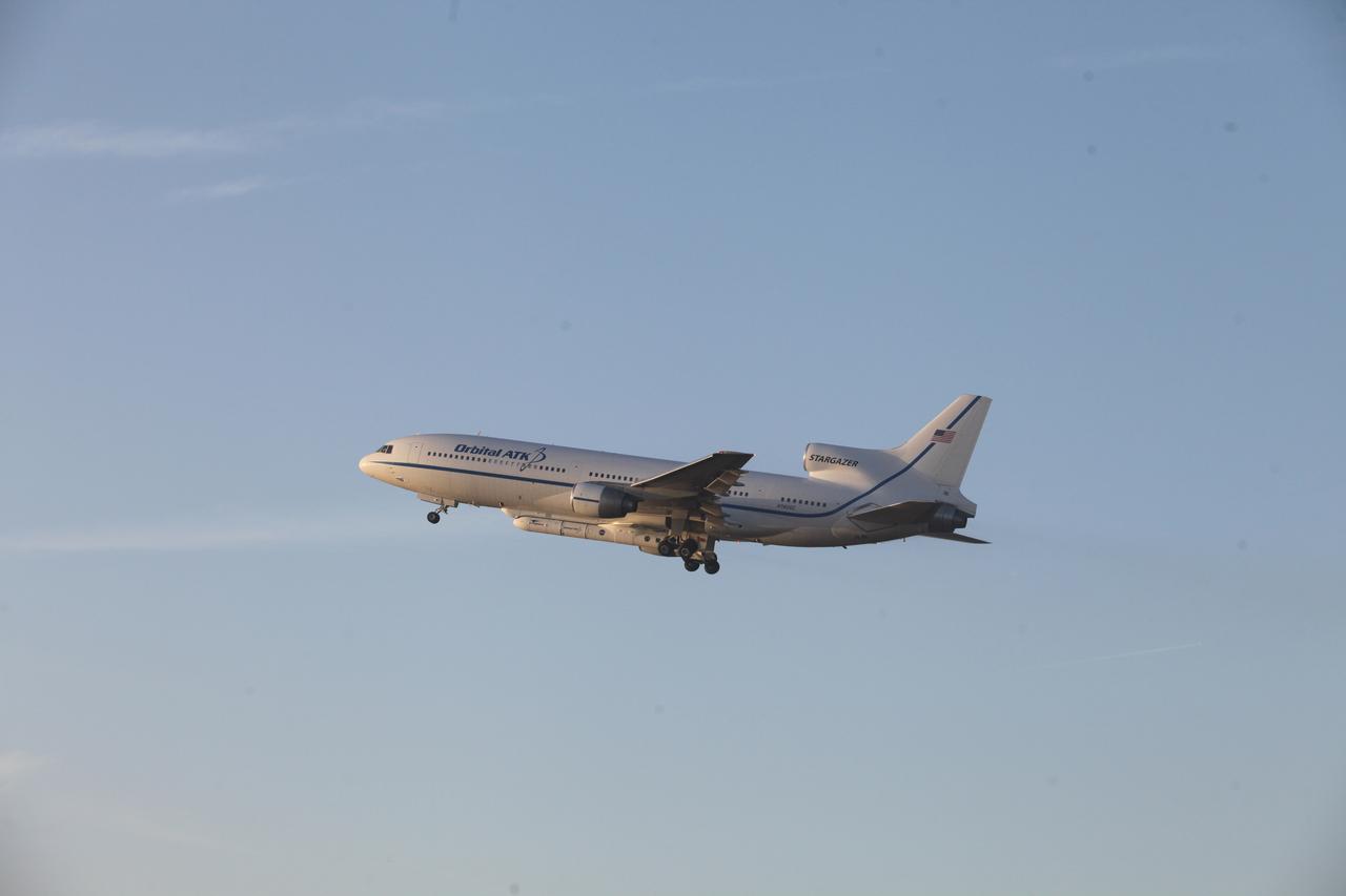
An Orbital ATK L-1011 Stargazer aircraft carrying a Pegasus XL Rocket with eight NASA Cyclone Global Navigation Satellite System, or CYGNSS, spacecraft takes off from the Skid Strip at Cape Canaveral Air Force Station, Florida. With the aircraft flying off shore, the Pegasus rocket will be released. Five seconds later, the solid propellant engine will ignite and boost the eight hurricane observatories to orbit. The eight CYGNSS satellites will make frequent and accurate measurements of ocean surface winds throughout the life cycle of tropical storms and hurricanes.

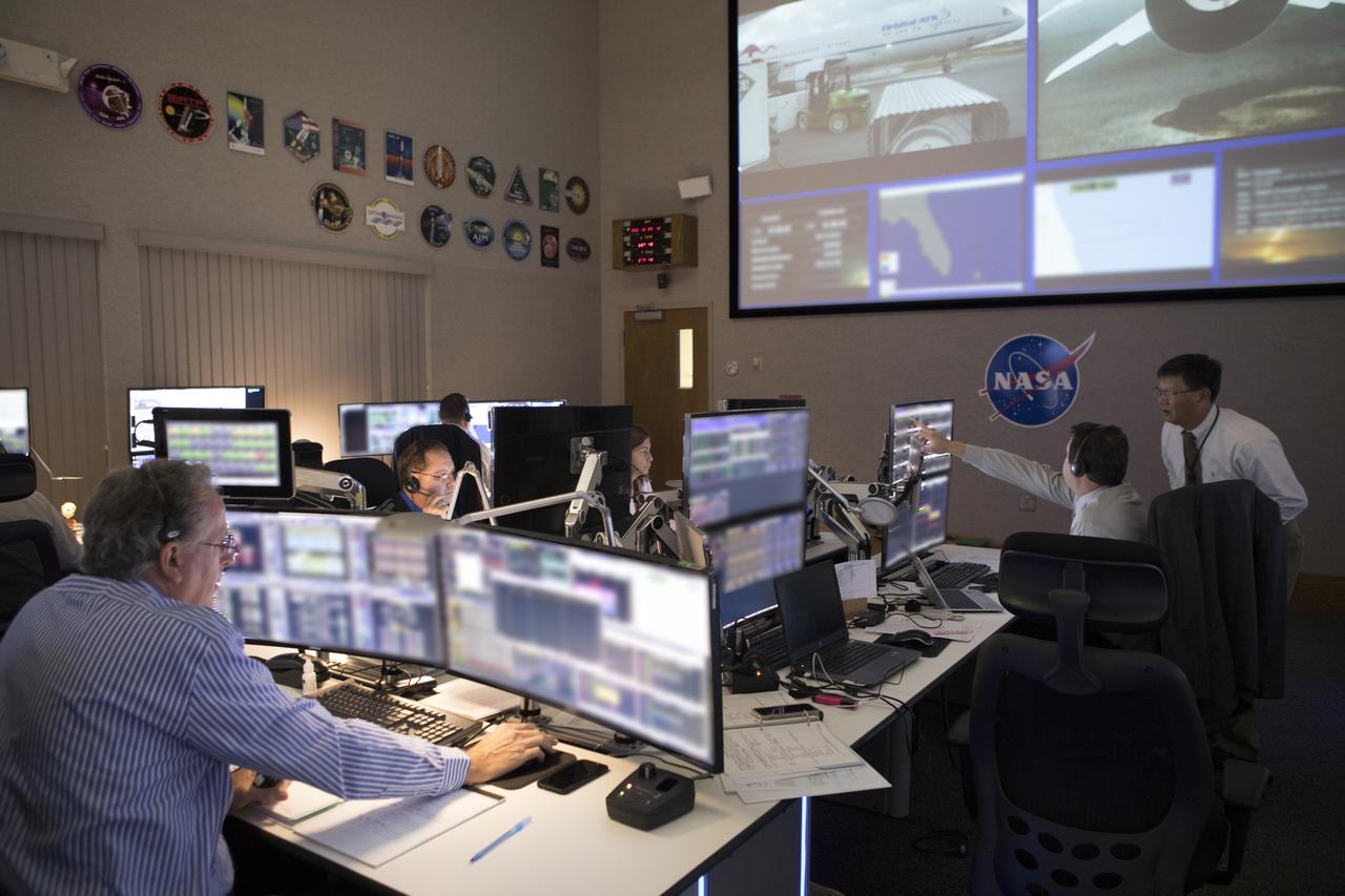
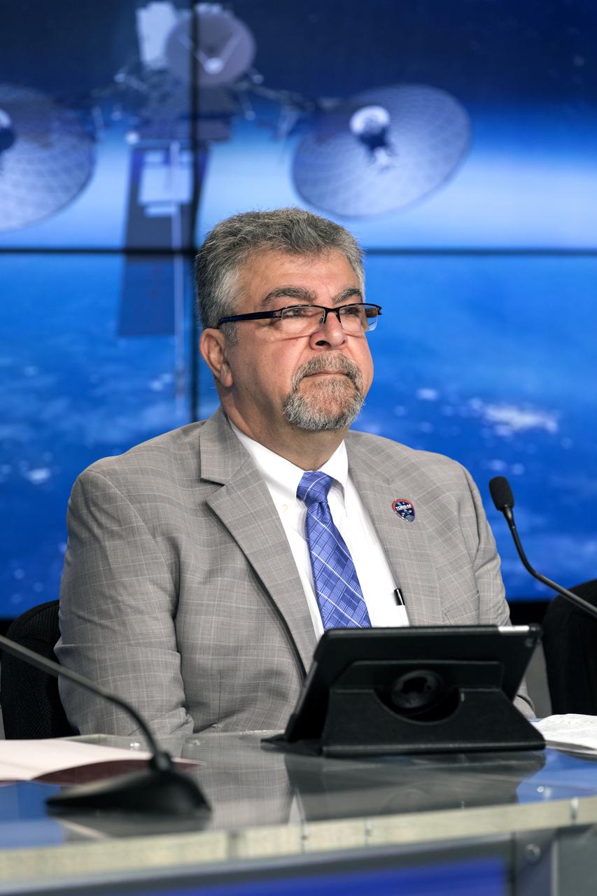
In the Mission Director's Center at Cape Canaveral Air Force Station, Greg Robinson, deputy associate administrator for Programs in the NASA Science Mission Directorate, right, congratulates, Tim Dunn, who was launch director for launch of eight Cyclone Global Navigation Satellite System, or CYGNSS, spacecraft. The satellites will make frequent and accurate measurements of ocean surface winds throughout the life cycle of tropical storms and hurricanes. The data that CYGNSS provides will enable scientists to probe key air-sea interaction processes that take place near the core of storms, which are rapidly changing and play a crucial role in the beginning and intensification of hurricanes.
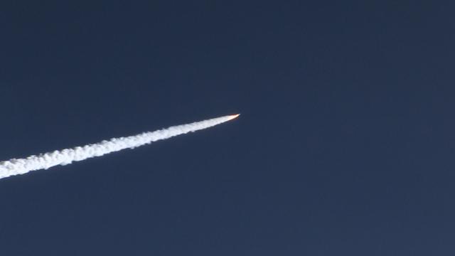
The Orbital ATK Pegasus XL rocket carrying NASA's Cyclone Global Navigation Satellite System, or CYGNSS, spacecraft is released and the first stage ignites at 8:37 a.m. EST. The rocket was released from the Orbital ATK L-1011 Stargazer aircraft flying over the Atlantic Ocean offshore from Daytona Beach, Florida following takeoff from the Skid Strip at Cape Canaveral Air Force Station. This image was taken from a NASA F-18 chase plane provided by Armstrong Flight Research Center in California. The CYGNSS satellites will make frequent and accurate measurements of ocean surface winds throughout the life cycle of tropical storms and hurricanes.
An Orbital ATK L-1011 Stargazer aircraft carrying a Pegasus XL Rocket with eight NASA Cyclone Global Navigation Satellite System, or CYGNSS, spacecraft is ready for takeoff from the Skid Strip at Cape Canaveral Air Force Station, Florida. With the aircraft flying off shore, the Pegasus rocket will be released. Five seconds later, the solid propellant engine will ignite and boost the eight hurricane observatories to orbit. The eight CYGNSS satellites will make frequent and accurate measurements of ocean surface winds throughout the life cycle of tropical storms and hurricanes.
An Orbital ATK L-1011 Stargazer touches down at the Skid Strip at Cape Canaveral Air Force Station in Florida. The aircraft carried a Pegasus XL Rocket with eight NASA Cyclone Global Navigation Satellite System, or CYGNSS, for launch. With the aircraft flying off shore, the Pegasus rocket was released at 8:37 a.m. EST. Five seconds later, the solid propellant engine ignited and boosted the eight hurricane observatories to orbit. The eight CYGNSS satellites will make frequent and accurate measurements of ocean surface winds throughout the life cycle of tropical storms and hurricanes.

In the Kennedy Space Center’s Press Site auditorium, NASA and industry leaders speak to members of the media during a prelaunch news conference for the agency’s Cyclone Global Navigation Satellite System, or CYGNSS, spacecraft. From left are: Tim Dunn, NASA launch director at Kennedy; and Bryan Baldwin, Pegasus launch vehicle program manager for Orbital ATK, Dulles, Virginia. The eight CYGNSS satellites will make frequent and accurate measurements of ocean surface winds throughout the life cycle of tropical storms and hurricanes. The data will help scientists probe key air-sea interaction processes that take place near the core of storms, which are rapidly changing and play a crucial role in the beginning and intensification of hurricanes.
An Orbital ATK L-1011 Stargazer aircraft carrying a Pegasus XL Rocket with eight NASA Cyclone Global Navigation Satellite System, or CYGNSS, spacecraft takes off from the Skid Strip at Cape Canaveral Air Force Station, Florida. With the aircraft flying off shore, the Pegasus rocket will be released. Five seconds later, the solid propellant engine will ignite and boost the eight hurricane observatories to orbit. The eight CYGNSS satellites will make frequent and accurate measurements of ocean surface winds throughout the life cycle of tropical storms and hurricanes.