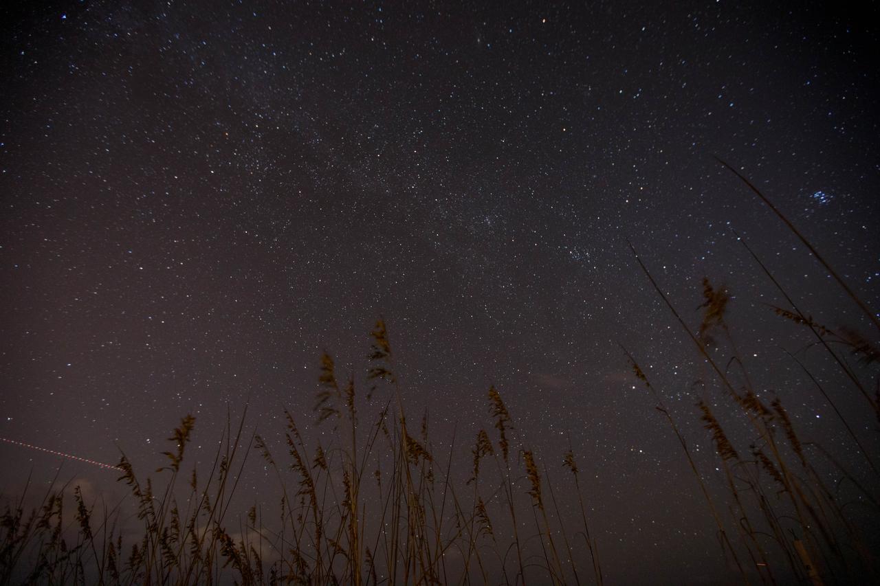
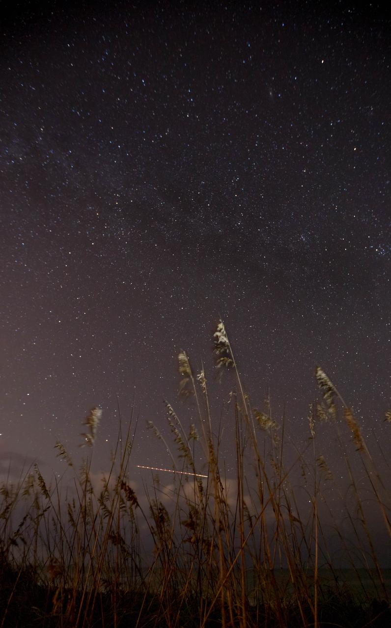
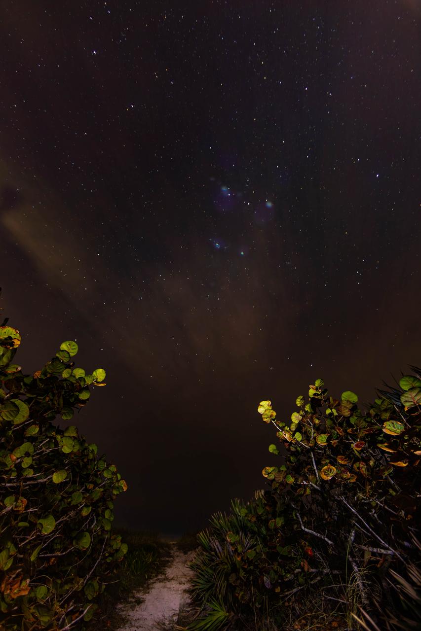
Sea oats frame the night sky, bisected by the Milky Way, in this view from the Atlantic shoreline at NASA’s Kennedy Space Center in Florida on Oct. 31, 2019. The lights of an aircraft create an illuminated streak in the lower left corner.
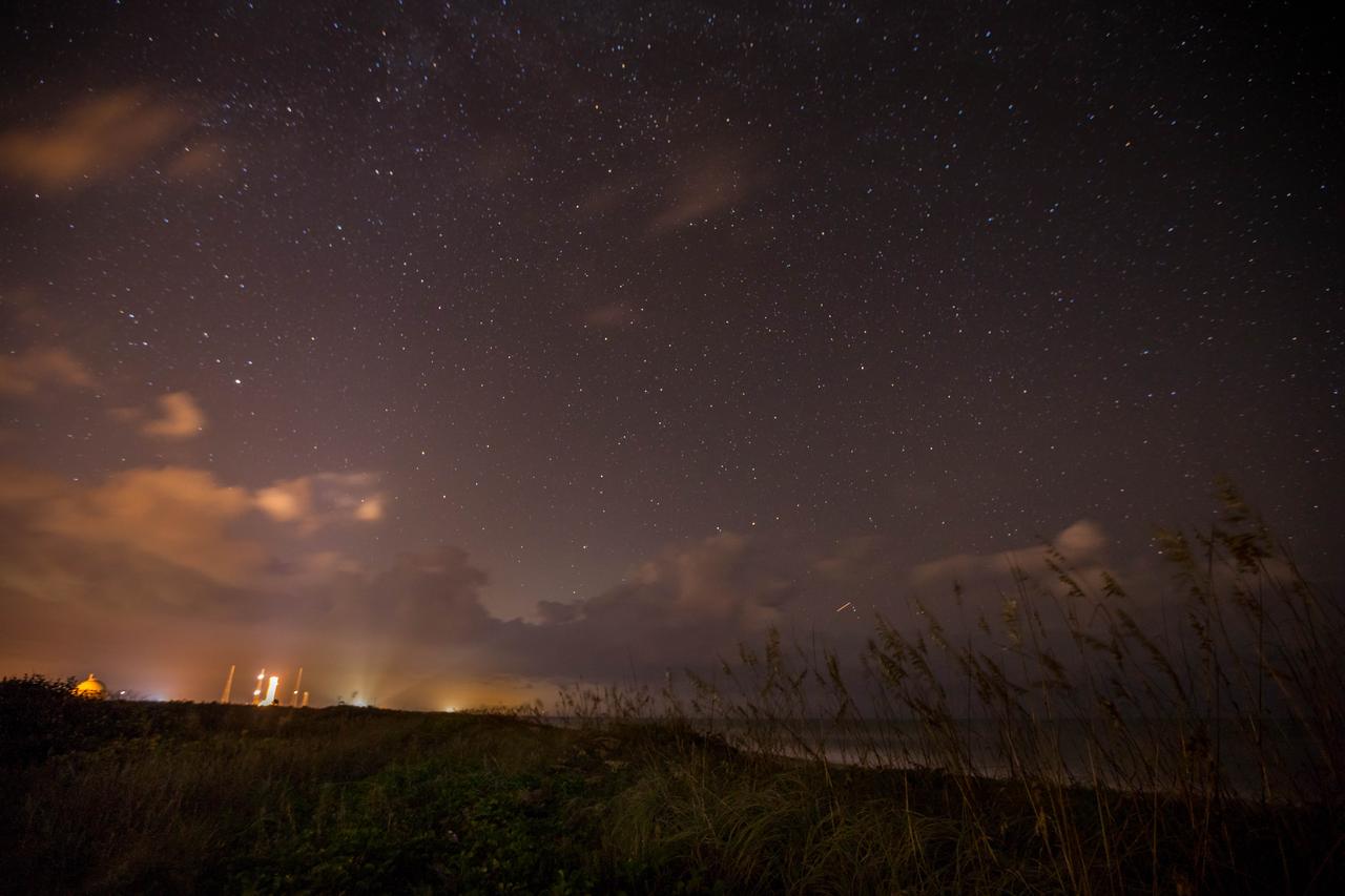
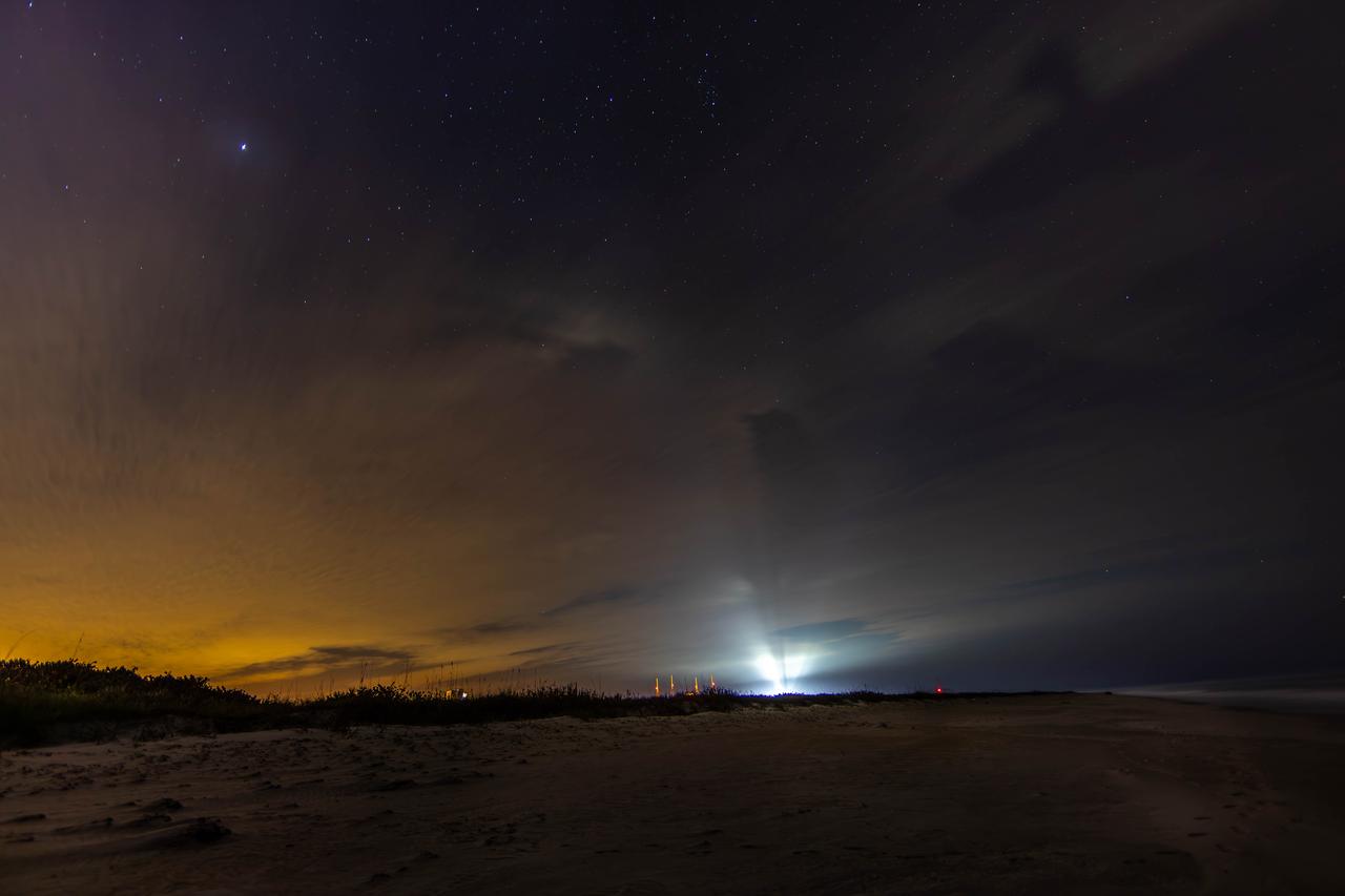
Lights from Launch Complexes 39A and B, left, glow against the night sky in this view from the Atlantic shoreline at NASA’s Kennedy Space Center in Florida on Oct. 31, 2019.
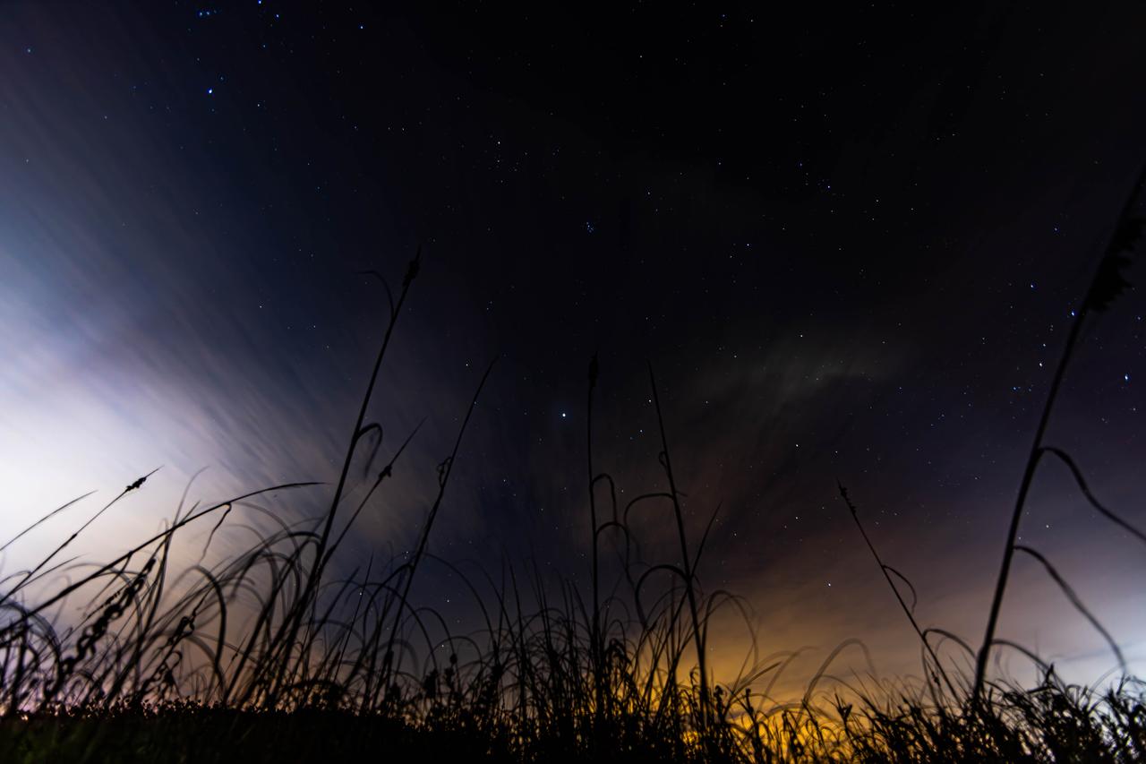
Sea oats are backdropped by the night sky and the Milky Way in this view from the Atlantic shoreline at NASA’s Kennedy Space Center in Florida on Oct. 31, 2019. Lights from aircraft create illuminated streaks above the horizon and at right.
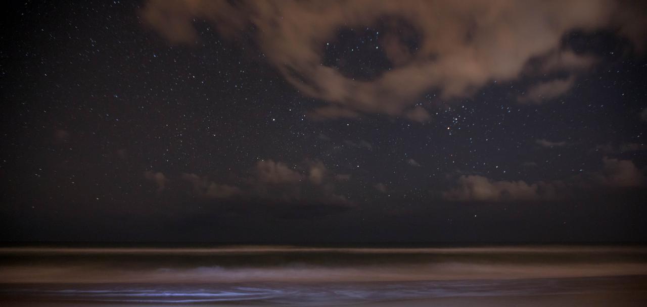
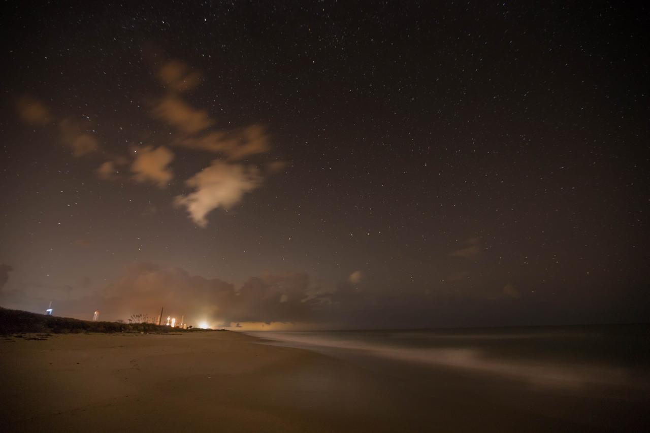
Clouds move inland from the Atlantic Ocean, backdropped by a nighttime vista of stars, in this view from the beach near Launch Complex 39 at NASA’s Kennedy Space Center in Florida on Oct. 31, 2019.
Lights from Launch Complexes 39A and B, left, glow against the night sky in this view from the Atlantic shoreline at NASA’s Kennedy Space Center in Florida on Oct. 31, 2019.
Sea oats are backdropped by the night sky and the Milky Way in this view from the Atlantic shoreline at NASA’s Kennedy Space Center in Florida on Oct. 31, 2019. The lights of an aircraft create an illuminated streak above the horizon.
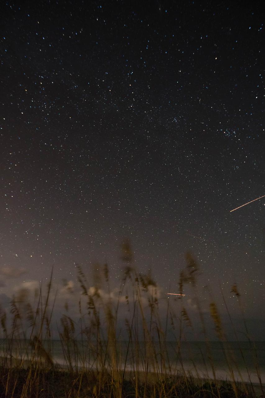
Photographers at NASA capture the night sky Tuesday, Jan. 30, 2024, on a beach near the agency’s Kennedy Space Center in Florida.
Photographers at NASA capture the night sky Tuesday, Jan. 30, 2024, on a beach near the agency’s Kennedy Space Center in Florida.
Photographers at NASA capture the night sky Tuesday, Jan. 30, 2024, on a beach near the agency’s Kennedy Space Center in Florida.
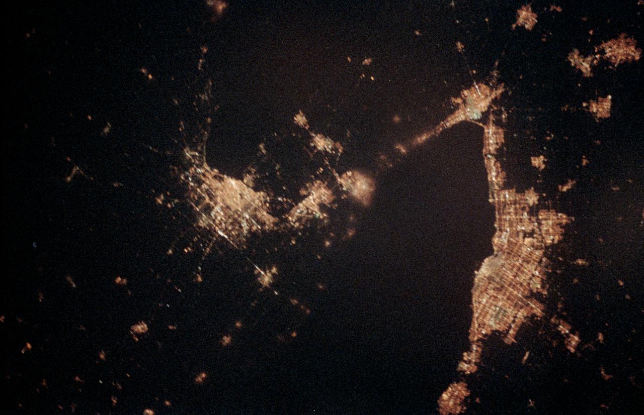
STS060-06-037 (3-11 Feb 1994) --- The city lights of Buffalo and Toronto outline the shores of the east end of Lake Erie and the west end of Lake Ontario in this night scene of western New York and southern Ontario. Between the two major cities are the cities of Niagara Falls, New York and Niagara Falls, Canada, which straddle the Niagara River just north of the actual falls. This photograph was taken with a special ASA-1600 film that is normally used for night-time photography of aurora, noctilucent clouds, biomass burning, and city lights.

This 1970 photograph shows Skylab's Ultraviolet (UV) Airglow Horizon Photography experiment. It was an astrophysics investigation designed to photograph the twilight airflow and Earth's ozone layer simultaneously in visible and UV wavelengths. These observations provided information on oxygen, nitrogen, and ozone layers in the Earth's atmosphere, and on their variation during night and day cycles. The Marshall Space Flight Center had program management responsibility for the development of Skylab hardware and experiments.
STS097-355-011 (30 Nov. -11 Dec. 2000) --- This vertical scene showing Torino and Milano, Italy, at night, was photographed with a 35mm camera by one of the STS-97 crew members aboard the Earth-orbiting Space Shuttle Endeavour. The night lights of Torino and Milano (two larger illuminated areas) are visible in the view, which covers the western end of the Po River Valley. Torino is the bright spot slightly left of center and Milano is the larger bright spot towards the bottom center of the image. The deeply eroded flanks of the snow-covered Alps Mountains (serrated-looking, light-colored terrain top half of the image) is visible north of the two large cities. Several mountain passes that connect the Po River Valley with France and Switzerland can be identified by the string of lights in the narrow, linear valleys. A translucent-looking cloud (bottom center) somewhat obscures the nighttime landscape south of Torino and Milano. The northwest coast of Italy, including the Italian city of Genova, can be identified in the lower left corner of the image. This photography was taken by astronauts using high speed film and long exposure on a night with a full moon illuminating the surface of the Earth.
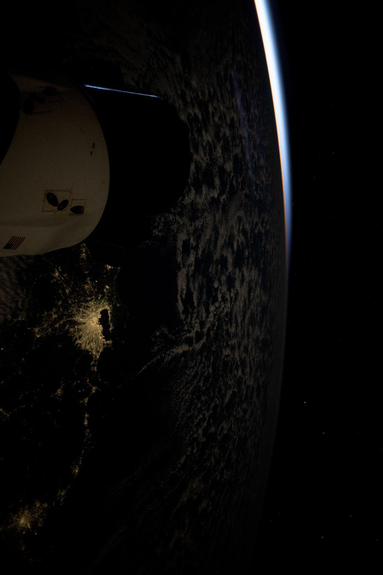
iss074e0170877 (Jan. 3, 2026) --- The Greater Tokyo Area in Japan, one of the most populous metropolitan areas on Earth with about 37 million residents, is pictured at approximately 4:31 a.m. local time from the International Space Station. A partially obscured SpaceX Dragon spacecraft (left) is docked to the Harmony module's forward port as both spacecraft soared 265 miles above Earth into an orbital sunrise.
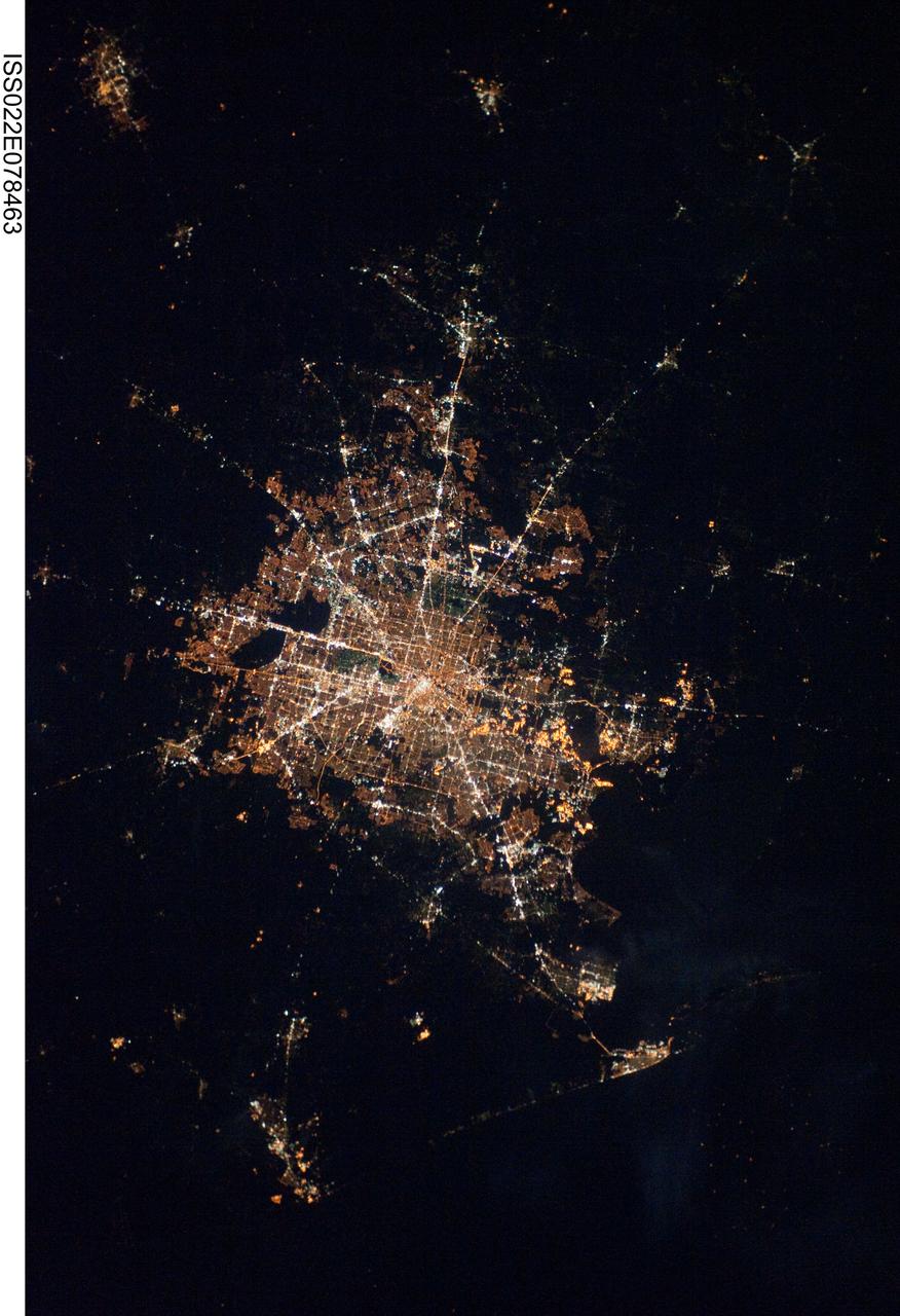
ISS022-E-078463 (28 Feb. 2010) ---The Houston metropolitan area at night is featured in this image photographed by an Expedition 22 crew member on the International Space Station. Houston, Texas has been called the ?energy capital of the world? due to its role as a major hub of the petroleum and other energy resource industries. The image is oriented with north toward the top. The Houston metropolitan area covers almost 2,331,000 hectares (approximately 9,000 square miles) along the southeast Texas coastline, with an average elevation of 13 meters (approximately 43 feet) above sea level and a population of over 5 million (2006 US Census estimate). The Houston metropolitan area is also noteworthy as being the largest in the US without formal zoning restrictions. This has lead to a highly diverse pattern of land use at the neighborhood scale; nevertheless, more general spatial patterns of land use can be recognized in remotely sensed data. This is particularly evident in night time photography of the urban area taken by crew members onboard the space station. The image depicts the roughly 100 kilometers (approximately 62 miles) east-west extent of the Houston metropolitan area. Houston proper is at center, indicated by a ?bull?s-eye? of elliptical white to orange-lighted beltways and brightly lit white freeways radiating outwards from the central downtown area. Suburban and primarily residential urban land use is indicated by both reddish-brown and gray-green lighted regions that reflect a higher proportion of tree cover and lower light density. Petroleum refineries along the Houston Ship Channel are recognized by densely lit areas of golden yellow light. Rural and undeveloped land circles the metropolitan area, and Galveston Bay to the southeast (lower right) provides access to the Gulf of Mexico. Both types of non-urban surface appear dark in the image.

ISS030-E-099324 (22 Feb. 2012) --- City lights of Dubai, United Arab Emirates are featured in this image photographed by an Expedition 30 crew member on the International Space Station. The City of Dubai?the largest metropolitan area within the emirate of Dubai?is a favorite subject of astronaut photography largely due to the unique island developments situated directly offshore in the Persian Gulf. These artificial archipelagos have been built such that their full design is only visible from the vantage point of an airplane ? or an orbiting spacecraft such as the International Space Station. The city presents an eye-catching appearance at night that vividly displays the urban development pattern. In this detailed nighttime image?taken with a long focal length lens and digital camera optimized for fast response and high light sensitivity?several interesting patterns can be observed. The highways and major streets are sharply defined by yellow-orange lighting, while the commercial and residential areas are resolved into a speckle pattern of individual white, blue, and yellow-orange lights. Several large and brilliantly lit areas are large hotel and mall complexes, including the Burj Khalifa Tower; at 828 meters (2,717 feet) height it is the world?s tallest building. The brilliant lighting of the city contrasts sharply with both the dark Persian Gulf to the northwest, and largely undeveloped and unlit areas to the southeast. Likewise, the clusters of lighting in the Palm Jumeira complex at bottom right correspond to the relatively small part of the archipelago that has been developed. Isolated areas of blurred city lights are due to patchy clouds.
<b>RELEASE DATE: OCTOBER 9, 2007</b> <b>Credit: NASA/Goddard Space Flight Center/Reto Stöckli</b> A day’s clouds. The shape and texture of the land. The living ocean. City lights as a beacon of human presence across the globe. This amazingly beautiful view of Earth from space is a fusion of science and art, a showcase for the remote-sensing technology that makes such views possible, and a testament to the passion and creativity of the scientists who devote their careers to understanding how land, ocean, and atmosphere—even life itself—interact to generate Earth’s unique (as far as we know!) life-sustaining environment. Drawing on data from multiple satellite missions (not all collected at the same time), a team of NASA scientists and graphic artists created layers of global data for everything from the land surface, to polar sea ice, to the light reflected by the chlorophyll in the billions of microscopic plants that grow in the ocean. They wrapped these layers around a globe, set it against a black background, and simulated the hazy edge of the Earth’s atmosphere (the limb) that appears in astronaut photography of the Earth. The land surface layer is based on photo-like surface reflectance observations (reflected sunlight) measured by the Moderate Resolution Imaging Spectroradiometer (MODIS) on NASA’s Terra satellite in July 2004. The sea ice layer near the poles comes from Terra MODIS observations of daytime sea ice observed between August 28 and September 6, 2001. The ocean layer is a composite. In shallow water areas, the layer shows surface reflectances observed by Terra MODIS in July 2004. In the open ocean, the photo-like layer is overlaid with observations of the average ocean chlorophyll content for 2004. NASA’s Aqua MODIS collected the chlorophyll data. The cloud layer shows a single-day snapshot of clouds observed by Terra MODIS across the planet on July 29, 2001. City lights on Earth’s night side are visualized from data collected by the Defense Meteorological Satellite Program mission between 1994–1995. The topography layer is based on radar data collected by the Space Shuttle Endeavour during an 11-day mission in February of 2000. Topography over Antarctica comes from the Radarsat Antarctic Mapping Project, version 2. Most of the data layers in this visualization are available as monthly composites as part of NASA’s Blue Marble Next Generation image collection. The images in the collection appear in cylindrical projection (rectangular maps), and they are available at 500-meter resolution. The large images provided above are the full-size versions of these globes. In their hope that these images will inspire people to appreciate the beauty of our home planet and to learn about the Earth system, the developers of these images encourage readers to re-use and re-publish the images freely. NASA images by Reto Stöckli, based on data from NASA and NOAA. To learn the history of the Blue Marble go here: <a href="http://earthobservatory.nasa.gov/Features/BlueMarble/BlueMarble_history.php" rel="nofollow">earthobservatory.nasa.gov/Features/BlueMarble/BlueMarble_...</a> To learn more about the Blue Marble go here: <a href="http://earthobservatory.nasa.gov/IOTD/view.php?id=8108" rel="nofollow">earthobservatory.nasa.gov/IOTD/view.php?id=8108</a> <b><a href="http://www.nasa.gov/centers/goddard/home/index.html" rel="nofollow">NASA Goddard Space Flight Center</a></b> is home to the nation's largest organization of combined scientists, engineers and technologists that build spacecraft, instruments and new technology to study the Earth, the sun, our solar system, and the universe. <b>Follow us on <a href="http://twitter.com/NASA_GoddardPix" rel="nofollow">Twitter</a></b> <b>Join us on <a href="http://www.facebook.com/pages/Greenbelt-MD/NASA-Goddard/395013845897?ref=tsd" rel="nofollow">Facebook</a><b> </b></b>
This striking image of the coastline of southwestern Saudi Arabia was taken by astronauts on the International Space Station. Patchy cloud cover partially obscures and blurs the city lights, especially in the vicinity of Khamis Mushait and Abha. While much of the country is lightly populated desert—and relatively dark at night due to lack of city and roadway lights—the southwestern coastal region has a more moderate climate and several large cities. Three brightly lit urban centers are visible at image top left: Jeddah, Mecca, and Taif. Jeddah is the gateway city for Islamic pilgrims going to nearby Mecca, a religious journey known as the Hajj. Taif is located on the slopes of the Sarawat Mountains and provides a summer retreat for the Saudi government from the desert heat of the capital, Riyadh. Bright yellow-orange lighting marks highways that parallel the trend of the Asir Mountains (image center), connecting Mecca to the resort cities of Al Bahah and Abha. Smaller roadways, lit with blue lights, extend to the west to small cities along the Red Sea coastline. The bright yellow-orange glow of the city of Abha is matched by that of Khamis Mushait (or Khamis Mushayt) to the northeast. The brightly lit ribbon of highway continues towards other large cities to the south (Jazan, not shown) and southeast (Najran, not shown). Astronaut photograph ISS036-E-25802 was acquired on July 26, 2013, with a Nikon D3S digital camera using a 50 millimeter lens, and is provided by the ISS Crew Earth Observations experiment and Image Science & Analysis Laboratory, Johnson Space Center. The image was taken by the Expedition 36 crew. It has been cropped and enhanced to improve contrast, and lens artifacts have been removed. The International Space Station Program supports the laboratory as part of the ISS National Lab to help astronauts take pictures of Earth that will be of the greatest value to scientists and the public, and to make those images freely available on the Internet. Additional images taken by astronauts and cosmonauts can be viewed at the NASA/JSC Gateway to Astronaut Photography of Earth. Caption by William L. Stefanov, Jacobs/JETS at NASA-JSC. Instrument: ISS - Digital Camera More info: <a href="http://1.usa.gov/13TqPcr" rel="nofollow">1.usa.gov/13TqPcr</a> Credit: <b><a href="http://www.earthobservatory.nasa.gov/" rel="nofollow"> NASA Earth Observatory</a></b> <b><a href="http://www.nasa.gov/audience/formedia/features/MP_Photo_Guidelines.html" rel="nofollow">NASA image use policy.</a></b> <b><a href="http://www.nasa.gov/centers/goddard/home/index.html" rel="nofollow">NASA Goddard Space Flight Center</a></b> enables NASA’s mission through four scientific endeavors: Earth Science, Heliophysics, Solar System Exploration, and Astrophysics. Goddard plays a leading role in NASA’s accomplishments by contributing compelling scientific knowledge to advance the Agency’s mission. <b>Follow us on <a href="http://twitter.com/NASA_GoddardPix" rel="nofollow">Twitter</a></b> <b>Like us on <a href="http://www.facebook.com/pages/Greenbelt-MD/NASA-Goddard/395013845897?ref=tsd" rel="nofollow">Facebook</a></b> <b>Find us on <a href="http://instagram.com/nasagoddard?vm=grid" rel="nofollow">Instagram</a></b>
<b>RELEASE DATE: OCTOBER 9, 2007</b> <b>Credit: NASA/Goddard Space Flight Center/Reto Stöckli</b> A day’s clouds. The shape and texture of the land. The living ocean. City lights as a beacon of human presence across the globe. This amazingly beautiful view of Earth from space is a fusion of science and art, a showcase for the remote-sensing technology that makes such views possible, and a testament to the passion and creativity of the scientists who devote their careers to understanding how land, ocean, and atmosphere—even life itself—interact to generate Earth’s unique (as far as we know!) life-sustaining environment. Drawing on data from multiple satellite missions (not all collected at the same time), a team of NASA scientists and graphic artists created layers of global data for everything from the land surface, to polar sea ice, to the light reflected by the chlorophyll in the billions of microscopic plants that grow in the ocean. They wrapped these layers around a globe, set it against a black background, and simulated the hazy edge of the Earth’s atmosphere (the limb) that appears in astronaut photography of the Earth. The land surface layer is based on photo-like surface reflectance observations (reflected sunlight) measured by the Moderate Resolution Imaging Spectroradiometer (MODIS) on NASA’s Terra satellite in July 2004. The sea ice layer near the poles comes from Terra MODIS observations of daytime sea ice observed between August 28 and September 6, 2001. The ocean layer is a composite. In shallow water areas, the layer shows surface reflectances observed by Terra MODIS in July 2004. In the open ocean, the photo-like layer is overlaid with observations of the average ocean chlorophyll content for 2004. NASA’s Aqua MODIS collected the chlorophyll data. The cloud layer shows a single-day snapshot of clouds observed by Terra MODIS across the planet on July 29, 2001. City lights on Earth’s night side are visualized from data collected by the Defense Meteorological Satellite Program mission between 1994–1995. The topography layer is based on radar data collected by the Space Shuttle Endeavour during an 11-day mission in February of 2000. Topography over Antarctica comes from the Radarsat Antarctic Mapping Project, version 2. Most of the data layers in this visualization are available as monthly composites as part of NASA’s Blue Marble Next Generation image collection. The images in the collection appear in cylindrical projection (rectangular maps), and they are available at 500-meter resolution. The large images provided above are the full-size versions of these globes. In their hope that these images will inspire people to appreciate the beauty of our home planet and to learn about the Earth system, the developers of these images encourage readers to re-use and re-publish the images freely. NASA images by Reto Stöckli, based on data from NASA and NOAA. To learn the history of the Blue Marble go here: <a href="http://earthobservatory.nasa.gov/Features/BlueMarble/BlueMarble_history.php" rel="nofollow">earthobservatory.nasa.gov/Features/BlueMarble/BlueMarble_...</a> To learn more about the Blue Marble go here: <a href="http://earthobservatory.nasa.gov/IOTD/view.php?id=8108" rel="nofollow">earthobservatory.nasa.gov/IOTD/view.php?id=8108</a> To learn more about NASA's Goddard Space Flight Center go here: <a href="http://www.nasa.gov/centers/goddard/home/index.html" rel="nofollow">www.nasa.gov/centers/goddard/home/index.html</a> <b><a href="http://www.nasa.gov/centers/goddard/home/index.html" rel="nofollow">NASA Goddard Space Flight Center</a></b> is home to the nation's largest organization of combined scientists, engineers and technologists that build spacecraft, instruments and new technology to study the Earth, the sun, our solar system, and the universe. <b><a href="http://www.nasa.gov/centers/goddard/home/index.html" rel="nofollow">NASA Goddard Space Flight Center</a></b> is home to the nation's largest organization of combined scientists, engineers and technologists that build spacecraft, instruments and new technology to study the Earth, the sun, our solar system, and the universe. <b>Follow us on <a href="http://twitter.com/NASA_GoddardPix" rel="nofollow">Twitter</a></b> <b>Join us on <a href="http://www.facebook.com/pages/Greenbelt-MD/NASA-Goddard/395013845897?ref=tsd" rel="nofollow">Facebook</a><b> </b></b>