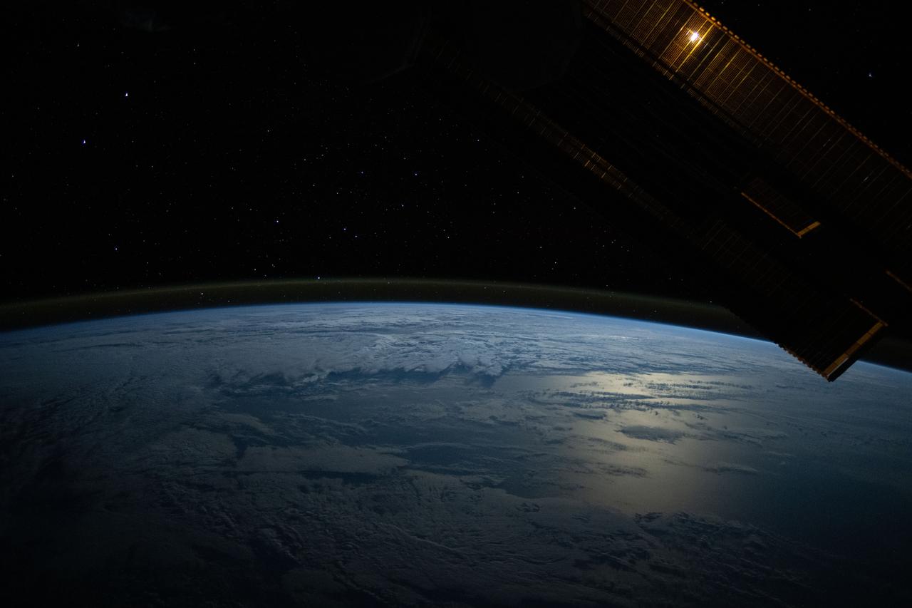
iss071e456772 (July 18, 2024) --- The Moon's glint beams off the Pacific Ocean as stars glitter in the background above the Earth's airglow. The Moon is obscured behind a solar array in this photograph from the International Space Station as it orbited 264 miles above.
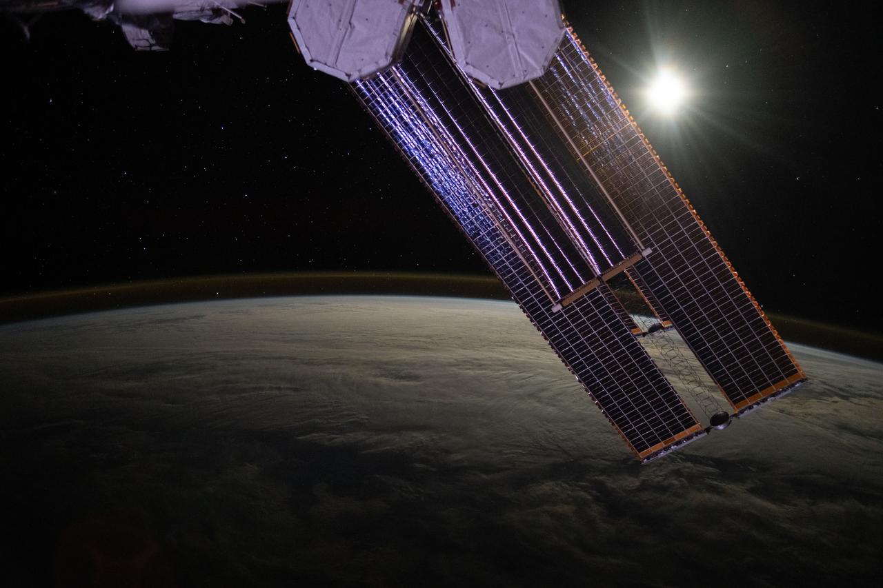
iss071e457356 (July 18, 2024) --- The Moon illuminates a cloud-covered Pacific Ocean as stars glitter in the background above the Earth's airglow. The International Space Station's solar arrays dominate the foreground as the orbital outpost soared 268 miles above.

BO THAO-URABE, A MEMBER OF PRESIDENT BARACK OBAMA’S COMMISSION ON ASIAN AMERICANS AND PACIFIC ISLANDERS, SPOKE TO TEAM MEMBERS OF NASA’S MARSHALL SPACE FLIGHT CENTER DURING AN ASIAN AMERICANS AND PACIFIC ISLANDERS MONTH CELEBRATION EVENT MAY 31.
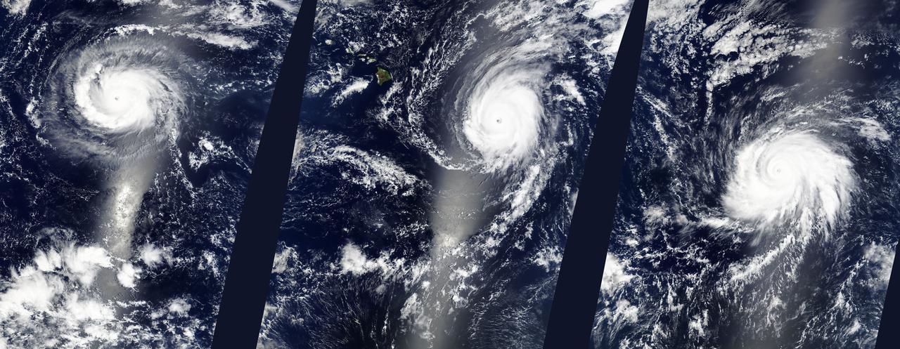
Hurricanes Kilo (03C), Ignacio (12E), and Jimena (13E) across the eastern Pacific Ocean. Captured by Terra/MODIS on 08/29/2015 at 22:25 UTC. Credit: NASA/GSFC/Jeff Schmaltz/MODIS Land Rapid Response Team <b><a href="http://www.nasa.gov/audience/formedia/features/MP_Photo_Guidelines.html" rel="nofollow">NASA image use policy.</a></b> <b><a href="http://www.nasa.gov/centers/goddard/home/index.html" rel="nofollow">NASA Goddard Space Flight Center</a></b> enables NASA’s mission through four scientific endeavors: Earth Science, Heliophysics, Solar System Exploration, and Astrophysics. Goddard plays a leading role in NASA’s accomplishments by contributing compelling scientific knowledge to advance the Agency’s mission. <b>Follow us on <a href="http://twitter.com/NASAGoddardPix" rel="nofollow">Twitter</a></b> <b>Like us on <a href="http://www.facebook.com/pages/Greenbelt-MD/NASA-Goddard/395013845897?ref=tsd" rel="nofollow">Facebook</a></b> <b>Find us on <a href="http://instagrid.me/nasagoddard/?vm=grid" rel="nofollow">Instagram</a></b>
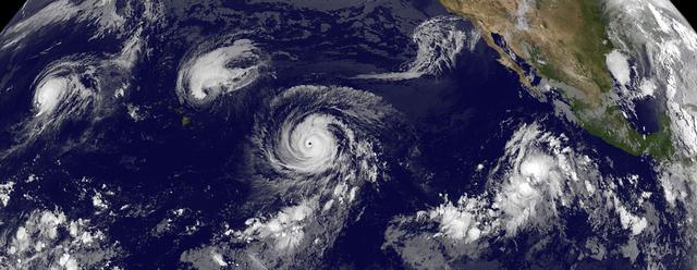
This GOES-West satellite image shows four tropical cyclones in the North Western, Central and Eastern Pacific Ocean on September 1, 2015. In the Western Pacific (far left) is Typhoon Kilo. Moving east (to the right) into the Central Pacific is Hurricane Ignacio (just east of Hawaii), and Hurricane Jimena. The eastern-most storm is Tropical Depression 14E in the Eastern Pacific. Credit: NASA/NOAA GOES Project <b><a href="http://www.nasa.gov/audience/formedia/features/MP_Photo_Guidelines.html" rel="nofollow">NASA image use policy.</a></b> <b><a href="http://www.nasa.gov/centers/goddard/home/index.html" rel="nofollow">NASA Goddard Space Flight Center</a></b> enables NASA’s mission through four scientific endeavors: Earth Science, Heliophysics, Solar System Exploration, and Astrophysics. Goddard plays a leading role in NASA’s accomplishments by contributing compelling scientific knowledge to advance the Agency’s mission. <b>Follow us on <a href="http://twitter.com/NASAGoddardPix" rel="nofollow">Twitter</a></b> <b>Like us on <a href="http://www.facebook.com/pages/Greenbelt-MD/NASA-Goddard/395013845897?ref=tsd" rel="nofollow">Facebook</a></b> <b>Find us on <a href="http://instagrid.me/nasagoddard/?vm=grid" rel="nofollow">Instagram</a></b>
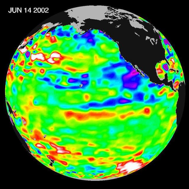
Like fall and winter of 2000, this year NASA Topex/Poseidon satellite data shows that the Pacific ocean continues to be dominated by the strong Pacific Decadal Oscillation, which is larger than the El Niño/La Niña pattern.
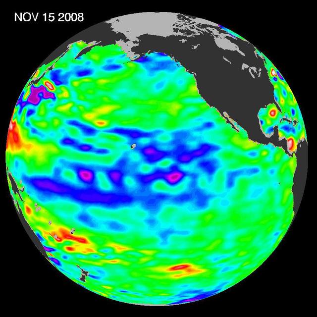
The latest image of sea-surface height measurements from NASA U.S./French Jason-1 oceanography satellite shows the Pacific Ocean remains locked in a strong, cool phase of the Pacific Decadal Oscillation.

BRIAN BAE, EV41, AND JOHN EARL BROWN, U.S. ARMY, CONDUCT KENDO DEMONSTRATION AT ASIAN AMERICANS AND PACIFIC ISLANDERS MONTH CELEBRATION EVENT MAY 31.

The SeaWinds scatterometer aboard NASA QuikScat satellite collected the data used to create this colorful image of Cyclone Olaf churning in the South Pacific on February 16, 2005.
iss063e074380 (Aug. 19, 2020) --- Hurricane Genevieve is pictured off the Pacific coast of Mexico from the International Space Station.
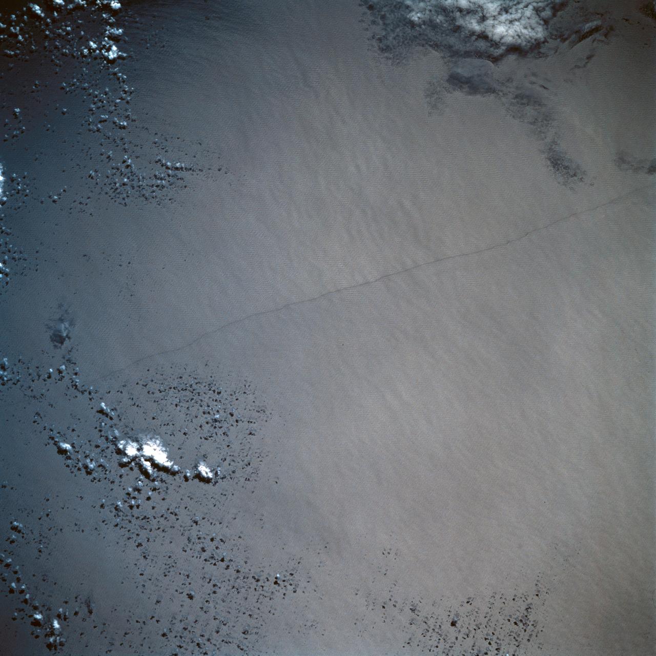
STS054-95-042 (13-19 Jan 1993) --- The Equatorial Pacific Ocean is represented in this 70mm view. The international oceanographic research community is presently conducting a program called Joint Global Ocean Flux Study (JGOFS) to study the global ocean carbon budget. A considerable amount of effort within this program is presently being focused on the Equatorial Pacific Ocean because of the high annual average biological productivity. The high productivity is the result of nearly constant easterly winds causing cool, nutrient-rich water to well up at the equator. In this view of the sun glint pattern was photographed at about 2 degrees north latitude, 103 degrees west longitude, as the Space Shuttle passed over the Equatorial Pacific. The long narrow line is the equatorial front, which defines the boundary between warm surface equatorial water and cool, recently upwelled water. Such features are of interest to the JGOFS researchers and it is anticipated that photographs such as this will benefit the JGOFS program.
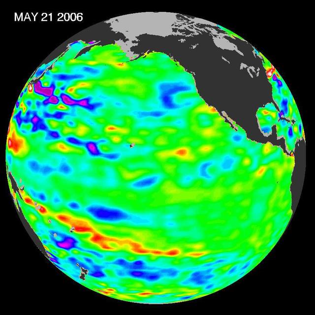
In early 2006, a weak La Niña event kept the temperatures in the Pacific Ocean along the equator a little cooler than normal.

The Rocky, Cascade, and Coast Mountain Ranges dominate the landscape of the Pacific Northwest in this image created June 11-17, 2012 from the Visible-Infrared Imager/Radiometer Suite (VIIRS) instrument aboard the Suomi National Polar-orbiting Partnership or Suomi NPP satellite, a partnership between NASA and the National Oceanic and Atmospheric Administration, or NOAA. Potato and other agriculture can be seen in the bottom center of the image, as the Rockies transition to the plains of Idaho. High values of Normalized Difference Vegetation Index, or NDVI, represent dense green functioning vegetation and low NDVI values represent sparse green vegetation or vegetation under stress from limiting conditions, such as drought. Credit: NASA/NOAA To read more go to: <a href="http://www.nasa.gov/mission_pages/NPP/news/vegetation.html" rel="nofollow">www.nasa.gov/mission_pages/NPP/news/vegetation.html</a> <b><a href="http://www.nasa.gov/audience/formedia/features/MP_Photo_Guidelines.html" rel="nofollow">NASA image use policy.</a></b> <b><a href="http://www.nasa.gov/centers/goddard/home/index.html" rel="nofollow">NASA Goddard Space Flight Center</a></b> enables NASA’s mission through four scientific endeavors: Earth Science, Heliophysics, Solar System Exploration, and Astrophysics. Goddard plays a leading role in NASA’s accomplishments by contributing compelling scientific knowledge to advance the Agency’s mission. <b>Follow us on <a href="http://twitter.com/NASA_GoddardPix" rel="nofollow">Twitter</a></b> <b>Like us on <a href="http://www.facebook.com/pages/Greenbelt-MD/NASA-Goddard/395013845897?ref=tsd" rel="nofollow">Facebook</a></b> <b>Find us on <a href="http://instagram.com/nasagoddard?vm=grid" rel="nofollow">Instagram</a></b>
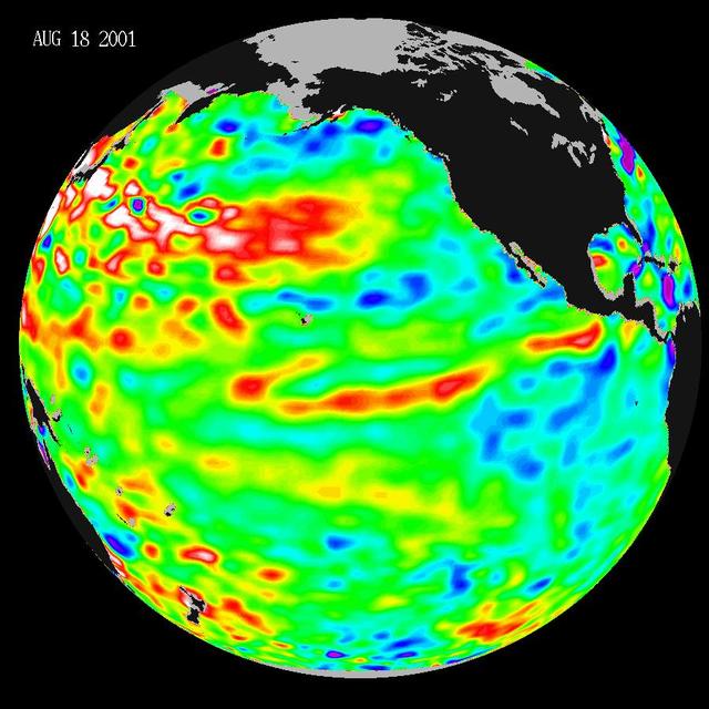
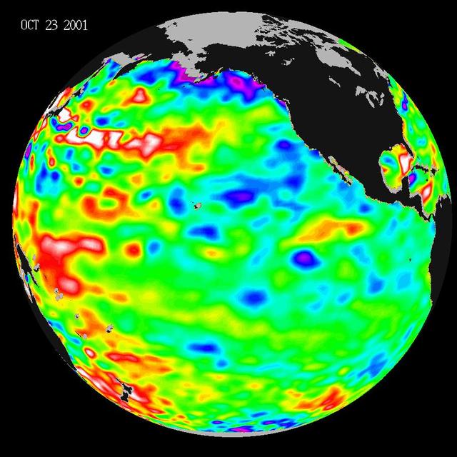
These data, taken during a 10-day collection cycle ending August 18, 2001, show that above-normal sea-surface heights and warmer ocean temperatures still blanket the far-western tropical Pacific and much of the north and south mid-Pacific.
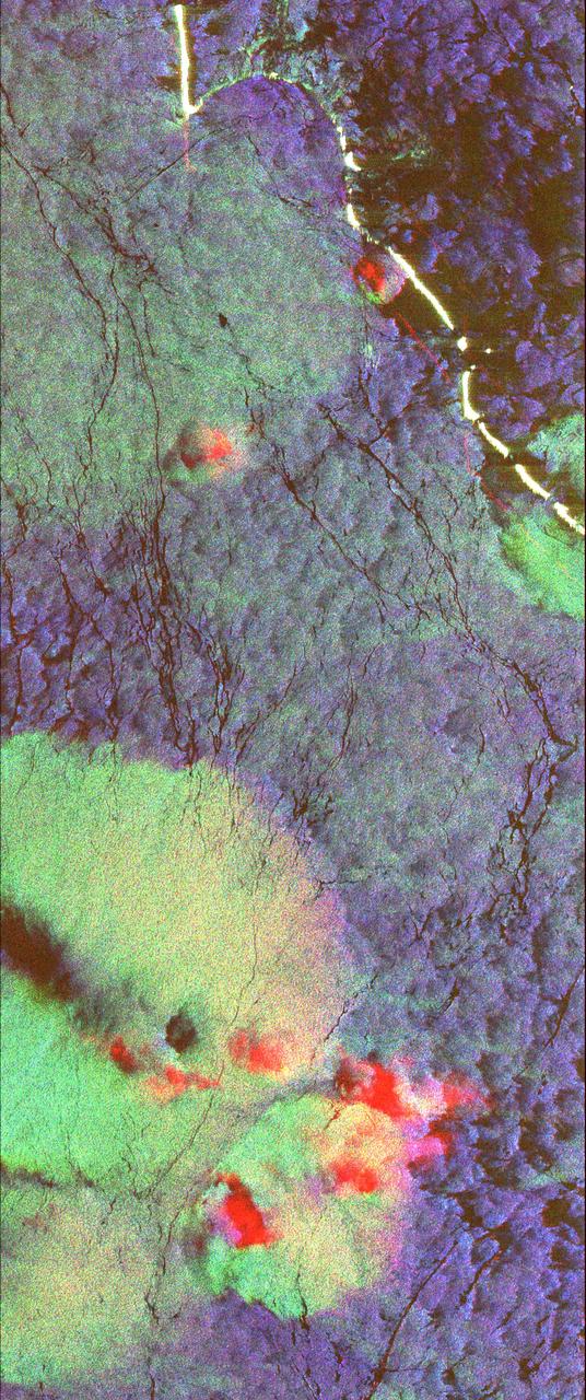
This radar image shows the ocean surface in a portion of the Western Pacific Ocean.
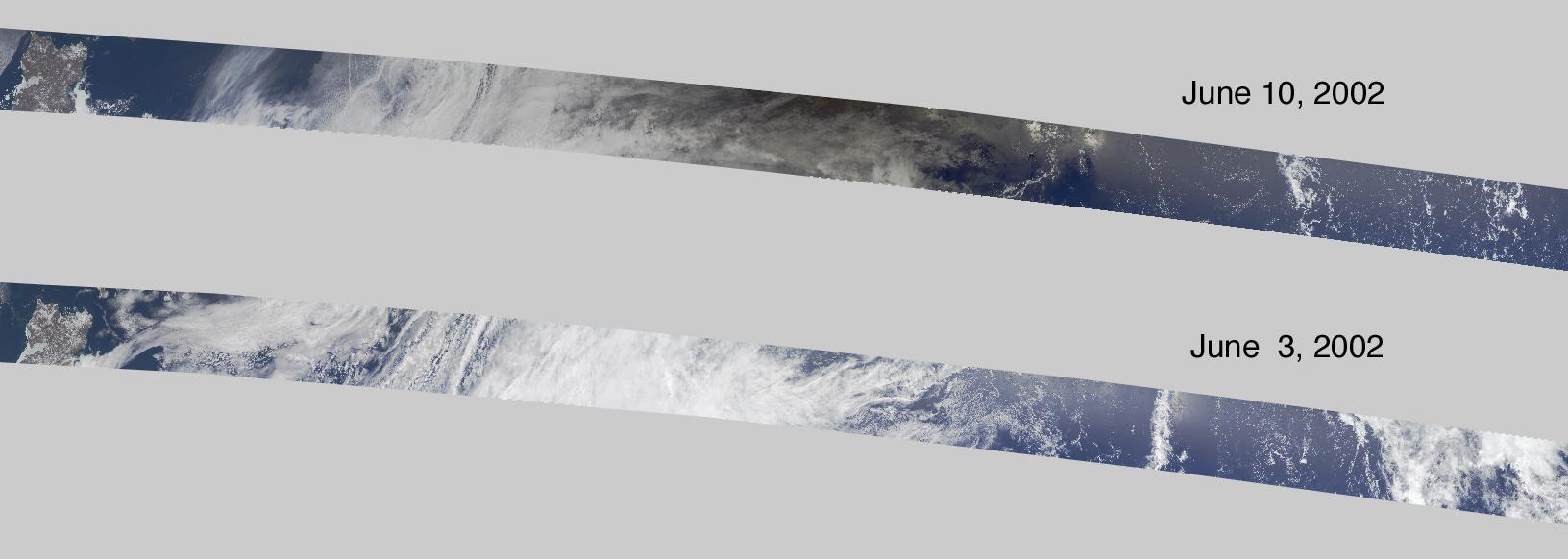
On June 10, 2002 the Moon obscured the central portion of the solar disk in a phenomenon known as an annular solar eclipse as NASA Terra satellite flew over the Pacific.
Hurricane Celia is currently in the Eastern Pacific Ocean, but once it passes west of 140 degrees west longitude, warnings on the system will be issued by NOAA's Central Pacific Hurricane Center. On July 11 at 22:05 UTC (6:05 p.m. EDT) the Visible Infrared Imaging Radiometer Suite (VIIRS) instrument aboard NASA-NOAA-DOD's Suomi NPP satellite captured a visible light image of Hurricane Celia that showed a cloud-filled eye with powerful bands of thunderstorms wrapping around the low level center. The VIIRS image also showed a large band of thunderstorms that extended to the south, wrapping into the storms' eastern quadrant. At 5 a.m. EDT (0900 UTC) on July 12 the center of Hurricane Celia was located near 16.2 north latitude and 127.9 west longitude. That's about 1,260 miles (2,025 km) west-southwest of the southern tip of Baja California, Mexico. It was moving to the west-northwest at 10 mph (17 kph) and NOAA's National Hurricane Center (NHC) expects Celia to turn toward the northwest later today, with this motion continuing Tuesday night and Wednesday. Maximum sustained winds were near 100 mph (155 kph). NHC forecasts weakening over the next two days and Celia could weaken to a tropical storm on Wednesday. Read more: NASA Sees Hurricane Celia Headed for Central Pacific Credit: NASA/Goddard/Jeff Schmaltz/MODIS Land Rapid Response Team <b><a href="http://www.nasa.gov/audience/formedia/features/MP_Photo_Guidelines.html" rel="nofollow">NASA image use policy.</a></b> <b><a href="http://www.nasa.gov/centers/goddard/home/index.html" rel="nofollow">NASA Goddard Space Flight Center</a></b> enables NASA’s mission through four scientific endeavors: Earth Science, Heliophysics, Solar System Exploration, and Astrophysics. Goddard plays a leading role in NASA’s accomplishments by contributing compelling scientific knowledge to advance the Agency’s mission. <b>Follow us on <a href="http://twitter.com/NASAGoddardPix" rel="nofollow">Twitter</a></b> <b>Like us on <a href="http://www.facebook.com/pages/Greenbelt-MD/NASA-Goddard/395013845897?ref=tsd" rel="nofollow">Facebook</a></b> <b>Find us on <a href="http://instagrid.me/nasagoddard/?vm=grid" rel="nofollow">Instagram</a></b>
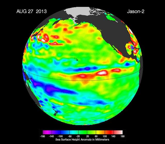
The latest image of sea surface heights in the Pacific Ocean from NASA Jason-2 satellite shows that the equatorial Pacific Ocean is now in its 10th month of being locked in what some call a neutral, or La Nada state.
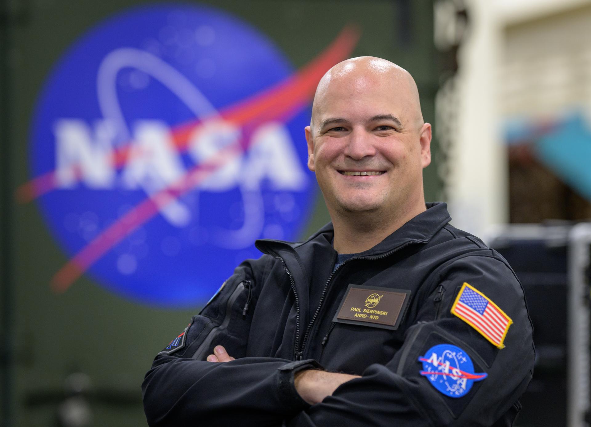
Paul Sierpinski, assistant NASA Recovery Director, poses for a portrait onboard USS John P. Murtha, Thursday, April 9, 2026, in the Pacific Ocean off the coast of California. Photo Credit: (NASA/Bill Ingalls)
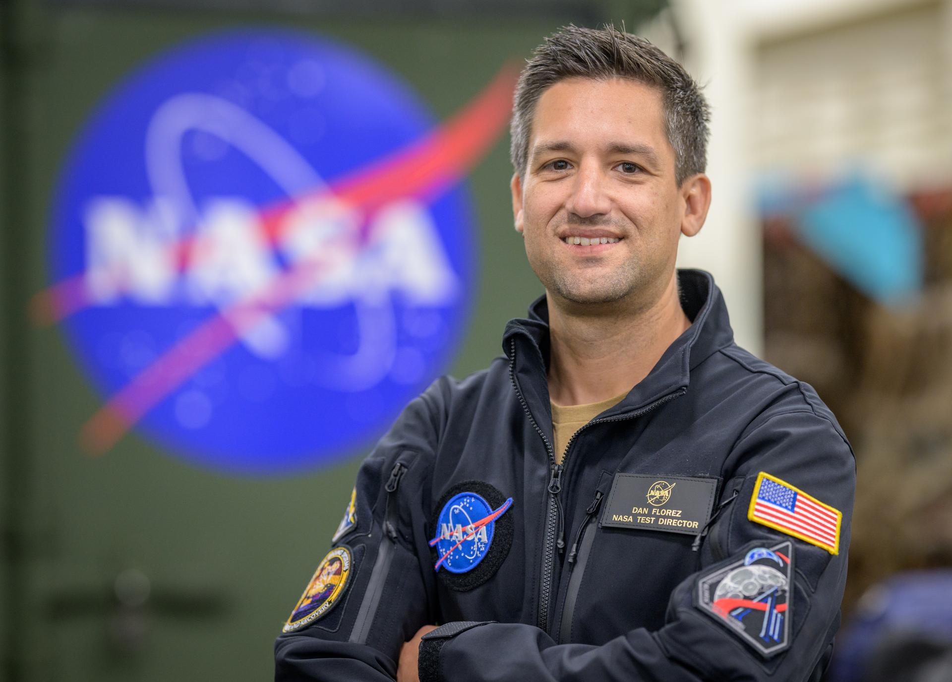
Dan Flores, Senior NASA Test Director, Rescue and Recovery, poses for a portrait onboard the USS Murtha, Tuesday, April 7, 2026, in the Pacific Ocean off the coast of California. Photo Credit: (NASA/Bill Ingalls)
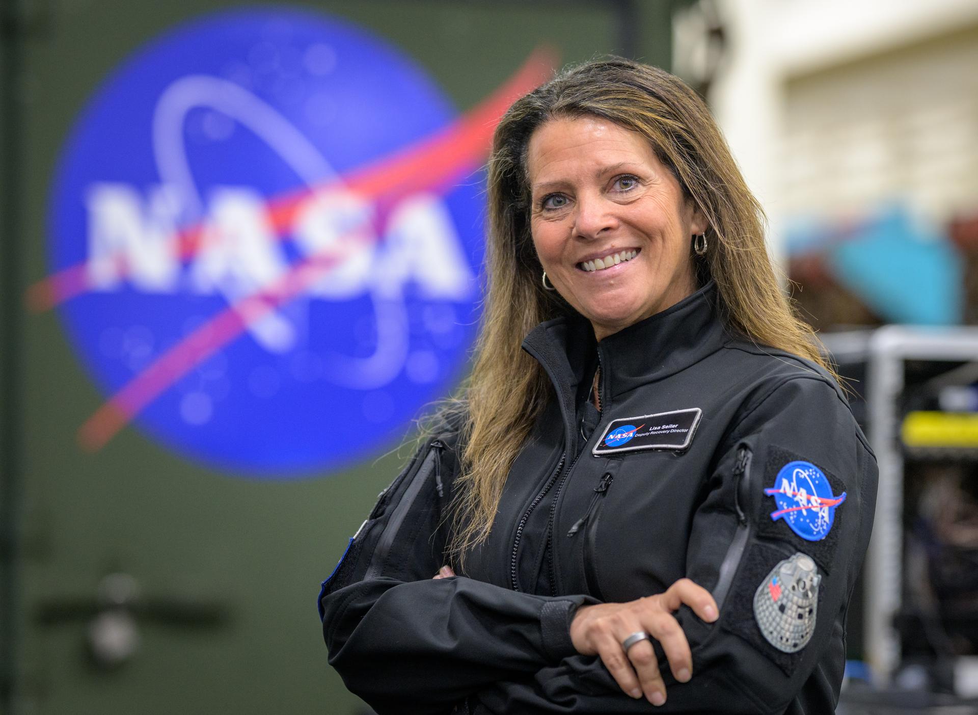
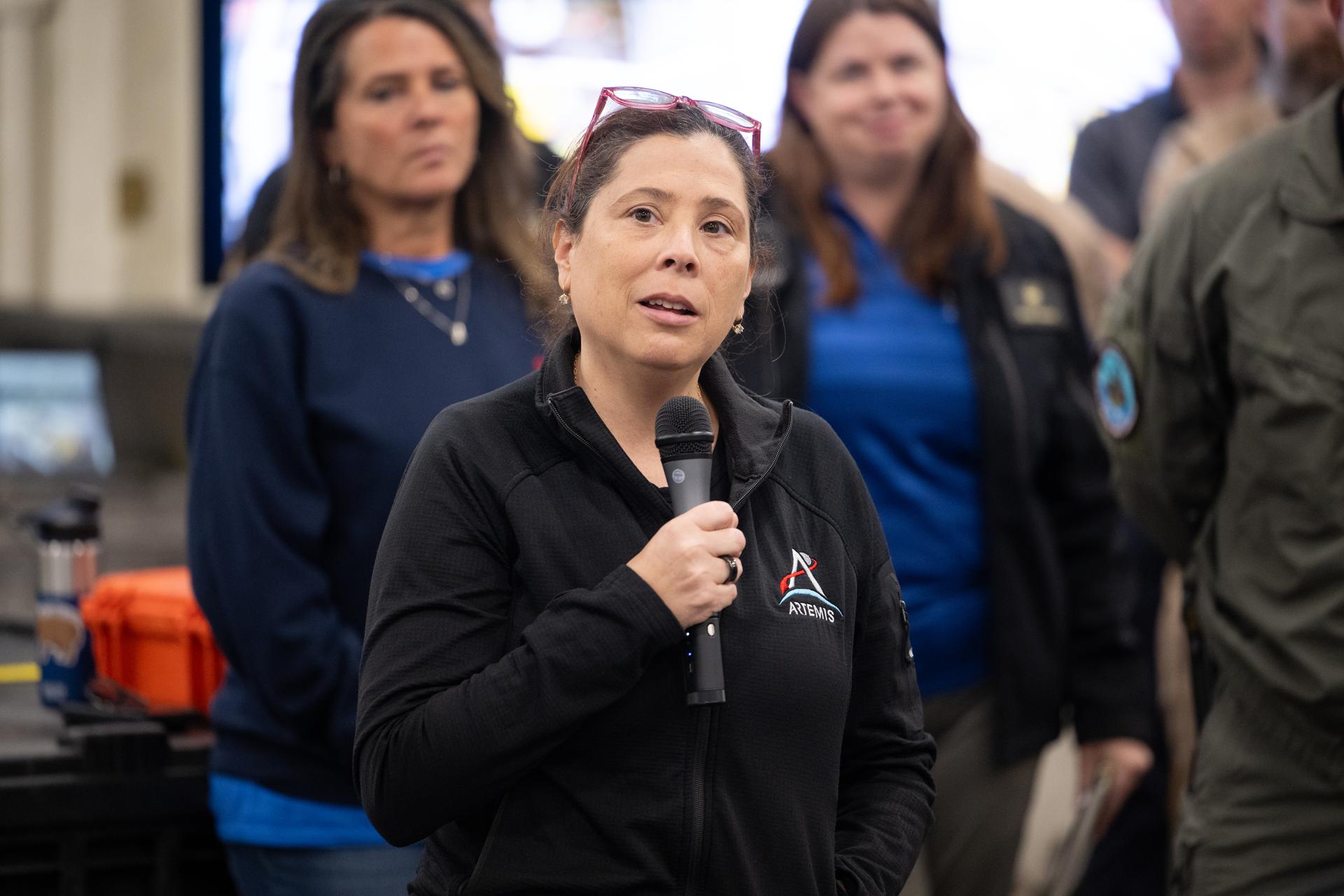
Lisa Seiler, Artemis Landing and Recovery Deputy Director, poses for a portrait onboard USS John P. Murtha, Thursday, April 9, 2026, in the Pacific Ocean off the coast of California. Photo Credit: (NASA/Bill Ingalls)
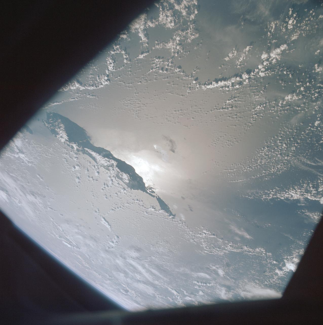
AST-19-1555 (24 July 1975) --- A sunglint in the South Western Pacific Ocean, as photographed from the Apollo spacecraft in Earth orbit during the joint U.S.-USSR Apollo-Soyuz Test Project mission. The island is Bougainville of the Solomon Islands group. The horizon of Earth is in the background. The picture was taken at an altitude of 231 kilometers (143 statute miles), with a 70mm Hasselblad camera using medium-speed Ektachrome QX-807 type film.
The North Pacific Ocean continues to run hot and cold, with abnormally low sea levels and cool waters in the northeastern Pacific contrasting with unusually high sea levels and warm waters in the northwestern Pacific.
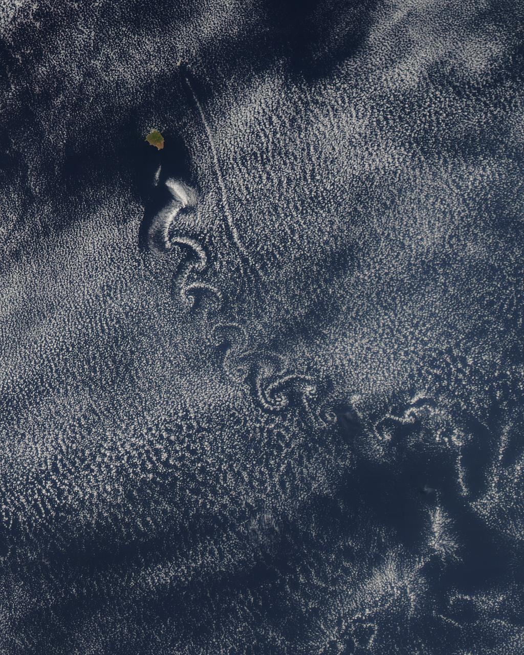
Theodore von Kármán, a Hungarian-American physicist, was the first to describe the physical processes that create long chains of spiral eddies like the one shown above. Known as von Kármán vortices the patterns can form nearly anywhere that fluid flow is disturbed by an object. Since the atmosphere behaves like a fluid, the wing of an airplane, a bridge, even an island can trigger the distinctive phenomenon. On May 22, 2013, the Moderate Resolution Imaging Spectroradiometer (MODIS) on NASA’s Terra satellite captured this natural-color image of cloud vortices behind Isla Socorro, a volcanic island located in the Pacific Ocean. The island, which is located a few hundred kilometers off the west coast of Mexico and the southern tip of Baja California, is part of the Revillagigedo Archipelago. Satellite sensors have spotted von Kármán vortices around the globe, including off of Guadalupe Island, near the coast of Chile, in the Greenland Sea, in the Arctic, and even next to a tropical storm. NASA image courtesy Jeff Schmaltz, LANCE/EOSDIS MODIS Rapid Response Team at NASA GSFC. Caption by Adam Voiland. Instrument: Terra - MODIS More info: <a href="http://1.usa.gov/14VSDQa" rel="nofollow">1.usa.gov/14VSDQa</a> Credit: <b><a href="http://www.earthobservatory.nasa.gov/" rel="nofollow"> NASA Earth Observatory</a></b> <b><a href="http://www.nasa.gov/audience/formedia/features/MP_Photo_Guidelines.html" rel="nofollow">NASA image use policy.</a></b> <b><a href="http://www.nasa.gov/centers/goddard/home/index.html" rel="nofollow">NASA Goddard Space Flight Center</a></b> enables NASA’s mission through four scientific endeavors: Earth Science, Heliophysics, Solar System Exploration, and Astrophysics. Goddard plays a leading role in NASA’s accomplishments by contributing compelling scientific knowledge to advance the Agency’s mission. <b>Follow us on <a href="http://twitter.com/NASA_GoddardPix" rel="nofollow">Twitter</a></b> <b>Like us on <a href="http://www.facebook.com/pages/Greenbelt-MD/NASA-Goddard/395013845897?ref=tsd" rel="nofollow">Facebook</a></b> <b>Find us on <a href="http://instagram.com/nasagoddard?vm=grid" rel="nofollow">Instagram</a></b>
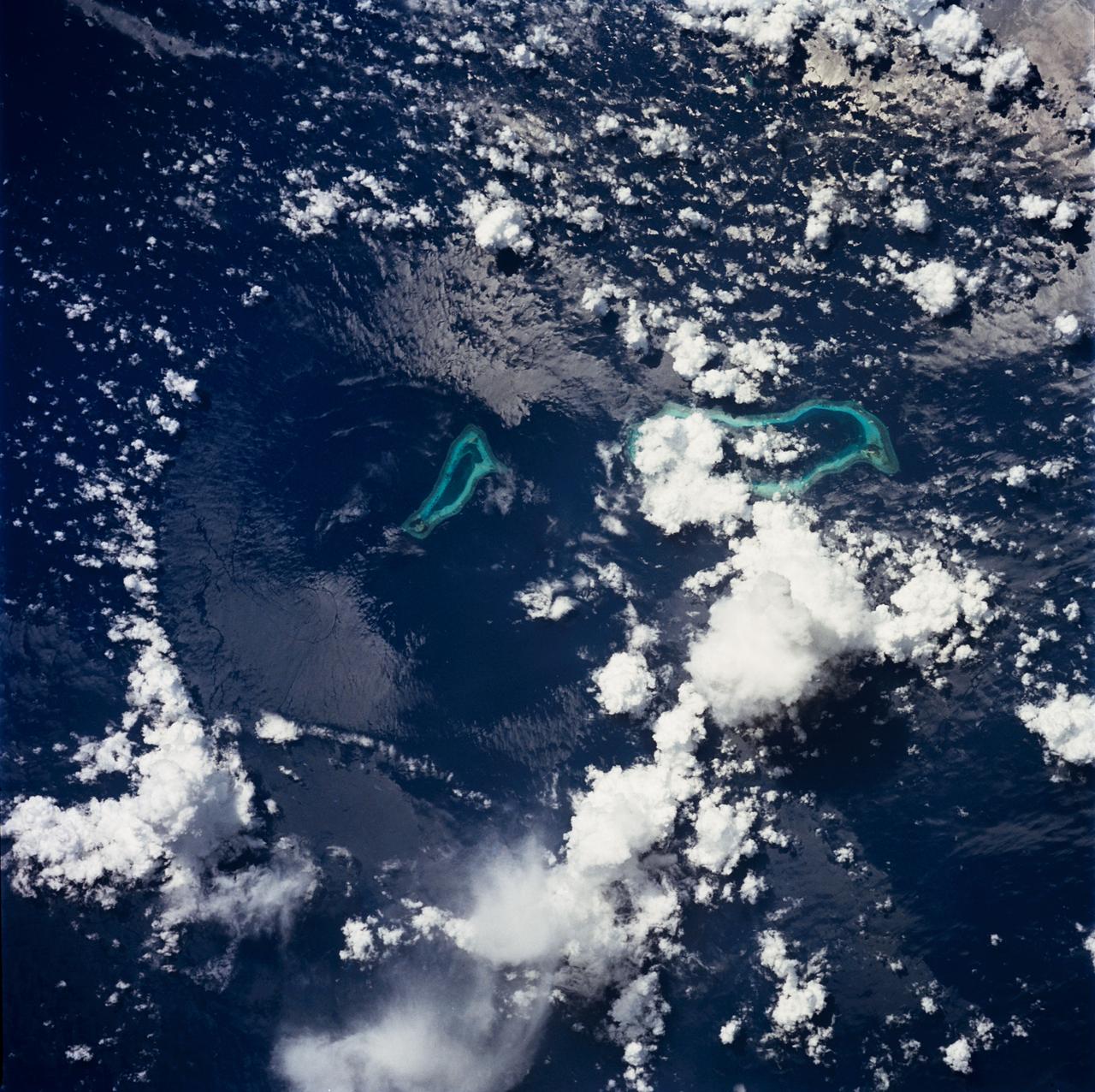
STS049-71-042 (8 May 1992) --- This photograph, taken from the Earth-orbiting Space Shuttle Endeavour, shows a collapsed thunderstorm in the southwestern Pacific Ocean. The clouds were pushed from this circular area of the ocean's surface by relatively cool air that spread downward and outward from a dying thunderstorm. Around the edges of the downdrafted air, new, though smaller, storms are developing. The photo was taken on May 8, 1992, between Borneo and the Philippine island of Mindoro. Two coral atolls can be seen near the center of the photograph. The crew members used a handheld Hasselblad camera, 250-mm lens, color film to expose the image.
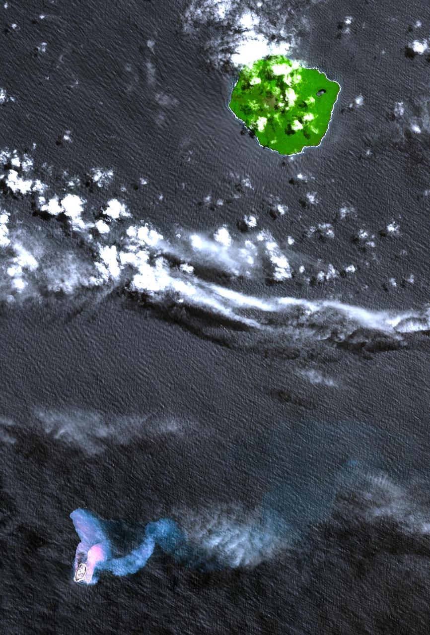
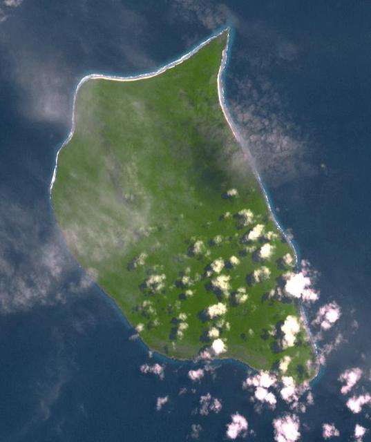
In the South Pacific, south of Late Island along the Tofua volcanic arc in Tonga, a new volcanic island Home Reef is being re-born. This image was acquired October 10, 2006 by NASA Terra spacecraft.
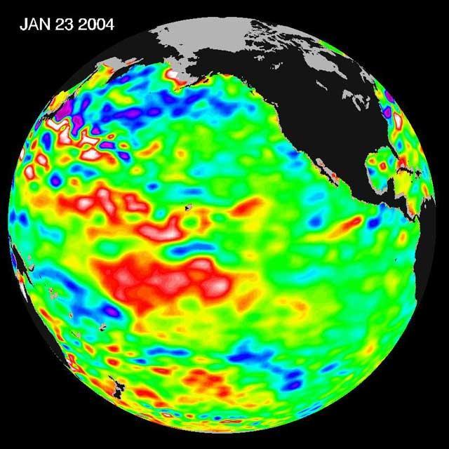
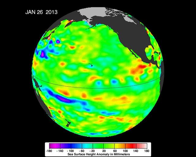
The latest remote sensing data from NASA's Jason satellite show that the equatorial Pacific sea surface levels are higher, indicating warmer sea surface temperatures in the central and west Pacific Ocean. This pattern has the appearance of La Niña rather than El Niño. This contrasts with the Bering Sea, Gulf of Alaska and U.S. West Coast where lower-than-normal sea surface levels and cool ocean temperatures continue (indicated by blue and purple areas). The image above is a global map of sea surface height, accurate to within 30 millimeters. The image represents data collected and composited over a 10-day period, ending on Jan 23, 2004. The height of the water relates to the temperature of the water. As the ocean warms, its level rises; and as it cools, its level falls. Yellow and red areas indicate where the waters are relatively warmer and have expanded above sea level, green indicates near normal sea level, and blue and purple areas show where the waters are relatively colder and the surface is lower than sea level. The blue areas are between 5 and 13 centimeters (2 and 5 inches) below normal, whereas the purple areas range from 14 to 18 centimeters (6 to 7 inches) below normal. http://photojournal.jpl.nasa.gov/catalog/PIA05071

The Orion team visits Aero Pacific Corporation in Placentia, CA on Jan. 28, 2014. Part of Batch image transfer from Flickr.

The Orion team visits Aero Pacific Corporation in Placentia, CA on Jan. 28, 2014. Part of Batch image transfer from Flickr.

The Orion team visits Aero Pacific Corporation in Placentia, CA on Jan. 28, 2014. Part of Batch image transfer from Flickr.
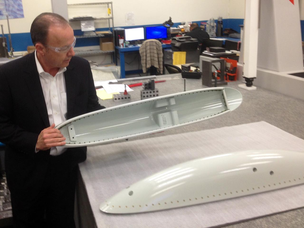
The Orion team visits Aero Pacific Corporation in Placentia, CA on Jan. 28, 2014. Part of Batch image transfer from Flickr.

The Orion team visits Aero Pacific Corporation in Placentia, CA on Jan. 28, 2014. Part of Batch image transfer from Flickr.
The Orion team visits Aero Pacific Corporation in Placentia, CA on Jan. 28, 2014. Part of Batch image transfer from Flickr.
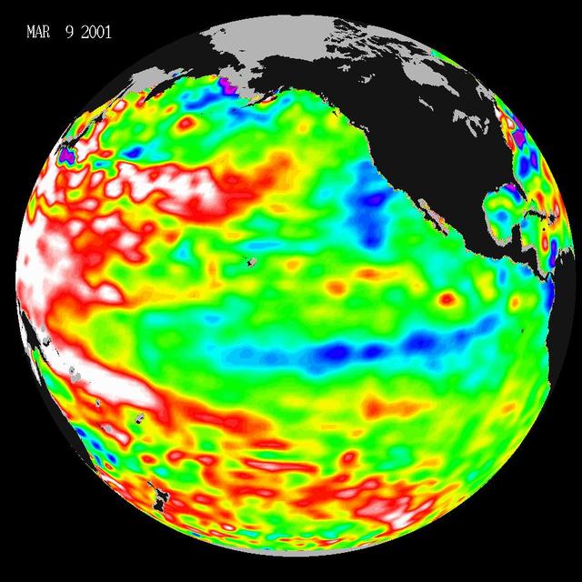
Data taken during a 10-day collection cycle ending March 9, 2001, show that above-normal sea-surface heights and warmer ocean temp. red and white areas still blanket the far-western tropical Pacific and much of the north and south mid-Pacific.
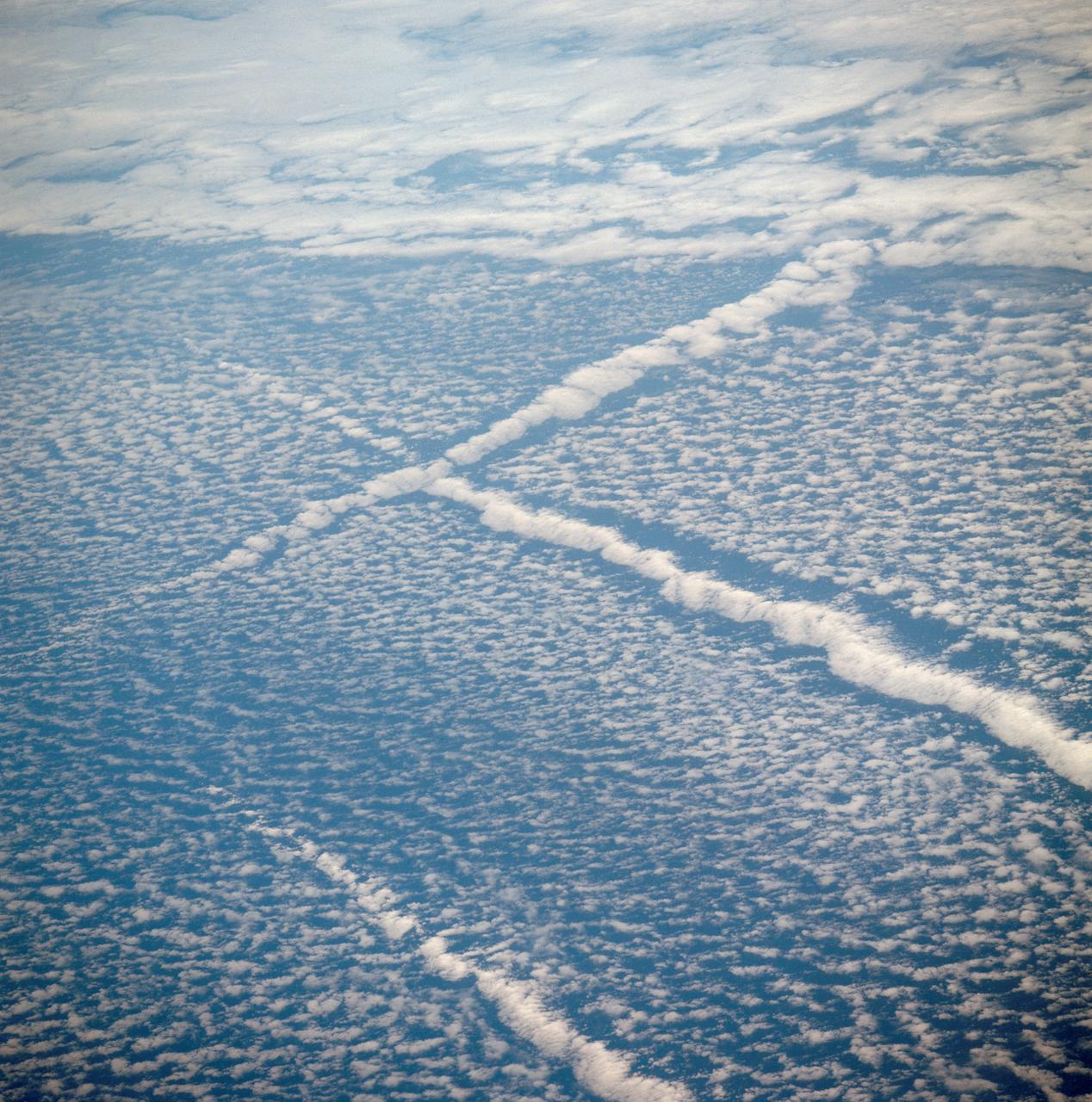
AST-01-042 (16 July 1975) --- An oblique view of unique cloud patterns over the Pacific Ocean caused by aircraft contrail shadows altering cumulus clouds and forming straight line clouds, as photographed from the Apollo spacecraft in Earth orbit during the joint U.S.-USSR Apollo-Soyuz Test Project mission. This area is southwest of Los Angeles, California. This photograph was taken at an altitude of 177 kilometers (110 statute miles) with a 70mm Hasselblad camera using medium-speed Ektachrome QX-807 type film.
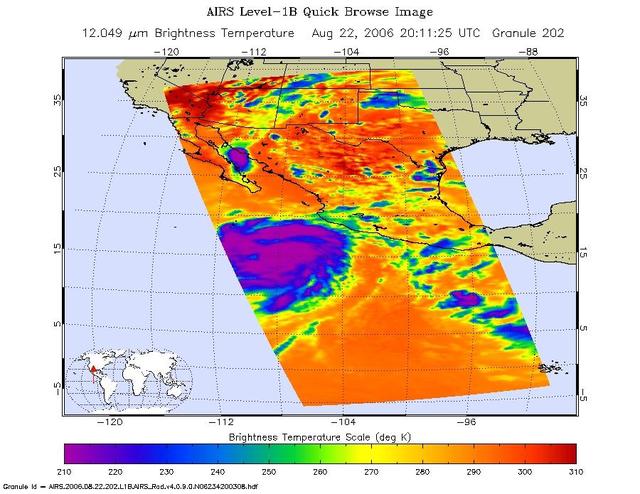
This is an infrared image of Hurricane Ileana in the Eastern Pacific, from the Atmospheric Infrared Sounder (AIRS) on NASA's Aqua satellite on August 22, 2006. This AIRS image shows the temperature of the cloud tops or the surface of the Earth in cloud-free regions. The lowest temperatures (in purple) are associated with high, cold cloud tops that make up the top of the storm. The infrared signal does not penetrate through clouds. Where there are no clouds the AIRS instrument reads the infrared signal from the surface of the Earth, revealing warmer temperatures (red). http://photojournal.jpl.nasa.gov/catalog/PIA00509
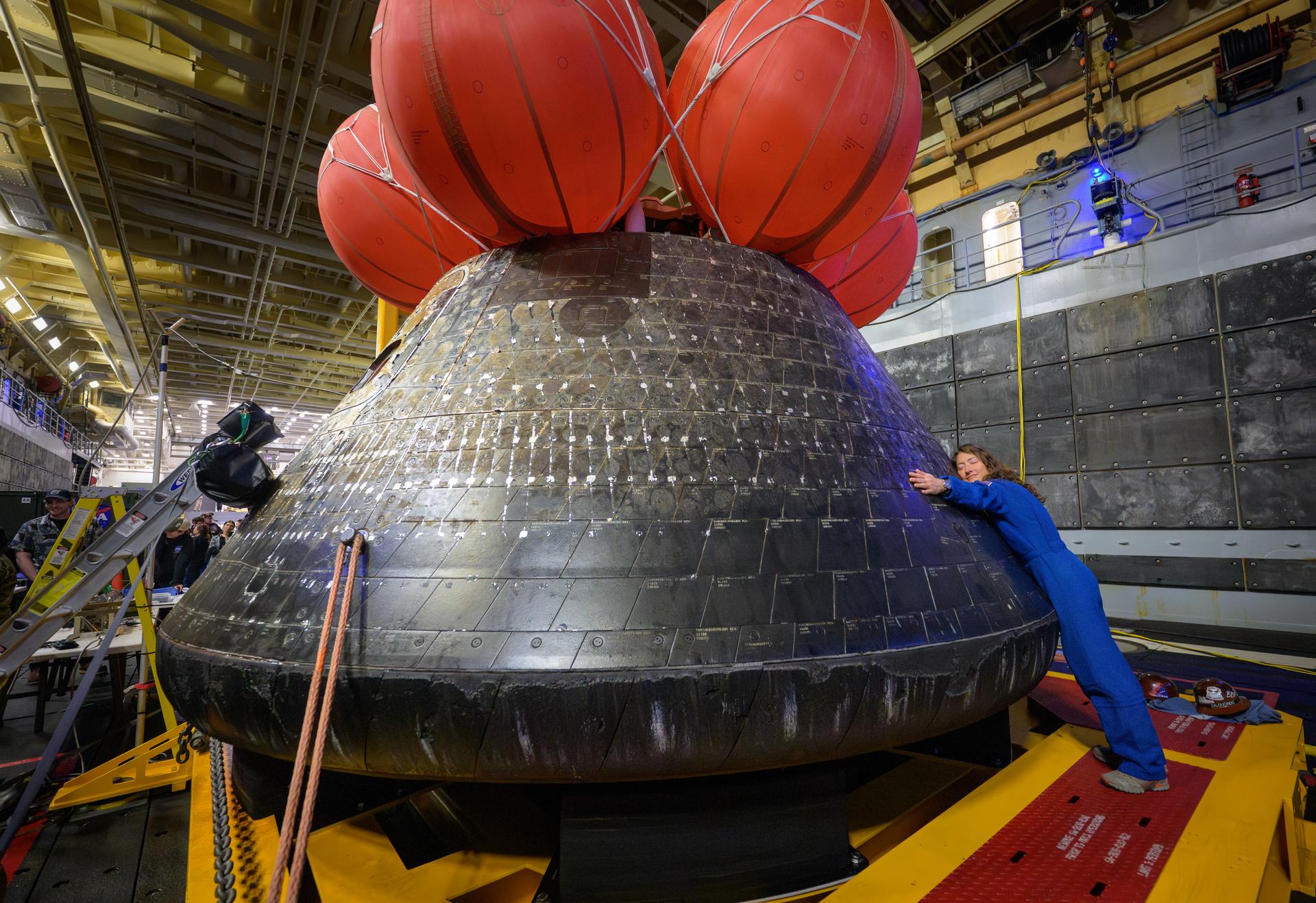
NASA astronaut Christina Koch, Artemis II mission specialist hugs the Orion spacecraft in the well deck of USS John P. Murtha, Saturday, April 11, 2026, in the Pacific Ocean off the coast of California. Koch, NASA astronaut Reid Wiseman, Artemis II commander, NASA astronaut Victor Glover, Artemis II pilot, and CSA (Canadian Space Agency) astronaut Jeremy Hansen, mission specialist; splashed down in the Pacific Ocean, Friday, April 10 at 5:07 p.m. PDT (8:07p.m. EDT). Photo Credit: (NASA/Bill Ingalls)
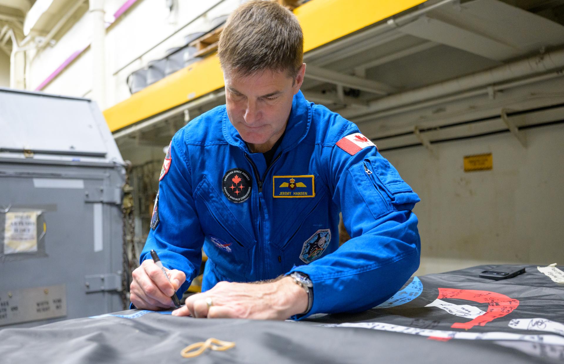
CSA (Canadian Space Agency) astronaut Jeremy Hansen, Artemis II mission specialist signs an Artemis II flag, onboard USS John P. Murtha, Saturday, April 11, 2026, in the Pacific Ocean off the coast of California. Hansen, and NASA astronauts Victor Glover, Artemis II pilot, Reid Wiseman, Artemis II commander, and Christina Koch, Artemis II mission specialist, splashed down in the Pacific Ocean, Friday, April 10 at 5:07 p.m. PDT (8:07p.m. EDT). Photo Credit: (NASA/Bill Ingalls)
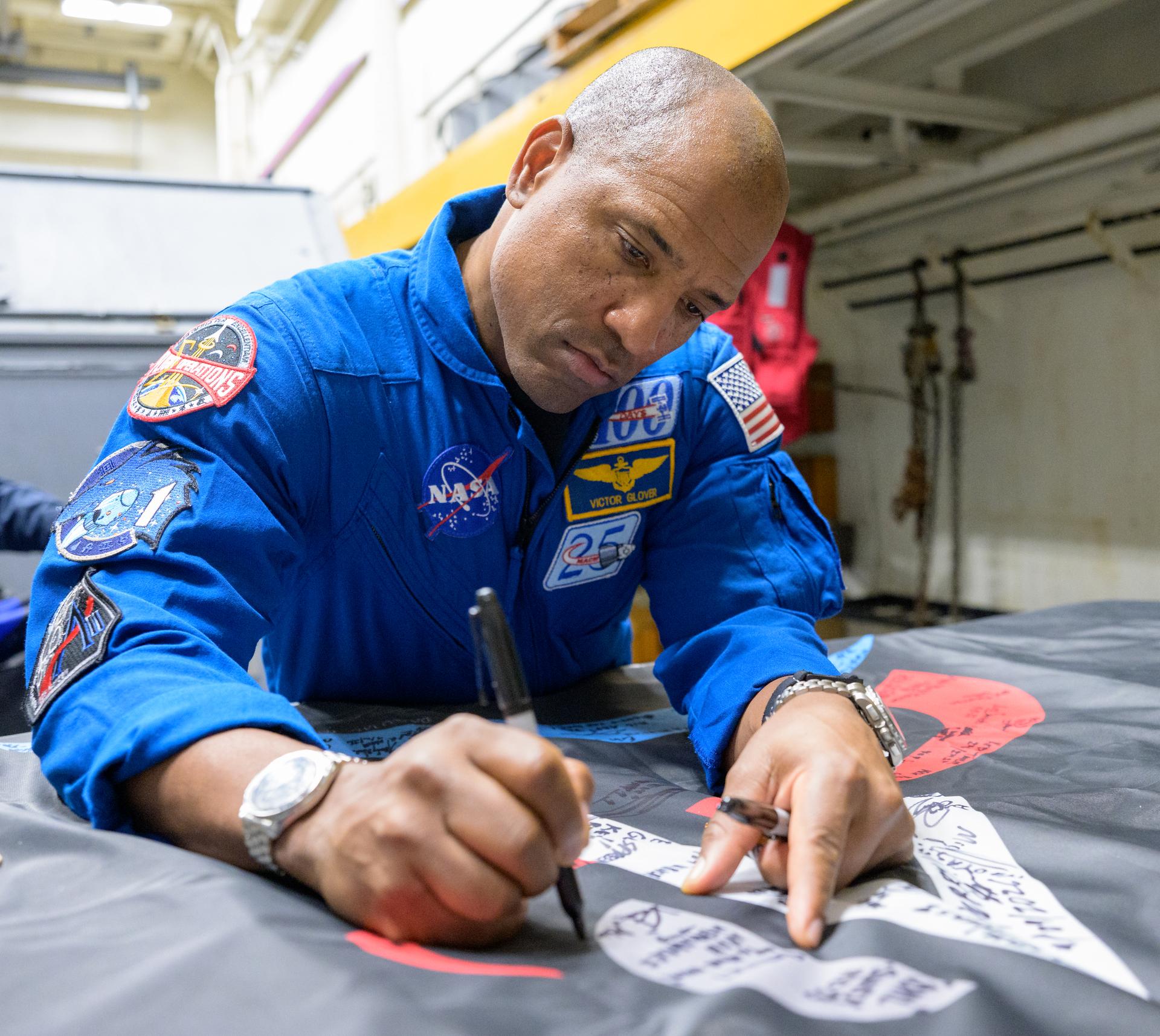
NASA astronaut Victor Glover, Artemis II pilot signs an Artemis II flag, onboard USS John P. Murtha, Saturday, April 11, 2026, in the Pacific Ocean off the coast of California. Glover, NASA astronauts Reid Wiseman, Artemis II commander, and Christina Koch, Artemis II mission specialist, along with CSA (Canadian Space Agency) astronaut Jeremy Hansen, Artemis II mission specialist, splashed down in the Pacific Ocean, Friday, April 10 at 5:07 p.m. PDT (8:07p.m. EDT). Photo Credit: (NASA/Bill Ingalls)
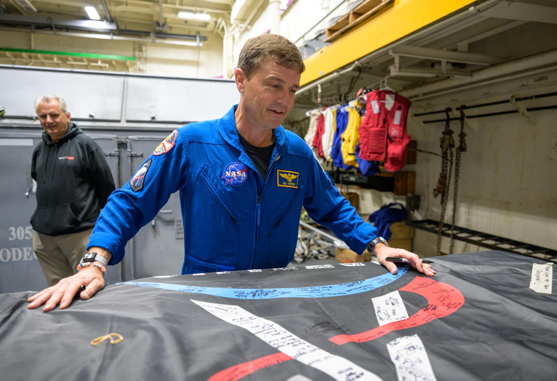
NASA astronaut Reid Wiseman, commander of the Artemis II mission looks for a place to sign an Artemis II flag onboard USS John P. Murtha, Saturday, April 11, 2026, in the Pacific Ocean off the coast of California. Wiseman, NASA astronaut Christina Koch, mission specialist; NASA astronaut Victor Glover, Artemis II pilot, and CSA (Canadian Space Agency) astronaut Jeremy Hansen, mission specialist; splashed down in the Pacific Ocean, Friday, April 10 at 5:07 p.m. PDT (8:07p.m. EDT). Photo Credit: (NASA/Bill Ingalls)
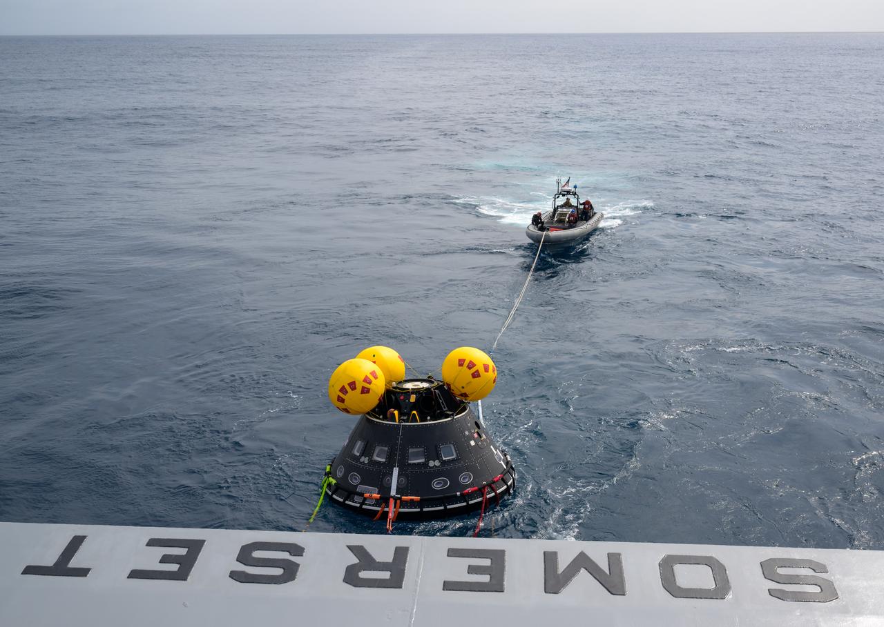
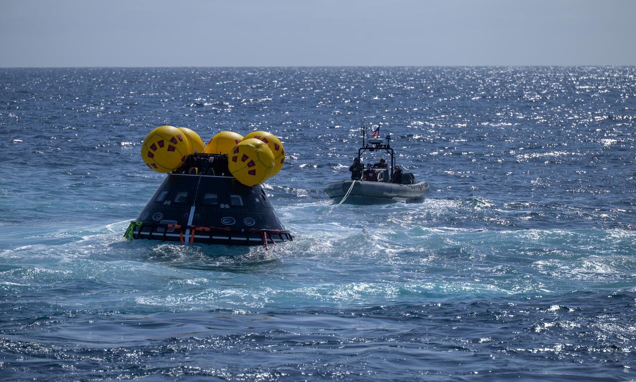
The Crew Module Test Article (CMTA), a full scale mockup of the Orion spacecraft, is seen in the Pacific Ocean as teams practice Artemis recovery operations during Underway Recovery Test-12 onboard USS Somerset off the coast of California, Saturday, March 29, 2025. During the test, NASA and Department of Defense teams are practicing to ensure recovery procedures are validated as NASA plans to send Artemis II around the Moon and splashdown in the Pacific Ocean. Photo Credit: (NASA/Bill Ingalls)
New data from NASA Jason-2 satellite show near-normal sea surface heights in the equatorial Pacific Ocean persisting for a 16th straight month.

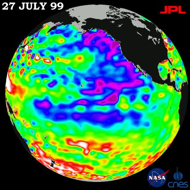
This image shows wind speeds and direction in the Pacific Ocean on August 1, 1999, gathered by NASA Seawinds radar instrument flying onboard NASA QuikScat satellite.
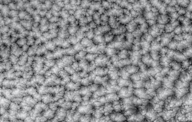
The structure of tightly packed closed cells in a layer of marine stratocumulus over the southeastern Pacific Ocean are highlighted in these views from NASA Terra satellite.
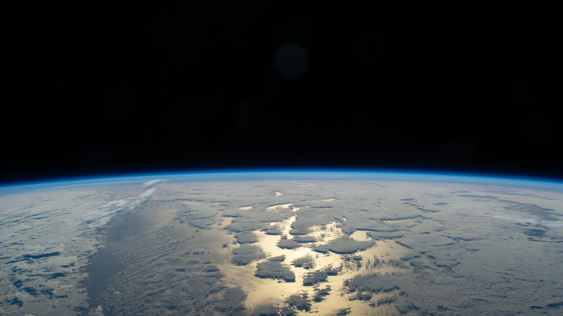
iss074e0089803 (Jan. 16, 2026) --- Earth's thin blue atmosphere traces the planet's horizon as the sun's glint beams off a partly cloudy Pacific Ocean west of Chile on the South American continent. The International Space Station was orbiting 271 miles above Earth at the time of this photograph.
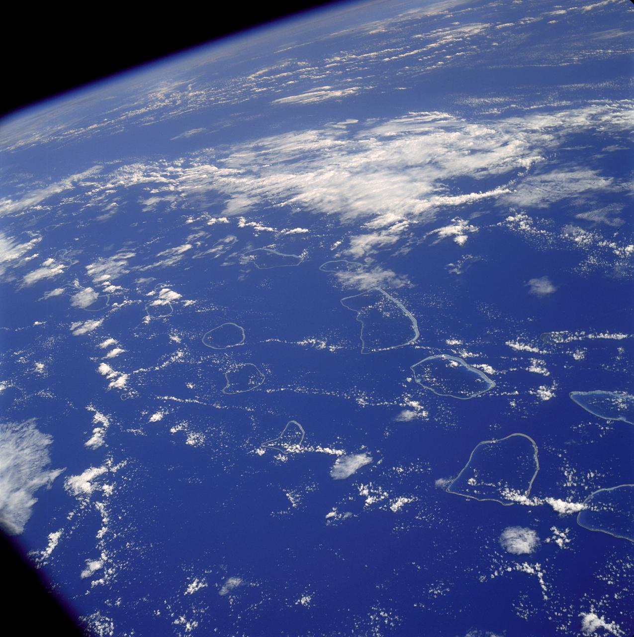
AS07-04-1590 (20 Oct. 1968) --- Tuamotu Archipelago in the South Pacific Ocean, looking southwest, as photographed from the Apollo 7 spacecraft during its 141st revolution of Earth. The photograph was taken from an altitude of 110 nautical miles, at a ground elapsed time of 224 hours and 18 minutes.
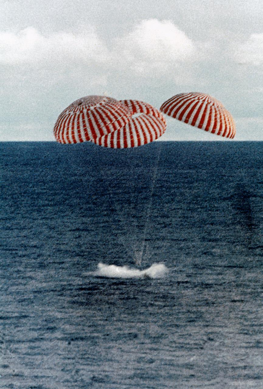
S70-35638 (17 April 1970) --- A perilous space mission comes to a smooth ending with the safe splashdown of the Apollo 13 Command Module (CM) in the South Pacific, only four miles from the prime recovery ship. The spacecraft with astronauts James A. Lovell Jr., John L. Swigert Jr., and Fred W. Haise Jr. aboard, splashed down at 12:07:44 p.m. (CST) April 17, 1970, to conclude safely the problem-plagued flight. The crewmen were transported by helicopter from the immediate recovery area to the USS Iwo Jima, prime recovery vessel.
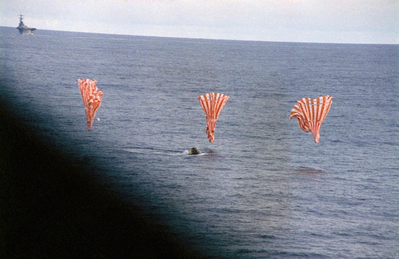
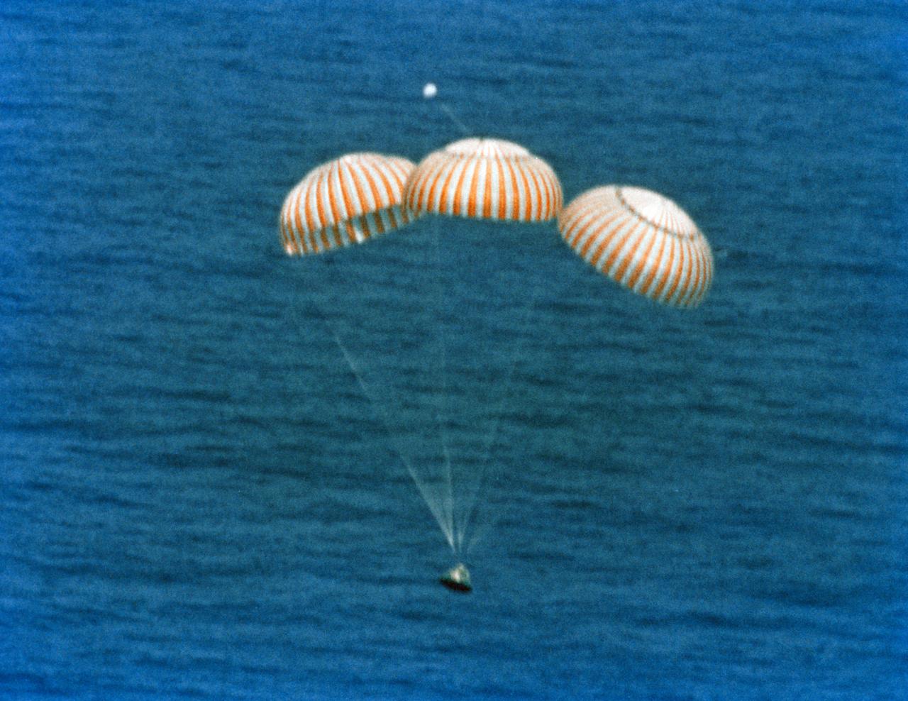
S70-35644 (17 April 1970) --- The Apollo 13 Command Module (CM) splashes down and its three main parachutes collapse, as the week-long problem-plagued Apollo 13 mission comes to a premature, but safe end. The spacecraft, with astronauts James A. Lovell Jr., commander; John L. Swigert Jr., command module pilot; and Fred W. Haise Jr., lunar module pilot, aboard splashed down at 12:07:44 p.m. (CST) April 17, 1970, in the South Pacific Ocean, only about four miles from the USS Iwo Jima, prime recovery ship.

Lilian Villarreal, Artemis II landing and recovery director for Exploration Ground Systems at NASA's Kennedy Space Center, poses for a portrait onboard USS John P. Murtha, Tuesday, April 7, 2026, in the Pacific Ocean off the coast of California. Photo Credit: (NASA/Bill Ingalls)
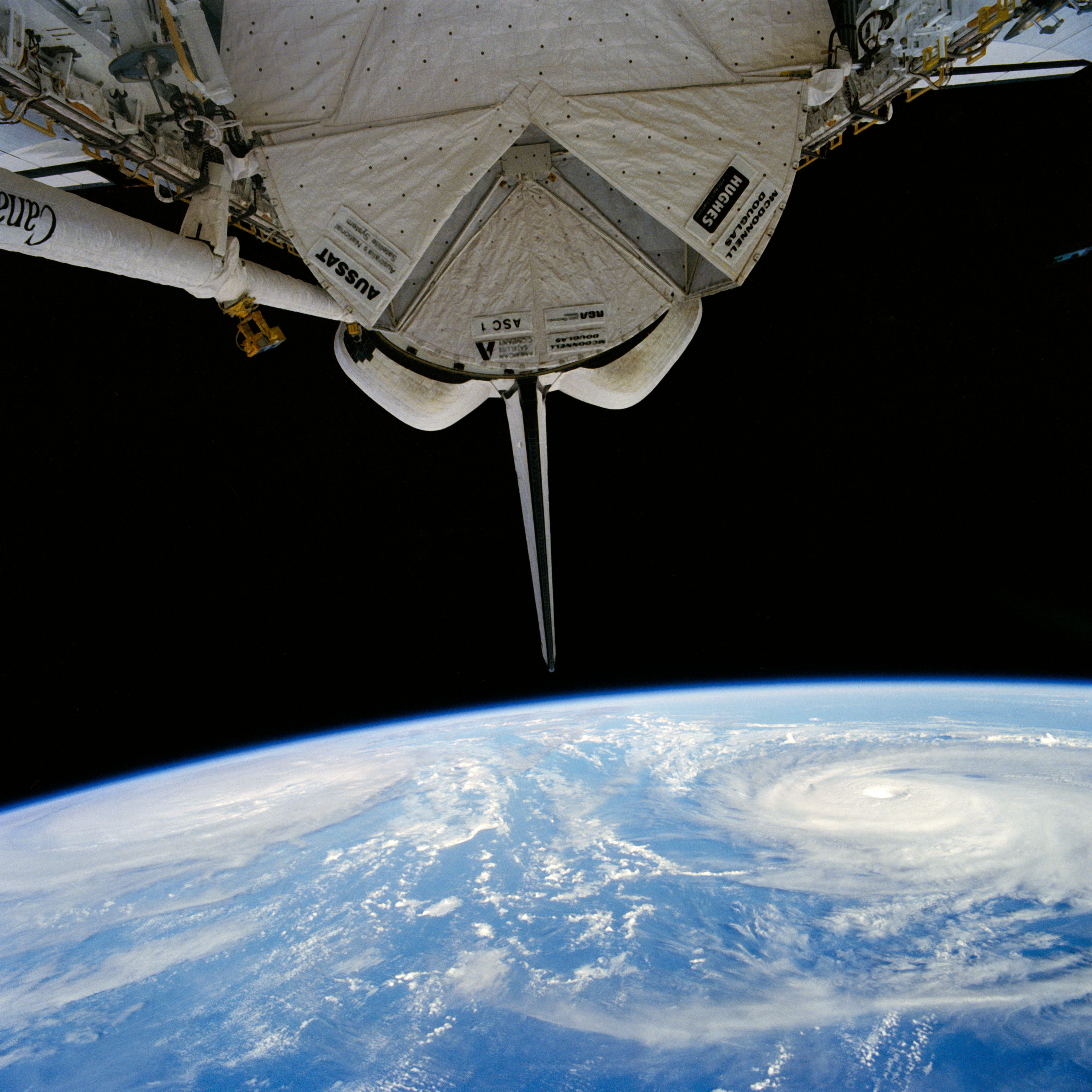
51I-35-078 (30 Aug 1985) --- Typhoons Pat (left) and Odessa in the western Pacific. Of the many tropical cyclones photographed by the STS 51-I crew, the dual typhoons of Pat and Odessa were the most unusual. The twin typhoons constitute a Fujiwara system of connected cyclones first described by the Japanese meteorologist after whom the phenomena has been named. Never before have such paired typhoons been photographed from orbit.
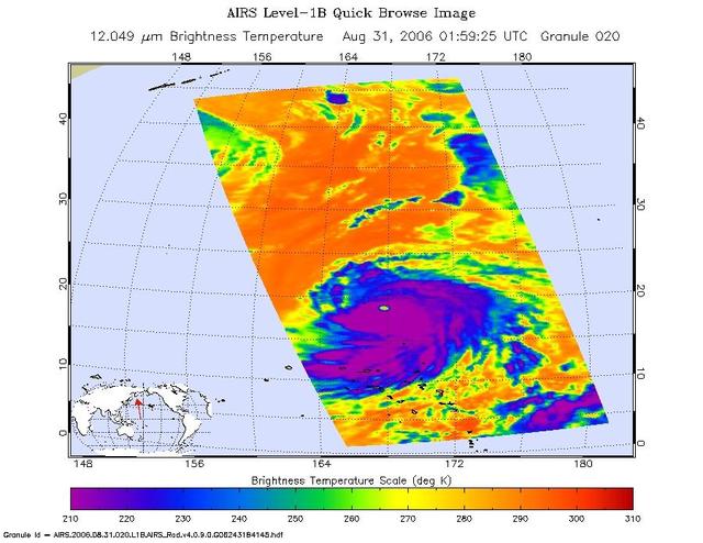
This infrared image shows Typhoon Ioke in the Western Pacific, from the Atmospheric Infrared Sounder AIRS on NASA Aqua satellite in August, 2006. Because infrared radiation does not penetrate through clouds, AIRS infrared images show either the temperature of the cloud tops or the surface of the Earth in cloud-free regions. The lowest temperatures (in purple) are associated with high, cold cloud tops that make up the top of the storm. In cloud-free areas the AIRS instrument will receive the infrared radiation from the surface of the Earth, resulting in the warmest temperatures (orange/red). http://photojournal.jpl.nasa.gov/catalog/PIA00511
Uninhabited Henderson Island is part of the United Kingdom's Pitcairn Islands group in the South Pacific. According to a study by the University of Tasmania published in the Proceedings of the National Academy of Science, the island has the highest density of plastic waste anywhere in the world, an estimated 38 million pieces of rubbish. The island is near the center of an ocean current, so it collects rubbish from boats and South America. The image was acquired February 7, 2012, covers an area of 10.3 by 12.3 km, and is located at 24.3 degrees south, 128.3 degrees west. https://photojournal.jpl.nasa.gov/catalog/PIA21691

Apollo 6 (AS-502) Pacific Recovery

Apollo 6 (AS-502) Pacific Recovery

Apollo 6 (AS-502) Pacific Recovery

Apollo 6 (AS-502) Pacific Recovery

Apollo 6 (AS-502) Pacific Recovery

Apollo 6 (AS-502) Pacific Recovery
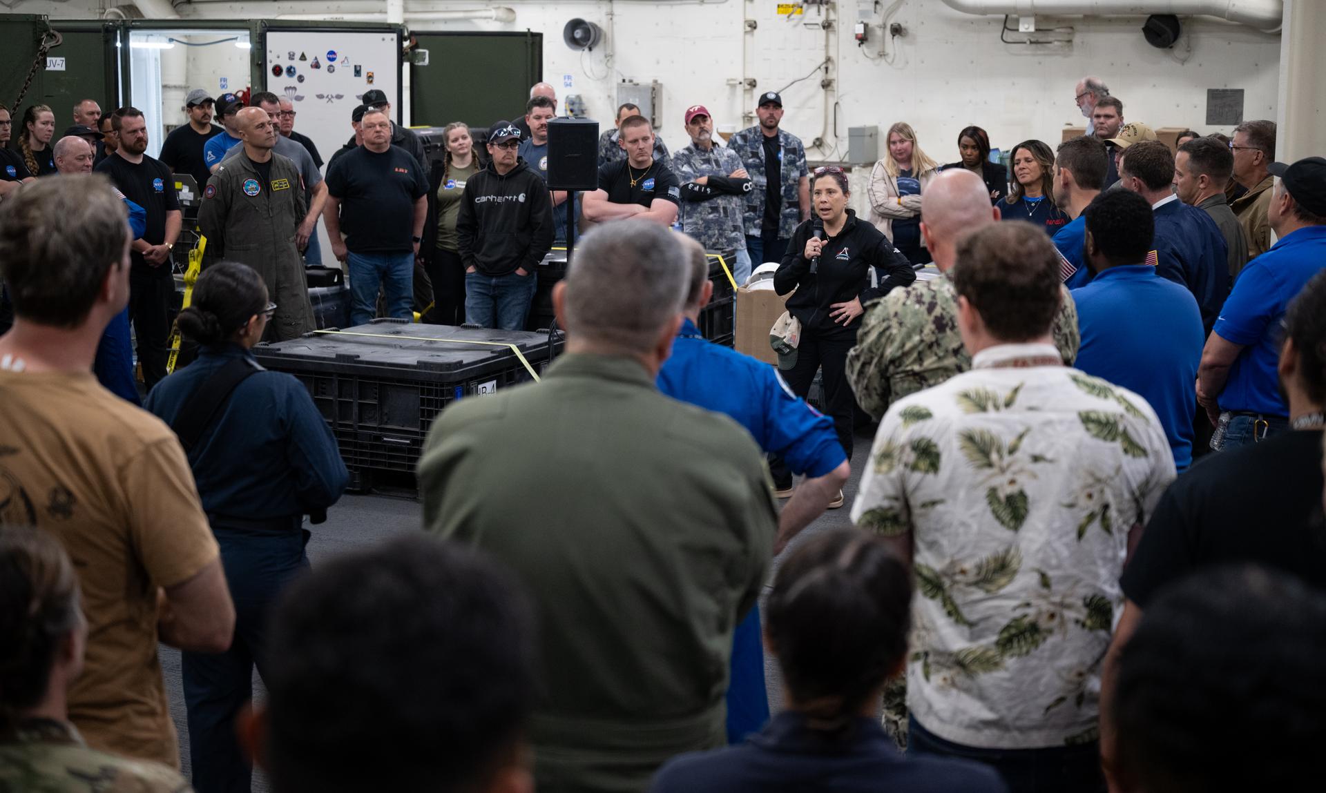
Lilian Villarreal, Artemis II landing and recovery director for Exploration Ground Systems at NASA's Kennedy Space Center, speaks to NASA and U.S. military recovery team members onboard USS John P. Murtha as they prepare for the return of NASA’s Orion spacecraft with Artemis II crewmembers NASA astronauts Reid Wiseman, commander; Victor Glover, pilot; Christina Koch, mission specialist; and CSA (Canadian Space Agency) astronaut Jeremy Hansen, mission specialist aboard in the Pacific Ocean off the coast of California, Friday, April 10, 2026. NASA’s Artemis II mission took Wiseman, Glover, Koch, and Hansen on a nearly 10-day journey around the Moon and back to Earth. The quartet splashed down in the Pacific Ocean at 5:07 p.m. PDT (8:07 p.m. EDT). Photo Credit: (NASA/Joel Kowsky)
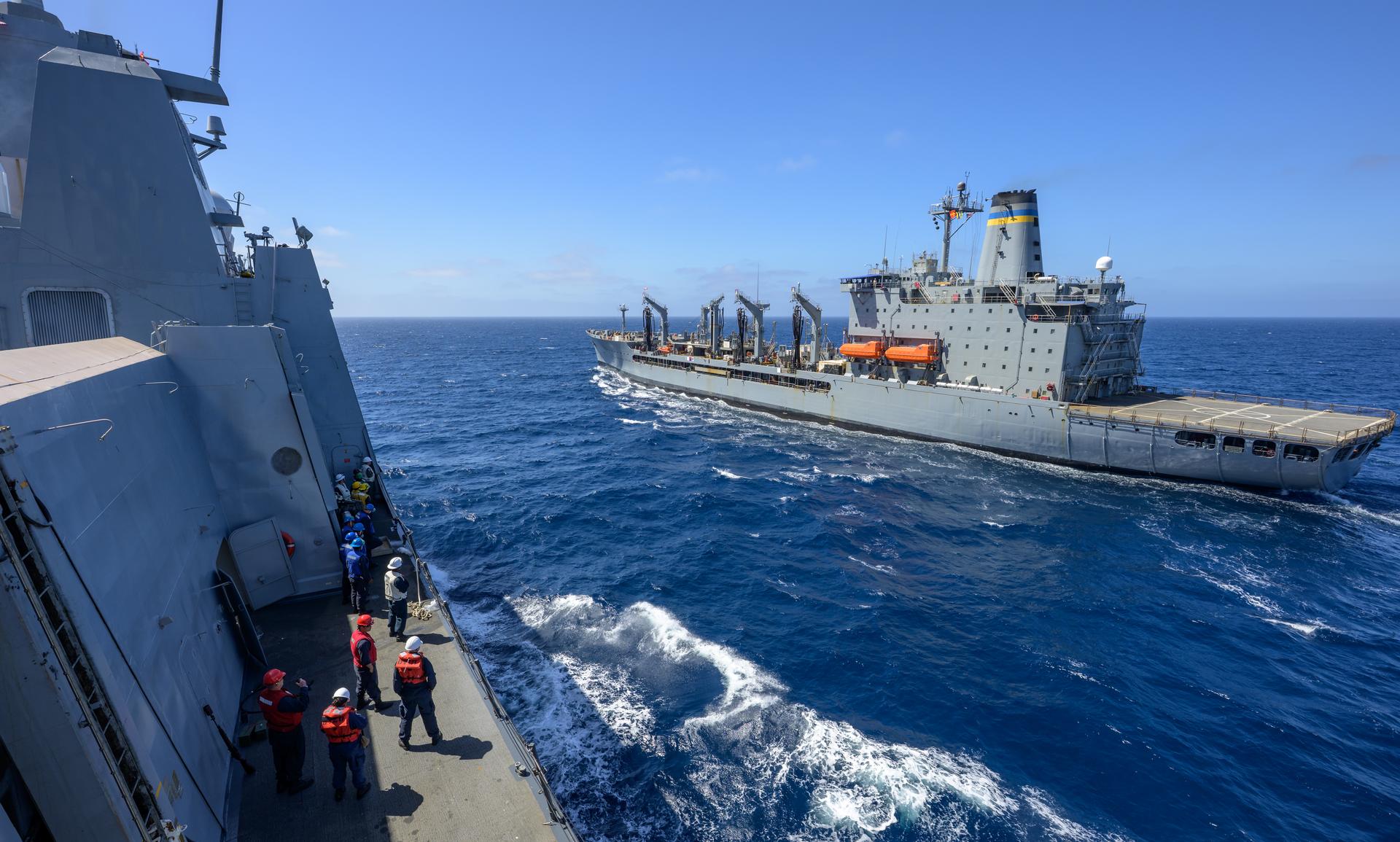
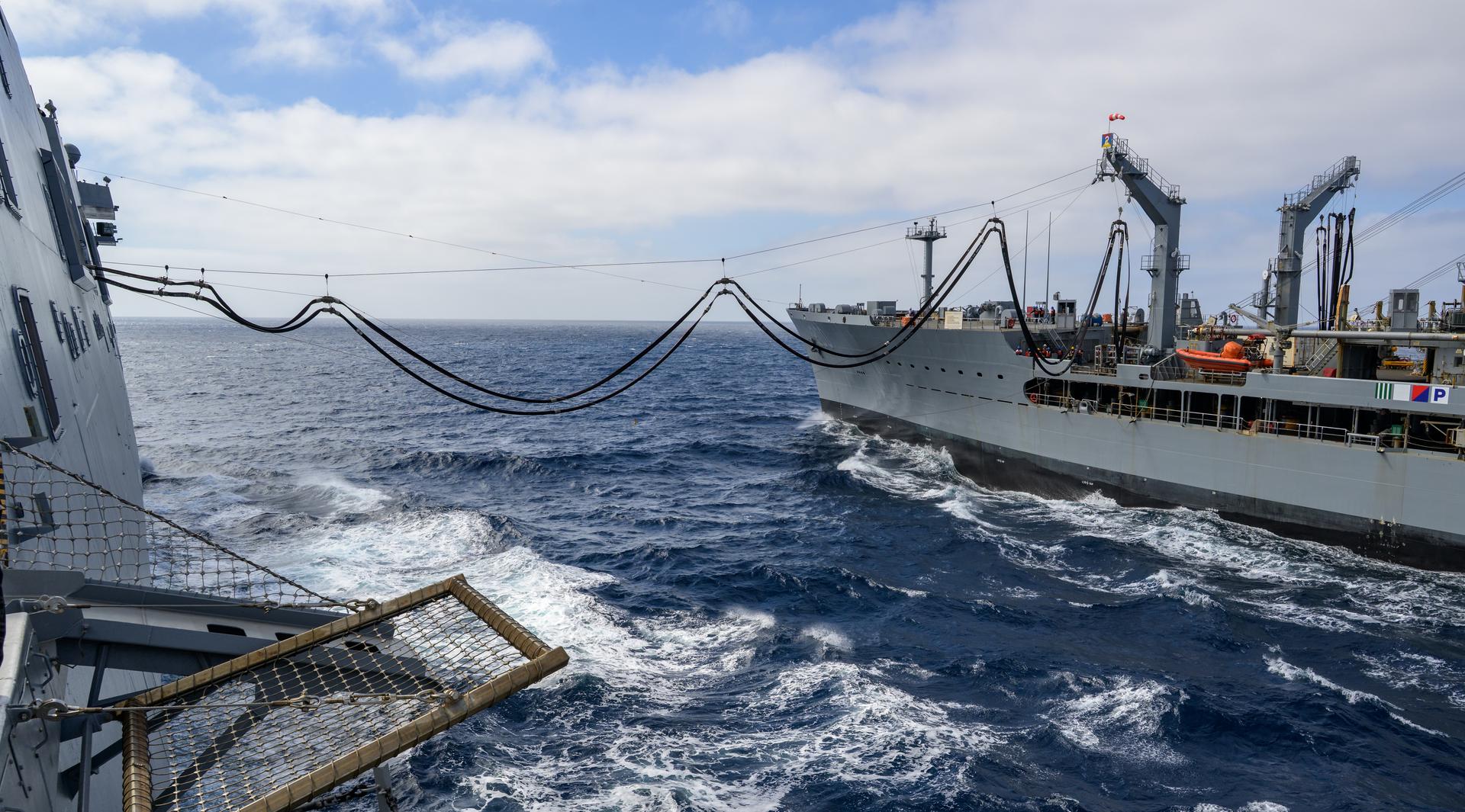
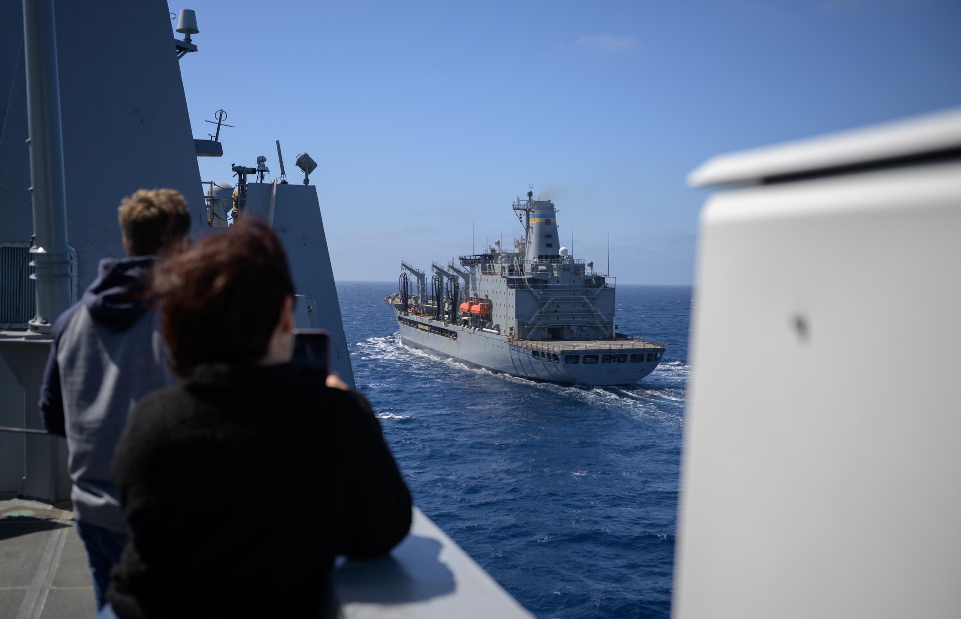
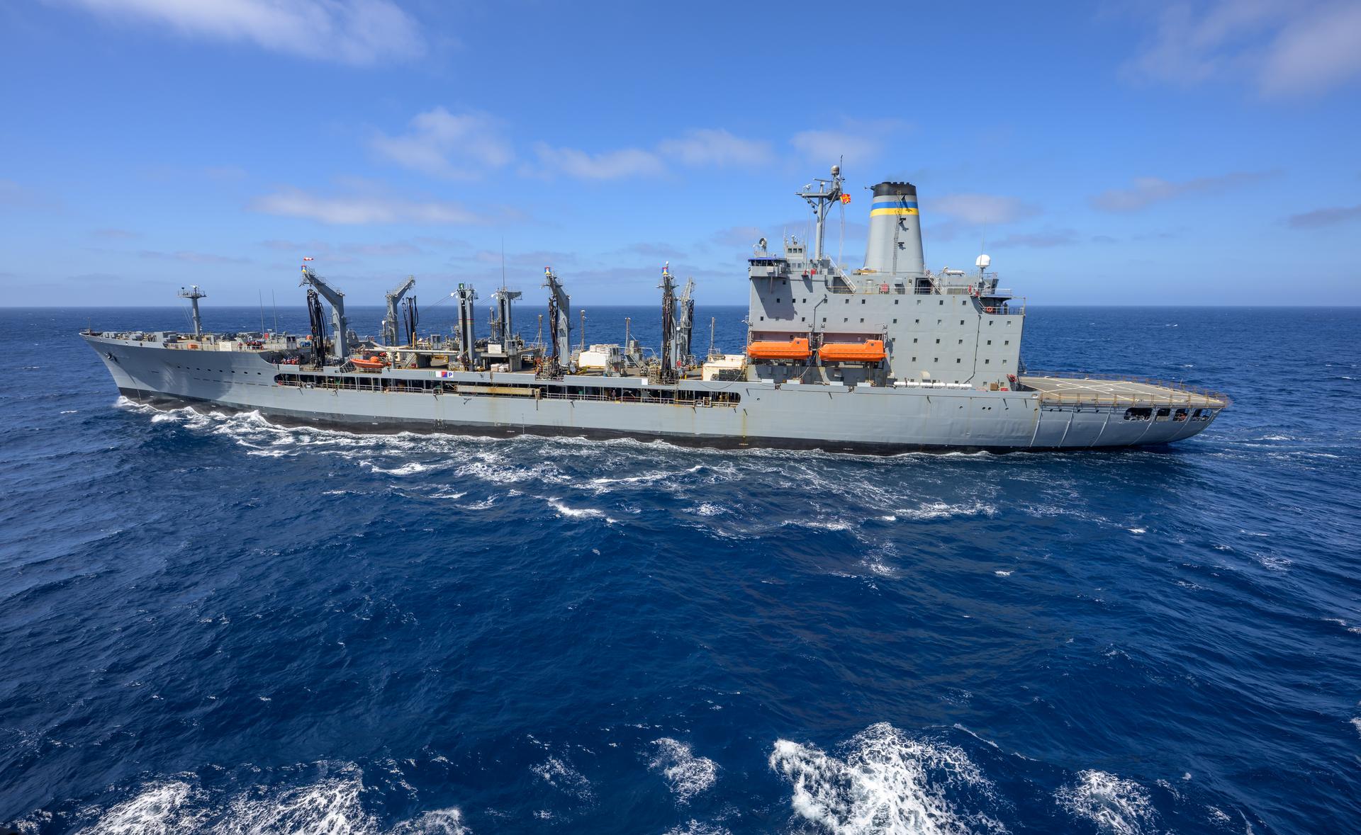
The USNS Guadalupe (T-AO 200) replenishment oiler prepares to refuel USS John P. Murtha (LPD 26) as NASA, U.S. Navy, and U.S. Air Force teams head into the Pacific Ocean for the return of the Artemis II crewmembers to Earth, Monday, April 6, 2026, in the Pacific Ocean off the coast of California. NASA’s Artemis II mission is taking NASA astronauts Reid Wiseman, commander; Victor Glover, pilot; Christina Koch, mission specialist; and CSA (Canadian Space Agency) astronaut Jeremy Hansen, mission specialist on a 10-day journey around the Moon and back aboard their Orion spacecraft. Wiseman, Glover, Koch, and Hansen are scheduled to splash down off the coast of San Diego at approximately 5:07 p.m. PDT (8:07 p.m. EDT) on Friday, April 10. Photo Credit: (NASA/Bill Ingalls)
The USNS Guadalupe (T-AO 200) replenishment oiler prepares to refuel USS John P. Murtha (LPD 26) as NASA, U.S. Navy, and U.S. Air Force teams head into the Pacific Ocean for the return of the Artemis II crewmembers to Earth, Monday, April 6, 2026, in the Pacific Ocean off the coast of California. NASA’s Artemis II mission is taking NASA astronauts Reid Wiseman, commander; Victor Glover, pilot; Christina Koch, mission specialist; and CSA (Canadian Space Agency) astronaut Jeremy Hansen, mission specialist on a 10-day journey around the Moon and back aboard their Orion spacecraft. Wiseman, Glover, Koch, and Hansen are scheduled to splash down off the coast of San Diego at approximately 5:07 p.m. PDT (8:07 p.m. EDT) on Friday, April 10. Photo Credit: (NASA/Bill Ingalls)
The USNS Guadalupe (T-AO 200) replenishment oiler prepares to refuel USS John P. Murtha (LPD 26) as NASA, U.S. Navy, and U.S. Air Force teams head into the Pacific Ocean for the return of the Artemis II crewmembers to Earth, Monday, April 6, 2026, in the Pacific Ocean off the coast of California. NASA’s Artemis II mission is taking NASA astronauts Reid Wiseman, commander; Victor Glover, pilot; Christina Koch, mission specialist; and CSA (Canadian Space Agency) astronaut Jeremy Hansen, mission specialist on a 10-day journey around the Moon and back aboard their Orion spacecraft. Wiseman, Glover, Koch, and Hansen are scheduled to splash down off the coast of San Diego at approximately 5:07 p.m. PDT (8:07 p.m. EDT) on Friday, April 10. Photo Credit: (NASA/Bill Ingalls)
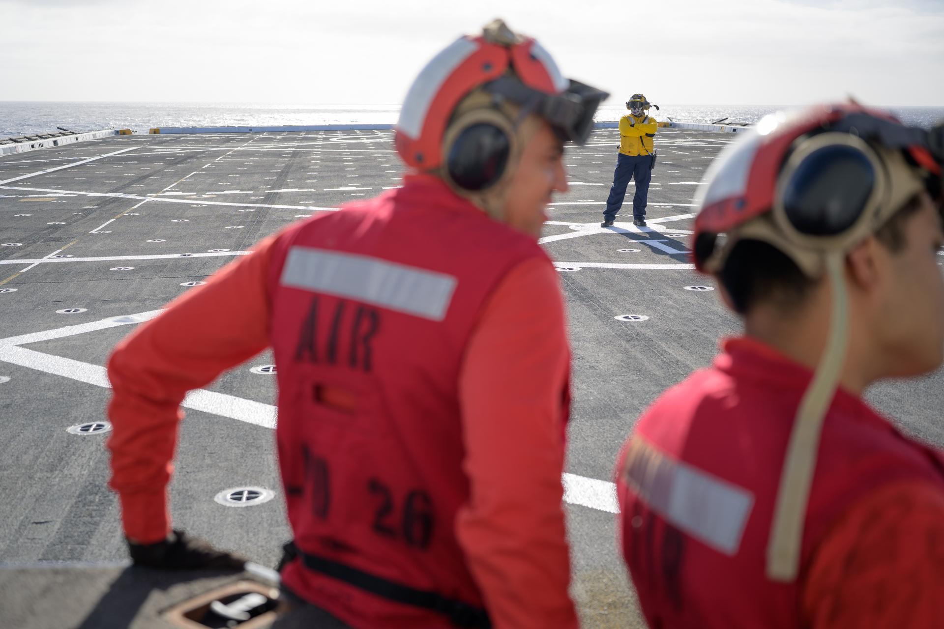
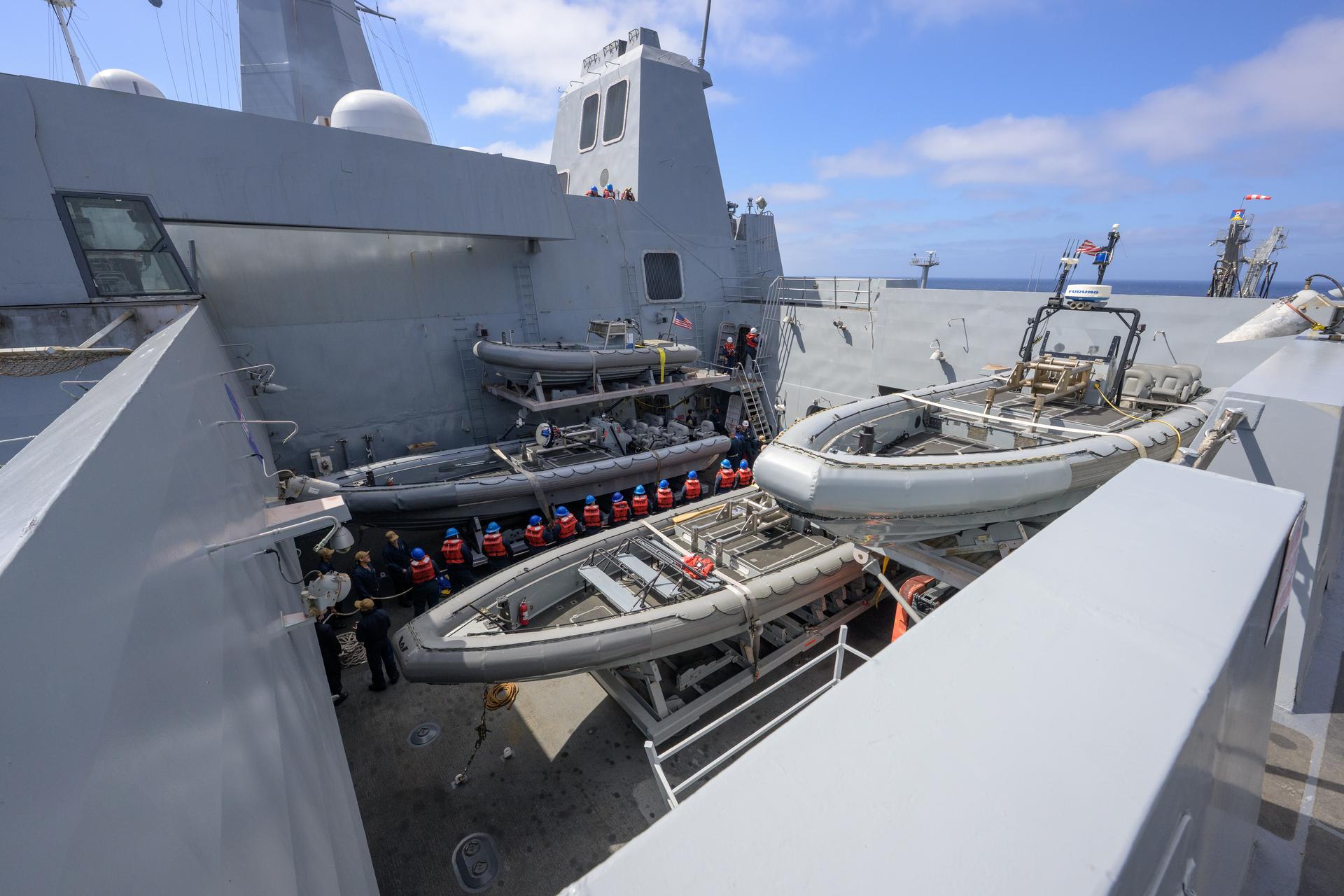
U.S. Navy sailors work the flight deck on USS John P. Murtha (LPD 26) as NASA, U.S. Navy, and U.S. Air Force teams head into the Pacific Ocean for the return of the Artemis II crewmembers to Earth, Monday, April 6, 2026, in the Pacific Ocean off the coast of California. NASA’s Artemis II mission is taking NASA astronauts Reid Wiseman, commander; Victor Glover, pilot; Christina Koch, mission specialist; and CSA (Canadian Space Agency) astronaut Jeremy Hansen, mission specialist on a 10-day journey around the Moon and back aboard their Orion spacecraft. Wiseman, Glover, Koch, and Hansen are scheduled to splash down off the coast of San Diego at approximately 5:07 p.m. PDT (8:07 p.m. EDT) on Friday, April 10. Photo Credit: (NASA/Bill Ingalls)
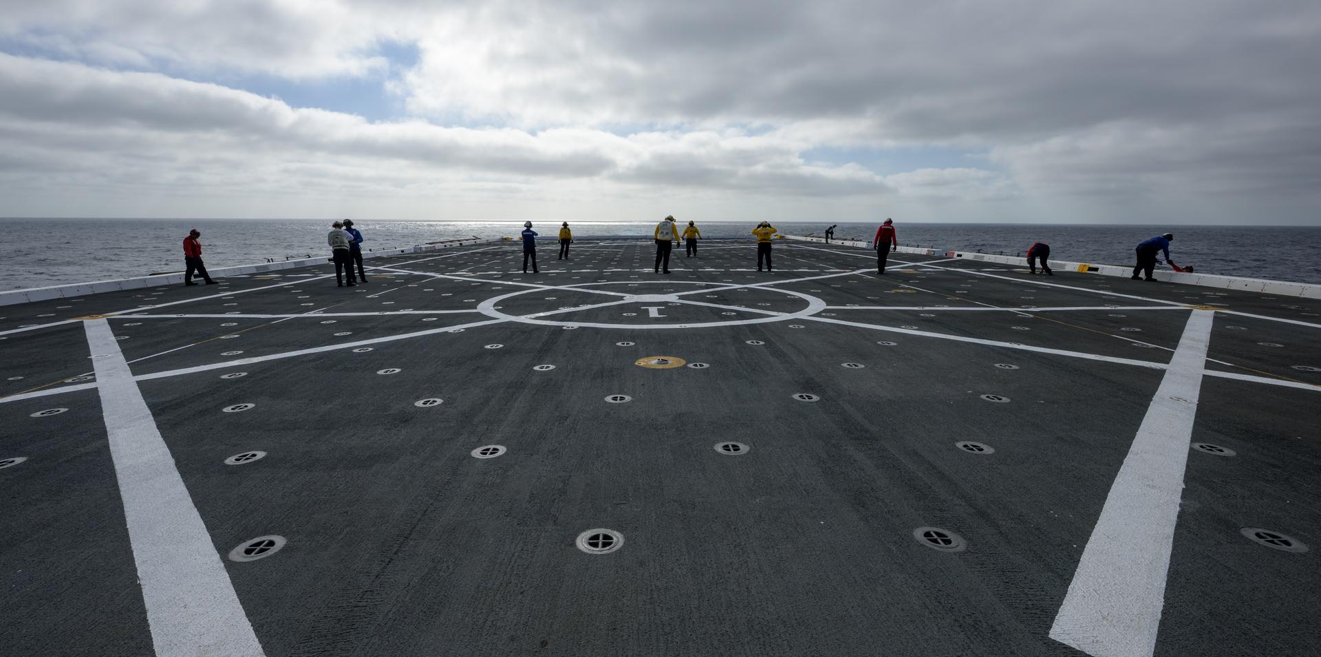
U.S. Navy sailors inspect the flight deck on USS John P. Murtha (LPD 26) as NASA, U.S. Navy, and U.S. Air Force teams head into the Pacific Ocean for the return of the Artemis II crewmembers to Earth, Monday, April 6, 2026, in the Pacific Ocean off the coast of California. NASA’s Artemis II mission is taking NASA astronauts Reid Wiseman, commander; Victor Glover, pilot; Christina Koch, mission specialist; and CSA (Canadian Space Agency) astronaut Jeremy Hansen, mission specialist on a 10-day journey around the Moon and back aboard their Orion spacecraft. Wiseman, Glover, Koch, and Hansen are scheduled to splash down off the coast of San Diego at approximately 5:07 p.m. PDT (8:07 p.m. EDT) on Friday, April 10. Photo Credit: (NASA/Bill Ingalls)
The USNS Guadalupe (T-AO 200) replenishment oiler prepares to refuel USS John P. Murtha (LPD 26) as NASA, U.S. Navy, and U.S. Air Force teams head into the Pacific Ocean for the return of the Artemis II crewmembers to Earth, Monday, April 6, 2026, in the Pacific Ocean off the coast of California. NASA’s Artemis II mission is taking NASA astronauts Reid Wiseman, commander; Victor Glover, pilot; Christina Koch, mission specialist; and CSA (Canadian Space Agency) astronaut Jeremy Hansen, mission specialist on a 10-day journey around the Moon and back aboard their Orion spacecraft. Wiseman, Glover, Koch, and Hansen are scheduled to splash down off the coast of San Diego at approximately 5:07 p.m. PDT (8:07 p.m. EDT) on Friday, April 10. Photo Credit: (NASA/Bill Ingalls)
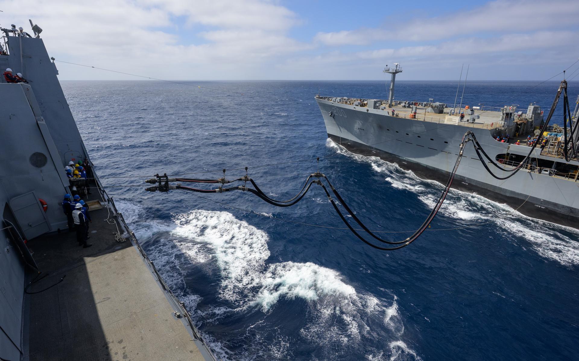
U.S. Navy sailors onboard USS John P. Murtha (LPD 26) pull a tow line from the USNS Guadalupe replenishment ship to refuel at sea, as NASA, U.S. Navy, and U.S. Air Force teams head into the Pacific Ocean for the return of the Artemis II crewmembers to Earth, Monday, April 6, 2026, in the Pacific Ocean off the coast of California. NASA’s Artemis II mission is taking NASA astronauts Reid Wiseman, commander; Victor Glover, pilot; Christina Koch, mission specialist; and CSA (Canadian Space Agency) astronaut Jeremy Hansen, mission specialist on a 10-day journey around the Moon and back aboard their Orion spacecraft. Wiseman, Glover, Koch, and Hansen are scheduled to splash down off the coast of San Diego at approximately 5:07 p.m. PDT (8:07 p.m. EDT) on Friday, April 10. Photo Credit: (NASA/Bill Ingalls)
The USNS Guadalupe (T-AO 200) replenishment oiler prepares to refuel USS John P. Murtha (LPD 26) as NASA, U.S. Navy, and U.S. Air Force teams head into the Pacific Ocean for the return of the Artemis II crewmembers to Earth, Monday, April 6, 2026, in the Pacific Ocean off the coast of California. NASA’s Artemis II mission is taking NASA astronauts Reid Wiseman, commander; Victor Glover, pilot; Christina Koch, mission specialist; and CSA (Canadian Space Agency) astronaut Jeremy Hansen, mission specialist on a 10-day journey around the Moon and back aboard their Orion spacecraft. Wiseman, Glover, Koch, and Hansen are scheduled to splash down off the coast of San Diego at approximately 5:07 p.m. PDT (8:07 p.m. EDT) on Friday, April 10. Photo Credit: (NASA/Bill Ingalls)
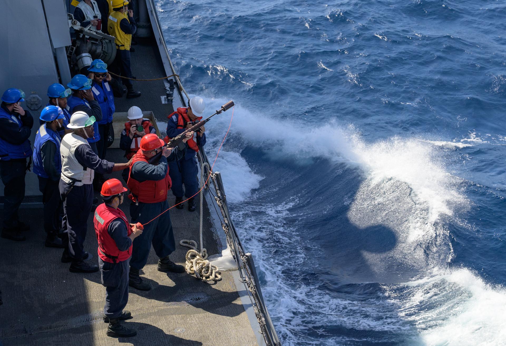
A member of USS John P. Murtha (LPD 26) gets ready to fire a line over to the USNS Guadalupe so they may refuel at sea as NASA, U.S. Navy, and U.S. Air Force teams head into the Pacific Ocean for the return of the Artemis II crewmembers to Earth, Monday, April 6, 2026, in the Pacific Ocean off the coast of California. NASA’s Artemis II mission is taking NASA astronauts Reid Wiseman, commander; Victor Glover, pilot; Christina Koch, mission specialist; and CSA (Canadian Space Agency) astronaut Jeremy Hansen, mission specialist on a 10-day journey around the Moon and back aboard their Orion spacecraft. Wiseman, Glover, Koch, and Hansen are scheduled to splash down off the coast of San Diego at approximately 5:07 p.m. PDT (8:07 p.m. EDT) on Friday, April 10. Photo Credit: (NASA/Bill Ingalls)
Lilian Villarreal, Artemis II landing and recovery director for Exploration Ground Systems at NASA's Kennedy Space Center, speaks to NASA and U.S. military recovery team members onboard USS John P. Murtha as they prepare for the return of NASA’s Orion spacecraft with Artemis II crewmembers NASA astronauts Reid Wiseman, commander; Victor Glover, pilot; Christina Koch, mission specialist; and CSA (Canadian Space Agency) astronaut Jeremy Hansen, mission specialist aboard in the Pacific Ocean off the coast of California, Friday, April 10, 2026. NASA’s Artemis II mission took Wiseman, Glover, Koch, and Hansen on a nearly 10-day journey around the Moon and back to Earth. The quartet splashed down in the Pacific Ocean at 5:07 p.m. PDT (8:07 p.m. EDT). Photo Credit: (NASA/Joel Kowsky)
This image of the Pacific Ocean was produced using sea-surface height measurements taken by NASA U.S.-French TOPEX/Poseidon satellite.
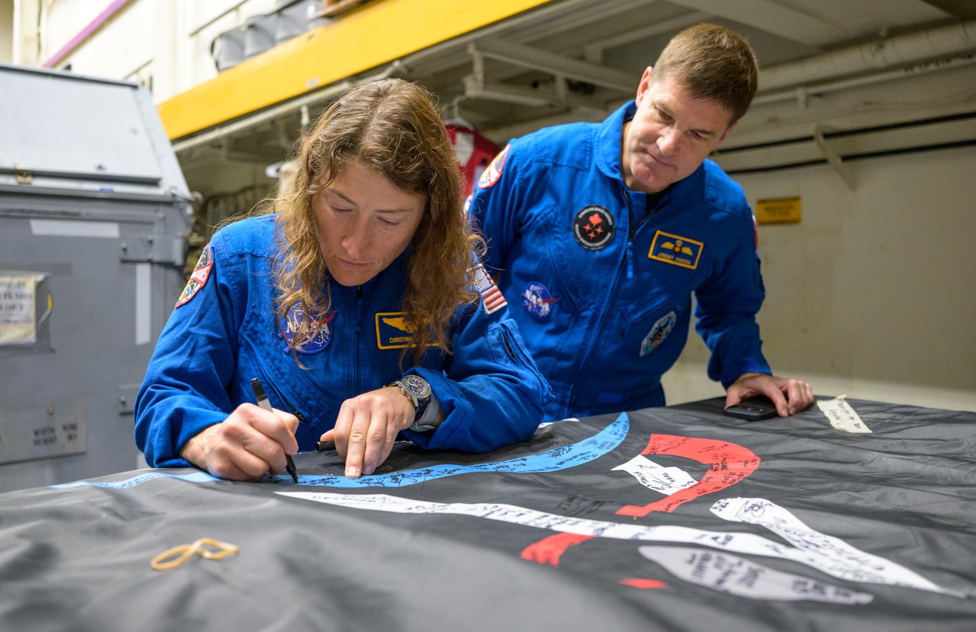
NASA astronaut Christina Koch, Artemis II mission specialist signs an Artemis II flag, as CSA (Canadian Space Agency) astronaut Jeremy Hansen, Artemis II mission specialist looks on, onboard USS John P. Murtha, Saturday, April 11, 2026, in the Pacific Ocean off the coast of California. Koch, Hansen, NASA astronaut Victor Glover, Artemis II pilot, and NASA astronaut Reid Wiseman, Artemis II commander, splashed down in the Pacific Ocean, Friday, April 10 at 5:07 p.m. PDT (8:07p.m. EDT). Photo Credit: (NASA/Bill Ingalls)
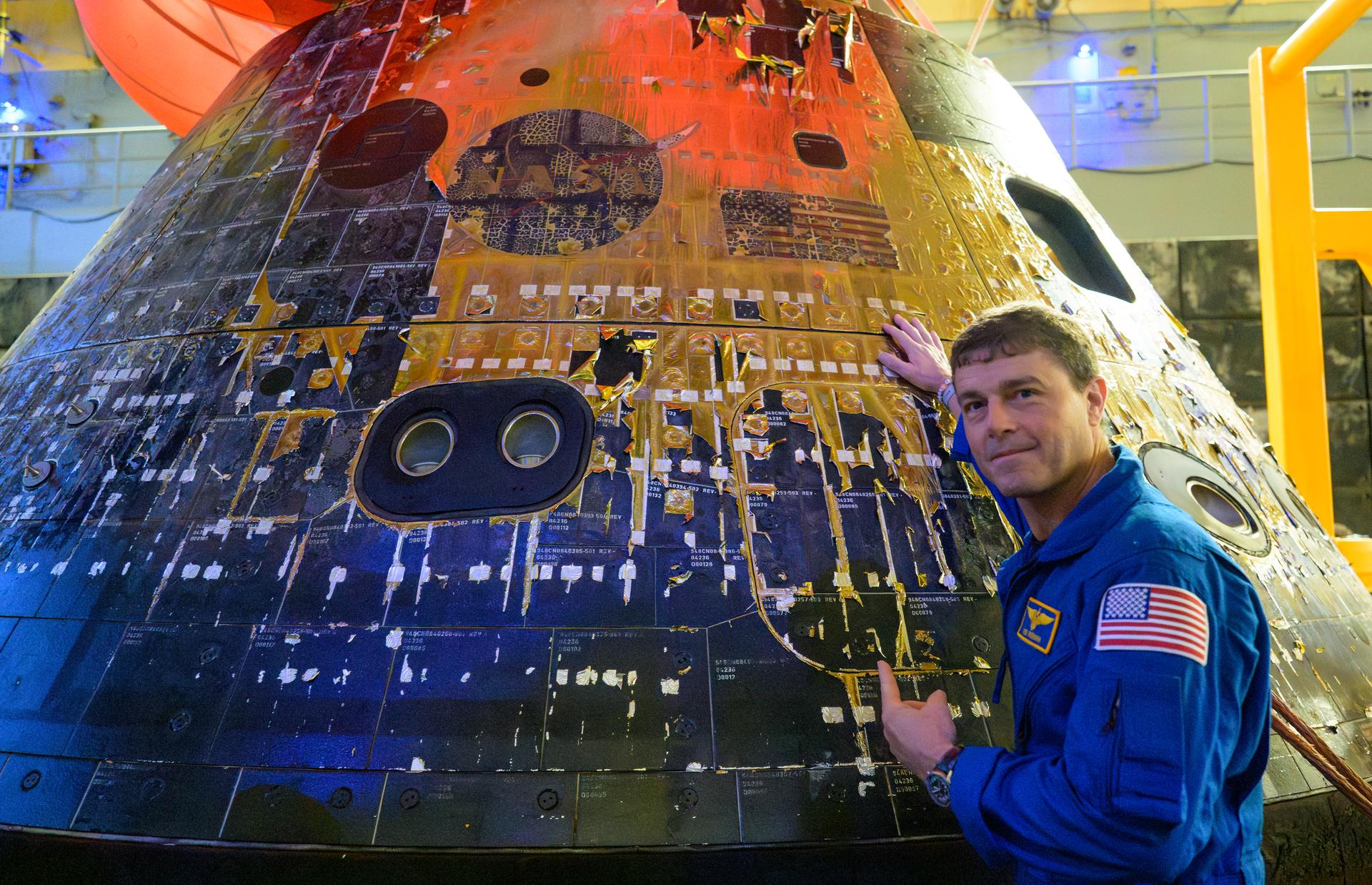
NASA astronaut Reid Wiseman, commander of the Artemis II mission points to the NASA logo and American flag on the outside of the Orion spacecraft in the well deck of USS John P. Murtha, Saturday, April 11, 2026, in the Pacific Ocean off the coast of California. Wiseman, NASA astronaut Christina Koch, mission specialist; NASA astronaut Victor Glover, Artemis II pilot, and CSA (Canadian Space Agency) astronaut Jeremy Hansen, mission specialist; splashed down in the Pacific Ocean, Friday, April 10 at 5:07 p.m. PDT (8:07p.m. EDT). Photo Credit: (NASA/Bill Ingalls)

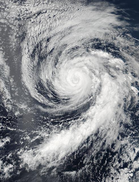
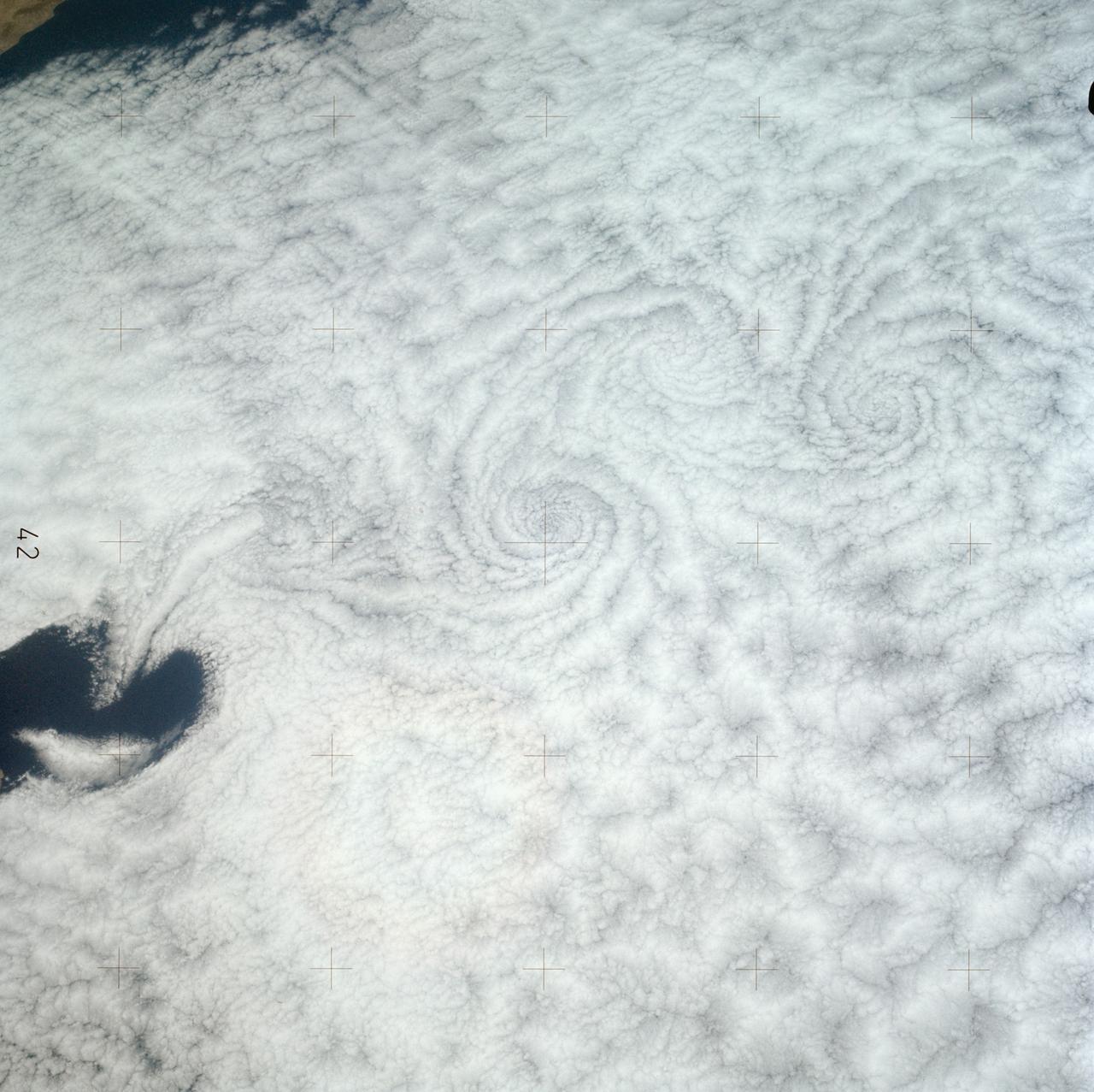
It’s usually the big, sprawling storms that attract the attention of meteorologists, but occasionally tiny storms can make news as well. The most recent example is a suspected mini-typhoon that drifted across the western Pacific Ocean in mid-July 2013. The storm system emerged on July 16 and dissipated by July 19 without making landfall or causing any significant damage. The Moderate Resolution Imaging Spectroradiometer (MODIS) on NASA’s Terra satellite captured this true-color image of the storm on July 17, 2013. It had the spiral shape of a tropical cyclone, but the cloud field was less than 100 kilometers (60 miles) across. For comparison, Super Typhoon Jelawat, the most intense storm of the 2012 season, had a cloud field that stretched nearly 1,000 kilometers (600 miles). Jelawat’s eye alone—with a diameter of 64 kilometers (40 miles)—was two-thirds the size of the entire July 2013 storm. Despite their small size, mini-cyclones are driven by the same forces that drive larger storms. Both small and large cyclonic storms are simply organized convection feeding off warm water in areas with low wind shear. According to the Joint Typhoon Warning Center, the low-pressure areas for these mini-typhoons must span less than two degrees of latitude (about 140 miles) and have sustained winds of 65 knots (74 miles per hour). The 2013 storm in the Pacific certainly meets the first criteria, but it is unlikely that the storm achieved typhoon-force winds. It’s also unlikely that the system had a “warm core,” which all true tropical cyclones have. While this storm did not cause damage, other mini storms certainly have. In 1974, the miniature cyclone Tracy hit Darwin, Australia, killing 71 people and destroying more than 70 percent of the city’s buildings. According to the National Hurricane Center, tropical cyclone Marco unseated Tracy as the smallest tropical cyclone on record in 2008. Marco had gale force winds that extended just 19 kilometers (12 miles). Typhoon Tip, with gale force winds extending 1,000 kilometers (675 miles) is the largest tropical cyclone on record. Credit: NASA/GSFC/Jeff Schmaltz/MODIS Land Rapid Response Team <b><a href="http://www.nasa.gov/audience/formedia/features/MP_Photo_Guidelines.html" rel="nofollow">NASA image use policy.</a></b> <b><a href="http://www.nasa.gov/centers/goddard/home/index.html" rel="nofollow">NASA Goddard Space Flight Center</a></b> enables NASA’s mission through four scientific endeavors: Earth Science, Heliophysics, Solar System Exploration, and Astrophysics. Goddard plays a leading role in NASA’s accomplishments by contributing compelling scientific knowledge to advance the Agency’s mission. <b>Follow us on <a href="http://twitter.com/NASA_GoddardPix" rel="nofollow">Twitter</a></b> <b>Like us on <a href="http://www.facebook.com/pages/Greenbelt-MD/NASA-Goddard/395013845897?ref=tsd" rel="nofollow">Facebook</a></b> <b>Find us on <a href="http://instagrid.me/nasagoddard/?vm=grid" rel="nofollow">Instagram</a></b>

This view of scientists taking a break during the Pan Pacific Microgravity Conference on May 2-3, 2001, in Pasadena, CA, shows some of the diversity of the researchers attracted to the field.
SL3-121-2371 (July-September 1973) --- A pattern of downstream eddies in the stratocumulus clouds over the Pacific Ocean west of Baja California, as photographed by the crewmen of the second Skylab manned mission (Skylab 3) from the space station cluster in Earth orbit. The clouds, produced by the cold California current running to the south and southwest, are prevented from rising by warm air above them. Photo credit: NASA
S75-29719 (24 July 1975) --- The ASTP Apollo Command Module, with astronauts Thomas P. Stafford, Vance D. Brand and Donald K. Slayton aboard, nears a touchdown in the Central Pacific Ocean to conclude the historic joint U.S.-USSR Apollo-Soyuz Test Project docking mission in Earth orbit. The spacecraft splashed down in the Hawaiian Islands area at 4:18 p.m. (CDT), July 24, 1975.
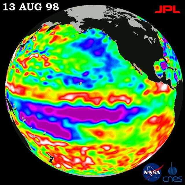
The Pacific Ocean doesnt show signs of anything that looks like the whopper El Niño of 1997-1998, according to the latest information from NASA U.S.-French ocean-observing satellite Topex/Poseidon.

Sergeant Huff of the 45 weather squadron deploys a weather balloon during Underway Recovery Test-12 onboard USS Somerset off the coast of California, Thursday, March 27, 2025. During the test, NASA and Department of Defense teams are practicing to ensure recovery procedures are validated as NASA plans to send Artemis II astronauts around the Moon and splashdown in the Pacific Ocean. Photo Credit: (NASA/Bill Ingalls)
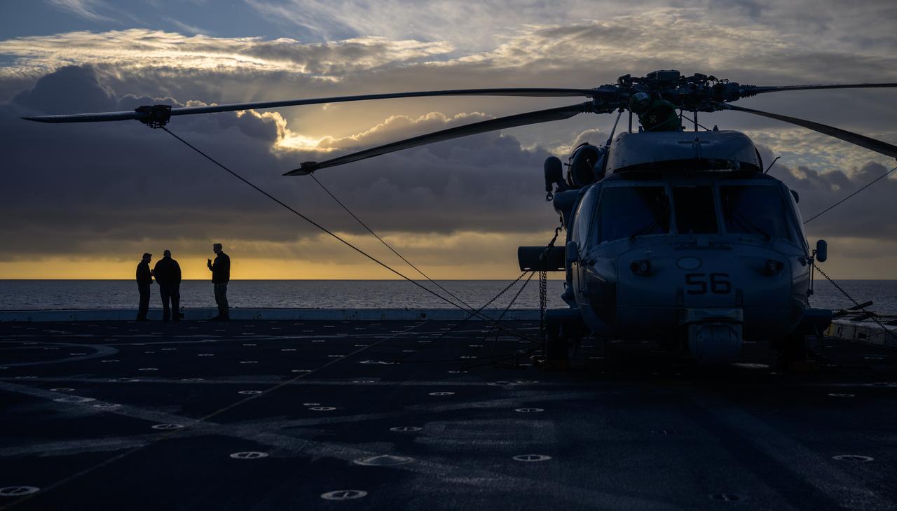
Navy MH-60 Seahawk helicopter team members are seen onboard USS Somerset off the coast of California, as NASA and Department of Defense teams participate in Underway Recovery Test-12, Friday, March 28, 2025. During the test, teams are practicing to ensure recovery procedures are validated as NASA plans to send the Artemis II astronauts around the Moon and splashdown in the Pacific Ocean. Photo Credit: (NASA/Bill Ingalls)
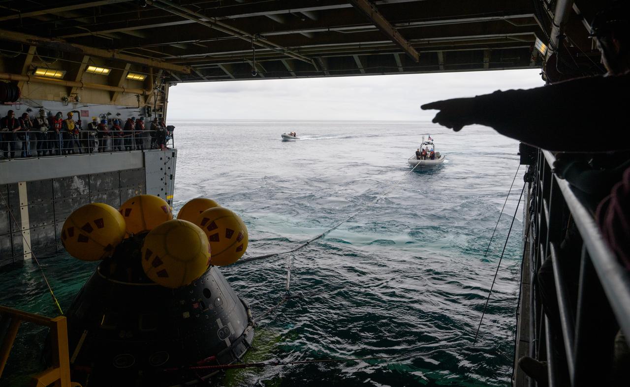
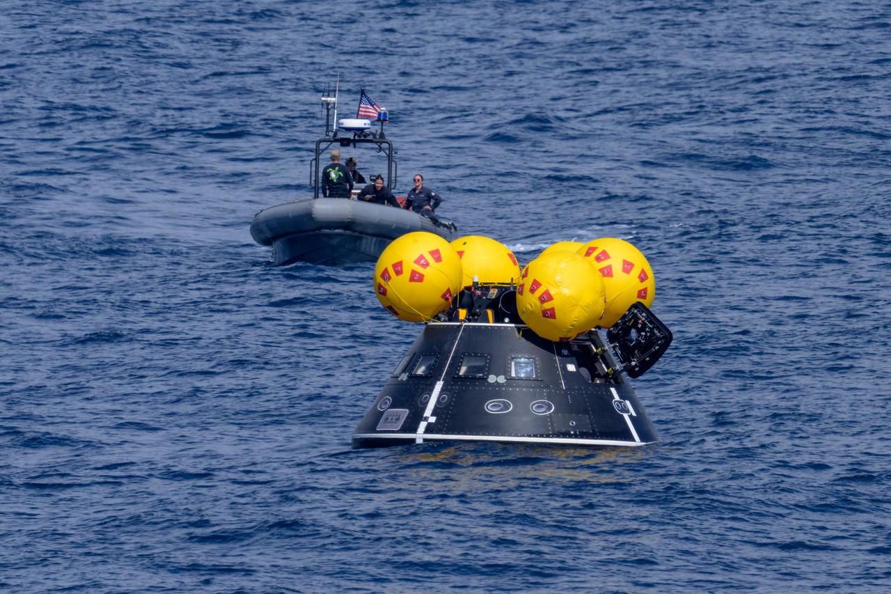
Mission support teams are seen off the stern of USS Somerset as they practice with the Crew Module Test Article (CMTA), a full scale mockup of the Orion spacecraft, during Underway Recovery Test-12 off the coast of California, Wednesday, March 26, 2025. During the test, NASA and Department of Defense teams are practicing to ensure recovery procedures are validated as NASA plans to send Artemis II astronauts around the Moon and splashdown in the Pacific Ocean. Photo Credit: (NASA/Bill Ingalls)
Mission support teams are seen off the stern of USS Somerset as they practice with the Crew Module Test Article (CMTA), a full scale mockup of the Orion spacecraft, during Underway Recovery Test-12 off the coast of California, Wednesday, March 26, 2025. During the test, NASA and Department of Defense teams are practicing to ensure recovery procedures are validated as NASA plans to send Artemis II astronauts around the Moon and splashdown in the Pacific Ocean. Photo Credit: (NASA/Bill Ingalls)
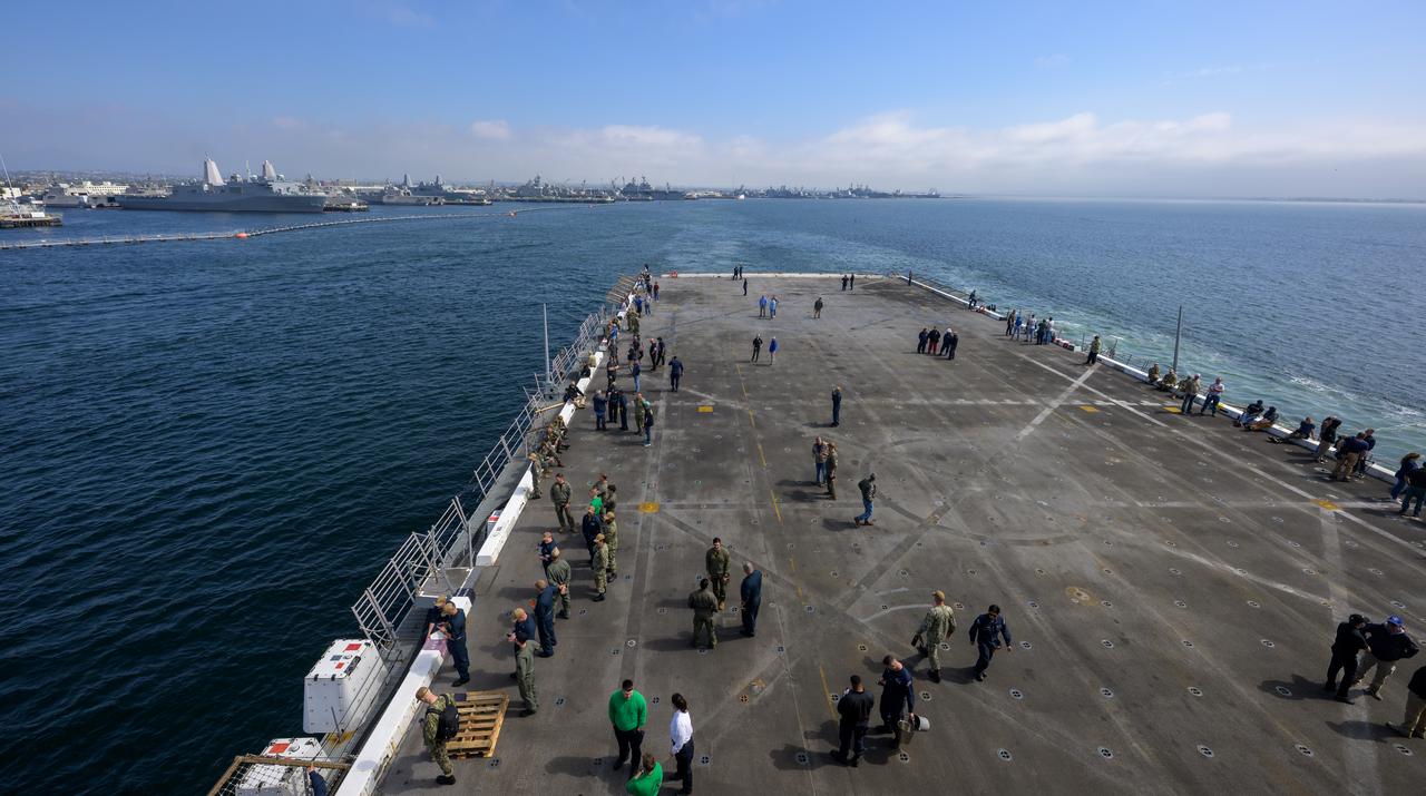
NASA and Department of Defense teams, onboard USS Somerset, depart San Diego as they start Underway Recovery Test-12 off the coast of California, Tuesday, March 25, 2025. During the test, the teams are practicing to ensure recovery procedures are validated as NASA plans to send the Artemis II astronauts around the Moon and splashdown in the Pacific Ocean. Photo Credit: (NASA/Bill Ingalls)
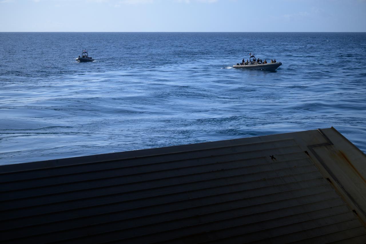
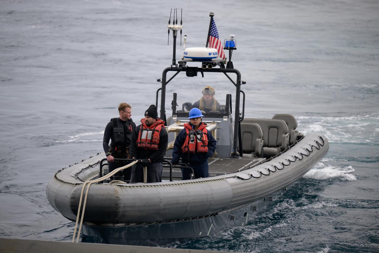
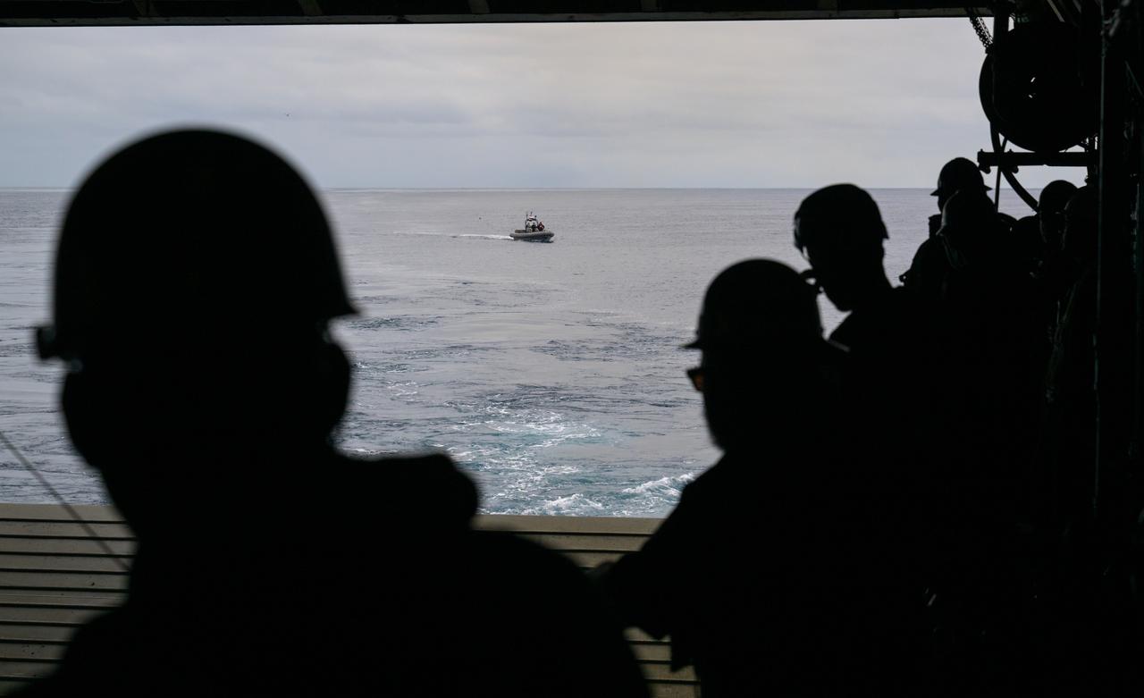
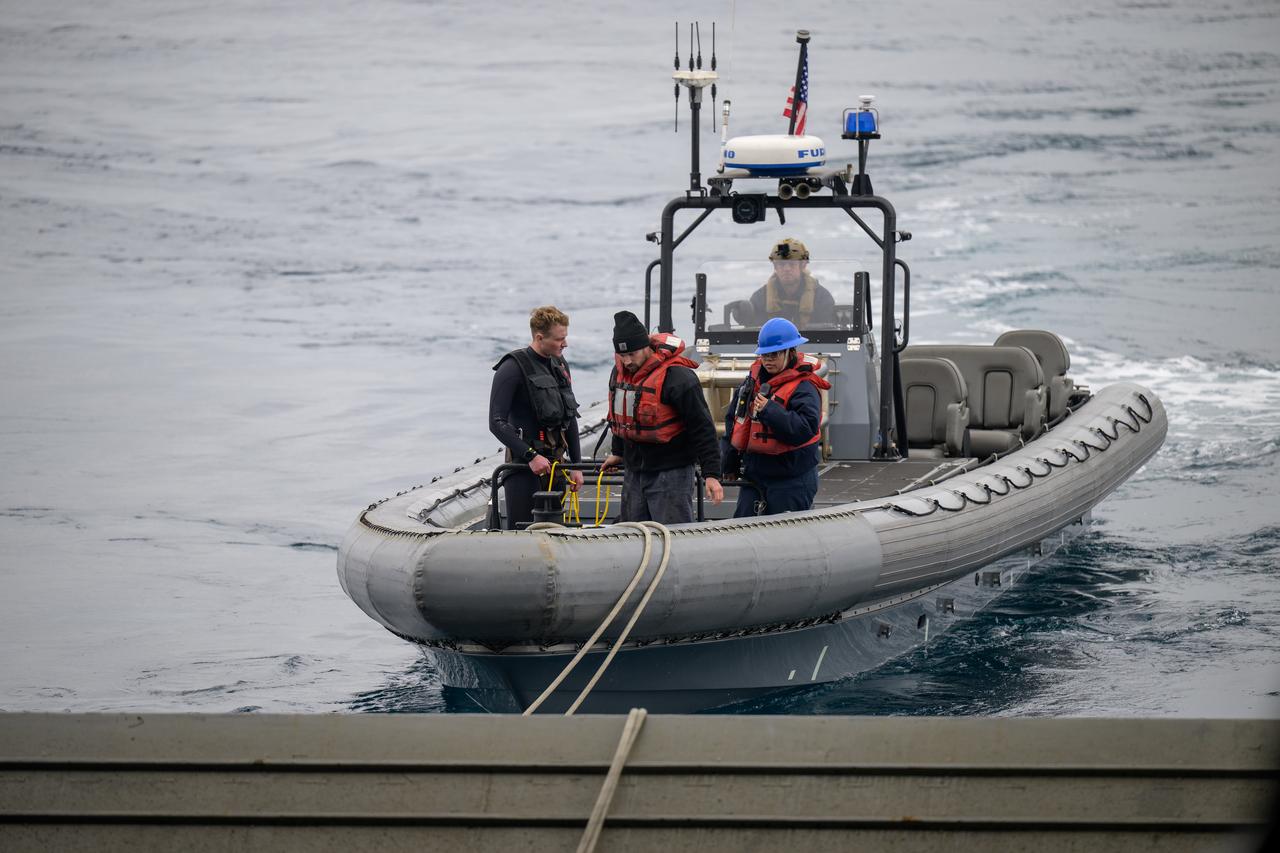
Fast boats are deployed during the Underway Recovery Test-12 onboard USS Somerset off the coast of California, Friday, March 28, 2025. During the test, NASA and Department of Defense teams are practicing to ensure recovery procedures are validated as NASA plans to send Artemis II astronauts around the Moon and splashdown in the Pacific Ocean. Photo Credit: (NASA/Bill Ingalls)
The Crew Module Test Article (CMTA), a full scale mockup of the Orion spacecraft, is seen during Underway Recovery Test-12 off the coast of California, Friday, March 28, 2025. During the test, NASA and Department of Defense teams are practicing to ensure recovery procedures are validated as NASA plans to send Artemis II astronauts around the Moon and splashdown in the Pacific Ocean. Photo Credit: (NASA/Bill Ingalls)
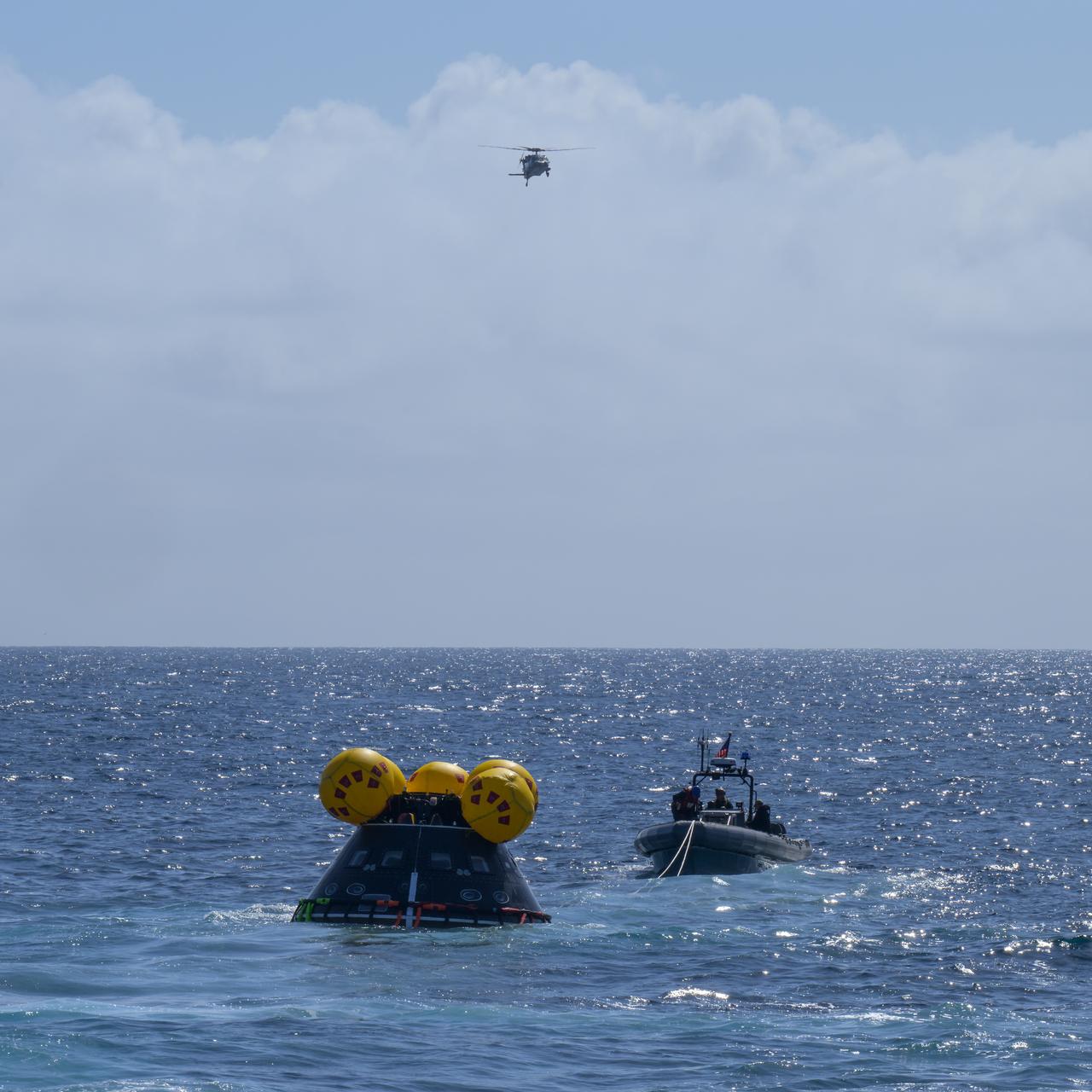
The Crew Module Test Article (CMTA), a full scale mockup of the Orion spacecraft, is seen during Underway Recovery Test-12 off the coast of California, Friday, March 28, 2025. During the test, NASA and Department of Defense teams are practicing to ensure recovery procedures are validated as NASA plans to send Artemis II astronauts around the Moon and splashdown in the Pacific Ocean. Photo Credit: (NASA/Bill Ingalls)
The Crew Module Test Article (CMTA), a full scale mockup of the Orion spacecraft, is seen during Underway Recovery Test-12 off the coast of California, Friday, March 28, 2025. During the test, NASA and Department of Defense teams are practicing to ensure recovery procedures are validated as NASA plans to send Artemis II astronauts around the Moon and splashdown in the Pacific Ocean. Photo Credit: (NASA/Bill Ingalls)

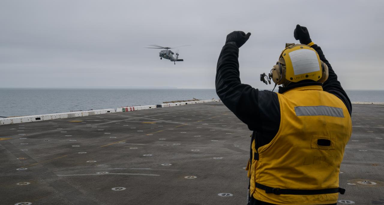
USS Somerset sailors direct the landing of helicopters with astronauts during Underway Recovery Test-12 onboard USS Somerset off the coast of California, Thursday, March 27, 2025. During the test, NASA and Department of Defense teams are practicing to ensure recovery procedures are validated as NASA plans to send Artemis II astronauts around the Moon and splashdown in the Pacific Ocean. Photo Credit: (NASA/Bill Ingalls)
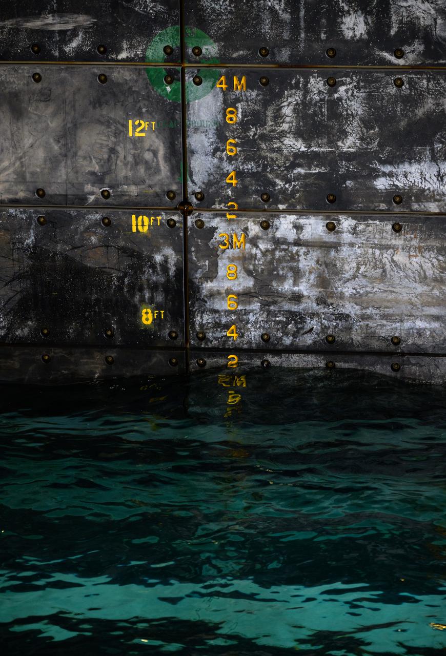
Indicators showing the water level in the well deck of USS Somerset are seen as teams deploy the Crew Module Test Article (CMTA), a full scale mockup of the Orion spacecraft, during Underway Recovery Test-12 off the coast of California, Wednesday, March 26, 2025. During the test, NASA and Department of Defense teams are practicing to ensure recovery procedures are validated as NASA plans to send Artemis II astronauts around the Moon and splashdown in the Pacific Ocean. Photo Credit: (NASA/Bill Ingalls)
A helicopter lands on USS Somerset off the coast of California, as NASA and Department of Defense teams participate in Underway Recovery Test-12, Tuesday, March 25, 2025. During the test, teams are practicing to ensure recovery procedures are validated as NASA plans to send the Artemis II astronauts around the Moon and splashdown in the Pacific Ocean. Photo Credit: (NASA/Bill Ingalls)
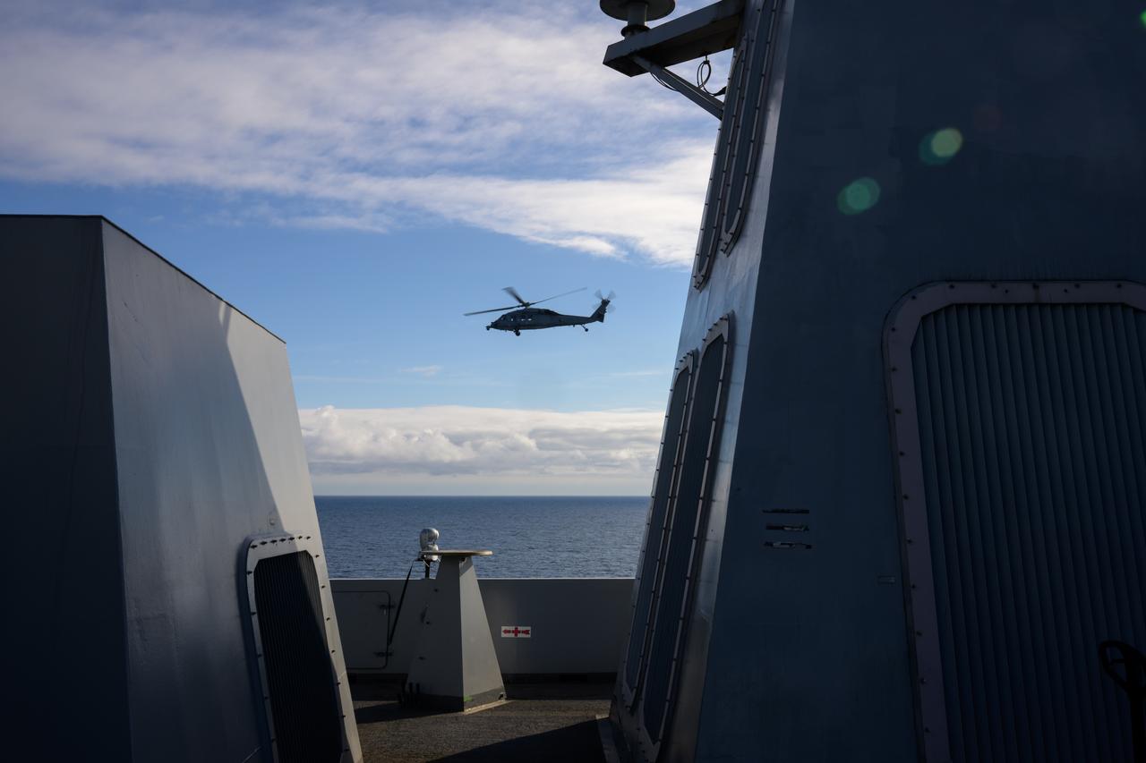
A Navy MH-60 Seahawk helicopter flies past USS Somerset off the coast of California, as NASA and Department of Defense teams participate in Underway Recovery Test-12, Thursday, March 27, 2025. During the test, teams are practicing to ensure recovery procedures are validated as NASA plans to send the Artemis II astronauts around the Moon and splashdown in the Pacific Ocean. Photo Credit: (NASA/Bill Ingalls)
Mission support teams are seen off the stern of USS Somerset as they practice with the Crew Module Test Article (CMTA), a full scale mockup of the Orion spacecraft, during Underway Recovery Test-12 off the coast of California, Wednesday, March 26, 2025. During the test, NASA and Department of Defense teams are practicing to ensure recovery procedures are validated as NASA plans to send Artemis II astronauts around the Moon and splashdown in the Pacific Ocean. Photo Credit: (NASA/Bill Ingalls)
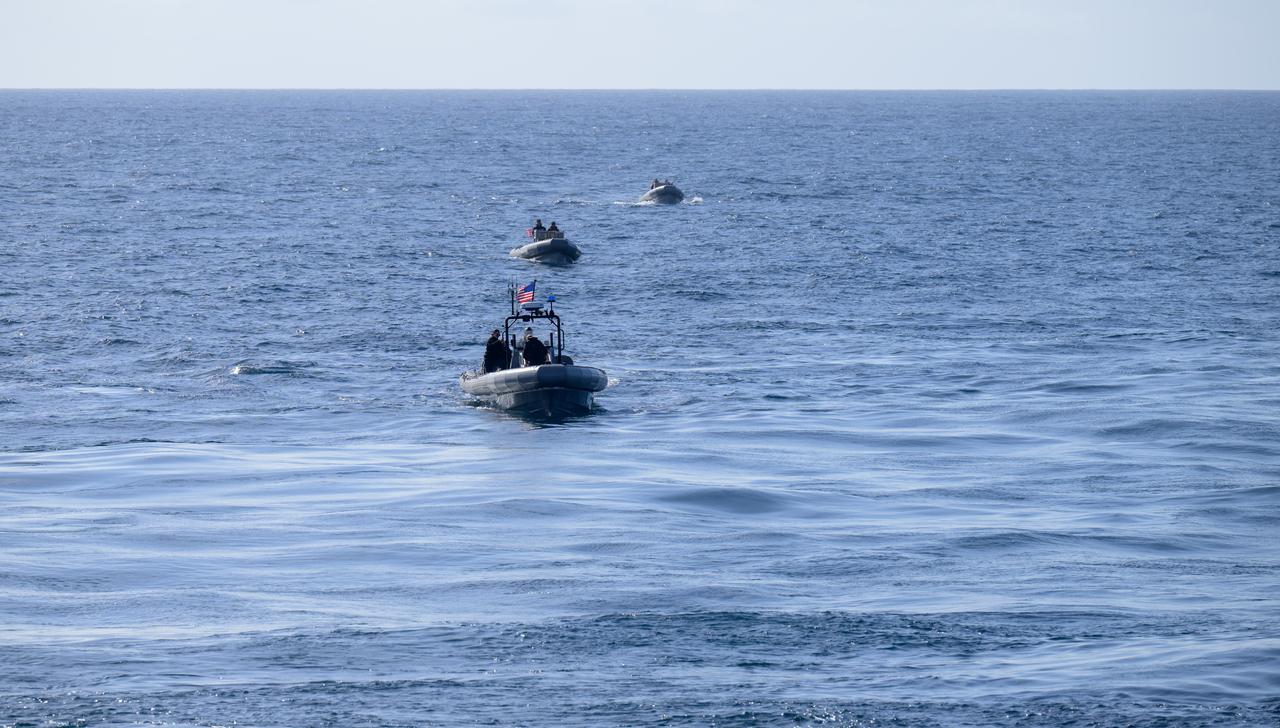
Fast boats are deployed during the Underway Recovery Test-12 onboard USS Somerset off the coast of California, Friday, March 28, 2025. During the test, NASA and Department of Defense teams are practicing to ensure recovery procedures are validated as NASA plans to send Artemis II astronauts around the Moon and splashdown in the Pacific Ocean. Photo Credit: (NASA/Bill Ingalls)

A helicopter lands on USS Somerset off the coast of California, as NASA and Department of Defense teams participate in Underway Recovery Test-12, Tuesday, March 25, 2025. During the test, teams are practicing to ensure recovery procedures are validated as NASA plans to send the Artemis II astronauts around the Moon and splashdown in the Pacific Ocean. Photo Credit: (NASA/Bill Ingalls)
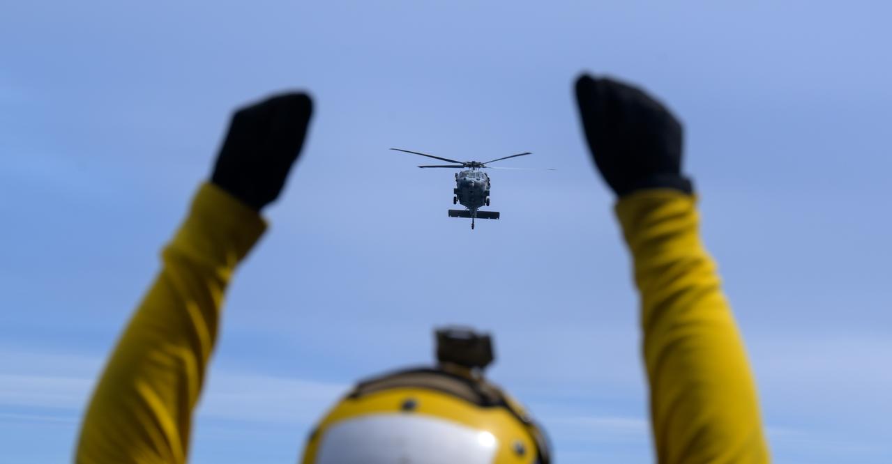
USS Somerset sailors direct the landing of helicopters with astronauts during Underway Recovery Test-12 onboard USS Somerset off the coast of California, Thursday, March 27, 2025. During the test, NASA and Department of Defense teams are practicing to ensure recovery procedures are validated as NASA plans to send Artemis II astronauts around the Moon and splashdown in the Pacific Ocean. Photo Credit: (NASA/Bill Ingalls)
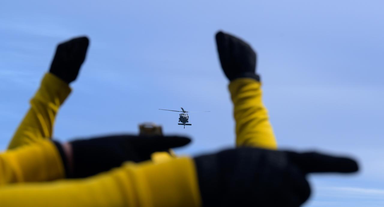
USS Somerset sailors direct the landing of helicopters with astronauts onboard during Underway Recovery Test-12 onboard USS Somerset off the coast of California, Thursday, March 27, 2025. During the test, NASA and Department of Defense teams are practicing to ensure recovery procedures are validated as NASA plans to send Artemis II astronauts around the Moon and splashdown in the Pacific Ocean. Photo Credit: (NASA/Bill Ingalls)
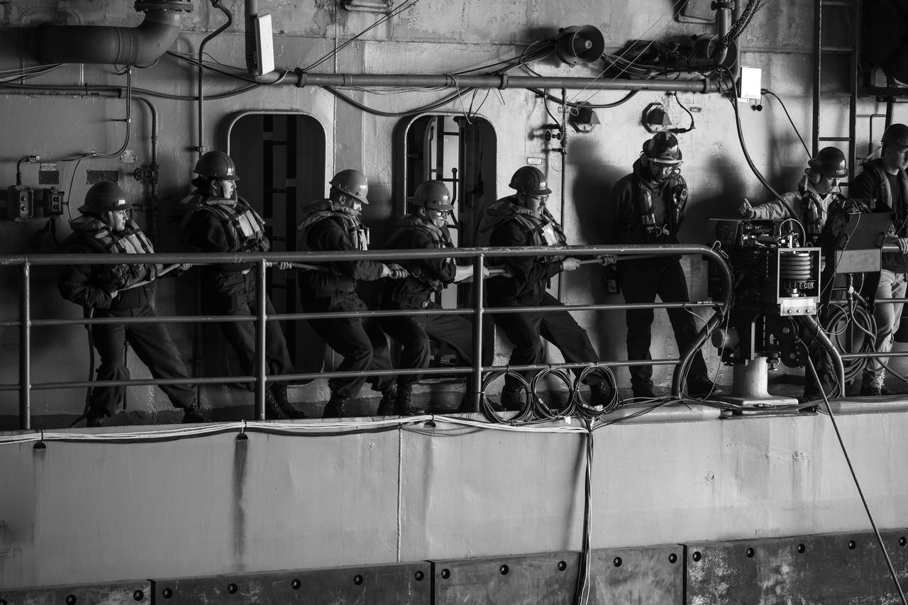
Mission support teams are seen toeing in rope line on USS Somerset as they practice with the Crew Module Test Article (CMTA), a full scale mockup of the Orion spacecraft, during Underway Recovery Test-12 off the coast of California, Wednesday, March 26, 2025. During the test, NASA and Department of Defense teams are practicing to ensure recovery procedures are validated as NASA plans to send Artemis II astronauts around the Moon and splashdown in the Pacific Ocean. Photo Credit: (NASA/Bill Ingalls)
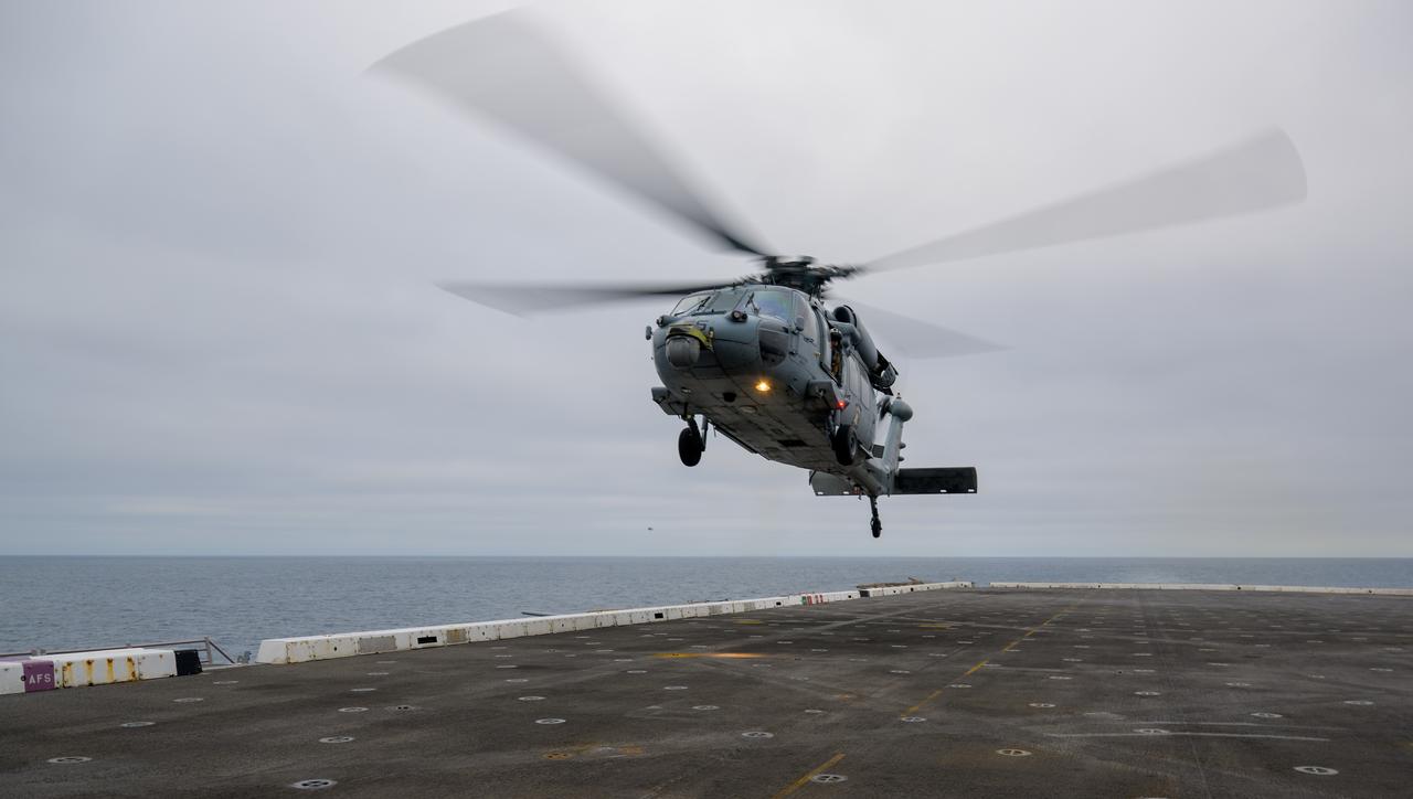
A helicopter lands on USS Somerset off the coast of California, as NASA and Department of Defense teams participate in Underway Recovery Test-12, Tuesday, March 25, 2025. During the test, teams are practicing to ensure recovery procedures are validated as NASA plans to send the Artemis II astronauts around the Moon and splashdown in the Pacific Ocean. Photo Credit: (NASA/Bill Ingalls)
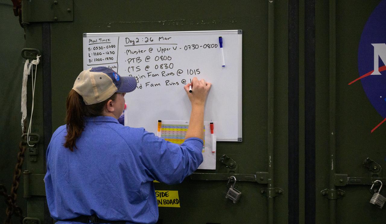
The daily schedule is posted during the Underway Recovery Test-12 onboard USS Somerset off the coast of California, Wednesday, March 26, 2025. During the test, NASA and Department of Defense teams are practicing to ensure recovery procedures are validated as NASA plans to send Artemis II astronauts around the Moon and splashdown in the Pacific Ocean. Photo Credit: (NASA/Joel Kowsky)
Mission support teams are seen off the stern of USS Somerset as they practice with the Crew Module Test Article (CMTA), a full scale mockup of the Orion spacecraft, during Underway Recovery Test-12 off the coast of California, Wednesday, March 26, 2025. During the test, NASA and Department of Defense teams are practicing to ensure recovery procedures are validated as NASA plans to send Artemis II astronauts around the Moon and splashdown in the Pacific Ocean. Photo Credit: (NASA/Bill Ingalls)
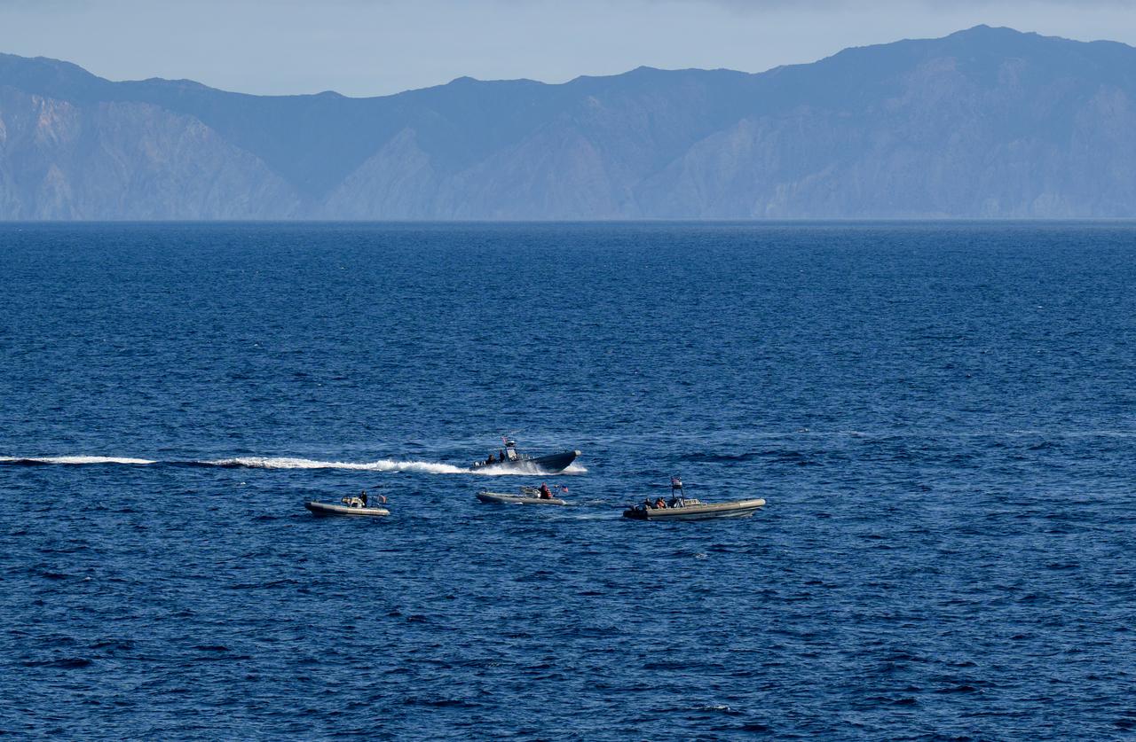
Fast boats are deployed during Underway Recovery Test-12 onboard USS Somerset off the coast of California, Thursday, March 27, 2025. During the test, NASA and Department of Defense teams are practicing to ensure recovery procedures are validated as NASA plans to send Artemis II astronauts around the Moon and splashdown in the Pacific Ocean. Photo Credit: (NASA/Bill Ingalls)