This is the Spirit panoramic camera's "Lookout" panorama, acquired on the rover's 410th to 413th martian days, or sols (Feb. 27 to Mar. 2, 2005). The view is from a position known informally as "Larry's Lookout" along the drive up "Husband Hill." The summit of Husband Hill is the far peak near the center of this panorama and is about 200 meters (656 feet) away from the rover and about 45 meters (148 feet) higher in elevation. The bright rocky outcrop near the center of the panorama is part of the "Cumberland Ridge," and beyond that and to the left is the "Tennessee Valley."  The panorama spans 360 degrees and consists of images obtained in 108 individual pointings and five filters at each pointing. This mosaic is an approximately true-color rendering generated using the images acquired through panoramic camera's 750-nanometer, 530-nanometer, and 480-nanometer filters. The lighting varied considerably during the four sols that it took to acquire this image (partly because of imaging at different times of sol, but also partly because of small sol-to-sol variations in the dustiness of the atmosphere), resulting in some obvious image seams or rock shadow variations within the mosaic. These seams have been smoothed out from the sky parts of the mosaic in order to simulate better the vista that a person would have if they were viewing it all at the same time on Mars. However, it is often not possible or practical to smooth out such seams for regions of rock, soil, rover tracks, or solar panels. Such is the nature of acquiring and assembling large Pancam panoramas from the rovers.  Spirit's tracks leading back from the "West Spur" region can be seen on the right side of the panorama. The region just beyond the area where the tracks made their last zig-zag is the area known as "Paso Robles," where Spirit discovered rock and soil deposits with very high sulfur abundances. After acquiring this mosaic (which took several weeks to fully downlink and then several more weeks to process), Spirit drove around the Cumberland Ridge rocks seen here and is now driving up the flank of Husband Hill, heading toward the summit.  http://photojournal.jpl.nasa.gov/catalog/PIA07882
Lookout Panorama from Spirit
A Whale of a Panorama
Cahokia Panorama
Cahokia Panorama
Payson Panorama by Opportunity
Payson Panorama in False Color
Partial Seminole Panorama
Phoenix Site Panorama
D-Star Panorama by Opportunity
Opportunity Olympia Panorama
360-degree Color Panorama
Spirit West Valley Panorama
East Basin Panorama
East Basin Panorama
Summit Panorama with Rover Deck
Santa Anita Panorama
Spirit Destination panorama
Bonneville Crater Panorama
This 360-degree panorama was taken by "Dusty," a fully-working replica of NASA's Opportunity rover at the agency's Jet Propulsion Laboratory. The panorama was taken as part of a software test. Members of the Opportunity team gathered to sit in during the panorama.  The panorama was taken by Dusty's Panoramic Camera, or Pancam, on Sept. 6, 2018.  https://photojournal.jpl.nasa.gov/catalog/PIA23247
Dusty's Panorama
Southern Half of Spirit Bonestell Panorama
Left Panorama of Spirit Landing Site
Partial Seminole Panorama False Color
360-degree Panorama of Martian Surface
Twin Peaks in 360-degree Panorama
Northeast View in 360-degree Panorama
Martian Arctic Landscape Panorama Video
Portion of 360-degree Color Panorama
Opportunity Rub al Khali Panorama
Everest Panorama; 20-20 Vision
Sojourner Within Color-Enhanced Panorama
Right Panorama of Spirit Landing Site
Area of 360 Degree Color Panorama
Legacy Panorama on Spirit Way to Bonneville
Panoramas of Apollo sites are required to familiarize various Constellation projects with the actual nature of the lunar surface. This image is the first of a multi-framed panorama photographed from a point some 30 or 40 feet west of the plus-Z (west) footpad of the Lunar Module "Eagle." The view is looking toward the southwest showing part of the horizon crater rim that was pointed out as being visible from the Eagle's window. Image taken at Tranquility Base. View was created using Apollo 11 images - mag 40 frames 5881 thru 5891.
Panoramas of Apollo sites
D-Star Panorama by Opportunity False Color
Airbag and ASI/MET Instrument in 360-degree Panorama
Full-Circle Bonestell Panorama from Spirit
Spirit West Valley Panorama False Color
Lyell Panorama inside Victoria Crater False Color
Deflated Airbags and Petal in 360-degree panorama
Southern Half of Spirit Bonestell Panorama False Color
Color Enhanced Version of 360-degree Panorama
Forward Ramp Within 360-degree Panorama
Panorama from Cape Verde False Color
ASI/MET Within Color-Enhanced Panorama
New 360-degree Color Gallery Panorama
Rover Panorama from Sols 75 & 76
Opportunity Landing Spot Panorama 3-D Model
Panoramas of Apollo sites were created to familiarize various Constellation projects with the actual nature of the lunar surface. Image is a view taken from northeast of the Lunar module (LM) looking west at panel and Flag, then to southwest at LM and counterclockwise to south and west looking into Surveyor Crater. View was created using Apollo 12 images - mag 47 frames 6982 thru 7006.
Panoramas of Apollo sites
Independence Panorama
NASA's Curiosity rover captured its highest-resolution panorama yet of the Martian surface between Nov. 24 and Dec. 1, 2019. A version without the rover contains nearly 1.8 billion pixels; a version with the rover contains nearly 650 million pixels. Both versions are composed of more than 1,000 images that were carefully assembled over the following months.  The rover's Mast Camera, or Mastcam, used its telephoto lens to produce the panorama and relied on its medium-angle lens to produce a lower-resolution panorama that includes the rover's deck and robotic arm.  https://photojournal.jpl.nasa.gov/catalog/PIA23623
Curiosity's 1.8-Billion-Pixel Panorama
NASA's InSight spacecraft captured this panorama of its landing site on Dec. 9, 2018, the 14th Martian day, or sol, of its mission. The 290-degree perspective surveys the rim of the degraded crater InSight landed in, nicknamed "Homestead Hollow."  The panorama is made of 30 individual images that were taken by the spacecraft's Instrument Deployment Camera, located on its robotic arm.  https://photojournal.jpl.nasa.gov/catalog/PIA23140
InSight Sol 14 Panorama
Full-Circle Bonestell Panorama from Spirit False Color
Panorama of Santa Maria Crater for Opportunity Anniversary False Color
Expected Footprints of 36-Image Panoramas from Huygens Camera
This 360-degree panorama was taken by NASA Mars Pathfinder. Three petals and the perimeter of the deflated airbags are seen in the foreground. 3D glasses are necessary to identify surface detail.
360-degree Panorama in 3-D
Panorama view of Apollo 17 Lunar surface photos for use in presentations to NASA management and for Outreach Education in regard to new NASA initiative for human planetary research. Photo numbers used for this panoramic include: Apollo 17 start frame AS17-136-20745 thru end frame AS17-136-20759. View is of Station 1, taken during the first Extravehicular Activity (EVA) 1.
Panorama view of Apollo 17 Lunar surface photos
Panorama view of Apollo 17 Lunar surface photos for use in presentations to NASA management and for Outreach Education in regard to new NASA initiative for human planetary research. Photo numbers used for this panoramic include: Apollo 17 start frame AS17-138-21053 thru end frame AS17-138-21073. View is of Station 2, taken during the second Extravehicular Activity (EVA) 2.
Panorama view of Apollo 17 Lunar surface photos
This is the first 360-degree panorama taken by Mastcam-Z, a zoomable pair of cameras aboard NASA's Perseverance Mars rover. The panorama was stitched together on Earth from 142 individual images taken on Sol 3, the third Martian day of the mission (Feb. 21, 2021).  Annotated versions of this panorama include a scale bar and close-ups of rock features seen in the distance. A detail shot from the top of the panorama shows the rim of Jezero Crater, Perseverance's landing site.  Arizona State University in Tempe leads the operations of the Mastcam-Z instrument, working in collaboration with Malin Space Science Systems in San Diego.  A key objective for Perseverance's mission on Mars is astrobiology, including the search for signs of ancient microbial life. The rover will characterize the planet's geology and past climate, pave the way for human exploration of the Red Planet, and be the first mission to collect and cache Martian rock and regolith (broken rock and dust).  Subsequent NASA missions, in cooperation with ESA (European Space Agency), would send spacecraft to Mars to collect these sealed samples from the surface and return them to Earth for in-depth analysis.  https://photojournal.jpl.nasa.gov/catalog/PIA24264
Mastcam-Z's First 360-Degree Panorama
A photo taken from the top of the new A-3 Test Stand at Stennis Space Center offers a panoramic view of the A, B and E test complexes at the south Mississippi facility.
Test complex panorama
photo taken from the top of the new A-3 Test Stand at Stennis Space Center offers a panoramic view of the A, B and E test complexes at the south Mississippi faci
Test complex panorama
This photograph shows a telescopic camera for ultraviolet star photography for Skylab's Ultraviolet Panorama experiment (S183) placed in the Skylab airlock. The S183 experiment was designed to obtain ultraviolet photographs, at three wavelengths, of hot stars, clusters of stars, large stellar clouds in the Milky Way, and nuclei of other galaxies. The Marshall Space Flight Center had program responsibility for the development of Skylab hardware and experiments.
Skylab
This photograph describes details of the telescopic camera for ultraviolet star photography for Skylab's Ultraviolet Panorama experiment (S183) placed in the Skylab airlock. The S183 experiment was designed to obtain ultraviolet photographs at three wavelengths of hot stars, clusters of stars, large stellar clouds in the Milky Way, and nuclei of other galaxies. The Marshall Space Flight Center had program responsibility for the development of Skylab hardware and experiments.
Skylab
This color panorama shows a 360-degree view of the landing site of NASA Curiosity rover, including the highest part of Mount Sharp visible to the rover.
Landing Site Panorama, with the Heights of Mount Sharp
This panorama looks to the southeast and shows rocks casting shadows, polygons on the surface and as the image looks to the horizon, NASA Phoenix Mars Lander backshell gleams in the distance.
Animation of Panorama of Phoenix Landing Area Looking Southeast
This panorama, created from multiple images, shows the deck of NASA's InSight lander, as well as its solar panels, during the assembly, test and launch operations phase at Lockheed Martin Space, Denver. The panorama, which uses images from InSight's Instrument Deployment Camera on its robotic arm, is a cylindrical projection.   https://photojournal.jpl.nasa.gov/catalog/PIA22826
Test Panorama of InSight Deck Before Launch
NASA Mars Exploration Rover Spirit recorded this 360-degree vista, dubbed the Seminole panorama, from partway down the south side of Husband Hill in November 2005. 3D glasses are necessary to view this image.
Stereo Version of Spirit Seminole Panorama
This is a stereoscopic version of NASA Mars Exploration Rover Spirit Lookout panorama, acquired on Feb. 27 to Mar. 2, 2005. The view is from a position known informally as Larry Lookout. 3D glasses are necessary to view this image.
Spirit Lookout Panorama in 3-D
This 360-degree view, called the McMurdo panorama, from NASA Mars Exploration Rover Spirit, where the rover stayed on a small hill known as Low Ridge from April through October 2006.
Spirit Mars Rover in McMurdo Panorama
Full-Circle Santorini Panorama from Opportunity
After snagging a new rock sample on August 9, 2018 (Sol 2137), NASA's Curiosity rover surveyed its surroundings on Mars, producing a 360-degree panorama of its current location on Vera Rubin Ridge. The scene is presented with a color adjustment that approximates white balancing, to resemble how the rocks and sand would appear under daytime lighting conditions on Earth. Two versions are included here: one with scale bars, and one without.  The panorama includes umber skies, darkened by a fading global dust storm. It also includes a rare view by the Mast Camera of the rover itself, revealing a thin layer of dust on Curiosity's deck. In the foreground is the rover's most recent drill target, named "Stoer" after a town in Scotland near where important discoveries about early life on Earth were made in lakebed sediments.  https://photojournal.jpl.nasa.gov/catalog/PIA22545
Panorama of Vera Rubin Ridge
This is a more recent geometrically improved, color enhanced version of the 360-degree Gallery Pan, the first contiguous, uniform panorama taken by the Imager for Mars IMP over the course of Sols 8, 9, and 10.
Improved MPF 360-degree Color Panorama
This view of Boo Boo was produced by combining the Super Panorama frames from the IMP camera from NASA Mars Pathfinder lander. 3D glasses are necessary to identify surface detail.
Boo Boo in Super Resolution from Super Panorama
This stereo, 180-degree panorama shows the southward vista from the location where Spirit is spending its third Martian winter inside Mars Gusev Crater on July 2, 2008. 3D glasses are necessary to view this image.
Southern Half of Spirit Bonestell Panorama Anaglyph
This view of Bookshelf Two was produced by combining the Super Panorama frames from the IMP camera from NASA Mars Pathfinder lander. 3D glasses are necessary to identify surface detail.
Bookshelf Two in Super Resolution from Super Panorama
This image shows finely layered rocks interspersed with sand sloping downward and inward toward the center of the panorama from either side. Here and there on the outcrop, a chunk of rock has become displaced and lies at an angle on the surface
Gibson Panorama by Spirit at Home Plate False Color
This panorama image of NASA’s Phoenix Mars Lander’s solar panel and the lander’s Robotic Arm with a sample in the scoop. The image was taken just before the sample was delivered to the Optical Microscope.
Panorama of Phoenix Solar Panel and Robotic Arm
This self-portrait of NASA Mars Exploration Rover Spirit is a polar projection of the 360-degree McMurdo panorama made from images taken by Spirit from April through October 2006.
Spirit Mars Rover in McMurdo Panorama, Polar Projection
This false color view, called the McMurdo panorama, from NASA Mars Exploration Rover Spirit, where the rover stayed on a small hill known as Low Ridge from April through October 2006.
Spirit Mars Rover in McMurdo Panorama False Color
This panorama shows two reddish-brown, rock-strewn slopes on the left and right sides of a broad, U-shaped dip in the middle. In the distance are the broad slopes of McCool Hill. Above that is an orangish-yellow sky.
Spirit Paige Panorama of the Interior of Home Plate
This panorama was taken on Dec. 19, 2018, (Sol 2265) by the Mast Camera (Mastcam) on NASA's Curiosity Mars rover. The rover's last drill location on Vera Rubin Ridge is visible, as well as the clay region it will spend the next year exploring.  The scene combines 122 images taken with Mastcam's left-eye camera. It is presented with a color adjustment that approximates white balancing to resemble how the rocks and sand would appear under daytime lighting conditions on Earth.  https://photojournal.jpl.nasa.gov/catalog/PIA23042
Curiosity's 360 Panorama of "Rock Hall"
This image of the northwestern portion of Mars' Gale Crater and terrain north of it, from the European Space Agency's Mars Express orbiter, provides a locator map for some features visible in an October 2017 panorama from NASA's Curiosity Mars rover (see PIA22210, Fig. 1).  A blue star marks the rover's landing site, on the floor of Gale Crater near the base of Mount Sharp. That layered mountain occupies the middle of the crater. The black line indicates the path of the rover's traverse from its August 2012 landing to about the location on lower Mount Sharp, where the panorama was acquired.  North is toward the top. At lower right is a 20-kilometer (12.4-mile) scale bar. The base-map image was taken by the High Resolution Stereo Camera on Mars Express.  https://photojournal.jpl.nasa.gov/catalog/PIA22208
Locator Map for Features in Curiosity Panorama
This full-circle, stereo panorama shows the terrain around the NASA Mars Exploration Rover Opportunity during the 3,105th Martian day, or sol, of the rover's work on Mars (Oct. 18, 2012). It was assembled from images taken by the rover's navigation camera. The view appears in three dimensions when viewed through red-blue glasses with the red lens on the left.      South is at the center. North is on both ends.      Opportunity had driven about 61 feet (18.5 meters) westward earlier on Sol 3105 to reach this location, which is on the northern portion of "Matijevic Hill" on the "Cape York" segment of the western rim of Endeavour Crater. The wheel tracks created by the drive are visible. For scale, the distance between the two parallel tracks is about 3.3 feet (1 meter).      The basin of Endeavour Crater is in the left half of the image. Opportunity has been working on the western rim of Endeavour since mid-2011.      The stereo panorama is presented as a cylindrical-perspective projection.   http://photojournal.jpl.nasa.gov/catalog/PIA16559
Opportunity's Surroundings on Sol 3105, Stereo View
NASA Mars Exploration Rover Spirit used its panoramic camera Pancam to record a 360-degree vista, dubbed the Everest panorama, from the top of Husband Hill in early October 2005. 3D glasses are necessary to view this image.
Stereo Version of Spirit Everest Panorama
NASA Mars Exploration Rover Spirit used its panoramic camera Pancam to record a 360-degree vista, dubbed the Thanksgiving panorama, from the northwestern side of Husband Hill in late 2004. 3D glasses are necessary to view this image.
Stereo Version of Spirit Thanksgiving Panorama
Full-Circle Color Panorama of Phoenix Landing Site on Northern Mars, Polar Projection
Full-Circle Color Panorama of Phoenix Landing Site on Northern Mars, Vertical Projection
Panoramas of Apollo sites were created to familiarize various Constellation projects with the actual nature of the lunar surface. View of the Lunar Surface towards the western Horizon. Image was created using Apollo 14 images - mag 66 frames 9271 thru 9293.
Panoramas of Apollo sites
A photograph of a J-2X rocket engine on the A-2 Test Stand from atop the B Test Stand at Stennis Space Center offers a panoramic view of the A Test Complex. The J-2X engine is being developed for NASA by Pratt & Whitney Rocketdyne to carry humans deeper into space than ever before.
Stennis panorama
Intriguing Martian rocks surround NASA's Perseverance rover in this panorama showing an ancient river delta, made from images captured by the Mastcam-Z camera system. This 2.5-billion-pixel mosaic, which combines 1,118 individual frames, is the most detailed landscape panorama ever returned from Mars.  The delta in Mars' Jezero Crater is an area where scientists surmise that, billions of years ago, a river once flowed into a lake and deposited rocks and sediments in a fan shape. Deltas are believed to be the best places on Mars to search for potential signs of ancient microbial life. Arrival at the Jezero delta has been a primary goal of the Perseverance mission since the rover landed in the crater in February 2021.  The panorama shows sedimentary rocks of great interest to scientists. The Perseverance rover has abraded the surface of several rocks in this area and acquired compositional information. It also has collected rock samples that the Mars Sample Return campaign could bring back to Earth in the future, enabling detailed laboratory studies as part of a search for signs of ancient life.  In this enhanced-color view, the color bands of the image have been processed to improve visual contrast and accentuate color differences. Figure A shows the same panorama using a natural-color view. A guided tour of the panorama is available at https://images.nasa.gov/details-JPL-20220906-Perseverance_Explores_Jezero_Crater_Delta_UHD.  These images were taken in 2022 on June 12, 13, 16, 17, and 20 (the 466th, 467th, 470th, 471st, and 474th Martian days, or sols, of Perseverance's mission).  A key objective for Perseverance's mission on Mars is astrobiology, including the search for signs of ancient microbial life. The rover will characterize the planet's geology and past climate, pave the way for human exploration of the Red Planet, and be the first mission to collect and cache Martian rock and regolith (broken rock and dust).  Subsequent NASA missions, in cooperation with ESA (European Space Agency), would send spacecraft to Mars to collect these sealed samples from the surface and return them to Earth for in-depth analysis.  The Mars 2020 Perseverance mission is part of NASA's Moon to Mars exploration approach, which includes Artemis missions to the Moon that will help prepare for human exploration of the Red Planet.  https://photojournal.jpl.nasa.gov/catalog/PIA24921
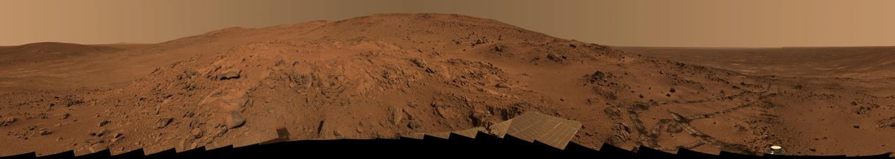
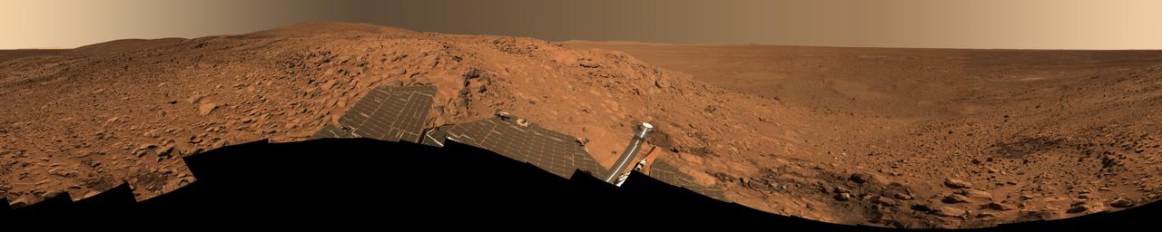
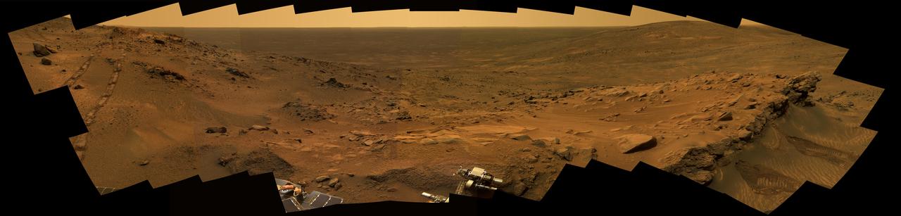
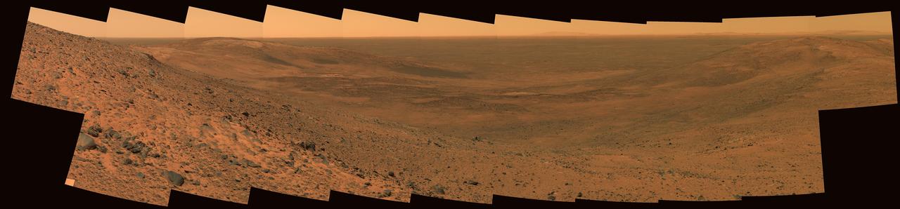
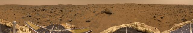
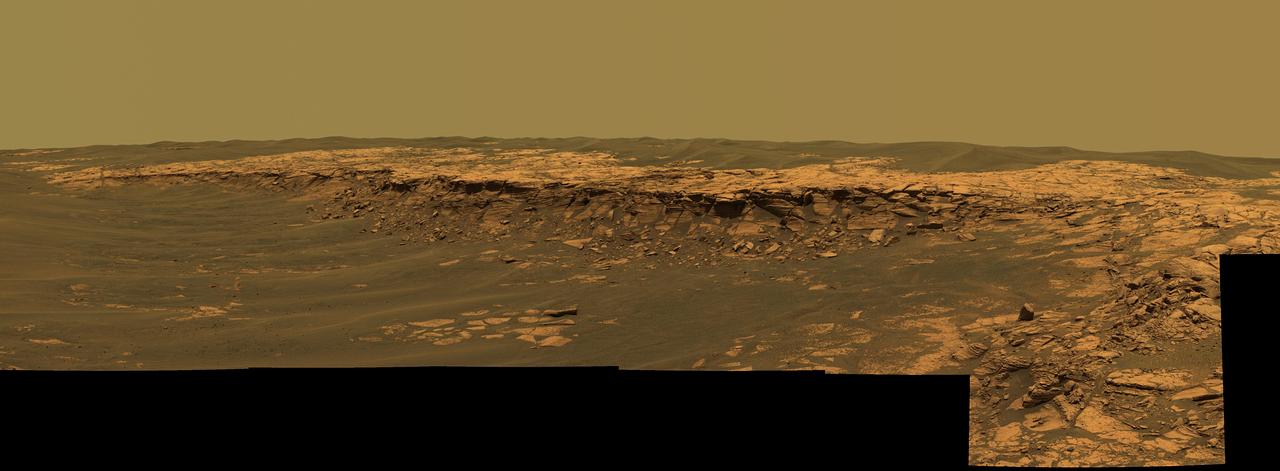
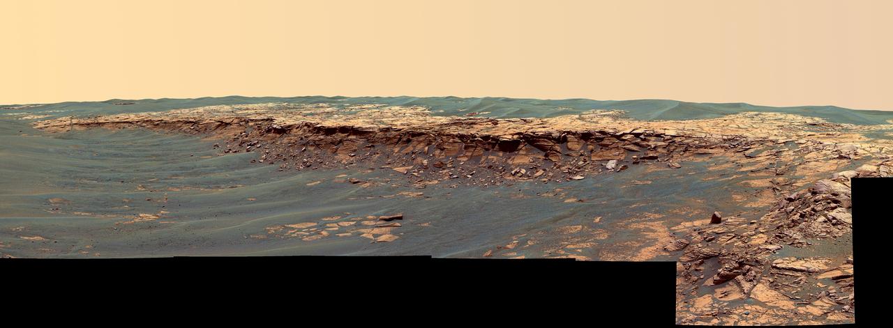
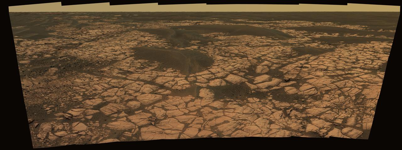
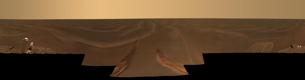
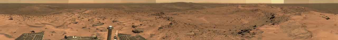
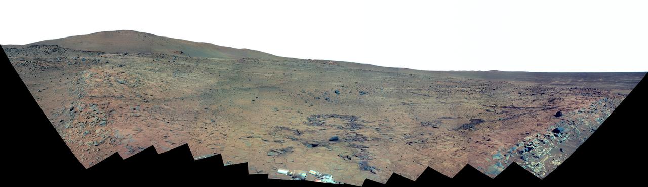
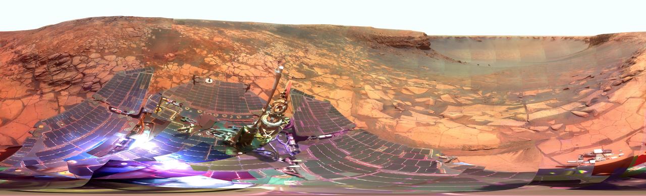
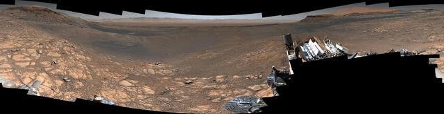
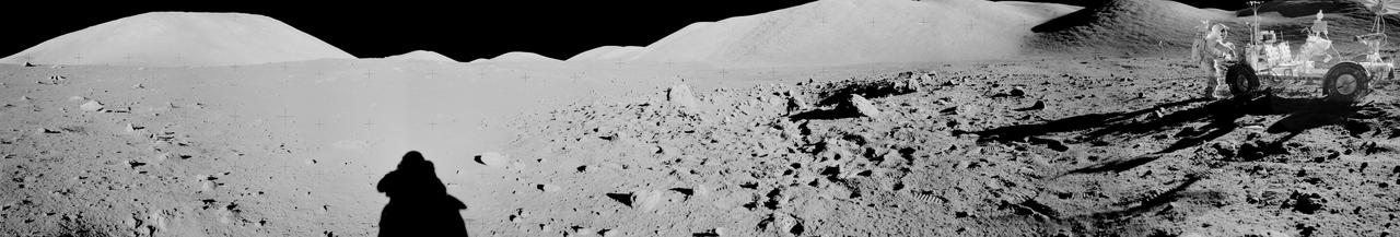
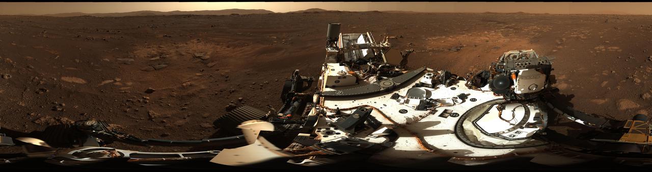
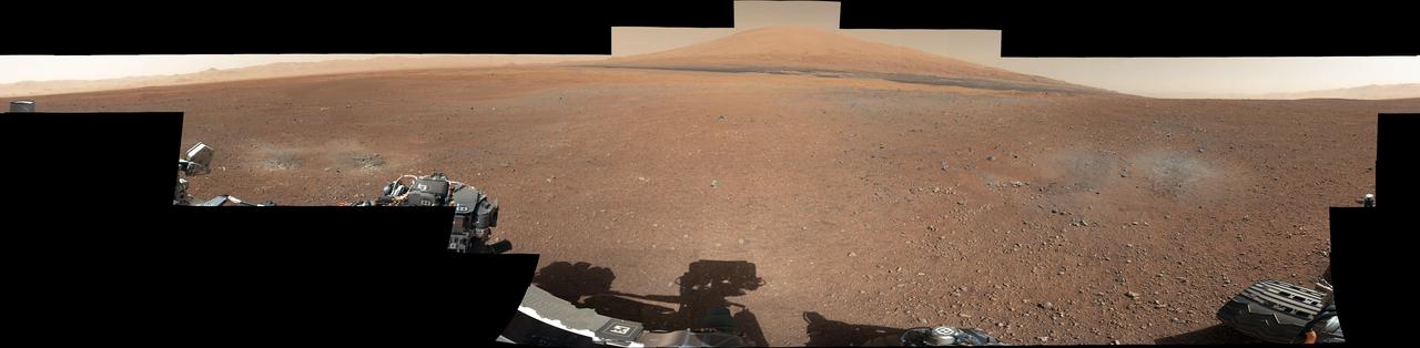
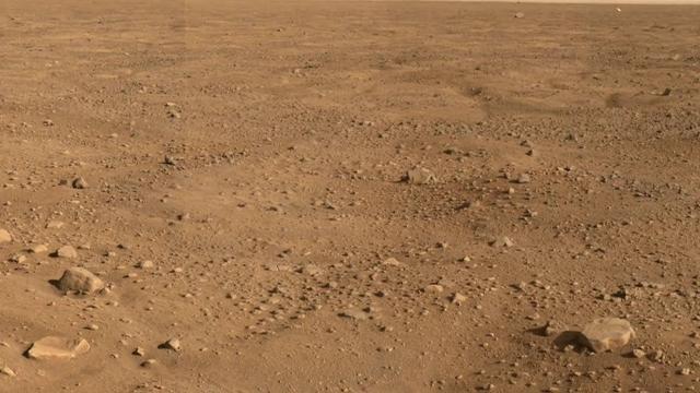
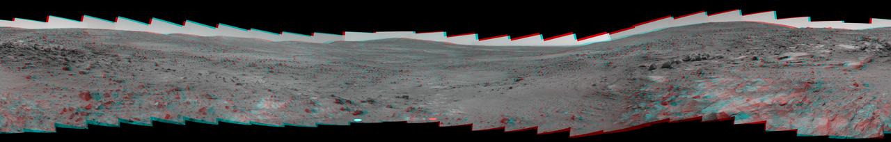
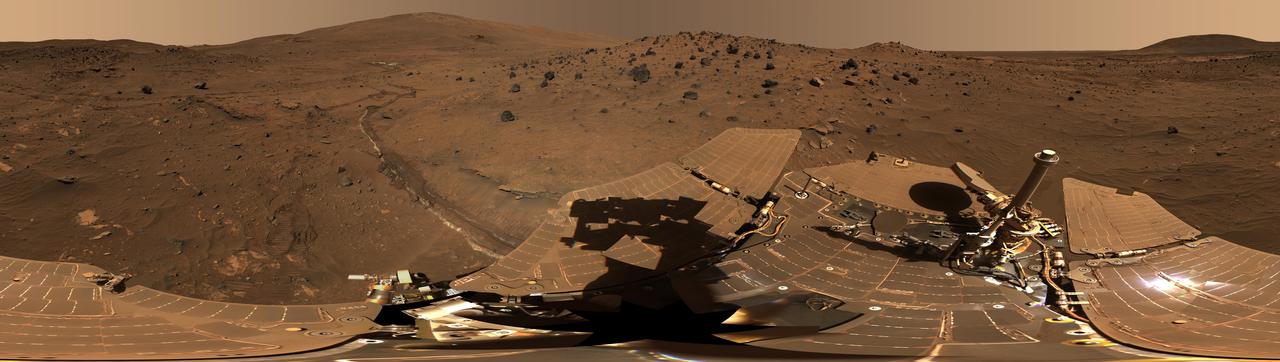
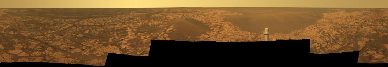
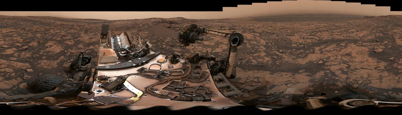
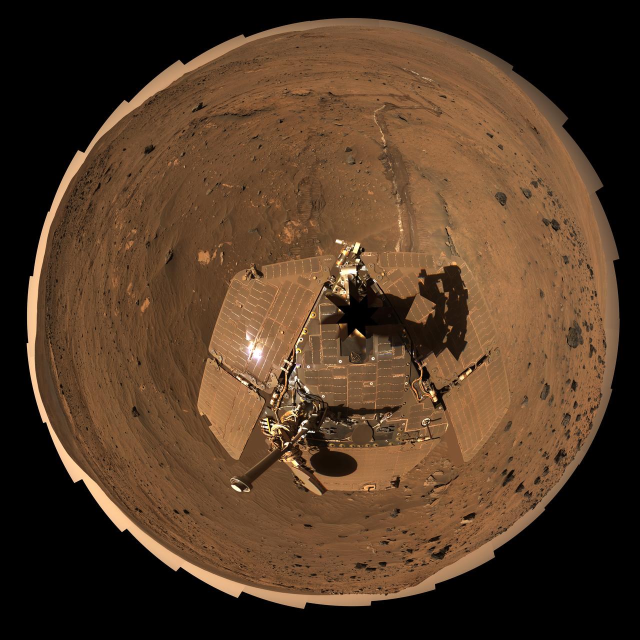
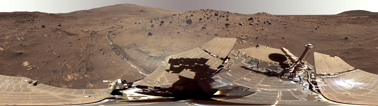
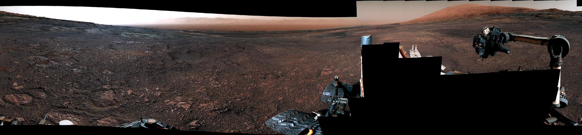
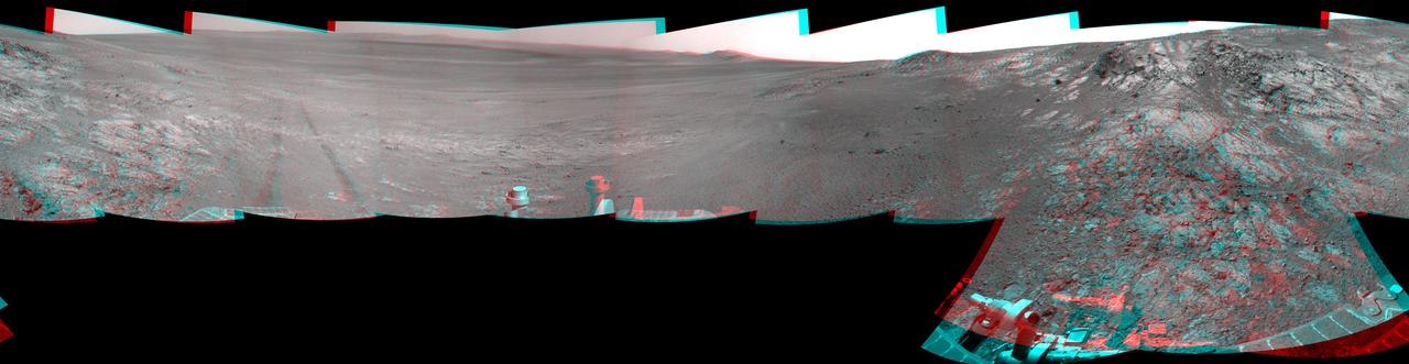
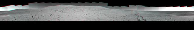
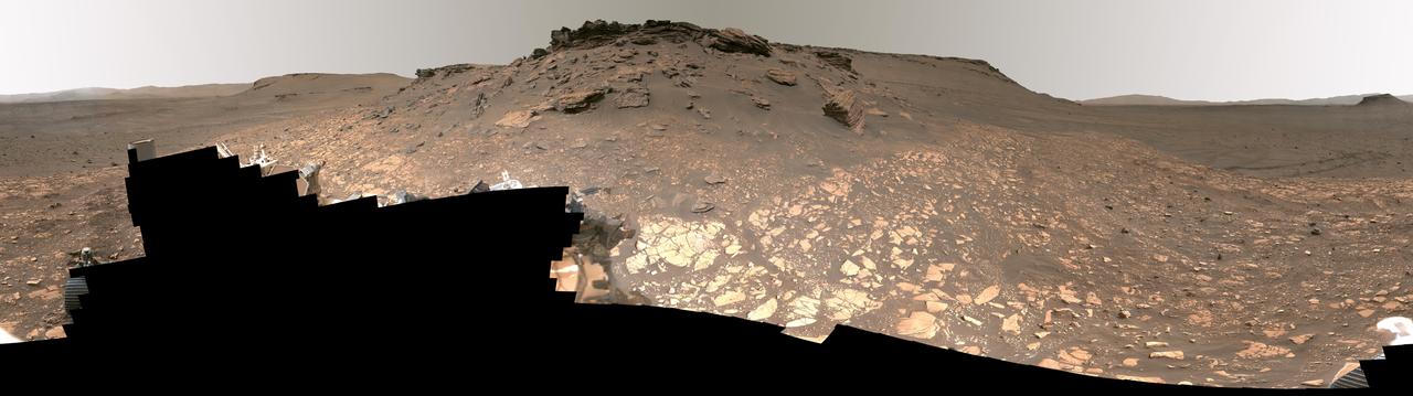
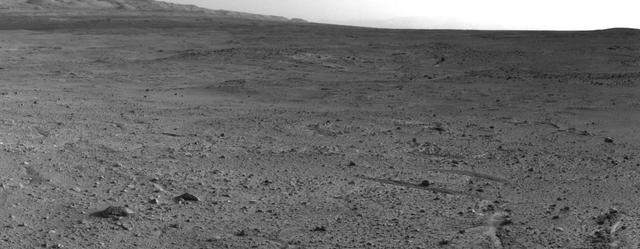
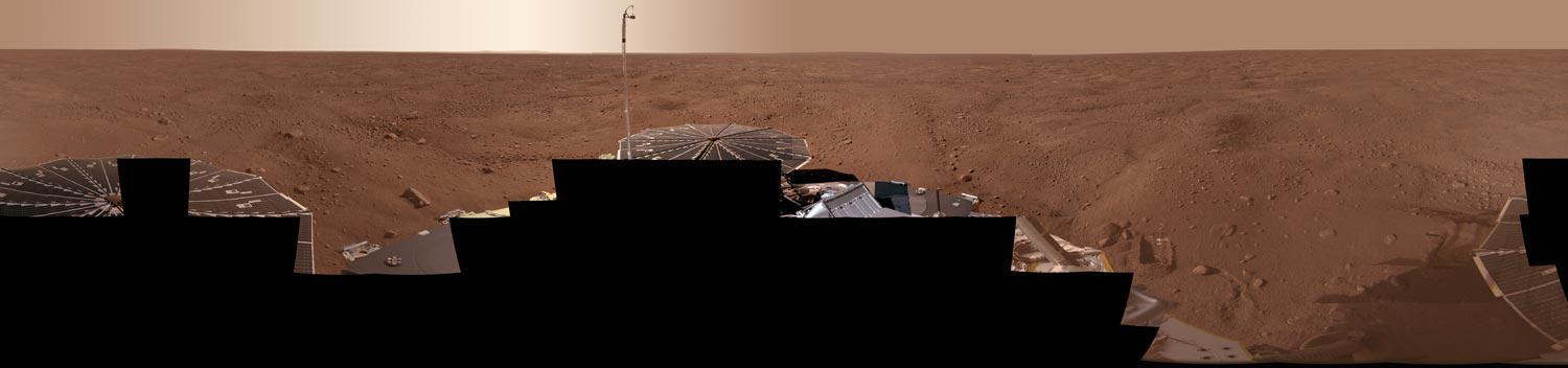
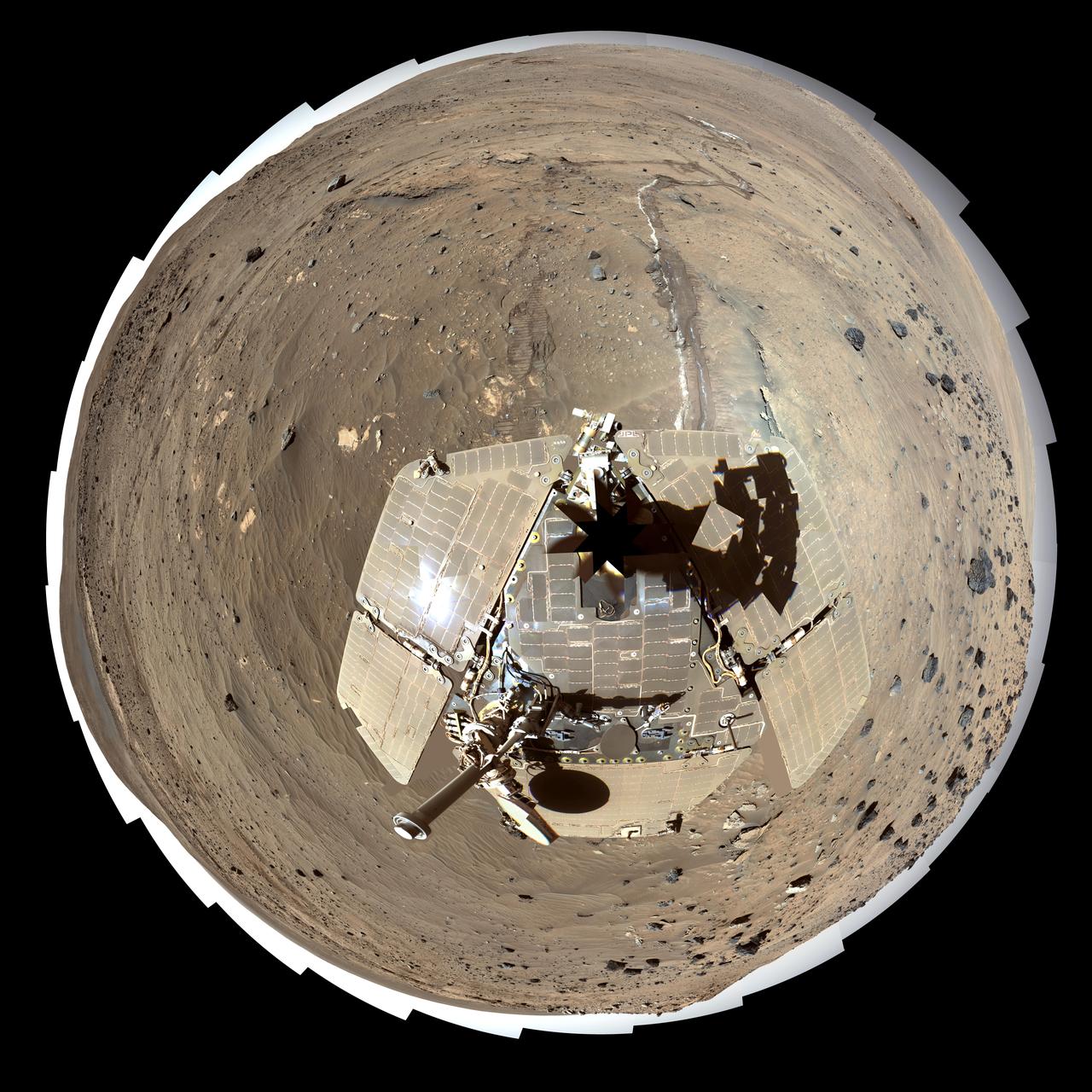
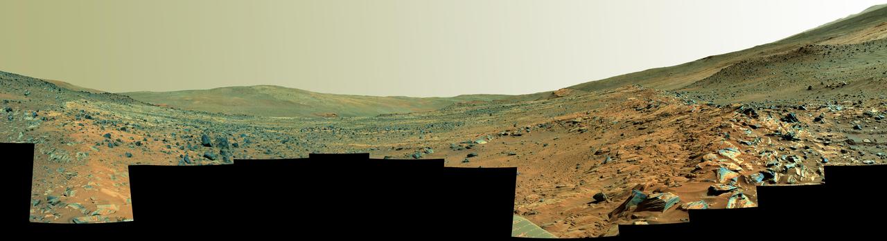
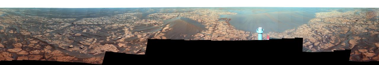
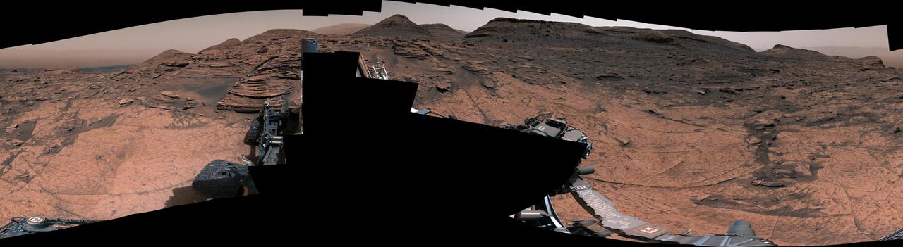
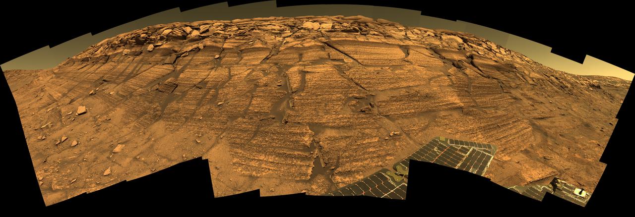
Detailed Panorama of Mars' Jezero Crater Delta
jsc2011e118358 - Panorama view of Apollo 12 lunar surface photos with lunar module pilot Alan L. Bean and the TV taken from just inside the rim of Surveyor Crater on the first moonwalk of the mission. The panoramas were built by combining Apollo 12 images starting with frame AS12-46-6777 thru end frame AS12-46-6780. The panoramic images received minimal retouching by NASA imagery specialists, including the removal of lens flares that were problematic in stitching together the individual frames and blacking out the sky to the lunar horizon. These adjustments were made based on observations of the Moon walkers who reported that there are no stars visible in the sky due to the bright lunar surface reflection of the Sun.
Apollo 15 lunar panorama
jsc2011e118359 - Panorama view of Apollo 15 lunar surface photos south of Station 2 taken by lunar module pilot James B. Irwin. Astronaut David R. Scott, mission commander, performs a task at the Lunar Roving Vehicle parked on the edge of Hadley Rille (Rima Hadley) during the first moonwalk of the mission. The panoramas were built by combining Apollo 15 images starting with frame AS15-85-11448 thru end frame AS15-85-11453. The panoramic images received minimal retouching by NASA imagery specialists, including the removal of lens flares that were problematic in stitching together the individual frames and blacking out the sky to the lunar horizon. These adjustments were made based on observations of the Moon walkers who reported that there are no stars visible in the sky due to the bright lunar surface reflection of the Sun.
Apollo 15 lunar panorama
Panorama view of Apollo 17 Lunar surface photos for use in presentations to NASA management and for Outreach Education in regard to new NASA initiative for human planetary research. Photo numbers used for this panoramic include: Apollo 17 start frame AS17-146-22339 thru end frame AS17-146-22363. View is of Station 7 Panorama taken during Extravehicular Activity (EVA) 3.
Panorama view of Apollo 17 Lunar surface photos
This panorama shows two rock-strewn slopes on the left and right sides of a broad, U-shaped dip in the middle. The sandy surface in front of the rover is reddish brown; individual rocks and more distant features are blue-gray
Spirit Paige Panorama of the Interior of Home Plate False Color
In the upper central portion of this image is a patch of ground paler than its surroundings as seen by NASA Mars rover Curiosity after reaching the top of a rise called Panorama Point.
Curiosity View from Panorama Point to Waypoint 1 and Outcrop Darwin
The full-circle panorama in approximately true color taken by NASA Phoenix Mars Lander shows the polygonal patterning of ground at the landing area, similar to patterns in permafrost areas on Earth.
Full-Circle Color Panorama of Phoenix Landing Site on Northern Mars
This self-portrait of NASA Mars Exploration Rover Spirit is a false color polar projection of the 360-degree McMurdo panorama made from images taken by Spirit from April through October 2006.
Spirit Mars Rover in McMurdo Panorama, Polar Projection False Color
Full-Circle Santorini Panorama from Opportunity False Color
NASA's Curiosity Mars rover used its Mast Camera, or Mastcam, to take this 360-degree panorama of at the "Avanavero" drill site. The panorama is made up of 127 individual images taken on June 20, 2022, the 3,509th Martian day, or sol, of the mission, and stitched together back on Earth. The color has been adjusted to match the lighting conditions as the human eye would perceive them on Earth.  At this location, Curiosity used the drill on its robotic arm to collect a rock sample for analysis by laboratory instruments inside the vehicle. It has collected more than three dozen such samples in its decade on the Red Planet.  In the center of the panorama is a gap between two hills – nicknamed "Paraitepuy Pass" – that Curiosity is currently driving through; beyond it is a layered sulfate-bearing region, which represents a drier, saltier era in the history of Mount Sharp, the 3-mile-tall (5-kilometer-tall) mountain the rover has been ascending since 2014.  https://photojournal.jpl.nasa.gov/catalog/PIA25407
Curiosity's 360-Degree Panorama of Avanavero Drill Site
This 360-degree view, called the McMurdo panorama, comes from the panoramic camera aboard NASA Mars Exploration Rover Spirit. From April through October 2006, Spirit has stayed on a small hill known as Low Ridge. 3D glasses are necessary.
McMurdo Panorama from Spirit Winter Haven Stereo
This 360-degree panorama shows the vista from the location where NASA Mars Exploration Rover Spirit has spent its third Martian southern-hemisphere winter inside Mars Gusev Crater. 3D glasses are necessary to view this image.
Full-Circle Bonestell Panorama from Spirit Stereo