
Norwegian explorer Roald Amundsen became the first man to reach the South Pole in December 1911. More than 100 years later, an international team of scientists that includes a NASA researcher has proven that air pollution from industrial activities arrived to the planet’s southern pole long before any human. Using data from 16 ice cores collected from widely spaced locations around the Antarctic continent, including the South Pole, a group led by Joe McConnell of the Desert Research Institute (DRI) in Reno, Nevada, created the most accurate and precise reconstruction to date of lead pollution over Earth’s southernmost continent. The new record, described in an article published today in the online edition of the Nature Publishing Group’s journal Scientific Reports, spans a 410-year period from 1600 to 2010. More here: <a href="http://1.usa.gov/1oB4p9U" rel="nofollow">1.usa.gov/1oB4p9U</a> <b><a href="http://www.nasa.gov/audience/formedia/features/MP_Photo_Guidelines.html" rel="nofollow">NASA image use policy.</a></b> <b><a href="http://www.nasa.gov/centers/goddard/home/index.html" rel="nofollow">NASA Goddard Space Flight Center</a></b> enables NASA’s mission through four scientific endeavors: Earth Science, Heliophysics, Solar System Exploration, and Astrophysics. Goddard plays a leading role in NASA’s accomplishments by contributing compelling scientific knowledge to advance the Agency’s mission. <b>Follow us on <a href="http://twitter.com/NASAGoddardPix" rel="nofollow">Twitter</a></b> <b>Like us on <a href="http://www.facebook.com/pages/Greenbelt-MD/NASA-Goddard/395013845897?ref=tsd" rel="nofollow">Facebook</a></b> <b>Find us on <a href="http://instagrid.me/nasagoddard/?vm=grid" rel="nofollow">Instagram</a></b>
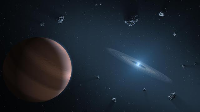
This artist's concept shows an exoplanet and debris disk orbiting a polluted white dwarf. White dwarfs are dim, dense remnants of stars similar to the Sun that have exhausted their nuclear fuel and blown off their outer layers. By "pollution," astronomers mean heavy elements invading the photospheres -- the outer atmospheres -- of these stars. The leading explanation is that exoplanets could push small rocky bodies toward the star, whose powerful gravity would pulverize them into dust. That dust, containing heavy elements from the torn-apart body, would then fall on the star. NASA's Spitzer Space Telescope has been instrumental in expanding the field of polluted white dwarfs orbited by hot, dusty disks. Since launch in 2004, Spitzer has confirmed about 40 of these special stars. Another space telescope, NASA's Wide-field Infrared Survey Explorer (WISE), also detected a handful, bringing the total up to about four dozen known today. Because these objects are so faint, infrared light is crucial to identifying them. https://photojournal.jpl.nasa.gov/catalog/PIA22084
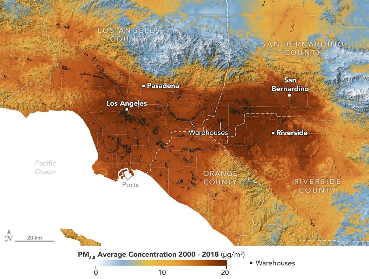
A data visualization shows the average concentration of PM2.5 particulate pollution in the Los Angeles region from 2000 to 2018, along with the locations of nearly 11,000 warehouses over the same time period. Particles measuring 2.5 micrometers or less, PM2.5 are pollutants that can be inhaled into the lungs and absorbed into the bloodstream. A NASA-funded study published in September 2024 in GeoHealth analyzed patterns and trends of atmospheric PM2.5 concentration and found that ZIP codes with more or larger warehouses had higher levels of PM2.5 and elemental carbon over time than those with fewer warehouses. Elemental carbon is a type of PM2.5 that is produced by heavy-duty diesel engines. In the visualization, areas with higher concentrations of PM2.5 are shown in darker red, and locations of warehouses are indicated by small black circles (many of them clustered closely together). The PM2.5 data came from models based on satellite observations, including from NASA's Moderate Resolution Imaging Spectroradiometer (MODIS) and Advanced Spaceborne Thermal Emission and Reflection Radiometer (ASTER) instruments. The PM2.5 warehouse locations were derived from a commercial real estate database. Particulate pollution has been linked to respiratory and cardiovascular diseases, some cancers, and adverse birth outcomes, including premature birth and low infant birth weight. As the e-commerce boom of recent decades has spurred warehouse construction, pollution in nearby neighborhoods has become a growing area for research. https://photojournal.jpl.nasa.gov/catalog/PIA26415
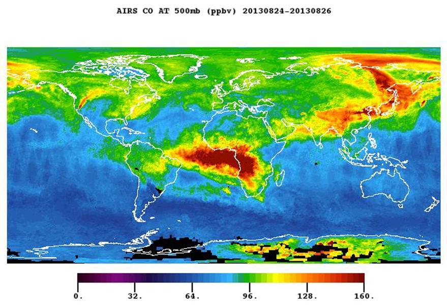
The plume of carbon monoxide pollution from the Rim Fire burning in and near Yosemite National Park, Calif., shows a three-day running average of daily measurements from NASA Aqua spacecraft.

This is an artist’s impression of a white dwarf (burned-out) star accreting rocky debris left behind by the star’s surviving planetary system. It was observed by Hubble in the Hyades star cluster. At lower right, an asteroid can be seen falling toward a Saturn-like disk of dust that is encircling the dead star. Infalling asteroids pollute the white dwarf’s atmosphere with silicon. Credit: NASA, ESA, and G. Bacon (STScI) --- NASA's Hubble Space Telescope has found the building blocks for Earth-sized planets in an unlikely place-- the atmospheres of a pair of burned-out stars called white dwarfs. These dead stars are located 150 light-years from Earth in a relatively young star cluster, Hyades, in the constellation Taurus. The star cluster is only 625 million years old. The white dwarfs are being polluted by asteroid-like debris falling onto them. <b><a href="http://www.nasa.gov/audience/formedia/features/MP_Photo_Guidelines.html" rel="nofollow">NASA image use policy.</a></b> <b><a href="http://www.nasa.gov/centers/goddard/home/index.html" rel="nofollow">NASA Goddard Space Flight Center</a></b> enables NASA’s mission through four scientific endeavors: Earth Science, Heliophysics, Solar System Exploration, and Astrophysics. Goddard plays a leading role in NASA’s accomplishments by contributing compelling scientific knowledge to advance the Agency’s mission. <b>Follow us on <a href="http://twitter.com/NASA_GoddardPix" rel="nofollow">Twitter</a></b> <b>Like us on <a href="http://www.facebook.com/pages/Greenbelt-MD/NASA-Goddard/395013845897?ref=tsd" rel="nofollow">Facebook</a></b> <b>Find us on <a href="http://instagram.com/nasagoddard?vm=grid" rel="nofollow">Instagram</a></b>
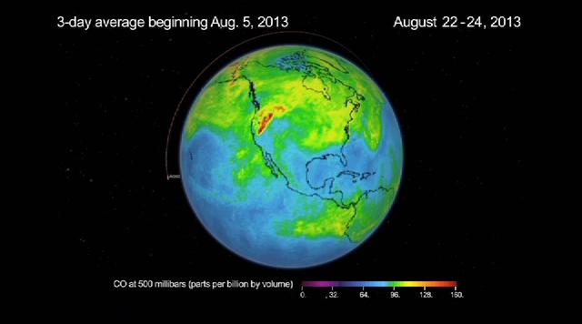
This frame from a movie was produced with data from NASA Aqua spacecraft showing the spread of carbon monoxide pollution across North America from fires in the Western U.S., including the Beaver Creek Fire in Idaho and the Rim Fire in California.
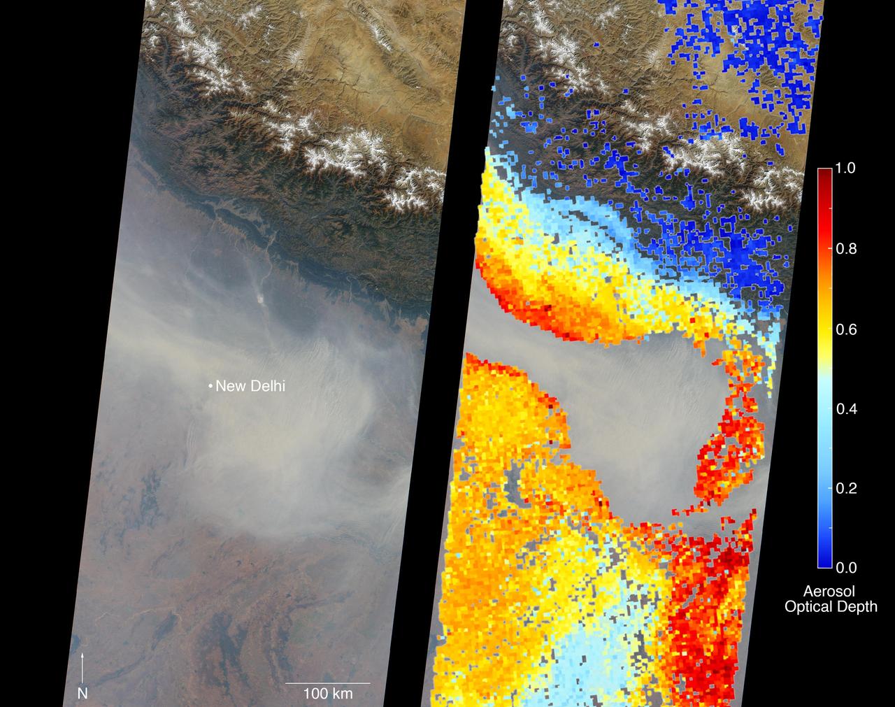
New Delhi, India's capital city, is currently suffering though a period of particularly poor air quality. In early November 2016, monitors at various locations in the area posted air quality index measurements as high as the 900s (the most severe ranking, "hazardous," is any air quality index measurement over 300). Thousands of schools have been closed, and a survey by the Associate Chambers of Commerce and Industry of India reports that 10 percent of the city's workers called in sick due to air-pollution-related health issues. According to several published news reports, the extreme air pollution may be due to a combination of nearby agricultural burning after harvest, urban construction and solid-waste burning, as well as remnants of firecracker smoke and additional car emissions after the celebration of Diwali, the Hindu festival of lights, on October 30. The Multi-angle Imaging SpectroRadiometer (MISR) instrument aboard NASA's Terra satellite passed over the region on Saturday, Nov. 5, 2016, at around 11:05 a.m. local time. At left is an image acquired from MISR's vertical viewing camera. The Himalayas stretch across the northern portion of the image. This towering mountain range tends to concentrate pollution in the region immediately to the south, including New Delhi, by preventing pollutants from blowing northwards. New Delhi, whose location is indicated on the image, is under a patch of especially thick haze. At 6:00 a.m. local time on that date, the U.S. Mission India NowCast Air Quality Index for New Delhi was reported at 751, more than twice the threshold for hazardous air quality. At right, a map of aerosol optical depth is superimposed on the image. Optical depth is a quantitative measure of the abundance of aerosols (tiny particles in the atmosphere). Optical depths for the area around New Delhi have not been calculated because the haze is so thick that the algorithm has classified the area as a cloud. In the region immediately surrounding the thick haze, optical depths approach 1.0. An optical depth of 1.0 means that only about 37 percent of direct sunlight reaches the surface due to interactions with particles in the atmosphere. These data were acquired during Terra orbit 89805. Other MISR data are available through the NASA Langley Research Center; for more information, go to https://eosweb.larc.nasa.gov/project/misr/misr_table. MISR was built and is managed by NASA's Jet Propulsion Laboratory, Pasadena, California, for NASA's Science Mission Directorate, Washington, D.C. The Terra spacecraft is managed by NASA's Goddard Space Flight Center, Greenbelt, Maryland. The MISR data were obtained from the NASA Langley Research Center Atmospheric Science Data Center, Hampton, Virginia. JPL is a division of the California Institute of Technology in Pasadena. http://photojournal.jpl.nasa.gov/catalog/PIA21100
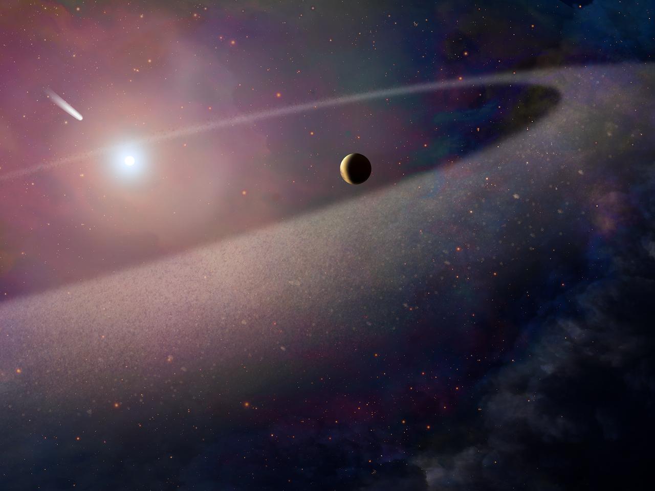
For the first time, scientists using NASA’s Hubble Space Telescope have witnessed a massive object with the makeup of a comet being ripped apart and scattered in the atmosphere of a white dwarf, the burned-out remains of a compact star. The object has a chemical composition similar to Halley’s Comet, but it is 100,000 times more massive and has a much higher amount of water. It is also rich in the elements essential for life, including nitrogen, carbon, oxygen, and sulfur. These findings are evidence for a belt of comet-like bodies orbiting the white dwarf, similar to our solar system’s Kuiper Belt. These icy bodies apparently survived the star’s evolution as it became a bloated red giant and then collapsed to a small, dense white dwarf. Caption: This artist's concept shows a massive, comet-like object falling toward a white dwarf. New Hubble Space Telescope findings are evidence for a belt of comet-like bodies orbiting the white dwarf, similar to our solar system's Kuiper Belt. The findings also suggest the presence of one or more unseen surviving planets around the white dwarf, which may have perturbed the belt to hurl icy objects into the burned-out star. Credits: NASA, ESA, and Z. Levay (STScI) <b><a href="http://www.nasa.gov/audience/formedia/features/MP_Photo_Guidelines.html" rel="nofollow">NASA image use policy.</a></b> <b><a href="http://www.nasa.gov/centers/goddard/home/index.html" rel="nofollow">NASA Goddard Space Flight Center</a></b> enables NASA’s mission through four scientific endeavors: Earth Science, Heliophysics, Solar System Exploration, and Astrophysics. Goddard plays a leading role in NASA’s accomplishments by contributing compelling scientific knowledge to advance the Agency’s mission. <b>Follow us on <a href="http://twitter.com/NASAGoddardPix" rel="nofollow">Twitter</a></b> <b>Like us on <a href="http://www.facebook.com/pages/Greenbelt-MD/NASA-Goddard/395013845897?ref=tsd" rel="nofollow">Facebook</a></b> <b>Find us on <a href="http://instagrid.me/nasagoddard/?vm=grid" rel="nofollow">Instagram</a></b>
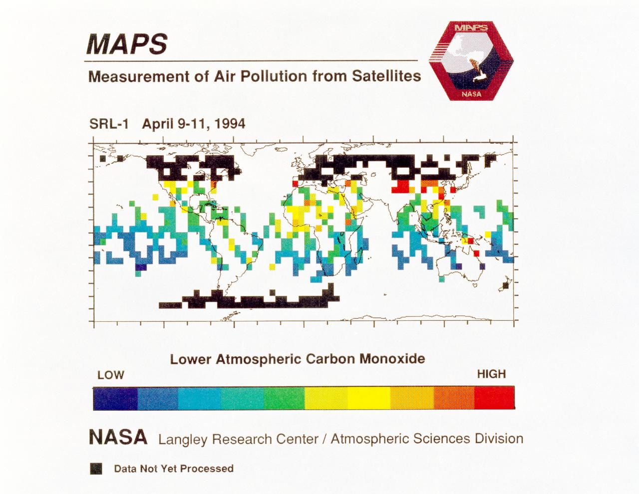
STS059-S-040 (12 April 1994) --- STS-59's MAPS (Measurement of Air Pollution from Satellites) experiment is sending real-time data that provides the most comprehensive view of carbon monoxide concentrations on Earth ever recorded. This computer image shows a summary of "quick look" data obtained by the MAPS instrument during its first days of operations as part of the Space Shuttle Endeavour's SRL-1 payload. This data will be processed using more sophisticated techniques following the flight. The color red indicates areas with the highest levels of carbon monoxide. These Northern Hemisphere springtime carbon monoxide values are generally significantly higher than the values found in the Southern Hemisphere. This is in direct contrast to the data obtained by the MAPS experiment during November 1981 and October 1984, i.e. during Northern Hemisphere fall. The astronauts aboard Endeavour have seen fires in most of the areas showing higher carbon monoxide values (China, Eastern Australia, and equatorial Africa). The relationship between the observed fires and the higher carbon monoxide values will be investigated following SRL-1 by combining the MAPS data with meteorological data, surface imagery, and Space Shuttle hand-held photographs. By the end of SRL-1, MAPS will have acquired data over most of the globe between 57 degrees north and 57 degrees south latitudes. The entire data set will be carefully analyzed using sophisticated post-flight data processing techniques. The data will then be applied in a variety of scientific studies concerning chemistry and transport processes in the atmosphere. The MAPS experiment measures the carbon monoxide in the lower atmosphere. This gas is produced both as a result of natural processes and as a result of human activities. The primary human resources of carbon monoxide are automobiles and industry and the burning of plant materials. The primary natural source is the interaction of sunlight with naturally occurring ozone and water vapor. The strength of all of these sources changes seasonally.
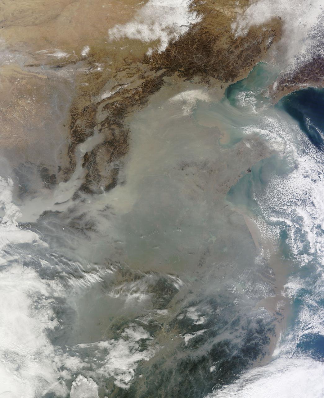
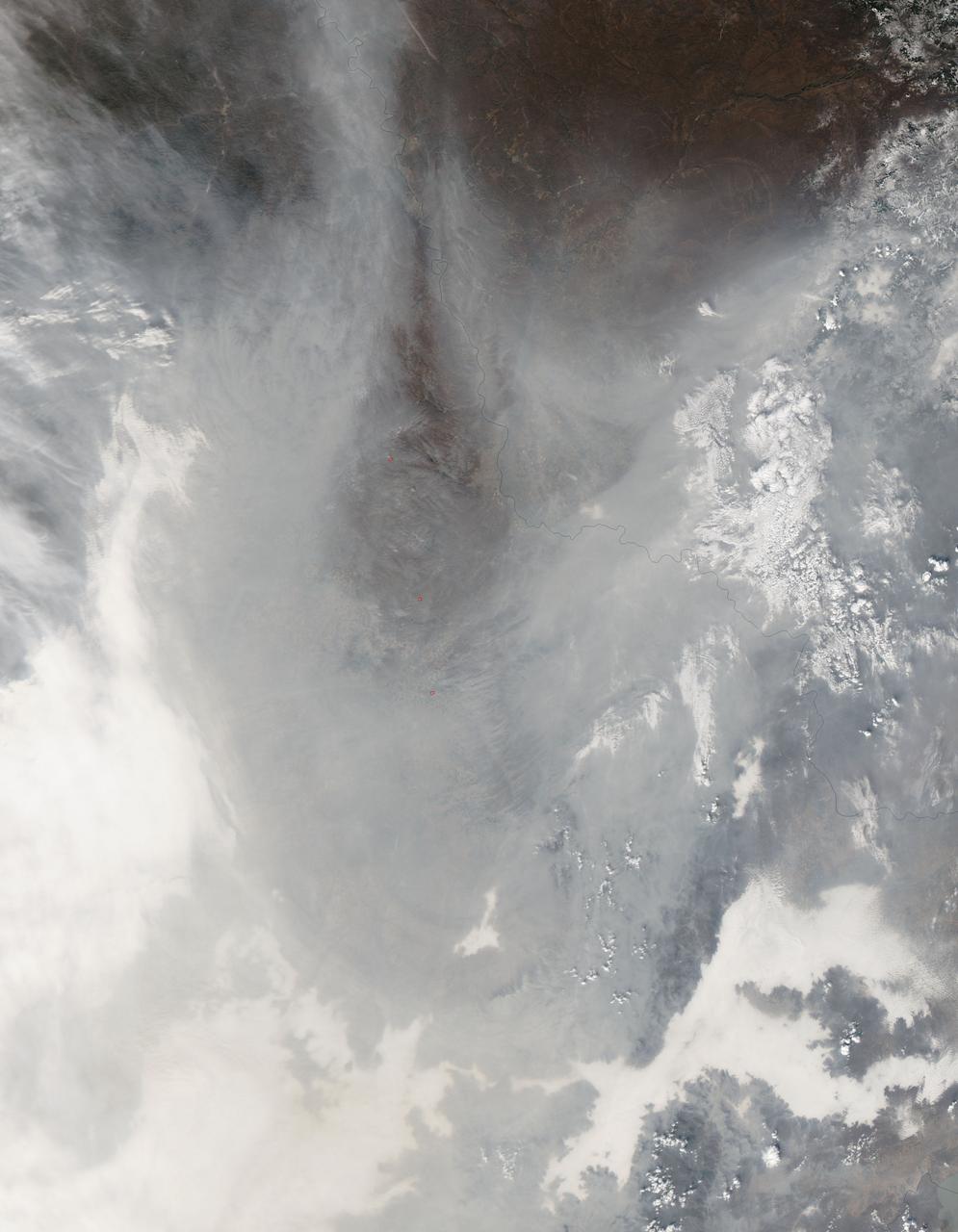
The skies over northern China were shrouded with a thick haze in late December, 2013. The Moderate Resolution Imaging Spectroradiometer (MODIS) aboard the Terra satellite captured this true-color image on December 23. The dense, gray haze obscures almost all the land and much of the coastal waters from view south and east of the Taihang Mountains. Clearer air covers the region north of the mountains, although fingers of haze roll through most river valleys. The cities of Beijing and Hebei, both west of the Bohai Sea are complete enshrouded. By December 24 the smog levels in some area exceeded World Health Organization-recommended levels by 30 times, according to Bloomberg News. The concentration of PM2.5, which are fine air particulates, were reported at 421 micrograms per cubic meter at 2 p.m. near Tiananmen Square in Beijing, while levels were 795 in Xi’an and 740 in Zhengzhou. The World Health Organization (WHO) recommends 24-hour exposure to PM2.5 concentrations no higher than 25 micrograms per cubic meter. While not the sole cause of haze and pollution, the use of coal as a very cheap energy source adds to the problem, particularly north of the Huai River. Prior to 1980, the government policy provided free coal for fuel boilers for all people living north of the Huai River. The widespread use of coal allows people in the north to stay warm in winter, but they have paid a price in air quality. According to Michael Greenstone, a Professor of Environmental Economics at Massachusetts Institute of Technology (MIT), whose research team published a paper on sustained exposure to air pollution on life expectancy in the region, air pollution, as measured by total suspended particulates, was about 55% higher north of the Huai River than south of it, for a difference of around 184 micrograms of particulate matter per cubic meter. The research, published in Proceedings of the National Academy of Sciences in July, 2013, also noted life expectancies were about 5.5 years lower in the north, owing to an increased incidence of cardiorespiratory mortality. Air pollution is an on-going issue for the government of China, and Beijing’s Five-Year Clean Air Action Plan aims to reduce overall particle density by over 25 percent on the PM2.5 scale by 2017, and also takes aim at shutting down all coal-burning plants. Credit: NASA/GSFC/Jeff Schmaltz/MODIS Land Rapid Response Team <b><a href="http://www.nasa.gov/audience/formedia/features/MP_Photo_Guidelines.html" rel="nofollow">NASA image use policy.</a></b> <b><a href="http://www.nasa.gov/centers/goddard/home/index.html" rel="nofollow">NASA Goddard Space Flight Center</a></b> enables NASA’s mission through four scientific endeavors: Earth Science, Heliophysics, Solar System Exploration, and Astrophysics. Goddard plays a leading role in NASA’s accomplishments by contributing compelling scientific knowledge to advance the Agency’s mission. <b>Follow us on <a href="http://twitter.com/NASA_GoddardPix" rel="nofollow">Twitter</a></b> <b>Like us on <a href="http://www.facebook.com/pages/Greenbelt-MD/NASA-Goddard/395013845897?ref=tsd" rel="nofollow">Facebook</a></b> <b>Find us on <a href="http://instagram.com/nasagoddard?vm=grid" rel="nofollow">Instagram</a></b>
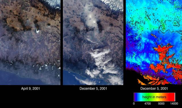
Mexico City has one of the world most serious air pollution problems. These images from NASA Terra satellite were captured on April 9 and December 5, 2001.
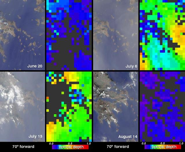
Strong synoptic winds disperse pollutants over the skies of Greece and the Aegean Sea during winter months as sen in this image from NASA Terra spacecraft captured in 2002.

During the last weeks of March 2003, unusually high and widespread aerosol pollution was detected over Europe by several satellite-borne instruments aboard NASA Terra satellite.
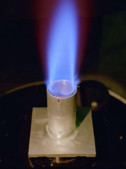
The Ring Flame Stabilizer has been developed in conjunction with Lewis Research Center. This device can lower pollutant emissions (which contribute to smog and air pollution) from natural-gas appliances such as furnaces and water heaters by 90 percent while improving energy efficiency by 2 percent.
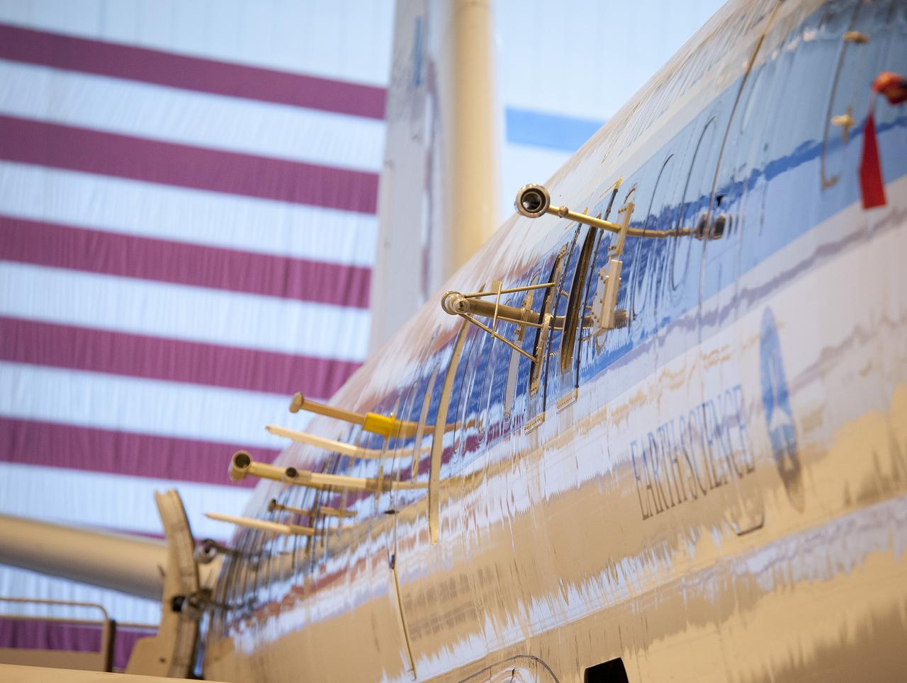
A number of atmospheric probes are installed along the fuselage of NASA's DC-8 in preparation for the SEAC4RS study to learn more about how air pollution and natural emissions affect climate change.
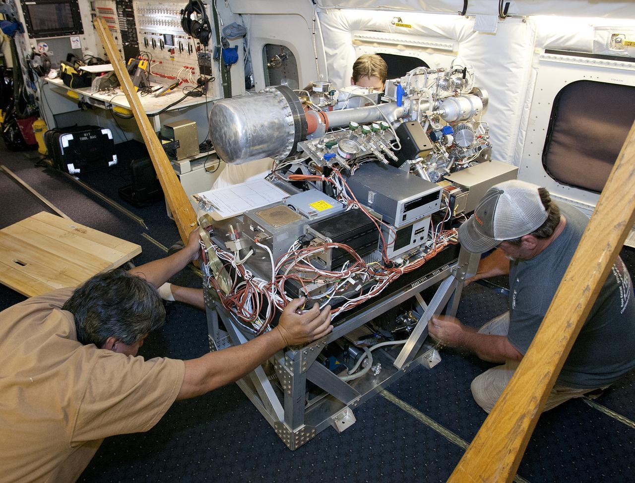
Scientists and technicians ready an instrument rack for mounting in NASA's DC-8 flying laboratory in preparation for a complex mission to study how air pollution and natural emissions affect climate change
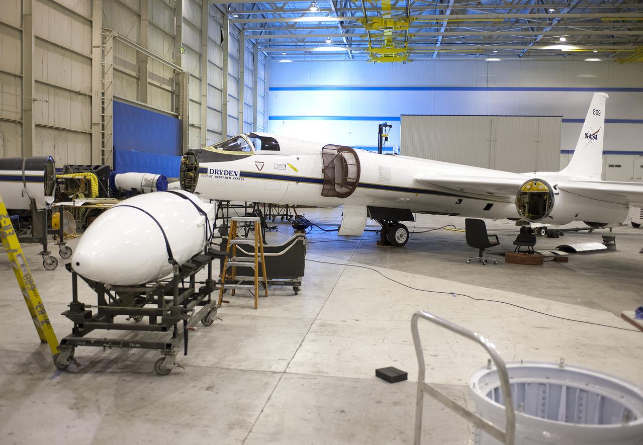
The equipment bays and wing pods of NASA's high-altitude ER-2 will carry 15 specialized instruments to study how the vertical convection of air pollution and natural emissions affect climate change.

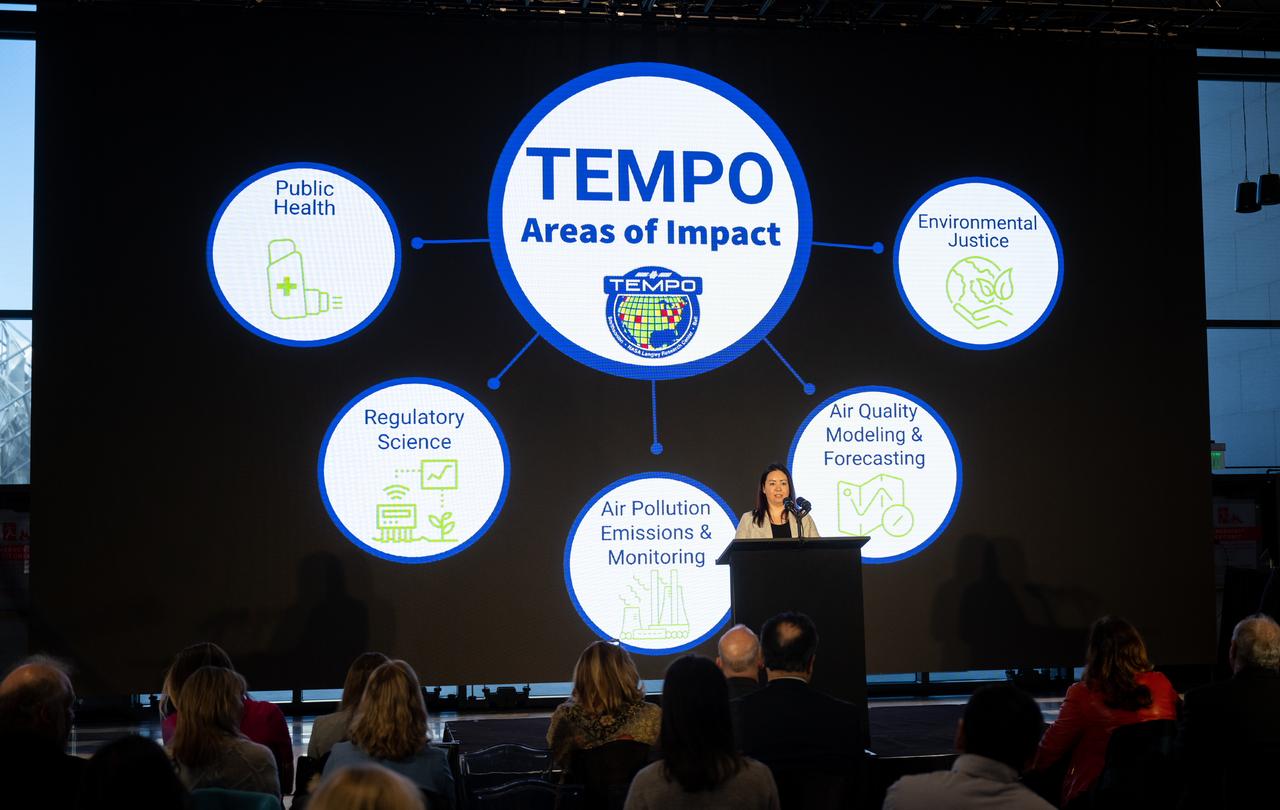
Erika Wright, education specialist at the Center for Astrophysics | Harvard & Smithsonian, speaks during a briefing on NASA’s TEMPO (Tropospheric Emissions: Monitoring of Pollution) instrument, Tuesday, March 14, 2023 at the Smithsonian’s National Air and Space Museum in Washington. NASA’s TEMPO instrument, the first Earth Venture Instrument mission, will measure air pollution across North America from Mexico City to the Canadian oil sands and from the Atlantic to the Pacific hourly and at a high spatial resolution. A partnership between NASA and the Center for Astrophysics | Harvard & Smithsonian, TEMPO will launch on a commercial satellite to geostationary orbit as early as April. Photo Credit: (NASA/Joel Kowsky)

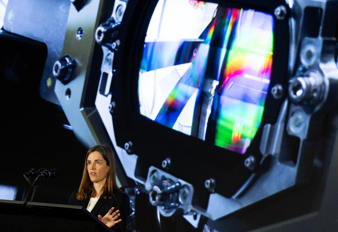
Caroline Nowlan, atmospheric physicist at the Center for Astrophysics | Harvard & Smithsonian, speaks during a briefing on NASA’s TEMPO (Tropospheric Emissions: Monitoring of Pollution) instrument, Tuesday, March 14, 2023 at the Smithsonian’s National Air and Space Museum in Washington. NASA’s TEMPO instrument, the first Earth Venture Instrument mission, will measure air pollution across North America from Mexico City to the Canadian oil sands and from the Atlantic to the Pacific hourly and at a high spatial resolution. A partnership between NASA and the Center for Astrophysics | Harvard & Smithsonian, TEMPO will launch on a commercial satellite to geostationary orbit as early as April. Photo Credit: (NASA/Joel Kowsky)
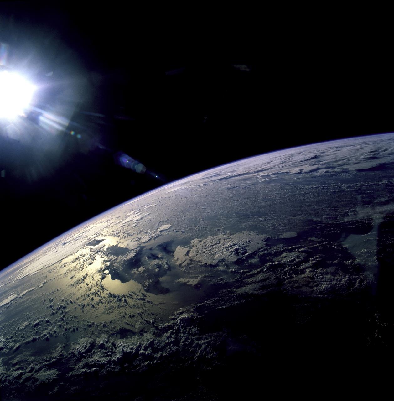
STS082-723-071 (11-21 Feb. 1997) --- The island of Hispaniola appears left center in this wide-angle view, photographed with a 70mm handheld camera from the Earth-orbiting Space Shuttle Discovery. The prominent cape is Cap-a-Foux, the northwest point of Haiti. The cloud is broken by the mountainous spine of the island. Smoke from bush fires appears in the valleys between the ridges. The coppery tinge of light reflected off the sea surface indicates pollution in the air -- probably industrial pollutants from North America which are typically fed around from the Atlantic seaboard into the Caribbean from the east.
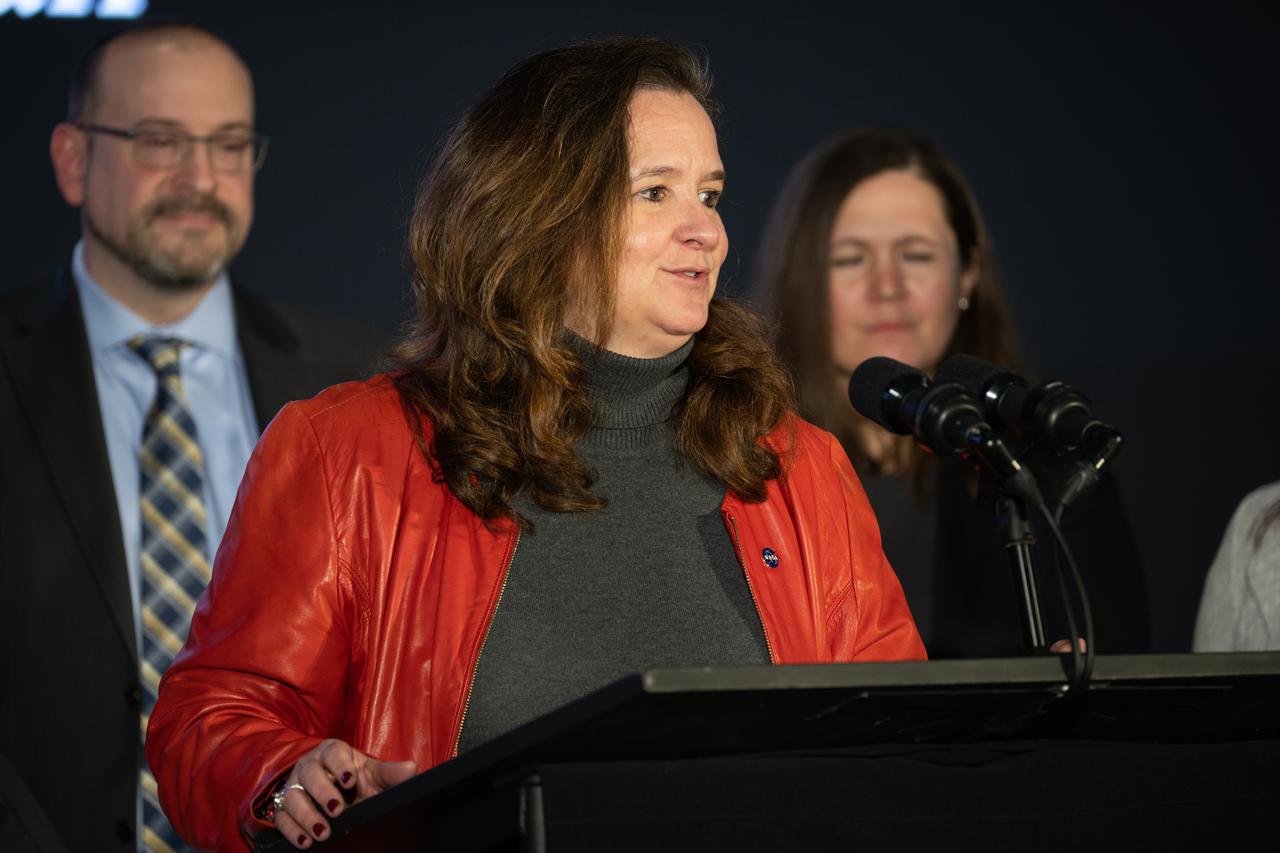
Karen St. Germain, director of the Earth Science Division of NASA’s Science Mission Directorate, answers a question during a briefing on NASA’s TEMPO (Tropospheric Emissions: Monitoring of Pollution) instrument, Tuesday, March 14, 2023 at the Smithsonian’s National Air and Space Museum in Washington. NASA’s TEMPO instrument, the first Earth Venture Instrument mission, will measure air pollution across North America from Mexico City to the Canadian oil sands and from the Atlantic to the Pacific hourly and at a high spatial resolution. A partnership between NASA and the Center for Astrophysics | Harvard & Smithsonian, TEMPO will launch on a commercial satellite to geostationary orbit as early as April. Photo Credit: (NASA/Joel Kowsky)
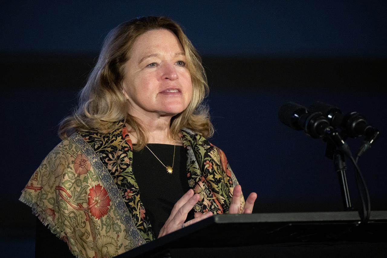
Ellen Stofan, under secretary for Science and Research at the Smithsonian Institution, speaks during a briefing on NASA’s TEMPO (Tropospheric Emissions: Monitoring of Pollution) instrument, Tuesday, March 14, 2023 at the Smithsonian’s National Air and Space Museum in Washington. NASA’s TEMPO instrument, the first Earth Venture Instrument mission, will measure air pollution across North America from Mexico City to the Canadian oil sands and from the Atlantic to the Pacific hourly and at a high spatial resolution. A partnership between NASA and the Center for Astrophysics | Harvard & Smithsonian, TEMPO will launch on a commercial satellite to geostationary orbit as early as April. Photo Credit: (NASA/Joel Kowsky)

Barry Lefer, tropospheric composition program manager in the Earth Science Division of NASA’s Science Mission Directorate, speaks during a briefing on NASA’s TEMPO (Tropospheric Emissions: Monitoring of Pollution) instrument, Tuesday, March 14, 2023 at the Smithsonian’s National Air and Space Museum in Washington. NASA’s TEMPO instrument, the first Earth Venture Instrument mission, will measure air pollution across North America from Mexico City to the Canadian oil sands and from the Atlantic to the Pacific hourly and at a high spatial resolution. A partnership between NASA and the Center for Astrophysics | Harvard & Smithsonian, TEMPO will launch on a commercial satellite to geostationary orbit as early as April. Photo Credit: (NASA/Joel Kowsky)
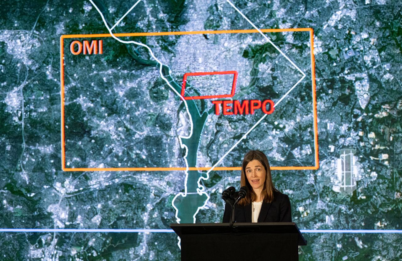
Caroline Nowlan, atmospheric physicist at the Center for Astrophysics | Harvard & Smithsonian, speaks during a briefing on NASA’s TEMPO (Tropospheric Emissions: Monitoring of Pollution) instrument, Tuesday, March 14, 2023 at the Smithsonian’s National Air and Space Museum in Washington. NASA’s TEMPO instrument, the first Earth Venture Instrument mission, will measure air pollution across North America from Mexico City to the Canadian oil sands and from the Atlantic to the Pacific hourly and at a high spatial resolution. A partnership between NASA and the Center for Astrophysics | Harvard & Smithsonian, TEMPO will launch on a commercial satellite to geostationary orbit as early as April. Photo Credit: (NASA/Joel Kowsky)

Ellen Stofan, under secretary for Science and Research at the Smithsonian Institution, speaks during a briefing on NASA’s TEMPO (Tropospheric Emissions: Monitoring of Pollution) instrument, Tuesday, March 14, 2023 at the Smithsonian’s National Air and Space Museum in Washington. NASA’s TEMPO instrument, the first Earth Venture Instrument mission, will measure air pollution across North America from Mexico City to the Canadian oil sands and from the Atlantic to the Pacific hourly and at a high spatial resolution. A partnership between NASA and the Center for Astrophysics | Harvard & Smithsonian, TEMPO will launch on a commercial satellite to geostationary orbit as early as April. Photo Credit: (NASA/Joel Kowsky)

Karen St. Germain, director of the Earth Science Division of NASA’s Science Mission Directorate, speaks during a briefing on NASA’s TEMPO (Tropospheric Emissions: Monitoring of Pollution) instrument, Tuesday, March 14, 2023 at the Smithsonian’s National Air and Space Museum in Washington. NASA’s TEMPO instrument, the first Earth Venture Instrument mission, will measure air pollution across North America from Mexico City to the Canadian oil sands and from the Atlantic to the Pacific hourly and at a high spatial resolution. A partnership between NASA and the Center for Astrophysics | Harvard & Smithsonian, TEMPO will launch on a commercial satellite to geostationary orbit as early as April. Photo Credit: (NASA/Joel Kowsky)

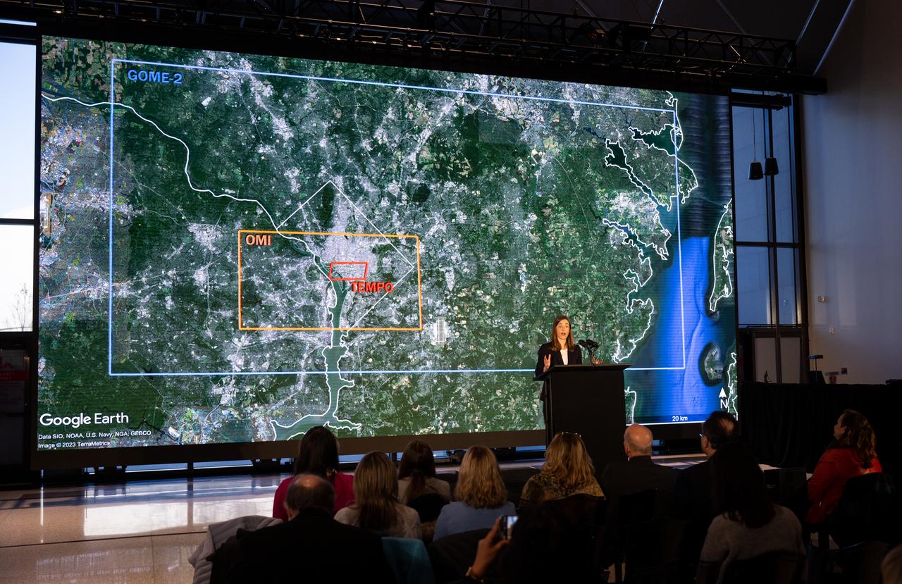
Caroline Nowlan, atmospheric physicist at the Center for Astrophysics | Harvard & Smithsonian, answers a question during a briefing on NASA’s TEMPO (Tropospheric Emissions: Monitoring of Pollution) instrument, Tuesday, March 14, 2023 at the Smithsonian’s National Air and Space Museum in Washington. NASA’s TEMPO instrument, the first Earth Venture Instrument mission, will measure air pollution across North America from Mexico City to the Canadian oil sands and from the Atlantic to the Pacific hourly and at a high spatial resolution. A partnership between NASA and the Center for Astrophysics | Harvard & Smithsonian, TEMPO will launch on a commercial satellite to geostationary orbit as early as April. Photo Credit: (NASA/Joel Kowsky)

NASA Public Affairs Officer Karen Fox moderates a briefing on NASA’s TEMPO (Tropospheric Emissions: Monitoring of Pollution) instrument, Tuesday, March 14, 2023 at the Smithsonian’s National Air and Space Museum in Washington. NASA’s TEMPO instrument, the first Earth Venture Instrument mission, will measure air pollution across North America from Mexico City to the Canadian oil sands and from the Atlantic to the Pacific hourly and at a high spatial resolution. A partnership between NASA and the Center for Astrophysics | Harvard & Smithsonian, TEMPO will launch on a commercial satellite to geostationary orbit as early as April. Photo Credit: (NASA/Joel Kowsky)
Caroline Nowlan, atmospheric physicist at the Center for Astrophysics | Harvard & Smithsonian, speaks during a briefing on NASA’s TEMPO (Tropospheric Emissions: Monitoring of Pollution) instrument, Tuesday, March 14, 2023 at the Smithsonian’s National Air and Space Museum in Washington. NASA’s TEMPO instrument, the first Earth Venture Instrument mission, will measure air pollution across North America from Mexico City to the Canadian oil sands and from the Atlantic to the Pacific hourly and at a high spatial resolution. A partnership between NASA and the Center for Astrophysics | Harvard & Smithsonian, TEMPO will launch on a commercial satellite to geostationary orbit as early as April. Photo Credit: (NASA/Joel Kowsky)
Caroline Nowlan, atmospheric physicist at the Center for Astrophysics | Harvard & Smithsonian, speaks during a briefing on NASA’s TEMPO (Tropospheric Emissions: Monitoring of Pollution) instrument, Tuesday, March 14, 2023 at the Smithsonian’s National Air and Space Museum in Washington. NASA’s TEMPO instrument, the first Earth Venture Instrument mission, will measure air pollution across North America from Mexico City to the Canadian oil sands and from the Atlantic to the Pacific hourly and at a high spatial resolution. A partnership between NASA and the Center for Astrophysics | Harvard & Smithsonian, TEMPO will launch on a commercial satellite to geostationary orbit as early as April. Photo Credit: (NASA/Joel Kowsky)
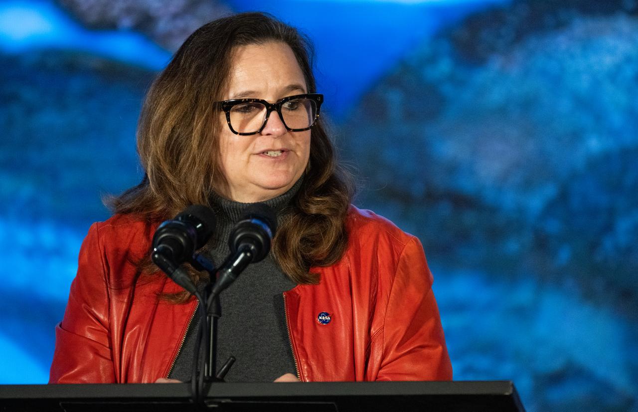
Karen St. Germain, director of the Earth Science Division of NASA’s Science Mission Directorate, speaks during a briefing on NASA’s TEMPO (Tropospheric Emissions: Monitoring of Pollution) instrument, Tuesday, March 14, 2023 at the Smithsonian’s National Air and Space Museum in Washington. NASA’s TEMPO instrument, the first Earth Venture Instrument mission, will measure air pollution across North America from Mexico City to the Canadian oil sands and from the Atlantic to the Pacific hourly and at a high spatial resolution. A partnership between NASA and the Center for Astrophysics | Harvard & Smithsonian, TEMPO will launch on a commercial satellite to geostationary orbit as early as April. Photo Credit: (NASA/Joel Kowsky)
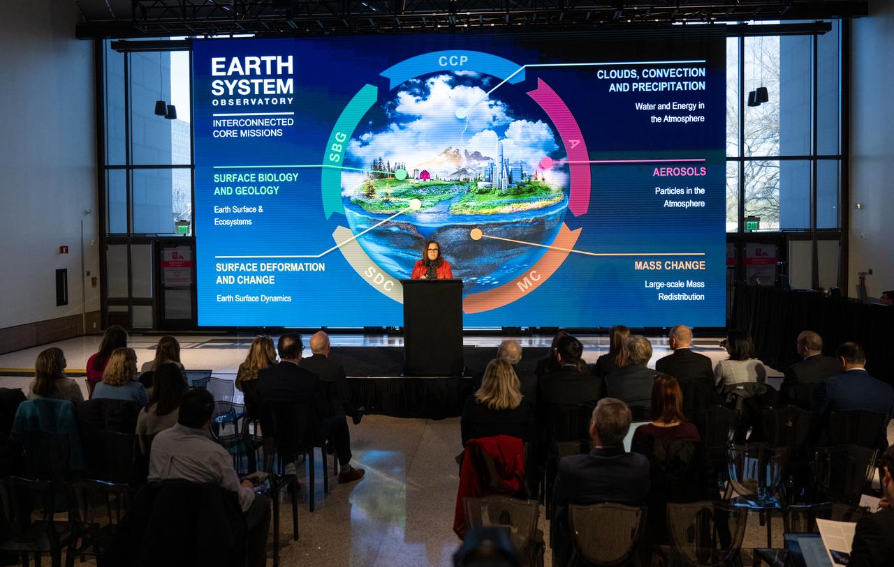
Karen St. Germain, director of the Earth Science Division of NASA’s Science Mission Directorate, speaks during a briefing on NASA’s TEMPO (Tropospheric Emissions: Monitoring of Pollution) instrument, Tuesday, March 14, 2023 at the Smithsonian’s National Air and Space Museum in Washington. NASA’s TEMPO instrument, the first Earth Venture Instrument mission, will measure air pollution across North America from Mexico City to the Canadian oil sands and from the Atlantic to the Pacific hourly and at a high spatial resolution. A partnership between NASA and the Center for Astrophysics | Harvard & Smithsonian, TEMPO will launch on a commercial satellite to geostationary orbit as early as April. Photo Credit: (NASA/Joel Kowsky)
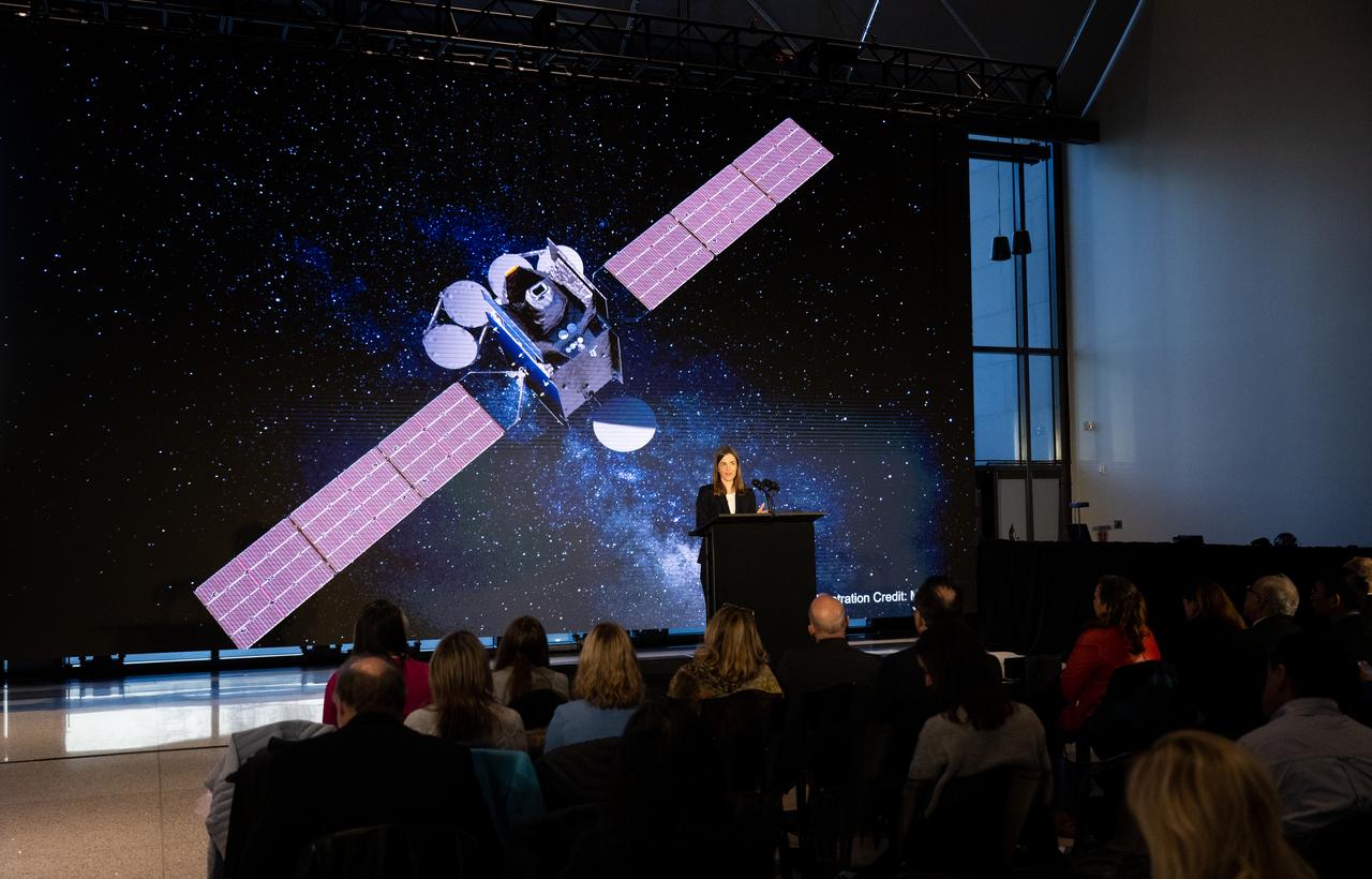
Caroline Nowlan, atmospheric physicist at the Center for Astrophysics | Harvard & Smithsonian, speaks during a briefing on NASA’s TEMPO (Tropospheric Emissions: Monitoring of Pollution) instrument, Tuesday, March 14, 2023 at the Smithsonian’s National Air and Space Museum in Washington. NASA’s TEMPO instrument, the first Earth Venture Instrument mission, will measure air pollution across North America from Mexico City to the Canadian oil sands and from the Atlantic to the Pacific hourly and at a high spatial resolution. A partnership between NASA and the Center for Astrophysics | Harvard & Smithsonian, TEMPO will launch on a commercial satellite to geostationary orbit as early as April. Photo Credit: (NASA/Joel Kowsky)

Barry Lefer, tropospheric composition program manager in the Earth Science Division of NASA’s Science Mission Directorate, speaks during a briefing on NASA’s TEMPO (Tropospheric Emissions: Monitoring of Pollution) instrument, Tuesday, March 14, 2023 at the Smithsonian’s National Air and Space Museum in Washington. NASA’s TEMPO instrument, the first Earth Venture Instrument mission, will measure air pollution across North America from Mexico City to the Canadian oil sands and from the Atlantic to the Pacific hourly and at a high spatial resolution. A partnership between NASA and the Center for Astrophysics | Harvard & Smithsonian, TEMPO will launch on a commercial satellite to geostationary orbit as early as April. Photo Credit: (NASA/Joel Kowsky)

Barry Lefer, tropospheric composition program manager in the Earth Science Division of NASA’s Science Mission Directorate, speaks during a briefing on NASA’s TEMPO (Tropospheric Emissions: Monitoring of Pollution) instrument, Tuesday, March 14, 2023 at the Smithsonian’s National Air and Space Museum in Washington. NASA’s TEMPO instrument, the first Earth Venture Instrument mission, will measure air pollution across North America from Mexico City to the Canadian oil sands and from the Atlantic to the Pacific hourly and at a high spatial resolution. A partnership between NASA and the Center for Astrophysics | Harvard & Smithsonian, TEMPO will launch on a commercial satellite to geostationary orbit as early as April. Photo Credit: (NASA/Joel Kowsky)

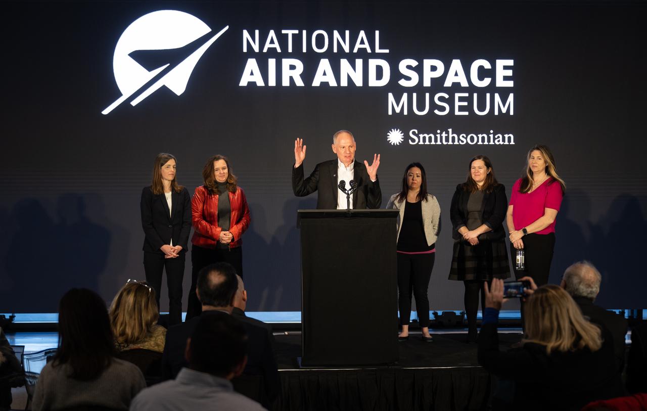
Christopher Browne, director of the Smithsonian’s National Air and Space Museum delivers remarks during a briefing on NASA’s TEMPO (Tropospheric Emissions: Monitoring of Pollution) instrument, Tuesday, March 14, 2023 at the Smithsonian’s National Air and Space Museum in Washington. NASA’s TEMPO instrument, the first Earth Venture Instrument mission, will measure air pollution across North America from Mexico City to the Canadian oil sands and from the Atlantic to the Pacific hourly and at a high spatial resolution. A partnership between NASA and the Center for Astrophysics | Harvard & Smithsonian, TEMPO will launch on a commercial satellite to geostationary orbit as early as April. Photo Credit: (NASA/Joel Kowsky)
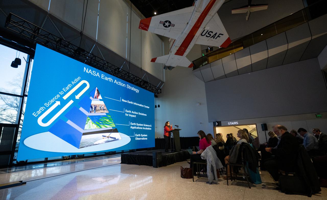
Karen St. Germain, director of the Earth Science Division of NASA’s Science Mission Directorate, speaks during a briefing on NASA’s TEMPO (Tropospheric Emissions: Monitoring of Pollution) instrument, Tuesday, March 14, 2023 at the Smithsonian’s National Air and Space Museum in Washington. NASA’s TEMPO instrument, the first Earth Venture Instrument mission, will measure air pollution across North America from Mexico City to the Canadian oil sands and from the Atlantic to the Pacific hourly and at a high spatial resolution. A partnership between NASA and the Center for Astrophysics | Harvard & Smithsonian, TEMPO will launch on a commercial satellite to geostationary orbit as early as April. Photo Credit: (NASA/Joel Kowsky)
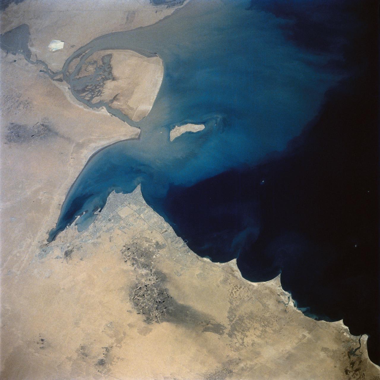
This view of the northern Persian Gulf shows Kuwait City and the Tigris and Euphrates River Deltas (29.5N, 48.5E). The oil laden sands and oil lakes of the Kuwait Oil Fields to the north and south of the city are clearly visible as dark patches surrounded by oil free desert sands. Comparison with earlier photos indicate that the oil laden sands are slowly being covered with clean sand carried by strong NW winds called Shmals.
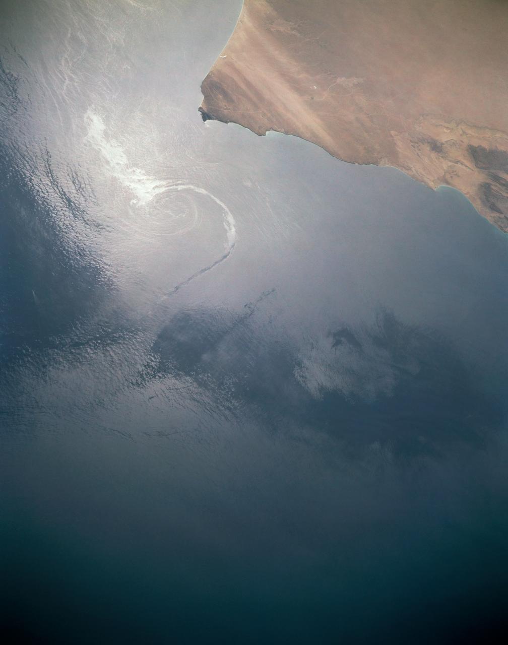
In this sunglint view of the Arabian Seacoast of Oman (19.0N, 59.0E) an oil slick is highlighted on the water's surface by sunglint lighting conditions. Nearly 50 percent of the oil transported worldwide passes through the Gulf of Oman, en route from the Persian Gulf and numerous ship wakes can be seen in this view. The oil slick, rounding the tip of Cape Ras Al Hadd, has formed a counterclockwise bright spiral indicating the local ocean currents.
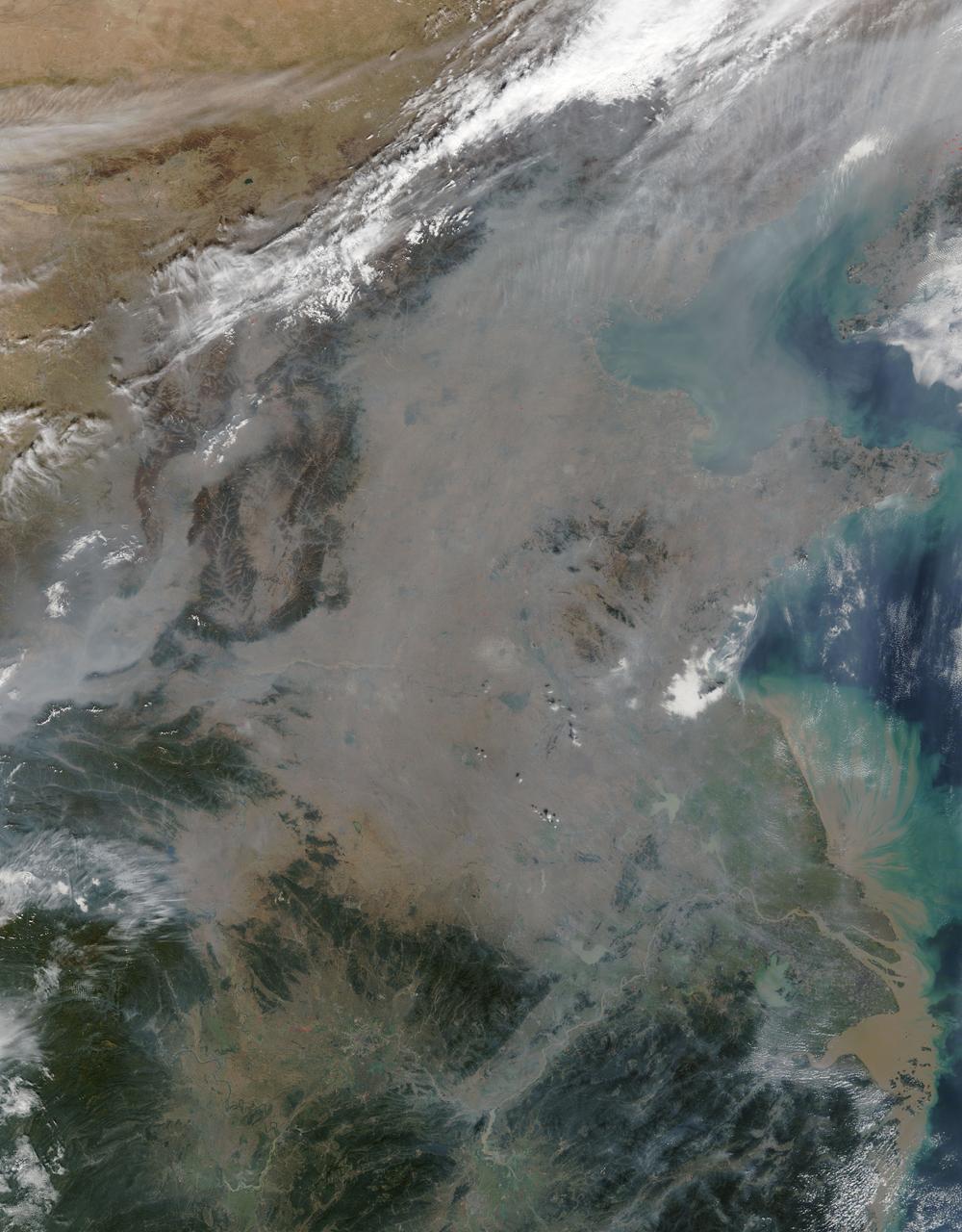
On October 17, 2015, the Moderate Resolution Imaging Spectroradiometer (MODIS) aboard NASA’s Terra satellite captured this true-color image of a thick haze hanging over eastern China. In the north, the large city of Beijing is completely obscured from view, as is much of the landscape. The haze thins slightly over the Bohai Sea. Further south, sediment pours into the East China Sea near the city of Shanghai. Heavy haze is common in this region, and tends to worsen in October through January, when cold, heavy air traps pollutants near the surface of the Earth. It is likely that this scene was caused by such a temperature inversion. Normally, air is warmest near the surface of the Earth. But sometimes a mass of warm air will move the cooler air, so the atmosphere actually warms with the altitude. Cool air does not have energy to rise through the warm air, vertical circulation slows and air becomes trapped near the surface. Any pollution that is emitted into the cooler air will also get trapped, increasing low-level air pollution and haze. Credit: NASA/GSFC/Jeff Schmaltz/MODIS Land Rapid Response Team
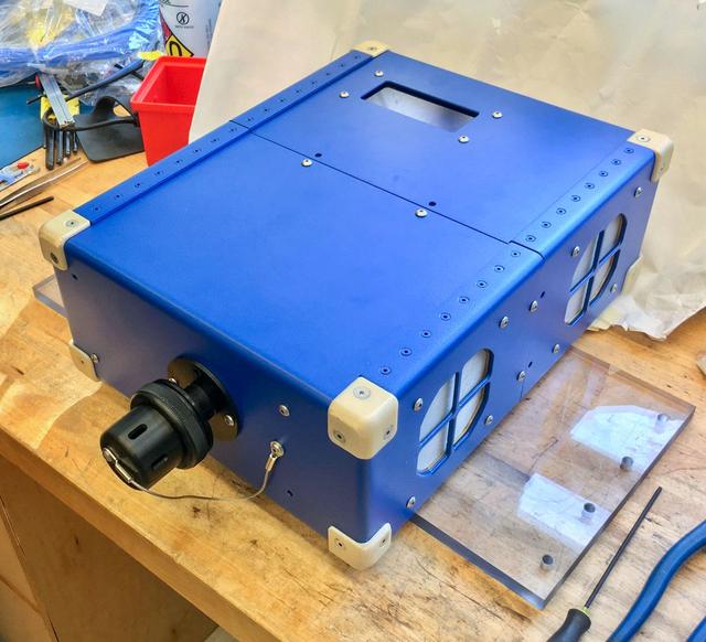
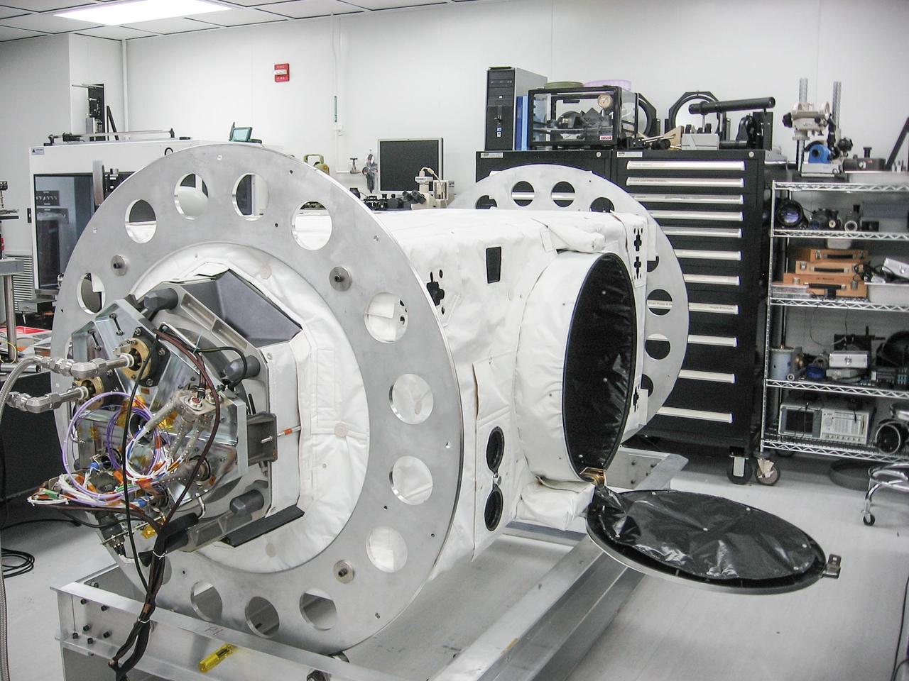
jsc2020e004941 (2/7/2020) --- A preflight view of the Airborne Particulate Monitor (APM) engineering unit. APM technology has applications in environmental monitoring and air pollution studies on Earth. Its combination of two instruments into one box offers a wider range of particle size measurement than other commercially available instruments.
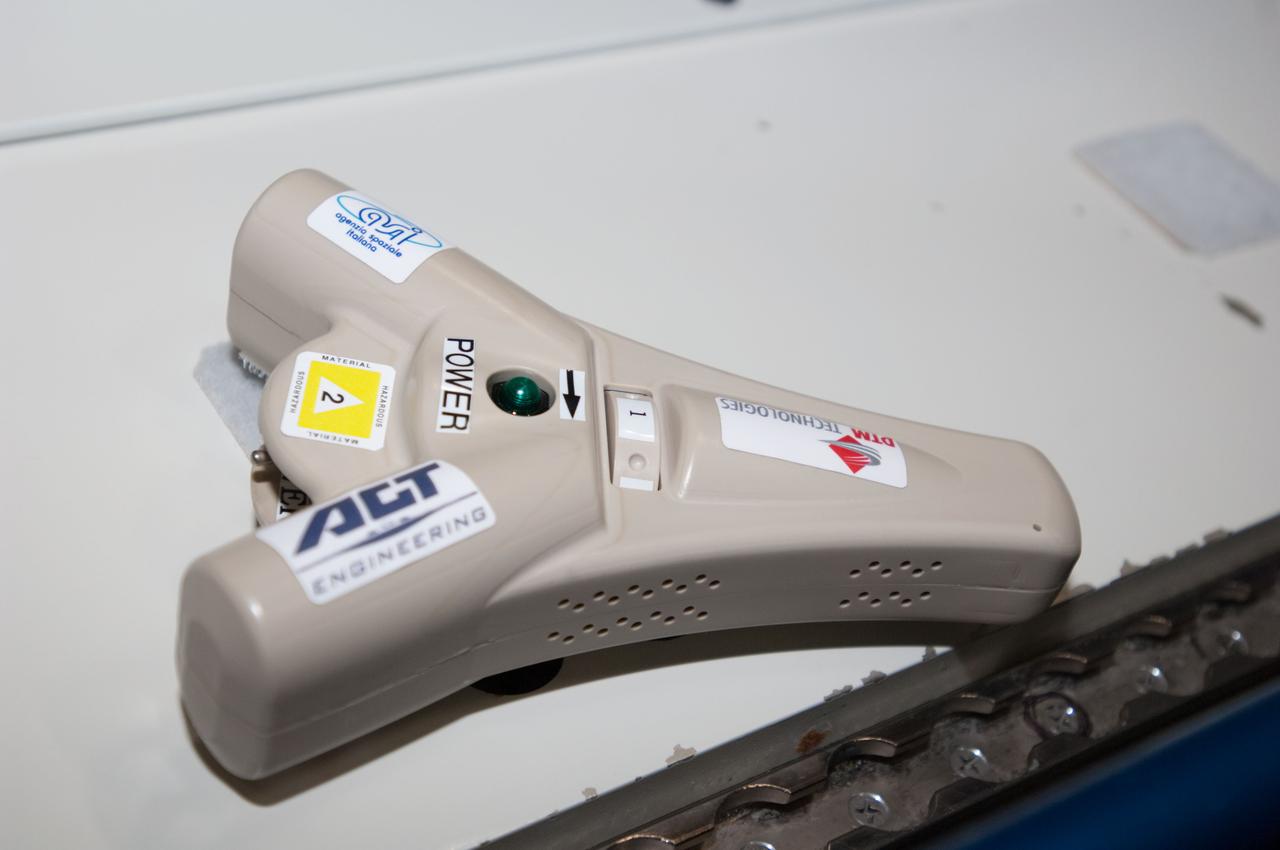
iss038e001785 (11/14/2013) --- Close-up view of DIAPASON in the U.S. Laboratory aboard the International Space Station (ISS). The DIAPASON conducts high-accuracy environmental control,pollution monitoring and particle recording with a simple instrument that captures nanoparticles.
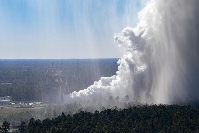
The cloud of steam is visible at NASA’s Stennis Space Center during the Oct. 17 hot fire, which marks the first test in the critical series to support future SLS (Space Launch System) missions to deep space. The steam released during the full duration, 550-second test is water and does not pollute the atmosphere.
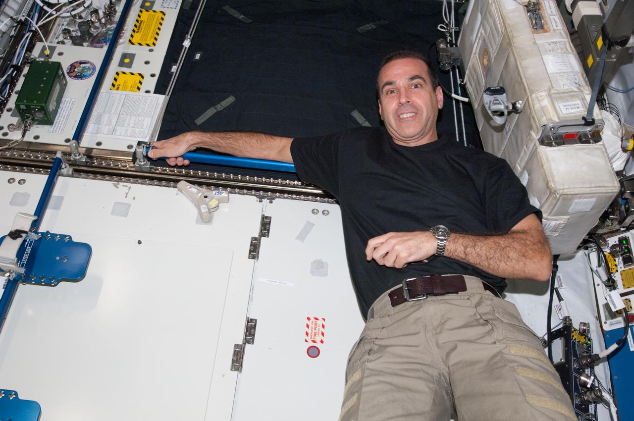
iss038e001780 (11/14/2013) --- A view of NASA astronaut Rick Mastracchio, posing with DIAPASON, in the U.S. Laboratory aboard the International Space Station(ISS). The DIAPASON conducts high-accuracy environmental control,pollution monitoring and particle recording with a simple instrument that captures nanoparticles.
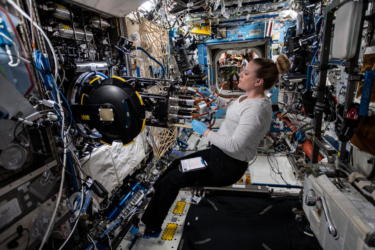
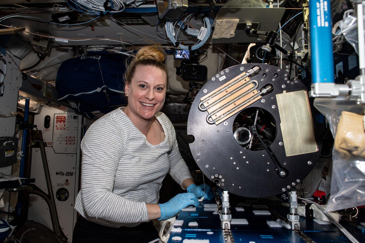
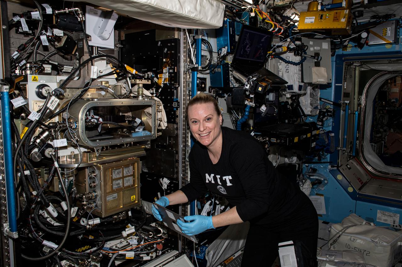
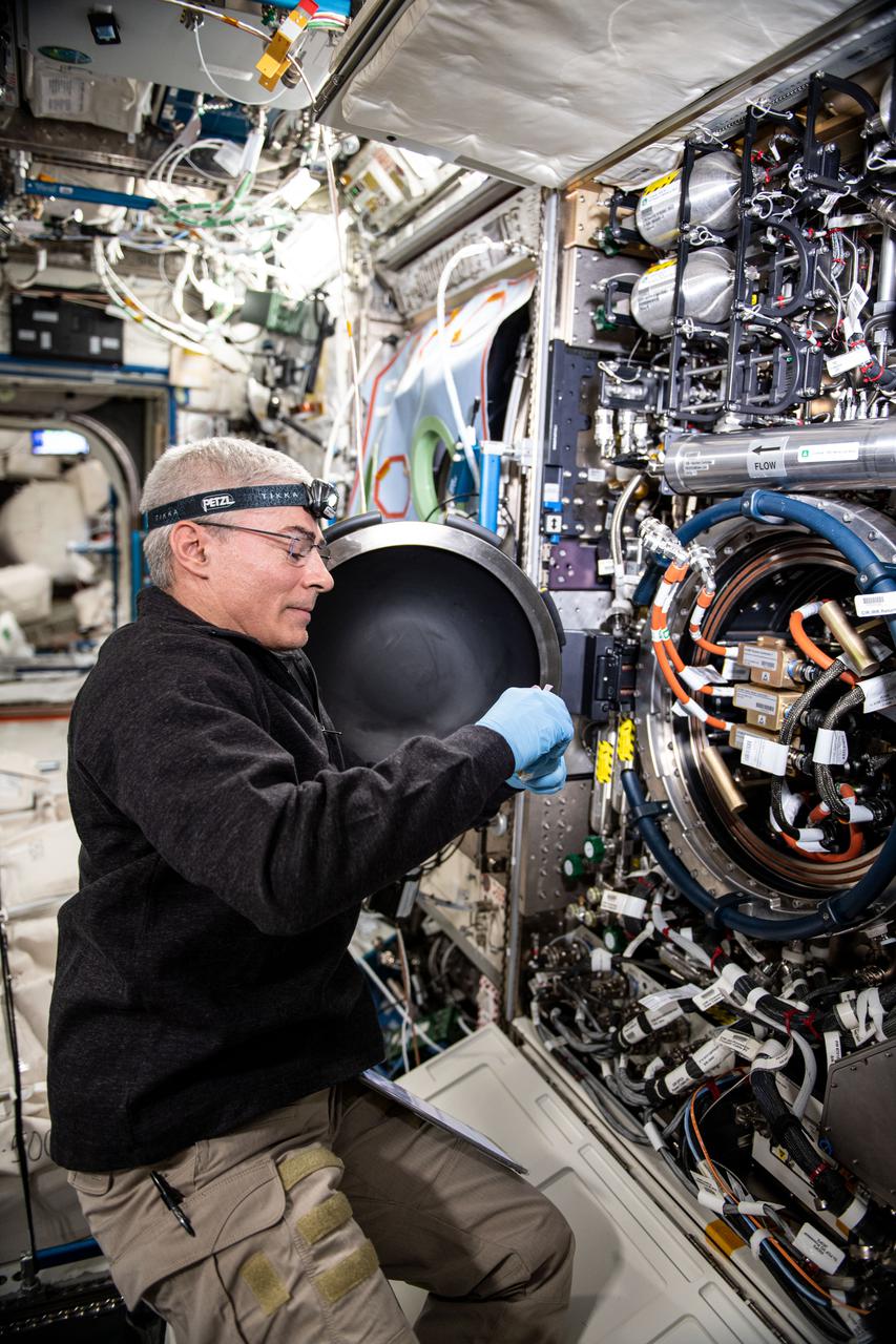
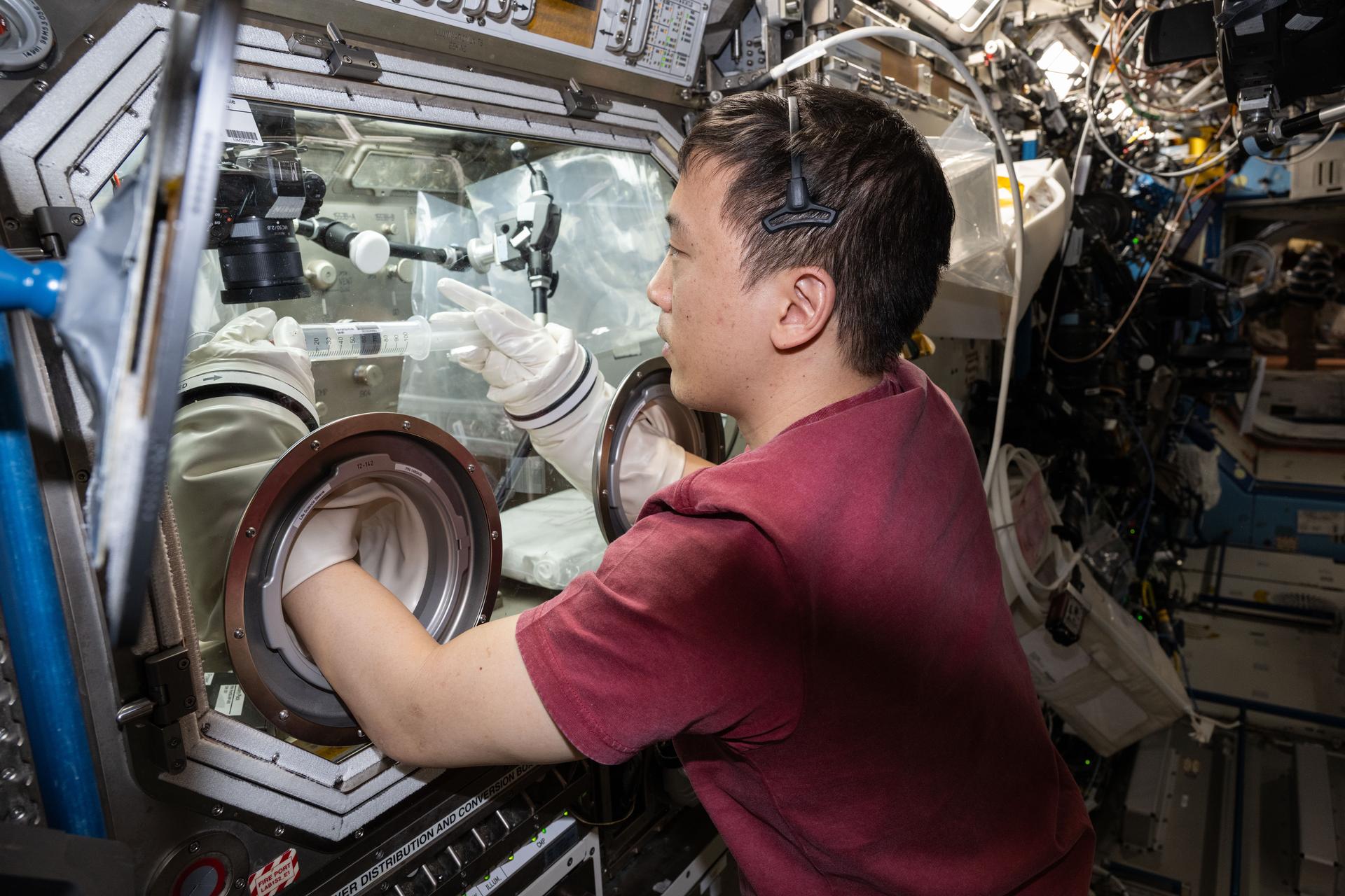
iss064e029405 (Feb. 3, 2021) --- NASA astronaut and Expedition 64 Flight Engineer Kate Rubins removes research hardware from inside the Combustion Integrated Rack. She was replacing gear to support a suite of fuel efficiency, pollution and fire safety studies known as the Advanced Combustion in Microgravity Experiments, or ACME.
Laura Judd, associate program manager for the Applied Sciences Health and Air Quality Applications in the Applied Sciences Program of NASA’s Earth Science Division, speaks during a briefing on NASA’s TEMPO (Tropospheric Emissions: Monitoring of Pollution) instrument, Tuesday, March 14, 2023 at the Smithsonian’s National Air and Space Museum in Washington. NASA’s TEMPO instrument, the first Earth Venture Instrument mission, will measure air pollution across North America from Mexico City to the Canadian oil sands and from the Atlantic to the Pacific hourly and at a high spatial resolution. A partnership between NASA and the Center for Astrophysics | Harvard & Smithsonian, TEMPO will launch on a commercial satellite to geostationary orbit as early as April. Photo Credit: (NASA/Joel Kowsky)
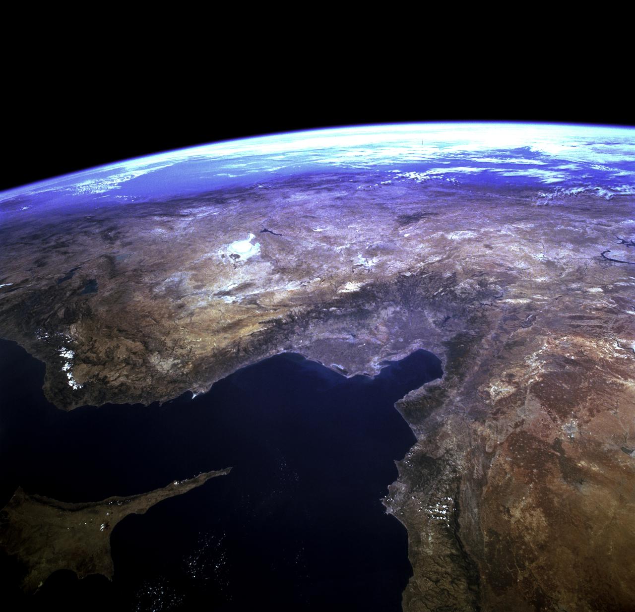
STS073-723-054 (21 October 1995) --- Central Turkey dominates this north-looking panorama, with the long fingered island of Cyprus lower left, surrounded by the deep blue waters of the Mediterranean Sea. Turkey's capital, Ankara, lies just north of the white bed of a dry lake in the center of the view. The city is supplied with water from the neighboring blue lake. The coast of Syria and Lebanon appear bottom right. Man-made lakes on the upper Euphrates River in eastern Turkey appear extreme right. According to scientists studying the STS-73 photo collection, the striking difference in visibility to north and south of Turkey suggests a pollution event over the Black Sea. Air pollution from East European industry flows down into the Black Sea basin, especially at the west end (haze top left) as shown in this view (compare clearer air top right).

Laura Judd, associate program manager for the Applied Sciences Health and Air Quality Applications in the Applied Sciences Program of NASA’s Earth Science Division, speaks during a briefing on NASA’s TEMPO (Tropospheric Emissions: Monitoring of Pollution) instrument, Tuesday, March 14, 2023 at the Smithsonian’s National Air and Space Museum in Washington. NASA’s TEMPO instrument, the first Earth Venture Instrument mission, will measure air pollution across North America from Mexico City to the Canadian oil sands and from the Atlantic to the Pacific hourly and at a high spatial resolution. A partnership between NASA and the Center for Astrophysics | Harvard & Smithsonian, TEMPO will launch on a commercial satellite to geostationary orbit as early as April. Photo Credit: (NASA/Joel Kowsky)
Chinese authorities shut down much of Harbin – a city of more than 10 million people – as unusually high levels of pollution shrouded the city and the surrounding region in mid-October, 2013. Measurements taken on October 20, 2013 scored the air quality index in the city at 500, the highest possible reading. Levels above 300 are considered hazardous to human health. The Moderate Resolution Imaging Spectroradiometer (MODIS) on NASA’s Aqua satellite acquired this true-color image of northeastern China on October 21. The brightest areas are fog, which is tinged with gray or yellow due to the air pollution. Other cloud-free areas have a pall of gray and brown smog that blots out the city and surrounding towns. Harbin lies under the Y-shaped patch of fog and smog in the south-central section of the image, completely obscured from view. Some neighborhoods experienced concentrations of fine particulate matter (PM 2.5) as high as 1,000 micrograms per cubic meter. For comparison the U.S. Environmental Protection Agency’s air quality standards state that PM 2.5 should remain below 35 micrograms per cubic meter. It is extremely rare for particulate levels to reach such high levels in the absence of a dust storm or forest fire. Chinese authorities grounded airplanes, shuttered thousands of schools and closed major roads in response to the surge in pollution. A few days after pollution levels started to rise, Harbin hospitals reported a 30 percent increase in admissions related to respiratory problems, and several Harbin pharmacies were sold out of pollution facemasks, according to media reports. Cold weather and lack of wind helped fuel the pollution outbreak, but human factors also played an important role. Wheat and corn farmers in the region light fires in the fall to burn off debris following the harvest. Also, city officials turned on Harbin’s city-wide, coal-powered heating system just prior to the pollution outbreak, according to China’s state-run Xinhua News Agency. Credit: NASA/GSFC/Jeff Schmaltz/MODIS Land Rapid Response Team <b><a href="http://www.nasa.gov/audience/formedia/features/MP_Photo_Guidelines.html" rel="nofollow">NASA image use policy.</a></b> <b><a href="http://www.nasa.gov/centers/goddard/home/index.html" rel="nofollow">NASA Goddard Space Flight Center</a></b> enables NASA’s mission through four scientific endeavors: Earth Science, Heliophysics, Solar System Exploration, and Astrophysics. Goddard plays a leading role in NASA’s accomplishments by contributing compelling scientific knowledge to advance the Agency’s mission. <b>Follow us on <a href="http://twitter.com/NASA_GoddardPix" rel="nofollow">Twitter</a></b> <b>Like us on <a href="http://www.facebook.com/pages/Greenbelt-MD/NASA-Goddard/395013845897?ref=tsd" rel="nofollow">Facebook</a></b> <b>Find us on <a href="http://instagram.com/nasagoddard?vm=grid" rel="nofollow">Instagram</a></b>
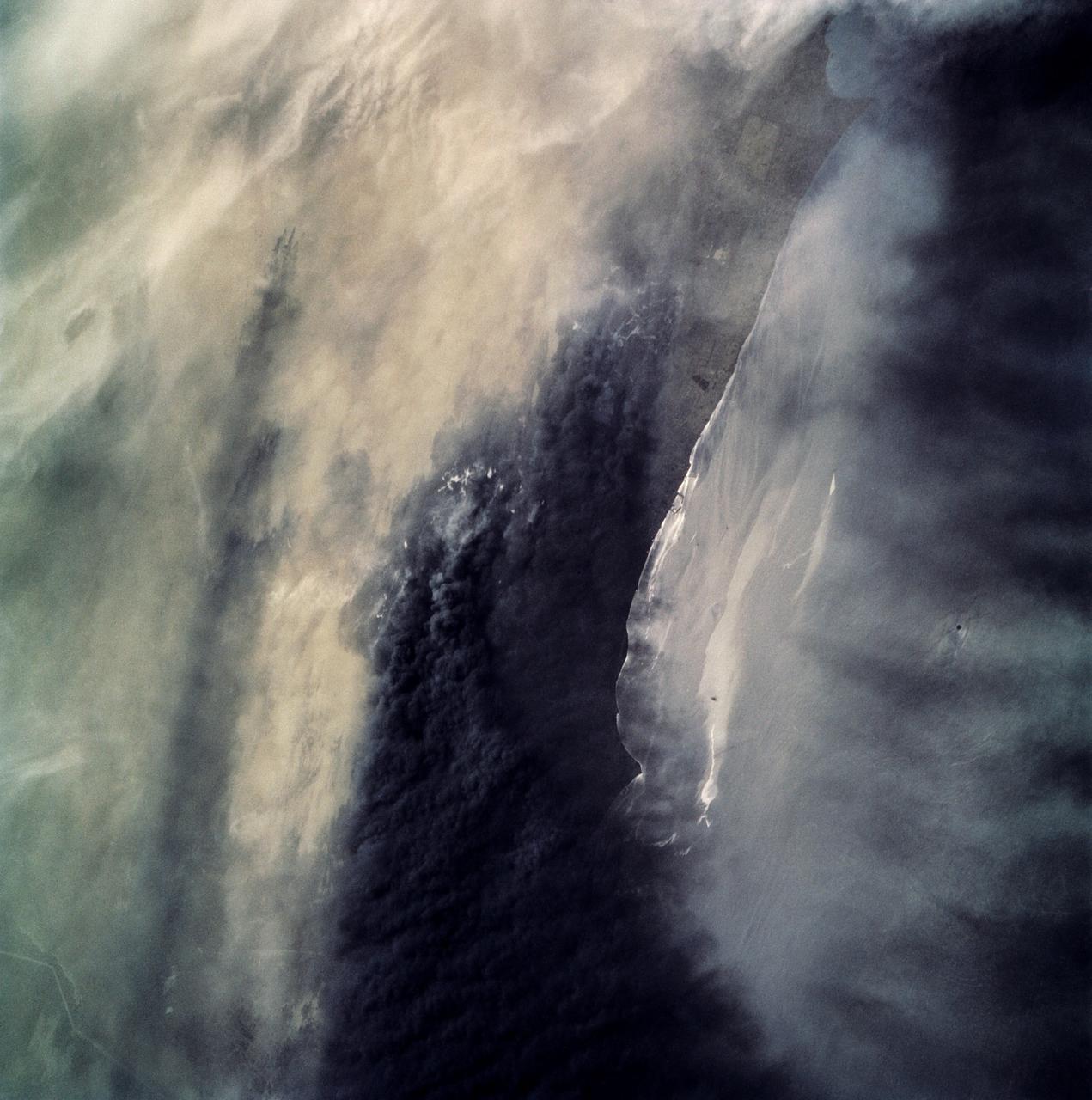
STS039-87-012 (28 April-6 May 1991) --- A handheld 70mm camera onboard the Space Shuttle Discovery exposed this infrared frame showing oil fires near the Kuwait coast as well as south-bound oil slicks in the Gulf. Pools of oil on the land are recognized as white objects near the burning wells.
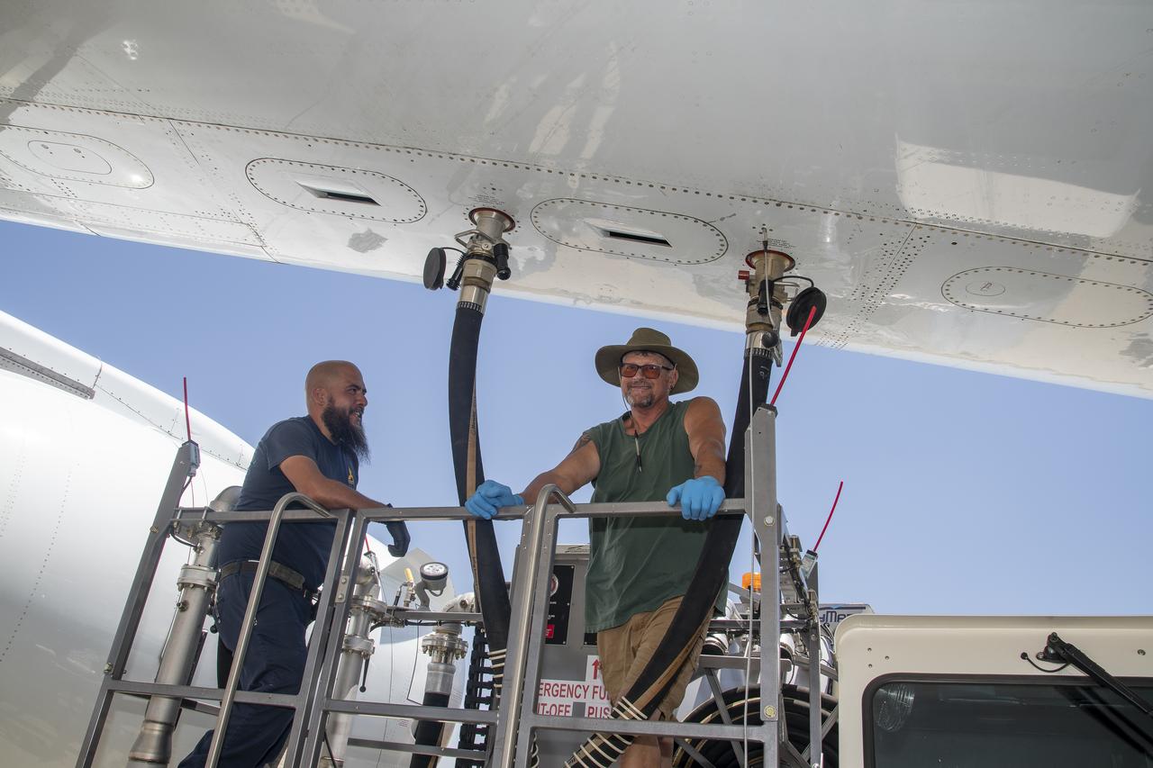
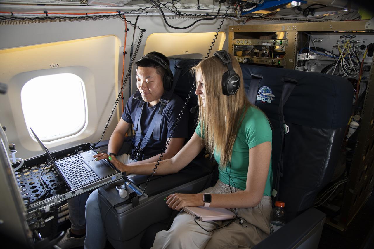
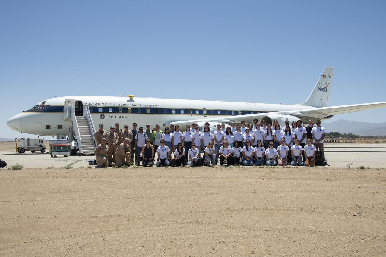
NASA Armstrong’s Student Airborne Research Program celebrates 15 years of success in 2023. An eight-week summer internship program, SARP offers upper-level undergraduate students the opportunity to acquire hands-on research experience as part of a scientific campaign using NASA Airborne Science Program flying science laboratories—aircraft outfitted specifically for research projects. Students onboard NASA’s DC-8 aircraft, the largest flying science laboratory in the world, help scientists from NOAA, the National Oceanic and Atmospheric Administration with a science project investigating air quality and non-vehicular pollution sources called AEROMMA, which measures Atmospheric Emissions and Reactions Observed from Megacities to Marine Areas. In 2023, NASA also introduced a sister program, SARP East to complement the West Coast program.
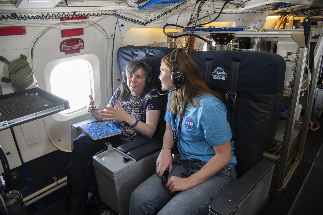
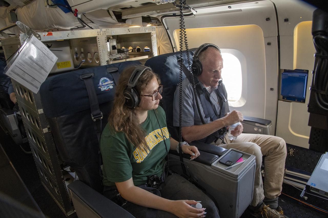
NASA Armstrong’s Student Airborne Research Program celebrates 15 years of success in 2023. An eight-week summer internship program, SARP offers upper-level undergraduate students the opportunity to acquire hands-on research experience as part of a scientific campaign using NASA Airborne Science Program flying science laboratories—aircraft outfitted specifically for research projects. Students onboard NASA’s DC-8 aircraft, the largest flying science laboratory in the world, help scientists from NOAA, the National Oceanic and Atmospheric Administration with a science project investigating air quality and non-vehicular pollution sources called AEROMMA, which measures Atmospheric Emissions and Reactions Observed from Megacities to Marine Areas. In 2023, NASA also introduced a sister program, SARP East to complement the West Coast program.
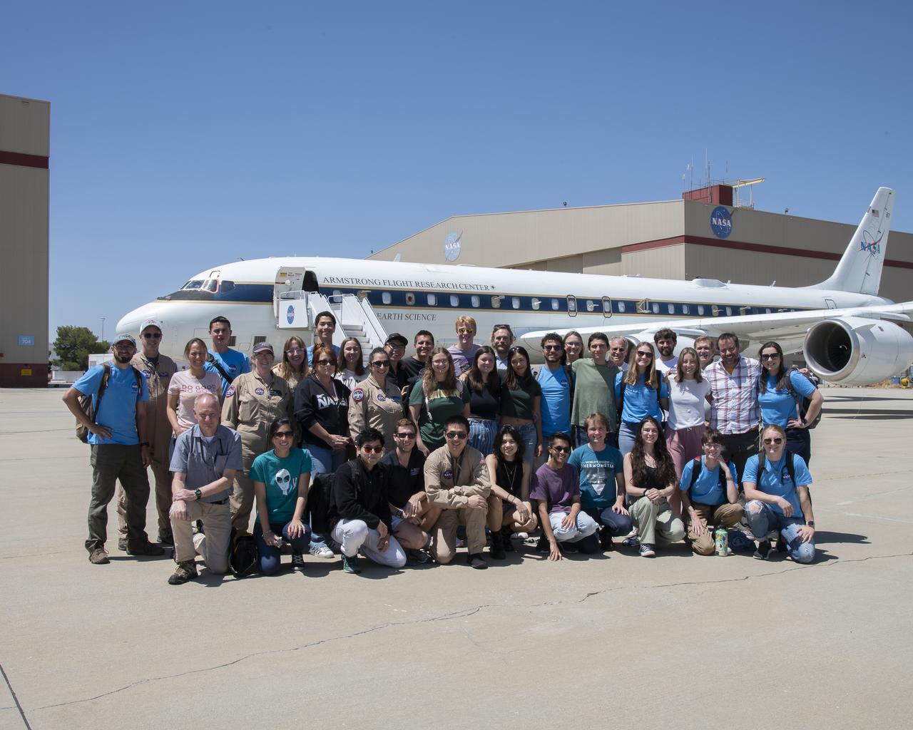
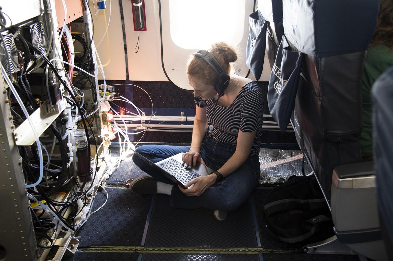
NASA Armstrong’s Student Airborne Research Program celebrates 15 years of success in 2023. An eight-week summer internship program, SARP offers upper-level undergraduate students the opportunity to acquire hands-on research experience as part of a scientific campaign using NASA Airborne Science Program flying science laboratories—aircraft outfitted specifically for research projects. Students onboard NASA’s DC-8 aircraft, the largest flying science laboratory in the world, help scientists from NOAA, the National Oceanic and Atmospheric Administration with a science project investigating air quality and non-vehicular pollution sources called AEROMMA, which measures Atmospheric Emissions and Reactions Observed from Megacities to Marine Areas. In 2023, NASA also introduced a sister program, SARP East to complement the West Coast program.
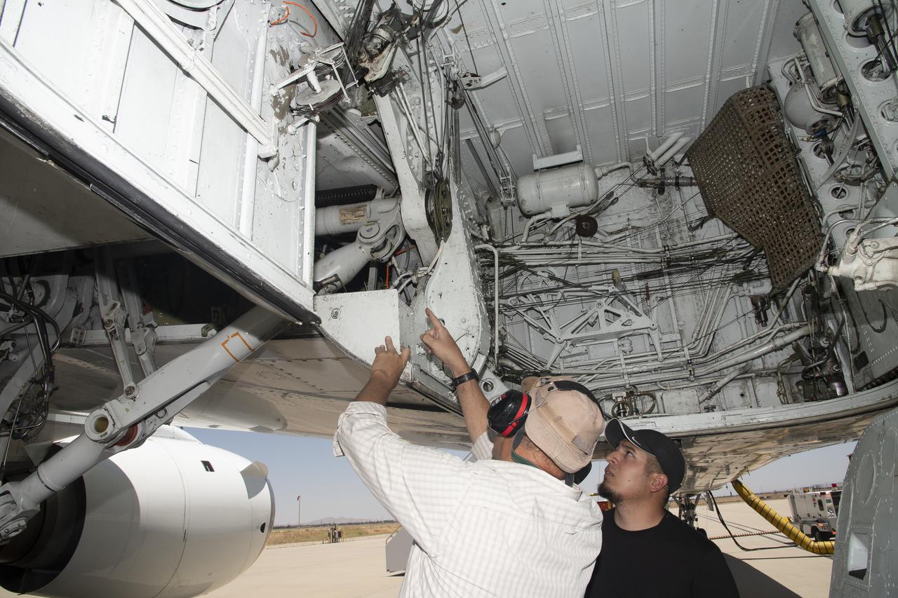
NASA Armstrong’s Student Airborne Research Program celebrates 15 years of success in 2023. An eight-week summer internship program, SARP offers upper-level undergraduate students the opportunity to acquire hands-on research experience as part of a scientific campaign using NASA Airborne Science Program flying science laboratories—aircraft outfitted specifically for research projects. Students onboard NASA’s DC-8 aircraft, the largest flying science laboratory in the world, help scientists from NOAA, the National Oceanic and Atmospheric Administration with a science project investigating air quality and non-vehicular pollution sources called AEROMMA, which measures Atmospheric Emissions and Reactions Observed from Megacities to Marine Areas. In 2023, NASA also introduced a sister program, SARP East to complement the West Coast program.
NASA Armstrong’s Student Airborne Research Program celebrates 15 years of success in 2023. An eight-week summer internship program, SARP offers upper-level undergraduate students the opportunity to acquire hands-on research experience as part of a scientific campaign using NASA Airborne Science Program flying science laboratories—aircraft outfitted specifically for research projects. Students onboard NASA’s DC-8 aircraft, the largest flying science laboratory in the world, help scientists from NOAA, the National Oceanic and Atmospheric Administration with a science project investigating air quality and non-vehicular pollution sources called AEROMMA, which measures Atmospheric Emissions and Reactions Observed from Megacities to Marine Areas. In 2023, NASA also introduced a sister program, SARP East to complement the West Coast program.
NASA Armstrong’s Student Airborne Research Program celebrates 15 years of success in 2023. An eight-week summer internship program, SARP offers upper-level undergraduate students the opportunity to acquire hands-on research experience as part of a scientific campaign using NASA Airborne Science Program flying science laboratories—aircraft outfitted specifically for research projects. Students onboard NASA’s DC-8 aircraft, the largest flying science laboratory in the world, help scientists from NOAA, the National Oceanic and Atmospheric Administration with a science project investigating air quality and non-vehicular pollution sources called AEROMMA, which measures Atmospheric Emissions and Reactions Observed from Megacities to Marine Areas. In 2023, NASA also introduced a sister program, SARP East to complement the West Coast program.
NASA Armstrong’s Student Airborne Research Program celebrates 15 years of success in 2023. An eight-week summer internship program, SARP offers upper-level undergraduate students the opportunity to acquire hands-on research experience as part of a scientific campaign using NASA Airborne Science Program flying science laboratories—aircraft outfitted specifically for research projects. Students onboard NASA’s DC-8 aircraft, the largest flying science laboratory in the world, help scientists from NOAA, the National Oceanic and Atmospheric Administration with a science project investigating air quality and non-vehicular pollution sources called AEROMMA, which measures Atmospheric Emissions and Reactions Observed from Megacities to Marine Areas. In 2023, NASA also introduced a sister program, SARP East to complement the West Coast program.

NASA Armstrong’s Student Airborne Research Program celebrates 15 years of success in 2023. An eight-week summer internship program, SARP offers upper-level undergraduate students the opportunity to acquire hands-on research experience as part of a scientific campaign using NASA Airborne Science Program flying science laboratories—aircraft outfitted specifically for research projects. Students onboard NASA’s DC-8 aircraft, the largest flying science laboratory in the world, help scientists from NOAA, the National Oceanic and Atmospheric Administration with a science project investigating air quality and non-vehicular pollution sources called AEROMMA, which measures Atmospheric Emissions and Reactions Observed from Megacities to Marine Areas. In 2023, NASA also introduced a sister program, SARP East to complement the West Coast program.
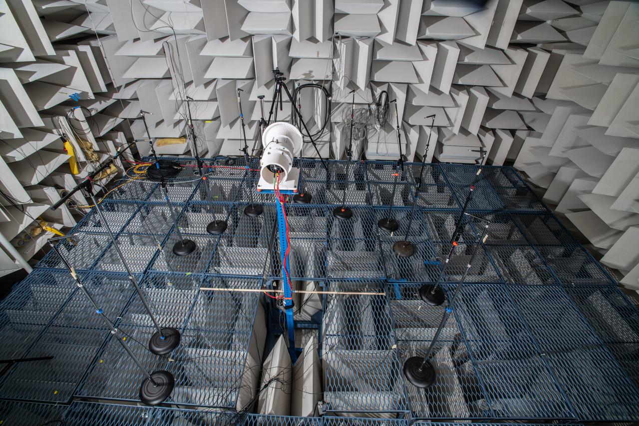
The Quiet Electric Engine V1 (QUEEN V1) experiment that was performed in the NASA GRC Acoustical Testing Laboratory (ATL). Equipment is installed in the anechoic chamber and in the adjacent control room. In response to the pervasive health and environmental problems associated with aviation noise and air pollution, NASA’s Quiet Electric Engine (QUEEN) team is working to increase the peace and quiet in the world by researching ways to make engines for large single-aisle aircraft safer, cleaner, and quieter.

iss049e006037 (Sep. 17, 2016) --- Cloud-Aerosol Transport System (CATS) mounted on the Japanese Experiment Module's Exposed Facility (JEM-EF). The CATS investigation uses a light detection and ranging (LiDAR) system to measure the location, composition and distribution of pollution, dust, smoke, aerosols and other particulates in the atmosphere. CATS is used to study the atmospheric constituents that impact global climate. By gaining a better understanding of cloud and aerosol coverage, scientists can create a better model of the Earth's climate feedback processes.
A group of university students and mentors flew aboard NASA Armstrong Flight Research Center’s DC-8 aircraft to study air quality as part of NASA’s Student Airborne Research Program (SARP). Based at NASA’s Armstrong Building 703 in Palmdale, California, the DC-8 flew over the Central Valley to measure pollution and monitor air quality on Tuesday, June 21, 2022.
iss064e025973 (Jan., 25, 2021) --- NASA astronaut and Expedition 64 Flight Engineer Kate Rubins services hardware inside the Unity module to support a suite of combustion investigations known as Advanced Combustion Microgravity Experiments, or ACME. The ACME project is a set of six independent studies of gaseous flames that may help to improve fuel efficiency, reduce pollution and prevent spacecraft fires.
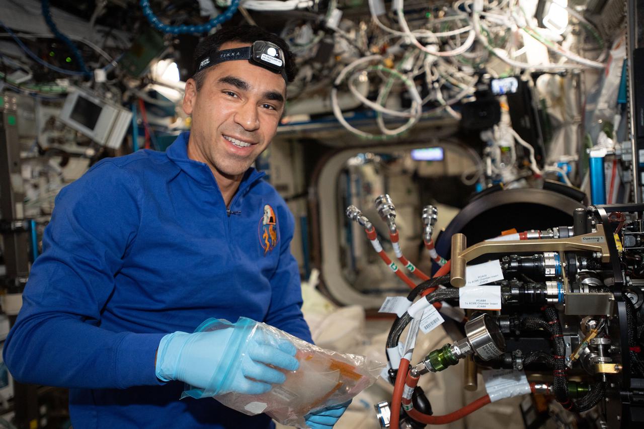
iss066e114415 (Jan. 6, 2022) --- NASA astronaut and Expedition 66 Flight Engineer Raja Chari replaces hardware inside the Combustion Integrated Rack that supports the ACME (Advanced Combustion via Microgravity Experiments) study. ACME is a series of six independent studies of gaseous flames seeking to improve fuel efficiency, reduce pollution, and promote spacecraft fire prevention.

The Quiet Electric Engine V1 (QUEEN V1) experiment that was performed in the NASA GRC Acoustical Testing Laboratory (ATL). Equipment is installed in the anechoic chamber and in the adjacent control room. In response to the pervasive health and environmental problems associated with aviation noise and air pollution, NASA’s Quiet Electric Engine (QUEEN) team is working to increase the peace and quiet in the world by researching ways to make engines for large single-aisle aircraft safer, cleaner, and quieter.
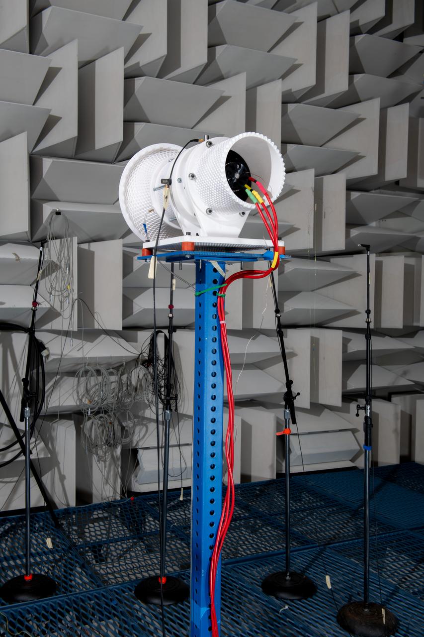
The Quiet Electric Engine V1 (QUEEN V1) experiment that was performed in the NASA GRC Acoustical Testing Laboratory (ATL). Equipment is installed in the anechoic chamber and in the adjacent control room. In response to the pervasive health and environmental problems associated with aviation noise and air pollution, NASA’s Quiet Electric Engine (QUEEN) team is working to increase the peace and quiet in the world by researching ways to make engines for large single-aisle aircraft safer, cleaner, and quieter.
jsc2013e090265 (Sep. 26, 2013) --- Cloud Aerosol Transport System (CATS) at NASA's Johnson Space Center undergoing payload fit-check and Support Equipment Installation (SEI). The CATS investigation uses a light detection and ranging (LiDAR) system to measure the location, composition and distribution of pollution, dust, smoke, aerosols and other particulates in the atmosphere. CATS is used to study the atmospheric constituents that impact global climate. By gaining a better understanding of cloud and aerosol coverage, scientists can create a better model of the Earth's climate feedback processes.
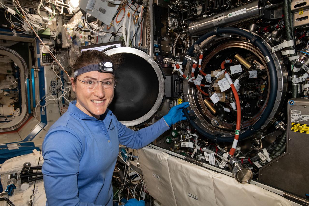
iss059e017127 (April 9, 2018) --- NASA astronaut and Expedition 59 Flight Engineer Christina Koch works inside the U.S. Destiny laboratory module's Combustion Integrated Rack. She was replacing hardware for a series of experiments collectively known as Advanced Combustion via Microgravity Experiments (ACME). ACME is a set of six independent studies researching improved fuel efficiency and reduced pollutant production in practical combustion on Earth, as well as spacecraft fire prevention through innovative research focused on materials flammability.
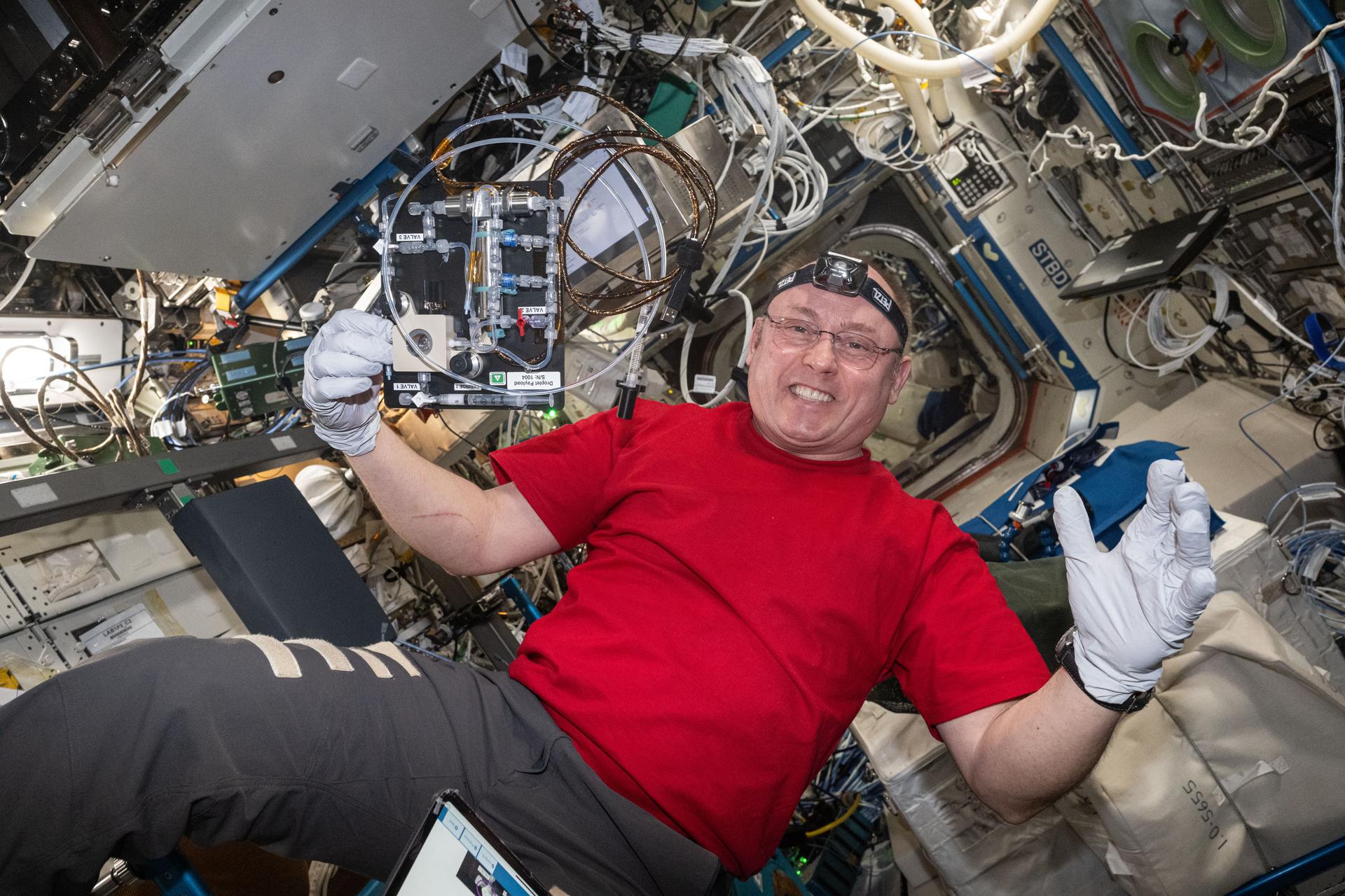
iss073e1193970 (Nov. 25, 2025) --- NASA astronaut and Expedition 73 Flight Engineer Mike Fincke smiles for a portrait during research operations for the Droplets fluid physics investigation. Fincke was inside the International Space Station's Destiny laboratory module exploring how particles behave inside fluids. The microgravity study may inform commercial in-space manufacturing techniques and improve optical materials and pollution removal operations.
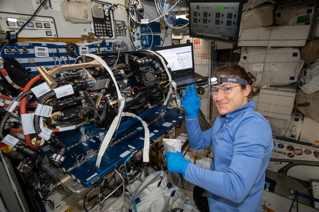
iss059e017072 (April 9, 2018) --- NASA astronaut and Expedition 59 Flight Engineer Christina Koch works on the Unity module's Maintenance Work Area where the Advanced Combustion via Microgravity Experiments (ACME) Chamber Insert was attached for hardware replacement. ACME is a set of five independent studies researching improved fuel efficiency and reduced pollutant production in practical combustion on Earth, as well as spacecraft fire prevention through innovative research focused on materials flammability.
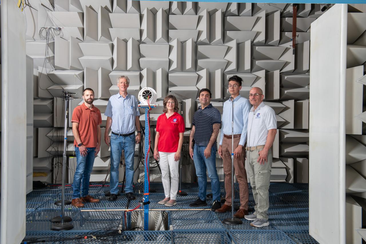
The Quiet Electric Engine V1 (QUEEN V1) experiment that was performed in the NASA GRC Acoustical Testing Laboratory (ATL). Equipment is installed in the anechoic chamber and in the adjacent control room. In response to the pervasive health and environmental problems associated with aviation noise and air pollution, NASA’s Quiet Electric Engine (QUEEN) team is working to increase the peace and quiet in the world by researching ways to make engines for large single-aisle aircraft safer, cleaner, and quieter.
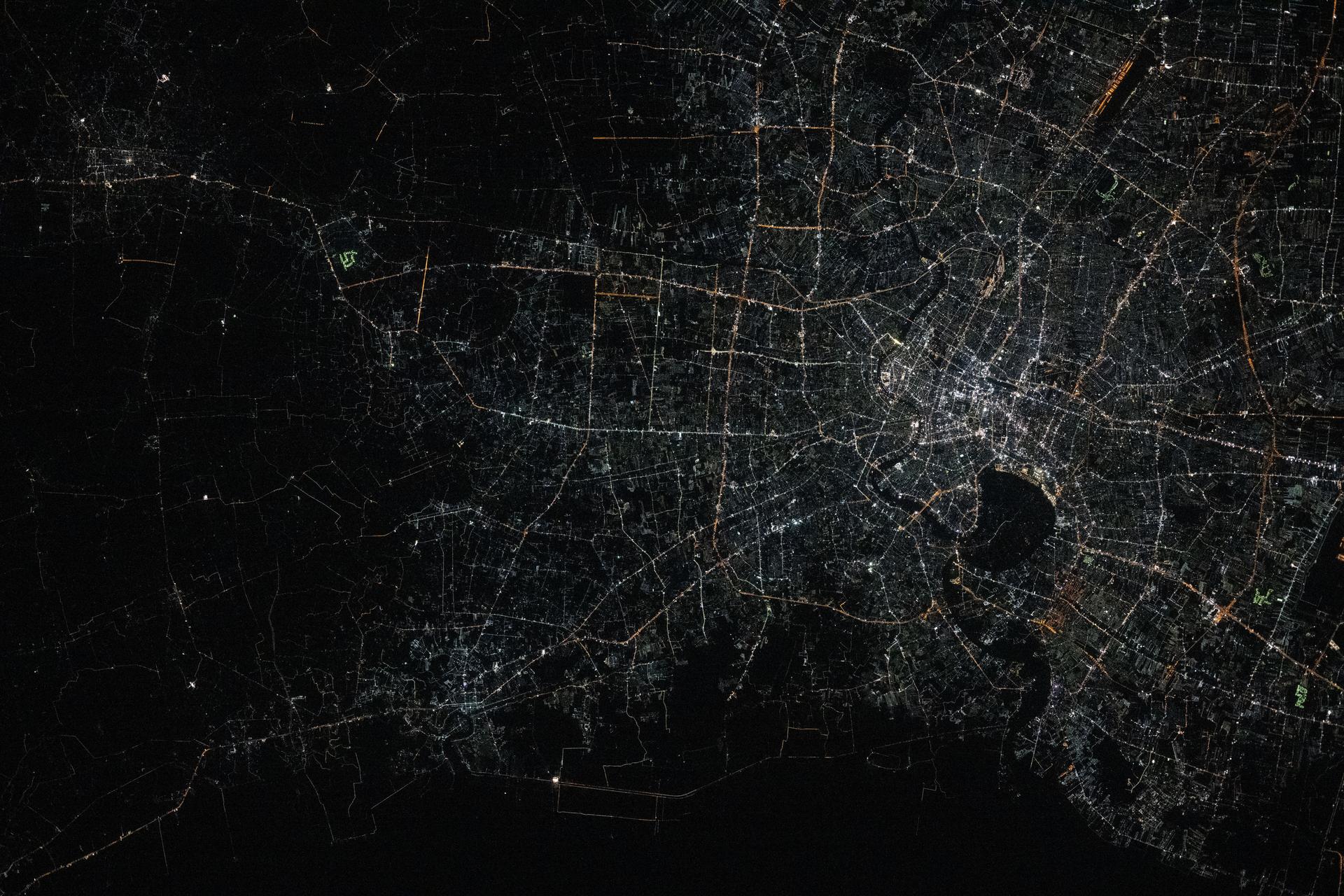
iss072e757257 (March 5, 2025) --- Bangkok, Thailand—with a metropolitan population of about 11.4 million and split by the Chao Phraya river—is pictured from the International Space Station at approximately 1:48 a.m. local time as it orbited 257 miles above the Southeast Asian nation. The dark area toward the center-right is part of the Phra Pradaeng District, a lush, green peninsula known as Bang Krachao. Preserved as an urban green space, it helps mitigate Bangkok’s pollution and urban density.
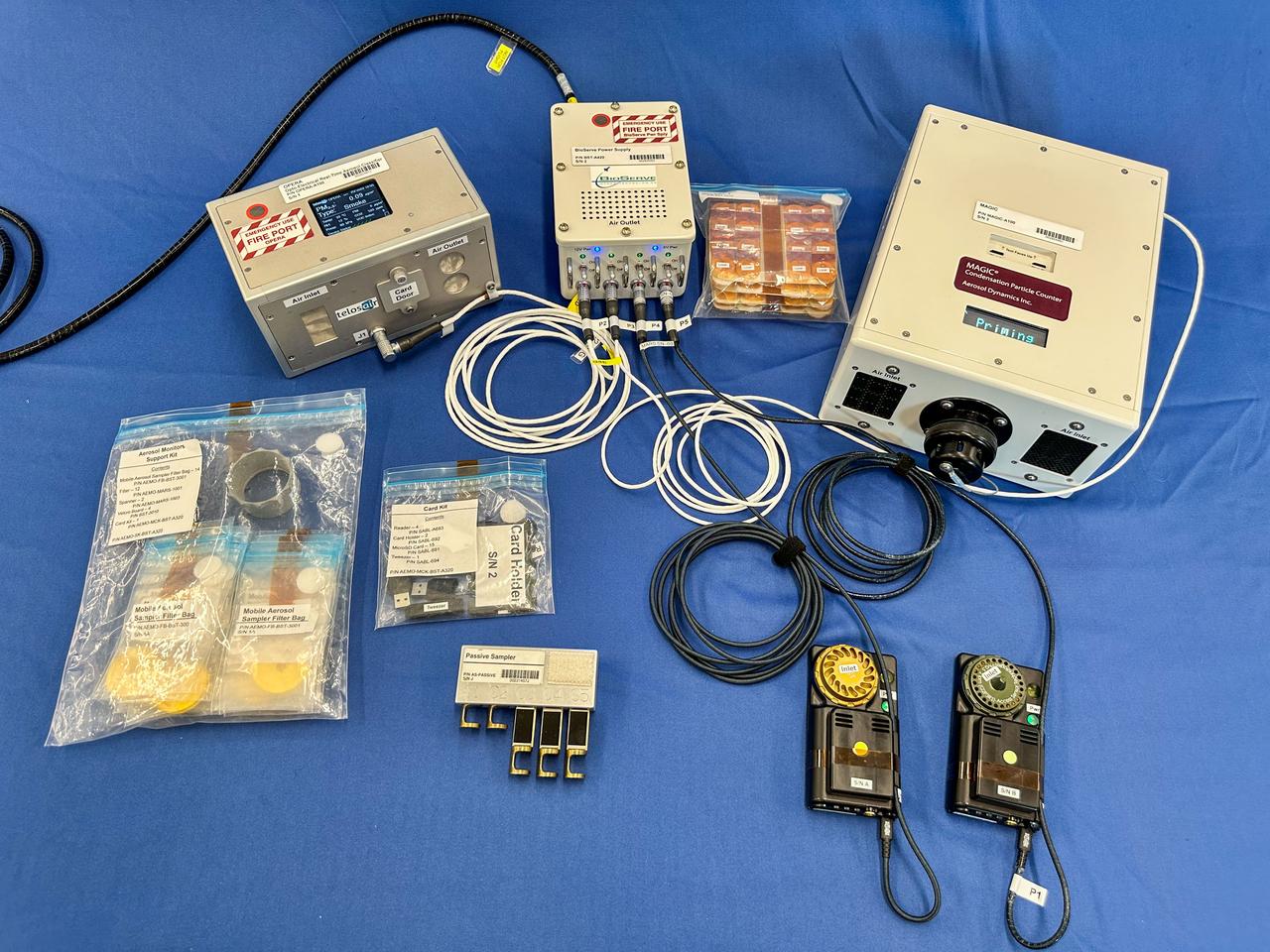
jsc2025e036188 (2/3/2025) --- A preflight image of the Exploration Aerosol Monitors (ExAM) hardware which includes the Moderated Aerosol Growth with Internal water Cycling (MAGIC) particle counter, the OPto-electrical Realtime Aerosol classifier (OPERA), the Mobile Aerosol Reference Samplers (MARS). Aerosol Monitors demonstrates technologies to continuously monitor the concentration of airborne pollutant particles, which must be kept within safe ranges, inside the International Space Station. Image courtesy of BioServe.
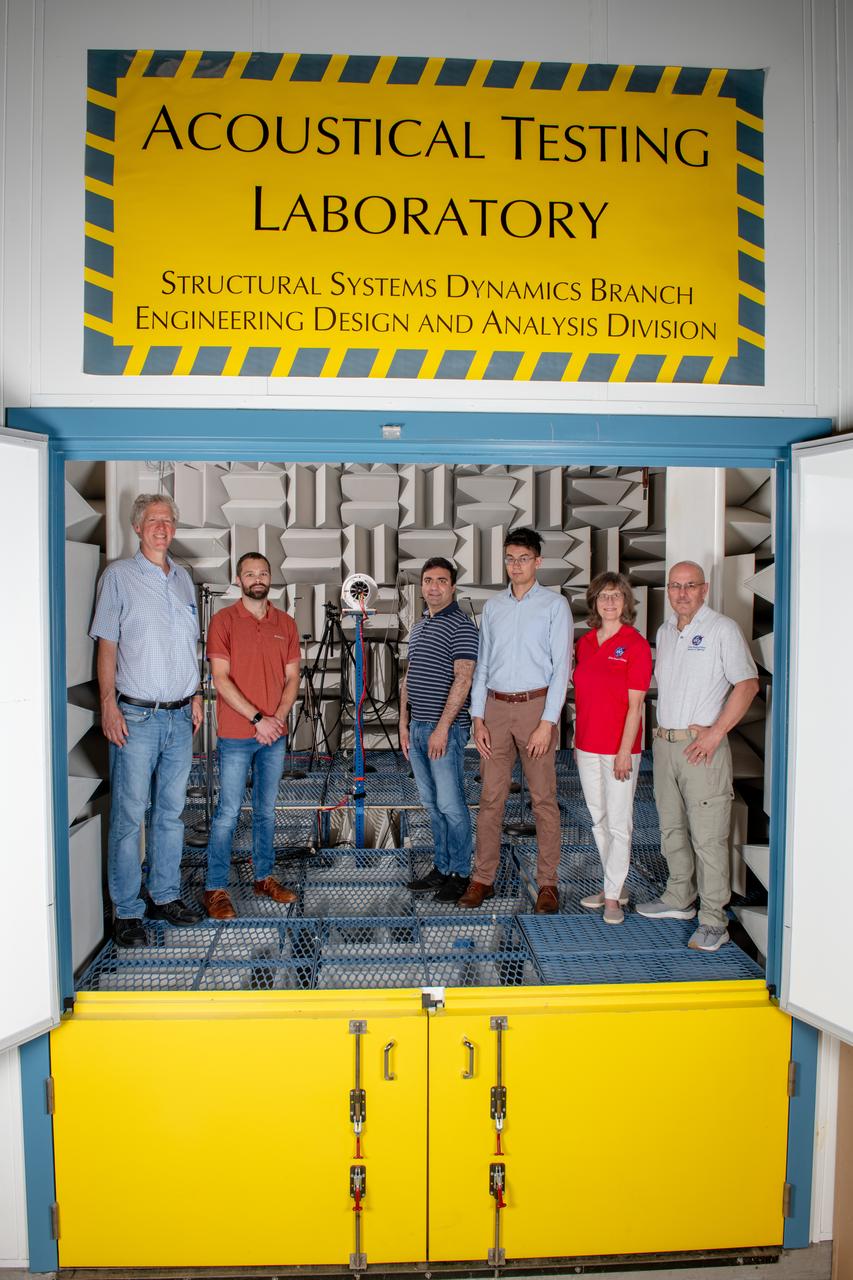
The Quiet Electric Engine V1 (QUEEN V1) experiment that was performed in the NASA GRC Acoustical Testing Laboratory (ATL). Equipment is installed in the anechoic chamber and in the adjacent control room. In response to the pervasive health and environmental problems associated with aviation noise and air pollution, NASA’s Quiet Electric Engine (QUEEN) team is working to increase the peace and quiet in the world by researching ways to make engines for large single-aisle aircraft safer, cleaner, and quieter.
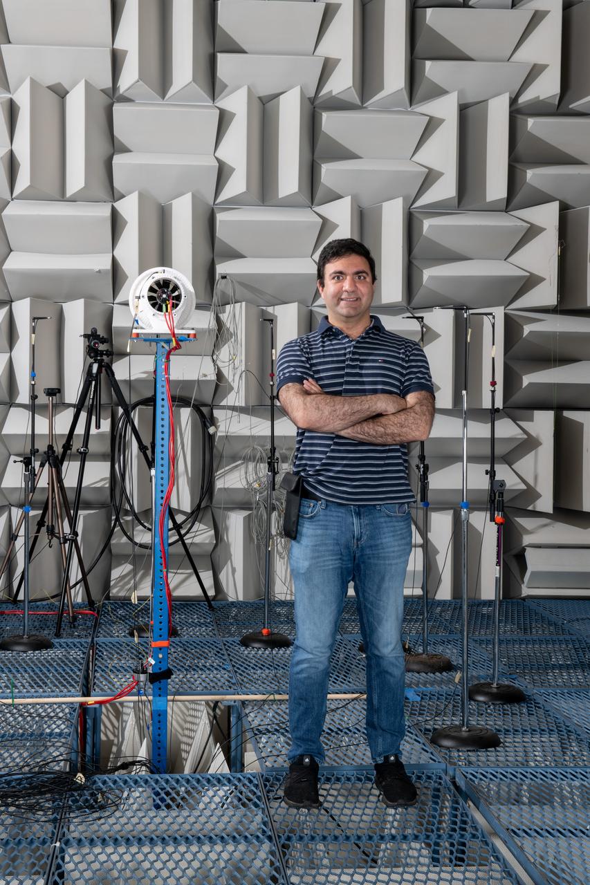
The Quiet Electric Engine V1 (QUEEN V1) experiment that was performed in the NASA GRC Acoustical Testing Laboratory (ATL). Equipment is installed in the anechoic chamber and in the adjacent control room. In response to the pervasive health and environmental problems associated with aviation noise and air pollution, NASA’s Quiet Electric Engine (QUEEN) team is working to increase the peace and quiet in the world by researching ways to make engines for large single-aisle aircraft safer, cleaner, and quieter. Posing with the experiment is aerospace engineer, Jonathan M. Goodman.
iss059e085880 (May 31, 2019) --- NASA astronaut Nick Hague replaces hardware inside the Combustion Integrated Rack supporting the Advanced Combustion via Microgravity Experiments (ACME). ACME is a set of five independent studies researching improved fuel efficiency and reduced pollutant production in practical combustion on Earth, as well as spacecraft fire prevention through innovative research focused on materials flammability.
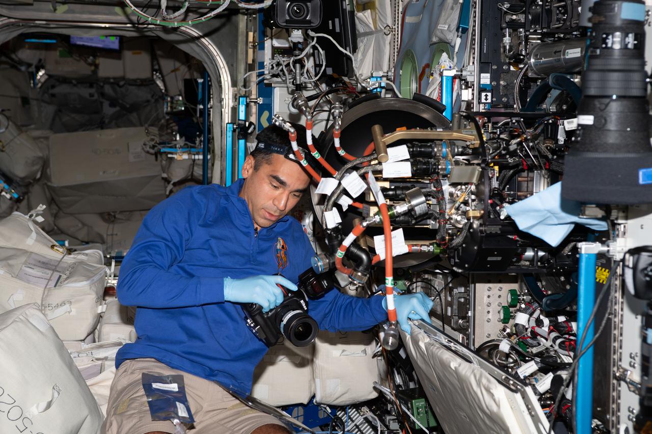
iss066e114301 (Jan. 17, 2022) --- NASA astronaut and Expedition 66 Flight Engineer Raja Chari replaces hardware inside the Combustion Integrated Rack that supports the ACME (Advanced Combustion via Microgravity Experiments) study. ACME is a series of six independent studies of gaseous flames seeking to improve fuel efficiency, reduce pollution, and promote spacecraft fire prevention.
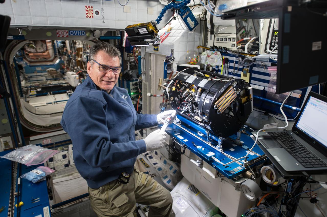
iss053e098185 (Oct. 12, 2017) --- Flight Engineer Paolo Nespoli works inside the Harmony module to configure the Combustion Integrated Rack and enable the Advanced Combustion Microgravity Experiment (ACME). The primary and secondary goals of ACME are the improved fuel efficiency and reduced pollutant production in practical combustion on Earth, and spacecraft fire prevention through innovative research focused on materials flammability.
iss064e022911 (Jan. 14, 2021) --- NASA astronaut and Expedition 64 Flight Engineer Kate Rubins sets up the ACME (Advanced Combustion via Microgravity Experiments) study inside the U.S. Destiny laboratory module's Combustion Integrated Rack. ACME is a set of six independent studies exploring ways to increase fuel efficiency, reduce pollutants and improve fire safety on Earth and in space.
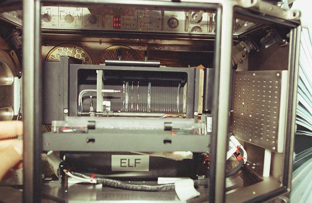
The goal of the ELF investigation is to improve our fundamental understanding of the effects of the flow environment on flame stability. The flame's stability refers to the position of its base and ultimately its continued existence. Combustion research focuses on understanding the important hidden processes of ignitions, flame spreading, and flame extinction. Understanding these processes will directly affect the efficiency of combustion operations in converting chemical energy to heat and will create a more balanced ecology and healthy environment by reducing pollutants emitted during combustion.
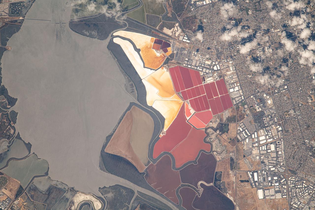
iss069e053745 (August 3, 2023) -- The South Bay Salt Ponds in the city of Newark, California show their vivid red and yellow-orange colors that primarily come from the microorganisms and brine shrimp in the waters. More than 16,500 acres are part of a restoration project— the largest in the West Coast—that includes pollution reduction, habitat expansion, and flood control. Expedition 69 Flight Engineer Woody Hoburg captured this image as the International Space Station orbited 260 miles above the coast of the Bay Area.
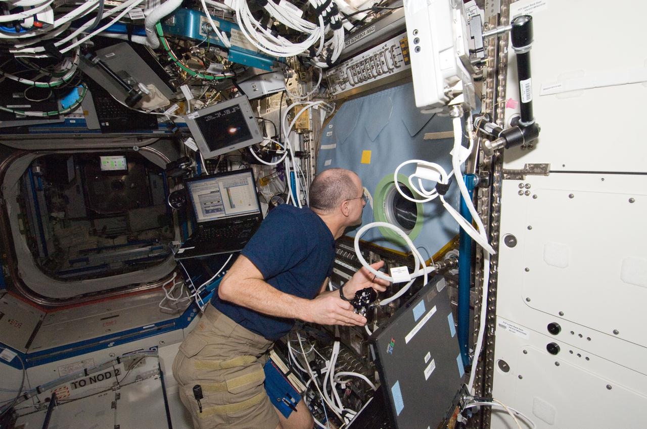
ISS030-E-128918 (9 March 2012) --- NASA astronaut Don Pettit, Expedition 30 flight engineer, works with the Structure and Liftoff In Combustion Experiment (SLICE) at the Microgravity Sciences Glovebox (MSG) in the Destiny laboratory of the International Space Station. Pettit conducted three sets of flame tests, followed by a fan calibration. This test will lead to increased efficiency and reduced pollutant emission for practical combustion devices.
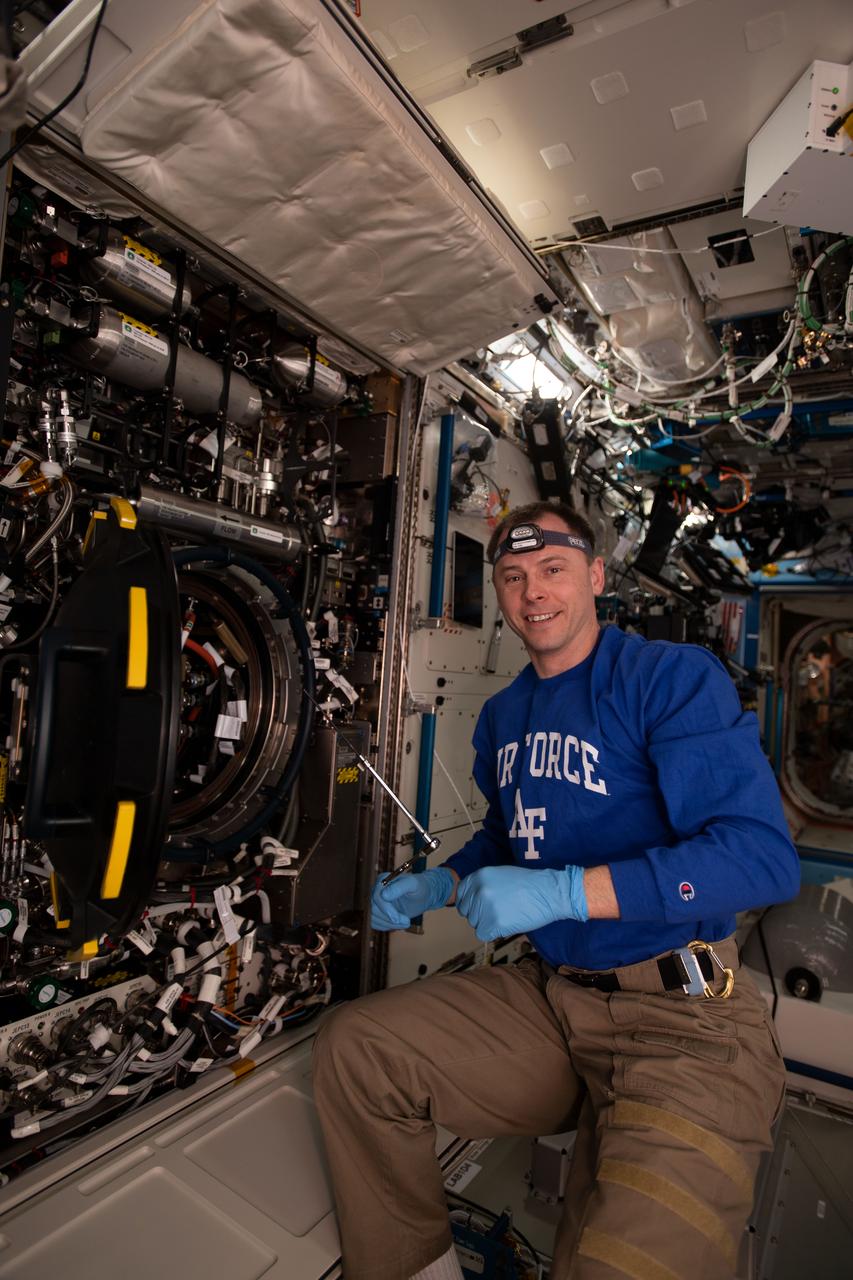
iss065e369687 (Sept. 8, 2021) ----NASA astronaut and Expedition 65 Flight Engineer Mark Vande Hei replaces an igniter inside the U.S. Destiny laboratory module's Combustion Integrated Rack for the ACME series of space combustion studies. ACME, or the Advanced Combustion via Microgravity Experiments, is a set of six independent studies of gaseous flames that seeks to improve fuel efficiency and reduce pollutants on Earth, and improve spacecraft fire prevention by focusing on decreasing the flammability of materials.
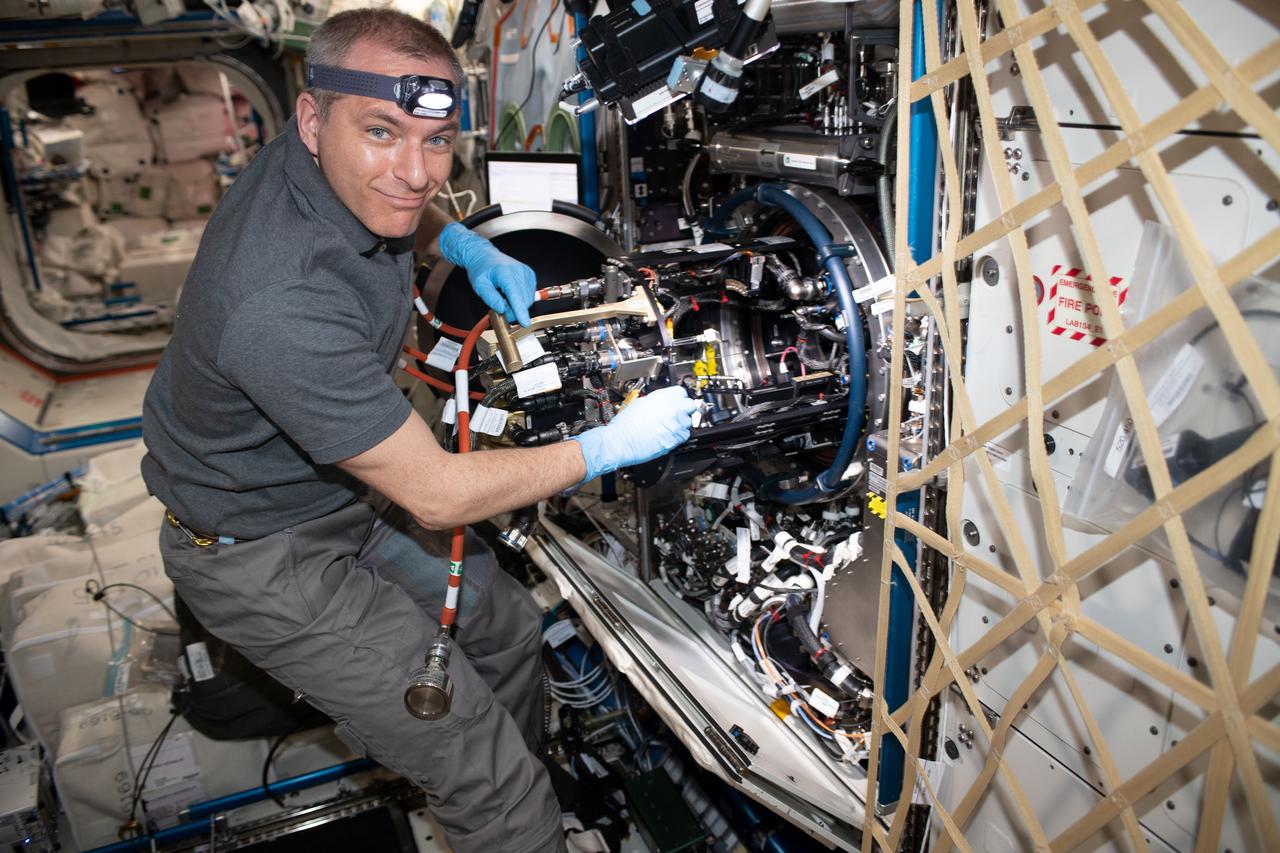
iss059e060847 (May 12, 2019) --- Astronaut David Saint-Jacques of the Canadian Space Agency works on the Combustion Integrated Rack located inside the U.S. Destiny laboratory module. Saint-Jacques was working on hardware supporting the Advanced Combustion via Microgravity Experiments (ACME). ACME is a set of five independent studies of gaseous flames exploring improved fuel efficiency, reduced pollution and spacecraft fire prevention.
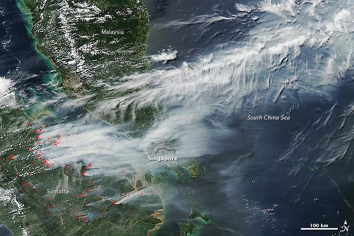
On June 19, 2013, NASA’s Aqua satellite captured a striking image of smoke billowing from illegal wildfires on the Indonesian island of Sumatra. The smoke blew east toward southern Malaysia and Singapore, and news media reported that thick clouds of haze had descended on Singapore, pushing pollution levels to record levels. Singapore’s primary measure of pollution, the Pollutant Standards Index (PSI)—a uniform measure of key pollutants similar to the Air Quality Index (AQI) used by the U.S. Environmental Protection Agency—spiked to 371 on the afternoon of June 20, 2013, the highest level ever recorded. The previous record occurred in 1997, when the index hit 226. Health experts consider any level above 300 to be “hazardous” to human health. Levels above 200 are considered “very unhealthy.” The image above was captured by the Moderate Resolution Imaging Spectroradiometer (MODIS), an instrument that observes the entire surface of Earth’s every 1 to 2 days. The image was captured during the afternoon at 6:30 UTC (2:30 p.m. local time). Though local laws prohibit it, farmers in Sumatra often burn forests during the dry season to prepare soil for new crops. The BBC reported that Singapore’s Prime Minister Lee Hsien Loong warned that the haze could “easily last for several weeks and quite possibly longer until the dry season ends in Sumatra.” NASA image by Jeff Schmaltz, LANCE/EOSDIS Rapid Response. Caption by Adam Voiland. Credit: <b><a href="http://www.earthobservatory.nasa.gov/" rel="nofollow"> NASA Earth Observatory</a></b> Instrument: Aqua - MODIS <b><a href="http://www.nasa.gov/audience/formedia/features/MP_Photo_Guidelines.html" rel="nofollow">NASA image use policy.</a></b> <b><a href="http://www.nasa.gov/centers/goddard/home/index.html" rel="nofollow">NASA Goddard Space Flight Center</a></b> enables NASA’s mission through four scientific endeavors: Earth Science, Heliophysics, Solar System Exploration, and Astrophysics. Goddard plays a leading role in NASA’s accomplishments by contributing compelling scientific knowledge to advance the Agency’s mission. <b>Follow us on <a href="http://twitter.com/NASA_GoddardPix" rel="nofollow">Twitter</a></b> <b>Like us on <a href="http://www.facebook.com/pages/Greenbelt-MD/NASA-Goddard/395013845897?ref=tsd" rel="nofollow">Facebook</a></b> <b>Find us on <a href="http://instagram.com/nasagoddard?vm=grid" rel="nofollow">Instagram</a></b>
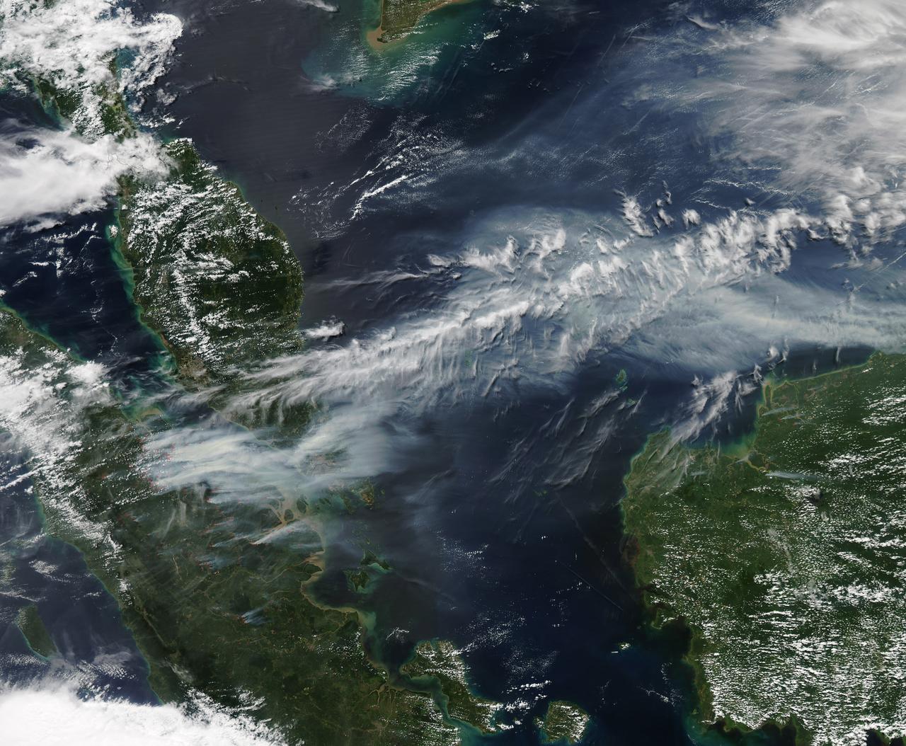
On June 19, 2013, NASA’s Aqua satellite captured a striking image of smoke billowing from illegal wildfires on the Indonesian island of Sumatra. The smoke blew east toward southern Malaysia and Singapore, and news media reported that thick clouds of haze had descended on Singapore, pushing pollution levels to record levels. Singapore’s primary measure of pollution, the Pollutant Standards Index (PSI)—a uniform measure of key pollutants similar to the Air Quality Index (AQI) used by the U.S. Environmental Protection Agency—spiked to 371 on the afternoon of June 20, 2013, the highest level ever recorded. The previous record occurred in 1997, when the index hit 226. Health experts consider any level above 300 to be “hazardous” to human health. Levels above 200 are considered “very unhealthy.” The image above was captured by the Moderate Resolution Imaging Spectroradiometer (MODIS), an instrument that observes the entire surface of Earth’s every 1 to 2 days. The image was captured during the afternoon at 6:30 UTC (2:30 p.m. local time). Though local laws prohibit it, farmers in Sumatra often burn forests during the dry season to prepare soil for new crops. The BBC reported that Singapore’s Prime Minister Lee Hsien Loong warned that the haze could “easily last for several weeks and quite possibly longer until the dry season ends in Sumatra.” NASA image by Jeff Schmaltz, LANCE/EOSDIS Rapid Response. Caption by Adam Voiland. Credit: <b><a href="http://www.earthobservatory.nasa.gov/" rel="nofollow"> NASA Earth Observatory</a></b> Instrument: Aqua - MODIS <b><a href="http://www.nasa.gov/audience/formedia/features/MP_Photo_Guidelines.html" rel="nofollow">NASA image use policy.</a></b> <b><a href="http://www.nasa.gov/centers/goddard/home/index.html" rel="nofollow">NASA Goddard Space Flight Center</a></b> enables NASA’s mission through four scientific endeavors: Earth Science, Heliophysics, Solar System Exploration, and Astrophysics. Goddard plays a leading role in NASA’s accomplishments by contributing compelling scientific knowledge to advance the Agency’s mission. <b>Follow us on <a href="http://twitter.com/NASA_GoddardPix" rel="nofollow">Twitter</a></b> <b>Like us on <a href="http://www.facebook.com/pages/Greenbelt-MD/NASA-Goddard/395013845897?ref=tsd" rel="nofollow">Facebook</a></b> <b>Find us on <a href="http://instagram.com/nasagoddard?vm=grid" rel="nofollow">Instagram</a></b>
JPL-led study shows bromine explosion on March 13, 2008 across the western Northwest Territories in Canada looking toward the Mackenzie Mountains at the horizon, which prevented the bromine from crossing over into Alaska.
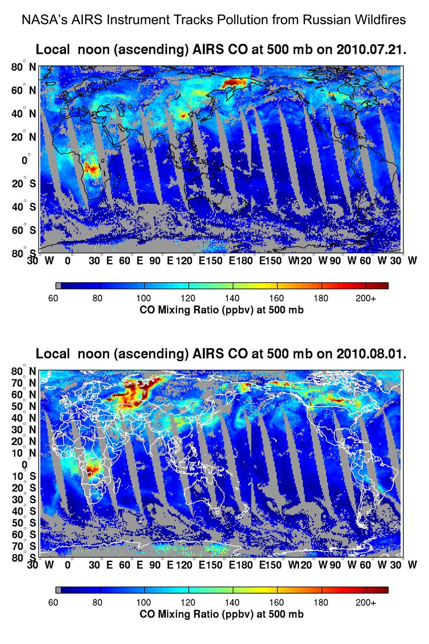
NASA Aqua spacecraft tracked the concentration and transport of carbon monoxide from Russian fires in 2010, during which time some 558 fires were burning.
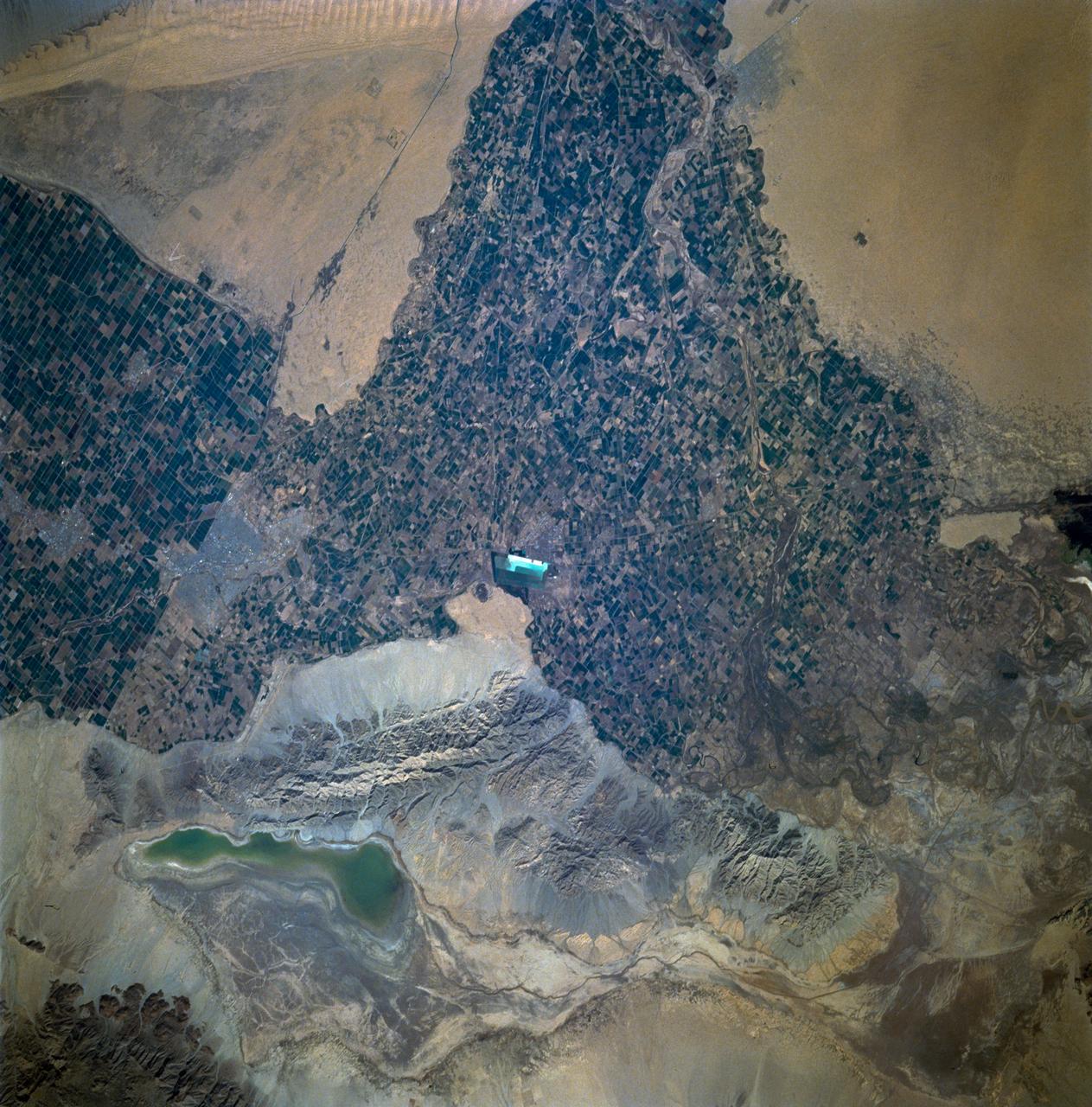
STS060-93-081 (3-11 Feb 1994)--- The Imperial Valley was documented using three films - color visible (seen here), the American infrared film (Kodak Aerochrome 2443), and the Russian panchromatic infrared film (SN-10). Results of this test still await detailed science analysis. However it does appear that good data was acquired of the region, and this data will be complemented by photography acquired by the Mir cosmonauts. In this frame, the U.S.-Mexico border goes from the upper left to the middle right. It is discernible as a vegetation line between Calexico, California and Mexicali, Mexico. The darker vegetation north of that line is due to different agricultural practices, heavier uses of fertilizers and pesticides, and lined (tiled) agricultural fields allowing subterraneean runoff of saline irrigation runoff. South of the line, the more polluted water draining out of the U.S. agricultural areas into the Mexican area has resulted in higher soil salinities and a consequent reduction in agricultural productivity. At the center of the frame, a large settling and desalinization plant has been built to attempt to purify, to some degree, the polluted irrigation waters draining south out of California. The All-American Canal, which brings in water from the Colorado River (off the frame, to the right), is located in the middle right hand portion of the frame. To the upper left is the normally dry Laguna Salada.

ISS011-E-12401 (10 July 2005) --- Gulf of Finland is featured in this image photographed by an Expedition 11 crew member on the international space station. This strongly oblique view shows the Gulf of Finland and Lake Ladoga in the sunglint of late afternoon. The image was taken from the station when the position of the craft lay north of the Caspian Sea, approximately 2,500 kilometers to the southeast on the Russia–Kazakhstan border. The Neva River appears in sunglint, connecting Lake Ladoga to the gulf. Although not visible, St. Petersburg—the home town of Sergei Krikalev, space station commander when this picture was taken—lies on the Neva River delta. In this view taken with a powerful 400 millimeter lens, sunglint even reveals the causeways to Kotlin Island in the gulf—including some of the details of their construction. Oblique views reveal marked layers of gray haze generated by air pollution, a common sight over Western Europe. Pollution also renders the bright glint areas a copper color.
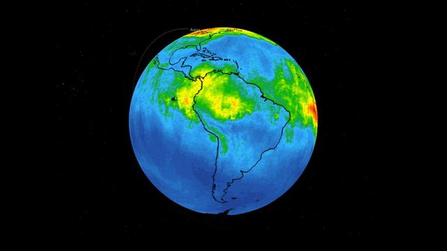
This time series shows carbon monoxide associated with fires from the Amazon region in Brazil from Aug. 8-22, 2019. The images show carbon monoxide at an hPA — a common unit of measurement for atmospheric pressure — of 500, or approximately 18,000 feet (5,500 meters) altitude, made with data collected from the Atmospheric Infrared Sounder (AIRS) on NASA's Aqua satellite. Each "day" in the series is made by averaging three day's-worth of measurements, a technique used to eliminate data gaps. As the series progresses, the carbon monoxide plume blooms in the northwest Amazon region then drifts south and east in a more concentrated plume toward Sao Paulo. Green indicates concentrations of carbon monoxide at approximately 100 parts per billion by volume (ppbv), yellow at approximately 120 ppbv, and dark red at approximately 160 ppbv. It must be noted that local values can be significantly higher. Carbon monoxide is a pollutant that can be transported large distances and persist in the atmosphere for about one month. It plays a role in both air pollution and climate change. Movie available at https://photojournal.jpl.nasa.gov/catalog/PIA23356
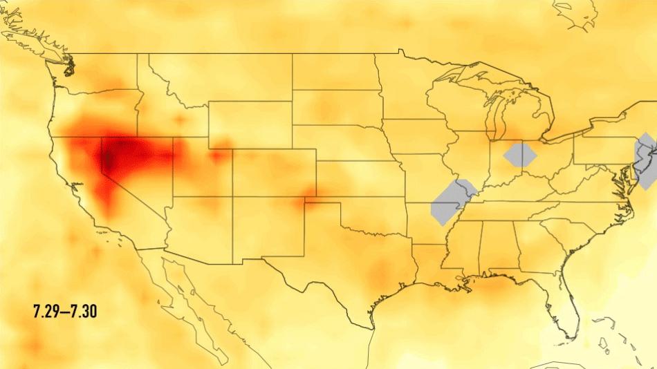
This single frame from a series of images shows carbon monoxide (in orange/red) from California's massive wildfires drifting east across the U.S. between July 30 and August 7, 2018. It was produced using data from the Atmospheric Infrared Sounder (AIRS) on NASA's Aqua satellite. AIRS measures concentrations of carbon monoxide that have been lofted high into the atmosphere. These images show the carbon monoxide at a 500 hPa pressure level, or an altitude of approximately 18,000 feet (5,500 meters). As the time series progresses, we see that this carbon monoxide is drifting east with one branch moving toward Texas and the other forking to the northeast. The high end of the scale is set to 200 parts per billion by volume (ppbv); however, local values can be significantly higher. Carbon monoxide is a pollutant that can persist in the atmosphere for about one month and can be transported large distances. It plays a role in both air pollution and climate change. An animation and single frames are available at https://photojournal.jpl.nasa.gov/catalog/PIA22492
Barry Lefer, tropospheric composition program manager in the Earth Science Division of NASA’s Science Mission Directorate, at podium, answers a question during a briefing on NASA’s TEMPO (Tropospheric Emissions: Monitoring of Pollution) instrument along with Caroline Nowlan, atmospheric physicist at the Center for Astrophysics | Harvard & Smithsonian, left, Karen St. Germain, director of the Earth Science Division of NASA’s Science Mission Directorate, second from left, Laura Judd, associate program manager for the Applied Sciences Health and Air Quality Applications in the Applied Sciences Program of NASA’s Earth Science Division, third from right, Erika Wright, education specialist at the Center for Astrophysics | Harvard & Smithsonian, second from right, and Karen Fox, NASA Public Affairs Officer, right, Tuesday, March 14, 2023 at the Smithsonian’s National Air and Space Museum in Washington. NASA’s TEMPO instrument, the first Earth Venture Instrument mission, will measure air pollution across North America from Mexico City to the Canadian oil sands and from the Atlantic to the Pacific hourly and at a high spatial resolution. A partnership between NASA and the Center for Astrophysics | Harvard & Smithsonian, TEMPO will launch on a commercial satellite to geostationary orbit as early as April. Photo Credit: (NASA/Joel Kowsky)
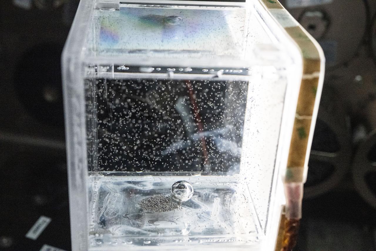
iss073e0917376 (Oct. 20, 2025) --- Tiny ball bearings surround a larger central bearing during the Fluid Particles experiment, conducted inside the Microgravity Science Glovebox (MSG) aboard the International Space Station’s Destiny laboratory module. A bulk container installed in the MSG, filled with viscous fluid and embedded particles, is subjected to oscillating frequencies to observe how the particles cluster and form larger structures in microgravity. Insights from this research may advance fire suppression, lunar dust mitigation, and plant growth in space. On Earth, the findings could inform our understanding of pollen dispersion, algae blooms, plastic pollution, and sea salt transport during storms.
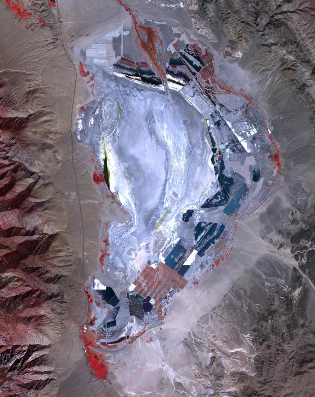
Prior to 1913, Owens Lake in eastern California had water up to a depth of 15 m, and covered an area of 280 km2. With the construction of the Los Angeles Aqueduct, all of the water from the Owens River was diverted to Los Angeles, and the lake dessicated, leading to dust storms that caused the worst air pollution in the state. Starting in 2002, various mitigation efforts were undertaken, including re-vegetation, flooding to create shallow ponds, and surface saturation to rehydrate the top layers. The ASTER image was acquired on September 29, 2020. It covers an area of 25.6 by 32.3 km, and is located at 36.4 degrees north, 117.9 degrees west. https://photojournal.jpl.nasa.gov/catalog/PIA24733
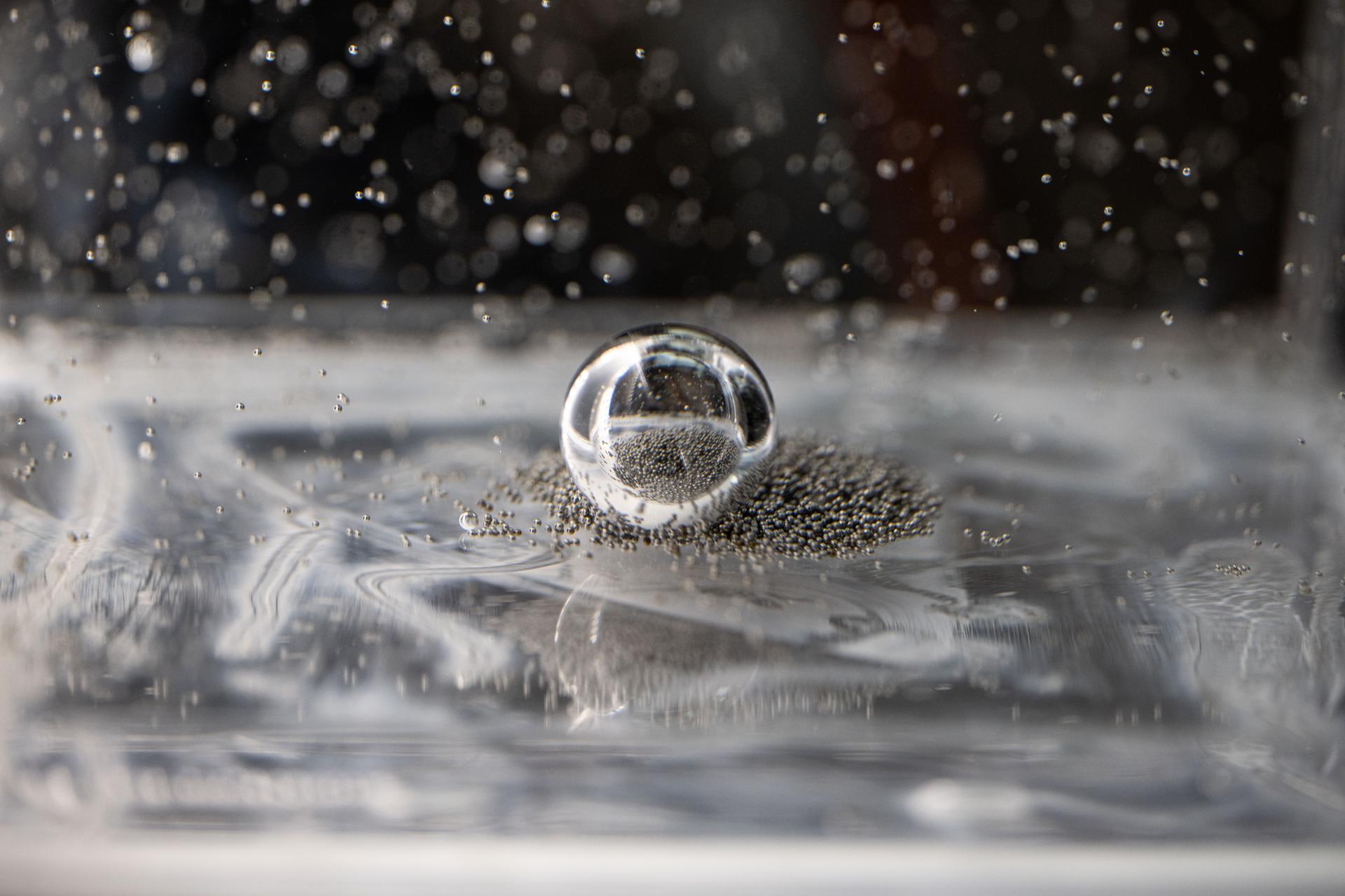
iss073e0917381 (Oct. 20, 2025) --- Tiny ball bearings surround a larger central bearing during the Fluid Particles experiment, conducted inside the Microgravity Science Glovebox (MSG) aboard the International Space Station’s Destiny laboratory module. A bulk container installed in the MSG, filled with viscous fluid and embedded particles, is subjected to oscillating frequencies to observe how the particles cluster and form larger structures in microgravity. Insights from this research may advance fire suppression, lunar dust mitigation, and plant growth in space. On Earth, the findings could inform our understanding of pollen dispersion, algae blooms, plastic pollution, and sea salt transport during storms.
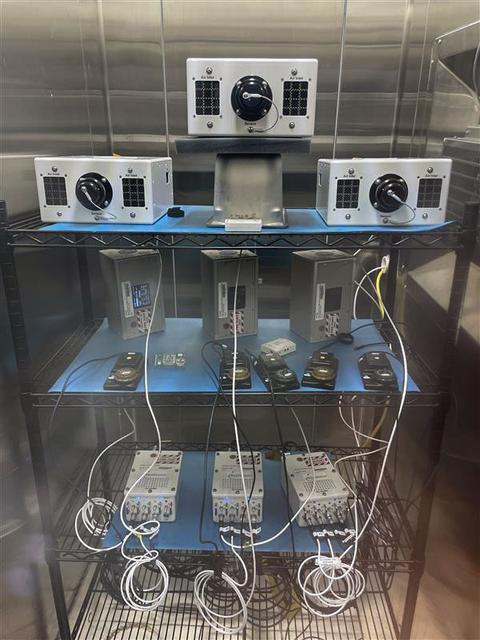
jsc2025e036187 (4/4/2025) --- The Exploration Aerosol Monitors (ExAM) hardware in BioServe Space Technologies’ environmental chamber: the Moderated Aerosol Growth with Internal water Cycling (MAGIC) particle counter (x3; top), the OPto-electrical Realtime Aerosol classifier (OPERA, x3; middle, back), the Mobile Aerosol Reference Samplers (MARS, x5; middle, front); power supplies (bottom). Aerosol Monitors demonstrates technologies to continuously monitor the concentration of airborne pollutant particles, which must be kept within safe ranges, inside the International Space Station.
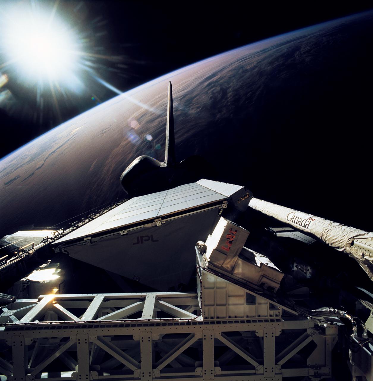
STS068-267-079 (30 September-11 October 1994) --- The rear windows of the Space Shuttle Endeavour reflect sunlight in this view of part of the cargo bay, 115 nautical miles above the Earth. The Space Radar Laboratory (SRL-2) Multipurpose Experiment Support Structure (MPESS) is seen at bottom frame. Also partially seen are other experiments including other components of the primary payload. They are the antenna for the Spaceborne Imaging Radar (SIR-C), the X-band Synthetic Aperture Radar (X-SAR), the device for Measurement of Air Pollution from Satellites (MAPS) and some Getaway Special (GAS) canisters.
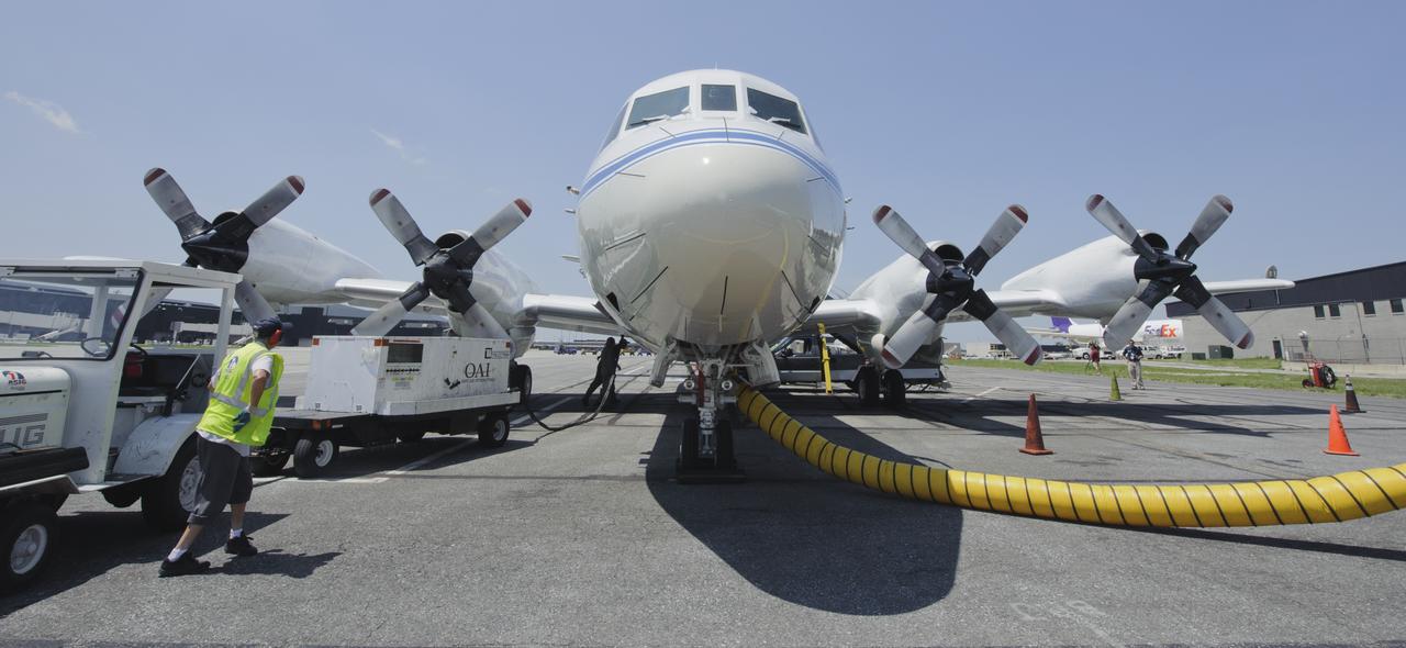
A 117-foot P-3B NASA research aircraft is seen on the tarmac at Baltimore/Washington International Thurgood Marshall Airport, Tuesday, June 28, 2011, in Baltimore, Md. The aircraft is part of a month-long field campaign designed to improve satellite measurements of air pollution. The name of the experiment -- Deriving Information on Surface conditions from Column and Vertically Resolved Observations Relevant to Air Quality (DISCOVER -- AQ) -- is a mouthful, but its purpose is simple. Come July, the aircraft will be flying spirals over six ground stations in Maryland. Photo Credit: (NASA/Paul E. Alers)

On top of Mauna Kea Volcano, Big Island of Hawai'I, are located the Mauna Kea Observatories, with thirteen telescopes. The site's 4205 m elevation, and lack of light pollution make it one of the most ideal locations for astronomical observations. Start of construction of the new Thirty Meter Telescope was delayed in July due to protests by Native Hawaiians who consider the mountain to be one of their most sacred sites. Image data for the perspective view was acquired April 23, 2019, and is located at 19.8 degrees north, 155.5 degrees west. https://photojournal.jpl.nasa.gov/catalog/PIA23339
iss073e0917782 (Oct. 23, 2025) --- NASA astronaut and Expedition 73 Flight Engineer Jonny Kim conducts research operations for the Fluid Particles investigation inside the Microgravity Science Glovebox aboard the International Space Station's Destiny laboratory module. The fluid physics experiment may help researchers understand how particles in a liquid interface come together to form larger structures or clusters in microgravity advancing fire suppression, lunar dust control, and plant growth in space. Earth benefits may include insights into pollen behavior, algae blooms, plastic pollution, and sea salt transfer during storms.