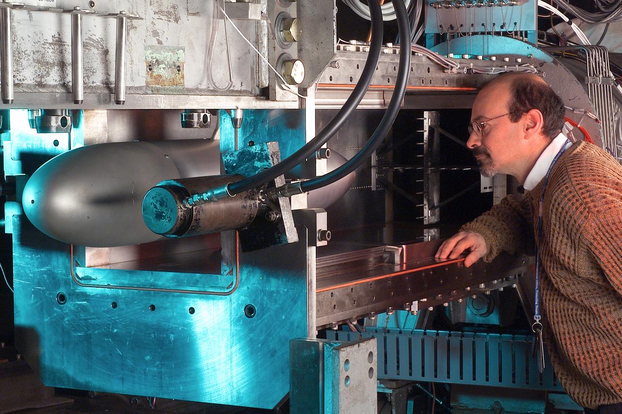
A researcher stands next to the Pulsed Ejector Wave Propagation Test Rig in an opened section of the 1'x1' Supersonic Wind Tunnel at NASA Glenn Research Center.
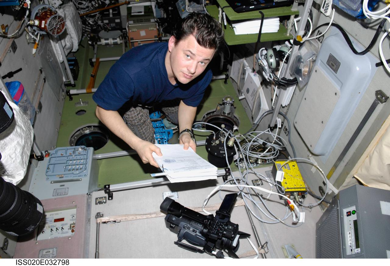
ISS020-E-032798 (21 Aug. 2009) --- Cosmonaut Roman Romanenko, Expedition 20 flight engineer, works with video equipment and a Russian payload TkhN-7 Self-Propagating High-Temperature Synthesis in the Zvezda Service Module of the International Space Station.
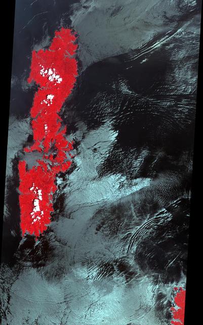
The false-color VNIR image from NASA Terra spacecraft was acquired off the island of Tsushima in the Korea Strait shows the signatures of several internal wave packets, indicating a northern propagation direction.
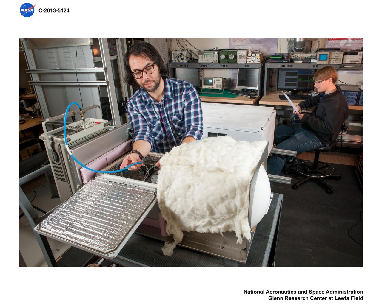
RF, Radio Frequency, Propagation Studies
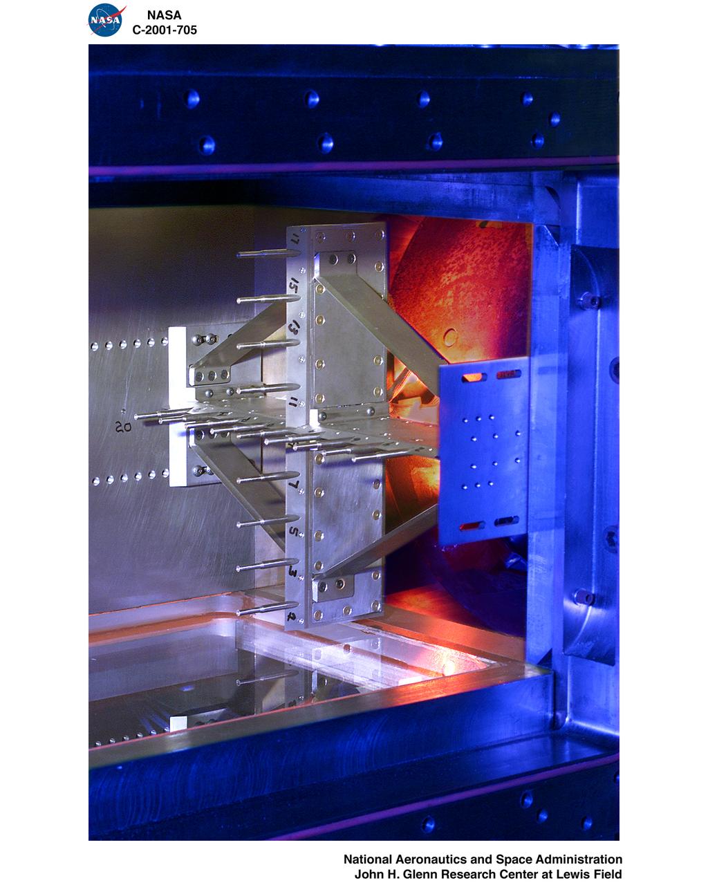
PULSED EJECTOR WAVE PROPAGATION TEST RIG
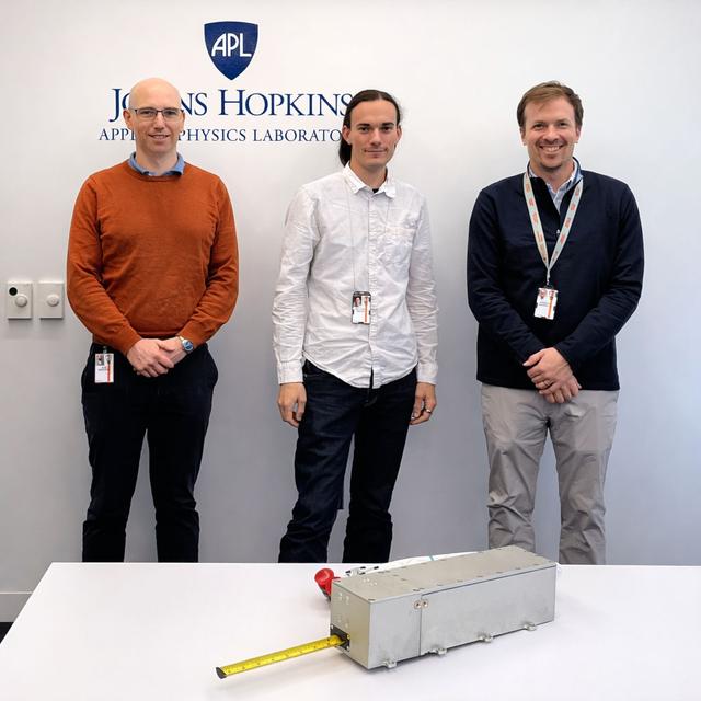
jsc2026e014327 (March 23, 2026) --- The research team as part of the Nanoracks-ITSI investigation, from left: Alex Chartier (PI), Matt Bailey (engineer), Greg Merboth (engineer). This investigation aims to measure radio signals that have passed through the ionosphere in order to quantify the effects of atmospheric dynamics on propagation. Earth’s ionosphere is highly variable due to forcing by the lower atmosphere, the aurora, meteors, and the Sun among other factors. This variability has important effects on radio propagation, and accurate characterization may support efforts to mitigate its effects on technology such as radar. Credit: Johns Hopkins Applied Physics Laboratory.
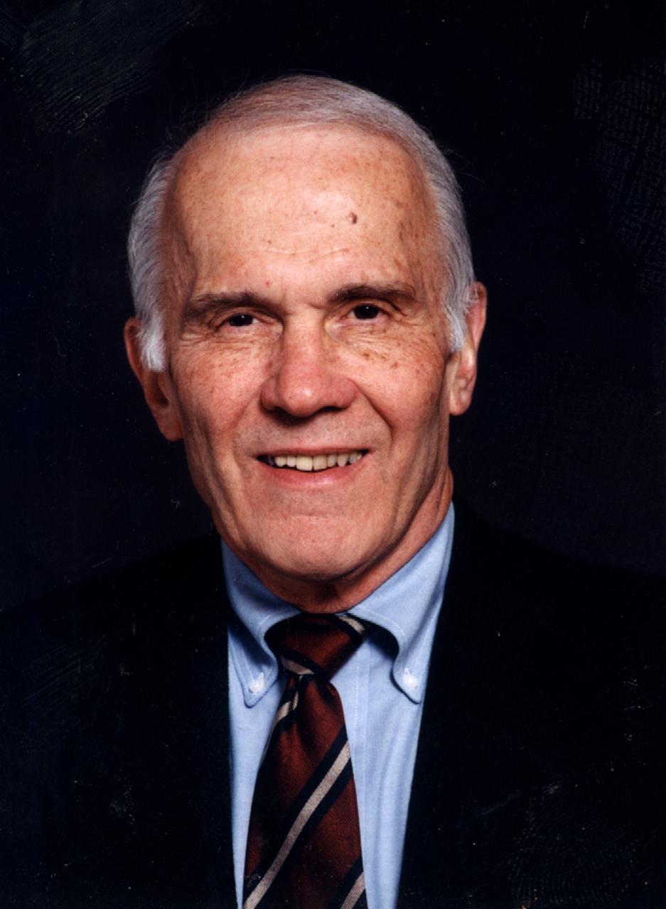
Gerard M. Faeth, University of Michigan, principal investigator in combustion science experiments, including Flow/Soot-Formation in Nonbuoyant Laminar Diffusion Flames, investigation of Laminar Jet Diffusion Flames in Microgravity: A Paradigm for Soot Processes in Turbulent Flames, and Soot Processes in Freely-Propagating Laminar Premixed Flames.
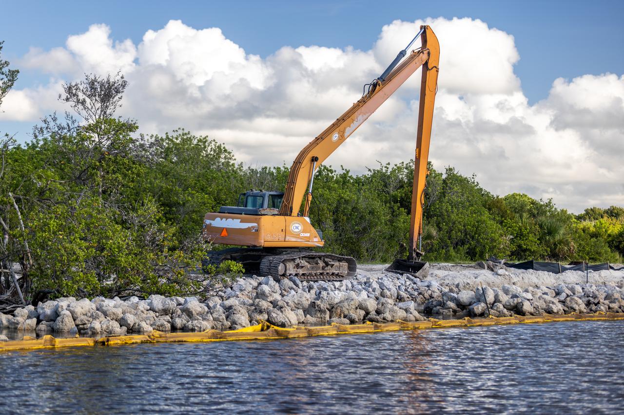
NASA Kennedy Space Center’s Spaceport Integration and Services organization is leading a restoration project at KARS Park on Hall Road in Merritt Island, Florida. As part of this project, a wavebreak is being created about 20 feet offshore to allow mangroves and other plants to propagate into the gap, providing protection for the shoreline.
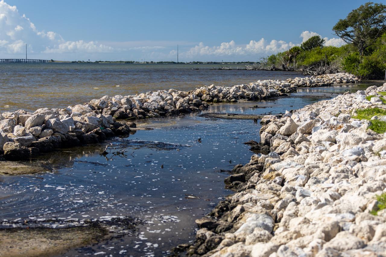
NASA Kennedy Space Center’s Spaceport Integration and Services organization is leading a restoration project at KARS Park on Hall Road in Merritt Island, Florida. As part of this project, a wavebreak is being created about 20 feet offshore to allow mangroves and other plants to propagate into the gap, providing protection for the shoreline.
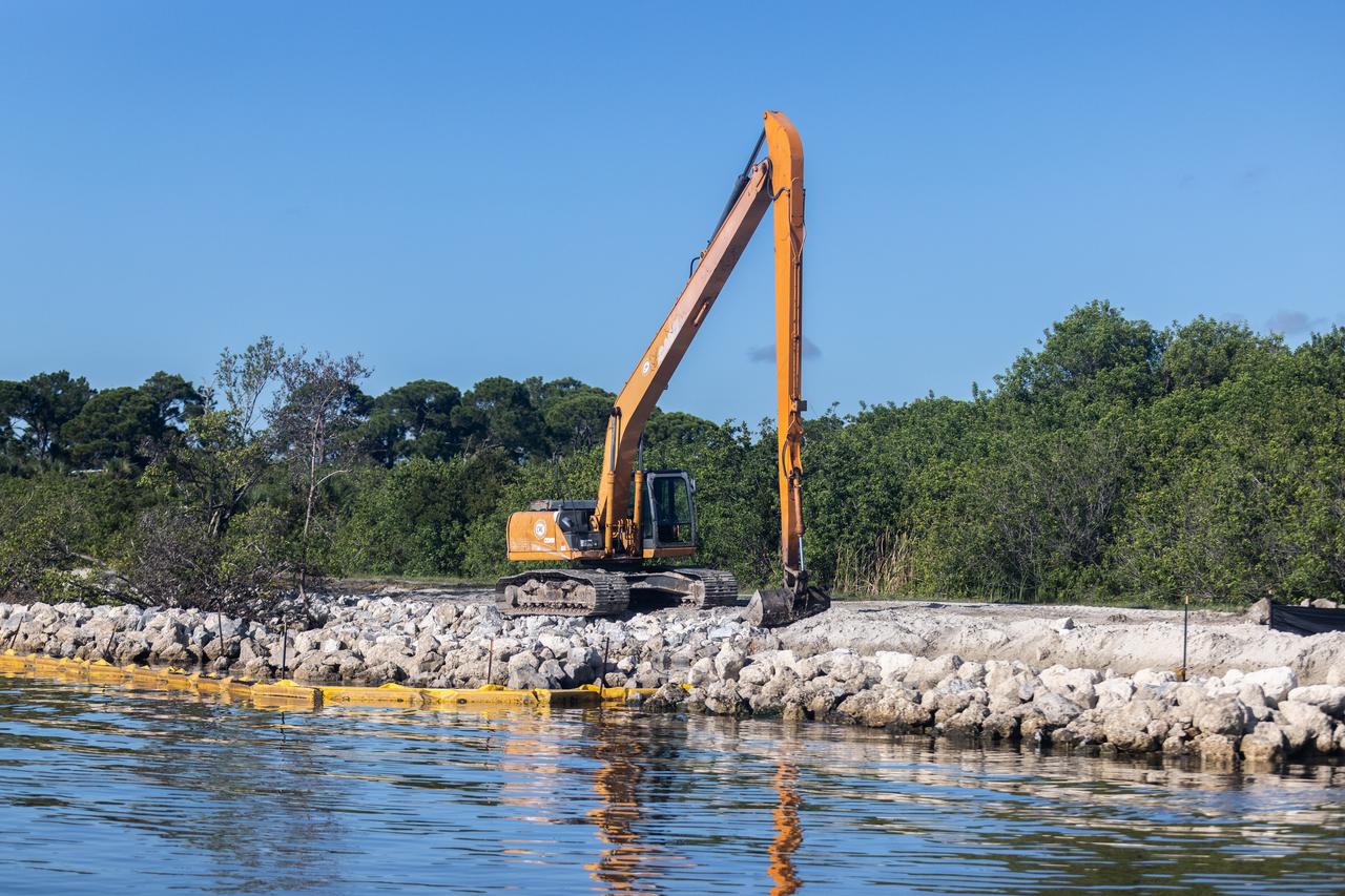
NASA Kennedy Space Center’s Spaceport Integration and Services organization is leading a restoration project at KARS Park on Hall Road in Merritt Island, Florida. As part of this project, a wavebreak is being created about 20 feet offshore to allow mangroves and other plants to propagate into the gap, providing protection for the shoreline.
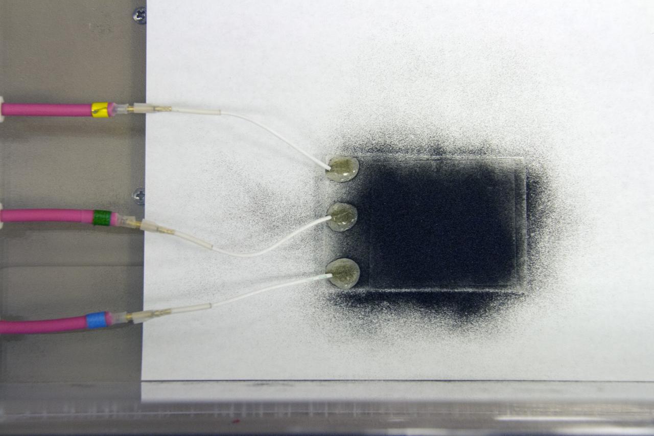
CAPE CANAVERAL, Fla. -- Dust particles are readied for an experiment for the Electrodynamic Dust Shield for Dust Mitigation project in the Electrostatics and Surface Physics Laboratory in the SwampWorks at NASA's Kennedy Space Center in Florida. The fabricated material is designed to mimic the dust on the lunar surface. The technology works by creating an electric field that propagates out like the ripples on a pond. This could prevent dust accumulation on spacesuits, thermal radiators, solar panels, optical instruments and view ports for future lunar and Mars exploration activities. CAPE CANAVERAL, Fla. -- Preparations are underway to conduct a dust particle experiment for the Electrodynamic Dust Shield for Dust Mitigation project in the Electrostatics and Surface Physics Laboratory in the SwampWorks at NASA's Kennedy Space Center in Florida. The technology works by creating an electric field that propagates out like the ripples on a pond. This could prevent dust accumulation on spacesuits, thermal radiators, solar panels, optical instruments and view ports for future lunar and Mars exploration activities.
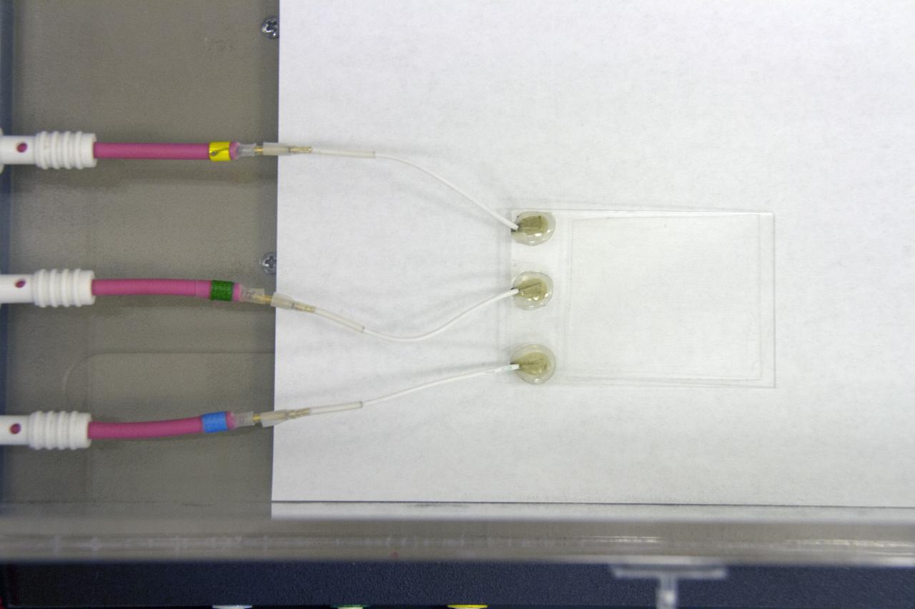
CAPE CANAVERAL, Fla. -- Preparations are underway to conduct a dust particle experiment for the Electrodynamic Dust Shield for Dust Mitigation project in the Electrostatics and Surface Physics Laboratory in the SwampWorks at NASA's Kennedy Space Center in Florida. The technology works by creating an electric field that propagates out like the ripples on a pond. This could prevent dust accumulation on spacesuits, thermal radiators, solar panels, optical instruments and view ports for future lunar and Mars exploration activities. CAPE CANAVERAL, Fla. -- Preparations are underway to conduct a dust particle experiment for the Electrodynamic Dust Shield for Dust Mitigation project in the Electrostatics and Surface Physics Laboratory in the SwampWorks at NASA's Kennedy Space Center in Florida. The technology works by creating an electric field that propagates out like the ripples on a pond. This could prevent dust accumulation on spacesuits, thermal radiators, solar panels, optical instruments and view ports for future lunar and Mars exploration activities.
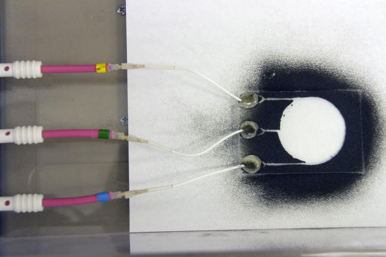
CAPE CANAVERAL, Fla. -- Dust particles scatter during an experiment for the Electrodynamic Dust Shield for Dust Mitigation project in the Electrostatics and Surface Physics Laboratory in the SwampWorks at NASA's Kennedy Space Center in Florida. The fabricated material is designed to mimic the dust on the lunar surface. The technology works by creating an electric field that propagates out like the ripples on a pond. This could prevent dust accumulation on spacesuits, thermal radiators, solar panels, optical instruments and view ports for future lunar and Mars exploration activities. CAPE CANAVERAL, Fla. -- Preparations are underway to conduct a dust particle experiment for the Electrodynamic Dust Shield for Dust Mitigation project in the Electrostatics and Surface Physics Laboratory in the SwampWorks at NASA's Kennedy Space Center in Florida. The technology works by creating an electric field that propagates out like the ripples on a pond. This could prevent dust accumulation on spacesuits, thermal radiators, solar panels, optical instruments and view ports for future lunar and Mars exploration activities.
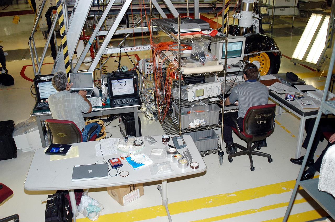
KENNEDY SPACE CENTER, FLA. - In the Orbiter Processing Facility, Eric Madaras (left), NASA-Langley Research Center, and Jim McGee, The Boeing Company, Huntington Beach, Calif., conduct impulse tests on the right wing leading edge (WLE) of Space Shuttle Endeavour. The tests monitor how sound impulses propagate through the WLE area. The data collected will be analyzed to explore the possibility of adding new instrumentation to the wing that could automatically detect debris or micrometeroid impacts on the Shuttle while in flight. The study is part of the initiative ongoing at KSC and around the agency to return the orbiter fleet to flight status.
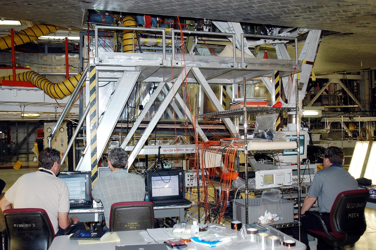
KENNEDY SPACE CENTER, FLA. - In the Orbiter Processing Facility, Bill Prosser (left) and Eric Madaras, NASA-Langley Research Center, and Jim McGee (right), The Boeing Company, Huntington Beach, Calif., conduct impulse tests on the right wing leading edge (WLE) of Space Shuttle Endeavour. The tests monitor how sound impulses propagate through the WLE area. The data collected will be analyzed to explore the possibility of adding new instrumentation to the wing that could automatically detect debris or micrometeroid impacts on the Shuttle while in flight. The study is part of the initiative ongoing at KSC and around the agency to return the orbiter fleet to flight status.
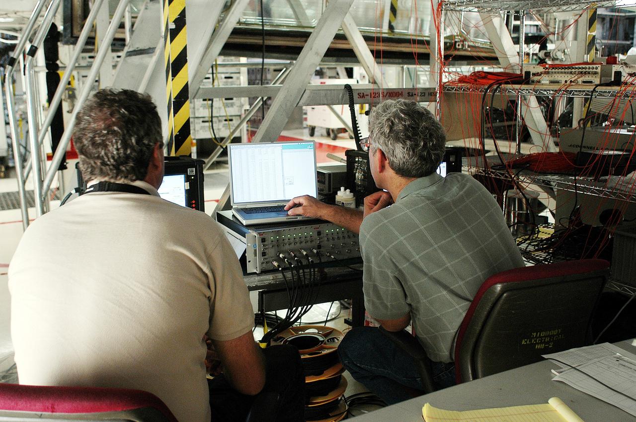
KENNEDY SPACE CENTER, FLA. - In the Orbiter Processing Facility, Bill Prosser (left) and Eric Madaras, NASA-Langley Research Center, conduct impulse tests on the right wing leading edge (WLE) of Space Shuttle Endeavour. The tests monitor how sound impulses propagate through the WLE area. The data collected will be analyzed to explore the possibility of adding new instrumentation to the wing that could automatically detect debris or micrometeroid impacts on the Shuttle while in flight. The study is part of the initiative ongoing at KSC and around the agency to return the orbiter fleet to flight status.

NASA Kennedy Space Center’s Spaceport Integration and Services organization is leading a restoration project at KARS Park on Hall Road in Merritt Island, Florida. As part of this project, a wavebreak is being created about 20 feet offshore to allow mangroves and other plants to propagate into the gap, providing protection for the shoreline. Shown here is Mark Mercadante, an environmental scientist at Kennedy.
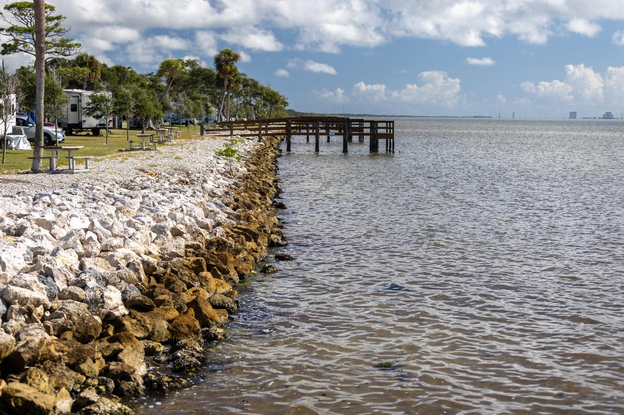
NASA Kennedy Space Center’s Spaceport Integration and Services organization is leading a restoration project at KARS Park on Hall Road in Merritt Island, Florida. As part of this project, a wavebreak is being created about 20 feet offshore to allow mangroves and other plants to propagate into the gap, providing protection for the shoreline. Shown here is the section of KARS park that was first completed during the project.
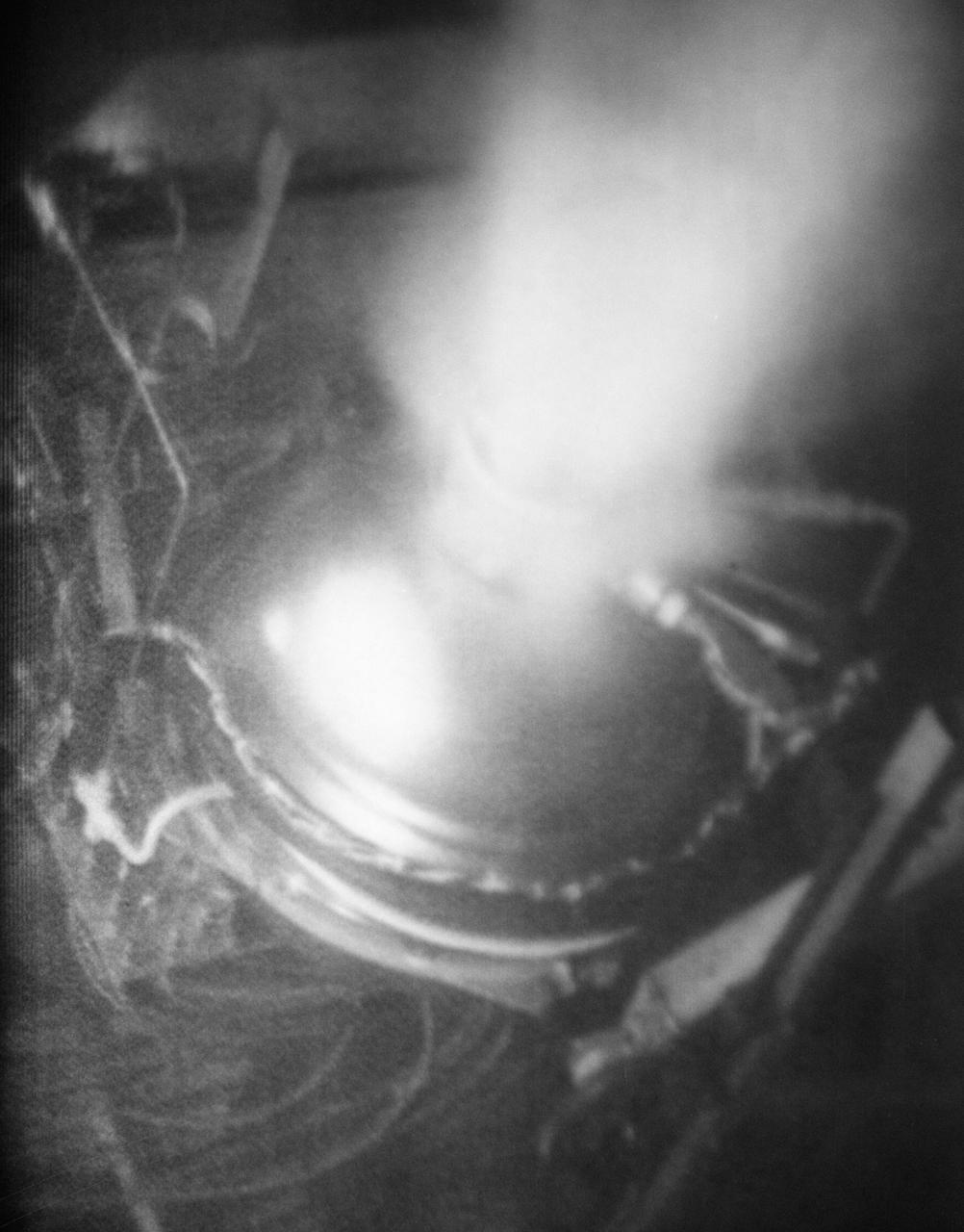
S70-41984 (June 1970) --- Full-scale propagation test at the NASA Manned Spacecraft Center (MSC) of fire inside an Apollo Service Module (SM) oxygen tank. The photograph from a motion picture sequence taken from outside the vessel shows failure of tank conduit with abrupt loss of oxygen pressure. The test was part of the Apollo 13 post flight investigation of the Service Module explosion incident. Photo credit: NASA
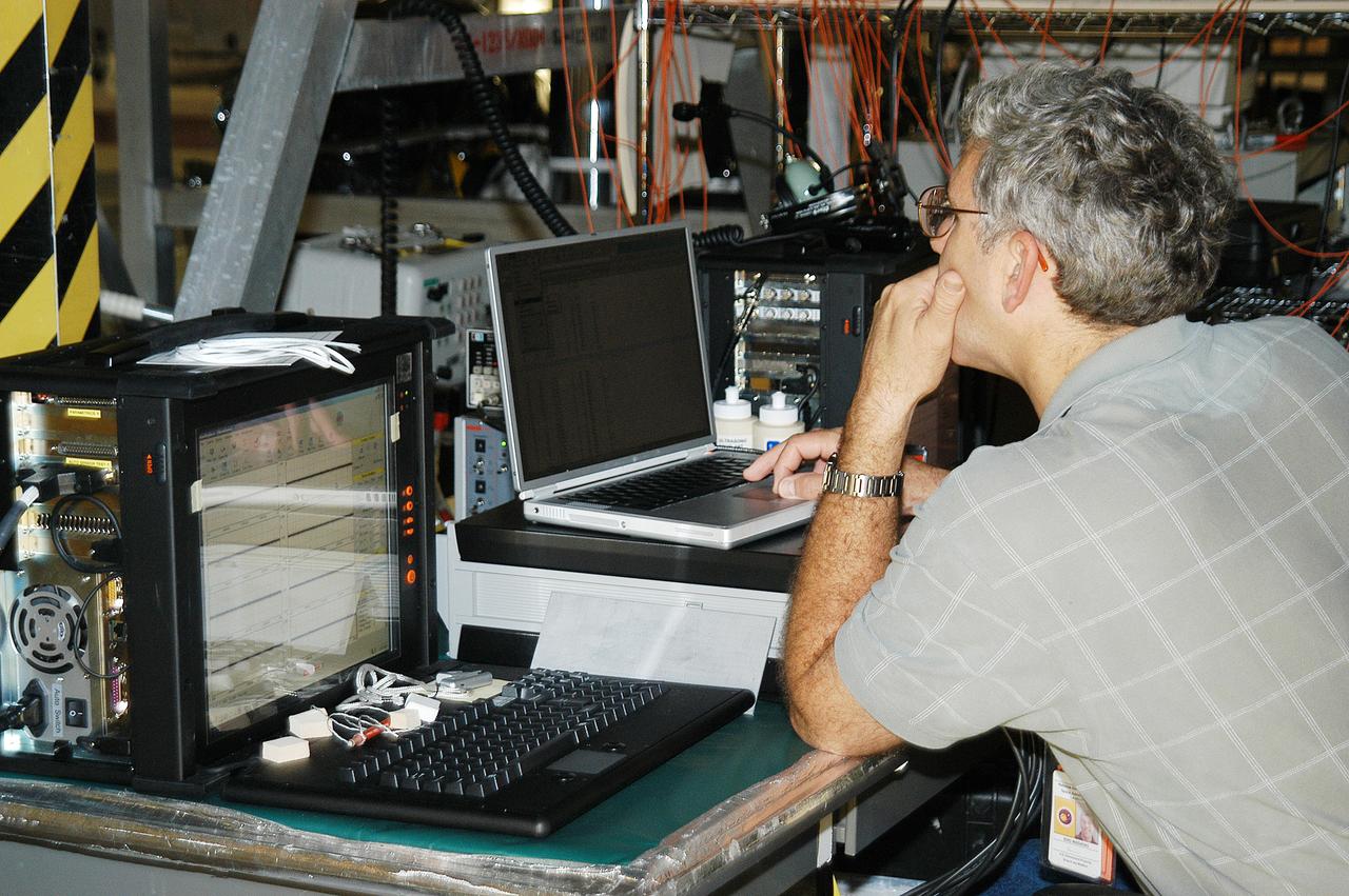
In the Orbiter Processing Facility, Eric Madaras, NASA-Langley Research Center, conducts impulse tests on the right wing leading edge (WLE) of Space Shuttle Endeavour. The tests monitor how sound impulses propagate through the WLE area. The data collected will be analyzed to explore the possibility of adding new instrumentation to the wing that could automatically detect debris or micrometeroid impacts on the Shuttle while in flight. The study is part of the initiative ongoing at KSC and around the agency to return the orbiter fleet to flight status.
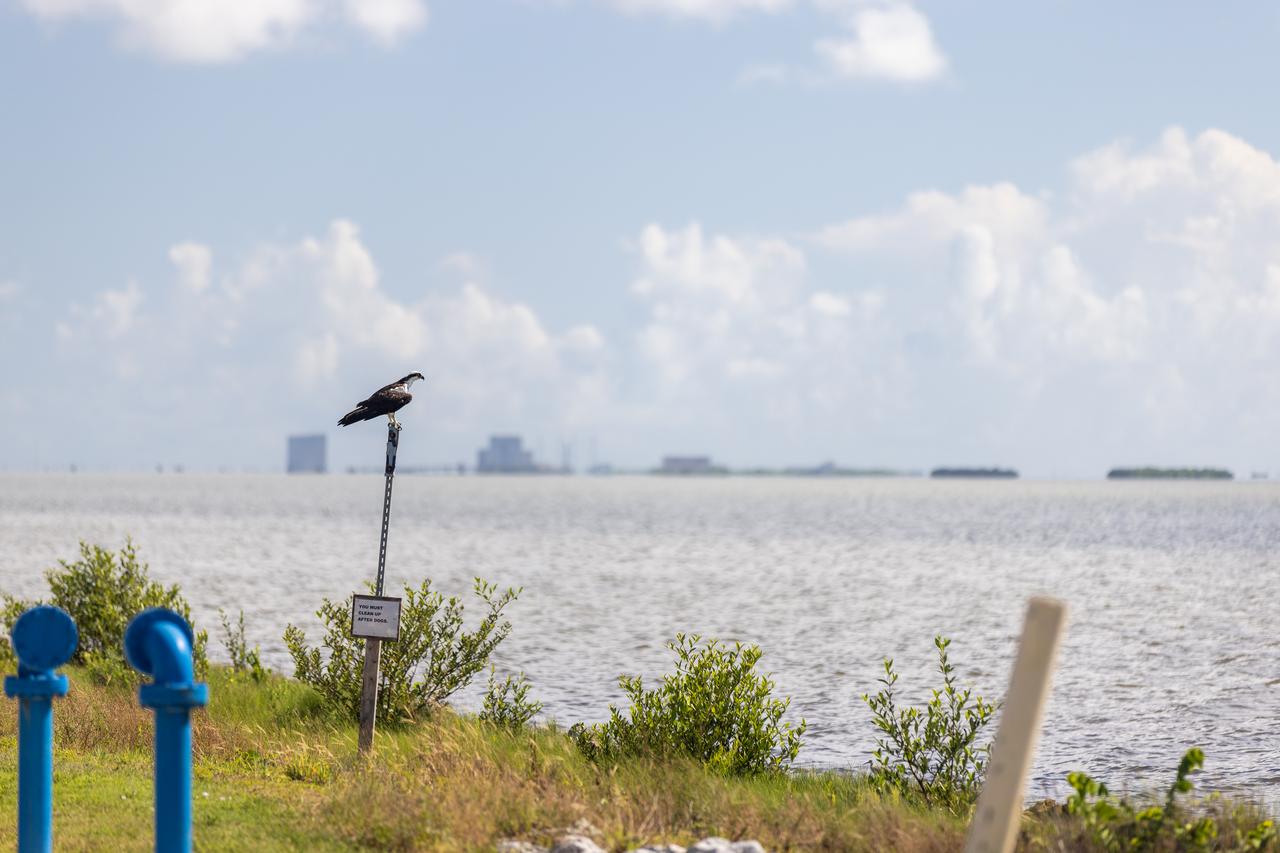
NASA Kennedy Space Center’s Spaceport Integration and Services organization is leading a restoration project at KARS Park on Hall Road in Merritt Island, Florida. As part of this project, a wavebreak is being created about 20 feet offshore to allow mangroves and other plants to propagate into the gap, providing protection for the shoreline. Shown here is an osprey overlooking the water.
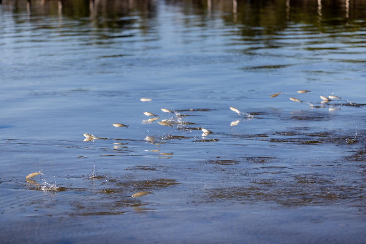
NASA Kennedy Space Center’s Spaceport Integration and Services organization is leading a restoration project at KARS Park on Hall Road in Merritt Island, Florida. As part of this project, a wavebreak is being created about 20 feet offshore to allow mangroves and other plants to propagate into the gap, providing protection for the shoreline. Shown here are mullet swimming at the location.
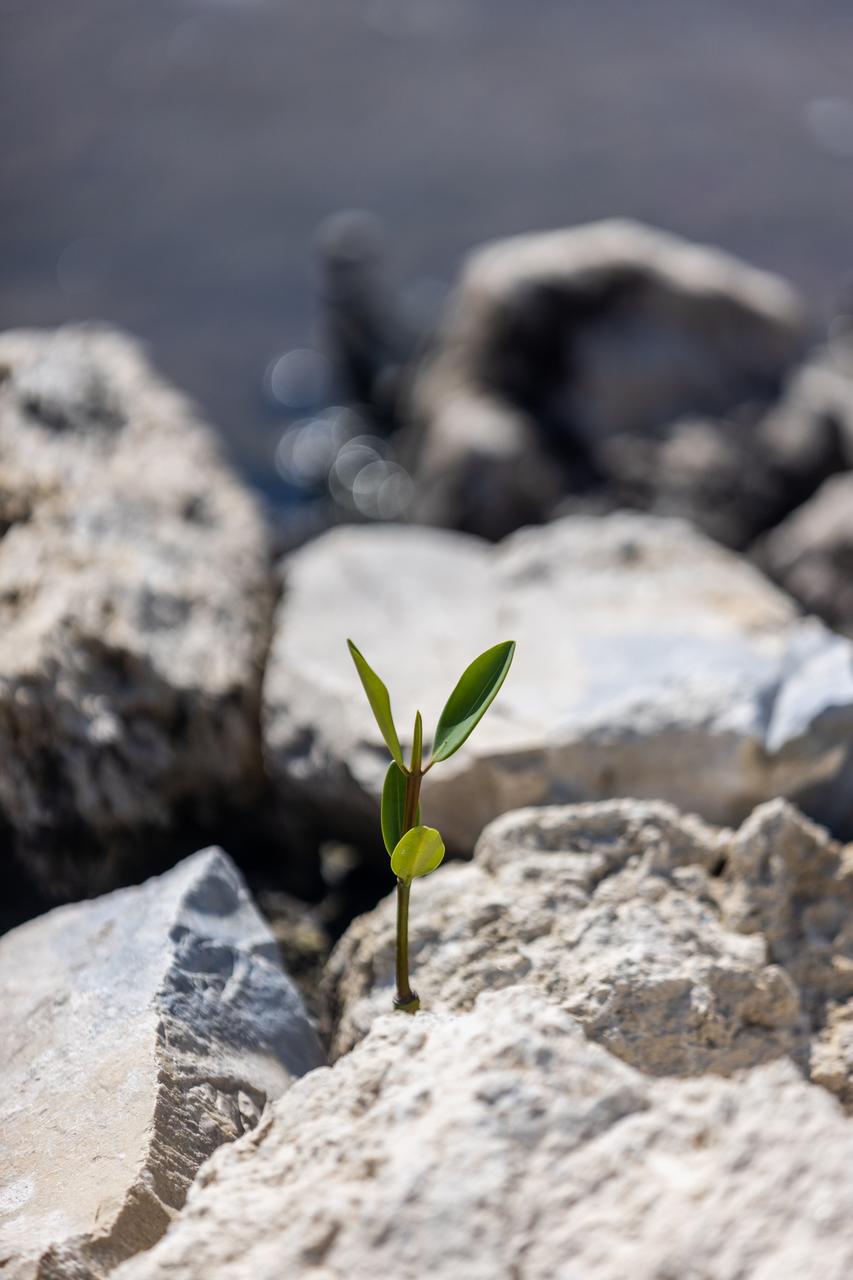
NASA Kennedy Space Center’s Spaceport Integration and Services organization is leading a restoration project at KARS Park on Hall Road in Merritt Island, Florida. As part of this project, a wavebreak is being created about 20 feet offshore to allow mangroves and other plants to propagate into the gap, providing protection for the shoreline. Shown in this photo is red mangrove starting to grow in the restoration area.
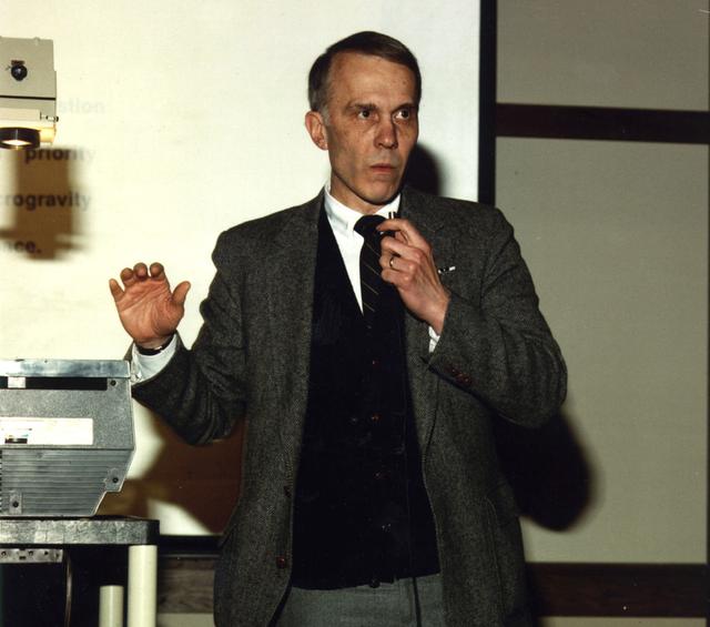
Professor Gerard M. Faeth, Department of Aerospace Engineering, University of Michigan, Arn Arbor, MI, is a principal investigator in NASA combustion science directed by Glenn Research Center. His projects include: Soot Processes in Freely-Propagating Laminar Premixed Flames; Investigation of Laminar Jet Diffusion Flames in Microgravity: A Paradigm for Soot Processes in Turbulent Flames (scheduled to fly on the STS-107 mission); and Flow/Soot- Formation in Nonbuoyant Laminar Diffusion Flames.
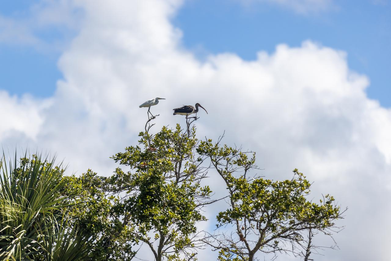
NASA Kennedy Space Center’s Spaceport Integration and Services organization is leading a restoration project at KARS Park on Hall Road in Merritt Island, Florida. As part of this project, a wavebreak is being created about 20 feet offshore to allow mangroves and other plants to propagate into the gap, providing protection for the shoreline. Show here in a tree are a snowy egret, left, and a limpkin.
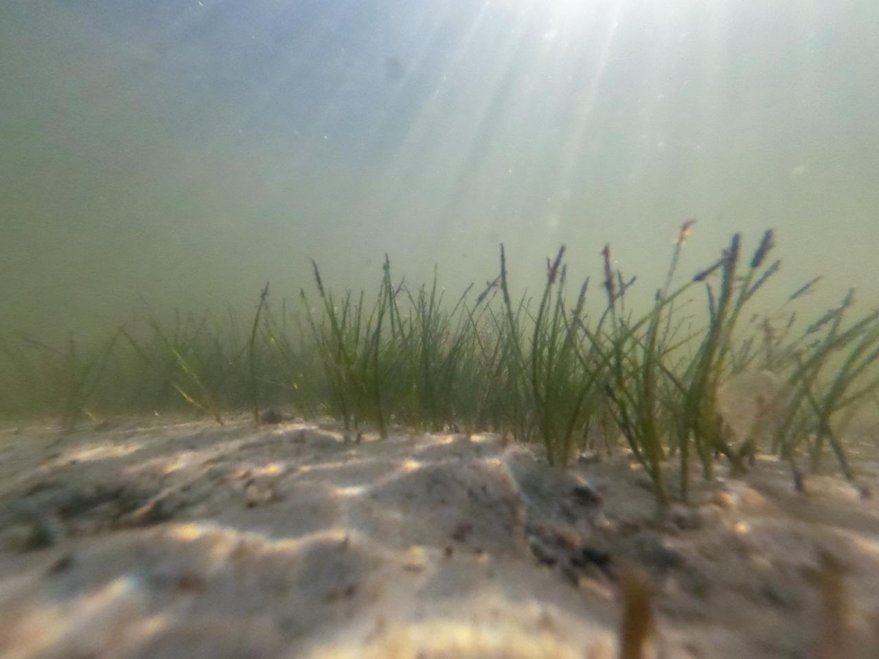
NASA Kennedy Space Center’s Spaceport Integration and Services organization is leading a restoration project at KARS Park on Hall Road in Merritt Island, Florida. As part of this project, a wavebreak is being created about 20 feet offshore to allow mangroves and other plants to propagate into the gap, providing protection for the shoreline. Shown here is shoalgrass taking hold in the restoration area.
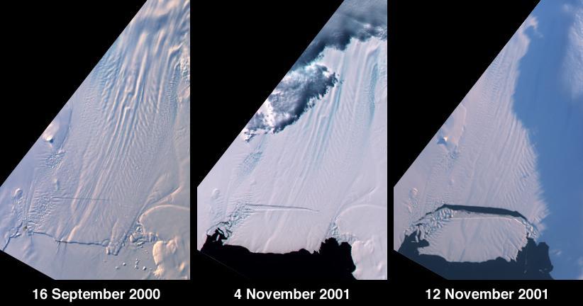
A large tabular iceberg (42 kilometers x 17 kilometers) broke off Pine Island Glacier, West Antarctica (75ºS latitude, 102ºW longitude) sometime between November 4 and 12, 2001. Images of the glacier were acquired by the Multi-angle Imaging SpectroRadiometer (MISR) instrument aboard NASA's Terra spacecraft. This event was preceded by the formation of a large crack across the glacier in mid 2000. Data gathered by other imaging instruments revealed the crack to be propagating through the shelf ice at a rate averaging 15 meters per day, accompanied by a slight rotation of about one percent per year at the seaward margin of the rift. The image set shows three views of Pine Island Glacier acquired by MISR's vertical-viewing (nadir) camera. The first was captured in late 2000, early in the development of the crack. The second and third views were acquired in November 2001, just before and just after the new iceberg broke off. The existence of the crack took the glaciological community by surprise, and the rapid rate at which the crack propagated was also not anticipated. Glaciologists predicted that the rift would reach the other side of the glacier sometime in 2002. However, the iceberg detached much sooner than anticipated, and the last 10-kilometer segment that was still attached to the ice shelf snapped off in a matter of days. http://photojournal.jpl.nasa.gov/catalog/PIA03431

This cartoon shows how magnetic waves, called Alfvén S-waves, propagate outward from the base of black hole jets. The jet is a flow of charged particles, called a plasma, which is launched by a black hole. The jet has a helical magnetic field (yellow coil) permeating the plasma. The waves then travel along the jet, in the direction of the plasma flow, but at a velocity determined by both the jet's magnetic properties and the plasma flow speed. The BL Lac jet examined in a new study is several light-years long, and the wave speed is about 98 percent the speed of light. Fast-moving magnetic waves emanating from a distant supermassive black hole undulate like a whip whose handle is being shaken by a giant hand, according to a study using data from the National Radio Astronomy Observatory's Very Long Baseline Array. Scientists used this instrument to explore the galaxy/black hole system known as BL Lacertae (BL Lac) in high resolution. http://photojournal.jpl.nasa.gov/catalog/PIA19822
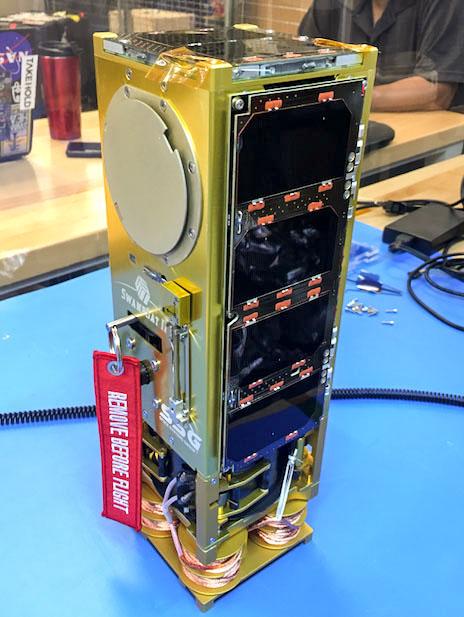
jsc2019e056549 (9/27/2019) --- Preflight overall view of SwampSat-II . SwampSat II measures very low frequency (VLF) wave propagation in Earth’s upper atmosphere using a novel antenna that has higher sensitivity than existing methods. The antenna system, developed by students at the University of Florida, launches in a 3-Unit CubeSat. Ground-based sources such as VLF transmitters and lightning injected VLF waves into the upper atmosphere, and measuring these waves is essential to understanding loss of energetic radiation belt particles. Image courtesy of: The SwampSat Team at University of Florida
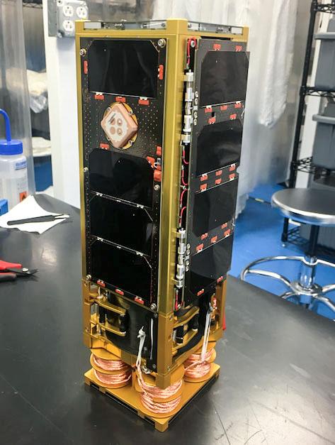
jsc2019e056548 (9/27/2019) --- Preflight overall view of SwampSat-II . SwampSat II measures very low frequency (VLF) wave propagation in Earth’s upper atmosphere using a novel antenna that has higher sensitivity than existing methods. The antenna system, developed by students at the University of Florida, launches in a 3-Unit CubeSat. Ground-based sources such as VLF transmitters and lightning injected VLF waves into the upper atmosphere, and measuring these waves is essential to understanding loss of energetic radiation belt particles. Image courtesy of: The SwampSat Team at University of Florida
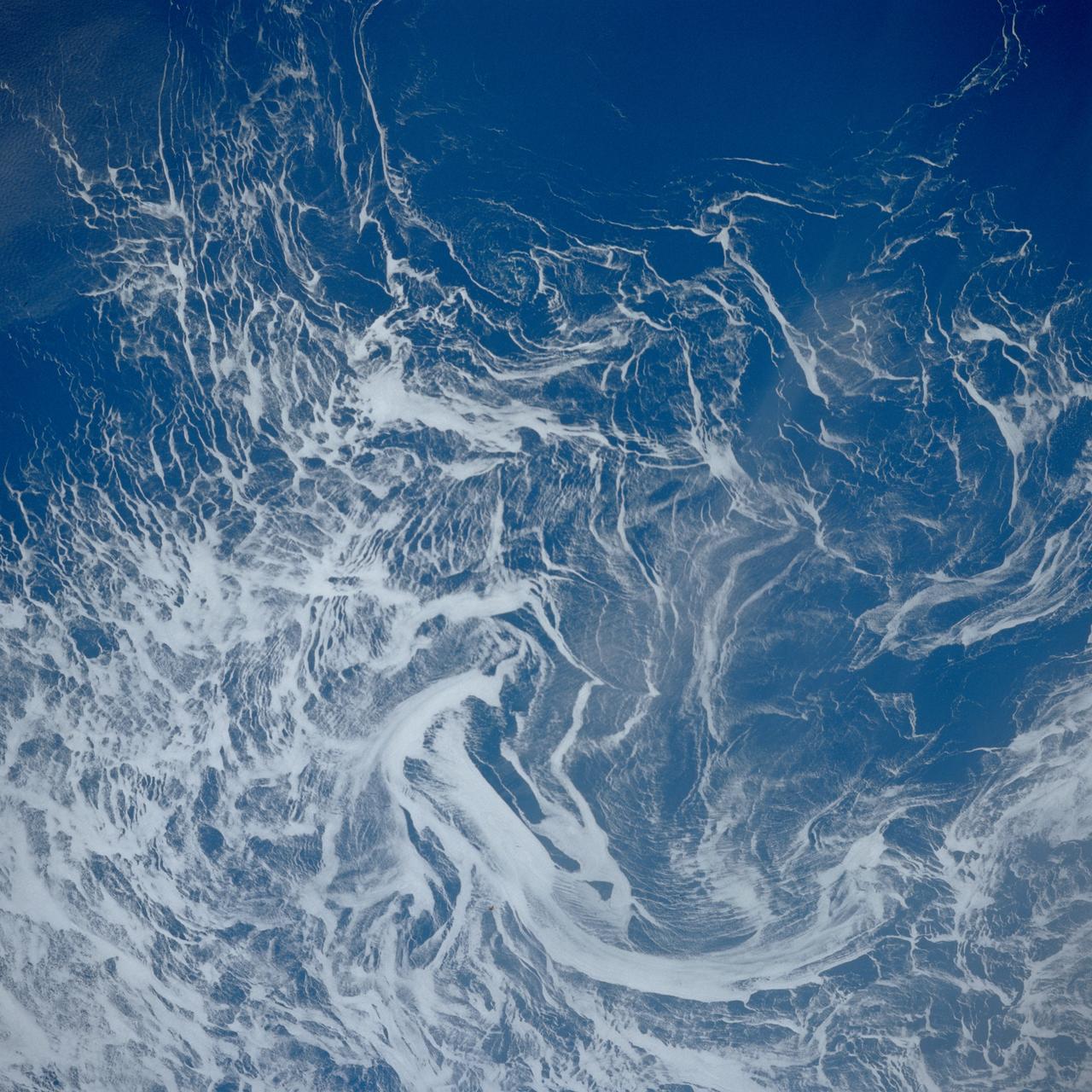
STS039-84-29AL (28 April-6 May 1991) --- This nearly vertical photograph of the North Atlantic, taken outside of the sunglint pattern, illustrates the extreme contrast between highly reflective ice, having a large percentage of between-crystal air space, and the low-reflectance water, which absorbs most of the light that propagates into it from the air. The ice drifts along with the surface currents and wind and may therefore be used as a natural Langranian* tracer. Photographs such as this, taken several times over the course of a mission, may be used to investigate near-surface circulation in high-latitude oceans. *A Langranian tracer is anything that can be tracked as it drifts along with the water, as opposed to staying in one position and measuring how fast the water goes by.
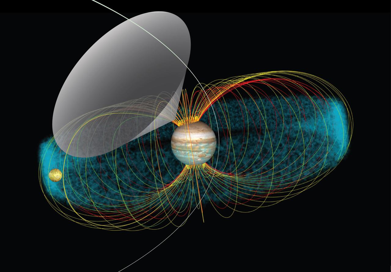
This is a representation of the Jupiter-Io system and interaction. The blue cloud is the Io plasma torus, which is a region of higher concentration of ions and electrons located at Io's orbit. This conceptual image shows the radio emission pattern from Jupiter. The multicolored lines represent the magnetic field lines that link Io's orbit with Jupiter's atmosphere. The radio waves emerge from the source, located at the line of force in the magnetic field, and propagate along the walls of a hollow cone (gray area). Juno receives the signal only when Jupiter's rotation sweeps that cone over the spacecraft, in the same way a lighthouse beacon shines briefly upon a ship at sea. Juno's orbit is represented by the white line crossing the cone. https://photojournal.jpl.nasa.gov/catalog/PIA24524
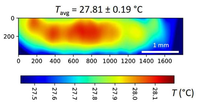
jsc2024e065172 (10/3/2024) --- A temperature map is seen within a microgel suspension illuminated by the Colloidal Solids (COLIS) near infrared laser (NIR). Reference ground tests for the Colloidal Solids (COLIS) investigation show spatial variation of the sample temperature while illuminating an aqueous, dense suspension of thermosensitive microgels with a 0.5 s pulse of NIR laser light. The NIR beam propagates from left to right. The sample temperature with no NIR laser is uniform and set to 27°C. The temperature values are inferred from the change in scattered intensity at a scattering angle of 90°, as recorded by one of the complementary metal-oxide-semiconductor (CMOS) cameras of COLIS. Results from this investigation are expected to provide a deeper understanding of soft solid interactions with gravity and microgravity, paving the way for the design of new materials. Image courtesy of Redwire Space Laboratories, Kruibeke – Belgium.
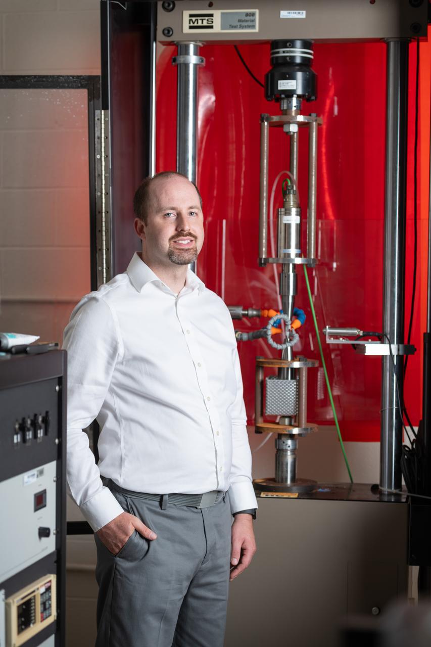
Each year, the NESC produces the NESC Technical Update, which highlights two or three individuals from each Center and includes assessments throughout the year. Because of the critical contributions to the NESC mission this year, Rob Jankovsky, NESC Chief Engineer at GRC, chose two individuals to be highlighted. This year, it is Andrew Ring and Michael Cooper. Mr. Ring, pictured here, performs stress and fatigue testing on all manner of materials in various environments and research on jet engine materials, looking for ways to increase the performance and safety of turbine blades and disks. Several NESC assessments have benefited from his expertise, most recently in understanding crack initiation and propagation in the aluminum-magnesium alloys that make up the modules of the ISS. He has also used image processing techniques to quantify the variables in parachute energy modulator production and performance and investigate flaws in the composite weave of overwrapped pressure vessels.
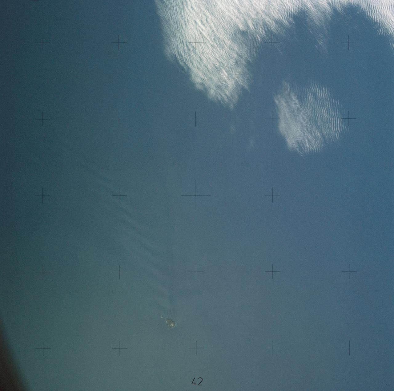
SL4-137-3655 (16 Dec. 1973) --- An island wake produced by the Antipodes Islands in the ocean current south of New Zealand is seen in this photograph taken from the Skylab space station in Earth orbit. A Skylab 4 crewmen took the picture with a hand-held 70mm Hasselblad camera. The bow wave pattern is quite evident and can be used to determine the current speed from the angle of the bow wave if the propagation speed of the surface wave is known. Also, evident is the darker band extending downstream from the island tens of miles. This is the actual wake of the island. The existence of water color differences from within to outside a turbulent island wake may indicate a temperature difference, with cooler water being stirred to the surface in the wake. This temperature difference could be used to drive a thermo-electric type generator to reduce small islands' dependence on imported oil for power generation. Photo credit: NASA
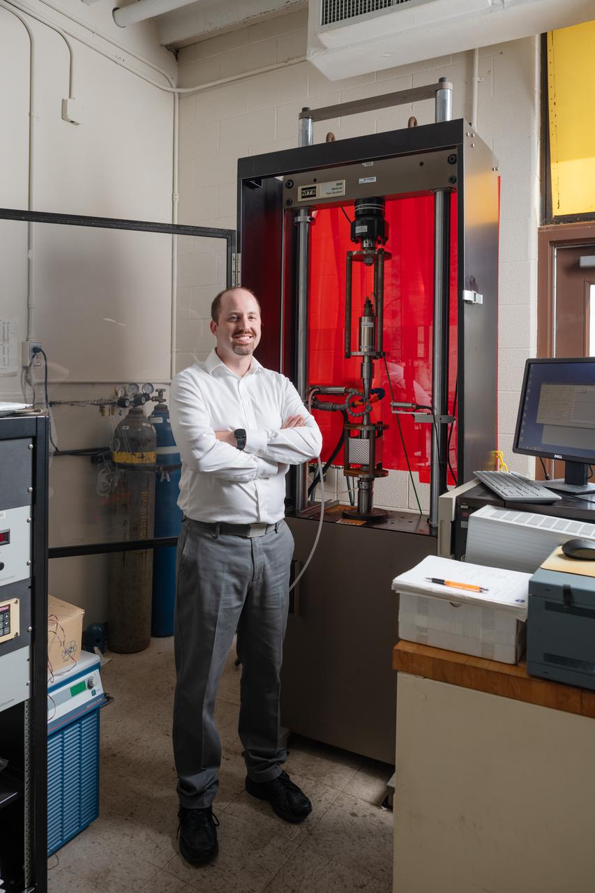
Each year, the NESC produces the NESC Technical Update, which highlights two or three individuals from each Center and includes assessments throughout the year. Because of the critical contributions to the NESC mission this year, Rob Jankovsky, NESC Chief Engineer at GRC, chose two individuals to be highlighted. This year, it is Andrew Ring and Michael Cooper. Mr. Ring, pictured here, performs stress and fatigue testing on all manner of materials in various environments and research on jet engine materials, looking for ways to increase the performance and safety of turbine blades and disks. Several NESC assessments have benefited from his expertise, most recently in understanding crack initiation and propagation in the aluminum-magnesium alloys that make up the modules of the ISS. He has also used image processing techniques to quantify the variables in parachute energy modulator production and performance and investigate flaws in the composite weave of overwrapped pressure vessels.
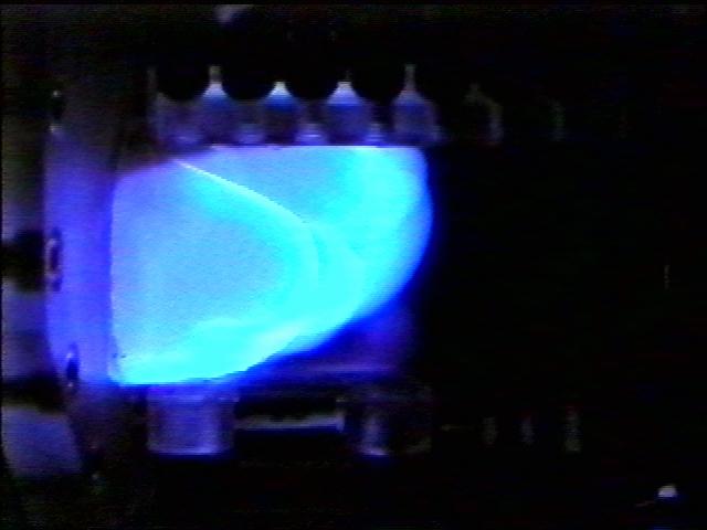
The Water Mist commercial research program is scheduled to fly an investigation on STS-107 in 2002 in the updated Combustion Module (CM-2), a sophisticated combustion chamber plus diagnostic equipment. The Center for the Commercial Applications of Combustion in Space (CCACS), a NASA Commercial Space Center located at the Colorado School of Mines, is investigating the properties of mist fire suppression in microgravity with Industry Partner Environmental Engineering Concepts. These experiments consist of varying water droplet sizes and water mist concentrations applied to flame fronts of different propane/air mixtures. Observations from these tests will provide valuable information on the change of flame speed in the presence of water mist. Shown here is a flame front propagating through the Mist flame tube during 1-g testing at NASA/Glenn Research Center.
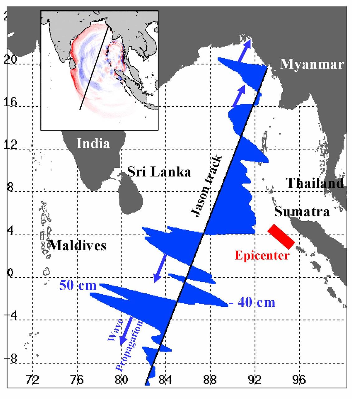
Displayed in blue color is the height of sea surface (shown in blue) measured by the Jason satellite two hours after the initial magnitude 9 earthquake hit the region (shown in red) southwest of Sumatra on December 26, 2004. The data were taken by a radar altimeter onboard the satellite along a track traversing the Indian Ocean when the tsunami waves had just filled the entire Bay of Bengal (see the model simulation inset image). The data shown are the changes of sea surface height from previous observations made along the same track 20-30 days before the earthquake, reflecting the signals of the tsunami waves. The maximum height of the leading wave crest was about 50 cm (or 1.6 ft), followed by a trough of sea surface depression of 40 cm. The directions of wave propagation along the satellite track are shown by the blue arrows. http://photojournal.jpl.nasa.gov/catalog/PIA07219
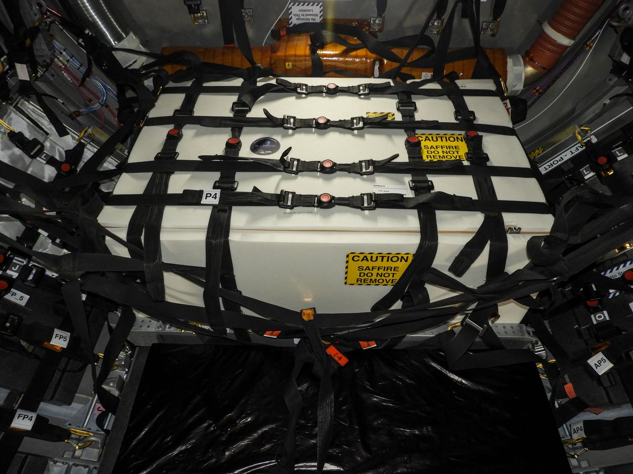
jsc2020e043815 (Sept. 10, 2020) --- A view of the Spacecraft Fire Safety Experiments (Saffire) V experiment hardware, loaded inside the Northrop Grumman(NG) Cygnus cargo vehicle for the 14th NG resupply mission to the International Space Station. Saffire is a series of experiments to investigate how fire spreads on a variety of combustible materials in the microgravity environment. The experiments are ignited in Cygnus cargo spacecraft after it departs the space station and before it reenters the Earth's atmosphere. Studying the development and growth of fire in a re-supply cargo vehicle eliminates the risk of exposure to humans in an occupied spacecraft. Understanding how fire behaves in microgravity, and how different materials propagate flames in space is immensely important for the development of future crew spacecraft.
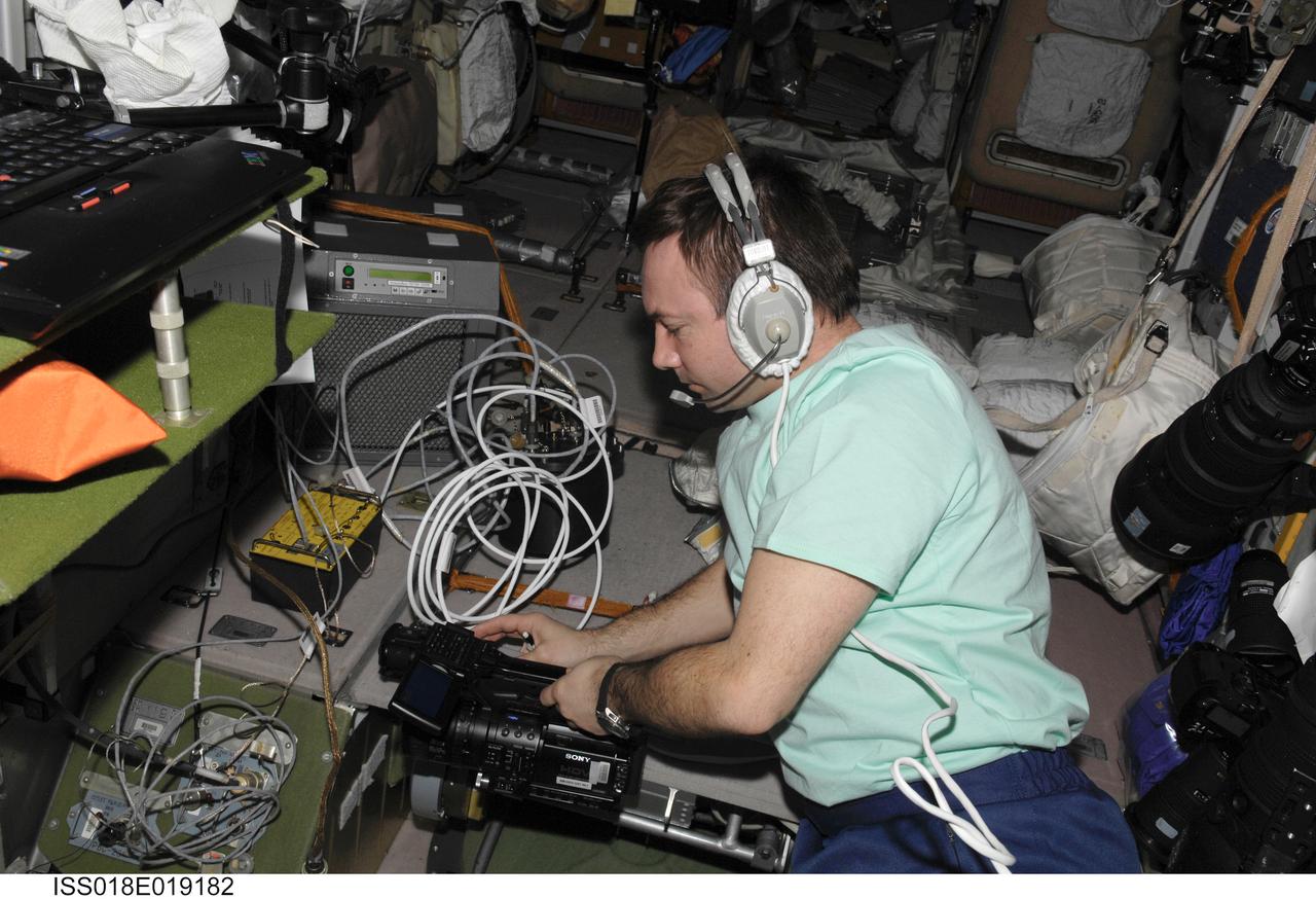
ISS018-E-019182 (13 Jan. 2009) --- Cosmonaut Yury Lonchakov, Expedition 18 flight engineer, uses a communication system while working in the Zvezda Service Module of the International Space Station.
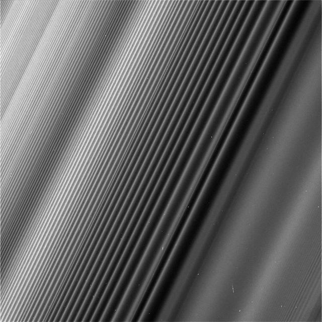
This view from NASA's Cassini spacecraft shows a wave structure in Saturn's rings known as the Janus 2:1 spiral density wave. Resulting from the same process that creates spiral galaxies, spiral density waves in Saturn's rings are much more tightly wound. In this case, every second wave crest is actually the same spiral arm which has encircled the entire planet multiple times. This is the only major density wave visible in Saturn's B ring. Most of the B ring is characterized by structures that dominate the areas where density waves might otherwise occur, but this innermost portion of the B ring is different. The radius from Saturn at which the wave originates (toward lower-right in this image) is 59,796 miles (96,233 kilometers) from the planet. At this location, ring particles orbit Saturn twice for every time the moon Janus orbits once, creating an orbital resonance. The wave propagates outward from the resonance (and away from Saturn), toward upper-left in this view. For reasons researchers do not entirely understand, damping of waves by larger ring structures is very weak at this location, so this wave is seen ringing for hundreds of bright wave crests, unlike density waves in Saturn's A ring. The image gives the illusion that the ring plane is tilted away from the camera toward upper-left, but this is not the case. Because of the mechanics of how this kind of wave propagates, the wavelength decreases with distance from the resonance. Thus, the upper-left of the image is just as close to the camera as the lower-right, while the wavelength of the density wave is simply shorter. This wave is remarkable because Janus, the moon that generates it, is in a strange orbital configuration. Janus and Epimetheus share practically the same orbit and trade places every four years. Every time one of those orbit swaps takes place, the ring at this location responds, spawning a new crest in the wave. The distance between any pair of crests corresponds to four years' worth of the wave propagating downstream from the resonance, which means the wave seen here encodes many decades' worth of the orbital history of Janus and Epimetheus. According to this interpretation, the part of the wave at the very upper-left of this image corresponds to the positions of Janus and Epimetheus around the time of the Voyager flybys in 1980 and 1981, which is the time at which Janus and Epimetheus were first proven to be two distinct objects (they were first observed in 1966). Epimetheus also generates waves at this location, but they are swamped by the waves from Janus, since Janus is the larger of the two moons. This image was taken on June 4, 2017, with the Cassini spacecraft narrow-angle camera. The image was acquired on the sunlit side of the rings from a distance of 47,000 miles (76,000 kilometers) away from the area pictured. The image scale is 1,730 feet (530 meters) per pixel. The phase angle, or sun-ring-spacecraft angle, is 90 degrees. https://photojournal.jpl.nasa.gov/catalog/PIA21627
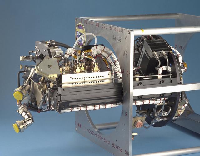
The Water Mist commercial research program is scheduled to fly an investigation on STS-107 in 2002. This investigation will be flown as an Experimental Mounting Structure (EMS) insert into the updated Combustion Module (CM-2), a sophisticated combustion chamber plus diagnostic equipment. (The investigation hardware is shown here mounted in a non-flight frame similar to the EMS.) Water Mist is a commercial research program by the Center for Commercial Applications of Combustion in Space (CCACS), a NASA Commercial Space Center located at the Colorado School of Mines, in Golden, CO and Industry Partner Environmental Engineering Concepts. The program is focused on developing water mist as a replacement for bromine-based chemical fire suppression agents (halons). By conducting the experiments in microgravity, interference from convection currents is minimized and fundamental knowledge can be gained. This knowledge is incorporated into models, which can be used to simulate a variety of physical environments. The immediate objective of the project is to study the effect of a fine water mist on a laminar propagating flame generated in a propane-air mixture at various equivalence ratios. The effects of droplet size and concentration on the speed of the flame front is used as a measure of the effectiveness of fire suppression in this highly controlled experimental environment.
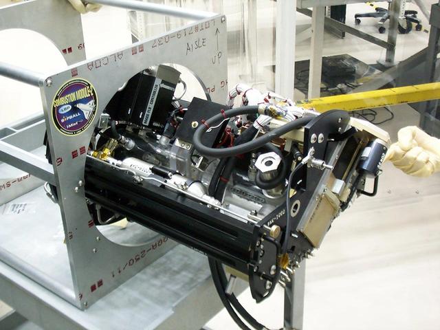
The Water Mist commercial research program is scheduled to fly an investigation on STS-107 in 2002. This investigation will be flown as an Experimental Mounting Structure (EMS) insert into the updated Combustion Module (CM-2), a sophisticated combustion chamber plus diagnostic equipment. (The investigation hardware is shown here mounted in a non-flight frame similar to the EMS.) Water Mist is a commercial research program by the Center for Commercial Applications of Combustion in Space (CCACS), a NASA Commercial Space Center located at the Colorado School of Mines, in Golden, CO and Industry Partner Environmental Engineering Concepts. The program is focused on developing water mist as a replacement for bromine-based chemical fire suppression agents (halons). By conducting the experiments in microgravity, interference from convection currents is minimized and fundamental knowledge can be gained. This knowledge is incorporated into models, which can be used to simulate a variety of physical environments. The immediate objective of the project is to study the effect of a fine water mist on a laminar propagating flame generated in a propane-air mixture at various equivalence ratios. The effects of droplet size and concentration on the speed of the flame front is used as a measure of the effectiveness of fire suppression in this highly controlled experimental environment.
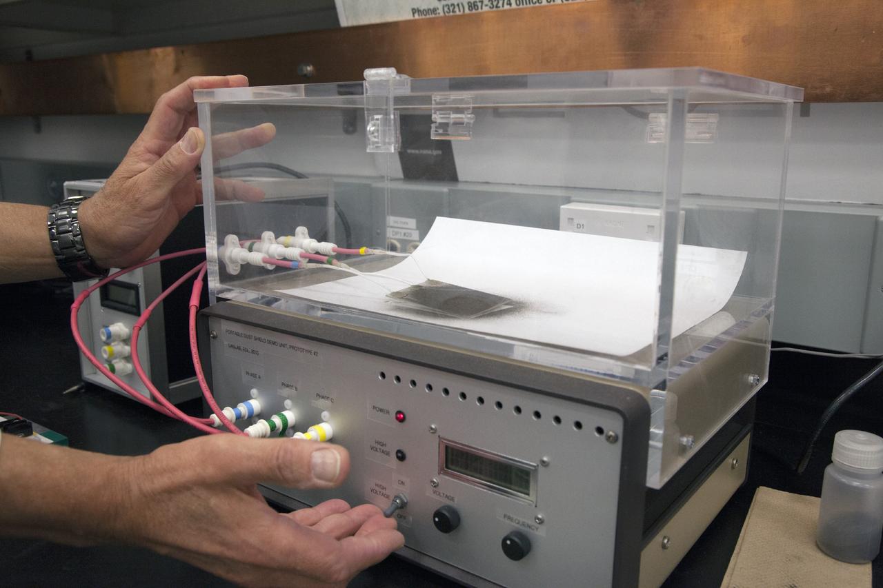
CAPE CANAVERAL, Fla. -- Dr. Carlos Calle, senior research scientist on the Electrodynamic Dust Shield for Dust Mitigation project, demonstrates a dust particle experiment in the Electrostatics and Surface Physics Laboratory in the SwampWorks at NASA's Kennedy Space Center in Florida. The technology works by creating an electric field that propagates out like the ripples on a pond. This could prevent dust accumulation on spacesuits, thermal radiators, solar panels, optical instruments and view ports for future lunar and Mars exploration activities. Electrodynamic dust shield, or EDS, technology is based on concepts originally developed by NASA as early as 1967 and later by the University of Tokyo. In 2003, NASA, in collaboration with the University of Arkansas at Little Rock, started development of the EDS for dust particle removal from solar panels to be used on future missions to the moon, an asteroid or Mars. A flight experiment to expose the dust shields to the space environment currently is under development. For more information, visit: http://www.nasa.gov/content/scientists-developing-ways-to-mitigate-dust-problem-for-explorers/ Photo credit: NASA/Dan Casper
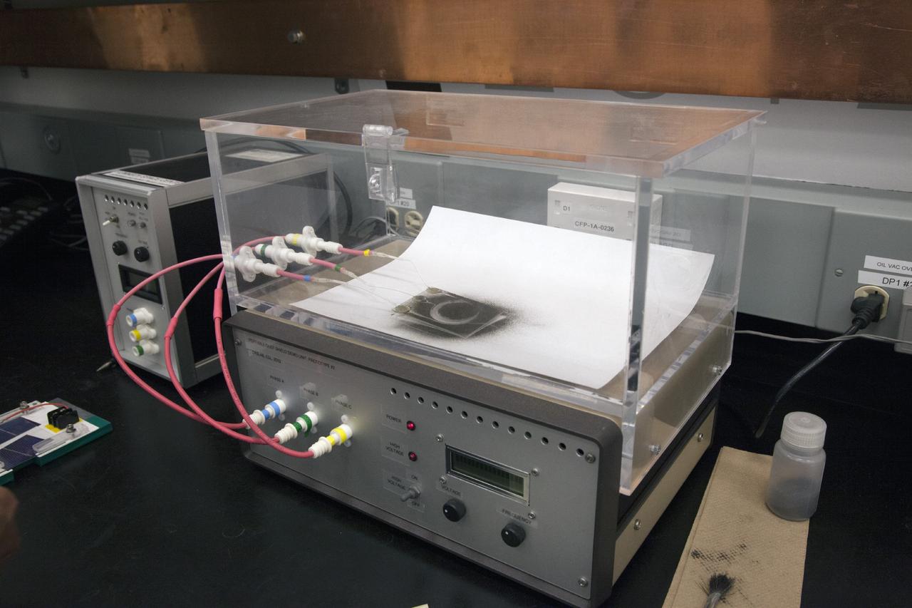
CAPE CANAVERAL, Fla. -- Dust particle experiments are conducted for Electrodynamic Dust Shield for Dust Mitigation project in the Electrostatics and Surface Physics Laboratory in the SwampWorks at NASA's Kennedy Space Center in Florida. The technology works by creating an electric field that propagates out like the ripples on a pond. This could prevent dust accumulation on spacesuits, thermal radiators, solar panels, optical instruments and view ports for future lunar and Mars exploration activities. Electrodynamic dust shield, or EDS, technology is based on concepts originally developed by NASA as early as 1967 and later by the University of Tokyo. In 2003, NASA, in collaboration with the University of Arkansas at Little Rock, started development of the EDS for dust particle removal from solar panels to be used on future missions to the moon, an asteroid or Mars. A flight experiment to expose the dust shields to the space environment currently is under development. For more information, visit: http://www.nasa.gov/content/scientists-developing-ways-to-mitigate-dust-problem-for-explorers/ Photo credit: NASA/Dan Casper
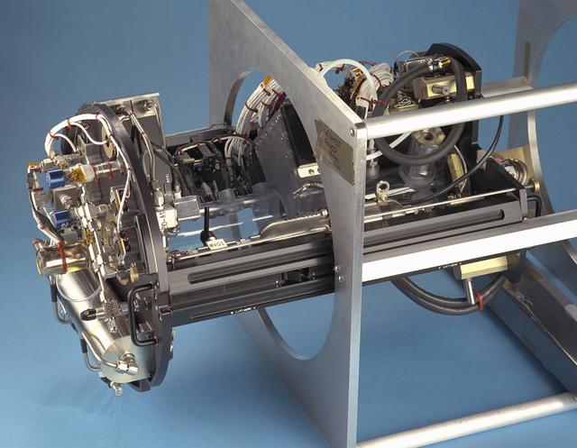
The Water Mist commercial research program is scheduled to fly an investigation on STS-107 in 2002. This investigation will be flown as an Experimental Mounting Structure (EMS) insert into the updated Combustion Module (CM-2), a sophisticated combustion chamber plus diagnostic equipment. (The investigation hardware is shown here mounted in a non-flight frame similar to the EMS.) Water Mist is a commercial research program by the Center for Commercial Applications of Combustion in Space (CCACS), a NASA Commercial Space Center located at the Colorado School of Mines, in Golden, CO and Industry Partner Environmental Engineering Concepts. The program is focused on developing water mist as a replacement for bromine-based chemical fire suppression agents (halons). By conducting the experiments in microgravity, interference from convection currents is minimized and fundamental knowledge can be gained. This knowledge is incorporated into models, which can be used to simulate a variety of physical environments. The immediate objective of the project is to study the effect of a fine water mist on a laminar propagating flame generated in a propane-air mixture at various equivalence ratios. The effects of droplet size and concentration on the speed of the flame front is used as a measure of the effectiveness of fire suppression in this highly controlled experimental environment.
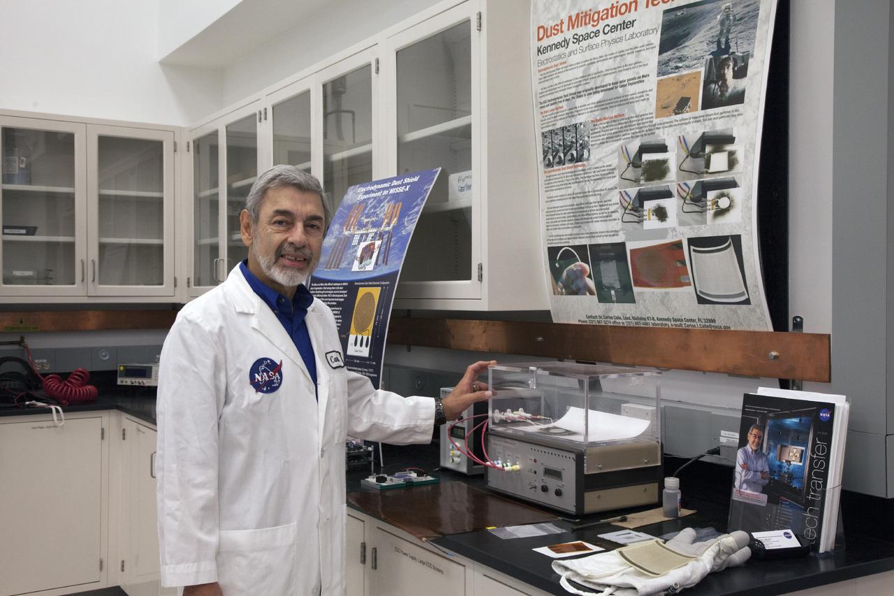
CAPE CANAVERAL, Fla. -- Dr. Carlos Calle, senior research scientist on the Electrodynamic Dust Shield for Dust Mitigation project, demonstrates a dust particle experiment in the Electrostatics and Surface Physics Laboratory in the SwampWorks at NASA's Kennedy Space Center in Florida. The technology works by creating an electric field that propagates out like the ripples on a pond. This could prevent dust accumulation on spacesuits, thermal radiators, solar panels, optical instruments and view ports for future lunar and Mars exploration activities. Electrodynamic dust shield, or EDS, technology is based on concepts originally developed by NASA as early as 1967 and later by the University of Tokyo. In 2003, NASA, in collaboration with the University of Arkansas at Little Rock, started development of the EDS for dust particle removal from solar panels to be used on future missions to the moon, an asteroid or Mars. A flight experiment to expose the dust shields to the space environment currently is under development. For more information, visit: http://www.nasa.gov/content/scientists-developing-ways-to-mitigate-dust-problem-for-explorers/ Photo credit: NASA/Dan Casper
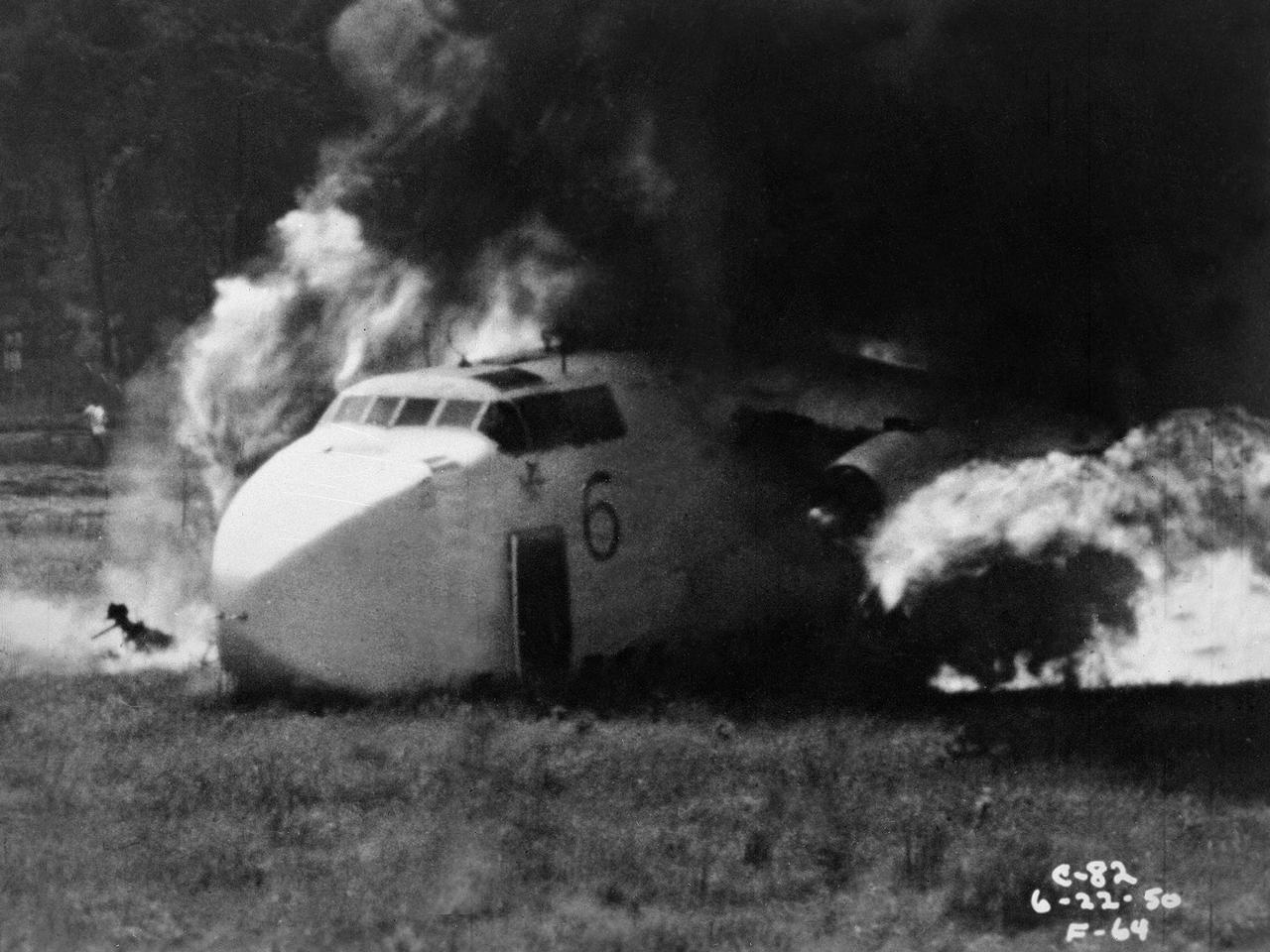
Researchers at the National Advisory Committee for Aeronautics (NACA) Lewis Flight Propulsion Laboratory purposely crash a Fairchild C-82 Packet aircraft to study flame propagation. A rash of passenger aircraft crashes in 1946 and 1947 spurred a White House call for an investigatory board staffed by members of the Civil Aeronautics Board, military, and the NACA. The group addressed fire segregation, extinguishment, and prevention. The NACA established a Subcommittee on Aircraft Fire Prevention in February 1948 to coordinate its efforts. The Lewis team simulated situations in which an aircraft failed to become airborne during takeoff resulting in crashes into embankments and other objects. The Lewis researchers initially used surplus C-46 and C-82 military transport planes. In these situations, the aircraft generally suffered damage to its fuel system and other components, but was structurally survivable. The aircraft were mounted to a rail that ran down a 1700-foot long test runway. The aircraft was secured at the starting point with an anchor pier so it could get its engines up to takeoff speed before launching down the track. Barriers at the end of the runway were designed to simulate a variety of different types of crashes. Telemetry and high-speed cameras were crucial elements in these studies. The preliminary testing phase identified potential ignition sources and analyzed the spread of flammable materials.
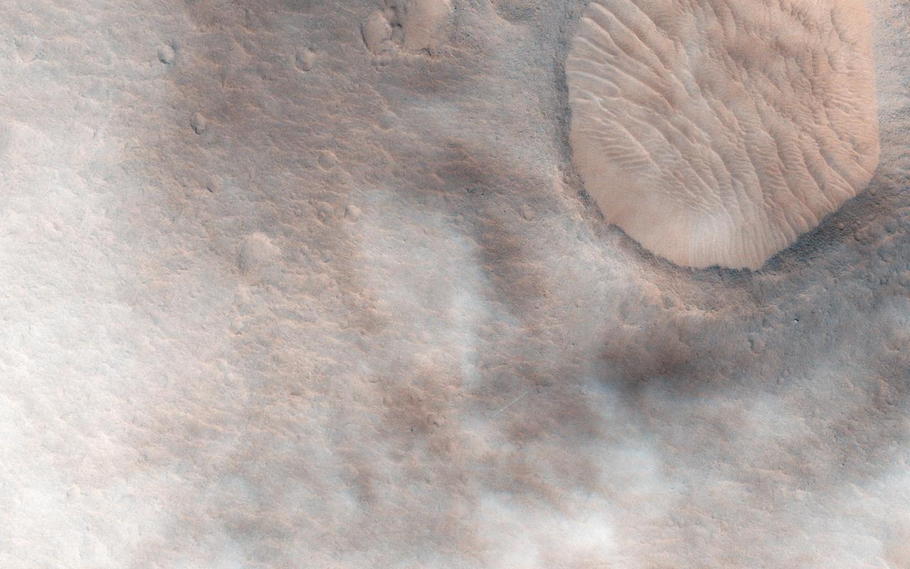
This observation from NASA Mars Reconnaissance Orbite shows a candidate 2018 European Space Agency ExoMars landing site in Hypanis Vallis. Instead of imaging ancient fluvial deposits (thought to be the remnants of a delta feed lake), the image shows patchy concentrations of dust clouds. These clouds are part of the annually occurring Acidalia storm track, a regional dust storm system that originates in the Acidalia-Chryse-Kasei region and propagates southward into equatorial Valles Marineris and beyond. While this image is only partially obscured by dust, many others captured around this time frame were completely dominated by think clouds of dust. For example, this image in Capri Chasma was rendered useless for geology and will have to be reacquired. Landing by the ExoMars rover in these kinds of atmospheric conditions would be complicated. That mission is set to touchdown on Mars in January 2019, hopefully with clear skies. HiRISE will continue to image Hypanis Vallis and other interesting sites on Mars despite the changing weather. http://photojournal.jpl.nasa.gov/catalog/PIA19846
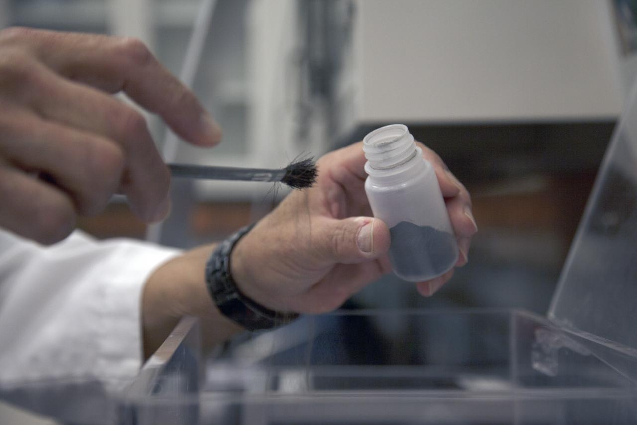
CAPE CANAVERAL, Fla. -- Dr. Carlos Calle, senior research scientist on the Electrodynamic Dust Shield for Dust Mitigation project, works with dust fabricated for use in his experiments in the Electrostatics and Surface Physics Laboratory in the SwampWorks at NASA's Kennedy Space Center in Florida. The fabricated material is designed to mimic the dust on the lunar surface. The technology works by creating an electric field that propagates out like the ripples on a pond. This could prevent dust accumulation on spacesuits, thermal radiators, solar panels, optical instruments and view ports for future lunar and Mars exploration activities. Electrodynamic dust shield, or EDS, technology is based on concepts originally developed by NASA as early as 1967 and later by the University of Tokyo. In 2003, NASA, in collaboration with the University of Arkansas at Little Rock, started development of the EDS for dust particle removal from solar panels to be used on future missions to the moon, an asteroid or Mars. A flight experiment to expose the dust shields to the space environment currently is under development. For more information, visit: http://www.nasa.gov/content/scientists-developing-ways-to-mitigate-dust-problem-for-explorers/ Photo credit: NASA/Dan Casper
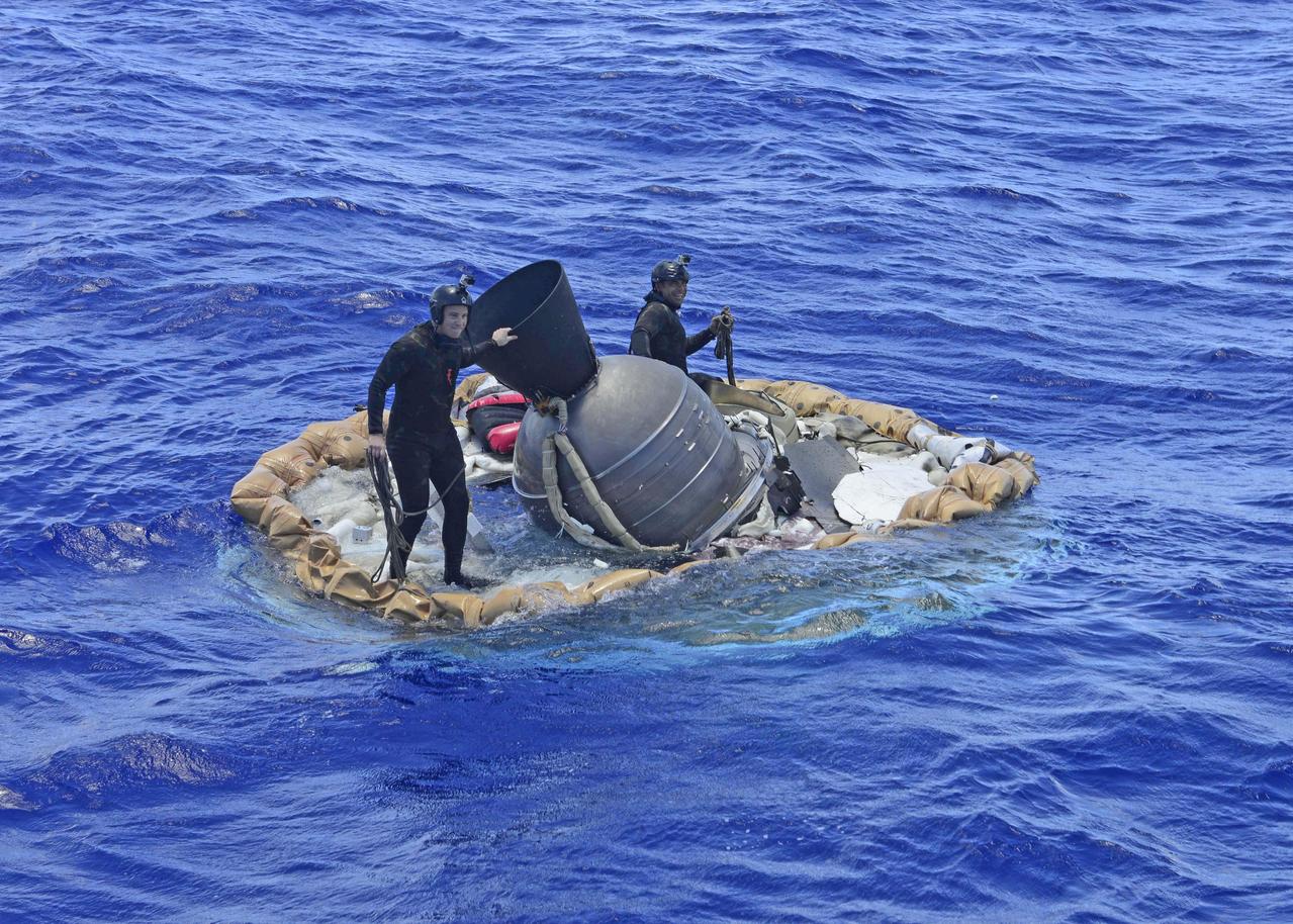
Two members of the U.S. Navy's Mobile Diving Salvage Unit (MDSU) 1 Explosive Ordnance Detachment work on recovering the test vehicle for NASA's Low-Density Supersonic Decelerator (LDSD) project. The saucer-shaped LDSD craft splashed down at 11:49 a.m. HST (2:49 PDT/5:49 p.m. EDT) Monday, June 8, 2015, in the Pacific Ocean off the west coast of the Kauai, Hawaii, after a four-hour experimental flight test that investigated new technologies for landing future robotic and human Mars missions. During the flight test, a Supersonic Inflatable Aerodynamic Decelerator (SIAD) and a supersonic parachute were deployed. The SIAD operated as expected, dramatically slowing the test vehicle's velocity. When the parachute was deployed into the supersonic slipstream, it appeared to blossom to full inflation prior to the emergence of a tear which then propagated and destroyed the parachute's canopy. As a result, the saucer's splashdown in the Pacific Ocean was hard, resulting in fracturing parts of the structure. Memory cards containing comprehensive test data -- including high-speed, high-resolution imagery recorded during the flight -- were successfully recovered. Also recovered were the test vehicle and its components, the supersonic parachute, the ballute used to deploy the parachute, and a large weather balloon that initially carried the saucer to an altitude of 120,000 feet. http://photojournal.jpl.nasa.gov/catalog/PIA19684
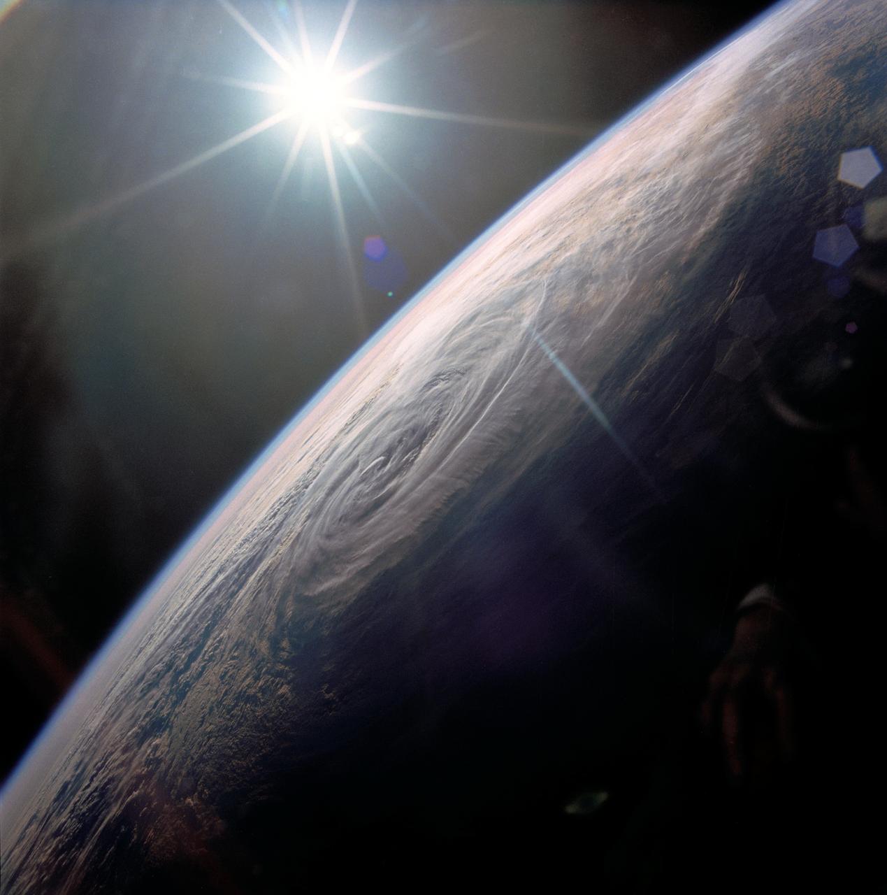
STS032-80-036 (9-20 Jan. 1990) --- This oblique view of Tropical Storm Sam in the eastern Indian Ocean off the western coast of Australia was photographed with a 70mm camera by the astronauts. Tropical Storm Sam (known as Willy-Willy in Australia) was born in the eastern Indian Ocean near the islands of Timor and Sumba in Indonesia. The storm tracked southwestward attaining sustained winds in excess of 60 knots (70 miles per hour). Other than on Christmas Island and the Cocos (Keeling) Islands south of Java, and for strong swells along the western Australia coast, the storm had little impact on land areas. At the time this photograph was taken, the storm was beginning to dissipate in the south Indian Ocean. The eye of the storm is still visible near center, with the swirling bands of the storm propagating in a clockwise direction toward the center. Winds aloft have begun to shear the tops of thunderstorms associated with the storm, forming a high cirrus cloud cover over the center portions of the storm. This picture was used by the crew at their January 30, 1990 Post-Flight Press Conference (PFPC).
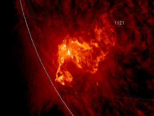
NASA image caputred November 6, 2010 <b>To see a really cool video of this event go here: <a href="http://www.flickr.com/photos/gsfc/5164627471/">www.flickr.com/photos/gsfc/5164627471/</a></b> Active sunspot 1121 has unleashed one of the brightest x-ray solar flares in years, an M5.4-class eruption at 15:36 UT on Nov. 6th. Radiation from the flare created a wave of ionization in Earth's upper atmosphere that altered the propagation of low-frequency radio waves. There was, however, no bright CME (plasma cloud) hurled in our direction, so the event is unlikely to produce auroras in the nights ahead. This is the third M-flare in as many days from this increasingly active sunspot. So far none of the eruptions has been squarely Earth-directed, but this could change in the days ahead as the sun's rotation turns the active region toward our planet. Credit: NASA/SDO/AIA To learn more about SDO go to: <a href="http://sdo.gsfc.nasa.gov/" rel="nofollow">sdo.gsfc.nasa.gov/</a> <b><a href="http://www.nasa.gov/centers/goddard/home/index.html" rel="nofollow">NASA Goddard Space Flight Center</a></b> enables NASA’s mission through four scientific endeavors: Earth Science, Heliophysics, Solar System Exploration, and Astrophysics. Goddard plays a leading role in NASA’s accomplishments by contributing compelling scientific knowledge to advance the Agency’s mission. <b>Follow us on <a href="http://twitter.com/NASA_GoddardPix" rel="nofollow">Twitter</a></b> <b>Join us on <a href="http://www.facebook.com/pages/Greenbelt-MD/NASA-Goddard/395013845897?ref=tsd" rel="nofollow">Facebook</a></b>
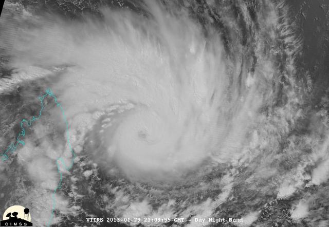
NASA-NOAA's Suomi NPP satellite captured this false-colored night-time image of Cyclone Felleng during the night on Jan. 28, 2013. Felleng is located in the Southern Indian Ocean, and is northwest of Madagascar. The image revealed some pretty cold overshooting tops, topping at ~170K. The image shows some interesting gravity waves propagating out from the storm in both the thermal and visible imagery. For full storm history on NASA's Hurricane Web Page, visit: <a href="http://www.nasa.gov/mission_pages/hurricanes/archives/2013/h2013_Felleng.html" rel="nofollow">www.nasa.gov/mission_pages/hurricanes/archives/2013/h2013...</a> Credit: William Straka, UWM/NASA/NOAA <b><a href="http://www.nasa.gov/audience/formedia/features/MP_Photo_Guidelines.html" rel="nofollow">NASA image use policy.</a></b> <b><a href="http://www.nasa.gov/centers/goddard/home/index.html" rel="nofollow">NASA Goddard Space Flight Center</a></b> enables NASA’s mission through four scientific endeavors: Earth Science, Heliophysics, Solar System Exploration, and Astrophysics. Goddard plays a leading role in NASA’s accomplishments by contributing compelling scientific knowledge to advance the Agency’s mission. <b>Follow us on <a href="http://twitter.com/NASA_GoddardPix" rel="nofollow">Twitter</a></b> <b>Like us on <a href="http://www.facebook.com/pages/Greenbelt-MD/NASA-Goddard/395013845897?ref=tsd" rel="nofollow">Facebook</a></b> <b>Find us on <a href="http://instagram.com/nasagoddard?vm=grid" rel="nofollow">Instagram</a></b>
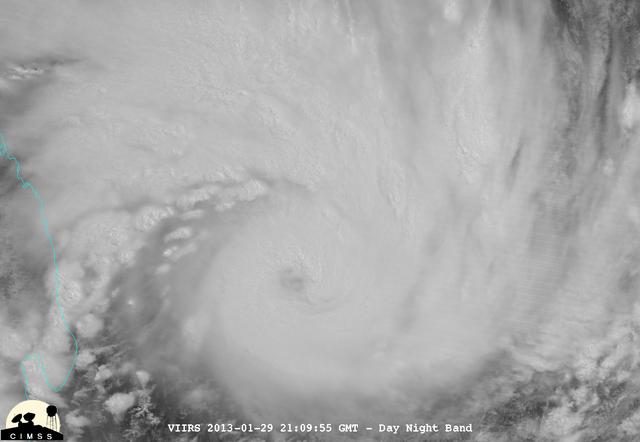
NASA-NOAA's Suomi NPP satellite captured this false-colored night-time image of Cyclone Felleng during the night on Jan. 28, 2013. Felleng is located in the Southern Indian Ocean, and is northwest of Madagascar. The image revealed some pretty cold overshooting tops, topping at ~170K. The image shows some interesting gravity waves propagating out from the storm in both the thermal and visible imagery. For full storm history on NASA's Hurricane Web Page, visit: <a href="http://www.nasa.gov/mission_pages/hurricanes/archives/2013/h2013_Felleng.html" rel="nofollow">www.nasa.gov/mission_pages/hurricanes/archives/2013/h2013...</a> Credit: William Straka, UWM/NASA/NOAA <b><a href="http://www.nasa.gov/audience/formedia/features/MP_Photo_Guidelines.html" rel="nofollow">NASA image use policy.</a></b> <b><a href="http://www.nasa.gov/centers/goddard/home/index.html" rel="nofollow">NASA Goddard Space Flight Center</a></b> enables NASA’s mission through four scientific endeavors: Earth Science, Heliophysics, Solar System Exploration, and Astrophysics. Goddard plays a leading role in NASA’s accomplishments by contributing compelling scientific knowledge to advance the Agency’s mission. <b>Follow us on <a href="http://twitter.com/NASA_GoddardPix" rel="nofollow">Twitter</a></b> <b>Like us on <a href="http://www.facebook.com/pages/Greenbelt-MD/NASA-Goddard/395013845897?ref=tsd" rel="nofollow">Facebook</a></b> <b>Find us on <a href="http://instagram.com/nasagoddard?vm=grid" rel="nofollow">Instagram</a></b>
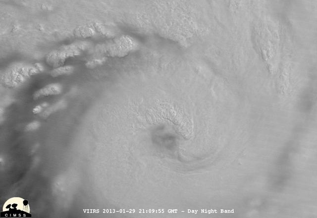
NASA-NOAA's Suomi NPP satellite captured this false-colored night-time image of Cyclone Felleng during the night on Jan. 28, 2013. Felleng is located in the Southern Indian Ocean, and is northwest of Madagascar. The image revealed some pretty cold overshooting tops, topping at ~170K. The image shows some interesting gravity waves propagating out from the storm in both the thermal and visible imagery. For full storm history on NASA's Hurricane Web Page, visit: <a href="http://www.nasa.gov/mission_pages/hurricanes/archives/2013/h2013_Felleng.html" rel="nofollow">www.nasa.gov/mission_pages/hurricanes/archives/2013/h2013...</a> Credit: William Straka, UWM/NASA/NOAA <b><a href="http://www.nasa.gov/audience/formedia/features/MP_Photo_Guidelines.html" rel="nofollow">NASA image use policy.</a></b> <b><a href="http://www.nasa.gov/centers/goddard/home/index.html" rel="nofollow">NASA Goddard Space Flight Center</a></b> enables NASA’s mission through four scientific endeavors: Earth Science, Heliophysics, Solar System Exploration, and Astrophysics. Goddard plays a leading role in NASA’s accomplishments by contributing compelling scientific knowledge to advance the Agency’s mission. <b>Follow us on <a href="http://twitter.com/NASA_GoddardPix" rel="nofollow">Twitter</a></b> <b>Like us on <a href="http://www.facebook.com/pages/Greenbelt-MD/NASA-Goddard/395013845897?ref=tsd" rel="nofollow">Facebook</a></b> <b>Find us on <a href="http://instagram.com/nasagoddard?vm=grid" rel="nofollow">Instagram</a></b>
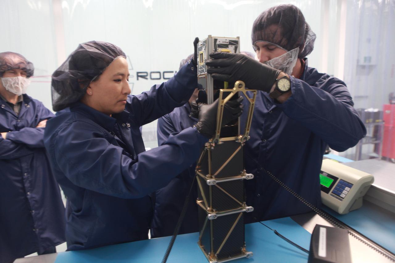
The goal of the CHOMPTT mission is to demonstrate new technologies that could be used for navigation and satellite networking in deep space. For future explorers and colonizers of the Moon or Mars, navigation systems like GPS here on Earth, will be essential. The key idea behind CHOMPTT is to use lasers to transfer time code data over long distances instead of radio waves. Because lasers can be more tightly beamed compared to radio waves, more of the transmitted energy reaches its intended target, making them more power-efficient. CHOMPTT takes advantage of this and of new miniature but very stable atomic clocks to produce a timing system with performance similar to that of GPS, but in a very compact and power efficient form factor. We will use a pulsed laser system, located at the Kennedy Space Center that will be synchronized with an atomic clock. Laser pulses will propagate from the ground to the orbiting CHOMPTT CubeSat and back. By precisely measuring the time of emission and detection of these pulses on the ground and in space we can calculate the time discrepancy between the ground atomic clock and the atomic clock on CHOMPTT. Our goal is to do this with an accuracy of 0.2 billionths of a second, or the time it takes light to travel just 6 centimeters. In the future, we envision using this technology on constellations or swarms of small satellites, for example orbiting the Moon, to equip them with precision navigation, networking, and ranging capabilities. CHOMPTT is a collaboration between the University of Florida and the NASA Ames Research Center. The CHOMPTT precision timing payload was designed and built by the Precision Space Systems Lab at the University of Florida, while the 3U CubeSat bus that has prior flight heritage, was provided by NASA Ames. The CHOMPTT mission has been funded by the Air Force Research Lab and by NASA.
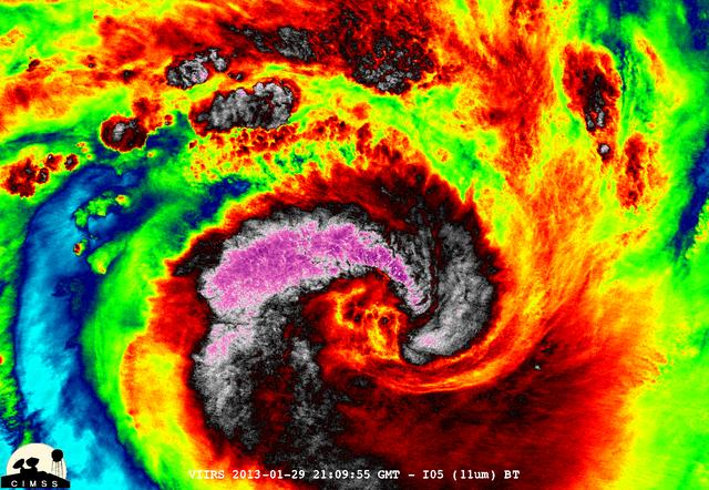
NASA-NOAA's Suomi NPP satellite captured this false-colored night-time image of Cyclone Felleng during the night on Jan. 28, 2013. Felleng is located in the Southern Indian Ocean, and is northwest of Madagascar. The image revealed some pretty cold overshooting tops, topping at ~170K. The image shows some interesting gravity waves propagating out from the storm in both the thermal and visible imagery. For full storm history on NASA's Hurricane Web Page, visit: <a href="http://www.nasa.gov/mission_pages/hurricanes/archives/2013/h2013_Felleng.html" rel="nofollow">www.nasa.gov/mission_pages/hurricanes/archives/2013/h2013...</a> Credit: William Straka, UWM/NASA/NOAA <b><a href="http://www.nasa.gov/audience/formedia/features/MP_Photo_Guidelines.html" rel="nofollow">NASA image use policy.</a></b> <b><a href="http://www.nasa.gov/centers/goddard/home/index.html" rel="nofollow">NASA Goddard Space Flight Center</a></b> enables NASA’s mission through four scientific endeavors: Earth Science, Heliophysics, Solar System Exploration, and Astrophysics. Goddard plays a leading role in NASA’s accomplishments by contributing compelling scientific knowledge to advance the Agency’s mission. <b>Follow us on <a href="http://twitter.com/NASA_GoddardPix" rel="nofollow">Twitter</a></b> <b>Like us on <a href="http://www.facebook.com/pages/Greenbelt-MD/NASA-Goddard/395013845897?ref=tsd" rel="nofollow">Facebook</a></b> <b>Find us on <a href="http://instagram.com/nasagoddard?vm=grid" rel="nofollow">Instagram</a></b>
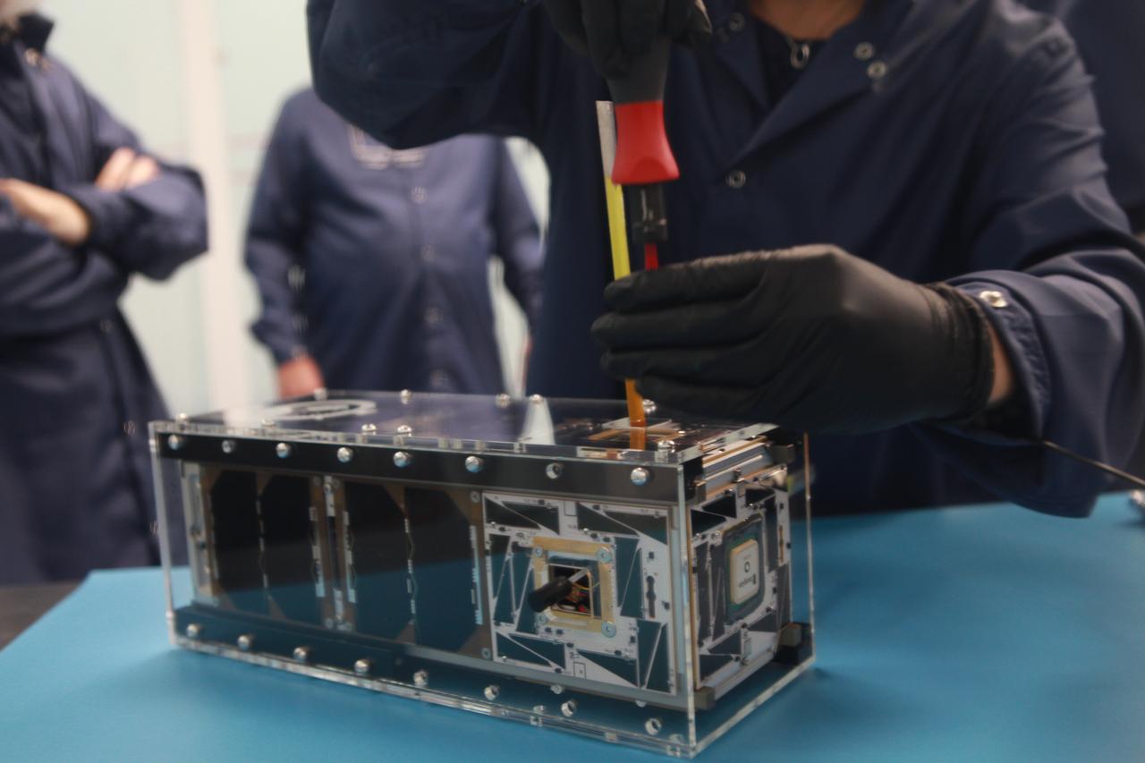
The goal of the CHOMPTT mission is to demonstrate new technologies that could be used for navigation and satellite networking in deep space. For future explorers and colonizers of the Moon or Mars, navigation systems like GPS here on Earth, will be essential. The key idea behind CHOMPTT is to use lasers to transfer time code data over long distances instead of radio waves. Because lasers can be more tightly beamed compared to radio waves, more of the transmitted energy reaches its intended target, making them more power-efficient. CHOMPTT takes advantage of this and of new miniature but very stable atomic clocks to produce a timing system with performance similar to that of GPS, but in a very compact and power efficient form factor. We will use a pulsed laser system, located at the Kennedy Space Center that will be synchronized with an atomic clock. Laser pulses will propagate from the ground to the orbiting CHOMPTT CubeSat and back. By precisely measuring the time of emission and detection of these pulses on the ground and in space we can calculate the time discrepancy between the ground atomic clock and the atomic clock on CHOMPTT. Our goal is to do this with an accuracy of 0.2 billionths of a second, or the time it takes light to travel just 6 centimeters. In the future, we envision using this technology on constellations or swarms of small satellites, for example orbiting the Moon, to equip them with precision navigation, networking, and ranging capabilities. CHOMPTT is a collaboration between the University of Florida and the NASA Ames Research Center. The CHOMPTT precision timing payload was designed and built by the Precision Space Systems Lab at the University of Florida, while the 3U CubeSat bus that has prior flight heritage, was provided by NASA Ames. The CHOMPTT mission has been funded by the Air Force Research Lab and by NASA.
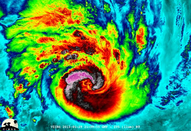
NASA-NOAA's Suomi NPP satellite captured this false-colored night-time image of Cyclone Felleng during the night on Jan. 28, 2013. Felleng is located in the Southern Indian Ocean, and is northwest of Madagascar. The image revealed some pretty cold overshooting tops, topping at ~170K. The image shows some interesting gravity waves propagating out from the storm in both the thermal and visible imagery. For full storm history on NASA's Hurricane Web Page, visit: <a href="http://www.nasa.gov/mission_pages/hurricanes/archives/2013/h2013_Felleng.html" rel="nofollow">www.nasa.gov/mission_pages/hurricanes/archives/2013/h2013...</a> Credit: William Straka, UWM/NASA/NOAA <b><a href="http://www.nasa.gov/audience/formedia/features/MP_Photo_Guidelines.html" rel="nofollow">NASA image use policy.</a></b> <b><a href="http://www.nasa.gov/centers/goddard/home/index.html" rel="nofollow">NASA Goddard Space Flight Center</a></b> enables NASA’s mission through four scientific endeavors: Earth Science, Heliophysics, Solar System Exploration, and Astrophysics. Goddard plays a leading role in NASA’s accomplishments by contributing compelling scientific knowledge to advance the Agency’s mission. <b>Follow us on <a href="http://twitter.com/NASA_GoddardPix" rel="nofollow">Twitter</a></b> <b>Like us on <a href="http://www.facebook.com/pages/Greenbelt-MD/NASA-Goddard/395013845897?ref=tsd" rel="nofollow">Facebook</a></b> <b>Find us on <a href="http://instagram.com/nasagoddard?vm=grid" rel="nofollow">Instagram</a></b>
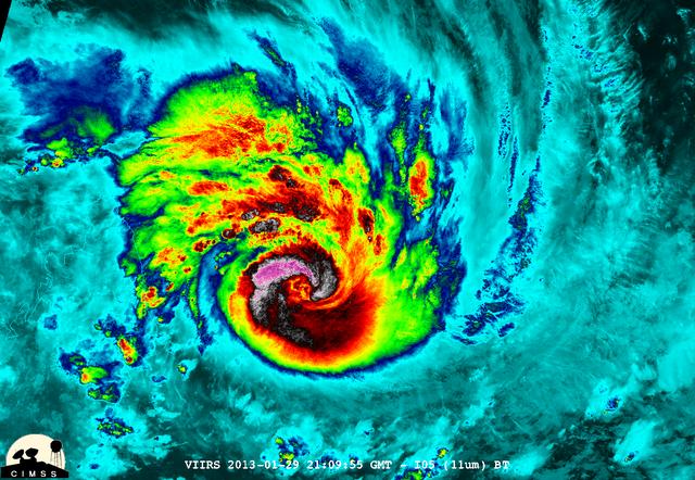
NASA-NOAA's Suomi NPP satellite captured this false-colored night-time image of Cyclone Felleng during the night on Jan. 28, 2013. Felleng is located in the Southern Indian Ocean, and is northwest of Madagascar. The image revealed some pretty cold overshooting tops, topping at ~170K. The image shows some interesting gravity waves propagating out from the storm in both the thermal and visible imagery. For full storm history on NASA's Hurricane Web Page, visit: <a href="http://www.nasa.gov/mission_pages/hurricanes/archives/2013/h2013_Felleng.html" rel="nofollow">www.nasa.gov/mission_pages/hurricanes/archives/2013/h2013...</a> Credit: William Straka, UWM/NASA/NOAA <b><a href="http://www.nasa.gov/audience/formedia/features/MP_Photo_Guidelines.html" rel="nofollow">NASA image use policy.</a></b> <b><a href="http://www.nasa.gov/centers/goddard/home/index.html" rel="nofollow">NASA Goddard Space Flight Center</a></b> enables NASA’s mission through four scientific endeavors: Earth Science, Heliophysics, Solar System Exploration, and Astrophysics. Goddard plays a leading role in NASA’s accomplishments by contributing compelling scientific knowledge to advance the Agency’s mission. <b>Follow us on <a href="http://twitter.com/NASA_GoddardPix" rel="nofollow">Twitter</a></b> <b>Like us on <a href="http://www.facebook.com/pages/Greenbelt-MD/NASA-Goddard/395013845897?ref=tsd" rel="nofollow">Facebook</a></b> <b>Find us on <a href="http://instagram.com/nasagoddard?vm=grid" rel="nofollow">Instagram</a></b>
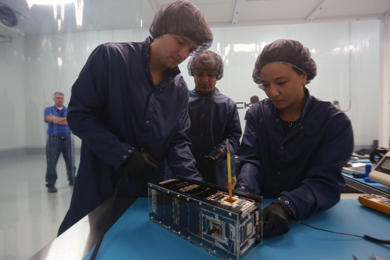
The goal of the CHOMPTT mission is to demonstrate new technologies that could be used for navigation and satellite networking in deep space. For future explorers and colonizers of the Moon or Mars, navigation systems like GPS here on Earth, will be essential. The key idea behind CHOMPTT is to use lasers to transfer time code data over long distances instead of radio waves. Because lasers can be more tightly beamed compared to radio waves, more of the transmitted energy reaches its intended target, making them more power-efficient. CHOMPTT takes advantage of this and of new miniature but very stable atomic clocks to produce a timing system with performance similar to that of GPS, but in a very compact and power efficient form factor. We will use a pulsed laser system, located at the Kennedy Space Center that will be synchronized with an atomic clock. Laser pulses will propagate from the ground to the orbiting CHOMPTT CubeSat and back. By precisely measuring the time of emission and detection of these pulses on the ground and in space we can calculate the time discrepancy between the ground atomic clock and the atomic clock on CHOMPTT. Our goal is to do this with an accuracy of 0.2 billionths of a second, or the time it takes light to travel just 6 centimeters. In the future, we envision using this technology on constellations or swarms of small satellites, for example orbiting the Moon, to equip them with precision navigation, networking, and ranging capabilities. CHOMPTT is a collaboration between the University of Florida and the NASA Ames Research Center. The CHOMPTT precision timing payload was designed and built by the Precision Space Systems Lab at the University of Florida, while the 3U CubeSat bus that has prior flight heritage, was provided by NASA Ames. The CHOMPTT mission has been funded by the Air Force Research Lab and by NASA.
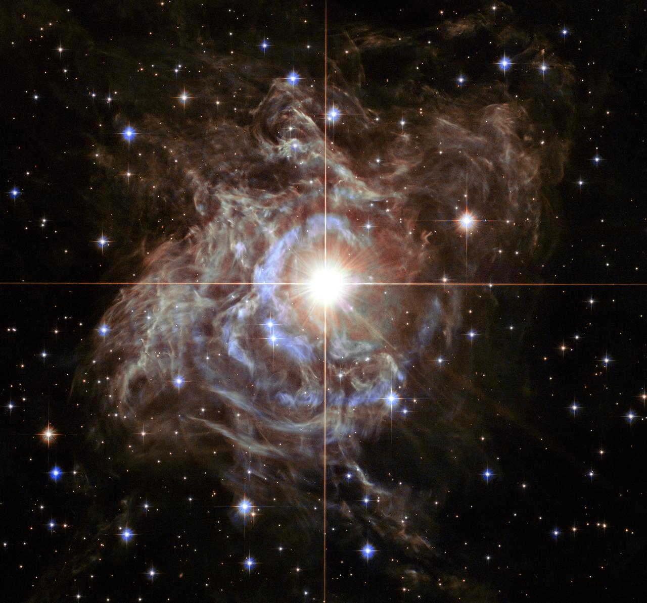
This festive NASA Hubble Space Telescope image resembles a holiday wreath made of sparkling lights. The bright southern hemisphere star RS Puppis, at the center of the image, is swaddled in a gossamer cocoon of reflective dust illuminated by the glittering star. The super star is ten times more massive than our sun and 200 times larger. RS Puppis rhythmically brightens and dims over a six-week cycle. It is one of the most luminous in the class of so-called Cepheid variable stars. Its average intrinsic brightness is 15,000 times greater than our sun’s luminosity. The nebula flickers in brightness as pulses of light from the Cepheid propagate outwards. Hubble took a series of photos of light flashes rippling across the nebula in a phenomenon known as a "light echo." Even though light travels through space fast enough to span the gap between Earth and the moon in a little over a second, the nebula is so large that reflected light can actually be photographed traversing the nebula. By observing the fluctuation of light in RS Puppis itself, as well as recording the faint reflections of light pulses moving across the nebula, astronomers are able to measure these light echoes and pin down a very accurate distance. The distance to RS Puppis has been narrowed down to 6,500 light-years (with a margin of error of only one percent). The Hubble Space Telescope is a project of international cooperation between NASA and the European Space Agency. NASA's Goddard Space Flight Center in Greenbelt, Md., manages the telescope. The Space Telescope Science Institute (STScI) in Baltimore, Md., conducts Hubble science operations. STScI is operated by the Association of Universities for Research in Astronomy, Inc., in Washington, D.C. Acknowledgment: H. Bond (STScI and Pennsylvania State University) <b><a href="http://www.nasa.gov/audience/formedia/features/MP_Photo_Guidelines.html" rel="nofollow">NASA image use policy.</a></b> <b><a href="http://www.nasa.gov/centers/goddard/home/index.html" rel="nofollow">NASA Goddard Space Flight Center</a></b> enables NASA’s mission through four scientific endeavors: Earth Science, Heliophysics, Solar System Exploration, and Astrophysics. Goddard plays a leading role in NASA’s accomplishments by contributing compelling scientific knowledge to advance the Agency’s mission. <b>Follow us on <a href="http://twitter.com/NASA_GoddardPix" rel="nofollow">Twitter</a></b> <b>Like us on <a href="http://www.facebook.com/pages/Greenbelt-MD/NASA-Goddard/395013845897?ref=tsd" rel="nofollow">Facebook</a></b> <b>Find us on <a href="http://instagram.com/nasagoddard?vm=grid" rel="nofollow">Instagram</a></b>

Red and white vapor clouds filled the skies over the Marshall Islands as part of NASA’s Equatorial Vortex Experiment (EVEX). The red cloud was formed by the release of lithium vapor and the white tracer clouds were formed by the release of trimethyl aluminum (TMA). These clouds allowed scientists on the ground from various locations in the Marshall Islands to observe the neutral winds in the ionosphere. Credit: NASA/Jon Grant --- The Equatorial Vortex Experiment (EVEX) was successfully conducted during the early morning hours (eastern time) May 7 from Roi Namur, Republic of the Marshall Islands. A NASA Terrier-Oriole sounding rocket was launched at 3:39 a.m. EDT and was followed by a launch of Terrier-Improved Malemute sounding rocket 90 seconds later. Preliminary indications are that both rockets released their vapor clouds of lithium or trimethyl aluminum, which were observed from various locations in the area, and all science instruments on the rockets worked as planned. More information on EVEX can be found at <a href="http://www.nasa.gov/mission_pages/sounding-rockets/news/evex.html" rel="nofollow">www.nasa.gov/mission_pages/sounding-rockets/news/evex.html</a> These were the second and third rockets of four planned for launch during this year’s campaign in the Marshall Islands. The first and fourth rockets are supporting the Metal Oxide Space Cloud experiment (MOSC), which is studying radio frequency propagation. <b><a href="http://www.nasa.gov/audience/formedia/features/MP_Photo_Guidelines.html" rel="nofollow">NASA image use policy.</a></b> <b><a href="http://www.nasa.gov/centers/goddard/home/index.html" rel="nofollow">NASA Goddard Space Flight Center</a></b> enables NASA’s mission through four scientific endeavors: Earth Science, Heliophysics, Solar System Exploration, and Astrophysics. Goddard plays a leading role in NASA’s accomplishments by contributing compelling scientific knowledge to advance the Agency’s mission. <b>Follow us on <a href="http://twitter.com/NASA_GoddardPix" rel="nofollow">Twitter</a></b> <b>Like us on <a href="http://www.facebook.com/pages/Greenbelt-MD/NASA-Goddard/395013845897?ref=tsd" rel="nofollow">Facebook</a></b> <b>Find us on <a href="http://instagram.com/nasagoddard?vm=grid" rel="nofollow">Instagram</a></b>
![On June 26, 2016, the Moderate Resolution Imaging Spectroradiometer (MODIS) on NASA’s Terra satellite acquired this natural-color image of cloud gravity waves off the coast of Angola and Namibia. “I [regularly] look at this area on Worldview because you quite often have these gravity waves,” said Bastiaan Van Diedenhoven, a researcher for Columbia University and NASA's Goddard Institute for Space Studies interested in cloud formations. “On this day, there was so much going on—so many different waves from different directions—that they really started interfering.” A distinctive criss-cross pattern formed in unbroken stretches hundreds of kilometers long. Similar to a boat’s wake, which forms as the water is pushed upward by the boat and pulled downward again by gravity, these clouds are formed by the rise and fall of colliding air columns. Off of west Africa, dry air coming off the Namib desert—after being cooled by the night—moves out under the balmy, moist air over the ocean and bumps it upwards. As the humid air rises to a higher altitude, the moisture condenses into droplets, forming clouds. Gravity rolls these newly formed clouds into a wave-like shape. When moist air goes up, it cools, and then gravity pushes it down again. As it plummets toward the earth, the moist air is pushed up again by the dry air. Repeated again and again, this process creates gravity waves. Clouds occur at the upward wave motions, while they evaporate at the downward motions. Such waves will often propagate in the morning and early afternoon, said Van Diedenhoven. During the course of the day, the clouds move out to sea and stretch out, as the dry air flowing off the land pushes the moist ocean air westward. NASA Earth Observatory image by Jesse Allen, using data from the Land Atmosphere Near real-time Capability for EOS (LANCE). via @NASAEarth <a href="http://go.nasa.gov/29Btxcy" rel="nofollow">go.nasa.gov/29Btxcy</a> <b><a href="http://go.nasa.gov/29BtHR6" rel="nofollow">NASA image use policy.</a></b> <b><a href="http://go.nasa.gov/29BtDku" rel="nofollow">NASA Goddard Space Flight Center</a></b> enables NASA’s mission through four scientific endeavors: Earth Science, Heliophysics, Solar System Exploration, and Astrophysics. Goddard plays a leading role in NASA’s accomplishments by contributing compelling scientific knowledge to advance the Agency’s mission. <b>Follow us on <a href="http://go.nasa.gov/29BtVrn" rel="nofollow">Twitter</a></b> <b>Like us on <a href="http://go.nasa.gov/29BtygK" rel="nofollow">Facebook</a></b> <b>Find us on <a href="http://go.nasa.gov/29Bu0vu" rel="nofollow">Instagram</a></b>](https://images-assets.nasa.gov/image/GSFC_20171208_Archive_e000269/GSFC_20171208_Archive_e000269~medium.jpg)
On June 26, 2016, the Moderate Resolution Imaging Spectroradiometer (MODIS) on NASA’s Terra satellite acquired this natural-color image of cloud gravity waves off the coast of Angola and Namibia. “I [regularly] look at this area on Worldview because you quite often have these gravity waves,” said Bastiaan Van Diedenhoven, a researcher for Columbia University and NASA's Goddard Institute for Space Studies interested in cloud formations. “On this day, there was so much going on—so many different waves from different directions—that they really started interfering.” A distinctive criss-cross pattern formed in unbroken stretches hundreds of kilometers long. Similar to a boat’s wake, which forms as the water is pushed upward by the boat and pulled downward again by gravity, these clouds are formed by the rise and fall of colliding air columns. Off of west Africa, dry air coming off the Namib desert—after being cooled by the night—moves out under the balmy, moist air over the ocean and bumps it upwards. As the humid air rises to a higher altitude, the moisture condenses into droplets, forming clouds. Gravity rolls these newly formed clouds into a wave-like shape. When moist air goes up, it cools, and then gravity pushes it down again. As it plummets toward the earth, the moist air is pushed up again by the dry air. Repeated again and again, this process creates gravity waves. Clouds occur at the upward wave motions, while they evaporate at the downward motions. Such waves will often propagate in the morning and early afternoon, said Van Diedenhoven. During the course of the day, the clouds move out to sea and stretch out, as the dry air flowing off the land pushes the moist ocean air westward. NASA Earth Observatory image by Jesse Allen, using data from the Land Atmosphere Near real-time Capability for EOS (LANCE). via @NASAEarth <a href="http://go.nasa.gov/29Btxcy" rel="nofollow">go.nasa.gov/29Btxcy</a> <b><a href="http://go.nasa.gov/29BtHR6" rel="nofollow">NASA image use policy.</a></b> <b><a href="http://go.nasa.gov/29BtDku" rel="nofollow">NASA Goddard Space Flight Center</a></b> enables NASA’s mission through four scientific endeavors: Earth Science, Heliophysics, Solar System Exploration, and Astrophysics. Goddard plays a leading role in NASA’s accomplishments by contributing compelling scientific knowledge to advance the Agency’s mission. <b>Follow us on <a href="http://go.nasa.gov/29BtVrn" rel="nofollow">Twitter</a></b> <b>Like us on <a href="http://go.nasa.gov/29BtygK" rel="nofollow">Facebook</a></b> <b>Find us on <a href="http://go.nasa.gov/29Bu0vu" rel="nofollow">Instagram</a></b>
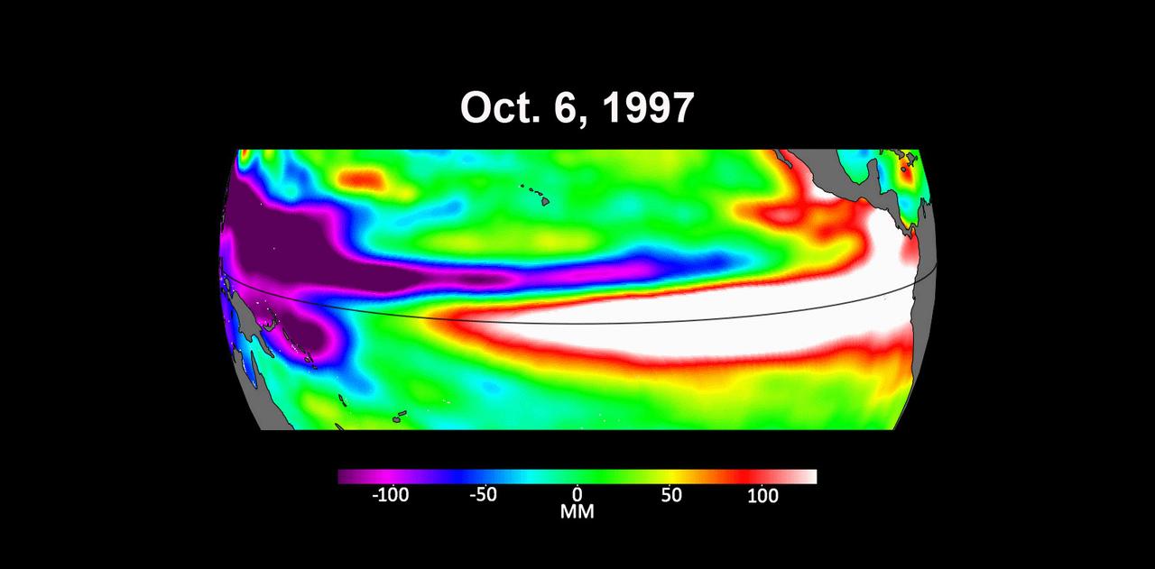
These three maps based on satellite data show sea levels in the Pacific Ocean during developing El Niño events in early October of 1997, 2015, and 2023. Higher-than-average ocean heights are shown in red and white, while lower-than-average heights are blue and purple. The two earlier maps represent the two extreme El Niño events from the past 30 years – the first from 1997 to 1998 and the second from 2015 to 2016. Both caused shifts in global air and ocean temperatures, atmospheric wind and rainfall patterns, and sea level. El Niños are characterized by higher-than-normal sea levels and warmer-than-average ocean temperatures along the equatorial Pacific. Water expands as it warms, so sea levels tend to be higher in places with warmer water. These temperature and sea level conditions can then propagate poleward along the western coasts of the Americas. El Niños can bring wetter conditions to the U.S. Southwest and drought to regions in the western Pacific, including Indonesia. Not all El Niño events are created equal, however, and their impacts vary widely. Satellites like the U.S.-European Sentinel-6 Michael Freilich, which captured the 2023 data, help anticipate those impacts on a global scale by tracking changes in sea surface height in the Pacific Ocean. The TOPEX/Poseidon satellite collected the 1997 data while Jason-2 collected data for the 2015 event. This year's El Niño is still developing, but researchers are looking to the recent past for clues as to how it is shaping up. By October 1997 and 2015, large areas of the central and eastern Pacific had sea levels more than 7 inches (18 centimeters) higher than normal. This year, sea levels are about 2 or 3 inches (5 to 8 centimeters) higher than normal and are elevated over a smaller area compared to the 1997 and 2015 events. Both of the past El Niños reached peak strength in late November or early December, so this year's event may still intensify. Launched in November 2020, Sentinel-6 Michael Freilich is named after former NASA Earth Science Division Director Michael Freilich. The satellite is one of two that compose the Copernicus Sentinel-6/Jason-CS (Continuity of Service) mission. Animation available at https://photojournal.jpl.nasa.gov/catalog/PIA26099
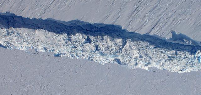
A close-up image of the crack spreading across the ice shelf of Pine Island Glacier shows the details of the boulder-like blocks of ice that fell into the rift when it split. For most of the 18-mile stretch of the crack that NASA’s DC-8 flew over on Oct. 26, 2011, it stretched about 240 feet wide, as roughly seen here. The deepest points ranged from about 165 to 190 feet, roughly equal to the top of the ice shelf down to sea level. Scientists expect the crack to propagate and the ice shelf to calve an iceberg of more than 300 square miles in the coming months. This image was captured by the Digital Mapping System (DMS) aboard the DC-8. Credit: NASA/DMS NASA's Operation IceBridge returns to a base camp of Punta Arenas, Chile for the third year of flights over Antarctica's changing sea ice, glaciers and ice sheets. NASA's DC-8, outfitted with seven remote-sensing instruments, and a Gulfstream 5 operated by the National Science Foundation and National Center for Atmospheric Research and outfitted with a high-altitude laser-ranging mapper, will fly from Chile over Antarctica in October and November. The mission is designed to record changes to Antarctica's ice sheets and give scientists insight into what is driving those changes. Follow the progress of the mission: Campaign News site: <a href="http://www.nasa.gov/mission_pages/icebridge/index.html" rel="nofollow">www.nasa.gov/mission_pages/icebridge/index.html</a> IceBridge blog: <a href="http://blogs.nasa.gov/cm/newui/blog/viewpostlist.jsp?blogname=icebridge" rel="nofollow">blogs.nasa.gov/cm/newui/blog/viewpostlist.jsp?blogname=ic...</a> Twitter: @nasa_ice <b><a href="http://www.nasa.gov/audience/formedia/features/MP_Photo_Guidelines.html" rel="nofollow">NASA image use policy.</a></b> <b><a href="http://www.nasa.gov/centers/goddard/home/index.html" rel="nofollow">NASA Goddard Space Flight Center</a></b> enables NASA’s mission through four scientific endeavors: Earth Science, Heliophysics, Solar System Exploration, and Astrophysics. Goddard plays a leading role in NASA’s accomplishments by contributing compelling scientific knowledge to advance the Agency’s mission. <b>Follow us on <a href="http://twitter.com/NASA_GoddardPix" rel="nofollow">Twitter</a></b> <b>Like us on <a href="http://www.facebook.com/pages/Greenbelt-MD/NASA-Goddard/395013845897?ref=tsd" rel="nofollow">Facebook</a></b> <b>Find us on <a href="http://instagrid.me/nasagoddard/?vm=grid" rel="nofollow">Instagram</a></b>