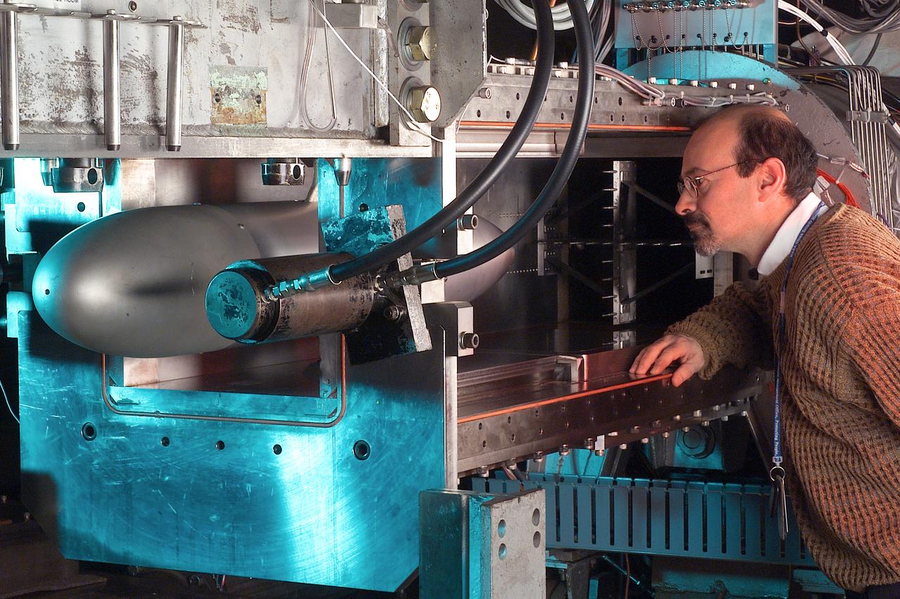
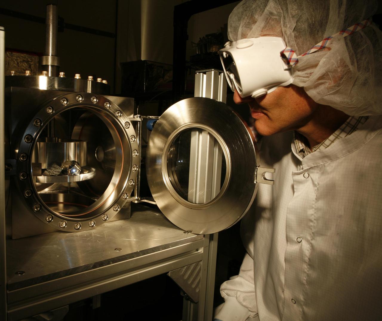
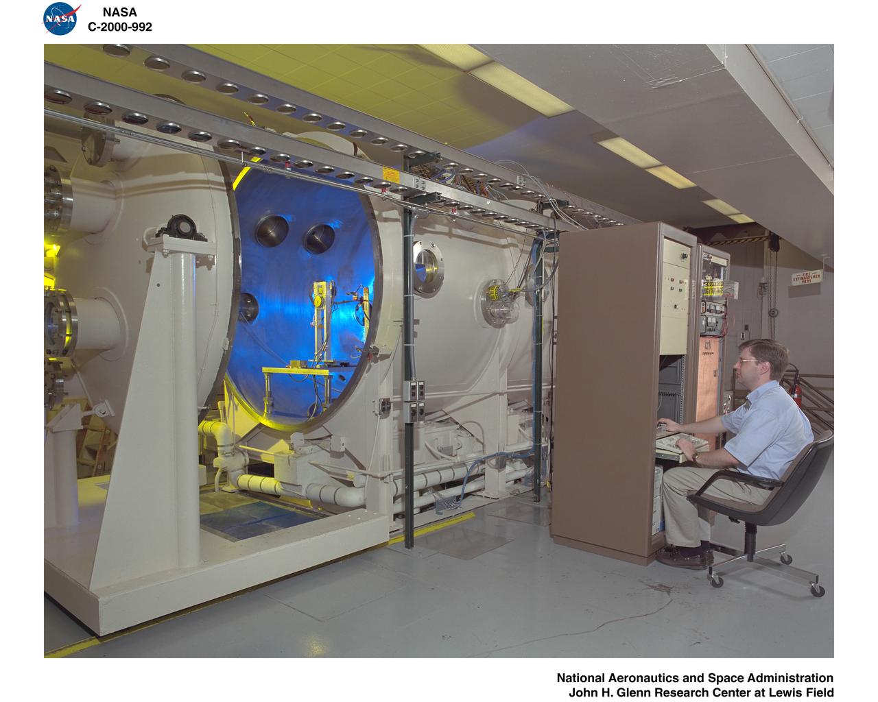
A researcher stands next to the Pulsed Ejector Wave Propagation Test Rig in an opened section of the 1'x1' Supersonic Wind Tunnel at NASA Glenn Research Center.
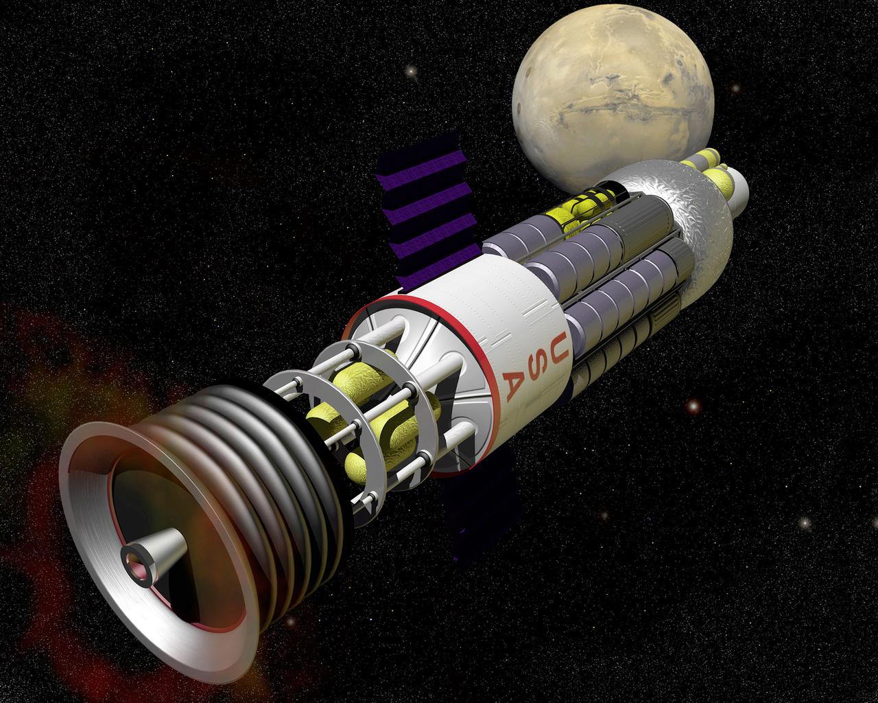
In the 1960's U.S. Government laboratories, under Project Orion, investigated a pulsed nuclear fission propulsion system. Small nuclear pulse units would be sequentially discharged from the aft end of the vehicle. A blast shield and shock absorber system would protect the crew and convert the shock loads into a continuous propulsive force.
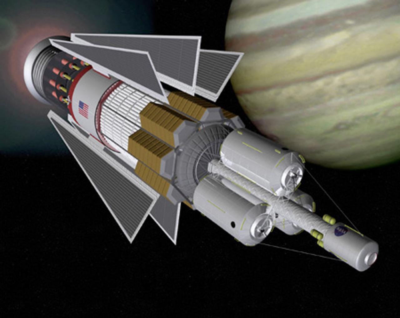
In the 1960's U.S. Government laboratories, under Project Orion, investigated a pulsed nuclear fission propulsion system. Based on Project Orion, an interplanetary vehicle using pulsed fission propulsion would incorporate modern technologies for momentum transfer, thermal management, and habitation design.
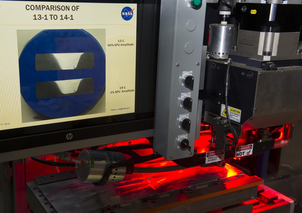
PULSED ULTRASONIC STIR WELDING SYSTEM
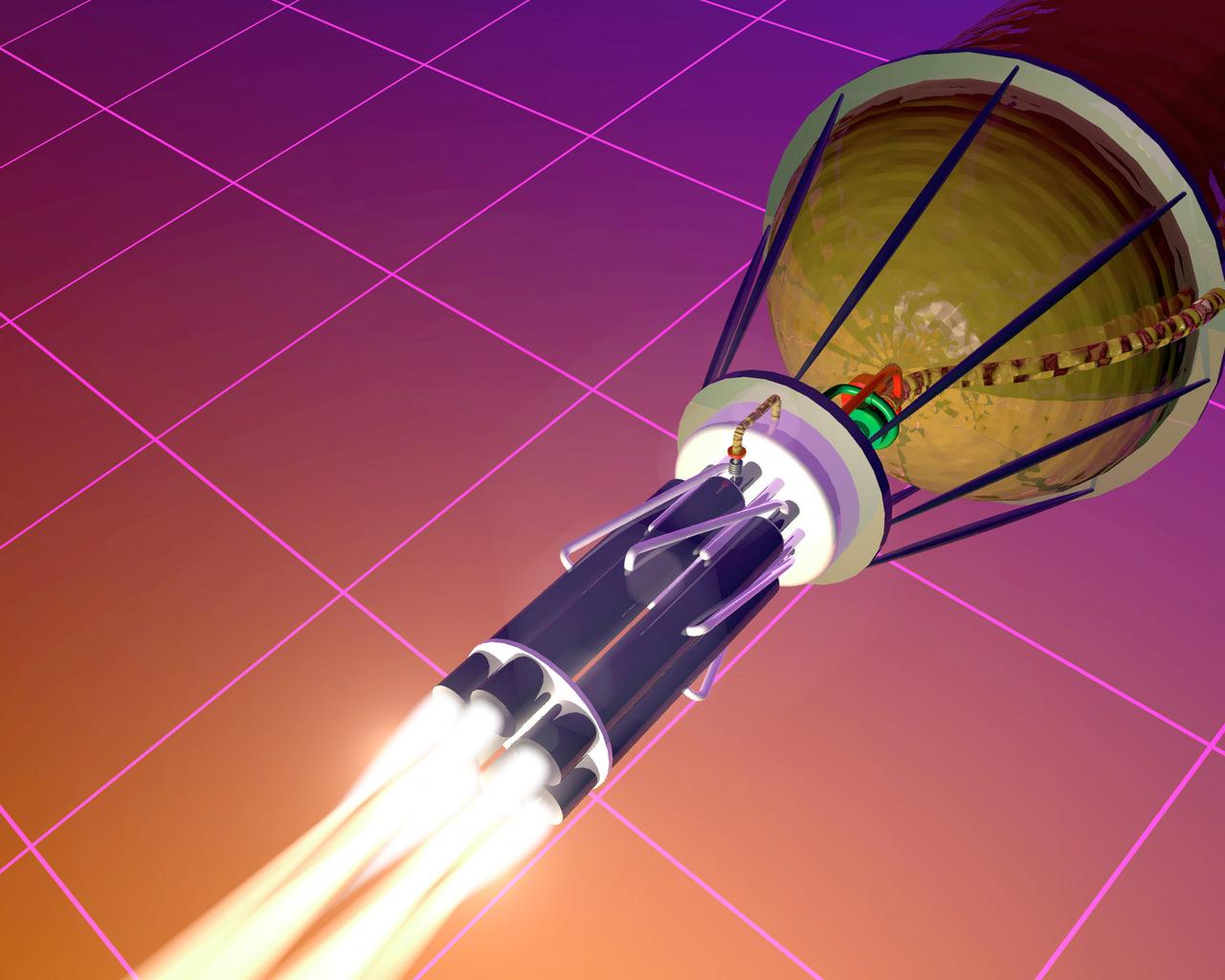
Pictured is an artist's concept of an advanced chemical propulsion system called Pulse Detonation. Long term technology research in this advanced propulsion system has the potential to dramatically change the way we think about space propulsion systems. This research is expected to significantly reduce the cost of space travel within the next 25 years.
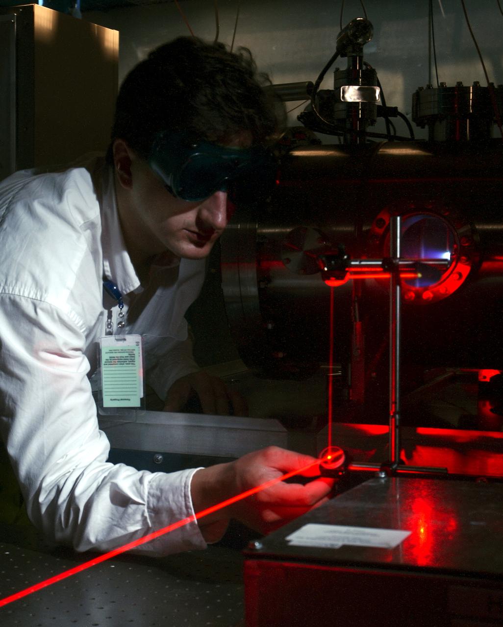
Dr. Tom Markusic, a propulsion research engineer at the Marshall Space Flight Center (MSFC), adjusts a diagnostic laser while a pulsed plasma thruster (PPT) fires in a vacuum chamber in the background. NASA/MSFC's Propulsion Research Center (PRC) is presently investigating plasma propulsion for potential use on future nuclear-powered spacecraft missions, such as human exploration of Mars.
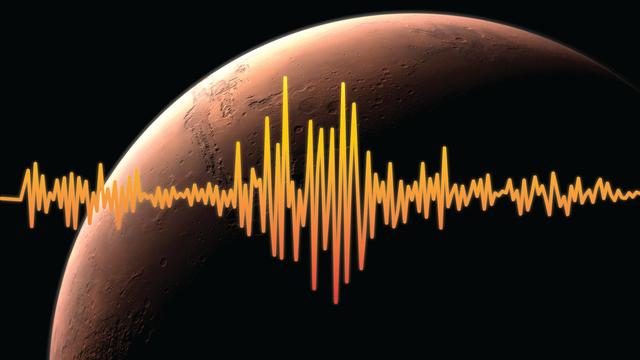
An artist's rendition of Mars, highlighting one of InSight's goals -- to figure out just how tectonically active Mars is today and how often meteorites impact it. Interior Exploration using Seismic Investigations, Geodesy and Heat Transport, or InSight, is scheduled to launch from Vandenberg Air Force Base on the California coast between May 5 through June 8, 2018, and land on Mars six months later. InSight will give the Red Planet its first thorough check up since it formed, 4.5 billion years ago. The InSight lander carries a seismometer, SEIS, that listens to the pulse of Mars. The seismometer records the waves traveling through the interior structure of a planet. Studying seismic waves tells us what might be creating the waves. On Mars, scientists suspect that the waves may be caused by marsquakes, meteorites striking the surface, or hot, molten magma moving at great depths underneath the surface. https://photojournal.jpl.nasa.gov/catalog/PIA22230
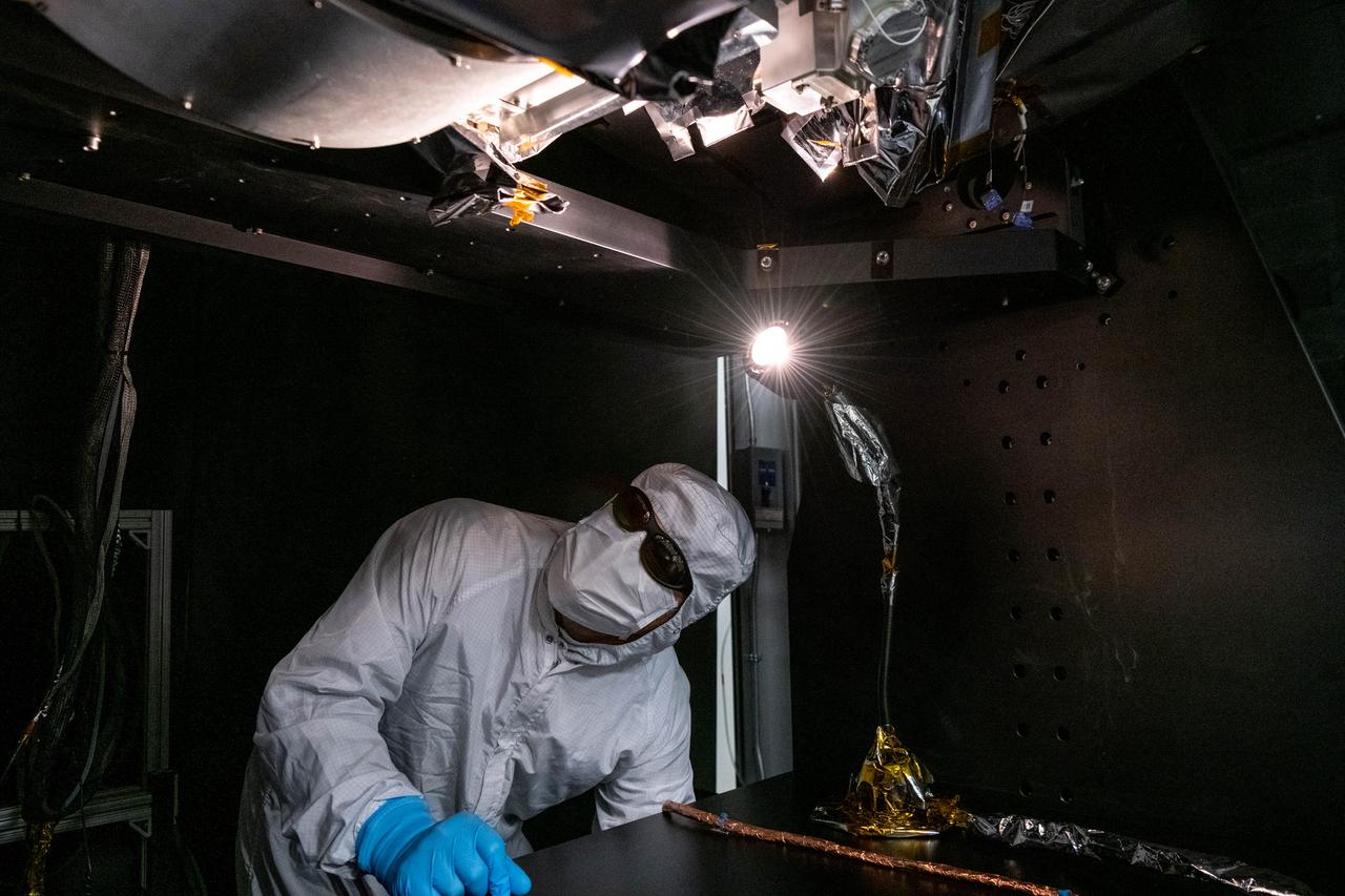
Manufacturing engineer, Roman Nilov, inspects flight hardware after technicians install the Short Wave Infrared (SWIR) Pulse Calibration Assembly (SPCA) fold mirror assembly to the Ocean Color Instrument (OCI). OCI is a highly advanced optical spectrometer that will be used to measure properties of light over portions of the electromagnetic spectrum. It will enable continuous measurement of light at finer wavelength resolution than previous NASA satellite sensors, extending key system ocean color data records for climate studies. OCI is PACE's (Plankton, Aerosol, Cloud, ocean Ecosystem) primary sensor built at Goddard Space Flight Center in Greenbelt, MD.
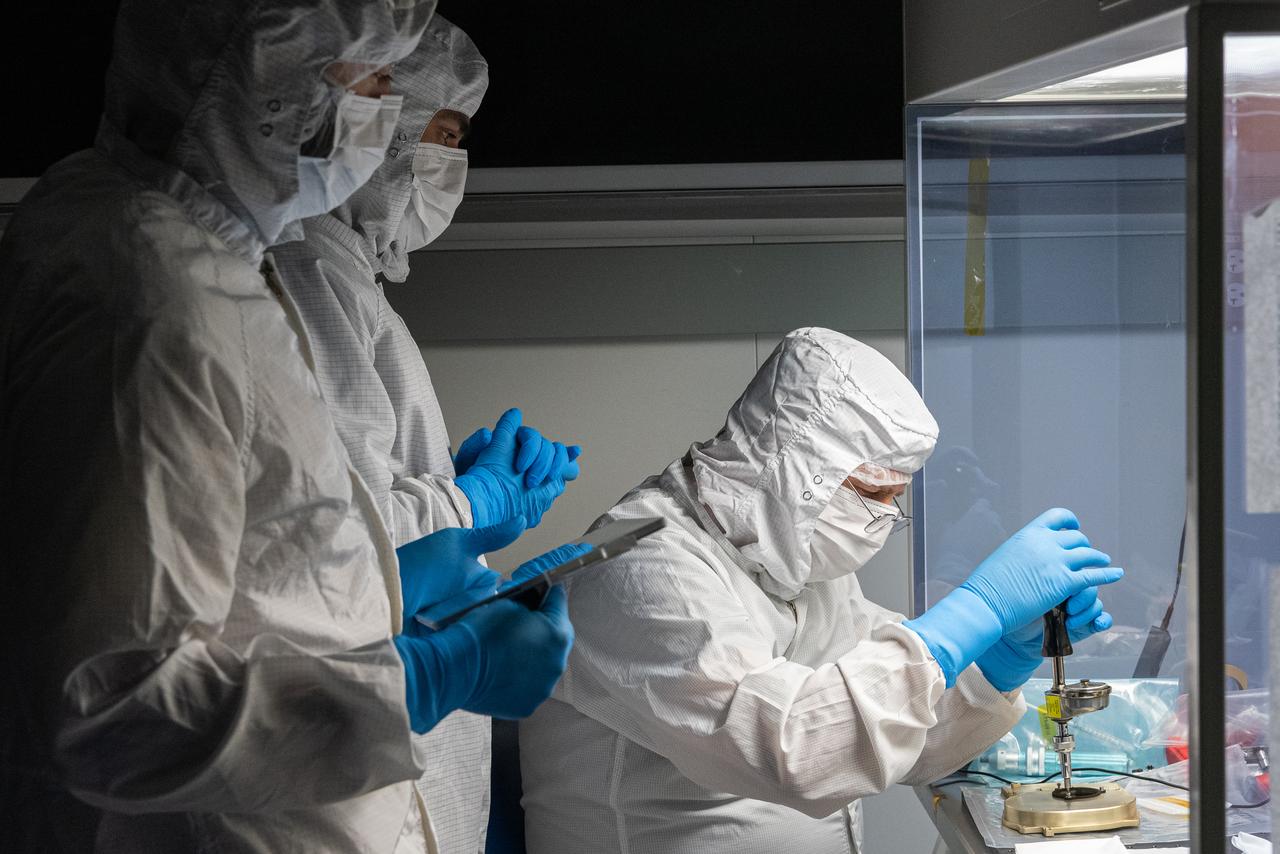
Mechanical technician, Dave Nolan, tightens bolts on the Ocean Color Instrument (OCI) Short Wave Infrared (SWIR) Pulse Calibration Assembly (SPCA). OCI is a highly advanced optical spectrometer that will be used to measure properties of light over portions of the electromagnetic spectrum. It will enable continuous measurement of light at finer wavelength resolution than previous NASA satellite sensors, extending key system ocean color data records for climate studies. OCI is PACE's (Plankton, Aerosol, Cloud, ocean Ecosystem) primary sensor built at Goddard Space Flight Center in Greenbelt, MD.
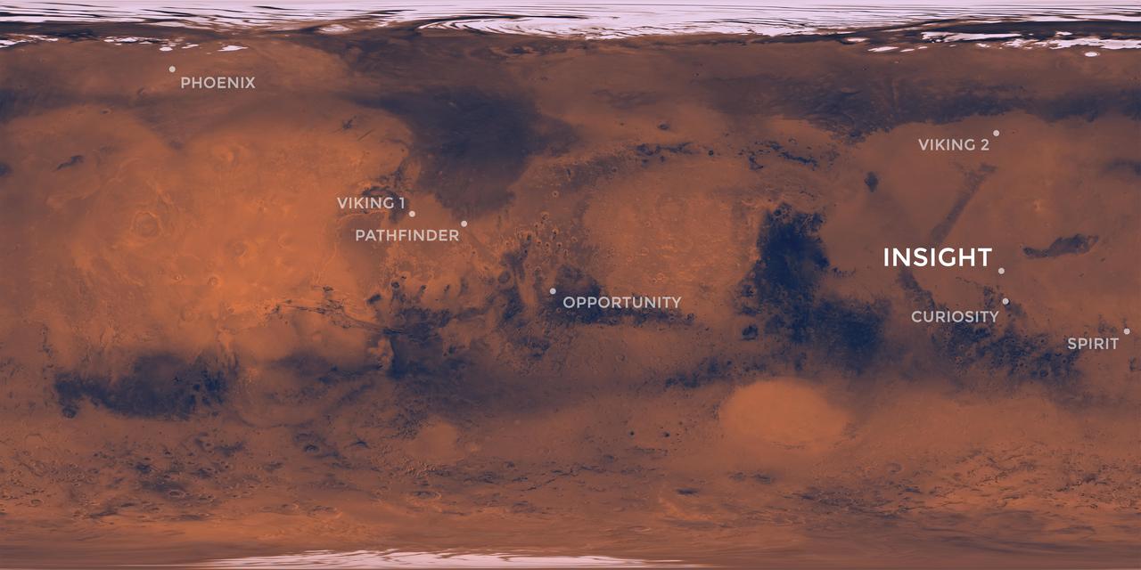
Elysium Planitia, a flat-smooth plain just north of the equator makes for the perfect location from which to study the deep Martian interior. Interior Exploration using Seismic Investigations, Geodesy and Heat Transport, or InSight, is designed to study the deep interior of Mars. The mission seeks the fingerprints of the processes that formed the rocky planets of the solar system. Its landing site, Elysium Planitia, was picked from 22 candidates, and is centered at about 4.5 degrees north latitude and 135.9 degrees east longitude; about 373 miles (600 kilometers) from Curiosity's landing site, Gale Crater. The locations of other Mars landers and rovers are labeled. InSight's scientific success and safe landing depends on landing in a relatively flat area, with an elevation low enough to have sufficient atmosphere above the site for a safe landing. It also depends on landing in an area where rocks are few in number. Elysium Planitia has just the right surface for the instruments to be able to probe the deep interior, and its proximity to the equator ensures that the solar-powered lander is exposed to plenty of sunlight. https://photojournal.jpl.nasa.gov/catalog/PIA22232
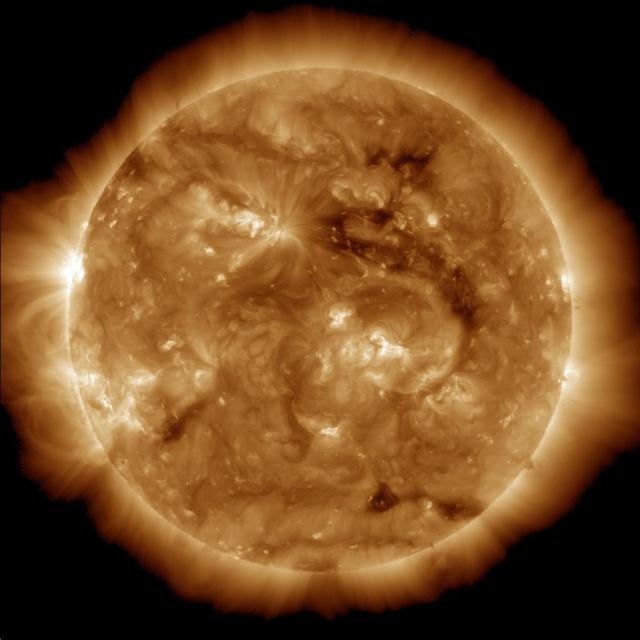
The dark region seen on the face of the sun at the end of March 2013 is a coronal hole just above and to the right of the middle of the picture, which is a source of fast solar wind leaving the sun in this image from NASA Solar Dynamic Observatory.
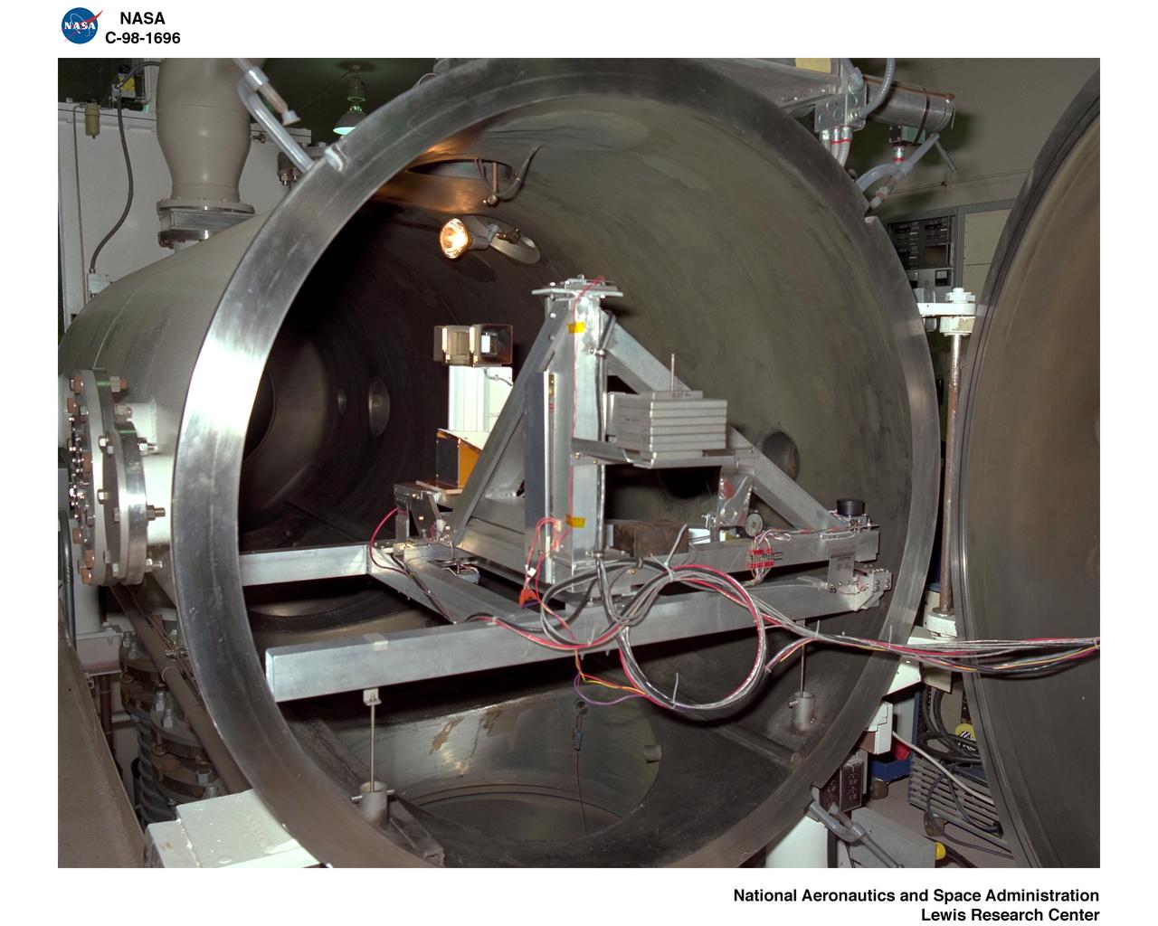
PULSED PLASMA THRUSTER
The ChemCam instrument for NASA Mars Science Laboratory mission uses a pulsed laser beam to vaporize a pinhead-size target, producing a flash of light from the ionized material plasma that can be analyzed to identify chemical elements in the target.
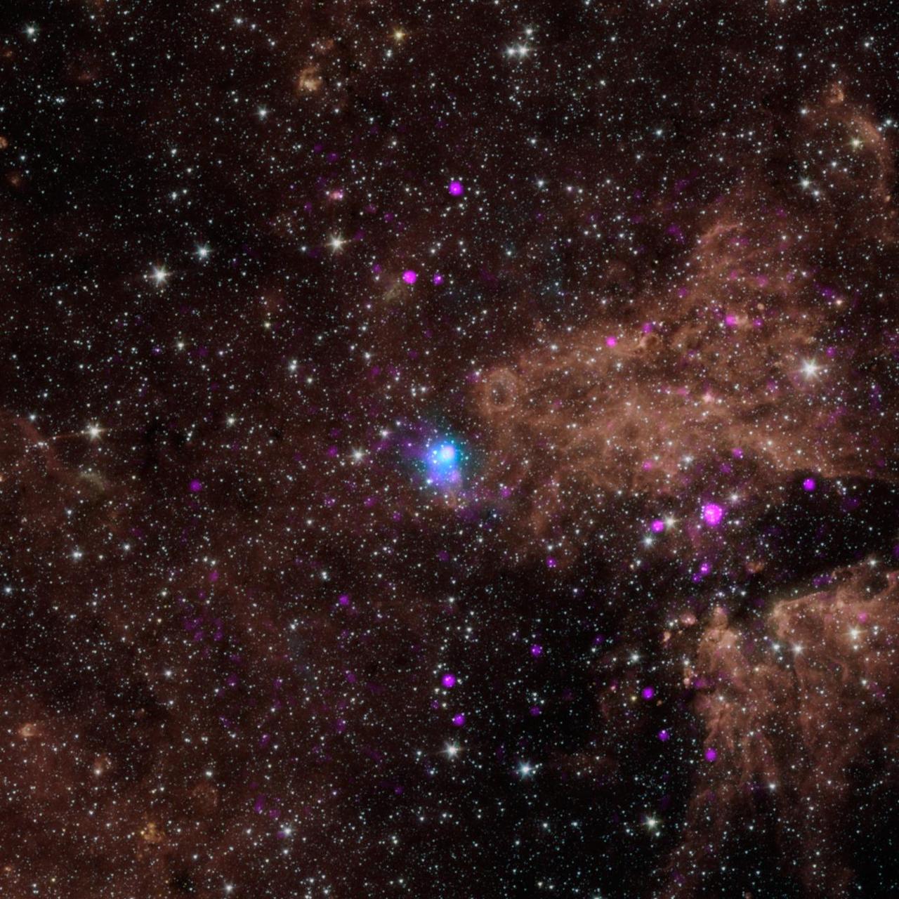
The blue dot in this image marks the spot of an energetic pulsar -- the magnetic, spinning core of star that blew up in a supernova explosion. NASA NuSTAR discovered the pulsar by identifying its telltale pulse.
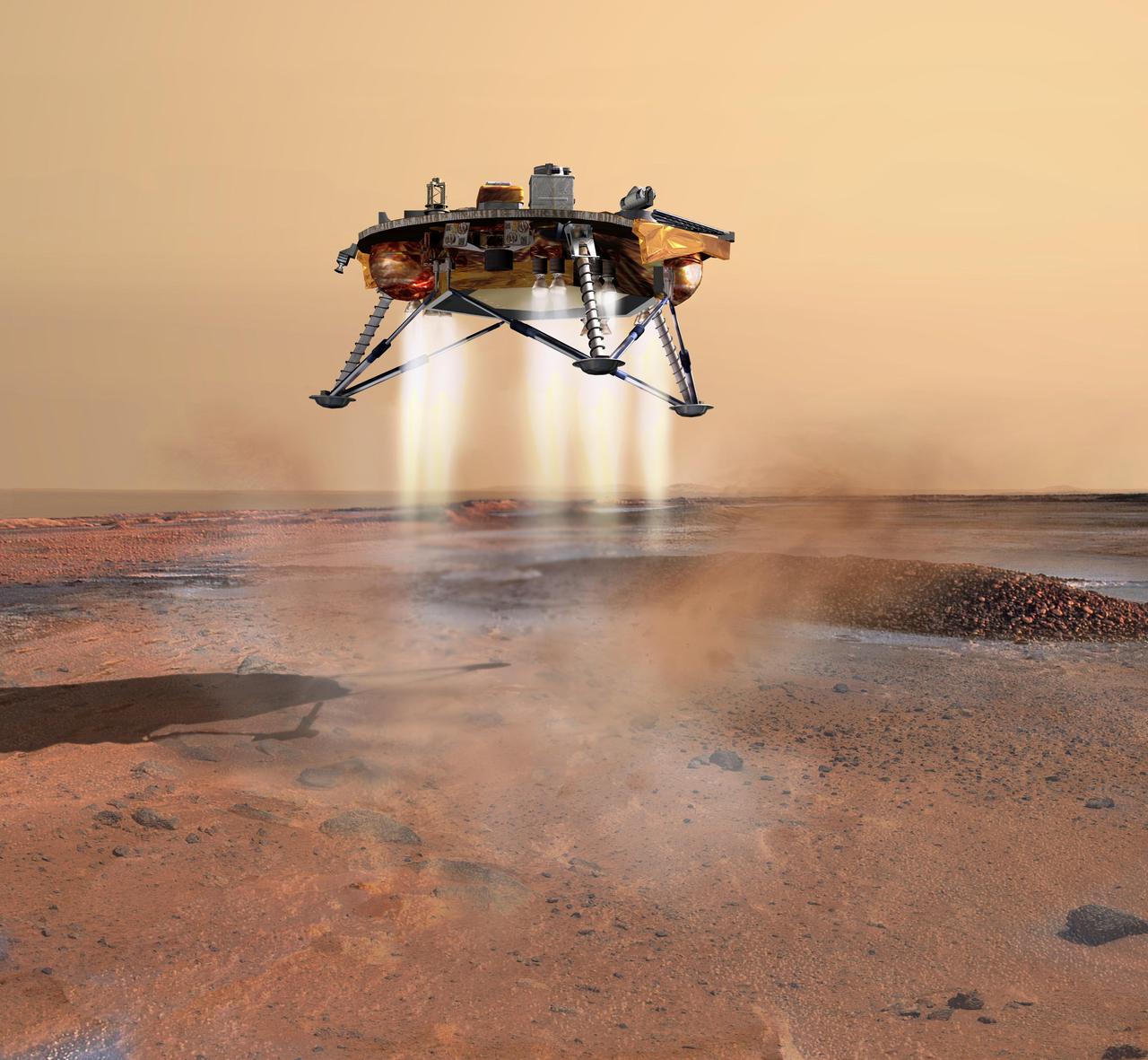
This artist concept depicts NASA Phoenix Mars Lander a moment before its 2008 touchdown on the arctic plains of Mars. Pulsed rocket engines control the spacecraft speed during the final seconds of descent.
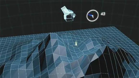
NASA Mercury Laser Altimeter MLA is shown ranging to Mercury surface from orbit. In this animation, yellow flashes represent near-infrared laser pulses that can reflect off terrain in shadow as well as in sunlight.
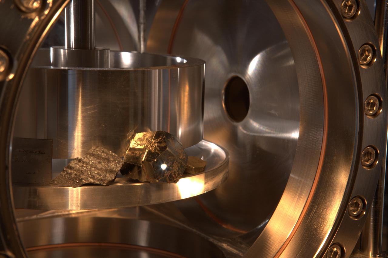
The ChemCam instrument for NASA Mars Science Laboratory mission uses a pulsed laser beam to vaporize a pinhead-size target, producing a flash of light from the ionized material plasma that can be analyzed to identify chemical elements in the target.
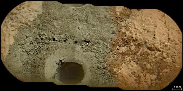
A day after NASA Mars rover Curiosity drilled the first sample-collection hole into a rock on Mars, the rover Chemistry and Camera ChemCam instrument shot laser pulses into the fresh rock powder that the drilling generated.
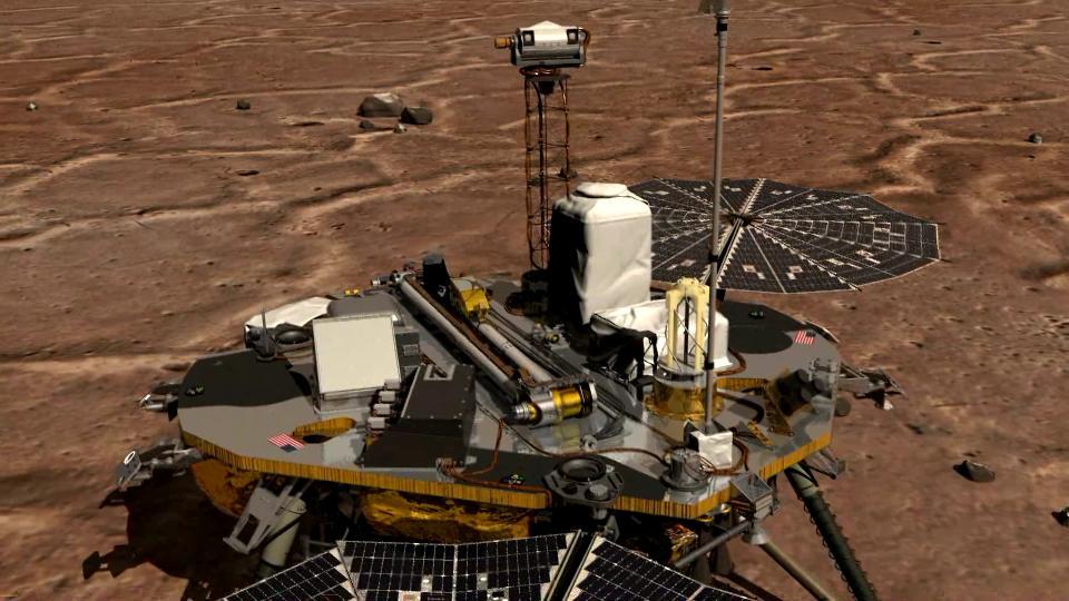
This image from NASA Phoenix Mars Lander of the Canadian-built meteorological station lidar, which was successfully activated on Sol 2 by first opening its dust cover, then emitting rapid pulses of light.
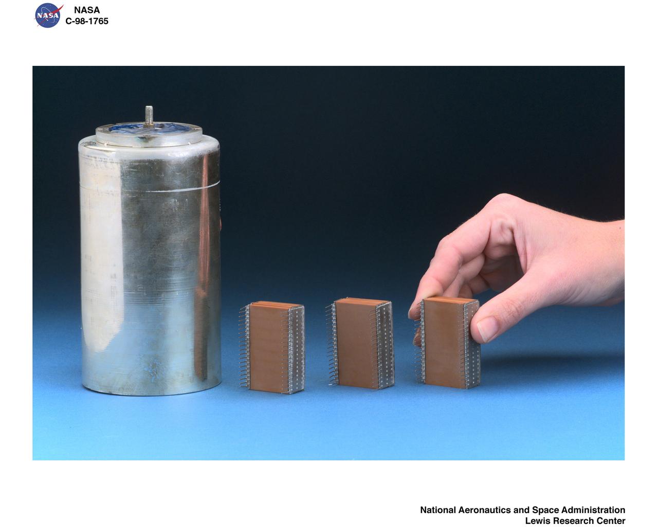
PULSED PLASMA THRUSTER CAPACITOR OPTIONS
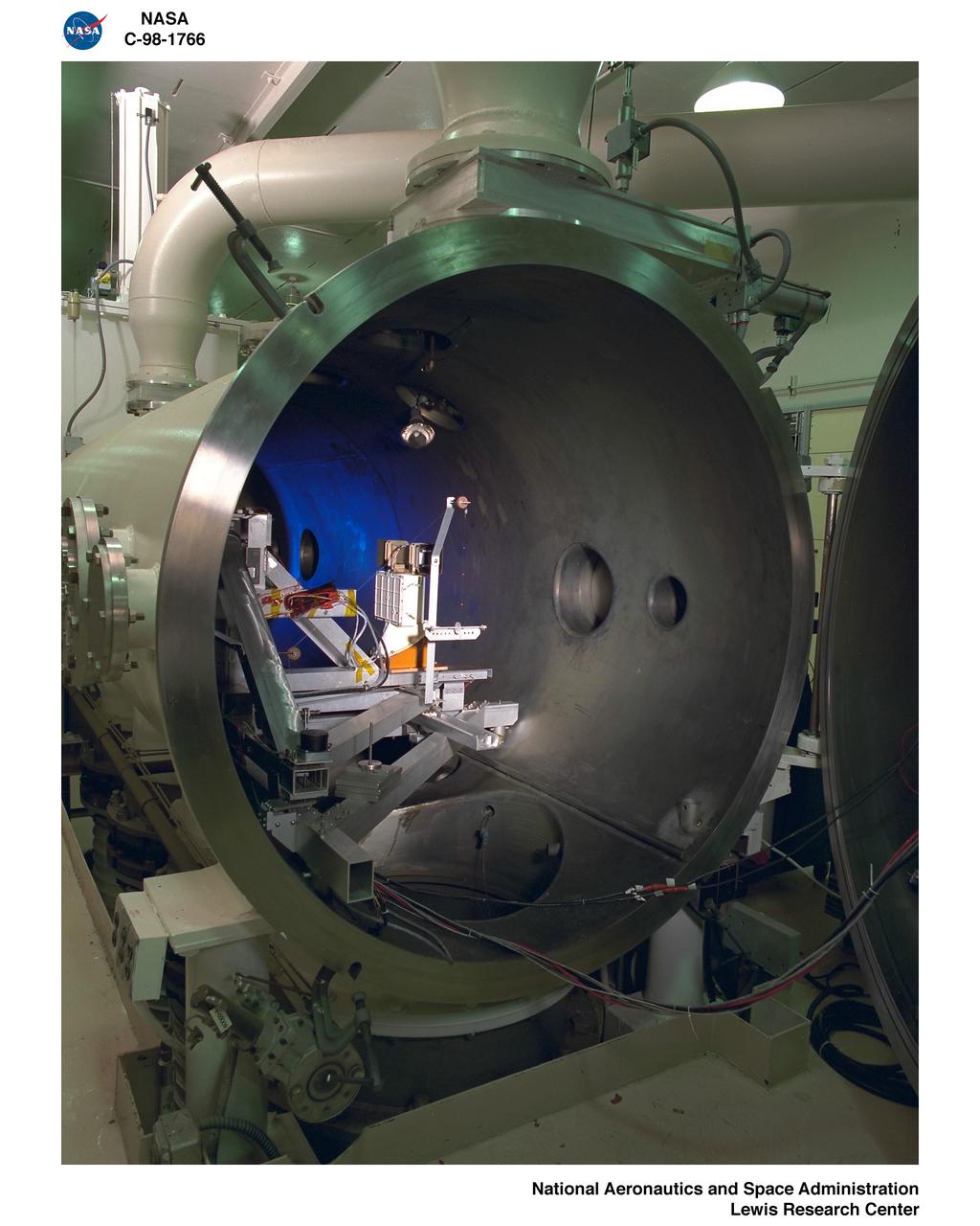
PPT PULSED PLASMA THRUSTER TEST

PULSE PLASMA THRUSTER TRIPLE LANGMUIR PROBE EQUIPMENT
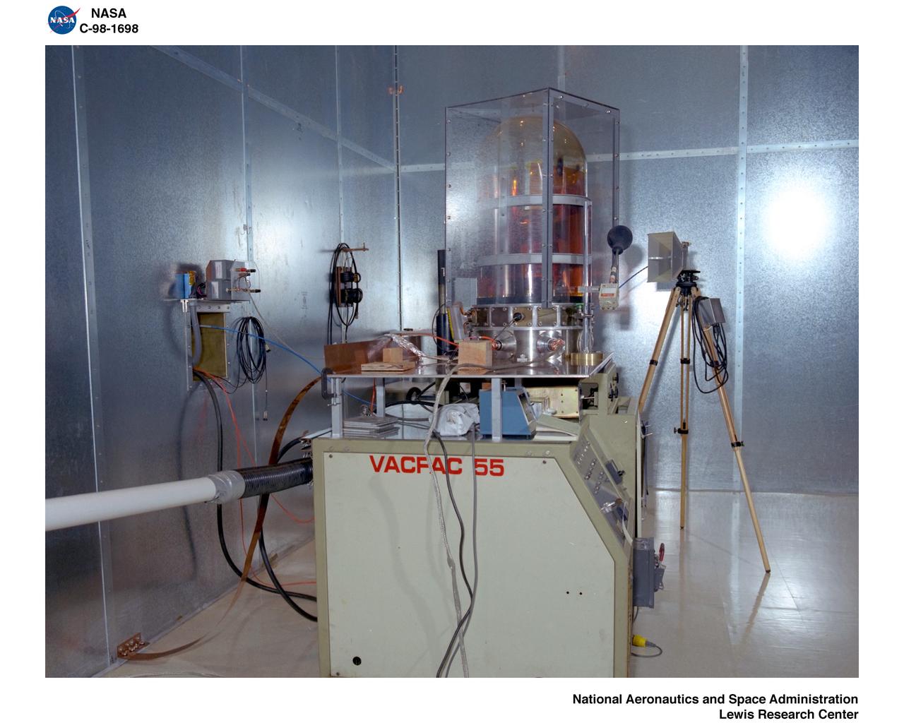
EARTH ORBITOR 1 FLIGHT PULSED PLASMA THRUSTER
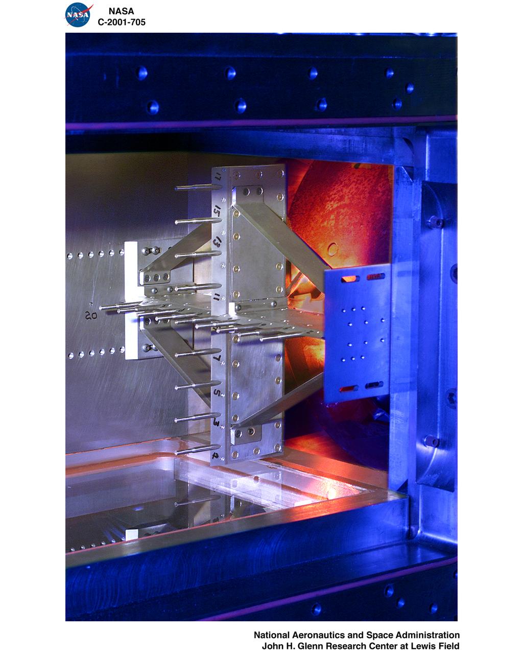
PULSED EJECTOR WAVE PROPAGATION TEST RIG
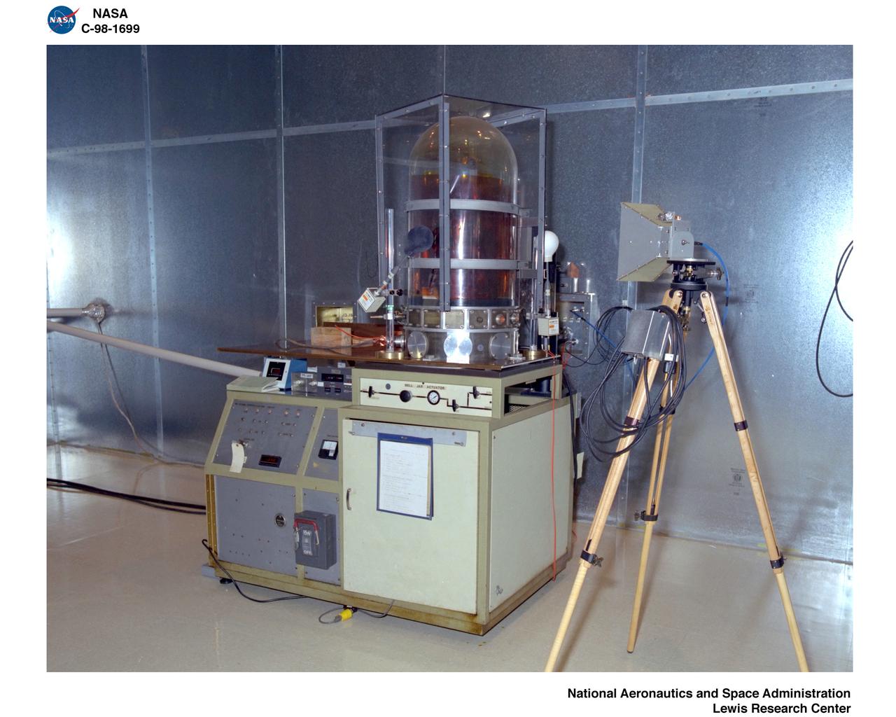
EARTH ORBITOR 1 FLIGHT PULSED PLASMA THRUSTER
PULSE PLASMA THRUSTER TRIPLE LANGMUIR PROBE EQUIPMENT
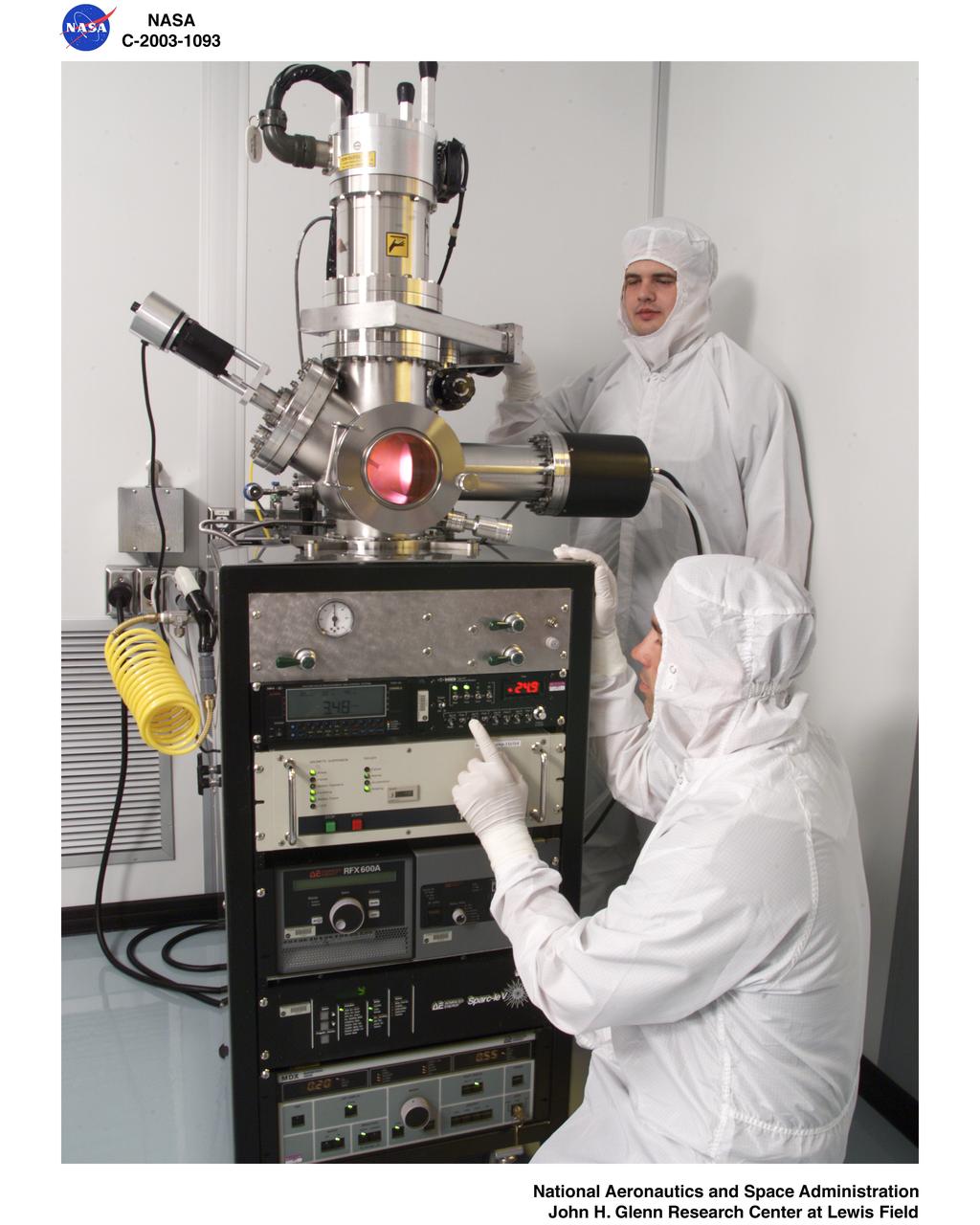
MICROSYSTEMS FABRICATION LABORATORY - PULSED-DC REACTIVE SPUTTERING SYSTEM

EO-1 EARTH ORBITER FLIGHT PPT PULSED PLASMA THRUSTER TESTING
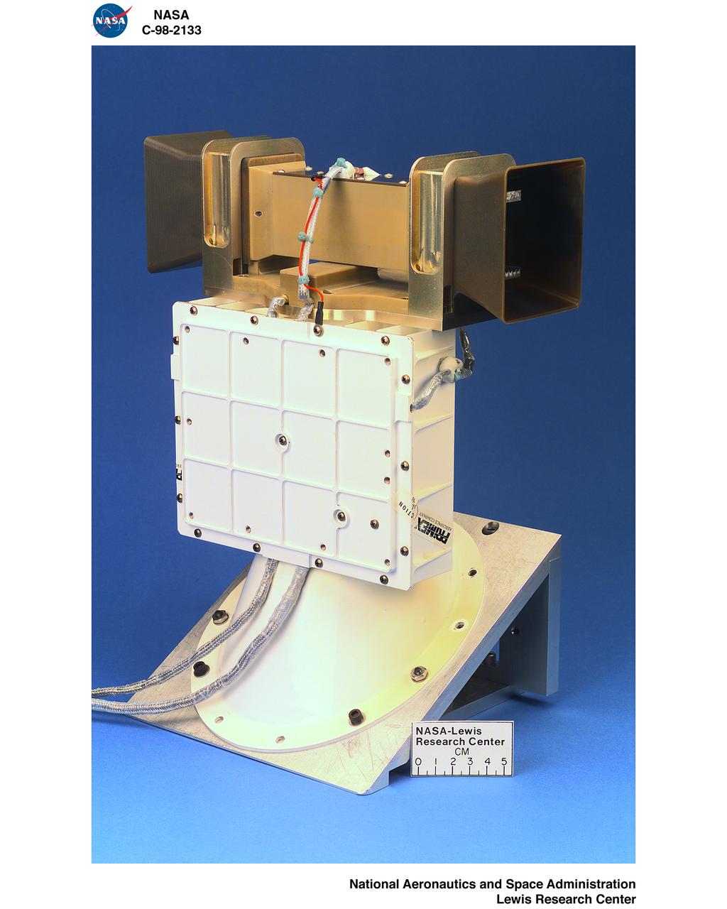
EO-1 EARTH ORBITER FLIGHT PPT PULSED PLASMA THRUSTER TESTING
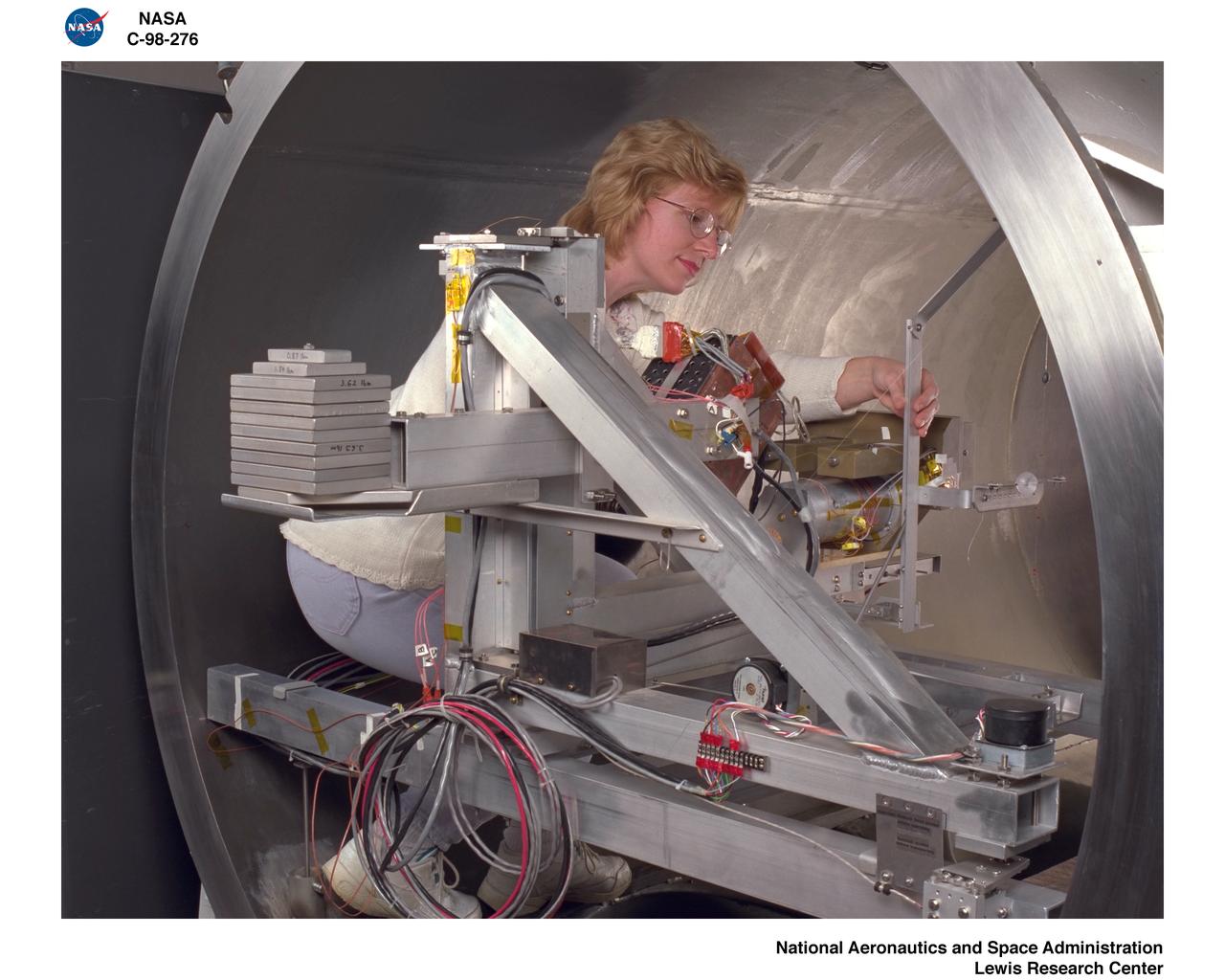
EARTH ORBITOR E0-1 FLIGHT PULSED PLASMA THRUSTER PPT TESTING
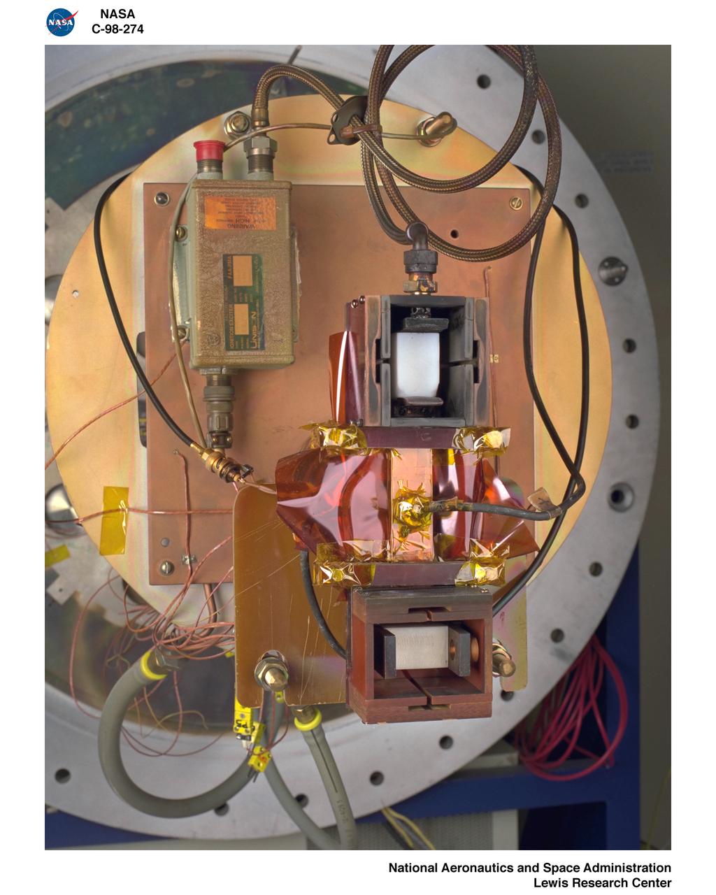
EARTH ORBITOR E0-1 FLIGHT PULSED PLASMA THRUSTER PPT TESTING
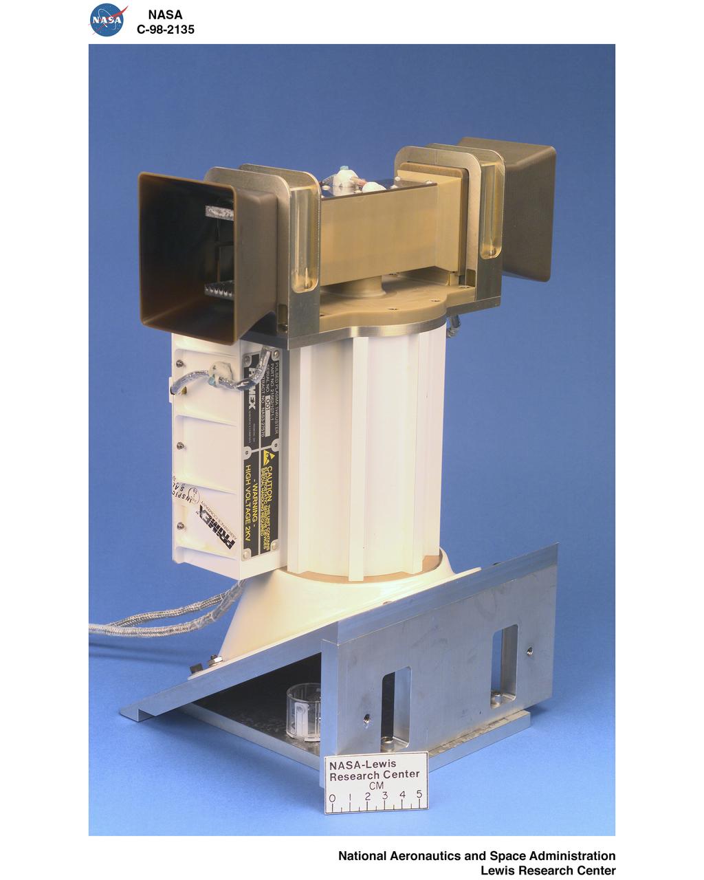
EO-1 EARTH ORBITER FLIGHT PPT PULSED PLASMA THRUSTER TESTING

Two sets of laser pulses transmitted from Earth to a spacecraft over a distance of 1.4 million kilometers 870,000 miles in a communications experiment are shown in this long-exposure image made by NASA’s Galileo spacecraft imaging system. http://photojournal.jpl.nasa.gov/catalog/PIA00230
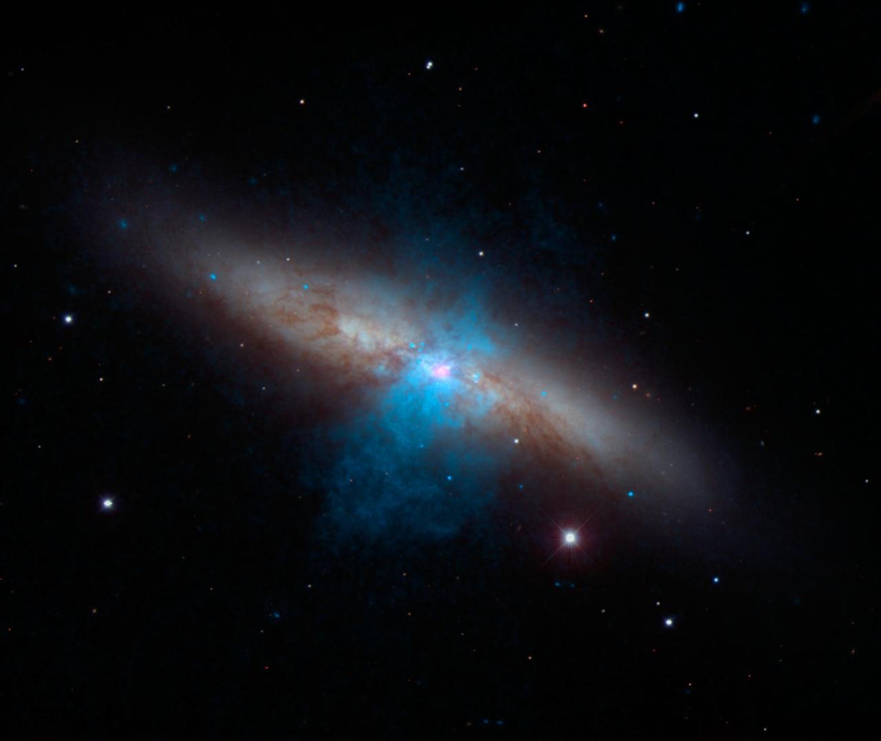
The bulk of a galaxy called Messier 82 M82, or the Cigar galaxy, is seen in visible-light data captured by the National Optical Astronomy Observatory 2.1-meter telescope at Kitt Peak in Arizona.
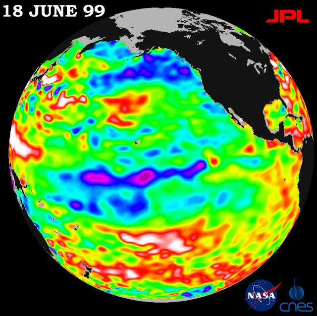
Lingering just a month ago in the eastern Pacific Ocean, the La Niña phenomenon, with its large volume of chilly water, barely has a pulse this month, according to new satellite data from NASA U.S.-French TOPEX/Poseidon mission. The data, taken during a 10-day cycle of data collection ending June 18, show that the equatorial Pacific Ocean is warming up and returning to normal (green) as La Niña all but vanishes. The warming trend is most apparent in the equatorial Pacific Ocean, where only a few patches of cooler, low sea levels (seen in blue and purple) remain. The blue areas are between 5 and 13 centimeters (2 and 5 inches) below normal, whereas the purple areas range from 14 to 18 centimeters (6 to 7 inches) below normal. Like its counterpart, El Niño, a La Niña condition will influence global climate and weather until it has completely subsided. As summer begins in the northern hemisphere, lower-than-normal sea surface levels and cool ocean temperatures persist in the northeastern Gulf of Alaska and along the western coast of North America. In contrast, the trend is the opposite over most of the Pacific, where above-normal sea surface heights and warmer ocean temperatures (indicated by the red and white areas) appear to be increasing and dominating the overall Pacific Ocean. Red areas are about 10 centimeters (4 inches) above normal; white areas show the sea surface height is between 14 and 32 centimeters (6 and 13 inches) above normal. Scientists are not ready to administer last rites to La Niña, though. In the last 12 months, the pool of unusually cold water in the Pacific has shrunk (warmed) several times before cooling (expanding) again. This summer's altimeter data will help them determine whether La Niña has truly dissipated or whether they will see another resurgence of cool water in the Pacific. http://photojournal.jpl.nasa.gov/catalog/PIA01586
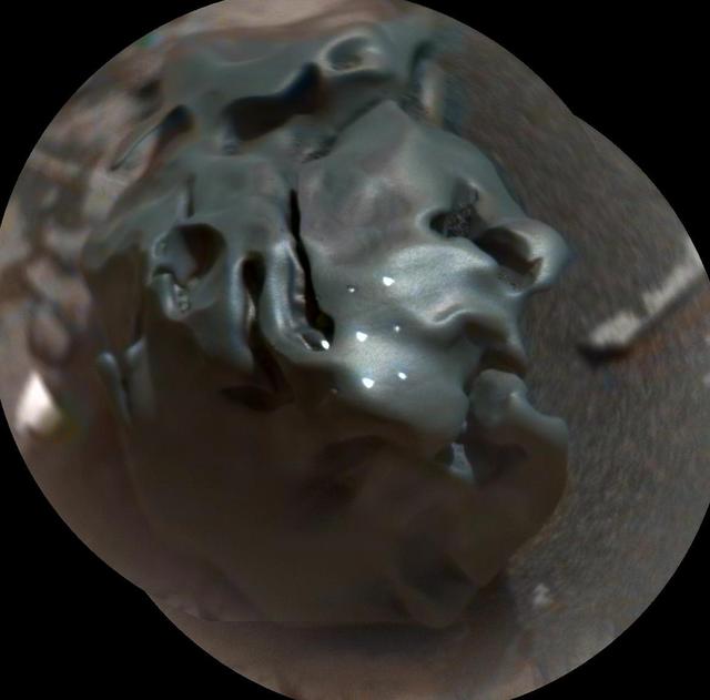
The dark, golf-ball-size object in this composite, colorized view from the Chemistry and Camera (ChemCam) instrument on NASA's Curiosity Mars rover shows a grid of shiny dots where ChemCam had fired laser pulses used for determining the chemical elements in the target's composition. The analysis confirmed that this object, informally named "Egg Rock," is an iron-nickel meteorite. Iron-nickel meteorites are a common class of space rocks found on Earth, and previous examples have been found on Mars, but Egg Rock is the first on Mars to be examined with a laser-firing spectrometer. The laser pulses on Oct. 30, 2016, induced bursts of glowing gas at the target, and ChemCam's spectrometer read the wavelengths of light from those bursts to gain information about the target's composition. The laser pulses also burned through the dark outer surface, exposing bright interior material. This view combines two images taken later the same day by ChemCam's remote micro-imager (RMI) camera, with color added from an image taken by Curiosity's Mast Camera (Mastcam). A Mastcam image of Egg Rock is at PIA21134. http://photojournal.jpl.nasa.gov/catalog/PIA21133
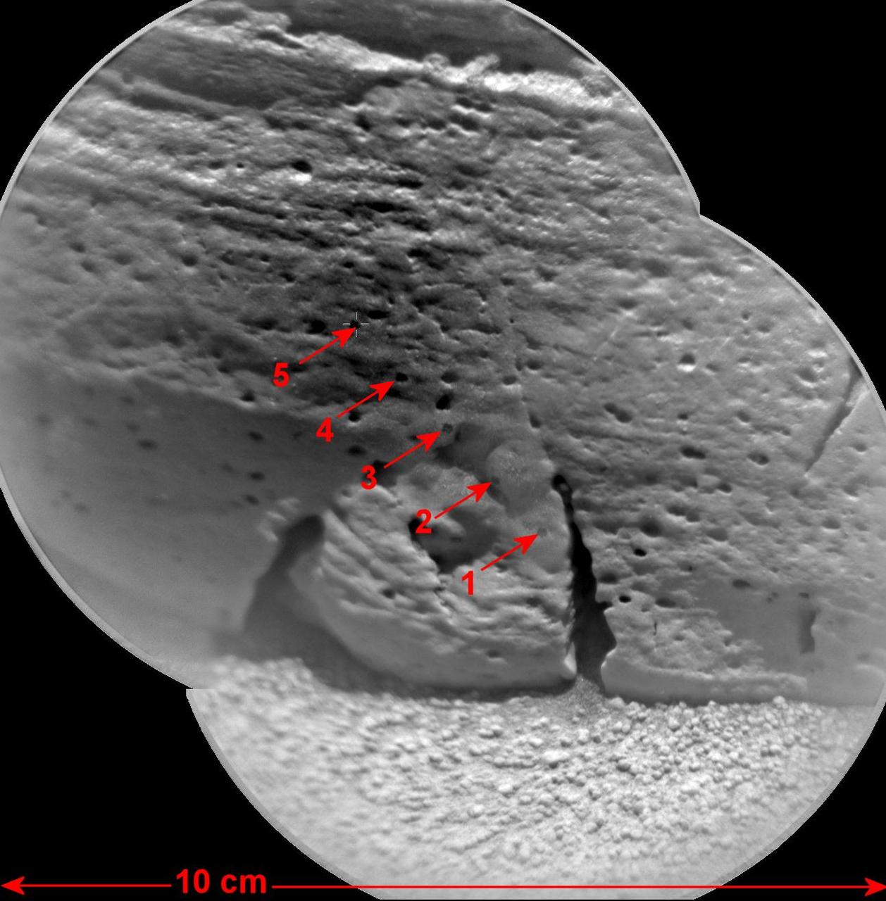
This view of a rock called Rocknest 3 combines two images taken by the Chemistry and Camera ChemCam instrument on the NASA Mars rover Curiosity and indicates five spots where ChemCam had hit the rock with laser pulses to check its composition.

Vital Signs: Taking the Pulse of Our Planet - Annual NASA reception and lecture hosted by the National Air and Space Museum and Sponsored by the Maryland Space Business Roundtable

This artist's concept shows a pulsar, which is like a lighthouse, as its light appears in regular pulses as it rotates. Pulsars are dense remnants of exploded stars, and are part of a class of objects called neutron stars. Magnetars are different kinds of neutron stars -- they have violent, high-energy outbursts of X-ray and gamma ray light. A mysterious object called PSR J1119-6127 has been seen behaving as both a pulsar and a magnetar, suggesting that it could be a "missing link" between these objects. http://photojournal.jpl.nasa.gov/catalog/PIA21085
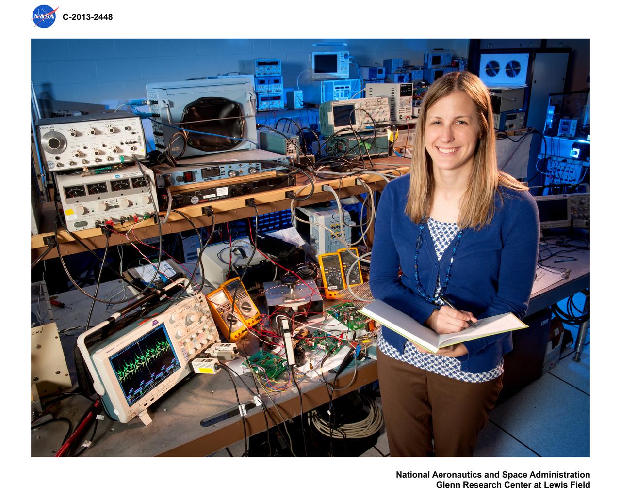
Environmental Portrait, Electrical Power Systems Employee, hardware for the High Power 300-Volt Power Processing Unit (PPU). The Printed Circuit Boards (PCBs) are the Discharge Module Inverter and the Pulse Width Modulation (PWM) Controller
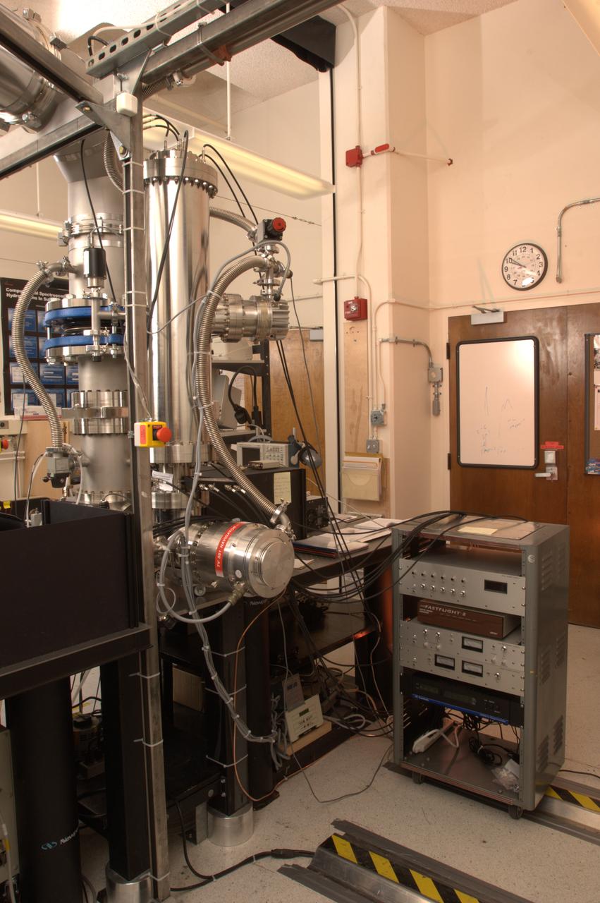
NASA Ames Astrophysics Branch (code-SSA), Pulsed discharge nozzle - Cavity Ring down - Reflection Time of Flight Mass Spectrometer (N-245 rm B-31) (PDN-CRDS-RETOFMS)
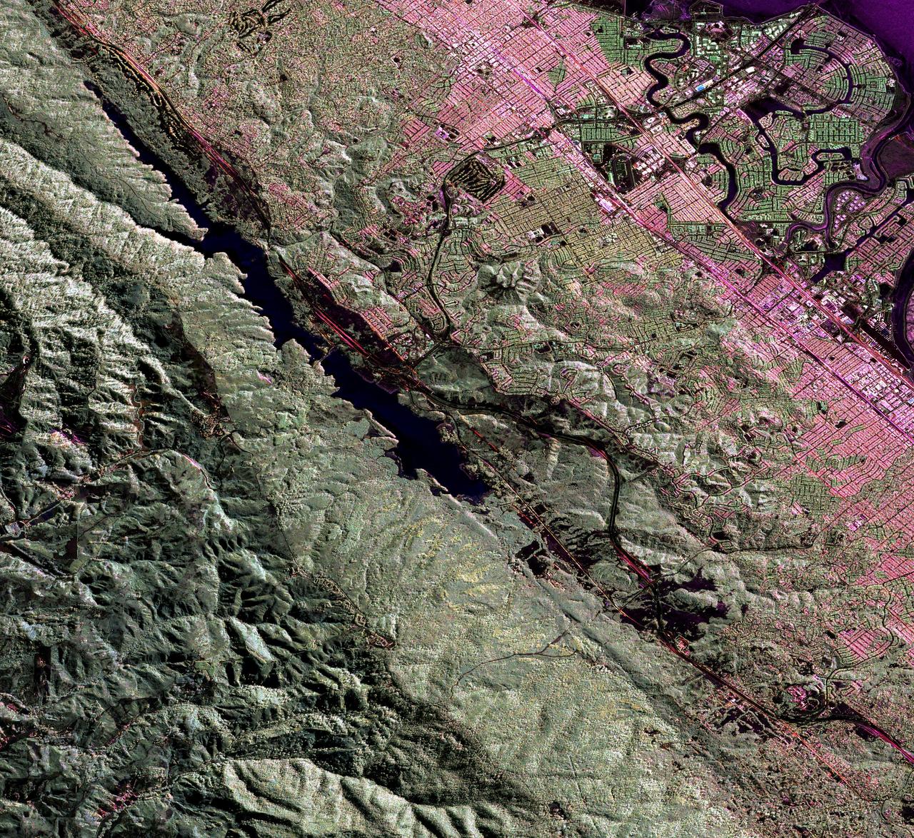
This image is a false-color composite of three channels of the UAVSAR polarimetric data acquired over the San Andreas Fault west of San Mateo, California.
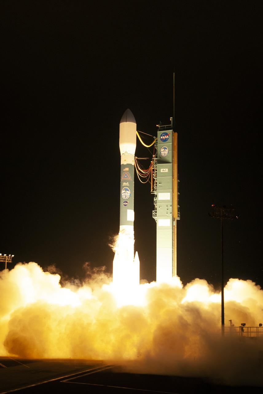
The final United Launch Alliance Delta II rocket lifts off from Space Launch Complex 2 at Vandenberg Air Force Base in California, on Sept. 15, 2018, carrying NASA's Ice, Cloud and land Elevation Satellite-2 (ICESat-2). Liftoff was at 9:02 a.m. EDT (6:02 a.m. PDT). The satellite will measure the height of our changing Earth, one laser pulse at a time, 10,000 laser pulses per second. ICESat-2 will provide scientists with height measurements that create a global portrait of Earth's third dimension, gathering date that can precisely track changes of terrain, including glaciers, sea ice and forests.
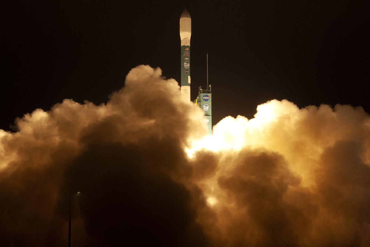
The final United Launch Alliance Delta II rocket lifts off from Space Launch Complex 2 at Vandenberg Air Force Base in California, on Sept. 15, 2018, carrying NASA's Ice, Cloud and land Elevation Satellite-2 (ICESat-2). Liftoff was at 9:02 a.m. EDT (6:02 a.m. PDT). The satellite will measure the height of our changing Earth, one laser pulse at a time, 10,000 laser pulses per second. ICESat-2 will provide scientists with height measurements that create a global portrait of Earth's third dimension, gathering date that can precisely track changes of terrain, including glaciers, sea ice and forests.

Inside Building 836 at Vandenberg Air Force Base in California, the first half of the payload fairing for the United Launch Alliance (ULA) Delta II rocket is lifted out of its shipping container. NASA's Ice, Cloud and land Elevation Satellite-2 (ICESat-2) is scheduled to launch on the final ULA Delta II rocket later this year. ICESat-2 will measure the height of a changing Earth, one laser pulse at a time, 10,000 laser pulses a second. The satellite will carry a single instrument, the Advanced Topographic Laser Altimeter System. ICESat-2 will help scientists investigate why, and how much our planet's frozen and icy areas, called the cryosphere, is changing in a warming climate.
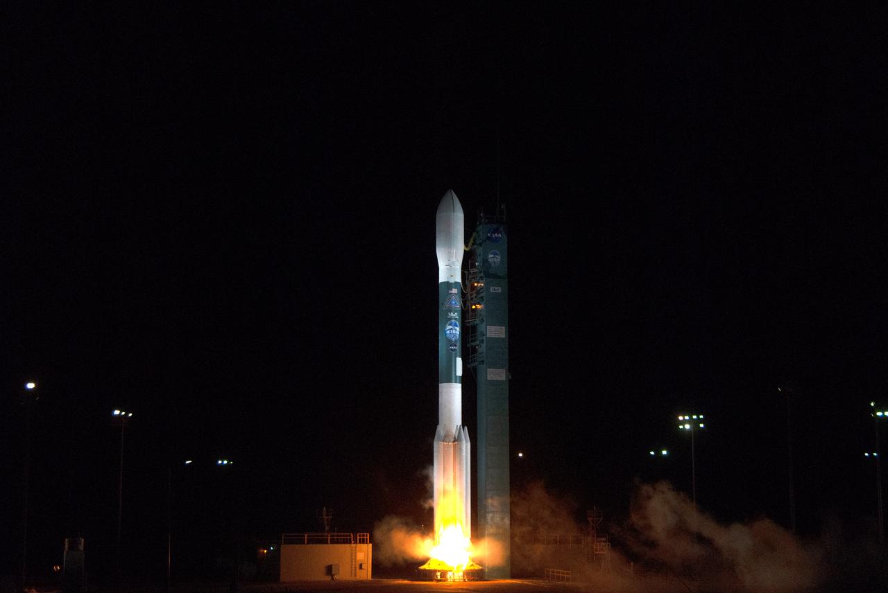
The final United Launch Alliance Delta II rocket lifts off from Space Launch Complex 2 at Vandenberg Air Force Base in California, on Sept. 15, 2018, carrying NASA's Ice, Cloud and land Elevation Satellite-2 (ICESat-2). Liftoff was at 9:02 a.m. EDT (6:02 a.m. PDT). The satellite will measure the height of our changing Earth, one laser pulse at a time, 10,000 laser pulses per second. ICESat-2 will provide scientists with height measurements that create a global portrait of Earth's third dimension, gathering date that can precisely track changes of terrain, including glaciers, sea ice and forests.
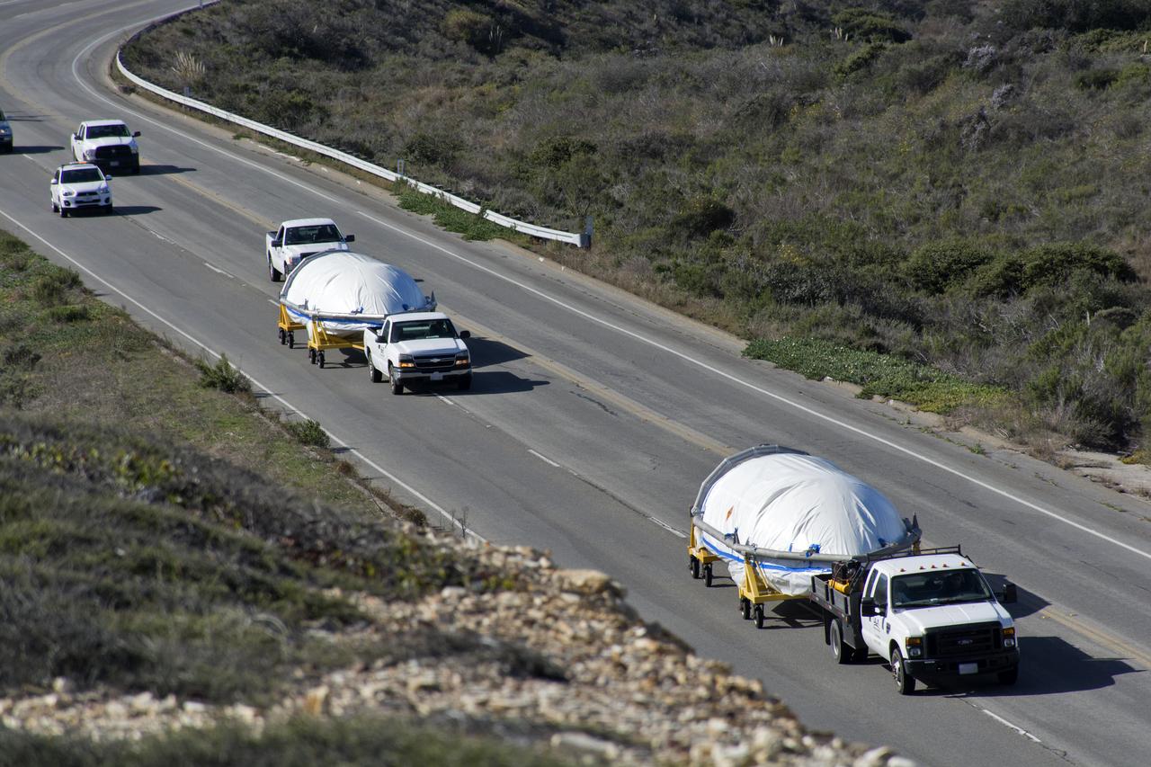
Both halves of the United Launch Alliance (ULA) Delta II rocket payload fairing are transported by convoy to ULA's Building B8337 at Vandenberg Air Force Base in California. NASA's Ice, Cloud and land Elevation Satellite-2 (ICESat-2) will launch later this year on the final Delta II rocket. ICESat-2 will measure the height of a changing Earth, one laser pulse at a time, 10,000 laser pulses a second. The satellite will carry a single instrument, the Advanced Topographic Laser Altimeter System. ICESat-2 will help scientists investigate why, and how much our planet's frozen and icy areas, called the cryosphere, is changing in a warming climate.

A flatbed truck arrives at Vandenberg Air Force Base in California, carrying the payload fairing for the United Launch Alliance (ULA) Delta II rocket that will launch NASA's Ice, Cloud and land Elevation Satellite-2 (ICESat-2). ICESat-2 will measure the height of a changing Earth, one laser pulse at a time, 10,000 laser pulses a second. The satellite will carry a single instrument, the Advanced Topographic Laser Altimeter System. ICESat-2 will help scientists investigate why, and how much our planet's frozen and icy areas, called the cryosphere, is changing in a warming climate. ICESat-2 is scheduled to launch on the final ULA Delta II rocket later this year.
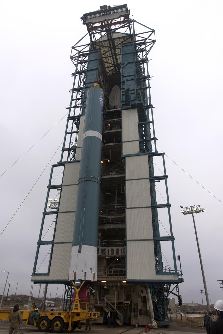
The United Launch Alliance Delta II first stage is lifted to vertical on the stand at Space Launch Complex 2 on June 8, 2018, at Vandenberg Air Force Base in California. The booster will be lifted and moved into the mobile service tower. NASA's Ice, Cloud and land Elevation Satellite-2 (ICESat-2) will launch on the final Delta II rocket. ICESat-2 will measure the height of a changing Earth, one laser pulse at a time, 10,000 laser pulses a second. The satellite will carry a single instrument, the Advanced Topographic Laser Altimeter System. ICESat-2 will help scientists investigate why, and how much our planet's frozen and icy areas, called the cryosphere, is changing in a warming climate.
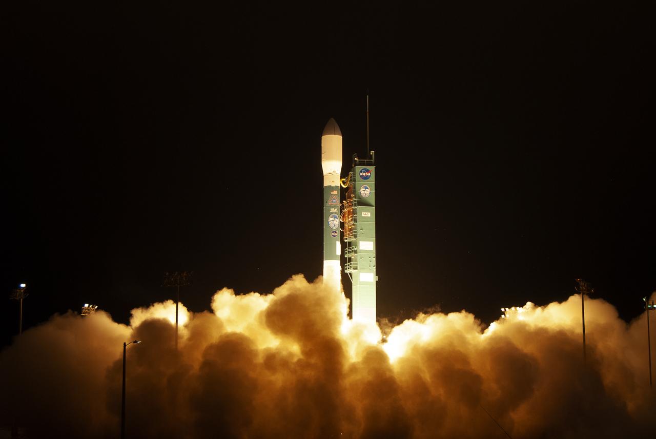
The final United Launch Alliance Delta II rocket lifts off from Space Launch Complex 2 at Vandenberg Air Force Base in California, on Sept. 15, 2018, carrying NASA's Ice, Cloud and land Elevation Satellite-2 (ICESat-2). Liftoff was at 9:02 a.m. EDT (6:02 a.m. PDT). The satellite will measure the height of our changing Earth, one laser pulse at a time, 10,000 laser pulses per second. ICESat-2 will provide scientists with height measurements that create a global portrait of Earth's third dimension, gathering date that can precisely track changes of terrain, including glaciers, sea ice and forests.

At Vandenberg Air Force Base in California, NASA's Ice, Cloud and land Elevation Satellite-2 (ICESat-2) is hoisted up by crane at the mobile service tower at Space Launch Complex 2, on Aug. 26, 2018. The satellite will be attached to the top of the United Launch Alliance Delta II rocket. Launch is scheduled for Sept. 15, 2018. ICESat-2 will measure the height of a changing Earth, one laser pulse at a time, 10,000 laser pulses a second. The satellite will carry the Advanced Topographic Laser Altimeter System (ATLAS). ICESat-2 will help scientists investigate why, and how much our planet's frozen and icy areas, called the cryosphere, are changing in a warming climate.
Both halves of the United Launch Alliance (ULA) Delta II rocket payload fairing are transported by convoy to ULA's Building B8337 at Vandenberg Air Force Base in California. NASA's Ice, Cloud and land Elevation Satellite-2 (ICESat-2) will launch later this year on the final Delta II rocket. ICESat-2 will measure the height of a changing Earth, one laser pulse at a time, 10,000 laser pulses a second. The satellite will carry a single instrument, the Advanced Topographic Laser Altimeter System. ICESat-2 will help scientists investigate why, and how much our planet's frozen and icy areas, called the cryosphere, is changing in a warming climate.
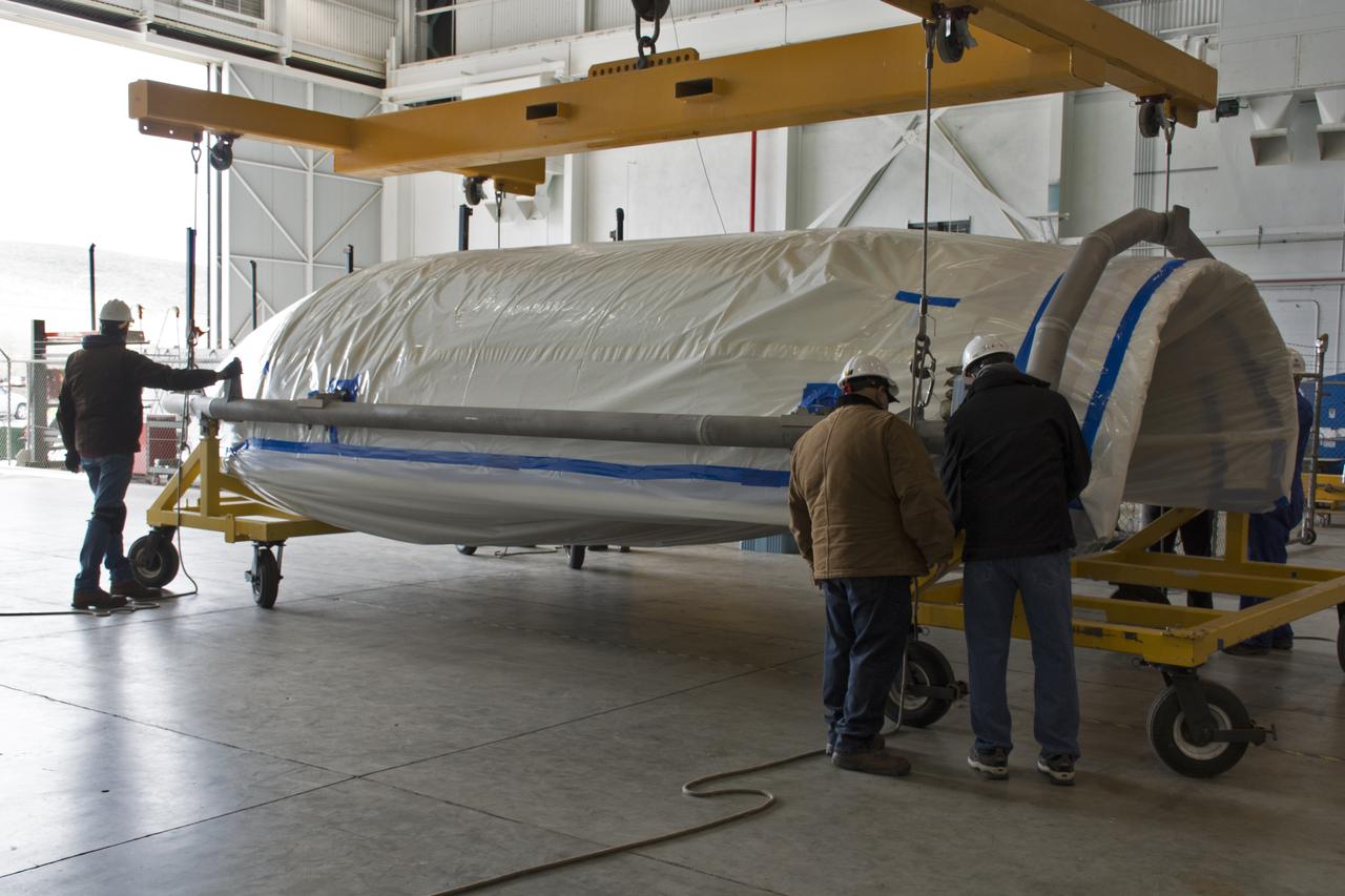
Inside Building 836 at Vandenberg Air Force Base in California, one of the payload fairing halves for the United Launch Alliance (ULA) Delta II rocket is being secured to a rolling work stand. NASA's Ice, Cloud and land Elevation Satellite-2 (ICESat-2) is scheduled to launch on the final ULA Delta II rocket later this year. ICESat-2 will measure the height of a changing Earth, one laser pulse at a time, 10,000 laser pulses a second. The satellite will carry a single instrument, the Advanced Topographic Laser Altimeter System. ICESat-2 will help scientists investigate why, and how much our planet's frozen and icy areas, called the cryosphere, is changing in a warming climate.
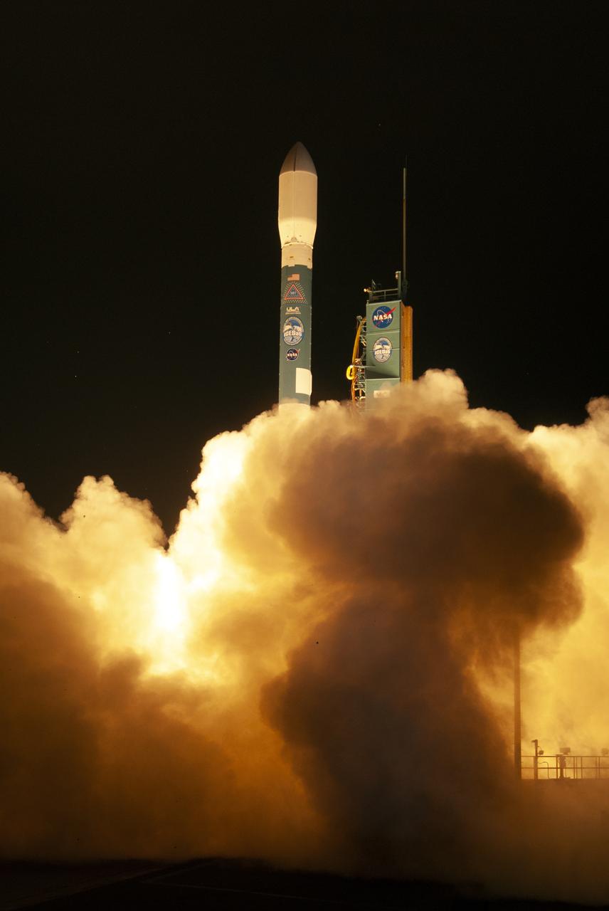
The final United Launch Alliance Delta II rocket lifts off from Space Launch Complex 2 at Vandenberg Air Force Base in California, on Sept. 15, 2018, carrying NASA's Ice, Cloud and land Elevation Satellite-2 (ICESat-2). Liftoff was at 9:02 a.m. EDT (6:02 a.m. PDT). The satellite will measure the height of our changing Earth, one laser pulse at a time, 10,000 laser pulses per second. ICESat-2 will provide scientists with height measurements that create a global portrait of Earth's third dimension, gathering date that can precisely track changes of terrain, including glaciers, sea ice and forests.
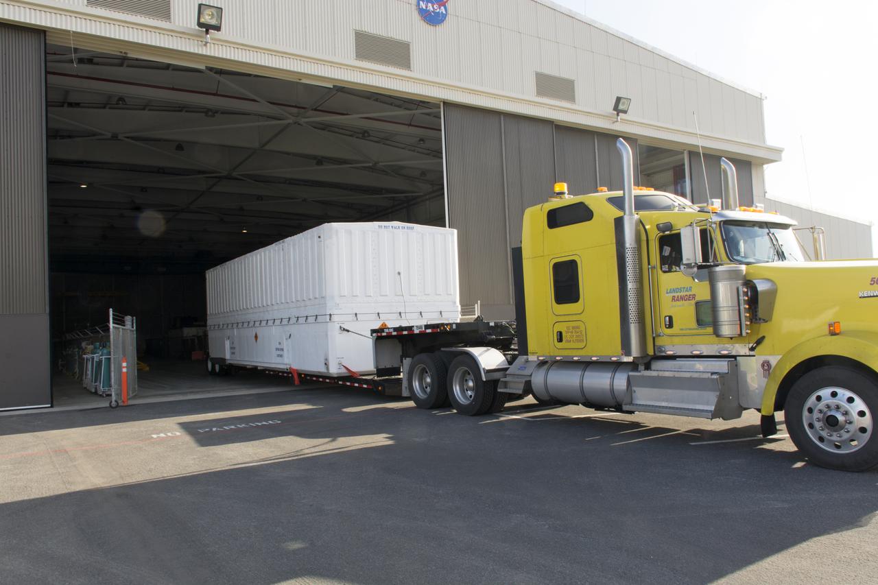
A flatbed truck, carrying the payload fairing for the United Launch Alliance (ULA) Delta II rocket, arrives at Building 836 at Vandenberg Air Force Base in California. NASA's Ice, Cloud and land Elevation Satellite-2 (ICESat-2) is scheduled to launch on the final ULA Delta II rocket later this year. ICESat-2 will measure the height of a changing Earth, one laser pulse at a time, 10,000 laser pulses a second. The satellite will carry a single instrument, the Advanced Topographic Laser Altimeter System. ICESat-2 will help scientists investigate why, and how much our planet's frozen and icy areas, called the cryosphere, is changing in a warming climate.
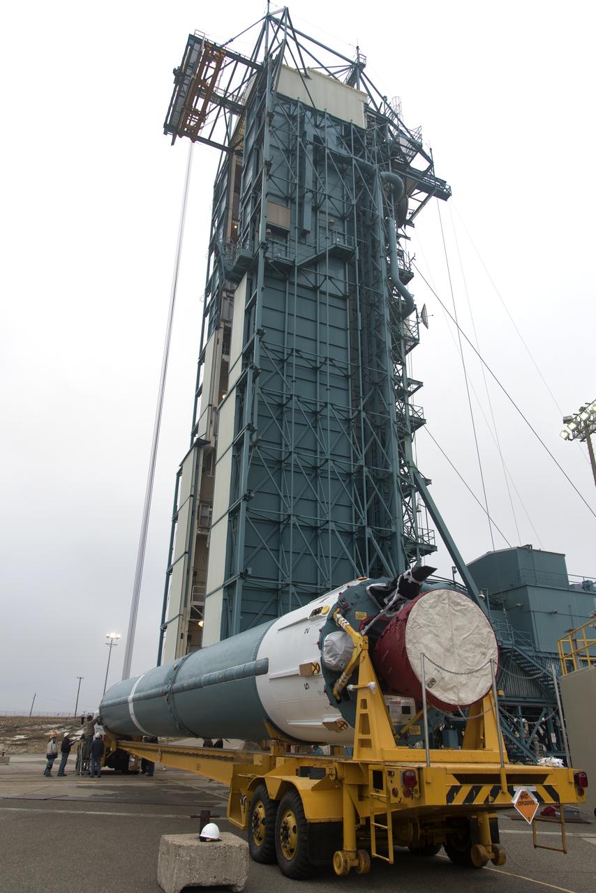
The United Launch Alliance Delta II first stage arrives at Space Launch Complex 2 on June 8, 2018, at Vandenberg Air Force Base in California. The booster will be lifted to vertical and moved into the mobile service tower. NASA's Ice, Cloud and land Elevation Satellite-2 (ICESat-2) will launch on the final Delta II rocket. ICESat-2 will measure the height of a changing Earth, one laser pulse at a time, 10,000 laser pulses a second. The satellite will carry a single instrument, the Advanced Topographic Laser Altimeter System. ICESat-2 will help scientists investigate why, and how much our planet's frozen and icy areas, called the cryosphere, is changing in a warming climate.

The United Launch Alliance Delta II second stage has arrived at the horizontal processing facility at Space Launch Complex-2 at Vandenberg Air Force Base in California. NASA's Ice, Cloud and land Elevation Satellite-2 (ICESat-2) will launch later this year on the final Delta II rocket. ICESat-2 will measure the height of a changing Earth, one laser pulse at a time, 10,000 laser pulses a second. The satellite will carry a single instrument, the Advanced Topographic Laser Altimeter System. ICESat-2 will help scientists investigate why, and how much our planet's frozen and icy areas, called the cryosphere, is changing in a warming climate.

The United Launch Alliance Delta II second stage emerges from NASA's Building 1555 at Vandenberg Air Force Base in California. It will be transported to the horizontal processing facility at Space Launch Complex-2. NASA's Ice, Cloud and land Elevation Satellite-2 (ICESat-2) will launch later this year on the final Delta II rocket. ICESat-2 will measure the height of a changing Earth, one laser pulse at a time, 10,000 laser pulses a second. The satellite will carry a single instrument, the Advanced Topographic Laser Altimeter System. ICESat-2 will help scientists investigate why, and how much our planet's frozen and icy areas, called the cryosphere, is changing in a warming climate.

Both halves of the United Launch Alliance (ULA) Delta II rocket payload fairing were moved inside ULA's Building B8337 at Vandenberg Air Force Base in California. NASA's Ice, Cloud and land Elevation Satellite-2 (ICESat-2) will launch later this year on the final Delta II rocket. ICESat-2 will measure the height of a changing Earth, one laser pulse at a time, 10,000 laser pulses a second. The satellite will carry a single instrument, the Advanced Topographic Laser Altimeter System. ICESat-2 will help scientists investigate why, and how much our planet's frozen and icy areas, called the cryosphere, is changing in a warming climate.

The first half of the United Launch Alliance Delta II payload fairing is secured around NASA's Ice, Cloud and land Elevation Satellite-2 (ICESat-2) on Sept. 4, 2018, at Space Launch Complex 2 at Vandenberg Air Force Base in California. The satellite is being prepared for its scheduled launch on the final Delta II rocket. ICESat-2 will measure the height of a changing Earth, one laser pulse at a time, 10,000 laser pulses a second. The satellite will carry the Advanced Topographic Laser Altimeter System (ATLAS). ICESat-2 will help scientists investigate why, and how much our planet's frozen and icy areas, called the cryosphere, are changing in a warming climate.
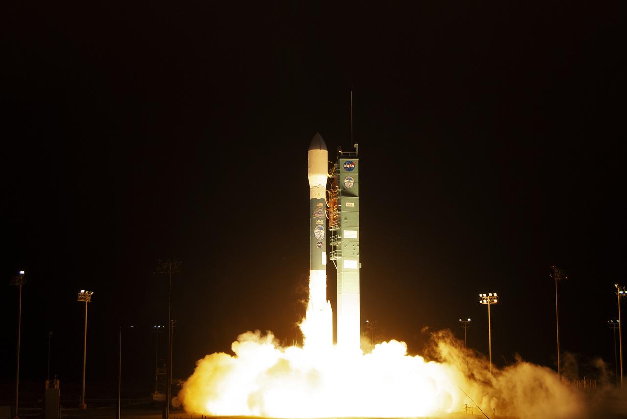
The final United Launch Alliance Delta II rocket lifts off from Space Launch Complex 2 at Vandenberg Air Force Base in California, on Sept. 15, 2018, carrying NASA's Ice, Cloud and land Elevation Satellite-2 (ICESat-2). Liftoff was at 9:02 a.m. EDT (6:02 a.m. PDT). The satellite will measure the height of our changing Earth, one laser pulse at a time, 10,000 laser pulses per second. ICESat-2 will provide scientists with height measurements that create a global portrait of Earth's third dimension, gathering date that can precisely track changes of terrain, including glaciers, sea ice and forests.
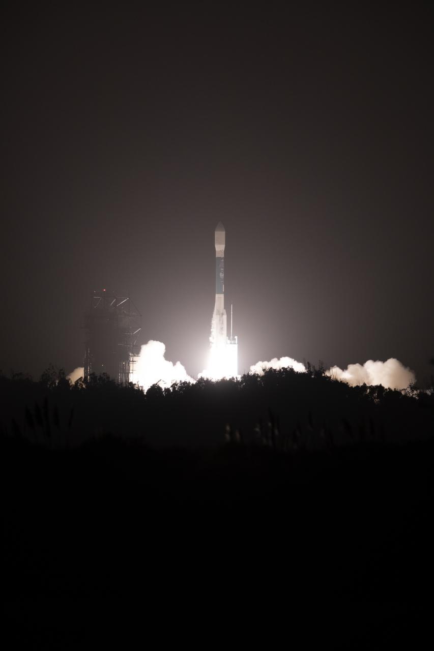
The final United Launch Alliance Delta II rocket lifts off from Space Launch Complex 2 at Vandenberg Air Force Base in California, on Sept. 15, 2018, carrying NASA's Ice, Cloud and land Elevation Satellite-2 (ICESat-2). Liftoff was at 9:02 a.m. EDT (6:02 a.m. PDT). The satellite will measure the height of our changing Earth, one laser pulse at a time, 10,000 laser pulses per second. ICESat-2 will provide scientists with height measurements that create a global portrait of Earth's third dimension, gathering date that can precisely track changes of terrain, including glaciers, sea ice and forests.
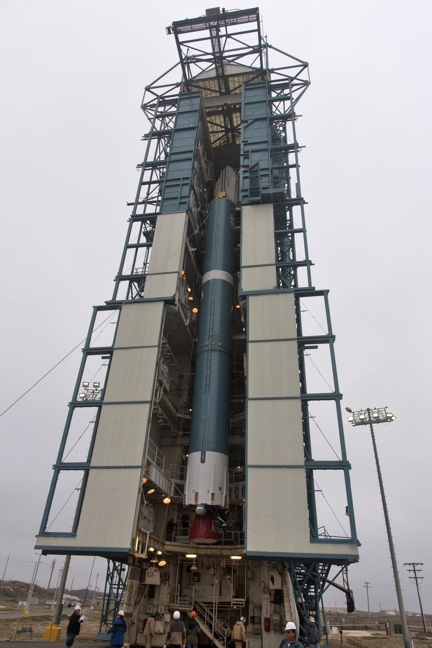
The United Launch Alliance Delta II first stage is lifted up in the mobile service tower at Space Launch Complex 2 on June 8, 2018, at Vandenberg Air Force Base in California. NASA's Ice, Cloud and land Elevation Satellite-2 (ICESat-2) will launch on the final Delta II rocket. ICESat-2 will measure the height of a changing Earth, one laser pulse at a time, 10,000 laser pulses a second. The satellite will carry a single instrument, the Advanced Topographic Laser Altimeter System. ICESat-2 will help scientists investigate why, and how much our planet's frozen and icy areas, called the cryosphere, is changing in a warming climate.
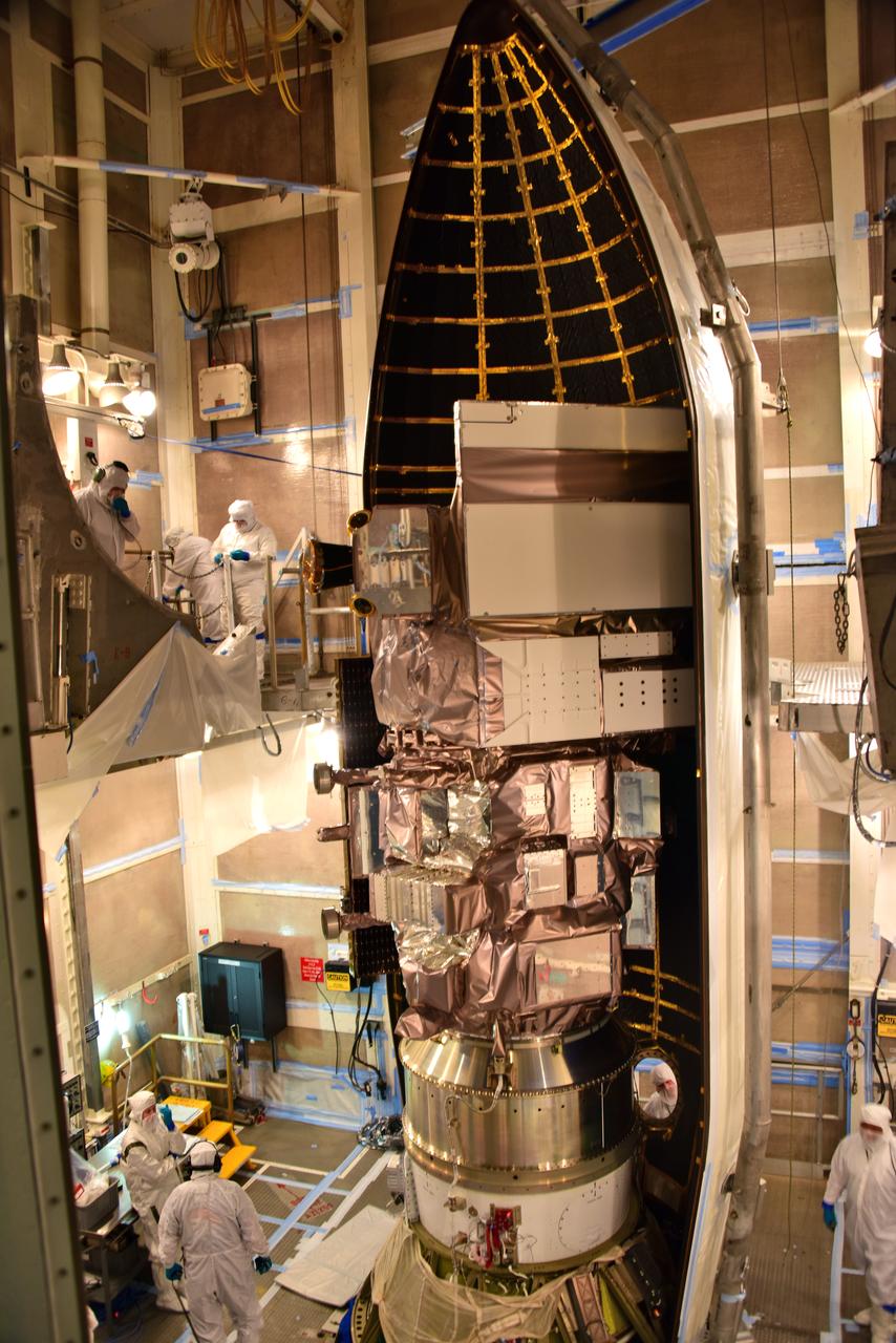
The first half of the United Launch Alliance Delta II payload fairing is secured around NASA's Ice, Cloud and land Elevation Satellite-2 (ICESat-2) on Sept. 4, 2018, at Space Launch Complex 2 at Vandenberg Air Force Base in California. The satellite is being prepared for its scheduled launch on the final Delta II rocket. ICESat-2 will measure the height of a changing Earth, one laser pulse at a time, 10,000 laser pulses a second. The satellite will carry the Advanced Topographic Laser Altimeter System (ATLAS). ICESat-2 will help scientists investigate why, and how much our planet's frozen and icy areas, called the cryosphere, are changing in a warming climate.
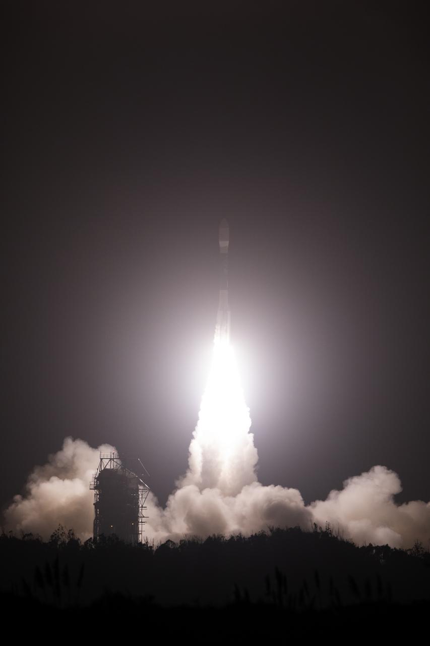
The final United Launch Alliance Delta II rocket lifts off from Space Launch Complex 2 at Vandenberg Air Force Base in California, on Sept. 15, 2018, carrying NASA's Ice, Cloud and land Elevation Satellite-2 (ICESat-2). Liftoff was at 9:02 a.m. EDT (6:02 a.m. PDT). The satellite will measure the height of our changing Earth, one laser pulse at a time, 10,000 laser pulses per second. ICESat-2 will provide scientists with height measurements that create a global portrait of Earth's third dimension, gathering date that can precisely track changes of terrain, including glaciers, sea ice and forests.
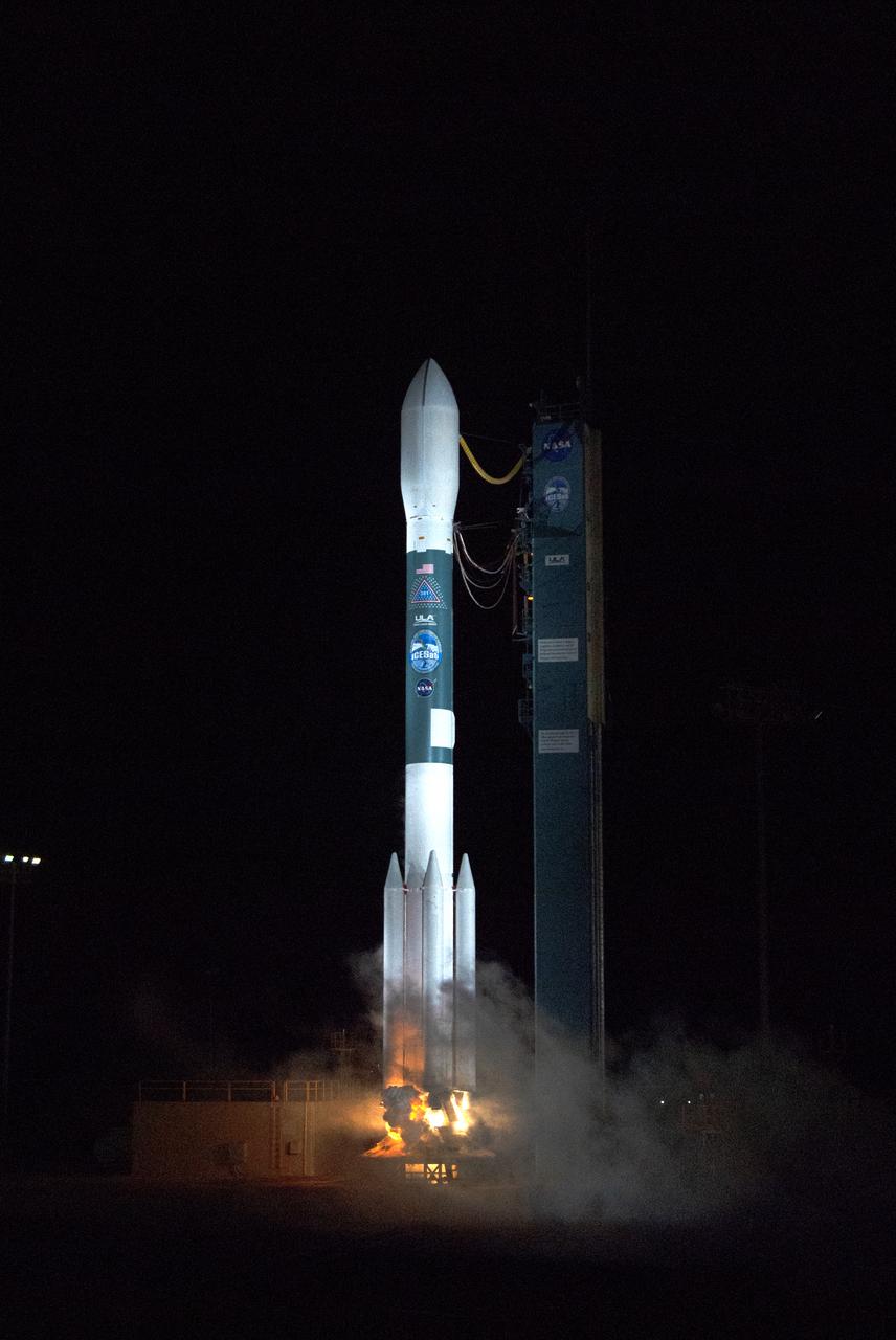
The final United Launch Alliance Delta II rocket lifts off from Space Launch Complex 2 at Vandenberg Air Force Base in California, on Sept. 15, 2018, carrying NASA's Ice, Cloud and land Elevation Satellite-2 (ICESat-2). Liftoff was at 9:02 a.m. EDT (6:02 a.m. PDT). The satellite will measure the height of our changing Earth, one laser pulse at a time, 10,000 laser pulses per second. ICESat-2 will provide scientists with height measurements that create a global portrait of Earth's third dimension, gathering date that can precisely track changes of terrain, including glaciers, sea ice and forests.
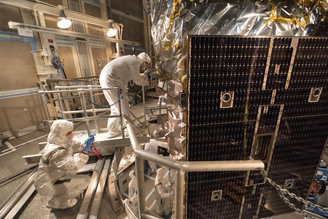
Technicians prepare NASA's Ice, Cloud and land Elevation Satellite-2 (ICESat-2) for encapsulation in the United Launch Alliance Delta II payload fairing on Sept. 4, 2018, at Space Launch Complex 2 at Vandenberg Air Force Base in California. The satellite is being prepared for its scheduled launch on the final Delta II rocket. ICESat-2 will measure the height of a changing Earth, one laser pulse at a time, 10,000 laser pulses a second. The satellite will carry the Advanced Topographic Laser Altimeter System (ATLAS). ICESat-2 will help scientists investigate why, and how much our planet's frozen and icy areas, called the cryosphere, are changing in a warming climate.

The United Launch Alliance Delta II first stage arrives at Space Launch Complex 2 on June 8, 2018, at Vandenberg Air Force Base in California. The booster will be lifted to vertical and moved into the mobile service tower. NASA's Ice, Cloud and land Elevation Satellite-2 (ICESat-2) will launch on the final Delta II rocket. ICESat-2 will measure the height of a changing Earth, one laser pulse at a time, 10,000 laser pulses a second. The satellite will carry a single instrument, the Advanced Topographic Laser Altimeter System. ICESat-2 will help scientists investigate why, and how much our planet's frozen and icy areas, called the cryosphere, is changing in a warming climate.
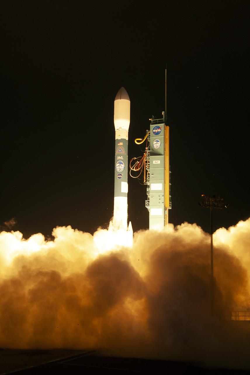
The final United Launch Alliance Delta II rocket lifts off from Space Launch Complex 2 at Vandenberg Air Force Base in California, on Sept. 15, 2018, carrying NASA's Ice, Cloud and land Elevation Satellite-2 (ICESat-2). Liftoff was at 9:02 a.m. EDT (6:02 a.m. PDT). The satellite will measure the height of our changing Earth, one laser pulse at a time, 10,000 laser pulses per second. ICESat-2 will provide scientists with height measurements that create a global portrait of Earth's third dimension, gathering date that can precisely track changes of terrain, including glaciers, sea ice and forests.
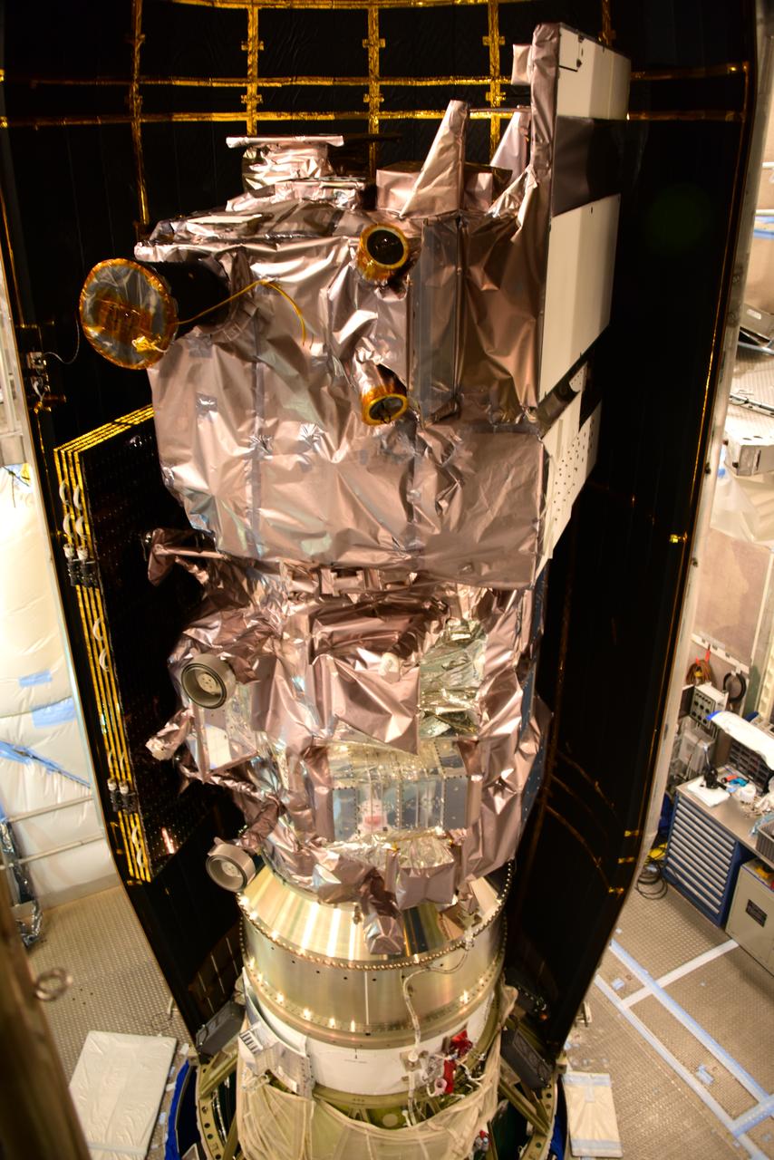
The first half of the United Launch Alliance Delta II payload fairing is secured around NASA's Ice, Cloud and land Elevation Satellite-2 (ICESat-2) on Sept. 4, 2018, at Space Launch Complex 2 at Vandenberg Air Force Base in California. The satellite is being prepared for its scheduled launch on the final Delta II rocket. ICESat-2 will measure the height of a changing Earth, one laser pulse at a time, 10,000 laser pulses a second. The satellite will carry the Advanced Topographic Laser Altimeter System (ATLAS). ICESat-2 will help scientists investigate why, and how much our planet's frozen and icy areas, called the cryosphere, are changing in a warming climate.
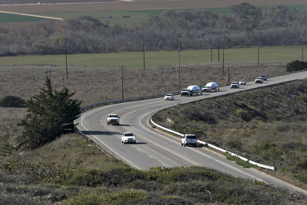
Both halves of the United Launch Alliance (ULA) Delta II rocket payload fairing are transported by convoy to ULA's Building B8337 at Vandenberg Air Force Base in California. NASA's Ice, Cloud and land Elevation Satellite-2 (ICESat-2) will launch later this year on the final Delta II rocket. ICESat-2 will measure the height of a changing Earth, one laser pulse at a time, 10,000 laser pulses a second. The satellite will carry a single instrument, the Advanced Topographic Laser Altimeter System. ICESat-2 will help scientists investigate why, and how much our planet's frozen and icy areas, called the cryosphere, is changing in a warming climate.
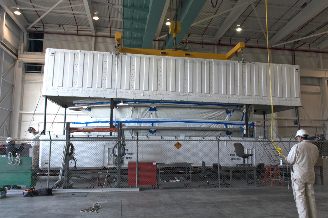
Inside Building 836 at Vandenberg Air Force Base in California, the top of the shipping container is lifted up from the payload fairings for the United Launch Alliance (ULA) Delta II rocket. NASA's Ice, Cloud and land Elevation Satellite-2 (ICESat-2) is scheduled to launch on the final ULA Delta II rocket later this year. ICESat-2 will measure the height of a changing Earth, one laser pulse at a time, 10,000 laser pulses a second. The satellite will carry a single instrument, the Advanced Topographic Laser Altimeter System. ICESat-2 will help scientists investigate why, and how much our planet's frozen and icy areas, called the cryosphere, is changing in a warming climate.
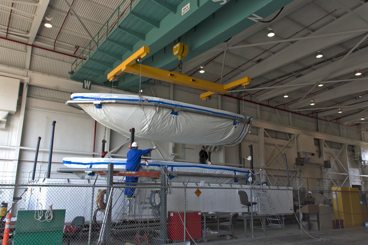
Inside Building 836 at Vandenberg Air Force Base in California, the payload fairing halves for the United Launch Alliance (ULA) Delta II rocket are lifted up from the base of their shipping container. NASA's Ice, Cloud and land Elevation Satellite-2 (ICESat-2) is scheduled to launch on the final ULA Delta II rocket later this year. ICESat-2 will measure the height of a changing Earth, one laser pulse at a time, 10,000 laser pulses a second. The satellite will carry a single instrument, the Advanced Topographic Laser Altimeter System. ICESat-2 will help scientists investigate why, and how much our planet's frozen and icy areas, called the cryosphere, is changing in a warming climate.
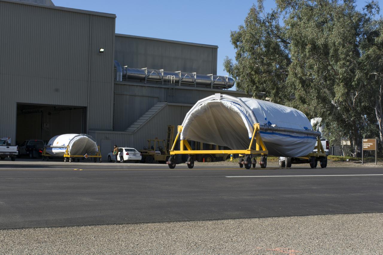
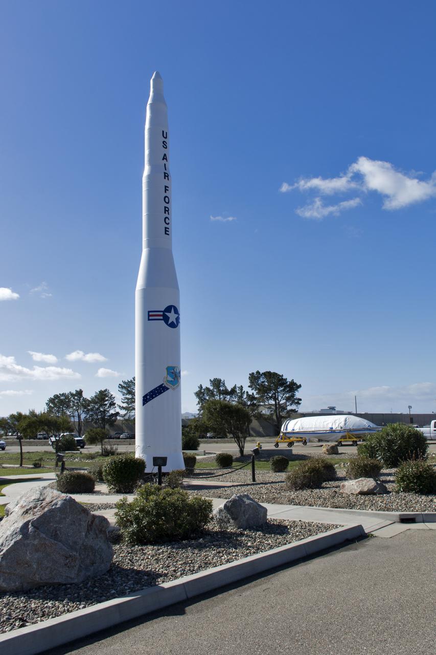
Both halves of the United Launch Alliance (ULA) Delta II rocket payload fairing arrive at ULA's Building B8337 at Vandenberg Air Force Base in California. NASA's Ice, Cloud and land Elevation Satellite-2 (ICESat-2) will launch later this year on the final Delta II rocket. ICESat-2 will measure the height of a changing Earth, one laser pulse at a time, 10,000 laser pulses a second. The satellite will carry a single instrument, the Advanced Topographic Laser Altimeter System. ICESat-2 will help scientists investigate why, and how much our planet's frozen and icy areas, called the cryosphere, is changing in a warming climate.
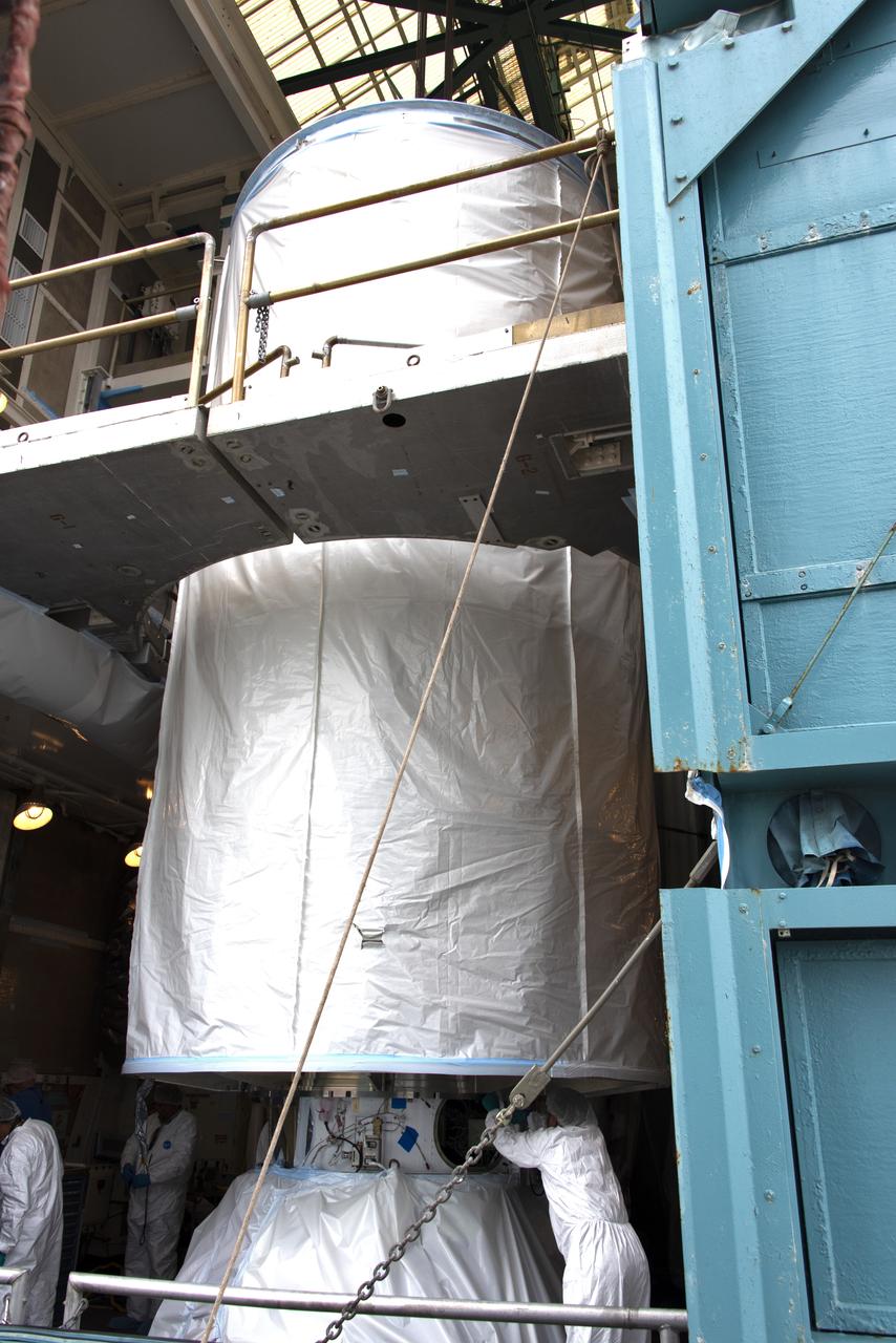
At Vandenberg Air Force Base in California, NASA's Ice, Cloud and land Elevation Satellite-2 (ICESat-2) is inside the mobile service tower at Space Launch Complex 2, on Aug. 26, 2018. The satellite will be attached to the top of the United Launch Alliance Delta II rocket. Launch is scheduled for Sept. 15, 2018. ICESat-2 will measure the height of a changing Earth, one laser pulse at a time, 10,000 laser pulses a second. The satellite will carry the Advanced Topographic Laser Altimeter System (ATLAS). ICESat-2 will help scientists investigate why, and how much our planet's frozen and icy areas, called the cryosphere, are changing in a warming climate.

The United Launch Alliance Delta II first stage is lifted up from its stand and moved into the mobile service tower at Space Launch Complex 2 on June 8, 2018, at Vandenberg Air Force Base in California. NASA's Ice, Cloud and land Elevation Satellite-2 (ICESat-2) will launch on the final Delta II rocket. ICESat-2 will measure the height of a changing Earth, one laser pulse at a time, 10,000 laser pulses a second. The satellite will carry a single instrument, the Advanced Topographic Laser Altimeter System. ICESat-2 will help scientists investigate why, and how much our planet's frozen and icy areas, called the cryosphere, is changing in a warming climate.
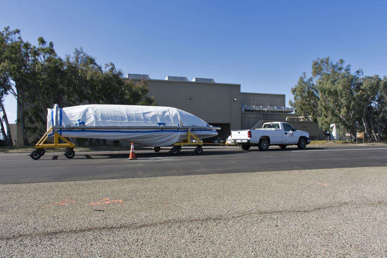
The first half of the United Launch Alliance (ULA) Delta II rocket payload fairing arrives at ULA's Building B8337 at Vandenberg Air Force Base in California. NASA's Ice, Cloud and land Elevation Satellite-2 (ICESat-2) will launch later this year on the final Delta II rocket. ICESat-2 will measure the height of a changing Earth, one laser pulse at a time, 10,000 laser pulses a second. The satellite will carry a single instrument, the Advanced Topographic Laser Altimeter System. ICESat-2 will help scientists investigate why, and how much our planet's frozen and icy areas, called the cryosphere, is changing in a warming climate.
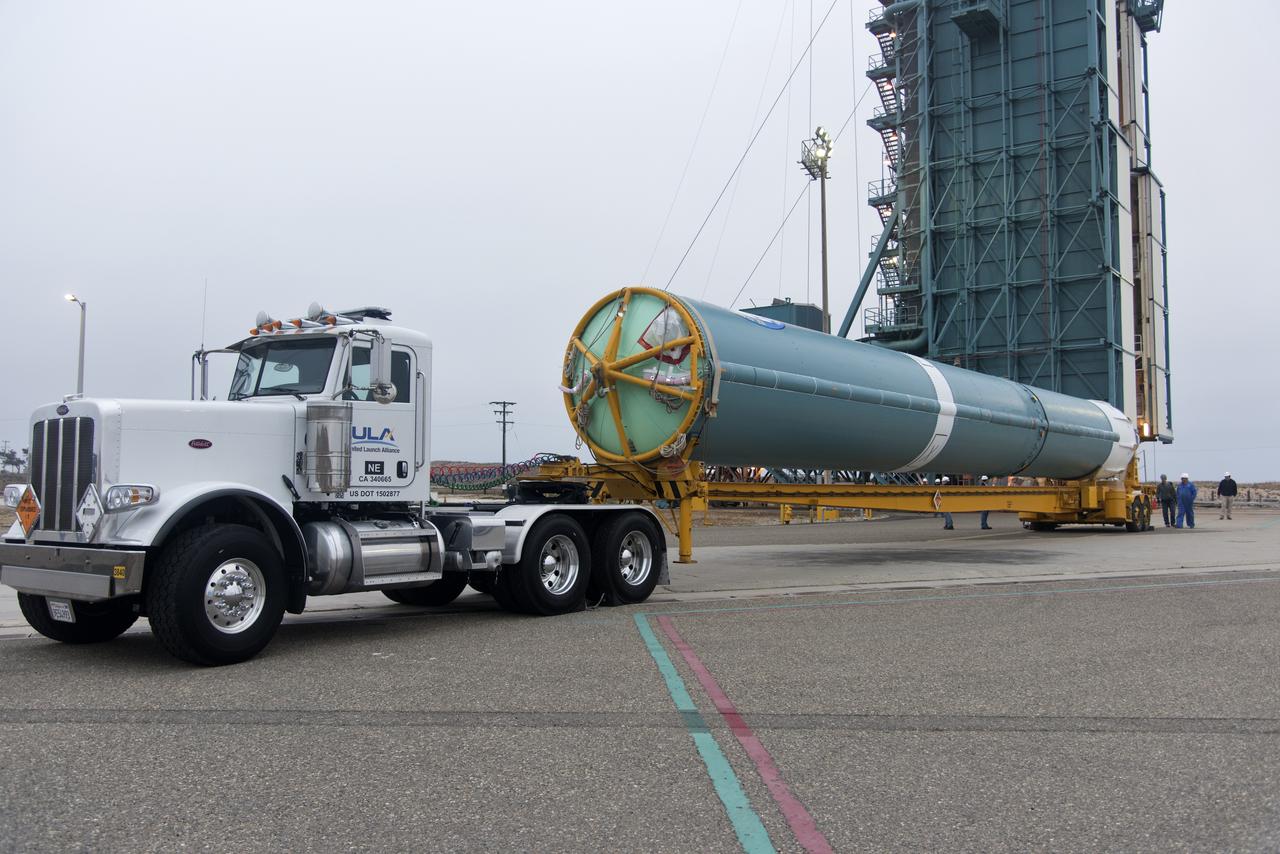
The United Launch Alliance Delta II first stage arrives at Space Launch Complex 2 on June 8, 2018, at Vandenberg Air Force Base in California. The booster will be lifted to vertical and moved into the mobile service tower. NASA's Ice, Cloud and land Elevation Satellite-2 (ICESat-2) will launch on the final Delta II rocket. ICESat-2 will measure the height of a changing Earth, one laser pulse at a time, 10,000 laser pulses a second. The satellite will carry a single instrument, the Advanced Topographic Laser Altimeter System. ICESat-2 will help scientists investigate why, and how much our planet's frozen and icy areas, called the cryosphere, is changing in a warming climate.
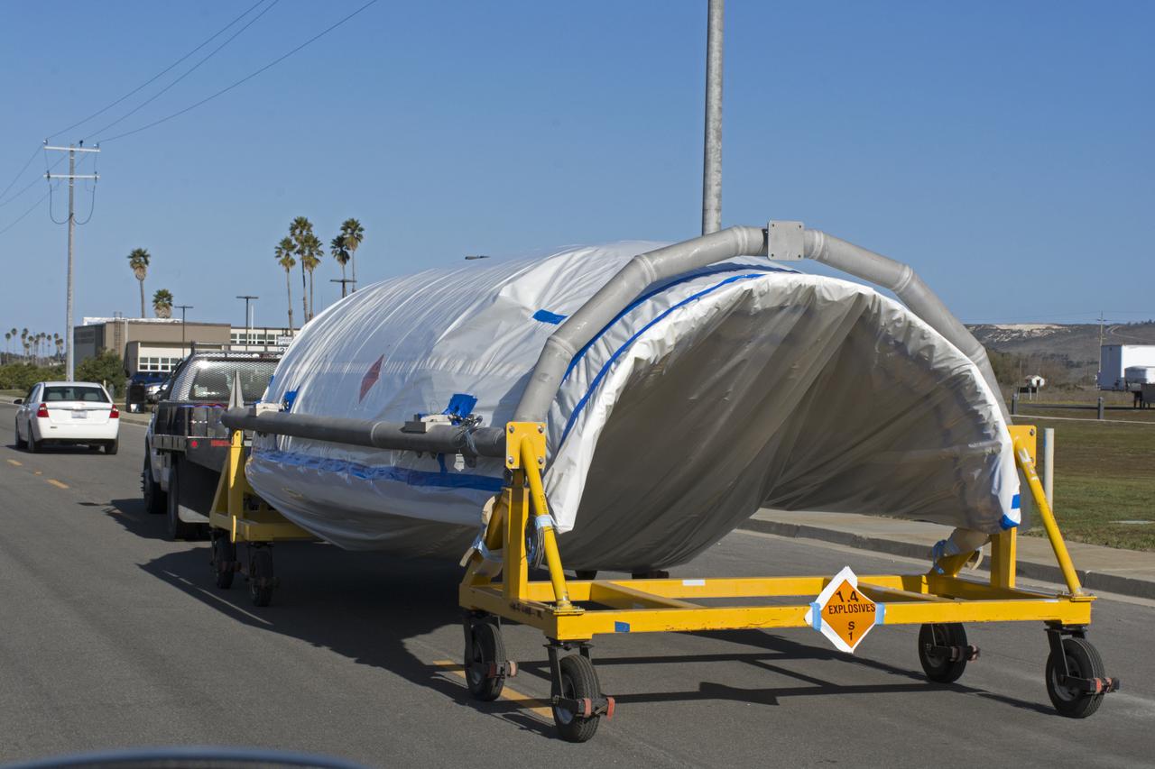
The first half of the United Launch Alliance (ULA) Delta II rocket payload fairing is transported from NASA's Building 836 to ULA's Building B8337 at Vandenberg Air Force Base in California. NASA's Ice, Cloud and land Elevation Satellite-2 (ICESat-2) will launch later this year on the final Delta II rocket. ICESat-2 will measure the height of a changing Earth, one laser pulse at a time, 10,000 laser pulses a second. The satellite will carry a single instrument, the Advanced Topographic Laser Altimeter System. ICESat-2 will help scientists investigate why, and how much our planet's frozen and icy areas, called the cryosphere, is changing in a warming climate.
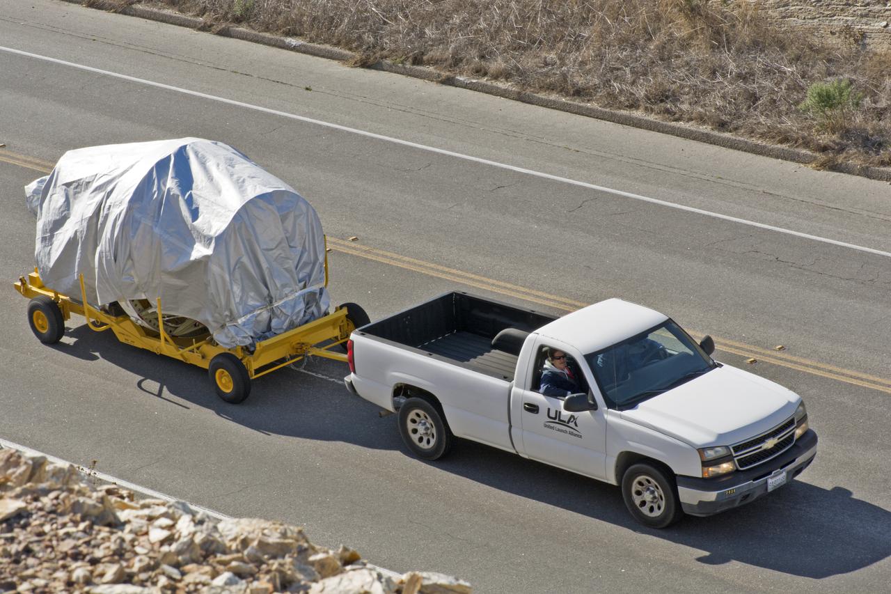
The United Launch Alliance Delta II second stage is being transported to Space Launch Complex-2 at Vandenberg Air Force Base in California. NASA's Ice, Cloud and land Elevation Satellite-2 (ICESat-2) will launch later this year on the final Delta II rocket. ICESat-2 will measure the height of a changing Earth, one laser pulse at a time, 10,000 laser pulses a second. The satellite will carry a single instrument, the Advanced Topographic Laser Altimeter System. ICESat-2 will help scientists investigate why, and how much our planet's frozen and icy areas, called the cryosphere, is changing in a warming climate.
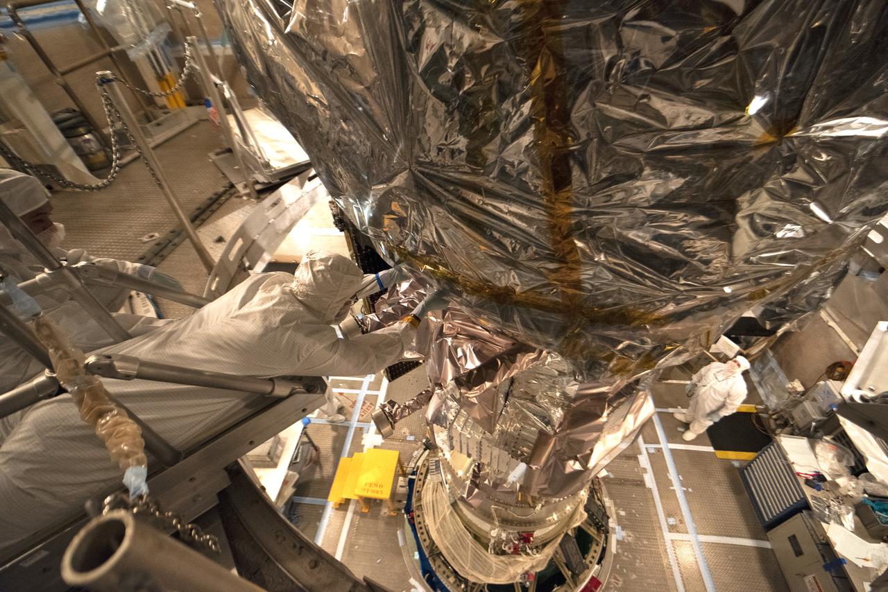
Technicians prepare NASA's Ice, Cloud and land Elevation Satellite-2 (ICESat-2) for encapsulation in the United Launch Alliance Delta II payload fairing on Sept. 4, 2018, at Space Launch Complex 2 at Vandenberg Air Force Base in California. The satellite is being prepared for its scheduled launch on the final Delta II rocket. ICESat-2 will measure the height of a changing Earth, one laser pulse at a time, 10,000 laser pulses a second. The satellite will carry the Advanced Topographic Laser Altimeter System (ATLAS). ICESat-2 will help scientists investigate why, and how much our planet's frozen and icy areas, called the cryosphere, are changing in a warming climate.

The first half of the United Launch Alliance (ULA) Delta II rocket payload fairing is moved out of NASA's Building 836 at Vandenberg Air Force Base in California. It will be transported to ULA's Building B8337. NASA's Ice, Cloud and land Elevation Satellite-2 (ICESat-2) will launch later this year on the final Delta II rocket. ICESat-2 will measure the height of a changing Earth, one laser pulse at a time, 10,000 laser pulses a second. The satellite will carry a single instrument, the Advanced Topographic Laser Altimeter System. ICESat-2 will help scientists investigate why, and how much our planet's frozen and icy areas, called the cryosphere, is changing in a warming climate.
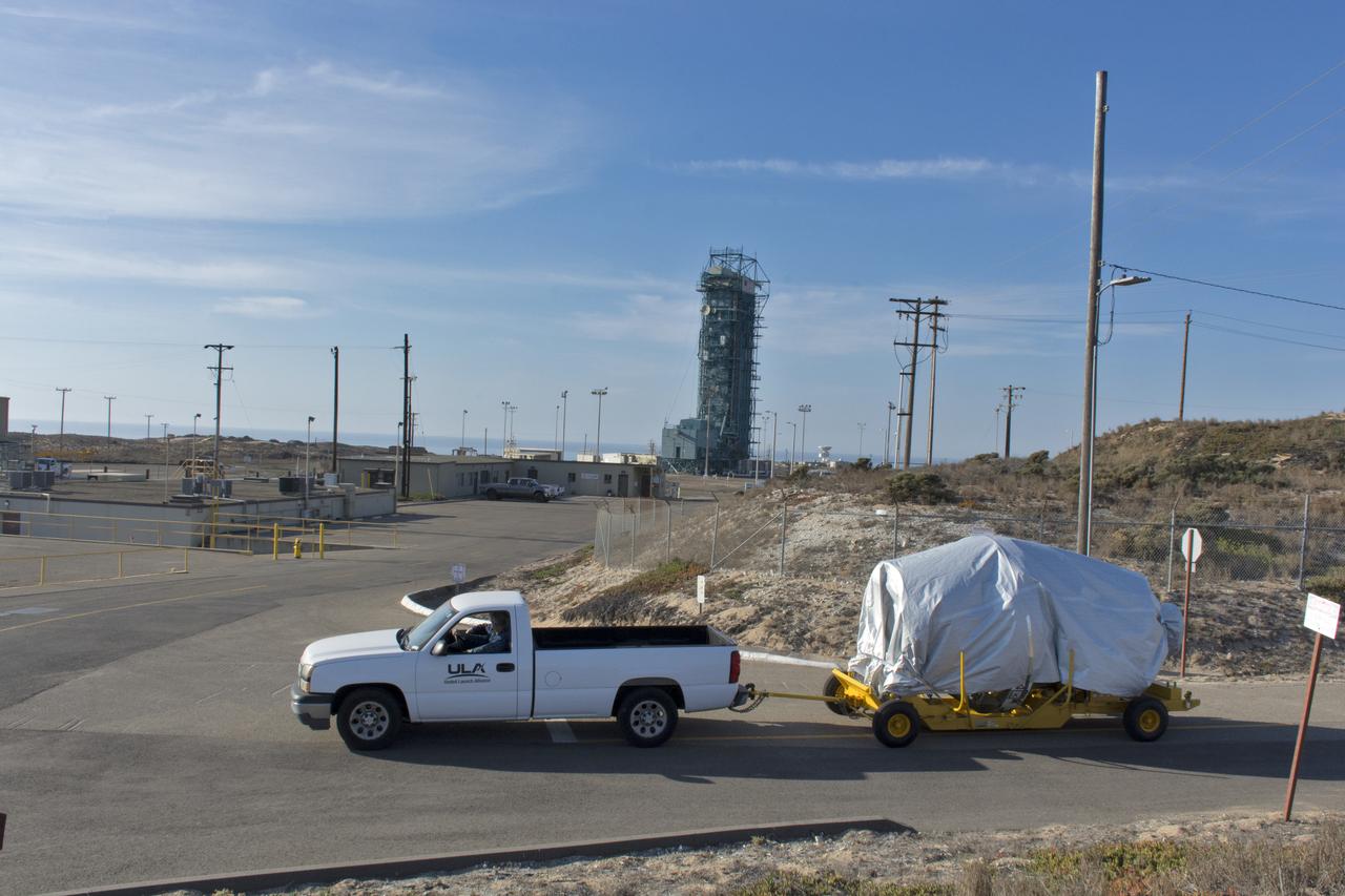
The United Launch Alliance Delta II second stage is being transported to Space Launch Complex-2 at Vandenberg Air Force Base in California. NASA's Ice, Cloud and land Elevation Satellite-2 (ICESat-2) will launch later this year on the final Delta II rocket. ICESat-2 will measure the height of a changing Earth, one laser pulse at a time, 10,000 laser pulses a second. The satellite will carry a single instrument, the Advanced Topographic Laser Altimeter System. ICESat-2 will help scientists investigate why, and how much our planet's frozen and icy areas, called the cryosphere, is changing in a warming climate.

Both halves of the United Launch Alliance (ULA) Delta II rocket payload fairing are transported by convoy to ULA's Building B8337 at Vandenberg Air Force Base in California. NASA's Ice, Cloud and land Elevation Satellite-2 (ICESat-2) will launch later this year on the final Delta II rocket. ICESat-2 will measure the height of a changing Earth, one laser pulse at a time, 10,000 laser pulses a second. The satellite will carry a single instrument, the Advanced Topographic Laser Altimeter System. ICESat-2 will help scientists investigate why, and how much our planet's frozen and icy areas, called the cryosphere, is changing in a warming climate.
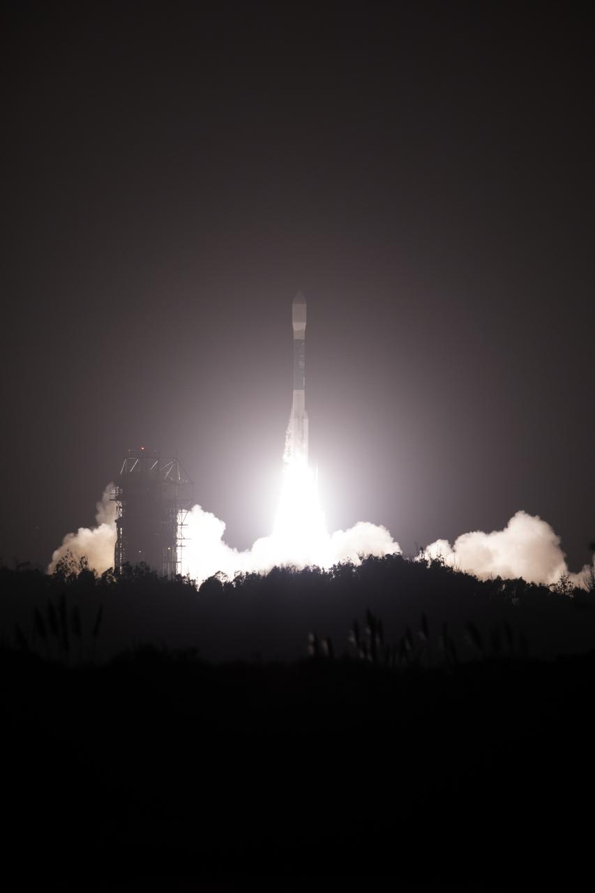
The final United Launch Alliance Delta II rocket lifts off from Space Launch Complex 2 at Vandenberg Air Force Base in California, on Sept. 15, 2018, carrying NASA's Ice, Cloud and land Elevation Satellite-2 (ICESat-2). Liftoff was at 9:02 a.m. EDT (6:02 a.m. PDT). The satellite will measure the height of our changing Earth, one laser pulse at a time, 10,000 laser pulses per second. ICESat-2 will provide scientists with height measurements that create a global portrait of Earth's third dimension, gathering date that can precisely track changes of terrain, including glaciers, sea ice and forests.

The United Launch Alliance Delta II first stage is lifted to vertical at Space Launch Complex 2 on June 8, 2018, at Vandenberg Air Force Base in California. The booster will be lifted and moved into the mobile service tower. NASA's Ice, Cloud and land Elevation Satellite-2 (ICESat-2) will launch on the final Delta II rocket. ICESat-2 will measure the height of a changing Earth, one laser pulse at a time, 10,000 laser pulses a second. The satellite will carry a single instrument, the Advanced Topographic Laser Altimeter System. ICESat-2 will help scientists investigate why, and how much our planet's frozen and icy areas, called the cryosphere, is changing in a warming climate.
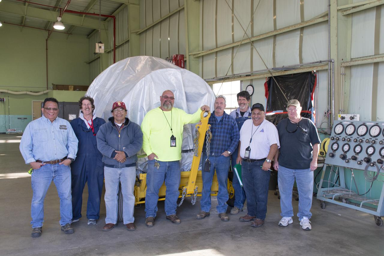
Workers stand with the Delta II second stage inside the horizontal processing facility at Space Launch Complex-2 at Vandenberg Air Force Base in California. NASA's Ice, Cloud and land Elevation Satellite-2 (ICESat-2) will launch later this year on the final Delta II rocket. ICESat-2 will measure the height of a changing Earth, one laser pulse at a time, 10,000 laser pulses a second. The satellite will carry a single instrument, the Advanced Topographic Laser Altimeter System. ICESat-2 will help scientists investigate why, and how much our planet's frozen and icy areas, called the cryosphere, is changing in a warming climate.

Inside Building 836 at Vandenberg Air Force Base in California, the top of the shipping container is lifted up from the payload fairings for the United Launch Alliance (ULA) Delta II rocket. NASA's Ice, Cloud and land Elevation Satellite-2 (ICESat-2) is scheduled to launch on the final ULA Delta II rocket later this year. ICESat-2 will measure the height of a changing Earth, one laser pulse at a time, 10,000 laser pulses a second. The satellite will carry a single instrument, the Advanced Topographic Laser Altimeter System. ICESat-2 will help scientists investigate why, and how much our planet's frozen and icy areas, called the cryosphere, is changing in a warming climate.

At Vandenberg Air Force Base in California, NASA's Ice, Cloud and land Elevation Satellite-2 (ICESat-2) is moved inside the mobile service tower at Space Launch Complex 2, on Aug. 26, 2018. The satellite will be attached to the top of the United Launch Alliance Delta II rocket. Launch is scheduled for Sept. 15, 2018. ICESat-2 will measure the height of a changing Earth, one laser pulse at a time, 10,000 laser pulses a second. The satellite will carry the Advanced Topographic Laser Altimeter System (ATLAS). ICESat-2 will help scientists investigate why, and how much our planet's frozen and icy areas, called the cryosphere, are changing in a warming climate.

A flatbed truck carrying the payload fairings for the United Launch Alliance (ULA) Delta II rocket that will launch NASA's Ice, Cloud and land Elevation Satellite-2 (ICESat-2) arrives at Building 836 at Vandenberg Air Force Base in California. ICESat-2 will measure the height of a changing Earth, one laser pulse at a time, 10,000 laser pulses a second. The satellite will carry a single instrument, the Advanced Topographic Laser Altimeter System. ICESat-2 will help scientists investigate why, and how much our planet's frozen and icy areas, called the cryosphere, is changing in a warming climate. ICESat-2 is scheduled to launch on the final ULA Delta II rocket later this year.
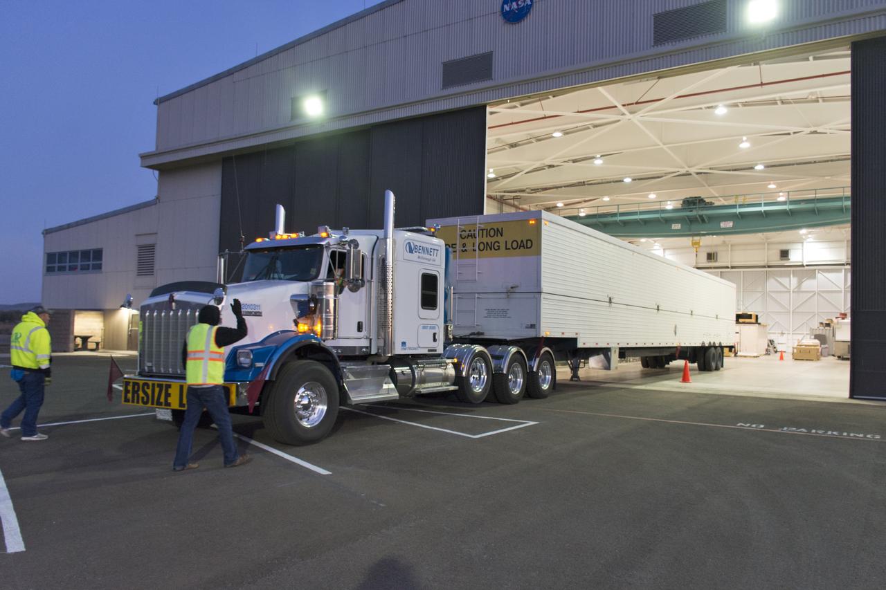
The United Launch Alliance Delta II second stage arrives at NASA's Building 1555 at Vandenberg Air Force Base in California. It will be offloaded and prepared for transport to the horizontal processing facility at Space Launch Complex-2. NASA's Ice, Cloud and land Elevation Satellite-2 (ICESat-2) will launch later this year on the final Delta II rocket. ICESat-2 will measure the height of a changing Earth, one laser pulse at a time, 10,000 laser pulses a second. The satellite will carry a single instrument, the Advanced Topographic Laser Altimeter System. ICESat-2 will help scientists investigate why, and how much our planet's frozen and icy areas, called the cryosphere, is changing in a warming climate.
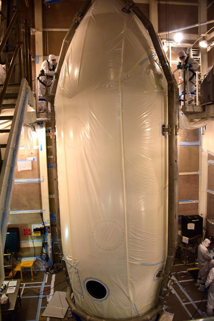
NASA's Ice, Cloud and land Elevation Satellite-2 (ICESat-2) is encapsulated in the United Launch Alliance Delta II payload fairing on Sept. 4, 2018, at Space Launch Complex 2 at Vandenberg Air Force Base in California. The satellite is being prepared for its scheduled launch on the final Delta II rocket. ICESat-2 will measure the height of a changing Earth, one laser pulse at a time, 10,000 laser pulses a second. The satellite will carry the Advanced Topographic Laser Altimeter System (ATLAS). ICESat-2 will help scientists investigate why, and how much our planet's frozen and icy areas, called the cryosphere, are changing in a warming climate.
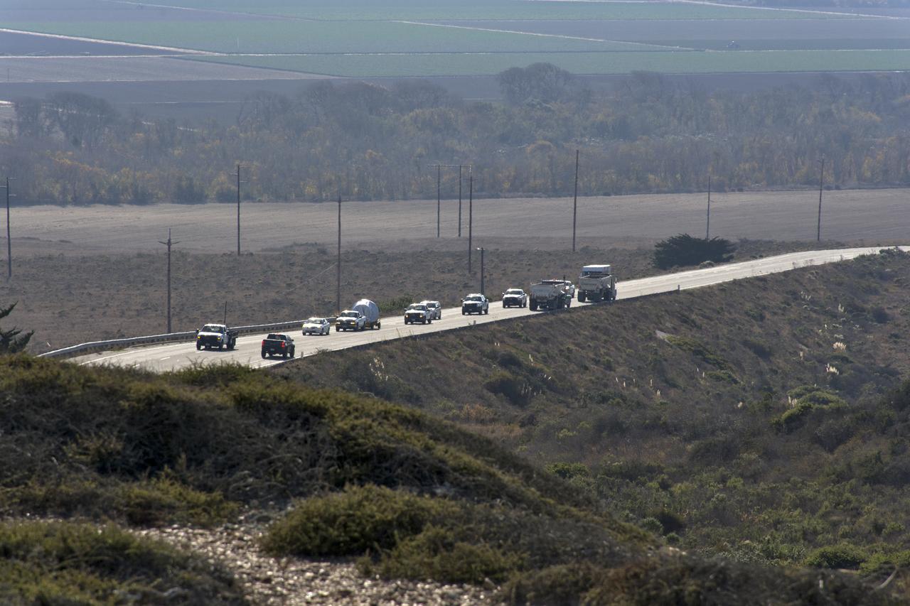
A convoy of vehicles accompanies the United Launch Alliance Delta II second stage on its way to the horizontal processing facility at Space Launch Complex-2 at Vandenberg Air Force Base in California. NASA's Ice, Cloud and land Elevation Satellite-2 (ICESat-2) will launch later this year on the final Delta II rocket. ICESat-2 will measure the height of a changing Earth, one laser pulse at a time, 10,000 laser pulses a second. The satellite will carry a single instrument, the Advanced Topographic Laser Altimeter System. ICESat-2 will help scientists investigate why, and how much our planet's frozen and icy areas, called the cryosphere, is changing in a warming climate.
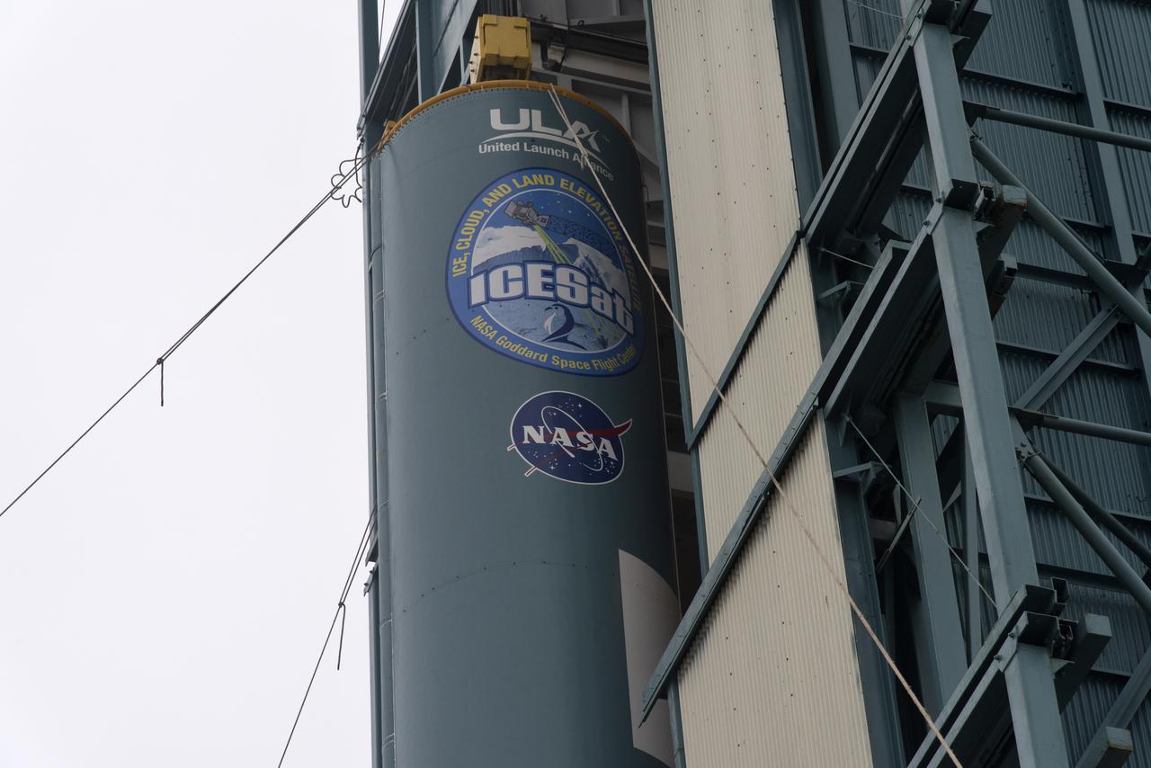
The United Launch Alliance Delta II first stage is lifted up and into the mobile service tower at Space Launch Complex 2 on June 8, 2018, at Vandenberg Air Force Base in California. NASA's Ice, Cloud and land Elevation Satellite-2 (ICESat-2) will launch on the final Delta II rocket. ICESat-2 will measure the height of a changing Earth, one laser pulse at a time, 10,000 laser pulses a second. The satellite will carry a single instrument, the Advanced Topographic Laser Altimeter System. ICESat-2 will help scientists investigate why, and how much our planet's frozen and icy areas, called the cryosphere, is changing in a warming climate.
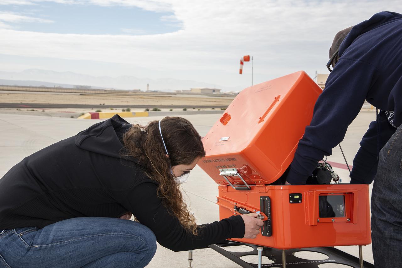
NASA’s flight systems engineer, Kassidy Mclaughlin adjusts a visual approach aid for aircraft called Pulse Light Approach Slope Indicator (PLASI). Dry run build-up test flights were conducted in 2021 at NASA’s Armstrong Flight Research Center in Edwards, California.
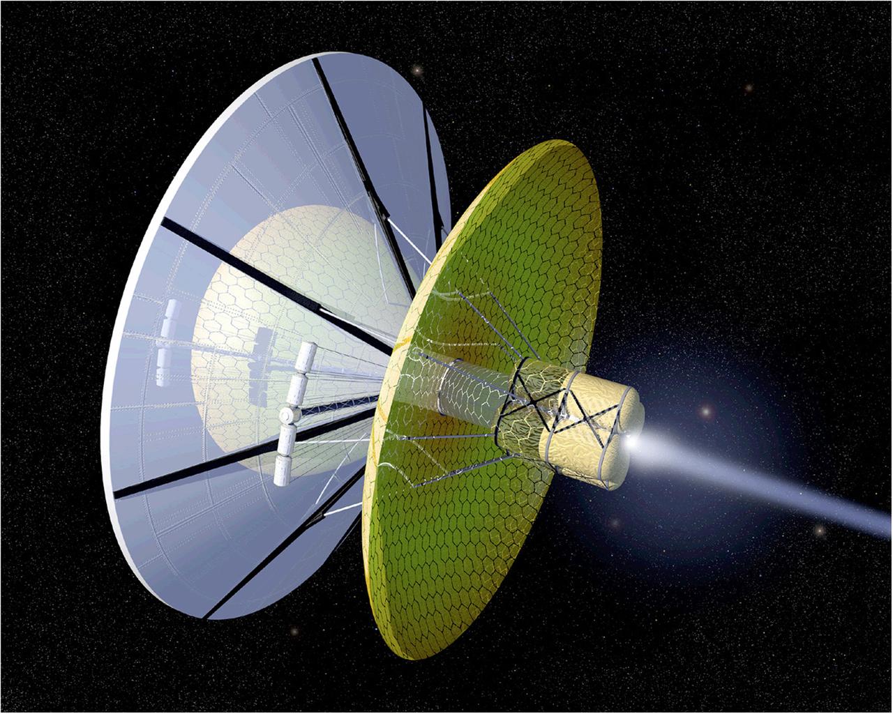
The Boussard Interstellar Ramjet engine concept uses interstellar hydrogen scooped up from its environment as the spacecraft passes by to provide propellant mass. The hydrogen is then ionized and then collected by an electromagentic field. In this image, an onboard laser is uded to heat the plasma, and the laser or electron beam is used to trigger fusion pulses thereby creating propulsion.
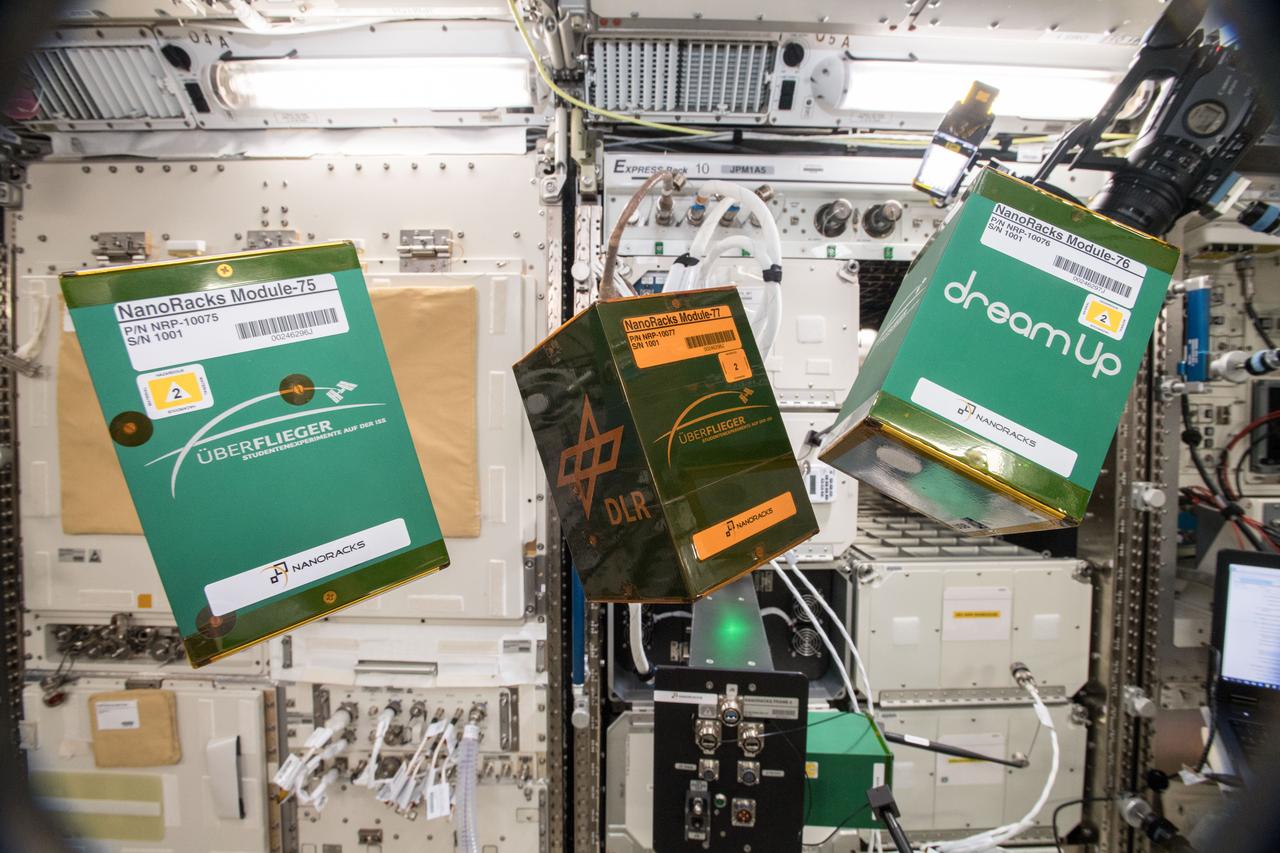
iss057e105661 (11/21/2018) --- A view of (ARISE) - NanoRacks Module-75, the Pump Application using Pulsed Electromagnets for Liquid reLocation (PAPELL) - NanoRacks Module-76 and the Experimental Chondrule Formation at the International Space Station (EXCISS) - NanoRacks Module-77 experiments shown in the Japanese Experiment Module (Kibo).
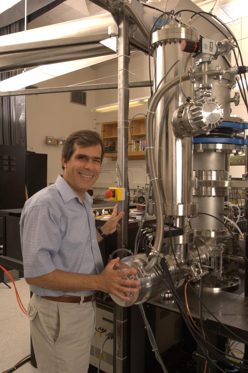
NASA Ames Astrophysics Branch (code-SSA), Pulsed discharge nozzle - Cavity Ring down - Reflection Time of Flight Mass Spectrometer (N-245 rm B-31) (PDN-CRDS-RETOFMS) shown here with Farid Salama
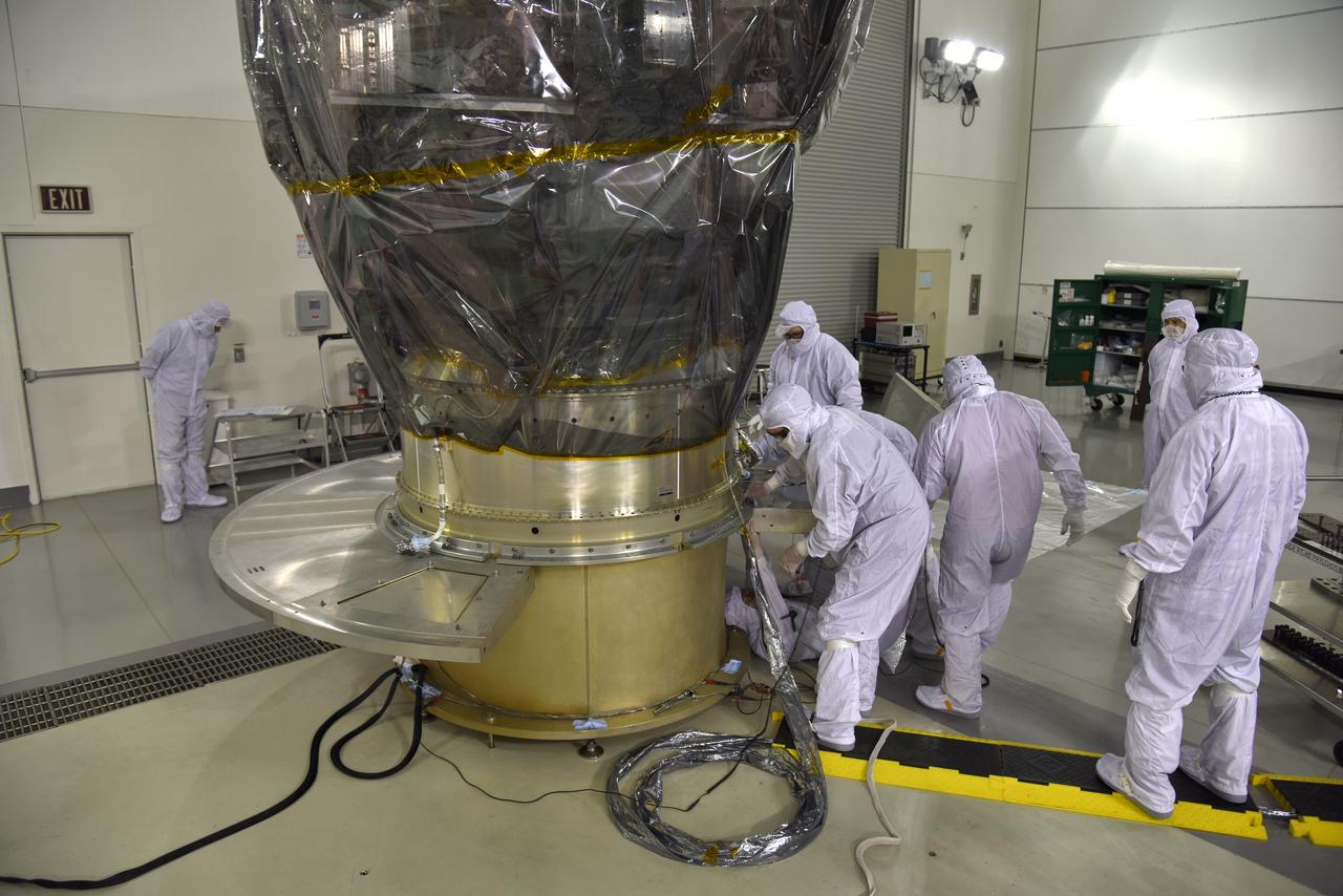
Inside the high bay of the Astrotech Space Operations facility at Vandenberg Air Force Base in California, technicians attach NASA's Ice, Cloud and land Elevation Satellite-2 (ICESat-2) to the payload direct mate adapter, on Aug. 24, 2018. The satellite is being prepared for its scheduled launch from Space Launch Complex 2 at Vandenberg on the final United Launch Alliance Delta II rocket. ICESat-2 will measure the height of a changing Earth, one laser pulse at a time, 10,000 laser pulses a second. The satellite will carry the Advanced Topographic Laser Altimeter System (ATLAS). ICESat-2 will help scientists investigate why, and how much our planet's frozen and icy areas, called the cryosphere, are changing in a warming climate.
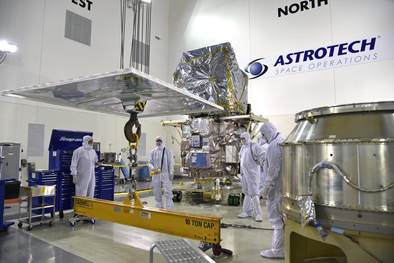
Inside the high bay of the Astrotech Space Operations facility at Vandenberg Air Force Base in California, technicians prepare to attach NASA's Ice, Cloud and land Elevation Satellite-2 (ICESat-2) to the payload adapter, on Aug. 20, 2018. The satellite is being prepared for its scheduled launch from Space Launch Complex 2 at Vandenberg on the final United Launch Alliance Delta II rocket. ICESat-2 will measure the height of a changing Earth, one laser pulse at a time, 10,000 laser pulses a second. The satellite will carry the Advanced Topographic Laser Altimeter System (ATLAS). ICESat-2 will help scientists investigate why, and how much our planet's frozen and icy areas, called the cryosphere, are changing in a warming climate.