
This map of Saturn moon Titan by the Cassini radar mapper using its synthetic aperture radar imaging mode. Shown are a variety of geologic features, including impact craters, wind-blown deposits, channels and cryovolcanic features

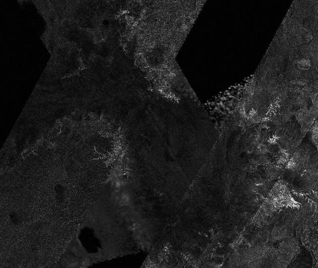
A network of river channels is located atop Xanadu, the continent-sized region on Saturn moon Titan. This radar image was captured by the Cassini Radar Mapper on April 30, 2006
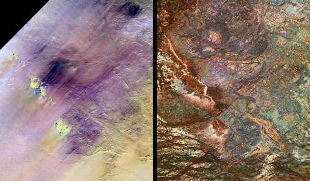
These images show two views of a region of south-central Egypt. On the left is an optical image from NASA Landsat Thematic Mapper, and on the right is a radar image from NASA Spaceborne Imaging Radar-C/X-band Synthetic Aperture Radar SIR-C/X-SAR.
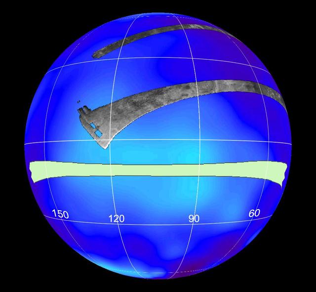
Seen here are areas mapped on Saturn moon Titan by the Cassini radar mapper using its synthetic aperture radar imaging mode. Shown are a variety of geologic features, including impact craters, wind-blown deposits, channels and cryovolcanic features
This mosaic of image swaths from Cassini’s Titan Radar Mapper, taken with the synthetic-aperture radar SAR, features a large dark region several hundred kilometers across that differs in several significant ways from potential lakes observed on Titan.

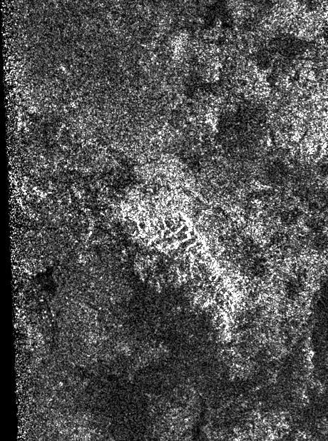
An enigmatic large basin appears in the south polar region of Saturn moon Titan at the center of this Titan Radar Mapper image from NASA Cassini spacecraft acquired on June 22, 2009.
This synthetic-aperture radar image was obtained by NASA's Cassini spacecraft during its T-120 pass over Titan's southern latitudes on June 7, 2016. The area shown here measures about 40 by 60 miles (70 by 100 kilometers) and is centered at about 60 degrees south latitude, 130 degrees west longitude. Radar illuminates the scene from the left at a 28-degree incidence angle. At the center of the image is a bright feature oriented from upper left to lower right. This is interpreted to be a long ridge with jagged peaks, likely created by methane rainfall erosion. Some of the individual peaks rise about 2,400 feet (800 meters) above the valley floor. The ridge has a considerably gentler slope on its left side (which appears brighter here) than on its right. Frequently, mountains shaped like this on Earth are fractured blocks of the planet's crust, thrusted upward and then tilted, creating a shallow slope on one side and a steeper slope on the fractured, faulted edge. Also presented here is an annotated version of the image, along with a radar image of the Dragoon Mountains in Arizona just east of Tucson. The Dragoon feature represents a tilted fault block, formed by spreading that has occurred across the western U.S., and has a similar shape to that of the Titan ridge. The Dragoon radar image was produced using data from NASA's Shuttle Radar Topography Mission (credit: NASA/JPL-Caltech/NGA). Radar illuminates the scene from the left in that image as well. Titan has displayed many features that are strikingly similar to Earth: lakes, seas, rivers, dunes and mountains. Scientists think it possible that, like Earth, the giant moon's crust has experienced familiar processes of uplift and spreading, followed by erosion. http://photojournal.jpl.nasa.gov/catalog/PIA20709

This synthetic-aperture radar image was obtained by NASA's Cassini spacecraft during its T-120 pass over Titan's southern latitudes on June 7, 2016. The image is centered near 47 degrees south, 153 degrees west. It covers an area of 87 by 75 miles (140 by 120 kilometers) and has a resolution of about 1,300 feet (400 meters). Radar illuminates the scene from the left at a 35-degree incidence angle. The features seen here are an excellent example of "labyrinth terrain." Labyrinth terrains on Titan are thought to be higher areas that have been cut apart by rivers of methane, eroded or dissolved as they were either lifted up or left standing above as the region around them lowered. (Other examples of labyrinth terrain can be seen in PIA10219.) In this image, several obvious valley systems have developed, draining liquids from methane rainfall toward the southeast (at top). Several of these systems are near parallel (running from upper left to lower right), suggesting that either the geological structure of the surface or the local topographic gradient (the general slope across the area) may be influencing their direction. Also presented here is an annotated version of the image, along with an aerial photograph of a region in southern Java known as Gunung Kidul that resembles this Titan labyrinth. This region is limestone that has been dissolved and eroded by water, creating a system of canyons called polygonal karst. Like on Titan, the canyons show a trend from upper left to lower right, in this case controlled by faults or joints. (Java photo from Haryono and Day, Journal of Cave and Karst Studies 66 (2004) 62-69, courtesy of Eko Haryono.) http://photojournal.jpl.nasa.gov/catalog/PIA20708
During its final targeted flyby of Titan on April 22, 2017, Cassini's radar mapper got the mission's last close look at the moon's surface. On this 127th targeted pass by Titan (unintuitively named "T-126"), the radar was used to take two images of the surface, shown at left and right. Both images are about 200 miles (300 kilometers) in width, from top to bottom. Objects appear bright when they are tilted toward the spacecraft or have rough surfaces; smooth areas appear dark. At left are the same bright, hilly terrains and darker plains that Cassini imaged during its first radar pass of Titan, in 2004. Scientists do not see obvious evidence of changes in this terrain over the 13 years since the original observation. At right, the radar looked once more for Titan's mysterious "magic island" (PIA20021) in a portion of one of the large hydrocarbon seas, Ligeia Mare. No "island" feature was observed during this pass. Scientists continue to work on what the transient feature might have been, with waves and bubbles being two possibilities. In between the two parts of its imaging observation, the radar instrument switched to altimetry mode, in order to make a first-ever (and last-ever) measurement of the depths of some of the lakes that dot the north polar region. For the measurements, the spacecraft pointed its antenna straight down at the surface and the radar measured the time delay between echoes from the lakes' surface and bottom. A graph is available at https://photojournal.jpl.nasa.gov/catalog/PIA21626
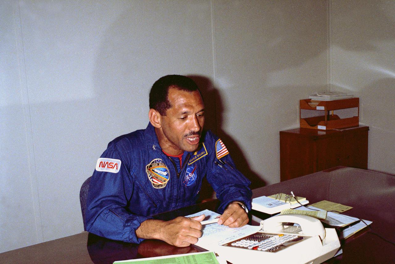
KENNEDY SPACE CENTER, FLA. -- At 1:30 a.m. EST the morning of the scheduled launch of Space Shuttle Mission STS-30 aboard Atlantis, astronaut Charles Bolden receives a call from the Vice President of the United States Dan Quayle. The Vice President called from the NASA tracking station in Australia while visiting the facility. STS-30 will launch the Magellan_Venus radar mapper spacecraft on a 15-month journey to Venus. This is the first U.S. planetary mission in 11 years and the first on Shuttle.

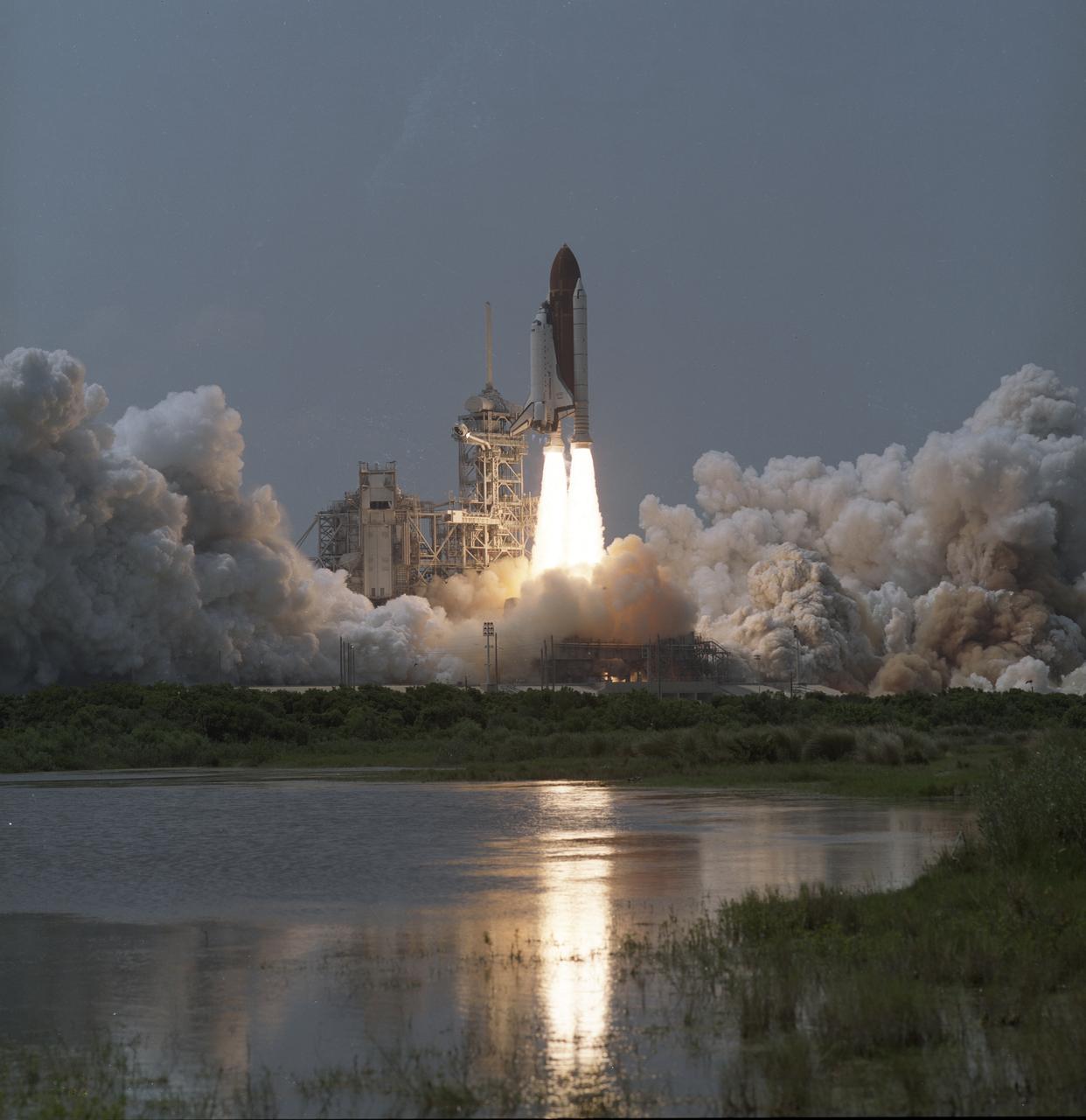
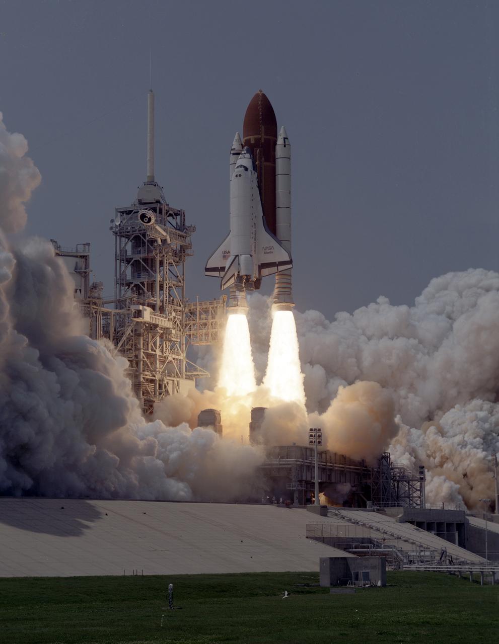
The STS-30 mission launched aboard the Space Shuttle Atlantis on May 4, 1989 at 2:46:59pm (EDT) carrying a crew of five. Aboard were Ronald J. Grabe, pilot; David M. Walker, commander; and mission specialists Norman E. Thagard, Mary L. Cleave, and Mark C. Lee. The primary payload for the mission was the Magellan/Venus Radar mapper spacecraft and attached Inertial Upper Stage (IUS).
The STS-30 mission launched aboard the Space Shuttle Atlantis on May 4, 1989 at 2:46:59pm (EDT) carrying a crew of five. Aboard were Ronald J. Grabe, pilot; David M. Walker, commander; and mission specialists Norman E. Thagard, Mary L. Cleave, and Mark C. Lee. The primary payload for the mission was the Magellan/Venus Radar mapper spacecraft and attached Inertial Upper Stage (IUS).
The STS-30 mission launched aboard the Space Shuttle Atlantis on May 4, 1989 at 2:46:59pm (EDT) carrying a crew of five. Aboard were Ronald J. Grabe, pilot; David M. Walker, commander; and mission specialists Norman E. Thagard, Mary L. Cleave, and Mark C. Lee. The primary payload for the mission was the Magellan/Venus Radar mapper spacecraft and attached Inertial Upper Stage (IUS).
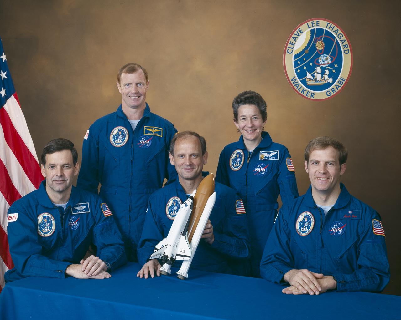
Five astronauts composed the STS-30 crew. Pictured (left to right) are Ronald J. Grabe, pilot; David M. Walker, commander; and mission specialists Norman E. Thagard, Mary L. Cleave, and Mark C. Lee. The STS-30 mission launched aboard the Space Shuttle Atlantis on May 4, 1989 at 2:46:59pm (EDT). The primary payload was the Magellan/Venus Radar mapper spacecraft and attached Inertial Upper Stage (IUS).
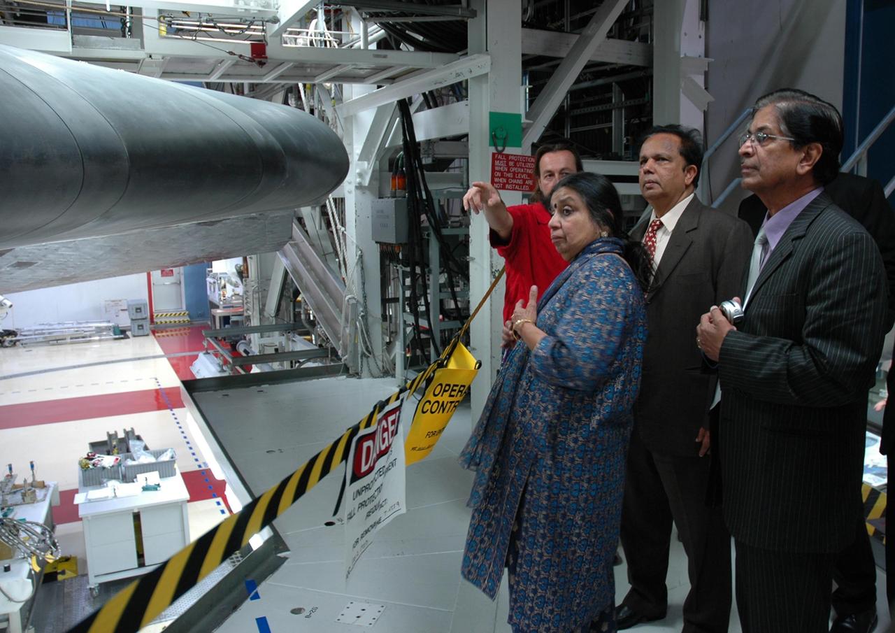
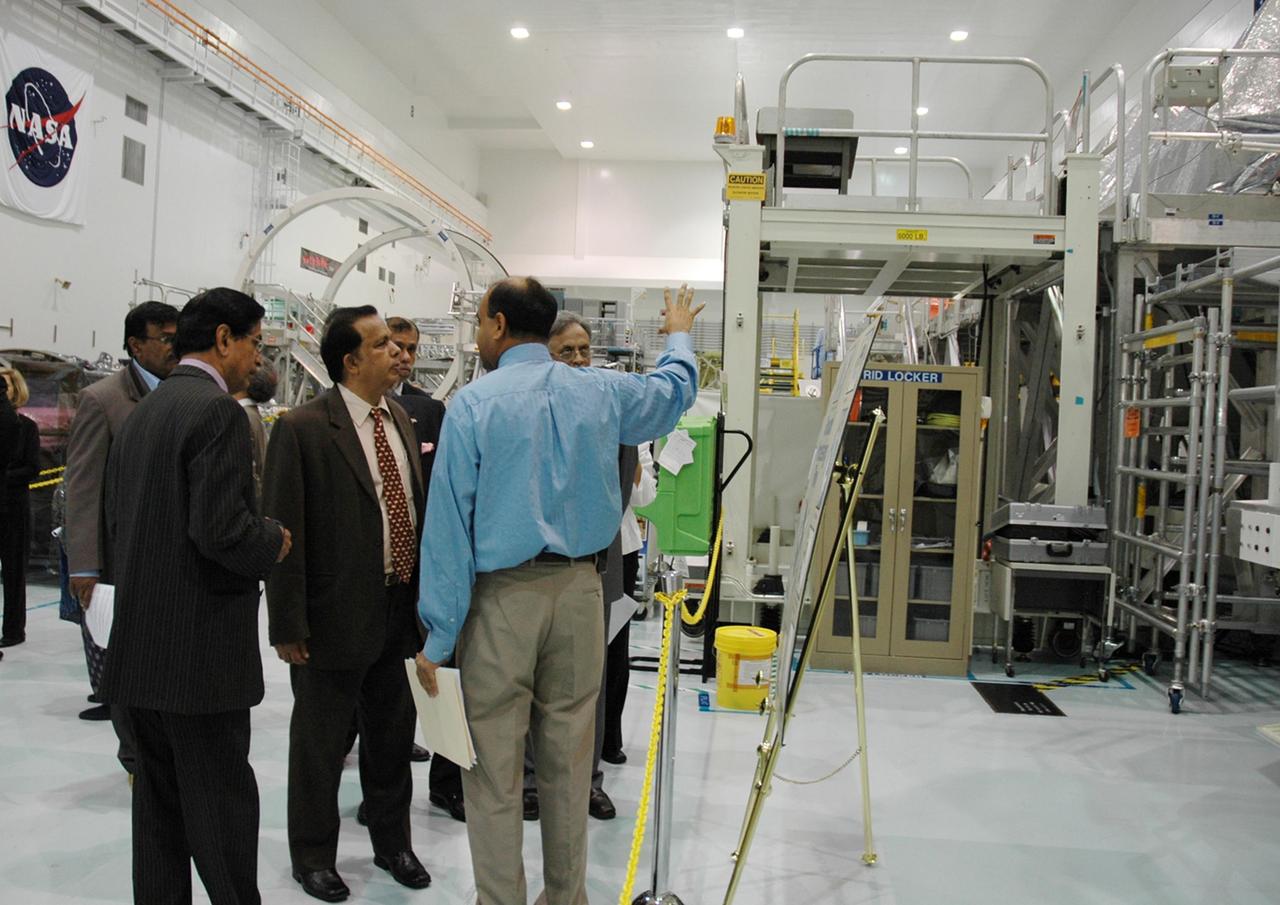
KENNEDY SPACE CENTER, FLA. -- After signing a framework agreement establishing the terms for future cooperation between NASA and the Indian Space Research Organization, Chairman G. Madhavan Nair (center) is given a tour of the Space Station Processing Facility at NASA's Kennedy Space Center. The agreement establishes the terms for future cooperation between the two agencies in the exploration and use of outer space for peaceful purposes. According to the framework agreement, the two agencies will identify areas of mutual interest and seek to develop cooperative programs or projects in Earth and space science, exploration, human space flight and other activities. In addition to a long history of cooperation in Earth science, NASA and the Indian Space Research Organization also are cooperating on India's first, mission to the moon, Chandrayaan-1, which will be launched later this year. NASA is providing two of the 11 instruments on the spacecraft: the moon mineralogy mapper instrument and the miniature synthetic aperture radar instrument. Photo credit: NASA/Kim Shiflett
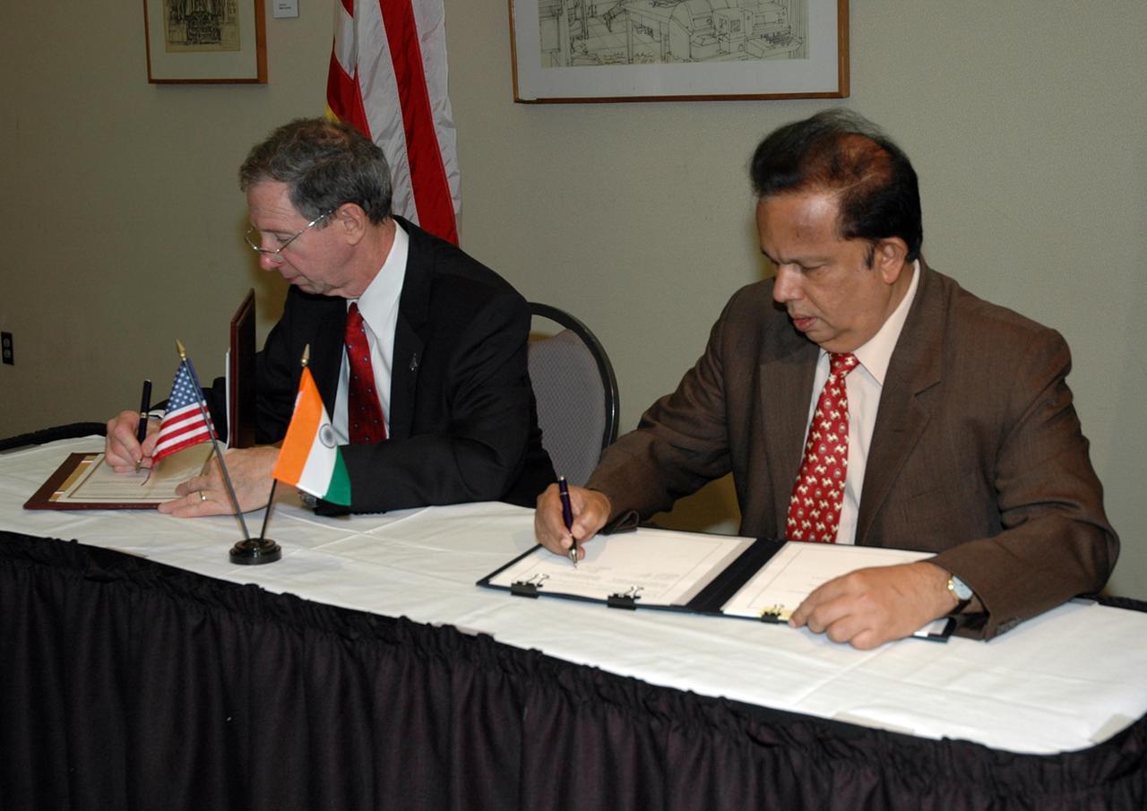
KENNEDY SPACE CENTER, FLA. -- At a ceremony at the NASA's Kennedy Space Center Visitor Complex, NASA Administrator Michael Griffin (left) and Indian Space Research Organization Chairman G. Madhavan Nair sign a framework agreement establishing the terms for future cooperation between the two agencies in the exploration and use of outer space for peaceful purposes. According to the framework agreement, the two agencies will identify areas of mutual interest and seek to develop cooperative programs or projects in Earth and space science, exploration, human space flight and other activities. In addition to a long history of cooperation in Earth science, NASA and the Indian Space Research Organization also are cooperating on India's first, mission to the moon, Chandrayaan-1, which will be launched later this year. NASA is providing two of the 11 instruments on the spacecraft: the moon mineralogy mapper instrument and the miniature synthetic aperture radar instrument. Photo credit: NASA/Kim Shiflett
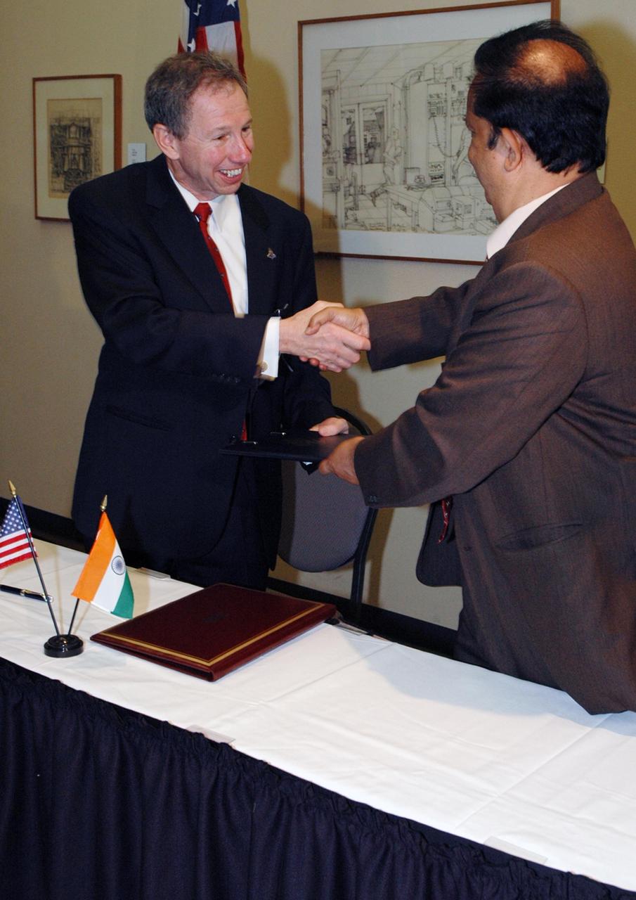
KENNEDY SPACE CENTER, FLA. -- At the NASA's Kennedy Space Center Visitor Complex, NASA Administrator Michael Griffin (left) and Indian Space Research Organization Chairman G. Madhavan Nair show their pleasure after signing a framework agreement establishing the terms for future cooperation between the two agencies in the exploration and use of outer space for peaceful purposes. According to the framework agreement, the two agencies will identify areas of mutual interest and seek to develop cooperative programs or projects in Earth and space science, exploration, human space flight and other activities. In addition to a long history of cooperation in Earth science, NASA and the Indian Space Research Organization also are cooperating on India's first, mission to the moon, Chandrayaan-1, which will be launched later this year. NASA is providing two of the 11 instruments on the spacecraft: the moon mineralogy mapper instrument and the miniature synthetic aperture radar instrument. Photo credit: NASA/Kim Shiflett
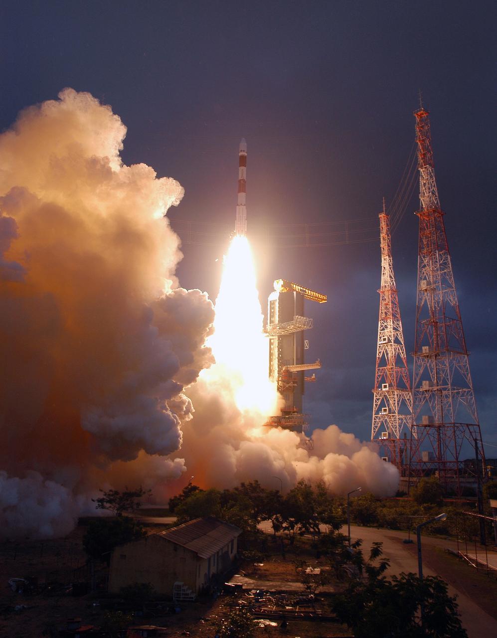
SRIHARIKOTA, India – The Indian Space Research Organization, or ISRO, launches its robotic Chandrayaan-1 rocket with two NASA instruments aboard on India's maiden moon voyage to map the lunar surface. The Moon Mineralogy Mapper will assess mineral resources, and the Miniature Synthetic Aperture Radar, or Mini-SAR, will map the polar regions and look for ice deposits. Data from the two instruments will contribute to NASA's increased understanding of the lunar environment as it implements the nation's space exploration policy, which calls for robotic and human missions to the moon. In addition to the two science instruments, NASA will provide space communications support to Chandrayaan-1. The primary location for the NASA ground tracking station will be at the Johns Hopkins University Applied Physics Laboratory in Laurel, Md. Photo credit: NASA
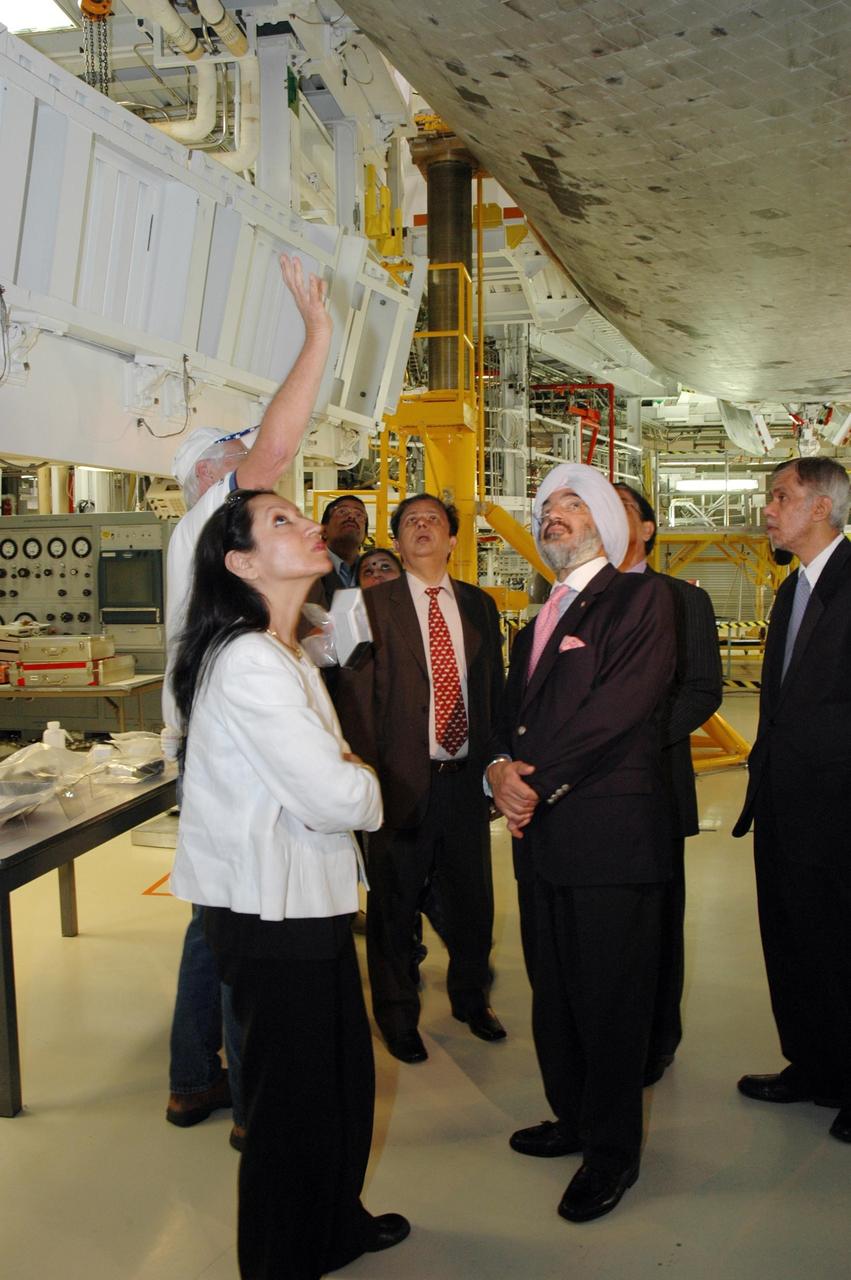
KENNEDY SPACE CENTER, FLA. -- After signing a framework agreement establishing the terms for future cooperation between NASA and the Indian Space Research Organization, Chairman G. Madhavan Nair (center) and other members are given a tour of the Space Station Processing Facility at NASA's Kennedy Space Center. The agreement establishes the terms for future cooperation between the two agencies in the exploration and use of outer space for peaceful purposes. According to the framework agreement, the two agencies will identify areas of mutual interest and seek to develop cooperative programs or projects in Earth and space science, exploration, human space flight and other activities. In addition to a long history of cooperation in Earth science, NASA and the Indian Space Research Organization also are cooperating on India's first, mission to the moon, Chandrayaan-1, which will be launched later this year. NASA is providing two of the 11 instruments on the spacecraft: the moon mineralogy mapper instrument and the miniature synthetic aperture radar instrument. Photo credit: NASA/Kim Shiflett

KENNEDY SPACE CENTER, FLA. -- After signing a framework agreement establishing the terms for future cooperation between NASA and the Indian Space Research Organization, Chairman G. Madhavan Nair (center) and other members are given a tour of the Space Station Processing Facility at NASA's Kennedy Space Center. The agreement establishes the terms for future cooperation between the two agencies in the exploration and use of outer space for peaceful purposes. According to the framework agreement, the two agencies will identify areas of mutual interest and seek to develop cooperative programs or projects in Earth and space science, exploration, human space flight and other activities. In addition to a long history of cooperation in Earth science, NASA and the Indian Space Research Organization also are cooperating on India's first, mission to the moon, Chandrayaan-1, which will be launched later this year. NASA is providing two of the 11 instruments on the spacecraft: the moon mineralogy mapper instrument and the miniature synthetic aperture radar instrument. Photo credit: NASA/Kim Shiflett
KENNEDY SPACE CENTER, FLA. -- After signing a framework agreement establishing the terms for future cooperation between NASA and the Indian Space Research Organization, Chairman G. Madhavan Nair (center) and other members are given a tour of the Space Station Processing Facility at NASA's Kennedy Space Center. The agreement establishes the terms for future cooperation between the two agencies in the exploration and use of outer space for peaceful purposes. According to the framework agreement, the two agencies will identify areas of mutual interest and seek to develop cooperative programs or projects in Earth and space science, exploration, human space flight and other activities. In addition to a long history of cooperation in Earth science, NASA and the Indian Space Research Organization also are cooperating on India's first, mission to the moon, Chandrayaan-1, which will be launched later this year. NASA is providing two of the 11 instruments on the spacecraft: the moon mineralogy mapper instrument and the miniature synthetic aperture radar instrument. Photo credit: NASA/Kim Shiflett
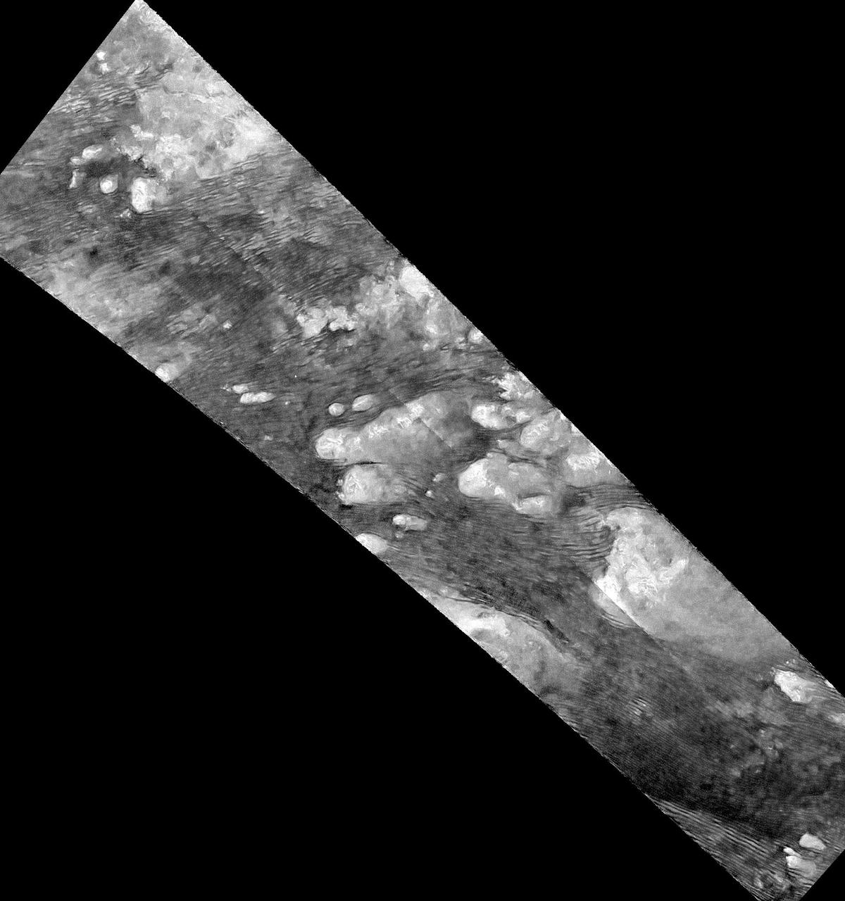
This radar image of the Shangri-La Sand Sea on Titan from NASA's Cassini spacecraft shows hundreds of sand dunes are visible as dark lines snaking across the surface. These dunes display patterns of undulation and divergence around elevated mountains (which appear bright to the radar), thereby showing the direction of wind and sand transport on the surface. Sands being carried from left to right (west to east) cannot surmount the tallest obstacles; instead, they are directed through chutes and canyons between the tall features, evident in thin, blade-like, isolated dunes between bright some features. Once sands have passed around the obstacles, they resume their downwind course, at first collecting into small, patchy dunes and then organizing into larger, more pervasive linear forms, before being halted once again by obstacles. These patterns reveal the effects not only of wind -- perhaps even modern winds if the dunes are actively moving today -- but also the effects of underlying bedrock and surrounding topography. Dunes across the solar system aid in our understanding of underlying topography, winds and climate, past and present. Similar patterns can be seen in dunes of the Great Sandy Desert in Australia, where dunes undulate broadly across the uneven terrain and are halted at the margins of sand-trapping lakes. The dune orientations correlate generally with the direction of current trade winds, and reveal that winds must have been similar back when the dunes formed, during the Pleistocene glacial and interglacial periods. The image was taken by the Cassini Synthetic Aperture radar (SAR) on July 25, 2016 during the mission's 122nd targeted Titan encounter. The image has been modified by the denoising method described in A. Lucas, JGR:Planets (2014). http://photojournal.jpl.nasa.gov/catalog/PIA20711