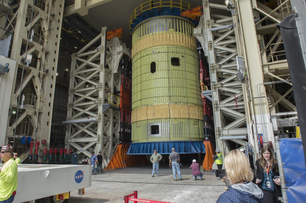
SLS Intertank Test Article, ITA, is attached to crosshead of load test Annex, Bldg. 4619, and removed from bed of KMAG transporter. ITA is slowly raised from bed of KMAG transporter and KMAG is removed.
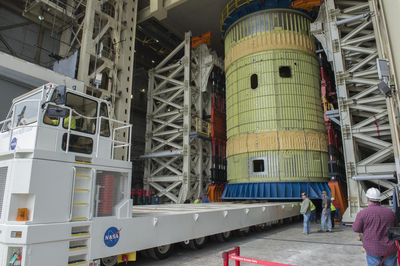
SLS Intertank Test Article, ITA, is attached to crosshead of load test Annex, Bldg. 4619, and removed from bed of KMAG transporter. ITA is slowly raised from bed of KMAG transporter and KMAG is removed.
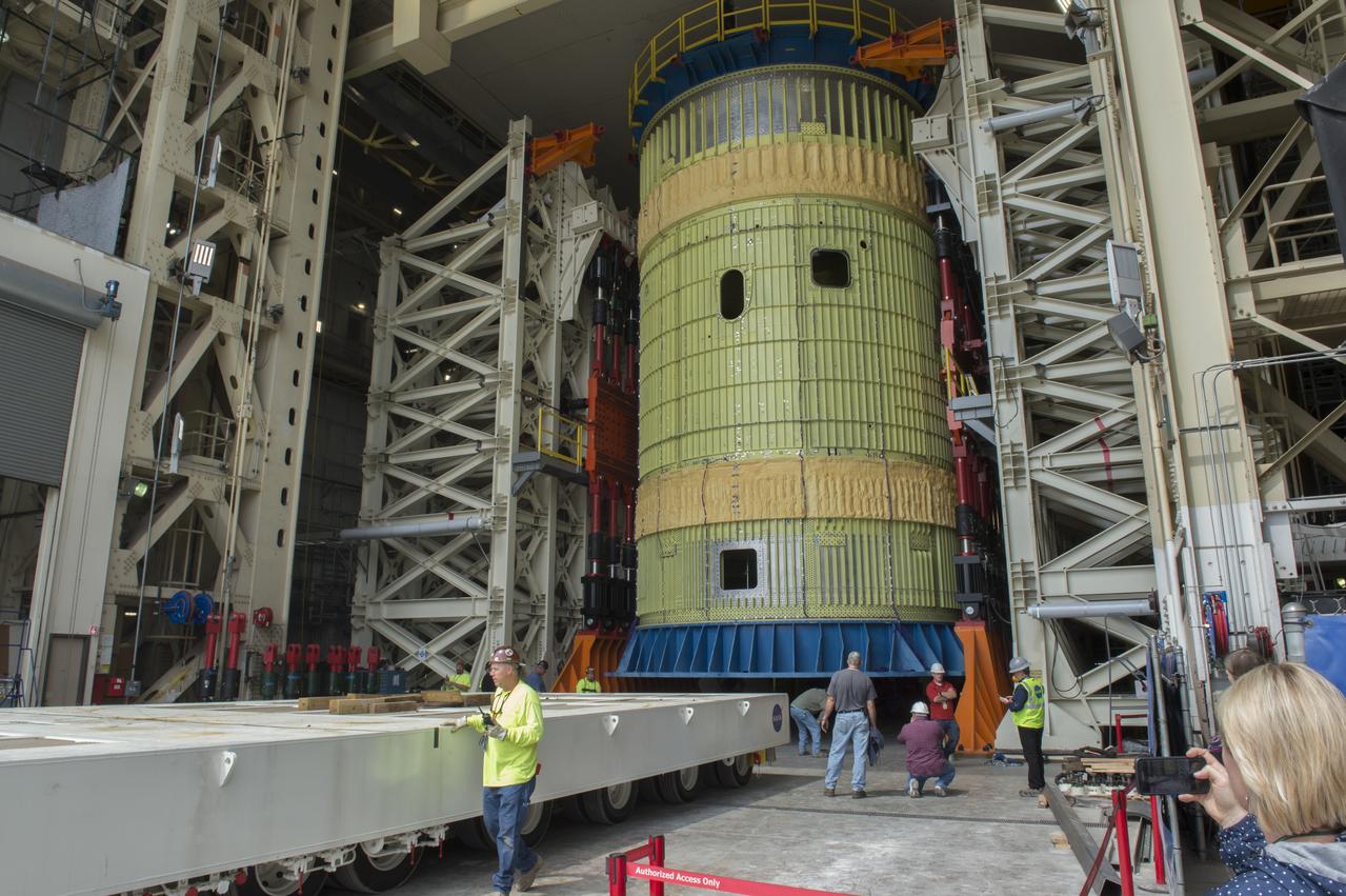
SLS Intertank Test Article, ITA, is attached to crosshead of load test Annex, Bldg. 4619, and removed from bed of KMAG transporter. ITA is slowly raised from bed of KMAG transporter and KMAG is removed.
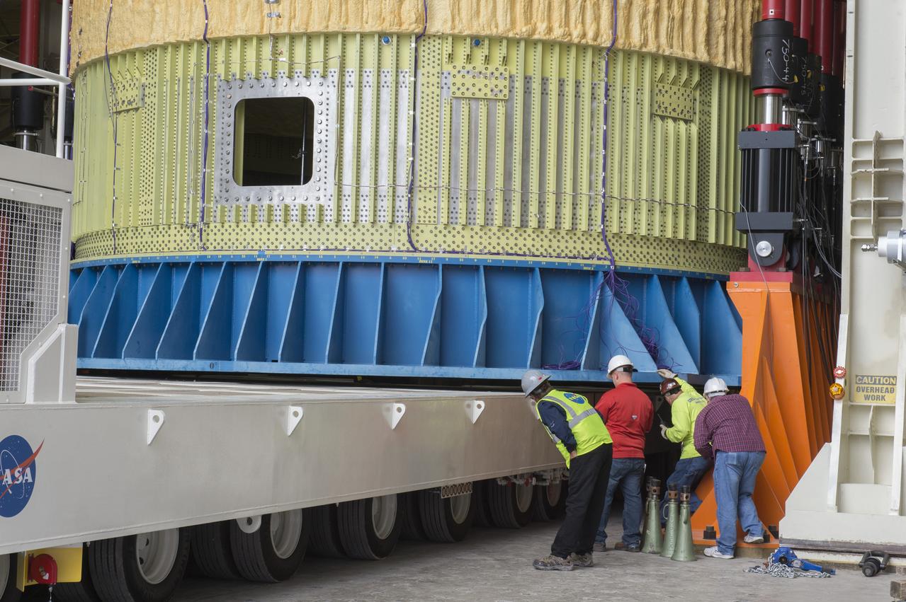
SLS Intertank Test Article, ITA, is attached to crosshead of load test Annex, Bldg. 4619, and removed from bed of KMAG transporter. ITA is slowly raised from bed of KMAG transporter and KMAG is removed.
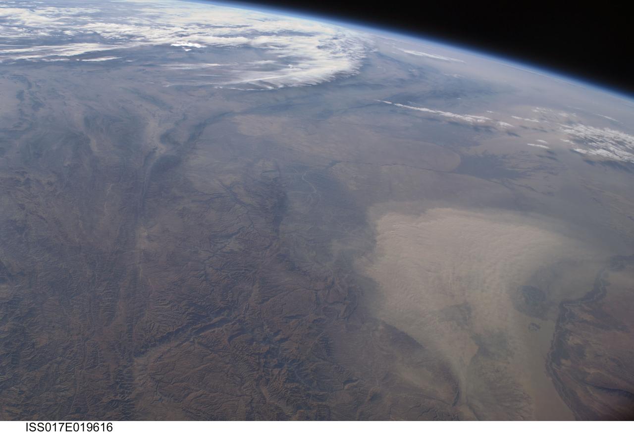
ISS017-E-019616 (16 Oct. 2008) --- A dust storm in Turkmenistan, Central Asia is featured in this image photographed by an Expedition 17 crewmember on the International Space Station. This west-looking view, taken with a short focal length lens from the station, shows a wide swath of central Asia--from Afghanistan, along the length of Turkmenistan to the Caspian Sea. Winds blowing down the largest river valley in the region, the Amudarya, were strong enough to raise a large dust storm. Dust appears as a light brown mass extending into the center of the image from the lower right. Diffuse dust from prior windy weather appears over much of the area making a regional haze that clouds much of the landscape detail. The haze partly obscures the irrigated agriculture in Turkmenistan and entirely obscures the Caspian Sea. Numerous rivers rise in the Hindu Kush mountain complex (lower left). The Band-i Amir River is a major tributary of the main regional river, the Amudarya, which it reaches via a deep canyon. The Amudarya River was the major historical contributor of water to the Aral Sea, but today extensive diversion of river water for agricultural purposes has lead to extensive exposure and desiccation of the sea bed. The exposed sea bed is a major source of saline dusts contaminated with agricultural chemicals that pose a significant environmental hazard to central Asia. To a lesser extent, dusts are also mobilized from sediments along the Amudarya river channel. The Paropamisus Range and the Amudarya (also known as the Oxus River) are mentioned in histories of Alexander the Great's famous military expedition from Greece to India. His horsemen made a fast side excursion from near the Caspian Sea (top right) as far as the Amudarya (lower right).
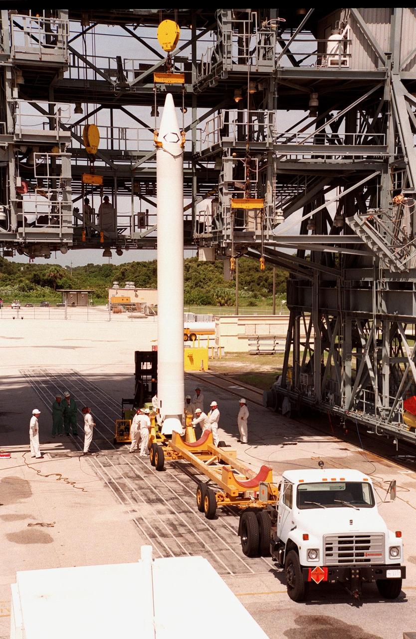
A booster is raised off a truck bed and prepared for lifting to the Boeing Delta 7326 rocket that will launch Deep Space 1 at Launch Pad 17A, Cape Canaveral Air Station. Delta II rockets are medium capacity expendable launch vehicles derived from the Delta family of rockets built and launched since 1960. Since then there have been more than 245 Delta launches. The Delta 7236 has three solid rocket boosters and a Star 37 upper stage. Delta IIs are manufactured in Huntington Beach, Calif. Rocketdyne, a division of The Boeing Company, builds Delta II's main engine in Canoga Park, Calif. Deep Space 1, the first flight in NASA's New Millennium Program, is designed to validate 12 new technologies for scientific space missions of the next century. Onboard experiments include an ion propulsion engine and software that tracks celestial bodies so the spacecraft can make its own navigation decisions without the intervention of ground controllers. Deep Space 1 will complete most of its mission objectives within the first two months, but may also do a flyby of a near-Earth asteroid, 1992 KD, in July 1999
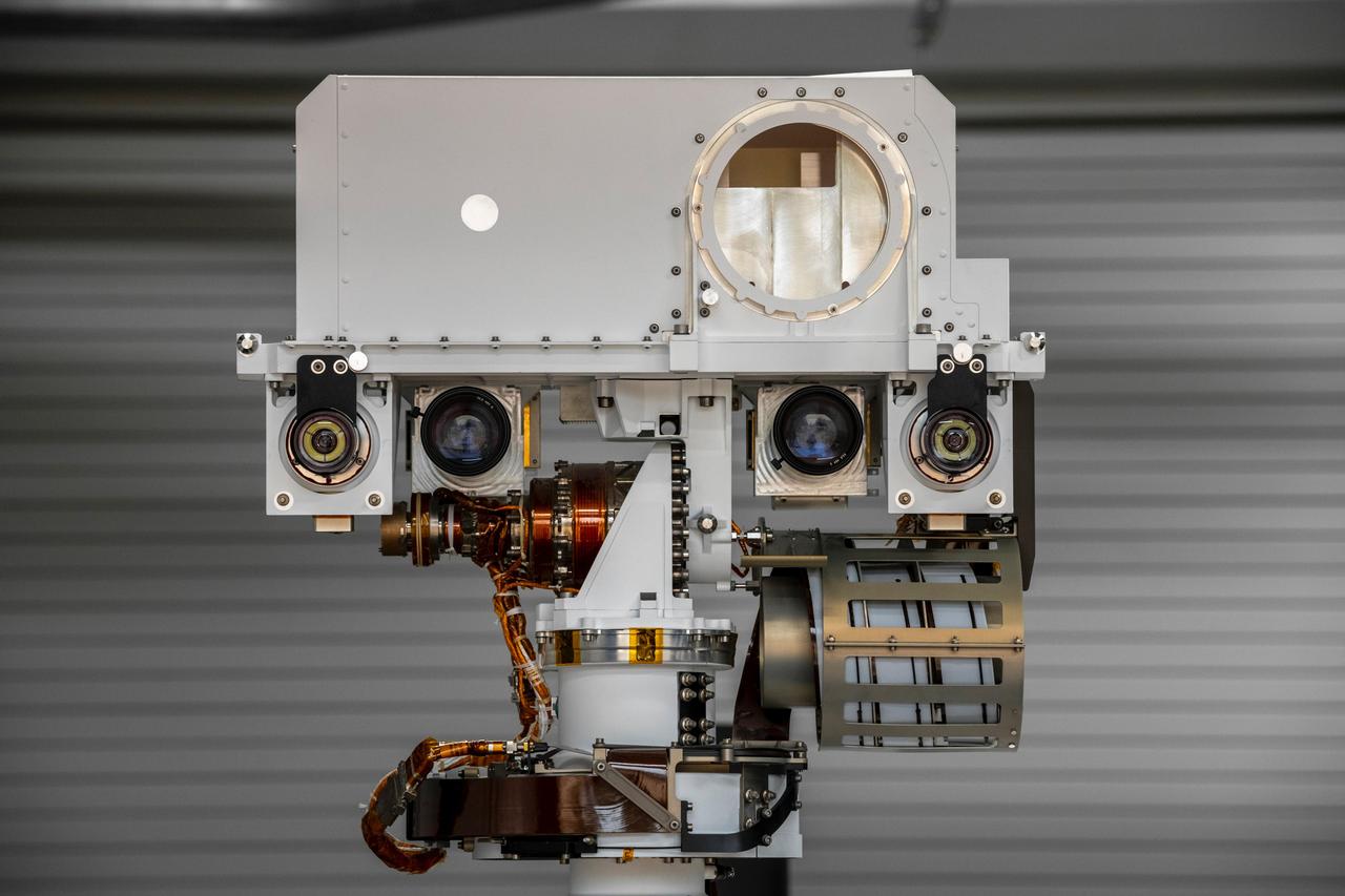
The full-scale engineering model of NASA's Perseverance rover raises its "head," or remote sensing mast, at NASA's Jet Propulsion Laboratory in Southern California. This model is known as the vehicle system test bed (VSTB) rover, or OPTIMISM (Operational Perseverance Twin for Integration of Mechanisms and Instruments Sent to Mars). OPTIMISM raised its mast shortly after moving into its new home at JPL's Mars Yard on Sept. 4, 2020. The mast hosts many of the rover's cameras and scientific instruments. At the top of the mast, the large circular opening is where the SuperCam instrument will be installed on this test rover. Also visible in these images below the SuperCam "eye" are the navigation cameras (two cameras closest to the outside of the head) and the Mastcam-Z cameras inside of the navigation cameras. A key objective for Perseverance's mission on Mars is astrobiology, including the search for signs of ancient microbial life. The rover will also characterize the planet's climate and geology, pave the way for human exploration of the Red Planet, and be the first planetary spacecraft to collect and cache Martian rock and regolith (broken rock and dust). Subsequent missions, currently under consideration by NASA in cooperation with the European Space Agency, would send spacecraft to Mars to collect these cached samples from the surface and return them to Earth for in-depth analysis. The Mars 2020 mission is part of a larger program that includes missions to the Moon as a way to prepare for human exploration of the Red Planet. Charged with returning astronauts to the Moon by 2024, NASA will establish a sustained human presence on and around the Moon by 2028 through NASA's Artemis lunar exploration plans. https://photojournal.jpl.nasa.gov/catalog/PIA23967
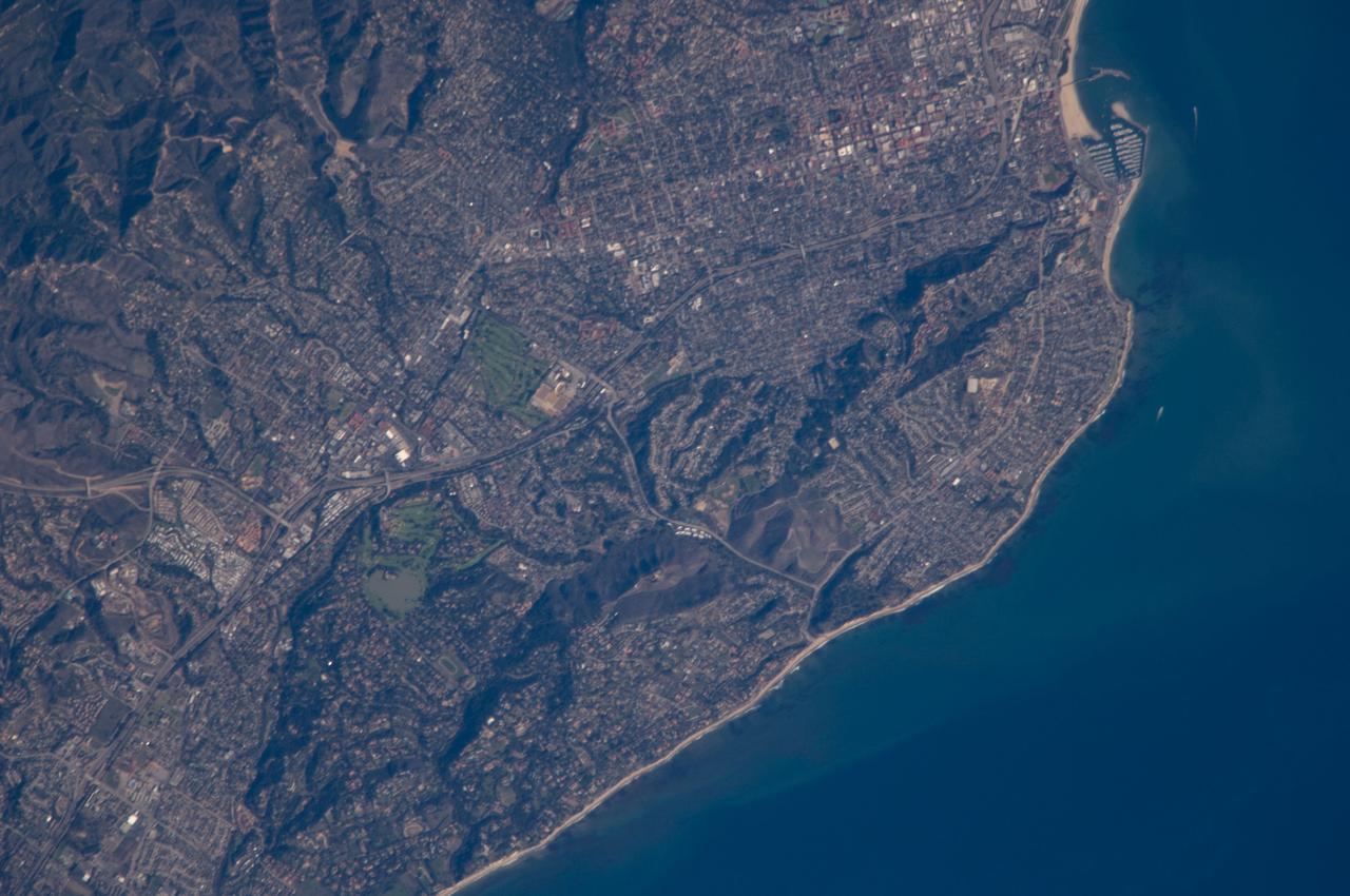
ISS018-E-011096 (6 Dec. 2008) --- Santa Barbara, CA metropolitan area, also known as the ?American Riviera?, is featured in this image photographed by an Expedition 18 crewmember on the International Space Station. The geographic setting of the city - between the Santa Barbara Channel to the south and the steep Santa Ynez Mountains to the north. The city was officially founded as a Spanish mission in 1786, and was incorporated into the United States from Mexico in 1848 following the Mexican-American War. The dramatic landscape of the city is the result of tectonic forces ? the Santa Barbara Channel is part of the boundary between the Pacific oceanic and North American continental crustal plates. Movement along the San Andreas Fault ? the actual zone of contact between the two plates ? over geologic time both raised the Santa Ynez range and lowered the seafloor, forming the deep Santa Barbara Channel. The city has experienced two earthquakes, one in 1812 and another in 1925 that caused significant damage. The urban street grid is defined by white and red rooftops at top center; to the southeast lie beaches and the boat slips of a large marina (top right). Two large golf courses, characterized by expanses of green grass, are visible at center. Low east-west trending hills that parallel the coastline are almost completely covered by residential and commercial development, lending a speckled appearance to the hillsides. Immediately offshore, giant kelp beds are the focus of the Santa Barbara Coastal Long Term Ecological Research site, part of the National Science Foundation?s Long Term Ecological Research Network.