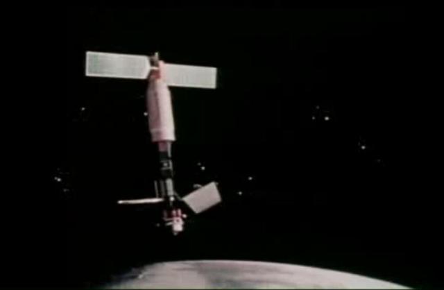
Seasat, built and managed by NASA Jet Propulsion Laboratory JPL, was launched thirty-five years ago, on June 27, 1978. It was the first satellite designed for remote sensing of the Earth oceans using many ground-breaking technologies.
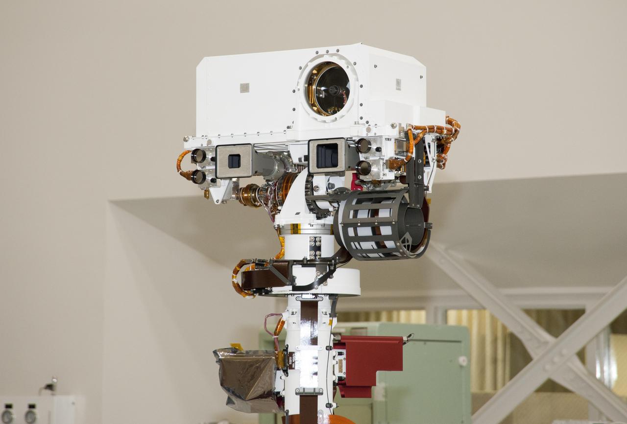
The remote sensing mast on NASA Mars rover Curiosity holds two science instruments for studying the rover surroundings and two stereo navigation cameras for use in driving the rover and planning rover activities.
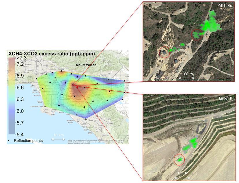
This image captured by a prototype NASA satellite instrument at NASA California Laboratory for Atmospheric Remote Sensing CLARS shows a persistent methane hotspot central red area over Los Angeles basin.
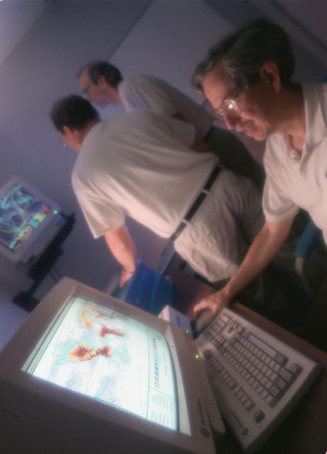
Marshall researchers conduct extensive analysis of weather patterns by using remote sensing on lightning and thunderstorms from outer space for the Mission to Planet Earth program.
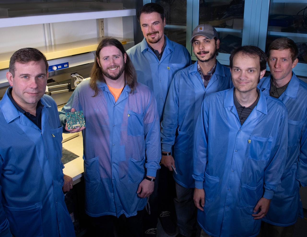
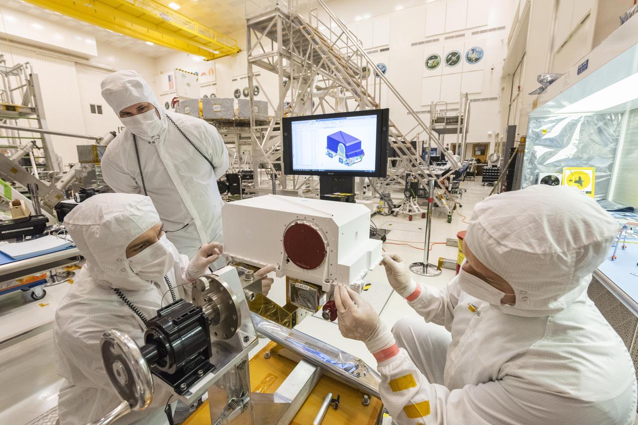
Several Goddard technologists are involved in a new CubeSat technology-demonstration mission called SNoOPI, which employs a novel remote-sensing technique for measuring soil-moisture levels. From left to right: Jeffrey Piepmeier, Chase Kielbasa, who is holding a first-generation prototype circuit board for the SNoOPI instrument, Joseph Knuble, Manuel Vega, Michael Coon, and Derek Hudson.
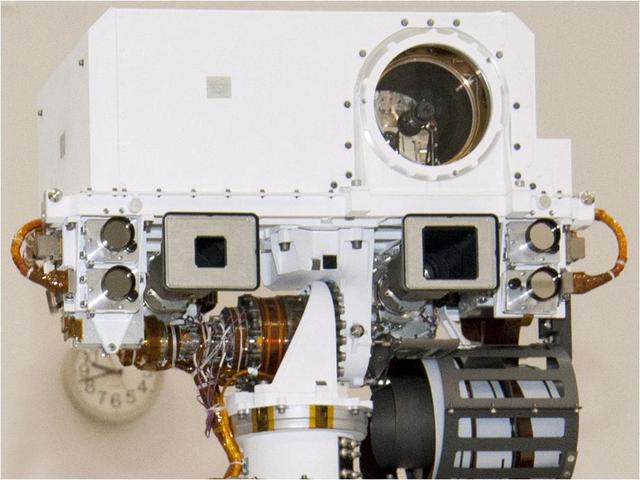
This view of the head of the remote sensing mast on the Mars Science Laboratory mission rover, Curiosity, shows seven of the 17 cameras on the rover.
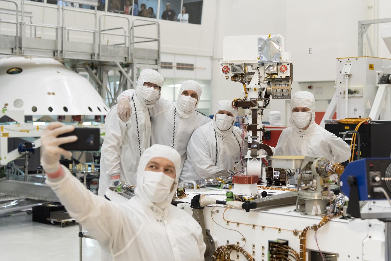
Members of NASA's Mars 2020 project take a moment after attaching the remote sensing mast to the Mars 2020 rover. The image was taken on June 5, 2019, in the Spacecraft Assembly Facility's High Bay 1 clean room at NASA's Jet Propulsion Laboratory in Pasadena, California. https://photojournal.jpl.nasa.gov/catalog/PIA23267
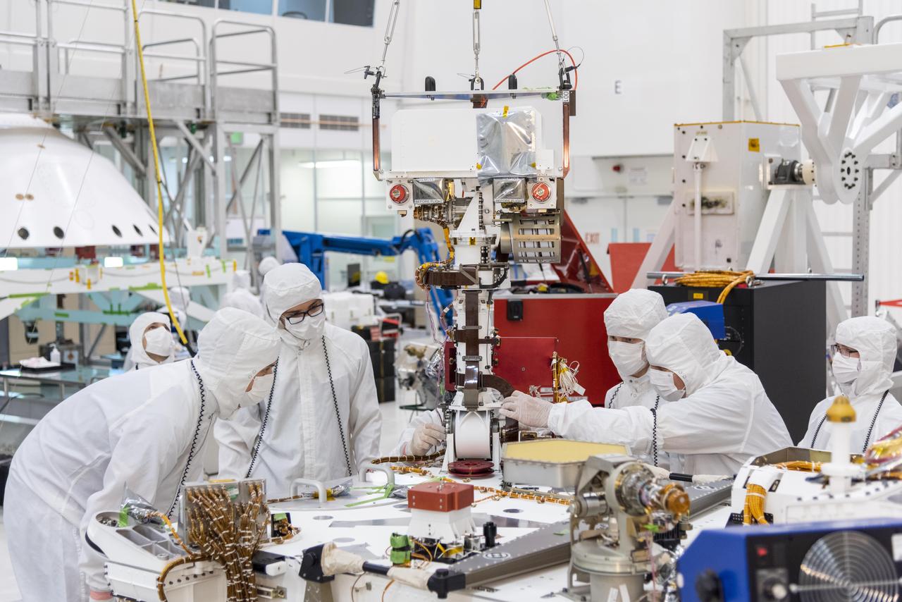
Engineers and technicians at NASA's Jet Propulsion Laboratory in Pasadena, California, install the remote sensing mast on the Mars 2020 rover. The image was taken on June 5, 2019, in the Spacecraft Assembly Facility's High Bay 1 clean room at JPL. https://photojournal.jpl.nasa.gov/catalog/PIA23268
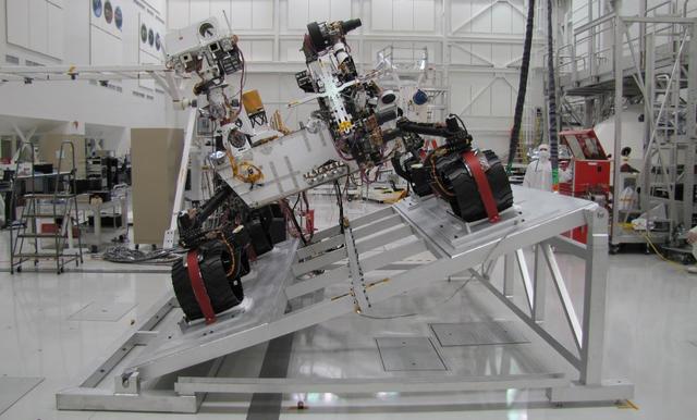
The Mast Camera Mastcam on NASA Mars rover Curiosity has two rectangular eyes near the top of the rover remote sensing mast. This image shows Curiosity on a tilt table NASA Jet Propulsion Laboratory, Pasadena, California.
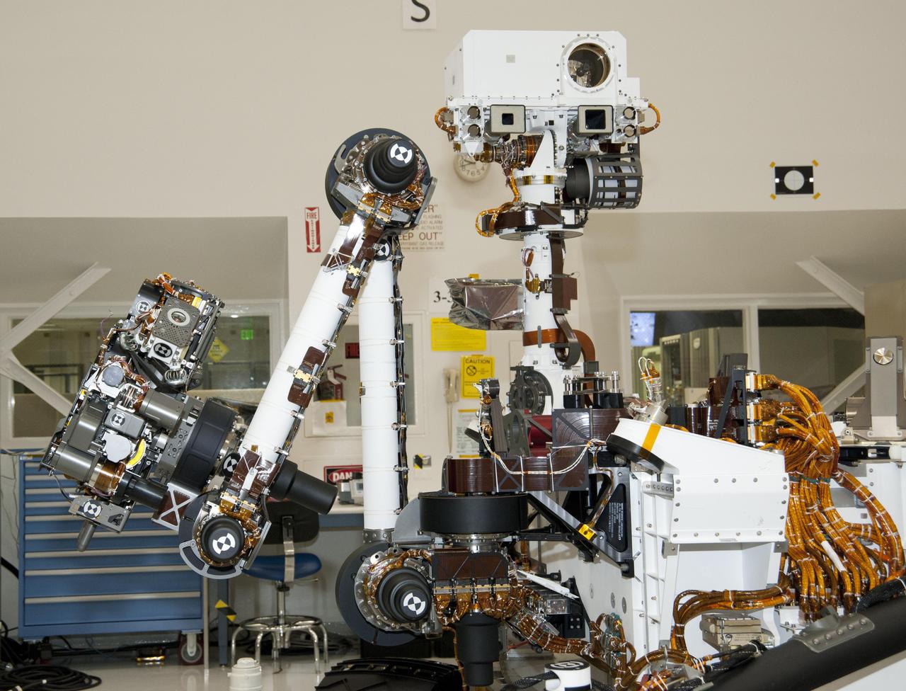
The arm and the remote sensing mast of the Mars rover Curiosity each carry science instruments and other tools for NASA Mars Science Laboratory mission. This image shows the arm on the left and the mast just right of center.
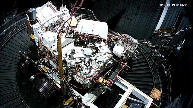
This animated GIF shows the deployment of the Perseverance rover's remote sensing mast during a cold test in a space simulation chamber at NASA's Jet Propulsion Laboratory. The test took place in October 2019. Movie available at https://photojournal.jpl.nasa.gov/catalog/PIA23889
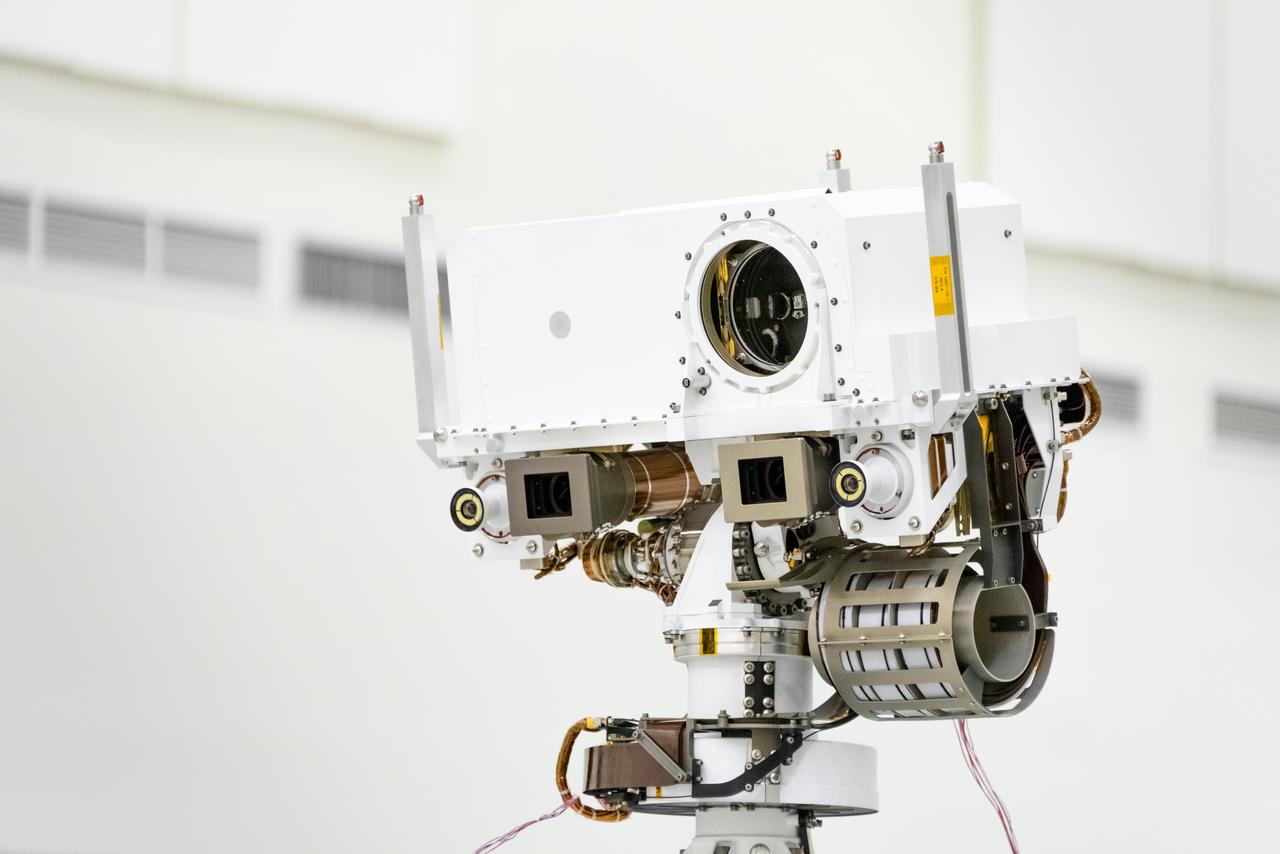
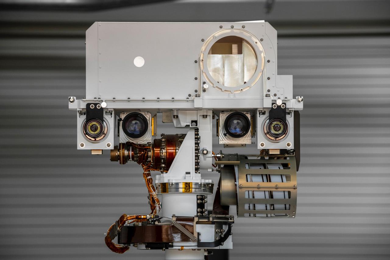
This image, taken in the Spacecraft Assembly Facility's High Bay 1 at the Jet Propulsion Laboratory in Pasadena, California, on July 23, 2019, shows a close-up of the head of Mars 2020's remote sensing mast. The mast head contains the SuperCam instrument (its lens is in the large circular opening). In the gray boxes beneath mast head are the two Mastcam-Z imagers. On the exterior sides of those imagers are the rover's two navigation cameras. https://photojournal.jpl.nasa.gov/catalog/PIA23316
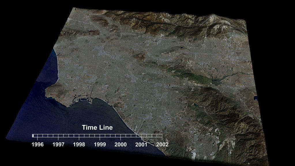
This frame from an animation depicts variations in surface elevation resulting from the discharge and recharge of groundwater basins in Southern California.
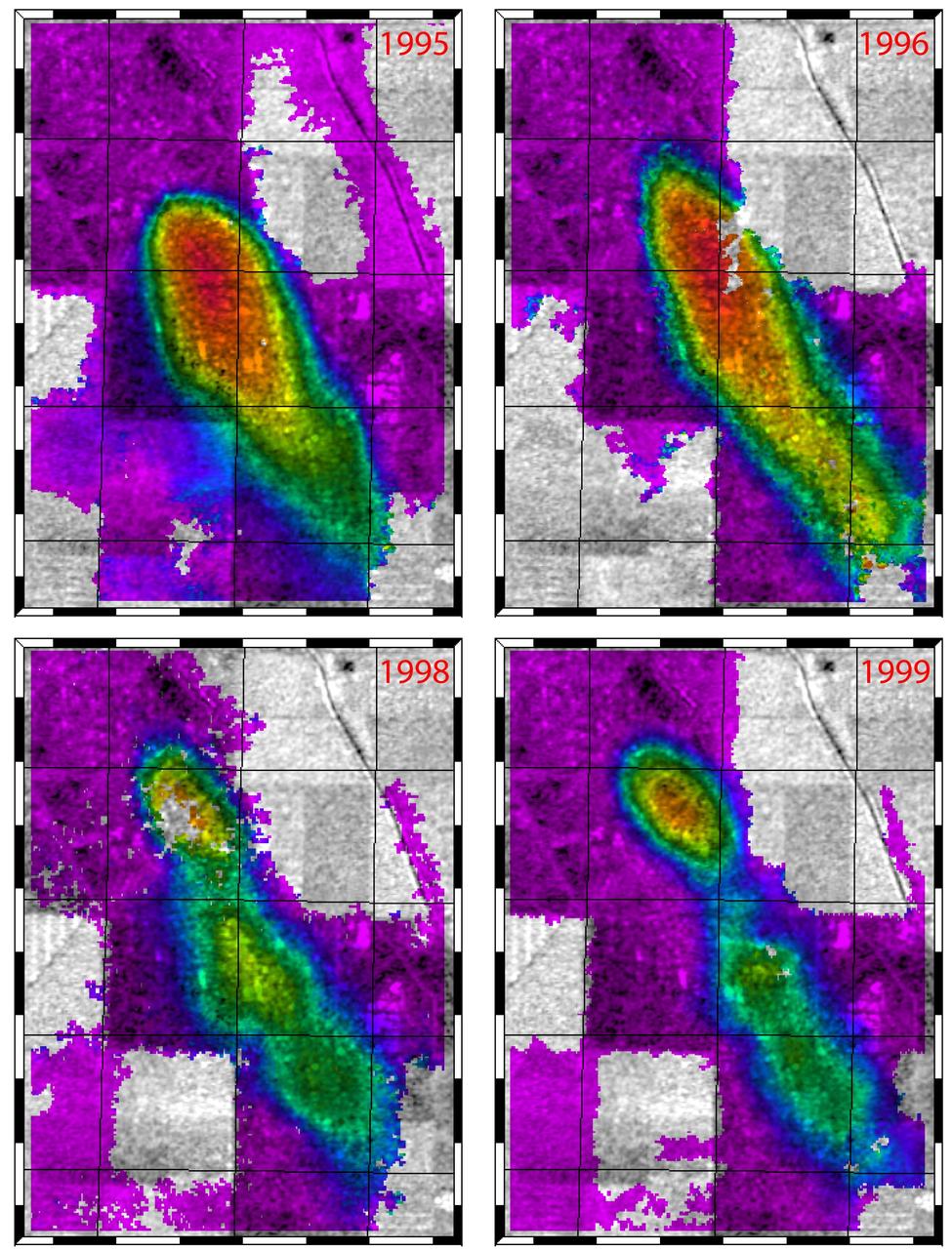
This figure shows a comparison of interferograms from four different years mapping the rapid ground subsidence over the Lost Hills oil field in California.
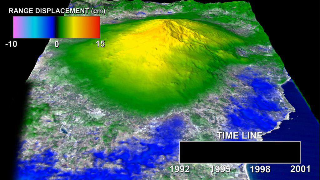
This animation depicts a time-series of ground deformation at Mount Etna Volcano between 1992 and 2001. The deformation results from changes in the volume of a shallow chamber centered approximately 5 km 3 miles below sea level.
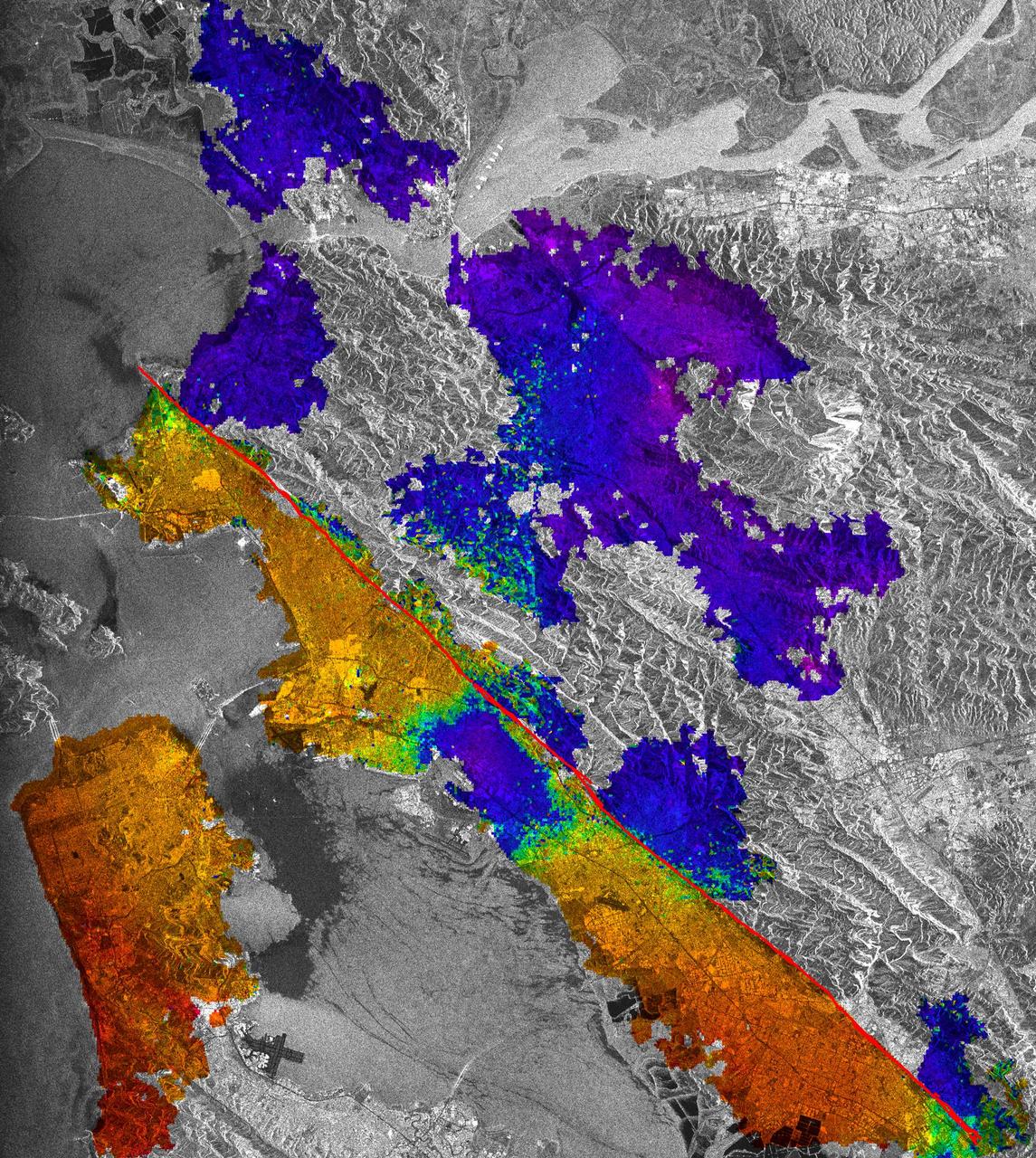
This image of California Hayward fault is an interferogram created using a pair of images taken by ESA ERS-1 and ERS-2 in June 1992 and September 1997 over the central San Francisco Bay in California.
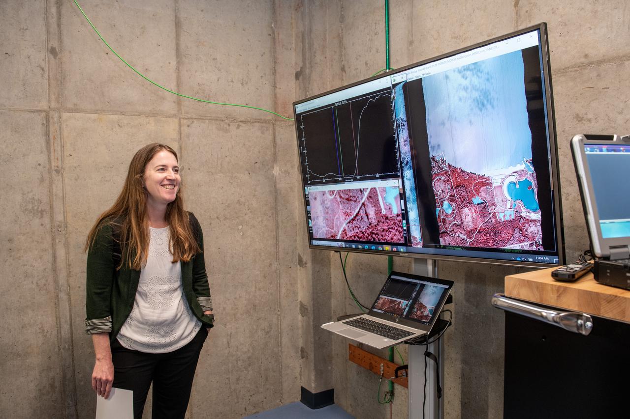
Dr. Katherine Calvin listens to a harmful algal bloom presentation on June 17, 2024. NASA Glenn Research Center conducts aerial remote sensing of harmful algal blooms to warn water filtration plants to enact more stringent filtering when harmful blooms are present. Aerial remote sensing is advantageous to satellite remote sensing that is limited by factors of resolution, on demand performance, cloud cover, and upgrades to instrumentation. Photo Credit: (NASA/Sara Lowthian-Hanna)

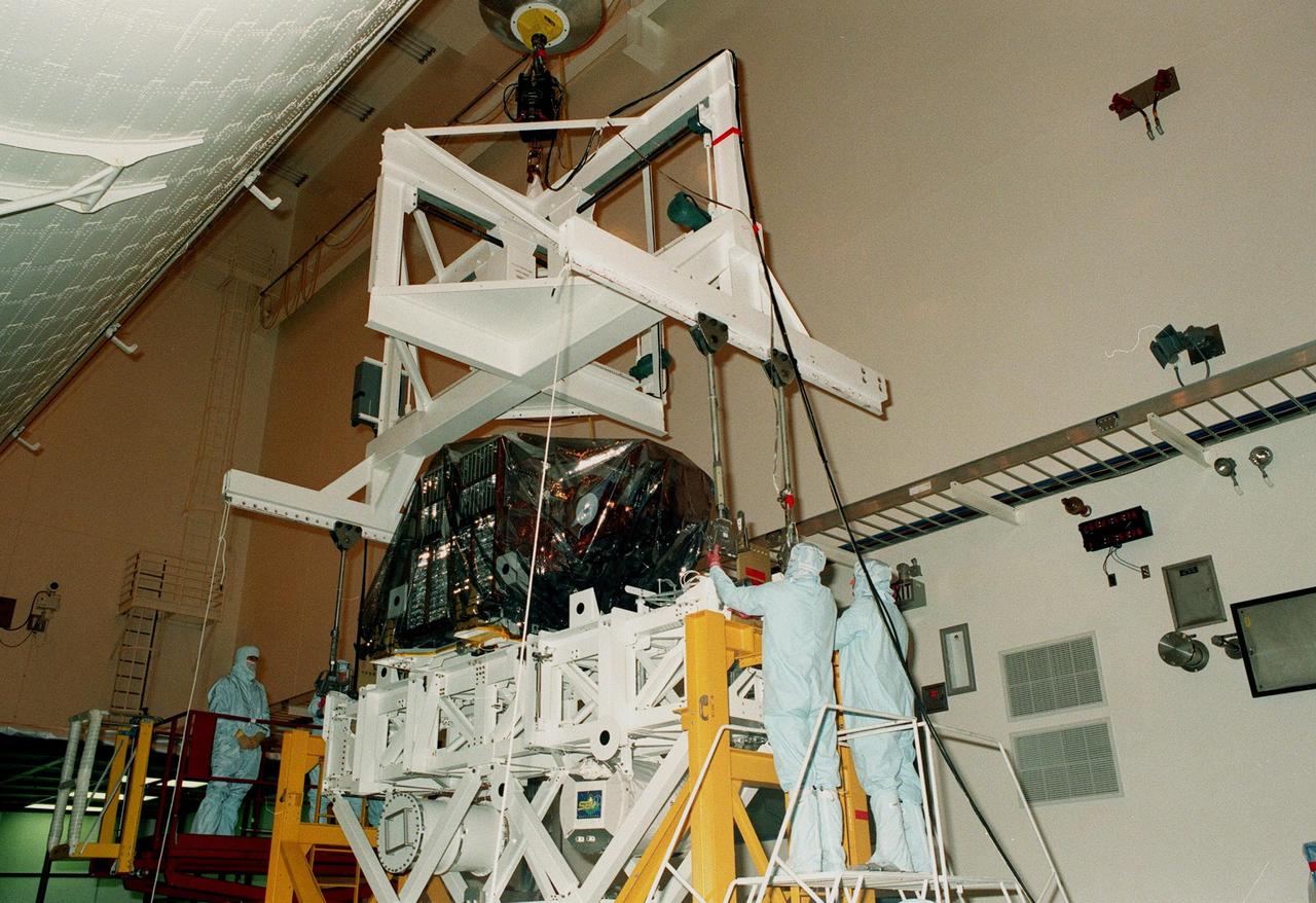
Titan Cassini Remote Sensing Platform installation in the Payload Hazardous Servicing Facility
Titan Cassini Remote Sensing Platform installation in the Payload Hazardous Servicing Facility
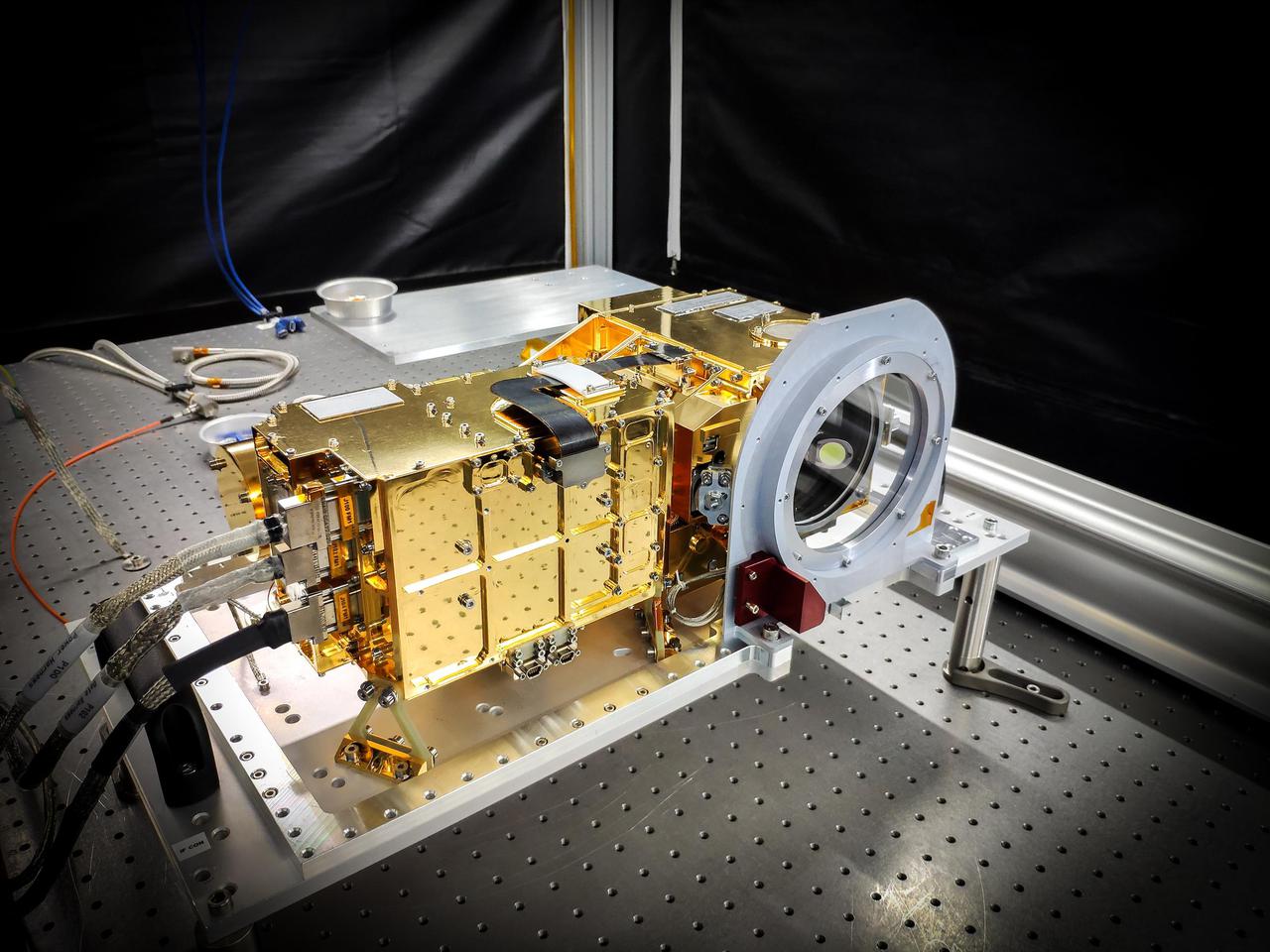
SuperCam's mast unit before being installed atop the Perseverance rover's remote sensing mast. SuperCam fires a laser at rock or soil targets up to 20 feet (7 meters) away, and then analyzes the vaporized rock to reveal the composition. SuperCam's telescope peers out through a window seen on the right side of the unit, above a microphone (hidden by a red protective cover in this image), which will pick up the sounds of rocks being vaporized by the laser. The electronics are inside the gold-plated box on the left. The end of the laser peeks out from behind the left side of the electronics. https://photojournal.jpl.nasa.gov/catalog/PIA24208
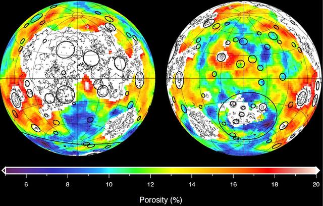
This image depicting the porosity of the lunar highland crust was derived using bulk density data from NASA GRAIL mission and independent grain density measurements from NASA Apollo moon mission samples as well as orbital remote-sensing data.
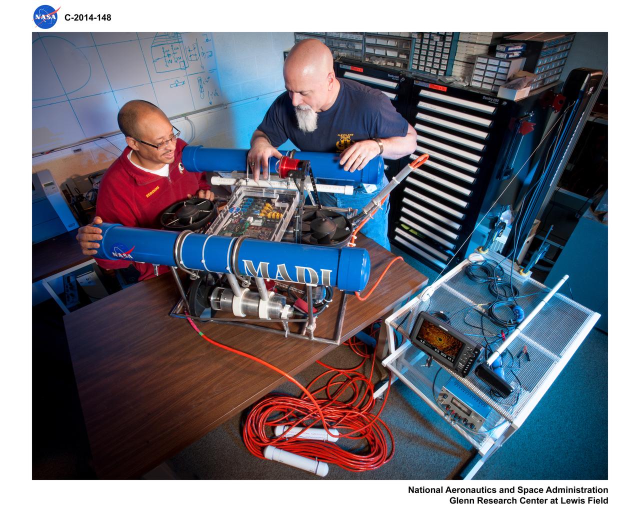
Mobile And Remote Sensing Laboratory (MARS), MARS lab aquatic decent instrument platform (MADI)
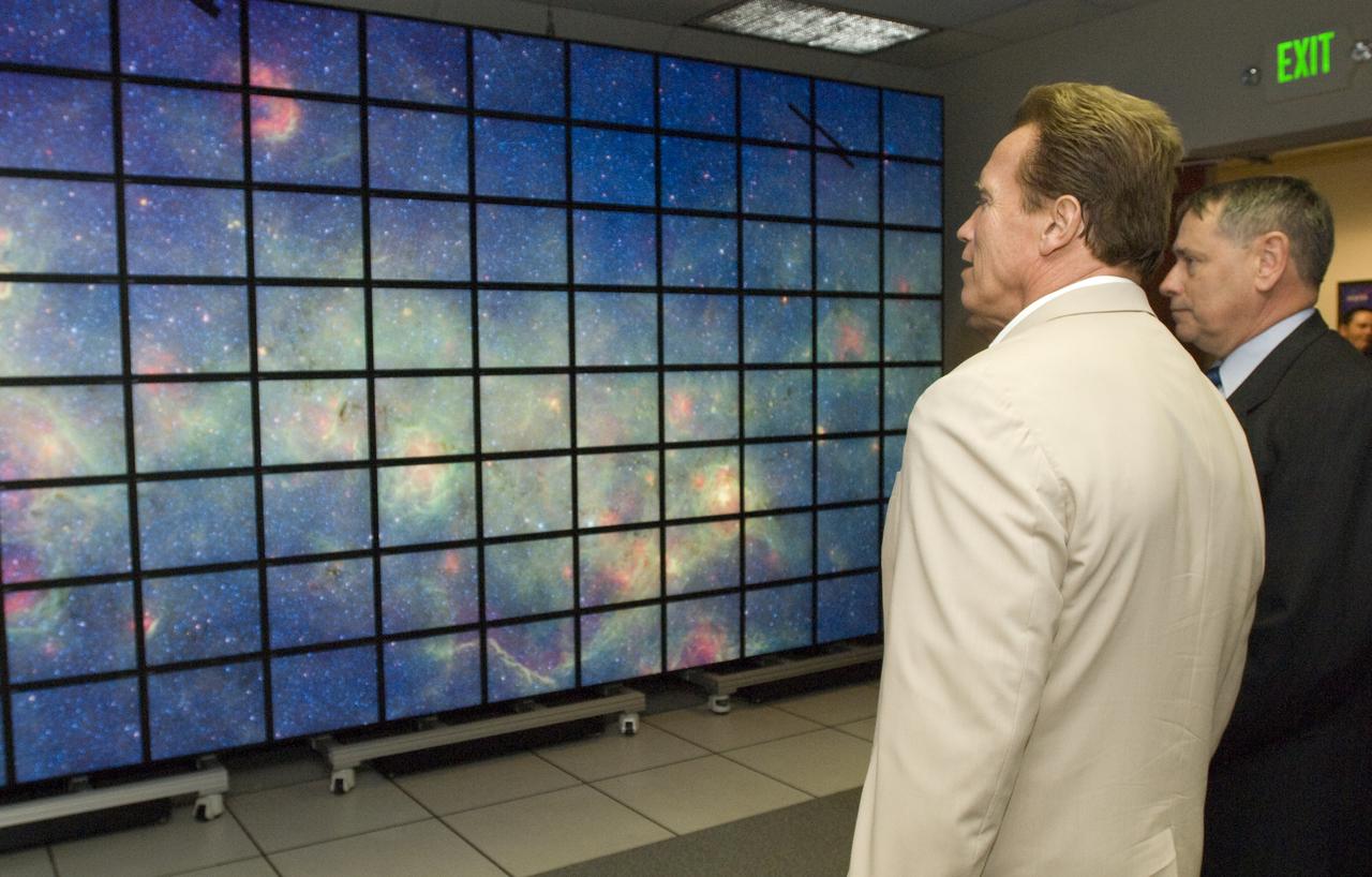
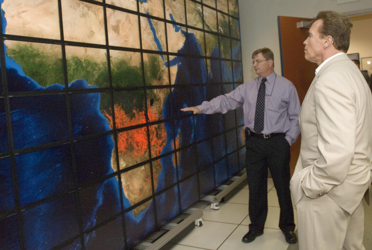
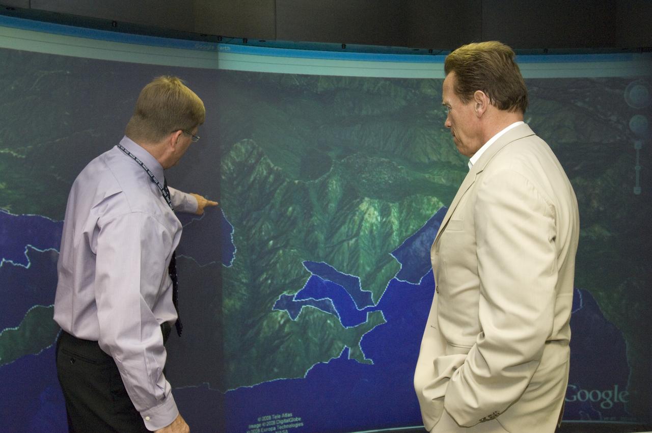
California Governor Arnold Schwarzenegger get a briefing on remote sensing fire fighting from Steve Hipskind, Chief of Ames Earth Science Division
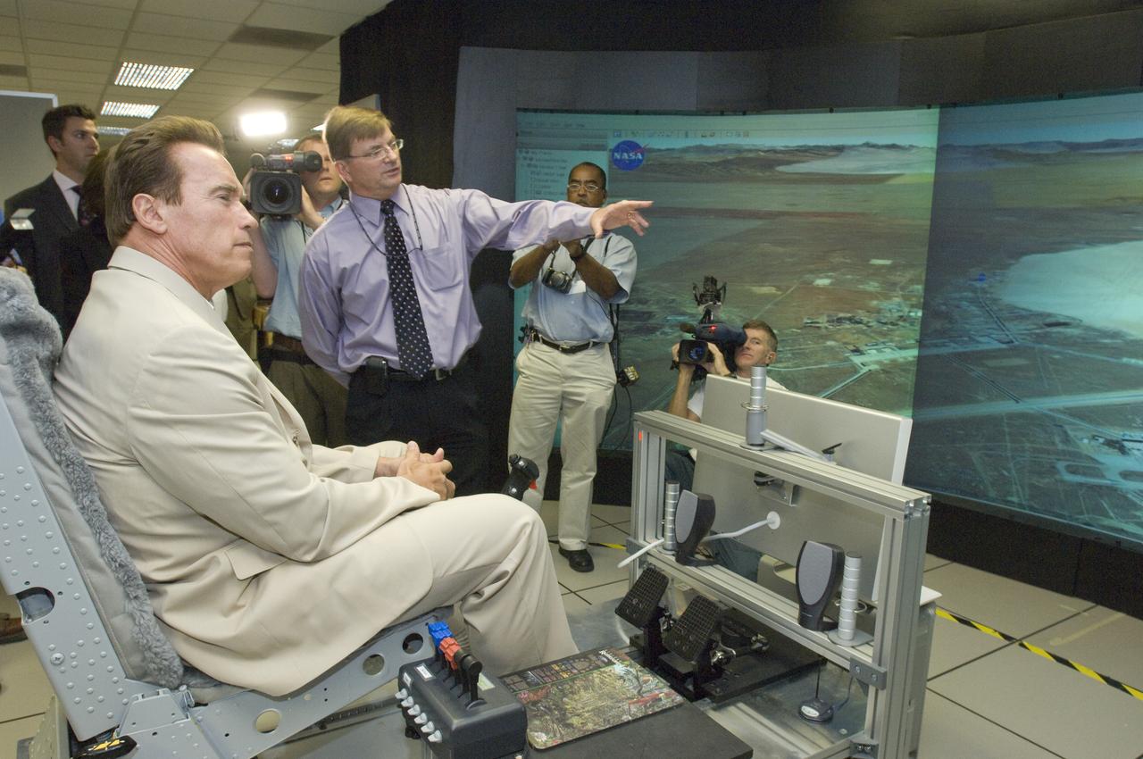
California Governor Arnold Schwarzenegger get a briefing on remote sensing fire fighting from Steve Hipskind, Chief of Ames Earth Science Division
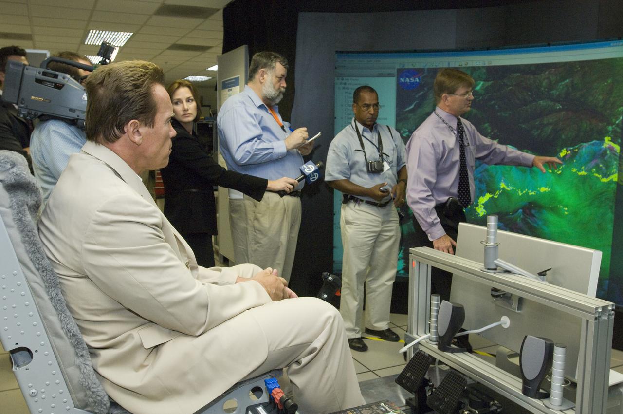
California Governor Arnold Schwarzenegger get a briefing on remote sensing fire fighting from Steve Hipskind, Chief of Ames Earth Science Division
California Governor Arnold Schwarzenegger get a briefing on remote sensing fire fighting from Steve Hipskind, Chief of Ames Earth Science Division
California Governor Arnold Schwarzenegger get a briefing on remote sensing fire fighting from Steve Hipskind, Chief of Ames Earth Science Division
California Governor Arnold Schwarzenegger get a briefing on remote sensing fire fighting from Steve Hipskind, Chief of Ames Earth Science Division

California Governor Arnold Schwarzenegger get a briefing on remote sensing fire fighting from Steve Hipskind, Chief of Ames Earth Science Division
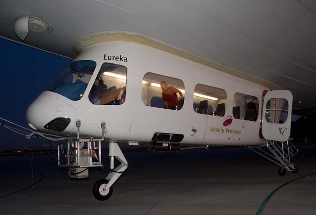
NASA Conducts Airborne Science Aboard Zeppelin Airship: equipped with two imaging instruments enabling remote sensing and atmospheric science measurements not previously practical
In this picture — taken on May 23, 2019, in the Spacecraft Assembly Facility's High Bay 1 clean room at the Jet Propulsion Laboratory in Pasadena, California — engineers re-install the cover to the remote sensing mast (RSM) head after integration of two Mastcam-Z high-definition cameras that will go on the Mars 2020 rover. https://photojournal.jpl.nasa.gov/catalog/PIA23266

With two cameras set about 10 inches apart at the top of the rover's remote sensing mast, Mastcam-Z can produce a 3D image to be viewed with 3D glasses. This is similar to the way our two human eyes work, with our brain forming the 3D image, but no glasses needed! This stereo, or 3D, image was taken with the Mastcam-Z simulator system, used during testing at Arizona State University. https://photojournal.jpl.nasa.gov/catalog/PIA24196
A magnitude 6.6 earthquake struck a sparsely inhabited area of southeast Iran on March 14, 1998, at 11:10 p.m. local time.
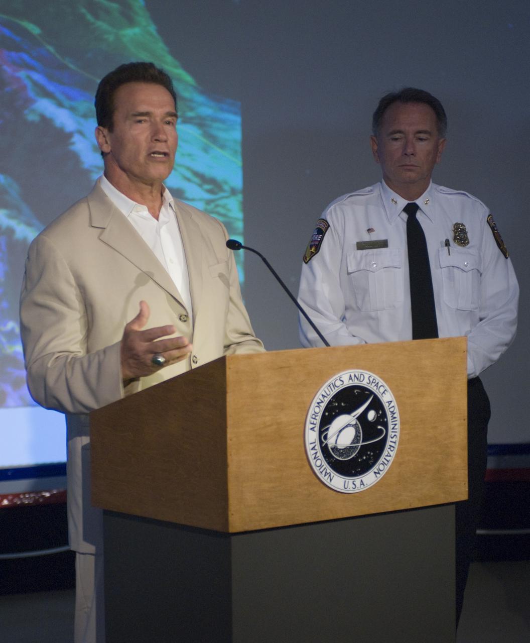
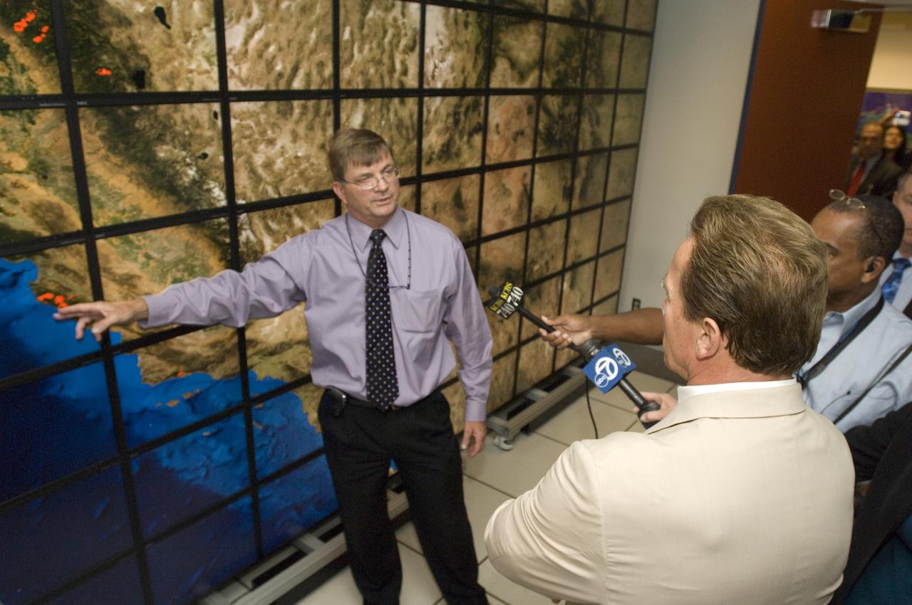
California Governor Arnold Schwarzenegger during a press briefing following a visit to Ames Earth Science Division for a briefing by Steve Hipskind on NASA Ames remote sensing fire fighting efforts.
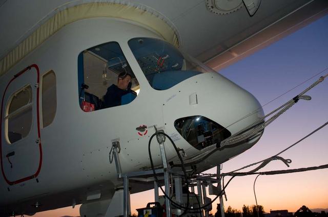
NASA Conducts Airborne Science Aboard Zeppelin Airship: equipped with two imaging instruments enabling remote sensing and atmospheric science measurements not previously practical. Pre-flight checkout of airship flight systems and instruments.
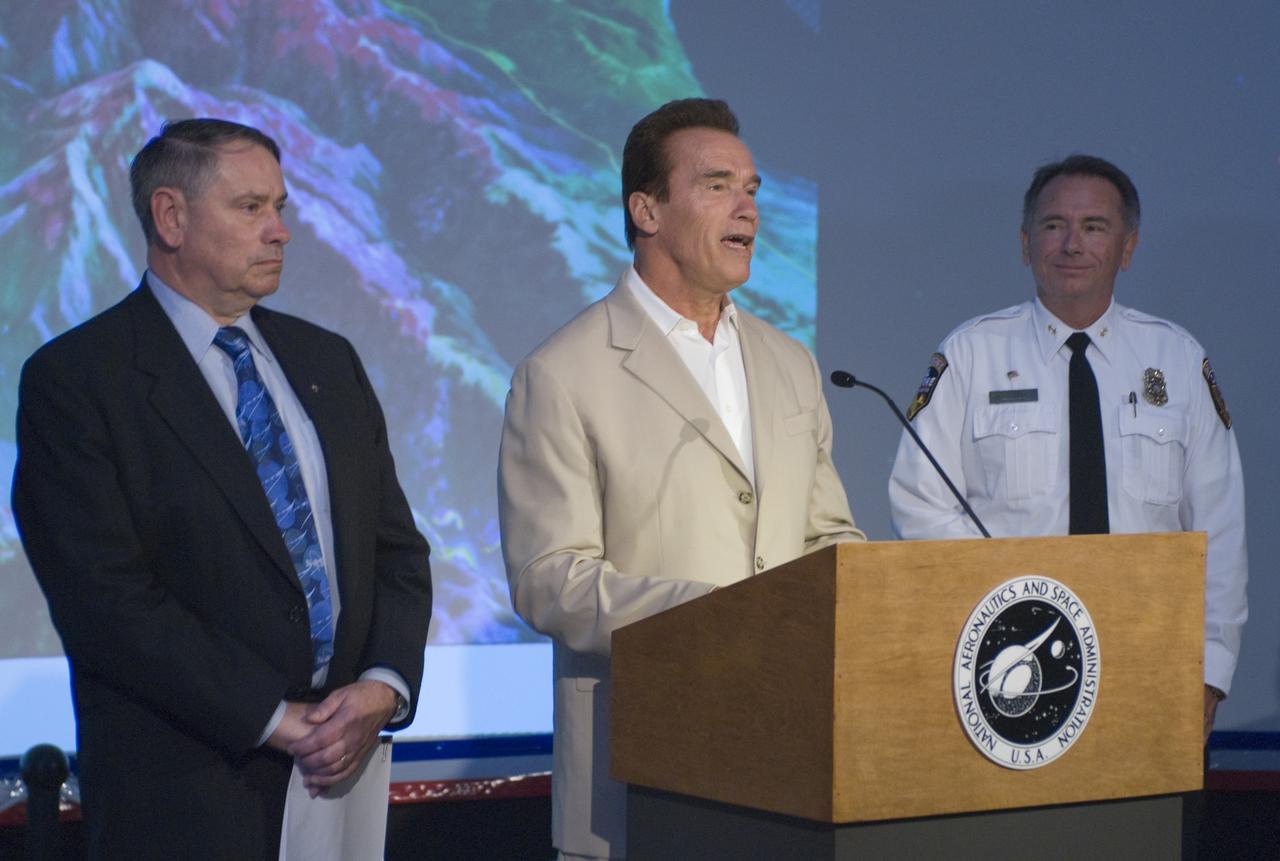
California Governor Arnold Schwarzenegger during a press briefing following a visit to Ames Earth Science Division for a briefing by Steve Hipskind on NASA Ames remote sensing fire fighting efforts.
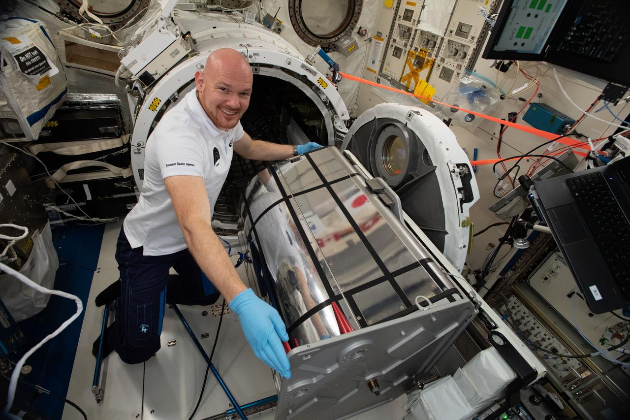
iss056e148119 (8/20/2018) --- Astronaut Alexander Gerst of ESA (European Space Agency) prepares the German Space Agency (DLR) Earth Sensing Imaging Spectrometer (DESIS) investigation for installation. DESIS verifies and enhances the use of space-based hyperspectral imaging capabilities for Earth remote sensing and provides an instrument which produces high value hyperspectral imagery
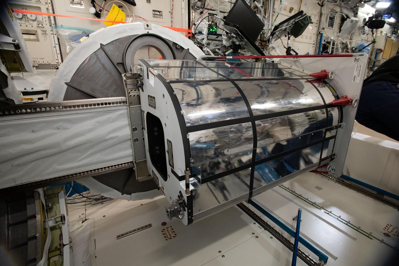
iss056e148130 (8/20/2018) --- Photographic documentation taken in the Japanese Experiment Module (JEM) during preparation for the installation of the German Space Agency (DLR) Earth Sensing Imaging Spectrometer (DESIS) investigation. DESIS verifies and enhances the use of space-based hyperspectral imaging capabilities for Earth remote sensing and provides an instrument which produces high value hyperspectral imagery.
NASA Conducts Airborne Science Aboard Zeppelin Airship: equipped with two imaging instruments enabling remote sensing and atmospheric science measurements not previously practical. Hyperspectral imager and large format camera mounted inside the Zeppelin nose fairing.
NASA Conducts Airborne Science Aboard Zeppelin Airship: equipped with two imaging instruments enabling remote sensing and atmospheric science measurements not previously practical. Shown here is Steve Dunagan, NASA Ames scientist. Cabin viewof instrument operaor Steve Dunagan, Pilot Katharing 'Kate' Board.
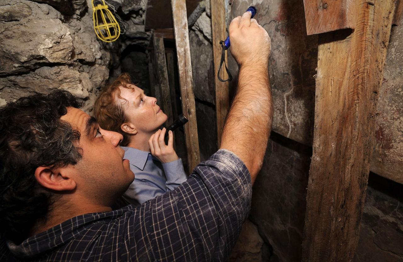
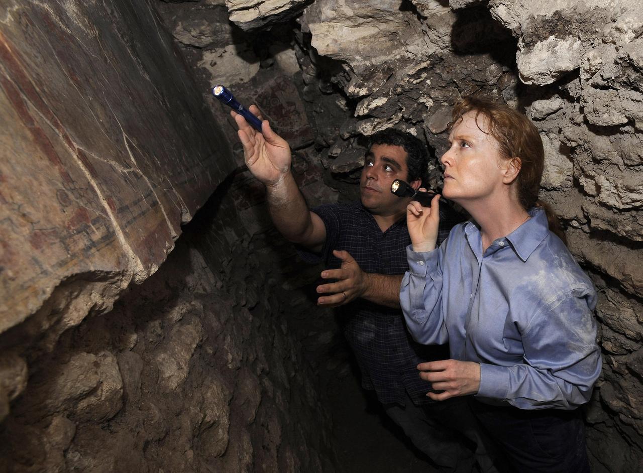
PETEN, GUATEMALA -- NASA's Deputy Administrator Shana Dale and NASA Research Scientist Dr. William Saturno investigate the San Bartolo Maya archaeological site in Peten, Guatemala, on Dec. 11. NASA's remote sensing data were used to locate and interpret the remains of the ancient Maya civilization. Photo credit: NASA/Bill Ingalls

NASA's Deputy Administrator Shana Dale and NASA Research Scientist Dr. William Saturno investigate the San Bartolo Maya archaeological site in Peten, Guatemala, Tuesday Dec. 11, 2007. NASA's remote sensing data were used to locate and interpret the remains of the ancient Maya civilization. Photo Credit: (NASA/Bill Ingalls)
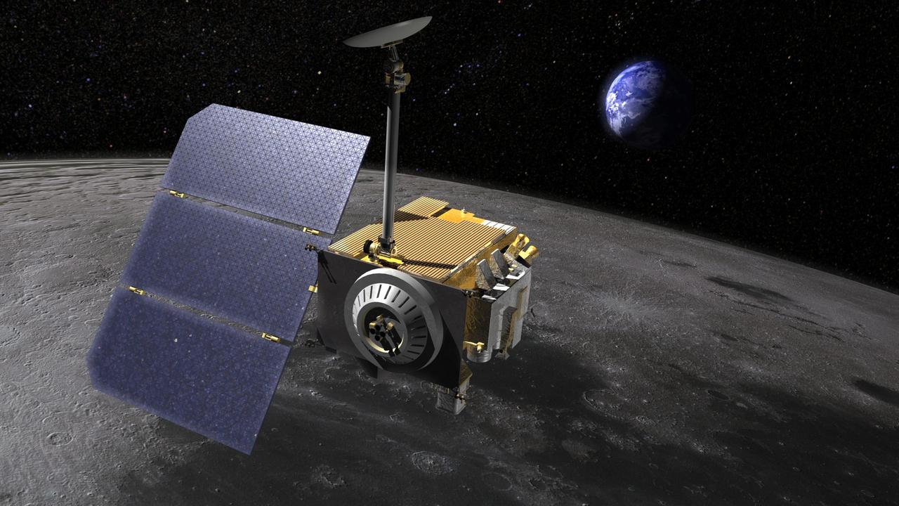
Artist rendering of the Lunar Reconnaissance Orbiter LRO, above the moon. LRO carries seven instruments that make comprehensive remote sensing observations of the moon and measurements of the lunar radiation environment. The LRO mission is managed by NASA Goddard for the Science Mission Directorate at NASA Headquarters in Washington. http://photojournal.jpl.nasa.gov/catalog/PIA18163

NASA's Deputy Administrator Shana Dale and NASA Research Scientist Dr. William Saturno investigate the San Bartolo Maya archaeological site in Peten, Guatemala, Tuesday Dec. 11, 2007. NASA's remote sensing data were used to locate and interpret the remains of the ancient Maya civilization. Photo Credit: (NASA/Bill Ingalls)
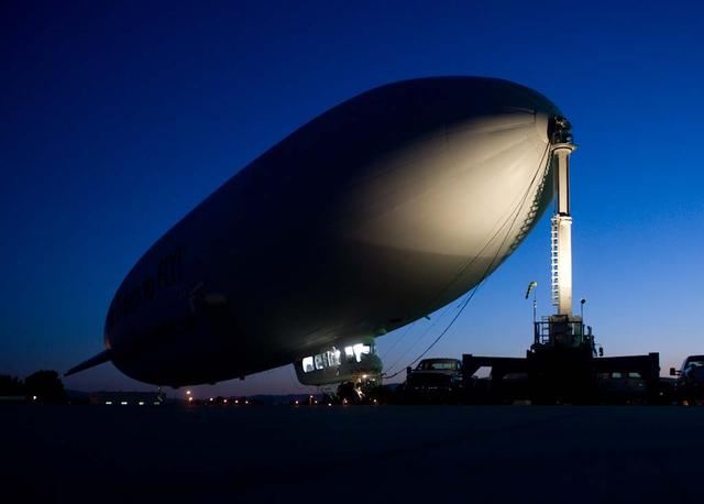
NASA Conducts Airborne Science Aboard Zeppelin Airship: equipped with two imaging instruments enabling remote sensing and atmospheric science measurements not previously practical. Show here in pre-flight checkouts aboard the Zeppelin NT coupled to mobile mast.
PETEN, GUATEMALA -- NASA's Deputy Administrator Shana Dale and NASA Research Scientist Dr. William Saturno investigate the San Bartolo Maya archaeological site in Peten, Guatemala, on Dec. 11. NASA's remote sensing data were used to locate and interpret the remains of the ancient Maya civilization. Photo credit: NASA/Bill Ingalls

S82-E-5652 (17 Feb. 1997) --- Astronaut Gregory J. Harbaugh (solid stripe on EMU) uses Remote Manipulator System (RMS) as a cherry-picker device to service Hubble Space Telescope (HST). In cooperation with astronaut Joseph R. Tanner, nearby, the mission specialist was in the process of replacing the HST's Magnetic Sensing System (MSS) protective caps with new, permanent covers. This view was taken with an Electronic Still Camera (ESC).

(from left) NASA Research Scientist Dr. William Saturno, Program Manager for NASA Earth Science Division Mr. Woody Turner, NASA's Deputy Administrator Shana Dale and NASA Deputy Assistant Administrator for External Relations Mr. Al Condes investigate the San Bartolo Maya archaeological site in Peten, Guatemala, Tuesday Dec. 11, 2007. NASA's remote sensing data were used to locate and interpret the remains of the ancient Maya civilization. Photo Credit: (NASA/Bill Ingalls)
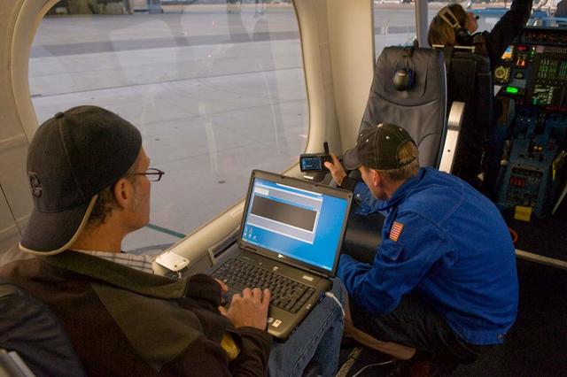
NASA Conducts Airborne Science Aboard Zeppelin Airship: equipped with two imaging instruments enabling remote sensing and atmospheric science measurements not previously practical. Cabin view of Instrument Operator Steve Dunagan, NASA Ames, Pilot Katharine 'Kate' Board, (left) and Crew Chief Matthew Kilkerr (in flight suit) preforming pre-flight checkouts.
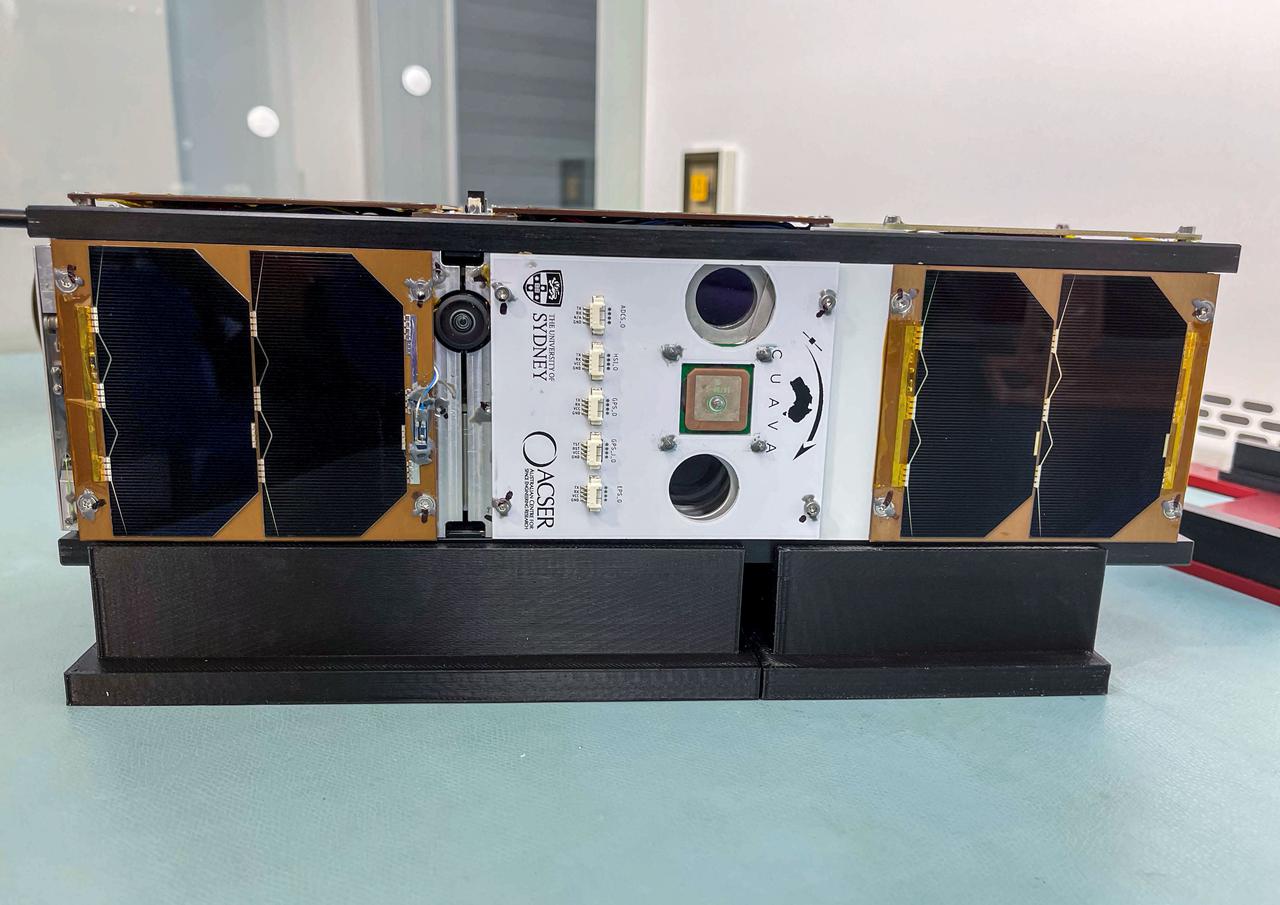
jsc2021e052206 (11/3/2021) --- A preflight view of a Pathfinder Satellite for Remote Sensing and Earth Observation (CUAVA-1) CubeSat about to undergo thermal vacuum testing at the Australian Research Council Industrial Transformation Training Centre (AITC). The CUAVA-1 investigation is part of the JEM (Japanese Experiment Module) Small Satellite Orbital Deployer-19 (J-SSOD-19) mission. Image Credit: CUAVA.
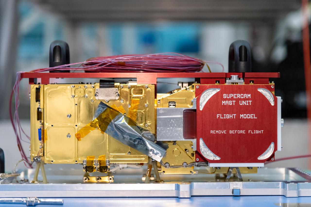
The mast-mounted portion of SuperCam awaits integration into the Perseverance rover. Part of SuperCam is contained in the belly of the rover, while this unit, containing the laser, infrared spectrometer, telescope, camera, and electronics, sits at the top of the remote sensing mast. The red "remove before flight" cover protects a clear window in front of the telescope and camera and was removed when SuperCam was installed in the rover. https://photojournal.jpl.nasa.gov/catalog/PIA24207
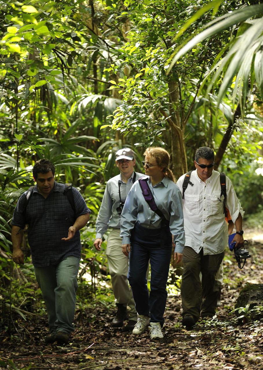
PETEN, GUATEMALA -- (From left) NASA Research Scientist Dr. William Saturno, Program Manager for NASA Earth Science Division Woody Turner, NASA's Deputy Administrator Shana Dale and NASA Deputy Assistant Administrator for External Relations Al Condes investigate the San Bartolo Maya archaeological site in Peten, Guatemala, on Dec. 11. NASA's remote sensing data were used to locate and interpret the remains of the ancient Maya civilization. Photo credit: NASA/Bill Ingalls
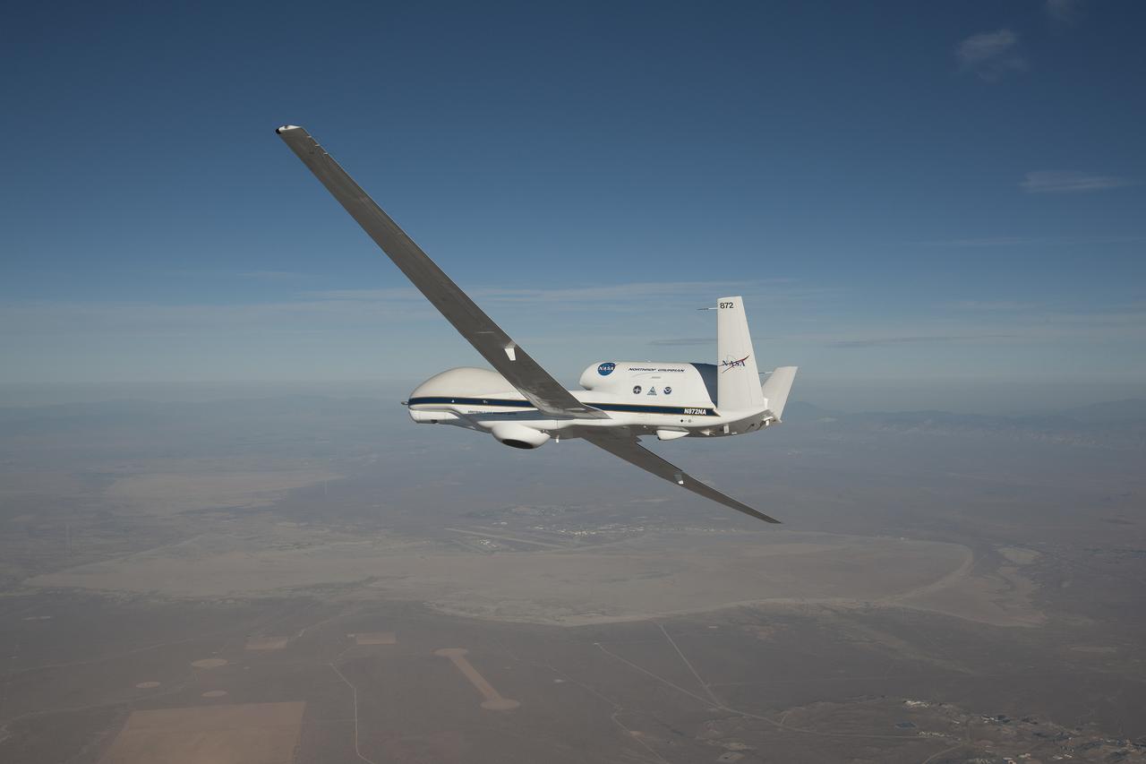
A NASA remotely piloted Global Hawk aircraft completes a flight in February 2015 to support the National Oceanic and Atmospheric Administration’s El Niño Rapid Response field campaign. The mission, called the Sensing Hazards Operational Unmanned Technology, gathered El Niño storm data over the Pacific Ocean. The flight originated from NASA’s Armstrong Flight Research Center in Edwards, California.
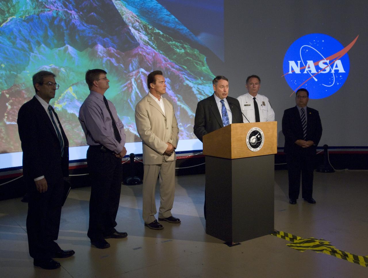
California Governor Arnold Schwarzenegger during a press briefing following a visit to Ames Earth Science Division for a briefing by Steve Hipskind on NASA Ames remote sensing fire fighting efforts. Also shown left to right, Mike Freilich, Director, NASA Earth Sceinces Division, Steve Hipskind, Pete Worden, Governor Schwarzenegger, Chief Del Walters, Assistant Region Fire Chief, California Department of Forestry and Fire Protection, Tom Maruyama, Deputy Director, Office of Emergency Services
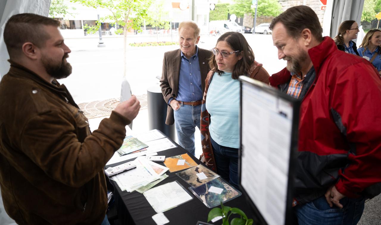
NASA Administrator Bill Nelson, second from right, listens as Michael Taylor from NASA’s Goddard Space Flight Center talks to visitors about Landsat, remote sensing data, and spectral signatures as NASA celebrates Earth Day, Friday, April 19, 2024, in the Earth Information Center at the Mary W. Jackson NASA Headquarters building in Washington. Photo Credit: (NASA/Joel Kowsky)
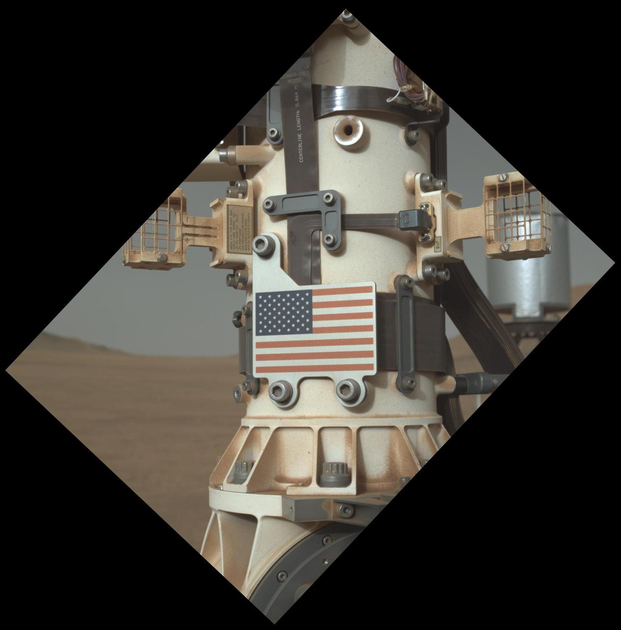
This close-up view of the United States flag plate on NASA's Perseverance was acquired on June 28, 2025 (the 1,548th day, or sol, of its mission to Mars), by the WATSON (Wide Angle Topographic Sensor for Operations and eNgineering) imager on the turret at the end of the rover's Mars robotic arm. This flag artwork is located on an aluminum plate mounted on the base of Perseverance's remote sensing mast. https://photojournal.jpl.nasa.gov/catalog/PIA26579
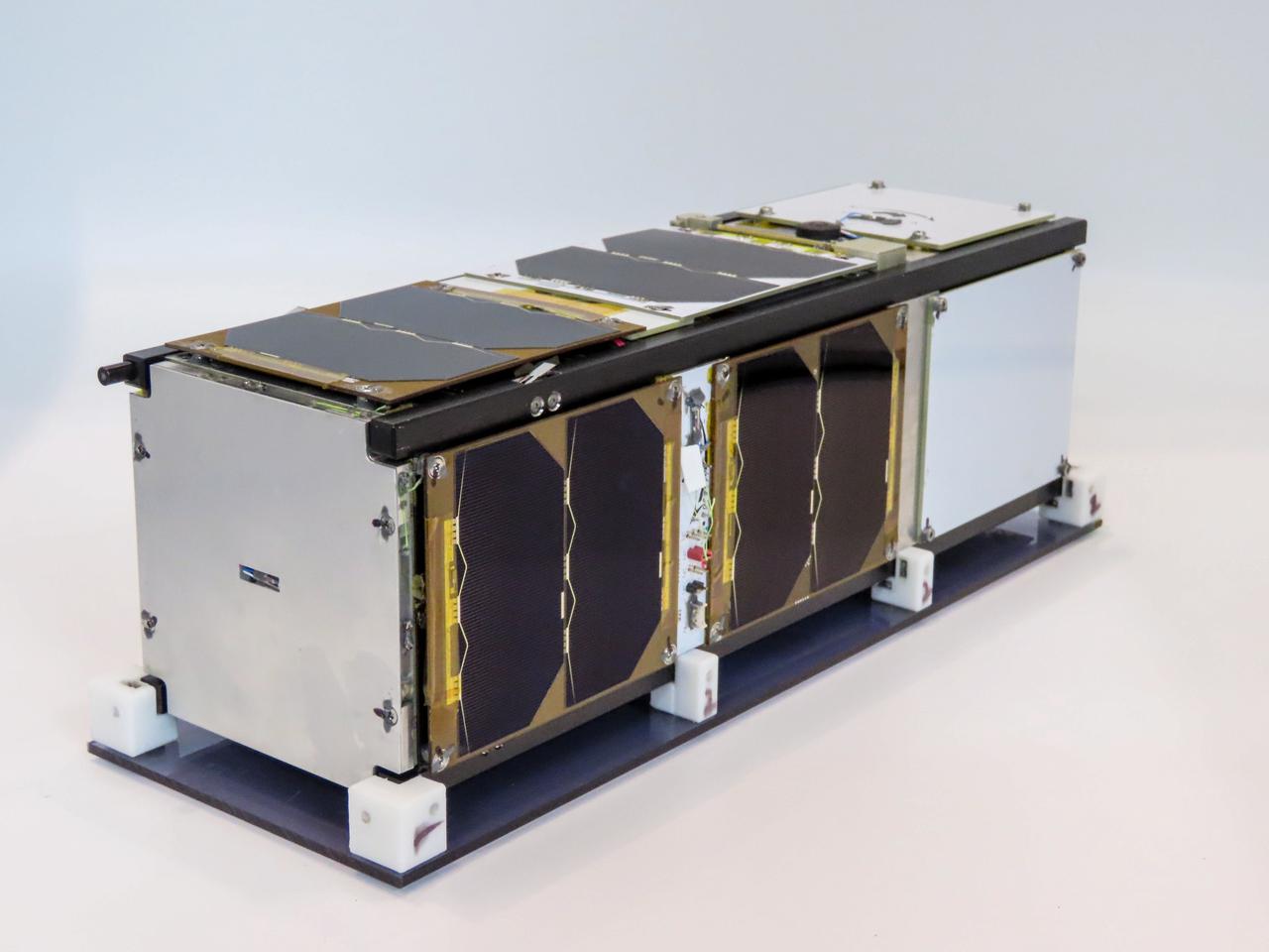
jsc2021e052204 (5/19/2021) --- A preflight view of a Pathfinder Satellite for Remote Sensing and Earth Observation (CUAVA-1) about to undergo thermal vacuum testing at the Australian Research Council Industrial Transformation Training Centre (AITC). The CUAVA-1 investigation is part of the JEM (Japanese Experiment Module) Small Satellite Orbital Deployer-19 (J-SSOD-19) mission. Image Credit: CUAVA.
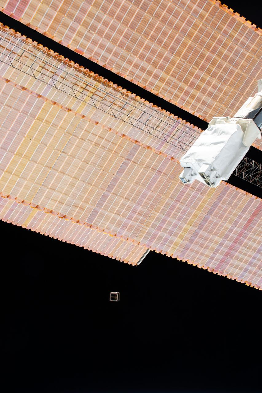
iss061e052315 (11/20/2019) --- An external view of the deployment of the NARSScube-1 CubeSat from the JEM Small Satellite Orbital Deployer aboard the International Space Station (ISS). NARSScube-1 is an Egyptian CubeSat developed by the National Authority for Remote Sensing and Space Sciences (NARSS), supported by Kyushu Institute of Technology(Kyutech). The CubeSat carries a small camera with a ground resolution of 200 meters to gather imagery of Egyptian territory.
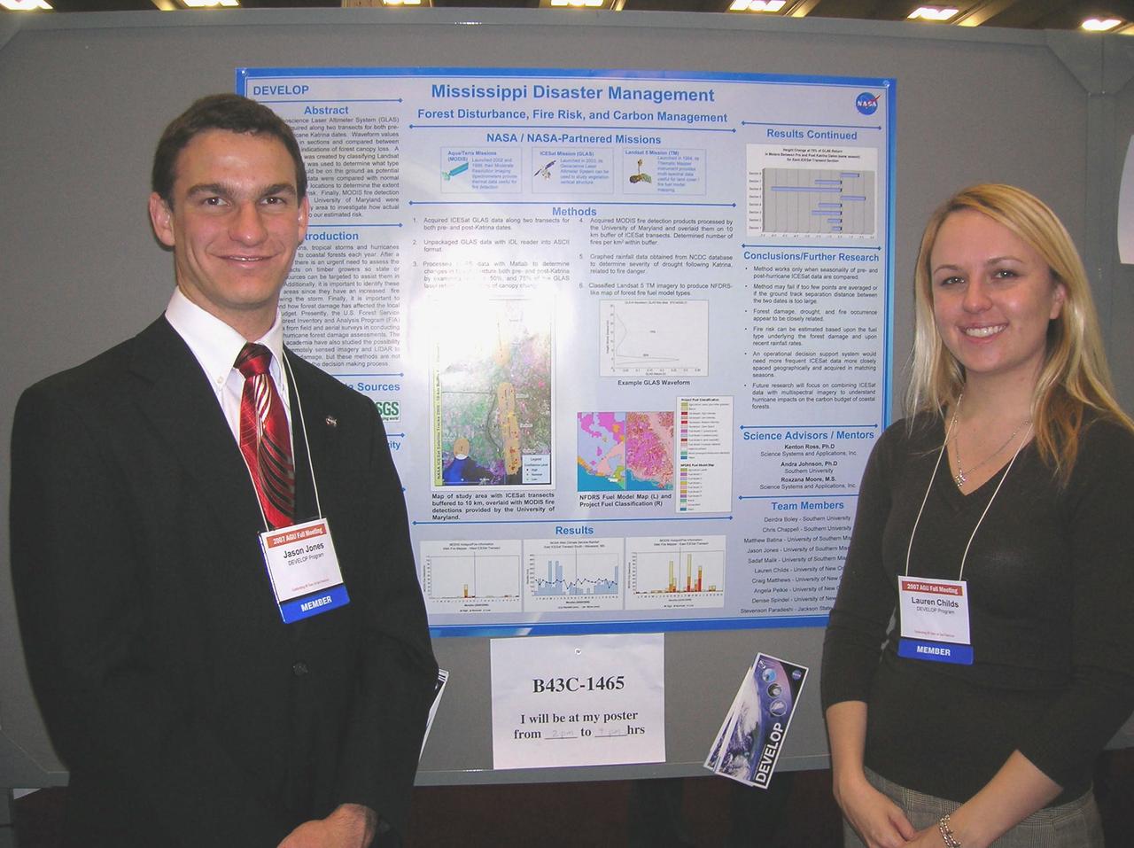
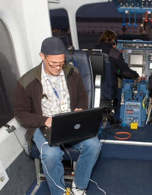
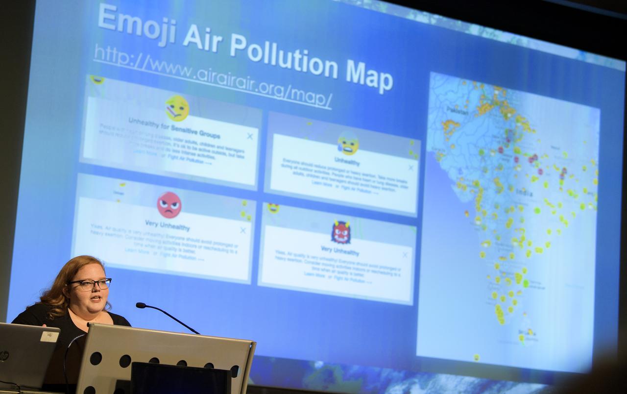
Jason Jones, left, and Lauren Childs are pictured with their presentation during the poster session at the American Geophysical Union Fall Meeting in San Francisco, Calif., Dec. 10-14, 2007.
The full-scale engineering model of NASA's Perseverance rover raises its "head," or remote sensing mast, at NASA's Jet Propulsion Laboratory in Southern California. This model is known as the vehicle system test bed (VSTB) rover, or OPTIMISM (Operational Perseverance Twin for Integration of Mechanisms and Instruments Sent to Mars). OPTIMISM raised its mast shortly after moving into its new home at JPL's Mars Yard on Sept. 4, 2020. The mast hosts many of the rover's cameras and scientific instruments. At the top of the mast, the large circular opening is where the SuperCam instrument will be installed on this test rover. Also visible in these images below the SuperCam "eye" are the navigation cameras (two cameras closest to the outside of the head) and the Mastcam-Z cameras inside of the navigation cameras. A key objective for Perseverance's mission on Mars is astrobiology, including the search for signs of ancient microbial life. The rover will also characterize the planet's climate and geology, pave the way for human exploration of the Red Planet, and be the first planetary spacecraft to collect and cache Martian rock and regolith (broken rock and dust). Subsequent missions, currently under consideration by NASA in cooperation with the European Space Agency, would send spacecraft to Mars to collect these cached samples from the surface and return them to Earth for in-depth analysis. The Mars 2020 mission is part of a larger program that includes missions to the Moon as a way to prepare for human exploration of the Red Planet. Charged with returning astronauts to the Moon by 2024, NASA will establish a sustained human presence on and around the Moon by 2028 through NASA's Artemis lunar exploration plans. https://photojournal.jpl.nasa.gov/catalog/PIA23967
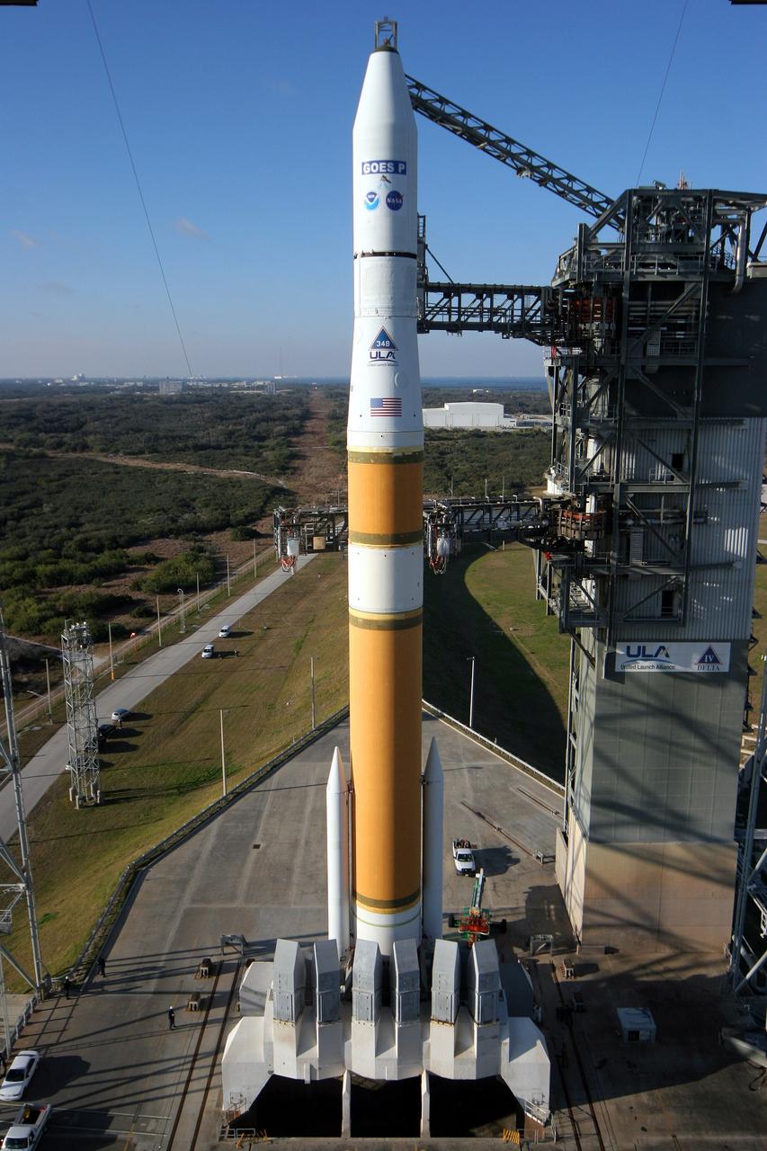
Cape Canaveral AFS, Fla. - A United Launch Alliance Delta IV rocket sits poised on its launch pad with the NASA/NOAA Geostationary Operational Environmental Satellite P (GOES P) at Space Launch Complex-37. GOES P will provide NOAA and NASA scientists with data to support weather, solar and space operations, and will enable future science improvements in weather prediction and remote sensing. Additionally, GOES-P will provide data on global climate changes and capability for search and rescue. Photo credit: Carleton Bailie, The Boeing Company
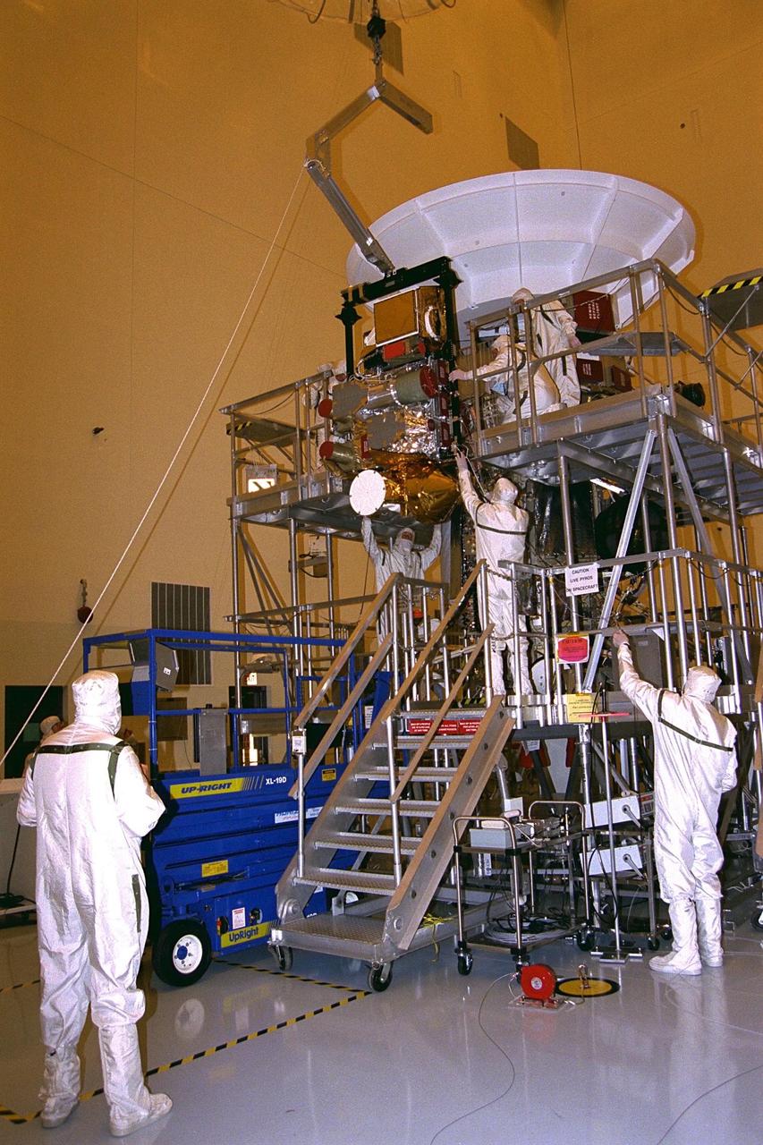
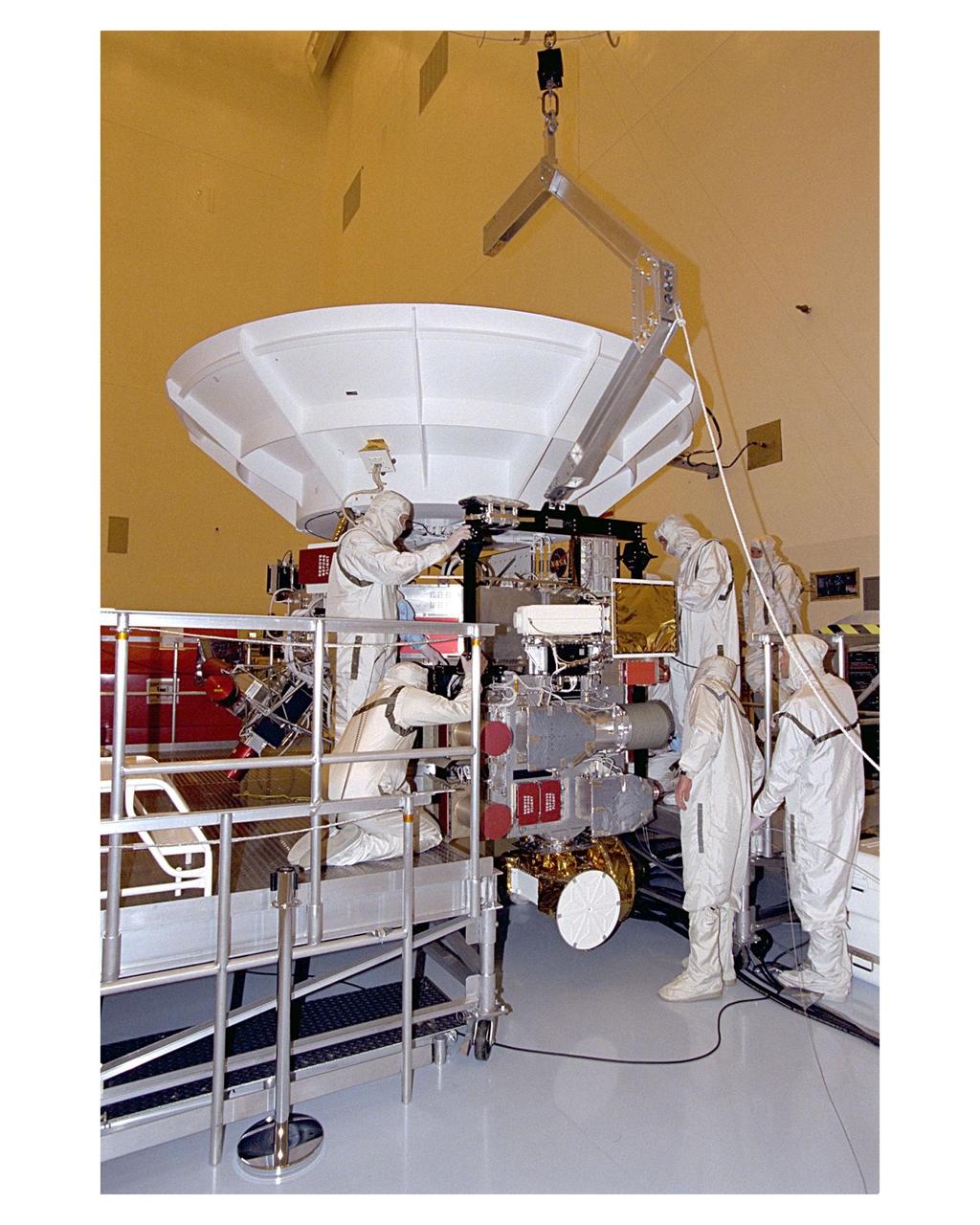
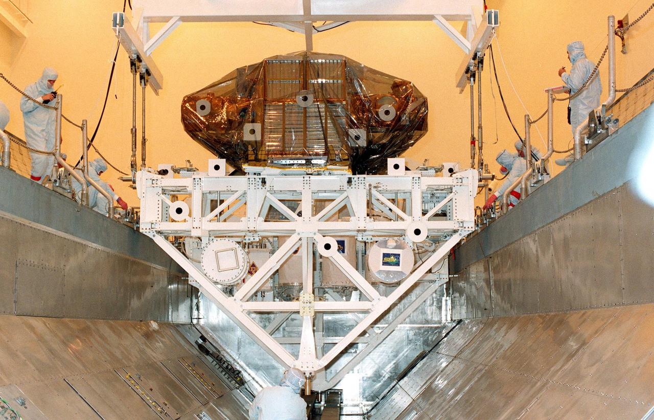
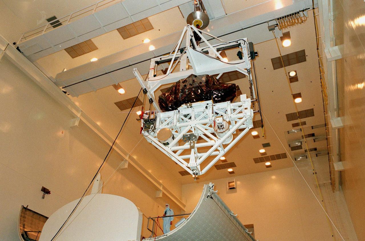
The complete remote sensing pallet is lowered by technicians from the Jet Propulsion Laboratory (JPL) of the California Institute of Technology and mated at the interface with the Cassini spacecraft in the Payload Hazardous Servicing Facility at KSC in July. A four-year, close-up study of the Saturnian system, the Cassini mission is scheduled for launch from Cape Canaveral Air Station in October 1997. It will take seven years for the spacecraft to reach Saturn. Scientific instruments carried aboard the spacecraft will study Saturn’s atmosphere, magnetic field, rings, and several moons. JPL is managing the Cassini project for NASA
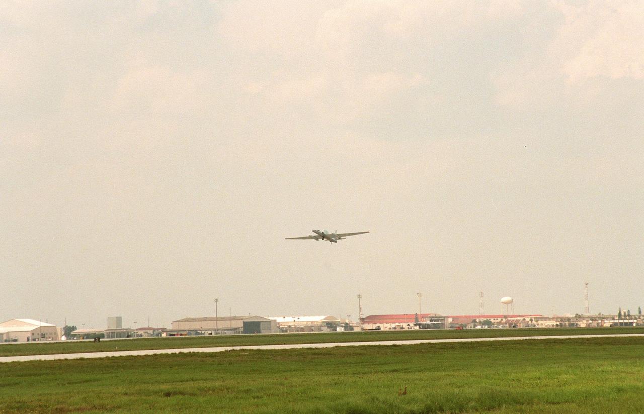
A specially equipped Dryden Flight Research Center ER-2 (a modified U-2) takes off from Patrick Air Force Base enroute to a hurricane in the Atlantic. The plane is part of the NASA-led Atmospheric Dynamics and Remote Sensing program that includes other government weather researchers and the university community in a study of Atlantic hurricanes and tropical storms. Soaring above 65,000 feet, the ER-2 will measure the structure of hurricanes and the surrounding atmosphere that steers the storm’s movement. The hurricane study, which lasts through September 1998, is part of NASA’s Earth Science enterprise to better understand the total Earth system and the effects of natural and human-induced changes on the global environment
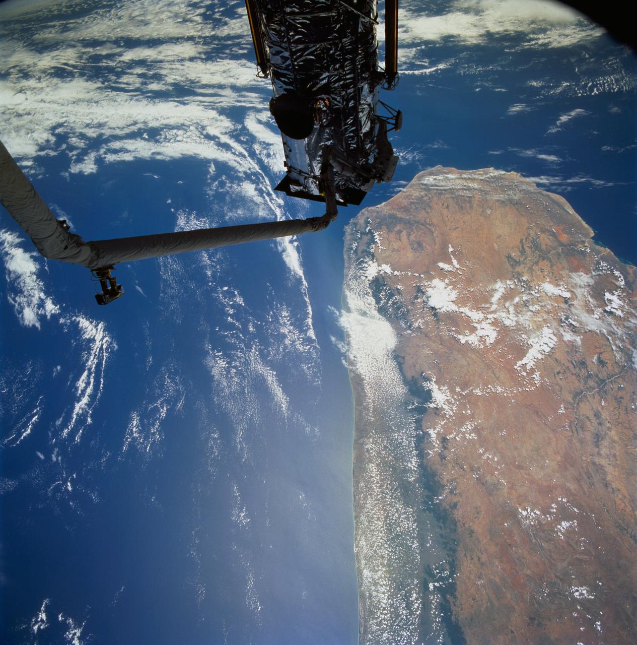
STS061-77-102 (7 Dec 1993) --- Astronauts Jeffrey A. Hoffman (left) and F. Story Musgrave are partially silhouetted against the Indian Ocean as they work to install the Magnetic Sensing System (MSS) on the Hubble Space Telescope (HST). Musgrave is anchored to the end of the Space Shuttle Endeavour's Remote Manipulator System (RMS) arm. The HST is positioned along the southern end of Madagascar, 325 nautical miles away. Visible on the western coast are the sediment laden Onilahy and Fiherenana Rivers which empty into Saint Augustin Bay. North of Fiherenana River is the Mangoky River. The circular feature on the southern end of Madagascar and to the right of HST is the L'ivakoany Mountains. The eastern coast is relatively straight compared to the western coast.
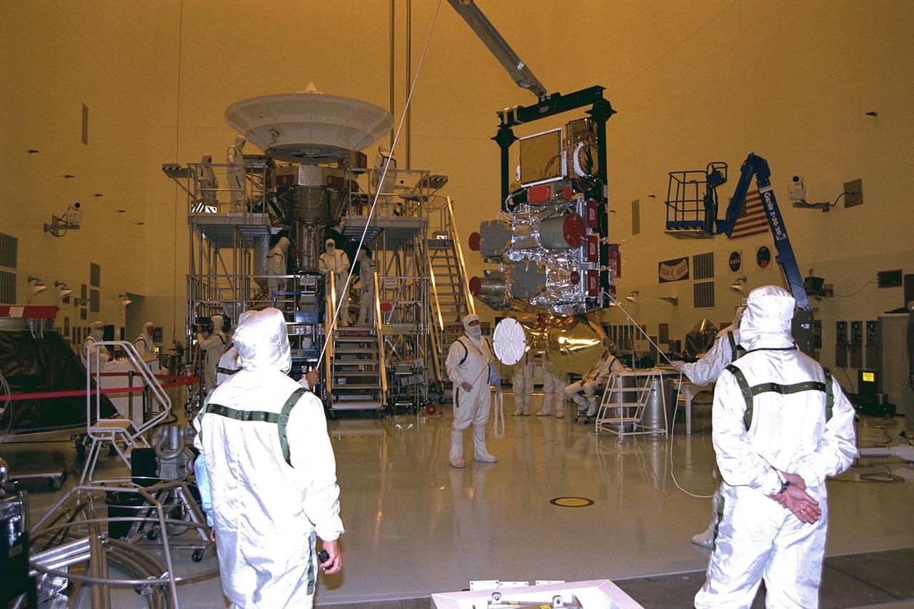
Technicians from the Jet Propulsion Laboratory (JPL) of the California Institute of Technology lift the remote sensing pallet in the Payload Hazardous Servicing Facility at KSC in July prior to installation on the Cassini spacecraft. A four- year, close-up study of the Saturnian system, the Cassini mission is scheduled for launch from Cape Canaveral Air Station in October 1997. It will take seven years for the spacecraft to reach Saturn. Scientific instruments carried aboard the spacecraft will study Saturn’s atmosphere, magnetic field, rings, and several moons. JPL is managing the Cassini project for NASA
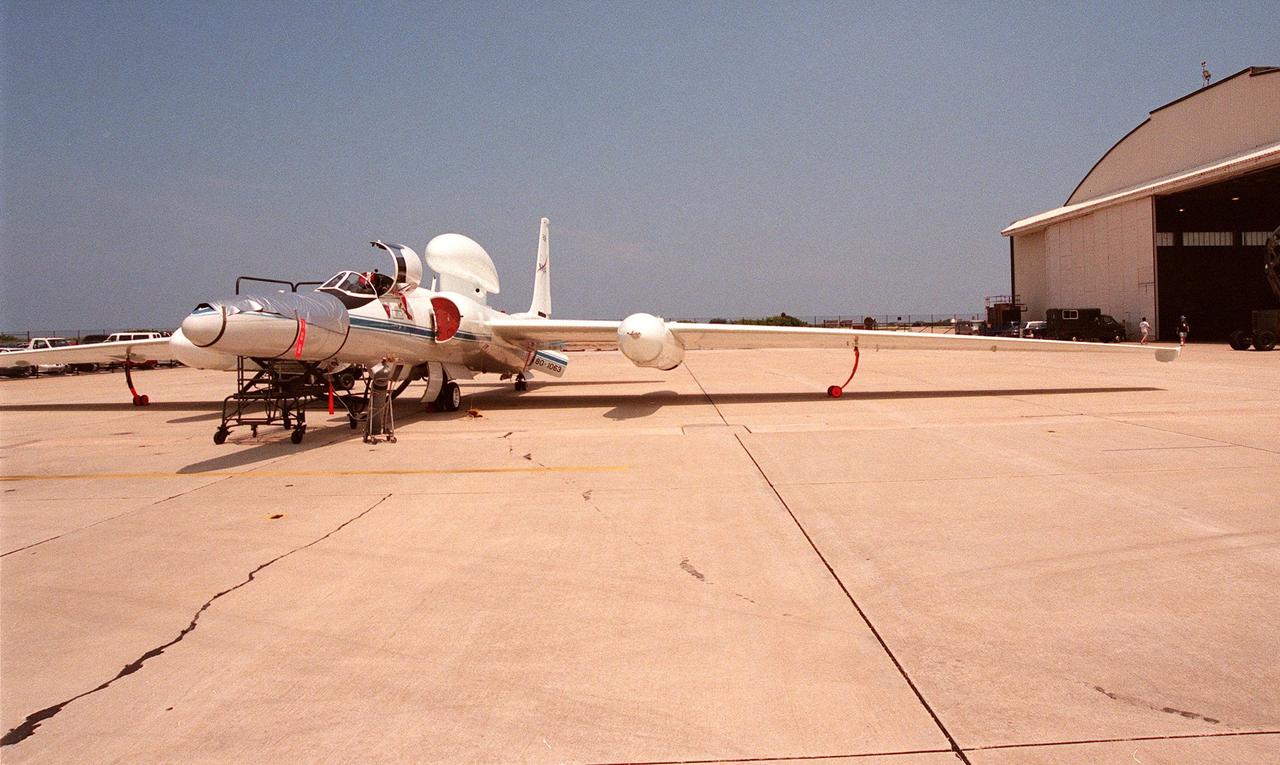
This high-altitude research plane, a specially equipped Dryden Flight Research Center ER-2 (a modified U-2), is readied at Patrick Air Force Base for flight into a hurricane in the Atlantic. The plane is part of the NASA-led Atmospheric Dynamics and Remote Sensing program that includes other government weather researchers and the university community in a study of Atlantic hurricanes and tropical storms. The ER-2, soaring above 65,000 feet, will measure the structure of hurricanes and the surrounding atmosphere that steers the storms’ movement. The hurricane study, which lasts through September 1998, is part of NASA’s Earth Science enterprise to better understand the total Earth system and the effects of natural and human-induced changes on the global environment
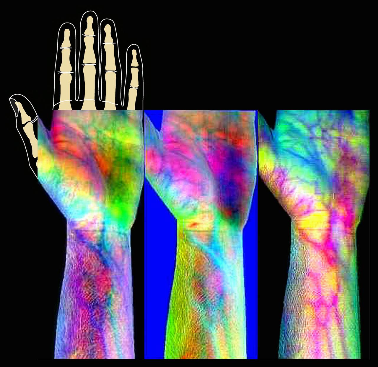
ProVision Technologies, a NASA research partnership center at Sternis Space Center in Mississippi, has developed a new hyperspectral imaging (HSI) system that is much smaller than the original large units used aboard remote sensing aircraft and satellites. The new apparatus is about the size of a breadbox. Health-related applications of HSI include non-invasive analysis of human skin to characterize wounds and wound healing rates (especially important for space travelers who heal more slowly), determining if burns are first-, second-, or third degree (rather than painful punch biopsies). The work is sponsored under NASA's Space Product Development (SPD) program.
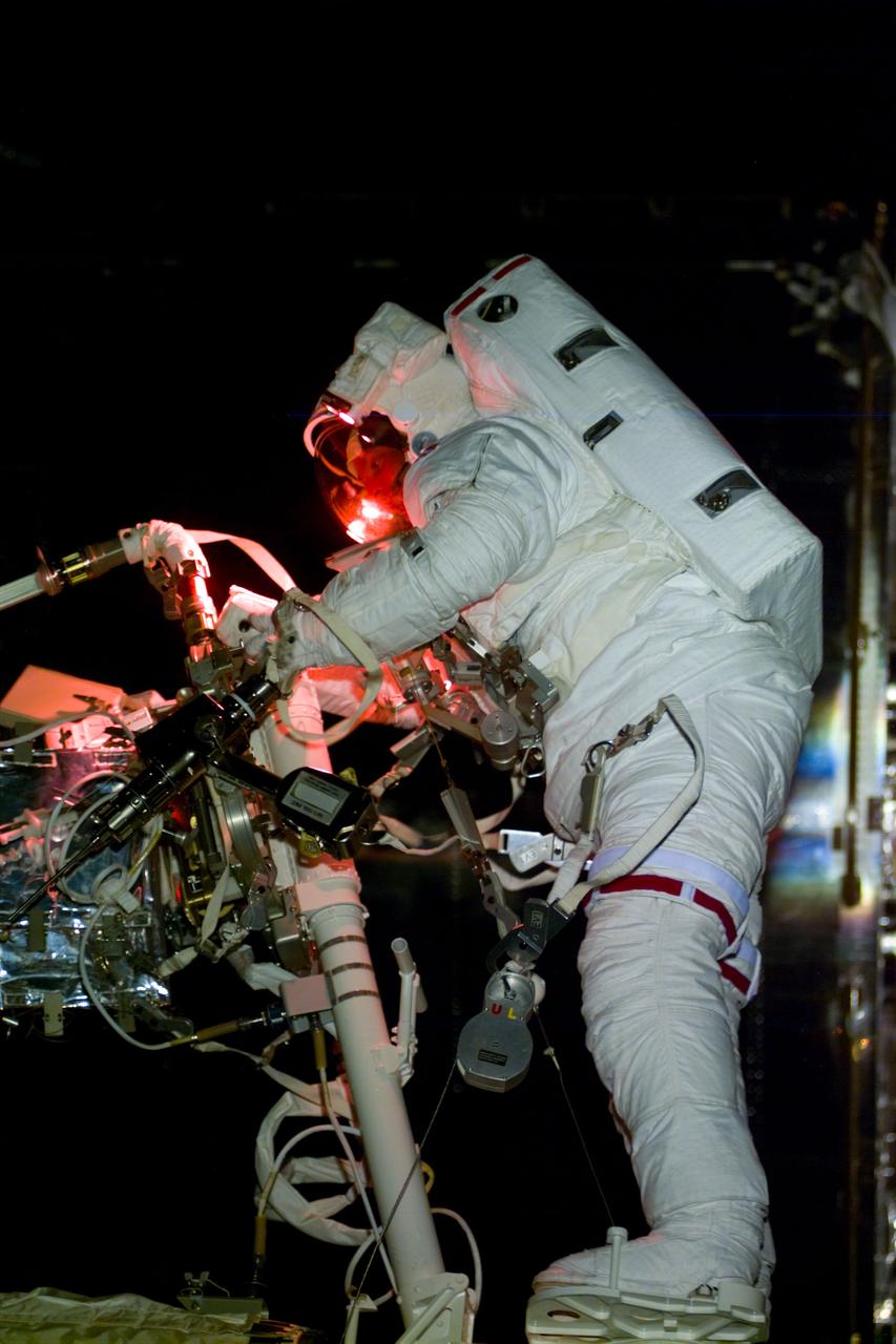
S82-E-5606 (17 Feb. 1997) --- Astronaut Gregory J. Harbaugh at work on Hubble Space Telescope (HST), with the assistance of astronaut Joseph R. Tanner (out of frame) on Remote Manipulator System (RMS). After replacing the HST's Solar Array Drive Electronics (SADE), Harbaugh and Tanner replaced the Magnetic Sensing System (MSS) protective lids with new, permanent covers; and they installed pre-cut insulation pieces to correct tears in the HST's protective covering caused by temperature changes in space. This view was taken with an Electronic Still Camera (ESC).
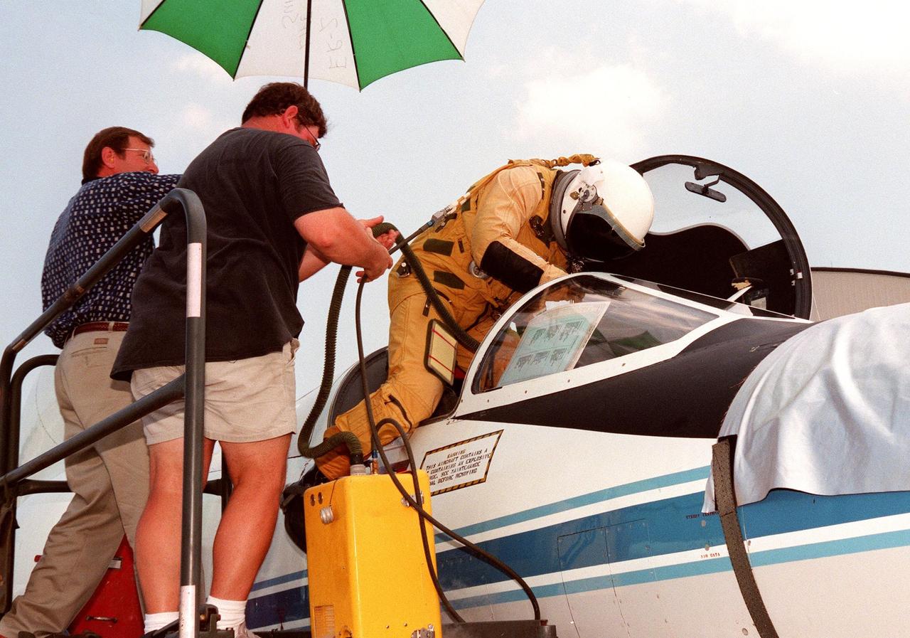
The pilot climbs into the cockpit of a high-altitude research plane, a specially equipped Dryden Flight Research Center ER-2 (a modified U-2), at Patrick Air Force Base. Soaring above 65,000 feet, the ER-2 will measure the structure of hurricanes and the surrounding atmosphere that steers the storm’s movement. The plane is part of the NASA-led Atmospheric Dynamics and Remote Sensing program that includes other government weather researchers and the university community in a study of Atlantic hurricanes and tropical storms. The hurricane study, which lasts through September 1998, is part of NASA’s Earth Science enterprise to better understand the total Earth system and the effects of natural and human-induced changes on the global environment
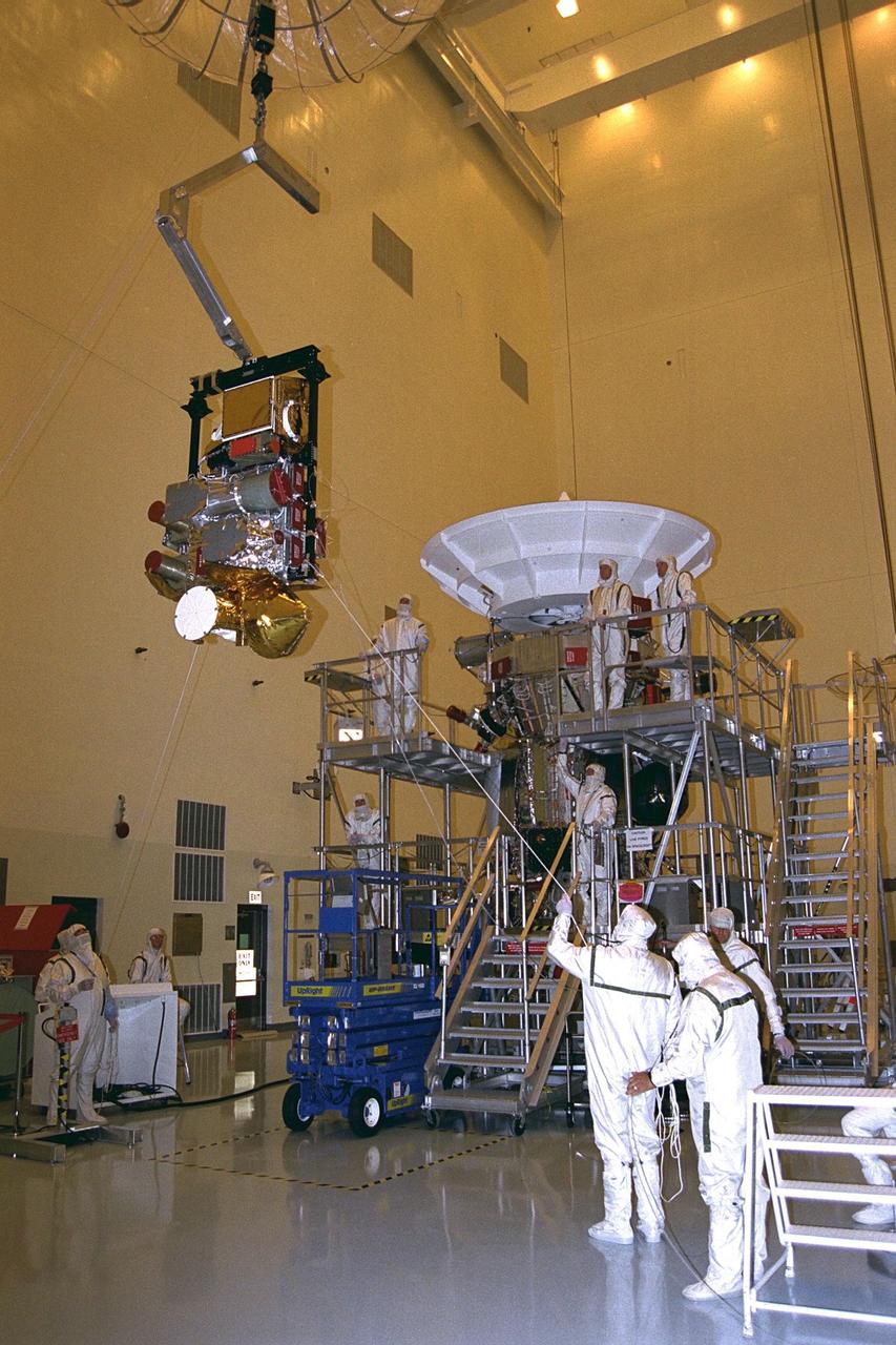
The complete remote sensing pallet is lowered by technicians from the Jet Propulsion Laboratory (JPL) of the California Institute of Technology to mate with the Cassini spacecraft in the Payload Hazardous Servicing Facility at KSC in July. A four-year, close-up study of the Saturnian system, the Cassini mission is scheduled for launch from Cape Canaveral Air Station in October 1997. It will take seven years for the spacecraft to reach Saturn. Scientific instruments carried aboard the spacecraft will study Saturn’s atmosphere, magnetic field, rings, and several moons. JPL is managing the Cassini project for NASA
KENNEDY SPACE CENTER, FLA. -- The Spartan solar-observing deployable spacecraft is lifted from its work stand to move it to a payload canister in the Multi-Payload Processing Facility at KSC. Spartan is one of the payloads for the STS-95 mission, scheduled to launch Oct. 29. Spartan is a solar physics spacecraft designed to perform remote sensing of the hot outer layers of the sun's atmosphere or corona. The objective of the observations is to investigate the mechanisms causing the heating of the solar corona and the acceleration of the solar wind which originates in the corona. Other research payloads include the Hubble Space Telescope Orbital Systems Test Platform, the International Extreme Ultraviolet Hitchhiker, and the SPACEHAB single module with experiments on space flight and the aging process
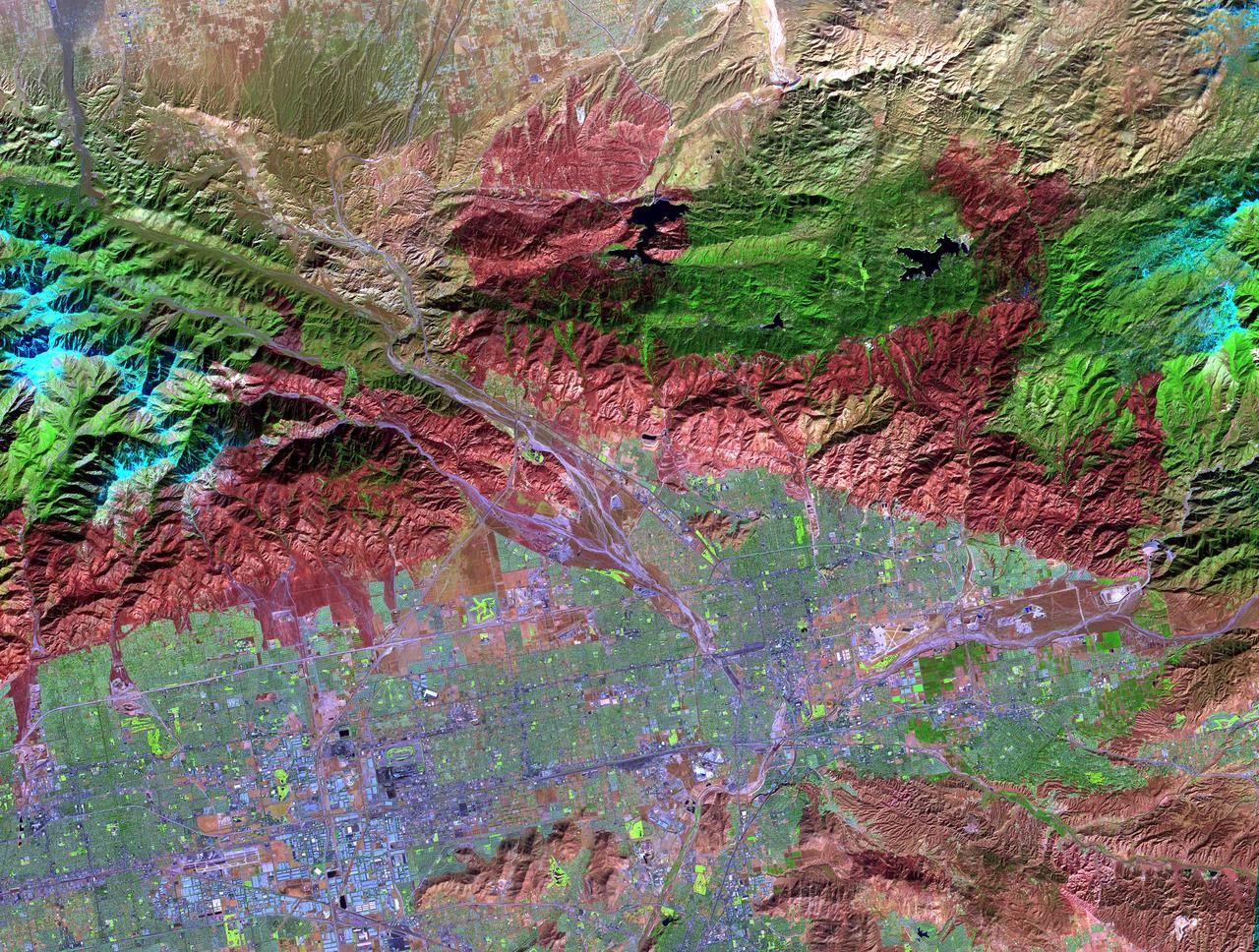
On November 18, 2003, the Advanced Spaceborne Thermal Emission and Reflection Radiometer (ASTER) on NASA's Terra satellite acquired this image of the Old Fire/Grand Prix fire east of Los Angeles. The image is being processed by NASA's Wildfire Response Team and will be sent to the United States Department of Agriculture's Forest Service Remote Sensing Applications Center (RSAC) which provides interpretation services to Burned Area Emergency Response (BAER) teams to assist in mapping the severity of the burned areas. The image combines data from the visible and infrared wavelength regions to highlight the burned areas. http://photojournal.jpl.nasa.gov/catalog/PIA04879
KENNEDY SPACE CENTER, FLA. -- The Spartan solar-observing deployable spacecraft is placed inside the payload canister in the Multi-Payload Processing Facility at KSC. Spartan is one of the payloads for the STS-95 mission, scheduled to launch Oct. 29. Spartan is a solar physics spacecraft designed to perform remote sensing of the hot outer layers of the sun's atmosphere or corona. The objective of the observations is to investigate the mechanisms causing the heating of the solar corona and the acceleration of the solar wind which originates in the corona. Other research payloads include the Hubble Space Telescope Orbital Systems Test Platform, the International Extreme Ultraviolet Hitchhiker, and the SPACEHAB single module with experiments on space flight and the aging process
KENNEDY SPACE CENTER, FLA. -- The Spartan solar-observing deployable spacecraft is suspended above the payload canister in the Multi-Payload Processing Facility at KSC. Spartan is one of the payloads for the STS-95 mission, scheduled to launch Oct. 29. Spartan is a solar physics spacecraft designed to perform remote sensing of the hot outer layers of the sun's atmosphere or corona. The objective of the observations is to investigate the mechanisms causing the heating of the solar corona and the acceleration of the solar wind which originates in the corona. Other research payloads include the Hubble Space Telescope Orbital Systems Test Platform, the International Extreme Ultraviolet Hitchhiker, and the SPACEHAB single module with experiments on space flight and the aging process

A specially equipped Dryden Flight Research Center ER-2 (a modified U-2) soars above Patrick Air Force Base enroute to a hurricane in the Atlantic. The plane is part of the NASA-led Atmospheric Dynamics and Remote Sensing program that includes other government weather researchers and the university community in a study of Atlantic hurricanes and tropical storms. Soaring above 65,000 feet, the ER-2 will measure the structure of hurricanes and the surrounding atmosphere that steers the storm’s movement. The hurricane study, which lasts through September 1998, is part of NASA’s Earth Science enterprise to better understand the total Earth system and the effects of natural and human-induced changes on the global environment
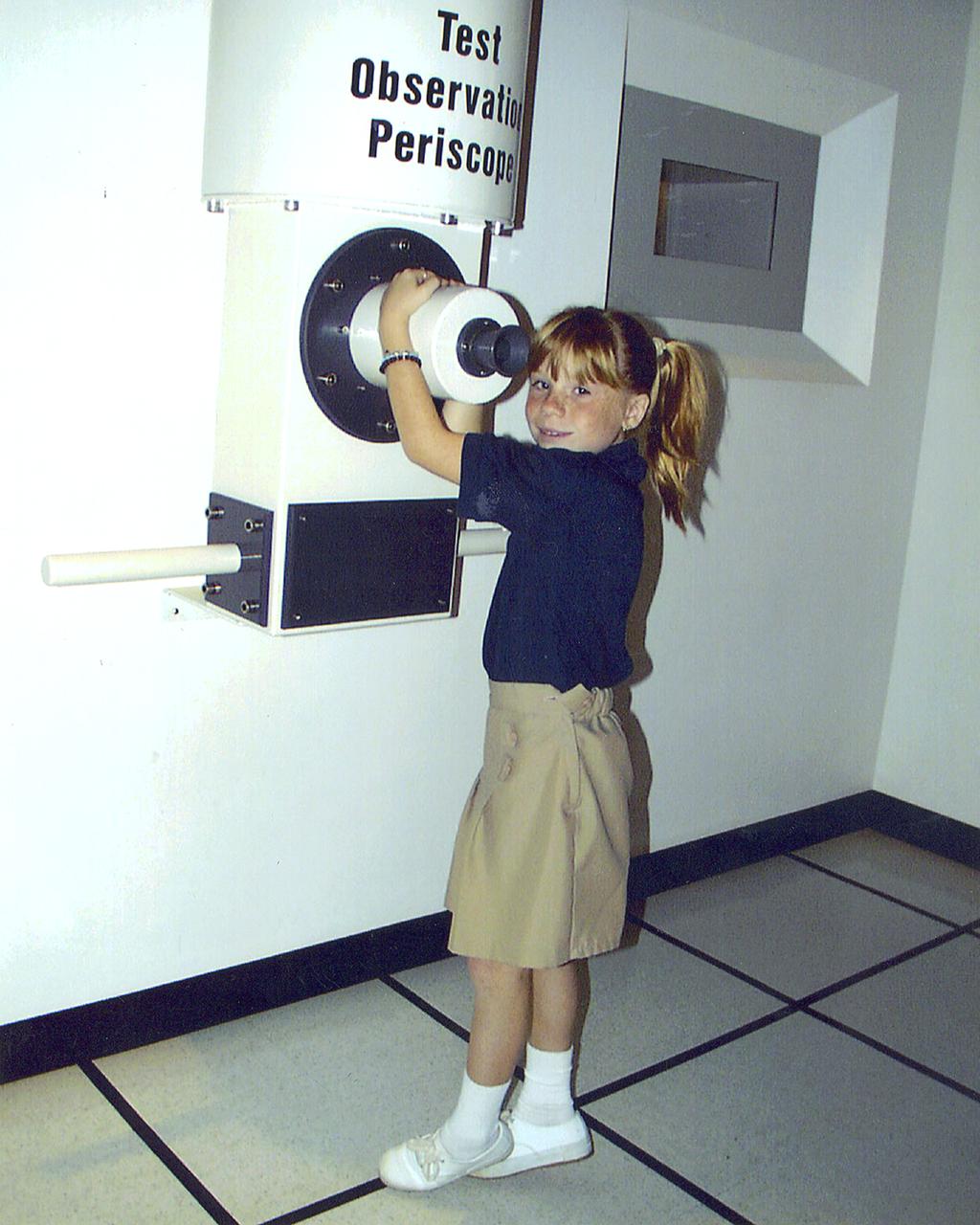
At the test observation periscope in the Test Control Center exhibit in StenniSphere at the John C. Stennis Space Center in Hancock County, Miss., visitors can observe a test of a Space Shuttle Main Engine exactly as test engineers might see it during a real engine test. The Test Control Center exhibit exactly simulates not only the test control environment, but also the procedure of testing a rocket engine. Designed to entertain while educating, StenniSphere includes informative dispays and exhibits from NASA's lead center for rocket propulsion and remote sensing applications. StenniSphere is open free of charge from 9 a.m. to 5 p.m. daily.
Elizabeth Hook, outreach coordinator for NASA's Applied Remote Sensing Training (ARSET) Program speaks about ARSET and its impact during the 2019 Annual Earth Science Applications Showcase, Thursday, Aug. 1, 2019 at NASA Headquarters in Washington, DC. Every summer students and young professionals from NASA’s Applied Sciences’ DEVELOP National Program come to NASA Headquarters and present their research projects. DEVELOP is a training and development program where students work on Earth science research projects, mentored by science advisers from NASA and partner agencies, and extend research results to local communities. Photo Credit: (NASA/Joel Kowsky)
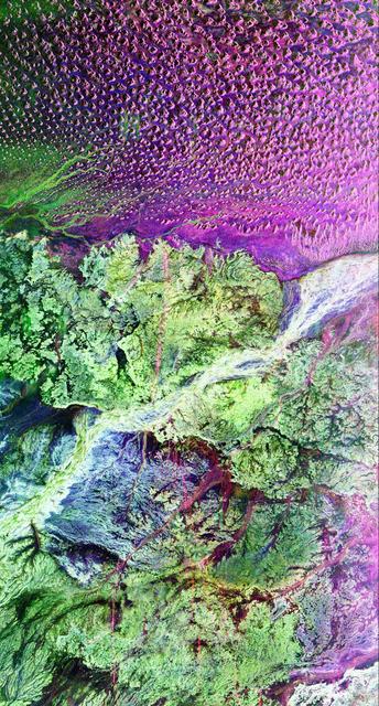
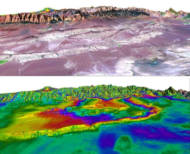
This is a radar image of the region around the site of the lost city of Ubar in southern Oman, on the Arabian Peninsula. The ancient city was discovered in 1992 with the aid of remote sensing data. Archeologists believe Ubar existed from about 2800 B.C. to about 300 A.D. and was a remote desert outpost where caravans were assembled for the transport of frankincense across the desert. This image was acquired on orbit 65 of space shuttle Endeavour on April 13, 1994 by the Spaceborne Imaging Radar C/X-Band Synthetic Aperture Radar (SIR-C/X-SAR). The SIR-C image shown is centered at 18.4 degrees north latitude and 53.6 degrees east longitude. The image covers an area about 50 by 100 kilometers (31 miles by 62 miles). The image is constructed from three of the available SIR-C channels and displays L-band, HH (horizontal transmit and receive) data as red, C-band HH as blue, and L-band HV (horizontal transmit, vertical receive) as green. The prominent magenta colored area is a region of large sand dunes, which are bright reflectors at both L-and C-band. The prominent green areas (L-HV) are rough limestone rocks, which form a rocky desert floor. A major wadi, or dry stream bed, runs across the middle of the image and is shown largely in white due to strong radar scattering in all channels displayed (L and C HH, L-HV). The actual site of the fortress of the lost city of Ubar, currently under excavation, is near the Wadi close to the center of the image. The fortress is too small to be detected in this image. However, tracks leading to the site, and surrounding tracks, appear as prominent, but diffuse, reddish streaks. These tracks have been used in modern times, but field investigations show many of these tracks were in use in ancient times as well. Mapping of these tracks on regional remote sensing images was a key to recognizing the site as Ubar in 1992. This image, and ongoing field investigations, will help shed light on a little known early civilization. http://photojournal.jpl.nasa.gov/catalog/PIA01721
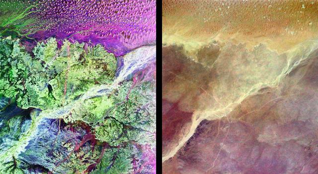
This pair of images from space shows a portion of the southern Empty Quarter of the Arabian Peninsula in the country of Oman. On the left is a radar image of the region around the site of the fabled Lost City of Ubar, discovered in 1992 with the aid of remote sensing data. On the right is an enhanced optical image taken by the shuttle astronauts. Ubar existed from about 2800 BC to about 300 AD. and was a remote desert outpost where caravans were assembled for the transport of frankincense across the desert. The actual site of the fortress of the Lost City of Ubar, currently under excavation, is too small to show in either image. However, tracks leading to the site, and surrounding tracks, show as prominent, but diffuse, reddish streaks in the radar image. Although used in modern times, field investigations show many of these tracks were in use in ancient times as well. Mapping of these tracks on regional remote sensing images provided by the Landsat satellite was a key to recognizing the site as Ubar. The prominent magenta colored area is a region of large sand dunes. The green areas are limestone rocks, which form a rocky desert floor. A major wadi, or dry stream bed, runs across the scene and appears as a white line. The radar images, and ongoing field investigations, will help shed light on an early civilization about which little in known. The radar image was taken by the Spaceborne Imaging Radar C/X-Band Synthetic Aperture Radar (SIR-C/X-SAR) and is centered at 18 degrees North latitude and 53 degrees East longitude. The image covers an area about 50 kilometers by 100 kilometers (31 miles by 62 miles). The colors in the image are assigned to different frequencies and polarizations of the radar as follows: red is L-band, horizontally transmitted, horizontally received; blue is C-band horizontally transmitted, horizontally received; green is L-band horizontally transmitted, vertically received. SIR-C/X-SAR, a joint mission of the German, Italian and the United States space agencies, is part of NASA's Mission to Planet Earth. http://photojournal.jpl.nasa.gov/catalog/PIA01302
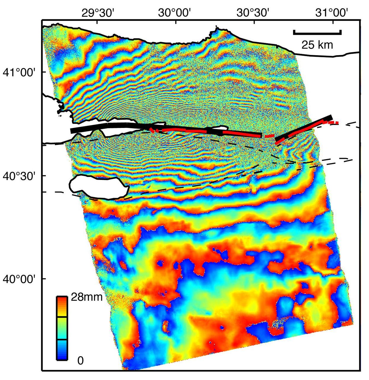
This image is an interferogram that was created using pairs of images taken by Synthetic Aperture Radar (SAR). The images, acquired at two different times, have been combined to measure surface deformation or changes that may have occurred during the time between data acquisition. The images were collected by the European Space Agency's Remote Sensing satellite (ERS-2) on 13 August 1999 and 17 September 1999 and were combined to produce these image maps of the apparent surface deformation, or changes, during and after the 17 August 1999 Izmit, Turkey earthquake. This magnitude 7.6 earthquake was the largest in 60 years in Turkey and caused extensive damage and loss of life. Each of the color contours of the interferogram represents 28 mm (1.1 inches) of motion towards the satellite, or about 70 mm (2.8 inches) of horizontal motion. White areas are outside the SAR image or water of seas and lakes. The North Anatolian Fault that broke during the Izmit earthquake moved more than 2.5 meters (8.1 feet) to produce the pattern measured by the interferogram. Thin red lines show the locations of fault breaks mapped on the surface. The SAR interferogram shows that the deformation and fault slip extended west of the surface faults, underneath the Gulf of Izmit. Thick black lines mark the fault rupture inferred from the SAR data. Scientists are using the SAR interferometry along with other data collected on the ground to estimate the pattern of slip that occurred during the Izmit earthquake. This then used to improve computer models that predict how this deformation transferred stress to other faults and to the continuation of the North Anatolian Fault, which extends to the west past the large city of Istanbul. These models show that the Izmit earthquake further increased the already high probability of a major earthquake near Istanbul. http://photojournal.jpl.nasa.gov/catalog/PIA00557
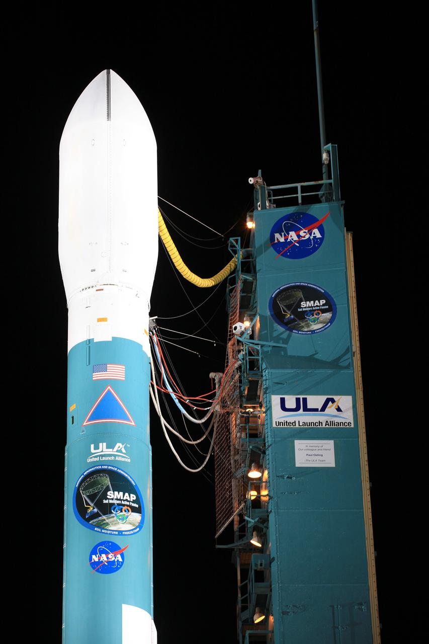
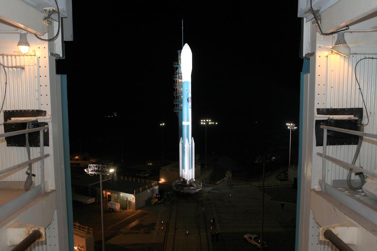
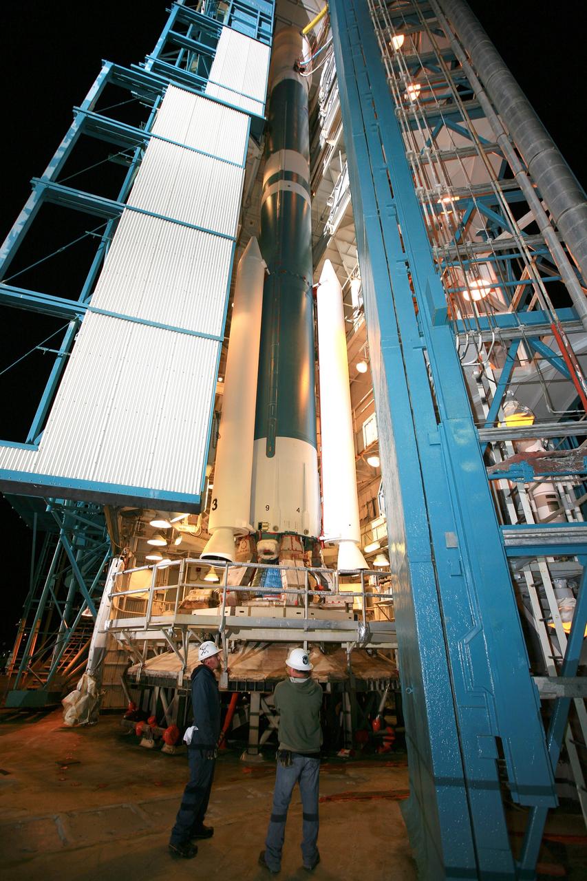
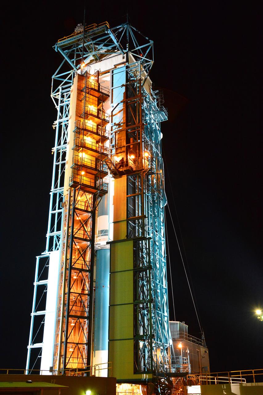
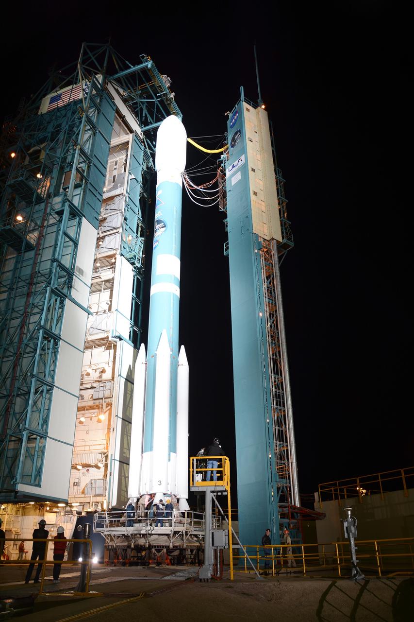
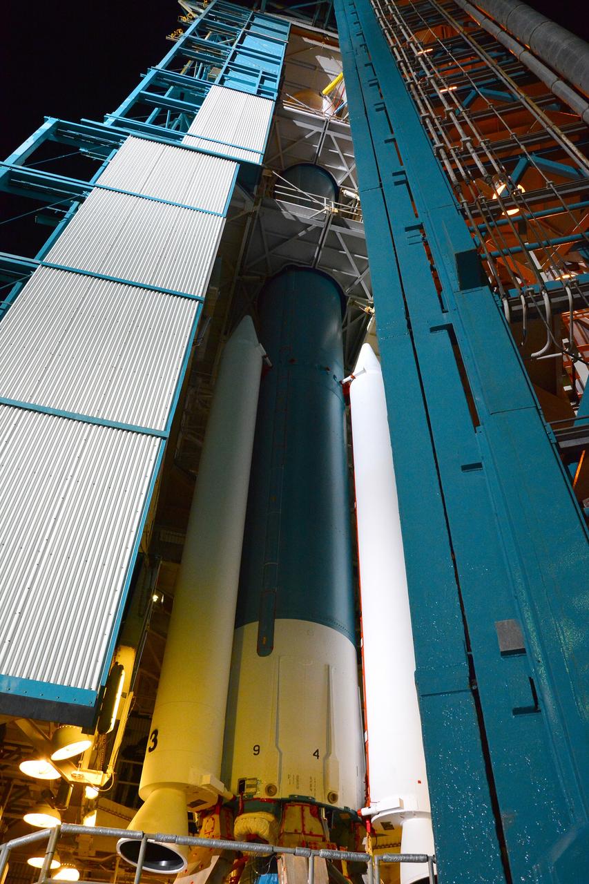
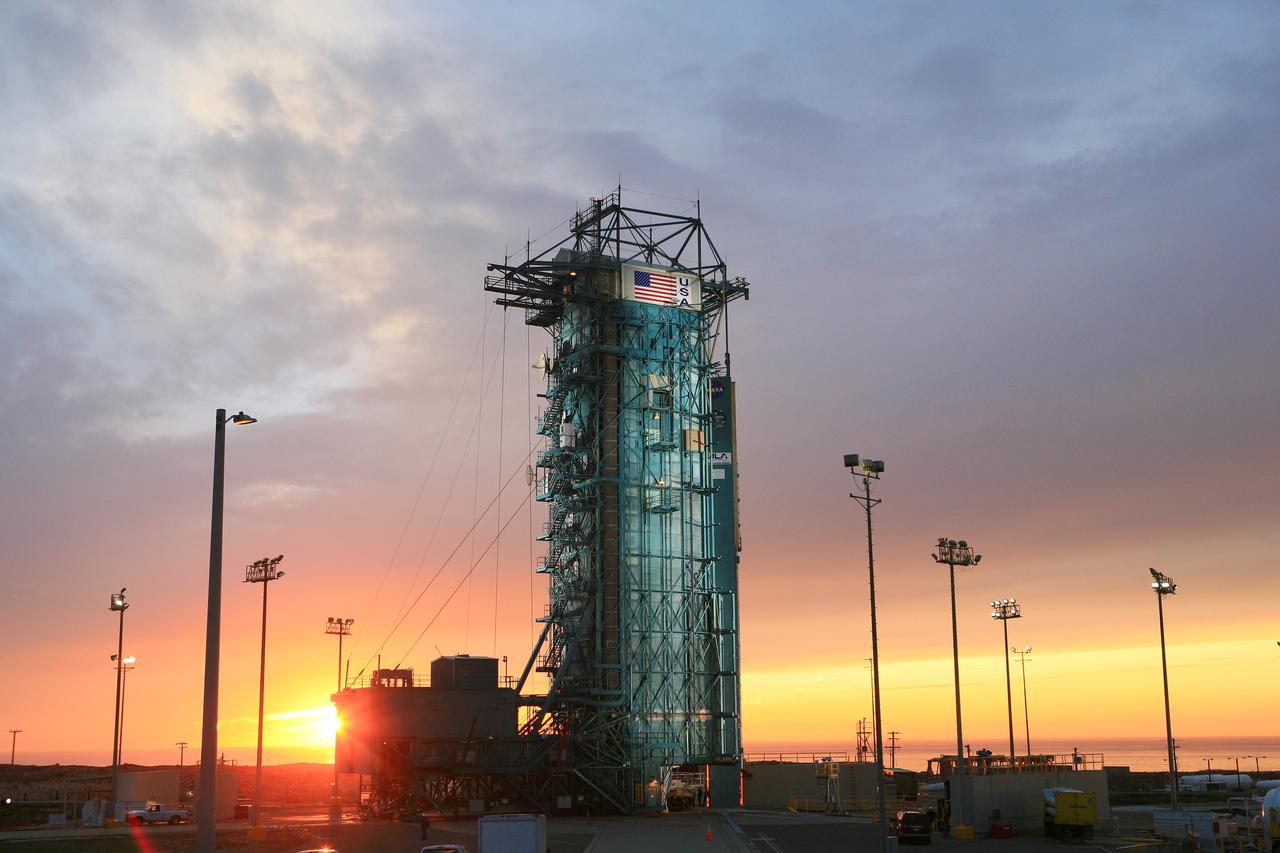
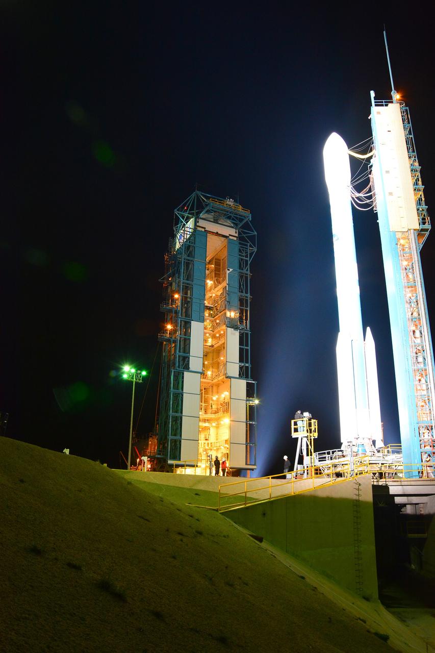
VANDENBERG AIR FORCE BASE, Calif. – The launch gantry is rolled back to reveal the United Launch Alliance Delta II rocket with the Soil Moisture Active Passive, or SMAP, satellite aboard, at the Space Launch Complex 2 at Vandenberg Air Force Base, California. SMAP is a remote sensing mission designed to measure and map the Earth's soil moisture distribution and freeze/thaw stat with unprecedented accuracy, resolution and coverage. SMAP will provide global measurements of soil moisture and its freeze/thaw state. These measurements will be used to enhance understanding of processes that link the water, energy and carbon cycles, and to extend the capabilities of weather and climate prediction models. SMAP data also will be used to quantify net carbon flux in boreal landscapes and to develop improved flood prediction and drought monitoring capabilities. Launch is scheduled for Jan. 29, 2015. To learn more about SMAP, visit http://smap.jpl.nasa.gov Photo credit: NASA/Kim Shiflett
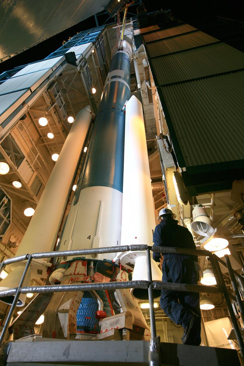
VANDENBERG AIR FORCE BASE, Calif. – The launch gantry is rolled back to reveal the United Launch Alliance Delta II rocket with the Soil Moisture Active Passive, or SMAP, satellite aboard, at the Space Launch Complex 2 at Vandenberg Air Force Base, California. SMAP is a remote sensing mission designed to measure and map the Earth's soil moisture distribution and freeze/thaw stat with unprecedented accuracy, resolution and coverage. SMAP will provide global measurements of soil moisture and its freeze/thaw state. These measurements will be used to enhance understanding of processes that link the water, energy and carbon cycles, and to extend the capabilities of weather and climate prediction models. SMAP data also will be used to quantify net carbon flux in boreal landscapes and to develop improved flood prediction and drought monitoring capabilities. Launch is scheduled for Jan. 29, 2015. To learn more about SMAP, visit http://smap.jpl.nasa.gov Photo credit: NASA/Kim Shiflett
VANDENBERG AIR FORCE BASE, Calif. – The launch gantry is rolled back to reveal the United Launch Alliance Delta II rocket with the Soil Moisture Active Passive, or SMAP, satellite aboard, at the Space Launch Complex 2 at Vandenberg Air Force Base, California. SMAP is a remote sensing mission designed to measure and map the Earth's soil moisture distribution and freeze/thaw stat with unprecedented accuracy, resolution and coverage. SMAP will provide global measurements of soil moisture and its freeze/thaw state. These measurements will be used to enhance understanding of processes that link the water, energy and carbon cycles, and to extend the capabilities of weather and climate prediction models. SMAP data also will be used to quantify net carbon flux in boreal landscapes and to develop improved flood prediction and drought monitoring capabilities. Launch is scheduled for Jan. 29, 2015. To learn more about SMAP, visit http://smap.jpl.nasa.gov Photo credit: NASA/Kim Shiflett
VANDENBERG AIR FORCE BASE, Calif. – The launch gantry is rolled back to reveal the United Launch Alliance Delta II rocket with the Soil Moisture Active Passive, or SMAP, satellite aboard, at the Space Launch Complex 2 at Vandenberg Air Force Base, California. SMAP is a remote sensing mission designed to measure and map the Earth's soil moisture distribution and freeze/thaw stat with unprecedented accuracy, resolution and coverage. SMAP will provide global measurements of soil moisture and its freeze/thaw state. These measurements will be used to enhance understanding of processes that link the water, energy and carbon cycles, and to extend the capabilities of weather and climate prediction models. SMAP data also will be used to quantify net carbon flux in boreal landscapes and to develop improved flood prediction and drought monitoring capabilities. Launch is scheduled for Jan. 29, 2015. To learn more about SMAP, visit http://smap.jpl.nasa.gov Photo credit: NASA/Kim Shiflett

This NASA Dryden Flight Research Center DC-8 takes off from Patrick Air Force Base to pursue its goal of collecting high-altitude information about Atlantic hurricanes and tropical storms. Flying at 35,000 to 40,000 feet, the plane is equipped with instruments to measure the storm’s structure, environment and changes in intensity and tracking. The DC-8 is part of the NASA-led Atmospheric Dynamics and Remote Sensing program that includes other government weather researchers and the university community in a study of Atlantic hurricanes and tropical storms. The hurricane study, which lasts through September, is part of NASA’s Earth Science enterprise to better understand the total Earth system and the effects of natural and human-induced changes on the global environment
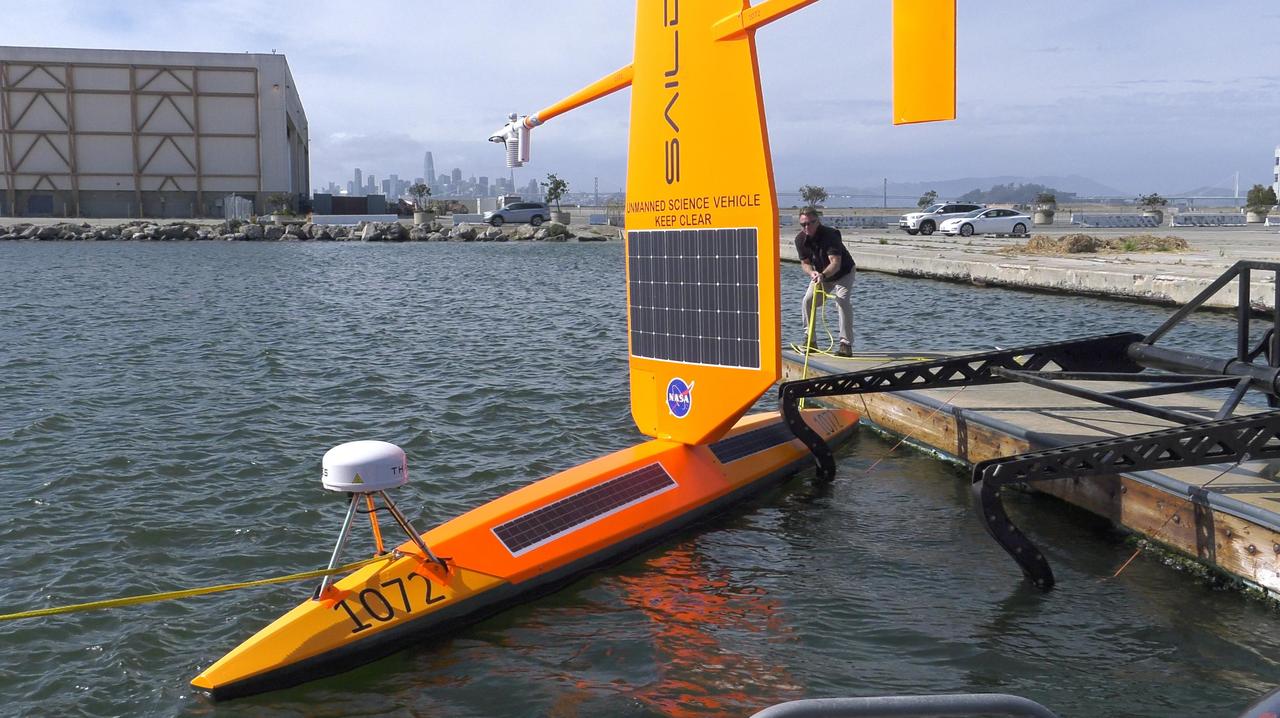
As part of NASA's Sub-Mesoscale Ocean Dynamics Experiment (S-MODE) field campaign, several Saildrones like the one pictured here were launched from San Francisco Bay. The Saildrones were part of a fleet of autonomous marine research vessels designed to measure a vast array of factors such as ocean currents, wind speed and direction, air and water temperature, salinity, dissolved oxygen, and chlorophyll content. S-MODE is a NASA Earth mission to use newly developed in-situ and remote-sensing techniques to look at small-scale ocean whirlpools, eddies, and currents. The observations could help scientists better understand how these dynamics drive the give-and-take of material and energy between the ocean and atmosphere and, ultimately, help shape Earth's climate. More information about S-MODE is at https://espo.nasa.gov/s-mode/content/S-MODE https://photojournal.jpl.nasa.gov/catalog/PIA25523
VANDENBERG AIR FORCE BASE, Calif. – The launch gantry is rolled back to reveal the United Launch Alliance Delta II rocket with the Soil Moisture Active Passive, or SMAP, satellite aboard, at Space Launch Complex 2 on Vandenberg Air Force Base in California. SMAP is a remote sensing mission designed to measure and map the Earth's soil moisture distribution and freeze/thaw stat with unprecedented accuracy, resolution and coverage. SMAP will provide global measurements of soil moisture and its freeze/thaw state. These measurements will be used to enhance understanding of processes that link the water, energy and carbon cycles, and to extend the capabilities of weather and climate prediction models. SMAP data also will be used to quantify net carbon flux in boreal landscapes and to develop improved flood prediction and drought monitoring capabilities. Launch is scheduled for Jan. 29, 2015. To learn more about SMAP, visit http://www.nasa.gov/smap. Photo credit: NASA/Randy Beaudoin
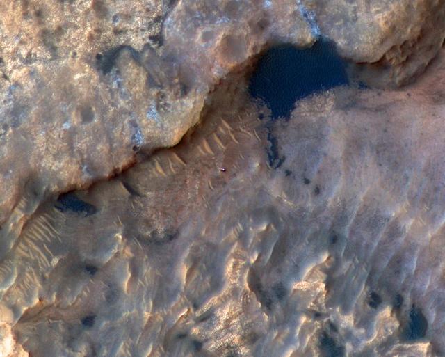
NASA's Curiosity Mars rover can be seen in this image taken from space on May 31, 2019, by the High Resolution Imaging Science Experiment (HiRISE) camera aboard the Mars Reconnaissance Orbiter (MRO). In the image, Curiosity appears as a bluish speck. The image shows Curiosity at a location called "Woodland Bay." It's just one of many stops the rover has made in an area referred to as the "clay-bearing unit" on the side of Mount Sharp, a 3-mile-tall (5-kilometer-tall) mountain inside of Gale Crater. Look carefully, and you can make out what it is likely Curiosity's "head," technically known as the remote sensing mast. A bright spot appears in the upper-left corner of the rover. At the time this image was acquired, the rover was facing 65 degrees counterclockwise from north, which would put the mast in about the right location to produce this bright spot. https://photojournal.jpl.nasa.gov/catalog/PIA23341
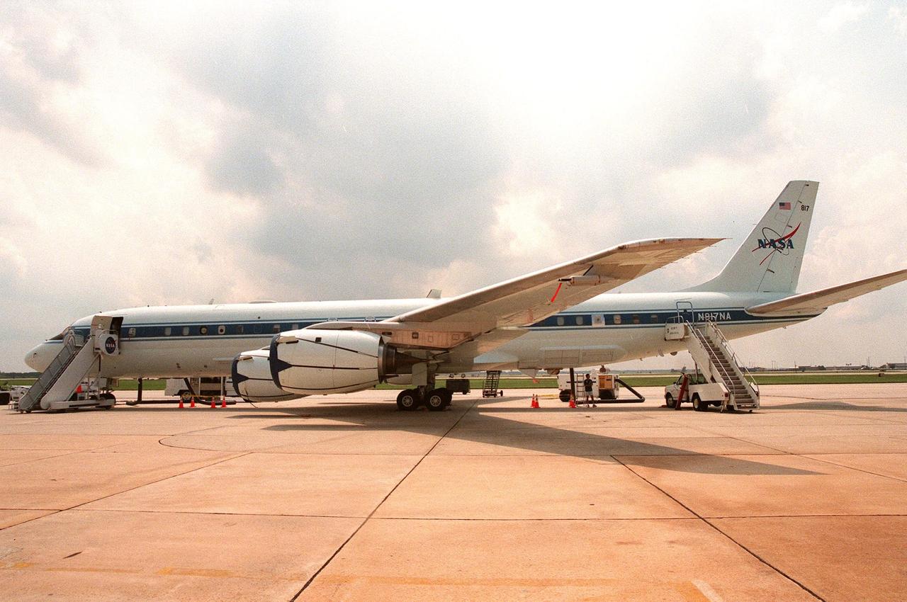
This NASA Dryden Flight Research Center DC-8, on view at Patrick Air Force Base, stands ready to pursue its goal of collecting high-altitude information about Atlantic hurricanes and tropical storms. Flying at 35,000 to 40,000 feet, the plane is equipped with instruments to measure the storm’s structure, environment and changes in intensity and tracking. The DC-8 is part of the NASA-led Atmospheric Dynamics and Remote Sensing program that includes other government weather researchers and the university community in a study of Atlantic hurricanes and tropical storms. The hurricane study, which lasts through September 1998, is part of NASA’s Earth Science enterprise to better understand the total Earth system and the effects of natural and human-induced changes on the global environment
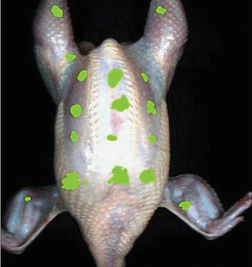
ProVision Technologies, a NASA research partnership center at Sternis Space Center in Mississippi, has developed a new hyperspectral imaging (HSI) system that is much smaller than the original large units used aboard remote sensing aircraft and satellites. The new apparatus is about the size of a breadbox. Health-related applications of HSI include scanning chickens during processing to help prevent contaminated food from getting to the table. ProVision is working with Sanderson Farms of Mississippi and the U.S. Department of Agriculture. ProVision has a record in its spectral library of the unique spectral signature of fecal contamination, so chickens can be scanned and those with a positive reading can be separated. HSI sensors can also determine the quantity of surface contamination. Research in this application is quite advanced, and ProVision is working on a licensing agreement for the technology. The potential for future use of this equipment in food processing and food safety is enormous.
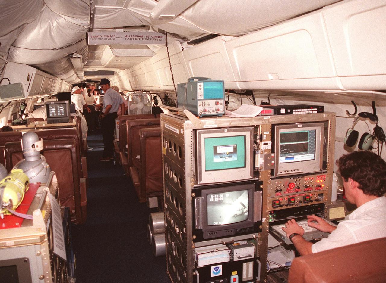
Inside this NASA Dryden Flight Research Center DC-8, which was on view at Patrick Air Force Base, visitors get a close-up look at the instruments that will be used to collect high-altitude information about Atlantic hurricanes and tropical storms as part of a NASA-led Atmospheric Dynamics and Remote Sensing program. The DC-8 is one of two aircraft being flown in a study through September to learn about the storms from top to bottom. The other plane, a modified U2, and the DC-8 will fly in conjunction with scheduled storm flights of the National Oceanic and Atmospheric Administration (NOAA) out of MacDill Air Force Base in Tampa and the U.S. Air Force 53rd Weather Reconnaissance Squadron from Keesler Air Force Base, Miss. The hurricane study is part of NASA’s Earth Science enterprise to better understand the total Earth system and the effects of natural and human-induced changes on the global environment
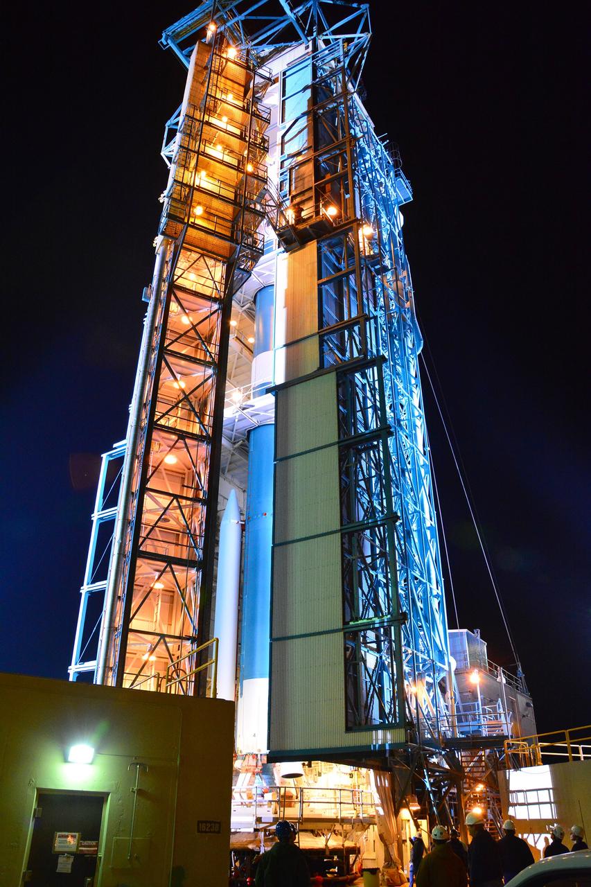
VANDENBERG AIR FORCE BASE, Calif. – The launch gantry is rolled back to reveal the United Launch Alliance Delta II rocket with the Soil Moisture Active Passive, or SMAP, satellite aboard, at Space Launch Complex 2 on Vandenberg Air Force Base in California. SMAP is a remote sensing mission designed to measure and map the Earth's soil moisture distribution and freeze/thaw stat with unprecedented accuracy, resolution and coverage. SMAP will provide global measurements of soil moisture and its freeze/thaw state. These measurements will be used to enhance understanding of processes that link the water, energy and carbon cycles, and to extend the capabilities of weather and climate prediction models. SMAP data also will be used to quantify net carbon flux in boreal landscapes and to develop improved flood prediction and drought monitoring capabilities. Launch is scheduled for Jan. 29, 2015. To learn more about SMAP, visit http://www.nasa.gov/smap. Photo credit: NASA/Randy Beaudoin
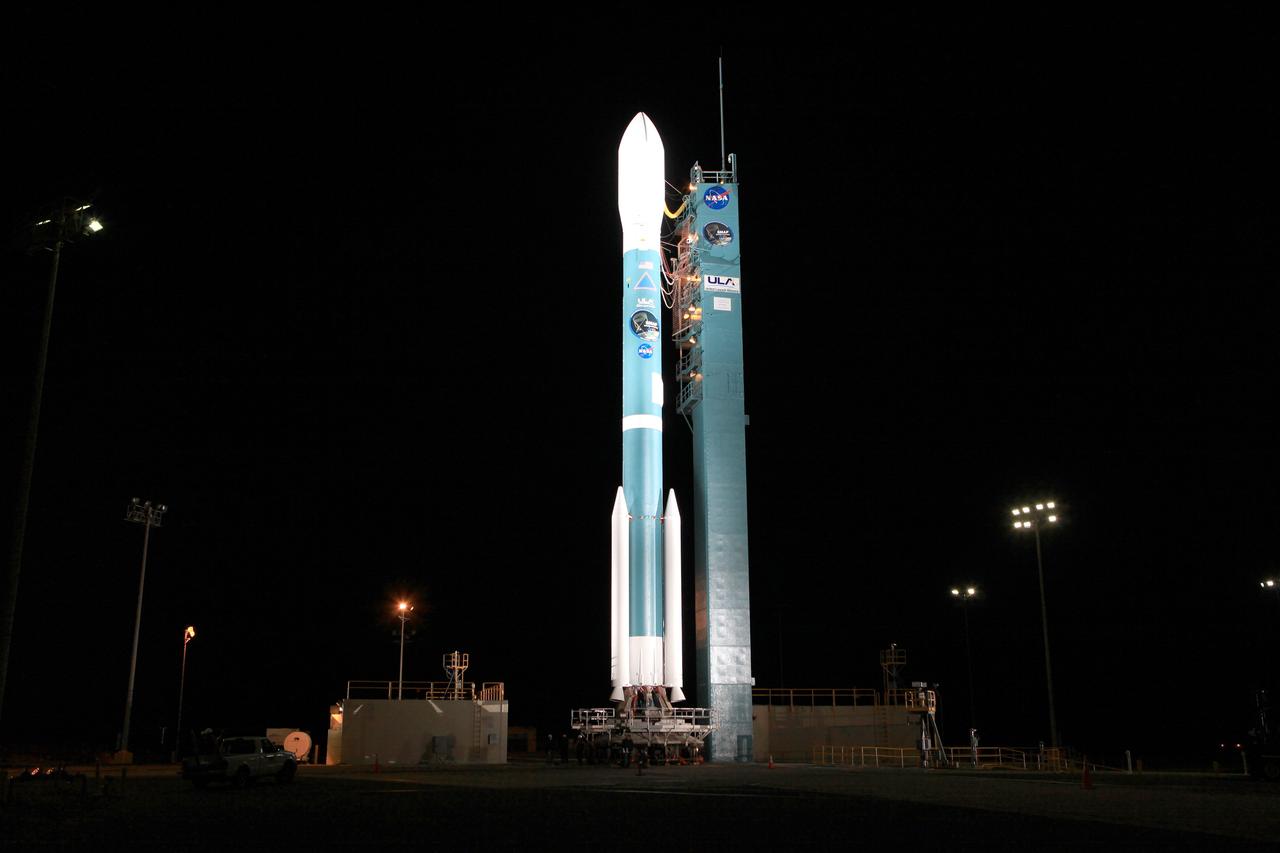
VANDENBERG AIR FORCE BASE, Calif. – The launch gantry is rolled back to reveal the United Launch Alliance Delta II rocket with the Soil Moisture Active Passive, or SMAP, satellite aboard, at the Space Launch Complex 2 at Vandenberg Air Force Base, California. SMAP is a remote sensing mission designed to measure and map the Earth's soil moisture distribution and freeze/thaw stat with unprecedented accuracy, resolution and coverage. SMAP will provide global measurements of soil moisture and its freeze/thaw state. These measurements will be used to enhance understanding of processes that link the water, energy and carbon cycles, and to extend the capabilities of weather and climate prediction models. SMAP data also will be used to quantify net carbon flux in boreal landscapes and to develop improved flood prediction and drought monitoring capabilities. Launch is scheduled for Jan. 29, 2015. To learn more about SMAP, visit http://smap.jpl.nasa.gov Photo credit: NASA/Kim Shiflett
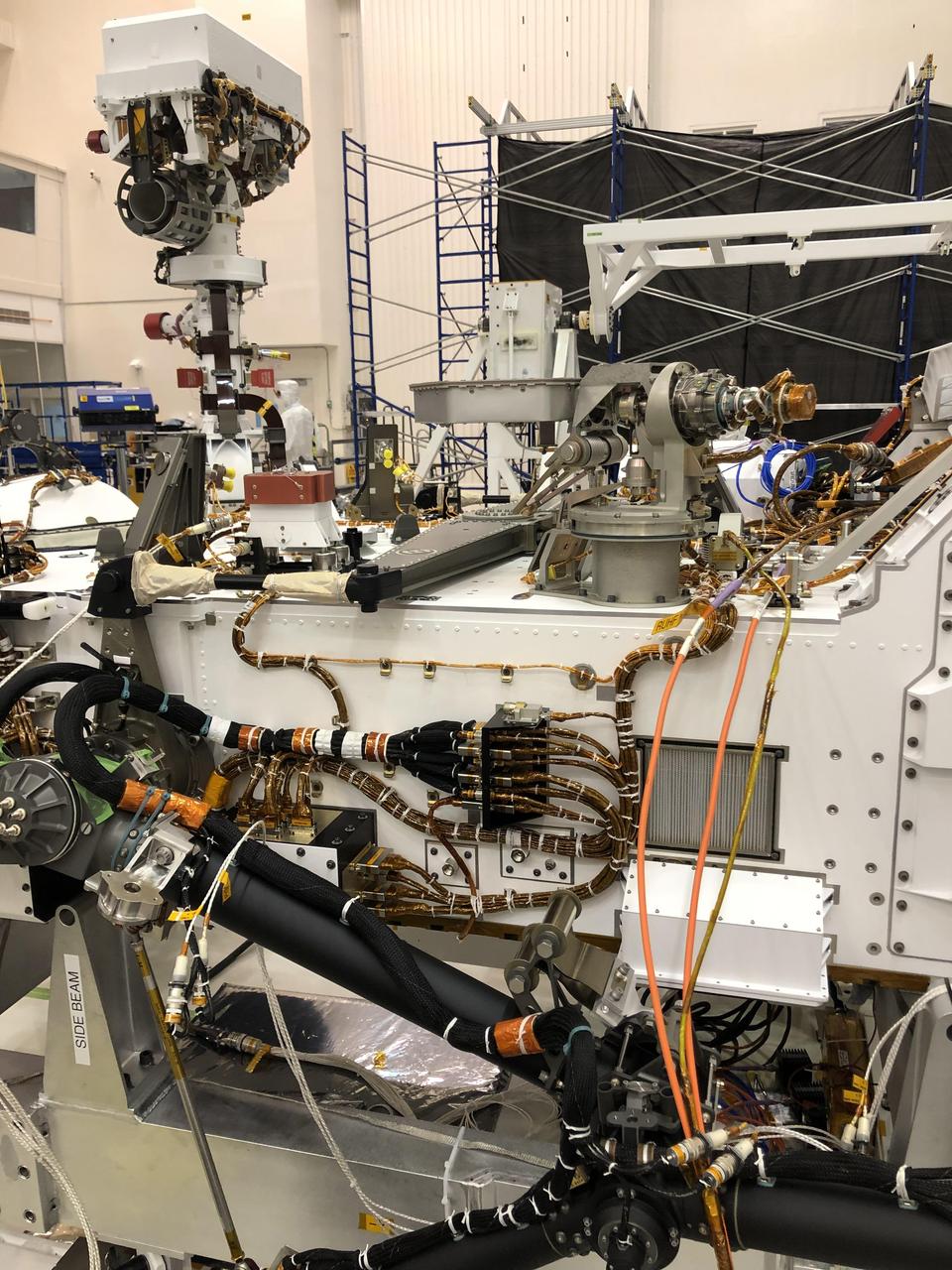
The port side of NASA's Perseverance Mars rover can be seen in this image taken on Nov. 16, 2019, in High Bay 1 of the Spacecraft Assembly Facility at NASA's Jet Propulsion Laboratory in Southern California. At the top left, the rover's remote sensing mast can be seen in the deployed position. To the right of the mast in the center of the image is the light gray high-gain antenna. At center of the image, attached to the side of the rover, is a black cable bracket (with gold cabling running through it). Attached to the top of this black bracket — and gray in color — is the Entry Descent and Landing (EDL) microphone. The rectangular screen to the right of the cable bracket is the rover chassis HEPA filter, which is above the white box housing the Mars Oxygen In-Situ Resource Utilization Experiment (MOXIE) inlet filter assembly. Gray and bright orange cables seen in the foreground of the image belong to ground support equipment. https://photojournal.jpl.nasa.gov/catalog/PIA24045
VANDENBERG AIR FORCE BASE, Calif. – The launch gantry is rolled back to reveal the United Launch Alliance Delta II rocket with the Soil Moisture Active Passive, or SMAP, satellite aboard, at Space Launch Complex 2 on Vandenberg Air Force Base in California. SMAP is a remote sensing mission designed to measure and map the Earth's soil moisture distribution and freeze/thaw stat with unprecedented accuracy, resolution and coverage. SMAP will provide global measurements of soil moisture and its freeze/thaw state. These measurements will be used to enhance understanding of processes that link the water, energy and carbon cycles, and to extend the capabilities of weather and climate prediction models. SMAP data also will be used to quantify net carbon flux in boreal landscapes and to develop improved flood prediction and drought monitoring capabilities. Launch is scheduled for Jan. 29, 2015. To learn more about SMAP, visit http://www.nasa.gov/smap. Photo credit: NASA/Randy Beaudoin
VANDENBERG AIR FORCE BASE, Calif. – The launch gantry is rolled back to reveal the United Launch Alliance Delta II rocket with the Soil Moisture Active Passive, or SMAP, satellite aboard, at Space Launch Complex 2 on Vandenberg Air Force Base in California. SMAP is a remote sensing mission designed to measure and map the Earth's soil moisture distribution and freeze/thaw stat with unprecedented accuracy, resolution and coverage. SMAP will provide global measurements of soil moisture and its freeze/thaw state. These measurements will be used to enhance understanding of processes that link the water, energy and carbon cycles, and to extend the capabilities of weather and climate prediction models. SMAP data also will be used to quantify net carbon flux in boreal landscapes and to develop improved flood prediction and drought monitoring capabilities. Launch is scheduled for Jan. 29, 2015. To learn more about SMAP, visit http://www.nasa.gov/smap. Photo credit: NASA/Randy Beaudoin
VANDENBERG AIR FORCE BASE, Calif. – The launch gantry is rolled back to reveal the United Launch Alliance Delta II rocket with the Soil Moisture Active Passive, or SMAP, satellite aboard, at the Space Launch Complex 2 at Vandenberg Air Force Base, California. SMAP is a remote sensing mission designed to measure and map the Earth's soil moisture distribution and freeze/thaw stat with unprecedented accuracy, resolution and coverage. SMAP will provide global measurements of soil moisture and its freeze/thaw state. These measurements will be used to enhance understanding of processes that link the water, energy and carbon cycles, and to extend the capabilities of weather and climate prediction models. SMAP data also will be used to quantify net carbon flux in boreal landscapes and to develop improved flood prediction and drought monitoring capabilities. Launch is scheduled for Jan. 29, 2015. To learn more about SMAP, visit http://smap.jpl.nasa.gov Photo credit: NASA/Kim Shiflett
VANDENBERG AIR FORCE BASE, Calif. – The launch gantry is rolled back to reveal the United Launch Alliance Delta II rocket with the Soil Moisture Active Passive, or SMAP, satellite aboard, at Space Launch Complex 2 on Vandenberg Air Force Base in California. SMAP is a remote sensing mission designed to measure and map the Earth's soil moisture distribution and freeze/thaw stat with unprecedented accuracy, resolution and coverage. SMAP will provide global measurements of soil moisture and its freeze/thaw state. These measurements will be used to enhance understanding of processes that link the water, energy and carbon cycles, and to extend the capabilities of weather and climate prediction models. SMAP data also will be used to quantify net carbon flux in boreal landscapes and to develop improved flood prediction and drought monitoring capabilities. Launch is scheduled for Jan. 29, 2015. To learn more about SMAP, visit http://www.nasa.gov/smap. Photo credit: NASA/Randy Beaudoin
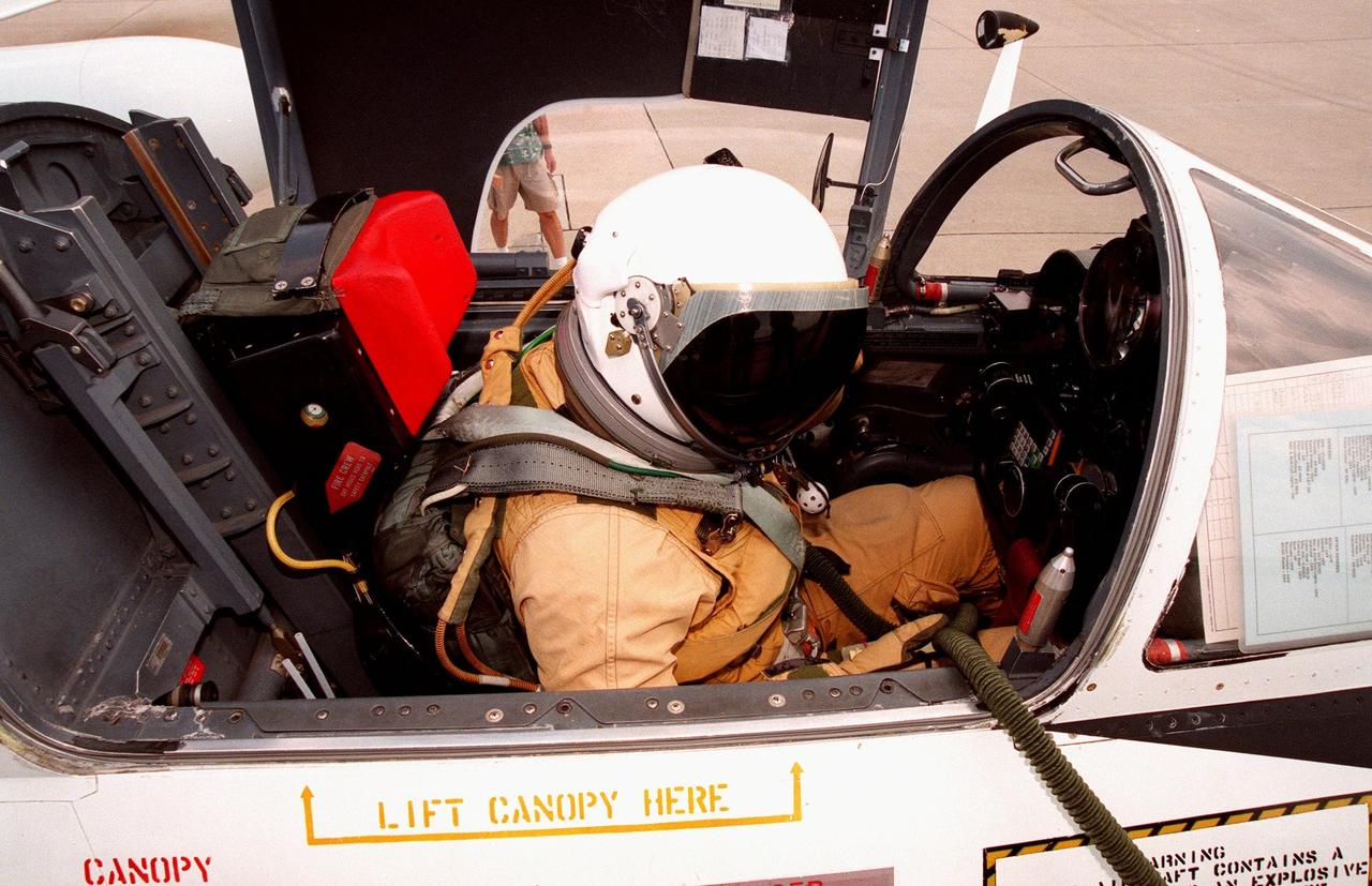
The pilot of this high-altitude research plane, a specially equipped Dryden Flight Research Center ER-2 (a modified U-2), settles into the cockpit at Patrick Air Force Base before taking off into a hurricane. The plane is part of the NASA-led Atmospheric Dynamics and Remote Sensing program that includes other government weather researchers and the university community in a study of Atlantic hurricanes and tropical storms. Soaring above 65,000 feet, the ER-2 will measure the structure of hurricanes and the surrounding atmosphere that steers the storm’s movement. The hurricane study, which lasts through September 1998, is part of NASA’s Earth Science enterprise to better understand the total Earth system and the effects of natural and human-induced changes on the global environment
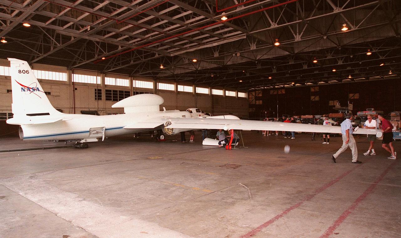
This high-altitude research plane, a specially equipped Dryden Flight Research Center ER-2, stops at Patrick Air Force Base long enough for visitors to get a close view. The modified U-2 aircraft, soaring above 65,000 feet, will measure the structure of hurricanes and the surrounding atmosphere that steers the storm’s movement. The plane is part of the NASA-led Atmospheric Dynamics and Remote Sensing program that includes other government weather researchers and the university community in a study of Atlantic hurricanes and tropical storms. The hurricane study, which lasts through September 1998, is part of NASA’s Earth Science enterprise to better understand the total Earth system and the effects of natural and human-induced changes on the global environment