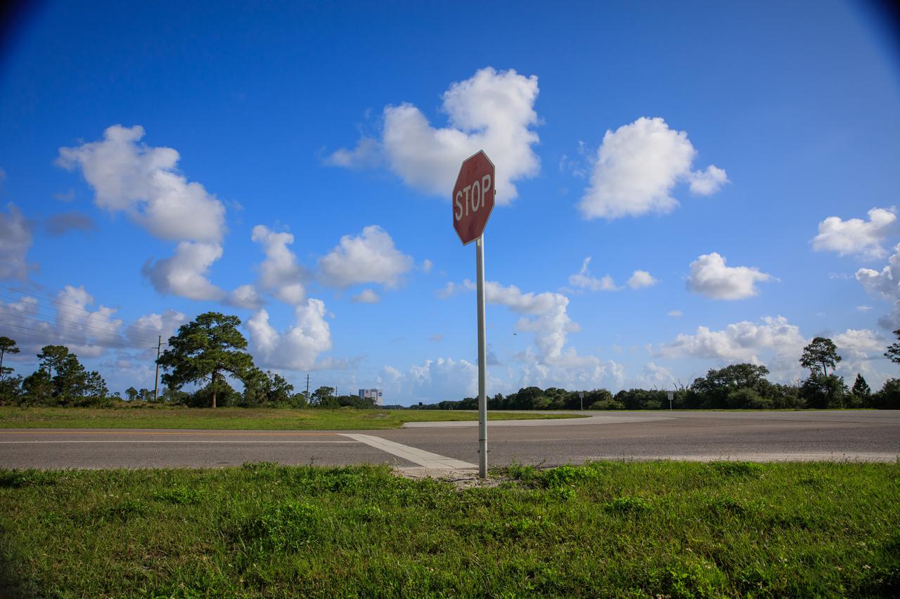
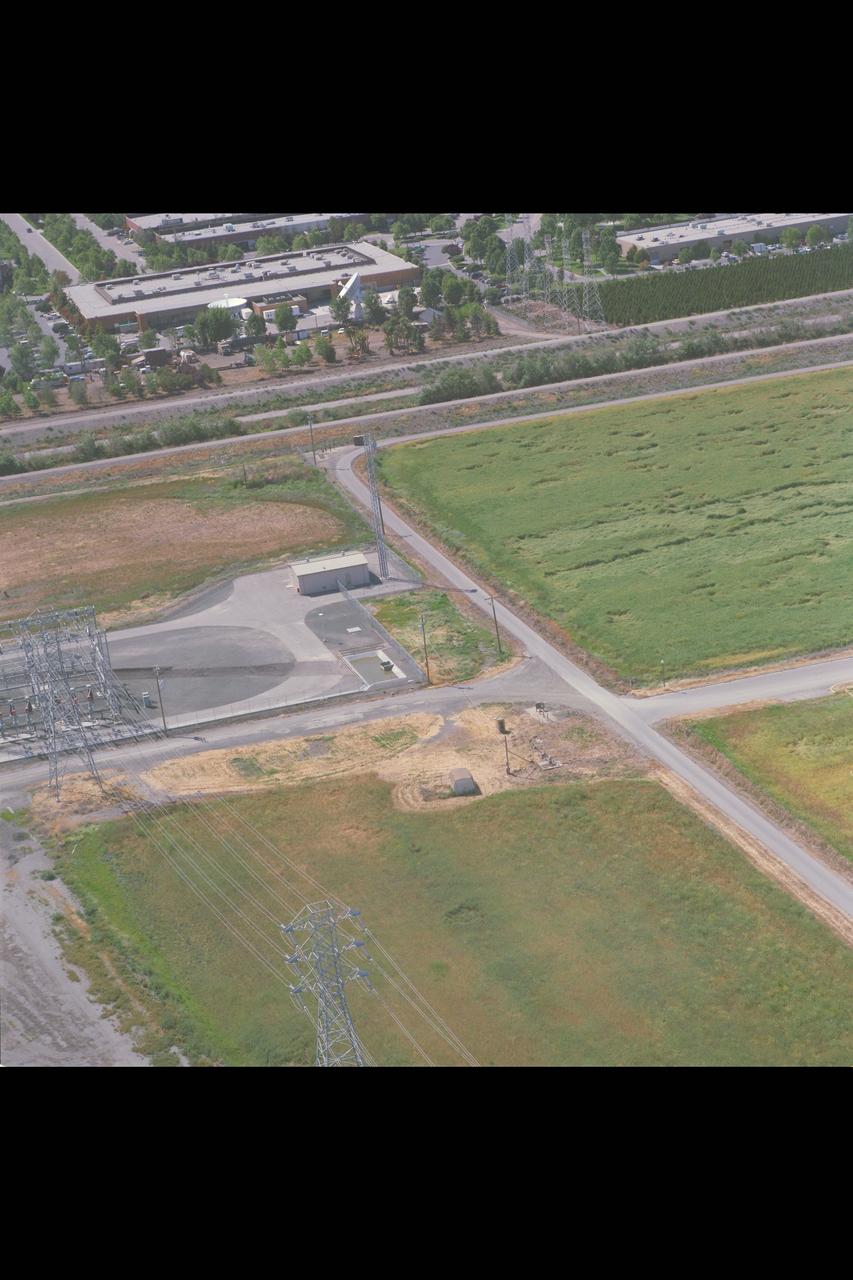
A view of the entrance to SpaceX’s Roberts Road off of State Road 3 at NASA’s Kennedy Space Center in Florida on April 21, 2023. The company wishes to extend the road to allow for expansion of its current facilities. An environmental impact study is underway to investigate the feasibility of the campus expansion.
A view of the entrance to SpaceX’s Roberts Road off of State Road 3 at NASA’s Kennedy Space Center in Florida on April 21, 2023. The company wishes to extend the road to allow for expansion of its current facilities. An environmental impact study is underway to investigate the feasibility of the campus expansion.
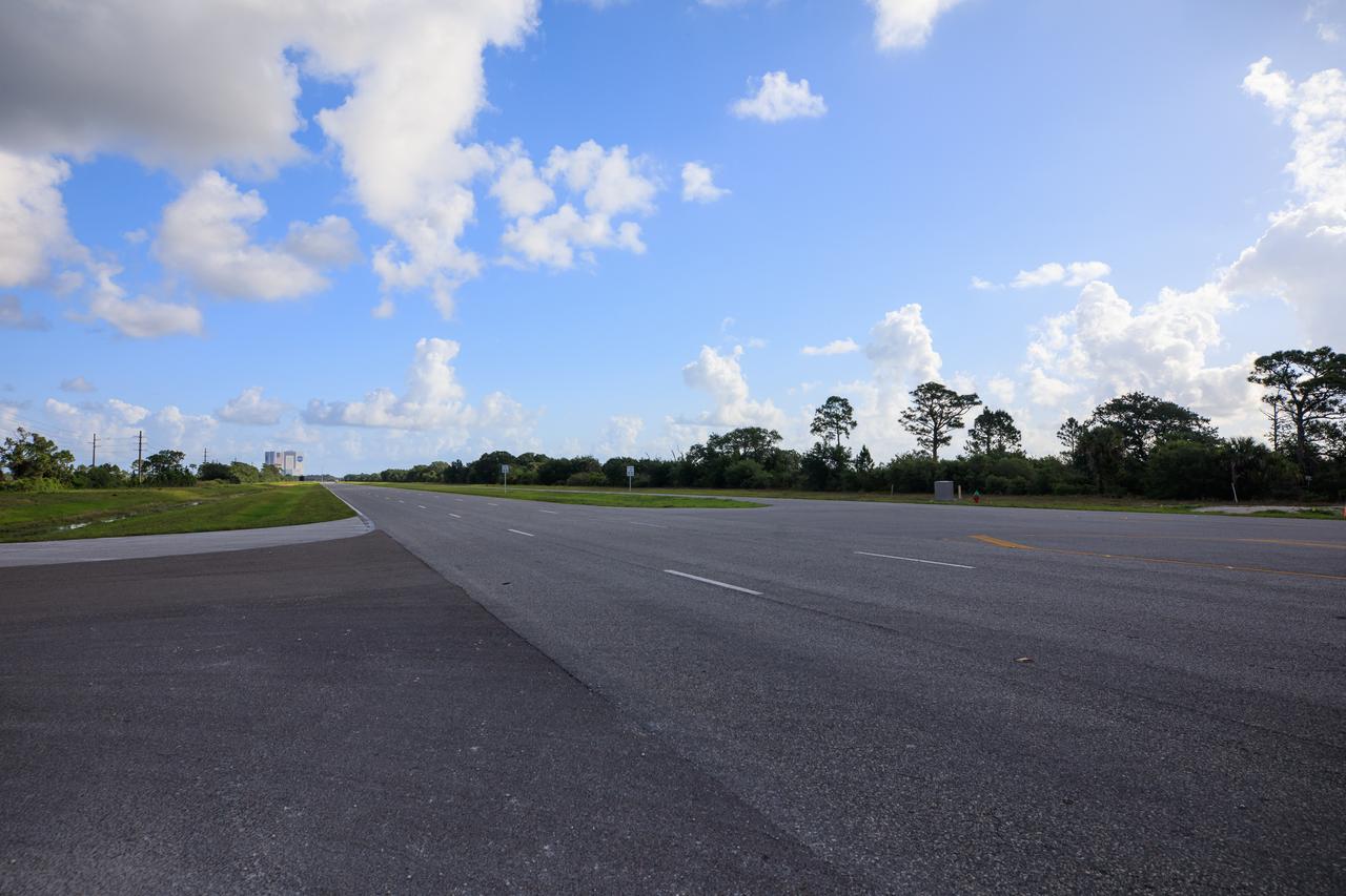
A view of the entrance to SpaceX’s Roberts Road off of State Road 3 at NASA’s Kennedy Space Center in Florida on April 21, 2023. The company wishes to extend the road to allow for expansion of its current facilities. An environmental impact study is underway to investigate the feasibility of the campus expansion.
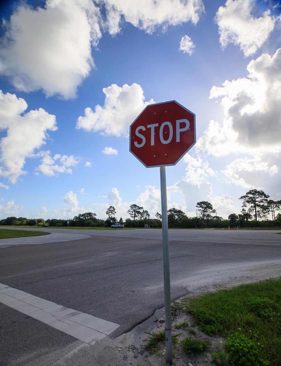
A sign marks the entrance to SpaceX’s Roberts Road off of State Road 3 at NASA’s Kennedy Space Center in Florida on April 21, 2023. The company wishes to extend the road to allow for expansion of its current facilities. An environmental impact study is underway to investigate the feasibility of the campus expansion.
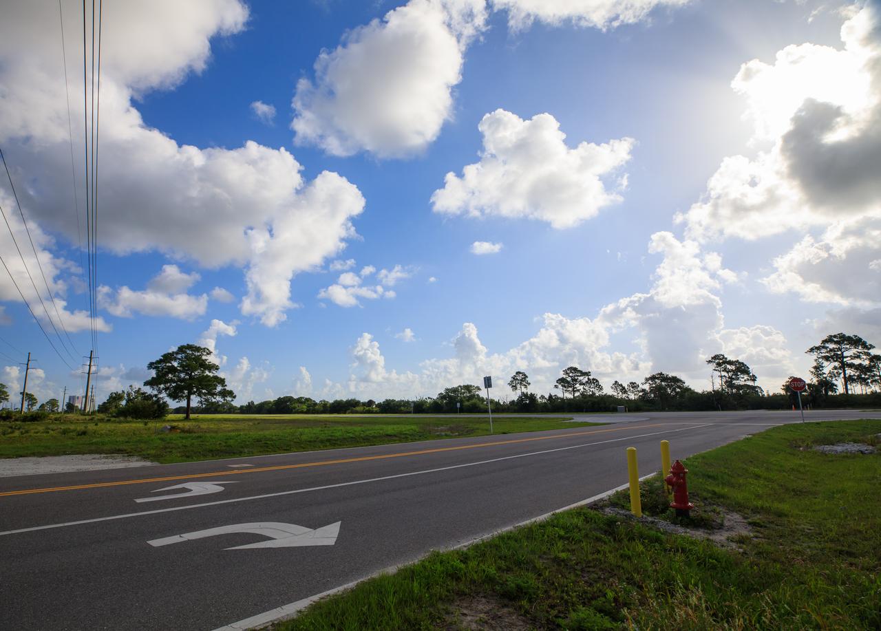
A view of the entrance to SpaceX’s Roberts Road off of State Road 3 at NASA’s Kennedy Space Center in Florida on April 21, 2023. The company wishes to extend the road to allow for expansion of its current facilities. An environmental impact study is underway to investigate the feasibility of the campus expansion.
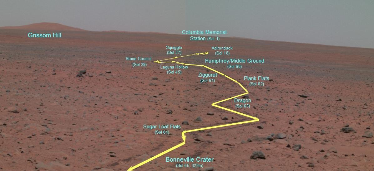
The Road to Bonneville
Long and Winding Road
Endurance Road Map
The Road Less Traveled polar
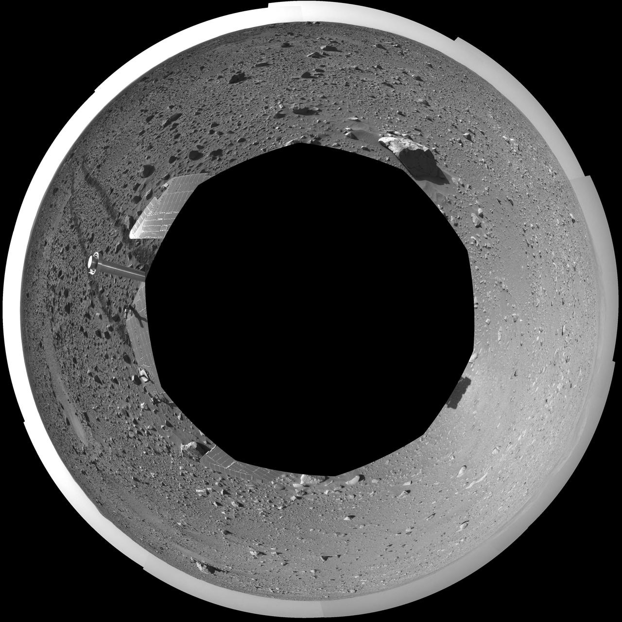
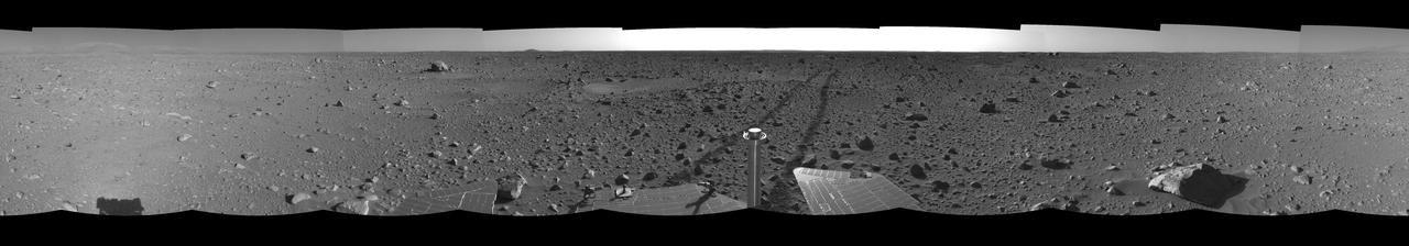
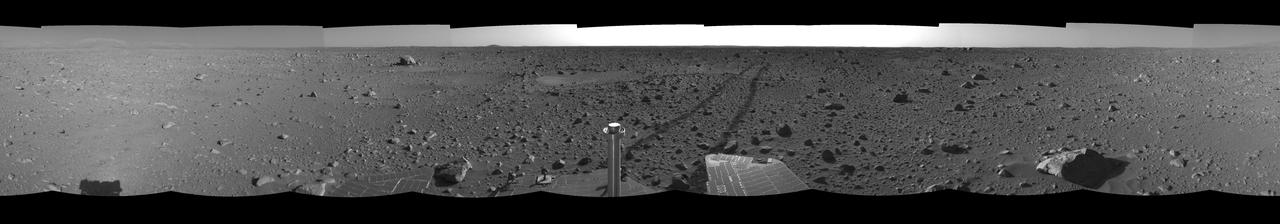
The Road Less Traveled
The Bumpy Road Ahead
Some Rocky Road Please
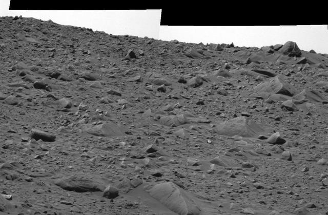
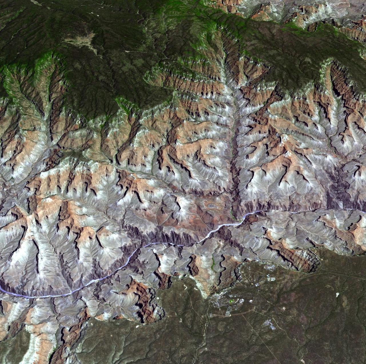
The Rocky Road to the Crater Rim
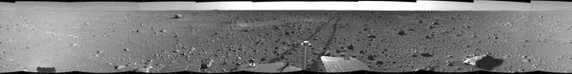
The Road Less Traveled
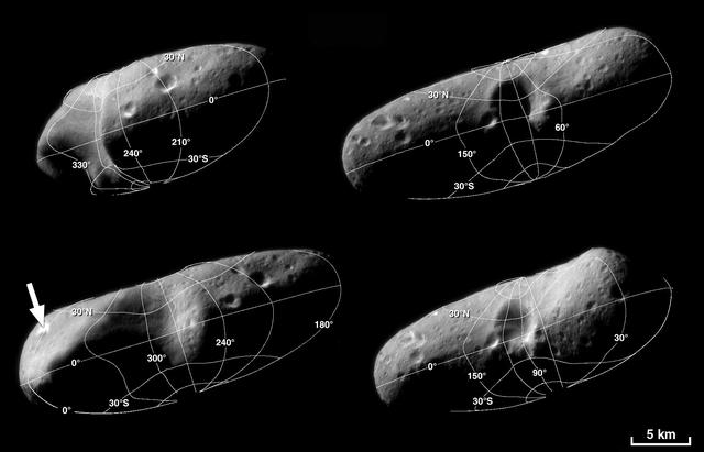
A Road map for Eros
NEAR Road to Eros
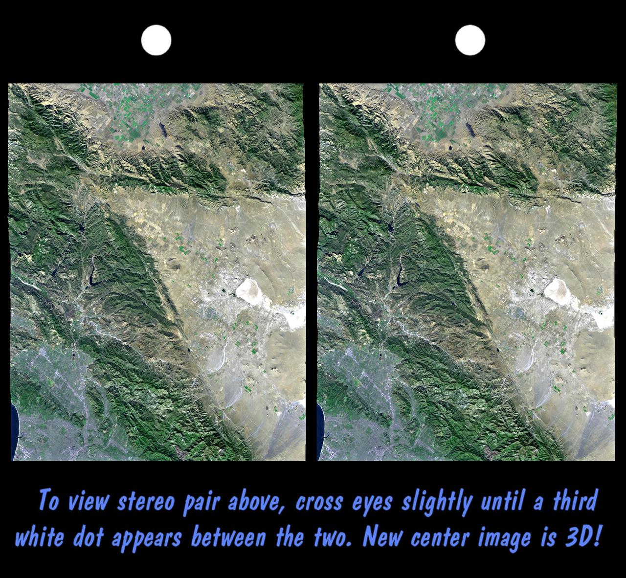
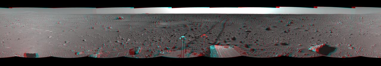
The Road Less Traveled left eye
The Road Less Traveled right eye
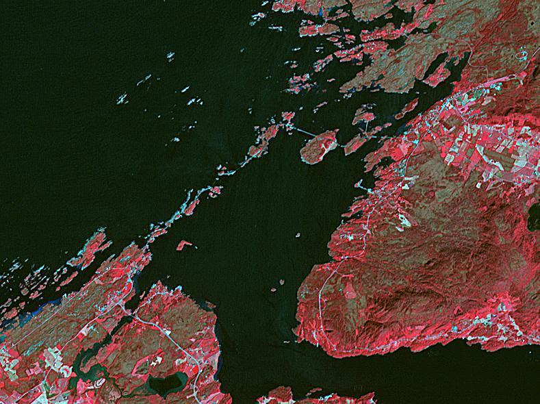
The Atlantic Ocean Road is an 8.3 kilometer road that runs through an archipelago in Eide and Averoy in More of Romsdal, Norway. It consists of eight bridges and four resting places and viewpoints. The road was originally proposed as a railway line, but that was abandoned. The road was opened in July 1989, and has been declared the world's best road trip. The image was acquired July 2, 2008, covers an area of 8.9 by 11.8 kilometers, and is located at 63 degrees north, 7.3 degrees east. https://photojournal.jpl.nasa.gov/catalog/PIA23096
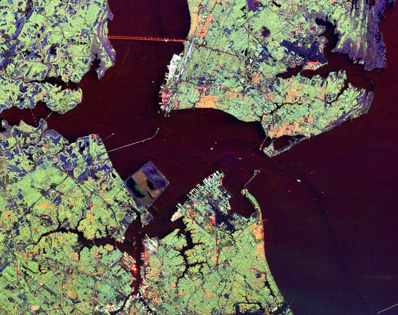
This radar image shows the Hampton Roads, Virginia region, where the James River upper left center flows into the Chesapeake Bay.
This radar image, taken by NASA Airborne Synthetic Aperture Radar AIRSAR in 2002, shows the Old Khmer Road Inrdratataka-Bakheng causeway in Cambodia.
The tri-county Riley Road wildfire burning in Texas north of Houston was 85 percent contained when NASA Terra spacecraft acquired this image on Sept. 12, 2011. Burned areas are dark gray and black; vegetation red; and bare ground and roads light gray.
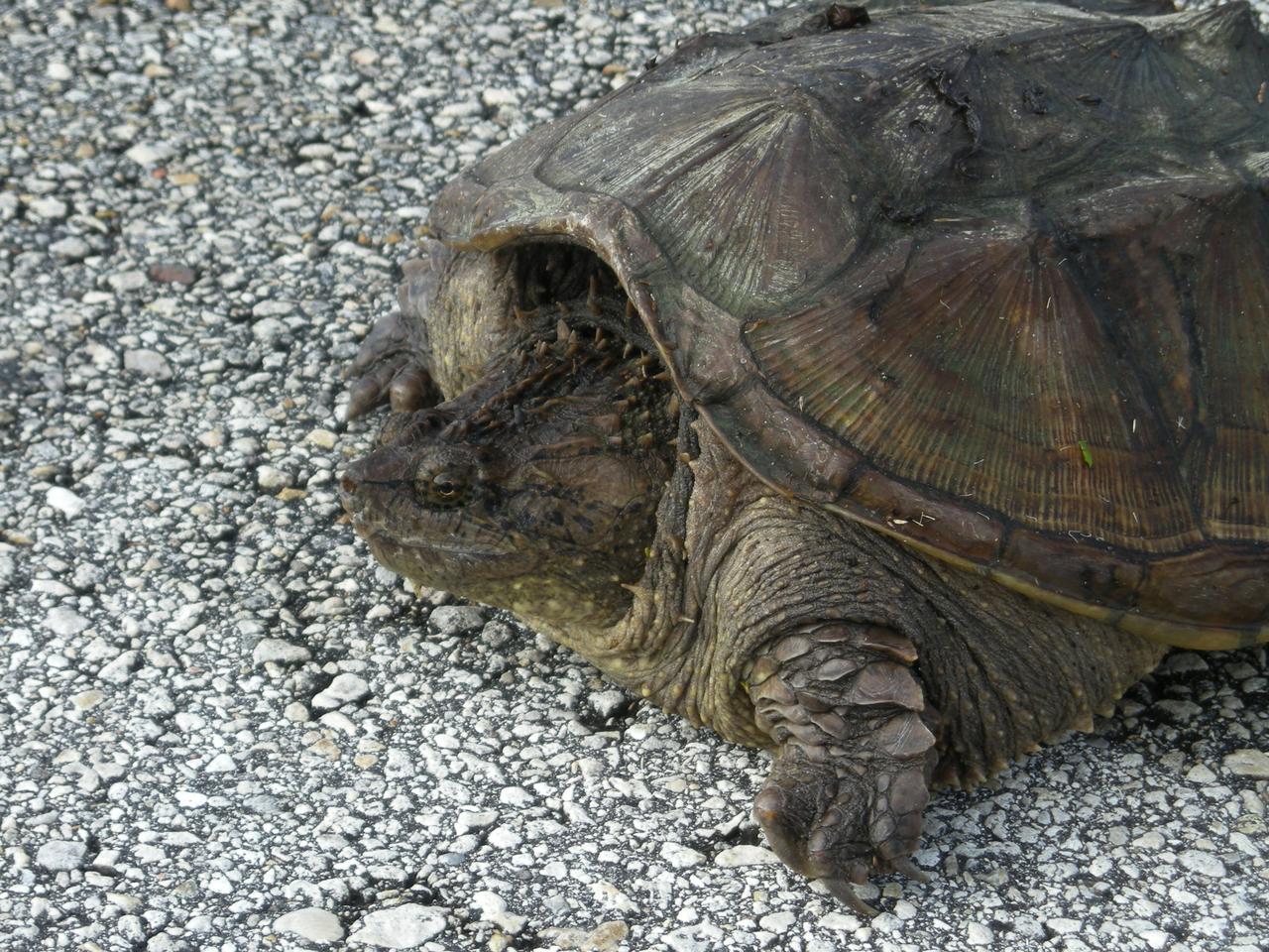
A rare photo of a Florida snapping turtle out in the open on Beach Road, near NASA's Kennedy Space Center. Found only in Florida and Georgia, this species is related to the common snapping turtle. It is considered a dangerous turtle because it can snap very quickly with its extremely strong jaws. Its tail, which is almost as long as its shell, has saw-edges along the top. The shell also has rough points down the middle. The shell is tan to dark brown and may have green algae growing on it. It can grow to 17 inches long and weigh 45 pounds. Snapping turtles usually live in ponds under the shadows and don’t like to rest in the sun like most turtles. They eat almost anything: water bugs, fish, lizards, small birds, mice, plants and even dead animals.
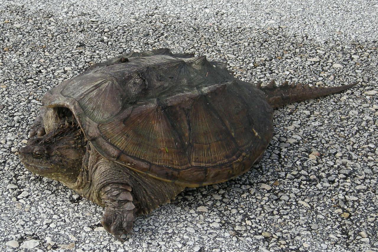
A rare photo of a Florida snapping turtle out in the open on Beach Road, near NASA's Kennedy Space Center. Found only in Florida and Georgia, this species is related to the common snapping turtle. It is considered a dangerous turtle because it can snap very quickly with its extremely strong jaws. Its tail, which is almost as long as its shell, has saw-edges along the top. The shell also has rough points down the middle. The shell is tan to dark brown and may have green algae growing on it. It can grow to 17 inches long and weigh 45 pounds. Snapping turtles usually live in ponds under the shadows and don’t like to rest in the sun like most turtles. They eat almost anything: water bugs, fish, lizards, small birds, mice, plants and even dead animals.

A rare photo of a Florida snapping turtle out in the open on Beach Road, near NASA's Kennedy Space Center. Found only in Florida and Georgia, this species is related to the common snapping turtle. It is considered a dangerous turtle because it can snap very quickly with its extremely strong jaws. Its tail, which is almost as long as its shell, has saw-edges along the top. The shell also has rough points down the middle. The shell is tan to dark brown and may have green algae growing on it. It can grow to 17 inches long and weigh 45 pounds. Snapping turtles usually live in ponds under the shadows and don’t like to rest in the sun like most turtles. They eat almost anything: water bugs, fish, lizards, small birds, mice, plants and even dead animals
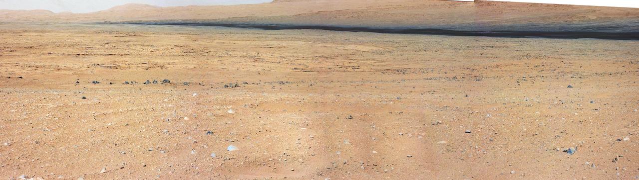
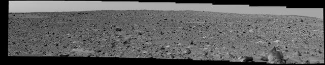
This mosaic from the Mast Camera on NASA Curiosity rover shows the view looking toward the Glenelg area, where three different terrain types come together.

The Tsugaru Iwaki Skyline is a toll road in northern Japan, which partially ascends Mount Iwaki stratovolcano, and is notable for its steep gradient and 69 hairpin turns. The road ascends 806 meters over an average gradient of 8.66%, with some sections going up to 10%. The Tsugaru Iwaki Skyline has been considered one of the most dangerous mountain roads in the world. (Wikipedia) The image was acquired May 26, 2015, and is located at 40.6 degrees north, 140.3 degrees east. https://photojournal.jpl.nasa.gov/catalog/PIA22385
California topography poses challenges for road builders. Northwest of Los Angeles, deformation of Earth crust along the Pacific-North American crustal plate boundary has made transportation difficult.
Surface brightness contrasts accentuated by a thin layer of snow enable a network of rivers, roads, and farmland boundaries to stand out clearly in these images from NASA Terra satellite of southeastern Saskatchewan and southwestern Manitoba.
Arguably one of America most magnificent national parks is the Grand Canyon in northern Arizona. NASA Terra spacecraft captured this image looking to the northeast, the buildings and roads in the center foreground are Grand Canyon Village.
This image is from an animation that chronicles the travels of NASA Deep Impact spacecraft, from its launch in January of 2005 to its dramatic impact 172 days later with comet Tempel 1.
This image shows two possible routes (blue and purple) to the fan-shaped deposit of sediments known as a delta for NASA's Perseverance rover, which landed at the spot marked with a white dot in Mars' Jezero Crater. The yellow line marks a notional traverse exploring the delta. The base image is from the High Resolution Imaging Experiment (HiRISE) camera aboard NASA's Mars Reconnaissance Orbiter (MRO). MRO's mission is managed by NASA's Jet Propulsion Laboratory, a division of Caltech in Pasadena, California, for NASA's Science Mission Directorate. Lockheed Martin Space in Denver built the spacecraft. The University of Arizona in Tucson provided and operates HiRISE. A key objective for Perseverance's mission on Mars is astrobiology, including the search for signs of ancient microbial life. The rover will characterize the planet's geology and past climate, pave the way for human exploration of the Red Planet, and be the first mission to collect and cache Martian rock and regolith (broken rock and dust). Subsequent NASA missions, in cooperation with ESA (European Space Agency), would send spacecraft to Mars to collect these sealed samples from the surface and return them to Earth for in-depth analysis. The Mars 2020 Perseverance mission is part of NASA's Moon to Mars exploration approach, which includes Artemis missions to the Moon that will help prepare for human exploration of the Red Planet. https://photojournal.jpl.nasa.gov/catalog/PIA24486
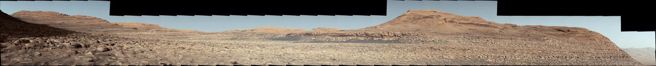
NASA's Curiosity Mars rover used its Mast Camera, or Mastcam, to capture this panorama in morning light on March 9, 2025, the 4,476th Martian day, or sol, of the mission. Steep hills on the left side of the panorama enclose wind-carved valleys on Mount Sharp, the mountain that Curiosity has been climbing for over a decade. Broken-up, rounded rocks throughout the foreground are part of the mountain's sulfate-bearing unit. The butte in the distance at right is nicknamed "Gould Mesa." A band of cliffs and dark ridges near the top of the butte may be the first glimpses of boxwork formations, a kind of feature created by groundwater flowing through large bedrock fractures in the ancient past. Assuming that is how they formed, these could represent the last gasps of water found on this region of Mars before the planet dried out completely. Before now, these features had only been viewed from orbiting spacecraft, to which they appeared as spiderweb-like fractures. This pattern of fractures stretches as long as 6 to 12 miles (10 to 20 kilometers) across the side of Mount Sharp. The rover's team expects to study these formations up close throughout the rest of 2025. The color in this image has been adjusted to match lighting conditions as the human eye would see them on Earth. https://photojournal.jpl.nasa.gov/catalog/PIA26552
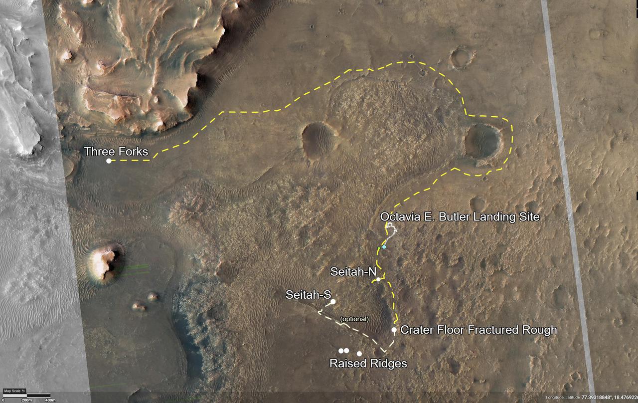
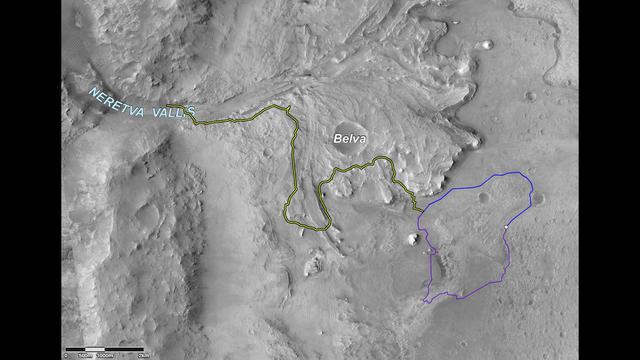
This annotated image of Mars' Jezero Crater depicts the route NASA's Perseverance rover will take during its first science campaign – as well as its path to the location of its second science campaign. The image was provided by the High Resolution Imaging Experiment (HiRISE) aboard NASA's Mars Reconnaissance orbiter. Perseverance's first science campaign sends the rover south and west of the Octavia E. Butler Landing Site to investigate and sample several of the deepest, and potentially oldest, accessible geologic units in Jezero Crater – the "Séítah" unit (which in Navajo language means "amidst the sand"), and the "Cratered Floor Fractured Rough." At the completion of the science campaign, Perseverance will return to the "Octavia E. Butler" landing site on its way north, then head west toward the location where its second science campaign will begin. The first science campaign (depicted with yellow hash marks) begins with the rover performing an arching drive southward from its landing site to Séítah-North (Séítah-N). At that point the rover will travel west a short distance to an overlook where it can view much of the Séítah unit. The "Séítah-N Overlook" could also become an area of scientific interest – with Perseverance performing a "toe dip" into the unit to collect remote-sensing measurements of geologic targets. Once its time at the Séítah-N Overlook is complete, Perseverance will head east, then south toward a spot where the science team can study the Crater Floor Fractured Rough in greater detail. The first core sample collected by the mission will also take place at this location. After Cratered Floor Fractured Rough, the Perseverance rover team will evaluate whether additional exploration (depicted with light-yellow hash marks) farther south – and then west – is warranted. Whether Perseverance travels beyond the Cratered Floor Fractured Rough during this first science campaign, the rover will eventually retrace its steps. As Perseverance passes the Octavia B. Butler landing site, the first science campaign will conclude. At that point, several months of travel lay ahead as Perseverance makes its way to "Three Forks," where the second science campaign will begin. From Three Forks, Perseverance can access geologic locations at the base of the ancient delta (the fan-shaped remains of the confluence of an ancient river and a lake), as well as ascend the delta by driving up a valley wall to the northwest. https://photojournal.jpl.nasa.gov/catalog/PIA24596
Ames Aerials: field roads
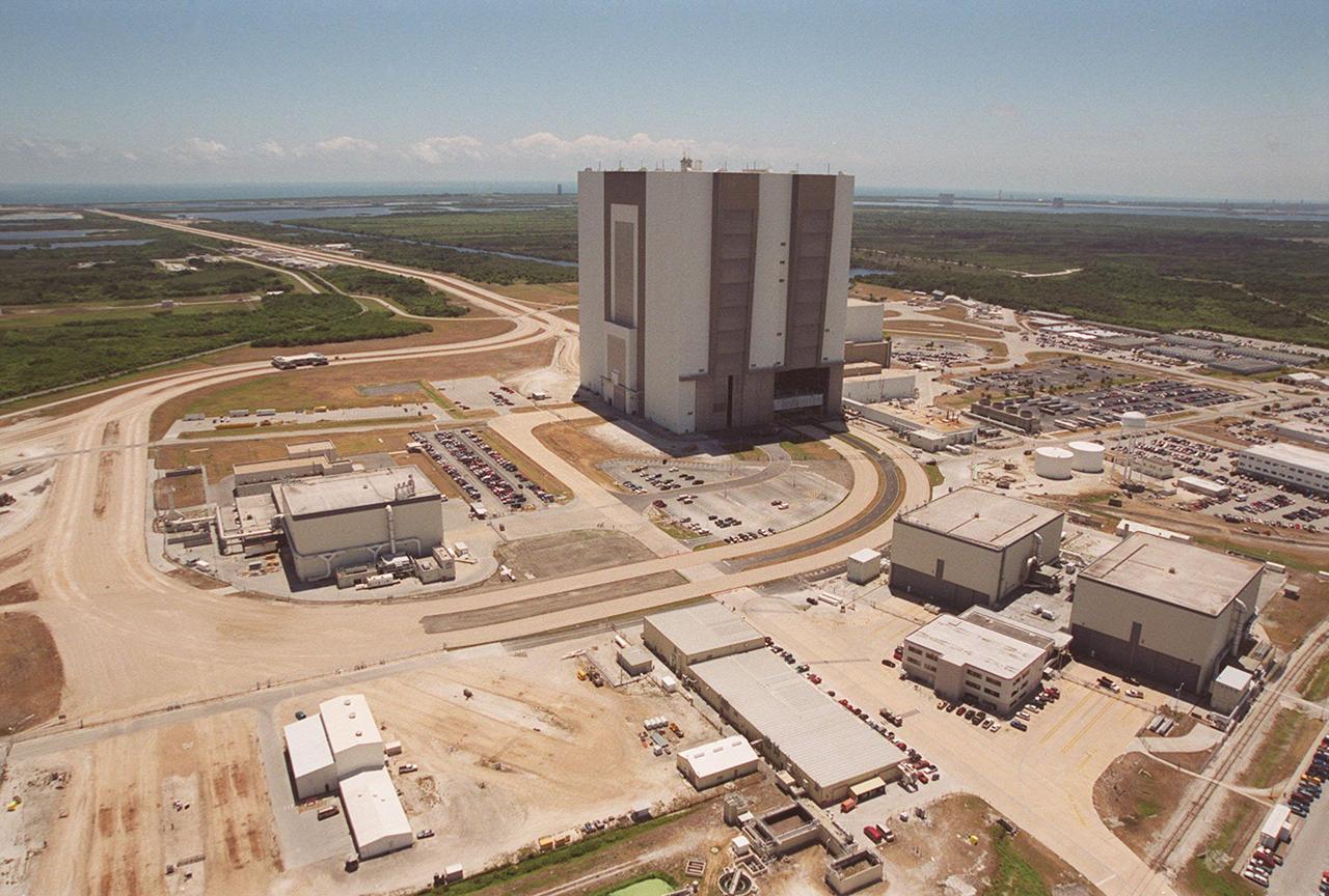
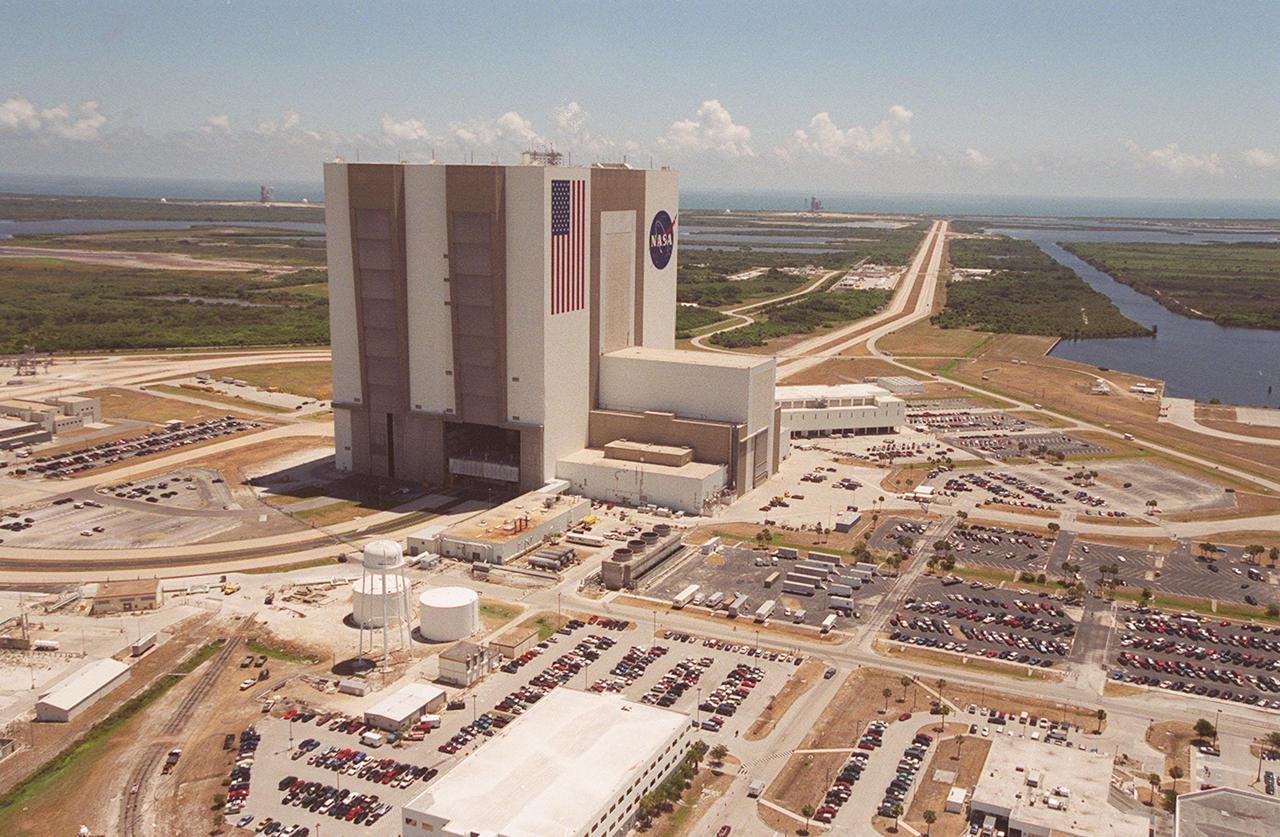
This aerial photo captures many of the facilities involved in Space Shuttle processing. At center is the Vehicle Assembly Building (VAB). The curved road is the newly restored crawlerway leading into the VAB high bay 2. The road restoration and high bay 2 are part of KSC's Safe Haven project, enabling the storage of orbiters during severe weather. The road circles around the Orbiter Processing Facility 3 (OPF-3) at left. OPF1 and OPF-2 are on the right below the curving road. East of the VAB, the crawlerway also extends from high bays 1 and 3 to the two Shuttle launch pads.

This aerial photo captures many of the facilities involved in Space Shuttle processing. At center is the Vehicle Assembly Building (VAB). The curved road in the foreground is the newly restored crawlerway leading into the VAB high bay 2. The road restoration and high bay 2 are part of KSC’s Safe Haven project, enabling the storage of orbiters during severe weather. The road circles around the Orbiter Processing Facility 3 (OPF-3) at right center. OPF1 and OPF-2 are just above the curving road. On the left of the VAB, the crawlerway also extends from high bays 1 and 3, past the Launch Control Center, out to the two Shuttle launch pads
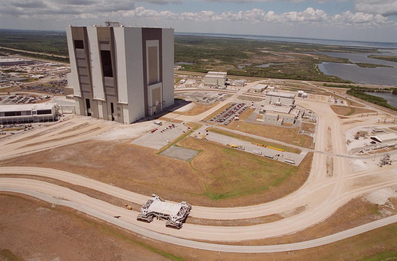
This aerial photo captures many of the facilities involved in Space Shuttle processing. At center is the Vehicle Assembly Building (VAB). The curved road in the foreground is the newly restored crawlerway leading into the VAB high bay 2. The road restoration and high bay 2 are part of KSC’s Safe Haven project, enabling the storage of orbiters during severe weather. The road circles around the Orbiter Processing Facility 3 (OPF-3) at right center. OPF1 and OPF-2 are just above the curving road. On the left of the VAB, the crawlerway also extends from high bays 1 and 3, past the Launch Control Center, out to the two Shuttle launch pads
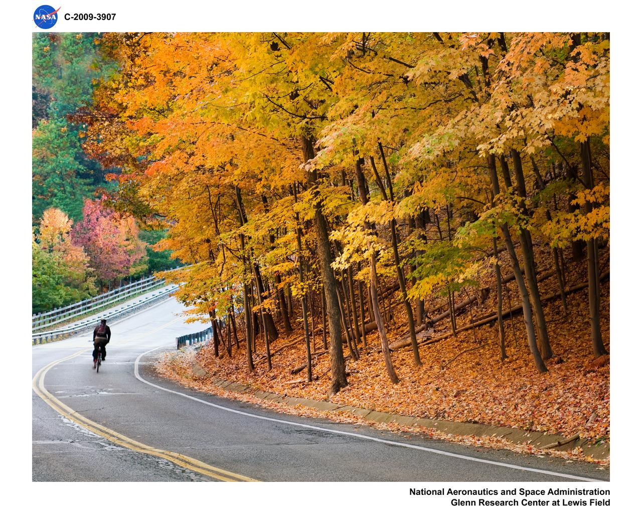
Bicyclist on West Area Road in the Fall
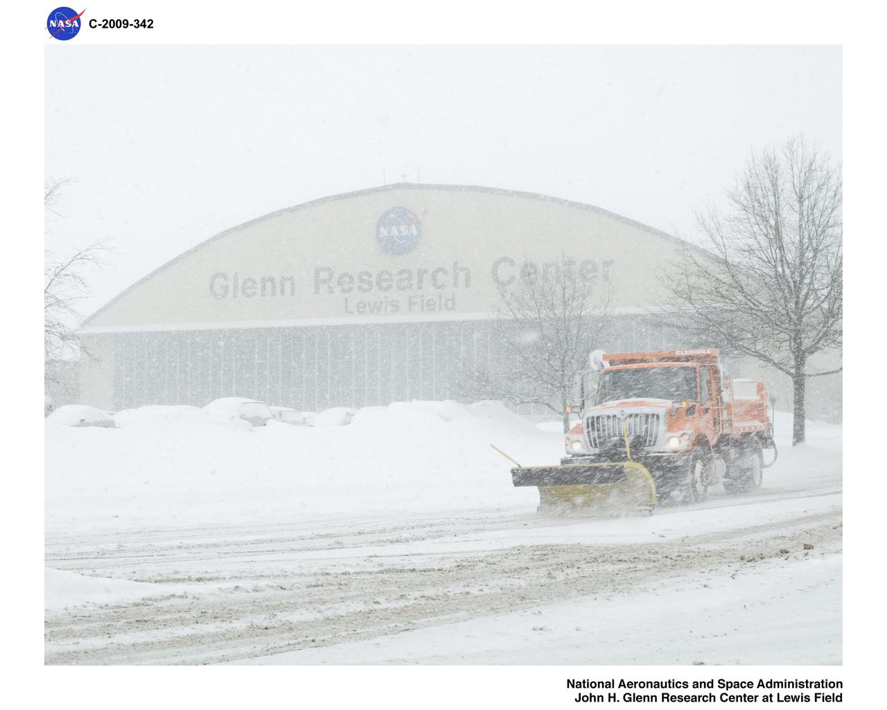
Snowplowing on Taylor Road in front of the Hangar
Ames Aeronautical Laboratory skyline from Akron Road

Tour DE Ames Bicycle event (start at Macon Road Gate - ending a the Old Mimi Mart on R.T. Jones Road) Deb Feng, Chief Center Operations (acting), starts off the race with fellow bikers on the first Tour de Ames
Snow scene in Abram Creek Ravine along West Area Road

This aerial photo captures many of the facilities involved in Space Shuttle launches. At center is the Vehicle Assembly Building (VAB). The curved road on the near side is the newly restored crawlerway leading into the VAB high bay 2, where a mobile launcher platform/crawler-transporter currently sits. The road restoration and high bay 2 are part of KSC’s Safe Haven project, enabling the storage of orbiters during severe weather. The road circles around the Orbiter Processing Facility 3 (OPF-3) at left center. OPF1 and OPF-2 are just below the curving road. The crawlerway also extends from the east side of the VAB out to the two launch pads, only one visible to the left of the VAB. In the distance is the Atlantic Ocean. To the right of the far crawlerway is the turn basin, into which ships tow the barge for offloading new external tanks from Louisiana

This aerial photo captures many of the facilities involved in Space Shuttle launches. At center is the Vehicle Assembly Building (VAB). The curved road on the near side is the newly restored crawlerway leading into the VAB high bay 2, where a mobile launcher platform/crawler-transporter currently sits. The road restoration and high bay 2 are part of KSC’s Safe Haven project, enabling the storage of orbiters during severe weather. The road circles around the Orbiter Processing Facility 3 (OPF-3) at left center. OPF1 and OPF-2 are just below the curving road. The crawlerway also extends from the east side of the VAB out to the two launch pads, only one visible to the left of the VAB. In the distance is the Atlantic Ocean. To the right of the far crawlerway is the turn basin, into which ships tow the barge for offloading new external tanks from Louisiana

Observations from NASA Spitzer Space Telescope show that filamentary galaxies form stars at twice the rate of their densely clustered counterparts. This is a representation of galaxies in and surrounding a galaxy cluster called Abell 1763.
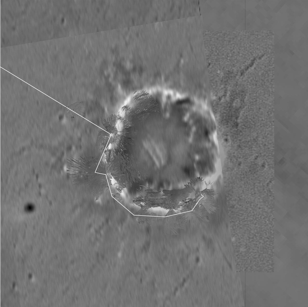
This image maps out the travels of NASA Mars Exploration Rover Opportunity, from is landing site at Eagle Crater to the rim of Victoria Crater about six miles 9.7 kilometers away in September of 2006.
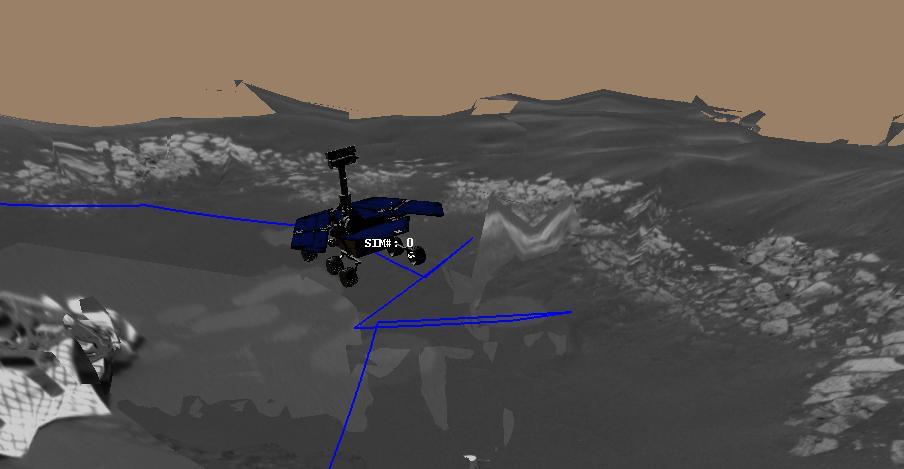
This 3-D cylindrical-perspective mosaic was created from navigation camera images that NASA Mars Exploration Rover Spirit captured on on sol 127. 3D glasses are necessary to view this image.
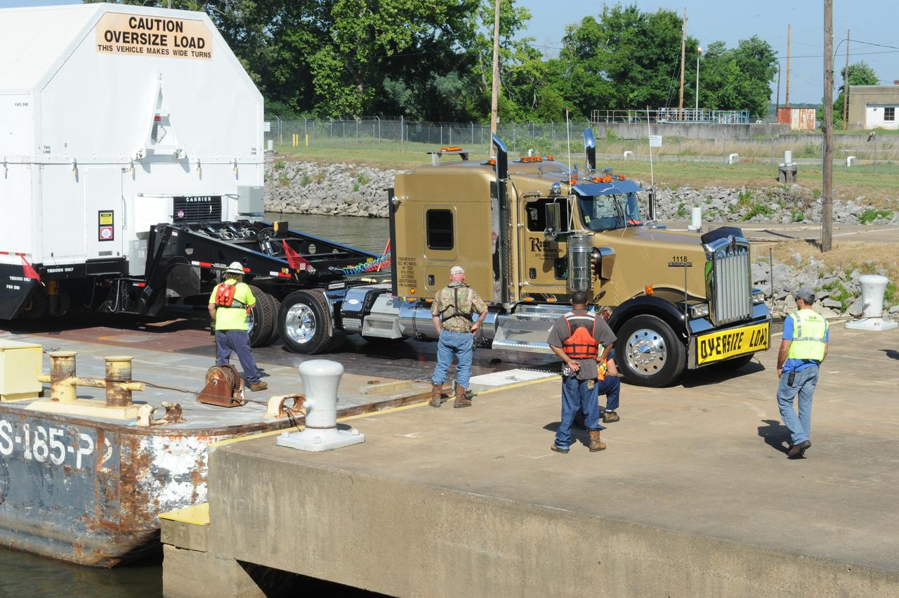
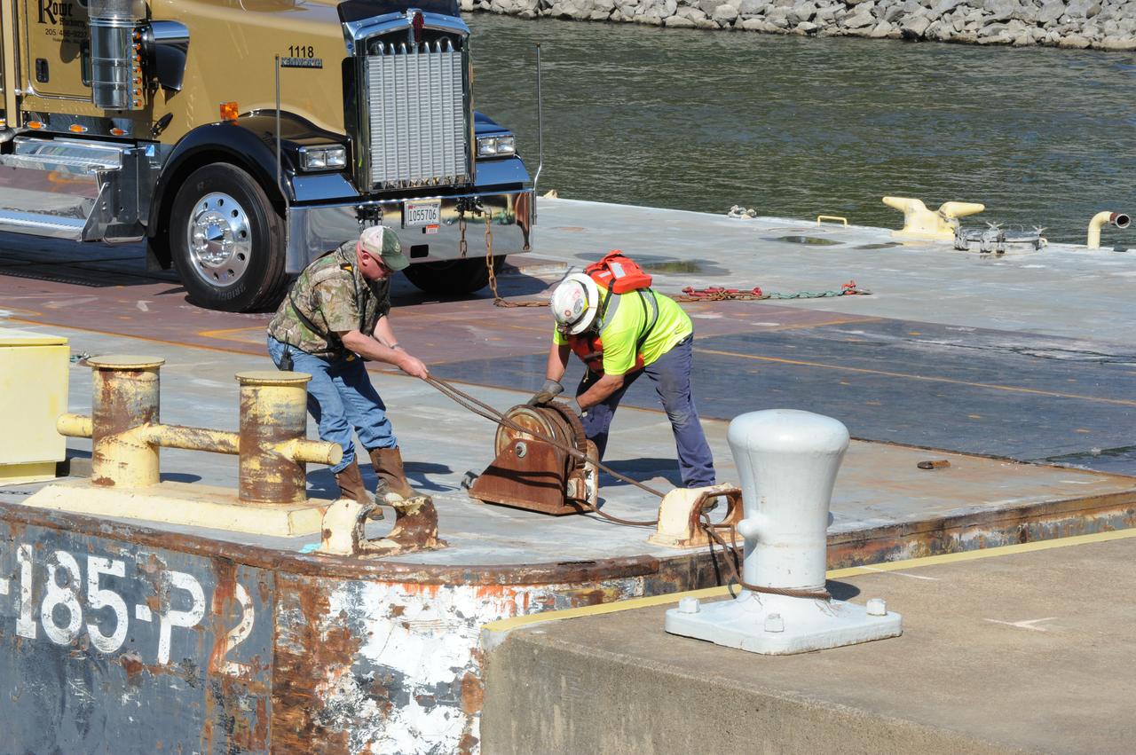
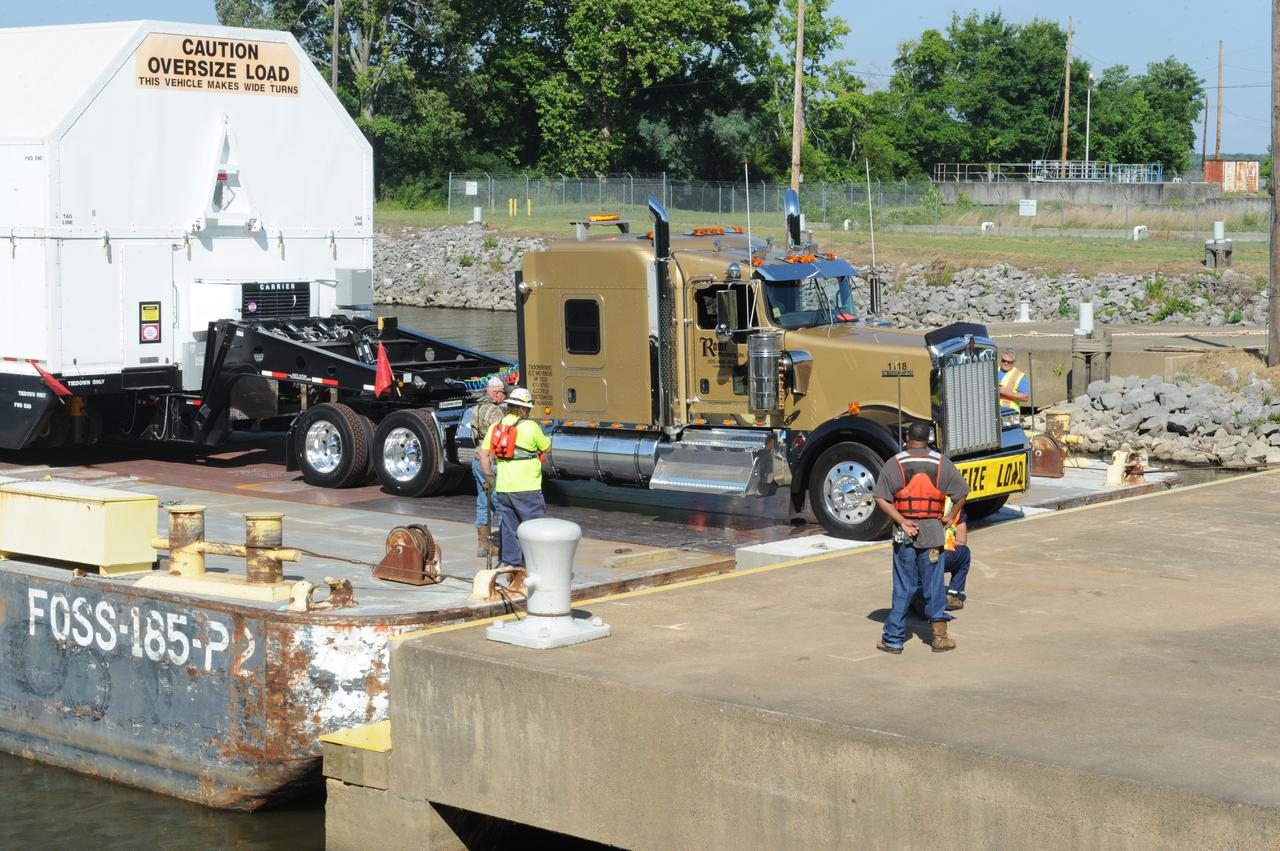
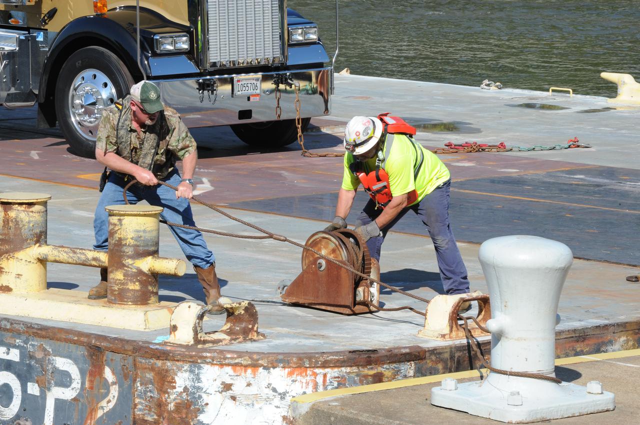
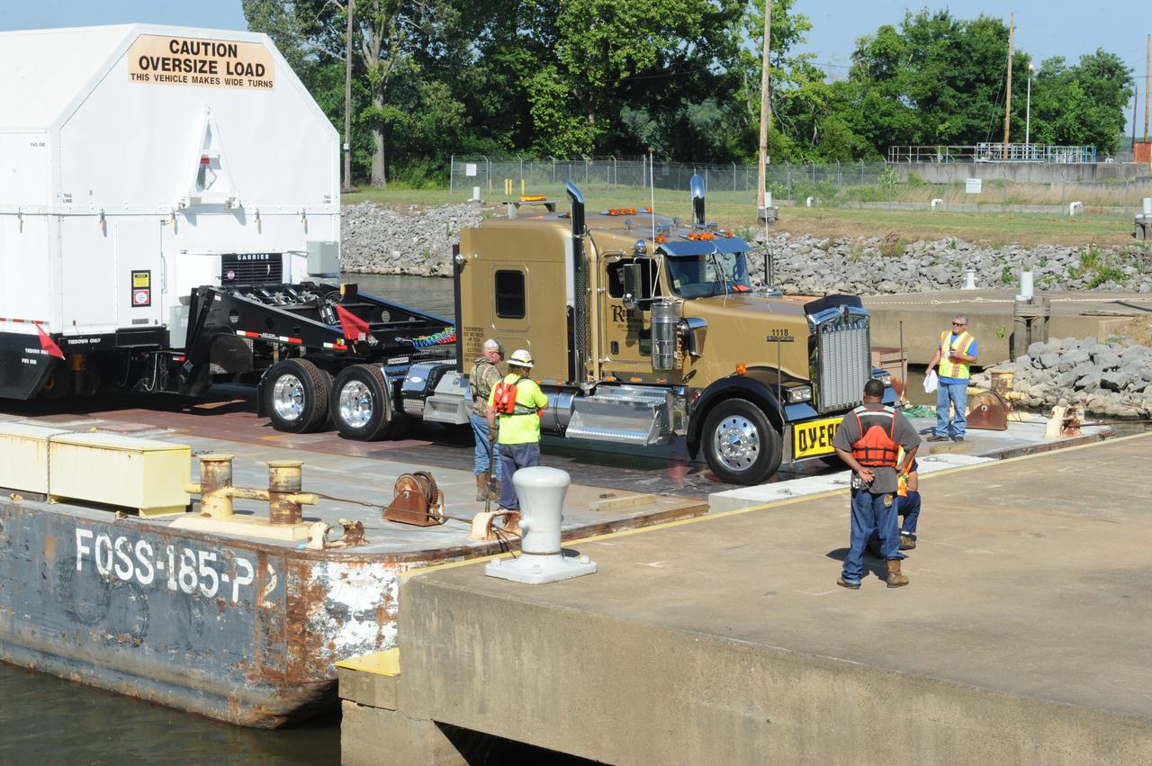
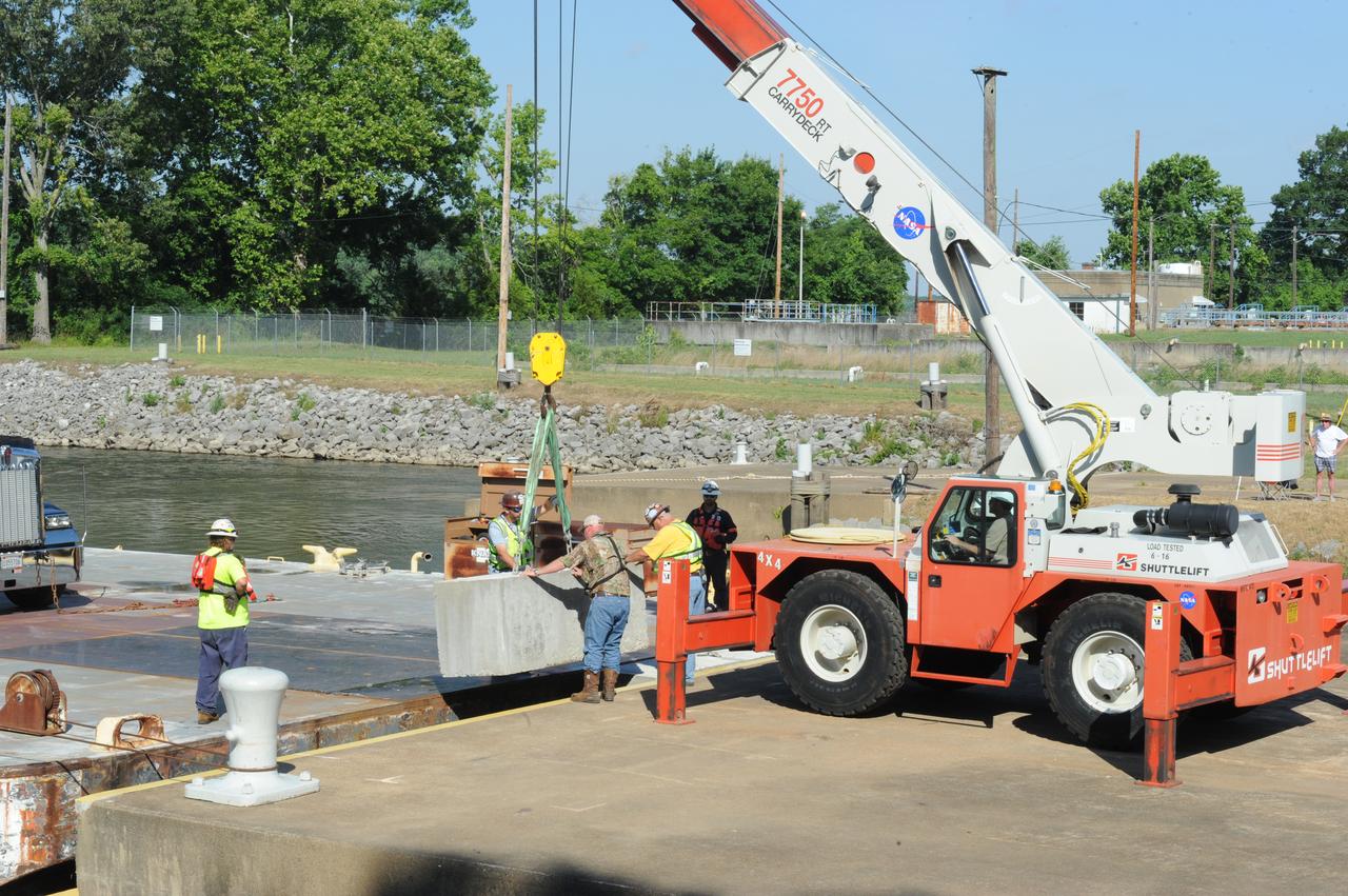
SLS INTERIM CRYOGENIC PROPULSION STAGE TEST ARTICLE ARRIVES AT WEST DOCK ON SHIELDS ROAD AND IS OFF LOADED FROM BARGE
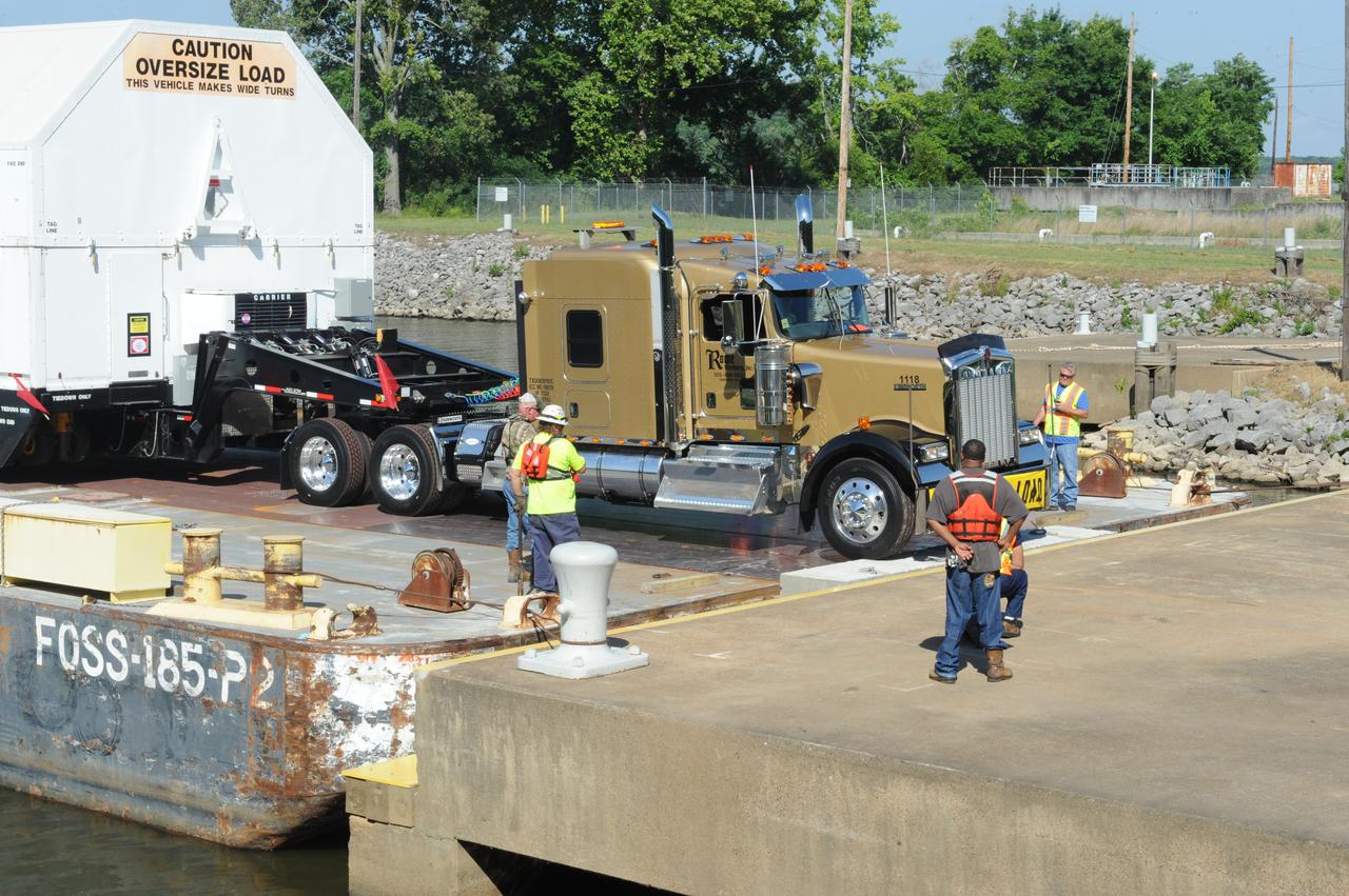
SLS INTERIM CRYOGENIC PROPULSION STAGE TEST ARTICLE ARRIVES AT WEST DOCK ON SHIELDS ROAD AND IS OFF LOADED FROM BARGE
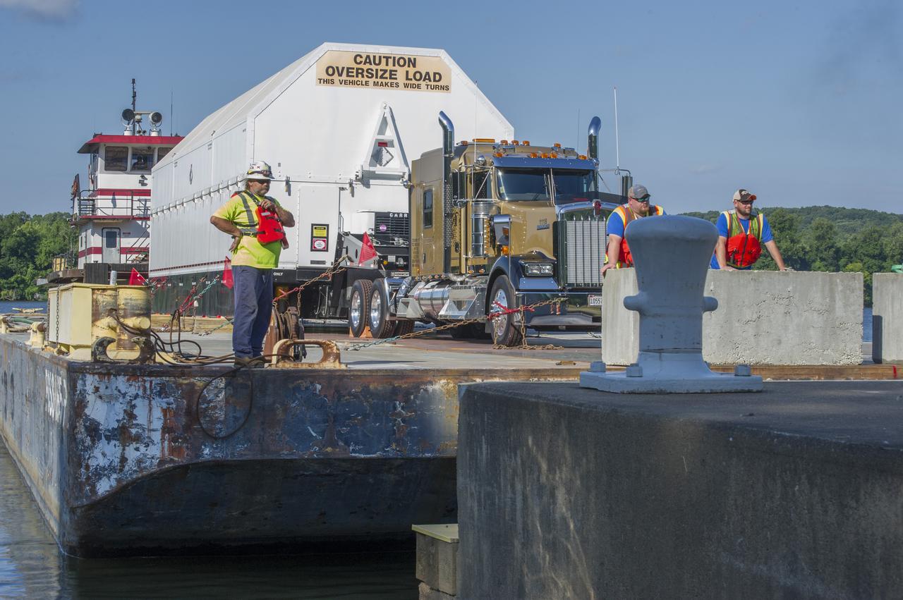
SLS INTERIM CRYOGENIC PROPULSION STAGE TEST ARTICLE ARRIVES AT WEST DOCK ON SHIELDS ROAD AND IS OFF LOADED FROM BARGE
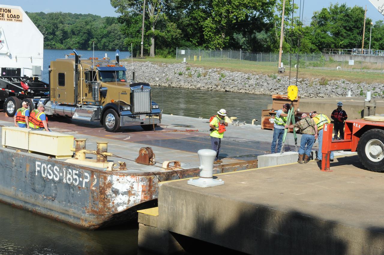
SLS INTERIM CRYOGENIC PROPULSION STAGE TEST ARTICLE ARRIVES AT WEST DOCK ON SHIELDS ROAD AND IS OFF LOADED FROM BARGE
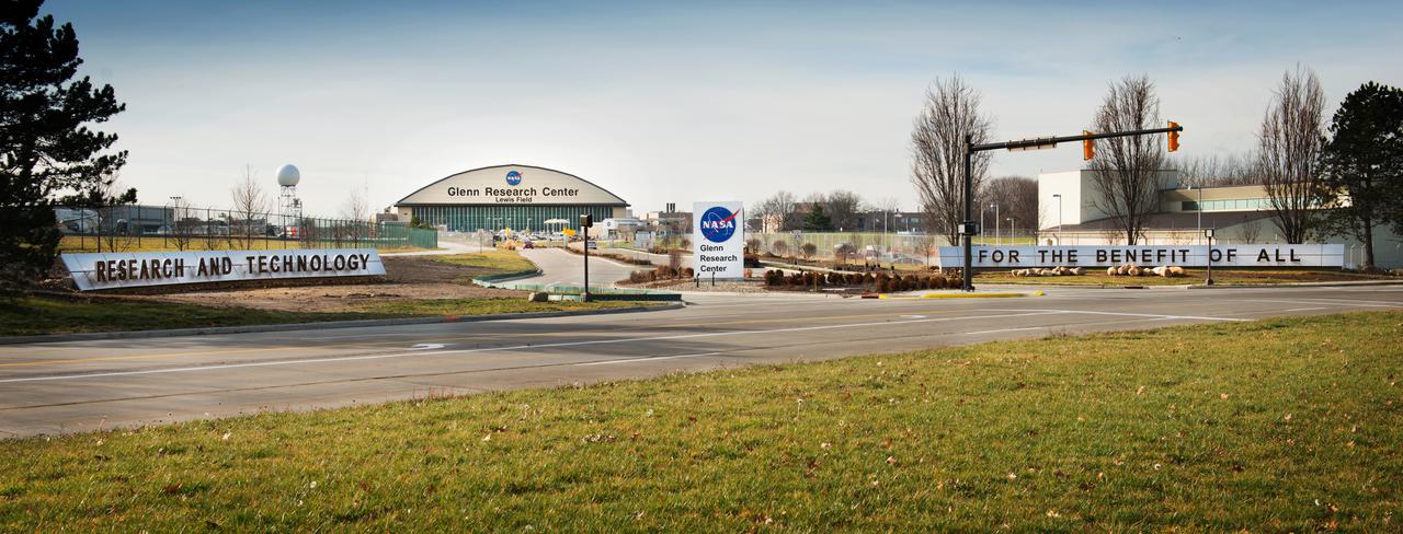
Main Entrance of NASA Glenn Research Center at Brookpark Road and NASA Parkway. The signs read: Research and Technology For The Benefit Of All.
SLS INTERIM CRYOGENIC PROPULSION STAGE TEST ARTICLE ARRIVES AT WEST DOCK ON SHIELDS ROAD AND IS OFF LOADED FROM BARGE
SLS INTERIM CRYOGENIC PROPULSION STAGE TEST ARTICLE ARRIVES AT WEST DOCK ON SHIELDS ROAD AND IS OFF LOADED FROM BARGE
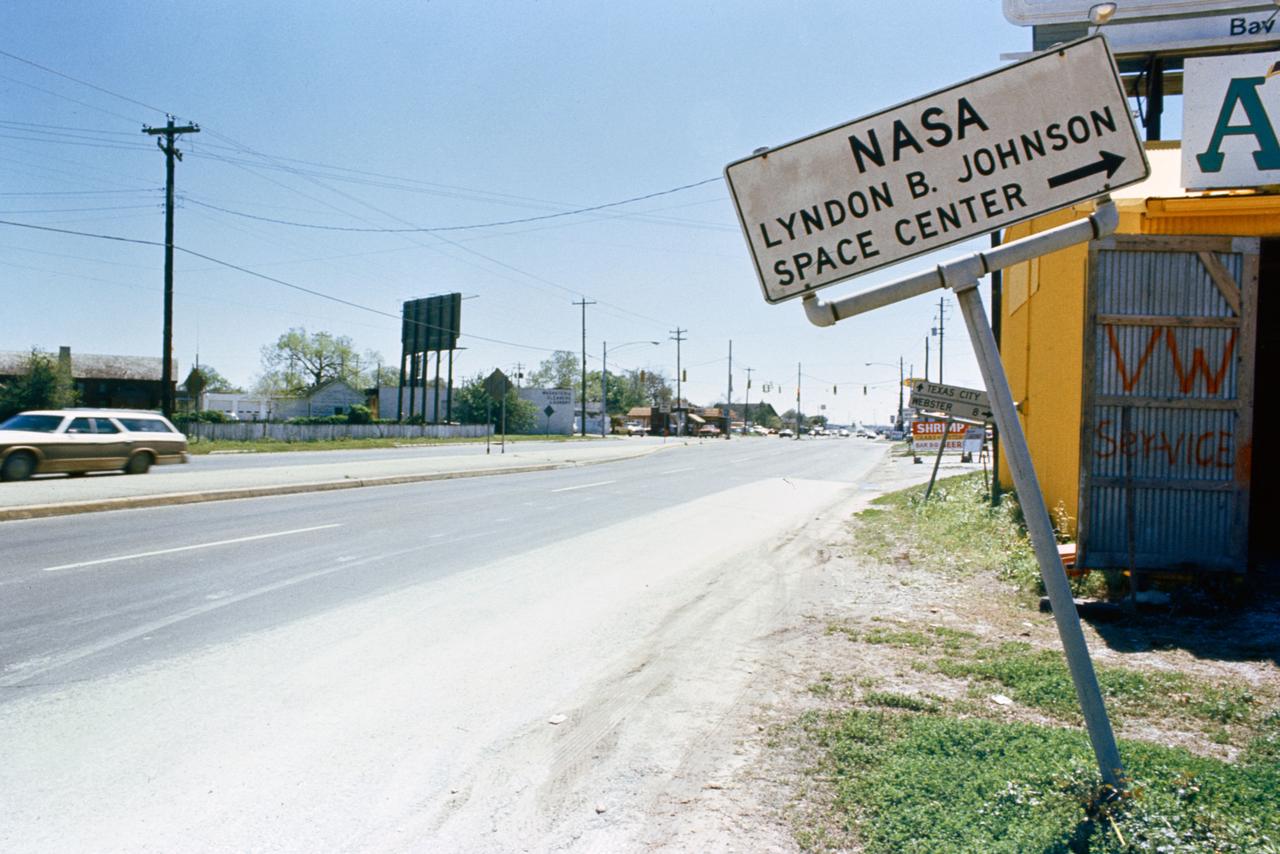
View of road sign pointing in the direction of the NASA Lyndon B. Johnson Space Center.
SLS INTERIM CRYOGENIC PROPULSION STAGE TEST ARTICLE ARRIVES AT WEST DOCK ON SHIELDS ROAD AND IS OFF LOADED FROM BARGE
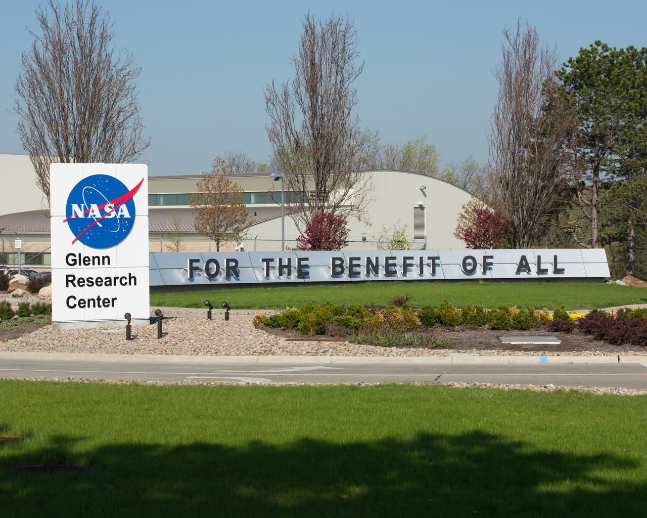
NASA Glenn Research Center Sign at the Intersection of NASA Parkway and Broiokpark Road. The sign reads: For The Benefit Of All
SLS INTERIM CRYOGENIC PROPULSION STAGE TEST ARTICLE ARRIVES AT WEST DOCK ON SHIELDS ROAD AND IS OFF LOADED FROM BARGE
SLS INTERIM CRYOGENIC PROPULSION STAGE TEST ARTICLE ARRIVES AT WEST DOCK ON SHIELDS ROAD AND IS OFF LOADED FROM BARGE
SLS INTERIM CRYOGENIC PROPULSION STAGE TEST ARTICLE ARRIVES AT WEST DOCK ON SHIELDS ROAD AND IS OFF LOADED FROM BARGE

Brenton Safety (road) Sign test-40-0064 in 40x80ft w.t. SHARC model in background
On Nov. 14, 2013, NASA Terra spacecraft spied a fire scar west of Wollongong, New South Wales, from the Hall Road fire in New South Wales, Australia. October 2013 brought the worst fires seen in Australia New South Wales in many decades.
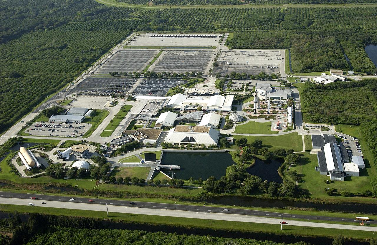
KENNEDY SPACE CENTER, FLA. – An aerial view, looking south, of the Kennedy Space Center Visitor Complex. The road near the bottom is S.R. 405.
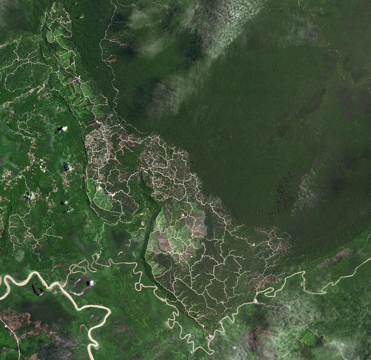
The southwestern border of Brunei with Sarawak, Malaysia is strikingly apparent due to differences in land use practice. On the Malaysian side, a spider web of small roads indicates intensive land use: in this case clearing of the forest for palm oil plantations. On the Brunei side, the virgin forest is preserved, with few if any roads cutting through the forest. The image was acquired September 10, 2012, covers an area of 38 by 38 km, and is located at 4.2 degrees north, 114.4 degrees east. https://photojournal.jpl.nasa.gov/catalog/PIA22034
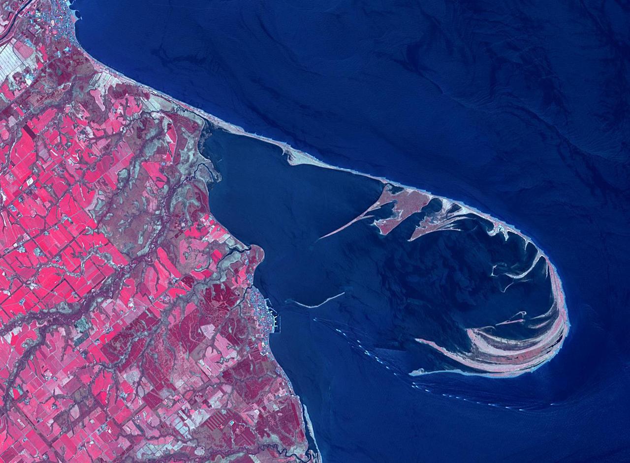
The Notsuke Peninsula is on the east coast of Hokkaido, Japan. Its name is derived from the Ainu word for jawbone. The curved peninsula is the longest sandspit in the country (26 km), formed by the deposition of sand carried by offshore currents. A 15 km road stretches from the base of the peninsula to a nature center and is known as the "Flower Road". The image was acquired May 14, 2019, covers an area of 15.9 by 21.7 km, and is located at 43.6 degrees north, 145.3 degrees east. https://photojournal.jpl.nasa.gov/catalog/PIA25858
This aerial photo captures many of the facilities involved in Space Shuttle launches. At center is the Vehicle Assembly Building (VAB), with the Launch Control Center at its right. The curved road on the left in the photo is the newly restored crawlerway leading into the VAB high bay 2, where a mobile launcher platform/crawler-transporter sits. The road restoration and high bay 2 are part of KSC's Safe Haven project, enabling the storage of orbiters during severe weather. The crawlerway also extends from the east side out to the two launch pads, one visible close to the road on the left and one to the left of the VAB. In the distance is the Atlantic Ocean. To the right of the crawlerway is the turn basin, into which ships tow the barge for offloading new external tanks from Louisiana.
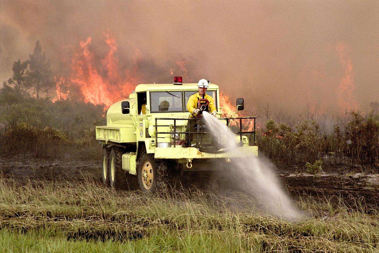
KENNEDY SPACE CENTER, FLA. -- A fire burns in the background as members of the U.S Fish and Wildlife Service operate firefighting equipment soaking the grass and underbrush in an attempt to keep the fire away from Kennedy Parkway and the wooded area on the other side of the road. Lightning touched off three different fires Sunday evening in and around Kennedy Space Center at Tel IV, Ransom Road and Pine Island Road. This area is part of the Merritt Island National Wildlife Refuge operated by the service. The fires were a short distance from operational facilities at the space center and forced the closing of Florida State Route 3. The fires are being contained by firefighters from Kennedy Space Center and the U.S. Fish and Wildlife Service
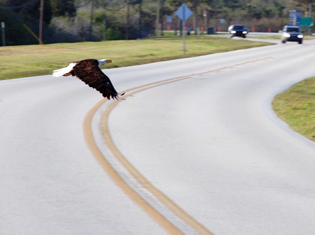
CAPE CANAVERAL, Fla. – At NASA's Kennedy Space Center in Florida, a bald eagle flies across the road in front of vehicles on the road. There are a dozen eagle nests within Kennedy and in the surrounding Merritt Island National Wildlife Refuge, some of them close to roads through the center. Bald eagles use a specific territory for nesting (they mate for life), winter feeding or a year-round residence. Eagles' natural domain is from Alaska to Baja, California, and from Maine to Florida. The Merritt Island refuge also includes several wading bird rookeries, many osprey nests, up to 400 manatees during the spring, and approximately 2,500 Florida scrub jays. It also is a major wintering area for migratory birds. More than 500 species of wildlife inhabit the refuge, with 15 considered federally threatened or endangered. Photo credit: NASA/Ben Smegelsky
ISS037-E-000719 (13 Sept. 2013) --- Samarkand, Uzbekistan is featured in this image photographed by one of the Expedition 37 crew members aboard the International Space Station. The historical Silk Road provided trade routes between Asia and Europe as far back as 208 BC according to historical accounts. And, parts of the Silk Road are still used for the transport of goods today. The city of Samarkand is one of the oldest and historically most important cities along the road, occupying a central position between China and the western nationas of Europe, Today, Samarkand is the second largest city in the Republic of Uzbekistan (formed in 1991). The urban area (center) is located within a large oasis situated in the Zerafshan River Valley of southeastern Uzbekistan.
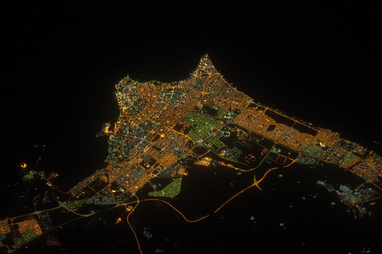
ISS032-E-017635 (9 Aug. 2012) --- A nighttime view of Kuwait City is featured in this image photographed by an Expedition 32 crew member on the International Space Station. Seen at night Kuwait City, the capital of the small Persian Gulf state of Kuwait, contrasts dramatically with the dark surface of the Persian Gulf (top) and the very sparsely populated desert area (bottom). Night views also show at a glance some aspects of urban geography that are difficult to perceive in daylight images. Here the focus of radial traffic arteries and ?ring roads? guide the eye to the financial center of the city?on the cape extending into Kuwait Bay north of the First Ring Road. The numbering of the ring roads shows the progressive southward development of the city, towards the Seventh Ring Road which still lies outside the built-up area at lower right. The striking differences in color of city lighting also provide information on the urban geography. Areas with lighting of a green tinge are, in each case, newer residential districts. The town of Al Ahmadi (lower right), known for its verdant vegetation, was built in 1946 when oil was struck and stands out with its characteristic blue night lights. Kuwait International Airport, like most major airports around the globe, is particularly bright due to the high concentration of lights.
ISS033-E-020288 (13 Nov. 2012) --- A nighttime view of Riyadh, Saudi Arabia is featured in this image photographed by an Expedition 33 crew member on the International Space Station. The population of Riyadh, the capital city of Saudi Arabia, has risen dramatically in the last half century, from 150,000 in 1960 to an estimated 5.4 million in 2012. The city appears as a brightly colored patchwork in this nighttime photograph. The brightest lights, apart from those on the old Riyadh Airbase at center (the new international airport is far outside the city and not shown here), follow the commercial districts along King Abdullah Road and King Fahd Branch Road. Many of the darker patches within the built area are city parks. University sectors stand out with different street and light patterns, as seen in the King Saud University campus which houses the Arabic Language Institute, and the Princess Nora Bint Abdul Rahman University which is the largest all-female university in the world. Highways and various ring roads also stand out in night imagery due to bright regular lighting. Lighted developments beyond the ring roads mark the growth of the city. Newer neighborhoods, set further from the city center, are recognizable by blue-gray lightning.
Ames and Moffett Field (MFA) historical sites and memorials Time capsule and cube display ot courner of DeFrance and King Road (50th year anniversary placement), with detail on brass plaque in walkway (40th year anniversary placement)
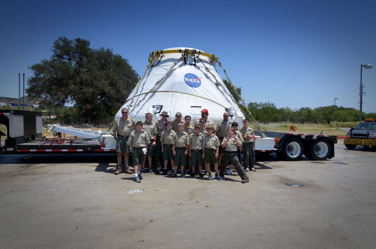
Travelers take a photo with the Orion crew module flown on NASA’s Pad Abort-1 (PA-1) flight test on the road on June 15, 2011. Part of Batch image transfer from Flickr.
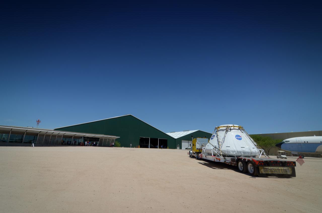
Travelers take a photo with the Orion crew module flown on NASA’s Pad Abort-1 (PA-1) flight test on the road on June 15, 2011. Part of Batch image transfer from Flickr.
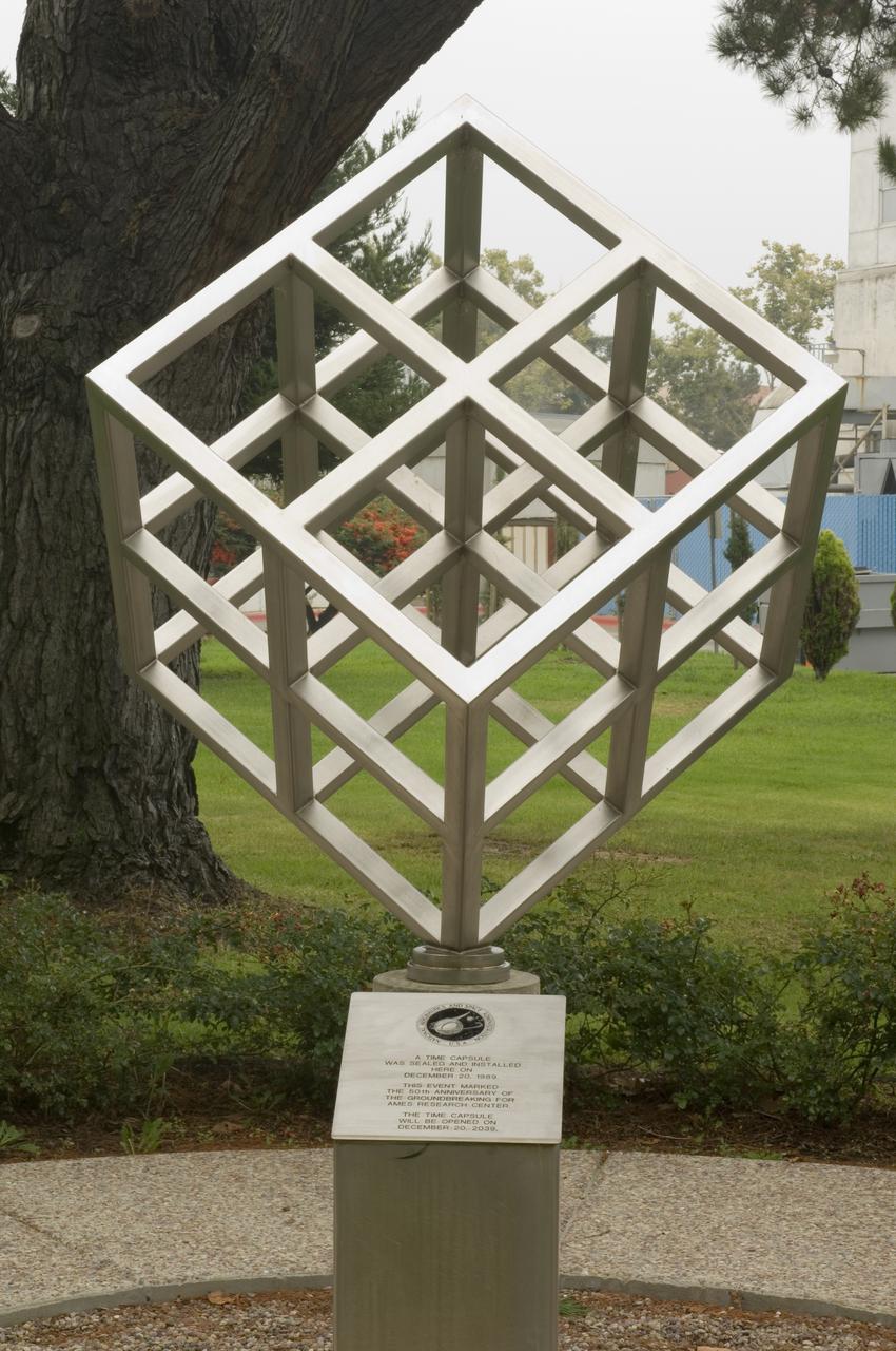
Ames and Moffett Field (MFA) historical sites and memorials Time capsule and cube display ot courner of DeFrance and King Road (50th year anniversary placement), with detail on brass plaque in walkway (40th year anniversary placement)
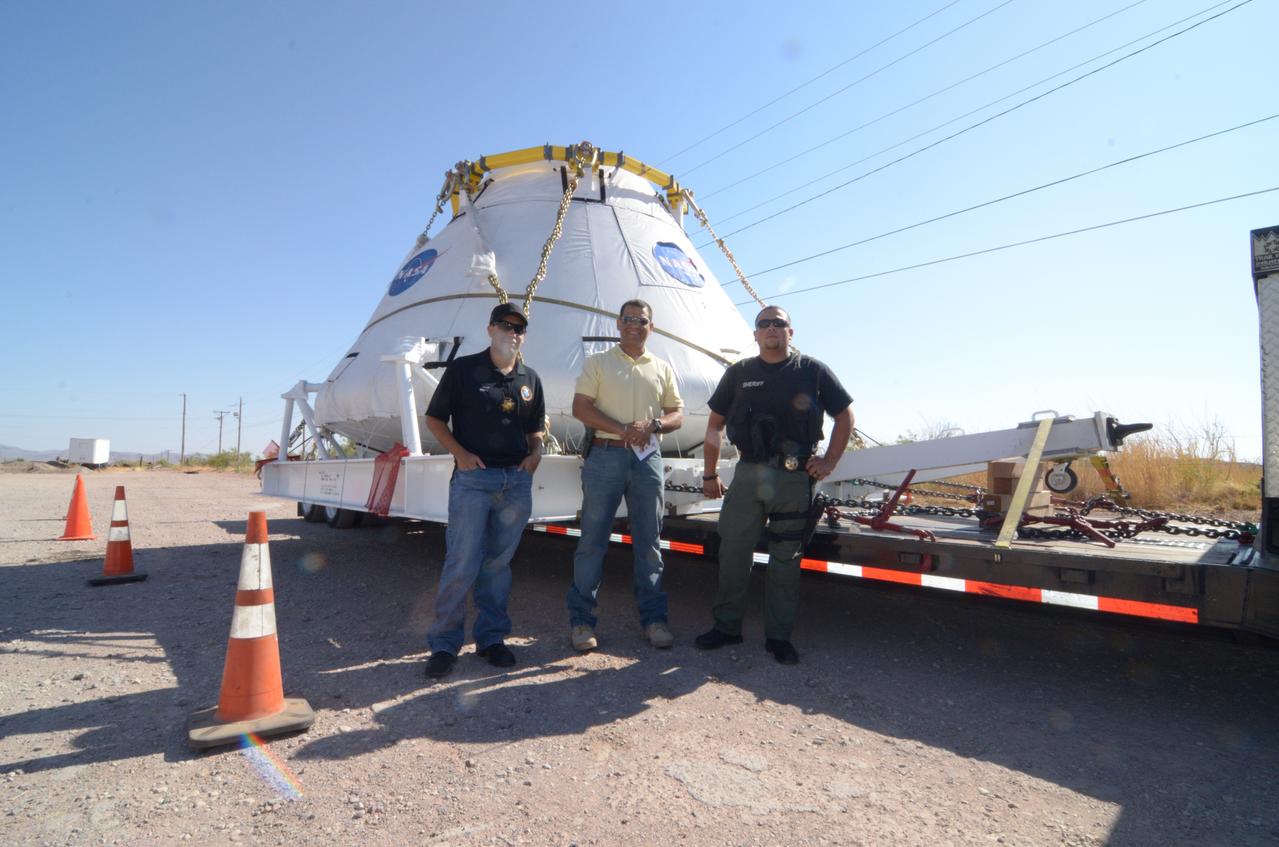
Travelers take a photo with the Orion crew module flown on NASA’s Pad Abort-1 (PA-1) flight test on the road on June 17, 2011. Part of Batch image transfer from Flickr.
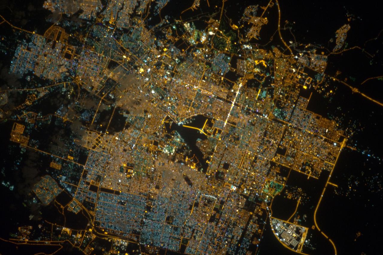
iss066e152177 (Feb. 23, 2022) --- The city lights of Hyderabad, India, bordered by Nehru Outer Ring Road, are pictured from the International Space Station as it orbited 261 miles above the South Asian subcontinent.
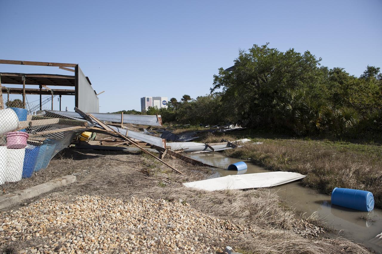
CAPE CANAVERAL, Fla. – Debris along Contractor Road at NASA's Kennedy Space Center in Florida the day after storm with strong winds blew through the launch center. Photo credit: Dmitri Gerondidakis
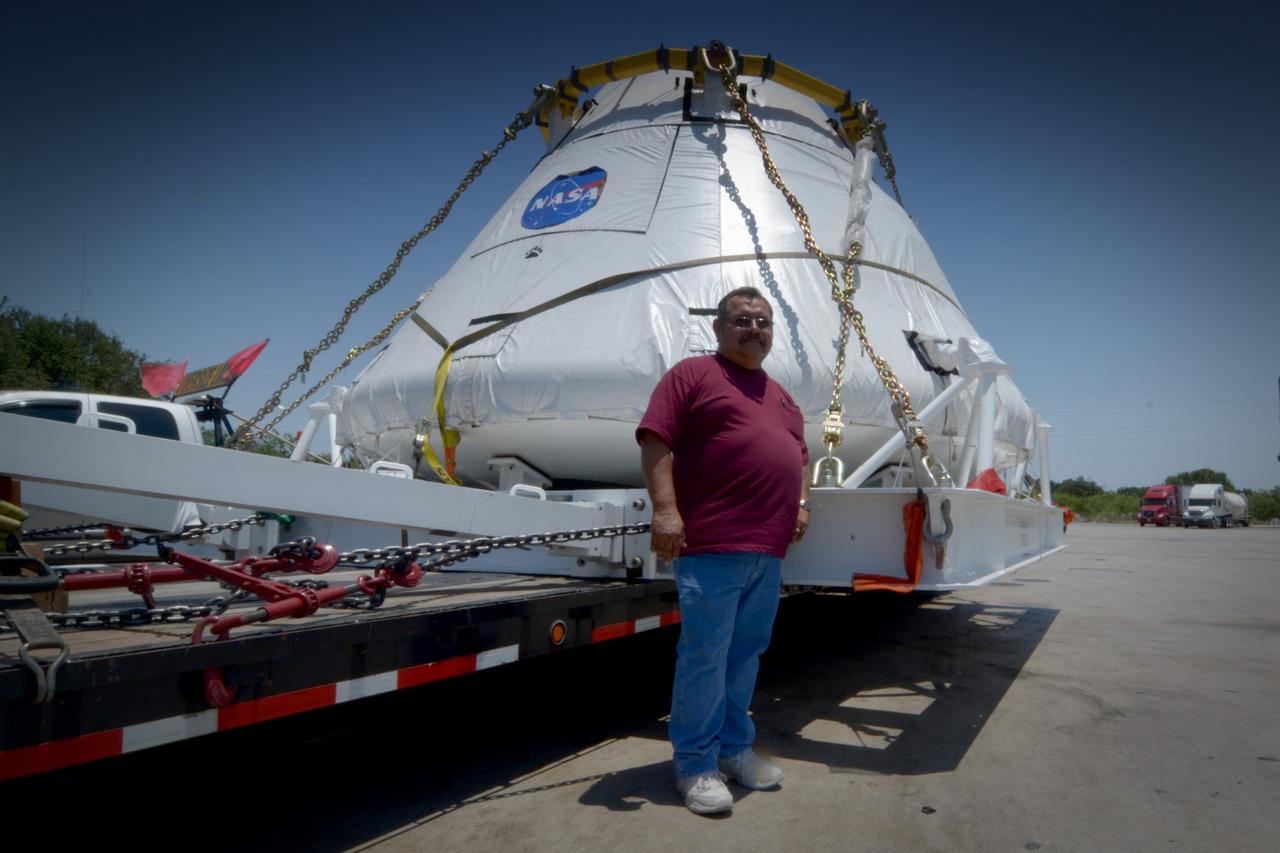
Travelers take a photo with the Orion crew module flown on NASA’s Pad Abort-1 (PA-1) flight test on the road on June 15, 2011. Part of Batch image transfer from Flickr.
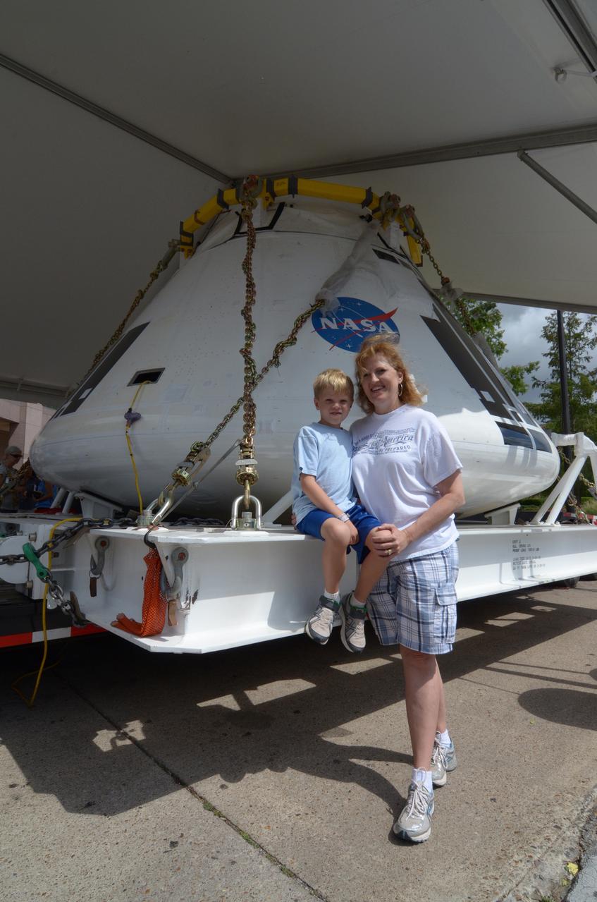
Travelers take a photo with the Orion crew module flown on NASA’s Pad Abort-1 (PA-1) flight test on the road on June 18, 2011. Part of Batch image transfer from Flickr.
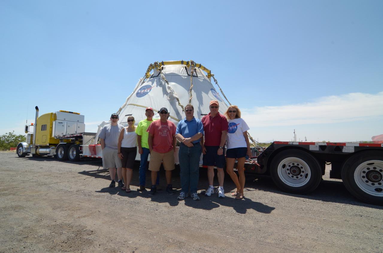
Travelers take a photo with the Orion crew module flown on NASA’s Pad Abort-1 (PA-1) flight test on the road on June 17, 2011. Part of Batch image transfer from Flickr.
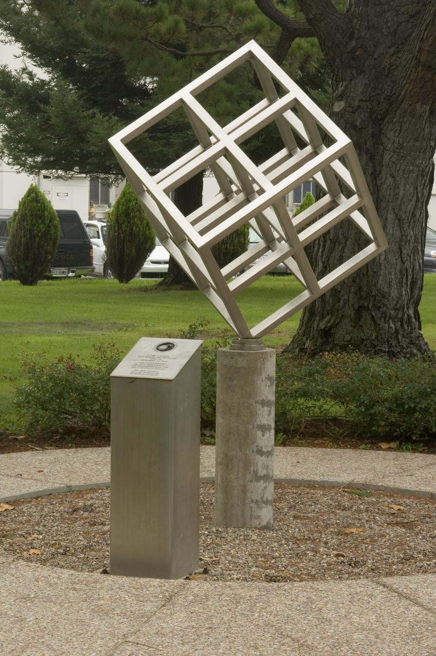
Ames and Moffett Field (MFA) historical sites and memorials Time capsule and cube display ot courner of DeFrance and King Road (50th year anniversary placement), with detail on brass plaque in walkway
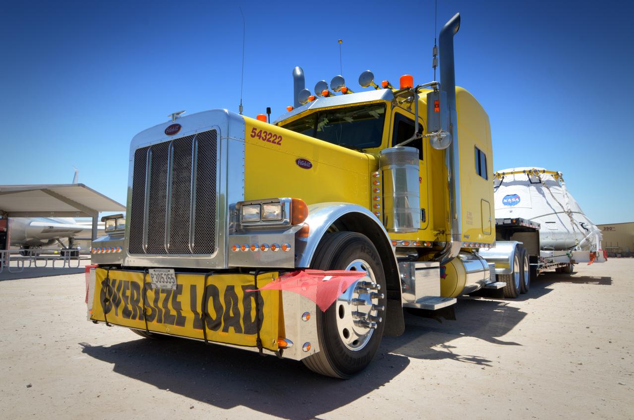
Travelers take a photo with the Orion crew module flown on NASA’s Pad Abort-1 (PA-1) flight test on the road on June 15, 2011. Part of Batch image transfer from Flickr.
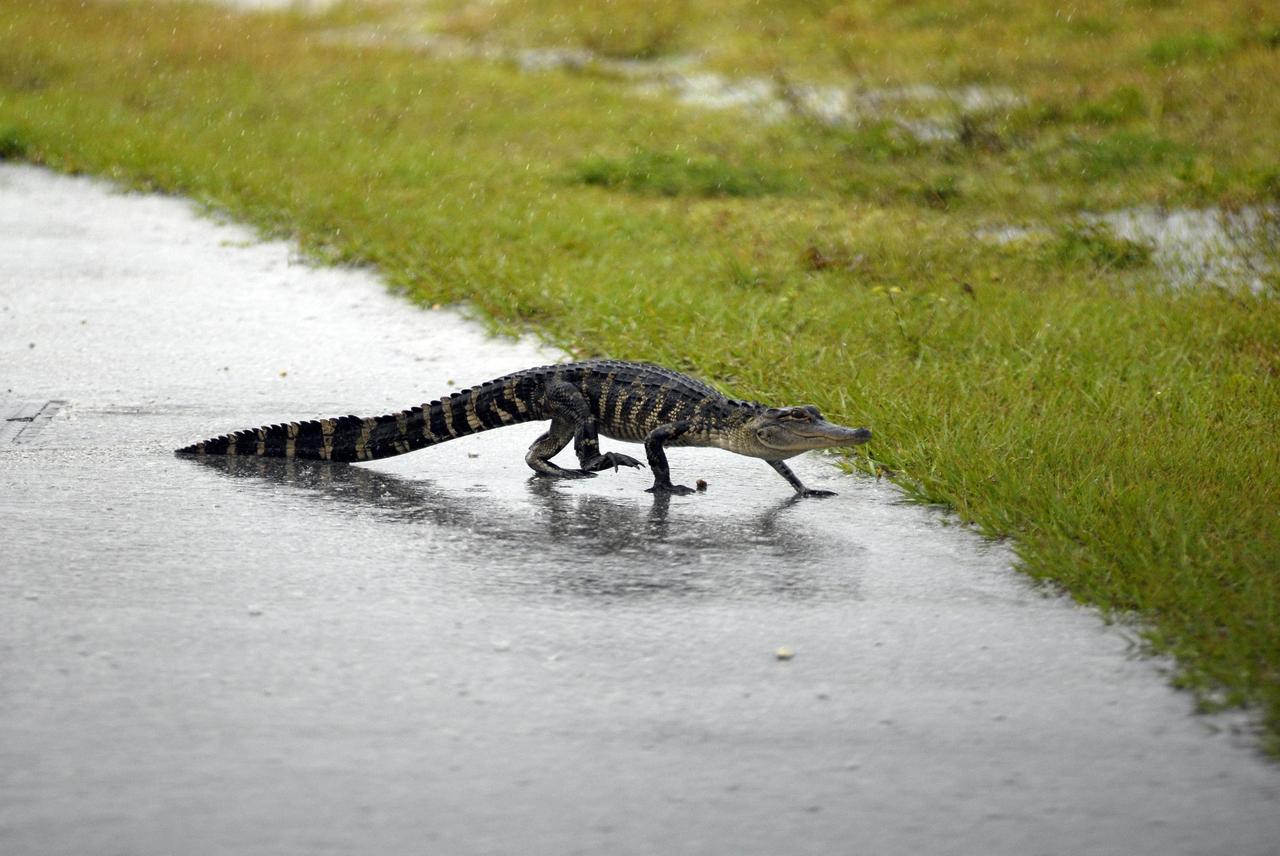
KENNEDY SPACE CENTER, FLA. -- This young alligator crosses a road near the railroad tracks where the train carrying solid rocket booster motor segments approaches Kennedy Space Center. Photo credit: NASA/George Shelton
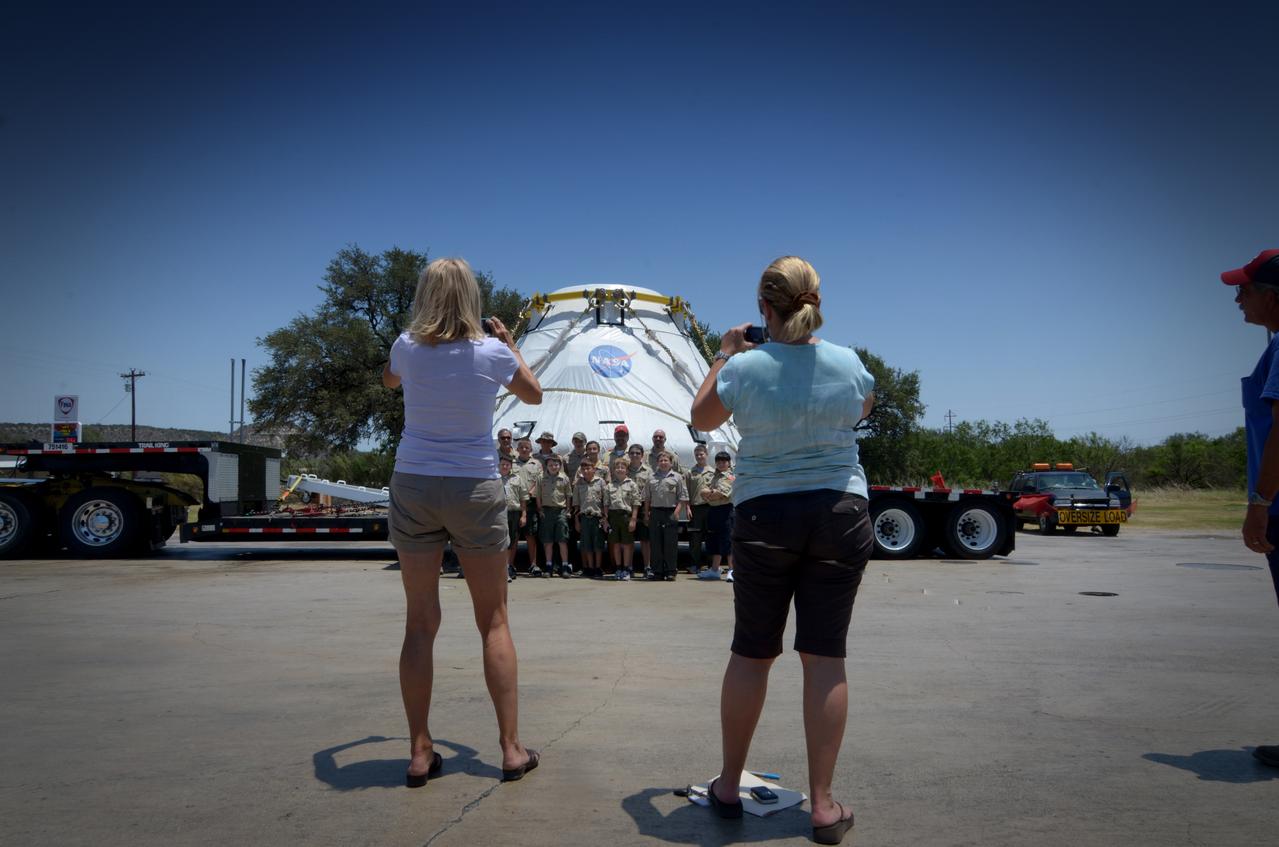
Travelers take a photo with the Orion crew module flown on NASA’s Pad Abort-1 (PA-1) flight test on the road on June 15, 2011. Part of Batch image transfer from Flickr.
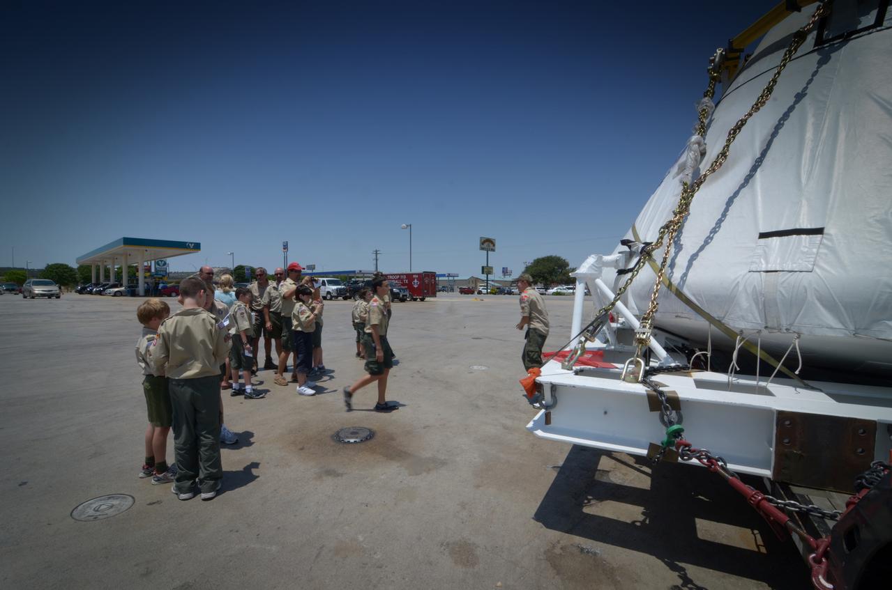
Travelers take a photo with the Orion crew module flown on NASA’s Pad Abort-1 (PA-1) flight test on the road on June 15, 2011. Part of Batch image transfer from Flickr.
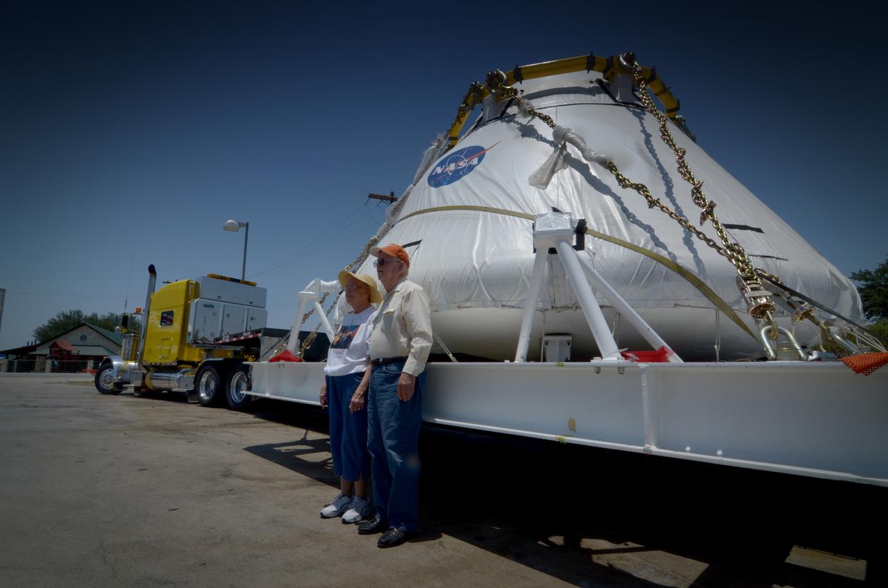
Travelers take a photo with the Orion crew module flown on NASA’s Pad Abort-1 (PA-1) flight test on the road on June 15, 2011. Part of Batch image transfer from Flickr.
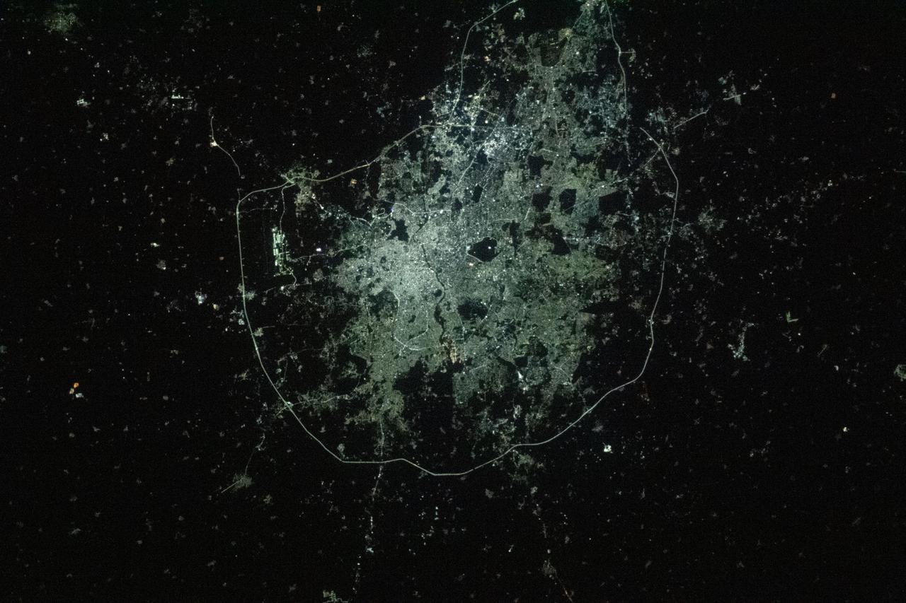
iss066e154504 (Feb. 27, 2022) --- The city lights of Hyderabad, India, bordered by Nehru Outer Ring Road, are pictured from the International Space Station as it orbited 262 miles above the South Asian subcontinent.
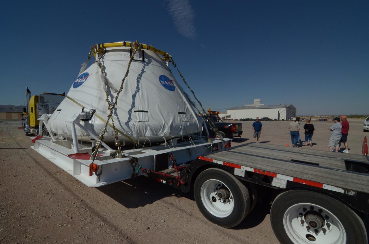
Travelers take a photo with the Orion crew module flown on NASA’s Pad Abort-1 (PA-1) flight test on the road on June 15, 2011. Part of Batch image transfer from Flickr.
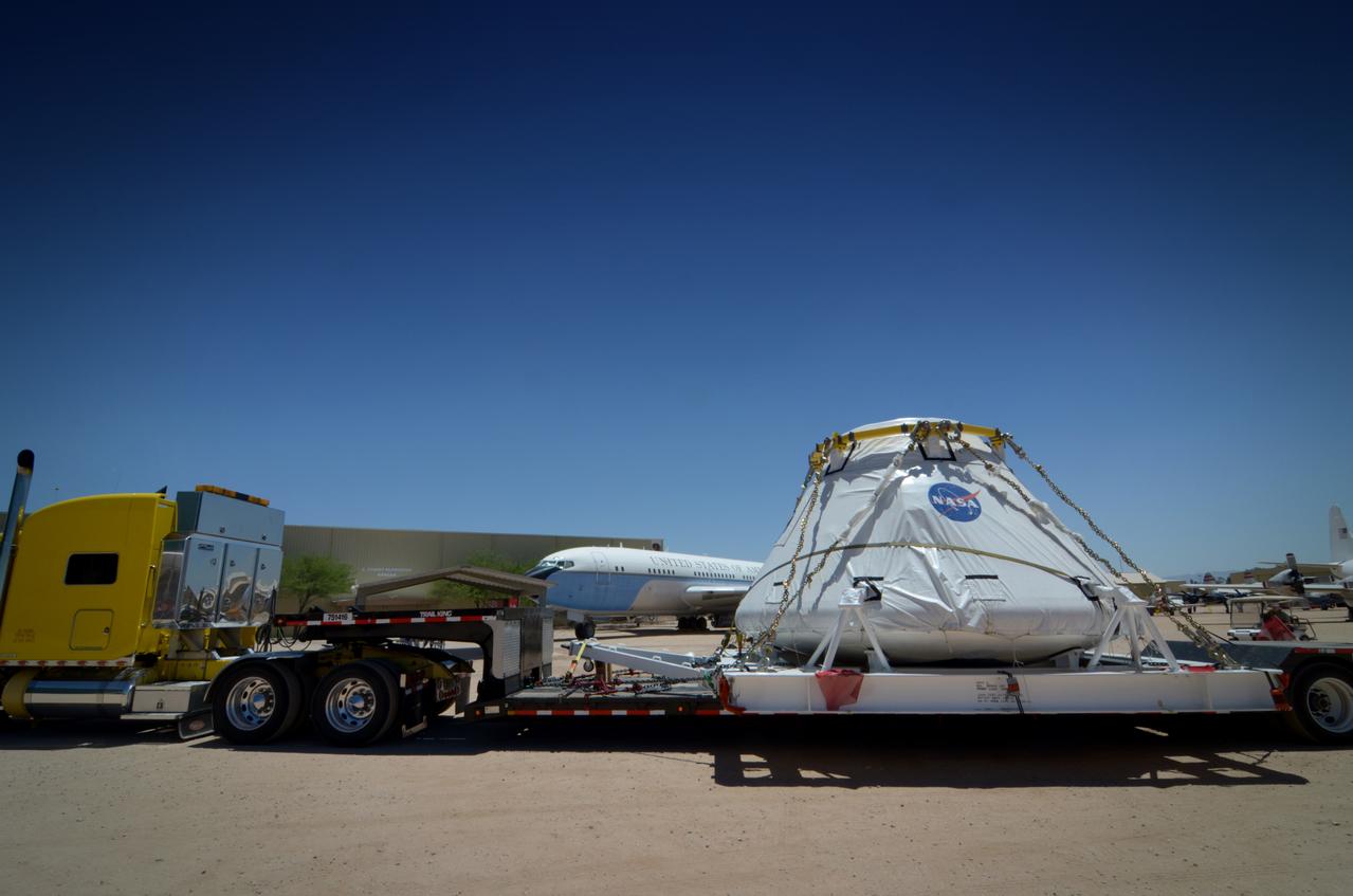
Travelers take a photo with the Orion crew module flown on NASA’s Pad Abort-1 (PA-1) flight test on the road on June 15, 2011. Part of Batch image transfer from Flickr.
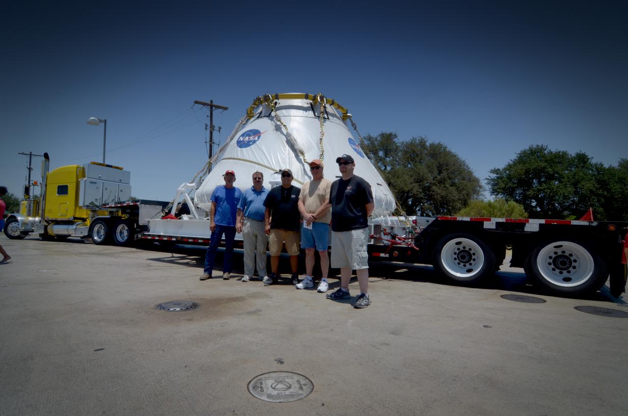
Travelers take a photo with the Orion crew module flown on NASA’s Pad Abort-1 (PA-1) flight test on the road on June 15, 2011. Part of Batch image transfer from Flickr.
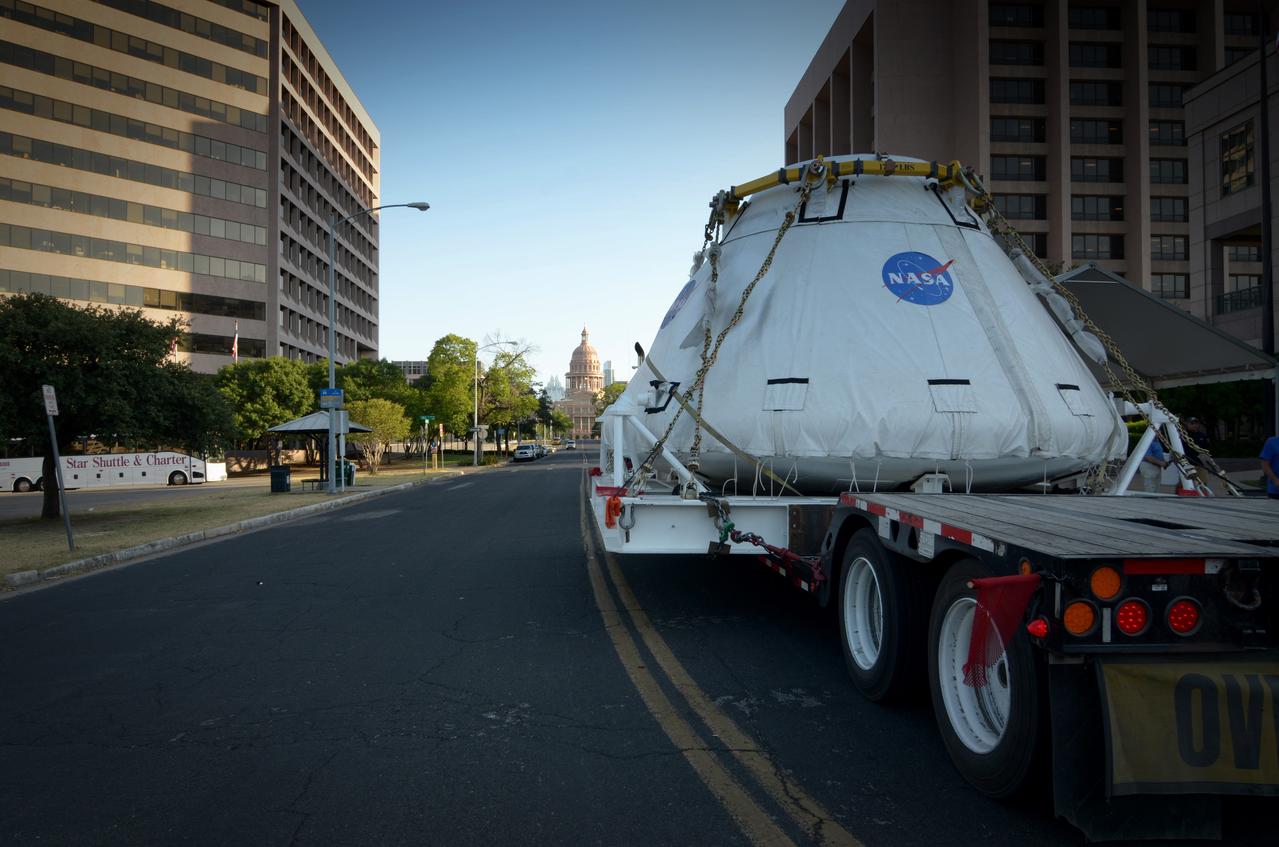
Travelers take a photo with the Orion crew module flown on NASA’s Pad Abort-1 (PA-1) flight test on the road on June 15, 2011. Part of Batch image transfer from Flickr.
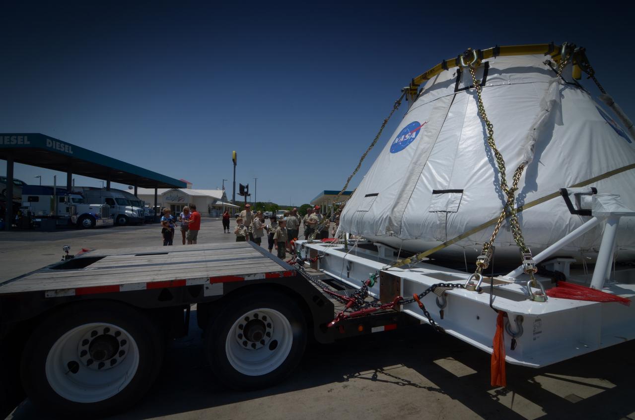
Travelers take a photo with the Orion crew module flown on NASA’s Pad Abort-1 (PA-1) flight test on the road on June 18, 2011. Part of Batch image transfer from Flickr.
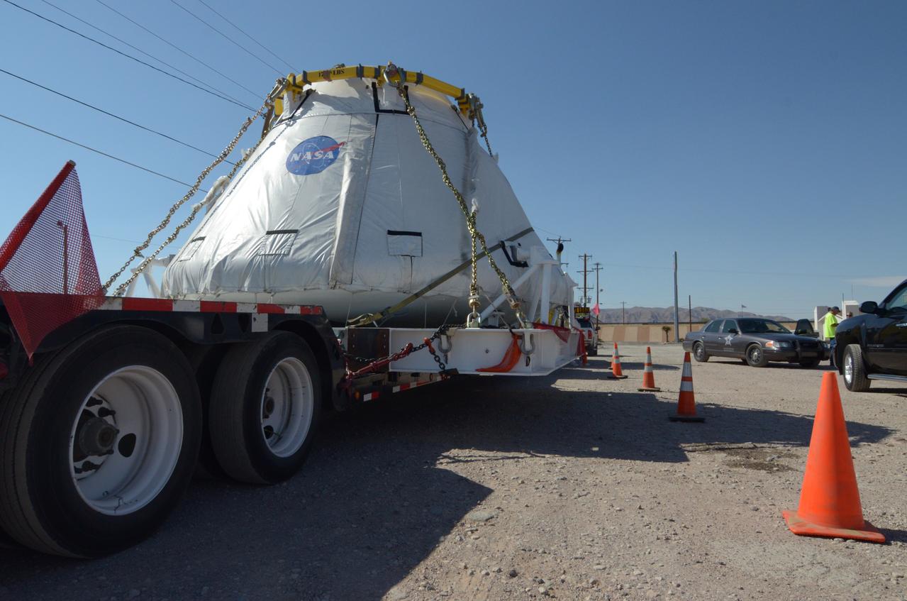
Travelers take a photo with the Orion crew module flown on NASA’s Pad Abort-1 (PA-1) flight test on the road on June 15, 2011. Part of Batch image transfer from Flickr.
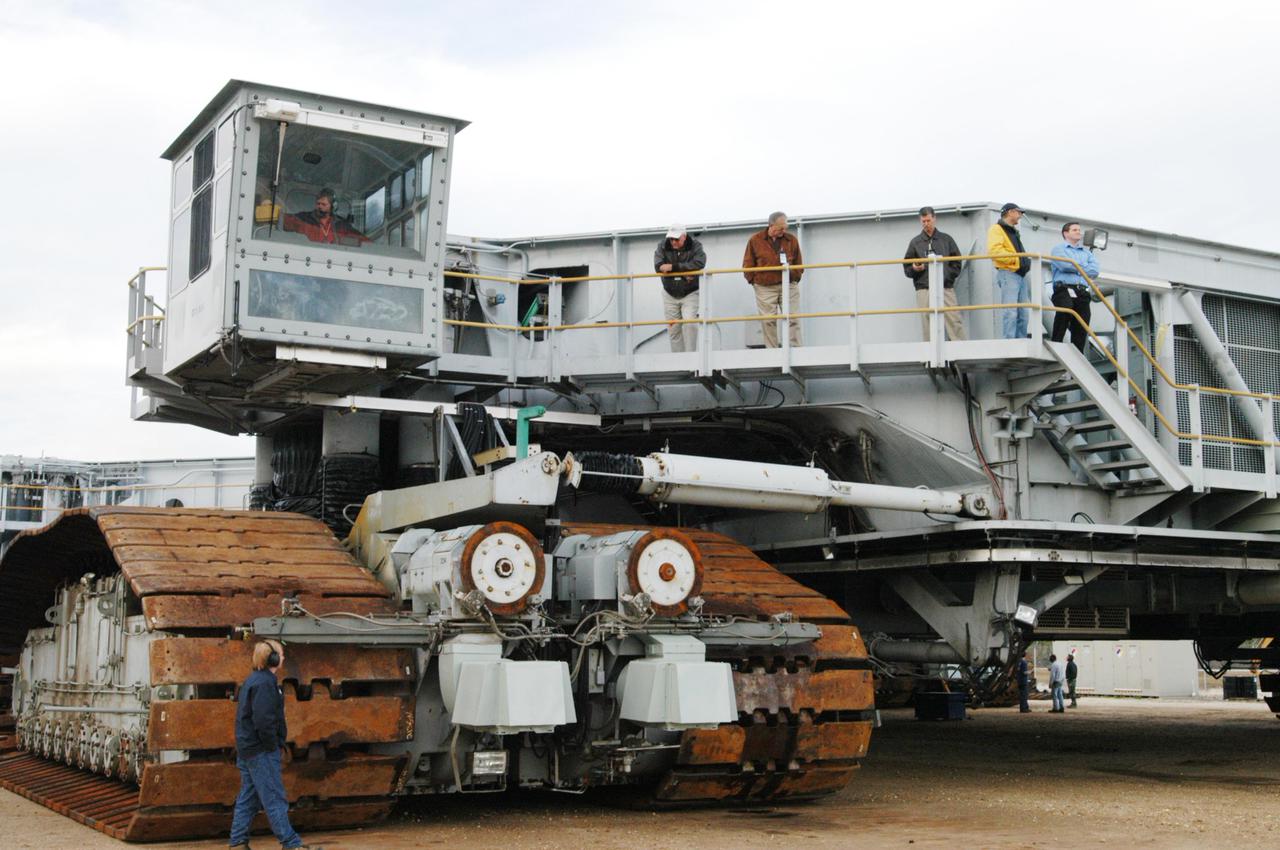
KENNEDY SPACE CENTER, FLA. - The newly shod Crawler Transporter is ready for a road test. The Crawler Transporter that will move Space Shuttle Discovery to the launch pad for Return to Flight is taking its first road test following the replacement of all its shoes. The crawlers have 456 shoes, 57 per belt (8 belts in all). Each shoe weighs 2,200 pounds. Cracks appeared in the shoes in recent years, spurring a need for replacement. The new manufacturer, in Duluth, Minn., has improved the design for a safe Return to Flight and use through the balance of the Space Shuttle Program.
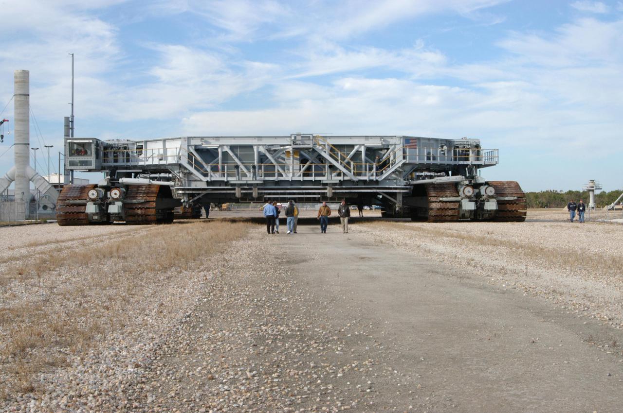
KENNEDY SPACE CENTER, FLA. - The newly shod Crawler Transporter is ready for its road test. The Crawler Transporter that will move Space Shuttle Discovery to the launch pad for Return to Flight is taking its first road test following the replacement of all its shoes. The crawlers have 456 shoes, 57 per belt (8 belts in all). Each shoe weighs 2,200 pounds. Cracks appeared in the shoes in recent years, spurring a need for replacement. The new manufacturer, in Duluth, Minn., has improved the design for a safe Return to Flight and use through the balance of the Space Shuttle Program.
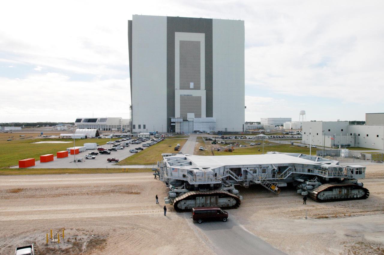
KENNEDY SPACE CENTER, FLA. - The Crawler Transporter sits behind the Vehicle Assembly Building after its road test of the new shoes. The Crawler Transporter that will move Space Shuttle Discovery to the launch pad for Return to Flight is taking its first road test following the replacement of all its shoes. The crawlers have 456 shoes, 57 per belt (8 belts in all). Each shoe weighs 2,200 pounds. Cracks appeared in the shoes in recent years, spurring a need for replacement. The new manufacturer, in Duluth, Minn., has improved the design for a safe Return to Flight and use through the balance of the Space Shuttle Program.
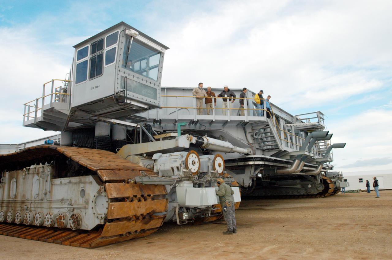
KENNEDY SPACE CENTER, FLA. - The newly shod Crawler Transporter is checked out before beginning a road test. The Crawler Transporter that will move Space Shuttle Discovery to the launch pad for Return to Flight is taking its first road test following the replacement of all its shoes. The crawlers have 456 shoes, 57 per belt (8 belts in all). Each shoe weighs 2,200 pounds. Cracks appeared in the shoes in recent years, spurring a need for replacement. The new manufacturer, in Duluth, Minn., has improved the design for a safe Return to Flight and use through the balance of the Space Shuttle Program.
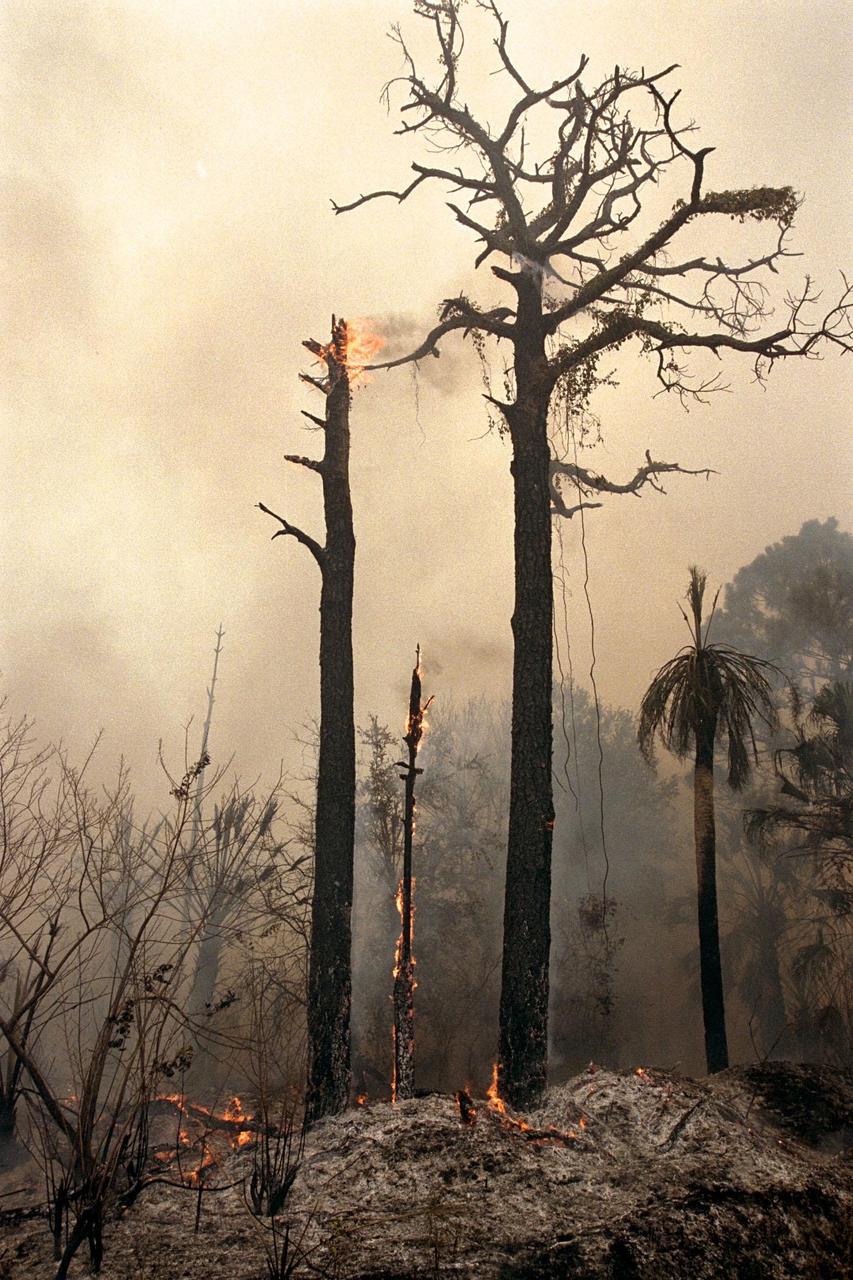
KENNEDY SPACE CENTER, FLA. -- Charred trees and brush in a wooded section of Kennedy Space Center still burn Monday, June 22, after lightning touched off three different fires Sunday evening in and around Kennedy Space Center at Tel IV, Ransom Road and Pine Island Road. This area is part of the Merritt Island National Wildlife Refuge operated by the U.S. Fish and Wildlife Service. The fires were a short distance from operational facilities at the space center and forced the closing of Florida State Route 3. The fires are being contained by firefighters from Kennedy Space Center and the U.S. Fish and Wildlife Service