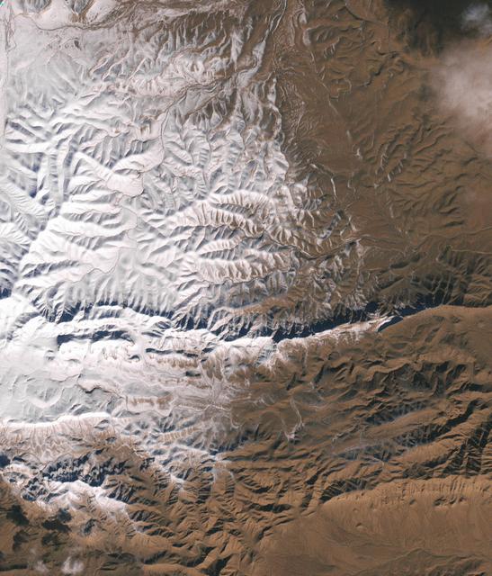
In December 2016, snow fell in the Sahara for the first time since 1979. In 1984, the charitable supergroup Band Aid sang: “There won’t be snow in Africa this Christmas time.” In fact, it does snow in Africa at high elevations. Kilimanjaro has long had a cap of snow and ice, though it has been shrinking. Skiiers travel for natural and manufactured snow in the Atlas Mountains of Morocco and Algeria, as well as a few spots in South Africa and Lesotho. Nonetheless, snow on the edge of the Sahara Desert is rare. On December 19, 2016, snow fell on the Algerian town of Ain Sefra, which is sometimes referred to as the “gateway to the desert.” The town of roughly 35,000 people sits between the Atlas Mountains and the northern edge of the Sahara. The last recorded snowfall in Ain Sefra occurred in February 1979. The Enhanced Thematic Mapper Plus (ETM+) on the Landsat 7 satellite acquired this natural-color image of snow in North Africa on December 19, 2016. This scene shows an area near the border of Morocco and Algeria, south of the city of Bouarfa and southwest of Ain Sefra. Though the news has been dominated by snow in the Saharan city, a review of several years of satellite data suggests that snow is also pretty rare in this section of the Atlas range. Read more: <a href="http://go.nasa.gov/2hIH4Xe" rel="nofollow">go.nasa.gov/2hIH4Xe</a> NASA Earth Observatory image by Joshua Stevens, using Landsat data from the U.S. Geological Survey. Caption by Mike Carlowicz. b><a href="http://www.nasa.gov/audience/formedia/features/MP_Photo_Guidelines.html" rel="nofollow">NASA image use policy.</a> <b><a href="http://www.nasa.gov/centers/goddard/home/index.html" rel="nofollow">NASA Goddard Space Flight Center</a></b> enables NASA’s mission through four scientific endeavors: Earth Science, Heliophysics, Solar System Exploration, and Astrophysics. Goddard plays a leading role in NASA’s accomplishments by contributing compelling scientific knowledge to advance the Agency’s mission. <b>Follow us on <a href="http://twitter.com/NASAGoddardPix" rel="nofollow">Twitter</a></b> <b>Like us on <a href="http://www.facebook.com/pages/Greenbelt-MD/NASA-Goddard/395013845897?ref=tsd" rel="nofollow">Facebook</a></b> <b>Find us on <a href="http://instagrid.me/nasagoddard/?vm=grid" rel="nofollow">Instagram</a></b>
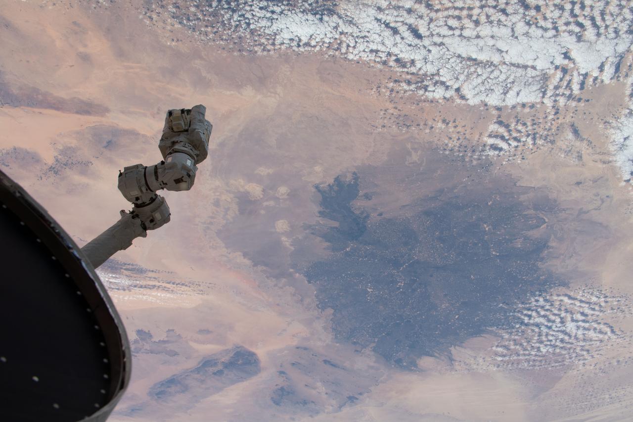
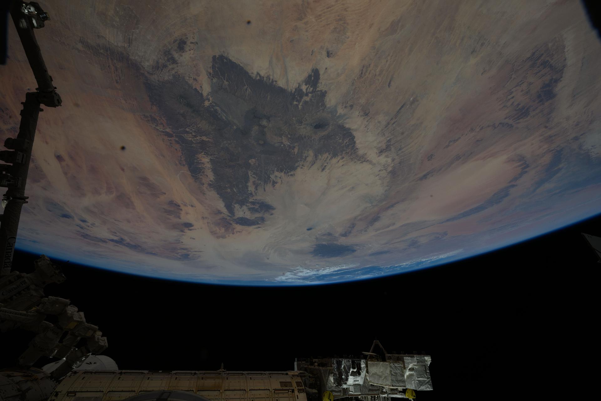
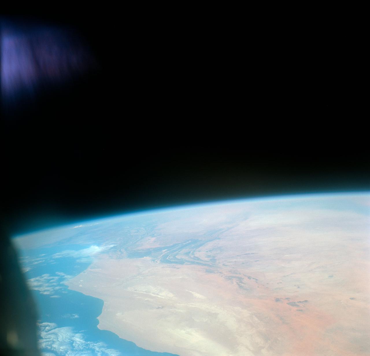
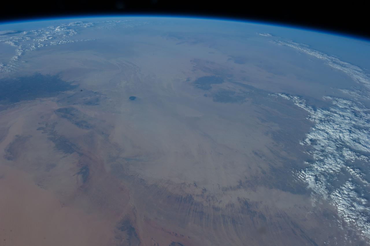
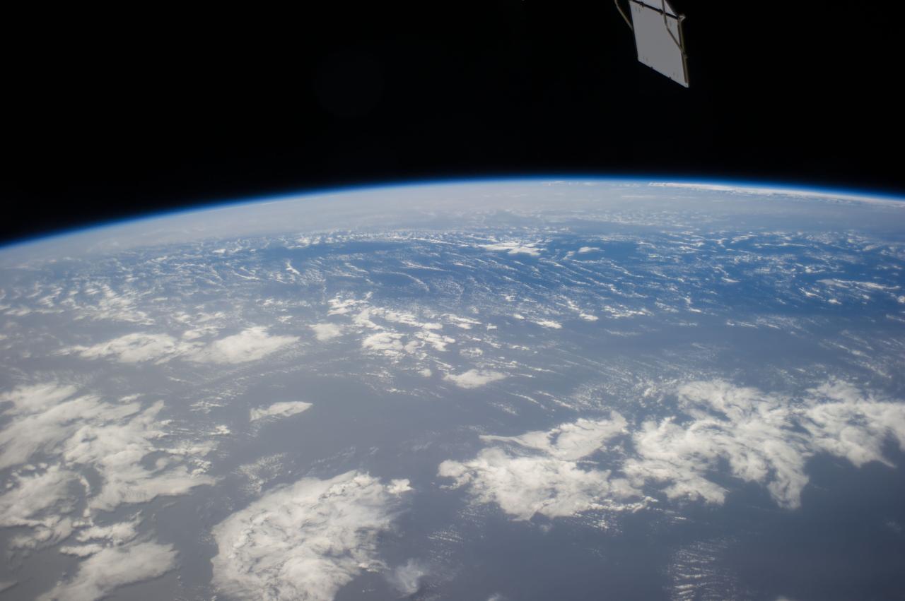
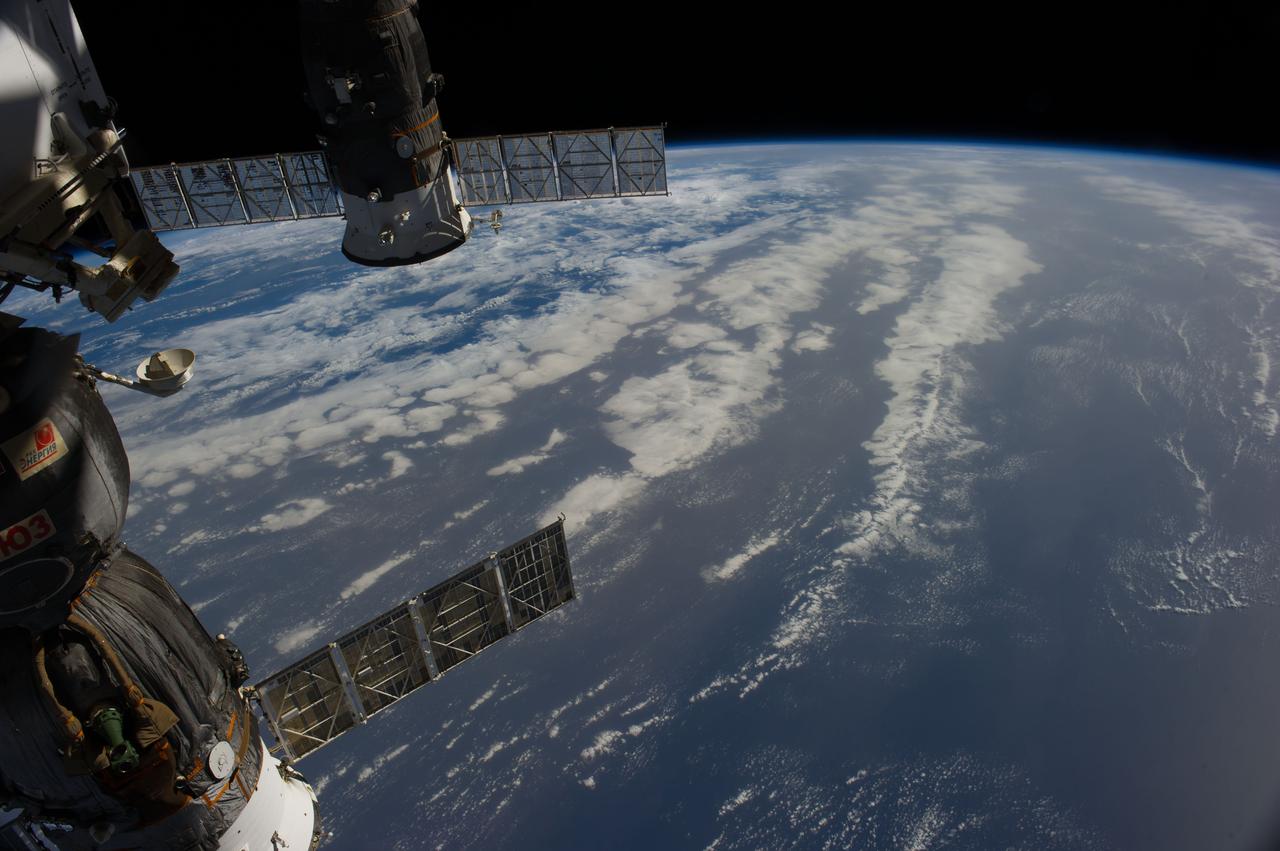
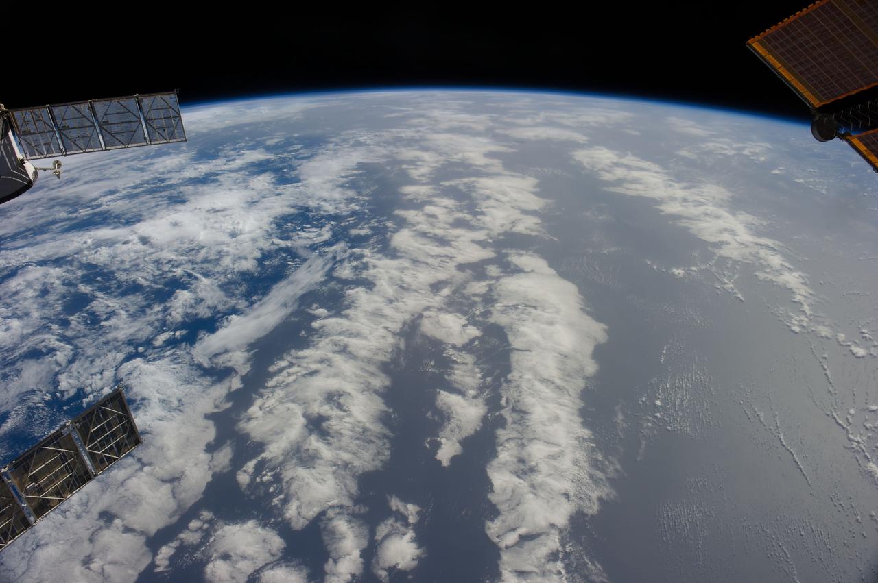
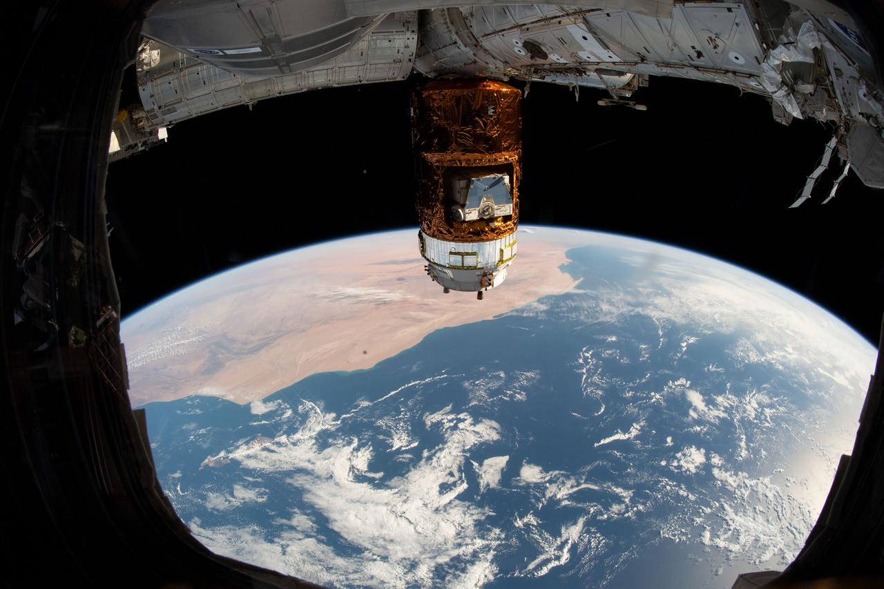
iss058e000174 (Dec. 23, 2018) --- The International Space Station's robotic arm, Canadarm2, seemingly reaches out to the North African nation of Libya and the Sahara 251 miles below.
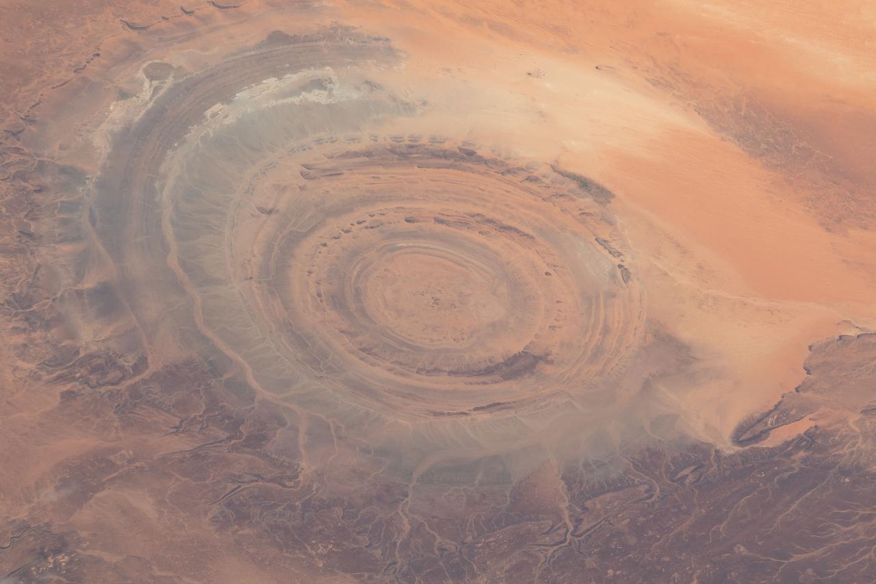
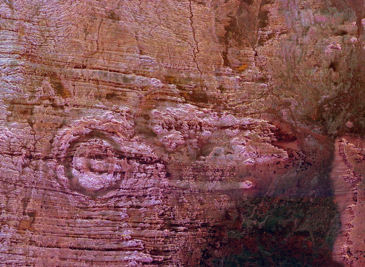
iss069e005471 (April 26, 2023) --- The Richat Structure, also known as the "Eye of the Sahara," an eroded geological dome in the nation of Mauritania, is pictured from the International Space Station as it orbited 259 miles above the African continent.
iss069e005526 (April 26, 2023) --- The Richat Structure, also known as the "Eye of the Sahara," an eroded geological dome in the nation of Mauritania, is pictured from the International Space Station as it orbited 259 miles above the African continent.
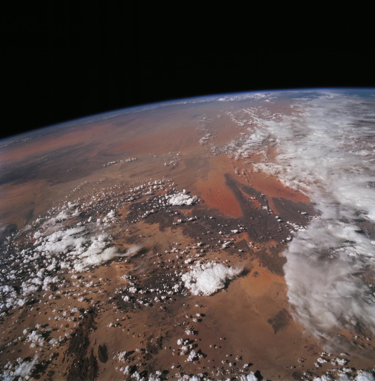
STS068-228-081 (30 September-11 October 1994) --- This northwest-looking view shows central Algeria with an unusual amount of cloud cover, responsible for one of the infrequent bouts of rain in the Sahara Desert. The lope-shaped, red sand dunes mass in the center of the view is one of the most prominent features in the Sahara as seen from the Space Shuttle Endeavour. It is known as the Tifernine Dunes. The Atlas Mountains (top) are only apparent in this view because of the clouds, which cap their summits.
iss072e068304 (Oct. 13, 2024) --- The town and commune of In Ghar, with a population of over 11,000 in Algeria's portion of the Sahara Desert, is pictured from the International Space Station as it orbited 259 miles above the African nation.
STS049-92-071 (13 May 1992) --- The STS-49 crew aboard the Earth-orbiting Space Shuttle Endeavour captured this Saharan dust storm on the Algeria-Niger border. The south-looking, late-afternoon view shows one of the best examples in the Shuttle photo data base of a dust storm. A series of gust fronts, caused by dissipating thunderstorms have picked up dust along the outflow boundaries. Small cumulus clouds have formed over the most vigorously ascending parts of the dust front, enhancing the visual effect of the front. The storm is moving roughly north-northwest, at right angles to the most typical path for dust storms in this part of the Sahara (shown by lines of sand on the desert surface in the foreground). Storms such as this can move out into the Atlantic, bringing dust even as far as the Americas on some occasions. A crewmember used a 70mm handheld Hasselblad camera with a 100mm lens to record the frame.
In July of 2005, a continent-sized cloud of hot air and dust originating from the Sahara Desert crossed the Atlantic Ocean and headed towards Florida and the Caribbean, captured by the Atmospheric Infrared Sounder onboard NASA Aqua satellite. A Saharan Air Layer, or SAL, forms when dry air and dust rise from Africa's west coast and ride the trade winds above the Atlantic Ocean. These dust clouds are not uncommon, especially during the months of July and August. They start when weather patterns called tropical waves pick up dust from the desert in North Africa, carry it a couple of miles into the atmosphere and drift westward. http://photojournal.jpl.nasa.gov/catalog/PIA00448
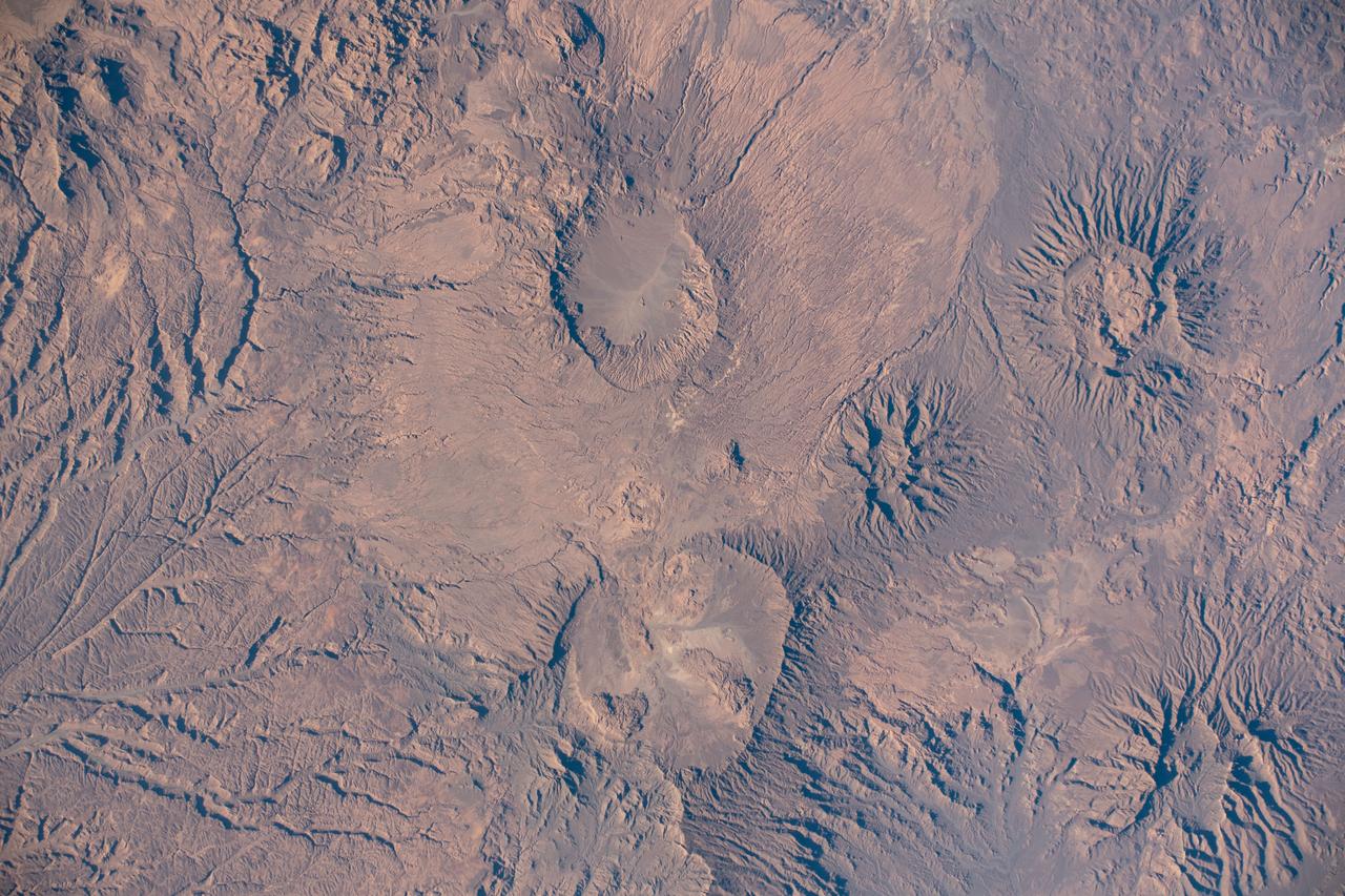
iss073e0906087 (Sept. 28, 2025) --- The Tibesti Mountains in the Sahara, primarily formed by volcanic activity between 34 and 23 million years ago and located mostly in northern Chad, are pictured from the International Space Station as it orbited 260 miles above the African continent.
iss072e065377 (Oct. 17, 2024) --- The borders of three African nations, Libya, Sudan, and Egypt, meet in the eastern portion of the Sahara in this photograph from the International Space Station as it orbited 258 miles above.
STS072-709-063 (11-20 Jan. 1996) --- The astronauts aboard the Space Shuttle Endeavour exposed this 70mm frame of the Air Mountains, located in the country of Niger. These Sahara Desert structures are granitic intrusions. They are resistant to erosion and are very prominent in the lighter colored sands of the area. According to NASA geologists studying the photo collection, the ring-like structure on the lower left-hand edge of the photograph is probably a Quaternary volcanic feature. The highest peaks in the range approach 1,800 meters (6,000 feet). Deep valleys in the range are used by the Tuaregs for pasturage. Uranium and other minerals are being mined in the massif.
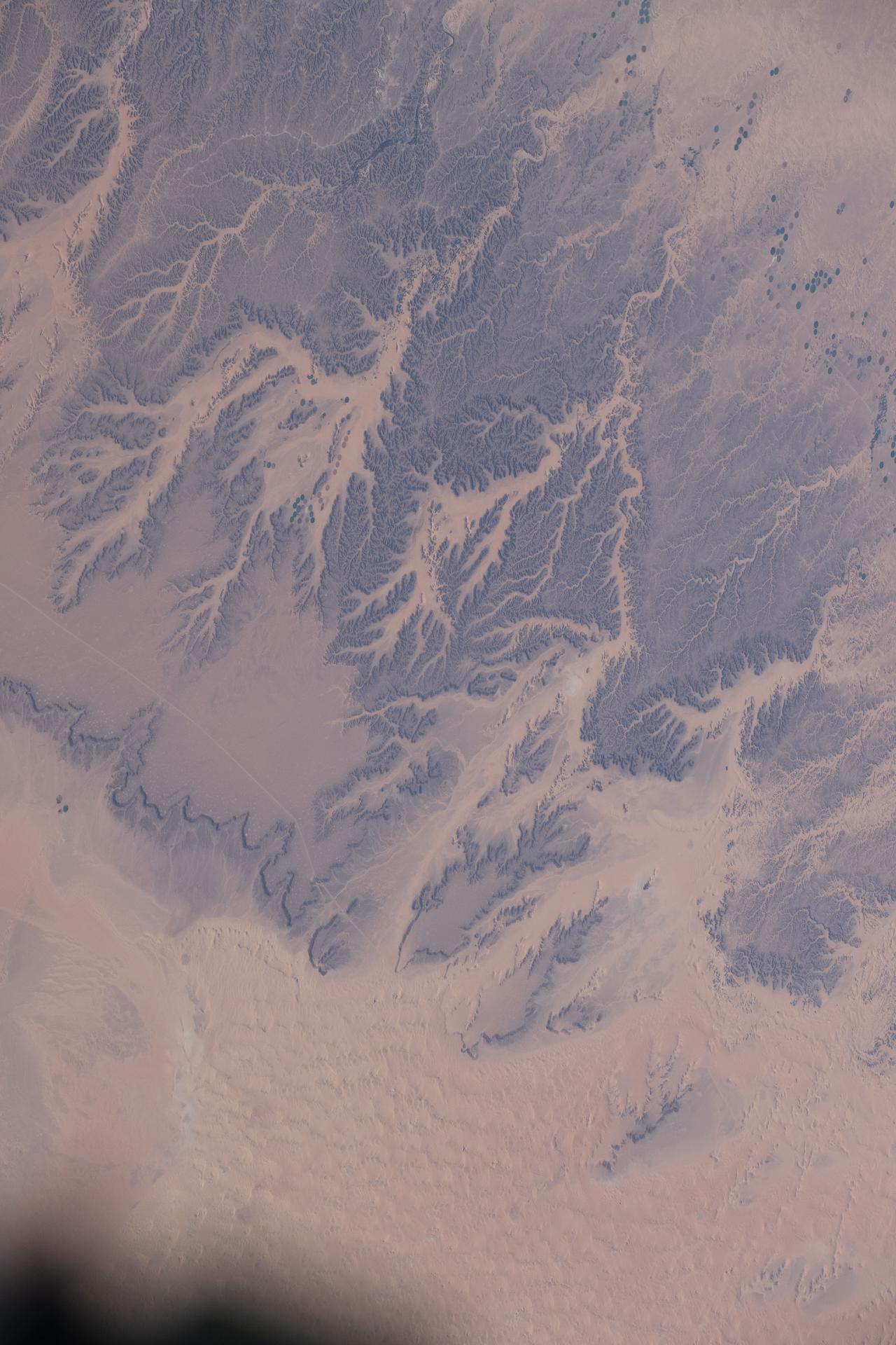
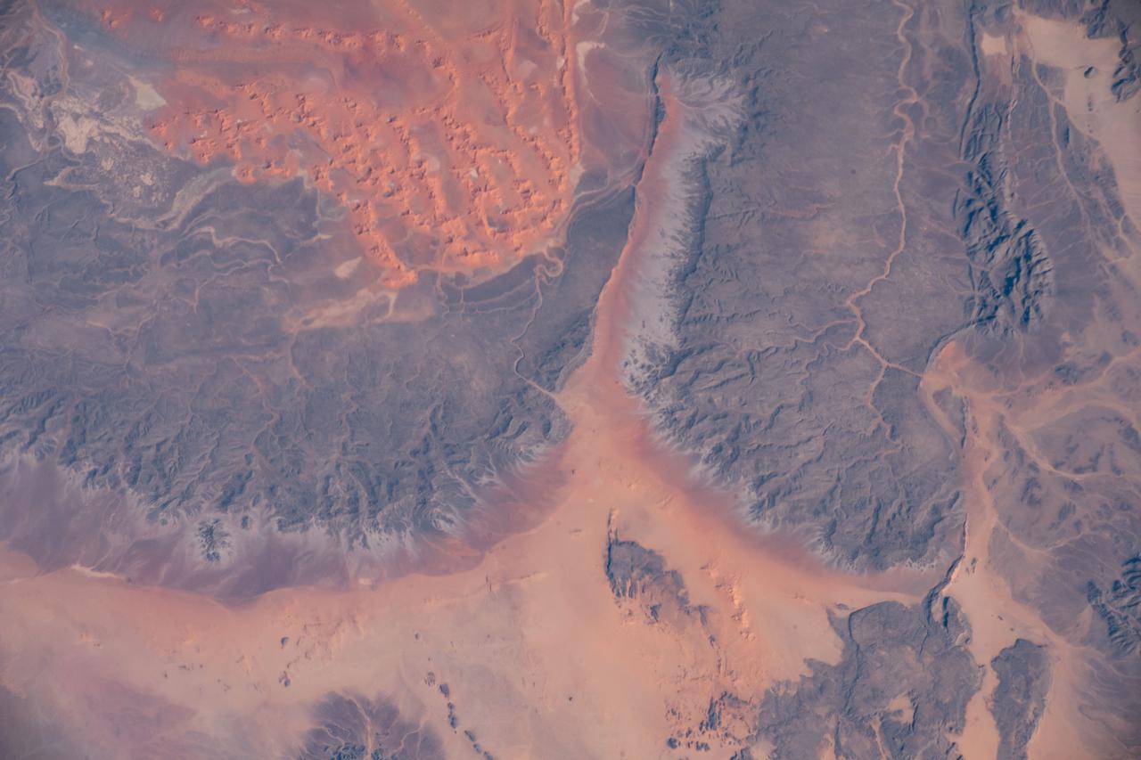
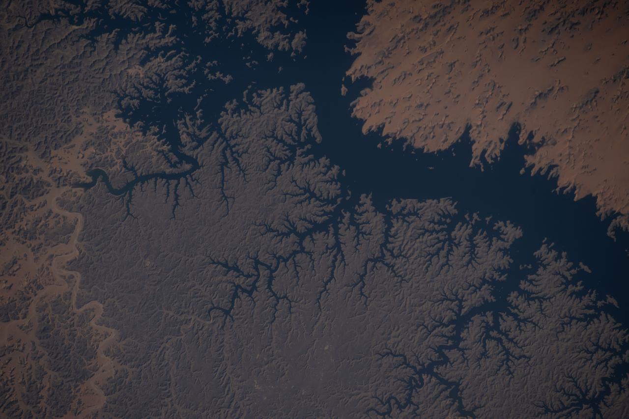
iss074e0320309 (Feb. 21, 2026) --- Wadis, dry riverbeds or channels that carry water only during the rainy season, are pictured in the northern Sahara Desert region of Algeria. The International Space Station was orbiting 260 miles above the North African nation when this photograph was taken. Credit: NASA/Jessica Meir
iss069e005536 (April 26, 2023) --- The Richat Structure, also known as the "Eye of the Sahara," an eroded geological dome in the nation of Mauritania, is pictured from the International Space Station as it orbited 259 miles above the African continent. At left, from top to bottom, are the Nauka multipurpose laboratory module's forward port, the Prichal docking module, and the Soyuz MS-23 crew ship.
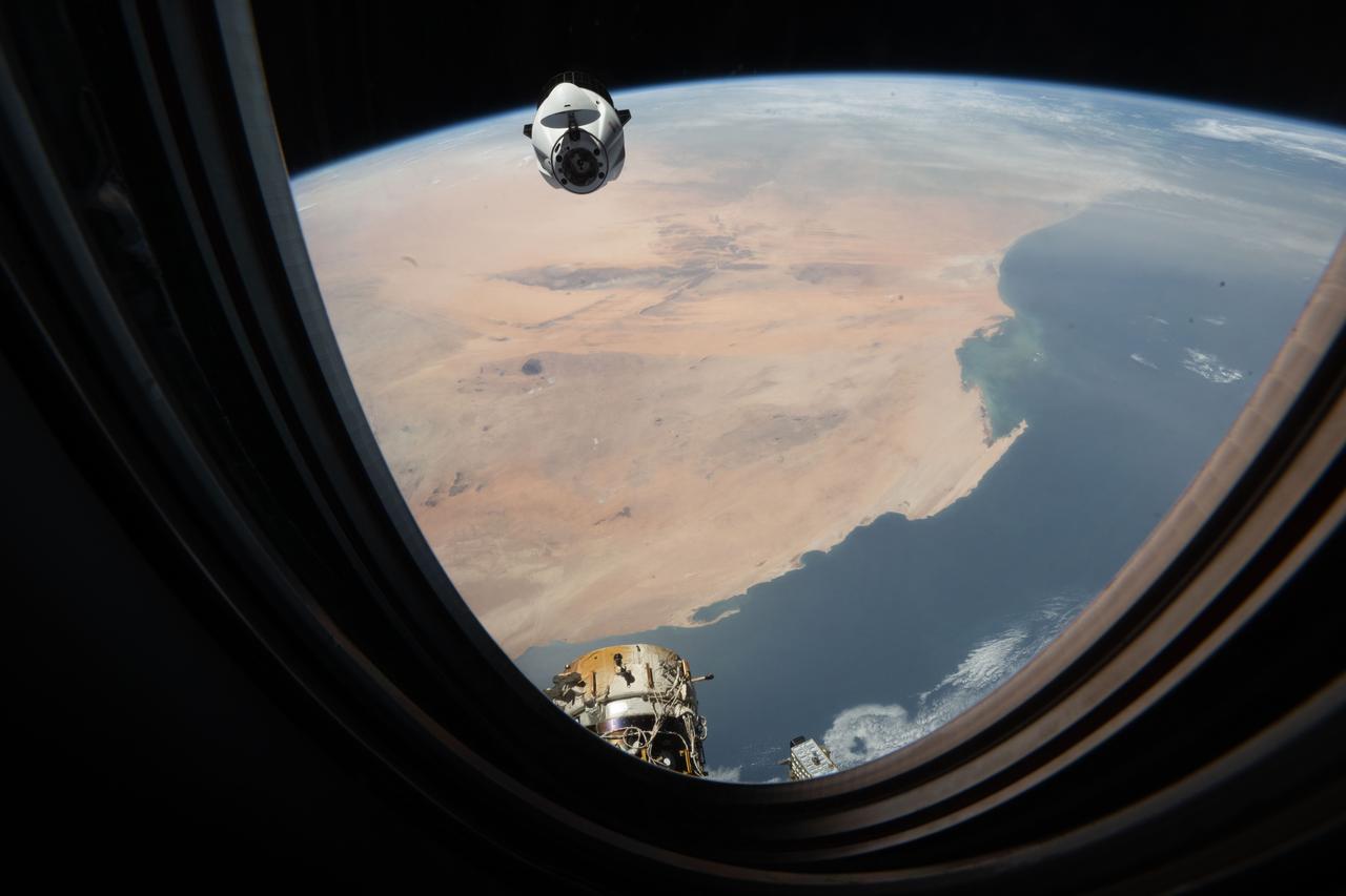
iss074e0504295 (April 13, 2026) --- Northrop Grumman’s Cygnus XL cargo spacecraft approaches the International Space Station while orbiting 264 miles above the Sahara Desert in Mauritania. Credit: NASA/Chris Williams
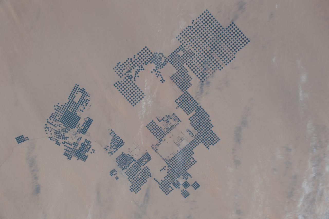
iss074e0417326 (March 27, 2026) --- A portion of the Sahara in the Agadez Region of northeastern Niger is pictured from the International Space Station as it orbited 264 miles above the African continent. Despite the hyper-arid conditions, a groundwater-fed oasis system supports settlements and small-scale agriculture in a narrow north–south corridor of the desert nation. Credit: NASA/Chris Williams
STS054-152-189 (13-19 Jan. 1993) --- This near-vertical color photograph shows the very diverse landscape that is part of the great Sahara Desert of north Africa. Specifically, the vast expanse of sand dunes, located in the extreme southwestern corner of Libya, is known as the Murzuk Sand Sea. Close inspection of this photograph shows the agricultural village of Murzuk as evidenced by the numerous center pivot irrigation patterns at the edge of the Murzuk Sand Sea. The very rugged, dissected terrain to the west of this sand sea is the eastern tip of the Tassili N'ajjer Mountains and the Tadrart Plateau that are in neighboring Algeria. Several smaller areas of sand dunes are interspersed between the major areas of rock outcrops. The photograph was taken with a Linhof camera.

AS04-01-410 (9 Nov. 1967) --- Coastal Brazil, Atlantic Ocean, West Africa, Sahara, Antarctica, looking west, as photographed from the Apollo 4 (Spacecraft 017/Saturn 501) unmanned, Earth-orbital space mission. This picture was taken when the Spacecraft 017 and Saturn S-IVB (third) stage were orbiting Earth at an altitude of 9,745 nautical miles.
S66-46062 (18-21 July 1966) --- Area of the Spanish Sahara--Mauritania--Algeria--Morocco, looking north into Hamada Du Dra, as seen from the Gemini-10 spacecraft. Taken with a J.A. Maurer 70mm camera, using Eastman Kodak, Ektachrome, MS (S.O. 217) color film. Photo credit: NASA
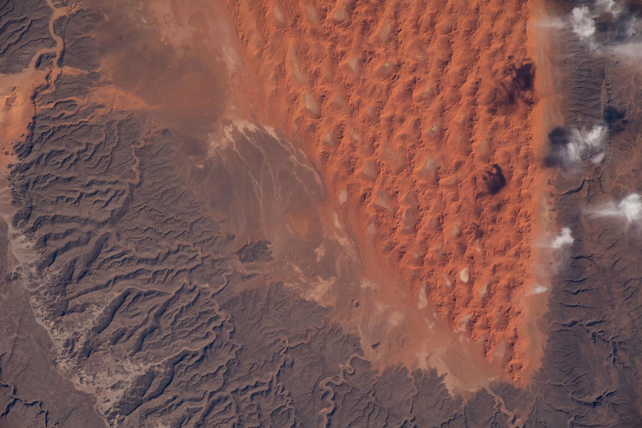
Radially symmetrical, star dunes dominate the Grand Erg Oriental of the Algerian Sahara, as depicted in this image acquired October 27, 2012 acquired by NASA Terra spacecraft.
The impact of an asteroid or comet several hundred million years ago left scars in the landscape that are still visible in this spaceborne radar image of an area in the Sahara Desert of northern Chad.
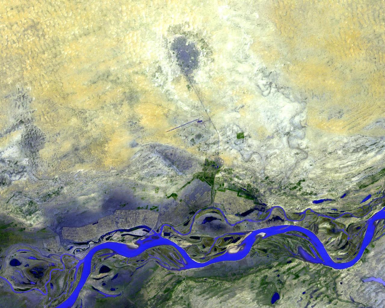
NASA Terra spacecraft shows Timbuktu in the West African Nation of Mali, about 15 km north of the Niger River, at the intersection of an east-west and a north-south Trans Saharan trade route across the Sahara.
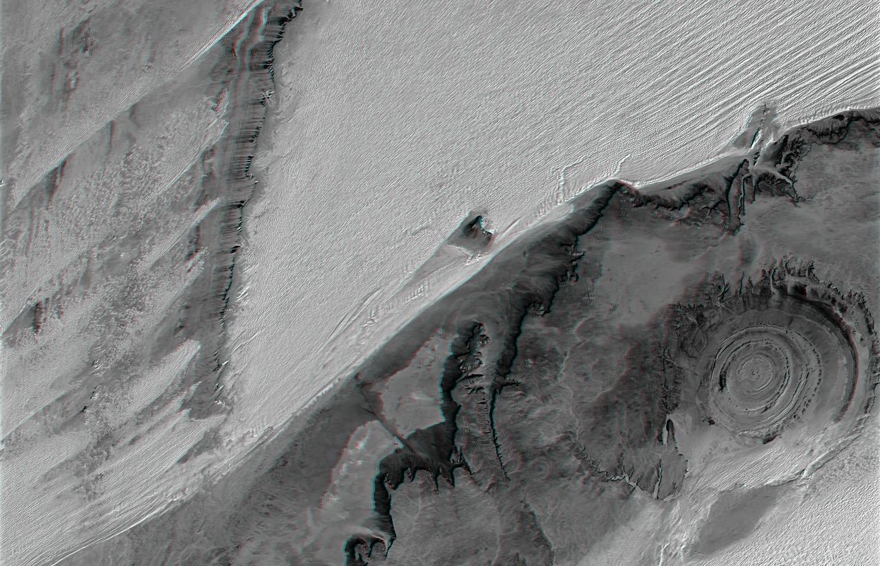
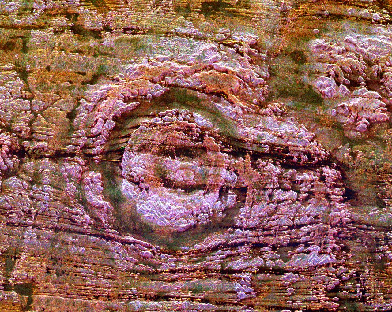
The prominent circular feature seen here is known as the Richat Structure, in the Sahara desert of Mauritania. This anaglyph is from NASA Shuttle Radar Topography Mission. 3D glasses are necessary to view this image.
Located 600 km south of Algiers, Algeria in the heart of the Sahara Desert, the five ksour fortified villages of the MZab Valley form an extraordinarily homogenous ensemble in this image captured by NASA Terra spacecraft.
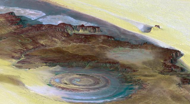
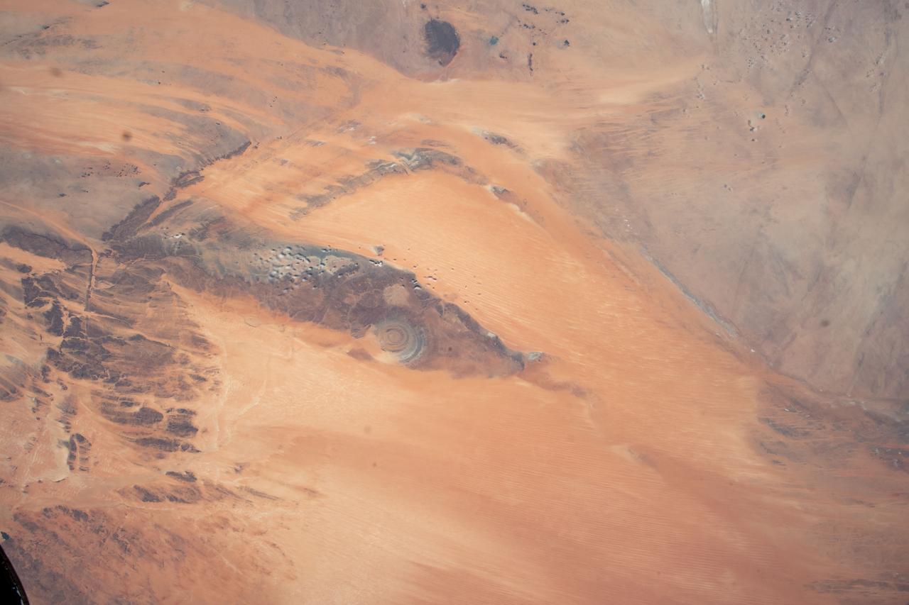
This prominent circular feature, known as the Richat Structure, in the Sahara desert of Mauritania is often noted by astronauts because it forms a conspicuous bull-eye on the otherwise rather featureless expanse of the desert.
The impact of an asteroid or comet several hundred million years ago left scars in the landscape that are still visible in this spaceborne radar image of an area in the Sahara Desert of northern Chad.
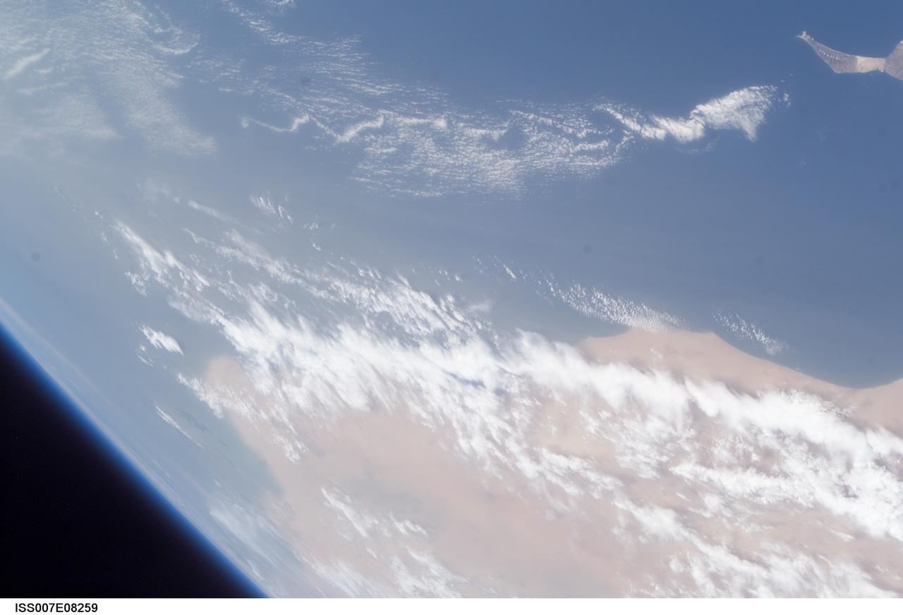
ISS007-E-08259 (25 June 2003) --- This view was taken by an Expedition 7 crewmember onboard the International Space Station (ISS) while in orbit over the Atlantic Ocean. Dust blowing from the Sahara Desert obscures the country of Western Sahara. Fuerteventura, one of the Canary Islands, is at upper right.
GMT353_11_56_Terry Virts_CEO Ghana Accra zoom sahara red sea_129
Earth observation taken during a day pass by the Expedition 40 crew aboard the International Space Station. File identifies it as: Sahara, and Libya.
iss071e082709 (May 16, 2024) --- Dakhla Bay on the coast of Western Sahara is pictured from the International Space Station as it orbited 259 miles above the Atlantic Ocean.
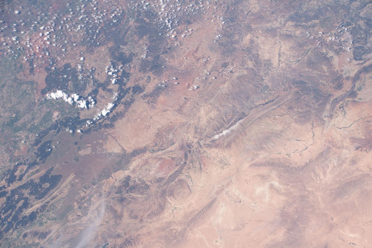
iss063e002389 (April 22, 2020) --- The northern central portion of Morocco, pictured from the International Space Station, is a mountainous region that borders the Sahara Desert in northwest Africa.
Earth observation taken during a day pass by the Expedition 40 crew aboard the International Space Station. File identifies it as: Sahara, and Libya.
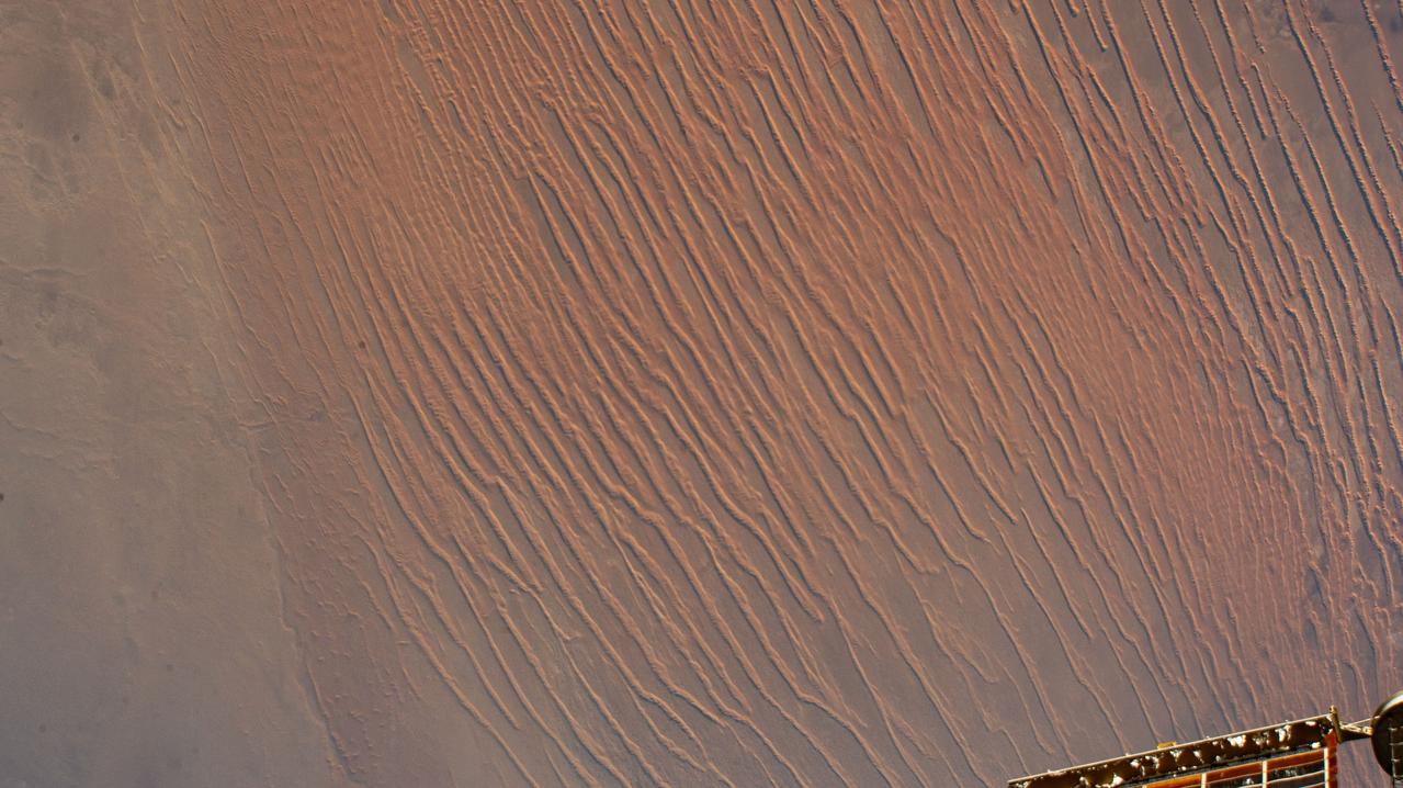
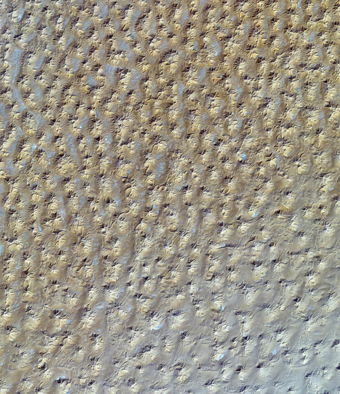
iss070e090117 (Feb. 8, 2024) --- Sand dunes in the Sahara Desert are pictured in the African nation of Algeria as the International Space Station orbited 260 miles above.
Earth Observation taken during a day pass by the Expedition 40 crew aboard the International Space Station (ISS). Folder lists this as: Sahara.
iss061e093293 (Dec. 20, 2019) --- The Tibesti Mountains in the African nation of Chad are pictured as the International Space Station orbited 259 miles above the central Sahara.
Earth observation taken during a day pass by the Expedition 40 crew aboard the International Space Station. File identifies it as: Sahara, and Libya.
Earth observation taken during a day pass by the Expedition 40 crew aboard the International Space Station. File identifies it as: Sahara, and Libya.
iss064e029454 (Feb. 5, 2021) --- The International Space Station was flying 261 miles above the Sahara Desert when this photograph was taken of the Murzuq District in central Libya.
Earth observation taken during a day pass by the Expedition 40 crew aboard the International Space Station. File identifies it as: Sahara, and Libya.
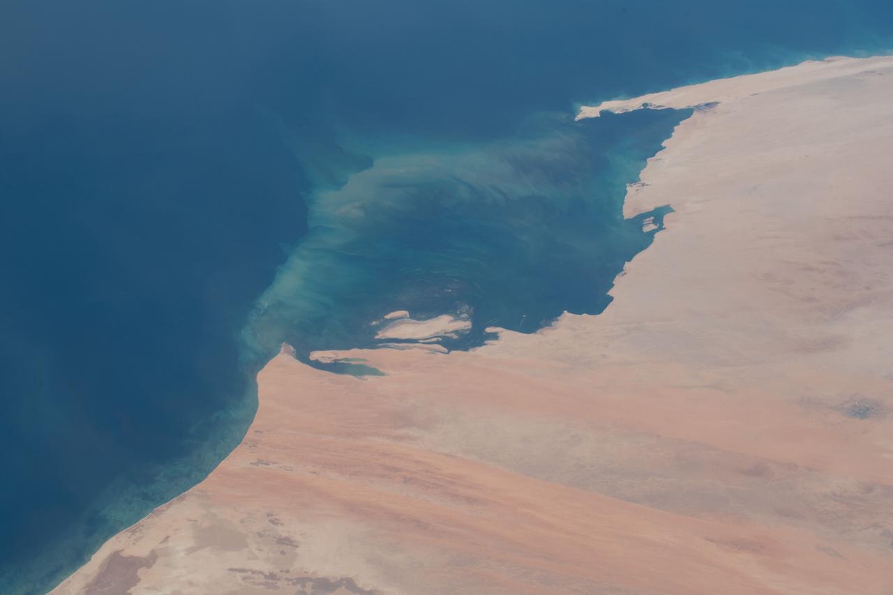
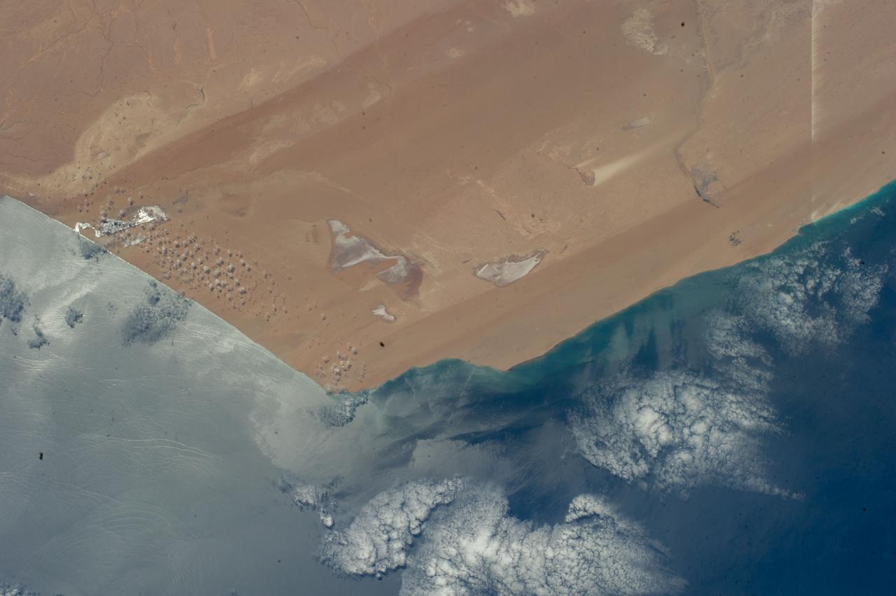
iss057e111398 (Dec. 4, 2018) --- An Expedition 57 crew member photographed the desert coast of Mauritania on the Atlantic Ocean near the border with Western Sahara on the African continent.
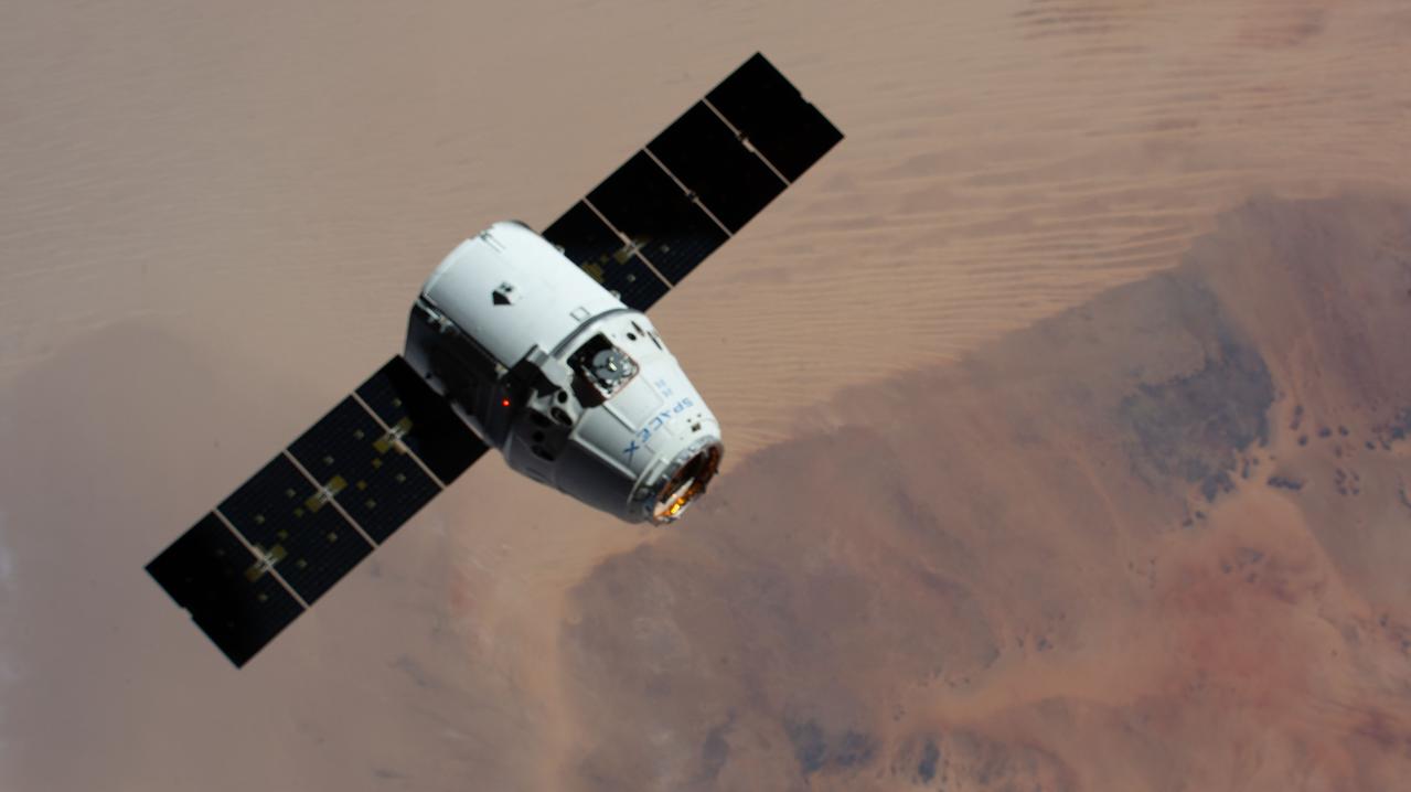
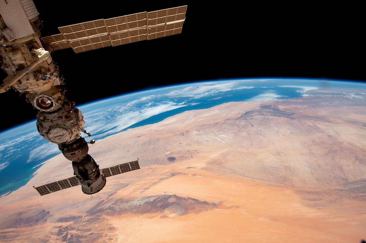
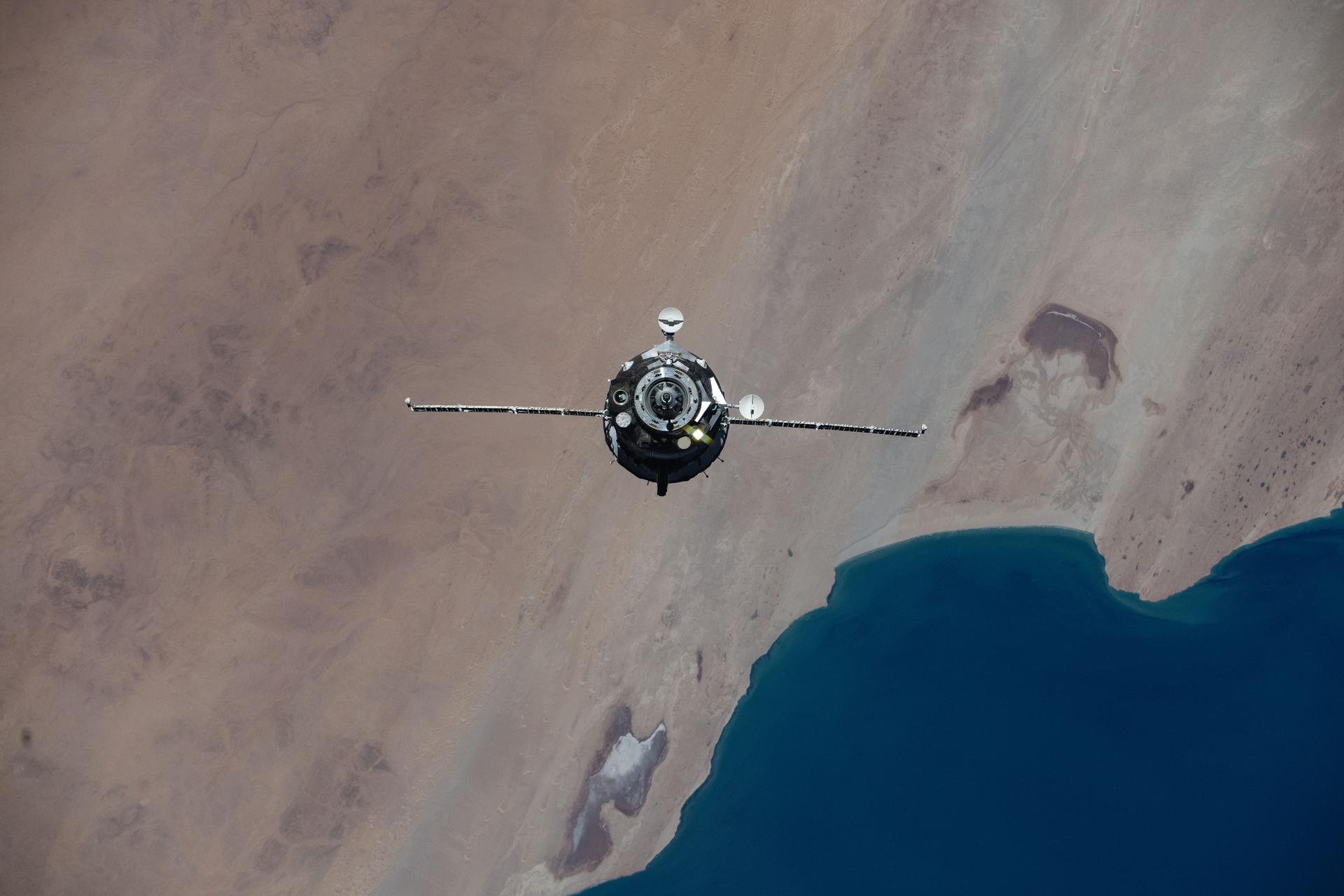
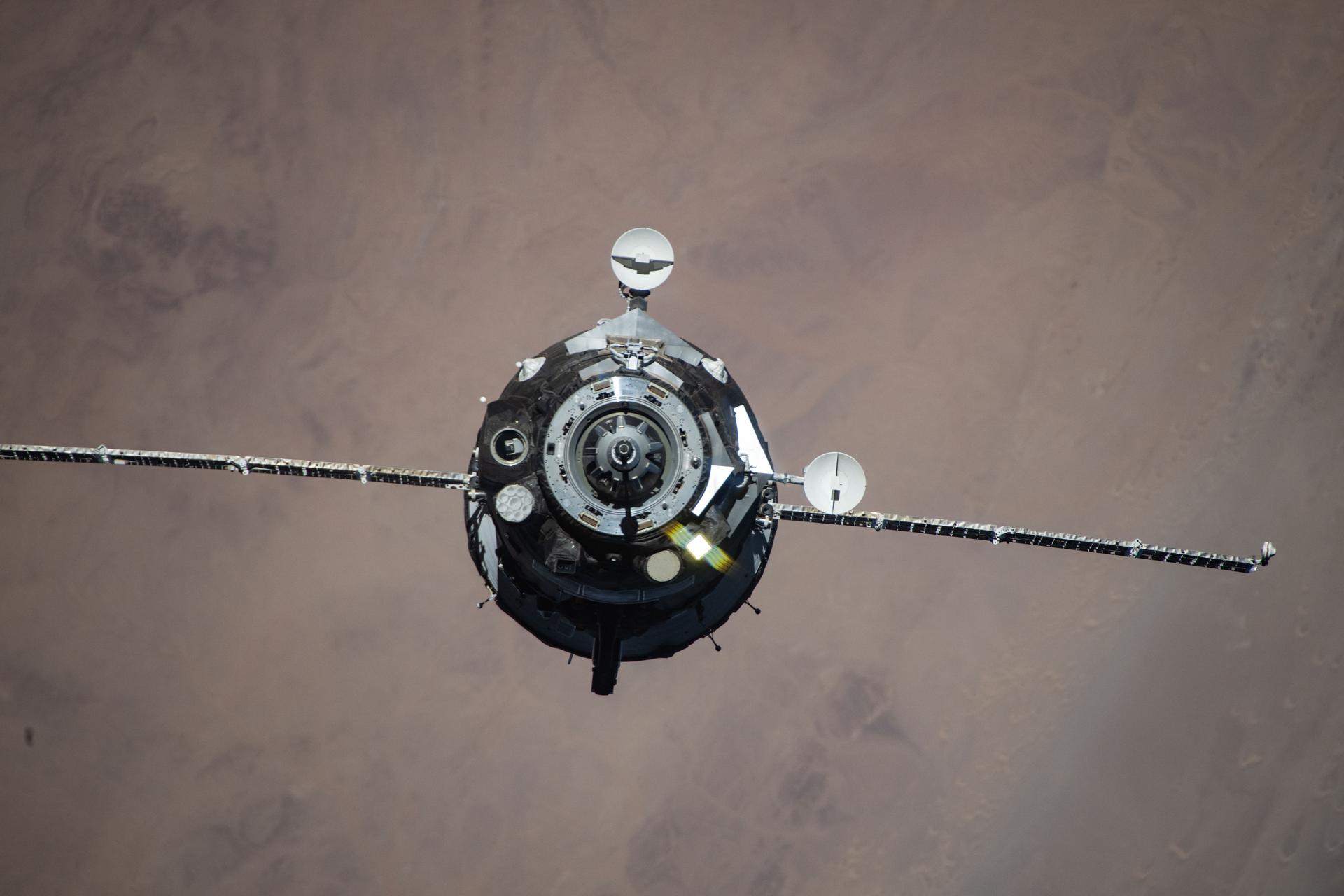
iss061e067973 (Dec. 8, 2019) --- The Space Dragon resupply ship approaches the International Space Station as both spacecraft orbited 257 miles above the Sahara.
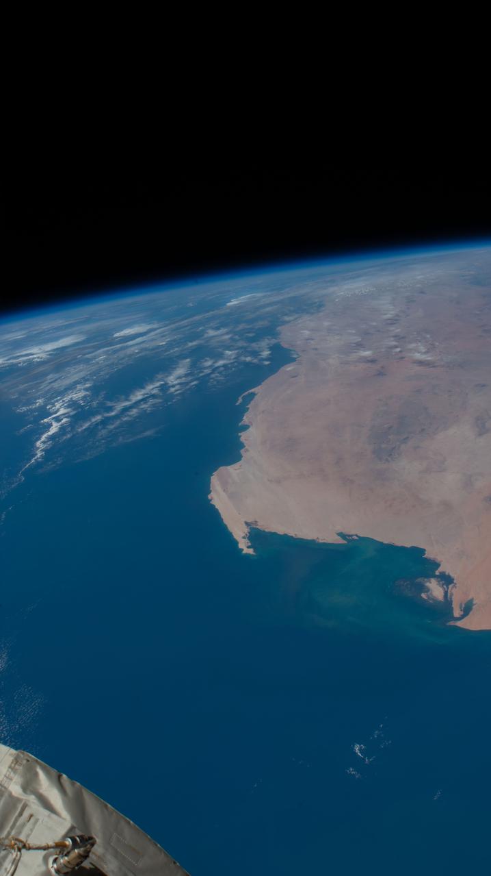
iss059e008252 (April 1, 2019) --- The Atlantic coast of the nations of Mauritania and Western Sahara is pictured as the International Space Station orbited 255 miles off the coast of Africa.
Earth Observation taken during a day pass by the Expedition 40 crew aboard the International Space Station (ISS). Folder lists this as: Sahara Sand over the Atlantic.
iss060e014846 (July 26, 2019) --- A portion of the Sahara desert in Algeria is pictured as the International Space Station orbited 260 miles above north Africa.
Earth Observation taken during a day pass by the Expedition 40 crew aboard the International Space Station (ISS). Folder lists this as: Sahara.
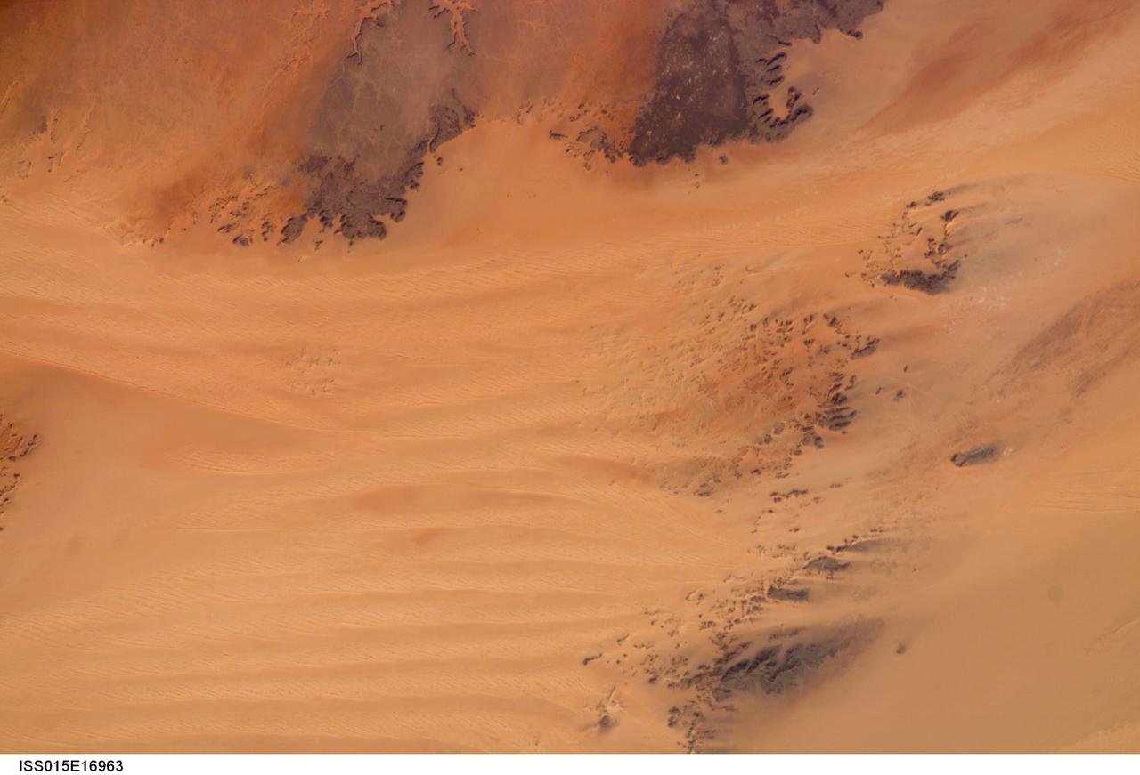
ISS015-E-16963 (7 July 2007) --- Sahara Desert dunes are featured in this image photographed by an Expedition 15 crewmember on the International Space Station.
iss064e000451 (Oct. 25, 2020) --- A portion of the Sahara Desert is pictured in Chad as the International Space Station orbited above the sparsely-populated African nation.
Earth Observation taken during a day pass by the Expedition 40 crew aboard the International Space Station (ISS). Folder lists this as: Sahara.
iss060e014847 (July 26, 2019) --- A portion of the Sahara desert in Algeria is pictured as the International Space Station orbited 260 miles above north Africa.
Earth Observation taken during a day pass by the Expedition 40 crew aboard the International Space Station (ISS). Folder lists this as: Sahara.
Earth Observation taken during a day pass by the Expedition 40 crew aboard the International Space Station (ISS). Folder lists this as: Sahara Sand over the Atlantic.
Earth Observation taken during a day pass by the Expedition 40 crew aboard the International Space Station (ISS). Folder lists this as: Sahara.
Earth Observation taken during a day pass by the Expedition 40 crew aboard the International Space Station (ISS). Folder lists this as: Sahara.
Earth Observation taken during a day pass by the Expedition 40 crew aboard the International Space Station (ISS). Folder lists this as: Sahara.
Earth observation taken during a day pass by the Expedition 40 crew aboard the International Space Station. File identifies it as: Sahara, and Libya.
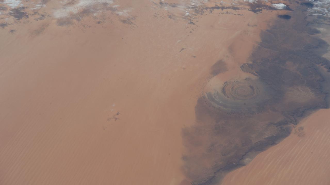
iss068e025663 (Nov. 30, 2022) --- The Richat Structure, or the "Eye of the Sahara," in northwestern Mauritania is pictured from the International Space Station as it orbited 259 miles above the African continent.
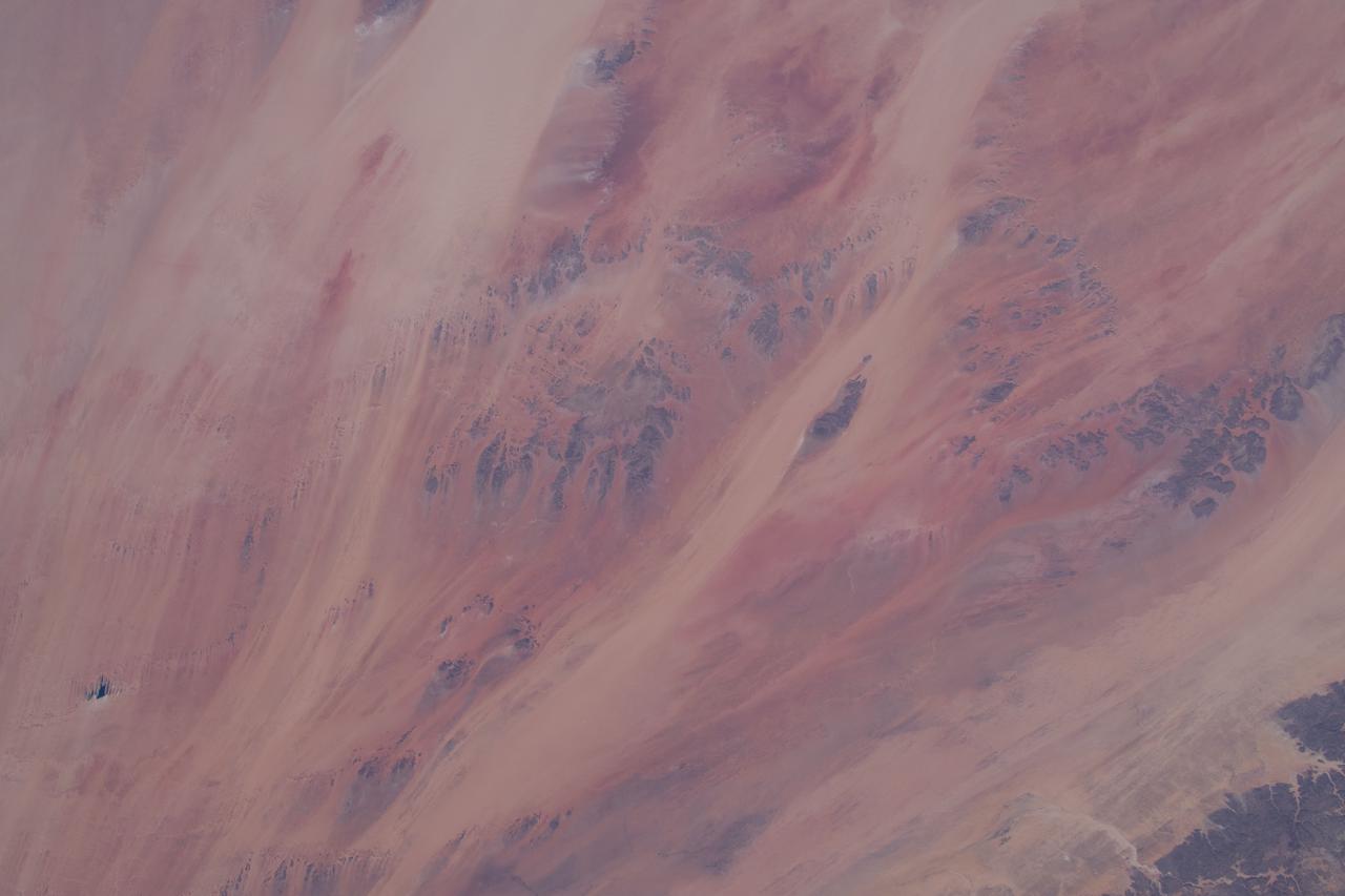
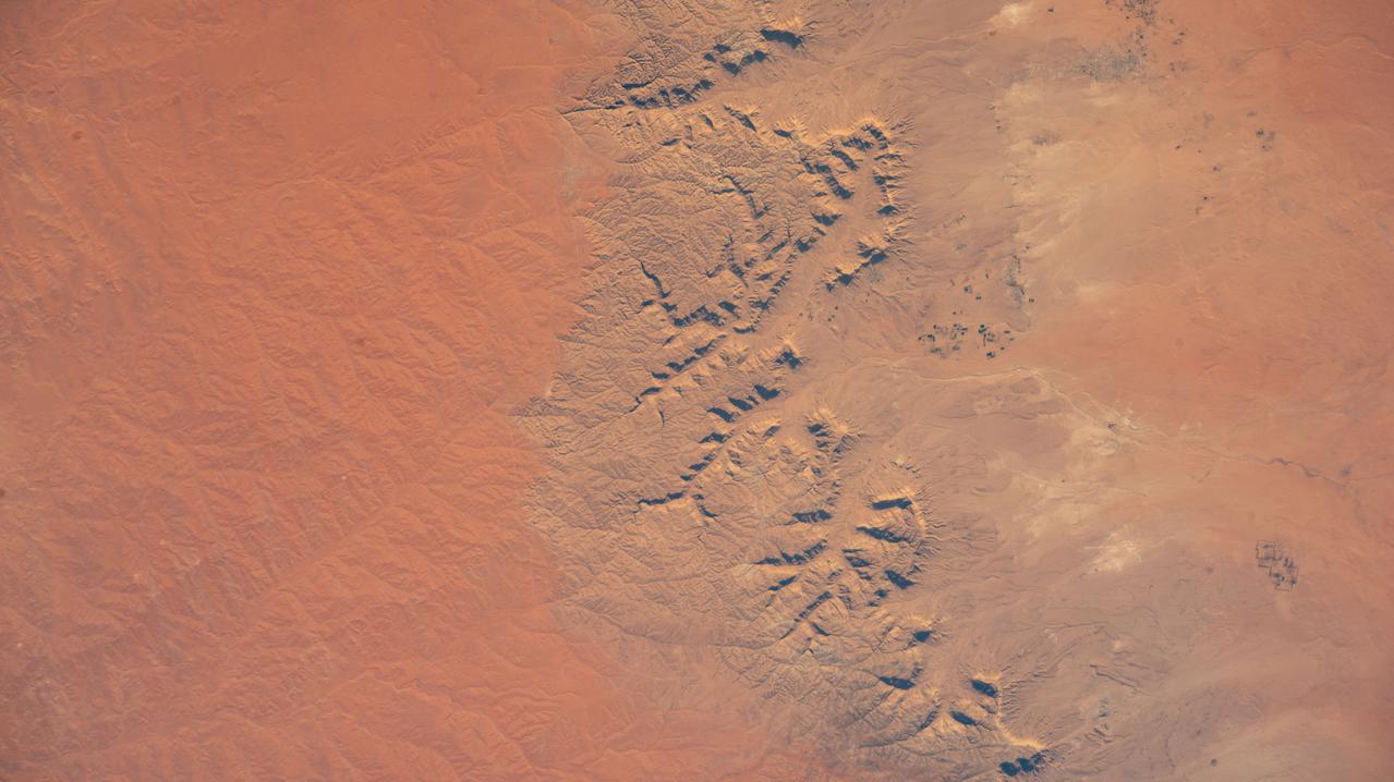
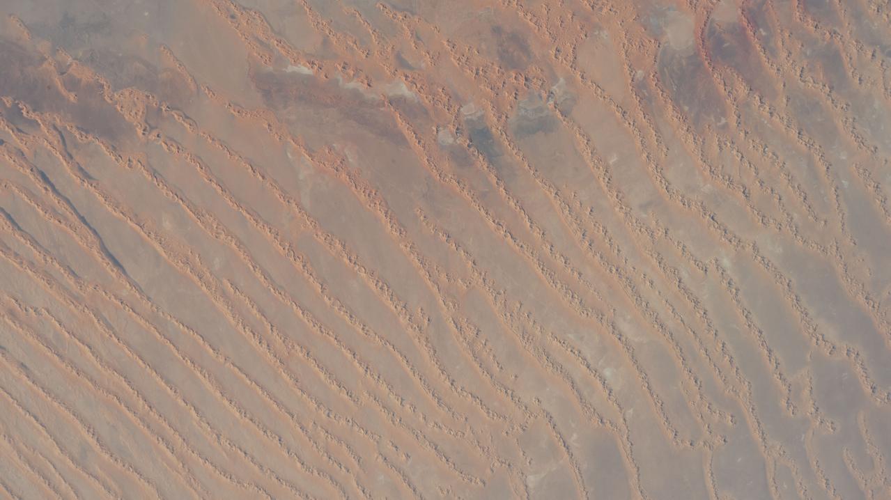
iss066e137375 (Feb. 7, 2022) --- A portion of the Sahara Desert in Algeria, with sand dunes, rocky platforms and sandstone plateaus, is pictured from the International Space Station as it orbited 259 miles above the African nation.
iss056e151163 (Aug. 18, 2018) --- Earth's limb and dust storms in the Sahara are pictured as the International Space Station orbited nearly 252 miles above the African country of Mali.
Earth Observation taken during a day pass by the Expedition 40 crew aboard the International Space Station (ISS). Folder lists this as: Sahara dust storm over Atlantic.
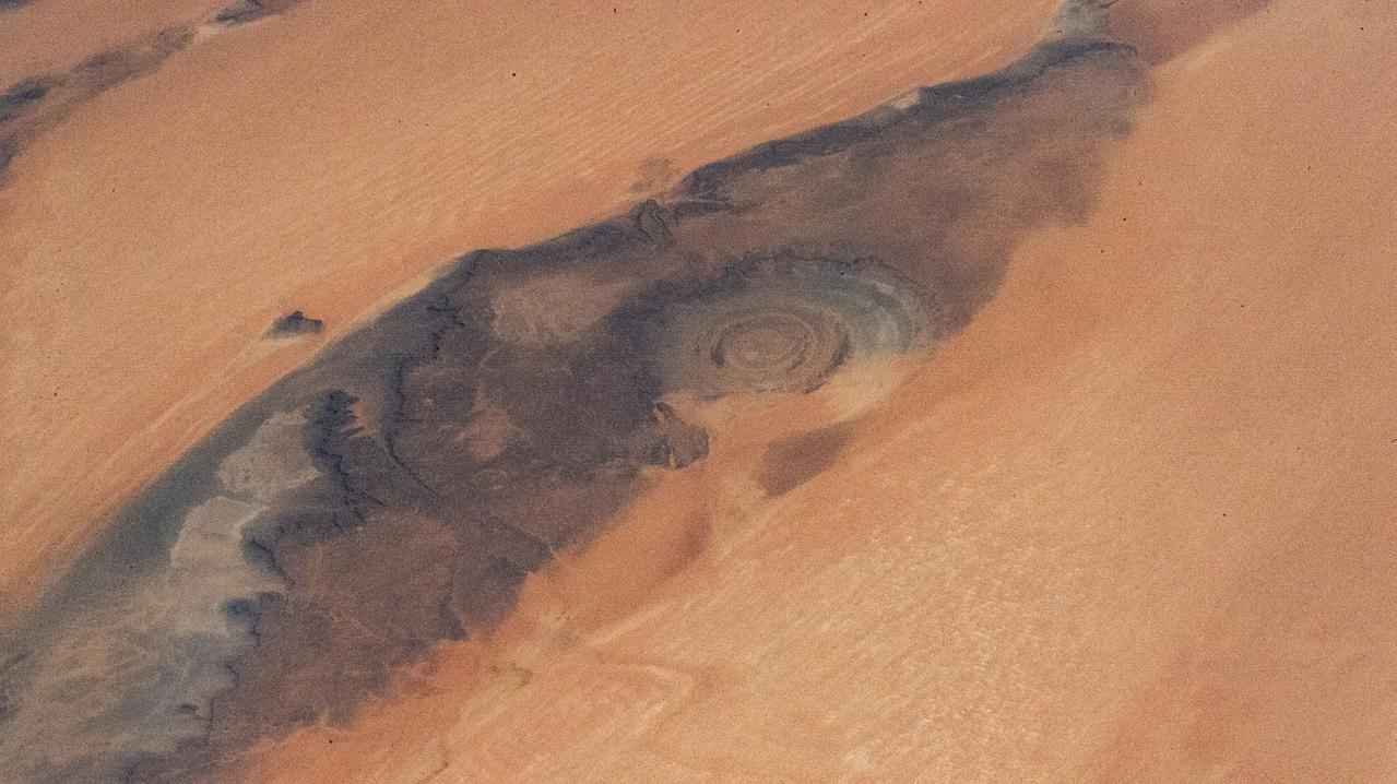
iss071e170970 (June 5, 2024) --- The Rihat Structure, also known as the Eye of the Sahara, is a deeply eroded geologic dome in the African nation of Mauritania pictured from the International Space Station as it orbited 258 miles above.
Earth Observation taken during a day pass by the Expedition 40 crew aboard the International Space Station (ISS). Folder lists this as: Sahara dust storm over Atlantic.
iss071e082698 (May 16, 2024) --- The Atlantic coastal desert region of the Sahara Desert in the African nation of Mauritania is pictured from the International Space Station as it orbited 258 miles above the Atlantic Ocean.
Earth Observation taken during a day pass by the Expedition 40 crew aboard the International Space Station (ISS). Folder lists this as: Sahara dust storm over Atlantic.
iss072e404551 (Dec. 26, 2024) --- A portion of the Ennedi Massif in Northern Chad, a UNESCO World Heritage Site in the Sahara, is pictured from the International Space Station as it orbited 261 miles above the African nation.
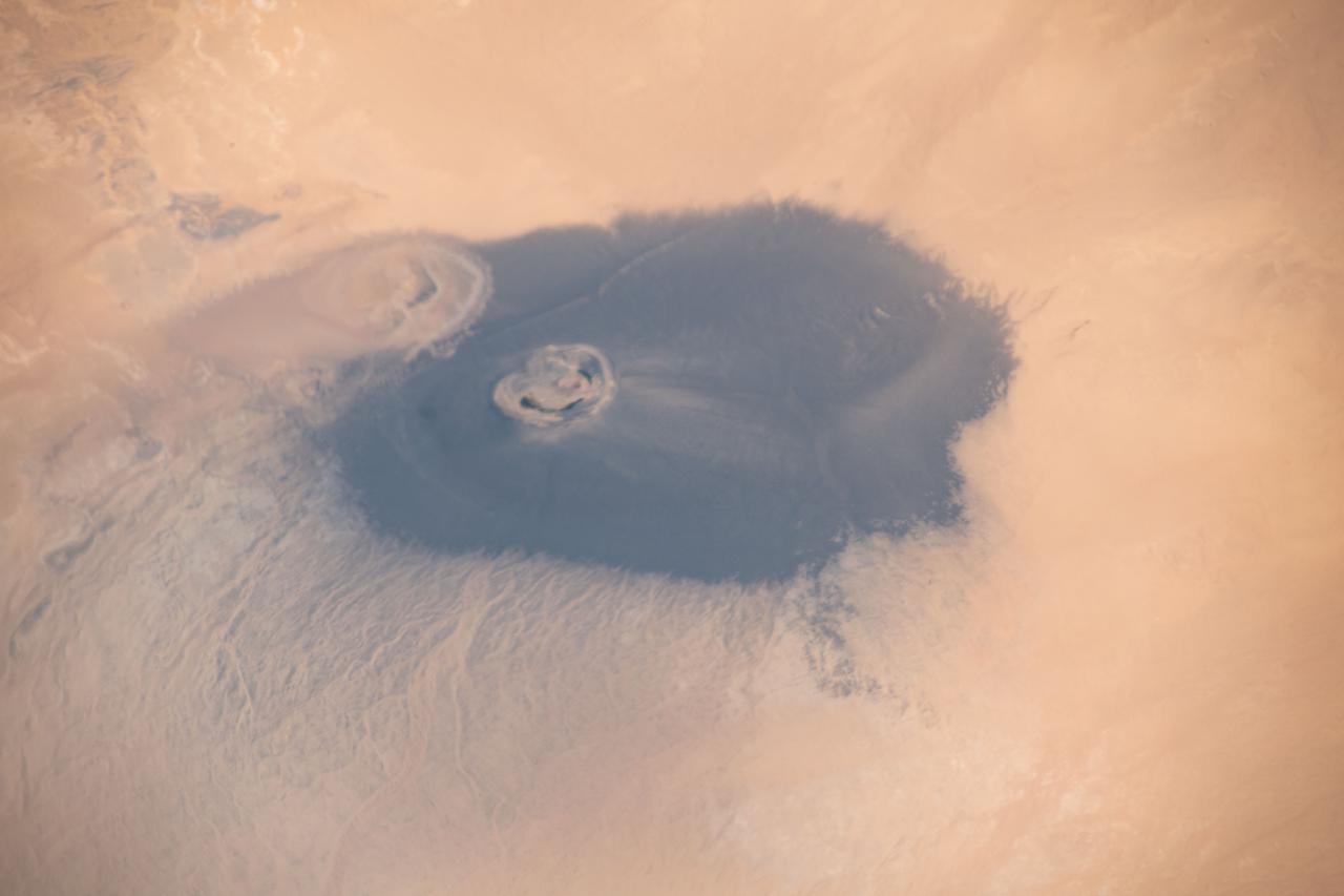
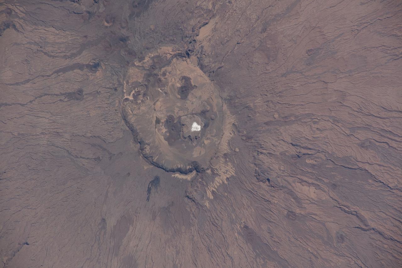
iss065e009516 (April 29, 2021) --- The isolated volcanic crater Waw an Namus in Libya with three small saltwater lakes is pictured from the International Space Station as it orbited 263 miles above the Sahara Desert.
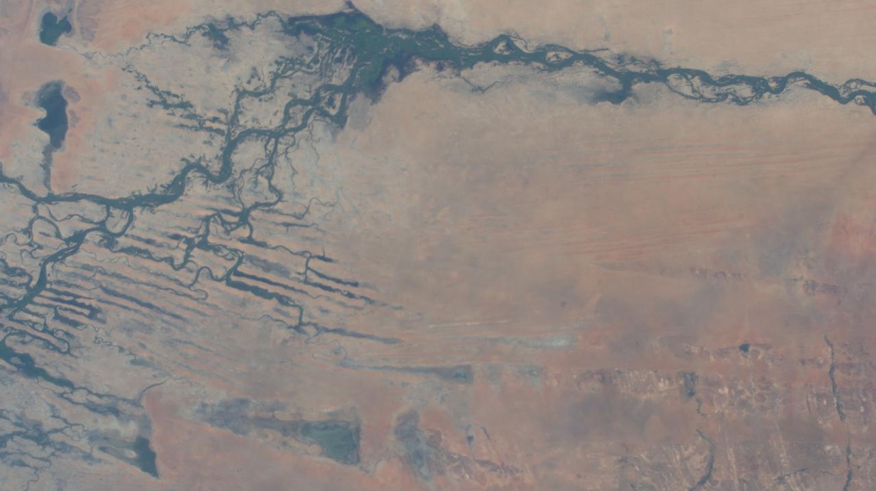
iss066e024016 (Nov. 1, 2021) --- The Niger River in the African nation of Mali is pictured from the International Space Station as it orbited 259 miles above the southwestern Sahara Desert.
iss068e050817 (Feb. 9, 2023) --- An agricultural development in Egypt's New Valley Governate near the Sudan border is pictured from the International Space Station as it orbited 258 miles above the eastern Sahara.
iss064e000448 (Oct. 25, 2020) --- Emi Koussi, a high pyroclastic shield volcano in northern Chad, is also the highest mountain in the Sahara. The International Space Station was orbiting above the Tibesti Mountains in Chad when this photograph was taken.
iss064e020109 (Jan. 5, 2021) --- This view from a window on the SpaceX Crew Dragon vehicle docked to the International Space Station looks at a portion of the Sahara Desert in the African nation of Niger 260 miles below.
iss067e141205 (June 19, 2022) --- This portion of the Western Desert is an area of the Sahara where the borders of Egypt, Libya, and Sudan meet. The International Space Station was orbiting 259 miles above north Africa at the time of this photograph.
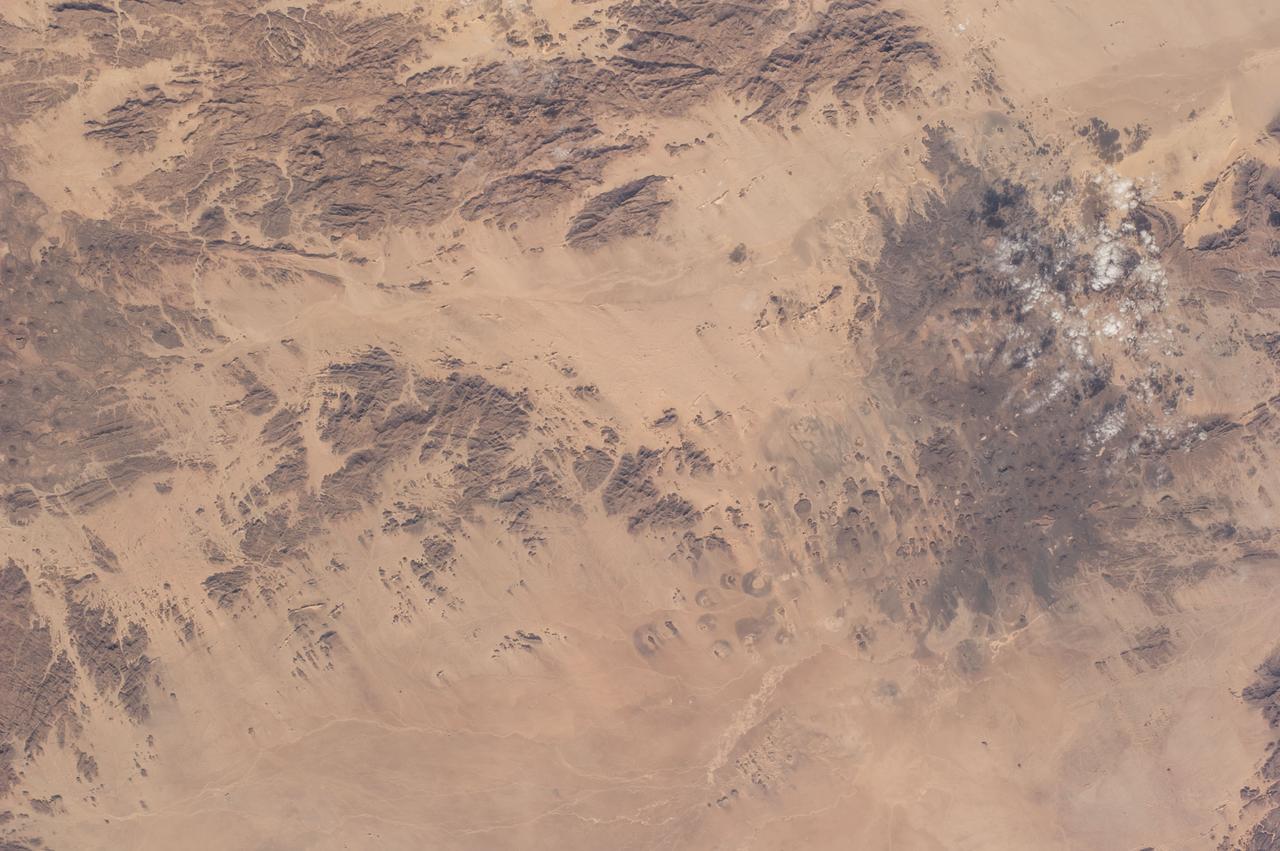
iss067e123244 (June 10, 2022) --- A portion of the Sahara in Libya's northwestern district of Nalut is pictured from the International Space Station as it orbited 260 miles above the north African nation.
iss066e137392 (Feb. 7, 2022) --- A portion of the Sahara Desert in Algeria, with sand dunes, rocky platforms and sandstone plateaus, is pictured from the International Space Station as it orbited 259 miles above the African nation.
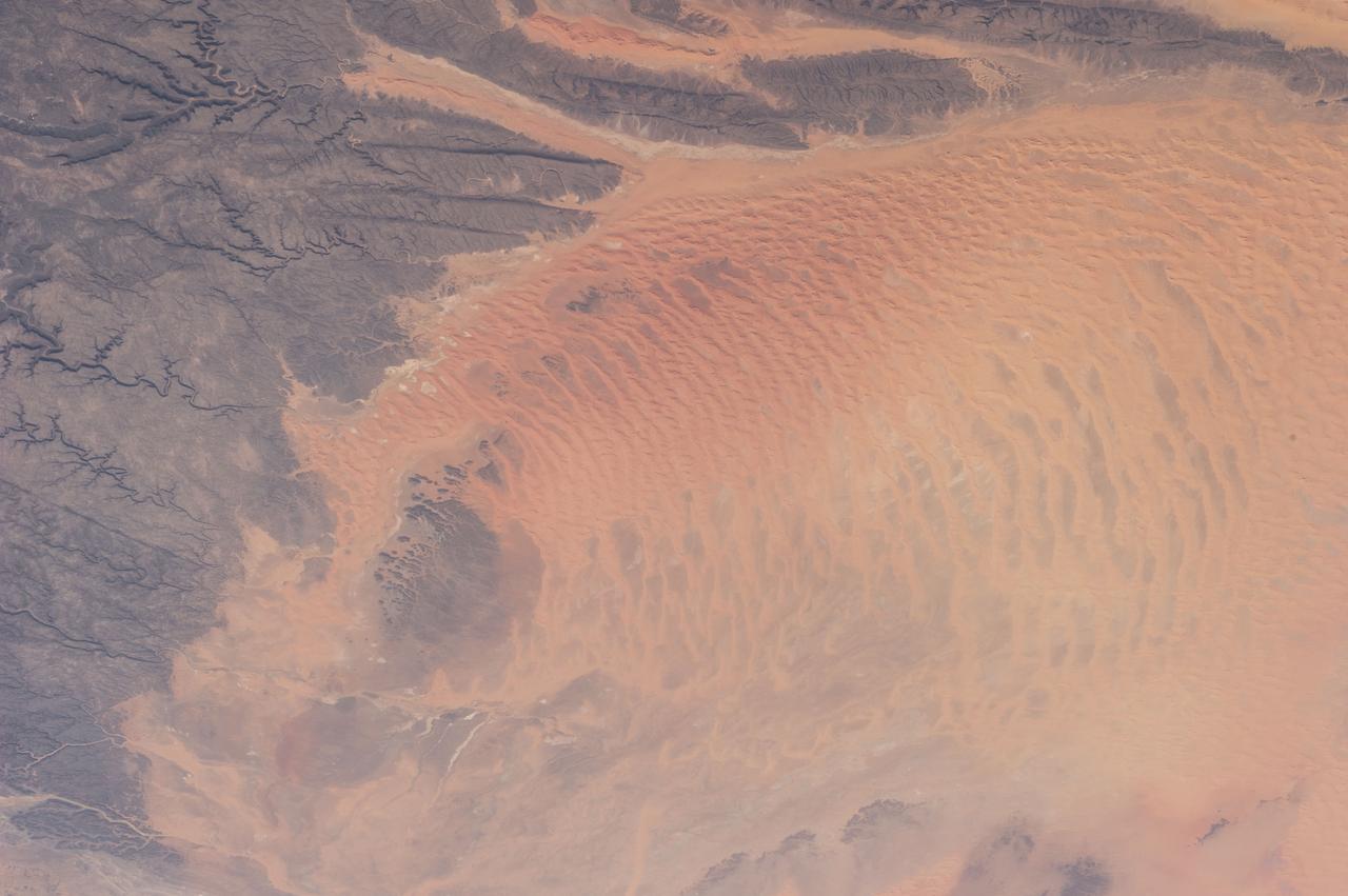
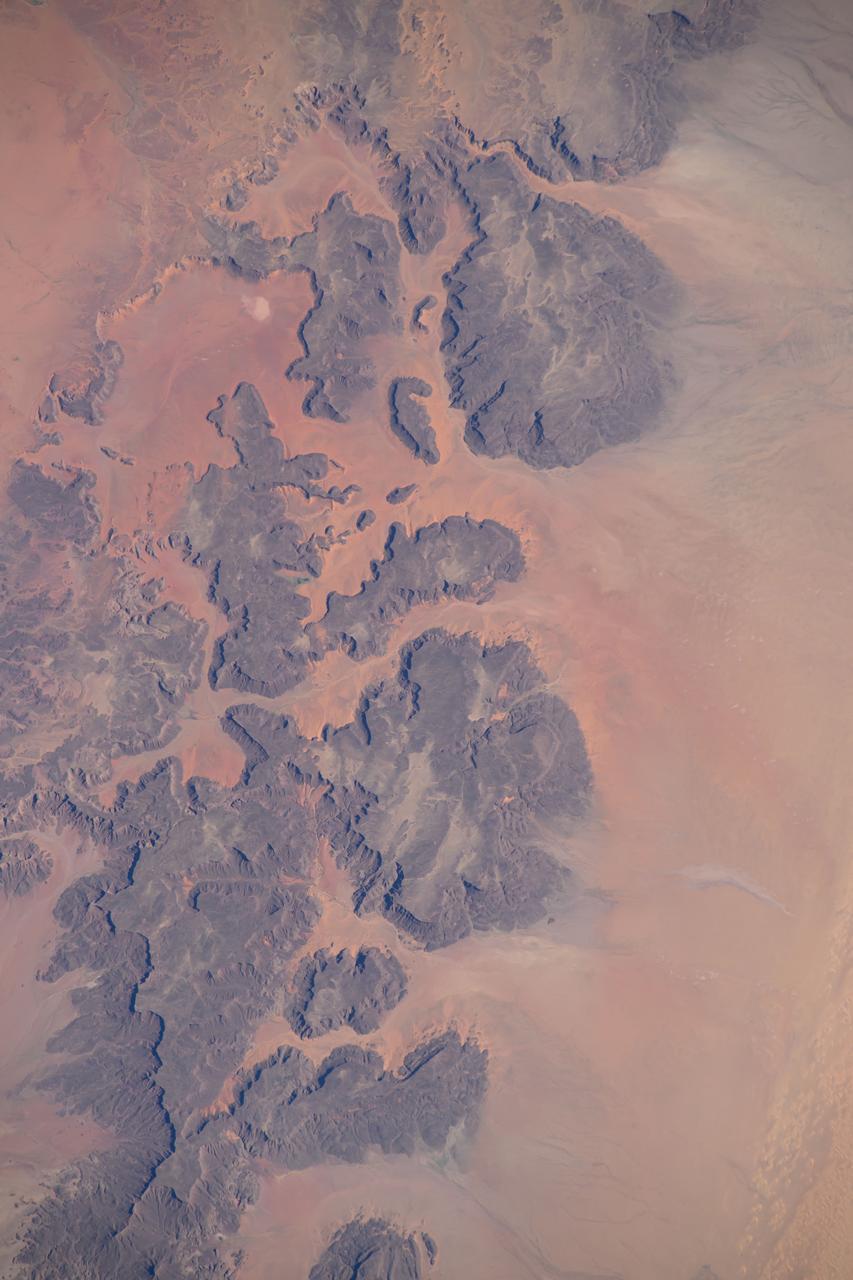
iss070e052305 (Jan. 3, 2024) --- Sand dunes, sandstone plateaus, and rocky platforms that comprise the Tassili N'Ajjer National Park in the southeastern portion of Algeria are pictured from the International Space Station as it orbited 261 mile above the Sahara.
iss073e0734903 (Aug. 25, 2025) --- A SpaceX Dragon cargo spacecraft approaches the International Space Station's forward port on the Harmoy module as both spacecraft orbited 260 miles above the Atlantic Ocean off the coast of Western Sahara.
iss072e404539 (Dec. 26, 2024) --- A portion of the Ennedi Massif in Northern Chad, a UNESCO World Heritage Site in the Sahara, is pictured from the International Space Station as it orbited 261 miles above the African nation.
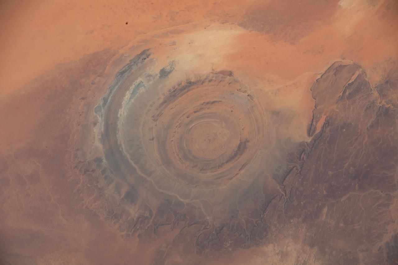
iss067e286458 (Aug. 21, 2022) --- The Richat Structure, also known as the "Eye of the Sahara," an eroded geological dome in the nation of Mauritania, is pictured from the International Space Station as it orbited 256 miles above northwestern Africa.
Earth Observation taken during a day pass by the Expedition 40 crew aboard the International Space Station (ISS). Folder lists this as: Sahara dust storm over Atlantic.
iss065e009521 (April 29, 2021) --- Mount Arkanu in southeast Libya, near the border with Egypt and Sudan, is pictured from the International Space Station as it orbited 262 miles above the Sahara Desert.
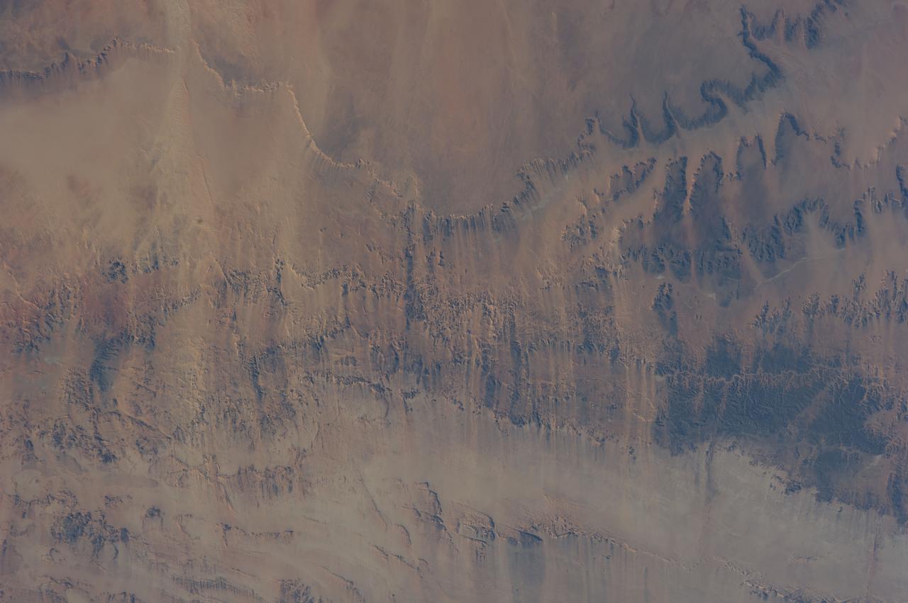
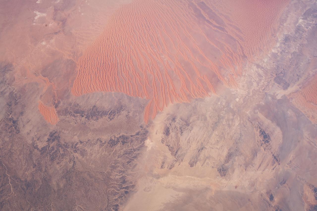
iss064e011532 (Dec. 9, 2020) --- A portion of the Sahara Desert in central western Algeria is pictured from the International Space Station as it orbited 261 miles above the African nation.
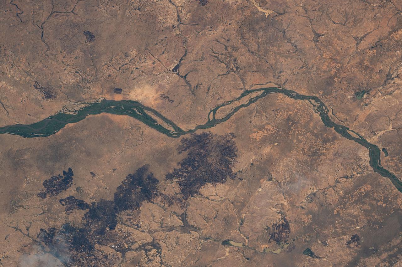
iss072e095217 (Oct. 20, 2024) --- The Niger River flows through the African nation of Mali near the Sahara Desert in this photograph from the International Space Station as it orbited 257 miles above.
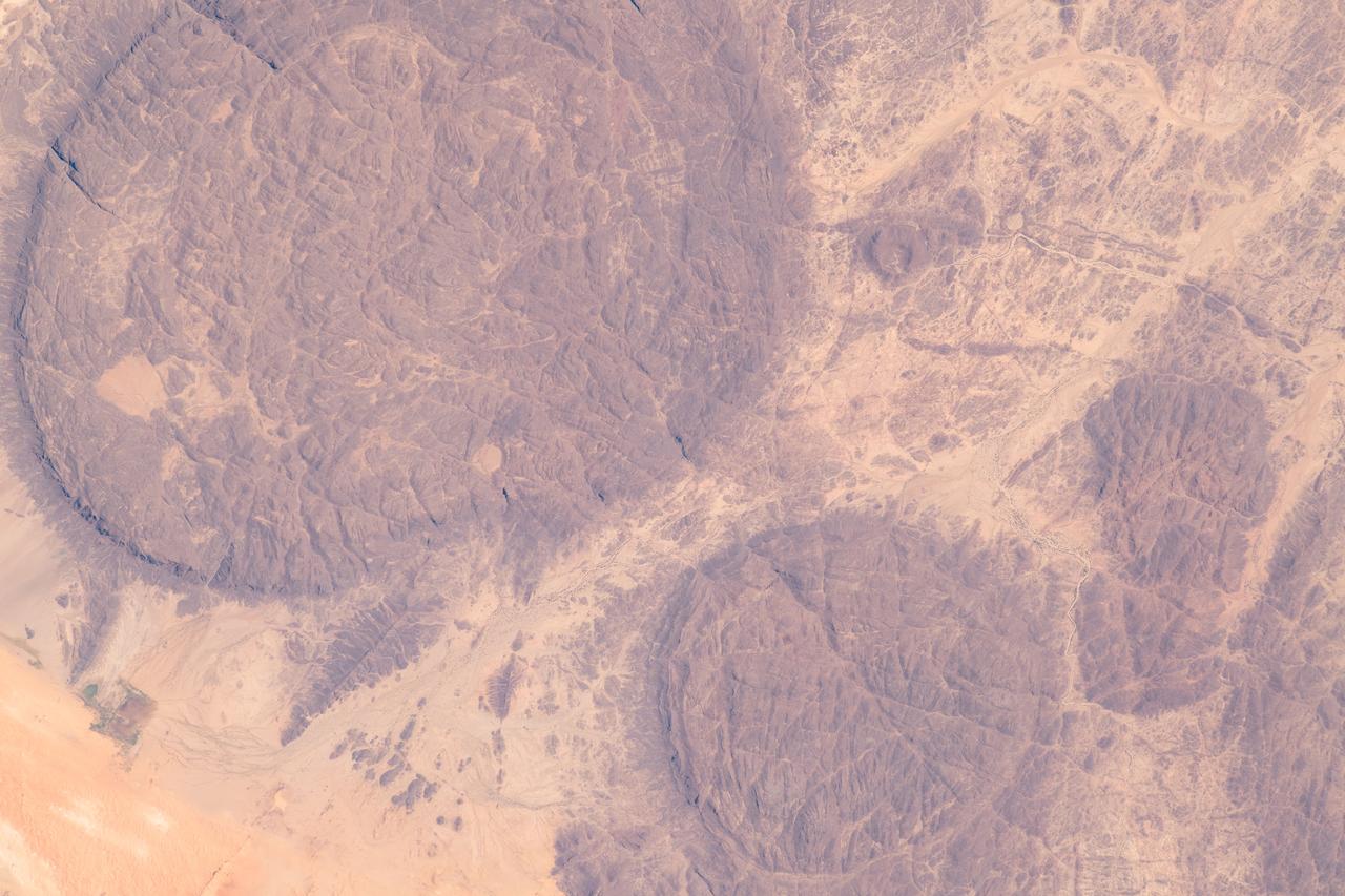
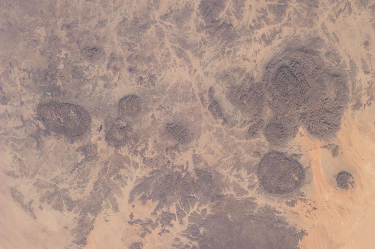
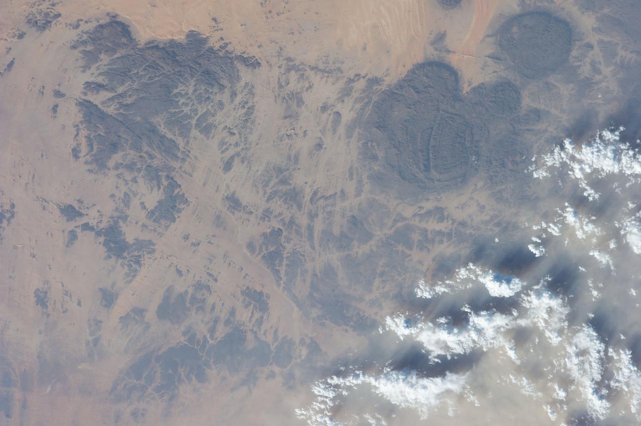
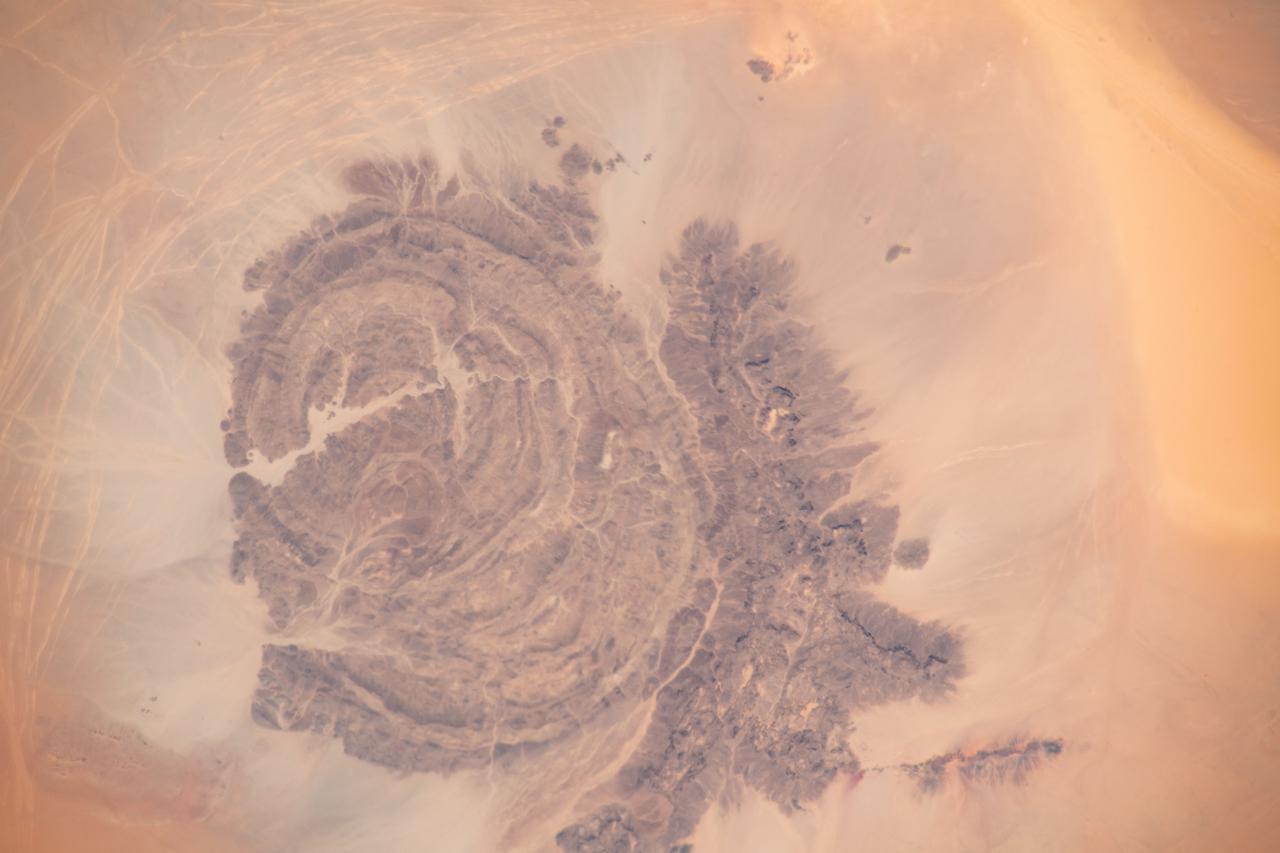
iss062e061341 (Feb. 27, 2020) --- The near-circular massifs of the Aïr Mountains within the Sahara Desert were pictured from the International Space Station as it orbited 263 miles above Niger.
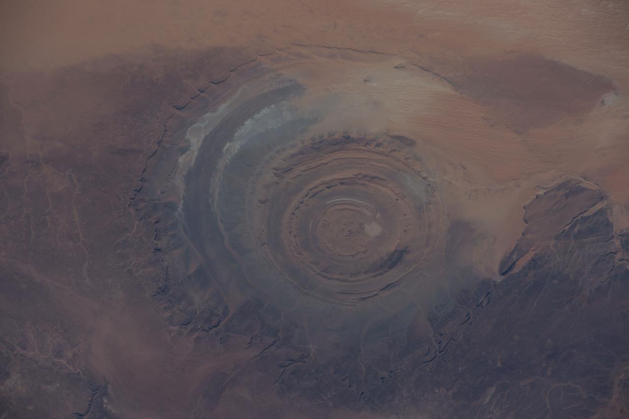
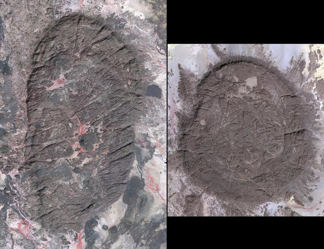
ISS042E007131 (11/22/2014) — Astronauts aboard the International Space Station captured this image of a huge crater in Africa on Nov. 22, 2014. This is the Richat Structure in northwestern Mauritania, otherwise known as the “Eye of the Sahara.” Scientists are still deciding whether this was formed by a subterranean volcano or impact from a large meteor. Deep in the Sahara Desert it is nearly a perfect circle, it is 1.2 miles (1.9 kilometers) wide, and sports a rim 330 feet (100 meters) tall. The crater sits in a vast plain of rocks so ancient they were deposited hundreds of millions of years before the first dinosaurs walked the Earth.
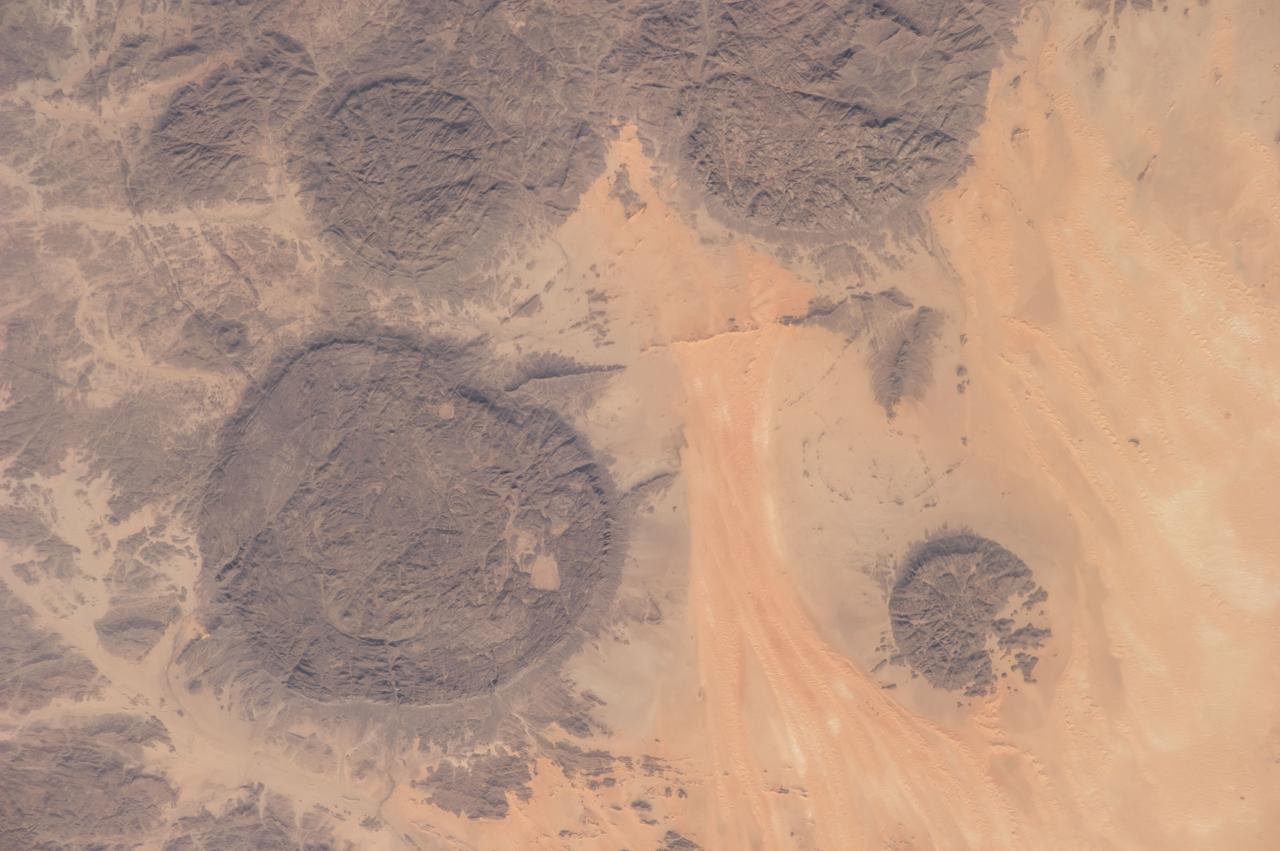
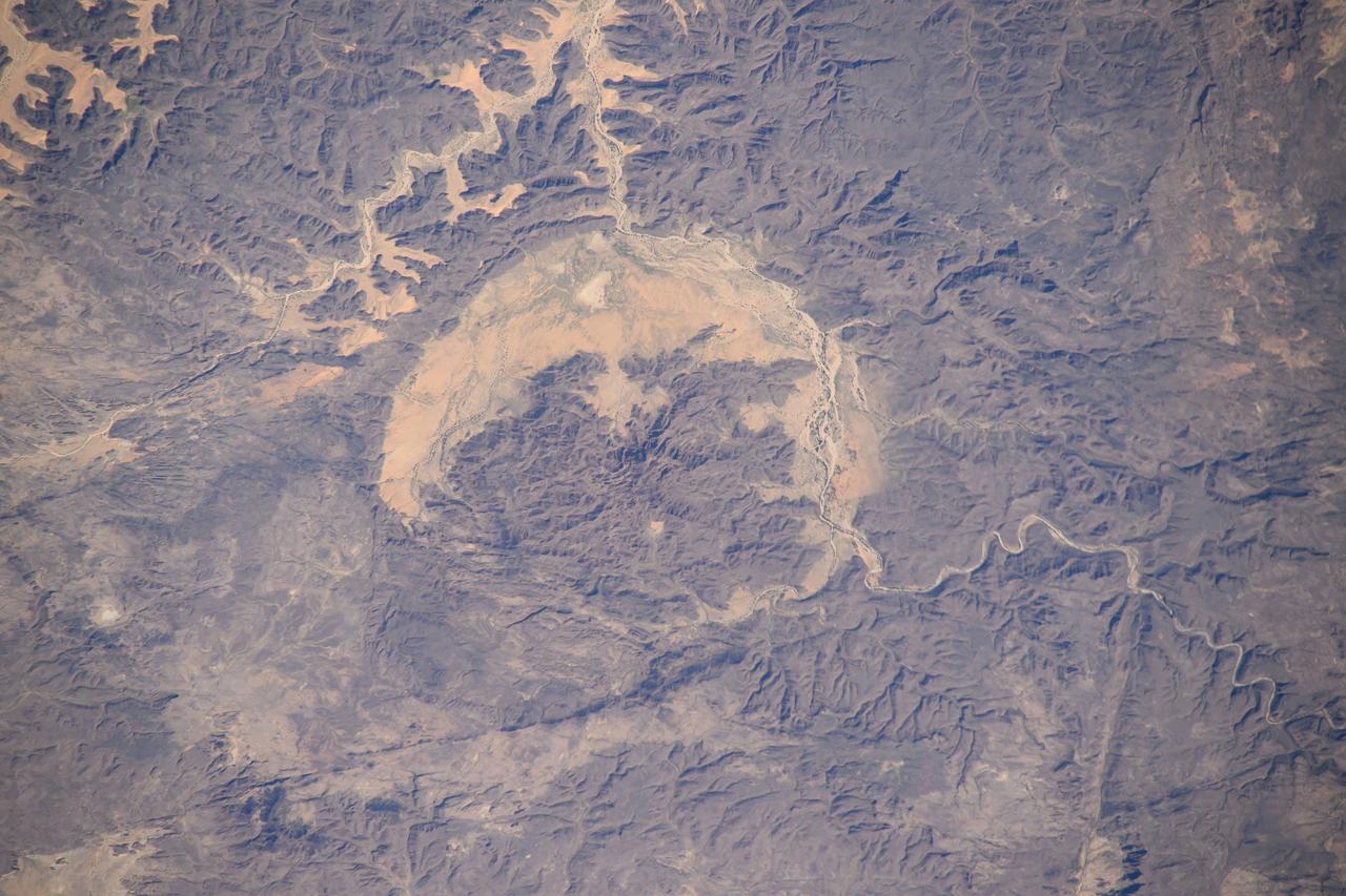
The Air Mountains are located in northern Niger and extend over 84,000 square kilometers within the Sahara Desert. Geologically, the area is notable for its remarkable ring dikes that enclose circular granite massifs. These in turn contain, and are surrounded by, young volcanic features, including cinder cones and lava flows. Two of the massifs are shown here: the oval one includes Mont Idoukal-n-Taghes, Niger's highest point. The montage is made up of images acquired November 5, 2017, covers an area of 45 kilometers north-south, and is located near 18 degrees north, 8.5 degrees east. https://photojournal.jpl.nasa.gov/catalog/PIA22795
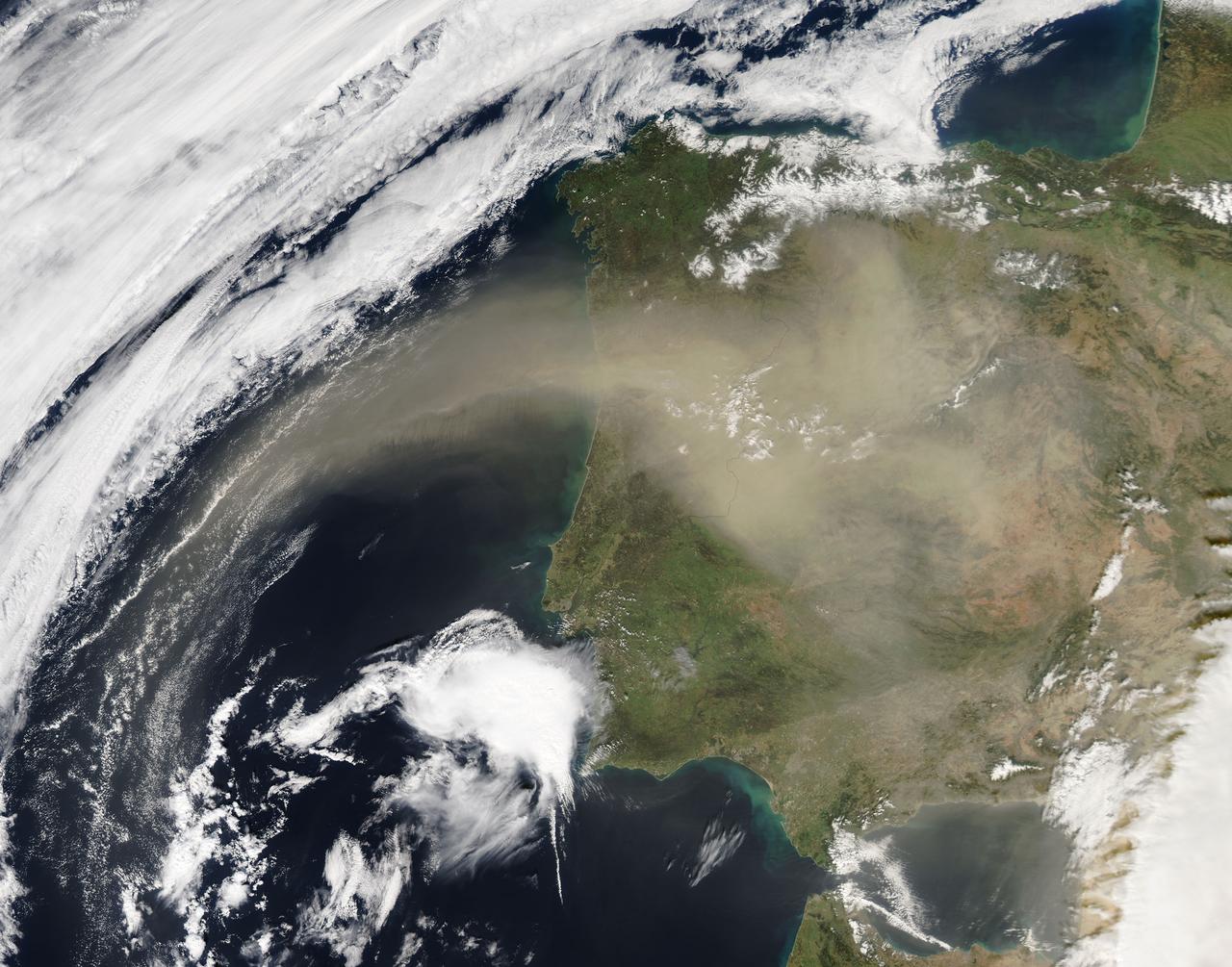
On Feb. 21, 2016 at 14:00 UTC, the Moderate Resolution Imaging Spectroradiometer (MODIS) aboard NASA’s Aqua satellite captured a true color image of Saharan dust over the Iberian Peninsula. Credit: NASA/Goddard/Jeff Schmaltz/MODIS Land Rapid Response Team <b><a href="http://www.nasa.gov/audience/formedia/features/MP_Photo_Guidelines.html" rel="nofollow">NASA image use policy.</a></b> <b><a href="http://www.nasa.gov/centers/goddard/home/index.html" rel="nofollow">NASA Goddard Space Flight Center</a></b> enables NASA’s mission through four scientific endeavors: Earth Science, Heliophysics, Solar System Exploration, and Astrophysics. Goddard plays a leading role in NASA’s accomplishments by contributing compelling scientific knowledge to advance the Agency’s mission. <b>Follow us on <a href="http://twitter.com/NASAGoddardPix" rel="nofollow">Twitter</a></b> <b>Like us on <a href="http://www.facebook.com/pages/Greenbelt-MD/NASA-Goddard/395013845897?ref=tsd" rel="nofollow">Facebook</a></b> <b>Find us on <a href="http://instagrid.me/nasagoddard/?vm=grid" rel="nofollow">Instagram</a></b>
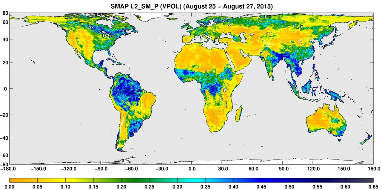
A three-day composite global map of surface soil moisture as retrieved from NASA SMAP radiometer instrument between Aug. 25-27, 2015. Dry areas appear yellow/orange, such as the Sahara Desert, western Australia and the western U.S. Wet areas appear blue, representing the impacts of localized storms. White areas indicate snow, ice or frozen ground. http://photojournal.jpl.nasa.gov/catalog/PIA19877
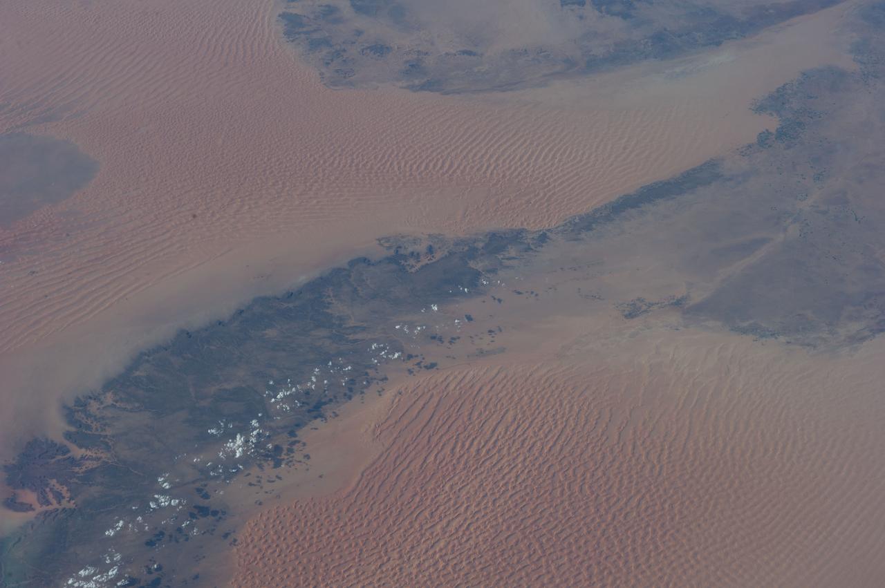
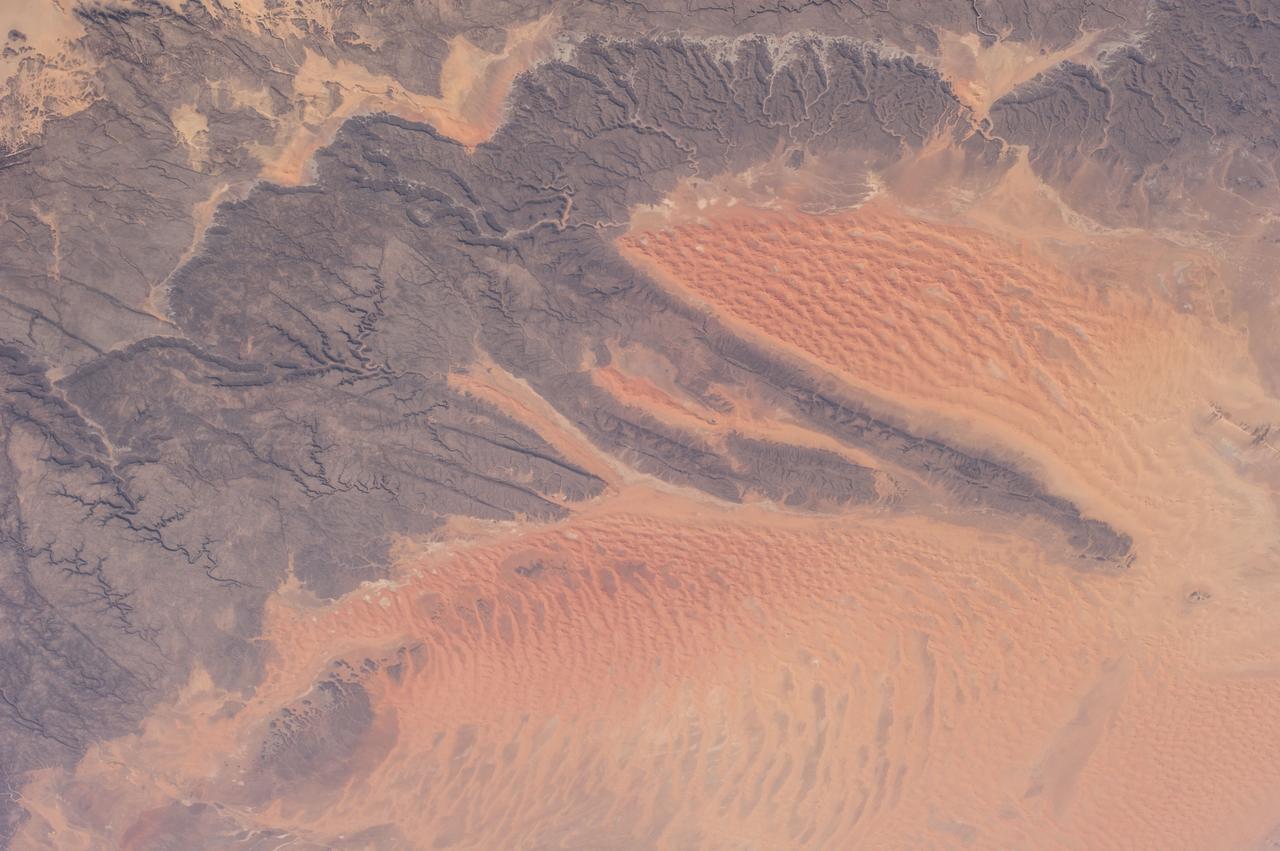
ISS038-E-026862 (8 Jan. 2014) --- The Western Sahara Desert is featured in this image photographed by an Expedition 38 crew member on the International Space Station. The infrequent cloud bands over southern Mauritania were photographed with an oblique look angle so that the dark cloud shadows are also a prominent part of the view. Beneath the cloud the Aouker plateau of dark sedimentary rocks appears as a ragged, near-vertical escarpment at top right. Isolated remnants of the plateau appear as dark mesas (flat-topped hills) across the top and near the center of the image. The escarpment is about 250 meters high, with a field of orange-colored dunes at the base (upper right). Prevailing winds in this part of the Sahara Desert blow from the northeast. The wavy dunes are aligned transverse to these winds. The sand that makes the dunes is blown in from a zone immediately upwind (just out of the bottom of the image) where dry river beds and dry lakes provide large quantities of mobile sand for the wind to transport. This pattern is typical in the western Sahara Desert, where plateau surfaces are mostly dune free and dune fields are located in the surrounding lowlands where the larger rivers deposit quantities of sandy sediment on the few occasions when they flow-sometimes only once in decades.
iss073e1196695 (Nov. 27, 2025) --- The Soyuz MS-28 crew spacecraft carrying NASA astronaut Chris WIlliams and Roscosmos cosmonauts Sergey Kud-Sverchkov and Sergei Mikaev approaches the International Space Station. Both spacecraft were orbiting 262 miles above the Atlantic coast of Western Sahara at the time of this photograph.
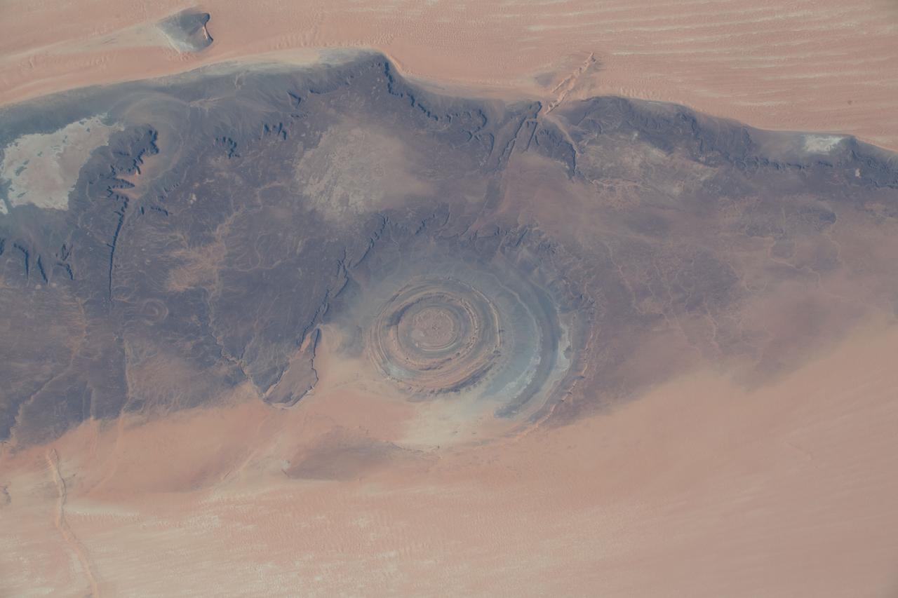
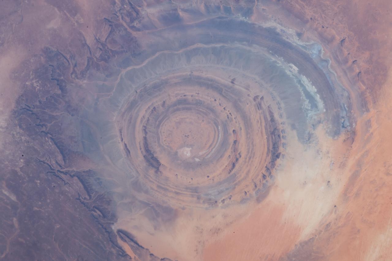
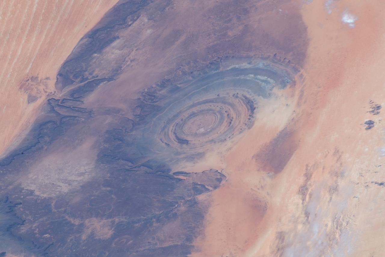
iss061e012458 (Oct. 20, 2019) --- Known as the “Eye of the Sahara," the Richat Structure in northwestern Mauritania is a circular geologic feature thought to be caused by an uplifted dome—geologists would classify it as a domed anticline—that has been eroded to expose the originally flat rock layers.
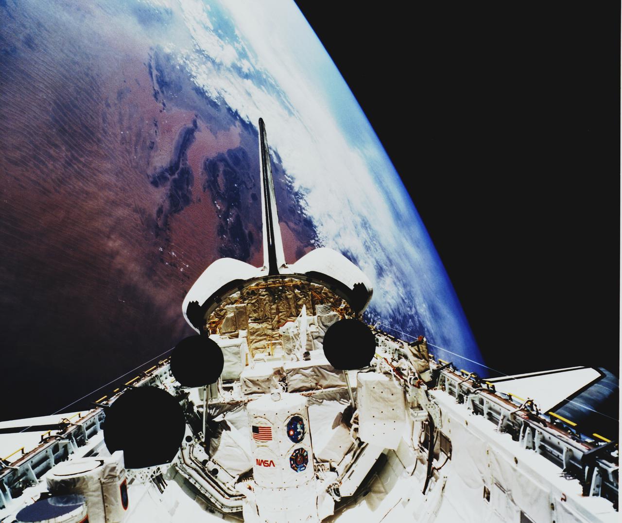
Space Shuttle Atlantis (STS-45) onboard photo of Atmospheric Laboratory for Applications and Science (Atlas-1) module in open cargo bay. Atlas-1 pallets are back dropped against the Atlas Mountains. Taken over Mali in the western Sahara, shows dunes in the Iguidi Dune Sea.

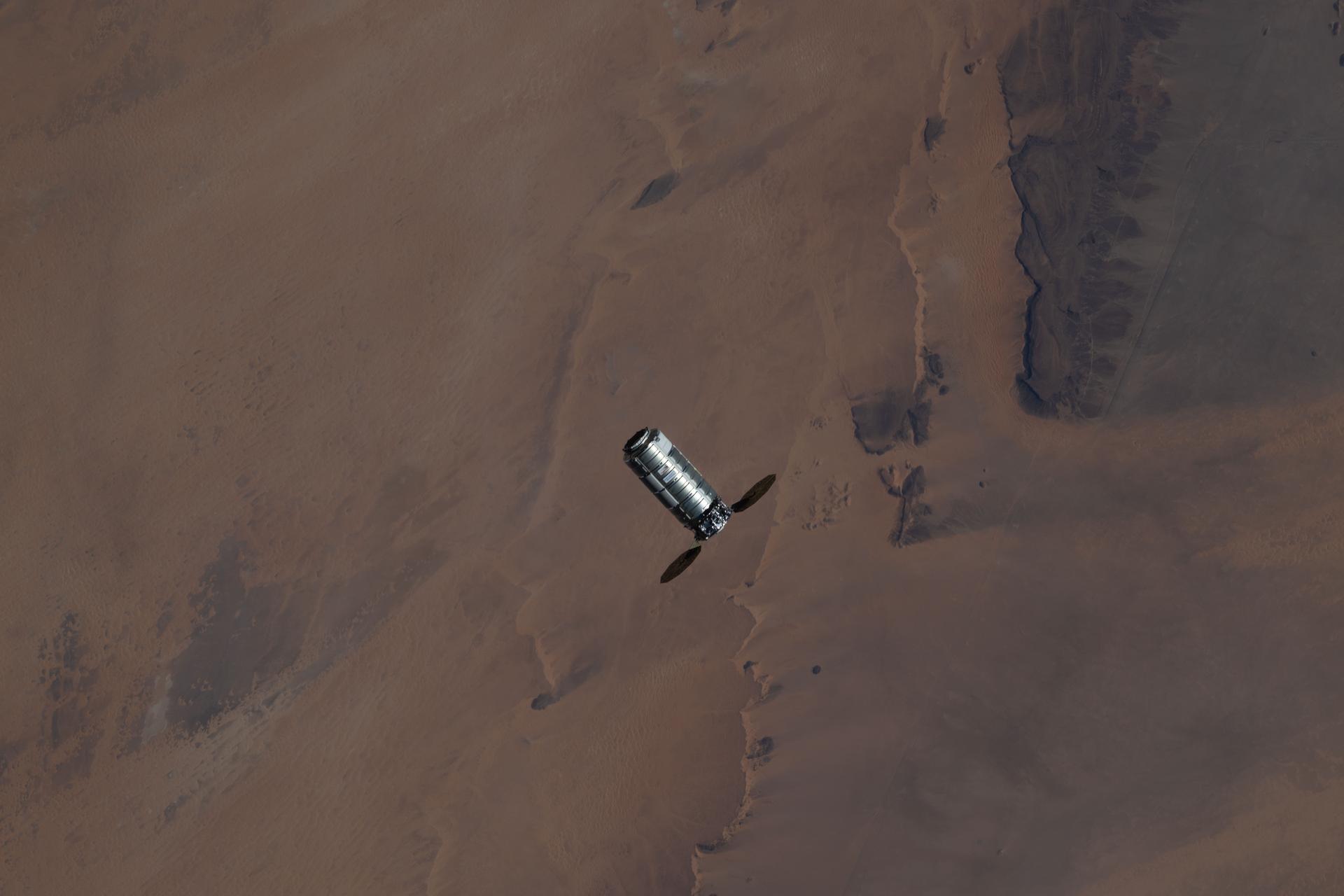
iss044e065321 (Aug. 24, 2015) --- JAXA's (Japan Aerospace Exploration Agency) H-II Transfer Vehicle-5, also known as the "Kounotori," is pictured during Expedition 44 approaching the International Space Station as both spacecraft orbited above the Sahara Desert.
iss073e1196703 (Nov. 27, 2025) --- The Soyuz MS-28 crew spacecraft carrying NASA astronaut Chris Williams and Roscosmos cosmonauts Sergey Kud-Sverchkov and Sergei Mikaev approaches the International Space Station. Both spacecraft were orbiting 262 miles above the hot desert landscape of Western Sahara at the time of this photograph.
iss059e013137 (March 5, 2019) --- From an altitude of 255 miles, an Expedition 59 crewmember photographed the Richat Structure, or the "Eye of the Sahara," in northwestern Mauritania. The circular geologic feature is thought to be caused by an uplifted dome—geologists would classify it as a domed anticline—that has been eroded to expose the originally flat rock layers.

S65-63256 (16 Dec. 1965) --- Cap Blanc and Levrier Bay on the coast of Spanish Sahara and Mauritania, as seen from the Gemini-6 spacecraft during its 15th revolution of Earth. Photo credit: NASA or National Aeronautics and Space Administration

iss073e1196724 (Nov. 27, 2025) --- The Soyuz MS-28 crew spacecraft carrying NASA astronaut Chris Williams and Roscosmos cosmonauts Sergey Kud-Sverchkov and Sergei Mikaev approaches the International Space Station. Both spacecraft were orbiting 262 miles above the hot desert landscape of Western Sahara at the time of this photograph.
iss061e012184 (Oct. 20, 2019) --- Japan's H-II Transfer Vehicle-8 (HTV-8) highlights this image as the International Space Station orbited 253 miles above the Atlantic Ocean. This view from the orbiting complex looks across Morocco and Western Sahara.

iss065e145194 (June 25, 2021) --- Spacewalker Thomas Pesquet of ESA (European Space Agency) waves to the camera 261 miles above Western Sahara as he works to complete the installation of the second roll out solar array on the International Space Station's Port-6 truss structure.
iss059e013142 (April 5, 2019) --- From an altitude of 255 miles, an Expedition 59 crewmember photographed the Richat Structure, or the "Eye of the Sahara," in northwestern Mauritania. The circular geologic feature is thought to be caused by an uplifted dome—geologists would classify it as a domed anticline—that has been eroded to expose the originally flat rock layers.
iss073e0032281 (May 15, 2025) --- The sun's glint beams off the Strait of Gibraltar at the top of this photograph as the International Space Station orbited 261 miles above a cloudy Mediterranean Sea. At left, is the Sahara Desert extending across the north African continent. In the right foreground, is a set of of the orbital outpost's main solar arrays.
ISS040-E-000788 (20 May 2014) --- Expedition 40 Commander Steve Swanson of NASA photographed this image from an Earth-facing window on the Earth-orbiting International Space Station featuring the Atlantic coast of the African nation of Morocco and the disputed territory of Western Sahara on May 20, 2014. The town of Tarfaya, Morocco, located at 22.45 degrees north latitude, and 13.13 degrees, east longitude, is visible. Obvious streaks in the sand were created by northerly winds.
iss073e0879542 (Oct. 13, 2025) --- Lake Nasser, created by the Aswan High Dam in southern Egypt, is one of the world’s largest man-made reservoirs. Extending into northern Sudan, it stores water from the Upper Nile and regulates its flow into the Lower Nile. This photograph was taken from the International Space Station while orbiting 260 miles above the eastern Sahara.
S63-06434 (15-16 May 1963) --- East looking view across Atlantic waters toward Africa, showing Mauritania and Spanish Sahara photographed from the Mercury-Atlas 9 (MA-9) capsule by astronaut L. Gordon Cooper Jr., during his 22-orbit MA-9 spaceflight. Photo credit: NASA