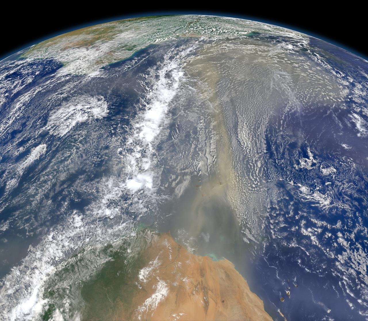
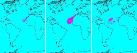
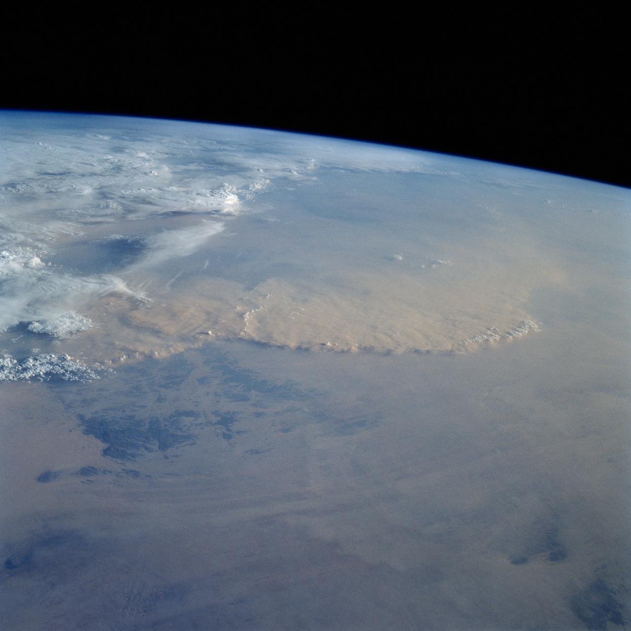
A piece of Africa—actually lots of them—began to arrive in the Americas in June 2014. On June 23, a lengthy river of dust from western Africa began to push across the Atlantic Ocean on easterly winds. A week later, the influx of dust was affecting air quality as far away as the southeastern United States. This composite image, made with data from the Visible Infrared Imaging Radiometer Suite (VIIRS) on Suomi NPP, shows dust heading west toward South America and the Gulf of Mexico on June 25, 2014. The dust flowed roughly parallel to a line of clouds in the intertropical convergence zone, an area near the equator where the trade winds come together and rain and clouds are common. In imagery captured by the Moderate Resolution Imaging Spectroradiometer (MODIS), the dust appeared to be streaming from Mauritania, Senegal, and Western Sahara, though some of it may have originated in countries farther to the east. Saharan dust has a range of impacts on ecosystems downwind. Each year, dust events like the one pictured here deliver about 40 million tons of dust from the Sahara to the Amazon River Basin. The minerals in the dust replenish nutrients in rainforest soils, which are continually depleted by drenching, tropical rains. Research focused on peat soils in the Everglades show that African dust has been arriving regularly in South Florida for thousands of years as well. In some instances, the impacts are harmful. Infusion of Saharan dust, for instance, can have a negative impact on air quality in the Americas. And scientists have linked African dust to outbreaks of certain types of toxic algal blooms in the Gulf of Mexico and southern Florida. Read more: <a href="http://1.usa.gov/1snkzmS" rel="nofollow">1.usa.gov/1snkzmS</a> NASA images by Norman Kuring, NASA’s Ocean Color web. Caption by Adam Voiland. Credit: <b><a href="http://www.earthobservatory.nasa.gov/" rel="nofollow"> NASA Earth Observatory</a></b> <b><a href="http://www.nasa.gov/audience/formedia/features/MP_Photo_Guidelines.html" rel="nofollow">NASA image use policy.</a></b> <b><a href="http://www.nasa.gov/centers/goddard/home/index.html" rel="nofollow">NASA Goddard Space Flight Center</a></b> enables NASA’s mission through four scientific endeavors: Earth Science, Heliophysics, Solar System Exploration, and Astrophysics. Goddard plays a leading role in NASA’s accomplishments by contributing compelling scientific knowledge to advance the Agency’s mission. <b>Follow us on <a href="http://twitter.com/NASAGoddardPix" rel="nofollow">Twitter</a></b> <b>Like us on <a href="http://www.facebook.com/pages/Greenbelt-MD/NASA-Goddard/395013845897?ref=tsd" rel="nofollow">Facebook</a></b> <b>Find us on <a href="http://instagram.com/nasagoddard?vm=grid" rel="nofollow">Instagram</a></b>
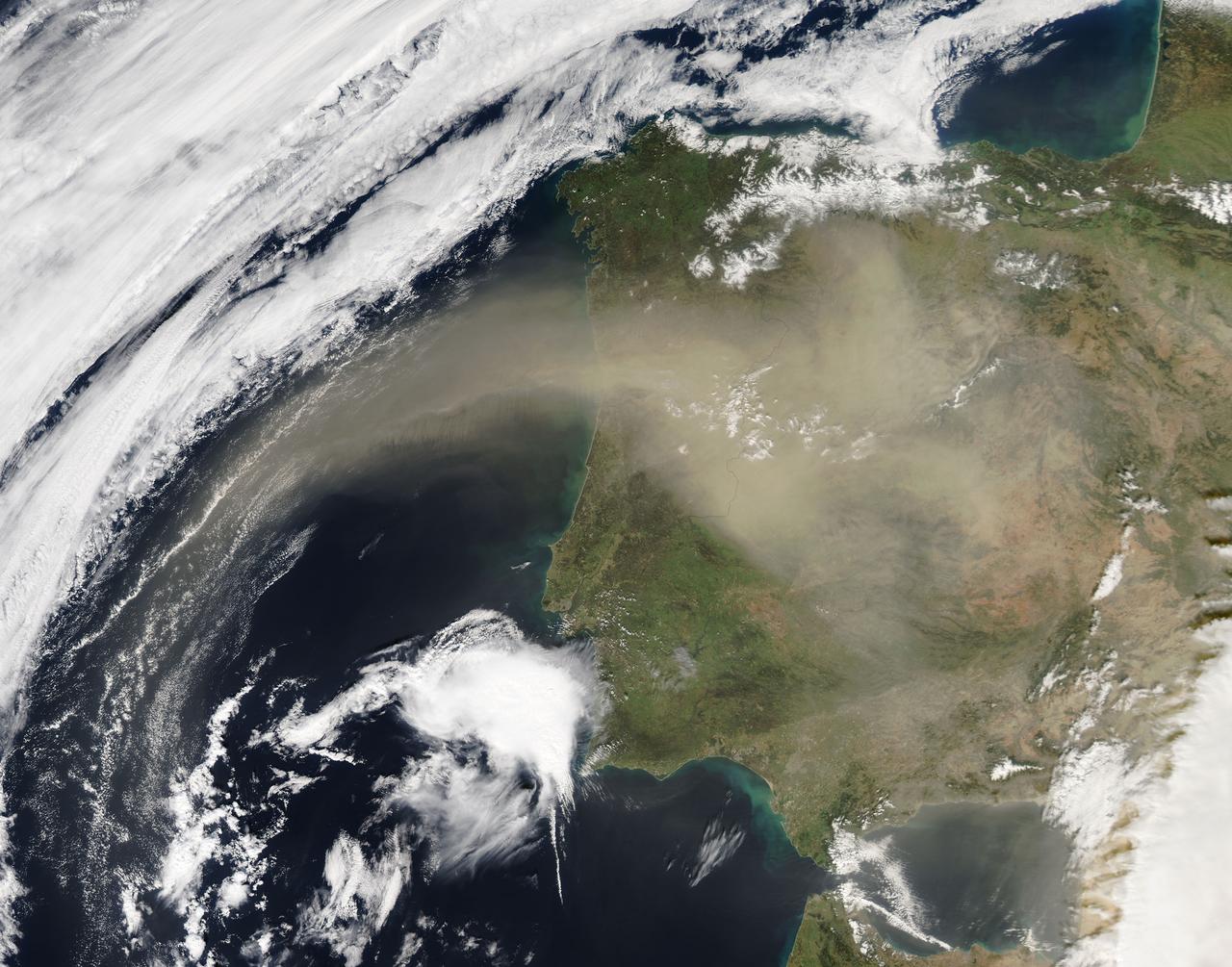
On Feb. 21, 2016 at 14:00 UTC, the Moderate Resolution Imaging Spectroradiometer (MODIS) aboard NASA’s Aqua satellite captured a true color image of Saharan dust over the Iberian Peninsula. Credit: NASA/Goddard/Jeff Schmaltz/MODIS Land Rapid Response Team <b><a href="http://www.nasa.gov/audience/formedia/features/MP_Photo_Guidelines.html" rel="nofollow">NASA image use policy.</a></b> <b><a href="http://www.nasa.gov/centers/goddard/home/index.html" rel="nofollow">NASA Goddard Space Flight Center</a></b> enables NASA’s mission through four scientific endeavors: Earth Science, Heliophysics, Solar System Exploration, and Astrophysics. Goddard plays a leading role in NASA’s accomplishments by contributing compelling scientific knowledge to advance the Agency’s mission. <b>Follow us on <a href="http://twitter.com/NASAGoddardPix" rel="nofollow">Twitter</a></b> <b>Like us on <a href="http://www.facebook.com/pages/Greenbelt-MD/NASA-Goddard/395013845897?ref=tsd" rel="nofollow">Facebook</a></b> <b>Find us on <a href="http://instagrid.me/nasagoddard/?vm=grid" rel="nofollow">Instagram</a></b>
On March 2, 2003, NASA Terra spacecraft saw near-surface winds carrying a large amount of Saharan dust aloft and transported the material westward over the Atlantic Ocean.
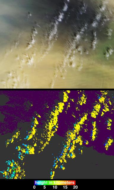
What connects Earth's largest, hottest desert to its largest tropical rainforest? The Sahara Desert is a near-uninterrupted brown band of sand and scrub across the northern third of Africa. The Amazon rainforest is a dense green mass of humid jungle that covers northeast South America. But after strong winds sweep across the Sahara, a tan cloud rises in the air, stretches between the continents, and ties together the desert and the jungle. It’s dust. And lots of it. For the first time, a NASA satellite has quantified in three dimensions how much dust makes this trans-Atlantic journey. Scientists have not only measured the volume of dust, they have also calculated how much phosphorus – a natural plant fertilizer present in Saharan sands from part of the desert’s past as a lake bed – gets carried across the ocean from one of the planet’s most desolate places to one of its most fertile. <b><a href="http://www.nasa.gov/audience/formedia/features/MP_Photo_Guidelines.html" rel="nofollow">NASA image use policy.</a></b> <b><a href="http://www.nasa.gov/centers/goddard/home/index.html" rel="nofollow">NASA Goddard Space Flight Center</a></b> enables NASA’s mission through four scientific endeavors: Earth Science, Heliophysics, Solar System Exploration, and Astrophysics. Goddard plays a leading role in NASA’s accomplishments by contributing compelling scientific knowledge to advance the Agency’s mission. <b>Follow us on <a href="http://twitter.com/NASAGoddardPix" rel="nofollow">Twitter</a></b> <b>Like us on <a href="http://www.facebook.com/pages/Greenbelt-MD/NASA-Goddard/395013845897?ref=tsd" rel="nofollow">Facebook</a></b> <b>Find us on <a href="http://instagram.com/nasagoddard?vm=grid" rel="nofollow">Instagram</a></b>
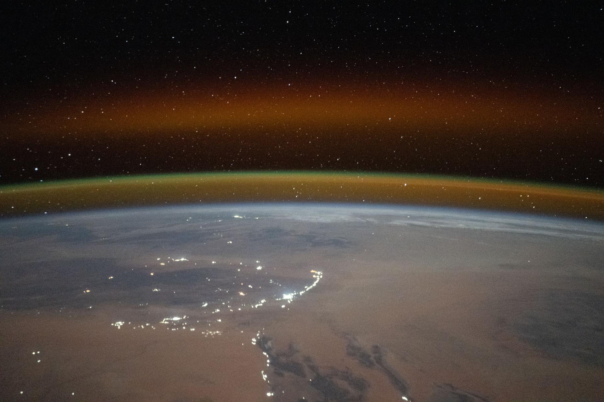
iss073e1198938 (Nov. 28, 2025) --- A yellow-red airglow blankets Earth's horizon as village lights dot the Saharan landscape of Algeria in this photograph taken at approximately 8:50 p.m. local time from the International Space Station as it orbited 261 miles above north Africa.

iss073e0422445 (July 29, 2025) --- The city lights of Sub-Saharan Africa streak below the International Space Station as it orbited 260 miles above the Tanzania-Zambia border in this long-duration photograph. At top right, lightning storms illuminate the cloud tops with the Soyuz MS-27 spacecraft docked to the Prichal module in the foreground.
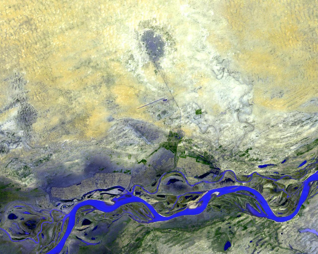
NASA Terra spacecraft shows Timbuktu in the West African Nation of Mali, about 15 km north of the Niger River, at the intersection of an east-west and a north-south Trans Saharan trade route across the Sahara.
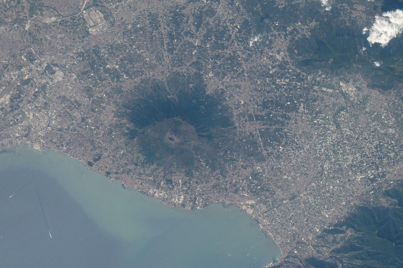
GMT210_15_58_Michael Barratt_CEO N Saharan Africa_Med Port Cities_Mt Vesuvius_Croatia thru Ukraine
iss063e032020 (June 21, 2020) --- What looks like land is actually a Saharan dust cloud that has blown over the Atlantic Ocean and is nearing the Caribbean Sea.
iss063e032007 (June 21, 2020) --- What looks like land is actually a Saharan dust cloud that has blown over the Atlantic Ocean and is nearing the Caribbean Sea.
iss067e270532 (Aug. 18, 2022) --- A portion of the Tibesti Mountains (lower right), in the Saharan region of the nation of Chad, is pictured from the International Space Station as it orbited 257 miles above the African continent.

ISS008-E-18202 (8 March 2004) --- This image featuring a Saharan dust outbreak was taken by an Expedition 8 crewmember onboard the International Space Station (ISS) from a position about 1400 kilometers off the coast of Mauritania (about 600 kilometers west of the Cape Verde Islands in the tropical Atlantic Ocean). Looking northwest, this image shows the dusty Saharan air mass in the lower third of the view, with clear air beyond a marked northeast-trending boundary. The dust is blowing west-southwest, parallel to the front, a common trajectory during northern winters. The width of the dust column was about 1800 kilometers, of which 200 kilometers only are seen here (right).
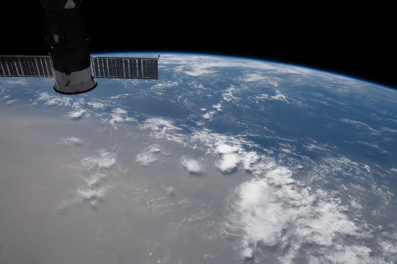
ISS032-E-008976 (15 July 2012) --- Saharan dust reaching the Americas is featured in this image photographed by an Expedition 32 crew member on the International Space Station. Weather satellites frequently document major dust palls blowing from the Sahara Desert westward from Africa out into the tropical Atlantic Ocean. Space station crew members frequently see these Saharan dust masses as very widespread atmospheric haze. Dust palls blowing from Africa can be transported right across the Atlantic Ocean. It takes about a week to reach either North America (in northern hemisphere summer) or South America (in northern hemisphere winter). This puts the Caribbean basin on the receiving end of many of these events. Recently, researchers have linked Saharan dust to coral disease, allergic reactions in humans, and red tides. The margin of the hazy air in this image reaches as far as Haiti (top center) and the nearby Turks and Caicos Islands (top left) ? but the eastern tip of Cuba in the foreground remains in the clear air.
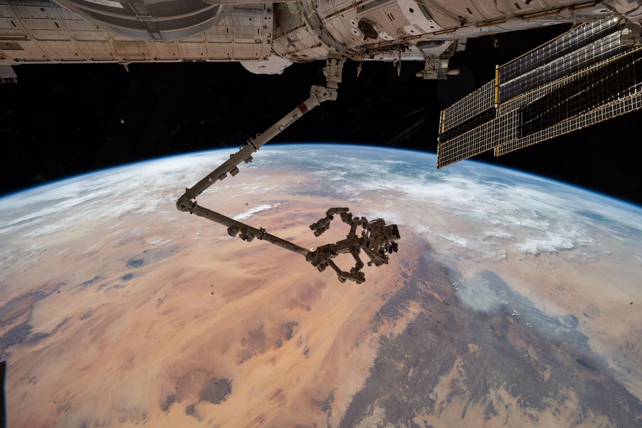
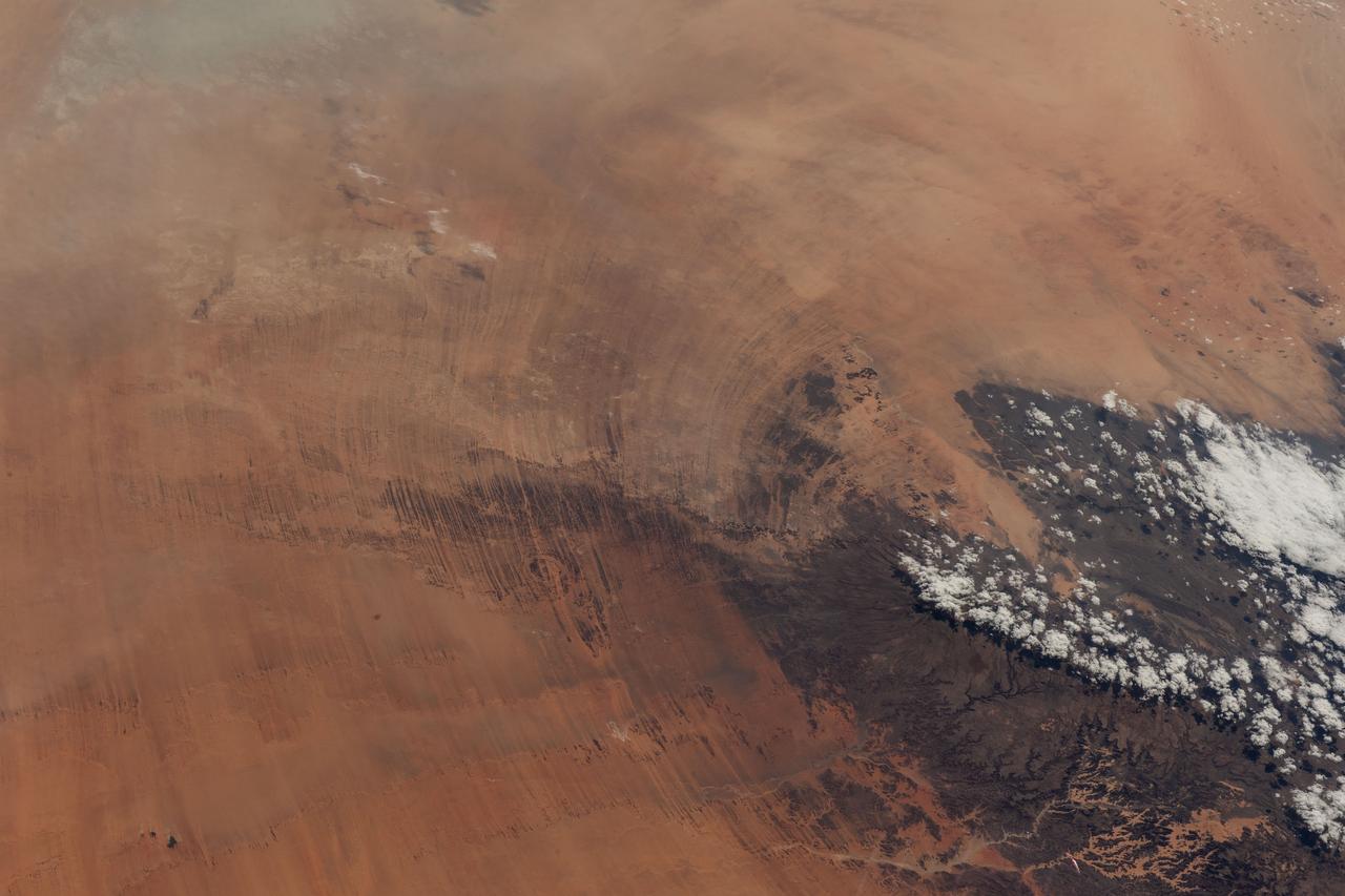
iss073e0546366 (Aug. 27, 2025) --- The International Space Station's 57.7-foot-long robotic arm, Canadarm2, with its fine-tuned robotic hand, Dextre, attached is pictured extending from the International Space Station's Harmony module. The orbital outpost was soaring 260 miles above the Saharan Desert in Libya at the time of this photograph.
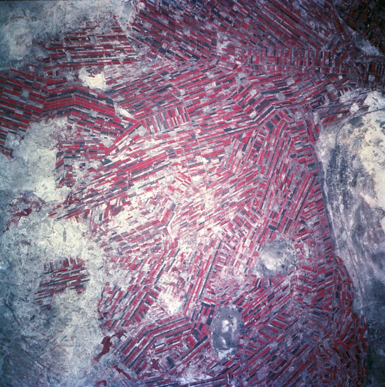
Agricultural patterns are distinctly visible in this near-vertical false color infrared photography taken in November 1994. The area depicted on the photograph is south of Khartoum between the White and Blue Nile Rivers. By far the most important irrigation project in sub-Saharan Africa, both large and small scale agricultural enterprises have been developed using water transported from the perennial Nile Rivers. Hundreds of small rectangular fields and water-filled canals can be seen in this photograph.
This image, captured by NASA Terra satellite on July 20, 2005, shows the dust cloud just off the west coast of Africa near Mauritania and Senegal.
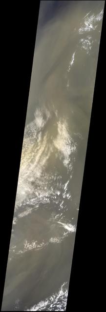
In July of 2005, a continent-sized cloud of hot air and dust originating from the Sahara Desert crossed the Atlantic Ocean and headed towards Florida and the Caribbean, captured by the Atmospheric Infrared Sounder onboard NASA Aqua satellite. A Saharan Air Layer, or SAL, forms when dry air and dust rise from Africa's west coast and ride the trade winds above the Atlantic Ocean. These dust clouds are not uncommon, especially during the months of July and August. They start when weather patterns called tropical waves pick up dust from the desert in North Africa, carry it a couple of miles into the atmosphere and drift westward. http://photojournal.jpl.nasa.gov/catalog/PIA00448
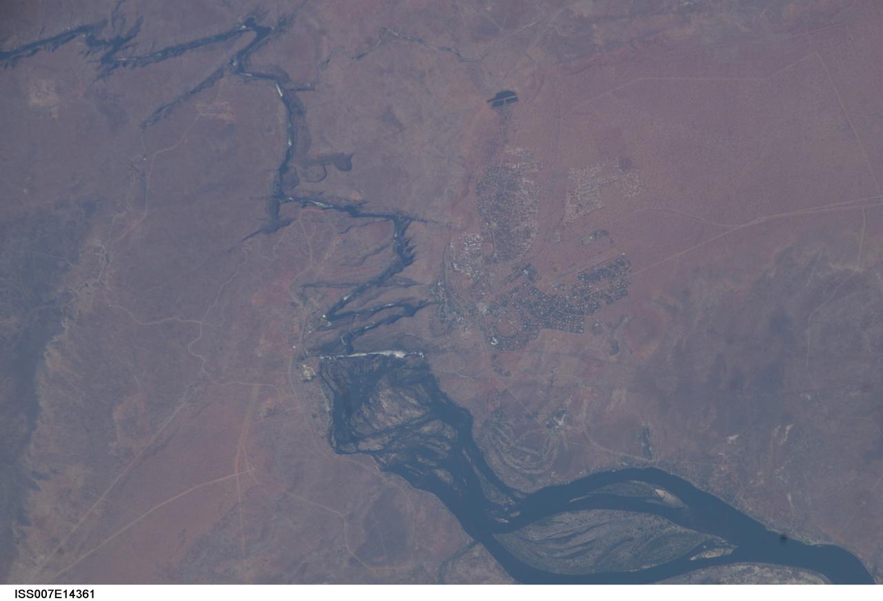
ISS007-E-14361 (4 September 2003) --- This view featuring Victoria Falls and the Zambezi River was photographed by one of the Expedition 7 crewmembers onboard the International Space Station (ISS). Victoria Falls is one of the most famous tourist sites in sub-Saharan Africa. The falls and their famous spray clouds are 1700 meters long, the longest sheet of falling water in the world. The falls appear as a ragged white line in this image. The small town of Victoria Falls in Zimbabwe appears just west of the falls, with smaller tourist facilities on the east bank in Zambia. A major river in south-central Africa, the Zambezi River flows from western Zambia to the Indian Ocean in Mozambique. It flows southeast in a wide bed before plunging suddenly 130 meters over the Victoria Falls into a narrow gorge.
STS049-92-071 (13 May 1992) --- The STS-49 crew aboard the Earth-orbiting Space Shuttle Endeavour captured this Saharan dust storm on the Algeria-Niger border. The south-looking, late-afternoon view shows one of the best examples in the Shuttle photo data base of a dust storm. A series of gust fronts, caused by dissipating thunderstorms have picked up dust along the outflow boundaries. Small cumulus clouds have formed over the most vigorously ascending parts of the dust front, enhancing the visual effect of the front. The storm is moving roughly north-northwest, at right angles to the most typical path for dust storms in this part of the Sahara (shown by lines of sand on the desert surface in the foreground). Storms such as this can move out into the Atlantic, bringing dust even as far as the Americas on some occasions. A crewmember used a 70mm handheld Hasselblad camera with a 100mm lens to record the frame.
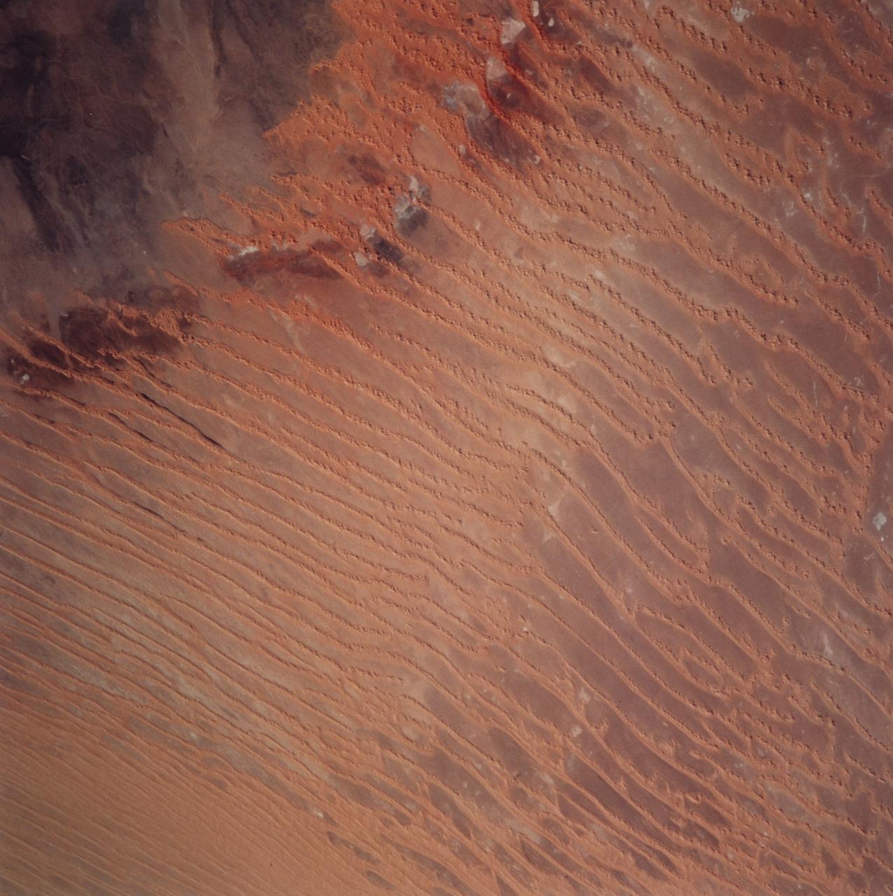
STS099-729-045 (11-22 February 2000) ---This Earth scene from the Space Shuttle Endeavour features linear dunes in the Algerian Saharan sand sea known as the Erg Chech. The dunes, according to NASA scientists, have been built up over thousands of years into masses elongated roughly parallel with the prevailing northeast winds. Dune chains in the northern (upper) half of the view are 5-8 kilometers apart. A slight change in orientation and an increase in the density of dunes appear across the middle of the view. Such changes usually relate to changes in sand supply, and also to topographic scarps over which the dunes pass. Obstacles like scarps and hills locally cause a leftward deflection (in the Northern Hemisphere) in wind direction, an effect that can be seen here in the dune orientation in the middle of the photo. Dunes in the lower part of the view are 2-5 kilometers apart. White patches are small dry lakes at low points in the underlying rock surface. The strong red color in some dunes near the edge of the dune field (left margin) is iron staining derived from sand particles blown into the dunes from the underlying iron-rich soils. A dune-free area appears in the lower left corner.
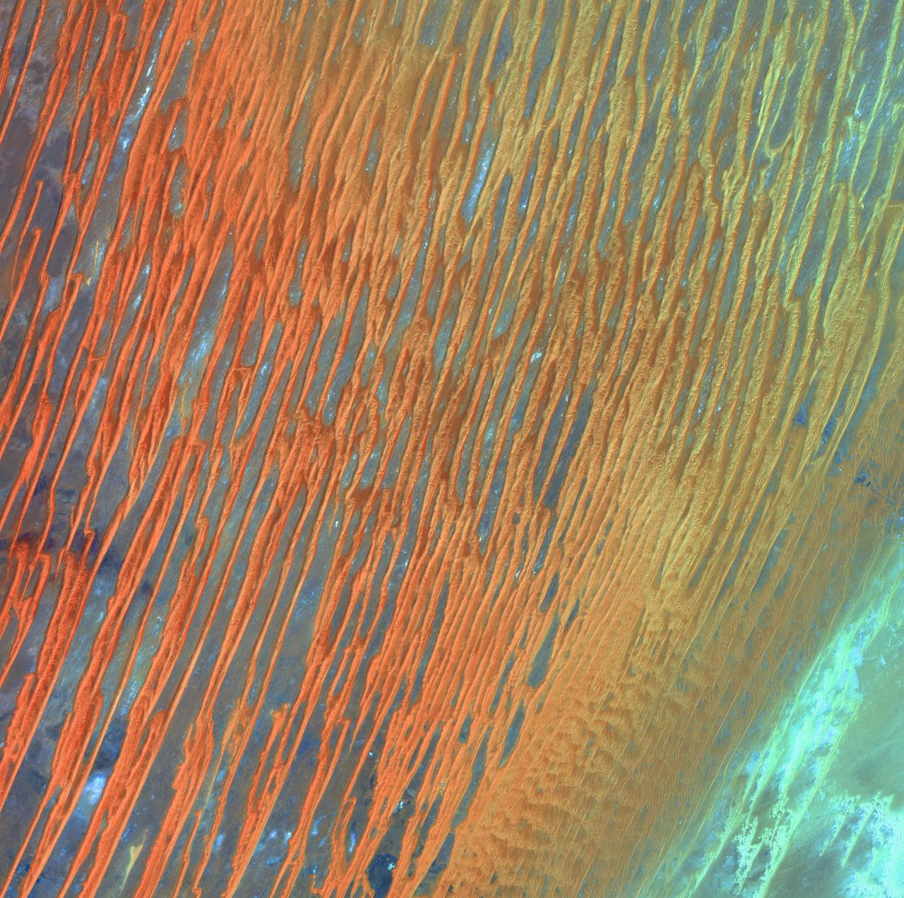
Desert Patterns - April 13th, 2003 Description: Seen through the "eyes" of a satellite sensor, ribbons of Saharan sand dunes seem to glow in sunset colors. These patterned stripes are part of Erg Chech, a desolate sand sea in southwestern Algeria, Africa, where the prevailing winds create an endlessly shifting collage of large, linear sand dunes. The term "erg" is derived from an Arabic word for a field of sand dunes. Credit: USGS/NASA/Landsat 7 To learn more about the Landsat satellite go to: <a href="http://landsat.gsfc.nasa.gov/" rel="nofollow">landsat.gsfc.nasa.gov/</a> <b><a href="http://www.nasa.gov/centers/goddard/home/index.html" rel="nofollow">NASA Goddard Space Flight Center</a></b> enables NASA’s mission through four scientific endeavors: Earth Science, Heliophysics, Solar System Exploration, and Astrophysics. Goddard plays a leading role in NASA’s accomplishments by contributing compelling scientific knowledge to advance the Agency’s mission. <b>Follow us on <a href="http://twitter.com/NASA_GoddardPix" rel="nofollow">Twitter</a></b> <b>Join us on <a href="http://www.facebook.com/pages/Greenbelt-MD/NASA-Goddard/395013845897?ref=tsd" rel="nofollow">Facebook</a></b>
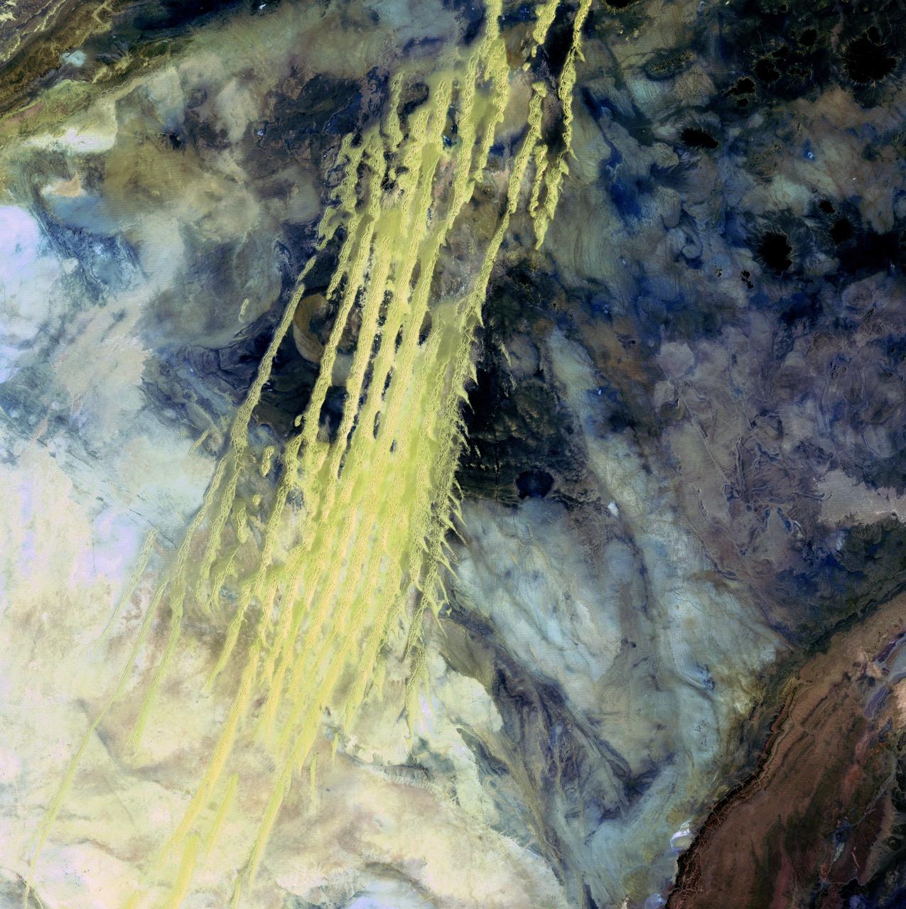
Algerian Abstract - April 8th, 1985 Description: What look like pale yellow paint streaks slashing through a mosaic of mottled colors are ridges of wind-blown sand that make up Erg Iguidi, an area of ever-shifting sand dunes extending from Algeria into Mauritania in northwestern Africa. Erg Iguidi is one of several Saharan ergs, or sand seas, where individual dunes often surpass 500 meters-nearly a third of a mile-in both width and height. Credit: USGS/NASA/Landsat 5 To learn more about the Landsat satellite go to: <a href="http://landsat.gsfc.nasa.gov/" rel="nofollow">landsat.gsfc.nasa.gov/</a> <b><a href="http://www.nasa.gov/centers/goddard/home/index.html" rel="nofollow">NASA Goddard Space Flight Center</a></b> enables NASA’s mission through four scientific endeavors: Earth Science, Heliophysics, Solar System Exploration, and Astrophysics. Goddard plays a leading role in NASA’s accomplishments by contributing compelling scientific knowledge to advance the Agency’s mission. <b>Follow us on <a href="http://twitter.com/NASA_GoddardPix" rel="nofollow">Twitter</a></b> <b>Join us on <a href="http://www.facebook.com/pages/Greenbelt-MD/NASA-Goddard/395013845897?ref=tsd" rel="nofollow">Facebook</a></b>
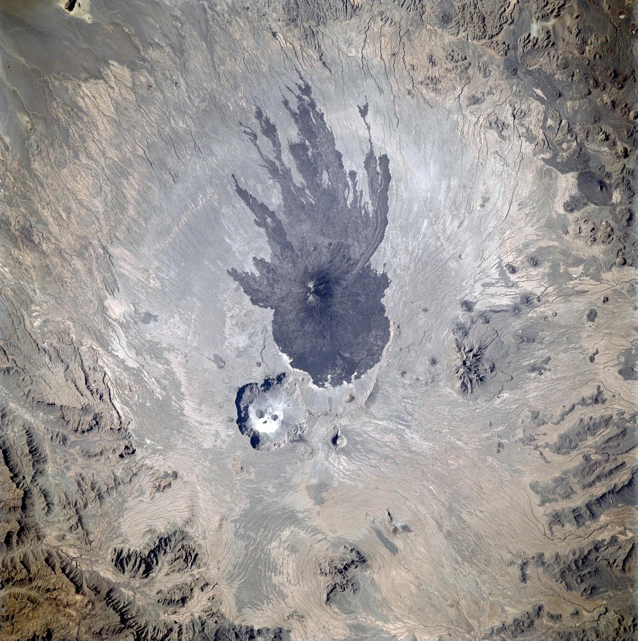
STS087-717-075 (19 November – 5 December 1997) --- Featured in this view is the Tibesti Massif in northern Chad in central Saharan Africa is a very large mountain range of old, dark, hard rocks, which is surrounded by sand seas. The mountains are capped with recent volcanoes and volcanic flows. The volcanoes of Tibesti are similar to those of Hawaii -- they are thought to be the result of a large hot spot deep in the Earth underneath northern Africa. The most striking volcano is the Pic Tousside (3,265 meters). The lava flows down the flanks of Pic Tousside make a characteristic and recognizable shape something like a giant squid -- thus providing astronauts a key visual marker as they fly across northern Africa. Because northern Africa receives very little rainfall, the volcano and crater shapes look very “young”. The occasional rainfall has created small gullies down the sides of the mountains, which can be seen when the sunlight is relatively low. Small amounts of water leach the soluble elements, like sodium, from the lavas. When the water collects in low places, like at the bottom of craters such as Trou au Natron (the crater adjacent to Pic Tousside) and subsequently evaporates, sodium-rich deposits are left behind. The white region at the bottom of the crater Trou au Natron is a sodium carbonate (natronite) deposit. This picture is one of the 70mm Earth observations visuals used by the crew at its post flight presentation events.
In December 2016, snow fell in the Sahara for the first time since 1979. In 1984, the charitable supergroup Band Aid sang: “There won’t be snow in Africa this Christmas time.” In fact, it does snow in Africa at high elevations. Kilimanjaro has long had a cap of snow and ice, though it has been shrinking. Skiiers travel for natural and manufactured snow in the Atlas Mountains of Morocco and Algeria, as well as a few spots in South Africa and Lesotho. Nonetheless, snow on the edge of the Sahara Desert is rare. On December 19, 2016, snow fell on the Algerian town of Ain Sefra, which is sometimes referred to as the “gateway to the desert.” The town of roughly 35,000 people sits between the Atlas Mountains and the northern edge of the Sahara. The last recorded snowfall in Ain Sefra occurred in February 1979. The Enhanced Thematic Mapper Plus (ETM+) on the Landsat 7 satellite acquired this natural-color image of snow in North Africa on December 19, 2016. This scene shows an area near the border of Morocco and Algeria, south of the city of Bouarfa and southwest of Ain Sefra. Though the news has been dominated by snow in the Saharan city, a review of several years of satellite data suggests that snow is also pretty rare in this section of the Atlas range. Read more: <a href="http://go.nasa.gov/2hIH4Xe" rel="nofollow">go.nasa.gov/2hIH4Xe</a> NASA Earth Observatory image by Joshua Stevens, using Landsat data from the U.S. Geological Survey. Caption by Mike Carlowicz. b><a href="http://www.nasa.gov/audience/formedia/features/MP_Photo_Guidelines.html" rel="nofollow">NASA image use policy.</a> <b><a href="http://www.nasa.gov/centers/goddard/home/index.html" rel="nofollow">NASA Goddard Space Flight Center</a></b> enables NASA’s mission through four scientific endeavors: Earth Science, Heliophysics, Solar System Exploration, and Astrophysics. Goddard plays a leading role in NASA’s accomplishments by contributing compelling scientific knowledge to advance the Agency’s mission. <b>Follow us on <a href="http://twitter.com/NASAGoddardPix" rel="nofollow">Twitter</a></b> <b>Like us on <a href="http://www.facebook.com/pages/Greenbelt-MD/NASA-Goddard/395013845897?ref=tsd" rel="nofollow">Facebook</a></b> <b>Find us on <a href="http://instagrid.me/nasagoddard/?vm=grid" rel="nofollow">Instagram</a></b>