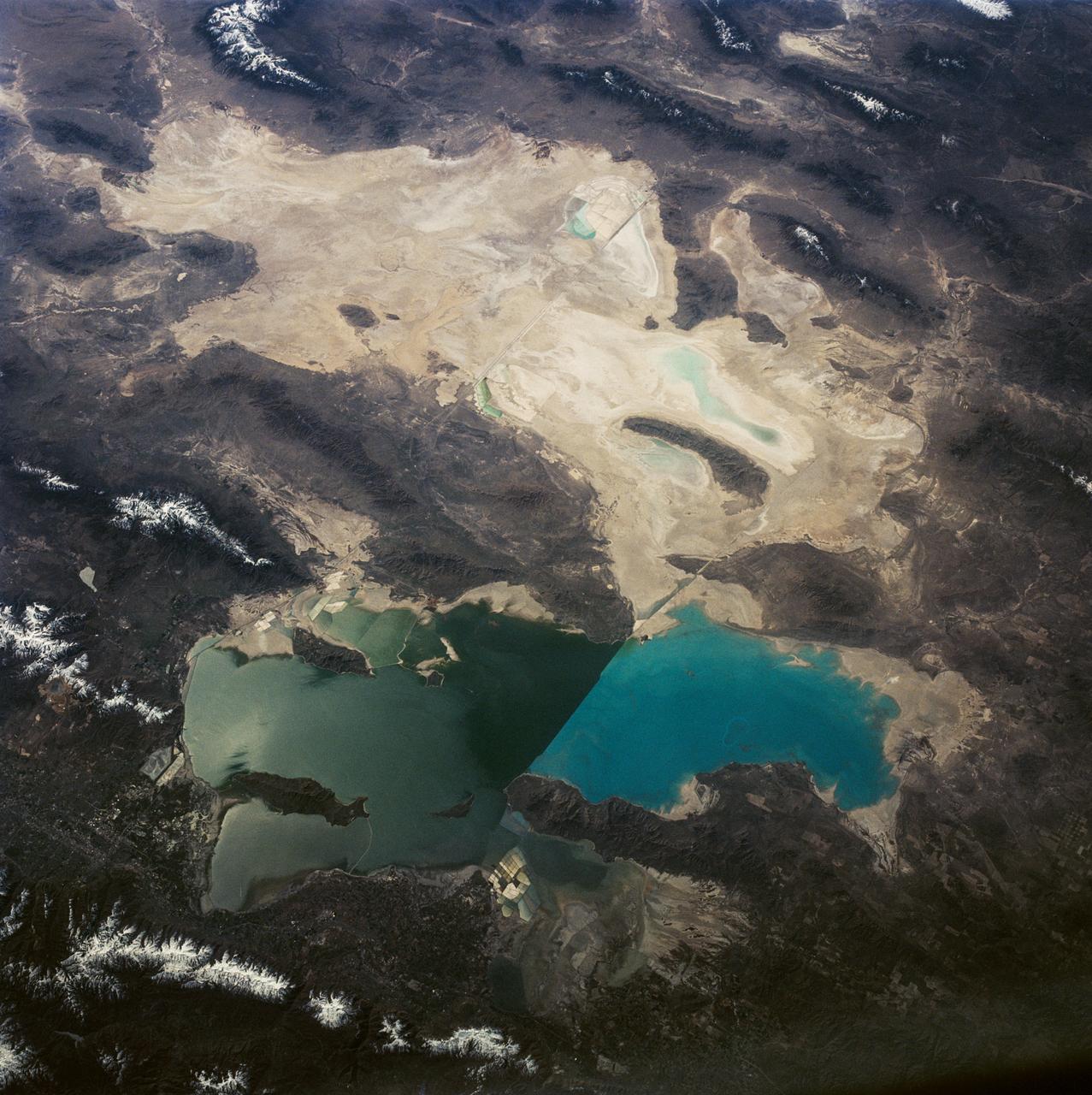
This is a view of the Great Salt Lake and nearby Bonneville Salt Flats, UT, (41.0N, 112.5W). A railroad causeway divides the lake with a stark straight line changing the water level and chemistry of the lake as a result. Fresh water runoff enters from the south adding to the depth and reducing the salinity. The north half receives little frsh water and is more saline and shallow. The Bonnieville Salt Flats is the lakebed of a onetime larger lake.
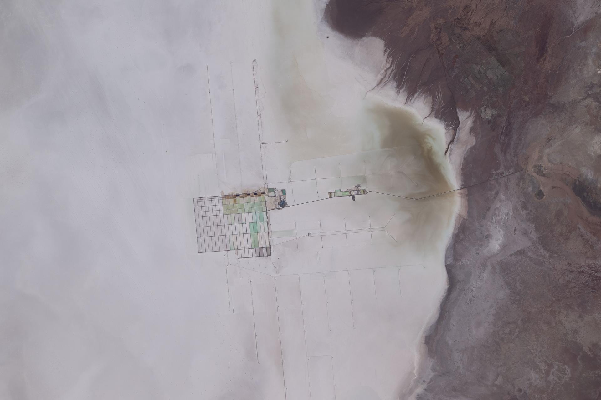
iss074e0319935 (Feb. 21, 2026) --- The Salar de Uyuni in Bolivia is the world's largest salt flat and one of the flattest surfaces on Earth. At the center of the photograph is a mining operation extracting extensive lithium deposits across the salt flat. Credit: NASA/Jessica Meir
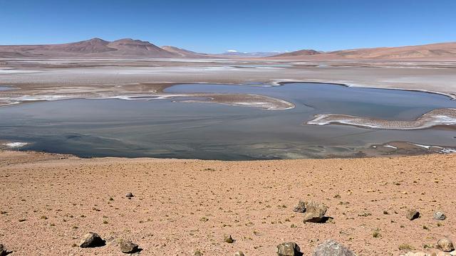
Filled with briny lakes, the Quisquiro salt flat in South America's Altiplano represents the kind of landscape that scientists think may have existed in Gale Crater, which NASA's Curiosity rover is exploring. This salt flat is located in Chile, though the Altiplano sprawls across countries. Streams and rivers flowing from mountain ranges into this arid, high-altitude plateau lead to closed basins similar to Mars' ancient Gale Crater. Lakes on the Altiplano are heavily influenced by climate in the same way as Gale. https://photojournal.jpl.nasa.gov/catalog/PIA23374
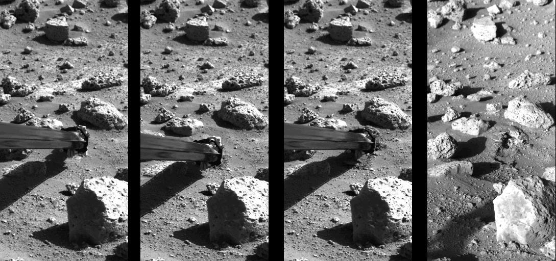
Operation of the surface sampler in obtaining Martian soil for NASA's Viking 2 molecular analysis experiment. Dubbed Bonneville Salt Flats, the exposure of thin crust appeared unique in contrast with surrounding materials. http://photojournal.jpl.nasa.gov/catalog/PIA00145

This false-color mosaic, made from infrared data collected by NASA Cassini spacecraft, reveals the differences in the composition of surface materials around hydrocarbon lakes at Titan, Saturn largest moon.
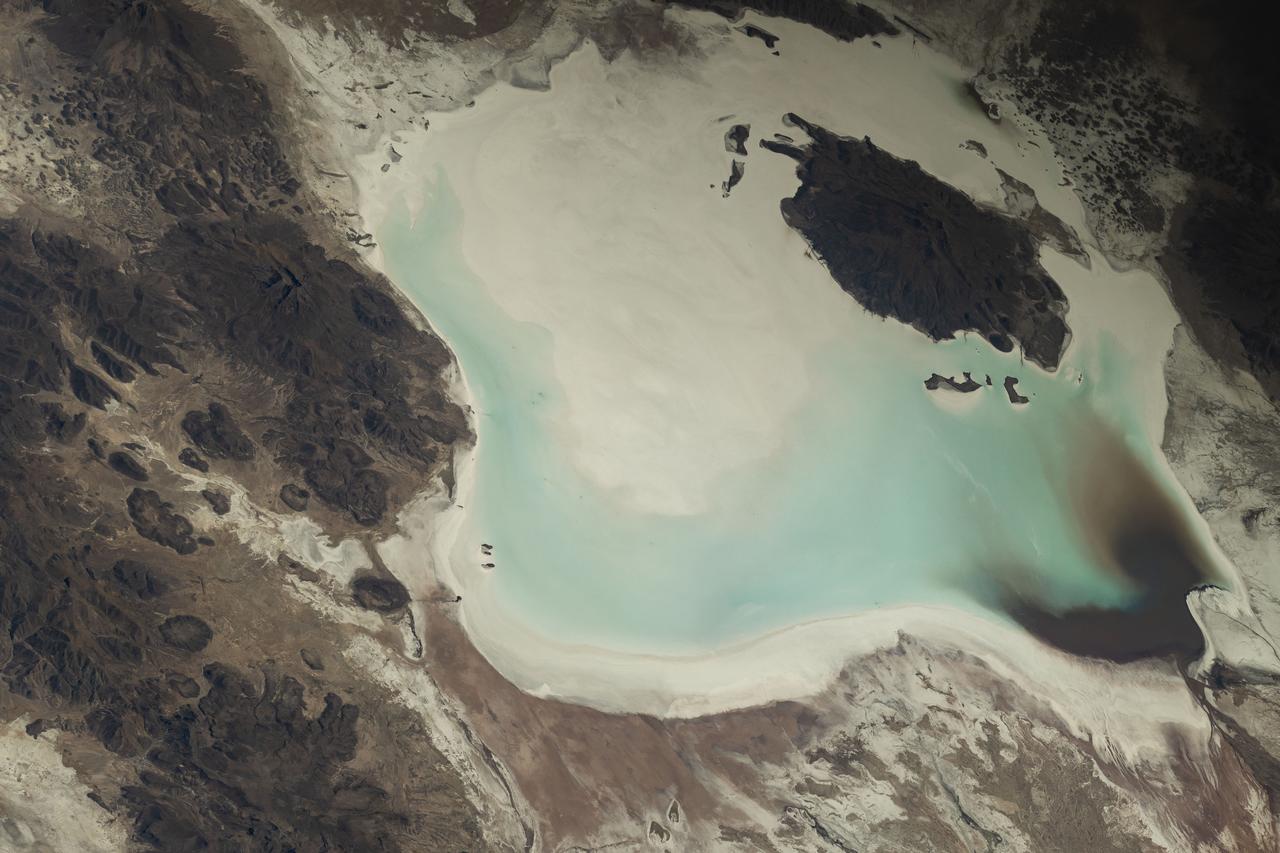
iss073e0248069 (June 24, 2025) --- Lake Coipasa, a basin created by tectonic activity with a high salt concentration surrounded by the Coipasa Salt Flats, in Bolivia near the border with Chile is pictured from the International Space Station as it orbited 264 miles above South America. The volcano Wila Pukarini (upper right) is located inside the lake.
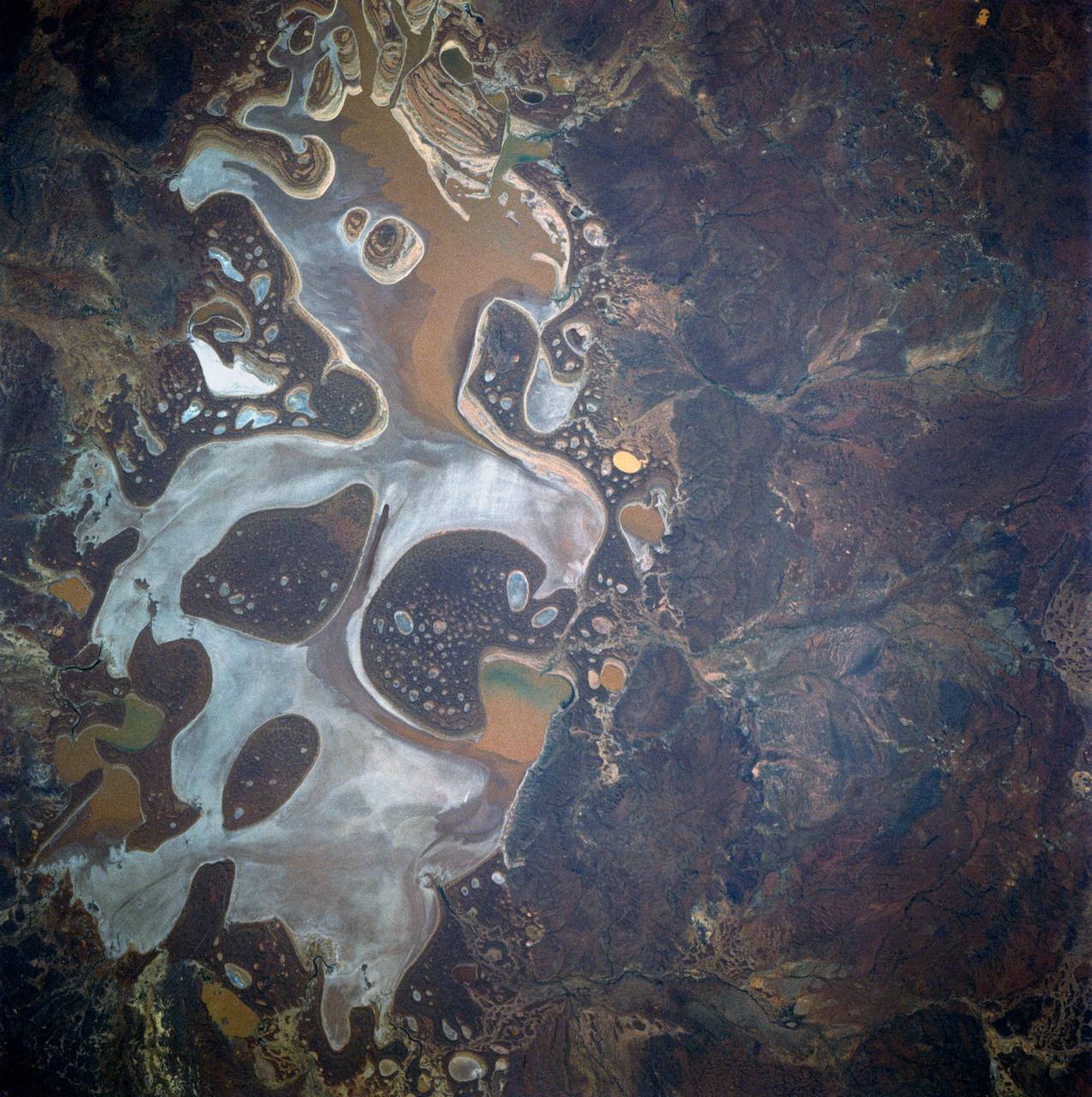
41D-42-045 (30 Aug-5 Sept 1984) --- Lake Carnegie in western Australia, 600 miles northeast of Perth. This is an island basin dotted with numerous salt lakes, ponds, flats, benches, and dunes.
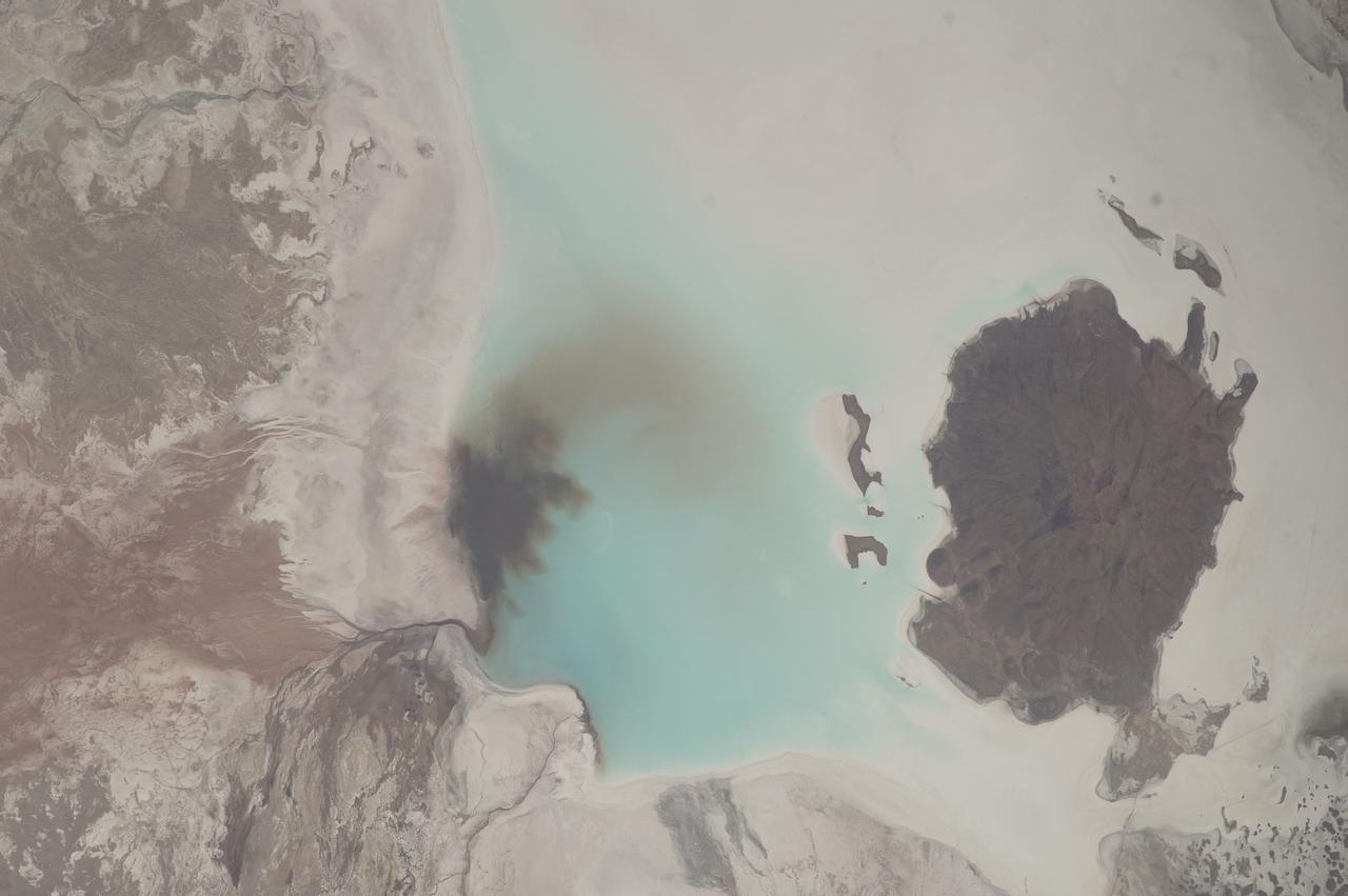
ISS033-E-006202 (20 Sept. 2012) --- Salar de Coipasa, Bolivia is featured in this image photographed by an Expedition 33 crew member on the International Space Station. The Salar de Coipasa, located in the Altiplano region of western Bolivia, covers an area of approximately 2,500 square kilometers. The word ?salar? describes arid closed basins in which evaporation of mineral-rich waters leads to the formation of thick, flat-laying salt deposits. Salar de Coipasa is located to the southwest of the saline Lake Poopo and northwest of the largest salt flat in the world, Salar de Uyuni. At Coipasa, a crust composed of halite?common table salt?provides the brilliant white coloration characteristic of the Altiplano salars (right). While the environment of Salar de Coipasa is arid, it does receive constant water from the Lauca River flowing from the north; this feeds Lake (Lago) Coipasa that fills the northern end of the basin with shallow water (center). However, the water flow can drop off sharply during periods of drought. The waters of Lake Coipasa, and the white salt crust of the salar, also serve to highlight dark river sediments flowing into the basin along the northeastern shore. Dark volcanic rocks contrast sharply with the surrounding salt crust at right. While the western Andes Mountains contain many active volcanoes, the nearby Tata Sabaya volcano has not been historically active.
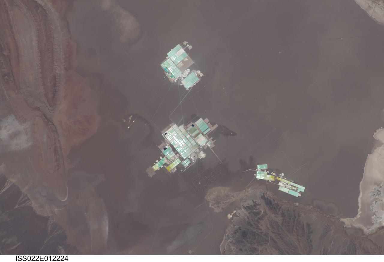
ISS022-E-012224 (15 Dec. 2009) --- Evaporation ponds in the Salar de Atacama, Chile are featured in this image photographed by an Expedition 22 crew member on the International Space Station. The Salar (salt flat) de Atacama in Chile is an enclosed basin with no drainage outlets. While the grey-brown surface of the Salar is flat and desiccated, mineral-rich brines - water with a high percentage of dissolved salts - are located below the surface. The subsurface brines of the Salar de Atacama are particularly rich in lithium salts. Lithium is an essential component of advanced batteries and medicines, among many other uses. The brines are pumped to the surface through a network of wells and into large shallow evaporation ponds ? three such evaporation pond facilities are visible in the center of the image. Color variations in the ponds are due to varying amounts of salts relative to water. The dry and windy climate enhances evaporation of the water, leaving concentrated salts behind for extraction of the lithium. The Salar de Atacama is located in the southern half of the Atacama Desert ? with no historical or current records of rainfall in some parts of this desert, it is considered to be one of the driest places on Earth. This photograph illustrates the central portion of the Salar de Atacama. It is bounded by brown to grey-brown folded and faulted strata of the Cordillera de la Sal to the northwest (upper left) and darker bedrock of the Cordon de Lila to the south (lower right).
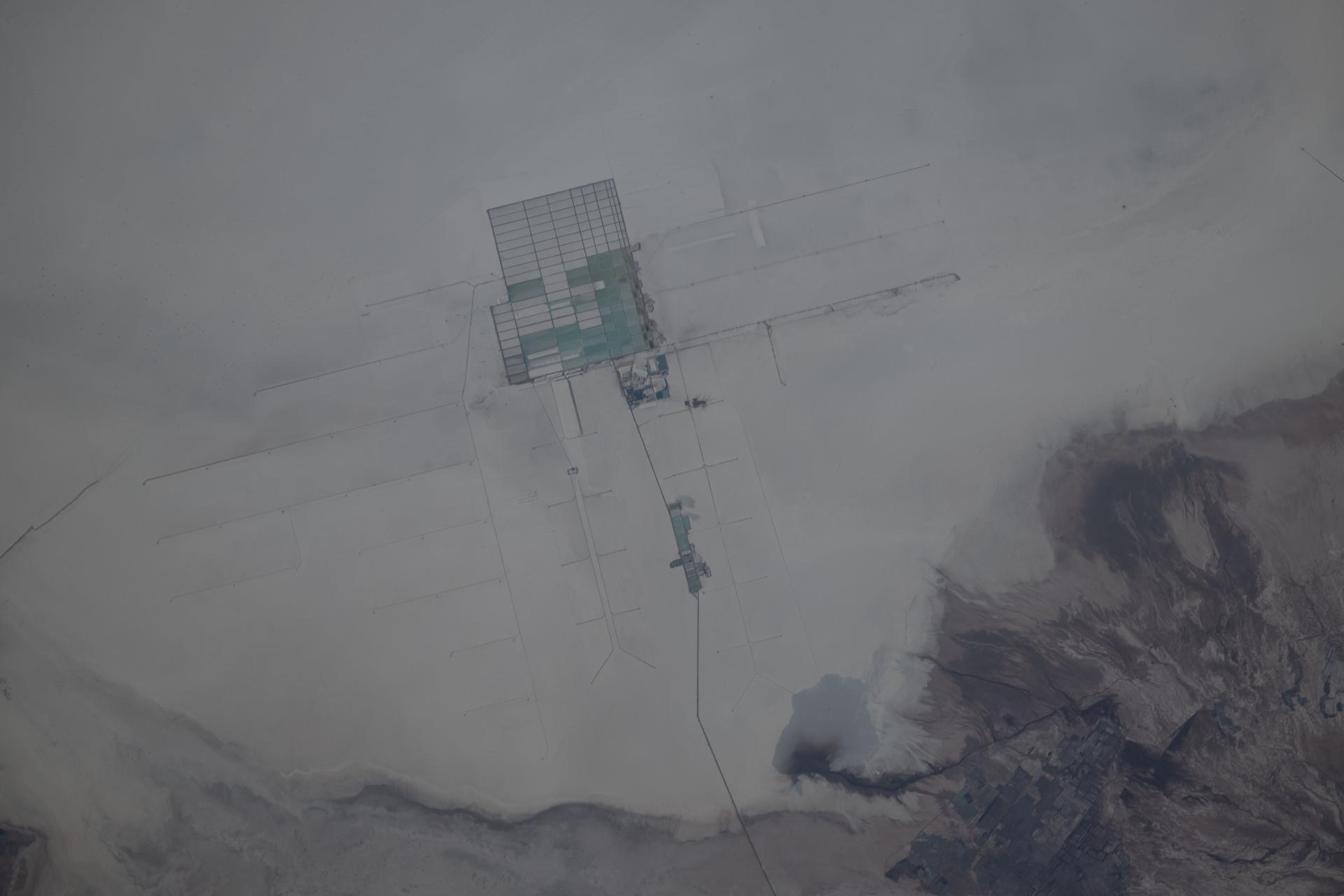
iss074e0796207 (July 7, 2026) --- A lithium extraction facility in Bolivia's Salar de Uyuni, the world's largest salt flat and the flattest surface on Earth, is pictured from the International Space Station as it orbited 263 miles above the South American nation. Credit: NASA/Chris Williams
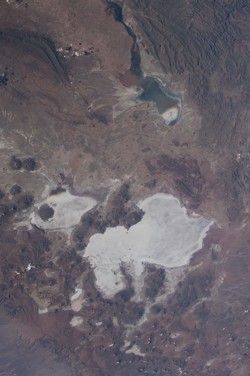
ISS043E184521 (05/10/2015) --- NASA astronaut Terry Virts Expedition 43 Commander on the International Space Station tweeted this Earth observation image of South America with the following comment: "Salar de Uyuni in the #Bolivia desert #SouthAmerica. The world's largest salt flat".
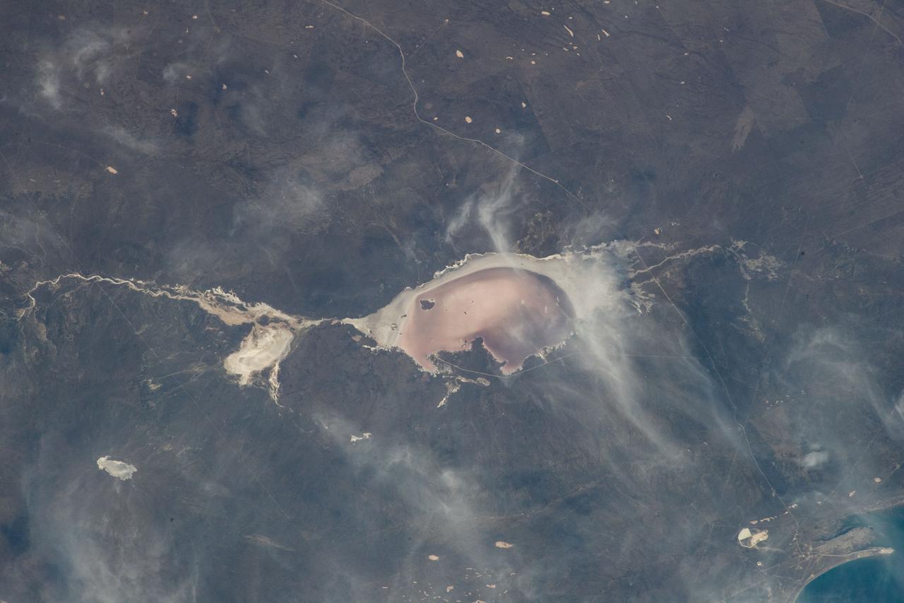
iss067e301712 (Aug. 30, 2022) --- Las Salinas del Gualicho, the third largest salt flat in the world and approximately 240 feet below sea level, is pictured from the International Space Station as it orbited 266 miles above Argentina.
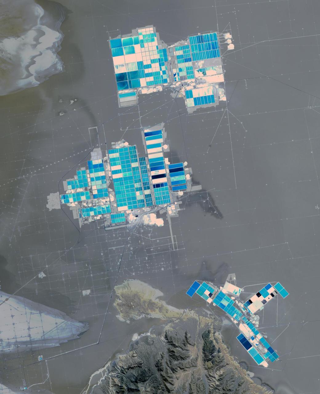
Salar de Atacama (Atacama salt flats) in Chile's Atacama Desert receives 2 mm rain per year. Its attraction are the brines 40 m below ground. They are pumped to the surface into large evaporation pans. After the water has vanished, a yellowish greasy solution is left behind that contains lithium. In fact, Salar de Atacama produces 27% of the world's annual supply. Mining lithium here is less expensive to produce than from neighboring Salar de Uyuni, which is estimated to have half of the lithium reserves in the world. The image was acquired August 21, 2017, covers an area of 22.5 by 27.8 km, and is located at 23.5 degrees south, 68.3 degrees west. https://photojournal.jpl.nasa.gov/catalog/PIA23420
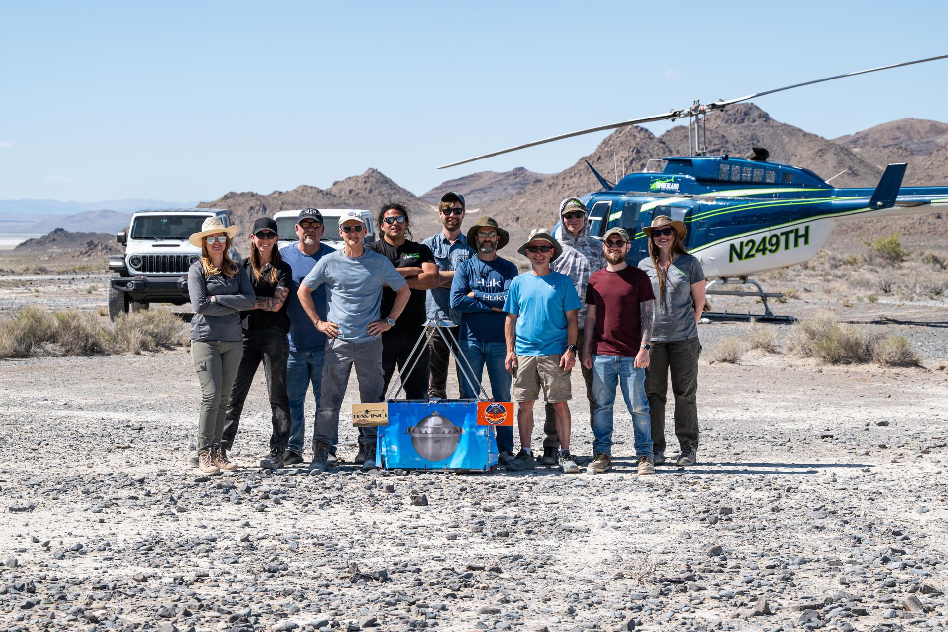
The DAVINCI VADIX dress rehearsal team poses for a group photo at Crater Island, June 4, 2026. From left to right, Erika Kohler, Terra Hardwick, Mike Vitulio, Brent Bos, Will Rivera, Christian Tate, Ben Schumacher, Phil Coulter, Joe Turner, Mike Guinto, Hailey. NASA/MIke Guinto
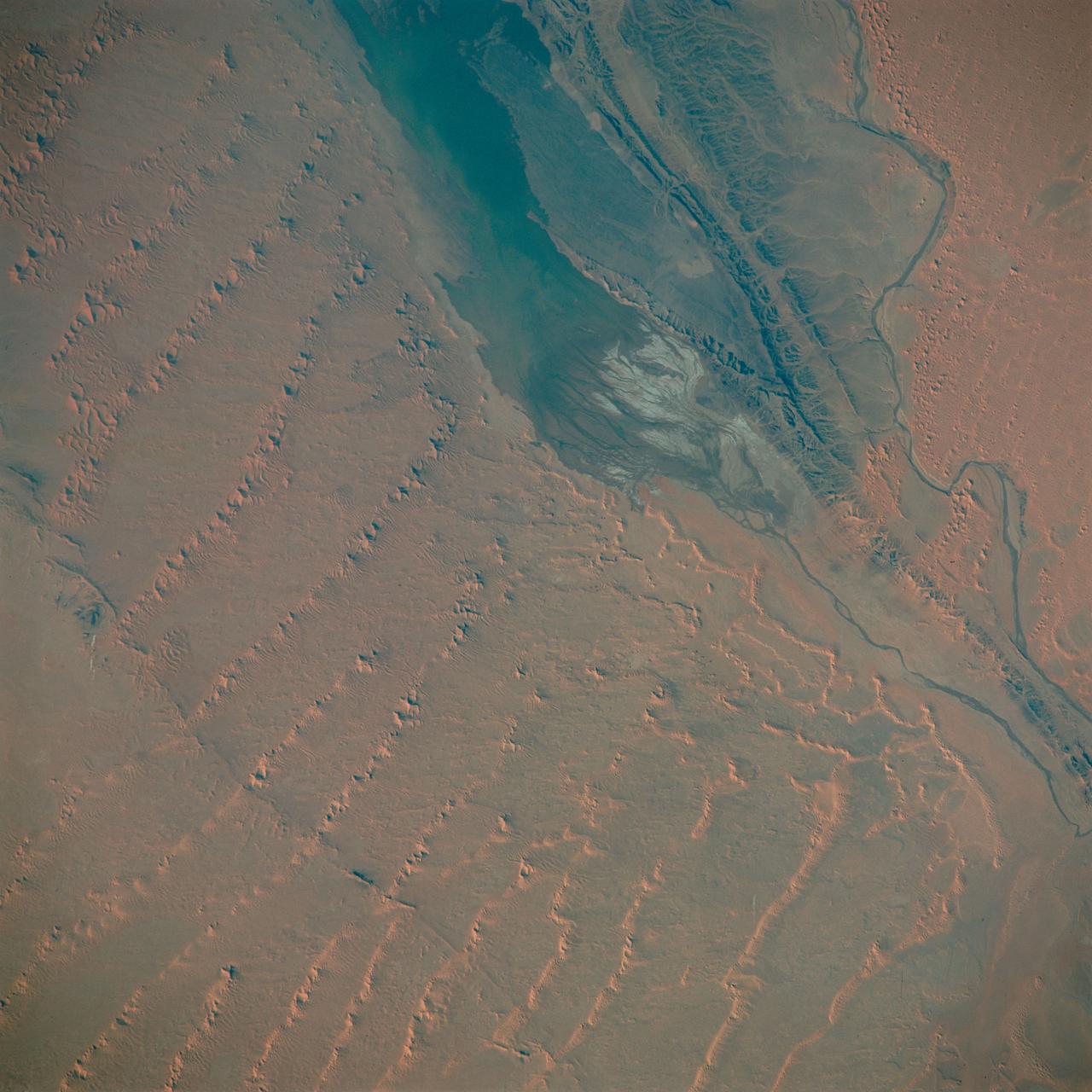
S65-63830 (5 Dec. 1965) --- Algeria, south-southeast of the Colomb Bechar area, as seen from the National Aeronautics and Space Administration's Gemini-7 spacecraft. Sand dunes are 200 to 300 feet high in the Grand Erg Occidental area. The Quod Sacura River can be seen in the upper left corner. The white spot in the middle of the picture is the Sebcha el Malah salt beds. It should be noted that the area had just experienced very heavy rains (first in many years) and the stream and salt flat are inundated. This photograph was taken with a modified 70mm Hasselblad camera, with Eastman Kodak, Ektachrome MS (S.O. 217) color film. Photo credit: NASA
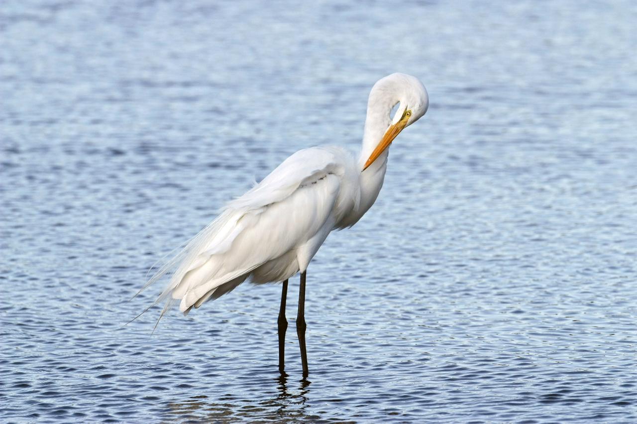
CAPE CANAVERAL, Fla. – A great egret preens its feathers while standing in the shallow water of a pond in the Merritt island National Wildlife Refuge, which borders NASA's Kennedy Space Center in Florida. The breed feeds alone, stalking fish, frogs, snakes and crayfish in shallow water. They inhabit freshwater and salt marshes, marshy ponds and tidal flats. The center shares a boundary with the refuge that includes salt-water estuaries, brackish marshes, hardwood hammocks and pine flatwoods. The diverse landscape provides habitat for more than 310 species of birds, 25 mammals, 117 fishes and 65 amphibians and reptiles. Photo credit: NASA/Jim Grossmann
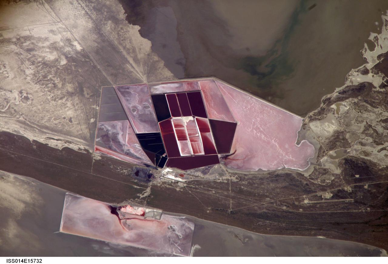
ISS014-E-15732 (1 March 2007) --- Salt ponds of Botswana are featured in this image photographed by an Expedition 14 crewmember on the International Space Station. This recent, detailed view shows the salt ponds of one of Africa's major producers of soda ash (sodium carbonate) and salt. Soda ash is used for glass making, in metallurgy, in the detergent industry, and in chemical manufacture. The image shows a small part of the great salt flats of central Botswana known as the Makgadikgadi Salt Pans. The soda ash and salt are both mainly exported (since 1989) to most countries in southern and central Africa. Brines from just beneath the pan floor are evaporated to produce the soda ash and salt -- a process for which the semiarid climate of Botswana is ideal. Red salt-loving algae in the ponds indicate that the salinity of the evaporating brines is medium to high. The salt pans of Botswana--a prominent visual photo target of interest for astronauts aboard the station--lie at the low point of a vast shallow continental basin. Rivers draining from as far away as central Angola - more than 1,000 kilometers away - supply water to the pans. According to scientists, during several wet climatic phases in the recent geological past the pans were permanently filled with water, for thousands of years, only to dry out when climates fluctuated to drier conditions. During dry phases water only reaches the pans underground. These are the brines that support the ash and salt industry. During wet phases when open water exists, beach ridges are constructed by wave action. One of these crosses the lower part of the view.

ISS012-E-06456 (3 Nov. 2005) --- Salar de Uyuni, the largest Salar (salt flat) in the world, located within the Altiplano of Bolivia, South America is featured in this image photographed by an Expedition 12 crewmember on the International Space Station. The Altiplano is a high plateau formed during uplift of the Andes Mountains. The plateau harbors fresh and saltwater lakes, together with Salars, that are surrounded by mountains with no drainage outlets--all at elevations greater than 3,659 meters (12,000 feet) above mean sea level. The Salar de Uyuni covers approximately 8,000 square kilometers (3,100 square miles), and it is a major transport route across the Bolivian Altiplano due to its flatness. This image features the northern end of the Salar and the dormant volcano Mount Tunupa (image center). This mountain is high enough to support a summit glacier, and enough rain falls on the windward slopes to provide water for small communities along the base. The dark volcanic rocks comprising Mt. Tunupa are in sharp contrast with the white, mineral-crusted surface of the Salar. The major minerals are halite--common table salt--and gypsum--a common component of drywall. Relict shorelines visible in the surface salt deposits (lower right of the image) attest to the occasional presence of small amounts of water in the Salar. Sediments in the Salar basin record fluctuations in water levels that occurred as the lake that once occupied the Salar evaporated. These sediments provide a valuable paleoclimate record for the region. The dynamic geological history of the Altiplano is recorded in isolated "islands" within the salt flat (image left); these islands are typically built from fossil coral reefs covered by Andean volcanic rocks.
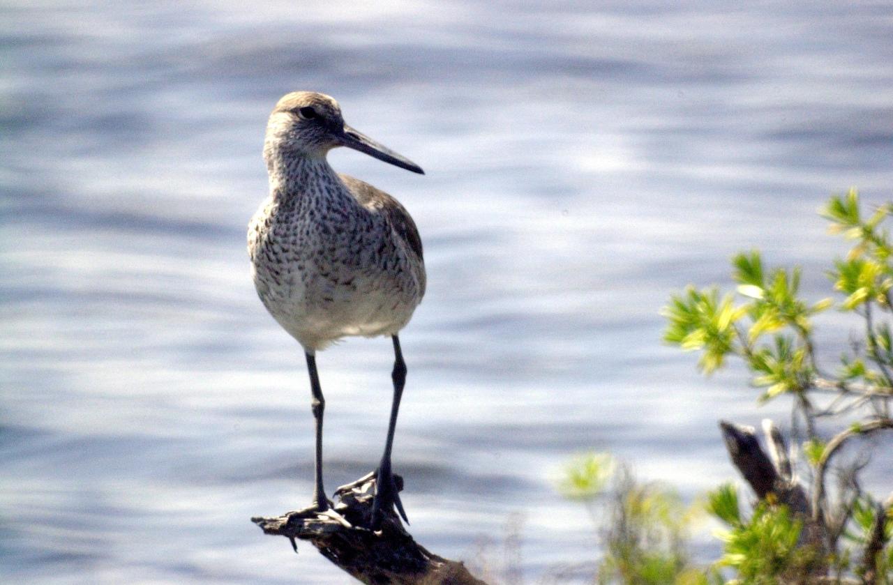
KENNEDY SPACE CENTER, FLA. - A Short-Billed Dowitcher perches on a branch hanging above water near Kennedy Space Center,. These sandpiper-like birds inhabit mud flats, creeks, salt marshes and tidal estuaries. With their long bills probing the water in rapid up-and-down motion, they seek marine worms, snails, tiny crustaceans and aquatic larvae. They range from southern Alaska to eastern Canada and winter from the southern United States to central South America.
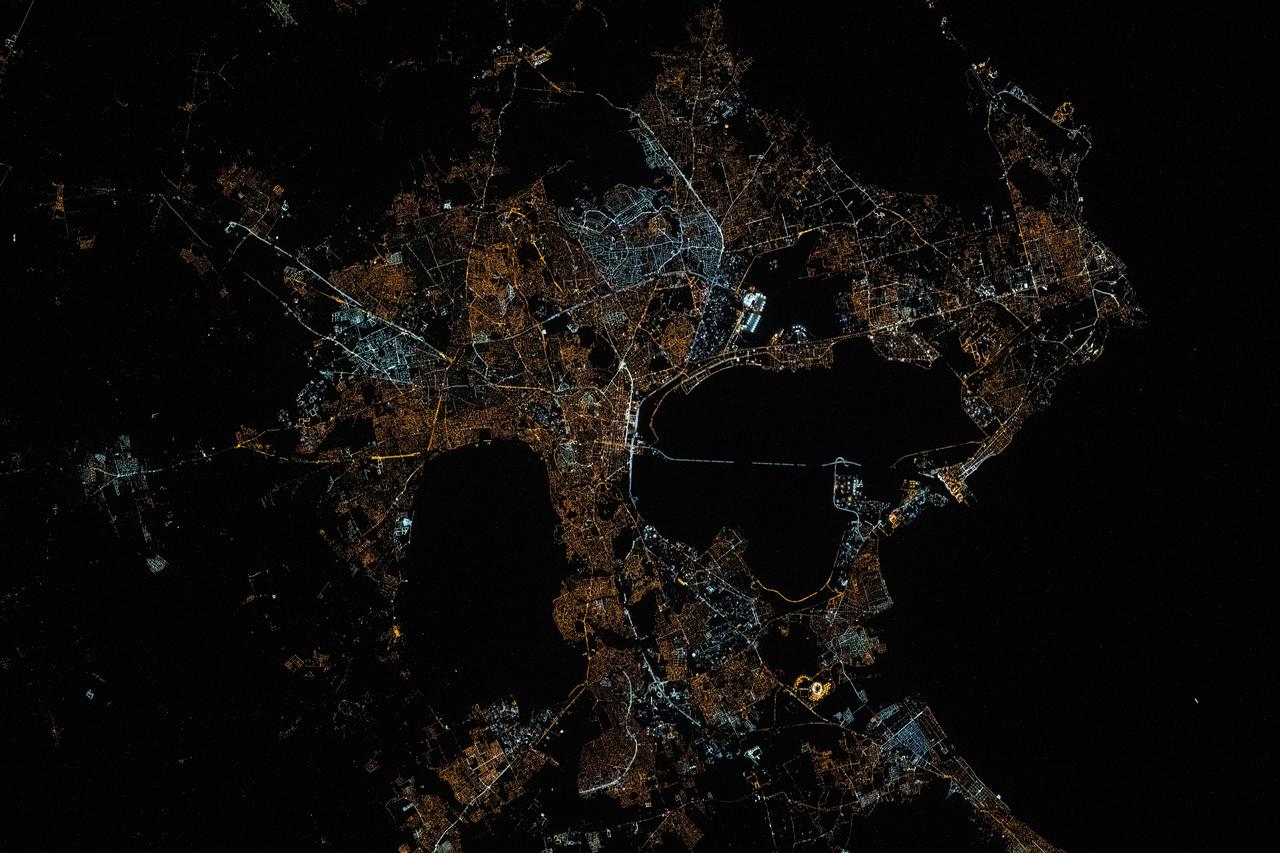
iss073e0078538 (May 17, 2025) --- The city lights of Tunis, the capital of the north African nation of Tunisia with a metropolitan population of 2.67 million, contrast the city's historical and modern character in this photograph at approximately 12:34 a.m. local time from the International Space Station as it orbited 260 miles above the Mediterranean Sea. Tunis sits in between the Lake of Tunis and the Sebkhet Sejoumi, a seasonal salt flat, and is situated on the Gulf of Tunis.
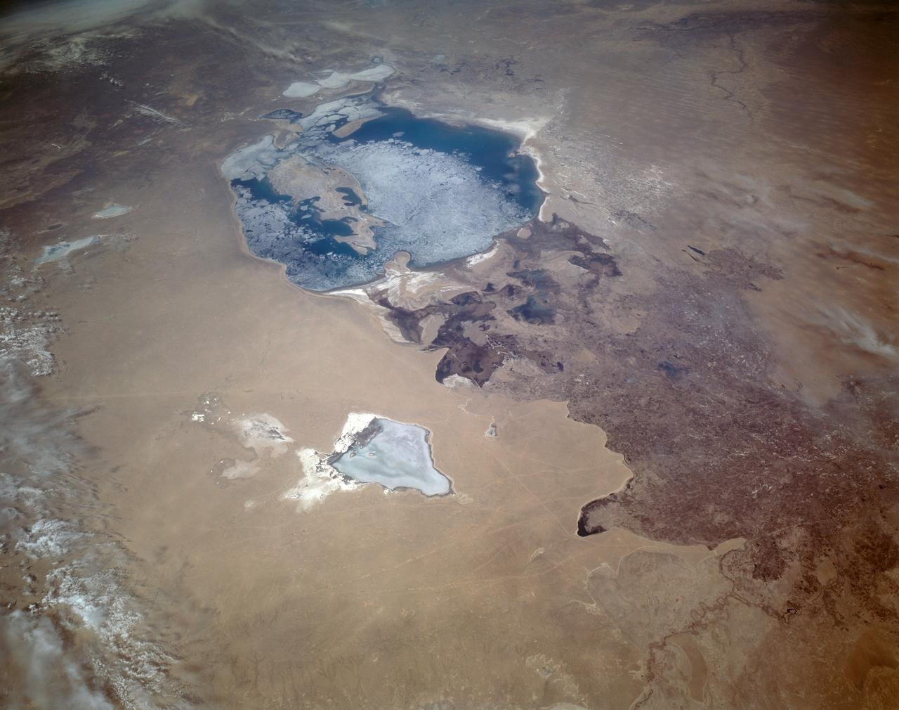
STS059-L22-140 (9-20 April 1994) --- View northeastward across Uzbekastan to the partly-ice-covered Aral Sea and Kazakhstan. The irrigated fan-delta of the Amu Darya extends from the right side of the photograph to end in extensive salt flats at the south end of the sea. The Aral was the fourth-largest inland sea or lake in the world, until diversion and over-use of the river water for irrigation led, in this arid climate, to the sea's decline. Linhof camera.
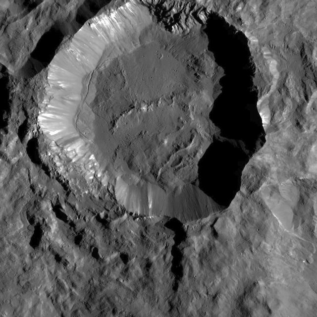
This image from NASA's Dawn spacecraft shows Kupalo Crater, one of the youngest craters on Ceres. The crater has bright material exposed on its rim and walls, which could be salts. Its flat floor likely formed from impact melt and debris. Kupalo, which measures 16 miles (26 kilometers) across and is located at southern mid-latitudes, is named for the Slavic god of vegetation and harvest. Kupalo was imaged earlier in Dawn's science mission at Ceres -- during Survey orbit (see PIA19624) and from the high altitude mapping orbit, or HAMO (see PIA20124). Dawn took this image on Dec. 21 from its low-altitude mapping orbit (LAMO) at an approximate altitude of 240 miles (385 kilometers) above Ceres. The image resolution is 120 feet (35 meters) per pixel. http://photojournal.jpl.nasa.gov/catalog/PIA20192
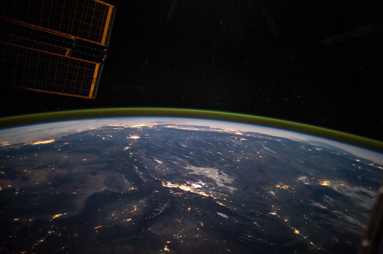
ISS041-E-067595 (6 Oct. 2014) --- This moonlit panorama was shot recently with a wide-angle lens by an Expedition 41 crew member aboard the International Space Station, as they looked southwest from a point over Nebraska. The wide-angle lens shows a huge swath of country that stretches from Portland, Oregon (right) to Phoenix, Arizona (left). The largest string of lights is the Ogden-Salt Lake City-Provo area (lower center) in Utah. The Los Angeles and San Francisco metropolitan regions, and the cities of the central valley of California (Bakersfield to Redding) stretch across the horizon. The green airglow layer always appears in night images. Moonlight shows the red tinge of the space station?s solar arrays top left. Moonlight emphasizes the broader-scale geological zones. Nevada?s short, dark, parallel mountain ranges of the basin and range geological province (center) contrast with the expanses of flat terrain of the Colorado Plateau (left) in Colorado, Arizona, Utah and New Mexico. The near-full moon even reveals the vast dry lake bed known as the Bonneville Salt Flats. The black line of the Sierra Nevada marks the edge of California?s well-lit central valley (directly below the San Francisco Bay area).
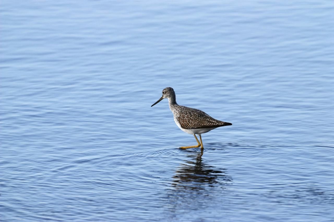
CAPE CANAVERAL, Fla. – A yellowleg sandpiper wades in the shallow water of a pond in the Merritt island National Wildlife Refuge, which borders NASA's Kennedy Space Center in Florida. They range through Alaska and Canada, wintering from the southern U.S. to southern South America. They inhabit marshy ponds, lake and river shores and mud flats. The center shares a boundary with the refuge that includes salt-water estuaries, brackish marshes, hardwood hammocks and pine flatwoods. The diverse landscape provides habitat for more than 310 species of birds, 25 mammals, 117 fishes and 65 amphibians and reptiles. Photo credit: NASA/Jim Grossmann
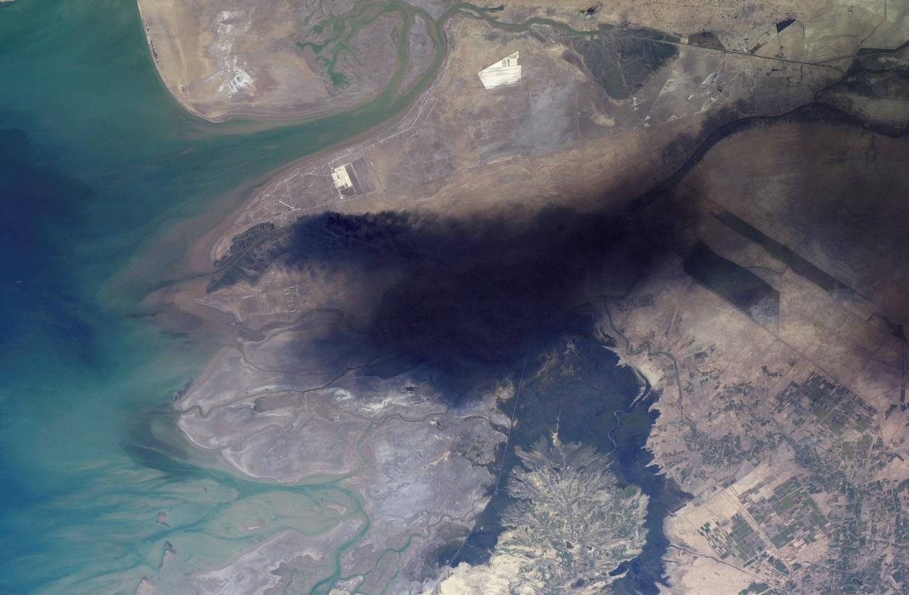
ISS008-E-18938 (24 March 2004) --- This photo of a large black smoke plume over southeastern Iraq was taken by an Expedition 8 crewmember on the International Space Station. The oil that is burning spilled from a ruptured pipeline on March 23, 2004. This photo was taken the next afternoon and shows details of land use near the fire. The delta of the Shatt al Arab has numerous channels, estuaries, and tidal flats. Near the top of the photo (southwest) are two large white salt evaporator operations while to the lower right are wetlands and irrigated agricultural fields. Iraq’s only oil terminal on the Persian Gulf is near the left edge of the plume.
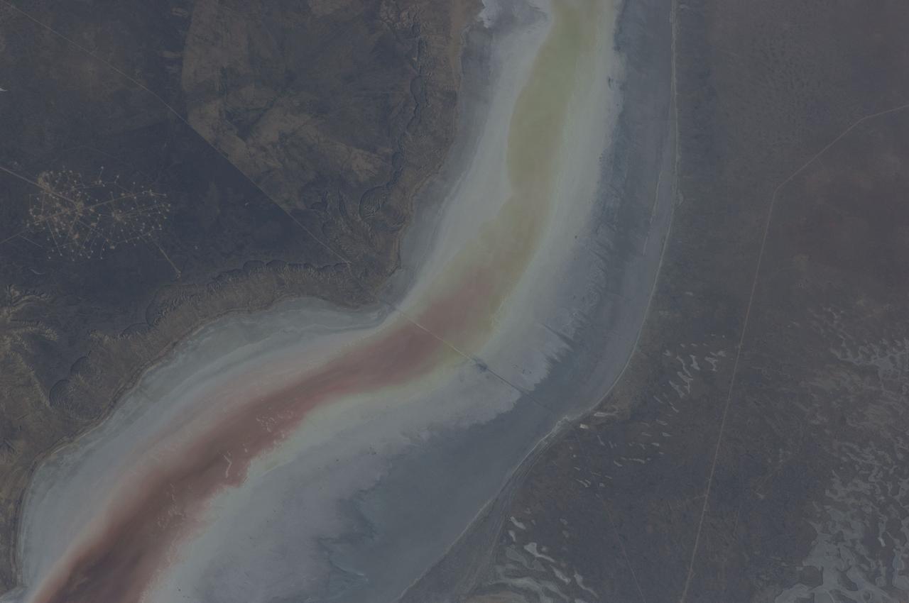
ISS031-E-030896 (11 May 2012) --- The Sor Kaydak near the northeast Caspian Sea in Kazakhstan are featured in this image photographed by an Expedition 31 crew member on the International Space Station. This striking image shows saline water of different colors in the Sor Kaydak, a salt marsh that leads into the northeast bulb of the Caspian Sea. The central 50 kilometers of this 180 kilometer-long depression is shown in this photograph. The Sor Kaydak depression is inundated on occasion by water from the Caspian Sea since it lies at the same elevation?that is, 29 meters below global sea level?though separated from the Sea by a low bar of land that is 1?2 meters high. The different colors of marsh water (brown to pink to light green, northeast to southwest) result from the interplay of water depth and resident organisms such as algae. Algae color varies depending on water temperature and salinity. The irregular gray areas at bottom right are wet zones between low sand dunes. These interdune flats are whitened with salt derived by evaporation of Caspian Sea water (the sea is just outside the image bottom right). The jagged line following the colored water (crossing the center of the image top to bottom) is the limit of the wetting zone (or perimeter), an irregular zone influenced by wind and the depth of water in the marsh. Small cliffs can be seen marking the east margin of the depression that contains Sor Kaydak. Above the cliffs a plateau surface (approximately 200 meters above the salt marsh, approximately 160 meters above global sea level) extends eastward for hundreds of kilometers. Here the plateau is occupied by a dense pattern of well heads which appear as a geometric pattern of tan dots. By contrast, the west margin (right) rises less than 10 meters above the marsh altitude. The straight line visible at center is a pipeline built across the salt marsh which takes oil to a terminal on the Caspian shore 100 kilometers northwest of the area shown here.
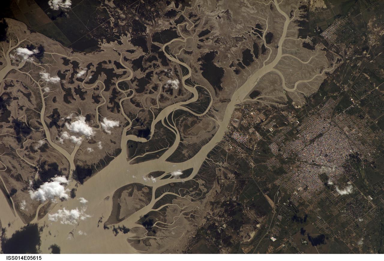
ISS014-E-05615 (14 Oct. 2006) --- Bahia Blanca, Buenos Aires Province, Argentina is featured in this image photographed by an Expedition 14 crewmember on the International Space Station. The port city of Bahia Blanca lies almost 600 kilometers southwest of Buenos Aires on the southern rim of the Argentine economic heartland. This small city of 275,000 people is captured in one frame which shows its position near the mouth of the Arroyo Naposta. The salt flats (gray) and wetlands bordering this estuary, characterized by twisting, light colored tidal channels and dark swamps, lie mainly on the south side of the river. The yellow tinge to the water surfaces arises from the partial sunglint reflection on this particular day. The name Bahia Blanca (White Bay) derives from the white color of the salt and was applied to the major bay--noted by Magellan as he probed the coast of South America for a passage to the Pacific Ocean in 1520--and then to the city at the head of this bay. Highways, airline routes and pipelines from oil and gas fields to the west and south all converge on Bahia Blanca. The city is a major cultural center and historically has acted as a gateway for immigration. Higher ground on the north side of the estuary affords stable ground for the growth of the city and for intensive agriculture, a mainstay of the Argentine economy. The city is set back from the waterfront where an industrial park, a petrochemical center, and dockyards (white ellipse) are located.
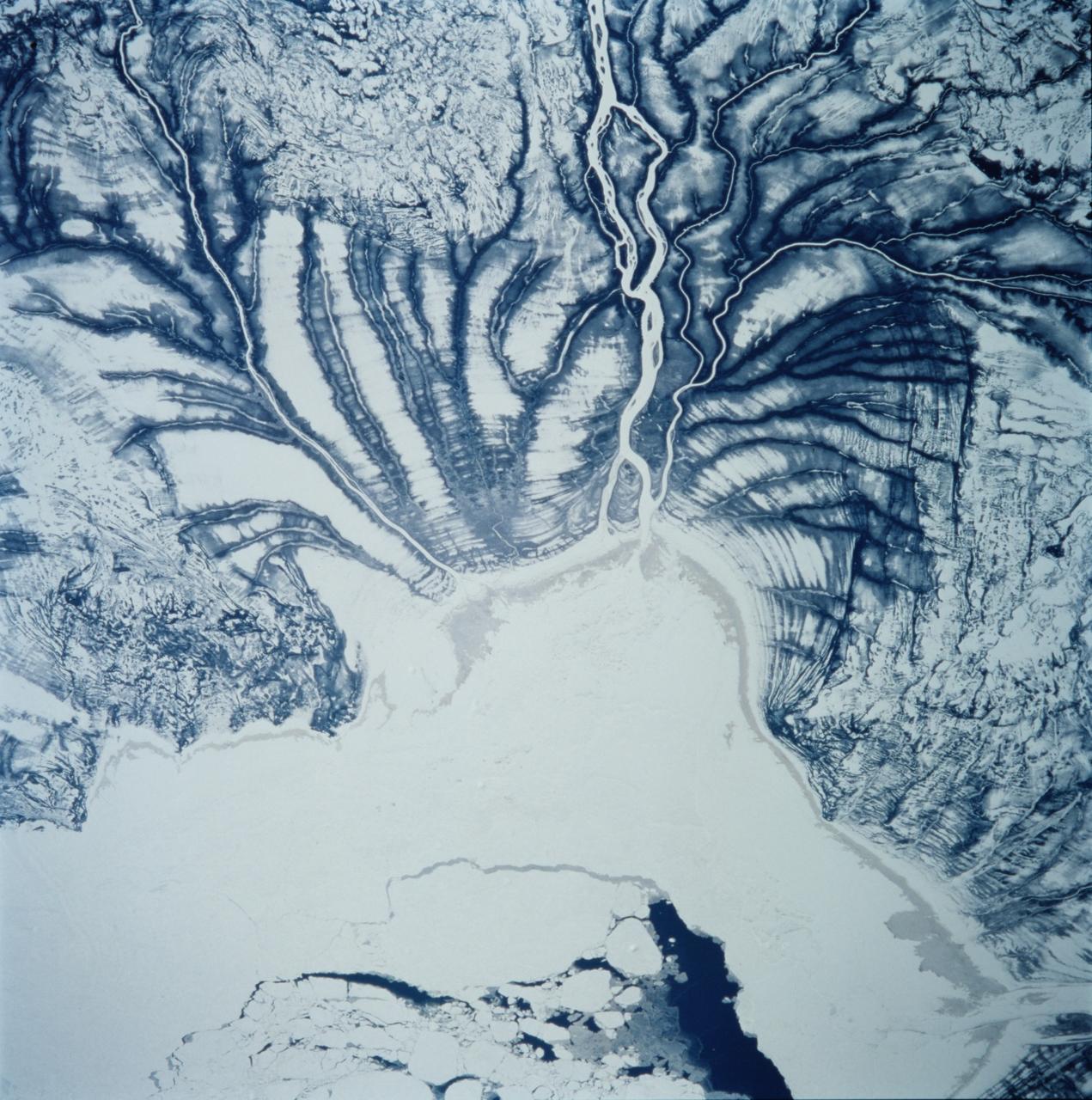
STS099-706-090 (11-22 February 2000) ---One of the astronauts aboard the Space Shuttle Endeavour for the STS-99 mission recorded this 70mm image of Hannah Bay, in the southern part of St. James Bay. The river is the Harricanaw River. Numerous shorelines around Hudson and St. James Bays are distinctive in winter because of snow cover. According to NASA scientists, shorelines were created when the overlying glaciers retreated and the land underneath rebounded causing the Hudson and St. James Bay waters to retreat northward. These ridges are 100 to 200 meters in width and heights can reach up to 7 meters. The land along St. James Bay consists mainly of tidal flats and salt marshes.
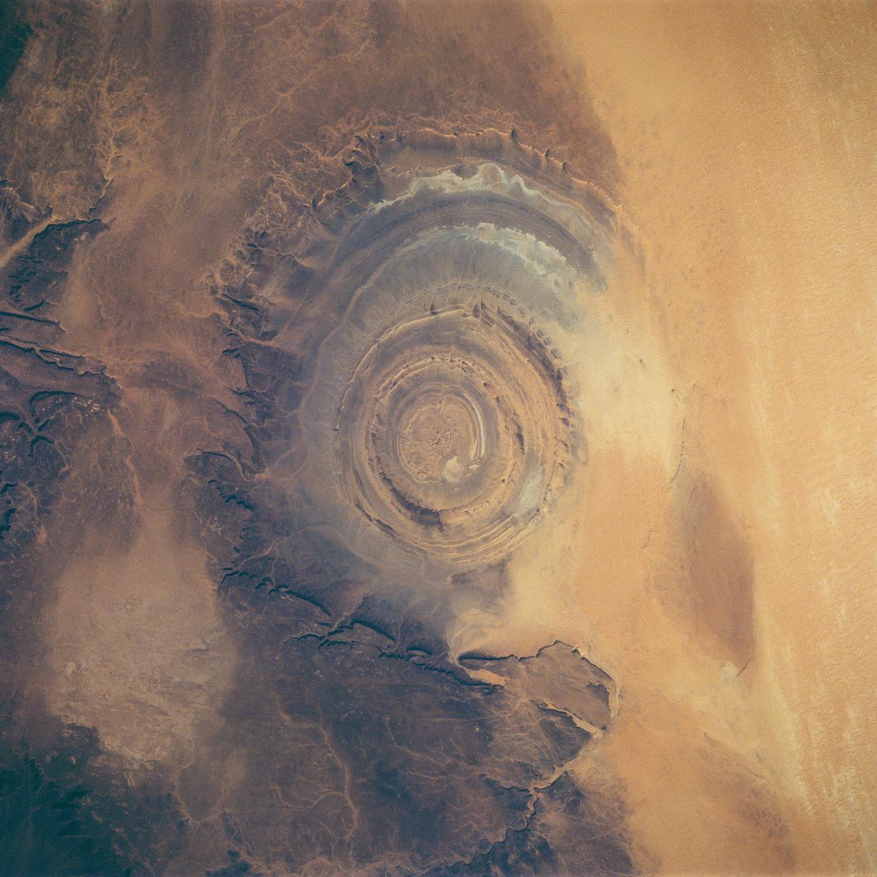
STS058-88-017 (18 Oct-1 Nov 1993) --- The eye-catching "bullseye" of the Richat Structure adds interest to the barren Gres de Chinguetti Plateau in central Mauretania, northwest Africa. It represents domally uplifted, layered (sedimentary) rocks that have been eroded by water and wind into the present shape. Desert sands have invaded the feature from the south. The origin of the structure is unknown. It is not an impact structure, because field work showed that strata are undisturbed and flat-lying in the middle of the feature, and no shock-altered rock could be found. There is no evidence for a salt dome or shale diapir, nor is there any geophysical evidence for an underlying dome of dense igneous rock having about the same density as the sedimentary layers.
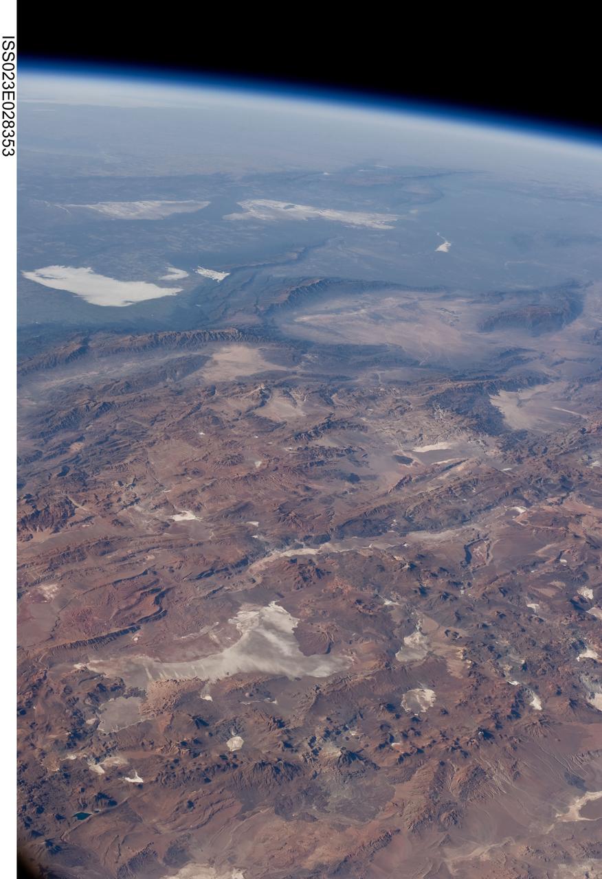
ISS023-E-028353 (26 April 2010) --- Central Andes Mountains, Salar de Arizaro, Argentina are featured in this image photographed by an Expedition 23 crew member on the International Space Station. The high plains (3,000 to greater than 5,000 meters elevation, 13,000 to 19,000 feet) of the Andes Mountains, also known as the Puna, appear in the foreground of this photograph, with a line of young volcanoes facing the much lower Atacama Desert (1,000–2,000 meters elevation). Several large dry lakes, marked by light-toned salt crusts, occupy the basins between major thrust faults in the Puna. Salar de Arizaro (foreground) is the largest of the dry lakes in this view (salar means waterless salt flat in Spanish). This panorama was taken by a station crew member looking southeast across the South American continent when the ISS was almost directly over the Atacama Desert near Chile’s Pacific coast. The Atlantic Ocean coastline (River Plate where Argentina’s capital city of Buenos Aires is located) is dimly visible at top left. A striking geological and landscape contrast is visible at center which separates two distinct geological zones, namely the Puna and the Sierras Pampeanas. The Sierras Pampeanas Mountains are lower in elevation and have few young volcanoes, in contrast to the Puna. Sharp-crested ranges are separated by wide, low valleys in this region. The Salinas Grandes—ephemeral shallow salt lakes at top left (salina means salt lake in Spanish) — occupies one of these valleys. The general color change from reds and browns in the foreground to blues and greens in the upper part of the image reflects the major climatic regions, namely the deserts of the Atacama and Puna, versus the low grassy plains of central Argentina where rainfall is sufficient to promote lush prairie grass growth—known famously as the pampas in Argentina. The Salinas Grandes mark an intermediate semiarid region. What accounts for the changes in landscape? The geology of this part of the Andes is a result of the eastward subduction of the Nazca tectonic plate underneath South America. Investigations using seismic data suggest that the Puna is underlain by a steeply dipping sector of the subducting Nazca plate. The Sierras Pampeanas zone however, is underlain by a sector of the Nazca plate that is almost horizontal, possibly due to the subduction of a submarine mountain range known as the Juan Fernandez Ridge. In the simplest terms, ridges are topographic highs that are difficult to stuff down subduction zones, with profound effects on the volcanism and structures of the upper plate.
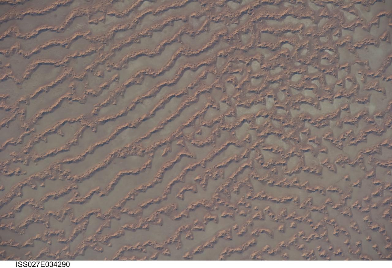
ISS027-E-034290 (16 May 2011) --- Ar Rub al Khali Sand Sea, Arabian Peninsula is featured in this image photographed by an Expedition 27 crew member on the International Space Station. The Ar Rub al Khali, also known as the “Empty Quarter”, is a large region of sand dunes and interdune flats known as a sand sea (or erg). This photograph highlights a part of the Ar Rub al Khali located close to its southeastern margin in the Sultanate of Oman. Reddish-brown, large linear sand dunes alternate with blue-gray interdune salt flats known as sabkhas at left. The major trend of the linear dunes is transverse to northwesterly trade winds that originate in Iraq (known as the Shamal winds). Formation of secondary barchan (crescent-shaped) and star dunes (dune crests in several directions originating from a single point, looking somewhat like a starfish from above) on the linear dunes is supported by southwesterly winds that occur during the monsoon season (Kharif winds). The long linear dunes begin to break up into isolated large star dunes to the northeast and east (right). This is likely a result of both wind pattern interactions and changes in the sand supply to the dunes. The Empty Quarter covers much of the south-central portion of the Arabian Peninsula, and with an area of approximately 660,000 square kilometers it is the largest continuous sand desert on Earth. The Empty Quarter is so called as the dominantly hyperarid climate and difficulty of travel through the dunes has not encouraged permanent settlement within the region. There is geological and archeological evidence to support cooler and wetter past climates in the region together with human settlement. This evidence includes exposed lakebed sediments, scattered stone tools, and the fossils of hippopotamus, water buffalo, and long-horned cattle.
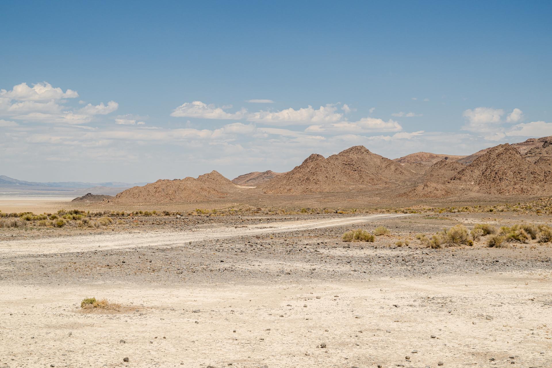
A view of Crater Island from the VADIX Basecamp, Crater Island, Utah June 24, 2026. This area was the site of a series of tests (June 23-25, 2026) of the camera system that will one day fly aboard NASA’s DAVINCI mission to Venus. NASA/Mike Guinto
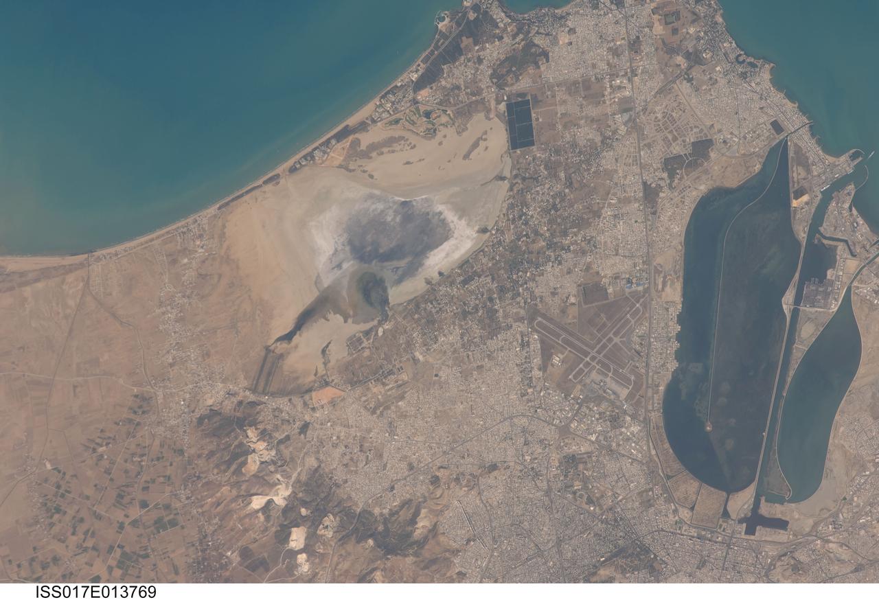
ISS017-E-013769 (19 Aug. 2008) --- Tunis, Tunisia is featured in this image photographed by an Expedition 17 crewmember on the International Space Station. The city of Tunis, capital of Tunisia, is a rapidly modernizing city located along the Mediterranean coast of northern Africa. Sharing much of its history with famous Carthage to the north, Tunis was also destroyed by Rome in approximately 146 BC. Tunis, however, was rebuilt by the Romans and became an important agricultural center. Modern Tunis serves as the administrative center for the whole of Tunisia, and as a commercial hub for trade in the northern part of the country. The urban area of Tunis is located on a flat coastal plain, and is distinguished in this view from the surrounding desert by the pattern of grey to tan buildings and darker street grid. The city is bordered by an evaporating saline lake to the northeast known as Sebkhet Arina (upper left) -- evaporite minerals such as halite (table salt) and gypsum produce the white deposits surrounding the darker lake center where there is more moisture. To the southeast of the city is Lake Tunis, a lagoon that has been significantly altered by human activities -- such as closing off water exchange with the Mediterranean Sea - dating back to Roman times. The general lack of water circulation and input of nutrients from sewage has lead to the establishment of marine worm reefs, and occasional fish kills. The western urban-rural fringe is defined by a range of low hills (lower left); dark green agricultural fields are visible on the western side of these hills.
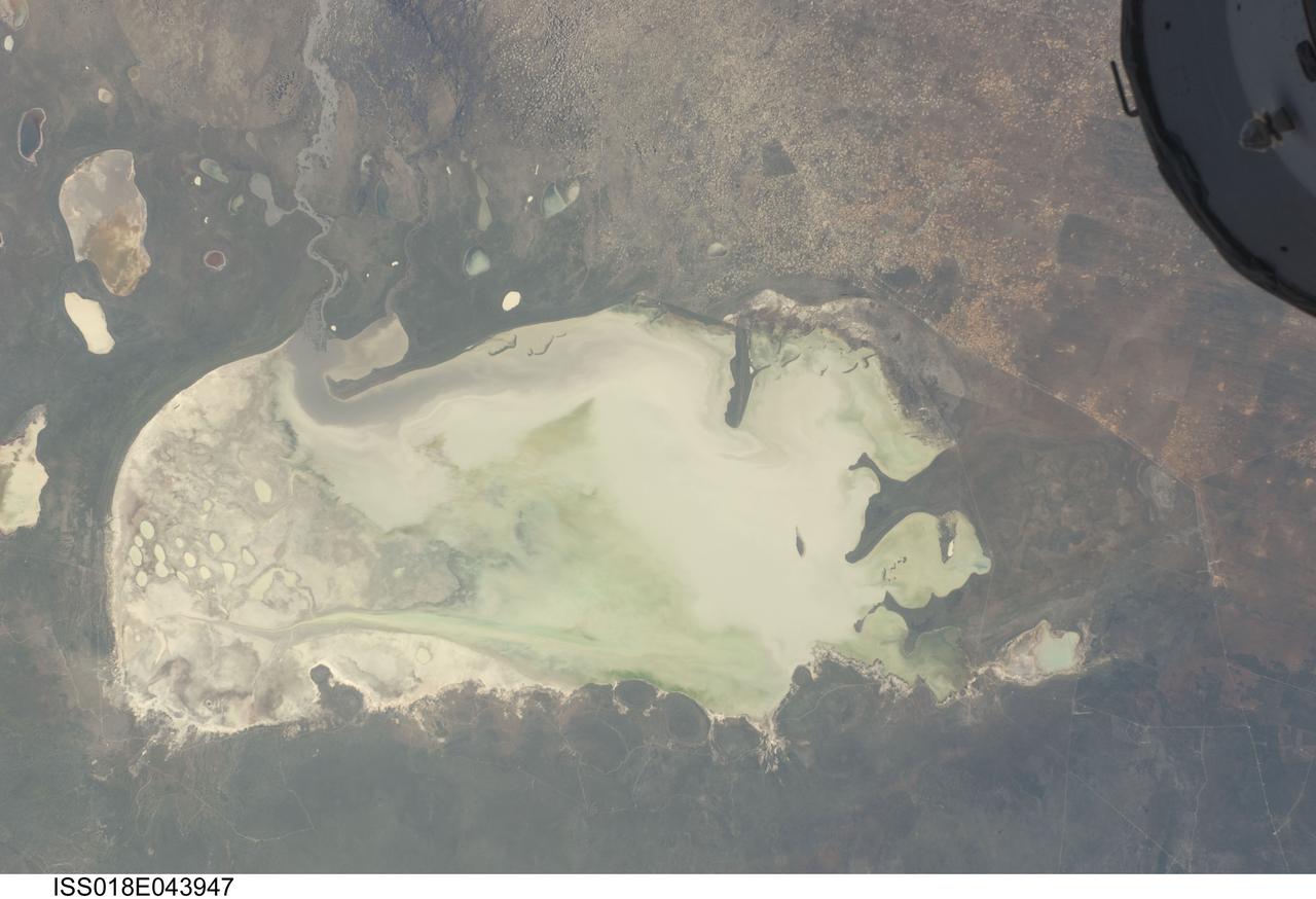
ISS018-E-043947 (26 March 2009) --- Etosha Pan in Namibia is featured in this image photographed by an Expedition 18 crewmember on the International Space Station. Etosha Pan is a large dry lake about 130 kilometers long that dominates Namibia?s Etosha National Park (the sharp edge of the park fence can be seen at right). Small related dry lake beds appear as bright shapes top left, a portion of the International Space Station appears at top right. This view shows the pan as it appeared almost ten years ago. The pan is the low point in a major inland basin in northern Namibia. During occasional flood events, such those experienced in the last nine months, rivers from Angola (the Namibia?Angola boundary lies just outside the top of the image) deliver large quantities of water to the pan. In this image flood water in the Oshigambo River, resulting from recent heavy rains in Angola, appears as a gray stream entering the northwest corner of the pan (top left). The floodwater becomes a thin sheet on the vast salt flat of the pan floor. Algae blooms in the warm water have produced a light-green tinge. Another image of the Oshigambo River mouth in flood can be seen here. Reports on the ground, augmented with orbital unmanned satellite imagery acquired subsequent to this photograph, show that the plains north of the pan are now flooded, causing damage to homesteads, crops and roads. More than 340,000 people have been affected in northern Namibia and approximately 250,000 in southern Angola.
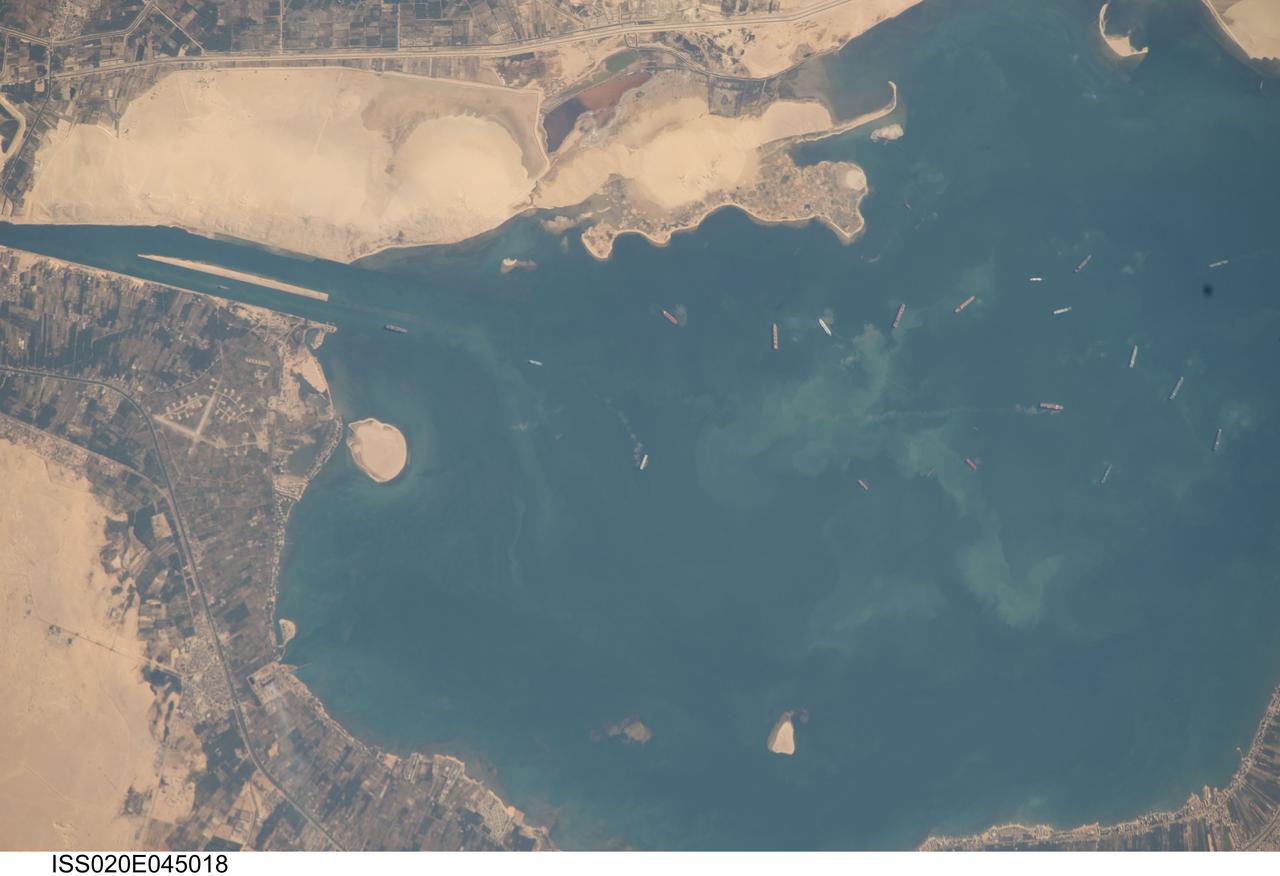
ISS020-E-045018 (2 Oct. 2009) --- Great Bitter Lake, Egypt is featured in this image photographed by an Expedition 20 crew member on the International Space Station. The Great Bitter Lake is one of several lakes located along the Suez Canal that connects the eastern Mediterranean and Red Seas. As the Canal is built only to allow ships to travel in a single lane, the Great Bitter Lake is a location where ships can change their position in line - much like a motor highway passing lane - before proceeding to either Port Said to the north, or the port of Suez to the south. The lake also provides an intermediate harborage for ships traversing the Canal ? a journey that typically takes 14 hours end-to-end. Several ships - some under power and some anchored ? are visible at right. Prior to the opening of the Suez Canal in 1869, Great Bitter Lake was a large salt flat, the typical geomorphic expression of basins in the arid Egyptian climate. Large expanses of white to tan sandy sediments at left and top attest to the desert conditions surrounding the Lake. Located at the approximate midpoint of the Suez Canal, Great Bitter Lake is now filled with water derived from both the Red and Mediterranean Seas and this steady influx of water balances the water lost to evaporation. The town of Fayid (also spelled as Fayed), visible along the western shore of the Lake (bottom) is a tourist destination frequented, particularly in the summer months, by residents of Cairo.
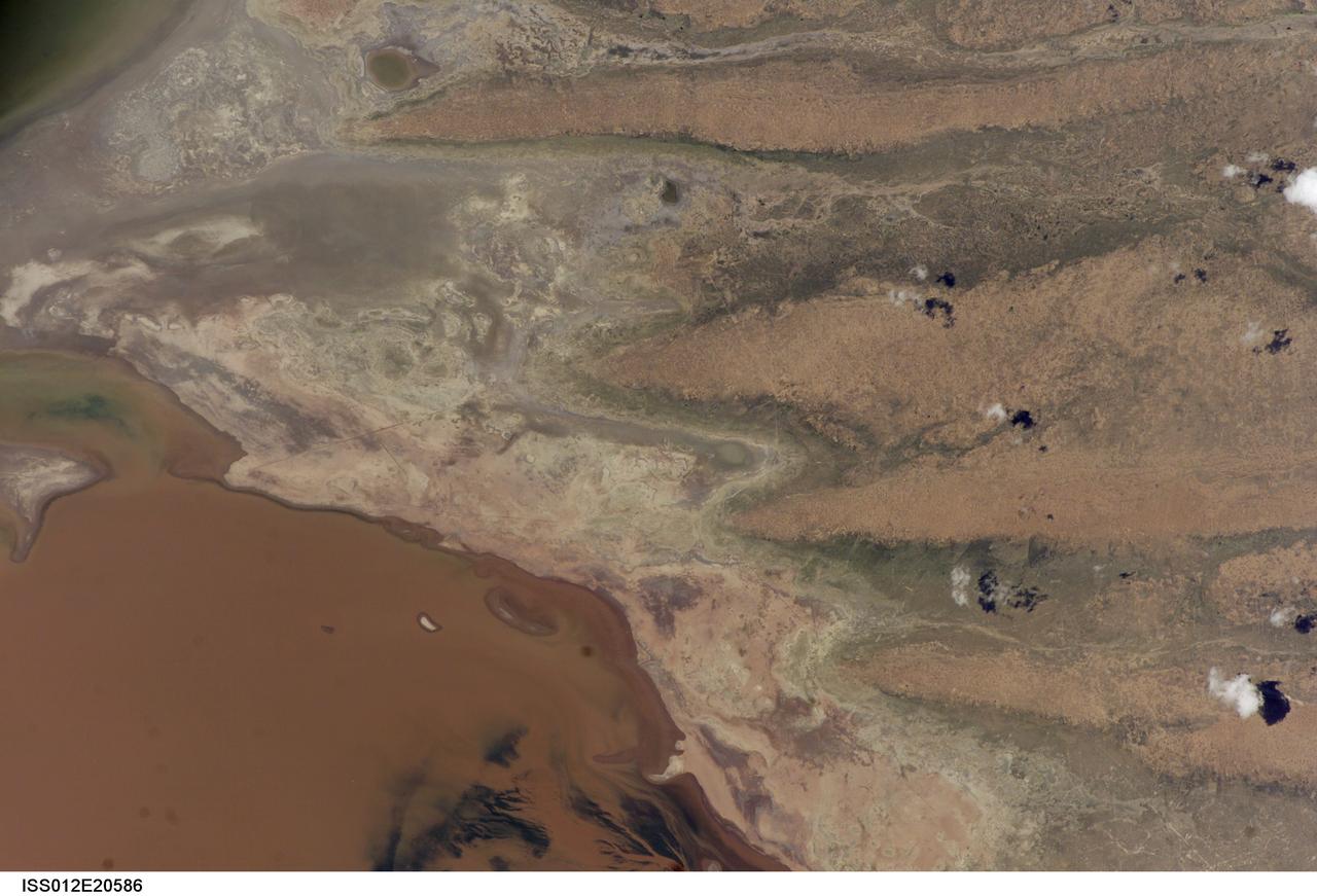
ISS012-E-20586 (9 March 2006) --- A portion of Lake Poopo is featured in this image photographed by an Expedition 12 crewmember on the International Space Station. Lake Poopo sits high in the Bolivian Andes, catching runoff from its larger neighbor to the north - Lake Titicaca (not shown) - by way of the Desaguadero River (muddy area at the north end of the lake). Because Lake Poopo is very high in elevation (roughly 3400 meters or 11,000 feet above sea level), very shallow (generally less than 3 meters or 9 feet), and the regional climate is very dry, small changes in precipitation in the surrounding basin have large impacts on the water levels and areal extent of Lake Poopo. When the lake fills during wet periods, Poopo drains from the south end into Salar de Coipasa (not shown). Water levels in Poopo are important because it is one of South America’s largest saline lakes, and a prime stop for migratory birds, including flamingoes. Last November, water levels had dropped, exposing large tracts of salt and mud flats. A wet and cool period between December and the end of February resulted in flooding of Poopo with muddy waters from the Desaguadero River. NASA managers have tasked the station crew to track such changes, which are related to regional weather patterns. Lake Poopo’s sensitivity to precipitation in the high Andes (possibly reflecting larger climate cycles) provides an excellent visual indicator of these trends.

ISS012-E-20585 (9 March 2006) --- A portion of Lake Poopo is featured in this image photographed by an Expedition 12 crewmember on the International Space Station. Lake Poopo sits high in the Bolivian Andes, catching runoff from its larger neighbor to the north - Lake Titicaca (not shown) - by way of the Desaguadero River (muddy area at the north end of the lake). Because Lake Poopo is very high in elevation (roughly 3400 meters or 11,000 feet above sea level), very shallow (generally less than 3 meters or 9 feet), and the regional climate is very dry, small changes in precipitation in the surrounding basin have large impacts on the water levels and areal extent of Lake Poopo. When the lake fills during wet periods, Poopo drains from the south end into Salar de Coipasa (not shown). Water levels in Poopo are important because it is one of South America’s largest saline lakes, and a prime stop for migratory birds, including flamingoes. Last November, water levels had dropped, exposing large tracts of salt and mud flats. A wet and cool period between December and the end of February resulted in flooding of Poopo with muddy waters from the Desaguadero River. NASA managers have tasked the station crew to track such changes, which are related to regional weather patterns. Lake Poopo’s sensitivity to precipitation in the high Andes (possibly reflecting larger climate cycles) provides an excellent visual indicator of these trends.
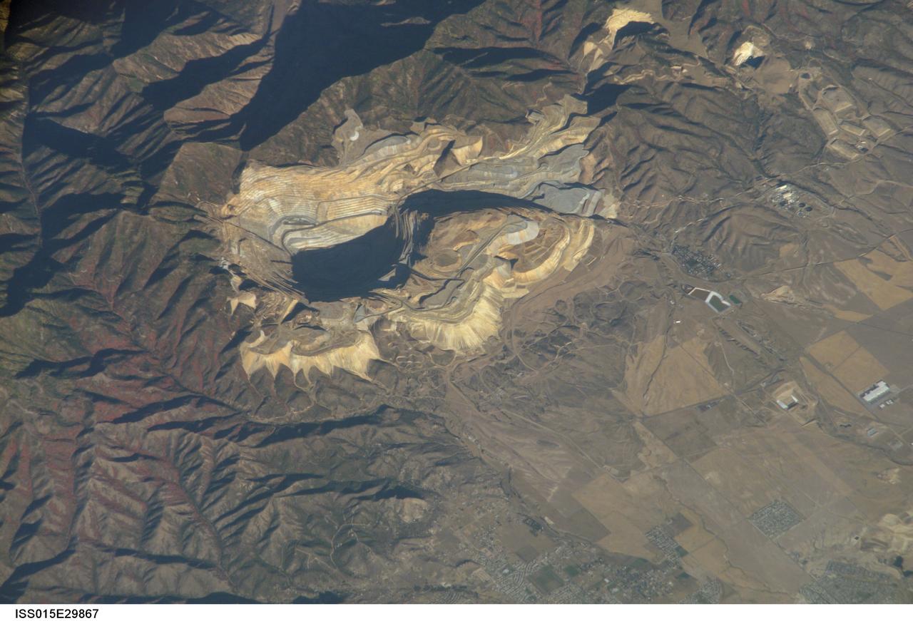
ISS015-E-29867 (20 Sept. 2007) --- Bingham Canyon Mine, Utah is featured in this image photographed by an Expedition 15 crewmember on the International Space Station. The Bingham Canyon Mine (center) located approximately 32 kilometers to the southeast of Salt Lake City, UT is one of the largest open-pit mines in the world, measuring over 4 kilometers wide and 1,200 meters deep. The mine exploits a porphyry copper, a type of geological structure formed by crystal-rich magma moving upwards through pre-existing rock layers. As the magma cools and crystallizes (forming an igneous rock with large crystals in a fine-grained matrix, known as a porphyry), hot fluids circulate through the magma and surrounding rocks via fractures. This process of hydrothermal alteration typically forms copper-bearing and other minerals in spatial patterns that a geologist recognizes as a potential porphyry copper deposit. Parallel benches (stepped terraces), visible along the western pit face (center left), range from 16 to 25 meters high - these provide access for equipment to work the rock face, as well as maintaining stability of the sloping pit walls. A dark, larger roadway is also visible directly below the benches. Brown to gray, flat topped hills of gangue (waste rock) surround the pit, and are thrown into sharp relief by shadows and the oblique viewing angle of this image. Leachate reservoirs associated with ore processing are visible to the south of the city of Bingham Canyon, UT (right).
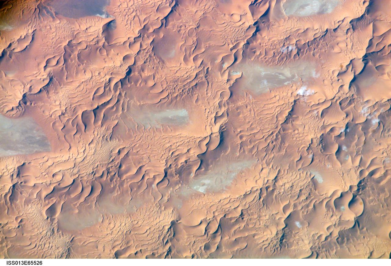
ISS013-E-65526 (8 Aug. 2006) --- Issaouane Dune Sea, Eastern Algeria is featured in this image photographed by an Expedition 13 crewmember on the International Space Station. This view from one of the smaller dune seas in the central Sahara shows the complex but regular patterns produced by winds in deserts where abundant sand is available. Geologists now know that dune seas (also called ergs) comprise at least three orders of dune size. In this image the largest and oldest appear here as chains oriented about 60 degrees apart, that is, one oriented almost north-south, the other southwest-northeast. The "streets" between the dune chains (also called mega-dunes) are swept clean of sand in places, revealing the original surface, with light colored muds and salt derived from very occasional rains. The chains have probably taken hundreds of thousands of years to accumulate, starting when the Sahara began to become significantly dry roughly 2.5 million years ago. Rivers became smaller, failed to reach the sea and deposited their sand load in the desert. Wind did the rest, blowing the sand into aerodynamic dune forms. According to scientists, chain trends coincide with two of the four major trends identified in the Great Eastern Sand Sea immediately to the north. Each trend likely implies a different formative wind direction--attesting to the climate shifts that have occurred since sand began to accumulate in the central Sahara. Smaller dunes are superimposed on the mega-dunes. Sinuous crest lines are the mesoscale (intermediate in size) forms, forming octopus-like crests, especially evident as the arms of star dunes. Whereas the mega-dunes are apparently stationary, studies based on aerial photographs in other parts of the world show that these dune crests move in the course of decades. The smallest dunes appear in patches on the eastern sides of the mega-dunes as a tracery of closely spaced crests. Small dunes move fast and reform quickly as stronger winds shift with the seasons. Sand grains are blown continuously from upwind dunes, across the dune-free flats. Small dunes form when the grains slow down and accumulate at the next large dune. The small dunes ride up and over the backs of the mega- and meso-dunes. Interestingly the crest orientation of the small dunes is different from that of the mesoscale dunes throughout the image. This is a common effect of wind direction shifting locally depending on dune height: the increased friction caused by larger dunes causes formative winds to blow to the left of the (weaker) winds that form the small dunes. The friction effect of larger dunes is to the right in the southern hemisphere, well illustrated on the coast of the Namib Desert.
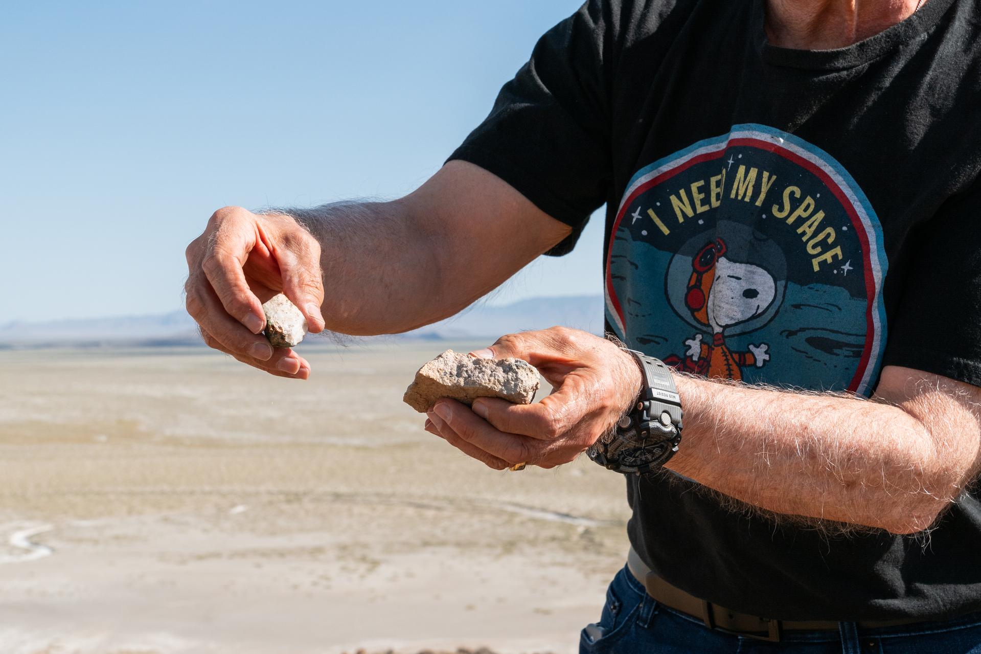
Dr. Jim Garvin presents rock samples found at Crater Island, Utah on June 23, 2026. Dr. Garvin is the principal investigator for NASA's DAVINCI probe which will one day be making discoveries on Venus.