
Gullies and Sand

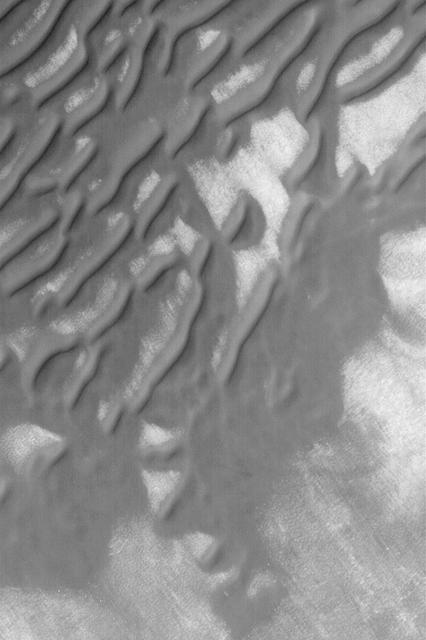
Defrosting Sand
Sand and Water

Defrosting Sand

Warm Sand
Defrosting Sand
Sea of Sand in Juventae Chasma
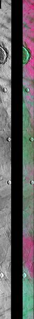
Sand Sea in False Color

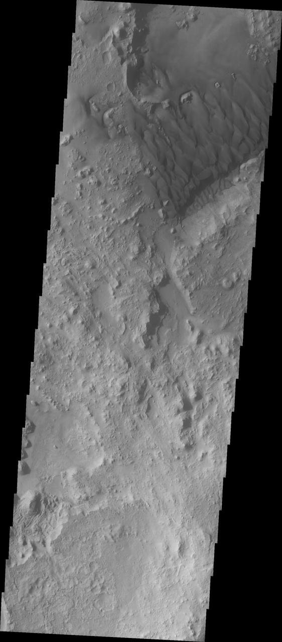
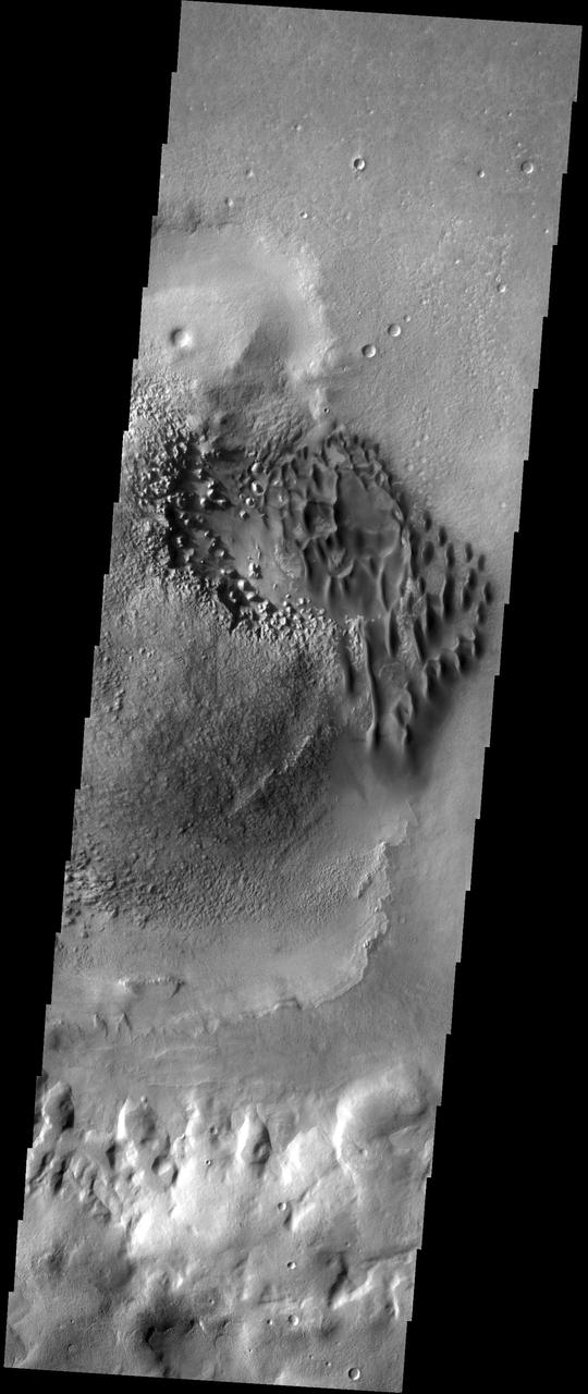
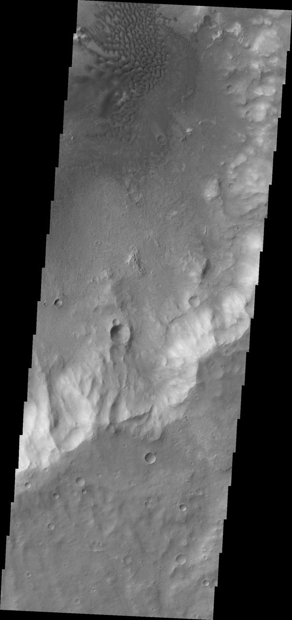
Ganges Rocks and Sand
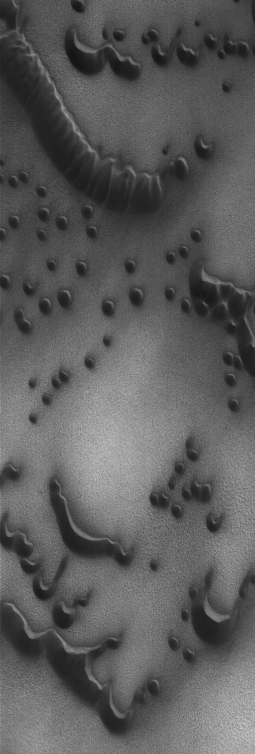
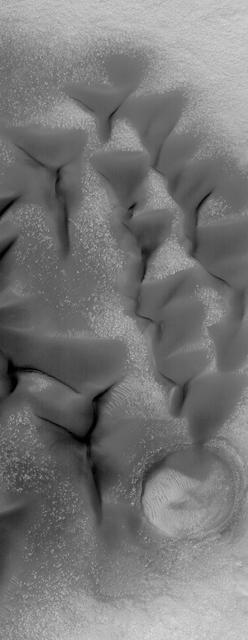
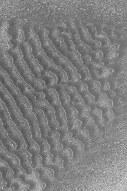
Sand Dunes in Kaiser Crater
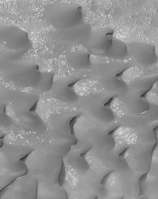
North Polar Sand Dunes
Polar Sand Dunes
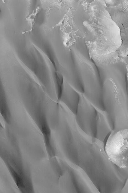
Hematite Outlier and Sand Dunes

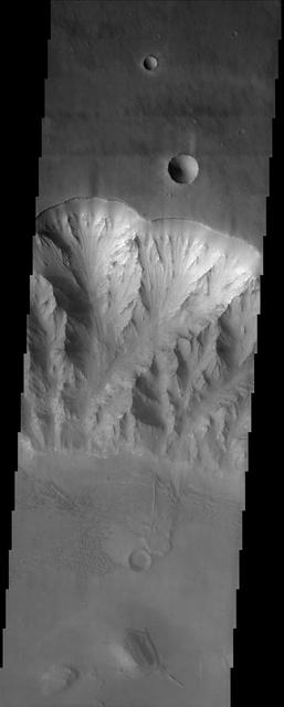
Ganges Chasma Sands

Mars in a Grain of Sand
Ganges Chasma Sand Sheet
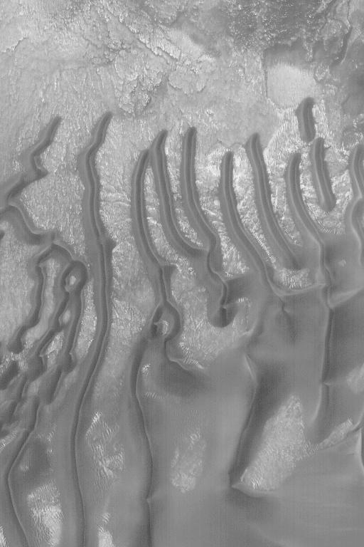
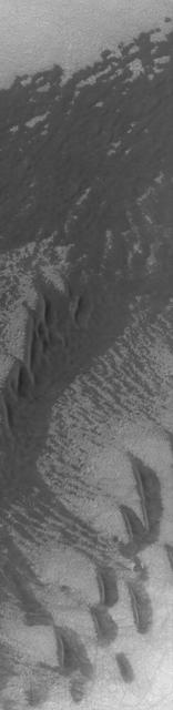
Dark Sand Dunes
Sand Dunes in Hellas

Sand Dunes in Rabe Crater
North Polar Sand Dunes
Windblown Sand Dunes
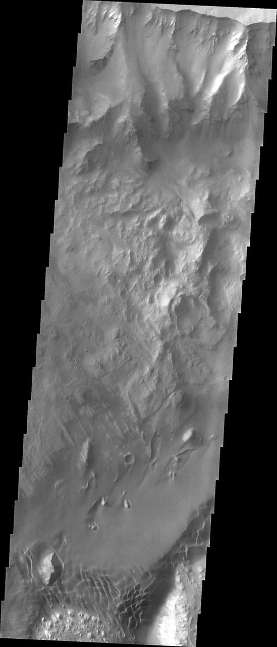
Layers, Landslides, and Sand Dunes
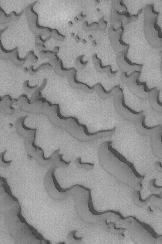
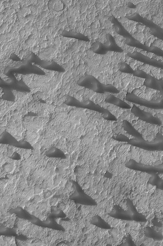
Sand Dunes in Noachis
Sand Dunes of Schaeberle Crater
South Polar Sand Dunes
Sand Dunes in Noachis Terra

Windblown Sand in Briault
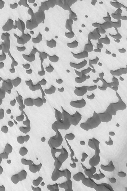
Sand Dunes with Frost

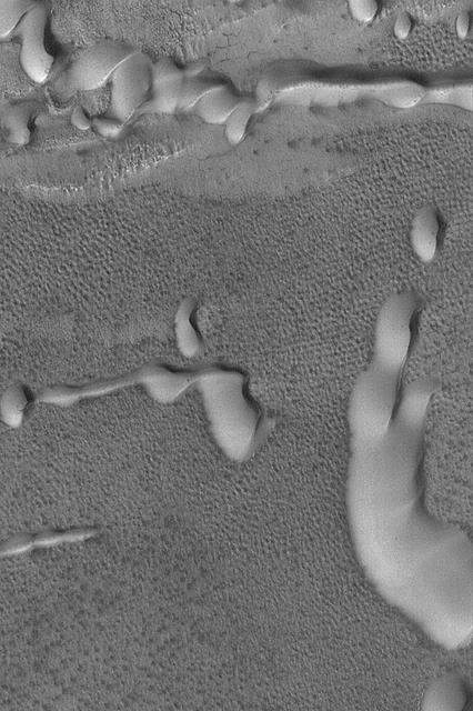
Windblown Sand in West Candor
Fortune Cookie Sand Dunes
Dark Sand Dunes
Martian Sand Dunes
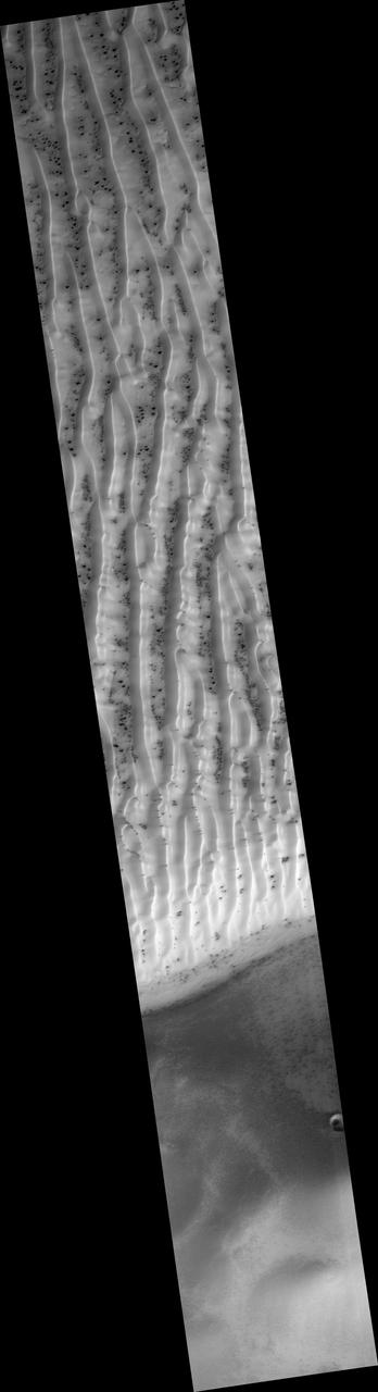
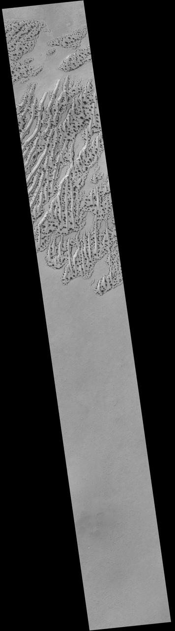
Northern Sand Sea
Defrosting Sand Dunes
Sand Sheet on Crater Floor
Sand Sheet and Dunes
Dust and Sand Mixing
Dark Sand Dunes

Defrosting South Polar Sand
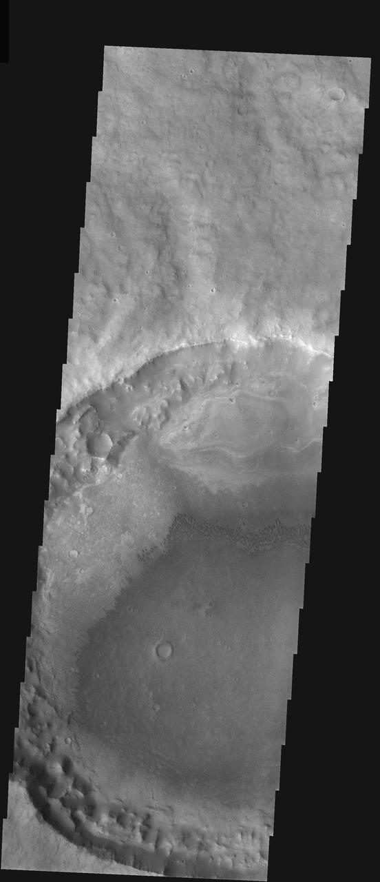
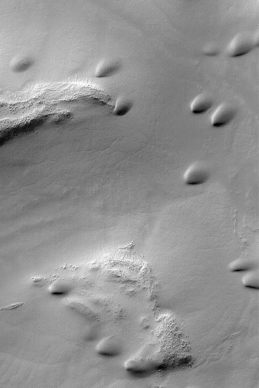
These sand dunes are located on the floor of Halley Crater
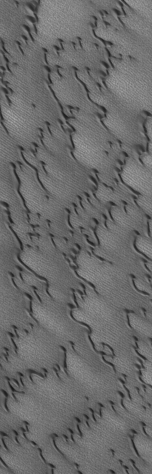
These sand dunes are located on the floor of Kaiser Crater.
These sand dunes are located on the floor of Kaiser Crater
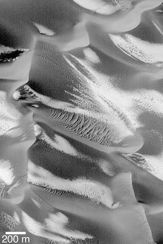
![NASA's Mars Reconnaissance Orbiter (MRO) captured this crater featuring sand dunes and sand sheets on its floor. What are sand sheets? Snow fall on Earth is a good example of sand sheets: when it snows, the ground gets blanketed with up to a few meters of snow. The snow mantles the ground and "mimics" the underlying topography. Sand sheets likewise mantle the ground as a relatively thin deposit. This kind of environment has been monitored by HiRISE since 2007 to look for movement in the ripples covering the dunes and sheets. This is how scientists who study wind-blown sand can track the amount of sand moving through the area and possibly where the sand came from. Using the present environment is crucial to understanding the past: sand dunes, sheets, and ripples sometimes become preserved as sandstone and contain clues as to how they were deposited The map is projected here at a scale of 25 centimeters (9.8 inches) per pixel. [The original image scale is 25 centimeters (9.8 inches) per pixel (with 1 x 1 binning); objects on the order of 75 centimeters (29.5 inches) across are resolved.] North is up. https://photojournal.jpl.nasa.gov/catalog/PIA21757](https://images-assets.nasa.gov/image/PIA21757/PIA21757~medium.jpg)
NASA's Mars Reconnaissance Orbiter (MRO) captured this crater featuring sand dunes and sand sheets on its floor. What are sand sheets? Snow fall on Earth is a good example of sand sheets: when it snows, the ground gets blanketed with up to a few meters of snow. The snow mantles the ground and "mimics" the underlying topography. Sand sheets likewise mantle the ground as a relatively thin deposit. This kind of environment has been monitored by HiRISE since 2007 to look for movement in the ripples covering the dunes and sheets. This is how scientists who study wind-blown sand can track the amount of sand moving through the area and possibly where the sand came from. Using the present environment is crucial to understanding the past: sand dunes, sheets, and ripples sometimes become preserved as sandstone and contain clues as to how they were deposited The map is projected here at a scale of 25 centimeters (9.8 inches) per pixel. [The original image scale is 25 centimeters (9.8 inches) per pixel (with 1 x 1 binning); objects on the order of 75 centimeters (29.5 inches) across are resolved.] North is up. https://photojournal.jpl.nasa.gov/catalog/PIA21757
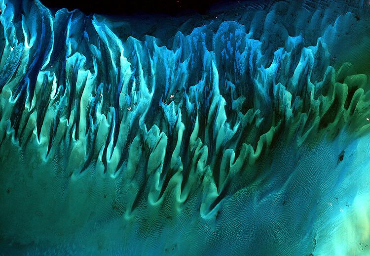
NASA image acquired January 17, 2001 Though the above image may resemble a new age painting straight out of an art gallery in Venice Beach, California, it is in fact a satellite image of the sands and seaweed in the Bahamas. The image was taken by the Enhanced Thematic Mapper plus (ETM+) instrument aboard the Landsat 7 satellite. Tides and ocean currents in the Bahamas sculpted the sand and seaweed beds into these multicolored, fluted patterns in much the same way that winds sculpted the vast sand dunes in the Sahara Desert. Image courtesy Serge Andrefouet, University of South Florida Instrument: Landsat 7 - ETM+ Credit: NASA/GSFC/Landsat <b><a href="http://www.nasa.gov/centers/goddard/home/index.html" rel="nofollow">NASA Goddard Space Flight Center</a></b> enables NASA’s mission through four scientific endeavors: Earth Science, Heliophysics, Solar System Exploration, and Astrophysics. Goddard plays a leading role in NASA’s accomplishments by contributing compelling scientific knowledge to advance the Agency’s mission. <b>Follow us on <a href="http://twitter.com/NASA_GoddardPix" rel="nofollow">Twitter</a></b> <b>Join us on <a href="http://www.facebook.com/pages/Greenbelt-MD/NASA-Goddard/395013845897?ref=tsd" rel="nofollow">Facebook</a></b>
New Gullies on Martian Sand Dune
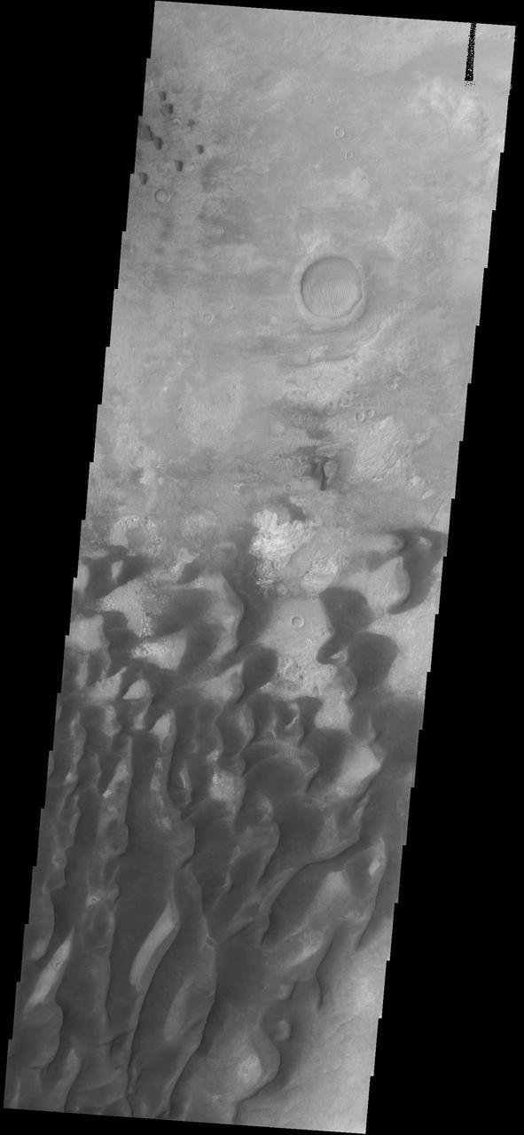
Sand Dune Field in Richardson Crater
DCS of Syrtis Major Sand Migration
These sand dunes are located on the floor of an unnamed crater west of Hellas Basin
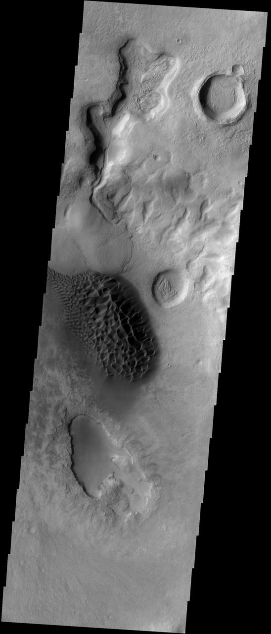
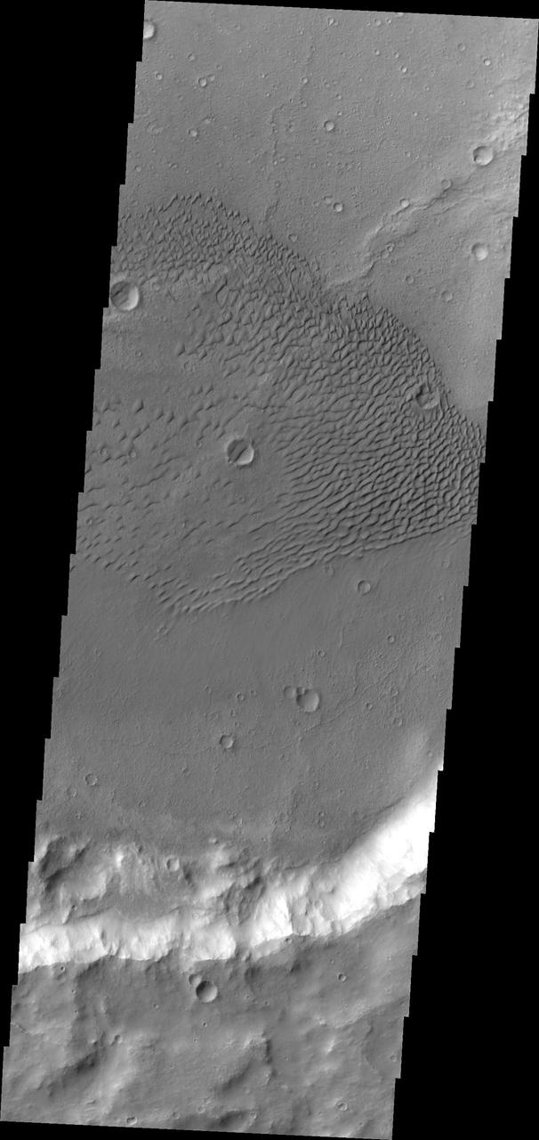
This sand sheet and dune field occurs on the floor of Candor Chasma
Today's VIS image shows a field of sand dunes in an unnamed crater located in Margaritifer Terra. Most sand dunes on Mars are made of dark basaltic sands. Orbit Number: 78228 Latitude: 6.60598 Longitude: 346.706 Instrument: VIS Captured: 2019-08-03 14:35 https://photojournal.jpl.nasa.gov/catalog/PIA23455
This image from NASA Mars Odyssey spacecraft displays sand dunes covered in CO2 frost. This is a region of Mars that contains circumpolar sand seas.
STS054-152-189 (13-19 Jan. 1993) --- This near-vertical color photograph shows the very diverse landscape that is part of the great Sahara Desert of north Africa. Specifically, the vast expanse of sand dunes, located in the extreme southwestern corner of Libya, is known as the Murzuk Sand Sea. Close inspection of this photograph shows the agricultural village of Murzuk as evidenced by the numerous center pivot irrigation patterns at the edge of the Murzuk Sand Sea. The very rugged, dissected terrain to the west of this sand sea is the eastern tip of the Tassili N'ajjer Mountains and the Tadrart Plateau that are in neighboring Algeria. Several smaller areas of sand dunes are interspersed between the major areas of rock outcrops. The photograph was taken with a Linhof camera.

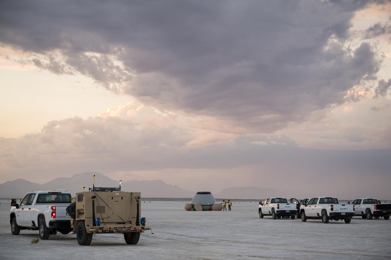
White Sands Galileo balloon drop test at White Sands New Mexico
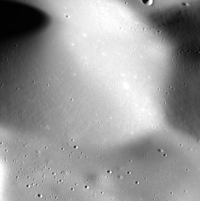
Staring at the Sea, Staring at the Sand. The smooth, rolling terrain in this high resolution image from NASA MESSENGER spacecraft looks almost like sand dunes or ripples on a beach.
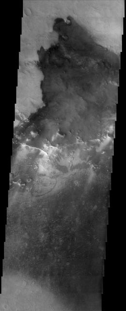
This region of dark sand dunes is located on the floor of an unnamed crater south of Bosporos Planum
This image from NASA Mars Odyssey shows sand dunes covering the floor of this unnamed crater in Terra Cimmeria.
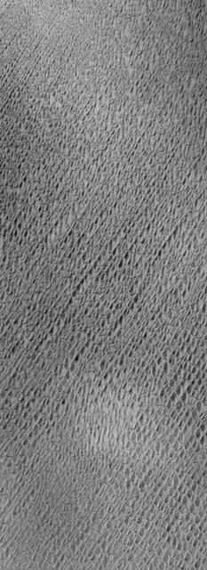
This image from NASA Mars Odyssey shows a sand sheet with dune forms on its surface.
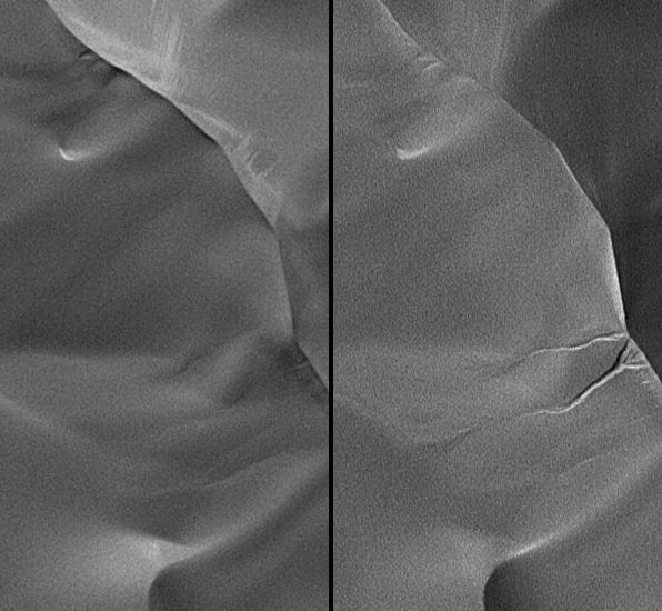
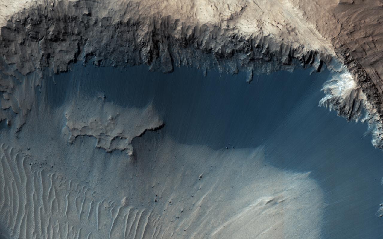
One of the major extended-mission objectives for HiRISE has been to re-image parts of the surface to look for changes. Such observations can tell us what processes are active today. This image was acquired as part of a series to look for sand movement in Meroe Patera, not far from the active sand dunes of Nili Patera. Our image shows that sand dunes are missing downwind (to the left) of a crater near the center of the observation, because sand falls into the crater and is trapped. Zooming in on the sand-coated crater wall and comparing it with older images revealed a surprise: several major sand flows slumped down into the crater (towards the upper left), leaving small ridges (called "levees") along their path and rounded piles of sand at the end. What caused these slumps? Dry ice, which is thought to cause flows in some gullies and the North polar dunes, does not occur this close to the equator. There is no sign of recurring slope lineae, the leading candidates for liquid on the Martian surface. Instead, it is most likely that these were dry flows. They are far larger than the avalanches commonly seen on sand dunes, typified by the shorter light streaks visible in the lower left part of the "after" image, so they might have been triggered by a Mars-quake or an unusually strong wind. http://photojournal.jpl.nasa.gov/catalog/PIA19305
Frosted North Polar Sand Dunes in Early Spring
Autumn Frost, North Polar Sand Dunes
Sand Dunes and Ripples in Proctor Crater, Mars
Spring Time View of North Polar Sand Dunes

Dark Sand and Bright Bedrock in Terra Meridiani
Defrosting Sand Dunes in Late Southern Winter
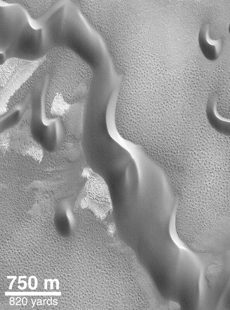
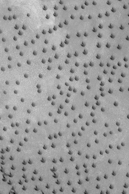
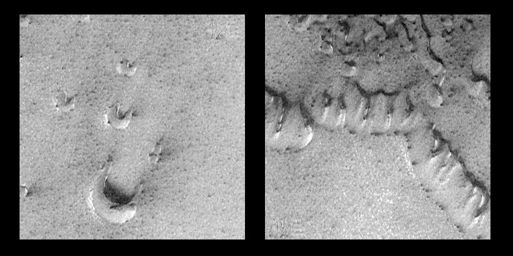
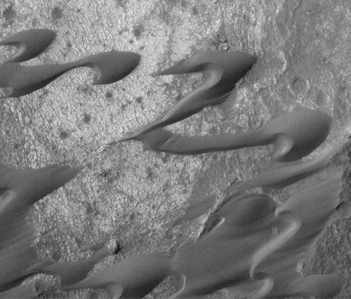
Recent Sand Avalanching on Rabe Crater Dunes
Sand Dunes of Nili Patera, Syrtis Major
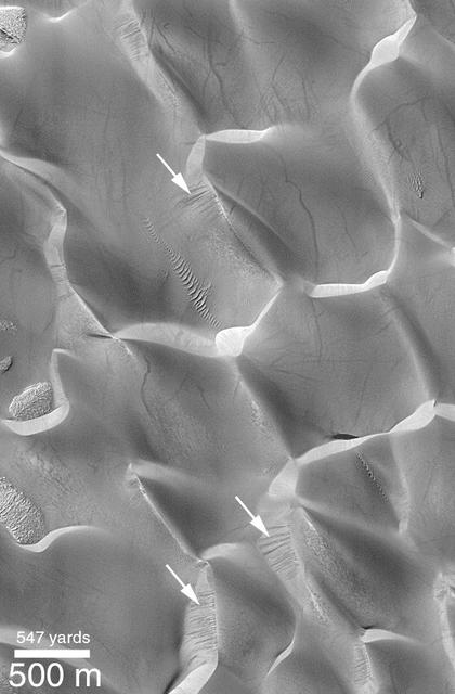
Evidence for Recent Wind Action on Martian Sand Dunes
Angular Grains of Sand Hint at Short Transport Distance
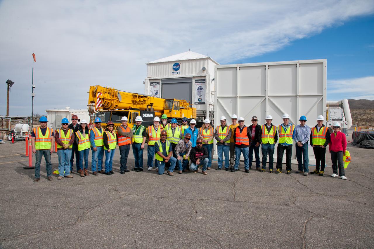
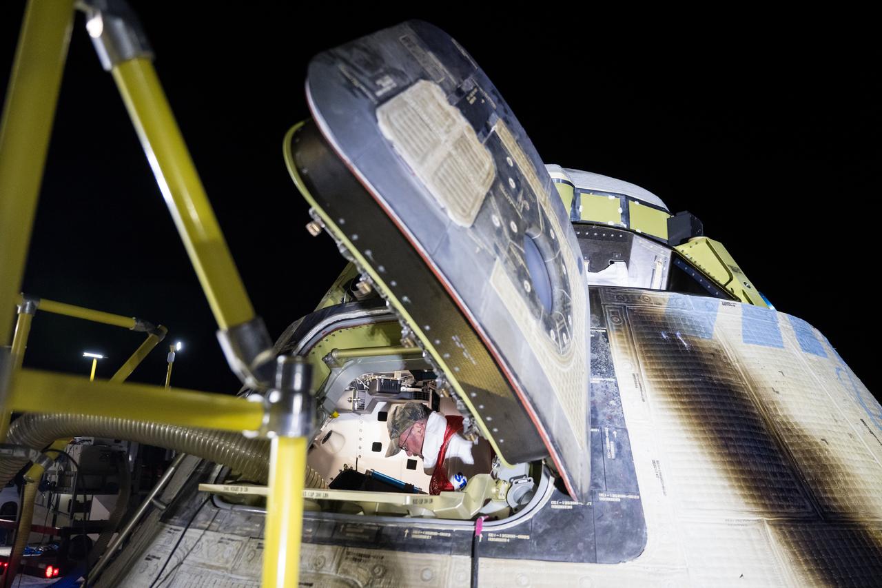
The European Service Module Propulsion Qualification Module (PQM) arrives at White Sands Test Facility in New Mexico on Feb. 18, 2017.

The European Service Module Propulsion Qualification Module (PQM) arrives at White Sands Test Facility in New Mexico on Feb. 18, 2017.
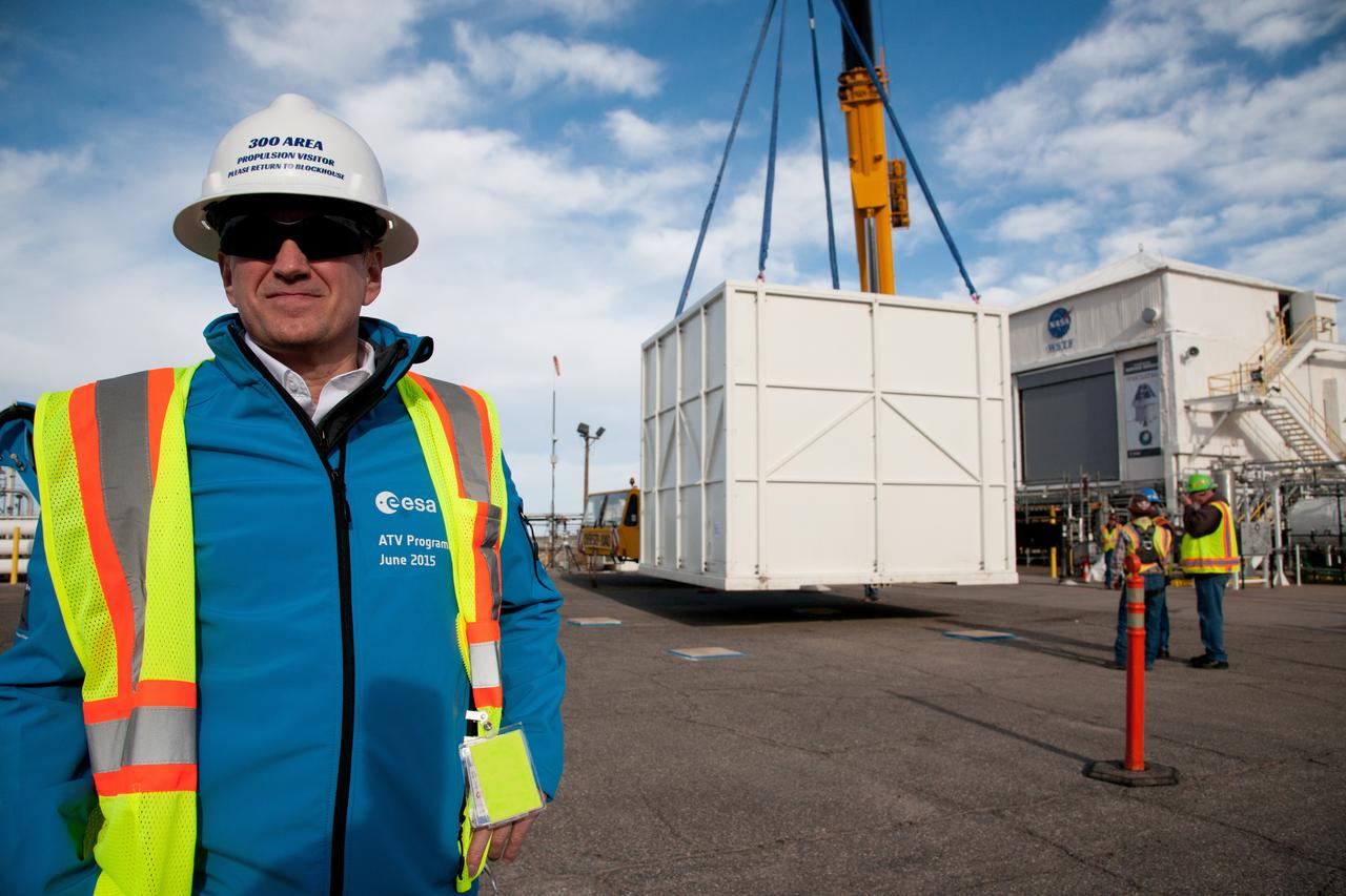
The European Service Module Propulsion Qualification Module (PQM) arrives at White Sands Test Facility in New Mexico on Feb. 18, 2017.
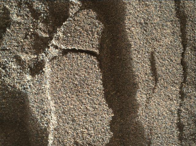
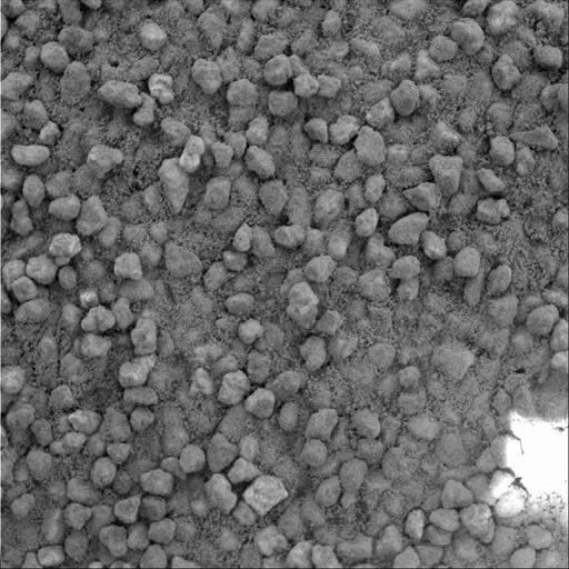
This view shows grains of sand where NASA's Curiosity Mars rover was driven into a shallow sand sheet near a large dune. The disturbance by the wheel exposed interior material of the sand body, including finer sand grains than on the undisturbed surface. Sunlight is coming from the left. The scene covers an area 1.3 inches by 1.0 inch (3.3 by 2.5 centimeters). This is a focus-merge product from Curiosity's Mars Hand Lens Imager (MAHLI), combining multiple images taken at different focus settings to yield sharper focus at varying distances from the lens. The component images were taken on Dec. 3, 2015, during the 1,182nd Martian day, or sol, of Curiosity's work on Mars. http://photojournal.jpl.nasa.gov/catalog/PIA20170
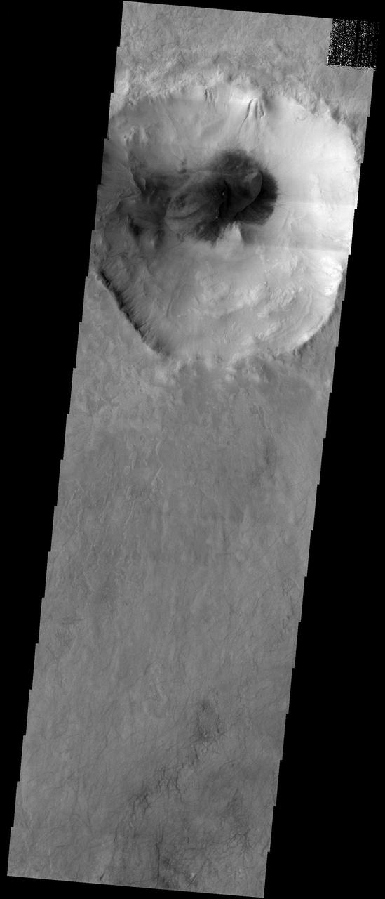
This image from NASA's Mars Reconnaisance Orbiter (MRO) shows one possible place where sand grains are being produced on Mars today. Discovered in images from the Context Camera, this region exhibits dark material that is being eroded from dark layers in the bedrock of a semicircular depression near the boundary of the Southern highlands and the Northern lowlands. Downslope lineations support the notion that these dark sediments are derived locally, and did not accumulate here by coincidence because of the winds. The grains of sand that make up sand dunes on Earth and Mars have a hazardous existence because of the way that they travel. Wind-blown sand is lifted above the surface of each planet before crashing onto the ground and bouncing in a sequence of repeated hops, a process called saltation. Sand grains can also roll along the ground as they are blown by the wind, and they are also jostled by other sand gains that are similarly flying across the surface. All of these repeated impacts tend to wear down the sand grains, smoothing them into a more spherical shape and breaking off small fragments that supply the vast dust deposits of Mars. This process (known as comminution) ultimately destroys sand grains and limits the length of time that the particles exist. The fact that we see active sand dunes on Mars today requires that sand particles must be resupplied to replace the grains that are lost over time. Where are the modern day sources of sand on Mars? https://photojournal.jpl.nasa.gov/catalog/PIA22043

This image covers the boundary between north polar ice and nearby polar sand dunes. The color data clearly distinguishes between the bright ice, dark sand, and reddish dust. https://photojournal.jpl.nasa.gov/catalog/PIA23758
This image from NASA 2001 Mars Odyssey spacecraft shows the floor of this unnamed crater in the northern lowlands is partially filled by a sand sheet with surface dune forms.
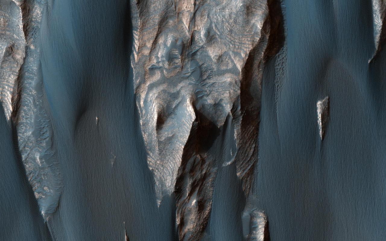
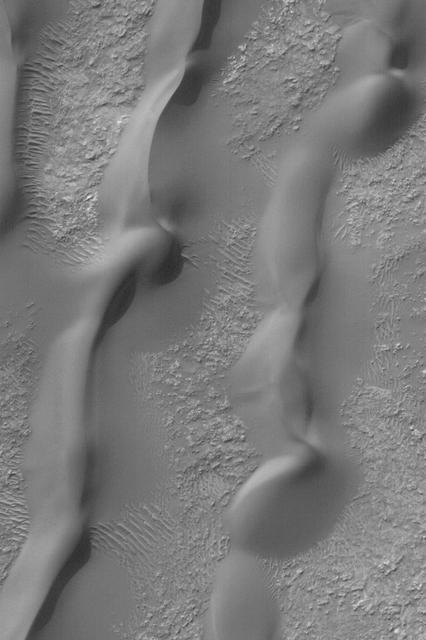
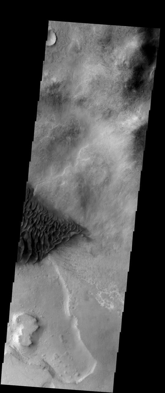
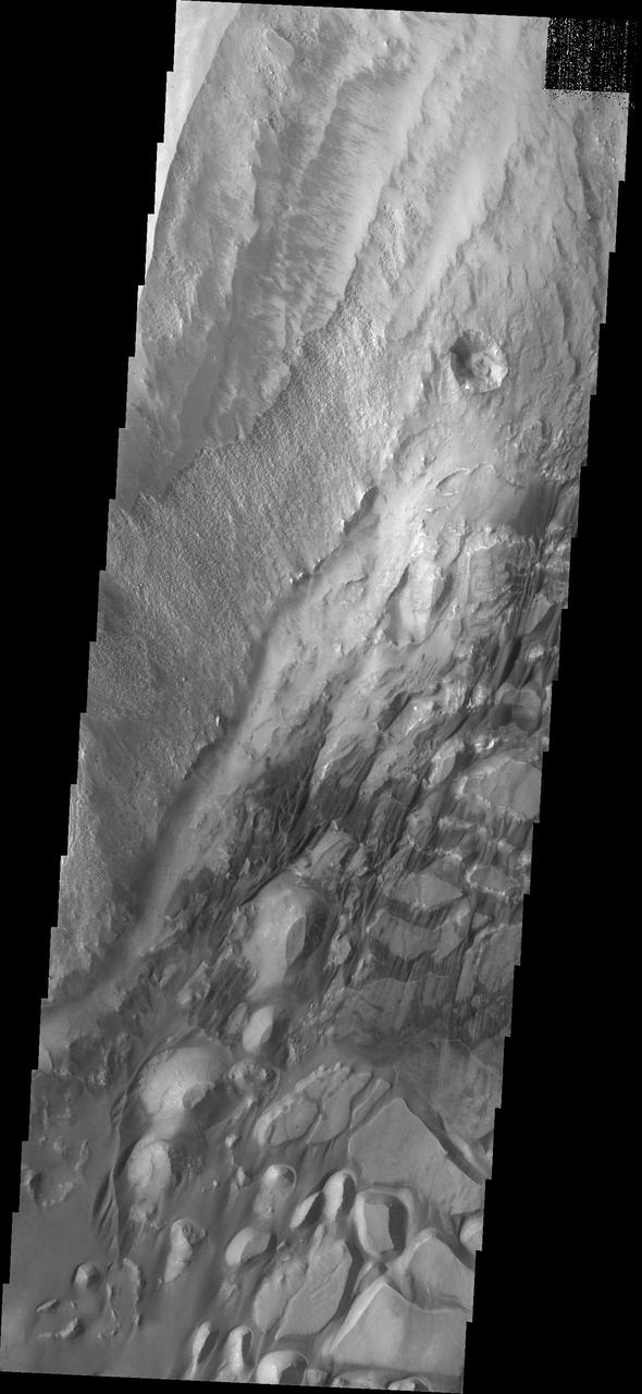
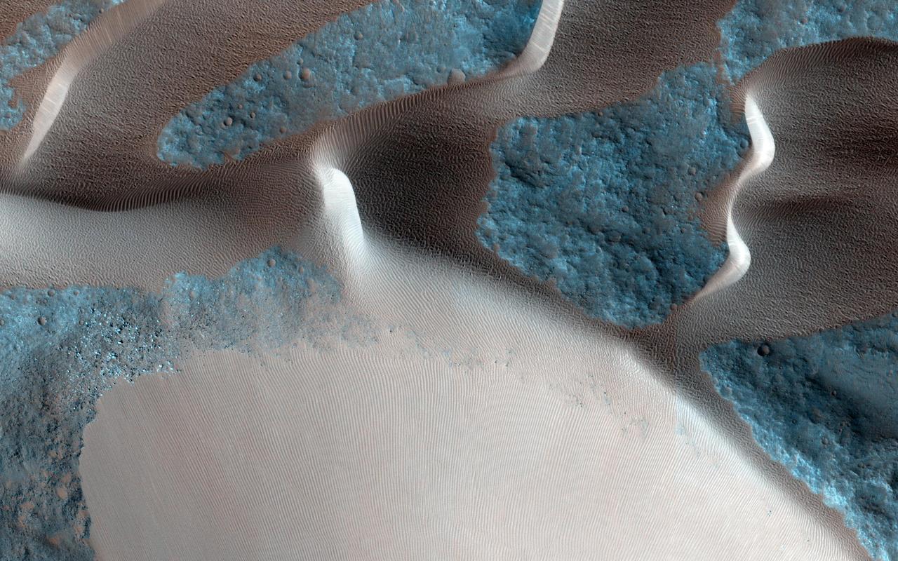
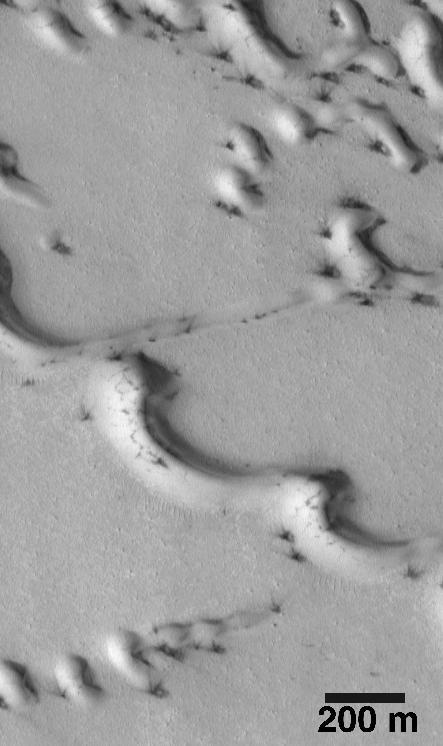
Dark, windblown sand covers intricate sedimentary rock layers in this image captured by NASA's Mars Reconnaissance Orbiter (MRO) from Ganges Chasma, a canyon in the Valles Marineris system. These features are at once familiar and unusual to those familiar with Earth's beaches and deserts. Most sand dunes on Earth are made of silica-rich sand, giving them a light color; these Martian dunes owe their dark color to the iron and magnesium-rich sand found in the region. https://photojournal.jpl.nasa.gov/catalog/PIA21600

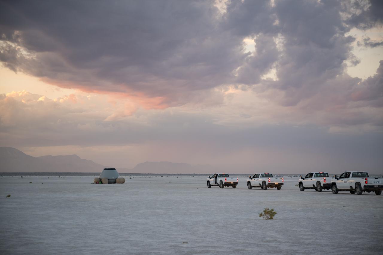
Boeing and NASA teams are seen before NASA's Boeing Crew Flight Test Starliner spacecraft lands uncrewed, Friday, Sept. 6, 2024 Mountain Time at White Sands, New Mexico. This approach allows NASA and Boeing to continue gathering testing data on the spacecraft. Photo Credit: (NASA/Aubrey Gemignani)
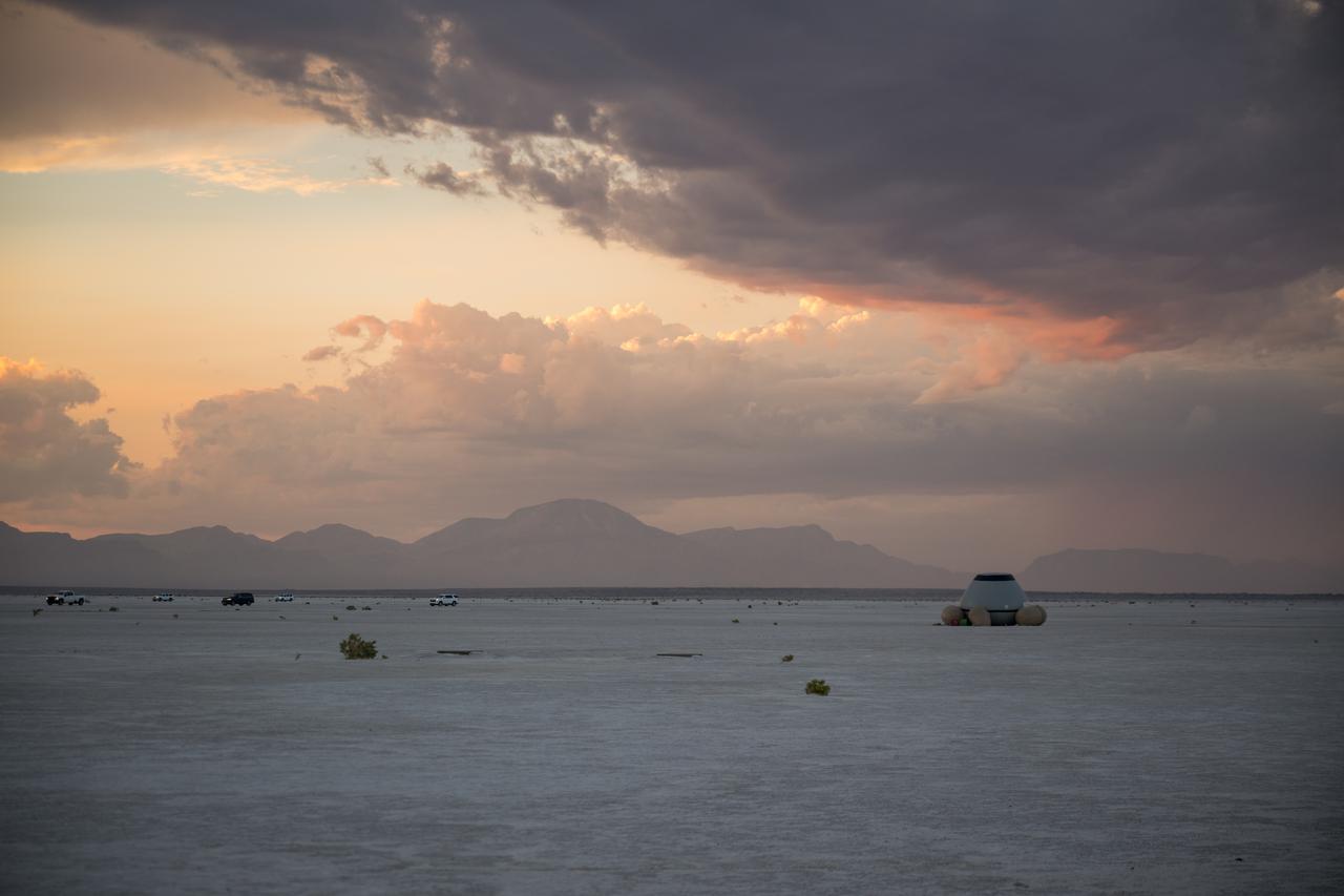
In this 30-second exposure, NASA's Boeing Crew Flight Test Starliner spacecraft lands uncrewed, Friday, Sept. 6, 2024 Mountain Time, at White Sands, New Mexico. This approach allows NASA and Boeing to continue gathering testing data on the spacecraft. Photo Credit: (NASA/Aubrey Gemignani)

Boeing and NASA teams meet before NASA's Boeing Crew Flight Test Starliner spacecraft lands uncrewed, Friday, Sept. 6, 2024 Mountain Time at White Sands, New Mexico. This approach allows NASA and Boeing to continue gathering testing data on the spacecraft. Photo Credit: (NASA/Aubrey Gemignani)

In this 30-second exposure, NASA's Boeing Crew Flight Test Starliner spacecraft lands uncrewed, Friday, Sept. 6, 2024, at White Sands, New Mexico. This approach allows NASA and Boeing to continue gathering testing data on the spacecraft. Photo Credit: (NASA/Aubrey Gemignani)
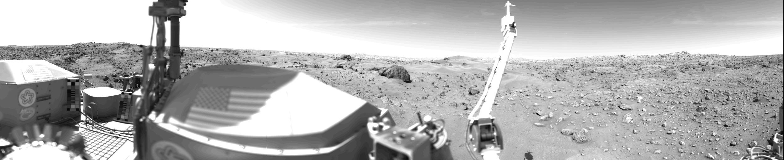
Sand Dunes And Large Rocks Revealed By Camera 1 http://photojournal.jpl.nasa.gov/catalog/PIA00391
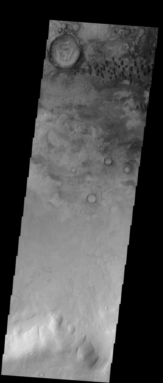
A sand dune field is located on the floor of this unnamed crater in Terra Cimmeria by NASA 2001 Mars Odyssey spacecraft.
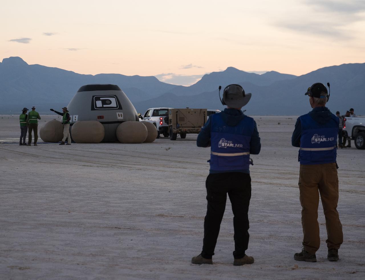
Boeing and NASA teams participate in a mission dress rehearsal to prepare for the landing of NASA’s Boeing Crew Flight Test Starliner spacecraft, Thursday, Sept. 5, 2024, at White Sands, New Mexico. The uncrewed spacecraft is scheduled to land at White Sands Missile Range’s Space Harbor, Friday, Sept. 6, 2024 Mountain Time. This approach allows NASA and Boeing to continue gathering testing data. Photo Credit: (NASA/Aubrey Gemignani)
Boeing and NASA teams participate in a mission dress rehearsal to prepare for the landing of NASA’s Boeing Crew Flight Test Starliner spacecraft, Thursday, Sept. 5, 2024, at White Sands, New Mexico. The uncrewed spacecraft is scheduled to land at White Sands Missile Range’s Space Harbor, Friday, Sept. 6, 2024 Mountain Time. This approach allows NASA and Boeing to continue gathering testing data. Photo Credit: (NASA/Aubrey Gemignani)
Boeing and NASA teams participate in a mission dress rehearsal to prepare for the landing of NASA’s Boeing Crew Flight Test Starliner spacecraft, Thursday, Sept. 5, 2024, at White Sands, New Mexico. The uncrewed spacecraft is scheduled to land at White Sands Missile Range’s Space Harbor, Friday, Sept. 6, 2024 Mountain Time. This approach allows NASA and Boeing to continue gathering testing data. Photo Credit: (NASA/Aubrey Gemignani)
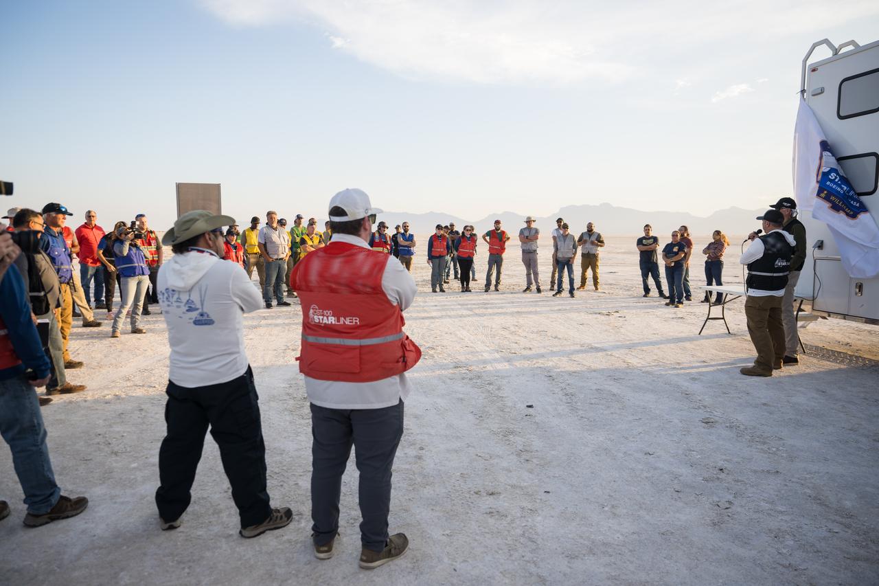
Boeing and NASA teams participate in a mission dress rehearsal to prepare for the landing of NASA’s Boeing Crew Flight Test Starliner spacecraft, Thursday, Sept. 5, 2024, at White Sands, New Mexico. The uncrewed spacecraft is scheduled to land at White Sands Missile Range’s Space Harbor, Friday, Sept. 6, 2024 Mountain Time. This approach allows NASA and Boeing to continue gathering testing data. Photo Credit: (NASA/Aubrey Gemignani)
Boeing and NASA teams participate in a mission dress rehearsal to prepare for the landing of NASA’s Boeing Crew Flight Test Starliner spacecraft, Thursday, Sept. 5, 2024, at White Sands, New Mexico. The uncrewed spacecraft is scheduled to land at White Sands Missile Range’s Space Harbor, Friday, Sept. 6, 2024 Mountain Time. This approach allows NASA and Boeing to continue gathering testing data. Photo Credit: (NASA/Aubrey Gemignani)
Boeing and NASA teams participate in a mission dress rehearsal to prepare for the landing of NASA’s Boeing Crew Flight Test Starliner spacecraft, Thursday, Sept. 5, 2024, at White Sands, New Mexico. The uncrewed spacecraft is scheduled to land at White Sands Missile Range’s Space Harbor, Friday, Sept. 6, 2024 Mountain Time. This approach allows NASA and Boeing to continue gathering testing data. Photo Credit: (NASA/Aubrey Gemignani)

Titan Sand
STS040-151-126 (5-14 June 1991) --- Croplands of the San Luis Valley stand out exceptionally clearly from low Earth orbit. The Rio Grande flows through the valley. Circular center pivot irrigation patterns have almost completely replaced the earlier rectangular grid pattern. Pinto beans are the specialty of the area. The Great Sand Dunes National Monument appears in fine detail near the center of the picture. The sands of these dunes have been blown from the valley floor by westerly winds in the course of the last few tens of thousands of years, now banked up against the foot of the Sangre de Christo Mountains (snowcapped peaks reach over 14000 feet). The town of Alamosa lies on the Rio Grande. The San Juan Mountains appear at the bottom left.

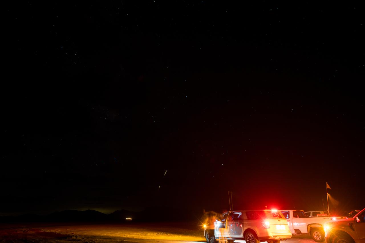
White Sands Missile Range Fire Department team members listen to a pretending briefing as they, NASA, and Boeing teams prepare for the landing of Boeing’s CST-100 Starliner spacecraft at White Sands Missile Range’s Space Harbor, Wednesday, May 25, 2022, in New Mexico. Boeing’s Orbital Flight Test-2 (OFT-2) is Starliner’s second uncrewed flight test to the International Space Station as part of NASA's Commercial Crew Program. OFT-2 serves as an end-to-end test of the system's capabilities. Photo Credit: (NASA/Bill Ingalls)

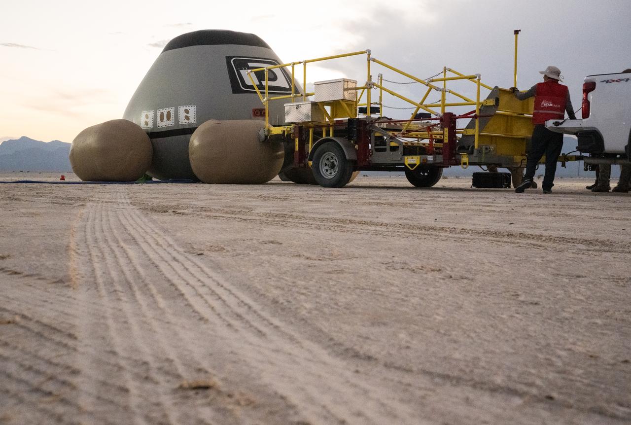
Boeing and NASA teams work around NASA's Boeing Crew Flight Test Starliner spacecraft after it landed uncrewed, Friday, Sept. 6, 2024 Mountain Time (Sept. 7 Eastern Time), at White Sands, New Mexico. This approach allows NASA and Boeing to continue gathering testing data on the spacecraft. Photo Credit: (NASA/Aubrey Gemignani)

Boeing and NASA teams work around NASA's Boeing Crew Flight Test Starliner spacecraft after it landed uncrewed, Friday, Sept. 6, 2024 Mountain Time (Sept. 7 Eastern Time), at White Sands, New Mexico. This approach allows NASA and Boeing to continue gathering testing data on the spacecraft. Photo Credit: (NASA/Aubrey Gemignani)

Boeing and NASA teams work around NASA's Boeing Crew Flight Test Starliner spacecraft after it landed uncrewed, Friday, Sept. 6, 2024 Mountain Time (Sept. 7 Eastern Time), at White Sands, New Mexico. This approach allows NASA and Boeing to continue gathering testing data on the spacecraft. Photo Credit: (NASA/Aubrey Gemignani)

Boeing and NASA recovery teams wait for hazmat teams to confirm it is safe to work around NASA's Boeing Crew Flight Test Starliner spacecraft after it landed uncrewed at White Sands Missile Range’s Space Harbor, Friday, Sept. 6, 2024 Mountain Time (Sept. 7 Eastern Time), in New Mexico. This approach allows NASA and Boeing to continue gathering testing data on the spacecraft. Photo Credit: (NASA/Aubrey Gemignani)

Boeing and NASA teams work around NASA's Boeing Crew Flight Test Starliner spacecraft after it landed uncrewed, Friday, Sept. 6, 2024 Mountain Time (Sept. 7 Eastern Time), at White Sands, New Mexico. This approach allows NASA and Boeing to continue gathering testing data on the spacecraft. Photo Credit: (NASA/Aubrey Gemignani)

Boeing and NASA teams unload cargo from NASA's Boeing Crew Flight Test Starliner spacecraft after it landed uncrewed at White Sands Missile Range’s Space Harbor, Friday, Sept. 6, 2024 Mountain Time (Sept. 7 Eastern Time), in New Mexico. This approach allows NASA and Boeing to continue gathering testing data on the spacecraft. Photo Credit: (NASA/Aubrey Gemignani)
Boeing and NASA teams unload cargo from NASA's Boeing Crew Flight Test Starliner spacecraft after it landed uncrewed at White Sands Missile Range’s Space Harbor, Friday, Sept. 6, 2024 Mountain Time (Sept. 7 Eastern Time), in New Mexico. This approach allows NASA and Boeing to continue gathering testing data on the spacecraft. Photo Credit: (NASA/Aubrey Gemignani)

Boeing and NASA teams work around NASA's Boeing Crew Flight Test Starliner spacecraft after it landed uncrewed, Friday, Sept. 6, 2024 Mountain Time (Sept. 7 Eastern Time), at White Sands, New Mexico. This approach allows NASA and Boeing to continue gathering testing data on the spacecraft. Photo Credit: (NASA/Aubrey Gemignani)

Boeing and NASA teams work around NASA's Boeing Crew Flight Test Starliner spacecraft after it landed uncrewed, Friday, Sept. 6, 2024 Mountain Time (Sept. 7 Eastern Time), at White Sands, New Mexico. This approach allows NASA and Boeing to continue gathering testing data on the spacecraft. Photo Credit: (NASA/Aubrey Gemignani)