
Landsat 7 image of the Santa Clara area acquired Nov 16, 2015. Landsat 7 is a U.S. satellite used to acquire remotely sensed images of the Earth's land surface and surrounding coastal regions. It is maintained by the Landsat 7 Project Science Office at the NASA Goddard Space Flight Center in Greenbelt, MD...Landsat satellites have been acquiring images of the Earth’s land surface since 1972. Currently there are more than 2 million Landsat images in the National Satellite Land Remote Sensing Data Archive. For more information visit: <a href="http://landsat.usgs.gov/" rel="nofollow">landsat.usgs.gov/</a>..To learn more about the Landsat satellite go to:.<a href="http://landsat.gsfc.nasa.gov/" rel="nofollow">landsat.gsfc.nasa.gov/</a> Credit: NASA/GSFC/Landsat 7 <b><a href="http://www.nasa.gov/audience/formedia/features/MP_Photo_Guidelines.html" rel="nofollow">NASA image use policy.</a></b> <b><a href="http://www.nasa.gov/centers/goddard/home/index.html" rel="nofollow">NASA Goddard Space Flight Center</a></b> enables NASA’s mission through four scientific endeavors: Earth Science, Heliophysics, Solar System Exploration, and Astrophysics. Goddard plays a leading role in NASA’s accomplishments by contributing compelling scientific knowledge to advance the Agency’s mission. <b>Follow us on <a href="http://twitter.com/NASAGoddardPix" rel="nofollow">Twitter</a></b> <b>Like us on <a href="http://www.facebook.com/pages/Greenbelt-MD/NASA-Goddard/395013845897?ref=tsd" rel="nofollow">Facebook</a></b> <b>Find us on <a href="http://instagrid.me/nasagoddard/?vm=grid" rel="nofollow">Instagram</a></b>
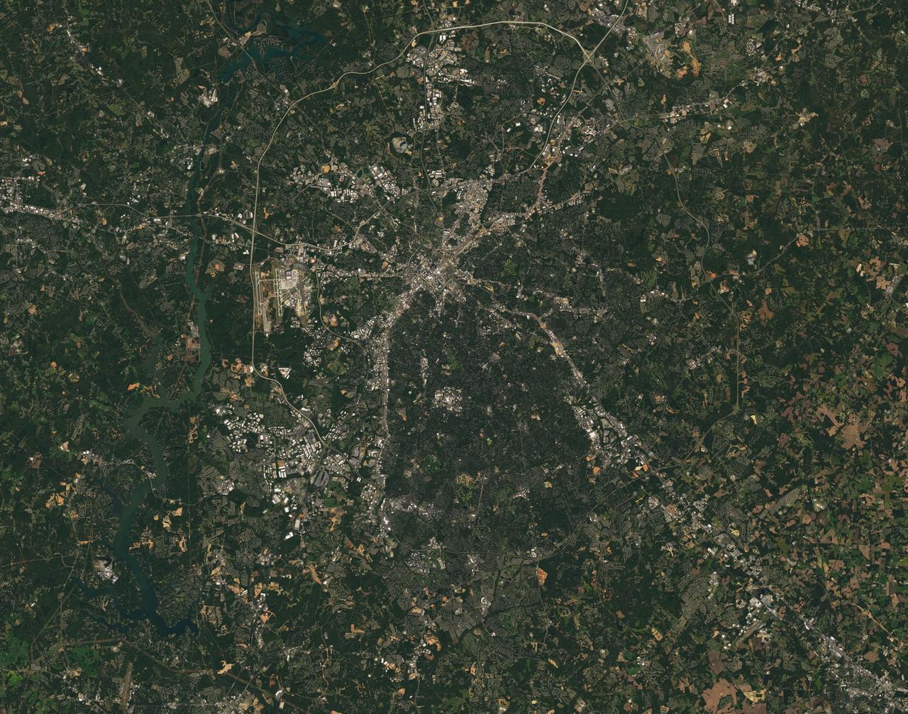
Landsat 7 image of the Charlotte, NC area acquired Oct 18, 2015. Landsat 7 is a U.S. satellite used to acquire remotely sensed images of the Earth's land surface and surrounding coastal regions. It is maintained by the Landsat 7 Project Science Office at the NASA Goddard Space Flight Center in Greenbelt, MD...Landsat satellites have been acquiring images of the Earth’s land surface since 1972. Currently there are more than 2 million Landsat images in the National Satellite Land Remote Sensing Data Archive. For more information visit: <a href="http://landsat.usgs.gov/" rel="nofollow">landsat.usgs.gov/</a>..To learn more about the Landsat satellite go to:.<a href="http://landsat.gsfc.nasa.gov/" rel="nofollow">landsat.gsfc.nasa.gov/</a> Credit: NASA/GSFC/Landsat 7 <b><a href="http://www.nasa.gov/audience/formedia/features/MP_Photo_Guidelines.html" rel="nofollow">NASA image use policy.</a></b> <b><a href="http://www.nasa.gov/centers/goddard/home/index.html" rel="nofollow">NASA Goddard Space Flight Center</a></b> enables NASA’s mission through four scientific endeavors: Earth Science, Heliophysics, Solar System Exploration, and Astrophysics. Goddard plays a leading role in NASA’s accomplishments by contributing compelling scientific knowledge to advance the Agency’s mission. <b>Follow us on <a href="http://twitter.com/NASAGoddardPix" rel="nofollow">Twitter</a></b> <b>Like us on <a href="http://www.facebook.com/pages/Greenbelt-MD/NASA-Goddard/395013845897?ref=tsd" rel="nofollow">Facebook</a></b> <b>Find us on <a href="http://instagrid.me/nasagoddard/?vm=grid" rel="nofollow">Instagram</a></b>
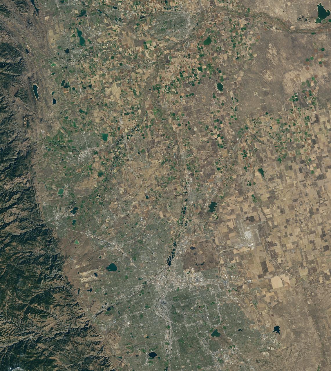
Landsat 7 image of Denver area acquired Nov 3, 2015. Landsat 7 is a U.S. satellite used to acquire remotely sensed images of the Earth's land surface and surrounding coastal regions. It is maintained by the Landsat 7 Project Science Office at the NASA Goddard Space Flight Center in Greenbelt, MD...Landsat satellites have been acquiring images of the Earth’s land surface since 1972. Currently there are more than 2 million Landsat images in the National Satellite Land Remote Sensing Data Archive. For more information visit: <a href="http://landsat.usgs.gov/" rel="nofollow">landsat.usgs.gov/</a>..To learn more about the Landsat satellite go to:.<a href="http://landsat.gsfc.nasa.gov/" rel="nofollow">landsat.gsfc.nasa.gov/</a> Credit: NASA/GSFC/Landsat 7 <b><a href="http://www.nasa.gov/audience/formedia/features/MP_Photo_Guidelines.html" rel="nofollow">NASA image use policy.</a></b> <b><a href="http://www.nasa.gov/centers/goddard/home/index.html" rel="nofollow">NASA Goddard Space Flight Center</a></b> enables NASA’s mission through four scientific endeavors: Earth Science, Heliophysics, Solar System Exploration, and Astrophysics. Goddard plays a leading role in NASA’s accomplishments by contributing compelling scientific knowledge to advance the Agency’s mission. <b>Follow us on <a href="http://twitter.com/NASAGoddardPix" rel="nofollow">Twitter</a></b> <b>Like us on <a href="http://www.facebook.com/pages/Greenbelt-MD/NASA-Goddard/395013845897?ref=tsd" rel="nofollow">Facebook</a></b> <b>Find us on <a href="http://instagrid.me/nasagoddard/?vm=grid" rel="nofollow">Instagram</a></b>